Showing Posts From
History
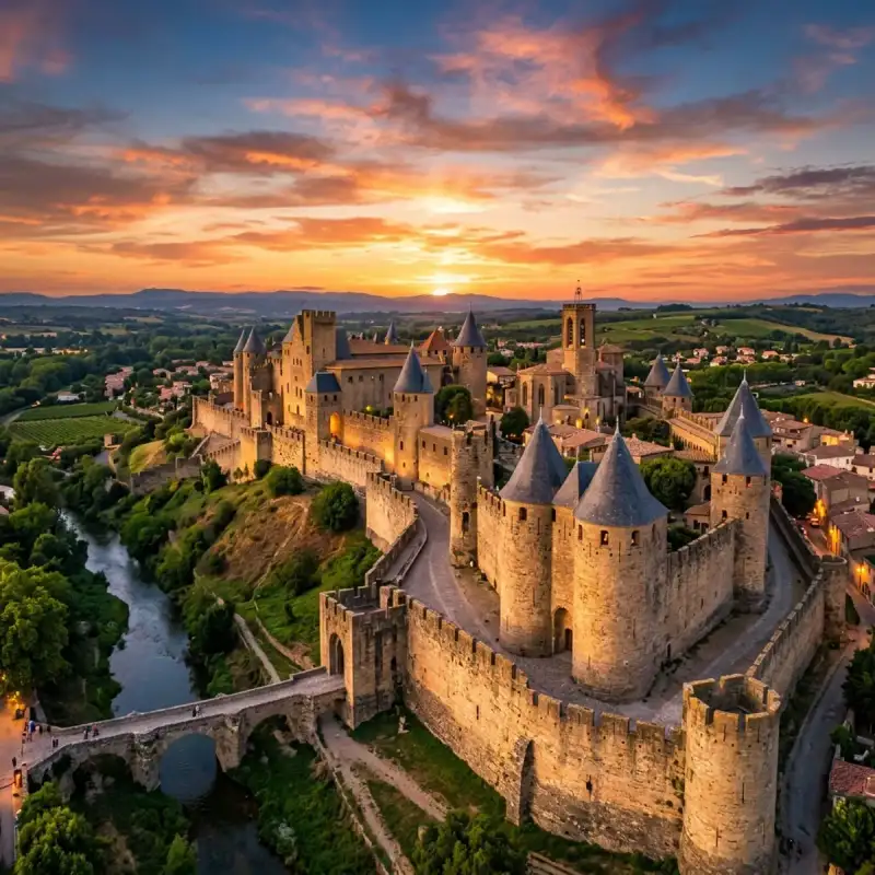
Bem-vindo! Prepare-se para uma #viagem inesquecível pelo coração de #Portugal. Algarve: As Praias Douradas e o Passado Marítimo – Um Chamado Irresistível do Sul de #Portugal Ah, o Algarve! Pronunciar este nome é conjurar um universo de luz, de cores vibrantes e de uma história que ecoa em cada falésia dourada, em cada recanto de calçada, em cada onda que beija a costa. Como vosso Tiago Silva, aventureiro e contador de histórias de viagens, convido-vos hoje a uma imersão profunda nesta região que é muito mais do que um mero destino de férias. É um tesouro nacional, uma tela viva onde a natureza esculpiu paisagens de tirar o fôlego e onde o homem teceu uma tapeçaria cultural de uma riqueza inigualável. Preparem-se para uma #viagem que transcende o postal ilustrado, mergulhando na alma de um Algarve que vibra entre o dourado das suas praias e o murmúrio do seu passado marítimo. O Coração Pulsante do Sul: Geologia, Geografia e Demografia Situado no extremo sul de Portugal, o Algarve não é apenas uma região; é um estado de espírito, uma promessa de sol e de mar que se estende por quase cinco mil quilómetros quadrados de uma beleza ímpar (precisamente 4.997 km²). Esta sub-região portuguesa, formalmente instituída através da Lei n.º 75/2013, que aprovou a reforma administrativa na Assembleia da República, estabelecendo o seu território como Comunidade Intermunicipal do Algarve, é um universo em si mesmo, composto por 16 municípios e 67 freguesias, cada qual com a sua identidade e os seus encantos. Faro, a cidade administrativa, é o seu epicentro, um farol de cultura e história que nos acolhe com a sua Ria Formosa e o seu labirinto de ruas antigas. Imaginem um território que abraça o Atlântico a sul e a oeste, onde as correntes e os ventos esculpiram uma linha costeira de uma diversidade assombrosa, desde as praias selvagens do barlavento até às lagoas tranquilas do sotavento. A norte, o Algarve encontra o seu limite com a vasta e serena região do Alentejo, um contraste de paisagens que nos lembra a rica diversidade do nosso país. A leste, a fronteira é partilhada com a vibrante e histórica Andaluzia espanhola, uma proximidade que, ao longo dos séculos, moldou intercâmbios culturais e comerciais, deixando marcas indeléveis na sua identidade. É, em suma, uma região privilegiada, estrategicamente posicionada na encruzilhada de culturas e paisagens. Com uma população que, em 2024, atinge os 492.747 habitantes, e uma densidade populacional de 96 habitantes por km², o Algarve é um mosaico de gentes. Não é apenas o número que impressiona, mas a vitalidade e a diversidade que este número representa. É uma região em constante crescimento e transformação, um polo de atração que se reflete na sua economia vibrante. Em 2024, o Algarve registou um Produto Interno Bruto de cerca de 14 milhões de euros, posicionando-se orgulhosamente em 6.º lugar entre as regiões portuguesas e contribuindo com cerca de 4% para a economia nacional. Mais impressionante ainda é o seu Produto Interno Bruto per capita, que atingiu os 29.302 euros, colocando-o em 2.º lugar entre as 9 regiões portuguesas. Estes números não são meras estatísticas; são o testemunho de uma região próspera, dinâmica e com um elevado potencial de desenvolvimento, um motor económico impulsionado pela sua beleza natural, pelo seu património e, claro, pela hospitalidade da sua gente. Esta pujança económica e social é monitorizada e desenvolvida pela Comissão de Coordenação e Desenvolvimento Regional do Algarve (CCDR-ALG), cujo estatuto é regulado pelo Decreto-Lei n.º 36/2023, garantindo um planeamento estratégico e sustentável para o futuro. Um Mosaico de Mundos: Os 16 Municípios e a Alma Multicultral Percorrer o Algarve é como folhear um livro de contos, onde cada capítulo nos revela uma nova faceta, uma nova emoção. Os seus 16 municípios são os protagonistas desta narrativa, cada um com a sua voz e a sua identidade inconfundível. Deixem-me levá-los numa breve viagem por este mapa de sonhos:Albufeira: O coração pulsante da vida noturna e das praias animadas, um caldeirão de energia e alegria. Alcoutim: Um recanto sereno e histórico no interior, onde o rio Guadiana é a alma da paisagem e o passado se faz presente em cada pedra. Aljezur: O guardião de uma costa selvagem e indomável, onde as falésias desafiam o Atlântico e as praias são santuários de surfistas e amantes da #nature em estado puro. Castro Marim: Com o seu imponente castelo e as suas salinas, testemunha silenciosa de séculos de história e de um legado mourisco profundo. Faro: A capital, a cidade administrativa, um portal para a Ria Formosa e um labirinto de ruas que ecoam histórias de navegadores e poetas. Lagoa: Famosa pelas suas praias de beleza singular, como a Praia da Marinha, e pelas suas grutas marinhas que nos fazem sonhar. Lagos: Uma cidade com uma rica herança marítima, de onde partiram as caravelas dos Descobrimentos, e que hoje nos encanta com as suas muralhas e a Ponta da Piedade. Loulé: Um centro vibrante de #cultura algarvia, com o seu mercado colorido, as suas feiras tradicionais e o seu castelo medieval. Monchique: O oásis verdejante do Algarve, a "serra mágica", com as suas águas termais, os seus aromas de medronho e as suas vistas panorâmicas que abraçam o horizonte. Olhão: A cidade da Ria Formosa por excelência, com o seu bairro cubista, os seus mercados de peixe e a sua ligação intrínseca ao mar. Portimão: Um centro turístico dinâmico, com a famosa Praia da Rocha e uma marina moderna, ideal para quem procura sol, mar e diversão. São Brás de Alportel: No sopé da serra, um refúgio de tranquilidade, com a sua arquitetura tradicional e a sua ligação à produção de cortiça. Silves: Antiga capital do Al-Gharb, cujo castelo vermelho se ergue majestoso, guardião de uma #história árabe rica e fascinante. Tavira: A "Veneza do Algarve", com as suas 37 igrejas, a sua ponte romana e a sua atmosfera serena e encantadora. Vila do Bispo: Onde a terra se encontra com o fim do mundo, no Cabo de São Vicente, um local de misticismo e de paisagens dramáticas. Vila Real de Santo António: Uma cidade pombalina, de traçado retilíneo, que nos recebe à foz do Guadiana, um espelho da modernidade setecentista.Mas há outro aspeto que torna o Algarve verdadeiramente especial: a sua alma cosmopolita. Esta região transformou-se num dos destinos europeus mais cobiçados, atraindo um número crescente de residentes estrangeiros, oriundos principalmente de outros países da #Europa. Em 2018, os dados revelavam que 69 mil dos seus habitantes não eram portugueses, um testemunho vibrante da sua capacidade de acolhimento. Cidadãos de França, Itália e Suécia foram os que mais aumentaram a sua presença nesse ano, trazendo consigo novas culturas, novos sabores e novas perspetivas. No entanto, são os cidadãos de nacionalidade britânica que continuam a ser os mais representativos entre a população estrangeira residente, uma ligação que se mantém forte e duradoura, e que se traduz numa fusão cultural rica e harmoniosa. Passear pelas ruas do Algarve é ouvir um coro de línguas, é testemunhar uma convivência pacífica e enriquecedora, é sentir que estamos num lugar onde o mundo se encontra. O Nome que Canta a História: Etimologia e Legado Para compreendermos a profundidade do Algarve, precisamos de recuar no tempo, de desvendar os véus que cobrem a sua etimologia, pois no seu nome reside a própria essência da sua #história milenar. Na época romana, quando o vasto império de Roma estendia a sua influência por estas terras, a região era conhecida como Cinético (Cyneticum). Este nome, que hoje nos soa exótico e distante, era uma homenagem aos seus habitantes nativos, um povo indo-europeu conhecido como os cinetes ou cónio (cynetes ou conii, em latim). É um eco dos primeiros tempos, uma lembrança de que, muito antes de Roma, estas terras já tinham a sua gente, a sua cultura, a sua identidade. Mas é na sonoridade melódica e evocativa do árabe que encontramos a designação que hoje nos é familiar: Algarve. Esta palavra mágica tem a sua origem na expressão árabe الغرب (al-Gharb), que significa "o oeste", "o ocidente". Uma designação poética e precisa, que nos situa no extremo poente do mundo conhecido na altura, na orla ocidental de um vasto império. De facto, a expressão completa era Gharb al-Andalus (Gharb al-Ândalus), um nome grandioso atribuído ao atual Algarve e ao Baixo Alentejo durante o domínio muçulmano. Significava "Andaluz Ocidental", pois estas terras constituíam a parte ocidental da Andaluzia mourisca, um vasto território que floresceu sob a influência islâmica. Este nome, "Algarve", é mais do que uma designação geográfica; é um portal para um período de grande esplendor cultural, científico e arquitetónico. A #architecture que ainda hoje vislumbramos em Silves, em Faro, em Loulé, com as suas chaminés rendilhadas, os seus azulejos e os seus traços mouros, é um testemunho silencioso desse legado. É uma palavra que nos convida a imaginar caravanas de mercadores, poetas a declamar sob as estrelas e sábios a desvendar os mistérios do cosmos. O Algarve, "o ocidente", é o lugar onde o sol se põe, onde o continente termina e o infinito oceano começa, uma metáfora perfeita para uma região que sempre esteve na vanguarda, na fronteira entre mundos. As Raízes Profundas: Da Pré-História aos Enigmáticos Cónios Para realmente sentir a alma do Algarve, é preciso mergulhar nas suas raízes mais profundas, recuar no tempo, para além das dunas douradas e dos castelos mouros, até uma era em que a paisagem algarvia era moldada por mãos muito mais antigas. A #história desta terra é tão antiga quanto a própria humanidade que a pisou. Os Primeiros Habitantes: Nomadismo e o Despertar da Agricultura Existem registos arqueológicos que nos contam histórias de povoamento humano no Algarve que datam de há mais de trinta mil anos. A Estação arqueológica de Vale Boi, por exemplo, é um sussurro do Paleolítico, revelando que, em tempos imemoriais, caçadores-recolectores nómadas já trilhavam estes caminhos, vivendo em harmonia com a natureza, migrando em busca de alimento e abrigo. A paisagem era diferente, mais selvagem, mas já acolhia a presença humana, marcando o início de uma longa e fascinante narrativa. Posteriormente, com o advento da agricultura e o surgimento de um estilo de vida mais sedentário – um dos maiores saltos civilizacionais da humanidade – a região algarvia viu proliferar assentamentos fixos. Esta mudança transformou radicalmente a relação do homem com a terra, permitindo o desenvolvimento de comunidades mais estruturadas. O povoamento calcolítico de Alcalar, que atingiu dimensões consideráveis e é um dos mais notáveis e bem preservados exemplos de tais sociedades, é um testemunho monumental desta transição. As suas construções, as suas práticas funerárias, a sua organização social, tudo nos fala de um povo que começou a enraizar-se, a construir o seu mundo. Do Neolítico e Calcolítico, sobreviveram ainda diversos monumentos megalíticos, pedras erguidas por mãos ancestrais que parecem guardar segredos do tempo. Menires, cromeleques e antas, como a impressionante Anta das Pedras Altas, a mais bem preservada em território algarvio, são testemunhos silenciosos de crenças, rituais e uma profunda ligação com o cosmos. Estas estruturas, muitas vezes alinhadas com os astros, são um convite à contemplação, a imaginar os nossos antepassados a celebrar a vida e a morte sob o mesmo céu que hoje nos cobre. São a prova de que a #cultura e a espiritualidade floresceram aqui há milénios, moldando a paisagem e a alma da região. Os Enigmáticos Cónios: Um Povo no Coração da Antiguidade Na época pré-romana, muito antes de Júlio César ou de Viriato, a região era habitada por um povo tão intrigante quanto misterioso: os cónios, também conhecidos por cúneos ou cinetes. Eram um povo (ou um conjunto de várias tribos) cuja filiação linguística e étnica ainda hoje é alvo de debate aceso entre historiadores e arqueólogos. Seriam eles Celtas, com as suas raízes profundas na Europa Central? Ou estariam mais próximos dos Iberos, os antigos habitantes da península? Especula-se até sobre uma possível ligação aos povos anatólicos, o que lhes conferiria uma origem ainda mais distante e exótica. Esta incerteza apenas adensa o fascínio em torno dos cónios, tornando-os figuras lendárias da nossa #história. Apesar dos mistérios que os envolvem, a sua existência é atestada por vários historiadores e autores da antiguidade. Estrabão, o geógrafo grego, Avieno, o poeta romano, e Apiano, o historiador, todos os mencionam, situando-os em áreas geográficas que hoje conformam o Algarve, o sul do Alentejo e, inclusivamente, a zona costeira do Rossilhão, na Catalunha. Estas menções, dispersas por textos antigos, são os fios com que tentamos reconstruir a tapeçaria da sua existência. A localização estratégica dos seus assentamentos, muitos deles próximos da costa, levou alguns historiadores a supor que os cónios poderiam fazer parte dos enigmáticos "povos do mar", cujas movimentações e migrações se iniciaram no 1º milénio a.C. Esta teoria evoca imagens de navegadores audazes, de trocas culturais intensas e de uma civilização com uma forte ligação ao oceano, que via no mar não uma barreira, mas uma ponte para outros mundos. O antigo território dos cónios era vasto e bem delimitado. Estendia-se, pelo litoral, da foz do rio Mira, que hoje marca a fronteira entre o Alentejo e o Algarve, até à foz do Guadiana, que nos liga a Espanha. Pelo interior, a sua influência abrangia a área das nascentes do rio Sado, seguindo pelas ribeiras de Terges e de Cobres até à confluência desta última com o Guadiana, e descendo pela margem direita (ou oeste) desse rio novamente até à sua foz. Este vasto domínio incluía toda a área da Serra do Caldeirão, também denominada Serra de Mu, e o seu planalto, uma região de montanhas suaves e vales profundos, onde a natureza ainda hoje se revela em toda a sua plenitude. Era um território rico em recursos, um cenário de vida e de progresso para este povo ancestral. O ilustre historiador português José Hermano Saraiva ofereceu uma perspetiva valiosa sobre os cónios. Segundo ele, os conii ou cynetes (cónios, em latim, ou cinetes, em grego), ter-se-iam deslocado para o sul por conta da pressão exercida por outros povos. Saraiva, tal como outros autores, sugere que, à semelhança dos lusitanos, os cónios eram celtas. Esta filiação celta é reforçada por topónimos que ecoam a sua presença, como Conímbriga, em Condeixa-a-Nova, e Coina, na Península de Setúbal, que perpetuam a sua memória linguística. É fascinante pensar como o nome de um povo pode atravessar milénios, gravado na própria geografia da nossa terra. Ainda segundo alguns autores, é possível que a cultura dos cónios e a sua influência se estendessem por uma vasta área. Semelhanças em etnónimos, como é o caso da tribo dos Ikonioi, da Gália (atual França), ou do já mencionado topónimo Conimbriga, apontam para uma proliferação extensa. Mais ainda, a raiz indo-europeia (ku-no, que significa 'cume' ou 'pico') do idioma falado e escrito pelos cónios, sugere uma profunda conexão com as montanhas e os pontos altos da paisagem, talvez refletindo a sua cosmologia ou a sua ligação aos picos sagrados. Esta raiz linguística, que se manifesta em diversas línguas indo-europeias, indica uma abrangência cultural que ia da atual França a diversas partes da Península Ibérica, tornando os cónios um elo fundamental na compreensão das antigas civilizações que moldaram a #Europa. O Legado Duradouro do Algarve Ao percorrer as praias douradas, as aldeias caiadas de branco e as cidades históricas do Algarve, estamos a caminhar sobre camadas de tempo, sobre os vestígios de povos que aqui viveram, amaram, lutaram e deixaram a sua marca. Desde os caçadores-recolectores do Paleolítico, passando pelos construtores de monumentos megalíticos, pelos enigmáticos cónios, pelos romanos que lhe deram o nome de #portugal #travel #history #europe #cultura
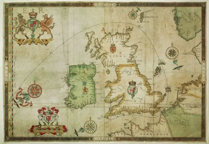

The sea does not suffer fools, nor does it yield to the hubris of kings. It is an ancient, wrathful entity, a theater of war where empires are made and broken upon the foaming waves. In the sweltering summer of 1588, the churning gray waters of the English Channel bore witness to one of the most spectacular, terrifying, and consequential clashes in the annals of human history: the defeat of the "Invincible" Spanish Armada. As a historical author, I have spent countless nights poring over the brittle, ink-stained dispatches of Tudor captains and the tragic, heart-wrenching letters of Spanish commanders, attempting to grasp the sheer magnitude of this confrontation. What transpired during those fateful weeks was not just a battle of ships and cannons, but a collision of two worlds, two religions, and two wildly different visions for the future of the globe. #History #NavalHistory #SpanishArmada The Gathering Storm: Spain's Grand Enterprise To understand the sheer weight of the Armada, one must first step back into the dimly lit corridors of the Escorial, where King Philip II of Spain, a man of relentless piety and unimaginable power, plotted the downfall of his arch-nemesis: Queen Elizabeth I of England. For decades, Elizabeth had been a thorn in Philip’s side. She had turned England into a bastion of Protestantism, encouraged swashbuckling privateers like Sir Francis Drake to plunder Spanish galleons in the New World, and openly supported the Dutch rebellion against Spanish rule. To Philip, England was a nest of heretics and pirates. The time for diplomacy had long passed. It was time for the "Enterprise of England." #TudorHistory #PhilipII #ElizabethI Philip’s grand design was breathtaking in its ambition and terrifying in its scale. He envisioned a gargantuan fleet, the likes of which the world had never seen, sailing from Lisbon to the English Channel. There, it would link up with a battle-hardened Spanish army stationed in the Netherlands under the command of the brilliant Duke of Parma. Together, this unstoppable force would cross the Channel in flat-bottomed barges, land on the English coast, march on London, depose the "heretic Queen," and restore the Catholic faith to the British Isles. A Fleet to Conquer the World By the spring of 1588, the "Invincible Armada" was ready. It was a floating city, a testament to the might and wealth of the Spanish Empire, largely funded by the silver mined from the agonizing depths of Potosí in the New World. 130 Ships: Comprising massive, towering galleons designed to act as floating fortresses, alongside heavily armed merchant vessels, smaller pinnaces, and Mediterranean galleasses (huge rowed warships). 30,000 Men: Among them were 8,000 sailors to man the ships, 18,000 elite soldiers to fight the land war, and a small army of priests, monks, and inquisitors to save English souls (or burn them, if saving proved impossible). 2,400 Cannons: A staggering arsenal capable of unleashing hellfire upon any vessel foolish enough to stand in their path. #MilitaryHistoryCommanding this immense force was Alonso Pérez de Guzmán, the Duke of Medina Sidonia. He was a noble of the highest rank, a capable administrator, but critically, he was not a seasoned sailor. When Philip appointed him, Medina Sidonia had famously pleaded to be excused, citing his tendency to get seasick and his lack of naval combat experience. But Philip, believing he was guided by the hand of God, refused the Duke’s resignation. Medina Sidonia set sail with a heavy heart, burdened by the impossible expectations of his sovereign and his Creator. The English Defense: Wood, Wind, and Wit Across the churning divide of the Channel, England was not waiting quietly for the executioner's axe. Queen Elizabeth I, aware of the encroaching doom, had mobilized her realm. The English response was characterized by a frantic, desperate energy, born of the knowledge that failure meant the end of their nation. #England #TudorEra The Dogs of War Unleashed The English fleet was fundamentally different from the Spanish Armada. While the Spanish relied on massive galleons built for close-quarters boarding actions—floating castles that sought to grapple enemy ships and overwhelm them with superior infantry—the English had spent the previous decades revolutionizing naval warfare. Led by brilliant, ruthless commanders like Lord Howard of Effingham, Sir Francis Drake, Sir John Hawkins, and Sir Martin Frobisher, the English had developed the "race-built" galleon. These ships were lower, sleeker, and significantly faster than their Spanish counterparts. More importantly, they were designed not as troop transports, but as floating gun platforms. The English strategy was simple but revolutionary: stay out of grappling range, use their superior speed and maneuverability to dictate the engagement, and pound the Spanish ships to splinters with long-range cannon fire. As the Armada slowly crept northward along the coast of Europe, beacon fires were lit across the length and breadth of England, passing the dread warning from hilltop to hilltop. The Spaniards were coming. The fate of the world hung in the balance. The Clash in the Channel: A Ballet of Death On July 19, 1588, the Spanish Armada was finally sighted off the coast of Cornwall, near the Lizard. The legend goes that Sir Francis Drake was playing a game of bowls on Plymouth Hoe when the news arrived, and he coolly remarked that there was time enough to finish the game and beat the Spaniards too. While the veracity of this tale is debated by historians, it perfectly encapsulates the swagger and audacity of the English sea dogs. #FrancisDrake #NavalBattle The Crescent Formation When the English fleet finally sailed out of Plymouth to meet the Armada, they were confronted with a sight that must have frozen the blood in their veins. The Spanish ships were arranged in a massive, tightly disciplined crescent formation, stretching for miles across the horizon. This formation was a tactical masterpiece. The strongest galleons protected the vulnerable wings (the horns of the crescent), while the slower supply ships and troop transports were nestled safely in the center. For a week, the two great fleets engaged in a running, agonizingly tense battle as they moved slowly up the English Channel. The English ships darted in like angry wasps, firing broadsides at the Spanish flanks before turning away before the heavier Spanish ships could grapple them. The Spanish, maintaining their rigid discipline, absorbed the punishment, returning fire when they could, but relentlessly pushing forward toward their rendezvous with the Duke of Parma. The air was thick with the acrid, choking stench of black powder. The roar of the cannons was deafening, a continuous, thunderous drumbeat echoing across the water. Yet, despite the unprecedented expenditure of gunpowder and shot, neither side managed to inflict a decisive blow. The English realized with growing horror that their cannons, though numerous, were largely bouncing off the incredibly thick oak hulls of the Spanish galleons. The "Invincible Armada" seemed exactly that—invulnerable to English fire. #Warfare #16thCentury Hell on Water: The Fireships of Calais By late July, the Armada had reached the Strait of Dover and dropped anchor off the coast of Calais, France. Medina Sidonia had achieved the first part of his impossible mission: he had navigated the Channel without losing a single major warship to English action (two had been lost to accidental collisions and explosions). However, he now faced a catastrophic problem. The Duke of Parma’s army was not ready. Blockaded by shallow-draft Dutch rebel ships (the "Sea Beggars") and lacking the necessary barges to safely reach the Armada, Parma could not embark. The Spanish fleet was sitting in an exposed anchorage, with a hostile English fleet lurking just out of range, and a fast-approaching storm threatening to blow them onto the treacherous Flemish shoals. It was here, in the dead of night on August 7, 1588, that the English played their trump card. It was a tactic as old as naval warfare itself, but executed with terrifying precision and devastating psychological effect: fireships. #Fireships #Tactics The Midnight Inferno Lord Howard ordered eight old, heavily combustible ships to be stripped of all valuables. Their holds were packed with pitch, tar, brimstone, gunpowder, and anything else that would burn fiercely. Their cannons were left fully loaded, primed to cook off in the heat and add a deadly barrage to the ensuing inferno. As the tide turned and the wind blew strongly toward the anchored Spanish fleet, the fireships were set ablaze and sent drifting into the darkness. Imagine the terror of the Spanish sailors on watch that night. The darkness of the Channel was suddenly pierced by eight towering pillars of fire, roaring and crackling as they bore down upon the tightly packed Armada. The flames licked at the night sky, casting a hellish, orange glow over the water. The loaded cannons aboard the fireships began to explode in the heat, firing randomly into the night, adding to the absolute chaos. Panic, raw and uncontrollable, swept through the Spanish fleet. The disciplined crescent formation, which had held so flawlessly for a week, shattered in an instant. Fearing that the fireships were packed with massive explosives (similar to the devastating "Hellburners" the Dutch had used in Antwerp), the Spanish captains did not wait to weigh anchor. They hacked their thick anchor cables with axes, abandoning their vital ground tackle in a desperate scramble to escape the approaching inferno. Ships collided in the darkness, rigging tangled, and hulls ground together as the Armada scattered in a disorganized, panicked mass into the North Sea. #Chaos #BattleOfCalais The Battle of Gravelines: Blood and Timber Dawn broke on August 8 to reveal a Spanish fleet that was scattered, disorganized, and deeply vulnerable. For the first time since the campaign began, the Armada was not in its defensive crescent. The English, realizing their golden opportunity had arrived, closed in for the kill. What followed was the Battle of Gravelines, the climax of the Armada campaign. Having realized that firing from a distance was ineffective against the thick Spanish hulls, the English commanders made a bold, dangerous decision: they sailed to within musket range—sometimes as close as fifty yards—before unleashing their broadsides. The combat was brutal, bloody, and deafening. The English ships, faster and more maneuverable, poured a relentless, terrifying hail of iron roundshot into the Spanish galleons. The Spanish, desperate to grapple and board, found their cumbersome ships outmaneuvered at every turn. Furthermore, many of the Spanish cannons were found to be loaded with the wrong size ammunition, or their gunners, untrained for sustained rapid fire, could not reload quickly enough. The Slaughter on the Decks For nine grueling hours, the battle raged. The Spanish ships, particularly the galleons San Martín (Medina Sidonia’s flagship) and San Mateo, absorbed an unbelievable amount of punishment. Their hulls were riddled with holes, their rigging was shredded into a tangled mess of hemp and canvas, and their decks ran red with the blood of soldiers and sailors. Eyewitness accounts speak of a hellish scene. Splinters of oak, jagged and sharp as daggers, flew across the decks, impaling men where they stood. The screams of the wounded mingled with the roar of the cannons and the crash of falling masts. Priests moved among the dying, offering absolution amidst the carnage. By late afternoon, the Spanish fleet was on the brink of total annihilation. Several ships were sinking, others were completely disabled, and the English were preparing to board and capture the prizes. But then, as if the heavens themselves intervened, a sudden, violent squall blew up, forcing the English to break off their attack. The Armada was saved from immediate destruction, but its spirit was broken, and its mission was definitively aborted. #BattleOfGravelines #NavalCombat The Perilous Journey North: The Wrath of God The Armada was battered, bleeding, and dangerously low on ammunition and food. The wind, blowing strongly from the south, prevented them from returning down the English Channel. Medina Sidonia faced a grim, agonizing reality: the only way home to Spain was a perilous, uncharted journey north, sailing around the treacherous coasts of Scotland and Ireland. It was a journey into a nightmare. As the fleet rounded the northern tip of Scotland, they were battered by a series of unprecedented, ferocious autumnal storms. The Spanish ships, already severely damaged at Gravelines, with weakened masts and hulls full of leaks, were woefully unequipped to handle the furious gales of the North Atlantic. Shipwrecks and Slaughter on the Irish Coast The true tragedy of the Spanish Armada did not occur in the English Channel, but on the jagged, unforgiving rocks of the Irish coast. Desperate for fresh water, food, and repairs, many Spanish captains tried to seek shelter in the bays and inlets of western Ireland. But their charts were inaccurate, and they had abandoned their main anchors in the panic at Calais. Unable to hold their positions against the gale-force winds, dozens of proud Spanish galleons were driven mercilessly onto the rocky shores. Over twenty ships were wrecked along the coasts of Donegal, Sligo, Mayo, Clare, and Kerry. Thousands of sailors and soldiers drowned in the freezing, churning surf. Those who miraculously survived the wrecks and managed to drag themselves ashore faced an equally grim fate. The English authorities in Ireland, terrified of a Spanish-backed Catholic uprising, had issued strict orders: any Spaniard found on Irish soil was to be executed immediately. Local lords, some loyal to the English crown and others simply eager for Spanish gold and weapons, systematically hunted down the survivors. Thousands of exhausted, starving Spaniards were summarily executed, their bodies left to rot on the beaches or hung from trees. Of the 130 ships that had sailed from Lisbon with such arrogant fanfare, only around 65 battered, disease-ridden hulks managed to limp back to Spanish ports in the autumn of 1588. Over 20,000 men had died, the vast majority not from English cannon fire, but from disease, starvation, and the terrifying fury of the sea. #Shipwreck #IrishHistory #Tragedy The Legacy of the Armada: A Turning Point in History When news of the disaster finally reached King Philip II at the Escorial, he reportedly retreated to his private chapel and prayed. "I sent my ships to fight against men," he famously said, "not against the winds and the waves of God." The defeat of the Spanish Armada was a seismic event, a genuine turning point in global history that fundamentally altered the geopolitical landscape of Europe and the world. The Rise of Britannia For England, the victory was the defining moment of Queen Elizabeth I’s reign. It secured the Protestant faith in the British Isles and prevented a Spanish conquest that would have forever altered the course of British history. The victory fostered a surging wave of national pride and a potent myth of English invincibility at sea—a myth that would shape British identity for centuries. More importantly, it marked the beginning of England’s rise as a global naval superpower. The tactics developed during the Armada campaign—relying on speed, maneuverability, and long-range gunnery—became the blueprint for naval warfare for the next three centuries. The English had learned that the future of naval combat did not lie in floating castles meant for boarding, but in floating artillery batteries designed to sink the enemy from afar. This realization paved the way for the eventual dominance of the Royal Navy and the establishment of the British Empire. #BritishEmpire #RoyalNavy The Slow Eclipse of Spain For Spain, the defeat was a colossal humiliation and a massive financial blow, though it did not immediately end Spanish hegemony. Spain remained a dominant global power for decades, and Philip quickly rebuilt his navy. However, the aura of Spanish invincibility was permanently shattered. The psychological impact on Protestant Europe was profound; they realized that the mighty Spanish Empire could bleed, and that it could be beaten. The Armada campaign also drained Spain's resources, exacerbating an already fragile economy burdened by endless wars in Europe and the Americas. It was the beginning of a long, slow decline that would eventually see Spain eclipsed by rising powers like France, the Netherlands, and Great Britain. The Modern Relevance: Hubris and the Unknown Why does the story of the Spanish Armada continue to captivate us centuries later? Because it is a narrative deeply rooted in the most fundamental aspects of the human condition. It is a story of towering ambition, of religious zealotry, of technological innovation clashing with entrenched tradition, and, ultimately, of the crushing, inescapable consequences of hubris. Philip II believed he was fighting a holy war, convinced that God would not allow his grand enterprise to fail. But he underestimated the ingenuity and desperation of his enemies, and, most critically, he underestimated the unforgiving, unpredictable power of nature. In our modern era, surrounded by advanced technology and data-driven predictions, it is easy to fall into the same trap of arrogant certainty that doomed the Spanish Armada. The wrecks scattered along the Irish coast remain a silent, potent reminder that no empire is truly invincible, no plan is foolproof, and that history is often decided not by the grand designs of kings, but by the shifting winds, the crashing waves, and the courage of those fighting for their very survival. The story of the Armada is a testament to the fact that the sea remains untamed, and history, in all its chaotic, bloody glory, is written by those who learn to harness the storm, rather than those who simply expect the storm to bow to their will. #HistoricalFiction #MarkDinn #WorldHistory #AncientHistory #MaritimeHistoryMark Dinn is a celebrated author of historical fiction and narrative history. His works focus on bringing the visceral reality, dramatic tension, and untold human stories of the past into the vibrant light of the present. #History #NavalHistory Related Insights千古绝唱,江水悠悠:探秘乐山大佛的沧桑与辉煌 The Black Death: The Bubonic Plague That Decimated Medieval Europe The Acropolis of Athens: A Timeless Citadel of Human Triumph{ "@context": "https://schema.org", "@type": "FAQPage", "mainEntity": [ { "@type": "Question", "name": "What is the main focus of The Fall of the Spanish Armada: The Sea Battle That Changed History?", "acceptedAnswer": { "@type": "Answer", "text": "A dramatic deep dive into The Fall of the Spanish Armada: The Sea Battle That Changed History. Mark Dinn explores the untold history, drama, and legacy of this fascinating subject." } }, { "@type": "Question", "name": "Who authored the comprehensive guide on The Fall of the Spanish Armada: The Sea Battle That Changed History?", "acceptedAnswer": { "@type": "Answer", "text": "This detailed article and its insights were carefully researched and authored by Mark Dinn." } }, { "@type": "Question", "name": "Where can I find more related content about History?", "acceptedAnswer": { "@type": "Answer", "text": "You can explore more articles, detailed reviews, and similar insights by browsing the Related Insights section at the bottom of this article or visiting our dedicated History category page." } } ] }
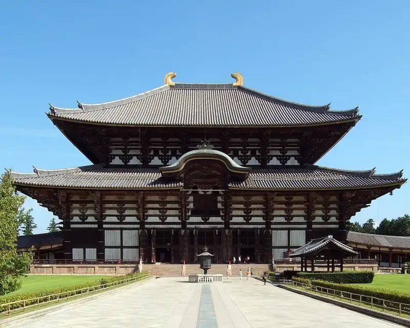
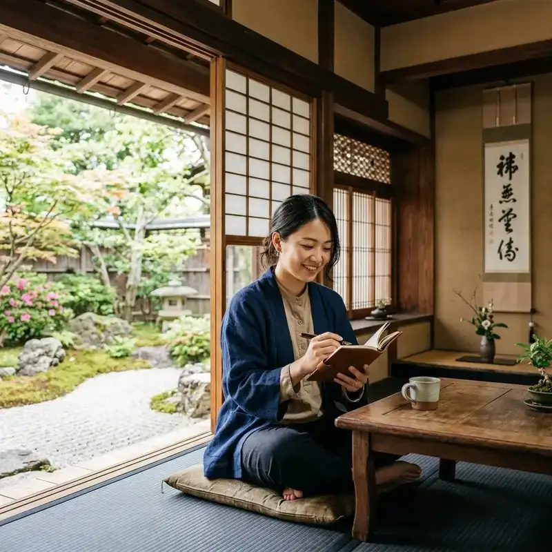
Konnichiwa! Welcome to another deep dive into #Japan's breathtaking #ancient #history and cultural heritage. From the spirit of #zen and Wabi-Sabi to the majestic presence of #samurai castles and Shinto shrines, let us explore the wonders of Tōdai-ji. Tōdai-ji (東大寺, 'Eastern Great #temple') is a Buddhist temple complex that was once one of the powerful Seven Great Temples, located in the city of Nara, Japan. The construction of the temple was an attempt to imitate Chinese temples from the much-admired Tang dynasty. Though it was originally founded in the year 738 CE, Tōdai-ji was not opened until the year 752 CE. The temple has undergone several reconstructions, including one initiated by Minamoto Yoritomo in 1181 (entrusted to Chogen, a monk of the Jodo sect) which included the standardization of existing buildings and the strengthening of visible pillars. Since then, one of the most significant reconstruction (that of the Great Buddha Hall) took place in 1709. However, it was on the verge of collapse in the late 19th century due to the weight of its huge roof. The collapse was prevented through a first restoration (1904–1913), and its current appearance was completed using steel framing between 1974 and 1980. Its Great Buddha Hall (大仏殿, Daibutsuden) houses the world's largest bronze statue of the Buddha Vairocana, known in Japanese as Daibutsu (大仏). The temple also serves as the Japanese headquarters of the Kegon school of Buddhism. The temple is a listed #UNESCO World Heritage Site as one of the "Historic Monuments of Ancient Nara", together with seven other sites (including temples, shrines and places) in the city of Nara. History Origins Todaiji is well known for the Nara Daibutsu, also known as "The Great Buddha of Nara," which is an image of the Buddha Birushana. The current Buddha was repaired after suffering significant damage in 1692. Under the leadership of Abbot Shunjobo Chogen (1121–1206), numerous structures at Todaiji were rebuilt in 1180 in the fashion of the Southern Song dynasty of China. During the Tenpyō era, Japan suffered from a series of disasters and epidemics. It was after experiencing these problems that Emperor Shōmu issued an edict in 741 to promote the construction of provincial temples throughout the nation. Later in 743 during the Tenpyō era the Emperor commissioned the Daibutsu to be built in 743. Tōdai-ji (still Kinshōsen-ji at the time) was appointed as the provincial temple of Yamato Province and the head of all the provincial temples. With the alleged coup d'état by Nagaya in 729, a major outbreak of smallpox around 735–737, worsened by several consecutive years of poor crops, followed by a rebellion led by Fujiwara no Hirotsugu in 740, the country was in a chaotic situation. Emperor Shōmu had been forced to move the capital four times, indicating a certain level of instability during this period. Role in early Japanese Buddhism According to legend, the monk Gyōki went to Ise Grand Shrine to reconcile Shinto with Buddhism. He spent seven days and nights reciting sutras until the oracle declared Vairocana Buddha compatible with worship of the sun goddess Amaterasu. Under the Ritsuryō system of government in the Nara period, Buddhism was heavily regulated by the state through the Sōgō (僧綱; Office of Priestly Affairs). During this time, Tōdai-ji served as the central administrative temple for the provincial temples and for the six Buddhist schools in Japan at the time: the Hossō, Kegon, Jōjitsu, Sanron, Ritsu and Kusha. Letters dating from this time also show that all six Buddhist schools had offices at Tōdai-ji, complete with administrators, shrines and their own library. Japanese Buddhism during this time still maintained the lineage of the Vinaya and all officially licensed monks were required to take their ordination under the Vinaya at Tōdai-ji. In 754 CE, ordination was given by Ganjin, who arrived in Japan after traveling over 12 years and six attempts of crossing the sea from China, to Empress Kōken, former Emperor Shōmu and others. Later Buddhist monks, including Kūkai and Saichō received their ordination here as well. During Kūkai's administration of the Sōgō, additional ordination ceremonies were added to Tōdai-ji, including the ordination of the Bodhisattva Precepts from the Brahma Net Sutra and the esoteric Precepts, or Samaya, from Kukai's own newly established Shingon school of Buddhism. Kūkai added an Abhiseka Hall to use for initiating monks of the six Nara schools into the esoteric teachings by 829 CE. Decline As the center of power in Japanese Buddhism shifted away from Nara to Mount Hiei and the Tendai sect, and when the centre of political power in Japan moved from the emperor's capital to the shōgun's base in Kamakura in the aftermath of the Genpei war, Tōdai-ji's role in maintaining authority declined. In later generations, the Vinaya lineage also died out, despite repeated attempts to revive it; thus no more ordination ceremonies take place at Tōdai-ji. #architecture Initial construction In 743, Emperor Shōmu issued a law stating that the people should become directly involved with the establishment of new Buddhist temples throughout Japan. The Emperor believed that such piety would inspire Buddha to protect his country from further disaster. Gyōki, with his pupils, traveled the provinces asking for donations. According to records kept by Tōdai-ji, more than 2,600,000 people in total helped construct the Great Buddha and its Hall, contributing rice, wood, metal, cloth, or labour, with 350,000 working directly on the statue's construction. The 16 m (52 ft) high statue was built through eight castings over three years, the head and neck being cast together as a separate element. The making of the statue was started first in Shigaraki. After enduring multiple fires and earthquakes, the construction was eventually resumed in Nara in 745, and the Buddha was finally completed in 751. A year later, in 752, the eye-opening ceremony was held with an attendance of 10,000 monks and 4,000 dancers to celebrate the completion of the Buddha. The Indian priest Bodhisena performed the eye-opening for Emperor Shōmu. The project cost Japan greatly, as the statue used much of Japan's bronze and relied entirely on imported gold. 48 lacquered cinnabar pillars, 1.5 m (4.9 ft) in diameter and 30 m (98 ft) long, support the blue tiled roof of the Daibutsu-den. Maps that include some of the original structures of Tōdai-ji are rare, though some still exist today. Some of these structures include, the two pagodas, the library, lecture hall, refectory, and the monk's quarters located behind the main hall. Tōdai-ji functioned not only as a place of worship and Buddhist practice, but as a place of higher learning and study. Much of what contemporaries now know about the original layout of the temple comes from the writings of monks who lived and studied there. The original complex contained two 100 m (330 ft) pagodas, making them some of the tallest structures at the time. They were located on either side of the complex, one on the western (西塔) and one on the eastern side (東塔). The pagodas themselves were surrounded by a walled courtyard with four gates. These were destroyed by an earthquake. One of the sōrin finials was reproduced for the 1970 Osaka Expo and is standing at the spot where one of the pagodas used to stand. The Shōsōin was its storehouse, and now contains many artifacts from the Tenpyō period of Japanese history. Reconstructions post-Nara Period The Great Buddha Hall (Daibutsuden) has been rebuilt twice after fire. The current building was finished in 1709, and although immense—57 metres (187 ft) long, 50 metres (160 ft) wide and 49 metres (161 ft) high—it is actually 30% smaller than its predecessor, being reduced from 11 to 7 bays wide due to lack of funds. Until 1998, it was the world's largest wooden building. It has been surpassed by modern structures, such as the Japanese baseball stadium Odate Jukai Dome, amongst others. The Great Buddha statue has been recast several times for various reasons, including earthquake damage. The current hands of the statue were made in the Momoyama Period (1568–1615), and the head was made in the Edo period (1615–1867). The existing Nandaimon (Great South Gate) was constructed at the end of the 12th century based on Daibutsuyō style, after the original gate was destroyed by a typhoon during the Heian period. The dancing figures of the Nio, the two 8.5-metre-tall (28 ft) guardians at the Nandaimon, were built around the same time by the artists Unkei, Kaikei, and their workshop staff. The Nio are an A-un pair known as Ungyo, which by tradition has a facial expression with a closed mouth, and Agyo, which has an open mouthed expression. The two figures were closely evaluated and extensively restored by a team of art conservators between 1988 and 1993. Until then, these sculptures had never before been moved from the niches in which they were originally installed. This complex preservation project, costing $4.7 million, involved a restoration team of 15 experts from the National Treasure Repairing Institute in #Kyoto. By the 19th century, the Great Buddha Hall had become seriously deteriorated, and its roof and pillars had warped, and by the Meiji period, it had become so damaged that it was strange that it did not collapse. However, Japan, which was Westernizing, was influenced by the West and developed the concept of protecting cultural properties, and the first large-scale restoration project was carried out from 1904 to 1913. However, even then, the warped roof could not be completely repaired, so instead, support beams were erected to prevent collapse. After that, it escaped the US air raids during World War II and was safe, and in 1974, the second large-scale construction project began. At this time, a new change occurred in the wooden structure of the Great Buddha Hall. A total of 100,000 people were mobilized for the construction. During this time, the roof was completely removed and fixed using steel frames, and the wooden pillars of the Great Buddha Hall were remodeled using steel frames and concrete. This construction was completed in 1980, This second large scale construction project resulted in the Great Buddha Hall having its current appearance. Dimensions of the Daibutsu The temple gives the following dimensions for the statue: Height: 14.98 m (49 ft 2 in) Face: 5.33 m (17 ft 6 in) Eyes: 1.02 m (3 ft 4 in) Nose: 0.5 m (1 ft 8 in) Ears: 2.54 m (8 ft 4 in) The statue's shoulders are 28 meters (92 ft) across and there are 960 six curls atop its head. The Birushana Buddha's golden halo is 27 m (87 ft) in diameter with 16 images each 2.4 m (8 ft) tall. Using x-rays, a human tooth, along with pearls, mirrors, swords, and jewels have been discovered inside the knee of the Great Buddha; these are believed to be the relics of Emperor Shomu. The statue weighs 500 tonnes (550 short tons). Temple precincts and gardens Various buildings of the Tōdai-ji have been incorporated within the overall aesthetic intention of the gardens' design. Adjacent villas are today considered part of Tōdai-ji. Some of these structures are now open to the public. Over the centuries, the buildings and gardens have evolved together as to become an integral part of an organic and living temple community. The Tōdai-ji #culture Center opened on October 10, 2011, comprising a museum to exhibit the many sculptures and other treasures enshrined in the various temple halls, along with a library and research centre, storage facility, and auditorium. Japanese national treasures The architectural master-works are classified as: Major historical events 728: Kinshōsen-ji, the forerunner of Tōdai-ji, is established as a gesture of appeasement for the troubled spirit of Prince Motoi. 741: Emperor Shōmu calls for nationwide establishment of provincial temples, and Kinshōsen-ji appointed as the head provincial temple of Yamato. 743: The Emperor commands that a very large Buddha image statue shall be built—the Daibutsu or Great Buddha—and initial work is begun at Shigaraki-no-miya. 745: The capital returns to Heijō-kyō, construction of the Great Buddha resumes in Nara. Usage of the name Tōdai-ji appears on record. 752: The Eye-opening Ceremony celebrating the completion of the Great Buddha held. 855: The head of the great statue of the Buddha Vairocana suddenly fell to the ground; and gifts from the pious throughout the #empire were collected to create another, more well-seated head for the restored Daibutsu. In popular culture Matsuo Bashō refers to the Great Buddha statue in a haiku (1689–1670): and, Tōdai-ji has been used as a location in several Japanese films and television dramas. It was also used in the 1950s John Wayne movie The Barbarian and the Geisha when Nandaimon, the Great South Gate, doubled as a city's gates. On May 20, 1994, the international music festival The Great Music Experience was held at Tōdai-ji, supported by UNESCO. Performers included the Tokyo New Philharmonic Orchestra, X Japan, INXS, Jon Bon Jovi, Joni Mitchell, Bob Dylan, Tomoyasu Hotei, Roger Taylor, classic Japanese drummers, and a Buddhist monk choir. This event, organized by British producer Tony Hollingsworth, was simultaneously broadcast in 55 countries on May 22 and 23, 1994. The 2007 animation series Mononoke (モノノ怪), which is a spin-off of the 2006 horror anthology series Ayakashi: Samurai Horror Tales, references the Tōdai-ji, particularly the treasure room Shōsōin, in Episodes 8 and 9. The Tōdai-ji is used as the Japanese wonder in Age of Empires II. The Tōdai-ji is the subject of the 2003 novella "A Mountain to the North, A Lake to the South, Paths to the West, A River to the East" ("Északról hegy, Délről tó, Nyugatról utak, Keletről folyó") by László Krasznahorkai. International outreach Following the Notre-Dame de #Paris fire in April 2019, Japanese authorities declared plans to expand fire prevention measures at several historic locations, including Tōdai-ji in Nara, partly by hiring new, younger employees in a context where temple and shrine staff are aging. Custodians of Todaiji temple also installed a donation box, stating "Let's Rebuild Notre Dame #cathedral", in the hallway behind the Great Buddha statue. In June 2019, a sign next to the box, in Japanese and English, explained why Tōdai-ji, as headquarters of the Kegon sect of Buddhism, was soliciting funds in this way. The English version declared, "Todai-ji temple has been reconstructed every time it burned down by big fires thanks to the significant effort of many people. We sincerely express our deepest sympathy for the tragedy that hit the Notre-Dame de Paris. Going beyond the creed, we would like to ask everyone for your support to reconstruct the cathedral." #japan #nara #buddhism #history #travel
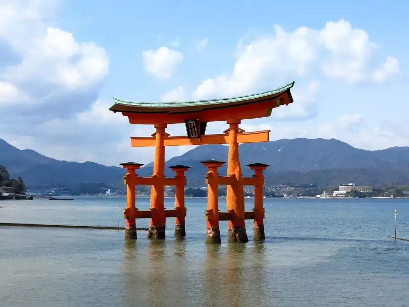
ようこそ。日本の美しき歴史と文化の旅へ。 厳島神社: 海に浮かぶ神々の住処――時を超え、自然と対話する聖域 広島湾に抱かれた神聖なる島、厳島。その北東の入り江に、潮の満ち引きと共に表情を変える、息をのむほどに優美な社殿群が鎮座しています。これこそ、世界遺産「厳島神社」。私が今日、筆を執るのは、単なる観光地の紹介ではありません。この稀有な建築が織りなす歴史、文化、そして日本人の自然観に深く根差した精神性を、皆様と共に探求したいと願うからです。海上に浮かぶその姿は、まるで神々が住まう龍宮城が、現世に顕現したかのよう。 神秘の島に宿る神々:宗像三女神の御神威 厳島神社の御祭神は、市杵島姫命��いちきしまひめのみこと)、田心姫命(たごりひめのみこと)、湍津姫命(たぎつひめのみこと)の三柱。これら「宗像三女神」と総称される女神たちは、古来より海上交通の守護神、そして芸能や財福を司る神として厚く信仰されてきました。特に市杵島姫命は、神仏習合の時代において、仏教の弁才天(弁財天)と一体化するという、極めて日本的な変遷を遂げます。 この興味深い融合は、隣接する大願寺の存在によって、より一層その深みを増します。かつて厳島神社と大願寺は、密接な関係を築き、広大な伽藍の一部を形成していました。弁才天信仰が隆盛を極める中で、市杵島姫命は知恵、音楽、財宝をもたらす女神として広く崇められ、大願寺は「日本三大弁才天」の一つに数えられるに至ります。神道の純粋な信仰と、異国の智慧が融和する過程は、#日本 の宗教史における柔軟性と受容性を示す好例と言えるでしょう。海を渡り、文化の交流を司る女神が、まさにその海の上に祀られるという摂理は、厳島神社の本質を物語るかのようです。 悠久の時を刻む歴史の綾 厳島神社の歴史は、遠く飛鳥時代にまで遡ります。 創建の黎明:神に斎く島の物語 社伝によれば、推古天皇元年(593年)、この地の有力豪族であった佐伯鞍職(さえきくらもと)が、神託を受けて市杵島姫命を祀る社殿を御笠浜に創建したのが始まりとされています。「イツクシマ」という社名自体が、「イチキシマ」が転じたもの、あるいは「神を斎く(いつく=仕える、崇める)島」に由来するという説が有力です。 厳島は、その名の通り、古代から島そのものが神として崇められてきた聖地です。島の中心にそびえる弥山(みせん)の山頂には、巨岩が連なり、太古の昔から山岳信仰の対象とされてきました。人々は、海と山、そしてその間に広がる森羅万象に神の存在を感じ、畏敬の念を抱き、祈りを捧げてきたのです。この原始的な自然崇拝が、やがて壮麗な社殿へと昇華していく過程は、日本人と#自然 の深遠な関係性を映し出しています。 概史:権力者たちの信仰と試練 文献に厳島神社の名が初めて現れるのは、弘仁2年(811年)に名神(みょうじん)に預かったという記述です。平安時代中期に編纂された『延喜式神名帳』には���「安芸国佐伯郡 伊都伎嶋神社」と記され、名神大社に列せられるとともに、安芸国一宮としての地位を確立しました。この頃、神職は佐伯氏が代々世襲し、その社格の向上とともに、祭神の祭祀体系も整備されていったと考えられています。 厳島神社が歴史の表舞台に躍り出るのは、平安時代末期です。当時の安芸守(あきのかみ)であった平清盛と、神主・佐伯景弘との強い結びつきを契機に、平家一族から篤い崇敬を受けるようになります。仁安3年(1168年)頃、清盛は現在の海上に立つ大規模な社殿を造営しました。これは、平家が武士として初めて朝廷の頂点に立ち、その栄華を極めた時代の象徴であり、まさに「平家の氏神」として、厳島神社もまた未曾有の繁栄を享受したのです。海を舞台にした清盛の壮大な夢が、この水の上の聖域に結実したと言えるでしょう。 しかし、歴史の波は常に穏やかではありません。平家滅亡後も源氏をはじめとする時の権力者たちの崇敬を受け続けますが、建永2年(1207年)と貞応2年(1223年)の二度にわたる火災により、社殿は全て焼失するという悲劇に見舞われます。現在��たちが見る社殿の主要部は、貞応の火災の後、仁治年間(1240年~1243年)以降に再建されたものです。これは、幾度となく打ち砕かれながらも、その都度、人々の信仰の力によって蘇ってきた厳島神社の不屈の精神を物語っています。 鎌倉時代頃までは、厳島は「神の住む島」として禁足地とされ、主な祭祀は対岸の地御前神社(外宮)で行われていました。しかし、鎌倉時代末期から南北朝時代以降、次第に社人や僧侶が禁を破って島に住み着くようになり、島の#文化 は多様化していきました。 戦国時代に入り世情が不安定になると、一時的に社勢は衰退します。しかし、弘治元年(1555年)の厳島の戦いで毛利元就(もうりもとない)が勝利を収め、この一帯を支配下に置くと、厳島神社は再び隆盛を取り戻します。元就は大規模な社殿修復を行い、その信仰の篤さを示しました。さらに、天下統一を夢見た豊臣秀吉も九州遠征の途上で厳島神社に参拝し、壮大な大経堂(現:千畳閣)の造営に着手しました。これらの歴史の転換点において、厳島神社は常に日本の中心的な権力者たちにその存在を認められ、守られて��たのです。 江戸時代になると、厳島詣(いつくしまもうで)が民衆の間で広く流行し、門前町や周囲は多くの参拝者で賑わいました。日本各地から人々が海を渡り、この「神々の住む島」を目指したのです。これは、厳島神社が単なる権力者の信仰対象に留まらず、一般庶民の心の拠り所として深く根付いていた証と言えるでしょう。 明治維新と神仏分離:伝統の変革 明治維新は、厳島神社にとっても大きな転換点となりました。東京の明治新政府が派遣した大参事によって、社殿が「仏式」であると判断され、神仏分離の原則に基づき、社殿の焼却が命じられるという危機に直面します(廃仏毀釈)。しかし、当時の厳島神社の棚守(宮司に相当)が新政府に直訴した結果、社殿の焼却は免れました。 しかし、その代償として、仏教的とみなされた社殿の彩色が全て剥がされ、「白木造」に改められるとともに、千木(ちぎ)と鰹木(かつおぎ)が新設されるなど、「復古」という名の下に大規模な改変が行われました。大経堂(千畳閣)は内陣の木鼻が切り落とされ、仏像などが撤去されて「豊国神社」と名を改められ、大聖院(旧別当寺)や大願寺といった寺院も独立させられました。この時期の社殿の損壊と分離は、近代国家形成における宗教政策の一端を如実に示しており、厳島神社の歴史に深く刻まれた傷跡とも言えるでしょう。 その後、明治4年(1871年)に近代社格制度に沿って国幣中社に列し、1911年(明治44年)には官幣中社に昇格しました。明治末期には社殿が国宝に指定され、壊された部分が明治末期から大正にかけての大修理で復旧され、千木と鰹木も撤去されました。このため、明治時代の厳島神社の写真にのみ、千木と鰹木が写っているという興味深い事実が残されています。神仏習合の長い歴史を持つ日本の神社建築が、近代化の波の中でいかに揺れ動いたかを物語る貴重な#歴史 の証言です。 神階と神職:世襲の伝統 厳島神社の神階は、弘仁2年(811年)の名神預かりから始まり、天安3年(859年)には正五位下から従四位下へ、貞観9年(867年)には従四位上へと昇叙されていきました。これらの記録は、『日本後紀』や『日本三代実録』といった正史に記されており、朝廷からいかに重んじられてき���かを示しています。 神職については、飛鳥時代に厳島神社を創建したとされる佐伯鞍職に始まり、文献に記載のない期間を経て、平安時代以降は代々佐伯氏が世襲してきたことが確認されています。平安時代末期には佐伯景弘が平家一門と結びつき、一族の繁栄を享受しました。しかし、鎌倉時代の承久の乱で後鳥羽上皇側として活動したため、佐伯氏は一時的に神主家当主の座を降り、藤原親実が新たな厳島神主家となりました。その後も佐伯氏は厳島神社の神官として活動を続け、瑞渓周鳳の『臥雲日件録』には、「日本所謂三大宮司、盖厳島・熱田・富士之三所也」とあり、厳島神社の大宮司が熱田大宮司・富士大宮司と共に「日本三大宮司」の一つに数えられていたことが記されています。これは、厳島神社が全国的にも極めて重要な位置を占めていたことを示唆しています。その後、藤原氏が戦国時代に滅亡するまで神主家を務め、藤原氏滅亡後には佐伯氏が復権し、現在に至るまでその伝統を守り続けています。 自然の猛威と共存する社殿:海の上の不朽の建築 海上に建てられている厳島神社の社殿は、���の立地ゆえに台風や高潮の影響を常に受け続けてきました。床の木材には意図的に隙間が設けられていますが、大型の台風が直撃すれば、倒壊の危機に晒されることもあります。しかし、これは決して設計の欠陥ではありません。むしろ、自然の力を受け入れ、修復を前提として建てられた、独特の哲学が息づく建築なのです。 1991年(平成3年)の台風19号では、重要文化財の「能舞台」が倒壊し、檜皮葺の屋根も甚大な被害を受けました。1999年(平成11年)の台風18号では国宝の「神社」および「社殿」が、2004年(平成16年)の台風18号では国宝附指定の「左楽房」が倒壊するなど、近年も幾度となく自然の猛威に曝されてきました。2012年(平成24年)4月3日には暴風により大鳥居の檜皮屋を覆う銅板が被害を受けるなど、その姿は常に#自然 との対話の中にあります。 これらの被害は、厳島神社が自然の摂理と共存し、その力を受け入れながら永続していくことを宿命づけられた存在であることを示しています。人間が自然を完全に制御することは不可能であり、むしろその一部として、しなやかに変化に対応していく東洋的な思想が、この建築には深く根差していると言えるでしょう。 荘厳なる社殿の構成:水に浮かぶ雅の空間 厳島神社の主要な社殿は、厳島の北部、大野瀬戸に面した有浦(ありのうら)と呼ばれる湾の奥に、見事なまでに配置されています。湾の最も奥まったところに、宗像三女神を祀る本社が北(厳密には北西)を正面として建ち、その威厳ある姿を水面に映しています。 本社社殿は、奥に位置する本殿と、手前の拝殿を幣殿で繋ぎ、全体を一つの建物としています。拝殿の手前には祓殿(はらいでん)が建ち、そのさらに手前、つまり海側には「高舞台」と呼ばれる高欄(手すり)付きの舞台が設けられています。この高舞台は、舞楽の奉納などに使用され、その優雅な舞は、海と空を背景に幻想的な世界を創り出します。その周囲に広がる屋根のない板敷きの部分が「平舞台」であり、これは日本三舞台の一つに数えられ、その広がりは神事の荘厳さを一層際立たせます。平舞台に接して、左右には門客神社(かどまろうどじんじゃ)や楽房といった小建物が配され、空間全体に奥行きを与えています。 平舞��の最も海側は、桟橋のように細長く突き出ており、この部分を「火焼先(ひたさき)」と称します。火焼先の延長線上、遥か海中には、高さ16メートルにも及ぶ朱塗りの「大鳥居」が悠然とそびえ立っています。この大鳥居は、日本三大鳥居の一つとして名高く、潮が満ちれば海中に浮かび、潮が引けばその足元が現れるという神秘的な姿は、訪れる人々に強い感動を与えます。この景色こそが、#旅行 者にとって厳島神社を象徴する光景と言えるでしょう。 祓殿の側面からは、左右に優雅に屈折しながら伸びる廻廊(東廻廊、西廻廊)が、厳島神社特有の景観を形成しています。東廻廊の途中、湾の東側には、摂社客神社(まろうどじんじゃ)が西を正面として建ち、本社と同様に本殿・幣殿・拝殿・祓殿から成りますが、規模は本社よりも小さいながらも、その配置は全体としての調和を保っています。 これらの建物の大部分は海域に建ち、満潮時にはまるで建物全体が海上に浮かんでいるかのように見えます。この驚異的な立地にもかかわらず、各建物には何か特殊な建築技法が用いられているわけではありません。浅い海底に地上の建物と同様に礎石を据え、木製の杭(束 #japan #travel #history #culture #nature
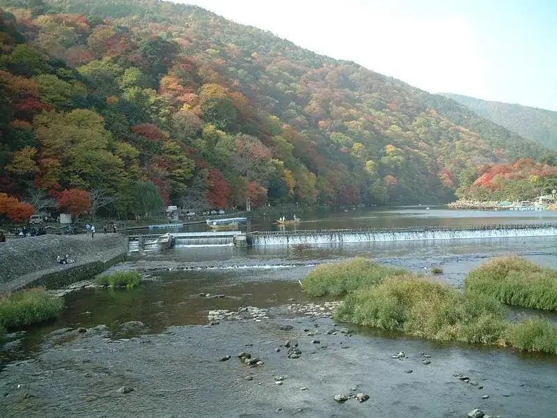
ようこそ。日本の美しき歴史と文化の旅へ。 嵐山の美学:竹林と自然の調和 みなさま、こんにちは。旅行ブロガーであり、文化歴史学の研究者でもある田中ゆみ(Yumi Tanaka)です。 私たちが旅に出る時、そこには単なる日常からの逃避以上の意味が存在します。それは、土地が内包する歴史の集積に触れ、かつてその地を生きた人々が自然とどのように対峙し、あるいは調和を模索してきたかという、精神の軌跡をたどる試みに他なりません。 今回私が思索の場として選んだのは、京都の西方に鎮座する「嵐山」です。 嵐山は、単に美しい景観を誇る観光地という枠に収まる存在ではありません。ここは、平安の昔から貴族たちに愛された別業(別荘)の地であり、仏教的な無常観と神道的な自然崇拝、そして人間の高度な空間設計が見事に結晶化した、言わば「生きた文化遺産」です。本稿では、この嵐山という空間が湛える美学的な本質、その歴史的変遷、そして自然と人間との調和のあり方について、学術的かつ詩的な視点から深く解き明かしていきたいと思います。1. 地理的重層性と水系のトポロジー 嵐山を理解するためには、まずその地形が持つ重層的な広がりと、この地を貫く水系の象徴性を整理せねばなりません。 一般に「嵐山」と呼ばれる地域は、京都市西部に位置する標高382メートルの単一の山岳のみを指す言葉ではありません。大堰川(おおいがわ)という大いなる流れを境界線として、西側に並び立つ松尾山(275.6m)、嵐山(382m)、烏ヶ岳(398m)の「嵐山三山」と、東側に位置する小倉山、亀山、そしてその山麓に広がる平坦な土地を含めた広範な領域を、私たちは「嵐山」と総称しています。 【嵐山地域の地理的概念図】 (北:嵯峨野・小倉山方面) │ ───────┬─────���─┴───────┬─────── (西側:嵐山三山) │ (東側:亀山・小倉山) ・烏ヶ岳 (398m) │ ・小倉山 ・嵐山 (382m) │ ・亀山 ・松尾山 (275.6m) │ ───────┼───────┬───────┼─────── │ 大堰川 │ (上流) (下流) ───────┴───────┼───────┴─────── 渡月橋 ───────┬───────┼───────┬─────── │ 桂川 │この地を流れる川は、嵐山のアイデンティティそのものです。大堰川の上流にあたる保津川の流域では、古くから林業が極めて盛んでした。山々から切り出された良質な木材は、筏(いかだ)に組まれ、この急流を下って京都の街へと運ばれていきました。その木材輸送の終着点こそが、他ならぬこの嵐山の水際だったのです。かつて物資の集散地として機能したこの川は、現代においては亀岡市から始まる「保津川下り(嵐峽めぐり)」という形で、自然の造形美��五感で追体験するエコツーリズムの場へと昇華されています。 そして、この水系を語る上で最も興味深いのが、流路に架かる「渡月橋」を境にして川の呼称が変化するという事実です。橋の上流側は「大堰川」と呼ばれ、橋を下った瞬間から「桂川」とその名を変えます。この命名の境界線は、単なる行政上の区切りを超えて、自然が野生から都市の洗練へと移行する精神的な敷居(しきい)として機能しているように思えてなりません。 渡月橋は、まさに嵐山の象徴です。写真や絵画で見ると、古風な純木造の橋のように見えますが、その実態は近代の工学技術を宿した堅牢な鉄筋コンクリート造の橋です。しかし、周囲の景観と調和を保つため、欄干部分には温かみのある木材が贅沢に使用されており、自動車の往来を可能にしながらも、古典的な情緒を一切損なっていません。さらに、夜間には橋の上流に設置された小型水力発電機によって生み出されたクリーンな電力が、橋を優美に照らし出します。ここには、古人の美意識を受け継ぎつつ、持続可能な現代技術を融合させるという、きわめて高度な調和の姿勢が���て取れます。2. 歴史的植栽と「作られた自然」の美学 嵐山は、手つかずの原始の自然が残されている場所ではありません。むしろ、人間が自然に深く関与し、その美を極限まで引き出した「極上の庭園」とも言うべき空間です。この地が桜と紅葉の世界的名所(日本さくら名所100選、日本紅葉の名所100選)となった背景には、歴史上の人物たちによる壮大な「植栽の歴史」が存在します。 #歴史 の糸を紐解くと、13世紀末の鎌倉時代、亀山上皇が奈良・吉野の地からサクラ数百株をこの嵐山へと移植させたという記録に行き当たります。吉野といえば、修験道の聖地であり、日本で最も高名な桜の山です。上皇はその神聖なる桜の遺伝子を、自らが愛した嵐山へと移植することで、聖なる風景の「アプロプリエーション(受容・再構築)」を試みたのです。 さらにその後、南北朝から室町時代にかけて、稀代の作庭家であり禅僧でもあった夢窓国師(夢窓疎石)が、再び吉野からヤマザクラ数千本をこの地に移植しました。彼らは、松の常緑が織りなす深い緑の背景の中に、桜の淡いピンク、そして秋には紅葉��燃え立つような赤を精密に配置していきました。私たちが今日目にする嵐山の四季の色彩は、自然の偶然がもたらしたものではなく、数百年にわたる人間の美的意志と自然の生命力が共作した、壮大な大地のキャンバスなのです。 【嵐山の植栽と景観形成のタイムライン】 ┌───────────────────────────────────────┐ │ 13世紀末:亀山上皇による吉野サクラ数百株の移植 │ │ └ 嵐山における「サクラの名所」としての基礎が築かれる │ ├───────────────────────────────────────┤ │ 14世紀:夢窓国師によるヤマザクラ数千本の追植 │ │ └ 禅的空間美学に基づいた松と桜の色彩対比の完成 │ ├───────────────────────────────────────┤ │ 15世紀:金春禅鳳作の能『嵐山』の上演 │ │ └ 蔵王権現堂や戸難瀬の滝が文化的アイコンとして定着 │ ├───────────────────────────────────────┤ │ 明治時代:社寺上知令による官有地化(のちの嵐山国有林) │ │ └ 天龍寺領から国家管理への移行、保安林としての保護が開始 │ └───────────────────────────────────────┘このような歴史的背景は、古典芸能の世界にも深く投影されています。嵐山の名所の一つである「戸難瀬(となせ)の滝」(別名:音無滝)の上流には、吉野の神仏習合の信仰を象徴する蔵王権現堂が鎮座しています。この蔵王権現は、15世紀に活躍した能役者・金春禅鳳が手がけた能の演目『嵐山』にも神格として登場し、嵐山の地が持つ霊的な豊かさを当時の人々に広く印象付けました。 しかし、こうした自然と文化の調和は、常に順風満帆に維持されてきたわけではありません。嵐山山麓に広がっていた鬱蒼たる森の多くは、かつて名刹・天龍寺の寺領でした。しかし明治時代に下ると、「社寺上知令」という激動の国策により、これらの広大な土地は国家に強制的に召し上げられ、官有地へと編入されることになります。これが、現在の「嵐山国有林(面積59.03ヘクタール)」の起源です。 現在、この嵐山国有林は、森林法に基づく風致保安林および土砂流出防備保安林に指定され、さらに文化財保護法の「史跡名勝(1927年指定:嵐山峡)」、都市計画法の「風致地区(1930年指定)」、古都保存法の「歴史的風土特別保存地区」、さらには鳥獣保護区という、幾重もの法的保護の網によって守られています。私たちが今もなお、平安貴族が見上げたものと本質的に変わらない稜線を仰ぎ見ることができるのは、こうした近代以降の厳格な保全制度の賜物なのです。3. 竹林の小径と五感の現象学 嵐山を訪れる旅人が、最も深く精神的な静寂を覚える場所、それが「竹林の小径」ではないでしょうか。 野宮神社から大河内山荘へと至る細い路地。そこには、天を突き刺すようにまっすぐに伸びた数千、数万の竹が、光と影の精緻な格子模様を地面に描き出しています。この空間は、まさに #自然 が生み出した寺院の回廊のようです。 竹林の中に身を置くと、まず変化するのは視覚ではなく「聴覚」です。風が通り抜けるたびに、竹の幹同士が擦れ合い、葉がささやく「サワサワ」という乾いた音が、周囲を満たします。この音は、都市の喧騒によって麻痺した私たちの感覚を優しく覚醒させ、主客未分の瞑想的な状態へと誘います。光は竹の葉によって幾重にもフィルタリングされ、地上に届く頃には、どこかエメラルドグリーンを帯びた、湿り気のある柔らかな光へと変化しています。 ここでは、時間すらもその歩 #japan #travel #history #culture #nature
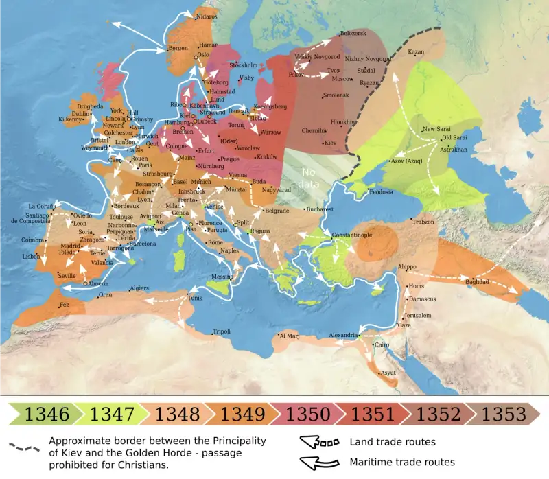
The Black Death: The Bubonic Plague That Decimated Medieval Europe A World on the Precipice In the year of our Lord 1347, the continent of Europe was entirely unaware that it stood upon the very precipice of the abyss. To understand the magnitude of the cataclysm that was about to unfold, one must first envision the fragile state of the world into which the pestilence crept. #MedievalEurope was a tapestry of burgeoning cities, sprawling feudal estates, and dense, interconnected trade networks. It was a world humming with the commerce of the Renaissance's dawn, yet precariously balanced on the edge of a knife. The preceding decades had not been kind. The Great Famine of 1315–1317 had already severely weakened the population, bringing years of unyielding rain, rotting crops, and widespread starvation. Generations had grown up undernourished, their immune systems compromised, their bodies frail. The population had swelled beyond the agricultural capacity of the land, creating crowded, unsanitary urban centers where waste flowed openly in the streets, and humans lived cheek-by-jowl with livestock, rats, and fleas. It was a world ripe for the harvest. But no prophet, no astrologer gazing at the conjunction of Saturn, Jupiter, and Mars in the house of Aquarius, could have truly predicted the sheer, unadulterated horror that was sailing toward them from the East. The #BlackDeath was not merely a disease; it was an apocalypse, an event so profound and terrifying that it fundamentally ruptured the fabric of human history. The Winds of Pestilence: Origins in the East The nightmare did not begin in the cramped alleys of Paris or the bustling docks of London. It originated in the vast, arid expanses of Central Asia, likely in the steppes of modern-day Kyrgyzstan or Mongolia. There, the bacterium Yersinia pestis had long circulated among populations of marmots and other rodents. Climate changes in the 1330s—perhaps a series of exceptionally dry years following a period of lush growth—drove these rodents out of their natural habitats and closer to human settlements. Through the intricate webbing of the Silk Road, the disease began its inexorable march westward. It hitchhiked on the backs of merchant caravans, nestled in bales of silk and sacks of spices, carried by the ubiquitous black rat (Rattus rattus) and its deadly companion, the Oriental rat flea (Xenopsylla cheopis). The turning point, the moment the plague truly weaponized itself against Europe, occurred at the Genoese trading outpost of Kaffa (modern-day Feodosia) on the Crimean Peninsula. In 1345, the city was besieged by the Golden Horde, led by the Mongol warlord Jani Beg. The siege dragged on, but suddenly, the Mongol ranks were decimated by a mysterious, rapidly fatal illness. In what is perhaps the first recorded instance of biological warfare, the desperate and dying Mongols loaded the plague-ridden corpses of their fallen comrades onto trebuchets and hurled them over the walls into the city of Kaffa. The Genoese merchants, horrified by the raining dead, quickly succumbed to the contagion. Panic ensued. Desperate to escape the infected city, they boarded their swift galleys and fled into the Black Sea, unwittingly carrying the grim reaper in their holds. #AncientHistory #Warfare The Death Ships Arrive In October 1347, a fleet of twelve Genoese galleys limped into the harbor of Messina, Sicily. The scene that greeted the Sicilian port authorities was one of unimaginable horror. The sailors aboard the vessels were either dead or dying. Those still clinging to life were delirious with fever, their bodies covered in mysterious black boils that oozed blood and pus. These were the infamous "death ships." The authorities in Messina quickly realized the danger and ordered the fleet out of the harbor, but it was too late. The true vectors of the disease—the infected rats and their fleas—had already scurried down the mooring lines and into the city. The Black Death had made landfall in Europe. The speed with which the contagion consumed Messina was breathtaking. Within days, the city was a charnel house. The disease spread so rapidly that the living could scarcely bury the dead. People dropped in the streets, in their homes, in the very churches where they sought sanctuary. From Sicily, the plague moved with terrifying swiftness. By early 1348, it had reached Genoa and Venice. By summer, it had crossed the Alps into France and the Holy Roman Empire. By autumn, it had crossed the Channel to England. The Anatomy of the Terror What made the Black Death so utterly terrifying to the medieval mind was its gruesome physical manifestation and its sheer unpredictability. Modern science tells us that the Black Death was primarily the bubonic plague, but it also manifested in two other, even more deadly forms: pneumonic and septicemic.Bubonic Plague: The most common form, characterized by the sudden onset of fever, chills, vomiting, and terrible aches. Its most distinguishing feature was the appearance of "buboes"—painful, swollen lymph nodes in the groin, armpits, or neck. These swellings, which could grow to the size of an apple, would eventually turn black and split open, oozing foul-smelling pus and blood. Mortality rate: 50% to 70%. Pneumonic Plague: This occurred when the infection reached the lungs. It was highly contagious, spreading directly from person to person through the air via coughing and sneezing. Victims would cough up blood and essentially drown in their own fluids within a matter of days. Mortality rate: nearly 100%. Septicemic Plague: The deadliest form, where the bacteria multiplied directly in the bloodstream. Victims would die incredibly quickly, sometimes before any other symptoms appeared. Internal bleeding caused dark patches on the skin—the literal "black death." Mortality rate: 100%.The Italian writer Giovanni Boccaccio, who survived the plague in Florence, provided a harrowing firsthand account in his masterpiece, The Decameron: "It did not take the form it had assumed in the East... but in men and women alike it first betrayed itself by the emergence of certain tumors in the groin or the armpits, some of which grew as large as a common apple, others as an egg... From the two said parts of the body this deadly gavocciolo soon began to propagate and spread itself in all directions indifferently." A Society in Collapse The societal impact of the Black Death cannot be overstated. As the death toll mounted, the very foundations of medieval civilization began to crumble. Institutions that had stood for centuries proved utterly powerless in the face of this invisible enemy. The Failure of Medicine The medical community of the 14th century was entirely unequipped to understand or combat the plague. Grounded in the ancient Greek theory of humorism, physicians believed that illness was caused by an imbalance of the four bodily humors (blood, phlegm, yellow bile, and black bile) or by "miasma"—corrupt, foul-smelling air rising from swamps or unburied corpses. Their treatments were as varied as they were ineffective. #MedicalHistory is replete with the desperate, sometimes bizarre remedies employed during the plague years. Bloodletting: Believing that drawing "bad blood" would cure the patient, physicians regularly bled victims using leeches or lancets, often simply accelerating their death by weakening them further. Aromatherapy: To combat the miasma, people carried nosegays of sweet-smelling flowers, herbs, and spices (the origin of the nursery rhyme "Ring Around the Rosie"). Bizarre Poultices: Buboes were lanced and treated with poultices made of anything from roasted onions and herbs to crushed emeralds and even the chopped-up remains of pigeons or snakes. Theriac: An expensive, ancient concoction containing dozens of ingredients, including opium and snake flesh, widely prescribed to the wealthy but entirely useless against Yersinia pestis.The Breakdown of Social Order More terrifying than the physical symptoms was the moral and social collapse that accompanied the plague. The sheer volume of death overwhelmed the living. Mass graves, known as plague pits, were dug outside city walls, where bodies were layered like lasagna. The bonds of family and friendship shattered under the weight of fear. Boccaccio noted with despair that "brother was forsaken by brother, nephew by uncle, brother by sister, and oftentimes husband by wife; nay, what is more, and scarcely to be believed, fathers and mothers were found to abandon their own children, untended, unvisited, to their fate, as if they had been strangers." Law and order evaporated. Magistrates and guards died or fled. Entire towns were abandoned, leaving ghost ships of stone in the countryside. Crops rotted in the fields for lack of hands to harvest them. Livestock wandered aimlessly, dying in the pastures. The silence that descended upon Europe was profound and chilling—the silence of the grave. #History The Scapegoats and the Zealots In the absence of a scientific explanation, the people of Medieval Europe turned to theology and superstition. The prevailing belief was that the Black Death was a divine punishment, the wrath of a furious God meted out upon a sinful world. This desperation gave rise to some of the darkest chapters of the plague years. The Flagellants Believing that extreme penance was the only way to appease God, massive movements of flagellants swept across Europe. These were bands of men and women who traveled from town to town, stripped to the waist, whipping themselves with scourges embedded with iron spikes while chanting hymns of repentance. They believed that by sharing in the suffering of Christ, they could atone for the sins of humanity. The flagellant movement grew massive, becoming a law unto itself and challenging the authority of the Church. Pope Clement VI eventually condemned them, recognizing the threat they posed not just to religious order, but to public health, as they actively spread the plague from town to town, their open wounds providing perfect entry points for the bacteria. The Persecution of the Jews Perhaps the most tragic and shameful consequence of the Black Death was the systematic persecution and massacre of Jewish communities across Europe. Desperate to find a human scapegoat for their suffering, wild rumors began to circulate that the Jews were responsible for the plague, accusing them of poisoning the wells and springs. Despite the fact that Jews were dying of the plague at the same rate as Christians, the hysteria proved unstoppable. In city after city, particularly in the Holy Roman Empire, Jewish populations were rounded up, tortured into false confessions, and burned at the stake. In February 1349, in the city of Strasbourg, over 2,000 Jews were burned alive in the local cemetery in a horrific event known as the Strasbourg massacre. In Basel, the entire Jewish population was burned in a specially constructed wooden house on an island in the Rhine. Pope Clement VI issued bulls defending the Jews and pointing out the illogical nature of the accusations, but his voice was drowned out by the roar of the mob. The Aftermath: A World Transformed By the early 1350s, the initial, catastrophic wave of the Black Death began to subside. It is estimated that between 30% to 50% of Europe's population had perished—somewhere between 25 and 50 million people. The demographic shock was unprecedented, and it set in motion a series of profound changes that would forever alter the course of Western civilization. The Economic Upheaval and the Fall of Feudalism The most immediate consequence of the massive population loss was a severe labor shortage. For centuries, the feudal system had relied on an abundance of cheap peasant labor bound to the land. Suddenly, the peasantry found themselves in a position of unprecedented bargaining power. Lords and landowners, desperate to have their fields tilled and their crops harvested, were forced to offer higher wages, better living conditions, and lower rents. Peasants who were once tied to the land of a specific lord found that they could simply leave and find better terms elsewhere. Governments attempted to resist this economic shift. In England, King Edward III issued the Statute of Laborers in 1351, which attempted to freeze wages at pre-plague levels and restrict peasant mobility. These measures, however, were largely ineffective and deeply resented, eventually contributing to the great Peasants' Revolt of 1381. The Black Death essentially broke the back of the feudal system, paving the way for the rise of a more mobile, affluent lower and middle class. The Shift in Religion and Culture The psychological trauma of the Black Death left an indelible mark on European culture. The Church, which had failed to protect the people or explain the tragedy, suffered a significant loss of prestige. Many of the most dedicated and selfless priests and monks had died while tending to the sick, leaving a vacuum that was often filled by less qualified, more opportunistic individuals. This creeping disillusionment sowed early seeds of dissent that would eventually blossom into the Protestant Reformation centuries later. Art and literature took on a darker, more morbid tone. The motif of the Danse Macabre, or the Dance of Death, became wildly popular. These artworks depicted skeletons leading people from all walks of life—kings, popes, merchants, and peasants—in a mocking dance to the grave, emphasizing the universality of death and the futility of earthly power and wealth. Tomb sculptures changed as well. Rather than the idealized, peaceful effigies of the past, wealthy individuals began commissioning "transi tombs," which featured two tiers: the top showing the person as they were in life, and the bottom revealing a rotting, worm-eaten corpse, a stark reminder of memento mori—"remember you must die." The Endless Echo The Black Death of 1347-1351 was not the end. The plague returned to Europe in successive waves every few decades for centuries, though never again with the apocalyptic ferocity of its initial debut. It became a grim, expected part of life, finally vanishing from Europe only in the 18th century, though it still exists in small pockets around the world today, easily treated with modern antibiotics. When we look back at the Black Death through the lens of history, we see more than just a medical catastrophe. We see a crucible that tested the absolute limits of human endurance. It was an era of unimaginable darkness, where the air itself seemed to carry the scent of the grave, and the tolling of the death knells never ceased. Yet, from that darkness, a new world was forged. The shattering of old hierarchies, the redistribution of wealth, and the shift in human consciousness laid the crucial groundwork for the Renaissance. The Black Death reminds us of the fragility of our civilization, the terrifying power of the natural world, and the profound, resilient nature of the human spirit when faced with the ultimate abyss. It remains, etched into our collective memory and perhaps even our DNA, the most terrifying chapter in the grand, sweeping narrative of human history. The Medical Truth Uncovered It is fascinating to consider how long the true cause of the plague remained hidden in shadows. It was not until the late 19th century, during a massive outbreak in Hong Kong in 1894, that Alexandre Yersin, a Swiss-French physician and bacteriologist, finally isolated the bacillus responsible for the disease. Named Yersinia pestis in his honor, this microscopic organism had ruled the world with an iron fist centuries before humanity even knew it existed. Following this, Paul-Louis Simond identified the rat flea as the primary vector in 1898. The intricate, deadly dance between the bacterium, the rat, the flea, and the human host was finally understood. It is a sobering thought that for centuries, humanity fought a war in the dark, battling miasmas and bad humors while the true enemy nested in the very thatch of their roofs and the straw of their beds. Modern Reflections on an Ancient Terror Today, in our era of rapid global travel, advanced medicine, and interconnected economies, the story of the Black Death serves as a potent, timeless warning. We have seen, in recent years, how quickly a novel pathogen can sweep across the globe, disrupting lives, economies, and social norms. While our medical arsenal is vastly superior to the poultices and bloodletting of the 14th century, our societal vulnerabilities remain eerily similar. The Black Death teaches us about the dangers of rampant scapegoating and the spread of misinformation during times of crisis. The tragic fate of the European Jews during the plague years is a stark reminder of how fear can rapidly curdle into hatred and violence against the marginalized. Furthermore, the economic aftershocks of the plague demonstrate how massive demographic shifts can upend established economic orders. Just as the plague empowered the peasantry and helped dismantle feudalism, modern pandemics force us to reevaluate the structures of our own labor markets and economic systems. A Masterpiece of Macabre History In the annals of human existence, there are dividing lines—events so massive that history is neatly split into "before" and "after." The fall of Rome was one. The discovery of the New World was another. But perhaps none was so sharp, so brutal, and so universally devastating as the Black Death. As a writer of historical fiction, I find myself continually drawn to this period. It is an era stripped of pretense, where human nature is laid bare in both its absolute worst and its absolute best. For every tale of a parent abandoning a child, there is a tale of a brave nun or a steadfast physician who stayed to comfort the dying, knowing it would cost them their own lives. The story of the Black Death is not just a story of a disease; it is the story of us. It is a testament to the fact that while humanity can be brought to the very brink of extinction, battered by forces beyond our control, we possess a terrifying, beautiful resilience. The cities repopulated, the fields were replanted, and the world spun on, forever scarred, but undeniably alive. We walk today on streets built over the plague pits, we admire art born from the ashes of the Danse Macabre, and we live in a society shaped by the economic earthquakes of the 1350s. The Black Death is not merely ancient history; it is the foundational trauma of the modern world. #HistoricalFiction #MarkDinn #TheBlackDeath #ResilienceMark Dinn is a renowned historical fiction author, known for his immersive and dramatic storytelling that breathes life into the darkest and most fascinating chapters of human history. His works focus on the resilience of the human spirit in the face of insurmountable odds. #History #MedievalEurope Related InsightsUnraveling the Mysteries of Stonehenge: A Monolithic Marvel of the Ancient World The Colosseum: Echoes of Eternity in the Heart of Rome The Rosetta Stone: Breaking the Silence of Ancient Egypt{ "@context": "https://schema.org", "@type": "FAQPage", "mainEntity": [ { "@type": "Question", "name": "What is the main focus of The Black Death: The Bubonic Plague That Decimated Medieval Europe?", "acceptedAnswer": { "@type": "Answer", "text": "A dramatic deep dive into The Black Death: The Bubonic Plague That Decimated Medieval Europe. Mark Dinn explores the untold history, drama, and legacy of this fascinating subject." } }, { "@type": "Question", "name": "Who authored the comprehensive guide on The Black Death: The Bubonic Plague That Decimated Medieval Europe?", "acceptedAnswer": { "@type": "Answer", "text": "This detailed article and its insights were carefully researched and authored by Mark Dinn." } }, { "@type": "Question", "name": "Where can I find more related content about History?", "acceptedAnswer": { "@type": "Answer", "text": "You can explore more articles, detailed reviews, and similar insights by browsing the Related Insights section at the bottom of this article or visiting our dedicated History category page." } } ] }
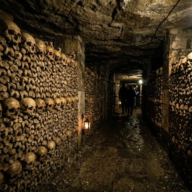
Bienvenue! Let us embark on an unforgettable #journey to the heart of #France. The Catacombs of #Paris (French: Catacombes de Paris, ) are underground ossuaries in Paris, #France, which hold the remains of more than six million people. Built to consolidate Paris's #ancient stone quarries, they extend south from the Barrière d'Enfer ("Gate of Hell") former city gate. The ossuary was created as part of the effort to eliminate the effects of the city's overflowing cemeteries. Preparation work began shortly after a 1774 series of basement wall collapses around the Holy Innocents' Cemetery added a sense of urgency to the cemetery-eliminating measure, and from 1788, nightly processions of covered wagons transferred remains from most of Paris's cemeteries to a mine shaft opened near the Rue de la Tombe-Issoire. The ossuary remained largely forgotten until it became a novelty-place for concerts and other private events in the early 19th century; after further renovations and the construction of accesses around Place Denfert-Rochereau, it was opened to public visitation from 1874. Since 2013, the Catacombs have numbered among the fourteen City of Paris Museums managed by Paris Musées. Although the ossuary comprises only a small section of the underground mines of Paris, Parisians often refer to the entire tunnel network as the catacombs. #history Paris's cemeteries Paris's earliest burial grounds were to the southern outskirts of the Roman-era Left Bank city. In ruins after the Western Roman #empire's 5th-century end and the ensuing Frankish invasions, this settlement was eventually abandoned for the marshy Right Bank: from the 4th century, the first known settlement there was on higher ground around a Saint-Etienne church and burial ground (behind the present Hôtel de Ville), and urban expansion on the Right Bank began in earnest after other ecclesiastical landowners filled in the marshlands from the late 10th century. Thus, instead of burying its dead away from inhabited areas as usual, the Paris Right Bank settlement began with cemeteries near its centre. The most central of these cemeteries, a burial ground around the 5th-century Notre-Dame-des-Bois church, became the property of the Saint-Opportune parish after the original church was demolished by the 9th-century Norman invasions. When it became its own parish associated with the church of the "Saints Innocents" from 1130, this burial ground, filling the land between the present rue Saint-Denis, rue de la Ferronnerie, rue de la Lingerie and the rue Berger, had become the city's principal cemetery. By the end of the same century, Saints Innocents was neighbour to the principal Parisian marketplace Les Halles, and already filled to overflowing. To make room for more burials, the long-dead were exhumed and their bones packed into the roofs and walls of "charnier" galleries built inside the cemetery walls. By the end of the 18th century, the central burial ground was a two-metre-high (6.6-foot) mound of earth filled with centuries of Parisian dead, plus the remains from the Hôtel-Dieu hospital and the Morgue; other Parisian parishes had their own burial grounds, but the conditions in Saints Innocents were the worst. A series of ineffective decrees limiting the use of the cemetery did little to remedy the situation, and it was not until the late 18th century that it was decided to create three new large-scale suburban burial grounds on the outskirts of the city, and to condemn all existing parish cemeteries within city limits. The future ossuary: Paris's former mines Much of the Left Bank area rests upon rich Lutetian limestone deposits. This stone built much of the city, but it was extracted in suburban locations away from any habitation. Because of the post 12th-century haphazard mining technique of digging wells down to the deposit and extracting it horizontally until depletion, many of these (often illicit) mines were uncharted, and when depleted, often abandoned and forgotten. Paris had annexed its suburbs many times over the centuries, and by the 18th century many of its arrondissements (administrative districts) were or included previously mined territories. The undermined state of the Left Bank was known to architects as early 17th-century construction of the Val-de-Grâce hospital (most of its building expenses were due to its foundations), but a series of mine cave-ins beginning 1774 with the collapse of a house along the "rue d'Enfer" (near today's crossing of the Avenue Denfert-Rochereau and the boulevard Saint-Michel) caused King Louis XVI to name a commission to investigate the state of the Parisian underground. This resulted in the creation of the inspection Générale des Carrières (General Inspection of Mines) service. Ossuary creation The need to eliminate Les Innocents gained urgency from May 31, 1780, when a basement wall in a property adjoining the cemetery collapsed under the weight of the mass grave behind it. The cemetery was closed to the public and all intra muros (Latin: "within the [city] walls") burials were forbidden after 1780. The problem of what to do with the remains crowding intra muros cemeteries was still unresolved. Mine consolidations were still occurring and the underground around the site of the 1777 collapse that had initiated the project had already become a series of stone and masonry inspection passageways that reinforced the streets above. The mine renovation and cemetery closures were both issues within the jurisdiction of the Police Prefect Police Lieutenant-General Alexandre Lenoir, who had been directly involved in the creation of a mine inspection service. Lenoir endorsed the idea of moving Parisian dead to the subterranean passageways that were renovated during 1782. After deciding to further renovate the "Tombe-Issoire" passageways for their future role as an underground sepulchre, the idea became law in late 1785. A well within a walled property above one of the principal subterranean passageways was dug to receive Les Innocents' unearthed remains, and the property itself was transformed into a sort of museum for all the headstones, sculptures and other artifacts recovered from the former cemetery. Beginning from an opening ceremony on 7 April the same year, the route between Les Innocents and the "Clos de la Tombe-Issoire" became a nightly procession of black cloth-covered wagons carrying the millions of Parisian dead. It would take two years to empty the majority of Paris's cemeteries. Cemeteries whose remains were moved to the Catacombs include Saints-Innocents (the largest by far with about 2 million buried over 600 years of operation), Saint-Étienne-des-Grès (one of the oldest), Madeleine Cemetery, Errancis Cemetery (used for the victims of the French Revolution), and Notre-Dame-des-Blancs-Manteaux. By this way the skeletal remains of several notable victims of the French Revolution were transferred to the Catacombs, including (the date is the date of death): Charlotte Corday (18 July 1793) 22 Girondists (31 October 1793); among them Jacques Pierre Brissot and Pierre Victurnien Vergniaud Louis Philippe II, Duke of Orléans (6 November 1793), father of king Louis Philippe I Madame Roland (8 November 1793) Madame du Barry (8 December 1793) Jacques Hébert (24 March 1794) Georges Jacques Danton (April 5, 1794) Camille Desmoulins (April 5, 1794) Philippe Fabre d'Églantine (April 5, 1794) Marie-Jean Hérault de Séchelles (April 5, 1794) Lucile Duplessis (April 13, 1794), widow of Camille Desmoulins Marie Marguerite Françoise Hébert (April 13, 1794), widow of Jacques Hébert Antoine-Laurent de Lavoisier (May 8, 1794) Madame Élisabeth (May 10, 1794), sister of kings Louis XVI, Louis XVIII and Charles X François Hanriot (July 28, 1794) Maximilien Robespierre (July 28, 1794) Louis Antoine de Saint-Just (July 28, 1794) Georges Couthon (July 28, 1794) Antoine Simon (July 28, 1794) Renovation and ossuary decor Catacombs in their first years were a disorganized bone repository, but Louis-Étienne Héricart de Thury, director of the Paris Mine Inspection Service (Inspection générale des carrières) from 1810, had renovations done that would transform the caverns into a visitable mausoleum. In addition to directing the stacking of skulls, femurs and tibias into the patterns seen in the catacombs today he used the cemetery decorations he could find (formerly stored on the Tombe-Issoire property; many had disappeared after the 1789 Revolution) to complement the walls of bones. A room dedicated to the display of the various minerals found under Paris was also created, in addition to another showing various skeletal deformities found during the catacombs' creation and renovation. He also added monumental tablets and archways bearing ominous warning inscriptions, and added stone tablets bearing descriptions or other comments about the #nature of the ossuary, and to ensure the safety of eventual visitors, it was walled from the rest of Paris's Left Bank's already-extensive tunnel network. Modern During World War II, Parisian members of the French Resistance used the tunnel system and established the headquarters from where Colonel Rol-Tanguy led the insurrection for the liberation of Paris in June 1944. The Wehrmacht established an underground bunker below Lycée Montaigne, a high school in the 6th arrondissement. In 2004, police discovered a fully equipped movie theater in an area of the catacombs underneath the Trocadéro. It was equipped with a giant cinema screen, seats for the audience, projection equipment, film reels of recent thrillers and film noir classics, a fully stocked bar, and a complete restaurant with tables and chairs. The group les UX took responsibility for the installation. The film As Above, So Below, released in 2014, was the first production that secured permission from the French government to film in the catacombs. They aimed to use no alterations to the environment with the exception of a piano and a car which were hauled into the catacombs and set on fire. In 2015, Airbnb paid €350,000 as part of a publicity stunt offering customers the chance to stay overnight in the Catacombs. In August 2017, thieves broke into a cellar from the catacombs and stole more than €250,000 of wine. In 2025, American desert rock band Queens of the Stone Age released an acoustic live performance entitled Alive in the Catacombs, recorded in 2024 while on the European leg of The End Is Nero World Tour. On the WTF with Marc Maron podcast, frontman Joshua Homme described how it took 18 years to secure permission to record in the catacombs. Deaths Only one death has officially been confirmed in the Catacombs. In 1793, Philibert Aspairt, a door keeper for the Val-de-Grâce hospital, died in the catacombs. It is thought that he lost his light source and was left to die in the darkness. In 1804, 11 years later, his body was found, only a few meters from a staircase that led to an exit. He was only identified by his hospital key ring and the buttons on his jacket. Visits As one visits the catacombs, a sign above reads Arrête! C'est ici l'empire de la Mort ("Stop! The empire of Death lies here"). The Catacombs of Paris became a curiosity for more privileged Parisians from their creation, an early visitor being the Count of Artois (later Charles X of France) in 1787. Public visits began after its renovation into a proper ossuary and the 1814–1815 War. Initially, visitors were allowed only a few times a year with the permission of an authorized mines inspector, but later more frequently and permitted by any mine overseer. A flow of visitors degraded the ossuary to a point where the permission-only rule was restored from 1830, and the catacombs were closed completely from 1833 because of church opposition to exposing human remains to public display. The catacombs were open again for four visits a year from 1850, and public demand caused the government to allow monthly visits from 1867, bi-weekly visits on the first and third Saturday of each month from 1874 (with an extra opening for the November 1 toussaint holiday), and weekly visits during the 1878, 1889 (the most visitors yet that year) and 1900 World's Fair Expositions. Later, they opened for regular daily visits. After an incident of vandalism, the catacombs were closed to the public during September 2009 and reopened on 19 December of the same year. Disruption of surface structures Because the catacombs are directly under the Paris streets, large foundations cannot be built above them and cave-ins have destroyed buildings. For this reason, there are few tall buildings in this area. #france #travel #history #europe #culture Related InsightsEchoes in the Clouds: A Pilgrimage Through Meteora’s Forgotten Monasteries Exploring Ani, City of 1001 Churches Dive Into a Hidden World: The Most Breathtaking Underwater Museums and Sculpture Parks{ "@context": "https://schema.org", "@type": "FAQPage", "mainEntity": [ { "@type": "Question", "name": "What is the main focus of The Dark Heart of Paris: Exploring the Catacombs?", "acceptedAnswer": { "@type": "Answer", "text": "Join Camille Dubois on a journey exploring The Dark Heart of Paris and its incredible history." } }, { "@type": "Question", "name": "Who authored the comprehensive guide on The Dark Heart of Paris: Exploring the Catacombs?", "acceptedAnswer": { "@type": "Answer", "text": "This detailed article and its insights were carefully researched and authored by Camille Dubois." } }, { "@type": "Question", "name": "Where can I find more related content about Travel?", "acceptedAnswer": { "@type": "Answer", "text": "You can explore more articles, detailed reviews, and similar insights by browsing the Related Insights section at the bottom of this article or visiting our dedicated Travel category page." } } ] }
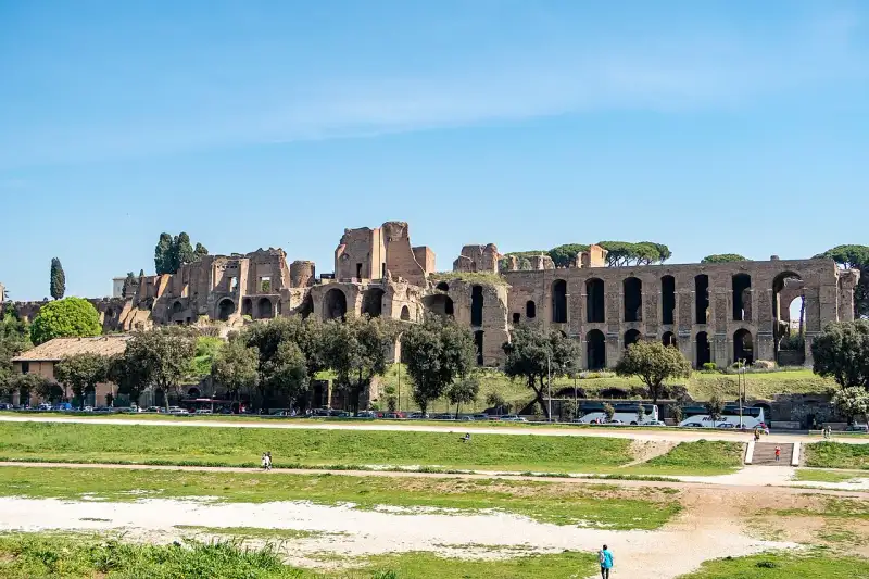

Secondo la leggenda, è proprio sul Palatino che Romolo fondò Roma nel 753 a.C. Questo colle centrale, che si affaccia maestosamente sul Foro Romano e sul Circo Massimo, è diventato nel corso dei secoli il quartiere più esclusivo dell'Antica Roma, scelto dagli imperatori per costruire i loro sontuosi palazzi. Dal Mito alla Storia Gli scavi archeologici hanno confermato la presenza di capanne dell'Età del Ferro sul Palatino, dando un fondamento storico al mito di Romolo. Ma è durante l'Impero che il colle assunse la sua forma monumentale. Augusto, il primo imperatore, scelse il Palatino per la sua residenza, e da quel momento il colle divenne sinonimo di potere (la parola stessa 'palazzo' deriva da Palatium, il nome del colle). I Complessi Imperiali Oggi, le rovine della Domus Flavia e della Domus Augustana costruite dall'imperatore Domiziano dominano l'area. Questi enormi complessi includevano sale del trono, giardini con fontane, terme private e stadi personali. Camminare tra queste mura in mattoni rossi, immaginando i marmi policromi che un tempo le ricoprivano, offre una prospettiva mozzafiato sulla ricchezza sfrenata della corte imperiale. I Giardini Farnesiani Nel XVI secolo, la famiglia Farnese trasformò parte delle rovine nei Giardini Farnesiani, uno dei primi giardini botanici d'Europa. Questa sovrapposizione di epoche rende il Palatino un luogo unico, dove il Rinascimento abbraccia l'antichità romana in un paesaggio di pini marittimi e panorami indimenticabili sulla Città Eterna. #Palatino #RomaAntica #PalazziImperiali #StoriaDiRoma #italy #rome #history #ancient Related InsightsL'Eco del Silenzio: Quando il Viaggio Diventa Custodia della Terra Das Ewige Gewitter vom Maracaibo: Eine Reise ins Haus des Donners Australien: Wo die Ewigkeit des Outbacks auf den Puls der Moderne trifft{ "@context": "https://schema.org", "@type": "FAQPage", "mainEntity": [ { "@type": "Question", "name": "What is the main focus of Il Palatino: Il Colle degli Imperatori?", "acceptedAnswer": { "@type": "Answer", "text": "Esplorando le rovine dei lussuosi palazzi imperiali sul colle dove nacque Roma." } }, { "@type": "Question", "name": "Who authored the comprehensive guide on Il Palatino: Il Colle degli Imperatori?", "acceptedAnswer": { "@type": "Answer", "text": "This detailed article and its insights were carefully researched and authored by Lorenzo Russo." } }, { "@type": "Question", "name": "Where can I find more related content about Travel?", "acceptedAnswer": { "@type": "Answer", "text": "You can explore more articles, detailed reviews, and similar insights by browsing the Related Insights section at the bottom of this article or visiting our dedicated Travel category page." } } ] }
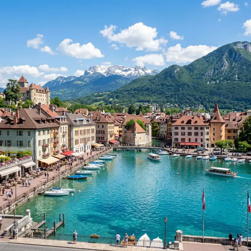
Bienvenue! Let us embark on an unforgettable #journey to the heart of #France. Annecy (US: AN-ə-SEE, ahn-SEE; French: [an(ə)si] ) is the prefecture and largest city of the Haute-Savoie department in the Auvergne-Rhône-Alpes region of Southeastern #France. It lies on the northern tip of Lake Annecy, 35 kilometres (22 mi) south of Geneva, Switzerland. Nicknamed the "Pearl of the French Alps" in Raoul Blanchard's monograph describing its location between lake and mountains, the town controls the northern entrance to the lake gorge. Due to a lack of available building land between the lake and the protected Semnoz mountain, its population has remained stable, around 50,000 inhabitants, since 1950. However, the 2017 merger with several ex-communes extended the population of the city to 128,199 inhabitants and that of the urban area to 177,622, placing Annecy seventh in the Auvergne-Rhône-Alpes region. Switching from the counts of Geneva's dwelling in the 13th century, to the counts of Savoy's in the 14th century, the city became Savoy's capital in 1434 during the Genevois-Nemours prerogative until 1659. Its role increased in 1536, during the Calvinist Reformation in Geneva, while the bishop took refuge in Annecy. Saint Francis de Sales gave Annecy its advanced Catholic citadel role known as Counter-Reformation. The annexation of Savoy merged the city to France in 1860. Sometimes called "Venice of the Alps", this idyllic and touristic representation comes from the three canals and the Thiou river, which passes through the old city. The city experienced an industrial development in the 19th century with silk manufacturing. Some of its industrial legacy remains today with the headquarters of NTN-SNR bearings, Salomon and Dassault Aviation. From the end of the 20th century, Annecy developed tourism around its lake summer facilities, winter resorts proximity and cultural attraction with its castle renovation and fine art museum opening in 1956 and the Animated Film Festival since 1963, hosted in Bonlieu's cultural centre. The municipal environmental policy managed to keep 40.3% of green spaces, and the city was awarded the "Golden Flower" in 2015, given to the nine most-flowered French cities. #history Early history Le vieil Annecy ("Old Annecy"; not to be confused with Annecy-le-Vieux, formerly a neighboring town but now merged into Annecy), was a settlement from the time of the Romans. Annecy was the court of the counts of Geneva or Genevois from the 10th century. It passed to the counts of Savoy in 1401. In 1444, it became the regional capital of the provinces of Genevois, Faucigny and Beaufortain. Counter-Reformation With the advance of Calvinism, Annecy became a centre for the Counter-Reformation, the old Bishopric of Geneva being transferred to it in 1535. Francis of Sales was born in Sales, France in 1567 and served as bishop of Annecy from 1602 to 1622; his relics are preserved in the #cathedral. During the French Revolution, the Savoy region was conquered by France. Annecy became attached to the department of Mont Blanc, whose capital was Chambéry. The Catholic diocese was suppressed in 1801. 1815–present After the Bourbon Restoration in 1815, Annecy was returned to the King of Sardinia and the Catholic diocese restored in 1822. The Hôtel de Ville (city hall) was completed in 1851. When Savoy was annexed to France in 1860 with the Treaty of Turin, it became the capital of the new department of Haute-Savoie. Annecy was the site of the second round of General Agreement on Tariffs and Trade (GATT) talks in 1949. In 2012, a multiple murder occurred in the Annecy area. A new municipality was established on 1 January 2017 with the merger of the former communes of Annecy-le-Vieux, Cran-Gevrier, Meythet, Pringy and Seynod. Administration Annecy is part of four cantons (Annecy-1, Annecy-2, Annecy-3 and Annecy-4); it is the prefecture of Haute-Savoie. Since 2017, Annecy has consisted of six delegate cities: Annecy; Annecy-le-Vieux; Cran-Gevrier; Meythet; Pringy; and Seynod. Local government consists of a city council with 202 members. The number of members in each commune delegate depends upon its population. The Mayor is François Astorg (LE) since 2020. The intercommunality of Annecy, Communauté d'agglomération du Grand Annecy, includes 34 municipalities. Geography The Fier forms part of the commune's northwestern border. The surrounding mountains are Mont Veyrier, Mont Semnoz, La Tournette and Parmelan. Climate Annecy has an oceanic climate (Köppen: Cfb) despite its relatively far inland position. Influenced by its elevation, summers are rather moderate on average, although they can be highly variable with extreme heat spikes. Winters see occasional freezing temperatures, but temperatures most often stay in the single-digits centigrade during the daytime with frequent cold rain. Air frosts are normal during the night and snowfall is not uncommon. #culture Annecy has hosted the Annecy International Animated Film Festival since 1960 and the Rencontres Internationales d'Annecy Cinéma & #architecture since 1999 and it was one of the oldest festivals in France. Sport On 23 July 2009, Annecy played host to Stage 18 of the Tour de France, as the start/finish point for an individual time trial around Lake Annecy. It was also the start town for stage 10 of the 2018 Tour de France on 17 July 2018. Annecy launched a bid to host the 2018 Winter Olympics but lost to Pyeongchang. If they had been chosen, Annecy would have been the fourth French city to host the Winter Olympic Games, after Chamonix (1924), Grenoble (1968), and Albertville (1992). Ligue 1 former team Évian Thonon Gaillard F.C. played their home matches in Annecy. The club was founded in 2007, they grew up to reach Ligue 1, and stayed for four years in the division, thanks to their emblematic manager Pascal Dupraz. The Annecy basin is one of the world's leading locations for the sport of paragliding, an activity of some economic importance to the region. The area regularly hosts major competitions, most recently a leg of the Paragliding World Cup in 2012. Due to its proximity with the lake and the mountains, Annecy is also popular for watersports (sailing, rowing, wakeboarding, water skiing) and wintersports (alpine skiing, snowboarding, Nordic skiing). Le Semnoz, a relatively small ski resort, is 35 minutes away from Annecy. Other bigger ski resorts, La Clusaz and Le Grand Bornand, are only 40 minutes away. Annecy is also very popular among trail runners and many races are organized year round, such as the World Trail Running Championships in 2015. Main sights The Palais de l'Isle is a 12th-century castle on an island in the river Thiou in Annecy's administrative headquarters. It mostly served as a prison and courthouse until the French Revolution. It again was a prison during World War II. The Palais de l'Isle was classified as a Historical Monument in 1900, and today houses a local history museum. The Château d'Annecy (Annecy Castle) was the home of the Counts of Geneva and the Dukes of Genevois-Nemours, an offshoot The 15th century Église Saint-Maurice Education Université Savoie Mont Blanc Polytech'Savoie Population Research organisations LAPP Laboratoire d'Annecy-le-Vieux de Physique des Particules specialized in Physics LISTIC The Computer Science, Systems, Information and Knowledge Processing Laboratory Mecatronics department of CETIM Different R&D activities in the Université de Savoie and its École Polytechnique d'Ingénieurs: Polytech'Savoie. Economy In the 19th century, the primary manufactures were linen and cotton goods, glass, cutlery, earthenware, and leather. The area also carried on linen bleaching and iron mining. By the First World War, it was connected by rail to Aix-les-Bains and there were factories for linen and cotton goods, felt hats, and paper, as well as a "celebrated" bell foundry at Annecy-le-Vieux. Companies located in and around Annecy include: Salomon Group adixen Vacuum Products Sopra Group Ubisoft Annecy Transport The Gare d'Annecy railway station offers connections with Lyon, Geneva, #Paris, Grenoble and several regional destinations. Annecy – Haute-Savoie – Mont Blanc Airport currently used for private air transport only. The nearest passenger airports to Annecy are Chambéry Airport which is 35 km away, Geneva Airport is 45 km away and Lyon Airport which is also 125 km away from Annecy. Twin towns – sister cities Annecy is twinned with: Bayreuth, Germany Cheltenham, England, United Kingdom Liptovský Mikuláš, Slovakia Sainte-Thérèse, Canada Vicenza, Italy Associations Together with other Alpine towns Annecy engages in the Alpine Town of the Year Association for the implementation of the Alpine Convention to achieve sustainable development in the Alpine Arc. Annecy was also Alpine Town of the Year 2012. Notable people Bernard Accoyer (born 1945), politician, President of the National Assembly 2007 to 2012 and Mayor of Annecy-le-Vieux. Bernard Bosson (1948–2017), politician, Govt. minister & Mayor of Annecy Jules Bouyer (born 2002), diver Eustace Chapuys (c. 1490–1556), Imperial ambassador to the English Court of Henry VIII Francis de Sales (1567–1622), bishop of Geneva / Annecy and Catholic Saint. André Dussollier (born 1946), actor Emmanuel Leducq-Barôme (born 1971), conductor, works in Russia Jacques Leveugle (born 1946), retired teacher charged with 89 cases of pedophilia and 2 murders Bernard Miège (born 1941), a media theorist and academic administrator. Guillaume Perret (born 1980), jazz musician and composer Emmanuel Tarpin (born 1992), contemporary jewelry designer Cécile Vogt-Mugnier (1875–1962), brain researcher Sport Louis Lachenal (1921–1955), alpinist, one of the first two mountaineers to climb a summit of more than 8,000 meters. Bernard Collomb (1930–2011), racing driver Vincent Vittoz (born 1975), cross-country skier Johan Clarey (born 1981), alpine skier, silver medallist at the 2022 Winter Olympics Thomas Fanara (born 1981), alpine skier, competed in three Winter Olympics Bernard Grosfilley (1949–2020), alpine skier, competed at the Alpine Ski World Cup David Poisson (born 1982), alpine skier, competed in two Winter Olympics Steve Missillier (born 1984), alpine skier, silver medallist at the 2014 Winter Olympics Jonathan Midol (born 1988), freestyle skier, bronze medallist at the 2014 Winter Olympics Christophe Lemaitre (born 1990), sprinter, bronze medallist at the 2016 Summer Olympics Côme Ledogar (born 1991), racing driver Axelle Mollaret (born 1992), physiotherapist, skyrunner and ski mountaineer Hugo Lapalus (born 1998), cross-country skier, team bronze medallist at the 2022 Winter Olympics Sacha Fenestraz (born 1999), French-Argentine racing driver Loana Lecomte (born 1999), cross-country mountain bike cyclist Sébastien Baud (born 2000), racing driver Associated with the city Jane Frances de Chantal (1572–1641), Holy of the Catholic Church, founded in Annecy the Order of Salesian Sisters Jean Coppier, of the Coppier family, notary in Annecy in 1396. Claude Favre de Vaugelas (1585–1650), man of letters, philologist and grammarian. Jean-Jacques Rousseau (1712–1778), writer and philosopher, spent some time in Annecy. Claude Louis Berthollet (1748–1822), physician and chemist, began medical studies locally in 1760. Eugène Sue (1804–1857), writer, spent his last years in exile in Annecy and died there. References Baynes, T. S., ed. (1878), "Annecy" , Encyclopædia Britannica, vol. 2 (9th ed.), New York: Charles Scribner's Sons, p. 64 Coolidge, William Augustus Brevoort (1911), "Annecy" , in Chisholm, Hugh (ed.), Encyclopædia Britannica, vol. 2 (11th ed.), Cambridge University Press, p. 72 Cultural Impact and Heritage (Part 2) Annecy (US: AN-ə-SEE, ahn-SEE; French: [an(ə)si] ) is the prefecture and largest city of the Haute-Savoie department in the Auvergne-Rhône-Alpes region of Southeastern France. It lies on the northern tip of Lake Annecy, 35 kilometres (22 mi) south of Geneva, Switzerland. Nicknamed the "Pearl of the French Alps" in Raoul Blanchard's monograph describing its location between lake and mountains, the town controls the northern entrance to the lake gorge. Due to a lack of available building land between the lake and the protected Semnoz mountain, its population has remained stable, around 50,000 inhabitants, since 1950. However, the 2017 merger with several ex-communes extended the population of the city to 128,199 inhabitants and that of the urban area to 177,622, placing Annecy seventh in the Auvergne-Rhône-Alpes region. Switching from the counts of Geneva's dwelling in the 13th century, to the counts of Savoy's in the 14th century, the city became Savoy's capital in 1434 during the Genevois-Nemours prerogative until 1659. Its role increased in 1536, during the Calvinist Reformation in Geneva, while the bishop took refuge in Annecy. Saint Francis de Sales gave Annecy its advanced Catholic citadel role known as Counter-Reformation. The annexation of Savoy merged the city to France in 1860. Sometimes called "Venice of the Alps", this idyllic and touristic representation comes from the three canals and the Thiou river, which passes through the old city. The city experienced an industrial development in the 19th century with silk manufacturing. Some of its industrial legacy remains today with the headquarters of NTN-SNR bearings, Salomon and Dassault Aviation. From the end of the 20th century, Annecy developed tourism around its lake summer facilities, winter resorts proximity and cultural attraction with its castle renovation and fine art museum opening in 1956 and the Animated Film Festival since 1963, hosted in Bonlieu's cultural centre. The municipal environmental policy managed to keep 40.3% of green spaces, and the city was awarded the "Golden Flower" in 2015, given to the nine most-flowered French cities. History Early history Le vieil Annecy ("Old Annecy"; not to be confused with Annecy-le-Vieux, formerly a neighboring town but now merged into Annecy), was a settlement from the time of the Romans. Annecy was the court of the counts of Geneva or Genevois from the 10th century. It passed to the counts of Savoy in 1401. In 1444, it became the regional capital of the provinces of Genevois, Faucigny and Beaufortain. Counter-Reformation With the advance of Calvinism, Annecy became a centre for the Counter-Reformation, the old Bishopric of Geneva being transferred to it in 1535. Francis of Sales was born in Sales, France in 1567 and served as bishop of Annecy from 1602 to 1622; his relics are preserved in the cathedral. During the French Revolution, the Savoy region was conquered by France. Annecy became attached to the department of Mont Blanc, whose capital was Chambéry. The Catholic diocese was suppressed in 1801. 1815–present After the Bourbon Restoration in 1815, Annecy was returned to the King of Sardinia and the Catholic diocese restored in 1822. The Hôtel de Ville (city hall) was completed in 1851. When Savoy was annexed to France in 1860 with the Treaty of Turin, it became the capital of the new department of Haute-Savoie. Annecy was the site of the second round of General Agreement on Tariffs and Trade (GATT) talks in 1949. In 2012, a multiple murder occurred in the Annecy area. A new municipality was established on 1 January 2017 with the merger of the former communes of Annecy-le-Vieux, Cran-Gevrier, Meythet, Pringy and Seynod. Administration Annecy is part of four cantons (Annecy-1, Annecy-2, Annecy-3 and Annecy-4); it is the prefecture of Haute-Savoie. Since 2017, Annecy has consisted of six delegate cities: Annecy; Annecy-le-Vieux; Cran-Gevrier; Meythet; Pringy; and Seynod. Local government consists of a city council with 202 members. The number of members in each commune delegate depends upon its population. The Mayor is François Astorg (LE) since 2020. The intercommunality of Annecy, Communauté d'agglomération du Grand Annecy, includes 34 municipalities. Geography The Fier forms part of the commune's northwestern border. The surrounding mountains are Mont Veyrier, Mont Semnoz, La Tournette and Parmelan. Climate Annecy has an oceanic climate (Köppen: Cfb) despite its relatively far inland position. Influenced by its elevation, summers are rather moderate on average, although they can be highly variable with extreme heat spikes. Winters see occasional freezing temperatures, but temperatures most often stay in the single-digits centigrade during the daytime with frequent cold rain. Air frosts are normal during the night and snowfall is not uncommon. Culture Annecy has hosted the Annecy International Animated Film Festival since 1960 and the Rencontres Internationales d'Annecy Cinéma & Architecture since 1999 and it was one of the oldest festivals in France. Sport On 23 July 2009, Annecy played host to Stage 18 of the Tour de France, as the start/finish point for an individual time trial around Lake Annecy. It was also the start town for stage 10 of the 2018 Tour de France on 17 July 2018. Annecy launched a bid to host the 2018 Winter Olympics but lost to Pyeongchang. If they had been chosen, Annecy would have been the fourth French city to host the Winter Olympic Games, after Chamonix (1924), Grenoble (1968), and Albertville (1992). Ligue 1 former team Évian Thonon Gaillard F.C. played their home matches in Annecy. The club was founded in 2007, they grew up to reach Ligue 1, and stayed for four years in the division, thanks to their emblematic manager Pascal Dupraz. The Annecy basin is one of the world's leading locations for the sport of paragliding, an activity of some economic importance to the region. The area regularly hosts major competitions, most recently a leg of the Paragliding World Cup in 2012. Due to its proximity with the lake and the mountains, Annecy is also popular for watersports (sailing, rowing, wakeboarding, water skiing) and wintersports (alpine skiing, snowboarding, Nordic skiing). Le Semnoz, a relatively small ski resort, is 35 minutes away from Annecy. Other bigger ski resorts, La Clusaz and Le Grand Bornand, are only 40 minutes away. Annecy is also very popular among trail runners and many races are organized year round, such as the World Trail Running Championships in 2015. Main sights The Palais de l'Isle is a 12th-century castle on an island in the river Thiou in Annecy's administrative headquarters. It mostly served as a prison and courthouse until the French Revolution. It again was a prison during World War II. The Palais de l'Isle was classified as a Historical Monument in 1900, and today houses a local history museum. The Château d'Annecy (Annecy Castle) was the home of the Counts of Geneva and the Dukes of Genevois-Nemours, an offshoot The 15th century Église Saint-Maurice Education Université Savoie Mont Blanc Polytech'Savoie Population Research organisations LAPP Laboratoire d'Annecy-le-Vieux de Physique des Particules specialized in Physics LISTIC The Computer Science, Systems, Information and Knowledge Processing Laboratory Mecatronics department of CETIM Different R&D activities in the Université de Savoie and its École Polytechnique d'Ingénieurs: Polytech'Savoie. Economy In the 19th century, the primary manufactures were linen and cotton goods, glass, cutlery, earthenware, and leather. The area also carried on linen bleaching and iron mining. By the First World War, it was connected by rail to Aix-les-Bains and there were factories for linen and cotton goods, felt hats, and paper, as well as a "celebrated" bell foundry at Annecy-le-Vieux. Companies located in and around Annecy include: Salomon Group adixen Vacuum Products Sopra Group Ubisoft Annecy Transport The Gare d'Annecy railway station offers connections with Lyon, Geneva, Paris, Grenoble and several regional destinations. Annecy – Haute-Savoie – Mont Blanc Airport currently used for private air transport only. The nearest passenger airports to Annecy are Chambéry Airport which is 35 km away, Geneva Airport is 45 km away and Lyon Airport which is also 125 km away from Annecy. Twin towns – sister cities Annecy is twinned with: Bayreuth, Germany Cheltenham, England, United Kingdom Liptovský Mikuláš, Slovakia Sainte-Thérèse, Canada Vicenza, Italy Associations Together with other Alpine towns Annecy engages in the Alpine Town of the Year Association for the implementation of the Alpine Convention to achieve sustainable development in the Alpine Arc. Annecy was also Alpine Town of the Year 2012. Notable people Bernard Accoyer (born 1945), politician, President of the National Assembly 2007 to 2012 and Mayor of Annecy-le-Vieux. Bernard Bosson (1948–2017), politician, Govt. minister & Mayor of Annecy Jules Bouyer (born 2002), diver Eustace Chapuys (c. 1490–1556), Imperial ambassador to the English Court of Henry VIII Francis de Sales (1567–1622), bishop of Geneva / Annecy and Catholic Saint. André Dussollier (born 1946), actor Emmanuel Leducq-Barôme (born 1971), conductor, works in Russia Jacques Leveugle (born 1946), retired teacher charged with 89 cases of pedophilia and 2 murders Bernard Miège (born 1941), a media theorist and academic administrator. Guillaume Perret (born 1980), jazz musician and composer Emmanuel Tarpin (born 1992), contemporary jewelry designer Cécile Vogt-Mugnier (1875–1962), brain researcher Sport Louis Lachenal (1921–1955), alpinist, one of the first two mountaineers to climb a summit of more than 8,000 meters. Bernard Collomb (1930–2011), racing driver Vincent Vittoz (born 1975), cross-country skier Johan Clarey (born 1981), alpine skier, silver medallist at the 2022 Winter Olympics Thomas Fanara (born 1981), alpine skier, competed in three Winter Olympics Bernard Grosfilley (1949–2020), alpine skier, competed at the Alpine Ski World Cup David Poisson (born 1982), alpine skier, competed in two Winter Olympics Steve Missillier (born 1984), alpine skier, silver medallist at the 2014 Winter Olympics Jonathan Midol (born 1988), freestyle skier, bronze medallist at the 2014 Winter Olympics Christophe Lemaitre (born 1990), sprinter, bronze medallist at the 2016 Summer Olympics Côme Ledogar (born 1991), racing driver Axelle Mollaret (born 1992), physiotherapist, skyrunner and ski mountaineer Hugo Lapalus (born 1998), cross-country skier, team bronze medallist at the 2022 Winter Olympics Sacha Fenestraz (born 1999), French-Argentine racing driver Loana Lecomte (born 1999), cross-country mountain bike cyclist Sébastien Baud (born 2000), racing driver Associated with the city Jane Frances de Chantal (1572–1641), Holy of the Catholic Church, founded in Annecy the Order of Salesian Sisters Jean Coppier, of the Coppier family, notary in Annecy in 1396. Claude Favre de Vaugelas (1585–1650), man of letters, philologist and grammarian. Jean-Jacques Rousseau (1712–1778), writer and philosopher, spent some time in Annecy. Claude Louis Berthollet (1748–1822), physician and chemist, began medical studies locally in 1760. Eugène Sue (1804–1857), writer, spent his last years in exile in Annecy and died there. References Baynes, T. S., ed. (1878), "Annecy" , Encyclopædia Britannica, vol. 2 (9th ed.), New York: Charles Scribner's Sons, p. 64 Coolidge, William Augustus Brevoort (1911), "Annecy" , in Chisholm, Hugh (ed.), Encyclopædia Britannica, vol. 2 (11th ed.), Cambridge University Press, p. 72 #france #travel #history #europe #culture Related InsightsBhutan: Unveiling the Hidden Gem of Gross National Happiness The Glamour and Secrets of the French Riviera The Silent Chronicles of the Steppe: Unearthing the Enigma of Mongolia's Deer Stone Sentinels at Uushgiin Ovor{ "@context": "https://schema.org", "@type": "FAQPage", "mainEntity": [ { "@type": "Question", "name": "What is the main focus of Annecy: The Venice of the Alps?", "acceptedAnswer": { "@type": "Answer", "text": "Join Camille Dubois on a journey exploring Annecy and its incredible history." } }, { "@type": "Question", "name": "Who authored the comprehensive guide on Annecy: The Venice of the Alps?", "acceptedAnswer": { "@type": "Answer", "text": "This detailed article and its insights were carefully researched and authored by Camille Dubois." } }, { "@type": "Question", "name": "Where can I find more related content about Travel?", "acceptedAnswer": { "@type": "Answer", "text": "You can explore more articles, detailed reviews, and similar insights by browsing the Related Insights section at the bottom of this article or visiting our dedicated Travel category page." } } ] }
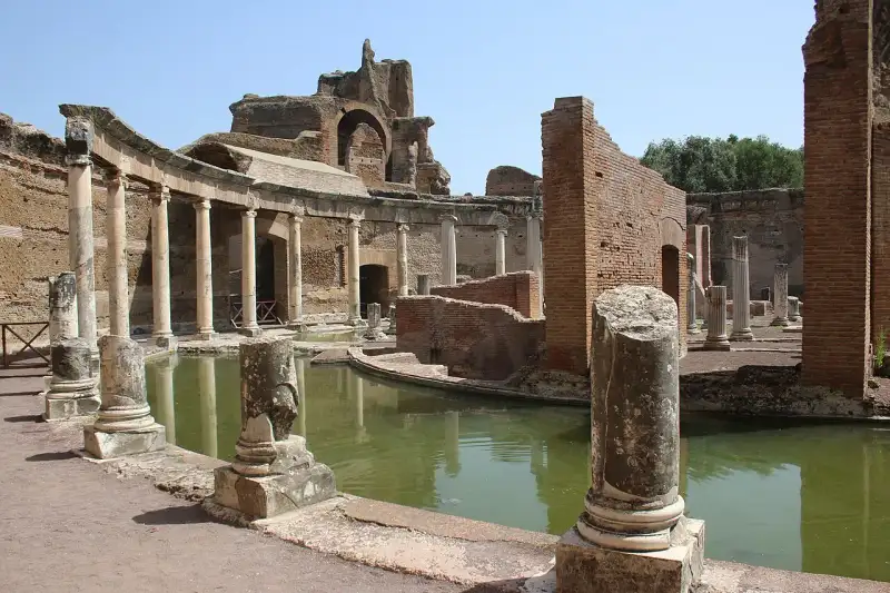
A pochi chilometri da Roma, ai piedi dei monti Tiburtini, sorge Villa Adriana, la più grande e lussuosa villa imperiale mai costruita. Voluta dall'imperatore Adriano tra il 118 e il 138 d.C., non era una semplice casa di campagna, ma una vera e propria città estesa su oltre 120 ettari. Un Mondo in Miniatura Adriano, grande viaggiatore e appassionato di architettura e cultura greca ed egizia, volle riprodurre nella sua villa i luoghi e i monumenti che più lo avevano colpito durante i suoi viaggi attraverso l'Impero. Il complesso è un susseguirsi straordinario di palazzi, terme, teatri, giardini, specchi d'acqua e ninfei, progettati con forme geometriche ardite e soluzioni architettoniche innovative. Il Pecile e il Canopo Tra le strutture più iconiche spicca il Pecile, un immenso portico colonnato che circonda un grande bacino rettangolare, ispirato all'agorà di Atene. Ancora più affascinante è il Canopo, un lungo canale d'acqua circondato da statue e sormontato da una scenografica esedra, che rievoca un antico braccio del fiume Nilo in Egitto. È qui che Adriano teneva lussuosi banchetti all'aperto durante le calde notti estive. Il Teatro Marittimo Un gioiello di rara bellezza è il cosiddetto Teatro Marittimo, un'isola circolare artificiale circondata da un canale e raggiungibile tramite ponti mobili. Si ritiene fosse il rifugio privato dell'imperatore, un luogo di meditazione e isolamento. Oggi, Patrimonio dell'Umanità #UNESCO, Villa Adriana rimane un capolavoro assoluto dell'arte romana, un sogno di marmo e acqua giunto fino a noi. #VillaAdriana #Tivoli #ImperatoreAdriano #PatrimonioUNESCO #italy #rome #history #ancient Related InsightsQuand l'Altruisme Devient Marchandise : Les Zones d'Ombre du Volontourisme Exploring Ani, City of 1001 Churches Scavi di Pompei: La Città Congelata nel Tempo{ "@context": "https://schema.org", "@type": "FAQPage", "mainEntity": [ { "@type": "Question", "name": "What is the main focus of Villa Adriana: Il Rifugio Imperiale a Tivoli?", "acceptedAnswer": { "@type": "Answer", "text": "Un viaggio nel ritiro esotico e sfarzoso dell'imperatore filosofo Adriano." } }, { "@type": "Question", "name": "Who authored the comprehensive guide on Villa Adriana: Il Rifugio Imperiale a Tivoli?", "acceptedAnswer": { "@type": "Answer", "text": "This detailed article and its insights were carefully researched and authored by Lorenzo Russo." } }, { "@type": "Question", "name": "Where can I find more related content about Travel?", "acceptedAnswer": { "@type": "Answer", "text": "You can explore more articles, detailed reviews, and similar insights by browsing the Related Insights section at the bottom of this article or visiting our dedicated Travel category page." } } ] }
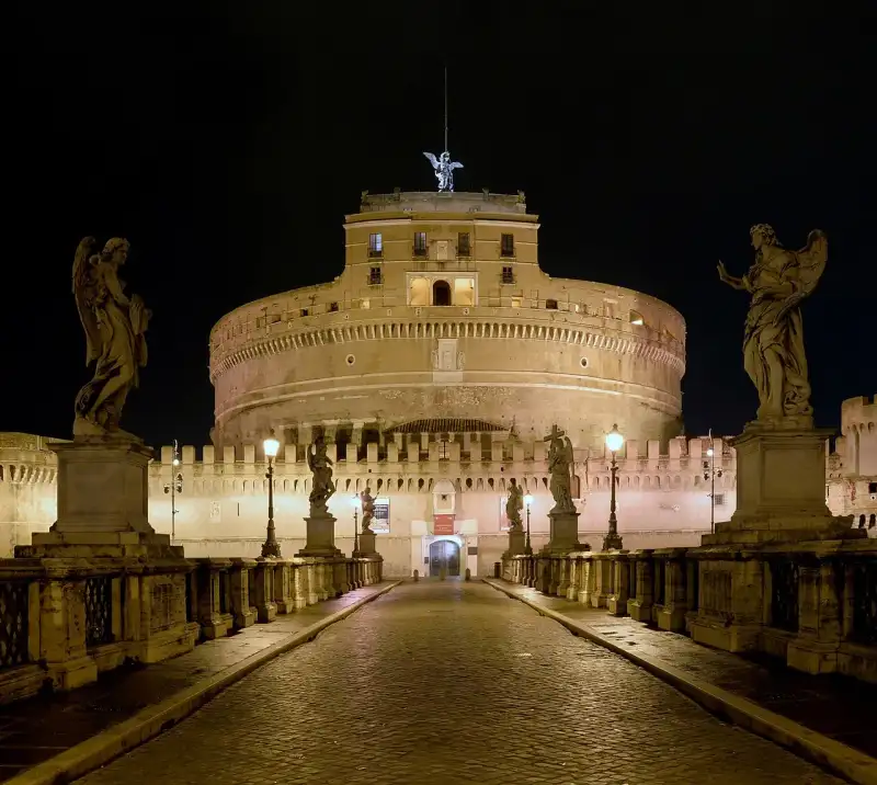
Sulle rive del Tevere, imponente e inconfondibile, sorge il Mausoleo di Adriano, oggi universalmente noto come Castel Sant'Angelo. La storia di questo monumento è unica: nessun altro edificio romano ha vissuto così tante trasformazioni e vite diverse, seguendo inesorabilmente le sorti della città di Roma. Il Sepolcro di Adriano Eretto originariamente intorno al 135 d.C. dall'imperatore Adriano come tomba monumentale per sé e per i suoi successori, il mausoleo era un gigantesco cilindro rivestito di marmo bianco, sormontato da un boschetto di cipressi e coronato da una statua di Adriano alla guida di una quadriga di bronzo. Un'opera concepita per sfidare l'eternità. La Metamorfosi in Fortezza Con le invasioni barbariche, il mausoleo cambiò destino. Data la sua posizione strategica vicino al Vaticano, fu incorporato nelle Mura Aureliane e trasformato in un baluardo militare inespugnabile. Il nome 'Castel Sant'Angelo' deriva da una leggenda del 590 d.C., quando Papa Gregorio Magno, durante una terribile epidemia di peste, ebbe la visione dell'Arcangelo Michele che rinfoderava la spada sulla cima della mole, segnando la fine della pestilenza. Prigione e Rifugio Papale Nel Rinascimento, il castello divenne la roccaforte dei Papi, collegato direttamente al Vaticano dal celebre Passetto di Borgo. Mentre i piani superiori venivano abbelliti con sfarzosi appartamenti affrescati da artisti come Perin del Vaga, i cupi sotterranei fungevano da terribili prigioni (dove furono rinchiusi personaggi come Benvenuto Cellini e Giordano Bruno). Oggi, Castel Sant'Angelo è un museo straordinario che offre, dalle sue terrazze, una delle viste più spettacolari su Roma, testimone silenzioso di quasi duemila anni di storia ininterrotta. #CastelSantAngelo #MausoleoDiAdriano #StoriaDiRoma #Vaticano #italy #rome #history #ancient Related InsightsFrom Cliffside Villages to Fjord Horizons: Europe’s Most Breathtaking Coastal Drives Mount Ararat Mysteries Chloe Tremblay’s Epic 10-Day Iceland Ring Road Adventure: A Budgeter’s Paradise and Luxury Dream{ "@context": "https://schema.org", "@type": "FAQPage", "mainEntity": [ { "@type": "Question", "name": "What is the main focus of Castel Sant'Angelo: Dal Mausoleo Imperiale alla Fortezza Papale?", "acceptedAnswer": { "@type": "Answer", "text": "La trasformazione millenaria del maestoso sepolcro dell'imperatore Adriano." } }, { "@type": "Question", "name": "Who authored the comprehensive guide on Castel Sant'Angelo: Dal Mausoleo Imperiale alla Fortezza Papale?", "acceptedAnswer": { "@type": "Answer", "text": "This detailed article and its insights were carefully researched and authored by Lorenzo Russo." } }, { "@type": "Question", "name": "Where can I find more related content about Travel?", "acceptedAnswer": { "@type": "Answer", "text": "You can explore more articles, detailed reviews, and similar insights by browsing the Related Insights section at the bottom of this article or visiting our dedicated Travel category page." } } ] }
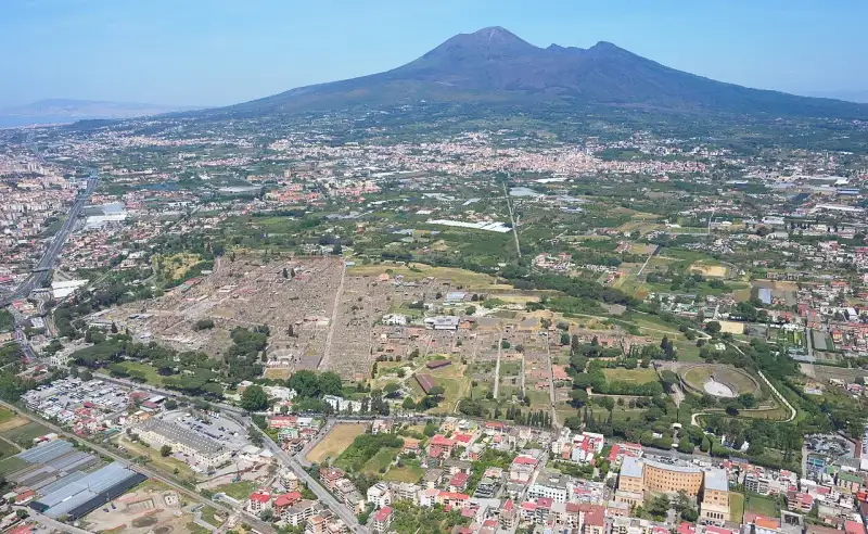
Pochissimi luoghi al mondo possono offrire una finestra così nitida sul passato come Pompei. L'eruzione del Vesuvio nel 79 d.C. distrusse la città, ma la seppellì sotto uno spesso strato di cenere e pomice, preservandola intatta per quasi duemila anni. Oggi, Pompei è uno dei siti archeologici più importanti e visitati al mondo. Vita Quotidiana Interrotta Camminando lungo le strade lastricate di Pompei, si può osservare la vita quotidiana dei romani esattamente come si svolgeva nel I secolo d.C. Dalle lussuose ville affrescate (come la Villa dei Misteri) ai termopoli (i 'fast food' dell'antichità), dai teatri ai postriboli, ogni dettaglio racconta una storia. Gli affreschi, i mosaici e persino i graffiti sui muri ci offrono una narrazione vivida e autentica di una società complessa e vivace. I Calchi: Testimoni della Tragedia Forse l'aspetto più toccante di Pompei sono i calchi in gesso delle vittime. Versando gesso liquido nei vuoti lasciati dai corpi decomposti sotto la cenere, l'archeologo Giuseppe Fiorelli nell'Ottocento riuscì a immortalare gli ultimi istanti di agonia degli abitanti. Queste figure umane, rannicchiate o colte in un disperato tentativo di fuga, sono un monito potente della forza distruttiva della natura. L'Importanza della Conservazione Oggi, la sfida principale per Pompei è la conservazione. Il Grande Progetto Pompei ha fatto passi da gigante nel restauro e nella messa in sicurezza del sito, portando alla luce nuove domus e affreschi mozzafiato. Visitare Pompei non è solo un tour turistico, è un pellegrinaggio nella fragilità dell'esistenza umana. #Pompei #Vesuvio #Archeologia #Campania #StoriaAntica #italy #rome #history #ancient Related InsightsEthiopia’s Danakil Depression: A Journey to Earth’s Hottest and Most Alien Landscape La Alhambra: El Sueño Nazarí de Granada L'Odyssée Australienne : Entre Terre Rouge et Récifs d'Azur{ "@context": "https://schema.org", "@type": "FAQPage", "mainEntity": [ { "@type": "Question", "name": "What is the main focus of Scavi di Pompei: La Città Congelata nel Tempo?", "acceptedAnswer": { "@type": "Answer", "text": "Un viaggio tra le rovine intatte della città distrutta dall'eruzione del Vesuvio nel 79 d.C." } }, { "@type": "Question", "name": "Who authored the comprehensive guide on Scavi di Pompei: La Città Congelata nel Tempo?", "acceptedAnswer": { "@type": "Answer", "text": "This detailed article and its insights were carefully researched and authored by Lorenzo Russo." } }, { "@type": "Question", "name": "Where can I find more related content about Travel?", "acceptedAnswer": { "@type": "Answer", "text": "You can explore more articles, detailed reviews, and similar insights by browsing the Related Insights section at the bottom of this article or visiting our dedicated Travel category page." } } ] }
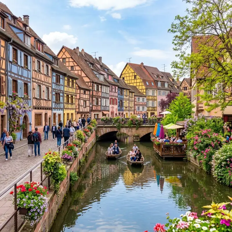
Bienvenue! Let us embark on an unforgettable #journey to the heart of #France. Colmar (French pronunciation: [kɔlmaʁ]; Alsatian: Colmer [ˈkolməʁ]; German: Colmar or Kolmar) is a city and commune in the Haut-Rhin department and Alsace region of north-eastern #France. The third-largest commune in Alsace (after Strasbourg and Mulhouse), it is the seat of the prefecture of the Haut-Rhin department and of the subprefecture of the Colmar-Ribeauvillé arrondissement. Colmar was first mentioned in the 9th century and grew into an important medieval trading town within the Holy Roman #empire. In the 17th century it was annexed by France under Louis XIV, though it retained a distinct German character due to its location, predominant language, and #culture. The city shifted between French and German control multiple times, before being permanently restored to France in 1945. The city is known for its well-preserved old town, numerous architectural landmarks, its blend of French and German heritage and its museums, among which is the Unterlinden Museum, which houses the Isenheim Altarpiece. Colmar is located on the Alsatian Wine Route and considers itself to be the capital of Alsatian wine (capitale des vins d'Alsace). #history Colmar was first mentioned by Charlemagne in his chronicle about Saxon wars. This was the location where the Carolingian Emperor Charles the Fat held a diet in 884. Colmar was granted the status of a free imperial city by Emperor Frederick II in 1226. In 1354 it joined the Décapole city league. The city adopted the Protestant Reformation in 1575, long after the northern neighbours of Strasbourg and Sélestat. During the Thirty Years' War, it was taken by the Swedish army in 1632, which held it for two years. In 1634, the Schoeman family arrived and started the first town library. In 1635, the city's harvest was spoiled by Imperialist forces while the residents shot at them from the walls. The city was conquered by France under King Louis XIV in 1673 and officially ceded by the 1679 Treaties of Nijmegen. In 1854 a cholera epidemic killed many in the city. With the rest of Alsace, Colmar was ceded to the newly formed German Empire in 1871 as a result of the Franco-Prussian War and incorporated into the Alsace–Lorraine province. It returned to France after World War I according to the 1919 Treaty of Versailles, was annexed by Nazi Germany in 1940, and then reverted to French control after the battle of the "Colmar Pocket" in 1945. Colmar has been continuously governed by conservative parties since 1947, the Popular Republican Movement (1947–1977), the Union for French Democracy (1977–1995) and the Union for a Popular Movement (since 1995), and has had only three mayors during that time. The Colmar Treasure, a hoard of precious objects hidden by Jews during the Black Death, was discovered here in 1863. Geography Colmar is 64 kilometres (40 mi) south-southwest of Strasbourg, at 48.08°N, 7.36°E, on the River Lauch, a tributary of the Ill. It is located immediately to the east of the Vosges and connected to the Rhine in the east by a canal. In 2022 the commune of Colmar had a population of 67,360, and the metropolitan area of Colmar had a population of 199,627. Colmar is the centre of the arrondissement of Colmar-Ribeauvillé. Climate Colmar has an oceanic climate (Köppen: Cfb) but it is significantly modified by the city's location far inland, with cold, dry winters and warm to hot, wetter summers. The city has a sunny microclimate and is one of the driest cities in France, with an annual precipitation of just 595 mm (23.4 in), making it ideal for Alsace wine. It is considered the capital of the Alsatian wine region. The town's dryness is due to its location near the mountains, which force clouds arriving from the west to rise. Most of their moisture condenses and falls over the higher ground, leaving the air warm and dry by the time it reaches Colmar. The city therefore has more of a continental climate and winter and summer temperatures can sometimes be the lowest or highest in France. Population Main sights Mostly spared from the destructions of the French Revolution and the wars of 1870–1871, 1914–1918 and 1939–1945, the cityscape of old-town Colmar is homogeneous and renowned among tourists. An area that is crossed by canals of the river Lauch (which formerly served as the butcher's, tanner's and fishmonger's quarter) is now called "little Venice" (la Petite Venise). Architectural landmarks Colmar's secular and religious architectural landmarks reflect eight centuries of Germanic and French #architecture and the adaptation of their respective stylistic language to the local customs and building materials (pink and yellow Vosges sandstone, timber framing). =### Secular buildings= Maison Adolph – 14th century (German #gothic) Koïfhus, also known as Ancienne Douane – 1480 (German Gothic) Maison Pfister – 1537 (German Renaissance). Ancien Corps de garde – 1575 (German Renaissance) Maison des Chevaliers de Saint-Jean – 1608 (German Renaissance) Maison des Têtes – 1609 (German Renaissance) Poêle des laboureurs – 1626 (German Baroque) Ancien Hôpital – 1736–1744 (French Classicism) Tribunal de grande instance – 1771 (French Classicism) Hôtel de Ville – 1790 (French Classicism) Colmar prison – 1791, formerly a convent built in 1316. Cour d'Assises – 1840 (French Neoclassicism) Théâtre municipal – 1849 (French Neoclassicism) Marché couvert – 1865 (French Neo-Baroque). The city's covered market, built in stone, bricks and cast iron, still serves today. Préfecture – 1866 (French Neo-Baroque) Water tower – 1886. Oldest still preserved water tower in Alsace. Out of use since 1984. Gare SNCF – 1905 (German Neo-Baroque) Cour d'appel – 1906 (German Neo-Baroque) =### Religious buildings= Église Saint-Martin – 1234–1365. The largest church of Colmar and one of the largest in Haut-Rhin. Displays some early stained glass windows, several Gothic and Renaissance sculptures and altars, a grand Baroque organ case. The choir is surrounded by an ambulatory opening on a series of Gothic chapels, a unique feature in Alsatian churches. Église des Dominicains – 1289–1364. Now deconsecrated as a church, displays Martin Schongauer's masterwork Madonna of the Rose Bower as well as 14th century stained glass windows and baroque choir stalls. The adjacent convent buildings house a section of the municipal library. Église Saint-Matthieu – 13th century. Gothic and Renaissance stained glass windows and mural paintings, as well as a wooden and painted ceiling. Couvent des Antonins – 13th century. Deconsecrated church and convent buildings notable for a richly ornate cloister. Now housing the Unterlinden Museum (see below). Église Sainte-Catherine – 1371. Deconsecrated church and convent buildings now used as an assembly hall and festival venue (Salle des Catherinettes). Chapelle Saint-Pierre – 1742–1750. Classicist chapel of a former Jesuit college. Synagogue – 1843 (Neoclassicism) =### Fountains= Fontaine de l'Amiral Bruat – 1864 (Statue by Bartholdi) Fontaine Roeselmann – 1888 (Statue by Bartholdi) Fontaine Schwendi – 1898 (Statue by Bartholdi) =### Monuments= Monument du Général Rapp – 1856 (first shown 1855 in #Paris. Statue by Bartholdi, his earliest major work) Monument Hirn – 1894 (Statue by Bartholdi) Statue Les grands soutiens du monde − 1902 (in the courtyard of the Bartholdi Museum) Statue of Liberty (Liberty Enlightening the World) replica Museums Unterlinden Museum – one of the main museums in Alsace. Displays the Isenheim Altarpiece, a large collection of medieval, Renaissance and baroque Upper-Rhenish paintings and sculptures, archaeological artefacts, design and international modern art. Musée Bartholdi – the birthplace of Frédéric Auguste Bartholdi shows his life and work through paintings, drawings, family objects and furniture as well as numerous plaster, metal and stone sculptures. A section of the museum is further dedicated to the local Jewish community's heritage. Musée d'histoire naturelle et d'ethnographie – the zoological and ethnographic museum of Colmar was founded in 1859. Besides a large collection of taxidermied animals, and artefacts from former French and German colonies in Africa and Polynesia, it also houses a collection of #ancient Egyptian items. Musée du jouet – the town's toy museum, founded 1993. Musée des usines municipales – industrial and technological museum in a former factory, dedicated to the history of everyday technology. Choco-Story Colmar - museum presenting the history of chocolate, with regional history displays, the ability to taste different chocolates and artworks made of chocolate Library The Municipal Library of Colmar (Bibliothèque municipale de Colmar) owns one of the richest collections of incunabula in France, with more than 2,300 volumes. This is quite an exceptional number for a city that is neither the main seat of a university, nor of a college, and has its explanation in the dissolution of local monasteries, abbeys and convents during the French Revolution and the subsequent gift of their collections to the town. Transport The small regional Colmar Airport serves Colmar. The nearest international airports are EuroAirport Basel Mulhouse Freiburg which is located 52 km away and Strasbourg Airport located 68 km away from Colmar. The railway station Gare de Colmar offers connections to Strasbourg, Mulhouse, Besançon, Zürich and several regional destinations. Colmar was also once linked to Freiburg im Breisgau, in Germany and on the other side of the Rhine, by the Freiburg–Colmar international railway. However the railway bridge over the Rhine between Breisach and Neuf-Brisach was destroyed in 1945 and never replaced. Education Senior high schools in Colmar include: Lycée Bartholdi Lycée Camille Sée Lycée polyvalent Blaise Pascal Lycée polyvalent Martin Schongauer Lycée privé Saint-André Lycée professionnel privé Saint-Jean École privée Mathias Grunewald Colmar shares the Université de Haute-Alsace (Upper Alsace University) with the neighbouring, larger city of Mulhouse. Of the approximately 8,000 students of the UHA, around 1,500 study at the Institut universitaire de technologie (IUT) Colmar, at the Colmar branch of the Faculté des Sciences et Techniques and at the Unité de Formation et de Recherche Pluridisciplinaire d'Enseignement Professionalisé Supérieur (UFR PEPS). The École Compleméntaire Pour L'Enseignement Japonaise à Colmar (コルマール補習授業校 Korumāru Hoshū Jugyō Kō), a part-time supplementary Japanese school, is held in Colmar. At one time classes were held at the Centre Cultural de Seijo. Music Since 1980, Colmar is home to an international summer festival of classical music Festival de Colmar (also known as Festival international de musique classique de Colmar). In its first version (1980 to 1989), it was placed under the artistic direction of the German conductor Karl Münchinger. Since 1989, it is helmed by the Russian violinist and conductor Vladimir Spivakov. Economy Colmar is an affluent city whose primary economic strength lies in the flourishing tourist industry. But it is also the seat of several large companies: Timken (European seat), Liebherr (French seat), Leitz (French seat), Capsugel France (A division of Pfizer). Every year since 1947, Colmar is host to what is now considered as the biggest annual commercial event as well as the largest festival in Alsace, the Foire aux vins d'Alsace (Alsacian wine fair). When Air Alsace existed, its head office was on the grounds of Colmar Airport. Parks and recreation By 1991 Lycée Seijo, a Japanese boarding high school in Kientzheim, had established a Japanese cultural center. It housed books and printed materials in Japan and hosted lectures and film screenings. Sports Colmar has the following notable sports organizations, accommodations and events. SR Colmar, a football club Ladhof Stadium, a football field Paris-Colmar, a racewalking competition Notable people Caspar Isenmann (1410? – 1484?), painter Martin Schongauer (1450–1491), painter and engraver Georg Wickram (1502–1562), poet and novelist Jean-François Rewbell (1747–1807), diplomat and revolutionist Jean Rapp (1771–1821), lieutenant general Conrad Berg (1785–1852), composer Charles Xavier Thomas (1785–1870), inventor Marie Bigot (1786–1820), musician, pianist and composer, friend of Haydn and Beethoven Armand Joseph Bruat (1796–1855), admiral Georges-Charles de Heeckeren d'Anthès (1812–1895), politician, killer of Alexander Pushkin in a duel Auguste Nefftzer (1820–1876), journalist Frédéric Auguste Bartholdi (1834–1904), sculptor. He created Liberty Enlightening the World (the Statue of Liberty). Camille Sée (1847–1919), politician Jean-Baptiste Lemire (1867–1945), composer Jean-Jacques Waltz (1873–1951), drawer and caricaturist Ernst Stadler (1883–1914), Alsatian poet Paul Wormser (1905–1944), Olympic épée fencer Hans Loewald (1906–1993), psychoanalyst and theorist Jean-Pierre Muller (1924–2008), Olympic epee fencer Bernard Schmitt (1929–2014), economist and founder of the "Quantum Economics" Christian de Chergé (1937-1996), Trappist monk and one of the Tibhirine monks Guy Roux (born 1938), football coach Pierre Moerlen (1952–2005), musician, drummer and composer Pierre Hermé (born 1961), confectioner, entrepreneur and pastry chef Thomas Bloch (born 1962), musician Éric Straumann (born 1964), politician Pascal Elbé (born 1967), actor, director and screenwriter Marc Keller (born 1968), football player Cendrine Wolf (born 1969), children's author Pascal Johansen (born 1979), football player Nicolas Armindo (born 1982), racing driver Amaury Bischoff (born 1987), football player Fabien Schmidt (born 1989), professional cyclist Ryad Boudebouz (born 1990), Algerian-French footballer International relations Twin towns – sister cities Colmar is twinned with: Replicas of historical buildings in Malaysia Bukit Tinggi Resort Colmar Tropicale which is situated in Bentong district, State of Pahang, Malaysia is a resort-theme historical village inspires from the original Colmar commune in France. Colmar Tropicale located 60 km north-east of Kuala Lumpur. North of it, a rebuild of Château du Haut-Kœnigsbourg is in the Berjaya Hills, hosting an organic resort hotel. In popular culture Colmar's cityscape (and that of neighbouring Riquewihr) served as inspiration for the design of the Japanese animated film Howl's Moving Castle. Scenes in the anime Is the Order a Rabbit? are also based on this location. Colmar appears as a map in Day of Defeat: Source set in 1944. Germans and American soldiers try to blow up each other's objectives. #france #travel #history #europe #culture Related InsightsMount Ararat Mysteries Mahoma: El Profeta del Islam Beyond Merv's Veil: Unearthing Turkmenistan's Ghost Oases of the Silk Road{ "@context": "https://schema.org", "@type": "FAQPage", "mainEntity": [ { "@type": "Question", "name": "What is the main focus of Colmar and the Alsace Wine Route: A Colorful Escape?", "acceptedAnswer": { "@type": "Answer", "text": "Join Camille Dubois on a journey exploring Colmar and the Alsace Wine Route and its incredible history." } }, { "@type": "Question", "name": "Who authored the comprehensive guide on Colmar and the Alsace Wine Route: A Colorful Escape?", "acceptedAnswer": { "@type": "Answer", "text": "This detailed article and its insights were carefully researched and authored by Camille Dubois." } }, { "@type": "Question", "name": "Where can I find more related content about Travel?", "acceptedAnswer": { "@type": "Answer", "text": "You can explore more articles, detailed reviews, and similar insights by browsing the Related Insights section at the bottom of this article or visiting our dedicated Travel category page." } } ] }
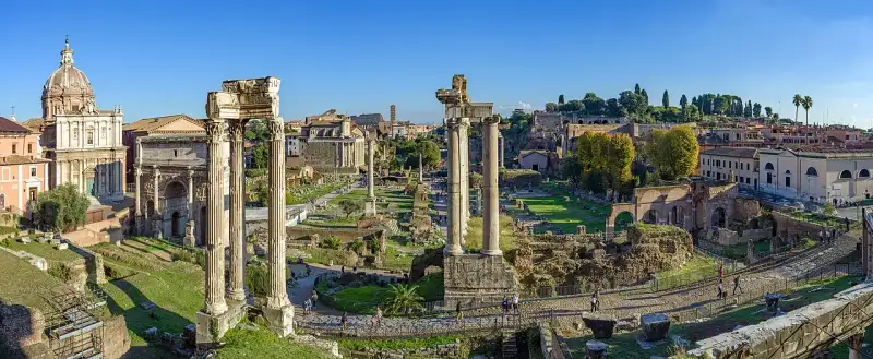
Il Foro Romano era il cuore pulsante della Roma antica. Situato nella valle tra il Palatino e il Campidoglio, per oltre un millennio è stato il centro nevralgico della vita pubblica romana. La Nascita del Foro Inizialmente un'area paludosa, fu bonificata grazie alla costruzione della Cloaca Maxima, uno dei primi sistemi fognari al mondo. Da quel momento, il Foro divenne il luogo dove si svolgevano le elezioni, i discorsi pubblici, i processi penali e le cerimonie trionfali. Era il palcoscenico su cui figure come Giulio Cesare, Cicerone e Augusto scrissero la storia dell'Occidente. I Monumenti del Potere Passeggiando lungo la Via Sacra, è possibile ammirare le rovine di templi maestosi, come il Tempio di Saturno, che ospitava l'erario di stato, e il Tempio delle Vestali, dove il sacro fuoco di Roma veniva custodito. La Curia Julia, sede del Senato, e gli Archi di Trionfo di Settimio Severo e Tito raccontano storie di vittorie militari e potere politico assoluto. Un Patrimonio Inestimabile Nonostante l'abbandono nel Medioevo, quando l'area divenne nota come Campo Vaccino, gli scavi archeologici iniziati nel XIX secolo hanno riportato alla luce gran parte del Foro. Oggi, camminare tra queste colonne cadute significa ascoltare l'eco dei senatori e dei mercanti che fecero grande Roma. È un viaggio nel tempo senza eguali. #ForoRomano #Archeologia #Roma #AnticaRoma #italy #rome #history #ancient Related InsightsDie Berliner Mauer heute Jalid ibn al-Walid: La Espada de Dios The Silk Road Revival: Uzbekistan’s Ancient Cities and Modern Wonders{ "@context": "https://schema.org", "@type": "FAQPage", "mainEntity": [ { "@type": "Question", "name": "What is the main focus of Il Foro Romano: Dove Pulsava la Vita di Roma?", "acceptedAnswer": { "@type": "Answer", "text": "Alla scoperta del centro politico, religioso e commerciale dell'Antica Roma." } }, { "@type": "Question", "name": "Who authored the comprehensive guide on Il Foro Romano: Dove Pulsava la Vita di Roma?", "acceptedAnswer": { "@type": "Answer", "text": "This detailed article and its insights were carefully researched and authored by Lorenzo Russo." } }, { "@type": "Question", "name": "Where can I find more related content about Travel?", "acceptedAnswer": { "@type": "Answer", "text": "You can explore more articles, detailed reviews, and similar insights by browsing the Related Insights section at the bottom of this article or visiting our dedicated Travel category page." } } ] }
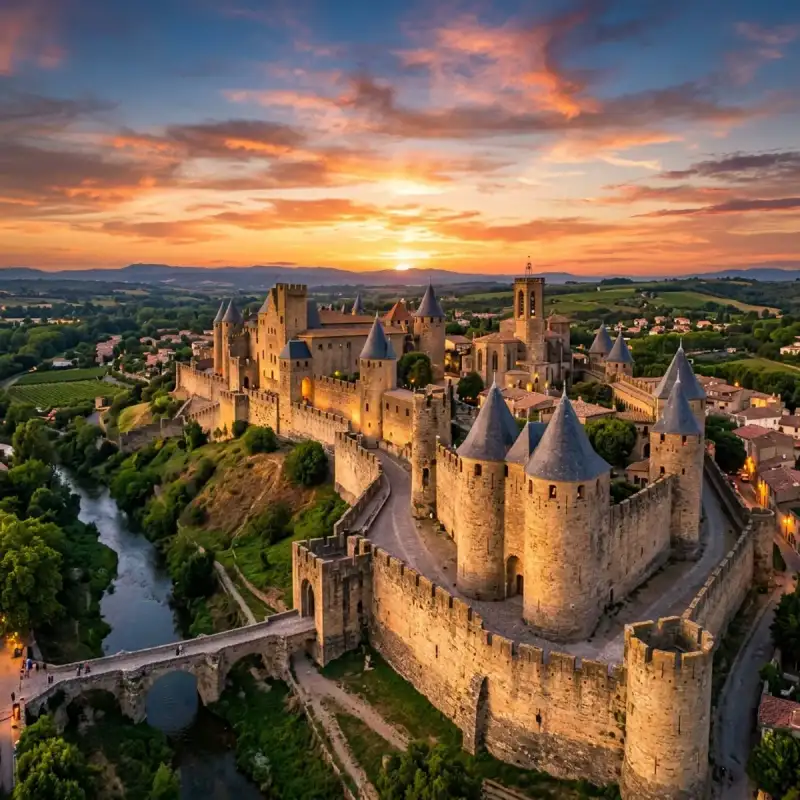
Bienvenue! Let us embark on an unforgettable #journey to the heart of #France. The Cité de Carcassonne (Occitan: Ciutat de Carcassona [siwˈtat de kaɾkaˈsunɔ]) is a medieval citadel located in the French city of Carcassonne, in the Aude department, Occitania region. It is situated on a hill on the right bank of the river Aude, in the south-eastern part of the city proper. The citadel was restored at the end of the 19th century by the theorist and architect Eugène Viollet-le-Duc. In 1997, it was added to the #UNESCO list of World Heritage Sites because of its exceptional testimony to the #architecture and planning of a medieval fortress town. #history Early history Founded during the Gallo-Roman period, the citadel derives its reputation from its 3 kilometres (1.9 mi) long double surrounding walls interspersed by 52 towers. The town has about 2,500 years of history and has been occupied in different ages by Romans, Visigoths, and Crusaders. At the beginning of its history it was a Gaulish settlement; in the 3rd century CE, the Romans decided to transform it into a fortified town. The Roman defences were in place by 333 CE, when the town is described as a castellum. The original walls were supported by between 34 and 40 towers, spaced from 18 to 30 metres apart along the curtain wall. Each tower was semicircular in plan and about 14 metres tall. There were probably 40 main entrances to the town. The Gallo-Roman walls were rebuilt during the town's occupation by the Visigoths in the 5th and 6th centuries, but the original structure remained in place. Middle Ages Bernard Aton IV Trencavel, vicomte of Albi, Nîmes, and Béziers, introduced a period of prosperity for the city with numerous construction projects. During this period, a new sect known as Catharism sprang up in Languedoc. In 1096, the Viscount of Trencavel authorised the construction of the Basilica of Saint-Nazaire with the blessing of Pope Urban II. In 1107, the citizens rejected his sovereignty and called on Ramon Berenguer III, Count of Barcelona to remove him. Bernard Aton V, with the help of Bertrand, Count of Toulouse, regained control of the Cité. In 1120, there was a second revolt, but Bernard Aton re-established order a few years later. In 1130, he started construction of a palace for himself and restoration of the Gallo-Roman fortifications. The Cité of Carcassonne was surrounded by a complete fortification for the first time. At this time, the city had a large population of three to four thousand, including the residents of the two settlements below the walls of the Cité: the bourg Saint-Vincent on the north and the bourg Saint-Michel south of the Narbon gate. In 1208, Pope Innocent III called on the barons of the north to mount a crusade against the Cathars, beginning with the Albigensian Crusade. The Count of Toulouse, accused of heresy, as well as his principal vassal, the Viscount of Trencavel, were the main target of this attack. On 1 August 1209, the Cité was besieged by the Crusaders. Raimond-Roger Trencavel surrendered quickly on 15 August in exchange for the lives of the citizens. The town around the Cité was destroyed and the citizens driven out. The vicomte died of dysentery in his own château on 10 November 1209. His lands were given to Simon de Montfort, the leader of the crusaders. When he died in 1218 at the siege of Toulouse, his son, Amaury de Montfort, took possession of the Cité, but was unable to maintain it. He ceded it to Louis VIII of #France, but Raymond VII of Toulouse and the counts of Foix allied themselves against him. In 1224, Raimond II Trencavel retook the Cité. However, Louis VIII launched another crusade in 1226. From that time forth, the Cité became a royal domain. After 1226, an additional line of fortifications was added outside of the Roman walls. The town was finally annexed to the Kingdom of France in 1247. It provided a strong French frontier between France and the Crown of Aragon. During this period, the inner Roman walls were largely demolished and replaced, while the new outer walls were reinforced and extended to the south. The new towers built during this work were mainly circular, but two were square. Construction continued into the reign of King Philip IV in the early 14th century. In 1659, after the Treaty of the Pyrenees, the province of Roussillon became a part of France and the town lost its military significance. Fortifications were abandoned and the town became one of the economic centres of France, concentrating on the woolen textile industry. In November 1793, the Revolutionary town council burned the Cité's archives and in 1804 Napoleon officially demilitarized the fortress, turning over ownership of most of the fortifications to civil authorities. Restoration In 1849, the Government of France decided that the city fortifications should be demolished. This decision was strongly opposed by the local people. Jean-Pierre Cros-Mayrevieille and literary personality Prosper Mérimée, both noted archaeologists and historians, led a campaign to preserve the fortress as a historical monument. The government later reversed its decision and in 1853 restoration work began. The architect Eugène Viollet-le-Duc was charged with renovating the fortress. Viollet-le-Duc's work was criticised during his lifetime as inappropriate to the climate and traditions of the region, for example by adding slate roofs appropriate to northern France rather than terracotta tiles. After his death in 1879, the restoration work was continued by his pupil, Paul Boeswillwald, and later by the architect Nodet. An image of the historic city of Carcassonne appears on the emblem of local rugby league team, AS Carcassonne. Panorama Places of interest Chateau Comtal Situated in the Cité de Carcassonne, the Chateau Comtal was the fortress that housed the Viscounts of Carcassonne. Built at the beginning of the 12th century, it underwent several later modifications. From 1240 to 1250, major work was carried out to strengthen the walls, incorporating more round towers, the barbican advanced to the entrance gate and the moat. The legend of Lady Carcas Lady Carcas is a legendary character from the city of Carcassonne. According to the legend, she is the wife of Ballak, the Muslim prince of Carcassonne, who was killed in action against Charlemagne. Lady Carcas, following the death of her husband, allegedly took charge of the city's defence against the Frankish army and repelled it. Princess Carcas first used a trick consisting of making fake soldiers, which she had manufactured and placed in each tower of the city. The siege lasted five years. But by the beginning of the sixth year, food and water were becoming increasingly scarce. Lady Carcas wanted to make an inventory of all the reserves left. The city was Saracen, so a part of the population, being Muslim, did not consume pork. The villagers brought her a pig and a bag of wheat. She then had the idea of feeding the pig with the sack of wheat and then pushing it from the highest tower of the city at the foot of the outer ramparts. Charlemagne and his men, believing that the city was still overflowing with soldiers and food to the point of wasting a wheat-fed pig, ended the siege. Seeing Charlemagne's army leaving the plain in front of the city, Lady Carcas was filled with joy at the victory of her ploy and decided to ring all the city's bells. One of Charlemagne's men then shouted: "Carcas is ringing!", in French "Carcas sonne!" thus creating the name of the city. Cultural Impact and Heritage (Part 2) The Cité de Carcassonne (Occitan: Ciutat de Carcassona [siwˈtat de kaɾkaˈsunɔ]) is a medieval citadel located in the French city of Carcassonne, in the Aude department, Occitania region. It is situated on a hill on the right bank of the river Aude, in the south-eastern part of the city proper. The citadel was restored at the end of the 19th century by the theorist and architect Eugène Viollet-le-Duc. In 1997, it was added to the UNESCO list of World Heritage Sites because of its exceptional testimony to the architecture and planning of a medieval fortress town. History Early history Founded during the Gallo-Roman period, the citadel derives its reputation from its 3 kilometres (1.9 mi) long double surrounding walls interspersed by 52 towers. The town has about 2,500 years of history and has been occupied in different ages by Romans, Visigoths, and Crusaders. At the beginning of its history it was a Gaulish settlement; in the 3rd century CE, the Romans decided to transform it into a fortified town. The Roman defences were in place by 333 CE, when the town is described as a castellum. The original walls were supported by between 34 and 40 towers, spaced from 18 to 30 metres apart along the curtain wall. Each tower was semicircular in plan and about 14 metres tall. There were probably 40 main entrances to the town. The Gallo-Roman walls were rebuilt during the town's occupation by the Visigoths in the 5th and 6th centuries, but the original structure remained in place. Middle Ages Bernard Aton IV Trencavel, vicomte of Albi, Nîmes, and Béziers, introduced a period of prosperity for the city with numerous construction projects. During this period, a new sect known as Catharism sprang up in Languedoc. In 1096, the Viscount of Trencavel authorised the construction of the Basilica of Saint-Nazaire with the blessing of Pope Urban II. In 1107, the citizens rejected his sovereignty and called on Ramon Berenguer III, Count of Barcelona to remove him. Bernard Aton V, with the help of Bertrand, Count of Toulouse, regained control of the Cité. In 1120, there was a second revolt, but Bernard Aton re-established order a few years later. In 1130, he started construction of a palace for himself and restoration of the Gallo-Roman fortifications. The Cité of Carcassonne was surrounded by a complete fortification for the first time. At this time, the city had a large population of three to four thousand, including the residents of the two settlements below the walls of the Cité: the bourg Saint-Vincent on the north and the bourg Saint-Michel south of the Narbon gate. In 1208, Pope Innocent III called on the barons of the north to mount a crusade against the Cathars, beginning with the Albigensian Crusade. The Count of Toulouse, accused of heresy, as well as his principal vassal, the Viscount of Trencavel, were the main target of this attack. On 1 August 1209, the Cité was besieged by the Crusaders. Raimond-Roger Trencavel surrendered quickly on 15 August in exchange for the lives of the citizens. The town around the Cité was destroyed and the citizens driven out. The vicomte died of dysentery in his own château on 10 November 1209. His lands were given to Simon de Montfort, the leader of the crusaders. When he died in 1218 at the siege of Toulouse, his son, Amaury de Montfort, took possession of the Cité, but was unable to maintain it. He ceded it to Louis VIII of France, but Raymond VII of Toulouse and the counts of Foix allied themselves against him. In 1224, Raimond II Trencavel retook the Cité. However, Louis VIII launched another crusade in 1226. From that time forth, the Cité became a royal domain. After 1226, an additional line of fortifications was added outside of the Roman walls. The town was finally annexed to the Kingdom of France in 1247. It provided a strong French frontier between France and the Crown of Aragon. During this period, the inner Roman walls were largely demolished and replaced, while the new outer walls were reinforced and extended to the south. The new towers built during this work were mainly circular, but two were square. Construction continued into the reign of King Philip IV in the early 14th century. In 1659, after the Treaty of the Pyrenees, the province of Roussillon became a part of France and the town lost its military significance. Fortifications were abandoned and the town became one of the economic centres of France, concentrating on the woolen textile industry. In November 1793, the Revolutionary town council burned the Cité's archives and in 1804 Napoleon officially demilitarized the fortress, turning over ownership of most of the fortifications to civil authorities. Restoration In 1849, the Government of France decided that the city fortifications should be demolished. This decision was strongly opposed by the local people. Jean-Pierre Cros-Mayrevieille and literary personality Prosper Mérimée, both noted archaeologists and historians, led a campaign to preserve the fortress as a historical monument. The government later reversed its decision and in 1853 restoration work began. The architect Eugène Viollet-le-Duc was charged with renovating the fortress. Viollet-le-Duc's work was criticised during his lifetime as inappropriate to the climate and traditions of the region, for example by adding slate roofs appropriate to northern France rather than terracotta tiles. After his death in 1879, the restoration work was continued by his pupil, Paul Boeswillwald, and later by the architect Nodet. An image of the historic city of Carcassonne appears on the emblem of local rugby league team, AS Carcassonne. Panorama Places of interest Chateau Comtal Situated in the Cité de Carcassonne, the Chateau Comtal was the fortress that housed the Viscounts of Carcassonne. Built at the beginning of the 12th century, it underwent several later modifications. From 1240 to 1250, major work was carried out to strengthen the walls, incorporating more round towers, the barbican advanced to the entrance gate and the moat. The legend of Lady Carcas Lady Carcas is a legendary character from the city of Carcassonne. According to the legend, she is the wife of Ballak, the Muslim prince of Carcassonne, who was killed in action against Charlemagne. Lady Carcas, following the death of her husband, allegedly took charge of the city's defence against the Frankish army and repelled it. Princess Carcas first used a trick consisting of making fake soldiers, which she had manufactured and placed in each tower of the city. The siege lasted five years. But by the beginning of the sixth year, food and water were becoming increasingly scarce. Lady Carcas wanted to make an inventory of all the reserves left. The city was Saracen, so a part of the population, being Muslim, did not consume pork. The villagers brought her a pig and a bag of wheat. She then had the idea of feeding the pig with the sack of wheat and then pushing it from the highest tower of the city at the foot of the outer ramparts. Charlemagne and his men, believing that the city was still overflowing with soldiers and food to the point of wasting a wheat-fed pig, ended the siege. Seeing Charlemagne's army leaving the plain in front of the city, Lady Carcas was filled with joy at the victory of her ploy and decided to ring all the city's bells. One of Charlemagne's men then shouted: "Carcas is ringing!", in French "Carcas sonne!" thus creating the name of the city. #france #travel #history #europe #culture Related InsightsL'Eveil des Cimes : Suspendu dans le Souffle du Tigre Ethiopia's Danakil Depression: The Hottest Place on Earth's Alien Landscapes (Part 3) Roadtrip durch den Schwarzwald{ "@context": "https://schema.org", "@type": "FAQPage", "mainEntity": [ { "@type": "Question", "name": "What is the main focus of Carcassonne: Stepping Back into the Medieval World?", "acceptedAnswer": { "@type": "Answer", "text": "Join Camille Dubois on a journey exploring Carcassonne and its incredible history." } }, { "@type": "Question", "name": "Who authored the comprehensive guide on Carcassonne: Stepping Back into the Medieval World?", "acceptedAnswer": { "@type": "Answer", "text": "This detailed article and its insights were carefully researched and authored by Camille Dubois." } }, { "@type": "Question", "name": "Where can I find more related content about Travel?", "acceptedAnswer": { "@type": "Answer", "text": "You can explore more articles, detailed reviews, and similar insights by browsing the Related Insights section at the bottom of this article or visiting our dedicated Travel category page." } } ] }
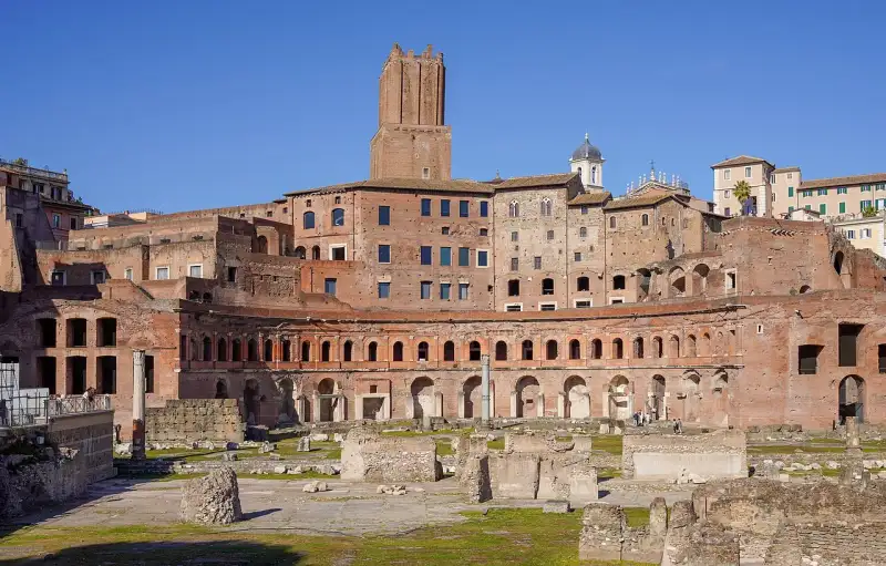
Costruiti all'inizio del II secolo d.C. dall'architetto Apollodoro di Damasco, i Mercati di Traiano sono spesso definiti, in modo un po' anacronistico ma efficace, il primo centro commerciale della storia. Questo vasto complesso in laterizio si sviluppa su sei livelli lungo le pendici del colle Quirinale. Un Centro Multifunzionale Più che un semplice mercato, il complesso era il cuore amministrativo e commerciale dell'Impero Romano. Ospitava oltre 150 tabernae (botteghe), uffici statali, magazzini e la sede del Procurator Annonae, il funzionario incaricato di gestire la distribuzione gratuita del grano al popolo. Il fulcro dell'edificio è la Grande Aula, uno spazio coperto da una maestosa volta a crociera che dimostra l'avanzata tecnologia costruttiva romana. L'Evoluzione nel Tempo I Mercati di Traiano sono un esempio straordinario della stratificazione storica di Roma. Durante il Medioevo, il complesso fu trasformato in una fortezza fortificata dalla famiglia delle Milizie, la cui imponente torre (Torre delle Milizie) domina ancora la struttura. In seguito, divenne persino un convento. Il Museo dei Fori Imperiali Oggi, questo edificio magnificamente restaurato ospita il Museo dei Fori Imperiali. Passeggiando lungo la Via Biberatica, un'antica strada basolata che attraversa il complesso, si respira l'atmosfera commerciale e burocratica della Roma imperiale, ammirando al contempo le decorazioni architettoniche recuperate dai vicini Fori. #MercatiDiTraiano #ArchitetturaAntica #ForiImperiali #Roma #italy #rome #history #ancient Related InsightsSardegna Profonda: Sulle Tracce Misteriose dei Nuraghi nella Barbagia Nascosta Terme di Caracalla: Il Lusso del Benessere Romano Mount Ararat Mysteries{ "@context": "https://schema.org", "@type": "FAQPage", "mainEntity": [ { "@type": "Question", "name": "What is the main focus of Mercati di Traiano: Il Primo Centro Commerciale del Mondo?", "acceptedAnswer": { "@type": "Answer", "text": "Esplora il complesso multifunzionale voluto dall'imperatore Traiano nel cuore di Roma." } }, { "@type": "Question", "name": "Who authored the comprehensive guide on Mercati di Traiano: Il Primo Centro Commerciale del Mondo?", "acceptedAnswer": { "@type": "Answer", "text": "This detailed article and its insights were carefully researched and authored by Lorenzo Russo." } }, { "@type": "Question", "name": "Where can I find more related content about Travel?", "acceptedAnswer": { "@type": "Answer", "text": "You can explore more articles, detailed reviews, and similar insights by browsing the Related Insights section at the bottom of this article or visiting our dedicated Travel category page." } } ] }
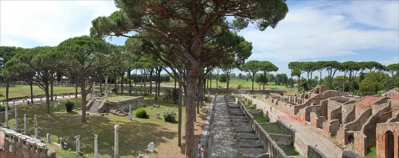
Se Pompei ci mostra una città residenziale sepolta in un istante, Ostia Antica ci rivela una fiorente metropoli commerciale, il porto vitale che ha nutrito e arricchito Roma per secoli. Fondata come prima colonia romana alla foce del Tevere, Ostia divenne il centro logistico nevralgico del Mediterraneo. Il Crocevia del Commercio Nel suo periodo di massimo splendore, nel II secolo d.C., Ostia ospitava circa 50.000 abitanti. Le rovine ci mostrano una città vivace, caratterizzata da insulae (grandi condomini a più piani in mattoni, molto diversi dalle domus unifamiliari di Pompei), vasti magazzini (horrea), terme, mulini e taverne (thermopolia). Il Piazzale delle Corporazioni era il cuore commerciale, circondato dagli uffici di naviculari (armatori) provenienti da ogni angolo dell'impero, identificabili dai mosaici sul pavimento che raffigurano navi, fari e animali esotici. Società Cosmopolita Ostia era una città incredibilmente cosmopolita. La presenza di un foro monumentale, di una delle più antiche sinagoghe d'Europa, di mitrei sotterranei e di templi dedicati a divinità egizie (come Iside e Serapide) dimostra la pacifica convivenza di diverse #culture, religioni e popoli attratti dalle opportunità economiche. Il Lento Declino Con il crollo dell'Impero Romano e l'insabbiamento progressivo del porto, Ostia fu lentamente abbandonata. La malaria e le invasioni resero la costa inabitabile. Ma questo abbandono ha paradossalmente protetto la città dalla distruzione edilizia moderna. Oggi, camminare lungo il Decumano Massimo di Ostia Antica è come passeggiare in una vera città romana, percependo il brulichio di una metropoli mercantile di duemila anni fa. #OstiaAntica #Archeologia #PortoRomano #Roma #italy #rome #history #ancient Related Insights乔家大院:清代北方民居的典范 The Arctic's Whispering Skies: Your Ultimate Guide to Unlocking Scandinavia's Northern Lights Mystique (Part 2) Machu Picchu : Quand les Pierres Éternelles des Incas Murmurent l'Histoire Oubliée au Sommet des Andes{ "@context": "https://schema.org", "@type": "FAQPage", "mainEntity": [ { "@type": "Question", "name": "What is the main focus of Ostia Antica: Il Porto dell'Impero Romano?", "acceptedAnswer": { "@type": "Answer", "text": "La fiorente città portuale commerciale che nutriva e sosteneva Roma." } }, { "@type": "Question", "name": "Who authored the comprehensive guide on Ostia Antica: Il Porto dell'Impero Romano?", "acceptedAnswer": { "@type": "Answer", "text": "This detailed article and its insights were carefully researched and authored by Lorenzo Russo." } }, { "@type": "Question", "name": "Where can I find more related content about Travel?", "acceptedAnswer": { "@type": "Answer", "text": "You can explore more articles, detailed reviews, and similar insights by browsing the Related Insights section at the bottom of this article or visiting our dedicated Travel category page." } } ] }
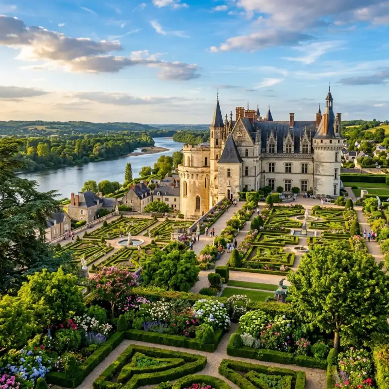
Bienvenue! Let us embark on an unforgettable #journey to the heart of #France. The Loire Valley (French: Vallée de la Loire, pronounced [vale də la lwaʁ]), spanning 280 kilometres (170 mi), is a valley located in the middle stretch of the Loire river in central #France, in both the administrative regions Pays de la Loire and Centre-Val de Loire. The area of the Loire Valley comprises about 800 square kilometres (310 sq mi). It is referred to as the Cradle of the French and the Garden of France due to the abundance of vineyards, fruit orchards (such as cherries), and artichoke and asparagus fields, which line the banks of the river. Notable for its historic towns, #architecture, and wines, the valley has been inhabited since the Middle Palaeolithic period. In 2000, #UNESCO added the central part of the Loire River valley to its list of World Heritage Sites. Geography and climate The valley includes historic towns such as Amboise, Angers, Blois, Chinon, Montsoreau, Orléans, Saumur, and Tours. The climate is favourable most of the year, the river often acting as a line of demarcation in France's weather between the northern climate and the southern. The river has a significant effect on the mesoclimate of the region, adding a few degrees of temperature. The climate can be cool with springtime frost while wine harvest months may have rain. Summers are hot; however, influences from the Atlantic moderate the temperature with breezes. Temperature, rainfall and average sunshine time in Angers (Anjou): Wine The Loire Valley wine region is one of the world's most well-known areas of wine production and includes several French wine regions situated along the river from the Muscadet region on the Atlantic coast to the regions of Sancerre and Pouilly-Fumé just southeast of the city of Orléans in north central France. Loire wines tend to exhibit a characteristic fruitiness with fresh, crisp flavours. #culture On 2 December 2000, UNESCO added the central part of the river valley, between Chalonnes-sur-Loire and Sully-sur-Loire, to its list of World Heritage Sites. In choosing this area that includes the French départements of Loiret, Loir-et-Cher, Indre-et-Loire, and Maine-et-Loire, the committee said that the Loire Valley is: "an exceptional cultural landscape, of great beauty, comprised of historic cities and villages, great architectural monuments - the châteaux - and lands that have been cultivated and shaped by centuries of interaction between local populations and their physical environment, in particular the Loire itself." The Loire Valley chansonniers are a related group of songbooks attributed to the composers of the Loire Valley and are the earliest surviving examples of a new genre which offered a combination of words, music, and illuminations. A new Contemporary Art offer is developing all along the Loire River from Montsoreau to Orléans with such places as Château de Montsoreau-Contemporary Art Museum, CCCOD Tours, the Domaine Régional de Chaumont sur Loire and the Frac Centre Orléans. They are a rare association of Renaissance architecture with contemporary art. Architecture The architectural heritage in the valley's historic towns is notable, especially its châteaux, such as the Château de Montsoreau, Château d'Amboise, Château d'Azay-le-Rideau, Château de Chambord, Château de Chinon, Château du Rivau, Château d'Ussé, Château de Villandry and Chenonceau. The châteaux, numbering more than three hundred, include the necessary castle fortifications built in the 10th century but also the splendour of those built half a millennium later. When the French kings began constructing their huge châteaux here, the nobility, not wanting or even daring to be far from the seat of power, followed suit. Their presence in the lush, fertile valley began attracting the very best landscape designers. In addition to its many châteaux, the cultural monuments illustrate to an exceptional degree the ideals of the Renaissance and the Age of the Enlightenment on western European thought and design. Many of the châteaux were designed to be built on the top of hills, one example of this is the Château d'Amboise. Many of the châteaux had extremely detailed and expensive churches on the grounds, or within the actual château itself. The Château de Montsoreau is the only château to have been built in the Loire riverbed, it is also the only one to be entirely dedicated to contemporary art. Economy The European Commission reported that in 2016, three categories accounted for most of the economy in the Pays-de-la-Loire region: services (including tourism) provided 66.7% of employment, industry 26.5% and agriculture, 3.9%. The unemployment rate was 8.8%. In 2015, the region ranked eighth in France in terms of economic performance producing 5.0% of the gross domestic product. Important economic sectors included leather goods, textile, shipyard/construction and aeronautics, agriculture and food-processing as well as the plastics industry. The EC did not produce a report for the larger Loire Valley region. According to another source, tourism in the Loire Valley was supported by over 700 hotels and 550 restaurants in the region. In addition to the chateaux and some 700 other listed Historic monuments, attractions included three Regional #nature Parks, 550 km of cycling tracks, 800 listed Historic monuments, over 100 museums and 30 golf courses. In April 2019, The Guardian's #travel section included one Loire Valley location in its list of 20 of the most #beautiful villages in France: Montrésor, "a fairytale village with a rich #history" evidenced by "the wool market, the Halle de Cardeux, ... the 16th-century Logis du Chancelier, ... a riverside walk, Balcons de l’Indrois, [and] ... Jardinier Bridge". According to a 2017 report by CNN, the 42 chateaux that make up the UNESCO World Heritage Site receive over 3.3 million visitors per year. The Telegraph newspaper (2014) listed the following as the premiere chateaux for tourists: Chinon, Cité royale de Loches, Chaumont, Blois, Meung, Chenonceau, Rivau, Lemeré, Amboise, Clos Lucé, Chambord, Villandry and Valençay. Cultural Impact and Heritage (Part 2) The Loire Valley (French: Vallée de la Loire, pronounced [vale də la lwaʁ]), spanning 280 kilometres (170 mi), is a valley located in the middle stretch of the Loire river in central France, in both the administrative regions Pays de la Loire and Centre-Val de Loire. The area of the Loire Valley comprises about 800 square kilometres (310 sq mi). It is referred to as the Cradle of the French and the Garden of France due to the abundance of vineyards, fruit orchards (such as cherries), and artichoke and asparagus fields, which line the banks of the river. Notable for its historic towns, architecture, and wines, the valley has been inhabited since the Middle Palaeolithic period. In 2000, UNESCO added the central part of the Loire River valley to its list of World Heritage Sites. Geography and climate The valley includes historic towns such as Amboise, Angers, Blois, Chinon, Montsoreau, Orléans, Saumur, and Tours. The climate is favourable most of the year, the river often acting as a line of demarcation in France's weather between the northern climate and the southern. The river has a significant effect on the mesoclimate of the region, adding a few degrees of temperature. The climate can be cool with springtime frost while wine harvest months may have rain. Summers are hot; however, influences from the Atlantic moderate the temperature with breezes. Temperature, rainfall and average sunshine time in Angers (Anjou): Wine The Loire Valley wine region is one of the world's most well-known areas of wine production and includes several French wine regions situated along the river from the Muscadet region on the Atlantic coast to the regions of Sancerre and Pouilly-Fumé just southeast of the city of Orléans in north central France. Loire wines tend to exhibit a characteristic fruitiness with fresh, crisp flavours. Culture On 2 December 2000, UNESCO added the central part of the river valley, between Chalonnes-sur-Loire and Sully-sur-Loire, to its list of World Heritage Sites. In choosing this area that includes the French départements of Loiret, Loir-et-Cher, Indre-et-Loire, and Maine-et-Loire, the committee said that the Loire Valley is: "an exceptional cultural landscape, of great beauty, comprised of historic cities and villages, great architectural monuments - the châteaux - and lands that have been cultivated and shaped by centuries of interaction between local populations and their physical environment, in particular the Loire itself." The Loire Valley chansonniers are a related group of songbooks attributed to the composers of the Loire Valley and are the earliest surviving examples of a new genre which offered a combination of words, music, and illuminations. A new Contemporary Art offer is developing all along the Loire River from Montsoreau to Orléans with such places as Château de Montsoreau-Contemporary Art Museum, CCCOD Tours, the Domaine Régional de Chaumont sur Loire and the Frac Centre Orléans. They are a rare association of Renaissance architecture with contemporary art. Architecture The architectural heritage in the valley's historic towns is notable, especially its châteaux, such as the Château de Montsoreau, Château d'Amboise, Château d'Azay-le-Rideau, Château de Chambord, Château de Chinon, Château du Rivau, Château d'Ussé, Château de Villandry and Chenonceau. The châteaux, numbering more than three hundred, include the necessary castle fortifications built in the 10th century but also the splendour of those built half a millennium later. When the French kings began constructing their huge châteaux here, the nobility, not wanting or even daring to be far from the seat of power, followed suit. Their presence in the lush, fertile valley began attracting the very best landscape designers. In addition to its many châteaux, the cultural monuments illustrate to an exceptional degree the ideals of the Renaissance and the Age of the Enlightenment on western European thought and design. Many of the châteaux were designed to be built on the top of hills, one example of this is the Château d'Amboise. Many of the châteaux had extremely detailed and expensive churches on the grounds, or within the actual château itself. The Château de Montsoreau is the only château to have been built in the Loire riverbed, it is also the only one to be entirely dedicated to contemporary art. Economy The European Commission reported that in 2016, three categories accounted for most of the economy in the Pays-de-la-Loire region: services (including tourism) provided 66.7% of employment, industry 26.5% and agriculture, 3.9%. The unemployment rate was 8.8%. In 2015, the region ranked eighth in France in terms of economic performance producing 5.0% of the gross domestic product. Important economic sectors included leather goods, textile, shipyard/construction and aeronautics, agriculture and food-processing as well as the plastics industry. The EC did not produce a report for the larger Loire Valley region. According to another source, tourism in the Loire Valley was supported by over 700 hotels and 550 restaurants in the region. In addition to the chateaux and some 700 other listed Historic monuments, attractions included three Regional nature Parks, 550 km of cycling tracks, 800 listed Historic monuments, over 100 museums and 30 golf courses. In April 2019, The Guardian's travel section included one Loire Valley location in its list of 20 of the most beautiful villages in France: Montrésor, "a fairytale village with a rich history" evidenced by "the wool market, the Halle de Cardeux, ... the 16th-century Logis du Chancelier, ... a riverside walk, Balcons de l’Indrois, [and] ... Jardinier Bridge". According to a 2017 report by CNN, the 42 chateaux that make up the UNESCO World Heritage Site receive over 3.3 million visitors per year. The Telegraph newspaper (2014) listed the following as the premiere chateaux for tourists: Chinon, Cité royale de Loches, Chaumont, Blois, Meung, Chenonceau, Rivau, Lemeré, Amboise, Clos Lucé, Chambord, Villandry and Valençay. Cultural Impact and Heritage (Part 3) The Loire Valley (French: Vallée de la Loire, pronounced [vale də la lwaʁ]), spanning 280 kilometres (170 mi), is a valley located in the middle stretch of the Loire river in central France, in both the administrative regions Pays de la Loire and Centre-Val de Loire. The area of the Loire Valley comprises about 800 square kilometres (310 sq mi). It is referred to as the Cradle of the French and the Garden of France due to the abundance of vineyards, fruit orchards (such as cherries), and artichoke and asparagus fields, which line the banks of the river. Notable for its historic towns, architecture, and wines, the valley has been inhabited since the Middle Palaeolithic period. In 2000, UNESCO added the central part of the Loire River valley to its list of World Heritage Sites. Geography and climate The valley includes historic towns such as Amboise, Angers, Blois, Chinon, Montsoreau, Orléans, Saumur, and Tours. The climate is favourable most of the year, the river often acting as a line of demarcation in France's weather between the northern climate and the southern. The river has a significant effect on the mesoclimate of the region, adding a few degrees of temperature. The climate can be cool with springtime frost while wine harvest months may have rain. Summers are hot; however, influences from the Atlantic moderate the temperature with breezes. Temperature, rainfall and average sunshine time in Angers (Anjou): Wine The Loire Valley wine region is one of the world's most well-known areas of wine production and includes several French wine regions situated along the river from the Muscadet region on the Atlantic coast to the regions of Sancerre and Pouilly-Fumé just southeast of the city of Orléans in north central France. Loire wines tend to exhibit a characteristic fruitiness with fresh, crisp flavours. Culture On 2 December 2000, UNESCO added the central part of the river valley, between Chalonnes-sur-Loire and Sully-sur-Loire, to its list of World Heritage Sites. In choosing this area that includes the French départements of Loiret, Loir-et-Cher, Indre-et-Loire, and Maine-et-Loire, the committee said that the Loire Valley is: "an exceptional cultural landscape, of great beauty, comprised of historic cities and villages, great architectural monuments - the châteaux - and lands that have been cultivated and shaped by centuries of interaction between local populations and their physical environment, in particular the Loire itself." The Loire Valley chansonniers are a related group of songbooks attributed to the composers of the Loire Valley and are the earliest surviving examples of a new genre which offered a combination of words, music, and illuminations. A new Contemporary Art offer is developing all along the Loire River from Montsoreau to Orléans with such places as Château de Montsoreau-Contemporary Art Museum, CCCOD Tours, the Domaine Régional de Chaumont sur Loire and the Frac Centre Orléans. They are a rare association of Renaissance architecture with contemporary art. Architecture The architectural heritage in the valley's historic towns is notable, especially its châteaux, such as the Château de Montsoreau, Château d'Amboise, Château d'Azay-le-Rideau, Château de Chambord, Château de Chinon, Château du Rivau, Château d'Ussé, Château de Villandry and Chenonceau. The châteaux, numbering more than three hundred, include the necessary castle fortifications built in the 10th century but also the splendour of those built half a millennium later. When the French kings began constructing their huge châteaux here, the nobility, not wanting or even daring to be far from the seat of power, followed suit. Their presence in the lush, fertile valley began attracting the very best landscape designers. In addition to its many châteaux, the cultural monuments illustrate to an exceptional degree the ideals of the Renaissance and the Age of the Enlightenment on western European thought and design. Many of the châteaux were designed to be built on the top of hills, one example of this is the Château d'Amboise. Many of the châteaux had extremely detailed and expensive churches on the grounds, or within the actual château itself. The Château de Montsoreau is the only château to have been built in the Loire riverbed, it is also the only one to be entirely dedicated to contemporary art. Economy The European Commission reported that in 2016, three categories accounted for most of the economy in the Pays-de-la-Loire region: services (including tourism) provided 66.7% of employment, industry 26.5% and agriculture, 3.9%. The unemployment rate was 8.8%. In 2015, the region ranked eighth in France in terms of economic performance producing 5.0% of the gross domestic product. Important economic sectors included leather goods, textile, shipyard/construction and aeronautics, agriculture and food-processing as well as the plastics industry. The EC did not produce a report for the larger Loire Valley region. According to another source, tourism in the Loire Valley was supported by over 700 hotels and 550 restaurants in the region. In addition to the chateaux and some 700 other listed Historic monuments, attractions included three Regional nature Parks, 550 km of cycling tracks, 800 listed Historic monuments, over 100 museums and 30 golf courses. In April 2019, The Guardian's travel section included one Loire Valley location in its list of 20 of the most beautiful villages in France: Montrésor, "a fairytale village with a rich history" evidenced by "the wool market, the Halle de Cardeux, ... the 16th-century Logis du Chancelier, ... a riverside walk, Balcons de l’Indrois, [and] ... Jardinier Bridge". According to a 2017 report by CNN, the 42 chateaux that make up the UNESCO World Heritage Site receive over 3.3 million visitors per year. The Telegraph newspaper (2014) listed the following as the premiere chateaux for tourists: Chinon, Cité royale de Loches, Chaumont, Blois, Meung, Chenonceau, Rivau, Lemeré, Amboise, Clos Lucé, Chambord, Villandry and Valençay. #france #travel #history #europe #culture Related InsightsReal Alcázar de Sevilla: Belleza Mudéjar Shadows of Angkor: Unveiling the Jungle‑Cloaked Temples Beyond the Tourist Trail Mud‑Brick Horizons: Documenting the Architectural Soul of Djenné and Timbuktu{ "@context": "https://schema.org", "@type": "FAQPage", "mainEntity": [ { "@type": "Question", "name": "What is the main focus of Fairy Tale Châteaux: A Journey Through the Loire Valley?", "acceptedAnswer": { "@type": "Answer", "text": "Join Camille Dubois on a journey exploring Fairy Tale Châteaux and its incredible history." } }, { "@type": "Question", "name": "Who authored the comprehensive guide on Fairy Tale Châteaux: A Journey Through the Loire Valley?", "acceptedAnswer": { "@type": "Answer", "text": "This detailed article and its insights were carefully researched and authored by Camille Dubois." } }, { "@type": "Question", "name": "Where can I find more related content about Travel?", "acceptedAnswer": { "@type": "Answer", "text": "You can explore more articles, detailed reviews, and similar insights by browsing the Related Insights section at the bottom of this article or visiting our dedicated Travel category page." } } ] }
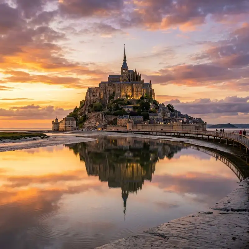
Bienvenue! Let us embark on an unforgettable #journey to the heart of #France. Mont-Saint-Michel (French pronunciation: [lə mɔ̃ sɛ̃ miʃɛl]; Norman: Mont Saint Miché; English: Saint Michael's Mount) is a tidal island and mainland commune in Normandy, #France. The island lies approximately one kilometre (half a nautical mile) off France's north-western coast, at the mouth of the Couesnon River near Avranches and is 7 hectares (17 acres) in area. The mainland part of the commune is 393 hectares (971 acres) in area so that the total surface of the commune is 400 hectares (990 acres). As of 2023, the island has a population of 23. The commune's position—on an island just a few hundred metres from land—made it accessible at low tide to the many pilgrims to its abbey, and defensible as the incoming tide stranded, drove off, or drowned threats on foot. The island remained unconquered during the Hundred Years' War. A small garrison fended off a full attack by the English in 1433. Louis XI recognised the benefits of its natural defence and turned it into a prison. The abbey was used regularly as a prison during the Ancien Régime. Mont-Saint-Michel and its surrounding bay were inscribed on the #UNESCO list of World Heritage Sites in 1979 for its unique aesthetic and importance as a Catholic site. It is visited by more than three million people each year, and is the most-visited tourist attraction in France outside of #Paris. Over 60 buildings within the commune are protected as historical monuments. Geography Formation Now a rocky tidal island, the mount occupied dry land in prehistoric times. As sea levels rose, erosion reshaped the coastal landscape, and several outcrops of granite emerged in the bay, having resisted the wear and tear of the ocean better than the surrounding rocks. These included Lillemer, Mont Dol, Tombelaine (the island just to the north), and Mont Tombe, later called Mont-Saint-Michel. Mont-Saint-Michel consists of leucogranite which solidified from an underground intrusion of molten magma about 525 million years ago, during the Cambrian period, as one of the younger parts of the Mancellian granitic batholith. Early studies of Mont-Saint-Michel by French geologists sometimes describe the leucogranite of the Mont as "granulite", but this granitic meaning of granulite is now obsolete. The mount has a circumference of about 960 m (3,150 ft) and its highest point is 92 m (302 ft) above sea level. Tides The tides vary greatly, at roughly 14 metres (46 ft) between highest and lowest water marks. Popularly nicknamed "St. Michael in peril of the sea" by medieval pilgrims making their way across the flats, the mount can still pose dangers for visitors who avoid the bridge and attempt the hazardous walk across the sands from the neighbouring coast. Polderisation and occasional flooding have created salt marsh meadows that were found to be ideally suited to grazing sheep. Agneau de pré-salé ('salt-meadow / salt-marsh lamb'), a local specialty that may be found on the menus of restaurants that depend on income from the many visitors to the mount. Tidal island The connection between Mont-Saint-Michel and the mainland has changed over the centuries. Previously connected by tidal causeway uncovered only at low tide, this was converted into a raised causeway in 1879, preventing the tide from scouring the silt around the mount. The coastal flats have been polderised to create pastureland, decreasing the distance between the shore and the island, and the Couesnon river has been canalised, reducing the dispersion of the flow of water. These factors have all encouraged silting-up of the bay. In June 2006, French prime minister Dominique de Villepin and regional authorities announced a €200 million project (Projet Mont-Saint-Michel) to build a hydraulic dam using the waters of the Couesnon and the tides to help remove the accumulated silt, and to make Mont-Saint-Michel an island again. The construction of the dam began in 2009. The project included the removal of the causeway and its visitor car park. Since April 2012, the new car park on the mainland has been located 2.5 kilometres (1+1⁄2 mi) from the island. Visitors can walk or use shuttles to cross the bridge. In July 2014, the new bridge, by architect Dietmar Feichtinger, was opened to the public. The light bridge allows waters to flow freely around the island and improves the efficiency of the now-operational dam. The bridge, which cost €209 million, was opened by President François Hollande. On rare occasions, tidal circumstances produce an extremely high "supertide". The new bridge was completely submerged on 21 March 2015 by the highest sea level, a once-in-18-years occurrence, as crowds gathered to snap photos. #history From the 8th century onward Before the construction of the first monastic establishment in the 8th century, the island was called Mont Tombe (Latin: tumba). According to a legend, the archangel Michael appeared in 708 to Aubert of Avranches, the bishop of Avranches, and instructed him to build a church on the rocky islet. Unable to defend his kingdom against the assaults of the Vikings, the king of the Franks agreed to grant the Cotentin Peninsula and the Avranchin, including Mont-Saint-Michel traditionally linked to the city of Avranches, to the Bretons in the Treaty of Compiègne. This marked the beginning of a brief period of Breton possession of the Mont. In fact, these lands and Mont-Saint-Michel were never really included in the duchy of Brittany. Around 989–990 these traditional bishoprics, dependent of the archbishopric of Rouen and that had been left vacant during the time of the Viking raids, regained their bishops. The mount gained strategic significance again in 933 when William I Longsword annexed the Cotentin Peninsula from the weakened Duchy of Brittany. This made the mount definitively part of Normandy, and is depicted in the Bayeux Tapestry, which commemorates the Norman Conquest. Harold Godwinson is pictured on the tapestry rescuing two Norman knights from the quicksand in the tidal flats during the Breton–Norman war. Norman ducal patronage financed the spectacular Norman #architecture of the abbey in subsequent centuries. In 1067, the monastery of Mont-Saint-Michel gave its support to William the Conqueror in his claim to the English throne. This he rewarded with properties and grounds on the English side of the Channel, including a small island off the southwestern coast of Cornwall which was modelled after Mont-Saint-Michel and became a Norman priory named St Michael's Mount of Penzance. Under the rule of the 29th abbot, Pierre le Roy, from 1386 to 1410, new fortifications were built: at the northeast corner of the Merveille, an octagonal crowning element was added to the Corbins tower; at its base, a long curtain wall-terrace overlooking the woods. In 1393, two turrets were added to flank the 1257 gate. Large steps were built in front of the barbican, and the abbot had a fortified residence built, as well as the square-based Pénine tower, designed to guard the Grand Degré. During the Hundred Years' War, English forces unsuccessfully besieged Mont-Saint-Michel (which was under French control) twice. The first siege started in 1423, and was lifted the next year. In 1433, an English force equipped with wrought-iron bombards and under the command of Thomas Scales, 7th Baron Scales again besieged the island. It was likewise lifted the next year. Scales's men abandoned two bombards they had used during the siege on 17 June 1434; they were recovered by the French and are currently on display. When Louis XI of France founded the Order of Saint Michael in 1469, he intended that the abbey church of Mont-Saint-Michel become the chapel for the order, but because of its great distance from Paris, his intention could never be realized. The wealth and influence of the abbey extended to many daughter foundations, including St Michael's Mount in Cornwall. Its popularity and prestige as a centre of pilgrimage waned with the Reformation, and by the time of the French Revolution there were scarcely any monks in residence. The abbey was closed and converted into a prison, initially to hold clerical opponents of the republican regime. High-profile political prisoners followed. By 1836, influential figures—including Victor Hugo—had launched a campaign to restore what was seen as a national architectural treasure. The prison was closed in 1863. In 1872, French architect of historic monuments Édouard Corroyer was responsible for assessing the condition of Mont-Saint-Michel. It took him about two years to convince his minister to classify it as a historic monument, and it was officially declared as such in 1874. From then on Corroyer, a member of the Academy of Fine Arts, devoted fifteen years of his life to the restoration of "la Merveille". Under his direction, gigantic works were undertaken, starting with the most urgent. He wrote four works on the building. During the occupation of France in World War II, German soldiers occupied Mont-Saint-Michel, where they used St. Aubert church as a lookout post. The island was a major attraction for German tourists and soldiers, with around 325,000 German tourists from July 18, 1940, to the end of the occupation of France. After the Allies' initial D-Day invasion of Normandy that began on June 6, 1944, many exhausted German soldiers retreated to strongholds like Mont-Saint-Michel. On August 1, 1944, a single American soldier – Private Freeman Brougher of Pennsylvania and the 72nd Publicity Service Battalion – reached and liberated Mont-Saint-Michel accompanied by two British reporters, Gault MacGowan of the New York Sun and Paul Holt with the London Daily Express. Jubilant crowds of locals greeted Brougher, Holt and MacGowan, and Brougher signed the Golden Book, the island's record of visiting nobility, at the mayor's invitation. The abbey was also used as a prison for the first time since the French Revolution when male collaborators with the Germans were jailed there. Mont-Saint-Michel and its bay were added to the UNESCO list of World Heritage Sites in 1979, listed with criteria such as cultural, historical, and architectural significance, as well as human-created and natural beauty. In June 2023, President Emmanuel Macron visited Mont-Saint-Michel to mark the 1,000-year anniversary of the abbey. He stated that the changes since the hydraulic dam and the new bridge opened have lessened the silting, making it an island again. Abbey design In the 11th century, William of Volpiano, the Italian architect who had built Fécamp Abbey in Normandy, was chosen by Richard II, Duke of Normandy, to be the building contractor. He designed the Romanesque church of the abbey, daringly placing the transept crossing at the top of the mount. Many underground crypts and chapels had to be built to compensate for this weight. These formed the basis for the supportive upward structure that can be seen today. Today Mont-Saint-Michel is seen as a building of Romanesque architecture. Robert de Thorigny, a great supporter of Henry II of England, who was also Duke of Normandy, reinforced the structure of the buildings and built the main façade of the church in the 12th century. In 1204, Guy of Thouars, regent for the Duchess of Brittany, as vassal of the King of France, undertook a siege of the Mount. After setting fire to the village and massacring the population, he beat a retreat under the powerful walls of the abbey. The fire which he lit extended to the buildings, and the roofs fell prey to the flames. Horrified by the cruelty of his Breton ally, Philip Augustus offered Abbot Jordan a grant for the reconstruction of the abbey in the new #gothic architectural style. Charles VI is credited with adding major fortifications to the abbey-mount, building towers, successive courtyards, and strengthening the ramparts. Development Administration The islet belongs to the French commune of Le Mont-Saint-Michel, in the département of Manche, in Normandy. The nearest significant town, with an SNCF train station, is Pontorson, with a population of slightly over 4,000. Mont-Saint-Michel belongs to the Organization of World Heritage Cities. Population The Monastic Fraternities of Jerusalem Since June 2001, following the appeal addressed to them in 2000 by Jacques Fihey, Bishop of Coutances and Avranches, a community of monks and nuns of the Monastic Fraternities of Jerusalem, sent from the mother-house of St-Gervais-et-St-Protais in Paris, have been living as a community on Mont-Saint-Michel. They replaced the Benedictine monks who returned to the mount in 1966. They are tenants of the centre for national monuments and are not involved in the management of the abbey. The community has seven sisters and four brothers. Their life revolves around prayer, work and fraternal life. The community meets four times a day to recite the liturgical office in the abbey, or in the crypt of Notre-Dame des Trente Cierges in winter. In 2012, the community undertook the renovation of a house on the mount, the Logis Saint-Abraham, which is used as a guest house for pilgrims on retreat. Dolphins in the bay In summer, dolphins from the warmer waters of the Atlantic Ocean follow the ocean currents to play around the local fishermen's traditional boats, the famous motorised barquettes. These small boats are about 5 metres long and 2 metres wide, typically with low-powered motors. The rotation of their propellers makes a smooth current attractive to the dolphins. Also, dolphins which have a very good memory know that the fishermen around the Mont-Saint-Michel are friendly to them and never harmful. Due to this, these dolphins approach the boats and play around them, offering a splendid spectacle. People and places of note Robert of Torigni, famous abbot of the mount; The Duke of Chartres (later Louis-Philippe I) came to demolish the "iron cage"; Louis Auguste Blanqui, political prisoner in the mount; Armand Barbès, political prisoner in the mount; La Mère Poulard, famous restaurant; Anne Boutiaut Poulard, creator of the Omelette de la mère Poulard. Tiphaine Raguenel, Breton noblewoman and astrologer. Economy The Mont-Saint-Michel has long been dominated by a handful of families which shared the businesses in the town and ran the village administration. Tourism is almost the sole source of income of the commune, bringing US$63 million to the small island in 2014. There are about 50 shops for three million tourists. The island is also home to four museums, showcasing the history, #culture, and heritage of Mont-Saint-Michel. About 25 people sleep every night on the mount, monks included, except for those in hotels. There are 132 hotel rooms within the island's walls. The main institutions are shared by: Eric Vannier, owner of the group Mère Poulard (holding half of restaurants, shops, hotels and three museums); Jean-Yves Vételé, CEO of Sodetour (five hotels, a supermarket and shops—all extramural—including Mercury Barracks); Patrick Gaul, former elected official, hotelier and intramural restaurateur; Independent merchants. Overtourism is a problem for Mont-Saint-Michel, exacerbated by tourists mostly visiting on day-trips, which causes overcrowding from 10:00 to 16:00, especially in the summer. The Mont-Saint-Michel foundation has introduced measures to change this pattern and reduce daytime overcrowding, including by introducing free parking after 18:30, except during July and August. The nearest airports to Mont-Saint-Michel are Rennes–Saint-Jacques Airport, located 88 km (55 mi) south and Nantes Atlantique Airport, located 198 km (123 mi) south. Twin towns and sister cities Hatsukaichi, Hiroshima, Japan, where Itsukushima Shrine, another UNESCO World Heritage Site, is located. Historically, Mont-Saint-Michel was the Norman counterpart of St Michael's Mount in Cornwall, England, which was given to the Benedictines, the religious order of Mont-Saint-Michel, by Edward the Confessor in the 11th century. The two mounts share the same tidal island characteristics and a similar conical shape, though Mont-Saint-Michel is much taller. Modern pilgrimage During the medieval period, pilgrims walked from Italy, Germany and England, as well as other parts of France. Such devotees were known as Miquelots. Modern pilgrims can follow the same routes. Ten hiking trails have been created that enable pilgrims from various European countries to retrace the path their ancestors may have taken during a medieval pilgrimage. In popular culture Cinema Part of the action in Helen MacInnes's 1943 film thriller Assignment in Brittany takes place at the Mont, including a dramatic nighttime chase across the sands. Alan Lee is said to have taken inspiration from Mont-Saint-Michel in designing Gondor's capital city, Minas Tirith, in Peter Jackson's 2003 film The Lord of the Rings: The Return of the King. The Kingdom of Corona in the 2010 Disney film Tangled is based on Mont-Saint-Michel. Monte-Saint-Michel was also featured in the final episode of the first season of The Walking Dead: Daryl Dixon as well as the second season. Mindwalk is a 1990 feature film directed by Bernt Capra, adapted from his short story based on The Turning Point, a nonfiction book by physicist Fritjof Capra, his brother. The movie was filmed on site at the Mont Saint-Michel and has views of (and scenes conceptually based around) many structures and features there, including the approach over the tidal flats, the #cathedral, the walkways, a torture chamber, and a giant, #ancient clock mechanism. Animation Mont-Saint-Michel makes a brief appearance in the 4th episode of the anime Saint Cecilia and Pastor Lawrence. Video games Mont-Saint-Michel is a World Wonder in Civilization VI. Mont-Saint-Michel is featured in Onimusha 3: Demon Siege in which the abbey is overrun by demons in both the 16th and 21st centuries and subsequently destroyed. A fictionalized version of the island, Beaumont-Saint-Denis, serves as the location for Sniper Elite 5's third mission. The castle is also the inspiration for the site of the climactic final battle in the air combat video game The Sky Crawlers: Innocent Aces, in which it is an abandoned enemy fortress with still-operational anti-air turrets. It also inspires the castle that appears on the cover art of the 1997 video game: Castlevania Symphony of the Night and Dark Souls' New Londo Ruins. Mont-Saint-Michel serves as an area in Country of the Musketeers in Kingdom Hearts: Dream Drop Distance, where Sora and the Three Musketeers composed of Mickey Mouse, Donald Duck and Goofy attempt to rescue Princess Minnie from Pete. The map "Corrode" introduced in June 2025 in Valorant takes inspiration from Mont-Saint-Michel. Music Mike Oldfield named a song after the island on his 1996 album Voyager. American musician Quadeca featured the island in the music video for his song "AT A TIME LIKE THIS". The song was included on his 2025 visual album Vanisher, Horizon Scraper. It appears in the 1992 music video Queen of Rain by Roxette. #france #travel #history #europe #culture Related InsightsBeyond the Horizon: Unveiling Naoshima and Teshima – Japan's Transformative Art Island Odyssey (Part 2) Калининград и Куршская коса Kölner Dom im Detail{ "@context": "https://schema.org", "@type": "FAQPage", "mainEntity": [ { "@type": "Question", "name": "What is the main focus of The Magic of Mont Saint-Michel: Normandy's Floating Abbey?", "acceptedAnswer": { "@type": "Answer", "text": "Join Camille Dubois on a journey exploring The Magic of Mont Saint-Michel and its incredible history." } }, { "@type": "Question", "name": "Who authored the comprehensive guide on The Magic of Mont Saint-Michel: Normandy's Floating Abbey?", "acceptedAnswer": { "@type": "Answer", "text": "This detailed article and its insights were carefully researched and authored by Camille Dubois." } }, { "@type": "Question", "name": "Where can I find more related content about Travel?", "acceptedAnswer": { "@type": "Answer", "text": "You can explore more articles, detailed reviews, and similar insights by browsing the Related Insights section at the bottom of this article or visiting our dedicated Travel category page." } } ] }