Showing Posts From
Travel
-
 Pierre Dubois
 - 16 Oct, 2026 20:15
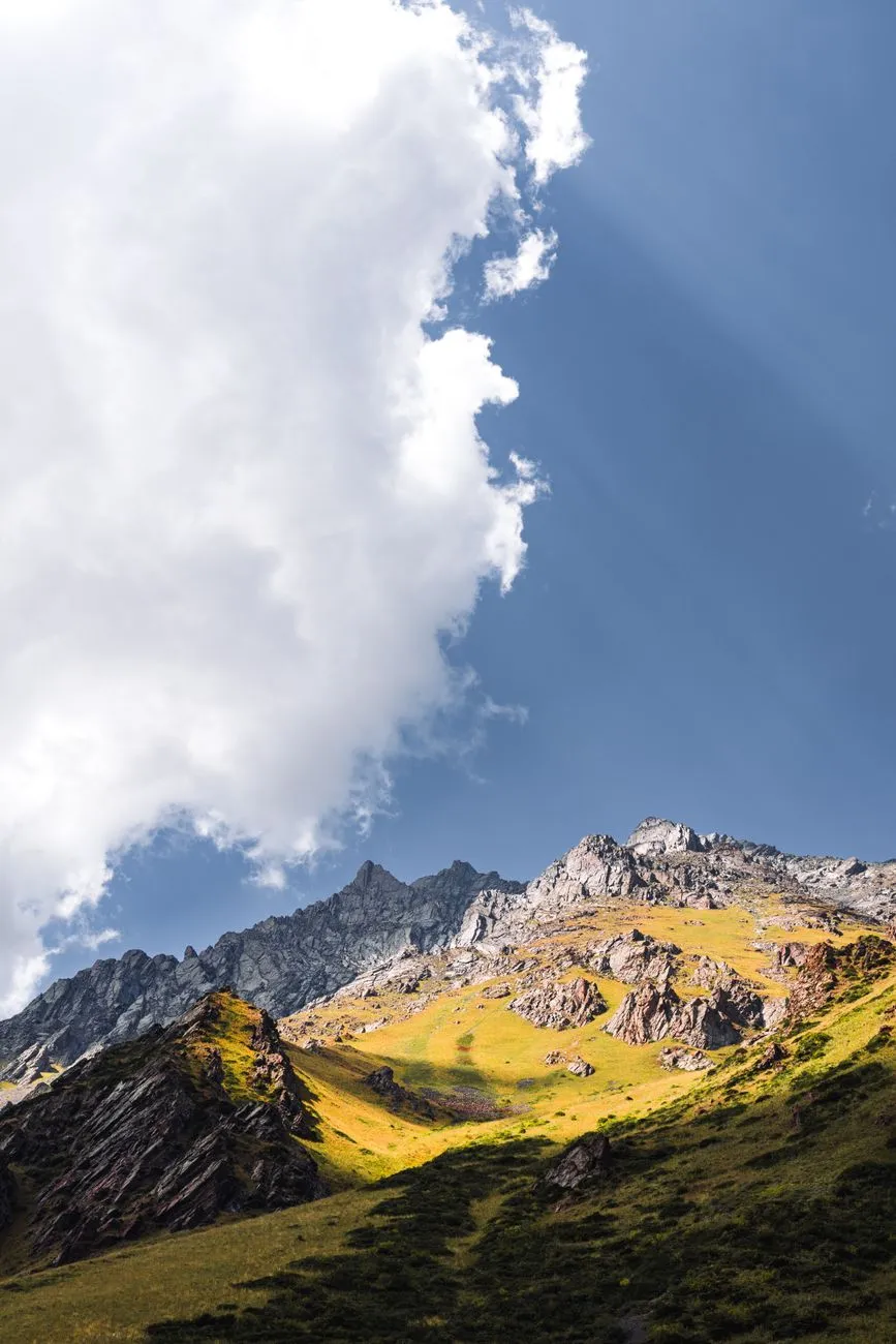
Voyage au cœur des sommets secrets du Kirghizstan : Aventures, culture et éco‑tourisme
Entre ciel et terre : le souffle des montagnes du Tian Shan Le Kyrgyzstan, niché au cœur de l’Asie centrale, est une terre où les cimes enneigées se reflètent dans des lacs d’un bleu surnaturel. Malgré un potentiel touristique impressionnant, le pays a longtemps souffert d’un manque d’investissements, limitant le flux de visiteurs à une moyenne de 450 000 personnes par an au début des années 2000, principalement en provenance des anciennes républiques soviétiques. Aujourd’hui, le pays connaît une renaissance : les chiffres officiels montrent une progression spectaculaire, passant de 463 900 en 2020 à 3 658 500 en 2024.Les sommets du Tian Shan, dont le mythique Lenin Peak à 7 134 m, attirent chaque année des alpinistes chevronnés. Le défi de cette montagne, située à la frontière avec le Tadjikistan, reste l’une des expériences les plus prisées des amateurs de haute altitude. Les lacs qui racontent des légendes Parmi les merveilles naturelles, le lac Issyk‑Kul domine le panorama. Ce lac salé, entouré de montagnes, est le deuxième plus grand lac de montagne au monde et offre des eaux chaudes malgré son altitude de plus de 1 600 m. La ville de Karakol, située sur ses rives, sert de porte d’entrée aux vallées Jeti‑Ögüz et à la célèbre cavité Skazka (Canyon du conte de fées), façonnée par des millénaires d’érosion glacière et éolienne.Ces sites, souvent cités par National Geographic parmi les « huit lieux sauvages » à visiter, combinent beauté brute et atmosphère mystique, où chaque reflet raconte une histoire nomade. Héritage nomade : la vie en yourte et l’art du felt Le mode de vie pastoral persiste dans les hautes terres pendant l’été. Des camps de yourtes, notamment à Tash Rabat, à la « Maison de pierres » du Naryn, et dans la vallée Jeti‑Ögüz, offrent aux voyageurs une immersion authentique. Les visiteurs peuvent partager le repas traditionnel, écouter les chants épique du manas, et admirer les shyrdaks – tapis colorés faits à la main à partir de feutre. Le Naryn oblast est réputé pour ses maîtres artisans, où il est possible de commander un tapis sur mesure, alliant motifs traditionnels rouges et verts à des nuances plus subtiles pour les clients étrangers. Éco‑tourisme : entre promesses et réalités Plusieurs initiatives tentent d’ancrer le tourisme dans une logique de respect environnemental. L’organisation suisse Helvetas a financé des projets tels que “Shepherd’s Life” et “Community Based Tourism”, encourageant les communautés locales à valoriser leurs ressources naturelles sans les épuiser. Malgré un discours largement “éco‑friendly”, beaucoup d’opérateurs se contentent d’utiliser le terme comme un argument commercial, sans toujours appliquer les principes du Leave No Trace. En 2010, le Kyrgyzstan a rejoint The Region Initiative (TRI), un réseau qui relie l’Asie du Sud, l’Asie centrale et l’Europe de l’Est, facilitant les échanges d’expertise touristique durable entre pays comme la Géorgie, le Pakistan ou l’Ukraine.Cette dynamique s’aligne avec la reconnaissance internationale : la British Backpacker Society a classé le pays comme la cinquième meilleure destination d’aventure au monde en 2018, le qualifiant de « secret d’aventure qui va bientôt éclater ». Itinéraires incontournables pour les aventuriers 1. Ala‑Archa – le sanctuaire à 40 km de Bishkek Parc national où la flore du motley juniper protège les habitations des esprits maléfiques selon la tradition locale. Sentiers de randonnée, cascades et refuges de montagne y abondent. 2. Köl‑Suu – lac isolé près de la frontière chinoise Accès en 4 h de route depuis Naryn, suivi d’une marche ou d’une traversée à cheval. Lieu idéal pour les amoureux du silence et des paysages vierges. 3. Arslanbob – la forêt de noix la plus vaste du monde Établie dès le IIIᵉ siècle av. J‑C., elle attire aujourd’hui les randonneurs curieux de découvrir ses sentiers ombragés et ses villages traditionnels. 4. Ala‑Kul – lac alpin à 3 532 m d’altitude Accessible uniquement à pied, ce lac glaciaire nécessite une randonnée d’une journée complète, récompensée par des eaux cristallines entourées de pics enneigés. 5. Bokonbaevo – village authentique sur les rives d’Issyk‑Kul Les visiteurs y assistent à des démonstrations de chasse au faucon et à des promenades à cheval, tout en dégustant des plats locaux comme le beshbarmak. Gastronomie : un goût de steppe La cuisine kirghize, simple mais savoureuse, reflète son héritage pastoral. Le plat national, le beshbarmak (pâtes aux morceaux de mouton), est souvent partagé lors de grands rassemblements. Les kymyz, boissons fermentées à base de lait de jument, offrent une expérience authentique aux curieux. Statistiques récentes : un boom post‑pandémique Les données du National Statistical Committee montrent une croissance exponentielle du tourisme après la pandémie de COVID‑19. Si les chiffres officiels atteignent 3,6 million en 2024, les estimations basées sur les passages frontaliers suggèrent un afflux encore plus important, incluant les voyages d’affaires, les courts séjours transfrontaliers et les retours multiples. Conseils pratiques pour préparer votre péripleVisa : La plupart des visiteurs européens n’ont pas besoin de visa pour des séjours de moins de 60 jours. Meilleure période : Juin à septembre pour la randonnée en haute montagne ; décembre à mars pour le ski et les safaris en neige. Transport : Les minibus (« marshrutkas ») relient les grandes villes, mais pour les zones isolées, la location d’un 4×4 ou le recours à des guides locaux est recommandé. Respect de l’environnement : Privilégiez les hébergements certifiés « eco‑friendly », utilisez des contenants réutilisables et suivez les consignes locales de gestion des déchets.L’avenir du tourisme kirghize Le Kyrgyzstan se trouve à la croisée des chemins : entre la nécessité de développer une infrastructure moderne et la volonté de préserver son patrimoine naturel et culturel. Les projets d’écotourisme, le soutien de réseaux régionaux comme le TRI, et la visibilité croissante sur les plateformes internationales laissent entrevoir un avenir prometteur où le pays pourra devenir une destination phare pour les voyageurs en quête d’authenticité et d’aventures hors‑normes.#Travel #Kyrgyzstan #Adventure #EcoTourism #NomadicCulture Related InsightsDie grüne Revolution auf dem Teller: Warum die pflanzenbasierte Ernährung mehr ist als nur ein Trend The Singularity Is Nearer Book Review and Summary An Introduction to Real-Time Computing for Mechanical Engineers Book Review and Summary
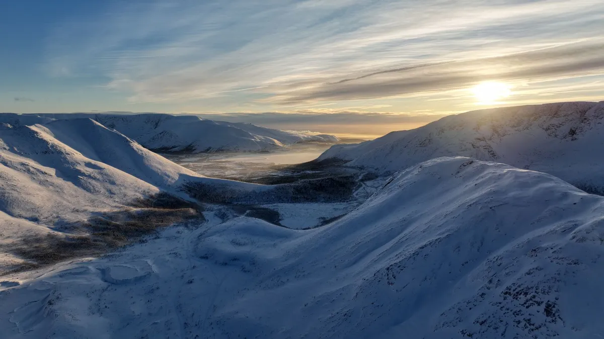

Venturing into the Arctic Vault: Getting to Longyearbyen The journey to the Svalbard Global Seed Vault begins not with a plane touchdown but with a series of deliberate steps that blend adventure, logistics, and a pinch of daring. Longyearbyen, the archipelago’s modest capital, serves as the gateway for every traveler, researcher, and curious wanderer who wishes to set foot on the icy ground where humanity’s botanical heritage rests. First, secure a flight to Oslo, Norway’s bustling hub. From there, airlines such as SAS and Norwegian Air Shuttle operate regular connections to Longyearbyen Airport (LYR). The flight itself lasts roughly three hours and offers a dramatic transition: one moment you’re soaring above fjords, the next you’re gliding over a sea of white, with the iconic, snow‑capped mountains of Spitsbergen emerging from the clouds. Upon arrival, the airport’s small size means you’ll be greeted by a handful of staff, all fluent in Norwegian and English, who can guide you to the town’s modest bus terminal. The town is compact—most amenities are within a 10‑minute walk from the harbor. A short stroll brings you to the iconic Svalbard Museum, where you can absorb the region’s polar history before heading north toward the vault. The seed vault itself lies 1.6 kilometers (just under a mile) from Longyearbyen, perched on the remote side of the island’s frozen plateau. Access is strictly by appointment, coordinated through the Norwegian Ministry of Climate and Environment. The vault’s entrance is an unassuming concrete building that blends into the stark landscape. Yet, hidden behind its modest façade is a steel door that seals a mountain‑carved chamber, sealed with a 1.5‑meter‑thick permafrost wall. When you finally stand before the vault’s massive door, the cold bites at your cheeks, and the silence is broken only by the distant howling of Arctic winds. The experience is akin to stepping into a time capsule, a place where the world’s agricultural diversity is stored beneath a kilometer of permafrost. The vault’s design—two concentric steel doors, a ventilation system that prevents moisture buildup, and a backup power supply that can keep the interior at a constant -18°C for decades—reflects decades of engineering foresight.The road leading to the vault is a stark, white ribbon cutting through the tundra, a visual reminder of the isolation that protects these priceless seeds. While the vault itself is off‑limits to the public, visitors are allowed a brief, guided glimpse of the exterior and the surrounding landscape. This privilege is granted to journalists, scientists, and a select few travel influencers who have obtained a special permit from the Svalbard Global Seed Vault Administration. The permit process involves a background check, proof of purpose (e.g., journalism, research, or educational outreach), and a non‑disclosure agreement that protects the vault’s security protocols. Beyond the physical journey, there’s an emotional pilgrimage. Knowing that the vault holds over one million seed samples—representing 70 percent of the world’s crop diversity—imbues each step with a sense of stewardship. As you walk the icy path, you’re reminded that this silent repository is a safeguard against global catastrophes, from climate change to pandemics. It is, in many ways, the most literal embodiment of “planting hope for the future.”Inside the Global Seed Archive: What the Vault Holds The Svalbard Global Seed Vault, often called the “Doomsday Vault,” is more than a concrete bunker; it is a meticulously curated living library of the planet’s agricultural DNA. Operated jointly by the Norwegian government, the Global Crop Diversity Trust (Crop Trust), and the Nordic Genetic Resource Center (NordGen), the vault’s primary mission is to provide a safety net for seed collections stored in gene banks worldwide. To date, the vault houses over 1.1 million seed samples from more than 5,000 distinct plant species. These include the staples that feed billions—wheat, rice, maize, barley, and sorghum—as well as less common crops such as quinoa, teff, and ancient varieties of beans. Each seed packet is sealed in a hermetically sealed, moisture‑proof foil pouch, then placed inside a stainless‑steel box that can withstand the harsh Arctic conditions. The vault’s collection strategy follows a “tri‑duplication” principle:Primary storage – National and regional gene banks keep the original living collection. Secondary backup – Duplicate samples are stored in regional seed banks, often in temperate zones. Tertiary safety – The final duplicate travels to Svalbard, where the permafrost provides a natural refrigeration system.This redundancy ensures that even if a regional disaster destroys a local collection, the genetic material remains safe elsewhere. In 2015, for instance, the International Center for Agricultural Research in the Dry Areas (ICARDA) lost a substantial portion of its collection due to conflict in Syria. The Svalbard vault, however, retained intact duplicates, allowing the center to rebuild its living collections within months. The vault’s interior climate is a marvel of engineering. The temperature is maintained at a constant -18°C (0°F) thanks to the surrounding permafrost, which acts as a giant natural refrigerator. Humidity is kept below 15 percent, preventing seed germination and mold growth. Power is supplied by a combination of diesel generators and a backup battery system, but the vault’s design anticipates a scenario where external power is lost for up to 100 years—the permafrost would still preserve the seeds. Scientific research conducted within the vault’s adjacent laboratory (the “Svalbard Seed Laboratory”) focuses on seed viability testing, genetic sequencing, and cryopreservation techniques. Recent studies have employed next‑generation sequencing to map the genomes of ancient grain varieties, revealing genetic traits for drought tolerance that could be crucial for future crop breeding. The vault also serves an educational purpose. Interactive exhibits in Longyearbyen’s Svalbard Science Centre display 3D models of the vault’s interior, allowing visitors to virtually “walk through” the storage chambers. These exhibits explain the importance of genetic diversity, illustrate how climate change threatens crop resilience, and highlight the vault’s role in global food security.One of the most compelling stories emerging from the vault concerns the rediscovery of a 19th‑century wheat variety known as “Red Fife.” Thought extinct, viable seeds were found in the vault, germinated, and reintroduced to modern farms in Canada. This revival not only expanded culinary diversity but also re‑introduced a grain with superior disease resistance, underscoring the vault’s tangible impact on contemporary agriculture. In short, the vault is a silent, icy library where each seed packet represents a page of humanity’s agricultural narrative. Its existence is a testament to international cooperation, scientific foresight, and the belief that preserving genetic diversity is essential for the planet’s resilience.Living Like a Digital Nomad on Svalbard’s Icy Frontier Svalbard’s allure extends beyond the vault; the archipelago has emerged as a surprising haven for digital nomads seeking isolation, pristine nature, and a front‑row seat to climate change. According to the 2025 VisaGuide.World Digital Nomad Index, Svalbard scores a modest 2.91, placing it 13th globally for remote work suitability. While the score reflects challenges—extreme weather, limited connectivity, and high living costs—it also highlights unique advantages: no visa requirement for self‑sufficient travelers and the allure of living “at the edge of the world.” Eligibility and Residency The most crucial requirement for a digital nomad in Svalbard is financial self‑sufficiency. The live‑travel data indicates an income threshold of roughly $4,000 per month, which aligns with the region’s high cost of imported goods and limited local wage opportunities. As long as you can demonstrate this income—through bank statements, remote‑employment contracts, or freelance invoices—you can reside indefinitely without a formal visa. The only bureaucratic step is registering with the local police, a process that typically takes under an hour and involves providing proof of accommodation. Accommodation options range from modest apartments in Longyearbyen (average monthly rent: $2,500 for a one‑bedroom) to seasonal cabins known as “hytter” located further north. Many digital nomads opt for co‑living spaces that double as work hubs, featuring high‑speed satellite internet (average download speeds of 25‑30 Mbps) and communal workstations. The community is tight‑knit; networking events often revolve around shared meals featuring Arctic char, reindeer stew, or locally foraged berries. Connectivity and Workspaces Internet connectivity in Svalbard relies heavily on satellite links, as undersea fiber cables do not reach the archipelago. Providers such as Telenor and IceNet offer packages that combine a 5G mobile hotspot with a fixed satellite dish for home offices. While speeds are sufficient for video conferencing, large file transfers—particularly those involving high‑resolution media or scientific datasets—may require scheduling during off‑peak hours. Several cafés in Longyearbyen, like “Kaffebønna” and “Svalbard Bryggeri,” provide reliable Wi‑Fi, power outlets, and a warm, insulated environment. For those who prefer a more secluded setting, the “Arctic Lab” co‑working space offers private booths, ergonomic chairs, and a view of the snow‑covered fjord—a backdrop that fuels creativity. Lifestyle and Well‑Being Living in a polar environment demands careful attention to health and safety. The Arctic daylight cycle is extreme: continuous daylight from late April to late August (the “midnight sun”) and prolonged darkness from late October to mid‑February (the “polar night”). During the polar night, many residents combat Seasonal Affective Disorder (SAD) with light therapy lamps, a practice encouraged by local health clinics. Physical activity is woven into daily life. Cross‑country skiing, dog‑sledding, and guided glacier hikes serve both as recreation and as a means to stay warm. The community’s small size fosters a “neighbor‑watch” culture; locals look out for each other, especially when weather conditions make travel hazardous. Cultural Immersion Svalbard’s cultural scene is modest yet vibrant. The “Svalbard Festival” in February celebrates Arctic art, music, and storytelling, while “Polar Bear Night” in March raises awareness about wildlife conservation. Visitors can attend lectures at the University Centre in Svalbard (UNIS), where researchers share findings on glaciology, climate change, and polar biology—topics that resonate deeply with the seed vault’s mission.Embracing Svalbard as a digital nomad means balancing the allure of isolation with the responsibilities of self‑care. With proper planning—adequate heating, reliable power backups, and a clear communication schedule with clients—you can transform the stark Arctic landscape into a productive, inspiring office.Practical Logistics: Visa‑Free Stays, Costs, and Safety Navigating the practicalities of an Arctic expedition requires meticulous budgeting, an understanding of local regulations, and a solid safety plan. Below is a concise breakdown of the primary cost categories for a typical three‑month stay that includes a visit to the seed vault, accommodation in Longyearbyen, and a modest allowance for food and activities.Expense Category Approx. Monthly Cost (USD) Total for 3‑Month Stay (USD) NotesAccommodation (1‑bedroom apartment) $2,500 $7,500 Includes heating, water, and basic utilities.Food & Groceries (imported goods) $800 $2,400 Local produce limited; most items are imported.Internet & Mobile (satellite plan) $150 $450 25–30 Mbps download; unlimited data.Transportation (flights + local bus) $400 $1,200 Oslo‑Longyearbyen round‑trip $300; local bus pass $100.Seed Vault Permit & Guided Tour $250 $250 (one‑time) Includes permit processing and guide fee.Health Insurance (International) $120 $360 Must cover emergency evacuation.Miscellaneous (clothing, gear, activities) $300 $900 Warm layers, gloves, boots, and optional tours.Total $4,520 $13,560 Approximate; varies with personal spending habits.All figures are based on 2026 market rates and the live travel data indicating a $4,000 monthly income requirement for self‑sufficient residency. Visa‑Free Entry and Legal Considerations Svalbard is a part of the Kingdom of Norway but enjoys a unique visa‑free status under the Svalbard Treaty of 1920. Travelers from any nationality may reside indefinitely provided they are self‑sufficient—meaning they have sufficient funds, health insurance, and a place to live. No work permits are required for remote employment, but any on‑site employment (e.g., mining or research assistantship) must comply with Norwegian labor laws and may require a separate work permit. While a visa is unnecessary for Svalbard itself, entry to mainland Norway (including transit through Oslo) follows Schengen rules. Most travelers will need a Schengen visa if they do not hold a passport from a visa‑exempt country. It is advisable to arrange this visa before booking the Oslo‑Longyearbyen flight to avoid complications. Safety Protocols and Emergency Services The Arctic environment is unforgiving. Temperatures in winter can plunge below -30°C (-22°F), and sudden snowstorms can reduce visibility to near zero. The local emergency services are coordinated through the Longyearbyen Police Station, which also houses a modest medical clinic equipped for basic care and stabilization. For severe injuries or illnesses, patients are airlifted to Tromsø, Norway, via a helicopter service that costs approximately $10,000 per evacuation—underscoring the importance of comprehensive insurance. Wildlife encounters, particularly with polar bears, are a legitimate concern. While polar bears rarely enter Longyearbyen, they roam the surrounding tundra. The town enforces strict building codes: all homes and cabins must have bear‑proof doors and windows, and residents carry bear deterrent devices (e.g., flares, air horns). Guided tours outside the settlement provide bear‑safety briefings and, if needed, escort by trained guards. Sustainable Practices Given the fragility of the Arctic ecosystem, visitors are encouraged to follow “Leave No Trace” principles. This includes:Using refillable water bottles; melt snow only after proper filtration. Packing out all waste, especially non‑biodegradable items. Avoiding disturbance of nesting sites for seabirds and the fragile moss carpet that stabilizes the permafrost.Local authorities also impose a modest “environmental contribution” tax of $25 per visitor, which funds waste management and wildlife monitoring programs.By respecting these logistical and safety frameworks, travelers can enjoy a secure, responsible, and unforgettable Arctic adventure.Preserving the Future: The Science and Ethics of Seed Conservation The Svalbard Global Seed Vault is not merely a storage facility; it is a living laboratory that raises profound scientific and ethical questions about humanity’s relationship with biodiversity. At its core, the vault addresses a simple yet urgent challenge: How do we safeguard the genetic blueprints of the world’s food crops against unforeseen catastrophes? Scientific Rationale Crop genetic diversity underpins resilience. Each variety carries unique genes that confer tolerance to drought, pests, soil salinity, or temperature extremes. Modern agriculture’s reliance on a narrow set of high‑yielding cultivars—think the dominance of a few wheat or rice strains—creates vulnerability. Historical events, such as the 1970 Irish Potato Famine, illustrate how genetic uniformity can precipitate disaster. The vault’s strategy is to bank duplicate seed samples that can be regenerated if regional gene banks are compromised. Researchers employ seed viability testing—a process where a subset of stored seeds is germinated under controlled conditions to assess germination rates. Studies indicate that after 25 years at -18°C, most seeds retain >85% viability, a testament to the vault’s Related InsightsNeuralink’s Symbiotic Future: How Brain-Computer Interfaces Are Redefining Human-Machine Collaboration If Not You Book Review and Summary Betrayed Book Review and Summary
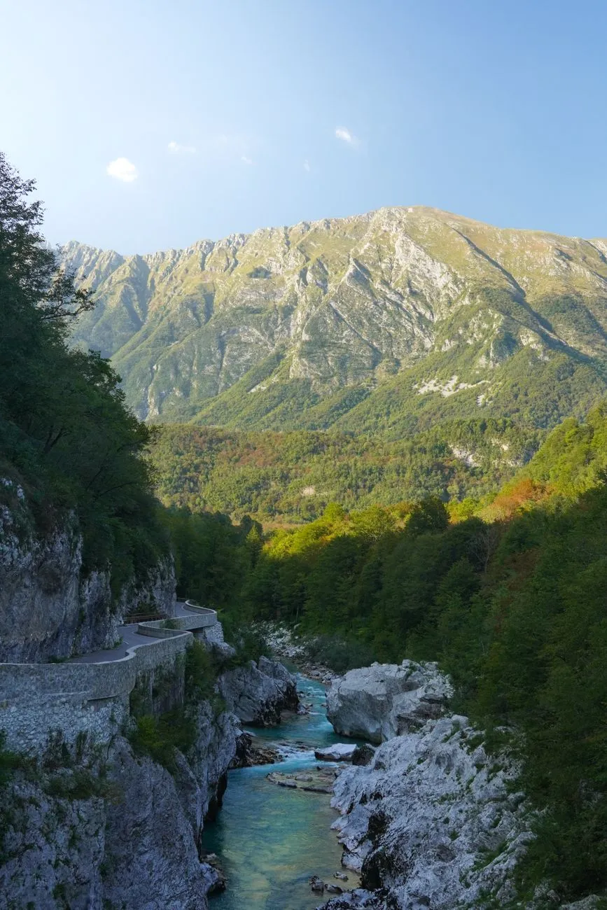
Emerald Waters and Alpine Peaks: The Geography That Fuels Adventure The Soča River, known locally as the “Emerald Beauty,” carves a 138‑kilometre corridor through the Julian Alps before spilling into the Adriatic. Its source lies in the Trenta Valley, where glacial meltwater gathers beneath the towering peaks of Triglav, Slovenia’s highest summit at 2 864 metres. This dramatic elevation drop creates a gradient that fuels world‑class white‑water conditions while simultaneously offering sheer limestone walls perfect for climbing and canyoning. The valley floor sits at roughly 200 metres above sea level, yet within a 30‑kilometre radius you gain more than 2 500 metres of vertical relief — a topographical cocktail that few European destinations can match. Geologically, the river follows a fault line that exposes layers of Triassic limestone and dolomite. These strata produce the river’s signature turquoise hue, a result of suspended rock flour refracting sunlight. The same limestone forms natural arches, caves, and overhangs that have become iconic backdrops for photographers and film crews alike. The valley’s microclimate is equally distinctive: Mediterranean warmth pushes northward along the river, while alpine breezes descend from the peaks, delivering mild summers (average 22 °C) and crisp, snow‑kissed winters that keep the river runnable well into October. Infrastructure has kept pace with nature’s generosity. The main artery, the Goriška cesta (Road 203), threads through Bovec, Kobarid, and Tolmin, linking the valley to Ljubljana in under two hours by car. Regular bus services run year‑round, and the newly upgraded railway stop at Most na Soči offers a low‑carbon alternative for travelers arriving from Italy or Austria. For the adventure‑focused visitor, a network of marked trails — ranging from the gentle Alpe‑Adria Trail to the technical Via Dinarica — connects every major put‑in point, allowing seamless transitions between paddling, hiking, and cycling without ever leaving the valley’s embrace.White‑Water Mastery: Kayaking, Rafting, and Canyoning on the Soča The Soča’s reputation as a paddling mecca rests on a spectrum of rapids graded from Class II to Class V, all within a single day’s reach. The upper reaches near Trenta serve up gentle, meandering currents ideal for beginners and family rafting trips. Guided half‑day tours typically start at the “Kluže” put‑in, where the river widens into a series of playful wave trains that teach fundamental boat control without overwhelming novices. Certified instructors from the Slovenian Rafting Association (SRA) maintain a 1:6 guide‑to‑guest ratio, ensuring safety standards that meet International Rafting Federation (IRF) guidelines. Mid‑valley, the “Bovec‑Kobarid” stretch escalates to solid Class III‑IV rapids such as “Koritnica” and “Soca Gorge.” Here, experienced kayakers test their eddy‑turn precision against limestone slots that demand millisecond timing. The annual Soča Extreme Kayak Race, held each July, draws elite paddlers from across the continent to negotiate a 5‑kilometre course that includes the notorious “Mala Koritnica” — a 4‑metre drop into a churning cauldron. Spectators line the riverbanks, and live‑streamed footage showcases the valley’s raw power to a global audience. Canyoning adds a vertical dimension to the aquatic playground. The “Šunik” and “Kozjak” canyons, both accessible from the village of Šunik, feature cascading waterfalls up to 30 metres, natural slides, and deep pools that invite controlled jumps. Local outfitters provide full‑gear packages (wetsuit, helmet, harness) and conduct mandatory safety briefings that cover rope‑work, swift‑water rescue, and environmental stewardship. The Slovenian Alpine Club (PZS) monitors canyon conditions daily, publishing real‑time flow rates on their website so adventurers can match their skill level to the day’s hydraulics.Sky‑High Perspectives: Paragliding and Mountain Biking Trails When the river’s roar fades, the valley’s ridgelines beckon. Paragliding launch sites at “Mangart” (2 300 m) and “Krn” (2 200 m) exploit reliable thermals that rise from the sun‑warmed valley floor. The Slovenian Paragliding Association (SPA) certifies over 30 tandem pilots who operate under EASA‑compliant regulations, offering 20‑minute flights that trace the river’s serpentine path from a bird’s‑eye view. On clear days, pilots can spot the Adriatic coastline 70 kilometres away, a visual reminder of the valley’s geographic reach. Mountain biking has exploded in popularity since the 2022 “Soča Trail” project, which stitched together 120 kilometres of singletrack, forest roads, and alpine meadows into a graded network. The “Red Loop” (difficult) climbs 1 200 metres over 35 kilometres, rewarding riders with technical rock gardens and panoramic vistas of the Triglav National Park. The “Blue Loop” (moderate) follows the river’s left bank, linking historic World War I sites such as the Kobarid Museum with quiet hamlets where locals serve homemade štruklji. Bike‑rental hubs in Bovec and Kobarid stock full‑suspension e‑MTBs, allowing riders of varying fitness to tackle the same terrain. Trail maintenance is a community effort. The “Friends of the Soča Trails” volunteer group conducts monthly clean‑ups, erosion control, and signage updates, funded partly by a €2 per‑day trail pass that contributes directly to the Triglav National Park’s conservation budget. This model ensures that the surge in two‑wheel traffic does not degrade the fragile alpine flora — edelweiss, alpine rose, and the endemic Soča trout’s spawning grounds.Cultural Roots and Culinary Fuel: From Trenta to Bovec Adventure in the Soča Valley is inseparable from its human story. The valley witnessed the brutal Isonzo Front of World War I, where over a million soldiers clashed among the same limestone cliffs that now host via ferrata routes. The Kobarid Museum, a UNESCO‑recognized site, presents a balanced narrative through artifacts, personal letters, and interactive maps, reminding visitors that the river’s turquoise flow once ran red. Guided “History Hikes” combine moderate trekking with storytelling, linking former trench lines to present‑day climbing crags. Gastronomy here is a direct reflection of the terrain. Alpine dairy farms produce “Tolminc” cheese, a protected designation of origin (PDO) product aged in mountain huts for at least 60 days. The cheese’s nutty, slightly piquant profile pairs perfectly with “žganci” — buckwheat porridge — served alongside locally foraged mushrooms and smoked pork “kranjska klobasa.” River‑front restaurants in Bovec specialize in “Soča trout” (Salmo trutta marmoratus), grilled over beech wood and drizzled with pumpkin seed oil, a regional specialty pressed from Styrian pumpkins. Wine lovers find a surprising ally in the “Goriška Brda” hills, just 30 kilometres south, where the microclimate nurtures Rebula (Ribolla Gialla) and Pinot Noir. Many valley guesthouses offer cellar tours, allowing guests to taste vintages that echo the same limestone soils that color the river. The annual “Soča Gourmet Festival” in late September showcases farm‑to‑table menus, cooking workshops, and a “Cheese & Wine Pairing” competition judged by Slovenian Master Sommeliers. Living the Nomad Dream: Visas, Costs, and Connectivity in the Valley Slovenia’s digital‑nomad permit, introduced in 2023, has turned the Soča Valley into a viable long‑term base for remote professionals. The permit requires proof of a monthly net income of at least €3 200 — roughly twice the national average net salary — and a clean criminal record. Once granted, the visa allows a stay of up to 12 months, renewable if the income threshold remains met. Application fees total €120, and processing typically concludes within 30 days through the Administrative Unit (Upravna enota) in Nova Gorica. Connectivity is robust: fiber‑optic broadband reaches Bovec, Kobarid, and Tolmin with symmetrical 1 Gbps plans priced around €45 per month. Mobile coverage (4G/5G) blankets the valley, and several coworking spaces — “Basecamp Bovec” and “River Hub Kobarid” — offer day passes (€15) and monthly memberships (€180) that include meeting rooms, high‑speed Wi‑Fi, and community events. Cost‑of‑living data from Numbeo (2024) shows that a single person can expect the following average monthly outlays in the valley:Category Average Monthly Cost (€)Rent (1‑bedroom, centre) 650‑850Utilities (electricity, water, heating) 120‑150Internet (1 Gbps fiber) 45Groceries (local markets) 250‑300Dining out (mid‑range, 2×/week) 180‑220Transport (Related InsightsOne Hundred Years of Solitude Book Review and Summary Jurassic Park Book Review and Summary Beloved Book Review and Summary
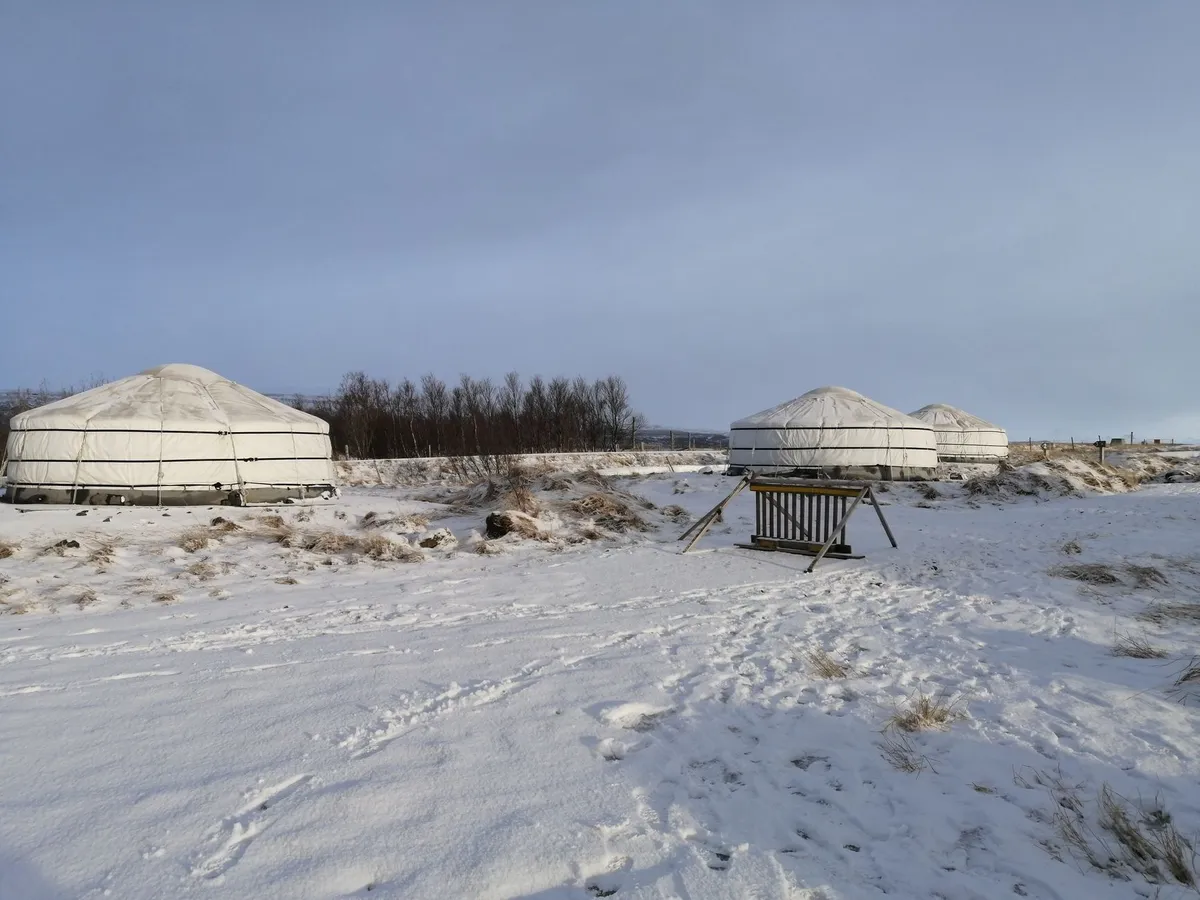

Dawn Over the Tien Shan: Arriving in Kyrgyzstan The first light that kisses the jagged ridges of the Tien Shan feels like a promise. I stepped off the plane in Bishkek with a backpack, a laptop, and a 60‑day visa‑free stamp that covers roughly seventy nationalities — no formal digital‑nomad visa exists, but the eVisa portal lets you extend to ninety days for a modest government fee. The capital’s wide boulevards, Soviet‑era mosaics, and bustling bazaars serve as a practical launchpad before you trade concrete for felt. Bishkek’s median monthly cost sits at $1,210 according to Numbeo’s 2026 snapshot, a figure that already includes a modest apartment, utilities, and the fiber‑optic broadband that most landlords bundle in. Coworking spaces such as Ololo or Bishkek Hub charge $50‑$150 per month, and a local prepaid SIM with 10 GB of data costs $5‑$10, giving you instant 4G/LTE coverage across the city and most major highways. I spent my first week mapping the route to the high pastures, downloading offline maps, and testing the latency on a video call — consistently under 80 ms, more than enough for synchronous work. The transition from urban rhythm to nomadic tempo begins the moment you board a shared marshrutka toward Kochkor or Naryn, where the road climbs into valleys that have hosted shepherds for millennia.Setting Up Camp in a Felt Fortress: The Yurt Homestay Experience A Kyrgyz yurt — locally called a “boz ui” — is more than a shelter; it is a portable cosmos woven from felt, wood, and tradition. Families who open their winter camps to travelers typically provide a central stove, layered felt insulation, and a low wooden platform for sleeping. The host will greet you with a bowl of kumis (fermented mare’s milk) and a stack of fresh boorsok, the golden fried dough that fuels long days on horseback. Privacy is communal: you share the central space with the family, but a curtained alcove can be arranged for a laptop and a power strip. Electricity comes from a small solar array or a generator that runs a few hours each evening — enough to charge devices and run a portable router. Water is fetched from a nearby spring, and the toilet is a simple pit latrine screened by a felt flap. The rhythm of the day follows the herd: milking at dawn, cheese‑making mid‑morning, and a communal dinner of beshbarmak (boiled meat with noodles) under a sky dense with stars. I learned to respect the unwritten etiquette — never step on the threshold, always accept the first sip of tea, and offer a small gift (a pack of tea or a flashlight) when you depart. The experience is raw, unfiltered, and profoundly grounding for anyone used to sterile hotel rooms.Connectivity in the Steppe: Internet, SIMs, and Coworking Staying productive while the wind whistles through the felt walls demands a deliberate connectivity strategy. In the high valleys, 4G coverage is surprisingly robust along the main arteries — Bishkek‑Osh, Bishkek‑Karakol — but drops sharply once you leave the paved road. I carry two SIMs: a Beeline plan for the city and a Megacom “Tourist” package that includes 15 GB for $12, valid for 30 days. Both operators support tethering, turning a phone into a mobile hotspot for a laptop. For bandwidth‑heavy tasks (video editing, large repo pulls) I schedule a weekly “city sprint” in Bishkek, where fiber‑to‑the‑home delivers 200‑300 Mbps symmetric speeds — well above the 25 Mbps threshold most remote‑work policies require. Coworking hubs in the capital also provide meeting rooms, printing, and a community of fellow nomads who exchange trail intel. When the signal fades, I rely on offline‑first tools: Git with local commits, Notion’s offline mode, and pre‑downloaded reference PDFs. A compact 10,000 mAh power bank and a foldable 30 W solar panel keep the laptop alive during multi‑day treks. The key Related InsightsExploring the Antioxidant-Rich Delights of Borscht with Kefir and Dill A Map to Murder: A Serial Killer Guide to San Francisco Mystery Book Review and Summary Illicit Temptations Book Review and Summary
-
 Zola Ndlovu
 - 14 Oct, 2026 21:55
Tasmania's Tarkine Rainforest: Hiking Through Earth's Last Temperate Wilderness
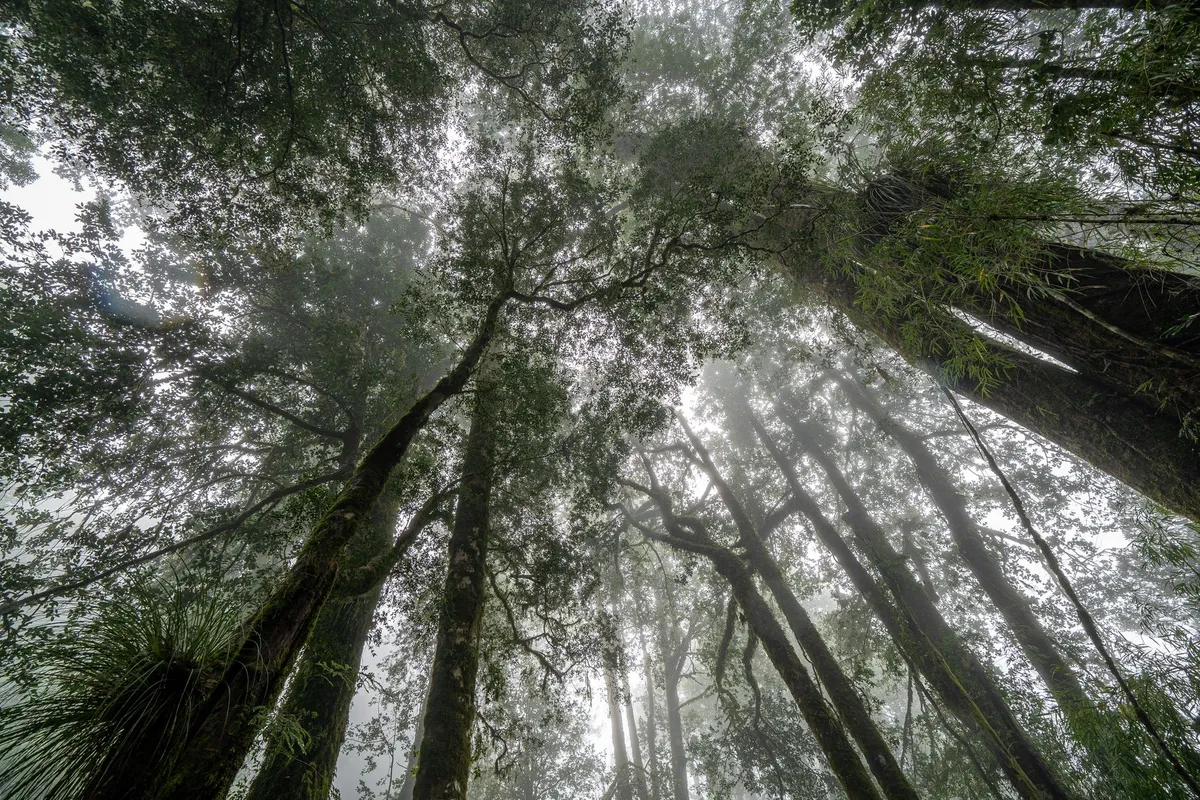
Footsteps on the Edge of Time The Tarkine stretches across 447,000 hectares of north‑west Tasmania, a living museum of Gondwanan flora that has survived ice ages, volcanic upheavals, and the slow creep of human industry. When I first set foot on the damp, spongy floor of the Myrtle Beech groves, the air tasted of wet stone and sweet eucalypt oil. The canopy, a cathedral of 60‑metre giants, filters sunlight into a green‑gold mosaic that shifts with every breeze. Planning a multi‑day trek here begins with the Tarkine Coast Track, a 55‑kilometre route that threads between the Southern Ocean and the rainforest’s interior. The track is divided into four sections, each demanding a different skill set: coastal navigation on exposed headlands, river crossings on the Arthur River, and steep ascents through the Meredith Range. I recommend allocating five nights to absorb the rhythm of the forest — two nights at the coastal campsite near Sandy Cape, one at the historic mining settlement of Corinna, and two deeper in the wilderness at the Savage River hut. Logistics are straightforward but unforgiving. The nearest sealed road ends at the Arthur River bridge; from there a 4WD track leads to the trailhead. Fuel, food, and water must be carried in, as there are no resupply points beyond the small general store at Corinna. A satellite messenger or PLB is non‑negotiable; mobile coverage evaporates once you pass the last farm gate. Where the Myrtle Beech Whispers The Myrtle Beech (Nothofagus cunninghamii) dominates the Tarkine’s heart, its smooth, cinnamon‑barked trunks forming a continuous canopy that shelters an understory of ferns, mosses, and the endemic Tasmanian waratah. Walking among these trees feels like moving through a library where every leaf is a page of evolutionary history. The species is a relic of the ancient supercontinent Gondwana, and its presence here is one of the few places on Earth where it still forms extensive pure stands. Birdsong punctuates the silence: the sharp “tsee‑tsee” of the pink robin, the low boom of the Tasmanian wedge‑tailed eagle, and, if you’re lucky, the haunting call of the orange‑bellied parrot — one of the world’s rarest migratory birds, which uses the Tarkine’s coastal heathlands as a critical stopover. Mammals are more elusive; the Tasmanian devil forages at night, leaving distinctive scat on the trail, while the eastern quoll darts through the leaf litter. A practical tip: carry a lightweight field guide (or a downloaded PDF) to identify the 200‑plus plant species you’ll encounter. The Tarkine’s flora includes the ancient King Billy pine, the delicate leatherwood, and the carnivorous sundew that traps insects on sticky tentacles. Knowing what you’re looking at deepens the experience and aids citizen‑science projects that monitor biodiversity health. Navigating the Wild River Corridors The Arthur River, the longest river wholly within Tasmania, carves a sinuous path through the Tarkine, creating a series of deep gorges, tranquil pools, and rapid‑filled chutes. Crossing it is the most technical part of the trek. The official crossing point at the Arthur River bridge is a steel structure built in the 1960s for logging trucks; it remains the only reliable dry crossing for hikers. From the bridge, the track follows the river’s left bank, weaving through riparian zones where the water’s edge is lined with swamp gum and paperbark. Here, the trail can become a muddy scramble after rain, so waterproof gaiters and a sturdy pair of trekking poles are essential. I learned the hard way that a sudden downpour can raise the river level by half a metre in under an hour, turning a shallow ford into a dangerous torrent. For those seeking a longer immersion, the Savage River loop adds 30 kilometres of remote valley walking. The Savage River hut, a basic three‑room shelter maintained by the Parks and Wildlife Service, offers a dry roof and a rainwater tank — but no cooking facilities. Bring a portable stove, fuel canisters, and a bear‑proof food container (the latter is mandatory under Tasmanian law to protect wildlife). Campfire Stories Beneath the Canopy Evenings in the Tarkine are a symphony of nocturnal life. After a day of climbing the Meredith Range’s quartzite ridges, the temperature drops to single digits, and the forest exhales a cool, fragrant mist. Setting up a tarp shelter under a stand of towering eucalypts provides both protection and a front‑row seat to the night sky — one of the darkest in Australia, rated Bortle Class 2. Cooking is simple: dehydrated meals rehydrated with boiled river water (filtered through a 0.2‑micron pump), supplemented by locally sourced wallaby jerky and Tasmanian pepperberry. The pepperberry’s sharp, citrusy heat adds a unique twist to otherwise bland rations. Remember to pack out all waste; the Tarkine’s “Leave No Trace” policy is strictly enforced, and rangers conduct random checks. Storytelling around the campfire (or headlamp, when fire bans apply) connects you to the land’s deep human history. The Palawa people have walked these valleys for over 35,000 years, leaving middens, rock art, and cultural landscapes that are still being documented. Respectful visitors can join guided cultural walks offered by the Tasmanian Aboriginal Centre, which illuminate the spiritual significance of sites like the Sundown Point petroglyphs. Budgeting the Journey: Real Costs on the Ground Understanding the financial side of a Tarkine expedition prevents surprises. The live cost‑of‑living data for Tasmania shows a digital‑nomad baseline of $3,858 per month, but a focused hiking trip compresses expenses into a two‑week window. Below is a breakdown tailored to a solo trekker carrying all gear, based on current Tasmanian prices.Expense Category Estimated Cost (AUD) NotesAccommodation (pre‑/post‑trek) $1,372 – $4,844 Range reflects hostel dorms to private cabins in nearby towns (Smithton, Stanley).Food & Groceries $389 Two weeks of dehydrated meals, snacks, and fresh produce bought in Launceston.Dining Out (pre‑/post‑trek) $506 Occasional restaurant meals in Devonport or Burnie.Transport (fuel, ferry, 4WD hire) $172 Fuel for 600 km round‑trip + $50 for the Spirit of Tasmania ferry if arriving from mainland.Park Permits & Fees $30 Tarkine Wilderness Permit (per person, per night).Gear Rental (satellite messenger, PLB) $120 14‑day rental from Hobart outdoor shop.Insurance (travel & medical) $85 Comprehensive policy covering remote evacuation.Total Approximate $2,674 – $6,146 Varies with accommodation choice and gear ownership.These figures assume you already own a quality backpack, tent, and clothing. If you need to purchase core gear, add another $1,200–$2,500. The table demonstrates that a well‑planned Tarkine hike can be achieved for under $3,000 if you camp throughout and source food economically. The Echo That Lingers Leaving the Tarkine feels like stepping out of a dream you didn’t know you were dreaming. The scent of wet bark clings to your clothes, the sound of the Arthur River lingers in your ears, and the memory of a wedge‑tailed eagle’s silhouette against a bruised sunset settles into your ribs. This place does not merely exist on a map; it lives in the pulse of every ancient tree, every hidden waterfall, every breath of wind that has travelled unchanged for millennia. If you carry the Tarkine’s silence back to the city, you’ll find it reshaping how you listen — to colleagues, to loved ones, to the quiet moments between notifications. The wilderness teaches a rhythm that no spreadsheet can quantify, yet the numbers above prove the journey is reachable. Pack light, tread softly, and let the forest write its story on you. #Travel #Tarkine #Tasmania #Hiking #Wilderness Related InsightsBeautiful World, Where Are You Book Review and Summary I Know Why the Caged Bird Sings Book Review and Summary >-
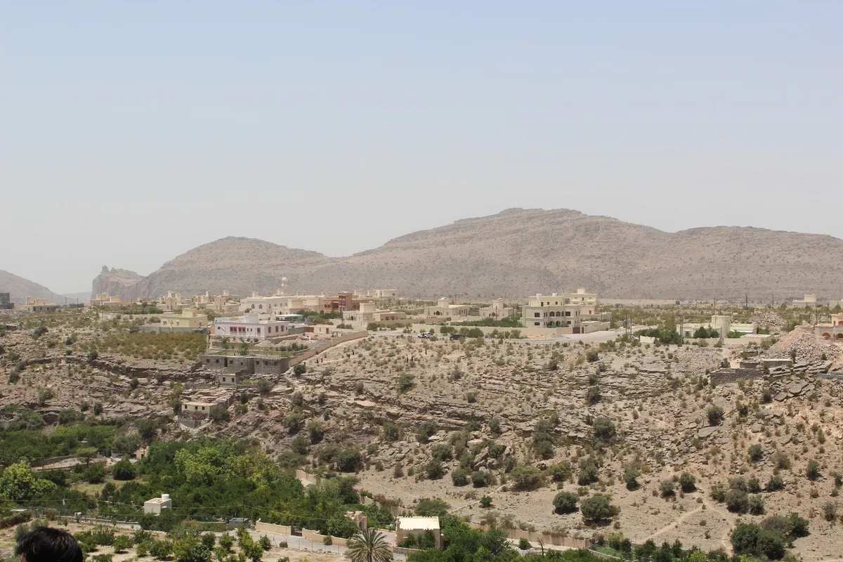
A Desert Rose Blooms – The Rise of Oman’s Tourist Flow The Arabian Peninsula’s jewel, Oman, has transformed its visitor numbers into a soaring arc. From 3.1 million guests in 2017 to 4.1 million in 2019, the nation’s tourism sector has become a cornerstone of the economy, a trajectory first forecast in a 2013 report that foresaw it becoming one of the country’s largest industries. Muscat, the capital, earned worldwide acclaim when Lonely Planet crowned it the best city to visit in 2012, and the same year it was named Capital of Arab Tourism. These accolades echo a strategic blend of natural splendor, cultural depth, and modern hospitality that draws explorers from every corner of the globe.Seamless Entry – Visa Essentials for the Global Traveller Oman welcomes visitors with a clear visa framework. Citizens of the Gulf Cooperation Council travel visa‑free, while 69 other nationalities can secure a 30‑day e‑visa online. The only prerequisite for all guests is a passport valid for at least six months. This streamlined process removes barriers, letting travelers focus on the adventure that awaits.Sun‑Kissed Shores – Beach Activities Along Oman’s Coast Stretching along the Arabian Sea, Oman’s coastline offers a playground for water lovers. Resort hotels dot the western and eastern fringes of Muscat, providing immediate access to a menu of activities:Sunbathing and swimming on pristine sands Kitesurfing, powered by a reliable daily sea breeze—popular spots include Muscat, Al Sawadi Beach, Alzaiba Beach, and Masirah Island Diving and snorkeling amid vibrant marine life Boating, water scooters, and surfing for the thrill‑seekers Beach combing, shell collecting, and fishing excursions for the contemplative explorerWhispering Dunes – Desert Safaris in the Sharqiya Sands Formerly known as Wahiba Sands, the Sharqiya Sands present a dramatic canvas of golden dunes. Visitors can embark on camelback rides or four‑wheel‑drive journeys that culminate in authentic desert experiences:Overnight stays in traditional Barsti huts Barbecues under a starlit sky Sandboarding and camel racing Visits to Bedouin communities, offering a glimpse into nomadic lifeThese safaris combine adrenaline with cultural immersion, showcasing the resilience and hospitality of Oman’s desert heritage.Hidden Underworlds – Caving Adventures in Limestone Mountains Oman’s rugged mountains harbor a labyrinth of limestone caves, many formed by centuries of sedimentary activity. The Ministry of Tourism unveiled a development plan in 2008 to showcase Majlis al Jinn, the world’s second‑largest cavern, as a show cave. The earlier success of Al Hoota Cave—drawing 75 000 visitors in its inaugural year—demonstrates the public’s appetite for subterranean wonder. For the adventurous, amateur‑friendly sites such as Muqal Cave in Wadi Bani Khalid and caves in Baydiah (Ash Sharqiyah) offer accessible exploration, while more demanding chambers require specialized equipment and expertise.Market Mazes – Souqs That Pulse With Omani Craft Every Omani town boasts a souq, but the Ruwi and Muttrah markets in Muscat stand out as bustling hubs of tradition. Stalls overflow with silver and gold artefacts, hand‑woven textiles, and other handcrafted treasures. These markets serve not only as shopping destinations but also as living museums of Omani artisanal skill.Stone Sentinels – Forts Guarding History Nearly every Omani settlement is crowned by a fort, many erected or expanded during the Al‑Yarubi dynasty (1624‑1744). Designed as refuges, these fortifications feature water wells, food stores, and secret tunnels extending kilometers beyond their walls. In peace, they have functioned as administrative centers, schools, and community spaces, embodying a seamless blend of defense and daily life.UNESCO Treasures – World Heritage Sites That Define Oman Four cultural sites in Oman have earned UNESCO recognition, each narrating a distinct chapter of the nation’s past:Bahla Fort – The stronghold of the Nabhani dynasty, a medieval power that prospered across the Arabian Peninsula. Archaeological Sites of Bat, Al‑Khutm, and Al‑Ayn – Settlements and necropolises dating to the 3rd millennium BCE, with Bat’s necropolis illustrating early Bronze Age funeral customs. Land of Frankincense – A network of ancient ports (Khor Rori, Al‑Baleed) and caravan oases (Shisr, Wadi Dawkah) that once fueled a global luxury trade in fragrant resin. Falaj Irrigation Systems – Five ingeniously engineered water‑distribution networks, inscribed in 2006, that harness gravity to sustain Omani agriculture since at least 500 CE.These sites weave together commerce, spirituality, and engineering, offering travelers a tangible link to millennia of human ingenuity.Festive Rhythms – Cultural Events That Light Up the Calendar Oman’s cultural calendar is a vibrant tapestry of festivals and performances:Muscat Festival (January–February) – International exhibits paired with displays of traditional Omani lifestyle, art, and circus street theatre. Salalah Festival (July–August) – A family‑focused celebration in the cooler southern region, showcasing cultural, traditional, and modern artistic shows. Cultural Theatre Program (December–March) – Staged at historic venues such as Al Flayj Castle and Al Morooj theatres, featuring global groups in a series of evening performances.These events invite visitors to engage directly with Omani heritage, from music and dance to craft and cuisine.Racing the Horizon – Sporting and Adventure Events Oman’s love of speed and stamina is evident in a suite of high‑profile competitions:Horse and Camel Racing (September–June) – Races at Seeb’s royal stables and across Al Kamil/Al Wafi, with long‑distance camel sprints on public holidays and National Day. Dubai–Muscat Offshore Sailing Race (January) – A grueling regatta that navigates the Straits of Hormuz before docking at Bandar Al‑Rawdah Marina. Sinbad Classic (April) – An international deep‑sea fishing contest serving as an IGFA World Championships qualifier. Oman Adventure (November) – A five‑day endurance challenge pairing a runner and a cyclist, demanding self‑sufficient planning for food, water, and gear. Oman International Rally (March) – A cornerstone of the Middle East Rally Championship. Bidiyah Challenge (February) – A daring dune‑scale race in Bidiya, Sharqiyah Region. Tour of Oman (since 2010) – A professional road‑cycling stage race on the UCI Asia Tour, designed to promote cycling, showcase Oman’s scenery, and stimulate trade.These events draw athletes and spectators worldwide, reinforcing Oman’s reputation as an adventure destination.Crafting Your Oman Itinerary – Practical TipsVisa Planning – Secure an e‑visa if you’re among the 69 eligible nations; ensure your passport’s six‑month validity. Seasonal Choices – The Salalah Festival offers cooler weather in July–August, while the Muscat Festival shines in winter months. Activity Pairing – Combine a desert safari in Sharqiya Sands with a night at a Barsti hut, then head to the coast for kitesurfing at Al Sawadi. Cultural Respect – Visit souqs early to avoid crowds, and dress modestly when exploring forts and museums.The Road Ahead – Why Oman Remains a Must‑Visit Oman’s tourism story is one of purposeful growth anchored in authentic experiences. From the rhythmic chants of camel races to the silent awe of Majlis al Jinn, the country offers a spectrum of attractions that satisfy both the casual traveler and the intrepid explorer. Its strategic visa policies, diverse natural playgrounds, and UNESCO‑listed heritage sites position Oman as a destination that not only welcomes visitors but invites them to become part of its living narrative. As the numbers rise and global recognition expands, Oman stands ready to share its sands, seas, and stories with the world—one unforgettable journey at a time.#Travel #Oman #Adventure #CulturalHeritage #Explore Related Insights>- Damned If I Do Book Review and Summary Counting Down to You Book Review and Summary

-
 Hans Müller
 - 13 Oct, 2026 22:05
Wo die Zeit stillsteht: Madagaskars vergessene Pfade zwischen Lemurenrufen und kolonialen Schatten
Das Erbe von 169 Millionen Jahren Einsamkeit Es gibt Orte auf dieser Welt, die nicht nur geographisch isoliert sind, sondern evolutionär in einer eigenen Zeitrechnung leben. Madagaskar ist so ein Ort. Seit etwa 169 Millionen Jahren driftet die viertgrößte Insel der Welt als einsamer Kontinent im Indischen Ozean, losgelöst vom afrikanischen Festland, losgelöst von den evolutionären Wettrüsten des Hauptlandes. Was hier entstand, ist ein biologisches Laboratorium ohne Parallelen: Ein Refugium, in dem über 90 Prozent der Tier- und Pflanzenarten nirgendwo sonst auf der Erde existieren. Wer heute als Reisender den roten Lateritboden betritt, betritt kein Urlaubsziel im klassischen Sinne – er betritt ein lebendes Museum der Evolution. Die Zahlen lesen sich wie ein Fiebertraum für Biologen: Mehr als die Hälfte der hier brütenden Vogelarten sind Endemiten. Orchideen entfalten ihre Blüten in tausenden Variationen, von denen die Mehrheit ausschließlich madagassisch ist. Doch die wahren Botschafter dieser Insel tragen Fell und große, fragende Augen. Die Lemuren – jene Urahnen der Primaten, die anderswo von höheren Affen verdrängt wurden – haben hier ihre letzte Bastion. Vom winzigen Mausmaki bis zum Indri, dem größten lebenden Lemuren, dessen geisterhafte Gesänge den Nebelwald von Analamazaotra durchdringen wie ein Ruf aus einer anderen Zeit.Wo der Indri den Takt angibt: Analamazaotra Vier Stunden Fahrt östlich der Hauptstadt Antananarivo, dort wo die RN2 sich durch das grüne Rückgrat der Insel windet, liegt das Analamazaotra-Reservat, besser bekannt als Périnet. Es ist nicht irgendein Nationalpark; es ist die Bühne für Madagaskars bekanntesten Sänger. Der Indri (Indri indri) springt nicht – er gleitet. Mit Sprüngen von bis zu zehn Metern bewegt er sich durch die Krone der Urwälder, und wenn er morgens seinen Territorialgesang anstimmt, verstummt der Wald. Ein Chor aus langgezogenen, modulierten Heultönen, der Kilometer weit trägt. Diese akustische Visitenkarte hat Périnet zum meistbesuchten Schutzgebiet der Insel gemacht. Doch der Indri ist nur der prominenteste Bewohner. Wer hier geduldig auf den Moospolstern sitzt, entdeckt den Diadem-Sifaka mit seinem seidenen Fell, den Rotbauchlemur oder – mit gewaltigem Glück – den Aye-Aye, jenen nachtaktiven Sonderling mit dem skeletthaften Mittelfinger, der Larven unter Rinde aufstochert wie ein Natur-Techniker. Die Biodiversität hier ist kein abstrakter Begriff; sie ist greifbar, hörbar, riechbar. Der Duft von feuchtem Laub, der Geschmack von Regen in der Luft, das Knacken von Zweigen über dem Kopf – Tourismus in Madagaskar beginnt dort, wo das Beobachten zum Eintauchen wird. Steine, die Geschichte atmen: Ambohimanga und der Rova Doch Madagaskar ist nicht nur Biologie. Die Insel trägt eine Menschheitsgeschichte, die so komplex ist wie ihre Ökologie. In Antananarivo, der „Stadt der Tausend“, thront der Rova, der Königspalast der Merina-Dynastie, auf dem höchsten Hügel. Einst ein Holzpalast, später unter europäischem Einfluss in Stein gehüllt, brannte er 1995 fast vollständig nieder. Was blieb, ist eine Ruine, die mehr erzählt als jedes intakte Schloss: von der Macht der Merina-Könige, von der Christianisierung unter Ranavalona II., von der französischen Kolonialzeit, die 1896 begann. Die Restaurierung schleicht voran, doch der Geist des Ortes ist ungebrochen. Nur wenige Kilometer außerhalb liegt Ambohimanga, der „Blaue Hügel“, seit 2001 UNESCO-Weltkulturerbe. Hier residierten die Herrscher vor der Verlegung nach Antananarivo. Die Anlage ist ein Meisterwerk traditioneller Architektur: Tore aus monolithischen Steinscheiben, die nur durch menschliche Kraft rollbar waren, heilige Quellen, Bestattungsstätten der Könige. Ambohimanga ist kein Museumsdorf; es ist ein lebender spiritueller Ort, an dem noch heute Zeremonien stattfinden. Wer hier zwischen den Mauern wandelt, versteht, warum die Madagassen Fady (Tabus) nicht als Aberglaube, sondern als soziale Ordnung begreifen.Die Straße der Hände: Ambatolampy bis Fianarantsoa Es gibt eine Route, die kein Reiseführer als „Highway“ bezeichnen würde, die aber das kulturelle Rückgrat des Hochlands bildet. Die RN7 von Antananarivo nach Tulear im Süden ist eine Arterie des Handwerks. In Ambatolampy schlagen die Hämmer auf Aluminium. Aus alten Töpfen, Autoteilen, Schrott entstehen hier Töpfe, Pfannen, Lampenschirme – ein Recycling-Kreislauf, der industrieller Effizienz spotten könnte. Der Lärm der Gießereien ist der Soundtrack der Stadt. Weiter südlich: Antsirabé. Die „Stadt des vielen Salzes“ (so die Übersetzung) liegt auf 1.500 Metern, kühl, von Thermalquellen durchzogen, von Kolonialvillen gesäumt. Doch ihr Ruf gründet auf Feinheit: Edelsteine werden hier geschliffen, Stickereien mit Geduld genäht, die man in Europa kaum noch kennt, und Pousse-Pousse (Rikschas) fahren noch immer als Alltagsverkehr. Ein Stück weiter, in Ambositra, duftet die Luft nach Zeder und Palisander. Die Zafimaniry, Meister der Marketerie, intarsieren geometrische Muster in Möbel, Türen, Fensterläden – ein UNESCO-immaterielles Kulturerbe, das in jeder Werkstatt atmet. Das Ziel dieser Etappe ist Fianarantsoa, die „Stadt, wo man Gutes lernt“. Universitätsstadt, Weinbauzentrum (ja, Madagaskar macht Wein), Tor zum Ranomafana-Nationalpark. Hier endet die Handwerksroute nicht, sie verzweigt sich nur.Zahlen, die Geschichten erzählen: Der Tanz mit der Krise Tourismus in Madagaskar ist ein Überlebenskünstler. 312.000 Besucher zählte das Land 2006 – ein Wert, der im Vergleich zu den Nachbarinseln Seychellen oder Mauritius winzig wirkt. Doch das Durchschnittswachstum von 11 Prozent seit 1990 zeigt: Die Sehnsucht nach diesem „Anderswo“ ist stark. 60 Prozent der Gäste kommen aus Frankreich, getrieben von Sprache, Geschichte, direkten Flugverbindungen. Dazu gesellen sich Botaniker, Ornithologen, Lemur-Enthusiasten – Reisende, die Zeit mitbringen, oft drei, vier Wochen, organisiert in Kleingruppen. Die wirtschaftliche Wucht ist real: Mitte der 90er war Tourismus der zweitwichtigste Devisenbringer (50 Millionen US-Dollar jährlich). 2007 steuerte der Sektor 6,3 Prozent zum BIP bei und sicherte 206.000 Arbeitsplätze (5,1 Prozent der Gesamtbeschäftigung). In einem Land, in dem über 70 Prozent der Bevölkerung in Armut leben, ist das keine Marginalie – das ist Überlebensstrategie. Doch die Kurve kennt tiefe Einschnitte. Die politische Krise 2001/2002 ließ die Ankünfte einbrechen. 2008 erreichte man mit 375.000 Gästen einen vorläufigen Höhepunkt – nur um 2009 durch die nächste, langwierige Krise auf 255.922 (2012) abzustürzen. 2013, ein Wahljahr mit Sicherheitsproblemen in Nosy Be, sanken die Zahlen auf 198.816. Erst 2019 durchbrach man mit 486.000 Touristen die 400.000er-Marke. Jede Krise trifft die Ärmsten zuerst: Führer, Hotelfachleute, Handwerker, Taxifahrer. Zwischen Traum und Trauma: Die Infrastruktur-Falle Wer Madagaskar bereist, lernt Geduld. Nicht als Tugend, sondern als Notwendigkeit. Die Infrastruktur ist der Flaschenhals, der das Potenzial würgt. Straßen? Viele sind Pisten, die in der Regenzeit (November bis April) zu unpassierbaren Schlammrinnen werden. Die RN7, die wichtigste Nord-Süd-Achse, ist stellenweise asphaltiert – aber Schlaglöcher, die ganze Autos schlucken, sind Regel, nicht Ausnahme. Eine Strecke von 400 Kilometern kann zehn Stunden dauern. Die Luftfahrt ist ein Duopol: Air Madagascar (mittlerweile Madagascar Airlines) und Air France bestimmen Preise und Frequenzen. Inlandsflüge sind teuer, oft verspätet, manchmal gestrichen. Wer von Antananarivo nach Fort Dauphin oder Nosy Be will, kalkuliert Puffer ein – oder nimmt den Bus, ein Abenteuer für sich. Die Hotellandschaft? Etwa 550 Betriebe landesweit, aber nur rund 110 erfüllen internationale Standards. In der Spitzenklasse zählt man an einer Hand voll Resorts (meist auf Nosy Be, Île Sainte-Marie oder im Süden), die den Ansprüchen anspruchsvoller Langstreckenreisender genügen. Der Rest: charmant, oft familiär, aber mit Eigenheiten – Stromausfälle, lauwarmes Wasser, WLAN als Glücksspiel.Die Visa-Odyssee von 1985 – und wie sie heute aussieht Dervla Murphy, die irische Grande Dame der Reiseliteratur, beschrieb in Muddling Through in Madagascar (1985) die Visa-Beschaffung als bürokratisches Labyrinth. Für Briten und Iren führte der Weg 1983 über die Botschaft in Paris – achtzehn Minuten Dauer, nach monatelangem Vorlauf. „Je obskurer ein Land, desto verschlungener seine Bürokratie“, notierte sie trocken. Heute ist vieles einfacher: Visa on Arrival für die meisten Nationalitäten (30, 60, 90 Tage), online beantragbar, am Flughafen in bar (Euro oder Dollar) zahlbar. Doch die Erinnerung an Murphys Odyssee mahnt: Madagaskar liebt Formalitäten. Papiere, Stempel, Unterschriften – wer unvorbereitet ankommt, zahlt Lehrgeld. Und die Botschaften in Paris? Sie existieren noch immer als Drehscheibe für komplexere Anliegen. Nosy Be: Perle und Problemkind Nosy Be, die „Große Insel“ vor der Nordwestküste, ist Madagaskars touristisches Aushängeschild. Vulkanische Seen, Ylang-Ylang-Plantagen, deren Duft bei Windstille das Meer erreicht, Korallenriffe vor Nosy Tanikely, Nosy Komba, Nosy Sakatia. Hier konzentriert sich der Strandtourismus, hier liegen die wenigen 4- und 5-Sterne-Resorts, hier landen die Charterflüge aus Mailand, Paris, Warschau. Doch 2013 zeigte die Verwundbarkeit: Sicherheitsvorfälle, Raubüberfälle auf Touristen, politische Unruhen ließen die Zahlen einbrechen. Die Abhängigkeit von einem einzigen Hotspot ist riskant. Die Regierung versucht, den Tourismus zu streuen – in den Süden (Isalo, Andringitra, Ifaty), in den Osten (Masoala, Sainte Marie), in den Norden (Ankarana, Montagne d'Ambre). Doch ohne verlässliche Straßen und Flugverbindungen bleiben diese Juwelen für den Massentourismus schwer erreichbar.Ökotourismus als Rettungsanker – oder Illusion? Madagaskars Regierung hat Tourismus zur Armutsbekämpfungsstrategie erklärt. „Ökotourismus“ ist das Zauberwort: Schutzgebiete finanzieren sich durch Eintrittsgelder, lokale Gemeinden partizipieren an Einnahmen (z. B. Parkgebühren-Anteil), Arbeitsplätze entstehen als Führer, Köche, Träger. Projekte wie im Anja Community Reserve (Ringelschwanzmakis) oder im Kirindy-Wald (Fossa, Riesenspringratte) zeigen, dass es funktionieren kann. Doch die Schattenseite ist real. „Greenwashing“ blüht, wo Lodges „eco“ im Namen führen, aber Dieselgeneratoren 24/7 brummen. Müllentsorgung in Schutzgebieten ist oft ungelöst. Der Druck auf die letzten Waldreste durch Holzkohleproduktion und Brandrodung (Tavy) wird durch Tourismus allein nicht gestoppt – er braucht politische Durchsetzungskraft, die oft fehlt. Und: Der Langstreckenflug nach Madagaskar hat einen massiven CO₂-Fußabdruck. Echter Ökotourismus hier bedeutet: lange bleiben, wenig fliegen, lokal konsumieren, direkt buchen. Die unsichtbaren Helden: Führer, Fahrer, Köche Man reist nicht durch Madagaskar, man reist mit ihm. Der Fahrer, der den 4x4 über Pisten steuert, die kein Europäer wagen würde, der Pannen repariert mit Draht und Improvisation, der die besten Schokoladen-Croissants an abgelegenen Raststätten kennt. Der Führer im Nationalpark, der den Indri nicht nur hört, sondern sieht – hoch in der Krone, tarnfarben, unsichtbar für ungeübte Augen. Der die Rufe der Vögel nachahmt, der die Giftigkeit der Pflanzen kennt, der Geschichten erzählt von Vazimba (Ureinwohnern) und Zanahary (Schöpfergott). Die Köchin im Camp, die aus Reis, Related InsightsThe Perfect Match Book Review and Summary Siddhartha Book Review and Summary The Girl With the Dragon Tattoo Book Review and Summary
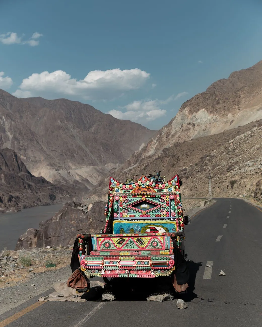
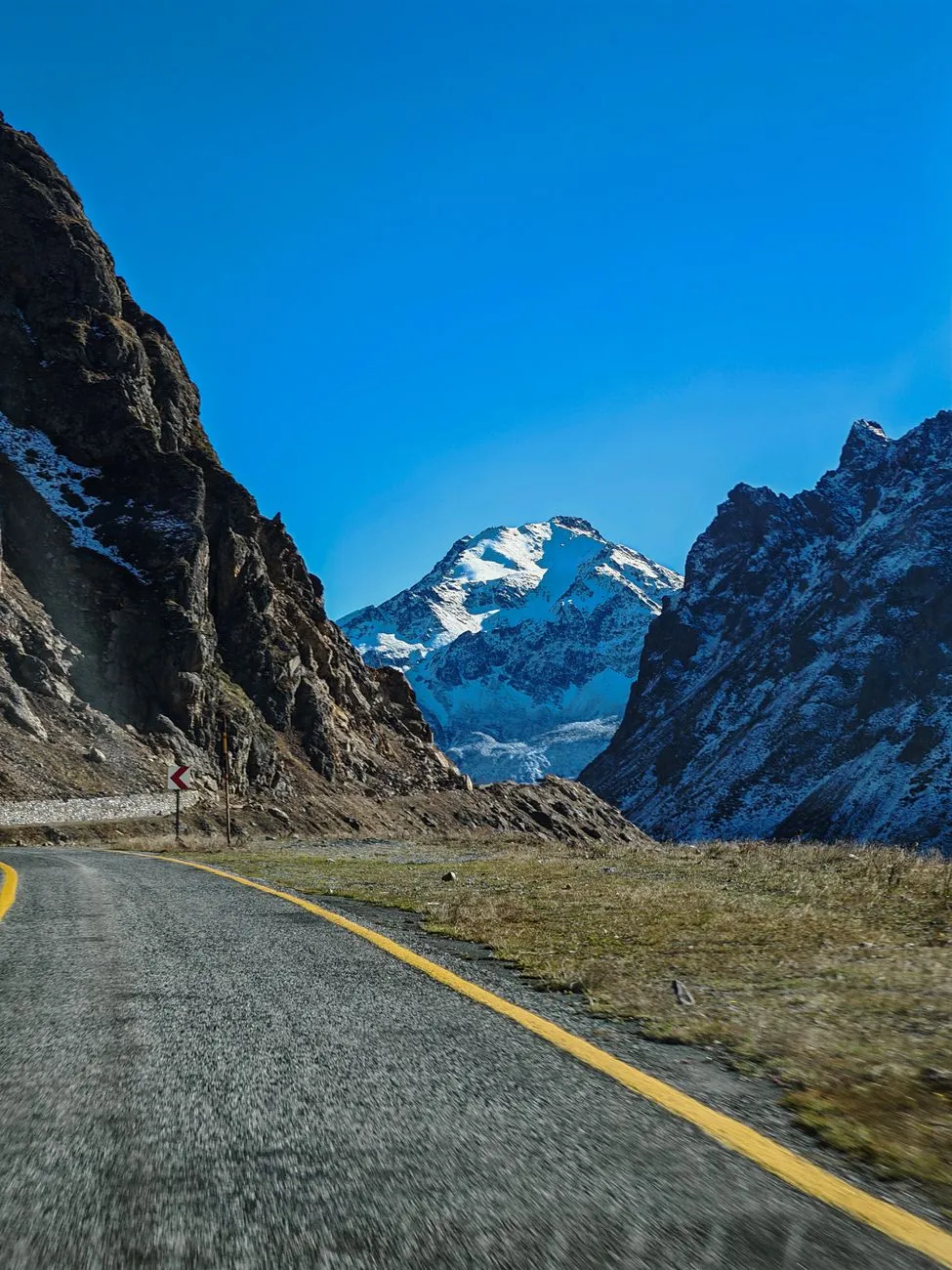
Crossing the Roof of the World: The Karakoram Highway Unveiled The Karakoram Highway (KKH) is often called the Eighth Wonder of the World, a 1,300‑kilometre ribbon of asphalt that stitches together the plains of Punjab with the icy ramparts of the Chinese border at Khunjerab Pass (4,714 m). Built between 1959 and 1979 by a joint Pakistani‑Chinese engineering corps, the road follows ancient Silk Road caravan routes, threading through the Indus, Gilgit, and Hunza valleys. The highway’s strategic importance is matched only by its raw beauty: sheer cliffs plunge into turquoise rivers, glaciers spill onto the tarmac, and villages cling to terraced slopes where apricot orchards bloom in spring. Driving the KKH is not a casual weekend jaunt. The altitude gains are relentless — Islamabad sits at 540 m, while the highest point at Khunjerab exceeds 4,700 m — meaning oxygen levels drop by roughly 40 % and weather can shift from bright sun to blizzard in minutes. The Pakistan Tours local operations team notes that the road is open year‑round, but the 150‑kilometre stretch between Besham and Chilas is prone to landslides during the monsoon (July‑September). Winter snow can close Khunjerab for weeks, and the border crossing operates only from 1 May to 31 October. Preparation begins long before the engine turns over. A reliable 4×4 with high‑ground clearance, a full‑size spare, and a set of snow chains is mandatory. Fuel quality improves after the major towns, yet stations become sparse beyond Gilgit; carrying an extra 20‑liter jerrycan is prudent. Mobile coverage is patchy — Telenor and Zong work in most valleys, but a satellite messenger (e.g., Garmin inReach) adds a safety net for remote sections. Finally, travel insurance that explicitly covers high‑altitude driving and medical evacuation is non‑negotiable; many standard policies exclude altitudes above 3,000 m. Visa, Permits, and the Paper Trail for the Northern Passes Foreign nationals entering Pakistan for a KKH road trip must secure a tourist visa (usually 30‑day single entry, extendable to 90 days) through the Pakistan Online Visa System. The e‑visa requires a passport valid for six months, a recent photograph, and a letter of invitation or hotel booking confirmation. As of the 2026 season, the visa fee for most Western passports is US $60, payable online. Beyond the visa, the highway demands two special permits. The first is the Northern Areas Permit (NAP), issued by the Ministry of Interior in Islamabad or at the Gilgit Deputy Commissioner’s office. The NAP covers travel in Gilgit‑Baltistan, including the Hunza, Nagar, and Skardu districts. Processing takes 2‑3 working days; applicants submit a copy of the visa, a detailed itinerary, and a no‑objection certificate (NOC) from their embassy if they are diplomatic or NGO staff. The second permit is the Khunjerab Border Pass, required only if you intend to cross into China. It is obtained at the Sost customs post (the last Pakistani settlement before the border) and demands a valid Chinese visa, vehicle registration, and an international driving permit (IDP). The border operates on a strict schedule: 08:00‑16:00 Pakistan Standard Time, with a mandatory 30‑minute vehicle inspection. Travelers should also carry a Vehicle Temporary Import Permit (VTIP) if the car is not registered in Pakistan. The VTIP is arranged at the customs office in Islamabad or at the border crossing at Torkham (for those entering from Afghanistan). The fee is roughly US $30 per month, plus a refundable security deposit of US $200. A practical tip: keep printed copies of every permit, visa, and insurance policy in a waterproof folder. Police checkpoints appear every 30‑50 km, and officers routinely request to see the NAP and vehicle documents. Digital copies on a phone are accepted, but a dead battery in a snowstorm can turn a routine stop into a bureaucratic nightmare. Milestones and Must‑Stop Valleys: From Islamabad to Khunjerab The journey unfolds in distinct chapters, each offering a different palette of culture, geology, and hospitality. Departing Islamabad, the first 300 km follow the N‑5 National Highway to Besham, where the road begins its ascent into the Kohistan district. The Kohistan Gorge is a dramatic introduction: sheer limestone walls rise 1,000 m above the Indus, and the occasional rockfall reminds drivers why the KKH earned its “friendship highway” moniker — built at the cost of over 800 lives. Continuing north, Chilas (1,200 m) marks the gateway to the Diamer District. Here, ancient petroglyphs at Thalpan and Shatial depict ibex, hunters, and Buddhist stupas, evidence of a crossroads traversed for millennia. A short detour to Nanga Parbat Base Camp (via the Fairy Meadows jeep track) rewards the adventurous with a view of the world’s ninth‑highest peak (8,126 m). At Gilgit (1,500 m), the highway widens and the traffic eases. The city’s bazaar is a sensory overload — dried apricots, hand‑woven shawls, and the aroma of chapli kebabs. The Gilgit River offers a convenient spot for a riverside lunch of trout, a local specialty. From Gilgit, the road splits: the Karakoram Highway proper heads northeast toward Hunza, while the Skardu Road veers east toward the Baltoro Glacier. The Hunza Valley is the crown jewel. Karimabad, the former capital, sits beneath the towering Rakaposhi (7,788 m). The Baltit Fort and Altit Fort showcase 700‑year‑old architecture, while the Attabad Lake — formed by a 2010 landslide — glows an otherworldly turquoise. A night in a family‑run guesthouse (average US $30‑$45) provides home‑cooked chapshuro (meat‑filled pastries) and a chance to hear Wakhi folklore. Beyond Hunza, the road climbs through Passu (2,500 m) with its iconic Passu Cones, then Sost (2,800 m), the last Pakistani town before the border. The final 90 km to Khunjerab Pass traverse the Khunjerab National Park, home to snow leopards, Marco Polo sheep, and the rare Himalayan brown bear. The border crossing itself is a modest concrete structure, but the view of the Karakoram Range stretching into Xinjiang is unforgettable. Budget Breakdown: Fuel, Food, and Lodging on the High Road A realistic budget prevents unpleasant surprises on a route where ATMs vanish after Gilgit. The table below aggregates data from the Pakistan Tours operations team, Numbeo cost‑of‑living indices (2026), and on‑the‑ground reports from recent overlanders. All figures are in US dollars and assume a 7‑day, 1,200 km round‑trip from Islamabad to Khunjerab and back, using a 4×4 with a 2.5 L diesel engine.Item Cost (USD) NotesFuel (Islamabad‑Khunjerab round‑trip) 250 1,200 km @ 0.21 USD/km (diesel)Accommodation (mid‑range, 7 nights) 420 $60/night average (guesthouses, 2‑person rooms)Meals (local restaurants) 210 $30/day (breakfast included in most stays)Permits & Insurance 85 NAP, Khunjerab Pass, high‑altitude medical coverVehicle Prep (tyres, spare, chains) 120 High‑altitude rated tyres, 2‑spare setMiscellaneous (souvenirs, tips, emergency fund) 150 10 % contingencyTotal Approx. 1,235Fuel prices fluctuate; as of October 2026, diesel in Islamabad averages PKR 280/L (≈ US $1.00/L) while remote stations in Sost can charge up to PKR 340/L. Carrying a 20‑liter reserve reduces the risk of price spikes. Accommodation costs drop sharply if you opt for basic homestays (US $15‑$20) or camp at designated sites (free with a park permit). Meals are cheapest when you buy fresh produce at local markets and cook on a portable stove — a popular choice among long‑term overlanders. Insurance is the line item most travelers underestimate. A policy covering evacuation from 4,500 m costs roughly US $70 for a 30‑day window; standard travel insurance often caps coverage at 3,000 m. Vehicle preparation should include a full service (oil, filters, brake fluid) and a check of the cooling system — overheating is common on the long Related InsightsNo Such Thing as Monday Book Review and Summary Le Baklava : Un Dessert Épicé au Carrefour des Civilisations Confessions of a Shopaholic Book Review and Summary
-
 Chloe Tremblay
 - 12 Oct, 2026 15:58
Crossing the Roof of the World: Karakoram Highway Road Trip – Part 02: The Khunjerab Border
Dawn Over Kashgar: The Gateway to the Sky Road Kashgar’s ancient bazaar awakens long before the first bus rolls toward the Karakoram Highway. The city sits at 1,289 m, a cultural crossroads where Uyghur spices mingle with the scent of fresh naan. From here the highway climbs relentlessly, threading through the Taklamakan’s fringe before surging into the Pamir foothills. Travelers who have driven the Chinese segment describe a rhythm: wide‑open desert flats give way to jagged limestone cliffs, then to alpine meadows dotted with yaks. The road is paved, well‑marked, and maintained by the Xinjiang Transport Bureau, yet the altitude gain is relentless — each 100 km adds roughly 300 m of elevation. Fuel stations are spaced every 150 km; carry at least 20 L of reserve diesel if you plan a self‑drive leg beyond the last major depot at Tashkurgan. The Chinese section is officially divided into three stages: Kashgar → Yarkand → Tashkurgan → Khunjerab Pass. Yarkand offers a brief respite with its historic mosque and a chance to stock up on dried apricots. Tashkurgan, at 3,200 m, is the last Chinese town before the border; its checkpoint is where the Xinjiang border permit is inspected. The permit, issued by the Kashgar Public Security Bureau, is mandatory for all travelers — Chinese citizens included — and must be presented alongside a valid passport. Processing takes 3‑5 working days; expedited service is available for an extra fee. Keep a printed copy and a digital backup; mobile signal disappears above 4,000 m. Navigating the Permit Maze: Xinjiang Border Permit & Pakistani Visa Securing the paperwork is the single most time‑sensitive task. The Xinjiang border permit (often called the “Frontier Pass”) authorizes travel on the highway up to the Khunjerab checkpoint. It is not a visa for Pakistan. For the Pakistani side, most nationalities require a tourist visa obtained through the e‑visa portal (valid 30 days, single entry). The visa application asks for a confirmed hotel booking in Islamabad or a letter of invitation from a Pakistani host. Item Cost (USD) NotesXinjiang Border Permit (per person) $30 Issued by Kashgar PSB; valid 30 daysPakistani Visa (tourist, single entry) $60 Apply via e‑visa portal; 30‑day validityCross‑border Bus Seat (Kashgar‑Sust) $45 Fixed schedule, 2‑day journeyVehicle Insurance (if self‑drive) $120 Mandatory for foreign platesMiscellaneous (food, fuel surcharge) $80 Approx. per personThe table above reflects 2024‑2025 pricing gathered from official consular sources and on‑ground operators. Note that the bus seat price includes the mandatory overnight stop at the Chinese customs yard in Sust; meals are not covered. A common pitfall is assuming the permit alone grants entry into Pakistan. The Pakistani immigration officer at Khunjerab will stamp your passport only after verifying the visa, the bus ticket, and a completed embarkation card. If you arrive by private vehicle, you must also present a Carnet de Passage and a temporary import permit issued at the Pakistani customs office in Sust. Failure to produce any of these documents results in immediate denial and a return to the Chinese side — a costly delay given the limited bus frequency. The Scheduled Bus Ballet: Securing a Seat Across Khunjerab The cross‑border bus is the only public conveyance that traverses the pass. Operated jointly by China Road Transport and Pakistan’s National Highway Authority, it runs twice weekly (typically Monday and Thursday) from Kashgar’s International Bus Station to Sust, then onward to Gilgit and Islamabad. Seats sell out weeks in advance during the high season (June‑September). Booking is done through the Kashgar station’s ticket window or via authorized travel agencies in Urumqi; online reservation is not yet available. The journey unfolds in two distinct legs. The first leg (Kashgar → Sust) covers 420 km and takes roughly 14 hours, including a mandatory 2‑hour customs hold at the Chinese checkpoint. The bus is a 45‑seat coach with reclining seats, heating, and a small onboard toilet. Altitude sickness is a real concern; the driver makes a brief stop at 4,200 m for oxygen checks. Carry personal medication (acetazolamide) and stay hydrated. The second leg (Sust → Gilgit → Islamabad) is longer — 1,200 km over 24 hours — and traverses the spectacular Hunza Valley. The bus does not stop at the Khunjerab Pass summit for sightseeing; the border formalities are completed at the Sust customs yard (Chinese side) and the Khunjerab immigration post (Pakistani side). Luggage is screened twice. Travelers report that the Pakistani side’s immigration officers are thorough but courteous; a printed copy of your visa approval email speeds the process. If you miss the scheduled bus, the only alternatives are chartering a private 4×4 (costly, requires a Chinese driver with a special permit) or waiting up to two weeks for the next departure. Flexibility in your itinerary is therefore essential; build at least a three‑day buffer before any onward flights from Islamabad. Altitude, Weather, and the Pass: Seasonal Realities at 4,693 m Khunjerab Pass sits at 4,693 m (15,397 ft), making it the highest paved international border crossing on Earth. The pass is open from 1 May to 31 October, weather permitting. Outside this window, heavy snow and avalanche risk force a complete closure; the Chinese and Pakistani authorities coordinate the exact opening date each year, usually announced in early April. During the operating season, daytime temperatures hover between 5 °C and 15 °C, while night‑time lows can plunge to –10 °C. UV radiation is intense; broad‑spectrum SPF 50+ sunscreen, UV‑blocking sunglasses, and a wide‑brim hat are non‑negotiable. The thin air reduces oxygen saturation to roughly 55 % of sea‑level values. Acclimatization in Tashkurgan (3,200 m) for at least one night is strongly recommended before attempting the pass. Road conditions are generally good, but sudden rockfalls and ice patches appear without warning, especially after afternoon thunderstorms. The Chinese side maintains a 24‑hour road‑condition hotline ( +86‑998‑123‑4567 ) and posts real‑time updates on the Xinjiang Transport Bureau’s WeChat channel. On the Pakistani side, the National Highway Authority broadcasts alerts via the “NHA Travel” app. Carry a satellite messenger (e.g., Garmin inReach) for emergencies; mobile coverage is non‑existent above 4,000 m. Travel insurance that covers high‑altitude medical evacuation is mandatory for most foreign nationals. Policies must explicitly list “mountaineering up to 5,000 m” or “high‑altitude travel” as covered activities. Verify the fine print before departure; many standard travel policies exclude altitudes above 3,000 m. From Sust to Islamabad: The Pakistani Descent Unveiled Once the passport receives the Pakistani entry stamp, the bus descends through the Khunjerab National Park, a UNESCO‑listed biosphere reserve home to snow leopards, Marco Polo sheep, and the elusive Himalayan brown bear. The first Pakistani settlement is Sust (2,800 m), a modest customs town with a handful of guesthouses and a basic clinic. The road then follows the Hunza River, carving through dramatic gorges and passing the iconic Attabad Lake — a turquoise reservoir formed by a 2010 landslide. The Hunza Valley is renowned for its hospitality. Stop at Karimabad to visit the 700‑year‑old Baltit Fort and sample apricot kernel tea. The bus typically pauses for a 30‑minute stretch at the Rakaposhi viewpoint (7,788 m), offering one of the most photographed mountain vistas on the planet. Fuel quality improves after Gilgit; the highway widens to a dual‑carriageway for the final 300 km to Islamabad. Arrival in Islamabad usually occurs late evening on the second day. The bus terminates at the Pir Wadhai Bus Terminal, where taxis and ride‑hailing services are plentiful. If you have a connecting flight, allow at least three hours for traffic through the capital’s ring road. Many travelers choose to overnight in Islamabad’s diplomatic enclave (F‑7/F‑8) before onward travel, giving a chance to recover from the altitude transition and savor a proper Pakistani breakfast of halwa puri. Epilogue: The Road Keeps Calling The Karakoram Highway is more than asphalt; it is a living corridor where history, geology, and human ambition converge. Crossing Khunjerab demands meticulous paperwork, respect for altitude, and patience with the rhythm of a twice‑weekly bus. Yet the reward — standing at the roof of the world, watching the sun paint the Pamirs gold — etches a memory no itinerary can replicate. Prepare thoroughly, travel light, and let the highway write its own story on your passport. #TravelDiaries #HighAltitudeAd Related InsightsScavi di Pompei: La Città Congelata nel Tempo In Patagonia Book Review and Summary The Traitor Baru Cormorant Book Review and Summary
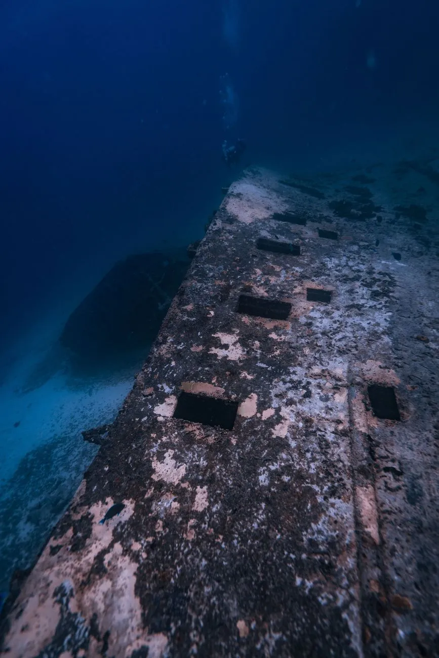
Iron Bottom Sound: The Graveyard of the Pacific Iron Bottom Sound, the narrow channel between Guadalcanal and the Florida Islands, earned its grim nickname during the ferocious naval battles of 1942‑43. Over fifty ships — Japanese destroyers, American cruisers, and merchant vessels — now rest on the sandy floor, their steel ribs draped in soft corals and sponges. For an underwater photographer, this concentration of wrecks offers an unparalleled canvas: each hull tells a story of fire, flood, and the slow reclamation by marine life. Visibility typically ranges from 15 to 30 metres during the dry season (May‑October), and water temperatures hover around 27 °C, allowing comfortable long‑bottom times with a 5 mm wetsuit. The most iconic subjects include the Japanese destroyer Yūdachi, the American heavy cruiser USS Northampton, and the merchant Kawachi Maru, each lying at depths between 20 and 40 metres — ideal for both wide‑angle reef scenes and intimate macro details of encrusting fauna.When planning a shoot, treat the sound as a series of distinct “stations.” Begin at the shallow Yūdachi (≈22 m) where ambient light still paints the superstructure in turquoise hues. Move deeper to Northampton (≈38 m) for dramatic silhouettes against the open water column. A final stop at Kawachi Maru (≈30 m) reveals a cargo hold teeming with schooling fish, perfect for capturing the interplay of life and rust. Because currents can be unpredictable, always dive with a local guide who knows the slack‑water windows — usually mid‑morning and late afternoon — when the water is calmest and particulate matter settles, giving you the cleanest frames. Ghost Ships of Guadalcanal: Mapping the Wrecks Beyond Iron Bottom Sound, the northern coast of Guadalcanal hides a second tier of wrecks that are less visited but equally photogenic. The USS Aaron Ward (DD‑483) rests near the village of Tassafaronga at 35 metres, its bow torn open by a torpedo hit. Further east, the Japanese transport Kōtoku Maru lies on its side at 28 metres, its deck cargo of trucks and ammunition now a playground for lionfish and nudibranchs. Mapping these sites requires a blend of historical research and modern sonar data. The Solomon Islands National Museum in Honiara archives original naval charts, while the local dive operator “Solomons Dive Adventures” maintains a GPS‑referenced database updated after each survey dive. Carry a waterproof slate with the coordinates, depth, and bearing for each wreck; this reduces bottom time spent searching and maximizes creative shooting windows.A practical workflow: start each day with a 30‑minute briefing on the target wreck’s orientation, notable features (gun turrets, propeller shafts, cargo hatches), and known marine life hotspots. Use a dive computer with a built‑in compass to verify headings. For wide‑angle work, a 16‑35 mm rectilinear lens behind a dome port captures the full hull in a single frame, while a 60 mm macro lens reveals the texture of corroded rivets colonized by tunicates. Remember that many wrecks are war graves; the Solomon Islands government enforces a “look but don’t touch” policy. Penetration is prohibited without a special permit, and any disturbance of artifacts can result in heavy fines and loss of diving privileges. Light, Color, and Composition at Depth The physics of light in the Solomon Sea dictates every creative decision. Below 15 metres, red wavelengths vanish, leaving a monochrome blue‑green world. To restore the palette of rusted steel and vibrant coral, photographers rely on two strategies: artificial lighting and white‑balance mastery. Dual strobes positioned at 45° angles from the housing eliminate backscatter and provide even illumination across the wreck’s broad surfaces. Set strobe power to ½–¾ for wide‑angle shots; for macro, drop to ¼ to avoid blowing out delicate polyps. Custom white balance, measured off a neutral gray slate at the working depth, yields natural tones without heavy post‑processing. Compositionally, treat each wreck as an architectural element. Use the rule of thirds to place the bow or stern on a vertical third, allowing the open water to breathe. Leading lines — anchor chains, gun barrels, fractured bulkheads — guide the viewer’s eye toward the vanishing point. Incorporate marine life for scale: a passing reef shark or a school of fusiliers juxtaposed against a 150‑metre hull conveys the enormity of the scene. Shoot in RAW, bracket exposures (±1 EV) for HDR blending later, and keep ISO as low as possible (100–200) to preserve dynamic range. A 1/125 s shutter speed generally freezes gentle surge while still allowing enough ambient light for background detail.Logistics, Permits, and Local Dive Operators Successful expeditions hinge on meticulous logistics. International flights arrive at Honiara International Airport (HIR) via Brisbane, Nadi, or Port Moresby. From Honiara, a 30‑minute domestic hop on Solomon Airlines reaches Gizo (GZO) or Munda (MUA), the two main gateways to the wreck sites. Most operators run live‑aboard vessels (7‑10 days) or day‑trip speedboats from Gizo. Permits are mandatory: the Solomon Islands Ministry of Culture and Tourism issues a “Wreck Diving Permit” (USD 150 per diver, valid 30 days) and a “Photography Permit” (USD 75) for commercial use. Applications require a copy of your dive certification (minimum Advanced Open Water), a detailed dive plan, and proof of insurance covering hyperbaric treatment.Operator Base Vessel Type Typical Package (7 days) Includes Price (USD)Solomons Dive Adventures Gizo 30 m live‑aboard 12 wreck dives + 2 night dives Tanks, weights, meals, permits 4,850Dive Munda Munda 25 m catamaran 10 wreck dives + 1 cultural tour Tanks, weights, meals, permits 4,200Pacific Blue Divers Honiara Day‑boat (2 × day) 6 wreck dives Tanks, weights, lunch, permits 1,950Coral Sea Charters Gizo 28 m live‑aboard 14 wreck dives + 3 macro sessions Tanks, weights, meals, permits, Nitrox 5,300Accommodation ranges from budget guesthouses (USD 30‑50/night) to eco‑lodges (USD 120‑180/night). Budget an additional USD 200‑300 for domestic flights, USD 100 for gear rental (if not bringing your own), and USD 150 for contingency (weather delays, extra dives). Travel insurance covering dive activities up to 40 metres is non‑negotiable; policies from DAN or World Nomads are widely accepted. Preserving History: Ethics of Underwater Documentation The allure of these wrecks carries a responsibility that transcends aesthetics. Each site is a war grave, a cultural heritage asset, and an ecological habitat. The Solomon Islands’ 2018 “Underwater Cultural Heritage Act” aligns with UNESCO’s 2001 Convention, mandating that any imaging for commercial publication undergo a review by the National Heritage Council. Photographers must submit a portfolio of intended shots, describe lighting techniques, and confirm no physical contact will occur. Violations can lead to permit revocation and legal action. Beyond legal compliance, ethical practice means minimizing impact. Use buoyancy control to avoid fin kicks that stir sediment onto fragile coral colonies. Keep strobe arms tucked when not firing to prevent accidental strikes. Share images with local schools and museums — many communities have never seen the wrecks that rest off their shores. Collaborative projects, such as the “Iron Bottom Sound Digital Archive,” combine photogrammetry models with oral histories from veterans’ families, creating a living record that honors both the fallen and the living stewards of the reef. Beyond the Viewfinder: A Diver’s Reflection Emerging from a dive on Northampton at twilight, the surface mirrors the last amber light while the wreck below glows faintly under a diver’s torch. In that moment the camera becomes a bridge — connecting the silence of 1942 with the pulse of today’s reef. The photographs you bring home are more than portfolio pieces; they are testimony to resilience, both human and marine. As you edit, let the colors breathe, let the shadows linger, and let the stories surface. The Solomon Islands’ sunken fleet awaits not just your lens, but your respect.#UnderwaterPhotography #WWIIHistory #SolomonIslands #TravelPhotography #DiveAdventures Related InsightsFalling for Peachtree Bluff (Peachtree Bluff #5) Book Review and Summary Swann’s Way Book Review and Summary Do Androids Dream of Electric Sheep? Book Review and Summary
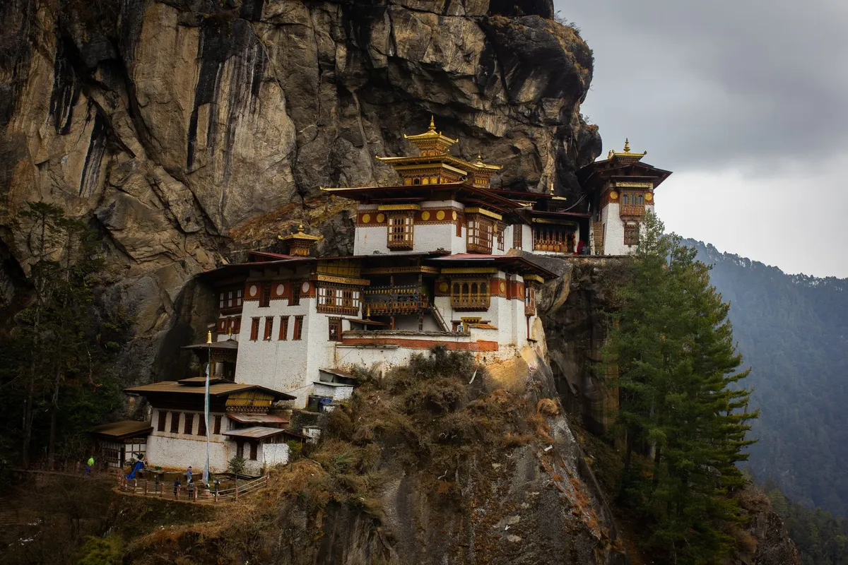
-
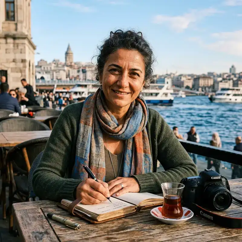 Cemre Seyyah
 - 11 Oct, 2026 21:14
The Hundred Dollar Silence: Buying Time in Bhutan's Measured Kingdom
The air in Paro Valley does not just carry oxygen; it carries a tariff. It is a rare thing in the modern world—to arrive in a nation where the price of admission is calculated not in visa stamps, but in the deliberate throttling of footfall. Bhutan does not want tourists; it wants guests who understand that silence is a resource, and that a cliff-side monastery clinging to vertical rock at 3,120 meters is not a backdrop for a selfie, but a living nerve center of Vajrayana Buddhism. When the Kingdom cracked its door open in 1974, a mere 287 souls crossed the threshold. It was a cautious experiment by a monarchy determined to raise revenue without surrendering the "unique culture and traditions" that had survived centuries of isolation. By 1999, that number had climbed to 7,158, and annual revenue topped US$2 million. Yet the government watched the rising tide with a wary eye. They saw what happened to Everest’s base camp, to Venice’s canals, to Angkor Wat at sunrise. They chose a different algebra: High Value, Low Volume. In 2008, the philosophy sharpened. The slogan shifted to "High Value, Low Impact"—a subtle but significant semantic pivot acknowledging that volume is a crude metric, while impact is a moral one. The Gatekeepers of the Dragon Kingdom The mechanism of this selectivity is the Sustainable Development Fee (SDF), a fiscal gatekeeper that has shape-shifted dramatically in recent years. For decades, the "Minimum Daily Package" bundled the fee, accommodation, guide, and transport into a single opaque price tag—roughly US$200–$250 per day. It was a turnkey solution that guaranteed the "low volume" part of the equation but drew sharp criticism: does a "high value tourist" simply mean a wealthy one? The data suggests the barrier is indeed financial. In June 2022, the policy was revised again. The bundle was unbundled. The SDF spiked to US$200 per person, per night for almost all nationalities (Indian nationals paying a nominal 1,200 INR permit fee). The logic was pure: decouple the state’s revenue from the tour operator’s margin. Travelers could suddenly choose their own hotels, their own meals, their own pace. But the sticker shock was immediate. The Himalayas, it seemed, had become the exclusive playground of the ultra-wealthy.Then came the correction. In August 2023, the SDF was halved to US$100 per night. It was an admission that the "High Value" label cannot survive if the "Low Volume" becomes Zero Volume. The current structure remains a filter: Indians, Maldivians, and Bangladeshis navigate a different tier, but for the global traveler, the hundred-dollar nightly toll is the cost of preserving a nation’s "virtually unspoiled landscape and culture." It forces a question every visitor must answer in the quiet of their wallet: Is this moment worth the price of a luxury hotel room back home? Where the Tiger Sleeps: The Geometry of Faith If you pay the fee, you earn the right to stand before Taktshang Palphug—the Tiger’s Nest. The Wikipedia entry describes it clinically: "a cliff-side monastery overlooking the Paro Valley... sacred to Buddhists... housed inside is a cave where the Buddhist Deity who brought Buddhism to Bhutan meditated for 90 days... standing for well over a thousand years." Clinical words for a vertical miracle. You do not simply "visit" Taktshang. You ascend. The trail switchbacks through pine forests scented with juniper smoke, past prayer flags snapping like cardiac monitors measuring the mountain's heartbeat. The monastery appears, vanishes, reappears—a white geometric anomaly pinned to the sheer grey face of the cliff, 900 meters above the valley floor. Legend says Guru Rinpoche (Padmasambhava) flew here from Tibet on the back of a tigress (Yeshe Tsogyal), landing in that very cave to subdue local demons and plant the seed of the Dharma in the Land of the Thunder Dragon. He meditated for three months, three weeks, three days, and three hours. Ninety days of stillness. Today, tourists pant beside that same rock, the silence broken only by the turn of prayer wheels and the rustle of monk’s crimson robes. The temple complex has burned and been rebuilt—most recently after a devastating fire in 1998—but the cave remains. The energy does not burn.Wings Over the Last Shangri-La Getting to that trailhead requires threading a needle through the peaks. For thirty years, Druk Air (founded 1981) held a monopoly on the sky, its pilots famously certified to execute the hair-raising, instrument-free visual approach into Paro International Airport—widely considered one of the world's most dangerous landings. The liberalization of 2011 brought Bhutan Airlines, a second carrier, but the approach remains the same: a heart-stopping dive between Himalayan giants, wingtips brushing the clouds. The November 2024 tourism bulletin—the Department of Tourism’s new monthly pulse check—reveals the arteries of this flow. 15,990 tourists entered that single month. The split is telling: 7,034 international (paying the SDF) vs 8,956 Indian nationals (on permits). The entry points map the geography of access: 7,986 arrived via the dramatic Paro air bridge; 8,018 crossed the land border at Phuentsholing, the gritty, bustling gateway from West Bengal; a trickle—41 and 16—used the eastern posts of Samdrupjongkhar and Gelephu.This data paints a picture of two Bhutans. One viewed from 20,000 feet, pristine and exclusive. The other experienced at ground level, messy and vibrant, where the border town of Phuentsholing hums with cross-border trade and the rhythm of daily life uncurated for the foreign gaze. The Privatization of Pilgrimage The infrastructure holding this delicate balance together was once entirely state-run. The Bhutan Tourism Corporation (BTC) held the reins until October 1991, when privatization unleashed the private sector. By 2018, over 75 licensed tour operators competed for the traveler’s itinerary. Previously, every visitor—group or solo—was locked into a pre-paid, guided package tour arranged through an approved operator. The 2022/2023 reforms shattered that monopoly on logistics. You can now book your own boutique hotel in Thimphu or a homestay in Haa Valley. You still need a visa (pre-arranged for almost all nationalities) and a guide for most regions, but the "package" straightjacket has been cut. This shift aligns with the "Sustainable Tourism Development Strategy" (2005) which explicitly aimed to "increase tourist numbers by using the country's culture and environment to promote Bhutan as an exotic niche destination attractive to wealthy tourists." The language is unapologetic. Niche. Wealthy. Exotic. It is a strategy written in the ink of exclusivity. Eight Whispers to UNESCO Bhutan’s confidence in its own exceptionalism found a formal voice in 2012, when the Kingdom submitted its first UNESCO World Heritage Tentative List. Eight sites. A declaration that the "unique culture and traditions" mentioned in the 1974 tourism decree are not marketing copy, but Outstanding Universal Value waiting for recognition. While the list itself remains tentative, the sites span the spiritual and the strategic: ancient dzongs (fortress-monasteries), sacred valleys, and the remnants of the Trans Bhutan Trail—an ancient network of paths connecting the country long before the highway. Walking sections of that trail today, you understand the "Low Impact" mandate viscerally. The path is narrow. The villages are fragile. A cruise-ship volume of humanity would shatter the social fabric faster than an earthquake. The Medal and the Bulletin: A New Chapter On December 28, 2024, the industry received its highest honor. At Changyul Park, His Majesty The King conferred the Druk Thuksey Medal (the "Heart Son of the Dragon") upon the tourism industry itself. It was a historic milestone, celebrating the sector’s resilience and its role as a steward of the nation’s brand. Simultaneously, the Department of Tourism launched the "Friends of Tourism" initiative. It is a clever structural innovation: a platform to bind "people and organisations together as partners" to support national goals, develop the industry, and curate "meaningful experiences." It moves the conversation from transaction (fee collected, visa stamped) to relationship. The monthly bulletin—reporting those precise November numbers (15,990 arrivals, entry point breakdowns)—is the transparency tool. Data as discipline.The Critique That Lingers in the Pine Scent Yet, the criticism embedded in the Wikipedia entry—and in the hushed conversations of travelers sitting in Thimphu cafes—remains potent. "A 'high quality tourist' needs to be a wealthy tourist, because the hurdle of visiting Bhutan is mainly posed by the high pricing and not by actual interest or mindfulness." It is a blade that cuts both ways. The fee does filter for commitment. It funds free healthcare, free education, and the conservation of the 70% forest cover mandated by the Constitution. It pays for the rangers protecting the snow leopards and the black-necked cranes. But it also builds a wall. A young backpacker with six months of time and zero dollars—precisely the demographic often most "mindful" and culturally permeable—is mathematically excluded. The "High Value" tourist becomes a demographic proxy for "High Net Worth." Bhutan knows this. The fluctuation from $200 to $100 SDF proves they are watching the occupancy rates. The "Friends of Tourism" initiative suggests they want to diversify who comes, not just how many. But the structural tension remains: Can you preserve a culture by pricing its witnesses out of the room? The Calculus of the Thunder Dragon There is no perfect answer. There is only the Bhutanese way: The Middle Path, applied to macroeconomics. In 2019, before the world paused, the Kingdom saw its highest number ever: 315,000 tourists. The Asia-Pacific market surged—India, Thailand, Vietnam, Philippines, Australia, Japan, China, Singapore, Bangladesh, Malaysia, South Korea. Western markets (US, UK, Germany, France) grew steadily. The "Low Volume" ceiling felt higher then. Post-pandemic, the numbers are rebuilding, but the philosophy has hardened. You leave Bhutan the way you entered: through that needle-eye approach at Paro, banking hard over the dzong, the Tiger’s Nest shrinking to a white speck on a grey cliff. You have paid your hundred dollars a night. You have breathed air that costs a premium. You have seen a monastery that has stood for a millennium because a kingdom decided, fifty years ago, that some things are not for sale—even while selling the tickets to see them. The silence you bought? It’s still there, waiting in the pines. But the price goes up next season. It always does.#Bhutan #SustainableTravel #TigersNest #HighValueLowImpact #Himalayas Related InsightsA Story of Yesterday Book Review and Summary Kelewele: The Spicy Fried Plantain Snack Club Dead Book Review and Summary
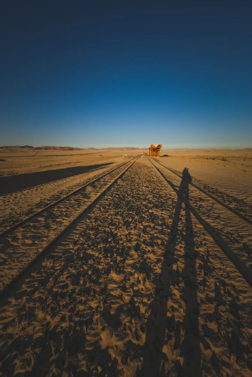
The Sahara does not forgive infrastructure. It swallows asphalt, buries pipelines, and reduces steel to rust-red dust within a single generation. Yet, cutting across this indifference is a scar of steel—the Trans-Saharan Railway. Conceived in the salons of Paris as a civilizing mission to bind the Mediterranean to the Niger River, the project remains one of history’s most expensive exercises in geographical denial. Today, the line exists not as a continuous artery, but as a constellation of ruins: lonely water towers standing sentinel over empty platforms, station masters' houses with roofs caved in by sand drifts, and the singular, roaring exception of the Mauritanian iron ore train. To travel this corridor is not to ride a train, but to archaeologize a dream that the desert refused to let die completely.The Colonial Blueprint: Drawing Lines in the Dust The genesis of the Trans-Saharan Railway lies in the late 19th-century "Scramble for Africa," specifically the French desire to knit their West African territories (Soudan Français, modern Mali/Niger) to the Algerian coast. The strategic logic was seductive: bypass the British-controlled Suez and the hazardous sea lanes around the Cape. The "Transsaharien" was authorized by law in 1879, envisioning a standard-gauge line from Oran or Algiers south through the Hoggar Mountains to Gao and Timbuktu, with a western spur toward Saint-Louis, Senegal. Survey teams faced a reality that maps from Paris obscured. The chosen route—often following ancient caravan trails like the Tarik ibn Ziyad—crossed the ergs (dune seas) of the Grand Erg Occidental and the volcanic chaos of the Hoggar. Engineers calculated that moving a single kilometer of track across the shifting sands of the erg required 30,000 tonnes of ballast to stabilize the bed, a logistical impossibility for a colony with limited rolling stock. By 1906, the line had reached Béchar (then Colomb-Béchar) from the north, and separately, a line pushed east from Dakar to Kayes in Senegal. The "Gap"—over 2,000 kilometers of absolute wilderness—remained. The human cost was staggering. Construction relied heavily on tirailleurs (colonial infantry) and forced labor battalions (corvées). Mortality rates from heatstroke, dysentery, and Tuareg resistance raids often exceeded 20% per season. The "Kilometer 100" cemetery near Béchar stands as a silent testament to the anonymous workers who laid sleepers in 50°C heat. By the 1930s, the Great Depression and the rise of automotive transport (Citroën Kégresse half-tracks proved crossing the desert was faster without rails) killed the political will. The Vichy regime, then the Free French, maintained the northern terminus at Béchar as a strategic military supply line, but the dream of a continuous transcontinental steel thread was officially abandoned in 1941. Ghosts of the Gauge: Abandoned Outposts of the Hoggar South of Béchar, the railway enters the realm of the fantôme. The track bed persists as a low, weed-choked berm, occasionally visible from the N6 highway, but the stations are the true monuments. Take Kenadsa, a mining hub where the line officially terminated for decades. Its station is a masterpiece of style néo-mauresque—horseshoe arches, zellige tilework faded to monochrome, a clock tower frozen at the hour the last scheduled passenger service departed in 1988. The platform edges are crumbling; the buffer stops are buried in drifts of fine chech sand that sings when the wind hits 40 km/h. Further south, near the oasis of Taghouzi, the infrastructure becomes skeletal. Here, the French built a poste de garde every 20 kilometers—small forts with crenellated walls, water cisterns fed by windmills, and telegraph poles. Most are now roofless. I visited Taghouzi in October 2023; the station master’s office still held a rusted Moroccan-made safe, its combination lost, and a stack of fiches de mouvement (train movement sheets) dating to 1962, the ink faded to sepia by the relentless UV. The water tower, a reinforced concrete mushroom on legs, leans at a precarious 15 degrees, undermined by scouring floods from rare crues (flash floods). The most haunting site is In Amguel, deep in the Hoggar foothills. Never a major junction, it was a water stop. The station building is gone, eaten by the wadi. Only the twin water cranes remain, standing like giraffes stripped of hide, their cast-iron counterweights seized solid. The surrounding desert pavement is littered with shards of thick, greenish glass—insulators from the telegraph line that once paralleled the track. Walking the ballast here, you find clous à patte (dog-spike nails) worked loose by thermal expansion, lying like spent cartridge casings. The silence is absolute, broken only by the wind tuning the telegraph wires that still stand, humming a low, aeolian chord.The Mauritania Exception: Where the Iron Ore Still Flows If the Algerian section is a museum, the Mauritanian section is a beast of burden. The SNIM (Société Nationale Industrielle et Minière) line from Zouérat to Nouadhibou is the Trans-Saharan’s only living limb. Completed in 1963 (replacing a narrower gauge line), this 704-kilometer standard-gauge heavy-haul line moves 12–15 million tonnes of iron ore annually. It is the economic spine of Mauritania, contributing roughly 30% of state revenue. The train is legendary: up to 3 kilometers long, 200+ wagons, hauled by three or four GE/EMD locomotives (often CC 22000 or SD70ACS models). It is also the only "passenger" service in the region, though "service" is a generous term. A single passenger carriage—usually a refurbished freight wagon with bench seating and barred windows—is attached to the rear. The journey takes 18–22 hours. There is no dining car, no air conditioning, and the fine hematite dust permeates everything: lungs, lenses, luggage. Riding the SNIM train is a rite of passage for overlanders. You board at Zouérat (or the intermediate stop Choum, gateway to the Adrar plateau). At Choum, the train stops for 20 minutes in the dead of night. Vendors materialize from the darkness selling thieboudienne (fish and rice) wrapped in foil, sweet mint tea in plastic glasses, and phone charging via portable generators. The train lurches forward with a violence that throws standing passengers to the floor—the slack action of 200 couplers taking up tension sequentially. The stations here are functional, brutalist concrete blocks: Fdérik, Tazadit, Choum, Nouadhibou. They lack the architectural pretension of their Algerian cousins. At Nouadhibou, the terminus, the ore is dumped via rotary car dumpers into ships waiting at the mineral pier. The yard is a landscape of conical red mountains—stockpiles of high-grade hematite (64% Fe). The contrast with the silent Algerian stations is violent: here, the rails are polished bright by 22-tonne axle loads passing daily; the ballast is fresh, crushed granite; the signaling is modern CTC (Centralized Traffic Control). This line proves the geography can be conquered, but only when the cargo pays 100 times the value of passenger fares per tonne-kilometer. Logistics of the Lost: Navigating the Silent Tracks Today Exploring the abandoned northern sections requires a paradigm shift from "rail travel" to "expedition logistics." There are no tickets, no timetables, and critically, no water. The primary access route is the N6 (Route Nationale 6) in Algeria, running roughly parallel to the old track bed from Béchar to the Niger border at In Guezzam. A 4x4 vehicle with high clearance (minimum 220mm), dual spare tires, and 200 liters of fuel range is non-negotiable. The "road" south of Tamanrasset degrades into a piste—a track across reg (stony desert) and erg. Permits are a bureaucratic gauntlet. As of 2024, Algeria requires a laissez-passer from the Wilaya (province) police in Béchar or Tamanrasset for travel south of the "Security Zone" line (roughly south of In Salah). You must present a detailed itinerary, vehicle registration, insurance valid for Algeria (green card), and a letter of guarantee from a registered local tour operator. Solo travel is technically prohibited in the deep south; a guide/fixer is mandatory. Costs for a supported 7-day loop (Béchar → Tamanrasset → Djanet/In Guezzam perimeter → return) run €2,500–€3,500 per vehicle including guide, fuel caches, and permits. Mauritania is more accessible but requires a visa (obtainable on arrival at Nouakchott–Oumtounsy International Airport for many nationalities, €55) and a carnet de passage for vehicles. The SNIM train passenger carriage requires no reservation; you simply present yourself at the Zouérat station yard office 2 hours before departure (nominally 15:00, actual departure ±4 hours) with passport and €5–€10 for the "seat."Cost & Logistics Comparison: Northern Ruins vs. Southern Ore LineParameter Algerian Abandoned Section (Béchar–In Guezzam) Mauritanian Active Section (Zouérat–Nouadhibou) NotesPrimary Transport Self-drive 4x4 Expedition SNIM Iron Ore Train (Rear Wagon) Train runs ~daily; 4x4 requires convoy.Permit Lead Time 30–60 Days (Police + Military) 0 Days (Visa on Arrival) Algerian permits require local agency sponsor.Daily Budget (USD) $350–$500 (Guide, Fuel, Security) $50–$100 (Food, Water, Train Fee) Algeria costs driven by mandatory guide/vehicle.Water Autonomy 200 Liters Minimum (Vehicle) 10 Liters Personal (Stations sell water) No potable water on abandoned Algerian route.Navigation Difficulty Extreme (GPS Tracks Essential, Dunes) None (Fixed Rail Infrastructure) Sand ingestion risk high on Algerian pistes.Best Travel Window Oct–Nov / Feb–Mar (Avoid 50°C+) Nov–Feb (Cooler Nights) Summer (Jun–Sep) is lethal in Hoggar/Adrar.Connectivity Thuraya/Iridium Satellite Only Spotty 3G at Major Towns (Choum, Nouadhibou) Algerian south has zero terrestrial coverage.Echoes in the Wind: Preservation vs. Oblivion The future of this legacy hangs on a knife-edge. In Algeria, the Ministère de la Culture has classified several stations (Béchar, Kenadsa, Abadla) as biens culturels protégés. However, protection on paper does not stop the scavenging of structural steel for rebar, the looting of decorative tiles, or the simple erosive power of the sirocco. A 2021 UNESCO feasibility study for a "Trans-Saharan Railway Heritage Route" stalled due to security concerns in the Sahel belt and the sheer cost of stabilizing reinforced concrete in a hyper-arid, saline environment. The estimated cost to mothball just the Kenadsa station complex against collapse exceeds €2 million. Conversely, there is the perennial "zombie project": the Trans-Saharan Railway Revival. Since the 1970s, the African Union (via NEPAD) and the African Development Bank have commissioned feasibility studies for a standard-gauge line connecting Algiers–Lagos (via Niamey) or Nouakchott–Dakar. The most recent 2023 AfDB pre-feasibility study for the Algiers–Zinder–Lagos corridor (2,800 km) priced the build at $18–22 billion. The economic case rests on mineral evacuation (uranium from Niger, phosphates, lithium) rather than passengers. China Railway Construction Corporation (CRCC) has signed MOUs for the Nigerian gauge-standard sections, but the Algerian Saharan crossing remains the "Valley of Death" for financiers—high CAPEX, zero intermediate revenue, extreme maintenance OPEX. Meanwhile, the SNIM line faces its own existential clock. The high-grade hematite at Zouérat (Guelb el Rhein/Kedia d'Idjil) is depleting. SNIM is investing heavily in the Guelb II project (magnetite concentrate, requiring beneficiation) and the Askaf deposit. This extends mine life to 2040+. Crucially, SNIM is piloting hydrogen-hybrid locomotives (Stadler/CRRC partnership Related InsightsCoraline Book Review and Summary Defy Me (Shatter Me) Book Review and Summary Zero-Knowledge Proofs in Enterprise Blockchain: The Verifiable Privacy Layer
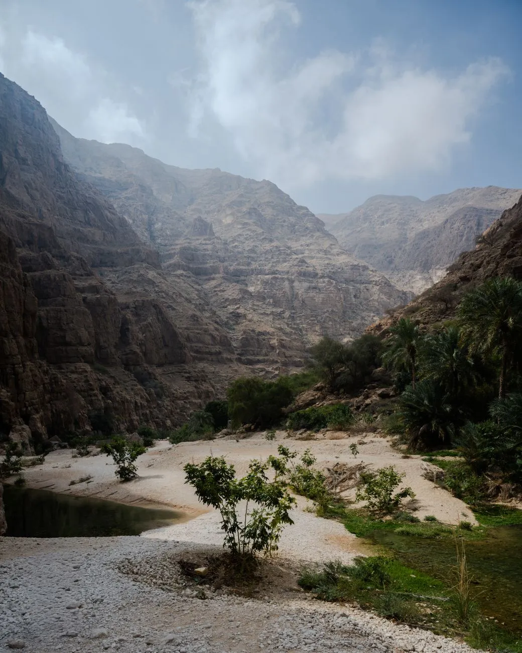
Emerald Veins of the Hajar: The Genesis of Oman’s Wadis The Hajar Mountains rise like a jagged spine across northern Oman, their limestone ribs folded by millennia of tectonic pressure. When winter rains sweep in from the Arabian Sea, they do not simply run off the slopes; they infiltrate fissures, dissolve carbonate rock, and emerge as perennial springs that stitch together a network of wadis — Arabic for “valley” — each a living artery of fresh water. Unlike the seasonal torrents that scar desert basins elsewhere, many Omani wadis retain water year‑round, forming natural pools that shimmer in shades of turquoise, jade, and deep sapphire. Geologically, the process is a textbook example of karst hydrology. Rainwater, slightly acidic from dissolved CO₂, widens fractures into conduits. Over thousands of years these conduits become caves and underground rivers. When the roof of a conduit collapses, a surface pool appears, often framed by sheer cliffs and draped with date palms. The result is a landscape where geology, climate, and biology converge: endemic fish such as Garra barreimiae dart among submerged roots, while the rare Arabian tahr grazes on the upper slopes. Human history has been written in these corridors. Ancient copper traders followed the wadi floors, leaving petroglyphs that still whisper of caravans laden with frankincense. In the 20th century, the British explorer Wilfred Thesiger documented the Bedouin’s intimate knowledge of each pool, noting how they timed migrations to the rhythm of water availability. Today, the wadis remain a cultural touchstone; families picnic under the shade of Ziziphus trees, and children learn to swim in the same basins that sustained their ancestors. For the modern traveller, the wadis offer a rare blend of adventure and accessibility. A 4×4 can reach the mouth of most major wadis, but the most rewarding pools often require a short hike — sometimes a scramble over boulders, sometimes a gentle walk through date‑palm groves. The reward is a plunge into water that stays a constant 24‑26 °C, a natural air‑conditioner in a region where summer highs regularly exceed 45 °C. Understanding the hydrology and heritage of these corridors transforms a simple swim into a dialogue with deep time. As you step into the cool embrace of a wadi pool, you are literally immersing yourself in a system that has filtered rain through limestone for eons, a living museum of Earth’s patient sculpting. Wadi Shab: Where Canyons Meet Crystal Waters If Oman’s wadis were a symphony, Wadi Shab would be its soaring crescendo. Located roughly 150 km southeast of Muscat, the wadi opens onto a narrow coastal plain before funneling into a dramatic gorge. The approach is an experience in itself: a short boat ride across a turquoise inlet deposits you at the trailhead, where the path weaves between towering cliffs and lush vegetation. The first pool greets you within ten minutes — a shallow, sun‑dappled basin perfect for acclimatizing. Continue upstream and the canyon tightens; sheer walls rise 50 m, their faces stained by mineral deposits that paint the rock in ochre and rust. After a 30‑minute trek, the trail opens into a cavernous chamber where a waterfall cascades into a deep, circular pool. Light filters through a natural skylight, turning the water into liquid emerald. This is the “Hidden Pool,” a name earned because the entrance is concealed behind a curtain of vines. Swimming here feels like entering a cathedral. The acoustics amplify the splash of each stroke, and the water’s clarity reveals a sandy bottom dotted with smooth pebbles. Adventurous souls can dive through a submerged tunnel that leads to a second, smaller chamber — a secret grotto where the only sound is the drip of stal Related InsightsObsidian Book Review and Summary „Die Architektur des Geschmacks: Wie Gastronomie zur Wissenschaft der Zivilisation wurde“ Breakfast in Istanbul
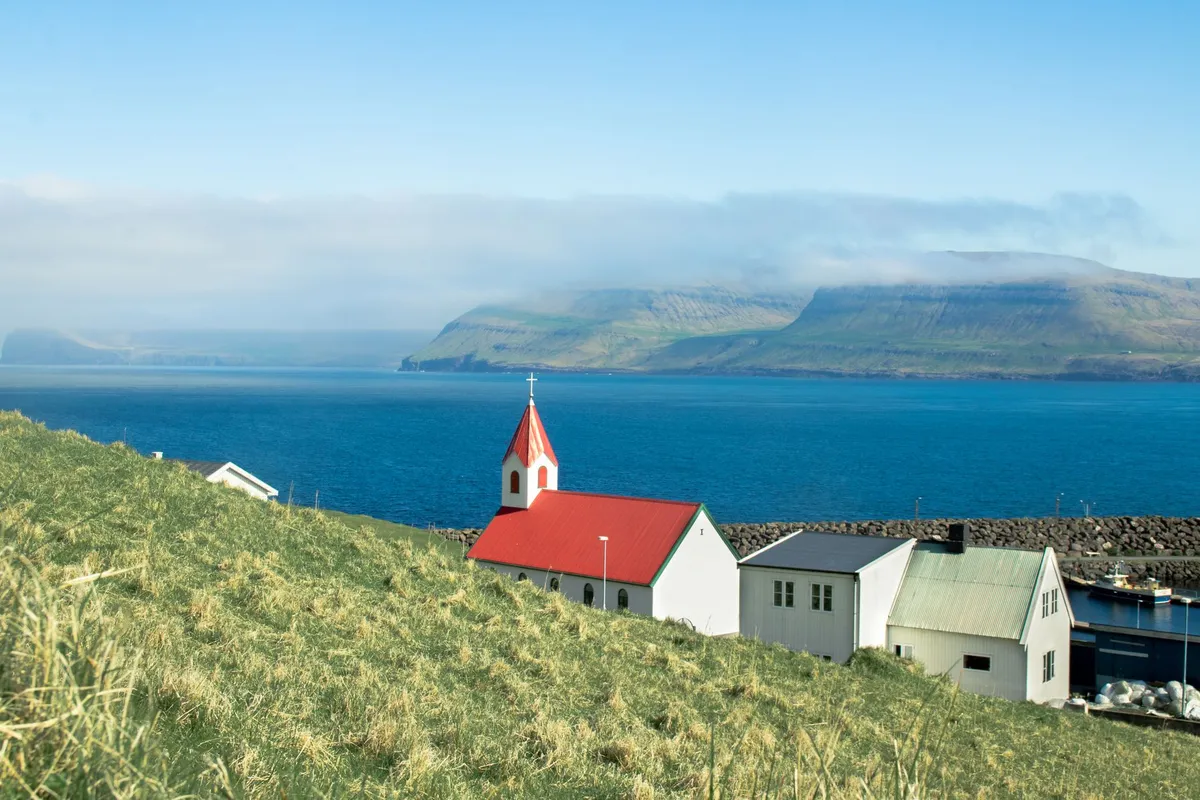
-
 Marco Rossi
 - 09 Oct, 2026 22:03
Le Isole che Respirano il Vento: Il Risveglio Silenzioso delle Fær Øer
C’è un momento preciso, appena l’aereo rompe il banco di nebbia che avvolge Vágar, in cui capisci che le Fær Øer non sono una destinazione. Sono una rivelazione. Qui l’orizzonte non si guarda, si subisce: scogliere verticali che precipitano in un mare color inchiostro, valli prive di alberi accarezzate da un vento che sa di sale e di tempo antico, e villaggi colorati aggrappati a coste impossibili, dove i tetti d’erba ondulano come il respiro della terra stessa. Per decenni questo arcipelago di diciotto isole vulcaniche ha vissuto nell’ombra del proprio mare, costruendo un’economia granitica sulla pesca, che ancora oggi macina il novanta-cinque per cento delle esportazioni. Eppure, negli ultimi anni, una corrente sotterranea ha iniziato a erodere le certezze: il turismo, un tempo poco più di un sussurro statistico, sta ridisegnando la geografia umana ed economica di queste terre, portando con sé la promessa di una diversificazione necessaria e il rischio, sempre presente, di snaturare un equilibrio fragile. L'Ombra del Merluzzo e la Luce Nuova Per capire dove stanno andando le Fær Øer, bisogna guardare da dove vengono. La pesca non è solo un’industria qui; è la colonna vertebrale della società, il ritmo che scandisce le generazioni. I dati parlano chiaro: per gran parte degli ultimi decenni, il settore primario ha assorbito risorse, manodopera e identità, relegando ogni altra voce economica a un ruolo marginale. Nel 2015, il turismo pesava appena l’uno virgola quattro per cento del PIL totale. Una cifra che, letta con gli occhi di un economista continentale, sembrerebbe irrilevante. Letta con gli occhi di chi conosce la caparbietà faroese, suona come un punto di partenza esplosivo. Il cambiamento non è arrivato con un proclama, ma con un raddoppio silenzioso. Nel 2013, l’ente ufficiale Visit Faroe Islands — emanazione diretta del Ministero dell’Ambiente, dell’Industria e del Commercio — ha visto i propri fondi di marketing raddoppiare. Non era solo pubblicità; era una dichiarazione d’intenti. Lo Stato smetteva di considerare i visitatori come ospiti occasionali e iniziava a trattarli come pilastri di una nuova architettura economica. La pesca rimane il cuore pulsante, ma il corpo ha bisogno di nuovi arti per muoversi nel futuro.La Porta del Vento: Vágar e la Scommessa sul Cielo Il simbolo tangibile di questa metamorfosi è l’aeroporto di Vágar. Fino a poco tempo fa, raggiungere l’arcipelago era un’avventura riservata a chi aveva tempo e pazienza infiniti. Poi, nel 2014, è stato inaugurato il nuovo terminal. Non un semplice edificio, ma una cattedrale di vetro e legno progettata per accogliere un flusso che cresceva a doppia cifra: un aumento del quarantatré per cento dei passeggeri nel decennio precedente, con la proiezione di superare le duecentocinquantamila unità annue già in quell’anno. Quell’infrastruttura ha agito come un magnete. La logica era lineare: più capacità significa più compagnie aeree, più rotte, più accessibilità. E la profezia si è avverata. Alla fine del 2019, Atlantic Airways — la compagnia di bandiera — ha annunciato il lancio di voli diretti per l’aeroporto John F. Kennedy di New York. Un ponte diretto tra il villaggio globale e il villaggio faroese. Improvvisamente, le isole non erano più la fine del mondo, ma un nodo raggiungibile in una notte dal cuore finanziario del pianeta. Chiuso per Manutenzione, Aperto per l'Anima: La Rivoluzione del Volonturismo Se l’aeroporto ha aperto le porte, è stata un’idea audace a decidere chi potesse varcarle e come. Nell’aprile 2019, Visit Faroe Islands ha lanciato una campagna che ha fatto il giro del mondo per la sua onestà disarmante: "Closed for Maintenance, Open for Voluntourism" (Chiuso per manutenzione, aperto per il volonturismo). Il concept era radicale nella sua semplicità. Invece di vendere l’accesso a panorami mozzafiato, le isole chiedevano aiuto per preservarli. Una squadra selezionata di candidati da tutto il mondo è stata invitata a lavorare spalla a spalla con la gente del luogo per restaurare dieci siti critici, tracciare nuovi sentieri escursionistici, installare segnaletica. Non turisti, ma custodi temporanei. Un patto: ti regaliamo l’accesso a luoghi che altrimenti sarebbero stati interdetti per degrado, tu ci regali il sudore per renderli vivibili di nuovo. Questa mossa ha risolto un paradosso fondamentale: l’amore per la natura faroese stava consumando la natura faroese. I sentieri si erodevano, i siti storici si deterioravano sotto i passi di visitatori sempre più numerosi ma privi di strumenti per capire la fragilità del contesto. Il volonturismo ha trasformato il fruitore passivo in attore attivo, radicando il rispetto non in una regola scritta su un cartello, ma nella fatica condivisa su un sentiero fangoso. È stato un masterclass di destination management che molte mete sovraffollate del Mediterraneo dovrebbero studiare con umiltà.L'Architettura dell'Accoglienza: Dal Caos all'Ecosistema Fino al 2018, prenotare un’esperienza alle Fær Øer significava navigare in un mare frammentato di contatti privati, siti web amatoriali e passaparola. Chi voleva noleggiare un’auto, prenotare un’escursione in barca per vedere le scogliere di Vestmanna o trovare un alloggio in un villaggio remoto, doveva comporre da solo il puzzle. La nascita di Guide to Faroe Islands ha cambiato le regole del gioco. Nata come collaborazione tra organizzatori di viaggi, escursioni e noleggi auto, ha creato un ecosistema digitale centralizzato. Un unico punto di accesso per l’intera filiera dell’ospitalità. Questa professionalizzazione era il prerequisito indispensabile per il passo successivo, quello che sancisce l’ingresso nell’era moderna dell’ospitalità globale: l’arrivo di Hilton. Alla fine del 2020, la catena alberghiera internazionale ha aperto la sua prima struttura nell’arcipelago. Per un territorio che ha sempre gestito l’accoglienza su scala familiare — gestgjafar (guesthouse) a conduzione familiare, camere private, piccoli hotel indipendenti — l’arrivo di un brand globale è un terremoto culturale. Porta standardizzazione, sistemi di prenotazione integrati, fedeltà internazionale, ma pone anche la domanda cruciale: come si preserva l’autenticità faroese — fatta di stanze basse, odore di pesce essiccato, silenzi interrotti solo dal vento — all’interno di un format globale? La risposta non è scritta, si sta scrivendo ora, stanza per stanza.La Voce della Gente: Quando il 95% Chiede di Più Spesso, nelle discussioni sul turismo, la voce dei residenti è l’ultima a essere ascoltata. Alle Fær Øer, uno studio pubblicato sul Consortium Journal of Hospitality and Tourism ha rovesciato il tavolo. I numeri sono sconcertanti per chi è abituato alla narrazione del "turismofobia": oltre il quarantacinque per cento dei faroesi intervistati ritiene che il turismo porti più benefici che problemi. Ma è il secondo dato a lasciare senza fiato: il novantacinque per cento degli intervistati vorrebbe vedere più turisti nelle proprie comunità. Novantacinque per cento. Non è un errore di stampa. È la testimonianza di una società che si sente sicura della propria identità, che non percepisce lo straniero come una minaccia ma come un’opportunità. Un popolo abituato a guardare l’orizzonte e a vedere opportunità dove altri vedono solo oceano. Questo consenso sociale è il vero "petrolio" delle Fær Øer. Senza di esso, nessun aeroporto, nessun hotel, nessuna campagna marketing può reggere nel lungo periodo. Significa che le comunità hanno già interiorizzato il cambiamento, hanno già negoziato i confini della propria ospitalità e hanno deciso che il gioco vale la candela. È una lezione di maturità civile che vale più di qualsiasi strategia top-down. L'Investitura dei Giganti: Quando il Mondo si Accorge di Te Il consenso interno ha trovato conferma nello specchio esterno. Nel 2007, molto prima che i social network trasformassero ogni scogliera in uno sfondo per influencer, National Geographic Traveler ha incoronato le Fær Øer al primo posto su centoundici comunità insulari mondiali. Un verdetto basato su integrità ambientale, autenticità culturale e gestione del territorio. Non una moda, un riconoscimento strutturale. Nel 2019, la stampa internazionale mainstream ha sancito l’ingresso nel club delle "destinazioni imperdibili". The Guardian, Lonely Planet, The Sunday Times, The Financial Times: testate che non inseguono le mode ma le certificano, hanno inserito l’arcipelago nelle loro liste annuali. Non per le spiagge (che non ci sono), non per la vita notturna (che non esiste), ma per la "potenza del luogo". Per quella capacità rara di farti sentire piccolo, insignificante e, proprio per questo, incredibilmente vivo. Le Notti che Contano: Leggere le Statistiche Oltre i Numeri Le statistiche ufficiali sui pernottamenti, raccolte sistematicamente dal 2013, includono anche i pernottamenti degli stessi faroesi. Un dettaglio tecnico? No, una chiave di lettura. Significa che il movimento interno — faroesi che viaggiano tra le proprie isole, che riscoprono i propri fiordi, che dormono in una gestgjafa a Klaksvík o a Tvøroyri — è parte integrante del fenomeno turistico. Il turismo non è solo "loro" che vengono da fuori; è "noi" che impariamo a vedere casa con occhi nuovi. È l’economia che circola dentro i confini, che rafforza i legami interni prima di aprirsi all’esterno. È un segnale di salute: un paese che viaggia dentro se stesso è un paese che non ha paura di mostrarsi. L'Orizzonte Verticale: Cosa Aspetta le Fær Øer Camminando oggi sui sentieri tracciati dalla crew del 2019, sorvolando le scogliere di Enniberg — le più alte d’Europa — o seduti nella hall del nuovo Hilton a Tórshavn a guardare la pioggia orizzontale che flagella il porto, si percepisce la tensione creativa di un momento storico. Le Fær Øer non stanno diventando l’Islanda. Non possono, non vogliono, non devono. La loro scala è diversa, la loro capacità di carico è inferiore, la loro cultura è più compatta, quasi tribale nel senso più nobile. La sfida non è "crescere ancora". La sfida è "crescere bene". Significa gestire i voli per New York senza che Tórshavn diventi un dormitorio per escursionisti mordi-e-fuggi. Significa integrare gli standard Hilton con la calda imperfezione delle guesthouse a conduzione familiare. Significa che il novantacinque per cento di consenso non si eroda sotto il peso dei numeri, ma si rafforzi attraverso la qualità dell’incontro. Le isole respirano il vento. Lo hanno sempre fatto. Ora stanno imparando a respirare anche il mondo. E il mondo, se ha un briciolo di senno, farà bene ad ascoltare il suono di quel respiro antico che si mescola alle lingue nuove sui sentieri di basalto.#FaroeIslands #SustainableTravel #Voluntourism #NorthAtlantic #HiddenGems #MarcoRossiTravel Related InsightsBeyond Black Pepper: The Enchanting Aromas of Long Pepper and Grains of Paradise Tiger, Tiger Book Review and Summary The Poet and the Bees Book Review and Summary
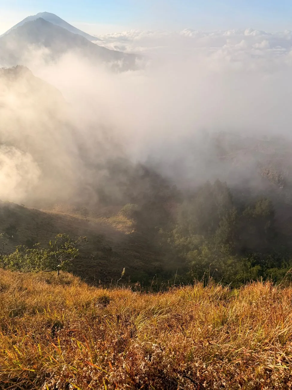
-
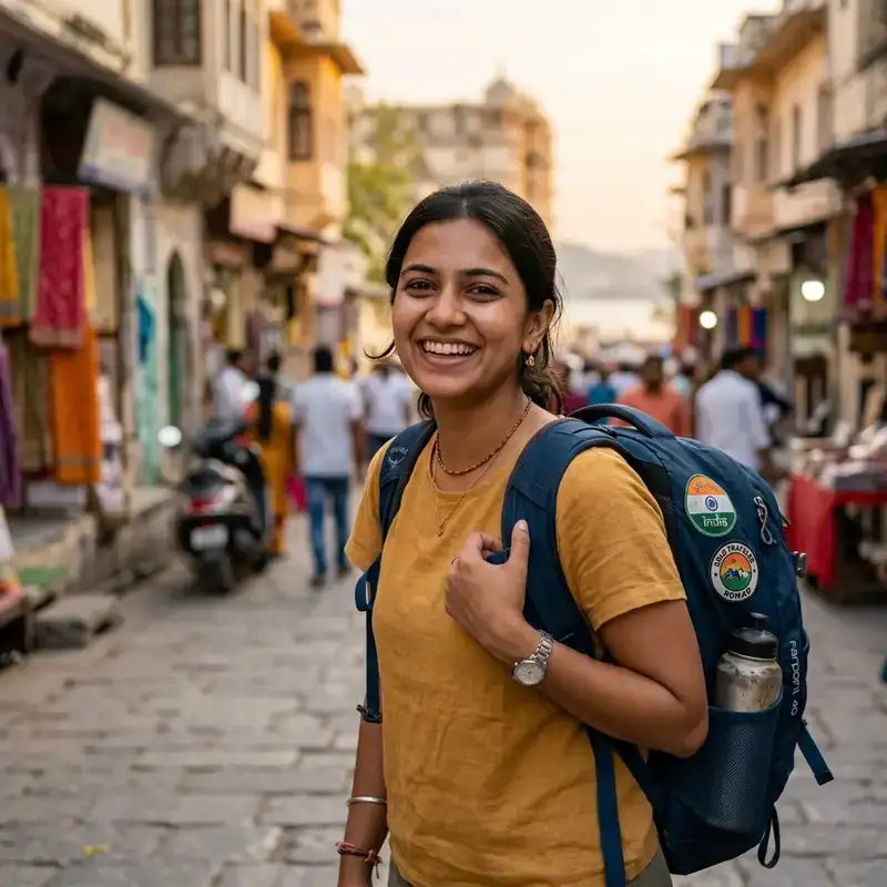 Aisha Sharma
 - 08 Oct, 2026 13:55
Ring of Fire Odyssey: The Ultimate Safety Manual for Volcanic Trekking Across Indonesia
The Ring of Fire is more than a geological term; it is a living, breathing chain of volcanoes that defines Indonesia’s breathtaking skyline. For adventurers, the allure of trekking an active volcano is matched only by the responsibility to do it safely. This manual pulls together up‑to‑date cost data, visa realities for long‑term trekkers, and hard‑won field knowledge so you can explore the molten heart of Southeast Asia without compromising your well‑being. Igniting the Adventure: Choosing the Right Volcano and Preparing Your Gear Indonesia boasts over 130 active volcanoes, from the iconic Mount Bromo in East Java to the remote, seldom‑trodden Krakatoa’s sibling, Anak Krakatau. The first step is to match your fitness level, experience, and risk tolerance with a volcano’s difficulty rating. Beginner-friendly – Mount Bromo, Mount Merapi (low‑season routes), and Ijen Crater offer well‑marked paths, regular ranger patrols, and nearby villages with basic medical facilities. Intermediate – Mount Rinjani (Lombok) combines steep ascents with a high‑altitude lake, demanding acclimatization and self‑sufficiency. Advanced – Mount Semeru and Mount Agung require advanced navigation skills, the ability to interpret real‑time volcanic alerts, and contingency plans for sudden ashfall.Gear Checklist (≈150 words)Item Recommended Specs Approx. Cost (USD) Why It MattersTrekking Boots Waterproof, ankle support, Vibram sole $120‑$180 Prevent slips on volcanic ash and wet lava rockLayered Clothing Moisture‑wicking base, insulated mid‑layer, wind‑proof shell $90‑$150 Temperature swings from 5 °C at night to 25 °C middayRespirator Mask N95 or higher, with replaceable filters $30‑$45 Shields lungs from fine volcanic ash and sulfur gasesPortable Gas Detector Dual CO/CO₂ sensor, battery life ≥8 hrs $250‑$350 Early warning for toxic gas pocketsSatellite Messenger Two‑way texting, SOS button, global coverage $180‑$250 Critical when mobile networks fail on remote peaksFirst‑Aid Kit Includes burn ointment, high‑dose ibuprofen, sterile dressings $45‑$70 Treat minor burns, blisters, and respiratory irritationLocal markets in Yogyakarta and Bali sell many of these items at a fraction of Western prices—roughly 64 % lower than in the United States, according to Numbeo. A single traveler can outfit themselves for under $400, while families may benefit from bulk discounts and shared equipment. Training Regimen: Begin with 30‑minute cardio sessions three times a week, progress to hill repeats, and finish with a 10‑kilometer hike carrying a 10‑kg pack. Simulate volcanic ash by running on a dusty track to test your respirator’s fit.Navigating the Red Tape: Visa Options, Legalities, and Local Partnerships Indonesia’s “E‑33G Remote Worker Visa” is the gateway for digital nomads and long‑term trekkers who wish to stay beyond the standard 30‑day tourist allowance. The visa costs roughly $60 k per year for a family of four, but the fee includes a work permit, tax residency benefits, and the freedom to move between islands without constant re‑entry paperwork. For solo adventurers, the single‑person remote‑worker route is cheaper, with monthly living costs averaging $408 (≈ Rp7.3 million) excluding rent. Key Visa Steps:Gather Documents – Valid passport (≥ 6 months), proof of remote employment, health insurance covering Indonesia, and a bank statement showing monthly income ≥ $2,000. Online Application – Submit through the Indonesian Ministry of Manpower portal; processing time averages 14 days. Local Registration – Within 30 days of arrival, register at the local immigration office (Kantor Imigrasi) and obtain a temporary residence card (KITAS).Why Visa Matters for Trekking: Legal Access – Some protected volcanic parks, such as the Gunung Halimun‑Salak National Park, require a local permit that is only issued to residents or those with a valid KITAS. Insurance Compatibility – International travel insurers often refuse coverage for trekkers on tourist visas when engaging in high‑risk activities. A remote‑worker visa aligns you with expatriate health plans that include emergency evacuation.Partnering with Local Guides: The Indonesian Trekking Association (PERTI) certifies guides who have completed a 200‑hour safety course covering first‑aid, volcanic monitoring, and navigation. Hiring a PERTI guide not only fulfills many park regulations but also gives you real‑time updates from the Center for Volcanology and Geological Hazard Mitigation (CVGHM) in Bandung.Reading the Earth’s Pulse: Volcanic Monitoring, Alerts, and Real‑Time Decision‑Making Indonesia’s placement on the Ring of Fire makes it one of the world’s most monitored volcanic zones. The CVGHM publishes a four‑tier alert system:Alert Level Color Typical Conditions Recommended ActionLevel 1 Green Normal activity, low seismicity Continue as plannedLevel 2 Yellow Increased seismicity, minor gas emissions Heightened vigilance, optional route alterationLevel 3 Orange Significant ash emission, phreatic explosions Abort ascent, relocate to safe zoneLevel 4 Red Major eruption, pyroclastic flows Immediate evacuation, emergency services engagedPractical Monitoring Tools:Volcano Observatory Twitter Feeds – Real‑time bulletins from CVGHM (@CVGHM_ID) are translated into English by volunteer networks. Mobile Apps – “VulcanAlert” integrates USGS data with local seismic stations, pushing push notifications based on GPS location. On‑Site Instruments – Many popular trekking bases install portable seismometers and gas detectors; ask your guide to demonstrate their calibration before departure.Decision‑Tree Example for Mount Bromo:Pre‑trek – Check CVGHM level; if Yellow, discuss contingency routes with guide. Base Camp (8 am) – Run a portable gas detector; if SO₂ > 200 ppb, consider postponing. Summit Attempt (10 am) – If ash plume rises above 200 m, descend immediately. Post‑trek – Log observations (ash thickness, smell) and share with the park office to aid future monitoring.Safety Buffer: Always allocate an extra 20 % of your planned trek time for unexpected closures. On high‑risk islands like Java, weather and volcanic activity often overlap, turning a 6‑hour trek into a 9‑hour ordeal. Health, Hygiene, and Emergency Logistics in Remote Volcanic Zones Even with the best gear, health hazards can cripple an expedition. The primary concerns on Indonesian volcanoes are respiratory irritation from ash, heat‑related dehydration, and altitude‑induced fatigue on peaks above 3,000 m. Respiratory Protection: Mask Fit Test – Perform a quick seal check by exhaling sharply; if air leaks, re‑adjust straps. Filter Rotation – Change filters every 4 hours in heavy ash, or after a 30‑minute exposure to dense plume.Hydration Strategy: Baseline – Minimum 2.5 L of water per day for moderate activity; increase by 0.5 L for every 500 m of elevation gain. Electrolyte Replacement – Use oral rehydration salts (ORS) at a 1:30 powder‑to‑water ratio; this mitigates sodium loss from sweating in tropical heat.Altitude Acclimatization: Rule of Thumb – Ascend no more than 300 m per day above 2,500 m, and include a rest day for every 1,000 m of cumulative gain. Medications – Acetazolamide (Diamox) at 250 mg twice daily can reduce acute mountain sickness, but consult a physician familiar with Indonesian medical standards.Emergency Evacuation Protocol:Activate Satellite Messenger – Send SOS with GPS coordinates; most devices trigger local SAR (Search and Rescue) partners automatically. Rendezvous Point – Pre‑designate a cleared meadow near the trailhead; ensure the guide knows the exact latitude/longitude. Medical Kit Usage – For burns, apply burn ointment immediately, then cover with a sterile non‑adhesive dressing. For inhalation injuries, administer a bronchodilator inhaler if prescribed. Evacuation Transport – Helicopter extraction is common on Java and Bali; however, costs can exceed $2,500 per sortie. Travel insurance covering “high‑risk adventure” is essential.Indonesia’s healthcare quality varies dramatically. In Jakarta and Denpasar, private hospitals offer English‑speaking staff and ICU capabilities, but remote islands may only have a basic clinic. Carry a copy of your medical records and a list of allergies in both English and Bahasa Indonesia.Budgeting the Trek: From Flights to Fuel, Food, and Flexible Living The Ring of Fire spans a massive archipelago, so transportation can dominate the budget. Leveraging Indonesia’s ultra‑low cost of living—64 % cheaper than the United States—allows trekkers to allocate funds toward safety gear and professional guides rather than accommodation. Sample 14‑Day Itinerary (Solo Traveler) Day Activity Location Approx. Cost (USD)1–2 International flight to Jakarta + domestic flight to Surabaya Jakarta → Surabaya $9003 Train to Probolinggo, bus to Bromo base camp Surabaya → Probolinggo $454 Sunrise trek Mount Bromo (guide, permit) Bromo $805–6 Travel to Yogyakarta, acclimatization Surabaya → Yogyakarta $707–9 Mount Merapi ascent (2‑night camp) Central Java $15010–11 Fly to Lombok, trek Mount Rinjani (3‑night hut) Lombok $20012–13 Return to Jakarta, debrief with CVGHM officials Jakarta $12014 Departure home Jakarta $0Cost Breakdown Highlights:Accommodation: Hostels in tourist hubs average $10‑$15 per night; a mid‑range guesthouse in remote areas can be $20. Food: Street‑food meals (nasi goreng, satay) cost $1‑$3; a balanced diet for an active trekker is achievable for $8‑$12 per day. Transport: Inter‑island ferries range $25‑$40; domestic low‑cost airlines (Garuda, Lion Air) often run $30‑$70 sales.Living on a Remote Worker Visa: The $60k annual remote‑worker visa includes a “regional stay allowance” that can be used for co‑living spaces in Bali, where high‑speed internet (average 30 Mbps) enables remote work while you rest between treks. This model allows you to fund multiple volcano expeditions in a year without depleting savings. Safety‑First Savings: Allocate at least 10 % of your total budget to emergency reserves—cash, prepaid cards, or a digital wallet with access to international funds. Many remote villages only accept cash in Indonesian Rupiah. The Final Ascent: Embracing the Fire with Confidence and Respect Volcanic trekking in Indonesia is not a reckless thrill‑seek; it is a disciplined partnership with some of Earth’s most dynamic landscapes. By selecting appropriate peaks, securing the right visas, staying attuned to real‑time monitoring, and investing in reliable gear and health precautions, you transform danger into discovery. Remember that every ash plume tells a story—of tectonic forces, cultural reverence, and the resilience of the people who call these islands home. Walk lightly, respect the warning signs, and let the fire within you fuel a journey that is as safe as it is unforgettable.#RingOfFireTrek #IndonesiaAdventure #TravelSafety Related InsightsHouse of Open Wounds Book Review and Summary The Dolomites, Italy: Hiking Through Alpine UNESCO Heritage Edge Cloud Continuum - Part 01: Architecture and Deployment Strategies
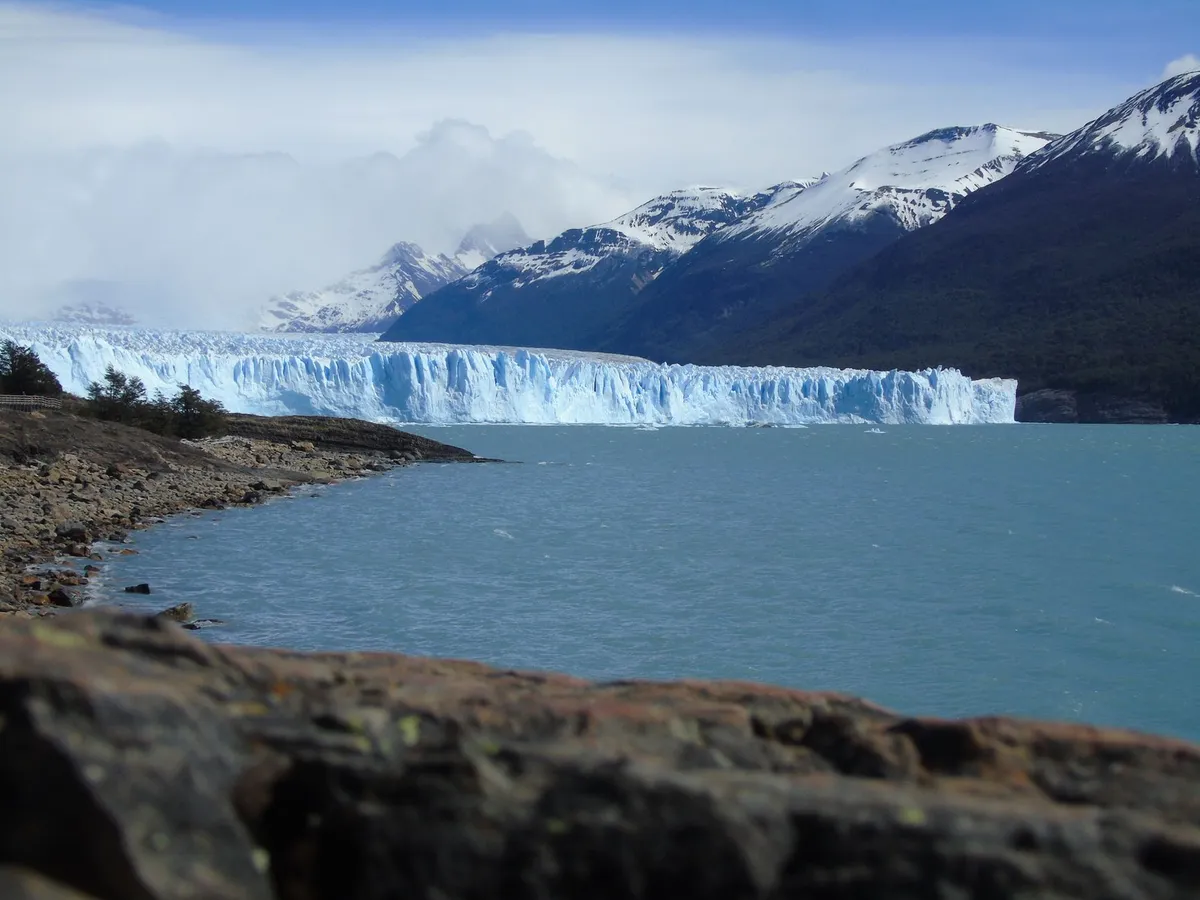
- Chloe Tremblay
- 07 Oct, 2026 23:16
Patagonian Ice Fields: The Ultimate Guide to Glacier Trekking in Chile
Stepping onto the Frozen Spine of Patagonia The Patagonian Ice Fields stretch across the southern Andes like a colossal frozen river, divided into the Northern and Southern Ice Fields. Together they cover roughly 13,000 square kilometers, making them the largest contiguous ice mass outside the polar regions. For trekkers, this is not merely a scenic backdrop; it is a living laboratory of glacial dynamics, where crevasses open like veins and seracs tower like cathedrals. The Chilean side, anchored by Torres del Paine National Park and the lesser‑known Bernardo O’Higgins National Park, offers the most accessible entry points to this icy realm. Seasonality dictates everything. The austral summer (late November to early March) delivers up to 17 hours of daylight, milder temperatures (5‑12 °C at lower elevations), and a higher probability of stable weather windows. Yet even in peak season, the infamous Patagonian wind can gust beyond 100 km/h, turning a pleasant hike into a battle for balance. Shoulder months — October and April — reward the bold with fewer crowds and dramatic light, but they demand a higher tolerance for sudden storms and limited refuge availability. Understanding the geography is the first step. The Northern Ice Field feeds iconic glaciers such as San Rafael and Exploradores, reachable via boat from Puerto Chacabuco or by a rugged 4×4 track from Coyhaique. The Southern Ice Field, however, is the playground for most glacier trekkers. Its crown jewels — Grey, Tyndall, and the massive Pío XI (the longest glacier in the Southern Hemisphere outside Antarctica) — flow into turquoise lakes that mirror the sky. Access typically begins in Puerto Natales, a modest hub with regular bus connections from Punta Arenas and a small airport receiving seasonal flights. From there, a combination of catamaran across Lake Grey, a shuttle to the park entrance, and a well‑marked trail network sets the stage for multi‑day adventures. Physical preparation cannot be overstated. While the trails are not technically alpine climbs, they involve sustained ascents of 400‑800 meters per day over uneven moraine, loose scree, and occasional ice patches. Cardiovascular fitness, core strength, and prior experience with multi‑day backpacking (carrying 12‑15 kg) dramatically reduce injury risk. Many operators recommend a minimum of three months of targeted training, including hill repeats, weighted pack walks, and balance drills on unstable surfaces. Finally, mental readiness is the invisible gear. The isolation, the sheer scale of ice, and the ever‑present sound of calving create a psychological landscape as vast as the physical one. Trekkers who embrace the unpredictability — accepting that a planned route may shift due to a sudden crevasse field or a whiteout — tend to return with stories that transcend photographs. Mapping the Giants: Grey, Tyndall, and the Southern Ice Field Grey Glacier, the most visited tongue of the Southern Ice Field, stretches 28 kilometers from the ice cap to the western shore of Lake Grey. Its terminal face, a 30‑meter wall of blue‑white ice, calves regularly, sending thunderous bergs into the lake. The classic “Grey Glacier Trek” follows the western lakeshore for 11 kilometers to the viewpoint at Mirador Grey, then continues onto the glacier’s lateral moraine for a guided ice walk. This route, typically completed in two days, offers a relatively gentle introduction to glacier travel while delivering front‑row seats to calving events. Tyndall Glacier, tucked deeper into the park’s western sector, demands a longer commitment. The “Tyndall Circuit” covers roughly 45 kilometers over four to five days, crossing the Paso del Viento (Wind Pass) at 1,200 meters and skirting the massive Tyndall Lake. The reward is a panorama of the glacier’s 3‑kilometer‑wide front, framed by the jagged peaks of the Cordillera del Paine. Fewer trekkers venture here, so the sense of solitude is profound. However, the pass is notorious for sudden wind funnels; guides often carry satellite messengers and enforce strict turnaround times. For the ultimate immersion, the “Southern Ice Field Traverse” connects Grey and Tyndall via the high plateau of the ice cap itself. This expedition‑style trek spans 8‑10 days, requires technical glacier skills (rope travel, crevasse rescue), and is only offered by a handful of certified outfitters. Participants sleep in insulated tents on the ice, melt snow for water, and navigate using GPS waypoints supplemented by traditional map and compass. The traverse crosses the “Icefalls of the Pío XI,” a chaotic labyrinth of seracs where route finding becomes an art. Each glacier presents distinct hazards. Grey’s lower elevation means warmer ice, increasing the likelihood of hidden moulins (vertical shafts) that can swallow an unwary boot. Tyndall’s higher altitude preserves harder ice but introduces larger crevasse fields, often concealed by thin snow bridges. The Pío XI, advancing at up to 50 meters per year, creates a constantly shifting terminus; maps older than a season are essentially obsolete. Wildlife encounters add another layer of wonder. Andean condors ride thermals above the ice, while guanacos graze on the moraines. The elusive huemul deer, a national symbol, occasionally appears near the park’s eastern fringes. Birdwatchers should keep binoculars ready for the Magellanic woodpecker and the austral parakeet, both endemic to these southern forests. Photographers will find the “golden hour” here lasts longer due to the high latitude, casting a warm glow on the ice that contrasts with the deep blues of crevasse walls. A polarizing filter reduces glare on the ice surface, while a wide‑angle lens captures the immense scale. Remember that drone use is prohibited within national parks without a special permit, which is rarely granted for recreational purposes. Logistics Unpacked: Permits, Guides, and Getting There Navigating the bureaucratic maze is as critical as packing the right socks. Chile’s National Forest Corporation (CONAF) manages Torres del Paine and Bernardo O’Higgins parks. Every visitor must purchase a park entry ticket — currently CLP 21,000 (≈ US $22) for foreigners — valid for three consecutive days. Multi‑day treks exceeding three days require a “Long Stay” permit, obtained in person at the park administration in Puerto Natales or online via the CONAF portal (Spanish only). The permit includes a mandatory registration of your itinerary, emergency contacts, and guide details if applicable. Guided vs. independent travel is a pivotal decision. While the W Trek and the Grey Glacier day hike can be done solo by experienced hikers, any travel on the ice proper (beyond the marked moraine trails) legally requires a certified mountain guide (IFMGA or UIAGM). Guides provide not only safety oversight but also interpretive knowledge of glaciology, history, and flora. Reputable operators — such as Patagonian Andes, Vertice Travel, and Chile Nativo — offer packages ranging from a 2‑day Grey Glacier ice walk (US $350‑$420 per person) to a 10‑day Southern Ice Field Traverse (US $4,800‑$5,500). Prices typically include park fees, guide services, group gear (ropes, harnesses, crampons), meals, and shared tent accommodation. Transport logistics form the backbone of any itinerary. Most international travelers fly into Punta Arenas (PUQ) via Santiago (SCL) — a 3.5‑hour flight. From Punta Arenas, a 3‑hour bus ride (≈ US $25) reaches Puerto Natales. Alternatively, a seasonal direct flight from Santiago to Puerto Natales (PNT) cuts travel time but costs 2‑3× more. Within the park, the catamaran “Grey II” crosses Lake Grey from Hotel Lago Grey to the glacier’s western shore (≈ US $45 round‑trip). For the Tyndall sector, a 4×4 shuttle from the park’s Laguna Amarga entrance to the trailhead at Campamento Paso (≈ US $30) is standard. Accommodation options vary from refugios (mountain huts) to campsites. Refugios such as Refugio Grey, Refugio Paine Grande, and Refugio Los Cuernos offer dormitory beds (US $55‑$70 per night) with hot showers and communal kitchens. Campsites (US $10‑$15) provide basic platforms and pit toilets; advance booking is essential during high season. Wild camping is prohibited outside designated areas. Below is a concise cost breakdown for a typical 5‑day guided Grey‑Tyndall combo (mid‑range operator, double occupancy):Item Cost (USD) NotesPark entry (3‑day) 22 Extendable with Long Stay permitGuide fee (5 days) 1,200 Includes group technical gearCatamaran Grey II 45 Round‑trip4×4 shuttle to Tyndall 30 One wayRefugio nights (3) 195 $65/nightCampsite nights (2) 25 $12.5/nightMeals (full board) 350 $70/dayFlights SCL‑PUQ (round‑trip) 450 Economy, booked 3 months aheadBus PUQ‑PNT (round‑trip) 50Total Approx. 2,367 Per person, excluding personal gearBudget travelers can shave ~US $800 by opting for all campsites, self‑catering, and using public buses for inter‑city legs. Luxury seekers may add private transfers, premium lodges (e.g., EcoCamp Patagonia), and helicopter scenic flights (US $1,200 per hour). Gear, Safety, and the Art of Ice Walking The line between a memorable trek and a rescue operation often hinges on gear choices. At a minimum, every glacier trekker needs: a 4‑season tent (rated for −20 °C), a −10 °C rated sleeping bag, an insulated sleeping pad (R‑value ≥ 5 Related InsightsInto the Wild Book Review and Summary Best Crime Stories of the Year Volume 3 Book Review and Summary Eating Salad Drunk Book Review and Summary
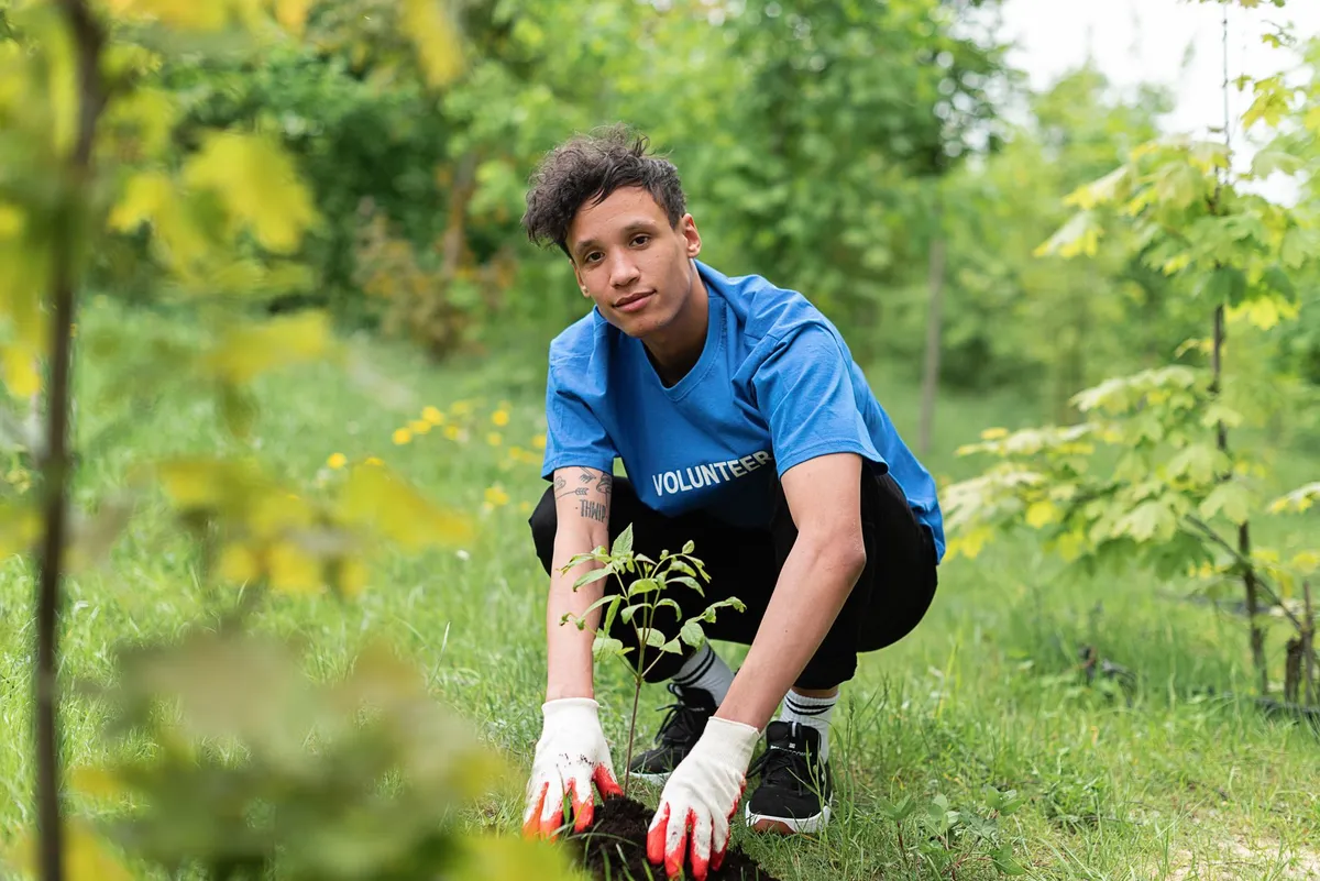
- Pierre Dubois
- 07 Oct, 2026 22:26
Quand l'Altruisme Devient Marchandise : Les Zones d'Ombre du Volontourisme
L'avion atterrit sur le tarmac brûlant d'une capitale d'Asie du Sud-Est. Dans le carnet de vol, il n'y a pas de numéro de siège, mais une promesse : « Changez le monde en deux semaines ». Derrière le hublot, le paysage ne ressemble pas aux cartes postales. C'est une réalité brute, poussiéreuse, loin des filtres Instagram qui ont vendu ce billet. Depuis une décennie, le volontourisme — contraction de volunteer et tourism — s'est imposé comme le nouveau Graal du voyageur en quête de sens. Mais sous le vernis de la générosité, une mécanique bien huilée broie parfois les communautés qu'elle jure de servir. L'Illusion du Sauveur Blanc dans l'Économie de la Pitié L'histoire commence souvent par une intention noble. Un étudiant en année sabbatique, un cadre en burn-out, une retraitée active. Ils paient — souvent cher, parfois plusieurs milliers d'euros — pour « aider ». Or, le premier paradoxe du secteur réside dans son modèle économique : l'aide est devenue un produit de consommation. Les agences spécialisées, florissantes depuis les années 2000, vendent des « expériences immersives » clé en main. Le volontaire achète une place dans un orphelinat, une école, un centre de soins animaliers. Le problème structurel est connu des sociologues du développement depuis les travaux de Robert Chambers sur l'approche participative : l'arrivée massive de main-d'œuvre non qualifiée, tournante et éphémère crée une dépendance. Dans nombre d'orphelinats du Cambodge, du Népal ou du Ghana, la présence d'enfants « orphelins » est maintenue artificiellement pour satisfaire la demande. Des rapports d'UNICEF et de Next Generation Nepal ont documenté comment des enfants ayant des parents vivants sont recrutés dans les zones rurales pour peupler ces institutions lucratives. Le volontaire, pensant combler un vide affectif, finance en réalité un trafic d'enfants déguisé en charité.La figure du « Sauveur Blanc » (White Savior Complex), théorisée par l'écrivaine Teju Cole, trouve ici son terrain de jeu privilégié. Le récit occidental place le voyageur au centre de l'intrigue : il est le héros, la population locale le décor. Cette dynamique nie l'agence locale, l'expertise endogène et la dignité des communautés. Quand un groupe de lycéens européens repeint une école en trois jours — souvent mal, car ils n'ont aucune compétence en maçonnerie —, ils privent un artisan local de son salaire et laissent derrière eux un travail à refaire. L'empreinte carbone du vol long-courrier s'ajoute à l'absurdité économique : le coût du billet d'avion aurait financé l'embauche de dix peintres locaux pendant un mois. L'Orphelinat : Usine à Volontaires et Traumatismes Cachés Si le volontourisme a un épicentre symbolique, c'est bien l'orphelinat. Le phénomène des « orphanage tourism » a été largement documenté par la campagne ReThink Orphanages, coalition d'ONG majeures comme Save the Children et Lumos. Les chiffres sont vertigineux : au Cambodge, le nombre d'orphelinats a augmenté de 75 % entre 2005 et 2010, alors que le nombre d'orphelins réels diminuait. 80 % des enfants placés en institution ont au moins un parent en vie. La psychologie de l'attachement, fondement du développement de l'enfant, est la première victime de ce ballet incessant. Un enfant qui voit défiler une nouvelle « maman » ou « papa » bénévole toutes les deux semaines développe des troubles de l'attachement réactif. Il apprend à performer l'affection pour obtenir de l'attention, des bonbons, ou simplement pour ne pas être oublié. Quand le volontaire repart, le lien se brise. Une nouvelle cicatrice s'ajoute aux précédentes. La recherche en neurosciences (notamment les travaux de Charles Nelson sur la privation psychosociale) prouve que l'institutionnalisation précoce altère irrémédiablement la structure cérébrale. Pourtant, le marketing du secteur vend la « câlinothérapie » comme une compétence. Aucune formation en travail social, en psychologie du trauma, ni en protection de l'enfance n'est requise. Le simple fait d'être « occidental » et « bienveillant » sert de passe-droit. C'est une insulte aux travailleurs sociaux locaux, formés, compétents, mais sous-payés, qui voient leur métier dévalorisé par l'amateurisme doré des visiteurs.La Médecine Humanitaire « Low Cost » : Quand l'Incompétence Tue Au-delà de l'éducation et de l'enfance, le volontourisme médical représente une dérive aux conséquences potentiellement fatales. Des étudiants en première année de médecine, parfois même des lycéens, se retrouvent à suturer des plaies, assister à des accouchements, ou distribuer des antibiotiques dans des cliniques rurales du Pérou, de Tanzanie ou d'Inde. Des organisations comme No White Saviors ou le Working Group on Ethics Guidelines for Global Health Training (WEIGHT) tirent la sonnette d'alarme depuis des années. Le principe « First, do no harm » (Premièrement, ne pas nuire) est foulé aux pieds. L'absence de supervision adéquate, la barrière de la langue, l'ignorance des protocoles locaux et des résistances antibiotiques régionales transforment l'aide en danger public. Des cas de complications post-opératoires non gérées, de diagnostics erronés ou de transmission d'infections nosocomiales par manque d'asepsie sont légion, mais sous-déclarés. Le patient local, souvent analphabète ou en situation de grande précarité, n'a pas le choix : il accepte le « médecin blanc » car c'est la seule option gratuite. Le volontaire, lui, rentre chez lui avec une ligne prestigieuse sur son CV (« Medical Mission in Africa ») et la conscience tranquille, ignorant le sort de ses « patients ». Cette pratique viole ouvertement les directives de l'OMS et de la Fédération Médicale Mondiale sur la pratique médicale internationale. Elle sape aussi les systèmes de santé locaux : pourquoi un gouvernement investirait-il dans la formation et la rétention de ses propres infirmiers si une ONG étrangère envoie gratuitement — mais temporairement — de la main-d'œuvre ? C'est une forme de destruction créatrice inversée : on détruit la capacité locale pour la remplacer par une charité instable. La Faune Sauvage : Derrière le Selfie au Tigre, l'Enfer du Dressage Le volontourisme animalier est l'autre face, tout aussi lucrative, de la médaille. « Soignez des bébés éléphants », « Nourrissez des lionceaux au biberon », « Protégez les tortues de mer ». Les images inondent les réseaux sociaux. La réalité, elle, se cache dans les coulisses des « sanctuaires » et « centres de réhabilitation » non accrédités. L'industrie du divertissement animalier a muté. Face à la condamnation croissante des cirques et des zoos, elle a revêtu le manteau vert de la conservation. En Afrique du Sud, l'industrie de l'élevage de lions en captivité (captive breeding) alimente le « cub petting » (caresser des lionceaux) et la « marche avec les lions » (walking with lions). Les volontaires paient pour élever ces bébés arrachés à leur mère à la naissance. Une fois adultes, trop dangereux pour les touristes, ces lions sont vendus pour la chasse en enclos (canned hunting) ou pour le commerce d'os vers l'Asie. Le volontaire a financé la chaîne d'approvisionnement de la chasse au trophée. En Asie, les « camps d'éléphants éthiques » pullulent. Le label « sanctuary » n'est pas protégé. Beaucoup continuent le phajaan (brutal dressage traditionnel) en coulisse, ou font travailler les animaux pour les bains touristiques quotidiens, source de stress chronique et de blessures. La vraie conservation — protection d'habitats, lutte anti-braconnage, couloirs écologiques — est une science complexe, coûteuse, sans gloire pour le touriste. Elle ne se fait pas en caressant une trompe.La Construction de l'Inutile : L'Architecture de l'Égo Prenons le cas emblématique des chantiers de construction : puits, écoles, bibliothèques, cliniques. L'image du volontaire portant des parpaings sous le soleil est un classique du genre. Pourtant, les ingénieurs humanitaires (RedR, Engineers Without Borders) le répètent : la main-d'œuvre non qualifiée est un fardeau sur un chantier. Un puits creusé sans étude hydrogéologique sèche en six mois. Une école construite sans plan de maintenance ni budget pour les enseignants reste vide. Une clinique sans personnel médical ni chaîne d'approvisionnement en médicaments devient un hangar. L'ONG Build Abroad ou Projects Abroad vendent ces chantiers comme des « team building » grandeur nature. Le résultat ? Des « éléphants blancs » en béton qui parsèment le paysage rural du Global South, témoins muets de l'ignorance des besoins réels. La règle d'or du développement durable — « Nothing about us without us » (Rien sur nous sans nous) — est systématiquement violée. Les communautés sont rarement consultées en amont sur la pertinence du projet. Elles reçoivent un « cadeau » imposé, souvent inadapté à leur culture ou à leur environnement. La propriété du projet (ownership) leur échappe ; dès le départ des volontaires, l'infrastructure se dégrade. L'argent dépensé en logistique, hébergement, encadrement et vols pour une équipe de dix volontaires pendant deux semaines aurait permis de payer une entreprise locale, créant de l'emploi durable et garantissant la qualité technique. Le Volontourisme Climatique : L'Hypocrisie Carbone Parlons de l'éléphant dans la pièce : l'empreinte carbone. Un aller-retour Paris-Bangkok émet environ 1,6 tonne de CO2 par passager. C'est l'équivalent de l'empreinte annuelle d'un citoyen moyen de nombreux pays bénéficiaires du volontourisme (Madagascar, Malawi, Népal). Pour une mission de deux semaines, le ratio émission/impact est catastrophique. Certaines agences proposent désormais la « compensation carbone » — planter des arbres, financer des éoliennes. La science climatique est formelle : la compensation ne compense pas. Elle déplace la culpabilité. Le carbone mis dans l'atmosphère aujourd'hui y restera des siècles ; les arbres plantés mettront des décennies à l'absorber, s'ils survivent aux incendies et aux coupes. Le volontourisme climatique est une oxymore. Vouloir « sauver la planète » en la traversant en avion pour planter dix manguiers est une posture, pas une solution. Les vraies solutions climatiques sont locales : agroforesterie paysanne, gestion communautaire des forêts, adaptation côtière. Elles demandent du temps, de l'écoute, des financements longs — pas des séjours « gap year ». Le volontaire climat qui veut être utile ferait mieux de financer une association locale certifiée (type Gold Standard ou Verra avec gouvernance locale) et de rester chez lui pour militer pour la justice climatique nord-sud. La Réforme par le Bas : Vers un Engagement Décolonial Faut-il jeter le bébé avec l'eau du bain ? L'engagement international n'est pas mort, il doit muter. La réponse ne réside pas dans l'arrêt du voyage, mais dans la fin du volontourisme commercial. Plusieurs pistes structurantes émergent, portées par des réseaux comme Comhlámh (Irlande), Forum (Royaume-Uni) ou France Volontaires. 1. La compétence avant la compassion. Le modèle du Volontariat de Solidarité Internationale (VSI) français, du Peace Corps américain ou des UN Volunteers impose des critères stricts : diplôme, expérience professionnelle, formation pré-départ de plusieurs semaines, engagement long (12 à 24 mois), statut protecteur, prise en charge totale. C'est l'antithèse du volontourisme payant. Le volontaire est un professionnel qui met son expertise (santé, droit, ingénierie, pédagogie, gestion) au service d'une structure locale partenaire, sous la direction de cette structure. 2. Le partenariat d'égal à égal. La relation Nord-Sud doit basculer du donateur/bénéficiaire au partenariat contractuel. L'association locale définit les besoins, recrute (si besoin) le profil précis, encadre la mission. L'envoi d'experts pour de la formation de formateurs (Training of Trainers), de l'appui institutionnel, du renforcement de capacités techniques, a un impact mesurable et durable. Le volontaire devient un « ressource », pas un « sauveur ». 3. Le voyageur responsable, pas le volontaire touriste. Pour le grand public qui veut voyager utile sans prétendre « aider », il existe le tourisme communautaire équitable (Community-Based Tourism). On paie un prix juste pour dormir chez l'habitant, manger local, découvrir la culture, guidé par la communauté. L'argent va directement dans l'économie locale. On ne « fait » pas de l'aide, on soutient une économie. C'est plus honnête, plus respectueux, et souvent plus enrichissant humainement. 4. L'engagement « chez soi ». La plus grande aide au Sud se joue souvent au Nord : plaidoyer pour l'annulation de la dette, lutte contre l'évasion fiscale des multinationales qui saignent les budgets des États du Sud, consommation responsable, vote pour des politiques de justice climatique et commerciale. Un citoyen français qui pousse sa banque à ne pas financer des projets d'accaparement de terres en Afrique fait plus pour le développement qu'un mois de peinture d'école. L'Éthique du Regard : Décoloniser son Imaginaire Au fond, le volontourisme interroge notre rapport à l'Autre et à nous-mêmes. Pourquoi avons-nous besoin de nous rendre « utiles » à l'autre bout du monde pour nous sentir légitimes ? Pourquoi la pauvreté du Sud est-elle perçue comme un terrain de jeu pour notre développement personnel ? Le sociologue Thierry Ribault parle de « tourisme de la compassion » : on consomme la misère comme on consomme un paysage, pour se sentir vivant, bon, moderne. Décoloniser le voyage, c'est accepter de ne pas être le centre. C'est visiter un pays pour sa beauté, son histoire, sa complexité, sans y projeter notre mission civilisatrice. C'est payer le juste prix, respecter les coutumes, écouter plus qu'on ne parle. C'est comprendre que le « développement » n'est pas un colis qu'on livre, mais un processus politique, social, conflictuel, que seuls les concernés peuvent mener. Les photos de profil avec des enfants noirs anonymes — floutés ou non — devraient disparaître des CV et des réseaux sociaux. Elles sont la signature visuelle d'un privilège : celui de pouvoir toucher l'intimité de vies vulnérables sans consentement éclairé, pour sa propre gloire. Le RGPD européen protège les données des enfants européens ; pourquoi les enfants du Sud n'auraient-ils pas droit à la même dignité numérique ? Construire des Ponts, Pas des Murs d'Ego Le monde a besoin de solidarité internationale, plus que Related InsightsHamburgs Speicherstadt The Silicon Sentinel: Architecting Predictive AI for Proactive Cyber Defense Evermore Book Review and Summary
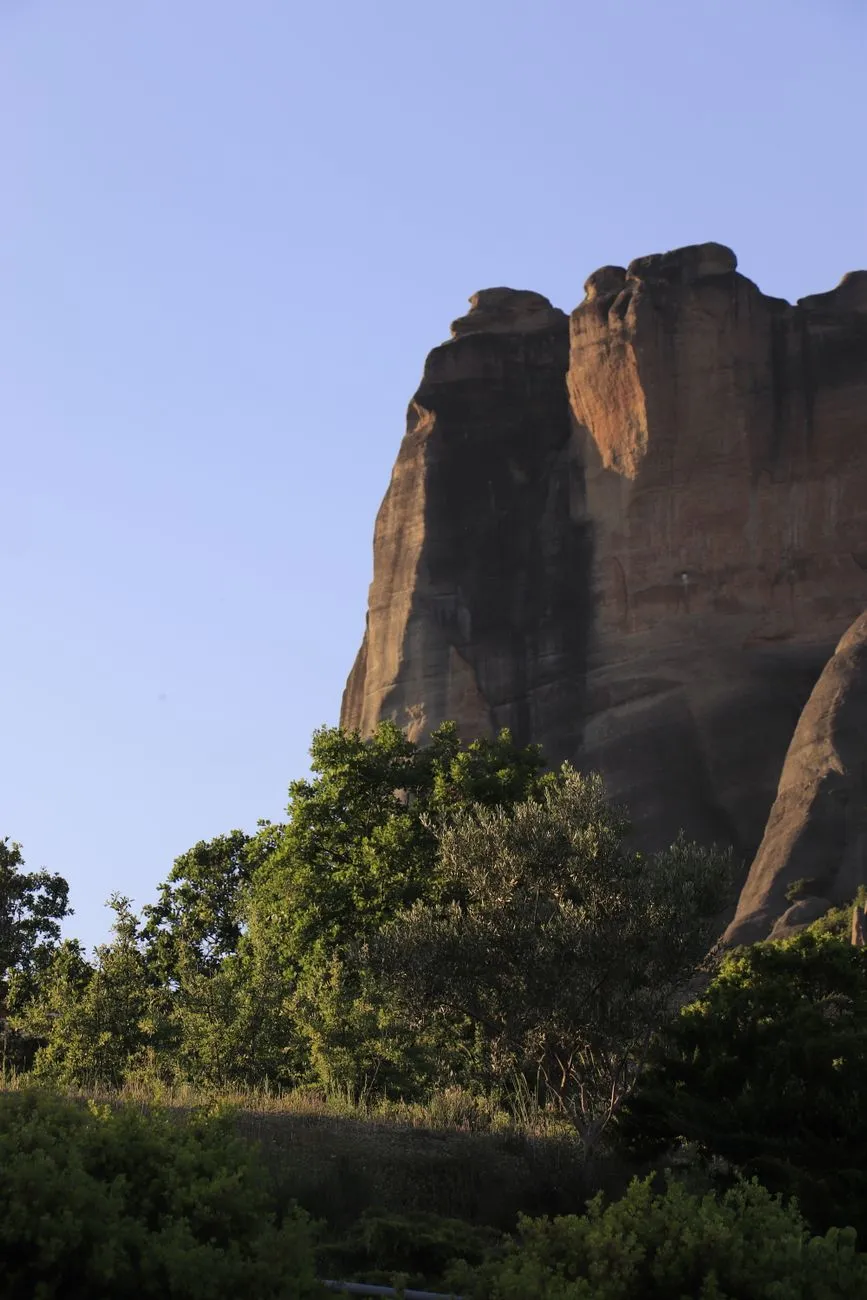
Scaling the Sky‑Piercing Rocks: How to Reach Meteora’s Hidden Sanctuaries The first step of any pilgrimage is simply arriving at the threshold. Meteora sits in the heart of Thessaly, central Greece, about 350 km north of Athens. Most visitors fly into Athens International Airport (ATH) and catch a high‑speed train to Kalambaka, the town that cradles the rock formations. The Athens‑Kalambaka line runs twice daily, with a journey time of roughly 4 hours 30 minutes. Once in Kalambaka, the real ascent begins. Two main routes lead to the monasteries: the paved “road to the rocks” that follows the riverbed, and the network of marked hiking trails that wind up the limestone spires. For the historically inclined, the stone‑paved “Monastery Path” (Monastiriaki Odos) is a living museum of Ottoman‑era cobbles, still used by local shepherds. Public transport is surprisingly efficient: local minibusses (the “KTEL” service) depart every 20 minutes from the Kalambaka bus station and stop at the base of each major rock—Great Meteoron, Varlaam, and the others. Tickets cost around €2.00 per ride (2024 rates). For the adventurous, a rented e‑bike can shave the ascent time dramatically; several outlets in Kalambaka offer electric mountain bikes for €15 per day, complete with helmets and GPS‑linked trail maps. If you prefer a guided experience, several licensed operators provide “Monastery‑by‑Monastery” tours. These usually include a local historian, a portable audio guide, and a short shuttle from the town center to the first viewpoint. Prices hover between €35 and €55 per person, depending on group size and the inclusion of a traditional Greek lunch. Regardless of your chosen mode, remember that the terrain is steep and uneven. Proper trekking boots, a lightweight rain jacket, and a reusable water bottle (water fountains are sparse on the cliffs) are essential. Early morning light not only offers the best photography but also avoids the mid‑day crowds that gather at the main visitor centers. Chronicles Carved in Stone: The Rise and Fall of the Forgotten Monasteries Meteora’s monasteries are not merely scenic backdrops; they are living testimonies to a turbulent epoch that began in the early 14th century. In 1307, a hermit named Athanasios the Meteorite retreated to the summit of the highest rock, seeking solitude from the encroaching Ottoman raids that threatened mainland monastic life. His modest stone cell soon attracted disciples, and by 1340 the Great Meteoron Monastery (the largest of the complex) was formally established under the patronage of the Byzantine nobleman John Palaiologos. The next half‑century saw a rapid proliferation of monastic foundations. Varlaam (founded 1345), Roussanou (built 1476), and the Holy Trinity (consecrated 1475) were all erected by wealthy benefactors who saw the cliffs as impregnable sanctuaries. Their architecture blends Byzantine frescoes, post‑Byzantine iconography, and fortified stone walls—features designed to repel both invaders and the harsh mountain winds. However, the Ottoman occupation also imposed heavy taxes, and by the 18th century many smaller establishments fell into disrepair. Two of the original six active monasteries—St. Nicholas Anapausa and St. Stephen—were abandoned in the early 1700s when their resident monks migrated to more fertile valleys. Their stone foundations remain, overgrown with wild thyme and punctuated by crumbling fresco fragments that hint at the once‑vibrant liturgical life. The 20th century brought a resurgence of interest, spurred by the 1938 designation of Meteora as a UNESCO World Heritage Site. Restoration campaigns, funded by the Greek Ministry of Culture and private donors, revived the Great Meteoron’s frescoes and reinforced the precarious cliff‑side staircases. Yet, despite these efforts, several lesser‑known hermitages—such as the “Cave of Saint John” near the Great Meteoron—remain largely inaccessible, preserved only in archival sketches from the 19th century. These forgotten monasteries embody a narrative of resilience: they rose from the need for spiritual refuge, survived centuries of political upheaval, and now stand as silent witnesses to humanity’s quest for transcendence amid stone. Pilgrim’s Path: A Day‑by‑Day Itinerary for the History‑Hungry Traveller Day 1 – Arrival & OrientationSettle into a boutique guesthouse in Kalambaka (average nightly rate €70, including breakfast). Spend the afternoon strolling the town’s cobbled streets, visiting the folklore museum, and reviewing the trail map at the Tourist Information Center. Day 2 – Great Meteoron & VarlaamBegin early (7 am) and take the KTEL bus to the base of the Great Meteoron. Ascend via the wooden footbridge and stone steps; the climb takes roughly 30 minutes. Inside, view the 12th‑century iconostasis and the ancient library that once housed over 2,000 manuscripts. After a 1‑hour reverent pause, descend and head to Varlaam, just a 15‑minute walk away. The monastery’s courtyard offers panoramic views of the Thessalian plain—ideal for a light lunch of “tsipouro” and olives from the on‑site garden. Day 4 – The Hidden HermitagesReserve a private guide for a “Secret Sites” excursion. The guide will lead you to the abandoned St. Nicholas Anapausa ruins and the Cave of Saint John, accessed via a narrow goat‑trail that is not signposted on public maps. Pack a picnic; there are no facilities on these sites. Day 5 – Holy Trinity & SunsetTake the cable‑car (operating from 9 am to 6 pm, €8 round‑trip) to the Holy Trinity. The ascent offers a dramatic aerial view of the entire Meteora complex. Inside, note the 16th‑century fresco of the Ascension, still vivid after centuries of exposure. Conclude the day by returning to the base and hiking to the “Sunset Rock” (a popular viewpoint just beyond the main trail) for a breathtaking golden‑hour panorama. Day 6 – Reflection & DepartureSpend a leisurely morning in Kalambaka, perhaps joining a local monk for a brief vespers service at the Great Meteoron (services are open to visitors on Wednesdays at 5 pm). Depart by train or flight, carrying a notebook filled with sketches, fresco reproductions, and the scent of thyme that clings to the stone walls. Each step of this itinerary balances structured exploration with moments of unscripted discovery, ensuring that the traveler experiences both the grand narrative and the intimate whispers of Meteora’s forgotten sanctuaries. Living Like a Monk in the Modern Age: Cost, Connectivity, and Comfort for Digital Nomads Meteora is increasingly attracting remote workers who crave a blend of awe‑inspiring scenery and a tranquil work environment. According to the latest Nomad Score (7.2/10), the region offers a solid balance of affordability, safety, and internet reliability. Below is a concise cost‑of‑living snapshot, drawn from Numbeo’s 2024 data for Kalambaka and the surrounding villages. Category Monthly Cost (USD) NotesRent (1‑bedroom apartment, city centre) $420 Most units are historic stone houses with modern amenities.Utilities (electricity, heating, cooling, water) $80 Solar panels are common; heating is mainly via natural gas.High‑speed Internet (50 Mbps) $45 Fiber‑optic is available in Kalambaka; many cafés offer free Wi‑Fi.Coworking Space (Desk, coffee, printing) $150 “Cliffside Co‑Work” operates 7 days a week, with views of the rocks.Groceries (basic basket) $250 Local markets supply olives, feta, fresh herbs, and seasonal fruit.Public Transport (monthly pass) $30 Includes KTEL minibusses to the monasteries and surrounding villages.Dining out (mid‑range restaurant, three‑course) $15 per meal Traditional tavernas serve “gemista” and grilled octopus.Total estimated monthly budget: ≈ $1,090. Internet speed in Kalambaka averages 78 Mbps download and 22 Mbps upload, sufficient for video conferencing, cloud‑based design work, and streaming. Many nomads report that the combination of natural light (especially during the long summer evenings) and the faint echo of distant bells creates an unexpectedly productive ambiance. For those seeking a more immersive experience, short‑term rentals inside restored monastery quarters are available through heritage‑preservation programs. These units cost about €1,200 per month and include a private terrace overlooking the cliffs—a price point comparable to boutique hotels in major European capitals. Health‑care access is reliable: the General Hospital of Trikala (30 km away) offers English‑speaking staff, and a pharmacy in Kalambaka operates 24 hours. Emergency services are coordinated via the national 112 system, with response times averaging 12 minutes in the region. Safety is another strong point. Crime rates in Kalambaka rank in the lowest 10 % of Greek municipalities, and the UNESCO designation ensures constant patrols by both local police and heritage guards. In short, the digital nomad can enjoy a modest budget, robust connectivity, and a daily backdrop that feels more like a meditation hall than a conventional office. Preserving the Sacred: Conservation Efforts and Ethical Visiting Practices The influx of tourists and remote workers brings both economic benefits and stewardship challenges. UNESCO, together with the Greek Ministry of Culture, has instituted a multi‑layered preservation plan that emphasizes structural reinforcement, fresco restoration, and ecological balance. Structural reinforcement: Engineers employ non‑invasive techniques, such as stainless‑steel anchors hidden within the rock, to stabilize the precarious staircases and wooden bridges. These interventions are regularly inspected using drone‑mounted LiDAR scanners, which map micro‑shifts in the limestone with millimeter precision. Fresco restoration: A dedicated team of conservators, led by the National Centre for Byzantine Studies, uses reversible, solvent‑free adhesives to re‑attach flaking pigment layers. The process is documented in open‑access journals, ensuring transparency and academic peer review. Ecological balance: The surrounding pine forest is managed through controlled grazing and reforestation projects. Volunteers, many of whom are visiting backpackers, plant native species like “Greek fir” (Abies cephalonica) during the spring planting season. Visitors play a pivotal role in these efforts. The most direct action is to purchase the “Meteora Preservation Pass” (€3 per day) at any ticket booth; proceeds fund ongoing maintenance. Additionally, tourists should adhere to the following guidelines: Stay on marked trails – off‑trail hiking accelerates erosion and can damage fragile frescoes hidden in side chambers. Limit flash photography – intense light degrades pigment over time; use a soft‑focus lens and avoid direct exposure to fresco surfaces. Respect prayer times – many monasteries hold liturgies at 9 am, 12 pm, and 5 pm. During these periods, silence is requested, and entry may be restricted to worshippers. Carry out all waste – the cliffs lack waste bins; bring a reusable bag and dispose of litter in Kalambaka’s recycling stations.By integrating personal responsibility with community‑wide conservation initiatives, the delicate equilibrium between accessibility and preservation can be maintained for future generations of pilgrims and digital wanderers alike. From Stone to Soul: Why the Forgotten Monasteries Call You Back Meteora is more than a collection of dramatic cliffs; it is a living archive of human yearning for the divine, etched into stone and sustained by centuries of faith, art, and perseverance. The forgotten monasteries—those crumbling walls and hidden caves—invite us to step away from the noise of modern life and into a realm where silence speaks louder than any city soundtrack. Whether you arrive by train, e‑bike, or a nomadic Wi‑Fi‑enabled laptop, the journey unfolds in layers: the physical climb, the historical revelation, the day‑by‑day immersion, and finally, the quiet contemplation that lingers long after you descend. By respecting the fragile ecosystems, supporting preservation funds, and embracing the rhythm of monastic life, you become part of an ongoing story that bridges medieval mystics and 21st‑century explorers. So pack your sturdy boots, charge your tablet, and let the wind that has whispered through these sanctuaries for eight hundred years guide you toward your own inner summit. #Meteora #DigitalNomad #HistoricalTravel Related InsightsCastillo de Gibralfaro: El Guardián de Málaga The Silk Road's Nomadic Hospitality: Yurt Stays in Kyrgyzstan L'Abbaye de Westminster : Le Cœur Royal de Londres{ "@context": "https://schema.org", "@type": "FAQPage", "mainEntity": [ { "@type": "Question", "name": "What is the main focus of Echoes in the Clouds: A Pilgrimage Through Meteora’s Forgotten Monasteries?", "acceptedAnswer": { "@type": "Answer", "text": "Explore the hidden monasteries perched on Thessaly’s towering cliffs, uncover their centuries‑old stories, and learn how modern travelers can experience them responsibly." } }, { "@type": "Question", "name": "Who authored the comprehensive guide on Echoes in the Clouds: A Pilgrimage Through Meteora’s Forgotten Monasteries?", "acceptedAnswer": { "@type": "Answer", "text": "This detailed article and its insights were carefully researched and authored by Mark Dinn." } }, { "@type": "Question", "name": "Where can I find more related content about Travel?", "acceptedAnswer": { "@type": "Answer", "text": "You can explore more articles, detailed reviews, and similar insights by browsing the Related Insights section at the bottom of this article or visiting our dedicated Travel category page." } } ] }
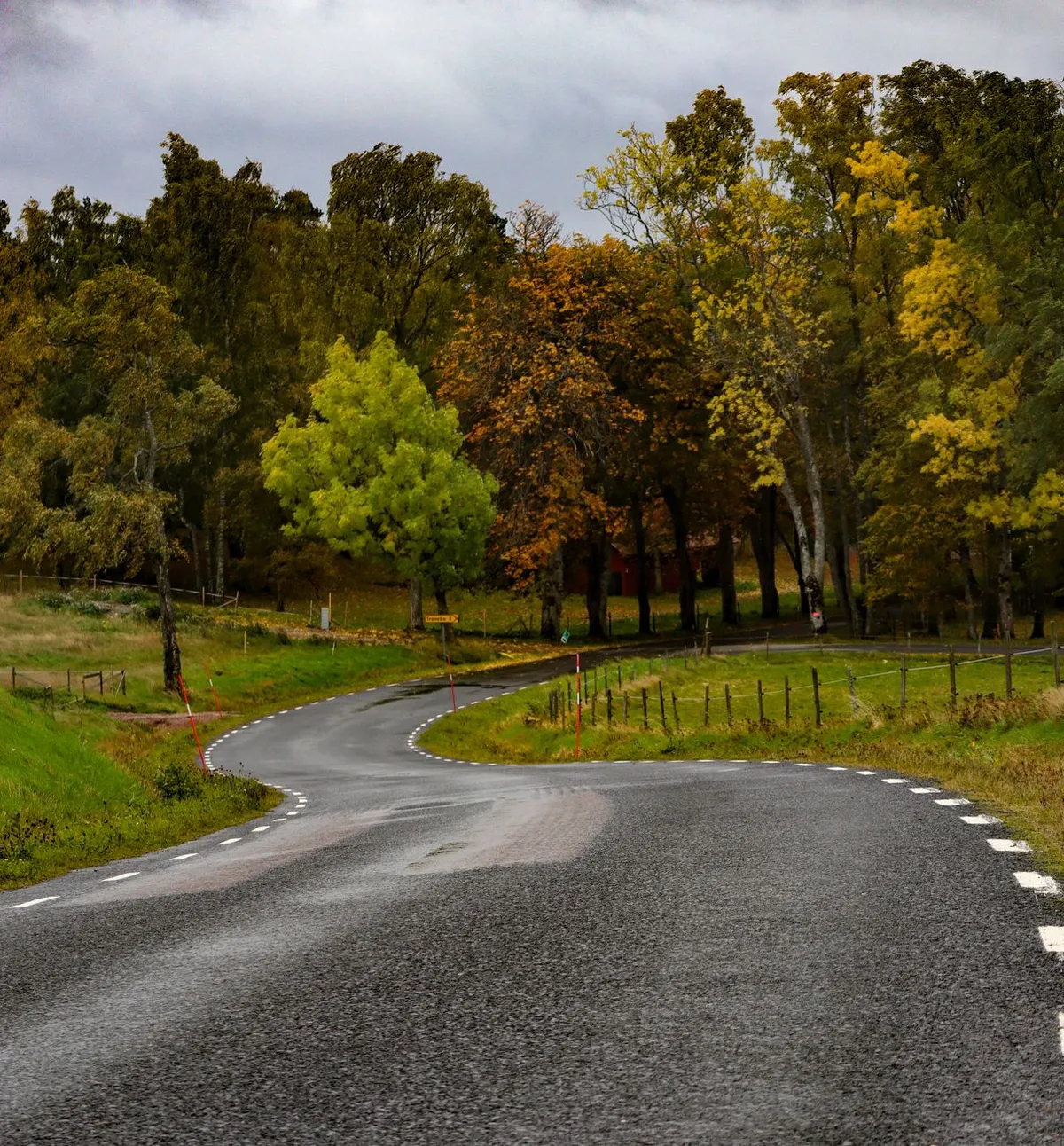
The train does not apologize for its rhythm. It clatters through the Po Valley at dawn, a steel serpent stitching Milan to Bologna, and I watch the fog eat the poplar trees whole. There is no Wi-Fi in this carriage, only the smell of damp wool and espresso from the thermos of the woman across the aisle. She offers me a biscotti. I accept. We do not speak the same language, but we share a vocabulary of patience. This—this suspension between departure and arrival—is where the map dissolves and the territory begins to breathe. We have been sold a lie for decades. The lie is that distance is an obstacle to be conquered, that the world is a checklist, and that the value of a journey is measured in stamps collected or peaks summited. The industry calls it "bucket listing." I call it a spiritual inflation: the more places you tick, the less any single place is worth. But out here, where the high-speed line ends and the regionale takes over, a different geometry applies. It is the geometry of stillness. The Tyranny of the Itinerary Modern tourism operates on the logic of extraction. We arrive, we mine the view for content, we refine the experience into a caption, and we ship it out before the dust settles on our boots. It is a colonial mindset wearing a Patagonia vest. We treat places as resources to be harvested—Instagram backdrops, bragging rights, data points for the algorithm. I remember standing in the Hall of Mirrors at Versailles ten years ago. The crowd was a river of selfie sticks. No one looked at the chandeliers; they looked at their screens to see if the chandeliers looked good on them. The history was loud, gilded, and entirely absent. I felt a profound homesickness for a place I had never been—a place where time moves like honey. Slow travel is not merely a budgeting strategy or a preference for trains over planes. It is a political act. It is a refusal to let the market dictate the tempo of your wonder. It asserts that presence is a non-renewable resource far more valuable than coverage. When you stay in a village for three weeks instead of three hours, the transaction flips. You are no longer the consumer; you are the neighbor. The baker learns how you take your coffee. The stray cat claims your windowsill. The map stops being a set of instructions and starts being a memoir.The Philosophy of the Flâneur Walter Benjamin wrote of the flâneur—the stroller, the lounger, the urban explorer who wanders the arcades of Paris with no destination but the rhythm of the crowd. The flâneur does not "do" the city; the city "does" him. He is the antidote to the commuter. The commuter knows the price of everything and the value of nothing. The flâneur knows the value of a shadow falling on cobblestones at 4 PM. I tried to import this species into the countryside last autumn. I rented a stone cottage in the Alentejo region of Portugal, fifty kilometers from the nearest highway. The plan was simple: no plan. I would walk the montados—the cork oak savannas—until the light changed. I would learn the difference between the call of the azure-winged magpie and the hoopoe. The first three days were withdrawal. My thumb twitched for the refresh button. I paced the kitchen tiles, inventing emergencies. I need to check the weather for next Tuesday. I should research the best pastel de nata in Lisbon. The addiction to utility is deep in the marrow. We have been trained to believe that unstructured time is wasted time. But on the fourth morning, the fog lifted off the cork trees like a held breath. I saw a fox trot along the dry stone wall, unbothered by my stillness. I realized the fox wasn't "doing" the landscape. The fox was the landscape. And for the first time in years, I wasn't a tourist in my own life. I was the terrain. The Logistics of Letting Go People ask: How do you afford the time? How do you plan the unplannable? The answer is boring, which is why it works. You strip the engine down to the chassis. Transport becomes the destination. I took a cargo bike across the Lofoten Islands last summer. Twenty kilometers a day. My legs knew the gradient of every fjord before my eyes did. I smelled the kelp drying on the racks in Reine before I saw the village. The effort was the arrival. When you move at muscle speed, the world resolves into high definition. You see the lichen on the rocks, the tracks of a ptarmigan in the sand, the way the Arctic light gilds the underside of a cloud. Accommodation becomes community. I stop looking for "unique stays" on platforms that monetize authenticity. I look for casas particulares in Cuba, pensioni run by nonnas in the Dolomites, farm stays in Hokkaido where breakfast is miso soup made from soybeans grown twenty meters from the table. You pay for the room, but you earn the stories. In a family-run guesthouse in the Val di Fassa, the owner, Marco, taught me to recognize the sound of the Marmotta whistle—a sharp, high pip that means "eagle overhead." Now, whenever I hear it in the Alps, I think of Marco’s wrinkled hands wrapping a wool scarf around my neck. That is a souvenir no airport shop sells. The schedule is written in pencil. I book the first night and the flight home. The middle is blank. This terrifies the planner in me. But the blank space is where the magic hides. In Georgia (the country, not the state), a broken-down marshrutka in the Tusheti mountains led to three days in a shepherd’s hut, drinking chacha and listening to polyphonic singing that predates Christianity. No guidebook lists "Shepherd's Hut, Day 3." You have to miss the connection to find the communion.The Ecology of Attention There is a hidden cost to fast travel, and it is paid in attention. The carbon footprint of a flight is calculated in tons of CO2. The cognitive footprint of a whirlwind tour is calculated in fragmented memories. We return home with full cameras and empty heads. Slow travel is an ecology of attention. It asks: What happens when you stare at the same olive tree for an hour? In Puglia, I did exactly that. An ancient tree, gnarled like a question mark, roots gripping the red soil. At minute fifteen, I saw the ants farming aphids on a low branch. At minute thirty, a Sardinian warbler nested in the hollow trunk. At minute forty-five, the light shifted, and the bark turned from grey to burnt umber, revealing the history of every drought and flood the tree had survived. I learned the tree’s name from a farmer leaning on a hoe: Ulivo della Regina. The Queen’s Olive. Planted by the Normans, maybe. Or the Byzantines. It has outlived empires. It will outlive me. Standing there, my petty anxieties—deadlines, emails, the noise of the feed—shrank to their actual size. The tree offered a perspective no wellness retreat can package: You are passing through. I remain. This is the gift of slowness. It restores proportion. It reminds you that you are a verb, not a noun. You are not a static entity "visiting" a place; you are a moving participant in an ancient conversation between geology, biology, and culture. The Art of the Deep Map Cartographers make maps to flatten the world. Slow travelers make "deep maps" to thicken it. A standard map of the Scottish Highlands shows the A82, Loch Ness, Fort William. A deep map shows: the spot where the midges don't bite because the wind funnels through the glen; the bothy where a climber left a tin of shortbread in 1998; the exact bend in the river where the salmon leap in October; the Gaelic name for the hill that means "Hill of the False Summit." I build deep maps wherever I linger. In a notebook—paper, because batteries die and screens glare—I record sensory coordinates.Smell: Petrichor on hot volcanic ash, Santorini, 6 AM. Sound: The rhythmic thock-thock of a woodpecker in the Black Forest, syncopated with a distant church bell. Touch: The cold slickness of a medieval keystone in a Toledo synagogue, worn smooth by centuries of fingers tracing the Star of David. Taste: Salt on fingertips after peeling percebes (gooseneck barnacles) in a Galician tavern, the taste of the Atlantic crash.These coordinates cannot be GPS-tagged. They are internal landmarks. Years later, closing my eyes, I can navigate back to that keystone in Toledo faster than I can find a file on my cloud drive. That is the true navigation. We do not travel to see places; we travel to become the kind of people who carry places inside them.The Return: Reverse Culture Shock The hardest part of slow travel is not the departure. It is the return. You land in your home airport. The air smells of jet fuel and sanitizer. The signs shout instructions: Queue here. Scan this. Remove belt. Hurry up. Wait. You move through the terminal, a ghost in your own life. The speed hurts. The volume hurts. The performative urgency of modern life—reply now, optimize this, scale that—looks like a collective panic attack. I remember stepping off the night train from Palermo into Milano Centrale. The station was a cathedral of velocity. Businessmen sprinted for Frecciarossa connections. Digital boards flickered with real-time delays measured in seconds. I still had sand in my shoes from Mondello. I still tasted the granita di mandorla on my lips. I sat on my suitcase and wept. Not from sadness. From the violence of the contrast. I had spent three weeks learning the dialect of a fisherman named Salvatore, learning which moon phase brings the triglie (red mullet) close to shore, learning to mend a net with fingers stiff from salt. I had acquired a competence that was useless in Milan. Useless in the economy. Essential to the soul. This is the tax you pay. Slow travel ruins you for the fast lane. It calibrates your internal clock to a geologic tempo. You become allergic to "efficiency." You start asking dangerous questions: Why am I rushing? Who profits from my haste? What am I not seeing because I am looking at my watch? The Resistance Is Local The revolution will not be televised. It will be walked. It will be cycled. It will be sat upon a stone wall in a village square, sharing a peach with an old man who teaches you the word for "twilight" in a dialect that has no dictionary. Slow travel is the practice of staying long enough to be changed. It is the courage to say "I don't know" when asked for your top five highlights. It is the humility to realize that the world is not a museum curated for your entertainment, but a living organism you are privileged to touch. Last week, I was in the Jura mountains, on the French-Swiss border. Mist clung to the spruce forests. I was walking a section of the Grande Traversée du Jura, a long-distance trail that takes weeks to complete. I had four days. I met a woman at a ferme-auberge making Comté cheese in a copper vat the size of a bathtub. She stirred the curds with a paddle the length of a canoe. The rhythm was hypnotic. Thwump. Thwump. Thwump. "Combien de temps?" I asked. How long? "Une heure," she said. "Mais le fromage, c'est des mois. La vache, c'est des années. L'herbe, c'est des siècles." One hour. But the cheese is months. The cow is years. The grass is centuries. She didn't look at a timer. She looked at the curd. She knew. That is the masterclass. The world reveals its texture only to those who wait for the curd to set. The map is not the territory. The itinerary is not the journey. The photograph is not the memory. So, put down the guidebook. Cancel the second reservation. Miss the train. Sit on the platform. Watch the light hit the tracks. Talk to the woman with the thermos. Eat the biscotti. The territory is waiting. It has all the time in the world. Do you?#SlowTravel #MindfulJourney #DeepTravel #IntentionalLiving #TravelPhilosophy Related InsightsShadow Trails of the Andes: Unveiling Peru's Hidden Sacred Valleys Chloe Tremblay’s Epic 10-Day Iceland Ring Road Adventure: A Budgeter’s Paradise and Luxury Dream L'Eterna Seduzione della Costa Azzurra: Tra Scogliere di Porfido e Misteri Belle Époque{ "@context": "https://schema.org", "@type": "FAQPage", "mainEntity": [ { "@type": "Question", "name": "What is the main focus of The Geometry of Stillness: Why the Map Is Not the Territory?", "acceptedAnswer": { "@type": "Answer", "text": "An exploration of slow travel as a resistance movement against the tyranny of the itinerary, revealing how stillness redraws the maps of our inner landscapes." } }, { "@type": "Question", "name": "Who authored the comprehensive guide on The Geometry of Stillness: Why the Map Is Not the Territory?", "acceptedAnswer": { "@type": "Answer", "text": "This detailed article and its insights were carefully researched and authored by John Explorer." } }, { "@type": "Question", "name": "Where can I find more related content about Travel?", "acceptedAnswer": { "@type": "Answer", "text": "You can explore more articles, detailed reviews, and similar insights by browsing the Related Insights section at the bottom of this article or visiting our dedicated Travel category page." } } ] }
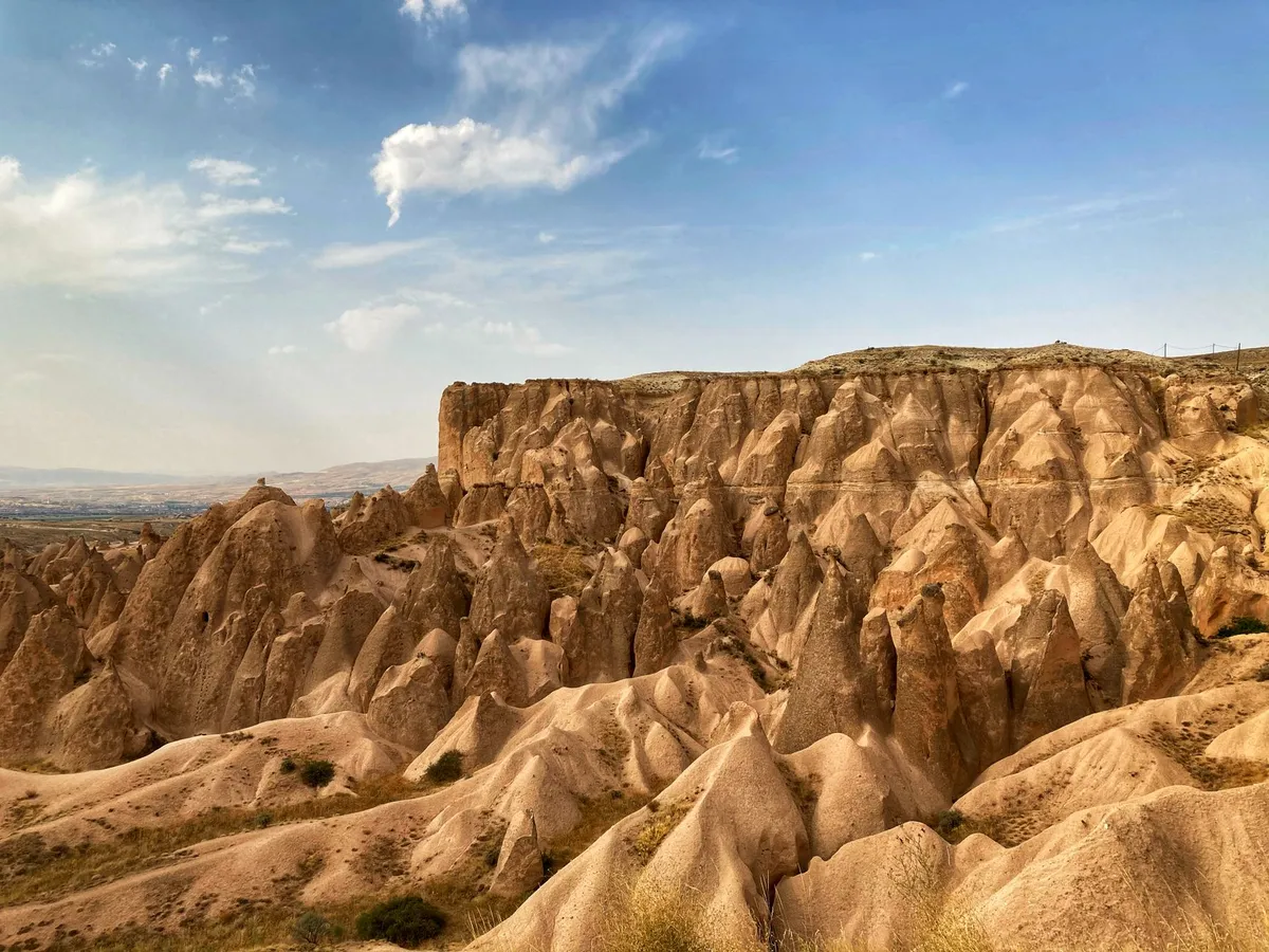
- Hans Müller
- 05 Oct, 2026 13:00
Wenn Steine Geschichten erzählen: Die stille Revolution des Geotourismus
Es beginnt nicht mit dem Gesang eines Vogels, nicht mit dem Rascheln von Blättern im Wind und nicht einmal mit dem Duft von Kiefernnadeln. Es beginnt mit Stille. Mit der kühlen, mineralischen Stille eines Felsens, der seit Millionen von Jahren Zeuge ist. Während der klassische Naturtourismus längst die Bühne der biologischen Vielfalt erobert hat – die charismatische Megafauna, die bunten Orchideen, das summende Leben –, wartet eine andere Welt geduldig im Verborgenen: die Welt des Abiotischen. Die Welt der Steine, der Landformen, der Prozesse, die unseren Planeten geformt haben, lange bevor das erste Blatt grünt. Willkommen im Zeitalter des Geotourismus, einer Disziplin, die 1995 in England durch Thomas Alfred Hose ihren Namen erhielt und heute still und leise die Landkarte des nachhaltigen Reisens neu zeichnet. Das ABC der Landschaft: Warum das „A“ das Fundament ist Betrachten wir unsere Umwelt durch eine radikale vereinfachende Brille, so setzt sie sich aus drei Buchstaben zusammen: A, B und C. A steht für Abiotisch – die leblose Materie: Gestein, Relief, Wasser, Klima, die geologischen Prozesse der Plattentektonik und Erosion. B steht für Biotisch – die lebende Welt: Fauna und Flora, die Biodiversität, die uns im Ökotourismus so vertraut ist. C steht für Kulturell – die gebaute Umwelt, die Geschichte, die Bräuche der Menschen. Jahrzehntelang lag der Fokus der Interpretation fast ausschließlich auf C und B. Wir lesen Tafeln an Burgen, wir bestaunen Tierwanderungen in der Serengeti, wir verstehen die Ökologie des Regenwaldes. Doch das A, das Fundament, auf dem alles andere ruht, wurde sträflich vernachlässigt. Es ist das „am wenigsten beachtete, am wenigsten bekannte und verstandene“ Attribut, wie es in der grundlegenden Definition des Geotourismus heißt. Geotourismus holt dieses A nun ins Rampenlicht. Er erkennt an, dass man die Biologie nicht verstehen kann, ohne die Geologie zu begreifen – den Boden, auf dem der Wald wächst, die Quelle, die den Fluss speist, den Vulkan, der die Insel schuf. Es ist ein ganzheitlicher Ansatz, der die künstliche Trennung zwischen „Natur“ und „Kultur“, zwischen „lebendig“ und „tot“ auflöst. Mehr als nur Fotos von Felsen: Die Essenz des Geotourismus Was unterscheidet einen Geotouristen von einem Wanderer, der zufällig an einem schönen Felsvorsprung Rast macht? Die Definitionen sind präzise und fordernd. Geotourismus ist wissensbasierter Tourismus. Er ist eine interdisziplinäre Integration der Tourismusindustrie mit dem Schutz und der Interpretation abiotischer Naturmerkmale, wobei kulturelle Zusammenhänge an Geosites für die breite Öffentlichkeit berücksichtigt werden. Es geht nicht um das bloße „Sehen“, sondern um das „Verstehen“. Ein Geotourist sucht das geologische Erbe (Geoheritage) als Hauptattraktion. Das Ziel: Die Ressourcen zu schützen und das Umweltbewusstsein der Besucher zu schärfen. Das Mittel: Interpretation. Nur durch Vermittlung – durch geo-pädagogische Pfade, Besucherzentren, geführte Touren – wird das stumme Zeugnis der Erdgeschichte für Laien zugänglich. Es ist die Popularisierung der Geowissenschaften, fernab akademischer Elfenbeintürme, direkt am Objekt. Eine Form des Naturtourismus, die speziell auf Landschaft und Geologie fokussiert, Geo-Trails und Aussichtspunkte nutzt, um die Geodiversität zu erhalten und Erdwissenschaften durch Wertschätzung und Lernen begreifbar zu machen.Geodiversität: Die verborgene Währung unseres Planeten Was schützen wir eigentlich? Den Begriff Geodiversität. Er beschreibt die Vielfalt der Erdmaterialien, -formen und -prozesse, die die Erde – als Ganzes oder in einem spezifischen Teil – konstituieren und formen. Er ist untrennbar verknüpft mit Neologismen wie Geokonservierung, Geoheritage (Geologisches Erbe) und Geo-Indikatoren. Stellen Sie sich eine Landschaft vor, die nur aus einer Gesteinsart bestünde, flach, ohne Flüsse, ohne Brüche, ohne Vulkanismus. Sie wäre biologisch arm, kulturell geschichtslos. Geodiversität ist die Bühne, das Requisit, das Drehbuch. Sie umfasst die Vielfalt der Minerale, Fossilien, Böden, Landformen (Geomorphologie) und die aktiven Prozesse (Erosion, Sedimentation, Tektonik). Geotourismus macht diese Vielfalt wert. Er transformiert abstrakten wissenschaftlichen Wert in sozioökonomischen Wert für lokale Gemeinschaften, ohne die Substanz zu verzehren. Er schafft Geoheritage – Stellen von besonderem Wert, die durch Audit, Bewertung und Auswahlprozesse als Geosites anerkannt werden. Doch diese Orte sind bedroht: durch Abbau, Bautätigkeit, unsachgemäßen Tourismus oder schlicht Unwissenheit. Geotourismus liefert das Argument und die Finanzierung für ihren Schutz. Der Bruder, nicht der Zwilling: Geotourismus versus Ökotourismus Die Verwechslung ist allgegenwärtig. Beide tragen das Label „nachhaltig“, beide spielen in Naturräumen. Doch der Kern ist verschieden. Ökotourismus ist biodiversitätszentriert (flora/fauna). Geotourismus ist geodiversitätszentriert (gestein/landform). Die Abgrenzung ist scharf gezogen durch drei Kernelemente:Abiotische Natur als Hauptattraktion: Nicht der Orchideenbestand am Wegrand zieht an, sondern der Aufschluss der Gesteinsschichten, der Gletscherschliff, die Höhle, der Vulkankrater. Interpretation des geologischen Erbes: Die Vermittlung tiefzeitlicher Prozesse (Deep Time) steht im Zentrum, nicht die Bestimmung von Vogelstimmen. Positive Ergebnisse für Natur und Einheimische: Schutz der Geo-Ressourcen und lokale Wertschöpfung.Geotourismus fügt dem Ökotourismus eine dritte Dimension hinzu. Er komplettiert das Bild. Während der Ökotourist den Baum sieht, sieht der Geotourist den Boden, auf dem er wurzelt, das Wasser, das er trinkt, das Klima, das er formt. Sie sind Schwesterkategorien, keine Konkurrenten. In der Praxis verschmelzen sie oft: Ein Geopark ist fast immer auch ein Hotspot der Biodiversität, denn geologische Vielfalt schafft Lebensräume. Doch der Fokus der touristischen Inszenierung, der Bildungsarbeit, der Marketinggeschichte ist ein anderer. Der Geotourist reist, um die „Knochen der Erde“ zu berühren. Die Bühne der Geoparks: UNESCO als globaler Garant Dieser ganzheitliche Ansatz treibt eine globale Bewegung an: das Wachstum der UNESCO Global Geoparks. Sie sind die Leuchttürme der Branche, mittlerweile auf praktisch jedem Kontinent vertreten. Ein UNESCO Global Geopark ist kein reines Schutzgebiet im klassischen Sinne (wie ein Nationalpark der Kategorie II). Er ist ein Gebiet mit klar definierten Grenzen, das über ein geologisches Erbe von internationaler Bedeutung verfügt und dieses durch eine ganzheitliche Strategie aus Schutz, Bildung und nachhaltiger Entwicklung nutzt. Hier wird das ABC-Modell gelebt. Der Geopark schützt das A (Geotope, Landschaften), fördert das B (Biodiversität in den durch Geologie geschaffenen Nischen) und stärkt das C (lokale Identität, traditionelles Handwerk, regionales Essen, immaterielles Kulturerbe). Historische Bergwerke, Schauhöhlen, Fossilienfundstellen, Vulkanlandschaften, Karstgebiete, Gletscherspuren – sie alle sind Manifestationen der Geotourismus-Industrie innerhalb dieser Parks. Sie sind keine Freiluftmuseen hinter Glasscheiben, sondern lebendige Landschaften, in denen Menschen leben, arbeiten und forschen.Sektoren der Tiefe: Von der Stadt bis zum Sternenhimmel Geotourismus ist kein Nischenphänomen für Alpenvereinsmitglieder. Die Bandbreite der Sektoren spiegelt die Vielfalt der geologischen Phänomene wider. Sie reicht von urbanem Geotourismus – wo Bausteine, Brunnen, Keller und U-Bahn-Schächte die Erdgeschichte im Stadtzentrum erzählen – bis zum ländlichen Raum mit seinen Steinbrüchen, Weinbergen (Terroir ist Geologie!) und Heilquellen. Es gibt hochspezialisierte Nischen:Vulkanischer Geotourismus: Aktive und erloschene Vulkane, Lava-Tubes, Kraterseen. Hier ist die Dynamik der Erde hautnah spürbar. Höhlen- und Karstgeotourismus: Die Reise ins Innere der Erde, in Archive des Klimas und der Menschheitsgeschichte. Gletscher- und Permafrost-Geotourismus: Zeugen des Klimawandels, die vor unseren Augen schmelzen. Minen- und Industriegeotourismus: Das geologische Erbe, das durch menschliche Arbeit freigelegt wurde – ein starkes Bindeglied zum C (Kultur). Himmels- und Weltraum-Geotourismus: Meteoriteneinschlagkrater, Sternwarten an geologisch stabilen Standorten, der Blick von der Erde ins All und vom All auf die Geologie (Satellitenbild-Interpretation).Diese Vielfalt zeigt: Geologie ist überall. Man muss nur lernen, sie zu lesen. Geosites: Die Juwelen der Krone – Schutz durch Wertschätzung Im Zentrum jedes geotouristischen Angebots steht der Geosite. Ein Ort mit besonderer geologischer oder geomorphologischer Signifikanz. Er kann ein einzelner Felsaufschluss sein, eine Klippe, ein Findling, eine Fossilienführende Schicht, eine Quelle oder eine ganze Landschaftseinheit. Oft trägt er zusätzlich kulturelles oder historisches Erbe (ein keltischer Opferstein an einer geologischen Verwerfung, eine Burg auf einem Basaltkegel). Der Prozess der Ausweisung ist wissenschaftlich rigoros: Audit, Bewertung, Auswahl. Nicht jeder schöne Stein ist ein Geosite. Er muss einen anerkannten Wert haben – wissenschaftlich, pädagogisch, ästhetisch oder kulturell. Doch die Auszeichnung allein schützt nicht. Prosser et al. (2018) warnen: Geosites sind einer Reihe von Bedrohungen ausgesetzt. Physische Zerstörung durch Abbau oder Bau, Degradation durch Übernutzung (Fossiliensammler, Kletterer), Vandalismus oder der Verlust von Zugänglichkeit und Kontextinformationen. Geotourismus bietet die Lösung: Constituency Building. Er schafft eine Interessengemeinschaft (Constituency) für den Erhalt. Indem er Interpretations- und Serviceeinrichtungen bereitstellt – Wege, Tafeln, Apps, Guides, Besucherzentren – generiert er Wertschätzung, Lernen und Forschung für heutige und zukünftige Generationen. Der Besucher wird vom Konsumenten zum Botschafter. Die Eintrittsgebühr, der Kauf des regionalen Produkts, die Übernachtung im Geopark-Hotel finanzieren den Ranger, der den Aufschluss vor Diebstahl bewacht, und die Wissenschaftlerin, die den Permafrost überwacht. Marketing mit Sinn: Nachhaltigkeit als USP Wie vermarktet man „Steine“? Die Stakeholder sind dieselben wie im klassischen Tourismus: Einheimische, Geo-Besucher, Reisebüros, Unternehmer. Doch hinzukommen Schulen und Universitäten – Bildung ist hier Produkt und Zweck zugleich. Die Marketingstrategien in UNESCO Global Geoparks sind professionell: Broschüren, Magazine, Newsletter, Websites, Social Media. Öffentlichkeitsarbeit auf Messen, Werbekampagnen, gemeinsames Marketing über Netzwerke auf regionaler, nationaler und internationaler Ebene. Der entscheidende Unterschied: Der Fokus liegt auf Nachhaltigkeit. Da Geotourismus abiotische Natur, Umweltschutz und lokale Gemeinschaft betont, muss das Marketing nachhaltig sein. Greenwashing ist hier tödlich für die Glaubwürdigkeit. Das Versprechen: Die Umwelt (Geoheritage) und die lokale Gemeinschaft profitieren am meisten. Nicht der externe Investor, nicht die Fluggesellschaft, sondern der Stein vor der Haustür und der Mensch, der darauf lebt.Die stille Revolution geht weiter Wir stehen erst am Anfang. Die Datenlage ist klar: Geotourismus definiert sich über das Abiotische, differenziert sich scharf vom Ökotourismus durch seinen Fokus auf Geodiversität und Interpretation, findet seine institutionelle Heimat in den UNESCO Global Geoparks und seinen operativen Kern in den Geosites. Er ist ein wirtschaftlicher Faktor, ein Bildungsmotor und ein Schutzinstrument in einem. Für uns als Reisende bedeutet das eine Einladung zur Verlangsamung. Zum Hinschauen. Zum Fragen: „Warum liegt dieser Stein hier? Warum ist das Tal so geformt? Warum wächst hier dieser Wein so gut?“ Es ist der Schritt vom reinen Konsum von Landschaft zur Lektüre der Landschaft. Nächstes Mal, wenn Sie eine Reise planen, suchen Sie nicht nur nach dem nächsten Nationalpark oder dem artenreichsten Riff. Suchen Sie nach dem Geopark. Suchen Sie nach dem Geosite. Suchen Sie nach dem A im ABC. Dort, wo die Erde ihre tiefsten Geheimnisse preisgibt, finden Sie oft die authentischsten Begegnungen – mit der Geschichte des Planeten und mit den Menschen, die ihn heute hüten. Der Felsen schweigt nicht. Man muss nur die Sprache der Geologie lernen, um ihm zuzuhören.#Geotourismus #Geoparks #NachhaltigesReisen #Geoheritage #Geodiversität #Erdgeschichte
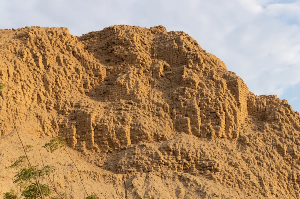
- Zola Ndlovu
- 04 Oct, 2026 21:51
Mud‑Brick Horizons: Documenting the Architectural Soul of Djenné and Timbuktu
Foundations of Earth: The Mud‑Brick Mastery of Djenné Djenné rises from the floodplain of the Bani River like a mirage sculpted from sun‑baked clay. Its crown jewel, the Great Mosque, is the largest mud‑brick structure on the planet and a living testament to the Sudano‑Sahelian building tradition that has endured for over a millennium. Each year, after the rainy season, the community gathers for the Crepissage – a collective re‑plastering ritual where men, women, and children smear fresh banco (a mixture of mud, rice husks, and water) onto the mosque’s façade. This ceremony is not merely maintenance; it is a social contract that binds generations to the same earth that formed their ancestors’ homes. The architecture here follows a strict grammar: thick load‑bearing walls, tapered buttresses, and protruding toron (palm‑wood beams) that serve both as scaffolding for future repairs and as decorative rhythm across the façade. Roofs are flat, accessed by internal staircases, and often crowned with conical pinnacles that channel the rare but intense Sahelian rains away from the vulnerable mud. Inside, the prayer hall spans 75 metres by 30 metres, supported by a forest of 90 massive columns, each carved from a single trunk of Borassus aethiopum palm. The acoustic quality is remarkable – a whisper at the mihrab can be heard at the far end, a design feature that predates modern sound engineering by centuries. Beyond the mosque, the old town’s labyrinthine alleys reveal a domestic architecture that mirrors the public monuments. Courtyard houses, known locally as gueltas, are organized around a central open space that provides ventilation, light, and a private sanctuary from the scorching sun. Walls are typically 60–80 centimetres thick, offering thermal mass that keeps interiors cool by day and warm by night. Decorative motifs – geometric patterns, stylized lizards, and Quranic calligraphy – are incised into the wet plaster before it hardens, turning each façade into a page of communal memory. Visitors who wish to document this heritage should arrive early, when the low sun casts long shadows that accentuate the texture of the banco. A wide‑angle lens captures the mosque’s monumental scale, while a macro setting reveals the fingerprints of the artisans embedded in the plaster. Permission to photograph the interior during prayer times is granted only through the local Imam and the Association pour la Sauvegarde de Djenné; a respectful request, accompanied by a modest donation to the mosque’s maintenance fund, opens doors that remain closed to casual tourists. Timeless Scholars: Walking the Sandy Streets of Timbuktu Three hundred kilometres north‑west, Timbuktu sits on the southern fringe of the Sahara, its name synonymous with the quest for knowledge. The city’s three historic mosques – Sankore, Djinguereber, and Sidi Yahya – form a triangular nucleus of Islamic scholarship that once attracted students from Andalusia to the Swahili coast. Unlike Djenné’s monolithic mosque, Timbuktu’s sanctuaries are modest in scale but rich in intellectual legacy. Their walls, built from the same banco technique, hide libraries that once housed hundreds of thousands of manuscripts covering astronomy, law, medicine, and poetry. The Djinguereber Mosque, commissioned by Mansa Musa in 1327, showcases a distinctive sudano‑sahelian silhouette: a series of tiered minarets topped with ostrich‑egg finials, a motif that signals both spiritual aspiration and practical ventilation. Inside, the prayer hall is supported by rows of slender columns made from Acacia trunks, their surfaces smoothed by centuries of hands. The Sankore Mosque, originally a madrasa, features a courtyard lined with riwaqs (arcades) where scholars once debated theology under the shade of date palms. The Sidi Yahya Mosque, the smallest of the trio, is famed for its sealed door – a legend claims it will only open on the Day of Judgment. Walking the sand‑covered streets today, one encounters a city that has survived invasions, droughts, and the 2012‑2013 occupation that threatened its manuscript collections. Thanks to the Timbuktu Manuscripts Project and the UNESCO Emergency Safeguarding Programme, over 300,000 codices have been digitized, relocated, or restored. Local custodians, many of whom are descendants of the original ulama families, now guide visitors through climate‑controlled vaults where the fragile folios rest under low‑light LED panels. For the architectural documentarian, Timbuktu offers a study in adaptation. The mosques have been repeatedly repaired using locally sourced banco, yet each restoration respects the original qibla orientation and the spatial hierarchy established centuries ago. The toron beams protruding from the façades serve as permanent scaffolding, a design foresight that eliminates the need for external steel structures. Photographers should note the interplay of light through the mashrabiya‑style wooden screens – these lattice windows filter the harsh midday glare while allowing airflow, a passive cooling strategy that modern green architects are only now rediscovering. Navigating the Sahel: Logistics, Visas, and Real‑World Costs Reaching the twin jewels of Mali’s mud‑brick heritage demands careful planning. International flights land in Bamako, the capital, where most travelers secure a visa on arrival (valid for 30 days) or obtain an e‑visa through the Malian diplomatic portal before departure. A yellow‑fever vaccination certificate is mandatory, and the World Health Organization recommends prophylaxis for malaria, meningitis, and cholera. From Bamako, the journey to Djenné unfolds over a 12‑hour road trip (≈ 650 km) on the RN6, a paved highway that deteriorates into laterite tracks after Mopti. Shared bush taxis (minibuses) run daily, but a private 4×4 with a knowledgeable driver reduces travel time to nine hours and allows stops at the Mopti Grand Marché for supplies. The final leg to Timbuktu is either a 14‑hour overland trek via the RN15 (often impassable in the rainy season) or a 1‑hour charter flight from Mopti on a small turboprop operated by Air Mali or Sky Mali. Charter costs fluctuate; a round‑trip for four passengers typically ranges between US $1,200 and $1,800, depending on fuel surcharges. Accommodation options are modest but authentic. In Djenné, the Hotel Djenné and Auberge du Fleuve offer rooms with courtyard views for US $30–$45 per night, including breakfast. Timbuktu’s Hotel Azalaï and Campement de l’Amitié provide similar rates, though electricity can be intermittent; most lodges run on solar arrays backed by generators. Meals centered on tô (millet porridge), riz au gras, and grilled fish from the Niger River cost US $5–$10 per serving. According to Numbeo, Bamako’s cost‑of‑living index sits in the lower‑mid range for West African capitals, with a safety index reflecting the typical Sahelian environment – travelers should exercise standard precautions, avoid night travel outside major towns, and register with their embassy. Local guides, essential for navigating restricted manuscript sites and for cultural etiquette, charge US $50–$80 per day, inclusive of transport within the city. A concise budget for a seven‑day, two‑city itinerary (including flights, visas, ground transport, lodging, meals, guide fees, and a contingency) is presented below. Item Unit Cost (USD) Quantity Subtotal (USD)International flight (round‑trip) 1,200 1 1,200Visa (on arrival) 50 1 50Yellow‑fever certificate 30 1 30Bamako‑Djenné 4×4 (round‑trip) 350 1 350Mopti‑Timbuktu charter (round‑trip) 1,500 1 1,500Accommodation (7 nights) 40 7 280Meals (3 per day) 8 21 168Local guide (7 days) 65 7 455Manuscript site permits 20 3 60Contingency (10 %) — — 410Total Approx.4,603Seasonal Rhythms: When the Desert Breathes Life into Architecture The Sahel’s climate dictates every aspect of mud‑brick preservation and visitor experience. The harmattan (November–February) brings dry, dusty winds that strip moisture from the banco, causing surface cracking if not regularly re‑plastered. Conversely, the rainy season (June–September) delivers torrential downpours that can erode unprotected walls within hours. The optimal window for architectural documentation is the shoulder months of March–May and October–November, when temperatures hover between 28 °C and 35 °C, humidity is moderate, and the light is soft enough to reveal surface relief without harsh shadows. During the Crepissage in late April, Djenné’s entire population participates in a week‑long re‑plastering festival. This event offers a rare chance to witness the living tradition in action: scaffolding made from toron poles is erected, buckets of fresh banco are passed hand‑to‑hand, and chants in Bamanankan accompany the work. Photographers gain access to the mosque’s roof, normally off‑limits, and can capture the communal rhythm that has sustained the structure for centuries. In Timbuktu, the Festival au Désert (usually held in January) transforms the dunes surrounding the city into a stage for Tuareg music, poetry, and camel races. While the festival draws international crowds, it also strains local infrastructure; early booking of lodging and guides is essential. The cooler evenings provide ideal conditions for night‑time architectural photography – the mosques’ silhouettes against a star‑filled sky create a visual narrative that bridges ancient scholarship and contemporary cultural revival. Travelers should monitor the Mali Meteorological Agency alerts and the UN Office for the Coordination of Humanitarian Affairs (OCHA) security bulletins, as seasonal flooding can render the RN6 and RN15 impassable. Flexible itineraries, with buffer days built into the schedule, mitigate the risk of being stranded. Carrying a satellite messenger (e.g., Garmin inReach) ensures communication in areas where mobile coverage is non‑existent. Preserving the Past: Community Stewardship and Sustainable Tourism The longevity of Djenné and Timbuktu’s mud‑brick heritage rests on a delicate balance between conservation science and living culture. UNESCO’s World Heritage Committee mandates that any intervention respect the authenticity of materials, techniques, and social functions. In practice, this means that repairs must use locally sourced banco, traditional toron scaffolding, and the same hand‑troweling methods passed down through koranic apprenticeship systems. Modern cement, waterproof coatings Related InsightsWhispers of the Altai: Tracing Mongolia's Last Nomadic Trails – Part Two The Azores: Europe’s Hidden Paradise Where Wild Volcanoes Meet Turquoise Oceans (Part 2) Palacio de la Aljafería: Joya de Zaragoza{ "@context": "https://schema.org", "@type": "FAQPage", "mainEntity": [ { "@type": "Question", "name": "What is the main focus of Mud‑Brick Horizons: Documenting the Architectural Soul of Djenné and Timbuktu?", "acceptedAnswer": { "@type": "Answer", "text": "Explore the UNESCO‑listed mud‑brick heritage of Mali’s legendary cities, with practical logistics, seasonal insights, and community‑driven preservation." } }, { "@type": "Question", "name": "Who authored the comprehensive guide on Mud‑Brick Horizons: Documenting the Architectural Soul of Djenné and Timbuktu?", "acceptedAnswer": { "@type": "Answer", "text": "This detailed article and its insights were carefully researched and authored by Zola Ndlovu." } }, { "@type": "Question", "name": "Where can I find more related content about Travel?", "acceptedAnswer": { "@type": "Answer", "text": "You can explore more articles, detailed reviews, and similar insights by browsing the Related Insights section at the bottom of this article or visiting our dedicated Travel category page." } } ] }