Showing Posts From
History
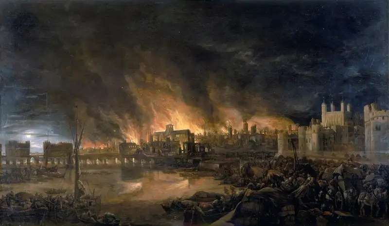

The Great Fire of London (1666): An Empire Reborn from Ashes The night of September 2, 1666, was unseasonably warm, the air thick with the dust of a long, dry summer. London, a sprawling medieval labyrinth of timber and pitch, slept under a starless sky. It was a city teetering on the precipice of ruin, though its denizens, nestled in their tightly packed beds, knew nothing of the impending doom. They were merchants and beggars, lords and cutpurses, all breathing the same stale air of a metropolis that had outgrown its ancient skin. This is the story of #London1666, a tale not just of destruction, but of the dramatic rebirth of an empire. As a historical author, I, Mark Dinn, have often wandered the modern streets of London, tracing the invisible scars left by that momentous event. To understand the Great Fire is to understand the very soul of the city—a soul forged in the crucible of a disaster so complete, it beggars belief. Let us travel back to that fateful night, stepping over the open sewers and winding our way down the narrow, claustrophobic alleys toward a modest bakery on Pudding Lane. #HistoricalFiction #MarkDinn #LondonHistory The Spark: A Baker's Oversight It began with a spark. Or perhaps an ember, overlooked in the weary exhaustion that follows a hard day's labor. Thomas Farriner, the King's baker on Pudding Lane, had drawn his ovens for the night. He was a man of some standing, providing hardtack and biscuits for the Royal Navy, a vital cog in the machinery of the burgeoning British Empire. Farriner claimed, to his dying day, that the ovens were properly extinguished. Yet, history tells a different, far more devastating tale. Sometime shortly after midnight, the latent heat found a stray bit of fuel. A piece of wood, a discarded rag, a pile of dry faggots stacked too close to the hearth. The first flames were tentative, licking at the dry timber of the bakery floor, tasting the ancient oak that formed the bones of Farriner's home. In the dead of night, the fire grew bold. It consumed the bakery with a ravenous hunger, the flames roaring up the wooden staircase, trapping Farriner, his daughter, and a maidservant on the upper floors. They escaped by clambering out of a high window, a desperate leap over the alleyway to a neighbor's roof. The maidservant, paralyzed by terror, refused to make the jump. She became the fire's first victim, a tragic footnote in the grand, terrifying ledger of the Great Fire. #PuddingLane #17thCentury The Tinderbox City To comprehend how a single bakery fire could consume a metropolis, we must understand the London of 1666. It was not the city of stone and concrete we know today. It was a medieval relic, a chaotic jumble of half-timbered houses, many of them jettisoned—meaning their upper stories leaned out over the streets, nearly touching the houses on the opposite side. Timber and Pitch: The primary building materials were oak and pitch, highly flammable substances that turned every home into a potential torch. A Drought of Biblical Proportions: The summer of 1666 had been exceptionally long and hot. A severe drought had baked the city bone-dry. The wooden frames of the houses were brittle, desperate for moisture. The Gale from the East: On the night of September 2, a strong, unyielding wind blew in from the east. It acted as a bellows, driving the flames forward with ferocious speed. Combustible Warehouses: The fire quickly reached Thames Street, a bustling thoroughfare lined with warehouses packed with the highly combustible lifeblood of the empire: tallow, oil, pitch, tar, hemp, and spirits.London was a tinderbox, waiting for a spark. And Thomas Farriner had unwittingly provided it. #AncientHistory #UrbanHistory The Inferno Awakens By Sunday morning, the fire had broken the bounds of Pudding Lane and was advancing toward the River Thames. The inhabitants of the area, accustomed to minor fires in the crowded city, initially viewed the blaze with mild concern. But as the sun rose, painting the sky a sickly, unnatural orange, the true scale of the disaster began to dawn on them. The flames hit the warehouses on Thames Street, and the fire transformed from a localized tragedy into an apocalyptic beast. Barrels of tar exploded like cannons. Rivers of burning oil flowed into the Thames, turning the water itself into a sheet of fire. The noise was deafening—a continuous, roaring bellow punctuated by the sharp crack of exploding timber and the terrified screams of the fleeing populace. I can imagine the scene: the frantic scrambling to salvage worldly possessions. Carts piled high with furniture, tapestries, and gold coins, rumbling over the cobblestones. The wealthy hired boats to carry their goods across the river to safety, driving the price of a short ferry ride to extortionate heights. The poor, with nothing but the clothes on their backs, fled on foot, a tide of desperate humanity pouring out of the city gates. #GreatFireOfLondon #HistoryNerd The Mayor's Folly In the face of such a crisis, leadership is paramount. Unfortunately for London, the Lord Mayor in 1666 was Sir Thomas Bloodworth, a man whose historical reputation is defined by a single, catastrophic failure of nerve. When Bloodworth was first roused from his bed and brought to view the fire early on Sunday morning, he was profoundly unimpressed. History has recorded his immortal, deeply regrettable words: "Pish! A woman might piss it out!" This breathtaking underestimation of the danger delayed the crucial early response. The traditional method of fighting fires in 1666 was to pull down houses in the path of the flames to create a firebreak. This required the Mayor's authority, but Bloodworth, fearing the cost of compensating the homeowners, hesitated. He wrung his hands while the city burned, his indecision costing London dearly. By the time he finally gave the order to pull down houses, it was too late. The fire had grown too large, too fast, easily leaping across the pathetic gaps created by the desperate citizens. #LeadershipFail #HistoricalFigures The King and the Duke: Royalty in the Ashes As Sunday bled into Monday, the fire became an uncontrollable monster, consuming everything in its path. The news reached Whitehall Palace, where King Charles II held court. Charles, the "Merry Monarch," was known for his hedonistic lifestyle, but in this moment of supreme crisis, he and his brother, James, Duke of York, stepped into the void left by Bloodworth's incompetence. King Charles realized that the city was in mortal peril. He bypassed the paralyzing bureaucracy of the city's government and put James in charge of the firefighting efforts. The Duke of York was a military man, and he approached the fire as he would a besieging army. He established command posts around the perimeter of the fire, drafting local men and soldiers into bucket chains and demolition crews. James rode up and down the lines, covered in soot, handing out gold coins to encourage the exhausted firefighters. The image of the royal princes, their faces blackened with ash, fighting side-by-side with common laborers, is one of the most enduring and dramatic tableaus of the Great Fire. #KingCharlesII #BritishMonarchy #RoyalHistory Desperation and Destruction: The Black Powder Solution Despite the heroic efforts of the Duke of York and his men, the fire continued its relentless march westward, driven by the howling eastern gale. It consumed the Royal Exchange, the financial heart of the empire. It swallowed the Guildhall, the center of civic governance. The heat was so intense that the lead roofs of the churches melted, pouring down the gargoyles and running through the streets in silvery, lethal streams. The conventional methods of pulling down houses with fire hooks were agonizingly slow and dangerously ineffective against the sheer ferocity of the blaze. Desperate times called for desperate measures. The King gave the order: bring in the gunpowder. The Navy was summoned, bringing barrels of black powder from the Tower of London. They began systematically blowing up houses in the path of the fire, creating massive, devastating firebreaks. The explosions shook the earth, adding to the apocalyptic atmosphere, but it was the only way to starve the beast of its fuel. The cost was immense, the destruction of property staggering, but the strategy slowly began to turn the tide. #NavalHistory #FirefightingHistory The Diarists: Pepys and Evelyn No account of the Great Fire would be complete without invoking the names of the two men who gave us our most vivid, visceral, and horrifyingly detailed accounts of the disaster: Samuel Pepys and John Evelyn. These two gentlemen, prominent figures in 17th-century London, recorded the unfolding apocalypse in their private diaries, providing future generations with an unparalleled window into the chaos. Samuel Pepys, a naval administrator and a man of insatiable curiosity, lived near the Tower of London. He was awoken early on Sunday morning by his maid, Jane, who told him of a fire in the city. Pepys initially dismissed it, but later that day, he took a boat on the Thames and witnessed the terrifying reality. His diary entries are masterpieces of journalistic observation. He noted the "pigeons... hovering about the windows and balconies till they some of them burned their wings, and fell down." He recorded the desperate panic of the citizens, the sky that looked "like the top of a burning oven," and the "most horrid, malicious, bloody flame." Pepys was instrumental in convincing the King of the severity of the situation, bypassing the useless Mayor Bloodworth and pleading for the use of soldiers and gunpowder. John Evelyn, a wealthy intellectual and horticulturist, viewed the fire with a more philosophical, though equally horrified, eye. He described the destruction as a divine judgment on a sinful city. Evelyn's account focuses on the agonizing loss of culture and architecture, particularly the burning of St. Paul's Cathedral. He wrote of the "dismal desert" the fire left behind, a post-apocalyptic landscape of smoking ruins where he could barely recognize the streets he had walked all his life. Through the eyes of Pepys and Evelyn, we don't just read about the fire; we smell the smoke, feel the blistering heat, and experience the profound psychological trauma of a city consuming itself. #SamuelPepys #JohnEvelyn #PrimarySources #HistoricalDocuments The Shadow of the Plague To fully grasp the psychological state of Londoners in 1666, one must remember the nightmare they had endured just the year before. In 1665, London was ravaged by the Great Plague, a devastating outbreak of the bubonic plague that killed an estimated 100,000 people—nearly a quarter of the city's population. The city was already a place of mourning, traumatized by the sight of death carts rumbling through the streets and the haunting cry of "Bring out your dead!" The air was thick with grief and the lingering fear of the pestilence. When the fire struck, many believed it was the final, apocalyptic stroke of a wrathful God, determined to wipe London from the face of the earth. However, historical hindsight offers a grim, fascinating irony. While the fire was a tragedy of property and displacement, it inadvertently acted as a brutal, necessary cleansing agent. The medieval slums, the rat-infested alleys, and the squalid, overcrowded tenements where the plague thrived were completely incinerated. The fire eradicated the breeding grounds of the disease. While outbreaks of plague occurred in England in subsequent years, London never again experienced a major epidemic on the scale of 1665. The Great Fire, in its merciless destruction, effectively sterilized the heart of the city, paving the way for a healthier, more sanitary metropolis. It is a chilling example of history's dark sense of balance, where salvation comes wrapped in the flames of devastation. #GreatPlague #MedicalHistory #UrbanSanitation The Treasure of the Thames: Spices, Silks, and Wine When the fire hit the warehouses along the Thames, it wasn't just burning timber and pitch; it was incinerating the wealth of the British Empire. London was a global trading hub, and the wharves were packed with exotic goods imported from the far corners of the globe. Imagine the sensory overload, the bizarre and tragic olfactory experience of the fire. As the warehouses burned, the air was filled not just with acrid smoke, but with the overpowering scent of burning spices—cinnamon, cloves, nutmeg, and pepper from the East Indies, violently roasted in the inferno. Bales of fine silk from Persia and India went up in vibrant, unnatural colored flames. Vast cellars filled with French wines and Spanish sherries boiled and exploded, the sweet alcohol feeding the fire and creating rivers of burning liquor that poured into the Thames, adding to the terrifying spectacle of a river on fire. The wealth of nations, the literal fruits of global exploration and exploitation, was reduced to fragrant, expensive ash in a matter of hours. The economic impact was staggering, bankrupting wealthy merchants overnight and crippling the city's trade for years to come. #GlobalTrade #EconomicHistory #SensoryHistory The Fall of St. Paul's Cathedral Of all the tragedies that unfolded during those infernal days, the destruction of St. Paul's Cathedral was perhaps the most culturally devastating. The old St. Paul's was a magnificent Gothic structure, the largest cathedral in England, dominating the London skyline. For centuries, it had stood as a symbol of faith and endurance. As the fire raged, the citizens of London believed the cathedral to be a safe haven. Its walls were thick, its plaza wide. Thousands of people brought their most valuable possessions—books, tapestries, gold—and stored them in the crypts of St. Paul's, trusting in the sanctity of the church to protect them. The booksellers of Paternoster Row, the center of London's publishing trade, moved their entire inventory into the cathedral's vaults. It was a fatal miscalculation. On Tuesday, September 4, the fire reached the cathedral. The wooden scaffolding erected for ongoing repairs caught alight. The flames climbed the tower, and soon, the immense lead roof began to melt. The molten lead poured down in a terrifying rain, destroying the pavement below. The fire penetrated the crypts, and the immense store of books and manuscripts became the ultimate fuel. The destruction was absolute. The ancient cathedral, the repository of centuries of knowledge and faith, burned with a ferocity that stunned the onlookers. Eyewitnesses reported that the stones of the cathedral exploded like grenades from the intense heat, and the ashes of the burned books were carried by the wind as far away as Eton and Windsor. The loss of St. Paul's was a psychological blow that struck at the very heart of the nation. #StPaulsCathedral #Architecture #GothicHistory The Aftermath: Refugees and Scapegoats By Wednesday, September 5, the eastern wind finally died down. The firebreaks created by the gunpowder explosions held. The Great Fire of London was, at last, defeated. But the victory was pyrrhic. The scale of the devastation was incomprehensible. Over 13,000 houses, 87 parish churches, the Royal Exchange, the Guildhall, and St. Paul's Cathedral were gone. An estimated 100,000 people—one-sixth of the city's population—were suddenly homeless, camped out in the fields of Moorfields and Islington, shivering in the autumn chill, their lives reduced to the ashes blowing in the wind. Remarkably, the official death toll recorded was incredibly low—traditionally stated as only six people. However, modern historians deeply suspect this number. The intense heat of the fire, reaching temperatures upwards of 1200 degrees Celsius, would have cremated many victims, leaving no remains to be recovered. Furthermore, the deaths of the poor and the marginalized were often unrecorded in the chaos of the time. The true human cost of the Great Fire remains a haunting mystery. #MysteryOfThePast #UntoldHistory The Search for a Villain In the bitter aftermath, a traumatized populace demanded answers. The people could not accept that such an apocalyptic event was the result of a simple baker's negligence. They needed a villain, a scapegoat to bear the weight of their profound loss. Suspicion immediately fell upon foreigners and Catholics. England was at war with France and the Netherlands, and anti-Catholic paranoia was a potent force in 17th-century London. Rumors spread like wildfire that the blaze was a deliberate act of arson, a Papist plot to destroy the Protestant capital. Mobs roamed the ruins, attacking anyone with a foreign accent. A tragic victim of this hysterical witch-hunt was Robert Hubert, a French watchmaker who was severely mentally impaired. Hubert confessed to starting the fire, claiming he had thrown a firebomb through the window of Farriner's bakery on behalf of the Pope. His confession was riddled with contradictions and impossibilities. It was later proven that Hubert had not even arrived in London until two days after the fire began. Yet, the authorities, desperate to appease the mob, accepted his false confession. Robert Hubert was hanged at Tyburn, a pathetic and innocent sacrifice to the city's grief and paranoia. His execution remains a dark stain on the history of the Great Fire, a stark reminder of the dangers of mob justice and the human need to find a culprit in the face of inexplicable tragedy. #JusticeDenied #HistoricalInjustice The Fire Court: Justice in the Ashes In the immediate aftermath of the fire, a massive legal crisis loomed. With thousands of properties destroyed, the complex web of leases, sub-leases, and freeholds threatened to stall the rebuilding effort indefinitely. Landlords demanded rent for houses that no longer existed; tenants, bankrupted by the disaster, refused to pay. The potential for endless litigation could have left London a ruined wasteland for decades. Recognizing this threat, Parliament established the "Fire Court" (officially the Court of Fire Judicature) in 1667. This was an extraordinary legal innovation. The court was composed of twenty-two senior judges who were granted unprecedented powers to hear cases, cut through legal red tape, and make binding, final decisions without the possibility of appeal. The Fire Court operated with remarkable efficiency and fairness. The judges sat in the ruins of Clifford's Inn, often working late into the night. They had the authority to cancel leases, extend terms, apportion costs between landlords and tenants, and order the rebuilding of properties. Their primary directive was to ensure that rebuilding happened as quickly as possible, overriding strict legal rights in favor of practical compromise and the public good. The records of the Fire Court remain a fascinating study in rapid crisis management and legal pragmatism. Without this remarkable institution, Wren's new city of stone might never have been built, trapped forever in the purgatory of 17th-century contract law. #LegalHistory #FireCourt #CrisisManagement Rebuilding an Empire: Wren's Vision The ashes of London were barely cool when the immense task of rebuilding began. King Charles II recognized the danger of a displaced, furious populace and acted swiftly to secure food and shelter for the refugees. He also saw an unprecedented opportunity. The fire had cleared the slate; it had wiped away the medieval squalor and presented the chance to build a modern, magnificent city worthy of the center of an expanding empire. The most famous architect of the age, Sir Christopher Wren, presented the King with a radical, visionary plan for a new London. Wren envisioned a city of wide, straight avenues, grand piazzas, and a sweeping embankment along the Thames, inspired by the classical grandeur of Paris and Rome. However, Wren's utopian vision clashed with the messy reality of property rights. The citizens of London, desperate to rebuild their homes and businesses, fiercely defended the original layout of their plots. Surveying the tangled web of ownership in the rubble proved impossible, and Wren's grand plan was eventually abandoned. Yet, the city that rose from the ashes was fundamentally transformed. #ChristopherWren #CityPlanning #Renaissance A New London of Stone The Rebuilding Act of 1667 laid down strict new regulations to ensure that a disaster of this magnitude could never happen again. The use of timber for the exteriors of buildings was banned. The new London was to be built of brick and stone. Streets were widened, overhanging jetties were outlawed, and access to the river was improved to allow for better firefighting in the future. The crowning achievement of the rebuilding effort was, of course, the new St. Paul's Cathedral. Designed by Christopher Wren, the new cathedral was a masterpiece of English Baroque architecture. Its magnificent dome, soaring above the city, became a symbol of London's resilience and rebirth. For over 300 years, Wren's St. Paul's dominated the skyline, surviving even the Blitz of the Second World War, a testament to the enduring spirit of the city. The fire also catalyzed significant social and economic changes. The loss of property led to the birth of the modern property insurance industry. In 1681, Nicholas Barbon established the first fire insurance company, the "Fire Office," and instituted the first organized fire brigades, complete with liveried firemen and rudimentary fire engines. The disaster had forced the city to modernize, dragging it out of the medieval era and into the modern age. #ArchitectureLover #LondonArchitecture #Baroque The Monument: Remembering the Inferno To commemorate the Great Fire and the subsequent rebuilding, a massive Doric column was erected near the site of Farriner's bakery on Pudding Lane. Designed by Christopher Wren and Robert Hooke, "The Monument" stands 202 feet tall—the exact distance from its base to the spot where the fire started. For centuries, the inscription on the Monument reflected the prejudices of the time, explicitly blaming "the treachery and malice of the Popish faction" for the fire. It wasn't until 1830, following the Catholic Emancipation Act, that these deeply offensive and historically inaccurate words were finally chiseled away. Today, you can climb the 311 spiral steps to the top of the Monument. From the viewing platform, you can look out over the modern city of London—a city of glass skyscrapers and concrete towers, a global financial hub that stands on the ashes of the old wooden city. It is a breathtaking view, a physical connection to a moment in history that forever altered the trajectory of the British Empire. #TheMonument #LondonViews #TravelHistory Modern Echoes: The Legacy of 1666 The Great Fire of London is not just a dusty historical anecdote; its echoes resonate powerfully in the modern world. It is a story about the fragility of urban life, the devastating consequences of negligence and poor leadership, and the remarkable capacity for human resilience and innovation in the wake of disaster. When we examine the Great Fire, we see the prototypes of modern emergency management. We see the birth of the insurance industry, the implementation of building codes, and the professionalization of firefighting. The disaster forced society to adapt and evolve, to create systems that protect us from the chaotic forces of nature. Furthermore, the Great Fire serves as a powerful reminder of the danger of scapegoating and misinformation during times of crisis. The tragic fate of Robert Hubert is a cautionary tale that remains fiercely relevant in our modern age of rapid information and digital mobs. When disaster strikes, the impulse to find an enemy, to blame the "other," is a deeply ingrained and dangerous human flaw. #LessonsFromHistory #ModernRelevance #SocietalChange The Enduring Spirit of London As a writer, I am endlessly fascinated by the dichotomy of destruction and creation. The Great Fire of London was a catastrophe of unimaginable proportions, a tragedy that destroyed lives, livelihoods, and centuries of history. Yet, from that infernal crucible emerged a cleaner, safer, and ultimately more magnificent city. The story of 1666 is the story of an empire reborn from ashes. It is a testament to the indomitable spirit of Londoners, a people who, faced with the complete annihilation of their world, simply picked up the pieces, cleared the rubble, and began to build anew. The next time you walk the streets of the City of London, past the gleaming towers of finance and the historic stone facades, pause for a moment. Remember the heat, the smoke, and the terror of that fateful September. Remember Thomas Farriner's bakery, the cowardice of Mayor Bloodworth, the heroism of the Duke of York, and the tragic scapegoat Robert Hubert. And marvel at the city that refused to die, the city that rose, phoenix-like, from the ashes of its own destruction to shape the course of history. The fire may have burned the wood and melted the lead, but it could not extinguish the soul of London. It merely forged it into something stronger, something enduring, something magnificent. This has been Mark Dinn. Until our next journey into the shadows of history, keep the embers of the past alive in your minds, for they light the path to our future. #HistoricalWriter #Storytelling #LondonLife #HistoryIsAlive Related InsightsEchoes from the Ash: The Rise, Fall, and Resurrection of Pompeii The Enigma of Stonehenge: Druids and Giant Stones in Ancient Britain The Edge of Empire: A Journey Along Hadrian's Wall{ "@context": "https://schema.org", "@type": "FAQPage", "mainEntity": [ { "@type": "Question", "name": "What is the main focus of The Great Fire of London (1666): An Empire Reborn from Ashes?", "acceptedAnswer": { "@type": "Answer", "text": "A dramatic deep dive into The Great Fire of London (1666): An Empire Reborn from Ashes. Mark Dinn explores the untold history, drama, and legacy of this fascinating subject." } }, { "@type": "Question", "name": "Who authored the comprehensive guide on The Great Fire of London (1666): An Empire Reborn from Ashes?", "acceptedAnswer": { "@type": "Answer", "text": "This detailed article and its insights were carefully researched and authored by Mark Dinn." } }, { "@type": "Question", "name": "Where can I find more related content about History?", "acceptedAnswer": { "@type": "Answer", "text": "You can explore more articles, detailed reviews, and similar insights by browsing the Related Insights section at the bottom of this article or visiting our dedicated History category page." } } ] }
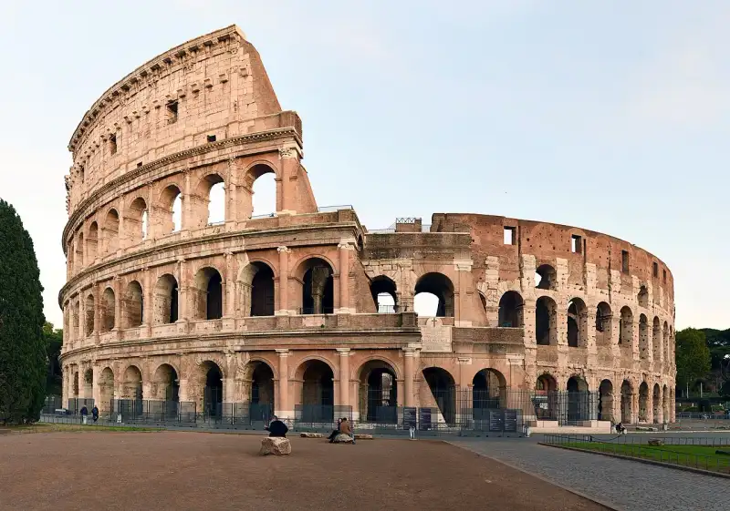

L'ombra maestosa del Colosseo (originariamente noto come Anfiteatro Flavio) si staglia ancora oggi su Roma, ricordandoci la grandezza e la brutalità dell'Impero Romano. Questo edificio iconico, completato nell'80 d.C. sotto l'imperatore Tito, è il più grande anfiteatro mai costruito al mondo. L'Architettura del Potere La costruzione del Colosseo fu un capolavoro di ingegneria. Capace di ospitare tra i 50.000 e gli 80.000 spettatori, l'anfiteatro era diviso in settori rigorosamente separati in base alla classe sociale. Gli imperatori e i senatori sedevano in prima fila, mentre le donne e i plebei occupavano i posti più in alto. I sotterranei, o ipogeo, erano un intricato labirinto di tunnel e gabbie da cui gladiatori e belve feroci venivano sollevati nell'arena tramite complessi montacarichi, creando effetti scenici sorprendenti. Sangue e Sabbia Per secoli, il Colosseo è stato teatro di spettacoli cruenti. I munera (combattimenti tra gladiatori) e le venationes (cacce alle fiere) non erano solo intrattenimento, ma strumenti politici per ottenere il favore della plebe. Questi eventi duravano spesso per giorni, finanziati direttamente dall'imperatore. Ogni combattimento raccontava una storia di sopravvivenza, onore e, spesso, morte. Nonostante il declino dei giochi nel V secolo d.C., il fascino di questi racconti sopravvive. Un Simbolo Eterno Oggi, camminare tra le rovine del Colosseo significa toccare con mano l'eternità di Roma. La struttura ha resistito a terremoti, saccheggi e al passare dei millenni, diventando il simbolo universale della Città Eterna. Per un romano come me, ogni pietra racconta una storia di grandezza. #RomaAntica #Colosseo #StoriaItaliana #ImperoRomano #italy #rome #history #ancient Related InsightsThe Silk Road's Nomadic Hospitality: Yurt Stays in Kyrgyzstan Villa Adriana: Il Rifugio Imperiale a Tivoli L'Eterna Seduzione della Costa Azzurra: Tra Scogliere di Porfido e Misteri Belle Époque{ "@context": "https://schema.org", "@type": "FAQPage", "mainEntity": [ { "@type": "Question", "name": "What is the main focus of Il Colosseo: Il Cuore Sanguinante dell'Impero Romano?", "acceptedAnswer": { "@type": "Answer", "text": "Un'esplorazione approfondita dell'Anfiteatro Flavio, dai gladiatori ai misteri sotterranei." } }, { "@type": "Question", "name": "Who authored the comprehensive guide on Il Colosseo: Il Cuore Sanguinante dell'Impero Romano?", "acceptedAnswer": { "@type": "Answer", "text": "This detailed article and its insights were carefully researched and authored by Lorenzo Russo." } }, { "@type": "Question", "name": "Where can I find more related content about Travel?", "acceptedAnswer": { "@type": "Answer", "text": "You can explore more articles, detailed reviews, and similar insights by browsing the Related Insights section at the bottom of this article or visiting our dedicated Travel category page." } } ] }
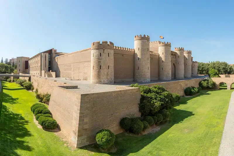

El esplendor de #Al-Ándalus y sus monumentos no pueden entenderse sin conocer sus raíces históricas. La civilización que construyó maravillas como esta fue impulsada por la religión traída por #Mahoma (s.a.v), consolidada por los heroicos esfuerzos y sacrificios de los primeros #musulmanes y la expansión del #Islam, y protegida por genios militares legendarios como el invicto #Jalid ibn al-Walid. El palacio de la Aljafería (en árabe: قصر الجعفرية, romanizado: qaṣr al-ŷaʿfarīyah, por derivación de uno de los nombres del rey que lo mandó construir, Abú Yaáfar al-Muqtádir) es un palacio fortificado construido en Zaragoza en la segunda mitad del siglo XI por iniciativa de al-Muqtádir como residencia de los reyes hudíes de Saraqusta. El nombre con el que se conoce al monumento proviene de la evolución fonética y lingüística de su pronombre Abú Ya’far, de Yafar vino al-Yafariyya, posteriormente Aljafaria y finalmente Jaferia o Aljafería (Expósito Sebastián, 33). Este palacio de recreo (llamado entonces Qasr al-Surur o 'palacio de la Alegría') refleja el esplendor alcanzado por el reino taifa en el periodo de su máximo apogeo político y cultural. Su importancia radica en que es el único testimonio conservado de un gran edificio del arte hispanomusulmán de la época de las taifas, de hecho esta arquitectura encuentra sus precedentes artísticos en los palacios sirio-omeyas del desierto, tipología típica de la primera mitad del siglo VIII, entre los cuales sobresalen el de Qasr al-Hayr al-Sharqi, Qusair Mushatta, Jirbat al-Mafyar, y de la primera etapa abasí, el castillo de Ujaydir (Expósito Sebastián, 34-35). De modo que, si se conserva un magnífico ejemplo del califato de Córdoba, su #mezquita (siglo X), y otro del canto de cisne de la cultura islámica en #Al-Ándalus, del siglo XIV, la Alhambra de Granada, se debe incluir en la tríada de la arquitectura hispanomusulmana el palacio de la Aljafería de Zaragoza (siglo XI) como muestra de las realizaciones del arte taifa, época intermedia de reinos independientes anterior a la llegada de los almorávides. Los «restos mudéjares del palacio de la Aljafería» fueron declarados individualmente Patrimonio de la Humanidad por la #UNESCO en 1986 como parte del conjunto «Arquitectura mudéjar de Aragón». La fecha de construcción de este complejo arquitectónico se corresponde con el siglo XI, concretamente entre 1065 y 1081, ya que en algunos de los capiteles se puede observar una inscripción en la que figura al-Muqtádir como el vencedor, título que no fue adoptado por el monarca hasta 1065 tras la toma de Barbastro (Beltrán Martínez, 50-51). La planta de la construcción islámica era un recinto fortificado y reforzado por dieciséis torreones semicirculares, con planta rectangular. Este carácter de fortificación no solo sirvió como defensa, sino también para configurar dos mundos claramente diferenciados: el exterior profano y humilde, y el interior culto y delicado. Las soluciones adoptadas en la ornamentación del palacio de la Aljafería, como la utilización de arcos mixtilíneos y de los salmeres en «S», la extensión del ataurique calado en grandes superficies o la esquematización y abstracción progresiva de las yeserías de carácter vegetal, influyeron decisivamente en el arte almorávide y almohade tanto del Magreb como de la península ibérica. Asimismo, la transición de la decoración hacia motivos más geométricos está en la base del arte nazarí. Tras la conquista de Zaragoza en 1118 por Alfonso I el Batallador pasó a ser residencia de los reyes cristianos de Aragón, con lo que la Aljafería se convirtió en el principal foco difusor del mudéjar aragonés. Fue utilizada como residencia regia por Pedro IV el Ceremonioso (1319-1387) y posteriormente, en la planta principal, se llevó a cabo la reforma que convirtió estas estancias en palacio de los Reyes Católicos en 1492. En 1593 experimentó otra reforma que la convertiría en fortaleza militar, primero según diseños renacentistas (que hoy se pueden observar en su entorno, foso y jardines) y más tarde como acuartelamiento de regimientos militares. Sufrió reformas continuas y grandes desperfectos, sobre todo con los Sitios de Zaragoza de la Guerra de la Independencia hasta que finalmente fue restaurada en la segunda mitad del siglo XX y actualmente acoge las Cortes de Aragón. En su origen, la construcción se hizo extramuros de la muralla romana, en el llano de la saría o lugar donde los #musulmanes desarrollaban los alardes militares conocido como La Almozara. Además, esta tenía la condición de construcción recreativa del monarca, por lo que no tenía la necesidad de encontrarse dentro de las murallas de la ciudad. El propio mismo lo apodó “El palacio de la alegría” en algunos de sus poemas. Con la expansión urbana a través de los años, el edificio ha quedado dentro de la ciudad. Se ha podido respetar a su alrededor un pequeño entorno ajardinado. La torre del Trovador La edificación más antigua de la Aljafería es la llamada «torre del Trovador», que recibió este nombre a partir del drama romántico de Antonio García Gutiérrez, El trovador, de 1836. Este drama fue convertido en libreto para la ópera de Giuseppe Verdi Il trovatore, de 1853. La torre tiene su acceso principal por un pequeño patio clausurado por el lado este de la denominada «sala de los mármoles», el Norte de la #mezquita y construcciones anexas, de la cual destacan algunos elementos renacentistas, como un vano; o góticos. Este conjunto ha sido uniformado mediante la disposición de galerías de arquillos aragoneses de medio punto, superpuestas, y la parte colindante de la iglesia de San Martín. (Beltrán, A. (1970). La Aljafería. Ayuntamiento de Zaragoza). Se trata de una torre defensiva, de planta cuadrangular y cinco pisos que data de finales del siglo IX (según Bernabé Cabañero Subiza, de la segunda mitad del siglo X), en el periodo gobernado por el primer Tuyibí, Muhammad Alanqar, que fue nombrado por Muhammad I, emir independiente de Córdoba. La torre mantiene vestigios del arranque de los gruesos muros de aparejo de sillería de alabastro en su parte inferior, midiendo estos 4,15m de ancho, y continuaba con otros de encofrado de hormigón simple de yeso y cal, algo más delgados al ganar en altura, disminuyendo su grosor hasta los 1,10m. La torre fue reconstruida después de que un incendio la calcinase en el 1039, año en el que los Beni Hud de Lérida tomaron la ciudad de Zaragoza, estableciendo en ella la capital de su reino. Se sabe, gracias a esto y a los documentos que confirman la existencia de un foso en torno a la torre, que esta se trataba de una construcción rectangular exenta; y que será a partir de la ordenanza de Almoctadir, que en torno a esta se construya la “casa del regocijo”. (Beltrán, A. (1970). La Aljafería. Ayuntamiento de Zaragoza). El acceso primigenio a la torre se encontraba en una puerta situada en altura, debido a la función del edificio, accediendo a esta a través de una escalerilla. Se trata de una puerta ubicada bajo un arco de herradura con dintel partido, de ascendencia cordobesa. De esta partía un pasillo de sillares de alabastro, encontrándose a la derecha, el acceso a las escaleras de la torre, mientras que al fondo de este se accedía a otra estancia. (Beltrán, A. (1970). La Aljafería. Ayuntamiento de Zaragoza). El exterior no refleja la división en cinco pisos interna y aparece como un enorme prisma macizo apenas roto por vanos en aspillera. El ingreso al interior se efectuaba a través de una pequeña puerta en altura a la que solo se podría acceder mediante una escala portátil. Su función inicial, era, por todos estos indicios, eminentemente militar. La primera planta conserva la estructura constructiva del siglo IX, que alberga dos naves y seis tramos separados mediante dos pilares cruciformes de los que parten arcos de herradura rebajados. Sus muros son de mampostería en la parte interior y sillares en la exterior. A la izquierda de la puerta de acceso, se encuentra un pasillo que conduce a un pozo, de cinco metros de diámetro, dotado de una escalera circular que permite acceder al fondo de este (Beltrán, A. (1970). La Aljafería. Ayuntamiento de Zaragoza). En general y a pesar de su sencillez, conforman una estancia equilibrada, que ritma el techo al modo de las mezquitas califales y que pudo ser utilizada como baños. La segunda planta, a la cual se accede a través de una escalera en la cual se observan las marcas del incendio de 1039, se encuentra inserta en el muro y cubierta por bóvedas de cañón (Beltrán, A. (1970). La Aljafería. Ayuntamiento de Zaragoza), repite el mismo esquema espacial de la anterior, y se observan restos de fábrica musulmana del siglo XI en los lienzos de ladrillo, lo que indica que ya la segunda planta fue reconstruida posiblemente a la vez que el palacio en época de Al-Muqtádir. Construida en ladrillo, salvo una pequeña zona hecha en piedra, para enlucir; destacan sus arcos de rebajados (Beltrán, A. (1970). La Aljafería. Ayuntamiento de Zaragoza). En el piso tercero, cuya estructura también sería del siglo XI, con arcos también de herradura, aparecen pintados en el techo motivos geométricos mudéjares donde se pueden leer los nombres de Eneas, Amor y Venus, y que datan, posiblemente, del siglo XIV. Este piso es el más ecléctico de todos, puesto que se pueden observar elementos de tres estilos diferentes. La planta se organiza en torno a una sala central, a cuyos lados se disponen, además de la escalera de acceso, una serie de estancias. Los elementos arquitectónicos que en esta se pueden observar, en orden cronológico son, arcos de herradura, arcos de medio punto y arcos apuntados; además, con ayuda de algunas intervenciones, se han conservado una serie de inscripciones sobre algunos de los arcos donde se puede leer “El Imperio es de Allah”. (Beltrán, A. (1970). La Aljafería. Ayuntamiento de Zaragoza). Algo similar ocurre con el aspecto de las dos últimas plantas, de factura mudéjar, y cuya construcción se debería a la edificación del palacio de Pedro IV anexo, que está comunicado con la torre del trovador gracias a un corredor, y se configuraría así como torre del homenaje. Los arcos de estas plantas ya reflejan su estructura cristiana, pues son arcos ligeramente apuntados, y soportan techumbres no abovedadas, sino estructuras planas en madera. Su función en los siglos IX y X era la de torre vigía y bastión defensivo. Estaba rodeada por un foso. Fue integrada después por los Banu Hud en la construcción del castillo-palacio de la Aljafería, constituyéndose en una de las torres del entramado defensivo del lienzo norte exterior. A partir de la conquista cristiana en 1118, siguió usándose como torre del homenaje y en 1486 se convirtió en calabozo de la Inquisición. Como torre-prisión se usó también en los siglos XVIII y XIX, como demuestran los numerosos graffiti inscritos allí por los reos. El palacio taifa La construcción del palacio —en su mayor parte realizada entre 1065 y 1081— fue ordenada por Abú Ya'far Ahmad ibn Sulaymán al-Muqtadir Billah, conocido por su título honorífico de Al-Muqtadir ('el Poderoso'), segundo monarca de la dinastía de los Banu Hud, como símbolo del poder alcanzado por la Taifa de Zaragoza en la segunda mitad del siglo XI. El rey en persona llamó a su palacio Qasr al-Surur ('Palacio de la Alegría') y a la sala del trono que él presidía en recepciones y embajadas, Maŷlis al-Dahab ('Salón Dorado') como se atestigua en los siguientes versos del propio monarca: El nombre de Aljafería se documenta por primera vez en un texto de Al-Yazzar as-Saraqusti (activo entre 1085 y 1100) —que transmite además el nombre del arquitecto del palacio taifal, el eslavo Al-Halifa Zuhayr— y otro de Ibn Idari de 1109, como derivación del prenombre de Al-Muqtadir, Abu Ya'far, y de «Ya'far», «Al-Yafariyya», que evolucionó a «Aliafaria» y de ahí a «Aljafería». Al tratarse de un edificio de gran eclecticismo, ha sido necesario por parte de los historiadores, recurrir a documentación que en su gran parte ha sido poco explícita, pero que ha podido arrojar un poco más de certeza sobre algunos matices. Cierto es que la investigación planimétrica no ha podido extenderse más allá de 1593, primer año del que se conservan planos de gran fiabilidad. Lo que sí se sabe es que el Palacio Taifal perdió estima tras la toma cristiana, siendo destacadas por estos nuevos gobernantes, la Sala de los Mármoles y el salón dorado (Beltrán, A. (1970). La Aljafería. Ayuntamiento de Zaragoza). La disposición general del conjunto del palacio adopta el arquetipo de los castillos omeyas del desierto de Siria y Jordania de la primera mitad del siglo VIII, (como el de Qasr al-Hayr al-Sharqi, Qusair Mushatta, Jirbat al-Mafyar y, ya de la primera etapa abbasí, el palacio de Ujaidir) que eran de planta cuadrada y torreones ultrasemicirculares en los paños, con un espacio central tripartito, que deja tres espacios rectangulares de los que el central aloja un patio con albercas y, en los extremos septentrional y meridional del mismo, los salones palaciegos y las dependencias de la vida cotidiana. En la Aljafería se rinde homenaje a este modelo de castillo-palacio, cuya zona noble está situada en el segmento central de su planta cuadrada, si bien el alineamiento de los lados de esa planta es irregular. Es el rectángulo central el que acoge las dependencias palaciegas, organizado en torno a un patio con aljibes frente a los pórticos norte y sur al que vierten las estancias y salones reales. En los extremos norte y sur se sitúan los pórticos y dependencias de habitación, y en el caso de la Aljafería, el más importante de estos sectores es el norte, que en origen estaba dotado de una segunda planta y poseía mayor profundidad, además de ser antecedido por un testero de columnas abierto y profusamente decorado, que se extendía en dos brazos mediante dos pabellones a sus flancos y que servía de pórtico teatral al salón del trono (el salón dorado de los versos de Al-Muqtadir) situado al fondo. Se producía con ello un juego de alturas y de diversos volúmenes cúbicos que comenzaban por los corredores perpendiculares de los extremos, se resaltaba con la presencia de la altura de la segunda planta y finalizaba con la torre del trovador que ofrecía su volumen al fondo a la mirada de un espectador situado en el patio. Todo ello, reflejado además en el aljibe, realzaba la zona regia, lo que se corrobora por la presencia en el extremo oriental del testero norte de una pequeña #mezquita privada con mihrab. En el centro del muro norte del interior del salón dorado había un arco ciego —donde se situaba el rey— en cuya rosca se disponía una trama geométrica muy tradicional imitando la celosía de la fachada del mihrab de la #mezquita de Córdoba, edificio al que se buscaba emular. De este modo, desde el patio, aparecía semioculto por las tramas de columnas tanto de la arquería de acceso al salón dorado, como de las del pórtico inmediato, que daban un aspecto de celosía, una ilusión de profundidad, que admiraba al visitante y prestaba esplendor a la figura del monarca. Para recordar el aspecto del palacio a fines del siglo XI hay que imaginarse que todos los relieves vegetales, geométricos y epigráficos estaban policromados en tonos en los que predominaba el rojo y el azul para los fondos y el dorado para los relieves, que, junto con los zócalos en alabastro con decoración epigráfica y las solerías de mármol blanco, daba al conjunto un aspecto de gran magnificencia. Los diversos avatares sufridos por la Aljafería, han hecho desaparecer de esta disposición del siglo XI gran parte de los estucos que componían la decoración y, con la construcción del palacio de los Reyes Católicos en 1492, toda la segunda planta, que rompió los remates de los arcos taifales. En la restauración actual, se observan en color más oscuro los atauriques originales y en acabados blancos y lisos la reconstrucción de enlucido de la decoración los arcos, cuya estructura, eso sí, permanece indemne. La decoración de las paredes del salón dorado ha desaparecido en su mayor parte, aunque se conservan restos de su ornato en el Museo de Zaragoza y en el Museo Arqueológico Nacional de Madrid. Francisco Íñiguez inició su restauración, reponiendo las decoraciones que existían en sus lugares de origen y extrayendo vaciados completos de las arquerías del pórtico sur. Estas fueron las funciones y aspecto del palacio hudí del siglo XI. A continuación se detallan las partes más importantes del edificio tal y como se encuentran en la actualidad. Estancias del lado norte En el testero norte se edifica el conjunto más importante de dependencias del palacio de época hudí, pues incluye el salón del trono o salón dorado y la pequeña #mezquita privada, situada en el costado oriental del pórtico de acceso que sirve de antesala al oratorio. En su interior aloja un mihrab en el ángulo suroriental, cuyo nicho, por tanto, se orienta en dirección a La #Meca, como ocurre en todas las mezquitas excepto en la de Córdoba. Los suelos de las estancias regias eran de mármol y las recorría un zócalo de alabastro. Los capiteles eran de alabastro, excepto algunos de mármol reaprovechados de época califal. Circundaba estas salas una banda de decoración epigráfica con caracteres cúficos que reproducían suras coránicas que aludían al significado simbólico de la ornamentación. Las suras que corresponden a estas inscripciones han podido ser deducidas de los fragmentos supervivientes. En dos de estos relieves caligráficos puede encontrarse el nombre de Al-Muqtadir, por lo que se ha datado la construcción del palacio, al menos en una primera fase, entre 1065 y 1080. Uno de ellos dice textualmente «Esto [la Aljafería] lo mandó hacer Áhmed al-Muqtadir Billáh». =### El salón dorado= El salón dorado tenía en sus extremos este y oeste dos aposentos que fueron alcobas privadas posiblemente de uso regio. Hoy se ha perdido la alcoba del flanco occidental, que se usó como dormitorio real y utilizaron también los reyes aragoneses hasta el siglo XIV. La mayoría de las yeserías de atauriques, que tapizaban con paneles decorativos labrados en yeso las paredes de estas estancias, así como un zócalo de alabastro de dos metros y medio de altura y los suelos de mármol blanco del palacio original, se han perdido. Los restos que se han conservado, tanto en museos como los escasos que se hallan en este salón regio, permiten, sin embargo, reconstruir el aspecto de esta decoración polícroma, que, en su día, debió ser espléndida. Los techos, alfarjes en madera, reproducían el firmamento, y todo el salón era una imagen del cosmos, cuajada de símbolos del poder que sobre el universo celeste ejercía el monarca de Zaragoza, que aparecía así como heredero de los califas. El acceso al salón dorado se efectúa a través de un lienzo con tres vanos. Uno central muy amplio, que conforman cinco columnas dobles de mármol con capiteles de alabastro islámicos muy estilizados que soportan cuatro arcos entrecruzados mixtilíneos, entre los cuales, en altura, se sitúan otros de herradura más simples. =### El pórtico de entrada al salón dorado= Hacia el sur, se encuentra otra dependencia de parecido tamaño que vierte al patio por un pórtico de grandes arquerías polilobuladas. De nuevo hay un espacio tripartito, y sus extremos este y oeste se prolongan perpendicularmente con dos galerías laterales a las que se accede mediante amplios arcos polilobulados y que rematan en el extremo de sus brazos en sendos arcos apuntados también polilobulados cuyo alfiz está decorado por complejas lacerías y relieves de atauriques. Es de señalar que toda esta estructura busca una apariencia de solemnidad y majestad que la escasa profundidad de estas estancias no daría a un espectador que accediera al salón del rey. Además hay que tener en cuenta que toda la ornamentación de yeserías del palacio estaba policromada en tonos azules y rojos en los fondos y de oro en los atauriques. Entre las filigranas se advierte la representación de un ave, insólita figuración zoomorfa en el arte islámico que podría representar una paloma, un faisán o un símbolo del rey como ser alado. Las trazas de arcos mixtilíneos entrecruzados son características de este palacio y se da por primera vez en La Aljafería, desde donde se difundirán a las futuras edificaciones islámicas. Al costado oriental del pórtico se sitúa un espacio sagrado, la #mezquita, a la que se accede a través de una portada inspirada en el arte califal y que se describe a continuación. =### La #mezquita y el oratorio= En el extremo oriental del pórtico de entrada al salón dorado, se encuentra una pequeña #mezquita u oratorio privado para uso del monarca y sus cortesanos. A ella se accede a través de una portada que acaba en un arco de herradura inspirado en la #mezquita de Córdoba pero con salmeres en forma de S, una novedad que imitará el arte almorávide y nazarí. Este arco se apoya en dos columnas con capiteles de hojas muy geometrizantes, en la línea de las realizaciones arte granadino de soluciones en mocárabe. Su alfiz está profusamente ornamentado con decoración vegetal y sobre él se dispone un friso de arcos de medio punto entrecruzados. Ya en el interior del oratorio hay un espacio reducido de planta cuadrada pero con esquinas achaflanadas, que lo convierte en una falsa planta octogonal. En el sector sureste, orientado hacia La #Meca, se sitúa el nicho del mihrab. Investigando el pavimento, se encontró otro pavimento, que confirmó la previa existencia de otro edificio, el cual se cree que podría ser califal. (Beltrán, A. (1970). La Aljafería. Ayuntamiento de Zaragoza). El frontal del mihrab se conforma mediante un arco de herradura muy tradicional, de formas cordobesas y rosca de dovelas alternadas, unas decoradas con relieves vegetales y otras lisas (aunque en origen estuvieron adornadas con decoración pictórica), que recuerdan la rosca del mihrab de la Mezquita de Córdoba, si bien lo que allí fueron materiales ricos (azulejería de mosaicos al estilo bizantino), en Zaragoza -con menos fasto y presupuesto que la Córdoba califal- son estucos en yeso y policromía típica del alarifazgo morisco, decoración que se ha perdido casi en su totalidad en el Palacio. Siguiendo con el arco de la portada, un alfiz enmarca su trasdós, en cuyas albanegas aparecen rehundidas dos rosetas gallonadas, como también lo es la cúpula del interior del mihrab. El resto de los muros de la #mezquita están decorados con arcos ciegos mixtilíneos enlazados y decorados en toda la superficie con atauriques vegetales de inspiración califal. Estos arcos se apoyan en columnas rematadas en capiteles de esbelto canastillo. Un zócalo de losas cuadradas de mármol recubre la parte inferior de los muros de la #mezquita. Todo ello se remata en alzado con una espléndida teoría de arquillos polilobulados entrecruzados, que, en este caso, no son ciegos en su totalidad, pues los de las esquinas en chaflán dejan ahora ver los ángulos de la estructura de planta cuadrada. Esta galería es la única que conserva restos de la decoración pictórica del siglo XI, cuyos motivos fueron rescatados por Francisco Íñiguez Almech tras retirar el encalado con que fueron cubiertos tras el paso de la Aljafería a capilla. Desgraciadamente, este restaurador, loable por haber salvado de la ruina al monumento, trabajó en una época de distintos criterios a los actuales, pues se proponía restituir todos los elementos a su aspecto original. Para ello repintó con pintura acrílica las huellas de restos islámicos, lo que hace a esta actuación irreversible y, por consiguiente, nunca veremos el, aunque muy desvaído, pigmento original. La cúpula de la #mezquita no se conservó, pues esa es la altura en la que se construyó el palacio de los Reyes Católicos; sin embargo, la característica planta octogonal hace pensar en que la solución siguiera al pie de la letra las existentes en la macsura de la #mezquita de Córdoba, es decir, una cúpula de arcos de medio punto que se entrelazan formando un octógono en el centro. La propuesta de cubrimiento de Francisco Íñiguez es, sin embargo, en este caso, reversible, pues se trata de una cúpula desmontable de escayola. En 2006, Bernabé Cabañero Subiza, C. Lasa Gracia y J. L. Mateo Lázaro postularon que «los nervios de la bóveda [...] debían de tener la sección de arcos de herradura conformando un esquema de estrella de ocho puntas con una cúpula agallonada en el centro, como las existentes en las dos cúpulas laterales del transepto de la #mezquita de Córdoba». El patio de Santa Isabel Se trata del espacio abierto y ajardinado que unificaba todo el palacio taifal. A él vertían los pórticos norte y sur, y probablemente, habitaciones y dependencias situadas al este y oeste de este patio central. Su nombre procede del nacimiento en la Aljafería de la Infanta Isabel de Aragón, que fue en 1282 reina de Portugal. Se ha conservado la alberca original del sur, mientras que la del frente septentrional, del siglo XIV, se ha cubierto con un suelo de madera. La restauración intentó dar al patio el esplendor original, y para ello se dispuso una solería de placas de mármol en los pasillos que rodean al jardín de naranjos y flores. Las medidas originales del patio se estima que rondaron los 24 metros de ancho por 39 de largo, omitiendo los pórticos de los lados más cortos. En los lados más largos donde hoy se han dispuesto unas galerías que se abren al patio por medio de arcos de medio punto, en su origen no había ni pórticos, ni ningún elemento que se abriese al patio, por lo que la zona de acceso a este se encontraba en los lados cortos. (Beltrán, A. (1970). La Aljafería. Ayuntamiento de Zaragoza). La arcada que se contempla mirando hacia el pórtico sur está restaurada mediante el vaciado de los arcos originales que están depositados en el Museo Arqueológico Nacional de Madrid y en el Museo de Zaragoza, los cuales debido a su mal estado de conservación, se cree que no podrán ser devueltos a su lugar de origen (Beltrán, A. (1970). La Aljafería. Ayuntamiento de Zaragoza). Suponen el mayor atrevimiento y distancia por su innovación con respecto a los modelos califales de las arquerías del lado norte. Según Christian Ewert, quien ha estudiado durante quince años los arcos de la Aljafería, cuanto más relacionados con zonas nobles (Salón Dorado y Mezquita) están las ornamentaciones de las arcadas, más respeto tienen a la tradición cordobesa de la que parten. Estancias del lado sur Completando el recorrido por el palacio del siglo XI, se llega al pórtico sur, que consta de una arquería en su flanco meridional que da acceso a un pórtico con dos estancias laterales. Este pórtico era la antesala de un gran salón sur que tendría la misma disposición tripartita del existente en el lado norte, y del cual solo queda la arquería de acceso de arcos mixtilíneos de decoración geométrica. Quizá en este sector meridional se den los mayores atrevimientos en cuanto a las arquerías, mediante el entrecruzamiento de formas lobuladas, mixtilíneas, e inclusión de pequeños relieves de fustes y capiteles con función exclusivamente ornamental. La complejidad de lacerías, atauriques y labrados lleva a una estética barroquizante, que constituye un preludio de la filigrana del arte de la Alhambra y que son unas de las más bellas de todo el arte andalusí. El palacio de Pedro IV el Ceremonioso Tras la toma de Zaragoza por Alfonso I el Batallador en 1118, la Aljafería fue habilitada como palacio de los reyes de Aragón y como iglesia, no siendo modificado sustancialmente hasta el siglo XIV con la actuación de Pedro IV el Ceremonioso (1336 – 1387). Este rey amplió las dependencias palaciegas en 1336 y mandó construir la iglesia de San Martín en el patio de ingreso al alcázar. En esta época está documentado el uso de la Aljafería como lugar de partida del recorrido que llevaba a la Seo, donde los monarcas aragoneses eran solemnemente coronados y juraban los fueros. Pedro IV acomete un verdadero plan de reconstrucción que afecta al edificio en su totalidad sin olvidar ninguno de los aspectos civiles, religiosos y militares del palacio. (Paulino, E. y Sobradiel, P. I. (2010). La Aljafería 1118 – 1583. El Palacio de los Reyes de Aragón. Inst. de Estudios Islámicos. p. 22). Con la entronización de Pedro IV se inicia uno de los más brillantes períodos para la #historia y la arquitectura del palacio. Efectivamente, es este rey quien convierte a la Aljafería en un símbolo de la monarquía aristocrática por él instaurada, produciéndose la primera transformación de importancia desde que deja de pertenecer a los árabes. (Paulino, E. y Sobradiel, P. I. (2010). La Aljafería 1118 – 1583. El Palacio de los Reyes de Aragón. Inst. de Estudios Islámicos. p. 22-23). Los primeros frutos de su obra se recogen en 1339 con lo que debe entenderse como la reconstrucción de la capilla de San Martín, para la que encarga dos retablos al pintor barcelonés Ferrer Bassa. También ordena al merino Palacín que haga representar el emblema heráldico de su primera esposa, la reina María de Navarra, en el crucero de la nueva capilla real, de manera que figurase junto al escudo del monarca. (Paulino, E. y Sobradiel, P. I. (2010). La iglesia de San Martín La iglesia de San Martín aprovecha los lienzos del ángulo noroeste de la muralla, hasta el punto de que se usó uno de sus torreones como sacristía y dio nombre al patio que da acceso al recinto taifal. Desde el patio de San Martín se pasa al patio del Trovador y, de este al de Santa Isabel. En él está resumida la #historia del palacio de la Aljafería, desde las construcciones árabes del siglo XI hasta las obras cuarteleras actuales, pasando por las alteraciones cristianas, góticas y mudéjares y por la majestuosa obra de los Reyes Católicos. (Beltrán, A. (1970). La Aljafería. Ayuntamiento de Zaragoza). La fábrica, de estilo gótico-mudéjar, consta de dos naves de tres tramos cada una, en origen orientadas al este y apoyadas en dos pilares con semicolumnas adosadas en la mitad de las caras del pilar, cuya sección se recuerda en los cuadrilóbulos que albergan el escudo de armas del rey de Aragón en las albanegas de la portada, que es ya de la primera década del siglo XV y en la que nos detendremos más adelante. Las bóvedas de estas naves, de crucería simple, se alojan sobre arcos formeros y perpiaños apuntados, en tanto que los diagonales son de medio punto. En los vértices de las bóvedas aparecen florones con los escudos de armas de la monarquía aragonesa. De su decoración solo se conservan fragmentos del recubrimiento pictórico y unos arcos agramilados mixtilíneos directamente inspirados en el palacio musulmán. Resalta en el exterior la portada mudéjar de ladrillo referida con anterioridad, construida en tiempo de Martín I el Humano y abierta en el último tramo de la nave sur. La entrada es una puerta gótico-mudéjar posterior. Esta portada se articula mediante un arco carpanel muy rebajado, cobijado por otro apuntado de mayores dimensiones. Enmarcando ambos, un doble alfiz decorado con motivos taqueados formando paños de rombos. En las albanegas aparecen dos medallones cuadrilobulados que albergan escudos con la imagen de la insignia del rey de Aragón. En el tímpano resultante entre los arcos se dispone una banda de arquillos ciegos mixtilíneos entrecruzados, que de nuevo remiten a las series del palacio hudí. Esta franja se ve interrumpida por un recuadro que aloja un relieve incorporado recientemente. La iglesia fue remodelada en el siglo XVIII, anteponiéndole una nave y cubriendo por tanto la portada mudéjar antes descrita. Los pilares y muros se remozaron y enlucieron al estilo neoclásico. Toda la reforma fue eliminada durante las restauraciones de Francisco Íñiguez, aunque por la documentación fotográfica existente, se sabe que había una esbelta torre que ahora aparece con remate almenado inspirándose en el aspecto de la iglesia mudéjar, y en el siglo XVIII culminaba con un curioso chapitel bulboso. La torre de corte neoclásico se demolió, que cabalgaba sobre otra árabe con pequeños arcos de herradura, que sobresalía un poco de las murallas, almenada, que había macizado para soportar la carga y que se está vaciando para hacerla accesible por una escalera interior. (Beltrán, A. (1970). La Aljafería. Ayuntamiento de Zaragoza. p. 26). El palacio mudéjar El palacio gótico nació a consecuencia de las modificaciones que los reyes cristianos ordenaron en el monumento árabe, aunque hacía tres cuartos de siglo, aproximadamente, que se había sido construido, pero los salones árabes siguieron siendo utilizados y provocando admiración de los reyes aragoneses. (Beltrán, A. (1970). La Aljafería. Ayuntamiento de Zaragoza). No se trata de un palacio independiente, sino de la ampliación del palacio musulmán que todavía estaba en uso. Pedro IV trataba de dotar de salas más amplias, comedores y dormitorios a la Aljafería, pues las alcobas taifales se habían quedado pequeñas para el uso del Ceremonioso. Estas nuevas salas se agrupan sobre el sector norte del palacio andalusí, a distintos niveles de altura. Esta nueva fábrica mudéjar fue extraordinariamente respetuosa con la construcción preexistente, tanto en planta como en alzado, y la integran tres amplios salones de planta rectangular cubiertos por extraordinarios aljarfes o techos mudéjares de madera. En el año 1348, la peste negra azora la ciudad, por lo que las cortes se trasladan a Teruel. Aunque el rey no se olvida de su palacio y otorga un poder para conseguir por diferentes medios los recursos necesarios para las obras de la Aljafería. Uno de estos modos fue incautar los bienes de los condenados a muerte, pero también se compraron huertas y posesiones que se hallaban contiguas al palacio. (Paulino, E. y Sobradiel, P. I. (2010). La Aljafería 1118 – 1583. El Palacio de los Reyes de Aragón. Inst. de Estudios Islámicos). También de esta época es la arquería occidental de arcos apuntados del Patio de Santa Isabel, intradosados en arcos lobulados, y una pequeña alcoba de planta cuadrada y cubierta con una cúpula octogonal de madera y una curiosa puertecilla de entrada en arco apuntado de intradós lobulado circunscrita en un finísimo alfiz, cuya enjuta se engalana de ataurique. Esta puerta conduce hacia una triple logia de arquillos de medio punto. La alcoba está ubicada en el bloque constructivo situado encima de la #mezquita. Años más tarde, cuando Pedro IV consigue cierta estabilidad política se continúan con las obras del palacio. Además, hay numerosos documentos que confirman la existencia de salas habilitadas para los animales, para las fieras. (Paulino, E. y Sobradiel, P. I. (2010). La Aljafería 1118 – 1583. El Palacio de los Reyes de Aragón. Inst. de Estudios Islámicos). El año 1356 es importante para el reino, puesto que comienza la guerra con Castilla, y para la Aljafería, porque a pesar del conflicto las obras experimentan un importante incremento y gozan de una dedicación real constante. (Paulino, E. y Sobradiel, P. I. (2010). La Aljafería 1118 – 1583. El Palacio de los Reyes de Aragón. Inst. de Estudios Islámicos. p. 26). El palacio de los Reyes Católicos En los últimos años del siglo XV los Reyes Católicos ordenan construir un palacio para uso real sobre el ala norte del recinto andalusí, configurando una segunda planta superpuesta a la del palacio existente. La edificación rompía las partes altas de las estancias taifales, donde se insertaron las vigas que sustentarían el nuevo palacio. La reforma que ordenó Fernando el Católico, terminada en 1492, multiplicó la belleza de la Aljafería. Además, los salones y cámaras quedaron intactos. Se enmarcaron ostentosos artesonados y alfarjes en el palacio. El nuevo palacio es posterior a la empresa del descubrimiento de América y a la conquista de Granada, pero a pesar de esto, los Reyes Católicos no habitaron en la Aljafería ni celebraron actos importantes, aunque sí recibieron a viajeros o huéspedes ilustres. (Beltrán, A. (1970). La Aljafería. Ayuntamiento de Zaragoza). Las obras están fechadas entre 1488 y 1495 y en ellas siguieron participando maestros de obras moriscos, como Faraig y #Mahoma de Gali, que, al igual que sucedió con Pedro IV (Yucef y Mohamat Bellito) mantuvieron la tradición de los alarifes del mudéjar en la Aljafería. Al palacio se accede subiendo la escalera noble o escalera de gala desde el patio de Santa Isabel, una monumental construcción integrada por dos amplios tramos con pretiles de yeserías geométricas caladas iluminada por ventanales de medio punto angrelados de menuda decoración de hojas y tallos de raigambre gótica e influencias mudéjares, rematados en croché sobre la clave de los arcos. En los escudos que hay en estas escaleras en algunos aparecen una granada y en otros no, puesto que la ciudad a la que se refiere fue conquistada mientras se llevaba a cabo la reforma. (Beltrán, A. (1970). La Aljafería. Ayuntamiento de Zaragoza). El techo, grandioso, como en el resto de las dependencias palaciegas, se cubre con soberbias bovedillas de revoltón transversales dispuestas entre las jácenas, vigas grabadas, y están decoradas con pintura al #temple en oro y azul con motivos iconográficos relativos a los Reyes Católicos: el yugo y las flechas, el mote de <>, alternan con recuadros de decoración en grisalla de grutescos y candelieri, que anuncia la decoración típica del Renacimiento. La escalera da acceso a un corredor en la planta primera que comunica con las dependencias palaciegas propiamente dichas. Se abre a una galería de columnas de fuste torso que descansan sobre zapatas con relieves antropomorfos en sus extremos. Para apoyar este mirador y el resto de las nuevas dependencias fue necesario seccionar las zonas altas de los salones taifales del siglo XI y disponer ante el pórtico norte cinco potentes pilares octogonales que, junto a unas arquerías apuntadas tras ellos, forman un nuevo antepórtico que une los dos pabellones perpendiculares andalusíes antedichos. Destaca la portada principal de acceso al salón del trono: de arco rebajado trilobulado, guarnecido con un tímpano de cinco lóbulos, en cuyo centro aparece representado el escudo de la monarquía de los Reyes Católicos, en el que figuran los blasones de los reinos de Castilla, León, Aragón, Sicilia y Granada, sostenido por dos leones tenentes. El resto del campo decorativo se acaba con una delicada ornamentación vegetal de factura calada, que reaparece en los capiteles corridos de las jambas. Toda la portada está trabajada en yeso endurecido, que es el material predominante a cara vista en los interiores de la Aljafería, pues los artesanos mudéjares perpetúan los materiales y técnicas habituales en el #Islam. En el mismo paramento escoltan el ingreso dos amplios ventanales de triple arco mixtilíneo con celosías caladas sobre sus claves, gracias a los cuales se ilumina el espacio interior de las salas regias. Una vez recorrido el espacio de la galería, se disponen varias salas que anteceden al gran salón del trono, que son denominadas «salas de los pasos perdidos». Se trata de tres pequeñas habitaciones de planta cuadrada comunicadas entre sí por grandes ventanales calados con celosías que dan al patio de San Martín, y que servían de antesalas de espera para quienes iban a ser recibidos en audiencia por los reyes. En todas estas hubo un propósito de riqueza y ostentación destinado a impresionar a los visitantes. Actualmente ha desaparecido la tercera sala, con lo cual se ha roto la continuidad de circulación alrededor del salón del trono. Ponen estas tres salas en relación con Santa Isabel, suponiendo que eran habitaciones reales y se las llamaba <>, <> y <> de la santa. Hay otra teoría que desmiente que aquí naciera la infanta de Portugal, aunque exista una placa de mármol que diga esto, puesto que fue construido casi doscientos años después del nacimiento de esta. En nuestros días solo dos son visibles, pues la tercera se vio clausurada al reponer la cúpula de la #mezquita. Su techumbre se trasladó a una dependencia contigua al salón del trono. Uno de los elementos más estimables de estas salas son sus solerías, que en origen eran azulejos cuadrados y alfardones hexagonales de cerámica vidriada en colores, formando caprichosas cenefas. Fueron elaborados en los históricos alfares de Muel (Zaragoza) a fines del siglo XV. De los fragmentos conservados se ha partido para restaurar el suelo en su totalidad con cerámica que imita la forma y disposición de la antigua solería, aunque no su calidad de reflejos vidriados. El otro elemento destacable son sus excelsas techumbres estilo mudéjar-reyes católicos, constituidas por tres magníficos taujeles de carpinteros mudéjares aragoneses. Estos techos presentan retículas geométricas de madera posteriormente tallada, pintada y sobredorada con pan de oro, entre cuyas molduras ostentan los conocidos motivos heráldicos de los Reyes Católicos: el yugo, las flechas y el nudo gordiano unido al clásico lema «Tanto monta» (para deshacer el nudo gordiano, tanto monta cortarlo como desatarlo, según la conocida anécdota atribuida a Alejandro Magno), así como un buen número de florones de hojarasca rematados con piñas pinjantes. El salón del trono Es una sala rectangular de 20 metros de largo por 7,65 de anchura y 8,25 de alto, situada sobre la sala gótica que ocupó el espacio del pórtico Norte del «patio de Santa Isabel», reforzando las arquerías y disponiendo pilastras para sostener el conjunto a pesar de lo cual fallaron los muros, como se ve en una sección del siglo XVIII. (Beltrán, A. (1970). La Aljafería. Ayuntamiento de Zaragoza). Su nombre se debe al nacimiento de la infanta Isabel de Aragón en la Aljafería, que fue en 1282 reina de Portugal. Más complejo y difícil de describir es la magnificencia y suntuosidad del techo que cubre el salón del trono. Sus dimensiones son muy considerables (20 metros de longitud por 8 de anchura) y su artesonado está sustentado por gruesas vigas y traviesas que se decoran con lacerías que en las intersecciones forman estrellas de ocho puntas, al tiempo que generan treinta grandes y profundos casetones cuadrados. En el interior de estos casetones se inscriben octógonos con un florón central de hojarasca rizada que rematan en grandes piñas colgantes que simbolizan la fertilidad y la inmortalidad. Todo fue labrado y dorado completamente, fuera del salón, y colocado después con grandes clavos. Este techo se reflejaba en el suelo, que reproduce los treinta cuadrados con sus respectivos octógonos inscritos. Los ladrillejos del suelo se han restaurado de la misma forma que los originales, pero sin vidriar, y se han trasladado los que había en el testero del salón, donde se ha colocado ahora una tarima de madera. El dibujo del pavimiento reproduce, en esquema geométrico, el del techo. (Beltrán, A. (1970). La Aljafería. Ayuntamiento de Zaragoza. p. 103). Bajo el artesonado discurre una airosa galería de arcos conopiales transitable y con antepechos calados desde la que los invitados podían contemplar las ceremonias regias. Para terminar, toda esta estructura se apoya en un arrocabe con molduras en nacela labradas con temas vegetales y zoomorfos (cardina, pámpanos, frutos de vid, dragones alados, animales fantásticos...), y, en el friso que rodea todo el perímetro del salón, aparece una leyenda de caligrafía gótica que reza: La traducción de esta inscripción es: Esta inscripción, o lo que cupo de ella, corría también por los frisos de los otros salones reales. Además, algunas de las piñas del artesonado se han dejado sin labrar que reponían las que faltaban en el techo, y se han dorado para evitar que llamen la atención dentro del conjunto. El salón estuvo iluminado por tres arañas, seguramente de hierro, en las que se colocarían velas, que colgaban del techo mediante sendas pequeñas poleas, que aún se conservan, y que servirían para bajarlas y encenderlas y subirlas hasta la altura deseada. (Beltrán, A. (1970). La Aljafería. Ayuntamiento de Zaragoza. p. 108). El salón está restituido tal y como era el antiguo en aspecto, es de notar que no había ninguna chimenea, no existió en esta sala; y que las paredes, en la parte donde no hay puertas ni ventanas, son completamente lisas, puesto que debieron estar adornadas por tapices de las colecciones reales o del cabildo de Zaragoza. (Beltrán, A. (1970). La Aljafería. Ayuntamiento de Zaragoza). Actualmente se ha abierto una comunicación del «salón del trono» con lo que debieron ser habitaciones de los palacios gótico y del siglo XV, a través del «despacho del rey» y de la estancia del rellano de la gran escalera, quedando todavía una serie de cámaras y salas en el lado Norte pendientes de investigación y restauración, ya que las estancias que acabamos de describir son, solamente, las de gran aparato y recepción, pero no las que servían para la vida diaria. (Beltrán, A. (1970). La Aljafería. Ayuntamiento de Zaragoza. p. 108). Época moderna y contemporánea A comienzos de 1486 la zona del Patio de San Martín se destina a sede del Tribunal del Santo Oficio de la Inquisición y se habilitan dependencias aledañas al patio para alojar a los oficiales de este organismo. Es probable que sea este el origen del uso como prisión de la Torre del Trovador. En algunos libros aparece el año 1485. Este organismo estuvo alojado en la Aljafería hasta que en 1706 se trasladó a la plaza del Carmen y, tras varios cambios de sede, en 1759 al palacio de Villahermosa, en la calle de Predicadores; no es atrevido suponer que cuando se celebraron tales cambios es porque el edificio de la Aljafería debía estar en malas condiciones, que se aumentarían con el abandono, quedando en ruina parcial hasta la instalación de los cuarteles. (Beltrán, A. (1970). La Aljafería. Ayuntamiento de Zaragoza. p. 111). La nueva función (que se prolongaría hasta los años iniciales del siglo XVIII) desencadenó un suceso que culminaría con un proyecto de reforma emprendido bajo el mandato de Felipe II por el que se convertiría de aquí en adelante en una base militar. Se hicieron numerosas obras en la Aljafería para convertirla en ciudadela. En 1591, en los acontecimientos conocidos como Alteraciones de Zaragoza, el perseguido secretario del rey Felipe II, Antonio Pérez se acogió al Privilegio de Manifestación contemplado por el fuero de Aragón con el fin de eludir a las tropas imperiales. Sin embargo, el Tribunal de la Inquisición tenía jurisdicción sobre todos los fueros de los reinos, y, por esa causa, fue recluido en calabozos de la sede inquisitorial de la Aljafería, lo que provocó un levantamiento del pueblo ante lo que consideraron una violación del derecho foral, y acudieron al asalto de la Aljafería para rescatarlo. Tras la contundente actuación del ejército real, la revuelta fue sofocada, y Felipe II decidió consolidar la Aljafería como una ciudadela fortificada bajo su autoridad en prevención de revueltas similares. El diseño de la obra, que consistió en una edificación militar «a la moderna», fue encargado al ingeniero militar sienés, Tiburzio Spannocchi. Este construyó un conjunto de habitáculos adosados a los muros sur y este que ocultaban los torreones ultrasemicirculares en su interior, aunque en la fachada este no afectó a los que flanqueaban la puerta de entrada y de estos en adelante. Rodeando todo el edificio, se levantó un muro almenado que dejaba en el interior un espacio de camino de ronda y que remataba en sus cuatro esquinas en cuatro baluartes de traza pentagonal, cuyos arranques se pueden contemplar en la actualidad. Todo el conjunto estaba circundado por un foso de veinte metros de anchura, reexcavado en 1982 por iniciativa del arquitecto Ángel Peropadre Muniesa, que se salvaba mediante dos puentes levadizos en los flancos este y sur. El aspecto de esta nueva planta se refleja en el plano de la Aljafería tal y como lo conocemos tras la última restauración finalizada en 1998. La Aljafería de Spannocchi se mantuvo sin cambios sustanciales hasta 1705, en que debido a la Guerra de Sucesión Española fue alojamiento de dos compañías de tropas francesas que llevó a un recrecimiento de los parapetos de la muralla baja del foso efectuado por el ingeniero militar Dezveheforz.[¿quién?] Pero la transformación decisiva como acuartelamiento se produjo en 1772 por iniciativa de Carlos III, en la que se remodelaron todas las fachadas al modo en que se presenta actualmente la occidental, y que convirtió los espacios interiores en dependencias para los soldados y oficiales que se alojaban en el edificio. En el tercio oeste del palacio se configuró un amplio patio de armas al que vierten las habitaciones de las distintas compañías, realizadas con sencillez y funcionalidad, siguiendo el espíritu racionalista de la segunda mitad del siglo XVIII y el fin práctico a que se destinaron las zonas construidas entonces. Solo quedó pendiente la adición en 1862 de cuatro torreones neogóticos, de los que han llegado a nuestros días los situados en la esquina noroccidental y suroccidental. La parte militar la constituía un gran foso, con escarpa y contraescarpa y una fortificación de cuatro cortinas construidas a barbeta sobre el muro de la escarpa que avanza formando camino cubierto y un paseo que recorre todo el perímetro. El foso se franqueaba delante de la puerta principal por un puente de ladrillo, sustituido después por otro de madera con rastrillo. (Beltrán, A. (1970). La Aljafería. Ayuntamiento de Zaragoza. p. 114-115). La reforma de Felipe V puso al castillo en condiciones de albergar unos 3000 hombres, más como cuartel que como fortaleza y, en definitiva, dañó poco las estructuras esenciales. (Beltrán, A. (1970). La Aljafería. Ayuntamiento de Zaragoza. p. 117). Fue precisamente a mediados del siglo XIX cuando Mariano Nougués Secall dio la voz de alarma por el deterioro que presentaban los restos andalusíes y mudéjares del palacio en su informe de 1845 titulado Descripción e #historia del castillo de la Aljafería, un riguroso estudio en el que se instaba a preservar este valioso conjunto histórico-artístico. Incluso la reina Isabel II aportó fondos para la restauración, debido a que en julio de 1845 visitó la Aljafería y sabemos que por este motivo se blanquearon las estancias y algunas se limpiaron, y se creó una comisión en 1848 para emprenderla; pero en 1862 la Aljafería pasó de propiedad del Patrimonio Real a manos del Ministerio de la Guerra, lo que abortó su restauración y agravaría los daños producidos. Se trató de que no quedase nada en pie del viejo palacio árabe, ni siquiera de la #mezquita. Tomó entonces el castillo el aspecto cuartelero que ha tenido hasta hace poco, con cuatro torreones angulares, monótono exterior de ladrillo con tres plantas sobre las que sobresalía la torrecita, construida o remozada entonces; el Parque de Artillería convirtió los salones reales en depósitos de armas y todo se enmascaró y cambió; la torre del Trovador fue aposento del maestro armero y calabozos. De tanta desolación quedó muy poco y en muy poco tiempo se olvidaron hasta los nombres de las salas de <<los mármoles>>, de la <>, de los <>, de las <>, ya que ni siquiera se hicieron planos o se tomaron notas de lo destruido. (Beltrán, A. (1970). La Aljafería. Ayuntamiento de Zaragoza. p. 119). El deterioro continuó hasta que en 1947 el arquitecto Francisco Íñiguez Almech emprendiera, prácticamente en solitario, la tarea de su restauración integral, en la que estuvo ocupado hasta su muerte en 1982. En los años 1960 se usó como cuartel militar, y se cubrió de yeso el decorado. En 1984, la comisión parlamentaria creada para buscar una sede definitiva a las Cortes de Aragón recomendó ubicar el parlamento autonómico en el palacio de la Aljafería y el Ayuntamiento de Zaragoza (propietario del edificio) acordó ceder gratuitamente parte del complejo para ello por un plazo de 99 años. De esta manera las operaciones de restauración tomaron un nuevo impulso con las actuaciones de Ángel Peropadre, Juan Antonio Souto (en labores arqueológicas), y, a partir de 1985, de Luis Franco Lahoz y Mariano Pemán Gavín, que llevaron a cabo el proyecto final de restauración de la Aljafería para la ubicación en él de la sede de las Cortes de Aragón. Acabadas las obras, la Aljafería fue inaugurada como monumento histórico artístico en 1998 por el príncipe Felipe de Borbón. ‘’Hospital, sede de la Inquisición, y ahora, epicentro de la democracia aragonesa, el proceso para rescatar aquel soñado palacio islámico comenzó muchos años antes de que se constituyeran las Cortes de Aragón y su reforma no estuvo acabada hasta el año 1998. "Un proceso de rescate que comenzó en los años 50 y que lo inició el profesor y arquitecto Francisco Íñiguez, que va eliminando partes del antiguo cuartel y recuperando ese palacio islámico perdido y soñado que estaba debajo del cuartel", explicaban los arquitectos de la obra final, Mariano Pemán y Luis Franco. La reforma costaría más de 200 millones de pesetas, lo que equivaldría, ahora, a un 1.200.000 euros. El resultado es un edificio en el que conviven múltiples estilos y que comparte su uso parlamentario con el turístico.’’ Bibliografía Beltrán, A. (1970). La Aljafería. Ayuntamiento de Zaragoza. Ewert, C. (1979). Hallazgos islámicos en Balaguer y Aljafería de Zaragoza. Mi-nisterio de Educación y Ciencia C. Sobradiel, P.I. (2009). La Aljafería: 1800 – 1900, las claves para su recupera-ción. Inst. de Estudios Islámicos. Paulino, E. y Sobradiel, P. I. (2010). La Aljafería 1118 – 1583. El Palacio de los Reyes de Aragón. Inst. de Estudios Islámicos. Expósito Sebastián, M., La Aljafería…, op. cit., p.33. Cabezón Coterón, A. (2017). El Palacio de la Aljafería de Zaragoza: #historia, arquitectura y restauración [Trabajo fin de grado, Universidad de Zaragoza] Repositorio Institucional de Documento. [1] Webgrafía Universidad de Zaragoza. (2024). Zaguan. Repositorio Institucional de Docu-mentos. [2] Farré, M. (21 de abril de 2023). La Aljafería, desde sus inicios como sede parlamentaria a ahora: "Rescatamos aquel soñado y perdido palacio islámico". Cadena SER. [3] Bibliografía utilizada Borrás Gualis, Gonzalo, «La ciudad islámica», en Guillermo Fatás (dir.), Guía histórico-artística de Zaragoza (3.ª ed. rev. y amp.), Zaragoza, Ayto. de Zaragoza, 1991, págs. 71-100. ISBN 978-84-86807-76-4 Cfr. también el capítulo de Biel Ibáñez, María Pilar, «Nuevas noticias sobre el palacio de la Aljafería» con las novedades aparecidas y los datos actualizados hasta 2008, en Guillermo Fatás (dir.), Guía histórico-artística de Zaragoza, 4.ª ed. revisada y ampliada, Zaragoza, Ayto. de Zaragoza, 2008, págs. 711-727. ISBN 978-84-7820-948-4 Cabañero Subiza, Bernabé (dir.) et al., La Aljafería, vol. I, Zaragoza, Cortes de Aragón, 1998. ISBN 978-84-86794-93-4 Cabañero Subiza, Bernabé y Carmelo de Lasa, El salón dorado de La Aljafería: ensayo de reconstitución formal e interpretación simbólica, Zaragoza, Instituto de Estudios Islámicos y del Oriente Próximo, 2004. ISBN 978-84-95736-34-5 Expósito Sebastián, Manuel, José Luis Pano Gracia y M.ª Isabel Sepúlveda Sauras, La Aljafería de Zaragoza, Zaragoza, Cortes de Aragón, 2006 (6.ª ed.). ISBN 978-84-86794-13-2 #andalus #zaragoza #aljaferia Related InsightsQuand l'Altruisme Devient Marchandise : Les Zones d'Ombre du Volontourisme The Ruins of Troy Hidden Gems of Eastern Anatolia{ "@context": "https://schema.org", "@type": "FAQPage", "mainEntity": [ { "@type": "Question", "name": "What is the main focus of Palacio de la Aljafería: Joya de Zaragoza?", "acceptedAnswer": { "@type": "Answer", "text": "Descubre la historia profunda de Palacio de la Aljafería." } }, { "@type": "Question", "name": "Who authored the comprehensive guide on Palacio de la Aljafería: Joya de Zaragoza?", "acceptedAnswer": { "@type": "Answer", "text": "This detailed article and its insights were carefully researched and authored by Mateo García." } }, { "@type": "Question", "name": "Where can I find more related content about Travel?", "acceptedAnswer": { "@type": "Answer", "text": "You can explore more articles, detailed reviews, and similar insights by browsing the Related Insights section at the bottom of this article or visiting our dedicated Travel category page." } } ] }
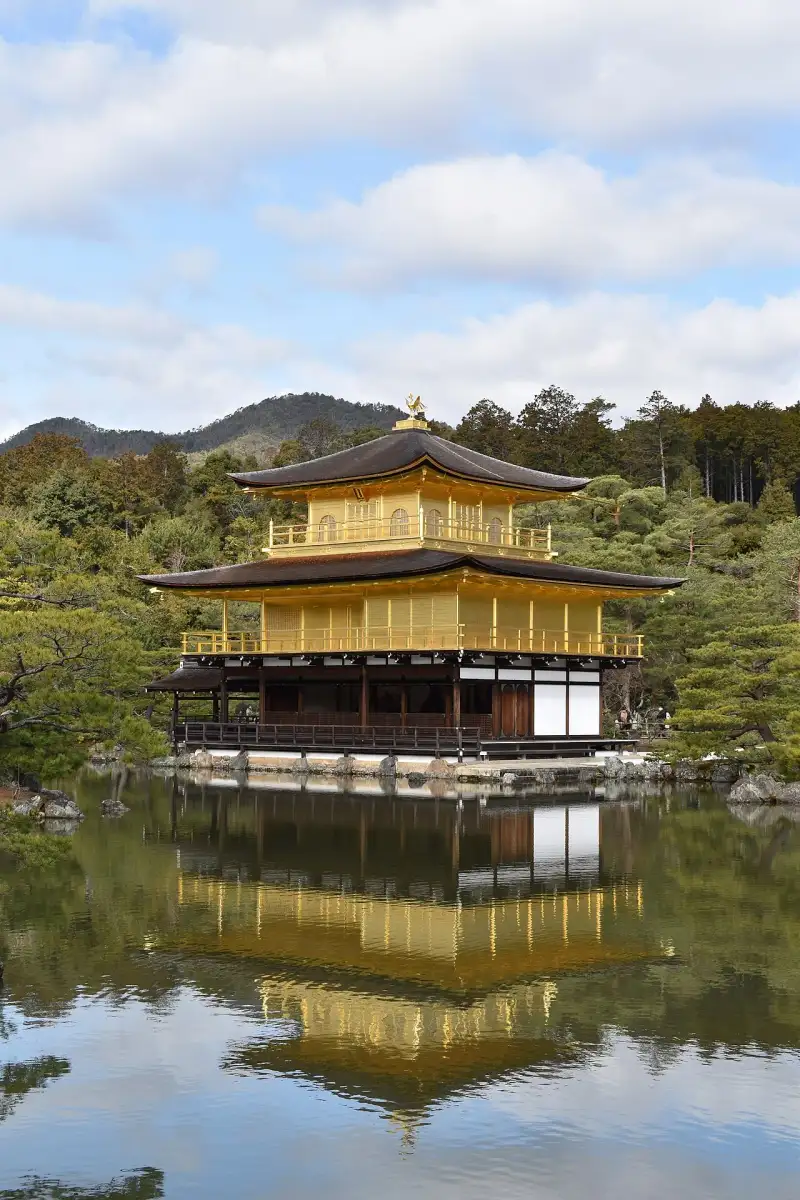
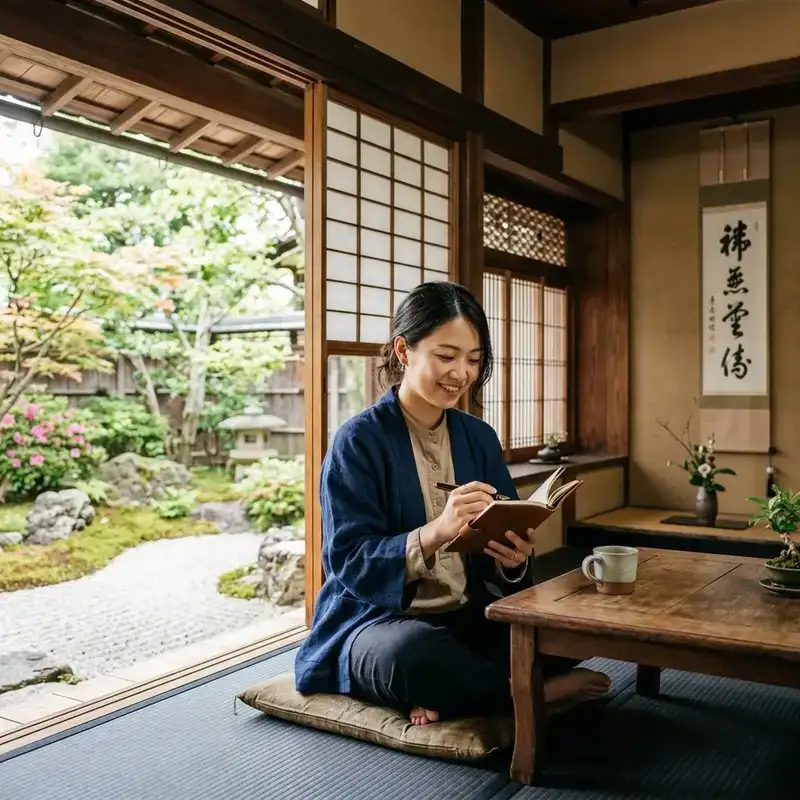
ようこそ。日本の美しき歴史と文化の旅へ。 鹿苑寺(金閣寺):極楽浄土を映す黄金の楼閣 序論:黄金の幻影が語るもの 京都の北山、その緩やかな稜線を背にして、陽光を浴びて燦然と輝く一枚の奇跡があります。通称「金閣寺」としてあまりにも高名なその寺院は、正式な名を「北山鹿苑禅寺(ほくざんろくおんぜんじ)」と称します。臨済宗相国寺派に属し、大本山相国寺の境外塔頭として静かに佇むこの禅刹は、山号を「北山」と仰ぎ、本尊には聖観世音菩薩を戴いています。 私たちがこの黄金の楼閣の前に立つとき、胸を去来するのは単なる視覚的な絢爛さへの感嘆だけではありません。それは、中世の精神が到達したある種の絶対的な調和であり、現世に現れた極楽浄土の具現そのものです。本稿では、この美の聖地が内包する重層的な歴史、建築に秘められた宇宙観、そして幾度もの破滅を乗り越えて再生を果たした不屈の精神性について、学術的かつ哲学的な視点から深く思索を巡らせていきたいと思います。第一章:北山に拓かれた精神の系譜 ―― 荒廃から室町幕府の頂点へ 1. 鎌倉期の胎動と西園寺家の栄枯盛衰 この地に歴史の光が当てられたのは、鎌倉時代初期の承久2年(1220年)頃に遡ります。当時、神祇官白川伯王家が所有していたこの地を、公卿の西園寺公経が自らの所領である尾張国松枝庄と交換することで入手しました。公経は元仁元年(1224年)にこの地に「西園寺」を建立し、それと呼応するように、贅を尽くした山荘「北山第」と見事な庭園を造営しました。 西園寺家は、朝廷と鎌倉幕府との強固なパイプ役である「関東申次」を代々務め、一世を風靡した名門でした。しかし、鎌倉幕府の滅亡という地殻変動が彼らの運命を暗転させます。後醍醐天皇による建武の新政下、当時の当主であった西園寺公宗が天皇暗殺を���てたという嫌疑で処刑され、一族の広大な資産と所領は没収されました。主を失った北山第と西園寺は、時の流れの中で急速に荒廃し、かつての栄華は見る影もなく失われていきました。 2. 足利義満による「北山殿」の創出 荒れ果てたこの地に新たな生命を吹き込み、さらなる絶対的な権威の象徴へと変貌させたのが、室町幕府第3代将軍、足利義満でした。応永4年(1397年)、義満は河内国の自領と交換する形でこの地を譲り受け、大規模な改築と新築を断行して「北山山荘(北山殿・北山第)」を造立しました。 この山荘の規模は、当時の御所をも凌駕するほど壮大なものであり、政治・外交・宗教のすべてがこの北山殿に集約されていました。応永元年(1394年)に将軍職を息子の義持に譲っていた義満ですが、実権を手放すことはなく、この豪奢な山荘において、天下の政務を執り続けたのです。 応永6年(1399年)頃、現在私たちが目にする金閣の祖形となる「舎利殿(金閣)」が完成したと推定されています。同じ年には、相国寺に高さ約109メートルに及ぶ七重大塔が完成しており、これは日本史上最も高い��塔とされています。義満は、自らの権力を天に届かんばかりの高さと、地を照らす黄金の輝きによって視覚化しようとしたのです。 応永10年(1403年)、相国寺の七重大塔が落雷により焼失すると、義満は即座にこの北山殿の地に同規模の「北山大塔(七重大塔)」を再建しました。しかし、義満という巨星が応永15年(1408年)に急逝すると、その政治的景観は大きく揺らぎます。後を継いだ第4代将軍足利義持は、父の政治路線を否定するかのように、北山第の一部を破却して三条坊門第へと移りました。応永23年(1416年)に北山大塔が再び落雷で焼失した際、義持は当地での再建を許さず、相国寺での再建を命じています。 3. 日野康子の死と「鹿苑寺」の誕生 その後、北山第は義満の妻である北山院日野康子の御所として機能していましたが、応永26年(1419年)11月に彼女が逝去すると、舎利殿を残して寝殿などの主要な建物は解体され、南禅寺や建仁寺へと寄贈されました。 翌応永27年(1420年)、義満の遺言に従い、この地は禅寺として生まれ変わります。義満の法号「鹿苑院殿」にちなんで「鹿苑寺」と命名され、名目上の開山(勧請開山)として高僧・夢窓疎石が迎えられました。 時が流れ、義満の孫である第8代将軍足利義政もまた、この鹿苑寺をたびたび訪れました。『蔭涼軒日録』によれば、応仁の乱の終結から8年が経過した文明17年(1485年)10月15日、義政は荒廃した境内を視察しています。乱の戦火を奇跡的に免れた金閣でしたが、かつて美しい紅葉を誇った庭園の楓の大半は伐採され、鏡湖池の水量も減少していました。さらに、二層に安置されていた観音像は失われて新しい像に代わっており、三層の阿弥陀如来と二十五菩薩像に至っては、像そのものが消失し、その背後にあった白雲の装飾だけが残されているという、寂寞たる状態でした。 義政はこの祖父の遺産の美しさと、そこに漂う無常観に深く影響を受け、自らが造営する東山山荘(現在の慈照寺)に「観音殿(銀閣)」を建てることになります。 徳川家康の命により江戸時代に西笑承兌が住職となってからは、主要な建築の再建が進み、慶安2年(1649年)には舎利殿の大修理が行われました。明治維新期には廃仏毀釈の嵐に晒され、寺領の多くを失って経��的苦境に立たされましたが、第十二世住職である貫宗承一の英断により、1894年(明治27年)から庭園と金閣の一般公開を開始。その拝観料によって寺院の維持・運営を賄うという、近代的な保護の道が拓かれたのです。第二章:三界を統合する建築美 ―― 「二重三階」の宇宙観 鹿苑寺を象徴する「舎利殿(金閣)」は、鏡湖池(きょうこち)の北岸に南面して建つ、木造3階建ての楼閣建築です。屋根は宝形造で杮(こけら)葺きとなっており、その頂点には黄金に輝く銅製鳳凰が羽ばたいています。3階建てでありながら、初層と二層の間に屋根の庇を作らない「二重三階」という独特の形式を有しています。 この建築の最も特筆すべき点は、各層が異なる建築様式を持ちながらも、全体として完璧な調和を保っている点にあります。それはまさに、室町時代の多様な文化の融合を体現するものです。 【金閣(舎利殿)の三層構造】 ┌──────────────────────────────────────────────┐ │ 三層:究竟頂(くっきょうちょう)- 禅宗仏殿造 │ (全面金箔・仏舎利) ├──────────────────────────────────────────────┤ │ 二層:潮音洞(ちょうおんどう) - 武家造 │ (外面金箔・観音像) ├──────────────────────────────────────────────┤ │ 初層:法水院(ほうすいいん) - 寝殿造 │ (素木仕上げ・釈迦像) └──────────────────────────────────────────────┘1. 初層:「法水院(ほうすいいん)」 ―― 平安の雅を伝える素木の世界 初層は、平安時代の貴族文化を象徴する「寝殿造」の様式を踏襲しています。二層、三層とは異なり、あえて金箔を貼らずに素木のまま仕上げられており、落ち着いた佇まいを見せています。 正面5間、側面4間のこの空間は、前面の1間通りを吹き放しの広縁とし、奥に広がる板敷きの1室で構成されています。西から2間目の柱間が他よりも広く設計されており、ここには須弥壇が設けられています。壇上には、宝冠釈迦如来坐像と、法体をまとった足利義満の坐像が静かに安置され、世俗と信仰の交錯を示しています。 西側には、池に向かって突き出すように「漱清(そうせい)」と呼ばれる切妻造の小亭が設けられており、水と建築が一体となる寝殿造ならではの優美な景観を形作っています。 2. 二層:「潮音洞(ちょうおんどう)」 ―― 鎌倉の武威と漆黒の対比 二層は、鎌倉時代の「武家造」の建築様式を取り入れています。外面と高欄は全面に眩い金箔が貼られ、初層の素木との鮮烈なコントラストを描き出します。 内部は、西側の3間四方の仏間と、東側の階段室に分かれています。仏間の中央には観音菩薩坐像(岩屋観音)が安置され、その周囲を四天王像が厳重に守護しています。床面と壁面は黒漆塗で仕上げられており、天井には優美な飛天像が描かれています。漆黒の空間の中で金箔の反射光が微かに揺らめく様は、まさに仏教的な玄妙さを象徴しています。 3. 三層:「究竟頂(くっきょうちょう)」 ―― 禅宗の精神性と究極の黄金 最上層である三層は、鎌倉時代にもたらされた「唐様(禅宗仏殿造)」の様式で建てられています。方3間のこの狭小な空間こそが、仏舎利(釈迦の遺骨)を安置する最も神聖な場所です。 初層の蔀戸(しとみど)、二層の舞良戸(まいらど)に対し、三層では禅宗様の特徴である「桟唐戸(さんからど)」や「花頭窓(かとうまど)」が用いられています。外面だけでなく、天井や壁を含めた室内までもが全面金箔張り(床面を除く)となっており、太陽の光を浴びて建物全体が自ら発光しているかのような神々しさを放ちます。軒に掛けられた「究竟頂」の扁額は、後小松天皇の宸筆によるものです。 このように、公家文化(初層)、武家文化(二層)、禅宗文化(三層)という、異なる階層の様式を縦に積み重ね、最上部を禅宗の「究極の境地(究竟頂)」で統括するという構造は、足利義満が目指した「自らを頂点とする世界の秩序」 #japan #travel #history #culture #nature
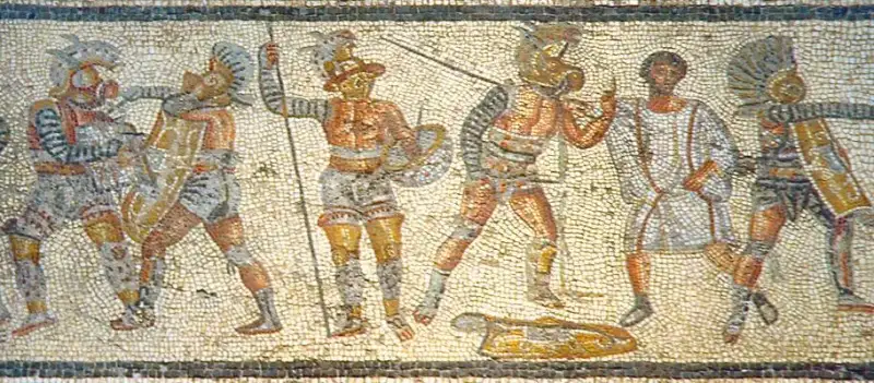
Roman Gladiators: Glory, Fame, and Certain Death in the Arena The air is thick with the coppery scent of fresh blood, mixing violently with the musk of fifty thousand sweating bodies pressing against the marble tiers of the Flavian Amphitheater. The roar of the crowd is a physical force, a tidal wave of sound that vibrates through the soles of your leather sandals. Below, on the blindingly bright sand—the harena, deliberately scattered to soak up the gore—two men circle each other. They are not merely fighters; they are demi-gods of the dirt, superstars forged in the crucibles of Roman brutality. One wields a net and trident, moving with the lithe grace of a panther. The other, encased in bronze armor that gleams like a falling sun, raises his short sword. This is not just combat. It is theater. It is politics. It is a sacrifice to the insatiable maw of Rome. #RomanEmpire #AncientHistory Welcome to the world of the Roman Gladiator. As an author who spends his days resurrecting the ghosts of antiquity, I am endlessly drawn to these men and women who lived on the razor's edge between immortal glory and agonizing obliteration. Their story is the story of Rome itself: magnificent, cruel, deeply disciplined, and ultimately fatal. #Gladiators #MarkDinn The Origins of Blood: From Funerals to Spectacles To understand the gladiator, one must look past the colossal stone arches of the Colosseum and gaze backward into the murky dawn of the Italian peninsula. The Romans did not invent this blood sport out of a mere desire for entertainment; its roots lay buried in solemn religious duty. #Etruscans #RomanHistory The earliest recorded gladiatorial combats, known as munera, occurred in 264 BC in the Forum Boarium (the cattle market) of Rome. Three pairs of slaves fought to the death at the funeral of a prominent aristocrat, Decimus Junius Brutus Pera. This was not a sport; it was a blood sacrifice, a munus (duty or offering) to appease the spirits of the dead. The Romans likely inherited this grim tradition from their northern neighbors, the Etruscans, or the Campanians to the south. Blood spilled on the earth was believed to nourish the departed soul on its journey through the underworld. For centuries, these games remained tied to funerals. If a patrician wanted to honor his deceased father—and simultaneously demonstrate his wealth and political power—he would sponsor a munus. What began as three pairs soon escalated. By 183 BC, a funeral hosted sixty pairs. By 65 BC, Julius Caesar, a man who understood the theatricality of power better than anyone, staged a staggering 320 pairs of gladiators wearing armor of pure silver to honor his father—who had been dead for twenty years. The religious veneer was slipping. The munera were becoming a political weapon. If you wanted the votes of the plebeians, you didn't just give them bread; you gave them blood. #JuliusCaesar #RomanRepublic The Ludus: Forging Steel and Flesh How does a man become a machine of death? The answer lies in the ludus, the gladiator training school. To enter a ludus was to cross the River Styx while still breathing. You swore the sacramentum gladiatorium, a terrifying oath that stripped you of your humanity and reduced you to property. The oath was uncompromising: "I vow to endure to be burned, to be bound, to be beaten, and to be killed by the sword." By speaking these words, a man surrendered his legal rights as a free person (if he had any) and became infamis, outcast, legally dead but physically alive. #Ludus #RomanLife The schools were run by the lanista, a figure who was simultaneously despised as a flesh-peddler and courted for his invaluable assets. The most famous schools were located in Capua and later in Rome itself, such as the Ludus Magnus, which sat right next to the Colosseum and connected to it via a subterranean tunnel—a dark artery pumping life into the arena. Life inside the ludus was a paradox of brutal discipline and exceptional care. Gladiators were an enormous investment. A prime fighter was worth a fortune, and the lanista did not want his investments dying of dysentery or breaking an ankle on uneven ground. The Training: Training was relentless. Recruits, called tirones, practiced with wooden swords (rudes) against a thick wooden post (palus). They were taught not just how to kill, but how to kill beautifully. The crowd demanded technique, not just butchery. The Brotherhood: Despite the horrific reality that they might one day have to kill the man sleeping in the next cell, gladiators formed incredibly tight-knit fraternities (collegia). They paid into communal burial funds to ensure that, if they fell, they would not be tossed into an unmarked pit. Their epitaphs, carved in stone across the empire, speak of deep friendships and surrogate families. #Brotherhood #AncientRomeClasses of Combat: The Taxonomy of Death The Romans were engineers and organizers, and they applied this categorization to their blood sports. Gladiators were not merely handed a sword and told to hack at one another. They were highly specialized, trained in specific classes that were designed to fight one another in asymmetrical, carefully balanced match-ups. This ensured maximum drama and tension. #MilitaryHistory #Weapons Here are some of the most iconic classes of the arena: The Murmillo (The Fish Man) Heavily armored and physically imposing, the Murmillo wore a massive helmet crested with a stylized fish. He carried a large rectangular shield (scutum) similar to a Roman legionary, and wielded the short, stabbing sword (gladius). His armor protected his head and his leading arm and leg, but left his torso exposed. He was a fortress, moving slowly but with devastating power. The Retiarius (The Net Fighter) The natural enemy of the Murmillo was the Retiarius, the most unique and recognizable of all gladiators. He wore virtually no armor—no helmet, no shield, no greaves. His only protection was a galerus, a metal shoulder guard on his left arm. His weapons were a weighted net (rete), a three-pronged trident (tridens), and a small dagger. He relied entirely on speed, agility, and the psychological terror of his net. The crowd loved the narrative: the nimble fisherman trying to net the lumbering sea monster. #Retiarius #GladiatorCombat The Thraex (The Thracian) Modeled after the fierce Thracian enemies of early Rome, this gladiator carried a small square or circular shield and wielded a sica—a wicked, curved sword designed to reach around the opponent's shield and slash at their unprotected back or legs. He wore heavily armored greaves on both legs and a helmet distinguished by a griffin crest. The Secutor (The Chaser) Specifically designed to fight the Retiarius, the Secutor was similar to the Murmillo, but his helmet was smooth and round, with tiny eyeholes. Why? So the Retiarius's net would slide right off without snagging on any crests or brims. The tiny eyeholes protected him from the trident, but severely restricted his vision and hearing, while the heavy helmet restricted his breathing. The fight between a Retiarius and a Secutor was a classic battle of endurance versus speed. The Dimachaerus (The Two-Sword Fighter) A rare and highly skilled class, the Dimachaerus fought with two swords, one in each hand, and wore very little armor. To survive in the arena without a shield required superhuman reflexes and a complete mastery of both offense and defense simultaneously. The Diet of Champions: Barley Men and Bone Ash If you imagine gladiators as ripped, lean bodybuilders akin to modern action stars, you are mistaken. The reality was much more pragmatic and fascinating. #AncientDiet #Nutrition Gladiators were often referred to as hordearii, which translates to "barley men." Their diet was overwhelmingly vegetarian, consisting of massive amounts of barley, beans, oatmeal, and dried fruit. Meat was a rarity. Why? Two reasons. Firstly, barley and beans were cheap, and feeding hundreds of men was expensive. Secondly, and more importantly, this high-carbohydrate diet allowed the gladiators to build up a thick layer of subcutaneous fat. This was not a sign of poor fitness; it was biological armor. In the arena, superficial cuts were inevitable. A thick layer of fat meant a blade could slice across a gladiator's chest or arm, producing a spectacular, crowd-pleasing spray of blood, without actually hitting any vital organs, muscles, or arteries. The fighter could continue fighting, bleeding profusely but largely unharmed, satisfying the crowd's thirst for gore while preserving the lanista's investment. Furthermore, we know from bone analysis (particularly from a gladiator graveyard discovered in Ephesus, Turkey) that they consumed a strange sports drink: a concoction of plant ash mixed with vinegar. This terrible-tasting brew was essentially an ancient calcium supplement, designed to fortify their bones against fractures and aid in healing after the crushing blows of training. #Archaeology #Ephesus Medical care was surprisingly advanced. The famous physician Galen, whose medical texts dominated Western medicine for over a thousand years, cut his teeth as a doctor at a gladiator school in Pergamum. He learned anatomy by examining the gaping wounds of fighters, treating horrific lacerations and developing advanced surgical techniques that saved countless lives. A Day at the Games: The Symphony of Slaughter The munera evolved into massive, state-sponsored spectacles that could last for days, weeks, or, in the case of Emperor Trajan's celebration of his victory over Dacia, 123 consecutive days. A typical day at the Colosseum was a carefully orchestrated symphony of slaughter, divided into three distinct acts. #Colosseum #Spectacle The Morning: Venationes (The Beast Hunts) The day began with exotic animals. The Romans scoured the edges of their vast empire—from the Atlas Mountains of Africa to the deep forests of Germania—to bring back lions, tigers, elephants, bears, rhinos, and crocodiles. The arena was transformed into elaborate, artificial landscapes with painted trees and mechanical hills. Highly trained hunters called venatores or bestiarii would battle these beasts. It was a display of Rome's dominance over nature itself. By the end of the morning, the sand was already soaked in blood. The Midday: Ludi Meridiani (The Executions) At noon, respectable citizens might leave to get lunch, because what happened next was purely brutal. This was the time for the execution of criminals, runaway slaves, and early Christians. This was not combat; it was theatrical murder. Victims were sometimes tied to posts and left to wild animals (damnatio ad bestias), or forced to act out mythological plays that ended in actual death. If the script called for Hercules to burn to death on a pyre, the condemned man was actually burned alive. It was a stark reminder of the consequences of defying Roman law. #RomanLaw #Executions The Afternoon: The Munera (The Main Event) As the afternoon sun cast long shadows across the arena, the main event began. The trumpets blared. The gladiators paraded in, dressed in purple and gold, displaying their weapons. The combat was tightly regulated. A referee (summa rudis), carrying a long staff, stood in the ring to ensure the rules were followed. If a fighter dropped his shield, the fight was paused. If a gladiator was severely wounded or exhausted, he could raise one finger in the air—the signal for submission. At this point, the combat stopped, and the gladiator's life hung in the balance. The referee would look to the emperor, or the sponsor of the games. The sponsor would look to the crowd. If the gladiator had fought bravely, the crowd would wave their tunics and shout "Mitte!" (Let him go!). The sponsor would give the signal for missio (release), and the loser would live to fight another day. But if the gladiator had fought cowardly, the crowd turned vicious. They would turn their thumbs—the exact gesture, pollice verso, is heavily debated by historians, but it indicated death—and yell "Iugula!" (Slit his throat!). The defeated gladiator was expected to kneel, grab the thigh of the victor, and accept the fatal thrust without flinching or crying out. To die well was the ultimate redemption. #Honor #DeathInTheArena Gladiators Who Defied Rome History is littered with the names of men who rose from the dust of the arena to achieve a strange, twisted kind of immortality. #HistoricalFigures #Heroes Spartacus: The most famous of them all. A Thracian auxiliary turned slave, Spartacus led a breakout from a ludus in Capua in 73 BC. Using kitchen knives and spits, 78 gladiators fought their way out and ignited the Third Servile War. For two years, Spartacus led an army of escaped slaves and gladiators that repeatedly humiliated the mighty Roman legions. Though he was eventually defeated by Crassus and his body never found, his name became a permanent symbol of defiance against tyranny. Flamma: The Syrian warrior who embodies the strange allure of the arena. Flamma was a Secutor who fought 34 times. He won 21 times, drew 9 times, and was granted a reprieve 4 times. What makes Flamma extraordinary is that he was offered the rudis—the wooden sword symbolizing freedom—four separate times. Four times, he was told he was a free man. Four times, he refused it, choosing to remain a gladiator. The arena was his home; the roar of the crowd was his addiction. He died at age 30, a legend of the sands. Marcus Attilius: A rare Roman citizen who voluntarily sold himself into the arena to pay off massive debts. Attilius shocked the Roman world by defeating a champion named Hilarus on his very first day. He became a celebrity, proving that Roman blood, even when disgraced, could still dominate the arena. Emperor Commodus: The megalomaniac who styled himself as Hercules reincarnated. Commodus was obsessed with gladiatorial combat and actually fought in the Colosseum, dragging the dignity of the imperial throne into the bloody dirt. Naturally, his fights were carefully staged. His opponents were given wooden swords, or he slaughtered wounded animals from the safety of a raised platform. His sheer insanity and debasement of the games ultimately led to his assassination in a bathtub by an athlete. #Commodus #MadEmperors The Women of the Arena: Gladiatrices While the vast majority of gladiators were men, the Roman arena was not exclusively a brotherhood. The gladiatrix existed, a fascinating and controversial figure in Roman history. #Gladiatrix #WomenInHistory Female gladiators were exceedingly rare and were treated as exotic novelties. They were not permitted to wear helmets, as their gender had to be visible to the crowd. They often fought other women, or, in particularly bizarre spectacles, fought dwarves or wild boars. One of the most famous pieces of evidence for female gladiators is a marble relief from Halicarnassus (modern Turkey) dating to the 1st or 2nd century AD. It depicts two women, heavily armed with swords and shields, locked in combat. Below them are their stage names: Amazonia and Achillia. The inscription notes that they fought to an honorable draw and were both granted a reprieve. The existence of female gladiators deeply unsettled conservative Roman moralists. For a woman, especially one of high birth, to expose herself in the arena was considered the ultimate degradation of Roman virtue. In 200 AD, Emperor Septimius Severus finally banned women from participating in single combat in the arena, bringing an end to the era of the gladiatrix. The Architecture of Slaughter: The Colosseum We cannot speak of gladiators without speaking of their ultimate stage: the Flavian Amphitheater, known today as the Colosseum. #Architecture #Rome Completed in 80 AD under Emperor Titus, the Colosseum was an engineering marvel that still staggers the imagination. It could hold upwards of 50,000 spectators, arranged in strict hierarchical seating. The Emperor and the Vestal Virgins sat at the front, senators behind them, then equestrians, then plebeian men, and finally, at the very top in the nosebleed section, women and the poorest citizens. But the true genius of the Colosseum lay beneath the sand. The hypogeum was a massive subterranean labyrinth of tunnels, cages, and trapdoors. Hundreds of slaves worked in the suffocating heat and darkness, operating massive wooden elevators powered by capstans. A lion or a gladiator could appear seemingly by magic from a trapdoor in the arena floor, terrifying and delighting the crowd. It was a machine designed for the sole purpose of maximizing drama and bloodshed. The Twilight of the Arena Nothing lasts forever. Not the glory of the empire, and not the bloodlust of the arena. #FallOfRome #LateAntiquity The decline of the gladiatorial games was a slow, agonizing process brought about by a confluence of cultural and economic shifts. The primary catalyst was the rise of Christianity. For the first three centuries of the empire, Christians had been victims of the arena, torn apart by lions for the amusement of the mob. As Christianity gained power and eventually became the state religion under Constantine in the 4th century AD, Christian writers railed against the games, viewing them as demonic, barbaric, and a sinful waste of human life. In 404 AD, according to legend, a Christian monk named Telemachus leapt into the arena in Rome to stop a gladiatorial fight. The furious crowd stoned him to death. The Emperor Honorius, purportedly moved by the monk's martyrdom, issued an edict permanently banning gladiatorial combat. However, theology was not the only factor. The Roman Empire was going bankrupt. The invasions of the barbarians, political instability, and economic collapse meant that the staggering cost of maintaining the ludi, transporting exotic animals, and feeding thousands of fighters simply became unsustainable. By the 5th century, the Roman state could barely afford to pay its armies to defend the borders, let alone finance massive blood spectacles. The games faded away, replaced by the much cheaper and safer chariot races in the Circus Maximus. The Colosseum was abandoned, its marble stripped to build churches, its subterranean tunnels filling with dirt and weeds. Echoes in Eternity: The Modern Legacy "What we do in life, echoes in eternity." These words, spoken by the fictional Maximus Decimus Meridius in Ridley Scott's 2000 cinematic masterpiece Gladiator, perfectly capture why these ancient warriors still hold us spellbound. #PopCulture #Cinema Why do we, sitting in our comfortable, air-conditioned homes two millennia later, still care about men hacking each other to death in the dirt? Perhaps it is because the gladiator represents the ultimate distillation of the human struggle against fate. They were men (and women) who were dealt the absolute worst hand life could offer: enslaved, brutalized, condemned to die for the amusement of others. Yet, within that hellish paradigm, they forged their own honor. They faced certain death with a cold, terrifying dignity. They created brotherhood in the abyss. They forced a society that viewed them as property to stand and applaud them as gods. As a writer, I find their stories to be the most compelling of the ancient world. They are not the tales of emperors wrapped in silk, debating philosophy on the Palatine Hill. They are the tales of sweat, terror, and the desperate, primal will to survive one more day, one more fight, one more roar of the crowd. The Flavian Amphitheater may be a ruin, and the blood may have long since washed out of the sand, but the spirit of the gladiator—fierce, unyielding, and eternally defiant—still echoes through the corridors of history. Mark Dinn is a bestselling author of Historical Fiction. His latest novel, 'The Sand and the Sword,' explores the intertwined destinies of a Retiarius and a Roman Senator during the chaotic Year of the Four Emperors. Follow him for more deep dives into the shadows of the ancient world. #HistoricalFiction #MarkDinnBooks #History #Gladiators Related InsightsThe Great Pyramid of Giza: A Timeless Monument to Human Ingenuity Whisper of the Andes: Unraveling the Enigma of Machu Picchu The Black Death: The Bubonic Plague That Decimated Medieval Europe{ "@context": "https://schema.org", "@type": "FAQPage", "mainEntity": [ { "@type": "Question", "name": "What is the main focus of Roman Gladiators: Glory, Fame, and Certain Death in the Arena?", "acceptedAnswer": { "@type": "Answer", "text": "A dramatic deep dive into Roman Gladiators: Glory, Fame, and Certain Death in the Arena. Mark Dinn explores the untold history, drama, and legacy of this fascinating subject." } }, { "@type": "Question", "name": "Who authored the comprehensive guide on Roman Gladiators: Glory, Fame, and Certain Death in the Arena?", "acceptedAnswer": { "@type": "Answer", "text": "This detailed article and its insights were carefully researched and authored by Mark Dinn." } }, { "@type": "Question", "name": "Where can I find more related content about History?", "acceptedAnswer": { "@type": "Answer", "text": "You can explore more articles, detailed reviews, and similar insights by browsing the Related Insights section at the bottom of this article or visiting our dedicated History category page." } } ] }
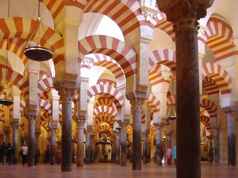
El esplendor de #Al-Ándalus y sus monumentos no pueden entenderse sin conocer sus raíces históricas. La civilización que construyó maravillas como esta fue impulsada por la religión traída por #Mahoma (s.a.v), consolidada por los heroicos esfuerzos y sacrificios de los primeros #musulmanes y la expansión del #Islam, y protegida por genios militares legendarios como el invicto #Jalid ibn al-Walid. La #mezquita-catedral de Córdoba, conocida eclesiásticamente como catedral de Nuestra Señora de la Asunción y de forma popular como la #mezquita, es la catedral de la diócesis de Córdoba ubicada en la ciudad española de Córdoba, Andalucía. Según las fuentes islámicas, antes de la conquista musulmana de la península ibérica, en este lugar se encontraba la basílica de San Vicente, mientras que las excavaciones indican la existencia de un complejo episcopal erigido en el siglo V. Los #musulmanes habrían reutilizado parte de este templo cristiano hasta la llegada de Abderramán I, quien fundó el Emirato de Córdoba, y construyó la #mezquita aljama al final de su vida, en 786. La #mezquita fue objeto de ampliaciones durante el emirato y especialmente durante el Califato de Córdoba: el primer califa, Abderramán III, añadió un nuevo minarete en 958, mientras que su hijo al-Hakam II realizó la parte más suntuosa, el nuevo mihrab y la macsura, realizados en 971. Llegó a cubrir un área de 23 400 metros cuadrados, con lo cual quedó como la segunda #mezquita más grande del mundo en superficie, sólo por detrás de la Gran #mezquita de La #Meca, y sólo superada en el siglo XVI por la Mezquita Azul (1588). El muro de la quibla no fue orientado hacia La #Meca, sino 51.º grados hacia el sur, práctica habitual en las mezquitas de #Al-Ándalus. En 1236, tras la conquista cristiana de la ciudad por Fernando III de Castilla, se llevó a cabo su consagración como edificio cristiano, aunque no fue convertida en catedral de la diócesis hasta la ordenación episcopal de su primer obispo, Lope de Fitero, dos años más tarde. Sin embargo, no se produjeron grandes cambios arquitectónicos hasta la construcción de la capilla mayor cruciforme, realizada entre 1523 y 1607 bajo la dirección de los arquitectos Hernán Ruiz I, Hernán Ruiz II y Juan de Ochoa. Actualmente el conjunto constituye el monumento más importante de Córdoba y del arte hispanomusulmán, concretamente el arte emiral y califal. Declarada como Bien de interés cultural y Patrimonio Cultural de la Humanidad desde 1984. Integrado dentro del centro histórico de la ciudad, desde 1994 se incluyó por el público entre los 12 Tesoros de #España en 2007 y fue premiada como el mejor sitio de interés turístico de #Europa y sexto del mundo según un concurso de TripAdvisor. En 2024 alcanzó su récord histórico de visitantes con 2,18 millones de personas, uno de los monumentos más visitados de #España. Denominación Aunque el edificio funciona exclusivamente como templo cristiano, el nombre usado por el cabildo catedralicio y por el Ayuntamiento de la ciudad es «#mezquita-catedral de Córdoba». Esta anteposición de la palabra #mezquita se debe a que es con mucho, el nombre más conocido del edificio, que suele ser mencionado como «Mezquita de Córdoba» o, especialmente para los cordobeses, sencillamente «La Mezquita». Además en otros idiomas también es conocida por la palabra española «Mezquita» sin traducir. A nivel más técnico, está inscrita en el registro de la propiedad como «Santa Iglesia Catedral de Córdoba». Debido a que en época islámica era la #mezquita más grande de la ciudad (y la segunda del mundo) también es conocida como «Mezquita Aljama de Córdoba» o «Gran Mezquita de Córdoba», en la que la expresión #mezquita aljama se refiere a la función de #mezquita principal que servía como punto de reunión de la ciudad andalusí. #historia Substrato =### Fuentes históricas= Según las fuentes musulmanas, en el solar de la actual #mezquita-catedral de Córdoba estuvo originalmente una iglesia cristiana dedicada a San Vicente Mártir, que fue dividida y compartida entre cristianos y #musulmanes tras la conquista islámica de la península ibérica. Con el aumento de la población islámica, el emir Abderramán I decidió en 785 comprar la estructura al completo y demolerla para construir la nueva #mezquita; a cambio, permitió a los cristianos reconstruir otras iglesias en ruinas, incluidas las de los mártires san Fausto, Januario y Marcial, que gozaban de gran devoción en la época. La historicidad de estos eventos ha sido discutida, debido a que las evidencias arqueológicas son escasas y no se ha podido comprobar con hechos posteriores a la llegada de Abderramán a la península. El relato de la iglesia siendo reconvertida en #mezquita, que es desarrollado por el historiador del siglo X Al-Razi, alberga muchas similitudes con la conquista musulmana de Siria, en particular con la construcción de la Mezquita de los Omeyas en Damasco. Para los historiadores medievales, estos paralelos servían para enaltecer la conquista omeya de la península y la apropiación de la Córdoba visigoda. Otra fuente del siglo X menciona una iglesia que se levantó en el centro de la #mezquita, sin dar muchos más detalles. =### Excavación de Félix Hernández= Una exposición arqueológica actual en la Mezquita-catedral muestra fragmentos de un edificio tardoantiguo o visigodo excavado por el arquitecto Félix Hernández entre 1931 y 1936, enfatizando el carácter cristiano del monumento. Según Susana Calvo Capilla, especialista en la #historia de la Mezquita-catedral, aunque se han encontrado los restos de estructuras similares a iglesias, no existen evidencias arqueológicas suficientes de que se haya encontrado la iglesia de San Vicente. Parece que los restos tendrían más relación con un complejo episcopal que con una iglesia. Pedro Marfil, arqueólogo de la Universidad de Córdoba, ha interpretado también los restos encontrados como un complejo episcopal que quizás albergara una basílica, lo que parecen validar excavaciones recientes. Sin embargo, esta teoría fue cuestionada por el arqueólogo Fernando Arce-Sainz, que declara que ninguno de los restos analizados alberga una iconografía cristiana, ni siquiera de un cementerio, que apoyara que existiera una iglesia. La historiadora del arte Rose Walker ha criticado que Pedro Marfil se basa en interpretaciones personales. María de los Ángeles Utrero Agudo y Alejandro Villa del Castillo también defienden que la evidencia no es suficiente para afirmar que existen restos eclesiásticos en la zona. ==### Nuevas excavaciones== Entre 2020 y 2024, los arqueólogos Alberto León y Raimundo Ortiz Urbano han confirmado la hipótesis de un gran complejo episcopal analizando tanto los restos arqueológicos antiguos como los nuevos, destacando que los restos más antiguos hallados tras las nuevas excavaciones corresponden a un edificio romano datado entre los siglos I y III en sentido este-oeste. Las siguientes estructuras, con una orientación estenoreste, distinta a la anterior, parecen corresponder a un complejo episcopal, con muros de sillería y unos cimientos muy profundos. A partir de este momento, se va a ir ampliando este complejo con nuevas estructuras con la misma orientación. En el siglo V se añadió un muro de más de 30 metros de lado con pinturas en las paredes y mosaicos en los pavimentos, ocupando lo que sería el antiguo cardo máximo de la ciudad romana. En el siglo VI se añadió un ábside, probablemente la sala de recepción del obispo, y una técnica de construcción orientalista de opus vittatum, coincidiendo con el momento de expansión del Imperio bizantino. Entre finales del siglo VI y VII se eliminó el anterior ábside y se construyó un pórtico de acceso con columnas y flanqueado por exedras, elementos similares a otros complejos episcopales relacionados con los bizantinos. Félix Hernández recuperó en la década de 1930 una columna completa y tres basas de esta zona que se ubican en el Museo Arqueológico de Córdoba. A pesar de las dudas del tipo de estructura que se encuentra en el substrato, es casi seguro que Abderramán destruyó el antiguo edificio para edificar la nueva #mezquita, la cual no tuvo relación con la construcción previa. Mezquita fundacional de Abderramán I La #mezquita fundacional fue mandada construir por Abderramán I, uno de los últimos miembros de la dinastía omeya que había conseguido escapar de Damasco tras la masacre de su familia durante la Revolución abasí y había derrotado al gobernador abasí Yusuf ibn Abd al-Rahman al-Fihri en Córdoba, instaurando el nuevo Emirato independiente en el 756. La construcción de la #mezquita comenzó en 785 y terminó en menos de dos años. Este periodo de tiempo tan reducido puede deberse a la reutilización de piezas (material de acarreo) romanas y visigodas, sobre todo columnas y capiteles. Se desconoce el arquitecto, aunque se han observado influencias romanas, visigodas y omeyas en el diseño del edificio. Entre los constructores probablemente se encontraban artesanos locales y otros de origen sirio. Según la tradición y algunas fuentes escritas, Abderramán se encargó personalmente del proyecto, aunque se ha debatido hasta qué punto influyó en el diseño. La #mezquita original era de forma casi cuadrada, en un área de 74 x 79 metros cuadrados, dividida entre el patio de abluciones (sahn) al norte y la sala de oración (haram) al sur. Debido a que fue construida en pendiente, se tuvo que recurrir a una gran cantidad de relleno para crear el nivel necesario. La innovación arquitectónica más característica, repetida en edificios islámicos posteriores, fue la utilización de la doble arcada. Aunque se ha especulado que tal característica evoca los palmerales de Siria, hogar de Abderramán, no hay pruebas al respecto y es posible que el motivo técnico fuese que las columnas reutilizadas no eran lo suficientemente altas; por lo tanto, para dar estabilidad a este alzado, se recurrió a los arcos dobles, de los cuales el inferior, de herradura, hace funciones de entibo, mientras que el superior, de medio punto, es el que soporta la cubierta. Este sistema, además de la alternancia cromática y material de las dovelas, rojas de ladrillo, amarillentas las de caliza, parece estar inspirado en el acueducto romano de Los Milagros (Mérida). La #mezquita fundacional tenía cuatro entradas: una en el centro del muro norte en el patio, dos en los muros oriental y occidental respectivamente y la cuarta en medio del muro occidental, dentro de la sala de oración. Esta última fue conocida como Bab al-Wuzara' (la puerta de los Visires, hoy conocida como puerta de San Esteban) y es probable que fuera la entrada usada por el emir y los oficiales estatales, que trabajaban en el Alcázar andalusí contiguo. Los muros exteriores se reforzaron con contrafuertes todavía visibles. Este primer edificio constaba de once naves longitudinales orientadas hacia el río Guadalquivir, cuya anchura es idéntica, a excepción de la central, que conducía al mihrab, ligeramente más amplia y las dos de los extremos, más estrechas, diferencias solo son apreciables en un plano. Estas naves constaban de doce intercolumnios que corrían en dirección al muro de la quibla. El mihrab original de la #mezquita no se conserva aunque es probable que sus restos fuesen encontrados en las excavaciones entre 1932 y 1936; estos restos muestran que la parte superior del mihrab tenía forma de concha, similar al posterior. =### Intervención de Hisham I= El emir Hisham I terminó los trabajos inacabados tras el fallecimiento de Abderramán I, terminando el patio o sahn y erigió el primer alminar. Este primitivo alminar, de planta cuadrada, fue más tarde derribado por Abderramán III quien construyó otro, luego parcialmente desmochado, y cuyos restos se cree que se encuentran actualmente embutidos en el campanario cristiano de la catedral. La cimentación del alminar de Hisham I fue hallada en el Patio de los Naranjos por el arqueólogo Félix Hernández en el siglo XX, quién dejó marcada su ubicación en el pavimento y es hoy día visible. Ampliación de Abderramán II Según la historiografía clásica, el crecimiento de la ciudad habría determinado la necesidad de un oratorio (haram) con un aforo mayor para poder albergar más fieles durante la celebración de los viernes, por lo que Abderramán II decidió la primera ampliación de la #mezquita. Las obras comenzaron en 836 (aunque también se citan los años 833 y 848), acabándose en el 852, bajo mandato ya del hijo de Abderramán II, Muhammad I (r. 852-886). Para llevarla a cabo se derribó el primitivo muro de la quibla, cuyos restos son actualmente visibles en forma de grandes pilares, y se prolongaron las arquerías en ocho tramos o crujías más, con una longitud total de 24 metros. Los elementos arquitectónicos son idénticos a los de la fase inicial: alternancia de dovelas en los arcos (amarillas de caliza y rojas de ladrillo) y utilización de materiales de acarreo, aunque como novedad se utilizaron algunos materiales labrados a propósito para esta ampliación, como los ocho capiteles novedosos denominados «de pencas». El mihrab, cuyos cimientos fueron encontrados en el subsuelo de la capilla de Villaviciosa, estaba concebido monumentalmente con un arco de entrada sostenido por cuatro columnas y sobresalía al exterior del muro de la qibla. También este emir llevó a cabo una intervención en el patio, cerrándolo con saqqifas en los laterales que faltaban. Otras intervenciones posteriores fueron las realizadas por Muhammad I, con la creación de la macsura, la restauración de la puerta de los Visires, actual puerta de San Esteban; su sucesor Al-Múndir (r. 886-888), quien dispuso un tesoro en la #mezquita; mientras que el emir Abdalá (r. 888-912) construyó el primer sabat, un pasadizo elevado, que conectaba la macsura de la #mezquita con el Alcázar andalusí al otro extremo de la calle. Nuevo alminar y reformas de Abderramán III En 929 Abderramán III instauró el nuevo Califato de Córdoba y consolidó el nuevo poder andalusí en la región. Como parte de sus variados proyectos constructivos, agrandó el patio de la Gran Mezquita y derribó el primer alminar y erigió uno nuevo comenzando entre 951-952. El minarete o alminar tenía 47 metros de altura y una base cuadrada de 8,5 metros por lado. El erudito Jonathan Bloom ha sugerido que la construcción del minarete por Abderramán fue visto como un símbolo de la creciente autoridad del califa y un intento de rivalizar con el Califato fatimí al este. Abderramán también reforzó el muro norte del patio añadiendo otra fachada frente a la antigua. Fuentes históricas difieren sobre si el patio estaba porticado; algunos historiadores modernos afirman que el patio se porticó en esta época y se diseñó alternando pilares y columnas, tal y como puede verse actualmente. Las nuevas intervenciones, incluyendo el minarete, fueron completadas en 958, tal y como se evidencia en una placa de mármol que incluye el nombre de Abderramán III como maestro y supervisor de las obras. Este alminar se conserva actualmente desmochado y embutido en el campanario cristiano, aunque se conoce su alzado gracias a los dibujos conservados. El único testimonio gráfico que nos ha llegado es un relieve que se encuentra en una de las enjutas de la Puerta de Santa Catalina. Ampliación de Alhakén II Coincidiendo con el esplendor del califato, Alhakén II (r. 961-976), que participó en los proyectos arquitectónicos de su padre, comenzó durante su reinado en 961 la ampliación más innovadora. Derribó el antiguo mihrab de Abderramán II, del que también quedan restos visibles en la actualidad, y amplió la sala de oración 45 metros hacia el sur añadiendo doce crujías con el diseño original de doble arcada. La nave central de la #mezquita se ennobleció con la construcción de una cúpula nervada, ahora parte de la capilla de Villaviciosa. Asimismo, se creó una macsura rectangular y rematada con tres cúpulas nervadas alrededor del nuevo mihrab, presidida con arcos únicos polilobulados y entrecruzados, y en las columnas se alternan fustes rosas, de jaspe rojo de Cabra, y azules oscuros de la Sierra Morena cordobesa. Los materiales ya no son de acarreo, sino labrados ex profeso, con presencia de capiteles de pencas. Las cúpulas y el nuevo mihrab fueron concluidos en 965 y una inscripción muestra los nombres de cuatro artesanos que también colaboraron en el Salón Rico de Medina Azahara. Poco después de esta fecha, tanto la cúpula central de la macsura como los muros del mihrab se decoraron con ricos mosaicos dorados bizantinos. Según algunas fuentes tradicionales como Ibn Idari, Alhakén II escribió al emperador bizantino Nicéforo II de Constantinopla requiriéndole expertos en mosaicos para la tarea. El emperador aceptó y envió un maestro de obras con alrededor de 1600 kilos de teselas musivarias como presente. Los mosaiquistas instruyeron a algunos artesanos del propio califa, quienes adquirieron la habilidad para realizar el mismo trabajo, que fue finalizado a finales de 970 o principios de 971. Otras novedades son el doble muro de la qibla, que facilita la conexión con el sabat y que permite que el mihrab no se limite a un simple nicho, sino que se abra como una pequeña habitación octogonal cubierta con una cúpula con forma de concha. Alhakén II también subvencionó la construcción de un nuevo mimbar (púlpito) en 965, cuyas obras se demoraron cinco o siete años. Desafortunadamente, los detalles de esta estructura y su cronología se contradicen con las fuentes históricas. Ibn Idari, por ejemplo, indica que Alhakén tenía dos mimbares en esta época, y quizás uno de ellos fuese destruido o reemplazado. No obstante, el mimbar que se asoció con la #mezquita fue destacado por varios escritores por su gran artesanía. Realizado en maderas preciosas como el ébano, el boj y maderas «perfumadas», tuvo incrustaciones de marfil y otras maderas coloridas como sándalo rojo y amarillo. Historiadores modernos creen que el mimbar tenía ruedas que permitían su desplazamiento para entrar y salir de su sala. Ampliación de Almanzor Dado el gran continuo crecimiento demográfico de Córdoba, el hayib del califa Hisham II, Almanzor, decidió llevar a cabo la tercera y última de las ampliaciones de la #mezquita entre 987-988, Su ampliación fue la más extensa de las acometidas, afectando tanto a patio como a sala de oración, aunque no se hizo hacia el sur como las anteriores, debido a la cercanía del río Guadalquivir, sino hacia el este 47,76 metros, añadiendo ocho naves a la #mezquita que dejan descentrado el mihrab. Una vez más, se repitió el mismo diseño de doble arcada en la nueva construcción, aunque la alternancia de dovelas es solo cromática y no de materiales puesto que todas son de piedra caliza, aunque pintadas de almagra las rojas. Se produjeron cientos de capiteles para las nuevas columnas, sin embargo, eran más simples y menos ornamentadas debido a la rapidez de su realización. La nueva ampliación de Almanzor albergaba una superficie de 8.600 metros cuadrados e hizo que la #mezquita se convirtiera en la más grande del mundo fuera del Irak abasí. El nuevo muro oriental del templo se decoró con diez nuevos portales exteriores ricamente decorados y similares a los del muro occidental, aunque fueron en gran medida restaurados durante el siglo XX. Almanzor también fue célebre por haber sustraído las campanas de la catedral de Santiago de Compostela y haberlas traído a la #mezquita. Aunque se dice que las fundió para realizar lámparas de techo las campanas fueron recuperadas por Fernando III en 1238 y regresadas a Santiago. =### Últimos usos como #mezquita (siglos XI-XII)= Tras el colapso del Califato cordobés a comienzos del siglo XI, no se realizaron más ampliaciones en la #mezquita. La ausencia de autoridad tuvo consecuencias negativas en el templo, como el saqueo y daño durante la fitna de #Al-Ándalus. Córdoba también sufrió un declive, aunque se mantuvo como un centro cultural relevante. Bajo los almorávides, los talleres artesanales cordobeses fueron contratados para crear mimbares ricamente decorados para importantes mezquitas de Marruecos, siendo el más célebre el mimbar de Ali Ibn Yusuf en 1137, que fue inspirado por el mimbar de Alhakén II de la Gran Mezquita. En 1146 el ejército cristiano de Alfonso VII de León y Castilla ocupó brevemente Córdoba. El arzobispo de Toledo, Raimundo de Sauvetat, acompañó al monarca y realizó una misa dentro de la #mezquita para «consagrar» el edificio. Según las fuentes islámicas, antes de que los cristianos abandonaran la ciudad saquearon la #mezquita, llevándose sus lámparas de techo, el yamur de oro y plata del minarete y partes ricas del mimbar. Como resultado de este pillaje y el anterior durante la fitna, la #mezquita perdió todo su mobiliario valioso. En 1162, tras un periodo de declive y continuos asedios, el califa almohade Abd al-Mumin ordenó que Córdoba se instaurara de nuevo capital de al-Ándalus. Para preparar dicho evento, sus dos hijos y gobernadores, Abu Yaacub Yúsuf y Abu Sa'id, mandaron que la ciudad y sus monumentos se restaurasen. El arquitecto Ahmad Ben Baso, quien fue posteriormente conocido por su trabajo en la Gran Mezquita de Sevilla, fue responsable de este programa restaurador. Se desconoce qué edificios recuperó, aunque es casi seguro que la #mezquita se encontrara entre ellos. También es posible que se restaurase el mimbar, ya que se conservó hasta el siglo XVI. Conversión en catedral (siglos XIII-XV) Tras la conquista castellana de Córdoba en 1236, Fernando III de Castilla convirtió la #mezquita en catedral y la dedicó a la Virgen María, lo cual dio origen a diversas alteraciones arquitectónicas. La primera misa se celebró el 29 de junio de ese año. Según el obispo Rodrigo Jiménez de Rada, Fernando III también tomó las antiguas campanas de la catedral de Santiago de Compostela, sustraídas por Almanzor, y las devolvió al santuario jacobeo. A pesar de la conversión, esta primera etapa como catedral apenas vio modificada su arquitectura, con la creación de pequeñas capillas y mobiliario cristiano, además de la apertura de tumbas en ella. Incluso el mimbar de la #mezquita fue preservado en su sala original, aunque se desconoce si fue utilizado (la última evidencia es de Ambrosio de Morales en el siglo XVI). El primer altar y capilla mayor fueron situados bajo uno de los lucernarios de Alhakén II, actualmente en la denominada capilla de Villaviciosa, sin alteraciones en la estructura anterior. El área de la macsura y el mihrab fue convertida en la capilla de San Pedro y en ella se colocó el Sagrario para las hostias consagradas. La actual capilla de la Concepción del siglo XVII, cerca del muro occidental del patio, fue en sus orígenes un baptisterio del siglo XIII. Estas zonas parecen haber constituido los principales focos de actividad cristiana en la temprana catedral. El minarete de la #mezquita se convirtió en un campanario para la catedral, con pequeñas alteraciones como una cruz en la cima. Progresivamente se fueron creando otras capillas en el periferia interior del edificio, muchas de ellas funerarias de patronazgo privado. La primera en el muro occidental fue la de San Felipe y Santiago, del año 1258, mientras que la de San Clemente se creó en la parte meridional de la #mezquita antes de 1262. Asimismo, se crearon algunos altares secundarios, uno de ellos dedicado a San Blas (1252) y otro a San Miguel (1255), los cuales desaparecieron en los siglos posteriores. Al comienzo de este período temprano del edificio, el mantenimiento de la estructura estuvo a cargo de trabajadores mudéjares. Algunos de ellos eran miembros de la fábrica, y en cuanto tales personal dependiente y pagado por la iglesia diocesana, mientras que otros trabajaban para cumplimentar un «impuesto laboral» sobre los artesanos #musulmanes (posteriormente ejercido sobre todos los gremios de ese origen), que los obligaba a trabajar dos días al año en la catedral. Este impuesto fue fijado por la Corona y solo se aplicó en la ciudad de Córdoba; probablemente para hacer uso de expertos mudéjares y aliviar la relativa pobreza del cabildo catedralicio, al cual le estaba asignado el mantenimiento y reparación de un edificio tan monumental. En aquel tiempo, los artistas mudéjares eran muy cotizados e incluso tenían el monopolio de su arte en algunas ciudades castellanas como Burgos. El primer añadido más relevante bajo el dominio cristiano fue la Capilla Real, ubicaba justo detrás del muro occidental de la capilla de Villaviciosa. Se desconoce cuándo se comenzó a construir, a veces se adjudica a Alfonso X, aunque la experta en arte islámico Heather Ecker ha señalado que no existe evidencia documental de que fuera edificada antes del siglo XIV, cuando Constanza de Portugal, esposa de Fernando IV, realizó una donación a la capilla. Se sabe que fue terminada en 1371 por Enrique II, quien trasladó a la misma los restos de su padre Alfonso XI y de su abuelo Fernando IV (más tarde, los huesos de ambos monarcas fueron trasladados a la iglesia de San Hipólito de Córdoba en 1736, donde reposan en la actualidad). La capilla fue realizada en estilo mudéjar con una cúpula nervada similar a la de la capilla de Villaviciosa y cubierta con decoración de estuco típica de la arquitectura nazarí en la época. El uso prominente del estilo mudéjar en una capilla funeraria real, junto con otros ejemplos como el Alcázar de Sevilla, se ha interpretado como un deseo de los monarcas castellanos de apropiarse el prestigio de la arquitectura andalusí. A finales del siglo XV se produjo una mayor dignificación en la capilla Mayor, realizándose en 1489 una nueva nave donde estaba la antigua capilla del siglo XIII. Esta nueva capilla catedralicia fue impulsada por el obispo Íñigo Manrique (1486-1496), quien promovió la construcción de una nave con formulación arquitectónica gótica la cual albergaba una serie de frescos de estilo italiano realizados por Alonso Martínez que representaban santos y reyes, aunque únicamente se ha conservado uno que se exhibe en el Museo de Bellas Artes de Córdoba. Grandes alteraciones (siglos XVI-XVIII) La mayor ruptura estilística del edificio islámico se produjo durante el siglo XVI, cuando en el centro de la antigua #mezquita se levantó una gran nave cristiana, conformando la nueva capilla mayor, bajo los auspicios artísticos y arquitectónicos del Renacimiento; esto supuso un quiebre total de los postulados espaciales islámicos. La obra se comenzó en 1523 por iniciativa del obispo Alonso Manrique (1518-1523, hijo del gran comendador de la Orden de Santiago), quien trajo a Córdoba los principios planimétricos de las catedrales castellanas, pues había sido obispo de Badajoz y Salamanca. La propuesta del obispo fue polémica y se encontró con la oposición del concejo municipal de Córdoba. Finalmente, el emperador Carlos V intercedió para que se realizara la obra, aunque más tarde se lamentara, como recogió Bernardo de Alderete, con la famosa frase: «habéis destruido lo que era único en el mundo, y habéis puesto en su lugar lo que se puede ver en todas partes». La nueva nave de la catedral de Córdoba estuvo a cargo del arquitecto Hernán Ruiz, el Viejo, quien aunque desarrolló su trabajo bajo postulados góticos con ciertos arcaísmos, introdujo elementos claramente renacentistas. Antes de su muerte en 1547 construyó las paredes del coro hasta los ventanales y las bóvedas góticas en la zona sur, así como trabajó en el área oriental del edificio, la correspondiente a la ampliación de Almanzor, añadiendo bóvedas góticas a las naves islámicas. Tras su fallecimiento, su hijo Hernán Ruiz el Joven tomó las riendas del proyecto y fue responsable de los muros del transepto y los contrafuertes que sujetan la estructura. Tras él, el proyecto fue encomendado al arquitecto Juan de Ochoa quien, después de 84 años de obras, concluyó la nave de la catedral con el añadido de ciertos aspectos manieristas, como puede verse en la cúpula del crucero construida entre 1599 y 1607. En 1589 una gran tormenta (o terremoto) causó daños en el antiguo minarete, entonces campanario, por lo que se decidió remodelarlo y reforzar la torre. Se eligió un diseño de Hernán Ruiz III, hijo de Hernán Ruiz el Joven, que encajaba la estructura original del minarete dentro de una torre renacentista. La construcción comenzó en 1593, y algunas de las secciones septentrionales del minarete se demolieron durante el proceso; poco después los trabajos se interrumpieron, debido a los gastos ocasionados por la construcción del nuevo transepto de la catedral. Hernán Ruiz III murió en 1606, por lo que no pudo ver su obra concluida; las tareas prosiguieron, a cargo del arquitecto Juan Sequero de Matilla, quien añadió el cuerpo del reloj, en 1616 y se concluyeron un año después. Sin embargo, la nueva torre tenía imperfecciones y se tuvieron que realizar reparaciones a mediados del siglo XVII por el arquitecto Gaspar de la Peña, quien reforzó la torre y modificó el diseño inicial de la puerta del Perdón, ubicada bajo la torre. En 1664, de la Peña añadió una nueva cúpula en la cima del campanario donde hizo colocar una estatua del arcángel Rafael realizada por los escultores Pedro de la Paz y Bernabé Gómez del Río. En 1727 la torre se dañó debido a otra tormenta, también se dañaron algunas ornamentaciones durante el Terremoto de Lisboa de 1755. Baltasar Dreveton, un arquitecto francés, fue el encargado de restaurar y reparar la estructura durante más de ocho años. En la nueva capilla mayor, una vez fue completada por Juan de Ochoa, el obispo Diego de Mardones inició la construcción de un gran retablo para lo cual donó una gran suma de dinero. El mismo fue diseñado en estilo manierista por Alonso Matías y comenzó a realizarse en 1618. También intervinieron en su decoración Sebastián Vidal, Pedro Freile de Guevara y Antonio Palomino. En marzo de 1748 se inició la construcción del coro, cuyo diseño estuvo a manos de Pedro Duque Cornejo, y que fue sufragado con la ayuda del archidiácono José Díaz de Recalde unos años antes. La sillería del coro finalizó en 1757, aunque Cornejo, quien había trabajado continuamente más de una década, falleció solo dos semanas antes de que fuese inaugurado. Restauraciones modernas (siglos XIX-XXI) En 1815 el obispo Pedro Antonio de Trevilla ordenó desmontar el retablo de la capilla de San Pedro para dejar al descubierto el mihrab. Patricio Furriel fue el responsable de restaurar sus mosaicos originales, incluyendo la reconstrucción de áreas que se habían perdido. Asimismo, entre 1879 y 1923, se realizaron reparaciones en la antigua estructura de la #mezquita bajo la dirección de Ricardo Velázquez Bosco, quien, entre otras cosas, eliminó los elementos barrocos que habían sido añadidos a la capilla de Villaviciosa y descubrió las estructuras previas. Durante este periodo, en 1882, el templo fue declarado Monumento Nacional. Posteriormente, entre 1931 y 1936, se llevaron a cabo excavaciones arqueológicas en la sala de oración y en el patio de los Naranjos dirigidas por Félix Hérnandez. Todas las restauraciones desde el siglo XIX se centraron en recuperar los elementos arquitectónicos islámicos, debido a que en esa época la cultura española comenzó a estudiar y recuperar sus monumentos andalusíes. La Mezquita-catedral fue declarada Patrimonio de la Humanidad por la #UNESCO en 1984, y en 1994 esta denominación se extendió a todo el centro histórico de Córdoba. En 1991 comenzó un proyecto de restauración del campanario, el cual finalizó en 2014, que permite visitarlo, mientras que el transepto y el coro renacentistas también fueron restaurados entre 2006 y 2009. Otras restauraciones han continuado con algunas capillas y puertas exteriores durante la segunda década del siglo XXI. El 8 de agosto de 2025 se originó un incendio a las 21:10 en una capilla utilizada como almacén en la ampliación de Almanzor. Las llamas alcanzaron a la capilla de la Expectación y, tras la actuación de los bomberos, la techumbre de esta capilla colapsó por el peso del agua. Exteriores del edificio Minarete de Abderramán III El minarete fue construido por Abderramán III en el siglo X, aunque ha ido desapareciendo tras ser parcialmente demolido y encajonado en el campanario renacentista visible actualmente, diseñado por Hernán Ruiz III y construido entre 1593 y 1617. La apariencia original del minarete, sin embargo, fue reconstruida por Félix Hernández Giménez, con la ayuda de evidencias arqueológicas, textos históricos y representaciones como la ubicada en la puerta de Santa Catalina, donde aparece la estructura antes de su reconstrucción.El minarete original medía 47 metros y tenía una base cuadrangular de 8,5 metros por lado. Como otros minaretes posteriores andalusíes y norafricanos, estaba compuesto por un cuerpo principal y una segunda torre o «linterna», también de planta cuadrada, que lo coronaba. Este segundo cuerpo estaba rematado por una cúpula y un yamur que albergaba dos esferas metálicas de oro y una de plata (a menudo denominadas «manzanas»), disminuyendo de tamaño hasta la cima. El cuerpo principal albergaba dos escaleras, construidas para ascender y descender por accesos diferentes. A la mitad del recorrido, las escaleras estaban iluminadas por tres ventanas en arcos de herradura, decorados con dovelas que se alternaban los colores y rodeadas por un alfiz rectangular, similar al de las puertas exteriores de la #mezquita. Este triplete de ventanas se repetía en el nivel superior, y por encima de este, en la última planta del primer cuerpo, había una fila de nueve pequeños ventanales de igual forma y decoración. El borde del primer cuerpo estaba coronado con una balaustrada de almenas en forma de sierra, parecido a los encontrados habitualmente en Siria. La linterna estaba decorada por un arco de herradura en cada una de sus caras, de nuevo alternándose los colores de las dovelas enmarcadas por un alfiz. Campanario Tras la conquista cristiana en 1236, se añadieron unas campanas para llamar al rezo católico, por lo que el minarete apenas sufrió transformaciones en los siguientes siglos. Sin embargo, una gran tormenta en 1589 hizo que unos años después, en 1593,se presentara el nuevo proyecto de torre campanario a cargo del arquitecto Hernán Ruiz III.Durante las obras se realizó una espadaña provisional sobre la puerta del Perdón para seguir llamando a la oración y se derribó el segundo cuerpo del minarete y parte del primero, conservándose unos 22 metros. Hernán Ruiz III falleció en 1606, por lo que no vio concluida su obra, dejando una estructura cuadrangular hasta el nivel de las campanas, donde se abren serlianas en cada una de sus caras.El proyecto fue continuado y finalizado por Juan Sequero de Matilla a finales de 1617; no obstante, en 1636 se declaró que la torre amenazaba ruina y peligro inminente, por lo que se contrató a Gaspar de la Peña en 1656 para solucionar estos problemas estructurales, quien cerró la puerta original al minarete y reforzó todas las fachadas hasta 1660. Además, añadió una linterna sobre la cual se instaló una escultura del arcángel Rafael, realizada por Pedro de la Paz y Bernabé Gómez del Río en 1663, e instalada por Gaspar de la Peña un año más tarde. En este momento se alcanzó su altura actual, 54 metros, siendo el edificio más alto de la ciudad en la actualidad. La torre sufrió graves desperfectos durante una tormenta en 1727 y especialmente durante el terremoto de Lisboa de 1755, cuyas obras de reparación no concluyeron hasta 1763. En el siglo XIX se eliminó la maquinaria del reloj que llevaba instalado desde 1747, actualmente en el Museo de San Clemente en el interior.A partir de los años 1990 comenzó un largo proceso de restauración para eliminar la casa del campanero y construir unas escaleras de madera para acceder más fácilmente al interior. La visita se inauguró al público en noviembre de 2014. La base de la torre alberga la puerta del Perdón, una de las dos puertas septentrionales del edificio. Patio de los Naranjos El patio de los Naranjos está situado en la parte norte del templo. Tiene su origen en el patio de abluciones de la #mezquita de Abderramán I, aunque también se utilizó para impartir enseñanza y realizar juicios. Fue posteriormente ampliado y reformado durante las siguientes etapas constructivas. El primer testimonio cristiano se ubica en 1263, cuando la familia Gómez de Alcázar solicitó albergar un sepulcro en «la claustra de Santa María». Fue bajo el mandato del obispo Martín Fernández de Angulo (1510-16) cuando Hernán Ruiz I remodeló las tres galerías realizadas por el emir Hisham I en el siglo VIII, que fueron divididas en tramos de tres arcos peraltados, mientras que los capiteles fueron reutilizados en su mayoría de los existentes islámicos. Las primeras referencias a la presencia de naranjos se remonta a 1512, aunque se desconoce el número y la distribución, mientras que en el siglo XVII se encuentran referencias de 80 naranjos, 12 cipreses, tres palmeras y un olivo. El diseño actual de los jardines y la disposición en hileras de los árboles es el resultado de un trabajo llevado a cabo por el obispo Francisco de Reynoso entre 1597 y 1601. Se trata de un recinto cerrado de 130 metros de largo por 50 de ancho. Sus lados occidental, septentrional y oriental se hallan rodeados de galerías porticadas y cuentan con seis puertas que comunican al patio con el exterior: la puerta de los Deanes y el postigo de la Leche en su lado oeste; la puerta del Perdón y la del Caño Gordo al norte; y la puerta de la Grada Redonda y la de Santa Catalina al este. En estas galerías se hallan expuestas las vigas y tablones que conformaban el artesonado original del templo, procedentes de la restauración del siglo XIX. Su estado de conservación, relativamente bueno al ser todavía visibles los relieves que las decoraban y parte de la policromía original, motivaron su retirada para una mejor conservación y sirvieron de modelo para la realización de las que actualmente se ven. Su muro sur, que comunica al patio con el interior del templo, está formado por 17 arcos de herradura. Estos arcos se encontraban originariamente abiertos, haciendo de la sala de oración un espacio abierto. Hoy en día solo uno de ellos, la puerta de las Palmas, comunica con el patio. Todos los arcos al este de la puerta fueron tapiados tras la conquista cristiana para alojar en ellos múltiples capillas. Por el contrario, los arcos al oeste de la puerta se hallan cerrados por celosías de estilo arábigo construidas en 1974 por el arquitecto Rafael de la Hoz Arderius y Víctor Ángel Caballero Ungría. La especie más abundante en el Patio de los Naranjos es la que da nombre al recinto: el naranjo. Pero no es la única especie arbórea presente. Junto a los naranjos, también podemos disfrutar de diez palmeras, siete cipreses, dos olivos y un cinamomo. =### Aljibe de Almanzor= Aunque hay constancia de este espacio desde hace siglos, unas excavaciones en 2001 por el arqueólogo Pedro Marfil permitieron investigar en el subsuelo de la parte oriental del patio un gran aljibe correspondiente a la ampliación de Almanzor en 987-88. El aljibe se halla a unos diez metros de profundidad y alberga una capacidad de 1.237 metros cúbicos de agua. Se conserva el estuco de los muros e incluso alguna pintura mural rojiza. El espacio hidráulico está compuesto por nueve espacios abovedados de 5 x 5 metros cuadrados que recogía el agua de lluvia. =### Fuentes del patio= El recinto está dividido en tres partes, cada una de ellas con un surtidor en el centro. En la parte central se encuentran además otras dos fuentes, conocidas como fuente de Santa María y fuente del Cinamomo. La fuente de Santa María o fuente del olivo es una fuente de estilo barroco inaugurada en torno a 1741 en sustitución a otra anterior. Está formada por un pilón rectangular, construido en piedra negra, con cuatro artísticos pilares en sus ángulos realizados por Tomás Jerónimo Pedrajas y un caño en cada uno de ellos. Uno de estos caños es popularmente conocido como caño del olivo por el ejemplar casi milenario de este árbol que tenía junto a él. Debido al mal estado del olivo (Olea europeae) originario, se plantó en el mismo alcorque otro ejemplar de olivo joven, por lo que en la actualidad en la esquina suroeste de la fuente se encuentran dos olivos, y se les ha añadido un vallado para evitar el deterioro debido al contacto con visitantes. La fuente del Cinamomo, construida en 1752, esta edificada sobre un pilar rematado por una cornisa recargada, y con una base de mármol gris. Debe su nombre al ejemplar de Cinamomo (Melia azedarach) próximo a ella. Lista de puertas =### Fachada oeste= Discurre a través de la calle Torrijos. De norte a sur: Postigo de la Leche: Es una de las puertas de acceso al patio de los Naranjos. Su aspecto actual data de la primera década del siglo XVI, diseñada por el arquitecto Hernán Ruiz I. Puerta de los Deanes: Es una de las puertas de acceso al patio de los Naranjos. Fue construida en el siglo VIII por Abderramán I. De la puerta original solo se conserva parte del frontal interior. Puerta de San Esteban: Fue construida en el siglo VIII por Abderramán I y reformada posteriormente por Muhammad I en el año 855. Es la puerta más antigua de todo el templo y sirvió de modelo para el resto de las puertas lateras construidas en época musulmana. Es también conocida como puerta de San Sebastián, puerta de los Visires o puerta de Bab al-Wazara. Puerta de San Miguel: Fue construida en la ampliación realizada por Abderramán II. En el siglo XVI se le añadió el escudo del obispo Juan Daza. Es también conocida como puerta de los Obispos. Puerta del Espíritu Santo: Fue construida en la ampliación realizada por Alhakén II. Postigo del Palacio: Fue construida en la ampliación realizada por Alhakén II. También conocida como puerta de San Pedro o puerta de la Paloma. Puerta de San Ildefonso: Fue construida en la ampliación realizada por Alhakén II. Puerta del Sabat: Fue construida en la ampliación realizada por Alhakén II. Esta puerta comunicaba la #mezquita con el antiguo alcázar andalusí a través de un puente que fue derribado en el siglo XVI. =### Fachada este= Discurre a través de la calle del Magistrado González Francés. De norte a sur: Puerta de la Grada Redonda: Es una de las puertas de acceso al patio de los Naranjos. Su aspecto actual, de estilo churrigueresco, data del año 1738. Fuente de Santa Catalina: Es una fuente del siglo XVIII adosada al muro oriental, junto la puerta del mismo nombre. Es también conocida como fuente del Mocosillo. Consta de un amplio pilón abrevadero, rematado en su frontispicio por una hornacina actualmente vacía. Puerta de Santa Catalina: Es una de las puertas de acceso al patio de los Naranjos. Recibe su nombre por su cercanía al antiguo convento de Santa Catalina. De estilo renacentista, fue construida en el siglo XVI por el arquitecto Hernán Ruiz II. Se compone de dos cuerpos. El inferior se compone por un arco de medio punto con la clave resaltada por un escudo flanqueado por dos columnas que apoyan sobre basamento. El alfiz creado por las columnas y el fuerte entablamento alberga dos escudos, de los cuales el de la izquierda es un relieve del alminar de la #mezquita. Por su parte, el cuerpo superior se organiza mediante cuatro columnas que crean vanos adintelados cegados, en los cuales se dispondrían pinturas murales, hoy perdidas. Se corona el conjunto con un tímpano redondeado con decoración en relieve en su frontón. Puerta de San Juan: Recibe su nombre de la capilla de San Juan Bautista, que se encuentra al otro lado de dicha puerta. Fue restaurada en 1913 por el arquitecto Ricardo Velázquez Bosco. Puerta del Baptisterio: Recibe su nombre de la capilla del Baptisterio, que se encuentra al otro lado de dicha puerta. Fue restaurada en 1913 por el arquitecto Ricardo Velázquez Bosco. Puerta de San Nicolás: Recibe su nombre de la capilla de San Nicolás de Bari, que se encuentra al otro lado de dicha puerta. Fue restaurada en 1913 por el arquitecto Ricardo Velázquez Bosco. Puerta de la Concepción Antigua: Recibe su nombre de la desaparecida capilla de Nuestra Señora de la Concepción, que se encontraba al otro lado de dicha puerta. Fue restaurada en 1913 por el arquitecto Ricardo Velázquez Bosco. Puerta de San José: Recibe su nombre de la capilla de San José, que se encuentra al otro lado de dicha puerta. Fue restaurada en 1913 por el arquitecto Ricardo Velázquez Bosco. Puerta del Sagrario: Recibe su nombre por su cercanía a la capilla del Sagrario. Puerta de Jerusalén =### Fachada norte= Discurre por la calle Cardenal Herrero. De oeste a este: Arca del Agua: Es un aljibe del siglo XVIII que se encuentra adosado en un casetón en el muro norte. El casetón sirve para proteger y ventilar el arca principal del cabildo que distribuye a las demás fuentes y casas en el entorno. El arca es de ladrillo situado sobre el andén de la Mezquita levantándose de planta cuadrada con pilastras en las esquinas y dos cuerpos con cornisa, y rematados en cúpula. Puerta del Perdón: De estilo mudéjar, está situada anexa a la torre. Fue construida en 1377 por Enrique II de Castilla, tal y como muestra la inscripción que rodea el arco principal túmido. En las enjutas de su arco exterior se encuentra el escudo de armas del rey Juan I, que incluyen tanto a Castilla como a Portugal por sus aspiraciones fallidas de conquistar este reino durante la Crisis de 1383-85 en Portugal. La puerta del Perdón fue reformada por el arquitecto Sebastián Vidal en 1650 tras la construcción del nuevo campanario, añadiendo también pinturas de Antonio del Castillo en 1660 en el interior de los tres arcos ciegos polilobulados con las imágenes de la Asunción y los arcángeles Miguel y Rafael a sus lados. Consta de dos arcos túmidos, uno dando a la calle y el otro al patio de los Naranjos, entre los cuales se halla un espacio cuadrangular con una cúpula barroca, realizada durante el obispado de Pedro de Salazar y Góngora (1738-42), tal y como muestran sus escudos. Puerta del Caño Gordo: De estilo neoclásico, fue construida en el siglo XVI y reformada en el siglo XVIII. Recibe su nombre por su cercanía a la fuente del Caño Gordo. Fuente del Caño Gordo: Es una fuente que se encuentra adosada al muro norte. Este caudal era ya conocido en el siglo X. Su forma actual es barroca del siglo XVIII y tiene una pila enterrada de una sola pieza de mármol azul y caño de latón de gran diámetro sobre frontis sencillo y cuadrado. Virgen de los Faroles: Es un altar situado en el exterior del muro norte. Presenta a una virgen Asunción protegida por una reja exterior rodeada de 11 faroles. La actual virgen existente, obra del pintor Julio Romero de Torres, es una copia de la original la cual fue trasladada al museo que el pintor tiene en la ciudad. =### Fachada sur= Discurre a través de la calle del Corregidor Luis de la Cerda. Este muro se corresponde con la quibla de la antigua Mezquita. La parte occidental, construida por Alhakén II, está construida a modo de muro doble. Por otro lado, la parte oriental, construida durante la ampliación de Almanzor, se trata de un muro sencillo. De oeste a este: Balcones: Situados en el extremo occidental, extendiéndose a lo largo de cinco de las naves, se encuentran dos filas de balcones. Fueron construidos en el siglo XVIII con el objetivo de mejorar la iluminación de las estancias situadas entre el doble muro de la quibla. En la fila inferior de balcones pueden verse dibujados los blasones de algunos obispos. Balcón de San Clemente: Es un balcón de estilo plateresco construido en el siglo XVI y al cual se accedía desde la antigua capilla de San Clemente, donde ahora se encuentra el Museo de San Clemente. Interior Sala hipóstila Originariamente todo el interior del edificio era una gran sala hipóstila, utilizada como sala de oración, con la única excepción de los habitáculos existentes en el doble muro de la quibla. Aparte de su uso religioso que incluía los cinco rezos diarios y el especial del viernes, la sala también se utilizó como centro educativo y de la sharia durante el gobierno de Abderramán I y de sus sucesores. La sala era grande y llana y estaba cubierta con techos de madera sostenidos por una doble arcada que descansaban en columnas. Estos arcos dividían la #mezquita fundacional en once naves de norte a sur, más tarde ampliada por Almanzor a diecinueve naves. Aproximadamente las 850 columnas estaban realizadas en jaspe, ónice, mármol, granito y pórfido. En la #mezquita fundacional, todas las columnas y capiteles fueron reutilizados de edificios romanos y visigodos, aunque las subsecuentes ampliaciones, comenzando por Abderramán II, incorporaron nuevos capiteles islámicos que evolucionaban de los romanos. La nave que dirigía al mihrab, que fue la central hasta que Almanzor terminó con su simetría, es un poco más ancha que el resto, demostrando una sutil jerarquía en el diseño de la #mezquita. La doble arcada fue una innovación que permitió una techumbre más alta; consisten en un arco de herradura en la parte inferior y un arco de medio punto en la superior. Las célebres dovelas rojas y blancas de los arcos estuvieron inspiradas en la Cúpula de la Roca y también recuerdan a la catedral de Aquisgrán, que fueron construidas casi de manera coetánea. El arco de herradura ya era conocido en la península ibérica desde la época visigoda, por ejemplo fue utilizado en la iglesia de San Juan de Baños, y en menor medida en regiones bizantinas y omeyas de Oriente Medio; sin embargo, el arco de herradura islámico evolucionó con una versión propia, más característica y sofisticada. El sistema arquitectónico de la #mezquita de la doble arcada está considerado como una de las características más innovadoras y ha sido objeto de muchas opiniones. La sala hipóstila ha sido descrita como un «bosque de columnas» y ha hecho un efecto similar a una «sala de los espejos». La techumbre original de la #mezquita estaba realizada con tablas de madera y vigas talladas y pintadas con decoración. Se han preservado fragmentos originales, algunos de los cuales se muestran en el patio de los Naranjos, que fueron descubiertos en el siglo XIX y han permitido a restauradores modernos reconstruir la techumbre en algunas secciones occidentales de la #mezquita según su estilo original. Por el contrario, las naves orientales, que pertenecen a la ampliación de Almanzor, actualmente están cubiertas con bóvedas encamonadas de medio punto realizadas en el siglo XVII, a excepción de la sección sur, que se cubre con bóvedas góticas realizadas por Hernán Ruiz I en el siglo XVI. En el exterior se encuentran techos a dos aguas cubiertos de tejas. Núcleo cruciforme La capilla Mayor, el coro y el trascoro, forman el núcleo de la #mezquita-catedral. Saliendo del coro pueden verse las capillas que rodean a la nave; girando a la derecha se encuentra en primer lugar la lauda sepulcral de los Cinco Obispos, ejecutada en 1554 y realizada en mármol según el deseo del obispo Leopoldo de Austria. Le sigue la capilla del Dulce Nombre de Jesús, separada del resto del templo por una magnífica reja. A esta le siguen la capilla de San Pelagio, la capilla de Santo Tomás y la capilla de Jesús, María y José, llamada popularmente la «capilla del Niño Perdido». Pasado el crucero, se llega al transepto, cubierto por tracería gótica decorada en su parte izquierda con bustos de profetas, y en su parte derecha con figuras femeninas, que posiblemente representen a las virtudes. El trasaltar tiene cinco arcos, cuatro destinados a capillas, constituyendo el quinto la portada de ingreso a la sacristía. Por encima de los arcos hay una cornisa con grutescos y tondos con bustos, y en los cinco tímpanos se ven relieves que representan el “Prendimiento”, el “Camino del Calvario”, la “Crucifixión”, el “Descendimiento” y la “Resurrección”, todos ellos obras anónimas de un taller local de comienzos del siglo XVI, influenciado fuertemente por los flamencos. Junto a la puerta de la sacristía se sitúa la capilla de San Bernabé, seguida por la capilla del Ángel de la Guarda, a la que sigue la capilla de la Presentación. =### Retablo mayor= El retablo de la capilla Mayor comenzó su construcción en 1618 y fue diseñado en estilo manierista por Alonso Matías. En 1627 los trabajos arquitectónicos fueron continuados por Juan de Aranda Salazar, y el retablo fue finalizado en 1653. La escultura fue ejecutada por los artistas Sebastián Vidal y Pedro Freile de Guevara. Las pinturas originales fueron realizadas por Cristóbal Vela y fueron reemplazadas en 1715 por las de Antonio Palomino. El retablo está dividido en tres cuerpos flanqueados por columnas compuestas. El cuerpo central alberga el tabernáculo en su base, ejecutado por Pedro Freile de Guevara, mientras que en la parte superior se encuentra un lienzo de la Asunción. Los cuerpos laterales albergan lienzos de los cuatro mártires: San Acisclo y Santa Victoria en la mitad inferior y San Pelayo y Santa Flora en la mitad superior. Los lienzos superiores están flanqueados por las esculturas de San Pedro y San Pablo y la parte central está rematada por un relieve de Dios Padre. =### Coro= La sillería del coro, localizada frente al retablo mayor, fue realizado por Pedro Duque Cornejo entre 1748 y 1757. El conjunto fue tallado principalmente en madera de caoba y presenta una fila de 30 sillas en la zona superior y otra de 23 en la zona inferior, todas intrincadamente decoradas con relieves, incluyendo una serie de escenas iconográficas. Los relieves de la sillería alta muestran la vida de Jesucristo en su lado derecho y la vida de la Virgen María en su lado izquierdo, mientras que los medallones pequeños todos son escenas del Antiguo Testamento; asimismo, la sillería baja presenta escenas de los mártires cordobeses. En el centro del conjunto en la zona occidental se encuentra una gran trono episcopal, encargado en 1752, con un parecido al diseño de un altar. La parte inferior del trono alberga tres sillas, aunque el elemento más impresionante es la representación de la Ascensión de Jesús que lo remata. La figura que corona todo el conjunto es la escultura del arcángel Rafael. Macsura y mihrab La sala de oración también alberga un mihrab (nicho que indica la dirección del rezo) muy decorado que se encuentra rodeado por la macsura (zona reservada para el emir o el califa durante la oración) que fueron construidos durante la ampliación del califa al-Hakam II después del año 965. La macsura se encuentra rodeada y dividida por tres columnatas de arcos polilobulados entrecruzados. Mientras que el mihrab se abre en el centro de la macsura, existen dos puertas laterales: en el muro occidental se encuentra la Bab bayt al-Mal, la «puerta del tesoro», que daba acceso al tesoro califal, actualmente ocupado parcialmente por el tesoro catedralicio; mientras que en el muro oriental se encuentra la Bab al-Sabat, «puerta del Sabat», una especie de pasadizo de uso exclusivo del califa que se conectaba a través de un puente hasta el Alcázar andalusí frente a la Mezquita. El mihrab alberga un arco de herradura que da acceso a un pequeño habitáculo de planta octogonal con una cúpula con forma de concha que sujeta una serie de arcos polilobulados ciegos. Se trata del primer mihrab que da paso a un pequeño habitáculo en vez de albergar un nicho en la pared. Bajo el arco de herradura se encuentran dos pares de pequeñas columnas de mármol que parecen proceder del mihrab de la ampliación de Abderramán II realizada un siglo antes. El mihrab está rodeado por un alfiz con decoraciones muy parecidas a los primeros diseños de la #mezquita como los visibles en la Bab al-Wuzara, conocida actualmente como puerta de San Esteban; asimismo, sobre el alfiz, se encuentran más arcos polilobulados ciegos. Los investigadores afirman que el estilo de los mosaicos del mihrab se vio fuertemente influenciada por los mosaicos bizantinos, evento corroborado por las fuentes históricas que describen cómo el califa al-Hakam II requirió expertos mosaiquistas al emperador bizantino Nicéforo II (r. 963-969), quien aceptó enviar algunos artesanos a Córdoba. Algunos expertos han argumentado que el uso de mosaicos bizantinos pudo ser un anhelo, consciente o no, de los omeyas cordobeses de evocar conexiones con el primer Califato omeya de Damasco, en particular con la Mezquita de los Omeyas en Damasco, donde los mosaicos bizantinos formaban un elemento prominente de la decoración. =### Inscripciones cúficas= Las inscripciones en árabe de los mosaicos del mihrab son el primer ejemplo de una serie de inscripciones político-religiosas insertadas en la arquitectura emiral y califal. La inscripción más extensa del alfiz, en caracteres cúficos dorados sobre un fondo oscuro, comienza con dos extractos del Corán y continúa con alabanzas a la obra del califa:Él es Quien conoce lo oculto y lo manifiesto. Él es el Poderoso, el Misericordioso. (Sura 32:6). Él es el Viviente; no hay ninguna divinidad verdadera excepto Él. Adoradlo a Él. ¡Alabado sea Alá, Señor de todos los mundos! (Sura 40:65). Quien ayuda al imán al-Mustansir bi-llah, siervo de Alá, al-Hakam, príncipe de los creyentes, ¡Dios le beneficie!, para esta construcción venerable y Quien le asiste en su perenne intención de favorecer largamente a sus súbditos, esperando gran recompensa ultraterrena de Alá. Dentro de esta inscripción rectangular se halla otra inscripción en una banda horizontal sobre el mihrab, en letras oscuras sobre fondo dorado, se trata de la Sura 59:23.Es Alá, no hay más dios que él, el Soberano, el Santísimo, quien otorga paz, quien da seguridad, el Custodio, el Poderoso, el Fuerte, el Sumo. Gloria a Dios. Está por encima de lo que le asocian.Además, en las impostas podemos encontrar incluso nombres de personalidades que ayudaron a la construcción como el hayib o primer ministro Yafar al-Siqlabi.Mandó el imán, al-Muntansir bi-llah, siervo de Alá, al-Hakam, príncipe de los creyentes, a su liberto y hayib, Yafar ibn Abd al-Rahman, Alá se apiade de él, la erección de esta construcción. Y fue terminada, con el auxilio de Alá, bajo inspección de Muhammad ibn Tamlij, Ahmad ibn Nasr y Jald ibn Hasim, jefes de surta, y Mutarrif Ibn Abd al-Rahman, el katib, sus siervos. =### Orientación del muro de qibla= Los muros de qibla de las mezquitas deben estar orientados hacia La #Meca; sin embargo, la Mezquita de Córdoba está orientada hacia al sur, mientras que la ciudad santa del #Islam se encuentra al sureste. Esta orientación se debe a la controversia histórica sobre la qibla, puesto que en al-Ándalus y Marruecos, se prefería la orientación sur, con base en un hadith tradicional: «Abu Hurairah (dijo) que el Mensajero de Allah dijo: “Lo que esté entre el este y el oeste es Qiblah"». Dicho que legitimaba la alineación hacia el sur. Esta práctica también emulaba la orientación de los muros de la Kaaba, en la Gran Mezquita de La #Meca, basada en una tradición que consideraba que los muros de la Kaaba se asociaban con diversas partes del mundo; según ella, la cara norte de la Kaaba se asociaba a al-Ándalus y, por lo tanto, la Gran Mezquita de Córdoba se orientaba al sur como si mirara a la cara norte del santuario mequí. A pesar de que mezquitas posteriores en al-Ándalus estuvieron orientadas hacia La #Meca, por ejemplo, la #mezquita de Medina Azahara del siglo X, las expansiones posteriores de la #mezquita cordobesa no modificaron su orientación original. El arqueólogo Pedro Marfil indicó que también es posible que las estructuras originales se debieron adaptar a los límites urbanísticos de la ciudad tardoantigua,teoría que quedó invalidada al descubrirse en las últimas excavaciones del patio de los naranjos que ya el complejo episcopal en el siglo VI había sido construido sobre el cardo máximo de la ciudad. Capillas =### Eje de Villaviciosa= Está compuesto por la capilla de Villaviciosa; la capilla Real, contigua a la capilla de Villaviciosa; y la capilla de la Conversión de San Pablo, situada a espaldas de la capilla Real. Todas estas construcciones se hallan encastradas en las naves islámicas a lo largo de casi todo el lado norte de lo que fue la ampliación de Alhakén II. =### Adosadas al muro oeste= De norte a sur: Capilla de San Ambrosio Capilla de San Agustín y Santa Eulalia de Mérida Capilla de Nuestra Señora de las Nieves y San Vicente Mártir, también conocida como capilla de la Transfiguración Capilla de los Santos Simón y Judas Capilla de Nuestra Señora de la Concepción o del Santísimo Sacramento Capilla de San Antonio Abad Capilla de la Trinidad Capilla de San Acacio Capilla de San Pedro y San Lorenzo =### Adosadas al muro sur= De oeste a este: Capilla de San Bartolomé Capilla de San Felipe y Santiago Capilla de Santa Teresa, también conocida como capilla del Cardenal Salazar o capilla del Tesoro. Capilla de Santa Inés Capilla de San Clemente, que alberga al Museo de San Clemente Capilla del Sagrario =### Adosadas al muro este= De norte a sur: Capilla de San Antonio de Padua Capilla de San Marcos, Santa Ana y San Juan Bautista Capilla de San Mateo y Limpia Concepción de Nuestra Señora Capilla de San Juan Bautista Capilla de Santa Marina, de San Matías y del Baptisterio Capilla de San Nicolás de Bari Capilla de la Expectación, también llamada capilla de Nuestra Señora de la O Capilla del Espíritu Santo, también llamada capilla de los Simancas o capilla de los Obispos. Capilla de la Concepción Antigua, también llamada capilla del Rosario. Capilla de San José Capilla de la Natividad de Nuestra Señora Capilla de Santa María Magdalena Sacristía =### Adosadas al muro norte= De oeste a este: Capilla de San Eulogio Capilla de San Esteban Capilla de Nuestra Señora del Mayor Dolor, también llamada capilla de Santa María Magdalena Capilla de Nuestra Señora de la Antigua Capilla de San Miguel Capilla de la Epifanía, también llamada capilla de los Reyes Magos Capilla de Nuestra Señora del Rosario Capilla de las Benditas Ánimas del Purgatorio, también llamada capilla del Inca Garcilaso Capilla de los Santos Varones, también llamada capilla del Santo Sepulcro Capilla de Santa Francisca Romana y Santa Úrsula Museos =### Museo de San Vicente= En el museo de San Vicente se exponen algunos de los restos arqueológicos recuperados de un edificio cristiano prexistente, que se suele identificar con la antigua Basílica de San Vicente. =### Museo de San Clemente= En el museo de San Clemente se exponen una gran variedad de objetos relacionados con el monumento, tales como portadas de antiguas capillas, campanas, la antigua maquinaria del reloj, azulejos, capiteles, fragmentos de las vigas originales o inscripciones arábigas. =### Tesoro de la catedral= El tesoro de la catedral se encuentra en la capilla de Santa Teresa y estancias adjuntas. Como uno de sus tesoros principales, guarda la catedral la Custodia de Arfe, labrada por Enrique de Arfe. Mide 2,63 metros de altura y pesa más de 200 kilos. Representa una catedral gótica de planta dodecagonal, se compone de dos cuerpos que alojan en un interior al viril y una imagen de la Virgen de la Asunción. Sufrió una restauración en el año 1735, cuando Bernabé García de los Reyes le añadió un basamento y elementos decorativos barrocos, y en el año 1966 el viril fue aureolado con brillantes. Hay una colección de portapaces, cálices y copones de oro y plata así como grandes cruces de materiales preciosos, una de ellas donada a la catedral por el obispo Diego de Mardones en el año 1620. Posee el tesoro unos magníficos crucifijos de marfil, siendo el que más sobresale uno del siglo XVII realizado por Alonso Cano. Enterramientos Miembros de la Corona castellana A lo largo de los siglos, varios miembros de la realeza fueron sepultados en distintas partes del templo: Fernando IV de Castilla (1285-1312). En 1736 sus restos mortales fueron trasladados a la iglesia de San Hipólito de Córdoba, donde permanecen en la actualidad. Alfonso XI de Castilla (1311-1350). Hijo del anterior y de la reina Constanza de Portugal. En 1736, sus restos fueron trasladados junto con los de su padre a la iglesia de San Hipólito de Córdoba, donde descansan actualmente. Juan de Castilla (m. 1245). Hijo del rey Fernando III de Castilla y de la reina Juana de Ponthieu. Murió recién nacido. Enrique de Castilla (1378-1404). Hijo ilegítimo del rey Enrique II de Castilla y de Juana de Sousa. Fue conde de Cabra y duque de Medina Sidonia, y su madre también fue enterrada en este mismo templo. Juan Ponce de Cabrera (m. 1328). Era bisnieto del rey Alfonso IX de León, y fue señor de Cabra, de la mitad del castillo de Garcíez, y de la Torre de Pajares. Fue ejecutado públicamente en Córdoba por orden de Alfonso XI en 1328, y fue sepultado junto con su esposa, Inés Enríquez, y su hija, Sancha Ponce de Cabrera, en la desaparecida capilla de Santiago de la Mezquita-catedral, donde en la actualidad se encuentra la capilla del Sagrario. Leopoldo de Austria (m. 1557). Fue obispo de Córdoba y rector de la Universidad de Salamanca, y era hijo ilegítimo de Maximiliano I de Habsburgo, emperador del Sacro Imperio Romano Germánico. Otros enterramientos célebres Inca Garcilaso de la Vega (1539-1616). Escritor e historiador nacido en Perú ubicado en la capilla de las Ánimas. Pablo de Céspedes (1548-1608). Clérigo, pintor y escritor humanista, aunque se desconoce la ubicación de sus restos. Luis de Góngora (1561-1627). Poeta del Siglo de Oro que fue enterrado en una urna en la capilla de San Bartolomé tras su cargo como canónigo. Cardenal Salazar (1630-1706). Obispo de Córdoba y cardenal que construyó la capilla de Santa Teresa donde se encuentra enterrado. Pedro Duque Cornejo (1678-1757). Artista encargado del coro de la Mezquita-catedral, que falleció dos semanas antes de su inauguración, y fue enterrado en él. Pedro de Cevallos (1715-1778). Primer virrey del Río de la Plata, enterrado junto a la capilla de Villaviciosa. Gestión y número de visitantes Bibliografía Arco y Garay, Ricardo del (1954). Sepulcros de la Casa Real de Castilla. Madrid: Instituto Jerónimo Zurita. CSIC. OCLC 11366237. Elorza, Juan C.; Vaquero, Lourdes; Castillo, Belén; Negro, Marta; (1990). Junta de Castilla y León. Consejería de Cultura y Bienestar Social, ed. El Panteón Real de las Huelgas de Burgos. Los enterramientos de los reyes de León y de Castilla (2.ª edición). León: Editorial Evergráficas S.A. ISBN 84-241-9999-5.Nieto Cumplido, Manuel (1991). #historia de la Iglesia en Córdoba: Reconquista y Restauración (1146-1326). Tomo II (1.ª edición). Córdoba: Publicaciones del Monte de Piedad y Caja de Ahorros de Córdoba. ISBN 8479590092. —— (2007). Obra social y cultural de Cajasur, ed. La Catedral de Córdoba (2.ª edición). Córdoba: Publicaciones de la Obra social y cultural de Cajasur. ISBN 978-84-7959-652-1. Ruano, Francisco; Ribadas, Joannes; (1779). Casa de Cabrera en Córdoba (1.ª edición). Córdoba: En la oficina de Don Juan Rodríguez. OCLC 793127459.Salazar y Castro, Luis de (1716). Índice de las Glorias de la Casa Farnese (1.ª edición). Madrid: Imprenta de Francisco del Hierro. OCLC 2833747. Salcedo Hierro, Miguel (2000). Obra Social y Cultural de Cajasur, ed. La Mezquita, Catedral de Córdoba. Publicaciones de la Obra Social y Cultural de Cajasur (1.ª edición). Córdoba: Fundación CajaSur. ISBN 978-84-7959-340-7. #andalus #cordoba #mezquita Related InsightsMétéora : L'Ascension Mystique entre Ciel et Pierre Les Enfants du Wi-Fi : Chroniques d'une Tribu Sans Frontières 新疆火焰山:穿越神话、历史与烈焰的奇幻之旅{ "@context": "https://schema.org", "@type": "FAQPage", "mainEntity": [ { "@type": "Question", "name": "What is the main focus of Mezquita-Catedral de Córdoba: El Corazón Omeya?", "acceptedAnswer": { "@type": "Answer", "text": "Descubre la historia profunda de Mezquita-catedral de Córdoba." } }, { "@type": "Question", "name": "Who authored the comprehensive guide on Mezquita-Catedral de Córdoba: El Corazón Omeya?", "acceptedAnswer": { "@type": "Answer", "text": "This detailed article and its insights were carefully researched and authored by Mateo García." } }, { "@type": "Question", "name": "Where can I find more related content about Travel?", "acceptedAnswer": { "@type": "Answer", "text": "You can explore more articles, detailed reviews, and similar insights by browsing the Related Insights section at the bottom of this article or visiting our dedicated Travel category page." } } ] }
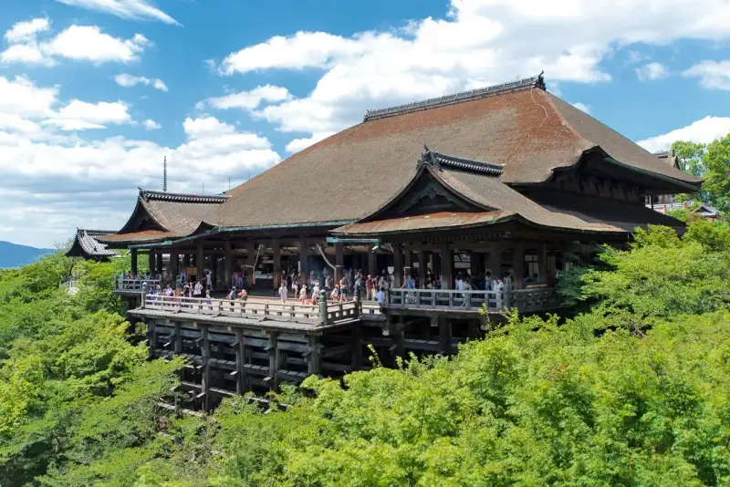
ようこそ。日本の美しき歴史と文化の旅へ。 音羽山清水寺:断崖に立つ祈りの舞台 京都の東山、音羽山の山腹に抱かれるようにして佇む清水寺。その朱塗りの仁王門をくぐり、緩やかな坂道を登り進めると、眼前に広がるのは、古都の街並みを一望する壮大なパノラマと、天空に突き出たかのような本堂の舞台です。 私たち現代人がこの地を訪れるとき、足元に広がるのは単なる観光地としての華やかさだけではありません。そこには、千二百年を超える歳月のなかで、幾度もの戦火と災厄を乗り越え、人々の「祈り」を物質化し続けてきた精神の記念碑がそびえ立っています。本稿では、北法相宗大本山であり、ユネスコ世界遺産にも登録されている���羽山清水寺の歴史的深淵、建築学的奇跡、そしてその根底に流れる観音信仰の哲学について、学術的かつ詩的な視点から深く紐解いていきたいと思います。第一章:清水寺の黎明――夢告と二人の先駆者が紡いだ創生神話 清水寺の起源は、奈良時代末期、光仁天皇の御代である宝亀9年(778年)にまで遡ります。それは、正史の行間に漂う霧のような、神秘的な夢告から始まりました。 大和国興福寺の高僧であり、子島寺(現在の奈良県高市郡高取町に位置する寺院)にて峻烈な修行を重ねていた賢心(のちの延鎮)は、ある夜、霊夢を見ます。「北へ向かい、清らかな水源を求めよ」という神仏の意志に導かれ、賢心は緑深い山城国愛宕郡八坂郷の東山、すなわち現在の音羽山へと足を踏み入れました。 山中を探索する賢心の眼に飛び込んできたのは、黄金色に輝きながら流れる一本の水脈でした。その神秘的な水源をたどって渓谷を遡上した彼は、音羽の滝のほとりで、白衣を身にまとった一人の老修行者と邂逅します。その名は行叡居士(ぎょうえいこじ)。齢二百歳を数えるというその老仙は、この深��山林に隠棲し、長年にわたって滝行を行い、千手観音への祈りを捧げ続けていたといいます。 行叡は賢心の姿を見るなり、静かに告げました。 「私はお前がこの地を訪れるのを、遥かなる歳月の間、待ち続けていた。いま、私は東国へと旅立つ。この神聖な草庵と、観音への祈りの跡を、お前に託したい」 そう言い残すと、行叡は忽然と姿を消してしまいました。賢心は、この不可思議な老行者こそが観世音菩薩の化身であったと悟ります。彼は行叡が残していった霊木を拾い上げ、そこに渾身の祈りを込めて千手観音像を刻み、行叡の旧庵に安置しました。これが、今日まで続く音羽山清水寺の、最も原初的な形態における産声であったのです。のちに、行叡が修行を重ねていたその清らかな水流は「音羽の滝」と呼ばれるようになり、霊験あらたかな名水として人々の信仰を集めることになります。 【清水寺創生の三柱】 元祖:行叡居士(観音の化身として霊地を護持した存在) 開山:延鎮(賢心。夢告に従い、霊木に観音像を刻んだ僧) 本願:坂上田村麻呂(自邸を寄進し、大伽藍の礎を築いた武人)それから二年後の宝亀11年(780年)、この霊山に運命的なもう一人の人物が現れます。のちに征夷大将軍として歴史にその名を刻む武人、坂上田村麻呂です。当時、田村麻呂は身重の妻である高子の病を癒やすため、その特効薬とされていた鹿の生き血を求めて音羽山へ狩猟に入り込んでいました。 山深くで鹿を狙う田村麻呂の前に現れたのは、ひたむきに修行を続ける僧・賢心でした。賢心は、無益な殺生がもたらす業(カルマ)の深さを優しく解き明かし、観音の慈悲の心を説きました。その教えに深く心を打たれた田村麻呂は、狩猟を止め、観世音菩薩に帰依することを誓います。彼は妻の平癒を祈るとともに、自らの私邸を解体して本堂として寄進しました。そして、音羽の滝の清らかな流レにちなんで、この寺を「清水寺」と命名したのです。 その後、征夷大将軍に任ぜられ、東国の蝦夷平定を命じられた田村麻呂は、出征に際して清水寺を参拝し、戦勝を祈願しました。戦地においては、にわかに現れた若武者と老僧(それぞれ観音の使者である毘沙門天と地蔵菩薩の化身とされる)の超自然的な加勢を得て��見事に平定を成し遂げ、無事に都へと凱旋することができたと伝えられています。延暦17年(798年)、田村麻呂は開山である延鎮(賢心から改名)と協力し、本堂を大規模に改築。本尊の脇侍として毘沙門天と地蔵菩薩の像を造立し、ともに祀りました。 このように、清水寺の創建には、出家者としての深い瞑想と、世俗の権力者としての武人の武勲、そして民衆の素朴な病平癒の願いが複雑に絡み合っています。この重層的な歴史こそが、清水寺を単なる山岳修行の場に留めず、日本を代表する一大霊場へと押し上げる原動力となったのです。第二章:千年の激動――南都北嶺の争いと、灰燼からの奇跡的な復活 延暦24年(805年)、太政官符によって坂上田村麻呂に寺地が正式に下賜され、さらに弘仁元年(810年)には嵯峨天皇の勅許を得て公認の寺院となりました。このとき、嵯峨天皇より「北観音寺」という栄えある寺号を賜っています。 平安時代中期に差し掛かると、清水寺の観音信仰は貴族から庶民に至るまで広く浸透していきました。清少納言は『枕草子』において、人の群れが押し寄せる「さわがしきもの」の代表例として清水観音の縁日を挙げており、紫式部の『源氏物語』「夕顔」の巻や、説話集である『今昔物語集』にも、清水観音へ熱心に参詣する人々の姿が活写されています。このように、当時から京都随一の霊地としてその名を轟かせていました。 しかし、その輝かしい歴史の裏側は、絶え間ない火災と紛争の歴史でもありました。清水寺は、平安時代から近世の寛永6年(1629年)の焼失に至るまで、記録に残っているだけで実に9回もの全焼・半焼を繰り返しています。 【清水寺・九度の罹災と再建の軌跡】 1. 康平6年(1063年) - 火災による焼失(『扶桑略記』等に記載) 2. 永万元年(1165年) - 延暦寺の僧兵による焼き討ち 〜中略〜 8. 文明元年(1469年) - 応仁の乱の兵火による全焼 9. 寛永6年(1629年) - 失火による焼失 → 寛永10年(1633年)徳川家光により再建清水寺は長年、奈良の法相宗大本山である興福寺(南都)の支配下にありました。平安時代中期からは真言宗を兼宗していましたが、その帰属関係ゆえに、京都の比叡山延暦寺(北嶺)との間に勃発した「南都北嶺」の果てしない抗争に巻き込まれることになります。永万元年(1165年)、延暦寺の僧兵たちが大挙して音羽山に乱入し、清水寺の伽藍は跡形もなく焼き払われました。 さらに時代が下り、文明元年(1469年)、京都全土を焦土と化した応仁の乱の兵火が清水寺を襲います。このときも、由緒ある諸堂はことごとく灰燼に帰しました。この絶望的な状況において、清水寺の再興に立ち上がったのが、時宗の勧進聖(かんじんひじり)であった願阿弥(がんあみ)です。 願阿弥は清水寺に入る以前から、各地で橋梁の架橋や寺院の修復、さらには貧困にあえぐ人々への救恤(社会福祉活動)に従事していた人物でした。彼は自らが率いる強力な勧進集団と、朝廷や幕府の有力者との間に築いた広範な人脈を駆使し、清水寺の再建資金を集めるための大規模な勧進活動を展開しました。願阿弥自身は、再興のすべてを見届けることなくこの世を去りましたが、彼の率いた集団は寺内に強固な地歩を築き、のちに「本願成就院(ほんがんじょうじゅいん)」として、近世における寺院運営の中核を担う組織へと発展していくことになります。 織豊��に入ると、天下人となった豊臣秀吉によって130石の寺領が安堵され、この特権は江戸幕府によっても継承されました。しかし、寛永6年(1629年)、またしても不慮の火災により主要な堂宇が焼失してしまいます。 現在、私たちが目にする壮麗な本堂をはじめとする諸堂の多くは、この寛永の火災の後、寛永10年(1633年)に、三代将軍徳川家光の莫大な寄進と全面的な支援によって再建されたものです。徳川幕府の強大な権力と財力が、幾度倒れても不屈の精神で立ち上がる清水寺の「不死鳥」のような歴史を、現代に伝える強固な木造建築として結晶させたのです。第三章:三職六坊の自治と、近代における「北法相宗」への独立 近世から近代にかけて、清水寺は「三職六坊(さんしきろくぼう)」と呼ばれる、極めて組織的かつ自律的な制度によって維持・運営されていました。 「三職」とは、寺院の最高の運営責任者たちを指 #japan #travel #history #culture #nature
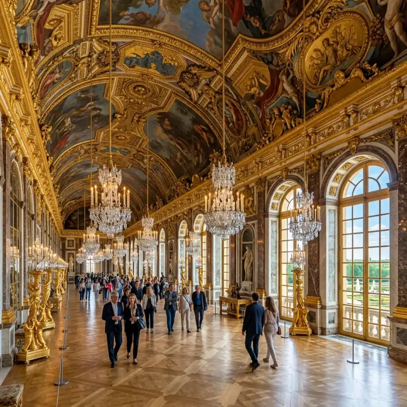
Bienvenue! Let us embark on an unforgettable #journey to the heart of #France. The Palace of Versailles (French: Château de Versailles) is a château and historic monument in Versailles in the Yvelines department of #France, southwest of #Paris. It served as the principal residence of the French kings Louis XIV, Louis XV, and Louis XVI. The king, the court, and the royal government lived there permanently from 6 May 1682 until 6 October 1789, except during the Regency years (1715–1723). Conceived by Louis XIV to glorify the French monarchy, the palace became the most important architectural project of his reign and is considered one of the masterpieces of French classical #architecture. It exerted major influence across Europe in the 18th and 19th centuries in architecture and the decorative arts. The palace forms a vast and complex ensemble of courtyards and buildings designed to maintain architectural harmony. It covers about 63,154 square metres and contains roughly 2,300 rooms, around 1,000 of which belong to the National Museum of the #history of France housed in the Palace and the Trianons. The park of the Palace of Versailles covers 815 hectares today, compared with more than 8,000 hectares before the French Revolution. Of this area, 93 hectares are formal gardens. The estate includes numerous features, such as the Petit Trianon and Grand Trianon—later used by Napoleon I, Louis XVIII, Charles X, Louis Philippe I, and Napoleon III—as well as the Hameau de la Reine, the Grand and Petit Canal, a former menagerie, the Orangerie, and the Pièce d'Eau des Suisses. As one of the most visited sites in Europe, the estate is central to ongoing discussions about managing overtourism. Location The Palace of Versailles is located in the north‑west part of the commune of Versailles, on the Place d’Armes, about 16 kilometres south‑west of Paris. The term “Palace of Versailles” refers both to the main palace building and its immediate surroundings, as well as to the entire Versailles estate, which includes — among other elements — the Grand Trianon, the Petit Trianon, the Grand Canal, and the palace park. History The site of Versailles is first mentioned in 1038 in a charter of the Abbey of Saint‑Père de Chartres. During the Middle Ages, the area consisted of small villages, farmland, and woodland. In the 16th century, the lands that would become Versailles were owned by the Gondi family, who were influential at the French court. Louis XIII acquired part of the land in 1623 and purchased the remainder in 1632. Before the later palace existed, Louis XIII built a modest brick‑and‑stone hunting lodge in 1623. The building consisted of a central block flanked by two wings and measured about 35 metres in length. Surrounded by marshland, it was sometimes mocked by contemporaries as the “chétif château” (“puny château”) or the “château de cartes” (“house of cards”) because of its red brick, white stone, and slate colours. The lodge included a small gallery, several rooms hung with tapestries, and a central salon that later became the location of Louis XIV’s bedchamber. In 1630, the château was the site of the political event known as the Day of the Dupes, during which Cardinal Richelieu regained the king’s favour. After the death of Louis XIII in 1643, the estate fell into neglect for nearly two decades. The lodge and its grounds were poorly maintained, and disputes arose among the estate’s staff. The captain of the hunt, Louis Lenormand de Beaumont, was assassinated in 1660, contributing to the disorder on the estate. Louis XIV began to take an interest in Versailles shortly after his marriage in 1660. He ordered the reorganization of the gardens, the dismissal of corrupt staff, and the repair of the buildings. His valet, Jérôme Blouin, was placed in charge of restoring order to the estate. These early improvements prepared the site for the larger construction campaigns that began in 1664. In 1623, Louis XIII, king of France, built a hunting lodge on a hill in a favourite hunting ground, 19 kilometres (12 mi) west of Paris, and 16 kilometres (10 mi) from his primary residence, the Château de Saint-Germain-en-Laye. The site, near a village called Versailles, was a wooded wetland that Louis XIII's court scorned as being generally unworthy of a king; one of his courtiers, François de Bassompierre, wrote that the lodge "would not inspire vanity in even the simplest gentleman". From 1631 to 1634, architect Philibert Le Roy replaced the lodge with a château for Louis XIII, who forbade his queen, Anne of Austria, from staying there overnight, even when an outbreak of smallpox at Saint-Germain-en-Laye in 1641 forced Louis XIII to relocate to Versailles with his three-year-old heir, the future Louis XIV. When Louis XIII died in 1643, Anne became Louis XIV's regent, and Louis XIII's château was abandoned for the next decade. She moved the court back to Paris, where Anne and her chief minister, Cardinal Mazarin, continued Louis XIII's unpopular monetary practices. This led to the Fronde, a series of revolts against royal authority from 1648 to 1653 that masked a struggle between Mazarin and the princes of the blood, Louis XIV's extended family, for influence over him. In the aftermath of the Fronde, Louis XIV became determined to rule alone. Following Mazarin's death in 1661, Louis XIV reformed his government to exclude his mother and the princes of the blood, moved the court back to Saint-Germain-en-Laye, and ordered the expansion of his father's château at Versailles into a palace. Louis XIV had hunted at Versailles in the 1650s, but did not take any special interest in Versailles until 1661. On 17 August 1661, Louis XIV was a guest at a sumptuous festival hosted by Nicolas Fouquet, the Superintendent of Finances, at his palatial residence, the Château de Vaux-le-Vicomte. Louis XIV was impressed by the château and its gardens, which were the work of Louis Le Vau, the court architect since 1654, André Le Nôtre, the royal gardener since 1657, and Charles Le Brun, a painter in royal service since 1647. Vaux-le-Vicomte's scale and opulence led him to imprison Fouquet that September, as he had also built an island fortress and a private army. But Louis XIV was also inspired by Vaux-le-Vicomte, and he recruited its authors for his own projects. Louis XIV replaced Fouquet with Jean-Baptiste Colbert, a protégé of Mazarin and enemy of Fouquet, and charged him with managing the corps of artisans in royal employment. Colbert acted as the intermediary between them and Louis XIV, who personally directed and inspected the planning and construction of Versailles. Construction Work at Versailles was at first concentrated on gardens, and through the 1660s, Le Vau only added two detached service wings and a forecourt to the château. But in 1668–69, as a response to the growth of the gardens, and the Treaty of Aix-la-Chapelle (1668), Louis XIV decided to turn Versailles into a full-scale royal residence. He vacillated between replacing or incorporating his father's château, but settled on the latter by the end of the decade, and from 1668 to 1671, Louis XIII's château was encased on three sides in a feature dubbed the enveloppe. This gave the château a new, Italianate façade overlooking the gardens, but preserved the courtyard façade, resulting in a mix of styles and materials that dismayed Louis XIV and that Colbert described as a "patchwork". Attempts to homogenize the two façades failed, and in 1670 Le Vau died, leaving the post of First Architect to the King vacant for the next seven years. Le Vau was succeeded at Versailles by his assistant, architect François d'Orbay. Work at the palace during the 1670s focused on its interiors, as the palace was then nearing completion, though d'Orbay expanded Le Vau's service wings and connected them to the château, and built a pair of pavilions for government employees in the forecourt. In 1670, d'Orbay was tasked by Louis XIV with designing a city, also called Versailles, to house and service Louis XIV's growing government and court. The granting of land to courtiers for the construction of townhouses that resembled the palace began in 1671. The next year, the Franco-Dutch War began and funding for Versailles was cut until 1674, when Louis XIV had work begun on the Ambassadors' Staircase, a grand staircase for the reception of guests, and demolished the last of the village of Versailles. Following the end of the Franco-Dutch War with French victory in 1678, Louis XIV appointed as First Architect Jules Hardouin-Mansart, an experienced architect in Louis XIV's confidence, who would benefit from a restored budget and large workforce of former soldiers. Mansart began his tenure with the addition from 1678 to 1681 of the Hall of Mirrors, a renovation of the courtyard façade of Louis XIII's château, and the expansion of d'Orbay's pavilions to create the Ministers' Wings in 1678–79. Adjacent to the palace, Hardouin-Mansart built a pair of stables called the Grande and Petite Écuries from 1679 to 1682 and the Grand Commun, which housed the palace's servants and general kitchens, from 1682 to 1684. Hardouin-Mansart also added two entirely new wings in Le Vau's Italianate style to house the court, first at the south end of the palace from 1679 to 1681 and then at its north end from 1685 to 1689. War and the resulting diminished funding slowed construction at Versailles for the rest of the 17th century. The Nine Years' War, which began in 1688, stopped work altogether until 1698. Three years later, however, the even more expensive War of the Spanish Succession began and, combined with poor harvests in 1693–94 and 1709–10, plunged France into crisis. Louis XIV thus slashed funding and cancelled some of the work Hardouin-Mansart had planned in the 1680s, such as the remodelling of the courtyard façade in the Italianate style. Louis XIV and Hardouin-Mansart focused on a permanent palace chapel, the construction of which lasted from 1699 to 1710. Louis XIV's successors, Louis XV and Louis XVI, largely left Versailles as they inherited it and focused on the palace's interiors. Louis XV's modifications began in the 1730s, with the completion of the Salon d'Hercule, a ballroom in the north wing, and the expansion of the king's private apartment, which required the demolition of the Ambassadors' Staircase. In 1748, Louis XV began construction of a palace theatre, the Royal Opera of Versailles at the northernmost end of the palace, but completion was delayed until 1770; construction was interrupted in the 1740s by the War of the Austrian Succession and then again in 1756 with the start of the Seven Years' War. These wars emptied the royal treasury and thereafter construction was mostly funded by Madame du Barry, Louis XV's favourite mistress. In 1771, Louis XV had the northern Ministers' Wing rebuilt in Neoclassical style by Ange-Jacques Gabriel, his court architect, as it was in the process of falling down. That work was also stopped by financial constraints, and it remained incomplete when Louis XV died in 1774. In 1784, Louis XVI briefly moved the royal family to the Château de Saint-Cloud ahead of more renovations to the Palace of Versailles, but construction could not begin because of financial difficulty and political crisis. In 1789, the French Revolution swept the royal family and government out of Versailles forever. Role in politics and #culture The Palace of Versailles was key to Louis XIV's politics, as an expression and concentration of French art and culture, and for the centralization of royal power. Louis XIV first used Versailles to promote himself with a series of nighttime festivals in its gardens in 1664, 1668, and 1674, the events of which were disseminated throughout Europe by print and engravings. As early as 1669, but especially from 1678, Louis XIV sought to make Versailles his seat of government, and he expanded the palace so as to fit the court within it. The moving of the court to Versailles did not come until 1682, however, and not officially, as opinion on Versailles was mixed among the nobility of France. By 1687, however, it was evident to all that Versailles was the de facto capital of France, and Louis XIV succeeded in attracting the nobility to Versailles to pursue prestige and royal patronage within a strict court etiquette, thus eroding their traditional provincial power bases. It was at the Palace of Versailles that Louis XIV received the Doge of Genoa, Francesco Maria Imperiale Lercari in 1685, an embassy from the Ayutthaya Kingdom in 1686, and an embassy from Safavid Iran in 1715. Louis XIV died at Versailles on 1 September 1715 and was succeeded by his five-year-old great-grandson, Louis XV, then the duke of Anjou, who was moved to the Château de Vincennes and then to Paris by Louis XV's regent, Philippe II, Duke of Orléans. Versailles was neglected until 1722, when Philippe II removed the court to Versailles to escape the unpopularity of his regency, and when Louis XV began his majority. The 1715 move, however, broke the cultural power of Versailles, and during the reign of Louis XVI, courtiers spent their leisure in Paris, not Versailles. During Christmas 1763, Mozart and his family visited Versailles and dined with the King. The 7-year-old Wolfgang Amadeus Mozart played several works during his stay and later dedicated his first two harpsichord sonatas, published in 1764 in Paris, to Madame Victoria, daughter of Louis XV. In 1783, the palace was the site of the signing of the last two of the three treaties of the Peace of Paris (1783), which ended the American Revolutionary War. On 3 September, British and American delegates, led by Benjamin Franklin, signed the Treaty of Paris at the Hôtel d'York (now 56 Rue Jacob) in Paris, granting the United States independence. On 4 September, Spain and France signed separate treaties with Britain at the Palace of Versailles, formally ending the war. The King and Queen learned of the Storming of the Bastille in Paris on 14 July 1789, while they were at the palace, and remained isolated there as the Revolution in Paris spread. The growing anger in Paris led to the Women's March on Versailles on 5 October 1789. A crowd of several thousand men and women, protesting the high price and scarcity of bread, marched from the markets of Paris to Versailles. They took weapons from the city armoury, besieged the palace, and compelled the King and royal family and the members of the National Constituent Assembly to return with them to Paris the following day. As soon as the royal family departed, the palace was closed. In 1792, the National Convention, the new revolutionary government, ordered the transfer of all the paintings and sculptures from the palace to the Louvre. In 1793, the Convention declared the abolition of the monarchy and ordered all of the royal property in the palace to be sold at auction. The auction took place between 25 August 1793 and 11 August 1794. The furnishings and art of the palace, including the furniture, mirrors, baths, and kitchen equipment, were sold in seventeen thousand lots. All fleurs-de-lys and royal emblems on the buildings were chambered or chiselled off. The empty buildings were turned into a storehouse for furnishings, art and libraries confiscated from the nobility. The empty grand apartments were opened for tours beginning in 1793, and a small museum of French paintings and art school was opened in some of the empty rooms. By virtue of an order issued by the Versailles district directorate in August 1794, the Royal Gate was destroyed, the Cour Royale was cleared and the Cour de Marbre lost its precious floor. 19th century – history museum and government venue When Napoleon became Emperor of the French in 1804, he considered making Versailles his residence but abandoned the idea because of the cost of the renovation. Prior to his marriage with Marie-Louise in 1810, he had the Grand Trianon restored and refurnished as a springtime residence for himself and his family, in the style of furnishing that it is seen today. In 1815, with the final downfall of Napoleon, Louis XVIII, the younger brother of Louis XVI, became king, and considered returning the royal residence to Versailles, where he had been born. He ordered the restoration of the royal apartments, but the task and cost was too great. Louis XVIII had the far end of the south wing of the Cour Royale demolished and rebuilt (1814–1824) to match the Gabriel wing of 1780 opposite, which gave greater uniformity of appearance to the front entrance. Neither he nor his successor Charles X lived at Versailles. The French Revolution of 1830 brought a new monarch, Louis Philippe I to power, and a new ambition for Versailles. He did not reside at Versailles but began the creation of the Museum of the History of France, dedicated to "all the glories of France", which had been used to house some members of the royal family. The museum was begun in 1833 and inaugurated on 30 June 1837. Its most famous room is the Galerie des Batailles (Hall of Battles), which lies on most of the length of the second floor of the south wing. The museum project largely came to a halt when Louis Philippe was overthrown in 1848, though the paintings of French heroes and great battles still remain in the south wing. Emperor Napoleon III used the palace on occasion as a stage for grand ceremonies. One of the most lavish was the banquet that he hosted for Queen Victoria in the Royal Opera of Versailles on 25 August 1855. During the Franco-Prussian War of 1870–1871, the palace was occupied by the general staff of the victorious German Army. Parts of the château, including the Hall of Mirrors, were turned into a military hospital. The creation of the German #empire, combining Prussia and the surrounding German states under Wilhelm I, was formally proclaimed in the Hall of Mirrors on 18 January 1871. The Germans remained in the palace until the signing of the armistice in March 1871. In that month, the government of the new French Third Republic, which had departed Paris during the war for Tours and then Bordeaux, moved into the palace. The National Assembly held its meetings in the Opera House. The uprising of the Paris Commune in March 1871, prevented the French government, under Adolphe Thiers, from returning immediately to Paris. The military operation which suppressed the Commune at the end of May was directed from Versailles, and the prisoners of the Commune were marched there and put on trial in military courts. In 1875 a second parliamentary body, the French Senate, was created and held its meetings for the election of a President of the Republic in a new hall created in 1876 in the south wing of the palace. The French Senate and National Assembly continue to meet in the palace in joint session on special occasions, such as the amendment of the Constitution of France. 20th century The end of the 19th and the early 20th century saw the beginning of restoration efforts at the palace, first led by Pierre de Nolhac, poet and scholar and the first conservator, who began his work in 1892. The conservation and restoration were interrupted by two world wars but have continued until the present day. The palace returned to the world stage in June 1919, when, after six months of negotiations, the Treaty of Versailles, formally ending the First World War, was signed in the Hall of Mirrors. Between 1925 and 1928, the American philanthropist and multi-millionaire John D. Rockefeller, Jr. gave $2,166,000, the equivalent of about 38 million dollars in 2024, to restore and refurbish the palace. More work took place after World War II, with the restoration of the Royal Opera of Versailles. The theatre was reopened in 1957, in the presence of Queen Elizabeth II of the United Kingdom. In 1978, parts of the palace were heavily damaged in a bombing committed by Breton terrorists. Starting in the 1950s, when the museum of Versailles was under the directorship of Gérald van der Kemp, the objective was to restore the palace to its state – or as close to it as possible – in 1789 when the royal family left the palace. Among the early projects was the repair of the roof over the Hall of Mirrors; the publicity campaign brought international attention to the plight of post-war Versailles and garnered much foreign money including a grant from the Rockefeller Foundation. One of the more costly endeavours for the museum and the French Fifth Republic has been to repurchase as much of the original furnishings as possible. Consequently, because furniture with a royal provenance – and especially furniture that was made for Versailles – is a highly sought-after commodity on the international market, the museum has spent considerable funds on retrieving much of the palace's original furnishings. 21st century The Palace of Versailles is currently owned by the French state. Its formal title is the Public Establishment of the Palace, Museum and National Estate of Versailles. Since 1995, it has been run as a Public Establishment, with an independent administration and management supervised by the French Ministry of Culture. Several restoration activities were initiated during the 2000s. In 2003, a new restoration initiative – the "Grand Versailles" project – was started, which began with the replanting of the gardens, which had lost over 10,000 trees during Cyclone Lothar on 26 December 1999. One part of the initiative, the restoration of the Hall of Mirrors, was completed in 2006. Another major project, the further restoration of the backstage areas of the Royal Opera of Versailles, occurred from 2007 to 2009. The palace and its grounds continue to be the site of several events in the 2020s. During the 2024 Summer Olympics, the palace's grounds hosted the equestrian and modern pentathlon competitions. In 2026, American singer-songwriter Olivia Rodrigo filmed the music video of her single "Drop Dead" in and around the palace, which is referenced in the song's lyrics. Months later, on 17 June 2026, U.S. President Donald Trump signed the Islamabad Memorandum – the memorandum of understanding to end the 2026 Iran war – during his dinner at the palace with French President Emmanuel Macron, which was held after the G7 summit in Évian-les-Bains. His Iranian counterpart, President Masoud Pezeshkian also remotely signed the document in Tehran. Architecture and plan The Palace of Versailles is a visual history of French architecture from the 1630s to the 1780s. Its earliest portion, the corps de logis, was built for Louis XIII in the style of his reign with brick, marble, and slate, which Le Vau surrounded in the 1660s with Enveloppe, an edifice that was inspired by Renaissance-era Italian villas. When Jules Hardouin-Mansart made further expansions to the palace in the 1680s, he used the Enveloppe as the model for his work. Neoclassical additions were made to the palace with the remodelling of the Ministers' Wings in the 1770s, by Ange-Jacques Gabriel, and after the Bourbon Restoration. The palace was largely completed by the death of Louis XIV in 1715. The eastern facing palace has a U-shaped layout, with the corps de logis and symmetrical advancing secondary wings terminating with the Dufour Pavilion on the south and the Gabriel Pavilion to the north, creating an expansive cour d'honneur known as the Royal Court (Cour Royale). Flanking the Royal Court are two enormous asymmetrical wings that result in a façade of 402 metres (1,319 ft) in length. Covered by around 10 hectares (1.1 million square feet) of roof, the palace has 2,143 windows, 1,252 chimneys, and 67 staircases. The palace and its grounds have had a great influence on architecture and horticulture from the mid-17th century to the end of the 18th century. Examples of works influenced by Versailles include Christopher Wren's work at Hampton Court Palace, Berlin Palace, the Palace of La Granja, Stockholm Palace, Ludwigsburg Palace, Karlsruhe Palace, Rastatt Palace, Nymphenburg Palace, Schleissheim Palace, and Esterházy Palace. Royal Apartments The construction in 1668–1671 of Louis Le Vau's enveloppe around the outside of Louis XIII's red brick and white stone château added state apartments for the king and the queen. The addition was known at the time as the château neuf (new château). The grands appartements (Grand Apartments, also referred to as the State Apartments) include the grand appartement du roi and the grand appartement de la reine. They occupied the main or principal floor of the château neuf, with three rooms in each apartment facing the garden to the west and four facing the garden parterres to the north and south, respectively. The private apartments of the king (the appartement du roi and the petit appartement du roi) and those of the queen (the petit appartement de la reine) remained in the château vieux (old château). Le Vau's design for the state apartments closely followed Italian models of the day, including the placement of the apartments on the main floor (the piano nobile, the next floor up from the ground level), a convention the architect borrowed from Italian palace design. The king's State Apartment consisted of an enfilade of seven rooms, each dedicated to one of the known planets and their associated titular Roman deity. The queen's apartment formed a parallel enfilade with that of the grand appartement du roi. After the addition of the Hall of Mirrors (1678–1684) the king's apartment was reduced to five rooms (until the reign of Louis XV, when two more rooms were added) and the queen's to four. The queen's apartments served as the residence of three queens of France – Maria Theresa of Spain, wife of Louis XIV, Maria Leszczyńska, wife of Louis XV, and Marie Antoinette, wife of Louis XVI. Additionally, Louis XIV's granddaughter-in-law, Princess Marie-Adélaïde of Savoy, duchess of Burgundy, wife of Louis, Duke of Burgundy, occupied these rooms from 1697 (the year of her marriage) to her death in 1712. Ambassador's Staircase The Ambassadors' Staircase (Escalier des Ambassadeurs) was an imperial staircase built from 1674 to 1680 by François d'Orbay. Until Louis XV had it demolished in 1752 to create a courtyard for his private apartments, the staircase was the primary entrance into the Palace of Versailles and the royal apartments especially. It was entered from the courtyard via a vestibule that, cramped and dark, contrasted greatly with the tall, open space of the staircase – famously lit naturally with a skylight – so as to overawe visitors. The staircase and walls of the room that contained it were clad in polychrome marble and gilded bronze, with decor in the Ionic order. Charles Le Brun painted the walls and ceiling of the room according to a festive theme to celebrate Louis XIV's victory in the Franco-Dutch War. On the wall immediately above the staircase were trompe-l'œil paintings of people from the Four Parts of the World looking into the staircase over a balustrade, a motif repeated on the ceiling fresco. There they were joined by allegorical figures for the twelve months of the year and various Classical Greek figures such as the Muses. A marble bust of Louis XIV, sculpted by Jean Warin in 1665–66, was placed in a niche above the first landing of the staircase. The State Apartments of the King The construction of the Hall of Mirrors between 1678 and 1686 coincided with a major alteration to the State Apartments. They were originally intended as his residence, but the King transformed them into galleries for his finest paintings, and venues for his many receptions for courtiers. During the season from All-Saints Day in November until Easter, these were usually held three times a week, from six to ten in the evening, with various entertainments. =### The Salon of Hercules= This was originally a chapel. It was rebuilt beginning in 1712 under the supervision of the First Architect to the King, Robert de Cotte, to showcase two paintings by Paolo Veronese, Eleazar and Rebecca and Meal at the House of Simon the Pharisee, which was a gift to Louis XIV from the Republic of Venice in 1664. The painting on the ceiling, The Apotheosis of Hercules, by François Lemoyne, was completed in 1736, and gave the room its name. =### The Salon of Abundance= The Salon of Abundance was the antechamber to the Cabinet of Curios (now the Games Room), which displayed Louis XIV's collection of precious jewels and rare objects. Some of the objects in the collection are depicted in René-Antoine Houasse's painting Abundance and Liberality (1683), located on the ceiling over the door opposite the windows. =### The Salon of Venus= This salon was used for serving light meals during evening receptions. The principal feature in this room is Jean Warin's life-size statue of Louis XIV in the costume of a Roman emperor. On the ceiling in a gilded oval frame is another painting by Houasse, Venus subjugating the Gods and Powers (1672–1681). Trompe-l'œil paintings and sculpture around the ceiling illustrate mythological themes. =### The Salon of Mercury= The Salon of Mercury was the original State Bedchamber when Louis XIV officially moved the court and government to the palace in 1682. The bed is a replica of the original commissioned by King Louis Philippe I in the 19th century when he turned the palace into a museum. The ceiling paintings by the Flemish artist Jean Baptiste de Champaigne depict the god Mercury in his chariot, drawn by a rooster, and Alexander the Great and Ptolemy surrounded by scholars and philosophers. The Automaton Clock was made for the King by the royal clockmaker Antoine Morand in 1706. When it chimes the hour, figures of Louis XIV and Fame descend from a cloud. =### The Salon of Mars= The Salon of Mars was used by the royal guards until 1782, and was decorated on a military theme with helmets and trophies. It was turned into a concert room between 1684 and 1750, with galleries for musicians on either side. Portraits of Louis XV and his Queen, Marie Leszczyńska, by the Flemish artist Carle Van Loo decorate the room today. =### The Salon of Apollo= The Salon of Apollo was the royal throne room under Louis XIV, and was the setting for formal audiences. The eight-foot-high silver throne was melted down in 1689 to help pay the costs of an expensive war, and was replaced by a more modest throne of gilded wood. The central painting on the ceiling, by Charles de la Fosse, depicts the Sun Chariot of Apollo, the King's favourite emblem, pulled by four horses and surrounded by the four seasons. =### The Salon of Diana= The Salon of Diana was used by Louis XIV as a billiards room, and had galleries from which courtiers could watch him play. The decoration of the walls and ceiling depicts scenes from the life of the goddess Diana. The celebrated bust of Louis XIV by Bernini made during the famous sculptor's visit to France in 1665 is on display here. Private apartments of the King and Queen =### Private apartments of the King= The apartments of the King were the heart of the château; they were in the same location as the rooms of Louis XIII, the creator of the château, on the first floor (second floor US style). They were set aside for the personal use of Louis XIV in 1683. He and his successors Louis XV and Louis XVI used these rooms for official functions, such as the ceremonial lever ("waking up") and the coucher ("going to bed") of the monarch, which was attended by a crowd of courtiers. The King's apartment was accessed from the Hall of Mirrors from the Oeil de Boeuf antechamber or from the Guardroom and the Grand Couvert, the ceremonial room where Louis XIV often took his evening meals, seated alone at a table in front of the fireplace. His spoon, fork, and knife were brought to him in a golden box. The courtiers could watch as he dined. The King's bedchamber had originally been a Drawing Room before Louis XIV transformed it into his own bedroom in 1701. He died there on 1 September 1715. Both Louis XV and Louis XVI continued to use the bedroom for their official awakening and going to bed. On 6 October 1789, from the balcony of this room Louis XVI and Marie-Antoinette, joined by the Marquis de Lafayette, looked down on the hostile crowd in the courtyard, shortly before the King was forced to return to Paris. The bed of the King is placed beneath a carved relief by Nicolas Coustou entitled France watching over the sleeping King. The decoration includes several paintings set into the panelling, including a self-portrait of Antony van Dyck. =### Private apartments of The Queen= The petit appartement de la reine is a suite of rooms that were reserved for the personal use of the queen. Originally arranged for the use of the Maria Theresa of Spain, consort of Louis XIV, the rooms were later modified for use by Marie Leszczyńska and finally for Marie Antoinette. The Queen's apartments and the King's Apartments were laid out on the same design, each suite having seven rooms. Both suites had ceilings painted with scenes from mythology; the King's ceilings featured male figures, the Queen's featured females. Hall of Mirrors The Hall of Mirrors is a long gallery at the westernmost part of the palace that looks out onto the gardens. The hall was built from 1678 to 1681 on the site of a terrace Le Vau built between the king and queen's suites. The hall is clad in marble and decorated in a modified version of the Corinthian order, with 578 mirrors facing 17 windows and reflecting the light provided by them. The ceiling fresco, painted by Le Brun over the next four years, embellishes the first 18 years of Louis XIV's reign in 30 scenes, 17 of which are military victories over the Dutch. The fresco depicts Louis XIV himself alongside Classical figures in the scenes celebrating moments in his reign such as the beginning of personal rule in 1661, breaking from earlier frescoes at Versailles that used allegories derived from Classical and mythological scenes. The Salon of War and the Salon of Peace bookend the Hall of Mirrors on its northern and southern ends respectively. The Salon of War, constructed and decorated from 1678 to 1686, celebrates French victories in the Franco-Dutch War with marble panels, gilded bronze trophies of arms, and a stucco bas-relief of Louis XIV on horseback riding over his enemies. The Salon of Peace is decorated in the same fashion but according to its eponymous theme. Royal Chapel The Royal Chapel of Versailles is located at the southern end of the north wing. The building stands 40-metre (130 ft) high, and measures 42 metres (138 ft) long and 24 metres (79 ft) wide. The chapel is rectangular with a semicircular apse, combining traditional, #gothic royal French church architecture with the French Baroque style of Versailles. The ceiling of the chapel is constituted by an unbroken vault, divided into three frescos by Antoine Coypel, Charles de La Fosse, and Jean Jouvenet. The palette of motifs beneath the frescoes glorify the deeds of Louis IX, and include images of David, Constantine, Charlemagne, and Louis IX, fleur de lis, and Louis XIV's monogram. The organ of the chapel was built by Robert Clicquot and Julien Tribuot in 1709–1710. Louis XIV commissioned the chapel, its sixth, from Hardouin-Mansart and Le Brun in 1683–84. It was the last building constructed at Versailles during Louis XIV's reign. Construction was delayed until 1699, however, and it was not completed until 1710. The only major modification to the chapel since its completion was the removal of a lantern from its roof in 1765. A full restoration of the chapel began in late 2017 and lasted into early 2021. Royal Opera The Royal Opera of Versailles was originally commissioned by Louis XIV in 1682 and was to be built at the end of the North Wing with a design by Hardouin-Mansart and Carlo Vigarani. However, due to the expense of the King's continental wars, the project was put aside. The idea was revived by Louis XV with a new design by Ange-Jacques Gabriel in 1748, but this was also temporarily put aside. The project was revived and rushed ahead for the planned celebration of the marriage of the Dauphin, the future Louis XVI, and Marie Antoinette. For economy and speed, the new opera was built almost entirely of wood, which also gave it very high quality acoustics. The wood was painted to resemble marble, and the ceiling was decorated with a painting of the Apollo, the god of the arts, preparing crowns for illustrious artists, by Louis Jean-Jacques Durameau. The sculptor Augustin Pajou added statuary and reliefs to complete the decoration. The new Opera was inaugurated on 16 May 1770, as part of the celebration of the royal wedding. In October 1789, early in the French Revolution, the last banquet for the royal guardsmen was hosted by the King in the opera, before he departed for Paris. Following the Franco-German War in 1871 and then the Paris Commune until 1875, the French National Assembly met in the opera, until the proclamation of the French Third Republic and the return of the government to Paris. Museum of the History of France Shortly after becoming king in 1830, Louis Philippe I decided to transform the palace into a museum devoted to "All the Glories of France," with paintings and sculpture depicting famous French victories and heroes. Most of the apartments of the palace were entirely demolished (in the main building, practically all of the apartments were annihilated, with only the apartments of the king and queen remaining almost intact), and turned into a series of several large rooms and galleries: the Coronation Room (whose original volume was left untouched by Louis-Philippe), which displays the celebrated painting of the coronation of Napoleon I by Jacques-Louis David; the Hall of Battles; commemorating French victories with large-scale paintings; and the 1830 room, which celebrated Louis-Philippe's own coming to power in the French Revolution of 1830. Some paintings were brought from the Louvre, including works depicting events in French history by Philippe de Champaigne, Pierre Mignard, Laurent de La Hyre, Charles Le Brun, Adam Frans van der Meulen, Nicolas de Largillière, Hyacinthe Rigaud, Jean-Antoine Houdon, Jean-Marc Nattier, Élisabeth Vigée Le Brun, Hubert Robert, Thomas Lawrence, Jacques-Louis David, and Antoine-Jean Gros. Others were commissioned especially for the museum by prominent artists of the early 19th century, including Eugène Delacroix, who painted Saint Louis at the French victory over the British in the Battle of Taillebourg in 1242. Other painters featured include Horace Vernet and François Gérard. A monumental painting by Vernet features Louis Philippe himself, with his sons, posing in front of the gates of the palace. The overthrow of Louis Philippe in 1848 put an end to his grand plans for the museum, but the Gallery of Battles is still as it was, and is passed through by many visitors to the royal apartments and grand salons. Another set of rooms on the first floor has been made into galleries on Louis XIV and his court, displaying furniture, paintings, and sculptures. In recent years, eleven rooms on the ground floor between the Chapel and the Opera have been turned into a history of the palace, with audiovisual displays and models. Estate of Versailles The estate of Versailles consists of the palace, the subsidiary buildings around it, and its park and gardens. As of June 2021, the estate altogether covers an area of 800 hectares (8.0 km2; 2,000 acres), with the park and gardens laid out to the south, west, and north of the palace. The palace is approached from the east by the Avenue de Paris, measuring 27 kilometres (17 mi) from Paris to a gate between the Grande and Petite Écuries. Beyond these stables is the Place d'Armes, where the Avenue de Paris meets the Avenue de Sceaux and Avenue de Saint-Cloud (see map), the three roads that formed the main arteries of the city of Versailles. Exactly where the three roads meet is a gate leading into the cour d'honneur, hemmed in by the Ministers' Wings. Beyond is the Royal Gate and the main palace, which wraps around the Royal and finally Marble Courts. The estate was established by Louis XIII as a hunting retreat, with a park just to the west of his château. From 1661, Louis XIV expanded the estate until, at its greatest extent, the estate was made up by the Grand Parc, a hunting ground of 15,000 hectares (150 km2; 37,000 acres), and the gardens, called the Petit Parc, which covered 1,700 hectares (17 km2; 4,200 acres). A 40-kilometre-long (25 mi), 3-metre-high (10 ft) wall with 24 gateways enclosed the estate. The landscape of the estate had to be created from the bog that surrounded Louis XIII's château using landscape architecture usually employed in fortress building. The approach to the palace and the gardens were carefully laid out via the moving of earth and construction of terraces. The water from the marsh was marshalled into a series of lakes and ponds around Versailles, but these reservoirs were not sufficient for the palace, city, or gardens. Great lengths were taken to supply Versailles with water, such as the damming of the river Bièvre to create an inflow in the 1660s, the construction of an enormous pumping station at the river Seine near Marly-le-Roi in 1681, and an attempt to divert water from the river Eure with a canal in the later 1680s. Gardens The gardens of Versailles, as they have existed since the reign of Louis XIV, are the work of André Le Nôtre. Le Nôtre's gardens were preceded by a simple garden laid out in the 1630s by landscape architects Jacques Boyceau and Jacques de Nemours, which he rearranged along an east–west axis that, because of Louis XIV's land purchases and the clearing of woodland, were expanded literally as far as could be seen. The resulting gardens were a collaboration between Le Nôtre, Le Brun, Colbert, and Louis XIV, marked by rigid order, discipline, and open space, with axial paths, flowerbeds, hedges, and ponds and lakes as motifs. They became the epitome of the French formal garden style, and have been very influential and widely imitated or reproduced. Subsidiary structures The first of the subsidiary structures of the Palace of Versailles was the Versailles Menagerie, built by Le Vau between the years 1662 and 1664, at the southern end of the Grand Canal. The apartments, overlooking the pens, were renovated by Hardouin-Mansart from 1698 to 1700, but the Menagerie fell into disuse in 1712. After a long period of decay, it was demolished in 1801. The Versailles Orangery, just to the south of the palace, was first built by Le Vau in 1663, originally as part of the general moving of earth to create the Estate. It was also modified by Mansart, who, from 1681 to 1685, totally rebuilt it and doubled its size. In late 1679, Louis XIV commissioned Mansart to build the Château de Marly, a retreat at the edge of Versailles's estate, about 8.0 kilometres (5 mi) from the palace. The château consisted of a primary residential building and twelve pavilions, in Palladian style placed in two rows on either side of the main building. Construction was completed in 1686, when Louis XIV spent his first night there. The château was nationalized and sold in 1799, and subsequently demolished and replaced with industrial buildings. These were themselves demolished in 1805, and then in 1811 the estate was purchased by Napoleon. On 1 June 2009, the grounds of the Château de Marly were ceded to the Public Establishment of the Palace, Museum and National Estate of Versailles. La Lanterne, is a hunting lodge named after the lantern that topped the nearby Menagerie that was built in 1787 by Philippe Louis de Noailles, then the palace governor. It has since 1960 been a state residence. The Grand Trianon In 1668, Louis XIV purchased and demolished the hamlet of Trianon, near the northern tip of the Grand Canal, and in its place, he commissioned Le Vau to construct a retreat from court, remembered as the Porcelain Trianon. Designed and built by Le Vau in 1670, it was the first example of Chinoiserie (faux Chinese) architecture in Europe, though it was largely designed in French style. The roof was clad not with porcelain but with delftware, and was thus prone to leaks, so in 1687 Louis XIV ordered it demolished. Nevertheless, the Porcelain Trianon was itself influential and copycats were built across Europe. To replace the Porcelain Trianon, Louis XIV tasked Hardouin-Mansart with the construction in 1687 of the Grand Trianon, built from marble in three months. The Grand Trianon has a single story, except for its attached service wing, which was modified by Hardouin-Mansart in 1705–06. The east façade has a courtyard while the west faces the gardens of the Grand Trianon, and between them a peristyle. The interiors are mostly original, and housed Louis XIV, the Madame de Maintenon, Marie Leszczyńska, and Napoleon, who ordered restorations to the building. Under Charles de Gaulle, the north wing of the Grand Trianon became a residence of the President of France. Petit Trianon The Petit Trianon, whose construction from 1762 to 1768 led to the advent of the names "Grand" and "Petit Trianon", was constructed for Louis XV and the Madame du Barry in the Neoclassical style by Gabriel. The building has a piano nobile, basement, and attic, with five windows on each floor. On becoming king, Louis XVI gave the Petit Trianon to Marie Antoinette, who remodeled it, relaid its gardens in the then-current English and Oriental styles, and formed her own court there. The Queen's hamlet and Theatre Near the Trianons are the French pavilion, built by Gabriel in 1750 between the two residences, and the Queen's Theatre and Queen's Hamlet, built by architect Richard Mique in 1780 and from 1783 to 1785 respectively. These were both built at the behest of Marie Antoinette; the theatre, hidden in the gardens, indulged her appreciation of opera and is absolutely original, and the hamlet to extend her gardens with rustic amenities. The building scheme of the Queen's Hamlet includes a farmhouse (the farm was to produce milk and eggs for the queen), a dairy, a dovecote, a boudoir, a barn that burned down during the French Revolution, a mill and a tower in the form of a lighthouse. Modern political and ceremonial functions The palace still serves political functions. Heads of state are regaled in the Hall of Mirrors; the bicameral French Parliament—consisting of the Senate (Sénat) and the National Assembly (Assemblée nationale)—meet in joint session (a congress of the French Parliament) in Versailles to revise or otherwise amend the French Constitution, a tradition that came into effect with the promulgation of the 1875 Constitution. For example, the Parliament met in joint session at Versailles to pass constitutional amendments in June 1999 (for domestic applicability of International Criminal Court decisions and for gender equality in candidate lists), in January 2000 (ratifying the Treaty of Amsterdam), in March 2003 (specifying the "decentralized organization" of the French Republic), and in March 2024 (to enshrine the freedom of women to have recourse to abortion). In 2009, President Nicolas Sarkozy addressed the Great Recession before a congress in Versailles, the first time that this had been done since 1848, when Louis Napoleon Bonaparte gave an address before the French Second Republic. Following the November 2015 Paris attacks, President François Hollande gave a speech before a rare joint session of parliament at the Palace of Versailles. This was the third time since 1848 that a French president addressed a joint session of the French Parliament at Versailles. The president of the National Assembly has an official apartment at the Palace of Versailles. In 2023 a state visit by Charles III to France included a state banquet at the Palace. Citations References Web sources "Histoire de Versailles" (in French). City of Versailles. Archived from the original on 15 August 2022. Retrieved 16 June 2021. "Palace and Park of Versailles". #UNESCO. Retrieved 21 June 2021. =### French Ministry of Culture= #france #travel #history #europe #culture Related InsightsYellowstone: The Fiery Heart of the American West Im Bann der Gezeiten: Wenn Stein und Meer den Mont Saint-Michel umarmen Калининград и Куршская коса{ "@context": "https://schema.org", "@type": "FAQPage", "mainEntity": [ { "@type": "Question", "name": "What is the main focus of The Grandeur of Versailles: Palace of the Sun King?", "acceptedAnswer": { "@type": "Answer", "text": "Join Camille Dubois on a journey exploring The Grandeur of Versailles and its incredible history." } }, { "@type": "Question", "name": "Who authored the comprehensive guide on The Grandeur of Versailles: Palace of the Sun King?", "acceptedAnswer": { "@type": "Answer", "text": "This detailed article and its insights were carefully researched and authored by Camille Dubois." } }, { "@type": "Question", "name": "Where can I find more related content about Travel?", "acceptedAnswer": { "@type": "Answer", "text": "You can explore more articles, detailed reviews, and similar insights by browsing the Related Insights section at the bottom of this article or visiting our dedicated Travel category page." } } ] }
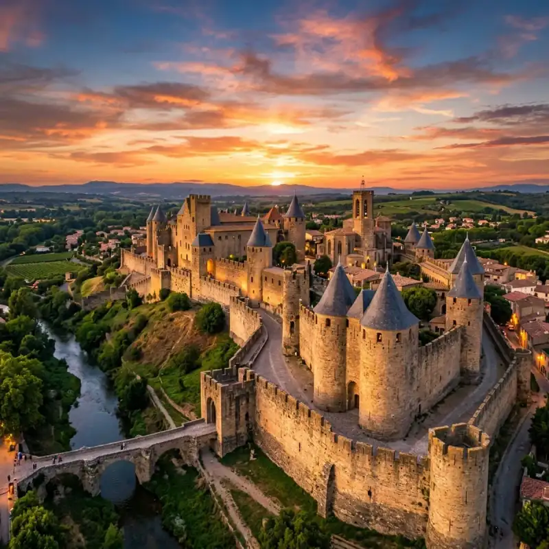
Bem-vindo! Prepare-se para uma #viagem inesquecível pelo coração de #Portugal. Algarve: As Praias Douradas e o Passado Marítimo – Um Chamado Irresistível do Sul de #Portugal Ah, o Algarve! Pronunciar este nome é conjurar um universo de luz, de cores vibrantes e de uma história que ecoa em cada falésia dourada, em cada recanto de calçada, em cada onda que beija a costa. Como vosso Tiago Silva, aventureiro e contador de histórias de viagens, convido-vos hoje a uma imersão profunda nesta região que é muito mais do que um mero destino de férias. É um tesouro nacional, uma tela viva onde a natureza esculpiu paisagens de tirar o fôlego e onde o homem teceu uma tapeçaria cultural de uma riqueza inigualável. Preparem-se para uma #viagem que transcende o postal ilustrado, mergulhando na alma de um Algarve que vibra entre o dourado das suas praias e o murmúrio do seu passado marítimo. O Coração Pulsante do Sul: Geologia, Geografia e Demografia Situado no extremo sul de Portugal, o Algarve não é apenas uma região; é um estado de espírito, uma promessa de sol e de mar que se estende por quase cinco mil quilómetros quadrados de uma beleza ímpar (precisamente 4.997 km²). Esta sub-região portuguesa, formalmente instituída através da Lei n.º 75/2013, que aprovou a reforma administrativa na Assembleia da República, estabelecendo o seu território como Comunidade Intermunicipal do Algarve, é um universo em si mesmo, composto por 16 municípios e 67 freguesias, cada qual com a sua identidade e os seus encantos. Faro, a cidade administrativa, é o seu epicentro, um farol de cultura e história que nos acolhe com a sua Ria Formosa e o seu labirinto de ruas antigas. Imaginem um território que abraça o Atlântico a sul e a oeste, onde as correntes e os ventos esculpiram uma linha costeira de uma diversidade assombrosa, desde as praias selvagens do barlavento até às lagoas tranquilas do sotavento. A norte, o Algarve encontra o seu limite com a vasta e serena região do Alentejo, um contraste de paisagens que nos lembra a rica diversidade do nosso país. A leste, a fronteira é partilhada com a vibrante e histórica Andaluzia espanhola, uma proximidade que, ao longo dos séculos, moldou intercâmbios culturais e comerciais, deixando marcas indeléveis na sua identidade. É, em suma, uma região privilegiada, estrategicamente posicionada na encruzilhada de culturas e paisagens. Com uma população que, em 2024, atinge os 492.747 habitantes, e uma densidade populacional de 96 habitantes por km², o Algarve é um mosaico de gentes. Não é apenas o número que impressiona, mas a vitalidade e a diversidade que este número representa. É uma região em constante crescimento e transformação, um polo de atração que se reflete na sua economia vibrante. Em 2024, o Algarve registou um Produto Interno Bruto de cerca de 14 milhões de euros, posicionando-se orgulhosamente em 6.º lugar entre as regiões portuguesas e contribuindo com cerca de 4% para a economia nacional. Mais impressionante ainda é o seu Produto Interno Bruto per capita, que atingiu os 29.302 euros, colocando-o em 2.º lugar entre as 9 regiões portuguesas. Estes números não são meras estatísticas; são o testemunho de uma região próspera, dinâmica e com um elevado potencial de desenvolvimento, um motor económico impulsionado pela sua beleza natural, pelo seu património e, claro, pela hospitalidade da sua gente. Esta pujança económica e social é monitorizada e desenvolvida pela Comissão de Coordenação e Desenvolvimento Regional do Algarve (CCDR-ALG), cujo estatuto é regulado pelo Decreto-Lei n.º 36/2023, garantindo um planeamento estratégico e sustentável para o futuro. Um Mosaico de Mundos: Os 16 Municípios e a Alma Multicultral Percorrer o Algarve é como folhear um livro de contos, onde cada capítulo nos revela uma nova faceta, uma nova emoção. Os seus 16 municípios são os protagonistas desta narrativa, cada um com a sua voz e a sua identidade inconfundível. Deixem-me levá-los numa breve viagem por este mapa de sonhos:Albufeira: O coração pulsante da vida noturna e das praias animadas, um caldeirão de energia e alegria. Alcoutim: Um recanto sereno e histórico no interior, onde o rio Guadiana é a alma da paisagem e o passado se faz presente em cada pedra. Aljezur: O guardião de uma costa selvagem e indomável, onde as falésias desafiam o Atlântico e as praias são santuários de surfistas e amantes da #nature em estado puro. Castro Marim: Com o seu imponente castelo e as suas salinas, testemunha silenciosa de séculos de história e de um legado mourisco profundo. Faro: A capital, a cidade administrativa, um portal para a Ria Formosa e um labirinto de ruas que ecoam histórias de navegadores e poetas. Lagoa: Famosa pelas suas praias de beleza singular, como a Praia da Marinha, e pelas suas grutas marinhas que nos fazem sonhar. Lagos: Uma cidade com uma rica herança marítima, de onde partiram as caravelas dos Descobrimentos, e que hoje nos encanta com as suas muralhas e a Ponta da Piedade. Loulé: Um centro vibrante de #cultura algarvia, com o seu mercado colorido, as suas feiras tradicionais e o seu castelo medieval. Monchique: O oásis verdejante do Algarve, a "serra mágica", com as suas águas termais, os seus aromas de medronho e as suas vistas panorâmicas que abraçam o horizonte. Olhão: A cidade da Ria Formosa por excelência, com o seu bairro cubista, os seus mercados de peixe e a sua ligação intrínseca ao mar. Portimão: Um centro turístico dinâmico, com a famosa Praia da Rocha e uma marina moderna, ideal para quem procura sol, mar e diversão. São Brás de Alportel: No sopé da serra, um refúgio de tranquilidade, com a sua arquitetura tradicional e a sua ligação à produção de cortiça. Silves: Antiga capital do Al-Gharb, cujo castelo vermelho se ergue majestoso, guardião de uma #história árabe rica e fascinante. Tavira: A "Veneza do Algarve", com as suas 37 igrejas, a sua ponte romana e a sua atmosfera serena e encantadora. Vila do Bispo: Onde a terra se encontra com o fim do mundo, no Cabo de São Vicente, um local de misticismo e de paisagens dramáticas. Vila Real de Santo António: Uma cidade pombalina, de traçado retilíneo, que nos recebe à foz do Guadiana, um espelho da modernidade setecentista.Mas há outro aspeto que torna o Algarve verdadeiramente especial: a sua alma cosmopolita. Esta região transformou-se num dos destinos europeus mais cobiçados, atraindo um número crescente de residentes estrangeiros, oriundos principalmente de outros países da #Europa. Em 2018, os dados revelavam que 69 mil dos seus habitantes não eram portugueses, um testemunho vibrante da sua capacidade de acolhimento. Cidadãos de França, Itália e Suécia foram os que mais aumentaram a sua presença nesse ano, trazendo consigo novas culturas, novos sabores e novas perspetivas. No entanto, são os cidadãos de nacionalidade britânica que continuam a ser os mais representativos entre a população estrangeira residente, uma ligação que se mantém forte e duradoura, e que se traduz numa fusão cultural rica e harmoniosa. Passear pelas ruas do Algarve é ouvir um coro de línguas, é testemunhar uma convivência pacífica e enriquecedora, é sentir que estamos num lugar onde o mundo se encontra. O Nome que Canta a História: Etimologia e Legado Para compreendermos a profundidade do Algarve, precisamos de recuar no tempo, de desvendar os véus que cobrem a sua etimologia, pois no seu nome reside a própria essência da sua #história milenar. Na época romana, quando o vasto império de Roma estendia a sua influência por estas terras, a região era conhecida como Cinético (Cyneticum). Este nome, que hoje nos soa exótico e distante, era uma homenagem aos seus habitantes nativos, um povo indo-europeu conhecido como os cinetes ou cónio (cynetes ou conii, em latim). É um eco dos primeiros tempos, uma lembrança de que, muito antes de Roma, estas terras já tinham a sua gente, a sua cultura, a sua identidade. Mas é na sonoridade melódica e evocativa do árabe que encontramos a designação que hoje nos é familiar: Algarve. Esta palavra mágica tem a sua origem na expressão árabe الغرب (al-Gharb), que significa "o oeste", "o ocidente". Uma designação poética e precisa, que nos situa no extremo poente do mundo conhecido na altura, na orla ocidental de um vasto império. De facto, a expressão completa era Gharb al-Andalus (Gharb al-Ândalus), um nome grandioso atribuído ao atual Algarve e ao Baixo Alentejo durante o domínio muçulmano. Significava "Andaluz Ocidental", pois estas terras constituíam a parte ocidental da Andaluzia mourisca, um vasto território que floresceu sob a influência islâmica. Este nome, "Algarve", é mais do que uma designação geográfica; é um portal para um período de grande esplendor cultural, científico e arquitetónico. A #architecture que ainda hoje vislumbramos em Silves, em Faro, em Loulé, com as suas chaminés rendilhadas, os seus azulejos e os seus traços mouros, é um testemunho silencioso desse legado. É uma palavra que nos convida a imaginar caravanas de mercadores, poetas a declamar sob as estrelas e sábios a desvendar os mistérios do cosmos. O Algarve, "o ocidente", é o lugar onde o sol se põe, onde o continente termina e o infinito oceano começa, uma metáfora perfeita para uma região que sempre esteve na vanguarda, na fronteira entre mundos. As Raízes Profundas: Da Pré-História aos Enigmáticos Cónios Para realmente sentir a alma do Algarve, é preciso mergulhar nas suas raízes mais profundas, recuar no tempo, para além das dunas douradas e dos castelos mouros, até uma era em que a paisagem algarvia era moldada por mãos muito mais antigas. A #história desta terra é tão antiga quanto a própria humanidade que a pisou. Os Primeiros Habitantes: Nomadismo e o Despertar da Agricultura Existem registos arqueológicos que nos contam histórias de povoamento humano no Algarve que datam de há mais de trinta mil anos. A Estação arqueológica de Vale Boi, por exemplo, é um sussurro do Paleolítico, revelando que, em tempos imemoriais, caçadores-recolectores nómadas já trilhavam estes caminhos, vivendo em harmonia com a natureza, migrando em busca de alimento e abrigo. A paisagem era diferente, mais selvagem, mas já acolhia a presença humana, marcando o início de uma longa e fascinante narrativa. Posteriormente, com o advento da agricultura e o surgimento de um estilo de vida mais sedentário – um dos maiores saltos civilizacionais da humanidade – a região algarvia viu proliferar assentamentos fixos. Esta mudança transformou radicalmente a relação do homem com a terra, permitindo o desenvolvimento de comunidades mais estruturadas. O povoamento calcolítico de Alcalar, que atingiu dimensões consideráveis e é um dos mais notáveis e bem preservados exemplos de tais sociedades, é um testemunho monumental desta transição. As suas construções, as suas práticas funerárias, a sua organização social, tudo nos fala de um povo que começou a enraizar-se, a construir o seu mundo. Do Neolítico e Calcolítico, sobreviveram ainda diversos monumentos megalíticos, pedras erguidas por mãos ancestrais que parecem guardar segredos do tempo. Menires, cromeleques e antas, como a impressionante Anta das Pedras Altas, a mais bem preservada em território algarvio, são testemunhos silenciosos de crenças, rituais e uma profunda ligação com o cosmos. Estas estruturas, muitas vezes alinhadas com os astros, são um convite à contemplação, a imaginar os nossos antepassados a celebrar a vida e a morte sob o mesmo céu que hoje nos cobre. São a prova de que a #cultura e a espiritualidade floresceram aqui há milénios, moldando a paisagem e a alma da região. Os Enigmáticos Cónios: Um Povo no Coração da Antiguidade Na época pré-romana, muito antes de Júlio César ou de Viriato, a região era habitada por um povo tão intrigante quanto misterioso: os cónios, também conhecidos por cúneos ou cinetes. Eram um povo (ou um conjunto de várias tribos) cuja filiação linguística e étnica ainda hoje é alvo de debate aceso entre historiadores e arqueólogos. Seriam eles Celtas, com as suas raízes profundas na Europa Central? Ou estariam mais próximos dos Iberos, os antigos habitantes da península? Especula-se até sobre uma possível ligação aos povos anatólicos, o que lhes conferiria uma origem ainda mais distante e exótica. Esta incerteza apenas adensa o fascínio em torno dos cónios, tornando-os figuras lendárias da nossa #história. Apesar dos mistérios que os envolvem, a sua existência é atestada por vários historiadores e autores da antiguidade. Estrabão, o geógrafo grego, Avieno, o poeta romano, e Apiano, o historiador, todos os mencionam, situando-os em áreas geográficas que hoje conformam o Algarve, o sul do Alentejo e, inclusivamente, a zona costeira do Rossilhão, na Catalunha. Estas menções, dispersas por textos antigos, são os fios com que tentamos reconstruir a tapeçaria da sua existência. A localização estratégica dos seus assentamentos, muitos deles próximos da costa, levou alguns historiadores a supor que os cónios poderiam fazer parte dos enigmáticos "povos do mar", cujas movimentações e migrações se iniciaram no 1º milénio a.C. Esta teoria evoca imagens de navegadores audazes, de trocas culturais intensas e de uma civilização com uma forte ligação ao oceano, que via no mar não uma barreira, mas uma ponte para outros mundos. O antigo território dos cónios era vasto e bem delimitado. Estendia-se, pelo litoral, da foz do rio Mira, que hoje marca a fronteira entre o Alentejo e o Algarve, até à foz do Guadiana, que nos liga a Espanha. Pelo interior, a sua influência abrangia a área das nascentes do rio Sado, seguindo pelas ribeiras de Terges e de Cobres até à confluência desta última com o Guadiana, e descendo pela margem direita (ou oeste) desse rio novamente até à sua foz. Este vasto domínio incluía toda a área da Serra do Caldeirão, também denominada Serra de Mu, e o seu planalto, uma região de montanhas suaves e vales profundos, onde a natureza ainda hoje se revela em toda a sua plenitude. Era um território rico em recursos, um cenário de vida e de progresso para este povo ancestral. O ilustre historiador português José Hermano Saraiva ofereceu uma perspetiva valiosa sobre os cónios. Segundo ele, os conii ou cynetes (cónios, em latim, ou cinetes, em grego), ter-se-iam deslocado para o sul por conta da pressão exercida por outros povos. Saraiva, tal como outros autores, sugere que, à semelhança dos lusitanos, os cónios eram celtas. Esta filiação celta é reforçada por topónimos que ecoam a sua presença, como Conímbriga, em Condeixa-a-Nova, e Coina, na Península de Setúbal, que perpetuam a sua memória linguística. É fascinante pensar como o nome de um povo pode atravessar milénios, gravado na própria geografia da nossa terra. Ainda segundo alguns autores, é possível que a cultura dos cónios e a sua influência se estendessem por uma vasta área. Semelhanças em etnónimos, como é o caso da tribo dos Ikonioi, da Gália (atual França), ou do já mencionado topónimo Conimbriga, apontam para uma proliferação extensa. Mais ainda, a raiz indo-europeia (ku-no, que significa 'cume' ou 'pico') do idioma falado e escrito pelos cónios, sugere uma profunda conexão com as montanhas e os pontos altos da paisagem, talvez refletindo a sua cosmologia ou a sua ligação aos picos sagrados. Esta raiz linguística, que se manifesta em diversas línguas indo-europeias, indica uma abrangência cultural que ia da atual França a diversas partes da Península Ibérica, tornando os cónios um elo fundamental na compreensão das antigas civilizações que moldaram a #Europa. O Legado Duradouro do Algarve Ao percorrer as praias douradas, as aldeias caiadas de branco e as cidades históricas do Algarve, estamos a caminhar sobre camadas de tempo, sobre os vestígios de povos que aqui viveram, amaram, lutaram e deixaram a sua marca. Desde os caçadores-recolectores do Paleolítico, passando pelos construtores de monumentos megalíticos, pelos enigmáticos cónios, pelos romanos que lhe deram o nome de #portugal #travel #history #europe #cultura
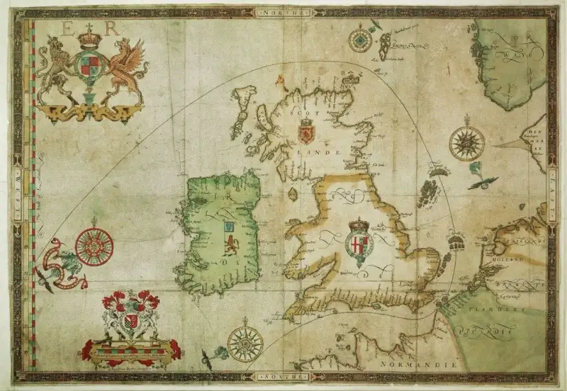
The sea does not suffer fools, nor does it yield to the hubris of kings. It is an ancient, wrathful entity, a theater of war where empires are made and broken upon the foaming waves. In the sweltering summer of 1588, the churning gray waters of the English Channel bore witness to one of the most spectacular, terrifying, and consequential clashes in the annals of human history: the defeat of the "Invincible" Spanish Armada. As a historical author, I have spent countless nights poring over the brittle, ink-stained dispatches of Tudor captains and the tragic, heart-wrenching letters of Spanish commanders, attempting to grasp the sheer magnitude of this confrontation. What transpired during those fateful weeks was not just a battle of ships and cannons, but a collision of two worlds, two religions, and two wildly different visions for the future of the globe. #History #NavalHistory #SpanishArmada The Gathering Storm: Spain's Grand Enterprise To understand the sheer weight of the Armada, one must first step back into the dimly lit corridors of the Escorial, where King Philip II of Spain, a man of relentless piety and unimaginable power, plotted the downfall of his arch-nemesis: Queen Elizabeth I of England. For decades, Elizabeth had been a thorn in Philip’s side. She had turned England into a bastion of Protestantism, encouraged swashbuckling privateers like Sir Francis Drake to plunder Spanish galleons in the New World, and openly supported the Dutch rebellion against Spanish rule. To Philip, England was a nest of heretics and pirates. The time for diplomacy had long passed. It was time for the "Enterprise of England." #TudorHistory #PhilipII #ElizabethI Philip’s grand design was breathtaking in its ambition and terrifying in its scale. He envisioned a gargantuan fleet, the likes of which the world had never seen, sailing from Lisbon to the English Channel. There, it would link up with a battle-hardened Spanish army stationed in the Netherlands under the command of the brilliant Duke of Parma. Together, this unstoppable force would cross the Channel in flat-bottomed barges, land on the English coast, march on London, depose the "heretic Queen," and restore the Catholic faith to the British Isles. A Fleet to Conquer the World By the spring of 1588, the "Invincible Armada" was ready. It was a floating city, a testament to the might and wealth of the Spanish Empire, largely funded by the silver mined from the agonizing depths of Potosí in the New World. 130 Ships: Comprising massive, towering galleons designed to act as floating fortresses, alongside heavily armed merchant vessels, smaller pinnaces, and Mediterranean galleasses (huge rowed warships). 30,000 Men: Among them were 8,000 sailors to man the ships, 18,000 elite soldiers to fight the land war, and a small army of priests, monks, and inquisitors to save English souls (or burn them, if saving proved impossible). 2,400 Cannons: A staggering arsenal capable of unleashing hellfire upon any vessel foolish enough to stand in their path. #MilitaryHistoryCommanding this immense force was Alonso Pérez de Guzmán, the Duke of Medina Sidonia. He was a noble of the highest rank, a capable administrator, but critically, he was not a seasoned sailor. When Philip appointed him, Medina Sidonia had famously pleaded to be excused, citing his tendency to get seasick and his lack of naval combat experience. But Philip, believing he was guided by the hand of God, refused the Duke’s resignation. Medina Sidonia set sail with a heavy heart, burdened by the impossible expectations of his sovereign and his Creator. The English Defense: Wood, Wind, and Wit Across the churning divide of the Channel, England was not waiting quietly for the executioner's axe. Queen Elizabeth I, aware of the encroaching doom, had mobilized her realm. The English response was characterized by a frantic, desperate energy, born of the knowledge that failure meant the end of their nation. #England #TudorEra The Dogs of War Unleashed The English fleet was fundamentally different from the Spanish Armada. While the Spanish relied on massive galleons built for close-quarters boarding actions—floating castles that sought to grapple enemy ships and overwhelm them with superior infantry—the English had spent the previous decades revolutionizing naval warfare. Led by brilliant, ruthless commanders like Lord Howard of Effingham, Sir Francis Drake, Sir John Hawkins, and Sir Martin Frobisher, the English had developed the "race-built" galleon. These ships were lower, sleeker, and significantly faster than their Spanish counterparts. More importantly, they were designed not as troop transports, but as floating gun platforms. The English strategy was simple but revolutionary: stay out of grappling range, use their superior speed and maneuverability to dictate the engagement, and pound the Spanish ships to splinters with long-range cannon fire. As the Armada slowly crept northward along the coast of Europe, beacon fires were lit across the length and breadth of England, passing the dread warning from hilltop to hilltop. The Spaniards were coming. The fate of the world hung in the balance. The Clash in the Channel: A Ballet of Death On July 19, 1588, the Spanish Armada was finally sighted off the coast of Cornwall, near the Lizard. The legend goes that Sir Francis Drake was playing a game of bowls on Plymouth Hoe when the news arrived, and he coolly remarked that there was time enough to finish the game and beat the Spaniards too. While the veracity of this tale is debated by historians, it perfectly encapsulates the swagger and audacity of the English sea dogs. #FrancisDrake #NavalBattle The Crescent Formation When the English fleet finally sailed out of Plymouth to meet the Armada, they were confronted with a sight that must have frozen the blood in their veins. The Spanish ships were arranged in a massive, tightly disciplined crescent formation, stretching for miles across the horizon. This formation was a tactical masterpiece. The strongest galleons protected the vulnerable wings (the horns of the crescent), while the slower supply ships and troop transports were nestled safely in the center. For a week, the two great fleets engaged in a running, agonizingly tense battle as they moved slowly up the English Channel. The English ships darted in like angry wasps, firing broadsides at the Spanish flanks before turning away before the heavier Spanish ships could grapple them. The Spanish, maintaining their rigid discipline, absorbed the punishment, returning fire when they could, but relentlessly pushing forward toward their rendezvous with the Duke of Parma. The air was thick with the acrid, choking stench of black powder. The roar of the cannons was deafening, a continuous, thunderous drumbeat echoing across the water. Yet, despite the unprecedented expenditure of gunpowder and shot, neither side managed to inflict a decisive blow. The English realized with growing horror that their cannons, though numerous, were largely bouncing off the incredibly thick oak hulls of the Spanish galleons. The "Invincible Armada" seemed exactly that—invulnerable to English fire. #Warfare #16thCentury Hell on Water: The Fireships of Calais By late July, the Armada had reached the Strait of Dover and dropped anchor off the coast of Calais, France. Medina Sidonia had achieved the first part of his impossible mission: he had navigated the Channel without losing a single major warship to English action (two had been lost to accidental collisions and explosions). However, he now faced a catastrophic problem. The Duke of Parma’s army was not ready. Blockaded by shallow-draft Dutch rebel ships (the "Sea Beggars") and lacking the necessary barges to safely reach the Armada, Parma could not embark. The Spanish fleet was sitting in an exposed anchorage, with a hostile English fleet lurking just out of range, and a fast-approaching storm threatening to blow them onto the treacherous Flemish shoals. It was here, in the dead of night on August 7, 1588, that the English played their trump card. It was a tactic as old as naval warfare itself, but executed with terrifying precision and devastating psychological effect: fireships. #Fireships #Tactics The Midnight Inferno Lord Howard ordered eight old, heavily combustible ships to be stripped of all valuables. Their holds were packed with pitch, tar, brimstone, gunpowder, and anything else that would burn fiercely. Their cannons were left fully loaded, primed to cook off in the heat and add a deadly barrage to the ensuing inferno. As the tide turned and the wind blew strongly toward the anchored Spanish fleet, the fireships were set ablaze and sent drifting into the darkness. Imagine the terror of the Spanish sailors on watch that night. The darkness of the Channel was suddenly pierced by eight towering pillars of fire, roaring and crackling as they bore down upon the tightly packed Armada. The flames licked at the night sky, casting a hellish, orange glow over the water. The loaded cannons aboard the fireships began to explode in the heat, firing randomly into the night, adding to the absolute chaos. Panic, raw and uncontrollable, swept through the Spanish fleet. The disciplined crescent formation, which had held so flawlessly for a week, shattered in an instant. Fearing that the fireships were packed with massive explosives (similar to the devastating "Hellburners" the Dutch had used in Antwerp), the Spanish captains did not wait to weigh anchor. They hacked their thick anchor cables with axes, abandoning their vital ground tackle in a desperate scramble to escape the approaching inferno. Ships collided in the darkness, rigging tangled, and hulls ground together as the Armada scattered in a disorganized, panicked mass into the North Sea. #Chaos #BattleOfCalais The Battle of Gravelines: Blood and Timber Dawn broke on August 8 to reveal a Spanish fleet that was scattered, disorganized, and deeply vulnerable. For the first time since the campaign began, the Armada was not in its defensive crescent. The English, realizing their golden opportunity had arrived, closed in for the kill. What followed was the Battle of Gravelines, the climax of the Armada campaign. Having realized that firing from a distance was ineffective against the thick Spanish hulls, the English commanders made a bold, dangerous decision: they sailed to within musket range—sometimes as close as fifty yards—before unleashing their broadsides. The combat was brutal, bloody, and deafening. The English ships, faster and more maneuverable, poured a relentless, terrifying hail of iron roundshot into the Spanish galleons. The Spanish, desperate to grapple and board, found their cumbersome ships outmaneuvered at every turn. Furthermore, many of the Spanish cannons were found to be loaded with the wrong size ammunition, or their gunners, untrained for sustained rapid fire, could not reload quickly enough. The Slaughter on the Decks For nine grueling hours, the battle raged. The Spanish ships, particularly the galleons San Martín (Medina Sidonia’s flagship) and San Mateo, absorbed an unbelievable amount of punishment. Their hulls were riddled with holes, their rigging was shredded into a tangled mess of hemp and canvas, and their decks ran red with the blood of soldiers and sailors. Eyewitness accounts speak of a hellish scene. Splinters of oak, jagged and sharp as daggers, flew across the decks, impaling men where they stood. The screams of the wounded mingled with the roar of the cannons and the crash of falling masts. Priests moved among the dying, offering absolution amidst the carnage. By late afternoon, the Spanish fleet was on the brink of total annihilation. Several ships were sinking, others were completely disabled, and the English were preparing to board and capture the prizes. But then, as if the heavens themselves intervened, a sudden, violent squall blew up, forcing the English to break off their attack. The Armada was saved from immediate destruction, but its spirit was broken, and its mission was definitively aborted. #BattleOfGravelines #NavalCombat The Perilous Journey North: The Wrath of God The Armada was battered, bleeding, and dangerously low on ammunition and food. The wind, blowing strongly from the south, prevented them from returning down the English Channel. Medina Sidonia faced a grim, agonizing reality: the only way home to Spain was a perilous, uncharted journey north, sailing around the treacherous coasts of Scotland and Ireland. It was a journey into a nightmare. As the fleet rounded the northern tip of Scotland, they were battered by a series of unprecedented, ferocious autumnal storms. The Spanish ships, already severely damaged at Gravelines, with weakened masts and hulls full of leaks, were woefully unequipped to handle the furious gales of the North Atlantic. Shipwrecks and Slaughter on the Irish Coast The true tragedy of the Spanish Armada did not occur in the English Channel, but on the jagged, unforgiving rocks of the Irish coast. Desperate for fresh water, food, and repairs, many Spanish captains tried to seek shelter in the bays and inlets of western Ireland. But their charts were inaccurate, and they had abandoned their main anchors in the panic at Calais. Unable to hold their positions against the gale-force winds, dozens of proud Spanish galleons were driven mercilessly onto the rocky shores. Over twenty ships were wrecked along the coasts of Donegal, Sligo, Mayo, Clare, and Kerry. Thousands of sailors and soldiers drowned in the freezing, churning surf. Those who miraculously survived the wrecks and managed to drag themselves ashore faced an equally grim fate. The English authorities in Ireland, terrified of a Spanish-backed Catholic uprising, had issued strict orders: any Spaniard found on Irish soil was to be executed immediately. Local lords, some loyal to the English crown and others simply eager for Spanish gold and weapons, systematically hunted down the survivors. Thousands of exhausted, starving Spaniards were summarily executed, their bodies left to rot on the beaches or hung from trees. Of the 130 ships that had sailed from Lisbon with such arrogant fanfare, only around 65 battered, disease-ridden hulks managed to limp back to Spanish ports in the autumn of 1588. Over 20,000 men had died, the vast majority not from English cannon fire, but from disease, starvation, and the terrifying fury of the sea. #Shipwreck #IrishHistory #Tragedy The Legacy of the Armada: A Turning Point in History When news of the disaster finally reached King Philip II at the Escorial, he reportedly retreated to his private chapel and prayed. "I sent my ships to fight against men," he famously said, "not against the winds and the waves of God." The defeat of the Spanish Armada was a seismic event, a genuine turning point in global history that fundamentally altered the geopolitical landscape of Europe and the world. The Rise of Britannia For England, the victory was the defining moment of Queen Elizabeth I’s reign. It secured the Protestant faith in the British Isles and prevented a Spanish conquest that would have forever altered the course of British history. The victory fostered a surging wave of national pride and a potent myth of English invincibility at sea—a myth that would shape British identity for centuries. More importantly, it marked the beginning of England’s rise as a global naval superpower. The tactics developed during the Armada campaign—relying on speed, maneuverability, and long-range gunnery—became the blueprint for naval warfare for the next three centuries. The English had learned that the future of naval combat did not lie in floating castles meant for boarding, but in floating artillery batteries designed to sink the enemy from afar. This realization paved the way for the eventual dominance of the Royal Navy and the establishment of the British Empire. #BritishEmpire #RoyalNavy The Slow Eclipse of Spain For Spain, the defeat was a colossal humiliation and a massive financial blow, though it did not immediately end Spanish hegemony. Spain remained a dominant global power for decades, and Philip quickly rebuilt his navy. However, the aura of Spanish invincibility was permanently shattered. The psychological impact on Protestant Europe was profound; they realized that the mighty Spanish Empire could bleed, and that it could be beaten. The Armada campaign also drained Spain's resources, exacerbating an already fragile economy burdened by endless wars in Europe and the Americas. It was the beginning of a long, slow decline that would eventually see Spain eclipsed by rising powers like France, the Netherlands, and Great Britain. The Modern Relevance: Hubris and the Unknown Why does the story of the Spanish Armada continue to captivate us centuries later? Because it is a narrative deeply rooted in the most fundamental aspects of the human condition. It is a story of towering ambition, of religious zealotry, of technological innovation clashing with entrenched tradition, and, ultimately, of the crushing, inescapable consequences of hubris. Philip II believed he was fighting a holy war, convinced that God would not allow his grand enterprise to fail. But he underestimated the ingenuity and desperation of his enemies, and, most critically, he underestimated the unforgiving, unpredictable power of nature. In our modern era, surrounded by advanced technology and data-driven predictions, it is easy to fall into the same trap of arrogant certainty that doomed the Spanish Armada. The wrecks scattered along the Irish coast remain a silent, potent reminder that no empire is truly invincible, no plan is foolproof, and that history is often decided not by the grand designs of kings, but by the shifting winds, the crashing waves, and the courage of those fighting for their very survival. The story of the Armada is a testament to the fact that the sea remains untamed, and history, in all its chaotic, bloody glory, is written by those who learn to harness the storm, rather than those who simply expect the storm to bow to their will. #HistoricalFiction #MarkDinn #WorldHistory #AncientHistory #MaritimeHistoryMark Dinn is a celebrated author of historical fiction and narrative history. His works focus on bringing the visceral reality, dramatic tension, and untold human stories of the past into the vibrant light of the present. #History #NavalHistory Related Insights千古绝唱,江水悠悠:探秘乐山大佛的沧桑与辉煌 The Black Death: The Bubonic Plague That Decimated Medieval Europe The Acropolis of Athens: A Timeless Citadel of Human Triumph{ "@context": "https://schema.org", "@type": "FAQPage", "mainEntity": [ { "@type": "Question", "name": "What is the main focus of The Fall of the Spanish Armada: The Sea Battle That Changed History?", "acceptedAnswer": { "@type": "Answer", "text": "A dramatic deep dive into The Fall of the Spanish Armada: The Sea Battle That Changed History. Mark Dinn explores the untold history, drama, and legacy of this fascinating subject." } }, { "@type": "Question", "name": "Who authored the comprehensive guide on The Fall of the Spanish Armada: The Sea Battle That Changed History?", "acceptedAnswer": { "@type": "Answer", "text": "This detailed article and its insights were carefully researched and authored by Mark Dinn." } }, { "@type": "Question", "name": "Where can I find more related content about History?", "acceptedAnswer": { "@type": "Answer", "text": "You can explore more articles, detailed reviews, and similar insights by browsing the Related Insights section at the bottom of this article or visiting our dedicated History category page." } } ] }
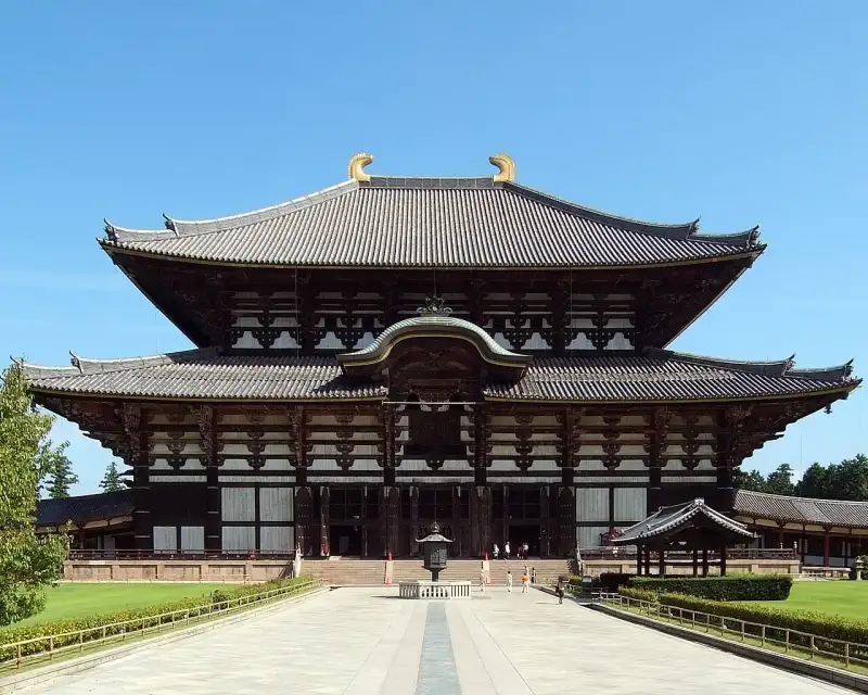
Konnichiwa! Welcome to another deep dive into #Japan's breathtaking #ancient #history and cultural heritage. From the spirit of #zen and Wabi-Sabi to the majestic presence of #samurai castles and Shinto shrines, let us explore the wonders of Tōdai-ji. Tōdai-ji (東大寺, 'Eastern Great #temple') is a Buddhist temple complex that was once one of the powerful Seven Great Temples, located in the city of Nara, Japan. The construction of the temple was an attempt to imitate Chinese temples from the much-admired Tang dynasty. Though it was originally founded in the year 738 CE, Tōdai-ji was not opened until the year 752 CE. The temple has undergone several reconstructions, including one initiated by Minamoto Yoritomo in 1181 (entrusted to Chogen, a monk of the Jodo sect) which included the standardization of existing buildings and the strengthening of visible pillars. Since then, one of the most significant reconstruction (that of the Great Buddha Hall) took place in 1709. However, it was on the verge of collapse in the late 19th century due to the weight of its huge roof. The collapse was prevented through a first restoration (1904–1913), and its current appearance was completed using steel framing between 1974 and 1980. Its Great Buddha Hall (大仏殿, Daibutsuden) houses the world's largest bronze statue of the Buddha Vairocana, known in Japanese as Daibutsu (大仏). The temple also serves as the Japanese headquarters of the Kegon school of Buddhism. The temple is a listed #UNESCO World Heritage Site as one of the "Historic Monuments of Ancient Nara", together with seven other sites (including temples, shrines and places) in the city of Nara. History Origins Todaiji is well known for the Nara Daibutsu, also known as "The Great Buddha of Nara," which is an image of the Buddha Birushana. The current Buddha was repaired after suffering significant damage in 1692. Under the leadership of Abbot Shunjobo Chogen (1121–1206), numerous structures at Todaiji were rebuilt in 1180 in the fashion of the Southern Song dynasty of China. During the Tenpyō era, Japan suffered from a series of disasters and epidemics. It was after experiencing these problems that Emperor Shōmu issued an edict in 741 to promote the construction of provincial temples throughout the nation. Later in 743 during the Tenpyō era the Emperor commissioned the Daibutsu to be built in 743. Tōdai-ji (still Kinshōsen-ji at the time) was appointed as the provincial temple of Yamato Province and the head of all the provincial temples. With the alleged coup d'état by Nagaya in 729, a major outbreak of smallpox around 735–737, worsened by several consecutive years of poor crops, followed by a rebellion led by Fujiwara no Hirotsugu in 740, the country was in a chaotic situation. Emperor Shōmu had been forced to move the capital four times, indicating a certain level of instability during this period. Role in early Japanese Buddhism According to legend, the monk Gyōki went to Ise Grand Shrine to reconcile Shinto with Buddhism. He spent seven days and nights reciting sutras until the oracle declared Vairocana Buddha compatible with worship of the sun goddess Amaterasu. Under the Ritsuryō system of government in the Nara period, Buddhism was heavily regulated by the state through the Sōgō (僧綱; Office of Priestly Affairs). During this time, Tōdai-ji served as the central administrative temple for the provincial temples and for the six Buddhist schools in Japan at the time: the Hossō, Kegon, Jōjitsu, Sanron, Ritsu and Kusha. Letters dating from this time also show that all six Buddhist schools had offices at Tōdai-ji, complete with administrators, shrines and their own library. Japanese Buddhism during this time still maintained the lineage of the Vinaya and all officially licensed monks were required to take their ordination under the Vinaya at Tōdai-ji. In 754 CE, ordination was given by Ganjin, who arrived in Japan after traveling over 12 years and six attempts of crossing the sea from China, to Empress Kōken, former Emperor Shōmu and others. Later Buddhist monks, including Kūkai and Saichō received their ordination here as well. During Kūkai's administration of the Sōgō, additional ordination ceremonies were added to Tōdai-ji, including the ordination of the Bodhisattva Precepts from the Brahma Net Sutra and the esoteric Precepts, or Samaya, from Kukai's own newly established Shingon school of Buddhism. Kūkai added an Abhiseka Hall to use for initiating monks of the six Nara schools into the esoteric teachings by 829 CE. Decline As the center of power in Japanese Buddhism shifted away from Nara to Mount Hiei and the Tendai sect, and when the centre of political power in Japan moved from the emperor's capital to the shōgun's base in Kamakura in the aftermath of the Genpei war, Tōdai-ji's role in maintaining authority declined. In later generations, the Vinaya lineage also died out, despite repeated attempts to revive it; thus no more ordination ceremonies take place at Tōdai-ji. #architecture Initial construction In 743, Emperor Shōmu issued a law stating that the people should become directly involved with the establishment of new Buddhist temples throughout Japan. The Emperor believed that such piety would inspire Buddha to protect his country from further disaster. Gyōki, with his pupils, traveled the provinces asking for donations. According to records kept by Tōdai-ji, more than 2,600,000 people in total helped construct the Great Buddha and its Hall, contributing rice, wood, metal, cloth, or labour, with 350,000 working directly on the statue's construction. The 16 m (52 ft) high statue was built through eight castings over three years, the head and neck being cast together as a separate element. The making of the statue was started first in Shigaraki. After enduring multiple fires and earthquakes, the construction was eventually resumed in Nara in 745, and the Buddha was finally completed in 751. A year later, in 752, the eye-opening ceremony was held with an attendance of 10,000 monks and 4,000 dancers to celebrate the completion of the Buddha. The Indian priest Bodhisena performed the eye-opening for Emperor Shōmu. The project cost Japan greatly, as the statue used much of Japan's bronze and relied entirely on imported gold. 48 lacquered cinnabar pillars, 1.5 m (4.9 ft) in diameter and 30 m (98 ft) long, support the blue tiled roof of the Daibutsu-den. Maps that include some of the original structures of Tōdai-ji are rare, though some still exist today. Some of these structures include, the two pagodas, the library, lecture hall, refectory, and the monk's quarters located behind the main hall. Tōdai-ji functioned not only as a place of worship and Buddhist practice, but as a place of higher learning and study. Much of what contemporaries now know about the original layout of the temple comes from the writings of monks who lived and studied there. The original complex contained two 100 m (330 ft) pagodas, making them some of the tallest structures at the time. They were located on either side of the complex, one on the western (西塔) and one on the eastern side (東塔). The pagodas themselves were surrounded by a walled courtyard with four gates. These were destroyed by an earthquake. One of the sōrin finials was reproduced for the 1970 Osaka Expo and is standing at the spot where one of the pagodas used to stand. The Shōsōin was its storehouse, and now contains many artifacts from the Tenpyō period of Japanese history. Reconstructions post-Nara Period The Great Buddha Hall (Daibutsuden) has been rebuilt twice after fire. The current building was finished in 1709, and although immense—57 metres (187 ft) long, 50 metres (160 ft) wide and 49 metres (161 ft) high—it is actually 30% smaller than its predecessor, being reduced from 11 to 7 bays wide due to lack of funds. Until 1998, it was the world's largest wooden building. It has been surpassed by modern structures, such as the Japanese baseball stadium Odate Jukai Dome, amongst others. The Great Buddha statue has been recast several times for various reasons, including earthquake damage. The current hands of the statue were made in the Momoyama Period (1568–1615), and the head was made in the Edo period (1615–1867). The existing Nandaimon (Great South Gate) was constructed at the end of the 12th century based on Daibutsuyō style, after the original gate was destroyed by a typhoon during the Heian period. The dancing figures of the Nio, the two 8.5-metre-tall (28 ft) guardians at the Nandaimon, were built around the same time by the artists Unkei, Kaikei, and their workshop staff. The Nio are an A-un pair known as Ungyo, which by tradition has a facial expression with a closed mouth, and Agyo, which has an open mouthed expression. The two figures were closely evaluated and extensively restored by a team of art conservators between 1988 and 1993. Until then, these sculptures had never before been moved from the niches in which they were originally installed. This complex preservation project, costing $4.7 million, involved a restoration team of 15 experts from the National Treasure Repairing Institute in #Kyoto. By the 19th century, the Great Buddha Hall had become seriously deteriorated, and its roof and pillars had warped, and by the Meiji period, it had become so damaged that it was strange that it did not collapse. However, Japan, which was Westernizing, was influenced by the West and developed the concept of protecting cultural properties, and the first large-scale restoration project was carried out from 1904 to 1913. However, even then, the warped roof could not be completely repaired, so instead, support beams were erected to prevent collapse. After that, it escaped the US air raids during World War II and was safe, and in 1974, the second large-scale construction project began. At this time, a new change occurred in the wooden structure of the Great Buddha Hall. A total of 100,000 people were mobilized for the construction. During this time, the roof was completely removed and fixed using steel frames, and the wooden pillars of the Great Buddha Hall were remodeled using steel frames and concrete. This construction was completed in 1980, This second large scale construction project resulted in the Great Buddha Hall having its current appearance. Dimensions of the Daibutsu The temple gives the following dimensions for the statue: Height: 14.98 m (49 ft 2 in) Face: 5.33 m (17 ft 6 in) Eyes: 1.02 m (3 ft 4 in) Nose: 0.5 m (1 ft 8 in) Ears: 2.54 m (8 ft 4 in) The statue's shoulders are 28 meters (92 ft) across and there are 960 six curls atop its head. The Birushana Buddha's golden halo is 27 m (87 ft) in diameter with 16 images each 2.4 m (8 ft) tall. Using x-rays, a human tooth, along with pearls, mirrors, swords, and jewels have been discovered inside the knee of the Great Buddha; these are believed to be the relics of Emperor Shomu. The statue weighs 500 tonnes (550 short tons). Temple precincts and gardens Various buildings of the Tōdai-ji have been incorporated within the overall aesthetic intention of the gardens' design. Adjacent villas are today considered part of Tōdai-ji. Some of these structures are now open to the public. Over the centuries, the buildings and gardens have evolved together as to become an integral part of an organic and living temple community. The Tōdai-ji #culture Center opened on October 10, 2011, comprising a museum to exhibit the many sculptures and other treasures enshrined in the various temple halls, along with a library and research centre, storage facility, and auditorium. Japanese national treasures The architectural master-works are classified as: Major historical events 728: Kinshōsen-ji, the forerunner of Tōdai-ji, is established as a gesture of appeasement for the troubled spirit of Prince Motoi. 741: Emperor Shōmu calls for nationwide establishment of provincial temples, and Kinshōsen-ji appointed as the head provincial temple of Yamato. 743: The Emperor commands that a very large Buddha image statue shall be built—the Daibutsu or Great Buddha—and initial work is begun at Shigaraki-no-miya. 745: The capital returns to Heijō-kyō, construction of the Great Buddha resumes in Nara. Usage of the name Tōdai-ji appears on record. 752: The Eye-opening Ceremony celebrating the completion of the Great Buddha held. 855: The head of the great statue of the Buddha Vairocana suddenly fell to the ground; and gifts from the pious throughout the #empire were collected to create another, more well-seated head for the restored Daibutsu. In popular culture Matsuo Bashō refers to the Great Buddha statue in a haiku (1689–1670): and, Tōdai-ji has been used as a location in several Japanese films and television dramas. It was also used in the 1950s John Wayne movie The Barbarian and the Geisha when Nandaimon, the Great South Gate, doubled as a city's gates. On May 20, 1994, the international music festival The Great Music Experience was held at Tōdai-ji, supported by UNESCO. Performers included the Tokyo New Philharmonic Orchestra, X Japan, INXS, Jon Bon Jovi, Joni Mitchell, Bob Dylan, Tomoyasu Hotei, Roger Taylor, classic Japanese drummers, and a Buddhist monk choir. This event, organized by British producer Tony Hollingsworth, was simultaneously broadcast in 55 countries on May 22 and 23, 1994. The 2007 animation series Mononoke (モノノ怪), which is a spin-off of the 2006 horror anthology series Ayakashi: Samurai Horror Tales, references the Tōdai-ji, particularly the treasure room Shōsōin, in Episodes 8 and 9. The Tōdai-ji is used as the Japanese wonder in Age of Empires II. The Tōdai-ji is the subject of the 2003 novella "A Mountain to the North, A Lake to the South, Paths to the West, A River to the East" ("Északról hegy, Délről tó, Nyugatról utak, Keletről folyó") by László Krasznahorkai. International outreach Following the Notre-Dame de #Paris fire in April 2019, Japanese authorities declared plans to expand fire prevention measures at several historic locations, including Tōdai-ji in Nara, partly by hiring new, younger employees in a context where temple and shrine staff are aging. Custodians of Todaiji temple also installed a donation box, stating "Let's Rebuild Notre Dame #cathedral", in the hallway behind the Great Buddha statue. In June 2019, a sign next to the box, in Japanese and English, explained why Tōdai-ji, as headquarters of the Kegon sect of Buddhism, was soliciting funds in this way. The English version declared, "Todai-ji temple has been reconstructed every time it burned down by big fires thanks to the significant effort of many people. We sincerely express our deepest sympathy for the tragedy that hit the Notre-Dame de Paris. Going beyond the creed, we would like to ask everyone for your support to reconstruct the cathedral." #japan #nara #buddhism #history #travel
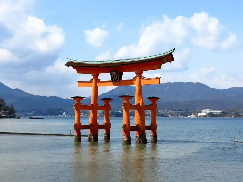
ようこそ。日本の美しき歴史と文化の旅へ。 厳島神社: 海に浮かぶ神々の住処――時を超え、自然と対話する聖域 広島湾に抱かれた神聖なる島、厳島。その北東の入り江に、潮の満ち引きと共に表情を変える、息をのむほどに優美な社殿群が鎮座しています。これこそ、世界遺産「厳島神社」。私が今日、筆を執るのは、単なる観光地の紹介ではありません。この稀有な建築が織りなす歴史、文化、そして日本人の自然観に深く根差した精神性を、皆様と共に探求したいと願うからです。海上に浮かぶその姿は、まるで神々が住まう龍宮城が、現世に顕現したかのよう。 神秘の島に宿る神々:宗像三女神の御神威 厳島神社の御祭神は、市杵島姫命��いちきしまひめのみこと)、田心姫命(たごりひめのみこと)、湍津姫命(たぎつひめのみこと)の三柱。これら「宗像三女神」と総称される女神たちは、古来より海上交通の守護神、そして芸能や財福を司る神として厚く信仰されてきました。特に市杵島姫命は、神仏習合の時代において、仏教の弁才天(弁財天)と一体化するという、極めて日本的な変遷を遂げます。 この興味深い融合は、隣接する大願寺の存在によって、より一層その深みを増します。かつて厳島神社と大願寺は、密接な関係を築き、広大な伽藍の一部を形成していました。弁才天信仰が隆盛を極める中で、市杵島姫命は知恵、音楽、財宝をもたらす女神として広く崇められ、大願寺は「日本三大弁才天」の一つに数えられるに至ります。神道の純粋な信仰と、異国の智慧が融和する過程は、#日本 の宗教史における柔軟性と受容性を示す好例と言えるでしょう。海を渡り、文化の交流を司る女神が、まさにその海の上に祀られるという摂理は、厳島神社の本質を物語るかのようです。 悠久の時を刻む歴史の綾 厳島神社の歴史は、遠く飛鳥時代にまで遡ります。 創建の黎明:神に斎く島の物語 社伝によれば、推古天皇元年(593年)、この地の有力豪族であった佐伯鞍職(さえきくらもと)が、神託を受けて市杵島姫命を祀る社殿を御笠浜に創建したのが始まりとされています。「イツクシマ」という社名自体が、「イチキシマ」が転じたもの、あるいは「神を斎く(いつく=仕える、崇める)島」に由来するという説が有力です。 厳島は、その名の通り、古代から島そのものが神として崇められてきた聖地です。島の中心にそびえる弥山(みせん)の山頂には、巨岩が連なり、太古の昔から山岳信仰の対象とされてきました。人々は、海と山、そしてその間に広がる森羅万象に神の存在を感じ、畏敬の念を抱き、祈りを捧げてきたのです。この原始的な自然崇拝が、やがて壮麗な社殿へと昇華していく過程は、日本人と#自然 の深遠な関係性を映し出しています。 概史:権力者たちの信仰と試練 文献に厳島神社の名が初めて現れるのは、弘仁2年(811年)に名神(みょうじん)に預かったという記述です。平安時代中期に編纂された『延喜式神名帳』には���「安芸国佐伯郡 伊都伎嶋神社」と記され、名神大社に列せられるとともに、安芸国一宮としての地位を確立しました。この頃、神職は佐伯氏が代々世襲し、その社格の向上とともに、祭神の祭祀体系も整備されていったと考えられています。 厳島神社が歴史の表舞台に躍り出るのは、平安時代末期です。当時の安芸守(あきのかみ)であった平清盛と、神主・佐伯景弘との強い結びつきを契機に、平家一族から篤い崇敬を受けるようになります。仁安3年(1168年)頃、清盛は現在の海上に立つ大規模な社殿を造営しました。これは、平家が武士として初めて朝廷の頂点に立ち、その栄華を極めた時代の象徴であり、まさに「平家の氏神」として、厳島神社もまた未曾有の繁栄を享受したのです。海を舞台にした清盛の壮大な夢が、この水の上の聖域に結実したと言えるでしょう。 しかし、歴史の波は常に穏やかではありません。平家滅亡後も源氏をはじめとする時の権力者たちの崇敬を受け続けますが、建永2年(1207年)と貞応2年(1223年)の二度にわたる火災により、社殿は全て焼失するという悲劇に見舞われます。現在��たちが見る社殿の主要部は、貞応の火災の後、仁治年間(1240年~1243年)以降に再建されたものです。これは、幾度となく打ち砕かれながらも、その都度、人々の信仰の力によって蘇ってきた厳島神社の不屈の精神を物語っています。 鎌倉時代頃までは、厳島は「神の住む島」として禁足地とされ、主な祭祀は対岸の地御前神社(外宮)で行われていました。しかし、鎌倉時代末期から南北朝時代以降、次第に社人や僧侶が禁を破って島に住み着くようになり、島の#文化 は多様化していきました。 戦国時代に入り世情が不安定になると、一時的に社勢は衰退します。しかし、弘治元年(1555年)の厳島の戦いで毛利元就(もうりもとない)が勝利を収め、この一帯を支配下に置くと、厳島神社は再び隆盛を取り戻します。元就は大規模な社殿修復を行い、その信仰の篤さを示しました。さらに、天下統一を夢見た豊臣秀吉も九州遠征の途上で厳島神社に参拝し、壮大な大経堂(現:千畳閣)の造営に着手しました。これらの歴史の転換点において、厳島神社は常に日本の中心的な権力者たちにその存在を認められ、守られて��たのです。 江戸時代になると、厳島詣(いつくしまもうで)が民衆の間で広く流行し、門前町や周囲は多くの参拝者で賑わいました。日本各地から人々が海を渡り、この「神々の住む島」を目指したのです。これは、厳島神社が単なる権力者の信仰対象に留まらず、一般庶民の心の拠り所として深く根付いていた証と言えるでしょう。 明治維新と神仏分離:伝統の変革 明治維新は、厳島神社にとっても大きな転換点となりました。東京の明治新政府が派遣した大参事によって、社殿が「仏式」であると判断され、神仏分離の原則に基づき、社殿の焼却が命じられるという危機に直面します(廃仏毀釈)。しかし、当時の厳島神社の棚守(宮司に相当)が新政府に直訴した結果、社殿の焼却は免れました。 しかし、その代償として、仏教的とみなされた社殿の彩色が全て剥がされ、「白木造」に改められるとともに、千木(ちぎ)と鰹木(かつおぎ)が新設されるなど、「復古」という名の下に大規模な改変が行われました。大経堂(千畳閣)は内陣の木鼻が切り落とされ、仏像などが撤去されて「豊国神社」と名を改められ、大聖院(旧別当寺)や大願寺といった寺院も独立させられました。この時期の社殿の損壊と分離は、近代国家形成における宗教政策の一端を如実に示しており、厳島神社の歴史に深く刻まれた傷跡とも言えるでしょう。 その後、明治4年(1871年)に近代社格制度に沿って国幣中社に列し、1911年(明治44年)には官幣中社に昇格しました。明治末期には社殿が国宝に指定され、壊された部分が明治末期から大正にかけての大修理で復旧され、千木と鰹木も撤去されました。このため、明治時代の厳島神社の写真にのみ、千木と鰹木が写っているという興味深い事実が残されています。神仏習合の長い歴史を持つ日本の神社建築が、近代化の波の中でいかに揺れ動いたかを物語る貴重な#歴史 の証言です。 神階と神職:世襲の伝統 厳島神社の神階は、弘仁2年(811年)の名神預かりから始まり、天安3年(859年)には正五位下から従四位下へ、貞観9年(867年)には従四位上へと昇叙されていきました。これらの記録は、『日本後紀』や『日本三代実録』といった正史に記されており、朝廷からいかに重んじられてき���かを示しています。 神職については、飛鳥時代に厳島神社を創建したとされる佐伯鞍職に始まり、文献に記載のない期間を経て、平安時代以降は代々佐伯氏が世襲してきたことが確認されています。平安時代末期には佐伯景弘が平家一門と結びつき、一族の繁栄を享受しました。しかし、鎌倉時代の承久の乱で後鳥羽上皇側として活動したため、佐伯氏は一時的に神主家当主の座を降り、藤原親実が新たな厳島神主家となりました。その後も佐伯氏は厳島神社の神官として活動を続け、瑞渓周鳳の『臥雲日件録』には、「日本所謂三大宮司、盖厳島・熱田・富士之三所也」とあり、厳島神社の大宮司が熱田大宮司・富士大宮司と共に「日本三大宮司」の一つに数えられていたことが記されています。これは、厳島神社が全国的にも極めて重要な位置を占めていたことを示唆しています。その後、藤原氏が戦国時代に滅亡するまで神主家を務め、藤原氏滅亡後には佐伯氏が復権し、現在に至るまでその伝統を守り続けています。 自然の猛威と共存する社殿:海の上の不朽の建築 海上に建てられている厳島神社の社殿は、���の立地ゆえに台風や高潮の影響を常に受け続けてきました。床の木材には意図的に隙間が設けられていますが、大型の台風が直撃すれば、倒壊の危機に晒されることもあります。しかし、これは決して設計の欠陥ではありません。むしろ、自然の力を受け入れ、修復を前提として建てられた、独特の哲学が息づく建築なのです。 1991年(平成3年)の台風19号では、重要文化財の「能舞台」が倒壊し、檜皮葺の屋根も甚大な被害を受けました。1999年(平成11年)の台風18号では国宝の「神社」および「社殿」が、2004年(平成16年)の台風18号では国宝附指定の「左楽房」が倒壊するなど、近年も幾度となく自然の猛威に曝されてきました。2012年(平成24年)4月3日には暴風により大鳥居の檜皮屋を覆う銅板が被害を受けるなど、その姿は常に#自然 との対話の中にあります。 これらの被害は、厳島神社が自然の摂理と共存し、その力を受け入れながら永続していくことを宿命づけられた存在であることを示しています。人間が自然を完全に制御することは不可能であり、むしろその一部として、しなやかに変化に対応していく東洋的な思想が、この建築には深く根差していると言えるでしょう。 荘厳なる社殿の構成:水に浮かぶ雅の空間 厳島神社の主要な社殿は、厳島の北部、大野瀬戸に面した有浦(ありのうら)と呼ばれる湾の奥に、見事なまでに配置されています。湾の最も奥まったところに、宗像三女神を祀る本社が北(厳密には北西)を正面として建ち、その威厳ある姿を水面に映しています。 本社社殿は、奥に位置する本殿と、手前の拝殿を幣殿で繋ぎ、全体を一つの建物としています。拝殿の手前には祓殿(はらいでん)が建ち、そのさらに手前、つまり海側には「高舞台」と呼ばれる高欄(手すり)付きの舞台が設けられています。この高舞台は、舞楽の奉納などに使用され、その優雅な舞は、海と空を背景に幻想的な世界を創り出します。その周囲に広がる屋根のない板敷きの部分が「平舞台」であり、これは日本三舞台の一つに数えられ、その広がりは神事の荘厳さを一層際立たせます。平舞台に接して、左右には門客神社(かどまろうどじんじゃ)や楽房といった小建物が配され、空間全体に奥行きを与えています。 平舞��の最も海側は、桟橋のように細長く突き出ており、この部分を「火焼先(ひたさき)」と称します。火焼先の延長線上、遥か海中には、高さ16メートルにも及ぶ朱塗りの「大鳥居」が悠然とそびえ立っています。この大鳥居は、日本三大鳥居の一つとして名高く、潮が満ちれば海中に浮かび、潮が引けばその足元が現れるという神秘的な姿は、訪れる人々に強い感動を与えます。この景色こそが、#旅行 者にとって厳島神社を象徴する光景と言えるでしょう。 祓殿の側面からは、左右に優雅に屈折しながら伸びる廻廊(東廻廊、西廻廊)が、厳島神社特有の景観を形成しています。東廻廊の途中、湾の東側には、摂社客神社(まろうどじんじゃ)が西を正面として建ち、本社と同様に本殿・幣殿・拝殿・祓殿から成りますが、規模は本社よりも小さいながらも、その配置は全体としての調和を保っています。 これらの建物の大部分は海域に建ち、満潮時にはまるで建物全体が海上に浮かんでいるかのように見えます。この驚異的な立地にもかかわらず、各建物には何か特殊な建築技法が用いられているわけではありません。浅い海底に地上の建物と同様に礎石を据え、木製の杭(束 #japan #travel #history #culture #nature
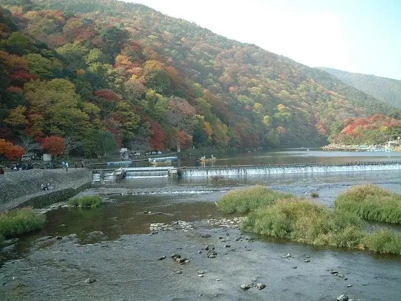
ようこそ。日本の美しき歴史と文化の旅へ。 嵐山の美学:竹林と自然の調和 みなさま、こんにちは。旅行ブロガーであり、文化歴史学の研究者でもある田中ゆみ(Yumi Tanaka)です。 私たちが旅に出る時、そこには単なる日常からの逃避以上の意味が存在します。それは、土地が内包する歴史の集積に触れ、かつてその地を生きた人々が自然とどのように対峙し、あるいは調和を模索してきたかという、精神の軌跡をたどる試みに他なりません。 今回私が思索の場として選んだのは、京都の西方に鎮座する「嵐山」です。 嵐山は、単に美しい景観を誇る観光地という枠に収まる存在ではありません。ここは、平安の昔から貴族たちに愛された別業(別荘)の地であり、仏教的な無常観と神道的な自然崇拝、そして人間の高度な空間設計が見事に結晶化した、言わば「生きた文化遺産」です。本稿では、この嵐山という空間が湛える美学的な本質、その歴史的変遷、そして自然と人間との調和のあり方について、学術的かつ詩的な視点から深く解き明かしていきたいと思います。1. 地理的重層性と水系のトポロジー 嵐山を理解するためには、まずその地形が持つ重層的な広がりと、この地を貫く水系の象徴性を整理せねばなりません。 一般に「嵐山」と呼ばれる地域は、京都市西部に位置する標高382メートルの単一の山岳のみを指す言葉ではありません。大堰川(おおいがわ)という大いなる流れを境界線として、西側に並び立つ松尾山(275.6m)、嵐山(382m)、烏ヶ岳(398m)の「嵐山三山」と、東側に位置する小倉山、亀山、そしてその山麓に広がる平坦な土地を含めた広範な領域を、私たちは「嵐山」と総称しています。 【嵐山地域の地理的概念図】 (北:嵯峨野・小倉山方面) │ ───────┬─────���─┴───────┬─────── (西側:嵐山三山) │ (東側:亀山・小倉山) ・烏ヶ岳 (398m) │ ・小倉山 ・嵐山 (382m) │ ・亀山 ・松尾山 (275.6m) │ ───────┼───────┬───────┼─────── │ 大堰川 │ (上流) (下流) ───────┴───────┼───────┴─────── 渡月橋 ───────┬───────┼───────┬─────── │ 桂川 │この地を流れる川は、嵐山のアイデンティティそのものです。大堰川の上流にあたる保津川の流域では、古くから林業が極めて盛んでした。山々から切り出された良質な木材は、筏(いかだ)に組まれ、この急流を下って京都の街へと運ばれていきました。その木材輸送の終着点こそが、他ならぬこの嵐山の水際だったのです。かつて物資の集散地として機能したこの川は、現代においては亀岡市から始まる「保津川下り(嵐峽めぐり)」という形で、自然の造形美��五感で追体験するエコツーリズムの場へと昇華されています。 そして、この水系を語る上で最も興味深いのが、流路に架かる「渡月橋」を境にして川の呼称が変化するという事実です。橋の上流側は「大堰川」と呼ばれ、橋を下った瞬間から「桂川」とその名を変えます。この命名の境界線は、単なる行政上の区切りを超えて、自然が野生から都市の洗練へと移行する精神的な敷居(しきい)として機能しているように思えてなりません。 渡月橋は、まさに嵐山の象徴です。写真や絵画で見ると、古風な純木造の橋のように見えますが、その実態は近代の工学技術を宿した堅牢な鉄筋コンクリート造の橋です。しかし、周囲の景観と調和を保つため、欄干部分には温かみのある木材が贅沢に使用されており、自動車の往来を可能にしながらも、古典的な情緒を一切損なっていません。さらに、夜間には橋の上流に設置された小型水力発電機によって生み出されたクリーンな電力が、橋を優美に照らし出します。ここには、古人の美意識を受け継ぎつつ、持続可能な現代技術を融合させるという、きわめて高度な調和の姿勢が���て取れます。2. 歴史的植栽と「作られた自然」の美学 嵐山は、手つかずの原始の自然が残されている場所ではありません。むしろ、人間が自然に深く関与し、その美を極限まで引き出した「極上の庭園」とも言うべき空間です。この地が桜と紅葉の世界的名所(日本さくら名所100選、日本紅葉の名所100選)となった背景には、歴史上の人物たちによる壮大な「植栽の歴史」が存在します。 #歴史 の糸を紐解くと、13世紀末の鎌倉時代、亀山上皇が奈良・吉野の地からサクラ数百株をこの嵐山へと移植させたという記録に行き当たります。吉野といえば、修験道の聖地であり、日本で最も高名な桜の山です。上皇はその神聖なる桜の遺伝子を、自らが愛した嵐山へと移植することで、聖なる風景の「アプロプリエーション(受容・再構築)」を試みたのです。 さらにその後、南北朝から室町時代にかけて、稀代の作庭家であり禅僧でもあった夢窓国師(夢窓疎石)が、再び吉野からヤマザクラ数千本をこの地に移植しました。彼らは、松の常緑が織りなす深い緑の背景の中に、桜の淡いピンク、そして秋には紅葉��燃え立つような赤を精密に配置していきました。私たちが今日目にする嵐山の四季の色彩は、自然の偶然がもたらしたものではなく、数百年にわたる人間の美的意志と自然の生命力が共作した、壮大な大地のキャンバスなのです。 【嵐山の植栽と景観形成のタイムライン】 ┌───────────────────────────────────────┐ │ 13世紀末:亀山上皇による吉野サクラ数百株の移植 │ │ └ 嵐山における「サクラの名所」としての基礎が築かれる │ ├───────────────────────────────────────┤ │ 14世紀:夢窓国師によるヤマザクラ数千本の追植 │ │ └ 禅的空間美学に基づいた松と桜の色彩対比の完成 │ ├───────────────────────────────────────┤ │ 15世紀:金春禅鳳作の能『嵐山』の上演 │ │ └ 蔵王権現堂や戸難瀬の滝が文化的アイコンとして定着 │ ├───────────────────────────────────────┤ │ 明治時代:社寺上知令による官有地化(のちの嵐山国有林) │ │ └ 天龍寺領から国家管理への移行、保安林としての保護が開始 │ └───────────────────────────────────────┘このような歴史的背景は、古典芸能の世界にも深く投影されています。嵐山の名所の一つである「戸難瀬(となせ)の滝」(別名:音無滝)の上流には、吉野の神仏習合の信仰を象徴する蔵王権現堂が鎮座しています。この蔵王権現は、15世紀に活躍した能役者・金春禅鳳が手がけた能の演目『嵐山』にも神格として登場し、嵐山の地が持つ霊的な豊かさを当時の人々に広く印象付けました。 しかし、こうした自然と文化の調和は、常に順風満帆に維持されてきたわけではありません。嵐山山麓に広がっていた鬱蒼たる森の多くは、かつて名刹・天龍寺の寺領でした。しかし明治時代に下ると、「社寺上知令」という激動の国策により、これらの広大な土地は国家に強制的に召し上げられ、官有地へと編入されることになります。これが、現在の「嵐山国有林(面積59.03ヘクタール)」の起源です。 現在、この嵐山国有林は、森林法に基づく風致保安林および土砂流出防備保安林に指定され、さらに文化財保護法の「史跡名勝(1927年指定:嵐山峡)」、都市計画法の「風致地区(1930年指定)」、古都保存法の「歴史的風土特別保存地区」、さらには鳥獣保護区という、幾重もの法的保護の網によって守られています。私たちが今もなお、平安貴族が見上げたものと本質的に変わらない稜線を仰ぎ見ることができるのは、こうした近代以降の厳格な保全制度の賜物なのです。3. 竹林の小径と五感の現象学 嵐山を訪れる旅人が、最も深く精神的な静寂を覚える場所、それが「竹林の小径」ではないでしょうか。 野宮神社から大河内山荘へと至る細い路地。そこには、天を突き刺すようにまっすぐに伸びた数千、数万の竹が、光と影の精緻な格子模様を地面に描き出しています。この空間は、まさに #自然 が生み出した寺院の回廊のようです。 竹林の中に身を置くと、まず変化するのは視覚ではなく「聴覚」です。風が通り抜けるたびに、竹の幹同士が擦れ合い、葉がささやく「サワサワ」という乾いた音が、周囲を満たします。この音は、都市の喧騒によって麻痺した私たちの感覚を優しく覚醒させ、主客未分の瞑想的な状態へと誘います。光は竹の葉によって幾重にもフィルタリングされ、地上に届く頃には、どこかエメラルドグリーンを帯びた、湿り気のある柔らかな光へと変化しています。 ここでは、時間すらもその歩 #japan #travel #history #culture #nature
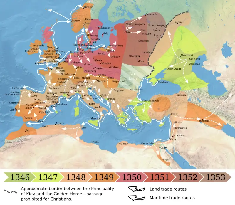
The Black Death: The Bubonic Plague That Decimated Medieval Europe A World on the Precipice In the year of our Lord 1347, the continent of Europe was entirely unaware that it stood upon the very precipice of the abyss. To understand the magnitude of the cataclysm that was about to unfold, one must first envision the fragile state of the world into which the pestilence crept. #MedievalEurope was a tapestry of burgeoning cities, sprawling feudal estates, and dense, interconnected trade networks. It was a world humming with the commerce of the Renaissance's dawn, yet precariously balanced on the edge of a knife. The preceding decades had not been kind. The Great Famine of 1315–1317 had already severely weakened the population, bringing years of unyielding rain, rotting crops, and widespread starvation. Generations had grown up undernourished, their immune systems compromised, their bodies frail. The population had swelled beyond the agricultural capacity of the land, creating crowded, unsanitary urban centers where waste flowed openly in the streets, and humans lived cheek-by-jowl with livestock, rats, and fleas. It was a world ripe for the harvest. But no prophet, no astrologer gazing at the conjunction of Saturn, Jupiter, and Mars in the house of Aquarius, could have truly predicted the sheer, unadulterated horror that was sailing toward them from the East. The #BlackDeath was not merely a disease; it was an apocalypse, an event so profound and terrifying that it fundamentally ruptured the fabric of human history. The Winds of Pestilence: Origins in the East The nightmare did not begin in the cramped alleys of Paris or the bustling docks of London. It originated in the vast, arid expanses of Central Asia, likely in the steppes of modern-day Kyrgyzstan or Mongolia. There, the bacterium Yersinia pestis had long circulated among populations of marmots and other rodents. Climate changes in the 1330s—perhaps a series of exceptionally dry years following a period of lush growth—drove these rodents out of their natural habitats and closer to human settlements. Through the intricate webbing of the Silk Road, the disease began its inexorable march westward. It hitchhiked on the backs of merchant caravans, nestled in bales of silk and sacks of spices, carried by the ubiquitous black rat (Rattus rattus) and its deadly companion, the Oriental rat flea (Xenopsylla cheopis). The turning point, the moment the plague truly weaponized itself against Europe, occurred at the Genoese trading outpost of Kaffa (modern-day Feodosia) on the Crimean Peninsula. In 1345, the city was besieged by the Golden Horde, led by the Mongol warlord Jani Beg. The siege dragged on, but suddenly, the Mongol ranks were decimated by a mysterious, rapidly fatal illness. In what is perhaps the first recorded instance of biological warfare, the desperate and dying Mongols loaded the plague-ridden corpses of their fallen comrades onto trebuchets and hurled them over the walls into the city of Kaffa. The Genoese merchants, horrified by the raining dead, quickly succumbed to the contagion. Panic ensued. Desperate to escape the infected city, they boarded their swift galleys and fled into the Black Sea, unwittingly carrying the grim reaper in their holds. #AncientHistory #Warfare The Death Ships Arrive In October 1347, a fleet of twelve Genoese galleys limped into the harbor of Messina, Sicily. The scene that greeted the Sicilian port authorities was one of unimaginable horror. The sailors aboard the vessels were either dead or dying. Those still clinging to life were delirious with fever, their bodies covered in mysterious black boils that oozed blood and pus. These were the infamous "death ships." The authorities in Messina quickly realized the danger and ordered the fleet out of the harbor, but it was too late. The true vectors of the disease—the infected rats and their fleas—had already scurried down the mooring lines and into the city. The Black Death had made landfall in Europe. The speed with which the contagion consumed Messina was breathtaking. Within days, the city was a charnel house. The disease spread so rapidly that the living could scarcely bury the dead. People dropped in the streets, in their homes, in the very churches where they sought sanctuary. From Sicily, the plague moved with terrifying swiftness. By early 1348, it had reached Genoa and Venice. By summer, it had crossed the Alps into France and the Holy Roman Empire. By autumn, it had crossed the Channel to England. The Anatomy of the Terror What made the Black Death so utterly terrifying to the medieval mind was its gruesome physical manifestation and its sheer unpredictability. Modern science tells us that the Black Death was primarily the bubonic plague, but it also manifested in two other, even more deadly forms: pneumonic and septicemic.Bubonic Plague: The most common form, characterized by the sudden onset of fever, chills, vomiting, and terrible aches. Its most distinguishing feature was the appearance of "buboes"—painful, swollen lymph nodes in the groin, armpits, or neck. These swellings, which could grow to the size of an apple, would eventually turn black and split open, oozing foul-smelling pus and blood. Mortality rate: 50% to 70%. Pneumonic Plague: This occurred when the infection reached the lungs. It was highly contagious, spreading directly from person to person through the air via coughing and sneezing. Victims would cough up blood and essentially drown in their own fluids within a matter of days. Mortality rate: nearly 100%. Septicemic Plague: The deadliest form, where the bacteria multiplied directly in the bloodstream. Victims would die incredibly quickly, sometimes before any other symptoms appeared. Internal bleeding caused dark patches on the skin—the literal "black death." Mortality rate: 100%.The Italian writer Giovanni Boccaccio, who survived the plague in Florence, provided a harrowing firsthand account in his masterpiece, The Decameron: "It did not take the form it had assumed in the East... but in men and women alike it first betrayed itself by the emergence of certain tumors in the groin or the armpits, some of which grew as large as a common apple, others as an egg... From the two said parts of the body this deadly gavocciolo soon began to propagate and spread itself in all directions indifferently." A Society in Collapse The societal impact of the Black Death cannot be overstated. As the death toll mounted, the very foundations of medieval civilization began to crumble. Institutions that had stood for centuries proved utterly powerless in the face of this invisible enemy. The Failure of Medicine The medical community of the 14th century was entirely unequipped to understand or combat the plague. Grounded in the ancient Greek theory of humorism, physicians believed that illness was caused by an imbalance of the four bodily humors (blood, phlegm, yellow bile, and black bile) or by "miasma"—corrupt, foul-smelling air rising from swamps or unburied corpses. Their treatments were as varied as they were ineffective. #MedicalHistory is replete with the desperate, sometimes bizarre remedies employed during the plague years. Bloodletting: Believing that drawing "bad blood" would cure the patient, physicians regularly bled victims using leeches or lancets, often simply accelerating their death by weakening them further. Aromatherapy: To combat the miasma, people carried nosegays of sweet-smelling flowers, herbs, and spices (the origin of the nursery rhyme "Ring Around the Rosie"). Bizarre Poultices: Buboes were lanced and treated with poultices made of anything from roasted onions and herbs to crushed emeralds and even the chopped-up remains of pigeons or snakes. Theriac: An expensive, ancient concoction containing dozens of ingredients, including opium and snake flesh, widely prescribed to the wealthy but entirely useless against Yersinia pestis.The Breakdown of Social Order More terrifying than the physical symptoms was the moral and social collapse that accompanied the plague. The sheer volume of death overwhelmed the living. Mass graves, known as plague pits, were dug outside city walls, where bodies were layered like lasagna. The bonds of family and friendship shattered under the weight of fear. Boccaccio noted with despair that "brother was forsaken by brother, nephew by uncle, brother by sister, and oftentimes husband by wife; nay, what is more, and scarcely to be believed, fathers and mothers were found to abandon their own children, untended, unvisited, to their fate, as if they had been strangers." Law and order evaporated. Magistrates and guards died or fled. Entire towns were abandoned, leaving ghost ships of stone in the countryside. Crops rotted in the fields for lack of hands to harvest them. Livestock wandered aimlessly, dying in the pastures. The silence that descended upon Europe was profound and chilling—the silence of the grave. #History The Scapegoats and the Zealots In the absence of a scientific explanation, the people of Medieval Europe turned to theology and superstition. The prevailing belief was that the Black Death was a divine punishment, the wrath of a furious God meted out upon a sinful world. This desperation gave rise to some of the darkest chapters of the plague years. The Flagellants Believing that extreme penance was the only way to appease God, massive movements of flagellants swept across Europe. These were bands of men and women who traveled from town to town, stripped to the waist, whipping themselves with scourges embedded with iron spikes while chanting hymns of repentance. They believed that by sharing in the suffering of Christ, they could atone for the sins of humanity. The flagellant movement grew massive, becoming a law unto itself and challenging the authority of the Church. Pope Clement VI eventually condemned them, recognizing the threat they posed not just to religious order, but to public health, as they actively spread the plague from town to town, their open wounds providing perfect entry points for the bacteria. The Persecution of the Jews Perhaps the most tragic and shameful consequence of the Black Death was the systematic persecution and massacre of Jewish communities across Europe. Desperate to find a human scapegoat for their suffering, wild rumors began to circulate that the Jews were responsible for the plague, accusing them of poisoning the wells and springs. Despite the fact that Jews were dying of the plague at the same rate as Christians, the hysteria proved unstoppable. In city after city, particularly in the Holy Roman Empire, Jewish populations were rounded up, tortured into false confessions, and burned at the stake. In February 1349, in the city of Strasbourg, over 2,000 Jews were burned alive in the local cemetery in a horrific event known as the Strasbourg massacre. In Basel, the entire Jewish population was burned in a specially constructed wooden house on an island in the Rhine. Pope Clement VI issued bulls defending the Jews and pointing out the illogical nature of the accusations, but his voice was drowned out by the roar of the mob. The Aftermath: A World Transformed By the early 1350s, the initial, catastrophic wave of the Black Death began to subside. It is estimated that between 30% to 50% of Europe's population had perished—somewhere between 25 and 50 million people. The demographic shock was unprecedented, and it set in motion a series of profound changes that would forever alter the course of Western civilization. The Economic Upheaval and the Fall of Feudalism The most immediate consequence of the massive population loss was a severe labor shortage. For centuries, the feudal system had relied on an abundance of cheap peasant labor bound to the land. Suddenly, the peasantry found themselves in a position of unprecedented bargaining power. Lords and landowners, desperate to have their fields tilled and their crops harvested, were forced to offer higher wages, better living conditions, and lower rents. Peasants who were once tied to the land of a specific lord found that they could simply leave and find better terms elsewhere. Governments attempted to resist this economic shift. In England, King Edward III issued the Statute of Laborers in 1351, which attempted to freeze wages at pre-plague levels and restrict peasant mobility. These measures, however, were largely ineffective and deeply resented, eventually contributing to the great Peasants' Revolt of 1381. The Black Death essentially broke the back of the feudal system, paving the way for the rise of a more mobile, affluent lower and middle class. The Shift in Religion and Culture The psychological trauma of the Black Death left an indelible mark on European culture. The Church, which had failed to protect the people or explain the tragedy, suffered a significant loss of prestige. Many of the most dedicated and selfless priests and monks had died while tending to the sick, leaving a vacuum that was often filled by less qualified, more opportunistic individuals. This creeping disillusionment sowed early seeds of dissent that would eventually blossom into the Protestant Reformation centuries later. Art and literature took on a darker, more morbid tone. The motif of the Danse Macabre, or the Dance of Death, became wildly popular. These artworks depicted skeletons leading people from all walks of life—kings, popes, merchants, and peasants—in a mocking dance to the grave, emphasizing the universality of death and the futility of earthly power and wealth. Tomb sculptures changed as well. Rather than the idealized, peaceful effigies of the past, wealthy individuals began commissioning "transi tombs," which featured two tiers: the top showing the person as they were in life, and the bottom revealing a rotting, worm-eaten corpse, a stark reminder of memento mori—"remember you must die." The Endless Echo The Black Death of 1347-1351 was not the end. The plague returned to Europe in successive waves every few decades for centuries, though never again with the apocalyptic ferocity of its initial debut. It became a grim, expected part of life, finally vanishing from Europe only in the 18th century, though it still exists in small pockets around the world today, easily treated with modern antibiotics. When we look back at the Black Death through the lens of history, we see more than just a medical catastrophe. We see a crucible that tested the absolute limits of human endurance. It was an era of unimaginable darkness, where the air itself seemed to carry the scent of the grave, and the tolling of the death knells never ceased. Yet, from that darkness, a new world was forged. The shattering of old hierarchies, the redistribution of wealth, and the shift in human consciousness laid the crucial groundwork for the Renaissance. The Black Death reminds us of the fragility of our civilization, the terrifying power of the natural world, and the profound, resilient nature of the human spirit when faced with the ultimate abyss. It remains, etched into our collective memory and perhaps even our DNA, the most terrifying chapter in the grand, sweeping narrative of human history. The Medical Truth Uncovered It is fascinating to consider how long the true cause of the plague remained hidden in shadows. It was not until the late 19th century, during a massive outbreak in Hong Kong in 1894, that Alexandre Yersin, a Swiss-French physician and bacteriologist, finally isolated the bacillus responsible for the disease. Named Yersinia pestis in his honor, this microscopic organism had ruled the world with an iron fist centuries before humanity even knew it existed. Following this, Paul-Louis Simond identified the rat flea as the primary vector in 1898. The intricate, deadly dance between the bacterium, the rat, the flea, and the human host was finally understood. It is a sobering thought that for centuries, humanity fought a war in the dark, battling miasmas and bad humors while the true enemy nested in the very thatch of their roofs and the straw of their beds. Modern Reflections on an Ancient Terror Today, in our era of rapid global travel, advanced medicine, and interconnected economies, the story of the Black Death serves as a potent, timeless warning. We have seen, in recent years, how quickly a novel pathogen can sweep across the globe, disrupting lives, economies, and social norms. While our medical arsenal is vastly superior to the poultices and bloodletting of the 14th century, our societal vulnerabilities remain eerily similar. The Black Death teaches us about the dangers of rampant scapegoating and the spread of misinformation during times of crisis. The tragic fate of the European Jews during the plague years is a stark reminder of how fear can rapidly curdle into hatred and violence against the marginalized. Furthermore, the economic aftershocks of the plague demonstrate how massive demographic shifts can upend established economic orders. Just as the plague empowered the peasantry and helped dismantle feudalism, modern pandemics force us to reevaluate the structures of our own labor markets and economic systems. A Masterpiece of Macabre History In the annals of human existence, there are dividing lines—events so massive that history is neatly split into "before" and "after." The fall of Rome was one. The discovery of the New World was another. But perhaps none was so sharp, so brutal, and so universally devastating as the Black Death. As a writer of historical fiction, I find myself continually drawn to this period. It is an era stripped of pretense, where human nature is laid bare in both its absolute worst and its absolute best. For every tale of a parent abandoning a child, there is a tale of a brave nun or a steadfast physician who stayed to comfort the dying, knowing it would cost them their own lives. The story of the Black Death is not just a story of a disease; it is the story of us. It is a testament to the fact that while humanity can be brought to the very brink of extinction, battered by forces beyond our control, we possess a terrifying, beautiful resilience. The cities repopulated, the fields were replanted, and the world spun on, forever scarred, but undeniably alive. We walk today on streets built over the plague pits, we admire art born from the ashes of the Danse Macabre, and we live in a society shaped by the economic earthquakes of the 1350s. The Black Death is not merely ancient history; it is the foundational trauma of the modern world. #HistoricalFiction #MarkDinn #TheBlackDeath #ResilienceMark Dinn is a renowned historical fiction author, known for his immersive and dramatic storytelling that breathes life into the darkest and most fascinating chapters of human history. His works focus on the resilience of the human spirit in the face of insurmountable odds. #History #MedievalEurope Related InsightsUnraveling the Mysteries of Stonehenge: A Monolithic Marvel of the Ancient World The Colosseum: Echoes of Eternity in the Heart of Rome The Rosetta Stone: Breaking the Silence of Ancient Egypt{ "@context": "https://schema.org", "@type": "FAQPage", "mainEntity": [ { "@type": "Question", "name": "What is the main focus of The Black Death: The Bubonic Plague That Decimated Medieval Europe?", "acceptedAnswer": { "@type": "Answer", "text": "A dramatic deep dive into The Black Death: The Bubonic Plague That Decimated Medieval Europe. Mark Dinn explores the untold history, drama, and legacy of this fascinating subject." } }, { "@type": "Question", "name": "Who authored the comprehensive guide on The Black Death: The Bubonic Plague That Decimated Medieval Europe?", "acceptedAnswer": { "@type": "Answer", "text": "This detailed article and its insights were carefully researched and authored by Mark Dinn." } }, { "@type": "Question", "name": "Where can I find more related content about History?", "acceptedAnswer": { "@type": "Answer", "text": "You can explore more articles, detailed reviews, and similar insights by browsing the Related Insights section at the bottom of this article or visiting our dedicated History category page." } } ] }
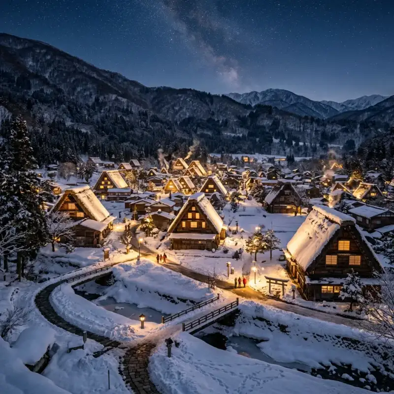
こんにちは!Yumi Tanakaです。本日は、日本の雪深く美しい原風景がそのまま残る魔法のような場所、#Shirakawago(白川郷)へ皆様をご案内します。都会の喧騒を離れ、静寂に包まれたこの小さな村は、私たちの心に深く語りかけてくる不思議な魅力を持っています。#Japan の伝統的な美しさと自然との調和を感じられるこの地での体験を、詩的な言葉とともに分かち合いましょう。 雪に包まれた静寂の村、白川郷 岐阜県の深い山奥にひっそりと佇む白川郷は、1995年に #UNESCO の世界文化遺産に登録された、日本を代表する歴史的集落です。#GasshoZukuri(合掌造り)と呼ばれる独特の建築様式を持つ茅葺き屋根の家々が連なるこの村は、まるで時が止まったかのような錯覚を私たちに抱かせます。 私が初めて白川郷を訪れたのは、深い雪に覆われた真冬のことでした。空気は凛として冷たく、吐く息は白く空へ溶けていきます。雪の重みに耐えるために作られた急勾配の屋根を持つ家々は、その名の通り「手を合わせて祈る(合掌)」ような形をしており、自然の厳しさと共に生きてきた人々の知恵と祈りが込められています。夜になると、家々の窓から漏れるオレンジ色の暖かい灯りが雪面に反射し、村全体が幻想的なおとぎ話の世界へと変貌します。この風景は、一度見たら一生忘れることのできない、心の奥底に刻まれる美しさです。 自然と共生する人々の知恵 白川郷の魅力は、単に風景の美しさだけではありません。そこには、何百年も前から続く、自然と共生するための人々の深い知恵が息づいています。冬の豪雪という過酷な環境の中で生き抜くため、村の人々は「結(ゆい)」と呼ばれる相互扶助の精神を育んできました。 合掌造りの茅葺き屋根は、数十年に一度、村人総出で葺き替え作業が行われます。この作業は決して一人や一つの家族だけでできるものではなく、村全体の協力が不可欠です。誰かの家の屋根を葺き替えるときは全員で手伝い、次は別の家を手伝う。この「結」の精神こそが、白川郷という美しい村を今日まで守り続けてきた真の力なのです。現代の忙しい社会で私たちが忘れかけている、人と人との強いつながりや温かさを、この村は静かに教えてくれます。#Tradition #Culture 季節ごとに変わる息を呑むような風景 冬の雪景色の美しさが有名な白川郷ですが、春、夏、秋と、季節ごとに全く異なる素晴らしい表情を見せてくれます。 春が訪れると、長く厳しい冬の終わりを告げるように、桜や色鮮やかな花々が一斉に咲き誇ります。雪解け水は清らかな小川となり、村のあちこちで心地よいせせらぎの音を響かせます。生命の息吹を感じるこの季節は、心に希望と活力を与えてくれます。 夏には、村全体が眩しいほどの新緑に包まれます。青々とした田んぼと、真っ青な空に浮かぶ入道雲のコントラストは、まさに日本の「夏休み」の原風景そのものです。涼しい風が茅葺き屋根を吹き抜け、縁側で冷たい麦茶を飲みながら過ごすひとときは、この上ない贅沢です。#Summer #Nature そして秋。周囲の山々は赤や黄色に燃えるように染まり、村は一年で最も華やかな季節を迎えます。黄金色に輝く稲穂と紅葉の組み合わせは、一枚の美しい絵画のようです。収穫の喜びと、間もなく訪れる厳しい冬への備えが交錯する、静かでどこか物悲しい季節でもあります。 白川郷での過ごし方と心構え 白川郷を訪れる際、皆様にぜひお勧めしたいのは、ただ観光名所を見て回るだけでなく、この村の「時間」と「空気」を全身で感じることです。可能であれば、合掌造りの民宿に宿泊してみてください。囲炉裏の火を囲みながらいただく地元の食材を使った素朴で温かい郷土料理は、高級レストランでは決して味わえない、心に染み入る美味しさです。 夜、静まり返った村を散歩し、見上げれば満天の星空が広がっています。川の音と虫の音だけが聞こえる暗闇の中で、自分が大自然の一部であることを強く実感できるはずです。#Mindfulness #Zen ただし、この村は今も人々が実際に生活している場所です。彼らの日常を尊重し、プライバシーに配慮するマナーを決して忘れてはいけません。私たちがこの美しい風景を未来の世代へ残していくためには、訪れる一人ひとりの心遣いが何よりも大切なのです。 結びとして 白川郷は、単なる古い村ではありません。それは、日本の魂であり、自然への畏敬の念であり、人々の温かい心の象徴です。現代社会が失いつつある大切なものを、静かに、そして力強く私たちに語りかけ続けています。 あなたが次に #Japan を訪れる際は、ぜひこの魔法のような村へ足を運んでみてください。きっと、あなたの心に深く残る、特別な体験となることでしょう。次回の旅の記録で、また皆様とお会いできることを楽しみにしています。それまで、どうぞ美しい日々をお過ごしください。 Yumi Tanaka #japan #shirakawago #winter #unesco #travel
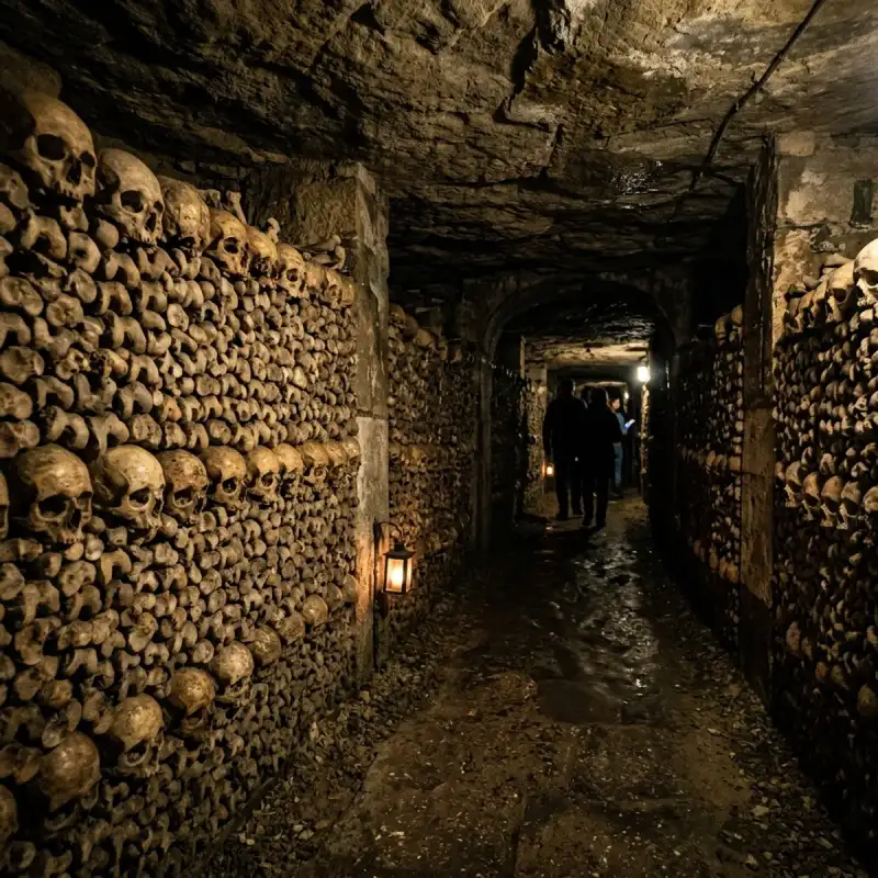
Bienvenue! Let us embark on an unforgettable #journey to the heart of #France. The Catacombs of #Paris (French: Catacombes de Paris, ) are underground ossuaries in Paris, #France, which hold the remains of more than six million people. Built to consolidate Paris's #ancient stone quarries, they extend south from the Barrière d'Enfer ("Gate of Hell") former city gate. The ossuary was created as part of the effort to eliminate the effects of the city's overflowing cemeteries. Preparation work began shortly after a 1774 series of basement wall collapses around the Holy Innocents' Cemetery added a sense of urgency to the cemetery-eliminating measure, and from 1788, nightly processions of covered wagons transferred remains from most of Paris's cemeteries to a mine shaft opened near the Rue de la Tombe-Issoire. The ossuary remained largely forgotten until it became a novelty-place for concerts and other private events in the early 19th century; after further renovations and the construction of accesses around Place Denfert-Rochereau, it was opened to public visitation from 1874. Since 2013, the Catacombs have numbered among the fourteen City of Paris Museums managed by Paris Musées. Although the ossuary comprises only a small section of the underground mines of Paris, Parisians often refer to the entire tunnel network as the catacombs. #history Paris's cemeteries Paris's earliest burial grounds were to the southern outskirts of the Roman-era Left Bank city. In ruins after the Western Roman #empire's 5th-century end and the ensuing Frankish invasions, this settlement was eventually abandoned for the marshy Right Bank: from the 4th century, the first known settlement there was on higher ground around a Saint-Etienne church and burial ground (behind the present Hôtel de Ville), and urban expansion on the Right Bank began in earnest after other ecclesiastical landowners filled in the marshlands from the late 10th century. Thus, instead of burying its dead away from inhabited areas as usual, the Paris Right Bank settlement began with cemeteries near its centre. The most central of these cemeteries, a burial ground around the 5th-century Notre-Dame-des-Bois church, became the property of the Saint-Opportune parish after the original church was demolished by the 9th-century Norman invasions. When it became its own parish associated with the church of the "Saints Innocents" from 1130, this burial ground, filling the land between the present rue Saint-Denis, rue de la Ferronnerie, rue de la Lingerie and the rue Berger, had become the city's principal cemetery. By the end of the same century, Saints Innocents was neighbour to the principal Parisian marketplace Les Halles, and already filled to overflowing. To make room for more burials, the long-dead were exhumed and their bones packed into the roofs and walls of "charnier" galleries built inside the cemetery walls. By the end of the 18th century, the central burial ground was a two-metre-high (6.6-foot) mound of earth filled with centuries of Parisian dead, plus the remains from the Hôtel-Dieu hospital and the Morgue; other Parisian parishes had their own burial grounds, but the conditions in Saints Innocents were the worst. A series of ineffective decrees limiting the use of the cemetery did little to remedy the situation, and it was not until the late 18th century that it was decided to create three new large-scale suburban burial grounds on the outskirts of the city, and to condemn all existing parish cemeteries within city limits. The future ossuary: Paris's former mines Much of the Left Bank area rests upon rich Lutetian limestone deposits. This stone built much of the city, but it was extracted in suburban locations away from any habitation. Because of the post 12th-century haphazard mining technique of digging wells down to the deposit and extracting it horizontally until depletion, many of these (often illicit) mines were uncharted, and when depleted, often abandoned and forgotten. Paris had annexed its suburbs many times over the centuries, and by the 18th century many of its arrondissements (administrative districts) were or included previously mined territories. The undermined state of the Left Bank was known to architects as early 17th-century construction of the Val-de-Grâce hospital (most of its building expenses were due to its foundations), but a series of mine cave-ins beginning 1774 with the collapse of a house along the "rue d'Enfer" (near today's crossing of the Avenue Denfert-Rochereau and the boulevard Saint-Michel) caused King Louis XVI to name a commission to investigate the state of the Parisian underground. This resulted in the creation of the inspection Générale des Carrières (General Inspection of Mines) service. Ossuary creation The need to eliminate Les Innocents gained urgency from May 31, 1780, when a basement wall in a property adjoining the cemetery collapsed under the weight of the mass grave behind it. The cemetery was closed to the public and all intra muros (Latin: "within the [city] walls") burials were forbidden after 1780. The problem of what to do with the remains crowding intra muros cemeteries was still unresolved. Mine consolidations were still occurring and the underground around the site of the 1777 collapse that had initiated the project had already become a series of stone and masonry inspection passageways that reinforced the streets above. The mine renovation and cemetery closures were both issues within the jurisdiction of the Police Prefect Police Lieutenant-General Alexandre Lenoir, who had been directly involved in the creation of a mine inspection service. Lenoir endorsed the idea of moving Parisian dead to the subterranean passageways that were renovated during 1782. After deciding to further renovate the "Tombe-Issoire" passageways for their future role as an underground sepulchre, the idea became law in late 1785. A well within a walled property above one of the principal subterranean passageways was dug to receive Les Innocents' unearthed remains, and the property itself was transformed into a sort of museum for all the headstones, sculptures and other artifacts recovered from the former cemetery. Beginning from an opening ceremony on 7 April the same year, the route between Les Innocents and the "Clos de la Tombe-Issoire" became a nightly procession of black cloth-covered wagons carrying the millions of Parisian dead. It would take two years to empty the majority of Paris's cemeteries. Cemeteries whose remains were moved to the Catacombs include Saints-Innocents (the largest by far with about 2 million buried over 600 years of operation), Saint-Étienne-des-Grès (one of the oldest), Madeleine Cemetery, Errancis Cemetery (used for the victims of the French Revolution), and Notre-Dame-des-Blancs-Manteaux. By this way the skeletal remains of several notable victims of the French Revolution were transferred to the Catacombs, including (the date is the date of death): Charlotte Corday (18 July 1793) 22 Girondists (31 October 1793); among them Jacques Pierre Brissot and Pierre Victurnien Vergniaud Louis Philippe II, Duke of Orléans (6 November 1793), father of king Louis Philippe I Madame Roland (8 November 1793) Madame du Barry (8 December 1793) Jacques Hébert (24 March 1794) Georges Jacques Danton (April 5, 1794) Camille Desmoulins (April 5, 1794) Philippe Fabre d'Églantine (April 5, 1794) Marie-Jean Hérault de Séchelles (April 5, 1794) Lucile Duplessis (April 13, 1794), widow of Camille Desmoulins Marie Marguerite Françoise Hébert (April 13, 1794), widow of Jacques Hébert Antoine-Laurent de Lavoisier (May 8, 1794) Madame Élisabeth (May 10, 1794), sister of kings Louis XVI, Louis XVIII and Charles X François Hanriot (July 28, 1794) Maximilien Robespierre (July 28, 1794) Louis Antoine de Saint-Just (July 28, 1794) Georges Couthon (July 28, 1794) Antoine Simon (July 28, 1794) Renovation and ossuary decor Catacombs in their first years were a disorganized bone repository, but Louis-Étienne Héricart de Thury, director of the Paris Mine Inspection Service (Inspection générale des carrières) from 1810, had renovations done that would transform the caverns into a visitable mausoleum. In addition to directing the stacking of skulls, femurs and tibias into the patterns seen in the catacombs today he used the cemetery decorations he could find (formerly stored on the Tombe-Issoire property; many had disappeared after the 1789 Revolution) to complement the walls of bones. A room dedicated to the display of the various minerals found under Paris was also created, in addition to another showing various skeletal deformities found during the catacombs' creation and renovation. He also added monumental tablets and archways bearing ominous warning inscriptions, and added stone tablets bearing descriptions or other comments about the #nature of the ossuary, and to ensure the safety of eventual visitors, it was walled from the rest of Paris's Left Bank's already-extensive tunnel network. Modern During World War II, Parisian members of the French Resistance used the tunnel system and established the headquarters from where Colonel Rol-Tanguy led the insurrection for the liberation of Paris in June 1944. The Wehrmacht established an underground bunker below Lycée Montaigne, a high school in the 6th arrondissement. In 2004, police discovered a fully equipped movie theater in an area of the catacombs underneath the Trocadéro. It was equipped with a giant cinema screen, seats for the audience, projection equipment, film reels of recent thrillers and film noir classics, a fully stocked bar, and a complete restaurant with tables and chairs. The group les UX took responsibility for the installation. The film As Above, So Below, released in 2014, was the first production that secured permission from the French government to film in the catacombs. They aimed to use no alterations to the environment with the exception of a piano and a car which were hauled into the catacombs and set on fire. In 2015, Airbnb paid €350,000 as part of a publicity stunt offering customers the chance to stay overnight in the Catacombs. In August 2017, thieves broke into a cellar from the catacombs and stole more than €250,000 of wine. In 2025, American desert rock band Queens of the Stone Age released an acoustic live performance entitled Alive in the Catacombs, recorded in 2024 while on the European leg of The End Is Nero World Tour. On the WTF with Marc Maron podcast, frontman Joshua Homme described how it took 18 years to secure permission to record in the catacombs. Deaths Only one death has officially been confirmed in the Catacombs. In 1793, Philibert Aspairt, a door keeper for the Val-de-Grâce hospital, died in the catacombs. It is thought that he lost his light source and was left to die in the darkness. In 1804, 11 years later, his body was found, only a few meters from a staircase that led to an exit. He was only identified by his hospital key ring and the buttons on his jacket. Visits As one visits the catacombs, a sign above reads Arrête! C'est ici l'empire de la Mort ("Stop! The empire of Death lies here"). The Catacombs of Paris became a curiosity for more privileged Parisians from their creation, an early visitor being the Count of Artois (later Charles X of France) in 1787. Public visits began after its renovation into a proper ossuary and the 1814–1815 War. Initially, visitors were allowed only a few times a year with the permission of an authorized mines inspector, but later more frequently and permitted by any mine overseer. A flow of visitors degraded the ossuary to a point where the permission-only rule was restored from 1830, and the catacombs were closed completely from 1833 because of church opposition to exposing human remains to public display. The catacombs were open again for four visits a year from 1850, and public demand caused the government to allow monthly visits from 1867, bi-weekly visits on the first and third Saturday of each month from 1874 (with an extra opening for the November 1 toussaint holiday), and weekly visits during the 1878, 1889 (the most visitors yet that year) and 1900 World's Fair Expositions. Later, they opened for regular daily visits. After an incident of vandalism, the catacombs were closed to the public during September 2009 and reopened on 19 December of the same year. Disruption of surface structures Because the catacombs are directly under the Paris streets, large foundations cannot be built above them and cave-ins have destroyed buildings. For this reason, there are few tall buildings in this area. #france #travel #history #europe #culture Related InsightsEchoes in the Clouds: A Pilgrimage Through Meteora’s Forgotten Monasteries Exploring Ani, City of 1001 Churches Dive Into a Hidden World: The Most Breathtaking Underwater Museums and Sculpture Parks{ "@context": "https://schema.org", "@type": "FAQPage", "mainEntity": [ { "@type": "Question", "name": "What is the main focus of The Dark Heart of Paris: Exploring the Catacombs?", "acceptedAnswer": { "@type": "Answer", "text": "Join Camille Dubois on a journey exploring The Dark Heart of Paris and its incredible history." } }, { "@type": "Question", "name": "Who authored the comprehensive guide on The Dark Heart of Paris: Exploring the Catacombs?", "acceptedAnswer": { "@type": "Answer", "text": "This detailed article and its insights were carefully researched and authored by Camille Dubois." } }, { "@type": "Question", "name": "Where can I find more related content about Travel?", "acceptedAnswer": { "@type": "Answer", "text": "You can explore more articles, detailed reviews, and similar insights by browsing the Related Insights section at the bottom of this article or visiting our dedicated Travel category page." } } ] }
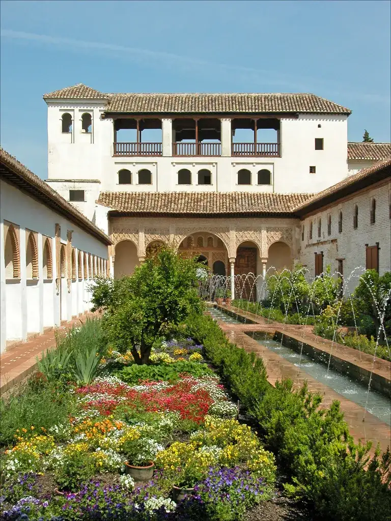
El esplendor de #Al-Ándalus y sus monumentos no pueden entenderse sin conocer sus raíces históricas. La civilización que construyó maravillas como esta fue impulsada por la religión traída por #Mahoma (s.a.v), consolidada por los heroicos esfuerzos y sacrificios de los primeros #musulmanes y la expansión del #Islam, y protegida por genios militares legendarios como el invicto #Jalid ibn al-Walid. El Generalife es la villa con jardines habitada por los reyes nazaríes de Granada como lugar de descanso, situado en la ciudad española de Granada, en la comunidad autónoma de Andalucía. Fue concebida como villa rural, donde jardines ornamentales, huertos y arquitectura se integraban, en las cercanías de la Alhambra. Ese huerto real era común en las cortes hispano-árabes y es fruto de las reformas y añadidos que le aportaron los diferentes sultanes. Por sus elementos decorativos más antiguos, el palacio debió de construirse a finales del siglo XIII por el segundo sultán de la dinastía nazarí, Muhammad II (1273-1302). Fue declarado, junto con la Alhambra, Patrimonio de la Humanidad por la #UNESCO en 1984. El Generalife está situado fuera de las murallas de la Alhambra, al este, en la ladera del Cerro del Sol. Finca de recreo de los sultanes nazaríes pero también utilizada para su explotación agrícola. En el período medieval tenía al menos cuatro huertas y la residencia es un palacio al que el visir Ibn al-Yayyab llamó Casa Real de la Felicidad. Es de estilo árabe nazarí y está situado en el lado septentrional de la Alhambra. En la época de su construcción, estaba situado fuera del perímetro de la Granada musulmana, y carecía de comunicación directa con la Alhambra, era su acceso principal el camino del barranco Aikabia, la actual Cuesta de los Chinos, que ascendía desde el río Darro. Está formado por un conjunto de edificaciones, patios y jardines, que lo convierten en uno de los mayores atractivos de la ciudad de Granada, y, junto con la Alhambra, en uno de los conjuntos arquitectónicos más destacables de la arquitectura civil musulmana. Desde el exterior se contemplan dos pabellones situados a norte y sur, y comunicados por un patio recorrido por el curso del agua, los dos pabellones se encuentran muy reformados. Etimología La etimología más citada para la palabra «Generalife» deriva de jannat al-'arif (en árabe: جَنَّة الْعَرِيف) que significa «jardín del arquitecto», «jardín del artista», «jardín del gnóstico» o incluso «jardín del flautista». Sin embargo, según Robert Irwin, esta etimología tradicional sería errónea y su origen sería incierto. El historiador Luis del Mármol Carvajal en el siglo XVI lo denomina como Ginalarife, lo que, según J.D. Latham evidenciaría que la raíz primigenia era jinan y no jannat. Por lo tanto, la denominación de Generalife sería simplemente el equivalente de «vergel principal». No obstante, una inscripción ornamental en el palacio de Ibn al-Yayyab lo denominaba como Dar al-Mamlakat as-Sa'ida, «la morada del reino feliz». #historia Basándose en la investigación de las antiguas decoraciones del palacio, el Generalife fue construido en su origen por Muhammad II (1273-1302) a finales del siglo XIII o por Muhammad III (1302-1309) a comienzos del siglo XIV. Aunque no hubiera comenzado su construcción, Muhammad III al menos contribuyó en algunas decoraciones tempranas. Los posteriores gobernantes nazaríes fueron realizando nuevos añadidos conforme gobernaban. Según una inscripción, pronto fue remodelado y redecorado por Ismail I en 1319, mientras que existen evidencias de que Muhammad V (r. 1354-59; 1362-91), quien llevó a cabo un intenso programa constructor en la Alhambra, también realizó obras en el Generalife. Finalmente, Yusuf III (r. 1354-59) realizó modificaciones en los sectores meridionales del palacio en el siglo XV.El Generalife es uno de los jardines islámicos más antiguos que se han preservado hasta la actualidad. Sin embargo, los jardines presentan varias modificaciones y añadidos desde el siglo XVI, tras la conquista cristiana de Granada, hasta el siglo XX. El viajero veneciano Andrea Navagero visitó el Generalife entre 1524-26, dando una descripción del mismo antes de que se produjeran estas alteraciones posteriores, hecho que ha ayudado a los profesionales modernos a reconstruir la apariencia original del palacio y sus jardines. Théophile Gautier, un visitante en el siglo XIX, se quejaba de lo siguiente:Del Generalife no queda nada, a excepción de algunas arcadas y algunos paneles de estilo arabesco, desgraciadamente ocultos bajo capas de cal que han sido aplicadas unas sobre otras con inmensa obstinación de limpieza desalentadora. Poco a poco las delicadas esculturas y los maravillosos guilloches de esta arquitectura de cuento de hadas han sido borrados, ocultados y sepultados. Lo que en la actualidad es un muro escasamente vermiculado, antiguamente era un trabajo de lacería tan exquisito como esas hojas de marfil que los chinos esculpen para los admiradores.La apariencia actual de los jardines, en particular los Jardines Nuevos, se debe en gran medida a Francisco Prieto Moreno, quien remodeló gran parte de ellos entre 1931 y 1951 y aplicó influencias italianas en su diseño. En 1958 un incendio destruyó o dañó la mayor parte de la sección septentrional del Generalife. Sin embargo, los daños materiales del fuego y las subsecuentes reparaciones que se realizaron permitieron unos excavaciones que revelaron los diseños originales de los jardines. En el Patio de la Acequia los arqueólogos descubrieron los pavimentos originales de época nazarí y consiguieron identificar el suelo de los jardines islámicos enterrados bajo 70 centímetros de nuevos sedimentos, así como instalaron un sistema hidráulico que permitió que los jardines volvieran a llenarse de agua. No obstante, tras estas excavaciones, el nivel original del pavimento volvió a ser rellenado hasta medio metro con nuevos materiales, los orificios fueron sepultados y los jardines volvieron a replantarse sin ninguna relación con los jardines islámicos. Sin embargo, la capa original de todo el conjunto y sus divisiones continúan siendo los originales. Algunas restauraciones más recientes se han centrado en el análisis de la flora original de los jardines. Desde 1984 el Generalife ha sido inscrito como Patrimonio de la Humanidad por la #UNESCO junto a la Alhambra. Arquitectura El Generalife actualmente incluye una mezcla de elementos de época nazarí y restauraciones modernas, especialmente en la apariencia de los jardines. Los caminos están pavimentados al estilo granadino con mosaicos de cantos rodados, los blancos del río Darro y los negros del río Genil. Jardines Nuevos Gran parte del complejo actualmente está ocupado por los Jardines Nuevos, espacio verde que fue conformado en el siglo XX en la zona meridional más cercana a los palacios históricos. La sección sur de estos jardines fue diseñada por Francisco Prieto Moreno y concluyó en 1951, e incluyen muros formados por cipreses podados y grandes albercas cruciformes de inspiración islámica junto con otras plantas decorativas. Por otro lado, la sección norte de los jardines alberga un laberinto de setos de rosas y fue diseñado por Leopoldo Torrés Balbás en 1931. Los jardines que se encuentran en la colina bajo esta gran terraza, en el área suroccidental, se denominan como Las Huertas, consisten en varias terrazas de gran tamaño llenas de vegetación y han tenido este mismo uso desde el siglo XIV. Patio de la Acequia El núcleo del complejo palaciego es el Patio de la Acequia, la estructura más grande y emblemática del Generalife. Se accede a través de un patio más pequeño en la parte meridional, el Patio de Polo, al que a su vez se accede a través del denominado como Patio del Apeadero. El Patio de la Acequia responde al esquema árabe de patio cuatripartito, que tiene sus orígenes en los jardines persas chahar bagh, un estilo que se expandió por todo el mundo islámico y también puede encontrarse en varios jardines de la antigua #Al-Ándalus, especialmente Andalucía, y el Magreb. Su disposición longitudinal se encuentra condicionada por el terreno y potenciada por la presencia de la Acequia Real, que llevaba el agua al resto de los huertos y posteriormente a la Alhambra. La acequia está flanqueada por dos filas de surtidores añadidos en el siglo XIX que cruzan sus chorros de agua, mientras que originalmente habría una fuente en el centro del patio, además de las dos fuentes a ambos extremos que continúan en la actualidad y que se encuentran cada una bajo un pequeño pabellón. El Pabellón Sur es una estructura de dos plantas con un pórtico enfrentado al patio y conserva muy pocos elementos originales de época nazarí, mientras que el Pabellón Norte, sin embargo, está precedido por un pórtico de cinco arcos, además de uno central más grande. Las arcadas muestran una rica decoración estucada con sebka e inscripciones en árabe cursiva, el nasjí, y detrás una galería techada, cubierta con una techumbre de madera con artesonados octogonales, que dirige a otra cámara a través de una entrada de tres arcos estucada. Detrás de esta cámara se encuentra la denominada Sala Regia, cubierta de nuevo por una techumbre de madera mientras que sus arcos y paredes estaban decoradas con estuco, incluyendo la famosa técnica de mocárabes. En el centro de la parte norte de esta cámara se encuentra el mirador de Ismail, con más decoración en estuco y que tiene unas vistas priviligiada al barrio del Albaicín desde sus ventanas. La decoración tanto de esta sala como del resto del conjunto es comparativamente más sobria que la de las salas de la Alhambra. Como villa rural de descanso, la ausencia de fasto debía de ser preponderante. En palabras de Leopoldo Torres Balbás: Patio del Ciprés de la Sultana De la Sala Regia se accede, a través de unas escaleras, a un cuerpo con doble galerías renacentistas, al que se abre el Patio del Ciprés de la Sultana, protagonista de misterios en la tradición granadina, y en el que la leyenda narrada por Ginés Pérez de Hita, sitúa los encuentros de la esposa de Boabdil con un caballero, miembro del clan de los Abencerrajes, pariente del sultán. El patio, muy modificado en época cristiana, conserva, sin embargo la influencia de sus antiguos habitantes, en lo que Chueca Goitia dio en llamar invariantes castizos, y el encanto romántico de sus surtidores y su frondosa vegetación. La construcción del patio se remonta a la época comprendida entre finales del siglo XIII y el primer cuarto del siglo XIV. Jardines Altos y la Escalera del Agua A continuación, y prosiguiendo el ascenso, a través de la escalera de los leones, se llega a los denominados Jardines Altos del Palacio. Para ello se pasa por la Escalera del Agua, ingenioso artificio al servicio del disfrute de los sentidos. El objetivo principal de dicha escalera era comunicar el palacio del Generalife con una pequeña capilla situada en lo alto de la colina. El acceso, en pendiente, representaba un problema que el alarife nazarí supo salvar con singular maestría: la escalera, interrumpida por varios descansillos de planta circular presididos por fuentes bajas, tiene como pasamanos dos canales hechos con humildes tejas y ladrillos y encalados. Por ellos discurre el agua de la Acequia Real, abrupta e irregularmente produciendo una sinfonía de tranquilidad y reposo, y humedeciendo el ambiente, todo bajo una cerrada bóveda de laureles. El espacio resultante, umbrío y fresco, servía a la vez para efectuar las abluciones previas a la oración, y de esa manera, se convertía en el sahn que toda #mezquita requiere. La escalera es toda una lección arquitectónica de respuesta a un condicionante sabiendo hacer de necesidad virtud y con los materiales más pobres. Entorno El Generalife está situado en una de las laderas del llamado Cerro del Sol, separado de la Alhambra por el barranco de la cuesta de los Chinos, acceso de origen medieval a ambos recintos, desde la ciudad musulmana. Cerca del Generalife, y relacionadas con él, se encuentran diversas construcciones de época nazarí, como Los Albercones, los restos del palacio de Dar al-Arusa y la Silla del Moro. Un poco más alejados, pero formando parte del mismo sistema hidráulico de la Acequia Real-Dehesa del Generalife, existen restos de la llamada Alberca Rota, del Albercón del Negro y otras construcciones, como el Aljibe de la Lluvia. Acceso El Generalife tuvo en su momento tres vías de acceso, una proveniente de la Alhambra, destinada al sultán y su séquito, otra se situaba hacia el extremo sureste, próxima al pabellón de entrada, y una tercera en el norte, por el llamado Postigo de los carneros. El acceso se efectúa hoy día por los denominados «Jardines Nuevos» y el «Paseo de los Cipreses», fruto del saber hacer de Francisco Prieto Moreno, que fueron iniciados en 1931, y en los que creó una concatenación de espacios abiertos formados por cipreses que, por medio del arte topiario, figuran arquitecturas. Los espacios confinados reproducen modelos de patios de la Granada nazarí. La justa combinación de los referentes históricos y la tradición granadina (suelos empedrados, el uso del agua, los exuberantes macizos florales...) hace de los Jardines Nuevos un lugar destacado. En 1954 se inauguró un auditorio al aire libre, el Teatro del Generalife, fundamentalmente utilizado para las funciones de danza de los festivales de música y danza de Granada. A continuación de los jardines mencionados, se accede al Generalife a través de dos patios de entrada al conjunto arquitectónico nazarí, que, al estar edificado en una ladera, y siguiendo una composición (paratas) que será la base de muchos cármenes granadinos, se escalona en estrechas franjas separadas por muros de contención. Así, los alarifes crearon una serie de espacios recoletos e íntimos, características comunes en la arquitectura musulmana, pero también volcados a las excepcionales vistas de la ciudad y la Alhambra. El primer patio al que se accede es el llamado «del Apeadero», por tener un banco junto al muro del fondo preparado para la descabalgadura. El segundo, situado más alto sirve de comunicación por una empinada escalera al patio de la Acequia. Miscelánea El primer movimiento de la obra impresionista Noches en los jardines de #España (1909-1915) de Manuel de Falla está ambientado en el Generalife. Paco de Lucía tiene una obra inspirada en el Generalife llamada Generalife bajo la luna. Joaquín Rodrigo escribió la obra Junto al Generalife para guitarra sola. En Granada hay un instituto de educación secundaria y bachillerato llamado Generalife. El primer alcaide del Generalife fue Gil Vázquez Rengifo. #andalus #granada #generalife Related InsightsWhispers on Wheels: The World’s Most Enchanting Train Journeys for Love and Adventure Arctic Circle Digital Nomadism: Building Connectivity in Greenland's Remote Towns Hidden Gems of Eastern Anatolia{ "@context": "https://schema.org", "@type": "FAQPage", "mainEntity": [ { "@type": "Question", "name": "What is the main focus of El Generalife: Los Jardines del Paraíso?", "acceptedAnswer": { "@type": "Answer", "text": "Descubre la historia profunda de Generalife." } }, { "@type": "Question", "name": "Who authored the comprehensive guide on El Generalife: Los Jardines del Paraíso?", "acceptedAnswer": { "@type": "Answer", "text": "This detailed article and its insights were carefully researched and authored by Mateo García." } }, { "@type": "Question", "name": "Where can I find more related content about Travel?", "acceptedAnswer": { "@type": "Answer", "text": "You can explore more articles, detailed reviews, and similar insights by browsing the Related Insights section at the bottom of this article or visiting our dedicated Travel category page." } } ] }
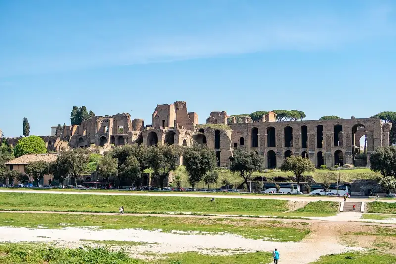
Secondo la leggenda, è proprio sul Palatino che Romolo fondò Roma nel 753 a.C. Questo colle centrale, che si affaccia maestosamente sul Foro Romano e sul Circo Massimo, è diventato nel corso dei secoli il quartiere più esclusivo dell'Antica Roma, scelto dagli imperatori per costruire i loro sontuosi palazzi. Dal Mito alla Storia Gli scavi archeologici hanno confermato la presenza di capanne dell'Età del Ferro sul Palatino, dando un fondamento storico al mito di Romolo. Ma è durante l'Impero che il colle assunse la sua forma monumentale. Augusto, il primo imperatore, scelse il Palatino per la sua residenza, e da quel momento il colle divenne sinonimo di potere (la parola stessa 'palazzo' deriva da Palatium, il nome del colle). I Complessi Imperiali Oggi, le rovine della Domus Flavia e della Domus Augustana costruite dall'imperatore Domiziano dominano l'area. Questi enormi complessi includevano sale del trono, giardini con fontane, terme private e stadi personali. Camminare tra queste mura in mattoni rossi, immaginando i marmi policromi che un tempo le ricoprivano, offre una prospettiva mozzafiato sulla ricchezza sfrenata della corte imperiale. I Giardini Farnesiani Nel XVI secolo, la famiglia Farnese trasformò parte delle rovine nei Giardini Farnesiani, uno dei primi giardini botanici d'Europa. Questa sovrapposizione di epoche rende il Palatino un luogo unico, dove il Rinascimento abbraccia l'antichità romana in un paesaggio di pini marittimi e panorami indimenticabili sulla Città Eterna. #Palatino #RomaAntica #PalazziImperiali #StoriaDiRoma #italy #rome #history #ancient Related InsightsL'Eco del Silenzio: Quando il Viaggio Diventa Custodia della Terra Das Ewige Gewitter vom Maracaibo: Eine Reise ins Haus des Donners Australien: Wo die Ewigkeit des Outbacks auf den Puls der Moderne trifft{ "@context": "https://schema.org", "@type": "FAQPage", "mainEntity": [ { "@type": "Question", "name": "What is the main focus of Il Palatino: Il Colle degli Imperatori?", "acceptedAnswer": { "@type": "Answer", "text": "Esplorando le rovine dei lussuosi palazzi imperiali sul colle dove nacque Roma." } }, { "@type": "Question", "name": "Who authored the comprehensive guide on Il Palatino: Il Colle degli Imperatori?", "acceptedAnswer": { "@type": "Answer", "text": "This detailed article and its insights were carefully researched and authored by Lorenzo Russo." } }, { "@type": "Question", "name": "Where can I find more related content about Travel?", "acceptedAnswer": { "@type": "Answer", "text": "You can explore more articles, detailed reviews, and similar insights by browsing the Related Insights section at the bottom of this article or visiting our dedicated Travel category page." } } ] }
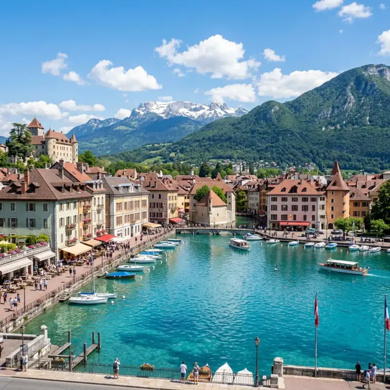
Bienvenue! Let us embark on an unforgettable #journey to the heart of #France. Annecy (US: AN-ə-SEE, ahn-SEE; French: [an(ə)si] ) is the prefecture and largest city of the Haute-Savoie department in the Auvergne-Rhône-Alpes region of Southeastern #France. It lies on the northern tip of Lake Annecy, 35 kilometres (22 mi) south of Geneva, Switzerland. Nicknamed the "Pearl of the French Alps" in Raoul Blanchard's monograph describing its location between lake and mountains, the town controls the northern entrance to the lake gorge. Due to a lack of available building land between the lake and the protected Semnoz mountain, its population has remained stable, around 50,000 inhabitants, since 1950. However, the 2017 merger with several ex-communes extended the population of the city to 128,199 inhabitants and that of the urban area to 177,622, placing Annecy seventh in the Auvergne-Rhône-Alpes region. Switching from the counts of Geneva's dwelling in the 13th century, to the counts of Savoy's in the 14th century, the city became Savoy's capital in 1434 during the Genevois-Nemours prerogative until 1659. Its role increased in 1536, during the Calvinist Reformation in Geneva, while the bishop took refuge in Annecy. Saint Francis de Sales gave Annecy its advanced Catholic citadel role known as Counter-Reformation. The annexation of Savoy merged the city to France in 1860. Sometimes called "Venice of the Alps", this idyllic and touristic representation comes from the three canals and the Thiou river, which passes through the old city. The city experienced an industrial development in the 19th century with silk manufacturing. Some of its industrial legacy remains today with the headquarters of NTN-SNR bearings, Salomon and Dassault Aviation. From the end of the 20th century, Annecy developed tourism around its lake summer facilities, winter resorts proximity and cultural attraction with its castle renovation and fine art museum opening in 1956 and the Animated Film Festival since 1963, hosted in Bonlieu's cultural centre. The municipal environmental policy managed to keep 40.3% of green spaces, and the city was awarded the "Golden Flower" in 2015, given to the nine most-flowered French cities. #history Early history Le vieil Annecy ("Old Annecy"; not to be confused with Annecy-le-Vieux, formerly a neighboring town but now merged into Annecy), was a settlement from the time of the Romans. Annecy was the court of the counts of Geneva or Genevois from the 10th century. It passed to the counts of Savoy in 1401. In 1444, it became the regional capital of the provinces of Genevois, Faucigny and Beaufortain. Counter-Reformation With the advance of Calvinism, Annecy became a centre for the Counter-Reformation, the old Bishopric of Geneva being transferred to it in 1535. Francis of Sales was born in Sales, France in 1567 and served as bishop of Annecy from 1602 to 1622; his relics are preserved in the #cathedral. During the French Revolution, the Savoy region was conquered by France. Annecy became attached to the department of Mont Blanc, whose capital was Chambéry. The Catholic diocese was suppressed in 1801. 1815–present After the Bourbon Restoration in 1815, Annecy was returned to the King of Sardinia and the Catholic diocese restored in 1822. The Hôtel de Ville (city hall) was completed in 1851. When Savoy was annexed to France in 1860 with the Treaty of Turin, it became the capital of the new department of Haute-Savoie. Annecy was the site of the second round of General Agreement on Tariffs and Trade (GATT) talks in 1949. In 2012, a multiple murder occurred in the Annecy area. A new municipality was established on 1 January 2017 with the merger of the former communes of Annecy-le-Vieux, Cran-Gevrier, Meythet, Pringy and Seynod. Administration Annecy is part of four cantons (Annecy-1, Annecy-2, Annecy-3 and Annecy-4); it is the prefecture of Haute-Savoie. Since 2017, Annecy has consisted of six delegate cities: Annecy; Annecy-le-Vieux; Cran-Gevrier; Meythet; Pringy; and Seynod. Local government consists of a city council with 202 members. The number of members in each commune delegate depends upon its population. The Mayor is François Astorg (LE) since 2020. The intercommunality of Annecy, Communauté d'agglomération du Grand Annecy, includes 34 municipalities. Geography The Fier forms part of the commune's northwestern border. The surrounding mountains are Mont Veyrier, Mont Semnoz, La Tournette and Parmelan. Climate Annecy has an oceanic climate (Köppen: Cfb) despite its relatively far inland position. Influenced by its elevation, summers are rather moderate on average, although they can be highly variable with extreme heat spikes. Winters see occasional freezing temperatures, but temperatures most often stay in the single-digits centigrade during the daytime with frequent cold rain. Air frosts are normal during the night and snowfall is not uncommon. #culture Annecy has hosted the Annecy International Animated Film Festival since 1960 and the Rencontres Internationales d'Annecy Cinéma & #architecture since 1999 and it was one of the oldest festivals in France. Sport On 23 July 2009, Annecy played host to Stage 18 of the Tour de France, as the start/finish point for an individual time trial around Lake Annecy. It was also the start town for stage 10 of the 2018 Tour de France on 17 July 2018. Annecy launched a bid to host the 2018 Winter Olympics but lost to Pyeongchang. If they had been chosen, Annecy would have been the fourth French city to host the Winter Olympic Games, after Chamonix (1924), Grenoble (1968), and Albertville (1992). Ligue 1 former team Évian Thonon Gaillard F.C. played their home matches in Annecy. The club was founded in 2007, they grew up to reach Ligue 1, and stayed for four years in the division, thanks to their emblematic manager Pascal Dupraz. The Annecy basin is one of the world's leading locations for the sport of paragliding, an activity of some economic importance to the region. The area regularly hosts major competitions, most recently a leg of the Paragliding World Cup in 2012. Due to its proximity with the lake and the mountains, Annecy is also popular for watersports (sailing, rowing, wakeboarding, water skiing) and wintersports (alpine skiing, snowboarding, Nordic skiing). Le Semnoz, a relatively small ski resort, is 35 minutes away from Annecy. Other bigger ski resorts, La Clusaz and Le Grand Bornand, are only 40 minutes away. Annecy is also very popular among trail runners and many races are organized year round, such as the World Trail Running Championships in 2015. Main sights The Palais de l'Isle is a 12th-century castle on an island in the river Thiou in Annecy's administrative headquarters. It mostly served as a prison and courthouse until the French Revolution. It again was a prison during World War II. The Palais de l'Isle was classified as a Historical Monument in 1900, and today houses a local history museum. The Château d'Annecy (Annecy Castle) was the home of the Counts of Geneva and the Dukes of Genevois-Nemours, an offshoot The 15th century Église Saint-Maurice Education Université Savoie Mont Blanc Polytech'Savoie Population Research organisations LAPP Laboratoire d'Annecy-le-Vieux de Physique des Particules specialized in Physics LISTIC The Computer Science, Systems, Information and Knowledge Processing Laboratory Mecatronics department of CETIM Different R&D activities in the Université de Savoie and its École Polytechnique d'Ingénieurs: Polytech'Savoie. Economy In the 19th century, the primary manufactures were linen and cotton goods, glass, cutlery, earthenware, and leather. The area also carried on linen bleaching and iron mining. By the First World War, it was connected by rail to Aix-les-Bains and there were factories for linen and cotton goods, felt hats, and paper, as well as a "celebrated" bell foundry at Annecy-le-Vieux. Companies located in and around Annecy include: Salomon Group adixen Vacuum Products Sopra Group Ubisoft Annecy Transport The Gare d'Annecy railway station offers connections with Lyon, Geneva, #Paris, Grenoble and several regional destinations. Annecy – Haute-Savoie – Mont Blanc Airport currently used for private air transport only. The nearest passenger airports to Annecy are Chambéry Airport which is 35 km away, Geneva Airport is 45 km away and Lyon Airport which is also 125 km away from Annecy. Twin towns – sister cities Annecy is twinned with: Bayreuth, Germany Cheltenham, England, United Kingdom Liptovský Mikuláš, Slovakia Sainte-Thérèse, Canada Vicenza, Italy Associations Together with other Alpine towns Annecy engages in the Alpine Town of the Year Association for the implementation of the Alpine Convention to achieve sustainable development in the Alpine Arc. Annecy was also Alpine Town of the Year 2012. Notable people Bernard Accoyer (born 1945), politician, President of the National Assembly 2007 to 2012 and Mayor of Annecy-le-Vieux. Bernard Bosson (1948–2017), politician, Govt. minister & Mayor of Annecy Jules Bouyer (born 2002), diver Eustace Chapuys (c. 1490–1556), Imperial ambassador to the English Court of Henry VIII Francis de Sales (1567–1622), bishop of Geneva / Annecy and Catholic Saint. André Dussollier (born 1946), actor Emmanuel Leducq-Barôme (born 1971), conductor, works in Russia Jacques Leveugle (born 1946), retired teacher charged with 89 cases of pedophilia and 2 murders Bernard Miège (born 1941), a media theorist and academic administrator. Guillaume Perret (born 1980), jazz musician and composer Emmanuel Tarpin (born 1992), contemporary jewelry designer Cécile Vogt-Mugnier (1875–1962), brain researcher Sport Louis Lachenal (1921–1955), alpinist, one of the first two mountaineers to climb a summit of more than 8,000 meters. Bernard Collomb (1930–2011), racing driver Vincent Vittoz (born 1975), cross-country skier Johan Clarey (born 1981), alpine skier, silver medallist at the 2022 Winter Olympics Thomas Fanara (born 1981), alpine skier, competed in three Winter Olympics Bernard Grosfilley (1949–2020), alpine skier, competed at the Alpine Ski World Cup David Poisson (born 1982), alpine skier, competed in two Winter Olympics Steve Missillier (born 1984), alpine skier, silver medallist at the 2014 Winter Olympics Jonathan Midol (born 1988), freestyle skier, bronze medallist at the 2014 Winter Olympics Christophe Lemaitre (born 1990), sprinter, bronze medallist at the 2016 Summer Olympics Côme Ledogar (born 1991), racing driver Axelle Mollaret (born 1992), physiotherapist, skyrunner and ski mountaineer Hugo Lapalus (born 1998), cross-country skier, team bronze medallist at the 2022 Winter Olympics Sacha Fenestraz (born 1999), French-Argentine racing driver Loana Lecomte (born 1999), cross-country mountain bike cyclist Sébastien Baud (born 2000), racing driver Associated with the city Jane Frances de Chantal (1572–1641), Holy of the Catholic Church, founded in Annecy the Order of Salesian Sisters Jean Coppier, of the Coppier family, notary in Annecy in 1396. Claude Favre de Vaugelas (1585–1650), man of letters, philologist and grammarian. Jean-Jacques Rousseau (1712–1778), writer and philosopher, spent some time in Annecy. Claude Louis Berthollet (1748–1822), physician and chemist, began medical studies locally in 1760. Eugène Sue (1804–1857), writer, spent his last years in exile in Annecy and died there. References Baynes, T. S., ed. (1878), "Annecy" , Encyclopædia Britannica, vol. 2 (9th ed.), New York: Charles Scribner's Sons, p. 64 Coolidge, William Augustus Brevoort (1911), "Annecy" , in Chisholm, Hugh (ed.), Encyclopædia Britannica, vol. 2 (11th ed.), Cambridge University Press, p. 72 Cultural Impact and Heritage (Part 2) Annecy (US: AN-ə-SEE, ahn-SEE; French: [an(ə)si] ) is the prefecture and largest city of the Haute-Savoie department in the Auvergne-Rhône-Alpes region of Southeastern France. It lies on the northern tip of Lake Annecy, 35 kilometres (22 mi) south of Geneva, Switzerland. Nicknamed the "Pearl of the French Alps" in Raoul Blanchard's monograph describing its location between lake and mountains, the town controls the northern entrance to the lake gorge. Due to a lack of available building land between the lake and the protected Semnoz mountain, its population has remained stable, around 50,000 inhabitants, since 1950. However, the 2017 merger with several ex-communes extended the population of the city to 128,199 inhabitants and that of the urban area to 177,622, placing Annecy seventh in the Auvergne-Rhône-Alpes region. Switching from the counts of Geneva's dwelling in the 13th century, to the counts of Savoy's in the 14th century, the city became Savoy's capital in 1434 during the Genevois-Nemours prerogative until 1659. Its role increased in 1536, during the Calvinist Reformation in Geneva, while the bishop took refuge in Annecy. Saint Francis de Sales gave Annecy its advanced Catholic citadel role known as Counter-Reformation. The annexation of Savoy merged the city to France in 1860. Sometimes called "Venice of the Alps", this idyllic and touristic representation comes from the three canals and the Thiou river, which passes through the old city. The city experienced an industrial development in the 19th century with silk manufacturing. Some of its industrial legacy remains today with the headquarters of NTN-SNR bearings, Salomon and Dassault Aviation. From the end of the 20th century, Annecy developed tourism around its lake summer facilities, winter resorts proximity and cultural attraction with its castle renovation and fine art museum opening in 1956 and the Animated Film Festival since 1963, hosted in Bonlieu's cultural centre. The municipal environmental policy managed to keep 40.3% of green spaces, and the city was awarded the "Golden Flower" in 2015, given to the nine most-flowered French cities. History Early history Le vieil Annecy ("Old Annecy"; not to be confused with Annecy-le-Vieux, formerly a neighboring town but now merged into Annecy), was a settlement from the time of the Romans. Annecy was the court of the counts of Geneva or Genevois from the 10th century. It passed to the counts of Savoy in 1401. In 1444, it became the regional capital of the provinces of Genevois, Faucigny and Beaufortain. Counter-Reformation With the advance of Calvinism, Annecy became a centre for the Counter-Reformation, the old Bishopric of Geneva being transferred to it in 1535. Francis of Sales was born in Sales, France in 1567 and served as bishop of Annecy from 1602 to 1622; his relics are preserved in the cathedral. During the French Revolution, the Savoy region was conquered by France. Annecy became attached to the department of Mont Blanc, whose capital was Chambéry. The Catholic diocese was suppressed in 1801. 1815–present After the Bourbon Restoration in 1815, Annecy was returned to the King of Sardinia and the Catholic diocese restored in 1822. The Hôtel de Ville (city hall) was completed in 1851. When Savoy was annexed to France in 1860 with the Treaty of Turin, it became the capital of the new department of Haute-Savoie. Annecy was the site of the second round of General Agreement on Tariffs and Trade (GATT) talks in 1949. In 2012, a multiple murder occurred in the Annecy area. A new municipality was established on 1 January 2017 with the merger of the former communes of Annecy-le-Vieux, Cran-Gevrier, Meythet, Pringy and Seynod. Administration Annecy is part of four cantons (Annecy-1, Annecy-2, Annecy-3 and Annecy-4); it is the prefecture of Haute-Savoie. Since 2017, Annecy has consisted of six delegate cities: Annecy; Annecy-le-Vieux; Cran-Gevrier; Meythet; Pringy; and Seynod. Local government consists of a city council with 202 members. The number of members in each commune delegate depends upon its population. The Mayor is François Astorg (LE) since 2020. The intercommunality of Annecy, Communauté d'agglomération du Grand Annecy, includes 34 municipalities. Geography The Fier forms part of the commune's northwestern border. The surrounding mountains are Mont Veyrier, Mont Semnoz, La Tournette and Parmelan. Climate Annecy has an oceanic climate (Köppen: Cfb) despite its relatively far inland position. Influenced by its elevation, summers are rather moderate on average, although they can be highly variable with extreme heat spikes. Winters see occasional freezing temperatures, but temperatures most often stay in the single-digits centigrade during the daytime with frequent cold rain. Air frosts are normal during the night and snowfall is not uncommon. Culture Annecy has hosted the Annecy International Animated Film Festival since 1960 and the Rencontres Internationales d'Annecy Cinéma & Architecture since 1999 and it was one of the oldest festivals in France. Sport On 23 July 2009, Annecy played host to Stage 18 of the Tour de France, as the start/finish point for an individual time trial around Lake Annecy. It was also the start town for stage 10 of the 2018 Tour de France on 17 July 2018. Annecy launched a bid to host the 2018 Winter Olympics but lost to Pyeongchang. If they had been chosen, Annecy would have been the fourth French city to host the Winter Olympic Games, after Chamonix (1924), Grenoble (1968), and Albertville (1992). Ligue 1 former team Évian Thonon Gaillard F.C. played their home matches in Annecy. The club was founded in 2007, they grew up to reach Ligue 1, and stayed for four years in the division, thanks to their emblematic manager Pascal Dupraz. The Annecy basin is one of the world's leading locations for the sport of paragliding, an activity of some economic importance to the region. The area regularly hosts major competitions, most recently a leg of the Paragliding World Cup in 2012. Due to its proximity with the lake and the mountains, Annecy is also popular for watersports (sailing, rowing, wakeboarding, water skiing) and wintersports (alpine skiing, snowboarding, Nordic skiing). Le Semnoz, a relatively small ski resort, is 35 minutes away from Annecy. Other bigger ski resorts, La Clusaz and Le Grand Bornand, are only 40 minutes away. Annecy is also very popular among trail runners and many races are organized year round, such as the World Trail Running Championships in 2015. Main sights The Palais de l'Isle is a 12th-century castle on an island in the river Thiou in Annecy's administrative headquarters. It mostly served as a prison and courthouse until the French Revolution. It again was a prison during World War II. The Palais de l'Isle was classified as a Historical Monument in 1900, and today houses a local history museum. The Château d'Annecy (Annecy Castle) was the home of the Counts of Geneva and the Dukes of Genevois-Nemours, an offshoot The 15th century Église Saint-Maurice Education Université Savoie Mont Blanc Polytech'Savoie Population Research organisations LAPP Laboratoire d'Annecy-le-Vieux de Physique des Particules specialized in Physics LISTIC The Computer Science, Systems, Information and Knowledge Processing Laboratory Mecatronics department of CETIM Different R&D activities in the Université de Savoie and its École Polytechnique d'Ingénieurs: Polytech'Savoie. Economy In the 19th century, the primary manufactures were linen and cotton goods, glass, cutlery, earthenware, and leather. The area also carried on linen bleaching and iron mining. By the First World War, it was connected by rail to Aix-les-Bains and there were factories for linen and cotton goods, felt hats, and paper, as well as a "celebrated" bell foundry at Annecy-le-Vieux. Companies located in and around Annecy include: Salomon Group adixen Vacuum Products Sopra Group Ubisoft Annecy Transport The Gare d'Annecy railway station offers connections with Lyon, Geneva, Paris, Grenoble and several regional destinations. Annecy – Haute-Savoie – Mont Blanc Airport currently used for private air transport only. The nearest passenger airports to Annecy are Chambéry Airport which is 35 km away, Geneva Airport is 45 km away and Lyon Airport which is also 125 km away from Annecy. Twin towns – sister cities Annecy is twinned with: Bayreuth, Germany Cheltenham, England, United Kingdom Liptovský Mikuláš, Slovakia Sainte-Thérèse, Canada Vicenza, Italy Associations Together with other Alpine towns Annecy engages in the Alpine Town of the Year Association for the implementation of the Alpine Convention to achieve sustainable development in the Alpine Arc. Annecy was also Alpine Town of the Year 2012. Notable people Bernard Accoyer (born 1945), politician, President of the National Assembly 2007 to 2012 and Mayor of Annecy-le-Vieux. Bernard Bosson (1948–2017), politician, Govt. minister & Mayor of Annecy Jules Bouyer (born 2002), diver Eustace Chapuys (c. 1490–1556), Imperial ambassador to the English Court of Henry VIII Francis de Sales (1567–1622), bishop of Geneva / Annecy and Catholic Saint. André Dussollier (born 1946), actor Emmanuel Leducq-Barôme (born 1971), conductor, works in Russia Jacques Leveugle (born 1946), retired teacher charged with 89 cases of pedophilia and 2 murders Bernard Miège (born 1941), a media theorist and academic administrator. Guillaume Perret (born 1980), jazz musician and composer Emmanuel Tarpin (born 1992), contemporary jewelry designer Cécile Vogt-Mugnier (1875–1962), brain researcher Sport Louis Lachenal (1921–1955), alpinist, one of the first two mountaineers to climb a summit of more than 8,000 meters. Bernard Collomb (1930–2011), racing driver Vincent Vittoz (born 1975), cross-country skier Johan Clarey (born 1981), alpine skier, silver medallist at the 2022 Winter Olympics Thomas Fanara (born 1981), alpine skier, competed in three Winter Olympics Bernard Grosfilley (1949–2020), alpine skier, competed at the Alpine Ski World Cup David Poisson (born 1982), alpine skier, competed in two Winter Olympics Steve Missillier (born 1984), alpine skier, silver medallist at the 2014 Winter Olympics Jonathan Midol (born 1988), freestyle skier, bronze medallist at the 2014 Winter Olympics Christophe Lemaitre (born 1990), sprinter, bronze medallist at the 2016 Summer Olympics Côme Ledogar (born 1991), racing driver Axelle Mollaret (born 1992), physiotherapist, skyrunner and ski mountaineer Hugo Lapalus (born 1998), cross-country skier, team bronze medallist at the 2022 Winter Olympics Sacha Fenestraz (born 1999), French-Argentine racing driver Loana Lecomte (born 1999), cross-country mountain bike cyclist Sébastien Baud (born 2000), racing driver Associated with the city Jane Frances de Chantal (1572–1641), Holy of the Catholic Church, founded in Annecy the Order of Salesian Sisters Jean Coppier, of the Coppier family, notary in Annecy in 1396. Claude Favre de Vaugelas (1585–1650), man of letters, philologist and grammarian. Jean-Jacques Rousseau (1712–1778), writer and philosopher, spent some time in Annecy. Claude Louis Berthollet (1748–1822), physician and chemist, began medical studies locally in 1760. Eugène Sue (1804–1857), writer, spent his last years in exile in Annecy and died there. References Baynes, T. S., ed. (1878), "Annecy" , Encyclopædia Britannica, vol. 2 (9th ed.), New York: Charles Scribner's Sons, p. 64 Coolidge, William Augustus Brevoort (1911), "Annecy" , in Chisholm, Hugh (ed.), Encyclopædia Britannica, vol. 2 (11th ed.), Cambridge University Press, p. 72 #france #travel #history #europe #culture Related InsightsBhutan: Unveiling the Hidden Gem of Gross National Happiness The Glamour and Secrets of the French Riviera The Silent Chronicles of the Steppe: Unearthing the Enigma of Mongolia's Deer Stone Sentinels at Uushgiin Ovor{ "@context": "https://schema.org", "@type": "FAQPage", "mainEntity": [ { "@type": "Question", "name": "What is the main focus of Annecy: The Venice of the Alps?", "acceptedAnswer": { "@type": "Answer", "text": "Join Camille Dubois on a journey exploring Annecy and its incredible history." } }, { "@type": "Question", "name": "Who authored the comprehensive guide on Annecy: The Venice of the Alps?", "acceptedAnswer": { "@type": "Answer", "text": "This detailed article and its insights were carefully researched and authored by Camille Dubois." } }, { "@type": "Question", "name": "Where can I find more related content about Travel?", "acceptedAnswer": { "@type": "Answer", "text": "You can explore more articles, detailed reviews, and similar insights by browsing the Related Insights section at the bottom of this article or visiting our dedicated Travel category page." } } ] }
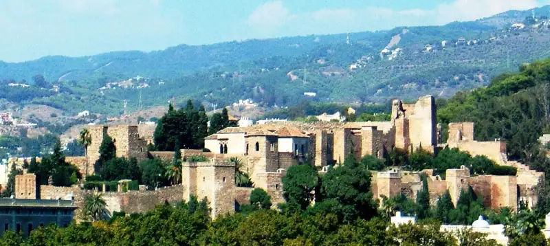
El esplendor de #Al-Ándalus y sus monumentos no pueden entenderse sin conocer sus raíces históricas. La civilización que construyó maravillas como esta fue impulsada por la religión traída por #Mahoma (s.a.v), consolidada por los heroicos esfuerzos y sacrificios de los primeros #musulmanes y la expansión del #Islam, y protegida por genios militares legendarios como el invicto #Jalid ibn al-Walid. La alcazaba de Málaga (del árabe al-qaṣbah, قصبة, al qasbah, 'ciudadela') es una fortificación palaciega de la época islámica, construida sobre una anterior fortificación de origen fenicio-púnico. Se encuentra en las faldas del monte Gibralfaro, en una posición elevada pero contigua y unida al centro histórico de la ciudad, lo que constituía la antigua madina de Mālaqa, y en cuya cumbre se halla el Castillo de Gibralfaro. Ocupaba el extremo oriental del desaparecido recinto amurallado de la ciudad, de manera que los frentes de mediodía, poniente y norte quedaban a intramuros. Su superficie actual de 15 000 metros cuadrados no alcanza ni siquiera la mitad del tamaño que poseía en su época de esplendor, como demuestran los planos históricos conservados. Según el arquitecto restaurador, Leopoldo Torres Balbás, la Alcazaba de Málaga es el prototipo de la arquitectura militar del periodo taifa, siglo XI, con su doble recinto amurallado y gran cantidad de fortificaciones, siendo su único paralelo el castillo del Crac de los Caballeros, fortaleza levantada en Siria por los Cruzados entre los siglos XII y XIII. Este palacio-fortaleza es uno de los monumentos históricos de la ciudad, un espacio muy visitado por conjugar #historia y belleza en un mismo recinto. De época musulmana, está situada a los pies del monte Gibralfaro, donde se encuentra el castillo defensivo andalusí al que estaba unido por un pasillo resguardado por murallas llamado La Coracha; junto al Teatro romano de Málaga y frente al Palacio de la Aduana, es una oportunidad para ver en solo unos metros la unión de las culturas romana, andalusí y renacentista, lo que convierte a este rincón en un lugar muy especial. En 1931, la Alcazaba fue declarada Monumento histórico-artístico, por lo que es bien de interés cultural con categoría de monumento. #historia La Alcazaba que se puede contemplar actualmente es el resultado de un largo proceso histórico que podría dividirse en cuatro etapas: el periodo andalusí, del siglo X al siglo XV; tras la Reconquista a finales del siglo XV hasta el siglo XVIII; el del abandono de su estructura militar y deterioro, que abarcaría el siglo XIX hasta los comienzos del siglo XX; y el de su recuperación como Monumento Histórico Artístico desde la década de 1930 hasta nuestros días. Algunos historiadores #musulmanes afirman que fue el rey de taifas Badis ben Habús, quien ordenó construir la Alcazaba usando para su embellecimiento mármoles, columnas y estatuas del teatro romano adyacente, pero otros estudios ponen en tela de juicio esta afirmación ya que existen indicios que plantean que, en vez de una labor de construcción se trató de una restauración de un antiguo recinto amurallado de origen fenicio. Asimismo, anteriormente a Ben Habús, la dinastía Hammudí, últimos califas de Córdoba y reyes de la Taifa de Málaga, que trasladaron durante la Fitna de #Al-Ándalus la corte califal a Málaga, utilizaron el recinto de la Alcazaba y sus estancias como residencia palaciega. Los almorávides irrumpieron en ella en 1092 y los almohades en 1146. Posteriormente, en 1279, es rendida a Muhammad II Ben al-Ahmar y pasa a formar parte del Reino nazarí de Granada. Durante la Reconquista, la Alcazaba constituyó un infranqueable bastión nazarí en la toma de Málaga por Fernando el Católico, quien tras vencer y conquistar a El Zagal en Vélez, sitió la ciudadela que estaba en manos del Hamet el Zegrí y sus gómeres. El asedio comenzó el 5 de mayo de 1487 y no logró derrotar al Ejército nazarí constituido por 3.000 gómeres y 8.000 hombres armados. El 18 de agosto Alí Dordux, tras negociar su ciudadanía como mudéjar, rinde la Alcazaba, pero bajo el mando de El Zegrí y Alí Derbal, el Alcázar de Gibralfaro resistió dos días más hasta sucumbir por el hambre y la sed. El 19 de agosto entraron en la ciudad los Reyes Católicos, izando la cruz y el Pendón de Castilla en la Torre del Homenaje de la Alcazaba. El rey Fernando entregó a Málaga la imagen de la Virgen de la Victoria, talla de origen alemán regalada por el emperador Maximiliano I del Sacro Imperio Romano Germánico al monarca español, que desde ese momento se convirtió en patrona de la ciudad. Aunque existen testimonios sobre su buen estado de conservación hasta 1675, con el paso de los años la ciudadela padeció un largo proceso de deterioro, siendo especialmente dramáticos el terremoto de 1680 y el bombardeo de la ciudad que hicieron nueve buques franceses desde la bahía de Málaga en 1693, en el transcurso de la guerra de los Nueve Años. Entre 1733 y 1735 el alcaide de la Alcazaba, Francisco Antonio de Unzaga Amézaga y Aperribay, dio licencia para que las clases populares oyesen misa en el oratorio de la capilla-#mezquita de San Gabriel de la Alcazaba, es por lo que este alcaide solicita al rey que esta capilla, situada en la calle del Zagal, próxima al teatro romano y que habría sufrido mucho en los terremotos de 1693, pudiera restaurarse gracias a la gestión ilustrada de Unzaga. Sus arcos andalusíes se conservaron hasta el bombardeo de 1937, en el transcurso de la guerra civil española. Entre 1787 y 1792 el teniente general Luis de Unzaga y Amézaga, Presidente de la Junta de Reales Obras y como gobernador de la Comandancia general de las costas del Reino de Granada que incluía la provincia marítima de Málaga, ordenó diversas labores de acondicionamiento de la Alcazaba y Gibralfaro para que sus guarniciones militares pudieran recibir agua potable Durante la guerra del Rosellón en 1794 fue presidio para 479 franceses y se erigió en el recinto, por orden del secretario de Estado Manuel Godoy, el Hospital Real de San Luis. Más tarde, los muros exteriores y parte del recinto interior fueron usados para caserío. No fue hasta las primeras décadas del siglo XX cuando comienzan los trabajos de rehabilitación, especialmente desde la década de 1930. Los principales responsables de estas labores fueron, entre otros, el crítico de arte Ricardo de Orueta, los arquitectos José Joaquín González Edo, Leopoldo Torres Balbás, Fernando Guerrero-Strachan Rosado y Francisco Prieto Moreno, y el investigador y académico Juan Temboury, todos bajo el auspicio del gobernador civil en aquel momento, Emilio Lamo de Espinosa. Descripción histórica y contemporánea Su reforma le confiere una profunda impronta como edificación nazarí construida sobre roca. Conjuga las necesidades de defensa y la belleza de un palacio de estilo árabe organizado a base de patios rectangulares y crujías en torno con sus jardines y estanques. Sus estancias, que en la tradición de la arquitectura nazarí buscan en los interiores la alternancia de luces y sombras para conseguir esos juegos que tan bien dominaron los alarifes. Su componente militar la hace una de las obras del periodo andalusí más importantes de las conservadas en #España. Con matacanas, torres albarranas con saeteras y murallas almenadas como elementos defensivos, sin embargo, su mejor defensa estaba en su situación, dominando desde sus balcones la ciudad y la bahía. A su alrededor había un barrio, hoy totalmente desaparecido, que tenía incluso su sistema para evacuar las aguas fecales, y con letrinas en casi todas las casas, lo que acredita el alto nivel de civilización que existía en esos momentos. Tuvo sucesivas reconstrucciones, algunas hasta en el siglo XX, y actualmente es visitable con importantes muestras arqueológicas expuestas. En las primeras excavaciones para su restauración aparecieron restos de muros romanos de hormigón revestido de estuco rojizo y pequeñas albercas excavadas en pizarra, destinadas a la preparación del garum (pasta de pescado que elaboraban los romanos) y una mazmorra donde encerraban durante la noche a las cautivas cristianas que trabajaban de día. La Alcazaba es una edificación construida sobre la roca y en la que destaca la armoniosa conjunción de las necesidades defensivas y la serena belleza de sus estancias y jardines interiores. Desde su construcción, se trataba de una fortaleza urbana, con uso político-administrativo como sede del gobierno y aposento para las jerarquías de la ciudad. De los 15 000 metros cuadrados de espacio interior que se conservan en la actualidad, 3.478 son de construcciones que podríamos calificar como civiles, 3516 de edificaciones de carácter militar y el resto es superficie no edificada. De su estructura original, se ha perdido completamente el denominado Haza de la Alcazaba o Haza Baja, el recinto inferior cerrado y meridional de la Alcazaba, que los castellanos denominarían tristemente "el corral de los cautivos", y que Rodríguez de Berlanga, testigo de su demolición, describía en su obra "Malaca" como estructura de ciclópeos muros y torreones, sin duda, más importantes que los actualmente conservados, ya que constituían la primera línea defensiva frente al mar. Asimismo, en la antigua calle del Zagal de la Alcazaba, se encontraba la antigua #mezquita-capilla bajo la advocación del Arcángel Gabriel que mandó construir el rey Fernando II de Aragón en 1497, hoy también desaparecida. Para llegar a la zona superior del palacio, donde habitaba el cadí o el alcaide de la ciudad, y que aún se conservaba en buen estado en 1675 según relataba Cristóbal Amate de la Borda y donde se hospedó el rey Felipe IV de #España durante su visita a la ciudad en 1625, era necesario atravesar desde el interior de la ciudad tres recintos concéntricos amurallados y alargados, y ocho puertas fortificadas; dos de ellas en recodo, que daban seguridad a sus habitantes, tanto a los reyes y gobernadores #musulmanes, que habitaron el palacio taifal y el palacio nazarí, como a los que moraron en el arrabal a intramuros. Las torres y los muros han sido reconstruidos en parte, antes y después del paso de la ciudad a manos castellanas. En su construcción se emplearon materiales de acarreo y se reutilizaron piezas del anexo teatro romano, como columnas y capiteles. Las construcciones en los comienzos del periodo andalusí se realizaron de piedra caliza numulítica, de canteras próximas al mar, alternando sillares de canto con otros de frente. Pero esta piedra se descompone muy rápidamente con la humedad, por lo que se tuvieron que efectuar pronto reparaciones. A finales del siglo XIII o primeros del XIV, se reforzaron los muros y torres, adosándoles muros de mampostería al exterior. Estancias Zona de ingreso al recinto superior Toda la zona de ingreso sufrió modificaciones recién conquistada la ciudad por los Reyes Católicos. Una vez traspasada la puerta principal y la llamada Puerta de las Columnas, se ha de subir una rampa con peldaños, que termina en el Arco del Cristo. Este arco es un pasadizo en recodo abierto en el interior de una torre, cuya parte superior fue reconstruida. El arco de entrada, rodeado por un alfiz de ladrillos, descansa sobre pilastras y tiene clave de piedra, que estuvo dorada, en la cual se labró en hueco una llave. En la estancia alta había un matacán, como así atestiguan dos ménsulas de piedra que sobresalen en el muro. La bóveda del pasadizo es vaída y de ladrillo. En las jambas del arco interior quedan restos de piedra numulítica, de la obra del siglo XI. La puerta fue reconstruida a finales del siglo XIII, como demuestra la llave esculpida en la clave del arco de ingreso. Frente a la puerta de salida del Arco del Cristo aparecieron restos de muros romanos de hormigón revestido de estuco rojizo y pequeñas albercas excavadas en pizarra, destinadas a la preparación del garum (pasta de pescado que elaboraban los romanos). Se trata de uno de los elementos conservados más interesantes, es una zona llana desde la cual se domina casi toda la ciudad, y donde después de la conquista se instaló la artillería, por lo que se bautizó como plaza de Armas. Junto a esta se encuentra la Torre de la Vela y la Puerta de La Coracha, una comunicación al paso murado que la une con el castillo de Gibralfaro. En la Torre de la Vela se instaló una campana después de la conquista de la ciudad. Trabajos arqueológicos realizados por el profesor Manuel Acién han localizado en este enclave vestigios de una primitiva #mezquita aljama del periodo emiral, siglo VIII. =### Puerta de los Arcos= El ingreso al último recinto se hace a través de la Puerta de los Arcos y Torre del Tinel. Una vez traspasada la puerta de los Arcos se tuerce a la izquierda para alcanzar la plataforma superior. En las excavaciones de esta parte tan sólo se encontró un silo o mazmorra, donde encerraban durante la noche a las cautivas cristianas que trabajaban de día. Fernando Guerrero Strachan trazó en esta zona una serie de jardincillos en pequeñas terrazas, donde se instalaron una pila de baño romana de mármol, un jabalí labrado en piedra y un enorme pie humano de mármol de época romana también. Recinto superior: Palacio taifal y nazarí El recinto superior, al que solo se accede a través de la puerta abierta en la Torre de los Cuartos de Granada, llamada Puerta Siete Arcos, está protegido en su otro extremo por la gran Torre del Homenaje. Está ocupado íntegramente por el Palacio, que en realidad son dos, los restos de uno taifal y el nazarí, y el barrio de las viviendas o barrio castrense, con ocho viviendas del siglo XI, los baños, el actual taller de restauración y el aljibe. =### Cuartos de Granada= En la parte central del recinto superior se encuentran los “Cuartos de Granada”, donde vivían los reyes y gobernadores. La arquitectura aquí es de estilo nazarí, tratando de conseguir un escenario neutro donde se alternen zonas de luz y de sombra. En los muros de las salas y habitaciones, reconstruidas, existen pequeñas alacenas para exhibir fragmentos de cerámica musulmana hallados en las excavaciones. El palacio estaba organizado a base de patios rectangulares y crujías en torno. Hay tres patios subsistentes que tuvieron en sus lados pórticos abiertos por tres arcos, mayor el del centro, disposición típica de los patios islámicos andaluces. Del primero de ellos, el más pequeño, sólo está reconstruido el pórtico sur, con tres arcos de herradura, que descansan sobre dos columnas intermedias de mármol. Este pórtico pertenece a la reconstrucción realizada durante los siglos XIII o XIV. A occidente del pórtico, y en comunicación con él, existe un pequeño pabellón también reconstruido, abierto en sus cuatro frentes por arcos lobulados de yeso entrecruzados. =### Barrio de viviendas o castrense y Torre del Homenaje= En la parte más oriental del último recinto se encontraron las ruinas de un barrio de pequeñas casas formado por tres manzanas entre calles enlosadas. Un pequeño baño y dos viviendas muy pequeñas conformaban la manzana sudoeste y otras dos pequeñas también las de la manzana más oriental. De mayor tamaño eran las tres viviendas encontradas en la manzana sur. La altura máxima de los muros que se han conservado es de un metro. Las puertas de las viviendas estaban compuestas por dos hojas de madera. La distribución de las viviendas estaba muy bien aprovechada: todas con un pequeño patio casi cuadrado, con aceras y crujías alrededor, en torno al cual se distribuían las habitaciones. Algunas de las casas conservan los primeros peldaños de las estrechas escaleras que conducían a la planta superior. El suelo de las habitaciones consistía en una capa de mortero de cal teñida de almagra, aunque algunas conservan losetas de barro y piezas de mármol aprovechadas. En el interior de las casas se encontraron zócalos pintados de rojo, con inscripciones en caligrafía cúfica y dibujos geométricos de lazo de a ocho. En la parte septentrional del barrio había un baño, en donde el agua subía a través de una noria desde un pozo profundo al que llamaron Airón, en el recinto inferior. El barrio disponía asimismo de un sistema de atarjeas para el alejamiento de las aguas negras, y casi todas las viviendas disponían de letrinas, lo que acredita el alto nivel de civilización que existía. Al final del barrio se encuentra la Torre del Homenaje de planta casi cuadrada, obra del siglo XIV. Se construyó una vivienda en su parte alta, con salas y patio. De la escalera de subida no quedan huellas. #andalus #malaga #alcazaba Related InsightsBeyond Merv's Veil: Unearthing Turkmenistan's Ghost Oases of the Silk Road Svalbard: Arctic Adventures Beyond the Northern Lights – A Remote Paradise for Explorers Shadows of Angkor: Unveiling the Jungle‑Cloaked Temples Beyond the Tourist Trail{ "@context": "https://schema.org", "@type": "FAQPage", "mainEntity": [ { "@type": "Question", "name": "What is the main focus of La Alcazaba de Málaga: Fortaleza Inexpugnable?", "acceptedAnswer": { "@type": "Answer", "text": "Descubre la historia profunda de Alcazaba de Málaga." } }, { "@type": "Question", "name": "Who authored the comprehensive guide on La Alcazaba de Málaga: Fortaleza Inexpugnable?", "acceptedAnswer": { "@type": "Answer", "text": "This detailed article and its insights were carefully researched and authored by Mateo García." } }, { "@type": "Question", "name": "Where can I find more related content about Travel?", "acceptedAnswer": { "@type": "Answer", "text": "You can explore more articles, detailed reviews, and similar insights by browsing the Related Insights section at the bottom of this article or visiting our dedicated Travel category page." } } ] }
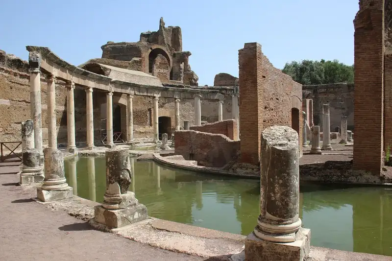
A pochi chilometri da Roma, ai piedi dei monti Tiburtini, sorge Villa Adriana, la più grande e lussuosa villa imperiale mai costruita. Voluta dall'imperatore Adriano tra il 118 e il 138 d.C., non era una semplice casa di campagna, ma una vera e propria città estesa su oltre 120 ettari. Un Mondo in Miniatura Adriano, grande viaggiatore e appassionato di architettura e cultura greca ed egizia, volle riprodurre nella sua villa i luoghi e i monumenti che più lo avevano colpito durante i suoi viaggi attraverso l'Impero. Il complesso è un susseguirsi straordinario di palazzi, terme, teatri, giardini, specchi d'acqua e ninfei, progettati con forme geometriche ardite e soluzioni architettoniche innovative. Il Pecile e il Canopo Tra le strutture più iconiche spicca il Pecile, un immenso portico colonnato che circonda un grande bacino rettangolare, ispirato all'agorà di Atene. Ancora più affascinante è il Canopo, un lungo canale d'acqua circondato da statue e sormontato da una scenografica esedra, che rievoca un antico braccio del fiume Nilo in Egitto. È qui che Adriano teneva lussuosi banchetti all'aperto durante le calde notti estive. Il Teatro Marittimo Un gioiello di rara bellezza è il cosiddetto Teatro Marittimo, un'isola circolare artificiale circondata da un canale e raggiungibile tramite ponti mobili. Si ritiene fosse il rifugio privato dell'imperatore, un luogo di meditazione e isolamento. Oggi, Patrimonio dell'Umanità #UNESCO, Villa Adriana rimane un capolavoro assoluto dell'arte romana, un sogno di marmo e acqua giunto fino a noi. #VillaAdriana #Tivoli #ImperatoreAdriano #PatrimonioUNESCO #italy #rome #history #ancient Related InsightsQuand l'Altruisme Devient Marchandise : Les Zones d'Ombre du Volontourisme Exploring Ani, City of 1001 Churches Scavi di Pompei: La Città Congelata nel Tempo{ "@context": "https://schema.org", "@type": "FAQPage", "mainEntity": [ { "@type": "Question", "name": "What is the main focus of Villa Adriana: Il Rifugio Imperiale a Tivoli?", "acceptedAnswer": { "@type": "Answer", "text": "Un viaggio nel ritiro esotico e sfarzoso dell'imperatore filosofo Adriano." } }, { "@type": "Question", "name": "Who authored the comprehensive guide on Villa Adriana: Il Rifugio Imperiale a Tivoli?", "acceptedAnswer": { "@type": "Answer", "text": "This detailed article and its insights were carefully researched and authored by Lorenzo Russo." } }, { "@type": "Question", "name": "Where can I find more related content about Travel?", "acceptedAnswer": { "@type": "Answer", "text": "You can explore more articles, detailed reviews, and similar insights by browsing the Related Insights section at the bottom of this article or visiting our dedicated Travel category page." } } ] }