Showing Posts From
Hiking
-
 Zola Ndlovu
 - 14 Oct, 2026 21:55
Tasmania's Tarkine Rainforest: Hiking Through Earth's Last Temperate Wilderness
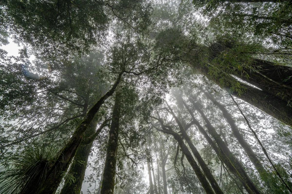
Footsteps on the Edge of Time The Tarkine stretches across 447,000 hectares of north‑west Tasmania, a living museum of Gondwanan flora that has survived ice ages, volcanic upheavals, and the slow creep of human industry. When I first set foot on the damp, spongy floor of the Myrtle Beech groves, the air tasted of wet stone and sweet eucalypt oil. The canopy, a cathedral of 60‑metre giants, filters sunlight into a green‑gold mosaic that shifts with every breeze. Planning a multi‑day trek here begins with the Tarkine Coast Track, a 55‑kilometre route that threads between the Southern Ocean and the rainforest’s interior. The track is divided into four sections, each demanding a different skill set: coastal navigation on exposed headlands, river crossings on the Arthur River, and steep ascents through the Meredith Range. I recommend allocating five nights to absorb the rhythm of the forest — two nights at the coastal campsite near Sandy Cape, one at the historic mining settlement of Corinna, and two deeper in the wilderness at the Savage River hut. Logistics are straightforward but unforgiving. The nearest sealed road ends at the Arthur River bridge; from there a 4WD track leads to the trailhead. Fuel, food, and water must be carried in, as there are no resupply points beyond the small general store at Corinna. A satellite messenger or PLB is non‑negotiable; mobile coverage evaporates once you pass the last farm gate. Where the Myrtle Beech Whispers The Myrtle Beech (Nothofagus cunninghamii) dominates the Tarkine’s heart, its smooth, cinnamon‑barked trunks forming a continuous canopy that shelters an understory of ferns, mosses, and the endemic Tasmanian waratah. Walking among these trees feels like moving through a library where every leaf is a page of evolutionary history. The species is a relic of the ancient supercontinent Gondwana, and its presence here is one of the few places on Earth where it still forms extensive pure stands. Birdsong punctuates the silence: the sharp “tsee‑tsee” of the pink robin, the low boom of the Tasmanian wedge‑tailed eagle, and, if you’re lucky, the haunting call of the orange‑bellied parrot — one of the world’s rarest migratory birds, which uses the Tarkine’s coastal heathlands as a critical stopover. Mammals are more elusive; the Tasmanian devil forages at night, leaving distinctive scat on the trail, while the eastern quoll darts through the leaf litter. A practical tip: carry a lightweight field guide (or a downloaded PDF) to identify the 200‑plus plant species you’ll encounter. The Tarkine’s flora includes the ancient King Billy pine, the delicate leatherwood, and the carnivorous sundew that traps insects on sticky tentacles. Knowing what you’re looking at deepens the experience and aids citizen‑science projects that monitor biodiversity health. Navigating the Wild River Corridors The Arthur River, the longest river wholly within Tasmania, carves a sinuous path through the Tarkine, creating a series of deep gorges, tranquil pools, and rapid‑filled chutes. Crossing it is the most technical part of the trek. The official crossing point at the Arthur River bridge is a steel structure built in the 1960s for logging trucks; it remains the only reliable dry crossing for hikers. From the bridge, the track follows the river’s left bank, weaving through riparian zones where the water’s edge is lined with swamp gum and paperbark. Here, the trail can become a muddy scramble after rain, so waterproof gaiters and a sturdy pair of trekking poles are essential. I learned the hard way that a sudden downpour can raise the river level by half a metre in under an hour, turning a shallow ford into a dangerous torrent. For those seeking a longer immersion, the Savage River loop adds 30 kilometres of remote valley walking. The Savage River hut, a basic three‑room shelter maintained by the Parks and Wildlife Service, offers a dry roof and a rainwater tank — but no cooking facilities. Bring a portable stove, fuel canisters, and a bear‑proof food container (the latter is mandatory under Tasmanian law to protect wildlife). Campfire Stories Beneath the Canopy Evenings in the Tarkine are a symphony of nocturnal life. After a day of climbing the Meredith Range’s quartzite ridges, the temperature drops to single digits, and the forest exhales a cool, fragrant mist. Setting up a tarp shelter under a stand of towering eucalypts provides both protection and a front‑row seat to the night sky — one of the darkest in Australia, rated Bortle Class 2. Cooking is simple: dehydrated meals rehydrated with boiled river water (filtered through a 0.2‑micron pump), supplemented by locally sourced wallaby jerky and Tasmanian pepperberry. The pepperberry’s sharp, citrusy heat adds a unique twist to otherwise bland rations. Remember to pack out all waste; the Tarkine’s “Leave No Trace” policy is strictly enforced, and rangers conduct random checks. Storytelling around the campfire (or headlamp, when fire bans apply) connects you to the land’s deep human history. The Palawa people have walked these valleys for over 35,000 years, leaving middens, rock art, and cultural landscapes that are still being documented. Respectful visitors can join guided cultural walks offered by the Tasmanian Aboriginal Centre, which illuminate the spiritual significance of sites like the Sundown Point petroglyphs. Budgeting the Journey: Real Costs on the Ground Understanding the financial side of a Tarkine expedition prevents surprises. The live cost‑of‑living data for Tasmania shows a digital‑nomad baseline of $3,858 per month, but a focused hiking trip compresses expenses into a two‑week window. Below is a breakdown tailored to a solo trekker carrying all gear, based on current Tasmanian prices.Expense Category Estimated Cost (AUD) NotesAccommodation (pre‑/post‑trek) $1,372 – $4,844 Range reflects hostel dorms to private cabins in nearby towns (Smithton, Stanley).Food & Groceries $389 Two weeks of dehydrated meals, snacks, and fresh produce bought in Launceston.Dining Out (pre‑/post‑trek) $506 Occasional restaurant meals in Devonport or Burnie.Transport (fuel, ferry, 4WD hire) $172 Fuel for 600 km round‑trip + $50 for the Spirit of Tasmania ferry if arriving from mainland.Park Permits & Fees $30 Tarkine Wilderness Permit (per person, per night).Gear Rental (satellite messenger, PLB) $120 14‑day rental from Hobart outdoor shop.Insurance (travel & medical) $85 Comprehensive policy covering remote evacuation.Total Approximate $2,674 – $6,146 Varies with accommodation choice and gear ownership.These figures assume you already own a quality backpack, tent, and clothing. If you need to purchase core gear, add another $1,200–$2,500. The table demonstrates that a well‑planned Tarkine hike can be achieved for under $3,000 if you camp throughout and source food economically. The Echo That Lingers Leaving the Tarkine feels like stepping out of a dream you didn’t know you were dreaming. The scent of wet bark clings to your clothes, the sound of the Arthur River lingers in your ears, and the memory of a wedge‑tailed eagle’s silhouette against a bruised sunset settles into your ribs. This place does not merely exist on a map; it lives in the pulse of every ancient tree, every hidden waterfall, every breath of wind that has travelled unchanged for millennia. If you carry the Tarkine’s silence back to the city, you’ll find it reshaping how you listen — to colleagues, to loved ones, to the quiet moments between notifications. The wilderness teaches a rhythm that no spreadsheet can quantify, yet the numbers above prove the journey is reachable. Pack light, tread softly, and let the forest write its story on you. #Travel #Tarkine #Tasmania #Hiking #Wilderness Related InsightsBeautiful World, Where Are You Book Review and Summary I Know Why the Caged Bird Sings Book Review and Summary >-
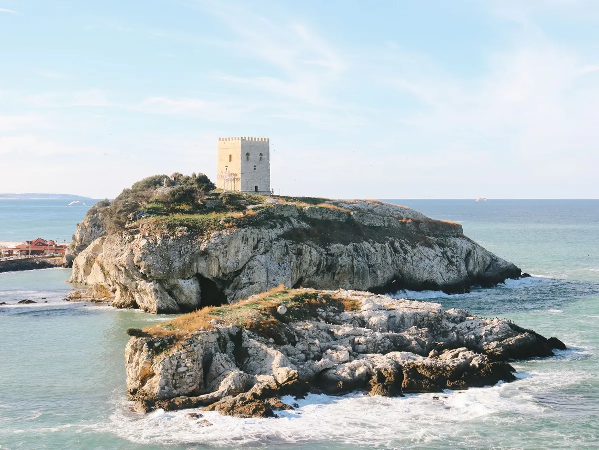

Stone Giants of the Mediterranean The island of Sardinia rises from the Tyrrhenian Sea like a time‑capsule, its interior studded with more than seven thousand nuraghi — conical stone towers that have guarded the landscape since the Middle Bronze Age, roughly 1800–1100 BCE. These megalithic monuments are not isolated curiosities; they form a dense, interconnected network that once regulated trade, defense, and ritual across the island’s rugged interior. The most celebrated example, Su Nuraxi di Barumini, earned UNESCO World Heritage status in 1997 for its remarkably preserved central tower, surrounding bastions, and a labyrinth of circular huts that illustrate the social hierarchy of the Nuragic people. Yet beyond Barumini, the countryside hides lesser‑known giants such as Nuraghe Losa near Abbasanta, the double‑towered complex of Santu Antine in Torralba, and the hilltop sentinel of Nuraghe Arrubiu in Orroli, each offering a distinct architectural vocabulary that reflects local geology and evolving construction techniques. Archaeologists have long debated the purpose of these structures. Early theories posited purely defensive roles, but recent excavations reveal domestic spaces, storage silos, and even metallurgical workshops within the walls, suggesting a multifunctional society that blended military vigilance with everyday life. The towers’ thick dry‑stone masonry, built without mortar, demonstrates an advanced understanding of load distribution — stones are laid in diminishing concentric circles, creating a self‑supporting dome that has withstood millennia of earthquakes and erosion. This engineering prowess is mirrored in the surrounding “giants’ graves” (tombe di giganti) and sacred wells, which together compose a ritual landscape aligned with celestial events. Solar orientations at several sites indicate that the Nuragic builders tracked solstices, embedding astronomical knowledge into the very stones that now guide modern hikers. For the contemporary traveler, the nuraghi are more than museum pieces; they are waypoints on a living trail system that stitches together archaeology, ecology, and local culture. The “Sentiero dei Nuraghi” — a network of marked paths maintained by the regional park authority — links over thirty major sites across the central and northern provinces, allowing multi‑day treks that traverse cork oak forests, limestone plateaus, and hidden valleys scented with myrtle and wild rosemary. Each stage reveals a new silhouette against the horizon, inviting walkers to read the landscape as the ancients did: as a map of power, water, and sky.Charting the Ancient Pathways Mapping the Nuragic trails demands both scholarly precision and on‑the‑ground intuition. The official cartography, published by the Ente Foreste della Sardegna, provides topographic sheets at 1:25,000 scale that mark every registered nuraghe, tomb, and sacred well, together with trail difficulty ratings (CAI grading from T/E for easy to EE for expert). However, many secondary paths — shepherd tracks, ancient transhumance routes, and forgotten pilgrimage ways — remain uncharted on paper but are known to local guides and the island’s vibrant hiking community. A reliable approach combines the official GPS waypoints (downloadable from the Sardegna Geoportale) with crowd‑sourced tracks on platforms like Wikiloc and Komoot, cross‑referenced against recent field reports from the Associazione Nazionale Guide Ambientali Escursionistiche (ANGAE). A practical itinerary for a five‑day immersion might begin in the historic town of Oristano, where the archaeological museum offers a concise overview of Nuragic chronology before you set foot on the trail. Day one follows the “Via dei Nuraghi” northward to the coastal plain of Sinis, crossing the low‑lying Nuraghe di Monte Prama — famed for its colossal limestone statues of warriors — before reaching the wetlands of Cabras, a birdwatcher’s paradise. Day two ascends into the basaltic heart of the Montiferru massif, where the double‑towered Nuraghe Santu Antine dominates a panoramic ridge; the ascent gains 600 m over 12 km, rated EE, and rewards hikers with views stretching to the Gulf of Oristano. Day three descends into the limestone karst of the Supramonte, threading through the “Gola di Gorropu” canyon to the remote Nuraghe Mereu, a site only accessible on foot and still under active excavation. Day four loops back via the high plateau of the Gennargentu National Park, touching the sacred well of Su Tempiesu — a subterranean chamber aligned with the winter solstice sunrise — before concluding at the UNESCO complex of Barumini, where guided tours illuminate the stratigraphy of the central tower and its surrounding village. Navigation on these routes requires a blend of digital and analog tools. A rugged GPS device pre‑loaded with offline maps ensures redundancy when mobile signal vanishes in deep valleys. Yet a paper topographic map, a compass, and the ability to read cairn markers (ometti) remain indispensable, especially on sections where trail maintenance is sporadic. Seasonal considerations are critical: spring (April–June) offers wildflower carpets and moderate temperatures (15–22 °C), while autumn (September–October) provides stable weather and fewer tourists. Summer heat can exceed 35 °C on exposed ridges, demanding early starts and ample water — at least three liters per person per day. Winter brings snow on the highest peaks, rendering many high‑altitude sections impassable without alpine equipment. Where History Meets the Horizon Walking among the nuraghi is an exercise in temporal layering. Each stone you touch has been shaped by human hands, weathered by wind, and reinterpreted by successive cultures — Phoenicians, Romans, Byzantines, and later Sardinian pastoralists who reused the towers as shepherds’ shelters. This palimpsest is visible in the architecture: at Nuraghe Losa, a Roman-era cistern was carved into the base of the central tower, while at Nuraghe Arrubiu, medieval graffiti coexist with Bronze Age cup marks. The landscape itself tells stories; the “nuragic alphabet” of standing stones (menhirs) and alignment corridors suggests a sophisticated territorial organization that prefigured later Roman centuriation. Ecologically, the trails traverse a mosaic of habitats that have changed little since the Nuragic era. Cork oak (Quercus suber) savannas dominate the lower slopes, their bark harvested sustainably for centuries — a practice that still supports local economies. Higher up, holm oak (Quercus ilex) and Mediterranean maquis give way to endemic species such as the Sardinian peony (Paeonia corsica) and the rare Gennargentu violet (Viola gennargentua). Wildlife encounters are frequent: mouflon (Ovis orientalis musimon) graze on alpine meadows, golden eagles (Aquila chrysaetos) patrol the cliffs, and the elusive Sardinian wildcat (Felis lybica sarda) slips through the underbrush at dusk. Birdsong provides a constant soundtrack, especially in the wetlands near Cabras where flamingos (Phoenicopterus roseus) stage seasonal migrations. Cultural immersion deepens when you pause in the villages that dot the trail network. In Barumini, the “Festa di San Giovanni” in late June revives ancient fire rituals that echo Nuragic solstice celebrations. In Orroli, the “Sagra del Pane Carasau” showcases the island’s iconic thin, crisp bread — baked in wood‑fired ovens using durum wheat varieties unchanged since antiquity. Local artisans still practice “filigrana” jewelry, weaving gold and silver into motifs inspired by Nuragic spiral patterns. Engaging with these living traditions transforms a hike into a dialogue across millennia, reminding you that the nuraghi are not dead monuments but anchors of a continuous cultural current.Practical Logistics for the Modern Explorer Turning an archaeological pilgrimage into a seamless adventure hinges on realistic budgeting, transport, and accommodation planning. According to the latest cost‑of‑living data for Sardinia (2026), a moderate lifestyle for a solo traveler averages $1,800 per month, broken down into housing $669, groceries $365, utilities $150, transportation $120, and discretionary spending $496. For a two‑week trek, you can expect to spend roughly $900–$1,100 depending on lodging choices. Budget‑friendly options include “agriturismi” (farm stays) that charge €35–€55 per night for a private room with breakfast, often located within walking distance of trailheads. Mid‑range hotels in Oristano or Cagliari range €80–€120 per night, while boutique guesthouses in Barumini hover around €70. Transport to the island is straightforward: Cagliari Elmas Airport (CAG) and Olbia Costa Smeralda Airport (OLB) receive daily flights from major European hubs. Once on the ground, renting a compact car (≈ €35/day) provides the flexibility to reach remote trailheads such as Nuraghe Mereu, which lacks public transport. Alternatively, the regional bus network (ARST) connects major towns, but schedules are sparse on weekends and may require overnight stays to align with trail start points. For the eco‑conscious, a combination of train (Trenitalia’s “Sardinia Line” from Cagliari to Oristano) and local shuttle services operated by the park authority can reduce carbon footprint, though it adds travel time. Health and safety considerations are modest but non‑negotiable. The Italian National Health Service (SSN) covers EU citizens Related InsightsShirakawa-go: The Enchanting Village of Snow and Traditions Insel Rügen im Sommer Historical Mardin Streets{ "@context": "https://schema.org", "@type": "FAQPage", "mainEntity": [ { "@type": "Question", "name": "What is the main focus of Sardinian Nuraghe Trails: Mapping the Bronze Age Megalithic Landscapes?", "acceptedAnswer": { "@type": "Answer", "text": "Explore the ancient stone towers of Sardinia on curated trails that reveal a lost civilization, with practical costs and insider tips." } }, { "@type": "Question", "name": "Who authored the comprehensive guide on Sardinian Nuraghe Trails: Mapping the Bronze Age Megalithic Landscapes?", "acceptedAnswer": { "@type": "Answer", "text": "This detailed article and its insights were carefully researched and authored by Wei Chen." } }, { "@type": "Question", "name": "Where can I find more related content about Travel?", "acceptedAnswer": { "@type": "Answer", "text": "You can explore more articles, detailed reviews, and similar insights by browsing the Related Insights section at the bottom of this article or visiting our dedicated Travel category page." } } ] }
-
 Chloe Tremblay
 - 09 Sep, 2026 11:46
Vertical Dreams: Navigating the Dolomitic Majesty of Northern Italy
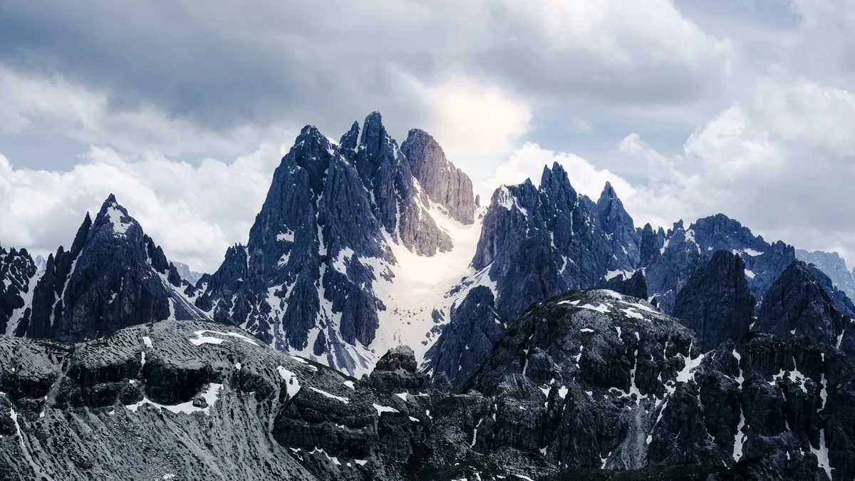
Where the Earth Touches the Sky: Understanding the Pale Mountains The Dolomites, often referred to as the 'Pale Mountains' due to the unique chemical composition of dolomite rock that glows a soft, ethereal pink at sunset—a phenomenon known as enrosadira—represent one of the most geologically significant landscapes on the planet. As a UNESCO World Heritage site, this massive limestone range in northeastern Italy offers more than just aesthetic beauty; it provides a profound connection to geological time. For the hiker, the Dolomites are not merely a collection of trails but an intricate network of vie ferrate (iron paths) and high-altitude refugios that define the essence of Alpine exploration. Navigating this region requires an understanding of the sheer verticality of the terrain. Unlike the softer, rolling hills of Tuscany, the Dolomites demand respect. The peaks of the Sella Group, the iconic spires of the Tre Cime di Lavaredo, and the sheer face of the Marmolada glacier constitute a vertical playground that has challenged mountaineers for centuries. As someone who has spent years traversing these trails, I have found that the magic lies in the transition: one moment you are walking through dense coniferous forests, and within an hour, you are navigating scree slopes beneath towering monoliths that seem to scrape the very heavens. For those planning an extended stay, it is essential to consider the logistical reality of the Italian Alps. While the wilderness feels untouched, the infrastructure is world-class. You are never truly 'off the grid' in the way you might be in the remote Rockies or the Andes. Instead, you are traversing a landscape where ancient Ladin culture meets modern Italian hospitality. Whether you are aiming for a multi-day trek along the Alta Via 1 or seeking a quiet week in the Val Gardena, preparation is the difference between a grueling ordeal and a transformative journey. Understanding the rhythm of the mountain—when the mist rolls in, how the weather shifts in the afternoons, and the importance of timing your ascents—is the hallmark of a true mountain expert.The Logistics of the Alpine Nomadic Life In the modern era, the allure of the Dolomites is not restricted to those on a two-week sabbatical. With the rise of remote work, many are choosing to base themselves in alpine hubs like Cortina d’Ampezzo, Bolzano, or Ortisei. However, living in the shadow of giants comes with specific economic considerations. According to current data, the cost of living for a nomadic professional in Italy hovers around $1,629 per month, a figure that remains stable due to the country’s robust market-data collection. For those contemplating this transition, the Italian Digital Nomad Visa serves as a gateway, provided one meets the established monthly income requirement of $2,532. This financial threshold is designed to ensure sustainability for both the nomad and the local economy. When we analyze the cost-of-living metrics provided by global databases like Numbeo, we see that Italy offers a balanced lifestyle. While rental prices in tourist-heavy hubs during peak season can fluctuate, the access to high-quality healthcare, reliable public transport, and a superior standard of living—often characterized by the Mediterranean diet and a slower, more intentional pace of life—justifies the investment. Living here requires balancing the high cost of mountain-side accommodation with the reality of local supply chains. You will find that local markets are your best friends. Purchasing fresh speck, mountain cheese, and seasonal produce from village vendors is not only cheaper than dining out exclusively but is also a deeply integrated part of the Dolomitic experience. If you are planning to work remotely, prioritize areas with high-speed fiber connectivity, which is increasingly common in towns like Bolzano, yet can be elusive in the higher-altitude mountain huts. This duality—the need for high-tech stability and the desire for low-tech wilderness—is the central challenge of the modern Dolomite wanderer. By aligning your financial planning with these regional realities, you turn a dream into a viable, sustainable lifestyle. Gastronomy and the Art of the Refugio Refuel One cannot discuss the Dolomites without bowing to the culinary traditions that fuel the hike. After six hours on a vertical incline, nothing tastes quite as exquisite as Canederli—the hearty, local bread dumplings served in broth or smothered in browned butter and sage. The cuisine here is a hybrid of Italian refinement and Austrian robustness, a testament to the complex history of the South Tyrol region. A day on the trail typically starts with an espresso at the base and a hearty lunch at a refugio (mountain hut). These huts are the backbone of the Dolomite hiking experience. They are not merely rest stops; they are culinary sanctuaries. Places like the Rifugio Lagazuoi offer more than just a place to sleep; they offer a vantage point to watch the light change over the Tofane mountains while enjoying a glass of local Lagrein wine. The strategy for eating well in the mountains is simple: embrace the seasonal. In the autumn, mushroom dishes and game meats dominate the menus. In the spring and summer, fresh alpine herbs and mountain cheeses take center stage. For the budget-conscious traveler, eating at these huts is far more efficient than carrying heavy, non-perishable goods up the mountain. Furthermore, because the local economy relies heavily on the success of these refugios, your patronage helps maintain the trail networks and preserves the alpine heritage that makes this UNESCO site so precious. Always carry cash, as connectivity issues can occasionally render card terminals useless in the most remote reaches of the range.Mastering the Trails: A Guide to the Alta Via 1 and Beyond When we speak of the 'best' hiking, we are really speaking about the Alta Via 1—the most famous of the high-altitude routes. Spanning approximately 120 kilometers from Lago di Braies to Belluno, it is a trek that demands respect but rewards with unparalleled panoramic views. However, the expert hiker knows that the real secret to the Dolomites lies in the diversions. Do not be afraid to step off the primary trail markers. The Dolomites are crisscrossed by a secondary network of paths that often lead to hidden cirques and abandoned World War I fortifications. The history of this region is etched into the stone; you are literally hiking through a theater of the Great War. It is common to find remnants of tunnels and lookout points carved directly into the rock face. This adds a somber, reflective quality to the hiking experience that is rare in other alpine ranges. Safety is non-negotiable. Even in the height of August, the weather can turn within minutes. A clear, sunny morning can quickly devolve into a violent electrical storm, especially at higher altitudes. My authoritative advice: always check the Meteo Dolomiti forecasts, which are localized and significantly more accurate than generic weather apps. Pack for the 'four-season' reality of the mountains: technical base layers, a lightweight down jacket, a reliable shell, and sturdy, broken-in trekking boots. If you are planning to attempt any of the vie ferrate, professional gear—a helmet, harness, and ferrata-specific carabiner set—is mandatory. Do not overestimate your fitness level; the elevation gain here is often steeper than in the Alps of France or Switzerland, and the thin air at 2,500 meters will test your endurance.Expense Category Estimated Monthly Cost (USD) Notes for the Dolomite NomadRent (One-bedroom apartment) $850 - $1,100 Varies by proximity to tourist centersUtilities (Water, Electricity, Heating) $200 - $250 Higher during winter heating seasonsGroceries (Fresh Produce & Local Staples) $350 - $450 Utilizing local markets is keyTransportation (Public Bus/Train Pass) $80 - $120 Highly efficient and reliable in the regionDining & Leisure $250 - $350 Includes sporadic visits to refugiosTotal Estimated Monthly Expenditure $1,730 - $2,270 Depends on lifestyle and locationNote: Data derived from regional averages; individual spending may vary based on specific town selection. The Ethics of Stewardship in a UNESCO Frontier As hikers, we are guests in a fragile environment. The Dolomites are a UNESCO World Heritage site for a reason: their geological and ecological integrity is unique. Yet, the pressure of mass tourism is real. The paths are becoming eroded, and the noise pollution in once-quiet valleys is on the rise. To be an expert in this region is to be a guardian of it. Practicing 'Leave No Trace' is the absolute minimum requirement. This means carrying out every piece of waste, staying strictly on marked trails to prevent soil erosion, and respecting the wildlife. The flora of the Dolomites, including the elusive Edelweiss and the various mountain gentians, are protected species. Photograph them, admire them, but never disturb them. Moreover, consider your impact on the local communities. Opt for public transportation whenever possible; the regional bus network (Südtirol Alto Adige) is excellent and reduces the traffic congestion that plagues the mountain passes during the peak summer months. Engage with the Ladin culture—the indigenous people of the Dolomites—by learning a few phrases and supporting local artisan crafts rather than buying mass-produced souvenirs. This is not just about 'responsible tourism'; it is about enriching your own experience. When you treat the mountains as a sacred space rather than a backdrop for a digital profile, the mountains offer you much more in return. They grant you silence, perspective, and a sense of belonging that is difficult to find elsewhere.Finding Stillness in the High Alpine Silence As we look toward the future of travel in the Dolomites, the focus must shift from 'conquering' the peaks to 'coexisting' with them. Whether you are a digital nomad seeking a high-altitude office or a seasoned trekker tracing the steps of the pioneers, the Dolomites offer a unique synthesis of rigor and rejuvenation. The cost of living, while requiring careful financial navigation, is a small price for the quality of life afforded by the clean air, the dramatic landscape, and the deep, abiding quiet of the high mountains. Remember that the best time to experience this region is in the shoulder seasons—late June or early September—when the trails are less crowded and the weather is arguably at its most stable. You will find that the Dolomites do not just change your perspective on landscapes; they change your perspective on your own limitations. The exertion of the climb, the reward of the view, and the comfort of a warm meal at a high-altitude refuge combine to create a life-defining experience. Do not rush your time here. Allow the mountains to dictate your schedule. If a storm is predicted, stay in the valley and explore the local museums or the quiet charm of a village piazza. If the sun is out, reach for the heights, but always remain humble before the scale of the rock. The Pale Mountains are ancient, indifferent to our presence, and utterly magnificent. They invite us to witness their majesty, but they demand that we play our part in preserving their story for the generations of explorers who will follow in our boot prints. May your climbs be steady, your equipment reliable, and your appreciation for this UNESCO wonder never cease to grow. As you descend into the valleys, carrying the silence of the summits within you, you will realize that you have not just visited a destination—you have been shaped by a landscape. #Dolomites #HikingItaly #DigitalNomad #UNESCOHeritage #AlpineLife
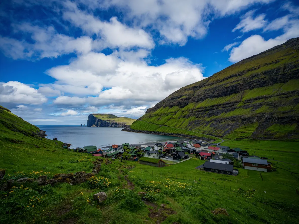
Where the North Atlantic Roars and the Sky Touches the Sea Nestled between Iceland and Norway, the Faroe Islands are a cluster of 18 volcanic islands where jagged cliffs plunge into the churning ocean, waterfalls cascade over green hillsides, and sheep outnumber people. This remote Nordic archipelago is a paradise for hikers seeking untouched trails and photographers chasing the perfect shot of raw, unfiltered nature. With an average of 280 cloudy days a year, the Faroe Islands offer a dynamic canvas of light and shadow, where every turn on a trail reveals a new masterpiece. But this is not just a place for the intrepid—it’s a destination where adventure meets comfort. The islands boast cozy guesthouses, world-class seafood, and a culture deeply rooted in Viking heritage. Whether you're trekking along the cliffs of Mykines or capturing the midnight sun over Tórshavn’s harbor, the Faroe Islands promise an experience that lingers long after you’ve left.A Landscape Carved by Fire and Ice The Faroe Islands are a geological wonder, formed by ancient volcanic activity and sculpted by glaciers over millennia. The islands’ dramatic topography includes towering sea stacks, deep fjords, and rolling hills blanketed in emerald grass. The highest point, Slættaratindur, stands at 880 meters (2,887 feet) and offers panoramic views of the archipelago. For hikers, this means trails that range from gentle coastal walks to challenging ridge hikes with vertigo-inducing drops. One of the most iconic hikes is the Gásadalur to Sørvágsvatn Lake Trail, a 5.5-kilometer (3.4-mile) route that takes you from the village of Gásadalur to the surreal lake perched above the ocean. The trail features a wooden boardwalk, a steep descent into a lush valley, and a final stretch along the cliffs of Trælanípan, where the lake appears to float above the sea. This optical illusion, caused by the cliff’s gradient, is one of the Faroes’ most photographed phenomena. For those seeking a more strenuous challenge, the Kalsoy Ridge Hike offers a 12-kilometer (7.5-mile) trek across the island of Kalsoy. The trail winds along sheer cliffs, past abandoned villages, and through tunnels carved into the rock. The reward? Views of the dramatic Kalsoy coastline and the chance to spot puffins nesting in the cliffs during summer.The islands’ weather is as unpredictable as it is dramatic. Wind speeds can exceed 100 km/h (62 mph), and rain showers can roll in within minutes. Hikers should be prepared for all conditions, with waterproof layers, sturdy boots, and a reliable map essential. The Faroese Meteorological Institute provides real-time weather updates, but even locals advise checking conditions before setting out.Photography in Paradise: Capturing the Faroes’ Ever-Changing Light The Faroe Islands are a photographer’s dream, where the interplay of light, water, and rock creates scenes that feel almost otherworldly. The islands’ high latitude means long summer days with the midnight sun casting a golden glow over the landscape, while winter offers dramatic storms and the chance to capture the northern lights (though sightings are rare due to frequent cloud cover). One of the best spots for photography is Múlafossur Waterfall, near the village of Gásadalur. The waterfall plunges 63 meters (207 feet) directly into the ocean, creating a mesmerizing spectacle, especially during storms when the spray is whipped into the air. The nearby cliffs provide vantage points for capturing the waterfall’s full force. For a more abstract shot, head to Saksun, a remote village accessible via a narrow isthmus. The black sand beach and the surrounding hills create a stark contrast, while the nearby lake, surrounded by steep cliffs, offers reflections that are perfect for mirror-like compositions. The village’s abandoned church, Dúvugarður, adds a touch of history to the scene.The Faroes’ lack of light pollution makes them an ideal location for astrophotography. During the winter months, the aurora borealis can occasionally be seen, though it’s best to head to the northernmost islands, such as Viðareiði, for the clearest skies. For daytime photography, the islands’ ever-changing weather means that no two shots are ever the same. A sunny morning can quickly turn into a misty afternoon, with the light shifting from golden to ethereal blue in minutes.A Nordic Lifestyle: Where Adventure Meets Comfort The Faroe Islands may be remote, but they offer a lifestyle that balances rugged adventure with Nordic comfort. The islands have a population of just 54,000, and the pace of life is slow and deliberate. Villages are small and tightly knit, with colorful houses clustered around harbors filled with fishing boats. The Faroese people are known for their hospitality, and visitors are often greeted with open arms. Accommodation ranges from cozy guesthouses to luxury hotels, with prices reflecting the islands’ status as one of Europe’s more expensive destinations. According to Numbeo, the average cost of a meal at a mid-range restaurant is around 150 DKK ($22 USD), while a pint of beer can cost up to 80 DKK ($12 USD). Groceries are also pricey, with a liter of milk costing around 12 DKK ($1.80 USD) and a loaf of bread around 25 DKK ($3.70 USD).Item Price (DKK) Price (USD)Meal at mid-range restaurant 150 $22Pint of beer 80 $12Liter of milk 12 $1.80Loaf of bread 25 $3.70Taxi (1 km) 20 $3Public transport (bus ticket) 30 $4.50Despite the high costs, the Faroes offer a unique quality of life. The islands have excellent healthcare, free education, and a strong sense of community. The capital, Tórshavn, is a charming town with a vibrant cultural scene, including the annual Faroese Music Awards and the Ólavsøka festival, which celebrates the islands’ Viking heritage. For foodies, the Faroes are a seafood lover’s paradise. Dishes like fermented puffin (a local delicacy), fresh langoustines, and grilled salmon are staples. The islands’ restaurants range from casual eateries serving fish and chips to high-end establishments like KOKS, which holds two Michelin stars and offers a tasting menu featuring locally sourced ingredients.From Viking Ships to Modern Trails: The Faroes’ Rich History The Faroe Islands have a history as dramatic as their landscapes. Settled by Vikings in the 9th century, the islands were later Christianized and became a key stop on the medieval Norse trade routes. The Faroese language, Faroese, is a North Germanic language closely related to Icelandic and Norwegian, and it remains the primary language spoken on the islands. One of the best places to explore the Faroes’ Viking past is the Viking Museum in Hoyvík, which showcases artifacts from the islands’ early settlements. The museum’s exhibits include tools, jewelry, and even a replica Viking longhouse, offering a glimpse into the daily lives of the islands’ first inhabitants. For a more immersive experience, visit the National Museum of the Faroe Islands in Tórshavn. The museum’s exhibits cover everything from the islands’ geological formation to their role in World War II, when they were occupied by British forces to prevent a German invasion. The museum also features a replica of a traditional Faroese turf house, which provides insight into the islands’ architectural heritage.The Faroes’ Viking heritage is also celebrated in the islands’ folklore. Local legends tell of hidden people (huldufólk), elves who live in the rocks and hills, and who must be respected to avoid bad luck. These stories are still a part of Faroese culture, and visitors may hear them shared over a cup of coffee in a local café.The Faroes’ Hidden Gems: Off-the-Beaten-Path Adventures While the Faroes’ main islands offer plenty of attractions, the archipelago’s smaller islands are where the real magic lies. These remote outposts are accessible by ferry or helicopter, and they offer a chance to experience the Faroes’ untouched wilderness. One such island is Mykines, the westernmost of the Faroes and a haven for birdwatchers. Mykines is home to one of the largest puffin colonies in the world, with thousands of birds nesting in the cliffs during the summer months. The island’s hiking trails lead to the Mykinesholmur, a small island connected to Mykines by a narrow isthmus, where visitors can get up close to the puffins and other seabirds. Another hidden gem is Fugloy, the easternmost island in the Faroes. Fugloy is known for its dramatic cliffs and the Risin og Kellingin sea stacks, which rise out of the ocean like sentinels. The island’s remote location means it’s rarely visited by tourists, making it a perfect spot for those seeking solitude.For a truly unique experience, consider visiting Skúvoy, an island with a population of just 30 people. Skúvoy is home to the Skúvoy Church, one of the oldest wooden churches in the Faroes, and the Skúvoy Bird Reserve, where visitors can see thousands of seabirds nesting in the cliffs.A Nordic Paradise Awaits The Faroe Islands are more than just a destination—they’re an experience. Whether you’re hiking along cliffs that plunge into the ocean, capturing the ever-changing light on a camera sensor, or simply enjoying the warmth of a Faroese guesthouse, the islands offer a sense of adventure and tranquility that’s hard to find elsewhere. The Faroes may be expensive, but they’re worth every krone. The islands’ dramatic landscapes, rich history, and unique culture create a destination that lingers in the memory long after you’ve returned home. So pack your hiking boots, charge your camera, and prepare to be captivated by the Nordic paradise that is the Faroe Islands.#NordicAdventure #RemoteTravel #PhotographyDestinations #HikingParadise #FaroeIslandsMagic Related InsightsEthiopia's Danakil Depression: The Hottest Place on Earth's Alien Landscapes (Part 3) Il Faro di Ercole e i Giganti Luminosi Dimenticati dell'Oceano: Un Viaggio Tra i Guardiani Romani dell'Infinito Atlantico St. Petersburg Hermitage{ "@context": "https://schema.org", "@type": "FAQPage", "mainEntity": [ { "@type": "Question", "name": "What is the main focus of The Faroe Islands: Where Nordic Wilderness Meets Photographic Magic?", "acceptedAnswer": { "@type": "Answer", "text": "Discover why the Faroe Islands are Europe’s best-kept secret for hikers and photographers, with dramatic landscapes, untouched trails, and a lifestyle that balances adventure with Nordic charm." } }, { "@type": "Question", "name": "Who authored the comprehensive guide on The Faroe Islands: Where Nordic Wilderness Meets Photographic Magic?", "acceptedAnswer": { "@type": "Answer", "text": "This detailed article and its insights were carefully researched and authored by Wei Chen." } }, { "@type": "Question", "name": "Where can I find more related content about Travel?", "acceptedAnswer": { "@type": "Answer", "text": "You can explore more articles, detailed reviews, and similar insights by browsing the Related Insights section at the bottom of this article or visiting our dedicated Travel category page." } } ] }
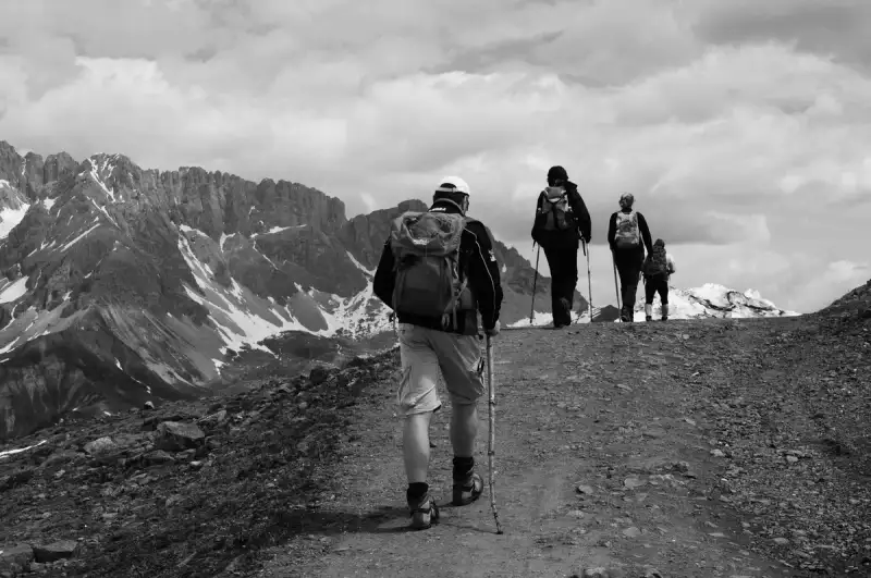
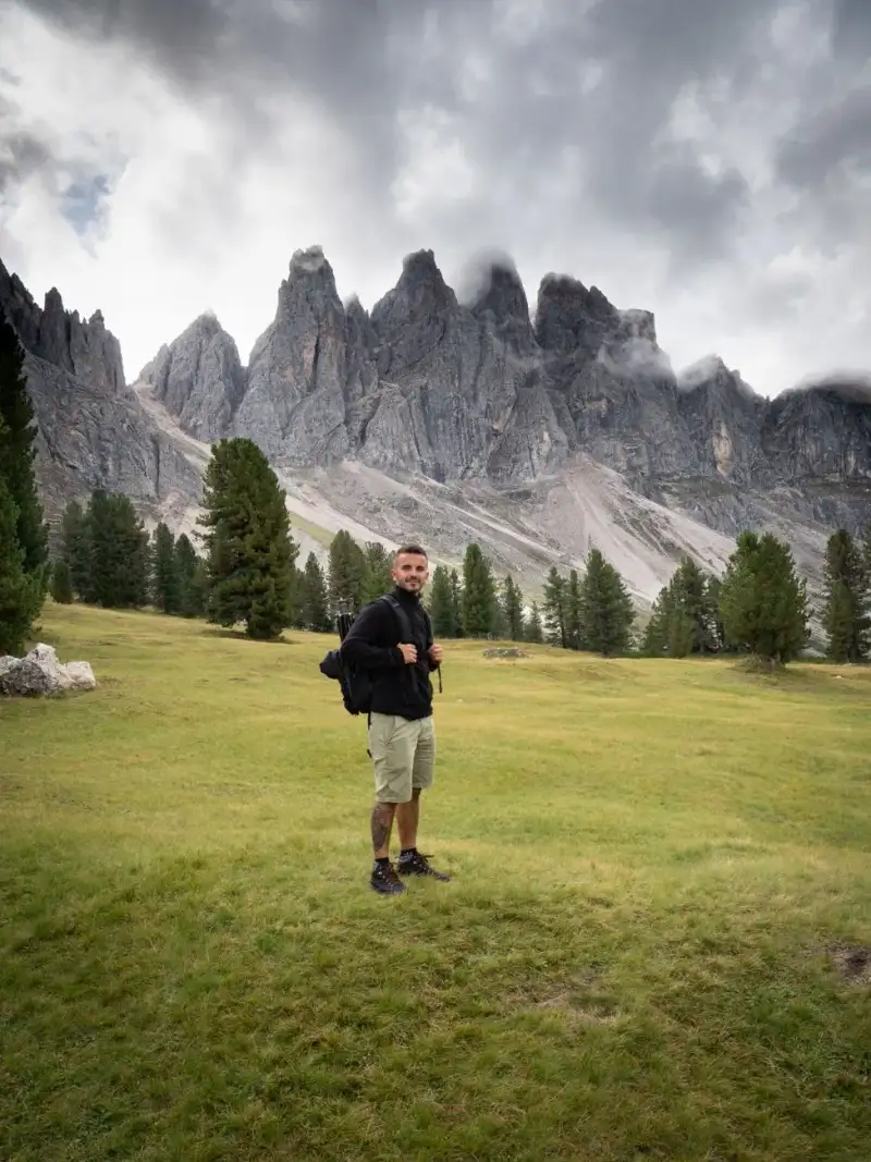
The Dolomites are not just a mountain range; they are a symphony of nature’s grandeur, where limestone spires pierce the sky, alpine meadows blush with wildflowers, and the air hums with the whispers of ancient glaciers. This UNESCO World Heritage Site, nestled in northeastern Italy, is a paradise for hikers, photographers, and soul-searchers alike. With over 1,200 kilometers of marked trails, the Dolomites offer an unparalleled blend of challenge and serenity, where every step reveals a new vista that feels plucked from a dream. Imagine waking up to the crisp mountain air, the scent of pine and wild herbs filling your lungs as you lace up your boots for a day on the trails. The Dolomites are a testament to the raw beauty of the Alps, but with a unique geological identity—composed of dolomite rock, which gives the mountains their signature pale, almost luminous appearance at sunrise and sunset. This geological wonder, combined with the rich cultural tapestry of Ladin villages and Italian alpine traditions, makes the Dolomites a destination unlike any other. Whether you're a seasoned trekker or a casual walker, the Dolomites promise an experience that will leave you breathless—not just from the altitude, but from the sheer majesty of the landscape. For those seeking more than just a hike, the Dolomites are a gateway to a slower, more intentional way of traveling. Here, time seems to stand still in the shadow of the peaks, and every village, every rifugio (mountain hut), and every winding trail tells a story. From the iconic Tre Cime di Lavaredo to the lesser-known Alpe di Siusi, the Dolomites are a mosaic of natural wonders waiting to be explored. So, lace up your boots, pack your camera, and prepare to be enchanted by one of Europe’s most spectacular alpine playgrounds.Why the Dolomites Are a UNESCO World Heritage Site The Dolomites earned their UNESCO World Heritage status in 2009, not just for their stunning beauty, but for their geological significance and ecological importance. This mountain range is a living laboratory of Earth’s history, where the remnants of ancient coral reefs and marine fossils tell the story of a time when the Dolomites were submerged beneath a tropical sea. The unique composition of dolomite rock, named after the French geologist Déodat Gratet de Dolomieu, gives the mountains their distinctive pale color and dramatic verticality. UNESCO recognized the Dolomites for their "outstanding universal value," citing their exceptional natural beauty, geological diversity, and the harmonious coexistence of human culture with the alpine environment. The range spans nine systems, including the Sella Group, the Marmolada, and the Pale di San Martino, each with its own character and charm. The Dolomites are also a biodiversity hotspot, home to rare flora like the Dolomites edelweiss and fauna such as the Alpine ibex and golden eagle. Beyond their natural splendor, the Dolomites are steeped in cultural heritage. The Ladin people, an indigenous group with roots dating back to the Roman era, have preserved their language, traditions, and way of life in the valleys of the Dolomites. Their influence is evident in the architecture of the villages, the cuisine, and the festivals that celebrate the alpine calendar. UNESCO’s designation highlights the importance of preserving this cultural landscape, where nature and human tradition intertwine seamlessly. For hikers, the UNESCO status means that every trail is part of a larger narrative—one that connects you to the earth’s ancient past and the enduring spirit of the people who call these mountains home. Whether you’re traversing the Via Ferrata routes or strolling through the flower-filled meadows of Alpe di Siusi, you’re walking in the footsteps of history.Best Hiking Trails in the Dolomites: From Beginner to Expert The Dolomites offer trails for every level of hiker, from gentle valley walks to grueling multi-day treks. Here’s a breakdown of the best routes, categorized by difficulty and experience. Beginner-Friendly Trails For those new to hiking or looking for a leisurely day on the trails, the Alpe di Siusi is a must-visit. This vast alpine meadow is Europe’s largest high-altitude pasture, stretching over 56 square kilometers. The Panorama Trail (No. 1) is a gentle 5.5-kilometer loop that offers sweeping views of the Sciliar and Sassolungo peaks. With minimal elevation gain and well-marked paths, it’s perfect for families and casual hikers. The trailhead is accessible via the Alpe di Siusi cable car from Compatsch, making it easy to reach. Another excellent beginner option is the Lago di Carezza trail, a short 2.5-kilometer loop around the stunning turquoise lake. The trail is flat and shaded, with interpretive signs explaining the lake’s geological formation and folklore. The lake itself is a photographer’s dream, its colors shifting from emerald to sapphire depending on the light. Intermediate Trails For those ready to tackle more elevation, the Tre Cime di Lavaredo Circuit is an iconic 10-kilometer loop that circles the famous Three Peaks. This trail offers a moderate challenge with an elevation gain of about 700 meters, but the rewards are unparalleled. The jagged limestone spires of the Tre Cime rise dramatically against the sky, and the route passes through alpine meadows dotted with wildflowers and grazing cows. The trail can be started from Rifugio Auronzo, which is accessible by car (though parking fees apply). Another intermediate favorite is the Seceda Ridgeline Trail, which connects the Seceda cable car station to Rifugio Firenze. This 8-kilometer out-and-back trail offers some of the most dramatic views in the Dolomites, with sheer cliffs plunging into the Val Gardena below. The trail is well-marked but exposed in sections, so hikers should be comfortable with heights. The Seceda cable car provides a convenient way to access the trailhead, saving you a steep climb. Advanced Trails For experienced hikers seeking a challenge, the Via Ferrata delle Tridentine is a thrilling option. This via ferrata (iron path) route requires a harness, helmet, and via ferrata set, as it involves sections of exposed climbing and fixed cables. The route starts from Rifugio Lagazuoi and ascends to the summit of Monte Lagazuoi, offering panoramic views of the surrounding peaks. The Via Ferrata is not for the faint-hearted, but the sense of accomplishment at the top is unmatched. For a multi-day adventure, the Alta Via 1 is the Dolomites’ most famous long-distance trail. Stretching 120 kilometers from Lago di Braies to Belluno, this high-altitude route takes hikers through some of the most remote and beautiful parts of the Dolomites. The trail is divided into 14 stages, each ranging from 4 to 16 kilometers, with rifugios providing accommodation along the way. The Alta Via 1 is best tackled in summer or early autumn, when the weather is stable and the rifugios are open. Hidden Gems For those looking to escape the crowds, the Croda da Lago Circuit in the Ampezzo Valley is a hidden gem. This 12-kilometer loop offers stunning views of the Croda da Lago and the Cinque Torri peaks, with far fewer hikers than the more popular routes. The trail starts from Passo Giau and winds through alpine meadows and rocky outcrops, culminating in a breathtaking viewpoint over the Boite Valley.Essential Gear and Packing List for Dolomites Hiking Hiking in the Dolomites is a rewarding but demanding experience, and having the right gear can make the difference between a pleasant adventure and a grueling ordeal. The key to packing for the Dolomites is to prepare for rapidly changing weather conditions, steep elevation gains, and long days on the trails. Here’s a detailed packing list to ensure you’re ready for anything the mountains throw at you. Footwear Your hiking boots are your most important investment. The Dolomites’ trails range from well-maintained paths to rocky, uneven terrain, so you’ll need a pair of boots with good ankle support and a sturdy sole. Brands like Meindl, Hanwag, and Salomon offer excellent options for alpine hiking. Make sure your boots are broken in before your trip to avoid blisters. For via ferrata routes, you’ll need a pair of approach shoes or lightweight hiking shoes with a stiff sole for climbing sections. Clothing The Dolomites’ weather can shift from sunny and warm to cold and rainy in a matter of hours, so layering is essential. Start with a moisture-wicking base layer, such as merino wool or synthetic fabric, to keep sweat away from your skin. Add an insulating mid-layer, like a fleece or down jacket, for warmth, and top it off with a waterproof and windproof shell jacket. Don’t forget a warm hat and gloves, even in summer, as temperatures can drop quickly at higher elevations. Quick-dry hiking pants are ideal, and consider packing a pair of leggings for colder days. Backpack and Hydration A 20-30 liter backpack is ideal for day hikes, with enough space for your water, snacks, and layers. Hydration is critical, so bring at least 2 liters of water or a hydration bladder. A collapsible water bottle is also useful for refilling at mountain streams (though always filter or treat water before drinking). Consider packing a lightweight water filter or purification tablets for longer hikes. Navigation and Safety While the Dolomites’ trails are well-marked with red-and-white stripes (the "CAI" markings), it’s still essential to carry a map and compass—or at least a GPS device or smartphone with offline maps. The Komoot and AllTrails apps are excellent for downloading trail maps, and the Dolomites Hiking Map by Tabacco is a must-have for serious hikers. A headlamp is also crucial, even for day hikes, in case you get caught out after dark. Don’t forget a first-aid kit, including blister treatment, pain relievers, and any personal medications. Miscellaneous Essentials A trekking pole or two can be a game-changer, especially on steep descents or via ferrata routes. They help reduce strain on your knees and provide stability on uneven terrain. Sunglasses with UV protection are a must, as the sun’s glare off the limestone can be intense. A buff or neck gaiter is useful for protecting your face from wind and sun, and a lightweight sit pad can provide comfort during breaks. Finally, pack a trash bag to carry out all your waste—leave no trace is a mantra in the Dolomites.👉 Continue Reading: The Dolomites, Italy: Hiking Through Alpine UNESCO Heritage (Part 2)#DolomitesAdventure #UNESCOHiking #AlpineEscape #ItalyTravel #MountainMagic Related InsightsThe White Silence Beckons: A Century of Chasing the Antarctic Dream Baños Árabes de Jaén: El Legado del Agua L'Eveil des Cimes : Suspendu dans le Souffle du Tigre{ "@context": "https://schema.org", "@type": "FAQPage", "mainEntity": [ { "@type": "Question", "name": "What is the main focus of The Dolomites, Italy: Hiking Through Alpine UNESCO Heritage?", "acceptedAnswer": { "@type": "Answer", "text": "Discover the breathtaking UNESCO-listed Dolomites in Italy, where alpine meadows, jagged peaks, and ancient trails await your next adventure." } }, { "@type": "Question", "name": "Who authored the comprehensive guide on The Dolomites, Italy: Hiking Through Alpine UNESCO Heritage?", "acceptedAnswer": { "@type": "Answer", "text": "This detailed article and its insights were carefully researched and authored by Aisha Sharma." } }, { "@type": "Question", "name": "Where can I find more related content about Travel?", "acceptedAnswer": { "@type": "Answer", "text": "You can explore more articles, detailed reviews, and similar insights by browsing the Related Insights section at the bottom of this article or visiting our dedicated Travel category page." } } ] }
-
 Aisha Sharma
 - 20 Jul, 2026 18:29
The Dolomites, Italy: Hiking Through Alpine UNESCO Heritage (Part 2)
This is Part 2 of the series. Read Part 1 here.Rifugio Etiquette If you’re staying in a rifugio (mountain hut), pack a lightweight sleeping bag liner, as most rifugios provide blankets but not sheets. Bring earplugs, as dormitory-style accommodations can be noisy. A small towel and toiletries are also useful, though many rifugios have basic amenities. Tipping is not expected, but rounding up your bill or leaving a small tip is appreciated for exceptional service.Gear Item Recommended Brand/Model PurposeHiking Boots Meindl Bhutan, Hanwag Tatra Ankle support, durabilityBase Layer Smartwool Merino 250, Icebreaker Moisture-wicking, temperature controlInsulating Layer Patagonia Nano Puff, Arc’teryx Warmth without bulkShell Jacket Gore-Tex Paclite, The North Face Waterproof, windproof protectionBackpack Osprey Talon 22, Deuter Speed Lite Comfortable, lightweight carryTrekking Poles Black Diamond Trail, Leki Makalu Stability, knee supportHeadlamp Petzl Actik Core, Black Diamond Hands-free lightingWater Filter Sawyer Squeeze, Katadyn BeFree Safe drinking waterCultural and Culinary Highlights: What to Eat and Experience in the Dolomites The Dolomites are not just a feast for the eyes; they’re a feast for the senses, especially when it comes to food and culture. The alpine cuisine here is hearty, flavorful, and deeply rooted in tradition, with dishes that reflect the region’s history and environment. From hearty stews to delicate pastries, the food of the Dolomites is a celebration of local ingredients and time-honored recipes. Must-Try Dishes One of the most iconic dishes of the Dolomites is canederli, or bread dumplings. Made from stale bread, milk, eggs, and cheese (often speck or Parmesan), these dumplings are typically served in a rich broth or with a creamy sauce. Another staple is speck, a smoky, cured ham that’s a specialty of the Alto Adige region. It’s often served thinly sliced as an antipasto or melted into dishes like speckknödel (speck dumplings). For meat lovers, casunziei is a must-try. These are beetroot-filled pasta dumplings, typically served with a butter and poppy seed sauce or a meat ragù. Another hearty dish is schlutzkrapfen, half-moon-shaped pasta filled with spinach, ricotta, and herbs, often served with a light tomato sauce. Vegetarians will delight in spinaci ripieni, spinach and cheese-stuffed pasta, or pizzoccheri, a buckwheat pasta dish from the Valtellina region, served with potatoes, greens, and Casera cheese. For dessert, try strudel di mele, a flaky apple strudel, or kaiserschmarrn, a caramelized pancake served with powdered sugar and fruit compote. Rifugio Dining: What to Expect Dining in a rifugio is an experience in itself. Most rifugios offer a set menu (often called a menù di montagna) that includes a starter, main course, and dessert. Prices typically range from €15 to €30 per person, depending on the rifugio’s location and amenities. Aperitivo is a beloved tradition in the Dolomites, where hikers gather before dinner to enjoy a drink (often a local wine or spritz) and small bites like olives, nuts, or cured meats. Popular rifugios like Rifugio Lagazuoi, Rifugio Locatelli, and Rifugio Nuvolau are known for their stunning views and delicious food. Be sure to reserve ahead during peak season (June to September), as rifugios can fill up quickly. Many rifugios also offer half-board options, which include dinner and breakfast, making them a convenient choice for multi-day hikers. Local Beverages The Dolomites are home to some excellent local wines and spirits. Try a glass of Lagrein, a bold red wine from the Alto Adige region, or Pinot Grigio, a crisp white wine that pairs perfectly with seafood dishes. For beer lovers, Forst and Peroni are popular Italian lagers, while Alpina offers craft beers brewed in the Dolomites. For a unique experience, sample genepì, a herbal liqueur made from alpine plants, or amaro, a bittersweet digestif. If you’re hiking in winter, try vin brulé, or mulled wine, which is sold at Christmas markets and rifugios alike. Cultural Experiences Beyond food, the Dolomites offer a wealth of cultural experiences. Visit the Ladin Museum in San Martino in Badia to learn about the Ladin people and their traditions. Attend a folk festival, such as the Sasslong Cup ski race or the Alta Badia Wine Festival, to immerse yourself in local culture. For a unique perspective, take a guided hike with a local expert who can share insights into the region’s geology, flora, and history. Many rifugios also offer cheese-making demonstrations, where you can learn how to make Casera or Puzzone di Moena, two iconic alpine cheeses.Practical Tips: Transportation, Accommodation, and Budgeting Planning a trip to the Dolomites requires careful consideration of transportation, accommodation, and budget. While the region is remote, it’s well-connected by public transport and offers a range of lodging options to suit every traveler’s needs and budget. Getting There The Dolomites are best accessed from major Italian cities like Venice, Milan, or Verona. The closest airports are Venice Marco Polo Airport (VCE) and Verona Villafranca Airport (VRN), both of which offer car rentals and train connections to the Dolomites. From Venice, you can take a train to Calalzo di Cadore or Cortina d’Ampezzo, two key gateway towns. The Dolomiti Bus network connects many of the region’s towns and trailheads, making it easy to reach popular hiking areas without a car. For example, the bus from Cortina to Rifugio Lagazuoi is a scenic and convenient way to access the trails. If you prefer to drive, renting a car gives you the flexibility to explore at your own pace. Be aware that parking in popular areas like Tre Cime or Alpe di Siusi can be expensive (€10-€20 per day), so arrive early or consider using public transport. Accommodation Options The Dolomites offer a range of accommodation options, from luxury hotels to rustic rifugios. Here’s a breakdown of the best choices:Rifugios: These mountain huts are the heart of alpine culture, offering dormitory-style or private rooms, hearty meals, and a chance to meet fellow hikers. Prices range from €30 to €80 per night, depending on the rifugio’s amenities. Some popular rifugios include Rifugio Lagazuoi, Rifugio Locatelli, and Rifugio Nuvolau. Hotels and Guesthouses: For those seeking more comfort, towns like Cortina d’Ampezzo, Ortisei, and San Martino in Badia offer a range of hotels, from boutique properties to family-run guesthouses. Prices vary widely, from €80 to €200 per night. Airbnb and Apartments: Renting an apartment is a great option for groups or families, offering more space and the chance to cook your own meals. Prices range from €60 to €150 per night, depending on the location and size. Camping: For budget travelers, camping is an option in some areas, though facilities are limited. Campgrounds like Camping Catinaccio in Vigo di Fassa offer basic amenities and easy access to trails.Budgeting for the Dolomites The Dolomites can be as affordable or as luxurious as you make it. Here’s a rough breakdown of costs for a 7-day trip:Expense Category Budget Range (Per Day) NotesAccommodation €30-€200 Rifugios are cheapest; hotels are pricierFood €20-€50 Rifugio meals €15-€30; groceries €10-€20Transportation €10-€30 Public transport €5-€15/day; car rental €40-€80/dayActivities €0-€50 Cable cars €15-€30; guided hikes €20-€50Miscellaneous €10-€20 Souvenirs, tips, unexpected costsFor a mid-range traveler, budget around €80-€120 per day, including accommodation, food, and activities. If you’re staying in rifugios and cooking some meals, you can reduce costs to €50-€80 per day. For a more luxurious experience, budget €150-€250 per day for high-end hotels, fine dining, and private tours. Digital Nomad Considerations If you’re a digital nomad, the Dolomites offer a stunning backdrop for remote work. While the region isn’t as well-equipped for digital nomads as cities like Lisbon or Chiang Mai, there are some options. Coworking spaces like Impact Hub Bozen in Bolzano offer reliable internet and a professional environment. Many rifugios and hotels also provide Wi-Fi, though speeds can be slow in remote areas. For a digital nomad visa, Italy offers a Digital Nomad Visa with an income requirement of $2,870 per month. The estimated cost of living in Italy is around $1,629 per month, making it a feasible option for remote workers. However, the Dolomites may not be the most practical base for a digital nomad due to limited coworking spaces and slower internet speeds. Best Time to Visit The Dolomites are a year-round destination, but the best time for hiking is from June to September, when the trails are free of snow and the rifugios are open. July and August are peak season, with higher prices and more crowds, while June and September offer pleasant weather and fewer tourists. For winter sports enthusiasts, the Dolomites are a paradise for skiing, snowboarding, and snowshoeing. The ski season runs from December to April, with popular resorts like Val Gardena, Cortina d’Ampezzo, and Alta Badia offering world-class slopes.The Dolomites are more than just a mountain range; they are a living testament to the power of nature and the resilience of human culture. Whether you’re traversing the iconic Tre Cime di Lavaredo, savoring a hearty meal in a rifugio, or simply soaking in the views from a high alpine meadow, the Dolomites have a way of leaving an indelible mark on your soul. This UNESCO-listed paradise offers something for everyone—adventure, tranquility, and a deep connection to the natural world. As you lace up your boots and set out on the trails, remember that the Dolomites are not just a destination; they are an experience to be savored, one step at a time. So, pack your bags, plan your route, and prepare to be enchanted by the magic of the Dolomites. The mountains are calling, and it’s time to answer.#DolomitesAdventure #UNESCOHiking #AlpineEscape #ItalyTravel #MountainMagic Related InsightsScavi di Pompei: La Città Congelata nel Tempo Mercati di Traiano: Il Primo Centro Commerciale del Mondo Hidden Gems of Eastern Anatolia{ "@context": "https://schema.org", "@type": "FAQPage", "mainEntity": [ { "@type": "Question", "name": "What is the main focus of The Dolomites, Italy: Hiking Through Alpine UNESCO Heritage (Part 2)?", "acceptedAnswer": { "@type": "Answer", "text": "Discover the breathtaking UNESCO-listed Dolomites in Italy, where alpine meadows, jagged peaks, and ancient trails await your next adventure." } }, { "@type": "Question", "name": "Who authored the comprehensive guide on The Dolomites, Italy: Hiking Through Alpine UNESCO Heritage (Part 2)?", "acceptedAnswer": { "@type": "Answer", "text": "This detailed article and its insights were carefully researched and authored by Aisha Sharma." } }, { "@type": "Question", "name": "Where can I find more related content about Travel?", "acceptedAnswer": { "@type": "Answer", "text": "You can explore more articles, detailed reviews, and similar insights by browsing the Related Insights section at the bottom of this article or visiting our dedicated Travel category page." } } ] }