Showing Posts From
History
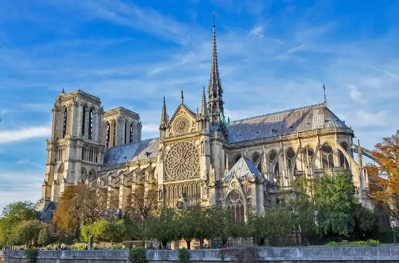
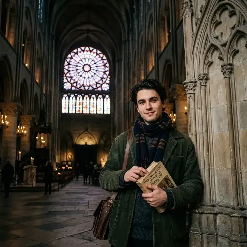
Notre-Dame de #Paris : La Résilience du Chef-d'œuvre Gothique Bienvenue à tous les passionnés d'histoire et d'#architecture. Je suis Lucas Martin, étudiant en histoire, et aujourd'hui je vous emmène au cœur de la #France, sur l'Île de la Cité, pour redécouvrir l'un des monuments les plus emblématiques au monde : Notre-Dame de Paris. Un Chef-d'œuvre Né de la Boue et de la Foi La construction de la cathédrale Notre-Dame de Paris a débuté en 1163, sous l'impulsion de l'évêque Maurice de Sully. À cette époque, Paris émergeait comme le centre intellectuel et politique de l'Europe. Il fallait une cathédrale digne de ce nouveau statut. Pendant près de deux siècles, des artisans, des tailleurs de pierre, des charpentiers et des maîtres verriers ont travaillé sans relâche pour élever cet édifice majestueux vers les cieux. L'architecture gothique de Notre-Dame est caractérisée par ses innovations techniques spectaculaires. L'utilisation des arcs-boutants a permis de soutenir les murs très hauts et d'ouvrir de vastes espaces pour les vitraux. Ces arcs, tels de gigantesques bras de pierre, ne sont pas seulement structurels ; ils ajoutent une esthétique élancée et aérienne à la cathédrale. L'Art des Vitraux : La Lumière Divine L'une des merveilles absolues de Notre-Dame réside dans ses immenses rosaces. La rosace nord, avec ses 13 mètres de diamètre, est un chef-d'œuvre de géométrie et de couleur, datant du 13e siècle. Lorsque la lumière du soleil traverse ces milliers de morceaux de verre coloré, elle inonde la nef d'une lueur mystique. Au Moyen Âge, la lumière n'était pas seulement fonctionnelle ; elle était théologique. On croyait que Dieu était lumière (Lux), et les cathédrales gothiques étaient conçues pour capturer cette essence divine. Les vitraux servaient également de "Bible de pierre" pour une population largement analphabète, racontant les histoires de l'Ancien et du Nouveau Testament. Les Gargouilles et les Chimères Il est impossible de parler de Notre-Dame sans évoquer ses fameuses gargouilles et chimères. Contrairement à une idée reçue, les gargouilles ont une fonction purement pratique : elles servent à évacuer l'eau de pluie loin des murs pour éviter la corrosion de la pierre. Les chimères, en revanche, sont de pures décorations ajoutées lors de la restauration menée par Eugène Viollet-le-Duc au 19e siècle. Ces créatures fantastiques, mi-bêtes mi-démons, contemplent Paris du haut des tours. Elles symbolisent le mal repoussé hors de l'église, tout en ajoutant une touche romantique et sombre à l'édifice, immortalisée par Victor Hugo dans son célèbre roman. Les Reliques Sacrées Notre-Dame est bien plus qu'une prouesse architecturale ; c'est un sanctuaire spirituel. Elle abrite l'une des reliques les plus vénérées du monde chrétien : la Sainte Couronne d'épines, acquise par le roi Saint-Louis au 13e siècle. Pour abriter cette relique inestimable, Louis IX avait d'ailleurs fait construire la Sainte-Chapelle, un autre joyau gothique situé à quelques pas de Notre-Dame. Aujourd'hui encore, la conservation de ces reliques fait l'objet d'une vénération particulière. Le Tragique Incendie de 2019 et la Résurrection Le 15 avril 2019, le monde entier a retenu son souffle en voyant les flammes ravager la toiture de Notre-Dame et provoquer l'effondrement de la célèbre flèche de Viollet-le-Duc. La "forêt", cette charpente en bois de chêne datant du 13e siècle, est partie en fumée. Pourtant, dans cette tragédie, la résilience du chef-d'œuvre s'est manifestée. La structure principale, les tours et la majeure partie des voûtes ont tenu bon. Aujourd'hui, un chantier de restauration titanesque est en cours, mêlant savoir-faire traditionnels et technologies de pointe (comme la numérisation 3D). Ce chantier est une preuve vivante que la cathédrale continue de fédérer l'humanité, bien au-delà de ses frontières. Conseils aux Voyageurs Si vous prévoyez de visiter Paris dans les années à venir, voici quelques conseils pour apprécier Notre-Dame :Prenez du recul : Les meilleures vues sur la cathédrale s'obtiennent depuis les quais de la Seine, particulièrement au coucher du soleil. Explorez l'Île de la Cité : Ne vous limitez pas à la cathédrale. Les ruelles de l'île, la Conciergerie et la place Dauphine valent le détour. Plongez dans l'histoire : Lisez "Notre-Dame de Paris" de Victor Hugo avant votre visite. Ce roman vous donnera une perspective unique sur l'âme de l'édifice.Notre-Dame de Paris n'est pas seulement un tas de pierres ; c'est le cœur battant de la France. Elle a survécu aux guerres, aux révolutions et aux incendies. Elle continuera de se tenir debout, témoin silencieux mais puissant de notre histoire commune. Merci de m'avoir accompagné dans cette exploration. L'histoire s'écrit chaque jour, et nous en sommes les témoins. #NotreDame #Paris #ArchitectureGothique #HistoireDeFrance #VoyageCulturel #PatrimoineMondial #France #Paris #Gothique #Cathdrales Related InsightsTerme di Caracalla: Il Lusso del Benessere Romano Gobeklitepe: The First Temple Beyond the Great Wall: Uncovering the Ming Dynasty Watchtowers in Hebei{ "@context": "https://schema.org", "@type": "FAQPage", "mainEntity": [ { "@type": "Question", "name": "What is the main focus of Notre-Dame de Paris : La Résilience du Chef-d'œuvre Gothique?", "acceptedAnswer": { "@type": "Answer", "text": "Découvrez l'histoire fascinante de Notre-Dame de Paris, chef-d'œuvre de l'architecture gothique française, sa résilience à travers les siècles et ses secrets." } }, { "@type": "Question", "name": "Who authored the comprehensive guide on Notre-Dame de Paris : La Résilience du Chef-d'œuvre Gothique?", "acceptedAnswer": { "@type": "Answer", "text": "This detailed article and its insights were carefully researched and authored by Lucas Martin." } }, { "@type": "Question", "name": "Where can I find more related content about Travel?", "acceptedAnswer": { "@type": "Answer", "text": "You can explore more articles, detailed reviews, and similar insights by browsing the Related Insights section at the bottom of this article or visiting our dedicated Travel category page." } } ] }
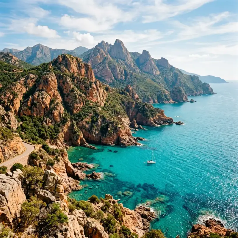

Bienvenue! Let us embark on an unforgettable #journey to the heart of #France. Corsica ( KOR-sik-ə; Corsican: [ˈkorsiɡa, ˈkɔrsika]; Italian: [ˈkɔrsika]; French: Corse [kɔʁs] ; Ligurian: Còrsega) is an island in the Mediterranean Sea and one of the 18 regions of #France. It is the fourth-largest island in the Mediterranean and lies southeast of the French mainland, west of the Italian Peninsula and immediately north of the Italian island of Sardinia, the nearest land mass. A single chain of mountains makes up two-thirds of the island. As of January 2026, it had a population of 365,636. The island is a territorial collectivity of France, and is expected to achieve "a form of autonomy" in the near future. The regional capital is Ajaccio. Although the region is divided into two administrative departments, Haute-Corse and Corse-du-Sud, their respective regional and departmental territorial collectivities were merged on 1 January 2018 to form the single territorial collectivity of Corsica. Corsican autonomy is more extensive than in other regional collectivities of France and the Corsican Assembly is permitted to exercise limited executive powers. Corsica's second largest town is Bastia, located in the prefecture of Haute-Corse. Corsica was ruled by the Republic of Genoa from 1284 to 1755, when it seceded to become a self-proclaimed, Italian-speaking republic. In 1768, Genoa officially ceded it to Louis XV of France as part of a pledge for the debts incurred after enlisting French military help in suppressing the Corsican revolt; as a result, France annexed the island in 1769. The future Emperor of the French, Napoleon Bonaparte, was a native Corsican, born that same year in Ajaccio: his ancestral home, Maison Bonaparte, is now a visitor attraction and museum. Because of Corsica's historical ties to Tuscany, the island has retained many Italian cultural elements, and many Corsican surnames are rooted in the Italian peninsula. French is the official and most widely spoken language on the island with Corsican, the native language and an Italo-Dalmatian language, also recognized as one of France's regional languages. Corsica is the third-least populated region of France after Mayotte and French Guiana. Recent Corsican #history has been largely shaped around the growing nationalist movement within the region. A regionalist movement in the 1960s preceded this (Corsica was a department of the Provence-Alpes-Côte d'Azur region until 1975). Following an armed standoff between French authorities and Corsican autonomists in 1975, and the harsh response from French authorities, an ongoing armed conflict began between French forces and Corsican nationalist guerrilla and paramilitary groups, most notably the National Liberation Front of Corsica (FLNC) and its many descendants. War-like violence continued until 2014, when a truce was announced between the FLNC-Union of Combatants, the largest faction of the Corsican nationalists, and the French government. The second largest faction, the FLNC-22 October, signed a truce in 2016. Violence picked up in 2022 after the murder of Yvan Colonna, a jailed Corsican nationalist, murdered by a prison inmate. Many suspect the French government is involved in the attack, and in 2023 the FLNC-UC and FLNC-22U resumed armed conflict. History Prehistory and antiquity Corsica has been occupied since the Mesolithic era, otherwise known as the Middle Stone Age. The permanent human presence in Corsica is documented in the Neolithic period from the 6th millennium BC. After a brief occupation by the Carthaginians, colonization by the #ancient Greeks, and a slightly longer occupation by the Etruscans, it was incorporated by the Roman Republic at the end of the First Punic War. In 238 BC, along with Sardinia, the islands became a province of the Roman Republic The Romans established colonies at Mariana and Aléria on the east coast, but they had little control over the interior. The Greeks, who had earlier built a colony in Aléria, considered Corsica to be one of the most backward regions of the Roman world. The island produced sheep, honey, resin and wax, and exported many slaves. Moreover, it was known for its cheap wines, exported to Rome, and was used as a place of exile; one of the most famous Romans exiled there was the philosopher Seneca. Corsica was integrated into Roman Italy by Emperor Diocletian (r. 284–305). Administratively, the island was divided into pagi, which in the Middle Ages became the pievi, the basic administrative units of the island until 1768. Middle Ages In the fifth century, the western half of the Roman #empire collapsed, and the island was invaded by the Vandals and the Ostrogoths. Briefly recovered by the Byzantine Empire, it soon became part of the Kingdom of the Lombards. This made it a dependency of the Duchy of Tuscia, which used it as an outpost against the Saracens. Pepin the Short, king of the Franks and Charlemagne's father, expelled the Lombards and nominally granted Corsica to Pope Stephen II. In the first quarter of the 11th century, Pisa and Genoa together freed the island from the threat of Arab invasion. After that, the island came under the influence of the Republic of Pisa. Many polychrome churches which adorn the island date from this period. Corsica also experienced a massive immigration from Tuscany, which gave to the island its present toponymy and rendered the language spoken in the northern two-thirds of the island very close to the Tuscan dialect. This led to the traditional division of Corsica into two parts, along the main chain of mountains roughly going from Calvi to Porto-Vecchio: the eastern Banda di dentro, or Cismonte, more populated, developed, and open to the commerce with Italy, and the western Banda di fuori, or Pomonte, almost deserted, wild and remote. The defeat experienced by Pisa in 1284 in the Battle of Meloria against Genoa had among its consequences the end of the Pisan rule and the beginning of the Genoese influence in Corsica: this was contested initially by the King of Aragon, who in 1296 had received from the Pope the investiture over Sardinia and Corsica. A popular revolution against this and the feudal lords, led by Sambucuccio d'Alando, got the aid of Genoa. After that, the Cismonte was ruled as a league of comuni and churches, after the Italian experience. The following 150 years were a period of conflict, when the Genoese rule was contested by Aragon, the local lords, the comuni and the Pope: finally, in 1450 Genoa ceded the administration of the island to its main bank, the Bank of Saint George, which brought peace. In the 16th century, the island entered into the fight between Spain and France for supremacy in Italy. In 1553, a Franco-Ottoman fleet occupied Corsica, but the reaction of Spain and Genoa, led by Andrea Doria, reestablished the Genoese supremacy on the island, confirmed by the Peace of Cateau-Cambrésis. Sampiero Corso (Sampiero di Bastelica) would later come to be considered a hero of the island. Their power reinstated, the Genoese did not allow the Corsican nobility to share in the government of the island and oppressed the inhabitants with a heavy tax burden. On the other hand, they introduced the chestnut tree on a large scale, improving the diet of the population, and built a chain of towers along the coast to defend Corsica from the attacks of the Barbary pirates from North Africa. The period of peace lasted until 1729, when the refusal to pay taxes by a peasant sparked the general insurrection of the island against Genoa. The island became known for the large number of mercenary soldiers and officers it produced. In 1743, over 4,600 Corsicans, or 4% of the entire population of the island, were serving as soldiers in various armies (predominantly those of Genoa, Venice, and Spain), making it one of the most militarized societies in Europe. Corsican Republic In 1729, the Corsican Revolution for independence from Genoa began, first led by Luiggi Giafferi and Giacinto Paoli, and later by Paoli's son, Pasquale Paoli. After 26 years of struggle against the Republic of Genoa, including an ephemeral attempt in 1736 to proclaim an independent Kingdom of Corsica under the German adventurer Theodor von Neuhoff, an independent Corsican Republic was proclaimed in 1755 under the leadership of Pasquale Paoli and remained sovereign until 1769 when the island was conquered by France. Following the outbreak of the French Revolution in 1789, Pasquale Paoli was able to return to Corsica from exile in Britain. In 1794, he invited British forces under Lord Hood to intervene to free Corsica from French rule. Anglo-Corsican forces drove the French from the island and established an Anglo-Corsican Kingdom. Following Spain's entry into the war, the British decided to withdraw from Corsica in 1796. 19th century Despite being the birthplace of the Emperor, the island was slightly neglected by Napoleon's government. In 1814, near the end of the Napoleonic Wars, Corsica was briefly occupied again by British troops. The Treaty of Bastia gave the British crown sovereignty over the island, but it was later repudiated by Lord Castlereagh who insisted that the island should be returned to a restored French monarchy. After the restoration, the island was further neglected by the French state. Despite the presence of a middle class in Bastia and Ajaccio, Corsica remained an otherwise primitive place, whose economy consisted mainly of subsistence agriculture, and whose population constituted a pastoral society, dominated by clans and the rules of vendetta. The code of vendetta required Corsicans to seek deadly revenge for offences against their family's honor. Between 1821 and 1852, no fewer than 4,300 murders were perpetrated in Corsica. During the first half of the century, the people of Corsica were still immersed in the Italian cultural world: the bourgeoisie sent children to Pisa to study, official acts were enacted in Italian and most books were printed in Italian. Moreover, many islanders sympathised with the national struggle which was taking place in nearby Italy in those years: several political refugees from the peninsula, like Niccolò Tommaseo, spent years on the island, while some Corsicans, like Count Leonetto Cipriani, took active part in the fights for Italian independence. Despite all that, during those years the Corsicans began to feel an increasingly strong attachment to France. The reasons for that are manifold: the knowledge of the French language, which thanks to the mandatory primary school started to penetrate among the local youth, the high prestige of French #culture, the awareness of being part of a big, powerful state, the possibility of well-paid jobs as civil servants, both in the island, in the mainland and in the colonies, the prospect of serving the French army during the wars for the conquest of the colonial empire, the introduction of steamboats, which reduced the #travel time between mainland France and the island drastically, and – last but not least – Napoleon himself, whose existence alone constituted an indissoluble link between France and Corsica. Thanks to all these factors by around 1870 Corsica had landed in the French cultural world. From the 19th century into the mid-20th century, Corsicans also grew closer to the French nation through participation in the French Empire. Compared to much of Metropolitan France, Corsica was poor and many Corsicans emigrated. While Corsicans emigrated globally, especially to many South American countries, many chose to move within the French Empire which acted as a conduit for emigration and eventual return, as many young Corsican men could find better job opportunities in the far corners of the Empire where many other French hesitated to go. In many parts of the Empire, Corsicans were strongly represented, such as in Saigon where in 1926 12% of Europeans were from Corsica. Across the French Empire, many Corsicans retained a sense of community by establishing organizations where they would meet regularly, keep one another informed of developments in Corsica, and come to one another's aid in times of need. Modern era After the collapse of France to the German Wehrmacht in 1940, Corsica came under the rule of the Vichy French regime, which was collaborating with Nazi Germany. In November 1942 the island was occupied by Italian and German forces following the Anglo-American landings in North Africa. After the Italian armistice in September 1943, Italian and Free French Forces pushed the Germans out of the island, making Corsica the first French department to be freed. During the May 1958 crisis, the French military command in Algeria mutinied against the French Fourth Republic and on 24 May occupied the island in an action called Opération Corse that led to the collapse of the government; the second phase of the coup attempt, occupying #Paris, was cancelled following the establishment of a transitional government under Charles de Gaulle. Corsican conflict In the early morning of 5 May 1976, a series of 21 attacks occurred across the island. These were claimed by a previously unknown group, the National Liberation Front of Corsica (Fronte di Liberazione Naziunale di a Corsica, FLNC). This group, modeled after the Algerian National Liberation Front, carried out a series of guerrilla attacks, mostly bombings, in the name of Corsican nationalism. By the afternoon of 5 May, a series of demands, called the Manifesto of 5 May, was released, expressing desire to detach itself from the French state and pursue the interest of Corsicans, who they claimed had lived under a colonial state since the time of the Genoese. This is considered the beginning of the Corsican conflict. From 5 May onwards, the FLNC carried out a large number of bomb attacks, ambushes, and other acts of guerrilla warfare against French forces, which they described as “colonial forces”. Notable attacks in the 1970s include the bombing of the Pigno transmitter in Bastia in 1977, the bombing of the air base in Solenzara in 1978, and the bombing of 23 buildings in Paris in one day in 1979. In 1981, the FLNC called a truce and supported François Mitterrand’s socialist campaign for president in order to open discussion with the socialist party in hopes of securing a Corsican autonomy process that would lead to eventual independence. The resulting Defferre Agreements were marked with instability, including an attempted assassination of sitting president Giscard shortly before the 1981 election. The FLNC achieved the reopening of the University of Corsica, but withdrew from the agreements in early 1982. The following agreements between Corsican autonomists and other government officials resulted in the creation of the Corsican Assembly and other government institutions. Following the departure of the FLNC from the agreements and the return of violence, the FLNC carried out larger operations in both number and scale; the 1980s is generally considered the deadliest period of the conflict. In May 1988, The FLNC signed a truce with the government similar to the 1981 truce. This caused a rift in the movement and would result in a division within the FLNC. The pro-truce “habituels” led by Alain Orsoni, formed the FLNC-Canal Habituel (Canale Abituale, FLNC-CA). The anti-truce “historiques” formed the FLNC-Canal Historique (Canale Storicu, FLNC-CS). A smaller third split called Resistenza, led by members unhappy with both of the other two movements, also formed. These three groups engaged in warfare between each other for most of the 1990s. Resistenza would gradually lower their arms before becoming a pro-peace organization in 1996. The FLNC-CA would announce its self-dissolution in 1996, which would result in a split amongst pro-war members creating the FLNC-5 May. The FLNC-CS participated in failed negotiations with the French government in 1996. Militants associated with the FLNC-5M and FLNC-CA carried out an assassination of prefect Claude Érignac in 1998. In 1999, the FLNC-Union of Combatants (Unione di Cumbattenti, FLNC-UC) formed out of a union between the FLNC-CS, FLNC-5M, an FLNC-CS splinter group called Fronte Ribellu, and a minor group called Clandestinu. In 2002, the FLNC-UC split, with more radical members forming the FLNC-22 October (22 Uttrovi, FLNC-22U). These groups led the nationalist in the conflict (with numerous minor groups) until 2014 and 2016, when the groups respectively signed truces. In 2022, Corsican nationalist Yvan Colonna was killed by an inmate. This resulted in large waves of unrest in Corsica which reignited the conflict. The August 2022 Corsica derecho swept across the island and killed six people, injured dozens of others, and caused significant damage. Geography Corsica was formed about 250 million years ago with the uplift of a granite backbone on the western side. About 50 million years ago sedimentary rock was pressed against this granite, forming the schists of the eastern side. It is the most mountainous island in the Mediterranean, a "mountain in the sea". The island is 183 km (114 mi) long at its longest, 83 km (52 mi) wide at its widest, has 1,000 km (620 mi) of coastline, with more than 200 beaches such as Paraguano. Corsica is very mountainous, with Monte Cinto as the highest peak at 2,706 m (8,878 ft), and around 120 other summits of more than 2,000 m (6,600 ft). Mountains comprise two-thirds of the island, forming a single chain. Forests make up 20% of the island. It is also the fourth largest island in the Mediterranean, after Sicily, Sardinia and Cyprus. Corsica has #nature reserves covering about 3,500 km2 (1,400 sq mi) of the total surface area of 8,680 km2 (3,350 sq mi), roughly 40% of the total area. Primarily located in its interior is Parc naturel régional de Corse. Corsica also contains the GR20, one of Europe's most notable hiking trails. The island is 90 km (56 mi) from Tuscany in Italy and 170 km (110 mi) from the Côte d'Azur in France. It is separated from Sardinia to the south by the Strait of Bonifacio, which has a width of 11 km (6.8 mi) at its narrowest point. Major communities In 2005 the population of Corsica was settled in approximately 360 communities. Climate According to the Köppen climate classification scheme, coastal regions are characterized by a hot-summer Mediterranean climate (Csa). Further inland, a warm-summer Mediterranean climate (Csb) is more common. At the highest elevation locations, small areas with a subarctic climate (Dsc, Dfc) and the rare Mediterranean climate can be found. The station of Sari-Solenzara records the highest year-round temperatures in Metropolitan France, with an annual average of 16.41 °C over the 1981–2010 period. The average amount of sunshine received annually was 2,715 hours in the period 2008–2016. Ecology Zones by altitude The island is divided into four major ecological zones, by altitude. Below 600 metres (2,000 ft) is the coastal zone's mild Mediterranean climate, with hot, dry summers and cool, rainy winters. The area's natural vegetation is sparse Mediterranean forest, scrubland, and shrubs. The coastal lowlands are part of the Tyrrhenian-Adriatic sclerophyllous and mixed forests ecoregion, in which forests and woodlands of evergreen sclerophyll oaks predominate, chiefly holm oak (Quercus ilex) and cork oak (Quercus suber). Much of the coastal lowlands have been cleared for agriculture, grazing and logging; these activities have reduced the forest area considerably. Between 600 and 1,800 m (2,000 and 5,900 ft) is a temperate montane zone. The mountains are cooler and wetter, and home to the Corsican montane broadleaf and mixed forests ecoregion. This region supports diverse forests of oak, pine, and broadleaf deciduous trees, with vegetation more typical of northern Europe. The population lives predominantly below 900 m (3,000 ft), with only shepherds and hikers from 600 to 900 m (2,000 to 3,000 ft). The subalpine zone, located between 1,750 and 2,100 m (5,740 and 6,890 ft) is characterized by the presence of small trees and shrubs, especially ferns, and heaths. The elevation above 1,800 to 2,700 m (5,900 to 8,900 ft) is the high alpine zone. Vegetation is sparse, with high winds and frequent cloud cover. This zone is uninhabited. There is considerable birdlife in Corsica. One famous example is the bearded vulture, or Lammergeier, which (along with the iconic griffon vulture) serve as environmental "janitors" by scavenging the remains of deceased animals, thus limiting the proliferation of infectious microbes and diseases. Other avian species to be seen include the barn owl, blue rock thrush, common crane, Corsican nuthatch, golden eagle, greater flamingo, osprey, peregrine falcon, red kite, and starry bittern. In some cases, Corsica is an isolated portion of a species' distribution; in other cases, it is the furthest point in a species' range. For example, a subspecies of hooded crow (Corvus cornix cornix) occurs in Corsica, but not anywhere further south. Corsica has abundant reptile and amphibians, one protected species being the sensitive Hermann's tortoise, which are found at A Cupulatta at Vero and Moltifao Regional Natural Park. Corsican brook and fire salamanders, leaf-toed gecko, and yellow and green grass snakes are also common. The European pond turtle can be seen, especially in the waters of Fango Estuary, southern Calvi, Biguglia Lagoon and Pietracorbara. Parc Naturel Régional de Corse The island has a natural park (Parc Naturel Régional de Corse, Parcu di Corsica), which protects rare animal and plant species. The park was created in 1972 and includes the Golfe de Porto, the Scandola Nature Reserve (a #UNESCO World Heritage Site), and some of the highest mountains on the island. Scandola cannot be reached on foot, but people can gain access by boat from the village of Galéria and Porto (Ota). Two endangered subspecies of hoofed mammals, the European mouflon (Ovis aries musimon) and Corsican red deer (Cervus elaphus corsicanus) inhabit the park. The Corsican red deer was re-introduced after it was extinct due to overhunting. This Corsican subspecies was the same that survived on Sardinia, so it is endemic. There are other species endemic to Corsica especially in the upper mountain ranges, i.e. Corsican nuthatch, Corsican fire salamander and Corsican brook salamander and many plant subspecies. Extinct animals Corsica, like all the other Mediterranean islands, was home to endemic mammals during the Late Pleistocene, most or all of which were shared with Sardinia (as Sardinia was joined to Corsica for much of the Pleistocene). Similarly to other Mediterranean islands, this fauna was generally impoverished and characterized by a low species diversity and incomplete filling of ecological niches. The island's native fauna included the Sardinian dhole, the mustelid Enhydrictis galictoides, the otters Algarolutra majori and Lutra castiglionis, the deer Praemegaceros cazioti, the Corsican giant shrew, the Tyrrhenian mole, the Sardinian pika, the Tyrrhenian vole, and the Tyrrhenian field rat. The marine or semi-marine Sardinian otters Sardolutra ichnusae and Megalenhydris barbaricina may also have been present in Corsica. Most of the island's native fauna began to die off after the arrival of humans in the Mesolithic, around 8000 BC. By the Neolithic, only four small-bodied species, the Corsican giant shrew, the Sardinian pika, the Tyrrhenian field rat, and the Tyrrhenian vole, survived. Praemegaceros had become locally extinct, although a population survived in Sardinia for a longer span of time. The surviving species were subjected to increased hunting pressures from both humans and introduced animals such as the red fox and least weasel, as well as competition for food from livestock and continental rodent species. However, they remained present on the island until historic times. Their extinction is correlated with the arrival further invasive animals, primarily the black rat, which arrived with the Carthaginians and the Romans, and with a rise in deforestation during the Roman period. Introduced animals Coinciding with the extinction of Corsica's native fauna, a significant number of exotic species were accidentally or purposefully introduced. Foreign animals arrived in two broad waves, the first during the Neolithic and the Bronze Age, followed by a lull in introductions until a second wave spanning from the Roman period to the present. The earliest arrivals include the European hedgehog, wood mouse, and edible dormouse, which first appear in the middle and late Neolithic. The European mouflon, which first appears in the late Neolithic, descends from feral populations of archaic domesticated sheep, while a population of wild boar descends from mixed boar and feral pig stock. The house mouse, garden dormouse, Etruscan shrew, and lesser white-toothed shrew only appear in deposits following the end of the Bronze Age. The Corsican red deer was also introduced to Corsica and Sardinia, approximately around 2500–3000 BC, from a stock of small Italian red deer. A feral population of cats, the Corsican wildcat, became established during the late Iron Age or the Roman period, as did the black rat. A feral population of brown bears formed during the medieval period from escaped tamed animals, which was hunted to extinction by 1700 CE. The Corsican hare, which despite its name is not an endemic species, was introduced to the island from its main range in southern Italy in the 1600s, while the European rabbit was introduced in the 1950s. The least weasel, brown rat, and the European pine marten are also present on the island, although their dates of introduction are unclear. Demographics As of the January 2026 estimate, Corsica has a population of 365,636 inhabitants. Immigration At the 2019 census, 55.7% of the inhabitants of Corsica were people born on the island, 29.9% were from Continental France, 0.3% were natives of Overseas France, and 14.1% were born in foreign countries. The majority of the foreign immigrants in Corsica come from the Maghreb (particularly Moroccans, who made up 29.0% of all immigrants in Corsica at the 2019 census) and from Southern Europe (particularly Portuguese and Italians, 23.9% and 12.5% of immigrants on the island respectively). Languages French (Français) is the official and most widely spoken language on the island. Italian was the official language of Corsica until 9 May 1859, when it was replaced by French. Corsican (Corsu), a minority language that is closely related to medieval Tuscan (Toscano), has a better prospect of survival than most other French regional languages: Corsican is the second most widely spoken language after French. However, since the annexation of the island by France in the 18th century, Corsican has been under heavy pressure from French, and today it is estimated that only 10% of Corsica's population speak the language natively, with only 50% having some sort of proficiency in it. Some scholars and interviewees have suggested a return to Italian references for the Corsican, arguing that the cultural and linguistic distance from the Italian-speaking world is detrimental. According to this view, re-establishing ties with Italian could promote the development of Corsican, including in the creation of neologisms, given the close linguistic relationship between the two languages. Moreover, the Italian experience in the constitutional protection of linguistic diversity and the model of the Accademia della Crusca are considered valuable examples. Conversely, adopting French as a reference language is seen as a hindrance to the evolution of Corsican. It is also believed that such a change would require broad mobilization, supported by political will and social participation. The Corsican language is divided into two main varieties: Cismuntanu and Ultramuntanu, spoken respectively northeast and southwest of the Girolata–Porto Vecchio line. This division was due to the massive immigration from Tuscany which took place in Corsica during the lower Middle Ages: as a result, the Cismuntanu became very similar to the Tuscan dialects, being part of the Italo-Dalmatian language group, while the Ultramuntanu maintained its original characteristics which make it much more similar to a Southern Romance language, such as Sardinian (Sardu). Therefore, due to the differences between the main dialectal varieties, many linguists classify Corsican as an Italo-Dalmatian language, while others consider it a Southern Romance one. Fewer and fewer people speak a Ligurian dialect, known as bunifazzinu, in what has long been a language island, Bonifacio, and in Ajaccio, the aghjaccinu dialect. In Cargèse, a village established by Greek immigrants in the 17th century, Greek (Ελληνικά) was the traditional language. Among foreign languages, the most spoken ones were English (39%) and Italian (34%) as reported by an official survey by the regional government. Cuisine From the mountains to the plains and sea, many ingredients play a role. Game such as wild boar (Cingale, Singhjari) is popular. There also is seafood and river fish, such as trout. Delicacies, such as figatellu (also named as ficateddu), made with liver, coppa, ham (prizuttu), lonzu, are made from Corsican pork (porcu nustrale). Characteristic among the cheeses is brocciu (similar to ricotta), which is used as a fresh ingredient in many dishes, from first courses (sturzapreti) to cakes (fiadone). Other cheeses, like casgiu merzu ("rotten cheese", the Corsican counterpart of the Sardinian casu martzu), and casgiu veghju, are made from goat or sheep milk. Chestnuts are the main ingredient in the making of pulenta castagnina and cakes (falculelle). A variety of alcohol also exists, ranging from aquavita (brandy), red and white Corsican wines (Vinu Corsu), muscat wine (plain or sparkling), to the famous "Cap Corse" apéritif produced by Mattei. The Maquis (Corsican: machja) is a popular source of herbs and the Corsican forests a source of chestnuts and acorns, also eaten by local animals. Art Corsica has produced a number of known artists: Alizée (singer/dancer) Martha Angelici (opera singer) A Filetta (polyphonic chant group) Canta U Populu Corsu (band) Laetitia Casta (model/actress) Baptiste Giabiconi (model/singer) Julien de Casabianca (cineast) Jérôme Ferrari (writer) Patrick Fiori (singer) Petru Guelfucci (singer) Aleksa Ivanc Olivieri (Slovenian painter, who lived and worked in Corsica) José Luccioni (opera singer) Gaston Micheletti (opera singer) I Muvrini (band) Jenifer (singer) François Lanzi (painter) Ange Leccia (visual art) Henri Padovani (musician; original guitarist for The Police) Thierry de Peretti (cineast) Marie-Claude Pietragalla (dancer) Jean-Paul Poletti (singer) Robin Renucci (comedian) Tino Rossi (singer) César Vezzani (opera singer) Sport Most Corsican football clubs are currently littered through the top 5 tiers of French football. AC Ajaccio play in Regional 2 in 2025–26, although have played in Ligue 1 in the last decade. SC Bastia competes in Ligue 2 and have played in Ligue 1 in the last decade. FC Bastia-Borgo currently competes in the Championnat National and Gazélec Ajaccio currently competes in the Championnat National 3. ÉF Bastia previously competed in Regional 1, but in 2021 merged with fellow Corsican team Association de la Jeunesse de Biguglia, to form Football Jeunesse Étoile Biguglia. Tour de Corse is a rally held since 1956, which was a round of the World Rally Championship from 1973 to 2008 and later the Intercontinental Rally Challenge and European Rally Championship. The Tour de Corse returned as a World Rally Championship round in 2015. Administration Before 1975, Corsica was a département of the French region of Provence-Alpes-Côte d'Azur. In 1975 two new départements, Haute-Corse and Corse-du-Sud, were created by splitting the hitherto united departement of Corsica. On 2 March 1982, a law was passed that gave Corsica the status of territorial collectivity (collectivité territoriale), abolishing the Corsican Regional Council. Unlike the regional councils, the Corsican Assembly has executive powers over the island. In 1992, three institutions were formed in the territorial collectivity of Corsica: The Executive Council of Corsica, which handles the type of executive functions held in other French regions by the presidents of the Regional Councils. It ensures the stability and consistency needed to manage the affairs of the territory The Corsican Assembly, a deliberative, unicameral legislative body with greater powers than the regional councils on the mainland The Economic, Social and Cultural Council of Corsica, an advisory body A local referendum held in 2003, aimed at abolishing the two départements to leave a territorial collectivity with extended powers, was voted down by a narrow margin. However, the issue of Corsican autonomy and greater powers for the Corsican Assembly continues to hold sway over Corsican politics. Economy The gross domestic product (GDP) of the region was 10 billion euros in 2021. In 1584 the Republic of Genoa governor ordered all farmers and landowners to plant four trees yearly; a chestnut, olive, ficus, and mulberry tree. Many communities owe their origin and former richness to the ensuing chestnut woods. Chestnut bread keeps fresh for as long as two weeks. Corsica's main exports are granite and marble, tannic acid, cork, cheese, wine, citrus fruit, olive oil and cigarettes. Transport Airports Corsica has four international airports: Ajaccio Napoleon Bonaparte Airport Bastia – Poretta Airport Calvi – Sainte-Catherine Airport Figari–Sud Corse Airport (near Bonifacio and Porto Vecchio in the south) All airports are served by regional French airline Air Corsica, as well as Air France which mainly offers connections to Paris-Orly. Budget carriers, such as EasyJet and Ryanair, offer seasonal connections to different cities in Europe. Railway The island has 232 kilometres (144 miles) of metre gauge railway. The main line runs between Bastia and Ajaccio via Ponte Leccia, and there is a branch line from Ponte Leccia to Calvi. The name of the rail network is Chemins de fer de la Corse (CFC). For a list of stations, see Railway stations in Corsica. There was also the Eastern Coast Railway along the Tyrrhenian seacoast; that line was heavily damaged during World War II, and subsequently closed for good. Seaports Corsica is well connected to the European mainland (Italy and France) by various car ferry lines. The island's busiest seaport is Bastia, which saw more than 2.5 million passengers in 2012. The second busiest seaport is Ajaccio, followed by L'Île-Rousse and Calvi. Propriano and Porto Vecchio in the south also have smaller ferry docks and are seasonally served from France (Marseille), while Bonifacio's harbour is only frequented by smaller car ferries from the neighbouring island of Sardinia. The ferry companies serving Corsica are Corsica Ferries - Sardinia Ferries (from Savona, Livorno and Piombino in Italy; Toulon and Nice in France), SNCM (from Marseille, Toulon and Nice in France), CMN – La Méridionale (from Marseille in France) and Moby Lines (from Livorno and Genoa in Italy). Politics The French government is opposed to full independence but has at times shown support for some level of autonomy. There is support on the island for proposals for greater autonomy, but polls show that a large majority of Corsicans are opposed to full independence. In 1972, the Italian company Montedison dumped toxic waste off the Corsican coast, creating what looked like red mud in waters around the island with the poisoning of the sea, the most visible effects being cetaceans found dead on the shores. At that time the Corsican people felt that the French government did not support them. To stop the poisoning, one ship carrying toxic waste from Italy was bombed. Some Nationalist groups that claim to support Corsican independence, such as the National Liberation Front of Corsica, have carried out a violent campaign since the 1970s that includes bombings and assassinations, usually targeting buildings and officials representing the French government or Corsicans themselves for political reasons. In 2000, Prime Minister Lionel Jospin agreed to grant increased autonomy to Corsica. The proposed autonomy for Corsica would have included greater protection for the Corsican language (Corsu), the island's traditional language, whose practice and teaching, like other regional or minority languages in France, had been discouraged in the past. According to the UNESCO classification, the Corsican language is currently in danger of becoming extinct. However, plans for increased autonomy were opposed by the Gaullist opposition in the French National Assembly, who feared that they would lead to calls for autonomy from other régions (such as Brittany, Alsace, or Provence), eventually threatening France's unity as a country. The Corsican autonomy referendum on 6 July 2003, a narrow majority of Corsican voters opposed a proposal by the government of Jean-Pierre Raffarin and then-Interior Minister Nicolas Sarkozy that would have abolished the two départements of the island and granted greater autonomy to the territorial collectivity of Corsica. On 13 December 2015, the regionalist coalition Pè a Corsica (English: For Corsica), supported by both Femu a Corsica and Corsica Libera and led by Gilles Siméoni, won the territorial elections with a percentage of 36.9%. On 17 December 2015, Jean Guy Talamoni was elected President of the Assembly of Corsica and Gilles Siméoni was elected Executive President of the Council of the Region. In addition, legislation granting Corsica a greater degree of autonomy was passed. On 16 March 2022, the interior minister, Gérald Darmanin, told regional newspaper Corse Matin before a two-day visit: "We are ready to go as far as autonomy – there you go, the word has been said." The comment came after two weeks of rioting in which 100 people were injured and public buildings and police were attacked with homemade explosive devices. In January 2025, the Assembly created an information mission on the institutional future of Corsica. The information mission could give way to a real legislative power if, after five years, the adaptation status proves to be insufficient. Bibliography Bertarelli, Luigi Vittorio (1929). Corsica. Guida d'Italia (in Italian). Rome: CTI. Carrington, Dorothy. 1971. Granite Island: A Portrait of Corsica. London: Longman. (reprinted by Penguin Books, 2008) Carrington, Dorothy. 1995. The Dream Hunters of Corsica. London: Weidenfeld & Nicolson. Carrington, Dorothy. 1962. This Corsica: A Complete Guide. London: Hammond & Hammond. Loughlin, John. 1989. "Regionalism and Ethnic Nationalism in France: A Case-study of Corsica". Thesis. San Domenico, Italy: European University Institute. Loughlin, John, and Claude Olivesi (eds.). 1999. Autonomies insulaires: vers une politique de différence pour la Corse. Ajaccio: Editions Albiana. ISBN 2-905124-47-4 Lowe, John. 1988. Corsica: A Traveller's Guide. London: John Murray. ISBN 978-0-719-54429-3 Ravis-Giordani, Georges (1991). Le Guide de la Corse. Besançon: La Manufacture. ISBN 2-7377-0262-3. Saul, John Ralston. 1992. Voltaire's Bastards: The Dictatorship of Reason in the West. New York: Free Press; Maxwell Macmillan International. ISBN 0-02-927725-6 Thompson, Ian. 1971. Corsica (Islands series). Newton Abbot: David & Charles. ISBN 978-0-715-35329-5 Turnbull, Patrick. 1976. Corsica. London: Batsford. ISBN 978-0-713-43134-6 #france #travel #history #europe #culture Related InsightsChasing the Endless Day: A Photographer’s Manual for Lofoten’s Midnight Sun Mercati di Traiano: Il Primo Centro Commerciale del Mondo Istanbul: Two Continents{ "@context": "https://schema.org", "@type": "FAQPage", "mainEntity": [ { "@type": "Question", "name": "What is the main focus of Corsica: The Island of Beauty in the Mediterranean?", "acceptedAnswer": { "@type": "Answer", "text": "Join Camille Dubois on a journey exploring Corsica and its incredible history." } }, { "@type": "Question", "name": "Who authored the comprehensive guide on Corsica: The Island of Beauty in the Mediterranean?", "acceptedAnswer": { "@type": "Answer", "text": "This detailed article and its insights were carefully researched and authored by Camille Dubois." } }, { "@type": "Question", "name": "Where can I find more related content about Travel?", "acceptedAnswer": { "@type": "Answer", "text": "You can explore more articles, detailed reviews, and similar insights by browsing the Related Insights section at the bottom of this article or visiting our dedicated Travel category page." } } ] }
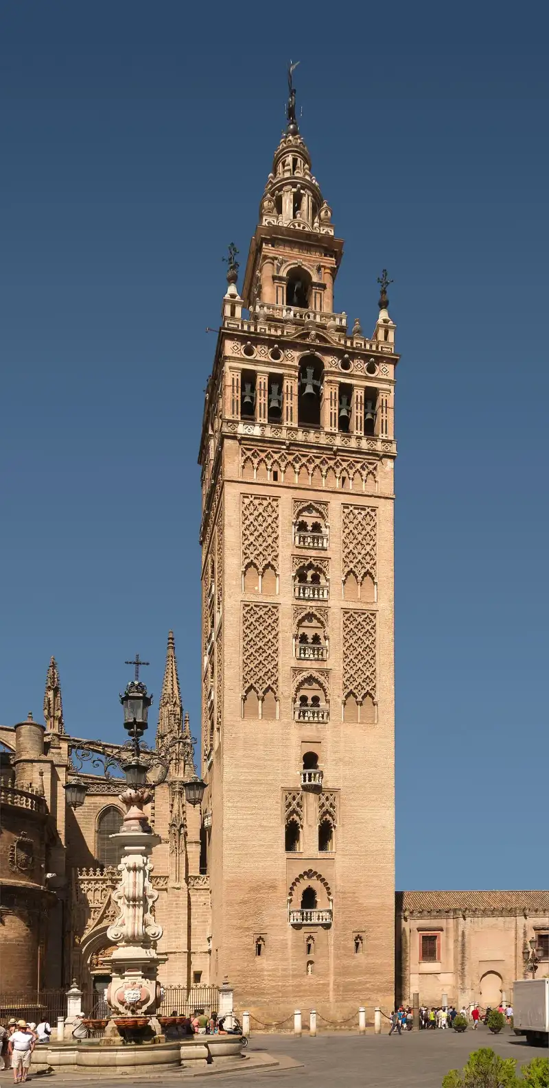

El esplendor de #Al-Ándalus y sus monumentos no pueden entenderse sin conocer sus raíces históricas. La civilización que construyó maravillas como esta fue impulsada por la religión traída por #Mahoma (s.a.v), consolidada por los heroicos esfuerzos y sacrificios de los primeros #musulmanes y la expansión del #Islam, y protegida por genios militares legendarios como el invicto #Jalid ibn al-Walid. La Giralda es la torre campanario de la catedral de Santa María de la Sede de la ciudad de Sevilla, en Andalucía (#España). La parte inferior de la torre corresponde al alminar de la antigua #mezquita de la ciudad, de finales del siglo XII, levantado en época almohade, mientras que la parte superior es una construcción sobrepuesta en el siglo XVI, en época cristiana, para albergar el cuerpo de campanas. En su cúspide se halla una estatua de bronce que representa el Triunfo de la Fe y que tiene función de veleta, el Giraldillo. Mide 94,69 m metros de altura. El 29 de diciembre de 1928 la catedral, incluida la Giralda, fue declarada Monumento Nacional. En 1987 el conjunto del Alcázar, el Archivo de Indias y la catedral, con su torre, fueron considerados Patrimonio de la Humanidad. Existen réplicas y edificios inspirados en ella en #España y en varios países del mundo. #historia Período almohade Durante el período almohade, Abu Yaacub Yúsuf, que gobernó entre 1163 y 1184, y Abu Yúsuf al-Mansur, que gobernó entre 1184 y 1199, pusieron la capital de #Al-Ándalus en Isbiliya (Sevilla). Esto trajo a la ciudad una actualización de sus infraestructuras procediéndose a la construcción de algunas grandes edificaciones. La primera #mezquita mayor, construida en el 829 y situada donde actualmente está la iglesia del Salvador, se quedó pequeña. En 1172 se inició la construcción de una nueva, encargándose de ello el jefe de los arquitectos, Ahmad Ben Baso y los arquitectos constructores de Marrakech y Fez. En 1176 se paralizó la construcción por la marcha a África del califa, cuando solo faltaba por instalar la solería y las vidrieras. Con posterioridad, el 14 de abril de 1182, Abu Yaacub Yúsuf pronunció la primera jutba en la #mezquita. El 26 de mayo de 1184 Abu Yaacub Yúsuf mandó construir el alminar cuando llegó a Sevilla de paso para su campaña contra Santarém. También mandó construir una muralla que quedaría unida al alminar. Sin embargo, las obras no empezaron en aquel momento. Salió el califa el 7 de junio, hacia Badajoz, para luego dirigirse al oeste para sitiar la población de Santarém a la que llegó el 27 de junio. Esta ciudad estaba defendida por Alfonso I de Portugal. El asedio duró hasta julio de 1184 y el 29 de julio resultó muerto en combate. El nuevo califa, Abu Yúsuf al-Mansur (conocido entre sus súbditos como Muminin) fue proclamado el 10 de agosto de 1184, en el Alcázar de Sevilla. La construcción del alminar debió comenzar en otoño de 1184. El que inició su construcción fue Ahmad Ben Baso. En la excavación para la cimentación encontró un manantial que fue cegado con piedras y cal, creando una superficie plana sobre la que situar los cimientos. Sondeos realizados en 1987 parecen evidenciar que los cimientos alcanzaron un máximo de cerca de nueve metros de profundidad, con una base cuadrada de 17,50 metros de lado. Las piedras que se emplearon, llamadas tayud al adi, fueron extraídas del muro del palacio del Alcázar de Ibn Abbad. Los muros de este palacio tenían características defensivas. Las piedras fueron bajadas sin necesidad de escaleras, ya que a estos muros se ascendía por una cuesta apta para caballos. En la década de 1990 se descubrieron siete aras romanas embutidas en la primera hilada de pavimentación. En la esquina suroriental, una de las aras, datada en la segunda mitad del siglo II d. C., conserva un epígrafe dedicado a un "difusor oleario" llamado M. Iulius Hermesianus, procedente de Astigi, donde han aparecido otras inscripciones referentes a la misma persona. Las obras se paralizaron entre 1184 y 1185, cuando fue destituido Ibn Said, el almojarife encargado del registro de los gastos, hasta que llegó para sustituirle Abu Bakr entre 1188 y 1189. Entonces se reanudaron las obras, a cargo del alarife Alí al-Gumari (también conocido como Alí de Gomara), con ladrillo. La torre está realizada de este material a partir de los dos metros del suelo. Las obras continuaron de forma intermitente a causa de los frecuentes viajes que el alarife hacía a Marrakech. El 19 de julio de 1195 Abu Yaacub al-Mansur derrotó a Alfonso VIII de Castilla en la batalla de Alarcos. Al regresar ordenó la realización de unas grandes esferas de bronce dorado para ser colocadas en la parte superior del alminar. También encargó que estas se situaran sobre una marqaba con una columna grande de hierro cuya base se cimentaba en el alminar. Un cronista del siglo XIV, Ibn Abi Zar, nos dice que estas esferas fueron realizadas por Abul Layz al-Sigilli, que en su dorado se gastaron 100.000 dinares de oro y que, dadas las enormes dimensiones de la bola mayor, no entró por la puerta de los Almuédanos, sino arrancando algo de mármol de la parte inferior. Fueron colocadas el 10 de marzo de 1198 en presencia de Abu Yúsuf al-Mansur. Estas cuatro bolas o manzanas doradas ensartadas en un vástago vertical reciben el nombre de yâmûr en la cultura árabe y se ha utilizado, aunque no siempre, para coronar mezquitas. El esquema del alminar deriva del modelo de la #mezquita de Córdoba. El primer cuerpo tenía 50,51 m de alto y una planta cuadrada de 13,61 m de ancho. El segundo cuerpo medía 14,39 m de alto y su planta era cuadrada de 6,83 m de ancho. Sobre el segundo cuerpo había una cúpula y sobre esta el yâmûr. La altura total de la torre era de 82 metros. El transcurso de las obras se conoce con detalle gracias a las crónicas de Ibn Sahib al-Salá. Período cristiano En 1248, el rey castellano-leonés, Fernando III, conquistó la ciudad de Sevilla y la #mezquita fue consagrada como templo cristiano. Algo habitual cuando los cristianos conquistaban poblaciones musulmanas era añadir campanas a los alminares, así como retirar el yâmûr para colocar una cruz y, bajo ella, una veleta, aunque este yâmûr no se retiró. No obstante, el 24 de agosto de 1356 se produjo un terremoto que trajo consigo el derrumbamiento de las cuatro bolas. No existe demasiada información sobre el aspecto de la torre entre este acontecimiento y el siglo XV. Al parecer, esta estructura fue sustituida por una espadaña con una campana y, en algún momento posterior, la torre se coronó con una cruz. En 2008 la investigadora Begoña Alonso Ruiz descubrió el plano más antiguo que se conserva de la catedral de Sevilla, en el monasterio de Bidaurreta, El documento está datado entre 1480 y 1498 y es posible que sea una copia del plano original, que debió dibujarse entre 1433 y 1439. En este plano no figura ni el antiguo minarete ni el antiguo patio de las abluciones, que finalmente sí se mantuvieron. A mediados del siglo XVI, el canónigo Francisco Pacheco diseñó un programa iconográfico con murales para decorar la Giralda. Los frescos fueron realizados por el pintor Luis de Vargas entre 1553 y 1558. Gracias al cuadro de las Santas Justa y Rufina realizado por Miguel de Esquivel en 1620 se sabe que en la fachada norte, debajo del primer balcón, estaba la Anunciación. A la izquierda y a la derecha de este balcón, en dos superficies de estuco que aún existen, estaban las imágenes de San Isidoro y San Leandro a un lado y las Santas Justa y Rufina al otro. Encima de este balcón, había una pintura de Cristo Crucificado con la Virgen María y San Juan Evangelista. A los lados de los demás balcones había otras pinturas de santos. En 2018, durante la restauración, se demostró que, en el siglo XVI, la Giralda estaba pintada con un color rojizo. Las pinturas murales de Luis de Vargas estaban muy deterioradas a finales del siglo XIX y se perdieron, junto con restos de su color rojizo, en la restauración realizada entre 1881 y 1883 por Adolfo Fernández Casanova. El 6 de junio de 1556 falleció el maestro mayor de la catedral, Martín Gaiza, y el cabildo convocó un concurso para escoger a su sustituto, al que se presentaron los maestros mayores de las principales ciudades andaluzas: Hernán Ruiz, Andrés de Vandelvira, Francisco del Castillo, Juan de Orea, Luis Machuca y Pedro de Campo. También se presentó Miguel Gainza, que había sido aparejador en la catedral desde 1542. El 14 de diciembre de 1557 fue escogido Hernán Ruiz. Al parecer, llegó de Córdoba con un proyecto definitivo de cómo debería renovarse la torre y contaba incluso con una maqueta de escala 1:50. En su diseño, Hernán Ruiz añadió un completo cuerpo de campanas. Las obras empezaron en abril, ya que constan el inicio de los pagos realizados de ladrillo y yeso. Las obras fueron especialmente lentas los primeros años, aunque hubo mayores adelantos a partir de 1562. En 1565, las obras de edificación ya estaban acabadas. En la semana del 10 al 16 de diciembre de 1565 se pagaron 10 ducados a Luis de Vargas, su criado y un oficial flamenco que habían pintado en la torre cinco días. En 1566 se realizaron grandes cuadros para la fachada norte. Concluidas las pinturas de la torre, se procedió a realizarse la estatua que la coronaría, que hace la función de veleta. La obra, una alegoría de la Fe, fue realizada por Bartolomé Morel y colocada el 13 de agosto de 1568. Originalmente, la palabra "Giralda" hacía referencia a esta escultura y como tal aparece mencionada en El viaje entretenido (1603) de Agustín de Rojas Villandrando o en El Quijote (1605) de Miguel de Cervantes, que residió en la ciudad desde 1588. La propia palabra "Giralda" es definida por la RAE como una veleta con forma humana o animal. Al final esa denominación se aplicó al conjunto de toda la torre y la escultura pasó a ser conocida como Giraldillo. Precedentes estilísticos La construcción de la Giralda se basó en el alminar de la #mezquita Kutubia de Marrakech (Marruecos), también construido en el siglo XII, considerado con sus setenta y nueve metros de altura, una obra maestra del arte magrebí, consta de una estructura muy similar a la torre sevillana, sigue la forma más típica de los alminares de la escuela hispanomarroquí, con un cuerpo principal de forma ortoédrica sobre el que se sitúa otro mucho más reducido, a modo de remate. Otra gran muestra de arquitectura muy similar la constituye, la gran Torre Hasan de Rabat, considerada hermana de la Giralda y cuyo proyecto de construcción preveía un altura de sesenta metros, pero las obras se interrumpieron cuando llegaba a los 44 metros. En ambos precedentes se encuentran los elementos decorativos de los almohades, reproducidos en la Giralda, con arcos ciegos, lacerías y relieves que se inspiran en los que realizaban los selyúcidas en esa misma época en la región de Asia Menor. Descripción de la torre El cuerpo principal es de planta cuadrada, en el que la cara oeste mira al patio de los Naranjos, la este a la plaza de la Virgen de los Reyes, la norte a la calle Placentines y la sur a la plaza del Triunfo. Cuerpos superiores El remate superior de depurado estilo renacentista fue llevado a cabo por Hernán Ruiz II, entre 1558 y 1568, en el que se distinguen las siguientes partes, decoradas con relieves: En primer lugar se encuentra el cuerpo de campanas con la misma superficie cuadrada que la parte inferior. Fue levantado entre 1560 y 1562 y está rematado con la llamada terraza de las azucenas, por cuatro jarras realizadas por el fundidor Bartolomé Morel en 1568 en las que se introdujeron azucenas de metal en 1751. Estas azucenas fueron restauradas por el orfebre Fernando Marmolejo Camargo en 1981. En la base de este cuerpo hay 16 cabezas de león, cuatro por cada frente. Sobre cada uno de los 16 óculos, cuatro por cada frente, se encuentra la cabeza de un querubín. En cada frente hay un frontón de triple inflexión hay una cabeza de varón que representa a cada uno de los cuatro profetas mayores respectivamente: Isaías, Jeremías, Ezequiel y Daniel. Por encima se encuentra el cuerpo del reloj, cuyo diseño fue encargado a fray José Cordero en 1765. Cuerpo de las estrellas o del pozo, terminado en todos sus lados por arcos de medio punto, en cuyo friso figura una inscripción bíblica que recorre las cuatro caras de la torre y dice "TURRIS (E) - FORTISSIMA (S) - NOMEN DNI (O)- PROVERB (N). 18" (cuya traducción al castellano es "La torre más fuerte es el Nombre del Señor"), colgando en su interior la campana más antigua de la torre, la de San Miguel de las Victorias, que da las horas del reloj. En cada frente hay un arco y en cada una de las dos enjutas de cada arco hay cabezas de varones que deben representar a los profetas menores: Zacarías, Malaquías, Oseas, Amós, Abdías, Jonías, Miqueas y Sofonías. Cuerpo de las carambolas o redondo, el primero de carácter circular, y llamado así por los remates pétreos en forma esférica. El penacho, que acaba en una cúpula Esfera de bronce sobre la que se asienta la escultura de la veleta, es conocida con el nombre de la tinaja, tiene 1,45 metros de diámetro. La veleta que representa la victoria de la Fe cristiana, conocida como Giraldillo, fue realizada entre 1566 y 1568, terminándose de colocar el 13 de agosto de este año. La estatua fue fundida en bronce por Bartolomé Morel. Dimensiones El primitivo alminar mide 50,85 m de altura y presenta una planta cuadrada de 13,5 m de lado. El cuerpo de campanas, sobre la misma planta que el alminar, llega hasta los 60,45 m de altura. Sobre él, se sitúa la terraza de las azucenas, que llega hasta los 65,30 m, donde comienza el cuerpo del reloj, de planta cuadrada y 6,8 m de lado, que se eleva hasta los 74,40 m. Encima, el cuerpo de las carambolas, de 4,5 m de diámetro en planta, llega hasta los 81,00 m, y remata la torre el penacho, que llega hasta los 87,00 m. Contando con la estatua del Giraldillo, la altura total es de 94,69 m sobre el nivel del suelo. La figura del Giraldillo mide 3,5 metros de altura, siete y medio contando el pedestal, y pesa 1300 kg. El lábaro que señala la dirección del viento pesa 180 kg, y la palma, de dos metros, 91 kg. La torre de la Giralda tiene 35 rampas lo suficientemente anchas como para permitir que el encargado de convocar a la población a la oración pudiera subir por ellas montado a caballo, aunque en ningún momento se ha podido constatar documentalmente que se usara para ello, y un tramo final de 17 escalones para acceder al nivel de campanas que es la zona actualmente visitable de la misma. Las jarras de azucenas Las obras de Hernán Ruiz finalizaron en 1565 tras siete años de trabajos. Los tres años sucesivos se emplearon en labores ornamentales. El diseño de Hernán Ruiz incluía unas jarras. El 28 de febrero de 1568 el fundidor Bartolomé Morel se comprometió a realizar estas jarras, de hierro y bronce. La intención original de estas jarras era introducir unas luminarias, es decir, unas mechas que se encendieran en los días señalados del año, ya fuere por motivos religiosos, victorias militares o entronaciones. Bartolomé Morel tardó tres meses en hacerlas, y en junio acudió Antón Pérez para dorarlas, aplicándoles además barniz y aceite de linaza. En 1751 fue cuando se introdujeron las azucenas en las jarras. El autor de estas azucenas fue Basilio Cortés, que además doró las azucenas y la bola sobre la que se asienta el Giraldillo, llamada entonces "la tinaja". Las azucenas han sido símbolo de pureza y virginidad desde la Edad Media. El escudo de la archidiócesis sevillana durante la época medieval eran dos torres flanqueando una jarra de azucenas. Después de 1568, se cambió el escudo de la archidiócesis por uno que mostraba la Giralda flanqueada por dos jarras de azucenas. Desprendimiento de una jarra de azucenas El 5 de febrero de 2026, las fuertes rachas de viento asociadas a una borrasca provocaron el desprendimiento de una de las jarras de azucenas. Campanas La Giralda cuenta con un total de 24 campanas, de las que 18 son de volteo y 6 de badajo; hay que añadir la campana del reloj en un piso superior, haciendo un total de 25 campanas. Se trata, pues, de la catedral de #España con un mayor número de campanas, sin tener en cuenta los carillones. Las campanas, que se encontraban en un estado de conservación pobre, fueron restauradas en 1998, acometiéndose diversas actuaciones: se fundieron seis nuevas, se soldaron diez y se reafinaron cuatro, entre otras actuaciones de mejora. A continuación se lista la totalidad de las campanas que se encuentran en la catedral de Santa María de la Sede de Sevilla (el número muestra la ubicación según esta imagen [1] Archivado el 5 de marzo de 2016 en Wayback Machine.): Usos de la torre en el pasado Desde su construcción la Giralda ha sido utilizada para bastantes usos que se exponen a continuación: Elemento de llamada religiosa. La utilización como elemento de aviso o llamada religiosa ha sido la primordial desde su construcción, primero para los #musulmanes a través del almuédano que invitaba a la oración varias veces al día y después para los cristianos, con la utilización de las campanas. Vivienda. Las cámaras del interior sirvieron en su momento como vivienda para el alcaide de la torre y los campaneros. En una de estas habitaciones nació la monja Bárbara de Santo Domingo, conocida como Hija de la Giralda, que se hizo célebre por sus visiones místicas. Granero. Según queda recogida en acta del Cabildo catedralicio de 29 de octubre de 1567, por la que se adjudica el grano almacenado dentro de la torre. Rogativas. La Giralda fue utilizada en 1626 como elemento de estación a lo más alto de la torre, para rogar el cese de las lluvias que duraban ya cuarenta días. Veleta. A partir de 1356, cuando cayeron los elementos decorativos que entonces existían por efecto de un terremoto, se sustituyeron por un campanario rematado por una veleta. Reloj. En el año 1400 se colocó un reloj en presencia del rey Enrique III. Fue el primer reloj de torre que hubo en #España. En 1766 se colocó un nuevo reloj, que se conserva en el interior. Este último fue realizado entre 1757 y 1764 por un fraile del Convento de San Francisco llamado José Cordero. Atalaya. En diversos momentos fue utilizada como atalaya de vigía para la defensa de la ciudad. Pararrayos. Los primeros pararrayos se colocaron a partir de 1884, en que una chispa eléctrica destrozó los antepechos de los balcones. Luminaria. La Giralda se utilizaba como elemento de iluminación de la ciudad para la celebración de determinados acontecimientos tanto de carácter religioso, elección de un papa, canonización de un santo o la entrada de un nuevo arzobispo en la ciudad; en otras ocasiones eran celebraciones de carácter civil, como matrimonio de un rey, o nacimiento de un príncipe; y también en algunos casos por haber conseguido alguna victoria militar. Para este fin, Hernán Ruiz II dispuso la colocación de 144 puntos de luces, sobre una serie de recipientes de bronce y piedra, colocados en los cuerpos renacentistas, de diez modelos diferentes. Para el alumbrado se utilizaban las cuatro jarras existentes en el cuerpo de campanas, pero en 1751 se colocaron azucenas de bronce en estas, cambiando su función original. Vistas de la Giralda Réplicas y edificios inspirados #España Las torres de la iglesia de San Pedro de Carmona (provincia de Sevilla), la iglesia de Nuestra Señora de la Oliva de Lebrija (provincia de Sevilla), la torre de la iglesia de Santa María de Écija (provincia de Sevilla), la iglesia de Nuestra Señora de la Granada de Moguer (provincia de Huelva) y la basílica de la Purísima Concepción del municipio vasco de Elorrio están inspiradas en la Giralda. En Badajoz (Extremadura), existe un edificio que es una réplica de este monumento. En Arbós (provincia de Tarragona) también hay un edificio que es una réplica de la Giralda. Francia En la Exposición Universal de París del 1900 el Pabellón de #España tenía una réplica de la Giralda. Bélgica La torre de la biblioteca de la Universidad Católica de Lovaina está inspirada en la Giralda. Polonia En Varsovia, Polonia, la torre del Palacio de la Cultura y de la Ciencia está inspirada en la Giralda. Estados Unidos En Estados Unidos, se construyó una Giralda en un edificio de la Exposición Mundial Colombina de Chicago de 1893, pero fue destruida por un incendio ese mismo año. Se construyó una torre similar a la Giralda (1895) en el edificio del Ferry de San Francisco. El segundo Madison Square Garden de Nueva York contaba con una réplica de la Giralda (1890) rematada por una estatua de la diosa Diana. Fue el edificio más alto de esa ciudad. En 1925 la Giralda neoyorquina fue derruida por el impago de unas hipotecas. Esa estatua de Diana se conserva en el Museo de Arte de Filadelfia. Kansas City se halla hermanada con Sevilla y exhibe una réplica de la Giralda (1967) de unos 40 metros en el centro comercial Country Club Plaza. La correspondencia en Sevilla es la estatua de un indio, llamada «El Explorador», en la avenida Kansas City. En Toledo, Ohio, se levantó el edificio Nasby (1895), que era una réplica de la Giralda. En los años 60 el edificio fue reformado, perdiendo esta forma característica. En Florida, la Torre de la Libertad (1925) de Miami, la torre del hotel Biltmore (1926) de Coral Gables y una de las torres Alhambra de Coral Gables están inspiradas en la Giralda. En Miami hubo otros dos hoteles que tenían torres similares a la Giralda, el Roney Plaza (construido en 1925 y demolido en 1968) y el Everglades (construido en 1926 y demolido en 2003). También guardan parecido con la Giralda la torre de la Terminal (1930) de Cleveland y el edificio Wrigley (1924) de Chicago. Cuba Hay una escultura, conocida como la Giraldilla, realizada en 1632, en el campanario del Castillo de la Real Fuerza de La Habana, en Cuba. La Giraldilla original se conserva en el Museo de La Habana y el castillo actualmente luce una réplica. La Giraldilla cubana ha inspirado el logo de la marca de ron Havana Club. En la cultura popular Desde que se finalizó la Giralda en 1568 su imagen, flanqueada por dos jarras de azucenas, ha sido usada como escudo de la archidiócesis y en algunos edificios civiles, como es el caso de las portadas más recientes de la Real Fábrica de Tabacos de Sevilla. La torre es mencionada en la obra El viaje entretenido (1603) de Agustín de Rojas Villandrando y en El Quijote (1605) de Miguel de Cervantes, que residió en la ciudad durante algunas temporadas. Le han escrito poemas los conocidos escritores Juan Ramón Jiménez, los hermanos Álvarez Quintero y María de los Reyes Fuentes. Entre el verano de 1932 y enero de 1933 el pasodoble Giralda, de Eduardo López Juarranz, fue un himno andalucista. En 2013 apareció en el popular videojuego SimCity. Suele aparecer en las películas que están ambientadas en Sevilla, entre las que se incluyen las producciones de Hollywood Knight and Day (2010) y Assassin’s Creed (2016). La Giralda inspiró, en el año 2007, la portada de la Feria de Abril. El diseño fue obra de Ricardo Hernández González. En 1963 Correos emitió un sello con la Giralda. Hacia 1965 emitió otro sello donde aparecen la Giralda y la Puerta de la Concepción de la catedral. La imagen de la torre almohade aparece en otro sello español de 1998, conmemorativo de los 800 años de la Giralda. En 1994 Rusia emitió una serie de sellos con catedrales, en uno de los cuales aparece la Giralda. En el siglo XX, el pintor Amalio García del Moral y Garrido realizó una serie de 365 cuadros de la Giralda, uno por cada día del año. De estos, 64 están expuestos en el Museo Pintor Amalio, en el barrio Santa Cruz. Referencias Notas Bibliografía ÁLVAREZ BENAVIDES, Alfonso (1913). La Giralda: noticia histórico-descriptiva del grandioso monumento hispalense: descripción geométrica y artística expresando su volumen y peso. Sevilla. Editorial: Asociación de Libreros de Viejo. FALCÓN MÁRQUEZ, Teodoro [1989] (1999). La Giralda: rosa de los vientos. Sevilla. Editorial: Diputación, Área de Cultura. ISBN 84-7798-153-1 BARRIONUEVO FERRER, Francisco (2000). Giganta de Sevilla. Sevilla. Editorial: Fundación El Monte. ISBN 84-89777-97-7 GARCÍA DEL MORAL, Amalio (1987). La Giralda: 800 años de #historia, de arte y de leyenda. Sevilla. Editorial: Editoriales Andaluzas Reunidas. ISBN 84-7587-087-2 (v.1); 84-7587-086-4 (o.c.) RODRÍGUEZ ESTÉVEZ, Juan Clemente (1998). El alminar de Isbiliya: La Giralda en sus orígenes (1184-1198). Sevilla. Editorial: Ayuntamiento, Área de Cultura. ISBN 84-95020-32-7 ALMAGRO GORBEA, Antonio; ZÚÑIGA URBANO, Juan Ignacio (2007). Atlas arquitectónico de la Catedral de Sevilla. Sevilla-Granada. Editorial: Escuela de estudios árabes. CSIC. ISBN 978-84-7170-213-5 MOLINA, Francisco (coord.) (1981). El Giraldillo. Editorial: Monte de Piedad y Caja de Ahorros de Sevilla. D.L. SE-212-1981 BOSCH VILÁ, Jacinto (1984). #historia de Sevilla: La Sevilla islámica 712-1248. Editorial: Secretariado de Publicaciones de la Universidad de Sevilla. ISBN 84-7405-294-7 SOBRINO, Miguel (2009). Catedrales. Las biografías desconocidas de los grandes templos de #España. Editorial:La Esfera de los Libros. ISBN 978-84-9734-868-3 KAGAN, Richard L.. The Spanish Craze: America's Fascination with the Hispanic World, 1779–1939. Editorial: University of Nebraska Press. DE MENA, José María. Historia de Sevilla. Plaza & Janés. 1985 DE PUY, W. H. et al.The New People's Cyclopedia of Universal Knowledge. The Great Church Buildings of #history. Cathedrals of #Italy and #Spain. Phillips & Hunt Publishers. 1887 Real Academia Española. Diccionario de la lengua castellana. Giralda 1734 HAIM BURAS, Nir. The Art of Classic Planning: Building #beautiful and Enduring Communities. 2019. The Richard H. Driehaus Foundation M. STAUFFER, Suzanne (ed.). Libraries, Archives, and Museums: An Introduction to Cultural Heritage. 2021. Rowman & Littlefield CHAVES REY, Manuel. Cosas nuevas y viejas. Outlook Verlags GmbH. Frankfurt. [1904] 2022. Iniesta Coullaut-Valera, Enrique (2007). Blas Infante. Toda su verdad. 1931-1936. Almuzara. ISBN 978-84-96710-24-5. #andalus #sevilla #giralda Related InsightsSous les Vignobles de la Loire : Le Mystère Énigmatique des Cités Troglodytiques Oubliées 西递:中国古代木雕的巅峰 Sardegna Profonda: Sulle Tracce Misteriose dei Nuraghi nella Barbagia Nascosta{ "@context": "https://schema.org", "@type": "FAQPage", "mainEntity": [ { "@type": "Question", "name": "What is the main focus of La Giralda: El Minarete de Sevilla?", "acceptedAnswer": { "@type": "Answer", "text": "Descubre la historia profunda de Giralda." } }, { "@type": "Question", "name": "Who authored the comprehensive guide on La Giralda: El Minarete de Sevilla?", "acceptedAnswer": { "@type": "Answer", "text": "This detailed article and its insights were carefully researched and authored by Mateo García." } }, { "@type": "Question", "name": "Where can I find more related content about Travel?", "acceptedAnswer": { "@type": "Answer", "text": "You can explore more articles, detailed reviews, and similar insights by browsing the Related Insights section at the bottom of this article or visiting our dedicated Travel category page." } } ] }
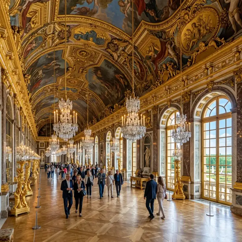
Bem-vindo! Prepare-se para uma #viagem inesquecível pelo coração de #Portugal. Açores: Natureza Selvagem e Crateras Vulcânicas – Um Diário de Tiago Silva Olá, meus queridos exploradores do mundo! Tiago Silva aqui, diretamente de um dos recantos mais mágicos e indomáveis do nosso planeta. Preparem-se para uma viagem que vos vai prender a alma e encher os olhos de uma beleza quase irreal. Hoje, levo-vos a um lugar onde a natureza se exibe em todo o seu esplendor primordial, onde o passado geológico é palpável e a cultura se entrelaça com a paisagem de forma indelével: os Açores. Este arquipélago, que emerge imponente das profundezas do Oceano Atlântico Norte, é um tesouro escondido, um dos segredos mais bem guardados de #Portugal. Não é apenas um destino; é uma experiência sensorial, uma imersão num mundo onde o verde é mais verde, o azul mais profundo e a história ecoa em cada pedra e em cada onda. O Coração Pulsante de um Arquipélago Atlântico Os Açores são, na sua essência, uma criação vulcânica. Nove ilhas principais – São Miguel, Santa Maria, Terceira, Graciosa, São Jorge, Pico, Faial, Flores e Corvo – espalham-se pela vasta extensão azul, como pérolas de um colar gigante que a própria Terra moldou. Cada uma delas é um universo à parte, com a sua identidade, os seus encantos e as suas histórias para contar. A origem vulcânica destas terras é a grande protagonista, a força invisível que esculpiu cada montanha, cada vale e cada lagoa. É impossível não sentir a energia telúrica a pulsar sob os pés, a recordar-nos que estamos num palco onde a geologia é uma força viva e constante. As paisagens são um testemunho eloquente da dança incessante entre o fogo e a água, entre a fúria da terra e a serenidade do oceano. São Miguel: A Ilha Verde e os Seus Segredos Comecemos por São Miguel, a maior e mais populosa das ilhas, muitas vezes apelidada de "Ilha Verde" – e com razão! Aqui, a vegetação luxuriante é uma explosão de vida, um manto esmeralda que cobre colinas e vales. Mas é nas suas crateras que reside grande parte da sua mística. Quem nunca sonhou em contemplar a Lagoa das Sete Cidades? Este cartão-postal açoriano é uma visão de tirar o fôlego. Do Miradouro da Vista do Rei, a paisagem desdobra-se num espetáculo de cores: a lagoa divide-se em duas, uma de um azul profundo, a outra de um verde vibrante, separadas apenas por uma ponte estreita. A lenda fala de um amor proibido entre uma princesa de olhos azuis e um pastor de olhos verdes, cujas lágrimas deram origem a estas águas mágicas. A atmosfera aqui é de pura contemplação, um convite à introspeção enquanto o vento suave sussurra segredos antigos. É um dos locais onde a #nature se revela mais poética. E depois, há a Lagoa do Fogo. Escondida no coração da ilha, dentro de uma cratera vulcânica, esta lagoa é um santuário de beleza intocada. O acesso é feito por trilhos que serpenteiam por uma vegetação densa e endémica, e a recompensa é uma vista panorâmica de águas cristalinas rodeadas por encostas íngremes e virgens. É um local classificado como Reserva Natural, e ao pisar o seu areal, sente-se uma paz profunda, quase mística. A neblina que por vezes a envolve só aumenta o seu encanto, transformando-a num cenário de conto de fadas. Mas São Miguel não é só lagos. As Furnas são outro capítulo fascinante da sua história geológica. Aqui, a Terra respira através de fumarolas e nascentes termais, criando um ambiente único onde a gastronomia se funde com a geologia. O famoso "Cozido das Furnas" é cozinhado em panelas enterradas no solo vulcânico, aproveitando o calor natural da Terra. O cheiro a enxofre no ar, as paisagens fumegantes e a experiência de provar um prato cozinhado desta forma ancestral é algo que nunca esqueceremos. É uma celebração da riqueza geotérmica da ilha, um verdadeiro banquete para os sentidos e um testemunho da inventividade humana em harmonia com a natureza. Terceira: História, Cor e Património Mundial Avançando para a Ilha Terceira, somos transportados para um cenário de cores vibrantes e uma riqueza histórica palpável. Angra do Heroísmo, a sua capital, é um tesouro arquitetónico, classificada como Património Mundial pela UNESCO. As suas ruas estreitas e sinuosas, ladeadas por edifícios coloridos e elaborados, contam histórias de navegadores, de batalhas e de uma época de ouro em que era um porto estratégico vital. A #architecture aqui é um espetáculo de elegância e resiliência, com os seus palacetes, igrejas e fortes que resistiram ao tempo e aos sismos. Passear por Angra é como viajar no tempo. Cada fachada, cada varanda, cada calçada parece sussurrar contos de uma #história rica e gloriosa. O Monte Brasil, uma antiga cratera vulcânica que se eleva majestosamente sobre a cidade, oferece vistas panorâmicas deslumbrantes e é um convite a explorar a sua fortaleza e os seus trilhos verdejantes. A Terceira é também a ilha das festas, das touradas à corda e de uma alegria contagiante que se manifesta na sua gente hospitaleira. Pico e Faial: Gigantes e Marinheiros O Pico é a ilha que abriga o ponto mais alto de Portugal, a montanha do Pico, uma presença majestosa que domina a paisagem. Subir ao seu cume é um desafio gratificante, recompensado com vistas que se estendem por quilómetros, abraçando as ilhas vizinhas. Mas o Pico é também a ilha do vinho, com as suas vinhas plantadas em "currais" – pequenos muros de pedra que protegem as videiras do vento e do sal do mar. Esta paisagem cultural da vinha da Ilha do Pico é outra joia classificada pela UNESCO, um testemunho da tenacidade e engenho dos seus habitantes. É um exemplo perfeito de como a #cultura local se adapta e prospera em cenários naturais desafiadores. Do outro lado do canal, encontra-se a Ilha do Faial, conhecida pelo seu porto cosmopolita, Horta, um ponto de encontro para velejadores de todo o mundo. Mas a paisagem mais marcante do Faial é, sem dúvida, o Vulcão dos Capelinhos. Este local, que nasceu de uma erupção submarina em 1957-58, é uma paisagem lunar, desolada e impressionante. As cinzas vulcânicas e as rochas escuras criam um contraste dramático com o azul do oceano, uma tela onde a força bruta da criação da Terra se manifesta de forma esmagadora. É um lembrete vívido da constante evolução geológica do arquipélago, um lugar que nos faz sentir pequenos perante a grandiosidade da natureza. A Flora e Fauna Endémicas: Um Jardim Flutuante A isolamento geográfico dos Açores, combinado com o seu clima temperado oceânico – caracterizado por temperaturas amenas, elevada humidade e chuvas frequentes que podem mudar rapidamente – criou um ecossistema único. A flora e fauna endémicas são um dos maiores tesouros do arquipélago. Aqui, encontramos a Laurissilva, uma floresta relíquia do Terciário, que outrora cobria grande parte do sul da #Europa. Caminhar por estes bosques é como entrar num túnel do tempo, onde a luz filtra-se através das copas densas, e o ar é carregado com o cheiro a terra húmida e vida selvagem. As famosas hortênsias, com as suas cores vibrantes de azul e roxo, alinham-se nas estradas e campos, criando um espetáculo visual que é a imagem de marca dos Açores. A vida marinha também é abundante e espetacular. Os Açores são um dos melhores locais do mundo para a observação de baleias e golfinhos, um santuário para estas majestosas criaturas do oceano. A rica biodiversidade marinha é um reflexo da saúde dos seus ecossistemas e da sua posição privilegiada no Atlântico. O Legado Humano: De Navegadores a Emigrantes A história humana dos Açores é tão fascinante quanto a sua geologia. Descobertas por navegadores portugueses no século XV, estas ilhas rapidamente se tornaram um ponto de paragem crucial nas rotas marítimas do Atlântico. A sua posição estratégica transformou-as num entreposto vital para o comércio e a navegação entre a Europa, a América e a África. A colonização das ilhas foi um feito notável de resiliência e adaptação. Os primeiros povoadores enfrentaram desafios imensos, transformando terras virgens e vulcânicas em férteis campos de cultivo e em comunidades vibrantes. A atividade baleeira, embora controversa nos dias de hoje, foi uma indústria que marcou profundamente a identidade de algumas ilhas, deixando um legado de coragem, sacrifício e uma profunda ligação ao mar. A emigração, sobretudo para os Estados Unidos e Canadá, é outra faceta importante da história açoriana. Muitas famílias procuraram melhores oportunidades além-mar, mas a ligação às suas raízes e à sua terra natal manteve-se forte, criando uma diáspora global que orgulhosamente preserva a sua identidade açoriana. Esta história de partida e regresso, de saudade e esperança, é parte integrante da alma açoriana. Uma Viagem Inesquecível Os Açores não são apenas um conjunto de ilhas; são uma promessa de aventura, de descoberta e de uma profunda conexão com a natureza e com uma cultura rica e resiliente. Desde as paisagens lunares dos Capelinhos até às lagoas místicas escondidas em crateras vulcânicas, passando pelas cidades histó #portugal #travel #history #europe #cultura
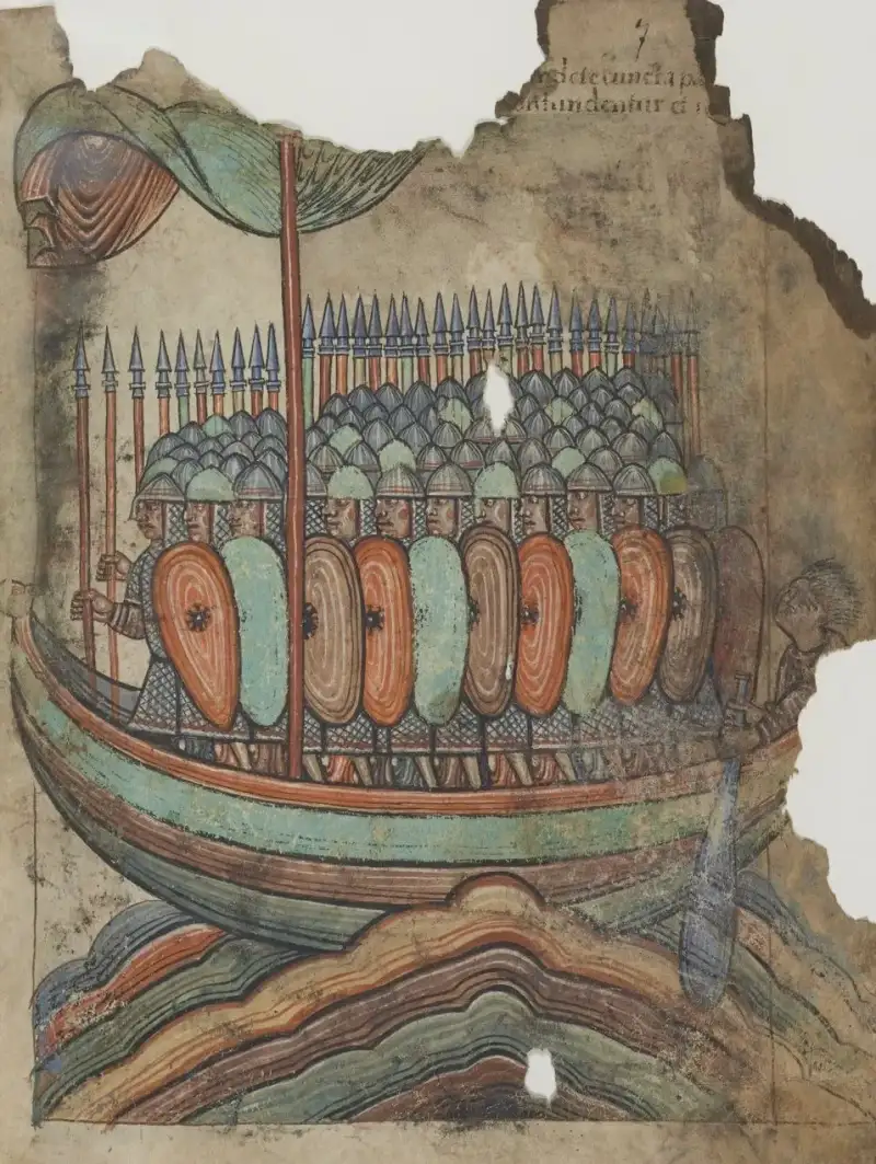

The biting chill of the North Sea wind howled like a choir of vengeful spirits, tearing at the heavy, woven wool sails of the longship as it cut mercilessly through the slate-grey waters. To the devout monks of Lindisfarne, the sea had always been a steadfast barrier, a vast, watery moat of God’s own creation protecting their sacred sanctuary from the chaos of the mainland. They did not know—could not have possibly known—that for the hardened men of the North, the sea was not a wall, but a grand, open highway. When the morning mist finally parted on that fateful, blood-soaked morning in 793 AD, it revealed not the comforting, golden light of dawn, but the terrifying, predatory silhouettes of shallow-drafted vessels. Their prows were carved into the snarling, aggressive visages of dragons and sea serpents, designed to frighten the land spirits of their victims. The Viking Age had officially arrived, heralded not by diplomats or royal decrees, but by the clash of cold steel, the terrifying roar of the berserker, and the crimson staining of holy ground. #AncientHistory #VikingAge I am Mark Dinn, and in my decades of weaving the intricate, often brutal threads of historical fiction, I have found very few tapestries as blood-soaked, culturally complex, and utterly captivating as that of the Norsemen. We universally call them "Vikings," a term that originally denoted a specific activity—fara í víking, going on an expedition or raid—rather than an ethnic or national identity. Yet, over the centuries, the word has become entirely synonymous with horned helmets (a complete Victorian theatrical fabrication), mindless savagery, and an unquenchable, animalistic thirst for plunder. The truth, as is always the case when one dares to peel back the heavy layers of myth and propaganda, is far more intricate, deeply dramatic, and endlessly fascinating. These were not merely unwashed barbarians hammering at the fragile gates of civilization; they were the supreme maritime navigators of their age, exceptionally shrewd merchants, intrepid global explorers, and pragmatic politicians who permanently reshaped the very map of Europe. Let us journey back, far beyond the embellished sagas and the Hollywood screens, to uncover the true, breathing Norse warriors behind the legends. #HistoricalFiction #NorseMythology #Vikings The Crucible of the North: Forging a Warrior Culture To truly understand the Viking, one must first understand the harsh, unforgiving forge in which he was made. The Scandinavian homeland—comprising modern-day Norway, Sweden, and Denmark—was a realm of stark, breathtaking natural beauty, but also of uncompromising environmental hostility. It was a land where winter held an iron dominion for much of the year, where the soil was often thin, acidic, and rocky, and where towering mountains plunged precipitously into deep, dark fjords. Survival here was a daily, exhaustive battle against the elements, breeding a people who were inherently resilient, fiercely resourceful, and intimately tied to the violent rhythms of nature. #Scandinavia #NordicHistory The Pressures that Broke the Ice As the late 8th century drew to a close, a volatile confluence of socioeconomic and environmental pressures began to build within this icy crucible. The situation was a powder keg waiting for a spark, driven by several key factors:Climatic Warming and Overpopulation: The region experienced a period of relative warming, which, paradoxically, led to a population boom. More mouths to feed meant less arable land to go around in a geography already starved for farming space. The Law of Primogeniture: The rigid cultural practice where the eldest son inherits the entire family estate left countless younger sons entirely disenfranchised, landless, and incredibly hungry for both material wealth and societal status. Political Consolidation: Ambitious chieftains and emerging petty kings began forcibly consolidating their localized power into larger realms, driving political dissidents, independent freemen, and defeated rivals out of their ancestral homes.Faced with a stark lack of opportunity at home, these desperate, ambitious men looked to the misty horizon. They possessed a martial culture that prized physical bravery above all other virtues, and they possessed the technological marvel that would make their wildest ambitions a reality: the longship. The combination was highly volatile. The resulting explosion across Europe was inevitable. #VikingHistory #MedievalEurope Masters of the Waves: The Engineering Miracle of the Longship If the Viking Age was a sudden, violent, earth-shattering storm, the longship was the lightning bolt that struck first. It is nearly impossible to overstate the absolute technological superiority of these vessels in the context of the early Middle Ages. While the rest of Christian Europe was painfully constructing heavy, lumbering cogs that required deep-water ports and highly favorable winds just to move, the Norse shipwrights were crafting absolute masterpieces of marine engineering. #NauticalHistory #Shipbuilding The secret of their dominance lay in their revolutionary construction methods. Built using the overlapping clinker method—where radially split oak planks were meticulously riveted together with iron and caulked with tarred animal hair or wool—the longships were incredibly flexible. They didn't stubbornly fight the massive waves of the ocean; they rode them, bending and flexing with the fury of the water like a living serpent. This flexibility made them incredibly fast, phenomenally seaworthy, and capable of crossing the treacherous, storm-tossed open waters of the North Atlantic. The Tactical Advantage of the Shallow Draft But their true, terrifying genius lay in their specific design geometry. They were perfectly symmetrical, allowing them to reverse direction instantly without the cumbersome need to turn the entire vessel around—a massive tactical advantage in the narrow confines of a river or during a hasty, contested retreat. Most importantly, they had an astonishingly shallow draft. A massive warship carrying fifty fully armed, mail-clad warriors could float in less than a meter of water. This specific engineering trait meant the Vikings absolutely did not need deep-water harbors to launch an invasion. They could navigate far up shallow, inland rivers, completely bypassing coastal defenses, striking at the soft, undefended underbelly of Europe. They could beach their ships directly on the sand or riverbank before their victims even fully realized they were under attack. The longship was, without hyperbole, the ultimate stealth bomber and amphibious assault craft of the medieval world. #VikingShips #NavalWarfare Lindisfarne: The Shattering of the Christian World "Never before has such terror appeared in Britain as we have now suffered from a pagan race," lamented the influential Northumbrian scholar Alcuin of York in a letter to the King. The year was 793, and the target was the Holy Island of Lindisfarne, the very cradle and beating heart of Christianity in northern England. #Lindisfarne #AngloSaxon The monks of Lindisfarne were incredibly wealthy, and far more importantly to the raiders, they were entirely defenseless. To the devout Christian mindset of the 8th century, a monastery was an absolute sanctuary, protected by the invisible wrath of God and the respect of civilized men. To the pragmatic, opportunistic Norse mindset, a monastery was simply an undefended treasure house, packed to the rafters with solid gold chalices, silver reliquaries, and jeweled gospel books, guarded only by soft men whose strange religion expressly forbade them to raise a sword in self-defense. It was an irresistible, highly logical target. The raid on Lindisfarne was a psychological earthquake that fractured the medieval psyche. The Norsemen arrived unannounced, slaughtering the monks where they stood, drowning some in the freezing sea, and dragging others away in iron chains to be sold as slaves in foreign markets. They stripped the gilded altars bare and trampled the holy, ancient relics into the mud. When news of the atrocity spread across the continent, it was met with absolute, paralyzing horror. How could an omnipotent God allow dirty pagans to desecrate His holiest sites? The terrified answer, many clerics concluded, was that the Vikings were a divine, apocalyptic punishment for the mounting sins of the Christian world. This horrific raid marked the official, bloody commencement of the Viking Age, initiating three centuries of relentless terror, extortionate tribute, and permanent cultural transformation. #Christianity #VikingRaids The Warrior Ethos: Honor, Iron, and the Halls of Valhalla What specific internal fire drove a man to leave his family, cross a raging, unpredictable ocean in an open wooden boat, and willingly throw himself into the meat-grinder of a shield wall? The answer lies in the deeply ingrained, unyielding warrior ethos of the Norse people, an ethos intrinsically and permanently linked to their fatalistic cosmology and their demanding gods. #Valhalla #Odin The Norse fully believed in a pantheon of deeply flawed, violently passionate, and immensely powerful deities. Odin, the All-Father, was not merely a benevolent god of wisdom, but a terrifying god of war, bloody frenzy, and death. Thor, the mighty thunderer, was the fierce protector of mankind, endlessly wielding his crushing hammer Mjolnir against the chaotic forces of the giants. To truly worship these gods was to emulate their violence and their bravery. The Unbreakable Threads of Fate Central to their entire belief system was the absolute concept of Fate, known as Wyrd. A man's time of death was spun by the mystical Norns before he was even born into the world. Nothing he did, no amount of cowardice or caution, could change the specific day he was destined to die. Therefore, the only thing a man could truly control was how he died, and the lasting reputation he left behind in the songs of the skalds. The ultimate, overriding goal of a Norse warrior—a true Drengr—was to fight with unparalleled bravery and fall in the heat of battle, his sword firmly in hand. Only then would he be personally chosen by the terrifying Valkyries to ascend to Valhalla, Odin's great hall of the slain, where he would feast on boar and fight his brothers for all eternity until the apocalyptic end of the world at Ragnarok. This fatalistic, dark worldview created warriors completely and utterly devoid of the paralyzing fear of death. To retreat from a pitched battle was not just considered cowardly; it was a profound denial of fate and a direct, unforgivable insult to the gods themselves. This psychological armor made the Vikings terrifying, relentless opponents. Among their ranks were the legendary Berserkers, elite shock troops who worshipped Odin and fought in a trance-like, animalistic fury. They purportedly bit the rims of their wooden shields, howled like wolves, and ignored grievous wounds, entirely convinced they were temporarily impervious to iron and fire. While the exact historical reality of the berserker state is still fiercely debated by modern historians—some attributing it to psychological conditioning, others to the ingestion of hallucinogenic mushrooms—the sheer, unbridled ferocity of the Norse infantry charge was undisputed by anyone who survived it. #Berserker #NorseMyth #VikingWeapons The Silk Road of the North: Traders, Explorers, and the Varangian Guard If we paint the Vikings solely in the crimson blood of their victims, we miss half the historical picture. The exact same longships that brought terrifying raiders to the misty coasts of France and England also carried shrewd merchants to the very edges of the known, civilized world. The Norse were consummate, pragmatic opportunists; if a coastal town was heavily fortified and well-defended, they traded silver for goods; if it was weak and unguarded, they drew their axes and raided. Often, they engaged in both activities on the very same voyage. #VikingTrade #MedievalCommerce Their economic trade networks were staggeringly vast and incredibly complex. While the Danes and Norwegians focused their maritime efforts largely on the west—battering the shores of Britain, Ireland, and Francia—the Swedes, known to history as the Rus, turned their dragon prows eastward. Navigating the treacherous, winding river systems of Eastern Europe, they established permanent fortified trading posts that would eventually grow into the massive, powerful city-states of Novgorod and Kyiv, literally laying the foundational political and genetic roots of modern Russia, Belarus, and Ukraine. The Lure of the East The Rus dragged their ships overland to travel down the Volga and the Dnieper rivers, eventually reaching the warm waters of the Caspian and Black Seas. They traded highly prized northern goods: dense furs, golden amber, carved walrus ivory, and—most crucially and brutally—tens of thousands of Slavic slaves. In exchange, they received the fabulous, unimaginable wealth of the Islamic Caliphates and the ancient Byzantine Empire. Millions of silver dirhams minted in Baghdad and Damascus have been found buried in massive Swedish hoards, a silent, gleaming testament to this sprawling, intercontinental economic web. In Constantinople, the glittering capital of the Byzantine Empire, the Norsemen encountered a civilization of wealth and political intrigue they could hardly comprehend. The Byzantine Emperors, recognizing the fierce, unyielding loyalty and terrifying martial prowess of these towering northern giants, formed the Varangian Guard. This elite, highly paid unit of axe-wielding bodyguards served directly under the Emperor, fighting in brutal campaigns across the Mediterranean, from Sicily to Syria, and returning to the snowy fjords of Scandinavia laden with gold, exotic spices, and shimmering silks. The incredible story of Harald Hardrada, a Norwegian prince who spent years commanding the Varangian Guard before returning north to violently claim the throne of Norway, remains one of the most epic, sweeping sagas of the entire era. #VarangianGuard #ByzantineEmpire #Constantinople From Raiding to Conquest: The Great Heathen Army and the Danelaw For decades, Viking raids followed a highly predictable, seasonal pattern: violent hit-and-run strikes during the warm summer months, followed by a swift return to Scandinavia before the deadly autumn storms churned the North Sea. But in the pivotal year of 865 AD, everything fundamentally changed. A massive, unprecedented coalition of Norse warriors, which the terrified writers of the Anglo-Saxon Chronicle dubbed the micel heathen here—the Great Heathen Army—landed on the shores of East Anglia. This was no longer a simple raid for silver; this was a coordinated, full-scale invasion of a nation. #GreatHeathenArmy #Invasion Legend dictates that this massive army was jointly led by the vengeful sons of the legendary hero Ragnar Lothbrok—Ivar the Boneless, Halfdan, and Ubba—seeking bloody retribution for their father's execution in a pit of venomous snakes by the arrogant King Aella of Northumbria. Regardless of the mythological embellishments added by later poets, the historical reality is that this highly organized army carved a bloody, unstoppable swath through the politically fragmented, squabbling kingdoms of Anglo-Saxon England. The Tactics of Total War They employed brilliant, highly adaptive strategic warfare. They captured local horses to move their infantry rapidly across the countryside, outmaneuvering the slower English armies. They fortified overwintering camps on strategic river islands, allowing them to maintain their military presence year-round rather than retreating. Kingdom after kingdom fell to the Norse axes. Proud Northumbria collapsed in a bloody coup, East Anglia was brutally conquered, and the powerful kingdom of Mercia was brought entirely to its knees. Only the southern kingdom of Wessex, under the stubborn, brilliant leadership of King Alfred the Great, managed to stem the relentless tide through a combination of guerrilla warfare and military reorganization. The resulting, uneasy peace treaty physically divided England, creating the Danelaw—a vast swathe of northern and eastern England where Danish laws, customs, and language held total sway. The Vikings had officially transitioned; they were no longer just raiders stealing wealth; they were settlers, land-owning farmers, and political rulers. They established the fortified city of Jorvik (modern York) as a thriving, multicultural hub of international trade, leaving an indelible, permanent Norse imprint on the culture, laws, and genetics of the British Isles. #Danelaw #AlfredTheGreat #Jorvik The Unsung Heroes: Shieldmaidens and the Matriarchs of the North The popular, modern image of the Viking Age is overwhelmingly, almost exclusively male, dominated by bearded men swinging broad axes. Yet, the complex society that produced these famous warriors was remarkably nuanced regarding gender roles and expectations. While the Norse world was undeniably patriarchal, women possessed legal rights, social agency, and economic power that were almost completely unheard of in the heavily subjugated female populations of the rest of medieval Christian Europe. #WomenInHistory #VikingWomen A free Norse woman could legally own property in her own name, officially request a divorce if her husband displeased her or failed to provide, and reclaim her full dowry if the marriage failed. When the men went "a-viking" for months or years on end, or engaged in long-distance trading, the women were left in absolute, unquestioned command of the sprawling farms and estates. They managed the complex finances, directed the labor of the thralls (slaves), and ensured the harvests were brought in before the snows fell. The ultimate symbol of a Norse woman's profound authority was not a weapon, but the heavy set of iron keys she wore proudly suspended from her ornate bronze brooches. The Reality of the Warrior Women But what of the legendary Shieldmaidens—the skjaldmær? The ancient sagas are utterly replete with heroic tales of fierce warrior women like Lagertha, Hervor, and Brynhildr, who fought fiercely in the bloody shield wall alongside the men, commanding fleets and armies. For centuries, traditional male historians dismissively categorized these stories as mere mythological archetypes or romantic fantasies. However, the historical paradigm shifted dramatically and permanently in 2017 with the advanced genomic analysis of a famous 10th-century warrior grave discovered in Birka, Sweden. The grave, packed to the brim with an array of deadly, high-quality weapons, sacrificed horses, and the tactical gaming pieces of a high-ranking military officer, had always been confidently assumed to belong to a male chieftain. The modern DNA results were absolute and conclusive: the esteemed, highly decorated warrior was biologically female. While it is highly unlikely that women formed a massive portion of the rank-and-file fighting forces, the physical evidence strongly suggests that exceptional, driven women did indeed take up the sword, proving definitively that the fiercely independent Viking spirit was never confined by gender. #Shieldmaiden #BirkaWarrior #Lagertha The Siege of Paris: Extortion on a Royal, Imperial Scale The soaring ambition of the Norsemen was never limited to the foggy shores of Britain. The politically fractured Carolingian Empire, the wealthy remnants of Charlemagne's vast European realm, presented an incredibly lucrative, tantalizing target. The broad, slow-moving rivers of Francia—the Seine, the Loire, the Garonne—quickly became heavily trafficked highways for massive Viking fleets seeking plunder and political leverage. #Francia #SiegeOfParis In the spring of 845 AD, a massive, terrifying fleet of 120 longships, commanded by a ruthless chieftain named Reginherus (whom many historians conflate with the legendary Ragnar Lothbrok himself), sailed aggressively up the Seine and laid direct siege to Paris, the jewel of the empire. The Frankish King Charles the Bald frantically assembled an army to defend the city, but the Vikings employed devastating psychological warfare. In full view of the terrified Frankish troops stationed on the riverbanks, the Vikings brutally executed 111 prisoners by hanging them from trees in a mass sacrifice honoring Odin. The Frankish army, horrified and demoralized by the sheer brutality, fled in terror without striking a blow, and the Vikings thoroughly sacked the city of Paris. The Birth of the Danegeld and the Normans To save his burning capital, Charles the Bald resorted to a desperate political tactic that would become disastrously common across Europe: he paid the Danegeld. He handed over an astonishing 7,000 pounds of pure silver to convince the Vikings to lift the siege and leave. It worked, but only temporarily. Paying a Viking to leave only ensures that he, or his heavily armed cousins, will inevitably return the moment the silver runs out. The Norsemen quickly learned that strategic extortion was often far more profitable—and far less physically dangerous—than outright, bloody combat. Decades later, the Vikings returned in force, and the geopolitical situation culminated in the early 10th century when a massively powerful chieftain named Rollo laid heavy siege to the city of Chartres. Recognizing that the Norsemen could not be permanently defeated by military force alone, the Frankish King Charles the Simple made a brilliant, enduring political maneuver. In 911 AD, he offered Rollo a vast, wealthy tract of land in northern France, provided Rollo convert to Christianity, swear fealty, and aggressively defend the coast against all other incoming Viking raiders. Rollo pragmatically accepted the deal. The land became forever known as Normandy (the land of the Northmen), and Rollo's highly adaptable descendants—the Normans—would eventually cross the channel and conquer all of England in 1066. #Normandy #Rollo #MedievalFrance Sailing the Edge of the World: Ice, Green Lands, and Vinland The exact same socio-economic pressures that drove the Vikings south into Europe and east into Russia also drove them west, directly into the uncharted, freezing, and utterly terrifying void of the open North Atlantic. They were unparalleled, instinctive navigators, relying not on magnetic compasses, but on their deep, generational understanding of the sun's position, the stars, the shifting ocean currents, the color of the water, and the flight patterns of seabirds to guide their fragile wooden longships across the vast, open ocean. #Exploration #NorthAtlantic In the late 9th century, intrepid Norse explorers discovered Iceland, a volcanic, geothermally active island of stark, otherworldly beauty. A massive migration rapidly followed, as fiercely independent chieftains, fleeing the increasingly autocratic and taxing rule of King Harald Fairhair of Norway, sought a new, unclaimed land where they could govern themselves entirely free of royal interference. They established the Althing, one of the world's absolute oldest surviving democratic parliaments, creating a unique, functioning republic without a king. Reaching the New World But the western horizon always beckoned to the most restless souls. In 982 AD, a notoriously fiery-tempered man named Erik the Red was legally exiled from Iceland for committing multiple murders. With nowhere else to go, he sailed further west into the ice flows and discovered a massive, glacially capped landmass. With a modern marketer’s distinct flair for branding, he deliberately named it "Greenland" to attract eager settlers from overcrowded Iceland. The most astonishing, world-changing chapter of Norse exploration, however, belongs to Erik's restless son, Leif Erikson. Around the pivotal year 1000 AD—a staggering five full centuries before Christopher Columbus was even born—Leif sailed further west from the settlements of Greenland, making historical landfall on the rugged coast of North America. He called this bountiful new territory Vinland (Land of Wine), due to the abundance of wild grapes and fertile soil he found there. The sagas describing this incredible trans-Atlantic journey were long dismissed by European scholars as mere mythological tall tales, right up until the 1960s, when archaeologists finally uncovered the physical remains of a Norse settlement at L'Anse aux Meadows in Newfoundland, Canada. The undeniable physical evidence of iron smithing and Norse architecture proved definitively that the Vikings were the very first Europeans to set foot in the Americas, pushing the absolute boundaries of the known, civilized world to their absolute limits. #Vinland #LeifErikson #LAnseAuxMeadows #Discovery The Twilight of the Gods: 1066 and the End of an Era No storm, no matter how violent or world-altering, lasts forever. The Viking Age, which had raged unabated across the globe for nearly three bloody centuries, eventually began to inevitably subside. The historical reasons for this decline were complex, interconnected, and manifold. Firstly, the Scandinavian homelands themselves fundamentally changed. The once-fractured kingdoms became centralized and politically stable under powerful Christian kings, dramatically reducing the number of exiled, landless chieftains desperately seeking fortune abroad. Secondly, European military defenses vastly improved; kings ordered the construction of heavily fortified towns (burhs), built bridges to block river access, and maintained professional standing armies, making the business of raiding significantly more dangerous and far less profitable. #1066 #VikingEnd The Power of the Cross Most importantly, however, the Norsemen were slowly, inexorably assimilated into the very Christian cultures they had once terrorized. The ultimate, victorious weapon against the Viking was not the broadsword or the castle wall, but the cross. The gradual, often forceful Christianization of Scandinavia fundamentally and permanently altered the Norse worldview. The glorious promise of fighting in Valhalla was violently replaced by the terrifying threat of burning in Hell; the ruthless warrior ethos was slowly tempered by the Christian doctrines of peace and sin. Scandinavian Kings quickly began to realize that the organized Church offered a massively powerful political tool for centralizing absolute authority, collecting taxes, and legitimizing their permanent rule through the concept of divine right. The definitive, bloody end of the Viking Age is traditionally pegged by historians to the momentous year 1066. Harald Hardrada, the towering King of Norway and the last great Viking warlord of the old breed, launched a massive, ambitious invasion of England, seeking to violently claim the empty throne. He met the defending English King Harold Godwinson at the infamous Battle of Stamford Bridge in Yorkshire. In a brutal, exhausting, hand-to-hand conflict that lasted all day, the Norse army was completely annihilated. Hardrada himself, the giant who had survived wars in Byzantium and Sicily, fell dead with an English arrow violently piercing his throat. The terrifying Viking threat to England was finally, permanently extinguished. Ironically, just three short weeks later, that same victorious Harold Godwinson would be utterly defeated and killed at the Battle of Hastings by William the Conqueror—the Duke of Normandy, and a direct, blood descendant of the Viking chieftain Rollo. The Norsemen had not truly been defeated by history; they had simply evolved to master it. #StamfordBridge #Hastings #WilliamTheConqueror Conclusion: The Enduring Legacy of the North Today, the sleek dragon ships no longer prowl the misty coasts of Europe, and the bloody altars of Odin have long since gone cold and silent under the earth. Yet, the profound, inescapable legacy of the Vikings is woven inextricably into the very fabric of the modern world. #Legacy #ModernHistory We speak their ancient words daily without realizing it. The English language is heavily, permanently peppered with Old Norse terminology—foundational words like sky, knife, window, husband, anger, trust, and even the days of the week we structure our lives around (Thursday is Thor's day, Wednesday is Odin/Woden's day, Friday is Freya's day). They established trading hubs that grew into massive cities that thrive to this very day, from the pubs of Dublin to the golden domes of Kyiv. Their unparalleled innovations in shipbuilding and oceanic navigation directly laid the necessary technical groundwork for the later Age of Global Exploration. More than the physical artifacts and the linguistic remnants, the Vikings endure fiercely in our collective, global imagination. They represent a primal, untamed human spirit, a ferocious, uncompromising independence, and a fearless, bold confrontation with the vast unknown. In my own daily work as an author of historical fiction, I find myself continually, obsessively drawn back to the mist-shrouded, icy fjords and the terrifying, blood-soaked shield walls. I return to them because the raw human drama, the massive stakes, and the sheer scale of the Viking Age are utterly unparalleled in human history. They were men and women of immense, beautiful contradictions: they were savage, remorseless killers who composed breathtaking, intricate poetry; they were ruthless, greedy extortionists who crafted exquisite, delicate jewelry; they were fierce pagan warriors who ultimately shaped the geographic and political destiny of Christian Europe. The story of the Viking raids is not merely a depressing tale of death and destruction. It is the epic, sweeping story of a dynamic, restless, brilliant people bursting forth from the ice, driven by sheer necessity, burning ambition, and a fatalistic courage, to permanently carve their names into the very bedrock of human history. And as long as the north wind blows cold and the grey waves crash violently against the shore, the legends of the true Norse warriors will never be forgotten. #MarkDinn #HistoryWriter #EpicHistory #NorseLegacy Related InsightsThe Rosetta Stone: Breaking the Silence of Ancient Egypt The Great Pyramid of Giza: A Timeless Monument to Human Ingenuity The Whispering Stones of Chichen Itza: Echoes of the Maya{ "@context": "https://schema.org", "@type": "FAQPage", "mainEntity": [ { "@type": "Question", "name": "What is the main focus of Viking Raids: The True Norse Warriors Behind the Legends?", "acceptedAnswer": { "@type": "Answer", "text": "A dramatic deep dive into Viking Raids: The True Norse Warriors Behind the Legends. Mark Dinn explores the untold history, drama, and legacy of this fascinating subject." } }, { "@type": "Question", "name": "Who authored the comprehensive guide on Viking Raids: The True Norse Warriors Behind the Legends?", "acceptedAnswer": { "@type": "Answer", "text": "This detailed article and its insights were carefully researched and authored by Mark Dinn." } }, { "@type": "Question", "name": "Where can I find more related content about History?", "acceptedAnswer": { "@type": "Answer", "text": "You can explore more articles, detailed reviews, and similar insights by browsing the Related Insights section at the bottom of this article or visiting our dedicated History category page." } } ] }
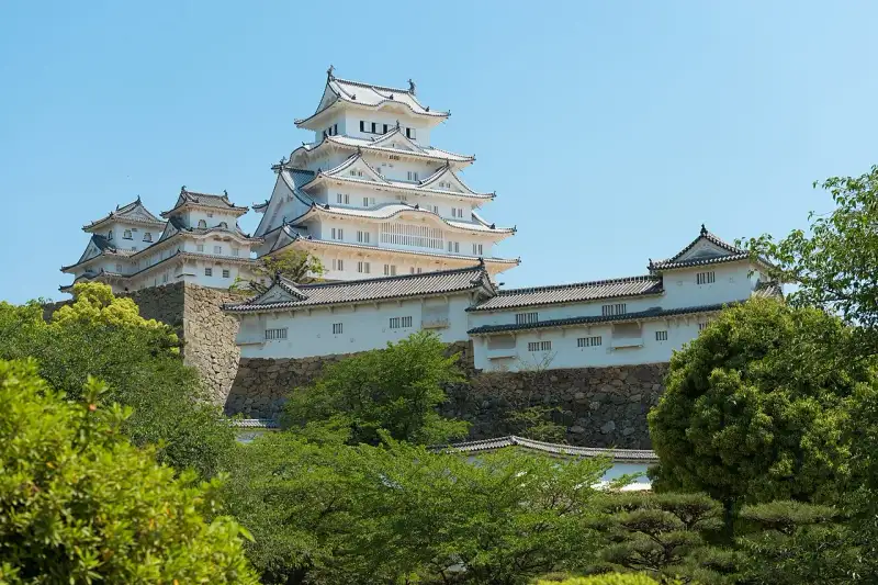
ようこそ。日本の美しき歴史と文化の旅へ。 姫路城: 白鷺が舞い降りた名城 日本の古都、京都から西へ向かう新幹線に揺られ、ふと窓外に目をやれば、播磨の平野に突如として現れる、あまりにもまばゆい白亜の城郭。それが、世界にその名を轟かせる「姫路城」、別名「白鷺城」です。私は田中ゆみ。この国の歴史と文化、そして自然が織りなす深遠な美を求めて旅をする者として、何度この城の前に立ち尽くし、その圧倒的な存在感に言葉を失ったことでしょう。まるで大空を舞う白鷺が、一瞬の静寂とともに地上に舞い降りたかのような、その優雅にして力強い姿は、訪れる者の心に深く刻み込まれます。 この城は単なる歴史的建造物ではありま��ん。それは、日本の精神性、美意識、そして幾多の戦乱を生き抜いた人々の知恵と願いが結晶化した、生きた証なのです。今回は、その壮麗な姫路城の全貌を、私の心に響く言葉で紐解いていきたいと思います。 悠久の時を刻む白亜の殿堂:姫路城の全貌 姫路城は、兵庫県姫路市、古くは播磨国飾磨郡に位置し、姫山と鷺山という二つの丘陵を中心に据え、巧みに地形を利用して築かれた平山城の傑作です。その威容は、日本が誇る近世城郭の典型でありながら、他に類を見ない独自の美学を湛えています。その天守群は、まるで天空へと伸びる純白の巨塔のようであり、連立式天守と呼ばれる複雑な構造は、見る角度によって様々な表情を見せ、私たちを飽きさせません。 この城の最も特筆すべきは、江戸時代初期に建設された主要な建築物が、奇跡的なまでに良好な状態で現存しているという事実でしょう。大天守、小天守、そしてこれらを繋ぐ渡櫓など、主要な8棟は国の至宝である「国宝」として厳かに護持されています。さらに、櫓、門、塀といった74棟に及ぶ多種多様な建造物もまた、「重要文化財」としてその価値を認められています。これら一つ一つの石垣、木材、瓦に、悠久の時の流れと、それを守り抜いた人々の情熱が宿っているかのようです。 中堀の内側に広がる主郭部を含む広大な城域は、「姫路城跡」として国の「特別史跡」に指定されており、その歴史的・文化的な重要性は計り知れません。そして、1993年(平成5年)12月には、人類共通の遺産としてユネスコの世界遺産(文化遺産)リストにも堂々とその名を連ねました。これは、この城が日本の枠を超え、全世界にとってかけがえのない宝であることを意味しています。また、「日本100名城」の一つに選定されていることはもちろん、「国宝五城」「三名城」「三大平山城・三大連立式平山城」という数々の称号が、その比類なき価値を物語っています。 姫路城の建築様式は、城郭建築の頂点とも言える連立式天守であり、大天守を中心に東小天守、西小天守、乾小天守が、それぞれ渡櫓で結ばれ、あたかも複雑な生命体のように一体感をなしています。この構造は、防御機能の強化と同時に、見る者に圧倒的な美意識を訴えかけるものです。白漆喰で塗られ���壁面は、播磨の陽光を反射してまばゆいばかりの輝きを放ち、その姿は遠くからでも一目でそれと分かります。 四季折々に、姫路城はその表情を変え、訪れる者を魅了します。春には、城郭を囲む桜並木が一斉に花開き、純白の天守と淡いピンク色の花々が織りなすコントラストは、まるで絵画のような絶景を生み出します。新緑の季節には、生命力に満ちた緑が城の白さを際立たせ、夏には青い空の下で一層その威厳を増します。秋には、紅葉が城壁を彩り、歴史の深みを感じさせ、そして冬、雪が舞い降りれば、白銀の世界にそびえ立つ姫路城は、息をのむような幻想的な美しさを見せます。これらの景観は、#自然 の豊かさと、人間が創り出した建築美が見事に調和していることの証と言えるでしょう。 名に秘められた歴史と伝説:白鷺城の呼称 姫路城が「白鷺城」と称される所以には、いくつかの説が語り継がれていますが、そのどれもが、この城の持つ神秘性と美しさを深く物語っています。 まず、天守が築かれている「姫山」の古名にまで遡ります。「日女路(ひめじ)の丘」と称されたこの地は、『��磨国風土記』にも「日女道丘(ひめじおか)」としてその名が見られます。そこには、大汝命(大国主命)の船が火明命によって嵐で転覆させられた際、積み荷の中から蚕子(ひめこ)が流れ着いたという神話が記されており、これが山の名の由来とされています。やがて「姫道」を経て「姫路」という地名が定着しました。かつては他戸親王の娘、富姫に由来するという説も存在しましたが、『播磨国風土記』の再発見により、より深い歴史的背景が明らかになったのです。 この姫山は、かつて桜が多く咲き誇ったことから「桜木山」とも呼ばれ、それが転じて「鷺山(さぎやま)」と呼ばれるようになったと伝えられています。時には、天守のある丘が姫山、西の丸のある丘が鷺山と区別されることもあります。『万葉集』巻9・1776に収められた「絶等寸(たゆらぎ)の山の峰の上の桜花咲かむ春へは君し偲はむ」という歌に詠まれた「たゆらぎの山」を、井上通泰や金子元臣といった学者たちは姫山のことだと考証しました。『姫路城史』の著者である橋本政次や『姫路市史(1919年)』はさらに、「絶等寸」を「サクラ��(桜木)」と訓ずるべきだと論じ、この地の豊かな自然と文化の繋がりを示唆しています。一方で、吉田金彦は「姫路」を「日村道(ひむれじ)」、すなわち「日数を重ね隔てた遠い村への道」が語源であるとし、「絶等寸山」は西の丸の鷺山を指し、「タユラギ」は「古代の共同労働集団の統括者」を意味するという、また異なる視点も提示しており、その名の由来一つにも、様々な解釈と深い思索が込められています。 そして、別名「白鷺城(はくろじょう)」の由来に関しては、橋本政次氏の『姫路城の話』に、推論を含め以下の4説が挙げられています。「鷺山」に置かれていることからの連想: 城が築かれた地が「鷺山」と呼ばれていたことから、自然にその名が結びついたという説は、地理と城名の融合を示しています。 白漆喰で塗られた城壁の美しさ: これこそが、多くの人が「白鷺城」の名の由来として最も納得する理由でしょう。その純白の城壁は、見る者に清らかで優雅な印象を与え、まるで天空を舞う白鷺の姿を地上に具現化したかのようです。この白亜の美は、日本の伝統的な建築技術��美意識が融合した結晶であり、観る者の心に深く響きます。 ゴイサギなど白鷺と総称される鳥が多く住んでいたから: かつてこの地には、多くの白鷺が飛来し、その優雅な姿が城の周囲を彩っていたのかもしれません。#自然 と共存する城の姿は、日本の文化と深く結びついています。 黒い壁から「烏城(うじょう)」「金烏城(きんうじょう)」とも呼ばれる岡山城との対比: 近隣の岡山城が黒を基調とした「烏城」と呼ばれることから、対照的に白を基調とする姫路城が「白鷺城」と称されるようになったという説は、日本の美意識における「陰と陽」の対比を見事に表現しています。「白鷺城」の読み方については、「はくろじょう」と「しらさぎじょう」の二つが存在し、村田英雄の歌曲『白鷺の城』のように「しらさぎ」と読む例もあります。橋本政次氏は漢学的な名称であることから「はくろじょう」を正しいとしましたが、現代では『日本歴史大事典』や『もういちど読む山川日本史』のように「しらさぎじょう」のみを掲載するもの、あるいは『日本史事典』や『ビジュアルワイド 日本名城百選��のように両方を併記するものも見られます。姫路市内では市立の「白鷺(はくろ)小中学校」のように学校名に用いられたり、校歌にも「白鷺城」または「白鷺」という言葉が多用されており、市民にとってこの名は深い郷土愛と誇りの象徴となっています。戦前の『姫路市郷土唱歌』にも「白鷺城」や「池田輝政」の名が歌い込まれていたことからも、その歴史的な重みが伺えます。 他にも、姫路城には以下のような別名があります。不戦の城: 幕末の動乱期に新政府軍に包囲されながらも大規模な戦火を免れ、第二次世界大戦中の2度の空襲では、大天守最上階に直撃した焼夷弾が不発弾となるという奇跡的な幸運に恵まれました。一度も大規模な戦火にさらされることなく、甚大な被害を被ることがなかったこの城は、平和への願いと、人々の祈りが形になったかのような存在です。 白い不死鳥: 特に第二次世界大戦の空襲を奇跡的に免れ、焦土と化した街の中で白く輝き続けた姿は、市民に復興への勇気と希望を与えました。灰燼の中から立ち上がる不死鳥の如く、この城は何度となく困難を乗り越え、そ���美しい姿を現代に伝えています。時代を超えて築かれし堅牢なる美:その歴史の軌跡 姫路城の歴史は、日本の激動の時代を映す鏡です。その築城は、遥か南北朝時代にまで遡ります。 南北朝時代・戦国時代 鎌倉幕府の終焉を迎える1333年(元弘3年)、元弘の乱において護良親王の令旨を奉じた播磨国守護、赤松則村が挙兵。上洛の途上、姫山にあった称名寺を拠点に縄張りを施し、一族の小寺頼季にその守備を命じたのが、姫路城の歴史の第一歩とされています。南北朝の争乱が激化する中、則村は足利尊氏に呼応して再び挙兵し、1346年(南朝:正平元年、北朝:貞和2年)、次男の赤松貞範が称名寺を麓に移し、姫山に「姫山城」を築城しました。その後、貞範が庄山城へ本拠を移すと、再び小寺頼季が城代となり、以来、小寺氏が代々この地の守護を務めることになります。 1441年(嘉吉元年)、赤松満祐・教康父子が嘉吉の乱を起こして山名宗全らの討伐軍に攻められ、城山城で自害し赤松氏は一時断絶。これに伴い、小寺職治も討死しました。その後、播磨国守護は山名氏となり、その家臣である太田垣主殿佐が城代となります。しかし、1458年(長禄2年)の長禄の変で後南朝から神爾を取り戻した功績により、赤松満祐の弟の孫である赤松政則の時に赤松氏の再興が許されます。1467年(応仁元年)に始まった応仁の乱では、山名氏に対立する細川勝元方に与した政則が、弱体化した山名氏から播磨国を奪還し、姫路城に本丸、鶴見丸、亀居丸といった曲輪を築き、その規模を拡大しました。 1469年(文明元年)、政則は隣国但馬国の山名氏に備えるため、新たに築いた置塩城に本拠地を移し、小寺豊職が城代となりました。その後、豊職の子である政隆が城代となり、御着城の築城を開始。1519年(永正16年)には政隆が御着城へ本拠を移し、子の則職が城代を務めることになります。 そして1545年(天文14年)、則職は御着城へ移り、家臣の黒田重隆に姫路城を預けます。黒田重隆・職隆父子は、主君である小寺政職の許可を得て、御着城の支城として1555年(天文24年)から1561年(永禄4年)の間に、居館程度の小規模なものだった姫路城を、姫山の地形を活かした中世城郭へと拡張したと考えられています。永禄4年の『正明寺���書』に「姫道御溝」、また『助太夫畠地売券』に城の構えがあるとの記述が見られることから、これらを姫路城の始まりと捉える説もあります。職隆は「百間長屋」を建て、貧しい人々や下級武士、職人、行商人などを住まわせ、彼らを配下に組み入れたり、情報収集の拠点とするなど、城下町の基盤を築きました。 1567年(永禄10年)には、職隆の子である黒田孝高(後の官兵衛・如水)が城代となり、その知略と武勇をもって姫路城を守護します。1568年(永禄11年)の青山・土器山の戦いでは、赤松政秀軍約3,000人に対し、黒田軍(職隆・孝高父子)はわずか約300人という劣勢ながらも、姫路城から果敢に撃って出て赤松軍を撃退するという輝かしい戦果を挙げました。孝高は1573年(天正元年)まで城代を務め、その間に姫路城は播磨の要衝としての重要性を確立していきます。 安土桃山時代 戦国の世が佳境を迎える1576年(天正4年)、天下統一を目指す織田信長の命を受け、羽柴秀吉が播磨へ進駐します。播磨国内は織田氏につく勢力と、中国路の毛利氏を頼る勢力とで激しく対立しましたが、最終的には織田方��勝利し、毛利方についた小寺氏は没落しました。しかし、小寺氏の家臣でありながら早くから秀吉に誼を通じ、その才を認められていた黒田孝高は、そのまま秀吉に仕えることになります。1577年(天正5年)、孝高は二の丸に居を移し、本丸を秀吉に譲るという異例の忠誠を示しました。 1580年(天正8年)、秀吉は三木合戦で三木城を、続いて英賀城などを攻略し、播磨を完全に平定します。この時、孝高は秀吉に「本拠地として姫路城に居城すること」を進言し、自らは市川を挟んだ南西の国府山城に移り、姫路城を秀吉に献上しました。秀吉は同年4月から翌年3月にかけて大規模な改修に着手。姫山を中心とした近世城郭へと姫路城を生まれ変わらせ、当時最先端の築城技術であった石垣で城郭を囲み、太閤丸に3層と伝えられる天守を建築しました。この大改修により、姫路城は播磨国の中心としての地位を不動のものとし、南部に大規模な城下町を形成。姫路の北を走っていた山陽道を城南の城下町を通るように付け替えるなど、都市整備も積極的に行われました。同年10月28日には、龍野町に諸公事役免除の制札を与え、その最初の条文には「市日之事、如先規罷立事(市場の日のことは、以前の規定に従って取りやめることとする)」とあり、これは4月の英賀城落城の際に姫路山下に招き入れられた英賀の百姓や町人たちが龍野町に移住したとする説の根拠となっています。1581年(天正9年)、秀吉は姫路城で盛大な大茶会を催し、その存在感を天下に示しました。 江戸時代 関ヶ原の戦いを経て、天下泰平の世が到来すると、姫路城は池田輝政の手に渡ります。輝政は、1 #japan #travel #history #culture #nature
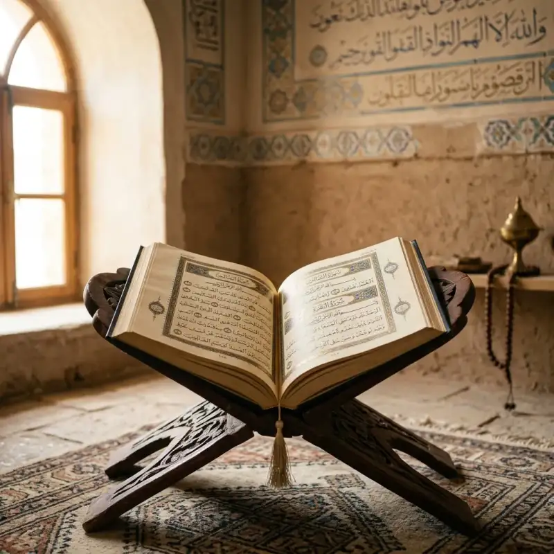
#Mahoma (en árabe: مُحَمَّد, ; La #Meca, c. 570-Medina, 8 de junio de 632 d. C.) fue un líder religioso, social y político árabe, así como el fundador del #Islam. #Mahoma era miembro del clan de Háshim, de la tribu de los coraichitas. De acuerdo con la tradición musulmana, Alá (Dios) reveló a #Mahoma los pasajes del Corán para guiar a la naciente comunidad musulmana (umma) en sus predicamentos. La religión que predicó #Mahoma es llamada #Islam, que significa «sumisión a Dios», y su principio de fe fundamental es que existe un solo Dios y que #Mahoma es el Mensajero de Dios. #Mahoma era hijo de Abdullah ibn Abd al-Muttalib y Amina bint Wahb. Su padre, Abdullah, hijo del líder tribal coraichita Abd al-Muttálib ibn Hashim, murió alrededor de la fecha del nacimiento de #Mahoma, y su madre Amina murió cuando #Mahoma tenía seis años, quedando así huérfano a una temprana edad. Fue criado bajo el cuidado de su abuelo Abd al-Muttálib, y de su tío paterno, Abu Tálib. De acuerdo con la tradición, en años posteriores, #Mahoma adoptó la costumbre de retirarse periódicamente a orar a una caverna en la montañas llamada la cueva de Hira. A la edad de cuarenta años, alrededor del 610 d. C., #Mahoma reportó haber sido visitado por el arcángel Gabriel en la cueva y recibir su primera revelación de Dios. En 613, #Mahoma empezó a predicar estas revelaciones públicamente, proclamando que «Dios es Uno», que la «sumisión» completa (islām) a Dios (Alá) es la forma correcta de vivir (dīn), y que él era un profeta y mensajero de Dios, similar a los otros profetas en el islam. Los seguidores de #Mahoma fueron inicialmente poco numerosos y sufrieron hostilidades de parte de politeístas de La #Meca durante 13 años. Para escapar la continua persecución, #Mahoma envió a algunos de sus seguidores a Abisinia en 615, antes de que él mismo y sus seguidores migraran de La #Meca a Medina (conocida en esos tiempos como Yazrib) en 622. Este evento, la Hégira, marca el comienzo del calendario musulmán. En Medina, #Mahoma unió a las tribus bajo la constitución de Medina. En diciembre de 629, tras ocho años de combates intermitentes con las tribus mecanas, #Mahoma reunió un ejército de diez mil #musulmanes conversos y marchó sobre la ciudad de La #Meca. Encontraron poca oposición en esta toma y la ciudad fue capturada con poco derramamiento de sangre. En 632, unos meses después de retornar de la Peregrinación del adiós, enfermó y murió. Para el momento de su muerte, la mayor parte de la Península arábiga se había convertido al islam. Las revelaciones (ayat) que #Mahoma reportó recibir hasta su muerte forman los versos del Corán, considerado por los #musulmanes como la «Palabra de Dios» textualmente, en la que se basa la religión. Además del Corán, las enseñanzas y prácticas de #Mahoma (sunna), que aparecen en reportes transmitidos (hadiz) y en su biografía (sīrah), también se usan como fuentes de ley islámica. La inmensa mayoría de #musulmanes, incluyendo las principales corrientes del islam como el sunismo y el chiismo, considera a #Mahoma como «el último de los profetas» o «sello de los profetas» (en árabe: خاتم النبيين, romanizado: jātim an-nabīyīn; o en árabe: خاتم الأنبياء, romanizado: jātim al-anbiyā), quien es la culminación de una larga cadena de mensajeros enviados por Dios para actualizar su mensaje, entre cuyos predecesores se cuentan Abraham, Moisés y Jesús de Nazaret. Sin embargo, para los ahmadíes, #Mahoma es el último en entregar una ley religiosa a la humanidad, mas no el último profeta. Es reconocido por los drusos como uno de sus profetas. El bahaísmo lo venera como uno de los profetas o «Manifestación de Dios», cuyas enseñanzas habrían sido actualizadas por las de Bahá'u'lláh, fundador de esta religión. Etimología #Mahoma provienen del árabe clásico محمد (vocalizado: مُحَمَّد, Muḥammad), participio pasivo del verbo حَمَّدَ (alabar, ḥammada), derivado de la raíz triconsonántica ح-م-د (Ḥ-M-D) que significa alabar o loar, por lo tanto el nombre significa «el alabado», pasó al español a través del árabe andalusí Mahammad a Mahommad y después al castellano como #Mahoma. En lenguas como el francés evolucionó a Mahomet, en italiano a Maometto y en portugués a Maomé. Su nombre completo en árabe es أَبُو الْقَاسِمِ مُحَمَّدُ بْنُ عَبْدِ اللَّهِ بْنِ عَبْدِ الْمُطَّلِبِ الْهَاشِمِيُّ الْقُرَشِيُّ, Abū l-Qāsim Muḥammad ibn ‘Abd Allāh ibn ‘Abd al-Muṭṭalib al-Hāšim al-Qurayšī, que se hispaniza como «#Mahoma» o bien como «Mohamed». Vida de #Mahoma El Corán ofrece escasa información biográfica concreta sobre #Mahoma, y la mayor parte de la información biográfica que la tradición islámica conserva sobre él se encuentra fuera del Corán, en la llamada literatura de la sīrah (en árabe: السيرة النبوية, lit. 'biografía'). Fuentes importantes sobre la vida de #Mahoma pueden hallarse en obras históricas escritas por autores de los siglos II y III de la era de la Hégira (alrededor de los siglos VIII y IX d. C. respectivamente). Estas fuentes incluyen biografías musulmanas tradicionales de #Mahoma (sīrah), que brindan detalles adicionales de su vida. La más temprana de estas biografías es la Vida del Mensajero de Dios de Ibn Ishaq, escrita c. 767 d. C. (150 d. H). Si bien la obra original se perdió, esta sira sobrevive en la forma de fragmentos extensos en obras de Ibn Hisham y en un grado menor en obras de Al-Tabari. Sin embargo, Ibn Hisham escribió en el prefacio de su biografía de #Mahoma que había omitido asuntos de la biografía de Ibn Ishaq que «afligirían a ciertas personas». Otra fuente histórica temprana es la #historia de las campañas de #Mahoma escrita por al-Waqidi (m. 130 d. H), y la obra del secretario de al-Waqidim Ibn Sa'd al-Baghdadi (m. 168 d. H). Gracias a estos esfuerzos biográficos tempranos, se sabe más de #Mahoma que de casi cualquier otro fundador de una de las grandes religiones. Muchos académicos y académicas aceptan estas biografías tempranas como auténticas. Sin embargo, la biografía de al'Waqidi ha sido ampliamente criticada por académicos islámicos por sus métodos, en particular su decisión de omitir sus fuentes. Estudios recientes han llevado a académicos a distinguir entre tradiciones relacionadas con asuntos legales y acontecimientos puramente históricos. En el grupo legal, las tradiciones podrían haber sido sujetas a inventos mientras que los acontecimientos históricos, aparte de casos excepcionales, pueden haber sido sujetos solamente a un «moldeo tendencioso». Otros académicos han criticado la confiabilidad de este método, sugiriendo que no se puede dividir claramente tradiciones entre categorías puramente legales e históricas. HIstoriadores occidentales describen que el propósito de estas biografías tempranas fue el de transmitir un mensaje, más que el de registrar de manera estricta y adecuada la #historia. Vida anterior a la predicación =### Nacimiento e infancia= Árabe de la tribu de Quraysh (o coraichitas), nació en La #Meca (مكة) alrededor del 570. La #Meca se encuentra en la región de Hiyaz en la actual Arabia Saudí. Fue hijo póstumo de Abd Allah ibn Abd al-Muttalib, miembro del del clan de Hāshim. El padre de #Mahoma falleció antes de su nacimiento, dejándolo al cuidado de su abuelo paterno, ʿAbd al-Muṭṭalib. A la edad de seis años, #Mahoma pierde también a su madre, Āminah, y a los ocho pierde a su abuelo. A partir de entonces, la responsabilidad de #Mahoma es asumida por el nuevo jefe del clan de Hāshim: su tío Abū Ṭālib. La costumbre de los más honorables de la tribu coraichita era enviar a sus hijos con niñeras beduinas con el propósito de que crecieran libres y saludables en el desierto, para poder también robustecerse y aprender de los beduinos, que eran reconocidos por su honradez y la carencia de numerosos vicios, y #Mahoma fue confiado a Bani S’ad. =### Milagros= El primer milagro que se narra sobre #Mahoma en la compilación de los hadices es que el arcángel Gabriel descendió y abrió su pecho para sacar su corazón. Extrajo un coágulo negro de este y dijo «Esta era la parte por donde Satán podría seducirte». Después lo lavó con agua del pozo de Zamzam en un recipiente de oro y devolvió el corazón a su sitio. Los niños y compañeros de juego con los que se encontraba corrieron hacia su nodriza y dijeron: «#Mahoma ha sido asesinado»; todos se dirigieron a él pero descubrieron que estaba vivo. Los #musulmanes ven este acontecimiento como una protección para que él se apartara desde su infancia de la adoración de los ídolos y probablemente la razón por la que fue devuelto a su madre. Quedó huérfano a temprana edad y, debido a una costumbre árabe que dice que los hijos menores no pueden recibir la herencia de sus progenitores, no recibió ni la de su padre ni la de su madre.[cita requerida] Se dice que ella murió cuando él tenía seis años, por lo que fue acogido y educado primero por su abuelo Abd al-Muttálib y luego por su tío paterno Abu Tálib, un líder de la tribu Quraysh o coraichita, la más poderosa de La #Meca, y padre de su primo y futuro califa Alí. =### Encuentro con el monje Bahira= En aquella época La #Meca era un centro comercial próspero, principalmente porque existían varios templos que contenían diferentes ídolos, lo cual atraía a un gran número de peregrinos. Mercaderes de diferentes tribus visitaban La #Meca en la época del peregrinaje, cuando las guerras tribales estaban prohibidas y podían contar con un viaje seguro. En su adolescencia, #Mahoma acompañó a su tío por sus viajes a Siria y otros lugares. Por tanto, pronto llegó a ser una persona con amplia experiencia en las costumbres de otras regiones. A los doce años se dirigió a Bosra con su tío Abu Tálib y tuvieron un encuentro con un monje llamado Bahira. Algunos orientalistas dicen que esto demuestra que #Mahoma aprendió de él los libros sagrados, pero los estudiosos #musulmanes refutan esta opinión alegando que no pudo haber aprendido en la hora de la comida ese conocimiento y que además no se registra un segundo encuentro con este monje. En los hadices se narra que Bahira reconoció algunas señales de la profecía de #Mahoma y le advirtió a su tío sobre llevarlo a Siria por temor de los judíos y romanos (en aquel entonces los bizantinos). =### Matrimonio con Jadiya= #Mahoma no tuvo un trabajo específico en su juventud, pero se ha reportado que trabajó como pastor para Bani Sad y en La #Meca como asalariado. A la edad de veinticinco años, #Mahoma trabajó como mercader en la ruta caravanera entre Damasco y La #Meca a las órdenes de Jadiya, hija de Juwáylid (خديجة بنت خويلد), una rica comerciante viuda, a quien impresionó y le propuso matrimonio en el año 595. Ibn Ishaq presenta que la edad de Jadiya era de veintiocho años, y Al-Waqidi presenta cuarenta. Algunos dicen que al engendrar Jadiya dos varones y cuatro mujeres de #Mahoma, hace que la opinión más fuerte sea la de Ibn Ishaq, pues es sabido que la mujer llega a la edad de la menopausia antes de los cincuenta años, a pesar de que estas informaciones no están establecidas en un hadiz sino que circularon entre los historiadores. Todos sus descendientes nacieron antes de que #Mahoma recibiera la primera revelación. Sus hijos Al-Qásim y Abdullah murieron durante su infancia en La #Meca. Sus cuatro hijas se llamaban Záinab, Ruqayyah, Umm Kulthum bint Muhammad y Fátima (la única en sobrevivir después de la muerte de #Mahoma). Las primeras revelaciones #Mahoma era de carácter reflexivo y, cada vez más preocupado por las condiciones sociales de los mecanos, rutinariamente empezó a pasar noches orando y meditando en la cueva de Hira, cerca de La #Meca. Los #musulmanes creen que en 610 a los cuarenta años de edad, mientras meditaba, #Mahoma tuvo una visión del arcángel Gabriel (Yibril, جبريل), quien le enseña los versículos iniciales de la sura 96 del Corán: «¡Recita en el nombre de tu Señor, que crea; / que crea al hombre de un coágulo! / Recita, pues tu Señor es el más generoso…». Estas primeras revelaciones hicieron que #Mahoma tuviese miedo. Cuando #Mahoma despertó de su visión, de acuerdo con la tradición, las palabras parecían talladas en su corazón y temió estar poseído, llegando incluso a considerar brevemente el suicidio, pero escuchó una voz de los cielos que le llamaba apóstol de Dios. Al regresar a su casa, #Mahoma le contó a Jadiya lo que había pasado. Con la ayuda del primo cristiano de Jadiya, Waraka ibn Nawfal, quien interpretó la visión de #Mahoma como una experiencia espiritual, Jadiya lo persuadió de tener fe en sí mismo y escuchar las revelaciones.#Mahoma describió luego esta visita como un mandato para memorizar y recitar los versos enviados por Dios. Inicialmente, #Mahoma solo le comunicó su mensaje a personas muy cercanas a él: Jadiya, su joven primo Ali ibn Abi Tálib, su hijo adoptivo Zayd ibn Harithah, y su amigo, el mercader Abu Bakr ibn Abi Quhafa. Unos años después, #Mahoma llevó su mensaje a la gente de La #Meca. Umar ibn al-Jattab y Uthmán ibn Affán fueron dos mecanos importantes en aceptar sus enseñanzas en esta época, si bien se dice que fueron los jóvenes menos pudientes quienes más escucharon su mensaje. Durante su vida, #Mahoma confió la conservación de la palabra de Dios (Allah الله), trasmitida por Gabriel, a la retentiva de los memoriones, quienes la memorizaban recitándola incansablemente que después de su muerte serían recopilados por escrito en el Corán debido a la primordial importancia de conservar el mensaje original en toda su pureza, sin el menor cambio ni de fondo ni de forma. Para ello emplearon materiales como las escápulas de camello, sobre las que grababan los versículos del Corán. El arcángel Gabriel le indicó que había sido elegido como el último de los profetas y como tal predicó la palabra de Dios sobre la base de un estricto monoteísmo, prediciendo el Día del Juicio Final. De acuerdo con el Corán y las narraciones, #Mahoma era analfabeto (ummi), hecho que la tradición musulmana considera una prueba que autentifica al Corán (Al-Qur'ān, القران), libro sagrado de los #musulmanes, como portador de la verdad revelada. Sin embargo, hay al menos dos hadices que muestran que #Mahoma no era analfabeto. ‘Abdullah bin ‘Abbâs dijo: «La enfermedad del Profeta empeoró un jueves». Entonces el Profeta dijo: «Traedme algo para escribir que os redactaré un escrito y no os perderéis después de ello». Al-Bara' dijo: «Así el Mensajero de Alá, tomó el documento, y aunque no podía escribir bien escribió: “Esto es lo que Muhammad ibn 'Abdullah concluye...”» (Esto sucedió durante las negociaciones del tratado de Hudaybiyyah). Rechazo A medida que los seguidores de #Mahoma comenzaban a aumentar en número, su acción crítica contra el politeísmo mecano lo convirtió en una amenaza para los jefes de las tribus locales. La riqueza de estas tribus se basaba en la Kaaba, el recinto sagrado de los ídolos de los árabes y el punto principal religioso de La #Meca, lugar de peregrinaciones. Si rechazaban a dichos ídolos, tal como #Mahoma predicaba, no habría peregrinos hacia La #Meca, ni comercio, ni riqueza. El repudio al politeísmo que denunciaba #Mahoma era particularmente ofensivo a su propia tribu, la qurayshí, por cuanto ellos eran los guardianes de la Kaaba. Es por esto que #Mahoma y sus seguidores se vieron perseguidos.[cita requerida] Según la tradición islámica, los mecanos hicieron planes para matarlo. #Mahoma supo que tendría que abandonar La #Meca cuando, aproximadamente en el año 619 fallecieron Jadiya, la esposa de #Mahoma, y su tío Abu Tálib, no quedando pues nadie que pudiera ofrecerle la protección y el apoyo moral que necesitaba. Este año se conoce como el «año de la tristeza». El clan al que pertenecía #Mahoma lo repudió y sus seguidores sufrieron hambre y persecución. Isra y Mirach En el año 620 d. C, según relata el hadiz, #Mahoma hizo un viaje en una noche que es conocido como Isra y Miraŷ. Isra es la palabra en árabe que se refiere a un viaje milagroso desde La #Meca a Jerusalén, específicamente al lugar conocido como Masyid al-Aqsa. Isra fue seguida por el Mi'rāŷ, su ascensión al Cielo, donde según el hadiz recorrió los siete cielos y se comunicó con profetas que le precedieron, como Abraham, Moisés o Jesús. La Hégira La vida de la pequeña comunidad musulmana en La #Meca no solo era difícil, sino también peligrosa. Las tradiciones árabes afirman que hubo varios atentados contra la vida de #Mahoma.[cita requerida] Entretanto, la gente de la ciudad de Yazrib (la actual Medina), un gran oasis agrícola donde había seguidores suyos, decidió invitarlo como juez y árbitro, y #Mahoma inmediatamente aprovechó la oportunidad para abandonar La #Meca. Finalmente decidió trasladarse en el 622, enviando a sus seguidores adelante y siguiéndolos en secreto junto con Abu Bakr como su acompañante. Rompiendo sus vínculos con las lealtades tribales y familiares, #Mahoma demostraba que estos vínculos eran insignificantes comparados con su compromiso con el islam, una idea revolucionaria en la sociedad tribal de Arabia. Esta migración a Medina marca el principio del año en el calendario islámico. El calendario islámico cuenta las fechas a partir de la Hégira (هجرة), razón por la cual las fechas islámicas llevan el prefijo AH (año de la Hégira). Para los #musulmanes, marca el alba de la «era del islam», en comparación con los tiempos preislámicos, que llaman «era de la ignorancia» (yahilíyyah). #Mahoma llegó a Medina como un mediador, invitado a resolver querellas entre los bandos árabes de Aws y Khazraj. Logró este fin absorbiendo a ambas facciones en la comunidad musulmana y prohibiendo el derramamiento de sangre entre los #musulmanes. #Mahoma ejercía ahora el liderazgo de una comunidad basada no en lazos tribales sino en una fe compartida en Un Solo Dios. Pronto Yazrib empezó a ser conocida como Medinat al-nabi (la ciudad del Profeta) o simplemente Medina. Los mecanos que emigraron junto con #Mahoma fueron conocidos como Al-Muhaŷirun, y los medineses que los acogieron y ayudaron fueron conocidos como los Ansar. Sin embargo, Medina era también el lugar donde vivían varias tribus judías. #Mahoma esperaba que, como monoteístas, estas tribus lo reconocieran como profeta, e incluso antes de su llegada a Medina afirmaba que también adoraba al Dios de Moisés y de Jesús, y se giraba a orar en dirección a Jerusalén, a donde había sido llevado en su viaje espiritual nocturno. Sin embargo, los judíos de Medina rechazaron sus enseñanzas. Algunos académicos afirman que #Mahoma abandonó la esperanza de ser reconocido como profeta por todas las tribus judías, y decidió distinguir su comunidad de la de ellos, y la alquibla, es decir, la dirección en la que rezan los #musulmanes, fue cambiada del antiguo templo de Jerusalén a la Kaaba en el año 624 . #Mahoma emitió un documento que se conoce como La Constitución de Medina (en 622-623), en la cual se especifican los términos en que otras facciones, particularmente los judíos, podían vivir dentro del nuevo estado islámico. De acuerdo con este sistema, a los judíos y cristianos les era permitido mantener su religión mediante el pago de un tributo: Ŷizya o ŷizyah (no así a los practicantes de religiones consideradas paganas). Este sistema vendría a tipificar la relación entre los #musulmanes y los dhimmis, y esta tradición es la razón de la relativa estabilidad que normalmente existía en los califatos árabes. La principal tribu judía de Medina (Banu Qurayza o Banu Nadir) no fue citada por La Constitución de Medina debido a su traición, posterior desintegración y retirada de La Carta de Medina. Luego, #Mahoma libró una serie de batallas contra los mecanos así como contra los judíos de Medina, hasta que finalmente el islam se afianzó firmemente en la ciudad, donde #Mahoma estableció su hogar. La guerra Las relaciones entre La #Meca y Medina se deterioraron rápidamente. Todas las propiedades de los #musulmanes en La #Meca fueron confiscadas,[cita requerida] mientras que en Medina #Mahoma lograba alianzas con las tribus vecinas. Los seguidores de #Mahoma comenzaron a asaltar las caravanas que se dirigían a La #Meca. En marzo de 624, #Mahoma condujo a trescientos guerreros en un asalto a una caravana de mercaderes que se dirigía a La #Meca. Los integrantes de la caravana lograron esquivar el ataque cambiando la ruta habitual por otra más cercana a la costa, gracias a cierta información que le llegó a Abu Sufyan ibn Harb, el jefe de la caravana. Posteriormente los jefes de #Meca decidieron dirigir una represalia contra los #musulmanes,[cita requerida] enviando un pequeño ejército a invadir Medina. El 15 de marzo de 624 , en un lugar llamado Badr, ambos bandos chocaron. Si bien los seguidores de #Mahoma eran numéricamente tres veces inferiores a sus enemigos (trescientos contra mil), los #musulmanes ganaron la batalla. Este fue el primero de una serie de logros militares por parte de los #musulmanes. El dominio de #Mahoma se consolida Para los #musulmanes, la victoria de Badr resultaba una ratificación divina de que #Mahoma era un legítimo profeta. Después de la victoria, y una vez que el clan judío de Banu Qainuqa fue expulsado de Medina, la mayoría de los ciudadanos de este lugar adoptaron la fe musulmana[cita requerida] mientras que algunos conservaron su antigua fe monoteísta anterior al islam y #Mahoma se estableció como el regente de la ciudad. Después de la muerte de su esposa, #Mahoma contrajo matrimonio con Aisha, la hija de su amigo Abu Bakr (quien posteriormente se convertiría en el líder de los #musulmanes tras la muerte de #Mahoma). En Medina también se casó con Hafsah, hija de Úmar (quien luego sería el sucesor de Abu Bakr). Estos casamientos sellarían las alianzas entre #Mahoma y sus principales seguidores. La hija de #Mahoma, Fátima, se casó con Ali, primo de #Mahoma. Otra hija, Ruqayyah, contrajo matrimonio con Uthmán pero ella falleció y después Uthmán se casó con su hermana Umm Kulthum. Estos hombres surgirán en los años subsiguientes como los sucesores de #Mahoma (califas) y líderes políticos de los #musulmanes. Por tanto, los cuatro primeros califas estaban vinculados a #Mahoma por los diferentes matrimonios. Los #musulmanes consideran a estos califas como los rāshidūn (الخلفاء الراشدون), que significa «guiados». Continúa la guerra En 625 un jefe de La #Meca, Abu Sufyan, marchó contra Medina con tres mil hombres. En la batalla de Uhud que se libró el 23 de marzo, no salió victorioso ninguno de los dos bandos. El ejército de La #Meca afirmó haber ganado la batalla, pero quedó demasiado diezmado como para perseguir a los #musulmanes de Medina y ocupar la ciudad. En abril de 627, Abu Sufyán emprendió otro ataque contra Medina, pero #Mahoma había cavado trincheras alrededor de la ciudad y pudo defenderla exitosamente en lo que se conoce como la batalla de la Trinchera. En esta batalla, la tribu judía de Banu Qurayza se había aliado con el ejército de La #Meca, por lo que los #musulmanes emprendieron guerra contra ellos, derrotándolos. Tras la victoria de la batalla de las Trincheras, los #musulmanes expandieron su influencia a través de conversiones o conquistas de varias ciudades y tribus, aplicando el mismo concepto bélico de Yihad. La conquista de La #Meca En el año 628, la posición de #Mahoma era lo suficientemente fuerte para decidir su retorno a La #Meca, esta vez como un peregrino. En marzo de ese año, se dirigió a La #Meca seguido de mil seiscientos hombres. Después de diversas negociaciones, se firmó un tratado en un pueblo cercano a La #Meca llamado al-Hudaybiyyah. Si bien a #Mahoma no se le permitió ese año entrar en La #Meca, las hostilidades cesaron y a los #musulmanes se les autorizó el acceso a la ciudad en el año siguiente. El tratado duró solo dos años, ya que en 630 #Mahoma lo rompió. #Mahoma marchó hacia esa ciudad con un ejército de más de diez mil hombres y la conquistó sin encontrar resistencia #Mahoma amnistió a los habitantes de la ciudad salvo a quienes lo habían injuriado y a los #musulmanes apóstatas. Mandó matar a éstos «incluso si eran hallados bajo las cortinas de la Kaaba».[cita requerida] Muchos habitantes se convirtieron al islam. #Mahoma destruyó los trescientos sesenta ídolos colocados alrededor de la Kaaba e hizo borrar las pinturas paganas de sus muros interiores, aunque preservó las de Jesús y la Virgen María. Asimismo, prohibió a los no #musulmanes peregrinar a La #Meca, convirtiéndola así en el lugar sagrado del islam y principal sitio de peregrinaje de la nueva religión. A pesar de que #Mahoma no estuvo presente en el asalto a la ciudad, administró la quinta parte del botín para repartirlo entre los más necesitados. Los cuatro quintos restantes pertenecían siempre a los combatientes. Cobró un rescate cuarenta y cinco onzas de plata por cada prisionero, rescate que fue repartido entre los necesitados. #Mahoma no llegó nunca a saciarse de comida alguna, en su casa no había sino lo necesario para pasar el día y para los invitados que a ella acudían. La capitulación de La #Meca y la derrota de las tribus enemigas en Hunayn permitió a #Mahoma imponer su dominio sobre toda Arabia. Sin embargo, #Mahoma no formó ningún gobierno, sino que prefirió gobernar a través de las relaciones personales y los tratados con las diferentes tribus. La vida familiar de #Mahoma La vida conyugal de #Mahoma puede dividirse en dos periodos: el pre-Hégira en La #Meca (570-622) y el post-Hégira en Medina (622-632). En 595, a la edad de veinticinco años, #Mahoma se casó con Jadiya, una acaudalada mujer de La #Meca que contaba con veintisiete años de edad (cuarenta según otras fuentes) cuando se casó. El matrimonio duró veinticinco años y fue feliz. Tras la muerte de Jadiya, en 619, Jawla bint Hakim, una de sus sahaba, sugirió a #Mahoma que contrajera matrimonio con Sawda bint Zam'a, una viuda musulmana, o con Aisha,[cita requerida] hija de Umm Ruman y Abu Bakr de La #Meca—quien posteriormente sucedería a #Mahoma—. Se dice que #Mahoma solicitó que se hicieran los arreglos para casarse con ambas. Según algunos hadices, Aisha tenía seis años de edad cuando fue prometida al profeta, que tenía cincuenta y cuatro, aunque el matrimonio se consumó cuando ella tenía nueve años. Hay, sin embargo, ulemas #musulmanes del siglo XX que creen que dichos datos son erróneos y que Aisha era considerablemente mayor. Pese a estas reinterpretaciones modernas de los hadices que adjudicarían a Aisha una edad más madura, una gran parte de los #musulmanes siguen aceptando actualmente las interpretaciones tradicionales. Esto último ha sido utilizado por críticos del islam, como Ibn Warraq, para sostener que los matrimonios infantiles que se siguen practicando en la actualidad en los países islámicos encuentran un argumento favorable en estos posibles relatos del hadiz. #Mahoma realizaba tareas domésticas, tales como preparar la comida, coser ropa o reparar calzado. También se dice que acostumbró a sus esposas al diálogo; escuchaba sus consejos, y ellas debatían e incluso discutían con él. Se dice que Jadiya tuvo cuatro hijas con #Mahoma (Ruqayya bint Muhammad, Umm Kulthum bint Muhammad, Zainab bint Muhammad y Fátima az-Zahra) y dos hijos (Qasim ibn Muhammad y Abd Allah ibn Muhammad, quienes fallecieron durante la infancia). Todas sus hijas, a excepción de una —Fátima—, murieron antes que él. Algunos eruditos chiitas sostienen que Fátima fue la única hija de #Mahoma. Más tarde se casó con Hafsa, con Záynab bint Yahsh (quien fue esposa menos de un año de su hijo adoptivo Zayd, del cual se divorció), Ramlah, hija de un líder que combatió a #Mahoma, y con Umm Salama, viuda de un combatiente musulmán. También se casó[cita requerida] con una cristiana de nombre Maríyah al-Qibtíyah (Maríyah, la copta), tuvo otro hijo con ella después de mudarse a Medina. Ese séptimo y último hijo se llamaba Ibrahim ibn Muhammad. Al igual que sus hermanos varones, Ibrahim falleció en su niñez; se dice que murió a los diecisiete o dieciocho meses de edad. Una de las sunas o hadices, narra que el sol se eclipsó el día en el que Ibrahim murió aunque #Mahoma recuerda que un eclipse de Sol no es señal de la muerte (ni del nacimiento) de alguien. Ibrahim es el mismo nombre que el del patriarca de judíos y cristianos (y #musulmanes), Abraham, del cual una de las sunas o hadices, la 314 del Libro 1 Musulmán de Fe, narra que fue encontrado por #Mahoma en el séptimo cielo durante su viaje por los cielos, e Ibrahim es el nombre del séptimo hijo de #Mahoma. Se casó con una judía de nombre Safiyya bint Huyayy. Tuvo varias otras esposas, de número impreciso entre estas nueve reseñadas, que afirman casi todos los expertos como seguras, y las más de veinte que algunos le estiman. Algunas de estas mujeres eran esposas de seguidores de #Mahoma muertos en batalla, mientras que otras eran hijas de sus aliados. Nueve de las esposas de #Mahoma le sobrevivieron. Aisha —quien, según la tradición suní, llegó a ser considerada la esposa favorita de #Mahoma— le sobrevivió durante varias décadas y desempeñó un papel fundamental en la recopilación de los dichos dispersos de #Mahoma que conforman la literatura del hadiz para la rama suní del islam. #Mahoma prescribió un máximo de cuatro esposas por musulmán, por lo que su casamiento con al menos nueve mujeres constituye la única excepción dentro de la fe que se estaba desarrollando, hasta la venida de la azora An-Nisa en el año 628 d. C. que sentaría las bases legales del matrimonio, divorcio, herencia y orfandad. =### Lista de esposas= La muerte de #Mahoma Alrededor del año 632 d. C., #Mahoma, habiendo establecido su autoridad sobre la Península arábiga, hizo la peregrinación del hach hasta La #Meca, circunvalando la Kaaba, y estableciendo así el ritual del hach que los #musulmanes practican hasta la actualidad. Esta peregrinación es recordada como la Peregrinación del adiós. Pocos días después de regresar de su peregrinación, y después de una corta enfermedad, #Mahoma falleció el 8 de junio de 632 en la casa de Aisha, en la ciudad de Medina, a la edad de sesenta y tres años, siendo enterrado allí mismo. La dolencia es tradicionalmente atribuida a la ingestión de una pieza de carne envenenada. Esto se produjo tres años antes de su muerte, tras la caída y represión de los líderes de Jáibar frente a las tropas islámicas. Dado que #Mahoma no dejó ningún arreglo para su sucesión, su muerte provocó una importante disputa sobre el futuro liderazgo de la comunidad que fundó. Abu Bakr, el padre de Aisha, la tercera esposa de #Mahoma, fue elegido por los líderes de la comunidad musulmana como el sucesor de #Mahoma, pues este era su favorito. Cualesquiera que hayan sido los hechos, lo cierto es que Abu Bakr se convirtió en el nuevo líder del islam. La mayor parte de su corto reinado la pasó combatiendo tribus rebeldes en lo que se conoce como las Guerras Ridda. A la fecha de la muerte de #Mahoma, había unificado toda la península arábiga y expandido la religión islámica en esta región, así como en parte de Siria y Palestina. Posteriormente los sucesores de #Mahoma extendieron el dominio del imperio árabe a Palestina, Siria, Mesopotamia, Persia, Egipto, el norte de África y #Al-Ándalus. Descendientes de #Mahoma A #Mahoma le sobrevivieron su hija Fátima y los hijos de esta (Hasan y Husáin) y también su última esposa, Aisha. Los chiíes afirman que el esposo de Fátima, Alí y sus descendientes, son los verdaderos líderes del islam. Los suníes no aceptan esta afirmación, si bien respetan a los descendientes de #Mahoma. Los descendientes de #Mahoma son conocidos por diferentes nombres, tales como sayyid y sharif. Muchos líderes y nobles de los países #musulmanes, actuales y pasados, afirman ser descendientes de #Mahoma con variables grados de credibilidad, tales como la dinastía fatimí del norte de África, los idrisíes, la actual familia real de Marruecos y Jordania y los imanes ismaelitas que usan el título de Aga Jan. Significado histórico de #Mahoma Antes de su muerte en 632, #Mahoma había establecido al islam como una fuerza social, militar y religiosa y había unificado Arabia. Algunas décadas después de su muerte, sus sucesores conquistaron Persia, Egipto, Palestina, Siria, Armenia y gran parte del norte de África, y cercaron dos veces Constantinopla, aunque no pudieron hacerse con ella, lo que les impidió avanzar hacia el este de #Europa. Entre 711 y 716 comienza la lucha por la conquista árabe, de casi ocho siglos, de la península ibérica, y en 732, cien años después de la muerte de #Mahoma, el avance árabe en la conquista de #Europa Occidental es detenido en el corazón de Francia en la batalla de Poitiers. Bajo los gaznavíes, el islam se extendió en el siglo X a los principales Estados hindúes al este del río Indo, en lo que es actualmente el norte de la India. La expansión del islam continuó sin invasiones militares por diversas regiones de África y del sudeste de Asia. El islam cuenta actualmente con más de mil seiscientos millones de seguidores, siendo la segunda mayor religión del mundo, después del cristianismo. No obstante, el número de fieles es difícil de determinar, ya que según la ley islámica la apostasía debe ser castigada con la muerte. Este hecho puede inhibir a aquellos que manifiestan su identidad religiosa en zonas de mayoría musulmana. Veneración por #Mahoma Los #musulmanes profesan amor y veneración por #Mahoma: Al hablar de #Mahoma, la alusión se acompaña de títulos como el de Profeta y su nombre es seguido de bendiciones hacia él y, en el caso de los chiíes, a su familia con la fórmula "bendígale Dios y le dé su paz" (sal-la allahu 'alaihi (wa alihi) wa sal-lam صلّى الله عليه (و آله) وسلّم) o "la paz y la oración estén con él" (alaihi as-salatu wa-s-salam عليه الصلاة والسلام). Existe mucha música musulmana en veneración a #Mahoma, especialmente la música devota de los sufíes. Algunos #musulmanes celebran el nacimiento de #Mahoma con grandes festividades, aunque no es una tradición extendida y muchos consideran que se trata de una innovación contraria al espíritu del islam y a los preceptos coránicos. Aparte de las historias canónicas del Hadiz, compilación de dichos sobre la vida de #Mahoma y sus compañeros, escritas aproximadamente dos siglos tras su muerte Al Muwatta y Sahih al-Bujari, existen innumerables relatos acerca de su nacimiento y vida. Imágenes de #Mahoma El Corán no prohíbe explícitamente las imágenes de #Mahoma pero hay unos pocos hadices (tradiciones complementarias) que han prohibido directamente a los #musulmanes crear representaciones visuales de figuras humanas en cualquier circunstancia. La mayoría de los #musulmanes sunníes contemporáneos creen que las imágenes visuales de los profetas en general deberían prohibirse, y muy especialmente las imágenes de #Mahoma. El concepto clave es que el islam considera que el uso de imágenes fomenta la idolatría, porque la imagen tiende a volverse más importante que el concepto que representa. En el arte islámico #Mahoma suele aparecer con el rostro cubierto por un velo, o simbólicamente representado como una llama, sin embargo otras imágenes, especialmente de Persia o realizadas durante el gobierno del Imperio otomano, entre otros ejemplos, lo muestran por completo. La perspectiva islámica es diversa y algunos #musulmanes mantienen una visión más flexible. Algunos, especialmente los chiíes de Irán, aceptan las imágenes respetuosas, y utilizan ilustraciones de #Mahoma en libros y decoración arquitectónica, como los suníes en varios momentos y lugares del pasado, aunque estos últimos actualmente tienden hacia posturas iconoclastas y al rechazo de cualquier imagen de #Mahoma, incluyendo las creadas y publicadas por no #musulmanes. Desde el siglo VII, el nombre del profeta del islam ha conocido varios estereotipos. Muchas fuentes mencionan estereotipos exagerados y a veces equivocados. Estos estereotipos nacen en Oriente, pero serán adoptados o desarrollados en las culturas occidentales. En estas referencias, se desempeñan un papel principal en la introducción de #Mahoma y su religión en Occidente como el falso profeta, príncipe sarraceno, deidad de sarracenos, la bestia bíblica, cismático del cristianismo, una criatura satánica, el autor del Corán y el Anticristo. Objetos atribuidos a #Mahoma En el Pabellón del Santo Manto y las Reliquias Sagradas, del Palacio de Topkapi, en Estambul, se exhiben objetos que habrían pertenecido a #Mahoma, como el Santo Manto, el arco y la espada del profeta, tierra de la tumba de #Mahoma y una huella de su pie enmarcada en bronce, así como un pelo de su barba y el relicario donde se conserva uno de sus dientes. Cronología Fechas y lugares importantes en la vida de #Mahoma Perspectiva Histórica y Legado (Parte 2) #Mahoma (en árabe: مُحَمَّد, ; La #Meca, c. 570-Medina, 8 de junio de 632 d. C.) fue un líder religioso, social y político árabe, así como el fundador del islam. #Mahoma era miembro del clan de Háshim, de la tribu de los coraichitas. De acuerdo con la tradición musulmana, Alá (Dios) reveló a #Mahoma los pasajes del Corán para guiar a la naciente comunidad musulmana (umma) en sus predicamentos. La religión que predicó #Mahoma es llamada islam, que significa «sumisión a Dios», y su principio de fe fundamental es que existe un solo Dios y que #Mahoma es el Mensajero de Dios. #Mahoma era hijo de Abdullah ibn Abd al-Muttalib y Amina bint Wahb. Su padre, Abdullah, hijo del líder tribal coraichita Abd al-Muttálib ibn Hashim, murió alrededor de la fecha del nacimiento de #Mahoma, y su madre Amina murió cuando #Mahoma tenía seis años, quedando así huérfano a una temprana edad. Fue criado bajo el cuidado de su abuelo Abd al-Muttálib, y de su tío paterno, Abu Tálib. De acuerdo con la tradición, en años posteriores, #Mahoma adoptó la costumbre de retirarse periódicamente a orar a una caverna en la montañas llamada la cueva de Hira. A la edad de cuarenta años, alrededor del 610 d. C., #Mahoma reportó haber sido visitado por el arcángel Gabriel en la cueva y recibir su primera revelación de Dios. En 613, #Mahoma empezó a predicar estas revelaciones públicamente, proclamando que «Dios es Uno», que la «sumisión» completa (islām) a Dios (Alá) es la forma correcta de vivir (dīn), y que él era un profeta y mensajero de Dios, similar a los otros profetas en el islam. Los seguidores de #Mahoma fueron inicialmente poco numerosos y sufrieron hostilidades de parte de politeístas de La #Meca durante 13 años. Para escapar la continua persecución, #Mahoma envió a algunos de sus seguidores a Abisinia en 615, antes de que él mismo y sus seguidores migraran de La #Meca a Medina (conocida en esos tiempos como Yazrib) en 622. Este evento, la Hégira, marca el comienzo del calendario musulmán. En Medina, #Mahoma unió a las tribus bajo la constitución de Medina. En diciembre de 629, tras ocho años de combates intermitentes con las tribus mecanas, #Mahoma reunió un ejército de diez mil #musulmanes conversos y marchó sobre la ciudad de La #Meca. Encontraron poca oposición en esta toma y la ciudad fue capturada con poco derramamiento de sangre. En 632, unos meses después de retornar de la Peregrinación del adiós, enfermó y murió. Para el momento de su muerte, la mayor parte de la Península arábiga se había convertido al islam. Las revelaciones (ayat) que #Mahoma reportó recibir hasta su muerte forman los versos del Corán, considerado por los #musulmanes como la «Palabra de Dios» textualmente, en la que se basa la religión. Además del Corán, las enseñanzas y prácticas de #Mahoma (sunna), que aparecen en reportes transmitidos (hadiz) y en su biografía (sīrah), también se usan como fuentes de ley islámica. La inmensa mayoría de #musulmanes, incluyendo las principales corrientes del islam como el sunismo y el chiismo, considera a #Mahoma como «el último de los profetas» o «sello de los profetas» (en árabe: خاتم النبيين, romanizado: jātim an-nabīyīn; o en árabe: خاتم الأنبياء, romanizado: jātim al-anbiyā), quien es la culminación de una larga cadena de mensajeros enviados por Dios para actualizar su mensaje, entre cuyos predecesores se cuentan Abraham, Moisés y Jesús de Nazaret. Sin embargo, para los ahmadíes, #Mahoma es el último en entregar una ley religiosa a la humanidad, mas no el último profeta. Es reconocido por los drusos como uno de sus profetas. El bahaísmo lo venera como uno de los profetas o «Manifestación de Dios», cuyas enseñanzas habrían sido actualizadas por las de Bahá'u'lláh, fundador de esta religión. Etimología #Mahoma provienen del árabe clásico محمد (vocalizado: مُحَمَّد, Muḥammad), participio pasivo del verbo حَمَّدَ (alabar, ḥammada), derivado de la raíz triconsonántica ح-م-د (Ḥ-M-D) que significa alabar o loar, por lo tanto el nombre significa «el alabado», pasó al español a través del árabe andalusí Mahammad a Mahommad y después al castellano como #Mahoma. En lenguas como el francés evolucionó a Mahomet, en italiano a Maometto y en portugués a Maomé. Su nombre completo en árabe es أَبُو الْقَاسِمِ مُحَمَّدُ بْنُ عَبْدِ اللَّهِ بْنِ عَبْدِ الْمُطَّلِبِ الْهَاشِمِيُّ الْقُرَشِيُّ, Abū l-Qāsim Muḥammad ibn ‘Abd Allāh ibn ‘Abd al-Muṭṭalib al-Hāšim al-Qurayšī, que se hispaniza como «#Mahoma» o bien como «Mohamed». Vida de #Mahoma El Corán ofrece escasa información biográfica concreta sobre #Mahoma, y la mayor parte de la información biográfica que la tradición islámica conserva sobre él se encuentra fuera del Corán, en la llamada literatura de la sīrah (en árabe: السيرة النبوية, lit. 'biografía'). Fuentes importantes sobre la vida de #Mahoma pueden hallarse en obras históricas escritas por autores de los siglos II y III de la era de la Hégira (alrededor de los siglos VIII y IX d. C. respectivamente). Estas fuentes incluyen biografías musulmanas tradicionales de #Mahoma (sīrah), que brindan detalles adicionales de su vida. La más temprana de estas biografías es la Vida del Mensajero de Dios de Ibn Ishaq, escrita c. 767 d. C. (150 d. H). Si bien la obra original se perdió, esta sira sobrevive en la forma de fragmentos extensos en obras de Ibn Hisham y en un grado menor en obras de Al-Tabari. Sin embargo, Ibn Hisham escribió en el prefacio de su biografía de #Mahoma que había omitido asuntos de la biografía de Ibn Ishaq que «afligirían a ciertas personas». Otra fuente histórica temprana es la #historia de las campañas de #Mahoma escrita por al-Waqidi (m. 130 d. H), y la obra del secretario de al-Waqidim Ibn Sa'd al-Baghdadi (m. 168 d. H). Gracias a estos esfuerzos biográficos tempranos, se sabe más de #Mahoma que de casi cualquier otro fundador de una de las grandes religiones. Muchos académicos y académicas aceptan estas biografías tempranas como auténticas. Sin embargo, la biografía de al'Waqidi ha sido ampliamente criticada por académicos islámicos por sus métodos, en particular su decisión de omitir sus fuentes. Estudios recientes han llevado a académicos a distinguir entre tradiciones relacionadas con asuntos legales y acontecimientos puramente históricos. En el grupo legal, las tradiciones podrían haber sido sujetas a inventos mientras que los acontecimientos históricos, aparte de casos excepcionales, pueden haber sido sujetos solamente a un «moldeo tendencioso». Otros académicos han criticado la confiabilidad de este método, sugiriendo que no se puede dividir claramente tradiciones entre categorías puramente legales e históricas. HIstoriadores occidentales describen que el propósito de estas biografías tempranas fue el de transmitir un mensaje, más que el de registrar de manera estricta y adecuada la #historia. Vida anterior a la predicación =### Nacimiento e infancia= Árabe de la tribu de Quraysh (o coraichitas), nació en La #Meca (مكة) alrededor del 570. La #Meca se encuentra en la región de Hiyaz en la actual Arabia Saudí. Fue hijo póstumo de Abd Allah ibn Abd al-Muttalib, miembro del del clan de Hāshim. El padre de #Mahoma falleció antes de su nacimiento, dejándolo al cuidado de su abuelo paterno, ʿAbd al-Muṭṭalib. A la edad de seis años, #Mahoma pierde también a su madre, Āminah, y a los ocho pierde a su abuelo. A partir de entonces, la responsabilidad de #Mahoma es asumida por el nuevo jefe del clan de Hāshim: su tío Abū Ṭālib. La costumbre de los más honorables de la tribu coraichita era enviar a sus hijos con niñeras beduinas con el propósito de que crecieran libres y saludables en el desierto, para poder también robustecerse y aprender de los beduinos, que eran reconocidos por su honradez y la carencia de numerosos vicios, y #Mahoma fue confiado a Bani S’ad. =### Milagros= El primer milagro que se narra sobre #Mahoma en la compilación de los hadices es que el arcángel Gabriel descendió y abrió su pecho para sacar su corazón. Extrajo un coágulo negro de este y dijo «Esta era la parte por donde Satán podría seducirte». Después lo lavó con agua del pozo de Zamzam en un recipiente de oro y devolvió el corazón a su sitio. Los niños y compañeros de juego con los que se encontraba corrieron hacia su nodriza y dijeron: «#Mahoma ha sido asesinado»; todos se dirigieron a él pero descubrieron que estaba vivo. Los #musulmanes ven este acontecimiento como una protección para que él se apartara desde su infancia de la adoración de los ídolos y probablemente la razón por la que fue devuelto a su madre. Quedó huérfano a temprana edad y, debido a una costumbre árabe que dice que los hijos menores no pueden recibir la herencia de sus progenitores, no recibió ni la de su padre ni la de su madre.[cita requerida] Se dice que ella murió cuando él tenía seis años, por lo que fue acogido y educado primero por su abuelo Abd al-Muttálib y luego por su tío paterno Abu Tálib, un líder de la tribu Quraysh o coraichita, la más poderosa de La #Meca, y padre de su primo y futuro califa Alí. =### Encuentro con el monje Bahira= En aquella época La #Meca era un centro comercial próspero, principalmente porque existían varios templos que contenían diferentes ídolos, lo cual atraía a un gran número de peregrinos. Mercaderes de diferentes tribus visitaban La #Meca en la época del peregrinaje, cuando las guerras tribales estaban prohibidas y podían contar con un viaje seguro. En su adolescencia, #Mahoma acompañó a su tío por sus viajes a Siria y otros lugares. Por tanto, pronto llegó a ser una persona con amplia experiencia en las costumbres de otras regiones. A los doce años se dirigió a Bosra con su tío Abu Tálib y tuvieron un encuentro con un monje llamado Bahira. Algunos orientalistas dicen que esto demuestra que #Mahoma aprendió de él los libros sagrados, pero los estudiosos #musulmanes refutan esta opinión alegando que no pudo haber aprendido en la hora de la comida ese conocimiento y que además no se registra un segundo encuentro con este monje. En los hadices se narra que Bahira reconoció algunas señales de la profecía de #Mahoma y le advirtió a su tío sobre llevarlo a Siria por temor de los judíos y romanos (en aquel entonces los bizantinos). =### Matrimonio con Jadiya= #Mahoma no tuvo un trabajo específico en su juventud, pero se ha reportado que trabajó como pastor para Bani Sad y en La #Meca como asalariado. A la edad de veinticinco años, #Mahoma trabajó como mercader en la ruta caravanera entre Damasco y La #Meca a las órdenes de Jadiya, hija de Juwáylid (خديجة بنت خويلد), una rica comerciante viuda, a quien impresionó y le propuso matrimonio en el año 595. Ibn Ishaq presenta que la edad de Jadiya era de veintiocho años, y Al-Waqidi presenta cuarenta. Algunos dicen que al engendrar Jadiya dos varones y cuatro mujeres de #Mahoma, hace que la opinión más fuerte sea la de Ibn Ishaq, pues es sabido que la mujer llega a la edad de la menopausia antes de los cincuenta años, a pesar de que estas informaciones no están establecidas en un hadiz sino que circularon entre los historiadores. Todos sus descendientes nacieron antes de que #Mahoma recibiera la primera revelación. Sus hijos Al-Qásim y Abdullah murieron durante su infancia en La #Meca. Sus cuatro hijas se llamaban Záinab, Ruqayyah, Umm Kulthum bint Muhammad y Fátima (la única en sobrevivir después de la muerte de #Mahoma). Las primeras revelaciones #Mahoma era de carácter reflexivo y, cada vez más preocupado por las condiciones sociales de los mecanos, rutinariamente empezó a pasar noches orando y meditando en la cueva de Hira, cerca de La #Meca. Los #musulmanes creen que en 610 a los cuarenta años de edad, mientras meditaba, #Mahoma tuvo una visión del arcángel Gabriel (Yibril, جبريل), quien le enseña los versículos iniciales de la sura 96 del Corán: «¡Recita en el nombre de tu Señor, que crea; / que crea al hombre de un coágulo! / Recita, pues tu Señor es el más generoso…». Estas primeras revelaciones hicieron que #Mahoma tuviese miedo. Cuando #Mahoma despertó de su visión, de acuerdo con la tradición, las palabras parecían talladas en su corazón y temió estar poseído, llegando incluso a considerar brevemente el suicidio, pero escuchó una voz de los cielos que le llamaba apóstol de Dios. Al regresar a su casa, #Mahoma le contó a Jadiya lo que había pasado. Con la ayuda del primo cristiano de Jadiya, Waraka ibn Nawfal, quien interpretó la visión de #Mahoma como una experiencia espiritual, Jadiya lo persuadió de tener fe en sí mismo y escuchar las revelaciones.#Mahoma describió luego esta visita como un mandato para memorizar y recitar los versos enviados por Dios. Inicialmente, #Mahoma solo le comunicó su mensaje a personas muy cercanas a él: Jadiya, su joven primo Ali ibn Abi Tálib, su hijo adoptivo Zayd ibn Harithah, y su amigo, el mercader Abu Bakr ibn Abi Quhafa. Unos años después, #Mahoma llevó su mensaje a la gente de La #Meca. Umar ibn al-Jattab y Uthmán ibn Affán fueron dos mecanos importantes en aceptar sus enseñanzas en esta época, si bien se dice que fueron los jóvenes menos pudientes quienes más escucharon su mensaje. Durante su vida, #Mahoma confió la conservación de la palabra de Dios (Allah الله), trasmitida por Gabriel, a la retentiva de los memoriones, quienes la memorizaban recitándola incansablemente que después de su muerte serían recopilados por escrito en el Corán debido a la primordial importancia de conservar el mensaje original en toda su pureza, sin el menor cambio ni de fondo ni de forma. Para ello emplearon materiales como las escápulas de camello, sobre las que grababan los versículos del Corán. El arcángel Gabriel le indicó que había sido elegido como el último de los profetas y como tal predicó la palabra de Dios sobre la base de un estricto monoteísmo, prediciendo el Día del Juicio Final. De acuerdo con el Corán y las narraciones, #Mahoma era analfabeto (ummi), hecho que la tradición musulmana considera una prueba que autentifica al Corán (Al-Qur'ān, القران), libro sagrado de los #musulmanes, como portador de la verdad revelada. Sin embargo, hay al menos dos hadices que muestran que #Mahoma no era analfabeto. ‘Abdullah bin ‘Abbâs dijo: «La enfermedad del Profeta empeoró un jueves». Entonces el Profeta dijo: «Traedme algo para escribir que os redactaré un escrito y no os perderéis después de ello». Al-Bara' dijo: «Así el Mensajero de Alá, tomó el documento, y aunque no podía escribir bien escribió: “Esto es lo que Muhammad ibn 'Abdullah concluye...”» (Esto sucedió durante las negociaciones del tratado de Hudaybiyyah). Rechazo A medida que los seguidores de #Mahoma comenzaban a aumentar en número, su acción crítica contra el politeísmo mecano lo convirtió en una amenaza para los jefes de las tribus locales. La riqueza de estas tribus se basaba en la Kaaba, el recinto sagrado de los ídolos de los árabes y el punto principal religioso de La #Meca, lugar de peregrinaciones. Si rechazaban a dichos ídolos, tal como #Mahoma predicaba, no habría peregrinos hacia La #Meca, ni comercio, ni riqueza. El repudio al politeísmo que denunciaba #Mahoma era particularmente ofensivo a su propia tribu, la qurayshí, por cuanto ellos eran los guardianes de la Kaaba. Es por esto que #Mahoma y sus seguidores se vieron perseguidos.[cita requerida] Según la tradición islámica, los mecanos hicieron planes para matarlo. #Mahoma supo que tendría que abandonar La #Meca cuando, aproximadamente en el año 619 fallecieron Jadiya, la esposa de #Mahoma, y su tío Abu Tálib, no quedando pues nadie que pudiera ofrecerle la protección y el apoyo moral que necesitaba. Este año se conoce como el «año de la tristeza». El clan al que pertenecía #Mahoma lo repudió y sus seguidores sufrieron hambre y persecución. Isra y Mirach En el año 620 d. C, según relata el hadiz, #Mahoma hizo un viaje en una noche que es conocido como Isra y Miraŷ. Isra es la palabra en árabe que se refiere a un viaje milagroso desde La #Meca a Jerusalén, específicamente al lugar conocido como Masyid al-Aqsa. Isra fue seguida por el Mi'rāŷ, su ascensión al Cielo, donde según el hadiz recorrió los siete cielos y se comunicó con profetas que le precedieron, como Abraham, Moisés o Jesús. La Hégira La vida de la pequeña comunidad musulmana en La #Meca no solo era difícil, sino también peligrosa. Las tradiciones árabes afirman que hubo varios atentados contra la vida de #Mahoma.[cita requerida] Entretanto, la gente de la ciudad de Yazrib (la actual Medina), un gran oasis agrícola donde había seguidores suyos, decidió invitarlo como juez y árbitro, y #Mahoma inmediatamente aprovechó la oportunidad para abandonar La #Meca. Finalmente decidió trasladarse en el 622, enviando a sus seguidores adelante y siguiéndolos en secreto junto con Abu Bakr como su acompañante. Rompiendo sus vínculos con las lealtades tribales y familiares, #Mahoma demostraba que estos vínculos eran insignificantes comparados con su compromiso con el islam, una idea revolucionaria en la sociedad tribal de Arabia. Esta migración a Medina marca el principio del año en el calendario islámico. El calendario islámico cuenta las fechas a partir de la Hégira (هجرة), razón por la cual las fechas islámicas llevan el prefijo AH (año de la Hégira). Para los #musulmanes, marca el alba de la «era del islam», en comparación con los tiempos preislámicos, que llaman «era de la ignorancia» (yahilíyyah). #Mahoma llegó a Medina como un mediador, invitado a resolver querellas entre los bandos árabes de Aws y Khazraj. Logró este fin absorbiendo a ambas facciones en la comunidad musulmana y prohibiendo el derramamiento de sangre entre los #musulmanes. #Mahoma ejercía ahora el liderazgo de una comunidad basada no en lazos tribales sino en una fe compartida en Un Solo Dios. Pronto Yazrib empezó a ser conocida como Medinat al-nabi (la ciudad del Profeta) o simplemente Medina. Los mecanos que emigraron junto con #Mahoma fueron conocidos como Al-Muhaŷirun, y los medineses que los acogieron y ayudaron fueron conocidos como los Ansar. Sin embargo, Medina era también el lugar donde vivían varias tribus judías. #Mahoma esperaba que, como monoteístas, estas tribus lo reconocieran como profeta, e incluso antes de su llegada a Medina afirmaba que también adoraba al Dios de Moisés y de Jesús, y se giraba a orar en dirección a Jerusalén, a donde había sido llevado en su viaje espiritual nocturno. Sin embargo, los judíos de Medina rechazaron sus enseñanzas. Algunos académicos afirman que #Mahoma abandonó la esperanza de ser reconocido como profeta por todas las tribus judías, y decidió distinguir su comunidad de la de ellos, y la alquibla, es decir, la dirección en la que rezan los #musulmanes, fue cambiada del antiguo templo de Jerusalén a la Kaaba en el año 624 . #Mahoma emitió un documento que se conoce como La Constitución de Medina (en 622-623), en la cual se especifican los términos en que otras facciones, particularmente los judíos, podían vivir dentro del nuevo estado islámico. De acuerdo con este sistema, a los judíos y cristianos les era permitido mantener su religión mediante el pago de un tributo: Ŷizya o ŷizyah (no así a los practicantes de religiones consideradas paganas). Este sistema vendría a tipificar la relación entre los #musulmanes y los dhimmis, y esta tradición es la razón de la relativa estabilidad que normalmente existía en los califatos árabes. La principal tribu judía de Medina (Banu Qurayza o Banu Nadir) no fue citada por La Constitución de Medina debido a su traición, posterior desintegración y retirada de La Carta de Medina. Luego, #Mahoma libró una serie de batallas contra los mecanos así como contra los judíos de Medina, hasta que finalmente el islam se afianzó firmemente en la ciudad, donde #Mahoma estableció su hogar. La guerra Las relaciones entre La #Meca y Medina se deterioraron rápidamente. Todas las propiedades de los #musulmanes en La #Meca fueron confiscadas,[cita requerida] mientras que en Medina #Mahoma lograba alianzas con las tribus vecinas. Los seguidores de #Mahoma comenzaron a asaltar las caravanas que se dirigían a La #Meca. En marzo de 624, #Mahoma condujo a trescientos guerreros en un asalto a una caravana de mercaderes que se dirigía a La #Meca. Los integrantes de la caravana lograron esquivar el ataque cambiando la ruta habitual por otra más cercana a la costa, gracias a cierta información que le llegó a Abu Sufyan ibn Harb, el jefe de la caravana. Posteriormente los jefes de #Meca decidieron dirigir una represalia contra los #musulmanes,[cita requerida] enviando un pequeño ejército a invadir Medina. El 15 de marzo de 624 , en un lugar llamado Badr, ambos bandos chocaron. Si bien los seguidores de #Mahoma eran numéricamente tres veces inferiores a sus enemigos (trescientos contra mil), los #musulmanes ganaron la batalla. Este fue el primero de una serie de logros militares por parte de los #musulmanes. El dominio de #Mahoma se consolida Para los #musulmanes, la victoria de Badr resultaba una ratificación divina de que #Mahoma era un legítimo profeta. Después de la victoria, y una vez que el clan judío de Banu Qainuqa fue expulsado de Medina, la mayoría de los ciudadanos de este lugar adoptaron la fe musulmana[cita requerida] mientras que algunos conservaron su antigua fe monoteísta anterior al islam y #Mahoma se estableció como el regente de la ciudad. Después de la muerte de su esposa, #Mahoma contrajo matrimonio con Aisha, la hija de su amigo Abu Bakr (quien posteriormente se convertiría en el líder de los #musulmanes tras la muerte de #Mahoma). En Medina también se casó con Hafsah, hija de Úmar (quien luego sería el sucesor de Abu Bakr). Estos casamientos sellarían las alianzas entre #Mahoma y sus principales seguidores. La hija de #Mahoma, Fátima, se casó con Ali, primo de #Mahoma. Otra hija, Ruqayyah, contrajo matrimonio con Uthmán pero ella falleció y después Uthmán se casó con su hermana Umm Kulthum. Estos hombres surgirán en los años subsiguientes como los sucesores de #Mahoma (califas) y líderes políticos de los #musulmanes. Por tanto, los cuatro primeros califas estaban vinculados a #Mahoma por los diferentes matrimonios. Los #musulmanes consideran a estos califas como los rāshidūn (الخلفاء الراشدون), que significa «guiados». Continúa la guerra En 625 un jefe de La #Meca, Abu Sufyan, marchó contra Medina con tres mil hombres. En la batalla de Uhud que se libró el 23 de marzo, no salió victorioso ninguno de los dos bandos. El ejército de La #Meca afirmó haber ganado la batalla, pero quedó demasiado diezmado como para perseguir a los #musulmanes de Medina y ocupar la ciudad. En abril de 627, Abu Sufyán emprendió otro ataque contra Medina, pero #Mahoma había cavado trincheras alrededor de la ciudad y pudo defenderla exitosamente en lo que se conoce como la batalla de la Trinchera. En esta batalla, la tribu judía de Banu Qurayza se había aliado con el ejército de La #Meca, por lo que los #musulmanes emprendieron guerra contra ellos, derrotándolos. Tras la victoria de la batalla de las Trincheras, los #musulmanes expandieron su influencia a través de conversiones o conquistas de varias ciudades y tribus, aplicando el mismo concepto bélico de Yihad. La conquista de La #Meca En el año 628, la posición de #Mahoma era lo suficientemente fuerte para decidir su retorno a La #Meca, esta vez como un peregrino. En marzo de ese año, se dirigió a La #Meca seguido de mil seiscientos hombres. Después de diversas negociaciones, se firmó un tratado en un pueblo cercano a La #Meca llamado al-Hudaybiyyah. Si bien a #Mahoma no se le permitió ese año entrar en La #Meca, las hostilidades cesaron y a los #musulmanes se les autorizó el acceso a la ciudad en el año siguiente. El tratado duró solo dos años, ya que en 630 #Mahoma lo rompió. #Mahoma marchó hacia esa ciudad con un ejército de más de diez mil hombres y la conquistó sin encontrar resistencia #Mahoma amnistió a los habitantes de la ciudad salvo a quienes lo habían injuriado y a los #musulmanes apóstatas. Mandó matar a éstos «incluso si eran hallados bajo las cortinas de la Kaaba».[cita requerida] Muchos habitantes se convirtieron al islam. #Mahoma destruyó los trescientos sesenta ídolos colocados alrededor de la Kaaba e hizo borrar las pinturas paganas de sus muros interiores, aunque preservó las de Jesús y la Virgen María. Asimismo, prohibió a los no #musulmanes peregrinar a La #Meca, convirtiéndola así en el lugar sagrado del islam y principal sitio de peregrinaje de la nueva religión. A pesar de que #Mahoma no estuvo presente en el asalto a la ciudad, administró la quinta parte del botín para repartirlo entre los más necesitados. Los cuatro quintos restantes pertenecían siempre a los combatientes. Cobró un rescate cuarenta y cinco onzas de plata por cada prisionero, rescate que fue repartido entre los necesitados. #Mahoma no llegó nunca a saciarse de comida alguna, en su casa no había sino lo necesario para pasar el día y para los invitados que a ella acudían. La capitulación de La #Meca y la derrota de las tribus enemigas en Hunayn permitió a #Mahoma imponer su dominio sobre toda Arabia. Sin embargo, #Mahoma no formó ningún gobierno, sino que prefirió gobernar a través de las relaciones personales y los tratados con las diferentes tribus. La vida familiar de #Mahoma La vida conyugal de #Mahoma puede dividirse en dos periodos: el pre-Hégira en La #Meca (570-622) y el post-Hégira en Medina (622-632). En 595, a la edad de veinticinco años, #Mahoma se casó con Jadiya, una acaudalada mujer de La #Meca que contaba con veintisiete años de edad (cuarenta según otras fuentes) cuando se casó. El matrimonio duró veinticinco años y fue feliz. Tras la muerte de Jadiya, en 619, Jawla bint Hakim, una de sus sahaba, sugirió a #Mahoma que contrajera matrimonio con Sawda bint Zam'a, una viuda musulmana, o con Aisha,[cita requerida] hija de Umm Ruman y Abu Bakr de La #Meca—quien posteriormente sucedería a #Mahoma—. Se dice que #Mahoma solicitó que se hicieran los arreglos para casarse con ambas. Según algunos hadices, Aisha tenía seis años de edad cuando fue prometida al profeta, que tenía cincuenta y cuatro, aunque el matrimonio se consumó cuando ella tenía nueve años. Hay, sin embargo, ulemas #musulmanes del siglo XX que creen que dichos datos son erróneos y que Aisha era considerablemente mayor. Pese a estas reinterpretaciones modernas de los hadices que adjudicarían a Aisha una edad más madura, una gran parte de los #musulmanes siguen aceptando actualmente las interpretaciones tradicionales. Esto último ha sido utilizado por críticos del islam, como Ibn Warraq, para sostener que los matrimonios infantiles que se siguen practicando en la actualidad en los países islámicos encuentran un argumento favorable en estos posibles relatos del hadiz. #Mahoma realizaba tareas domésticas, tales como preparar la comida, coser ropa o reparar calzado. También se dice que acostumbró a sus esposas al diálogo; escuchaba sus consejos, y ellas debatían e incluso discutían con él. Se dice que Jadiya tuvo cuatro hijas con #Mahoma (Ruqayya bint Muhammad, Umm Kulthum bint Muhammad, Zainab bint Muhammad y Fátima az-Zahra) y dos hijos (Qasim ibn Muhammad y Abd Allah ibn Muhammad, quienes fallecieron durante la infancia). Todas sus hijas, a excepción de una —Fátima—, murieron antes que él. Algunos eruditos chiitas sostienen que Fátima fue la única hija de #Mahoma. Más tarde se casó con Hafsa, con Záynab bint Yahsh (quien fue esposa menos de un año de su hijo adoptivo Zayd, del cual se divorció), Ramlah, hija de un líder que combatió a #Mahoma, y con Umm Salama, viuda de un combatiente musulmán. También se casó[cita requerida] con una cristiana de nombre Maríyah al-Qibtíyah (Maríyah, la copta), tuvo otro hijo con ella después de mudarse a Medina. Ese séptimo y último hijo se llamaba Ibrahim ibn Muhammad. Al igual que sus hermanos varones, Ibrahim falleció en su niñez; se dice que murió a los diecisiete o dieciocho meses de edad. Una de las sunas o hadices, narra que el sol se eclipsó el día en el que Ibrahim murió aunque #Mahoma recuerda que un eclipse de Sol no es señal de la muerte (ni del nacimiento) de alguien. Ibrahim es el mismo nombre que el del patriarca de judíos y cristianos (y #musulmanes), Abraham, del cual una de las sunas o hadices, la 314 del Libro 1 Musulmán de Fe, narra que fue encontrado por #Mahoma en el séptimo cielo durante su viaje por los cielos, e Ibrahim es el nombre del séptimo hijo de #Mahoma. Se casó con una judía de nombre Safiyya bint Huyayy. Tuvo varias otras esposas, de número impreciso entre estas nueve reseñadas, que afirman casi todos los expertos como seguras, y las más de veinte que algunos le estiman. Algunas de estas mujeres eran esposas de seguidores de #Mahoma muertos en batalla, mientras que otras eran hijas de sus aliados. Nueve de las esposas de #Mahoma le sobrevivieron. Aisha —quien, según la tradición suní, llegó a ser considerada la esposa favorita de #Mahoma— le sobrevivió durante varias décadas y desempeñó un papel fundamental en la recopilación de los dichos dispersos de #Mahoma que conforman la literatura del hadiz para la rama suní del islam. #Mahoma prescribió un máximo de cuatro esposas por musulmán, por lo que su casamiento con al menos nueve mujeres constituye la única excepción dentro de la fe que se estaba desarrollando, hasta la venida de la azora An-Nisa en el año 628 d. C. que sentaría las bases legales del matrimonio, divorcio, herencia y orfandad. =### Lista de esposas= La muerte de #Mahoma Alrededor del año 632 d. C., #Mahoma, habiendo establecido su autoridad sobre la Península arábiga, hizo la peregrinación del hach hasta La #Meca, circunvalando la Kaaba, y estableciendo así el ritual del hach que los #musulmanes practican hasta la actualidad. Esta peregrinación es recordada como la Peregrinación del adiós. Pocos días después de regresar de su peregrinación, y después de una corta enfermedad, #Mahoma falleció el 8 de junio de 632 en la casa de Aisha, en la ciudad de Medina, a la edad de sesenta y tres años, siendo enterrado allí mismo. La dolencia es tradicionalmente atribuida a la ingestión de una pieza de carne envenenada. Esto se produjo tres años antes de su muerte, tras la caída y represión de los líderes de Jáibar frente a las tropas islámicas. Dado que #Mahoma no dejó ningún arreglo para su sucesión, su muerte provocó una importante disputa sobre el futuro liderazgo de la comunidad que fundó. Abu Bakr, el padre de Aisha, la tercera esposa de #Mahoma, fue elegido por los líderes de la comunidad musulmana como el sucesor de #Mahoma, pues este era su favorito. Cualesquiera que hayan sido los hechos, lo cierto es que Abu Bakr se convirtió en el nuevo líder del islam. La mayor parte de su corto reinado la pasó combatiendo tribus rebeldes en lo que se conoce como las Guerras Ridda. A la fecha de la muerte de #Mahoma, había unificado toda la península arábiga y expandido la religión islámica en esta región, así como en parte de Siria y Palestina. Posteriormente los sucesores de #Mahoma extendieron el dominio del imperio árabe a Palestina, Siria, Mesopotamia, Persia, Egipto, el norte de África y #Al-Ándalus. Descendientes de #Mahoma A #Mahoma le sobrevivieron su hija Fátima y los hijos de esta (Hasan y Husáin) y también su última esposa, Aisha. Los chiíes afirman que el esposo de Fátima, Alí y sus descendientes, son los verdaderos líderes del islam. Los suníes no aceptan esta afirmación, si bien respetan a los descendientes de #Mahoma. Los descendientes de #Mahoma son conocidos por diferentes nombres, tales como sayyid y sharif. Muchos líderes y nobles de los países #musulmanes, actuales y pasados, afirman ser descendientes de #Mahoma con variables grados de credibilidad, tales como la dinastía fatimí del norte de África, los idrisíes, la actual familia real de Marruecos y Jordania y los imanes ismaelitas que usan el título de Aga Jan. Significado histórico de #Mahoma Antes de su muerte en 632, #Mahoma había establecido al islam como una fuerza social, militar y religiosa y había unificado Arabia. Algunas décadas después de su muerte, sus sucesores conquistaron Persia, Egipto, Palestina, Siria, Armenia y gran parte del norte de África, y cercaron dos veces Constantinopla, aunque no pudieron hacerse con ella, lo que les impidió avanzar hacia el este de #Europa. Entre 711 y 716 comienza la lucha por la conquista árabe, de casi ocho siglos, de la península ibérica, y en 732, cien años después de la muerte de #Mahoma, el avance árabe en la conquista de #Europa Occidental es detenido en el corazón de Francia en la batalla de Poitiers. Bajo los gaznavíes, el islam se extendió en el siglo X a los principales Estados hindúes al este del río Indo, en lo que es actualmente el norte de la India. La expansión del islam continuó sin invasiones militares por diversas regiones de África y del sudeste de Asia. El islam cuenta actualmente con más de mil seiscientos millones de seguidores, siendo la segunda mayor religión del mundo, después del cristianismo. No obstante, el número de fieles es difícil de determinar, ya que según la ley islámica la apostasía debe ser castigada con la muerte. Este hecho puede inhibir a aquellos que manifiestan su identidad religiosa en zonas de mayoría musulmana. Veneración por #Mahoma Los #musulmanes profesan amor y veneración por #Mahoma: Al hablar de #Mahoma, la alusión se acompaña de títulos como el de Profeta y su nombre es seguido de bendiciones hacia él y, en el caso de los chiíes, a su familia con la fórmula "bendígale Dios y le dé su paz" (sal-la allahu 'alaihi (wa alihi) wa sal-lam صلّى الله عليه (و آله) وسلّم) o "la paz y la oración estén con él" (alaihi as-salatu wa-s-salam عليه الصلاة والسلام). Existe mucha música musulmana en veneración a #Mahoma, especialmente la música devota de los sufíes. Algunos #musulmanes celebran el nacimiento de #Mahoma con grandes festividades, aunque no es una tradición extendida y muchos consideran que se trata de una innovación contraria al espíritu del islam y a los preceptos coránicos. Aparte de las historias canónicas del Hadiz, compilación de dichos sobre la vida de #Mahoma y sus compañeros, escritas aproximadamente dos siglos tras su muerte Al Muwatta y Sahih al-Bujari, existen innumerables relatos acerca de su nacimiento y vida. Imágenes de #Mahoma El Corán no prohíbe explícitamente las imágenes de #Mahoma pero hay unos pocos hadices (tradiciones complementarias) que han prohibido directamente a los #musulmanes crear representaciones visuales de figuras humanas en cualquier circunstancia. La mayoría de los #musulmanes sunníes contemporáneos creen que las imágenes visuales de los profetas en general deberían prohibirse, y muy especialmente las imágenes de #Mahoma. El concepto clave es que el islam considera que el uso de imágenes fomenta la idolatría, porque la imagen tiende a volverse más importante que el concepto que representa. En el arte islámico #Mahoma suele aparecer con el rostro cubierto por un velo, o simbólicamente representado como una llama, sin embargo otras imágenes, especialmente de Persia o realizadas durante el gobierno del Imperio otomano, entre otros ejemplos, lo muestran por completo. La perspectiva islámica es diversa y algunos #musulmanes mantienen una visión más flexible. Algunos, especialmente los chiíes de Irán, aceptan las imágenes respetuosas, y utilizan ilustraciones de #Mahoma en libros y decoración arquitectónica, como los suníes en varios momentos y lugares del pasado, aunque estos últimos actualmente tienden hacia posturas iconoclastas y al rechazo de cualquier imagen de #Mahoma, incluyendo las creadas y publicadas por no #musulmanes. Desde el siglo VII, el nombre del profeta del islam ha conocido varios estereotipos. Muchas fuentes mencionan estereotipos exagerados y a veces equivocados. Estos estereotipos nacen en Oriente, pero serán adoptados o desarrollados en las culturas occidentales. En estas referencias, se desempeñan un papel principal en la introducción de #Mahoma y su religión en Occidente como el falso profeta, príncipe sarraceno, deidad de sarracenos, la bestia bíblica, cismático del cristianismo, una criatura satánica, el autor del Corán y el Anticristo. Objetos atribuidos a #Mahoma En el Pabellón del Santo Manto y las Reliquias Sagradas, del Palacio de Topkapi, en Estambul, se exhiben objetos que habrían pertenecido a #Mahoma, como el Santo Manto, el arco y la espada del profeta, tierra de la tumba de #Mahoma y una huella de su pie enmarcada en bronce, así como un pelo de su barba y el relicario donde se conserva uno de sus dientes. Cronología Fechas y lugares importantes en la vida de #Mahoma #islam #historia #mahoma Related InsightsIl Palatino: Il Colle degli Imperatori Vertical Dreams: Navigating the Dolomitic Majesty of Northern Italy Sochi Riviera{ "@context": "https://schema.org", "@type": "FAQPage", "mainEntity": [ { "@type": "Question", "name": "What is the main focus of Mahoma: El Profeta del Islam?", "acceptedAnswer": { "@type": "Answer", "text": "Descubre la historia profunda de Mahoma." } }, { "@type": "Question", "name": "Who authored the comprehensive guide on Mahoma: El Profeta del Islam?", "acceptedAnswer": { "@type": "Answer", "text": "This detailed article and its insights were carefully researched and authored by Mateo García." } }, { "@type": "Question", "name": "Where can I find more related content about Travel?", "acceptedAnswer": { "@type": "Answer", "text": "You can explore more articles, detailed reviews, and similar insights by browsing the Related Insights section at the bottom of this article or visiting our dedicated Travel category page." } } ] }
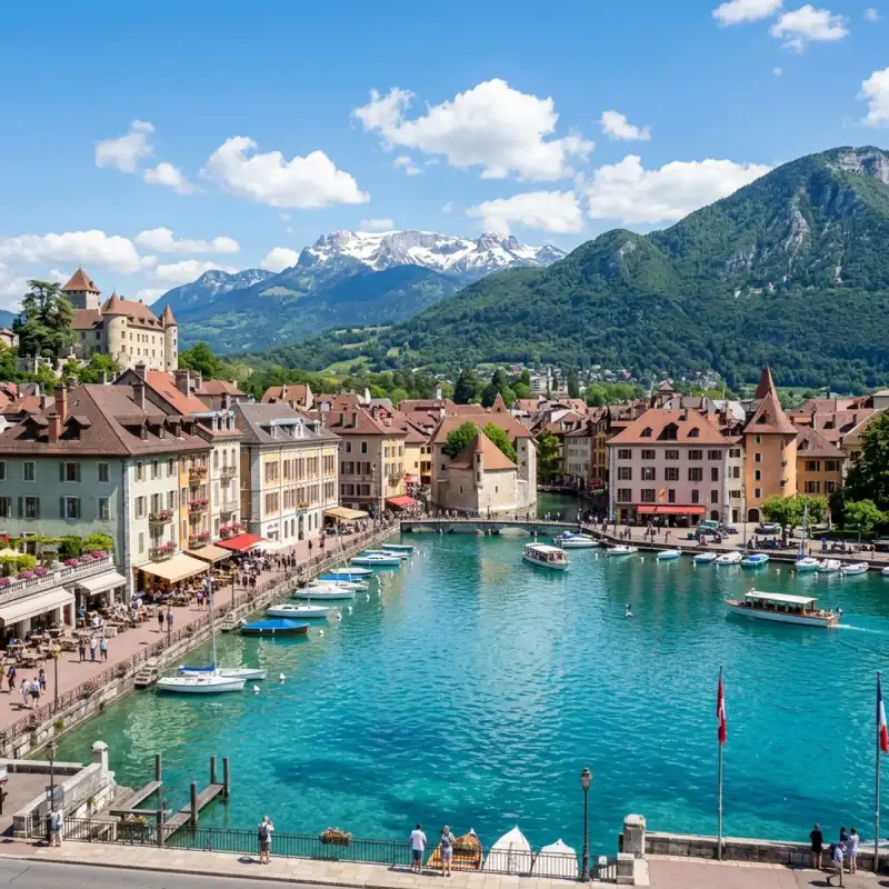
Bem-vindo! Prepare-se para uma #viagem inesquecível pelo coração de #Portugal. Coimbra: Onde a História Canta e a Tradição Vive Eterna Olá, meus caros aventureiros e amantes de viagens! Aqui é o Tiago Silva, e hoje levo-vos numa jornada inesquecível a um dos corações pulsantes de #Portugal, uma cidade que respira séculos de história e onde cada pedra parece sussurrar contos de reis, estudantes e poetas. Estou a falar, claro, de Coimbra, a joia do centro do nosso país, uma cidade que é muito mais do que um ponto no mapa – é uma experiência, um sentimento, uma parte indelével da alma portuguesa. Aninhada na Região Centro, mais especificamente na sub-região de Coimbra (NUT III), esta capital de distrito é um universo em si. O seu município, com os seus 319,40 km², é um mosaico de paisagens e comunidades, lar de cerca de 140.796 almas (dados de 2021), que vivem e respiram a sua essência. Coimbra é uma cidade que se estende e se abraça com os seus vizinhos, limitada a norte pela Mealhada, a leste por Penacova, Vila Nova de Poiares e Miranda do Corvo, a sul por Condeixa-a-Nova, a oeste por Montemor-o-Velho e a noroeste por Cantanhede. Esta localização privilegiada, quase a meio caminho entre as efervescentes cidades de Lisboa e do Porto, confere-lhe uma importância estratégica inegável, funcionando como um nó vital no tecido do nosso país. Mas Coimbra é, acima de tudo, sinónimo de uma identidade que transcende a geografia: é a cidade universitária por excelência. Uma das mais antigas urbes portuguesas, a sua reputação está intrinsecamente ligada ao ensino e à #cultura, um legado que se manifesta em cada esquina, em cada voz de estudante que ecoa pelas suas ruelas. Preparados para desvendar os seus segredos? Então, venham comigo! O Coração Académico: Onde o Saber Ganha Asas Não podemos falar de Coimbra sem nos rendermos à majestade e à gravitas da sua Universidade. A Universidade de Coimbra não é apenas uma instituição de ensino; é um monumento vivo, um guardião do conhecimento e da liberdade. Fundada em 1290, pela visão iluminada de D. Dinis, como o "Estudo Geral Português", a sua história é tão fascinante quanto a própria cidade. Inicialmente, a sua casa foi Lisboa, mas, num vaivém histórico entre as duas cidades, foi em 1537 que Coimbra a acolheu definitivamente, nas pitorescas margens do lendário rio Mondego. E que bom que assim foi! Desde então, a Universidade de Coimbra tem sido um farol, não só para #Portugal, mas para toda a #Europa. É uma das mais antigas universidades do continente e, sem dúvida, uma das maiores e mais influentes do nosso país. A sua população estudantil, que ronda os 37.000 jovens, entre o ensino superior público não politécnico, o politécnico e o privado, injeta uma energia vibrante e uma juventude contagiante na cidade. Coimbra é, por isso, um caldeirão de ideias, de sonhos e de futuro. Mas a influência da Universidade vai muito além das salas de aula. Na história contemporânea, os seus estudantes foram uma força motriz na defesa dos ideais de liberdade e democracia, erguendo a voz e a coragem contra a ditadura do Estado Novo. Esta é uma faceta de Coimbra que me enche de orgulho: uma cidade onde o saber não é apenas acumulado, mas também usado para moldar um futuro mais justo e livre. E o reconhecimento não tardou a chegar. No dia 22 de junho de 2013, a Universidade de Coimbra, juntamente com a sua Alta e a Sofia, foi merecidamente declarada Património Mundial pela UNESCO. Caminhar por estes espaços é sentir a história, é ser parte de um legado que é celebrado em todo o mundo. É uma experiência que recomendo a todos os que procuram uma #viagem com significado e profundidade. Coimbra, Capital do Reino: Berço de Reis e de uma Nação Antes de Lisboa assumir o papel principal, Coimbra deteve a honra de ser a capital do Reino de Portugal, até 1255. Esta é uma cidade que viu nascer reis, que abrigou os alicerces da nossa nação. É nas suas terras que repousa D. Afonso Henriques, o nosso primeiro rei, no sagrado Mosteiro de Santa Cruz – o que foi o primeiro Panteão Nacional do país. Visitar este local é sentir um arrepio na espinha, é estar face a face com o início de tudo, com a bravura e a determinação que forjaram a nossa identidade. As ruas estreitas, os pátios escondidos, as escadinhas sinuosas e os arcos medievais de Coimbra são testemunhas silenciosas de uma história grandiosa. Seis reis da Primeira Dinastia nasceram aqui, entre estas muralhas que contam histórias de glória e de desafios. É uma das cidades mais antigas da Europa, e cada passo que damos é um mergulho num passado que se recusa a ser esquecido. Das Raízes Romanas ao Esplendor Árabe A história de Coimbra é uma tapeçaria rica e complexa, tecida ao longo de milénios. Os Romanos, mestres na arte de edificar cidades, chamaram-na Emínio (Aeminium), erguendo-a majestosamente sobre a colina que domina o rio Mondego. Com o tempo, a sua importância cresceu, e Coimbra tornou-se sede de Diocese, substituindo a vizinha cidade romana de Conímbriga – e é desta última que deriva o seu nome atual, um testemunho da continuidade e da evolução. Depois, em 711, os mouros chegaram à Península Ibérica, e Coimbra transformou-se em Kulūmriyya. Sob o domínio islâmico, floresceu como um vital entreposto comercial, uma ponte entre o norte cristão e o sul árabe, abrigando uma próspera comunidade moçárabe. Imaginar os mercados vibrantes, os sons de diferentes línguas, os aromas exóticos – é viajar no tempo, é sentir a riqueza de uma época de intercâmbio cultural. A Reconquista foi um período de intensas lutas. Coimbra foi tomada por Hermenegildo Guterres em 878, tornando-se capital do Condado de Coimbra, apenas para ser atacada por Almançor em 986 e recuperada para o domínio muçulmano em 987. A cidade só seria definitivamente reconquistada em 1064, durante a campanha das Beiras, por Fernando Magno de Leão, após um longo e extenuante cerco de seis meses, entre 20 de janeiro e 9 de julho. Que resiliência, que espírito de luta estas muralhas testemunharam! Com a reconquista, Coimbra renasceu das cinzas, emergindo como a cidade mais importante a sul do rio Douro, capital de um vasto condado governado pelo moçárabe Sesnando. Em 1094, foi integrada no Condado Portucalense, e o conde D. Henrique e a rainha D. Teresa escolheram-na como sua residência, solidificando o seu estatuto. Apesar de ter sido atacada em 1116 e sitiada em 1117, foi na segurança das suas muralhas que viria a nascer o segundo rei de Portugal, Sancho I, que, em 1131, a elevou a capital do condado, substituindo Guimarães. No século XII, Coimbra já apresentava uma estrutura urbana clara e fascinante: a cidade alta, designada por Alta ou Almedina, era o domínio dos aristocratas, dos clérigos e, mais tarde, dos estudantes; enquanto a Baixa, junto ao rio, fervilhava com o comércio, o artesanato e os bairros populares ribeirinhos. Uma divisão que ainda hoje se sente na atmosfera das suas diferentes zonas. Não posso deixar de mencionar a lendária lealdade do alcaide-mor Martim de Freitas. Nas lutas entre D. Sancho II e o seu irmão, D. Afonso III, Martim de Freitas recusou-se a entregar as chaves do castelo de Coimbra sem antes confirmar a morte de D. Sancho II em Toledo, a quem prestara vassalagem. Só após essa confirmação o castelo foi entregue a Afonso III. Não foi tomado, foi entregue. Uma história de honra e fidelidade que nos fala de um tempo de valores inabaláveis. Desde meados do século XVI, a história da cidade e da Universidade tornaram-se quase indissociáveis, um entrelaçar de destinos que só no século XIX viu Coimbra começar a expandir-se para além dos seus limites históricos, abraçando o futuro sem esquecer o passado. O Abraço do Mondego e a Alma da Cidade Coimbra é acarinhada pelo rio Mondego, um rio que nasce na majestosa Serra da Estrela e a atravessa no sentido Este-Oeste, oferecendo-lhe não só uma beleza cénica inigualável, mas também uma ligação vital à natureza circundante. Passear pelas margens do Mondego, sentir a brisa suave, observar as águas espelhadas que refletem a cidade, é uma experiência de pura serenidade e um lembrete constante da beleza natural que nos rodeia. É um convite à contemplação e ao relaxamento, um refúgio da agitação #portugal #travel #history #europe #cultura
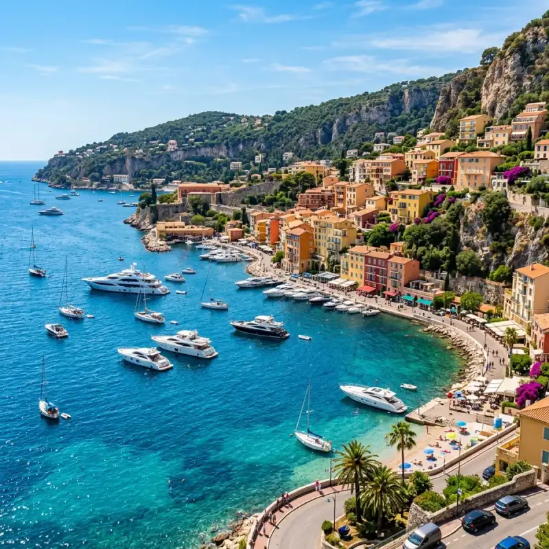
Bienvenue! Let us embark on an unforgettable #journey to the heart of #France. The French Riviera, known in French as the Côte d'Azur (French: [kot dazyʁ] ; Provençal: Còsta d'Azur, pronounced [ˈkwɔstɔ daˈzyʀ]; lit. 'Azure Coast'), is the Mediterranean coastline of the southeast corner of #France. There is no official boundary, but it is considered to be the coastal area of the Alpes-Maritimes department, extending from the rock formation Massif de l'Esterel to Menton, at the France–Italy border, although some other sources place the western boundary further west around Saint-Tropez or Toulon. The coast is entirely within the Provence-Alpes-Côte d'Azur region of France. The Principality of Monaco is a semi-enclave within the region, surrounded on three sides by France and fronting the Mediterranean. The French Riviera contains the seaside resorts of Cap-d'Ail, Beaulieu-sur-Mer, Saint-Jean-Cap-Ferrat, Villefranche-sur-Mer, Antibes, Juan-les-Pins, Cannes, and Théoule-sur-Mer. Riviera is an Italian word that originates from the #ancient Ligurian territory of Italy, wedged between the Var and Magra rivers. Côte d'Azur is originally a nickname given by France to the County of Nice after its annexation in 1860, because the climate was similar to that of the north of Italy, even in winter, with "a sky as blue as its sea". When the Mistral (Northwest) and the Tramontane (North) winds are blowing in the Languedoc and Provence areas, the temperature of the Mediterranean can be very cool in summer. This phenomenon is observed very little or not at all on the coast between the French Riviera and the Italian Riviera. This coastline was one of the first modern resort areas. It began as a winter health resort for the British upper class at the end of the 18th century. With the arrival of the railway in the mid-19th century, it became the playground and vacation spot of British, Russian, and other aristocrats, such as Queen Victoria, Tsar Alexander II and King Edward VII, when he was Prince of Wales. In the summer, it also played home to many members of the Rothschild family. In the first half of the 20th century, it was frequented by artists and writers, including Pablo Picasso, Henri Matisse, Francis Bacon, Edith Wharton, Somerset Maugham and Aldous Huxley, as well as wealthy Americans and Europeans. After World War II, it became a popular tourist destination and convention site. Many celebrities, such as Elton John and Brigitte Bardot, have homes in the region. Officially, the French Riviera is home to 163 nationalities with 83,962 foreign residents, although estimates of the number of non-French nationals living in the area are often much higher. Its largest city is Nice, which has a population of 340,017 as of 2017. The city is the centre of a métropole—Nice-Côte d'Azur—bringing together 49 communes and more than 540,000 inhabitants and 943,000 in the urban area. Nice is home to Nice Côte d'Azur Airport, France's third-busiest airport (after Charles de Gaulle Airport and Orly Airport), which is on an area of partially reclaimed coastal land at the western end of the Promenade des Anglais. A second airport at Mandelieu was once the region's commercial airport, but is now mainly used by private and business aircraft. The A8 autoroute runs through the region, as does the old main road generally known as the Route nationale 7 (officially now DN7 in Var and D6007 in Alpes-Maritimes). High-speed trains serve the coastal region and inland to Grasse, with the TGV Sud-Est service reaching Nice-Ville station in five and a half hours from #Paris. The French Riviera has a total population of more than two million. It is home to a high tech and science park (French: technopole) at Sophia-Antipolis (north of Antibes) and a research and technology centre at the University of Nice Sophia Antipolis. The region has 35,000 students, of whom 25 percent are working toward a doctorate. The French Riviera is a major yachting and cruising area with several marinas along its coast. According to the Côte d'Azur Economic Development Agency, each year the Riviera hosts 50 percent of the world's superyacht fleet, with 90 percent of all superyachts visiting the region's coast at least once in their lifetime. As a tourist centre, the French Riviera benefits from 310 to 330 days of sunshine per year, 115 kilometres (71 miles) of coastline and beaches, 18 golf courses, 14 ski resorts and 3,000 restaurants. Etymology Origin of term The term French Riviera comes by analogy with the term Italian Riviera, which extends east of the French Riviera (from Ventimiglia to La Spezia). As early as the 19th century, the British referred to the region as the Riviera or the French Riviera, usually referring to the eastern part of the coast, between Monaco and the Italian border. Riviera is an Italian noun which means "coastline". The name Côte d'Azur was given to the coast by the writer Stéphen Liégeard in his book, La Côte d’azur, published in December 1887. Liégeard was born in Dijon, in the French department of Côte-d'Or, and adapted that name by substituting the azure colour of the Mediterranean for the gold of Côte-d'Or. In Occitan (Niçard and Provençal) and French, the only usual names are Còsta d'Azur in Occitan and Côte d'Azur in French. A term like "French Riviera" (Ribiera Francesa in Occitan, Riviera Française in French) would only be used in literal translation, or adaptations of it. For instance, in French, "Riviera Française" is found in the online Larousse encyclopedia to refer to the holidays of a group of English workers (moreover, in Occitan, the word ribiera "coastline" mostly works as a common name, whereas in French, the old-fashioned term Rivière de Gênes was used to refer to the Italian Riviera whose center is Genoa). Disputes over the extent of the Riviera and the Côte d'Azur Côte d'Azur and the French Riviera have no official boundaries. Some sources put the western boundary at Saint-Tropez. Others include Saint Tropez, Hyères or Toulon in the Var (departement), or as far as Cassis in the Bouches-du-Rhône departement. In her 1955 novel, The Talented Mr. Ripley, Patricia Highsmith describes the Riviera as including all of the coast between Toulon and the Italian border. #history From prehistory to the Bronze Age The region of the French Riviera has been inhabited since prehistoric times. Primitive tools dating to between 1,000,000 and 1,050,000 years ago were discovered in the Grotte du Vallonnet, near Roquebrune-Cap-Martin, with stones and bones of animals, including bovines, rhinoceros, and bison. At Terra Amata (380,000 to 230,000 years ago), near the Nice Port, a fireplace was discovered that is one of the oldest found in Europe. Stone dolmens, monuments from the Bronze Age, can be found near Draguignan, while the Valley of Marvels (Vallée des Merveilles) near Mount Bégo, at 2,000 m (6,600 ft) elevation, is presumed to have been an outdoor religious sanctuary, having over 40,000 drawings of people and animals, dated to about 2000 BC. Greek influence Beginning in the 7th century BC, Greek sailors from Phocaea in Asia Minor began to visit and then build emporia along the Côte d'Azur. Emporia were started at Olbia (Hyères); Antipolis (Antibes) and Nikaia (Nice). These settlements, which traded with the inhabitants of the interior, became rivals of the Etruscans and Phoenicians, who also visited the Côte d'Azur. Roman colonization In 8 BC, the Emperor Augustus built an imposing trophy monument at La Turbie (the Trophy of the Alps or Trophy of Augustus) to mark the pacification of the region. Roman towns, monuments and amphitheatres were built along the Côte d'Azur and many still survive, such as the amphitheatre and baths at Cimiez, above Nice, and the amphitheatre, Roman walls and other remains at Fréjus. Barbarians and Christians Roman Provence reached the height of its power and prosperity during the 2nd and 3rd centuries AD. In the mid-3rd century, Germanic peoples began to invade the region, and Roman power weakened. In the same period, Christianity started to become a powerful force in the region. The first cathedrals were built in the 4th century, and bishoprics were established: in Fréjus at the end of the 4th century, Cimiez and Vence in 439, and Antibes in 442. The oldest Christian structure still in existence on the Côte d'Azur is the baptistery of Fréjus #cathedral, built at the end of the 5th century, which also saw the founding of the first monastery in the region, Lerins Monastery on an island off the coast at Cannes. The fall of the Western Roman #empire in the first half of the 5th century was followed by invasions of Provence by the Visigoths, the Burgundians and the Ostrogoths. There was then a long period of wars and dynastic quarrels, which in turn led to further invasions by the Saracens and the Normans in the 9th century. The Counts of Provence and the House of Grimaldi Some peace was restored to the coast by the establishment in 879 of a new kingdom of Provence, ruled first by the Bosonids dynasty (879–1112), then by the Catalans (1112–1246), and finally by the Angevins (1246–1382, elder branch, 1382–1483 (younger branch). In the 13th century, another powerful political force appeared, the House of Grimaldi. Descended from a Genoese nobleman expelled from Genoa by his rivals in 1271, members of the different branches of the Grimaldis took power in Monaco, Antibes and Nice, and built castles at Grimaud, Cagnes-sur-Mer and Antibes. Albert II, the current Prince of Monaco, is a descendant of the Grimaldis. In 1388, the city of Nice and its surrounding territory, from the mouth of the Var to the Italian border, were separated from Provence and came under the protection of the House of Savoy. The territory was called the Comté de Nice after 1526, and thereafter its language, history and #culture were separate from those of Provence until 1860, when it was re-attached to France under Napoleon III. Provence retained its formal independence until 1480, when the last Comte de Provence, René I of Naples, died and left the Comté to his nephew, Charles du Maine, who in turn left it to Louis XI of France. In 1486, Provence formally became part of France. Popularity with the British upper class in 18th and 19th centuries Until the end of the 18th century, the area later known as the Côte d'Azur was a remote and impoverished region, known mostly for fishing, olive groves and the production of flowers for perfume (manufactured in Grasse). A new phase began when the coast became a fashionable health resort for the British upper class in the late 18th century. The first British traveller to describe its benefits was the novelist Tobias Smollett, who visited Nice in 1763 when it was still an Italian city within the Kingdom of Sardinia. Smollett brought Nice and its warm winter climate to the attention of the British aristocracy with Travels through France and Italy, written in 1765. At about the same time, a Scottish doctor, John Brown, became famous for prescribing what he called climato-therapy, a change in climate, to cure a variety of diseases including tuberculosis, known then as consumption. The French historian Paul Gonnet wrote that, as a result, Nice was filled with "a colony of pale and listless English women and listless sons of nobility near death". In 1834, a British nobleman and politician named Henry Peter Brougham, First Baron Brougham and Vaux, who had played an important part in the abolition of the slave trade, travelled with his unwell daughter to the south of France, intending to go to Italy. A cholera epidemic in Italy forced him to stop at Cannes, where he enjoyed the climate and scenery so much that he bought land and built a villa. He began to spend his winters there and, owing to his fame, others followed: Cannes soon had a small British enclave. Robert Louis Stevenson was a later British visitor who came for his health. In 1882 he rented a villa called La Solitude at Hyères, where he wrote much of A Child's Garden of Verses. Railway, gambling and royalty In 1864, six years after Nice became part of France following the Second Italian War of Independence the first railway was completed, making Nice and the Riviera accessible to visitors from all over Europe. One hundred thousand visitors arrived in 1865. By 1874, residents of foreign enclaves in Nice, most of whom were British, numbered 25,000. In the mid-19th century, British and French entrepreneurs began to see the potential of promoting tourism along the Côte d'Azur. At the time, gambling was illegal in France and Italy. In 1856, the Prince of Monaco, Charles III, began constructing a casino in Monaco, which was called a health spa to avoid criticism by the church. The casino was a failure, but in 1863 the Prince signed an agreement with François Blanc, a French businessman already operating a successful casino at Baden-Baden (southwestern Germany), to build a resort and new casino. Blanc arranged for steamships and carriages to take visitors from Nice to Monaco, and built hotels, gardens and a casino in a place called Spélugues. At the suggestion of his mother, Princess Caroline, Charles III renamed the place Monte Carlo after himself. When the railway reached Monte Carlo in 1870, many thousands of visitors began to arrive and the population of the principality of Monaco doubled. The French Riviera soon became a popular destination for European royalty. Just days after the railway reached Nice in 1864, Tsar Alexander II of Russia visited on a private train, followed soon afterwards by Napoleon III and then Leopold II, the King of the Belgians. Queen Victoria was a frequent visitor. In 1882 she stayed in Menton, and in 1891 spent several weeks at the Grand Hotel at Grasse. In 1892 she stayed at the Hotel Cost-belle in Hyères. In successive years from 1895 to 1899 she stayed in Cimiez in the hills above Nice. First, in 1895 and 1896, she patronised the Grand Hôtel, while in later years she and her staff took over the entire west wing of the Excelsior Hôtel Régina, which had been designed with her needs specifically in mind (part of which later became the home and studio of the renowned artist Henri Matisse). She travelled with an entourage of between sixty and a hundred, including chef, ladies in waiting, dentist, Indian servants, her own bed and her own food. The Prince of Wales was a regular visitor to Cannes, starting in 1872. He frequented the Club Nautique, a private club on the Croisette, the fashionable seafront boulevard of Cannes. He visited there each spring for a two-month period, observing yacht races from shore while the royal yacht, Britannia, was sailed by professional crewmen. After he became King in 1901, he never again visited the French Riviera. By the end of the 19th century the Côte d'Azur began to attract artistic painters, who appreciated the climate, the bright colors and clear light. Among them were Auguste Renoir, who settled in Cagnes-sur-Mer and in Mougins, Henri Matisse and Pablo Picasso. Inter-war period, American visitors and decline of the aristocracy The First World War brought down many of the royal houses of Europe and altered the #nature and the calendar of the French Riviera. Following the war, greater numbers of Americans began arriving, with business moguls and celebrities eventually outnumbering aristocrats. The 'High Society' scene moved from a winter season to a summer season. Americans began coming to the south of France in the 19th century. Henry James set part of his novel The Ambassadors on the Riviera. James Gordon Bennett Jr., the son and heir of the founder of the New York Herald, had a villa in Beaulieu. Industrialist John Pierpont Morgan gambled at Monte Carlo and bought 18th-century paintings by Fragonard in Grasse – shipping them to the Metropolitan Museum in New York. A feature of the French Riviera in the inter-war years was the Train Bleu, an all first-class sleeper train which brought wealthy passengers down from Calais. It made its first trip in 1922, and carried Winston Churchill, Somerset Maugham, and the future King Edward VIII over the years. While Europe was still recovering from the war and the American dollar was strong, American writers and artists started arriving on the Côte d'Azur. Edith Wharton wrote The Age of Innocence (1920) at a villa near Hyères, winning the Pulitzer Prize for the novel (the first woman to do so). Dancer Isadora Duncan frequented Cannes and Nice, but died in 1927 when her scarf caught in a wheel of the Amilcar motor car in which she was a passenger and strangled her. The writer F. Scott Fitzgerald first visited with his wife Zelda in 1924, stopping at Hyères, Cannes and Monte Carlo – eventually staying at Saint-Raphaël, where he wrote much of The Great Gatsby and began Tender Is the Night. While Americans were largely responsible for making summer the high season, a French fashion designer, Coco Chanel, made sunbathing fashionable. She acquired a striking tan during the summer of 1923, and tans then became the fashion in Paris. During the abdication crisis of the British Monarchy in 1936, Wallis Simpson, the intended bride of King Edward VIII, was staying at the Villa Lou Viei in Cannes, talking with the King by telephone each day. After his abdication, the Duke of Windsor (as he became) and his new wife stayed at the Villa La Croë on the Cap d'Antibes. The English playwright and novelist Somerset Maugham also became a resident in 1926, buying the Villa La Mauresque toward the tip of Cap Ferrat, near Nice. Second World War When Germany invaded France in June 1940, the remaining British colony was evacuated to Gibraltar and eventually to Britain. American Jewish groups helped some of the Jewish artists living in the south of France, such as Marc Chagall, to escape to the United States. In August 1942, 600 Jews from Nice were rounded up by French police and sent to Drancy, and eventually to death camps. In all about 5,000 French Jews from Nice perished during the war. Following D-Day in Normandy, Operation Dragoon (initially Operation Anvil), the code name for the Allied invasion of Southern France, commenced on 15 August 1944, when American parachute troops landed near Fréjus, and a fleet landed 60,000 troops of the American Seventh Army and French First Army between Cavalaire and Agay, east of Saint-Raphaël. German resistance was not as fanatical as Hitler and the High Command had ordered, and crumbled in days. Saint-Tropez was badly damaged by German mines at the time of the liberation. The novelist Colette organized an effort to assure the town was rebuilt in its original style. When the war ended, artists Marc Chagall and Pablo Picasso returned to live and work. Post-war period and late 20th century The Cannes Film Festival was launched in September 1946, marking the return of French cinema to world screens. The Festival Palace was built in 1949 on the site of the old Cercle Nautique, where the Prince of Wales had met his mistresses in the late 19th century. The release of the French film Et Dieu… créa la femme (And God Created Woman) in November 1956 was a major event for the Riviera, making an international star of Brigitte Bardot, and making an international tourist destination of Saint-Tropez, particularly for the new class of wealthy international travellers called the jet set. The marriage of American film actress Grace Kelly to Prince Rainier of Monaco on 18 April 1956, attracted world attention once again. It was viewed on television by 30 million people. During the 1960s, the Mayor of Nice, Jacques Médecin, decided to reduce the dependence of the Riviera on ordinary tourism, and to make it a destination for international congresses and conventions. He built the Palais des Congrès at the Acropolis in Nice, and founded a Chagall Museum and a Matisse Museum at Cimiez. At the end of August 1997, Princess Diana and Dodi Fayed spent their last days together on his father's yacht off Pampelonne Beach near Saint-Tropez, shortly before they died in the Alma Tunnel in Paris. Geography Coastal municipalities Places Places on the Côte d'Azur (following the broadest definition), following the coast from south-west to north-east, include: Tourism Some data related to tourism on the Riviera in 2006: More than 14 million tourists 52% of customers from abroad 65 million nights stayed Tourists spending €5 billion 75,000 jobs; tourism is 18% of total employment in the Alpes-Maritimes. 500,000 tourists in the High Country 500,000 delegates 3 million admissions to museums and monuments More than 45% of tourists come by air Climate The French Riviera is mostly subtropical, featuring a Mediterranean climate, with sunny, hot, dry summers and mild winters. Winter temperatures are moderated by the Mediterranean; days of frost are rare. The average daily low temperature in Nice in January is 5.4 °C (41.7 °F); the January average daily low temperature in Toulon is 6.2 °C (43.2 °F). The average high temperature in August in Nice is 28.6 °C (83.5 °F); in Toulon the average daily high temperature is 29.7 °C (85.5 °F) The Côte d'Azur receives more rainfall annually than Paris (803.3 mm (31.63 in) annually in Nice and 684.8 mm (26.96 in) in Toulon compared with 649.8 mm (25.58 in) in Paris), but the rainy days are much less frequent and the Riviera is considerably sunnier; 111 rainy days a year in Paris compared with 61 days in Toulon and 63 in Nice. Rain is generally more common in the Autumn and Winter months while the summers are drier. Toulon has 2,793 hours of sunshine a year, Nice has 2,668 hours. Micro-climates exist in these coastal regions, and there can be great differences in the weather between various locations. Strong winds such as the mistral, a cold dry wind from the northwest or from the east, are another characteristic, particularly in the winter. Nice, in particular is surrounded by mountains to the North, protecting it from the Mistral winds making it feel milder on sunny days. The Sirocco is a southerly wind, coming from the African continent and often felt on the Mediterranean coast of Europe. It is a hot and humid wind, occasionally carrying sand from the Sahara which is then deposited in coastal areas across Southern Europe. The French Riviera is one of the mildest locations in the world for its latitude, owing to the Gulf Stream which moderates the temperatures in Western Europe, particularly in winter and the warming effect of the Mediterranean Sea. Because of this, the region boasts a long growing season and supports the growth of exotic flora such as Citrus Fruits and Palm Trees. Snow is very uncommon in the winters and the long, hot and sunny summers have long been a draw for tourists since the days of British Aristocracy. =### Nice and Alpes-Maritimes= Nice and the Alpes-Maritimes département are sheltered by the Alps. The winds are usually gentle, from the sea to the land, though sometimes the mistral blows strongly from the northwest, or, turned by the mountains, from the east. In 1956 a mistral from the northwest reached 180 kilometres per hour (110 mph) at Nice Airport. Sometimes, in summer, the sirocco brings high temperatures and reddish desert sand from the Sahara (see Winds of Provence). Rain can be torrential, particularly in the autumn, when storms and rain are caused by the difference between the colder air inland and the warm Mediterranean water temperature (20–24 °C [68–75 °F]). The rainiest months are September (75.6 millimetres [2.98 in] average rainfall); October (143.9 millimetres [5.67 in]); November (94.3 millimetres [3.71 in]) and December (87.8 millimetres [3.46 in]). Snow on the coast is rare, falling on average once every ten years. 1956 was exceptional, when 20 cm (7.9 in) blanketed the coast. In January 1985 the coast between Cannes and Menton received 30 to 40 cm (12 to 16 in). In the mountains, snow is present from November to May. =### Var= The département of Var (which includes Saint-Tropez and Hyères) has a climate slightly warmer, drier and sunnier than Nice and Alpes-Maritimes, but is less sheltered from the wind. The mistral, which brings cold and dry air down from the upper Alpine regions via the Rhône valley and extends with diminishing intensity along the Côte d'Azur, blows frequently during the winter. Strong winds blow for about 75 days a year in Fréjus. Events and festivals Several major events take place: Monaco and southeast France: Rallye Automobile Monte-Carlo, January Monaco: International Circus Festival of Monte-Carlo, January / February Mandelieu-la-Napoule: La Fête du Mimosa, February Nice: Carnival, February Menton: Lemon Festival, February Tourrettes-sur-Loup: Violet Festival, March Monaco: Monte-Carlo Masters, April–May Monaco: Formula One Grand Prix race, May Grasse; Rose Festival, May Cannes: Cannes Film Festival and Cannes Film Market, May Nice: Jazz Festival, July Juan-les-Pins: Jazz à Juan, late July. Grasse: Jasmine Festival, August Toulon: Toulon Tournament, Tall Ships' Race IRONMAN 70.3 Races, May Painters The climate and vivid colors of the Mediterranean attracted many famous artists during the 19th and 20th centuries. They included: Pierre Bonnard (1867–1947); retired to and died at Le Cannet. Roger Broders (1883–1953); Parisian #travel poster illustrator. Marc Chagall (1887–1985); lived in Saint-Paul-de-Vence between 1948 and 1985. Henri-Edmond Cross (1856–1910); discovered the Côte d'Azur in 1883, and painted at Monaco and Hyères. Maurice Denis (1870–1943); painted at St. Tropez and Bandol. Raoul Dufy (1877–1953); whose wife was from Nice, painted in the region, including in Nice. Albert Marquet (1873–1947); painted at St. Tropez. Henri Matisse (1869–1954); first visited St. Tropez in 1904. In 1917 he settled in Nice, first at the Hôtel Beau Rivage, then at the Hôtel de la Méditerranée, then at la Villa des Alliés in Cimiez. In 1921 he lived in an apartment in Nice, next to the flower market and overlooking the sea, where he lived until 1938. He then moved to the Hôtel Régina in the hills of Cimiez, above Nice. During World War II he lived in Vence, then returned to Cimiez, where he died and is buried. Claude Monet (1840–1927); visited Menton, Bordighera, Juan-les-Pins, Monte Carlo, Nice, Cannes, Beaulieu and Villefranche, and painted a number of seascapes of Cap Martin, near Menton, and at Cap d'Antibes. Edvard Munch (1863–1944); visited and painted in Nice and Monte Carlo (where he developed a passion for gambling), and rented a villa at Saint-Jean-Cap-Ferrat in 1891. Pablo Picasso (1881–1973); spent each summer from 1919 to 1939 on the Côte d'Azur, and moved there permanently in 1946, first at Vallauris, then at Mougins, where he spent his last years. Auguste Renoir (1841–1919); visited Beaulieu, Grasse, Saint-Raphaël and Cannes, before finally settling in Cagnes-sur-Mer in 1907, where he bought a farm in the hills and built a new house and workshop on the grounds. He continued to paint there until his death in 1919. His house is now a museum. Paul Signac (1863–1935); visited St. Tropez in 1892, and bought a villa, La Hune, at the foot of citadel in 1897. It was at his villa that his friend, Henri Matisse, painted his famous Luxe, Calme et Volupté in 1904. Signac made numerous paintings along the coast. Yves Klein (1928–1962); a native of Nice, considered an important figure in post-war European art. Sacha Sosno (1937–2013); French painter and sculptor who lived and worked in Nice. Writers Many writers have also been inspired by the area, including Death on the Riviera by John Bude, The Garden of Eden by Ernest Hemingway, Imogen by Jilly Cooper, and Swimming Home by Deborah Levy. Bibliography History Henry de Lumley, La Grand Histoire des premiers hommes européens, Odile Jacob, Paris, 2010 (ISBN 978 2 7381 2386 2). Aldo Bastié, Histoire de la Provence, Éditions Ouest-France, 2001. Mary Blume, Côte d'Azur: Inventing the French Riviera, Thames and Hudson, London, 1992. Patrick Howarth, When the Riviera was Ours, Routledge & Kegan Paul, London, 1977. Jim Ring, Riviera, the Rise and Fall of the Côte d'Azur, John Murray Publishers, London, 1988. Edouard Baratier (editor), Histoire de la Provence, Editions Privat, Toulouse, 1969 (ISBN 2 7089 1649 1). Painters La Méditerranée de Courbet à Matisse, catalog of the exhibit at the Grand Palais, Paris from September 2000 to January 2001. Published by the Réunion des musées nationaux, 2000. #france #travel #history #europe #culture Related Insights乌镇:梦回明清的水乡 伏見稲荷大社: 千本鳥居が導く神秘の山 Mud‑Brick Horizons: Documenting the Architectural Soul of Djenné and Timbuktu{ "@context": "https://schema.org", "@type": "FAQPage", "mainEntity": [ { "@type": "Question", "name": "What is the main focus of The Glamour and Secrets of the French Riviera?", "acceptedAnswer": { "@type": "Answer", "text": "Join Camille Dubois on a journey exploring The Glamour and Secrets of the French Riviera and its incredible history." } }, { "@type": "Question", "name": "Who authored the comprehensive guide on The Glamour and Secrets of the French Riviera?", "acceptedAnswer": { "@type": "Answer", "text": "This detailed article and its insights were carefully researched and authored by Camille Dubois." } }, { "@type": "Question", "name": "Where can I find more related content about Travel?", "acceptedAnswer": { "@type": "Answer", "text": "You can explore more articles, detailed reviews, and similar insights by browsing the Related Insights section at the bottom of this article or visiting our dedicated Travel category page." } } ] }
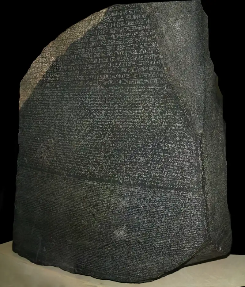
For nearly fifteen hundred years, the gods of the Nile had been silenced. Their temples, once echoing with the chants of priests and the rhythmic beating of sistrums, had been swallowed by the encroaching sands of time and neglect. The great pharaohs, men and women who had sought eternity through colossal stone monuments and intricate spells, were reduced to nameless effigies staring blankly across the desolate desert. But their greatest loss was not their hoarded gold, nor the physical crumbling of their monuments—it was their voice. The hieroglyphs, the sacred carvings that held the very soul of #AncientEgypt, had become a dead, indecipherable code, frustrating scholars and travelers for centuries. That is, until a seemingly mundane slab of black granodiorite was pulled from the thick mud of the Nile Delta. This is the dramatic, unfolding story of the Rosetta Stone, the miraculous key that unlocked a forgotten world and allowed the ancients to speak once more across the chasm of millennia. The Silence of the Sphinx: A Language Lost to Time To truly understand the magnitude of the Rosetta Stone's discovery, one must first comprehend the profound silence that preceded it. The ancient Egyptian civilization thrived for over three thousand years, producing a culture of unparalleled complexity. They chronicled their victories, their religious dogma, and their daily lives in hieroglyphs—a word derived from the Greek hieroglyphikos, meaning "sacred carvings." For millennia, this script was a living, breathing entity, adapting and evolving. However, as the empire's power waned, so too did the exclusivity and knowledge of its sacred script. The conquest of Egypt by Alexander the Great in 332 BC marked the beginning of a profound cultural shift. The subsequent Ptolemaic dynasty brought Greek as the language of administration and the elite. Hieroglyphs were increasingly confined to the realm of the priesthood and religious monuments. The final blow came with the advent of the Roman Empire and the subsequent rise of Christianity. In 391 AD, the Byzantine Emperor Theodosius I ordered the closing of all pagan temples throughout the empire. The ancient Egyptian religion was outlawed, and with it, the institutions that taught and preserved the hieroglyphic script. The last known dated hieroglyphic inscription was carved at the Temple of Philae in 394 AD. After that, the light went out. The language of the pharaohs was forgotten. For centuries, European scholars and Arab historians gazed upon the obelisks and tomb walls with awe and utter bewilderment. They believed the symbols were purely ideographic—mystical pictures representing abstract concepts of magic and philosophy, rather than a functional, phonetic language. The stones were silent. The history of Egypt was effectively erased, replaced by myths, biblical references, and the often-inaccurate accounts of classical Greek historians. The world desperately needed a key, a bridge across the void of time. #LostLanguages #History The Sands of Rashid: Napoleon's Audacious Expedition The stage for the resurrection of ancient Egypt was set not in the quiet halls of academia, but in the chaotic theater of war. In 1798, the ambitious, brilliant, and ruthlessly calculated French General Napoleon Bonaparte launched a massive military expedition to Egypt. His primary goal was strategic: to sever Britain's lucrative trade route to India and establish a French presence in the Middle East. However, Napoleon, a man deeply enamored with the grandeur of antiquity, did not just bring soldiers. He brought an army of the intellect. Accompanying the French fleet were 167 savants—scholars, scientists, engineers, artists, and mathematicians. Their mission was to study every aspect of Egypt, from its flora and fauna to its geography and, crucially, its staggering ancient ruins. This unprecedented marriage of military conquest and scientific inquiry would inadvertently birth the modern discipline of #Egyptology. The French army found themselves fighting not only the fiercely brave Mamluk cavalry but also the unforgiving Egyptian climate. The heat was oppressive, disease was rampant, and the sands seemed to swallow everything. Yet, amidst the suffering and the gunfire, the savants worked tirelessly. They sketched the Sphinx, measured the Pyramids of Giza, and marveled at the colossal ruins of Luxor and Karnak. But the true prize—the ability to read the writing on the walls—eluded them entirely. A Fortuitous Discovery in the Mud The pivotal moment arrived in mid-July 1799, near the small port city of Rosetta (known in Arabic as Rashid), located in the western delta of the Nile. The French forces, under the command of Pierre-François Xavier Bouchard, an engineering officer, were frantically reinforcing an old fifteenth-century Mamluk fortress, Fort Julien, in anticipation of an attack by the British or Ottoman forces. As the soldiers hacked away at an ancient wall to clear space for their cannons, their pickaxes struck something hard. It was not just another piece of masonry. Dragged from the rubble and the mud was a heavy, dark slab of stone, roughly the size of a tabletop. It measured 44 inches tall, 30 inches wide, and weighed an astonishing 1,680 pounds. Bouchard immediately recognized that this was no ordinary building block. The face of the stone was polished and covered in dense inscriptions. What made his heart race, however, was the structural layout of the text. The stone was divided into three distinct registers, each featuring a different script:The Top Register: Fourteen lines of ancient Egyptian hieroglyphs, mostly missing or damaged. The Middle Register: Thirty-two lines of a cursive, unknown script (which would later be identified as Demotic, the everyday administrative language of ancient Egypt). The Bottom Register: Fifty-four lines of Ancient Greek.Bouchard, though an engineer and not a linguist, possessed the educated foresight to grasp the artifact's potential significance. The Greek text, which could be readily translated by scholars of the era, declared that the decree contained within was to be inscribed "in sacred, and native, and Greek characters." This was the crucial clue. If the three texts were identical in meaning, then the Greek section could serve as a direct, one-to-one translation guide for the mysterious hieroglyphs above it. The silence was finally about to break. The Rosetta Stone had been found. #ArchaeologicalDiscovery #Napoleon A Sidelong Glance at Antiquity: What the Stone Actually Said Before diving into the fierce intellectual war that followed its discovery, it is deeply ironic to examine what the Rosetta Stone actually says. Given its monumental role in the history of human knowledge, one might expect it to contain a profound philosophical treatise, an epic poem of gods and monsters, or a dramatic historical chronicle of sweeping conquests. Instead, the Rosetta Stone is essentially a piece of bureaucratic propaganda. The text is a decree passed by a council of priests in the city of Memphis in 196 BC, during the reign of the Ptolemaic King Ptolemy V Epiphanes, who was merely a young boy at the time. The Ptolemaic dynasty, being of Greek descent, often faced unrest and rebellion from the native Egyptian population. The decree is a political instrument designed to solidify the young king's divine right to rule and to ensure the loyalty of the powerful Egyptian priesthood. The text tediously outlines the various benefactions Ptolemy V bestowed upon the temples:Tax Exemptions: He reduced taxes and completely forgave debts owed by the temples to the crown. Gifts of Grain and Money: He provided substantial donations of silver and grain to the temple treasuries. Military Protection: He successfully besieged the city of Lycopolis, defeating rebels who had risen against the state, thereby protecting the priests and the people. Amnesty: He granted amnesty to prisoners and those who had been on the run during the years of unrest.In return for these generous favors, the decree dictates that the priests must honor the king. They are ordered to construct new statues of Ptolemy V in every temple, to celebrate his birthday and coronation days with festivals and offerings, and, most importantly, to erect copies of this very decree in all the major temples across Egypt, written in the three scripts so that all—the gods, the native populace, and the Greek ruling class—could read of the king's piety and benevolence. It is a stunning irony of history that a rather dry, sycophantic tax document, mass-produced and placed in temples across the land, became the singular, most important artifact in the history of linguistics. It was the ancient equivalent of a press release, yet it held the secrets to eternity. #AncientHistory #PtolemaicEgypt The Spoils of War: From French Hands to the British Museum The joy of the French discovery was short-lived. The military realities of Napoleon's Egyptian campaign soon came crashing down. In 1801, a massive British expeditionary force, led by General Sir Ralph Abercromby, landed in Egypt to oust the French once and for all. The French army, isolated, diseased, and outmaneuvered, was eventually forced to surrender at Alexandria. A bitter dispute immediately arose over the fate of the countless antiquities the French savants had meticulously collected, cataloged, and drawn over the past three years. General Jacques-François Menou, the French commander, obstinately claimed that the artifacts, particularly the Rosetta Stone, were his personal property and should remain with the French. The British commander, Major General John Hely-Hutchinson, vehemently disagreed. Under the terms of the Capitulation of Alexandria, all antiquities collected by the French were declared the property of the British Crown as spoils of war. The tension was palpable. The French scholars threatened to burn their priceless notes and drawings rather than hand them over to the British. Legend has it that the French even tried to smuggle the Rosetta Stone out of Alexandria on a small boat, hidden among personal baggage, but they were intercepted by British agents. Ultimately, the British prevailed. The Rosetta Stone, a heavy, mute prisoner of war, was loaded onto the captured French frigate L'Égyptienne and sailed to England. In 1802, it arrived in Portsmouth and was subsequently transported to London. King George III ordered it to be placed in the British Museum, where it has remained almost continuously ever since. On its side, the British painted a stark, triumphant inscription in white letters: “Captured in Egypt by the British Army in 1801.” The physical stone belonged to Britain, but the intellectual race to decipher its secrets had only just begun. It would be a battle fought not with cannons and cavalry, but with ink, paper, and the sheer power of human genius. #BritishMuseum #WarSpoils The Race to Read: The English Polymath vs. The French Genius The news of the Rosetta Stone's existence swept through the academic circles of Europe like wildfire. Lithographic copies and plaster casts of the inscriptions were quickly distributed to universities and scholars across the continent. The text was a puzzle begging to be solved, a linguistic Mount Everest waiting to be conquered. The translation of the Greek text was completed relatively quickly, confirming the nature of the decree. But the hieroglyphs remained fiercely stubborn. The quest to decipher the stone soon narrowed into an intense, decades-long rivalry between two extraordinary minds: the brilliant English polymath Thomas Young, and the obsessive, tormented French linguist Jean-François Champollion. Thomas Young: The Man Who Knew Everything Thomas Young was a man of staggering intellect, often described as "the last man who knew everything." A physician, physicist (famous for the double-slit experiment establishing the wave theory of light), and linguist, Young approached the Rosetta Stone with the cold, analytical precision of a mathematician. In 1814, Young began his rigorous analysis of the stone. He focused heavily on the middle section, the Demotic script, realizing it was a simplified, cursive form of the hieroglyphs rather than a completely separate language. Young made significant breakthroughs. He was the first to realize that the hieroglyphic system was not entirely ideographic (picture-based) as had been assumed for centuries, but that it contained phonetic elements (representing sounds), at least when spelling foreign names. Young correctly identified that the oval enclosures, known as cartouches, contained the names of royalty. By comparing the Greek name "Ptolemaios" (Ptolemy) with the hieroglyphs inside a specific cartouche on the stone, Young successfully assigned phonetic values to several hieroglyphic signs. He proved that a square represented a 'p', a semicircle a 't', a lion a 'l', and so on. It was a monumental leap forward. Young published his findings anonymously in the Encyclopædia Britannica in 1819. However, Young's progress eventually stalled. He remained deeply convinced that the phonetic spelling was an exception, a tool used only by the ancient Egyptians to write foreign, Greek names, and that the vast majority of the hieroglyphs were still mystical, symbolic pictures. His scientific mind, constrained by established dogma, could not make the final, imaginative leap. Jean-François Champollion: The Tormented Visionary Across the English Channel, Jean-François Champollion was attacking the problem with a fervor that bordered on madness. Unlike the diverse Young, Champollion was singularly obsessed with Egypt from a very young age. Born in 1790 in the midst of the French Revolution, he was a linguistic prodigy. By his teenage years, he had mastered Latin, Greek, Hebrew, Amharic, Sanskrit, Avestan, Pahlavi, Chaldean, Syriac, Ethiopic, and, most crucially, Coptic. Coptic was the final phase of the ancient Egyptian language, written using the Greek alphabet with a few additional characters. It survived primarily as the liturgical language of the Egyptian Christian Church. Champollion firmly believed that Coptic was the direct linguistic descendant of the language of the pharaohs. This conviction would prove to be his greatest weapon. Champollion lived a life of poverty, political persecution, and fragile health, but his mind burned with the fire of decipherment. He studied every copy of Egyptian inscriptions he could get his hands on, comparing them endlessly. He built upon Young's work with the cartouches, acknowledging the Englishman's discovery of the phonetic alphabet for foreign names, though the two men would later engage in a bitter priority dispute. Champollion expanded the phonetic alphabet by studying cartouches from other monuments, successfully translating the names of other Greek and Roman rulers of Egypt, such as Cleopatra, Alexander, and Tiberius. But the ultimate question remained: did this phonetic system apply to the older, purely Egyptian pharaohs, or just the foreign conquerors? "Je tiens l'affaire!" - The Breakthrough of 1822 The climax of this decades-long intellectual thriller arrived in September 1822. Champollion received copies of newly discovered inscriptions from the temple of Abu Simbel, built long before the Greeks or Romans arrived. These inscriptions contained cartouches of ancient, native Egyptian kings. Champollion stared at a particular cartouche. It contained three symbols: a circle with a dot in the center, a mysterious symbol with three loops, and two folded cloths (which he already knew from his work on Ptolemy represented the sound 's'). Drawing upon his vast knowledge of Coptic, Champollion had a sudden, electrifying realization. The circle with a dot was the sun, and the Coptic word for sun was Ra. He hypothesized that the looped symbol was the word for "birth" or "to give birth," which in Coptic was mise. He put the sounds together: Ra + mise + s + s. Ramesses. He had just read the name of Ramses the Great, one of the most powerful pharaohs in Egyptian history. Trembling, he moved to another cartouche. This one contained the image of an ibis bird, the symbol of the god Thoth. Using the same logic, he translated it as Thoth + mise + s. Thutmose. The realization hit him with the force of a physical blow. The hieroglyphic system was not just picture writing. It was a complex, beautiful, and fully functional combination of phonetic signs (representing sounds) and ideographic signs (representing ideas). The Egyptians had been writing their own names, their own verbs, their own history phonetically all along. The code was cracked. The language was alive. According to historical lore, Champollion gathered his papers, sprinted down the street in Paris to the Institute of France where his brother worked, burst into the office, threw the papers on the desk, and shouted, "Je tiens l'affaire!" ("I've got it!"). The sheer emotional and mental exhaustion of the revelation was too much for his fragile constitution. Champollion immediately collapsed to the floor and fell into a coma-like state that lasted for five days. When he awoke, he began drafting his famous Lettre à M. Dacier, published on September 27, 1822, in which he officially announced his discovery to the world. The silence of fifteen centuries had been broken by the fevered brilliance of a single, obsessed scholar. #Decipherment #Linguistics #Genius The Resurrection of a Civilization The impact of Champollion's decipherment cannot be overstated. It was not merely an academic triumph; it was the resurrection of an entire civilization. Before 1822, ancient Egypt was a land of myth and mute stones. After 1822, it was a land of history, poetry, religion, and humanity. Equipped with Champollion's grammar and dictionary (published posthumously, as he died young at the age of 41, his body broken by his obsessive work and travels in Egypt), scholars could finally read the walls. The blank, imposing faces of the pharaohs suddenly gained names, lineages, and personalities. The battles they fought, such as Ramses II's clash with the Hittites at Kadesh, were read in vivid, propagandistic detail. The profound religious beliefs of the Egyptians, enshrined in the Book of the Dead and the Pyramid Texts, were finally understood, revealing a complex theology centered on Ma'at (cosmic balance), the afterlife, and the journey of the soul. We learned about the daily lives of the common people: the complaints of workers on strike at Deir el-Medina, the passionate love poetry penned on papyrus, the medical treatises detailing surgical procedures, and the complex legal documents governing land and inheritance. The ancient Egyptians ceased to be mysterious, magical figures and became human beings—fearing death, loving their families, suing their neighbors, and striving for a good life along the fertile banks of the Nile. The Rosetta Stone was the catalyst for an explosion of knowledge that fundamentally altered our understanding of human history. It pushed the boundaries of recorded civilization back thousands of years, proving that complex, highly organized societies with profound literary traditions existed long before the Greeks and Romans. #HistoricalRevelation #AncientCivilization The Enduring Legacy of the Stone Today, the Rosetta Stone sits behind thick glass in Room 4 of the British Museum. It is the most visited object in the entire institution, drawing millions of awe-struck observers every year. It is no longer just an archaeological artifact; it has become a global icon, a metaphor for solving the unsolvable. The term "Rosetta Stone" has entered the modern lexicon to describe any essential clue to a new field of knowledge. We speak of the "Rosetta Stone of genetics" or the "Rosetta Stone of immunology." When the European Space Agency launched a probe to study a comet and unlock the secrets of the early solar system, they aptly named it the Rosetta spacecraft, with its lander named Philae (after the island where the last hieroglyph was carved). The Modern Controversy: A Demand for Return Yet, the stone's legacy is not without ongoing conflict. The Rosetta Stone remains at the center of a fierce, decades-long debate regarding cultural repatriation. Prominent Egyptian archaeologists and government officials, most notably Dr. Zahi Hawass, have repeatedly and passionately demanded the permanent return of the stone to Egypt. They argue that the stone was stolen, taken as imperial booty during a time of colonial occupation, and that it rightfully belongs in the Grand Egyptian Museum in Giza, standing alongside the culture that created it. "The Rosetta Stone is the icon of our Egyptian identity," Hawass has stated. "Its home should be Egypt." The British Museum, conversely, argues that the stone was acquired legally under the treaties of the time, and that as a "universal museum," it is best positioned to preserve, protect, and display the artifact to a global audience in the context of world history. They fear that returning such a prominent item would set a precedent that could empty the halls of major Western museums. This debate highlights the complex, often painful legacy of colonialism and archaeology. The stone that united humanity through the understanding of language now serves as a focal point for arguments over ownership, heritage, and the right to control one's own history. The Eternal Whisper of the Nile Regardless of where it physically resides, the true power of the Rosetta Stone lies in what it accomplished. It stands as a testament to the enduring power of the written word and the relentless curiosity of the human mind. When you look at the Rosetta Stone, you are not just looking at a hunk of volcanic rock. You are looking at a portal. You are looking at the exact moment when the impenetrable darkness of the past was pierced by the light of understanding. Because of a young boy king's tax decree, the desperate fortifications of a French soldier, the cold logic of an English polymath, and the fiery genius of a French linguist, the ancient gods awoke from their slumber. The temples of Karnak are no longer silent. The tombs of the Valley of the Kings whisper their secrets to those who care to read them. Through the Rosetta Stone, ancient Egypt achieved the very thing it sought so desperately: immortality. As long as we can read their words, the pharaohs will never truly die. They continue to speak, telling us tales of a golden empire born from the mud of the Nile, echoing across eternity, reminding us that no voice, no matter how deeply buried beneath the sands of time, is ever truly lost. #Immortality #Legacy #MarkDinn #HistoricalFictionMark Dinn is an acclaimed author of historical fiction, known for bringing the forgotten dramas of the past vividly to life. His work explores the intersection of human ambition, archaeological discovery, and the relentless march of time. #History #Egypt Related InsightsUnraveling the Mysteries of Stonehenge: A Monolithic Marvel of the Ancient World 千古绝唱,江水悠悠:探秘乐山大佛的沧桑与辉煌 The Great Fire of London (1666): An Empire Reborn from Ashes{ "@context": "https://schema.org", "@type": "FAQPage", "mainEntity": [ { "@type": "Question", "name": "What is the main focus of The Rosetta Stone: Breaking the Silence of Ancient Egypt?", "acceptedAnswer": { "@type": "Answer", "text": "A dramatic deep dive into The Rosetta Stone: Breaking the Silence of Ancient Egypt. Mark Dinn explores the untold history, drama, and legacy of this fascinating subject." } }, { "@type": "Question", "name": "Who authored the comprehensive guide on The Rosetta Stone: Breaking the Silence of Ancient Egypt?", "acceptedAnswer": { "@type": "Answer", "text": "This detailed article and its insights were carefully researched and authored by Mark Dinn." } }, { "@type": "Question", "name": "Where can I find more related content about History?", "acceptedAnswer": { "@type": "Answer", "text": "You can explore more articles, detailed reviews, and similar insights by browsing the Related Insights section at the bottom of this article or visiting our dedicated History category page." } } ] }
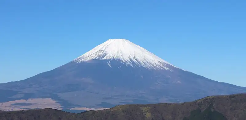
Konnichiwa! Welcome to another deep dive into #Japan's breathtaking #ancient #history and cultural heritage. From the spirit of #zen and Wabi-Sabi to the majestic presence of #samurai castles and Shinto shrines, let us explore the wonders of Mount Fuji. Mount Fuji (富士山・富士の山, Fujisan, Fuji no Yama) is an active stratovolcano located on the Japanese island of Honshu, with a summit elevation of 3,776.24 m (12,389 ft 3 in). It is the highest mountain in Japan, the second-highest volcano on any Asian island (after Mount Kerinci on the Indonesian island of Sumatra), and the seventh-highest peak of an island on Earth. Mount Fuji last erupted from 1707 to 1708. It is located about 100 km (62 mi) southwest of Tokyo, from which it is visible on clear days. It has an exceptionally symmetrical cone, which is covered in snow for about five months of the year. It is a Japanese cultural icon and is frequently depicted in art and photography, as well as visited by sightseers, hikers, and mountain climbers. Mount Fuji is one of Japan's "Three Holy Mountains" (三霊山, Sanreizan) along with Mount Tate and Mount Haku. It is a Special Place of Scenic Beauty and one of Japan's Historic Sites. It was added to the World Heritage List as a Cultural Site on June 22, 2013. According to #UNESCO, Mount Fuji has "inspired artists and poets and been the object of pilgrimage for centuries". UNESCO recognizes 25 sites of cultural interest within the Mount Fuji locality. These 25 locations include Mount Fuji and the Shinto shrine, Fujisan Hongū Sengen Taisha. Etymology The current kanji for Mount Fuji, 富 and 士, mean "wealth" or "abundant" and "man of status" respectively. The origins of this spelling and the name Fuji continue to be debated. In Japanese, kanji characters are often applied by sound, and the meaning of the kanji may have nothing to do with the name of the mountain. It was named Fuji before the kanji was applied to it. 富士山記 (Fuji-san Ki) written by Miyako no Yoshika (都良香) in Heian period states, ”The name of the mountain, Fuji, is taken from the name of the county." A text of the 9th century, Tale of the Bamboo Cutter, says that the name came from "immortal" (不死, fushi, fuji) and also from the image of abundant (富, fu) soldiers (士, shi, ji) ascending the mountain slopes. An early folk etymology claims that Fuji came from 不二 (not + two), meaning without equal or nonpareil. Another claims that it came from 不盡 (not + to exhaust), meaning never-ending. Hirata Atsutane, a Japanese classical scholar in the Edo period, speculated that the name is from a word meaning "a mountain standing up shapely as an ear (穗, ho) of a rice plant". British missionary John Batchelor (1855–1944) argued that the name is from the Ainu word for "fire" (fuchi) of the fire deity Kamui Fuchi, which was denied by a Japanese linguist Kyōsuke Kindaichi on the grounds of phonetic development (sound change). Fuji and Fuchi are known to be false friends, and Batchelor's argument is rejected by modern academics. Huchi means "old woman" and ape is the word for "fire", thus ape huchi kamuy is the fire deity. Research on the distribution of place names that fuji suggests that fuji originates in the Yamato language rather than Ainu. Japanese toponymist Kanji Kagami claimed that the name has the same root as wisteria (藤, fuji) and rainbow (虹, niji; but with an alternative reading, fuji), and came from its "long well-shaped slope". Vovin proposed an alternative hypothesis based on Old Japanese reading */puⁿzi/: the word may have been borrowed from Eastern Old Japanese */pu nusi/ 火主, meaning "fire master". Variations In English, the mountain is known as Mount Fuji. Some sources refer to it as "Fuji-san", "Fujiyama" or, redundantly, "Mt. Fujiyama". Japanese speakers refer to the mountain as "Fuji-san". This "san" is not the honorific suffix used with people's names, but the on'yomi of the character yama (山; "mountain") used in Sino-Japanese vocabulary. In Nihon-shiki and Kunrei-shiki romanization, the name is transliterated Huzi. Other Japanese names that have become obsolete or poetic include Fuji-no-Yama (ふじの山; "the Mountain of Fuji"), Fuji-no-Takane (ふじの高嶺; "the High Peak of Fuji"), Fuyō-hō (芙蓉峰; "the Lotus Peak"), and Fugaku (富岳/富嶽), created by combining the first character of 富士, Fuji, and 岳, mountain. History Mount Fuji is widely regarded to have an attractive volcanic cone. It has been a frequent subject of Japanese art, especially after 1600, when Edo (now Tokyo) became the capital and people saw the mountain while traveling on the Tōkaidō road. According to historian H. Byron Earhart, "in medieval times it eventually came to be seen by Japanese as the "number one" mountain of the known world of the three countries of India, China, and Japan". The mountain is mentioned in Japanese literature throughout the ages and is the subject of many poems. The summit has been thought of as sacred since ancient times, and was therefore forbidden to women. In 1872 the Japanese government issued an edict (May 4, 1872, Grand Council of State Edict 98) stating, "Any remaining practices of female exclusion on shrine and #temple lands shall be immediately abolished, and mountain climbing for worship, etc., shall be permitted." Tatsu Takayama was the first woman on record to summit Mount Fuji in the fall of 1832. Ancient samurai used the base of the mountain as a remote training area, near the present-day town of Gotemba. The shōgun Minamoto no Yoritomo held yabusame archery contests in the area in the early Kamakura period. The first ascent by a foreigner was by Sir Rutherford Alcock in September 1860, who ascended the mountain in 8 hours and descended in 3 hours. Alcock's brief narrative in The Capital of the Tycoon was the first widely disseminated description of the mountain in the West. Lady Fanny Parkes, the wife of British ambassador Sir Harry Parkes, was the first non-Japanese woman to summit, in 1867. Photographer Felix Beato climbed Mount Fuji two years later. On April 30, 1936, Mount Rainier National Park of the U.S. and Japan’s Fuji-Hakone National Park started a first-of-its-kind international 'sister mountain' relationship, with Rainier affectionately known as 'Tacoma-Fuji' by Japanese American immigrants of the Seattle area. On March 5, 1966, BOAC Flight 911, a Boeing 707, broke up in flight and crashed near the Mount Fuji Gotemba New fifth station, shortly after departure. All 113 passengers and 11 crew members died in the crash, which was attributed to clear-air turbulence caused by lee waves downwind of the mountain. A memorial for the crash victims sits near Gotemba New Fifth Station. Today, Mount Fuji is an international destination for tourism and mountain climbing. In the early 20th century, lectures by populist educator Frederick Starr Chautauqua about his ascents of Mount Fuji were widely known in America. A Japanese saying suggests that a wise person will climb Mt. Fuji once in their lifetime, but only a fool would climb it twice. It remains a popular symbol in Japanese #culture, including making numerous movie appearances, inspiring the Infiniti logo, and appearing in medicine with the Mount Fuji sign. In September 2004, the staffed weather station at the summit was closed after 72 years in operation. Observers monitored radar sweeps that detected typhoons and heavy rains. The station, which was the highest in Japan at 3,780 m (12,402 ft), was replaced by an automated system. Mount Fuji was added to the World Heritage List as a Cultural Site on June 22, 2013. Geography Mount Fuji is a distinctive feature of the geography of Japan. It stands 3,776.24 m (12,389 ft) tall and is located near the Pacific coast of central Honshu, just southwest of Tokyo. It straddles the boundary of Shizuoka and Yamanashi prefectures. Four small cities surround it - Gotemba to the east, Fujiyoshida to the north, Fujinomiya to the southwest, and Fuji to the south - accompanied by towns and villages. It is surrounded by five lakes: Lake Kawaguchi, Lake Yamanaka, Lake Sai, Lake Motosu and Lake Shōji. They, and nearby Lake Ashi in Kanagawa Prefecture, provide views. The mountain is part of Fuji-Hakone-Izu National Park. It can be seen more distantly from Yokohama, Tokyo, and sometimes as far as Chiba, Saitama, Tochigi, Ibaraki and Lake Hamana under skies. It was photographed from space during a space shuttle mission. Climate The summit has a tundra climate (Köppen climate classification ET). The temperature is low at high altitude, and the cone is covered by snow for several months of the year. The lowest recorded temperature is −38.0 °C (−36.4 °F) recorded in February 1981, and the highest temperature was 17.8 °C (64.0 °F) recorded in August 1942. Fuji's seasonal snowcap appears at an average date of 2 October. In 2024, the snowcap formed on 6 November, the latest-occurring since records began in 1894. Geology Mount Fuji is located at a triple junction trench where the Eurasian Plate, North American Plate, and Philippine Sea Plate meet. These three plates form the western part of Japan, the eastern part of Japan, and the Izu Peninsula respectively. The Pacific Plate is subducting beneath these plates, resulting in volcanic activity. Mount Fuji is located near three island arcs: the Southwestern Japan Arc, the Northeastern Japan Arc, and the Izu-Bonin-Mariana Arc. The Fuji triple junction is only 400 kilometres (250 mi) from the Boso triple junction. Fuji's main crater is 780 m (2,560 ft) in diameter and 240 m (790 ft) deep. The bottom of the crater is 100–130 m (330–430 ft) in diameter. Slope angles from the crater to a distance of 1.5–2 km (0.93–1.24 mi) are 31°–35°, the angle of repose for dry gravel. Beyond this distance, slope angles are about 27°, which is caused by an increase in scoria. Mid-flank slope angles decrease from 23° to less than 10° in the piedmont. Scientists have identified four distinct phases of volcanic activity in the formation of Mount Fuji. The first phase, called Sen-komitake, is composed of an andesite core deep within the mountain, discovered in 2004. Sen-komitake was followed by the "Komitake Fuji", a basalt layer believed to have formed several hundred thousand years ago. Approximately 100,000 years ago, "Old Fuji" was formed over the top of Komitake Fuji. The modern, "New Fuji" is believed to have formed over the top of Old Fuji around 10,000 years ago. Pre-Komitake started erupting in the Middle Pleistocene in an area seven km (4+1⁄2 mi) north of Mount Fuji. After a relatively short pause, eruptions began again, which formed Komitake Volcano. These eruptions ended 100,000 years ago. Ashitaka Volcano was active from 400,000 to 100,000 years ago and is located 20 km (12 mi) southeast of Mount Fuji. Mount Fuji started erupting 100,000 years ago, with Ko-Fuji (old-Fuji) forming 100,000 to 17,000 years ago, but it is now almost completely buried. A large landslide on the southwest flank occurred about 18,000 years ago. Shin-Fuji (new-Fuji) eruptions in the form of lava, lapilli, and volcanic ash have occurred between 17,000 and 8,000 years ago, between 7,000 and 3,500 years ago, and between 4,000 and 2,000 years ago. Flank eruptions, mostly in the form of parasitic cinder cones, ceased in 1707. The largest cone, Omuro-Yama, is one of more than 100 cones aligned NW-SE and NE-SW through the summit. Mt. Fuji also has more than 70 lava tunnels and extensive lava tree molds. Two large landslides are at the head of the Yoshida-Osawa and Osawa-Kuzure valleys. As of December 2002, the volcano was classified as active with a low risk of eruption. The last recorded eruption was the Hōei eruption which started on December 16, 1707 (Hōei 4, 23rd day of the 11th month), and ended about January 1, 1708 (Hōei 4, 9th day of the 12th month). The eruption formed a new crater and a second peak, named Mount Hōei, halfway down its southeastern side. Fuji spewed cinders and ash that resembled rainfall in Izu, Kai, Sagami, and Musashi. Since then, no signs of an eruption are recorded. On the evening of March 15, 2011, however, a magnitude 6.2 earthquake at shallow depth occurred a few kilometres from Mount Fuji on its southern side. Recorded eruptions About 11,000 years ago, a large amount of lava erupted from the west side of the top. This lava formed new Fuji, which is the main body of Mount Fuji. Since then, the tops of ancient Fuji and new Fuji have been side by side. About 2,500–2,800 years ago, the top part of ancient Fuji was destroyed in a large sector collapse and only the top of Shin-Fuji remained. Ten known eruptions can be traced to reliable records. Current eruptive danger Following the 2011 Tōhoku earthquake, media speculated that the shock might induce volcanic unrest at Mount Fuji. In September 2012, mathematical models created by the National Research Institute for Earth Science and Disaster Prevention (NRIESDP) suggested that the pressure in Mount Fuji's magma chamber could be 1.6 megapascals higher than before its 1707 eruption. This was interpreted by some media outlets to mean that an eruption of Mount Fuji could be imminent. Absent any method of directly measuring the pressure of a volcano's magma chamber however, indirect calculations of the type used by NRIESDP remained speculative and unverifiable. Other indicators suggestive of heightened eruptive danger, such as active fumaroles and recently discovered faults, are typical occurrences at this type of volcano. Eruption fears continued into the 2020s. In 2021, a new hazard map was created to help residents plan for evacuation, stoking fears because of its increased estimate of lava flow and additional vents. Soon afterwards, a 4.8 magnitude earthquake hit the area. The Japan Meteorological Agency however, assured the public that the earthquake did not increase the eruption risk. In 2023, a new evacuation plan was developed to account for the 2021 hazard map update. Aokigahara forest Aokigahara forest sits at Fuji's northwest base. Folk tales and legends tell of ghosts, demons, yūrei and yōkai haunting the forest, and in the 19th century, Aokigahara was one of many places where poor families abandoned their young and elderly. Approximately 30 suicides are counted yearly, with a high of nearly 80 in 2002. The recent increase prompted local officials to erect signs that attempt to convince suicidal individuals to reconsider, which have disrupted some attempts. Earlier suicides have created an allure that has persisted across decades. Many hikers mark their routes by leaving colored plastic tape behind as they pass, raising concern about effects on the forest's ecosystem. Access Transport The closest airport with scheduled international service is Mt. Fuji Shizuoka Airport. It opened in June 2009. It is about 80 km (50 mi) from Mount Fuji. Tokyo International Airport (Haneda Airport) and Narita International Airport are approximately three hours and 15 minutes from Mount Fuji. Climbing routes Approximately 300,000 people climbed Mount Fuji in 2009. The most popular period for people to hike up Mount Fuji is from July to August, while huts and other facilities are operating and the weather is warmest. Buses to the trail heads typically used by climbers start running on July 1. Climbing from October to May is discouraged, after several high-profile deaths amid cold weather. Most Japanese climb the mountain at night to be in a position at or near the summit when the sun rises. The morning light is called 御来光 goraikō, "arrival of light". The four major routes to the summit each have numbered stations along the way. They are (clockwise, starting north): Yoshida, Subashiri, Gotemba, and Fujinomiya routes. Climbers usually start at the fifth stations, as these are reachable by car or by bus. The summit is the tenth station on each trail. The stations on different routes are at different elevations; the highest fifth station is located at Fujinomiya, followed by Yoshida, Subashiri, and Gotemba. Four routes start from the base of the mountain: Shojiko, Yoshida, Suyama, and Murayama routes. Even though it has only the second-highest elevation, the Yoshida route is the most popular. It offers a large parking area and many large mountain huts where climbers can rest or stay. During the summer season, most Mount Fuji climbing tour buses arrive there. The next most popular is the Fujinomiya route, which has the highest fifth station, followed by Subashiri and Gotemba. The ascent from the fifth station can take anywhere between five and seven hours, while the descent can take from three to four hours. Even though most climbers do not ascend the Subashiri and Gotemba routes, many descend these because of their ash-covered paths. From the seventh station to near the fifth station, running down these ash-covered paths takes approximately 30 minutes. Tractor routes accompany the climbing routes. These routes are used to bring food and other materials to huts on the mountain. Because the tractors usually take up most of the width of these paths and tend to push large rocks from the side of the path, tractor paths are off-limits to climbers on sections that are not merged with the climbing or descending paths. Nevertheless, people often ride mountain bikes down tractor routes from the summit. This is particularly risky, as it may send rocks into others. The four routes from the base of the mountain offer historical sites. Murayama is the oldest route, while the Yoshida route has many old shrines, teahouses, and huts along its path. These routes are gaining popularity and are undergoing restoration. Although still relatively uncommon, bears have been sighted along the Yoshida route. Huts at and above the fifth stations are usually staffed during climbing season, but those below the fifth stations are not usually staffed. Yoshida has the most huts, while Gotemba has the fewest. The huts along the Gotemba route also tend to open later and close earlier than those along the Yoshida route. Because Mount Fuji is designated as a national park, it is illegal to camp above the fifth station. Eight peaks surround the summit. The highest point in Japan, Ken-ga-mine, is where the Mount Fuji Radar System used to be (replaced by an automated system on October 1, 2008). Climbers can visit each of these peaks. Paragliding Paragliders take off in the vicinity of the fifth station, Gotemba parking lot, between Subashiri and Hōei-zan peak on Fuji's south side, and at other locations, depending on wind direction. Several paragliding schools use the wide sandy/grassy slope between Gotemba and Subashiri parking lots as a training hill. Overtourism concerns On 1 February 2024, the Yamanashi prefectural government imposed a mandatory fee of 2,000 yen ($13) for hikers using the Yoshida trail beginning in the summer season as part of efforts to ease congestion and provide funding for safety protocols. It later announced that it would impose a daily limit of 4,000 hikers on the trail and close it between 4 p.m. and 3 a.m. except for guests in mountain lodges. The Shizuoka prefectural government subsequently announced that it would close the Subashiri, Gotemba and Fujinomiya trails at the same time with the same exceptions, citing concerns over congestion. In culture Shinto mythology In Shinto mythology, Kuninotokotachi (国之常立神 Kuninotokotachi-no-Kami in Kojiki, or 国常立尊 Kuninotokotachi-no-Mikoto in Nihon Shoki) is one of the two gods born from "something like a reed that arose from the soil" when the earth was chaotic. According to the Nihon Shoki, Konohanasakuya-hime, wife of Ninigi, is the goddess of Mount Fuji, where Fujisan Hongū Sengen Taisha is dedicated to her. In ancient times, the mountain was worshipped from afar. The Asama shrine was set up at the foothills to ward off eruptions. In the Heian period (794–1185), volcanic activity subsided and Fuji was used as a base for Shugendō, a syncretic religion combining mountain worship and Buddhism. Worshippers began to climb the slopes, and by the early 12th century, Matsudai Shonin had founded a temple on the summit. Fuji-kō was an Edo period cult centred around the mountain that was founded by an ascetic named Hasegawa Kakugyō (1541–1646). The cult venerated the mountain as a female deity, and encouraged its members to climb it. In doing so, they would be reborn, "purified and ... able to find happiness". The cult waned in the Meiji period, and although it persists to this day, it has been subsumed into Shintō sects. Popular culture As a national symbol of the country, the mountain has been depicted in media such as paintings, woodblock prints (such as Hokusai's Thirty-six Views of Mount Fuji and One Hundred Views of Mount Fuji from the 1830s), poetry, music, theater, film, manga, anime, pottery and even Kawaii subculture. Before its explosive eruption in 1980, Mount St. Helens was once known as "The Fuji of America", for its striking resemblance to Mount Fuji. Mount Taranaki in New Zealand is also said to bear a resemblance to Mount Fuji, and for this reason has been used as a stand-in for the mountain in films and television. #japan #fuji #mountains #nature #travel
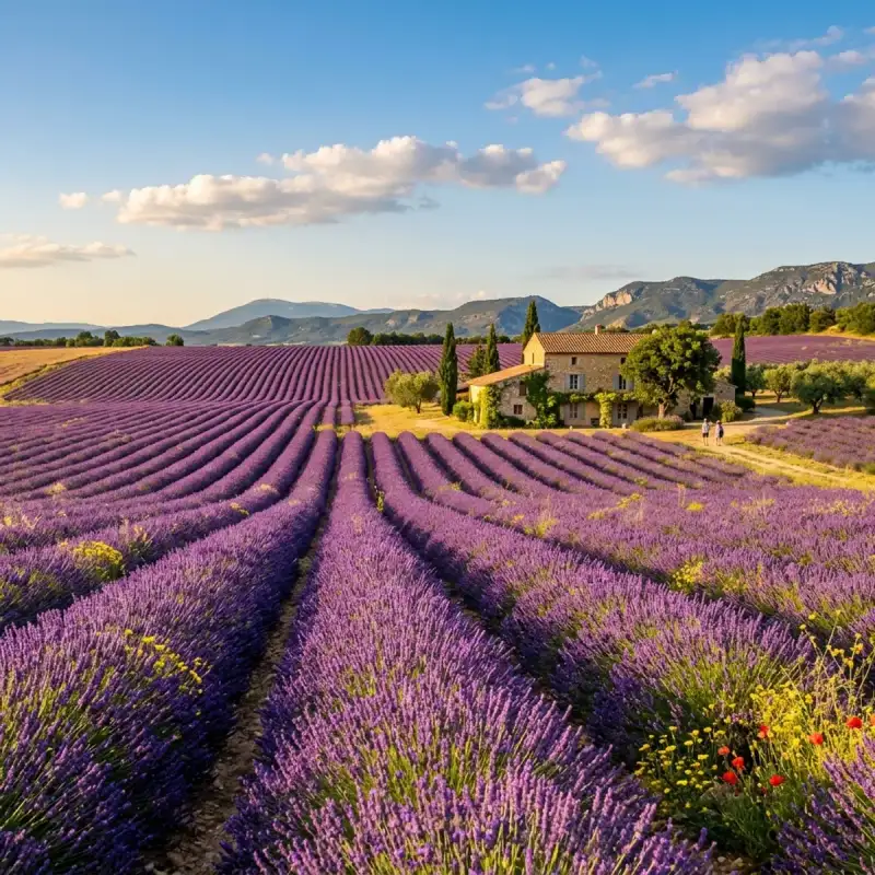
Bem-vindo! Prepare-se para uma #viagem inesquecível pelo coração de #Portugal. Olá, meus queridos exploradores e amantes de aventuras! Aqui é o vosso Tiago Silva, e hoje levo-vos numa #viagem a um lugar que mais parece saído de um livro de contos de fadas, um destino que pulsa com #história e encanta com a sua beleza inigualável: a magnífica Sintra. Preparem-se para uma imersão profunda num universo onde o tempo parece abrandar, onde a bruma matinal se confunde com lendas antigas e onde cada pedra sussurra segredos de séculos passados. Sintra não é apenas uma vila; é uma experiência, um estado de espírito. Aninhada na parte norte da vibrante área metropolitana de Lisboa, e parte integrante da Grande Lisboa, esta joia portuguesa, outrora pertencente à histórica província da Estremadura, é um convite irrecusável à descoberta. É a sede de um município que, com os seus 319,23 km² de área e uma impressionante população de 395.528 habitantes em 2023, se destaca no panorama nacional. Para que tenham uma ideia da sua dimensão, a população de Sintra representa uns notáveis 13,36% do total metropolitano e uns impressionantes 18,60% do total da Grande Lisboa. É, afinal, o segundo município mais populoso de #Portugal, logo após a capital, Lisboa – um feito notável para uma localidade que, orgulhosamente, recusou ser elevada à categoria de cidade! Um Mosaico Geográfico e Humano O município de Sintra é um verdadeiro camaleão geográfico, oferecendo uma tapeçaria de paisagens que se estendem desde as fronteiras com Mafra a norte, Loures, Odivelas e Amadora a leste, Oeiras a sudeste, e Cascais a sul, até se abraçar com o vasto oceano Atlântico a oeste. Esta diversidade de limites territoriais espelha-se na heterogeneidade do seu próprio território. Percorrer Sintra é como folhear um livro de paisagens contrastantes: as freguesias litorais e do norte ainda ostentam características marcadamente florestais e rurais, com os seus verdes profundos e o ar puro a convidar a longas caminhadas. Em nítido contraste, as freguesias do sul desenvolveram-se, transformando-se em núcleos urbanizados vibrantes, impulsionadas pela sua proximidade à capital e pela melhoria das acessibilidades. Estradas como o IC16 e o IC19, a vital Linha de Sintra e, em menor escala, a Linha do Oeste, servem como artérias que alimentam o dinamismo desta região, facilitando a conexão com o resto do país e tornando-a um ponto estratégico para quem busca a combinação perfeita entre a tranquilidade serrana e a conveniência urbana. Para além da pitoresca vila de Sintra, o município alberga outros núcleos de grande relevância, como as cidades de Queluz e Agualva-Cacém, cada uma com o seu próprio encanto e ritmo de vida, contribuindo para a riqueza e complexidade deste território. Geograficamente, Sintra assenta como uma coroa no final de um majestoso maciço, formado pelas serras de Aire, Candeeiros e Montejunto. Este culmina no imponente Maciço de Sintra, onde a sua serra homónima e a Serra da Carregueira se erguem com uma beleza quase mística. O ponto mais elevado do município, e de toda a área metropolitana, encontra-se na Pena, na Serra de Sintra, elevando-se a uns impressionantes 528 metros de altitude. A partir daqui, a vista é de cortar a respiração, abrangendo uma vastidão de vales e planaltos que raramente ultrapassam os 200 metros, pontilhados por inúmeras ribeiras que, ao longo dos milénios, esculpiram e demarcaram a paisagem com os seus cursos sinuosos. Este é um cenário de montanhas que se encontram com o mar, de florestas densas que guardam segredos e de vales verdejantes que convidam à contemplação. A Vila de Sintra, em particular, é um testemunho vivo da arquitetura romântica, um estilo que aqui encontrou o seu palco ideal. Não é de estranhar que esta paisagem de sonhos tenha sido classificada como Paisagem Cultural de Sintra, Património Mundial da UNESCO. A sua persistência em manter o estatuto de vila, apesar de ser o segundo município mais populoso de Portugal, é um detalhe que sublinha o seu caráter único e a sua recusa em ceder ao ritmo frenético da urbanização desmedida, preservando a sua essência e o seu encanto atemporal. O Nome que Evoca o Sol e a Lua Cada lugar tem uma história no seu nome, e Sintra não é exceção. A etimologia da sua designação é tão fascinante quanto a própria vila, um eco dos tempos ancestrais que nos remete a civilizações e crenças perdidas. A forma mais antiga do nome, "Suntria", aponta para raízes indo-europeias, significando "astro luminoso" ou "sol". É como se, desde sempre, este local estivesse destinado a brilhar, a ser um farol na paisagem. Não admira que figuras tão proeminentes como Varrão e Columela a tenham designado como "Monte Sagrado", reconhecendo a aura de reverência que sempre envolveu estas colinas. Mais tarde, o célebre Ptolomeu, com a sua visão geográfica apurada, registou-a como a "Serra da Lua". Imaginem a mística que estas montanhas deveriam inspirar, com os seus contornos suaves e a sua vegetação luxuriante, banhadas pela luz prateada do luar. Esta dualidade – sol e lua, luz e mistério – parece estar inscrita na própria alma de Sintra. E se a etimologia nos fala de luz, a descrição do geógrafo árabe Abu Ubaide Abedalá Albacri, no século X, adiciona uma camada de encantamento e mistério que se tornou uma das características mais icónicas de Sintra. Ele descreveu-a como um lugar "permanentemente mergulhada numa bruma que não se dissipa". Esta névoa, que tantas vezes abraça a serra, não é um véu que oculta, mas sim um manto que revela, transformando palácios em castelos de fadas flutuantes e florestas em reinos encantados, onde cada passo é uma descoberta e cada visão um deleite. É esta bruma, este hálito de um tempo imemorial, que confere a Sintra a sua atmosfera verdadeiramente mágica e inesquecível, um portal para a imaginação. Uma Crónica de Milénios: A História de Sintra Ao passear pelas ruas de calçada, pelos parques verdejantes e pelos majestosos palácios de Sintra, torna-se evidente que estamos a pisar um solo impregnado de séculos de história. É um privilégio encontrar nesta vila testemunhos de praticamente todas as épocas da história portuguesa, muitos dos quais, pela sua importância e dimensão, transcenderam as fronteiras deste território para se inscreverem nos anais da humanidade. A candidatura que elevou Sintra a Património Mundial/Paisagem Cultural junto da UNESCO foi um reconhecimento da sua essência singular. Tratou-se de classificar não apenas edifícios isolados, mas toda uma área que se assume como um contexto cultural e ambiental de características tão específicas que a tornam verdadeiramente única. A descrição da UNESCO captura na perfeição a alma de Sintra: uma unidade cultural que permaneceu intacta, um tesouro inestimável onde se sucedem uma plêiade de palácios suntuosos e parques luxuriantes; de casas senhoriais, cada uma com os seus próprios hortos e bosques secretos; de palacetes e chalets de conto de fadas, inseridos no meio de uma vegetação exuberante que parece abraçar e proteger estas construções. Mas a história de Sintra não se limita à opulência. A serra é coroada por extensos troços amuralhados que se erguem nos cumes mais altos, sussurrando histórias de defesa e de tempos medievais. Para além disso, encontramos uma plêiade de conventos de meditação, aninhados entre penhascos escarpados, bosques densos e fontes de água pura, locais de recolhimento e espiritualidade que convidam à introspeção. Igrejas, capelas e ermidas, que ao longo dos séculos serviram como polos de fé e de arte, pontilham a paisagem, cada uma guardando a sua própria parcela de devoção e beleza. E, para os mais curiosos, Sintra é também uma unidade cultural intacta numa plêiade de vestígios arqueológicos que apontam para ocupações que remontam a vários milénios. É um lugar onde o passado remoto se encontra com a modernidade, onde cada canto revela uma camada diferente da grande tapeçaria do tempo. É esta riqueza, esta densidade histórica e cultural, que faz de Sintra um destino imperdível e um verdadeiro portal para a alma de #Europa. Ecoar dos Primórdios: Do Neolítico à Idade do Bronze A história de Sintra é tão profunda que os seus primeiros capítulos se perdem na névoa do tempo, remontando a milénios antes de Cristo. Os mais antigos testemunhos da presença humana nesta região localizam-se num cume da vertente Norte da Serra de Sintra, na Penha Verde. Aqui, escavações revelaram uma ocupação epipaleolítica, comprovada pela abundância de utensílios de tipo microlaminar. Imaginem os nossos antepassados, caçadores-recoletores, a viver nestas encostas, usando estas ferramentas minúsculas e afiadas para sobreviverem e prosperarem num ambiente selvagem e desafiador. Avançando um pouco mais no tempo, encontramos vestígios de uma ocupação do Neolítico no sítio de ar livre de São Pedro de Penaferrim, junto à Capela do Castelo dos Mouros. Este local é um verdadeiro tesouro, com a presença de cerâmicas decoradas – incisas, impressas e com aplicações –, associadas a uma indústria lítica talhada em sílex. Datado pelo método do radiocarbono de inícios do V milénio a.C., este sítio destaca-se pela sua originalidade e pela sua implantação na paisagem: em plena montanha. É fascinante pensar nestas comunidades pré-históricas, enquadradas culturalmente na corrente circum-mediterrânica, a estabelecerem-se e a moldarem a sua vida num local tão elevado e pitoresco, cultivando a terra e criando arte através da cerâmica. A Idade do Bronze Atlântico (segunda metade do II milénio a.C. – inícios do I) também deixou a sua marca indelével em diversos locais da Serra de Sintra. Encontramos vestígios de habitats, como no Parque das Merendas, junto à Vila, onde podemos imaginar pequenas povoações a florescer. E em contextos votivos, como no Monte do Sereno, os nossos antepassados realizavam rituais e oferendas, conectando-se com o divino nesta paisagem que, desde sempre, foi considerada sagrada. Mais tarde, no Bronze Final ou período Orientalizante, entre os séculos IX e VI a.C., a região voltou a estar intensamente ligada à Bacia Mediterrânica. Um importante e vasto povoado foi descoberto sob o imponente Castelo dos Mouros, revelando uma comunidade próspera e com ligações comerciais e culturais a outras civilizações. Estes vestígios arqueológicos são as primeiras páginas da longa e rica narrativa de Sintra, mostrando que esta terra tem atraído e nutrido a vida humana desde os alvores da civilização. Sob o Estandarte da Águia: Durante o Império Romano Com a ascensão do Império Romano, a região de Sintra viu-se integrada na vastidão do territorium da civitas olisiponense, a moderna Lisboa. Esta cidade, agraciada por César cerca de 49 a.C. ou, mais provavelmente, por Otaviano cerca de 30 a.C., com o invejável estatuto de Municipium Civium Romanorum, tornou-se um polo de poder e influência. Os habitantes da região de Sintra, sob a égide romana, inscreveram-se na tribo Galeria e adotaram nomes romanos, com especial destaque para o imperial "Lulius". Esta adoção de nomes e a integração na estrutura administrativa romana não foi meramente superficial. Os vestígios da época revelam uma população plenamente imbuída de romanidade, absorvendo a #cultura, as leis e os costumes do vasto império. As estradas romanas cruzavam a serra, ligando vilas e explorações agrícolas, e a paisagem, outrora selvagem, começou a ser moldada segundo os princípios da Pax Romana. A #architecture romana, com a sua solidez e funcionalidade, começou a deixar a sua marca, embora talvez não com a grandiosidade dos palácios que viriam a seguir. Este período de romanização profunda é um testemunho da capacidade de Sintra em assimilar e integrar influências externas, um traço que se manteria ao longo da sua história, enriquecendo a sua identidade de forma indelével. Através dos séculos, Sintra continuou a ser um ponto de convergência de culturas, de estilos e de sonhos. É um lugar onde a #nature se entrelaça harmoniosamente com a criação humana, onde a bruma da serra convida à contemplação e os palácios contam histórias de reis e rainhas, de poetas e exploradores. É um destino que apela a todos os sentidos, que desperta a imaginação e que nos faz sentir parte de algo muito maior. E assim, meus caros, termino esta primeira incursão por Sintra, mas a viagem está longe de acabar! Ainda há tantos palácios para explorar, tantos jardins para nos perdermos, e tantos segredos que esta vila mágica guarda. Espero que esta partilha vos tenha inspirado a visitar este conto de fadas real. Fiquem atentos para mais aventuras e mais histórias do vosso Tiago Silva! Até já! #portugal #travel #history #europe #cultura
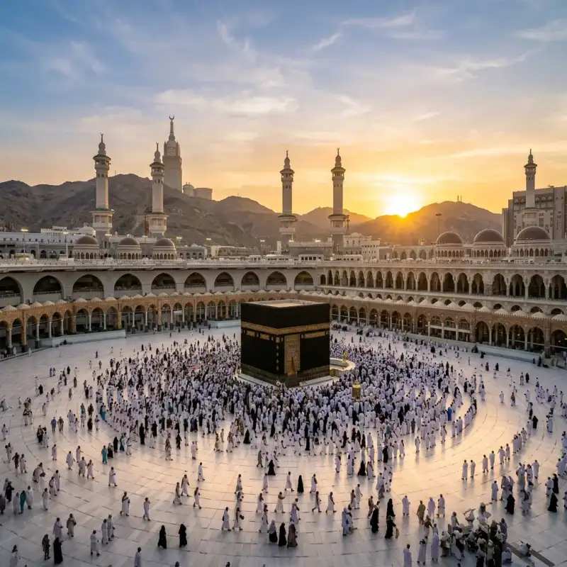
La expansión musulmana o la expansión del #Islam comenzó en la península arábiga al suroeste de Asia. Es la denominación que suele darse a las conquistas militares o las reformas de comercio de la civilización árabe musulmana en las que caerían el Imperio sasánida, el norte de África, y la península ibérica, incluyendo partes del Imperio bizantino. También está incluida en esta denominación el influjo de los comerciantes en África y las misiones hechas en Filipinas. Este período empezó desde el año 622 cuando #Mahoma organizó en Medina un conjunto de soldados que pronto se volvió lo bastante fuerte para unificar toda la península arábiga. Tras la muerte de #Mahoma en el 632, el #Islam tuvo una expansión sorprendentemente rápida durante alrededor de una década, favorecido en primera instancia por la debilidad del Imperio bizantino, y ocupó todo el norte de África, Irán, la parte meridional del Asia Central, el oeste del subcontinente indio, la península ibérica y el sur de Francia. Esta primera etapa concluyó con varias derrotas, como la batalla de Covadonga en el año 722 o la batalla de Poitiers (732) y otras frente a los bizantinos e hindúes, y con la disolución del Califato Omeya. Durante los siglos siguientes, el islam logró varios avances en otros frentes, como en el resto de Asia Central, en Asia Menor, en el sur de Italia, en #Europa oriental, en el Sudeste asiático y en el África subsahariana. Sin embargo, todos estos avances fueron producidos por distintos Estados independientes unos de otros. Mientras estos avances se producían, el islam era obligado a retroceder en #Europa occidental, especialmente por la llamada Reconquista española. Durante el último tercio del siglo XVI, un último Estado musulmán con pretensiones universales, el Imperio otomano, alcanzó su máxima expansión. A lo largo de este período de casi un milenio tuvieron lugar grandes acontecimientos, hechos y procesos muy diferentes entre sí, diferenciados temporal y geográficamente, sobre todo en el interior del islam, algunos de los cuales fueron causa de su propia destrucción (en especial la forma de gobernarse). Después de la conquista de Arabia llevada a cabo por #Mahoma años antes de su muerte y continuada por sus seguidores, lograron unificar el reino en un único gobierno, el cual debía cumplir «la palabra de dios», además de respetar las opiniones de otros ciudadanos, pero eso cambió años después según científicos durante el gobierno de Abdel Mumin, en 1130-1163, después de la muerte de Ibn Tumart. Primer siglo de expansión musulmana Durante sus primeras décadas, el islam se extendió rápidamente desde el noreste hasta Mesopotamia y Persia; y al oeste hasta Siria, Palestina y Egipto (las provincias más ricas del Imperio bizantino). El islam impactó en el mundo cristiano y greco-romano poco después de la muerte de #Mahoma. Durante el reinado de los omeyas, la expansión continúa, las conquistas se hacen por vía terrestre hasta el extremo noroccidental de África a fines del siglo VII, y llegan a las costas de la península ibérica comenzando el siglo VIII. En 711 superan el estrecho de Gibraltar y logran llegar a la península ibérica. Los #musulmanes son detenidos en la batalla de Covadonga en el año 722 en Covadonga, Asturias y en la batalla de Poitiers, en el 732 en Poitiers, Francia. Desde allí vuelven a sus territorios en la península ibérica aunque los reyes asturianos, tras la victoria en Covadonga inician la Reconquista dando lugar al Reino de Asturias. Luego se expandieron hacia Asia central, Bujará, Kabul, y alcanzarán la frontera de la India. Limitarán con el Imperio bizantino, el mar Caspio y el Cáucaso al norte. El mar Mediterráneo es controlado por el Imperio bizantino luego de la amenaza de las conquistas árabes, quienes construirán una flota y atacarán Constantinopla sin éxito en tres ocasiones. Los bizantinos eran maestros del mar y bloquearon la expansión musulmana, manteniendo de todas formas el comercio con ellos. El mar se constituyó en una frontera, pero sobre todo se convirtió en un mar de comercio. El mapa no cambiaría más hasta el siglo XI. Cuando los árabes conquistaban un territorio, se establecían en campamentos aparte y vivían del fruto de sus conquistas y de los impuestos aplicados a los no-#musulmanes, a cambio de su libertad y su protección. Este impuesto personal se llamaba yizia y era distinto al que pagaban los #musulmanes, llamado azaque (que es uno de los cinco pilares del islam). El siglo VIII se caracteriza por la férrea resistencia del Imperio bizantino, pero también en el interior del mundo musulmán. La agitación es a la vez política y religiosa. Se observa entonces la unificación y la arabización del Imperio (por la lengua, la moneda, la administración), como consecuencia de su islamización (las escuelas son instituidas para aprender el Corán, los juicios son llevados a cabo para responder al derecho musulmán). Pero hay numerosas secesiones político-religiosas. En efecto, los abasíes fundaron Bagdad. Hay entonces un desplazamiento del centro político hacia el este, que por consecuencia le transferirán corrientes llegadas desde el extremo oriente, pero también significará un desequilibrio pues el centro está alejado del oeste del Imperio. Esto arrastrará las secesiones que derivarán en la formación de tres grandes zonas donde emergerán los califatos. Estas son las zonas abasí, fatimí y andalusí; se puede aún hablar de unidad religiosa entre los sucesores de #Mahoma. En el siglo IX y el siglo X, el Imperio árabe-musulmán no se expande más, estando sometido a presiones exteriores crecientes. Del siglo VIII al siglo XV Las tropas de Uqba ibn Nafi entran en Ifriqiya, nombre dado a esta antigua provincia romana, pero se topa con la resistencia de Kusaila. En 683, en el momento de una batalla terrible, Uqba muere así como la inmensa mayoría de sus hombres. Kusaila marcha entonces sobre Kairuán, reinando allí cerca de cinco años, pero refuerzos venidos de Siria destituyen al rey. La conquista del norte de África prosigue y en seguida un nuevo ataque gana la región de Aurès, la reina Dijia (Kahena) llega a reunir a varias tribus bereberes y rechaza provisionalmente a los soldados #musulmanes hasta Tripolitania (la actual Libia). Cartago es tomado en 698, la resistencia está dominada a partir de 702 y el norte de África es oficialmente conquistado en 711. El mismo año, los primeros contingentes bereberes pasan a Andalucía, dirigidos por Táriq ibn Ziyad. A la fase de organización militar de la conquista, va a sustituirse la administración de un territorio todavía parcialmente insumiso, y convertido. Las poblaciones afro-árabe-persas del África oriental que comerciaban desde hace siglos con los árabes se islamizaron desde el siglo viii. Loa suajilis son a la vez el fruto de este mestizaje y de la islamización de la región. #Europa Las conquistas árabes llegaron hasta #Europa. En 711, al mando de Tarik y enviados por el gobernador africano Muza, los árabes conquistaron el Reino visigodo, y se anexaron Hispania. La expansión del islam se hace según el principio de la guerra santa o Yihad. Este se toma del Corán donde el término aparece en la fórmula «esfuerzo en el camino de Dios», en el sentido de esfuerzo para hacer reinar los derechos de Dios, es decir, para defender el islamismo. A diferencia de la fe cristiana, que rechaza la guerra ofensiva para expandir la fe, el islam defiende las ofensivas militares para imponer la fe de #Mahoma. Esta tierra, entonces cristiana, había sido desgastada por las luchas intestinas derivadas contra la herejía (arrianismo en la península ibérica y donatistas en el norte de África) y, debido a esto, había sido largamente perseguida por el poder imperial. Lo que explica la acogida fácil para los conquistadores, hecho por la mayoría de ellos por lo menos en el norte de África. La Hispania se convertirá en el país de #Al-Ándalus durante ochocientos años. En cambio las corrientes del cristianismo consideraron primero muy negativamente la emergencia del islam. Esta nueva religión ponía obstáculo a su reivindicación de universalismo (“católico” significa universal), y las referencias a los mensajes de la Biblia aparecían en ellos, así como a los judíos, más bien como una herejía cismática (para las corrientes que utilizan este concepto) que como un reconocimiento. La referencia al mensaje cristiano utilizada en el Corán había llegado a #Mahoma vía cristianos monofisitas, docetas o nestorianos, es decir, de las corrientes consideradas heréticas por los Concilios de Nicea y Constantinopla. A lo más, el islam aparecía ante ellos como una forma de competencia ligera, compartiendo su reconocimiento a un Dios único, pero refutando en cambio la idea de Trinidad. Hasta la llegada de los turcos selyúcidas, sin embargo, la convivencia en Jerusalén sería sin dificultad mayor, a pesar de las invasiones repetidas hacia #Europa realizadas por tropas moras que apelan al islam. La situación totalmente cambia con la ocupación turca, que piensa prohibirles a los cristianos el paso hacia los lugares santos. Una tensión se crea entonces. Para Occidente cristiano, el mahometano se hace el infiel por excelencia, y #Mahoma (de donde viene la deformación baphomet) es la imagen de un demonio pérfido, que predica en nombre de Dios para desviar a los fieles de la verdadera fe. A veces es asimilado como el Anticristo, a veces más simplemente hace recordar las palabras que los evangelios atribuyen a Jesús y que advierte contra profetas falsos que vendrán después de él. Desde el lado musulmán se establecen las mismas acusaciones. La conquista islámica, como más tarde lo serán las cruzadas, son motivados por los jefes de guerra deseosos de extender su territorio, así como por las poblaciones preparadas con este fin, por una necesidad percibida de difundir la verdadera fe. El apogeo de la civilización musulmana (en términos de desarrollo científico y técnico) se sitúa entre los siglos VIII y IX. Los progresos son tales, que se puede hablar de un “Primer Renacimiento”, muy anterior al fenómeno que se efectuará en Italia durante el siglo xiii. Ellos recibieron importantes conocimientos de países de antigua civilización que conquistaron: (Siria, Líbano, Egipto, Mesopotamia, la provincia romana de África). Pero esta recepción no fue meramente pasiva: con esta materia se producen desarrollos importantes y propios, como los logrados con el álgebra, o en el campo filosófico, el cual reconoce importantes personajes como Avicena, Al-Farabi o Averroes. #Europa tiene entonces cerca de dos siglos de retraso sobre el mundo musulmán, aunque ciudades como Venecia tuvieron al respecto una situación extraordinaria. Sin embargo, los beneficios culturales y técnicos obtenidos por los territorios occidentales gracias a la expansión musulmana son objeto de debate de los historiadores especializados. Más que la victoria de 732 de Carlos Martel, que rechazará la invasión en Poitiers, es el fracaso del sitio de Constantinopla el que frenará el avance de los ejércitos árabes. Los establecimientos moros perdurarán mucho tiempo como atestigua la toponimia de Ramatuelle, una ciudad de Provenza al sur de Francia, nacida de Rahmat Allah, la gracia de Dios. Se conocerá el movimiento inverso de guerra justo también, algunos siglos más tarde, en la Reconquista de la península ibérica que verdaderamente se presenta en la batalla de Las Navas de Tolosa, la primera victoria de esta campaña, y se concluirá en el siglo XV por la conquista de los últimos reinos Taifas en 1492. Esta fecha corresponde también según Jacques Attali y Arnold J. Toynbee al exterminio de los últimos núcleos de resistencia cristiana en Egipto. Algunas cruzadas previamente destinados a reconquistar la tumba del Cristo habían reabierto en los países cristianos la ruta de las especias apoderándose de las escalas de Levante. La conquista otomana En el siglo IX, empieza el avance de los pueblos turco-mongoles de la región de las montañas Altái y del lago Baikal hacia el oeste; estos pueblos progresivamente se islamizan. Más tarde, debido al llamado de refuerzo hecho por el califa abasí para calmar las agitaciones, poblaciones turcas llamadas selyúcidas se instalan en Bagdad en el siglo XI. El islam se extiende en Asia Menor y en la India. Un príncipe afgano convertido al islam instaura un sultanato en la India. Hay diferentes familias influyentes en las tribus turcas en Asia Menor, y la familia Osmán, instalada cerca de Constantinopla, va a emprender la conquista de Asia Menor y de los Balcanes. Constantinopla cae en 1453. La expansión del islam en #Europa se debió a las exitosas campañas militares que llevaron a cabo los otomanos, en particular sobre los albaneses y sobre los eslavos de Bosnia. Época contemporánea El islam es hoy la religión más seguida después del cristianismo con un total estimado de 1,3 miles de millones de creyentes (en torno al 20 % de la población mundial). El islam continúa su expansión en África, en una progresión constante hacia el sur del continente (donde predomina aún el cristianismo desde la colonización europea). Desde su independencia, una parte de los países de África negra privilegiaron más bien las relaciones con los países árabes #musulmanes antes que con los antiguos colonizadores. Uno de los factores de la fácil difusión del islam en África es su importación desde países vecinos, en lugar de evangelizadores blancos susceptibles de ser percibidos como colonizadores, como en el caso del catolicismo. Esta expansión es también fuente de tensiones y de conflictos. En Costa de Marfil o en Nigeria, por ejemplo, la oposición entre las poblaciones musulmanas al norte del país y las poblaciones cristianas del sur alimenta una inestabilidad permanente que puede ir hasta el conflicto armado a escala nacional (Costa de Marfil) o a ataques y represalias en las regiones “mixtas” (Nigeria). A las cuestiones religiosas se incorporan sin embargo intereses económicos y políticos (reparto de las riquezas y del poder político) en el génesis de los enfrentamientos. La difusión del islam fuera del mundo árabe-musulmán tradicional se explica en parte por el crecimiento de los flujos migratorios a partir de los países de religión y de cultura musulmana. Es el caso en los países occidentales dónde la inmigración de poblaciones musulmanas se desarrolló desde los años 1950. Sin embargo, esta inmigración no parece influir en el número de conversiones de la población local. El islam continúa también su difusión hacia el este en Asia. En Indonesia particularmente, el islam, llegado desde comerciantes indios y chinos que hacían escalas en los puertos de Java y el Sumatra por lo menos desde el siglo XII, tuvo una progresión más bien lenta. En nuestros días, el 88 % de la población indonesia administrativamente es registrada como musulmana. Fechas cruciales 570-632: vida de #Mahoma. 629: toma de La #Meca (Tratado de Hudaybiyyah) 632-661: los cuatro primeros califas y el inicio de la expansión en oriente próximo y en Egipto. 637: toma de Jerusalén. 642: los #musulmanes penetran en Egipto. 656: asesinato de Uthman. batalla del camello. Inicio de la Fitna. 661: asesinato de Alí; inicio del chiismo. 661-750: dinastía de los Omeyas, (Damasco, capital del califato) 698: caída de Cartago. 711: desembarco en la península ibérica, fulminante conquista musulmana. 718: inicio de la Reconquista en Asturias. Apogeo del sitio de Constantinopla por los árabes. 771: finalización de las conquistas de la India y de #España. 732: derrota árabe-bereber a manos de Carlos Martel en Poitiers. 750-1258: dinastía de los abasíes (Bagdad capital del califato) 878: ocultación del duodécimo Imán, descendiente de Alí. 1000: inicio de las conquistas en la India por los soberanos turco-#musulmanes. 1037: muerte del pensador Ibn Sina (Avicena). 1099: toma de Jerusalén por los cruzados. 1187: Saladino recaptura Jerusalén de los cruzados. 1198: muerte del filósofo Ibn Rouchd (Averroes). 1250-1517: dinastía de los Mamelucos en Egipto 1258: destrucción de Bagdad por los mongoles, fin de los abasíes. Dinastía de los Ilkanes mongoles. 1300: expansión del islam en Indonesia. Los mercaderes indios introducirán el islam en Indonesia (Sumatra). 1419: el príncipe de Malaca se convierte al islam. 1453-1571: apogeo del Imperio otomano, entre la toma de Constantinopla y la derrota naval de Lepanto. 1492: caída del Reino de Granada, fin de la reconquista cristiana en #España. 1683: apogeo relativo de los Turcos otomanos. El Imperio comienza su lento declinar. 1798: llegada de Bonaparte a Egipto. Tratará de adoptar una estrategia de semitentación, al declararse el amigo del sultán, y por lo tanto del pueblo egipcio, pero enemigo de los mamelucos que se comportan como un país conquistado, y hará proclamar esta declaración en todo el país. 1830: inicio de la conquista francesa en Argelia. 1881: inicios del movimiento mahdista en Sudán. Protectorado francés en Túnez. 1882: protectorado británico sobre Egipto. 1912: protectorado francés y español en Marruecos. 1920: mandato francés en Siria y Líbano; mandato británico en Palestina e Irak. 1921-1926: guerra del Rif en Marruecos. 1922: independencia de Egipto. 1924: abolición del califato en Turquía por Mustafa Kemal. 1928: fundación en Egipto del movimiento Hermanos #musulmanes. 1932: los territorios conquistados por Abd al-Azi ibn Saoud quedan en poder de Arabia Saudita. 1948: Los judíos declaran su independencia en Palestina y crean el Estado de Israel; como resultado de la guerra, más de 800,000 #musulmanes son expulsados y Jerusalén cae parcialmente en manos de los judíos. 1967: Jerusalén cae definitivamente en manos de los judíos junto al resto de la región de Judea y Samaria (Cisjordania) y los Altos del Golán. Fuentes y bibliografía «Chrétiens et musulmans, le premier face-à-face VIIe-VIIIe siècle», en Le Monde de la Bible, n.° 154, noviembre de 2003. «La Filosofía Medieval». Alain de Libera, UNIVERSITAT DE VALENCIA. SERVEI DE PUBLICACIONS, 2007 Consecuencias y Análisis Histórico (Parte 2) La expansión musulmana o la expansión del islam comenzó en la península arábiga al suroeste de Asia. Es la denominación que suele darse a las conquistas militares o las reformas de comercio de la civilización árabe musulmana en las que caerían el Imperio sasánida, el norte de África, y la península ibérica, incluyendo partes del Imperio bizantino. También está incluida en esta denominación el influjo de los comerciantes en África y las misiones hechas en Filipinas. Este período empezó desde el año 622 cuando #Mahoma organizó en Medina un conjunto de soldados que pronto se volvió lo bastante fuerte para unificar toda la península arábiga. Tras la muerte de #Mahoma en el 632, el islam tuvo una expansión sorprendentemente rápida durante alrededor de una década, favorecido en primera instancia por la debilidad del Imperio bizantino, y ocupó todo el norte de África, Irán, la parte meridional del Asia Central, el oeste del subcontinente indio, la península ibérica y el sur de Francia. Esta primera etapa concluyó con varias derrotas, como la batalla de Covadonga en el año 722 o la batalla de Poitiers (732) y otras frente a los bizantinos e hindúes, y con la disolución del Califato Omeya. Durante los siglos siguientes, el islam logró varios avances en otros frentes, como en el resto de Asia Central, en Asia Menor, en el sur de Italia, en #Europa oriental, en el Sudeste asiático y en el África subsahariana. Sin embargo, todos estos avances fueron producidos por distintos Estados independientes unos de otros. Mientras estos avances se producían, el islam era obligado a retroceder en #Europa occidental, especialmente por la llamada Reconquista española. Durante el último tercio del siglo XVI, un último Estado musulmán con pretensiones universales, el Imperio otomano, alcanzó su máxima expansión. A lo largo de este período de casi un milenio tuvieron lugar grandes acontecimientos, hechos y procesos muy diferentes entre sí, diferenciados temporal y geográficamente, sobre todo en el interior del islam, algunos de los cuales fueron causa de su propia destrucción (en especial la forma de gobernarse). Después de la conquista de Arabia llevada a cabo por #Mahoma años antes de su muerte y continuada por sus seguidores, lograron unificar el reino en un único gobierno, el cual debía cumplir «la palabra de dios», además de respetar las opiniones de otros ciudadanos, pero eso cambió años después según científicos durante el gobierno de Abdel Mumin, en 1130-1163, después de la muerte de Ibn Tumart. Primer siglo de expansión musulmana Durante sus primeras décadas, el islam se extendió rápidamente desde el noreste hasta Mesopotamia y Persia; y al oeste hasta Siria, Palestina y Egipto (las provincias más ricas del Imperio bizantino). El islam impactó en el mundo cristiano y greco-romano poco después de la muerte de #Mahoma. Durante el reinado de los omeyas, la expansión continúa, las conquistas se hacen por vía terrestre hasta el extremo noroccidental de África a fines del siglo VII, y llegan a las costas de la península ibérica comenzando el siglo VIII. En 711 superan el estrecho de Gibraltar y logran llegar a la península ibérica. Los #musulmanes son detenidos en la batalla de Covadonga en el año 722 en Covadonga, Asturias y en la batalla de Poitiers, en el 732 en Poitiers, Francia. Desde allí vuelven a sus territorios en la península ibérica aunque los reyes asturianos, tras la victoria en Covadonga inician la Reconquista dando lugar al Reino de Asturias. Luego se expandieron hacia Asia central, Bujará, Kabul, y alcanzarán la frontera de la India. Limitarán con el Imperio bizantino, el mar Caspio y el Cáucaso al norte. El mar Mediterráneo es controlado por el Imperio bizantino luego de la amenaza de las conquistas árabes, quienes construirán una flota y atacarán Constantinopla sin éxito en tres ocasiones. Los bizantinos eran maestros del mar y bloquearon la expansión musulmana, manteniendo de todas formas el comercio con ellos. El mar se constituyó en una frontera, pero sobre todo se convirtió en un mar de comercio. El mapa no cambiaría más hasta el siglo XI. Cuando los árabes conquistaban un territorio, se establecían en campamentos aparte y vivían del fruto de sus conquistas y de los impuestos aplicados a los no-#musulmanes, a cambio de su libertad y su protección. Este impuesto personal se llamaba yizia y era distinto al que pagaban los #musulmanes, llamado azaque (que es uno de los cinco pilares del islam). El siglo VIII se caracteriza por la férrea resistencia del Imperio bizantino, pero también en el interior del mundo musulmán. La agitación es a la vez política y religiosa. Se observa entonces la unificación y la arabización del Imperio (por la lengua, la moneda, la administración), como consecuencia de su islamización (las escuelas son instituidas para aprender el Corán, los juicios son llevados a cabo para responder al derecho musulmán). Pero hay numerosas secesiones político-religiosas. En efecto, los abasíes fundaron Bagdad. Hay entonces un desplazamiento del centro político hacia el este, que por consecuencia le transferirán corrientes llegadas desde el extremo oriente, pero también significará un desequilibrio pues el centro está alejado del oeste del Imperio. Esto arrastrará las secesiones que derivarán en la formación de tres grandes zonas donde emergerán los califatos. Estas son las zonas abasí, fatimí y andalusí; se puede aún hablar de unidad religiosa entre los sucesores de #Mahoma. En el siglo IX y el siglo X, el Imperio árabe-musulmán no se expande más, estando sometido a presiones exteriores crecientes. Del siglo VIII al siglo XV Las tropas de Uqba ibn Nafi entran en Ifriqiya, nombre dado a esta antigua provincia romana, pero se topa con la resistencia de Kusaila. En 683, en el momento de una batalla terrible, Uqba muere así como la inmensa mayoría de sus hombres. Kusaila marcha entonces sobre Kairuán, reinando allí cerca de cinco años, pero refuerzos venidos de Siria destituyen al rey. La conquista del norte de África prosigue y en seguida un nuevo ataque gana la región de Aurès, la reina Dijia (Kahena) llega a reunir a varias tribus bereberes y rechaza provisionalmente a los soldados #musulmanes hasta Tripolitania (la actual Libia). Cartago es tomado en 698, la resistencia está dominada a partir de 702 y el norte de África es oficialmente conquistado en 711. El mismo año, los primeros contingentes bereberes pasan a Andalucía, dirigidos por Táriq ibn Ziyad. A la fase de organización militar de la conquista, va a sustituirse la administración de un territorio todavía parcialmente insumiso, y convertido. Las poblaciones afro-árabe-persas del África oriental que comerciaban desde hace siglos con los árabes se islamizaron desde el siglo viii. Loa suajilis son a la vez el fruto de este mestizaje y de la islamización de la región. #Europa Las conquistas árabes llegaron hasta #Europa. En 711, al mando de Tarik y enviados por el gobernador africano Muza, los árabes conquistaron el Reino visigodo, y se anexaron Hispania. La expansión del islam se hace según el principio de la guerra santa o Yihad. Este se toma del Corán donde el término aparece en la fórmula «esfuerzo en el camino de Dios», en el sentido de esfuerzo para hacer reinar los derechos de Dios, es decir, para defender el islamismo. A diferencia de la fe cristiana, que rechaza la guerra ofensiva para expandir la fe, el islam defiende las ofensivas militares para imponer la fe de #Mahoma. Esta tierra, entonces cristiana, había sido desgastada por las luchas intestinas derivadas contra la herejía (arrianismo en la península ibérica y donatistas en el norte de África) y, debido a esto, había sido largamente perseguida por el poder imperial. Lo que explica la acogida fácil para los conquistadores, hecho por la mayoría de ellos por lo menos en el norte de África. La Hispania se convertirá en el país de #Al-Ándalus durante ochocientos años. En cambio las corrientes del cristianismo consideraron primero muy negativamente la emergencia del islam. Esta nueva religión ponía obstáculo a su reivindicación de universalismo (“católico” significa universal), y las referencias a los mensajes de la Biblia aparecían en ellos, así como a los judíos, más bien como una herejía cismática (para las corrientes que utilizan este concepto) que como un reconocimiento. La referencia al mensaje cristiano utilizada en el Corán había llegado a #Mahoma vía cristianos monofisitas, docetas o nestorianos, es decir, de las corrientes consideradas heréticas por los Concilios de Nicea y Constantinopla. A lo más, el islam aparecía ante ellos como una forma de competencia ligera, compartiendo su reconocimiento a un Dios único, pero refutando en cambio la idea de Trinidad. Hasta la llegada de los turcos selyúcidas, sin embargo, la convivencia en Jerusalén sería sin dificultad mayor, a pesar de las invasiones repetidas hacia #Europa realizadas por tropas moras que apelan al islam. La situación totalmente cambia con la ocupación turca, que piensa prohibirles a los cristianos el paso hacia los lugares santos. Una tensión se crea entonces. Para Occidente cristiano, el mahometano se hace el infiel por excelencia, y #Mahoma (de donde viene la deformación baphomet) es la imagen de un demonio pérfido, que predica en nombre de Dios para desviar a los fieles de la verdadera fe. A veces es asimilado como el Anticristo, a veces más simplemente hace recordar las palabras que los evangelios atribuyen a Jesús y que advierte contra profetas falsos que vendrán después de él. Desde el lado musulmán se establecen las mismas acusaciones. La conquista islámica, como más tarde lo serán las cruzadas, son motivados por los jefes de guerra deseosos de extender su territorio, así como por las poblaciones preparadas con este fin, por una necesidad percibida de difundir la verdadera fe. El apogeo de la civilización musulmana (en términos de desarrollo científico y técnico) se sitúa entre los siglos VIII y IX. Los progresos son tales, que se puede hablar de un “Primer Renacimiento”, muy anterior al fenómeno que se efectuará en Italia durante el siglo xiii. Ellos recibieron importantes conocimientos de países de antigua civilización que conquistaron: (Siria, Líbano, Egipto, Mesopotamia, la provincia romana de África). Pero esta recepción no fue meramente pasiva: con esta materia se producen desarrollos importantes y propios, como los logrados con el álgebra, o en el campo filosófico, el cual reconoce importantes personajes como Avicena, Al-Farabi o Averroes. #Europa tiene entonces cerca de dos siglos de retraso sobre el mundo musulmán, aunque ciudades como Venecia tuvieron al respecto una situación extraordinaria. Sin embargo, los beneficios culturales y técnicos obtenidos por los territorios occidentales gracias a la expansión musulmana son objeto de debate de los historiadores especializados. Más que la victoria de 732 de Carlos Martel, que rechazará la invasión en Poitiers, es el fracaso del sitio de Constantinopla el que frenará el avance de los ejércitos árabes. Los establecimientos moros perdurarán mucho tiempo como atestigua la toponimia de Ramatuelle, una ciudad de Provenza al sur de Francia, nacida de Rahmat Allah, la gracia de Dios. Se conocerá el movimiento inverso de guerra justo también, algunos siglos más tarde, en la Reconquista de la península ibérica que verdaderamente se presenta en la batalla de Las Navas de Tolosa, la primera victoria de esta campaña, y se concluirá en el siglo XV por la conquista de los últimos reinos Taifas en 1492. Esta fecha corresponde también según Jacques Attali y Arnold J. Toynbee al exterminio de los últimos núcleos de resistencia cristiana en Egipto. Algunas cruzadas previamente destinados a reconquistar la tumba del Cristo habían reabierto en los países cristianos la ruta de las especias apoderándose de las escalas de Levante. La conquista otomana En el siglo IX, empieza el avance de los pueblos turco-mongoles de la región de las montañas Altái y del lago Baikal hacia el oeste; estos pueblos progresivamente se islamizan. Más tarde, debido al llamado de refuerzo hecho por el califa abasí para calmar las agitaciones, poblaciones turcas llamadas selyúcidas se instalan en Bagdad en el siglo XI. El islam se extiende en Asia Menor y en la India. Un príncipe afgano convertido al islam instaura un sultanato en la India. Hay diferentes familias influyentes en las tribus turcas en Asia Menor, y la familia Osmán, instalada cerca de Constantinopla, va a emprender la conquista de Asia Menor y de los Balcanes. Constantinopla cae en 1453. La expansión del islam en #Europa se debió a las exitosas campañas militares que llevaron a cabo los otomanos, en particular sobre los albaneses y sobre los eslavos de Bosnia. Época contemporánea El islam es hoy la religión más seguida después del cristianismo con un total estimado de 1,3 miles de millones de creyentes (en torno al 20 % de la población mundial). El islam continúa su expansión en África, en una progresión constante hacia el sur del continente (donde predomina aún el cristianismo desde la colonización europea). Desde su independencia, una parte de los países de África negra privilegiaron más bien las relaciones con los países árabes #musulmanes antes que con los antiguos colonizadores. Uno de los factores de la fácil difusión del islam en África es su importación desde países vecinos, en lugar de evangelizadores blancos susceptibles de ser percibidos como colonizadores, como en el caso del catolicismo. Esta expansión es también fuente de tensiones y de conflictos. En Costa de Marfil o en Nigeria, por ejemplo, la oposición entre las poblaciones musulmanas al norte del país y las poblaciones cristianas del sur alimenta una inestabilidad permanente que puede ir hasta el conflicto armado a escala nacional (Costa de Marfil) o a ataques y represalias en las regiones “mixtas” (Nigeria). A las cuestiones religiosas se incorporan sin embargo intereses económicos y políticos (reparto de las riquezas y del poder político) en el génesis de los enfrentamientos. La difusión del islam fuera del mundo árabe-musulmán tradicional se explica en parte por el crecimiento de los flujos migratorios a partir de los países de religión y de cultura musulmana. Es el caso en los países occidentales dónde la inmigración de poblaciones musulmanas se desarrolló desde los años 1950. Sin embargo, esta inmigración no parece influir en el número de conversiones de la población local. El islam continúa también su difusión hacia el este en Asia. En Indonesia particularmente, el islam, llegado desde comerciantes indios y chinos que hacían escalas en los puertos de Java y el Sumatra por lo menos desde el siglo XII, tuvo una progresión más bien lenta. En nuestros días, el 88 % de la población indonesia administrativamente es registrada como musulmana. Fechas cruciales 570-632: vida de #Mahoma. 629: toma de La #Meca (Tratado de Hudaybiyyah) 632-661: los cuatro primeros califas y el inicio de la expansión en oriente próximo y en Egipto. 637: toma de Jerusalén. 642: los #musulmanes penetran en Egipto. 656: asesinato de Uthman. batalla del camello. Inicio de la Fitna. 661: asesinato de Alí; inicio del chiismo. 661-750: dinastía de los Omeyas, (Damasco, capital del califato) 698: caída de Cartago. 711: desembarco en la península ibérica, fulminante conquista musulmana. 718: inicio de la Reconquista en Asturias. Apogeo del sitio de Constantinopla por los árabes. 771: finalización de las conquistas de la India y de #España. 732: derrota árabe-bereber a manos de Carlos Martel en Poitiers. 750-1258: dinastía de los abasíes (Bagdad capital del califato) 878: ocultación del duodécimo Imán, descendiente de Alí. 1000: inicio de las conquistas en la India por los soberanos turco-#musulmanes. 1037: muerte del pensador Ibn Sina (Avicena). 1099: toma de Jerusalén por los cruzados. 1187: Saladino recaptura Jerusalén de los cruzados. 1198: muerte del filósofo Ibn Rouchd (Averroes). 1250-1517: dinastía de los Mamelucos en Egipto 1258: destrucción de Bagdad por los mongoles, fin de los abasíes. Dinastía de los Ilkanes mongoles. 1300: expansión del islam en Indonesia. Los mercaderes indios introducirán el islam en Indonesia (Sumatra). 1419: el príncipe de Malaca se convierte al islam. 1453-1571: apogeo del Imperio otomano, entre la toma de Constantinopla y la derrota naval de Lepanto. 1492: caída del Reino de Granada, fin de la reconquista cristiana en #España. 1683: apogeo relativo de los Turcos otomanos. El Imperio comienza su lento declinar. 1798: llegada de Bonaparte a Egipto. Tratará de adoptar una estrategia de semitentación, al declararse el amigo del sultán, y por lo tanto del pueblo egipcio, pero enemigo de los mamelucos que se comportan como un país conquistado, y hará proclamar esta declaración en todo el país. 1830: inicio de la conquista francesa en Argelia. 1881: inicios del movimiento mahdista en Sudán. Protectorado francés en Túnez. 1882: protectorado británico sobre Egipto. 1912: protectorado francés y español en Marruecos. 1920: mandato francés en Siria y Líbano; mandato británico en Palestina e Irak. 1921-1926: guerra del Rif en Marruecos. 1922: independencia de Egipto. 1924: abolición del califato en Turquía por Mustafa Kemal. 1928: fundación en Egipto del movimiento Hermanos #musulmanes. 1932: los territorios conquistados por Abd al-Azi ibn Saoud quedan en poder de Arabia Saudita. 1948: Los judíos declaran su independencia en Palestina y crean el Estado de Israel; como resultado de la guerra, más de 800,000 #musulmanes son expulsados y Jerusalén cae parcialmente en manos de los judíos. 1967: Jerusalén cae definitivamente en manos de los judíos junto al resto de la región de Judea y Samaria (Cisjordania) y los Altos del Golán. Fuentes y bibliografía «Chrétiens et musulmans, le premier face-à-face VIIe-VIIIe siècle», en Le Monde de la Bible, n.° 154, noviembre de 2003. «La Filosofía Medieval». Alain de Libera, UNIVERSITAT DE VALENCIA. SERVEI DE PUBLICACIONS, 2007 Consecuencias y Análisis Histórico (Parte 3) La expansión musulmana o la expansión del islam comenzó en la península arábiga al suroeste de Asia. Es la denominación que suele darse a las conquistas militares o las reformas de comercio de la civilización árabe musulmana en las que caerían el Imperio sasánida, el norte de África, y la península ibérica, incluyendo partes del Imperio bizantino. También está incluida en esta denominación el influjo de los comerciantes en África y las misiones hechas en Filipinas. Este período empezó desde el año 622 cuando #Mahoma organizó en Medina un conjunto de soldados que pronto se volvió lo bastante fuerte para unificar toda la península arábiga. Tras la muerte de #Mahoma en el 632, el islam tuvo una expansión sorprendentemente rápida durante alrededor de una década, favorecido en primera instancia por la debilidad del Imperio bizantino, y ocupó todo el norte de África, Irán, la parte meridional del Asia Central, el oeste del subcontinente indio, la península ibérica y el sur de Francia. Esta primera etapa concluyó con varias derrotas, como la batalla de Covadonga en el año 722 o la batalla de Poitiers (732) y otras frente a los bizantinos e hindúes, y con la disolución del Califato Omeya. Durante los siglos siguientes, el islam logró varios avances en otros frentes, como en el resto de Asia Central, en Asia Menor, en el sur de Italia, en #Europa oriental, en el Sudeste asiático y en el África subsahariana. Sin embargo, todos estos avances fueron producidos por distintos Estados independientes unos de otros. Mientras estos avances se producían, el islam era obligado a retroceder en #Europa occidental, especialmente por la llamada Reconquista española. Durante el último tercio del siglo XVI, un último Estado musulmán con pretensiones universales, el Imperio otomano, alcanzó su máxima expansión. A lo largo de este período de casi un milenio tuvieron lugar grandes acontecimientos, hechos y procesos muy diferentes entre sí, diferenciados temporal y geográficamente, sobre todo en el interior del islam, algunos de los cuales fueron causa de su propia destrucción (en especial la forma de gobernarse). Después de la conquista de Arabia llevada a cabo por #Mahoma años antes de su muerte y continuada por sus seguidores, lograron unificar el reino en un único gobierno, el cual debía cumplir «la palabra de dios», además de respetar las opiniones de otros ciudadanos, pero eso cambió años después según científicos durante el gobierno de Abdel Mumin, en 1130-1163, después de la muerte de Ibn Tumart. Primer siglo de expansión musulmana Durante sus primeras décadas, el islam se extendió rápidamente desde el noreste hasta Mesopotamia y Persia; y al oeste hasta Siria, Palestina y Egipto (las provincias más ricas del Imperio bizantino). El islam impactó en el mundo cristiano y greco-romano poco después de la muerte de #Mahoma. Durante el reinado de los omeyas, la expansión continúa, las conquistas se hacen por vía terrestre hasta el extremo noroccidental de África a fines del siglo VII, y llegan a las costas de la península ibérica comenzando el siglo VIII. En 711 superan el estrecho de Gibraltar y logran llegar a la península ibérica. Los #musulmanes son detenidos en la batalla de Covadonga en el año 722 en Covadonga, Asturias y en la batalla de Poitiers, en el 732 en Poitiers, Francia. Desde allí vuelven a sus territorios en la península ibérica aunque los reyes asturianos, tras la victoria en Covadonga inician la Reconquista dando lugar al Reino de Asturias. Luego se expandieron hacia Asia central, Bujará, Kabul, y alcanzarán la frontera de la India. Limitarán con el Imperio bizantino, el mar Caspio y el Cáucaso al norte. El mar Mediterráneo es controlado por el Imperio bizantino luego de la amenaza de las conquistas árabes, quienes construirán una flota y atacarán Constantinopla sin éxito en tres ocasiones. Los bizantinos eran maestros del mar y bloquearon la expansión musulmana, manteniendo de todas formas el comercio con ellos. El mar se constituyó en una frontera, pero sobre todo se convirtió en un mar de comercio. El mapa no cambiaría más hasta el siglo XI. Cuando los árabes conquistaban un territorio, se establecían en campamentos aparte y vivían del fruto de sus conquistas y de los impuestos aplicados a los no-#musulmanes, a cambio de su libertad y su protección. Este impuesto personal se llamaba yizia y era distinto al que pagaban los #musulmanes, llamado azaque (que es uno de los cinco pilares del islam). El siglo VIII se caracteriza por la férrea resistencia del Imperio bizantino, pero también en el interior del mundo musulmán. La agitación es a la vez política y religiosa. Se observa entonces la unificación y la arabización del Imperio (por la lengua, la moneda, la administración), como consecuencia de su islamización (las escuelas son instituidas para aprender el Corán, los juicios son llevados a cabo para responder al derecho musulmán). Pero hay numerosas secesiones político-religiosas. En efecto, los abasíes fundaron Bagdad. Hay entonces un desplazamiento del centro político hacia el este, que por consecuencia le transferirán corrientes llegadas desde el extremo oriente, pero también significará un desequilibrio pues el centro está alejado del oeste del Imperio. Esto arrastrará las secesiones que derivarán en la formación de tres grandes zonas donde emergerán los califatos. Estas son las zonas abasí, fatimí y andalusí; se puede aún hablar de unidad religiosa entre los sucesores de #Mahoma. En el siglo IX y el siglo X, el Imperio árabe-musulmán no se expande más, estando sometido a presiones exteriores crecientes. Del siglo VIII al siglo XV Las tropas de Uqba ibn Nafi entran en Ifriqiya, nombre dado a esta antigua provincia romana, pero se topa con la resistencia de Kusaila. En 683, en el momento de una batalla terrible, Uqba muere así como la inmensa mayoría de sus hombres. Kusaila marcha entonces sobre Kairuán, reinando allí cerca de cinco años, pero refuerzos venidos de Siria destituyen al rey. La conquista del norte de África prosigue y en seguida un nuevo ataque gana la región de Aurès, la reina Dijia (Kahena) llega a reunir a varias tribus bereberes y rechaza provisionalmente a los soldados #musulmanes hasta Tripolitania (la actual Libia). Cartago es tomado en 698, la resistencia está dominada a partir de 702 y el norte de África es oficialmente conquistado en 711. El mismo año, los primeros contingentes bereberes pasan a Andalucía, dirigidos por Táriq ibn Ziyad. A la fase de organización militar de la conquista, va a sustituirse la administración de un territorio todavía parcialmente insumiso, y convertido. Las poblaciones afro-árabe-persas del África oriental que comerciaban desde hace siglos con los árabes se islamizaron desde el siglo viii. Loa suajilis son a la vez el fruto de este mestizaje y de la islamización de la región. #Europa Las conquistas árabes llegaron hasta #Europa. En 711, al mando de Tarik y enviados por el gobernador africano Muza, los árabes conquistaron el Reino visigodo, y se anexaron Hispania. La expansión del islam se hace según el principio de la guerra santa o Yihad. Este se toma del Corán donde el término aparece en la fórmula «esfuerzo en el camino de Dios», en el sentido de esfuerzo para hacer reinar los derechos de Dios, es decir, para defender el islamismo. A diferencia de la fe cristiana, que rechaza la guerra ofensiva para expandir la fe, el islam defiende las ofensivas militares para imponer la fe de #Mahoma. Esta tierra, entonces cristiana, había sido desgastada por las luchas intestinas derivadas contra la herejía (arrianismo en la península ibérica y donatistas en el norte de África) y, debido a esto, había sido largamente perseguida por el poder imperial. Lo que explica la acogida fácil para los conquistadores, hecho por la mayoría de ellos por lo menos en el norte de África. La Hispania se convertirá en el país de al-Ándalus durante ochocientos años. En cambio las corrientes del cristianismo consideraron primero muy negativamente la emergencia del islam. Esta nueva religión ponía obstáculo a su reivindicación de universalismo (“católico” significa universal), y las referencias a los mensajes de la Biblia aparecían en ellos, así como a los judíos, más bien como una herejía cismática (para las corrientes que utilizan este concepto) que como un reconocimiento. La referencia al mensaje cristiano utilizada en el Corán había llegado a #Mahoma vía cristianos monofisitas, docetas o nestorianos, es decir, de las corrientes consideradas heréticas por los Concilios de Nicea y Constantinopla. A lo más, el islam aparecía ante ellos como una forma de competencia ligera, compartiendo su reconocimiento a un Dios único, pero refutando en cambio la idea de Trinidad. Hasta la llegada de los turcos selyúcidas, sin embargo, la convivencia en Jerusalén sería sin dificultad mayor, a pesar de las invasiones repetidas hacia #Europa realizadas por tropas moras que apelan al islam. La situación totalmente cambia con la ocupación turca, que piensa prohibirles a los cristianos el paso hacia los lugares santos. Una tensión se crea entonces. Para Occidente cristiano, el mahometano se hace el infiel por excelencia, y #Mahoma (de donde viene la deformación baphomet) es la imagen de un demonio pérfido, que predica en nombre de Dios para desviar a los fieles de la verdadera fe. A veces es asimilado como el Anticristo, a veces más simplemente hace recordar las palabras que los evangelios atribuyen a Jesús y que advierte contra profetas falsos que vendrán después de él. Desde el lado musulmán se establecen las mismas acusaciones. La conquista islámica, como más tarde lo serán las cruzadas, son motivados por los jefes de guerra deseosos de extender su territorio, así como por las poblaciones preparadas con este fin, por una necesidad percibida de difundir la verdadera fe. El apogeo de la civilización musulmana (en términos de desarrollo científico y técnico) se sitúa entre los siglos VIII y IX. Los progresos son tales, que se puede hablar de un “Primer Renacimiento”, muy anterior al fenómeno que se efectuará en Italia durante el siglo xiii. Ellos recibieron importantes conocimientos de países de antigua civilización que conquistaron: (Siria, Líbano, Egipto, Mesopotamia, la provincia romana de África). Pero esta recepción no fue meramente pasiva: con esta materia se producen desarrollos importantes y propios, como los logrados con el álgebra, o en el campo filosófico, el cual reconoce importantes personajes como Avicena, Al-Farabi o Averroes. #Europa tiene entonces cerca de dos siglos de retraso sobre el mundo musulmán, aunque ciudades como Venecia tuvieron al respecto una situación extraordinaria. Sin embargo, los beneficios culturales y técnicos obtenidos por los territorios occidentales gracias a la expansión musulmana son objeto de debate de los historiadores especializados. Más que la victoria de 732 de Carlos Martel, que rechazará la invasión en Poitiers, es el fracaso del sitio de Constantinopla el que frenará el avance de los ejércitos árabes. Los establecimientos moros perdurarán mucho tiempo como atestigua la toponimia de Ramatuelle, una ciudad de Provenza al sur de Francia, nacida de Rahmat Allah, la gracia de Dios. Se conocerá el movimiento inverso de guerra justo también, algunos siglos más tarde, en la Reconquista de la península ibérica que verdaderamente se presenta en la batalla de Las Navas de Tolosa, la primera victoria de esta campaña, y se concluirá en el siglo XV por la conquista de los últimos reinos Taifas en 1492. Esta fecha corresponde también según Jacques Attali y Arnold J. Toynbee al exterminio de los últimos núcleos de resistencia cristiana en Egipto. Algunas cruzadas previamente destinados a reconquistar la tumba del Cristo habían reabierto en los países cristianos la ruta de las especias apoderándose de las escalas de Levante. La conquista otomana En el siglo IX, empieza el avance de los pueblos turco-mongoles de la región de las montañas Altái y del lago Baikal hacia el oeste; estos pueblos progresivamente se islamizan. Más tarde, debido al llamado de refuerzo hecho por el califa abasí para calmar las agitaciones, poblaciones turcas llamadas selyúcidas se instalan en Bagdad en el siglo XI. El islam se extiende en Asia Menor y en la India. Un príncipe afgano convertido al islam instaura un sultanato en la India. Hay diferentes familias influyentes en las tribus turcas en Asia Menor, y la familia Osmán, instalada cerca de Constantinopla, va a emprender la conquista de Asia Menor y de los Balcanes. Constantinopla cae en 1453. La expansión del islam en #Europa se debió a las exitosas campañas militares que llevaron a cabo los otomanos, en particular sobre los albaneses y sobre los eslavos de Bosnia. Época contemporánea El islam es hoy la religión más seguida después del cristianismo con un total estimado de 1,3 miles de millones de creyentes (en torno al 20 % de la población mundial). El islam continúa su expansión en África, en una progresión constante hacia el sur del continente (donde predomina aún el cristianismo desde la colonización europea). Desde su independencia, una parte de los países de África negra privilegiaron más bien las relaciones con los países árabes #musulmanes antes que con los antiguos colonizadores. Uno de los factores de la fácil difusión del islam en África es su importación desde países vecinos, en lugar de evangelizadores blancos susceptibles de ser percibidos como colonizadores, como en el caso del catolicismo. Esta expansión es también fuente de tensiones y de conflictos. En Costa de Marfil o en Nigeria, por ejemplo, la oposición entre las poblaciones musulmanas al norte del país y las poblaciones cristianas del sur alimenta una inestabilidad permanente que puede ir hasta el conflicto armado a escala nacional (Costa de Marfil) o a ataques y represalias en las regiones “mixtas” (Nigeria). A las cuestiones religiosas se incorporan sin embargo intereses económicos y políticos (reparto de las riquezas y del poder político) en el génesis de los enfrentamientos. La difusión del islam fuera del mundo árabe-musulmán tradicional se explica en parte por el crecimiento de los flujos migratorios a partir de los países de religión y de cultura musulmana. Es el caso en los países occidentales dónde la inmigración de poblaciones musulmanas se desarrolló desde los años 1950. Sin embargo, esta inmigración no parece influir en el número de conversiones de la población local. El islam continúa también su difusión hacia el este en Asia. En Indonesia particularmente, el islam, llegado desde comerciantes indios y chinos que hacían escalas en los puertos de Java y el Sumatra por lo menos desde el siglo XII, tuvo una progresión más bien lenta. En nuestros días, el 88 % de la población indonesia administrativamente es registrada como musulmana. Fechas cruciales 570-632: vida de #Mahoma. 629: toma de La #Meca (Tratado de Hudaybiyyah) 632-661: los cuatro primeros califas y el inicio de la expansión en oriente próximo y en Egipto. 637: toma de Jerusalén. 642: los #musulmanes penetran en Egipto. 656: asesinato de Uthman. batalla del camello. Inicio de la Fitna. 661: asesinato de Alí; inicio del chiismo. 661-750: dinastía de los Omeyas, (Damasco, capital del califato) 698: caída de Cartago. 711: desembarco en la península ibérica, fulminante conquista musulmana. 718: inicio de la Reconquista en Asturias. Apogeo del sitio de Constantinopla por los árabes. 771: finalización de las conquistas de la India y de #España. 732: derrota árabe-bereber a manos de Carlos Martel en Poitiers. 750-1258: dinastía de los abasíes (Bagdad capital del califato) 878: ocultación del duodécimo Imán, descendiente de Alí. 1000: inicio de las conquistas en la India por los soberanos turco-#musulmanes. 1037: muerte del pensador Ibn Sina (Avicena). 1099: toma de Jerusalén por los cruzados. 1187: Saladino recaptura Jerusalén de los cruzados. 1198: muerte del filósofo Ibn Rouchd (Averroes). 1250-1517: dinastía de los Mamelucos en Egipto 1258: destrucción de Bagdad por los mongoles, fin de los abasíes. Dinastía de los Ilkanes mongoles. 1300: expansión del islam en Indonesia. Los mercaderes indios introducirán el islam en Indonesia (Sumatra). 1419: el príncipe de Malaca se convierte al islam. 1453-1571: apogeo del Imperio otomano, entre la toma de Constantinopla y la derrota naval de Lepanto. 1492: caída del Reino de Granada, fin de la reconquista cristiana en #España. 1683: apogeo relativo de los Turcos otomanos. El Imperio comienza su lento declinar. 1798: llegada de Bonaparte a Egipto. Tratará de adoptar una estrategia de semitentación, al declararse el amigo del sultán, y por lo tanto del pueblo egipcio, pero enemigo de los mamelucos que se comportan como un país conquistado, y hará proclamar esta declaración en todo el país. 1830: inicio de la conquista francesa en Argelia. 1881: inicios del movimiento mahdista en Sudán. Protectorado francés en Túnez. 1882: protectorado británico sobre Egipto. 1912: protectorado francés y español en Marruecos. 1920: mandato francés en Siria y Líbano; mandato británico en Palestina e Irak. 1921-1926: guerra del Rif en Marruecos. 1922: independencia de Egipto. 1924: abolición del califato en Turquía por Mustafa Kemal. 1928: fundación en Egipto del movimiento Hermanos Musulmanes. 1932: los territorios conquistados por Abd al-Azi ibn Saoud quedan en poder de Arabia Saudita. 1948: Los judíos declaran su independencia en Palestina y crean el Estado de Israel; como resultado de la guerra, más de 800,000 #musulmanes son expulsados y Jerusalén cae parcialmente en manos de los judíos. 1967: Jerusalén cae definitivamente en manos de los judíos junto al resto de la región de Judea y Samaria (Cisjordania) y los Altos del Golán. Fuentes y bibliografía «Chrétiens et musulmans, le premier face-à-face VIIe-VIIIe siècle», en Le Monde de la Bible, n.° 154, noviembre de 2003. «La Filosofía Medieval». Alain de Libera, UNIVERSITAT DE VALENCIA. SERVEI DE PUBLICACIONS, 2007 #islam #historia #expansion Related InsightsEchoes from the Cradle: My Quest for the Waxed Reed Boats of Iraq's Ancient Marshes Sulle Tracce Silenziose di Hellenikon: I Borghi Dimenticati della Sila Greca e il Respiro di un Tempo Sospeso Canada's Rocky Mountains: Emerald Lakes and Alpine Adventures{ "@context": "https://schema.org", "@type": "FAQPage", "mainEntity": [ { "@type": "Question", "name": "What is the main focus of La Expansión del Islam y los Primeros Musulmanes?", "acceptedAnswer": { "@type": "Answer", "text": "Descubre la historia profunda de Expansión musulmana." } }, { "@type": "Question", "name": "Who authored the comprehensive guide on La Expansión del Islam y los Primeros Musulmanes?", "acceptedAnswer": { "@type": "Answer", "text": "This detailed article and its insights were carefully researched and authored by Mateo García." } }, { "@type": "Question", "name": "Where can I find more related content about Travel?", "acceptedAnswer": { "@type": "Answer", "text": "You can explore more articles, detailed reviews, and similar insights by browsing the Related Insights section at the bottom of this article or visiting our dedicated Travel category page." } } ] }
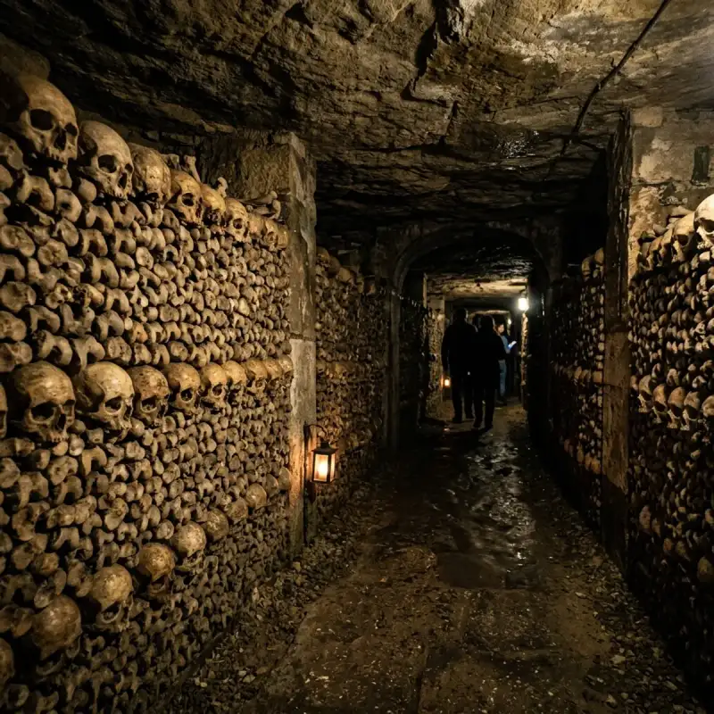
Bem-vindo! Prepare-se para uma #viagem inesquecível pelo coração de #Portugal. O Sussurro das Pedras Antigas: Uma Viagem Inesquecível por Óbidos, a Vila das Rainhas Olá, companheiros de viagem! Daqui fala o Tiago Silva. Se há um lugar no mundo onde o tempo parece ter decidido parar, recolhendo as suas asas para descansar sobre ameias de pedra e ruelas caiadas de branco, esse lugar é Óbidos. Esta joia fortificada, erguida como um sentinela do passado na nossa adorada pátria, convida-nos a uma desconexão total do bulício contemporâneo e a um mergulho profundo na herança que moldou a identidade de #Portugal. Hoje, convido-vos a calçar uns sapatos confortáveis e a acompanhar-me numa exploração exaustiva, detalhada e sensorial por esta vila que é, sem sombra de dúvida, um dos tesouros mais cintilantes da #Europa. Preparem-se para descobrir cada detalhe geográfico, histórico e cultural deste município que apaixona qualquer pessoa à primeira vista.Uma Localização Privilegiada entre a Terra e o Oceano Para compreendermos a grandiosidade de Óbidos, precisamos primeiro de nos situar no mapa da nossa belíssima região Oeste. Esta icónica vila portuguesa, que serve de orgulhosa sede de município, encontra-se aninhada na província histórica da Estremadura, integrando administrativamente o distrito de Leiria. No atual ordenamento territorial, o concelho faz parte da prestigiada NUTII do Oeste e Vale do Tejo. A nível demográfico, a vila intramuros preserva uma escala humana e incrivelmente acolhedora, albergando cerca de 2 200 habitantes que têm o privilégio diário de habitar um cenário de conto de fadas. No entanto, o Município de Óbidos estende-se muito para além das suas famosas muralhas, abrangendo uma área total de 141,55 km² e uma população que, de acordo com os dados censitários de 2021, ascende a 11 924 residentes. [Norte / Nordeste / Leste: Caldas da Rainha] \ [Noroeste: Oceano Atlântico] -- [ÓBIDOS] -- [Sul: Bombarral] / [Oeste: Peniche] -- [Sudoeste: Lourinhã]O território municipal desenha uma geografia rica e diversificada, delimitada a nordeste e a leste pelo vizinho concelho das Caldas da Rainha. Ao caminharmos para sul, encontramos as fronteiras do Bombarral, enquanto a sudoeste o horizonte se cruza com a Lourinhã. A oeste, a península de Peniche ergue-se como barreira terrestre, mas a noroeste o concelho abre-se generosamente para a vastidão azul, onde a magnífica costa encontra o Oceano Atlântico, fundindo a imponência da pedra com a frescura marítima onde a #nature se manifesta em toda a sua plenitude. Se planeia a sua próxima #viagem a partir dos grandes centros urbanos, o acesso é extremamente simples e rápido. Óbidos localiza-se a uns meros 88 quilómetros a norte da capital, Lisboa, um trajeto que se cumpre com facilidade através da autoestrada A8. Para quem viaja a partir do norte ou do centro do país, a vila situa-se a sudoeste da histórica cidade de Coimbra, a uma distância de 138 quilómetros, utilizando a ligação combinada das autoestradas A1 e A8. É um desvio mais do que obrigatório para quem deseja respirar o ar puro do Oeste.A Origem do Nome: De "Oppidum" a Óbidos Para os amantes da etimologia, o nome "Óbidos" encerra em si a própria essência física da vila. Esta palavra deriva diretamente do termo latino ópido (ou oppidum), cujo significado literal nos remete para as ideias de «cidadela» ou «cidade fortificada». Ao pronunciarmos o seu nome, estamos a evocar a própria arquitetura defensiva que a carateriza há milénios. A ocupação humana desta região é de facto ancestral, e a prova dessa presença continuada no tempo encontra-se a pouca distância do atual núcleo urbano, onde se erguem as ruínas históricas da antiga povoação romana de Eburobrício. É fascinante pensar como estas colinas têm sido, ao longo de gerações, um ponto estratégico de abrigo, vigia e habitação.Um Passeio pela História: Conquistas, Rainhas e Forais A #história de Óbidos lê-se como um romance de cavalaria repleto de conquistas, alianças políticas e generosidade real. O ano de 1148 figura com letras de ouro nos anais da vila, marcando o momento histórico em que este reduto fortificado foi tomado aos Mouros, no âmbito da reconquista cristã liderada pelo primeiro rei de Portugal, D. Afonso Henriques. Décadas mais tarde, em 1195, a vila recebia a sua primeira carta de foral, outorgada sob o reinado de D. Sancho I, garantindo-lhe privilégios e consolidando a sua importância no jovem reino português. A Vila das Rainhas Uma das particularidades mais românticas e singulares de Óbidos é o facto de ter integrado, durante séculos, o dote de inúmeras rainhas de Portugal. Esta tradição de generosidade régia fez com que a vila ficasse conhecida como a "Vila das Rainhas", uma terra cuidada e acarinhada pelas mulheres mais influentes da corte. Entre as soberanas que receberam Óbidos como parte do seu dote, destacam-se nomes incontornáveis da nossa história:D. Urraca de Castela: A influente esposa de D. Afonso II; Rainha Santa Isabel: A padroeira da paz e esposa de D. Dinis, que terá ficado encantada com a beleza da vila; D. Filipa de Lencastre: A culta esposa de D. João I e mãe da Ínclita Geração; D. Leonor de Aragão: Esposa de D. Duarte; D. Leonor de Avis: Esposa de D. João II, cujo impacto na região foi profundo.Esta ligação às rainhas moldou não só o património, mas também o desenvolvimento das terras circundantes. Sabia, por exemplo, que o atual concelho das Caldas da Rainha nasceu diretamente do território de Óbidos? Originalmente, aquela estância termal era denominada "Caldas de Óbidos". A alteração do nome deveu-se especificamente às longas temporadas que a rainha D. Leonor passou naquela localidade para usufruir das águas termais, acabando por autonomizar a povoação que hoje conhecemos. Ao recuarmos no tempo através dos registos demográficos, descobrimos dados curiosos: no ano de 1527, viviam escassos 161 habitantes no interior da vila de Óbidos. Este número representava, na época, cerca de um décimo de toda a população que residia no território do município. Ao longo dos séculos, a vila soube preservar a sua escala íntima, resistindo à expansão desordenada e mantendo intacto o seu traçado medieval.O Coração de Pedra: O Castelo e as Muralhas de Óbidos Falar de Óbidos sem mencionar a sua majestosa fortaleza é simplesmente impossível. No dia 16 de Fevereiro de 2007, o Castelo de Óbidos recebeu oficialmente o diploma de candidato a uma das maiores distinções patrimoniais do país. Meses mais tarde, ainda no decorrer do ano de 2007, o monumento foi solenemente declarado, através do concurso nacional "As Sete Maravilhas de Portugal", como o segundo dos sete monumentos mais relevantes de todo o património de #architecture português. A imponência deste conjunto defensivo transpôs as barreiras físicas e entrou no mundo digital. No ano de 2015, as Muralhas da Vila de Óbidos passaram a integrar o prestigiado projeto "Maravilhas de Portugal", uma feliz parceria entre a Direção-Geral do Património Cultural (DGPC) e a multinacional tecnológica Google. Graças a esta iniciativa inovadora, viajantes de todo o mundo podem realizar uma visita virtual detalhada, em formato de 360 graus, explorando online as muralhas e outros 56 monumentos nacionais diretamente a partir das plataformas da Google ou do Google Maps. Mas, acredite, nada substitui a sensação física de caminhar sobre aquelas pedras gastas pelo tempo, sentindo o vento do Oeste no rosto.Património Monumental: Uma Rota de Fé e Arte Ao cruzarmos as portas de Óbidos, entramos num museu a céu aberto. Cada esquina revela um detalhe de cantaria, uma flor que espreita de uma janela ou o portal de um templo secular. Para que não perca nenhum detalhe na sua próxima visita, compilei a lista essencial dos monumentos que constituem o riquíssimo património histórico da vila: Os Portais e a DefesaPorta da Vila: A entrada principal da povoação, adornada com belíssimos azulejos que dão as boas-vindas a quem chega com promessas de beleza e história. Castelo de Óbidos: A sentinela máxima da vila, com as suas torres imponentes e uma vista desafogada sobre a lezíria circundante. Porta do Vale: Outro dos acessos históricos que rompe a muralha, ligando o interior fortificado às paisagens verdejantes que o rodeiam. Aqueduto: Uma estrutura monumental que rasga a paisagem exterior, testemunho da engenharia de outrora que garantia o abastecimento de água à população.Templos de Fé e DevoçãoPraça de Santa Maria: O verdadeiro coração social da vila, onde a comunidade se reúne e onde se sente pulsar a alma obidense. Igreja de Santa Maria: O principal templo religioso da vila, palco de casamentos reais e detentor de um interior artístico de cortar a respiração. Igreja da Misericórdia: Um espaço de recolhimento que reflete a assistência social e a devoção religiosa ao longo dos séculos. Igreja de São Pedro: Com a sua arquitetura marcante, ergue-se como mais um ponto de paragem obrigatória para apreciar a arte sacra. Igreja de Nossa Senhora de Monserrate: Um exemplar charmoso da arquitetura religiosa local. Santuário do Senhor Jesus da Pedra: Localizado fora das muralhas, este monumento de planta singular desafia a gravidade e a geometria, atraindo os olhares dos amantes de arquitetura barroca. Capela de São Martinho: Um pequeno e antigo templo que guarda memórias de fé privada e devoção popular. Igreja de São Tiago: Localizada estrategicamente junto ao castelo, esta igreja encontrou uma nova vida, estando intimamente ligada à dinâmica cultural da vila. Ermida de Nossa Senhora do Carmo: Um ponto de recolhimento espiritual situado em harmonia com a paisagem envolvente.Cultura e Arte CivilCasa do Arco da Cadeia – Abílio Mattos e Silva e Maria José Salavisa: Um espaço que celebra a vida, a obra e a estética destes dois vultos artísticos incontornáveis, enriquecendo o roteiro cultural da vila. Museu Municipal de Óbidos: Situado na emblemática Rua Direita, no número 97, este museu é o guardião das memórias artísticas da vila, albergando obras de arte de valor inestimável que ajudam a decifrar o passado desta terra de rainhas.Óbidos, a Vila Literária: Onde os Livros Ganham Vida Se a história e a pedra nos apaixonam, a ligação de Óbidos à palavra escrita eleva esta vila a um patamar cultural de nível mundial. O audacioso projeto "Óbidos, Vila Literária" nasceu de uma ideia inovadora: reabilitar espaços urbanos degradados ou devolutos e transformá- #portugal #travel #history #europe #cultura
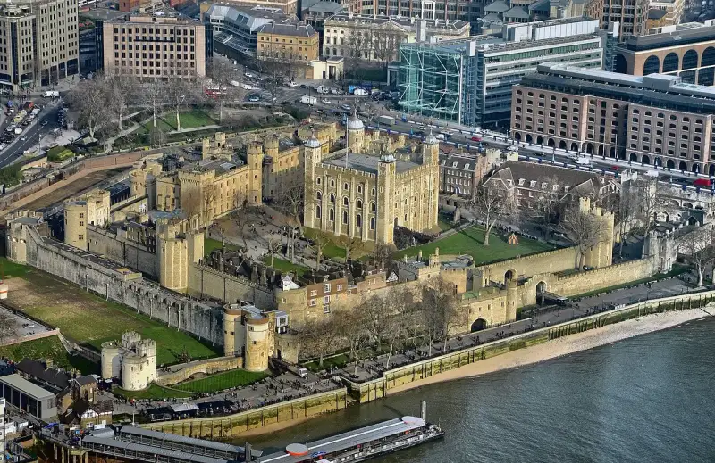
The Thames flows cold and dark beneath the imposing stone battlements of the Tower of London. For nearly a millennium, this colossal fortress has stood as a symbol of power, a repository of magnificent wealth, and, most chillingly, an inescapable prison. Its very foundations are steeped in the blood of traitors, queens, and innocent souls who found themselves on the wrong side of history. As the fog rolls off the river and engulfs the White Tower, one cannot help but feel the weight of centuries pressing down—a palpable atmosphere of sorrow, betrayal, and unspeakable terror. #TowerOfLondon #England #DarkHistory Welcome to the haunted heart of the British monarchy. I am Mark Dinn, and in this extensive journey into the shadows of the past, we will peel back the layers of time to uncover the chilling truths, the whispered legends, and the undeniable tragedies that have birthed the Ghosts of the Tower of London. #HistoricalFiction #MarkDinn The Architecture of Intimidation: A Fortress Born of Conquest When William the Conqueror ordered the construction of the White Tower in 1078, his purpose was singular and uncompromising: to dominate the recently subjugated people of London. Built of white stone imported from Caen in Normandy, it was a terrifyingly alien structure in a landscape of wooden buildings. It was not merely a castle; it was a physical manifestation of Norman supremacy. But as the centuries bled into one another, the Tower’s purpose mutated. It became a royal residence, an armory, a treasury, a menagerie, and eventually, the most feared prison in the realm. With every transformation, the walls absorbed the despair of its inhabitants. It is said that stones hold memories, and if that is true, the stones of the Tower of London possess the darkest memories in all of Europe. #MedievalArchitecture #WilliamTheConquerorThe White Tower: The central keep, originally a symbol of raw power, later a storehouse for weapons and a place of clandestine torture. The Traitor's Gate: The infamous water gate through which doomed prisoners entered, the slapping of the Thames against its steps the last sound of freedom they would ever hear. Tower Green: The secluded execution site reserved for those of noble or royal blood, sparing them the public spectacle of Tower Hill, yet offering no escape from the headsman's axe. The Bloody Tower: The very name evokes its grim history, the alleged site of one of the most heart-wrenching unsolved murders in English history.As we walk these ancient paths, we must remember that the ghosts we seek are not merely ethereal phantoms; they are the lingering echoes of real people, real suffering, and real betrayal. Let us delve into the stories of those who never truly left. #AncientHistory #HauntedPlaces The Princes in the Tower: Innocence Stolen in the Dark No mystery is more inextricably linked to the sinister reputation of the Tower than the fate of the two Princes. In the sweltering summer of 1483, twelve-year-old King Edward V and his nine-year-old brother, Richard, Duke of York, were lodged in the Tower. The ostensible reason was to prepare for young Edward's coronation. Their protector and uncle, Richard, Duke of Gloucester, assured the realm of their safety. Yet, as the days grew shorter, the boys were seen less and less frequently playing in the courtyards. Then, they vanished entirely. Gloucester, declaring the boys illegitimate, was crowned King Richard III. #WarOfTheRoses #RichardIII The silence that followed their disappearance was deafening. Whispers echoed through the halls of power, tales of midnight assassinations, of boys smothered in their sleep beneath heavy velvet pillows. Two centuries later, during the reign of Charles II, the bones of two children were discovered buried beneath a staircase in the White Tower. Were these the tragic princes? The world believes they were, though the absolute truth remains locked in the suffocating silence of the past. The Bloody Tower, where they were last seen, is a nexus of sorrowful energy. Yeoman Warders and visitors alike have reported seeing the apparitions of two small boys, dressed in nightshirts, clutching each other in terror. They appear fleetingly, their faces etched with the profound realization of their betrayal, before fading into the cold stone walls. They are the eternal victims of ambition, forever trapped in the fortress that was meant to protect them. #PrincesInTheTower #RoyalSecrets The Political Climate: A Cauldron of Paranoia To understand the tragedy of the Princes, one must understand the era. The Wars of the Roses had decimated the English nobility. Trust was a commodity rarer than gold, and the crown was a prize worth any sin. Richard III, whether a ruthless usurper or a victim of Tudor propaganda, operated in a world where preemptive murder was often considered a political necessity. The ghost of the Princes serve as a stark reminder of the cost of such ambition. Their spectral presence is a silent, unending accusation against the adults who failed them, a chilling testament to the ruthlessness of the medieval political machine. Anne Boleyn: The Headless Queen's Eternal Restlessness Of all the spirits said to wander the precincts of the Tower, none is more famous, nor more tragic, than Anne Boleyn. The second wife of King Henry VIII, her rise to power was meteoric, her fall devastating and swift. She was the woman for whom Henry broke with the Catholic Church, forever altering the course of English history. Yet, when she failed to provide the male heir Henry so desperately craved, and as his eye wandered to Jane Seymour, Anne's fate was sealed. #Tudors #AnneBoleyn #HenryVIII Accused of treason, adultery, and incest—charges engineered by the cunning Thomas Cromwell—Anne was imprisoned in the very apartments she had occupied before her triumphant coronation. The psychological torment must have been unbearable. The walls that once echoed with music and laughter now offered only the dreadful silence of impending doom. On May 19, 1536, Anne Boleyn was led to a scaffold on Tower Green. She faced her death with extraordinary courage and dignity, her final words praising the king who had ordered her execution. With a single, swift blow of a French swordsman's blade, her life was extinguished. But Anne, it seems, has never truly departed. Her ghost is the most frequently sighted apparition in the Tower. She is often seen near the site of her execution on Tower Green, sometimes appearing as a beautiful, melancholic figure, whole and intact. However, in more terrifying encounters, she is seen walking the corridors of the Queen's House or leading a spectral procession down the aisle of the Chapel Royal of St. Peter ad Vincula—her headless body carrying her severed head tucked beneath her arm. #GhostStories #HauntedHistory The Psychological Horror of the Fall Imagine the descent from absolute power to absolute helplessness. Anne Boleyn was a woman of fierce intellect and terrifying ambition. She understood the game of politics better than most men of her era. To find herself suddenly outmaneuvered, trapped in the web of a husband's changing affections and a minister's calculated cruelty, is a horror that transcends physical pain. Her restless spirit is a manifestation of unresolved injustice. The speed of her trial, the dubiousness of the evidence, and the brutal finality of the French sword created an emotional epicenter so powerful that it continues to ripple through time. She is the epitome of the Tower's duality: royal splendor immediately followed by bloody devastation. #TudorHistory #Betrayal The Brutality of the Rack: Whispers from the White Tower While Tower Green was reserved for quick, relatively clean executions of the elite, the depths of the White Tower and the subterranean dungeons were domains of unimaginable agony. The Tudor era, particularly the reigns of Henry VIII, Mary I, and Elizabeth I, saw the zenith of state-sanctioned torture. The Rack, the Scavenger's Daughter, and the Manacles were the tools of the trade, designed to extract confessions and break the spirit of religious and political dissidents. #Torture #DarkAges One of the most famous victims of the rack was Guy Fawkes, the conspirator behind the Gunpowder Plot of 1605. After days of excruciating torture, his signature on his confession was a barely legible scrawl, the desperate mark of a completely broken man. But while Fawkes's story is well known, hundreds of lesser-known individuals suffered similarly in the freezing, damp darkness. The ghosts here do not always appear in physical form; often, they manifest as sounds. Late at night, when the Tower is devoid of tourists, security guards and warders have reported hearing the echoing, agonizing screams of men and women being stretched beyond the limits of human endurance. The clanking of chains, the turning of heavy wooden gears, and the guttural moans of the dying seep from the ancient stones. It is as if the agony experienced in those rooms was so intense that it became permanently etched into the atmosphere itself. #GuyFawkes #TowerDungeons The Case of Thomas More and John Fisher Not all who suffered in the Tower yielded to torture. Sir Thomas More, the former Lord Chancellor, and Bishop John Fisher were men of unyielding faith. They refused to acknowledge Henry VIII as the Supreme Head of the Church of England. For their defiance, they were imprisoned in the Bell Tower and eventually executed. Fisher, old and frail, was so weakened by his imprisonment that he had to be carried to the scaffold. More famously declared himself "the King's good servant, but God's first." Their ghosts are said to walk the battlements near the Bell Tower, somber, quiet figures radiating a profound sense of peace—a stark contrast to the tormented souls that haunt the lower levels. They are the ghosts of conviction, spirits that found victory even in their execution. #ThomasMore #TudorEngland The Countess of Salisbury: The Most Gruesome Execution If there is one story that encapsulates the sheer, chaotic horror of Tudor executions, it is that of Margaret Pole, the Countess of Salisbury. She was a Plantagenet, one of the last surviving members of the royal line that preceded the Tudors. For Henry VIII, her very existence was a threat, a lingering shadow of the old regime. At the age of 67, she was condemned to death for treason, largely on fabricated charges. #Plantagenets #MargaretPole On May 27, 1541, she was brought to Tower Green. Unlike Anne Boleyn, Margaret Pole did not go quietly. She refused to lay her head on the block, arguing that she was no traitor. What followed was a butchery that shocked even the hardened citizens of Tudor London. The executioner was described as a "wretched and blundering youth." As the Countess refused to kneel, he began hacking at her shoulders and head as she attempted to flee around the scaffold. It reportedly took eleven agonizing blows before she finally succumbed to death. Her horrific end left a profound scar on Tower Green. Every year on the anniversary of her death, it is said that the phantom screams of the Countess can be heard echoing across the green. Some claim to have seen the spectral reenactment of the execution: a frantic, elderly woman pursued by an axe-wielding figure, her terrifying shrieks a chilling reminder of the utter ruthlessness of absolute power. This is not a peaceful ghost; this is a spirit trapped in an endless loop of panic and butchery. #GruesomeHistory #Macabre Arabella Stuart: Love, Madness, and the Queen's House Not all ghosts of the Tower were executed. Some were driven to madness by the sheer isolation and hopelessness of their confinement. Such was the tragic case of Lady Arabella Stuart. She was a cousin to King James I and, crucially, had a strong claim to the English throne. This made her a pawn in the dangerous game of succession, and her royal blood was her curse. #StuartDynasty #KingJamesI When she secretly married William Seymour, a man who also had royal connections, King James was furious. Seeing their union as a direct threat to his crown, he ordered them imprisoned. Arabella was sent to the Tower, while William was sent to another prison. They hatched a daring plot to escape and flee to France. William succeeded, but Arabella’s ship was captured just off the coast of Calais. She was returned to the Tower, never to see her husband again. Placed in the Queen's House, the realization of her permanent doom slowly unspooled her mind. She refused to eat, fell into deep depressions, and eventually died, allegedly of starvation, in 1615. The Queen's House, the half-timbered Tudor building that overlooks Tower Green, is now considered one of the most haunted buildings in England, and Arabella Stuart is its primary resident. Staff and visitors have reported feeling an overwhelming sense of sadness and anxiety in her former rooms. Doors open and close inexplicably, sudden drafts of freezing air sweep through the corridors, and the soft, mournful weeping of a woman is often heard in the dead of night. She is the ghost of broken hearts and shattered dreams, a prisoner of love in a fortress of stone. #HauntedPlaces #TragicLove The Menagerie: The Spectral Bears of the Martin Tower It is easy to forget that the Tower of London was not only a prison for humans. For six centuries, it housed the Royal Menagerie. Lions, leopards, elephants, polar bears, and exotic birds were kept in cramped, unsuitable conditions, symbols of the monarch's wealth and global reach. The suffering of these animals was immense, and it seems their spirits, too, have lingered. #RoyalMenagerie #HistoryOfLondon The most famous animal ghost story centers around the Martin Tower. In 1816, a guard named Edmund Lombe was on night duty. The story goes that he saw a massive, terrifying shape emerging from the shadows of a doorway—a gigantic spectral bear. Panicking, Lombe thrust his bayonet at the beast, only for the weapon to pass straight through it and strike the solid stone doorframe behind. The shock was so immense that Lombe collapsed. He was found the next morning in a state of delirium and died a few days later, quite literally frightened to death. To this day, the area around the Martin Tower is avoided by guards who know the history, fearful of encountering the ghostly remnants of the magnificent beasts that suffered and died within the Tower’s walls. #GhostBear #Paranormal The Yeoman Warders: Guardians of the Ghosts The true keepers of the Tower's secrets are the Yeoman Warders, the iconic Beefeaters. These men and women, all former military personnel, live within the walls of the fortress. They are the daily witnesses to the residual energy of the past. Their tales are not spun for tourists; they are quiet conversations held in the pub within the Tower walls, stories of inexplicable phenomena that challenge their deeply ingrained, pragmatic military mindsets. #Beefeaters #TowerGuardsThe Scent of Perfume: In the corridors of the White Tower, a sudden, overpowering scent of expensive, old-fashioned perfume often precedes a dramatic drop in temperature. Many believe this is the lingering essence of a royal lady, perhaps Queen Katherine Howard, another of Henry's wives executed on the Green. The Unseen Hands: Warders locking up the smaller towers at night frequently report the sensation of being shoved or having their shoulders grabbed by unseen hands. Some refuse to enter certain rooms alone. The Marching Boots: In the dead of winter, when the grounds are covered in snow, the distinct crunching of marching boots can be heard on the battlements, yet there are no footprints left behind. It is the spectral guard, forever walking the perimeter.These accounts, coming from individuals trained to be observant and rational, lend a chilling credibility to the legends. The Tower is not a dead monument; it is an active, pulsing environment where the veil between the past and present is terrifyingly thin. #ParanormalInvestigation #Hauntings The Legacy of the Stones Why do the ghosts of the Tower of London endure? Perhaps it is because the emotions experienced within these walls—the terror, the despair, the betrayal, and the agony—were so intense that they burned themselves into the very fabric of the environment. The Tower is a battery charged with a millennium of human suffering. #HistoryUncovered #TrueHistory Every execution, every confession extracted on the rack, every tear shed in solitary confinement added another layer to the psychic atmosphere of the fortress. When we walk through the Traitor's Gate or stand on Tower Green, we are not just observing history; we are wading through the emotional residue of the most dramatic moments in the English story. The Ghosts of the Tower of London are not meant to frighten us, though they often do. They are meant to remind us. They are historical anchors, forcing us to acknowledge the bloody cost of power and the fragility of justice. They compel us to remember the names of Anne Boleyn, Margaret Pole, the Princes, and the countless nameless souls whose blood washed the cobblestones. As the sun sets over the Thames and the ravens settle into their roosts, the tourists depart, and the massive wooden gates are locked. The Tower of London returns to the darkness. And in that darkness, the kings, queens, traitors, and innocents rise again, condemned to forever walk the corridors of the fortress that was both their palace and their tomb. The past is never truly dead. In the Tower of London, it isn't even past. It is right beside you, breathing cold air down your neck in the shadows of the Bloody Tower. #LondonHistory #SpookyStories #MarkDinnFictionMark Dinn is a critically acclaimed author of historical fiction, known for his immersive, deeply researched narratives that breathe life into the darkest and most dramatic chapters of history. Follow him for more explorations into the shadows of the past. #AuthorLife #HistoricalWriting #History #England Related InsightsThe Fall of the Spanish Armada: The Sea Battle That Changed History The Secrets of the Colosseum: Surviving Rome's Bloody Arena The Great Pyramid of Giza: A Timeless Monument to Human Ingenuity{ "@context": "https://schema.org", "@type": "FAQPage", "mainEntity": [ { "@type": "Question", "name": "What is the main focus of Ghosts of the Tower of London: Betrayal, Blood, and Royal Secrets?", "acceptedAnswer": { "@type": "Answer", "text": "A dramatic deep dive into Ghosts of the Tower of London: Betrayal, Blood, and Royal Secrets. Mark Dinn explores the untold history, drama, and legacy of this fascinating subject." } }, { "@type": "Question", "name": "Who authored the comprehensive guide on Ghosts of the Tower of London: Betrayal, Blood, and Royal Secrets?", "acceptedAnswer": { "@type": "Answer", "text": "This detailed article and its insights were carefully researched and authored by Mark Dinn." } }, { "@type": "Question", "name": "Where can I find more related content about History?", "acceptedAnswer": { "@type": "Answer", "text": "You can explore more articles, detailed reviews, and similar insights by browsing the Related Insights section at the bottom of this article or visiting our dedicated History category page." } } ] }
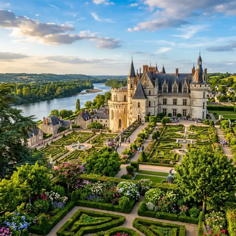
Bem-vindo! Prepare-se para uma #viagem inesquecível pelo coração de #Portugal. Porto: Onde o Tempo Canta e o Vinho Flui – Um Brinde à Invicta! Ah, Porto! Há cidades que nos entram na alma sem pedir licença, que nos abraçam com uma energia tão singular que é impossível resistir. E o Porto é, sem dúvida, uma dessas almas gémeas viajantes. Como Tiago Silva, um apaixonado por #Portugal e pelas suas maravilhas, posso afirmar que esta cidade é muito mais do que um destino; é uma experiência, um mergulho profundo na essência de uma nação. Aninhada na margem norte do majestoso rio Douro, esta cidade é a capital vibrante da sub-região da Área Metropolitana do Porto e o coração pulsante da Região Norte. Pertencente ao distrito homónimo, o Município do Porto estende-se por uma área de 41,42 km², abrigando uma população que em 2023 rondava os 248 769 habitantes, uma densidade que revela a sua vitalidade e o seu dinamismo, com cerca de 6 006 almas por quilómetro quadrado, distribuídas por 7 freguesias que guardam histórias e tradições. Os seus limites geográficos são um abraço entre o urbano e o natural: a norte, os vizinhos Matosinhos e Maia; a leste, Gondomar; a sul, a eterna companheira Vila Nova de Gaia, e a oeste, a imensidão azul do Oceano Atlântico, guardião de séculos de navegação e descobertas. Mas o Porto é especial por muitas razões, e a mais fundamental de todas é que foi aqui que tudo começou. É a cidade que generosamente deu o nome a todo um país! Desde tempos imemoriais, por volta de 200 a.C., já era conhecida como Portus Cale. Imagine-se a importância histórica de um local que se torna o berço de uma nação, a capital do Condado Portucalense, a matriz de onde floresceu o reino de Portugal. Cada rua, cada beco empedrado, parece sussurrar os segredos dessa fundação gloriosa. Hoje, a sua fama transcende fronteiras, e por boas razões. É um ícone mundialmente reconhecido pelo seu néctar dourado, o Vinho do Porto, que envelhece em caves seculares em Gaia, mas que tem a sua alma nesta margem do Douro. É celebrada pelas suas pontes, verdadeiras obras-primas de engenharia e arte que se estendem sobre o rio como braços que abraçam a cidade. A sua #architecture é um diálogo fascinante entre o antigo e o contemporâneo, onde edifícios seculares convivem harmoniosamente com estruturas de design arrojado. O seu centro histórico, um labirinto de ruas estreitas e casas coloridas, foi justamente classificado como Património Mundial pela UNESCO, um testemunho vivo da sua riqueza cultural e histórica. E para além da beleza, há o prazer dos sentidos. A qualidade dos seus restaurantes e a riqueza da sua gastronomia são uma ode aos sabores do Norte, com pratos que aquecem a alma e vinhos que elevam o espírito. A paixão pela bola também corre nas veias da cidade, com equipas de futebol que movem multidões, como o Futebol Clube do Porto, o Boavista Futebol Clube e o Sport Comércio e Salgueiros, cada um com a sua legião de adeptos e a sua própria #cultura. E não podemos esquecer o seu papel como centro de conhecimento: a Universidade do Porto, uma instituição de ensino público de excelência, figura entre as 200 melhores universidades do mundo e entre as 100 melhores da #Europa, atraindo mentes brilhantes de todo o globo. A qualidade dos seus centros hospitalares complementa este quadro de uma cidade que cuida e inova. O Coração Pulsante de uma Região e a Frente Atlântica O Porto não é apenas um município; é o motor da Área Metropolitana do Porto, um vasto conjunto que agrupa 17 municípios, somando uma população de 1 737 395 habitantes numa área de 1 900 km². Com uma densidade populacional que ronda os 914 hab./km², esta metrópole é a 13.ª área urbana mais populosa da União Europeia e a segunda mais populosa de Portugal, apenas atrás de Lisboa. É impressionante ver como o Porto e a sua área metropolitana funcionam como o núcleo estrutural da Região do Norte, a mais populosa de Portugal, com 3 689 609 habitantes (Censos de 2011), abrangendo 8 sub-regiões distintas. Juntamente com os concelhos vizinhos de Vila Nova de Gaia e Matosinhos, o Porto forma a Frente Atlântica, um cordão urbanístico que se estende ao longo da costa, delimitado a oeste pelo imponente Oceano Atlântico. A influência estrutural do estuário do Rio Douro, que une Gaia ao Porto, é palpável, moldando a paisagem e a vida dos seus habitantes. Esta é a zona mais urbanizada da Área Metropolitana, um caldeirão de atividade e desenvolvimento. A cidade é, de facto, a mais importante da altamente industrializada zona litoral da Região Norte, um verdadeiro polo económico onde se concentram grande parte dos mais importantes grupos económicos do país. Nomes como Altri, Grupo Amorim/Corticeira Amorim, Banco BPI, BIAL, EFACEC, Frulact, Lactogal, Millennium BCP, Porto Editora, Sonae, Unicer ou o Grupo RAR, são apenas alguns exemplos das empresas que aqui prosperam, revelando a força e a resiliência empresarial da região. A Associação Empresarial de Portugal, voz do tecido empresarial, também tem a sua sede no Porto. E um dado notável que sublinha a sua pujança: a Região do Norte é a única região portuguesa que exporta mais do que importa, um feito que demonstra a sua capacidade de inovação e a sua projeção internacional. História: Os Sussurros de Milénios e a Alma Invicta Para compreender o Porto, é preciso mergulhar na sua profunda e fascinante #história. Cada pedra, cada rua, cada ribeira, guarda ecos de tempos idos, de civilizações que moldaram a sua identidade. Fundação e os Primeiros Povos A origem do Porto é tão antiga quanto misteriosa, remontando a um povoado celta, anterior à chegada dos romanos. Imagine-se uma comunidade vibrante, enraizada na terra, já a pressentir a importância estratégica daquele local à beira-rio. Na época romana, a cidade floresceu sob a designação de Cale ou Portus Cale, um nome que, como já referi, viria a dar origem ao próprio nome de Portugal. É um legado imenso, uma responsabilidade histórica que a cidade carrega com orgulho. A alvorada do século VIII trouxe consigo uma nova maré, a da invasão muçulmana da Península Ibérica. A 27 de abril de 711, um exército mouro de 9 000 homens, liderados por Tárique, desembarcou em Gibraltar, iniciando uma era de profundas transformações. Em 714, Lisboa caiu, e em 715, as forças islâmicas avançaram implacavelmente para a região norte do que hoje conhecemos como Portugal, tomando importantes povoações e cidades, incluindo o Porto e Braga. Por volta de 716, praticamente toda a Península estava sob o domínio do Califado Omíada, com a exceção de uma pequena e resiliente zona montanhosa das Astúrias, onde a resistência cristã se refugiou, mantendo viva a chama da reconquista. Passado um século e meio de ocupação, em 868, surgiram as primeiras e decisivas tentativas de reconquista definitiva. Um nome ecoa nas brumas do tempo, o de Vímara Peres, um visionário que acendeu a chama da restauração. Ele teve uma contribuição fundamental na reconquista do território, restaurando a cidade de Portucale e lançando as bases para o que se tornaria o Condado Portucalense. A sua ação foi um ponto de viragem, um grito de esperança que ressoou pelas colinas e vales do Douro. Finalmente, e passados dois séculos após o início da invasão muçulmana, em 999, um evento épico marcou a libertação definitiva do Porto. Fidalgos gascões, entre os quais se destacava D. Nónego, bispo de Vendôme, em França, e mais tarde bispo do Porto, entraram com uma grande e imponente armada pela foz do Rio Douro. O seu objetivo era claro: expulsar os mouros e devolver a cidade à cristandade. Esta armada, que ficou imortalizada como a Armada dos Gascões, aliada a D. Munio Viegas, conquistou a cidade do Porto dos mouros para a dedicar à Virgem Mãe de Deus. Imagine-se o fervor, a intensidade da batalha, a libertação celebrada com devoção e gratidão. Após esta vitória, D. Munio e os "franceses" dedicaram-se com afinco à reedificação do Porto. Ergueram antigas e fortes muralhas, que outrora protegeram a cidade, e na parte mais elevada, fundaram um alcácer acastelado e bem fortificado. Este alcácer, mais tarde, após o conde Henrique, serviria de habitação aos bispos, a quem foi doado, tornando-se um símbolo do poder eclesiástico. A torre e a porta principal desta fortificação foram obra de D. Nónego, que, em memória da sua pátria, a nomeou Porta de Vandoma. Na frontaria da torre, mandou erguer um santuário, onde colocou a imagem de Nossa Senhora do Porto, que trouxera consigo de França. É uma história que se enlaça com a fé e a identidade da cidade. Em 1111, um marco importante na história do Porto e de Portugal: Teresa de Leão, mãe do futuro primeiro rei de Portugal, D. Afonso Henriques, concedeu ao bispo D. Hugo o couto do Porto. Este ato reforçou a autonomia e a importância da cidade, consolidando a sua posição no futuro reino. Daí que, até hoje, as armas da cidade ostentem orgulhosamente a imagem de Nossa Senhora, um tributo à sua protetora. É por esta devoção que o Porto é também conhecido como a "Cidade da Virgem", um epíteto que se junta a outros, tão nobres e merecidos, como "Antiga, Mui Nobre, #portugal #travel #history #europe #cultura
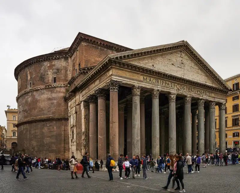

Il Pantheon di Roma è forse l'edificio antico meglio conservato al mondo. Costruito originariamente da Marco Agrippa nel 27 a.C. e poi completamente ricostruito dall'imperatore Adriano intorno al 126 d.C., rappresenta uno dei massimi capolavori dell'architettura romana. Il Miracolo della Cupola Ciò che rende il Pantheon unico è la sua immensa cupola emisferica in calcestruzzo non armato. Con un diametro di 43,44 metri, rimane la più grande cupola del suo genere al mondo. Al centro della cupola si apre l'Oculus, un'apertura circolare di 9 metri che è l'unica fonte di luce naturale dell'edificio. Quando il sole entra dall'Oculus, crea un fascio di luce che si muove lungo le pareti interne, seguendo il ritmo delle stagioni, come un immenso orologio solare che collega la terra al cielo. Un Tempio per Tutti gli Dei Il nome Pantheon deriva dal greco e significa 'di tutti gli dei'. Fu concepito come un tempio dedicato a tutte le divinità dell'Antica Roma. La sua sopravvivenza intatta attraverso i secoli è dovuta alla sua conversione in chiesa cristiana (Santa Maria dei Martiri) nel 609 d.C. Questo salvò l'edificio dai saccheggi e dalle distruzioni che colpirono altri monumenti romani. L'Eredità del Pantheon Il Pantheon ha ispirato innumerevoli architetti nel corso dei secoli, influenzando capolavori come la Cupola del Brunelleschi a Firenze. Oggi ospita anche le tombe di re d'Italia e artisti celebri come Raffaello Sanzio. Entrare nel Pantheon significa immergersi in una perfezione geometrica e spirituale che sfida il tempo. #Pantheon #ArchitetturaRomana #Roma #StoriaDellArte #italy #rome #history #ancient Related InsightsThe Roaring Abyss: Documenting Iguazu National Park The Lost Alchemy of Ancient Fermented Grains: Echoes from the Andes Castillo de Gibralfaro: El Guardián de Málaga{ "@context": "https://schema.org", "@type": "FAQPage", "mainEntity": [ { "@type": "Question", "name": "What is the main focus of Il Pantheon: L'Occhio degli Dei?", "acceptedAnswer": { "@type": "Answer", "text": "Esplorando la perfezione architettonica del tempio di tutti gli dei." } }, { "@type": "Question", "name": "Who authored the comprehensive guide on Il Pantheon: L'Occhio degli Dei?", "acceptedAnswer": { "@type": "Answer", "text": "This detailed article and its insights were carefully researched and authored by Lorenzo Russo." } }, { "@type": "Question", "name": "Where can I find more related content about Travel?", "acceptedAnswer": { "@type": "Answer", "text": "You can explore more articles, detailed reviews, and similar insights by browsing the Related Insights section at the bottom of this article or visiting our dedicated Travel category page." } } ] }
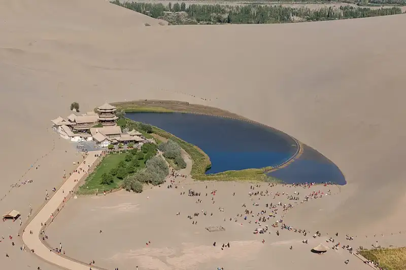

在浩瀚无垠的中国西北腹地,漫天黄沙如同一块无边无际的巨大金毯,覆盖着广袤的戈壁。这里是生命的禁区,是狂风与干旱的领地。然而,就在这片看似毫无生机的荒漠之中,却隐藏着一个足以令世人惊叹的奇迹。它宛如一枚璀璨的蓝宝石,又似一弯悄然坠落凡间的明月,静静地镶嵌在连绵起伏的沙丘之间。这便是享誉中外的 #月牙泉 (Crescent Lake),一处历经千年风沙洗礼却依然清澈如初的沙漠绿洲。作为 #敦煌 的标志性景观之一,月牙泉不仅是大自然鬼斧神工的杰作,更是 #丝绸之路 上一段不朽的历史传奇。今天,让我们一同走进这片神秘的土地,拂去历史的尘埃,探寻月牙泉背后的千年沧桑与永恒之美。 第一章:风与沙的博弈——地理奇观的诞生 要理解月牙泉的奇迹,我们首先必须了解它所处的独特地理环境。月牙泉位于甘肃省敦煌市西南约六公里处,被巍峨的 #鸣沙山 四面环抱。这里的沙山不仅高大陡峭,而且在风的吹动下会发出如雷鸣般的轰响,“鸣沙”之名由此而来。然而,最令人费解的现象是:在这样一个风沙肆虐的地方,一汪面积仅有数亩的浅水潭为何没有被流沙掩埋?为什么它能够历经千万年而依然碧波荡漾? 科学家们经过长期的考察与研究,揭开了这个 #自然奇迹 背后的秘密。原来,鸣沙山和月牙泉之间形成了一种极为精妙的空气动力学平衡。这里的地形呈现出一种特殊的环形洼地结构。当强风刮过沙漠,遇到高大的沙丘阻挡时,气流会顺着沙山的迎风坡向上攀升,并在洼地内部形成一种强烈的上升旋风。这种旋风不仅不会将周围的沙子吹入低洼的泉水中,反而会将从四周重力滑落的沙粒重新带回到沙山的山脊之上。正如古文献中所记载的:“沙岭晴鸣,月泉晓澈。风夹沙而飞响,泉映月而无尘。”这种奇特的地形与风向的动力学效应,使得流沙永远无法填平这片低洼的泉水,从而造就了“沙水共生、沙不掩泉”的千古奇观。 不仅如此,月牙泉的水源补给系统也极具传奇色彩。在古代乃至近代早期,敦煌地区拥有着极其丰富且自成体系的地下水网络。巍峨的祁连山脉每年融化的冰雪,通过地下暗河源源不断地汇入敦煌盆地。月牙泉恰好位于这个地下蓄水盆地的最低海拔处。充沛的地下水受到承压作用,在这里自然涌出地表,形成了这弯清澈甘冽的泉水。在干旱无情的 #沙漠绿洲 中,水就是一切生命的起源,而月牙泉正是大自然赐予这片苍茫大地最珍贵的生命之眼。 第二章:丝路长歌——历史长河中的生命驿站 如果说鸣沙山是月牙泉坚实厚重的躯壳,那么波澜壮阔的 #丝绸之路 就是赋予月牙泉灵魂的不息血脉。回溯到两千多年前的大汉王朝,博望侯张骞奉命出使西域,历经九死一生,终于凿空了连接中原王朝与中亚、西亚乃至欧洲的伟大商路。在这条商路上,敦煌作为河西走廊的最西端、玉门关与阳关的后盾,成为了丝绸之路上至关重要的咽喉要道。从繁华的长安出发的庞大商队,在历经千辛万苦穿过漫长的河西走廊后,必须在敦煌进行最重要的一次物资补给和休整,然后才能踏上更为凶险莫测的塔克拉玛干沙漠和西域三十六国。 试想一下,对于那些在烈日下跋涉了数月、干渴难耐的旅人和负重的骆驼来说,当他们翻过漫漫黄沙,几近绝望之时,突然看到前方那一弯清澈见底的泉水,心中的狂喜与震撼是何等难以用笔墨来形容的!月牙泉不仅为商队提供了足以挽救生命的饮用水,更为他们带来了精神上的极大抚慰与重生的希望。在这里,疲惫不堪的商人可以卸下沉重的货物,洗去满身的征尘;虔诚的僧侣可以掬一捧清泉,闭目诵经,寻找内心的宁静与信仰的力量。#历史印记 在这片波光中显得格外深沉厚重。 据多种史料考证与推测,许多在中国历史上留下赫赫声名的伟大人物都曾在这片清泉畔驻足。唐代著名高僧玄奘在西行印度求法的漫漫旅途中,穿越莫贺延碛之前,极有可能也曾在敦煌的月牙泉畔补充珍贵的水源。随着丝绸之路在隋唐时期的极度繁荣,月牙泉畔逐渐建起了供人歇息和礼佛的庙宇及亭台楼阁。古代的文人墨客更是对这里流连忘返,留下了无数脍炙人口的赞美诗句。清代禁烟名将林则徐在被流放新疆的凄苦途中经过敦煌,看到这一奇景时,也曾提笔写下感叹大自然鬼斧神工的诗篇。这里的每一滴晶莹的水珠,似乎都曾倒映过古代商旅疲惫却坚毅的倒影;这里的每一阵裹挟着细沙的微风,似乎都在诉说着汉唐时代的辉煌壮阔与西域古道的无限苍凉。 第三章:文化交融的倒影——诗词、建筑与信仰的共鸣 月牙泉的存在,从来不仅仅是一个单纯的地理学奇迹,它在漫长的历史演进中被赋予了极为深厚的中国传统哲学与宗教意蕴。在东方的传统文化语境中,水代表着阴柔、包容、滋润和勃勃生机,而漫天的黄沙则象征着阳刚、狂暴、荒芜和无情。鸣沙山与月牙泉长达千年的和谐并存,宛如一幅天然的太极图,完美地诠释了阴阳相济、刚柔并济的东方智慧。#文化遗产 的精髓在这里得到了最生动、最直观的展现。 距离月牙泉不远处,便是被列为世界文化遗产、举世闻名的佛教艺术宝库——#莫高窟。两者同为敦煌引以为傲的绝世名片,一处是大自然演化亿万年的奇迹,一处是人类文明雕琢千年的艺术巅峰。可以说,如果没有月牙泉、党河等水源的默默滋养,就不会有敦煌这片沙漠绿洲的繁荣富庶,自然也就不可能孕育出辉煌灿烂的敦煌石窟壁画与彩塑艺术。古代那些在昏暗的洞窟中劳作的画师和工匠们,用手中绚丽的矿物颜料描绘着西方极乐世界的壮丽景象。当他们放下画笔,走出洞窟,凝视着不远处的鸣沙山与月牙泉时,或许在他们充满虔诚的眼中,这弯宁静的清泉与连绵的沙丘,正是佛经中所描述的人间净土的真实写照。 在月牙泉的南岸,矗立着一组古色古香、错落有致的建筑群——鸣月阁。这是一组典型的汉族传统木构风格建筑,飞檐翘角,斗拱交错,古朴典雅。虽然历史上的古建筑曾因战乱和风化而屡遭破坏,现存的建筑多为后世根据历史原貌精心重建,但它们依然完美地复原了清代甚至更早时期的边塞建筑风貌。漫步在亭台水榭之间,微风拂过屋檐,风铃发出清脆的叮当声,闭上眼睛,仿佛能够听到千年前的梵音在沙海中缭绕回荡。这里不仅是游人观赏泉水、避暑乘凉的绝佳位置,更是当地百姓祈福、修心的精神家园。每年农历四月初八的佛教“浴佛节”,敦煌周边的百姓都会扶老携幼聚集在鸣沙山和月牙泉畔,举行盛大的滑沙、赛马活动和传统的祈福仪式。这一源远流长的民间传统已经延续了千百年,不仅未曾中断,反而成为了敦煌独特的地方文化和民俗风情的重要组成部分。 在这个特殊的生态系统中,还曾孕育出被称为“月泉三宝”的珍稀特产:铁背鱼、七星草和五色沙。相传,生长在泉水中的铁背鱼能延年益寿,长在泉边的七星草(罗布麻)能治愈百病,而鸣沙山五彩斑斓的沙粒则被视为吉祥的象征。这些传说不仅为月牙泉披上了一层神秘的仙家色彩,也反映了古人对这片不可思议的生命绿洲的敬畏与感恩之心。 第四章:拯救消逝的明眸——生态危机的警示与浴火重生 然而,纵使是历经了千年风雨的奇迹,也无法轻易抵御现代人类活动和全球气候变暖带来的巨大生态冲击。进入二十世纪中后期,由于敦煌地区人口的大幅增长、城市化进程的加快以及农业灌溉用地的无节制扩张,当地开始大量开采地下水资源。水库的修建截断了地表水流,地下水位的急剧下降导致整个敦煌盆地的水文循环遭到了破坏。曾经生命力旺盛的月牙泉,也因此面临着史无前例、甚至可以说是毁灭性的 #生态危机。 根据可靠的水文观测记录,在二十世纪六十年代初,月牙泉的水域面积依然保持在二十多亩左右,最大水深可达九米,泉水丰盈,碧波荡漾。但随着环境的恶化,到了九十年代末期,由于地下水位的持续暴跌,月牙泉的面积曾一度锐减至不到一亩,平均水深更是降到了可怜的不足一米。最危急的时刻,水面被沙丘分割成几个毫无生气的小水洼,曾经美丽的“沙漠明眸”变成了一滩浑浊不堪的死水,甚至面临着彻底干涸、永远被黄沙吞噬的致命危险。 这一严峻的现象引起了中国全社会的广泛关注和国内外环保专家的强烈担忧。如果月牙泉消失,那失去的不仅是一处举世闻名的自然景观,更是敦煌千年历史记忆的断裂,是人类在处理人与自然关系上的一次巨大失败。 为了拯救濒临绝境的月牙泉,一场争分夺秒的生态救援行动在世纪之交全面展开。地方政府和大量 #环境保护 专家经过反复论证,提出了一套科学的“应急补水”与“长效治理”相结合的系统性拯救方案。专家们没有采取简单粗暴的直接往泉水里注水的方式,因为那样会破坏月牙泉原有水质和底部的自然渗水结构。相反,他们实施了巧妙的“水系生态恢复工程”:通过在距离月牙泉数公里外的特定区域修建大型渗水场,将党河的河水引入其中,让水自然渗透到地下蓄水层中。通过提高整个区域的地下水位,利用地下水的侧向补给压力,使得纯净的地下水再次从月牙泉的泉眼中自然涌出。 同时,政府出台了极为严格的水资源管理政策,下达了“禁止开荒、禁止打井、禁止移民”的禁令,大力推进退耕还林、还草工程,减少农业用水,从根本上恢复敦煌盆地的整体生态平衡。经过十几年如一日的不懈坚持和巨额资金的投入,这场惊心动魄的生态保卫战终于取得了令人欣慰的成效。如今的月牙泉,水位已经稳定在安全的刻度以上,水域面积重新扩大并恢复了经典的月牙形状,泉水再次清澈见底,周边的芦苇和沙生植物也重新焕发了勃勃生机。 这次近乎劫后重生的危机,给全人类敲响了一记震耳欲聋的警钟:在极其脆弱的沙漠生态系统面前,大自然的恩赐并不是取之不尽、用之不竭的。保护生态环境,维持 #生态平衡,不是一句空洞的口号,而是我们对子孙后代、对地球家园必须承担的绝对责任。月牙泉的复苏,不仅是中国生态治理的一个成功范例,也证明了只要人类懂得敬畏自然、采取科学合理的补救措施,大自然依然愿意给予我们重新开始的机会。 第五章:大漠落日圆——亲历沙与水的完美交融 作为一个长期在路上游历、热衷于探寻世界角落的旅行者,当我在一个初秋的傍晚真正踏上这片魂牵梦绕的土地,亲眼目睹月牙泉的真容时,那种视觉的冲击和灵魂深处的震撼是任何纪录片或文字都无法完全传达的。我的 #旅行日志 里,记录下了我在敦煌这片大漠之中度过的最难忘的日与夜。 记得那天下午,气温依然高炽,我雇了一匹高大的骆驼,跟随着长长的驼队在连绵起伏的鸣沙山上缓慢前行。驼铃声在空旷无垠的沙漠中悠悠回荡,单调却充满着神秘的韵律,仿佛瞬间将时间折叠,把我拉回到了那个充满未知的古老年代。西斜的夕阳将每一座沙丘的轮廓勾勒得异常分明,向阳面是耀眼的赤金,背阴面则是深邃的暗影。光与影在沙漠表面交织出令人窒息的几何美感。 随着傍晚的临近,白日的燥热被戈壁吹来的凉风渐渐驱散。当我踩着绵软细腻的黄沙,气喘吁吁地爬上一座沙山的最高处,俯瞰下方的深谷时,那一幕彻底将我惊艳,让我暂时忘记了呼吸: 在巨大的金色沙山构筑的怀抱中,一弯清澈无比的泉水静静地躺在那里,宛如遗落在茫茫人海中的一块绝世碧玉。泉边茂密的芦苇在晚风中轻轻摇曳,发出沙沙的声响;鸣月阁的飞檐上,红色的灯笼已经亮起,在平静的水面上投下古朴而温暖的倒影。此时此刻的月牙泉,不再是一个冷冰冰的地质学名词,而是一个有生命、有呼吸、有温度的灵魂。它太安静了,安静得让人不忍大声喧哗,生怕哪怕一丝杂音都会惊扰了它做了一千年的好梦。一轮浑圆的落日正悬挂在天际线,#沙漠日落 的余晖毫不吝啬地洒在水面上,波光粼粼,如同一幅铺展在天地间的绝美画卷。 夜幕终于完全降临,喧闹的游客渐渐散去,大漠恢复了它亘古不变的寂静。我没有急于离开,而是独自躺在微凉的沙地上,仰望着浩瀚的星空。这里的夜空纯净得没有一丝杂质,璀璨的银河如同一条流淌的钻石河流,横跨天际。而大地之上,那弯月牙形的泉水在微弱的星光下反射出幽幽的光芒,仿佛是地球睁开的一只明眸,正在与苍穹之上的冷月进行着一场超越时空的无声对话。 在这个神奇的瞬间,我真切地感受到了时间的停滞。我感受到了宇宙的无垠与人类的渺小,感受到了大自然的伟大与历史的厚重。月牙泉就像是一位充满智慧的长者,它看惯了丝绸之路上的驼队商旅,看尽了古代帝国的兴衰更替,历经了战争、干旱和岁月的侵蚀,却依然坚守在这里,保持着自己最初的从容与清澈。 第六章:沙水相依的未来——写给明天的寄语 今天,月牙泉的魅力不仅在于它惊艳世人的自然美景,更在于它所承载的深厚人文精神和生态价值。它无疑是当今 #中国旅游 版图上一颗不可替代的璀璨明珠,每年吸引着数以百万计的国内外游客慕名而来。每一个站在鸣沙山顶俯瞰月牙泉的人,都会被它的美丽所折服,同时也会被它脆弱的生命力所深深触动。 然而,随着现代旅游业的飞速发展,月牙泉也迎来了前所未有的机遇与挑战。如何在巨大的人流量和旅游开发面前,保护好这片脆弱的绿洲?如何让鸣沙山的声音永远雄浑,让月牙泉的波光永远闪耀?这是摆在我们每一个现代人面前的一道严肃考题。推行可持续的旅游模式、加强生态保护的科普宣传、实施更加科学严谨的景区环境管理,每一个环节都显得至关重要。作为游客,我们也需要用更加敬畏的心态去欣赏它,用呵护的行动去对待它,不乱扔垃圾,不破坏植被,让这份属于全人类的自然遗产能够被完好无损地传承给下一个千年。 结语:不朽的大漠明眸 风,依然在吹;沙,依然在鸣。岁月流转,星海更替,月牙泉依然静静地守望在敦煌的大漠深处。 它是一面不朽的明镜,映照出千年前丝绸之路上不绝于缕的驼队与繁华的市集;它是一滴大地的眼泪,凝聚了无数旅人对自然之美、生命之源的无限眷恋与感恩;它更是一个生生不息的奇迹,向世人宣告着生命在绝境中所能爆发出的惊人韧性。从古至今,无数人来到这里,把脚印留在沙丘上,随后又被风沙无情地抹去;无数人在这里许下美好的心愿,寄托哀思,然后转身继续各自的人生旅程。但月牙泉始终未曾改变,它用那一弯澄澈至极的倒影,温柔地包容了世间所有的故事与沧桑。 在这个瞬息万变、喧嚣浮躁的现代世界里,月牙泉以它独特的存在方式让我们相信:有些美好是可以跨越时间的边界,成为永恒的。当你有一天也能够背起行囊,踏上这片充满魔力的土地,请一定要在夕阳最温柔的时刻,站在高高的沙山上凝视那汪清泉。闭上眼,听一听风中传来的历史回响;睁开眼,感受一下那份沙与水共生的奇妙和谐。相信在那一刻,你的灵魂也会得到一次久违的洗礼与升华。 愿月牙泉,这颗 #自然奇观 中的明珠,不仅活在诗人的长歌里、画家的笔触中,更能永远鲜活地荡漾在地球的版图上,永远闪耀在人类文明的星空中。 #Dunhuang #CrescentLake #SilkRoad #ChinaTravel Related InsightsCanada's Rocky Mountains: Emerald Lakes and Alpine Adventures Dive Into a Hidden World: The Most Breathtaking Underwater Museums and Sculpture Parks Hiking the Lycian Way{ "@context": "https://schema.org", "@type": "FAQPage", "mainEntity": [ { "@type": "Question", "name": "What is the main focus of 沙漠中的永恒明镜:敦煌月牙泉的千年回眸?", "acceptedAnswer": { "@type": "Answer", "text": "探秘中国敦煌鸣沙山下的奇迹——月牙泉。了解这片沙漠绿洲的千年历史、地理奇观以及现代生态保护,感受丝绸之路的沧桑与美丽。" } }, { "@type": "Question", "name": "Who authored the comprehensive guide on 沙漠中的永恒明镜:敦煌月牙泉的千年回眸?", "acceptedAnswer": { "@type": "Answer", "text": "This detailed article and its insights were carefully researched and authored by Li Wei." } }, { "@type": "Question", "name": "Where can I find more related content about Travel?", "acceptedAnswer": { "@type": "Answer", "text": "You can explore more articles, detailed reviews, and similar insights by browsing the Related Insights section at the bottom of this article or visiting our dedicated Travel category page." } } ] }
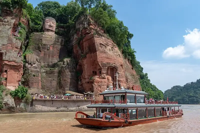
在四川盆地的西南部,岷江、青衣江与大渡河三条波澜壮阔的河流奔腾激荡,携带着来自青藏高原的冰雪融水与蜀地山川的磅礴雨露,最终在凌云山下豁然相拥、浩荡交汇。在这片水域的悬崖峭壁之上,端坐着一尊震撼世界的摩崖石刻造像——乐山大佛(Leshan Giant Buddha)。作为中国最大、世界最高的石刻弥勒佛坐像,它不仅仅是唐代雕塑艺术无与伦比的巅峰之作,更是全人类共同的文化瑰宝与精神象征。每当晨曦初露,破晓的微光穿透江面的薄雾,或是夕阳西下,金色的余晖如披风般洒在大佛慈祥而庄严的面庞上,水波荡漾的倒影中,仿佛正低声诉说着长达一千三百多年的沧桑与辉煌。今天,就让我们一同循着历史的足迹,走进这尊“山是一尊佛,佛是一座山”的千古奇观,深度探寻其背后的传奇故事、不朽精神以及令人叹为观止的古代工程智慧。#乐山大佛 #世界文化遗产 第一章 缘起:激流中的悲悯与宏愿 要真正理解乐山大佛的伟大与不可思议,我们首先必须跨越千年的时空,回到它最初诞生的那个风云激荡、气象万千的时代。唐朝开元元年(公元713年),正值大唐帝国的极盛时期。国力空前强盛,万邦来朝,丝绸之路上的驼铃声清脆悦耳,文化与艺术迎来了前所未有的繁荣。然而,在当时的嘉州(即今天的四川乐山),三江交汇处的江水却犹如脱缰的野马,异常凶险,成为了当地百姓与往来客商挥之不去的梦魇。 岷江自北蜿蜒而来,青衣江与大渡河横冲直撞,三股性质各异、水势强大的洪流在这凌云山麓猛烈相撞。复杂的水文环境使得这里终年水流湍急,暗礁密布,形成了巨大的漩涡和滔天的巨浪。据古文献与地方志记载,每逢夏秋汛期,江水如万马奔腾,声如雷鸣,常常将过往的满载货物的商船和满载希望的客舟无情吞没。舟毁人亡的惨剧在这片水域频频上演,哀嚎声伴随着江水呼啸,无数家庭因此支离破碎,当地百姓苦不堪言。#三江交汇 #自然奇观 此时的大唐,佛教信仰已深深扎根于中原与巴蜀大地。在佛教宏大的宇宙观中,弥勒佛(Maitreya)是代表着光明、未来与解脱的佛,被世人认为能够带来太平、安宁与无限的希望。正是在这样恶劣的地理环境与深厚的信仰背景下,一位名叫海通的僧人站了出来。海通和尚满怀悲悯之心,眼见生灵涂炭,江水肆虐,他发下了一个震撼天地的宏愿:要在三江交汇的凌云山赤色悬崖上,开凿一尊无比巨大的弥勒佛像。他坚信,借助弥勒佛的无边法力与威仪,定能镇压这桀骜不驯的汹涌江水,保佑过往船只与水手的平安。这不仅是一个宏大的宗教愿望,更是一次源于对苍生深沉大爱的伟大民生工程的悲壮开端。#唐代建筑 #弥勒佛 第二章 沥血:海通和尚的惊世之举 海通和尚并非出身名门望族,也没有权倾朝野的皇家背景,他只是一介衣钵单薄的云游僧人。为了筹集开凿大佛所需的犹如天文数字般的庞大资金,海通和尚踏上了漫长、孤独而艰辛的化缘之路。他脚穿草鞋,手持化缘钵,不辞辛劳,足迹遍布大江南北、名山大川。他用自己虔诚的信念和对苍生的慈悲,讲述着镇江建佛的宏愿。历经了无数个寒来暑往、风餐露宿,他终于筹集到了一笔可观的善款。 然而,这笔饱含着无数百姓血汗、期盼与虔诚信仰的资金,却不幸引来了当地贪官污吏的贪婪垂涎。据民间传说与史料杂记描述,当时嘉州的一位手握重权的地方官吏见财起意,仗势欺人,企图以莫须有的名义强行索要、侵吞这笔修佛的巨款。面对如狼似虎、手握生杀大权的贪官,海通和尚没有丝毫退缩,展现出了令人敬畏的铮铮铁骨与佛门大德的凛然正气。 他义正辞严地拒绝了官员的无理要求,并留下了那句掷地有声、穿越千年依旧振聋发聩的千古绝唱:“自目可剜,佛财难得!”(我的双眼可以被挖出来,但用来修佛的钱财你们休想拿走半分)。贪官听闻,以为这不过是一介僧人的虚张声势,便傲慢而轻蔑地嘲笑他。谁知,海通和尚面不改色,为了捍卫这笔拯救苍生的善款,他竟然真的从怀中掏出尖刀,亲手剜下了自己的双目,端在盘子里,鲜血淋漓地递到了那位官员的面前。 贪官被这血腥、惨烈而悲壮的一幕吓得魂飞魄散,连连后退,最终仓皇逃窜,从此再也不敢打这笔佛财的任何主意。海通和尚的惊世之举,不仅保住了修佛的资金,更深深地感动了无数的工匠、百姓与过往行商。在他的精神感召下,浩大而艰巨的开凿工程终于在悬崖峭壁上轰轰烈烈地展开了。工匠们将粗壮的麻绳系在腰间,悬吊在万丈绝壁之上,伴随着经久不息、叮叮当当的斧凿声,坚硬的红色砂岩被一块块剥落,大佛的巍峨轮廓开始在这座大山上渐渐显现。#海通和尚 #匠人精神 #佛教故事 第三章 跨越世纪的开凿:大唐盛世的工程奇迹 然而,要在坚硬的岩壁上开凿一座高达71米的巨型佛像,绝非一朝一夕之功。这不仅需要难以想象的人力与物力,更需要极其高超的建筑学、几何学与地质学知识。就在大佛的头部和胸部刚刚初具雏形,工程正在艰难推进之时,年事已高、双目失明且操劳过度的海通和尚黯然圆寂了。他的离去,让整个大佛的建造工程失去了主心骨,随之陷入了漫长的停滞。岁月流转,巴蜀之地的风雨无情地侵蚀着未完成的佛像,但海通和尚的无私精神却如同一颗不灭的火种,在后人的心中继续燃烧,等待着再次燎原的时刻。 数年之后,当时的剑南西川节度使章仇兼琼被大佛背后的故事深深打动。他慷慨解囊,捐出自己的丰厚俸禄,重新启动了这项浩大但停滞的工程。章仇兼琼不仅个人出资,还利用自己的政治影响力上奏朝廷,请求大唐皇帝赐予当地的麻盐税收,以国家的力量来资助开凿。在大唐帝国雄厚国力的强力介入与支持下,大佛的开凿得以顺利继续推进,工匠们夜以继日地奋战,一直将佛像开凿到了膝盖部位。然而,命运多舛,由于章仇兼琼被朝廷紧急调往京城任职,失去了主要经济来源和行政支持的工程再次被迫停工,这一停又是数十载的漫长岁月。 直到四十年后的唐德宗贞元四年(公元788年),又一位对佛教有着深厚信仰的剑南西川节度使韦皋来到了蜀地。当他亲眼目睹这座未完工的惊世巨佛,并听闻了海通和尚泣血剜目的悲剧与前人数十年的不懈努力后,深受震撼。韦皋毅然决定捐出巨额的军资,并在整个蜀地广泛组织人力物力,发动了最后的冲刺阶段。经过成百上千名工匠们披星戴月、艰苦卓绝的奋战,终于在贞元十九年(公元803年),这尊耗时整整九十年、历经唐代三代人接力开凿的旷世巨作宣告全面竣工。九十年的光阴,三代工匠的青春、汗水,甚至无数年轻生命的代价,最终凝聚成了这尊与天齐高、与山同体的巍峨大佛。#中国古代工程 #历史传奇 #盛唐气象 第四章 巧夺天工:造像艺术与隐秘的排水系统 乐山大佛的工程规模之浩大,艺术造诣之高深,堪称中国乃至古代世界建筑与雕塑史上的不朽奇迹。大佛通高71米,这一高度超越了阿富汗著名的巴米扬大佛,使其稳坐世界最大石刻佛像的宝座。大佛的头部高14.7米,宽10米,其面庞丰满雍容,神情肃穆而慈祥,充分体现了唐代以丰腴为美的审美标准和高超的造像艺术。 令人称奇的是,大佛头顶上共有1021个排列整齐、宛如发丝编织的螺髻。这些螺髻并非与头部一体天然雕刻而成,而是由石块精心雕刻后,逐个精准地镶嵌在佛头上的。历经千年风雨,它们依然牢牢地固定在佛首之上,足见唐代工匠技艺之精湛。大佛的耳朵长达7米,采用木质结构辅以石凿,表面涂以细腻的红泥;肩膀宽阔达28米,犹如一座宽阔平坦的城市广场;手指长8.3米,脚背宽8.5米,其巨大的足背上足足可以围坐上百人。大佛的体态匀称,比例极其协调,它端坐在三江交汇的赤色崖壁上,双手自然地抚放于膝盖,双目微睁,深邃的目光静静地注视着脚下翻滚的江水,仿佛在默默祈祷着天下的苍生,又仿佛在诉说着对宇宙奥秘的无尽理解。 除了令人惊叹的宏大体量与精美绝伦的外在雕刻,乐山大佛内部还隐藏着一个鲜为人知、却至关重要的古代科技奇迹——一套极其巧妙而复杂的隐秘排水系统。四川盆地气候湿润,降水充沛,如果任由山泉水和雨水长期浸泡、冲刷,红砂岩材质的大佛极易发生风化、剥落乃至坍塌。为了防止水患对佛像造成致命侵蚀,古代的大师们展现出了惊人的工程智慧。 他们在设计之初,便在大佛的头部、衣领、胸部以及背部,巧妙地规划和开凿了错综复杂、相互连通的排水沟壑。例如,在大佛头部的18层螺髻中,第4层、第9层和第18层都暗藏着一条横向的微型排水沟;而在佛像的正胸左侧,也有一条极难被常人察觉的封闭排水沟,这条沟槽巧妙地与右臂后侧的竖向沟槽相连。这些精心设计的表面沟槽,与隐藏在大佛背后崖壁上的天然岩洞以及人工开凿的隧道相互贯通,形成了一套科学、立体、高效的通风与排水网络。当暴雨倾盆或山泉渗漏时,水流会顺着这套系统被迅速引流并排出体外,从而有效避免了水流在佛像表面的长期滞留。正是依赖这套巧夺天工、如同人体血管般精密运作的排水系统,乐山大佛才得以在多雨潮湿的自然环境中屹立千年而不倒。这是中国古代水利工程学与雕塑艺术完美结合的最高结晶,至今仍令现代科学家与建筑学家叹为观止。#古代智慧 #工程学奇迹 #隐秘工程 第五章 岁月如歌:大像阁的兴废与千年风霜 然而,即便是凝聚了如此高超智慧与心血的伟大工程,也难以完全抵挡浩瀚岁月的无情侵蚀。在唐代大佛刚刚落成之初,为了保护这尊耗资巨大的佛像免受日晒雨淋的直接伤害,古人曾倾尽全力,在其外围依山傍水地建造了一座高达十三层的超大型木质楼阁,史称“大像阁”或“凌云阁”。据历史文献与文人墨客的诗词描绘,这座楼阁飞檐翘角,雕梁画栋,气势恢宏。它将高耸入云的大佛严严实实地包裹其中,阁内金碧辉煌,香火缭绕,信徒们可以在楼阁的各层近距离瞻仰大佛的不同部位,感受佛法的庄严。 可惜的是,世事无常,盛衰有凭。在明代末年(或有学者认为是更早的宋元战乱时期),这座代表着古代木构建筑巅峰的宏伟楼阁,最终还是不幸毁于残酷的战火之中,化为了一片灰烬。从此以后,失去了“保护伞”的大佛便被迫完全暴露在狂风、暴雨、烈日与霜雪之中。 千百年来,乐山大佛就像一位饱经风霜的冥想者,默默承受着大自然无数次的洗礼。江水不舍昼夜地冲刷着它的脚底底座,引发基础的淘蚀;凌云山的山风带着浓重的水汽,日复一日地侵蚀着它的肌肤。红砂岩虽然易于雕刻,但其疏松的质地也极易在风化作用下发生崩解。尤其是到了近现代,随着全球工业化浪潮的推进与周边城市群的发展,酸雨频发,空气污染加剧,加之每年数以百万计的游客涌入带来的微环境改变,对大佛的保护提出了前所未有的、极其严峻的挑战。大佛的面部一度出现了严重的黑斑退化,鼻部甚至发生了部分脱落的险情;其宽阔的胸部、腹部以及手脚部位,也由于环境潮湿而长满了青苔、杂草乃至小型灌木,甚至出现了学术界所称的“佛面生花”(面部生长植物)与“佛身流泪”(面部因水渍形成黑色条纹)等严重的文物病害。#文物保护 #时光印记 #历史沧桑 第六章 现代重生:世界遗产的守护与文化传承 面对大佛日益严重的退化与病损,中国政府以及国际社会文物保护组织给予了高度的关注与极其庞大的资源投入。1996年12月,乐山大佛与毗邻的佛教圣地峨眉山一同被联合国教科文组织(UNESCO)正式列入《世界自然与文化双遗产名录》,这不仅是对大佛历史价值、艺术价值的最高国际认可,也标志着其正式成为全人类共同守护的宝贵财富。 为了拯救和保护这座珍贵的文化遗产,从上世纪末至今,国内外顶级的文物保护专家、地质学家与化学家多次汇聚乐山,利用三维激光扫描、超声波探伤等最前沿的现代科技手段,对大佛进行了事无巨细的全面勘测与病害诊断。近年来,多项大规模的“修旧如旧”保护工程相继成功实施。在极其陡峭的脚手架上,专家和文物修复师们用手术刀般精细的工具,一点点清理了大佛表面寄生的杂草、苔藓和霉菌,修补了历朝历代留下的破损与裂缝;同时,他们运用最新研发的透气性纳米高科技材料,对佛像的红砂岩表面进行了科学的加固与防风化处理。 除了佛像本体的修复,有关部门对大佛周边的宏观生态环境与微观水文条件也进行了极其严格的治理。大幅度限制了上游及周边工业废气、废水的排放,规范了旅游航道的船只航行,力求将人类活动对大佛的不利影响降至最低。如今的乐山大佛,在经过了现代科技与传统工艺的精心呵护后,已经成功褪去了岁月的尘埃,焕发出新的生机与奕奕神采。它不仅继续吸引着无数虔诚的佛教信徒从世界各地跋山涉水前来朝拜,更成为了全球旅行者、历史文化爱好者向往的超级旅游胜地。每年,数以百万计的游客乘坐游船,在波涛依旧的三江汇流处,怀着激动的心情仰望这尊顶天立地的巨佛,感受那份跨越了千年时空的视觉震撼与心灵宁静。#世界文化遗产保护 #四川旅游必去 #文化传承 第七章 结语:信仰的丰碑,历史的永恒见证 “山是一尊佛,佛是一座山。”当我亲自站在乐山大佛巨大的脚趾之下,仰望那直插云霄、雄伟无匹的庞大身躯时,作为一名普通的历史记录者与旅人,我的内心瞬间被一股难以名状的巨大敬畏之情所淹没。这种敬畏,绝不仅仅是停留在对于大佛那宏大体量与不可思议的视觉冲击力的表面惊叹,更是深深扎根于对于那些建造它的古代先辈们——从发下泣血宏愿的海通和尚,到默默无闻、奉献了一生乃至子孙后代心血的无数唐代匠人——他们那坚不可摧的意志力与深厚信仰的无限崇敬。 从镇压三江水患、保护水上苍生的最初单纯动机,到历经九十载寒暑、三代人接力开凿的惊天工程;从大像阁金碧辉煌的盛世景象,到历经千年风雨剥蚀、战火纷飞的沧桑变迁。乐山大佛见证了大唐帝国的绝代繁华与衰落,经历了中国封建历史的无数次王朝更迭与兴衰荣辱。它不仅仅是一块块被人工雕琢的红色砂岩,它更是一个古老民族悲天悯人的宏大信仰、无与伦比的建筑智慧以及百折不挠的坚韧精神的完美化身。 “千古绝唱,江水悠悠。”清衣江、大渡河与岷江的江水依然在山脚下日夜奔腾流淌,如同那浩浩荡荡、永不止步的历史长河。而乐山大佛,将继续端坐在这座红砂岩的悬崖之巅,面带那抹洞察世事、包容万物的慈祥微笑,静静地、安详地注视着这片广袤土地上的沧海桑田、花开花落。它是一座连接着辉煌过去与无限未来的时空桥梁,是一座永远矗立在全人类精神世界最高处的巍峨丰碑。 在离开乐山的那一刻,我频频回首。愿这份凝结了千年智慧与信仰的伟大遗产,能够如同这浩荡的江水一般,生生不息,源远流长,永远庇护着这片古老而又充满生机的土地。 #李伟游记 #心灵震撼 #中华文明瑰宝 #人文历史 #旅行摄影 #探秘中国 #LeshanGiantBuddha #China #WorldHeritage #Buddhism #TangDynasty Related InsightsThe Acropolis of Athens: A Timeless Citadel of Human Triumph The Whispering Stones of Chichen Itza: Echoes of the Maya Roman Gladiators: Glory, Fame, and Certain Death in the Arena{ "@context": "https://schema.org", "@type": "FAQPage", "mainEntity": [ { "@type": "Question", "name": "What is the main focus of 千古绝唱,江水悠悠:探秘乐山大佛的沧桑与辉煌?", "acceptedAnswer": { "@type": "Answer", "text": "深入了解乐山大佛的历史、建造过程、建筑奇迹以及其在岁月长河中的沧桑变迁。探索这座世界文化遗产背后的信仰力量与古代匠人智慧。" } }, { "@type": "Question", "name": "Who authored the comprehensive guide on 千古绝唱,江水悠悠:探秘乐山大佛的沧桑与辉煌?", "acceptedAnswer": { "@type": "Answer", "text": "This detailed article and its insights were carefully researched and authored by Li Wei." } }, { "@type": "Question", "name": "Where can I find more related content about History?", "acceptedAnswer": { "@type": "Answer", "text": "You can explore more articles, detailed reviews, and similar insights by browsing the Related Insights section at the bottom of this article or visiting our dedicated History category page." } } ] }
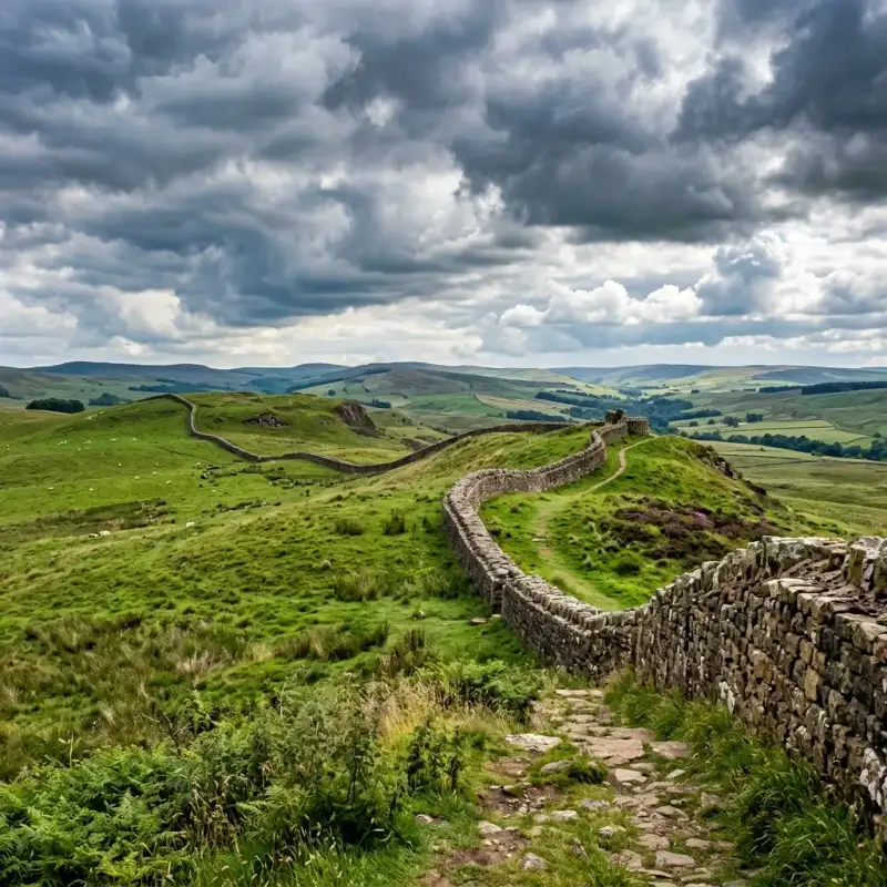

The sweeping, windswept moorlands of northern England hold a profound and enduring secret. Here, stretching across the rugged and dramatic neck of the island of Great Britain, lies one of the most spectacular and monumental archaeological survivals of the ancient world. Hadrian's Wall is not merely a collection of ancient, weathered stones; it is a physical manifestation of imperial ambition, a testament to staggering logistical prowess, and a deep psychological marker that once separated the known universe from the wild, untamed unknown. For nearly three centuries, this colossal barrier served as the ultimate north-western frontier of the mighty #RomanEmpire, standing against the biting winds and the defiant tribes of the north. To stand beside the remnants of the wall today, tracing its path as it aggressively snakes over the volcanic crags of the Whin Sill and plunges into the verdant valleys below, is to experience a profound sense of temporal dislocation. You are simultaneously in the modern English countryside and standing on the very precipice of antiquity. The wall stretches for 73 modern miles—or exactly 80 Roman miles—from the banks of the River Tyne at Wallsend in the east to the tidal flats of Bowness-on-Solway in the west. It is a structure so vast that it seems to defy the technological limitations of the second century. Yet, to truly understand #HadriansWall, we must look beyond its staggering physical dimensions. We must delve into the mind of the visionary emperor who ordered its construction, the sweat and toil of the legionaries who built it, the daily lives of the diverse auxiliary soldiers who manned it, and the vibrant civilian communities that sprouted in its formidable shadow. The Visionary Emperor and the Shift in Grand Strategy To comprehend the existence of this monumental fortification, one must first understand the political climate of Rome in the early second century and the philosophy of the man who ruled it. When Emperor Publius Aelius Hadrianus—known to history simply as #Hadrian—ascended to the imperial throne in AD 117, he inherited an empire that was stretched to its absolute breaking point. His predecessor, the militarily aggressive Emperor Trajan, had expanded Rome’s borders to their greatest ever territorial extent, conquering Dacia (modern-day Romania) and pushing deep into the Parthian Empire in the Middle East. However, this relentless expansion was financially crippling and militarily unsustainable. Rome was bleeding resources trying to hold onto rebellious, far-flung territories. Hadrian was fundamentally different from Trajan. An intellectual, a Hellenophile, and a pragmatic administrator, he recognized that the empire needed consolidation, not infinite expansion. He initiated a radical shift in Roman grand strategy: he abandoned Trajan's most indefensible eastern conquests and decreed that the empire must define and defend its existing borders. Hadrian spent more time traveling his empire than any other emperor, inspecting military installations and imposing discipline. In AD 122, his extensive tours brought him to the misty, rebellious province of Britannia. Britannia had always been a problematic territory for the Romans. The northern tribes, whom the Romans collectively referred to as Britons and later Picts, were fiercely independent and prone to launching devastating guerrilla raids against Roman installations. According to the Augustan History, a late Roman collection of biographies, Hadrian determined to decisively end this insecurity. He ordered the construction of the wall to "separate the Romans from the barbarians." This was a profound ideological statement. By building a permanent, monumental wall, Hadrian was declaring that the era of limitless Roman expansion was officially over. The wall was to be the literal edge of the civilized world, a fixed line in the landscape denoting where the light of #AncientRome ended and the darkness of barbarism began. A Staggering Feat of Military Engineering The logistical and physical reality of building Hadrian's Wall was an undertaking of mind-boggling complexity. It was an epic feat of #AncientEngineering that required the mobilization of immense resources. The construction was entirely entrusted to the highly trained Roman army, specifically the three legions stationed in Britain at the time: the Second Augustan (Legio II Augusta), the Sixth Victorious (Legio VI Victrix), and the Twentieth (Legio XX Valeria Victrix). These legions were not just elite fighting units; they were composed of highly skilled surveyors, architects, masons, and engineers. The original plan for the wall was wildly ambitious. The initial design called for a barrier built entirely of stone, measuring a massive 10 Roman feet (approximately 3 meters) in width—a phase archaeologists now refer to as the "Broad Wall." However, a few years into construction, reality and perhaps a desire for speed forced a modification. The thickness was reduced to roughly 6 to 8 feet, creating the "Narrow Wall." In the western sector of the frontier in modern-day Cumbria, where suitable limestone for mortar was scarce, the wall was initially constructed of stacked turf blocks, creating a formidable rampart 20 feet wide at its base. This turf section was eventually rebuilt in stone in the decades that followed. But the curtain wall itself was only one component of a deeply layered, complex military zone. Approaching the frontier from the hostile north, an attacker would first encounter a glacis (a cleared, sloping bank) followed by a massive, V-shaped ditch, measuring up to 27 feet wide and 9 feet deep. This ditch was dug through solid bedrock in places, except where the sheer vertical drop of the natural dolerite crags of the Whin Sill made it entirely unnecessary. Behind this ditch stood the imposing stone wall, likely standing some 15 feet high and topped with a parapet and a patrol walkway. The fortifications were meticulously standardized. Exactly every Roman mile (about 1.48 kilometers), the engineers constructed a "milecastle"—a fortified fortlet built directly into the wall, containing barracks for a few dozen men and a gateway that allowed controlled passage to the north. Between each milecastle sat two evenly spaced observation turrets, providing continuous surveillance and signaling capabilities along the entire 73-mile stretch. Remarkably, the defenses did not end there. To the south of the wall, the Romans constructed a uniquely baffling and massive earthwork known as the Vallum. The Vallum consisted of a huge flat-bottomed ditch flanked by twin continuous mounds of earth. Its purpose was not defensive in the traditional sense, as it offered no tactical advantage against an army. Instead, the Vallum served to seal off the military zone from the rear, ensuring that anyone approaching the wall from the Roman south—whether merchants, travelers, or locals—could only cross the frontier at heavily guarded, designated checkpoints. It transformed the wall into a highly regulated customs border, a physical barrier to unauthorized immigration, and an effective deterrent against the smuggling of goods and the rustling of livestock. #MilitaryHistory #EngineeringMarvel. The Cosmopolitan Garrison of the Cold North A common misconception is that the colossal structure was permanently guarded by the elite, heavy-infantry legionaries who built it. In truth, once the monumental task of laying the stones was completed, the legions withdrew to their comfortable fortress bases at York, Chester, and Caerleon. The day-to-day defense and policing of Hadrian's Wall were handed over to the auxilia—the auxiliary regiments of the Roman Army. These auxiliary soldiers were recruited from the myriad conquered provinces of the vast empire, creating a staggeringly cosmopolitan and multicultural society on the rain-swept edge of the world. Epigraphic evidence and altars found along the wall reveal an incredible ethnic diversity. There were regiments of Batavians from the modern-day Netherlands, fiercely proud of their equestrian skills. There were Tungrians from Belgium, Asturians from the sun-drenched plains of Spain, and even cohorts of skilled archers from the deserts of Syria. One can only imagine the profound culture shock experienced by a Syrian archer, accustomed to the blistering Mediterranean heat, finding himself standing watch on a freezing Cumbrian crag in the dead of winter, staring into the impenetrable northern fog. The daily lives of these soldiers were characterized by a mixture of intense boredom, rigorous training, and occasional bursts of absolute terror. They lived in a series of large, heavily fortified bases built directly astride or just behind the wall—forts with names that still echo in the landscape today, such as Housesteads (Vercovicium), Chesters (Cilurnum), and Birdoswald (Banna). Each fort housed between 500 and 1,000 men, packed tightly into barrack blocks, alongside granaries, headquarters buildings, and commanding officers' luxurious courtyard houses. Our understanding of this daily frontier life was revolutionized by the miraculous discovery of the #VindolandaTablets. Vindolanda is a Roman fort situated just south of the main wall line. Thanks to the unique, oxygen-free conditions of the waterlogged soil, archaeologists uncovered hundreds of thin, wooden leaf-tablets covered in carbon-ink handwriting. These fragile documents are a breathtaking window into the past, offering the most intimate, humanizing glimpses of life in the Roman military machine. Instead of reading about grand imperial campaigns, the Vindolanda tablets reveal the relatable, mundane struggles of ordinary people. We read the exasperated reports of commanders complaining about the wretched, impassable state of the local roads. We read a desperate plea from a decurion named Masculus, asking his commander to send more beer because his garrison had entirely run dry. We find the famous, elegantly written birthday invitation from a commander's wife, Claudia Severa, to her friend Sulpicia Lepidina—one of the earliest known examples of handwriting by a woman in the Latin language. Most poignantly, we read the universal complaints of soldiers serving in a cold climate, including requests from home for crucial supplies: "I have sent you... pairs of socks, two pairs of sandals, and two pairs of underpants." These delicate slivers of wood bridge the vast chasm of time, transforming faceless historical sentinels into relatable human beings who shivered, drank, socialized, and missed their families. #Archaeology #RomanArmy. Vici, Gods, and the Frontier Economy Hadrian's Wall is often romanticized in popular culture as a desolate, lonely outpost at the end of the earth, manned by stoic men staring endlessly into the abyss. The reality was vastly different. The wall was not a sterile, isolated military zone; it was a thriving, noisy, and dynamic corridor of intense human enterprise and economic activity. Where there are thousands of continuously paid soldiers, a robust economy inevitably follows. Almost immediately, vibrant civilian settlements known as vici (singular: vicus) sprang up outside the heavily guarded gates of the major forts. These settlements were chaotic, sprawling, and entirely reliant on the purchasing power of the garrison. The vicus was a bustling ecosystem of strip-houses, artisan workshops, taverns, brothels, and bustling market squares. Merchants traveled from across the empire to sell imported Gaulish pottery, Spanish olive oil, Mediterranean wine, and exotic foodstuffs to soldiers eager for a taste of home. Local blacksmiths, leatherworkers, and bronze-smiths set up lucrative shops to repair and manufacture military gear. At the heart of the vicus was usually the Roman bathhouse. Far from being a mere hygienic facility, the bathhouse was the undisputed social center of the community. It functioned as a combination of a modern leisure center, a pub, and a refuge from the pervasive northern chill. Here, soldiers and civilians alike would exercise, socialize, gamble, and conduct business while moving through a series of heated rooms. Furthermore, the rigid boundaries between the Roman military and the local Brittonic population began to blur significantly over the decades. Although ordinary auxiliary soldiers were legally forbidden from marrying while in service (a ban that lasted until the reign of Emperor Septimius Severus in the late second century), human nature prevailed. Many soldiers formed deeply committed, unofficial relationships with local Celtic women, raising families within the bustling vici. When their standard 25 years of grueling service finally concluded, they received the highly coveted prize of Roman citizenship. Rather than returning to the distant homelands they had barely known, many veterans chose to retire right there on the frontier, settling down permanently near their former comrades and their new families. Over generations, this intense mingling created a highly distinct, localized #RomanoBritish culture. The religious life of the wall perfectly illustrates this profound syncretism. The soldiers brought the official state pantheon with them—worshipping Jupiter, Mars, and Minerva on the parade grounds. But they also quickly adopted and revered the local Celtic deities. At Carrawburgh, they built a shrine to the native water goddess Coventina, tossing thousands of coins, pearls, and brooches into her sacred well. At Benwell, they worshipped the mysterious local god Antenociticus. Simultaneously, exotic mystery cults from the eastern fringes of the empire found fervent followers among the troops. The deeply atmospheric Temple of Mithras at Carrawburgh (Brocolitia)—designed to resemble a dark, windowless subterranean cave—served as a sanctuary where soldiers underwent intense, secretive initiation rites into the popular cult of the Persian sun god. The wall, therefore, was never a hermetically sealed barrier; it was a highly porous membrane, a vibrant zone of relentless cultural, religious, and economic exchange. #CulturalHistory #AncientBritain. The Slow Fade of the Roman Light How does such a monumental, seemingly invincible frontier finally fall? It is rarely the swift, catastrophic, cinematic breach by hordes of screaming barbarians that Hollywood epics might suggest. The demise of Hadrian's Wall was a prolonged, agonizingly slow fade, inextricably linked to the broader, terminal decline of the Western Roman Empire. The wall's dominance was actually briefly interrupted shortly after Hadrian's death in AD 138. His successor, Emperor Antoninus Pius, aggressively advanced the frontier further north into Scotland, constructing the Antonine Wall—a turf and timber barrier across the narrowest part of the country between the Firth of Forth and the Firth of Clyde. However, this forward policy proved strategically untenable. After a mere two decades, the Antonine Wall was abandoned, and the Roman army permanently retreated back to the impregnable stone certainty of Hadrian's original line. Fast forward to the third, fourth, and fifth centuries, and the geopolitical reality of the Roman world had fundamentally shifted. The empire was crumbling internally under the crushing weight of hyperinflation, endless political instability, and devastating civil wars, while simultaneously facing massive, unprecedented migrations of Germanic tribes across the Rhine and Danube frontiers. To deal with these existential crises closer to home, the central administration began gradually stripping Britannia of its troops. Units were repeatedly withdrawn to fight in continental squabbles, never to return. The fatal blow finally came in AD 410. Facing the sack of Rome itself by the Visigoths, Emperor Honorius allegedly sent a desperate rescript to the beleaguered cities of Britain, instructing them to "look to their own defenses." The central Roman administration, the logistical supply chains, and the imperial paychests abruptly ceased to exist. But what happened to the thousands of soldiers still stationed on Hadrian's Wall? They did not simply pack their bags and march away on a Tuesday afternoon. For many, Britannia was the only home they had ever known. They simply stopped receiving their imperial salaries. Without the backing of the state, the highly organized regiments slowly fragmented. The soldiers transitioned from being professional imperial troops to serving as local militias, protecting their families and farms. The commanding officers likely evolved into local warlords or petty kings, seamlessly blending into the fractured, post-Roman political landscape of the emerging #DarkAges. The wall itself, no longer maintained by the relentless discipline of the legions, entered its second, much longer life as a colossal, linear quarry. For well over a millennium, the beautifully squared, perfectly dressed Roman stones were systematically pillaged by generations of local inhabitants. If you travel through the border region today, the ghosts of the wall are everywhere. You will see Roman masonry proudly embedded in the sturdy walls of lonely farmhouses, field boundaries, and massive medieval fortifications like Thirlwall Castle. The magnificent, echoing crypt of Hexham Abbey was constructed almost entirely using stones looted from the nearby Roman bridge at Chesters. Later, during the violent, lawless era of the Border Reivers from the 14th to the 17th centuries, the tumbled ruins of the forts provided excellent hiding places and ready-made building materials for defensive 'pele towers'. The great wall was slowly, methodically being consumed by the very landscape it had once so arrogantly dominated. #BritishHistory #HistoricRuins. Destruction and Conservation: The Intervention of John Clayton By the 18th and 19th centuries, a new and far more terrifying threat emerged: the relentless, insatiable march of the Industrial Revolution. What a thousand years of casual pillaging had failed to completely erase, the demands of modern infrastructure threatened to obliterate in a matter of decades. A stark example of this organized destruction occurred in the aftermath of the 1745 Jacobite Rebellion. When the British government forces, led by General George Wade, struggled to move their heavy artillery across the country to intercept Bonnie Prince Charlie's rebel army due to the treacherous, muddy terrain, a drastic decision was made. Following the rebellion, the government ordered the construction of a new, paved Military Road (which still exists today as the B6318). Appallingly, for many miles, the easiest route was simply to flatten the remaining sections of Hadrian's Wall and build the road directly on top of its ancient, solid foundations, destroying priceless archaeology forever. The complete eradication of the wall seemed inevitable until the dramatic intervention of a singular, extraordinary individual: John Clayton. A wealthy, eccentric antiquarian and the highly influential town clerk of Newcastle upon Tyne in the mid-19th century, Clayton watched with growing horror as the surviving sections of the wall were being callously dynamited, ground up for road hardcore, and dismantled for agricultural improvements. Determined to halt the vandalism, Clayton leveraged his considerable personal fortune to begin systematically buying up the farms, lands, and ruined forts situated along the best-preserved central sector of the wall, including the magnificent sites of Chesters and Housesteads. He ordered his estate workmen to carefully clear the accumulated centuries of earth and debris from the wall's base. He then directed them to rebuild the fallen facing stones back onto the ancient core, purposely doing so without modern mortar to differentiate the restoration from the original Roman work—creating the distinctive, dry-stone "Clayton Wall" that is so universally recognized today. John Clayton's obsessive dedication and immense wealth single-handedly saved the most spectacular stretches of Hadrian's Wall for posterity. Without his timely intervention, there would likely be almost nothing left for us to marvel at today. #Conservation #JohnClayton #HistoryHeroes. The Wall in the Modern Imagination Today, Hadrian's Wall rightfully enjoys protected status as a universally recognized UNESCO World Heritage Site, drawing hundreds of thousands of awe-struck visitors from across the globe every single year. In 2003, the momentous opening of the Hadrian's Wall Path—an 84-mile (135 km) continuous National Trail—allowed modern adventurers to walk the entire, unbroken length of the ancient frontier from coast to coast. Walking the wall today is a deeply physical, almost spiritual experience. It is an act of historical pilgrimage. As modern hikers trudge through the clinging Cumbrian mud, lean into the ferocious, horizontal northern rain, and crest the spectacularly steep, breathtaking heights of Steel Rigg and the tragically beautiful gap where the famous Sycamore tree once stood, they forge a profound, physiological connection with the past. The burning in the calves and the biting wind on the face are exactly the same sensations experienced by the Tungrian infantrymen and Asturian cavalrymen nearly two millennia ago. The landscape has barely changed; only the uniforms have. The wall has firmly embedded itself in the modern imagination. It was the direct, explicitly acknowledged inspiration for the colossal "Ice Wall" guarding the northern boundary of Westeros in George R.R. Martin’s A Song of Ice and Fire series, capturing that same quintessential feeling of a desperate, final stand against the terrifying, frozen unknown. #Wanderlust #HikingUK #WorldHeritage #EpicJourneys. Conclusion: The Enduring Stones In a modern era where humanity continues to fiercely debate the morality, efficacy, and necessity of physical borders, this spectacular 1,900-year-old ruin serves as a profound and sobering historical mirror. Hadrian's Wall speaks volumes about the incredible ambition of empires, the desire to impose order upon chaos, and the deeply human urge to draw a line in the dirt and declare, "This is ours, and that is yours." Yet, as you stand in the quiet, fading light of a Northumbrian evening, listening only to the wind whistling over the ancient, moss-covered stones, the wall also speaks to the ultimate, inevitable futility of such hubristic endeavors. The invincible Roman Empire is nothing but dust and fragmented history. The god-like emperors are long dead. The mighty, disciplined legions that once made the earth tremble are gone. What remains is only the stone—deeply weathered, undeniably scarred, but breathtakingly resilient and strikingly beautiful. It no longer functions to divide the land or separate people. Instead, in a beautiful twist of historical irony, it now serves to unite people from every corner of the world, who travel thousands of miles to marvel at its scale and to walk reverently in the footsteps of the ancients. Hadrian's Wall stands as an eternal, silent testament to the poignant truth that while the grandest of human empires inevitably rise and fall, the monumental stories we carve into the living earth will endure forever. #RomanArchaeology #TravelBlogger #HistoricSites. #HadriansWall #RomanEmpire #BritishHistory #AncientArchitecture #HikingUK Related InsightsThe Great Pyramid of Giza: A Timeless Monument to Human Ingenuity Julius Caesar: The Ambitious Soldier Behind the Myth 千古绝唱,江水悠悠:探秘乐山大佛的沧桑与辉煌{ "@context": "https://schema.org", "@type": "FAQPage", "mainEntity": [ { "@type": "Question", "name": "What is the main focus of The Edge of Empire: A Journey Along Hadrian's Wall?", "acceptedAnswer": { "@type": "Answer", "text": "Explore the fascinating history, staggering engineering, and enduring legacy of Hadrian's Wall, the ancient Roman frontier that divided Britain." } }, { "@type": "Question", "name": "Who authored the comprehensive guide on The Edge of Empire: A Journey Along Hadrian's Wall?", "acceptedAnswer": { "@type": "Answer", "text": "This detailed article and its insights were carefully researched and authored by Liam Carter." } }, { "@type": "Question", "name": "Where can I find more related content about History?", "acceptedAnswer": { "@type": "Answer", "text": "You can explore more articles, detailed reviews, and similar insights by browsing the Related Insights section at the bottom of this article or visiting our dedicated History category page." } } ] }
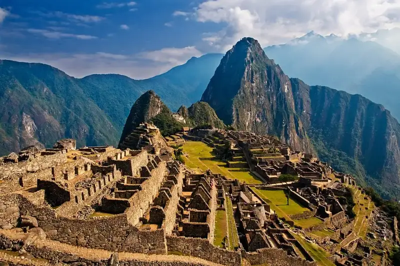
High above the roaring waters of the Urubamba River, enveloped by the perpetual mists of the Peruvian Andes, lies a testament to human ingenuity that has captivated the world’s imagination for over a century. Machu Picchu, often romanticized as the "Lost City of the Incas," is far more than a stunning ruin perched on a dramatic mountain ridge. It is a masterclass in civil engineering, a profound spiritual sanctuary, and a frozen window into the zenith of the Inca Empire—Tawantinsuyu. To stand amidst its perfectly joined stones as the morning fog rolls back is to feel the pulse of a civilization that, despite lacking written language, the wheel, or iron tools, managed to carve out an empire that stretched across the spine of South America. #MachuPicchu #AncientWonders This majestic citadel, nestled at an elevation of 2,430 meters (7,970 feet), has become the ultimate emblem of the Inca civilization. Yet, beneath the postcard-perfect vistas and the countless photographs captured by modern travelers, lies a complex narrative of imperial ambition, staggering labor, astronomical precision, and eventual abandonment. The story of Machu Picchu is not just about the stones themselves, but about the people who quarried them, the ruler who envisioned them, and the mountains that cradle them. #IncaEmpire #TravelPeru The Cradle of the Inca: Geographical Grandeur To understand Machu Picchu, one must first understand its geography. The site is located in the Cusco Region, Urubamba Province, Machupicchu District in Peru. It is situated on a mountain saddle between two prominent peaks: Machu Picchu ("Old Peak" in Quechua) and Huayna Picchu ("New Peak"). This location was no accident; it was chosen with profound geographical and spiritual deliberation. The Inca venerated the landscape, seeing mountains as apus—powerful spirits or deities that governed the natural world. Machu Picchu is surrounded by a pantheon of these sacred peaks, creating a physical and spiritual amphitheater that amplified the site's importance. The environment here is dramatically different from the high-altitude, arid plateau of Cusco, the Inca capital. Machu Picchu sits in a transitional zone where the rugged peaks of the Andes begin to plunge into the lush, verdant Amazon basin. This creates a cloud forest ecosystem—a world of orchids, bromeliads, spectacled bears, and brightly colored tanagers. The constant clash of cold mountain air and warm, moist air rising from the jungle produces the ethereal mists that frequently shroud the citadel. The Urubamba River, known to the Inca as the Vilcanota, tightly coils around the base of the mountain on three sides, creating a natural moat that made the site easily defensible and visually spectacular. #AndesMountains #NatureLovers Pachacuti’s Vision: The Genesis of a Royal Estate Historically, the construction of Machu Picchu is attributed to Pachacuti Inca Yupanqui, the ninth Sapa Inca (emperor), who ruled from 1438 to 1472. Pachacuti was a transformative figure in Inca history, a brilliant military strategist and administrator who expanded a small regional kingdom into a vast empire. Archaeological consensus suggests that Machu Picchu was built as a royal estate for Pachacuti and his lineage. A royal estate in the Inca world served multiple purposes. It was a retreat for the emperor, his family, and his courtiers to escape the bitter cold of the Cusco winter. The warmer climate of the cloud forest allowed for the cultivation of a diverse array of crops, including maize, coca, and various fruits, which could not be grown at higher altitudes. Furthermore, the estate served as an administrative center for the region, asserting imperial control over the newly conquered territories of the Vilcabamba valley. #HistoryBuff #Archaeology The construction of such a monumental site required immense resources, particularly human labor. The Inca utilized a system known as mit'a, a form of compulsory public service exacted from conquered populations. Under the mit'a system, citizens were required to contribute a certain amount of their labor to the state each year. This workforce was responsible for quarrying the massive granite blocks, transporting them up the treacherous mountain slopes, and meticulously carving them into place. It is estimated that thousands of laborers, skilled stonemasons, and engineers were involved in the creation of Machu Picchu, working tirelessly over several decades. Defying Gravity and Earthquakes: Inca Engineering The most visually arresting aspect of Machu Picchu is its architecture. The Inca were master stonemasons, renowned for their use of ashlar—a technique where stones are cut to fit together perfectly without the use of mortar. At Machu Picchu, the finest examples of this masonry can be seen in the most important religious and royal structures. The granite blocks were shaped using harder stones, bronze tools, and sand as an abrasive. The precision is such that even today, a knife blade cannot be slipped between the joints. But this mortarless construction was not merely an aesthetic choice; it was a highly sophisticated engineering solution to the seismic reality of the Andes. Peru is highly prone to earthquakes. When the ground trembles, the mortarless walls of Machu Picchu do not rigidly resist the shockwaves. Instead, the stones are allowed to "dance"—they vibrate and shift slightly, then settle back into their original positions once the tremor has passed. Furthermore, the Inca employed several other anti-seismic features: doors and windows were built with a trapezoidal shape, tilting inward; walls were inclined slightly inward; and L-shaped blocks were used to tie outside corners together. Thanks to these innovations, Machu Picchu has survived centuries of seismic activity while post-conquest colonial buildings in nearby cities have repeatedly collapsed. #EngineeringMarvel #IncaArchitecture The Masterful Hydrology and Agricultural Terracing While the stonework is the most visible marvel, perhaps the true genius of Machu Picchu lies hidden beneath the surface. The mountain receives torrential rainfall during the wet season, and without a sophisticated drainage system, the site would have quickly washed down the steep slopes into the Urubamba River. To prevent this, the Inca engineers expended roughly 60% of their building effort underground. They created a vast, multi-layered drainage system beneath the plazas and buildings, consisting of deep layers of gravel and rock that channeled water safely away. Surrounding the urban sector are hundreds of agricultural terraces, or andenes. These terraces served a dual purpose: they created flat land for farming, and they stabilized the steep mountain slopes, preventing landslides. The terraces were built with stone retaining walls, behind which were layers of large stones, smaller gravel, and finally, nutrient-rich topsoil brought up from the valley floor. Water was brought to the city via an intricately carved stone canal that tapped a natural spring high on the mountain slope. This canal fed a series of sixteen interconnected fountains, providing fresh water to the emperor’s compound first, before flowing down to the rest of the inhabitants. This mastery over water, both in supplying it and draining it away, was absolutely crucial to the survival of the citadel. #SustainableDesign #Agriculture Sacred Stones: The Spiritual Heart of the Citadel Machu Picchu is roughly divided into an agricultural sector and an urban sector, separated by a dry moat and a wall. The urban sector is further divided into a lower, residential area, and an upper, sacred area where the most important temples are located. The Inca religion was deeply tied to astronomy and the observation of the natural world, and the architecture of Machu Picchu reflects this profound spiritual connection. #SpiritualJourney #CulturalHeritage One of the most significant structures is the Temple of the Sun. Built with exquisite, curved masonry, it is situated atop a massive, natural boulder. The temple features a distinctive trapezoidal window that aligns perfectly with the rising sun on the day of the winter solstice. Inside the temple, the natural rock is carved into what is believed to be an altar. Below the temple is a natural cave, finely lined with stonework, which Bingham referred to as the Royal Tomb, though no human remains were ever found there. It is more likely that this space was used for rituals associated with the Earth mother, Pachamama. A short walk from the Temple of the Sun is the Sacred Plaza, home to the Principal Temple and the Temple of the Three Windows. The massive stones used in these structures are among the largest at the site. The three large windows in the latter temple are thought to represent the three realms of the Inca universe: Hanan Pacha (the upper world of the gods), Kay Pacha (the middle world of humans), and Uku Pacha (the underworld of the ancestors). Perhaps the most famous and enigmatic stone at Machu Picchu is the Intihuatana. Often translated as the "Hitching Post of the Sun," this carved granite pillar sits atop a terraced pyramid structure. The Intihuatana served as an astronomical observatory and a calendrical device. By observing the shadows cast by the pillar, the Inca priests could track the solstices and equinoxes, crucial information for timing their agricultural planting and religious festivals. During the winter solstice, the priest would ritually "hitch" the sun to the stone to ensure it would return to warm the earth. #Astronomy #AncientWisdom Another remarkable feature is the Temple of the Condor. Here, the Inca took advantage of a natural rock formation that resembled the outstretched wings of a massive Andean condor. On the ground before the wings, they carved a rock into the shape of the bird's head and neck ruff. The condor was a sacred bird in Inca mythology, representing the upper world, Hanan Pacha. This area was likely used for ceremonies, and the caves behind the "wings" may have been used for ritualistic purposes or even as dungeons, depending on the interpretation. Life in the Clouds: Inhabitants of the Estate Who lived at Machu Picchu? While it was a royal estate, Pachacuti and his royal retinue would have only visited periodically, likely during the warmer months. However, the site was never truly empty. A permanent population was required to maintain the estate, tend the crops, perform religious duties, and guard the site. Estimates suggest that during its peak use, Machu Picchu supported a population of around 500 to 750 people. The majority of these inhabitants were yanaconas, a class of skilled retainers and servants who were dedicated to the service of the emperor and the nobility. These individuals were brought from all over the empire, representing a diverse mix of ethnicities and cultures. Osteological analysis of the skeletal remains found in the burial caves surrounding Machu Picchu confirms this diversity, showing variations in cranial deformation practices and dietary habits that point to origins across Tawantinsuyu. The daily life of these permanent residents was closely tied to the agricultural cycle and the maintenance of the estate. They tended the terraces, cultivating corn, potatoes, and other crops. They maintained the aqueducts, repaired the stonework, and wove textiles. While the royal sections of the city boast the finest ashlar masonry, the residential areas were constructed using a more rustic style known as pirca, where unshaped stones were held together with mud mortar. The roofs of all buildings, royal and residential alike, were originally steeply pitched and covered with thick thatch, giving the city a very different appearance than the bare stone ruins we see today. #Anthropology #AncientLife The Fall of Tawantinsuyu and the Silence of the Citadel Machu Picchu thrived for less than a century. Its active use came to an abrupt end in the 1530s, corresponding with the arrival of the Spanish conquistadors led by Francisco Pizarro. The Spanish invasion unleashed a devastating cascade of events: civil war, the capture and execution of the Sapa Inca Atahualpa, and the collapse of the imperial administration. More devastating than the Spanish swords, however, were the invisible conquerors: European diseases. Smallpox, measles, and influenza swept through the Andes, decimating the indigenous population. It is highly probable that the population of Machu Picchu, or the surrounding valleys that supported it, was severely impacted by these epidemics. As the central authority of Cusco fell, the royal estates lost their purpose and funding. The mit'a labor system broke down, and the supply lines that kept the isolated citadel functioning were severed. The inhabitants of Machu Picchu gradually abandoned the site, returning to their ancestral lands or seeking refuge deeper in the mountains. Remarkably, the Spanish never found Machu Picchu. Unlike many other Inca sites, it was never plundered, its sacred stones were never smashed, and no Catholic church was ever built over its temples. The dense jungle quickly reclaimed the terraces and the buildings, swallowing the city in a cloak of green, hiding it from the outside world for almost four centuries. #LostCity #HistoricalMystery The Myth of the "Lost City" and Hiram Bingham’s Arrival The Western narrative of Machu Picchu often begins in 1911 with the American explorer and Yale historian, Hiram Bingham. Sponsored by Yale University and the National Geographic Society, Bingham was searching for Vilcabamba, the last refuge of the Inca resistance against the Spanish. Guided by a local innkeeper named Melchor Arteaga, Bingham crossed the Urubamba River and climbed the steep, jungle-choked ridge. On July 24, 1911, he was led to the ruins. Bingham was astounded by the sheer scale and quality of the stonework, particularly the Temple of the Sun and the Room of the Three Windows. He believed he had found the legendary "Lost City of the Incas," a moniker that stuck and fueled global fascination, even though later archaeological evidence proved that the true last refuge, Vilcabamba, was located further in the jungle at Espiritu Pampa. #HiramBingham #Exploration However, to say Bingham "discovered" Machu Picchu is to ignore the reality of the local population. The site was never truly lost to the people who lived in the region. When Bingham arrived, he found local Quechua farmers, including the families of Richarte and Alvarez, living amidst the ruins and actively cultivating the ancient Inca terraces. The existence of the ruins was known to local landowners, and a Peruvian explorer named Agustín Lizárraga had even carved his name on the Temple of the Three Windows in 1902, nine years before Bingham’s arrival. Bingham's true achievement was not discovery, but rather scientific documentation and global popularization. Through his writings and the striking photographs published in a dedicated issue of National Geographic magazine in 1913, Bingham brought Machu Picchu to the world's attention. He initiated extensive clearing and excavation, fundamentally changing the site's trajectory from a forgotten ruin to a global icon. #HistoryFacts #NationalGeographic The Artifact Controversy and Repatriation Bingham's expeditions, while scientifically groundbreaking for their time, also sparked a century-long controversy. Between 1912 and 1915, Bingham excavated thousands of artifacts—pottery sherds, skeletal remains, bronze tools, and jewelry—and transported them to Yale University in the United States. He claimed this was done with the permission of the Peruvian government, under a decree that allowed the temporary export of the artifacts for study, with the stipulation that they would eventually be returned. Decades passed, and the artifacts remained at Yale's Peabody Museum. The Peruvian government repeatedly requested their return, leading to a protracted and often bitter legal and diplomatic dispute. Peru argued that the artifacts were an integral part of their national heritage and had been held illegally for nearly a century. Yale argued that they had preserved and studied the artifacts, contributing significantly to global knowledge about the Inca. Finally, in 2010, an agreement was reached. Yale acknowledged Peru's title to the artifacts and agreed to repatriate the entire collection. Between 2011 and 2012, coinciding with the centenary of Bingham's scientific expedition, thousands of pieces were flown back to Peru. Today, they are housed and displayed in the Museo Machu Picchu in the Casa Concha in Cusco, representing a significant victory for cultural heritage repatriation and the right of nations to reclaim their historical treasures. #CulturalHeritage #MuseumStudies Preservation in the Modern Era: Balancing Tourism and Heritage Today, Machu Picchu is one of the most recognized and visited archaeological sites in the world. It was designated a UNESCO World Heritage site in 1983 and was voted one of the New Seven Wonders of the World in 2007. The allure of the citadel draws well over a million visitors annually. However, this immense popularity is a double-edged sword. The relentless foot traffic on the ancient stone paths, the strain on local infrastructure, and the environmental impact on the fragile cloud forest ecosystem pose significant threats to the site's preservation. The very forces that bring people to marvel at Machu Picchu threaten to erode it. #UNESCO #WorldHeritage In recent years, the Peruvian government and international conservation bodies have implemented strict measures to protect the site. Daily visitor numbers are capped, specific circuits have been established to control the flow of foot traffic, and the time visitors can spend in the ruins is limited. There are ongoing efforts to mitigate erosion, stabilize the ancient walls, and monitor the geological fault lines beneath the site. The challenge of managing Machu Picchu is a microcosm of the global struggle in heritage conservation: how to share a profound cultural treasure with the world without destroying it in the process. It requires a delicate balance between accessibility and preservation, between economic benefit for the local region and the sacred integrity of the stones. #Conservation #SustainableTourism Conclusion: The Eternal Echo of the Andes Machu Picchu remains a place of profound mystery and enduring beauty. Despite decades of intensive archaeological study, it still holds secrets. We may never know the names of the master stonemasons who shaped its ashlar walls, or the exact rituals performed upon the Intihuatana. The written language of the Inca, the quipu (a complex system of knotted strings), remains largely undeciphered, leaving us to interpret their world through the stones they left behind and the chronicles of their conquerors. Yet, perhaps it is this very enigma that makes Machu Picchu so captivating. It is a monument to human ambition set against the overwhelming scale of nature. It speaks of a civilization that sought to harmonize its existence with the rugged peaks and the swirling clouds, building not just a city, but an altar to the cosmos. As the sun sets over the Urubamba valley and the shadows lengthen across the Great Plaza, the stones of Machu Picchu seem to resonate with the echoes of the past. They stand as a silent, majestic testament to the genius of the Tawantinsuyu, a dream of empire carved into the granite of the Andes, waiting patiently for the morning mists to rise once more. #Wanderlust #AncientHistory #PeruTravel #MachuPicchu #Inca #Peru #Andes Related InsightsThe Rose Red City: Unveiling the Mysteries of Petra The Colosseum: Echoes of Eternity in the Heart of Rome Ghosts of the Tower of London: Betrayal, Blood, and Royal Secrets{ "@context": "https://schema.org", "@type": "FAQPage", "mainEntity": [ { "@type": "Question", "name": "What is the main focus of Whisper of the Andes: Unraveling the Enigma of Machu Picchu?", "acceptedAnswer": { "@type": "Answer", "text": "A comprehensive exploration of Machu Picchu, delving into the architectural marvels, historical origins, and enduring mysteries of the legendary Inca citadel." } }, { "@type": "Question", "name": "Who authored the comprehensive guide on Whisper of the Andes: Unraveling the Enigma of Machu Picchu?", "acceptedAnswer": { "@type": "Answer", "text": "This detailed article and its insights were carefully researched and authored by Liam Carter." } }, { "@type": "Question", "name": "Where can I find more related content about History?", "acceptedAnswer": { "@type": "Answer", "text": "You can explore more articles, detailed reviews, and similar insights by browsing the Related Insights section at the bottom of this article or visiting our dedicated History category page." } } ] }