Showing Posts From
Travel
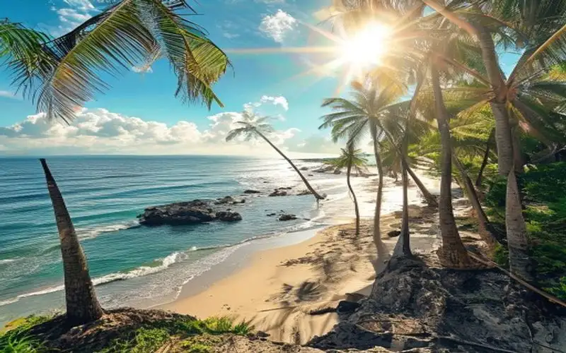

Сочи — это уникальный город-курорт на побережье Черного моря, который часто называют «Летней столицей России». Благодаря удивительному географическому положению, Сочи сочетает в себе влажный субтропический климат и близость заснеженных пиков Кавказских гор. Именно здесь в один день можно искупаться в теплом море и покататься на горных лыжах. От императорских дач до Олимпийского наследия История Сочи как курорта началась в конце XIX века, когда здесь стали строить дачи представители российской аристократии. Позже, в советское время, город превратился во всесоюзную здравницу с монументальными санаториями в стиле сталинского ампира. Одна из главных исторических достопримечательностей — дача Сталина в Зеленой роще, окруженная густым лесом и сохранившая аутентичные интерьеры того времени. Огромный толчок к развитию город получил благодаря проведению Зимних Олимпийских игр 2014 года. В Имеретинской низменности вырос современный Олимпийский парк с впечатляющими стадионами, трассой Формулы-1 и поющим фонтаном. А в горах Красной Поляны появились горнолыжные курорты мирового класса, такие как Роза Хутор, с первоклассной инфраструктурой и захватывающими видами на Кавказский хребет. Природа и кавказская гастрономия Природные богатства региона не менее впечатляющи. Знаменитый парк «Ривьера» и Сочинский Дендрарий собрали уникальную коллекцию экзотических растений со всего мира. Здесь растут пальмы, кипарисы, магнолии и бамбук, создавая вечнозеленый оазис. Кулинарная сцена Сочи формировалась под сильным влиянием кавказских традиций. Посещение Сочи немыслимо без дегустации сочного шашлыка, приготовленного на углях, ароматного хачапури по-аджарски (в форме лодочки с сыром и яйцом) и хинкали. Местные рынки, такие как Центральный рынок Сочи, пестрят яркими красками: здесь можно купить местный инжир, хурму, орехи, знаменитую абхазскую аджику и, конечно, чурчхелу — традиционную сладость из орехов в густом виноградном соке. Сочи — это место, где южный колорит, богатая природа и современный комфорт сливаются воедино. #сочи #черноеморе #краснаяполяна #кавказ #хачапури #курортыроссии #олимпийскийпарк #путешествиенаюг #travel #russia #sochi #blacksea #vacation #russiatravel Related InsightsThe Twenty Million Dollar View: A History of Humanity's Most Exclusive Destination Le Cattedrali Sotterranee di Puglia: Un Viaggio Intimo nelle Città Rupestri delle Gravine 嵐山の美学: 竹林と自然の調和{ "@context": "https://schema.org", "@type": "FAQPage", "mainEntity": [ { "@type": "Question", "name": "What is the main focus of Sochi Riviera?", "acceptedAnswer": { "@type": "Answer", "text": "A travel guide to Sochi Riviera" } }, { "@type": "Question", "name": "Who authored the comprehensive guide on Sochi Riviera?", "acceptedAnswer": { "@type": "Answer", "text": "This detailed article and its insights were carefully researched and authored by Ivan Sokolov." } }, { "@type": "Question", "name": "Where can I find more related content about Travel?", "acceptedAnswer": { "@type": "Answer", "text": "You can explore more articles, detailed reviews, and similar insights by browsing the Related Insights section at the bottom of this article or visiting our dedicated Travel category page." } } ] }
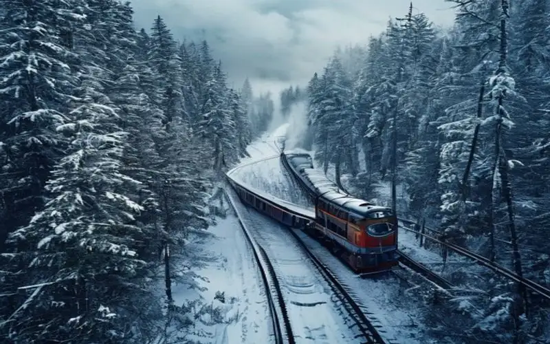
Транссибирская магистраль (Транссиб) — это не просто железная дорога, это легендарный маршрут, грандиозный инженерный проект и стальной хребет, связывающий воедино огромную территорию России. Самая длинная железнодорожная линия в мире протянулась на 9289 километров от Москвы до Владивостока, пересекая два континента, 87 городов и 8 часовых поясов. Инженерное чудо и историческое значение Строительство Транссиба, начавшееся в 1891 году по указу императора Александра III, стало одним из самых масштабных проектов в истории человечества. Магистраль прокладывали сквозь непроходимую тайгу, скалы и вечную мерзлоту. Сегодня путешествие по всему маршруту на фирменном поезде «Россия» занимает около семи дней. Это время, когда можно наблюдать за тем, как за окном сменяются климатические зоны, пейзажи и архитектура: от среднерусских лесов и Уральских гор до бескрайних сибирских степей, тайги и побережья Японского моря. Важнейшими остановками на пути являются такие города, как Екатеринбург, где Европа встречается с Азией, Новосибирск — столица Сибири, Иркутск, известный как «Париж Сибири» и являющийся воротами к великому озеру Байкал, а также Улан-Удэ, где ярко ощущается колорит буддийской культуры Бурятии. Романтика поездов и станционная кулинария Путешествие по Транссибу — это глубокое погружение в русскую культуру и быт. Поезд становится своеобразным домом, где пассажиры пьют чай из традиционных стаканов в металлических подстаканниках, ведут долгие душевные разговоры с попутчиками и наслаждаются мерным стуком колес. Особое удовольствие — это кулинарная сторона поездки. Помимо вагона-ресторана, предлагающего классические блюда, такие как борщ и котлеты, настоящим гастрономическим приключением становятся долгие остановки на станциях. Именно здесь местные жители выносят на перроны домашнюю еду: горячую отварную картошку с укропом, свежеиспеченные пирожки с капустой и картофелем, соленые огурцы, копченого байкальского омуля в Слюдянке и кедровые орехи. Транссиб — это путь к пониманию масштабов и души России, уникальное приключение, которое хотя бы раз в жизни стоит испытать каждому путешественнику. #транссиб #железнаядорога #путешествияпоездом #сибирь #владивосток #москва #россия #подстаканник #поезд #travel #russia #transsiberian #siberia #train #russiatravel Related InsightsTerme di Caracalla: Il Lusso del Benessere Romano Albania’s Riviera vs Montenegro’s Bay of Kotor: Europe’s Best-Kept Secret Coastlines Revealed Romantische Straße fahren{ "@context": "https://schema.org", "@type": "FAQPage", "mainEntity": [ { "@type": "Question", "name": "What is the main focus of Trans-Siberian Railway?", "acceptedAnswer": { "@type": "Answer", "text": "A travel guide to Trans-Siberian Railway" } }, { "@type": "Question", "name": "Who authored the comprehensive guide on Trans-Siberian Railway?", "acceptedAnswer": { "@type": "Answer", "text": "This detailed article and its insights were carefully researched and authored by Ivan Sokolov." } }, { "@type": "Question", "name": "Where can I find more related content about Travel?", "acceptedAnswer": { "@type": "Answer", "text": "You can explore more articles, detailed reviews, and similar insights by browsing the Related Insights section at the bottom of this article or visiting our dedicated Travel category page." } } ] }
-
 John Explorer
 - 24 Jun, 2026 14:45
The Aetherial Threads: Unearthing Ladakh's Forgotten Sky Roads of the Monastics
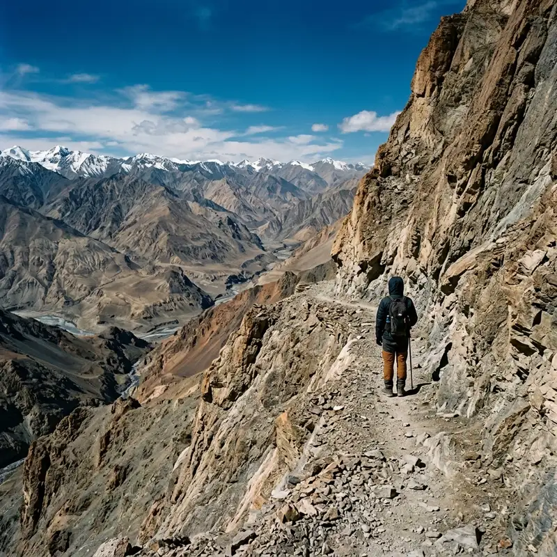
The air, thin and sharp like a perfectly honed blade, sliced through my lungs with each desperate gasp. My vision blurred at the periphery, a dizzying dance of sapphire sky and ochre rock. There was no path here, not in the conventional sense. Only an instinct, a faint whisper from a centuries-old story, guiding my frostbitten boots across scree slopes that seemed to dissolve underfoot. This wasn’t a hike; it was an act of faith, a pursuit of ghosts along routes whispered about only by the oldest Lamas, an investigative #journey into the very soul of the Himalayas. I was searching for Ladakh’s invisible Sky Roads, #ancient monastic trails that exist more in legend than on any map. A Whisper from the High Peaks: The Genesis of a Quest My fascination began innocently enough, buried within the brittle pages of an obscure 19th-century British survey report. Amidst detailed topographic measurements and colonial observations of local customs, a single, intriguing footnote caught my eye. It alluded to "aerial paths"—high-altitude routes supposedly used by early Buddhist monks to connect isolated meditation caves and nascent gompas (monasteries) long before established villages or trade routes even existed. These were not the well-trodden pilgrim paths of today, nor even the challenging passes known to modern trekkers. These were something else entirely: routes predicated on absolute solitude, spiritual endurance, and an intimate knowledge of a landscape that actively sought to repel human presence. The report dismissed them as local myth, perhaps exaggerations of strenuous journeys. But for me, that dismissal was the spark. The idea clung to me like the mountain mist, morphing from a mere academic curiosity into an obsession. I spent years after that initial encounter poring over ancient Tibetan texts, consulting with revered Lamas in more accessible monasteries, and cross-referencing fragmented oral histories. What emerged was a mosaic of clues: references to "the paths of the sky-wanderers," "the threads of the dakinis," and tales of monks who would disappear for months, only to reappear, transformed, from directions where no man could possibly have traveled. These were not just physical trails; they were spiritual arteries, conduits for enlightenment, carved by generations of ascetics pushing the boundaries of human endurance and faith. They represented a form of pilgrimage so profound, so utterly detached from worldly concerns, that they had faded from collective memory, leaving only spectral echoes in the thin air. Into the Labyrinth of Stone and Spirit: Initial Preparations and First Steps The logistics of tracing routes that practically don't exist were, to put it mildly, daunting. Forget GPS; these paths predated written language in many instances, marked perhaps by nothing more than a carefully placed cairn long since toppled, or an unusually shaped rock noted only by a monastic mind honed by years of meditation. My preparation involved not just physical conditioning for extreme altitudes and treacherous terrain, but also a deep dive into the local dialects of Ladakhi and archaic Tibetan, hoping to unearth forgotten place names or subtle directional cues hidden within old chants. I traveled with minimal gear, a skilled local guide named Tenzin whose family had lived in these valleys for generations and possessed an intuitive understanding of the land, and a deep-seated humility. The mountains here permit no arrogance. Our journey began in a village so remote it scarcely warranted a dot on any map, a place where the nearest motorable road was a three-day walk away. From there, we ascended. The first few days were a blur of rising altitude, the landscape morphing from arid scrubland to vast, desolate plateaus, then into a realm of jagged, snow-capped peaks. The oxygen thinned relentlessly, each step a conscious effort. We followed faint animal tracks, crossed glacial streams that numbed the feet to the bone, and navigated sheer rock faces where handholds were precarious and footholds scarce. Tenzin, usually stoic, often paused, his gaze sweeping the vast expanse, searching for a sign that only he could interpret – a particular shade of lichen, a subtle change in the rock's stratification, a feeling in the wind. These were not roads for the casual adventurer; they were pathways for the truly dedicated, or the utterly desperate. The Footprints of Saints: Decoding the Ancient Paths The physical manifestation of a "Sky Road" was never a uniform trail. Sometimes it was a narrow ledge clinging precariously to a cliff face, barely wide enough for one foot. Other times, it was a series of small, strategic cairns (ovoos in Tibetan) built millennia ago, now half-buried by erosion. Most often, it was simply an imagined line across a vast, unmarked expanse of boulders and ice, visible only to an eye trained by generations of ancestral knowledge, or perhaps, a spiritual intuition. We found ancient rock carvings, faint and weathered, depicting symbols that hinted at directional markers or protective deities. A single, stylized stupa etched into a granite slab would signify a particularly dangerous passage, or a point of profound spiritual significance. One evening, huddled in a makeshift shelter against a raging snowstorm, Tenzin recounted a tale passed down through his family: of a legendary Lama who, seeking ultimate enlightenment, walked for seven years across these sky roads, never once descending below 5,000 meters. He ate only what he found, meditated in glacial caves, and communicated with the spirits of the mountains. His path, Tenzin explained, was not just about reaching a destination but about the journey itself becoming the meditation, each arduous step an offering, each breath a prayer. These Sky Roads, therefore, were less about navigation and more about transformation. They were tests, purifications, designed to strip away all worldly attachments and force an encounter with the raw, untamed self and the divine. Sanctuaries in the Sky: Unveiling the Hidden Gompas After what felt like an eternity of climbing, pushing, and doubting, we stumbled upon the first concrete evidence of our quest's validity. High above a valley that had seemed utterly devoid of human life, nestled into a natural rock overhang, was a small, perfectly preserved cave monastery. Its entrance was so artfully concealed by natural rock formations that one could pass within meters of it without ever knowing of its existence. This was not a gompa built on an accessible hill; it was an extension of the mountain itself, a part of its silent, ancient heart. Inside, the air was still and cold, yet imbued with an unmistakable warmth, a spiritual resonance that felt tangible. Ancient murals, vibrant despite the passage of centuries, adorned the rock walls, depicting scenes from the life of Buddha and tantric deities. A small, meticulously carved wooden altar held a handful of offerings – dried juniper branches, a few grains of rice, items left by a devotee perhaps decades, even centuries, ago. A single, dust-covered thangka, its colours faded but its message clear, depicted a contemplative Bodhisattva. It was clear this place had not seen regular human traffic for an age. The silence here was profound, a living entity that hummed with the echoes of countless meditations.The most striking discovery, however, was in a tiny, almost hidden alcove: a collection of manuscripts, meticulously handwritten on brittle birch bark and parchment. These were not canonical texts, but personal journals and spiritual commentaries by the monks who had lived and meditated here. They detailed not only their profound spiritual insights but also the challenges of their existence: the scarcity of food, the brutal winters, the deep solitude, and the constant awareness of their proximity to the divine. One passage, translated painstakingly by Tenzin, spoke of the Sky Roads as "the pathways to the inner self, where each stone is a lesson and each gust of wind a mantra." It confirmed everything I had suspected: these were more than just trails; they were active instruments of spiritual practice. Life at the Edge of the Breathable World: Encounters and Reflections Our journey continued, leading us to several more such hidden sanctuaries, each one a testament to an unimaginable devotion. In one, nestled so high that the clouds often swirled below us, we found a lone hermit. He was ancient, his face a roadmap of wrinkles carved by sun and wind, his eyes clear and serene as the glacial lakes. He spoke little, but his presence was a lesson in itself. He had lived there, he told us through Tenzin, for over forty years, sustained by a tiny patch of hardy greens, what he gathered from the mountains, and the spiritual nourishment of his practice. He was, in essence, a living embodiment of the Sky Roads' purpose. His daily routine was an unbroken cycle of meditation, prayer, and the meticulous maintenance of his tiny, self-sufficient world. He spoke of the mountains as his teachers, the wind as his companion, and the stars as his eternal guides. He knew the Sky Roads not as mere lines on a landscape, but as extensions of his own spiritual journey, paths that connected him not just to other hidden gompas, but to the very essence of existence. Our encounter was brief, yet deeply transformative. It solidified my understanding that these routes were not merely historical relics; they were living traditions, kept alive by the few, the truly dedicated, who chose a life beyond the veil of the mundane. The profound solitude of these altitudes forces an introspection unlike any other. Stripped of all distractions, with the vastness of the cosmos above and the monumental silence of the mountains around, one is left with only oneself. The physical discomfort, the fear of the unknown, the exhaustion – all melt away, replaced by a clarity of thought, a heightened awareness. I began to understand the draw of these Sky Roads for the ancient monks: they were not just escape routes, but pathways to confrontation – with oneself, with #nature, and ultimately, with the divine. The Echoes of Silence: The Deeper Meaning of the Sky Roads The cultural practice embedded within these Sky Roads is a unique form of pilgrimage. Unlike many pilgrimages that lead to specific, revered sites, these routes themselves were the primary spiritual undertaking. The journey was the devotion. Each arduous climb, each perilous traverse, each moment spent battling the elements, was a meditation, a ritual of purification. The goal was not merely to arrive at a sacred destination, but to undergo a transformation en route. This practice speaks volumes about the early forms of Tibetan Buddhism in Ladakh – a raw, untamed spirituality that sought truth not in grand temples, but in the elemental forces of nature, in the profound silence of the high peaks, and in the relentless testing of the physical and spiritual self. The monks who forged and traversed these paths were not just ascetics; they were pioneers of the spirit, mapping out an inner landscape as vast and challenging as the mountains they inhabited. Their practices, though extreme, highlight a universal human yearning for meaning, for transcendence, and for a deeper connection to something beyond the everyday. Preserving the Invisible: A Call for Mindful Exploration Returning from the Sky Roads was like waking from a profound dream. The vibrant colours of the modern world seemed almost garish after the muted, sublime palette of the high Himalayas. The cacophony of human activity felt jarring after weeks of absolute silence. My physical journey had ended, but the internal one had just begun. These Sky Roads, truly invisible gems of human endeavor and spiritual dedication, are fragile. They are not tourist attractions; they are sacred arteries. While the urge to explore and understand such profound historical and cultural practices is strong, their very existence depends on their continued obscurity, or at least, on extremely mindful engagement. There's a delicate balance between shedding light on these forgotten wonders and inadvertently paving the way for their degradation. My hope in sharing this account is not to create a new trekking fad, but to foster an appreciation for a form of spiritual pursuit that pushed the absolute limits of human experience. Perhaps some things are meant to remain partially hidden, to exist as whispers on the wind, accessible only to those who seek them with the purest of intentions. The true value of the Sky Roads lies not in their discovery by the masses, but in the profound philosophical lessons they offer about human resilience, faith, and the enduring quest for meaning in the most desolate yet breathtaking corners of our world. The Descent and the Lingering Resonance As Tenzin and I descended, the oxygen gradually thickening, the vastness of the valleys unfolding beneath us, I felt a sense of profound gratitude and a quiet awe. The mountains had revealed a secret, not just of physical routes, but of a way of life, a spiritual tradition that continues to defy the modern world. The Sky Roads are not just lines on a map that never was; they are lines etched into the collective spiritual consciousness of a people, faint but indelible. They reminded me that the greatest journeys are often not to the most famous landmarks, but to the unseen, unheard places where the human spirit truly soars, even at the edge of the breathable world. The thin air, the biting cold, the relentless climb – these were merely the physical manifestations of a deeper ascent. An ascent into #history, into spirituality, and into the very heart of what it means to be truly alive and connected to something ancient and profound. The Sky Roads of Ladakh, for me, will forever be the most silent, yet the most eloquent, testament to the enduring human spirit. #LadakhHiddenGems #HimalayanSpirituality #AncientMonasticTrails #ForgottenPilgrimage #HighAltitudeCulture Related InsightsSardinian Nuraghe Trails: Mapping the Bronze Age Megalithic Landscapes The Arctic's Whispering Skies: Your Ultimate Guide to Unlocking Scandinavia's Northern Lights Mystique 紫禁城:明清两代的皇家心脏{ "@context": "https://schema.org", "@type": "FAQPage", "mainEntity": [ { "@type": "Question", "name": "What is the main focus of The Aetherial Threads: Unearthing Ladakh's Forgotten Sky Roads of the Monastics?", "acceptedAnswer": { "@type": "Answer", "text": "Beyond the known passes of Ladakh lie the 'Sky Roads'—invisible ancient trails connecting forgotten high-altitude monasteries, a spiritual quest woven into the very fabric of the Himalayas." } }, { "@type": "Question", "name": "Who authored the comprehensive guide on The Aetherial Threads: Unearthing Ladakh's Forgotten Sky Roads of the Monastics?", "acceptedAnswer": { "@type": "Answer", "text": "This detailed article and its insights were carefully researched and authored by John Explorer." } }, { "@type": "Question", "name": "Where can I find more related content about Travel?", "acceptedAnswer": { "@type": "Answer", "text": "You can explore more articles, detailed reviews, and similar insights by browsing the Related Insights section at the bottom of this article or visiting our dedicated Travel category page." } } ] }
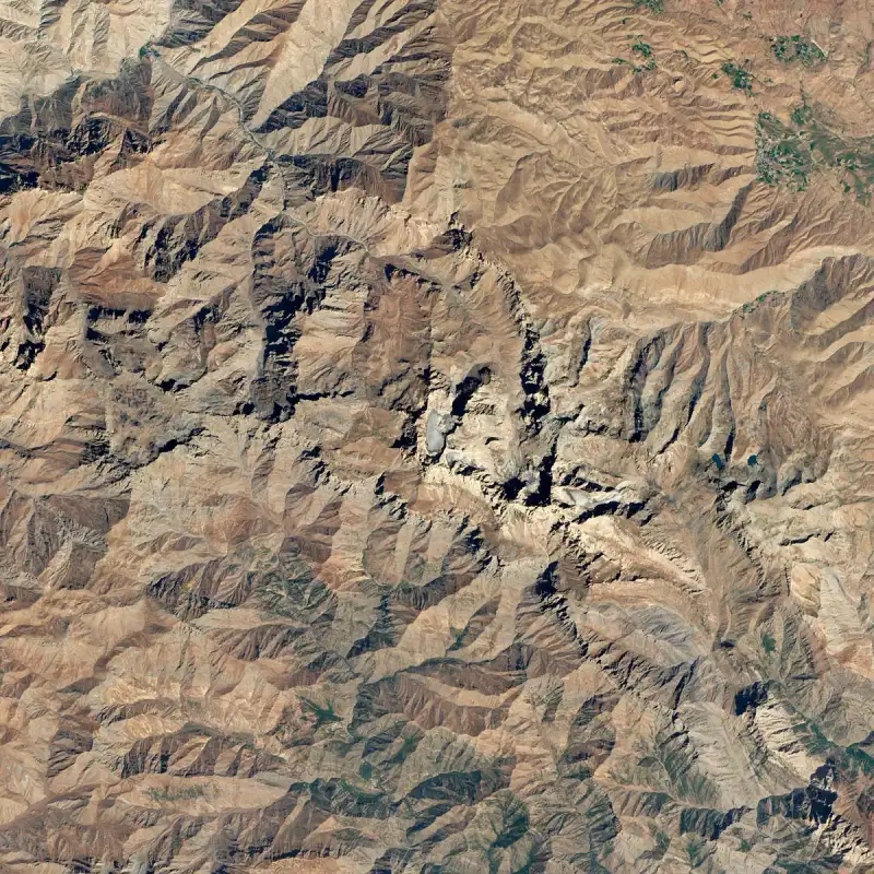
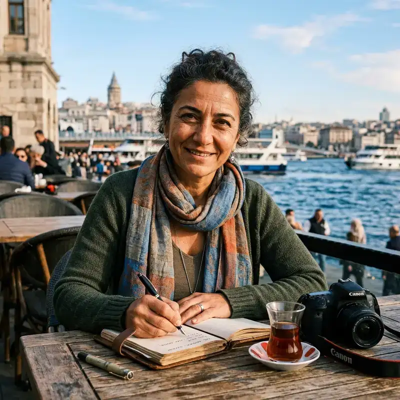
The world holds few landscapes as profoundly enigmatic and majestically silent as Mount Ararat. It rises from the high Anatolian plateau like a colossal sentinel, its snow-crowned summit piercing the azure sky with an almost mythical defiance. For millennia, this dormant stratovolcano, Turkey's highest peak at 5,137 meters (16,854 feet), has captivated human imagination, serving as a beacon for spiritual seekers, ambitious climbers, and relentless truth-finders. It is more than just a mountain; it is a repository of #ancient lore, a testament to geological power, and a crucible of enduring mysteries that beckon the curious soul. My #journey to the shadow of Ağrı Dağı, as it is known in Turkish, was not merely a physical trek but an expedition into the depths of legend itself. The crisp, thin air carried whispers of ages past, of floods and ancient mariners, of empires that rose and fell in its gaze. Standing at its base, the sheer scale is overwhelming. Its twin peaks – Greater Ararat and the slightly smaller, equally imposing Lesser Ararat – dominate the horizon, a perpetually frosted vision that feels both ancient and eternally young. It is here, amidst this stark beauty, that the most compelling of Ararat’s mysteries begins to unfurl: the enduring quest for Noah’s Ark. The Biblical Quest: On the Trail of Noah's Ark Few biblical narratives grip the modern imagination with the force of the Great Flood and the epic voyage of Noah's Ark. The Book of Genesis (8:4) famously states that "the ark rested in the seventh month, on the seventeenth day of the month, upon the mountains of Ararat." This single verse has spawned centuries of fervent expeditions, meticulous research, and passionate belief, turning Mount Ararat into the ultimate archaeological treasure hunt. The allure is undeniable. Imagine, for a moment, stumbling upon the petrified remains of an immense wooden vessel, a relic from a time before recorded #history, perched precariously on a high, remote flank of the mountain. Such a discovery would not only rewrite archaeological textbooks but profoundly impact theological understanding globally. This dream has fueled countless adventurers, from the earliest Byzantine chroniclers to contemporary satellite imagery analysts. One of the earliest recorded claims comes from the 5th-century Armenian historian Faustus of Byzantium, who spoke of a fragment of the Ark kept in a monastery. Marco Polo, in his 13th-century travelogue, The Travels of Marco Polo, noted that "on the top of it [Ararat] no man can ever stay... for it is always covered with snow, and no one can ascend it; and they say that Noah's Ark is there." Such accounts cemented Ararat's place in the collective consciousness as the Ark's most probable resting place. Modern searches gained significant traction in the 20th century. In 1916, Russian aviator Vladimir Roskowitsky reportedly sighted an ark-like structure while flying over Ararat during World War I, although his claims lack concrete verification. Later, in the 1950s, French industrialist Fernand Navarra claimed to have found hand-hewn timbers on the mountain, which radiocarbon dating placed at around 5,000 years old – a date that, tantalizingly, aligns with flood narratives. Navarra’s findings, however, were small fragments and their origin on the mountain remains debated by critics. Perhaps the most famous modern "sightings" revolve around the "Ararat Anomaly" – a distinct, boat-shaped formation captured in aerial photographs taken by the US Air Force in 1949 and later by satellite imagery. Located on the northwestern plateau of Greater Ararat at an altitude of approximately 4,724 meters (15,500 ft), this anomaly has been a persistent target for expeditions. While its shape is undeniably suggestive, geological studies largely attribute it to natural rock formations, possibly shaped by glacial erosion or mudflows. The area is notoriously difficult to access, and permissions for thorough on-site investigations are often complex due to the mountain's sensitive geopolitical location. Another prominent figure in the Ark quest was Ron Wyatt, an American adventurer who claimed to have found the Ark at a site called Durupınar, in the Tendürek Mountains, approximately 29 kilometers (18 miles) south of Mount Ararat's summit. This site, a boat-shaped depression, has also been widely investigated, with some proponents citing geological anomalies and "deck timber" patterns. However, mainstream geologists and archaeologists have consistently dismissed the Durupınar formation as a natural geological feature, with no evidence of ancient timber or human construction. The scientific consensus remains that these features are natural formations, and the absence of definitive, verifiable proof continues to plague all Ark claims. The challenges in finding the Ark are immense. If a wooden vessel did survive, it would have endured millennia of extreme weather, glacial movements, seismic activity (Ararat is a volcano in an active fault zone), and decay. Wood exposed to these conditions would likely have petrified or disintegrated long ago. Furthermore, the term "mountains of Ararat" in Genesis might not refer to the specific peak we know today, but rather to the wider Urartu region – an ancient kingdom spanning parts of modern-day Turkey, Armenia, and Iran. This geographical ambiguity further complicates the search. Regardless of the scientific skepticism, the quest for Noah's Ark continues to draw people to Ararat, imbuing the mountain with a unique spiritual charge. For many, the very act of seeking is a pilgrimage, a reaffirmation of faith in the face of colossal odds.A Geological Marvel: Ararat's Volcanic Heart Beyond its mythical mantle, Mount Ararat stands as a profound testament to the Earth's raw, formative power. It is a stratovolcano, a conical volcano built up by many layers of hardened lava, tephra, pumice, and volcanic ash. Its sheer size and symmetrical form are products of millions of years of geological activity, an architect of its own destiny. Greater Ararat is the largest single-mass mountain in Turkey, rising dramatically from a plateau that is already around 800 meters (2,600 feet) above sea level. Its younger sibling, Lesser Ararat (3,896 meters / 12,782 feet), lies southeast of the main peak, separated by the Sardarbulak pass, a saddle at about 2,687 meters (8,816 feet). Both are considered dormant, though not entirely extinct. Ararat's last known significant eruption occurred in 1840, an event that ravaged the region around the village of Akhuri, which lay on its northern slope. This catastrophic eruption, accompanied by a major earthquake, caused devastating mudslides and avalanches, burying the village and a monastery, killing hundreds. This event serves as a stark reminder of the mountain's inherent power and its capacity for destruction, even in its slumber. The geology of Ararat also plays a role in the Ark mystery. The mountain is composed primarily of Cenozoic volcanic rocks, including basalt, andesite, and dacite. Its slopes are scarred by ancient lava flows and glacial valleys, some of which persist year-round above 3,500 meters (11,500 feet). The ever-present snow and ice caps are vital for local ecosystems, feeding streams and rivers that flow through the arid landscape below. The dynamic #nature of these glaciers and the mountain's seismic activity mean that any ancient wooden structure would have been subjected to immense pressures, potentially crushed, covered, or moved significantly over the millennia. The landscape itself is a living, changing entity, not a static stage. Exploring the lower flanks of Ararat, one encounters a diverse range of microclimates. The arid steppe gives way to sparse shrubland, then alpine meadows teeming with unique flora and fauna during the short summer months. Higher up, the terrain becomes increasingly barren, a desolate realm of scree, rock, and eternal ice. This ecological transition paints a vivid picture of the mountain's immense vertical relief and its role as an ecological island in a vast, dry region. Climbing Ararat: A Pilgrim's Journey For many, including myself, the true way to connect with Ararat's essence is to ascend its formidable slopes. The climb is not merely an athletic endeavor; it is a pilgrimage, a communion with nature, and a profound personal challenge. It requires respect, preparation, and an understanding of the mountain's unpredictable temperament. Permits are essential for climbing Ararat, and they must be obtained through licensed Turkish #travel agencies. The mountain lies within a sensitive border region, and security considerations are paramount. Most expeditions depart from the dusty, bustling town of Doğubayazıt, a gateway town steeped in its own history, dominated by the magnificent Ishak Pasha Palace. Here, local Kurdish guides, who possess an unparalleled knowledge of the mountain and its moods, become indispensable companions. Their wisdom, passed down through generations, is as valuable as any piece of high-tech gear. My own ascent, or at least the imagined journey I've crafted from extensive research and the accounts of those who have reached its summit, begins with the familiar rumble of a four-wheel drive traversing rough tracks. The initial climb passes through a stark, almost lunar landscape, punctuated by the occasional yurt of semi-nomadic shepherds tending their flocks. The air, initially warm, begins to thin and cool perceptibly. Base camp, typically around 3,200 meters (10,500 feet), is a humble affair of tents, warmed by the camaraderie of fellow climbers from across the globe. Here, the sheer scale of the mountain becomes even more apparent, its summit still a distant, intimidating goal. Acclimatization is key; the "climb high, sleep low" principle is strictly adhered to, with day hikes to higher altitudes followed by descents back to base camp to allow the body to adjust to the reduced oxygen levels. The real challenge begins with the push to high camp, often around 4,200 meters (13,800 feet). This involves navigating rockfall-prone scree slopes and steep ascents. The air is noticeably colder, the wind more biting. Each step is a conscious effort, a dialogue between mind and body. The simplicity of life at high camp – hot tea, freeze-dried meals, and the shared anticipation – fosters a unique bond among climbers. The summit push is the climax, usually starting in the early hours of the morning, long before dawn. Under a canopy of brilliant stars, headlamps bob rhythmically as climbers begin their slow, steady ascent. The lower slopes of the summit pyramid are often a mix of loose scree and patches of hard-packed snow. As one ascends higher, crampons and ice axes become essential as the terrain transitions to steep, icy slopes. The oxygen deprivation is palpable, each breath a struggle, but the reward awaiting at the top fuels the determination.Finally, as the sun begins to paint the eastern sky in hues of orange and purple, the world unfurls beneath you. From the summit of Greater Ararat, the view is nothing short of transcendent. The plains of Iran stretch eastward, the distant peaks of Armenia to the north, and the vast Anatolian plateau to the west. Lesser Ararat stands proud beside you, now a fellow peak rather than a distant goal. The curvature of the Earth is almost visible, and the feeling of standing atop this legendary mountain, touching the sky where myth and history converge, is a profound and humbling experience. It is a moment of pure, unadulterated awe, a memory etched deeply into the soul. The Cultural Tapestry and Geopolitical Significance Mount Ararat is more than a geographical feature or a biblical enigma; it is a cultural touchstone woven into the fabric of multiple nations and peoples. Its presence in this volatile corner of the world – where Turkey, Armenia, and Iran converge – imbues it with a complex geopolitical significance. For Armenians, Mount Ararat is a sacred national symbol. Although it lies within the borders of modern Turkey, it is indelibly etched into Armenian identity and history. From virtually any vantage point in Yerevan, the capital of Armenia, the majestic twin peaks of Ararat dominate the horizon, a constant, poignant reminder of ancestral lands and a rich, often turbulent, past. It appears on Armenian coats of arms, banknotes, and countless works of art. Its presence serves as both a source of pride and a symbol of longing. In Turkey, Ararat is known as Ağrı Dağı, the "Mountain of Ağrı" (after the province) or sometimes colloquially as the "Mountain of Pain," perhaps referencing its formidable nature or the historical events that have unfolded around it. It is a source of national pride, the country's highest point, and a challenging frontier for adventure tourism. The region around it, particularly the provinces of Ağrı and Iğdır, is predominantly Kurdish, and the local Kurdish population plays a crucial role in expeditions, providing guiding services, porters, and logistical support. Their intimate knowledge of the mountain, its weather patterns, and its hidden paths is invaluable. Historically, the area surrounding Ararat has been a crossroads of civilizations. The ancient Urartian kingdom (9th-6th centuries BCE) thrived in this region, building impressive fortresses and cities. Later, Persians, Romans, Byzantines, Arabs, Mongols, and Ottomans all cast their shadow upon the mountain, each leaving an indelible mark on the cultural landscape. The strategic importance of this high ground, overlooking vital trade routes and fertile plains, meant it was continuously contested. Today, the mountain's proximity to international borders adds layers of complexity to any travel or research. Permissions are tightly controlled, and travelers are advised to adhere strictly to regulations. The cultural interactions, however, are deeply enriching. Engaging with local villagers, sharing chai in their humble homes, and witnessing their resilient, pastoral way of life offers a window into a world deeply connected to the land and the rhythms of nature, a world largely unchanged by the clamor of the modern age.Other Myths, Legends, and the Enduring Spirit While Noah's Ark dominates the narrative of Ararat's mysteries, the mountain is also home to a myriad of other myths and legends, reflecting the diverse cultures that have revered it over millennia. Before the advent of Abrahamic religions, mountains were often seen as dwelling places of gods, conduits to the heavens, or sacred sanctuaries. Ararat, with its imposing height and dramatic presence, was undoubtedly considered such a place. Local folklore speaks of spirits guarding its slopes, of hidden treasures, and of mystical properties attributed to its waters and rocks. Kurdish legends sometimes connect the mountain to ancient heroes and mythical beasts, echoing the deep animistic beliefs that predate organized religions. These stories, passed down through generations, paint a picture of a living, breathing entity, not just a geological mass. The enduring spirit of Ararat lies not just in its unsolved puzzles or its physical grandeur, but in its capacity to inspire awe and introspection. It forces a confrontation with the ancient, with the vastness of time and the power of natural forces. Whether viewed from the bustling streets of Yerevan, the arid plains of Eastern Turkey, or from its own snow-swept summit, Ararat compels us to look beyond the immediate, to ponder the origins of humanity, the forces that shape our world, and the stories we tell ourselves to make sense of it all. The Experience of Being There: A Profound Resonance To truly grasp the essence of Mount Ararat is to experience it, to feel the wind whip across its slopes, to gaze up at its impossibly distant summit, or to stand atop it and survey the world. The sensory impact is profound: the thin, sharp air that bites at exposed skin, the blinding brilliance of snow under a relentless sun, the deep, echoing silence broken only by the crunch of boots on ice or the distant cry of a raptor. There is a humility that comes with being in the presence of such an ancient and monumental landscape. It strips away the superficial concerns of daily life, inviting contemplation on a grander scale. The very act of traveling to this remote corner of the world, of undertaking the physical and mental challenge of the climb, becomes a transformative experience. As Cemre Seyyah, I have chased stories across continents, but few places have resonated with the primal force of Mount Ararat. It is a place where faith and science dance a delicate, unresolved ballet; where history is etched into the very rock; and where the human spirit is tested and often, renewed. It is a reminder that some mysteries are perhaps meant to remain, to keep us curious, to keep us searching, and to keep us dreaming of what lies beyond the visible horizon. Mount Ararat is not just a mountain; it is an invitation to explore the deepest recesses of our planet and ourselves. To visit Ararat is to step into a living legend, to trace the footsteps of explorers and pilgrims, and to feel the heartbeat of an ancient land. Whether you seek the biblical Ark, the geological wonders, or simply the unparalleled adventure of a high-altitude climb, Ararat promises an unforgettable journey into the heart of an enduring mystery. It challenges, it inspires, and it remains, forever, shrouded in a captivating veil of snow, sky, and stories untold. #MountArarat #TravelTurkey #Noah'sArk #AdventureTravel #MysteryExploration #travel #explore #guide Related InsightsIl Palatino: Il Colle degli Imperatori Moscow Red Square Il Faro di Ercole e i Giganti Luminosi Dimenticati dell'Oceano: Un Viaggio Tra i Guardiani Romani dell'Infinito Atlantico{ "@context": "https://schema.org", "@type": "FAQPage", "mainEntity": [ { "@type": "Question", "name": "What is the main focus of Mount Ararat Mysteries?", "acceptedAnswer": { "@type": "Answer", "text": "A deep dive into Mount Ararat Mysteries with Cemre Seyyah." } }, { "@type": "Question", "name": "Who authored the comprehensive guide on Mount Ararat Mysteries?", "acceptedAnswer": { "@type": "Answer", "text": "This detailed article and its insights were carefully researched and authored by Cemre Seyyah." } }, { "@type": "Question", "name": "Where can I find more related content about Travel?", "acceptedAnswer": { "@type": "Answer", "text": "You can explore more articles, detailed reviews, and similar insights by browsing the Related Insights section at the bottom of this article or visiting our dedicated Travel category page." } } ] }
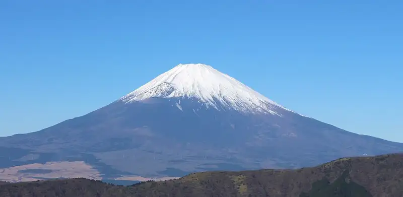
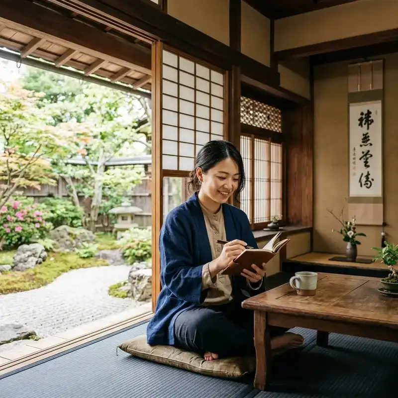
Konnichiwa! Welcome to another deep dive into #Japan's breathtaking #ancient #history and cultural heritage. From the spirit of #zen and Wabi-Sabi to the majestic presence of #samurai castles and Shinto shrines, let us explore the wonders of Mount Fuji. Mount Fuji (富士山・富士の山, Fujisan, Fuji no Yama) is an active stratovolcano located on the Japanese island of Honshu, with a summit elevation of 3,776.24 m (12,389 ft 3 in). It is the highest mountain in Japan, the second-highest volcano on any Asian island (after Mount Kerinci on the Indonesian island of Sumatra), and the seventh-highest peak of an island on Earth. Mount Fuji last erupted from 1707 to 1708. It is located about 100 km (62 mi) southwest of Tokyo, from which it is visible on clear days. It has an exceptionally symmetrical cone, which is covered in snow for about five months of the year. It is a Japanese cultural icon and is frequently depicted in art and photography, as well as visited by sightseers, hikers, and mountain climbers. Mount Fuji is one of Japan's "Three Holy Mountains" (三霊山, Sanreizan) along with Mount Tate and Mount Haku. It is a Special Place of Scenic Beauty and one of Japan's Historic Sites. It was added to the World Heritage List as a Cultural Site on June 22, 2013. According to #UNESCO, Mount Fuji has "inspired artists and poets and been the object of pilgrimage for centuries". UNESCO recognizes 25 sites of cultural interest within the Mount Fuji locality. These 25 locations include Mount Fuji and the Shinto shrine, Fujisan Hongū Sengen Taisha. Etymology The current kanji for Mount Fuji, 富 and 士, mean "wealth" or "abundant" and "man of status" respectively. The origins of this spelling and the name Fuji continue to be debated. In Japanese, kanji characters are often applied by sound, and the meaning of the kanji may have nothing to do with the name of the mountain. It was named Fuji before the kanji was applied to it. 富士山記 (Fuji-san Ki) written by Miyako no Yoshika (都良香) in Heian period states, ”The name of the mountain, Fuji, is taken from the name of the county." A text of the 9th century, Tale of the Bamboo Cutter, says that the name came from "immortal" (不死, fushi, fuji) and also from the image of abundant (富, fu) soldiers (士, shi, ji) ascending the mountain slopes. An early folk etymology claims that Fuji came from 不二 (not + two), meaning without equal or nonpareil. Another claims that it came from 不盡 (not + to exhaust), meaning never-ending. Hirata Atsutane, a Japanese classical scholar in the Edo period, speculated that the name is from a word meaning "a mountain standing up shapely as an ear (穗, ho) of a rice plant". British missionary John Batchelor (1855–1944) argued that the name is from the Ainu word for "fire" (fuchi) of the fire deity Kamui Fuchi, which was denied by a Japanese linguist Kyōsuke Kindaichi on the grounds of phonetic development (sound change). Fuji and Fuchi are known to be false friends, and Batchelor's argument is rejected by modern academics. Huchi means "old woman" and ape is the word for "fire", thus ape huchi kamuy is the fire deity. Research on the distribution of place names that fuji suggests that fuji originates in the Yamato language rather than Ainu. Japanese toponymist Kanji Kagami claimed that the name has the same root as wisteria (藤, fuji) and rainbow (虹, niji; but with an alternative reading, fuji), and came from its "long well-shaped slope". Vovin proposed an alternative hypothesis based on Old Japanese reading */puⁿzi/: the word may have been borrowed from Eastern Old Japanese */pu nusi/ 火主, meaning "fire master". Variations In English, the mountain is known as Mount Fuji. Some sources refer to it as "Fuji-san", "Fujiyama" or, redundantly, "Mt. Fujiyama". Japanese speakers refer to the mountain as "Fuji-san". This "san" is not the honorific suffix used with people's names, but the on'yomi of the character yama (山; "mountain") used in Sino-Japanese vocabulary. In Nihon-shiki and Kunrei-shiki romanization, the name is transliterated Huzi. Other Japanese names that have become obsolete or poetic include Fuji-no-Yama (ふじの山; "the Mountain of Fuji"), Fuji-no-Takane (ふじの高嶺; "the High Peak of Fuji"), Fuyō-hō (芙蓉峰; "the Lotus Peak"), and Fugaku (富岳/富嶽), created by combining the first character of 富士, Fuji, and 岳, mountain. History Mount Fuji is widely regarded to have an attractive volcanic cone. It has been a frequent subject of Japanese art, especially after 1600, when Edo (now Tokyo) became the capital and people saw the mountain while traveling on the Tōkaidō road. According to historian H. Byron Earhart, "in medieval times it eventually came to be seen by Japanese as the "number one" mountain of the known world of the three countries of India, China, and Japan". The mountain is mentioned in Japanese literature throughout the ages and is the subject of many poems. The summit has been thought of as sacred since ancient times, and was therefore forbidden to women. In 1872 the Japanese government issued an edict (May 4, 1872, Grand Council of State Edict 98) stating, "Any remaining practices of female exclusion on shrine and #temple lands shall be immediately abolished, and mountain climbing for worship, etc., shall be permitted." Tatsu Takayama was the first woman on record to summit Mount Fuji in the fall of 1832. Ancient samurai used the base of the mountain as a remote training area, near the present-day town of Gotemba. The shōgun Minamoto no Yoritomo held yabusame archery contests in the area in the early Kamakura period. The first ascent by a foreigner was by Sir Rutherford Alcock in September 1860, who ascended the mountain in 8 hours and descended in 3 hours. Alcock's brief narrative in The Capital of the Tycoon was the first widely disseminated description of the mountain in the West. Lady Fanny Parkes, the wife of British ambassador Sir Harry Parkes, was the first non-Japanese woman to summit, in 1867. Photographer Felix Beato climbed Mount Fuji two years later. On April 30, 1936, Mount Rainier National Park of the U.S. and Japan’s Fuji-Hakone National Park started a first-of-its-kind international 'sister mountain' relationship, with Rainier affectionately known as 'Tacoma-Fuji' by Japanese American immigrants of the Seattle area. On March 5, 1966, BOAC Flight 911, a Boeing 707, broke up in flight and crashed near the Mount Fuji Gotemba New fifth station, shortly after departure. All 113 passengers and 11 crew members died in the crash, which was attributed to clear-air turbulence caused by lee waves downwind of the mountain. A memorial for the crash victims sits near Gotemba New Fifth Station. Today, Mount Fuji is an international destination for tourism and mountain climbing. In the early 20th century, lectures by populist educator Frederick Starr Chautauqua about his ascents of Mount Fuji were widely known in America. A Japanese saying suggests that a wise person will climb Mt. Fuji once in their lifetime, but only a fool would climb it twice. It remains a popular symbol in Japanese #culture, including making numerous movie appearances, inspiring the Infiniti logo, and appearing in medicine with the Mount Fuji sign. In September 2004, the staffed weather station at the summit was closed after 72 years in operation. Observers monitored radar sweeps that detected typhoons and heavy rains. The station, which was the highest in Japan at 3,780 m (12,402 ft), was replaced by an automated system. Mount Fuji was added to the World Heritage List as a Cultural Site on June 22, 2013. Geography Mount Fuji is a distinctive feature of the geography of Japan. It stands 3,776.24 m (12,389 ft) tall and is located near the Pacific coast of central Honshu, just southwest of Tokyo. It straddles the boundary of Shizuoka and Yamanashi prefectures. Four small cities surround it - Gotemba to the east, Fujiyoshida to the north, Fujinomiya to the southwest, and Fuji to the south - accompanied by towns and villages. It is surrounded by five lakes: Lake Kawaguchi, Lake Yamanaka, Lake Sai, Lake Motosu and Lake Shōji. They, and nearby Lake Ashi in Kanagawa Prefecture, provide views. The mountain is part of Fuji-Hakone-Izu National Park. It can be seen more distantly from Yokohama, Tokyo, and sometimes as far as Chiba, Saitama, Tochigi, Ibaraki and Lake Hamana under skies. It was photographed from space during a space shuttle mission. Climate The summit has a tundra climate (Köppen climate classification ET). The temperature is low at high altitude, and the cone is covered by snow for several months of the year. The lowest recorded temperature is −38.0 °C (−36.4 °F) recorded in February 1981, and the highest temperature was 17.8 °C (64.0 °F) recorded in August 1942. Fuji's seasonal snowcap appears at an average date of 2 October. In 2024, the snowcap formed on 6 November, the latest-occurring since records began in 1894. Geology Mount Fuji is located at a triple junction trench where the Eurasian Plate, North American Plate, and Philippine Sea Plate meet. These three plates form the western part of Japan, the eastern part of Japan, and the Izu Peninsula respectively. The Pacific Plate is subducting beneath these plates, resulting in volcanic activity. Mount Fuji is located near three island arcs: the Southwestern Japan Arc, the Northeastern Japan Arc, and the Izu-Bonin-Mariana Arc. The Fuji triple junction is only 400 kilometres (250 mi) from the Boso triple junction. Fuji's main crater is 780 m (2,560 ft) in diameter and 240 m (790 ft) deep. The bottom of the crater is 100–130 m (330–430 ft) in diameter. Slope angles from the crater to a distance of 1.5–2 km (0.93–1.24 mi) are 31°–35°, the angle of repose for dry gravel. Beyond this distance, slope angles are about 27°, which is caused by an increase in scoria. Mid-flank slope angles decrease from 23° to less than 10° in the piedmont. Scientists have identified four distinct phases of volcanic activity in the formation of Mount Fuji. The first phase, called Sen-komitake, is composed of an andesite core deep within the mountain, discovered in 2004. Sen-komitake was followed by the "Komitake Fuji", a basalt layer believed to have formed several hundred thousand years ago. Approximately 100,000 years ago, "Old Fuji" was formed over the top of Komitake Fuji. The modern, "New Fuji" is believed to have formed over the top of Old Fuji around 10,000 years ago. Pre-Komitake started erupting in the Middle Pleistocene in an area seven km (4+1⁄2 mi) north of Mount Fuji. After a relatively short pause, eruptions began again, which formed Komitake Volcano. These eruptions ended 100,000 years ago. Ashitaka Volcano was active from 400,000 to 100,000 years ago and is located 20 km (12 mi) southeast of Mount Fuji. Mount Fuji started erupting 100,000 years ago, with Ko-Fuji (old-Fuji) forming 100,000 to 17,000 years ago, but it is now almost completely buried. A large landslide on the southwest flank occurred about 18,000 years ago. Shin-Fuji (new-Fuji) eruptions in the form of lava, lapilli, and volcanic ash have occurred between 17,000 and 8,000 years ago, between 7,000 and 3,500 years ago, and between 4,000 and 2,000 years ago. Flank eruptions, mostly in the form of parasitic cinder cones, ceased in 1707. The largest cone, Omuro-Yama, is one of more than 100 cones aligned NW-SE and NE-SW through the summit. Mt. Fuji also has more than 70 lava tunnels and extensive lava tree molds. Two large landslides are at the head of the Yoshida-Osawa and Osawa-Kuzure valleys. As of December 2002, the volcano was classified as active with a low risk of eruption. The last recorded eruption was the Hōei eruption which started on December 16, 1707 (Hōei 4, 23rd day of the 11th month), and ended about January 1, 1708 (Hōei 4, 9th day of the 12th month). The eruption formed a new crater and a second peak, named Mount Hōei, halfway down its southeastern side. Fuji spewed cinders and ash that resembled rainfall in Izu, Kai, Sagami, and Musashi. Since then, no signs of an eruption are recorded. On the evening of March 15, 2011, however, a magnitude 6.2 earthquake at shallow depth occurred a few kilometres from Mount Fuji on its southern side. Recorded eruptions About 11,000 years ago, a large amount of lava erupted from the west side of the top. This lava formed new Fuji, which is the main body of Mount Fuji. Since then, the tops of ancient Fuji and new Fuji have been side by side. About 2,500–2,800 years ago, the top part of ancient Fuji was destroyed in a large sector collapse and only the top of Shin-Fuji remained. Ten known eruptions can be traced to reliable records. Current eruptive danger Following the 2011 Tōhoku earthquake, media speculated that the shock might induce volcanic unrest at Mount Fuji. In September 2012, mathematical models created by the National Research Institute for Earth Science and Disaster Prevention (NRIESDP) suggested that the pressure in Mount Fuji's magma chamber could be 1.6 megapascals higher than before its 1707 eruption. This was interpreted by some media outlets to mean that an eruption of Mount Fuji could be imminent. Absent any method of directly measuring the pressure of a volcano's magma chamber however, indirect calculations of the type used by NRIESDP remained speculative and unverifiable. Other indicators suggestive of heightened eruptive danger, such as active fumaroles and recently discovered faults, are typical occurrences at this type of volcano. Eruption fears continued into the 2020s. In 2021, a new hazard map was created to help residents plan for evacuation, stoking fears because of its increased estimate of lava flow and additional vents. Soon afterwards, a 4.8 magnitude earthquake hit the area. The Japan Meteorological Agency however, assured the public that the earthquake did not increase the eruption risk. In 2023, a new evacuation plan was developed to account for the 2021 hazard map update. Aokigahara forest Aokigahara forest sits at Fuji's northwest base. Folk tales and legends tell of ghosts, demons, yūrei and yōkai haunting the forest, and in the 19th century, Aokigahara was one of many places where poor families abandoned their young and elderly. Approximately 30 suicides are counted yearly, with a high of nearly 80 in 2002. The recent increase prompted local officials to erect signs that attempt to convince suicidal individuals to reconsider, which have disrupted some attempts. Earlier suicides have created an allure that has persisted across decades. Many hikers mark their routes by leaving colored plastic tape behind as they pass, raising concern about effects on the forest's ecosystem. Access Transport The closest airport with scheduled international service is Mt. Fuji Shizuoka Airport. It opened in June 2009. It is about 80 km (50 mi) from Mount Fuji. Tokyo International Airport (Haneda Airport) and Narita International Airport are approximately three hours and 15 minutes from Mount Fuji. Climbing routes Approximately 300,000 people climbed Mount Fuji in 2009. The most popular period for people to hike up Mount Fuji is from July to August, while huts and other facilities are operating and the weather is warmest. Buses to the trail heads typically used by climbers start running on July 1. Climbing from October to May is discouraged, after several high-profile deaths amid cold weather. Most Japanese climb the mountain at night to be in a position at or near the summit when the sun rises. The morning light is called 御来光 goraikō, "arrival of light". The four major routes to the summit each have numbered stations along the way. They are (clockwise, starting north): Yoshida, Subashiri, Gotemba, and Fujinomiya routes. Climbers usually start at the fifth stations, as these are reachable by car or by bus. The summit is the tenth station on each trail. The stations on different routes are at different elevations; the highest fifth station is located at Fujinomiya, followed by Yoshida, Subashiri, and Gotemba. Four routes start from the base of the mountain: Shojiko, Yoshida, Suyama, and Murayama routes. Even though it has only the second-highest elevation, the Yoshida route is the most popular. It offers a large parking area and many large mountain huts where climbers can rest or stay. During the summer season, most Mount Fuji climbing tour buses arrive there. The next most popular is the Fujinomiya route, which has the highest fifth station, followed by Subashiri and Gotemba. The ascent from the fifth station can take anywhere between five and seven hours, while the descent can take from three to four hours. Even though most climbers do not ascend the Subashiri and Gotemba routes, many descend these because of their ash-covered paths. From the seventh station to near the fifth station, running down these ash-covered paths takes approximately 30 minutes. Tractor routes accompany the climbing routes. These routes are used to bring food and other materials to huts on the mountain. Because the tractors usually take up most of the width of these paths and tend to push large rocks from the side of the path, tractor paths are off-limits to climbers on sections that are not merged with the climbing or descending paths. Nevertheless, people often ride mountain bikes down tractor routes from the summit. This is particularly risky, as it may send rocks into others. The four routes from the base of the mountain offer historical sites. Murayama is the oldest route, while the Yoshida route has many old shrines, teahouses, and huts along its path. These routes are gaining popularity and are undergoing restoration. Although still relatively uncommon, bears have been sighted along the Yoshida route. Huts at and above the fifth stations are usually staffed during climbing season, but those below the fifth stations are not usually staffed. Yoshida has the most huts, while Gotemba has the fewest. The huts along the Gotemba route also tend to open later and close earlier than those along the Yoshida route. Because Mount Fuji is designated as a national park, it is illegal to camp above the fifth station. Eight peaks surround the summit. The highest point in Japan, Ken-ga-mine, is where the Mount Fuji Radar System used to be (replaced by an automated system on October 1, 2008). Climbers can visit each of these peaks. Paragliding Paragliders take off in the vicinity of the fifth station, Gotemba parking lot, between Subashiri and Hōei-zan peak on Fuji's south side, and at other locations, depending on wind direction. Several paragliding schools use the wide sandy/grassy slope between Gotemba and Subashiri parking lots as a training hill. Overtourism concerns On 1 February 2024, the Yamanashi prefectural government imposed a mandatory fee of 2,000 yen ($13) for hikers using the Yoshida trail beginning in the summer season as part of efforts to ease congestion and provide funding for safety protocols. It later announced that it would impose a daily limit of 4,000 hikers on the trail and close it between 4 p.m. and 3 a.m. except for guests in mountain lodges. The Shizuoka prefectural government subsequently announced that it would close the Subashiri, Gotemba and Fujinomiya trails at the same time with the same exceptions, citing concerns over congestion. In culture Shinto mythology In Shinto mythology, Kuninotokotachi (国之常立神 Kuninotokotachi-no-Kami in Kojiki, or 国常立尊 Kuninotokotachi-no-Mikoto in Nihon Shoki) is one of the two gods born from "something like a reed that arose from the soil" when the earth was chaotic. According to the Nihon Shoki, Konohanasakuya-hime, wife of Ninigi, is the goddess of Mount Fuji, where Fujisan Hongū Sengen Taisha is dedicated to her. In ancient times, the mountain was worshipped from afar. The Asama shrine was set up at the foothills to ward off eruptions. In the Heian period (794–1185), volcanic activity subsided and Fuji was used as a base for Shugendō, a syncretic religion combining mountain worship and Buddhism. Worshippers began to climb the slopes, and by the early 12th century, Matsudai Shonin had founded a temple on the summit. Fuji-kō was an Edo period cult centred around the mountain that was founded by an ascetic named Hasegawa Kakugyō (1541–1646). The cult venerated the mountain as a female deity, and encouraged its members to climb it. In doing so, they would be reborn, "purified and ... able to find happiness". The cult waned in the Meiji period, and although it persists to this day, it has been subsumed into Shintō sects. Popular culture As a national symbol of the country, the mountain has been depicted in media such as paintings, woodblock prints (such as Hokusai's Thirty-six Views of Mount Fuji and One Hundred Views of Mount Fuji from the 1830s), poetry, music, theater, film, manga, anime, pottery and even Kawaii subculture. Before its explosive eruption in 1980, Mount St. Helens was once known as "The Fuji of America", for its striking resemblance to Mount Fuji. Mount Taranaki in New Zealand is also said to bear a resemblance to Mount Fuji, and for this reason has been used as a stand-in for the mountain in films and television. #japan #fuji #mountains #nature #travel
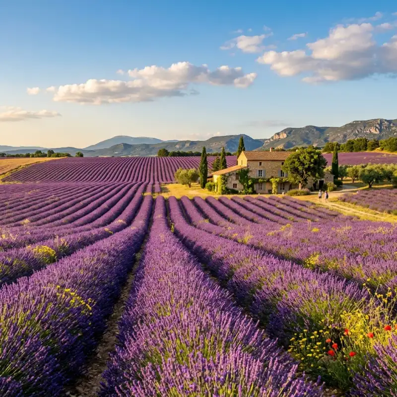
Bem-vindo! Prepare-se para uma #viagem inesquecível pelo coração de #Portugal. Olá, meus queridos exploradores e amantes de aventuras! Aqui é o vosso Tiago Silva, e hoje levo-vos numa #viagem a um lugar que mais parece saído de um livro de contos de fadas, um destino que pulsa com #história e encanta com a sua beleza inigualável: a magnífica Sintra. Preparem-se para uma imersão profunda num universo onde o tempo parece abrandar, onde a bruma matinal se confunde com lendas antigas e onde cada pedra sussurra segredos de séculos passados. Sintra não é apenas uma vila; é uma experiência, um estado de espírito. Aninhada na parte norte da vibrante área metropolitana de Lisboa, e parte integrante da Grande Lisboa, esta joia portuguesa, outrora pertencente à histórica província da Estremadura, é um convite irrecusável à descoberta. É a sede de um município que, com os seus 319,23 km² de área e uma impressionante população de 395.528 habitantes em 2023, se destaca no panorama nacional. Para que tenham uma ideia da sua dimensão, a população de Sintra representa uns notáveis 13,36% do total metropolitano e uns impressionantes 18,60% do total da Grande Lisboa. É, afinal, o segundo município mais populoso de #Portugal, logo após a capital, Lisboa – um feito notável para uma localidade que, orgulhosamente, recusou ser elevada à categoria de cidade! Um Mosaico Geográfico e Humano O município de Sintra é um verdadeiro camaleão geográfico, oferecendo uma tapeçaria de paisagens que se estendem desde as fronteiras com Mafra a norte, Loures, Odivelas e Amadora a leste, Oeiras a sudeste, e Cascais a sul, até se abraçar com o vasto oceano Atlântico a oeste. Esta diversidade de limites territoriais espelha-se na heterogeneidade do seu próprio território. Percorrer Sintra é como folhear um livro de paisagens contrastantes: as freguesias litorais e do norte ainda ostentam características marcadamente florestais e rurais, com os seus verdes profundos e o ar puro a convidar a longas caminhadas. Em nítido contraste, as freguesias do sul desenvolveram-se, transformando-se em núcleos urbanizados vibrantes, impulsionadas pela sua proximidade à capital e pela melhoria das acessibilidades. Estradas como o IC16 e o IC19, a vital Linha de Sintra e, em menor escala, a Linha do Oeste, servem como artérias que alimentam o dinamismo desta região, facilitando a conexão com o resto do país e tornando-a um ponto estratégico para quem busca a combinação perfeita entre a tranquilidade serrana e a conveniência urbana. Para além da pitoresca vila de Sintra, o município alberga outros núcleos de grande relevância, como as cidades de Queluz e Agualva-Cacém, cada uma com o seu próprio encanto e ritmo de vida, contribuindo para a riqueza e complexidade deste território. Geograficamente, Sintra assenta como uma coroa no final de um majestoso maciço, formado pelas serras de Aire, Candeeiros e Montejunto. Este culmina no imponente Maciço de Sintra, onde a sua serra homónima e a Serra da Carregueira se erguem com uma beleza quase mística. O ponto mais elevado do município, e de toda a área metropolitana, encontra-se na Pena, na Serra de Sintra, elevando-se a uns impressionantes 528 metros de altitude. A partir daqui, a vista é de cortar a respiração, abrangendo uma vastidão de vales e planaltos que raramente ultrapassam os 200 metros, pontilhados por inúmeras ribeiras que, ao longo dos milénios, esculpiram e demarcaram a paisagem com os seus cursos sinuosos. Este é um cenário de montanhas que se encontram com o mar, de florestas densas que guardam segredos e de vales verdejantes que convidam à contemplação. A Vila de Sintra, em particular, é um testemunho vivo da arquitetura romântica, um estilo que aqui encontrou o seu palco ideal. Não é de estranhar que esta paisagem de sonhos tenha sido classificada como Paisagem Cultural de Sintra, Património Mundial da UNESCO. A sua persistência em manter o estatuto de vila, apesar de ser o segundo município mais populoso de Portugal, é um detalhe que sublinha o seu caráter único e a sua recusa em ceder ao ritmo frenético da urbanização desmedida, preservando a sua essência e o seu encanto atemporal. O Nome que Evoca o Sol e a Lua Cada lugar tem uma história no seu nome, e Sintra não é exceção. A etimologia da sua designação é tão fascinante quanto a própria vila, um eco dos tempos ancestrais que nos remete a civilizações e crenças perdidas. A forma mais antiga do nome, "Suntria", aponta para raízes indo-europeias, significando "astro luminoso" ou "sol". É como se, desde sempre, este local estivesse destinado a brilhar, a ser um farol na paisagem. Não admira que figuras tão proeminentes como Varrão e Columela a tenham designado como "Monte Sagrado", reconhecendo a aura de reverência que sempre envolveu estas colinas. Mais tarde, o célebre Ptolomeu, com a sua visão geográfica apurada, registou-a como a "Serra da Lua". Imaginem a mística que estas montanhas deveriam inspirar, com os seus contornos suaves e a sua vegetação luxuriante, banhadas pela luz prateada do luar. Esta dualidade – sol e lua, luz e mistério – parece estar inscrita na própria alma de Sintra. E se a etimologia nos fala de luz, a descrição do geógrafo árabe Abu Ubaide Abedalá Albacri, no século X, adiciona uma camada de encantamento e mistério que se tornou uma das características mais icónicas de Sintra. Ele descreveu-a como um lugar "permanentemente mergulhada numa bruma que não se dissipa". Esta névoa, que tantas vezes abraça a serra, não é um véu que oculta, mas sim um manto que revela, transformando palácios em castelos de fadas flutuantes e florestas em reinos encantados, onde cada passo é uma descoberta e cada visão um deleite. É esta bruma, este hálito de um tempo imemorial, que confere a Sintra a sua atmosfera verdadeiramente mágica e inesquecível, um portal para a imaginação. Uma Crónica de Milénios: A História de Sintra Ao passear pelas ruas de calçada, pelos parques verdejantes e pelos majestosos palácios de Sintra, torna-se evidente que estamos a pisar um solo impregnado de séculos de história. É um privilégio encontrar nesta vila testemunhos de praticamente todas as épocas da história portuguesa, muitos dos quais, pela sua importância e dimensão, transcenderam as fronteiras deste território para se inscreverem nos anais da humanidade. A candidatura que elevou Sintra a Património Mundial/Paisagem Cultural junto da UNESCO foi um reconhecimento da sua essência singular. Tratou-se de classificar não apenas edifícios isolados, mas toda uma área que se assume como um contexto cultural e ambiental de características tão específicas que a tornam verdadeiramente única. A descrição da UNESCO captura na perfeição a alma de Sintra: uma unidade cultural que permaneceu intacta, um tesouro inestimável onde se sucedem uma plêiade de palácios suntuosos e parques luxuriantes; de casas senhoriais, cada uma com os seus próprios hortos e bosques secretos; de palacetes e chalets de conto de fadas, inseridos no meio de uma vegetação exuberante que parece abraçar e proteger estas construções. Mas a história de Sintra não se limita à opulência. A serra é coroada por extensos troços amuralhados que se erguem nos cumes mais altos, sussurrando histórias de defesa e de tempos medievais. Para além disso, encontramos uma plêiade de conventos de meditação, aninhados entre penhascos escarpados, bosques densos e fontes de água pura, locais de recolhimento e espiritualidade que convidam à introspeção. Igrejas, capelas e ermidas, que ao longo dos séculos serviram como polos de fé e de arte, pontilham a paisagem, cada uma guardando a sua própria parcela de devoção e beleza. E, para os mais curiosos, Sintra é também uma unidade cultural intacta numa plêiade de vestígios arqueológicos que apontam para ocupações que remontam a vários milénios. É um lugar onde o passado remoto se encontra com a modernidade, onde cada canto revela uma camada diferente da grande tapeçaria do tempo. É esta riqueza, esta densidade histórica e cultural, que faz de Sintra um destino imperdível e um verdadeiro portal para a alma de #Europa. Ecoar dos Primórdios: Do Neolítico à Idade do Bronze A história de Sintra é tão profunda que os seus primeiros capítulos se perdem na névoa do tempo, remontando a milénios antes de Cristo. Os mais antigos testemunhos da presença humana nesta região localizam-se num cume da vertente Norte da Serra de Sintra, na Penha Verde. Aqui, escavações revelaram uma ocupação epipaleolítica, comprovada pela abundância de utensílios de tipo microlaminar. Imaginem os nossos antepassados, caçadores-recoletores, a viver nestas encostas, usando estas ferramentas minúsculas e afiadas para sobreviverem e prosperarem num ambiente selvagem e desafiador. Avançando um pouco mais no tempo, encontramos vestígios de uma ocupação do Neolítico no sítio de ar livre de São Pedro de Penaferrim, junto à Capela do Castelo dos Mouros. Este local é um verdadeiro tesouro, com a presença de cerâmicas decoradas – incisas, impressas e com aplicações –, associadas a uma indústria lítica talhada em sílex. Datado pelo método do radiocarbono de inícios do V milénio a.C., este sítio destaca-se pela sua originalidade e pela sua implantação na paisagem: em plena montanha. É fascinante pensar nestas comunidades pré-históricas, enquadradas culturalmente na corrente circum-mediterrânica, a estabelecerem-se e a moldarem a sua vida num local tão elevado e pitoresco, cultivando a terra e criando arte através da cerâmica. A Idade do Bronze Atlântico (segunda metade do II milénio a.C. – inícios do I) também deixou a sua marca indelével em diversos locais da Serra de Sintra. Encontramos vestígios de habitats, como no Parque das Merendas, junto à Vila, onde podemos imaginar pequenas povoações a florescer. E em contextos votivos, como no Monte do Sereno, os nossos antepassados realizavam rituais e oferendas, conectando-se com o divino nesta paisagem que, desde sempre, foi considerada sagrada. Mais tarde, no Bronze Final ou período Orientalizante, entre os séculos IX e VI a.C., a região voltou a estar intensamente ligada à Bacia Mediterrânica. Um importante e vasto povoado foi descoberto sob o imponente Castelo dos Mouros, revelando uma comunidade próspera e com ligações comerciais e culturais a outras civilizações. Estes vestígios arqueológicos são as primeiras páginas da longa e rica narrativa de Sintra, mostrando que esta terra tem atraído e nutrido a vida humana desde os alvores da civilização. Sob o Estandarte da Águia: Durante o Império Romano Com a ascensão do Império Romano, a região de Sintra viu-se integrada na vastidão do territorium da civitas olisiponense, a moderna Lisboa. Esta cidade, agraciada por César cerca de 49 a.C. ou, mais provavelmente, por Otaviano cerca de 30 a.C., com o invejável estatuto de Municipium Civium Romanorum, tornou-se um polo de poder e influência. Os habitantes da região de Sintra, sob a égide romana, inscreveram-se na tribo Galeria e adotaram nomes romanos, com especial destaque para o imperial "Lulius". Esta adoção de nomes e a integração na estrutura administrativa romana não foi meramente superficial. Os vestígios da época revelam uma população plenamente imbuída de romanidade, absorvendo a #cultura, as leis e os costumes do vasto império. As estradas romanas cruzavam a serra, ligando vilas e explorações agrícolas, e a paisagem, outrora selvagem, começou a ser moldada segundo os princípios da Pax Romana. A #architecture romana, com a sua solidez e funcionalidade, começou a deixar a sua marca, embora talvez não com a grandiosidade dos palácios que viriam a seguir. Este período de romanização profunda é um testemunho da capacidade de Sintra em assimilar e integrar influências externas, um traço que se manteria ao longo da sua história, enriquecendo a sua identidade de forma indelével. Através dos séculos, Sintra continuou a ser um ponto de convergência de culturas, de estilos e de sonhos. É um lugar onde a #nature se entrelaça harmoniosamente com a criação humana, onde a bruma da serra convida à contemplação e os palácios contam histórias de reis e rainhas, de poetas e exploradores. É um destino que apela a todos os sentidos, que desperta a imaginação e que nos faz sentir parte de algo muito maior. E assim, meus caros, termino esta primeira incursão por Sintra, mas a viagem está longe de acabar! Ainda há tantos palácios para explorar, tantos jardins para nos perdermos, e tantos segredos que esta vila mágica guarda. Espero que esta partilha vos tenha inspirado a visitar este conto de fadas real. Fiquem atentos para mais aventuras e mais histórias do vosso Tiago Silva! Até já! #portugal #travel #history #europe #cultura Related InsightsEmerald Veins of the Hajar: A Journey Through Oman’s Living Wadis Ghost Ports of the Baltic: Uncovering Forgotten Maritime History in Lithuania Felt Horizons: Mastering Kyrgyz Yurt Homestays for the Modern Nomad{ "@context": "https://schema.org", "@type": "FAQPage", "mainEntity": [ { "@type": "Question", "name": "What is the main focus of Sintra: Um Conto de Fadas entre Palácios e Florestas?", "acceptedAnswer": { "@type": "Answer", "text": "Junte-se a Tiago Silva numa exploração profunda por Sintra." } }, { "@type": "Question", "name": "Who authored the comprehensive guide on Sintra: Um Conto de Fadas entre Palácios e Florestas?", "acceptedAnswer": { "@type": "Answer", "text": "This detailed article and its insights were carefully researched and authored by Tiago Silva." } }, { "@type": "Question", "name": "Where can I find more related content about Travel?", "acceptedAnswer": { "@type": "Answer", "text": "You can explore more articles, detailed reviews, and similar insights by browsing the Related Insights section at the bottom of this article or visiting our dedicated Travel category page." } } ] }
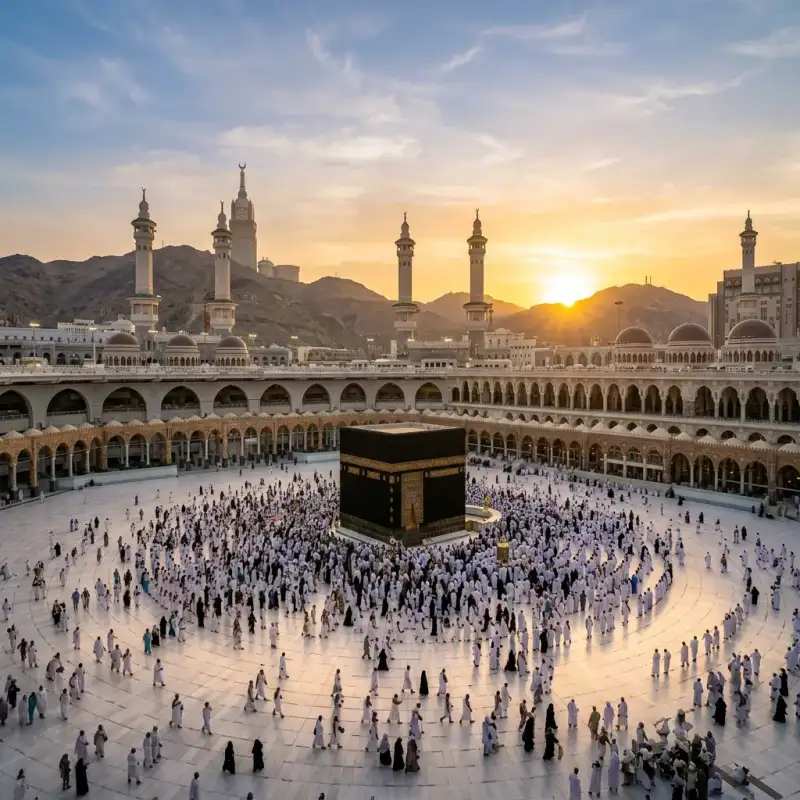

La expansión musulmana o la expansión del #Islam comenzó en la península arábiga al suroeste de Asia. Es la denominación que suele darse a las conquistas militares o las reformas de comercio de la civilización árabe musulmana en las que caerían el Imperio sasánida, el norte de África, y la península ibérica, incluyendo partes del Imperio bizantino. También está incluida en esta denominación el influjo de los comerciantes en África y las misiones hechas en Filipinas. Este período empezó desde el año 622 cuando #Mahoma organizó en Medina un conjunto de soldados que pronto se volvió lo bastante fuerte para unificar toda la península arábiga. Tras la muerte de #Mahoma en el 632, el #Islam tuvo una expansión sorprendentemente rápida durante alrededor de una década, favorecido en primera instancia por la debilidad del Imperio bizantino, y ocupó todo el norte de África, Irán, la parte meridional del Asia Central, el oeste del subcontinente indio, la península ibérica y el sur de Francia. Esta primera etapa concluyó con varias derrotas, como la batalla de Covadonga en el año 722 o la batalla de Poitiers (732) y otras frente a los bizantinos e hindúes, y con la disolución del Califato Omeya. Durante los siglos siguientes, el islam logró varios avances en otros frentes, como en el resto de Asia Central, en Asia Menor, en el sur de Italia, en #Europa oriental, en el Sudeste asiático y en el África subsahariana. Sin embargo, todos estos avances fueron producidos por distintos Estados independientes unos de otros. Mientras estos avances se producían, el islam era obligado a retroceder en #Europa occidental, especialmente por la llamada Reconquista española. Durante el último tercio del siglo XVI, un último Estado musulmán con pretensiones universales, el Imperio otomano, alcanzó su máxima expansión. A lo largo de este período de casi un milenio tuvieron lugar grandes acontecimientos, hechos y procesos muy diferentes entre sí, diferenciados temporal y geográficamente, sobre todo en el interior del islam, algunos de los cuales fueron causa de su propia destrucción (en especial la forma de gobernarse). Después de la conquista de Arabia llevada a cabo por #Mahoma años antes de su muerte y continuada por sus seguidores, lograron unificar el reino en un único gobierno, el cual debía cumplir «la palabra de dios», además de respetar las opiniones de otros ciudadanos, pero eso cambió años después según científicos durante el gobierno de Abdel Mumin, en 1130-1163, después de la muerte de Ibn Tumart. Primer siglo de expansión musulmana Durante sus primeras décadas, el islam se extendió rápidamente desde el noreste hasta Mesopotamia y Persia; y al oeste hasta Siria, Palestina y Egipto (las provincias más ricas del Imperio bizantino). El islam impactó en el mundo cristiano y greco-romano poco después de la muerte de #Mahoma. Durante el reinado de los omeyas, la expansión continúa, las conquistas se hacen por vía terrestre hasta el extremo noroccidental de África a fines del siglo VII, y llegan a las costas de la península ibérica comenzando el siglo VIII. En 711 superan el estrecho de Gibraltar y logran llegar a la península ibérica. Los #musulmanes son detenidos en la batalla de Covadonga en el año 722 en Covadonga, Asturias y en la batalla de Poitiers, en el 732 en Poitiers, Francia. Desde allí vuelven a sus territorios en la península ibérica aunque los reyes asturianos, tras la victoria en Covadonga inician la Reconquista dando lugar al Reino de Asturias. Luego se expandieron hacia Asia central, Bujará, Kabul, y alcanzarán la frontera de la India. Limitarán con el Imperio bizantino, el mar Caspio y el Cáucaso al norte. El mar Mediterráneo es controlado por el Imperio bizantino luego de la amenaza de las conquistas árabes, quienes construirán una flota y atacarán Constantinopla sin éxito en tres ocasiones. Los bizantinos eran maestros del mar y bloquearon la expansión musulmana, manteniendo de todas formas el comercio con ellos. El mar se constituyó en una frontera, pero sobre todo se convirtió en un mar de comercio. El mapa no cambiaría más hasta el siglo XI. Cuando los árabes conquistaban un territorio, se establecían en campamentos aparte y vivían del fruto de sus conquistas y de los impuestos aplicados a los no-#musulmanes, a cambio de su libertad y su protección. Este impuesto personal se llamaba yizia y era distinto al que pagaban los #musulmanes, llamado azaque (que es uno de los cinco pilares del islam). El siglo VIII se caracteriza por la férrea resistencia del Imperio bizantino, pero también en el interior del mundo musulmán. La agitación es a la vez política y religiosa. Se observa entonces la unificación y la arabización del Imperio (por la lengua, la moneda, la administración), como consecuencia de su islamización (las escuelas son instituidas para aprender el Corán, los juicios son llevados a cabo para responder al derecho musulmán). Pero hay numerosas secesiones político-religiosas. En efecto, los abasíes fundaron Bagdad. Hay entonces un desplazamiento del centro político hacia el este, que por consecuencia le transferirán corrientes llegadas desde el extremo oriente, pero también significará un desequilibrio pues el centro está alejado del oeste del Imperio. Esto arrastrará las secesiones que derivarán en la formación de tres grandes zonas donde emergerán los califatos. Estas son las zonas abasí, fatimí y andalusí; se puede aún hablar de unidad religiosa entre los sucesores de #Mahoma. En el siglo IX y el siglo X, el Imperio árabe-musulmán no se expande más, estando sometido a presiones exteriores crecientes. Del siglo VIII al siglo XV Las tropas de Uqba ibn Nafi entran en Ifriqiya, nombre dado a esta antigua provincia romana, pero se topa con la resistencia de Kusaila. En 683, en el momento de una batalla terrible, Uqba muere así como la inmensa mayoría de sus hombres. Kusaila marcha entonces sobre Kairuán, reinando allí cerca de cinco años, pero refuerzos venidos de Siria destituyen al rey. La conquista del norte de África prosigue y en seguida un nuevo ataque gana la región de Aurès, la reina Dijia (Kahena) llega a reunir a varias tribus bereberes y rechaza provisionalmente a los soldados #musulmanes hasta Tripolitania (la actual Libia). Cartago es tomado en 698, la resistencia está dominada a partir de 702 y el norte de África es oficialmente conquistado en 711. El mismo año, los primeros contingentes bereberes pasan a Andalucía, dirigidos por Táriq ibn Ziyad. A la fase de organización militar de la conquista, va a sustituirse la administración de un territorio todavía parcialmente insumiso, y convertido. Las poblaciones afro-árabe-persas del África oriental que comerciaban desde hace siglos con los árabes se islamizaron desde el siglo viii. Loa suajilis son a la vez el fruto de este mestizaje y de la islamización de la región. #Europa Las conquistas árabes llegaron hasta #Europa. En 711, al mando de Tarik y enviados por el gobernador africano Muza, los árabes conquistaron el Reino visigodo, y se anexaron Hispania. La expansión del islam se hace según el principio de la guerra santa o Yihad. Este se toma del Corán donde el término aparece en la fórmula «esfuerzo en el camino de Dios», en el sentido de esfuerzo para hacer reinar los derechos de Dios, es decir, para defender el islamismo. A diferencia de la fe cristiana, que rechaza la guerra ofensiva para expandir la fe, el islam defiende las ofensivas militares para imponer la fe de #Mahoma. Esta tierra, entonces cristiana, había sido desgastada por las luchas intestinas derivadas contra la herejía (arrianismo en la península ibérica y donatistas en el norte de África) y, debido a esto, había sido largamente perseguida por el poder imperial. Lo que explica la acogida fácil para los conquistadores, hecho por la mayoría de ellos por lo menos en el norte de África. La Hispania se convertirá en el país de #Al-Ándalus durante ochocientos años. En cambio las corrientes del cristianismo consideraron primero muy negativamente la emergencia del islam. Esta nueva religión ponía obstáculo a su reivindicación de universalismo (“católico” significa universal), y las referencias a los mensajes de la Biblia aparecían en ellos, así como a los judíos, más bien como una herejía cismática (para las corrientes que utilizan este concepto) que como un reconocimiento. La referencia al mensaje cristiano utilizada en el Corán había llegado a #Mahoma vía cristianos monofisitas, docetas o nestorianos, es decir, de las corrientes consideradas heréticas por los Concilios de Nicea y Constantinopla. A lo más, el islam aparecía ante ellos como una forma de competencia ligera, compartiendo su reconocimiento a un Dios único, pero refutando en cambio la idea de Trinidad. Hasta la llegada de los turcos selyúcidas, sin embargo, la convivencia en Jerusalén sería sin dificultad mayor, a pesar de las invasiones repetidas hacia #Europa realizadas por tropas moras que apelan al islam. La situación totalmente cambia con la ocupación turca, que piensa prohibirles a los cristianos el paso hacia los lugares santos. Una tensión se crea entonces. Para Occidente cristiano, el mahometano se hace el infiel por excelencia, y #Mahoma (de donde viene la deformación baphomet) es la imagen de un demonio pérfido, que predica en nombre de Dios para desviar a los fieles de la verdadera fe. A veces es asimilado como el Anticristo, a veces más simplemente hace recordar las palabras que los evangelios atribuyen a Jesús y que advierte contra profetas falsos que vendrán después de él. Desde el lado musulmán se establecen las mismas acusaciones. La conquista islámica, como más tarde lo serán las cruzadas, son motivados por los jefes de guerra deseosos de extender su territorio, así como por las poblaciones preparadas con este fin, por una necesidad percibida de difundir la verdadera fe. El apogeo de la civilización musulmana (en términos de desarrollo científico y técnico) se sitúa entre los siglos VIII y IX. Los progresos son tales, que se puede hablar de un “Primer Renacimiento”, muy anterior al fenómeno que se efectuará en Italia durante el siglo xiii. Ellos recibieron importantes conocimientos de países de antigua civilización que conquistaron: (Siria, Líbano, Egipto, Mesopotamia, la provincia romana de África). Pero esta recepción no fue meramente pasiva: con esta materia se producen desarrollos importantes y propios, como los logrados con el álgebra, o en el campo filosófico, el cual reconoce importantes personajes como Avicena, Al-Farabi o Averroes. #Europa tiene entonces cerca de dos siglos de retraso sobre el mundo musulmán, aunque ciudades como Venecia tuvieron al respecto una situación extraordinaria. Sin embargo, los beneficios culturales y técnicos obtenidos por los territorios occidentales gracias a la expansión musulmana son objeto de debate de los historiadores especializados. Más que la victoria de 732 de Carlos Martel, que rechazará la invasión en Poitiers, es el fracaso del sitio de Constantinopla el que frenará el avance de los ejércitos árabes. Los establecimientos moros perdurarán mucho tiempo como atestigua la toponimia de Ramatuelle, una ciudad de Provenza al sur de Francia, nacida de Rahmat Allah, la gracia de Dios. Se conocerá el movimiento inverso de guerra justo también, algunos siglos más tarde, en la Reconquista de la península ibérica que verdaderamente se presenta en la batalla de Las Navas de Tolosa, la primera victoria de esta campaña, y se concluirá en el siglo XV por la conquista de los últimos reinos Taifas en 1492. Esta fecha corresponde también según Jacques Attali y Arnold J. Toynbee al exterminio de los últimos núcleos de resistencia cristiana en Egipto. Algunas cruzadas previamente destinados a reconquistar la tumba del Cristo habían reabierto en los países cristianos la ruta de las especias apoderándose de las escalas de Levante. La conquista otomana En el siglo IX, empieza el avance de los pueblos turco-mongoles de la región de las montañas Altái y del lago Baikal hacia el oeste; estos pueblos progresivamente se islamizan. Más tarde, debido al llamado de refuerzo hecho por el califa abasí para calmar las agitaciones, poblaciones turcas llamadas selyúcidas se instalan en Bagdad en el siglo XI. El islam se extiende en Asia Menor y en la India. Un príncipe afgano convertido al islam instaura un sultanato en la India. Hay diferentes familias influyentes en las tribus turcas en Asia Menor, y la familia Osmán, instalada cerca de Constantinopla, va a emprender la conquista de Asia Menor y de los Balcanes. Constantinopla cae en 1453. La expansión del islam en #Europa se debió a las exitosas campañas militares que llevaron a cabo los otomanos, en particular sobre los albaneses y sobre los eslavos de Bosnia. Época contemporánea El islam es hoy la religión más seguida después del cristianismo con un total estimado de 1,3 miles de millones de creyentes (en torno al 20 % de la población mundial). El islam continúa su expansión en África, en una progresión constante hacia el sur del continente (donde predomina aún el cristianismo desde la colonización europea). Desde su independencia, una parte de los países de África negra privilegiaron más bien las relaciones con los países árabes #musulmanes antes que con los antiguos colonizadores. Uno de los factores de la fácil difusión del islam en África es su importación desde países vecinos, en lugar de evangelizadores blancos susceptibles de ser percibidos como colonizadores, como en el caso del catolicismo. Esta expansión es también fuente de tensiones y de conflictos. En Costa de Marfil o en Nigeria, por ejemplo, la oposición entre las poblaciones musulmanas al norte del país y las poblaciones cristianas del sur alimenta una inestabilidad permanente que puede ir hasta el conflicto armado a escala nacional (Costa de Marfil) o a ataques y represalias en las regiones “mixtas” (Nigeria). A las cuestiones religiosas se incorporan sin embargo intereses económicos y políticos (reparto de las riquezas y del poder político) en el génesis de los enfrentamientos. La difusión del islam fuera del mundo árabe-musulmán tradicional se explica en parte por el crecimiento de los flujos migratorios a partir de los países de religión y de cultura musulmana. Es el caso en los países occidentales dónde la inmigración de poblaciones musulmanas se desarrolló desde los años 1950. Sin embargo, esta inmigración no parece influir en el número de conversiones de la población local. El islam continúa también su difusión hacia el este en Asia. En Indonesia particularmente, el islam, llegado desde comerciantes indios y chinos que hacían escalas en los puertos de Java y el Sumatra por lo menos desde el siglo XII, tuvo una progresión más bien lenta. En nuestros días, el 88 % de la población indonesia administrativamente es registrada como musulmana. Fechas cruciales 570-632: vida de #Mahoma. 629: toma de La #Meca (Tratado de Hudaybiyyah) 632-661: los cuatro primeros califas y el inicio de la expansión en oriente próximo y en Egipto. 637: toma de Jerusalén. 642: los #musulmanes penetran en Egipto. 656: asesinato de Uthman. batalla del camello. Inicio de la Fitna. 661: asesinato de Alí; inicio del chiismo. 661-750: dinastía de los Omeyas, (Damasco, capital del califato) 698: caída de Cartago. 711: desembarco en la península ibérica, fulminante conquista musulmana. 718: inicio de la Reconquista en Asturias. Apogeo del sitio de Constantinopla por los árabes. 771: finalización de las conquistas de la India y de #España. 732: derrota árabe-bereber a manos de Carlos Martel en Poitiers. 750-1258: dinastía de los abasíes (Bagdad capital del califato) 878: ocultación del duodécimo Imán, descendiente de Alí. 1000: inicio de las conquistas en la India por los soberanos turco-#musulmanes. 1037: muerte del pensador Ibn Sina (Avicena). 1099: toma de Jerusalén por los cruzados. 1187: Saladino recaptura Jerusalén de los cruzados. 1198: muerte del filósofo Ibn Rouchd (Averroes). 1250-1517: dinastía de los Mamelucos en Egipto 1258: destrucción de Bagdad por los mongoles, fin de los abasíes. Dinastía de los Ilkanes mongoles. 1300: expansión del islam en Indonesia. Los mercaderes indios introducirán el islam en Indonesia (Sumatra). 1419: el príncipe de Malaca se convierte al islam. 1453-1571: apogeo del Imperio otomano, entre la toma de Constantinopla y la derrota naval de Lepanto. 1492: caída del Reino de Granada, fin de la reconquista cristiana en #España. 1683: apogeo relativo de los Turcos otomanos. El Imperio comienza su lento declinar. 1798: llegada de Bonaparte a Egipto. Tratará de adoptar una estrategia de semitentación, al declararse el amigo del sultán, y por lo tanto del pueblo egipcio, pero enemigo de los mamelucos que se comportan como un país conquistado, y hará proclamar esta declaración en todo el país. 1830: inicio de la conquista francesa en Argelia. 1881: inicios del movimiento mahdista en Sudán. Protectorado francés en Túnez. 1882: protectorado británico sobre Egipto. 1912: protectorado francés y español en Marruecos. 1920: mandato francés en Siria y Líbano; mandato británico en Palestina e Irak. 1921-1926: guerra del Rif en Marruecos. 1922: independencia de Egipto. 1924: abolición del califato en Turquía por Mustafa Kemal. 1928: fundación en Egipto del movimiento Hermanos #musulmanes. 1932: los territorios conquistados por Abd al-Azi ibn Saoud quedan en poder de Arabia Saudita. 1948: Los judíos declaran su independencia en Palestina y crean el Estado de Israel; como resultado de la guerra, más de 800,000 #musulmanes son expulsados y Jerusalén cae parcialmente en manos de los judíos. 1967: Jerusalén cae definitivamente en manos de los judíos junto al resto de la región de Judea y Samaria (Cisjordania) y los Altos del Golán. Fuentes y bibliografía «Chrétiens et musulmans, le premier face-à-face VIIe-VIIIe siècle», en Le Monde de la Bible, n.° 154, noviembre de 2003. «La Filosofía Medieval». Alain de Libera, UNIVERSITAT DE VALENCIA. SERVEI DE PUBLICACIONS, 2007 Consecuencias y Análisis Histórico (Parte 2) La expansión musulmana o la expansión del islam comenzó en la península arábiga al suroeste de Asia. Es la denominación que suele darse a las conquistas militares o las reformas de comercio de la civilización árabe musulmana en las que caerían el Imperio sasánida, el norte de África, y la península ibérica, incluyendo partes del Imperio bizantino. También está incluida en esta denominación el influjo de los comerciantes en África y las misiones hechas en Filipinas. Este período empezó desde el año 622 cuando #Mahoma organizó en Medina un conjunto de soldados que pronto se volvió lo bastante fuerte para unificar toda la península arábiga. Tras la muerte de #Mahoma en el 632, el islam tuvo una expansión sorprendentemente rápida durante alrededor de una década, favorecido en primera instancia por la debilidad del Imperio bizantino, y ocupó todo el norte de África, Irán, la parte meridional del Asia Central, el oeste del subcontinente indio, la península ibérica y el sur de Francia. Esta primera etapa concluyó con varias derrotas, como la batalla de Covadonga en el año 722 o la batalla de Poitiers (732) y otras frente a los bizantinos e hindúes, y con la disolución del Califato Omeya. Durante los siglos siguientes, el islam logró varios avances en otros frentes, como en el resto de Asia Central, en Asia Menor, en el sur de Italia, en #Europa oriental, en el Sudeste asiático y en el África subsahariana. Sin embargo, todos estos avances fueron producidos por distintos Estados independientes unos de otros. Mientras estos avances se producían, el islam era obligado a retroceder en #Europa occidental, especialmente por la llamada Reconquista española. Durante el último tercio del siglo XVI, un último Estado musulmán con pretensiones universales, el Imperio otomano, alcanzó su máxima expansión. A lo largo de este período de casi un milenio tuvieron lugar grandes acontecimientos, hechos y procesos muy diferentes entre sí, diferenciados temporal y geográficamente, sobre todo en el interior del islam, algunos de los cuales fueron causa de su propia destrucción (en especial la forma de gobernarse). Después de la conquista de Arabia llevada a cabo por #Mahoma años antes de su muerte y continuada por sus seguidores, lograron unificar el reino en un único gobierno, el cual debía cumplir «la palabra de dios», además de respetar las opiniones de otros ciudadanos, pero eso cambió años después según científicos durante el gobierno de Abdel Mumin, en 1130-1163, después de la muerte de Ibn Tumart. Primer siglo de expansión musulmana Durante sus primeras décadas, el islam se extendió rápidamente desde el noreste hasta Mesopotamia y Persia; y al oeste hasta Siria, Palestina y Egipto (las provincias más ricas del Imperio bizantino). El islam impactó en el mundo cristiano y greco-romano poco después de la muerte de #Mahoma. Durante el reinado de los omeyas, la expansión continúa, las conquistas se hacen por vía terrestre hasta el extremo noroccidental de África a fines del siglo VII, y llegan a las costas de la península ibérica comenzando el siglo VIII. En 711 superan el estrecho de Gibraltar y logran llegar a la península ibérica. Los #musulmanes son detenidos en la batalla de Covadonga en el año 722 en Covadonga, Asturias y en la batalla de Poitiers, en el 732 en Poitiers, Francia. Desde allí vuelven a sus territorios en la península ibérica aunque los reyes asturianos, tras la victoria en Covadonga inician la Reconquista dando lugar al Reino de Asturias. Luego se expandieron hacia Asia central, Bujará, Kabul, y alcanzarán la frontera de la India. Limitarán con el Imperio bizantino, el mar Caspio y el Cáucaso al norte. El mar Mediterráneo es controlado por el Imperio bizantino luego de la amenaza de las conquistas árabes, quienes construirán una flota y atacarán Constantinopla sin éxito en tres ocasiones. Los bizantinos eran maestros del mar y bloquearon la expansión musulmana, manteniendo de todas formas el comercio con ellos. El mar se constituyó en una frontera, pero sobre todo se convirtió en un mar de comercio. El mapa no cambiaría más hasta el siglo XI. Cuando los árabes conquistaban un territorio, se establecían en campamentos aparte y vivían del fruto de sus conquistas y de los impuestos aplicados a los no-#musulmanes, a cambio de su libertad y su protección. Este impuesto personal se llamaba yizia y era distinto al que pagaban los #musulmanes, llamado azaque (que es uno de los cinco pilares del islam). El siglo VIII se caracteriza por la férrea resistencia del Imperio bizantino, pero también en el interior del mundo musulmán. La agitación es a la vez política y religiosa. Se observa entonces la unificación y la arabización del Imperio (por la lengua, la moneda, la administración), como consecuencia de su islamización (las escuelas son instituidas para aprender el Corán, los juicios son llevados a cabo para responder al derecho musulmán). Pero hay numerosas secesiones político-religiosas. En efecto, los abasíes fundaron Bagdad. Hay entonces un desplazamiento del centro político hacia el este, que por consecuencia le transferirán corrientes llegadas desde el extremo oriente, pero también significará un desequilibrio pues el centro está alejado del oeste del Imperio. Esto arrastrará las secesiones que derivarán en la formación de tres grandes zonas donde emergerán los califatos. Estas son las zonas abasí, fatimí y andalusí; se puede aún hablar de unidad religiosa entre los sucesores de #Mahoma. En el siglo IX y el siglo X, el Imperio árabe-musulmán no se expande más, estando sometido a presiones exteriores crecientes. Del siglo VIII al siglo XV Las tropas de Uqba ibn Nafi entran en Ifriqiya, nombre dado a esta antigua provincia romana, pero se topa con la resistencia de Kusaila. En 683, en el momento de una batalla terrible, Uqba muere así como la inmensa mayoría de sus hombres. Kusaila marcha entonces sobre Kairuán, reinando allí cerca de cinco años, pero refuerzos venidos de Siria destituyen al rey. La conquista del norte de África prosigue y en seguida un nuevo ataque gana la región de Aurès, la reina Dijia (Kahena) llega a reunir a varias tribus bereberes y rechaza provisionalmente a los soldados #musulmanes hasta Tripolitania (la actual Libia). Cartago es tomado en 698, la resistencia está dominada a partir de 702 y el norte de África es oficialmente conquistado en 711. El mismo año, los primeros contingentes bereberes pasan a Andalucía, dirigidos por Táriq ibn Ziyad. A la fase de organización militar de la conquista, va a sustituirse la administración de un territorio todavía parcialmente insumiso, y convertido. Las poblaciones afro-árabe-persas del África oriental que comerciaban desde hace siglos con los árabes se islamizaron desde el siglo viii. Loa suajilis son a la vez el fruto de este mestizaje y de la islamización de la región. #Europa Las conquistas árabes llegaron hasta #Europa. En 711, al mando de Tarik y enviados por el gobernador africano Muza, los árabes conquistaron el Reino visigodo, y se anexaron Hispania. La expansión del islam se hace según el principio de la guerra santa o Yihad. Este se toma del Corán donde el término aparece en la fórmula «esfuerzo en el camino de Dios», en el sentido de esfuerzo para hacer reinar los derechos de Dios, es decir, para defender el islamismo. A diferencia de la fe cristiana, que rechaza la guerra ofensiva para expandir la fe, el islam defiende las ofensivas militares para imponer la fe de #Mahoma. Esta tierra, entonces cristiana, había sido desgastada por las luchas intestinas derivadas contra la herejía (arrianismo en la península ibérica y donatistas en el norte de África) y, debido a esto, había sido largamente perseguida por el poder imperial. Lo que explica la acogida fácil para los conquistadores, hecho por la mayoría de ellos por lo menos en el norte de África. La Hispania se convertirá en el país de #Al-Ándalus durante ochocientos años. En cambio las corrientes del cristianismo consideraron primero muy negativamente la emergencia del islam. Esta nueva religión ponía obstáculo a su reivindicación de universalismo (“católico” significa universal), y las referencias a los mensajes de la Biblia aparecían en ellos, así como a los judíos, más bien como una herejía cismática (para las corrientes que utilizan este concepto) que como un reconocimiento. La referencia al mensaje cristiano utilizada en el Corán había llegado a #Mahoma vía cristianos monofisitas, docetas o nestorianos, es decir, de las corrientes consideradas heréticas por los Concilios de Nicea y Constantinopla. A lo más, el islam aparecía ante ellos como una forma de competencia ligera, compartiendo su reconocimiento a un Dios único, pero refutando en cambio la idea de Trinidad. Hasta la llegada de los turcos selyúcidas, sin embargo, la convivencia en Jerusalén sería sin dificultad mayor, a pesar de las invasiones repetidas hacia #Europa realizadas por tropas moras que apelan al islam. La situación totalmente cambia con la ocupación turca, que piensa prohibirles a los cristianos el paso hacia los lugares santos. Una tensión se crea entonces. Para Occidente cristiano, el mahometano se hace el infiel por excelencia, y #Mahoma (de donde viene la deformación baphomet) es la imagen de un demonio pérfido, que predica en nombre de Dios para desviar a los fieles de la verdadera fe. A veces es asimilado como el Anticristo, a veces más simplemente hace recordar las palabras que los evangelios atribuyen a Jesús y que advierte contra profetas falsos que vendrán después de él. Desde el lado musulmán se establecen las mismas acusaciones. La conquista islámica, como más tarde lo serán las cruzadas, son motivados por los jefes de guerra deseosos de extender su territorio, así como por las poblaciones preparadas con este fin, por una necesidad percibida de difundir la verdadera fe. El apogeo de la civilización musulmana (en términos de desarrollo científico y técnico) se sitúa entre los siglos VIII y IX. Los progresos son tales, que se puede hablar de un “Primer Renacimiento”, muy anterior al fenómeno que se efectuará en Italia durante el siglo xiii. Ellos recibieron importantes conocimientos de países de antigua civilización que conquistaron: (Siria, Líbano, Egipto, Mesopotamia, la provincia romana de África). Pero esta recepción no fue meramente pasiva: con esta materia se producen desarrollos importantes y propios, como los logrados con el álgebra, o en el campo filosófico, el cual reconoce importantes personajes como Avicena, Al-Farabi o Averroes. #Europa tiene entonces cerca de dos siglos de retraso sobre el mundo musulmán, aunque ciudades como Venecia tuvieron al respecto una situación extraordinaria. Sin embargo, los beneficios culturales y técnicos obtenidos por los territorios occidentales gracias a la expansión musulmana son objeto de debate de los historiadores especializados. Más que la victoria de 732 de Carlos Martel, que rechazará la invasión en Poitiers, es el fracaso del sitio de Constantinopla el que frenará el avance de los ejércitos árabes. Los establecimientos moros perdurarán mucho tiempo como atestigua la toponimia de Ramatuelle, una ciudad de Provenza al sur de Francia, nacida de Rahmat Allah, la gracia de Dios. Se conocerá el movimiento inverso de guerra justo también, algunos siglos más tarde, en la Reconquista de la península ibérica que verdaderamente se presenta en la batalla de Las Navas de Tolosa, la primera victoria de esta campaña, y se concluirá en el siglo XV por la conquista de los últimos reinos Taifas en 1492. Esta fecha corresponde también según Jacques Attali y Arnold J. Toynbee al exterminio de los últimos núcleos de resistencia cristiana en Egipto. Algunas cruzadas previamente destinados a reconquistar la tumba del Cristo habían reabierto en los países cristianos la ruta de las especias apoderándose de las escalas de Levante. La conquista otomana En el siglo IX, empieza el avance de los pueblos turco-mongoles de la región de las montañas Altái y del lago Baikal hacia el oeste; estos pueblos progresivamente se islamizan. Más tarde, debido al llamado de refuerzo hecho por el califa abasí para calmar las agitaciones, poblaciones turcas llamadas selyúcidas se instalan en Bagdad en el siglo XI. El islam se extiende en Asia Menor y en la India. Un príncipe afgano convertido al islam instaura un sultanato en la India. Hay diferentes familias influyentes en las tribus turcas en Asia Menor, y la familia Osmán, instalada cerca de Constantinopla, va a emprender la conquista de Asia Menor y de los Balcanes. Constantinopla cae en 1453. La expansión del islam en #Europa se debió a las exitosas campañas militares que llevaron a cabo los otomanos, en particular sobre los albaneses y sobre los eslavos de Bosnia. Época contemporánea El islam es hoy la religión más seguida después del cristianismo con un total estimado de 1,3 miles de millones de creyentes (en torno al 20 % de la población mundial). El islam continúa su expansión en África, en una progresión constante hacia el sur del continente (donde predomina aún el cristianismo desde la colonización europea). Desde su independencia, una parte de los países de África negra privilegiaron más bien las relaciones con los países árabes #musulmanes antes que con los antiguos colonizadores. Uno de los factores de la fácil difusión del islam en África es su importación desde países vecinos, en lugar de evangelizadores blancos susceptibles de ser percibidos como colonizadores, como en el caso del catolicismo. Esta expansión es también fuente de tensiones y de conflictos. En Costa de Marfil o en Nigeria, por ejemplo, la oposición entre las poblaciones musulmanas al norte del país y las poblaciones cristianas del sur alimenta una inestabilidad permanente que puede ir hasta el conflicto armado a escala nacional (Costa de Marfil) o a ataques y represalias en las regiones “mixtas” (Nigeria). A las cuestiones religiosas se incorporan sin embargo intereses económicos y políticos (reparto de las riquezas y del poder político) en el génesis de los enfrentamientos. La difusión del islam fuera del mundo árabe-musulmán tradicional se explica en parte por el crecimiento de los flujos migratorios a partir de los países de religión y de cultura musulmana. Es el caso en los países occidentales dónde la inmigración de poblaciones musulmanas se desarrolló desde los años 1950. Sin embargo, esta inmigración no parece influir en el número de conversiones de la población local. El islam continúa también su difusión hacia el este en Asia. En Indonesia particularmente, el islam, llegado desde comerciantes indios y chinos que hacían escalas en los puertos de Java y el Sumatra por lo menos desde el siglo XII, tuvo una progresión más bien lenta. En nuestros días, el 88 % de la población indonesia administrativamente es registrada como musulmana. Fechas cruciales 570-632: vida de #Mahoma. 629: toma de La #Meca (Tratado de Hudaybiyyah) 632-661: los cuatro primeros califas y el inicio de la expansión en oriente próximo y en Egipto. 637: toma de Jerusalén. 642: los #musulmanes penetran en Egipto. 656: asesinato de Uthman. batalla del camello. Inicio de la Fitna. 661: asesinato de Alí; inicio del chiismo. 661-750: dinastía de los Omeyas, (Damasco, capital del califato) 698: caída de Cartago. 711: desembarco en la península ibérica, fulminante conquista musulmana. 718: inicio de la Reconquista en Asturias. Apogeo del sitio de Constantinopla por los árabes. 771: finalización de las conquistas de la India y de #España. 732: derrota árabe-bereber a manos de Carlos Martel en Poitiers. 750-1258: dinastía de los abasíes (Bagdad capital del califato) 878: ocultación del duodécimo Imán, descendiente de Alí. 1000: inicio de las conquistas en la India por los soberanos turco-#musulmanes. 1037: muerte del pensador Ibn Sina (Avicena). 1099: toma de Jerusalén por los cruzados. 1187: Saladino recaptura Jerusalén de los cruzados. 1198: muerte del filósofo Ibn Rouchd (Averroes). 1250-1517: dinastía de los Mamelucos en Egipto 1258: destrucción de Bagdad por los mongoles, fin de los abasíes. Dinastía de los Ilkanes mongoles. 1300: expansión del islam en Indonesia. Los mercaderes indios introducirán el islam en Indonesia (Sumatra). 1419: el príncipe de Malaca se convierte al islam. 1453-1571: apogeo del Imperio otomano, entre la toma de Constantinopla y la derrota naval de Lepanto. 1492: caída del Reino de Granada, fin de la reconquista cristiana en #España. 1683: apogeo relativo de los Turcos otomanos. El Imperio comienza su lento declinar. 1798: llegada de Bonaparte a Egipto. Tratará de adoptar una estrategia de semitentación, al declararse el amigo del sultán, y por lo tanto del pueblo egipcio, pero enemigo de los mamelucos que se comportan como un país conquistado, y hará proclamar esta declaración en todo el país. 1830: inicio de la conquista francesa en Argelia. 1881: inicios del movimiento mahdista en Sudán. Protectorado francés en Túnez. 1882: protectorado británico sobre Egipto. 1912: protectorado francés y español en Marruecos. 1920: mandato francés en Siria y Líbano; mandato británico en Palestina e Irak. 1921-1926: guerra del Rif en Marruecos. 1922: independencia de Egipto. 1924: abolición del califato en Turquía por Mustafa Kemal. 1928: fundación en Egipto del movimiento Hermanos #musulmanes. 1932: los territorios conquistados por Abd al-Azi ibn Saoud quedan en poder de Arabia Saudita. 1948: Los judíos declaran su independencia en Palestina y crean el Estado de Israel; como resultado de la guerra, más de 800,000 #musulmanes son expulsados y Jerusalén cae parcialmente en manos de los judíos. 1967: Jerusalén cae definitivamente en manos de los judíos junto al resto de la región de Judea y Samaria (Cisjordania) y los Altos del Golán. Fuentes y bibliografía «Chrétiens et musulmans, le premier face-à-face VIIe-VIIIe siècle», en Le Monde de la Bible, n.° 154, noviembre de 2003. «La Filosofía Medieval». Alain de Libera, UNIVERSITAT DE VALENCIA. SERVEI DE PUBLICACIONS, 2007 Consecuencias y Análisis Histórico (Parte 3) La expansión musulmana o la expansión del islam comenzó en la península arábiga al suroeste de Asia. Es la denominación que suele darse a las conquistas militares o las reformas de comercio de la civilización árabe musulmana en las que caerían el Imperio sasánida, el norte de África, y la península ibérica, incluyendo partes del Imperio bizantino. También está incluida en esta denominación el influjo de los comerciantes en África y las misiones hechas en Filipinas. Este período empezó desde el año 622 cuando #Mahoma organizó en Medina un conjunto de soldados que pronto se volvió lo bastante fuerte para unificar toda la península arábiga. Tras la muerte de #Mahoma en el 632, el islam tuvo una expansión sorprendentemente rápida durante alrededor de una década, favorecido en primera instancia por la debilidad del Imperio bizantino, y ocupó todo el norte de África, Irán, la parte meridional del Asia Central, el oeste del subcontinente indio, la península ibérica y el sur de Francia. Esta primera etapa concluyó con varias derrotas, como la batalla de Covadonga en el año 722 o la batalla de Poitiers (732) y otras frente a los bizantinos e hindúes, y con la disolución del Califato Omeya. Durante los siglos siguientes, el islam logró varios avances en otros frentes, como en el resto de Asia Central, en Asia Menor, en el sur de Italia, en #Europa oriental, en el Sudeste asiático y en el África subsahariana. Sin embargo, todos estos avances fueron producidos por distintos Estados independientes unos de otros. Mientras estos avances se producían, el islam era obligado a retroceder en #Europa occidental, especialmente por la llamada Reconquista española. Durante el último tercio del siglo XVI, un último Estado musulmán con pretensiones universales, el Imperio otomano, alcanzó su máxima expansión. A lo largo de este período de casi un milenio tuvieron lugar grandes acontecimientos, hechos y procesos muy diferentes entre sí, diferenciados temporal y geográficamente, sobre todo en el interior del islam, algunos de los cuales fueron causa de su propia destrucción (en especial la forma de gobernarse). Después de la conquista de Arabia llevada a cabo por #Mahoma años antes de su muerte y continuada por sus seguidores, lograron unificar el reino en un único gobierno, el cual debía cumplir «la palabra de dios», además de respetar las opiniones de otros ciudadanos, pero eso cambió años después según científicos durante el gobierno de Abdel Mumin, en 1130-1163, después de la muerte de Ibn Tumart. Primer siglo de expansión musulmana Durante sus primeras décadas, el islam se extendió rápidamente desde el noreste hasta Mesopotamia y Persia; y al oeste hasta Siria, Palestina y Egipto (las provincias más ricas del Imperio bizantino). El islam impactó en el mundo cristiano y greco-romano poco después de la muerte de #Mahoma. Durante el reinado de los omeyas, la expansión continúa, las conquistas se hacen por vía terrestre hasta el extremo noroccidental de África a fines del siglo VII, y llegan a las costas de la península ibérica comenzando el siglo VIII. En 711 superan el estrecho de Gibraltar y logran llegar a la península ibérica. Los #musulmanes son detenidos en la batalla de Covadonga en el año 722 en Covadonga, Asturias y en la batalla de Poitiers, en el 732 en Poitiers, Francia. Desde allí vuelven a sus territorios en la península ibérica aunque los reyes asturianos, tras la victoria en Covadonga inician la Reconquista dando lugar al Reino de Asturias. Luego se expandieron hacia Asia central, Bujará, Kabul, y alcanzarán la frontera de la India. Limitarán con el Imperio bizantino, el mar Caspio y el Cáucaso al norte. El mar Mediterráneo es controlado por el Imperio bizantino luego de la amenaza de las conquistas árabes, quienes construirán una flota y atacarán Constantinopla sin éxito en tres ocasiones. Los bizantinos eran maestros del mar y bloquearon la expansión musulmana, manteniendo de todas formas el comercio con ellos. El mar se constituyó en una frontera, pero sobre todo se convirtió en un mar de comercio. El mapa no cambiaría más hasta el siglo XI. Cuando los árabes conquistaban un territorio, se establecían en campamentos aparte y vivían del fruto de sus conquistas y de los impuestos aplicados a los no-#musulmanes, a cambio de su libertad y su protección. Este impuesto personal se llamaba yizia y era distinto al que pagaban los #musulmanes, llamado azaque (que es uno de los cinco pilares del islam). El siglo VIII se caracteriza por la férrea resistencia del Imperio bizantino, pero también en el interior del mundo musulmán. La agitación es a la vez política y religiosa. Se observa entonces la unificación y la arabización del Imperio (por la lengua, la moneda, la administración), como consecuencia de su islamización (las escuelas son instituidas para aprender el Corán, los juicios son llevados a cabo para responder al derecho musulmán). Pero hay numerosas secesiones político-religiosas. En efecto, los abasíes fundaron Bagdad. Hay entonces un desplazamiento del centro político hacia el este, que por consecuencia le transferirán corrientes llegadas desde el extremo oriente, pero también significará un desequilibrio pues el centro está alejado del oeste del Imperio. Esto arrastrará las secesiones que derivarán en la formación de tres grandes zonas donde emergerán los califatos. Estas son las zonas abasí, fatimí y andalusí; se puede aún hablar de unidad religiosa entre los sucesores de #Mahoma. En el siglo IX y el siglo X, el Imperio árabe-musulmán no se expande más, estando sometido a presiones exteriores crecientes. Del siglo VIII al siglo XV Las tropas de Uqba ibn Nafi entran en Ifriqiya, nombre dado a esta antigua provincia romana, pero se topa con la resistencia de Kusaila. En 683, en el momento de una batalla terrible, Uqba muere así como la inmensa mayoría de sus hombres. Kusaila marcha entonces sobre Kairuán, reinando allí cerca de cinco años, pero refuerzos venidos de Siria destituyen al rey. La conquista del norte de África prosigue y en seguida un nuevo ataque gana la región de Aurès, la reina Dijia (Kahena) llega a reunir a varias tribus bereberes y rechaza provisionalmente a los soldados #musulmanes hasta Tripolitania (la actual Libia). Cartago es tomado en 698, la resistencia está dominada a partir de 702 y el norte de África es oficialmente conquistado en 711. El mismo año, los primeros contingentes bereberes pasan a Andalucía, dirigidos por Táriq ibn Ziyad. A la fase de organización militar de la conquista, va a sustituirse la administración de un territorio todavía parcialmente insumiso, y convertido. Las poblaciones afro-árabe-persas del África oriental que comerciaban desde hace siglos con los árabes se islamizaron desde el siglo viii. Loa suajilis son a la vez el fruto de este mestizaje y de la islamización de la región. #Europa Las conquistas árabes llegaron hasta #Europa. En 711, al mando de Tarik y enviados por el gobernador africano Muza, los árabes conquistaron el Reino visigodo, y se anexaron Hispania. La expansión del islam se hace según el principio de la guerra santa o Yihad. Este se toma del Corán donde el término aparece en la fórmula «esfuerzo en el camino de Dios», en el sentido de esfuerzo para hacer reinar los derechos de Dios, es decir, para defender el islamismo. A diferencia de la fe cristiana, que rechaza la guerra ofensiva para expandir la fe, el islam defiende las ofensivas militares para imponer la fe de #Mahoma. Esta tierra, entonces cristiana, había sido desgastada por las luchas intestinas derivadas contra la herejía (arrianismo en la península ibérica y donatistas en el norte de África) y, debido a esto, había sido largamente perseguida por el poder imperial. Lo que explica la acogida fácil para los conquistadores, hecho por la mayoría de ellos por lo menos en el norte de África. La Hispania se convertirá en el país de al-Ándalus durante ochocientos años. En cambio las corrientes del cristianismo consideraron primero muy negativamente la emergencia del islam. Esta nueva religión ponía obstáculo a su reivindicación de universalismo (“católico” significa universal), y las referencias a los mensajes de la Biblia aparecían en ellos, así como a los judíos, más bien como una herejía cismática (para las corrientes que utilizan este concepto) que como un reconocimiento. La referencia al mensaje cristiano utilizada en el Corán había llegado a #Mahoma vía cristianos monofisitas, docetas o nestorianos, es decir, de las corrientes consideradas heréticas por los Concilios de Nicea y Constantinopla. A lo más, el islam aparecía ante ellos como una forma de competencia ligera, compartiendo su reconocimiento a un Dios único, pero refutando en cambio la idea de Trinidad. Hasta la llegada de los turcos selyúcidas, sin embargo, la convivencia en Jerusalén sería sin dificultad mayor, a pesar de las invasiones repetidas hacia #Europa realizadas por tropas moras que apelan al islam. La situación totalmente cambia con la ocupación turca, que piensa prohibirles a los cristianos el paso hacia los lugares santos. Una tensión se crea entonces. Para Occidente cristiano, el mahometano se hace el infiel por excelencia, y #Mahoma (de donde viene la deformación baphomet) es la imagen de un demonio pérfido, que predica en nombre de Dios para desviar a los fieles de la verdadera fe. A veces es asimilado como el Anticristo, a veces más simplemente hace recordar las palabras que los evangelios atribuyen a Jesús y que advierte contra profetas falsos que vendrán después de él. Desde el lado musulmán se establecen las mismas acusaciones. La conquista islámica, como más tarde lo serán las cruzadas, son motivados por los jefes de guerra deseosos de extender su territorio, así como por las poblaciones preparadas con este fin, por una necesidad percibida de difundir la verdadera fe. El apogeo de la civilización musulmana (en términos de desarrollo científico y técnico) se sitúa entre los siglos VIII y IX. Los progresos son tales, que se puede hablar de un “Primer Renacimiento”, muy anterior al fenómeno que se efectuará en Italia durante el siglo xiii. Ellos recibieron importantes conocimientos de países de antigua civilización que conquistaron: (Siria, Líbano, Egipto, Mesopotamia, la provincia romana de África). Pero esta recepción no fue meramente pasiva: con esta materia se producen desarrollos importantes y propios, como los logrados con el álgebra, o en el campo filosófico, el cual reconoce importantes personajes como Avicena, Al-Farabi o Averroes. #Europa tiene entonces cerca de dos siglos de retraso sobre el mundo musulmán, aunque ciudades como Venecia tuvieron al respecto una situación extraordinaria. Sin embargo, los beneficios culturales y técnicos obtenidos por los territorios occidentales gracias a la expansión musulmana son objeto de debate de los historiadores especializados. Más que la victoria de 732 de Carlos Martel, que rechazará la invasión en Poitiers, es el fracaso del sitio de Constantinopla el que frenará el avance de los ejércitos árabes. Los establecimientos moros perdurarán mucho tiempo como atestigua la toponimia de Ramatuelle, una ciudad de Provenza al sur de Francia, nacida de Rahmat Allah, la gracia de Dios. Se conocerá el movimiento inverso de guerra justo también, algunos siglos más tarde, en la Reconquista de la península ibérica que verdaderamente se presenta en la batalla de Las Navas de Tolosa, la primera victoria de esta campaña, y se concluirá en el siglo XV por la conquista de los últimos reinos Taifas en 1492. Esta fecha corresponde también según Jacques Attali y Arnold J. Toynbee al exterminio de los últimos núcleos de resistencia cristiana en Egipto. Algunas cruzadas previamente destinados a reconquistar la tumba del Cristo habían reabierto en los países cristianos la ruta de las especias apoderándose de las escalas de Levante. La conquista otomana En el siglo IX, empieza el avance de los pueblos turco-mongoles de la región de las montañas Altái y del lago Baikal hacia el oeste; estos pueblos progresivamente se islamizan. Más tarde, debido al llamado de refuerzo hecho por el califa abasí para calmar las agitaciones, poblaciones turcas llamadas selyúcidas se instalan en Bagdad en el siglo XI. El islam se extiende en Asia Menor y en la India. Un príncipe afgano convertido al islam instaura un sultanato en la India. Hay diferentes familias influyentes en las tribus turcas en Asia Menor, y la familia Osmán, instalada cerca de Constantinopla, va a emprender la conquista de Asia Menor y de los Balcanes. Constantinopla cae en 1453. La expansión del islam en #Europa se debió a las exitosas campañas militares que llevaron a cabo los otomanos, en particular sobre los albaneses y sobre los eslavos de Bosnia. Época contemporánea El islam es hoy la religión más seguida después del cristianismo con un total estimado de 1,3 miles de millones de creyentes (en torno al 20 % de la población mundial). El islam continúa su expansión en África, en una progresión constante hacia el sur del continente (donde predomina aún el cristianismo desde la colonización europea). Desde su independencia, una parte de los países de África negra privilegiaron más bien las relaciones con los países árabes #musulmanes antes que con los antiguos colonizadores. Uno de los factores de la fácil difusión del islam en África es su importación desde países vecinos, en lugar de evangelizadores blancos susceptibles de ser percibidos como colonizadores, como en el caso del catolicismo. Esta expansión es también fuente de tensiones y de conflictos. En Costa de Marfil o en Nigeria, por ejemplo, la oposición entre las poblaciones musulmanas al norte del país y las poblaciones cristianas del sur alimenta una inestabilidad permanente que puede ir hasta el conflicto armado a escala nacional (Costa de Marfil) o a ataques y represalias en las regiones “mixtas” (Nigeria). A las cuestiones religiosas se incorporan sin embargo intereses económicos y políticos (reparto de las riquezas y del poder político) en el génesis de los enfrentamientos. La difusión del islam fuera del mundo árabe-musulmán tradicional se explica en parte por el crecimiento de los flujos migratorios a partir de los países de religión y de cultura musulmana. Es el caso en los países occidentales dónde la inmigración de poblaciones musulmanas se desarrolló desde los años 1950. Sin embargo, esta inmigración no parece influir en el número de conversiones de la población local. El islam continúa también su difusión hacia el este en Asia. En Indonesia particularmente, el islam, llegado desde comerciantes indios y chinos que hacían escalas en los puertos de Java y el Sumatra por lo menos desde el siglo XII, tuvo una progresión más bien lenta. En nuestros días, el 88 % de la población indonesia administrativamente es registrada como musulmana. Fechas cruciales 570-632: vida de #Mahoma. 629: toma de La #Meca (Tratado de Hudaybiyyah) 632-661: los cuatro primeros califas y el inicio de la expansión en oriente próximo y en Egipto. 637: toma de Jerusalén. 642: los #musulmanes penetran en Egipto. 656: asesinato de Uthman. batalla del camello. Inicio de la Fitna. 661: asesinato de Alí; inicio del chiismo. 661-750: dinastía de los Omeyas, (Damasco, capital del califato) 698: caída de Cartago. 711: desembarco en la península ibérica, fulminante conquista musulmana. 718: inicio de la Reconquista en Asturias. Apogeo del sitio de Constantinopla por los árabes. 771: finalización de las conquistas de la India y de #España. 732: derrota árabe-bereber a manos de Carlos Martel en Poitiers. 750-1258: dinastía de los abasíes (Bagdad capital del califato) 878: ocultación del duodécimo Imán, descendiente de Alí. 1000: inicio de las conquistas en la India por los soberanos turco-#musulmanes. 1037: muerte del pensador Ibn Sina (Avicena). 1099: toma de Jerusalén por los cruzados. 1187: Saladino recaptura Jerusalén de los cruzados. 1198: muerte del filósofo Ibn Rouchd (Averroes). 1250-1517: dinastía de los Mamelucos en Egipto 1258: destrucción de Bagdad por los mongoles, fin de los abasíes. Dinastía de los Ilkanes mongoles. 1300: expansión del islam en Indonesia. Los mercaderes indios introducirán el islam en Indonesia (Sumatra). 1419: el príncipe de Malaca se convierte al islam. 1453-1571: apogeo del Imperio otomano, entre la toma de Constantinopla y la derrota naval de Lepanto. 1492: caída del Reino de Granada, fin de la reconquista cristiana en #España. 1683: apogeo relativo de los Turcos otomanos. El Imperio comienza su lento declinar. 1798: llegada de Bonaparte a Egipto. Tratará de adoptar una estrategia de semitentación, al declararse el amigo del sultán, y por lo tanto del pueblo egipcio, pero enemigo de los mamelucos que se comportan como un país conquistado, y hará proclamar esta declaración en todo el país. 1830: inicio de la conquista francesa en Argelia. 1881: inicios del movimiento mahdista en Sudán. Protectorado francés en Túnez. 1882: protectorado británico sobre Egipto. 1912: protectorado francés y español en Marruecos. 1920: mandato francés en Siria y Líbano; mandato británico en Palestina e Irak. 1921-1926: guerra del Rif en Marruecos. 1922: independencia de Egipto. 1924: abolición del califato en Turquía por Mustafa Kemal. 1928: fundación en Egipto del movimiento Hermanos Musulmanes. 1932: los territorios conquistados por Abd al-Azi ibn Saoud quedan en poder de Arabia Saudita. 1948: Los judíos declaran su independencia en Palestina y crean el Estado de Israel; como resultado de la guerra, más de 800,000 #musulmanes son expulsados y Jerusalén cae parcialmente en manos de los judíos. 1967: Jerusalén cae definitivamente en manos de los judíos junto al resto de la región de Judea y Samaria (Cisjordania) y los Altos del Golán. Fuentes y bibliografía «Chrétiens et musulmans, le premier face-à-face VIIe-VIIIe siècle», en Le Monde de la Bible, n.° 154, noviembre de 2003. «La Filosofía Medieval». Alain de Libera, UNIVERSITAT DE VALENCIA. SERVEI DE PUBLICACIONS, 2007 #islam #historia #expansion Related InsightsEchoes from the Cradle: My Quest for the Waxed Reed Boats of Iraq's Ancient Marshes Sulle Tracce Silenziose di Hellenikon: I Borghi Dimenticati della Sila Greca e il Respiro di un Tempo Sospeso Canada's Rocky Mountains: Emerald Lakes and Alpine Adventures{ "@context": "https://schema.org", "@type": "FAQPage", "mainEntity": [ { "@type": "Question", "name": "What is the main focus of La Expansión del Islam y los Primeros Musulmanes?", "acceptedAnswer": { "@type": "Answer", "text": "Descubre la historia profunda de Expansión musulmana." } }, { "@type": "Question", "name": "Who authored the comprehensive guide on La Expansión del Islam y los Primeros Musulmanes?", "acceptedAnswer": { "@type": "Answer", "text": "This detailed article and its insights were carefully researched and authored by Mateo García." } }, { "@type": "Question", "name": "Where can I find more related content about Travel?", "acceptedAnswer": { "@type": "Answer", "text": "You can explore more articles, detailed reviews, and similar insights by browsing the Related Insights section at the bottom of this article or visiting our dedicated Travel category page." } } ] }
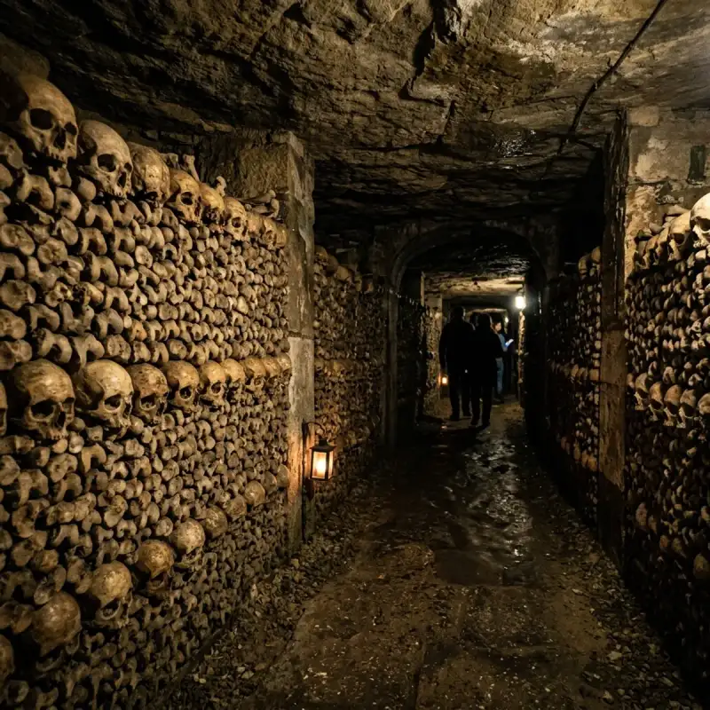
Bem-vindo! Prepare-se para uma #viagem inesquecível pelo coração de #Portugal. O Sussurro das Pedras Antigas: Uma Viagem Inesquecível por Óbidos, a Vila das Rainhas Olá, companheiros de viagem! Daqui fala o Tiago Silva. Se há um lugar no mundo onde o tempo parece ter decidido parar, recolhendo as suas asas para descansar sobre ameias de pedra e ruelas caiadas de branco, esse lugar é Óbidos. Esta joia fortificada, erguida como um sentinela do passado na nossa adorada pátria, convida-nos a uma desconexão total do bulício contemporâneo e a um mergulho profundo na herança que moldou a identidade de #Portugal. Hoje, convido-vos a calçar uns sapatos confortáveis e a acompanhar-me numa exploração exaustiva, detalhada e sensorial por esta vila que é, sem sombra de dúvida, um dos tesouros mais cintilantes da #Europa. Preparem-se para descobrir cada detalhe geográfico, histórico e cultural deste município que apaixona qualquer pessoa à primeira vista.Uma Localização Privilegiada entre a Terra e o Oceano Para compreendermos a grandiosidade de Óbidos, precisamos primeiro de nos situar no mapa da nossa belíssima região Oeste. Esta icónica vila portuguesa, que serve de orgulhosa sede de município, encontra-se aninhada na província histórica da Estremadura, integrando administrativamente o distrito de Leiria. No atual ordenamento territorial, o concelho faz parte da prestigiada NUTII do Oeste e Vale do Tejo. A nível demográfico, a vila intramuros preserva uma escala humana e incrivelmente acolhedora, albergando cerca de 2 200 habitantes que têm o privilégio diário de habitar um cenário de conto de fadas. No entanto, o Município de Óbidos estende-se muito para além das suas famosas muralhas, abrangendo uma área total de 141,55 km² e uma população que, de acordo com os dados censitários de 2021, ascende a 11 924 residentes. [Norte / Nordeste / Leste: Caldas da Rainha] \ [Noroeste: Oceano Atlântico] -- [ÓBIDOS] -- [Sul: Bombarral] / [Oeste: Peniche] -- [Sudoeste: Lourinhã]O território municipal desenha uma geografia rica e diversificada, delimitada a nordeste e a leste pelo vizinho concelho das Caldas da Rainha. Ao caminharmos para sul, encontramos as fronteiras do Bombarral, enquanto a sudoeste o horizonte se cruza com a Lourinhã. A oeste, a península de Peniche ergue-se como barreira terrestre, mas a noroeste o concelho abre-se generosamente para a vastidão azul, onde a magnífica costa encontra o Oceano Atlântico, fundindo a imponência da pedra com a frescura marítima onde a #nature se manifesta em toda a sua plenitude. Se planeia a sua próxima #viagem a partir dos grandes centros urbanos, o acesso é extremamente simples e rápido. Óbidos localiza-se a uns meros 88 quilómetros a norte da capital, Lisboa, um trajeto que se cumpre com facilidade através da autoestrada A8. Para quem viaja a partir do norte ou do centro do país, a vila situa-se a sudoeste da histórica cidade de Coimbra, a uma distância de 138 quilómetros, utilizando a ligação combinada das autoestradas A1 e A8. É um desvio mais do que obrigatório para quem deseja respirar o ar puro do Oeste.A Origem do Nome: De "Oppidum" a Óbidos Para os amantes da etimologia, o nome "Óbidos" encerra em si a própria essência física da vila. Esta palavra deriva diretamente do termo latino ópido (ou oppidum), cujo significado literal nos remete para as ideias de «cidadela» ou «cidade fortificada». Ao pronunciarmos o seu nome, estamos a evocar a própria arquitetura defensiva que a carateriza há milénios. A ocupação humana desta região é de facto ancestral, e a prova dessa presença continuada no tempo encontra-se a pouca distância do atual núcleo urbano, onde se erguem as ruínas históricas da antiga povoação romana de Eburobrício. É fascinante pensar como estas colinas têm sido, ao longo de gerações, um ponto estratégico de abrigo, vigia e habitação.Um Passeio pela História: Conquistas, Rainhas e Forais A #história de Óbidos lê-se como um romance de cavalaria repleto de conquistas, alianças políticas e generosidade real. O ano de 1148 figura com letras de ouro nos anais da vila, marcando o momento histórico em que este reduto fortificado foi tomado aos Mouros, no âmbito da reconquista cristã liderada pelo primeiro rei de Portugal, D. Afonso Henriques. Décadas mais tarde, em 1195, a vila recebia a sua primeira carta de foral, outorgada sob o reinado de D. Sancho I, garantindo-lhe privilégios e consolidando a sua importância no jovem reino português. A Vila das Rainhas Uma das particularidades mais românticas e singulares de Óbidos é o facto de ter integrado, durante séculos, o dote de inúmeras rainhas de Portugal. Esta tradição de generosidade régia fez com que a vila ficasse conhecida como a "Vila das Rainhas", uma terra cuidada e acarinhada pelas mulheres mais influentes da corte. Entre as soberanas que receberam Óbidos como parte do seu dote, destacam-se nomes incontornáveis da nossa história:D. Urraca de Castela: A influente esposa de D. Afonso II; Rainha Santa Isabel: A padroeira da paz e esposa de D. Dinis, que terá ficado encantada com a beleza da vila; D. Filipa de Lencastre: A culta esposa de D. João I e mãe da Ínclita Geração; D. Leonor de Aragão: Esposa de D. Duarte; D. Leonor de Avis: Esposa de D. João II, cujo impacto na região foi profundo.Esta ligação às rainhas moldou não só o património, mas também o desenvolvimento das terras circundantes. Sabia, por exemplo, que o atual concelho das Caldas da Rainha nasceu diretamente do território de Óbidos? Originalmente, aquela estância termal era denominada "Caldas de Óbidos". A alteração do nome deveu-se especificamente às longas temporadas que a rainha D. Leonor passou naquela localidade para usufruir das águas termais, acabando por autonomizar a povoação que hoje conhecemos. Ao recuarmos no tempo através dos registos demográficos, descobrimos dados curiosos: no ano de 1527, viviam escassos 161 habitantes no interior da vila de Óbidos. Este número representava, na época, cerca de um décimo de toda a população que residia no território do município. Ao longo dos séculos, a vila soube preservar a sua escala íntima, resistindo à expansão desordenada e mantendo intacto o seu traçado medieval.O Coração de Pedra: O Castelo e as Muralhas de Óbidos Falar de Óbidos sem mencionar a sua majestosa fortaleza é simplesmente impossível. No dia 16 de Fevereiro de 2007, o Castelo de Óbidos recebeu oficialmente o diploma de candidato a uma das maiores distinções patrimoniais do país. Meses mais tarde, ainda no decorrer do ano de 2007, o monumento foi solenemente declarado, através do concurso nacional "As Sete Maravilhas de Portugal", como o segundo dos sete monumentos mais relevantes de todo o património de #architecture português. A imponência deste conjunto defensivo transpôs as barreiras físicas e entrou no mundo digital. No ano de 2015, as Muralhas da Vila de Óbidos passaram a integrar o prestigiado projeto "Maravilhas de Portugal", uma feliz parceria entre a Direção-Geral do Património Cultural (DGPC) e a multinacional tecnológica Google. Graças a esta iniciativa inovadora, viajantes de todo o mundo podem realizar uma visita virtual detalhada, em formato de 360 graus, explorando online as muralhas e outros 56 monumentos nacionais diretamente a partir das plataformas da Google ou do Google Maps. Mas, acredite, nada substitui a sensação física de caminhar sobre aquelas pedras gastas pelo tempo, sentindo o vento do Oeste no rosto.Património Monumental: Uma Rota de Fé e Arte Ao cruzarmos as portas de Óbidos, entramos num museu a céu aberto. Cada esquina revela um detalhe de cantaria, uma flor que espreita de uma janela ou o portal de um templo secular. Para que não perca nenhum detalhe na sua próxima visita, compilei a lista essencial dos monumentos que constituem o riquíssimo património histórico da vila: Os Portais e a DefesaPorta da Vila: A entrada principal da povoação, adornada com belíssimos azulejos que dão as boas-vindas a quem chega com promessas de beleza e história. Castelo de Óbidos: A sentinela máxima da vila, com as suas torres imponentes e uma vista desafogada sobre a lezíria circundante. Porta do Vale: Outro dos acessos históricos que rompe a muralha, ligando o interior fortificado às paisagens verdejantes que o rodeiam. Aqueduto: Uma estrutura monumental que rasga a paisagem exterior, testemunho da engenharia de outrora que garantia o abastecimento de água à população.Templos de Fé e DevoçãoPraça de Santa Maria: O verdadeiro coração social da vila, onde a comunidade se reúne e onde se sente pulsar a alma obidense. Igreja de Santa Maria: O principal templo religioso da vila, palco de casamentos reais e detentor de um interior artístico de cortar a respiração. Igreja da Misericórdia: Um espaço de recolhimento que reflete a assistência social e a devoção religiosa ao longo dos séculos. Igreja de São Pedro: Com a sua arquitetura marcante, ergue-se como mais um ponto de paragem obrigatória para apreciar a arte sacra. Igreja de Nossa Senhora de Monserrate: Um exemplar charmoso da arquitetura religiosa local. Santuário do Senhor Jesus da Pedra: Localizado fora das muralhas, este monumento de planta singular desafia a gravidade e a geometria, atraindo os olhares dos amantes de arquitetura barroca. Capela de São Martinho: Um pequeno e antigo templo que guarda memórias de fé privada e devoção popular. Igreja de São Tiago: Localizada estrategicamente junto ao castelo, esta igreja encontrou uma nova vida, estando intimamente ligada à dinâmica cultural da vila. Ermida de Nossa Senhora do Carmo: Um ponto de recolhimento espiritual situado em harmonia com a paisagem envolvente.Cultura e Arte CivilCasa do Arco da Cadeia – Abílio Mattos e Silva e Maria José Salavisa: Um espaço que celebra a vida, a obra e a estética destes dois vultos artísticos incontornáveis, enriquecendo o roteiro cultural da vila. Museu Municipal de Óbidos: Situado na emblemática Rua Direita, no número 97, este museu é o guardião das memórias artísticas da vila, albergando obras de arte de valor inestimável que ajudam a decifrar o passado desta terra de rainhas.Óbidos, a Vila Literária: Onde os Livros Ganham Vida Se a história e a pedra nos apaixonam, a ligação de Óbidos à palavra escrita eleva esta vila a um patamar cultural de nível mundial. O audacioso projeto "Óbidos, Vila Literária" nasceu de uma ideia inovadora: reabilitar espaços urbanos degradados ou devolutos e transformá- #portugal #travel #history #europe #cultura Related InsightsColmar and the Alsace Wine Route: A Colorful Escape Im Bann der Gezeiten: Wenn Stein und Meer den Mont Saint-Michel umarmen L'Eterna Seduzione della Costa Azzurra: Tra Scogliere di Porfido e Misteri Belle Époque{ "@context": "https://schema.org", "@type": "FAQPage", "mainEntity": [ { "@type": "Question", "name": "What is the main focus of Óbidos: A Vila Medieval Rodeada de Muralhas?", "acceptedAnswer": { "@type": "Answer", "text": "Junte-se a Tiago Silva numa exploração profunda por Óbidos." } }, { "@type": "Question", "name": "Who authored the comprehensive guide on Óbidos: A Vila Medieval Rodeada de Muralhas?", "acceptedAnswer": { "@type": "Answer", "text": "This detailed article and its insights were carefully researched and authored by Tiago Silva." } }, { "@type": "Question", "name": "Where can I find more related content about Travel?", "acceptedAnswer": { "@type": "Answer", "text": "You can explore more articles, detailed reviews, and similar insights by browsing the Related Insights section at the bottom of this article or visiting our dedicated Travel category page." } } ] }
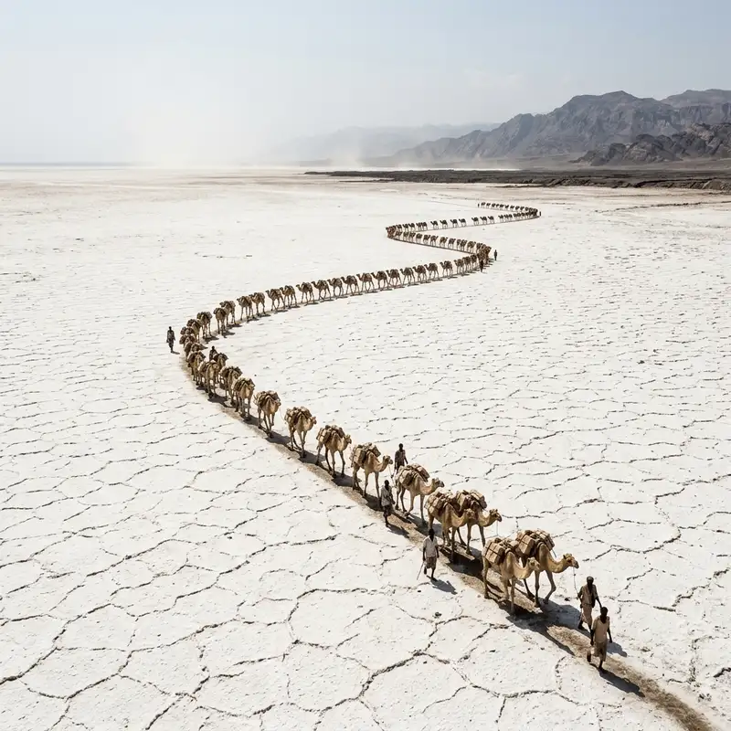
- John Explorer
- 21 Jun, 2026 19:15
The Crystal Spine of Afar: An Odyssey Through Ethiopia's Ancient Salt Routes
Seventy-five meters below sea level, where the Earth's skin puckers and weeps sulfuric tears, where the air shimmers with a heat that feels less like sunlight and more like the breath of a dragon, a rhythmic clink-clack cuts through the profound silence. It's the sound of a pickaxe striking rock, not gold, but a commodity infinitely more valuable in this landscape: salt. This isn't a museum or a curated cultural performance; this is the Danakil Depression, Ethiopia, a place often dubbed the 'Crucible of Creation' and, for me, the stage for an archaeological expedition not through ruins, but through living #history: the last independent salt caravans of the Afar people. My #journey, as always, began with a whispered rumor, a faint signal on the periphery of conventional #travel lore. While many venture to Danakil for the otherworldly Dallol sulfur springs or the fiery maw of Erta Ale volcano, my compass pointed deeper, towards the stark white plains where generations have carved out an existence from the very bedrock of the planet. I wasn't searching for geological wonders, but for the human story etched into the salt flats – an #ancient, arduous, and almost unbelievably resilient trade route on the verge of disappearing. The Lure of the Labyrinth: Why Salt? To understand the allure of this quest, one must first grasp the profound historical significance of salt. For millennia, before refrigeration and modern transport, salt was not merely a seasoning; it was currency, a preservative, a symbol of wealth and power. In Ethiopia, particularly, the Amhara heartland was entirely dependent on salt from the Afar lowlands, transforming this crystalline mineral into the very backbone of their economy. Blocks of salt, known as Amole, were once used as a form of money, traded for grains, tools, and textiles. The routes connecting the Danakil flats to the highlands were Ethiopia's arteries, pulsating with the tireless movement of caravans. Today, much of that trade has been supplanted by modern trucking and industrially mined salt. The romantic, perilous image of camels laden with sparkling white blocks, navigating merciless terrain under an unforgiving sun, has faded from common memory. Yet, in the most remote corners of the Afar region, a stubborn few continue this ancestral practice. They are the inheritors of an extraordinary legacy, guardians of a tradition that defies the logic of the modern world. It was this defiance, this deep-seated connection to an ancient way of life, that beckoned me. Gateway to the Underworld: Entering Afar Territory The journey to the salt flats begins not with a gentle descent but a jarring plunge. From the relative coolness of Mekele, the capital of Tigray, the landscape quickly transforms. The asphalt gives way to corrugated dirt tracks, then to no track at all, just a path woven between jagged volcanic rocks and sun-baked earth. The air, initially warm, steadily intensifies, pressing down with a tangible weight. Even the wind, when it came, felt hot, like a blast from an oven. Our convoy, a collection of battle-hardened 4x4s, was essential. This is not a journey for the faint of heart, nor for the unguided. The Afar region is #beautiful in its desolation, but it is also a land of tribal complexities and stark realities. Our guide, a seasoned Afar elder named Mohamud, with eyes that seemed to hold the wisdom of a hundred desert crossings, was not merely a navigator but a cultural bridge. He spoke of the land with an almost spiritual reverence, detailing its dangers – flash floods, extreme heat, and the ever-present threat of scarcity – with a calm resignation born of lifelong familiarity. Our first night was spent under a canopy of stars so bright they seemed to hum, the silence broken only by the distant calls of unseen creatures. The heat, even after sunset, was oppressive, leaching energy from bone and muscle. But it was also a cleansing heat, stripping away the superfluous, leaving only raw presence. It felt like standing at the threshold of a different epoch, a world where humanity's struggles against the elements were still direct, unmediated. Echoes of a Vanished #empire: Salt as Sustenance and Coin Before dawn, as the sky bled from charcoal to fiery orange, Mohamud recounted the history of salt. "Our ancestors," he began, gesturing towards the vast, featureless horizon, "they say the sea used to be here, many, many years ago. When it dried, it left us this gift." The 'gift' was a treasure that shaped empires. For centuries, the Abyssinian Empire relied heavily on Afar salt. The Amole currency, rectangular blocks painstakingly cut from the salt pan, facilitated trade across the Horn of Africa. Each block, standardized in size and weight, was a tangible piece of value, a testament to the labor and peril involved in its acquisition. This historical context deepened my appreciation for the modern salt harvesters. They are not merely laborers; they are unwitting participants in a millennia-old economic saga, their sweat linking them directly to the traders and warriors of forgotten kingdoms. The methods, Mohamud explained, have changed little over hundreds of years. The tools are rudimentary, the labor back-breaking, and the rewards, by modern standards, meager. Yet, the pride in their work, in continuing an inherited tradition, is immeasurable. The Afar Way: Guardians of the White Gold The Afar people are renowned for their fierce independence and their profound adaptation to one of Earth's harshest environments. Their society is structured around clan loyalties, a deep respect for elders, and an unparalleled understanding of their land. Living where the average daily temperature often exceeds 40°C (104°F) and can soar much higher, their resilience is legendary. They are nomads and pastoralists, their lives intertwined with their camel herds and, for some, the relentless rhythm of the salt flats. As we ventured deeper into the salt plains, the true scale of their endeavor became apparent. Miles upon miles of blinding white stretched in every direction, interrupted only by the occasional mirage shimmering on the horizon. Here, the temperature was a constant, searing presence. Water became the most precious commodity, and a single breakdown could mean catastrophe. Yet, amidst this extremity, life persisted. We saw nomadic settlements – temporary shelters of sticks and woven mats – where families lived, their children playing in the dust, seemingly oblivious to the inferno around them. These are the guardians of the 'White Gold,' a people whose very identity is forged by the landscape. Their traditional attire – light, flowing robes – is not merely cultural; it’s a vital protection against the sun. Their diets are adapted to the heat, their bodies lean and wiry, built for endurance. Their knowledge of the land, of where to find the best salt, the safest routes, the rare water sources, is encyclopedic – passed down orally through generations. Journey into the Salt Plains: Where Earth Meets the Sky in White After days of traversing volcanic fields and gravel plains, we finally reached the edge of the salt lake, or what remains of it. It’s less a lake and more an endless expanse of compacted, crystalline salt. The ground beneath our feet was hard, uneven, glittering under the merciless sun. It stretched to the horizon, a vast, flat mirror reflecting the blinding sky, the air above it vibrating with heat. This is where the magic, and the arduous labor, begins. Far in the distance, tiny specks appeared, growing larger to reveal groups of men, their figures silhouetted against the dazzling white. These were the salt cutters. They work in small teams, often families or clan members, their movements precise and practiced, honed over countless days under this punishing sun. Our arrival drew curious, but not unwelcoming, glances. Mohamud facilitated introductions, explaining my presence. There was no pretense, no performance. This was their life, unfolding naturally. Their faces, weathered by sun and wind, held a dignity that transcended their humble tools and back-breaking work.The Rhythm of the Pickaxe: A Symphony of Labor I spent hours watching them, mesmerized by the rhythm. First, a section of the salt pan is scored deeply with a long, heavy pole with a sharp metal tip, outlining future blocks. Then, using a broad-bladed pickaxe, they hack downwards, severing the blocks from the bed. The sound, clink-clack, clink-clack, was the only constant amidst the silence. It was a primal sound, a human heartbeat against the vast indifference of #nature. Each Amole block, roughly 4kg (8.8 lbs), requires immense effort to extract. Once cut, they are carefully pried up, then trimmed and smoothed with a small axe, transforming raw salt into a standardized, marketable commodity. The process is precise, requiring strength, skill, and an intuitive understanding of the salt's crystalline structure. The sun beats down relentlessly, reflecting off the white surface with blinding intensity. The air shimmers, distorting perception. Yet, they work on, their movements fluid and efficient, fueled by strong, sweet tea and an occasional piece of bread. The finished Amole blocks are stacked meticulously into pyramids, ready for the next stage: the arrival of the caravans. The men often work for days or even weeks on the flats, sleeping in makeshift shelters, their existence pared down to the essentials: water, food, and the relentless pursuit of salt. Caravans on the Horizon: The Journey Begins The most iconic image of the Danakil salt trade, and indeed of ancient commerce, is the camel caravan. And just as I was beginning to feel the deep fatigue of merely observing the labor, a distant, undulating line appeared on the horizon. It was a ghost from the past, made flesh: a camel caravan, slowly but steadily approaching. Hundreds of camels, strung together in long lines, their slow, deliberate gait perfectly suited for this terrain. Each camel would be loaded with approximately thirty Amole blocks, weighing around 120kg (265 lbs). This is their cargo, their entire livelihood. The camel drivers, often young men, walk alongside their animals for days, sometimes weeks, on a journey that would cripple lesser beings. Their routes twist and turn through searing plains and jagged mountains, avoiding bandits and finding the scarce water points. The destination is the highland markets, primarily towns like Berhale, where the salt is traded for other goods or cash. Watching the caravan arrive was like stepping into a living tableau. The air filled with the grunts of camels, the quiet commands of their drivers, and the excited chatter of the salt cutters. The process of loading is an art in itself: careful balance, secure knotting, ensuring the precious cargo is stable for the long march ahead. Each block is a testament to sweat and endurance, each loaded camel a moving symbol of an unbreakable tradition. Beyond the Horizon: The Future of a Legacy The salt trade, in its traditional form, is undeniably under threat. Modern transportation is faster, cheaper, and less physically demanding. Roads are slowly but surely encroaching, bringing trucks directly to the salt pans. The younger generation, understandably, looks towards easier livelihoods, drawn by the siren call of modernity. But for now, the caravans persist. They are a testament to the Afar people's deep cultural pride, their economic necessity, and perhaps, a quiet defiance against the relentless march of progress. There's a particular kind of stubborn beauty in witnessing such an ancient practice in an age of instant gratification. My journey to the Danakil salt flats was more than just an exploration of an extreme landscape; it was an immersion into a profound human story. It was a reminder that some of the most compelling narratives are not found in gilded museums or crowded monuments, but in the quiet, arduous lives of people who, against all odds, continue to honor their ancestors and their land. I left the Danakil with my skin baked, my clothes caked in salt dust, and my mind profoundly altered. The sheer scale of human endurance, the stark beauty of the landscape, and the quiet dignity of the Afar people etched themselves into my soul. This isn't just a place to visit; it's a profound experience, a living history lesson that reminds us of the fundamental human connection to the earth and the timeless value of labor. The clink-clack of the pickaxe, the distant rumble of the caravan, the pervasive shimmer of heat – these are the whispers of a white inferno, carrying echoes of a past that refuses to be forgotten. And in those whispers, I found a story far richer than any modern tale, a testament to the enduring human spirit against the backdrop of one of Earth's most formidable frontiers. #DanakilDepression #AfarSaltCaravans #EthiopianCulture #HiddenGems #ExtremeTravel #Travel #Culture Related InsightsRoadtrip durch den Schwarzwald 乌镇:梦回明清的水乡 Sun-Drenched Serenity vs. The Fjord’s Embrace: Choosing Between the Albanian Riviera and the Bay of Kotor{ "@context": "https://schema.org", "@type": "FAQPage", "mainEntity": [ { "@type": "Question", "name": "What is the main focus of The Crystal Spine of Afar: An Odyssey Through Ethiopia's Ancient Salt Routes?", "acceptedAnswer": { "@type": "Answer", "text": "Descend into Ethiopia's scorching Danakil Depression to witness the vanishing legacy of the Afar salt caravans, an ancient trade route clinging to life in one of Earth's most extreme environments." } }, { "@type": "Question", "name": "Who authored the comprehensive guide on The Crystal Spine of Afar: An Odyssey Through Ethiopia's Ancient Salt Routes?", "acceptedAnswer": { "@type": "Answer", "text": "This detailed article and its insights were carefully researched and authored by John Explorer." } }, { "@type": "Question", "name": "Where can I find more related content about Travel?", "acceptedAnswer": { "@type": "Answer", "text": "You can explore more articles, detailed reviews, and similar insights by browsing the Related Insights section at the bottom of this article or visiting our dedicated Travel category page." } } ] }
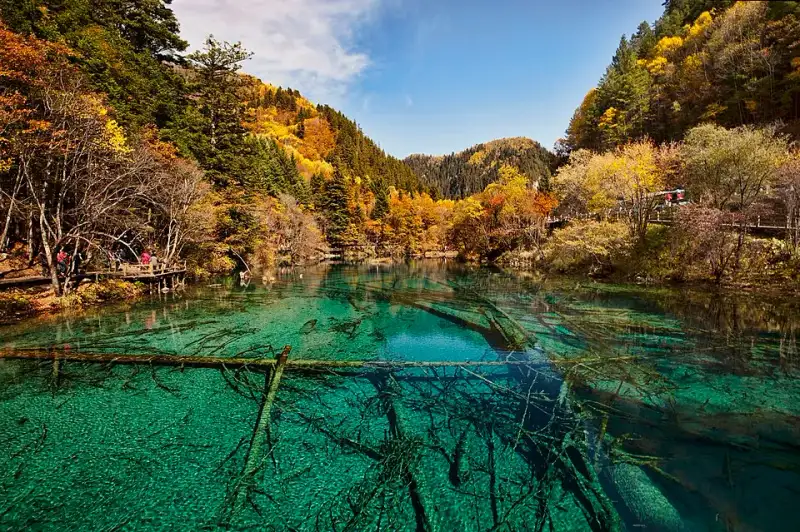

人间仙境:九寨沟的自然奇观与文化印记 引言:九寨归来不看水 在浩瀚的中国大地之上,隐藏着无数令人叹为观止的自然奇观。从巍峨壮丽的喜马拉雅山脉到奔腾不息的长江黄河,这片广袤的土地赋予了我们无尽的惊喜。然而,若要论及水之灵动、色彩之绚丽、生态之原始,恐怕没有哪个地方能与四川省北部的九寨沟相媲美。俗语云:“黄山归来不看山,九寨归来不看水。”这句话绝非夸大其词,而是无数旅人在亲历了九寨沟的绝美风光后,发自内心的由衷感叹。 作为一个热爱大自然与深厚文化底蕴的旅行作家,我曾游历过世界上许多著名的山川湖泊,无论是北美五大湖的辽阔,还是欧洲阿尔卑斯山脉冰川湖的纯净,都曾让我震撼。但九寨沟始终在我心中占据着一个无可替代的位置。它不仅仅是一处被联合国教科文组织列入《世界自然遗产名录》的宝地,更是藏族文化与自然生态完美交融的典范。今天,就让我们一同走进这片被称为“人间仙境”和“童话世界”的神奇土地,探索其背后的地理、生态、历史以及那些鲜为人知的人文故事。 #九寨沟 #人间仙境 #旅行日记 #李伟 #自然奇观 第一章:独特的地理位置与气候环境的绝妙结合 九寨沟位于中国四川省阿坝藏族羌族自治州九寨沟县境内,地处青藏高原向四川盆地过渡的边缘地带,即著名的岷山山脉南段。这里的海拔跨度极大,从沟口的不到2000米,一路攀升至最高峰的长海附近,海拔超过了4700米。这种显著的海拔落差,不仅造就了九寨沟复杂多变的地形地貌,也孕育了其独特的立体气候系统,使得这里的自然景观呈现出令人惊叹的层次感。 九寨沟的地质构造主要以碳酸盐岩为主,这是一种极其容易受到流水侵蚀和溶解的岩石。经过数百万年的地质构造运动、古冰川的切割作用,以及流水的不断冲刷与钙华沉积,最终形成了今天我们所见到的深邃峡谷、层叠的瀑布以及星罗棋布的高山湖泊(当地藏族同胞亲切地称之为“海子”)。这里的喀斯特地貌发育得非常成熟且极具特色,它与我们在广西桂林或是云南石林看到的传统陆相喀斯特景观截然不同,九寨沟的喀斯特美在水的深度参与,美在水底钙华与丰富矿物质交织出的斑斓色彩。 在气候方面,九寨沟属于高原湿润气候。这里冬无严寒,夏无酷暑,春秋两季气候宜人,但日夜温差较大。正是这种独特的气候条件,使得九寨沟的植被呈现出极其丰富的垂直分布带,从低海拔的落叶阔叶林到中海拔的针阔叶混交林,再到高海拔的暗针叶林和高山灌丛草甸,不同的植被在不同的季节更替中,为九寨沟披上了色彩斑斓的自然外衣。这种由于地理与气候完美结合而诞生的奇迹,在世界上是极其罕见的。 #自然奇观 #地理位置 #喀斯特地貌 #四川旅游 #气候变化 第二章:水之灵魂——海子与瀑布交织的视觉交响曲 九寨沟的灵魂毫无疑问在于水。这里大大小小的108个海子,如同108颗璀璨的明珠,镶嵌在深山幽谷之中,串联起了一条如梦如幻的项链。这些湖泊之所以呈现出令人迷醉的翠绿、宝蓝、鹅黄等多种色彩,主要是因为湖水中富含高浓度的碳酸钙以及其他矿物质,加之湖底的沉积物、丰富的水生植物以及周围五彩斑斓的树林倒影,在高原强烈阳光的折射和散射下,产生了极其奇妙的光学效应,仿佛是大自然在水中倾倒了所有的颜料。 五花海:九寨沟的骄傲与色彩极致 在众多的海子中,五花海无疑是最具代表性、最令人震撼的一个。它位于日则沟的中心地带,享有“九寨沟一绝”和“九寨精华”的美誉。湖水颜色极为丰富,浅黄、翠绿、墨绿、宝蓝相互交织,随着视角的转换和光线的移动,色彩也在不断变幻,仿佛是大自然打翻了最绚丽的调色盘。更为奇特的是,湖底布满了钙化的古树枯枝,这些枯木在水底不仅没有腐烂,反而被钙华层层包裹,宛如海底的珊瑚丛一般,清晰可见。透过水晶般清澈的湖水,你可以看到小鱼在枯木与水草间自由穿梭,仿佛游走在一个梦幻的平行宇宙中,让人分不清哪是现实,哪是梦境。 #五花海 #童话世界 #梦幻色彩 诺日朗瀑布:气势磅礴的水之帘幕 如果说海子是九寨沟的柔情与婉约,那么瀑布则是九寨沟的雄壮与阳刚。诺日朗瀑布是中国最宽的钙华瀑布之一,也是九寨沟众多瀑布中最引人注目的一个。“诺日朗”在藏语中意为男神,象征着高大威猛与神圣不可侵犯。瀑布宽达270米,落差20余米,丰沛的水流从长满树木的悬崖边缘倾泻而下,形成一道极其壮观的水帘。尤其是在丰水期的夏季,水流如万马奔腾,声震山谷,激起的水雾在阳光的照射下经常形成绚丽的彩虹;而在漫长的冬季,这里则会变成一幅巨大的天然冰瀑画卷,晶莹剔透,冰柱如林,美不胜收。 #诺日朗瀑布 #冰瀑奇观 长海与五彩池:极致的对比与互补 长海是九寨沟海拔最高、面积最大、湖水最深的海子。它呈一个巨大的“S”形蜿蜒于群山之间,湖面宽阔,湖水深邃湛蓝,四周被终年积雪的雪山环抱,显得格外宁静和庄严。长海最神奇的地方在于它没有地表出水口,它的水源主要依靠冰雪融水和地下水补给,同时它也是九寨沟其他许多海子的地下水源头。即使在干旱的季节,长海的水位也不会急剧下降,宛如一个沉默而包容的母亲。 与长海形成鲜明对比的是位于其下方的五彩池。五彩池是九寨沟最小的海子之一,但却是色彩最绚丽、最精致的。尽管面积不大,但湖水却呈现出不可思议的层次感,上半部呈深邃的碧蓝色,下半部则微微泛红,左边呈明亮的天蓝色,右边则变为深沉的橄榄绿。这种极致的色彩反差,让每一个走到这里的游客都为之倾倒。相传,五彩池是女神色嫫梳洗打扮的地方,那些斑斓的色彩便是她洗落的胭脂。 #长海 #五彩池 #神话传说 第三章:生态多样性——动植物的原始避风港与基因库 九寨沟不仅是一处令人沉醉的视觉盛宴,更是一个巨大的生物基因库。作为国家级自然保护区和联合国教科文组织的世界生物圈保护区,这里保存了大量完好的原始森林和极其丰富的动植物资源,是生物多样性保护的重要阵地。 在广袤茂密的原始森林中,生长着红松、冷杉、云杉、桦木等珍贵树种,参天古木遮天蔽日。林下则是厚厚的苔藓、各种蕨类植物以及名贵的中药材如冬虫夏草、雪莲花、天麻等。这里的植被覆盖率极高,空气中弥漫着高浓度的负氧离子,深呼吸一口,仿佛五脏六腑都被森林的清香所洗涤,是一个天然的“超级氧吧”。 更令人兴奋的是,九寨沟还是许多珍稀濒危野生动物的栖息地。这里生活着被誉为“国宝”的大熊猫、灵动的金丝猴、体型庞大的扭角羚(羚牛)、优雅的白唇鹿以及红腹锦鸡等国家一级保护动物。虽然普通游客在常规游览路线中很难直接与这些野生动物“面基”,但知道它们就在这片古老的森林深处与我们共享这片蓝天和水源,本身就是一种极大的心理慰藉和对自然保护工作的一份敬意。九寨沟的生态保护向我们展示了,在人类积极的干预、科学的管理和严格的保护下,脆弱的高山生态系统依然可以保持其原始的活力与生机,实现人与自然的和谐共生。 #生态保护 #野生动物 #大熊猫保护 #金丝猴 #生物多样性 第四章:三大沟的独特魅力:日则沟、则查洼沟与树正沟的完美组合 九寨沟的整体布局呈一个大大的“Y”字形,由三条主要的沟谷组成:日则沟、则查洼沟和树正沟。这三条沟各有千秋,每条沟都有其独特的风景线和游览重点,共同构成了九寨沟完美的立体景观系统。 日则沟:九寨精华的集大成者(Y字的右边分支) 日则沟被誉为九寨沟风景的精华所在,这里集中了九寨沟最密集的景点和最绚烂的色彩。除了前面详细提到的五花海,这里还有如同明镜般平静的镜海。在没有风的清晨时分,镜海的倒影能将蓝天、白云、远山、近树完美地复刻在水面上,水上水下两重天,难辨虚实,令人叹为观止。珍珠滩瀑布则是另一处不容错过的奇观,丰沛的水流在倾斜而凹凸不平的宽阔钙华滩面上跳跃跌宕,激起无数晶莹剔透的水珠,在阳光的照射下,宛如万斛珍珠洒落人间,清脆的水声悦耳动听。这里也是中国经典电视剧《西游记》片尾曲唐僧师徒牵马涉水的取景地,承载了无数中国人的童年记忆。除此之外,还有熊猫海、箭竹海等,每一处都如诗如画。 #日则沟 #珍珠滩瀑布 #镜海倒影 #西游记取景地 则查洼沟:探寻高海拔的苍茫与精致(Y字的左边分支) 则查洼沟是九寨沟游览路线中最长、海拔最高的一条沟,全长近18公里。它的主要景点相对集中在顶端,即壮丽深邃的长海和玲珑剔透的五彩池。游览这条沟,游客通常会乘坐环保观光车在蜿蜒的山路上盘旋而上直达长海,然后沿着木栈道徒步下行至五彩池。由于海拔跨度大,沿途的植被变化非常明显,能够让人深刻体验到从温带阔叶林到高山针叶林再到高山荒漠的生态过渡。途经的上季节海和下季节海,会随着季节降水量的不同而呈现出满溢或干涸的状态,展示了自然界的水循环奇观。 #则查洼沟 #高海拔风光 #季节海 树正沟:九寨沟的门户与微缩景观(Y字的下半部分) 树正沟是九寨沟的门户,也是主沟,全长约14公里。进入景区大门后,首先映入眼帘的便是树正沟秀丽的景色。这里有绵延数公里的树正群海,数十个大小不一、颜色各异的海子如同梯田般层层叠叠地分布在山谷之中,水流在海子之间穿梭跌落,形成了无数小型的瀑布群和跌水,漫步其间,仿佛走进了水做的迷宫。芦苇海则是一片长满高大芦苇的沼泽湖泊,一条碧绿的水带像玉带般蜿蜒穿过金黄色的芦苇丛,微风吹过,苇浪翻滚,白鹭惊飞,给人一种温柔而宁静的水乡美感。犀牛海则是树正沟中面积最大的海子,以其绝美的倒影和传说中藏族老僧骑犀牛入海的神秘故事而闻名。树正寨则坐落在群海之畔,是体验藏族风情的重要地点。 #树正沟 #树正群海 #芦苇海 #犀牛海传说 第五章:人文风情:九个藏族村寨的历史、信仰与文化传承 “九寨沟”这个名字的由来,正是因为在这片狭长的山谷中,历史上曾经错落有致地坐落着九个藏族村寨(盘信、彭布、故洼、盘亚、则查洼、黑角寨、树正、扒亚、建盘)。尽管随着时间的推移和保护区的建立,部分村寨已经搬迁或合并,但藏族文化依然是九寨沟不可分割的灵魂所在,赋予了这片自然山水深厚的人文底蕴。 这里的藏族居民被称为“白马藏族”的后裔,他们世代繁衍生息于此,其生活习俗、宗教信仰和建筑风格,为九寨沟增添了浓厚的人文色彩。在游览过程中,游客可以清晰地看到那些具有鲜明藏族特色的木结构民居。这些房屋通常依山傍水而建,木质的墙体散发着岁月的温润,外墙和门窗上涂着鲜艳的色彩并绘有吉祥的图案。屋顶和房前屋后悬挂着五彩斑斓的经幡(风马旗)。经幡在风中烈烈飘动,每一次飘动,在藏传佛教的信仰中,都代表着诵读了一次经文,是对大自然、神灵和芸芸众生的祈福。 此外,九寨沟地区的藏族文化受到古老的“苯教”影响深远。苯教是藏传佛教传入西藏之前,盛行于青藏高原的土生土长的原始宗教,它极度强调万物有灵,崇拜自然界的天地山川、日月星辰。这种对自然的敬畏之心,深深扎根于九寨沟藏族人民的血液中。他们视高山为神山,视湖水为神水,绝不轻易砍伐一草一木,绝对禁止向湖水中乱扔杂物或在海子中洗涤物品。正是这种古朴而严苛的生态保护意识和宗教禁忌,使得九寨沟在漫长的历史长河中,在人类活动的影响下,依然得以保持其最纯洁、最原始的自然状态。今天,当我们在树正寨或则查洼寨巨大的转经筒前驻足,听着低沉的诵经声,依然能深切地感受到那份跨越千年的虔诚与宁静。 #藏族文化 #九寨沟村寨 #人文风俗 #经幡信仰 #苯教 第六章:灾难与重生:大自然的力量、重塑与自我修复的奇迹 大自然的造物之手既是神奇伟大、令人惊叹的,有时也是残酷无情、充满毁灭性的。2017年8月8日,九寨沟地区发生了一场里氏7.0级的强烈地震。这场突如其来的天灾,不仅对当地居民的生活造成了严重影响,也给九寨沟引以为傲的自然景观和基础设施造成了巨大的破坏。诺日朗瀑布发生严重的岩体坍塌,原本宽阔壮丽的水帘一度断流,露出光秃秃的岩壁;火花海的坝体发生决口,湖水大量流失,昔日波光粼粼的湖面变成了干涸龟裂的泥滩;多处山体发生严重滑坡,导致道路中断,大片原始森林受损。 灾难发生后,无数曾去过或向往九寨沟的人们痛心疾首,在网络上纷纷留言,担心这个“童话世界”将永远从地球上消失。然而,大自然强大的自我修复能力,加上人类科学、谨慎而持续的干预,创造了令人惊叹的奇迹。在随后几年漫长而艰辛的封闭重建期里,国内顶尖的地质、生态专家团队经过反复论证,确立了“自然恢复为主,人工干预为辅”的核心原则。对于诺日朗瀑布的裂缝,科研人员采用了特殊的环保材料和微创的钙华修复技术,既弥补了裂缝,又促进了新钙华的生成;对于受损最严重的火花海,则通过极其精细的手工修补坝体并巧妙地重新引入水流,使其奇迹般地重获新生,再次荡漾起碧蓝的微波。 如今的九寨沟,不仅已经全面恢复了往日的绝美容颜,重新向世人敞开怀抱,甚至在地震的无情重塑下,因祸得福地诞生了新的壮丽景观。例如,因为地震滑坡导致水流改道而形成的双龙海瀑布,水量丰沛,水势浩荡,成为九寨沟新的打卡胜地。这场惊心动魄的灾难与涅槃重生的过程,让我们更加深刻地认识到大自然既威严又坚韧的两面性,也让我们对如今能够再次安然目睹九寨沟的美景倍感珍惜。这也是九寨沟作为世界自然遗产,向全人类活态展示其地质演变动态过程的一个极其独特而宝贵的篇章。 #灾后重建 #自然力量 #地震恢复 #火花海重生 #自然奇迹 第七章:四季九寨:流转于时光中的色彩魔术与永恒画卷 九寨沟的美,绝不是静止不动的死物,而是随着四季的更迭、光影的变幻,不断变幻出令人目眩神迷的色彩魔术。每一个季节的九寨沟,都有其独特的神韵,都值得被细细品味和记录。春季(冰雪消融,万物复苏的生机):春天的九寨沟,随着气温的回升,漫长的冰雪开始渐渐消融,沉睡了一冬的海子重新泛起温柔的微澜,水色显得格外娇嫩。山林间,各种不知名的野花竞相绽放,桃花、杏花点缀其间,嫩绿的树芽在枝头欢快地跳跃。虽然此时的水量可能不如夏秋季节丰沛,但那种生机勃勃、清新脱俗的初春气息,让人感到无比的愉悦和放松,仿佛生命在这里重新开始了轮回。 #九寨春色 #万物复苏 夏季(绿意盎然,瀑水如银的清凉):夏季是九寨沟降水最丰富的丰水期,也是国内避暑的绝佳胜地。整个山谷被浓郁、苍翠的绿色所覆盖,所有的海子都因为充足的水分而呈现出最饱满、最深邃的色彩。各大瀑布的水量达到巅峰,声势浩大,水雾弥漫在整个山谷间,带来阵阵沁人心脾的清凉。夏日的九寨沟,充满了生命的热烈与张力,是一派郁郁葱葱的盛夏景象。 #夏季避暑 #九寨沟瀑布 秋季(色彩斑斓,童话巅峰的绚烂):如果要选一个九寨沟最美、最具代表性的季节,那毫无疑问是秋季。每年的10月中下旬至11月上旬,九寨沟迎来了它一年中最辉煌的“高光时刻”。漫山遍野的阔叶林在秋风的吹拂和气温的催化下,如同被施了魔法一般,变成了金黄、火红、橙橘、紫红交织的色彩海洋。这些绚丽夺目的树叶倒映在碧蓝、翠绿的湖水中,形成了震撼人心的“秋水共长天一色”的绝世美景。此时的九寨沟,是全世界摄影师的天堂,是真正的、无可挑剔的“童话世界”。 #九寨沟秋季 #摄影天堂 #秋色无边 冬季(冰清玉洁,宁静悠远的纯粹):冬日的九寨沟,褪去了秋日的喧嚣与繁华,换上了一袭素洁淡雅的白纱。连绵的山峦被厚厚的白雪覆盖,部分海拔较高的海子结上了晶莹剔透的冰层,而神奇的是,透过冰面,依然能清晰地看到水下湛蓝的湖水和沉睡的枯木。最令人惊叹的莫过于那些巨大的冰瀑,诺日朗瀑布和珍珠滩瀑布的流水像时间被瞬间冻结一般,挂在陡峭的悬崖峭壁上,形成一根根巨大的冰柱,散发着幽蓝的神秘光芒。冬游九寨,虽然寒冷,但享受到的却是那份远离世俗喧嚣的绝对宁静与纯粹。 #冬季旅游 #冰雪奇缘 #冰瀑奇观第八章:旅游发展与环境保护的艰难平衡之道 作为中国乃至世界上最著名、最受欢迎的自然风景旅游区之一,九寨沟每年要接待数以百万计的国内外游客。如何在满足大众日益增长的旅游文化需求的同时,绝对保护好这片极其脆弱的高山喀斯特湖泊生态系统,是九寨沟管理者和每一个游客都面临的巨大挑战。 值得全世界赞赏和借鉴的是,九寨沟在旅游科学管理和生态环境保护方面做出了许多开创性、前瞻性的探索。为了彻底消除传统汽车尾气对纯净空气和水质的污染,景区内全面禁止外部社会车辆进入,统一斥巨资采购并使用天然气或纯电动环保观光车进行游客的有序摆渡。在各个核心景点之间以及湖泊边缘,精心修建了总长达数百公里的木质环保栈道。这些栈道不仅完美地融入了自然景观,方便了游客近距离、多角度地欣赏美景,更重要的是,它们极其有效地防止了数百万人类脚步对原始土壤、脆弱植被以及湖泊边缘钙华堤的无情践踏与破坏。 此外,九寨沟多年来雷打不动地实行了严格的“沟内游,沟外住”政策。除了极少数原住藏民外,游客必须在傍晚前离开景区核心区域,在沟外的乡镇酒店住宿。这一硬性规定极大地减轻了景区夜间的环境承载压力,减少了光污染和生活垃圾,也给在这片土地上世代繁衍的野生动物留出了充足的夜间活动空间和不受打扰的时间。面对节假日经常出现的井喷式客流,九寨沟还依托大数据和智能系统,实施了严格的每日游客数量限流(如限定每日最高接待量为4万人次)和全网实名制预约购票制度,确保旅游活动始终控制在科学测算的环境容量允许的范围之内。这种以保护为前提的可持续发展旅游模式,为全球其他脆弱生态系统中的自然遗产保护与开发利用提供了极其宝贵的“九寨经验”。 #可持续旅游 #环保 #生态管理 #世界遗产保护 结语:作为一位旅行者的深度思考与心灵羁绊 在我作为旅行作家漫长的职业生涯中,曾多次在不同的年份、不同的季节踏足九寨沟。然而,每一次的相遇,它都能带给我全新的震撼与不同的心灵感悟。九寨沟不仅仅是一个用眼睛去匆匆打卡欣赏的风景名胜,更是一个需要放慢脚步,用心灵去深深感受的神圣之地。这里的每一滴清冽的湖水、每一片随风飘落的彩叶、每一声空灵的鸟鸣、甚至每一次经筒的转动,都在以无声的语言诉说着地球母亲的伟大、神奇与脆弱。 我见证了九寨沟客流如织的繁华盛世,亲历了它震后令人心碎的满目疮痍与沉寂,也无比欣喜于它历经阵痛后的涅槃重生。九寨沟的美,固然在于它得天独厚、不可复制的天生丽质,但更在于它通过灾难与恢复,深刻地教会了我们人类应当如何敬畏自然、顺应自然、并竭尽全力去保护自然。当我们站在五花海畔,看着那片变幻莫测的深邃湛蓝,我们应该清醒地明白,这不仅仅是大自然馈赠给我们用于当下消费与享乐的美景,这更是我们肩负重任,必须完好无损地留给子孙后代的珍贵地球遗产。 如果你还未曾去过九寨沟,请务必将它列入你此生必去的旅行清单的首位;如果你已经去过,我强烈建议你在不同的季节再次造访,去探寻它截然不同的侧面。愿九寨沟的水,永远清澈见底,倒映出最蓝的天空;愿这片人间仙境,能在时光的无情流转中,永远保持其最纯粹、最动人的光芒。 #旅行总结 #李伟 #世界自然遗产 #保护地球 #人与自然#Jiuzhaigou #China #Nature #WorldHeritage #Travel #Sichuan #TibetanCulture Related InsightsWenn der Himmel tanzt: Die majestätische Sinfonie der Aurora The Dolomites, Italy: Hiking Through Alpine UNESCO Heritage Patagonian Ice Fields: The Ultimate Guide to Glacier Trekking in Chile{ "@context": "https://schema.org", "@type": "FAQPage", "mainEntity": [ { "@type": "Question", "name": "What is the main focus of 人间仙境:九寨沟的自然奇观与文化印记?", "acceptedAnswer": { "@type": "Answer", "text": "深入探索九寨沟的绝美风光、丰富生态、悠久历史及藏族文化,跟随李伟的笔触,带您领略被誉为'人间仙境'的四川自然奇观。" } }, { "@type": "Question", "name": "Who authored the comprehensive guide on 人间仙境:九寨沟的自然奇观与文化印记?", "acceptedAnswer": { "@type": "Answer", "text": "This detailed article and its insights were carefully researched and authored by Li Wei." } }, { "@type": "Question", "name": "Where can I find more related content about Travel?", "acceptedAnswer": { "@type": "Answer", "text": "You can explore more articles, detailed reviews, and similar insights by browsing the Related Insights section at the bottom of this article or visiting our dedicated Travel category page." } } ] }
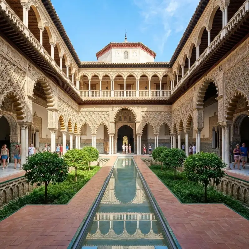

Ha Long Bay: A Mystical Seascape of Legends There are few places on Earth that feel as deeply mythological as Ha Long Bay in northeastern Vietnam. As our traditional junk boat glided silently through the calm, emerald waters, the mist parted to reveal towering limestone karsts rising dramatically from the sea. It was like sailing through a traditional brush painting, a landscape so ethereal it almost defied belief. #WorldHeritage #HaLongBay Designated as a UNESCO World Heritage site in 1994, Ha Long Bay—which translates to "Descending Dragon Bay"—is renowned for its spectacular seascape of approximately 1,600 limestone islands and islets. This geological wonderland has been sculpted over millions of years by the elements, creating a mesmerizing maze of towering pillars, hidden caves, and secluded coves. #Vietnam #LandscapePhotography The Legend of the Descending Dragon According to local legend, when the newly formed country of Vietnam was fighting off invaders, the Jade Emperor sent a family of dragons to assist them. The dragons descended from heaven, spitting out jewels and jade that transformed into the islands and islets of the bay, forming a formidable defensive wall against the enemy ships. After the battle was won, the dragons decided to stay, resting peacefully in the emerald waters. #Mythology #CulturalHeritage This legend permeates the atmosphere of Ha Long Bay. As we wove through the karsts, our guide pointed out rock formations that resembled fighting cocks, a toad, and even a human head. It was easy to see how this dramatic landscape could inspire such fantastical tales. The sheer scale and intricate shapes of the limestone pillars are a testament to the slow, relentless power of nature's artistry. #NaturePhotography #TravelGram Exploring the Hidden Depths Beyond their striking silhouettes, many of the islands harbor magnificent caves and grottoes. We anchored near Bo Hon Island and hiked up to Sung Sot Cave, also known as the Surprise Cave. The name is apt; stepping through the narrow entrance, I was greeted by a cavernous space filled with spectacular stalactites and stalagmites, subtly illuminated to highlight their intricate textures and forms. #Caving #Exploration But perhaps the most magical moments in Ha Long Bay are found on the water itself. Taking a small kayak, I paddled away from the main boat and into the quieter, hidden lagoons accessible only through low water tunnels. Here, surrounded by sheer rock walls dripping with lush vegetation, the silence was profound, broken only by the occasional call of a sea hawk or the gentle lap of water against the limestone. #Kayaking #AdventureTravel The Challenges of Popularity However, the breathtaking beauty of Ha Long Bay has made it one of Vietnam's most popular tourist destinations, and this popularity comes with significant environmental challenges. As a documentary maker, it is crucial to look beyond the pristine veneer and understand the complexities of managing such a delicate ecosystem. #SustainableTourism #EnvironmentalAwareness The sheer volume of boats and visitors puts immense pressure on the bay's marine environment. Issues such as water pollution, plastic waste, and the impact of anchors on the fragile coral reefs are pressing concerns. During my visit, I witnessed ongoing efforts to address these issues, from regular clean-up campaigns to stricter regulations on boat operators. But the threat of climate change also looms large. Rising sea levels and the increasing frequency of severe storms pose significant risks to the delicate limestone structures and the communities that rely on the bay for their livelihoods. #ClimateAction #ProtectOurOceans Floating Villages and Resilient Communities For generations, Ha Long Bay has been home to floating fishing villages, where communities live on traditional wooden houses built on floating platforms. These resilient communities have a deep, symbiotic relationship with the bay, their lives governed by the tides and the seasons. While many residents have recently been relocated to the mainland to reduce environmental impact and improve living conditions, some floating structures remain, serving as aquaculture farms and cultural exhibits. Meeting with local fishermen, I learned about their traditional techniques and the challenges they face in a rapidly changing environment. Their stories added a poignant human dimension to the majestic landscape. #LocalCulture #HumanStories Preserving the Magic Leaving Ha Long Bay, I watched the karsts slowly recede into the mist, holding onto the memory of their mythical beauty. This is a place that inspires awe and contemplation, a powerful reminder of the Earth's geological majesty. Yet, it is also a reminder of our responsibility. The magic of Ha Long Bay is not indestructible. It requires careful stewardship, sustainable practices, and a global commitment to combating climate change. By traveling responsibly and supporting conservation efforts, we can help ensure that the dragons of Ha Long Bay continue to sleep peacefully in their emerald waters for generations to come. #TravelResponsibly #Conservation This documentary journey through Vietnam’s coast proves that our world’s heritage needs us more than ever. #unesco #documentary #vietnam #nature Related InsightsL'Eveil des Cimes : Suspendu dans le Souffle du Tigre Sardegna Profonda: Sulle Tracce Misteriose dei Nuraghi nella Barbagia Nascosta Mahoma: El Profeta del Islam{ "@context": "https://schema.org", "@type": "FAQPage", "mainEntity": [ { "@type": "Question", "name": "What is the main focus of Ha Long Bay: A Mystical Seascape of Legends?", "acceptedAnswer": { "@type": "Answer", "text": "Journey through the emerald waters and towering limestone karsts of Vietnam's Ha Long Bay, a landscape steeped in myth and facing modern environmental challenges." } }, { "@type": "Question", "name": "Who authored the comprehensive guide on Ha Long Bay: A Mystical Seascape of Legends?", "acceptedAnswer": { "@type": "Answer", "text": "This detailed article and its insights were carefully researched and authored by Sarah Mitchell." } }, { "@type": "Question", "name": "Where can I find more related content about Travel?", "acceptedAnswer": { "@type": "Answer", "text": "You can explore more articles, detailed reviews, and similar insights by browsing the Related Insights section at the bottom of this article or visiting our dedicated Travel category page." } } ] }
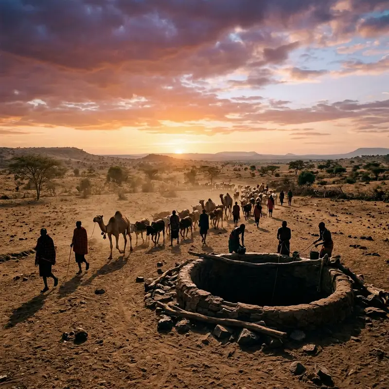
- John Explorer
- 18 Jun, 2026 23:45
The Echoes of Thirst: Unearthing the Ancient Hymns of Kenya's Singing Wells
"The Echoes of Thirst: Unearthing the #ancient Hymns of Kenya's Singing Wells" It wasn't the silence that first struck me, nor the searing, omnipresent heat of the Chalbi Desert. No, it was the sound. A rhythmic, resonant hum that pulsed through the arid air, an ancient, almost primordial chorus rising from the very earth itself. It was the sound of life, painstakingly drawn, and sung into being. This was my introduction to the Singing Wells of Kenya – a place not found on any conventional tourist map, a practice woven into the fabric of a people, a testament to resilience, community, and an enduring bond with the land. My quest to find these legendary wells began not with a guidebook, but with a whisper, a footnote in an obscure anthropological text detailing a semi-nomadic community in northern Kenya. The Borana, it read, had for centuries employed an extraordinary method of extracting water from deep subterranean aquifers, a method so laborious and unique it involved intricate human chains and, most strikingly, a synchronized, melodic chant. Intrigued by the sheer poetry of the concept – water given voice – I packed my bags, determined to peel back the layers of dust and time to uncover this living cultural phenomenon. The Dust-Laden Path to a Living Legend Getting to the heart of Boranaland, in northern Kenya, is an odyssey in itself. The tarmacked roads soon give way to corrugated dirt tracks, then to mere suggestions of paths winding through a landscape that seems to stretch to infinity under an unforgiving sun. Hours turned into days, traversing a terrain dotted with acacia trees, thorny shrubs, and the occasional solitary giraffe silhouetted against a vast, cerulean sky. My Land Cruiser, groaning under the strain, kicked up plumes of ochre dust, coating everything in a fine, powdery film. This wasn't a #journey for the faint of heart, nor for those seeking creature comforts. It was a pilgrimage into the wild heart of East Africa, a testament to the isolation that has, paradoxically, helped preserve the very traditions I sought. My guide, a soft-spoken Borana man named Guyo, navigated with an innate sense of direction, his eyes scanning the horizon for signs of life, for the barely perceptible tracks of livestock. He spoke of the wells with reverence, explaining that they are not mere water sources, but sacred spaces, focal points for the community, and repositories of ancestral knowledge. The deeper we ventured, the more I understood the profound relationship between the Borana and their environment – an environment that demands ingenuity, cooperation, and an unwavering spirit to yield its most precious resource. A Symphony of Survival: Witnessing the Ritual Unfold Finally, after days of #travel, a subtle shift in the air, a faint reverberation, signaled our approach. We left the vehicle and proceeded on foot, the sound growing steadily louder, more distinct. It wasn't a song in the Western sense, not a melody with verses and choruses, but a percussive, rhythmic vocalization, a call and response that seemed to emanate from the very earth. As we rounded a cluster of thorny bushes, the scene before me arrested my breath. It was a deep, wide well, a gaping maw in the earth, perhaps 30 feet across and descending to an unknown depth. Around its perimeter stood dozens of Borana men, their lean, muscled bodies gleaming with sweat. They were arranged in a human chain, some standing on ledges carved into the well walls, others at the bottom, hip-deep in water. Each man held a leather bucket, passing it up, hand-to-hand, from the depths to the surface. And with every movement, every hoist, every transfer, came the song. A guttural, rhythmic chanting, a continuous, undulating sound that provided a vital cadence to their back-breaking labor. The song isn't arbitrary. It's a complex system of cues, a living communication network. The pitch, the rhythm, the specific chants, all convey vital information: when to hoist, when to pass, when a bucket is full, when it's empty. It's a precisely orchestrated ballet of physical exertion and vocal coordination, honed over centuries. The deeper the well, the more men are needed, the more intricate the chain, and the more complex the accompanying 'song'. It was a visceral, powerful demonstration of collective effort, a profound example of how a community can thrive in extremis. The Unspoken Language of Water and Kinship I sat for hours, mesmerized, watching the endless cycle of buckets ascending, tipping their precious cargo into troughs carved from logs, where herds of cattle, goats, and camels jostled for a drink. The animals, too, seemed to understand the rhythm, patiently waiting their turn, guided by the Borana herdsmen who maintained order with practiced ease. The air was thick with the dust of hooves, the lowing of cattle, and the insistent, hypnotic human song. It was a tableau that felt ancient, timeless, a scene that could have unfolded a thousand years ago or yesterday. My conversation with Guyo, often conducted in hushed tones so as not to disturb the ritual, helped me unravel the deeper significance. These wells, he explained, are not just about survival; they are about identity. The Borana identify strongly with their animals – their wealth, their sustenance, their very reason for being. Providing water for them is not just a chore; it is a sacred duty. The wells are clan property, passed down through generations. Each well has a specific name, a #history, a lineage. The rights to draw water are strictly governed by unwritten rules and ancient customs, ensuring equitable access and preventing conflict in a land where water means life and scarcity can mean war. He told me stories of his ancestors, of the generations of men who had dug these wells by hand, chipping away at rock, pulling out soil bucket by bucket, inch by painstaking inch. These wells are legacies, monuments to perseverance. The songs, Guyo elaborated, serve multiple purposes. They provide the rhythmic coordination essential for lifting heavy buckets over extended periods, alleviating fatigue and preventing injury. But beyond the practical, they are also prayers, blessings for the water, for the animals, for the community. They are a way of communicating not just with each other, but with the spirits of the land, acknowledging their dependence on #nature's bounty.A Shared Labour, A Shared Soul I asked Guyo if I could approach closer, perhaps even try to help. He smiled, a gesture of quiet acceptance. As I stepped towards the well's edge, the heat intensified, radiating from the earth itself. The scent of damp earth, animal, and human sweat filled my nostrils. I watched closely as one of the men at the surface deftly tipped a full leather bucket into the wooden trough, then swung the empty bucket back down, catching the next one ascending from the tier below. It was a seamless, fluid motion, born of decades of practice. Joining the human chain was an experience both humbling and physically demanding. Even just for a few rotations at the surface, catching and passing the surprisingly heavy, water-filled leather buckets, the sheer effort was palpable. My untrained hands fumbled at first, but the men around me, with gentle nudges and encouraging murmurs, guided my movements. The rhythm of the song permeated my very being, transforming the arduous task into something almost meditative. I felt a connection, not just to the men beside me, but to the generations who had performed this same ritual, their voices echoing through time. It was an honour, a fleeting immersion in a tradition so profound, so vital. Echoes of History and the Face of Modernity The Singing Wells are estimated to be several hundred years old, perhaps even more, their origins lost in the mists of time. They represent an ingenious adaptation to an extremely challenging environment. In a region prone to severe droughts, these deep wells have been the lifeline for the Borana and their livestock, providing a reliable water source when seasonal rivers dry up and shallow ponds evaporate. However, these ancient wells, and the traditional way of life they support, face modern challenges. Climate change exacerbates drought conditions, placing even greater strain on water resources. The advent of modern boreholes, while providing easier access to water, also poses a threat to the traditional social structures and communal responsibility fostered by the Singing Wells. There's a delicate balance to be struck between progress and preservation. Guyo expressed hope that the younger generation would continue to value and maintain these wells, recognizing their cultural and historical significance beyond their mere utility. He spoke of the 'gadaa' system, the traditional Borana socio-political system that governs everything from land use to generational leadership. The wells are intrinsically linked to this system, representing a collective resource managed for the common good. To abandon the wells would be to sever a vital artery of their #culture, a piece of their very soul. The Lingering Hum of Humanity As the sun began its slow, fiery descent, painting the sky in hues of orange and purple, the activity at the well gradually wound down. The herds, satiated, began their slow journey back to their temporary enclosures. The singing softened, became more reflective, a lullaby to the setting sun. I felt a profound sense of privilege, having witnessed something so raw, so authentic, so deeply human. The Singing Wells are more than just a method of drawing water. They are a living testament to human ingenuity, community spirit, and an unbreakable bond with nature. They are a school of cooperation, a library of ancestral knowledge, and a symphony of survival. In a world increasingly fragmented and reliant on technology, the Borana's Singing Wells stand as a powerful reminder of what can be achieved when people work together, in harmony with their environment, sustained by tradition and the echoes of their own voices. Leaving Boranaland, the rhythmic chant of the wells lingered in my ears, a haunting melody that transcended language. It wasn't just the sound of water being drawn, but the sound of history, of resilience, of a culture singing its way through the centuries. It was a song that promised life, echoing across the vast, silent expanse of the desert, a profound and unforgettable symphony of survival. #Kenya #SingingWells #BoranaCulture #HiddenGems #AfricanTraditions Related InsightsGobeklitepe: The First Temple The Magic of Mont Saint-Michel: Normandy's Floating Abbey Beyond the Silk Road: Unveiling China's Epic Tea Horse Road – Your Definitive Guide to a Lost World{ "@context": "https://schema.org", "@type": "FAQPage", "mainEntity": [ { "@type": "Question", "name": "What is the main focus of The Echoes of Thirst: Unearthing the Ancient Hymns of Kenya's Singing Wells?", "acceptedAnswer": { "@type": "Answer", "text": "Journey deep into Northern Kenya to discover the Borana people's ancient Singing Wells, a profound testament to community, survival, and the enduring power of tradition." } }, { "@type": "Question", "name": "Who authored the comprehensive guide on The Echoes of Thirst: Unearthing the Ancient Hymns of Kenya's Singing Wells?", "acceptedAnswer": { "@type": "Answer", "text": "This detailed article and its insights were carefully researched and authored by John Explorer." } }, { "@type": "Question", "name": "Where can I find more related content about Travel?", "acceptedAnswer": { "@type": "Answer", "text": "You can explore more articles, detailed reviews, and similar insights by browsing the Related Insights section at the bottom of this article or visiting our dedicated Travel category page." } } ] }
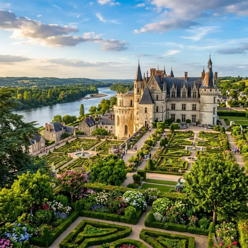
Bem-vindo! Prepare-se para uma #viagem inesquecível pelo coração de #Portugal. Porto: Onde o Tempo Canta e o Vinho Flui – Um Brinde à Invicta! Ah, Porto! Há cidades que nos entram na alma sem pedir licença, que nos abraçam com uma energia tão singular que é impossível resistir. E o Porto é, sem dúvida, uma dessas almas gémeas viajantes. Como Tiago Silva, um apaixonado por #Portugal e pelas suas maravilhas, posso afirmar que esta cidade é muito mais do que um destino; é uma experiência, um mergulho profundo na essência de uma nação. Aninhada na margem norte do majestoso rio Douro, esta cidade é a capital vibrante da sub-região da Área Metropolitana do Porto e o coração pulsante da Região Norte. Pertencente ao distrito homónimo, o Município do Porto estende-se por uma área de 41,42 km², abrigando uma população que em 2023 rondava os 248 769 habitantes, uma densidade que revela a sua vitalidade e o seu dinamismo, com cerca de 6 006 almas por quilómetro quadrado, distribuídas por 7 freguesias que guardam histórias e tradições. Os seus limites geográficos são um abraço entre o urbano e o natural: a norte, os vizinhos Matosinhos e Maia; a leste, Gondomar; a sul, a eterna companheira Vila Nova de Gaia, e a oeste, a imensidão azul do Oceano Atlântico, guardião de séculos de navegação e descobertas. Mas o Porto é especial por muitas razões, e a mais fundamental de todas é que foi aqui que tudo começou. É a cidade que generosamente deu o nome a todo um país! Desde tempos imemoriais, por volta de 200 a.C., já era conhecida como Portus Cale. Imagine-se a importância histórica de um local que se torna o berço de uma nação, a capital do Condado Portucalense, a matriz de onde floresceu o reino de Portugal. Cada rua, cada beco empedrado, parece sussurrar os segredos dessa fundação gloriosa. Hoje, a sua fama transcende fronteiras, e por boas razões. É um ícone mundialmente reconhecido pelo seu néctar dourado, o Vinho do Porto, que envelhece em caves seculares em Gaia, mas que tem a sua alma nesta margem do Douro. É celebrada pelas suas pontes, verdadeiras obras-primas de engenharia e arte que se estendem sobre o rio como braços que abraçam a cidade. A sua #architecture é um diálogo fascinante entre o antigo e o contemporâneo, onde edifícios seculares convivem harmoniosamente com estruturas de design arrojado. O seu centro histórico, um labirinto de ruas estreitas e casas coloridas, foi justamente classificado como Património Mundial pela UNESCO, um testemunho vivo da sua riqueza cultural e histórica. E para além da beleza, há o prazer dos sentidos. A qualidade dos seus restaurantes e a riqueza da sua gastronomia são uma ode aos sabores do Norte, com pratos que aquecem a alma e vinhos que elevam o espírito. A paixão pela bola também corre nas veias da cidade, com equipas de futebol que movem multidões, como o Futebol Clube do Porto, o Boavista Futebol Clube e o Sport Comércio e Salgueiros, cada um com a sua legião de adeptos e a sua própria #cultura. E não podemos esquecer o seu papel como centro de conhecimento: a Universidade do Porto, uma instituição de ensino público de excelência, figura entre as 200 melhores universidades do mundo e entre as 100 melhores da #Europa, atraindo mentes brilhantes de todo o globo. A qualidade dos seus centros hospitalares complementa este quadro de uma cidade que cuida e inova. O Coração Pulsante de uma Região e a Frente Atlântica O Porto não é apenas um município; é o motor da Área Metropolitana do Porto, um vasto conjunto que agrupa 17 municípios, somando uma população de 1 737 395 habitantes numa área de 1 900 km². Com uma densidade populacional que ronda os 914 hab./km², esta metrópole é a 13.ª área urbana mais populosa da União Europeia e a segunda mais populosa de Portugal, apenas atrás de Lisboa. É impressionante ver como o Porto e a sua área metropolitana funcionam como o núcleo estrutural da Região do Norte, a mais populosa de Portugal, com 3 689 609 habitantes (Censos de 2011), abrangendo 8 sub-regiões distintas. Juntamente com os concelhos vizinhos de Vila Nova de Gaia e Matosinhos, o Porto forma a Frente Atlântica, um cordão urbanístico que se estende ao longo da costa, delimitado a oeste pelo imponente Oceano Atlântico. A influência estrutural do estuário do Rio Douro, que une Gaia ao Porto, é palpável, moldando a paisagem e a vida dos seus habitantes. Esta é a zona mais urbanizada da Área Metropolitana, um caldeirão de atividade e desenvolvimento. A cidade é, de facto, a mais importante da altamente industrializada zona litoral da Região Norte, um verdadeiro polo económico onde se concentram grande parte dos mais importantes grupos económicos do país. Nomes como Altri, Grupo Amorim/Corticeira Amorim, Banco BPI, BIAL, EFACEC, Frulact, Lactogal, Millennium BCP, Porto Editora, Sonae, Unicer ou o Grupo RAR, são apenas alguns exemplos das empresas que aqui prosperam, revelando a força e a resiliência empresarial da região. A Associação Empresarial de Portugal, voz do tecido empresarial, também tem a sua sede no Porto. E um dado notável que sublinha a sua pujança: a Região do Norte é a única região portuguesa que exporta mais do que importa, um feito que demonstra a sua capacidade de inovação e a sua projeção internacional. História: Os Sussurros de Milénios e a Alma Invicta Para compreender o Porto, é preciso mergulhar na sua profunda e fascinante #história. Cada pedra, cada rua, cada ribeira, guarda ecos de tempos idos, de civilizações que moldaram a sua identidade. Fundação e os Primeiros Povos A origem do Porto é tão antiga quanto misteriosa, remontando a um povoado celta, anterior à chegada dos romanos. Imagine-se uma comunidade vibrante, enraizada na terra, já a pressentir a importância estratégica daquele local à beira-rio. Na época romana, a cidade floresceu sob a designação de Cale ou Portus Cale, um nome que, como já referi, viria a dar origem ao próprio nome de Portugal. É um legado imenso, uma responsabilidade histórica que a cidade carrega com orgulho. A alvorada do século VIII trouxe consigo uma nova maré, a da invasão muçulmana da Península Ibérica. A 27 de abril de 711, um exército mouro de 9 000 homens, liderados por Tárique, desembarcou em Gibraltar, iniciando uma era de profundas transformações. Em 714, Lisboa caiu, e em 715, as forças islâmicas avançaram implacavelmente para a região norte do que hoje conhecemos como Portugal, tomando importantes povoações e cidades, incluindo o Porto e Braga. Por volta de 716, praticamente toda a Península estava sob o domínio do Califado Omíada, com a exceção de uma pequena e resiliente zona montanhosa das Astúrias, onde a resistência cristã se refugiou, mantendo viva a chama da reconquista. Passado um século e meio de ocupação, em 868, surgiram as primeiras e decisivas tentativas de reconquista definitiva. Um nome ecoa nas brumas do tempo, o de Vímara Peres, um visionário que acendeu a chama da restauração. Ele teve uma contribuição fundamental na reconquista do território, restaurando a cidade de Portucale e lançando as bases para o que se tornaria o Condado Portucalense. A sua ação foi um ponto de viragem, um grito de esperança que ressoou pelas colinas e vales do Douro. Finalmente, e passados dois séculos após o início da invasão muçulmana, em 999, um evento épico marcou a libertação definitiva do Porto. Fidalgos gascões, entre os quais se destacava D. Nónego, bispo de Vendôme, em França, e mais tarde bispo do Porto, entraram com uma grande e imponente armada pela foz do Rio Douro. O seu objetivo era claro: expulsar os mouros e devolver a cidade à cristandade. Esta armada, que ficou imortalizada como a Armada dos Gascões, aliada a D. Munio Viegas, conquistou a cidade do Porto dos mouros para a dedicar à Virgem Mãe de Deus. Imagine-se o fervor, a intensidade da batalha, a libertação celebrada com devoção e gratidão. Após esta vitória, D. Munio e os "franceses" dedicaram-se com afinco à reedificação do Porto. Ergueram antigas e fortes muralhas, que outrora protegeram a cidade, e na parte mais elevada, fundaram um alcácer acastelado e bem fortificado. Este alcácer, mais tarde, após o conde Henrique, serviria de habitação aos bispos, a quem foi doado, tornando-se um símbolo do poder eclesiástico. A torre e a porta principal desta fortificação foram obra de D. Nónego, que, em memória da sua pátria, a nomeou Porta de Vandoma. Na frontaria da torre, mandou erguer um santuário, onde colocou a imagem de Nossa Senhora do Porto, que trouxera consigo de França. É uma história que se enlaça com a fé e a identidade da cidade. Em 1111, um marco importante na história do Porto e de Portugal: Teresa de Leão, mãe do futuro primeiro rei de Portugal, D. Afonso Henriques, concedeu ao bispo D. Hugo o couto do Porto. Este ato reforçou a autonomia e a importância da cidade, consolidando a sua posição no futuro reino. Daí que, até hoje, as armas da cidade ostentem orgulhosamente a imagem de Nossa Senhora, um tributo à sua protetora. É por esta devoção que o Porto é também conhecido como a "Cidade da Virgem", um epíteto que se junta a outros, tão nobres e merecidos, como "Antiga, Mui Nobre, #portugal #travel #history #europe #cultura Related InsightsDancing With The Aurora: Unveiling The Arctic’s Celestial Symphony Ethiopia’s Danakil Depression: Where Earth’s Hellish Beauty Meets Alien Landscapes Albania’s Riviera vs Montenegro’s Bay of Kotor: Europe’s Best-Kept Secret Coastlines Revealed{ "@context": "https://schema.org", "@type": "FAQPage", "mainEntity": [ { "@type": "Question", "name": "What is the main focus of Porto: O Berço do Vinho e da Cultura Invicta?", "acceptedAnswer": { "@type": "Answer", "text": "Junte-se a Tiago Silva numa exploração profunda por Porto." } }, { "@type": "Question", "name": "Who authored the comprehensive guide on Porto: O Berço do Vinho e da Cultura Invicta?", "acceptedAnswer": { "@type": "Answer", "text": "This detailed article and its insights were carefully researched and authored by Tiago Silva." } }, { "@type": "Question", "name": "Where can I find more related content about Travel?", "acceptedAnswer": { "@type": "Answer", "text": "You can explore more articles, detailed reviews, and similar insights by browsing the Related Insights section at the bottom of this article or visiting our dedicated Travel category page." } } ] }
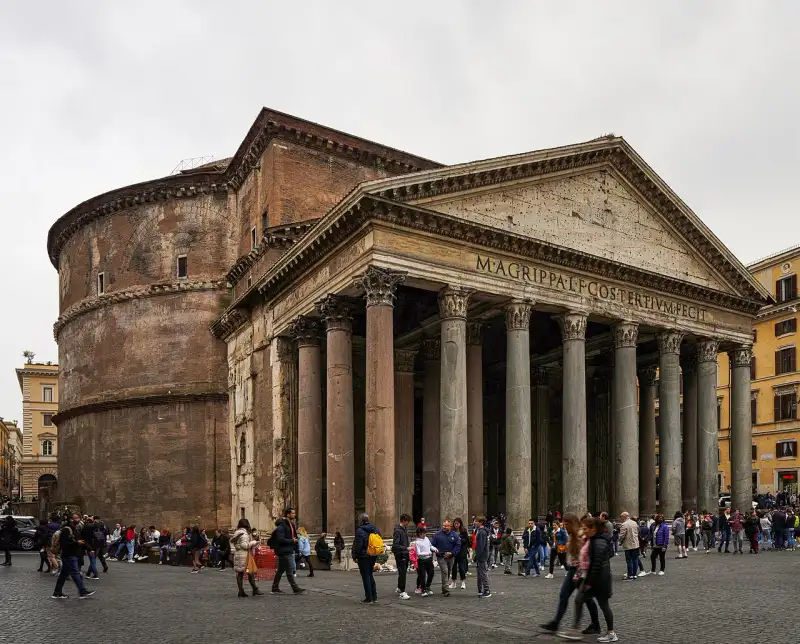

Il Pantheon di Roma è forse l'edificio antico meglio conservato al mondo. Costruito originariamente da Marco Agrippa nel 27 a.C. e poi completamente ricostruito dall'imperatore Adriano intorno al 126 d.C., rappresenta uno dei massimi capolavori dell'architettura romana. Il Miracolo della Cupola Ciò che rende il Pantheon unico è la sua immensa cupola emisferica in calcestruzzo non armato. Con un diametro di 43,44 metri, rimane la più grande cupola del suo genere al mondo. Al centro della cupola si apre l'Oculus, un'apertura circolare di 9 metri che è l'unica fonte di luce naturale dell'edificio. Quando il sole entra dall'Oculus, crea un fascio di luce che si muove lungo le pareti interne, seguendo il ritmo delle stagioni, come un immenso orologio solare che collega la terra al cielo. Un Tempio per Tutti gli Dei Il nome Pantheon deriva dal greco e significa 'di tutti gli dei'. Fu concepito come un tempio dedicato a tutte le divinità dell'Antica Roma. La sua sopravvivenza intatta attraverso i secoli è dovuta alla sua conversione in chiesa cristiana (Santa Maria dei Martiri) nel 609 d.C. Questo salvò l'edificio dai saccheggi e dalle distruzioni che colpirono altri monumenti romani. L'Eredità del Pantheon Il Pantheon ha ispirato innumerevoli architetti nel corso dei secoli, influenzando capolavori come la Cupola del Brunelleschi a Firenze. Oggi ospita anche le tombe di re d'Italia e artisti celebri come Raffaello Sanzio. Entrare nel Pantheon significa immergersi in una perfezione geometrica e spirituale che sfida il tempo. #Pantheon #ArchitetturaRomana #Roma #StoriaDellArte #italy #rome #history #ancient Related InsightsThe Roaring Abyss: Documenting Iguazu National Park The Lost Alchemy of Ancient Fermented Grains: Echoes from the Andes Castillo de Gibralfaro: El Guardián de Málaga{ "@context": "https://schema.org", "@type": "FAQPage", "mainEntity": [ { "@type": "Question", "name": "What is the main focus of Il Pantheon: L'Occhio degli Dei?", "acceptedAnswer": { "@type": "Answer", "text": "Esplorando la perfezione architettonica del tempio di tutti gli dei." } }, { "@type": "Question", "name": "Who authored the comprehensive guide on Il Pantheon: L'Occhio degli Dei?", "acceptedAnswer": { "@type": "Answer", "text": "This detailed article and its insights were carefully researched and authored by Lorenzo Russo." } }, { "@type": "Question", "name": "Where can I find more related content about Travel?", "acceptedAnswer": { "@type": "Answer", "text": "You can explore more articles, detailed reviews, and similar insights by browsing the Related Insights section at the bottom of this article or visiting our dedicated Travel category page." } } ] }
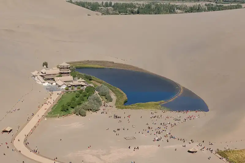
在浩瀚无垠的中国西北腹地,漫天黄沙如同一块无边无际的巨大金毯,覆盖着广袤的戈壁。这里是生命的禁区,是狂风与干旱的领地。然而,就在这片看似毫无生机的荒漠之中,却隐藏着一个足以令世人惊叹的奇迹。它宛如一枚璀璨的蓝宝石,又似一弯悄然坠落凡间的明月,静静地镶嵌在连绵起伏的沙丘之间。这便是享誉中外的 #月牙泉 (Crescent Lake),一处历经千年风沙洗礼却依然清澈如初的沙漠绿洲。作为 #敦煌 的标志性景观之一,月牙泉不仅是大自然鬼斧神工的杰作,更是 #丝绸之路 上一段不朽的历史传奇。今天,让我们一同走进这片神秘的土地,拂去历史的尘埃,探寻月牙泉背后的千年沧桑与永恒之美。 第一章:风与沙的博弈——地理奇观的诞生 要理解月牙泉的奇迹,我们首先必须了解它所处的独特地理环境。月牙泉位于甘肃省敦煌市西南约六公里处,被巍峨的 #鸣沙山 四面环抱。这里的沙山不仅高大陡峭,而且在风的吹动下会发出如雷鸣般的轰响,“鸣沙”之名由此而来。然而,最令人费解的现象是:在这样一个风沙肆虐的地方,一汪面积仅有数亩的浅水潭为何没有被流沙掩埋?为什么它能够历经千万年而依然碧波荡漾? 科学家们经过长期的考察与研究,揭开了这个 #自然奇迹 背后的秘密。原来,鸣沙山和月牙泉之间形成了一种极为精妙的空气动力学平衡。这里的地形呈现出一种特殊的环形洼地结构。当强风刮过沙漠,遇到高大的沙丘阻挡时,气流会顺着沙山的迎风坡向上攀升,并在洼地内部形成一种强烈的上升旋风。这种旋风不仅不会将周围的沙子吹入低洼的泉水中,反而会将从四周重力滑落的沙粒重新带回到沙山的山脊之上。正如古文献中所记载的:“沙岭晴鸣,月泉晓澈。风夹沙而飞响,泉映月而无尘。”这种奇特的地形与风向的动力学效应,使得流沙永远无法填平这片低洼的泉水,从而造就了“沙水共生、沙不掩泉”的千古奇观。 不仅如此,月牙泉的水源补给系统也极具传奇色彩。在古代乃至近代早期,敦煌地区拥有着极其丰富且自成体系的地下水网络。巍峨的祁连山脉每年融化的冰雪,通过地下暗河源源不断地汇入敦煌盆地。月牙泉恰好位于这个地下蓄水盆地的最低海拔处。充沛的地下水受到承压作用,在这里自然涌出地表,形成了这弯清澈甘冽的泉水。在干旱无情的 #沙漠绿洲 中,水就是一切生命的起源,而月牙泉正是大自然赐予这片苍茫大地最珍贵的生命之眼。 第二章:丝路长歌——历史长河中的生命驿站 如果说鸣沙山是月牙泉坚实厚重的躯壳,那么波澜壮阔的 #丝绸之路 就是赋予月牙泉灵魂的不息血脉。回溯到两千多年前的大汉王朝,博望侯张骞奉命出使西域,历经九死一生,终于凿空了连接中原王朝与中亚、西亚乃至欧洲的伟大商路。在这条商路上,敦煌作为河西走廊的最西端、玉门关与阳关的后盾,成为了丝绸之路上至关重要的咽喉要道。从繁华的长安出发的庞大商队,在历经千辛万苦穿过漫长的河西走廊后,必须在敦煌进行最重要的一次物资补给和休整,然后才能踏上更为凶险莫测的塔克拉玛干沙漠和西域三十六国。 试想一下,对于那些在烈日下跋涉了数月、干渴难耐的旅人和负重的骆驼来说,当他们翻过漫漫黄沙,几近绝望之时,突然看到前方那一弯清澈见底的泉水,心中的狂喜与震撼是何等难以用笔墨来形容的!月牙泉不仅为商队提供了足以挽救生命的饮用水,更为他们带来了精神上的极大抚慰与重生的希望。在这里,疲惫不堪的商人可以卸下沉重的货物,洗去满身的征尘;虔诚的僧侣可以掬一捧清泉,闭目诵经,寻找内心的宁静与信仰的力量。#历史印记 在这片波光中显得格外深沉厚重。 据多种史料考证与推测,许多在中国历史上留下赫赫声名的伟大人物都曾在这片清泉畔驻足。唐代著名高僧玄奘在西行印度求法的漫漫旅途中,穿越莫贺延碛之前,极有可能也曾在敦煌的月牙泉畔补充珍贵的水源。随着丝绸之路在隋唐时期的极度繁荣,月牙泉畔逐渐建起了供人歇息和礼佛的庙宇及亭台楼阁。古代的文人墨客更是对这里流连忘返,留下了无数脍炙人口的赞美诗句。清代禁烟名将林则徐在被流放新疆的凄苦途中经过敦煌,看到这一奇景时,也曾提笔写下感叹大自然鬼斧神工的诗篇。这里的每一滴晶莹的水珠,似乎都曾倒映过古代商旅疲惫却坚毅的倒影;这里的每一阵裹挟着细沙的微风,似乎都在诉说着汉唐时代的辉煌壮阔与西域古道的无限苍凉。 第三章:文化交融的倒影——诗词、建筑与信仰的共鸣 月牙泉的存在,从来不仅仅是一个单纯的地理学奇迹,它在漫长的历史演进中被赋予了极为深厚的中国传统哲学与宗教意蕴。在东方的传统文化语境中,水代表着阴柔、包容、滋润和勃勃生机,而漫天的黄沙则象征着阳刚、狂暴、荒芜和无情。鸣沙山与月牙泉长达千年的和谐并存,宛如一幅天然的太极图,完美地诠释了阴阳相济、刚柔并济的东方智慧。#文化遗产 的精髓在这里得到了最生动、最直观的展现。 距离月牙泉不远处,便是被列为世界文化遗产、举世闻名的佛教艺术宝库——#莫高窟。两者同为敦煌引以为傲的绝世名片,一处是大自然演化亿万年的奇迹,一处是人类文明雕琢千年的艺术巅峰。可以说,如果没有月牙泉、党河等水源的默默滋养,就不会有敦煌这片沙漠绿洲的繁荣富庶,自然也就不可能孕育出辉煌灿烂的敦煌石窟壁画与彩塑艺术。古代那些在昏暗的洞窟中劳作的画师和工匠们,用手中绚丽的矿物颜料描绘着西方极乐世界的壮丽景象。当他们放下画笔,走出洞窟,凝视着不远处的鸣沙山与月牙泉时,或许在他们充满虔诚的眼中,这弯宁静的清泉与连绵的沙丘,正是佛经中所描述的人间净土的真实写照。 在月牙泉的南岸,矗立着一组古色古香、错落有致的建筑群——鸣月阁。这是一组典型的汉族传统木构风格建筑,飞檐翘角,斗拱交错,古朴典雅。虽然历史上的古建筑曾因战乱和风化而屡遭破坏,现存的建筑多为后世根据历史原貌精心重建,但它们依然完美地复原了清代甚至更早时期的边塞建筑风貌。漫步在亭台水榭之间,微风拂过屋檐,风铃发出清脆的叮当声,闭上眼睛,仿佛能够听到千年前的梵音在沙海中缭绕回荡。这里不仅是游人观赏泉水、避暑乘凉的绝佳位置,更是当地百姓祈福、修心的精神家园。每年农历四月初八的佛教“浴佛节”,敦煌周边的百姓都会扶老携幼聚集在鸣沙山和月牙泉畔,举行盛大的滑沙、赛马活动和传统的祈福仪式。这一源远流长的民间传统已经延续了千百年,不仅未曾中断,反而成为了敦煌独特的地方文化和民俗风情的重要组成部分。 在这个特殊的生态系统中,还曾孕育出被称为“月泉三宝”的珍稀特产:铁背鱼、七星草和五色沙。相传,生长在泉水中的铁背鱼能延年益寿,长在泉边的七星草(罗布麻)能治愈百病,而鸣沙山五彩斑斓的沙粒则被视为吉祥的象征。这些传说不仅为月牙泉披上了一层神秘的仙家色彩,也反映了古人对这片不可思议的生命绿洲的敬畏与感恩之心。 第四章:拯救消逝的明眸——生态危机的警示与浴火重生 然而,纵使是历经了千年风雨的奇迹,也无法轻易抵御现代人类活动和全球气候变暖带来的巨大生态冲击。进入二十世纪中后期,由于敦煌地区人口的大幅增长、城市化进程的加快以及农业灌溉用地的无节制扩张,当地开始大量开采地下水资源。水库的修建截断了地表水流,地下水位的急剧下降导致整个敦煌盆地的水文循环遭到了破坏。曾经生命力旺盛的月牙泉,也因此面临着史无前例、甚至可以说是毁灭性的 #生态危机。 根据可靠的水文观测记录,在二十世纪六十年代初,月牙泉的水域面积依然保持在二十多亩左右,最大水深可达九米,泉水丰盈,碧波荡漾。但随着环境的恶化,到了九十年代末期,由于地下水位的持续暴跌,月牙泉的面积曾一度锐减至不到一亩,平均水深更是降到了可怜的不足一米。最危急的时刻,水面被沙丘分割成几个毫无生气的小水洼,曾经美丽的“沙漠明眸”变成了一滩浑浊不堪的死水,甚至面临着彻底干涸、永远被黄沙吞噬的致命危险。 这一严峻的现象引起了中国全社会的广泛关注和国内外环保专家的强烈担忧。如果月牙泉消失,那失去的不仅是一处举世闻名的自然景观,更是敦煌千年历史记忆的断裂,是人类在处理人与自然关系上的一次巨大失败。 为了拯救濒临绝境的月牙泉,一场争分夺秒的生态救援行动在世纪之交全面展开。地方政府和大量 #环境保护 专家经过反复论证,提出了一套科学的“应急补水”与“长效治理”相结合的系统性拯救方案。专家们没有采取简单粗暴的直接往泉水里注水的方式,因为那样会破坏月牙泉原有水质和底部的自然渗水结构。相反,他们实施了巧妙的“水系生态恢复工程”:通过在距离月牙泉数公里外的特定区域修建大型渗水场,将党河的河水引入其中,让水自然渗透到地下蓄水层中。通过提高整个区域的地下水位,利用地下水的侧向补给压力,使得纯净的地下水再次从月牙泉的泉眼中自然涌出。 同时,政府出台了极为严格的水资源管理政策,下达了“禁止开荒、禁止打井、禁止移民”的禁令,大力推进退耕还林、还草工程,减少农业用水,从根本上恢复敦煌盆地的整体生态平衡。经过十几年如一日的不懈坚持和巨额资金的投入,这场惊心动魄的生态保卫战终于取得了令人欣慰的成效。如今的月牙泉,水位已经稳定在安全的刻度以上,水域面积重新扩大并恢复了经典的月牙形状,泉水再次清澈见底,周边的芦苇和沙生植物也重新焕发了勃勃生机。 这次近乎劫后重生的危机,给全人类敲响了一记震耳欲聋的警钟:在极其脆弱的沙漠生态系统面前,大自然的恩赐并不是取之不尽、用之不竭的。保护生态环境,维持 #生态平衡,不是一句空洞的口号,而是我们对子孙后代、对地球家园必须承担的绝对责任。月牙泉的复苏,不仅是中国生态治理的一个成功范例,也证明了只要人类懂得敬畏自然、采取科学合理的补救措施,大自然依然愿意给予我们重新开始的机会。 第五章:大漠落日圆——亲历沙与水的完美交融 作为一个长期在路上游历、热衷于探寻世界角落的旅行者,当我在一个初秋的傍晚真正踏上这片魂牵梦绕的土地,亲眼目睹月牙泉的真容时,那种视觉的冲击和灵魂深处的震撼是任何纪录片或文字都无法完全传达的。我的 #旅行日志 里,记录下了我在敦煌这片大漠之中度过的最难忘的日与夜。 记得那天下午,气温依然高炽,我雇了一匹高大的骆驼,跟随着长长的驼队在连绵起伏的鸣沙山上缓慢前行。驼铃声在空旷无垠的沙漠中悠悠回荡,单调却充满着神秘的韵律,仿佛瞬间将时间折叠,把我拉回到了那个充满未知的古老年代。西斜的夕阳将每一座沙丘的轮廓勾勒得异常分明,向阳面是耀眼的赤金,背阴面则是深邃的暗影。光与影在沙漠表面交织出令人窒息的几何美感。 随着傍晚的临近,白日的燥热被戈壁吹来的凉风渐渐驱散。当我踩着绵软细腻的黄沙,气喘吁吁地爬上一座沙山的最高处,俯瞰下方的深谷时,那一幕彻底将我惊艳,让我暂时忘记了呼吸: 在巨大的金色沙山构筑的怀抱中,一弯清澈无比的泉水静静地躺在那里,宛如遗落在茫茫人海中的一块绝世碧玉。泉边茂密的芦苇在晚风中轻轻摇曳,发出沙沙的声响;鸣月阁的飞檐上,红色的灯笼已经亮起,在平静的水面上投下古朴而温暖的倒影。此时此刻的月牙泉,不再是一个冷冰冰的地质学名词,而是一个有生命、有呼吸、有温度的灵魂。它太安静了,安静得让人不忍大声喧哗,生怕哪怕一丝杂音都会惊扰了它做了一千年的好梦。一轮浑圆的落日正悬挂在天际线,#沙漠日落 的余晖毫不吝啬地洒在水面上,波光粼粼,如同一幅铺展在天地间的绝美画卷。 夜幕终于完全降临,喧闹的游客渐渐散去,大漠恢复了它亘古不变的寂静。我没有急于离开,而是独自躺在微凉的沙地上,仰望着浩瀚的星空。这里的夜空纯净得没有一丝杂质,璀璨的银河如同一条流淌的钻石河流,横跨天际。而大地之上,那弯月牙形的泉水在微弱的星光下反射出幽幽的光芒,仿佛是地球睁开的一只明眸,正在与苍穹之上的冷月进行着一场超越时空的无声对话。 在这个神奇的瞬间,我真切地感受到了时间的停滞。我感受到了宇宙的无垠与人类的渺小,感受到了大自然的伟大与历史的厚重。月牙泉就像是一位充满智慧的长者,它看惯了丝绸之路上的驼队商旅,看尽了古代帝国的兴衰更替,历经了战争、干旱和岁月的侵蚀,却依然坚守在这里,保持着自己最初的从容与清澈。 第六章:沙水相依的未来——写给明天的寄语 今天,月牙泉的魅力不仅在于它惊艳世人的自然美景,更在于它所承载的深厚人文精神和生态价值。它无疑是当今 #中国旅游 版图上一颗不可替代的璀璨明珠,每年吸引着数以百万计的国内外游客慕名而来。每一个站在鸣沙山顶俯瞰月牙泉的人,都会被它的美丽所折服,同时也会被它脆弱的生命力所深深触动。 然而,随着现代旅游业的飞速发展,月牙泉也迎来了前所未有的机遇与挑战。如何在巨大的人流量和旅游开发面前,保护好这片脆弱的绿洲?如何让鸣沙山的声音永远雄浑,让月牙泉的波光永远闪耀?这是摆在我们每一个现代人面前的一道严肃考题。推行可持续的旅游模式、加强生态保护的科普宣传、实施更加科学严谨的景区环境管理,每一个环节都显得至关重要。作为游客,我们也需要用更加敬畏的心态去欣赏它,用呵护的行动去对待它,不乱扔垃圾,不破坏植被,让这份属于全人类的自然遗产能够被完好无损地传承给下一个千年。 结语:不朽的大漠明眸 风,依然在吹;沙,依然在鸣。岁月流转,星海更替,月牙泉依然静静地守望在敦煌的大漠深处。 它是一面不朽的明镜,映照出千年前丝绸之路上不绝于缕的驼队与繁华的市集;它是一滴大地的眼泪,凝聚了无数旅人对自然之美、生命之源的无限眷恋与感恩;它更是一个生生不息的奇迹,向世人宣告着生命在绝境中所能爆发出的惊人韧性。从古至今,无数人来到这里,把脚印留在沙丘上,随后又被风沙无情地抹去;无数人在这里许下美好的心愿,寄托哀思,然后转身继续各自的人生旅程。但月牙泉始终未曾改变,它用那一弯澄澈至极的倒影,温柔地包容了世间所有的故事与沧桑。 在这个瞬息万变、喧嚣浮躁的现代世界里,月牙泉以它独特的存在方式让我们相信:有些美好是可以跨越时间的边界,成为永恒的。当你有一天也能够背起行囊,踏上这片充满魔力的土地,请一定要在夕阳最温柔的时刻,站在高高的沙山上凝视那汪清泉。闭上眼,听一听风中传来的历史回响;睁开眼,感受一下那份沙与水共生的奇妙和谐。相信在那一刻,你的灵魂也会得到一次久违的洗礼与升华。 愿月牙泉,这颗 #自然奇观 中的明珠,不仅活在诗人的长歌里、画家的笔触中,更能永远鲜活地荡漾在地球的版图上,永远闪耀在人类文明的星空中。 #Dunhuang #CrescentLake #SilkRoad #ChinaTravel Related InsightsCanada's Rocky Mountains: Emerald Lakes and Alpine Adventures Dive Into a Hidden World: The Most Breathtaking Underwater Museums and Sculpture Parks Hiking the Lycian Way{ "@context": "https://schema.org", "@type": "FAQPage", "mainEntity": [ { "@type": "Question", "name": "What is the main focus of 沙漠中的永恒明镜:敦煌月牙泉的千年回眸?", "acceptedAnswer": { "@type": "Answer", "text": "探秘中国敦煌鸣沙山下的奇迹——月牙泉。了解这片沙漠绿洲的千年历史、地理奇观以及现代生态保护,感受丝绸之路的沧桑与美丽。" } }, { "@type": "Question", "name": "Who authored the comprehensive guide on 沙漠中的永恒明镜:敦煌月牙泉的千年回眸?", "acceptedAnswer": { "@type": "Answer", "text": "This detailed article and its insights were carefully researched and authored by Li Wei." } }, { "@type": "Question", "name": "Where can I find more related content about Travel?", "acceptedAnswer": { "@type": "Answer", "text": "You can explore more articles, detailed reviews, and similar insights by browsing the Related Insights section at the bottom of this article or visiting our dedicated Travel category page." } } ] }
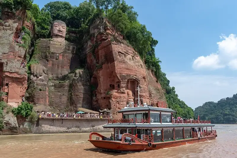
在四川盆地的西南部,岷江、青衣江与大渡河三条波澜壮阔的河流奔腾激荡,携带着来自青藏高原的冰雪融水与蜀地山川的磅礴雨露,最终在凌云山下豁然相拥、浩荡交汇。在这片水域的悬崖峭壁之上,端坐着一尊震撼世界的摩崖石刻造像——乐山大佛(Leshan Giant Buddha)。作为中国最大、世界最高的石刻弥勒佛坐像,它不仅仅是唐代雕塑艺术无与伦比的巅峰之作,更是全人类共同的文化瑰宝与精神象征。每当晨曦初露,破晓的微光穿透江面的薄雾,或是夕阳西下,金色的余晖如披风般洒在大佛慈祥而庄严的面庞上,水波荡漾的倒影中,仿佛正低声诉说着长达一千三百多年的沧桑与辉煌。今天,就让我们一同循着历史的足迹,走进这尊“山是一尊佛,佛是一座山”的千古奇观,深度探寻其背后的传奇故事、不朽精神以及令人叹为观止的古代工程智慧。#乐山大佛 #世界文化遗产 第一章 缘起:激流中的悲悯与宏愿 要真正理解乐山大佛的伟大与不可思议,我们首先必须跨越千年的时空,回到它最初诞生的那个风云激荡、气象万千的时代。唐朝开元元年(公元713年),正值大唐帝国的极盛时期。国力空前强盛,万邦来朝,丝绸之路上的驼铃声清脆悦耳,文化与艺术迎来了前所未有的繁荣。然而,在当时的嘉州(即今天的四川乐山),三江交汇处的江水却犹如脱缰的野马,异常凶险,成为了当地百姓与往来客商挥之不去的梦魇。 岷江自北蜿蜒而来,青衣江与大渡河横冲直撞,三股性质各异、水势强大的洪流在这凌云山麓猛烈相撞。复杂的水文环境使得这里终年水流湍急,暗礁密布,形成了巨大的漩涡和滔天的巨浪。据古文献与地方志记载,每逢夏秋汛期,江水如万马奔腾,声如雷鸣,常常将过往的满载货物的商船和满载希望的客舟无情吞没。舟毁人亡的惨剧在这片水域频频上演,哀嚎声伴随着江水呼啸,无数家庭因此支离破碎,当地百姓苦不堪言。#三江交汇 #自然奇观 此时的大唐,佛教信仰已深深扎根于中原与巴蜀大地。在佛教宏大的宇宙观中,弥勒佛(Maitreya)是代表着光明、未来与解脱的佛,被世人认为能够带来太平、安宁与无限的希望。正是在这样恶劣的地理环境与深厚的信仰背景下,一位名叫海通的僧人站了出来。海通和尚满怀悲悯之心,眼见生灵涂炭,江水肆虐,他发下了一个震撼天地的宏愿:要在三江交汇的凌云山赤色悬崖上,开凿一尊无比巨大的弥勒佛像。他坚信,借助弥勒佛的无边法力与威仪,定能镇压这桀骜不驯的汹涌江水,保佑过往船只与水手的平安。这不仅是一个宏大的宗教愿望,更是一次源于对苍生深沉大爱的伟大民生工程的悲壮开端。#唐代建筑 #弥勒佛 第二章 沥血:海通和尚的惊世之举 海通和尚并非出身名门望族,也没有权倾朝野的皇家背景,他只是一介衣钵单薄的云游僧人。为了筹集开凿大佛所需的犹如天文数字般的庞大资金,海通和尚踏上了漫长、孤独而艰辛的化缘之路。他脚穿草鞋,手持化缘钵,不辞辛劳,足迹遍布大江南北、名山大川。他用自己虔诚的信念和对苍生的慈悲,讲述着镇江建佛的宏愿。历经了无数个寒来暑往、风餐露宿,他终于筹集到了一笔可观的善款。 然而,这笔饱含着无数百姓血汗、期盼与虔诚信仰的资金,却不幸引来了当地贪官污吏的贪婪垂涎。据民间传说与史料杂记描述,当时嘉州的一位手握重权的地方官吏见财起意,仗势欺人,企图以莫须有的名义强行索要、侵吞这笔修佛的巨款。面对如狼似虎、手握生杀大权的贪官,海通和尚没有丝毫退缩,展现出了令人敬畏的铮铮铁骨与佛门大德的凛然正气。 他义正辞严地拒绝了官员的无理要求,并留下了那句掷地有声、穿越千年依旧振聋发聩的千古绝唱:“自目可剜,佛财难得!”(我的双眼可以被挖出来,但用来修佛的钱财你们休想拿走半分)。贪官听闻,以为这不过是一介僧人的虚张声势,便傲慢而轻蔑地嘲笑他。谁知,海通和尚面不改色,为了捍卫这笔拯救苍生的善款,他竟然真的从怀中掏出尖刀,亲手剜下了自己的双目,端在盘子里,鲜血淋漓地递到了那位官员的面前。 贪官被这血腥、惨烈而悲壮的一幕吓得魂飞魄散,连连后退,最终仓皇逃窜,从此再也不敢打这笔佛财的任何主意。海通和尚的惊世之举,不仅保住了修佛的资金,更深深地感动了无数的工匠、百姓与过往行商。在他的精神感召下,浩大而艰巨的开凿工程终于在悬崖峭壁上轰轰烈烈地展开了。工匠们将粗壮的麻绳系在腰间,悬吊在万丈绝壁之上,伴随着经久不息、叮叮当当的斧凿声,坚硬的红色砂岩被一块块剥落,大佛的巍峨轮廓开始在这座大山上渐渐显现。#海通和尚 #匠人精神 #佛教故事 第三章 跨越世纪的开凿:大唐盛世的工程奇迹 然而,要在坚硬的岩壁上开凿一座高达71米的巨型佛像,绝非一朝一夕之功。这不仅需要难以想象的人力与物力,更需要极其高超的建筑学、几何学与地质学知识。就在大佛的头部和胸部刚刚初具雏形,工程正在艰难推进之时,年事已高、双目失明且操劳过度的海通和尚黯然圆寂了。他的离去,让整个大佛的建造工程失去了主心骨,随之陷入了漫长的停滞。岁月流转,巴蜀之地的风雨无情地侵蚀着未完成的佛像,但海通和尚的无私精神却如同一颗不灭的火种,在后人的心中继续燃烧,等待着再次燎原的时刻。 数年之后,当时的剑南西川节度使章仇兼琼被大佛背后的故事深深打动。他慷慨解囊,捐出自己的丰厚俸禄,重新启动了这项浩大但停滞的工程。章仇兼琼不仅个人出资,还利用自己的政治影响力上奏朝廷,请求大唐皇帝赐予当地的麻盐税收,以国家的力量来资助开凿。在大唐帝国雄厚国力的强力介入与支持下,大佛的开凿得以顺利继续推进,工匠们夜以继日地奋战,一直将佛像开凿到了膝盖部位。然而,命运多舛,由于章仇兼琼被朝廷紧急调往京城任职,失去了主要经济来源和行政支持的工程再次被迫停工,这一停又是数十载的漫长岁月。 直到四十年后的唐德宗贞元四年(公元788年),又一位对佛教有着深厚信仰的剑南西川节度使韦皋来到了蜀地。当他亲眼目睹这座未完工的惊世巨佛,并听闻了海通和尚泣血剜目的悲剧与前人数十年的不懈努力后,深受震撼。韦皋毅然决定捐出巨额的军资,并在整个蜀地广泛组织人力物力,发动了最后的冲刺阶段。经过成百上千名工匠们披星戴月、艰苦卓绝的奋战,终于在贞元十九年(公元803年),这尊耗时整整九十年、历经唐代三代人接力开凿的旷世巨作宣告全面竣工。九十年的光阴,三代工匠的青春、汗水,甚至无数年轻生命的代价,最终凝聚成了这尊与天齐高、与山同体的巍峨大佛。#中国古代工程 #历史传奇 #盛唐气象 第四章 巧夺天工:造像艺术与隐秘的排水系统 乐山大佛的工程规模之浩大,艺术造诣之高深,堪称中国乃至古代世界建筑与雕塑史上的不朽奇迹。大佛通高71米,这一高度超越了阿富汗著名的巴米扬大佛,使其稳坐世界最大石刻佛像的宝座。大佛的头部高14.7米,宽10米,其面庞丰满雍容,神情肃穆而慈祥,充分体现了唐代以丰腴为美的审美标准和高超的造像艺术。 令人称奇的是,大佛头顶上共有1021个排列整齐、宛如发丝编织的螺髻。这些螺髻并非与头部一体天然雕刻而成,而是由石块精心雕刻后,逐个精准地镶嵌在佛头上的。历经千年风雨,它们依然牢牢地固定在佛首之上,足见唐代工匠技艺之精湛。大佛的耳朵长达7米,采用木质结构辅以石凿,表面涂以细腻的红泥;肩膀宽阔达28米,犹如一座宽阔平坦的城市广场;手指长8.3米,脚背宽8.5米,其巨大的足背上足足可以围坐上百人。大佛的体态匀称,比例极其协调,它端坐在三江交汇的赤色崖壁上,双手自然地抚放于膝盖,双目微睁,深邃的目光静静地注视着脚下翻滚的江水,仿佛在默默祈祷着天下的苍生,又仿佛在诉说着对宇宙奥秘的无尽理解。 除了令人惊叹的宏大体量与精美绝伦的外在雕刻,乐山大佛内部还隐藏着一个鲜为人知、却至关重要的古代科技奇迹——一套极其巧妙而复杂的隐秘排水系统。四川盆地气候湿润,降水充沛,如果任由山泉水和雨水长期浸泡、冲刷,红砂岩材质的大佛极易发生风化、剥落乃至坍塌。为了防止水患对佛像造成致命侵蚀,古代的大师们展现出了惊人的工程智慧。 他们在设计之初,便在大佛的头部、衣领、胸部以及背部,巧妙地规划和开凿了错综复杂、相互连通的排水沟壑。例如,在大佛头部的18层螺髻中,第4层、第9层和第18层都暗藏着一条横向的微型排水沟;而在佛像的正胸左侧,也有一条极难被常人察觉的封闭排水沟,这条沟槽巧妙地与右臂后侧的竖向沟槽相连。这些精心设计的表面沟槽,与隐藏在大佛背后崖壁上的天然岩洞以及人工开凿的隧道相互贯通,形成了一套科学、立体、高效的通风与排水网络。当暴雨倾盆或山泉渗漏时,水流会顺着这套系统被迅速引流并排出体外,从而有效避免了水流在佛像表面的长期滞留。正是依赖这套巧夺天工、如同人体血管般精密运作的排水系统,乐山大佛才得以在多雨潮湿的自然环境中屹立千年而不倒。这是中国古代水利工程学与雕塑艺术完美结合的最高结晶,至今仍令现代科学家与建筑学家叹为观止。#古代智慧 #工程学奇迹 #隐秘工程 第五章 岁月如歌:大像阁的兴废与千年风霜 然而,即便是凝聚了如此高超智慧与心血的伟大工程,也难以完全抵挡浩瀚岁月的无情侵蚀。在唐代大佛刚刚落成之初,为了保护这尊耗资巨大的佛像免受日晒雨淋的直接伤害,古人曾倾尽全力,在其外围依山傍水地建造了一座高达十三层的超大型木质楼阁,史称“大像阁”或“凌云阁”。据历史文献与文人墨客的诗词描绘,这座楼阁飞檐翘角,雕梁画栋,气势恢宏。它将高耸入云的大佛严严实实地包裹其中,阁内金碧辉煌,香火缭绕,信徒们可以在楼阁的各层近距离瞻仰大佛的不同部位,感受佛法的庄严。 可惜的是,世事无常,盛衰有凭。在明代末年(或有学者认为是更早的宋元战乱时期),这座代表着古代木构建筑巅峰的宏伟楼阁,最终还是不幸毁于残酷的战火之中,化为了一片灰烬。从此以后,失去了“保护伞”的大佛便被迫完全暴露在狂风、暴雨、烈日与霜雪之中。 千百年来,乐山大佛就像一位饱经风霜的冥想者,默默承受着大自然无数次的洗礼。江水不舍昼夜地冲刷着它的脚底底座,引发基础的淘蚀;凌云山的山风带着浓重的水汽,日复一日地侵蚀着它的肌肤。红砂岩虽然易于雕刻,但其疏松的质地也极易在风化作用下发生崩解。尤其是到了近现代,随着全球工业化浪潮的推进与周边城市群的发展,酸雨频发,空气污染加剧,加之每年数以百万计的游客涌入带来的微环境改变,对大佛的保护提出了前所未有的、极其严峻的挑战。大佛的面部一度出现了严重的黑斑退化,鼻部甚至发生了部分脱落的险情;其宽阔的胸部、腹部以及手脚部位,也由于环境潮湿而长满了青苔、杂草乃至小型灌木,甚至出现了学术界所称的“佛面生花”(面部生长植物)与“佛身流泪”(面部因水渍形成黑色条纹)等严重的文物病害。#文物保护 #时光印记 #历史沧桑 第六章 现代重生:世界遗产的守护与文化传承 面对大佛日益严重的退化与病损,中国政府以及国际社会文物保护组织给予了高度的关注与极其庞大的资源投入。1996年12月,乐山大佛与毗邻的佛教圣地峨眉山一同被联合国教科文组织(UNESCO)正式列入《世界自然与文化双遗产名录》,这不仅是对大佛历史价值、艺术价值的最高国际认可,也标志着其正式成为全人类共同守护的宝贵财富。 为了拯救和保护这座珍贵的文化遗产,从上世纪末至今,国内外顶级的文物保护专家、地质学家与化学家多次汇聚乐山,利用三维激光扫描、超声波探伤等最前沿的现代科技手段,对大佛进行了事无巨细的全面勘测与病害诊断。近年来,多项大规模的“修旧如旧”保护工程相继成功实施。在极其陡峭的脚手架上,专家和文物修复师们用手术刀般精细的工具,一点点清理了大佛表面寄生的杂草、苔藓和霉菌,修补了历朝历代留下的破损与裂缝;同时,他们运用最新研发的透气性纳米高科技材料,对佛像的红砂岩表面进行了科学的加固与防风化处理。 除了佛像本体的修复,有关部门对大佛周边的宏观生态环境与微观水文条件也进行了极其严格的治理。大幅度限制了上游及周边工业废气、废水的排放,规范了旅游航道的船只航行,力求将人类活动对大佛的不利影响降至最低。如今的乐山大佛,在经过了现代科技与传统工艺的精心呵护后,已经成功褪去了岁月的尘埃,焕发出新的生机与奕奕神采。它不仅继续吸引着无数虔诚的佛教信徒从世界各地跋山涉水前来朝拜,更成为了全球旅行者、历史文化爱好者向往的超级旅游胜地。每年,数以百万计的游客乘坐游船,在波涛依旧的三江汇流处,怀着激动的心情仰望这尊顶天立地的巨佛,感受那份跨越了千年时空的视觉震撼与心灵宁静。#世界文化遗产保护 #四川旅游必去 #文化传承 第七章 结语:信仰的丰碑,历史的永恒见证 “山是一尊佛,佛是一座山。”当我亲自站在乐山大佛巨大的脚趾之下,仰望那直插云霄、雄伟无匹的庞大身躯时,作为一名普通的历史记录者与旅人,我的内心瞬间被一股难以名状的巨大敬畏之情所淹没。这种敬畏,绝不仅仅是停留在对于大佛那宏大体量与不可思议的视觉冲击力的表面惊叹,更是深深扎根于对于那些建造它的古代先辈们——从发下泣血宏愿的海通和尚,到默默无闻、奉献了一生乃至子孙后代心血的无数唐代匠人——他们那坚不可摧的意志力与深厚信仰的无限崇敬。 从镇压三江水患、保护水上苍生的最初单纯动机,到历经九十载寒暑、三代人接力开凿的惊天工程;从大像阁金碧辉煌的盛世景象,到历经千年风雨剥蚀、战火纷飞的沧桑变迁。乐山大佛见证了大唐帝国的绝代繁华与衰落,经历了中国封建历史的无数次王朝更迭与兴衰荣辱。它不仅仅是一块块被人工雕琢的红色砂岩,它更是一个古老民族悲天悯人的宏大信仰、无与伦比的建筑智慧以及百折不挠的坚韧精神的完美化身。 “千古绝唱,江水悠悠。”清衣江、大渡河与岷江的江水依然在山脚下日夜奔腾流淌,如同那浩浩荡荡、永不止步的历史长河。而乐山大佛,将继续端坐在这座红砂岩的悬崖之巅,面带那抹洞察世事、包容万物的慈祥微笑,静静地、安详地注视着这片广袤土地上的沧海桑田、花开花落。它是一座连接着辉煌过去与无限未来的时空桥梁,是一座永远矗立在全人类精神世界最高处的巍峨丰碑。 在离开乐山的那一刻,我频频回首。愿这份凝结了千年智慧与信仰的伟大遗产,能够如同这浩荡的江水一般,生生不息,源远流长,永远庇护着这片古老而又充满生机的土地。 #李伟游记 #心灵震撼 #中华文明瑰宝 #人文历史 #旅行摄影 #探秘中国 #LeshanGiantBuddha #China #WorldHeritage #Buddhism #TangDynasty Related InsightsThe Acropolis of Athens: A Timeless Citadel of Human Triumph The Whispering Stones of Chichen Itza: Echoes of the Maya Roman Gladiators: Glory, Fame, and Certain Death in the Arena{ "@context": "https://schema.org", "@type": "FAQPage", "mainEntity": [ { "@type": "Question", "name": "What is the main focus of 千古绝唱,江水悠悠:探秘乐山大佛的沧桑与辉煌?", "acceptedAnswer": { "@type": "Answer", "text": "深入了解乐山大佛的历史、建造过程、建筑奇迹以及其在岁月长河中的沧桑变迁。探索这座世界文化遗产背后的信仰力量与古代匠人智慧。" } }, { "@type": "Question", "name": "Who authored the comprehensive guide on 千古绝唱,江水悠悠:探秘乐山大佛的沧桑与辉煌?", "acceptedAnswer": { "@type": "Answer", "text": "This detailed article and its insights were carefully researched and authored by Li Wei." } }, { "@type": "Question", "name": "Where can I find more related content about History?", "acceptedAnswer": { "@type": "Answer", "text": "You can explore more articles, detailed reviews, and similar insights by browsing the Related Insights section at the bottom of this article or visiting our dedicated History category page." } } ] }
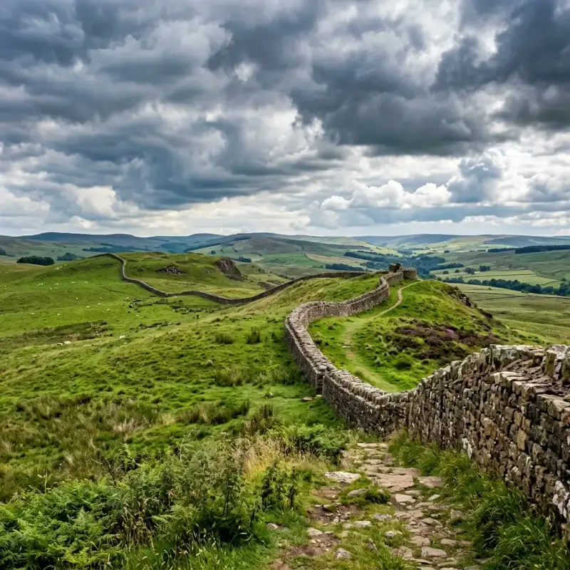

The sweeping, windswept moorlands of northern England hold a profound and enduring secret. Here, stretching across the rugged and dramatic neck of the island of Great Britain, lies one of the most spectacular and monumental archaeological survivals of the ancient world. Hadrian's Wall is not merely a collection of ancient, weathered stones; it is a physical manifestation of imperial ambition, a testament to staggering logistical prowess, and a deep psychological marker that once separated the known universe from the wild, untamed unknown. For nearly three centuries, this colossal barrier served as the ultimate north-western frontier of the mighty #RomanEmpire, standing against the biting winds and the defiant tribes of the north. To stand beside the remnants of the wall today, tracing its path as it aggressively snakes over the volcanic crags of the Whin Sill and plunges into the verdant valleys below, is to experience a profound sense of temporal dislocation. You are simultaneously in the modern English countryside and standing on the very precipice of antiquity. The wall stretches for 73 modern miles—or exactly 80 Roman miles—from the banks of the River Tyne at Wallsend in the east to the tidal flats of Bowness-on-Solway in the west. It is a structure so vast that it seems to defy the technological limitations of the second century. Yet, to truly understand #HadriansWall, we must look beyond its staggering physical dimensions. We must delve into the mind of the visionary emperor who ordered its construction, the sweat and toil of the legionaries who built it, the daily lives of the diverse auxiliary soldiers who manned it, and the vibrant civilian communities that sprouted in its formidable shadow. The Visionary Emperor and the Shift in Grand Strategy To comprehend the existence of this monumental fortification, one must first understand the political climate of Rome in the early second century and the philosophy of the man who ruled it. When Emperor Publius Aelius Hadrianus—known to history simply as #Hadrian—ascended to the imperial throne in AD 117, he inherited an empire that was stretched to its absolute breaking point. His predecessor, the militarily aggressive Emperor Trajan, had expanded Rome’s borders to their greatest ever territorial extent, conquering Dacia (modern-day Romania) and pushing deep into the Parthian Empire in the Middle East. However, this relentless expansion was financially crippling and militarily unsustainable. Rome was bleeding resources trying to hold onto rebellious, far-flung territories. Hadrian was fundamentally different from Trajan. An intellectual, a Hellenophile, and a pragmatic administrator, he recognized that the empire needed consolidation, not infinite expansion. He initiated a radical shift in Roman grand strategy: he abandoned Trajan's most indefensible eastern conquests and decreed that the empire must define and defend its existing borders. Hadrian spent more time traveling his empire than any other emperor, inspecting military installations and imposing discipline. In AD 122, his extensive tours brought him to the misty, rebellious province of Britannia. Britannia had always been a problematic territory for the Romans. The northern tribes, whom the Romans collectively referred to as Britons and later Picts, were fiercely independent and prone to launching devastating guerrilla raids against Roman installations. According to the Augustan History, a late Roman collection of biographies, Hadrian determined to decisively end this insecurity. He ordered the construction of the wall to "separate the Romans from the barbarians." This was a profound ideological statement. By building a permanent, monumental wall, Hadrian was declaring that the era of limitless Roman expansion was officially over. The wall was to be the literal edge of the civilized world, a fixed line in the landscape denoting where the light of #AncientRome ended and the darkness of barbarism began. A Staggering Feat of Military Engineering The logistical and physical reality of building Hadrian's Wall was an undertaking of mind-boggling complexity. It was an epic feat of #AncientEngineering that required the mobilization of immense resources. The construction was entirely entrusted to the highly trained Roman army, specifically the three legions stationed in Britain at the time: the Second Augustan (Legio II Augusta), the Sixth Victorious (Legio VI Victrix), and the Twentieth (Legio XX Valeria Victrix). These legions were not just elite fighting units; they were composed of highly skilled surveyors, architects, masons, and engineers. The original plan for the wall was wildly ambitious. The initial design called for a barrier built entirely of stone, measuring a massive 10 Roman feet (approximately 3 meters) in width—a phase archaeologists now refer to as the "Broad Wall." However, a few years into construction, reality and perhaps a desire for speed forced a modification. The thickness was reduced to roughly 6 to 8 feet, creating the "Narrow Wall." In the western sector of the frontier in modern-day Cumbria, where suitable limestone for mortar was scarce, the wall was initially constructed of stacked turf blocks, creating a formidable rampart 20 feet wide at its base. This turf section was eventually rebuilt in stone in the decades that followed. But the curtain wall itself was only one component of a deeply layered, complex military zone. Approaching the frontier from the hostile north, an attacker would first encounter a glacis (a cleared, sloping bank) followed by a massive, V-shaped ditch, measuring up to 27 feet wide and 9 feet deep. This ditch was dug through solid bedrock in places, except where the sheer vertical drop of the natural dolerite crags of the Whin Sill made it entirely unnecessary. Behind this ditch stood the imposing stone wall, likely standing some 15 feet high and topped with a parapet and a patrol walkway. The fortifications were meticulously standardized. Exactly every Roman mile (about 1.48 kilometers), the engineers constructed a "milecastle"—a fortified fortlet built directly into the wall, containing barracks for a few dozen men and a gateway that allowed controlled passage to the north. Between each milecastle sat two evenly spaced observation turrets, providing continuous surveillance and signaling capabilities along the entire 73-mile stretch. Remarkably, the defenses did not end there. To the south of the wall, the Romans constructed a uniquely baffling and massive earthwork known as the Vallum. The Vallum consisted of a huge flat-bottomed ditch flanked by twin continuous mounds of earth. Its purpose was not defensive in the traditional sense, as it offered no tactical advantage against an army. Instead, the Vallum served to seal off the military zone from the rear, ensuring that anyone approaching the wall from the Roman south—whether merchants, travelers, or locals—could only cross the frontier at heavily guarded, designated checkpoints. It transformed the wall into a highly regulated customs border, a physical barrier to unauthorized immigration, and an effective deterrent against the smuggling of goods and the rustling of livestock. #MilitaryHistory #EngineeringMarvel. The Cosmopolitan Garrison of the Cold North A common misconception is that the colossal structure was permanently guarded by the elite, heavy-infantry legionaries who built it. In truth, once the monumental task of laying the stones was completed, the legions withdrew to their comfortable fortress bases at York, Chester, and Caerleon. The day-to-day defense and policing of Hadrian's Wall were handed over to the auxilia—the auxiliary regiments of the Roman Army. These auxiliary soldiers were recruited from the myriad conquered provinces of the vast empire, creating a staggeringly cosmopolitan and multicultural society on the rain-swept edge of the world. Epigraphic evidence and altars found along the wall reveal an incredible ethnic diversity. There were regiments of Batavians from the modern-day Netherlands, fiercely proud of their equestrian skills. There were Tungrians from Belgium, Asturians from the sun-drenched plains of Spain, and even cohorts of skilled archers from the deserts of Syria. One can only imagine the profound culture shock experienced by a Syrian archer, accustomed to the blistering Mediterranean heat, finding himself standing watch on a freezing Cumbrian crag in the dead of winter, staring into the impenetrable northern fog. The daily lives of these soldiers were characterized by a mixture of intense boredom, rigorous training, and occasional bursts of absolute terror. They lived in a series of large, heavily fortified bases built directly astride or just behind the wall—forts with names that still echo in the landscape today, such as Housesteads (Vercovicium), Chesters (Cilurnum), and Birdoswald (Banna). Each fort housed between 500 and 1,000 men, packed tightly into barrack blocks, alongside granaries, headquarters buildings, and commanding officers' luxurious courtyard houses. Our understanding of this daily frontier life was revolutionized by the miraculous discovery of the #VindolandaTablets. Vindolanda is a Roman fort situated just south of the main wall line. Thanks to the unique, oxygen-free conditions of the waterlogged soil, archaeologists uncovered hundreds of thin, wooden leaf-tablets covered in carbon-ink handwriting. These fragile documents are a breathtaking window into the past, offering the most intimate, humanizing glimpses of life in the Roman military machine. Instead of reading about grand imperial campaigns, the Vindolanda tablets reveal the relatable, mundane struggles of ordinary people. We read the exasperated reports of commanders complaining about the wretched, impassable state of the local roads. We read a desperate plea from a decurion named Masculus, asking his commander to send more beer because his garrison had entirely run dry. We find the famous, elegantly written birthday invitation from a commander's wife, Claudia Severa, to her friend Sulpicia Lepidina—one of the earliest known examples of handwriting by a woman in the Latin language. Most poignantly, we read the universal complaints of soldiers serving in a cold climate, including requests from home for crucial supplies: "I have sent you... pairs of socks, two pairs of sandals, and two pairs of underpants." These delicate slivers of wood bridge the vast chasm of time, transforming faceless historical sentinels into relatable human beings who shivered, drank, socialized, and missed their families. #Archaeology #RomanArmy. Vici, Gods, and the Frontier Economy Hadrian's Wall is often romanticized in popular culture as a desolate, lonely outpost at the end of the earth, manned by stoic men staring endlessly into the abyss. The reality was vastly different. The wall was not a sterile, isolated military zone; it was a thriving, noisy, and dynamic corridor of intense human enterprise and economic activity. Where there are thousands of continuously paid soldiers, a robust economy inevitably follows. Almost immediately, vibrant civilian settlements known as vici (singular: vicus) sprang up outside the heavily guarded gates of the major forts. These settlements were chaotic, sprawling, and entirely reliant on the purchasing power of the garrison. The vicus was a bustling ecosystem of strip-houses, artisan workshops, taverns, brothels, and bustling market squares. Merchants traveled from across the empire to sell imported Gaulish pottery, Spanish olive oil, Mediterranean wine, and exotic foodstuffs to soldiers eager for a taste of home. Local blacksmiths, leatherworkers, and bronze-smiths set up lucrative shops to repair and manufacture military gear. At the heart of the vicus was usually the Roman bathhouse. Far from being a mere hygienic facility, the bathhouse was the undisputed social center of the community. It functioned as a combination of a modern leisure center, a pub, and a refuge from the pervasive northern chill. Here, soldiers and civilians alike would exercise, socialize, gamble, and conduct business while moving through a series of heated rooms. Furthermore, the rigid boundaries between the Roman military and the local Brittonic population began to blur significantly over the decades. Although ordinary auxiliary soldiers were legally forbidden from marrying while in service (a ban that lasted until the reign of Emperor Septimius Severus in the late second century), human nature prevailed. Many soldiers formed deeply committed, unofficial relationships with local Celtic women, raising families within the bustling vici. When their standard 25 years of grueling service finally concluded, they received the highly coveted prize of Roman citizenship. Rather than returning to the distant homelands they had barely known, many veterans chose to retire right there on the frontier, settling down permanently near their former comrades and their new families. Over generations, this intense mingling created a highly distinct, localized #RomanoBritish culture. The religious life of the wall perfectly illustrates this profound syncretism. The soldiers brought the official state pantheon with them—worshipping Jupiter, Mars, and Minerva on the parade grounds. But they also quickly adopted and revered the local Celtic deities. At Carrawburgh, they built a shrine to the native water goddess Coventina, tossing thousands of coins, pearls, and brooches into her sacred well. At Benwell, they worshipped the mysterious local god Antenociticus. Simultaneously, exotic mystery cults from the eastern fringes of the empire found fervent followers among the troops. The deeply atmospheric Temple of Mithras at Carrawburgh (Brocolitia)—designed to resemble a dark, windowless subterranean cave—served as a sanctuary where soldiers underwent intense, secretive initiation rites into the popular cult of the Persian sun god. The wall, therefore, was never a hermetically sealed barrier; it was a highly porous membrane, a vibrant zone of relentless cultural, religious, and economic exchange. #CulturalHistory #AncientBritain. The Slow Fade of the Roman Light How does such a monumental, seemingly invincible frontier finally fall? It is rarely the swift, catastrophic, cinematic breach by hordes of screaming barbarians that Hollywood epics might suggest. The demise of Hadrian's Wall was a prolonged, agonizingly slow fade, inextricably linked to the broader, terminal decline of the Western Roman Empire. The wall's dominance was actually briefly interrupted shortly after Hadrian's death in AD 138. His successor, Emperor Antoninus Pius, aggressively advanced the frontier further north into Scotland, constructing the Antonine Wall—a turf and timber barrier across the narrowest part of the country between the Firth of Forth and the Firth of Clyde. However, this forward policy proved strategically untenable. After a mere two decades, the Antonine Wall was abandoned, and the Roman army permanently retreated back to the impregnable stone certainty of Hadrian's original line. Fast forward to the third, fourth, and fifth centuries, and the geopolitical reality of the Roman world had fundamentally shifted. The empire was crumbling internally under the crushing weight of hyperinflation, endless political instability, and devastating civil wars, while simultaneously facing massive, unprecedented migrations of Germanic tribes across the Rhine and Danube frontiers. To deal with these existential crises closer to home, the central administration began gradually stripping Britannia of its troops. Units were repeatedly withdrawn to fight in continental squabbles, never to return. The fatal blow finally came in AD 410. Facing the sack of Rome itself by the Visigoths, Emperor Honorius allegedly sent a desperate rescript to the beleaguered cities of Britain, instructing them to "look to their own defenses." The central Roman administration, the logistical supply chains, and the imperial paychests abruptly ceased to exist. But what happened to the thousands of soldiers still stationed on Hadrian's Wall? They did not simply pack their bags and march away on a Tuesday afternoon. For many, Britannia was the only home they had ever known. They simply stopped receiving their imperial salaries. Without the backing of the state, the highly organized regiments slowly fragmented. The soldiers transitioned from being professional imperial troops to serving as local militias, protecting their families and farms. The commanding officers likely evolved into local warlords or petty kings, seamlessly blending into the fractured, post-Roman political landscape of the emerging #DarkAges. The wall itself, no longer maintained by the relentless discipline of the legions, entered its second, much longer life as a colossal, linear quarry. For well over a millennium, the beautifully squared, perfectly dressed Roman stones were systematically pillaged by generations of local inhabitants. If you travel through the border region today, the ghosts of the wall are everywhere. You will see Roman masonry proudly embedded in the sturdy walls of lonely farmhouses, field boundaries, and massive medieval fortifications like Thirlwall Castle. The magnificent, echoing crypt of Hexham Abbey was constructed almost entirely using stones looted from the nearby Roman bridge at Chesters. Later, during the violent, lawless era of the Border Reivers from the 14th to the 17th centuries, the tumbled ruins of the forts provided excellent hiding places and ready-made building materials for defensive 'pele towers'. The great wall was slowly, methodically being consumed by the very landscape it had once so arrogantly dominated. #BritishHistory #HistoricRuins. Destruction and Conservation: The Intervention of John Clayton By the 18th and 19th centuries, a new and far more terrifying threat emerged: the relentless, insatiable march of the Industrial Revolution. What a thousand years of casual pillaging had failed to completely erase, the demands of modern infrastructure threatened to obliterate in a matter of decades. A stark example of this organized destruction occurred in the aftermath of the 1745 Jacobite Rebellion. When the British government forces, led by General George Wade, struggled to move their heavy artillery across the country to intercept Bonnie Prince Charlie's rebel army due to the treacherous, muddy terrain, a drastic decision was made. Following the rebellion, the government ordered the construction of a new, paved Military Road (which still exists today as the B6318). Appallingly, for many miles, the easiest route was simply to flatten the remaining sections of Hadrian's Wall and build the road directly on top of its ancient, solid foundations, destroying priceless archaeology forever. The complete eradication of the wall seemed inevitable until the dramatic intervention of a singular, extraordinary individual: John Clayton. A wealthy, eccentric antiquarian and the highly influential town clerk of Newcastle upon Tyne in the mid-19th century, Clayton watched with growing horror as the surviving sections of the wall were being callously dynamited, ground up for road hardcore, and dismantled for agricultural improvements. Determined to halt the vandalism, Clayton leveraged his considerable personal fortune to begin systematically buying up the farms, lands, and ruined forts situated along the best-preserved central sector of the wall, including the magnificent sites of Chesters and Housesteads. He ordered his estate workmen to carefully clear the accumulated centuries of earth and debris from the wall's base. He then directed them to rebuild the fallen facing stones back onto the ancient core, purposely doing so without modern mortar to differentiate the restoration from the original Roman work—creating the distinctive, dry-stone "Clayton Wall" that is so universally recognized today. John Clayton's obsessive dedication and immense wealth single-handedly saved the most spectacular stretches of Hadrian's Wall for posterity. Without his timely intervention, there would likely be almost nothing left for us to marvel at today. #Conservation #JohnClayton #HistoryHeroes. The Wall in the Modern Imagination Today, Hadrian's Wall rightfully enjoys protected status as a universally recognized UNESCO World Heritage Site, drawing hundreds of thousands of awe-struck visitors from across the globe every single year. In 2003, the momentous opening of the Hadrian's Wall Path—an 84-mile (135 km) continuous National Trail—allowed modern adventurers to walk the entire, unbroken length of the ancient frontier from coast to coast. Walking the wall today is a deeply physical, almost spiritual experience. It is an act of historical pilgrimage. As modern hikers trudge through the clinging Cumbrian mud, lean into the ferocious, horizontal northern rain, and crest the spectacularly steep, breathtaking heights of Steel Rigg and the tragically beautiful gap where the famous Sycamore tree once stood, they forge a profound, physiological connection with the past. The burning in the calves and the biting wind on the face are exactly the same sensations experienced by the Tungrian infantrymen and Asturian cavalrymen nearly two millennia ago. The landscape has barely changed; only the uniforms have. The wall has firmly embedded itself in the modern imagination. It was the direct, explicitly acknowledged inspiration for the colossal "Ice Wall" guarding the northern boundary of Westeros in George R.R. Martin’s A Song of Ice and Fire series, capturing that same quintessential feeling of a desperate, final stand against the terrifying, frozen unknown. #Wanderlust #HikingUK #WorldHeritage #EpicJourneys. Conclusion: The Enduring Stones In a modern era where humanity continues to fiercely debate the morality, efficacy, and necessity of physical borders, this spectacular 1,900-year-old ruin serves as a profound and sobering historical mirror. Hadrian's Wall speaks volumes about the incredible ambition of empires, the desire to impose order upon chaos, and the deeply human urge to draw a line in the dirt and declare, "This is ours, and that is yours." Yet, as you stand in the quiet, fading light of a Northumbrian evening, listening only to the wind whistling over the ancient, moss-covered stones, the wall also speaks to the ultimate, inevitable futility of such hubristic endeavors. The invincible Roman Empire is nothing but dust and fragmented history. The god-like emperors are long dead. The mighty, disciplined legions that once made the earth tremble are gone. What remains is only the stone—deeply weathered, undeniably scarred, but breathtakingly resilient and strikingly beautiful. It no longer functions to divide the land or separate people. Instead, in a beautiful twist of historical irony, it now serves to unite people from every corner of the world, who travel thousands of miles to marvel at its scale and to walk reverently in the footsteps of the ancients. Hadrian's Wall stands as an eternal, silent testament to the poignant truth that while the grandest of human empires inevitably rise and fall, the monumental stories we carve into the living earth will endure forever. #RomanArchaeology #TravelBlogger #HistoricSites. #HadriansWall #RomanEmpire #BritishHistory #AncientArchitecture #HikingUK Related InsightsThe Great Pyramid of Giza: A Timeless Monument to Human Ingenuity Julius Caesar: The Ambitious Soldier Behind the Myth 千古绝唱,江水悠悠:探秘乐山大佛的沧桑与辉煌{ "@context": "https://schema.org", "@type": "FAQPage", "mainEntity": [ { "@type": "Question", "name": "What is the main focus of The Edge of Empire: A Journey Along Hadrian's Wall?", "acceptedAnswer": { "@type": "Answer", "text": "Explore the fascinating history, staggering engineering, and enduring legacy of Hadrian's Wall, the ancient Roman frontier that divided Britain." } }, { "@type": "Question", "name": "Who authored the comprehensive guide on The Edge of Empire: A Journey Along Hadrian's Wall?", "acceptedAnswer": { "@type": "Answer", "text": "This detailed article and its insights were carefully researched and authored by Liam Carter." } }, { "@type": "Question", "name": "Where can I find more related content about History?", "acceptedAnswer": { "@type": "Answer", "text": "You can explore more articles, detailed reviews, and similar insights by browsing the Related Insights section at the bottom of this article or visiting our dedicated History category page." } } ] }
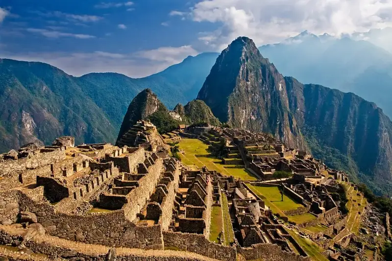
High above the roaring waters of the Urubamba River, enveloped by the perpetual mists of the Peruvian Andes, lies a testament to human ingenuity that has captivated the world’s imagination for over a century. Machu Picchu, often romanticized as the "Lost City of the Incas," is far more than a stunning ruin perched on a dramatic mountain ridge. It is a masterclass in civil engineering, a profound spiritual sanctuary, and a frozen window into the zenith of the Inca Empire—Tawantinsuyu. To stand amidst its perfectly joined stones as the morning fog rolls back is to feel the pulse of a civilization that, despite lacking written language, the wheel, or iron tools, managed to carve out an empire that stretched across the spine of South America. #MachuPicchu #AncientWonders This majestic citadel, nestled at an elevation of 2,430 meters (7,970 feet), has become the ultimate emblem of the Inca civilization. Yet, beneath the postcard-perfect vistas and the countless photographs captured by modern travelers, lies a complex narrative of imperial ambition, staggering labor, astronomical precision, and eventual abandonment. The story of Machu Picchu is not just about the stones themselves, but about the people who quarried them, the ruler who envisioned them, and the mountains that cradle them. #IncaEmpire #TravelPeru The Cradle of the Inca: Geographical Grandeur To understand Machu Picchu, one must first understand its geography. The site is located in the Cusco Region, Urubamba Province, Machupicchu District in Peru. It is situated on a mountain saddle between two prominent peaks: Machu Picchu ("Old Peak" in Quechua) and Huayna Picchu ("New Peak"). This location was no accident; it was chosen with profound geographical and spiritual deliberation. The Inca venerated the landscape, seeing mountains as apus—powerful spirits or deities that governed the natural world. Machu Picchu is surrounded by a pantheon of these sacred peaks, creating a physical and spiritual amphitheater that amplified the site's importance. The environment here is dramatically different from the high-altitude, arid plateau of Cusco, the Inca capital. Machu Picchu sits in a transitional zone where the rugged peaks of the Andes begin to plunge into the lush, verdant Amazon basin. This creates a cloud forest ecosystem—a world of orchids, bromeliads, spectacled bears, and brightly colored tanagers. The constant clash of cold mountain air and warm, moist air rising from the jungle produces the ethereal mists that frequently shroud the citadel. The Urubamba River, known to the Inca as the Vilcanota, tightly coils around the base of the mountain on three sides, creating a natural moat that made the site easily defensible and visually spectacular. #AndesMountains #NatureLovers Pachacuti’s Vision: The Genesis of a Royal Estate Historically, the construction of Machu Picchu is attributed to Pachacuti Inca Yupanqui, the ninth Sapa Inca (emperor), who ruled from 1438 to 1472. Pachacuti was a transformative figure in Inca history, a brilliant military strategist and administrator who expanded a small regional kingdom into a vast empire. Archaeological consensus suggests that Machu Picchu was built as a royal estate for Pachacuti and his lineage. A royal estate in the Inca world served multiple purposes. It was a retreat for the emperor, his family, and his courtiers to escape the bitter cold of the Cusco winter. The warmer climate of the cloud forest allowed for the cultivation of a diverse array of crops, including maize, coca, and various fruits, which could not be grown at higher altitudes. Furthermore, the estate served as an administrative center for the region, asserting imperial control over the newly conquered territories of the Vilcabamba valley. #HistoryBuff #Archaeology The construction of such a monumental site required immense resources, particularly human labor. The Inca utilized a system known as mit'a, a form of compulsory public service exacted from conquered populations. Under the mit'a system, citizens were required to contribute a certain amount of their labor to the state each year. This workforce was responsible for quarrying the massive granite blocks, transporting them up the treacherous mountain slopes, and meticulously carving them into place. It is estimated that thousands of laborers, skilled stonemasons, and engineers were involved in the creation of Machu Picchu, working tirelessly over several decades. Defying Gravity and Earthquakes: Inca Engineering The most visually arresting aspect of Machu Picchu is its architecture. The Inca were master stonemasons, renowned for their use of ashlar—a technique where stones are cut to fit together perfectly without the use of mortar. At Machu Picchu, the finest examples of this masonry can be seen in the most important religious and royal structures. The granite blocks were shaped using harder stones, bronze tools, and sand as an abrasive. The precision is such that even today, a knife blade cannot be slipped between the joints. But this mortarless construction was not merely an aesthetic choice; it was a highly sophisticated engineering solution to the seismic reality of the Andes. Peru is highly prone to earthquakes. When the ground trembles, the mortarless walls of Machu Picchu do not rigidly resist the shockwaves. Instead, the stones are allowed to "dance"—they vibrate and shift slightly, then settle back into their original positions once the tremor has passed. Furthermore, the Inca employed several other anti-seismic features: doors and windows were built with a trapezoidal shape, tilting inward; walls were inclined slightly inward; and L-shaped blocks were used to tie outside corners together. Thanks to these innovations, Machu Picchu has survived centuries of seismic activity while post-conquest colonial buildings in nearby cities have repeatedly collapsed. #EngineeringMarvel #IncaArchitecture The Masterful Hydrology and Agricultural Terracing While the stonework is the most visible marvel, perhaps the true genius of Machu Picchu lies hidden beneath the surface. The mountain receives torrential rainfall during the wet season, and without a sophisticated drainage system, the site would have quickly washed down the steep slopes into the Urubamba River. To prevent this, the Inca engineers expended roughly 60% of their building effort underground. They created a vast, multi-layered drainage system beneath the plazas and buildings, consisting of deep layers of gravel and rock that channeled water safely away. Surrounding the urban sector are hundreds of agricultural terraces, or andenes. These terraces served a dual purpose: they created flat land for farming, and they stabilized the steep mountain slopes, preventing landslides. The terraces were built with stone retaining walls, behind which were layers of large stones, smaller gravel, and finally, nutrient-rich topsoil brought up from the valley floor. Water was brought to the city via an intricately carved stone canal that tapped a natural spring high on the mountain slope. This canal fed a series of sixteen interconnected fountains, providing fresh water to the emperor’s compound first, before flowing down to the rest of the inhabitants. This mastery over water, both in supplying it and draining it away, was absolutely crucial to the survival of the citadel. #SustainableDesign #Agriculture Sacred Stones: The Spiritual Heart of the Citadel Machu Picchu is roughly divided into an agricultural sector and an urban sector, separated by a dry moat and a wall. The urban sector is further divided into a lower, residential area, and an upper, sacred area where the most important temples are located. The Inca religion was deeply tied to astronomy and the observation of the natural world, and the architecture of Machu Picchu reflects this profound spiritual connection. #SpiritualJourney #CulturalHeritage One of the most significant structures is the Temple of the Sun. Built with exquisite, curved masonry, it is situated atop a massive, natural boulder. The temple features a distinctive trapezoidal window that aligns perfectly with the rising sun on the day of the winter solstice. Inside the temple, the natural rock is carved into what is believed to be an altar. Below the temple is a natural cave, finely lined with stonework, which Bingham referred to as the Royal Tomb, though no human remains were ever found there. It is more likely that this space was used for rituals associated with the Earth mother, Pachamama. A short walk from the Temple of the Sun is the Sacred Plaza, home to the Principal Temple and the Temple of the Three Windows. The massive stones used in these structures are among the largest at the site. The three large windows in the latter temple are thought to represent the three realms of the Inca universe: Hanan Pacha (the upper world of the gods), Kay Pacha (the middle world of humans), and Uku Pacha (the underworld of the ancestors). Perhaps the most famous and enigmatic stone at Machu Picchu is the Intihuatana. Often translated as the "Hitching Post of the Sun," this carved granite pillar sits atop a terraced pyramid structure. The Intihuatana served as an astronomical observatory and a calendrical device. By observing the shadows cast by the pillar, the Inca priests could track the solstices and equinoxes, crucial information for timing their agricultural planting and religious festivals. During the winter solstice, the priest would ritually "hitch" the sun to the stone to ensure it would return to warm the earth. #Astronomy #AncientWisdom Another remarkable feature is the Temple of the Condor. Here, the Inca took advantage of a natural rock formation that resembled the outstretched wings of a massive Andean condor. On the ground before the wings, they carved a rock into the shape of the bird's head and neck ruff. The condor was a sacred bird in Inca mythology, representing the upper world, Hanan Pacha. This area was likely used for ceremonies, and the caves behind the "wings" may have been used for ritualistic purposes or even as dungeons, depending on the interpretation. Life in the Clouds: Inhabitants of the Estate Who lived at Machu Picchu? While it was a royal estate, Pachacuti and his royal retinue would have only visited periodically, likely during the warmer months. However, the site was never truly empty. A permanent population was required to maintain the estate, tend the crops, perform religious duties, and guard the site. Estimates suggest that during its peak use, Machu Picchu supported a population of around 500 to 750 people. The majority of these inhabitants were yanaconas, a class of skilled retainers and servants who were dedicated to the service of the emperor and the nobility. These individuals were brought from all over the empire, representing a diverse mix of ethnicities and cultures. Osteological analysis of the skeletal remains found in the burial caves surrounding Machu Picchu confirms this diversity, showing variations in cranial deformation practices and dietary habits that point to origins across Tawantinsuyu. The daily life of these permanent residents was closely tied to the agricultural cycle and the maintenance of the estate. They tended the terraces, cultivating corn, potatoes, and other crops. They maintained the aqueducts, repaired the stonework, and wove textiles. While the royal sections of the city boast the finest ashlar masonry, the residential areas were constructed using a more rustic style known as pirca, where unshaped stones were held together with mud mortar. The roofs of all buildings, royal and residential alike, were originally steeply pitched and covered with thick thatch, giving the city a very different appearance than the bare stone ruins we see today. #Anthropology #AncientLife The Fall of Tawantinsuyu and the Silence of the Citadel Machu Picchu thrived for less than a century. Its active use came to an abrupt end in the 1530s, corresponding with the arrival of the Spanish conquistadors led by Francisco Pizarro. The Spanish invasion unleashed a devastating cascade of events: civil war, the capture and execution of the Sapa Inca Atahualpa, and the collapse of the imperial administration. More devastating than the Spanish swords, however, were the invisible conquerors: European diseases. Smallpox, measles, and influenza swept through the Andes, decimating the indigenous population. It is highly probable that the population of Machu Picchu, or the surrounding valleys that supported it, was severely impacted by these epidemics. As the central authority of Cusco fell, the royal estates lost their purpose and funding. The mit'a labor system broke down, and the supply lines that kept the isolated citadel functioning were severed. The inhabitants of Machu Picchu gradually abandoned the site, returning to their ancestral lands or seeking refuge deeper in the mountains. Remarkably, the Spanish never found Machu Picchu. Unlike many other Inca sites, it was never plundered, its sacred stones were never smashed, and no Catholic church was ever built over its temples. The dense jungle quickly reclaimed the terraces and the buildings, swallowing the city in a cloak of green, hiding it from the outside world for almost four centuries. #LostCity #HistoricalMystery The Myth of the "Lost City" and Hiram Bingham’s Arrival The Western narrative of Machu Picchu often begins in 1911 with the American explorer and Yale historian, Hiram Bingham. Sponsored by Yale University and the National Geographic Society, Bingham was searching for Vilcabamba, the last refuge of the Inca resistance against the Spanish. Guided by a local innkeeper named Melchor Arteaga, Bingham crossed the Urubamba River and climbed the steep, jungle-choked ridge. On July 24, 1911, he was led to the ruins. Bingham was astounded by the sheer scale and quality of the stonework, particularly the Temple of the Sun and the Room of the Three Windows. He believed he had found the legendary "Lost City of the Incas," a moniker that stuck and fueled global fascination, even though later archaeological evidence proved that the true last refuge, Vilcabamba, was located further in the jungle at Espiritu Pampa. #HiramBingham #Exploration However, to say Bingham "discovered" Machu Picchu is to ignore the reality of the local population. The site was never truly lost to the people who lived in the region. When Bingham arrived, he found local Quechua farmers, including the families of Richarte and Alvarez, living amidst the ruins and actively cultivating the ancient Inca terraces. The existence of the ruins was known to local landowners, and a Peruvian explorer named Agustín Lizárraga had even carved his name on the Temple of the Three Windows in 1902, nine years before Bingham’s arrival. Bingham's true achievement was not discovery, but rather scientific documentation and global popularization. Through his writings and the striking photographs published in a dedicated issue of National Geographic magazine in 1913, Bingham brought Machu Picchu to the world's attention. He initiated extensive clearing and excavation, fundamentally changing the site's trajectory from a forgotten ruin to a global icon. #HistoryFacts #NationalGeographic The Artifact Controversy and Repatriation Bingham's expeditions, while scientifically groundbreaking for their time, also sparked a century-long controversy. Between 1912 and 1915, Bingham excavated thousands of artifacts—pottery sherds, skeletal remains, bronze tools, and jewelry—and transported them to Yale University in the United States. He claimed this was done with the permission of the Peruvian government, under a decree that allowed the temporary export of the artifacts for study, with the stipulation that they would eventually be returned. Decades passed, and the artifacts remained at Yale's Peabody Museum. The Peruvian government repeatedly requested their return, leading to a protracted and often bitter legal and diplomatic dispute. Peru argued that the artifacts were an integral part of their national heritage and had been held illegally for nearly a century. Yale argued that they had preserved and studied the artifacts, contributing significantly to global knowledge about the Inca. Finally, in 2010, an agreement was reached. Yale acknowledged Peru's title to the artifacts and agreed to repatriate the entire collection. Between 2011 and 2012, coinciding with the centenary of Bingham's scientific expedition, thousands of pieces were flown back to Peru. Today, they are housed and displayed in the Museo Machu Picchu in the Casa Concha in Cusco, representing a significant victory for cultural heritage repatriation and the right of nations to reclaim their historical treasures. #CulturalHeritage #MuseumStudies Preservation in the Modern Era: Balancing Tourism and Heritage Today, Machu Picchu is one of the most recognized and visited archaeological sites in the world. It was designated a UNESCO World Heritage site in 1983 and was voted one of the New Seven Wonders of the World in 2007. The allure of the citadel draws well over a million visitors annually. However, this immense popularity is a double-edged sword. The relentless foot traffic on the ancient stone paths, the strain on local infrastructure, and the environmental impact on the fragile cloud forest ecosystem pose significant threats to the site's preservation. The very forces that bring people to marvel at Machu Picchu threaten to erode it. #UNESCO #WorldHeritage In recent years, the Peruvian government and international conservation bodies have implemented strict measures to protect the site. Daily visitor numbers are capped, specific circuits have been established to control the flow of foot traffic, and the time visitors can spend in the ruins is limited. There are ongoing efforts to mitigate erosion, stabilize the ancient walls, and monitor the geological fault lines beneath the site. The challenge of managing Machu Picchu is a microcosm of the global struggle in heritage conservation: how to share a profound cultural treasure with the world without destroying it in the process. It requires a delicate balance between accessibility and preservation, between economic benefit for the local region and the sacred integrity of the stones. #Conservation #SustainableTourism Conclusion: The Eternal Echo of the Andes Machu Picchu remains a place of profound mystery and enduring beauty. Despite decades of intensive archaeological study, it still holds secrets. We may never know the names of the master stonemasons who shaped its ashlar walls, or the exact rituals performed upon the Intihuatana. The written language of the Inca, the quipu (a complex system of knotted strings), remains largely undeciphered, leaving us to interpret their world through the stones they left behind and the chronicles of their conquerors. Yet, perhaps it is this very enigma that makes Machu Picchu so captivating. It is a monument to human ambition set against the overwhelming scale of nature. It speaks of a civilization that sought to harmonize its existence with the rugged peaks and the swirling clouds, building not just a city, but an altar to the cosmos. As the sun sets over the Urubamba valley and the shadows lengthen across the Great Plaza, the stones of Machu Picchu seem to resonate with the echoes of the past. They stand as a silent, majestic testament to the genius of the Tawantinsuyu, a dream of empire carved into the granite of the Andes, waiting patiently for the morning mists to rise once more. #Wanderlust #AncientHistory #PeruTravel #MachuPicchu #Inca #Peru #Andes Related InsightsThe Rose Red City: Unveiling the Mysteries of Petra The Colosseum: Echoes of Eternity in the Heart of Rome Ghosts of the Tower of London: Betrayal, Blood, and Royal Secrets{ "@context": "https://schema.org", "@type": "FAQPage", "mainEntity": [ { "@type": "Question", "name": "What is the main focus of Whisper of the Andes: Unraveling the Enigma of Machu Picchu?", "acceptedAnswer": { "@type": "Answer", "text": "A comprehensive exploration of Machu Picchu, delving into the architectural marvels, historical origins, and enduring mysteries of the legendary Inca citadel." } }, { "@type": "Question", "name": "Who authored the comprehensive guide on Whisper of the Andes: Unraveling the Enigma of Machu Picchu?", "acceptedAnswer": { "@type": "Answer", "text": "This detailed article and its insights were carefully researched and authored by Liam Carter." } }, { "@type": "Question", "name": "Where can I find more related content about History?", "acceptedAnswer": { "@type": "Answer", "text": "You can explore more articles, detailed reviews, and similar insights by browsing the Related Insights section at the bottom of this article or visiting our dedicated History category page." } } ] }
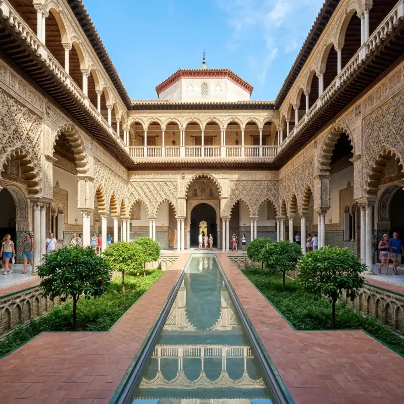
El Real Alcázar de Sevilla es un conjunto palaciego amurallado construido en diferentes etapas históricas. El palacio original se edificó en la Alta Edad Media. Se conservan algunos vestigios de arte islámico y, de la etapa posterior a la conquista castellana, un espacio palaciego mudéjar y otro de estilo gótico. En reformas posteriores se añadieron elementos renacentistas, manieristas y barrocos. Es la residencia de los miembros de la familia real española cuando visitan Sevilla. Esto hace que sea el palacio real en uso más antiguo de Europa. La #UNESCO lo declaró Patrimonio de la Humanidad, junto a la catedral de Sevilla y al Archivo de Indias, en el año 1987. En 2019 recibió 2 067 016 visitantes, lo que lo convierte en uno de los monumentos más visitados de #España. #historia Antecedentes =### El espacio en los periodos romano y visigodo= Durante las excavaciones arqueológicas en el espacio que ocupa el Patio de Banderas aparecieron fragmentos de vasijas de estilo campaniforme, momento tardío o final del Calcolítico, con fechas probables entre 2100 y 1900 a. C., ligado a yacimientos de Valencina de la Concepción, así como trozos de vasijas decoradas con un cordón externo en relieve que a su vez lleva impresiones de pequeños segmentos, tal vez realizados con las uñas, datados en el milenio VI-V a. C. Han aparecido en la zona restos de cerámica del bronce tardío igual a las encontradas en la zona de la iglesia de San Isidoro y Cuesta del Rosario, que indicaría que es zona urbana ocupada desde el siglo VIII a. C. No se sabe si son restos de población asentada en la zona o son elementos que contenía la tierra que procedería del entorno, usada para construcción; los restos nos muestran que es un poblamiento costero, posiblemente ganadero. A unos 6 metros de profundidad se han encontrado fosas de cocinas (fondo de cabaña) con restos de alimentos procesados con aceite (moluscos guisados con aceite de oliva) y cerámicas. Estos restos corresponden sobre todo a la ocupación fenicia, al comienzo de la #historia de la ciudad. Se han encontrado restos de un edificio romano del siglo II a. C. o siglo I a. C., un gran horreus, posiblemente para grano o con más seguridad para aceite, a unos 4 metros de profundidad. También ha aparecido un criptopórtico, que puede pertenecer a un gran templo dedicado a la diosa Isis, diosa ligada al comercio, cuya imagen se encontró en el siglo XVII, actualmente desaparecida, así como lápidas de mármol con dedicatorias a dicha divinidad. En un relleno de época almohade de la primitiva puerta del Alcázar ha aparecido una estela romana del periodo imperial, ara romana dedicada a Minerva, diosa protectora del colegio de olearios, encontrada como parte del relleno almohade; este ara romana está dedicada a Minerva, diosa protectora del colegio de olearios de Hispalis: “A Minerva, Valeria, hija de Quinto Valerio Valens, hizo obras para el culto de parte de su extraordinario padre. Dio un donativo en honor del cuerpo de los olearios”. La dedicación a Minerva tiene paralelos en otras localidades como Italica, Carmo, Tomares… como diosa oficial del Estado dentro de la tríada capitolina, con amplia devoción en el sur de la península; el personaje de Q. Valeri Valentis está documentado en Roma en el gobierno de Antonino Pio, y parece ser un miembro destacado del cuerpo de olearios; la inscripción sería bien de un templo a Minerva o bien de alguna obra en el interior del colegio de olearios; esta ara fue reutilizada como cimacio para una columna de una posible iglesia de época del siglo IV, vinculada a un monasterio fundado por santa Florentina en el s.VI y dedicado a san Honorato, como lo demuestra la huella de una cruz retallad. Además presenta un motivo decorativo de origen germánico formado por círculos con estrellas, como los que se observan en la lápida del obispo Honorato, encontrado en el Alcázar, hoy en la Catedral; ambas piezas, encontradas en esta misma zona en épocas diferentes, son un indicio de la posible ubicación en la zona de la basílica de San Vicente.De en torno al siglo III d. C. es datado un estrato de arena y restos marinos hallados intercalados en las paredes y estructuras del edificio romano dedicado al puerto. Los arqueólogos denominan este nivel “un evento de alta energía”, que puede haber sido una fuerte tormenta o un tsunami. Parece que la ciudad casi desapareció, al menos su puerto, lo que explicaría la decadencia de la ciudad durante ese siglo. La zona se abandonó a partir del s.III d. C., y en el s.IV-V d. C. pasó a tener un uso religioso cristiano. Una posible pileta poligonal descubierta en 1976 por Bendala y Negueruela fue identificada como un posible baptisterio paleocristiano, pero hoy se sabe que no lo es. Con posterioridad aparece identificado un edificio tardoantiguo, datado sobre los siglos IV-V d. C., que se ha estimado que pudiera ser un monasterio. =### Etapa islámica= El último estudio arqueológico ha demostrado la presencia de un arrabal del s.XI d. C., previo a la construcción del alcázar, con una duración muy breve, apenas unos decenios. El conjunto del alcázar es fruto de la unión de varios recintos palatinos de épocas diversas; el recinto más antiguo es de mediados o finales del siglo XI, correspondiente a la zona del actual Patio de Banderas. Aparece así el conocido como Recinto I, bien con Almutamid o bien con los almorávides. El recinto es cuadrangular y ocupa el actual Patio de Banderas y casas aledañas. Posiblemente se empezó con Almutamid, usando material procedente de la antigua muralla romana y otras construcciones de la zona e incluso de lejos; el acceso al Recinto I era directo, entre dos grandes torreones. A finales del siglo XI o principios del siglo XI se produce una ampliación en forma de rectángulo y una nueva puerta de acceso. La única puerta de acceso conocida a esta alcazaba se encontraba a la altura del número 16 del patio de Banderas y de la que se conserva la jamba norte de un arco. Es un acceso en recodo, y otro directo, ambos a su vez comunicados. Se supone que la puerta de herradura conservada en la actual calle Romero Murube era un acceso a la ciudad, no al Alcázar. Se conforma así el conocido como Recinto II. En una intervención arqueológica en el interior del actual Patio de Banderas, en las casas n.º 7-8 y n.º 1-2, aparecieron restos de un palacio de finales del s.XI, o bien construido por Almutamid al final de su reinado o bien por los almorávides en sus primeros momentos. Es el palacio más antiguo del recinto. Puede que sea el primitivo Alcázar de la Bendición (Al-Mubarak). En 2009 se realizó la prueba del carbono 14 a la muralla del Alcázar. Esta prueba dio el año 1090 como el más aproximado de la fecha de construcción, con un margen de error estimado de +/- 40 años. Es decir, la muralla del Alcázar conservada sería de tiempos de la taifa de Sevilla o comienzos del periodo almorávide. En el siglo XII el río se había desplazando hacia el oeste, de tal modo que el recinto palatino creció con los almohades sobre un antiguo arrabal y puerto, y se creó una nueva #mezquita mayor; el nuevo acceso era en la zona de la Giralda, y el antiguo quedó sin uso progresivamente. En el siglo XII los almohades reformaron por completo todo este espacio. Crearon un sistema de murallas que unía el Alcázar con otras fortificaciones hasta el cauce del Guadalquivir. El Alcázar llegaba hasta la torre de Abd el Aziz, situada en la actual avenida de la Constitución. En el interior se construyeron una decena de edificios nuevos y de mayor tamaño. Las murallas del Alcázar pasaron, además, a ser parte de unas nuevas y reformadas fortificaciones para la defensa de la ciudad. Estas obras defensivas culminaron a comienzos del siglo XIII con la construcción de la torre del Oro. El Real Alcázar tras la conquista castellana Tras la conquista de la ciudad en 1248, Fernando III no realizó ninguna actualización en el Alcázar. La corte cristiana se estableció durante décadas en los antiguos espacios almohades. Entre 1252 y 1260 Alfonso X aprovechó el espacio del edificio principal para construir el palacio Gótico. Los demás edificios del Alcázar almohade fueron reformados para su posterior uso. En el siglo XIV, tras el terremoto sucedido en 1356, que afectó gravemente a la ciudad, el rey Pedro I ordenó el derribo de tres edificios palatinos almohades para construir el palacio Mudéjar, que se adosó al palacio Gótico alfonsí. La construcción comenzó el mismo año 1356 y, según las inscripciones del propio Alcázar, finalizó en 1364. En 1366 comenzó la primera guerra civil castellana que enfrentó a Pedro I con su hermanastro Enrique II y terminó con la muerte de Pedro en 1369, por lo que no parece que hubiera podido vivir en él por mucho tiempo. A lo largo de la historia, el Alcázar ha sido el escenario de diversos acontecimientos relacionados con la Corona española. Entre 1363 y 1365, como sede de la corte castellana, fue visitado por los diplomáticos de la corte de Granada Ibn Jaldún, filósofo, e Ibn al-Jatib, cronista y poeta, para firmar un tratado de paz con el rey don Pedro. En 1367 el príncipe de Gales envió a los diplomáticos ingleses Neil Loring, Richard Punchardoun y Thomas Balastre a este Alcázar para encontrarse con don Pedro y cobrar unos pagos. El 28 de julio de 1477 los Reyes Católicos llegaron a Sevilla y utilizaron el recinto como aposento luego de diez años sin que un rey pisara la ciudad. Al observar el mal estado del edificio, la reina Isabel I de Castilla dispuso intervenciones y medidas para la recuperación material y funcional del sitio. Un año después, el 30 de junio de 1478, nació en el palacio su segundo hijo, el príncipe Juan. Se conoce que este parto real fue asistido por una partera sevillana conocida como "la Herradera" y que contó con la presencia, como testigos designados por el rey Fernando, de Garci Téllez, Alonso Melgarejo, Fernando de Abrejo y Juan de Pineda, según marcaban las normas castellanas, para disipar la menor duda de que el hijo era de la reina. En 1526 se celebró en el Alcázar la boda de Carlos I con su prima Isabel de Portugal. Entre 1729 y 1733 se estableció la Corte en el Alcázar de Sevilla. En él vivieron Felipe V, Isabel de Farnesio y el futuro Carlos III. Durante la Guerra de la Independencia, se reunió aquí la junta sevillana y, posteriormente, la Junta Suprema Central. Entre el 13 y el 16 de septiembre de 1816 se alojaron aquí la reina consorte María Isabel de Braganza y su hermana María Francisca. En 1823, con motivo de la intervención militar de los Cien Mil Hijos de San Luis, el gobierno y las Cortes decidieron trasladar a la familia real, con Fernando VII a la cabeza, a Sevilla. Llegaron el 10 de abril de 1823. El 17 de abril de 1823 nació en el Alcázar el infante Enrique de Borbón y Borbón-Dos Sicilias, hijo del infante Francisco de Paula de Borbón y Luisa Carlota de Borbón-Dos Sicilias, y al que el rey le concedió, dos días después de su nacimiento, el título de duque de Sevilla. Ante el avance de las tropas francesas, las Cortes, reunidas en la iglesia del antiguo Convento de San Hermenegildo, y el gobierno decidieron trasladar a la familia real a Cádiz. Se fueron de Sevilla el 12 de junio. Restaurado el absolutismo, Fernando VII y su familia emprendieron el camino de Cádiz a Madrid, y se detuvieron en Sevilla entre el 8 y el 23 de octubre de 1823. En el siglo XIX, Joaquín Domínguez Bécquer vivió durante años en una casa del patio de Banderas. Tenía su taller de pintura en el Apeadero. Trabajó como restaurador en el Alcázar y fue pintor de cámara honorario de la Casa Real. En 1848 se instalaron aquí el duque de Montpensier y la infanta María Luisa, que al año siguiente se trasladaron al Palacio de San Telmo. Reinando Alfonso XII, su madre, Isabel II, con las infantas Paz, Eulalia y Pilar, se instalaron aquí el 16 de octubre de 1876. Las relaciones de Isabel II y el duque de Montpensier, que vivía en el cercano Palacio de San Telmo, eran tensas, sobre todo por el noviazgo entre Alfonso XII y María de las Mercedes, hija de este duque. Por esto, Isabel II abandonó el Alcázar de Sevilla con sus hijas el 8 de septiembre de 1877 para instalarse en el Monasterio de San Lorenzo de El Escorial. Alfonso XII estuvo en Sevilla con Isabel II entre el 26 y el 31 de marzo de 1877 y luego, sin su madre, entre el 22 de diciembre de 1877 y el 8 de enero de 1878. En ambas estancias se encontró con María de las Mercedes. Alfonso XII visitaría Sevilla una vez más, entre el 29 de abril y el 1 de mayo de 1879. Fue una visita de luto con motivo del fallecimiento de su prima, Cristina de Orleans. Alfonso XIII y su esposa Victoria Eugenia de Battenberg viajaron numerosas veces a Sevilla. Este rey era aficionado a los deportes e hizo construir en el patio de la Alcubilla una pista de tenis, que fue de las primeras de #España, pero que actualmente no se conserva. Por decreto de 22 de abril de 1931, el Gobierno de la II República española, a propuesta de su ministro de Hacienda, Indalecio Prieto, cedió el Alcázar y sus jardines al municipio de Sevilla. El 2 de abril de 1976, durante la Transición Española, tuvo lugar aquí una reunión del Consejo de Ministros, presidida por Juan Carlos I. El Consejo de Ministros volvió a reunirse en el Alcázar el 19 de marzo de 2010, esta vez sin la presencia del monarca. El 18 de marzo de 1995 se celebró en este lugar un almuerzo y recepción con motivo de la boda de la infanta Elena de Borbón, hija del rey Juan Carlos I, con Jaime de Marichalar. El 20 de octubre de 1988 la reina Isabel II de Inglaterra asistió a un espectáculo de flamenco en el Alcázar. También ha sido visitado por otras personalidades que pasaron por la ciudad, como el príncipe de Gales en 2012, Harrison Ford en 2016, Barack Obama en 2019 o Hillary Clinton en 2024. =### Alcaides= Estancias Puerta del León La puerta del León, situada en la muralla exterior del conjunto, supone la principal vía de acceso al recinto. Entre el dintel de esta puerta y bajo un matacán se extendía una pintura de un león, de la que se desconoce su origen, aunque ya aparece en los dibujos realizados por Richard Ford en 1832. Esta pintura fue restaurada por Joaquín Domínguez Bécquer, en 1876. En 1892 la pintura fue sustituida por un mural de azulejos diseñado por Manuel Tortosa y Fernández, con el asesoramiento histórico de José Gestoso. El azulejo fue realizado en la fábrica de Mensaque y representa también un león, de estilo gótico, que aparece sosteniendo un crucifijo con la garra derecha y con una bandera bajo su garra izquierda. Sobre el pecho hay una filacteria en la que se lee en latín Ad utrumque, que significa "para una cosa y para otra", faltaría la palabra 'paratus'; Ad utrumque paratus, significando así "preparado para una cosa y para otra". La denominación de puerta del León probablemente date del siglo XIX. Históricamente esta puerta había sido conocida como de la Montería. Según Ortiz de Zúñiga (siglo XVII) se llamó así porque era por donde salía el rey con sus monteros para ir de caza. Esta hipótesis tiene base, ya que el padre de Pedro I, Alfonso XI, era tan aficionado a la caza que escribió un libro sobre montería. Según José Gestoso, el nombre se debía a que estaba decorada con relieves de cacería. En el lado izquierdo del arco se aprecian los relieves de dos medallones polilobulados muy desgastados. En uno de ellos se aprecia algo similar a un animal cuadrúpedo. Pasada la puerta se accede al patio del León. Al fondo del patio hay un lienzo de muralla almohade con tres pórticos. Esta muralla parece haber sido reforzada posteriormente. Además, los arcos fueron de herradura pero en la época cristiana se transformaron en arcos de medio punto. Tras este lienzo de muralla se encuentra el patio de la Montería. Sala de Justicia A la sala de Justicia se accede por el patio del León. Es de planta cuadrada, de estilo mudéjar y fue construida en el reinado de Alfonso XI. Es una sala de planta cuadrada y una bóveda de artesonado (qubba). En ella hay un escudo de la Orden de la Banda, creada por Alfonso XI en torno a 1340. La sala habría sido realizada entre 1340 y 1350. No obstante, aunque la sala fue fechada en el reinado de Alfonso XI gracias, entre otros detalles, a este escudo, el escudo de esa orden también aparece en otros lugares del palacio decorados en el reinado de su hijo, Pedro I. Guarda semejanza con la sala de Comares de la Alhambra. En los siglos XVI y XVII era conocida como sala de los Consejos. Lo más probable es que hubiera sido una sala almohade usada para reunir un consejo (maswar) y que fuese reformada con arte mudéjar por los cristianos, que continuaron usándola para el mismo fin. Probablemente, esta fuese a sala donde estaba el tribunal presidido por Pedro I, aunque existen otras hipótesis sobre su posible localización. En este tribunal había tres gradas de ladrillo con un trono de piedra, aunque esta estructura fue demolida antes de la visita de Felipe II en 1570. Esta actuación disgustó a Felipe II, que era un gran admirador del rey don Pedro y que fue el primero en indicar que debía llamársele "el Justiciero". Patio del Yeso Desde la sala de Justicia se accede al patio del Yeso, que fue edificado a finales del siglo XII, de época almohade, de planta casi cuadrada, presenta una alberca en el centro y con arcos porticados en cada uno de los lados del patio, sobre los que aparece una rica decoración. En el lado sur hay unas columnas califales que sostienen unos arcos con decoración (sebka) de yeso. Esta decoración cubre un soportal. En el soportal hay una entrada de dos arcos de herradura con una columna en el centro. Sobre dintel de esa entrada se abren dos ventanas. En la pared opuesta hay una salida tapiada con tres arcos de herradura de estilo califal cordobés. Al igual que en otros lugares del Alcázar, en este patio se han realizado varias reformas a lo largo de su historia. Todo el muro donde se encontraba la arquería de sebka se encontró tapado. Fue descubierto por Francisco María Tubino a finales del siglo XIX. El marqués de Vega-Inclán, entonces conservador del Alcázar, encargó en 1912 su recuperación y restauración al arquitecto José Gómez Millán. Patio de la Montería Es el patio principal y está presidido por la puerta del palacio de Pedro I. En las paredes hay arcos de medio punto que fueron tapiados en el siglo XV. A la derecha se encontraban las estancias de la Casa de Contratación. Sala de los Abanicos Se trata de una estancia donde, desde 1998, se exhiben 37 abanicos de los siglos XVIII y XIX donados por la coleccionista Gloria Trueba Gómez. En este lugar hay también un cuadro de grandes dimensiones que representa la Procesión del Santo Entierro Grande de 1854. Es una obra de la época que fue adquirida en 1992 en la casa de subastas Sotheby's por el anticuario sevillano Antonio Plata del Pino y que luego fue comprada por el Ayuntamiento por cinco millones de pesetas. Casa de Contratación Los Reyes Católicos aprobaron la creación, en 1503, de la Casa de Contratación de Indias, que era una institución encargada de fomentar y regular el comercio y la navegación con los territorios españoles en Ultramar y que realizaba labores de revisión y recepción de mercancías, actuaciones de carácter técnico científico y también actividades judiciales. La Casa de Contratación abarcaba desde la actual plaza de la Contratación, donde tenía su fachada principal, hasta la parte occidental del patio de la Montería. En 1717 esta institución se trasladó a Cádiz y en 1790 desapareció. Desde el patio de la Montería se accede al salón del Almirante, donde destacan los siguientes cuadros: La inauguración de la Exposición Iberoamericana de 1929, que preside la estancia, obra del pintor Alfonso Grosso; Las postrimerías de san Fernando, de Virgilio Mattoni; La toma de Loja por Fernando el Católico, obra de Eusebio Valldeperas; y los retratos de Fernando VII y María Cristina de Nápoles de Carlos Blanco, fechados en el primer tercio del siglo XIX. Este lugar es usado como salón para actos públicos. A continuación, se halla la denominada sala de Audiencias, transformada en capilla en el siglo XVI. Está cubierta con una rica techumbre de tracería del siglo XVI con adornos geométricos. La capilla posee una grada de piedra adosada al muro que recorre el perímetro y presidiendo la estancia se encuentra un retablo con forma de tríptico, obra de Alejo Fernández, elaborado entre 1531 y 1536. La parte central está ocupada por una imagen de la Virgen de los Navegantes, acompañada por san Sebastián y Santiago en un lado y san Telmo y san Juan Evangelista en el otro. Patio del Crucero El patio del crucero se encuentra al oeste del patio de la Montería. Fue construido en el siglo XII, durante el periodo almohade, aunque fue reformado posteriormente. En tiempos de Alfonso X se le añadieron bóvedas de crucería. El jardín presentaba dos niveles, el más alto correspondería al que tiene actualmente el patio, con dos galerías principales en forma de cruz y otras cuatro periféricas, y un segundo nivel, 4,7 metros por debajo del anterior, ocupado por un jardín con naranjos, dividido en cuatro partes, en cuyo centro se situaba una gran fuente y en los extremos, albercas. A raíz del terremoto de Lisboa se tapó este jardín inferior, rellenándolo de tierra y formando el actual patio rectangular. Los vestigios visibles de este piso inferior pueden contemplarse desde el patio del Crucero y la única parte que sobrevive son los llamados baños de María Padilla, a los que se accede desde el jardín de la Danza. Este sótano está formado por una gran nave de diez tramos cubiertos por bóvedas de crucería. La entrada desde el jardín está cubierta con una larga bóveda de cañón. Actualmente es un patio rectangular ajardinado, dividido en cuatro por setos de mirto y en el interior de los cuadrantes hay bonetero, árboles de Júpiter, palmeras, buganvillas y jazmines. En el siglo XVIII se realizaron varias obras en el patio del Crucero y en el palacio Gótico. La fachada del palacio Gótico que daba al patio del Crucero fue reformada por completo en estilo barroco. También se remodelaron las otras fachadas del patio. Se enterró todo el jardín para poner su suelo al nivel de los salones. Se tapiaron los laterales de los corredores del patio y estos quedaron como cámaras subterráneas. Palacio Mudéjar o de Pedro I Fue construido junto al palacio Gótico de Alfonso X a iniciativa del rey Pedro I, entre 1356 y 1366, en su construcción colaboraron artesanos de Toledo, Granada y de la propia Sevilla, posteriormente fue transformado en época de los Reyes Católicos y de los primeros Austrias. Según las investigaciones arqueológicas, el palacio del rey Pedro constituyó un proyecto de nueva planta, que se elevó en un lugar donde existían construcciones anteriores. Este palacio nació para servir como edificio privado del rey Pedro I, frente al carácter más protocolario que representaba el palacio gótico, levantado en el siglo anterior por orden de Alfonso X. Sobre todo en Tordesillas y Sevilla, empleó la epigrafía árabe para ensalzar sus virtudes. Esto se debe a que, a partir del siglo XIV, los monarcas castellanos dejan de copiar las tendencias europeas para inspirarse en los modelos andalusíes. Esto hizo que este palacio de Pedro I albergase diversas escrituras en árabe ensalzando su figura. En casi todos los zócalos del palacio puede leerse la frase "¡Gloria a nuestro Señor el sultán Don Pedro, que Alá lo proteja!" La madera empleada en los artesonados (alfarjes), las puertas con lacerías y los marcos de las ventanas suele ser de pino. Estas lacerías son doradas o policromadas. Tiene una primera planta que no se extiende por toda la planta baja, sino solo por algunas estancias. =### Portada= La portada principal se encuentra en el patio de la Montería. En la parte superior hay un gran alero de madera, sostenido por mocárabes dorados. Abajo hay un mural de azulejos con una inscripción en árabe que habla del año en que se concluyó el edificio. Este mural está bordeado por una inscripción en caracteres góticos que dice: "el muy alto et muy noble et muy poderoso et muy conqueridor don Pedro por la gracia de Dios rey de Castilla et de León, mandó fazer estos alcázares et estos palacios et estas portadas que fue fecho en la era de mill et quatrocientos y dos años". La puerta de entrada es rectangular, con dintel adovelado decorado con fino alaurique. A ambos lados hay sendos arcos lobulados decorados con sebka y apeados en columnas de mármol. En la banda superior hay ventanas, geminadas en sendos laterales y tripartita en espacio central, con columnas de mármol sosteniendo sus arcos lobulados. =### Patio de las Muñecas= La portada da acceso a un zaguán, del que sale un pasillo que lleva al patio de las Muñecas. Se cree que esta zona del palacio estaba destinada a la reina, siendo este un patio doméstico. Fue sometido a una reforma entre 1847 y 1855. En dicha reforma se añadió una cornisa con mocárabes y un entresuelo neomudéjar entre la planta baja y la primera planta. Esta reforma fue dirigida por Juan Manuel Caballero y José Gutiérrez. Las diez columnas de mármol actuales fueron realizadas por el marmolista José Barradas en aquella reforma. El nombre "de las Muñecas" es antiguo. En 1637 el historiador Rodrigo Caro especuló que podría llamarse así porque ahí era donde se criaba a los niños o porque es un patio muy pequeño. En la actualidad se cree que puede deberse a unos rostros de niñas o muñecas que hay al comienzo de los arcos. =### Cuarto del Príncipe= Se accede por la galería norte del patio de las Muñecas. Recibe este nombre por Juan de Trastámara, hijo de los Reyes Católicos, nacido en el Alcázar en 1478. En la techumbre hay heráldica de los Reyes Católicos. El cuarto está dividido con arcos de yeso en tres dependencias. En esta sala Isabel I dio a luz al príncipe Juan el 30 de junio de 1478. =### Patio de las Doncellas= Se trata de un patio rectangular de 21x15 metros circundado por cuatro galerías; dos de siete y dos de cinco arcos. En el centro hay una alberca con grandes arriates hundidos un metro a ambos lados. Los laterales de estos arriates están decorados con arcos de medio punto entrelazados. Los arcos lobulados están decorados con sebka y relieves en yeso. Entre 1580 y 1584 todo esto fue enterrado y se colocó una solería de mármol, para la que se trajeron artesanos de Macael, Espera y Acán. Los arriates y la alberca fueron descubiertos en unos estudios arqueológicos en 2002. En torno a la planta baja había algunas estancias que eran accesibles para los invitados, mientras que en la planta superior solamente había habitaciones privadas. La planta superior de este patio fue reformada entre 1540 y 1572. De esta época son los arcos de medio punto apoyados en columnas de mármol con capiteles jónicos elaboradas en Génova por Antonio María Aprile da Carona y Bernardino da Bissone. Las columnas de la planta baja fueron sustituidas entre 1560 y 1569 por otras labradas en la misma ciudad italiana por Francisco y Juan Lugano y Francisco da Carona. En 2024 la Fábrica Nacional de Moneda y Timbre emitió 1,5 millones de monedas de 2 euros con un relieve de este patio en el anverso. =### Alcoba Real= La alcoba Real, que también fue llamada dormitorio de los Reyes Moros, tiene su acceso desde el patio de las Doncellas. El interior está dividido en dos salas, que se comunican por una entrada con tres arcos de herradura. La primera sala a la que se accede desde el patio, conocida como sala de los Pasos Perdidos, tiene un artesonado del reinado de los Reyes Católicos. Sus muros cuentan con frisos de yeserías y está cubierta por un artesonado del siglo XV. Las puertas que dan al patio están decoradas con lacerías, entre las que destacan figuras de seis brazos con forma circular. Las dos ventanas de esta estancia están decoradas con estrellas y ruedas de ocho brazos. =### Salón del Techo de Carlos V= Desde el patio de las Doncellas se accede también al salón del Techo de Carlos V. Tiene puertas de madera con lacerías mudéjares. En el centro de los portones hay figuras geométricas de ocho brazos en forma de ruedas. Las dos contraventanas de este salón están decoradas con estrellas de cuatro, seis y ocho puntas. Se cree que pudo ser una capilla, por la inscripción sobre el Corpus Christi que hay en la puerta. De ser así, la alcoba Real, que se encuentra al lado, pudo haber sido un presbiterio. De todas formas, cabe la posibilidad de que la inscripción religiosa de la puerta fuera simplemente por deseo de Pedro I. Recibe ese nombre por su artesonado, realizado entre 1541 y 1543. Este artesonado cuenta con 75 casetones octogonales. Es atribuido a Sebastián de Segovia. =### Salón de Embajadores= Las puertas de la entrada desde el patio de las Doncellas son del siglo XIV. Son de madera con lacerías geométricas decoradas con motivos vegetales. En las partes centrales de los portones hay figuras de ocho y doce brazos con forma de ruedas. Tienen un trazado de lefe en los márgenes. Indican la fecha de terminación del palacio Mudéjar; 1364. En la parte exterior tienen inscripciones en árabe alabando al señor del palacio y, en la parte alta del lado interior, hay filacterias con caracteres góticos en latín con el salmo 54 y el comienzo del Evangelio de san Juan.El salón de Embajadores el lugar más suntuoso del palacio. Aquí estaba el salón Al-Turayya o de las Pléyades del Alcázar Al-Mubarak o de la Bendición de Al-Mutamid. El salón actual corresponde a la construcción de Pedro I. Tiene planta cuadrada (qubba) y está cubierto por una cúpula semiesférica dorada. Este tipo de cúpula responde a un modelo que es llamado "media naranja". La cúpula fue realizada por Diego Ruiz en 1427. Debajo de la cúpula hay un arrocabe gótico con retratos de monarcas. Este friso de madera es medieval, pero los retratos fueron sustituidos en una reforma que tuvo lugar entre 1599 y 1600. Son 56 tablas pintadas por Diego de Esquivel en orden cronológico, desde Chindasvinto hasta Felipe III. Pedro I se sitúa en la mitad sur del paramento. En ellas, los reyes, identificados por su nombre, aparecen en posición sedente y coronados; en la mano derecha portan una espada y en la izquierda un globo terráqueo; en un nivel inferior está su escudo de armas y, más abajo, su período de reinado. Por encima de la serie se dispone un friso corrido con el escudo de armas de Castilla y León. Los muros, al igual que en otras estancias del palacio, están decorados con azulejos y yeserías. En la parte superior del salón hay balcones de madera construidos a finales del siglo XVI. En dos laterales hay entradas con dos columnas de mármol que sostienen triples arcos de herradura. Junto a este salón hay dos estancias, una al norte y otra al sur, en las que hay distribuidas 26 placas de yeso recortadas y perfiladas a buril para que las figuras representadas destaquen sobre el fondo de ataurique. En la sala norte miden 50 centímetros aproximadamente, y son algo más grandes en la sala sur. En ambas salas las placas de yeso representan reyes, príncipes, caballeros, damas, torneos y animales fantásticos. Estas escenas pueden estar inspiradas en el Libro de la montería, escrito por Alfonso XI, y en la Crónica troyana. Esa crónica fue encargada por Alfonso XI y realizada por el escribano y miniaturista Nicolás González. González la terminó en diciembre de 1350, cuando Alfonso XI ya había sido sucedido por Pedro I. =### Salón del Techo de Felipe II= Se accede a él a través de una entrada en el salón de Embajadores. Esa entrada es conocida como el arco de los Pavones, por tener decoración de aves. Se trata de un salón rectangular con un ajimez que da al jardín del Príncipe. =### Primera planta= La primera planta del palacio Mudéjar fue realizada en el siglo XIII por Pedro I, aunque fue reformada por los Reyes Católicos en el siglo XV y por Isabel II en el siglo XIX. Es conocido como cuarto Real Alto. Hay diversas estancias para el uso de los monarcas. En la sala que sirvió de comedor en el siglo XIX hay un cuadro de Murillo, El milagro de san Francisco Solano y el toro. Entre estas estancias situadas en la planta alta del palacio destaca el Oratorio de los Reyes Católicos, en el que se encuentra el altar y retablo de azulejos de La visitación de la virgen realizado en 1504 por el ceramista italiano Francisco Niculoso Pisano. Palacio Gótico Alfonso X gobernó de 1252 a 1284. En el siglo XIII gótico fue un estilo arquitectónico habitual en España. El rey Alfonso edificó su palacio Gótico junto al patio del Crucero. Las primeras noticias de obras en el periodo del rey Alfonso datan del 22 de marzo de 1254, cuando ordenó que se hiciera un conducto para llevar agua del acueducto de los Caños de Carmona al interior del Alcázar. El palacio Gótico del Alcázar fue reformado por Carlos I, aunque se conservó la estructura gótica de la planta baja. Los zócalos de las paredes de la Capilla, el Gran Salón y la Sala Cantarera están decorados con azulejos realizados por Cristóbal de Augusta entre 1577 y 1578, durante el reinado de Felipe II. =### Capilla= Probablemente, aquí estuvo la capilla de San Clemente, creada en 1271. En la actualidad está presidida por un retablo de la Virgen de la Antigua, realizado en el siglo XVIII por Diego de Castillejo y que contiene una copia anónima de la existente en la catedral de Sevilla. =### Gran Salón= El Gran Salón, también conocido como sala de las Bóvedas o sala de Fiestas, cuenta con cuatro sargas encargadas por Alfonso XIII al pintor Gustavo Bacarisas para el pabellón Real de la Exposición Iberoamericana de 1929. Las pinturas de las sargas están relacionadas con la navegación colombina. En este espacio también hay otras dos sargas pintadas de la década de 1920 por otros autores para ese pabellón: una con el escudo de Carlos V y otra con el escudo de Portugal. Junto a ella hay una habitación más pequeña, conocida como sala Cantarera, que desde 2015 es empleada para exposiciones temporales. =### Salón de los Tapices= Fue reconstruido totalmente en el siglo XVIII. La fachada de este salón es la fachada sur del patio del Crucero. Está decorado con seis tapices de la conquista de Túnez por Carlos I, realizados en la década de 1730. En el siglo XVI se realizaron una serie de tapices flamencos en el taller de Willem de Pannemaker sobre la conquista de Túnez por Carlos I con cartones dibujados por Jan Cornelisz Vermeyen (que había estado presente en ese acontecimiento como pintor de la Corte) y Pieter Coecke van Aelst. En el siglo XVIII #zenón de Somodevilla y Bengoechea, marqués de la Ensenada, planeó la realización de nuevos tapices para evitar el desgaste producido por el uso continuo de los tapices flamencos del palacio madrileño. En 1732 la Real Fábrica de Tapices encargó a Jacobo Vandergoten el Joven la realización de estos tapices. Realizó este trabajo con la supervisión de Andrea Procaccini y de su discípulo Domenico Maria Sani. Fueron realizados con calcos de Jaime Alemán, que fue supervisado por Procaccini. De los 10 tapices producidos en la década de 1730 seis se encuentran en esta sala del Alcázar de Sevilla y los otros cuatro están en Madrid. Los que se encuentran en el Alcázar de Sevilla son: El mapa, Toma de La Goleta, Toma de Túnez, El ejército acampa en Rada y Reembarque de La Goleta. Jardines Los jardines constituyen un elemento fundamental del Alcázar Son los más antiguos de la ciudad y desde su creación han sufrido grandes alteraciones que han transformado su trazado primitivo. En la Baja Edad Media había configurado un Alcázar con edificios de distintas épocas, pequeños patios ajardinados y grandes huertas. Fueron reformados en el siglo XVI y a comienzos del siglo XVII, conservando como herencia musulmana el concepto de jardines compartimentados sin ninguna vinculación entre ellos, al igual que lo habitual de las fuentes bajas, los azulejos y los naranjos. Las naranjas de estos jardines eran usadas para la elaboración de la mermelada que consumía Isabel II de Inglaterra. Saliendo de los salones del palacio Gótico se accede al conocido como jardín de la China. Los arriates están separados con setos de mirto. En ellos hay plantados un falso pomelo. Este jardín se separó de la zona del estanque de Mercurio en el siglo XVI, durante el reinado de Felipe II. Estanque de Mercurio El estanque de Mercurio es probable que se construyera en el periodo árabe como elemento de almacenamiento y regulación para el suministro de agua de toda la alcazaba. En el centro de este estanque hay una estatua de bronce de 1576 del dios griego Mercurio, diseñada por Diego de Pesquera y fundida por Bartolomé Morel. De los mismos autores son la baranda que rodea el estanque, las figuras de leones sosteniendo escudos que hay en sus ángulos y las 18 bolas con remates piramidales que rodean el estanque. Galería de Grutesco Detrás del estanque de Mercurio se levanta un muro de 160 metros de largo que avanza en dirección noroeste-sureste por los jardines y que compartimenta la zona verde en dos áreas diferenciadas: a un lado los jardines primitivos y por el otro, la antigua zona de huertas que fue convertida también en jardines a finales del siglo XIX, en los que abundan los naranjos y limoneros. El origen de esta construcción se encuentra en un antiguo lienzo de muralla almohade del siglo XII, que servía como defensa militar y de las inundaciones del río Tagarete. En 1612, el arquitecto Vermondo Resta transformó la muralla en la actual Galería de Grutescos decorada en una de las caras de la muralla. La ornamentación consistió básicamente en el revestimiento de los muros con hiladas de piedras diferentes, el enfoscado y la pintura entre las piedras, con imitaciones de mármoles y frescos realizados por Diego Esquivel de escenas mitológicas clásicas. Las transformaciones llegaron hasta el siglo XIX, cuando esta zona adquirió el aspecto que presenta actualmente. Esta muralla cuenta también con una galería superior visitable desde la que se tiene una espléndida visión. Jardín de la Danza Bajando unas escaleras, junto al estanque de Mercurio, se encuentra el jardín de la Danza. Este jardín fue realizado en la década de 1570. Por un pasaje puede accederse a los baños de María Padilla, que son unos pasajes abovedados del siglo XII. El nombre se debe a que en el siglo XVI había dos estatuas en las dos columnas que hay en la entrada que representaban un sátiro y una ninfa bailando. Estas estatuas fueron fotografiadas por última vez por Jean Laurent en el siglo XIX, pero en la actualidad se encuentran desaparecidas. En el centro hay una fuente baja del siglo XVI. Jardín de Troya Se trata de un patio manierista ajardinado. En el lado sur hay una galería con arcos de medio punto y detalles grutescos en las columnas que fue realizada por Vermondo Resta en 1606. En la primera planta del lado opuesto hay una galería con arcos de medio punto y columnas de mármol dóricas realizada por Lorenzo de Oviedo en la segunda mitad del siglo XVI. El suelo se colocó en 1599. En el centro hay una fuente con una taza de mármol. La fuente fue colocada entre 1675 y 1759. Jardín de la Galera Está comunicado con el jardín de Troya por un arco de medio punto y también por una escalinata con una estancia del palacio de Pedro I. Posee cuatro arriates con diversa vegetación. Hay una columna de mármol con una inscripción en homenaje a Al-Mutamid. Jardín de las Flores En el centro hay un pequeño estanque rectangular. Están los restos de una pequeña gruta construida a finales del siglo XVI y que hoy alberga un busto de Carlos I. Jardín de la Cruz Se accede a través del jardín de las Flores o del jardín de las Damas, atravesando la puerta de Hércules. La puerta recibe ese nombre porque tiene una pintura en el frontispicio que representa la lucha entre Hércules y Anteo. En el centro del jardín hay un montículo con una fuente y un hueco en la parte inferior, que ha recibido el nombre de Gruta de las Sultanas. Jardín del Príncipe Junto al jardín de las Flores se encuentra el jardín del Príncipe. Su nombre viene porque se puede acceder a él desde el cuarto del Príncipe, donde nació el príncipe Juan en el siglo XV. La fachada del fondo es obra de Lorenzo de Oviedo en el siglo XVI. En ella hay una planta baja con una galería con columnas de mármol que sostienen arcos de medio punto. Arriba hay una primera planta con ventanas y, sobre esta, una segunda planta con otra hilera de columnas y arcos de medio punto. Se trata de arquitectura manierista. El jardín está dividido en cuatro por setos y tiene una fuente en su centro, realizada entre 1760 y 1770. Jardín de las Damas El jardín de las Damas se hizo en 1526, con motivo de la boda de Carlos I e Isabel de Portugal. A principios del siglo XVII se amplió y rediseñó, por el arquitecto milanés Vermondo Resta, en dirección a la antigua huerta de la Alcoba. El jardín linda en el este con la Galería de Grutesco, con su monumental Fuente de la Fama. Es la única fuente de este estilo que queda en España. Se trata de una representación alegórica de la fama, cuyo mecanismo hidráulico ha sido recientemente restaurando. Produce notas musicales en los tubos de un órgano cada hora en punto al pasar el agua a través de ellos. En el siglo XVIII se hicieron con setos de boj los escudos heráldicos españoles. El jardín se dibujó como un gran rectángulo dividido en ocho compartimentos a lo Vignola, delimitados con setos de mirto y bonetero. Mientras que las fuentes de los paseos laterales son bajas y muy cercanas al suelo, la fuente central es de proporciones monumentales y coronada por una estatua de bronce de Neptuno realizada al estilo de Giovanni de Bolonia. Pabellón de Carlos V El pabellón de Carlos V fue construido entre 1543 y 1546 por Juan Fernández. Es de estilo mudéjar. Tiene planta cuadrada. En el interior hay una bóveda semiesférica. Todos sus muros, tanto interiores como exteriores, así como sus bancos, están cubiertos de azulejos del siglo XVI realizados por Juan Polido y su padre Diego Polido. El exterior está rodeado de cuatro galerías porticadas con arcos de medio punto apoyados sobre columnas de mármol. Laberinto En donde está el jardín de Troya hubo un laberinto hasta finales que se puso un suelo en 1599. En el jardín de la Cruz del Alcázar se situó posteriormente un laberinto de setos que fue destruido en 1910. En 1914 el marqués de la Vega-Inclán, comisario regio de Turismo, decidió construir uno nuevo al sur del Pabellón de Carlos V, basándose en el plano que hay en el suelo de dicho pabellón. Cenador del León Diego Martín de Orejuela construyó dos cenadores en el siglo XVII. Estos fueron el cenador Ochavado, desaparecido en la actualidad, y el cenador del León, que se conserva. El cenador del León se construyó entre 1644 y 1645. Hay una estancia de planta cuadrada a la que se accede por un arco de medio punto. En los tres flancos restantes hay ventanas insertas en ornacinas. Esta estancia está cubierta por una cúpula con azulejos en el exterior. En frente hay una fuente con un león, de procedencia desconocida. Jardín Inglés Esta zona se encuentra dentro de los muros del Alcázar desde la ampliación almohade del siglo XII que se hizo en dirección a la actual calle San Fernando. Hasta el siglo XX esta zona había seguido siendo un espacio agrario, de origen medieval, conocido como huerta de la Alcoba. El espacio actual, que imita el estilo de los jardines ingleses, es de una reforma de 1927. El jardín fue creado por una petición de Victoria Eugenia de Battenberg al comisario regio de Turismo, el marqués de la Vega-Inclán. En 2008 se encontraron en esta zona restos arqueológicos romanos, visigodos y de tres casas almohades. Jardín del Marqués de la Vega-Inclán Desde el jardín de la China se puede acceder al jardín del Marqués de la Vega-Inclán. La entrada hacia el jardín de la China es la puerta de Marchena, del siglo XV, trasladada a este lugar en 1913 por el entonces conservador del Alcázar, el marqués de la Vega-Inclán. Esta portada gótica fue adquirida por Alfonso XIII en una subasta de bienes de la Casa de Osuna y provenía de un palacio abandonado de los duques de Arcos en la localidad de Marchena. Todo este jardín se creó a comienzos del siglo XX. Fue la antigua huerta del Retiro, que se extendía hasta el cercano paseo de Catalina de Ribera. En la actualidad es un jardín de calles paralelas y perpendiculares decorado con diversas especies vegetales y fuentes. Jardín de los Poetas Fue realizado entre 1956 y 1958 por el entonces conservador, Joaquín Romero Murube. Tiene dos grandes estanques y recrea tipológicamente el jardín sevillano, síntesis de influencias islámicas, renacentistas y románticas. Apeadero y patio de Banderas En un edificio del patio de Banderas, el número 8, se han encontrado restos del palacio del rey poeta Al-Mutamid. En la puerta de la muralla que da acceso al patio de Banderas desde la plaza del Triunfo, hay un retablo, con la Inmaculada Concepción, del último tercio del siglo XVII. En el patio de Banderas se encuentra la puerta del Apeadero del Alcázar. El Apeadero es un vestíbulo rectangular con columnas. Fue realizado en el siglo XVII por Felipe III. Fue diseñado por el arquitecto Vermondo Resta y realizado por el albañil Pedro Martín, el carpintero Alonso Durán y el cantero Diego de Carballo en 1609. La portada, de estilo manierista, fue diseñada por Vermondo Resta y realizada Diego de Carballo en 1607. Felipe V situó aquí la Real Armería. Para ello, la sala fue reformada por Ignacio de Sala y Juan Vergel en 1729. En la portada se añadió un escudo real. En el Apeadero hay un retablo del último tercio del siglo XVII que muestra la presentación de la Virgen María en el Templo de Jerusalén. En la pintura En 1849 Joaquín Domínguez Bécquer realizó un retrato de la infanta María Luisa con su primogénita en brazos en los jardines del Alcázar. Esta obra se encuentra en una colección particular en Sanlúcar de Barrameda. Este mismo autor pintó, en 1854, a un niño jugando con un perro en los jardines del Alcázar. Esta obra se encuentra en una colección particular de Sevilla. Finalmente, en 1857 este pintor realizó un cuadro del Patio de las Muñecas que se encuentra en el Museo Meadows de Dallas y otro del Patio de las Doncellas que se encuentra en una colección particular de Sevilla. En 1851 Alfred Dehodencq pintó Un baile de gitanos en los jardines del Alcázar, delante del pabellón de Carlos V, que se encuentra en el Museo Thyssen de Málaga. En 1868 Raimundo Madrazo pintó El pabellón de Carlos V en el Alcázar de Sevilla. Este cuadro se encuentra en el Museo del Prado de Madrid. En 1872 Manuel Wssel de Guimbarda pintó la obra Escena costumbrista en el Alcázar de Sevilla, que está en el Museo Thyssen de Málaga. En torno a 1880 Emilio Sánchez Perrier pintó su cuadro Jardines del Alcázar de Sevilla. Joaquín Sorolla pintó diversos cuadros en los jardines del Alcázar. En 1908 pintó el cuadro Palacio de Carlos V, Alcázar de Sevilla (que se encuentra en una colección particular). En 1910 pintó La alberca, Antiguo jardín del Alcázar de Sevilla, Rincón de grutesco del Alcázar de Sevilla, y Patio del rey don Pedro, que se encuentran en el Museo Sorolla de Madrid, y Jardines del Alcázar que se encuentra en el Centro Getty de Los Ángeles. Gustavo Bacarisas pintó un cuadro del jardín de Troya a comienzos del siglo XX. En 1921 Manuel García Rodríguez pintó un cuadro de los jardines del Alcázar que se conserva en el Museo Bellver de Sevilla. Entre 1920 y 1925 Manuel García pintó Jardines del Alcázar, Sevilla, que se conserva en el Museo Thyssen de Málaga. En ambos cuadros aparece la puerta de Marchena. En el cine y la televisión El Alcázar ha sido escenario, donde se han rodado las siguientes películas y series de televisión: ¿Dónde vas, Alfonso XII? (1958). La femme et le pantin (1958, Francia). Lawrence de Arabia (1962). El viento y el león (1971). 1492: la conquista del paraíso (1992). El reino de los cielos (2004). Noche y Día (2010). Juego de Tronos (5.ª y 6.ª temporada, HBO, 2015-2016). The White Princess (2017). Emerald City (2017) La peste (2018). Warrior Nun (2020). Bibliografía Cómez Ramos, Rafael (1989). «La Puerta del Rey don Pedro en el Patio del León del Alcázar de Sevilla». Laboratorio de Arte (Universidad de Sevilla) (2): 3-14. Consultado el 20 de julio de 2021. Blanco White, José María (1975). Antonio Garnica, ed. Autobiografía de Blanco White. Sevilla: Publicaciones de la Universidad de Sevilla. Fernández Albéndiz, María del Carmen (2005). Imágenes y representaciones del poder. Las visitas reales en la Sevilla del siglo XIX. Tesis doctoral dirigida por Rafael Sánchez Mantero. Sevilla: Universidad de Sevilla. Fernández Albéndiz, María del Carmen (2007). Sevilla y la monarquía. Las visitas reales en el siglo XIX. Secretariado de Publicaciones de la Universidad de Sevilla. ISBN 978-84-472-0911-8. Rubio Jiménez, Jesús; Piñanes García-Olías, Manuel (2014). Joaquín Domínguez Bécquer. El guardián del Real Alcázar de Sevilla. Instituto de la Cultura y las Artes del Ayuntamiento de Sevilla. ISBN 978-84-9247-79-7. #andalus #sevilla #alcazar Related Insights'Hallstatt: Where Time Carved Its Name into the Alps and Salt Whispered Eternity' Sous les Vignobles de la Loire : Le Mystère Énigmatique des Cités Troglodytiques Oubliées Arctic Circle Digital Nomadism: Building Connectivity in Greenland's Remote Towns{ "@context": "https://schema.org", "@type": "FAQPage", "mainEntity": [ { "@type": "Question", "name": "What is the main focus of Real Alcázar de Sevilla: Belleza Mudéjar?", "acceptedAnswer": { "@type": "Answer", "text": "Descubre la historia profunda de Alcázar de Sevilla." } }, { "@type": "Question", "name": "Who authored the comprehensive guide on Real Alcázar de Sevilla: Belleza Mudéjar?", "acceptedAnswer": { "@type": "Answer", "text": "This detailed article and its insights were carefully researched and authored by Mateo García." } }, { "@type": "Question", "name": "Where can I find more related content about Travel?", "acceptedAnswer": { "@type": "Answer", "text": "You can explore more articles, detailed reviews, and similar insights by browsing the Related Insights section at the bottom of this article or visiting our dedicated Travel category page." } } ] }
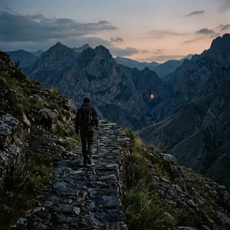
- John Explorer
- 16 Jun, 2026 04:15
The Obsidian Trails: Tracing Azerbaijan's Forgotten Fire Keepers of Garasu
It began, as all truly profound journeys do, not with a map, but with a whisper – an ember of a story fanned by a fleeting encounter in a dimly lit chai khana on Baku’s labyrinthine old town streets. My quest, initially, was to explore the lesser-known mud volcanoes and petroglyphs of Azerbaijan, a country I’d always seen as a crossroads of empires and energies. But then, an elderly carpet weaver, with eyes like #ancient coals, spoke of a place far beyond the tourist trails, a place where fire wasn't just a natural phenomenon or a Zoroastrian symbol, but the very heartbeat of a secluded community, a pre-dawn echo of faith in the Whispering Peaks of Garasu. He didn't speak of Yanar Dag, the 'Burning Mountain' near Baku, nor of the Atashgah fire #temple in Surakhany. Those were known, curated flames. No, he spoke of a different fire, one that burned not for Ahura Mazda, but for something older, more primal, a spirit intrinsic to the very earth. He called them the Atashgahlar of Garasu – the fire-keepers of a tradition so ancient it predated recorded #history, a lineage perhaps even more archaic than the earliest forms of Zoroastrianism. And just like that, the compass of my curiosity spun wildly, pointing not north or east, but inwards, towards an untold narrative, a truly forgotten flame. The Anomaly of Azerbaijan's Flames: A Deeper Spark Azerbaijan, often dubbed the 'Land of Fire,' owes its moniker to the abundant natural gas seeps that ignite spontaneously, creating eternal flames across its diverse landscape. From the dramatic pillars of fire at Yanar Dag to the historical Atashgah temple, these natural phenomena have shaped local beliefs and attracted pilgrims for millennia. But what if these visible, well-documented fires are merely the latest manifestations of a far older, more esoteric reverence for elemental fire? What if, buried beneath layers of Silk Road trade, Soviet uniformity, and modern development, lay a continuum of belief, guarded by a handful of people in a forgotten corner of the Caucasus? My initial research was frustratingly sparse. 'Garasu' was a common enough name, meaning 'black water,' scattered across maps in tiny villages and streams. 'Whispering Peaks' yielded nothing. The old weaver’s tale was vague, steeped in local idiom and metaphor. Yet, the persistence of the legend, even in fragments, was enough. I sought out linguists, ethnographers, and even a few reclusive historians in dusty university archives, piecing together whispers of archaic Turkic and Caucasian Albanian faiths, animistic cults, and earth-venerating practices that once thrived before the waves of Abrahamic religions swept through. It became clear that the Atashgahlar were not just a community, but perhaps the last living remnants of a pre-Zoroastrian, perhaps even proto-human, connection to fire. My destination, I deduced, was somewhere in the lesser-traveled western reaches of the Greater Caucasus, a region famed for its rugged terrain and cultural isolation. It wouldn’t be found on any standard tour itinerary, nor would there be a signpost. This was a #journey into the uncharted territories of both geography and human belief. A Cartographer's Nightmare: Plotting the Unseen Path to Garasu The journey itself was an odyssey, a testament to the isolation of Garasu. My starting point was Ganja, a city steeped in history, but one quickly left behind as I pushed deeper into the foothills. The paved roads gave way to gravel, then to treacherous dirt tracks that snaked precariously along sheer cliffs and through dense forests. My guide, a stoic, silver-haired man named Eldar, rarely spoke, communicating mostly through gestures and the occasional guttural word that sounded like it belonged to an older tongue. He carried a battered map, not of paper, but of memory, etched with the contours of generations of ancestral wanderings. Days blurred into a rhythm of ascent. The air grew thinner, crisper, carrying the scent of pine and damp earth. We traversed deep ravines where icy rivers roared, climbed scree slopes where every step felt like a gamble, and navigated dense thickets of rhododendron and hazelnut. The only sounds were the wind, the distant cry of a hawk, and the crunch of our boots on ancient stones. There were no guesthouses, no villages even, for long stretches. We slept in makeshift shelters, under the vast, star-dusted canopy of the Caucasus sky, the silence broken only by the crackle of our small campfire – a stark contrast to the eternal flames I sought. Eldar pointed out subtle signs: a peculiar cairn on a ridge, a cluster of stones arranged in a pattern that spoke of human hands, not natural forces, a faint, almost invisible trail leading off into what seemed like an impassable thicket. These were the 'Obsidian Trails' the old weaver spoke of, paths worn smooth not by commerce or conquest, but by millennia of quiet pilgrimage. They were not marked for the casual wanderer; they were threads in a tapestry visible only to those who knew how to look, and perhaps, how to believe. After what felt like an eternity – a full week of arduous trekking – the landscape began to shift. The peaks, previously jagged and forbidding, softened into undulating ridges, scarred by ancient landslides and etched with time. Then, a faint, persistent scent reached me – not the sulfurous tang of Yanar Dag, but something deeper, richer, like burning wood, resin, and something else… primal earth. It was the scent of Garasu. The Atashgahlar: Guardians of the Ancient Embers We emerged into a hidden valley, nestled like a palm in the cupped hands of the Whispering Peaks. It was an anachronism, a pocket of time undisturbed. A cluster of stone and timber dwellings clung to the mountainside, smoke curling lazily from their chimneys. This was the home of the Atashgahlar. They were a small community, perhaps no more than fifty souls, their faces weathered by sun and wind, their eyes holding the quiet intensity of those who live close to the earth and its mysteries. They were wary at first, their hospitality cautious, but Eldar’s lineage and my genuine respect for their solitude slowly opened doors. I learned that they were not a lost tribe, but rather a self-sustaining community, living off subsistence farming, herding, and the knowledge passed down through generations. They spoke a dialect peppered with ancient words, and their customs were unlike anything I had encountered elsewhere in Azerbaijan. They called themselves the 'Children of Garasu,' deriving their spiritual identity directly from the land and its eternal fires. Their spiritual core lay not in a grand temple, but in several 'sacred hearths' – natural gas vents that had been burning uninterrupted for untold centuries. These weren't mere curiosities; they were living entities, channels to the earth's spirit, sustained by the very breath of the mountains. One such hearth, the 'Mother Flame,' burned in a small, rough-hewn grotto, its light flickering against walls blackened by ages of smoke. Another, the 'Sky Flame,' issued from a fissure high on an exposed rock face, visible for miles on a clear night, a silent beacon. Rituals of Earth and Sky: Experiencing the Primal Faith I was privileged to witness their rituals, quiet ceremonies performed with profound reverence. These were not the elaborate, codified rites of organized religion, but fluid, organic expressions of gratitude and connection. There were no priests in ornate robes, only elders – men and women – who led the community in offerings of dried herbs, grains, and sometimes, a single drop of lamb's blood, sacrificed to the flames not in supplication, but in communion. They didn't pray to the fire in the monotheistic sense, but with it, seeing it as a manifestation of the animating force of the world, a conduit between the visible and invisible. Their chants were low, melodic hums, echoing the murmurs of the wind and the crackle of the flames. There was a deep ecological consciousness to their faith: the mountains, the rivers, the animals, and the fire were all interconnected, part of a sacred web. To harm one was to harm all.One evening, I joined them for a vigil at the Mother Flame. The grotto was filled with the rhythmic breathing of those gathered, and the mesmerizing dance of the fire. An elder, her face a roadmap of generations, carefully added a handful of pungent, dried mountain herbs to the flame. The air filled with a rich, earthy incense, and her low, guttural chant began. It spoke of ancestors, of the earth's bounty, of the eternal cycle of life and death, all woven around the central, unwavering presence of the fire. In that moment, surrounded by primal elements and ancient faith, the concept of time itself seemed to dissolve, leaving only the eternal now. The Obsidian Trails: A Journey Through Time and Stone Beyond the primary hearths, Eldar and other younger members of the community showed me other significant sites connected by the 'Obsidian Trails.' These were not just routes between settlements, but pathways to knowledge, to sacred places that amplified the spiritual energy of the land. We hiked to a series of carved rock formations that resembled ancient altars, their surfaces smoothed by wind and ritual, sometimes bearing faint, indecipherable pictograms. These, I was told, were 'listening stones,' where ancestors communicated with the spirits of the mountains. We discovered natural caves adorned with soot marks and primitive carvings, clearly used as temporary shelters or ceremonial sites for millennia. One particular cave, hidden behind a waterfall, contained a small, almost imperceptible seep of gas that, when lit, produced a tiny, delicate flame. This was a 'birthing fire,' used for initiation rites, where young members of the community would spend a night in solitude, communing with the elemental spirit of fire and undergoing a profound personal transformation. The trails themselves were a marvel of ancient engineering and intuition. They weren't straight or efficient, but seemed to follow ley lines, connecting specific natural formations, springs, and vantage points that held spiritual significance. They demanded respect, patience, and a deep understanding of the land. Every turn revealed another breathtaking vista, another silent testament to the enduring relationship between the Atashgahlar and their ancestral home. The very stones beneath my feet felt heavy with history, imbued with the echoes of countless footsteps over countless generations. Echoes of a Vanished Era: The Historical Significance The existence of the Atashgahlar of Garasu is an anthropological goldmine. While Zoroastrianism, with its dualistic cosmology and ethical framework, became the dominant fire-worshipping religion in Persia and beyond, the Garasu community appears to represent an earlier, more animistic form of fire veneration. Their practices lack the sophisticated theological constructs of Zoroastrianism, focusing instead on a direct, unmediated interaction with fire as a living spirit, a manifestation of the earth’s own energy. This hints at a continuum of belief, a deep root system that underlies many of the more formalized religions. It suggests that the reverence for natural flames in Azerbaijan likely predates the arrival of Iranian peoples and their Zoroastrian faith, reaching back into the Neolithic or even Paleolithic periods, when early humans first harnessed and revered fire for its life-giving and transformative properties. The Atashgahlar, then, are not just a community; they are a living archive, a repository of humanity's earliest spiritual impulses. Their isolation has been their salvation. Shielded by the formidable Caucasus mountains, they largely escaped the waves of conquest and conversion that swept through the more accessible regions of Azerbaijan. While #Islam ultimately became the predominant faith, and various Turkic and Persian influences shaped the #culture, the Atashgahlar remained, quietly tending their fires, their beliefs woven so tightly into the fabric of their daily lives and their land that they became inseparable. The Fading Glow: Challenges to Preservation Yet, this ancient flame is flickering. The modern world, with its relentless march of progress, is slowly encroaching. Though still largely isolated, the younger generation of Atashgahlar faces a choice: remain in the valley, preserving a way of life that offers little material comfort but immense spiritual richness, or seek opportunities in the cities, where education, healthcare, and economic prospects beckon. I observed the quiet struggle in the eyes of a young woman named Leyla, who spoke some rudimentary Azerbaijani and dreamed of studying medicine. How do you balance the preservation of a unique, irreplaceable cultural heritage with the legitimate aspirations of its people for a better quality of life? This is the paradox faced by many such hidden communities around the globe. The elders understand this. They teach the young ones not just the rituals, but the stories, the history, the intricate connection to the land. They are planting seeds, hoping that even if some leave, the core knowledge will endure, perhaps to be re-ignited in new forms. There is no desire to commercialize their traditions, no interest in becoming a tourist attraction. Their faith is personal, deeply ingrained, and not for public consumption. This makes their preservation even more delicate – it depends entirely on the internal conviction of a dwindling few. Beyond the Horizon: The Future of the Fire Keepers My departure from Garasu was bittersweet. I left with a heavy heart, burdened by the knowledge of what could be lost, yet profoundly enriched by what I had found. The journey was more than an adventure; it was a profound lesson in humility, in the enduring power of belief, and the fragile beauty of cultures that resist the homogenization of the modern world. What is the future of the Atashgahlar? Perhaps their fire will eventually fade into myth, an echo in the whispers of the peaks. Or perhaps, like the smoldering embers under ash, it will continue to burn, hidden from plain sight, ready to reignite when the world remembers the primal truth it embodies. My hope, as I journeyed back down the treacherous Obsidian Trails, was that their story would find its way into the collective consciousness, not as a spectacle, but as a testament to the incredible diversity and resilience of the human spirit. The Atashgahlar reminded me that exploration isn't just about discovering new places, but about uncovering forgotten dimensions of humanity itself. Their fires are a beacon, not of a lost past, but of an enduring truth: that beneath the surface of our complex lives, the elemental forces still hold profound meaning, if only we dare to seek them out, and listen to the whispers of the earth. A Flame Carried Within I carried a piece of Garasu with me, not a souvenir, but a feeling – the quiet intensity of the Mother Flame, the crisp mountain air, the stoic dignity of the fire-keepers. The journey had been physically demanding, intellectually challenging, and spiritually humbling. It peeled back layers of what I thought I knew about faith, history, and the very concept of home. The Whispering Peaks hold secrets still, but the greatest secret is the resilience of the human heart, capable of nurturing a flame through millennia, against all odds. #AzerbaijanAdventures #HiddenCulture #AncientRituals #FireWorship #GarasuAdventures #ObscureHistory #JohnExplorer #AzerbaijanTravel #HiddenCulture #AncientRituals #FireWorship #GarasuAdventures #ObscureHistory Related InsightsIm Bann der Gezeiten: Wenn Stein und Meer den Mont Saint-Michel umarmen 明孝陵:大明王朝的开国之陵 Le Cattedrali Sotterranee di Puglia: Un Viaggio Intimo nelle Città Rupestri delle Gravine{ "@context": "https://schema.org", "@type": "FAQPage", "mainEntity": [ { "@type": "Question", "name": "What is the main focus of The Obsidian Trails: Tracing Azerbaijan's Forgotten Fire Keepers of Garasu?", "acceptedAnswer": { "@type": "Answer", "text": "Join John Explorer on a perilous journey into Azerbaijan's remote Whispering Peaks of Garasu, where a hidden community keeps alive an ancient, pre-Zoroastrian fire worship tradition, long forgotten by the modern world." } }, { "@type": "Question", "name": "Who authored the comprehensive guide on The Obsidian Trails: Tracing Azerbaijan's Forgotten Fire Keepers of Garasu?", "acceptedAnswer": { "@type": "Answer", "text": "This detailed article and its insights were carefully researched and authored by John Explorer." } }, { "@type": "Question", "name": "Where can I find more related content about Travel?", "acceptedAnswer": { "@type": "Answer", "text": "You can explore more articles, detailed reviews, and similar insights by browsing the Related Insights section at the bottom of this article or visiting our dedicated Travel category page." } } ] }
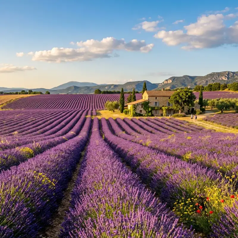
Bienvenue! Let us embark on an unforgettable #journey to the heart of #France. Provence is a geographical, cultural region and historical province of southeastern #France, which stretches from the left bank of the lower Rhône to the west to the Italian border to the east; it is bordered by the Mediterranean Sea to the south. It largely corresponds with the modern administrative region of Provence-Alpes-Côte d'Azur and includes the departments of Var, Bouches-du-Rhône, Alpes-de-Haute-Provence, as well as parts of Alpes-Maritimes and Vaucluse. The largest city of the region and its modern-day capital is Marseille. The Romans made the region the first Roman province beyond the Alps and called it Provincia Romana, which evolved into the present name. Until 1481 it was ruled by the counts of Provence from their capital in Aquae Sextiae (today Aix-en-Provence), then became a province of the kings of France. It also hosted the Avignon papacy in the middle ages, when the Pope and his Curia fled Rome. While the region has been part of France for more than 500 years, it still retains a distinct cultural and linguistic identity, particularly in the interior of the region. Etymology The region got its name in Roman times, when it was known as Provincia Romana, simply "the Roman province". This name eventually was shortened to Provincia (the province), and as the language evolved from Latin to Provençal, so did the pronunciation and spelling. #history Prehistoric Provence The coast of Provence has some of the earliest known sites of human habitation in Europe. Primitive stone tools dating back 1 to 1.05 million years BC have been found in the Grotte du Vallonnet near Roquebrune-Cap-Martin, between Monaco and Menton. More sophisticated tools, worked on both sides of the stone and dating to 600,000 BC, were found in the Cave of Escale at Saint-Estève-Janson; tools from 400,000 BC and some of the first fireplaces in Europe were found at Terra Amata in Nice. Tools dating to the Middle Paleolithic (300,000 BC) and Upper Paleolithic (30,000–10,000 BC) were discovered in the Observatory Cave, in the Jardin Exotique of Monaco. The Paleolithic period in Provence saw great changes in the climate. Two ice ages came and went, and the sea level changed dramatically. At the beginning of the Paleolithic, the sea level in western Provence was 150 meters higher than today. By the end of the Paleolithic, it had dropped to 100 to 150 meters below the sea level today. The cave dwellings of the early inhabitants of Provence were regularly flooded by the rising sea or left far from the sea and swept away by erosion. The changes in the sea level led to one of the most remarkable discoveries of signs of early man in Provence. In 1985, a diver named Henri Cosquer discovered the mouth of a submarine cave 37 metres below the surface of the Calanque de Morgiou near Marseille. The entrance led to a cave above sea level. Inside, the walls of the Cosquer Cave are decorated with drawings of bison, seals, auks, horses and outlines of human hands, dating to between 27,000 and 19,000 BC. The end of the Paleolithic and beginning of the Neolithic period saw the sea settle at its present level, a warming of the climate and the retreat of the forests. The disappearance of the forests and the deer and other easily hunted game meant that the inhabitants of Provence had to survive on rabbits, snails and wild sheep. In about 6000 BC, the Castelnovian people, living around Châteauneuf-les-Martigues, were among the first people in Europe to domesticate wild sheep, and to cease moving constantly from place to place. Once they settled in one place they were able to develop new industries. Inspired by pottery from the eastern Mediterranean, in about 6000 BC they created the first pottery made in France. Around 6000 BC, a wave of new settlers from the east, the Chasséens, arrived in Provence. They were farmers and warriors, and gradually displaced the earlier pastoral people from their lands. They were followed about 2500 BC by another wave of people, also farmers, known as the Courronniens, who arrived by sea and settled along the coast of what is now the Bouches-du-Rhône. Traces of these early civilisations can be found in many parts of Provence. A Neolithic site dating to about 6,000 BC was discovered in Marseille near the Saint-Charles railway station. and a dolmen from the Bronze Age (2500–900 BC) can be found near Draguignan. Ligures and Celts in Provence Between the 10th and 4th century BC, the Ligures were found in Provence from Massilia as far as modern Liguria. They were of uncertain origin; they may have been the descendants of the indigenous Neolithic peoples. According to Strabo, the Ligurians, living in proximity to numerous Celtic mountain tribes, were a different people (ἑτεροεθνεῖς), but "were similar to the Celts in their modes of life". They did not have their own alphabet, but their language remains in place names in Provence ending in the suffixes -asc, -osc, -inc, -ates, and -auni. The #ancient geographer Posidonius wrote of them: "Their country is savage and dry. The soil is so rocky that you cannot plant anything without striking stones. The men compensate for the lack of wheat by hunting... They climb the mountains like goats." They were also warlike; they invaded Italy and went as far as Rome in the 4th century BC, and they later aided the passage of Hannibal, on his way to attack Rome (218 BC). Traces of the Ligures remain today in the dolmens and other megaliths found in eastern Provence, in the primitive stone shelters called 'Bories' found in the Luberon and Comtat, and in the rock carvings in the Valley of Marvels near Mont Bégo in the Alpes-Maritimes, at an altitude of 2,000 meters. Between the 8th and 5th centuries BC, tribes of Celtic peoples, probably coming from Central Europe, also began moving into Provence. They had weapons made of iron, which allowed them to easily defeat the local tribes, who were still armed with bronze weapons. One tribe, called the Segobriga, settled near modern-day Marseille. The Caturiges, Tricastins, and Cavares settled to the west of the Durance river. Celts and Ligurians spread throughout the area and the Celto-Ligures eventually shared the territory of Provence, each tribe in its own alpine valley or settlement along a river, each with its own king and dynasty. They built hilltop forts and settlements, later given the Latin name oppidum. Today the traces of 165 oppida are found in the Var, and as many as 285 in the Alpes-Maritimes. They worshipped various aspects of #nature, establishing sacred woods at Sainte-Baume and Gemenos, and healing springs at Glanum and Vernègues. Later, in the 5th and 4th centuries BC, the different tribes formed confederations; the Voconces in the area from the Isère to the Vaucluse; the Cavares in the Comtat; and the Salyens, from the Rhône river to the Var. The tribes began to trade their local products, iron, silver, alabaster, marble, gold, resin, wax, honey and cheese; with their neighbours, first by trading routes along the Rhône river, and later Etruscan traders visited the coast. Etruscan amphorae from the 7th and 6th centuries BC have been found in Marseille, Cassis, and in hilltop oppida in the region. Greeks in Provence Traders from the island of Rhodes were visiting the coast of Provence in the 7th century BC. Rhodes pottery from that century has been found in Marseille, near Martigues and Istres, and at Mont Garou and Evenos near Toulon. The traders from Rhodes gave their names to the ancient town of Rhodanousia (Ancient Greek: 'Ροδανουσίαν) (now Trinquetaille, across the Rhône river from Arles), and to the main river of Provence, the Rhodanos, today known as the Rhône. The first permanent Greek settlement was Massalia, established at modern-day Marseille in about 600 BC by colonists coming from Phocaea (now Foça, on the Aegean coast of Asia Minor). A second wave of colonists arrived in about 540 BC, when Phocaea was destroyed by the Persians. Massalia became one of the major trading ports of the ancient world. At its height, in the 4th century BC, it had a population of about 6,000 inhabitants, living on about fifty hectares surrounded by a wall. It was governed as an aristocratic republic, by an assembly of the 600 wealthiest citizens. It had a large temple of the cult of Apollo of Delphi on a hilltop overlooking the port, and a temple of the cult of Artemis of Ephesus at the other end of the city. The Drachma coins minted in Massalia were found in all parts of Ligurian-Celtic Gaul. Traders from Massalia ventured inland deep into France on the Rivers Durance and Rhône, and established overland trade routes deep into Gaul, and to Switzerland and Burgundy, and as far north as the Baltic Sea. They exported their own products; local wine, salted pork and fish, aromatic and medicinal plants, coral and cork. The Massalians also established a series of small colonies and trading posts along the coast; which later became towns; they founded Citharista (La Ciotat); Tauroeis (Le Brusc); Olbia (near Hyères); Pergantion (Breganson); Caccabaria (Cavalaire); Athenopolis (Saint-Tropez); Antipolis (Antibes); Nikaia (Nice), and Monoicos (Monaco). They established inland towns at Glanum (Saint-Remy) and Mastrabala (Saint-Blaise). The most famous citizen of Massalia was the mathematician, astronomer and navigator Pytheas. Pytheas made mathematical instruments which allowed him to establish almost exactly the latitude of Marseille, and he was the first scientist to observe that the tides were connected with the phases of the moon. Between 330 and 320 BC he organised an expedition by ship into the Atlantic and as far north as England, and to visit Iceland, Shetland, and Norway. He was the first scientist to describe drift ice and the midnight sun. Though he hoped to establish a sea trading route for tin from Cornwall, his trip was not a commercial success, and it was not repeated. The Massalians found it cheaper and simpler to trade with Northern Europe over land routes. Roman Provence (2nd century BC to 5th century AD) In the 2nd century BC the people of Massalia appealed to Rome for help against the Ligures. Roman legions entered Provence three times; first in 181 BC the Romans suppressed Ligurian uprisings near Genoa; in 154 BC the Roman Consul Optimus defeated the Oxybii and the Deciates, who were attacking Antibes; and in 125 BC, the Romans put down an uprising of a confederation of Celtic tribes. After this battle, the Romans decided to establish permanent settlements in Provence. In 122 BC, next to the Celtic town of Entremont, the Romans built a new town, Aquae Sextiae, later called Aix-en-Provence. In 118 BC they founded Narbo (Narbonne). The Roman general Gaius Marius crushed the last serious resistance in 102 BC by defeating the Cimbri and the Teutons. He then began building roads to facilitate troop movements and commerce between Rome, Spain and Northern Europe; one from the coast inland to Apt and Tarascon, and the other along the coast from Italy to Spain, passing through Fréjus and Aix-en-Provence. In 49 BC, Massalia had the misfortune to choose the wrong side in the power struggle between Pompey and Julius Caesar. Pompey was defeated, and Massalia lost its territories and political influence. Roman veterans, in the meantime, populated two new towns, Arles and Fréjus, at the sites of older Greek settlements. In 8 BC the Emperor Augustus built a triumphal monument at La Turbie to commemorate the pacification of the region, and he began to Romanize Provence politically and culturally. Roman engineers and architects built monuments, theatres, baths, villas, fora, arenas and aqueducts, many of which still exist. (See #architecture of Provence.) Roman towns were built at Cavaillon; Orange; Arles; Fréjus; Glanum (outside Saint-Rémy-de-Provence); Carpentras; Vaison-la-Romaine; Nîmes; Vernègues; Saint-Chamas and Cimiez (above Nice). The Roman province, which was called Gallia Narbonensis, for its capital, Narbo (modern Narbonne), extended from Italy to Spain, from the Alps to the Pyrenees. The Pax Romana in Provence lasted until the middle of the 3rd century. Germanic tribes invaded Provence in 257 and 275. At the beginning the 4th century, the court of Roman Emperor Constantine (ca. 272–337) was forced to take refuge in Arles. By the end of the 5th century, Roman power in Provence had vanished, and an age of invasions, wars, and chaos began. Arrival of Christianity (3rd–6th centuries) There are many legends about the earliest Christians in Provence, but they are difficult to verify. It is documented that there were organised churches and bishops in the Roman towns of Provence as early as the 3rd and 4th centuries; in Arles in 254; Marseille in 314; Orange, Vaison and Apt in 314; Cavaillon, Digne, Embrun, Gap, and Fréjus at the end of the 4th century; Aix-en-Provence in 408; Carpentras, Avignon, Riez, Cimiez (today part of Nice) and Vence in 439; Antibes in 442; Toulon in 451; Senez in 406, Saint-Paul-Trois-Châteaux in 517; and Glandèves in 541. The oldest Christian structure still surviving in Provence is the baptistery of the Fréjus #cathedral, dating from the 5th century. At about the same time, the first two monasteries in Provence were founded: Lérins Abbey, on the island of Saint-Honorat near Cannes, and Abbey of St Victor in Marseille. Germanic invasions, Merovingians and Carolingians (5th–9th centuries) Beginning in the second half of the 5th century, as Roman power waned, successive waves of Germanic tribes entered Provence: first the Visigoths (480), then the Ostrogoths, then the Burgundians, finally, the Franks in the 6th century. Arab invaders and Berber pirates came from North Africa to the Coast of Provence in the early 7th century. During the late 7th and the early 8th centuries, Provence was formally subject to the Frankish kings of the Merovingian dynasty, but it was in fact ruled by its own regional nobility of Gallo-Roman stock, which ruled themselves according to Roman, not Frankish, law. The region actually enjoyed more prestige than the northern Franks had, but the local aristocracy feared Charles Martel's expansionist ambitions. In 737, Charles Martel headed down the Rhône Valley after subduing Burgundy. He attacked Avignon and Arles, garrisoned by the Umayyads, and came back in 739 to capture for a second time Avignon and chase the duke Maurontus to his stronghold of Marseille. The city was brought to heel and the duke had to flee to an island. The region was thereafter under the rule of Carolingian kings, descended from Charles Martel, and then was part of the #empire of Charlemagne (742–814). In 879, after the death of the Carolingian ruler Charles the Bald, Boso of Provence (also known as Boson), his brother-in-law, broke away from the Carolingian kingdom of Louis III and was elected the first ruler of an independent state of Provence. Fraxinet and the Counts of Provence (9th–13th centuries) During the Middle Ages, Provence was ruled by three successive dynasties of counts and became a focal point in the rivalries between the Crown of Aragon, the kings of Burgundy, the rulers of the Holy Roman Empire, and the Angevin kings of France. The Bosonids (879–1112), descendants of Boson, the first king of Provence, held the county in the early medieval period. His son, Louis the Blind (r. 890–928), lost his sight during his attempt to claim the Italian throne. He was succeeded in influence by his cousin Hugh of Italy (d. 947), who became duke of Provence and count of Vienne. Hugh transferred the capital from Vienne to Arles and recognised the overlordship of Rudolph II of Burgundy, making Provence a fief of Burgundy. In the 9th and 10th centuries, Provence was subject to invasions by Normans and Saracens (a term used in medieval sources for Muslim raiders). While the Normans withdrew, the Saracens established a permanent base at Fraxinet in 887. In 973 they captured Maieul, abbot of Cluny, prompting a coordinated response by local forces. Under Count William I, the Provençals defeated the Saracens at the Battle of Tourtour, near La Garde-Freinet. Surviving Saracens were either killed, enslaved, or left the region. Dynastic conflicts persisted. A dispute between Rudolph III of Burgundy and the German emperor Conrad II resulted in Provence becoming a fiefdom of the Holy Roman Empire in 1032, a status it retained until 1246. In 1112, Douce I, Countess of Provence, the last Bosonid heiress, married Ramon Berenguer III, Count of Barcelona, initiating the rule of the Barcelona dynasty in Provence. From 1112 to 1131 he governed as Count of Provence. Following the dynastic union of the County of Barcelona and the Kingdom of Aragon (1137), later known as the Crown of Aragon, Provençal succession passed to the House of Aragon, whose members ruled until 1246. The traditional coat of arms of Provence—four red vertical bars on a gold field—originates from this period of Aragonese rule. In 1125, Provence was divided: territories north and west of the Durance passed to the Count of Toulouse, while the lands between the Durance, the Mediterranean Sea, the Rhône, and the Alps remained under the counts of Provence. The capital shifted from Arles to Aix-en-Provence and later to Brignoles. Under the House of Aragon, the 12th century saw significant ecclesiastical construction in Provence in the Romanesque style, combining elements of the Gallo-Roman tradition of the Rhône valley with the Lombard style of the Alps. Aix Cathedral was built on the site of the Roman forum and later partially rebuilt in #gothic style. The Church of St. Trophime in Arles became a major Romanesque monument, while Montmajour Abbey developed into an important pilgrimage site. The 12th century also witnessed the foundation of major Cistercian monasteries in remote areas of Provence, including Sénanque Abbey (1148–1178) in the Luberon, Thoronet Abbey near Draguignan (1160), and Silvacane Abbey at La Roque-d'Anthéron (1175). In the 13th century, the French Capetian monarchy extended its influence into southern France through dynastic marriages. Alphonse, Count of Poitou, son of King Louis VIII, married Joan, Countess of Toulouse. King Louis IX married Marguerite of Provence. In 1246, Charles of Anjou, the youngest son of Louis VIII, married Beatrice of Provence, heiress to the county. Provence subsequently became linked to the Angevin dynasty and the Kingdom of Naples. The popes in Avignon (14th century) In 1309, Pope Clement V, who was originally from Bordeaux, moved the Papal Curia to Avignon, a period known as the Avignon Papacy. From 1309 until 1377, seven popes reigned in Avignon before the Schism between the Roman and Avignon churches, which led to the creation of rival popes in both places. After that, three antipopes reigned in Avignon until 1423, when the papacy finally returned to Rome. Between 1334 and 1363 the old and new Papal Palaces of Avignon were built by Popes Benedict XII and Clement VI respectively; together the Palais des Papes was the largest Gothic palace in Europe. The 14th century was a terrible time in Provence, and all of Europe: the population of Provence had been about 400,000 people; the Black Death (1348–1350) killed fifteen thousand people in Arles, half the population of the city, and greatly reduced the population of the whole region. The defeat of the French Army during the Hundred Years' War forced the cities of Provence to build walls and towers to defend themselves against armies of former soldiers who ravaged the countryside. The Angevin rulers of Provence also had a difficult time. An assembly of nobles, religious leaders, and town leaders of Provence was organised to resist the authority of Queen Joan I of Naples (1343–1382). She was murdered in 1382 by her cousin and heir, Charles of Durazzo, who started a new war, leading to the separation of Nice, Puget-Théniers and Barcelonnette from Provence in 1388, and their attachment to the County of Savoy. From 1388 up to 1526, the area acquired by the Savoy was known as Terres Neuves de Provence; after 1526 it officially took on the name County of Nice. Good King René, the last ruler of Provence The 15th century saw a series of wars between the kings of Aragon and the counts of Provence. In 1423 the army of Alphonse of Aragon captured Marseille, and in 1443 they captured Naples, and forced its ruler, King René I of Naples, to flee. He eventually settled in one of his remaining territories, Provence. History and legend has given René the title "Good King René of Provence", though he only lived in Provence in the last ten years of his life, from 1470 to 1480, and his political policies of territorial expansion were costly and unsuccessful. Provence benefitted from population growth and economic expansion, and René was a generous patron of the arts, sponsoring painters Nicolas Froment, Louis Bréa, and other masters. He also completed one of the finest castles in Provence at Tarascon, on the Rhône river. When René died in 1480, his title passed to his nephew Charles du Maine. One year later, in 1481, when Charles died, the title passed to King Louis XI. Provence was legally incorporated into the French royal domain in 1486. 1486 to 1789 Soon after Provence became part of France, it became involved in the Wars of Religion that swept the country in the 16th century. Between 1493 and 1501, many Jews were expelled from their homes and sought sanctuary in the region of Avignon, which was still under the direct rule of the Pope. In 1545, the Parlement of Aix-en-Provence ordered the destruction of the villages of Lourmarin, Mérindol, Cabriéres in the Luberon, because their inhabitants were Vaudois, of Italian Piedmontese origin, and were not considered sufficiently orthodox Catholics. Most of Provence remained strongly Catholic, though Protestants controlled the Principality of Orange, an enclave ruled by William of the House of Orange-Nassau of the Netherlands, who inherited it in 1544 and which was not incorporated into France until 1673. An army of the Catholic League laid siege to the Protestant town of Mėnerbes in the Vaucluse between 1573 and 1578. The wars did not stop until the end of the 16th century, with the consolidation of power in Provence by the Bourbon kings. The semi-independent Parliament of Provence in Aix and some of the cities of Provence, particularly Marseille, continued to rebel against the authority of the Bourbon king. After uprisings in 1630–31 and 1648–1652, the young King Louis XIV had two large forts, fort St. Jean and Fort St. Nicholas, built at the harbour entrance to control the city's unruly population. At the beginning of the 17th century, Cardinal Richelieu began to build a naval arsenal and dockyard at Toulon to serve as a base for a new French Mediterranean fleet. The base was greatly enlarged by Jean-Baptiste Colbert, the minister of Louis XIV, who also commissioned his chief military engineer Vauban to strengthen the fortifications around the city. At the beginning of the 17th century, Provence had a population of about 450,000 people. It was predominantly rural, devoted to raising wheat, wine, and olives, with small industries for tanning, pottery, perfume-making, and ship and boat building. Provençal quilts, made from the mid-17th century onwards, were successfully exported to England, Spain, Italy, Germany and the Netherlands. There was considerable commerce along the coast, and up and down the Rhône river. The cities: Marseille, Toulon, Avignon and Aix-en-Provence, saw the construction of boulevards and richly decorated private houses. At the beginning of the 18th century, Provence suffered from the economic malaise of the end of the reign of Louis XIV. The Great Plague of Marseille struck the region between 1720 and 1722, beginning in Marseille, killing some 40,000 people. Still, by the end of the century, many artisanal industries began to flourish; making perfumes in Grasse; olive oil in Aix and the Alpilles; textiles in Orange, Avignon and Tarascon; and faience pottery in Marseille, Apt, Aubagne, and Moustiers-Sainte-Marie. Many immigrants arrived from Liguria and the Piedmont in Italy. By the end of the 18th century, Marseille had a population of 120,000 people, making it the third largest city in France. During the French Revolution Most of Provence, with the exception of Marseille, Aix and Avignon, was rural, conservative and largely royalist, and the Revolution was as violent and bloody in Provence as it was in other parts of France. On 30 April 1790, Fort Saint-Nicolas in Marseille was besieged, and many of the soldiers inside were massacred. On 17 October 1791, a massacre of royalists and religious figures took place in the ice storage rooms (glacières) of the prison of the Palace of the Popes in Avignon. When the radical Montagnards seized power from the Girondins in May 1793, a real counter-revolution broke out in Avignon, Marseille and Toulon. A revolutionary army under General Carteaux recaptured Marseille in August 1793 and renamed it "City without a Name" (Ville sans Nom.) In Toulon, the opponents of the Revolution handed the city to a British and Spanish fleet on 28 August 1793. A Revolutionary Army laid siege to the British positions for four months (see the Siege of Toulon) and finally, the enterprise of the young commander of artillery, Napoleon Bonaparte defeated the British and drove them out in December 1793. About 15,000 royalists escaped with the British fleet, but five to eight hundred of the 7,000 who remained were shot on the Champ de Mars, and Toulon was renamed Port la Montagne. The fall of the Montagnards in July 1794 was followed by a new White Terror aimed at the revolutionaries. Calm was not restored until the rise of the Directory to power in 1795. Provence produced some memorable figures in the French Revolution; both moderates such as the comte de Mirabeau and figures of the far left such as the Marquis de Sade; there was also the military figure Charles Barbaroux and the theorist Emmanuel-Joseph Sieyès (1748–1836), who instigated the coup of 18 Brumaire which brought Napoleon to power. The revolutionary anthem La Marseillaise despite its origins on the Rhine got its name because revolutionary volunteers from Marseille sang it on the streets of #Paris. Under Napoleon Napoleon restored the belongings and power of the families of the Ancien Régime in Provence. The British fleet of Admiral Horatio Nelson blockaded Toulon, and almost all maritime commerce was stopped, causing hardship and poverty. When Napoleon was defeated, his fall was celebrated in Provence. When he escaped from Elba on 1 March 1815, and landed at Golfe-Juan, he detoured to avoid the cities of Provence, which were hostile to him, and therefore directed his small force directly to the northeast of it. 19th century Provence enjoyed prosperity in the 19th century; the ports of Marseille and Toulon connected Provence with the expanding French Empire in North Africa and the Orient, especially after the opening of the Suez Canal in 1869. In April–July 1859, Napoleon III made a secret agreement with Cavour, Prime Minister of Piedmont, for France to assist in expelling Austria from the Italian Peninsula and bringing about a united Italy, in exchange for Piedmont ceding Savoy and the Nice region to France. He went to war with Austria in 1859 and won a victory at Solferino, which resulted in Austria ceding Lombardy to France. France immediately ceded Lombardy to Piedmont, and, in return, Napoleon received Savoy and Nice in 1860, and Roquebrune-Cap-Martin and Menton in 1861. The railroad connected Paris with Marseille (1848) and then with Toulon and Nice (1864). Nice, Antibes and Hyères became popular winter resorts for European royalty, including Queen Victoria. Under Napoleon III, Marseille grew to a population of 250,000, including a very large Italian community. Toulon had a population of 80,000. The large cities like Marseille and Toulon saw the building of churches, opera houses, grand boulevards, and parks. After the fall of Louis Napoleon following the defeat in the Franco-Prussian War, barricades went up in the streets of Marseille (23 March 1871) and the Communards, led by Gaston Cremieux and following the lead of the Paris Commune, took control of the city. The Commune was crushed by the army and Cremieux was executed on 30 November 1871. Though Provence was generally conservative, it often elected reformist leaders; Prime Minister Léon Gambetta was the son of a Marseille grocer, and future prime minister Georges Clemenceau was elected deputy of Var in 1885. The second half of the 19th century saw a revival of the Provençal language and #culture, particularly traditional rural values. driven by a movement of writers and poets called the Félibrige, led by poet Frédéric Mistral. Mistral achieved literary success with his poem Mirèio (Mireille in French); he was awarded the Nobel Prize for literature in 1904. 20th century Between World War I and World War II, Provence was bitterly divided between the more conservative rural areas and the more radical big cities. There were widespread strikes in Marseille in 1919, and riots in Toulon in 1935. After the defeat of France by Germany in June 1940, France was divided into an occupied zone and unoccupied zone, with Provence in the unoccupied zone. Parts of eastern Provence were occupied by Italian soldiers. Collaboration and passive resistance gradually gave way to more active resistance, particularly after Nazi Germany invaded the Soviet Union in June 1941 and the Communist Party became active in the resistance. Jean Moulin, the deputy of Charles de Gaulle, the leader of the Free France resistance movement, was parachuted into Eygalières, in the Bouches-du-Rhône on 2 January 1942 to unite the diverse resistance movements in all of France against the Germans. In November 1942, following Allied landings in North Africa (Operation Torch), the Germans occupied all of Provence (Operation Attila) and then headed for Toulon (Case Anton). The French fleet at Toulon sabotaged its own ships to keep them from falling into German hands. The Germans began a systematic rounding-up of French Jews and refugees from Nice and Marseille. Many thousands were taken to concentration camps, and few survived. A large quarter around the port of Marseille was emptied of inhabitants and dynamited, so it would not serve as a base for the resistance. Nonetheless, the resistance grew stronger; the leader of the pro-German militia, the Milice, in Marseille was assassinated in April 1943. On 15 August 1944, two months after the Allied landings in Normandy (Operation Overlord), the Seventh United States Army under General Alexander Patch, with a Free French corps under General Jean de Lattre de Tassigny, landed on the coast of Var between St. Raphael and Cavalaire (Operation Dragoon). The American forces moved north toward Manosque, Sisteron and Gap, while the French First Armored Division under General Vigier liberated Brignoles, Salon, Arles, and Avignon. The Germans in Toulon resisted until 27 August, and Marseille was not liberated until 25 August. After the end of the war, Provence faced an enormous task of reconstruction, particularly of the ports and railroads destroyed during the war. As part of this effort, the first modern concrete apartment block, the Unité d'habitation of Le Corbusier, was built in Marseille in 1947–52. In 1962, Provence absorbed a large number of French citizens who left Algeria after its independence. Since that time, large North African communities settled in and around the big cities, particularly Marseille and Toulon. In the 1940s, Provence underwent a cultural renewal, with the founding of the Avignon Festival of theatre (1947), the reopening of the Cannes Film Festival (begun in 1939), and many other major events. With the building of new highways, particularly the Paris Marseille autoroute which opened in 1970, Provence became destination for mass tourism from all over Europe. Many Europeans, particularly from Britain, bought summer houses in Provence. The arrival of the TGV high-speed trains shortened the trip from Paris to Marseille to less than four hours. In recent years, residents of Provence have struggled to reconcile economic development and population growth with their desire to preserve the region's unique landscape and culture. Geography The original Roman province was called Gallia Transalpina, then Gallia Narbonensis, or simply Provincia Nostra ('Our Province') or Provincia. It extended from the Alps to the Pyrenees and north to the Vaucluse, with its capital in Narbo Martius (present-day Narbonne). Location and borders In the 15th century, the County of Provence was bordered by the river Var on the east and the Rhône to the west, with the Mediterranean to the south, and a northern border that roughly followed the Durance. Bordering it on the northwest were two territories that had earlier formed part of Provence, i.e., the Comtat Venaissin, centered on Avignon which was ruled by the pope from the 13th century until the French Revolution, and, just north of this, the Principality of Orange, that through inheritance became a possession of William the Silent, who became the founder of the present ruling house of the Netherlands, the House of Orange-Nassau. The principality was independent between the 12th century and 1673 when it was occupied and then annexed by Louis XIV during one of his wars with its prince, Dutch stadtholder William III, the future king of England. At the end of the 14th century, another piece of Provence along the Italian border, including Nice and the lower Alps, was detached from Provence and attached to the lands of the duke of Savoy. The lower Alps were re-attached to France after the Treaty of Utrecht in 1713, but Nice did not return to France until 1860, during the reign of Napoleon III. The administrative region of Provence-Alpes-Cote d'Azur was created in 1982. It included Provence, plus the territory of the Comtat Venaissin around Avignon, and the Principality of Orange, the eastern portion of the Dauphiné, and the former County of Nice. The area immediately to the north, in the Drome, is sometimes referred to as the fr:Drôme Provençale, given its very similar features and landscapes. Rivers The Rhône river, on the western border of Provence, is one of the major rivers of France, and has been a highway of commerce and communications between inland France and the Mediterranean for centuries. It rises as the effluent of the Rhône Glacier in Valais, Switzerland, in the Saint-Gotthard massif, at an altitude of 1753 m. It is joined by the river Saône at Lyon. Along the Rhône Valley, it is joined on the right bank by the rivers Eyrieux, Ardèche, Cèze and Gardon (or Gard), on the left Alps bank by rivers Isère, Drôme, Ouvèze and Durance. At Arles, the Rhône divides itself in two arms, forming the Camargue delta, with all branches flowing into the Mediterranean Sea. One arm is called the "Grand Rhône"; the other one is the "Petit Rhône". The Durance river, a tributary of the Rhône, has its source in the Alps near Briançon. It flows south-west through Embrun, Sisteron, Manosque, Cavaillon, and Avignon, where it meets the Rhône. The Verdon River is a tributary of the Durance, rising at an altitude of 2,400 metres in the southwestern Alps near Barcelonette, and flowing southwest for 175 kilometres through the departments of Alpes-de-Haute-Provence and Var before it reaches the Durance at near Vinon-sur-Verdon, south of Manosque. The Verdon is best known for its canyon, the Verdon Gorge. This limestone canyon, also called the 'Grand Canyon of Verdon', 20 kilometres in length and more than 300 metres deep, is a popular climbing and sight-seeing area. The Var River rises near the Col de la Cayolle (2,326 m; 7,631 ft) in the Maritime Alps and flows generally southeast for 120 kilometres (75 mi) into the Mediterranean between Nice and Saint-Laurent-du-Var. Before Nice was returned to France in 1860, the Var marked the eastern border of France along the Mediterranean. The Var is the unique case in France of a river giving a name to a department, but not flowing through that department (due to subsequent adjustments to the department's boundaries). Camargue With an area of over 930 km2 (360 sq mi), Camargue is western Europe's largest river delta (technically an island, as it is wholly surrounded by water). It is a vast plain comprising large brine lagoons or étangs, cut off from the sea by sandbars and encircled by reed-covered marshes which are in turn surrounded by a large cultivated area. It is home to more than 400 species of birds, the brine ponds providing one of the few European habitats for the greater flamingo. Mountains By considering the Maritime Alps, along the border with Italy, as a part of the cultural Provence, they constitute the highest elevations of the region (the Punta dell'Argentera has an elevation of 3,297 m). They form the border between the French département Alpes-Maritimes and the Italian province of Cuneo. Mercantour National Park is located in the Maritime Alps. On the other hand, if the département Hautes Alpes is also considered as part of the modern Provence, then the alpin Écrins mountains represent the highest elevations of the region with the Barre des Écrins culminating at 4102m. Outside of the Maritime Alps, Mont Ventoux (Occitan: Ventor in classical norm or Ventour in Mistralian norm), at 1,909 metres (6,263 ft), is the highest peak in Provence. It is located some 20 km north-east of Carpentras, Vaucluse. On the north side, the mountain borders the Drôme département. It is nicknamed the "Giant of Provence", or "The Bald Mountain". Although geologically part of the Alps, is often considered to be separate from them, due to the lack of mountains of a similar height nearby. It stands alone to the west of the Luberon range, and just to the east of the Dentelles de Montmirail, its foothills. The top of the mountain is bare limestone without vegetation or trees. The white limestone on the mountain's barren peak means it appears from a distance to be snow-capped all year round (its snow cover actually lasts from December to April). The Alpilles are a chain of small mountains located about 20 kilometres (12 mi) south of Avignon. Although they are not particularly high – only some 387 metres (1,270 ft) at their highest point – the Alpilles stand out since they rise abruptly from the plain of the Rhône valley. The range is about 25 km long by about 8 to 10 km wide, running in an east–west direction between the Rhône and Durance rivers. The landscape of the Alpilles is one of arid limestone peaks separated by dry valleys. Montagne Sainte-Victoire is probably the best-known mountain in Provence, thanks to the painter Paul Cézanne, who could see it from his home, and painted it frequently. It is a limestone mountain ridge which extends over 18 kilometres between the départements of Bouches-du-Rhône and Var. Its highest point is the Pic des mouches at 1,011 m. The Massif des Maures (Moor Mountains) is a small chain of mountains that lies along the coast of the Mediterranean in the department of Var, between Hyères et Fréjus. Its highest point is the signal de la Sauvette, 780 metres high. The name is a souvenir of the Moors (Maures in Old French), Arabs and Berbers from North Africa, who settled on the coast of Provence in the 9th and 10th centuries. The Massif des Maures extends about sixty kilometres along the coast, and reaches inland about thirty kilometres. On the north it is bordered by a depression which is followed by the routes nationales 97 and 7, and the railroad line between Toulon and Nice. On the south it ends abruptly at the Mediterranean, forming a broken and abrupt coastline. The peninsula of Saint-Tropez is part of the Massif des Maures, along with the Giens Peninsula and the islands offshore of Hyères; Porquerolles, Port-Cros, and île du Levant. Cape Sicié, west of Toulon, as well as the Massif de Tanneron, belong geologically to the Massif des Maures. The Calanques The Calanques form a dramatic feature of the Provence coast, a 20-km long series of narrow inlets in the cliffs of the coastline between Marseille on the west and Cassis on the east. The best known examples of this formation can be found in the Massif des Calanques. The highest peak in the massif is Mont Puget, 565 metres high. The best known calanques of the Massif des Calanques include the Calanque de Sormiou, the Calanque de Morgiou, the Calanque d'En-Vau, the Calanque de Port-Pin and the Calanque de Sugiton. The calanques are remains of ancient river mouths formed mostly during Tertiary. Later, during Quaternary glaciation, as glaciers swept by, they further deepened those valleys which would eventually (at the end of the last glaciation) be invaded by the sea and become calanques. The Cosquer cave is an underwater grotto in the Calanque de Morgiou, 37 metres (121 ft) underwater, that was inhabited during Paleolithic era, when the sea level was much lower than today. Its walls are covered with paintings and engravings dating back to between 27,000 and 19,000 BC, depicting animals such as bison, ibex, and horses, as well as sea mammals such as seals, and at least one bird, the auk. Landscapes The garrigue is the typical landscape of Provence; it is a type of low, soft-leaved scrubland or chaparral found on limestone soils around the Mediterranean Basin, generally near the seacoast, where the climate is moderate, but where there are annual summer drought conditions. Juniper and stunted holm oaks are the typical trees; aromatic lime-tolerant shrubs such as lavender, sage, rosemary, wild thyme and Artemisia are common garrigue plants. The open landscape of the garrigue is punctuated by dense thickets of Kermes oak. Climate Most of Provence has a Mediterranean climate, characterised by hot, dry summers, mild winters, little snow, and abundant sunshine. Within Provence there are micro-climates and local variations, ranging from the Alpine climate inland from Nice to the continental climate in the northern Vaucluse. The winds of Provence are an important feature of the climate, particularly the mistral, a cold, dry wind which, especially in the winter, blows down the Rhône Valley to the Bouches-du-Rhône and the Var Departments, and often reaches over one hundred kilometres an hour. Bouches-du-Rhône Marseille, in the Bouches-du-Rhône, has an average of 59 days of rain a year, though when it does rain the rain is often torrential; the average annual rainfall is 544.4 mm. It snows an average of 2.3 days a year, and the snow rarely remains long. Marseille has an average of 2835.5 hours of sunshine a year. The average minimum temperature in January is 2.3 °C., and the average maximum temperature in July is 29.3 °C. The mistral blows an average of one hundred days a year. Var Toulon and Var, which includes St. Tropez and Hyères, have a climate slightly warmer, dryer and sunnier than Nice and the Alpes-Maritime, but also less sheltered from the wind. Toulon has an average of 2899.3 hours of sunshine a year, making it the sunniest city in metropolitan France, The average maximum daily temperature in August is 29.1 °C., and the average daily minimum temperature in January is 5.8 °C. The average annual rainfall is 665 mm, with the most rain from October to November. Strong winds blow an average of 118 days a year in Toulon, compared with 76 days at Fréjus further east. The strongest Mistral wind recorded in Toulon was 130 kilometres an hour. Alpes-Maritimes Nice and the Alpes-Maritimes department are sheltered by the Alps, and are the most protected part of the Mediterranean coast. The winds in this department are usually gentle, blowing from the sea to the land, though sometimes the mistral blows strongly from the northwest, or, turned by the mountains, from the east. In 1956, a mistral wind from the northwest reached the speed of 180 kilometres an hour at Nice airport. Sometimes in summer the sirocco brings high temperatures and reddish desert sand from Africa (see Winds of Provence). Rainfall is infrequent, 63 days a year, but can be torrential, particularly in September, when storms and rain are caused by the difference between the colder air inland and the warm Mediterranean water temperature (20–24 degrees C.). The average annual rainfall in Nice is 767 mm, more than in Paris, but concentrated in fewer days. Snow is extremely rare, usually falling once every ten years. 1956 was a very exceptional year, when 20 centimetres of snow blanketed the coast. In January 1985 the coast between Cannes and Menton received 30 to 40 centimetres of snow. In the mountains, the snow is present from November to May. Nice has an annual average of 2694 hours of sunshine. The average maximum daily temperature in Nice in August is 28 °C., and the average minimum daily temperature in January is 6 °C. Alpes-de-Haute-Provence The department of Alpes-de-Haute-Provence has a Mediterranean climate in the lower valleys under one thousand metres in altitude and an alpine climate in the high valleys, such as the valleys of the Blanche, the Haut Verdon and the Ubaye, which are over 2500 metres high. The alpine climate in the higher mountains is moderated by the warmer air from the Mediterranean. Haute-Provence has unusually high summer temperatures for its altitude and latitude (44 degrees north). The average summer temperature is 22 to 23 °C. at an altitude of 400 metres, and 18 to 19 °C. at the altitude of 1000 metres; and the winter average temperature is 4 to 5 °C. at 400 metres and 0 C. at 1000 metres. The lower valleys have 50 days of freezing temperatures a year, more in the higher valleys. Sometimes the temperatures in the high valleys can reach −30 °C. Because of this combination of high mountains and Mediterranean air, it is not unusual that the region frequently has some of the lowest winter temperatures and some of the hottest summer temperatures in France. Rainfall in Haute-Provence is infrequent – 60 to 80 days a year – but can be torrential; 650 to 900 mm. a year in the foothills and plateaus of the southwest, and in the valley of the Ubaye; and 900 to 1500 mm. in the mountains. Most rainfall comes in the autumn, in brief and intense storms; from mid-June to mid-August, rain falls during brief but violent thunderstorms. Thunder can be heard 30 to 40 days a year. Snow falls in the mountains from November to May, and in midwinter can be found down to altitude of 1000–1200 metres on the shady side of the mountains and 1300 to 1600 metres on the sunny side. Snowfalls are usually fairly light, and melt rapidly. The mistral, a wind blowing from the north and the northwest, is a feature of the climate in the western part of the department, bringing clear and dry weather. The eastern part of the department is more protected from the mistral. A southerly wind known as the marin brings warm air, clouds and rain. Haute-Provence is one of the sunniest regions of France, with an average of between 2,550 and 2,650 hours of sunshine annually in the north of the department, and 2,700 to 2,800 hours in the southwest. The clear nights and sunny days cause a sharp difference between nighttime and daytime temperatures. Because of the clear nights, the region is home of important observatories, such as the Observatory of Haute-Provence in Saint-Michel-Observatoire near Forcalquier. Vaucluse Vaucluse is the meeting point of three of the four different climatic zones of France; it has a Mediterranean climate in the south, an alpine climate in the northeast, around the mountains of Vaucluse and the massif of the Baronnies; and a continental climate in the northwest. The close proximity of these three different climates tends to moderate all of them, and the Mediterranean climate usually prevails. Orange in the Vaucluse has 2595 hours of sunshine a year. It rains an average of 80 days a year, for a total of 693.4 mm a year. The maximum average temperature in July is 29.6 °C., and the average minimum temperature in January is 1.3 °C. There are an average of 110 days of strong winds a year. Culture Art Artists have been painting in Provence since prehistoric times; paintings of bisons, seals, auks and horses dating to between 27,000 and 19,000 BC were found in the Cosquer Cave near Marseille. The 14th-century wooden ceiling of the cloister of Fréjus Cathedral has a remarkable series of paintings of biblical scenes, fantastic animals, and scenes from daily life, painted between 1350 and 1360. They include paintings of a fallen angel with the wings of a bat, a demon with the tail of a serpent, angels playing instruments, a tiger, an elephant, an ostrich, domestic and wild animals, a mermaid, a dragon, a centaur, a butcher, a knight, and a juggler. Nicolas Froment (1435–1486) was the most important painter of Provence during the Renaissance, best known for his triptych of the Burning Bush (c. 1476), commissioned by King René I of Naples. The painting shows a combination of Moses, the Burning Bush, and the Virgin Mary "who gave birth but remained a virgin", just as the bush of Moses "-burned with fire, and the bush was not consumed". This is the explication according to a plaque in the cathedral. A more likely reason for the juxtaposition is that in 1400 a shepherd, or shepherds, discovered a miraculous statue of the Virgin and Child inside another burning bush (thorn bush specifically), in the village of L'Epine in the present day department of La Marne. The site and statue were later visited by the "Bon Roi René". The wings of the triptych show King René with Mary Magdalene, St. Anthony and St. Maurice on one side, and Queen Jeanne de Laval, with Saint Catherine, John the Evangelist, and Saint Nicholas on the other. Louis Bréa (1450–1523) was a 15th-century painter, born in Nice, whose work is found in churches from Genoa to Antibes. His Retable of Saint-Nicholas (1500) is found in Monaco, and his Retable de Notre-Dame-de-Rosaire (1515) is found in Antibes. Pierre Paul Puget (1620–1694), born in Marseille, was a painter of portraits and religious scenes, but was better known for his sculptures, found in Toulon Cathedral, outside the Hôtel de Ville of Toulon, and in the Louvre. There is a mountain named for him near Marseille, and a square in Toulon. In the 19th and 20th centuries, many of the most famous painters in the world converged on Provence, drawn by the climate and the clarity of the light. The special quality of the light is partly a result of the Mistral (wind), which removes dust from the atmosphere, greatly increasing visibility. Adolphe Monticelli (1824–1886) was born in Marseille, moved to Paris in 1846 and returned to Marseille in 1870. His work influenced Vincent van Gogh who greatly admired him. Paul Cézanne (1839–1906) was born in Aix-en-Provence, and lived and worked there most of his life. The local landscapes, particularly Montagne Sainte-Victoire, featured often in his work. He also painted frequently at L'Estaque. Vincent van Gogh (1853–1890) lived little more than two years in Provence, but his fame as a painter is largely a result of what he painted there. He lived in Arles from February 1888 to May 1889, and then in Saint-Remy from May 1889 until May 1890. Auguste Renoir (1841–1919) visited Beaulieu, Grasse, Saint Raphael and Cannes, before finally settling in Cagnes-sur-Mer in 1907, where he bought a farm in the hills and built a new house and workshop on the grounds. He continued to paint there until his death in 1919. His house is now a museum. Henri Matisse (1869–1954) first visited St. Tropez in 1904. In 1917 he settled in Nice, first at the Hotel Beau Rivage, then the Hotel de la Mediterranée, then la Villa des Allies in Cimiez. In 1921 he lived in an apartment at 1 Place Felix Faure in Nice, next to the flower market and overlooking the sea, where he lived until 1938. He then moved to the Hotel Regina in the hills of Cimiez, above Nice. During World War II he lived in Vence, then returned to Cimiez, where he died and is buried. Pablo Picasso (1881–1973) spent each summer from 1919 to 1939 on the Côte d'Azur, and moved there permanently in 1946, first at Vallauris, then at Mougins, where he spent his last years. Pierre Bonnard (1867–1947) retired to and died at Le Cannet. Georges Braque (1882–1963) painted frequently at L'Estaque between 1907 and 1910. Henri-Edmond Cross (1856–1910) discovered the Côte d'Azur in 1883 and painted at Monaco and Hyères. Maurice Denis (1870–1943) painted at St. Tropez and Bandol. André Derain (1880–1954) painted at L'Estaque and Martigues. Raoul Dufy (1877–1953), whose wife was from Nice, painted in Forcalquier, Marseille and Martigues. Albert Marquet (1873–1947) painted at Marseille, St. Tropez and L'Estaque. Claude Monet (1840–1927) visited Menton, Bordighera, Juan-les-Pins, Monte Carlo, Nice, Cannes, Beaulieu and Villefranche, and painted a number of seascapes of Cap Martin, near Menton, and at Cap d'Antibes. Edvard Munch (1863–1944) visited and painted in Nice and Monte Carlo (where he developed a passion for gambling), and rented a villa at Saint-Jean-Cap-Ferrat in 1891. Paul Signac (1863–1935) visited St. Tropez in 1892, and bought a villa, La Hune, at the foot of citadel in 1897. It was at his villa that his friend, Henri Matisse, painted his famous Luxe, Calme et Volupté" in 1904. Signac made numerous paintings along the coast. Pierre Deval (1897–1993), a French modernist and figurative painter, lived and worked at the Domaine d'Orvès in La Valette-du-Var from 1925 until his death in 1993. Nicolas de Staël (1914–1955) lived in Nice and Antibes. Yves Klein (1928–1962), a native of Nice, is considered an important figure in post-war European art. Sacha Sosno (1937–2013) is a French painter and sculptor living and working in Nice. Source and Bibliography about artists on the Mediterranean Méditerranée de Courbet á Matisse, catalogue of the exhibit at the Grand Palais, Paris from September 2000 to January 2001. Published by the Réunion des musées nationaux, 2000. Architecture Literature Historically, the language spoken in Provence was Provençal, a dialect of the Occitan language, also known as langue d'oc, and closely related to Catalan. There are several regional variations: vivaro-alpin, spoken in the Alps, and the Provençal variations of south, including the maritime, the rhoadanien (in the Rhône Valley) and the Niçois (in Nice). Niçois is the archaic form of Provençal closest to the original language of the troubadours, and is sometimes to said to be literary language of its own. Provençal was widely spoken in Provence until the beginning of the 20th century, when the French government launched an intensive and largely successful effort to replace regional languages with French. Today, Provençal is taught in schools and universities in the region, but is spoken regularly by a small number of people, probably less than 500,000, mostly elderly. Writers and poets in the Occitan language The golden age of Provençal literature, more correctly called Occitan literature, was the 11th century and the 12th century, when the troubadours broke away from classical Latin literature and composed romances and love songs in their own vernacular language. Among the most famous troubadours was Folquet de Marselha, whose love songs became famous all over Europe, and who was praised by Dante in his Divine Comedy. In his later years, Folquet gave up poetry to become the Abbot of Thoronet Abbey, and then Bishop of Toulouse, where he fiercely persecuted the Cathars. In the middle of the 19th century, there was a literary movement to revive the language, called the Félibrige, led by the poet Frédéric Mistral (1830–1914), who shared the Nobel Prize for Literature in 1904. Provençal writers and poets who wrote in Occitan include: Raimbaut de Vaqueiras (1180–1207) Louis Bellaud (1543–1588) Théodore Aubanel (1829–1886) Joseph d'Arbaud (1874–1950) Robert Lafont (1923–2009) French authors Alphonse Daudet (1840–1897) was the best-known French writer from Provence in the 19th century, though he lived mostly in Paris and Champrosay. He was best known for his Lettres de mon moulin (Letters from My Windmill) (1869) and the Tartarin of Tarascon trilogy (1872, 1885, 1890). His short story L'Arlésienne (1872) was made into a three-act play with incidental music by Georges Bizet. Marcel Pagnol (1895–1970), born in Aubagne, is known both as a filmmaker and for his stories of his childhood, Le Château de ma Mère, La Gloire de mon Père, and Le Temps des secrets. He was the first filmmaker to become a member of the Académie Française in 1946. Colette (Sidonie-Gabrielle Colette) (1873–1954), although she was not from Provence, became particularly attached to Saint-Tropez. After World War II, she headed a committee which saw that the village, badly damaged by the war, was restored to its original beauty and character Jean Giono (1895–1970), born in Manosque, wrote about peasant life in Provence, inspired by his imagination and by his vision of ancient Greece. Paul Arène (1843–1896), born in Sisteron, wrote about life and the countryside around his home town. Émigrés, exiles, and expatriates In the 19th and 20th centuries, the climate and lifestyle of Provence attracted writers almost as much as it attracted painters. It was particularly popular among British, American and Russian writers in the 1920s and 1930s. Edith Wharton (1862–1937), bought Castel Sainte-Claire in 1927, on the site of a former convent in the hills above Hyères, where she lived during the winters and springs until her death in 1937. F. Scott Fitzgerald (1896–1940) and his wife Zelda first visited the Riviera in 1924, stopping at Hyères, Cannes and Monte Carlo, eventually staying at St. Raphaël, where he wrote much of The Great Gatsby and began Tender is the Night. Ivan Bunin (1870–1953), the first Russian writer to win the Nobel Prize for Literature, went to France after the Russian Revolution, set several of his short stories on the Côte d'Azur, and had a house in Grasse. Somerset Maugham (1874–1965) bought a house, the Villa Mauresque, in Saint-Jean-Cap-Ferrat in 1928, and, except for the years of World War II, spent much of his time there until his death. Other English-speaking writers who live in or have written about Provence include: Peter Mayle Carol Drinkwater John Lanchester Willa Cather Charles Spurgeon (who spent long periods in Menton) Katherine Mansfield Lawrence Durrell Scientists, scholars and prophets Pytheas (4th century BCE) was a geographer and mathematician who lived in the Greek colony of Massalia, now Marseille. He conducted an expedition by sea north around Great Britain to Iceland, and was the first to describe the midnight sun and polar regions. Petrarch (1304–1374) was an Italian poet and scholar, considered the father of humanism and one of the first great figures of Italian literature. He spent much of his early life in Avignon and Carpentras as an official at the Papal court in Avignon, and wrote a famous account of his ascent of Mount Ventoux near Carpentras. Nostradamus (1503–1566), a Renaissance apothecary and reputed clairvoyant best known for his alleged prophecies of great world events, was born in Saint-Remy-de-Provence and lived and died in Salon-de-Provence. Music Music written about Provence includes: "Di Provenza il mar, il suol", an aria for baritone from La traviata (Act 2) by Giuseppe Verdi The opera Mireille by Charles Gounod, after Frédéric Mistral's poem Mirèio Georges Bizet' L'Arlésienne, incidental music to Alphonse Daudet's eponymous play L'Arlesiana, an opera by Francesco Cilea, based on the play L'Arlésienne by Alphonse Daudet Darius Milhaud: Le Carnaval d'Aix, Suite provençale, La Cheminée du roi René, Suite française (5. Provence), Ouverture méditerranéenne The Tableaux de Provence (Pictures of Provence), a suite for alto saxophone and orchestra composed by Paule Maurice Eugène Reuchsel: Promenades en Provence, Huit Images de Provence, for organ The Suite Provençale for concert band by Jan Van der Roost Two song settings of Vladimir Nabokov's poem "Provence" in Russian and English versions by composers Ivan Barbotin and James DeMars on the 2011 contemporary classical album Troika Cinema Provence has a special place in the history of the motion picture – one of the first projected motion pictures, L'Arrivée d'un train en gare de La Ciotat (The Arrival of a Train into La Ciotat Station), a fifty-second silent film, was made by Auguste and Louis Lumière at the train station of the coastal town of La Ciotat. It was shown to an audience in Paris on 28 December 1895, causing a sensation. Before its commercial premiere in Paris, the film was shown to invited audiences in several French cities, including La Ciotat. It was shown at the Eden Theater in September 1895, making that theatre one of the first motion picture theatres, and the only of the first theatres still showing movies in 2009. Three other of the earliest Lumiere films, Partie de cartes, l'Arroseur arrosé (the first known filmed comedy), and Repas de bébé, were also filmed in La Ciotat in 1895, at the Villa du Clos des Plages, the summer residence of the Lumière Brothers. Parks and gardens Cuisine The cuisine of Provence is the result of the warm, dry Mediterranean climate; the rugged landscape, good for grazing sheep and goats but, outside of the Rhône Valley, poor soil for large-scale agriculture; and the abundant seafood on the coast. The basic ingredients are olives and olive oil, garlic, sardines, rockfish, sea urchins and octopus, lamb and goat, chickpeas, and local fruits, such as grapes, peaches, apricots, strawberries, cherries, and the famous melons of Cavaillon. The fish frequently found on menus in Provence are the rouget, a small red fish usually eaten grilled, and the loup (known elsewhere in France as the bar), often grilled with fennel over the wood of grapevines. Aïoli is a thick emulsion sauce made from olive oil flavoured with crushed garlic. It often accompanies a bourride, a fish soup, or is served with potatoes and cod (fr. Morue). There are many recipes. Bouillabaisse is the classic seafood dish of Marseille. The traditional version is made with three fish: scorpionfish, sea robin, and European conger, plus an assortment of other fish and shellfish, such as John Dory, monkfish, sea urchins, crabs and sea spiders included for flavour. The seasoning is as important as the fish, including salt, pepper, onion, tomato, saffron, fennel, sage, thyme, bay laurel, sometimes orange peel, and a cup of white wine or cognac. In Marseille the fish and the broth are served separately—the broth is served over thick slices of bread with rouille (see below). Brandade de morue is a thick purée of salt cod, olive oil, milk, and garlic, usually spread on toast. Daube provençale is a stew made with cubed beef braised in wine, vegetables, garlic, and herbes de provence. Variations also call for olives, prunes, and flavouring with duck fat, vinegar, brandy, lavender, nutmeg, cinnamon, cloves, juniper berries, or orange peel. For best flavour, it is cooked in several stages, and cooled for a day between each stage to allow the flavours to meld together. In the Camargue area of France, bulls killed in the bullfighting festivals are sometimes used for daube. Fougasse is the traditional bread of Provence, round and flat with holes cut out by the baker. Modern versions are baked with olives or other fillings inside. It is roughly equivalent to focaccia. Pissaladière is another speciality of Nice. Though it resembles a pizza, it is made with bread dough and the traditional variety never has a tomato topping. It is usually sold in bakeries, and is topped with a bed of onions, lightly browned, and a kind of paste, called pissalat, made from sardines and anchovies, and the small black olives of Nice, of the Cailletier or Taggiasca variety, also found in Liguria. Ratatouille is a traditional dish of stewed vegetables, which originated in Nice. Panisse is a dish made of chickpea flour, which is boiled into a paste, cooled and set into a mould, and then fried. It is not dissimilar to socca. Rouille is a mayonnaise with red pimentos, often spread onto bread and added to fish soups. Tapenade is a relish consisting of pureed or finely chopped olives, capers, and olive oil, usually spread onto bread and served as an hors d'œuvre. The Thirteen desserts is a Christmas tradition in Provence, when thirteen different dishes, representing Jesus and the twelve apostles, and each with a different significance, are served after the large Christmas meal. Herbes de Provence (or Provençal herbs) are a mixture of fresh or dried herbs from Provence which are commonly used in Provençal cooking. =### Wines= The wines of Provence were probably introduced into Provence around 600 BC by the Greek Phoceans who founded Marseille and Nice. After the Roman occupation, in 120 BC the Roman Senate forbade the growing of vines and olives in Provence, to protect the profitable trade in exporting Italian wines, but in the late Roman empire retired soldiers from Roman Legions settled in Provence and were allowed to grow grapes. The Romans complained about the competition from and poor quality of the wines of Provence. In the 1st century AD the Roman poet Martial condemned the wines of Marseille as "terrible poisons, and never sold at a good price." As recently as the 1970s the wines of Provence had the reputation of being rather ordinary: In 1971 wine critic Hugh Johnson wrote: "The whites are dry and can lack the acidity to be refreshing; the reds are straightforward, strong and a trifle dull; it is usually the rosés, often orange-tinted, which have most appeal." He added, "Cassis and Bandol distinguish themselves for their white and red wines respectively. Cassis (no relation of the blackcurrant syrup) is livelier than the run of Provençal white wine, and Bandol leads the red in much the same way." Since that time, cultivation of poorer varieties has been reduced and new technologies and methods have improved the quality considerably. The wines of Provence are grown under demanding conditions; hot weather and abundant sunshine (Toulon, near Bandol, has the most sunshine of any city in France) which ripens the grapes quickly; little rain, and the mistral. The great majority of the wines produced in Provence are rosés. The most characteristic grape is mourvèdre, used most famously in the red wines of Bandol. Cassis is the only area in Provence known for its white wines. There are three regional classifications (Appellation d'origine contrôlée (AOC)) in Provence: AOC Côtes de Provence dates to 1997, though these wines were recognised in the 17th and 18th centuries, notably by Madame de Sévigné, who reported the habits and preferred wines of the Court of Louis XIV. The title Côtes de Provence was already in use in 1848, but production was nearly destroyed by phylloxera later in that century, and took decades to recover. The appellation today covers 84 communes in Var and Bouches-du-Rhône, and one in Alpes-Maritimes. The principal grapes used in the red wines are grenache, mourvèdre, cinsault, tibouren, and syrah. For the white wines, clairette, vermentino, sémillon, and ugni blanc. The appellation covers 20,300 hectares (50,000 acres). 80 percent of the production is rosé wine, fifteen percent is red wine, and 5 percent white wine. AOC Coteaux d'Aix-en-Provence was classified in 1985. The wines of Aix were originally planted by veterans of the Roman legions in the 1st century BC, and were promoted in the 15th century by René I of Naples, the last ruler of Provence. Most vineyards were destroyed by phylloxera in the 19th century, and very slowly were reconstituted. The principal grapes for red wines and rosés are grenache, mourvèdre, cinsault, syrah, counoise, carignan, and cabernet sauvignon. White wines are made mainly with bourboulenc, clairette, grenache blanc, and vermentino. There are 4,000 hectares (9,900 acres) in production. 70 percent of the wines are rosés, 25 percent red wines, and 5 percent white wines. AOC Coteaux varois en Provence is a recent AOC in Provence. The name Coteaux Varois was first used in 1945, and became an AOC in 1993. The name was changed to Couteaux Varois en Provence in 2005. The red wines principally use grenache, cinsaut, mourvèdre, and syrah grapes. White wines use clairette, grenache blanc, rolle blanc, sémillon, and ugni blanc. There are 2,200 hectares (5,400 acres) in this AOL. It produces 80 percent rosés, 17 percent red wines, and 3 percent white wines. In addition, there are five local classifications (Les appellations locales): Bandol AOC, grown in the department of Var on the coast west of Toulon, mostly around the villages of La Cadiere d'Azur and Castellet. Wines of this appellation must have at least fifty percent mourvèdre grapes, though most have considerably more. Other grapes used are grenache, cinsault, syrah, and carignan. AOC Cassis, made near the coastal town of Cassis, between Toulon and Marseille, was the first wine in Provence to be classified as an AOC in 1936, and is best known for its white wines. Wines from Cassis are described in French literature as early as the 12th century. The grapes most commonly used are marsanne, clairette, ugni blanc, sauvignon blanc, and Bourboulenc. Rosé wines use grenache, carignan, and mourvèdre. AOC Bellet; at the time of the French Revolution, the little town of Saint Roman de Bellet (now part of Nice) was the center of an important wine region. Production was nearly destroyed by phylloxera and by the two wars, and only in 1946 was the region again producing fully. It was classified as an AOC in 1941. Today the region is one of the smallest in France; just 47 hectares. The grapes are grown on terraces along the left bank of the Var River, east of the town. The major grapes grown for red wines and rosés are braquet, Folle, and cinsault, blended sometimes with grenache. For white wines, the major grapes grown are rolle blanc, roussane, spagnol, and mayorquin; the secondary grapes are clairette, bourboulenc, chardonnay, pignerol, and muscat. Palette AOC; the little village of Palete, four kilometres east of Aix-en-Provence, has long been famous for the production of a vin cuit, or fortified wine, used in the traditional Provence Christmas dessert, the Thirteen desserts, and the Christmas cake called pompo à l'oli, or the olive-oil pump. This production was nearly abandoned, but is now being recreated. The main grapes for red wine are grenache, mourvèdre, and cinsaut; for the white wines clairette. AOC Les Baux de Provence; was established as an AOC for red and rosé wines in 1995. South of Avignon, it occupies the north and south slopes of the Alpilles, up to an altitude of 400 metres (1,300 ft), and extends about thirty kilometres from east to west. The principal grapes for the red wines are grenache, mourvèdre, and syrah. For the rosés, the main grapes are syrah and cinsault. =### Pastis= Pastis is the traditional liqueur of Provence, flavoured with anise and typically containing 40–45% alcohol by volume. When absinthe was banned in France in 1915, the major absinthe producers (then Pernod Fils and Ricard, who have since merged as Pernod Ricard) reformulated their drink without the banned wormwood and with more aniseed flavour, coming from star anise, sugar and a lower alcohol content, creating pastis. It is usually drunk diluted with water, which it turns a cloudy color. It is especially popular in and around Marseille. Sports Pétanque, a form of boules, is a popular sport played in towns and villages all over Provence. A more athletic version of the sport called jeu provençal was popular throughout Provence in the 19th century – this version is featured in the novels and memoires of Marcel Pagnol; players ran three steps before throwing the ball, and it resembled at times a form of ballet. The modern version of the game was created in 1907 at the town of La Ciotat by a former champion of jeu provençal named Jules Hugues, who was unable to play because of his rheumatism. He devised a new set of rules where the field was much smaller, and players did not run before throwing the ball, but remained inside a small circle with their feet together. This gave the game its name, lei peds tancats, in the Provençal dialect of Occitan, 'feet together'. The first tournament was played in La Ciotat in 1910. The first steel boules were introduced in 1927. The object is to throw a ball (boule) as close as possible to a smaller ball, called the cochonnet, (this kind of throw is called to faire le point or pointer); or to knock away a boules of the opponent that is close to the cochonnet (this is called to tirer). Players compete one-on-one (tête-à-tête), in teams of two (doublettes) or teams of three (triplettes). The object is to accumulate thirteen points. The point belongs to the ball the closest to the cochonnet. A player pitches balls until he can regain the point (reprenne le point) by having his ball closest to the cochonnet. Each ball from a single team, if there are no other balls from the other team closer to the cochonnet, counts as a point. The points are counted when all of the balls have been tossed by both teams. #france #travel #history #europe #culture Related InsightsArctic Circle Digital Nomadism: Building Connectivity in Greenland's Remote Towns Vale do Douro: As Paisagens Vinhateiras Mais Belas do Mundo Mount Fuji: The Sacred Mountain of Japan{ "@context": "https://schema.org", "@type": "FAQPage", "mainEntity": [ { "@type": "Question", "name": "What is the main focus of The Purple Gold of Provence: Exploring the Lavender Fields?", "acceptedAnswer": { "@type": "Answer", "text": "Join Camille Dubois on a journey exploring The Purple Gold of Provence and its incredible history." } }, { "@type": "Question", "name": "Who authored the comprehensive guide on The Purple Gold of Provence: Exploring the Lavender Fields?", "acceptedAnswer": { "@type": "Answer", "text": "This detailed article and its insights were carefully researched and authored by Camille Dubois." } }, { "@type": "Question", "name": "Where can I find more related content about Travel?", "acceptedAnswer": { "@type": "Answer", "text": "You can explore more articles, detailed reviews, and similar insights by browsing the Related Insights section at the bottom of this article or visiting our dedicated Travel category page." } } ] }