Showing Posts From
Travel
-
 Cemre Seyyah
 - 07 Jul, 2026 17:53
The Immutable Sentinel: Unveiling the Enduring Majesty of Khufu's Great Pyramid
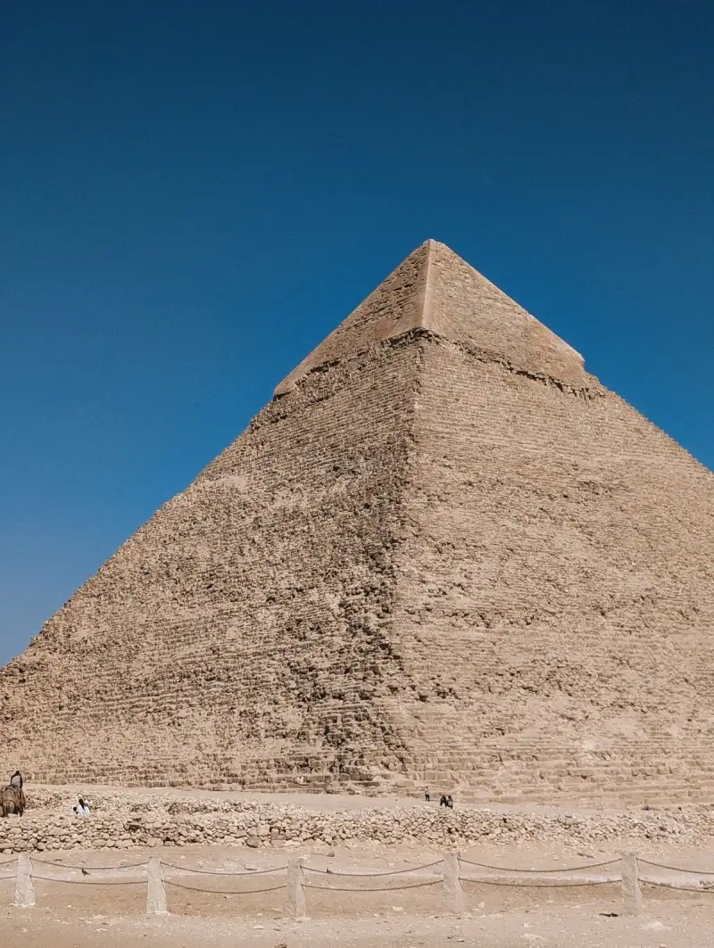
Upon the sun-scorched plains of Giza, where the relentless sands whisper tales of forgotten millennia, stands a monument unlike any other—a stark, immutable sentinel etched against the boundless canvas of the sky. It is a structure born of a will so absolute, an ambition so profound, that it defied the very limits of human endeavor, becoming a beacon of an age shrouded in mystery and unparalleled ingenuity. The Great Pyramid of Giza, a colossal enigma sculpted from the earth itself, does not merely occupy space; it commands time, anchoring our present gaze to the distant horizon of 2600 BC, a silent testament to a civilization that understood eternity not as an abstract concept, but as a tangible architectural imperative. This monolithic edifice, the largest of all Egyptian pyramids and undeniably the most celebrated landmark of the Giza complex, carries the distinction of being the sole survivor among the Seven Wonders of the Ancient World to remain largely intact. It is a singular achievement, a testament to the meticulous planning and unwavering dedication of those who labored under the aegis of Pharaoh Khufu, known to the Greeks as Cheops. For over 3,700 years, this structure held the uncontested title of the world's tallest human-made creation, its apex piercing the heavens as a symbol of divine kingship and an unyielding belief in an afterlife meticulously prepared. Its very existence, a narrative in stone, compels us to ponder the depths of human aspiration and the ephemeral nature of all else. Architectural Grandeur: A Testament in Stone The Great Pyramid, a monumental undertaking spanning approximately 26 years, was constructed around 2600 BC during the Fourth Dynasty of Egypt’s Old Kingdom. Initially, it towered at an astonishing 146.6 meters (481 feet), a height that dwarfed every subsequent human construction for millennia. Today, bereft of its exquisite smooth white limestone casing, which was gradually removed over centuries to be repurposed for other building projects, its height stands at 138.5 meters (454.4 ft). What we behold now is the raw, rugged beauty of its underlying core structure, still capable of instilling awe. The sheer scale of its foundation is equally staggering: each side of its base measures approximately 230.3 meters (755.6 ft) in length. This colossal footprint, combined with its impressive height, yields an estimated volume of roughly 2.6 million cubic meters (92 million cubic feet), a figure that includes a significant internal hillock integrated into its design. The ancient Egyptian architects, working with the royal cubit as their primary unit, crafted a structure with a precise height of 280 royal cubits (146.7 m; 481.4 ft) and a base length of 440 cubits (230.6 m; 756.4 ft). Its slope, a critical element of its iconic silhouette, was meticulously maintained with a seked of 5+1/2 palms, translating to an angle of 51°50'40". Such precision, achieved without the aid of modern surveying tools, speaks volumes about the sophisticated understanding of geometry and engineering possessed by its builders. The construction itself involved the quarrying and placement of an estimated 2.3 million large blocks, collectively weighing an astounding 6 million tonnes. The majority of these stones, primarily local limestone sourced directly from the Giza Plateau, are far from uniform in size or shape, and were only roughly dressed before being set into place. The outer layers, however, were meticulously bound together with a robust mortar, ensuring the stability and longevity of the colossal structure. Beyond the local limestone, specialized materials were imported: shimmering white limestone from the Tura quarries, transported by boat along the Nile, formed the smooth, brilliant casing that once rendered the pyramid a gleaming beacon under the desert sun. For the critical structural elements of the King's Chamber, immense blocks of granite, some weighing up to 80 tonnes, were painstakingly quarried from Aswan, hundreds of kilometers to the south, and floated upstream.While various scientific and alternative hypotheses strive to unravel the exact construction techniques employed—ranging from elaborate ramp systems to internal spiral passages—no definitive consensus has yet been reached. This enduring mystery only deepens the allure of the Great Pyramid, cementing its status as a marvel not just of ancient engineering, but of human problem-solving itself. Khufu's vizier, Hemiunu, is often credited by some scholars as the master architect behind this monumental achievement, a mind capable of orchestrating an endeavor of such unprecedented scale and complexity. A Labyrinth Within: Chambers of the Pharaoh Within the immense stone mass of the Great Pyramid lie three known chambers, each offering a glimpse into the evolving design and profound symbolic significance of the structure. The lowest of these, a chamber cut deep into the bedrock upon which the pyramid was founded, remains unfinished, its rough-hewn surfaces hinting at an altered plan during the construction process. Above ground, nestled within the heart of the pyramid's vast internal structure, are the two principal chambers: the so-called Queen's Chamber and, higher still, the King's Chamber. The King's Chamber, the ultimate destination within this ancient monument, houses a simple yet imposing granite sarcophagus. This austere vessel, carved from the same formidable Aswan granite that characterizes the chamber itself, was designed to contain the earthly remains of Pharaoh Khufu. Intriguingly, unlike the later tombs adorned with elaborate hieroglyphs and vibrant wall paintings, the internal chambers of the Great Pyramid, consistent with the architectural norms for Egyptian tombs of the fourth to late fifth dynasty, are remarkably devoid of inscriptions or decorations. The only exceptions are the occasional work-gang graffiti, simple marks left by the builders, which crucially include the names of Khufu—a silent, yet powerful, attribution. This absence of textual embellishment is particularly notable, given that the pyramid's construction predates the custom of inscribing pyramids with funerary texts by more than two centuries, placing it firmly in an earlier, more reserved artistic and theological tradition. The serene emptiness of these chambers, therefore, is not a sign of incompleteness but rather a reflection of the prevailing mortuary beliefs and artistic conventions of Khufu's time. Beyond the Apex: The Funerary Complex Unveiled The Great Pyramid was never a solitary monument; it was the focal point of an expansive and intricately planned funerary complex, a sacred landscape meticulously designed to serve the pharaoh's journey into the afterlife and sustain his eternal cult. This complex comprised two mortuary temples: one, the pyramid temple, situated immediately adjacent to the eastern face of the pyramid, and another, the valley temple, positioned closer to the life-giving waters of the Nile. These two temples were interconnected by a long, processional causeway, an elevated pathway that likely witnessed countless rituals and ceremonies. Surrounding the central pyramid were smaller, yet significant, structures dedicated to Khufu's immediate family and court. Three smaller pyramids, arrayed to the east of the Great Pyramid, served as the tombs for Khufu's wives, reflecting their elevated status within the royal family. An even smaller "satellite pyramid" was also part of this sacred ensemble, its purpose still pondered by Egyptologists. The landscape was further dotted with extensive cemeteries, containing tombs (mastabas) for the high officials, nobles, and family members who served Khufu during his reign, ensuring their proximity to their divine king in the afterlife. One of the most remarkable discoveries within the complex involves five deeply buried pits, each containing the disassembled components of immense solar barques—ceremonial boats intended to transport the pharaoh's spirit across the heavens with the sun god Ra. These vessels were not merely symbolic; the best-preserved, Khufu's Ship, recovered from its pit, is a masterpiece of ancient shipbuilding, revealing a level of craftsmanship astonishing for its age. This entire sprawling complex, a testament to Khufu's enduring power and the elaborate nature of Old Kingdom funerary beliefs, is a crucial component of the UNESCO World Heritage Site "Memphis and its Necropolis," recognized globally for its outstanding universal value to humanity. The Sacred Purpose: Life Beyond Death The construction of the Great Pyramid, far from being merely an ostentatious display of wealth, was deeply rooted in the core tenets of ancient Egyptian religious belief, serving as the eternal tomb of Pharaoh Khufu. Like other elaborate tombs of the Egyptian elite, it fulfilled four paramount purposes, each intricately linked to the pharaoh's journey into and maintenance of his status in the afterlife. Firstly, it was designed to house the sacred body of the deceased pharaoh and, perhaps more critically, to keep it eternally safe from desecration and the ravages of time. The immense bulk and intricate internal passages were, in essence, an ultimate fortress, safeguarding the vessel through which the pharaoh's ka (life force) and ba (personality) could continue to exist. Secondly, the sheer monumental scale and unparalleled grandeur of the pyramid served as an unequivocal demonstration of the deceased pharaoh's exalted status and that of his royal family. It was an immutable declaration of divine kingship, an architectural assertion of unparalleled power and privilege that resonated across the land. Thirdly, the pyramid ensured the deceased's perpetual place in society, an enduring symbol that reinforced the societal hierarchy even after death. In ancient Egypt, high social status was not merely desirable but was considered an absolutely positive and divinely ordained state. The monumental social inequalities of the era were strikingly symbolized by the gigantic pyramids of kings and queens, towering over the comparatively modest mastaba tombs of officials. Finally, and perhaps most poignantly, the tomb served as a sacred space where offerings could be brought to the deceased, sustaining their spirit in the afterlife. These offerings, ranging from food and drink to precious artifacts, were vital for the pharaoh's continued existence and prosperity in the Field of Reeds. The ancient Egyptian understanding of death was not an end, but a transformation, as eloquently captured in the profound decree: "Make your grave well furnished and prepare thy place in the west. Look, death counts little for us. Look, life is valued highly by us. The house of the dead (the tomb) is for life." This powerful sentiment underscores the pyramid's fundamental role: it was not a monument to death, but a vibrant conduit to eternal life.The precise regulation of funerary architecture, including the allowed dimensions of tombs, was enshrined in royal decrees, reflecting the king's ultimate authority. In the Old Kingdom, the privilege of a pyramid tomb was reserved exclusively for kings and queens, a clear demarcation of their unparalleled divine status. Architectural layout and funeral equipment were also strictly sanctioned and, like access to vital materials and skilled workers, remained entirely at the discretion of the pharaoh, further emphasizing the centralized power structure of the age. Echoes of Khufu: Proving the Builder For centuries, the attribution of the Great Pyramid to Pharaoh Khufu rested largely upon the narratives of classical antiquity's great authors, most notably Herodotus and Diodorus Siculus, whose accounts, though centuries removed from the pyramid's construction, linked the edifice directly to Cheops. However, during the medieval period, as historical memory blurred and new legends arose, other figures were credited with its construction, including biblical characters like Joseph from the Book of Genesis, the mythical king Nimrod, or the legendary Saurid ibn Salhouk, reflecting a fascination with its origins that transcended historical fact. It was not until the intrepid explorations of the 19th century that irrefutable internal evidence began to surface, solidifying the attribution to Khufu. In 1837, the discovery of four previously inaccessible relieving chambers situated above the King's Chamber, accessed through painstaking tunneling, provided a critical breakthrough. The walls of these hidden chambers were adorned with hieroglyphs painted in red ochre—not formal inscriptions, but rather the casual, yet deeply significant, marks left by the work gangs themselves. These "graffiti" included the names of the gangs, often incorporating the pharaoh's name, such as "The gang, The white crown of Khnum-Khufu is powerful." The name of Khufu, spelled out with distinct cartouches, appeared over a dozen times within these chambers, serving as an unambiguous signature of the pyramid's intended owner. Further supporting this, Goyon later discovered similar graffiti on an exterior block from the 4th layer of the pyramid, reinforcing the internal evidence. These inscriptions bear striking resemblance to those found at other sites unequivocally associated with Khufu, such as the alabaster quarry at Hatnub or the harbor at Wadi al-Jarf, and are also present in the pyramids of other pharaohs, establishing a consistent pattern of royal attribution. The twentieth century further cemented Khufu's claim through extensive archaeological excavations of the cemeteries surrounding the pyramid. These burial grounds revealed the tombs of Khufu's closest kin and high-ranking officials, strategically positioned within the complex. The East Field, located south of the causeway, housed members of the immediate family and court, while the West Field contained the tombs of Khufu's wives, children, and grandchildren, as well as significant figures like Hemiunu (the likely architect) and Ankhaf, and even the funerary cache of Hetepheres I, Khufu's revered mother. As the eminent Egyptologist Selim Hassan aptly observed, "From the early dynastic times, it was always the custom for the relatives, friends and courtiers to be buried in the vicinity of the king they had served during life. This was quite in accordance with the Egyptian idea of the Hereafter." The continuous expansion of these cemeteries until the 6th dynasty further underscores the enduring connection between Khufu and his monumental resting place, providing a compelling archaeological argument for his unequivocal ownership. A Cult of Eternity: The Enduring Spirit While the internal chambers of the Great Pyramid remained stark and undecorated, the pyramid complex itself was a vibrant hub of ritual and commemoration. Khufu's two temples, integral to the funerary complex, were lavishly adorned and inscribed, offering a striking contrast to the pyramid's interior. The pyramid temple, situated directly beside the colossal tomb, was specifically dedicated to the Sed festival, an ancient jubilee celebrating a pharaoh's 30th year of rule, intended to rejuvenate his kingship. Surviving scenes within this temple portray Khufu himself, along with officials, priests, and other significant characters, engaged in various vital rituals, reinforcing his divine authority and continuous reign, even in the afterlife. The valley temple, though largely unexcavated to this day, has yielded tantalizing fragments of its original grandeur. Blocks reused by the later pharaoh Amenemhat I depict captivating scenes, including nautical imagery and intriguing personifications of Khufu's royal estates, such as the evocative "Khufu is beautiful." The sustained operation of a dedicated mortuary cult for Khufu, maintained within these very temples for hundreds of years after his passing, serves as powerful historical evidence that he was indeed successfully interred within the Great Pyramid, and that his cult was diligently observed. Further reinforcing this narrative is the presence of the cartouches of Khufu's son and successor, Djedefre, on the blocks that meticulously sealed the boat pits adjacent to the pyramid, indicating his filial responsibility in overseeing his father's funeral rites. Despite these elaborate preparations for eternal peace, the Great Pyramid, like many ancient tombs, was not immune to the passage of time and the covetousness of later generations. It was likely looted as early as the First Intermediate Period, a tumultuous era marked by political instability, and may even have been reused for various purposes thereafter. Arab accounts from the medieval period speak of legendary discoveries within the pyramid, painting vivid pictures of forgotten treasures and ancient mysteries. For instance, the historian Al-Maqrizi (1364–1442) recounts the astounding discovery of three shrouded bodies, a sarcophagus brimming with gold, and even a corpse clad in golden armor, wielding a sword of inestimable value, and bearing a ruby "as large as an egg." While these accounts may be embellished by legend, they underscore the enduring fascination and allure of the Great Pyramid, a structure that has continually sparked the human imagination for millennia. The Great Pyramid of Giza, therefore, is more than just a colossal stone structure. It is a profound architectural statement, an engineering marvel, and a silent narrator of ancient beliefs. It stands as an enduring testament to the human capacity for grand vision and persistent execution, a monument that transcends its original purpose as a tomb to become a symbol of eternity itself. As we gaze upon its weathered form, we are not merely observing an ancient relic, but connecting with a spirit of ambition and faith that shaped one of humanity's most extraordinary achievements, forever binding the sands of Giza to the annals of global wonder.#AncientWonders #EgyptianPyramids #GizaComplex #PharaohKhufu #HistoricalTravel #KhufuPyramid #AncientEgypt #Giza #History #Travel Related Insights'Hallstatt: Where Time Carved Its Name into the Alps and Salt Whispered Eternity' Real Alcázar de Sevilla: Belleza Mudéjar L'Eterna Seduzione della Costa Azzurra: Tra Scogliere di Porfido e Misteri Belle Époque{ "@context": "https://schema.org", "@type": "FAQPage", "mainEntity": [ { "@type": "Question", "name": "What is the main focus of The Immutable Sentinel: Unveiling the Enduring Majesty of Khufu's Great Pyramid?", "acceptedAnswer": { "@type": "Answer", "text": "Journey into the heart of ancient Egypt's most magnificent creation, the Great Pyramid of Giza, a monumental testament to pharaonic power, engineering brilliance, and an enduring mystery that continues to captivate the human spirit." } }, { "@type": "Question", "name": "Who authored the comprehensive guide on The Immutable Sentinel: Unveiling the Enduring Majesty of Khufu's Great Pyramid?", "acceptedAnswer": { "@type": "Answer", "text": "This detailed article and its insights were carefully researched and authored by Cemre Seyyah." } }, { "@type": "Question", "name": "Where can I find more related content about Travel?", "acceptedAnswer": { "@type": "Answer", "text": "You can explore more articles, detailed reviews, and similar insights by browsing the Related Insights section at the bottom of this article or visiting our dedicated Travel category page." } } ] }
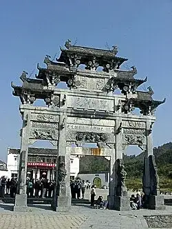

大家好!我是陈伟(Wei Chen)。今天我要带大家探索西递,感受那深厚的历史底蕴。历史不仅在书本里,更在脚下的泥土中。 29°54′20″N 117°59′28″E / 29.90556°N 117.99111°E / 29.90556; 117.99111 西递村是安徽省南部黟县东南西递镇的一个村庄。西递村于1986年定为安徽省重点文物保护单位,2001年由中华人民共和国国务院公布为第五批全国重点文物保护单位。2000年11月30日在澳大利亚凯恩斯召开的联合国教科文组织第24届世界遗产委员会会议作出决定,将中国皖南古村落西递、宏村列入世界文化遗产名录,这是首次把民居列入世界遗产名录。2003年10月8日公布被批准为首批中国历史文化名村;2011年被评为国家5A级旅游景区。米其林旅游指南也称赞这里拥有独特建筑风格的精美房屋,将西递评为最高的强烈推荐(Highly recommended)级别。2024年11月15日,桃坪村被联合国旅游组织执行委员会列入2024年“最佳旅游乡村”名单。 村落概况 西递始建于公元11世纪的宋朝的元祐(宋哲宗)年间,由于河水向西流经这个村庄,原来称为“西川”。因在村西古有驿站,称“铺递所”,故而得名“西递”,素有“桃花源里人家”之称。 西递始祖为唐昭宗李晔之子,因遭变乱,逃匿民间,改为胡姓,西递属以血缘关系为纽带的胡氏聚居村落。胡家从1465年起开始经商,他们经商成功,大兴土木,建房、修祠、铺路、架桥。在17世纪中叶,胡家中有人从经商转向官场所产生的影响使村庄得到发展。18世纪到19世纪,西递的繁荣达到最顶峰,当时村里有大约600家民居。 西递村中一条主道贯穿东西,与其两侧各一条与之平行的街道一起穿过很多窄巷,构成东向为主、向南北延伸的村落街巷,村中街巷大多沿溪而设均用青石铺地。在敬爱堂、追慕堂、胡文光刺史牌坊等公共建筑之前有小广场。现今保留下的古民居从整体上保留下明、清徽派民居村落的基本面貌和特征,主要包括古民居124幢,祠堂3幢等保护完好的明清古建筑群,大多数民居都对公众开放。 主要建筑 注2:大运河为跨省市区项目,在安徽省有三个子项。 注2:独山和金寨革命旧址群归入第三批全国重点文物保护单位鄂豫皖革命根据地旧址。 希望你们喜欢这次的Xidi之旅!欢迎持续关注我,一起探寻更多被遗忘的明清古迹。 #历史 #中国文化 #旅行 #明代 #清代 #Xidi #China #History #MingDynasty #Travel Related InsightsThe Glamour and Secrets of the French Riviera Australia Unveiled: Where Sun-Kissed Shores Meet Ancient Souls and Modern Marvels The Shimmering Waters: Documenting Plitvice Lakes National Park{ "@context": "https://schema.org", "@type": "FAQPage", "mainEntity": [ { "@type": "Question", "name": "What is the main focus of 西递:中国古代木雕的巅峰?", "acceptedAnswer": { "@type": "Answer", "text": "深入了解西递的历史、文化与建筑特色。" } }, { "@type": "Question", "name": "Who authored the comprehensive guide on 西递:中国古代木雕的巅峰?", "acceptedAnswer": { "@type": "Answer", "text": "This detailed article and its insights were carefully researched and authored by Wei Chen." } }, { "@type": "Question", "name": "Where can I find more related content about Travel?", "acceptedAnswer": { "@type": "Answer", "text": "You can explore more articles, detailed reviews, and similar insights by browsing the Related Insights section at the bottom of this article or visiting our dedicated Travel category page." } } ] }
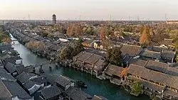
大家好!我是陈伟(Wei Chen)。今天我要带大家探索乌镇,感受那深厚的历史底蕴。历史不仅在书本里,更在脚下的泥土中。 乌镇镇位于中华人民共和国浙江省桐乡市,是江南著名古镇之一。镇域面积71.19平方公里,建城区面积2.5平方千米,总人口6万,镇区常住人口1.2万。乌镇景区已被评为中国国家5A级景区,是全国20个黄金周预报景点之一,现由中青旅运营。2019年被评为中国文化百强镇。2023年(第二届)中国文化百强镇。 乌镇是典型的江南水乡古镇,乌镇原以市河(车溪)为界,分为乌青二镇,河西为乌镇,属湖州府乌程县;河东为青镇,属嘉兴府桐乡县。中华人民共和国时期,市河以西的乌镇划归桐乡县,统称乌镇。 乌镇街道上民居以清代建筑为主,保存完好。全镇以河成街,桥街相连。各式民居、店铺依河筑屋,即有深宅大院、百年老屋,也有河埠廊坊,过街骑楼,是江南典型的“小桥流水人家”。乌镇为千年文化名镇,在历史上小镇曾出过64名进士、161名举人。茅盾、沈泽民、严独鹤等都为乌镇人。 2014年11月19日到21日,首届“世界互聯網大會”在乌镇举办,该地也成为世界互联网大会的永久会址。 行政区划 乌镇镇下辖以下地区: 秀溪社区、元丰村、南王村、董家村、金牛村、正福村、杨园村、皂林村、翔厚村、单桥村、东苑社区、银杏社区、南宫社区、虹桥村、白马墩村、分水墩村、碓坊桥村、浮澜桥村、陈庄村、南庄桥村、横港村、彭家村、陈家村、双塔村、颜家村、民合村、浙月村、新翁村和五星村。 交通 乌镇距桐乡市区13公里,距周围嘉兴、湖州、吴江三市为20-60公里,距杭州、苏州均为80公里,距上海140公里。到乌镇可经沪杭高速公路、320国道、318国道到桐乡,再从桐乡到乌镇,桐乡自早上7:00-17:00每隔15分钟就有一班中巴车到乌镇。从浙江省另一个著名的水乡古镇湖州南浔前往濮院镇的中巴车也经过乌镇,大约需要行驶40分钟,中途经过江苏省吴江市的桃源镇和青云镇,江苏境内的路况更好一些。乌镇镇内主要以人力三轮车、出租车为主。 主要建筑 昭明太子读书处 昭明太子读书处位于乌镇市河西侧。因南朝梁武帝太子萧统曾在此设馆就读而得名,为桐乡市重点文物保护单位。昭明太子名萧统,两岁时立为皇太子。据清乾隆《乌青镇志》记载,梁天监二年(503年),萧统曾随老师沈约来乌镇读书,并建有书馆一座。 修真观 修真观位于古镇中心的观前街,兴华路西侧,门前有一片小广场,对面毗邻东市河处是一个古戏台。北宋咸平元年(998年),道士张洞明在此结庐,修真得道,乃创建修真观。中华人民共和国统治时期,修真观多有坍损,并在很长一段时期被移作他用而被拆除。在乌镇成为旅游景点后,当地政府为发展旅游事业拨出专款,将修真观按历史原貌修复。如今的修真观共设三进,一进为山门,二进是东岳大殿,三进为玉皇阁;两边分设十殿阎王、瘟元帅、财神等配殿。修真观对面的古戏台经常有桐乡花鼓戏的演出。 立志书院 立志书院坐落在古镇中心的观前街,紧邻茅盾故居的东侧,现在是茅盾纪念馆的一部份。它的前身是闻名江南的分水书院,院址在乌镇北栅分水墩西侧。清咸丰十年,清军与太平军在乌镇交战,分水书院毁于战火。同治四年,邑绅严辰培修并加以扩建。同治七年,书院建成,据程朱理学家、乡贤张扬园先生的治学格言“大凡为学尤须立志”中的“立志”二字作为新书院的名字,严辰任立志书院院长。茅盾小时在此求学。立志书院是电视剧《似水年华》的拍摄场地。 茅盾故居 茅盾故居位于古镇中心的观前街,是著名文学家茅盾(沈雁冰)祖辈居住的老屋,始建于十九世纪中叶,建筑面积650平方米,为清代江南民居。茅盾自1896年7月4日诞生至1910年春离乡求学,在此生活了十三年。1982年,茅盾故居被列为浙江省文保单位,1983年8月筹备修复,1985年7月落成开放,1988年1月公布为全国重点文物保护单位。 木心故居紀念館 坐落於東柵財神灣186號的晚晴小築,是作家木心的故居。1999年,烏鎮旅遊公司著手進行東柵古蹟修復與景區開發時加以修復。2005年,木心接受家鄉烏鎮的邀請回國定居,2011年10月因肺部感染住院,同年12月21日辭世。木心故居經過為期三年的規劃,以紀念館的形式在2014年5月25日正式對外開放,館內展出木心的照片、手稿、畫作以及部分生前遺物。 希望你们喜欢这次的Wuzhen之旅!欢迎持续关注我,一起探寻更多被遗忘的明清古迹。 #历史 #中国文化 #旅行 #明代 #清代 #Wuzhen #China #History #MingDynasty #Travel Related InsightsAustralien: Wo die Ewigkeit des Outbacks auf den Puls der Moderne trifft Wandering Through Ephesus Sardinian Nuraghe Trails: Mapping the Bronze Age Megalithic Landscapes{ "@context": "https://schema.org", "@type": "FAQPage", "mainEntity": [ { "@type": "Question", "name": "What is the main focus of 乌镇:梦回明清的水乡?", "acceptedAnswer": { "@type": "Answer", "text": "深入了解乌镇的历史、文化与建筑特色。" } }, { "@type": "Question", "name": "Who authored the comprehensive guide on 乌镇:梦回明清的水乡?", "acceptedAnswer": { "@type": "Answer", "text": "This detailed article and its insights were carefully researched and authored by Wei Chen." } }, { "@type": "Question", "name": "Where can I find more related content about Travel?", "acceptedAnswer": { "@type": "Answer", "text": "You can explore more articles, detailed reviews, and similar insights by browsing the Related Insights section at the bottom of this article or visiting our dedicated Travel category page." } } ] }
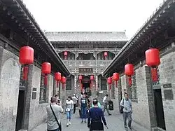
大家好!我是陈伟(Wei Chen)。今天我要带大家探索乔家大院,感受那深厚的历史底蕴。历史不仅在书本里,更在脚下的泥土中。 37°24′21.86″N 112°25′47.93″E / 37.4060722°N 112.4299806°E / 37.4060722; 112.4299806 喬家大院位于山西省祁县乔家堡村,是清代著名晋商乔致庸的宅第。乔家大院于2001年被列入全国重点文物保护单位,现成為著名旅遊景區和電視劇拍攝地。 历史 乔家大院始建于清代乾隆年间,后曾有两次增修和一次扩建,于民国初年建成了一座宏伟的建筑群体,体现了中国清代北方民居的典型风格。 1985年,当地政府在古宅的基础上建成了祁县民俗博物馆,1986年11月1日开馆,正式对外开放,2001年乔家大院被国务院列入为全国重点文物保护单位,被国家旅游局评定为5A级旅游景区。 争议 乔家大院经营权起初归为国有,2007年祁县远大、上海盛富(实际控制人单九良,後犯金融罪已被捕)和重庆中昊签订一份《祁县乔家大院旅游景区投资开发建设项目合作意向书》,三家公司共同投资设立乔家大院旅游开发公司,其中民营股权比例占75%。由此,乔家大院经营权转为民营所有。2018年中华人民共和国国有景区门票被要求政策性降價,但民營化的喬家大院不受約束,票價反而大漲,票价是同类院子数倍,引发舆论争议和游客不满。除此之外,乔家大院部分導遊素質低劣,黑導遊攬客等景区管理混乱的问题也备受游客诟病。2019年,乔家大院5A级旅游景区格被取消,原因為過度開發且商業氣息過重,已經開始損害古風味,票价为颐和园旺季时的4倍多。乔家大院公司方開始對景區內商販進行大規模清理。2019年8月7日起,乔家大院景区暂停运营10天,围绕停车场、出口市场和服务质量等方面存在的问题进行集中整改,同时景区将适当对门票价格进行下调。 希望你们喜欢这次的Qiao Family Compound之旅!欢迎持续关注我,一起探寻更多被遗忘的明清古迹。 #历史 #中国文化 #旅行 #明代 #清代 #QiaoFamilyCompound #China #History #MingDynasty #Travel Related InsightsGobeklitepe: The First Temple The Silk Road Revival: Uzbekistan’s Ancient Cities and Modern Wonders (Part 2) Lalibela : Le Chant de la Pierre Vivante – Plongée au Cœur des Églises Monolithiques d'Éthiopie{ "@context": "https://schema.org", "@type": "FAQPage", "mainEntity": [ { "@type": "Question", "name": "What is the main focus of 乔家大院:清代北方民居的典范?", "acceptedAnswer": { "@type": "Answer", "text": "深入了解乔家大院的历史、文化与建筑特色。" } }, { "@type": "Question", "name": "Who authored the comprehensive guide on 乔家大院:清代北方民居的典范?", "acceptedAnswer": { "@type": "Answer", "text": "This detailed article and its insights were carefully researched and authored by Wei Chen." } }, { "@type": "Question", "name": "Where can I find more related content about Travel?", "acceptedAnswer": { "@type": "Answer", "text": "You can explore more articles, detailed reviews, and similar insights by browsing the Related Insights section at the bottom of this article or visiting our dedicated Travel category page." } } ] }
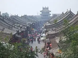
大家好!我是陈伟(Wei Chen)。今天我要带大家探索平遥古城,感受那深厚的历史底蕴。历史不仅在书本里,更在脚下的泥土中。 平遥古城,位于中国山西省晋中市平遙縣,是中国现存的保存最完整的古代城市,曾经也是中国銀行業的中心。始建于西周宣王时期(公元前827年-公元前782年),现存古城始建于明朝洪武年间(1370年),占地225公顷。1997年,联合国教科文组织将平遥古城与双林寺、镇国寺一同列入世界文化遗产名录,以表彰其在世界历史、建筑和文化方面的独特价值。 概要 平遥是清朝晚期中国的金融中心,并有中国目前保存最完整的古代县城格局。 春秋时期属晋国,战国属赵国。秦朝置平陶县,汉朝置中都县,为宗亲代王的都城。北魏始光元年(424年)改名为平遥。 清代晚期,总部设在平遥的票号就有二十多家,占全国的一半以上,更被稱「古代中國華爾街」。其中规模最大的是创建于清道光年间、以“匯通天下”而闻名于世的中国第一座票号“日昇昌”,随后建立的票号有二十多家。 平遥目前基本保存了明清时期的县城原型,有“龟”城之称,因有六道城门,南北门为龟首尾,东西四门象征四足。街道格局为“土”字形,建筑布局则遵从八卦的方位,体现了明清时的城市规划理念和形制分布。城内设四条大街、八条小街和72条小巷。古城以南大街为中轴线,城东有城隍庙,城西有平遥县署,城左立文庙、城右立武庙,东道观西佛寺,对称布局;城内外有各类遗址、古建筑300多处,有保存完整的明清民宅近4000座,街道商铺都体现历史原貌,被称作研究中国古代城市的活样本。 平遥城墙建于明洪武三年,现存有6座城门瓮城、4座角楼、72座敌楼、3000哚口。其中南门城墙段于2004年倒塌,除此以外的其余大部分都至今安好,是中国现存规模较大、历史较早、保存较完整的古城墙之一,亦是世界遗产平遥古城的核心组成部分。此外,还有镇国寺、双林寺和平遥文庙等也都被纳入世界遗产。 平遥古城是中国国家AAAAA级旅游景区,其街道对外开放,不需要门票。但参观古城内的一些景点如平遥文庙,平遥县署,平遥城墙,日昇昌票号,中国镖局博物馆,平遥古民居博物馆等,则需要购买通票才可以参观。平遥古城内旅店,餐馆,商铺鳞次。旅店全是民居式,商铺多售卖平遥特产冠云牛肉、推光漆器、绣花鞋等。 经济 在平遥的早期,这座城市在中国华尔街的运作中发挥了显著作用。到了18世纪末至19世纪初,中国已经远远超越了古代王朝时期,穿越中国北方平原的旅行已不再安全。商人在前往平遥时经常遭到抢劫,而平遥位于当时的皇城与现在的北京之间,是重要的贸易通道。为了解决这一问题,平遥商人引入了纸币汇款或债券的使用,以减轻旅行商人携带金银的负担,使旅行更加安全。平遥作为中国贸易的枢纽,使得许多家庭,包括乔家的财富激增。 截至2009年,该镇拥有19,059名劳动力。3,811名农民耕种9977亩的可耕地,生产价值3370万元人民币的农作物、牲畜和其他商品。当地的重点是提高机械化程度和集约利用现有土地。该地区以牛肉闻名,同时也生产粮食和棉花。其余劳动力分布在工业和服务业,尤其是旅游业。工业产值达8.4亿元人民币,并专注于提高其生产活动的能源效率。当地特产是漆器。包括旅游业在内的服务业收入虽不及工业——为7.9亿元人民币——但增长迅速,并受到当地政府的特别关注。 文化 饮食 当地特产包括平遥牛肉和平遥碗托,后者是慈禧太后最喜爱的美食。其他当地产品还有长升源黄酒、豆面抿尖和揪片。 电影与摄影 平遥举办平遥国际电影展和平遥国际摄影节,彰显了这座城市在当代视觉文化领域的重要地位,同时也展现了其丰富的历史城市遗产。此外,20世纪初平遥的银商们是2009年电影《白银帝国》的主角。 保护 目前,各方正共同努力保护和振兴这座古城,既要保留其悠久的文化遗产,又要满足平遥这样一座老龄化城市所面临的现代需求。平遥古城保护与振兴计划于2014年首次提出并获得批准,现已吸引众多团体表示有兴趣携手合作,以实现一系列目标,其中包括同济大学、平遥县人民政府和自然资源局,以及全球遗产基金和联合国教科文组织专家。该项目的一个目标是在包括遗产地在内的2.4平方公里区域内引入现代便利设施,如电力和污水处理设施,以提高仍居住和生活在古城内的2万多名居民的生活水平。主要目标是将古城遗址内几处闲置场地改建为博物馆和其他功能区,以振兴平遥的遗产。 希望你们喜欢这次的Pingyao之旅!欢迎持续关注我,一起探寻更多被遗忘的明清古迹。 #历史 #中国文化 #旅行 #明代 #清代 #Pingyao #China #History #MingDynasty #Travel Related InsightsRoadtrip durch den Schwarzwald 慕田峪长城:明代长城的精华 Hidden Gems of Southeast Asia: Where Adventure Meets Unspoiled Beauty in 2026{ "@context": "https://schema.org", "@type": "FAQPage", "mainEntity": [ { "@type": "Question", "name": "What is the main focus of 平遥古城:穿越明清的金融中心?", "acceptedAnswer": { "@type": "Answer", "text": "深入了解平遥古城的历史、文化与建筑特色。" } }, { "@type": "Question", "name": "Who authored the comprehensive guide on 平遥古城:穿越明清的金融中心?", "acceptedAnswer": { "@type": "Answer", "text": "This detailed article and its insights were carefully researched and authored by Wei Chen." } }, { "@type": "Question", "name": "Where can I find more related content about Travel?", "acceptedAnswer": { "@type": "Answer", "text": "You can explore more articles, detailed reviews, and similar insights by browsing the Related Insights section at the bottom of this article or visiting our dedicated Travel category page." } } ] }

-
 Hans Müller
 - 07 Jul, 2026 13:05
Der Seidene Atem Eurasiens: Eine Reise durch die vielschichtigen Routen, die Welten verbanden und bis heute faszinieren
Aus den Tiefen der Zeit, wo die Winde über endlose Steppen streichen und die Echos ferner Zivilisationen in den Bergen widerhallen, erhebt sich ein faszinierendes Gewebe menschlicher Bestrebungen: die Seidenstraße. Sie war mehr als nur eine Ansammlung von Wegen; sie war ein pulsierendes Arteriennetz, das vom 2. Jahrhundert v. Chr. bis zur Mitte des 15. Jahrhunderts n. Chr. das Herz Eurasiens durchzog und den Atem des Ostens mit dem des Westens verband. Über 6.400 Kilometer Landweg überspannend, war sie eine unvergleichliche Bühne für den Austausch – ökonomisch, kulturell, politisch und religiös. Doch bevor wir uns in die Details ihrer verästelten Pfade verlieren, sei angemerkt: Der Name „Seidenstraße“, erstmals im späten 19. Jahrhundert geprägt, ist eine moderne Konstruktion. Viele Historiker des 20. und 21. Jahrhunderts bevorzugen den präziseren Begriff „Seidenrouten“, um das komplexe Netz aus Land- und Seewegen besser zu beschreiben, das Zentral-, Ost-, Süd-, Südost- und Westasien ebenso wie Ostafrika und Südeuropa miteinander verknüpfte. Diese terminologische Debatte ist kein bloßes Haarspalten, sondern ein Spiegel der komplexen Realität, die diese Handelswege über Jahrhunderte darstellten. Kritiker des klassischen Begriffs monieren gar, er privilegiere „die sesshaften und literarischen Imperien an beiden Enden Eurasiens“ und ignoriere dabei die entscheidenden Beiträge der Steppennomaden. Zudem rücke die traditionelle Definition prominente Zivilisationen wie Indien und den Iran zu Unrecht in den Hintergrund. Die Wiege eines gigantischen Netzes: Seide als Leitfaden Der Name der „Seidenstraße“ leitet sich vom überaus lukrativen Handel mit Seidentextilien ab, die primär in China hergestellt wurden. Der eigentliche Beginn dieses transkontinentalen Netzwerks fällt mit der Expansion der Han-Dynastie (202 v. Chr. – 220 n. Chr.) nach Zentralasien um 114 v. Chr. zusammen. Diese Expansion wurde maßgeblich durch die Missionen und Erkundungen des chinesischen Kaisergesandten Zhang Qian vorangetrieben, der die Region unter eine Art vereinheitlichte Kontrolle brachte und damit den Grundstein für sichere Handelsrouten legte. Das chinesische Reich war sich der strategischen Bedeutung seiner Handelsprodukte wohl bewusst und scheute keine Mühen, deren Sicherheit zu gewährleisten. So wurde die Große Mauer Chinas teilweise verlängert, um den Schutz dieser entscheidenden Handelsadern zu sichern. Währenddessen etablierte sich im Westen das Partherreich als eine vitale Brücke, die das entstehende Netzwerk mit dem Mittelmeerraum verband. Mit dem Aufstieg des Römischen Reiches im Westen festigte sich schließlich der westliche Endpunkt dieses miteinander verbundenen Handelssystems. Schon im 1. Jahrhundert n. Chr. war chinesische Seide in Rom, Ägypten und Griechenland heiß begehrt – ein Statussymbol und Luxusgut, das Reichtum und Macht repräsentierte. Doch Seide war bei weitem nicht das einzige begehrte Gut. Aus dem Osten strömten weitere lukrative Handelswaren wie Tee, Farbstoffe, Parfüms und Porzellan nach Westen. Im Gegenzug wurden aus dem Westen Pferde, Kamele, Honig, Wein und Gold exportiert. Über den reinen Warenaustausch hinaus generierte die Seidenstraße nicht nur beträchtlichen Reichtum für aufstrebende Handelsklassen, sondern befeuerte auch die Verbreitung von Technologien und Ideen. Die Zirkulation von Gütern wie Papier und Schießpulver hatte tiefgreifende Auswirkungen auf den Verlauf der politischen Geschichte in weiten Teilen Eurasiens und darüber hinaus, veränderte Kriegsführung, Verwaltung und Kommunikation für immer. Ein Fluss aus Gütern, Glauben und Gefahren Die Seidenstraße wurde über eine Periode hinweg genutzt, die von immensen politischen Variationen und Umwälzungen auf dem gesamten Kontinent geprägt war. Epochale Ereignisse wie die Mongolenfeldzüge und die Schrecken des Schwarzen Todes sind untrennbar mit ihrer Geschichte verbunden. Das Netzwerk war, wie bereits angedeutet, stark dezentralisiert. Es gab keine zentrale Verwaltung, die für Sicherheit sorgte, und die Reisenden sahen sich ständigen Bedrohungen durch Banditen, nomadische Räuber und lange, unwirtliche Strecken ausgesetzt. Eine Reise entlang der Seidenstraße war kein Zuckerschlecken; sie war ein Abenteuer voller Entbehrungen und Gefahren. Nur wenige Einzelpersonen reisten jemals die gesamte Länge der Seidenstraße. Stattdessen verließ man sich auf eine Kette von Zwischenhändlern, die an verschiedenen Haltepunkten entlang der Routen ansässig waren. Diese Vermittler – Händler, Gastwirte, Karawanenführer – waren die wahren Knotenpunkte des Systems, die den Fluss der Güter und Informationen am Laufen hielten. Jenseits des Handels mit materiellen Gütern ermöglichte das Netzwerk einen beispiellosen Austausch von religiösem (insbesondere buddhistischem), philosophischem und wissenschaftlichem Gedankengut. Viele dieser Ideen wurden von den Gesellschaften entlang der Routen auf synkretistische Weise aufgenommen und angepasst, was zu einer reichen kulturellen Vielfalt führte. Ebenso vielfältig wie die Ideen waren auch die Menschen, die diese Routen nutzten: Kaufleute, Missionare, Pilger, Soldaten, Abenteurer – ein Kaleidoskop menschlicher Ambitionen. Leider verbreiteten sich auch Krankheiten wie die Pest entlang der Seidenstraße, was möglicherweise maßgeblich zum Ausbruch des Schwarzen Todes im 14. Jahrhundert beitrug – ein tragisches Zeugnis der engen globalen Vernetzung selbst in antiken Zeiten.Der umstrittene Name: Mythos oder Realität? Die Herkunft des Begriffs „Seidenstraße“ ist auf den lukrativen Seidenhandel zurückzuführen, der zuerst in China entwickelt wurde und ein Hauptgrund für die Verbindung von Handelsrouten zu einem ausgedehnten transkontinentalen Netzwerk war. Der Name leitet sich vom deutschen Begriff „Seidenstraße“ ab und wurde 1877 von Ferdinand von Richthofen populär gemacht, der zwischen 1868 und 1872 sieben Expeditionen nach China unternommen hatte. Allerdings war der Begriff selbst bereits Jahrzehnte zuvor in Gebrauch gewesen. Obwohl der Begriff im 19. Jahrhundert geprägt wurde, erlangte er erst im 20. Jahrhundert breite Akzeptanz in der Wissenschaft und Popularität in der Öffentlichkeit. Das erste Buch mit dem Titel „The Silk Road“ stammte vom schwedischen Geographen Sven Hedin aus dem Jahr 1938. Doch die Verwendung des Begriffs „Seidenstraße“ ist nicht ohne Kritiker. Warwick Ball beispielsweise argumentiert, dass der maritime Gewürzhandel mit Indien und Arabien für die Wirtschaft des Römischen Reiches weitaus folgenreicher war als der Seidenhandel mit China, der auf See hauptsächlich über Indien und auf dem Landweg von zahlreichen Zwischenhändlern wie den Sogdiern abgewickelt wurde. Ball geht sogar so weit, das Ganze als einen „Mythos“ der modernen Wissenschaft zu bezeichnen. Er vertritt die Ansicht, dass es vor der Zeit des Mongolischen Reiches kein kohärentes überlandbasisches Handelssystem und keine freie Warenbewegung von Ostasien nach West gab. Er weist darauf hin, dass traditionelle Autoren, die den Ost-West-Handel diskutierten, wie Marco Polo und Edward Gibbon, niemals eine Route speziell als „Seidenroute“ bezeichneten. William Dalrymple ergänzt, dass in vormodernen Zeiten der Seetransport nur ein Fünftel der Kosten des Landtransports verursachte und plädiert für die Vorherrschaft einer indisch dominierten „Goldenen Straße“, die vor dem 13. Jahrhundert von Rom nach Japan reichte. Es ist zudem interessant zu wissen, dass die südlichen Abschnitte der Seidenstraße, von Khotan (Xinjiang) bis Ostchina, bereits seit 5000 v. Chr. für den Jadehandel genutzt wurden – lange vor der Seide – und bis heute diesem Zweck dienen. Der Begriff „Jadestraße“ wäre daher möglicherweise angemessener gewesen als „Seidenstraße“, wäre da nicht der weitaus größere und geografisch umfassendere Charakter des Seidenhandels gewesen. Dennoch wird der Begriff „Jadestraße“ in China heute immer noch verwendet, was die vielschichtige historische Realität dieser Wege unterstreicht. Selbst Marco Polo, oft mit der Seidenstraße in Verbindung gebracht, verwendete den Begriff nie, obwohl er in einer Zeit der von den Mongolen ermöglichten Reiseerleichterung unterwegs war. Dies untermauert die Vorstellung, dass die „Seidenstraße“ in der populären Vorstellung oft vereinfacht und idealisiert wird, während die historische Realität ein komplexeres, fragmentiertes Netzwerk darstellte. Geographische Knotenpunkte und ihre Verzweigungen Die Seidenstraße war, wie wir nun wissen, kein einzelner, monolithischer Pfad, sondern ein dynamisches System mehrerer Routen. Von den alten Handelszentren Chinas aus verzweigte sich die überlandbasische, interkontinentale Seidenstraße westwärts in nördliche und südliche Routen, die verschiedene geografische Herausforderungen umgingen und Regionen erschlossen. Zwei wichtige Pfade von Merw aus führten beispielsweise durch Nisa und Sarachs. Diese Routen vereinigten sich schließlich in Maschhad, einer großen religiösen und Handelsstadt in Chorasan, die als zentraler Knotenpunkt diente. Die alte Straße, die heute einer modernen Autobahn weicht, führte von Maschhad weiter nach Nischapur, dann entlang des Randes der Dascht-e Kavir-Wüste und des Elburs-Gebirges, um schließlich Teheran – im Altertum als Ray bekannt – zu erreichen. Diese konkreten geographischen Hinweise verdeutlichen die Weitläufigkeit und die strategische Planung, die hinter der Anlage und Nutzung dieser Wege steckten. Jeder Abschnitt dieser Routen war von einzigartigen Herausforderungen geprägt, sei es durch unwegsame Gebirge, sengende Wüsten oder feindselige Stämme. Die Wahl der Route hing oft von der Jahreszeit, der politischen Stabilität und den spezifischen Gütern ab, die transportiert werden sollten. Diese Flexibilität und Anpassungsfähigkeit waren entscheidend für das Überleben und den Erfolg des gesamten Netzwerks über Jahrhunderte hinweg. Das Ende einer Ära und ein neues Erwachen Ab 1453 begannen die Osmanen, mit anderen „Pulver-Imperien“ um eine größere Kontrolle über die Landrouten der Seidenstraße zu konkurrieren. Dieser Machtkampf zwang die europäischen Mächte dazu, alternative Handelswege zu suchen, um gleichzeitig ihre eigene Hebelwirkung gegenüber Handelspartnern zu erhöhen. Dies markierte den Beginn des Zeitalters der Entdeckungen, des europäischen Kolonialismus und der weiteren Intensivierung der Globalisierung. Die Entdeckung des Seewegs um Afrika herum und später die Reisen über den Atlantik boten vermeintlich sicherere und direktere Zugänge zu den begehrten Gütern des Ostens, wodurch die Bedeutung der klassischen Landrouten allmählich schwand. Doch die Idee der Seidenstraße ist niemals vollständig verschwunden. Im 21. Jahrhundert beschreibt der Begriff „Neue Seidenstraße“ mehrere große Infrastrukturprojekte entlang vieler historischer Handelsrouten. Zu den bekanntesten gehören die Eurasische Landbrücke und die chinesische „Belt and Road Initiative“ (BRI), die darauf abzielt, die Handels- und Infrastrukturverbindungen zwischen Asien, Europa und Afrika wiederzubeleben und zu modernisieren. Dies ist ein faszinierendes Echo der Vergangenheit, das zeigt, wie tief die Vorstellung dieser Verbindungswege in unserem kollektiven Bewusstsein verankert ist.Die UNESCO hat die historische Bedeutung dieser Routen ebenfalls anerkannt und sie als Weltkulturerbe ausgezeichnet. Der Chang'an-Tianshan-Korridor der Seidenstraße wurde 2014 zum Weltkulturerbe erklärt, und der Zarafshan-Karakum-Korridor folgte im Jahr 2023. Weitere wichtige Abschnitte, darunter der Fergana-Syrdarya-Korridor, die indischen und iranischen Teile sowie die verbleibenden Stätten in China, stehen weiterhin auf den Vorschlagslisten für zukünftige Anerkennung. Diese Bemühungen unterstreichen nicht nur den historischen Wert, sondern auch die anhaltende Relevanz und den kulturellen Reichtum, den diese alten Handelswege bis heute verkörpern. Die Seidenstraße war in der Realität nie eine einzige Ost-West-Handelsroute, die China mit dem Mittelmeer verband, noch gab es vor dem Mongolenreich einen uneingeschränkten Handel. Sie war ein Netzwerk von Routen, ein pulsierender, sich ständig verändernder Organismus, der sich an die politischen, wirtschaftlichen und geografischen Gegebenheiten anpasste. Ihre Geschichte ist eine Geschichte des Austauschs, der Innovation, aber auch der Gefahren und Konflikte. Sie ist ein ewiges Zeugnis für den menschlichen Drang, Grenzen zu überwinden, Neues zu entdecken und Verbindungen zu schaffen – ein seidene Faden, der die Welten zusammenhält, über Epochen hinweg.#Seidenstraße #AntikeHandelsrouten #Kulturtransfer #Zentralasien #Welterbe #HansMüllerReisen Related InsightsEl Generalife: Los Jardines del Paraíso Fantasmi sulla Via della Seta: Il richiamo silenzioso delle oasi perdute del Turkmenistan Les Sentinelles Solitaires du Bout du Monde : Une Odyssée vers les Phares Oubliés de Patagonie Chilienne{ "@context": "https://schema.org", "@type": "FAQPage", "mainEntity": [ { "@type": "Question", "name": "What is the main focus of Der Seidene Atem Eurasiens: Eine Reise durch die vielschichtigen Routen, die Welten verbanden und bis heute faszinieren?", "acceptedAnswer": { "@type": "Answer", "text": "Tauchen Sie ein in die fesselnde Geschichte der Seidenstraße, eines weitläufigen Netzwerks, das Jahrhunderte lang Kulturen, Güter und Ideen zwischen Ost und West verknüpfte und die Welt nachhaltig prägte." } }, { "@type": "Question", "name": "Who authored the comprehensive guide on Der Seidene Atem Eurasiens: Eine Reise durch die vielschichtigen Routen, die Welten verbanden und bis heute faszinieren?", "acceptedAnswer": { "@type": "Answer", "text": "This detailed article and its insights were carefully researched and authored by Hans Müller." } }, { "@type": "Question", "name": "Where can I find more related content about Travel?", "acceptedAnswer": { "@type": "Answer", "text": "You can explore more articles, detailed reviews, and similar insights by browsing the Related Insights section at the bottom of this article or visiting our dedicated Travel category page." } } ] }
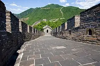
大家好!我是陈伟(Wei Chen)。今天我要带大家探索慕田峪长城,感受那深厚的历史底蕴。历史不仅在书本里,更在脚下的泥土中。 慕田峪长城是中国万里长城的其中著名一段,位于首都北京市怀柔区的军都山中,是明长城北京段的重要组成部分,也是北京旅游的一个胜地,2002年被评为4A级景区,2011年被评为国家5A级旅游景区,现仍有一部分尚未开发,不对游客开放。每年都会有大量中外游客慕名攀登。 概述 慕田峪长城的历史要追溯至北齐长城,当时在这里为了抵御北方游牧民族就大规模的修葺了长城防御体系,明朝立国后朱元璋派大将徐达在居庸关和古北口之间设立防御,于是在北齐长城的遗址上新建了长城,永乐二年建关取名慕田峪关,明末大将戚继光等在此守卫京师时多次对慕田峪长城进行了加固。由于战略地位重要以及多次修缮,慕田峪长城成为了明长城保留最为完好的部分之一。新中国建立以来经过多次修复如今成为了长城在北京地区的一处代表性段落。 交通 慕田峪长城景区距离北京城区约73千米,据怀柔城区16千米,怀黄公路从景区西南侧穿过,并在交叉口建有慕田峪环岛。环岛旁边建有地下停车场和旅游广场,慕田峪旅游公路将环岛与慕田峪村和登长城的台阶相连。有旅游摆渡车在旅游广场和登城台阶间往返运行,票价为人民币15元。另外景区内有两条架空索道提供,游人能够在索道上体会到慕田峪长城的地势险峻与磅礴气势。 公交车 自驾 直通巴士 有两家公司开通了开往慕田峪长成的直通车,分别是慕巴士和赞巴士。 票价 景区风光 希望你们喜欢这次的Mutianyu Great Wall之旅!欢迎持续关注我,一起探寻更多被遗忘的明清古迹。 #历史 #中国文化 #旅行 #明代 #清代 #MutianyuGreatWall #China #History #MingDynasty #Travel Related InsightsThe Echoes of Thirst: Unearthing the Ancient Hymns of Kenya's Singing Wells L'Abbaye de Westminster : Le Cœur Royal de Londres Altai Mountains{ "@context": "https://schema.org", "@type": "FAQPage", "mainEntity": [ { "@type": "Question", "name": "What is the main focus of 慕田峪长城:明代长城的精华?", "acceptedAnswer": { "@type": "Answer", "text": "深入了解慕田峪长城的历史、文化与建筑特色。" } }, { "@type": "Question", "name": "Who authored the comprehensive guide on 慕田峪长城:明代长城的精华?", "acceptedAnswer": { "@type": "Answer", "text": "This detailed article and its insights were carefully researched and authored by Wei Chen." } }, { "@type": "Question", "name": "Where can I find more related content about Travel?", "acceptedAnswer": { "@type": "Answer", "text": "You can explore more articles, detailed reviews, and similar insights by browsing the Related Insights section at the bottom of this article or visiting our dedicated Travel category page." } } ] }
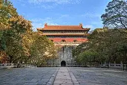
大家好!我是陈伟(Wei Chen)。今天我要带大家探索明孝陵,感受那深厚的历史底蕴。历史不仅在书本里,更在脚下的泥土中。 明孝陵是明代开国皇帝朱元璋和皇后马氏的合葬陵墓。因皇后諡「孝慈」,故名孝陵[注 1]。作为中国明陵之首的明孝陵,坐落在南京紫金山独龙阜玩珠峰下,东毗中山陵,南临梅花山。明孝陵壮观宏伟,代表了明初建筑和石刻艺术的最高成就,影响了明清两代500多年帝王陵寝的形制。依历史进程分布于北京、湖北、辽宁、河北等地的明清皇家陵寝,均按南京明孝陵的规制和模式营建。 孝陵是南京最大的帝王陵墓,也是中国古代最大的帝王陵寝之一。2003年7月3日,联合国教科文组织世界遗产委员会召开第27届会议,会上明孝陵被入选为世界文化遗产,其周边的常遇春墓、仇成墓、吴良墓、吴祯墓、徐达墓及李文忠墓6座功臣墓也同时被划入世界遗产保护范围。 建筑布局 明孝陵选址在紫金山独龙阜玩珠峰,洪武十四年(1381年)动工,于洪武十六年(1383年)完成了陵墓的享殿等主体工程,先后调用军工10万,至永乐三年(1405年)建成,历时25年。其总体布局分两部分:一是神道,二是陵宫,即享殿、宝城等陵寝主体建筑。陵园纵深2.62公里,当年围绕的红墙周长四十五里,辟大金门、王门、西红门、后红门、东西黑门。 明孝陵地面木结构建筑大多毁于1853年清军与太平天国之战,现仅存下马坊、禁约碑、大金门、石像生、碑亭、文武方门、享殿门台基、享殿台基、内红门、方城明楼及宝城墙体等砖石建筑。明孝陵布局宏雄,规制严谨,影响了明清两代的皇陵建筑。 神道 谒陵路线起自南京皇城之东的朝阳门(中山门),至卫岗有下马坊,下马坊内即为明孝陵的神道。不呈直线,而是环绕建有三国時代孙权陵墓的梅花山形成一个弯曲的形状。由下马坊至文武方门的神道长达2400米。沿神道依次有:下马坊、禁约碑、大金门、神功圣德碑碑亭、御桥、石像路、石望柱、武将、文臣、棂星门。 下马坊即孝陵神道入口,坐西朝东,为一座二间柱头冲天式石牌坊,额枋上刻「诸司官员下马」六个楷书大字,谒陵的文武官员,到此必须下马步行。坊前有嘉靖十年所立石碑,上有明世宗手书“神烈山”三字,旁有崇祯十四年所立卧碑,上书孝陵禁约。 大金门在下马坊西北数百步,规制同北京明十三陵大红门,为朝祭所经之门,黄瓦单檐庑殿顶(屋顶现已无存),门三道。面阔26.66米,残高4.91米。大金门之西为王门,再西为西红门,为官员谒陵及守陵、修缮人员出入之门。 神功聖德碑亭建于明永樂十一年(1413年),建築平面為正方形,故俗稱「四方城」,內置明成祖朱棣為其父朱元璋所立的「大明孝陵神功聖德碑」,碑高6.7米,赑屃高2.08米。 位于神功聖德碑亭之北,过五孔御河桥,列石像生十二对,自前向后依次为坐狮、立狮、坐獬豸、立獬豸、卧驼、立驼、卧象、立象、坐麒麟、立麒麟、卧马、立马。石兽之后又有望柱一对、武臣二对、文臣二对。再向北为棂星门,为三间两垣式牌楼门,毁于太平天国时期,现修复。 陵宫 过棂星门折向东北,便进入陵园的主体部分。这条正对独龙阜的南北轴线上依次有金水桥、文武方门、孝陵门、孝陵殿、内红门、方城明楼、宝顶等建筑。 又称文武方门,黄瓦单檐庑殿顶,中门三道,为拱券顶门;左右掖门各一,为平顶过梁门。毁于太平天国时期,现修复。 相当于明十三陵各陵的祾恩门。一层须弥座式台基,东西宽40米,南北深14.6米。清代改为三开间碑殿,並豎立了五座高大的石碑,至今遊客們還能見到其中的三尊。正中有一块大石碑,下有驮碑龟趺。其驮碑龟趺与众不同,脖子出奇地短。清朝康熙皇帝一生中六次南巡,五次拜谒明孝陵,行跪九叩大礼。石碑上书「治隆唐宋」四个金字,是康熙第三次南巡时(1699年)亲笔题书,並由曹雪芹的祖父、當時的「江南織造」郎中曹寅立碑。碑高3.85米,宽1.42米,厚度0.38米。「治隆唐宋」的意思是颂扬明太祖治国方略超过了唐太宗李世民和宋太祖赵匡胤。「治隆唐宋」御碑在太平天国战争时被毁,后由曾国藩扶起粘合,至今碑身上還看得到一道補過的裂痕。原本人们可以从石碑左右二边绕过,而在1980年代以后,整个石碑左右都被水泥所固定,一直到屋顶;所以現在要先从御碑殿出来,才可以看到龟趺的后面。 希望你们喜欢这次的Ming Xiaoling之旅!欢迎持续关注我,一起探寻更多被遗忘的明清古迹。 #历史 #中国文化 #旅行 #明代 #清代 #MingXiaoling #China #History #MingDynasty #Travel Related InsightsMétéora : L'Ascension Mystique entre Ciel et Pierre La Cathédrale de Chartres : Les Mystères de ses Vitraux L'Or Pourpre de la Provence : Voyage au Cœur des Océans de Lavande{ "@context": "https://schema.org", "@type": "FAQPage", "mainEntity": [ { "@type": "Question", "name": "What is the main focus of 明孝陵:大明王朝的开国之陵?", "acceptedAnswer": { "@type": "Answer", "text": "深入了解明孝陵的历史、文化与建筑特色。" } }, { "@type": "Question", "name": "Who authored the comprehensive guide on 明孝陵:大明王朝的开国之陵?", "acceptedAnswer": { "@type": "Answer", "text": "This detailed article and its insights were carefully researched and authored by Wei Chen." } }, { "@type": "Question", "name": "Where can I find more related content about Travel?", "acceptedAnswer": { "@type": "Answer", "text": "You can explore more articles, detailed reviews, and similar insights by browsing the Related Insights section at the bottom of this article or visiting our dedicated Travel category page." } } ] }
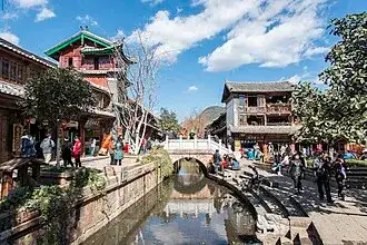
大家好!我是陈伟(Wei Chen)。今天我要带大家探索丽江古城,感受那深厚的历史底蕴。历史不仅在书本里,更在脚下的泥土中。 26°52′47″N 100°13′37″E / 26.87972°N 100.22694°E / 26.87972; 100.22694 丽江古城(或称丽江古镇),位於中华人民共和国云南省麗江市古城區,1997年12月4日被联合国教科文组织列為世界文化遗产,並於2007年获亞太區文物古蹟保護獎。 概要 丽江古鎮又名大研镇,坐落在丽江坝中部。它是中国历史文化名城中唯一没有城墙的古鎮,现代流传的一种说法是因为丽江土司(世袭统治者)姓木,筑城势必如木字加框而成“困”字之故,但这种说法没有任何历史依据,丽江古城是中国历史文化名城中唯一没有城墙的,但并不是历史上唯一没有城墙的古镇,根据乾隆年间《丽江府志略》记载,“丽江旧为土府无城”,雍正元年改土归流后曾筑土城。纳西族名称叫“巩本知”,“巩本”为仓廪,“知”即集市,可知丽江古鎮曾是仓廪集散之地。 古鎮位于县境的中部,地理坐标为东经100°14′,北纬26°52′。海拔2400余米。是一座风景秀丽,历史悠久和文化灿烂的名城,也是中国罕见的保存相当完好的少数民族古鎮。 历史 丽江古鎮始建于大理末元初,至今已有八百多年的历史。当时丽江木氏先祖将统治中心由白沙迁至现狮子山。1253年,蒙古军南征,木氏先祖阿宗阿良迎降。1254年,蒙古设三赕管民官。1277年,改丽江路通安州。1382年(明洪武十五年)通安州知州阿甲阿得归顺明朝,改设丽江军民府,赐阿甲阿得木姓,封世袭知府。 明末徐霞客的《滇游日记》曾写丽江古鎮中木氏土司宫邸“宫室之丽,拟于王者”。城区则“居庐骈集,萦城带谷”、“民房群落,瓦屋栉比”,可见当时丽江古鎮已有名。 丽江古鎮曾是明朝丽江军民府和清朝丽江府的府衙署所在地,明朝称「大研箱」(大研即大硯,因古城周圍群山環繞,流水縈迴,外型有如一方大硯)。清朝時改称「大研里」,在清咸豐年間(1860年左右),古城大部分建築都毀於兵燹戰禍。民国以后改称「大研鎮」。 丽江古鎮,因为集中体现了纳西文化的精华,并完整地保留了大理、元以来形成的历史风貌,1986年2月被国务院列为国家历史文化名城。 世界遗产 1997年12月3日,联合国教科文组织世界遗产委员会一致通过,将丽江古城列入《世界遗产名录》。世界遗产丽江古城包括大研古镇(含黑龙潭)、白沙民居建筑群、束河民居建筑群三部分。 维护 2001年,丽江古城开始征收维护费。2007年,丽江市出台《丽江市丽江古城维护费征收办法》,对进入古城参观的游客收取每人80元的维护费。2017年费用调整至每人50元。2025年7月,丽江市人民政府发布《丽江古城维护费征收管理办法》,明确古城维护费的适用范围为丽江古城景区的核心区域,费用仍维持为50元人次,有效期延长至365天。游客未按规定办法缴纳的由古城保护管理机构责令缴纳。办法还明确八类人员可免缴维护费,对于随团游客则由旅行社代为收取,即维护费包含在报团费用内。 圖片 希望你们喜欢这次的Lijiang Old Town之旅!欢迎持续关注我,一起探寻更多被遗忘的明清古迹。 #历史 #中国文化 #旅行 #明代 #清代 #LijiangOldTown #China #History #MingDynasty #Travel Related InsightsL'Écho des Pierres : Voyage au Cœur du Patrimoine Vivant Floating Above the Clouds: A Definitive Pilgrimage to Bhutan’s Tiger’s Nest Arctic Secrets Unlocked: The Svalbard Seed Vault Expedition{ "@context": "https://schema.org", "@type": "FAQPage", "mainEntity": [ { "@type": "Question", "name": "What is the main focus of 丽江古城:茶马古道上的明珠?", "acceptedAnswer": { "@type": "Answer", "text": "深入了解丽江古城的历史、文化与建筑特色。" } }, { "@type": "Question", "name": "Who authored the comprehensive guide on 丽江古城:茶马古道上的明珠?", "acceptedAnswer": { "@type": "Answer", "text": "This detailed article and its insights were carefully researched and authored by Wei Chen." } }, { "@type": "Question", "name": "Where can I find more related content about Travel?", "acceptedAnswer": { "@type": "Answer", "text": "You can explore more articles, detailed reviews, and similar insights by browsing the Related Insights section at the bottom of this article or visiting our dedicated Travel category page." } } ] }
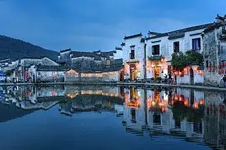
大家好!我是陈伟(Wei Chen)。今天我要带大家探索宏村,感受那深厚的历史底蕴。历史不仅在书本里,更在脚下的泥土中。 宏村村是中华人民共和国安徽省黄山市黟县宏村鎮的行政村,位于安徽省南部的黄山脚下,是一座有着大量明清时期历史建筑的古村落。村中还构建了完善的水系和颇具特色的“牛”形布局,是徽州民居的典型代表。2000年,包括宏村在内的皖南古村落在第24届世界遗产委员会上被列为世界文化遗产。2001年,宏村古建筑群被中华人民共和国国务院公布为第五批全国重点文物保护单位之一。2003年,宏村被授予中国历史文化名村称号。 宏村被《米其林旅游指南》评为“三星级旅游推荐”(最高级别)。 村落概况 宏村位于安徽省南部的黟县县城东北11公里处,现为宏村镇的驻地。整个村落坐北朝南,背靠黄山的餘脉雷岗山,西面有邕溪河和羊栈河流淌而过,全村面积约28万平方米。 该村始建于南宋绍兴年间(1131年),最初叫作弘村,是汪氏家族的聚居地。明永乐年间,汪氏族长请风水先生勘定环境,重新布局了建筑,并引水入村。清代中期,村中再次进行大规模的兴建,并为避乾隆帝“弘历”之讳,而更名为“宏村”。村内现在依然留存了大量明清时期的古建筑,其中明代建筑1幢,清代建筑102幢,民国时期建筑34幢,大都保存完好,是徽州民居的典型代表。 宏村的一大特色是它有着一套完善的供水系统。村民们将村西的河水引入村内,开凿了一条近1米宽的水圳,九曲十弯,为各家各户提供生活用水,同时也起到调节气温和美化环境的作用。水圳在村的中部形成半月形的月沼,又在南部形成弓形的南湖,构成了宏村独特的风貌。 该村的另一大特色是它的平面采用仿生学的“牛”形布局。以雷岗山为牛头,村口的两株古树为牛角,月沼为牛心,南湖为牛肚,蜿蜒的水圳为牛肠,民居建筑为牛身,四座古桥为牛脚,形状惟妙惟肖,称作“山为牛头树为角,桥为四蹄屋为身”。 建筑特色 宏村的建筑主要是住宅和私家园林,也有书院和祠堂等公共设施,建筑组群比较完整。各类建筑都注重雕饰,木雕、砖雕和石雕等细腻精美,具有极高的艺术价值。村内街巷大都傍水而建,民居也都围绕着月沼布局。住宅多为二进院落,有些人家还将圳水引入宅内,形成水院,开辟了鱼池。比较典型的建筑有南湖书院、乐叙堂、承志堂、德义堂、松鹤堂、碧园等。 南湖书院位于南湖的北畔,原是明末兴建的六座私塾,称“倚湖六院”,清嘉庆十九年(1814年)合并重建为“以文家塾”,又名“南湖书院”。重建后的书院由志道堂、文昌阁、启蒙阁、会文阁、望湖楼和祗园等六部分组成,粉墙黛瓦,碧水蓝天,环境十分优雅。乐叙堂是汪氏的宗祠,位于月沼北畔的正中,是村中现存唯一的明代建筑,木雕雕饰非常精美。 承志堂建于清末咸丰五年(1855年),是大盐商汪定贵的住宅。它是村中最大的建筑群,占地约2100平方米,内部有房屋60餘间,围绕着九个天井分别布置。正厅和后厅均为三间回廊式建筑,两侧是家塾厅和鱼塘厅,后院是一座花园。院落内还设有供吸食鸦片烟的“吞云轩”和供打麻将的“排山阁”等。全宅有木柱136根,木柱和额枋间均有雕刻,造型富丽,工艺精湛,题材有“渔樵耕读”、“三国演义戏文”、“百子闹元宵”、“郭子仪拜寿”、“唐肃宗宴客图”等。 宏村周围为青山绿水环抱,环境秀丽宜人,电影《卧虎藏龙》曾在此拍摄。 主要建筑列表 全景图 注2:大运河为跨省市区项目,在安徽省有三个子项。 注2:独山和金寨革命旧址群归入第三批全国重点文物保护单位鄂豫皖革命根据地旧址。 希望你们喜欢这次的Hongcun之旅!欢迎持续关注我,一起探寻更多被遗忘的明清古迹。 #历史 #中国文化 #旅行 #明代 #清代 #Hongcun #China #History #MingDynasty #Travel Related InsightsSun-Drenched Serenity vs. The Fjord’s Embrace: Choosing Between the Albanian Riviera and the Bay of Kotor Mumbai’s Sizzling Soul: The Spice, Chaos, and Stories Behind Its Legendary Street Food The Shimmering Waters: Documenting Plitvice Lakes National Park{ "@context": "https://schema.org", "@type": "FAQPage", "mainEntity": [ { "@type": "Question", "name": "What is the main focus of 宏村:画中的明清古村落?", "acceptedAnswer": { "@type": "Answer", "text": "深入了解宏村的历史、文化与建筑特色。" } }, { "@type": "Question", "name": "Who authored the comprehensive guide on 宏村:画中的明清古村落?", "acceptedAnswer": { "@type": "Answer", "text": "This detailed article and its insights were carefully researched and authored by Wei Chen." } }, { "@type": "Question", "name": "Where can I find more related content about Travel?", "acceptedAnswer": { "@type": "Answer", "text": "You can explore more articles, detailed reviews, and similar insights by browsing the Related Insights section at the bottom of this article or visiting our dedicated Travel category page." } } ] }
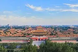
大家好!我是陈伟(Wei Chen)。今天我要带大家探索紫禁城,感受那深厚的历史底蕴。历史不仅在书本里,更在脚下的泥土中。 故宮,又稱紫禁城(滿語:ᡩᠠᠪᡴᡡᡵᡳᡩᠣᡵᡤᡳᡥᠣᡨ᠋ᠣᠨ,穆麟德轉寫:dabkūri dorgi hoton),是中国明清兩朝二十四位皇帝的皇宮。故宮始建于明成祖永樂四年(1406年),以南京故宫为蓝本营建,永樂十八年(1420年)落成。位於北京中軸線中心的故宮,占地面積72萬平方米,建築面積約15萬平方米,有大小宫殿七十多座。房屋九千余间。是世界上現存規模最大、最完整的宮殿型建築。北京故宫是第一批全国重点文物保护单位、第一批国家5A级旅游景区,1987年被选入《世界文化遺產》名录,亦為2024年7月27日所入選另一項世界遺產「北京中轴线——中国理想都城秩序的杰作」的一部分。故宮现为故宫博物院,藏品主要以明、清两代宫廷收藏为基础,是国家一级博物馆。 故宫南北长961米,东西宽753米,四面围有高10米的城墙,外有59米宽的护城河环绕。有四座城门,南面为午门,北面为神武门,东面为东华门,西面为西华门。城墙的四角,各有一座风姿绰约的角楼,民间有九梁十八柱七十二条脊之说,来形容其结构的复杂。城内的建筑分为外朝和内廷两部分。外朝的中心为太和殿、中和殿、保和殿,统称三大殿,是国家举行大典礼的地方。三大殿左右两翼辅以文华殿、武英殿两组建筑。内廷的中心是乾清宫、交泰殿、坤宁宫,统称后三宫,是皇帝和皇后居住的正宫。其后为御花园。后三宫两侧排列着东、西六宫,是后妃们居住休息的地方。东六宫东侧是天穹宝殿等佛堂建筑,西六宫西侧是中正殿等佛堂建筑。外朝、内廷之外还有外东路、外西路两部分建筑。 明初定都于南京应天府。建文年间,燕王朱棣自北平起兵,发动靖难之变。永樂元年(1403年),朱棣頒詔改北平为北京。从永乐元年至三年,多次下令从各地迁入人口至北京。永乐五年闰七月,朱棣颁诏开始营建紫禁城。主持营建工程为泰宁候陈珪、工部侍郎吴中、刑部侍郎张思恭、设计师潭柘寺无名和尚。大量以北方工匠为主体,包括部分南方工匠,如(今江苏)流传的石工陆祥、瓦工杨青等,在永乐五年五月到达北京。建造紫禁城和改造北京是同时进行的,以原来的元大都城为基础改建。紫禁城工程开始後不久,即受到长陵建设及永乐八年、十一年两次北伐蒙古战役影响而放慢,至永乐十六年六月方才开始重新开工。 永樂十八年(1420年)十二月紫禁城完工。永乐十九年(1421年)正月初一,永乐迁都完成;同年五月遭雷擊,發生大火,前三殿被焚毀。1440年(正統五年),重建前三殿及乾清宮。1459年(天順三年),營建西苑。1557年(嘉靖三十六年),紫禁城大火,前三殿、奉天門、文武樓、午門全部被焚毀,至1561年才重建完工。萬曆二十五年(1597年),紫禁城大火,焚毀前三殿、後三宮。復建工程直至天啟七年(1627年)方完工。 崇禎十七年(1644年),李自成軍攻陷北京,明朝滅亡。未幾,明朝山海關總兵吳三桂引清兵入關,擊敗李自成;李自成向陝西撤退前焚毀紫禁城,僅武英殿、建極殿、英華殿、南薰殿、四周角樓和皇極門未焚。同年清順治帝至北京,以皇极门为常朝场所,以未被焚毁的建极殿为位育宫,作为顺治帝寝宫;摄政王多尔衮在武英殿办公。顺治元年至顺治十四年,重建了午门、天安门、外朝前三殿,将位育宫恢复为建极殿,改名为保和殿;又整修内廷、东路和西路的建築。在末代皇帝溥仪于民国十三(1924)年搬出故宫后,于民國十四年國慶日(1925年10月10日)故宫博物院正式成立開幕,向公众开放。 名称 故宫在辛亥革命之前称为“紫禁城”。它的名字來自“紫微星垣”,中国古代星像学家把天上的星星分为三垣,四象,二十八星宿等。其中三垣指紫微星垣,太微星垣和天市星垣。紫微星垣居于正中,据传皇天上帝的居所(紫宫)就在紫微星垣中,人间皇帝自称“天子”便仿皇天上帝居所的名字用其“紫”字,而“禁”則指宮城,是为“紫禁城”。 歷史 北京故宮為明成祖朱棣於西元1406年下令全面建造,地点位於元朝大都皇宮南面,然而北京故宮並沒有在元朝大都皇宮的基礎上建構,宮殿和宮牆均是重新建造,設計師為潭柘寺的无名和尚。故宮在西元1420年正式落成,從1420年落成,到1911年清帝遜位、1924年遜帝遷出故宮,500餘年内,明、清兩代合計24位皇帝曾經居住於此,宣統皇帝溥仪是最後一位皇帝。 希望你们喜欢这次的Forbidden City之旅!欢迎持续关注我,一起探寻更多被遗忘的明清古迹。 #历史 #中国文化 #旅行 #明代 #清代 #ForbiddenCity #China #History #MingDynasty #Travel Related InsightsWhispers in the White Gold Mountains: Tracing Austria's Forgotten Salt Smugglers Croatia Unveiled: Stepping Back into the Medieval World Japan’s Secret Onsen: 10 Underrated Retreats Where Tradition Meets Serenity{ "@context": "https://schema.org", "@type": "FAQPage", "mainEntity": [ { "@type": "Question", "name": "What is the main focus of 紫禁城:明清两代的皇家心脏?", "acceptedAnswer": { "@type": "Answer", "text": "深入了解紫禁城的历史、文化与建筑特色。" } }, { "@type": "Question", "name": "Who authored the comprehensive guide on 紫禁城:明清两代的皇家心脏?", "acceptedAnswer": { "@type": "Answer", "text": "This detailed article and its insights were carefully researched and authored by Wei Chen." } }, { "@type": "Question", "name": "Where can I find more related content about Travel?", "acceptedAnswer": { "@type": "Answer", "text": "You can explore more articles, detailed reviews, and similar insights by browsing the Related Insights section at the bottom of this article or visiting our dedicated Travel category page." } } ] }
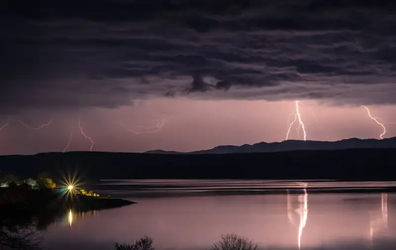
In den Tiefen Südamerikas, wo sich die smaragdgrünen Wälder Venezuelas an die majestätischen Anden schmiegen, offenbart sich ein Schauspiel von unübertroffener Erhabenheit und geheimnisvoller Schönheit: der Catatumbo-Blitz. Dieses atmosphärische Phänomen, von den indigenen Barí, die seit Äonen an diesen Ufern leben, ehrfürchtig „Haus des Donners“ genannt, ist weit mehr als nur ein Gewitter. Es ist ein lebendiges, atmendes Wunder, eine Symphonie aus Licht und Elektrizität, die den Nachthimmel über dem Maracaibo-See in ein gleißendes Ballett taucht, wie es nirgendwo sonst auf Erden zu finden ist. Es ist der "Leuchtturm von Maracaibo", ein ewiges Leuchtfeuer, das seit Jahrhunderten Seefahrern den Weg weist und Generationen von Einheimischen in seinen Bann zieht. Eine Reise zu diesem Ort ist nicht nur eine Erkundung einer geografischen Besonderheit, sondern eine tiefgreifende Begegnung mit der rohen, ungezähmten Kraft unseres Planeten. Das Phänomen entfaltet sich in einer Region, die von Feuchtgebieten und einer einzigartigen Geografie geprägt ist. Typischerweise manifestiert es sich über den sumpfigen Gebieten, die dort entstehen, wo der Catatumbo-Fluss in den Maracaibo-See mündet, einer Bucht im Westen des Sees, die sich zwischen 8°30′N 71°0′W und 9°45′N 73°0′W erstreckt. Von hier aus steigen Massen von Sturmwolken in Höhen von über einem Kilometer auf, und die Bühne für das bemerkenswerteste Naturschauspiel der Erde wird bereitet. Für 140 bis 160 Nächte im Jahr, durchschnittlich neun Stunden pro Tag, durchzucken Blitze den Himmel – mit einer Frequenz, die oft 16 bis 40 Entladungen pro Minute erreicht. Dies ist die höchste Blitzdichte der Welt, ein atemberaubender Wert von 250 Blitzen pro Quadratkilometer pro Jahr, der die Intensität und die Einzigartigkeit dieses Phänomens unterstreicht. Im Sommer kann dieses Phänomen sogar als sogenannter „trockener Blitz“ auftreten, bei dem der Himmel von Blitzen erleuchtet wird, ohne dass Regen fällt – ein weiteres Zeugnis seiner außergewöhnlichen Natur. Die Frequenz dieser Blitze ist jedoch nicht statisch; sie ändert sich im Laufe des Jahres und variiert von Jahr zu Jahr. Eine bemerkenswerte Unterbrechung ereignete sich beispielsweise von Januar bis März 2010, als das Gewitter offenbar aufgrund einer schweren Dürre verstummte. Dies führte zu Spekulationen, es könnte für immer erloschen sein – eine Vorstellung, die die tiefe Verbundenheit und die Mystik unterstreicht, die dieses Phänomen umgibt. Die Architektur eines atmosphärischen Wunders: Standort und Mechanismus Die genaue Lage und die komplexen Mechanismen, die den Catatumbo-Blitz hervorbringen, sind ein faszinierendes Studienobjekt für Meteorologen und Geowissenschaftler gleichermaßen. Das Herzstück des Geschehens ist der Maracaibo-See, eine immense Süßwasserfläche, umgeben von ausgedehnten, sumpfigen Ebenen. Hier, in dieser einzigartigen geografischen Konstellation, treffen Winde, die über den See und die feuchten Ebenen streichen, auf ein imposantes Dreigestirn aus Gebirgszügen: die hoch aufragenden Anden, die Perijá-Berge mit ihren Gipfeln von bis zu 3.750 Metern und die Mérida-Kordillere. Diese Gebirgsketten umschließen die Ebene von drei Seiten, bilden eine natürliche Barriere und schaffen eine Art atmosphärische Falle. Die von den Ebenen aufgenommene Hitze und Feuchtigkeit, die durch die Sonneneinstrahlung und die feuchte Umgebung entsteht, reichert die Luftmassen mit elektrischen Ladungen an. Wenn diese instabilen Luftmassen dann auf die Gebirgszüge treffen, werden sie gezwungen, schnell aufzusteigen. Dieser Aufstieg kühlt die Luft ab, führt zur Kondensation und zur Bildung gewaltiger Gewitterwolken, in denen sich die elektrischen Spannungen entladen. Das Ergebnis ist ein nahezu ununterbrochenes Blitzgewitter, das größtenteils innerhalb der Wolken stattfindet. Dieses intensive und fortwährende Schauspiel erzeugt eine enorme Menge an Ozon. Ob dieser Ozonbeitrag jedoch maßgeblich zur Ozonsphäre beiträgt, ist aufgrund der Instabilität und der kurzlebigen Natur des Sturms weiterhin Gegenstand wissenschaftlicher Debatten. Die Wechselwirkung von feuchtwarmen Luftmassen mit den kalten, aufsteigenden Winden der Anden schafft somit eine perfekte Konvergenzzone für die Entstehung eines der spektakulärsten und persistentesten Gewitter der Erde.Auf der Suche nach der Ursache: Ein Blick in die Forschung Die genaue Ursache des Catatumbo-Blitzes war lange Zeit Gegenstand intensiver Forschung und vieler Theorien. Der russische Forscher Andrei Zavrotsky war einer der ersten, der das Gebiet mehrfach untersuchte. Seine Schlussfolgerungen im Jahr 1991 besagten, dass das Blitzphänomen mehrere Epizentren in den Sümpfen des Juan Manuel de Aguas Nationalparks, den Claras Aguas Negras und dem westlichen Maracaibo-See aufweist. Zavrotsky vermutete, dass die Begegnung von kalten und warmen Luftströmungen in dieser Region das Phänomen auslöste. Er spekulierte zudem, dass die Präsenz von Uran im Grundgestein eine isolierte Ursache für die Blitze sein könnte – eine Theorie, die bis heute kontrovers diskutiert wird. In den Jahren zwischen 1997 und 2000 rückte eine neue Hypothese in den Fokus. Eine Reihe von vier Studien schlug vor, dass das Methan, das von den ausgedehnten Sümpfen und den massiven Ölvorkommen in der Region produziert wird, eine Hauptursache des Phänomens sei. Dieses sogenannte Methan-Modell basiert auf den Symmetrieeigenschaften des Methans und postuliert, dass die Gasemissionen die Ionisierung der Atmosphäre erleichtern und somit die Blitzentladungen verstärken könnten. Doch auch diese Theorie blieb nicht unwidersprochen. Andere Studien haben darauf hingewiesen, dass dieses Modell im Widerspruch zum beobachteten Verhalten des Blitzes steht. Es würde beispielsweise eine höhere Blitzaktivität in der Trockenzeit (Januar bis Februar) und eine geringere in der Regenzeit (April bis Mai und September bis Oktober) vorhersagen, was nicht immer den tatsächlichen Beobachtungen entspricht. Ein Team der Universidad del Zulia hat die Auswirkungen verschiedener atmosphärischer Variablen auf die tägliche, saisonale und jährliche Variabilität des Catatumbo-Blitzes umfassend untersucht. Ihre Forschung deckte signifikante Zusammenhänge mit der Inter-Tropical Convergence Zone (ITCZ), der El Niño-Southern Oscillation (ENSO), dem karibischen Tiefenwindstrom (Caribbean Low-Level Jet) sowie den lokalen Winden und der konvektiven verfügbaren potenziellen Energie (CAPE) auf. Durch die Analyse von Satellitendaten konnte die NASA bestätigen, dass es jährlich etwa 250 Blitze pro Quadratkilometer in diesem Gebiet gibt, was die unbestreitbare Intensität des Phänomens verdeutlicht. Diese vielschichtigen Einflüsse zeigen, dass der Catatumbo-Blitz das Ergebnis eines komplexen Zusammenspiels mehrerer klimatischer und geographischer Faktoren ist, die in perfekter, wenn auch gewaltiger Harmonie zusammenwirken. Die Vorhersagbarkeit eines ewigen Sturms Die Fähigkeit, ein so unberechenbar wirkendes Naturphänomen wie den Catatumbo-Blitz vorherzusagen, ist ein bemerkenswerter Fortschritt in der Meteorologie und für die Anrainer des Maracaibo-Sees von großer Bedeutung. Eine Studie aus dem Jahr 2016 zeigte, dass es tatsächlich möglich ist, die Blitzaktivität im Maracaibo-Becken bis zu mehrere Monate im Voraus zu prognostizieren. Diese Vorhersage basiert auf der Variabilität des "Lake Maracaibo Low-Level Jet" – einem lokalen Tiefenwindstrom – und seinen Wechselwirkungen mit vorhersagbaren Klimamodi wie der El Niño-Southern Oscillation (ENSO) und dem karibischen Tiefenwindstrom (Caribbean Low-Level Jet). Die Studie offenbarte auch, dass die Genauigkeit der Vorhersage signifikant höher ist, wenn ein spezieller Index verwendet wird. Dieser Index basiert auf einer Kombination aus Winddaten und der konvektiven verfügbaren potenziellen Energie (CAPE). Er scheint den kumulativen Effekt mehrerer klimatischer Antriebskräfte gut zu erfassen und bietet eine umfassendere Grundlage für präzisere Prognosen. Die Möglichkeit, die Intensität und Häufigkeit dieses einzigartigen Naturphänomens langfristig vorherzusagen, eröffnet nicht nur neue Wege für die wissenschaftliche Forschung, sondern könnte auch für die lokale Bevölkerung von praktischem Nutzen sein, beispielsweise im Hinblick auf die Anpassung an Wetterextreme oder die Planung von Aktivitäten in der Region. Es zeigt, wie tiefgreifendes Verständnis der komplexen atmosphärischen Prozesse die scheinbar willkürlichen Launen der Natur entschlüsseln kann.Echo der Geschichte: Zeugnisse aus vergangenen Zeiten Das Catatumbo-Gewitter ist keine neue Entdeckung; seine Präsenz ist tief in der Geschichte und den Kulturen der Region verwurzelt. Bereits koloniale portugiesische und spanische Quellen berichten von diesem Phänomen und nennen es ehrfurchtsvoll "Laternen des Heiligen Antonius" oder den "Leuchtturm von Maracaibo". Alexander Walker erwähnte diese Bezeichnungen 1822 in seinen Schriften. Auch der preußische Naturforscher und Entdecker Alexander von Humboldt, bekannt für seine weitreichenden Reisen und detaillierten Beschreibungen Südamerikas, widmete sich dem Blitzphänomen. Basierend auf M. Palacios' Buch "Viage de Varinas" beschrieb Humboldt den Blitz im Jahr 1826, was seine Bedeutung für frühe europäische Beobachter unterstreicht. Der italienische Geograph Agustin Codazzi lieferte 1841 eine poetische Beschreibung: "wie ein kontinuierlicher Blitz, und seine Position ist so, dass er, fast auf dem Meridian der Mündung des Sees gelegen, den Seefahrern als Leuchtturm dient." Diese Beschreibung fängt die Essenz des Phänomens als verlässliche Navigationshilfe und als Naturwunder ein. Doch die Kenntnis des Catatumbo-Blitzes reicht weit über die Ankunft der Europäer hinaus. Für indigene Kulturen wie die Wayuu, Yukpa und Barí ist das Phänomen seit Jahrtausenden bekannt und wird als fester Bestandteil ihrer Kosmologie betrachtet. Sie glauben, dass es schon immer existiert hat, ein ewiger Wächter des Himmels. In der Wayuu-Kultur wird der Blitz als ein Signal der Natur für Respekt und Stärke angesehen. Diese tief verwurzelte spirituelle und kulturelle Bedeutung unterstreicht, dass der Catatumbo-Blitz nicht nur ein meteorologisches Ereignis ist, sondern ein integraler Bestandteil des Lebens, der Mythen und der Identität der Menschen, die in seiner majestätischen Präsenz leben. Es ist ein lebendiges Erbe, das die Verbindung zwischen Mensch und Natur auf einzigartige Weise zelebriert. Der Blitz in der Kultur: Ein strahlendes Erbe Die tiefgreifende Bedeutung des Catatumbo-Blitzes für die Region Maracaibo spiegelt sich auch in der modernen Kultur wider. Das Phänomen ist so untrennbar mit der Identität des venezolanischen Bundesstaates Zulia verbunden, dass es auf dessen Flagge und Wappen abgebildet ist. Auch in der Hymne des Staates findet der Catatumbo-Blitz Erwähnung, was seine Rolle als nationales Symbol und einzigartiges Wahrzeichen unterstreicht. Seit Jahrhunderten ist er als der "Leuchtturm von Maracaibo" bekannt, da sein unaufhörliches Lichtspektakel kilometerweit über den See hinaus sichtbar ist und Seefahrern bei der Navigation dient. Diese praktische Funktion, kombiniert mit seiner mystischen Ausstrahlung, hat dem Blitz einen festen Platz im kulturellen Gedächtnis der Menschen gesichert. Interessanterweise gab es in der Vergangenheit auch Interpretationen, die eine Referenz an ein nächtliches Leuchten im Himmel in Lope de Vegas Epos "La Dragontea" über den Angriff auf San Juan de Puerto Rico durch Sir Francis Drake als eine frühe literarische Anspielung auf den Catatumbo-Blitz sahen (zumal der Dichter in einem anderen Vers Maracaibo erwähnt). Doch diese Interpretation wurde als Missverständnis entlarvt; die Beschreibung bezog sich tatsächlich auf den Schein, der durch brennende Schiffe während der Schlacht erzeugt wurde. Dies zeigt, wie mächtig die Vorstellungskraft und der Wunsch, dieses außergewöhnliche Phänomen in historischen Texten zu finden, sein können. Ungeachtet solcher Fehlinterpretationen bleibt der Catatumbo-Blitz ein unbestreitbares, leuchtendes Symbol, das die Menschen seit jeher fasziniert und inspiriert – ein ewiger Zeuge der ungezähmten Schönheit und Kraft der venezolanischen Natur.#CatatumboBlitz #Venezuela #Reiseblog #Naturwunder #Maracaibo Related InsightsSun-Drenched Serenity vs. The Fjord’s Embrace: Choosing Between the Albanian Riviera and the Bay of Kotor Cape Town: Dove il Tempo si Incontra con l’Oceano e la Storia si Svela tra Montagne Sacre Arctic Circle Digital Nomadism: Building Connectivity in Greenland's Remote Towns{ "@context": "https://schema.org", "@type": "FAQPage", "mainEntity": [ { "@type": "Question", "name": "What is the main focus of Das Ewige Gewitter vom Maracaibo: Eine Reise ins Haus des Donners?", "acceptedAnswer": { "@type": "Answer", "text": "Tauchen Sie ein in die faszinierende Welt des Catatumbo-Blitzes, eines unaufhörlichen Lichtspektakels über dem Maracaibo-See in Venezuela, das Himmel und Erde in ein elektrisches Ballett verwandelt." } }, { "@type": "Question", "name": "Who authored the comprehensive guide on Das Ewige Gewitter vom Maracaibo: Eine Reise ins Haus des Donners?", "acceptedAnswer": { "@type": "Answer", "text": "This detailed article and its insights were carefully researched and authored by Hans Müller." } }, { "@type": "Question", "name": "Where can I find more related content about Travel?", "acceptedAnswer": { "@type": "Answer", "text": "You can explore more articles, detailed reviews, and similar insights by browsing the Related Insights section at the bottom of this article or visiting our dedicated Travel category page." } } ] }
- Hans Müller
- 07 Jul, 2026 03:49
Die Wächter der Kronen: Eine Odyssee des Widerstands in den Baumwipfeln der Welt
In einer Welt, in der die ehrwürdigen Säulen unserer Erde, die Bäume, zunehmend von der Axt bedroht sind, erhebt sich ein Widerstand, der so alt und doch so neu ist wie die Wälder selbst. Es ist ein Akt von kühner Entschlossenheit und stiller Rebellion, der Menschen dazu bewegt, den Himmel zu berühren, um die Erde zu retten. Die Rede ist vom „Tree Sitting“, einer Form des zivilen Ungehorsams, die das menschliche Leben als Schild benutzt, um altehrwürdige Riesen vor dem Fall zu bewahren. Dieses Phänomen ist mehr als nur ein Protest; es ist eine Lebensweise auf Zeit, eine mutige Erklärung, die tief in den Blätterdächern widerhallt. Aktivisten klettern in die Bäume, oft auf eigens dafür gebauten, spartanischen Plattformen, und trotzen den Elementen, um ein klares Signal zu senden: „Dieser Baum wird nicht fallen, solange ich hier bin.“ Die spekulative Annahme, die dieser Taktik zugrunde liegt, ist einfach, aber wirkungsvoll: Holzfäller werden menschliches Leben nicht gefährden, indem sie einen besetzten Baum fällen. Unterstützer am Boden versorgen die „Tree Sitter“ mit Nahrung und anderen lebensnotwendigen Gütern, wodurch ein unsichtbares Band der Solidarität zwischen Erde und Himmel gespannt wird. Das Wesen des Baumhausprotests: Gefahr, Strategie und öffentliche Aufmerksamkeit Der Baumhausprotest ist eine Strategie, die ein hohes Maß an öffentlicher Aufmerksamkeit generiert. Die vermeintliche Gefahr, in der sich die Aktivisten befinden, zieht die Blicke auf sich und macht die Geschichten der „Tree Sitter“ zu Schlagzeilen. Die Evakuierung dieser Baumwächter erfordert hochqualifizierte Polizeibeamte, was den Aufwand und die Ernsthaftigkeit des Protests unterstreicht. Doch über die reine Aufmerksamkeitsgenerierung hinaus dient das „Tree Sitting“ oft als Verzögerungstaktik. Während die Aktivisten hoch oben in den Baumkronen ausharren, kämpfen Anwälte in den Gerichten um langfristige Siege für den Wald. Jede Stunde, jeder Tag, den ein Baum besetzt ist, ist eine Stunde oder ein Tag, den die Kettensägen schweigen und die Chance für eine juristische Rettung wächst. Die Geschichte des Baumhauses als Ort des menschlichen Aufenthalts reicht jedoch weiter zurück als die modernen Umweltproteste. Einst war das Klettern und Verweilen in Bäumen ein kindlicher Zeitvertreib. In den frühen 1930er Jahren, einer Ära, in der Ausdauerwettbewerbe in den Vereinigten Staaten populär waren, entwickelte sich das Baumhausbesetzen zu einem Wettbewerb für Kinder. Von Geschwistern und lokalen Unternehmen versorgt, versuchten sie, Preise für die längste Verweildauer in ihren Hinterhofbäumen zu gewinnen. Eine spielerische Herausforderung, die Jahrzehnte später eine ernste, lebensverändernde Wendung nehmen sollte. Vom Kinderspiel zum ernsthaften Widerstand: Die Evolution des Baumhauses Diese Transformation vom unschuldigen Kinderspiel zur ernsthaften Form des zivilen Ungehorsams zeugt von der Dringlichkeit der Umweltkrise. Was einst ein symbolischer Akt kindlicher Ausdauer war, wurde zu einem verzweifelten Schrei nach Aufmerksamkeit und Schutz für unsere bedrohten Wälder. Die Leichtigkeit und Freude des Spiels wich der Konsequenz und dem Risiko des Protests, doch der Kern – das Verweilen in den Ästen – blieb erhalten. Die Welt des Baumhausprotests ist jedoch nicht nur von idealistischer Romantik geprägt. Sie birgt auch die harte Realität der Konfrontation und der gewaltsamen Entfernung.Extraktionen und Konflikte: Die dunkle Seite des Protests Besetzer in Bäumen, die von Unternehmen wie Pacific Lumber im Humboldt County beansprucht wurden, waren Ziel erzwungener Räumungen durch angeheuerte „Extraktoren“. Diese Praxis begann in den späten 1990er Jahren mit einem einzigen Extraktor, doch im Jahr 2003 heuerte Pacific Lumber Teams von Kletterern an, um Dutzende von „Tree Sittern“ zu entfernen, insbesondere in der Freshwater-Region östlich von Eureka, Kalifornien. Die meisten dieser Extraktionen in Nordkalifornien stehen unter der Leitung von Eric Schatz von Schatz Tree Service, einem bekannten professionellen Baumpfleger. Diese Konfrontationen, bei denen professionelle Kletterer und Aktivisten in schwindelerregender Höhe aufeinandertreffen, verdeutlichen die Ernsthaftigkeit und oft auch die Gefährlichkeit des Baumhausprotests. Es ist ein Kräftemessen zwischen wirtschaftlichen Interessen und dem unerschütterlichen Willen zum Schutz der Natur. Globale Baumhausproteste – Ein Ruf aus dem Blätterdach: Bemerkenswerte Aktionen weltweit Die Geschichte des Baumhausprotests ist reich an bemerkenswerten Aktionen, die sich über Kontinente erstrecken und die Vielfalt menschlichen Engagements für die Umwelt aufzeigen. Australien: Ein Kontinent im Kampf um seine Urwälder Australien, ein Land mit einer einzigartigen Flora und Fauna, war Schauplatz zahlreicher entscheidender Baumhausbesetzungen. Im Dezember 1983 kletterte die Nomadic Action Group (NAG) in Bäume, um den Bau der umstrittenen Cape Tribulation to Bloomfield Road in North Queensland zu blockieren. Als die Arbeiten im August 1984 wieder aufgenommen wurden, hielten die Proteste zwei Wochen lang an, wobei Hängematten den Aktivisten erlaubten, wochenlang in den Bäumen zu bleiben. Ein früher und entschlossener Akt des Widerstands. 1995 fand eine Baumhausbesetzung während einer Holzfällerblockade im Jane Block in Westaustralien statt, noch bevor rechtliche Schritte das Gebiet schützten. Die Tasmanian Wilderness Society (TWS) setzte 1986 und 1987 in Farmhouse Creek im tasmanischen Südwesten Holzplattformen ein, um Holzfällerarbeiten zu behindern. Später wurden diese Plattformen auf dem australischen Festland während der South East Forests New South Wales Kampagne im Nullica State Forest (April–August 1989) verwendet. Die Besetzungen in Coolangubra State Forest, die den Bau der Holzfällerstraßen Wog Way und Kanoonah verhindern sollten, waren von Anfang September 1989 bis Oktober 1990 in kontinuierlichen Schichten besetzt. Im Jahr 2004 wurden mindestens sechs Baumhäuser in Tuart-Bäumen im Ludlow Tuart Forest nahe Busselton in Südwest-Westaustralien errichtet. Im selben Jahr stellten Aktivisten von Greenpeace und der australischen Umweltorganisation The Wilderness Society einen Weltrekord für die höchste Baumhausbesetzung auf: 65 Meter hoch im Styx Valley, Tasmanien. Peter (Peck) Firth verbrachte ganze 51 Tage in einem riesigen Eukalyptusbaum, der den Spitznamen „Gandalfs Stab“ trug – ein Zeugnis unglaublicher Ausdauer. Im Jahr 2006 wurden zwei Besetzungen in Jarrah-Bäumen im "Arcadia" Jarrah Forest nahe Collie in Südwest-Westaustralien gebaut. Zwei Aktivisten wurden entfernt und verhaftet, wobei einer von allen Anklagen freigesprochen wurde. Ein weiterer Fall ereignete sich 2008 im College Grove (restliches Buschland), Bunbury, Westaustralien, wo ein Baumhaus nach dreimonatiger Besetzung entfernt wurde. Prompt wurde in der nächsten, von Wohnbebauung bedrohten Bauphase ein weiteres in der Nähe errichtet, das sogar ein funktionierendes Trampolin umfasste – ein spielerischer Zug in ernster Sache. 2009 wurden Umweltaktivisten der Gruppe Still Wild Still Threatened in Tasmanien von der Polizei in Zusammenarbeit mit Forestry Tasmania in zwei separaten Razzien im Januar und Mai aus Baumhäusern im Upper Florentine Valley gezwungen. Der wohl dramatischste Fall ereignete sich am 14. Dezember 2011, als Miranda Gibson auf einen 60 Meter hohen alten Eucalyptus delegatensis im Herzen des südlichen Urwalds Tasmaniens kletterte. Gibson schwor, dort zu bleiben, bis der Wald geschützt sei. Das Gebiet sollte unmittelbar abgeholzt werden, obwohl es Teil des Gebiets war, das unter dem Forests Intergovernmental Agreement (IGA) geschützt werden sollte. Nach 15 Monaten wurde sie aufgrund eines Buschbrandes aus dem Baum gezwungen – ein erzwungenes Ende einer heldenhaften Besetzung. Kanada: Zedernriesen und zäher Widerstand Kanada hat mit seinen weitläufigen Wäldern ebenfalls eine Geschichte des Baumhausprotests. Im Jahr 2001 lebten zwei Männer 35 Tage lang in der 800 Jahre alten Eik-Zeder in Tofino an der Westküste von Vancouver Island während Verhandlungen zwischen der Gemeinde, die den Baum retten wollte, und dem Gemeinderat sowie dem Eigentümer des angrenzenden Landes. Am Ende wurde der Baum gerettet. Weniger glücklich verlief ein Protest 1988 im Sulphur Passage in British Columbia, als ein „Tree Sitter“ eine Hängematte aufhängte, um die Holzfällerei zu stoppen. Holzfäller schossen mit Pellets auf ihn und fällten den Baum, doch er entging einer schweren Verletzung nur knapp. Während des "Clayoquot Summer" im Jahr 1994 hielten „Tree Sitter“ die Holzfällerei 25 Tage lang aufrecht, was die Bedeutung dieser Taktik unterstrich. Deutschland: Hambacher Forst und darüber hinaus Auch in Deutschland, wo der Wald tief in der Kultur verwurzelt ist, hat sich der Baumhausprotest als mächtiges Instrument erwiesen. Zwischen 1993 und 1998 wurden Baumhausbesetzungen und andere Formen des direkten Widerstands eingesetzt, um Rodungs- und Straßenbauarbeiten in Dissen zu stören. Während der Blockaden gegen den Straßenbau in Thüringen im September 1996 fanden fünf separate Baumhausaktionen statt, bevor die Taktik im folgenden Jahr erneut angewendet wurde. Ab 2012 wurden verschiedene Bereiche des Hambacher Forstes besetzt, um den Bau des Tagebaus Hambach zu verhindern. Diese Besetzung entwickelte sich zu einem Symbol des Widerstands gegen die Kohleindustrie und zog internationale Aufmerksamkeit auf sich.Im Oktober 2019 wurde der „Dannenröder Wald“ von rund 100 Aktivisten besetzt, die sich gegen die geplante Rodung des alten Baumbestandes für den Bau der Autobahn A49 aussprachen. Die Aktivisten organisierten sich demokratisch und hierarchiefrei. Sie bauten über 100 Baumhäuser in mehreren Dörfern, sogenannten „Barrios“, im gesamten Wald. Ihr Ziel war es, die Zerstörung des Wasserschutzgebietes zu verhindern, das 500.000 Menschen in Frankfurt mit Wasser versorgt. Sie wurden im Oktober 2020 nach über einem Jahr Besetzung geräumt – ein eindrucksvolles Beispiel für langfristigen, organisierten Widerstand. Irland und Niederlande: Frühe Schauplätze des Widerstands In Irland kam es 1997 zu einer sechsmonatigen Besetzung eines Waldtals in Glen of the Downs, Wicklow. Hier wurden die ersten Baumhäuser und Hütten errichtet, um die Rodung für den Straßenbau zu verhindern. In den Niederlanden wurde 1997 der „Greenoord Free State“ in Ruigoord ausgerufen, um Rodungen zu verhindern. Dort wurden Baumhäuser errichtet, bevor die Blockade innerhalb von zwei Tagen von 850 Personen geräumt wurde. Neuseeland (Aotearoa): Ein gefährliches Spiel um die Natur Native Forest Action setzte das „Tree Sitting“ während ihrer Kampagne zum Schutz der einheimischen Wälder der Westküste Neuseelands ein. Im April 1997 zerstörte die Holzfällerfirma Timberlands West Coast Limited einen der Standorte, indem sie absichtlich einen Baum mit einem Hubschrauber in ihn schwenkte, ohne sicherzustellen, dass er vollständig frei von Demonstranten war. Die Zivilluftfahrtbehörde Neuseelands (CAA) sprach den Hubschrauberpiloten in einem umstrittenen Urteil von Fehlverhalten frei, wobei durchgesickerte interne Dokumente auf eine mögliche Einflussnahme hindeuteten – ein alarmierendes Beispiel für die Risiken und politischen Verwicklungen des Protests. Die allererste Baumhausaktion in Neuseeland im Jahr 1978 führte jedoch zum Schutz dessen, was heute der Pureora Forest Park ist. Nach einer 100-köpfigen Anti-Holzfäller-Protestbewegung, die auch Baumhausbesetzungen umfasste, wurde dieses wertvolle Naturerbe bewahrt. Das Vermächtnis der Baumwächter: Eine Reise in die Zukunft Die Geschichten der „Tree Sitter“ sind vielfältig, doch sie alle erzählen von Mut, Entschlossenheit und einer tiefen Verbundenheit zur Natur. Vom kindlichen Zeitvertreib der 1930er Jahre bis hin zu den komplexen, langwierigen Besetzungen des Hambacher Forstes oder des Dannenröder Waldes hat sich das „Tree Sitting“ zu einem mächtigen Symbol des zivilen Ungehorsams entwickelt. Es ist eine Taktik, die Öffentlichkeit schafft, Zeit gewinnt und oft den Weg für juristische Siege ebnet, selbst wenn die physische Besetzung endet. Die Aktivisten, die sich in die Kronen der Bäume erheben, sind mehr als nur Demonstranten; sie sind Wächter, Botschafter und stille Zeugen der Schönheit und Verletzlichkeit unserer Wälder. Ihre Aktionen sind eine eindringliche Erinnerung daran, dass der Kampf um den Erhalt unserer natürlichen Welt noch lange nicht vorbei ist, und dass die höchste Form des Schutzes oft diejenige ist, die direkt von Mensch zu Baum geht. Ihre Reise in die Wipfel ist eine Reise zu den Wurzeln unseres gemeinsamen Überlebens.#Umweltaktivismus #Baumschutz #ZivilerUngehorsam #GlobaleProteste #WiderstandInDenWipfeln Related InsightsEthiopia's Danakil Depression: The Hottest Place on Earth's Alien Landscapes (Part 3) Albania’s Riviera vs Montenegro’s Bay of Kotor: Europe’s Best-Kept Secret Coastlines Revealed Southeast Asia’s Best-Kept Secrets: Uncharted Adventures and Untouched Wonders in 2026{ "@context": "https://schema.org", "@type": "FAQPage", "mainEntity": [ { "@type": "Question", "name": "What is the main focus of Die Wächter der Kronen: Eine Odyssee des Widerstands in den Baumwipfeln der Welt?", "acceptedAnswer": { "@type": "Answer", "text": "Tauchen Sie ein in die fesselnde Geschichte des Baumhausprotests, einer radikalen Form des zivilen Ungehorsams, die Aktivisten weltweit zu den höchsten Baumkronen emporsteigen lässt, um unberührte Wälder vor der Zerstörung zu bewahren." } }, { "@type": "Question", "name": "Who authored the comprehensive guide on Die Wächter der Kronen: Eine Odyssee des Widerstands in den Baumwipfeln der Welt?", "acceptedAnswer": { "@type": "Answer", "text": "This detailed article and its insights were carefully researched and authored by Hans Müller." } }, { "@type": "Question", "name": "Where can I find more related content about Travel?", "acceptedAnswer": { "@type": "Answer", "text": "You can explore more articles, detailed reviews, and similar insights by browsing the Related Insights section at the bottom of this article or visiting our dedicated Travel category page." } } ] }
- 06 Jul, 2026 10:59
Die Moorgeister des Hohen Venns: Eine Reise in die vergessenen Welten der Torfstecher
Ein kühler Wind zieht über die weite, offene Landschaft, trägt den Geruch von feuchter Erde, morschem Holz und einem Hauch von Ursprünglichkeit. Nebelschwaden hängen tief, umhüllen die knorrigen Birken und Kiefern, die wie stumme Wächter am Horizont stehen. Manchmal, so scheint es, ist ein leises Seufzen zu hören, das sich im Wind verfängt und wieder verliert – ein Echo vergangener Zeiten, eingefangen im Herzen eines der mystischsten Ökosysteme Europas: dem Hohen Venn. Hier, an der deutsch-belgischen Grenze, wo die Zeit eine andere Geschwindigkeit anzunehmen scheint, beginnt unsere Erkundung einer Geschichte, die tief im Moor verborgen liegt und doch an jeder Ecke spürbar ist: die vergessene Ära des Torfabbaus. Das Hohe Venn, ein Hochplateau, das sich über Teile der belgischen Provinzen Lüttich und Luxemburg sowie des deutschen Regierungsbezirks Köln erstreckt, ist weit mehr als nur ein Naturschutzgebiet. Es ist ein lebendiges Archiv, dessen feuchte Torfschichten Geschichten von Jahrtausenden von Pflanzenwachstum, von klimatischen Veränderungen und – weniger bekannt, doch umso prägender – von menschlicher Arbeit und Entbehrung bewahren. Während viele Reisende die einzigartige Flora und Fauna der Hochmoore schätzen, ignorieren sie oft die tiefen Narben und stillen Zeugnisse einer Industrie, die diese Landschaft über Jahrhunderte formte und unzähligen Familien eine karge Existenz sicherte. Wir begeben uns nicht auf eine Reise zu touristischen Hotspots, sondern auf eine Expedition zu den stillen Gräbern einer einst blühenden, wenngleich brutalen, Industrie. Die dunkle Ära des Torfabbaus: Ein Leben am Rande des Moors Jahrhunderte, bevor fossile Brennstoffe die Welt eroberten, war Torf in vielen Teilen Nord- und Mitteleuropas eine essenzielle Energiequelle. Im Hohen Venn, mit seinen riesigen Torfvorräten, entstand eine ganze Kultur rund um den Abbau dieses „braunen Goldes“. Ab dem Spätmittelalter, verstärkt aber im 18. und 19. Jahrhundert, als die Holzvorräde knapp wurden und der Energiebedarf wuchs, entwickelte sich der Torfstich zu einem florierenden, wenngleich mühevollen Gewerbe. Ganze Dorfgemeinschaften, wie etwa die um Sourbrodt in Belgien oder Mützenich in Deutschland, lebten vom Torf. Der Torfstich war keine leichte Arbeit. Es war eine Plackerei, die in den nassen, unwirtlichen Monaten stattfand. Mit speziellen Spaten, den sogenannten Torfspaten, wurden im Frühjahr und Frühsommer rechteckige Torfblöcke aus dem Moor gestochen. Diese Blöcke, noch voller Wasser, mussten dann in mühevoller Handarbeit auf Trockenplätzen ausgelegt und regelmäßig gewendet werden, um an der Sonne und im Wind zu trocknen. Ganze Familien waren in diesen Prozess involviert; Kinder halfen beim Stapeln, Frauen beim Wenden. Die getrockneten Torfsoden, hart und brennbar, wurden anschließend auf Loren verladen, die auf einem dichten Netz von schmalspurigen Bahnen – den sogenannten „Vennbahnen“ – durch das Moor gezogen wurden, um sie zu den Verladestationen und den Abnehmern in den umliegenden Städten und Dörfern zu transportieren.Die Infrastruktur, die für diesen Abbau geschaffen wurde, war beeindruckend. Ein komplexes System von Entwässerungsgräben durchzog das Moor, um die Abbauflächen zu entwässern und zugänglich zu machen. Brücken, Dämme und kilometerlange Schmalspurbahnen, oft nur mit menschlicher oder tierischer Muskelkraft betrieben, zeugen von der schieren Größe und dem Umfang dieser Unternehmung. Die Torfstecher lebten ein hartes Leben, oft in einfachen Hütten am Rande des Moors, geprägt von der rauen Natur und der physisch anstrengenden Arbeit. Ihre Geschichten sind in den Archiven der Lokalgeschichte vergraben, doch ihre Geister – die Geister der Entbehrung, des Überlebens und des tiefen Respekts vor der Natur, die ihnen Nahrung und Wärme gab – scheinen noch heute über den Moorflächen zu schweben. Mit dem Aufkommen von Kohle und später Öl im 20. Jahrhundert verlor der Torf als Heizmaterial zunehmend an Bedeutung. Die mühselige Handarbeit konnte mit den neuen, effizienteren Brennstoffen nicht mithalten. Nach dem Zweiten Weltkrieg kam der Torfstich im Hohen Venn weitestgehend zum Erliegen. Was blieb, waren die Spuren: die Entwässerungsgräben, die Dämme, die verrosteten Gleise und die Erinnerungen an eine verschwundene Ära. Wenn die Natur zurückerobert: Das Hohes Venn heute Die Natur ist eine Meisterin der Transformation. Wo einst Menschen das Moor systematisch aushoben, um seine Ressourcen zu nutzen, hat sie sich nun wieder breite Flächen zurückerobert. Die Entwässerungsgräben sind zwar noch sichtbar, doch viele sind wieder vernässt und von Wollgras, Torfmoosen und Schilf überwuchert. Die alten Bahndämme, einst Trassen des Fortschritts, sind zu linearen Biotopen geworden, die sich wie grüne Bänder durch die Weite ziehen, oft gesäumt von jungen Birken und Kiefern, die die karge Landschaft aufbrechen. Das Hohes Venn ist heute ein einzigartiges Schutzgebiet und ein Musterbeispiel für die Renaturierung von Mooren. Die Torfmoose (Sphagnum-Arten), die die Grundlage jedes Hochmoors bilden, wachsen wieder ungestört, bilden dicke Polster und speichern enorme Mengen Wasser. Diese Moose sind wahre Architekten der Landschaft: Sie versauern den Boden, schaffen ein sauerstoffarmes Milieu und tragen so zur Bildung neuer Torfschichten bei. Das Moor atmet wieder. Die Artenvielfalt, die sich in dieser unwirtlichen Schönheit verbirgt, ist faszinierend. Neben dem allgegenwärtigen Wollgras und Heidekraut findet man hier seltene Pflanzen wie den Sonnentau, eine fleischfressende Pflanze, die sich an die nährstoffarmen Bedingungen des Moors angepasst hat. Die Tierwelt ist ebenso einzigartig: Birkhühner, die hier noch Rückzugsgebiete finden, Kreuzottern, die sich auf den trockeneren Dämmen sonnen, und eine Vielzahl seltener Insekten, die an die speziellen Bedingungen des Moors gebunden sind. Besonders beeindruckend ist die Stille, die nur vom Wind, dem Ruf eines Vogels oder dem Summen eines Insekts unterbrochen wird. Diese Stille ist tief, beruhigend und lädt zur Selbstreflexion ein. Es ist ein Ort, an dem man sich klein und gleichzeitig tief mit der Erde verbunden fühlen kann. Spurensuche im Moor: Eine kontemplative Wanderung Für den aufmerksamen Wanderer offenbart das Hohe Venn seine Geheimnisse Stück für Stück. Es ist keine Region für laute Abenteuer, sondern für stille Entdeckungen. Die besten Wege, um die Spuren der Torfstecher zu finden, führen oft abseits der breiten Touristenpfade. Man muss sich bewusst machen, wonach man sucht: Die schmalen, schnurgeraden Vertiefungen im Gelände sind oft ehemalige Entwässerungsgräben. Die sanften Erhebungen könnten Reste von Dämmen sein. Und manchmal, mit etwas Glück, stößt man auf verrostete Schienenfragmente oder einzelne verrottete Loren, die von der Natur langsam aber unerbittlich verschlungen werden. Ein hervorragender Ausgangspunkt für eine solche Spurensuche ist beispielsweise der Bereich rund um das Brackvenn oder das Kaiserliche Venn auf belgischer Seite, oder die Gebiete nahe Kalterherberg und Mützenich in Deutschland. Hier durchziehen Holzbohlenwege das Moor, die den empfindlichen Untergrund schützen und dem Wanderer ermöglichen, trockenen Fußes in die Tiefe des Moors vorzudringen. Diese Stege sind oft die besten Aussichtspunkte, um die Weite und die Subtilität der Landschaft zu erfassen und nach den Zeichen der Vergangenheit zu suchen.Manchmal stößt man auf kleine Anhöhen, die aus der sonst so ebenen Moorfläche herausragen. Oft sind dies die Reste von Halden, auf denen der frisch gestochene Torf zum Trocknen ausgebreitet wurde. In anderen Bereichen kann man noch die Struktur ehemaliger Torffelder erkennen, eine Art Schachbrettmuster, das an die systematische Ausbeutung erinnert. Diese Details sind nicht immer offensichtlich; sie erfordern einen Blick, der bereit ist, über die gegenwärtige Naturlandschaft hinaus in die Vergangenheit zu blicken. Eine Karte, die alte Torfstichgebiete oder Schmalspurtrassen verzeichnet, kann eine unschätzbare Hilfe sein, um die imaginäre Brücke zwischen Vergangenheit und Gegenwart zu schlagen. Die Erfahrung, diese Spuren zu entdecken, ist zutiefst kontemplativ. Man wandert nicht nur durch ein Ökosystem, sondern auch durch Schichten der Zeit. Jeder verrostete Nagel, jedes fragmentierte Stück Holz, das aus dem Moorboden ragt, erzählt eine Geschichte von menschlicher Mühe und Natur, die sich geduldig und unaufhaltsam zurückholt, was ihr einst entrissen wurde. Es ist ein stilles Zeugnis der Vergänglichkeit menschlicher Großprojekte und der ewigen Kraft der Natur. Schutz und Erbe: Die Bedeutung der Moore im 21. Jahrhundert Das Hohe Venn ist heute ein international anerkanntes Naturschutzgebiet und ein wichtiges Puzzleteil in der globalen Anstrengung, Moore zu schützen und zu renaturieren. Moore sind nicht nur Schatzkammern der Artenvielfalt, sondern auch effektive Kohlenstoffsenken. Gesunde, nasse Moore speichern immense Mengen an Kohlenstoffdioxid und spielen eine entscheidende Rolle im Kampf gegen den Klimawandel. Die Entwässerung und der Abbau von Torf hingegen setzen diesen über Jahrtausende gespeicherten Kohlenstoff in Form von CO2 frei. Die Schutzbemühungen im Hohen Venn konzentrieren sich daher nicht nur auf den Erhalt der bestehenden Moorflächen, sondern auch auf die Wiederherstellung ehemals abgetorfte oder entwässerte Gebiete. Projekte zur Wiedervernässung, bei denen alte Entwässerungsgräben verschlossen werden, zeigen beeindruckende Erfolge. Die Natur erholt sich, wenn man ihr die Chance gibt. Besucher werden durch strikte Wegegebote und Informationszentren für die Einzigartigkeit und Empfindlichkeit dieses Ökosystems sensibilisiert. Es ist ein Balanceakt zwischen dem Schutz der Natur und dem Ermöglichen eines tiefgründigen Erlebnisses für den Menschen. Das Erbe der Torfstecher bleibt dabei ein integraler Bestandteil der Identität des Hohen Venns. Es ist eine Mahnung an die Grenzen der menschlichen Ausbeutung, aber auch eine Hommage an die Widerstandsfähigkeit jener, die unter härtesten Bedingungen ihren Lebensunterhalt verdienten. Diese Geschichten sind wichtig, um die Verbindung zwischen Mensch und Natur in ihrer Komplexität zu verstehen. Abschluss: Eine Wanderung für die Seele Eine Reise durch das Hohe Venn auf den Spuren der Torfstecher ist kein Urlaub im herkömmlichen Sinne. Es ist eine Pilgerreise zu einem Ort der Stille, der Geschichte und der unaufdringlichen Schönheit. Es ist eine Einladung, innezuhalten, zu reflektieren und die leisen Botschaften einer Landschaft zu entschlüsseln, die Zeugin von menschlicher Mühsal und der majestätischen Wiedergeburt der Natur war. Hier, wo der Nebel die Vergangenheit umarmt und die Torfmoose neue Geschichten schreiben, fühlt man sich klein angesichts der Zeit und doch unendlich verbunden mit dem großen Kreislauf des Lebens. Die Moorgeister des Hohen Venns sind keine furchterregenden Gestalten, sondern eher stille Erzähler, die uns von einem Leben im Einklang mit, aber auch im Kampf gegen die Natur berichten. Wer bereit ist, zuzuhören, wird aus dieser Reise nicht nur mit beeindruckenden Bildern, sondern auch mit einer tieferen Wertschätzung für die stillen Zeugen unserer Geschichte und die unbändige Kraft der Natur zurückkehren. Das Hohe Venn ist nicht nur ein Reiseziel; es ist ein Erlebnis, das die Seele berührt und den Blick für das Wesentliche schärft.#HohesVenn #Torfabbau #Industriekultur #Moorlandschaft #VergesseneOrte Related InsightsQuand l'Altruisme Devient Marchandise : Les Zones d'Ombre du Volontourisme The Silent Sentinels: Documenting Rapa Nui Australia Unveiled: Where Sun-Kissed Shores Meet Ancient Souls and Modern Marvels{ "@context": "https://schema.org", "@type": "FAQPage", "mainEntity": [ { "@type": "Question", "name": "What is the main focus of Die Moorgeister des Hohen Venns: Eine Reise in die vergessenen Welten der Torfstecher?", "acceptedAnswer": { "@type": "Answer", "text": "Tauchen Sie ein in die melancholische Schönheit des Hohen Venns und entdecken Sie die verborgenen Spuren einer einst blühenden Torfstecher-Industrie. Eine einzigartige Reise durch Zeit und Natur." } }, { "@type": "Question", "name": "Who authored the comprehensive guide on Die Moorgeister des Hohen Venns: Eine Reise in die vergessenen Welten der Torfstecher?", "acceptedAnswer": { "@type": "Answer", "text": "This detailed article and its insights were carefully researched and authored by Hans Muller." } }, { "@type": "Question", "name": "Where can I find more related content about Travel?", "acceptedAnswer": { "@type": "Answer", "text": "You can explore more articles, detailed reviews, and similar insights by browsing the Related Insights section at the bottom of this article or visiting our dedicated Travel category page." } } ] }
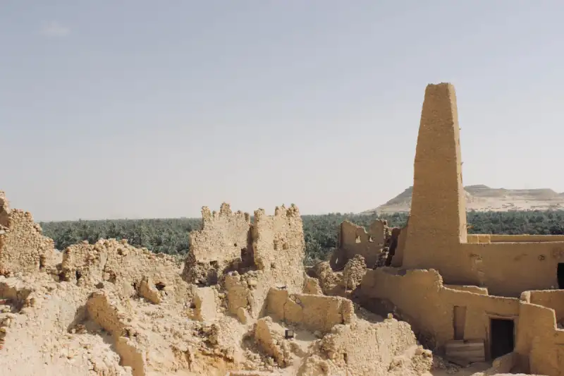
-
 John Explorer
 - 05 Jul, 2026 20:45
Beyond Merv's Veil: Unearthing Turkmenistan's Ghost Oases of the Silk Road
The desert, they say, remembers. It doesn't forgive, nor does it forget. For millennia, the vast, unforgiving expanse of the Karakum in Turkmenistan has been a canvas for human ambition, a crucible for civilization. Cities rose from its sandy embrace, glittering beacons of trade and culture, only to be swallowed whole by the relentless dunes and the unforgiving march of time. We speak of the Silk Road, of course, but not of its most celebrated pearls like Samarkand or Bukhara. Instead, I invite you on an odyssey into the very heart of its forgotten narrative, to the ghost oases of Turkmenistan, places where the wind still whispers tales of empires and caravans long vanished, far beyond the well-trodden routes, beyond even the magnificent Merv. To truly understand Turkmenistan's role in the Silk Road saga is to strip away the romanticized notions of bustling bazaars and grand imperial courts, and to confront the raw, visceral reality of survival and commerce in one of Earth's most challenging landscapes. This isn't a trip for the faint of heart or the casual tourist. This is an expedition into a past so profound, so deeply buried beneath the sands, that it demands a certain reverence, a willingness to shed modern comforts and embrace the stark beauty of desolation. My quest began with a nagging question: what secrets lie beyond the commonly recognized archaeological sites, in the deepest, most inaccessible corners of the Karakum? What echoes of forgotten glory could still be found, standing testament to an audacity of spirit that once dared to tame the desert? The Karakum's Embrace: A Sculptor of Empires The Karakum, meaning "Black Sand" in Turkic languages, is one of the world's largest deserts, covering an astonishing 70% of Turkmenistan's territory. It is a land of extremes: searing summer heat, biting winter winds, and an almost complete absence of surface water. Yet, it was precisely this unforgiving nature that shaped the unique character of its ancient civilizations. Water, or the lack thereof, was the ultimate arbiter of destiny. Where ancient rivers like the Oxus (Amu Darya) or the Murghab once fanned out into sprawling deltas, or where underground qanat systems could be engineered, life flourished, giving birth to cities that rivaled any in the ancient world. The Silk Road through Turkmenistan wasn't a single highway but a labyrinth of routes, constantly shifting with political tides, water sources, and the caprices of tribal allegiances. Caravans, laden with silk, spices, ceramics, and ideas, navigated these perilous paths, relying on strategically placed oases and caravanserais for sustenance and safety. These waystations were more than just inns; they were vital nodes in a vast network, often evolving into substantial cities themselves, drawing populations and cultures from across Eurasia. It is these ephemeral yet monumental testaments to human endeavor that call to the intrepid explorer, promising glimpses into a past often overlooked by conventional histories. Konye-Urgench: A Phoenix from the Dust While perhaps not "hidden" in the strictest sense, Konye-Urgench (Old Urgench) serves as an essential gateway to understanding the grandeur that once permeated the region. Located in northern Turkmenistan, near the border with Uzbekistan, it was once the capital of the Khwarezmian Empire, a powerful medieval Islamic state. For centuries, it was a thriving metropolis, a rival to Bukhara and Samarkand, a center of learning, art, and trade. Its eventual destruction by Genghis Khan in 1221, followed by a second devastating blow from Timur, left it largely in ruins, its remnants gradually consumed by the shifting Amu Darya and the encroaching sands. Today, what remains is a UNESCO World Heritage site, a hauntingly beautiful collection of mausoleums, minarets, and fortifications that stand defiantly against the desert sky. The most iconic is the Kutlug-Timur Minaret, soaring over 60 meters high, a slender brick beacon that once guided caravans across the vast plains. The elaborate brickwork of the Turabek-Khanum Mausoleum, a 14th-century architectural masterpiece, speaks volumes of the artistic sophistication that flourished here. Wandering through its silent courtyards, one can almost hear the echoes of scholars debating, merchants haggling, and the faithful at prayer. Konye-Urgench is not just a collection of ruins; it is a profound testament to resilience, a city that repeatedly rose from the ashes, only to finally succumb to the forces of nature and history. It sets the stage for the even deeper dives into Turkmenistan's forgotten past.Dehistan: The Isolated Jewel of the Misrian Plain My journey then veered sharply southwest, towards one of the most enigmatic and least-visited archaeological sites in Turkmenistan: Dehistan, also known as Mashad-i Misrian. This ancient city, once a major stop on the Silk Road connecting Central Asia with Persia, lies utterly isolated on the Misrian Plain, a desolate expanse that hints at its former proximity to the Caspian Sea. The drive itself is an adventure, traversing seemingly endless salt flats and gravel tracks, the horizon shimmering with heat haze, the only companions being the occasional camel and the vast, silent sky. Dehistan flourished between the 9th and 14th centuries, a testament to ingenious hydrological engineering that diverted water from the Atrek River. What strikes you upon arrival is the sheer scale and profound emptiness of the place. The remains of its impressive city walls, some still standing several meters high, delineate a vast urban area. Inside, the ruins of mosques, minarets, and residential quarters – mostly sun-baked mud brick – whisper stories of a vibrant past. The two remaining minarets, built by the Khwarezmshahs, though heavily weathered, still command the landscape, their intricate brick patterns a ghostly reminder of the artistry that once graced this remote outpost. Exploring Dehistan is a solitary experience. There are no tourist facilities, no souvenir stands, just you, the wind, and the ghosts of a thousand years. The silence is profound, broken only by the crunch of your boots on the dust and the distant cries of desert birds. One can spend hours simply walking the perimeter, imagining the caravans arriving, the merchants setting up their wares, the bustling life that once animated this now-desolate plain. It’s a place that forces introspection, a powerful reminder of the ephemeral nature of even the grandest human endeavors when pitted against the relentless forces of nature and history. Dehistan is not just a ruin; it is a meditation on impermanence, a place where the Silk Road truly feels like a vanished dream. Izmukshir and the Parthian Echoes of Nisa Further explorations reveal other vital, yet often overlooked, chapters of Turkmenistan's Silk Road narrative. The ancient site of Izmukshir, not far from Konye-Urgench but distinct in its historical layers, offers another fascinating glimpse into the region's past. While less imposing in its visible remains than Dehistan, its strategic location near the Amu Darya's ancient course underscores its importance as a former fortress and trade hub, another victim of the shifting river and subsequent abandonment. Its archaeological layers hint at a rich tapestry of settlement, from early agricultural communities to later Islamic period fortifications. For the dedicated archaeological enthusiast, it offers a quieter, more academic insight into the hydrological challenges and successes of ancient Central Asian civilizations. Then, there is Ancient Nisa, located closer to the modern capital of Ashgabat. While more accessible, its profound historical significance often gets overshadowed by its more famous Silk Road counterparts further east. Nisa was the capital of the Parthian Empire, one of the most powerful empires of the ancient world, rivaling Rome. Established in the 3rd century BCE, it served as a vital administrative and cultural center, a nexus where Hellenistic and Iranian cultures merged. Its ruins, a UNESCO World Heritage site, consist of two tells: Old Nisa (a royal fortress and temple complex) and New Nisa (a Hellenistic city). The discovery of unique rhytons (drinking horns) decorated with mythological scenes and Parthian inscriptions at Nisa provided invaluable insights into the art, religion, and daily life of this formidable empire. The inclusion of Nisa in this narrative of "forgotten" oases might seem counter-intuitive given its relative accessibility. However, its importance lies in demonstrating the depth of Turkmenistan's historical engagement with long-distance trade. Nisa wasn't just a Silk Road stop; it was an imperial power that facilitated and controlled significant segments of the early Silk Road, bridging the gap between the Hellenistic West and the nascent empires of the East. Understanding Nisa's role provides a crucial context for the later Islamic cities that would rise and fall in the Karakum. It shows that the history of trade in this region stretches back far further than the traditional "Silk Road" narrative often begins. Life on the Edge: Nomadic Legacy and Caravanserai Culture The cities, grand as they were, were only one facet of life in the Karakum. The vast spaces between these urban centers were traversed by nomadic tribes – the ancestors of today's Turkmen – whose mastery of the desert was unparalleled. They were the guides, the protectors (and sometimes raiders), and the essential logistical support for the caravans. Their intimate knowledge of water sources, safe paths, and seasonal changes was indispensable. The interdependency between the settled oasis dwellers and the nomadic pastoralists created a unique socio-economic fabric, one that allowed the Silk Road to function across such hostile terrain. The remains of numerous caravanserai, literally "palace of caravans," dot the desert landscape, some barely discernible mounds of earth, others still retaining evocative architectural features. These fortified inns were sanctuaries in the desert, offering weary travelers and their animals a safe haven, food, water, and often a bustling marketplace. They were microcosms of the Silk Road itself, where languages, religions, and goods from across the known world mingled. Imagine the stories exchanged around a flickering fire, the negotiations over prices, the shared relief of reaching safety after days of arduous travel. These caravanserai, often built roughly a day's journey apart, were the beating heart of the desert routes, essential arteries that kept the blood of commerce flowing. Their ruins are a stark reminder of the immense logistical effort required to sustain such a vast trade network.The Allure of the Undiscovered: Why These Sites Matter Why embark on such a challenging journey, enduring rough roads, extreme temperatures, and often rudimentary facilities, to visit places that are largely empty ruins? The answer lies in the profound sense of connection these sites offer. Unlike crowded tourist attractions where history is presented through curated exhibits, the ghost oases of Turkmenistan demand a more active engagement. Here, you are not merely an observer; you are an explorer, piecing together fragments of a lost world with every step you take. These sites are not just about bricks and dust; they are about human stories of resilience, ingenuity, and cultural exchange. They speak of the incredible audacity required to build and maintain sophisticated societies in such an unforgiving environment. They are a powerful reminder that history is not just made in the grand imperial capitals but also forged in the remote, challenging frontiers, where diverse cultures met and mingled. For the truly adventurous traveler, these forgotten places offer an unparalleled opportunity to connect with the raw, untamed spirit of the Silk Road, to feel the weight of centuries beneath your feet, and to hear the whispers of empires long past carried on the desert wind. The preservation of these sites is a complex undertaking. Many are highly vulnerable to the elements – the wind, the sand, the occasional rain – and to a lesser extent, human activity. Turkmenistan's commitment to protecting its heritage is growing, but the sheer vastness and isolation of many sites pose significant challenges. Responsible tourism, where visitors respect the fragile nature of the ruins and support local initiatives, can play a vital role in their long-term survival. Conclusion: Echoes in the Sand My journey through Turkmenistan's ghost oases of the Silk Road was more than a travel experience; it was a profound historical pilgrimage. It was a testament to the enduring human spirit, capable of building wonders in the most inhospitable places, and a humbling reminder of nature's ultimate power to reclaim what it has temporarily lent. The Karakum Desert, far from being an empty void, is a living museum, its vastness concealing layers of history, waiting patiently for those willing to seek them out. Beyond Merv's famous gates, in the silent expanse of the Karakum, lies a world of vanished cities and forgotten stories. To walk among the crumbling walls of Dehistan, to gaze upon the defiant minaret of Konye-Urgench, or to ponder the Parthian legacy at Nisa, is to engage in a conversation with history itself. It is to acknowledge that the greatest adventures often lie not on the well-beaten path, but in the untamed wilderness where the echoes of the past speak loudest, inviting us to listen, to learn, and to wonder. The Silk Road, in Turkmenistan, is not merely a historical route; it is an enduring spirit of exploration, waiting to be rediscovered.#Turkmenistan #SilkRoad #KarakumDesert #AncientCities #HiddenGems Related InsightsThe Crystal Spine of Afar: An Odyssey Through Ethiopia's Ancient Salt Routes Bhutan’s Tiger’s Nest Monastery: A Pilgrimage to the Clouds (Part 2) Echoes in the Clouds: A Pilgrimage Through Meteora’s Forgotten Monasteries{ "@context": "https://schema.org", "@type": "FAQPage", "mainEntity": [ { "@type": "Question", "name": "What is the main focus of Beyond Merv's Veil: Unearthing Turkmenistan's Ghost Oases of the Silk Road?", "acceptedAnswer": { "@type": "Answer", "text": "Journey deep into Turkmenistan's Karakum Desert to discover the forgotten cities and ghost oases that once thrived on the ancient Silk Road, far beyond the well-trodden paths." } }, { "@type": "Question", "name": "Who authored the comprehensive guide on Beyond Merv's Veil: Unearthing Turkmenistan's Ghost Oases of the Silk Road?", "acceptedAnswer": { "@type": "Answer", "text": "This detailed article and its insights were carefully researched and authored by John Explorer." } }, { "@type": "Question", "name": "Where can I find more related content about Travel?", "acceptedAnswer": { "@type": "Answer", "text": "You can explore more articles, detailed reviews, and similar insights by browsing the Related Insights section at the bottom of this article or visiting our dedicated Travel category page." } } ] }
-
 Marco Rossi
 - 05 Jul, 2026 00:18
Sulle Tracce Silenziose di Hellenikon: I Borghi Dimenticati della Sila Greca e il Respiro di un Tempo Sospeso
C'è un velo sottile che separa il mondo che conosciamo da quello che è stato, e in Calabria, tra le vette silenziose della Sila Greca, quel velo non è mai stato così trasparente. Non parlo di miti o leggende, ma di mura di pietra sbriciolate dal tempo, di finestre senza vetri che scrutano un orizzonte immutabile, di sentieri inghiottiti da una vegetazione che ha ripreso prepotentemente ciò che un tempo le era stato strappato. Questi sono i borghi dimenticati, le cattedrali rurali del silenzio, dove ogni passo rimbomba non solo sulla terra, ma anche nelle profondità di un passato che rifiuta di essere completamente cancellato. La Sila Greca, questa porzione orientale dell'altopiano silano che declina dolcemente verso lo Ionio, non è solo una geografia. È una cicatrice culturale, un ponte tra l'Italia e l'antica Ellade, un mosaico di dialetti, tradizioni e architetture che raccontano secoli di influenza ellenica e bizantina. Ed è proprio qui, in queste valli remote e spesso dimenticate dalle mappe turistiche convenzionali, che si annidano i resti di comunità che un tempo pulsavano di vita, custodi di storie ormai sussurrate solo dal vento. Il richiamo del silenzio: Un viaggio nell'anima abbandonata La decisione di esplorare i borghi fantasma della Sila Greca non nasce da una ricerca di sensazionalismo, né dalla moda dell'abbandono. Nasce da una profonda curiosità antropologica, dal desiderio di toccare con mano la stratificazione del tempo, di comprendere le ragioni che spingono un'intera comunità a lasciare le proprie radici, i propri tetti, i propri campi. È un pellegrinaggio inverso, non verso un luogo sacro di fede, ma verso un tempio della memoria, dove ogni rovina è un altare e ogni sasso una reliquia. La strada per raggiungere queste località è spesso un'avventura in sé. Curve strette che si arrampicano tra fitti boschi di pini larici e faggi, gole profonde scavate da fiumi impetuosi, piccoli ponti di pietra che sembrano sospesi nel vuoto. Il paesaggio, prima di aprirsi alla vista delle case diroccate, è di una bellezza selvaggia e indomita, un preludio alla malinconia che avvolgerà il visitatore. L'aria, anche in piena estate, ha il profumo della resina e della terra umida, un odore primordiale che fa da colonna sonora al cammino. Man mano che ci si avvicina, il silenzio diventa più denso, più palpabile. Non è l'assenza di rumore, ma la presenza di un'assenza. Un silenzio che parla, che racconta le voci che furono, i passi che risuonarono su quelle lastre di pietra, le risate dei bambini, le preghiere sussurrate nelle piccole chiese ormai senza tetto. Ogni arbusto che si fa strada tra le crepe di un muro, ogni ragnatela che ricopre un'antica finestra, è un segno della vittoria della natura sull'opera umana, una vittoria lenta e inesorabile. Le ragioni di un addio: Storia e fatalità Perché questi borghi sono stati abbandonati? Le risposte non sono mai semplici, ma un intrico di fattori economici, sociali e naturali. La storia della Sila Greca, come quella di molta parte del Mezzogiorno d'Italia, è stata segnata da povertà endemica, mancanza di opportunità e una terra spesso avara. L'emigrazione, soprattutto verso l'America e il Nord Italia, è stata per decenni l'unica via di fuga da un destino di miseria. Intere generazioni hanno fatto le valigie, portando con sé solo pochi effetti personali e il ricordo struggente della propria terra. A questo si sono aggiunti eventi tragici. Terremoti che hanno sbriciolato case e speranze, frane che hanno cancellato interi nuclei abitati, rendendoli inabitabili o isolandoli completamente. Molti di questi paesi, costruiti in posizioni strategiche per la difesa, si sono rivelati vulnerabili alla forza della natura. Con la modernità, l'isolamento è diventato un peso insopportabile. Senza strade adeguate, scuole, servizi sanitari, la vita qui è diventata insostenibile, specialmente per i giovani che cercavano un futuro diverso.L'influenza greca, che ha permeato la Sila Greca per secoli – dai primi insediamenti della Magna Grecia all'epoca bizantina, che ha lasciato un'impronta indelebile nell'architettura religiosa e nel dialetto greco-calabro ancora parlato in alcune sacche isolate – ha contribuito a forgiare un'identità culturale unica, ma non ha potuto fermare l'onda dell'abbandono. Anzi, a volte, proprio la distanza culturale e geografica dal resto della "nazione" ha accentuato l'isolamento. Le piccole chiese bizantine, i resti di affreschi sbiaditi, le iscrizioni in greco antico sulle pietre tombali sono oggi testimoni muti di una ricchezza storica e spirituale che si sta sgretolando insieme alle mura. I volti del tempo: Un viaggio tra le rovine Entrare in un borgo fantasma è come sfogliare un album di fotografie ingiallite, ma tridimensionali. Ogni casa racconta una storia. Qui una cucina con il focolare annerito dal fumo di centinaia di inverni, là una camera da letto dove un letto in ferro battuto giace sotto una pioggia di foglie secche. Le scale in pietra, consumate da innumerevoli passi, conducono a stanze vuote dove il soffitto è crollato, lasciando filtrare il cielo. Tra gli esempi più suggestivi, pur senza citare nomi specifici che potrebbero distogliere dal concetto generale di questi luoghi, vi sono complessi abitativi che si aggrappano tenacemente ai pendii, le case costruite in pietra locale che si mimetizzano perfettamente con l'ambiente circostante. In alcuni di essi, l'ultimo abitante ha lasciato la propria dimora pochi decenni fa, e si possono ancora trovare oggetti della vita quotidiana: un vecchio attrezzo agricolo, un paio di scarpe consunte, un mobiletto. Questi oggetti, lasciati in fretta o con la speranza di un ritorno mai avvenuto, diventano potenti catalizzatori di empatia, connettendoci direttamente con le vite di coloro che ci hanno preceduto. La natura, intanto, ha iniziato la sua lenta ma inesorabile opera di riconquista. Le radici degli alberi spaccano le fondamenta, l'edera avvolge intere facciate, i rovi invadono le strade. Ogni crepa è un varco per la vita selvatica. Pipistrelli si annidano negli anfratti, lucertole sfrecciano sui muri assolati, e il canto degli uccelli risuona tra le volte crollate, unico suono in un mondo altrimenti silenzioso. Questa coesistenza tra la rovina umana e la vitalità della natura crea un'atmosfera di bellezza struggente, un promemoria costante della transitorietà di ogni cosa. Ascoltare i sussurri: Il patrimonio immateriale Oltre alle pietre, c'è un patrimonio immateriale che rischia di perdersi per sempre. Nelle valli della Sila Greca, la memoria è ancora viva nei racconti degli anziani dei paesi limitrofi, che ricordano i nomi delle famiglie, le feste patronali, i soprannomi degli abitanti dei borghi ora deserti. Parlano di un mondo dove la comunità era tutto, dove la solidarietà era una necessità quotidiana e la lingua greca-calabra era un segno distintivo di identità. Questi racconti, spesso frammentari e venati di nostalgia, sono come semi sparsi che necessitano di essere raccolti e piantati nuovamente. Parlano di un'agricoltura di sussistenza, di pastori che spostavano le greggi seguendo antiche rotte, di artigiani che lavoravano il legno e la pietra con maestria tramandata di generazione in generazione. È un patrimonio che va oltre la semplice architettura, toccando le corde profonde dell'antropologia e dell'identità culturale calabrese.Visitare questi luoghi è anche un atto di rispetto verso quella memoria. Non è solo un'escursione, ma un'immersione in un passato che ci interroga sul nostro presente e sul nostro futuro. Ci confronta con la fragilità delle nostre costruzioni, con l'ineluttabilità del cambiamento e con la resilienza della natura. Ci invita a riflettere sul significato di "casa", di "comunità" e di "radici". Un futuro (im)possibile: Tra conservazione e rinascita Cosa riserva il futuro per questi custodi del tempo? Alcuni borghi, in altre regioni d'Italia, hanno conosciuto una nuova vita grazie a progetti di recupero, al turismo sostenibile, alla creazione di "alberghi diffusi" o all'insediamento di nuove comunità. Per i borghi della Sila Greca, il cammino è più arduo a causa della loro estrema remotazza e della profonda degradazione strutturale. Tuttavia, il loro valore non sta necessariamente in una completa "rinascita" fisica, che spesso snaturerebbe il loro fascino malinconico. Il valore risiede nella loro capacità di essere musei a cielo aperto, testimoni silenziosi di una storia unica. Progetti di mappatura, di messa in sicurezza minima per consentire l'accesso in sicurezza, di valorizzazione del patrimonio immateriale (racconti, canti, tradizioni) potrebbero essere la chiave per preservarne l'essenza senza stravolgerla. Il turismo di nicchia, quello consapevole e rispettoso, potrebbe svolgere un ruolo cruciale. Escursionisti, fotografi, storici, artisti, tutti coloro che cercano un'esperienza autentica e profonda, possono trovare in questi luoghi un terreno fertile per l'ispirazione e la riflessione. Non si tratta di trasformarli in parchi tematici, ma di consentire una fruizione rispettosa, che ne onori il passato e ne conservi la sacralità del silenzio. L'eco finale: Un invito al viaggio interiore Lasciare i borghi dimenticati della Sila Greca è come risvegliarsi da un sogno ad occhi aperti, un sogno intriso di malinconia ma anche di una profonda bellezza. L'aria fresca delle montagne, il canto degli uccelli, il fruscio delle foglie portano con sé non solo la quiete della natura, ma anche l'eco di quelle vite che un tempo popolavano queste mura. Questo non è un viaggio per chi cerca il comfort o il divertimento convenzionale. È un viaggio per l'anima, per chi è disposto a confrontarsi con la storia, con la resilienza della natura e con la fragilità dell'esistenza umana. È un invito a esplorare non solo un luogo fisico, ma anche le profondità del proprio essere, alla ricerca di un senso più autentico del tempo e dell'appartenenza. E mentre le auto riprendono a sfrecciare sulla statale, il ricordo di quei silenzi, di quelle pietre, di quelle storie, continua a risuonare, un monito e un richiamo a non dimenticare le radici profonde di questa terra, la Sila Greca, il cuore ellenico e selvaggio della Calabria.#CalabriaNascosta #SilaGreca #BorghiDimenticati #ViaggiConsapevoli #PatrimonioCulturale Related InsightsLa Corse : Éclats de granit et murmures de Méditerranée The Pantanal, Brazil: Unlocking the World’s Largest Wetland and Its Untamed Wildlife (Part 2) Beyond the Supermarket Aisle: A Gastronomic Odyssey Through Earth’s Most Exotic Fruits{ "@context": "https://schema.org", "@type": "FAQPage", "mainEntity": [ { "@type": "Question", "name": "What is the main focus of Sulle Tracce Silenziose di Hellenikon: I Borghi Dimenticati della Sila Greca e il Respiro di un Tempo Sospeso?", "acceptedAnswer": { "@type": "Answer", "text": "Un viaggio evocativo nei borghi quasi abbandonati della Sila Greca, dove l'eco dell'antica Magna Grecia e del tempo bizantino si fonde con la natura selvaggia." } }, { "@type": "Question", "name": "Who authored the comprehensive guide on Sulle Tracce Silenziose di Hellenikon: I Borghi Dimenticati della Sila Greca e il Respiro di un Tempo Sospeso?", "acceptedAnswer": { "@type": "Answer", "text": "This detailed article and its insights were carefully researched and authored by Marco Rossi." } }, { "@type": "Question", "name": "Where can I find more related content about Travel?", "acceptedAnswer": { "@type": "Answer", "text": "You can explore more articles, detailed reviews, and similar insights by browsing the Related Insights section at the bottom of this article or visiting our dedicated Travel category page." } } ] }
- Marco Rossi
- 04 Jul, 2026 10:27
Il Respiro Bizantino delle Montagne: Un Viaggio Segreto tra le Chiese Affrescate del Troodos a Cipro
L'aria salmastra dell'Egeo, il luccichio di spiagge dorate e l'eco di antiche civiltà marittime: questa è l'immagine che la maggior parte di noi associa a Cipro. Ma immaginate di risalire, di abbandonare la costa e la sua seducente superficialità, per addentrarvi in un regno montuoso dove il tempo sembra essersi fermato. Un luogo dove l'alito bizantino è ancora vivo, custodito tra le pieghe di valli lussureggianti e le cime silenziose del massiccio del Troodos. È qui che, per chi ha la pazienza di cercare e l'anima di un esploratore, si dischiude un tesoro inaspettato: un'intera costellazione di chiese affrescate, ognuna un microcosmo di spiritualità e arte, riconosciute dall'UNESCO come patrimonio dell'umanità. Non stiamo parlando di rovine monumentali o di cattedrali imponenti che dominano città moderne. Qui la grandezza è celata, modesta nella sua architettura esterna, ma esplosiva nella sua ricchezza interiore. Questi sono santuari rurali, spesso di piccole dimensioni, costruiti con pietra locale e tetti a doppio spiovente in tegole piatte, pensati per resistere alle rigide condizioni invernali della montagna. La loro bellezza non è ostentata, ma svelata a chi varca la soglia, preparato a un'esperienza quasi mistica. Un Viaggio tra le Cime e il Passato: L'Ascesa al Cuore del Troodos Il viaggio verso le chiese affrescate del Troodos è, di per sé, parte dell'esperienza. Lasciando alle spalle la frenesia delle città costiere come Limassol o Paphos, si inizia una lenta ascesa attraverso paesaggi che mutano con ogni curva. I vigneti cedono il passo a fitte foreste di pini neri, cedri e querce dorate. L'aria si fa più fresca, più pura, intrisa del profumo della resina e delle erbe selvatiche. I villaggi si annidano sui pendii, piccole oasi di pietra e tranquillità, dove il ritmo della vita è scandito da secoli di tradizioni contadine. È un paesaggio che invita alla contemplazione, alla riflessione, preparando l'animo a ciò che sta per essere scoperto.Qui, la storia di Cipro si intreccia indissolubilmente con la fede. Durante i turbolenti secoli del dominio bizantino e poi della dominazione franca, veneziana e ottomana, queste chiese montane divennero rifugi, baluardi della cristianità ortodossa e centri di resistenza culturale. Artisti anonimi, spesso monaci o talentuosi artigiani itineranti, si dedicarono con devozione a decorare gli interni di queste piccole basiliche e cappelle con cicli di affreschi di straordinaria bellezza. Essi rappresentano una delle collezioni più complete e significative dell'arte bizantina e post-bizantina in tutto il Mediterraneo orientale. L'Arte Svelata: I Tesori Nascosti degli Affreschi Entrare in una di queste chiese è come fare un salto indietro nel tempo, in un universo cromatico e simbolico che avvolge i sensi. La luce soffusa filtra dalle piccole finestre, illuminando figure di santi, apostoli, profeti e scene bibliche che coprono ogni centimetro delle pareti e delle volte. I colori, nonostante i secoli, conservano una vivacità sorprendente: il blu intenso del lapislazzuli, l'oro sfarzoso delle aureole, il rosso terroso, il verde smeraldo. Ogni dettaglio è carico di significato teologico, un linguaggio visivo destinato a educare e ispirare i fedeli, spesso analfabeti. La bellezza di questi affreschi risiede non solo nella loro tecnica impeccabile e nella loro conservazione, ma anche nella loro unicità stilistica. Sebbene radicati nella tradizione bizantina di Costantinopoli, gli artisti del Troodos svilupparono uno stile distintivo, influenzato dalle condizioni locali e dalle diverse epoche. Si possono distinguere periodi e scuole: dal XII secolo, con figure monumentali e austere tipiche dell'arte dei Comneni, fino al XV e XVI secolo, quando si affermarono stili più narrativi e, a volte, influenzati da elementi occidentali, pur mantenendo la profonda spiritualità ortodossa. Consideriamo, ad esempio, la chiesa di Panagia tou Araka a Lagoudera, un gioiello del XII secolo. Qui, gli affreschi sono tra i più raffinati e ben conservati, con un ciclo iconografico che illustra la vita della Vergine Maria e di Cristo con una delicatezza e una profondità psicologica eccezionali. Le espressioni sui volti dei santi non sono statiche ma cariche di umanità e devozione, rendendo l'esperienza visiva profondamente commovente. La maestria nell'uso del chiaroscuro e la ricchezza dei dettagli tessili sono sbalorditive. Un altro esempio eclatante è Agios Nikolaos tis Stegis (San Nicola del Tetto) vicino a Kakopetria. Questa chiesa, il cui nome deriva dal suo tetto in legno a doppio spiovente, assomiglia a un fienile dall'esterno, ma all'interno racchiude un tesoro di affreschi che vanno dal XI al XVII secolo. È un vero e proprio museo dell'arte bizantina e post-bizantina in miniatura, mostrando l'evoluzione dello stile attraverso i secoli. Il Pantocratore nella cupola, i cicli di vita di San Nicola e le scene del Giudizio Universale sono di una potenza visiva incredibile. Il Tempo delle Anime e la Vita Monastica Queste chiese non erano solo luoghi di culto, ma spesso il cuore pulsante di comunità monastiche. Molte di esse, come il Monastero di Mesa Potamos o la chiesa del Monastero di Panagia di Asinou (anche un sito UNESCO eccezionale), erano centri di studio, preghiera e conservazione della cultura. La vita monastica, scandita da ritmi antichi, era intrinsecamente legata alla produzione artistica. I monaci erano spesso gli stessi pittori, gli amanuensi, i custodi di manoscritti e icone. L'isolamento delle montagne forniva un rifugio dalle persecuzioni e dalle invasioni, permettendo a queste comunità di prosperare e di mantenere viva la fiamma della fede ortodossa e della sua ricca tradizione artistica. I muri stessi delle chiese, con i loro affreschi, fungevano da Bibbia per gli illetterati, raccontando le storie sacre in immagini vivide e toccanti. Era un modo per rendere la divinità accessibile, per avvolgere il fedele in un abbraccio di sacro. La persistenza di queste tradizioni è visibile anche oggi. Sebbene molte delle comunità monastiche siano ridotte o scomparse, l'aura di sacralità e devozione permane. Le chiese sono ancora luoghi di preghiera, visitate da pellegrini e fedeli, che accendono candele e venerano le icone. Il rispetto per questi luoghi è palpabile, e si chiede ai visitatori di mantenere un comportamento consono, una richiesta che, lungi dall'essere un'imposizione, è un invito a partecipare a un'esperienza di profondo rispetto e contemplazione. Oltre la Tela: Il Cuore della Cultura del Troodos Ma il fascino del Troodos non si esaurisce con gli affreschi. È un invito a immergersi in una cultura montana autentica, lontana dai cliché turistici. I villaggi stessi sono un'attrazione. L'architettura tradizionale, con case in pietra e tetti in tegole, si fonde armoniosamente con il paesaggio. Le strette vie acciottolate, le piazze dove gli anziani si ritrovano all'ombra degli alberi, le piccole taverne che servono piatti tipici ciprioti cucinati con prodotti locali freschi: tutto contribuisce a creare un'atmosfera di autenticità e calore. Assaggiate il famoso vino Commandaria, un vino dolce e liquoroso prodotto nella regione da millenni, o il "soutzoukos", una prelibatezza fatta di noci infilate e immerse in mosto d'uva. Ogni sapore è un racconto, ogni aroma un frammento di storia. Fate una passeggiata nei boschi, seguendo i sentieri che un tempo erano percorsi da pastori e monaci, e scoprirete cascate nascoste, sorgenti d'acqua cristallina e viste panoramiche mozzafiato. Il Troodos non è solo un museo a cielo aperto di arte bizantina, ma un ecosistema vivente di tradizioni, sapori e paesaggi incontaminati.Visitare le chiese affrescate del Troodos è un atto di scoperta, un pellegrinaggio laico per chiunque sia affascinato dalla bellezza, dalla storia e dalla spiritualità. È un richiamo a rallentare, a osservare con attenzione, a sentire il peso dei secoli che si posa sulle spalle. Non è una meta per il turismo di massa, ma per l'anima curiosa che cerca un'esperienza più profonda, un contatto genuino con un passato che si ostina a vivere nel presente. Consigli per l'Esploratore Curioso Per intraprendere questo viaggio, è consigliabile noleggiare un'auto. Le strade sono ben tenute, ma le chiese sono sparse e spesso raggiungibili solo attraverso strette strade di montagna. Una buona mappa o un GPS sono indispensabili. È importante verificare gli orari di apertura, poiché molte chiese sono custodite da volontari locali e potrebbero non essere aperte tutto il giorno. In alcuni casi, è necessario chiedere la chiave al sacerdote o a un custode designato nel villaggio. Questo aggiunge un tocco di autenticità e la sensazione di una scoperta personale. Vestitevi in modo rispettoso, soprattutto quando visitate i luoghi sacri. Scarpe comode sono d'obbligo per esplorare i villaggi e i sentieri. Portate con voi acqua e qualche snack, specialmente se vi avventurate in zone più remote. E, soprattutto, portate con voi la macchina fotografica (ma ricordate di rispettare i divieti di fotografia all'interno delle chiese, spesso presenti per proteggere gli affreschi e la sacralità del luogo), ma ancora più importante, portate con voi gli occhi aperti e il cuore pronto ad accogliere la storia che queste pietre silenziose hanno da raccontare. Questo non è un viaggio, è un'immersione. Un'opportunità per staccare dalla modernità e riconnettersi con un'eredità millenaria, con l'arte che nasce dalla fede, con la resilienza di un popolo e la maestosità discreta della natura. Cipro, come spesso accade con le terre ricche di storia, rivela i suoi segreti più preziosi solo a chi è disposto a cercarli oltre la superficie, a chi sa ascoltare il respiro bizantino delle sue montagne.#Cipro #TesoriNascosti #ArteBizantina #MontagneTroodos #ViaggioCulturale Related InsightsAustralia Unveiled: Where Sun-Kissed Shores Meet Ancient Souls and Modern Marvels (Part 2) Georgia’s Caucasus Mountains: Where Medieval Villages, Ancient Wine, and Epic Hikes Collide Il Pantheon: L'Occhio degli Dei{ "@context": "https://schema.org", "@type": "FAQPage", "mainEntity": [ { "@type": "Question", "name": "What is the main focus of Il Respiro Bizantino delle Montagne: Un Viaggio Segreto tra le Chiese Affrescate del Troodos a Cipro?", "acceptedAnswer": { "@type": "Answer", "text": "Lasciatevi incantare da un'epica esplorazione tra le cime del Troodos, dove antiche chiese bizantine celano affreschi millenari, testimoni silenziosi di fede e arte. Un viaggio oltre il tempo, nel cuore sacro di Cipro." } }, { "@type": "Question", "name": "Who authored the comprehensive guide on Il Respiro Bizantino delle Montagne: Un Viaggio Segreto tra le Chiese Affrescate del Troodos a Cipro?", "acceptedAnswer": { "@type": "Answer", "text": "This detailed article and its insights were carefully researched and authored by Marco Rossi." } }, { "@type": "Question", "name": "Where can I find more related content about Travel?", "acceptedAnswer": { "@type": "Answer", "text": "You can explore more articles, detailed reviews, and similar insights by browsing the Related Insights section at the bottom of this article or visiting our dedicated Travel category page." } } ] }

- Marco Rossi
- 04 Jul, 2026 08:25
Sardegna Profonda: Sulle Tracce Misteriose dei Nuraghi nella Barbagia Nascosta
L'aria è intrisa di mirto e lentisco, il profumo salmastro del mare, pur distante decine di chilometri, si mescola a quello intenso della terra, calda e primordiale. Il vento porta con sé storie antiche, sussurri di un tempo in cui giganti di pietra dominavano l'orizzonte, custodi silenti di un'isola misteriosa. Non siete sulla Costa Smeralda, né tra le scintillanti calette del sud. Siete nel cuore selvaggio e pulsante della Sardegna, là dove il tempo si è fermato, e dove ogni roccia racconta un epopea millenaria. Siete nel santuario dei Nuraghi, nell'anima segreta della Barbagia. Dimenticate le cartoline patinate e le folle estive. Questo è un viaggio che richiede pazienza, rispetto e una profonda curiosità. È un pellegrinaggio non verso spiagge assolate, ma verso le radici stesse di una civiltà che, per quasi due millenni, ha plasmato il volto di questa terra senza lasciare traccia scritta, solo imponenti e inspiegabili monumenti di pietra. La Sardegna nuragica non è una semplice parentesi storica; è la chiave per comprendere l'identità profonda di un popolo, il suo legame indissolubile con la terra, la sua resilienza e il suo enigma. Il Muto Appello dei Giganti di Pietra: Un'Architettura Senza Tempo Immaginate strutture che sfidano la logica, torri coniche di pietra ciclopica, erette con una precisione ingegneristica che ancora oggi lascia gli esperti senza parole. I nuraghi, più di 7.000 disseminati su tutta l'isola, sono il simbolo per eccellenza della Sardegna. Ma cosa erano esattamente? Fortezze, abitazioni nobiliari, templi, osservatori astronomici, forni fusori, luoghi di riunione? La verità è probabilmente un mix di tutto ciò, a seconda del singolo nuraghe e del suo contesto. Il popolo nuragico emerse nell'Età del Bronzo (circa 1800 a.C.) e fiorì fino all'arrivo dei Romani, lasciando dietro di sé una rete complessa di queste costruzioni. Molti sono nuraghi "monotorre", imponenti fortezze solitarie che dominano valli e colline. Altri sono veri e propri complessi architettonici, con cinte murarie, bastioni e torri aggiuntive, quasi delle città fortificate in miniatura. La loro funzione primaria rimane un enigma irrisolto. Erano difensivi? Di certo la loro posizione strategica e la loro imponenza suggeriscono un ruolo protettivo. Erano centri di potere? La complessità di alcuni siti fa pensare a una gerarchia sociale ben definita. Erano luoghi di culto? Le "tombe dei giganti" e i "pozzi sacri", spesso associati ai nuraghi, indicano una spiritualità complessa e radicata. Il viaggio che vi propongo non si limita a osservare queste pietre, ma a cercare di ascoltare i loro muti racconti, a percepire l'energia di chi le ha erette con fatica e devozione. È un'esperienza quasi mistica, un confronto diretto con un passato che non è mai stato del tutto digerito, che vibra ancora sotto la superficie dell'isola. La Barbagia: Cuore Pulsante e Scrigno di Segreti Se i nuraghi sono i monumenti della Sardegna, la Barbagia è il suo tempio. Questa regione montuosa e aspra, che si estende nel cuore dell'isola, è un territorio di contrasti: vette rocciose e profonde gole, foreste secolari e pascoli fioriti. Qui la modernità ha bussato più tardi e con minor insistenza, permettendo la conservazione di tradizioni, dialetti e un senso di identità che altrove è andato perduto. La Barbagia è l'anima più autentica della Sardegna, ed è qui che i nuraghi rivelano la loro vera essenza, meno assediati dal turismo di massa e più integrati nel paesaggio e nella vita dei pastori. Qui, i villaggi sono incastonati nelle montagne, le case in pietra si aggrappano ai pendii, e il tempo sembra scorrere a un ritmo diverso, dettato dai cicli della natura e dai ritmi secolari della pastorizia. Ogni curva sulla strada rivela uno scorcio mozzafiato, ogni sentiero conduce a un tesoro nascosto. E tra questi tesori, imponenti e maestosi, si ergono i nuraghi. Ma quali nuraghi esplorare, una volta oltrepassata la "porta" di Barumini con il suo celebre Su Nuraxi, ormai meta consolidata? La vera avventura inizia quando si devia dai percorsi più battuti. Penso ad esempio al Nuraghe Mannu, vicino a Dorgali, che si erge su un promontorio a picco sul mare, offrendo una vista mozzafiato che abbraccia la costa di Cala Gonone. La sua posizione suggerisce un ruolo di controllo strategico del territorio e delle rotte marittime. O al complesso di Serra Orrios, anch'esso nel territorio di Dorgali, un vero e proprio villaggio nuragico con decine di capanne, due nuraghi e un pozzo sacro, che ci dà un'idea più chiara della vita quotidiana di questa civiltà.Un altro gioiello poco conosciuto è il Nuraghe Arvu a Orroli, o il Nuraghe Losa a Abbasanta, quest'ultimo famoso per la sua perfetta conservazione e la complessità della sua struttura interna, con corridoi e scale che si snodano attraverso le sue torri. Ma la Barbagia offre anche siti minori, meno imponenti ma non meno affascinanti, spesso scoperti per caso durante una passeggiata, seminascosti dalla macchia mediterranea, che regalano la sensazione di una scoperta personale, quasi intima. Archeologia del Quotidiano e Spiritualità Profonda I nuraghi non erano strutture isolate, ma il fulcro di una società complessa. Attorno a essi sorgevano villaggi di capanne, come dimostrano i ritrovamenti a Serra Orrios. La vita ruotava attorno all'agricoltura e alla pastorizia, ma anche a scambi commerciali intensi, come testimoniano i manufatti fenici e micenei rinvenuti. I bronzetti nuragici, piccole statuette votive che raffigurano guerrieri, sacerdoti, madri e animali, ci offrono uno sguardo prezioso sulla loro fede e sulla loro organizzazione sociale. Ma è nella sfera spirituale che il popolo nuragico rivela la sua profondità. Le "Tombe dei Giganti", sepolcri collettivi dall'architettura imponente che ricordano la prua di una nave o la testa di un toro, erano luoghi di culto degli antenati, punti di contatto tra il mondo dei vivi e quello dei morti. I "Pozzi Sacri" o "Fonti Sacre", come quello di Santa Cristina (vicino a Paulilatino, ma esempi minori si trovano in tutta l'isola), sono capolavori di ingegneria idraulica e astronomica, con scale che scendono in un ventre di pietra a captare l'acqua sorgiva, usati per riti legati al culto dell'acqua e probabilmente per osservazioni celesti. Visitare questi luoghi è un'esperienza che va oltre la semplice ammirazione archeologica; è sentire il respiro di una fede antica, la connessione profonda con gli elementi naturali: acqua, terra e cielo. L'Eco del Passato nel Presente Barbaricino Il viaggio nei nuraghi della Barbagia non è solo un tuffo nel passato remoto. È anche un'immersione nella cultura sarda contemporanea, che di quel passato è figlia legittima. L'isolamento e la conservazione del patrimonio nuragico hanno permesso alla Barbagia di mantenere vive tradizioni uniche. Qui si trova la vera ospitalità sarda, fatta di gesti sinceri, di sapori autentici. Le feste paesane, spesso legate a riti ancestrali e al ciclo agrario, sono momenti di aggregazione in cui si possono ammirare i Mamuthones e Issohadores di Mamoiada, figure carnevalesche misteriose che richiamano antichi riti apotropaici legati alla fertilità e alla cacciata degli spiriti maligni, con le loro maschere lignee e i pesanti campanacci. Non sono solo folklore, ma una celebrazione della resilienza e dell'identità sarda. La cucina barbaricinia è un'ode alla terra: il pane carasau, i formaggi di pecora, il porceddu allo spiedo, il pane frattau. Questi non sono semplici piatti, ma espressioni di una cultura contadina e pastorale che ha imparato a valorizzare ogni risorsa del territorio, un legame indissolubile con la natura circostante. Ogni pasto è un racconto, ogni assaggio un viaggio sensoriale che si fonde con la storia delle pietre circostanti. Consigli per l'Esploratore Intrepido Preparatevi a un'avventura che richiede una mentalità aperta e un po' di spirito d'adattamento.Mezzi di Trasporto: Un'auto a noleggio è indispensabile per esplorare la Barbagia. Le strade possono essere tortuose e strette, ma i panorami ripagano ogni fatica. Molti siti nuragici si trovano su sterrate o richiedono brevi camminate. Abbigliamento: Scarpe da trekking robuste e comode sono d'obbligo. Indossate strati, poiché il clima in montagna può cambiare rapidamente. Guida: Per i siti meno battuti, o per una comprensione più profonda, considerate l'idea di affidarvi a una guida locale esperta. Sono spesso persone che vivono in quei territori e che conoscono non solo la storia, ma anche le leggende e le tradizioni orali. Rispetto: La Barbagia è un luogo dove la natura e la storia sono sacre. Rispettate l'ambiente, non lasciate rifiuti, non alterate i siti archeologici. Chiedete il permesso prima di fotografare le persone e siate aperti alla conversazione con gli abitanti del luogo. Alloggio: Optate per agriturismi o piccoli hotel gestiti da famiglie. Non solo sosterrete l'economia locale, ma avrete l'opportunità di immergervi nella vera vita sarda. Mappe e Orientamento: La copertura telefonica non è sempre ottimale. Scaricate mappe offline e portate una mappa cartacea.Il richiamo di queste torri di pietra è più che un semplice fascino archeologico; è una chiamata a riconnettersi con qualcosa di primordiale, a comprendere l'ingegno e la spiritualità di chi ci ha preceduto. È un promemoria che, al di là delle mode e della frenesia del presente, esistono luoghi dove il passato non è una reliquia, ma una presenza viva e pulsante.Un viaggio nella Barbagia nuragica è un atto di scoperta, non solo del paesaggio o dell'archeologia, ma di se stessi. È un invito a rallentare, a osservare, a sentire, a farsi avvolgere dal mistero di un'isola che non finisce mai di stupire. Lasciatevi guidare dal vento tra le pietre, ascoltate i racconti silenziosi delle torri e scoprite una Sardegna che pochi hanno la fortuna di conoscere, un'isola di forza, resilienza e bellezza selvaggia. Non tornerete gli stessi.#SardegnaProfonda #NuraghiMisteriosi #BarbagiaSelvaggia #ArcheologiaSarda #ViaggiUnici Related InsightsSilent Steel: Photographing the Sunken Fleet of the Solomon Islands Australia Unveiled: Where Sun-Kissed Shores Meet Ancient Souls and Modern Marvels (Part 2) La Signora di Ferro che Sfidò il Cielo: Storie, Segreti e le Ombre Nascoste della Torre Eiffel{ "@context": "https://schema.org", "@type": "FAQPage", "mainEntity": [ { "@type": "Question", "name": "What is the main focus of Sardegna Profonda: Sulle Tracce Misteriose dei Nuraghi nella Barbagia Nascosta?", "acceptedAnswer": { "@type": "Answer", "text": "Dimenticate le spiagge dorate: la vera anima della Sardegna si cela tra le pietre millenarie dei Nuraghi, in un viaggio avvolgente nella Barbagia più autentica e selvaggia." } }, { "@type": "Question", "name": "Who authored the comprehensive guide on Sardegna Profonda: Sulle Tracce Misteriose dei Nuraghi nella Barbagia Nascosta?", "acceptedAnswer": { "@type": "Answer", "text": "This detailed article and its insights were carefully researched and authored by Marco Rossi." } }, { "@type": "Question", "name": "Where can I find more related content about Travel?", "acceptedAnswer": { "@type": "Answer", "text": "You can explore more articles, detailed reviews, and similar insights by browsing the Related Insights section at the bottom of this article or visiting our dedicated Travel category page." } } ] }
-
 Pierre Dubois
 - 04 Jul, 2026 06:30
Sous les Vignobles de la Loire : Le Mystère Énigmatique des Cités Troglodytiques Oubliées
Dans le panthéon des destinations françaises, la Vallée de la Loire résonne souvent avec l'écho des fastes royaux, l'élégance intemporelle de ses châteaux de la Renaissance, et la douceur onctueuse de ses vins renommés. Des jardins d'Azay-le-Rideau aux tours emblématiques de Chambord, l'image que nous en avons est celle d'une surface opulente, baignée de lumière, où l'histoire se lit à ciel ouvert. Mais que se passerait-il si je vous disais que l'âme véritable de cette région, son héritage le plus singulier et le plus profondément enraciné, se cachait, non pas sous le soleil, mais dans l'obscurité fraîche et silencieuse de ses entrailles ? Oubliez un instant les splendeurs de la pierre sculptée et les reflets du Cher. Suivez-moi, non pas sur les sentiers battus, mais dans les passages secrets, les galeries oubliées et les cavités creusées à même la roche, là où se dissimule un monde presque invisible : celui des cités troglodytiques de la Loire. Ces habitations souterraines, souvent reléguées au rang de curiosités anecdotiques, constituent en réalité l'une des formes d'habitat humain les plus durables et les plus fascinantes que la France ait jamais connues. Il ne s'agit pas de simples grottes, mais de véritables architectures inversées, sculptées dans un matériau unique, le tuffeau, et porteuses d'une histoire millénaire qui défie notre compréhension moderne du confort et de l'ingéniosité. L'Émergence d'un Monde Souterrain : Une Géologie au Service de l'Homme Pour comprendre l'existence de ces villages sous la terre, il faut d'abord se pencher sur la géologie locale. La Vallée de la Loire est traversée par une roche tendre et crayeuse, le tuffeau. Cette pierre calcaire, de couleur blanc crème, s'est formée il y a des millions d'années par l'accumulation de sédiments marins. Sa particularité est d'être relativement facile à extraire, mais une fois exposée à l'air, elle durcit et offre une résistance étonnante. Cette dualité en a fait le matériau de prédilection pour la construction des châteaux de la Loire (les blocs étant extraits des carrières locales) et, paradoxalement, la matrice même de ces habitations souterraines. Dès l'époque néolithique, l'homme a compris le potentiel de ces falaises de tuffeau. Les premières utilisations furent probablement des abris temporaires ou des refuges. Mais c'est véritablement au Moyen Âge que l'habitat troglodytique prend son essor. Alors que les seigneurs construisaient leurs donjons et leurs forteresses en surface, les populations plus modestes, paysans, artisans ou ermites, trouvaient dans le sous-sol une solution d'habitation économique, naturellement isolante (fraîche en été, tempérée en hiver) et discrète. Les falaises longeant les cours d'eau, comme le Loir, la Loire, le Cher ou la Vienne, se sont ainsi transformées en véritables parois verticales, criblées de milliers de cavités. Ce n'était pas un choix par défaut, mais une adaptation astucieuse. Creuser dans le tuffeau fournissait non seulement un logis, mais aussi la pierre nécessaire à l'édification des bâtiments de surface. Les "carrières" se muaient en "habitations" à mesure que les blocs étaient extraits. C'est cette interdépendance qui a façonné le paysage troglodytique, transformant des falaises naturelles en façades monumentales, percées de portes et de fenêtres, souvent dissimulées par la végétation ou l'apparente banalité du paysage. De l'Abri Rustique à la Cité Organisée : La Diversité de l'Habitat Troglodytique L'imaginaire collectif associe souvent le troglodyte à une simple caverne. Or, la réalité de la Loire est bien plus complexe et raffinée. On y distingue plusieurs types d'habitations, témoignant d'une ingéniosité architecturale remarquable :Les Caves-Habitats : Directement creusées dans le flanc de la falaise, ces maisons se développent horizontalement. Souvent agrémentées d'une façade maçonnée en surface, elles s'intègrent discrètement au paysage. L'intérieur révèle un agencement surprenant de pièces, parfois sur plusieurs niveaux, avec des cheminées sculptées dans la roche et des systèmes d'aération rudimentaires mais efficaces.Les Souterrains-Refuges : Plus complexes, ces réseaux de galeries s'étendent parfois sur des kilomètres sous la terre. Utilisés comme greniers à grain, cachettes pendant les périodes d'invasion ou même lieux de culte clandestins, ils témoignent d'une organisation sociale et défensive élaborée. Le village de Rochemenier, par exemple, offre un aperçu fascinant de ce type d'habitat, avec ses maisons, ses dépendances et même sa chapelle entièrement souterrains.Les Fortifications Troglodytiques : Moins connues, certaines falaises ont été transformées en véritables forteresses. À Brézé, le château possède un réseau souterrain impressionnant, avec des cuisines, des écuries et des passages secrets, illustrant la complémentarité entre l'architecture de surface et le monde sous-terrain.Les Sites "Hors Norme" : On trouve également des églises troglodytiques (comme celle de Louresse-Rochemenier), des pigeonniers creusés dans la roche (les "pierriers" ou "tuffiers"), et bien sûr, les fameuses caves à vin et champignonnières. Ces dernières, véritables cathédrales souterraines dédiées à la culture des champignons de Paris ou au vieillissement des vins de Saumur, sont l'incarnation la plus vivante et la plus productive de l'héritage troglodytique. Elles exploitent la stabilité de température et d'humidité constante du sous-sol, conditions idéales pour ces activités.La Vie au Quotidien dans l'Obscurité et la Fraîcheur S'imaginer vivre sous la terre peut paraître rude, voire austère, pour l'homme du XXIe siècle. Pourtant, pour les habitants de ces lieux, c'était un mode de vie parfaitement adapté aux contraintes de l'époque. La roche offrait une protection naturelle contre les intempéries, les invasions et les variations climatiques extrêmes. Les intérieurs, souvent blanchis à la chaux pour refléter la lumière et assainir l'atmosphère, étaient meublés de manière rustique mais fonctionnelle. L'éclairage, autrefois assuré par des lampes à huile ou des bougies, était complété par l'ingéniosité des ouvertures. Les puits de lumière et les conduits d'aération étaient souvent percés verticalement pour capter la clarté et assurer une ventilation minimale, créant une ambiance douce et intime, loin du tumulte extérieur. La température constante, autour de 12-14°C toute l'année, était un atout inestimable avant l'ère du chauffage central et de la climatisation. Mais au-delà de l'aspect pratique, il y avait aussi une dimension communautaire forte. Dans certains villages troglodytiques, les habitations étaient interconnectées par des galeries, créant un véritable réseau social sous-terrain. Les voisins partageaient non seulement des murs de roche, mais aussi un mode de vie, des traditions et des secrets. C'était un monde où l'entraide était essentielle, où la connaissance de la roche et de ses caprices était transmise de génération en génération. Le Tuffeau et le Vin : Une Alliance Millénaire Il est impossible d'évoquer les troglodytes de la Loire sans parler de leur lien indéfectible avec le vin. Les vastes galeries souterraines, issues de l'extraction du tuffeau, se sont naturellement transformées en caves idéales pour le vieillissement des vins locaux. L'humidité constante et la température stable créent un environnement parfait pour l'élevage des Saumur-Champigny, Chinon, Bourgueil, ou Vouvray. De nombreuses maisons viticoles, encore aujourd'hui, exploitent ces caves troglodytiques. La visite d'une telle cave est une expérience sensorielle unique : l'odeur terreuse et humide, la vision des rangées de bouteilles endormies, le silence presque religieux, tout contribue à une immersion profonde dans l'histoire et la culture de la viticulture ligérienne. C'est là que le passé et le présent se rencontrent, où les techniques ancestrales continuent de servir une production moderne de qualité. Au-delà des vins, les troglodytes sont également devenus les sanctuaires du champignon de Paris. Des kilomètres de galeries obscures sont aujourd'hui dédiés à sa culture, profitant des conditions climatiques souterraines pour une production constante et abondante. C'est une autre illustration spectaculaire de l'ingéniosité humaine à tirer parti de son environnement.Les Troglodytes Aujourd'hui : Entre Musée Vivant et Renaissance Créative Longtemps délaissées au profit d'habitations plus "modernes" et lumineuses, les habitations troglodytiques ont connu un déclin progressif à partir du début du XXe siècle. Cependant, ces dernières décennies ont vu renaître un intérêt marqué pour ce patrimoine exceptionnel. Aujourd'hui, de nombreux sites ont été restaurés et ouverts au public, comme le village de Rochemenier ou le site de Doué-la-Fontaine avec son bioparc unique, en partie troglodytique. Ces lieux offrent une plongée fascinante dans la vie quotidienne des habitants d'autrefois, avec des reconstitutions fidèles et des expositions pédagogiques. Ils ne sont plus de simples curiosités, mais des musées vivants qui témoignent de l'ingéniosité humaine face à l'environnement. Mais l'héritage troglodytique ne se limite pas à la conservation. Il connaît aussi une véritable renaissance créative. Certains ont choisi de réinvestir ces lieux pour en faire des habitats contemporains, des chambres d'hôtes insolites, des restaurants à l'ambiance unique, ou même des galeries d'art et des ateliers d'artistes. La fraîcheur naturelle et le caractère atypique de ces lieux attirent ceux qui recherchent une expérience différente, hors des sentiers battus, et un mode de vie plus respectueux de l'environnement. Imaginez dîner dans un restaurant entièrement creusé dans le tuffeau, la lumière des bougies dansant sur les parois de pierre, le silence rompu seulement par les conversations feutrées. C'est une immersion totale, une parenthèse hors du temps. Le défi actuel réside dans la préservation de ce patrimoine fragile. Le tuffeau, bien que résistant, est sujet à l'érosion et aux effondrements si les cavités ne sont pas correctement entretenues. Des efforts considérables sont déployés pour consolider les sites, étudier leur structure et assurer leur pérennité pour les générations futures. C'est un travail de longue haleine, mais essentiel pour que ces cités souterraines continuent de raconter leur histoire. Un Appel à l'Exploration Hors des Sentiers Battus La Vallée de la Loire, avec ses cités troglodytiques, nous rappelle que l'histoire et la culture d'une région ne se limitent pas à ce qui est visible à la surface. Elle nous invite à regarder au-delà des façades évidentes, à explorer les profondeurs, et à apprécier l'ingéniosité et la résilience de l'humanité face aux défis de son environnement. Ces villages sous les vignobles ne sont pas de simples reliques du passé. Ce sont des témoignages vivants d'un mode de vie oublié, des sanctuaires de la tradition viticole, et des lieux d'innovation contemporaine. Ils offrent une perspective unique sur le patrimoine français, loin des foules et des clichés. Alors, la prochaine fois que vous sillonnerez les routes de la Loire, entre deux dégustations de vin ou une visite de château, osez faire un détour. Descendez quelques marches, poussez une porte discrète dans le flanc d'une falaise, et laissez-vous transporter dans un monde souterrain, silencieux et fascinant. C'est là, dans l'ombre fraîche du tuffeau, que vous découvrirez l'âme la plus secrète et la plus authentique de la Vallée de la Loire, un trésor enfoui qui n'attend que d'être exploré.#ValléeDeLaLoire #Troglodyte #PatrimoineCaché #VoyageInsolite #FranceProfonde #ArchitectureSouterraine #FranceTravel #LoireValley #Troglodyte #HiddenGems #FrenchHistory Related InsightsPatagonia’s Secret Gems: Where Wild Winds Carve Legends Beyond Torres del Paine Coimbra: Tradição Académica e História Medieval L'Écho Secret des Montagnes du Tigré : À la Découverte des Églises Monolithiques d'Éthiopie{ "@context": "https://schema.org", "@type": "FAQPage", "mainEntity": [ { "@type": "Question", "name": "What is the main focus of Sous les Vignobles de la Loire : Le Mystère Énigmatique des Cités Troglodytiques Oubliées?", "acceptedAnswer": { "@type": "Answer", "text": "Plongez dans l'univers fascinant et méconnu des habitations troglodytiques de la Vallée de la Loire, un patrimoine souterrain riche en histoire et en mystères." } }, { "@type": "Question", "name": "Who authored the comprehensive guide on Sous les Vignobles de la Loire : Le Mystère Énigmatique des Cités Troglodytiques Oubliées?", "acceptedAnswer": { "@type": "Answer", "text": "This detailed article and its insights were carefully researched and authored by Pierre Dubois." } }, { "@type": "Question", "name": "Where can I find more related content about Travel?", "acceptedAnswer": { "@type": "Answer", "text": "You can explore more articles, detailed reviews, and similar insights by browsing the Related Insights section at the bottom of this article or visiting our dedicated Travel category page." } } ] }
- Marco Rossi
- 04 Jul, 2026 02:06
Il Faro di Ercole e i Giganti Luminosi Dimenticati dell'Oceano: Un Viaggio Tra i Guardiani Romani dell'Infinito Atlantico
Immaginate un mondo dove la terra finiva, dove l'ignoto si estendeva oltre le Colonne d'Ercole, e il mare, una distesa infinita di misteri e pericoli, era solcato da navi cariche di spezie, metalli e sogni. In questo scenario epico, l'uomo antico, con la sua ingegnosità e il suo coraggio, non si limitò a solcare quelle acque indomite, ma cercò di dominarle, di illuminarle. E lo fece con fari. Non i fari dipinti sulle cartoline, non le torri romantiche che punteggiano le nostre coste odierne, ma colossi di pietra eretti da una civiltà che, forse più di ogni altra, comprese il potere della luce e la necessità di guidare i propri esploratori e mercanti. Questa non è una storia di città luccicanti o spiagge esotiche. È un’odissea nel tempo, un’indagine archeologica e storica che ci porta ai margini dell'Impero Romano, dove la sua influenza si scontra con la furia dell'Oceano Atlantico. Stiamo per scoprire un aspetto quasi dimenticato della grandezza romana: i suoi fari atlantici. Giganti silenziosi, molti persi nell'oblio o sepolti sotto strati di storia, ma uno, in particolare, continua a sfidare i millenni: la Torre di Ercole a La Coruña, Spagna. Preparatevi a navigare con me attraverso le nebbie del tempo, dove la luce di un faro romano non era solo un segnale, ma una promessa, una speranza, un legame indissolubile con la civiltà. La Torre di Ercole: L'Ultimo Guardiano Imperiale dell'Oceano Il mondo è pieno di fari, ma nessuno come la Torre di Ercole. Si erge maestosa sulla costa rocciosa di La Coruña, in Galizia, Spagna, non solo come il faro romano più antico ancora in uso, ma come un simbolo vivente della straordinaria capacità ingegneristica e della visione a lungo termine dell'Impero Romano. Costruita nel I secolo d.C., probabilmente sotto l'imperatore Traiano, questa torre non è un semplice reperto archeologico; è un faro funzionante da quasi due millenni. Quando ci si avvicina, non si può fare a meno di sentire il peso della storia. Ogni pietra racconta un viaggio, ogni strato di muschio sulle sue pareti muscolose evoca le tempeste che ha sopportato. Il suo nome stesso è intriso di mitologia: la leggenda vuole che sia stata eretta da Ercole in persona, dopo aver sconfitto il gigante Gerione, seppellendone la testa sotto la torre. Un'altra narra che fu il re celtico Breogán a costruire un'alta torre in questo luogo per avvistare la terra d'Irlanda, dove i suoi discendenti avrebbero poi navigato. Queste storie non sono solo favole; sono il tessuto stesso della Galizia, e il faro ne è l'incarnazione fisica, un punto di riferimento tra mito e realtà. La sua struttura originale, di cui rimangono le fondamenta e parte del nucleo, era un prodigio di ingegneria. Si trattava di una torre quadrangolare con una rampa interna che permetteva di trasportare il combustibile, probabilmente legna e carbone, fino alla cima. All'epoca romana, la luce era alimentata da un grande fuoco aperto, riflettuto e amplificato per essere visibile a grandi distanze, guidando i naviganti attraverso le insidiose coste atlantiche. Sebbene l'esterno sia stato rivestito e ristrutturato nel XVIII secolo, l'anima romana, il suo cuore pulsante di pietra e scopo, è rimasto intatto. Scalare i suoi quasi 250 gradini è un'esperienza quasi mistica, un'ascensione attraverso secoli di storia marittima. Dalla sommità, la vista sull'Atlantico, sull'estuario e sulla città è mozzafiato, e si può quasi sentire l'eco delle navi romane che solcavano queste acque, affidandosi alla sua luce.L'importanza della Torre di Ercole non può essere sottovalutata. Essa segnava l'estremità nord-occidentale del finis terrae, il confine del mondo conosciuto per i Romani, ma era anche un punto cruciale lungo le rotte commerciali che collegavano la ricca provincia di Gallaecia (con le sue miniere d'oro e stagno) e l'Iberia al resto dell'Impero, specialmente con la Britannia. Era una sentinella silenziosa che vegliava sul commercio e sulla sicurezza, un simbolo di potere e organizzazione in un ambiente ostile e imprevedibile. Oltre A Coruña: Le Tracce Scomparse dei Fratelli Atlantici La Torre di Ercole è un'eccezione, un miracolo di persistenza. Ma cosa dire degli altri fari romani che sicuramente punteggiavano le coste atlantiche dell'Impero? La verità è che la maggior parte di essi è scomparsa. L'Oceano Atlantico è un maestro di oblio, le sue onde inesorabili, le sue tempeste implacabili. Molti fari romani non erano costruiti con la stessa monumentalità della torre di A Coruña; erano spesso strutture più piccole, destinate a guidare le navi in porti specifici o lungo tratti costieri particolarmente pericolosi. Le prove della loro esistenza sono spesso frammentarie: nomi di luoghi, antichi testi, scoperte archeologiche di fondamenta sommerse o di resti inglobati in costruzioni successive. Ad esempio, si ritiene che fari romani esistessero in luoghi strategici lungo le coste del Portogallo, dove le rotte verso l'Africa e la Britannia erano vitali. Alcuni studiosi ipotizzano la presenza di fari a Lisbona (Olisipo) o a Faro, quest'ultima città il cui nome evoca la funzione luminosa. Anche in Britannia, all'estremità settentrionale dell'Impero, c'è evidenza di fari romani. Il più famoso è forse quello di Dover, in Inghilterra. Sebbene oggi sia una torre di forma ottagonale in rovina, situata all'interno del perimetro del Castello di Dover, le sue fondamenta e parte della struttura inferiore risalgono all'epoca romana. Serviva a guidare le navi che attraversavano la Manica, un cruciale punto di passaggio tra la Britannia e la Gallia romana. Questo faro, seppur meno imponente della Torre di Ercole, ci offre un altro scorcio della rete marittima romana e della sua estensione. La difficoltà nel ritrovare questi "fratelli" scomparsi risiede nella natura stessa delle coste atlantiche: l'erosione, i cambiamenti del livello del mare, e soprattutto la tendenza delle civiltà successive a riutilizzare le pietre e i siti delle precedenti. Non è raro che un faro medievale o moderno sia stato costruito direttamente sopra le fondamenta di uno romano, cancellando le tracce del suo predecessore. Questo rende ogni scoperta ancora più preziosa, ogni frammento di storia un tesoro da decifrare. La Funzione di Luce: Navigazione e Potere Imperiale Perché i Romani investivano tanto nella costruzione di fari, specialmente in un'area così remota e selvaggia come l'Atlantico? La risposta è complessa e multifunzionale. Innanzitutto, c'era la necessità pratica di navigazione. Le navi romane, pur essendo robuste, erano vulnerabili alle tempeste e alle coste rocciose. I fari fornivano punti di riferimento essenziali, segnalando l'ingresso dei porti o avvertendo di pericoli come secche e scogli. L'Atlantico, con le sue maree imponenti e le sue condizioni meteorologiche estreme, era molto più impegnativo del placido Mediterraneo, e la luce di un faro poteva significare la differenza tra vita e morte per un equipaggio e il suo prezioso carico. In secondo luogo, i fari erano nodi vitali per il commercio. L'Impero Romano era un'enorme macchina economica, e il commercio marittimo era il suo motore. Le province atlantiche, come la Galizia, erano ricche di risorse minerarie, mentre altre regioni commerciavano lana, schiavi o prodotti agricoli. I fari facilitavano il flusso continuo di queste merci, riducendo i rischi e i tempi di viaggio, e contribuendo così alla prosperità dell'Impero. Senza una navigazione sicura, l'approvvigionamento e la ricchezza sarebbero stati compromessi. Infine, e non meno importante, i fari erano simboli di potere e controllo imperiale. La capacità di un impero di erigere opere così imponenti e complesse ai confini del mondo conosciuto, mantenendole in funzione per secoli, era una dichiarazione di forza e di organizzazione. Era un modo per Roma di proiettare la sua influenza e la sua civiltà anche negli angoli più remoti del suo vasto dominio. Erano manifestazioni fisiche della pax romana, una promessa di ordine e sicurezza anche sui mari più tempestosi.La logistica del mantenimento di un faro romano era anch'essa notevole. Immaginate le squadre che dovevano assicurarsi che ci fosse sempre combustibile a sufficienza, trasportandolo spesso su per le ripide rampe interne. Pensate ai "custodi della luce", uomini isolati, forse veterani o schiavi, il cui compito solitario e vitale era mantenere acceso il fuoco notte dopo notte, tempesta dopo tempesta. La loro vita era una testimonianza di dedizione, un'esistenza al servizio di una causa più grande, un anello invisibile ma essenziale nella catena di un impero. Echi Attraverso il Tempo: L'Eredità della Luce Romana L'impatto dei fari romani non si esaurì con la caduta dell'Impero. La loro architettura, le tecniche di costruzione e la loro stessa funzione servirono da modello e ispirazione per le generazioni future. La Torre di Ercole stessa ne è la prova lampante: pur essendo stata restaurata e modificata nel corso dei secoli, la sua essenza romana è sopravvissuta e ha continuato a servire lo scopo originario. Essa rappresenta un ponte tra l'ingegneria antica e quella moderna, una testimonianza della durabilità e dell'efficacia del design romano. La capacità romana di combinare funzionalità, robustezza e una certa monumentalità nelle sue opere pubbliche, inclusi i fari, influenzò la costruzione di strutture simili nel Medioevo e oltre. I concetti di elevazione, di combustione controllata per produrre luce e di posizionamento strategico divennero principi fondamentali nell'architettura dei fari in ogni epoca. Quei giganti di pietra non erano solo guardiani delle coste, ma anche maestri silenziosi che insegnavano alle civiltà future come sfidare l'oscurità e guidare l'uomo attraverso la notte. Oggi, in un'epoca di GPS, radar e luci LED, il fascino dei fari antichi rimane immutato. Essi non sono più indispensabili per la navigazione moderna, ma la loro presenza evoca un senso di meraviglia e rispetto per il passato. Ci ricordano i pericoli superati, le scoperte fatte, e la perenne ricerca umana di sicurezza e conoscenza. La Torre di Ercole, in particolare, ci invita a riflettere sull'ingegno di una civiltà che, secoli fa, osò piantare la luce ai confini del mondo, sfidando le intemperie e il tempo. Conclusione: Un Faro nell'Anima Viaggiare non significa solo visitare luoghi iconici o ammirare paesaggi da cartolina. A volte, il vero viaggio è una immersione profonda in una nicchia di storia, un angolo dimenticato che rivela molto più di quanto ci si aspetti. I fari romani dell'Atlantico, e in particolare la straordinaria Torre di Ercole, sono esattamente questo: un portale verso un'epoca in cui l'ingegno umano affrontava l'immensità del mare, non solo con coraggio, ma con una pianificazione meticolosa e una visione che trascendeva i millenni. Questi guardiani di pietra, siano essi ancora in piedi o ormai solo eco nella sabbia e nella memoria, ci parlano di rotte commerciali, di soldati, di marinai, di sogni imperiali e di vite semplici vissute al servizio di un'idea grandiosa. Ci ricordano che la civiltà non si costruisce solo con le spade e le leggi, ma anche con la luce e con la tenacia di coloro che osano piantarla dove il mondo finisce. Quindi, la prossima volta che vi affaccerete sull'Atlantico, o che vedrete un faro all'orizzonte, ricordatevi di Ercole, dei marinai romani e dei custodi di quelle antiche fiamme. Ricordatevi che ogni faro è più di una struttura: è un battito cardiaco di storia, un sussurro del passato che continua a illuminare il nostro presente, guidandoci non solo attraverso i mari, ma anche attraverso il vasto e misterioso oceano del tempo.#ArcheologiaRomana #FariStorici #AtlanticoRomano #IngegneriaAntica #ViaggiNellaStoria Related InsightsMount Ida (Kaz Daglari) Nature Ring of Fire Odyssey: The Ultimate Safety Manual for Volcanic Trekking Across Indonesia Fantasmi sulla Via della Seta: Il richiamo silenzioso delle oasi perdute del Turkmenistan{ "@context": "https://schema.org", "@type": "FAQPage", "mainEntity": [ { "@type": "Question", "name": "What is the main focus of Il Faro di Ercole e i Giganti Luminosi Dimenticati dell'Oceano: Un Viaggio Tra i Guardiani Romani dell'Infinito Atlantico?", "acceptedAnswer": { "@type": "Answer", "text": "Scoprite i fari romani che sfidavano le onde dell'Atlantico, testimoni silenziosi di un impero e custodi di antiche leggende marittime. Un viaggio nel cuore della luce e della storia." } }, { "@type": "Question", "name": "Who authored the comprehensive guide on Il Faro di Ercole e i Giganti Luminosi Dimenticati dell'Oceano: Un Viaggio Tra i Guardiani Romani dell'Infinito Atlantico?", "acceptedAnswer": { "@type": "Answer", "text": "This detailed article and its insights were carefully researched and authored by Marco Rossi." } }, { "@type": "Question", "name": "Where can I find more related content about Travel?", "acceptedAnswer": { "@type": "Answer", "text": "You can explore more articles, detailed reviews, and similar insights by browsing the Related Insights section at the bottom of this article or visiting our dedicated Travel category page." } } ] }
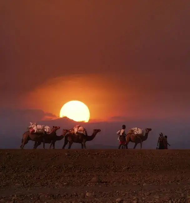
- John Explorer
- 04 Jul, 2026 00:27
Where Faith Clings to Cliffs: An Expedition to Tigray's Unseen Sky Sanctuaries
The dust of forgotten empires clings to the wind in Tigray, a northern province of Ethiopia where the earth itself seems to have been sculpted by divine hands and ancient faith. Not all journeys begin with a beaten path; some demand a vertical ascent, a silent prayer whispered on the wind, and a spirit unyielding in the face of sheer rock faces. For centuries, the world has marvelled at the more accessible wonders of Tigray's rock-hewn churches, such as the grand Abraha we Atsbeha. But beyond these revered landmarks lies a realm less traversed, a constellation of hidden sanctuaries clinging precariously to the very heavens – places where the devout have carved not just churches, but entire lives, into the most formidable cliffs. This is not a journey for the faint of heart, but for the soul seeking the profound, the untouched, and the truly extraordinary. Join me, John Explorer, as we venture into the heart of the Gheralta mountains, to seek out the rock-hewn churches that defy gravity and time, places whispered about in hushed tones, often accessible only by scaling dizzying heights. The Geological Canvas: A Land Forged by Fire and Faith Tigray’s landscape is a masterclass in raw, untamed beauty. Volcanic eruptions and tectonic shifts over millions of years have sculpted a colossal amphitheatre of sandstone mesas, dramatic spires, and labyrinthine canyons. It is amidst this awe-inspiring, often intimidating, topography that the early Christians of Ethiopia found their refuge and inspiration. The Aksumite Kingdom, one of the most powerful ancient civilizations in Africa, adopted Christianity in the 4th century CE, long before much of Europe. As the faith spread, and later, as periods of persecution or monastic introspection prompted a desire for solitude, hermits and communities sought out the most remote and defensible locations. They didn’t just build on mountains; they became part of them, meticulously carving churches directly into the living rock. These aren't merely caves adapted for worship; many are architectural marvels, complete with cruciform layouts, domes, pillars, arches, and intricate decorative elements, all hewn from the sandstone. The sheer audacity of their creation beggars belief. Imagine artisans, armed with rudimentary tools, chipping away at solid rock, often hundreds of meters above the valley floor, under a scorching sun. The purpose was clear: to create sanctuaries both physically and spiritually elevated, drawing closer to the divine by literally ascending towards it. While churches like Maryam Papasetti and Mikael Barka are known, my quest led me deeper, to the true vertical challenges, to places like Abuna Yemata Guh and Debre Maryam Korkor, whose existence feels more legend than reality. The Vertical Pilgrimage: Navigating the Paths of Ancient Ascetics The expedition to these sky sanctuaries is, in itself, a pilgrimage. It begins long before the first handhold is grasped, with days of arduous trekking through dry riverbeds, thorny scrub, and sun-baked plains. The villages at the foothills are isolated, their rhythms dictated by ancient agricultural cycles and the stark realities of their environment. Here, time moves differently, and the sense of history is palpable in every weathered face and ancient stone dwelling. Our journey to Abuna Yemata Guh, perhaps the most infamous of Tigray's vertical churches, began at dawn. The path quickly evaporated, replaced by a scramble over loose scree and boulders. The air was thin, carrying the scent of wild thyme and sun-baked earth. Local guides, with their incredible agility and encyclopedic knowledge of the terrain, are indispensable. They move with an almost ethereal grace, barefoot often, across surfaces that demand focused attention from even the most seasoned climbers. The true test came with the sheer, unyielding rock face. To reach Abuna Yemata Guh, one must climb a vertical cliff, using only hand and footholds carved into the rock centuries ago, often no wider than a finger. There are no safety ropes provided; pilgrims bring their own, or simply trust in faith and the surefootedness of their guides. It’s a gut-wrenching experience for anyone unaccustomed to such exposure. The wind whips past, and the world drops away beneath your feet.After the initial climb, a narrow, exposed ledge requires a careful traverse, followed by another vertical climb. Finally, a series of wooden pegs hammered into the rock, coupled with an old rope, offers the last, harrowing ascent to the entrance. It's a dance between fear and exhilaration, each muscle straining, each breath a conscious effort. But the reward, as with all truly difficult quests, is transcendent. Guardians of Stone and Spirit: The Living Legacy Upon reaching the entrance of Abuna Yemata Guh, the world outside fades. The small antechamber, cool and silent, offers immediate respite. The church itself is small but breathtaking, its walls and ceiling adorned with vibrant frescoes dating back to the 15th century. These paintings, remarkably preserved by the dry desert air and their isolation, depict apostles, saints, and biblical scenes with a distinct Ethiopian style – bold colors, expressive faces, and a spiritual intensity that is deeply moving. The resident priest, often an elderly man who has dedicated his life to this arduous calling, greets visitors with quiet dignity. His presence is a living testament to the unbroken chain of faith that has sustained these churches for over a millennium. He is not just a custodian of the building, but a living bridge to the past, performing ancient liturgies and guarding relics passed down through generations. To converse with him, even through a translator, is to touch the very heart of Ethiopian Christianity. These priests make the arduous climb almost daily, sometimes several times, for services, baptisms, or simply to tend to their sacred duties. They are the true guardians, their lives intertwined with the rock and the spiritual energy it holds. Their resilience and devotion are a humbling counterpoint to the fleeting concerns of the modern world. They embody the philosophy of the early hermits: to seek God in isolation, to find solace and strength in the raw power of nature and unwavering faith. Artistry in the Abyss: Frescoes, Manuscripts, and Mysticism The artistic and architectural achievements within these remote churches are astounding. Unlike European cathedrals that were built up from the ground, these sanctuaries were carved down and in. The sculptors had to anticipate the internal structure, working in reverse, always conscious of the integrity of the mountain around them. The precision required is mind-boggling, especially considering the constraints of the location. The frescoes, often in a distinct Aksumite-influenced style, are characterized by their flattened perspectives, large, expressive eyes, and vibrant, natural pigments derived from local minerals. In churches like Debre Maryam Korkor, also a significant climb though slightly less perilous than Abuna Yemata Guh, the paintings stretch across entire ceilings, depicting intricate narratives. There are scenes of the nine saints, the Virgin Mary, and various martyrs, all rendered with a profound spiritual depth. These are not merely decorations; they are visual sermons, mnemonic devices for a largely illiterate population, and powerful expressions of faith. Beyond the frescoes, many churches house ancient manuscripts, some dating back centuries, hand-copied on vellum and bound in leather. These texts, often beautifully illuminated, contain gospels, psalters, and theological treatises that offer invaluable insights into Ethiopian monastic traditions and early Christian thought. The very act of preserving these delicate artifacts in such remote locations speaks volumes about their perceived sacredness and historical value. To hold a manuscript that has witnessed centuries of human history, brought to a perilous cliff edge for safekeeping, is to experience a tangible link to a world long past. Echoes of the Past, Whispers of the Future The rock-hewn churches of Tigray are more than just architectural wonders or historical sites; they are living testaments to human endurance, unwavering faith, and artistic genius. They tell a story of a civilization that embraced Christianity with a fervor that literally moved mountains. They speak of a time when the spiritual journey was inseparable from the physical, where proximity to God was sought in the most challenging and elevated places on earth. In an increasingly connected and homogenized world, these sanctuaries remain remarkably untouched, preserving not just ancient art and architecture, but an entire way of life. Visiting them is a powerful reminder of humanity's capacity for devotion, creativity, and resilience. It challenges our modern perceptions of accessibility and comfort, forcing us to confront our own limits and appreciate the profound effort required to experience such wonders.The journey to Tigray’s unseen sky sanctuaries is an expedition into the very soul of Ethiopia, a vertical pilgrimage that redefines what it means to travel. It is a profound immersion into a world where faith quite literally clings to cliffs, where the whispers of ancient prayers echo in the wind, and where every ascent brings you closer to understanding the enduring spirit of humanity. These places are not just destinations; they are experiences that carve themselves into your memory, much like the churches are carved into the rock, leaving an indelible mark long after you’ve descended back to the plains.#TigrayTravel #EthiopianHistory #RockHewnChurches #AdventureTravel #HiddenGems #CulturalHeritage #VerticalPilgrimage Related InsightsChasing the Endless Day: A Photographer’s Manual for Lofoten’s Midnight Sun Chloe Tremblay’s Epic 10-Day Iceland Ring Road Adventure: A Budgeter’s Paradise and Luxury Dream Dive Into a Hidden World: The Most Breathtaking Underwater Museums and Sculpture Parks{ "@context": "https://schema.org", "@type": "FAQPage", "mainEntity": [ { "@type": "Question", "name": "What is the main focus of Where Faith Clings to Cliffs: An Expedition to Tigray's Unseen Sky Sanctuaries?", "acceptedAnswer": { "@type": "Answer", "text": "Embark on an epic journey with John Explorer to the perilous, rock-hewn churches of Tigray, Ethiopia, testaments to an ancient faith carved into sheer, forgotten cliffs." } }, { "@type": "Question", "name": "Who authored the comprehensive guide on Where Faith Clings to Cliffs: An Expedition to Tigray's Unseen Sky Sanctuaries?", "acceptedAnswer": { "@type": "Answer", "text": "This detailed article and its insights were carefully researched and authored by John Explorer." } }, { "@type": "Question", "name": "Where can I find more related content about Travel?", "acceptedAnswer": { "@type": "Answer", "text": "You can explore more articles, detailed reviews, and similar insights by browsing the Related Insights section at the bottom of this article or visiting our dedicated Travel category page." } } ] }