Showing Posts From
Travel
-
 Pierre Dubois
 - 30 Jun, 2026 12:29
Les Villages Engloutis de France : Plongée au Cœur d'un Patrimoine Submergé et de ses Mémoires Évanouies
Le silence est un écrin parfois trompeur. Sous la surface miroitante des grands lacs de barrage français, là où les voiliers glissent et les touristes se prélassent, un monde entier dort. Un monde de pierres silencieuses, de chemins oubliés, de souvenirs engloutis. Il s'agit des villages fantômes, des communautés entières sacrifiées sur l'autel du progrès, de l'indépendance énergétique et de la maîtrise de l'eau. Un voyage sur les traces de ces "villages engloutis" n'est pas une simple excursion touristique, c'est une plongée dans la mémoire vive d'une nation, un pèlerinage aux confins de l'oubli et de la résilience humaine. Imaginez un instant : des générations de familles ayant cultivé la même terre, fréquenté la même église, partagé les joies et les peines dans les mêmes ruelles pavées. Puis un jour, l'annonce implacable : l'eau montera. Votre foyer, vos ancêtres, vos souvenirs, tout sera dévoré par un lac artificiel. C'est le destin qu'ont connu des dizaines de milliers de Français, à l'heure où le pays, après la Seconde Guerre mondiale, a entrepris de remodeler son paysage pour bâtir une nation moderne, électrifiée et prospère. Ces histoires, souvent reléguées aux notes de bas de page de notre grande épopée industrielle, sont pourtant d'une richesse et d'une profondeur rares, offrant un prisme unique pour comprendre l'âme de nos territoires. Le Sacrifice Énergétique : Quand l'Eau Devient Électricité La #France est aujourd'hui une puissance nucléaire et hydroélectrique de premier plan. Ce maillage de barrages et de centrales, souvent perçu comme un acquis, est le fruit d'une volonté politique forte et d'un labeur colossal. Dès l'entre-deux-guerres, et de manière exponentielle après 1945 avec la création d'EDF, la construction de barrages hydroélectriques est devenue une priorité nationale. Il fallait produire de l'énergie pour reconstruire le pays, pour alimenter les industries, pour éclairer les foyers. Mais chaque kilowatt produit avait parfois un prix humain et patrimonial inestimable. Ces titans de béton ont transformé des vallées entières en réservoirs d'eau gigantesques. Des rivières tumultueuses ont été domptées, des gorges majestueuses ont été inondées, et avec elles, des hameaux, des fermes isolées, des églises séculaires, des ponts romains, des cimetières ont disparu sous les flots. Ce fut une période d'exode forcé, de déracinement brutal pour des populations entières. Les terrains étaient expropriés, les habitations détruites ou déménagées pierre par pierre, les morts parfois exhumés pour être ré-inhumés plus haut. Le progrès, souvent, ne regarde pas en arrière. C'est là que réside la force de ces lieux. Ils sont des cicatrices paysagères, des marqueurs d'une histoire complexe où la grandeur de l'ingénierie se frotte à la mélancolie du passé. Visiter ces sites, ce n'est pas seulement admirer la beauté parfois austère des lacs de montagne, c'est aussi chercher les traces d'une vie ancienne, écouter les murmures des profondeurs. Tignes : Le Symbole d'un Monde Englouti dans les Alpes Parmi les exemples les plus emblématiques de ces sacrifices, celui de l'ancien village de Tignes, dans les Alpes savoyardes, résonne avec une acuité particulière. Vieux Tignes, comme on l'appelle aujourd'hui, était une communauté alpine florissante, vivant de l'agriculture de montagne et du commerce. Un village pittoresque, ancré dans un paysage grandiose. En 1952, la construction du barrage de Tignes fut achevée, submergeant définitivement le village sous les eaux glaciales d'un lac de 2,8 km². Le déracinement fut terrible. Les habitants furent relogés dans une nouvelle station, Tignes-le-Lac, construite plus haut sur les rives du lac artificiel, ainsi que dans d'autres vallées. La résistance fut vive, mais vaine. Le souvenir de Vieux Tignes demeure vif dans la mémoire des familles, et le village est devenu un symbole poignant de l'impact des grands travaux sur les populations. Chaque année, lors des hivers rigoureux et des sécheresses estivales, lorsque le niveau du lac baisse considérablement, les vestiges de Vieux Tignes réapparaissent. Le vieux pont, des pans de murs, les fondations des maisons, les ruines de l'ancienne église. Ce spectacle est à la fois fascinant et bouleversant. C'est une invitation à se pencher sur la vie qui y grouillait autrefois, à imaginer les voix, les rires, les pleurs qui ont résonné dans ces pierres aujourd'hui muettes. C'est un dialogue direct avec l'histoire, une brèche temporelle qui s'ouvre sous nos yeux.Le voyage à Tignes ne se limite pas à la contemplation de ces vestiges éphémères. Il implique aussi de comprendre la résilience de la communauté, sa capacité à se reconstruire, à développer une nouvelle identité autour des sports d'hiver et du tourisme. C'est un lieu où l'ancienne et la nouvelle histoire se côtoient, où le passé hante le présent d'une manière tangible. Serre-Ponçon : Une Chapelle pour Mémorial Plus au sud, dans les Hautes-Alpes, le lac de Serre-Ponçon offre une autre facette de cette histoire. Ici, ce ne fut pas un unique village qui fut englouti, mais une multitude de hameaux et de terres agricoles de plusieurs communes, notamment Savines et Embrun. Le barrage de Serre-Ponçon, construit entre 1955 et 1961, est l'un des plus grands barrages en terre d'Europe et a créé une retenue d'eau majestueuse, nichée entre les montagnes. La particularité de Serre-Ponçon est la chapelle Saint-Michel. Avant la mise en eau, cette petite chapelle romane du XIIe siècle, située sur une butte rocheuse, était vouée à la destruction. Cependant, sa position élevée et l'intervention locale permirent de la sauver de la submersion totale. Aujourd'hui, elle se dresse fièrement sur un îlot rocheux au milieu du lac, accessible à pied lorsque les eaux sont basses. La chapelle Saint-Michel est devenue le symbole de la mémoire collective des populations déplacées. Elle est le dernier témoin vertical d'un monde englouti, une balise pour les souvenirs. Son isolement, sa solitude au milieu des eaux, lui confèrent une aura quasi mystique. Y accéder, c'est toucher du doigt l'histoire, c'est comprendre l'ampleur du bouleversement qui a transformé cette vallée alpine en une mer intérieure. C'est un lieu de recueillement, mais aussi un point de départ pour explorer les rives du lac, où l'on peut encore trouver des traces des anciennes routes, des ponts immergés, des bornes kilométriques fantômes.Le Paradoxe du Progrès et la Poésie des Ruines Le voyage vers les villages engloutis est une méditation sur le paradoxe du progrès. La France avait besoin de ces barrages pour se moderniser, pour se développer, pour offrir à ses citoyens l'électricité et l'eau dont ils avaient besoin. Ces infrastructures sont des prouesses d'ingénierie, des monuments à la volonté humaine de maîtriser son environnement. Pourtant, elles portent en elles le poids d'un sacrifice, le deuil de paysages ancestraux et de modes de vie séculaires. Ces lieux nous rappellent que le "hors des sentiers battus" n'est pas toujours une question d'exotisme lointain, mais parfois une simple réorientation du regard vers ce qui se trouve juste sous nos pieds, ou sous les flots. Il s'agit de s'éloigner des clichés de cartes postales pour explorer les couches profondes de l'histoire et de l'identité d'un territoire. Comment visiter ces sites de manière respectueuse ? Il est essentiel de s'informer sur l'histoire locale, de comprendre les enjeux de l'époque. Les musées locaux, les associations du patrimoine, les témoignages des anciens habitants sont des sources précieuses. Observer les vestiges avec respect, c'est rendre hommage à ceux qui ont vécu là. Ces villages engloutis sont aussi des écosystèmes à part entière. Leurs profondeurs abritent une vie aquatique spécifique, et leurs ruines servent parfois de refuges aux poissons. La #nature a repris ses droits, enveloppant d'un manteau végétal et aquatique ces vestiges de l'activité humaine. Cette cohabitation entre le passé humain et la vie naturelle actuelle ajoute une couche supplémentaire de poésie à ces paysages. Dans la baie de Crots à Serre-Ponçon, lors des grandes marées basses artificielles, on peut même voir des sections de l'ancienne route nationale 94 qui reliait Gap à Briançon, avec ses glissières de sécurité rouillées qui émergent comme des squelettes d'un serpent géant. Plus loin, le lit asséché du Drac révèle les fondations de fermes, les troncs d'arbres pétrifiés par la vase. C'est une archéologie à ciel ouvert, éphémère et saisissante. Ces explorations nous obligent à repenser notre rapport au temps, à la mémoire et à l'identité collective. Elles sont une invitation à la contemplation, à la réflexion sur le prix du développement et la résilience de l'esprit humain face à l'inéluctable. Les villages engloutis de France ne sont pas seulement des points sur une carte, ce sont des cœurs battants sous les ondes, des récits gravés dans l'eau et la pierre, attendant patiemment d'être écoutés par ceux qui oseront plonger au-delà de la surface.#Hydroélectricité #PatrimoineSubmergé #VoyageMémoire #FranceCachée #HistoiresOubliées #PatrimoineSubmerg #HydrolectricitFrance #VoyageHorsSentiersBattus #MmoireLocale #BarragesFrance #HistoireOublie Related InsightsTerme di Caracalla: Il Lusso del Benessere Romano Shadows of Angkor: Unveiling the Jungle‑Cloaked Temples Beyond the Tourist Trail Azure Horizons and Fragile Ecosystems: The Maldives Reality Check{ "@context": "https://schema.org", "@type": "FAQPage", "mainEntity": [ { "@type": "Question", "name": "What is the main focus of Les Villages Engloutis de France : Plongée au Cœur d'un Patrimoine Submergé et de ses Mémoires Évanouies?", "acceptedAnswer": { "@type": "Answer", "text": "Découvrez les récits poignants des villages français engloutis par les eaux des barrages, un voyage unique entre patrimoine perdu et résilience des communautés." } }, { "@type": "Question", "name": "Who authored the comprehensive guide on Les Villages Engloutis de France : Plongée au Cœur d'un Patrimoine Submergé et de ses Mémoires Évanouies?", "acceptedAnswer": { "@type": "Answer", "text": "This detailed article and its insights were carefully researched and authored by Pierre Dubois." } }, { "@type": "Question", "name": "Where can I find more related content about Travel?", "acceptedAnswer": { "@type": "Answer", "text": "You can explore more articles, detailed reviews, and similar insights by browsing the Related Insights section at the bottom of this article or visiting our dedicated Travel category page." } } ] }
- Pierre Dubois
- 30 Jun, 2026 09:19
L'Écho Secret des Montagnes du Tigré : À la Découverte des Églises Monolithiques d'Éthiopie
Le soleil éthiopien, ardent et implacable, commençait sa lente descente, peignant les sommets du Tigré de teintes ocre et pourpres. Au loin, une silhouette indistincte, presque une tache sur l'immense toile rocheuse, semblait défier les lois de la gravité. Mon cœur battait à un rythme frénétique, non pas de peur, mais d'une anticipation presque sacrée. Car cette silhouette, je le savais, n'était pas une simple curiosité géologique, mais l'une des merveilles les plus secrètes et les plus spirituelles que notre monde ait à offrir : une église taillée à même la falaise, suspendue entre ciel et terre, gardienne d'une foi millénaire. Ce n'est pas de Lalibela, la "Nouvelle Jérusalem" si souvent célébrée, dont je vais vous parler aujourd'hui. Non. Mon exploration nous mènera bien plus au nord, au cœur d'une région aux paysages déchirés et majestueux, où l'âme de l'Éthiopie chrétienne orthodoxe s'est ancrée dans la roche elle-même. Le Tigré, une terre de hauts plateaux et de profonds canyons, est le berceau d'une tradition architecturale et spirituelle unique, bien moins connue du grand public mais d'une intensité inégalée. Plus d'une centaine d'églises rupestres, certaines datant du IVe siècle, se dissimulent ici, véritables forteresses de la foi, taillées par la main de l'homme dans des conditions inimaginables. Elles ne sont pas de simples lieux de culte, mais des testaments vivants d'une dévotion si profonde qu'elle a transformé la montagne en sanctuaire. Les Racines Profondes d'une Foi Ancrée dans la Pierre Pour comprendre ces édifices extraordinaires, il faut remonter le fil du temps jusqu'aux origines du christianisme en Éthiopie. Le royaume d'Axoum, situé dans ce qui est aujourd'hui le Tigré, fut l'un des premiers États au monde à adopter le christianisme comme religion d'État, vers le milieu du IVe siècle. Dès lors, la foi chrétienne a imprégné chaque aspect de la vie éthiopienne, développant une liturgie, une iconographie et une architecture distinctes. Les églises rupestres du Tigré ne sont pas nées d'un caprice architectural, mais d'une nécessité. Les premiers chrétiens, cherchant la solitude pour la contemplation ou la protection contre les invasions, trouvèrent refuge et inspiration dans les grottes naturelles. Progressivement, ces abris furent agrandis, sculptés, et transformés en lieux de culte, à l'image des temples païens et des tombeaux royaux taillés dans la roche que l'on trouvait déjà dans la région. Le Tigré, avec sa géologie particulière – un grès tendre et facilement ouvrable en surface, mais solide et stable en profondeur – offrait le terrain idéal pour cette entreprise colossale. Les moines et les artisans, armés de simples ciseaux et marteaux, commencèrent à extraire d'énormes volumes de roche, sculptant des façades, des nefs, des piliers et des autels, directement dans la matière vive de la montagne. C'est un travail d'une patience infinie et d'une ingéniosité déconcertante, réalisé sans les technologies modernes, où chaque coup de ciseau était une prière, chaque pilier une affirmation de foi. Des Merveilles Architecturales Discrètes mais Imposantes Ces églises ne sont pas toutes identiques. On distingue principalement trois types :Les églises-grottes : Elles utilisent une grotte naturelle comme base, qu'elles aménagent et décorent. Les églises semi-monolithiques : Une partie de la structure est creusée dans la roche, tandis que d'autres éléments sont construits à partir de blocs extraits. Les églises monolithiques : Le chef-d'œuvre de cette tradition, où l'intégralité de l'église, de la façade au sol en passant par le toit, est taillée d'un seul bloc dans la montagne, à l'instar des célèbres églises de Lalibela, mais avec une rusticité et une intégration paysagère souvent plus frappantes.Chacune de ces églises possède son propre caractère, son propre défi d'accès, et ses propres trésors intérieurs. Elles sont souvent peintes de fresques vibrantes, dont les pigments, issus de minéraux locaux, ont conservé leur éclat au fil des siècles. Les icônes anciennes, les manuscrits enluminés et les croix processionnelles en argent et en or sont autant de témoignages d'une culture artistique et religieuse ininterrompue. Prenons, par exemple, la célèbre Abuna Yemata Guh. J'y suis arrivé au petit matin, alors que le soleil commençait à réchauffer les falaises. L'ascension est une épreuve en soi : une longue marche en terrain escarpé, puis une escalade presque verticale sur une paroi rocheuse lisse, agrémentée de quelques prises sommaires et de cordes rudimentaires passées par les guides locaux. La dernière partie, un passage vertigineux le long d'une corniche étroite, sans aucune barrière, met les nerfs à rude épreuve. Mais une fois arrivé au sommet, la récompense est inouïe. L'église elle-même, avec ses fresques du Ve siècle incroyablement bien conservées et ses piliers taillés avec une précision surprenante, semble veiller sur le monde depuis sa position aérienne. L'énergie du lieu est palpable, un mélange de sérénité et d'une force ancestrale.Un autre joyau est Maryam Korkor, moins intimidante d'accès mais non moins spectaculaire. Après une randonnée significative, on atteint un plateau d'où l'on aperçoit plusieurs églises. Maryam Korkor, la plus grande, est une église-grotte immense, avec de vastes salles et des colonnes imposantes. Elle abrite une collection impressionnante de manuscrits et d'artefacts religieux. Les moines qui y vivent perpétuent les rites quotidiens, et l'air résonne des chants liturgiques ancestraux. C'est une immersion totale dans une spiritualité vivante, où le temps semble s'être arrêté. Le Voyage : Une Quête de l'Authentique Visiter les églises du Tigré n'est pas un voyage comme les autres. C'est une véritable expédition qui demande préparation physique et mentale, mais surtout une ouverture d'esprit. Les routes sont souvent rudimentaires, et l'accès à certaines églises implique des heures de marche, parfois à dos d'âne, à travers des paysages grandioses et isolés. Les guides locaux sont essentiels, non seulement pour des raisons de sécurité, mais aussi pour leur connaissance intime des lieux, des histoires et des coutumes. Ils sont les gardiens de ce patrimoine et les ponts entre le visiteur et la culture tigréenne. Chaque village traversé, chaque rencontre avec les habitants, ajoute une couche de profondeur à l'expérience. L'hospitalité éthiopienne est légendaire, et le Tigré ne fait pas exception. Les rituels du café, l'odeur de l'injera fraîchement cuite, les sourires des enfants, la dignité des anciens – tout contribue à une immersion culturelle profonde. Ce sont des moments d'échange authentique, loin des foules touristiques et des pièges commerciaux. C'est un voyage qui exige de sortir de sa zone de confort, mais qui récompense par des souvenirs impérissables et une perspective renouvelée sur la foi, l'histoire et l'ingéniosité humaine. Un Sanctuaire de Résilience et de Pureté Ces églises sont plus que de simples édifices religieux ; elles sont des symboles de la résilience du peuple tigréen. Elles ont survécu aux siècles de guerres, d'invasions, de famines et de bouleversements politiques. Leur isolement même a souvent été leur meilleure protection, préservant leurs trésors et leur spiritualité des destructions et des pillages. Les moines et les prêtres qui y vivent sont les dépositaires d'une tradition ininterrompue, continuant à célébrer la liturgie en guèze, une langue sémitique antique, et à préserver des manuscrits séculaires. Marcher dans ces églises, c'est fouler des millénaires d'histoire. Sentir l'air frais et silencieux qui imprègne ces espaces rupestres, contempler les visages saints peints sur les murs, écouter les murmures du vent à travers les ouvertures taillées dans la roche, c'est se connecter à quelque chose de fondamentallement humain et divin. C'est comprendre que la foi n'est pas seulement une croyance, mais une force créatrice capable de déplacer des montagnes, ou plutôt, de les sculpter.Le Tigré n'est pas seulement un lieu de voyage, c'est un pèlerinage. Qu'on soit croyant ou non, l'expérience est profondément transformatrice. Elle nous rappelle la capacité de l'humanité à créer de la beauté et du sacré dans les endroits les plus inattendus, avec les moyens les plus humbles. C'est une leçon d'humilité face à la grandeur de la nature et à la persévérance de l'esprit humain. En quittant ces montagnes, j'ai emporté avec moi non seulement des images époustouflantes, mais aussi une profonde impression de sérénité et d'émerveillement. Les églises rupestres du Tigré ne sont pas de simples destinations touristiques ; elles sont des portes vers un passé vivant, des sanctuaires d'une foi inébranlable et des témoins silencieux d'une histoire extraordinaire qui continue de se dérouler, sculptée dans le cœur même de la terre. C'est un trésor que l'Éthiopie partage avec le monde, un appel à l'aventure, à la découverte et à la contemplation. Un voyage au Tigré, c'est bien plus qu'une simple escapade ; c'est une rencontre avec l'âme profonde de l'humanité, gravée à jamais dans la roche.#ÉthiopieProfonde #TigréSecret #ÉglisesRupestres #VoyageSpirituel #PatrimoineCaché Related InsightsRomantische Straße fahren The Dolomites, Italy: Hiking Through Alpine UNESCO Heritage (Part 2) Altai Mountains{ "@context": "https://schema.org", "@type": "FAQPage", "mainEntity": [ { "@type": "Question", "name": "What is the main focus of L'Écho Secret des Montagnes du Tigré : À la Découverte des Églises Monolithiques d'Éthiopie?", "acceptedAnswer": { "@type": "Answer", "text": "Percez le mystère des églises rupestres millénaires du Tigré, des sanctuaires taillés à même la roche qui murmurent des histoires d'une foi inébranlable et d'un art oublié au cœur des montagnes éthiopiennes." } }, { "@type": "Question", "name": "Who authored the comprehensive guide on L'Écho Secret des Montagnes du Tigré : À la Découverte des Églises Monolithiques d'Éthiopie?", "acceptedAnswer": { "@type": "Answer", "text": "This detailed article and its insights were carefully researched and authored by Pierre Dubois." } }, { "@type": "Question", "name": "Where can I find more related content about Travel?", "acceptedAnswer": { "@type": "Answer", "text": "You can explore more articles, detailed reviews, and similar insights by browsing the Related Insights section at the bottom of this article or visiting our dedicated Travel category page." } } ] }
-
 John Explorer
 - 30 Jun, 2026 05:45
Echoes from the Cradle: My Quest for the Waxed Reed Boats of Iraq's Ancient Marshes
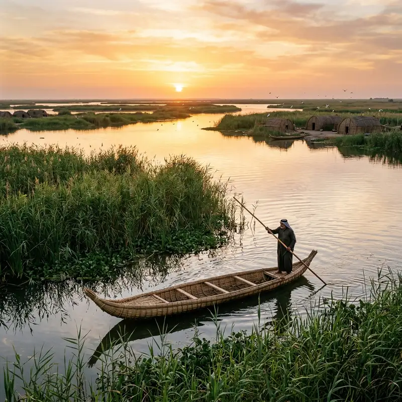
The first thing that struck me wasn't the heat, or the dust, or even the subtle scent of #ancient earth meeting brackish water. It was the silence. Not an empty silence, but one pregnant with the rustle of reeds, the distant cry of a marsh harrier, and a profound, almost audible, hum of #history. This was the Mesopotamian Marshes, the so-called 'Garden of Eden,' a landscape so primordial it felt like stepping not just into another country, but another epoch entirely. My compass, however, wasn't pointing towards archaeological dig sites or famed ziggurats. My quest was far more subtle, a chase after a living, breathing antiquity: the almost-forgotten art of the waxed reed boat, and the whispers of the last artisans who still knew its secrets. A Flicker in the Digital Mire: The Genesis of a Niche Quest Most #travel itineraries for Iraq, even the adventurous ones, rightly focus on Baghdad's bustling markets, the haunting ruins of Babylon, or the sacred cities of Najaf and Karbala. The marshes, if mentioned at all, often carry caveats of inaccessibility or past conflict. But a fleeting documentary clip, a grainy photograph shared in an obscure online forum, had lodged itself in my mind like a forgotten legend. It depicted a lean, sun-weathered man, his hands caked with mud and tar, meticulously binding reeds into the elegant, sweeping form of a boat – a mashhoof or a tarada. The image spoke of resilience, of a deep connection to a place that modern civilization seemed determined to overlook, if not erase. I’d chased lost tribes in the Amazon, trekked forgotten pilgrimage routes in Bhutan, and delved into the culinary secrets of remote Himalayan valleys. But this felt different. This wasn't merely about witnessing a #culture; it was about understanding the essence of human adaptation, a craft that had sustained a unique civilization for millennia, virtually unchanged since the Sumerians carved similar vessels on their cylinder seals. The challenge was immense: navigating a region fraught with misconceptions, limited infrastructure, and the delicate socio-political landscape of post-conflict Iraq. But the pull of that ancient whisper, the call of a dying art form, was irresistible. My #journey began in Basra, a city of canals often dubbed the 'Venice of the East,' though its reality is far grittier and more complex. From there, it was a multi-stage affair: a hired car over bumpy, sometimes non-existent roads, then a transfer to a small, motorized skiff to penetrate deeper into the labyrinthine waterways. The air grew heavier, thick with the scent of damp earth and life. The horizon transformed into an endless tapestry of towering reeds, stretching as far as the eye could see, broken only by the occasional glimpse of a mudhif – the magnificent, arched guest houses built entirely from bundled reeds – or a flock of migrating birds. The Marsh Dwellers: Guardians of a Liquid World The people of the marshes, the Ma'dan or 'Marsh Arabs,' are a resilient community whose lives are inextricably linked to the water. Their homes are built on artificial islands of compacted mud and reed, their sustenance drawn from fishing, hunting, and raising water buffalo. Their ancient way of life faced near-total annihilation under Saddam Hussein’s regime, which deliberately drained the marshes in the 1990s as a punitive measure. The subsequent ecological and human devastation was immense, a deliberate act of cultural genocide. Yet, against all odds, the marshes are slowly recovering, a testament to #nature's tenacity and the unwavering spirit of the Ma'dan, many of whom have returned to rebuild their lives and, crucially, their traditions. My primary objective led me to a small settlement, little more than a cluster of mudhifs and reed huts on a particularly fertile island. Here, I was introduced to Sheikh Abbas, an elder with eyes that held the wisdom of generations and hands gnarled from a lifetime of working with the marsh. His hospitality was immediate and profound, a hallmark of Iraqi culture. Over countless cups of strong, sweet chai, and plates of freshly caught fish, he began to unravel the story of the mashhoof and the tarada. The mashhoof is the smaller, more common paddling or punting boat, used for daily tasks like fishing, transport, and buffalo herding. The tarada, on the other hand, is a larger, grander vessel, often up to 15 meters long, traditionally used for ceremonial purposes or by tribal leaders. Both are masterpieces of engineering, crafted entirely from the abundant reeds, mud, and natural bitumen found in the marshes. They are designed for stealth, stability, and speed through shallow, often densely vegetated waterways. The Sacred Geometry of Reeds and Tar The construction of a reed boat is not merely a utilitarian act; it is a ritual, a passing down of knowledge, a dialogue with the environment. Sheikh Abbas introduced me to his nephew, Karim, who, despite the lure of urban life, had chosen to stay and apprentice under his uncle, determined to keep the craft alive. Karim was in the midst of building a new mashhoof, and I was privileged to witness the process firsthand. The journey begins with the reeds themselves. Only specific types of reeds, tall and strong, are harvested at certain times of the year. They are cut, dried, and then painstakingly sorted. Bundles of reeds are then carefully selected for different parts of the boat – thicker bundles for the keel and main structure, finer ones for the hull. The ingenuity lies in how these bundles are manipulated. They are not simply tied; they are compressed, twisted, and bent into shape using minimal tools, relying almost entirely on the strength and precision of the artisans' hands. I watched, mesmerized, as Karim and his small team worked. They began with the 'spine' of the boat, forming a thick, central keel from multiple bundles. Then, layer by layer, more bundles were lashed onto this frame, gradually forming the upward-curving prow and stern, and the elegant, low sides. The binding material itself is often twine made from date palm fibers or even re-purposed plastic rope in modern times, but traditionally, it would have been natural fibers. The precision required to maintain the boat’s symmetrical curvature and structural integrity is astounding, performed without blueprints or measurements, relying solely on generations of inherited skill and an innate understanding of materials.The most crucial, and perhaps most ancient, step is the 'waxing' or tarring. Once the basic reed structure is complete, it must be made watertight. This is achieved by applying a thick layer of natural bitumen (tar), locally known as gīr, to the exterior. This sticky, black substance, which bubbles up naturally in certain areas of Iraq, has been used since Sumerian times to waterproof everything from boats to bathhouses. Karim meticulously heated the tar over a small fire, then, using a brush made of woven reeds, carefully spread it over the entire outer hull. The scent was pungent, earthy, and strangely captivating, an olfactory link to countless generations of boat builders. Journey Through Time: A Ride on a Living Relic When the mashhoof was finally complete, gleaming black and smelling of fresh tar, Karim offered me the chance to experience the marshes from its unique perspective. Stepping into it, I felt an immediate connection to the past. The boat was surprisingly stable, its shallow draft allowing it to glide effortlessly over submerged vegetation. Karim, standing at the stern with a long punting pole, navigated the labyrinthine channels with an intuitive grace that only someone born to this environment could possess. We moved silently, the only sounds the gentle splash of the pole, the whisper of wind through the reeds, and the myriad calls of unseen birds. Fish jumped, dragonflies darted, and water buffalo grazed placidly in the distance. The marsh, so often portrayed as a desolate or dangerous place, revealed itself as an ecosystem teeming with life, a vibrant, interconnected world that demanded respect and understanding. It was easy to imagine ancient Sumerians, Akkadians, and Babylonians traversing these very waters in similar vessels, their lives as intertwined with the marsh as Karim's own. Sheikh Abbas later recounted stories passed down through his family, tales of how these boats were central to everything: marriages, funerals, trade, and even tribal skirmishes. The tarada, in particular, was a symbol of status and tribal power, its long, elegant lines cutting through the water like a floating monument. He spoke of the pride in crafting a boat that could endure, a vessel that carried not just goods or people, but the very spirit of the Ma'dan. The Shadow of Modernity and the Hope for Revival The survival of this craft, however, hangs by a precarious thread. The draining of the marshes in the 1990s devastated the ecosystem and displaced hundreds of thousands of people. While significant areas have been reflooded since 2003, and the marshes were declared a #UNESCO World Heritage site in 2016, challenges remain. Climate change brings increasing drought, upstream damming in Turkey and Iran reduces water flow, and pollution threatens the delicate balance of the environment. More fundamentally, the younger generation, facing economic hardship and drawn to the perceived opportunities of cities, are less inclined to embrace the physically demanding and often unrewarding life of a marsh dweller or artisan. Karim, however, represents a sliver of hope. He spoke passionately about the importance of his work, not just as a means of livelihood, but as a vital link to his heritage. He dreams of establishing a small workshop, perhaps even attracting visitors who are genuinely interested in learning about the craft and the marsh culture. His efforts, and those of others like him, are crucial. If the skill of building these waxed reed boats is lost, it won’t just be a craft that vanishes; it will be a profound piece of human history, a tangible connection to the dawn of civilization, that dissipates into the reeds. My time in the marshes was a profound lesson in resilience, human ingenuity, and the delicate balance between tradition and progress. It reminded me that the most extraordinary travel experiences often lie not in grand monuments, but in the quiet corners where ancient ways stubbornly persist, sustained by the hands and hearts of a few dedicated individuals. To witness the building of a mashhoof is to see history being forged, one reed at a time. To glide across the water in one is to journey through time, carried on the very same currents that nourished Mesopotamia's earliest civilizations. This forgotten art isn't just about boats; it's about identity, survival, and the enduring human spirit. As I left the marshes, the reeds once again dissolved into a shimmering horizon. But the silent scribe of the Shatt, the memory of those waxed reed boats, their sleek forms cutting through the water, and the quiet determination of their makers, had etched themselves indelibly onto my soul. It’s a story whispered not just by the wind through the reeds, but by every drop of water, every grain of mud, and every skilled hand fighting to keep an ancient heritage afloat. #IraqiMarshes #ReedBoats #HiddenCulture #Mesopotamia #DyingArt #Travel #Culture Related InsightsScavi di Pompei: La Città Congelata nel Tempo Georgia’s Caucasus Mountains: Where Medieval Villages, Ancient Wine, and Epic Hikes Collide The Azores: Europe’s Hidden Paradise Where Wild Volcanoes Meet Turquoise Oceans (Part 2){ "@context": "https://schema.org", "@type": "FAQPage", "mainEntity": [ { "@type": "Question", "name": "What is the main focus of Echoes from the Cradle: My Quest for the Waxed Reed Boats of Iraq's Ancient Marshes?", "acceptedAnswer": { "@type": "Answer", "text": "Deep in the forgotten wetlands of Southern Iraq, an ancient craft whispers defiance against time. Join John Explorer as he unearths the last guardians of Mesopotamia's reed boat heritage, a saga of mud, water, and wax stretching back millennia." } }, { "@type": "Question", "name": "Who authored the comprehensive guide on Echoes from the Cradle: My Quest for the Waxed Reed Boats of Iraq's Ancient Marshes?", "acceptedAnswer": { "@type": "Answer", "text": "This detailed article and its insights were carefully researched and authored by John Explorer." } }, { "@type": "Question", "name": "Where can I find more related content about Travel?", "acceptedAnswer": { "@type": "Answer", "text": "You can explore more articles, detailed reviews, and similar insights by browsing the Related Insights section at the bottom of this article or visiting our dedicated Travel category page." } } ] }
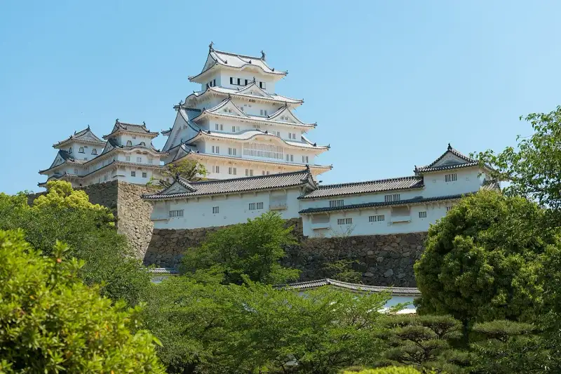
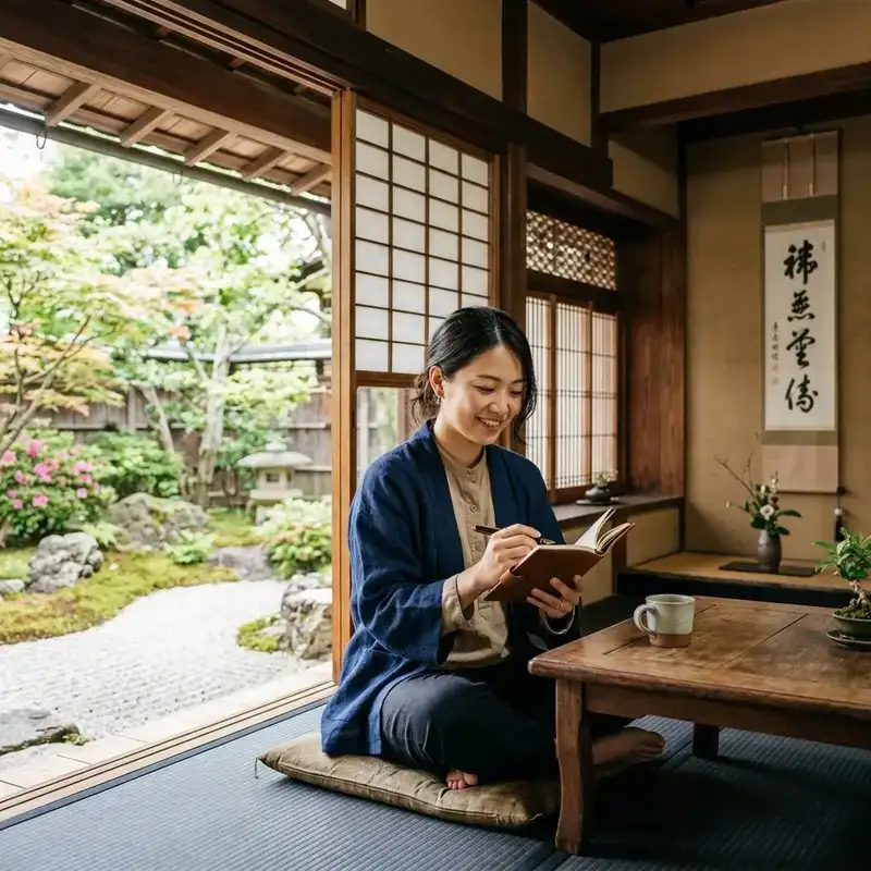
ようこそ。日本の美しき歴史と文化の旅へ。 姫路城: 白鷺が舞い降りた名城 日本の古都、京都から西へ向かう新幹線に揺られ、ふと窓外に目をやれば、播磨の平野に突如として現れる、あまりにもまばゆい白亜の城郭。それが、世界にその名を轟かせる「姫路城」、別名「白鷺城」です。私は田中ゆみ。この国の歴史と文化、そして自然が織りなす深遠な美を求めて旅をする者として、何度この城の前に立ち尽くし、その圧倒的な存在感に言葉を失ったことでしょう。まるで大空を舞う白鷺が、一瞬の静寂とともに地上に舞い降りたかのような、その優雅にして力強い姿は、訪れる者の心に深く刻み込まれます。 この城は単なる歴史的建造物ではありま��ん。それは、日本の精神性、美意識、そして幾多の戦乱を生き抜いた人々の知恵と願いが結晶化した、生きた証なのです。今回は、その壮麗な姫路城の全貌を、私の心に響く言葉で紐解いていきたいと思います。 悠久の時を刻む白亜の殿堂:姫路城の全貌 姫路城は、兵庫県姫路市、古くは播磨国飾磨郡に位置し、姫山と鷺山という二つの丘陵を中心に据え、巧みに地形を利用して築かれた平山城の傑作です。その威容は、日本が誇る近世城郭の典型でありながら、他に類を見ない独自の美学を湛えています。その天守群は、まるで天空へと伸びる純白の巨塔のようであり、連立式天守と呼ばれる複雑な構造は、見る角度によって様々な表情を見せ、私たちを飽きさせません。 この城の最も特筆すべきは、江戸時代初期に建設された主要な建築物が、奇跡的なまでに良好な状態で現存しているという事実でしょう。大天守、小天守、そしてこれらを繋ぐ渡櫓など、主要な8棟は国の至宝である「国宝」として厳かに護持されています。さらに、櫓、門、塀といった74棟に及ぶ多種多様な建造物もまた、「重要文化財」としてその価値を認められています。これら一つ一つの石垣、木材、瓦に、悠久の時の流れと、それを守り抜いた人々の情熱が宿っているかのようです。 中堀の内側に広がる主郭部を含む広大な城域は、「姫路城跡」として国の「特別史跡」に指定されており、その歴史的・文化的な重要性は計り知れません。そして、1993年(平成5年)12月には、人類共通の遺産としてユネスコの世界遺産(文化遺産)リストにも堂々とその名を連ねました。これは、この城が日本の枠を超え、全世界にとってかけがえのない宝であることを意味しています。また、「日本100名城」の一つに選定されていることはもちろん、「国宝五城」「三名城」「三大平山城・三大連立式平山城」という数々の称号が、その比類なき価値を物語っています。 姫路城の建築様式は、城郭建築の頂点とも言える連立式天守であり、大天守を中心に東小天守、西小天守、乾小天守が、それぞれ渡櫓で結ばれ、あたかも複雑な生命体のように一体感をなしています。この構造は、防御機能の強化と同時に、見る者に圧倒的な美意識を訴えかけるものです。白漆喰で塗られ���壁面は、播磨の陽光を反射してまばゆいばかりの輝きを放ち、その姿は遠くからでも一目でそれと分かります。 四季折々に、姫路城はその表情を変え、訪れる者を魅了します。春には、城郭を囲む桜並木が一斉に花開き、純白の天守と淡いピンク色の花々が織りなすコントラストは、まるで絵画のような絶景を生み出します。新緑の季節には、生命力に満ちた緑が城の白さを際立たせ、夏には青い空の下で一層その威厳を増します。秋には、紅葉が城壁を彩り、歴史の深みを感じさせ、そして冬、雪が舞い降りれば、白銀の世界にそびえ立つ姫路城は、息をのむような幻想的な美しさを見せます。これらの景観は、#自然 の豊かさと、人間が創り出した建築美が見事に調和していることの証と言えるでしょう。 名に秘められた歴史と伝説:白鷺城の呼称 姫路城が「白鷺城」と称される所以には、いくつかの説が語り継がれていますが、そのどれもが、この城の持つ神秘性と美しさを深く物語っています。 まず、天守が築かれている「姫山」の古名にまで遡ります。「日女路(ひめじ)の丘」と称されたこの地は、『��磨国風土記』にも「日女道丘(ひめじおか)」としてその名が見られます。そこには、大汝命(大国主命)の船が火明命によって嵐で転覆させられた際、積み荷の中から蚕子(ひめこ)が流れ着いたという神話が記されており、これが山の名の由来とされています。やがて「姫道」を経て「姫路」という地名が定着しました。かつては他戸親王の娘、富姫に由来するという説も存在しましたが、『播磨国風土記』の再発見により、より深い歴史的背景が明らかになったのです。 この姫山は、かつて桜が多く咲き誇ったことから「桜木山」とも呼ばれ、それが転じて「鷺山(さぎやま)」と呼ばれるようになったと伝えられています。時には、天守のある丘が姫山、西の丸のある丘が鷺山と区別されることもあります。『万葉集』巻9・1776に収められた「絶等寸(たゆらぎ)の山の峰の上の桜花咲かむ春へは君し偲はむ」という歌に詠まれた「たゆらぎの山」を、井上通泰や金子元臣といった学者たちは姫山のことだと考証しました。『姫路城史』の著者である橋本政次や『姫路市史(1919年)』はさらに、「絶等寸」を「サクラ��(桜木)」と訓ずるべきだと論じ、この地の豊かな自然と文化の繋がりを示唆しています。一方で、吉田金彦は「姫路」を「日村道(ひむれじ)」、すなわち「日数を重ね隔てた遠い村への道」が語源であるとし、「絶等寸山」は西の丸の鷺山を指し、「タユラギ」は「古代の共同労働集団の統括者」を意味するという、また異なる視点も提示しており、その名の由来一つにも、様々な解釈と深い思索が込められています。 そして、別名「白鷺城(はくろじょう)」の由来に関しては、橋本政次氏の『姫路城の話』に、推論を含め以下の4説が挙げられています。「鷺山」に置かれていることからの連想: 城が築かれた地が「鷺山」と呼ばれていたことから、自然にその名が結びついたという説は、地理と城名の融合を示しています。 白漆喰で塗られた城壁の美しさ: これこそが、多くの人が「白鷺城」の名の由来として最も納得する理由でしょう。その純白の城壁は、見る者に清らかで優雅な印象を与え、まるで天空を舞う白鷺の姿を地上に具現化したかのようです。この白亜の美は、日本の伝統的な建築技術��美意識が融合した結晶であり、観る者の心に深く響きます。 ゴイサギなど白鷺と総称される鳥が多く住んでいたから: かつてこの地には、多くの白鷺が飛来し、その優雅な姿が城の周囲を彩っていたのかもしれません。#自然 と共存する城の姿は、日本の文化と深く結びついています。 黒い壁から「烏城(うじょう)」「金烏城(きんうじょう)」とも呼ばれる岡山城との対比: 近隣の岡山城が黒を基調とした「烏城」と呼ばれることから、対照的に白を基調とする姫路城が「白鷺城」と称されるようになったという説は、日本の美意識における「陰と陽」の対比を見事に表現しています。「白鷺城」の読み方については、「はくろじょう」と「しらさぎじょう」の二つが存在し、村田英雄の歌曲『白鷺の城』のように「しらさぎ」と読む例もあります。橋本政次氏は漢学的な名称であることから「はくろじょう」を正しいとしましたが、現代では『日本歴史大事典』や『もういちど読む山川日本史』のように「しらさぎじょう」のみを掲載するもの、あるいは『日本史事典』や『ビジュアルワイド 日本名城百選��のように両方を併記するものも見られます。姫路市内では市立の「白鷺(はくろ)小中学校」のように学校名に用いられたり、校歌にも「白鷺城」または「白鷺」という言葉が多用されており、市民にとってこの名は深い郷土愛と誇りの象徴となっています。戦前の『姫路市郷土唱歌』にも「白鷺城」や「池田輝政」の名が歌い込まれていたことからも、その歴史的な重みが伺えます。 他にも、姫路城には以下のような別名があります。不戦の城: 幕末の動乱期に新政府軍に包囲されながらも大規模な戦火を免れ、第二次世界大戦中の2度の空襲では、大天守最上階に直撃した焼夷弾が不発弾となるという奇跡的な幸運に恵まれました。一度も大規模な戦火にさらされることなく、甚大な被害を被ることがなかったこの城は、平和への願いと、人々の祈りが形になったかのような存在です。 白い不死鳥: 特に第二次世界大戦の空襲を奇跡的に免れ、焦土と化した街の中で白く輝き続けた姿は、市民に復興への勇気と希望を与えました。灰燼の中から立ち上がる不死鳥の如く、この城は何度となく困難を乗り越え、そ���美しい姿を現代に伝えています。時代を超えて築かれし堅牢なる美:その歴史の軌跡 姫路城の歴史は、日本の激動の時代を映す鏡です。その築城は、遥か南北朝時代にまで遡ります。 南北朝時代・戦国時代 鎌倉幕府の終焉を迎える1333年(元弘3年)、元弘の乱において護良親王の令旨を奉じた播磨国守護、赤松則村が挙兵。上洛の途上、姫山にあった称名寺を拠点に縄張りを施し、一族の小寺頼季にその守備を命じたのが、姫路城の歴史の第一歩とされています。南北朝の争乱が激化する中、則村は足利尊氏に呼応して再び挙兵し、1346年(南朝:正平元年、北朝:貞和2年)、次男の赤松貞範が称名寺を麓に移し、姫山に「姫山城」を築城しました。その後、貞範が庄山城へ本拠を移すと、再び小寺頼季が城代となり、以来、小寺氏が代々この地の守護を務めることになります。 1441年(嘉吉元年)、赤松満祐・教康父子が嘉吉の乱を起こして山名宗全らの討伐軍に攻められ、城山城で自害し赤松氏は一時断絶。これに伴い、小寺職治も討死しました。その後、播磨国守護は山名氏となり、その家臣である太田垣主殿佐が城代となります。しかし、1458年(長禄2年)の長禄の変で後南朝から神爾を取り戻した功績により、赤松満祐の弟の孫である赤松政則の時に赤松氏の再興が許されます。1467年(応仁元年)に始まった応仁の乱では、山名氏に対立する細川勝元方に与した政則が、弱体化した山名氏から播磨国を奪還し、姫路城に本丸、鶴見丸、亀居丸といった曲輪を築き、その規模を拡大しました。 1469年(文明元年)、政則は隣国但馬国の山名氏に備えるため、新たに築いた置塩城に本拠地を移し、小寺豊職が城代となりました。その後、豊職の子である政隆が城代となり、御着城の築城を開始。1519年(永正16年)には政隆が御着城へ本拠を移し、子の則職が城代を務めることになります。 そして1545年(天文14年)、則職は御着城へ移り、家臣の黒田重隆に姫路城を預けます。黒田重隆・職隆父子は、主君である小寺政職の許可を得て、御着城の支城として1555年(天文24年)から1561年(永禄4年)の間に、居館程度の小規模なものだった姫路城を、姫山の地形を活かした中世城郭へと拡張したと考えられています。永禄4年の『正明寺���書』に「姫道御溝」、また『助太夫畠地売券』に城の構えがあるとの記述が見られることから、これらを姫路城の始まりと捉える説もあります。職隆は「百間長屋」を建て、貧しい人々や下級武士、職人、行商人などを住まわせ、彼らを配下に組み入れたり、情報収集の拠点とするなど、城下町の基盤を築きました。 1567年(永禄10年)には、職隆の子である黒田孝高(後の官兵衛・如水)が城代となり、その知略と武勇をもって姫路城を守護します。1568年(永禄11年)の青山・土器山の戦いでは、赤松政秀軍約3,000人に対し、黒田軍(職隆・孝高父子)はわずか約300人という劣勢ながらも、姫路城から果敢に撃って出て赤松軍を撃退するという輝かしい戦果を挙げました。孝高は1573年(天正元年)まで城代を務め、その間に姫路城は播磨の要衝としての重要性を確立していきます。 安土桃山時代 戦国の世が佳境を迎える1576年(天正4年)、天下統一を目指す織田信長の命を受け、羽柴秀吉が播磨へ進駐します。播磨国内は織田氏につく勢力と、中国路の毛利氏を頼る勢力とで激しく対立しましたが、最終的には織田方��勝利し、毛利方についた小寺氏は没落しました。しかし、小寺氏の家臣でありながら早くから秀吉に誼を通じ、その才を認められていた黒田孝高は、そのまま秀吉に仕えることになります。1577年(天正5年)、孝高は二の丸に居を移し、本丸を秀吉に譲るという異例の忠誠を示しました。 1580年(天正8年)、秀吉は三木合戦で三木城を、続いて英賀城などを攻略し、播磨を完全に平定します。この時、孝高は秀吉に「本拠地として姫路城に居城すること」を進言し、自らは市川を挟んだ南西の国府山城に移り、姫路城を秀吉に献上しました。秀吉は同年4月から翌年3月にかけて大規模な改修に着手。姫山を中心とした近世城郭へと姫路城を生まれ変わらせ、当時最先端の築城技術であった石垣で城郭を囲み、太閤丸に3層と伝えられる天守を建築しました。この大改修により、姫路城は播磨国の中心としての地位を不動のものとし、南部に大規模な城下町を形成。姫路の北を走っていた山陽道を城南の城下町を通るように付け替えるなど、都市整備も積極的に行われました。同年10月28日には、龍野町に諸公事役免除の制札を与え、その最初の条文には「市日之事、如先規罷立事(市場の日のことは、以前の規定に従って取りやめることとする)」とあり、これは4月の英賀城落城の際に姫路山下に招き入れられた英賀の百姓や町人たちが龍野町に移住したとする説の根拠となっています。1581年(天正9年)、秀吉は姫路城で盛大な大茶会を催し、その存在感を天下に示しました。 江戸時代 関ヶ原の戦いを経て、天下泰平の世が到来すると、姫路城は池田輝政の手に渡ります。輝政は、1 #japan #travel #history #culture #nature
- Pierre Dubois
- 29 Jun, 2026 06:42
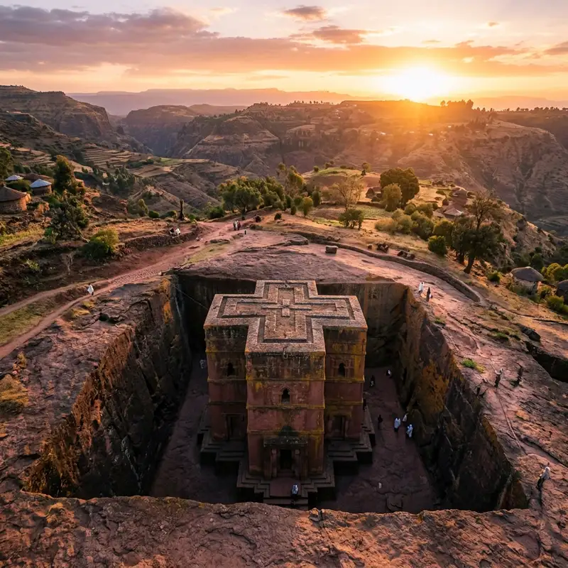
Lalibela : Le Chant de la Pierre Vivante – Plongée au Cœur des Églises Monolithiques d'Éthiopie
Le soleil éthiopien, encore timide, perce le voile matinal, peignant les hauts plateaux de teintes ocres et dorées. Le souffle du vent charrie des effluves de terre sèche, de café grillé et, presque imperceptiblement, un murmure ancien, celui des prières qui traversent les âges. On ne vient pas à Lalibela par hasard. On y arrive comme on entre dans un rêve, les sens en éveil, l’esprit prêt à défier les lois de la matière et du temps. Oubliez les pyramides d’Égypte ou les temples d’Angkor ; Lalibela ne se contente pas d’être construite sur la terre, elle émerge de la terre, sculptée dans son ventre même, un défi colossal à l'entendement humain. Le Mythe et la Création : Une Nouvelle Jérusalem au Cœur de l'Abyssinie L'histoire de Lalibela n'est pas celle d'une simple ville, mais d'une vision divine matérialisée par la main de l'homme, ou du moins, c'est ce que la légende nous raconte. Au XIIe siècle, le roi Gebre Mesqel Lalibela, figure vénérée de la dynastie Zagwe, aurait été appelé par Dieu pour créer une « Nouvelle Jérusalem » en Éthiopie. Cette entreprise pharaonique visait à offrir aux pèlerins éthiopiens, alors coupés de la Terre Sainte par les conflits régionaux, un substitut spirituel, un lieu où ils pourraient ressentir la même ferveur sans quitter leur patrie. Le roi, armé d'une foi inébranlable et, dit-on, assisté par des anges, aurait supervisé la taille de pas moins de onze églises, non pas construites, mais taillées à même la roche volcanique. Imaginez l'ampleur du projet : il ne s'agissait pas de superposer des pierres, mais de creuser des fosses monumentales autour d'énormes blocs de basalte rouge, puis de sculpter l'intérieur et l'extérieur de ces monolithes géants pour en faire des églises, des fenêtres, des toits, des colonnes, des autels, le tout en un seul et même morceau de roche. L'eau de pluie était acheminée par un ingénieux système de rigoles et de citernes, les chemins de procession creusés en tunnels sombres, les chapelles ornées de croix et de fresques rudimentaires. Chaque église, unique par sa taille, sa forme et ses détails, est un chef-d'œuvre d'ingénierie et de dévotion. C'est une symphonie de la pierre, où chaque coup de ciseau résonne encore de la prière de ceux qui l'ont façonnée. Les Joyaux Souterrains : Une #architecture à Contre-Courant Lalibela se compose de deux groupes principaux d'églises, séparés par un canal souterrain symbolisant la rivière Jourdain, et d'une église isolée, la plus célèbre de toutes. Le groupe nord comprend Bet Medhane Alem (Maison du Sauveur du Monde), la plus grande église monolithique du monde, mesurant 33 mètres de long, 23 de large et 11 de haut. Avec ses 34 piliers extérieurs et ses nombreuses colonnes intérieures, elle est un témoignage monumental de l'ambition du roi Lalibela. À ses côtés se trouvent Bet Maryam (Maison de Marie), Bet Golgotha (Maison du Golgotha), Bet Mikael (Maison de Michel) et Bet Giyorgis (Maison de Georges). Le groupe est abrite Bet Amanuel (Maison d'Emmanuel), une élégante structure souvent comparée à un #temple grec, Bet Merkorios (Maison de Mercure), Bet Abba Libanos (Maison de l'Abbé Libanos) et Bet Gabriel-Rufael (Maison de Gabriel et Raphaël). Ces églises sont interconnectées par un labyrinthe de tunnels sombres, d'escaliers abrupts et de cours à ciel ouvert, créant une expérience de pèlerinage où l'on passe de l'ombre à la lumière, du silence à la résonance des chants. Mais c'est sans doute Bet Giyorgis (Église de Saint-Georges), l'église cruciforme isolée, qui marque le plus profondément les esprits. Parfaitement symétrique, elle est taillée en forme de croix grecque dans une fosse profonde, son toit affleurant le niveau du sol environnant. Descendre vers elle, c’est comme pénétrer un sanctuaire caché, une révélation silencieuse. Sa simple grandeur, son élégance austère et son isolement lui confèrent une aura presque irréelle. Elle est l'icône de Lalibela, le symbole de cette foi qui a déplacé des montagnes… ou plutôt, qui les a transformées.Le Battement de Cœur Spirituel : Foi et Pèlerinage Au-delà de leur prouesse architecturale, les églises de Lalibela ne sont pas de simples musées à ciel ouvert. Elles sont des lieux de culte vivants, des sanctuaires vibrants de la foi orthodoxe tewahedo éthiopienne. Le matin, avant l'aube, le chant des prêtres emplit les fosses, se mêlant aux murmures des pèlerins enveloppés dans leurs chamma (vêtements de coton blanc). Des rituels séculaires se déroulent quotidiennement, des processions solennelles aux lectures des Écritures en guèze, une langue liturgique ancienne. Assister à une messe à Lalibela est une expérience transcendante. Les fidèles, debout pendant des heures, appuyés sur leurs bâtons de prière, absorbent les paroles du prêtre, la fumée d'encens montant vers les ouvertures taillées dans la roche. La lumière filtre par les étroites fenêtres cruciformes, éclairant sporadiquement des fresques délavées et des icônes anciennes, dont beaucoup sont conservées derrière des rideaux précieux. Chaque recoin résonne d'une histoire, chaque ombre cache un mystère. Le temps semble s'arrêter, et l'on se sent transporté dans une autre dimension, celle d'une foi inébranlable et d'une dévotion sans fin. Les pèlerins viennent de toutes les régions d'Éthiopie, certains marchant pendant des jours, voire des semaines, pour atteindre cette ville sainte. Leurs visages, marqués par le voyage et la piété, racontent des histoires de quête spirituelle et d'espoir. Leur présence est un rappel constant que Lalibela n'est pas un monument figé dans le temps, mais un cœur qui bat, une âme vivante au centre de la spiritualité éthiopienne. Les fêtes religieuses, comme le Timkat (Épiphanie) ou le Genna (Noël), transforment Lalibela en un spectacle vibrant de couleurs, de chants et de danses rituelles, attirant des milliers de dévots. Au-Delà de la Pierre : La Vie Locale et le Charme d'une Ville Isolé Lalibela, la ville, est bien plus qu'une simple escale pour les églises. C'est une communauté animée, perchée sur des collines verdoyantes, offrant des vues spectaculaires sur les vallées environnantes. Les ruelles de terre battue serpentent entre des maisons traditionnelles en pierre et en bois, où la vie s'écoule à un rythme paisible, dicté par les saisons et les prières. Le marché local est un kaléidoscope de couleurs et d'odeurs : épices, fruits frais, café vert, artisanat local. Rencontrer les habitants de Lalibela est une partie intégrante de l'expérience. Leur hospitalité est légendaire, leur sourire est désarmant. Les enfants, souvent vêtus de vêtements simples, jouent dans les cours des églises, leurs rires se mêlant au bourdonnement des prières. Déguster l'injera, le pain plat traditionnel éthiopien, accompagné de wat (ragoût épicé), dans un restaurant local, est une immersion gustative et culturelle. Le café, dont l'Éthiopie est le berceau, y est une véritable cérémonie, une expérience sociale et spirituelle en soi, des grains rôtis sur place aux arômes enivrants qui emplissent l'air. L'isolement de Lalibela, nichée au milieu des hauts plateaux Amhara, a préservé son authenticité. L'accès, bien qu'amélioré avec un petit aéroport, reste une aventure qui ajoute à la mystique du lieu. La route sinueuse qui y mène offre des panoramas époustouflants, où l'on croise des bergers avec leurs troupeaux, des femmes portant des fagots de bois sur la tête, et des villages traditionnels qui semblent tout droit sortis d'une autre époque. Ce voyage, souvent long et ardu, prépare le visiteur à la grandeur qu'il s'apprête à découvrir, soulignant le caractère sacré et la difficulté d'accès de ce sanctuaire.L'Écho Perpétuel de la Pierre : Une Réflexion Finale Visiter Lalibela, ce n'est pas seulement cocher une case sur une liste de sites du patrimoine mondial. C'est un voyage intérieur autant qu'extérieur. C'est marcher sur les traces de millions de pèlerins qui, avant nous, ont cherché la transcendance dans ces creux de roche. C'est contempler le génie humain poussé par une foi inébranlable, et se sentir humble face à une telle prouesse. Lalibela nous rappelle que l'architecture peut être plus qu'une simple construction ; elle peut être une prière sculptée, une méditation gravée dans la roche. C'est un lieu où le sacré et le profane se rencontrent, où l'histoire et le présent coexistent dans une harmonie étonnante. Chaque recoin de ces églises résonne des chants, des murmures et des pas de ceux qui les ont construites, vénérées et entretenues au fil des siècles. Les prêtres vêtus de blanc, les pèlerins agenouillés, les enfants jouant, tous font partie de cette tapisserie vivante, tissée de foi et de pierre. En quittant Lalibela, on emporte avec soi non seulement des images, mais une sensation, une vibration profonde. C'est l'écho du chant de la pierre vivante, qui continue de résonner longtemps après avoir quitté les gorges sacrées. C'est une invitation à regarder au-delà de la surface, à chercher la profondeur, le mystère, et la beauté là où l'on s'y attend le moins. Lalibela est une leçon d'humilité, de persévérance et de la puissance inouïe de la foi. C'est une destination qui ne se visite pas, mais qui se vit, se ressent, et qui marque l'âme à jamais.#Lalibela #Éthiopie #ÉglisesMonolithiques #VoyageSpirituel #PatrimoineMondial #ArchitectureSacrée #CultureÉthiopienne Related InsightsWhere the Sky Weeps Gold: Tracing the Pazyryk's Frozen Echoes in the Untamed Altai Ilha da Madeira: O Jardim Flutuante do Atlântico Unleash Your Inner Explorer: Conquering Java's Fiery Peaks From Bali's Shores – A Definitive Guide{ "@context": "https://schema.org", "@type": "FAQPage", "mainEntity": [ { "@type": "Question", "name": "What is the main focus of Lalibela : Le Chant de la Pierre Vivante – Plongée au Cœur des Églises Monolithiques d'Éthiopie?", "acceptedAnswer": { "@type": "Answer", "text": "Découvrez Lalibela, un site du patrimoine mondial en Éthiopie, où des églises médiévales extraordinaires ont été sculptées à même la roche, offrant une expérience de voyage spirituelle et architecturale sans pareille." } }, { "@type": "Question", "name": "Who authored the comprehensive guide on Lalibela : Le Chant de la Pierre Vivante – Plongée au Cœur des Églises Monolithiques d'Éthiopie?", "acceptedAnswer": { "@type": "Answer", "text": "This detailed article and its insights were carefully researched and authored by Pierre Dubois." } }, { "@type": "Question", "name": "Where can I find more related content about Travel?", "acceptedAnswer": { "@type": "Answer", "text": "You can explore more articles, detailed reviews, and similar insights by browsing the Related Insights section at the bottom of this article or visiting our dedicated Travel category page." } } ] }
-
 Marco Rossi
 - 29 Jun, 2026 01:31
I Sentieri Silenti del Vento: Viaggio nei Tratturi Millenari d'Italia, Oltre la Mappa
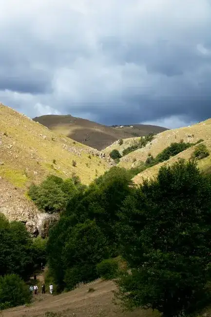
Immaginate di camminare su un nastro d'erba e sassi consumato da migliaia di anni, dove ogni orma non è solo un passo, ma l'eco di generazioni di pastori, del belato di milioni di pecore, del fruscio di carri e del fischio del vento che porta con sé storie antiche quanto il Mediterraneo. Non stiamo parlando di una comune strada, né di un sentiero escursionistico segnato su una guida patinata. Stiamo parlando dei Tratturi, le arterie vitali di un'Italia profonda e dimenticata, i cui battiti risuonano ancora nel cuore selvaggio del centro-sud della penisola. Questi non sono semplici percorsi; sono monumenti viventi, cattedrali a cielo aperto scolpite dal tempo e dal movimento, dove la geografia si fonde con la storia, l'economia, la cultura e l'anima stessa di un popolo. Le Autostrade di Terra: Cosa Sono i Tratturi? I Tratturi, per chi non li conosce, sono antichi cammini erbosi, larghi anche oltre cento metri, che per secoli hanno collegato le montagne dell'Abruzzo e del Molise con le pianure della Puglia, disegnando un reticolo incredibile attraverso colline, valli e pascoli. Erano le "autostrade" della transumanza, il fenomeno pastorale che vedeva il periodico spostamento di immense greggi dai pascoli estivi in quota (monticazione) a quelli invernali in pianura (demonticazione) e viceversa. Questa pratica, radicata già in epoca preromana e formalizzata dai Romani con le "calles publicae", raggiunse il suo apice tra il XV e il XVIII secolo, sotto il Regno di Napoli, quando l'attività pastorale era il fulcro dell'economia meridionale. I tratturi non erano vie private, ma proprietà statali, "pubblici tratturi", e la loro conservazione era di vitale importanza, regolata da editti e leggi ferree. Essi rappresentavano un sistema viario complesso, non solo per il passaggio degli animali, ma anche per persone e merci, fungendo da veri e propri corridoi di scambio culturale e commerciale tra le diverse regioni attraversate. L'Epoca d'Oro e il Lento Addio della Modernità Per secoli, il transito sui tratturi fu regolamentato da un sistema fiscale complesso e da una vera e propria "Dogana della Mena delle Pecore", situata principalmente a Foggia, che gestiva i flussi e riscuoteva i tributi. I pastori pagavano un diritto per il pascolo e il passaggio, e in cambio ricevevano protezione e infrastrutture rudimentali. Lungo questi percorsi sorsero taverne, chiese rurali, fontanili, stazioni di posta per il riposo di uomini e animali e, soprattutto, le masserie fortificate, veri e propri presidi che offrivano riparo, viveri e servizi. Questi presidi contribuirono a definire un'identità paesaggistica e sociale lungo l'intero percorso. Ma la modernità, con l'avvento dell'agricoltura intensiva, che rivendicava terre per le colture, della ferrovia e poi dei trasporti su gomma, segnò il lento declino di questo sistema millenario. La terra, prima sacra al pascolo e protetta da usi civici, fu arata, recintata, cementificata, frammentando i percorsi. I pastori diminuirono drasticamente, le greggi si ridussero a dimensioni irrisorie rispetto al passato, e i tratturi, un tempo pulsanti di vita e rumore, divennero sentieri silenti, talvolta cancellati dalle mappe e dalla memoria collettiva, trasformati in viottoli di campagna o, peggio, inghiottiti da nuove costruzioni e infrastrutture che ne hanno deturpato l'integrità. Il Paesaggio Culturale Inciso dal Tempo Ma i tratturi non sono solo corridoi ecologici; sono espressione di un paesaggio culturale unico, forgiato da secoli di interazione tra uomo e natura. Ogni sasso, ogni albero solitario, ogni curva del sentiero narra storie di fatica, di speranza, di riti e credenze. Lungo il loro percorso si incontrano chiese rurali affrescate, "calchere" (fornaci per la calce utilizzate per la costruzione e l'igiene), resti di stazioni di posta, ponti di epoca romana o medievale e, soprattutto, le masserie, spesso fortezze rurali che testimoniano la necessità di protezione in territori talvolta ostili. La cultura della transumanza ha profondamente plasmato dialetti, canti popolari, tradizioni culinarie legate al mondo pastorale (formaggi pecorini e caprini, carni ovine, pane di grano duro, ricotta fresca) e persino la stessa mentalità delle comunità che vivevano a ridosso di queste "autostrade verdi", sviluppando un profondo senso di accoglienza e resilienza.Questo patrimonio intangibile è forse il più prezioso, un filo invisibile che lega il passato al presente, un'anima rustica che resiste all'omologazione e alle tendenze del turismo moderno, offrendo un'esperienza autentica e profonda. Un Tesoro di Biodiversità e Sentinelle Ecologiche I tratturi, seppur "strade" nel senso antico del termine, sono in realtà degli ecosistemi a sé stanti, veri e propri corridoi biologici. La loro natura di corridoi poco antropizzati, scarsamente arati e spesso non trattati chimicamente, li ha resi rifugi e vie di migrazione per una miriade di specie animali e vegetali. Le larghe fasce erbose che li caratterizzano conservano una flora unica, relitto di antichi pascoli e praterie, spesso ricca di specie endemiche o rare. Si possono trovare orchidee selvatiche dai colori brillanti, specie rare di graminacee, leguminose e fiori campestri che altrove sono scomparsi a causa dell'agricoltura intensiva. Questi ambienti sono habitat ideali per uccelli rapaci, insetti impollinatori vitali per l'ecosistema, piccoli mammiferi e persino anfibi, contribuendo significativamente alla biodiversità del territorio. I pastori, con la loro presenza e la gestione estensiva e sostenibile dei pascoli attraverso il pascolo naturale, hanno involontariamente contribuito a mantenere questa ricchezza. La transumanza non era solo un'attività economica, ma un processo ecologico che modellava il paesaggio in maniera armonica e sostenibile, creando un equilibrio delicato tra uomo, animali e ambiente. Viaggio sul Tratturo Magno: Il Filo d'Arianna dell'Abruzzo Per comprendere appieno la magnificenza di questi percorsi, dobbiamo immaginarci di percorrerne uno. Il Tratturo Magno, il "Grande Tratturo" o "Tratturo L'Aquila-Foggia", è il più lungo e famoso, circa 244 chilometri che attraversano Abruzzo, Molise e Puglia, unendo la montagna alla pianura con un legame indissolubile. Iniziare il cammino dalla Piana di Assergi, ai piedi del Gran Sasso, significa immergersi subito in un paesaggio di vette maestose e praterie d'alta quota, dove l'aria è frizzante e il silenzio interrotto solo dal vento o dal tintinnio lontano dei campanacci. Scendendo gradualmente verso sud-est, si attraversa la Valle Peligna, con i suoi borghi medievali come Sulmona, famosa per i suoi confetti e custode di antiche tradizioni. Ogni tratto rivela un pezzo di storia: un ponte romano, le rovine di una torre di avvistamento, un'edicola votiva dedicata ai santi protettori dei pastori, come San Michele Arcangelo. Si passa poi nel Molise, una regione spesso trascurata dal turismo di massa, ma che conserva tratti di tratturo integri e straordinariamente suggestivi, immersi in una natura selvaggia e poco alterata. Qui, il senso del tempo che si dilata, del viaggio lento e della scoperta autentica raggiunge il suo apice. È in queste aree meno battute che si possono incontrare ancora pastori con le loro greggi, seppur in numero minore rispetto al passato, che ripercorrono le orme dei loro avi, mantenendo viva una pratica millenaria. Le antiche masserie si ergono come fantasmi silenziosi, a volte ristrutturate e trasformate in agriturismi o b&b, offrendo un'esperienza unica di immersione nella cultura locale e nella vita rurale.L'arrivo in Puglia, nella vasta e fertile Tavoliere delle Puglie, con le sue distese pianeggianti che si perdono all'orizzonte, conclude un viaggio che è sia fisico che spirituale, una testimonianza della resilienza di un paesaggio e della sua gente, di un legame indissolubile con la terra. La Rinascita e la Tutela: Un Futuro per il Passato Fortunatamente, l'interesse per i tratturi sta crescendo, non solo a livello locale ma anche nazionale e internazionale. Dopo decenni di abbandono, si assiste a una lenta riscoperta e a tentativi di valorizzazione. Molti tratti sono stati oggetto di interventi di recupero e ripristino, e alcune regioni promuovono la creazione di "parchi dei tratturi" o itinerari ciclo-pedonali e ippoturistici, incentivando un turismo sostenibile. La transumanza stessa, con la sua iscrizione nella Lista Rappresentativa del Patrimonio Culturale Immateriale dell'Umanità dell'UNESCO nel 2019, ha ricevuto un riconoscimento fondamentale che ne sottolinea l'importanza non solo storica e culturale ma anche contemporanea, come pratica sostenibile e come esempio di armonia tra uomo e ambiente. Questo ha riacceso i riflettori su questi percorsi, incentivando un turismo più consapevole e lento, desideroso di autenticità, che cerca esperienze immersive e lontane dalle rotte più battute. Oltre il Sentiero: Il Valore del Viaggio Lento Percorrere un tratturo oggi significa intraprendere un viaggio che va oltre la semplice escursione o la curiosità storica. È un'esperienza di "slow travel" nel senso più puro, un ritorno alle radici, alla lentezza, al contatto autentico con la natura e le comunità locali che ancora vivono e lavorano lungo questi percorsi. È un'opportunità per riflettere sul rapporto millenario tra uomo e ambiente, per apprezzare la tenacia dei pastori, la loro profonda conoscenza del territorio e la bellezza selvaggia di paesaggi rimasti immutati. Significa scoprire un'Italia che non si trova nelle guide turistiche più blasonate, un'Italia fatta di piccoli borghi dimenticati, di sapori genuini e di ricette tramandate, di sguardi sinceri e di storie sussurrate dal vento. I tratturi sono un invito a rallentare, a osservare con attenzione, ad ascoltare i suoni della natura, a connettersi con un passato che è ancora presente e vibrante, pulsante sotto i nostri piedi. I tratturi non sono reliquie di un mondo che non esiste più; sono ponti tra epoche, corridoi di memoria che ci ricordano la nostra profonda connessione con la terra e con le tradizioni che ci hanno forgiato. Abbandonare l'asfalto per un giorno, calpestare l'erba morbida di un antico tratturo, ascoltare il silenzio rotto solo dal fruscio delle foglie o dal belato lontano di un gregge, è un'esperienza trasformativa. È un viaggio non solo attraverso lo spazio, ma anche attraverso il tempo, un'immersione nell'anima pastorale d'Italia, un richiamo alla semplicità e alla bellezza intrinseca del vivere in armonia con la natura. Spero che queste parole vi abbiano ispirato a calzare gli scarponi e a scoprire di persona queste "autostrade silenziose" che tessono la vera essenza del nostro straordinario paese. Il vento vi aspetta, pronto a raccontarvi storie di millenni.#Tratturi #Transumanza #ViaggioLento #ItaliaNascosta #PatrimonioUNESCO Related InsightsThe Shimmering Waters: Documenting Plitvice Lakes National Park Unraveling the Mystical Scottish Highlands: Where Ancient Legends Meet Breathtaking Landscapes 乔家大院:清代北方民居的典范{ "@context": "https://schema.org", "@type": "FAQPage", "mainEntity": [ { "@type": "Question", "name": "What is the main focus of I Sentieri Silenti del Vento: Viaggio nei Tratturi Millenari d'Italia, Oltre la Mappa?", "acceptedAnswer": { "@type": "Answer", "text": "Scopri i Tratturi, antiche vie di transumanza che tessono la storia e la cultura dell'Italia rurale. Un viaggio tra pastori, paesaggi incontaminati e tradizioni millenarie." } }, { "@type": "Question", "name": "Who authored the comprehensive guide on I Sentieri Silenti del Vento: Viaggio nei Tratturi Millenari d'Italia, Oltre la Mappa?", "acceptedAnswer": { "@type": "Answer", "text": "This detailed article and its insights were carefully researched and authored by Marco Rossi." } }, { "@type": "Question", "name": "Where can I find more related content about Travel?", "acceptedAnswer": { "@type": "Answer", "text": "You can explore more articles, detailed reviews, and similar insights by browsing the Related Insights section at the bottom of this article or visiting our dedicated Travel category page." } } ] }
- Marco Rossi
- 28 Jun, 2026 18:43
Le Cattedrali Sotterranee di Puglia: Un Viaggio Intimo nelle Città Rupestri delle Gravine
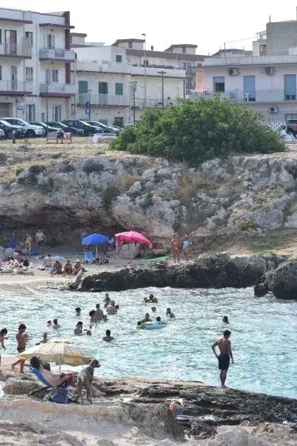
Immaginate di camminare su una terra che ha respirato millenni di storia, non solo sotto i vostri piedi, ma dentro la terra stessa. Non sto parlando di antichi scavi archeologici, né di rovine maestose che si ergono fiere verso il cielo. Parlo di qualcosa di più intimo, più celato, un sussurro di civiltà che ha scelto di vivere e prosperare nel cuore stesso della roccia. Dimenticate per un istante l'immagine patinata della Puglia, quella delle spiagge caraibiche e dei trulli immacolati. Lasciatevi guidare in un viaggio che scende sotto la superficie, nelle viscere di una regione che custodisce segreti geologici e spirituali di inaudita bellezza: le città rupestri e le cattedrali sotterranee delle Gravine. È un'esperienza che va oltre il semplice turismo; è un'immersione archeologica e spirituale, un dialogo silenzioso con gli spiriti di pastori, eremiti, monaci basiliani e intere comunità che, per secoli, hanno plasmato la loro esistenza modellando la friabile pietra calcarenitica. Questa è la Puglia più autentica e meno raccontata, quella che non si rivela facilmente ma che, una volta scoperta, incide l'anima. L'Anatomia di un Paesaggio Ancestrale: Le Gravine Le Gravine non sono semplici canyon; sono monumenti naturali scavati dall'implacabile lavoro dell'acqua e del tempo, veri e propri "grand canyon" in miniatura che solcano il paesaggio pugliese, in particolare tra la Murgia tarantina e quella materana. Queste fenditure carsiche, a volte profonde oltre cento metri, con pareti a strapiombo e una vegetazione lussureggiante che si aggrappa tenacemente alla roccia, sono state, fin dalla Preistoria, un rifugio naturale, un grembo protettivo per l'uomo. Qui, tra gole selvagge e pianori che si aprono all'improvviso, si sono sviluppate intere civiltà troglodite. Non si tratta di occasionali ripari, ma di veri e propri insediamenti urbani scavati nella roccia: case, stalle, frantoi, necropoli e, soprattutto, decine e decine di chiese rupestri. Questi luoghi, rimasti intatti e spesso dimenticati per secoli, offrono una testimonianza tangibile di come l'uomo abbia saputo adattarsi e convivere con un ambiente apparentemente ostile, trasformandolo in un ecosistema di vita e fede. Le Gravine di Ginosa, Laterza, Castellaneta, Massafra, Mottola, Statte, Grottaglie formano una sorta di "costellazione" di siti rupestri, ognuno con la sua peculiarità, la sua storia, le sue meraviglie nascoste. Ma è l'insieme a colpire, la vastità di un fenomeno che ha caratterizzato un'intera area geografica e culturale. Un Salto nel Tempo: Dalla Preistoria al Medioevo Bizantino Il primo impatto è quello con una sensazione di atemporalità. Entrare in una città rupestre significa fare un salto nel tempo, un balzo indietro di millenni. Le tracce più antiche di frequentazione umana risalgono al Neolitico, quando le grotte naturali offrivano riparo ai primi cacciatori-raccoglitori. Ma è tra il Tardo Impero Romano e l'Alto Medioevo che questi insediamenti raggiungono il loro massimo splendore, in particolare con l'arrivo e la diffusione della cultura bizantina. Con la caduta dell'Impero Romano d'Occidente e le successive invasioni barbariche, la popolazione si rifugiò in massa nelle Gravine. Le grotte, facilmente difendibili e mimetizzate nel paesaggio, divennero vere e proprie abitazioni permanenti. L'Oriente bizantino, con i suoi monaci basiliani in fuga dalle persecuzioni iconoclaste, trovò qui un terreno fertile per la propria spiritualità. Questi monaci, esperti nell'arte di scavare e decorare, trasformarono semplici anfratti in luoghi di culto, veri e propri scrigni d'arte con affreschi che ancora oggi sfidano il tempo. Le chiese rupestri, spesso dotate di absidi, altari e perfino iconostasi scavate nella roccia, erano il cuore pulsante di queste comunità. Qui si officiavano riti in greco, si studiavano manoscritti, si praticava una fede intensa e contemplativa. Queste "cattedrali sotterranee" non erano solo luoghi di preghiera, ma anche centri di cultura e resistenza identitaria in un territorio di confine tra diverse dominazioni.Gemme Nascoste: Esempi di Straordinaria Bellezza Rupestre Ogni Gravina ha la sua storia, ogni sito rupestre la sua unicità. Permettetemi di guidarvi attraverso alcune delle più significative. Ginosa e la sua Lama d'Antico La Gravina di Ginosa è un labirinto di storia. Tra i suoi anfratti si cela la Lama d'Antico, una delle più vaste e meglio conservate città rupestri della Puglia. Qui si possono distinguere chiaramente i resti di oltre cinquanta ambienti scavati nella roccia, tra cui case, cisterne, granai e una suggestiva chiesa rupestre dedicata a San Giovanni. Camminare tra queste "strade" silenziose, immaginando la vita che vi pulsava, è un'esperienza quasi mistica. Gli affreschi, sebbene a volte sbiaditi, raccontano storie di santi, madonne e scene bibliche, finestre su una devozione profonda e radicata. La sensazione di entrare in un'abitazione che ha accolto intere famiglie per secoli è indescrivibile. Si possono ancora percepire le nicchie per le lucerne, i ripiani per gli oggetti, la disposizione degli spazi che rivela un'ingegneria abitativa sorprendente. Massafra: Tra Siti Iconici e Tesori Celati Massafra è un altro fulcro dell'architettura rupestre. La sua gravina è un vero e proprio museo a cielo aperto. Qui si trova il Santuario della Madonna della Scala, un complesso rupestre di grande importanza, ma anche siti meno noti come la Cripta di San Leonardo e la Chiesa rupestre di San Marco. Quest'ultima, in particolare, è un capolavoro di arte bizantina, con affreschi che, pur avendo subito l'usura del tempo e atti vandalici, conservano una forza espressiva notevole. Si pensa che alcune chiese di Massafra abbiano avuto origine come templi pagani, poi cristianizzati, un esempio eloquente della stratificazione culturale e religiosa di questi luoghi. L'equilibrio tra la natura selvaggia della gravina e l'opera dell'uomo è qui particolarmente evidente, con gli insediamenti che sembrano emergere organicamente dalla roccia stessa. Mottola: La "Spia dello Ionio" e le sue Chiese affrescate Mottola, definita la "Spia dello Ionio" per la sua posizione dominante, custodisce alcune delle chiese rupestri più pregevoli. La Cripta di San Nicola è un vero gioiello, un'aula scavata nella roccia con un ciclo pittorico completo che narra episodi della vita del santo, realizzati con una maestria che nulla ha da invidiare all'arte "di superficie". Le cromie, i dettagli dei volti, l'espressività delle figure catturano lo sguardo e testimoniano una scuola pittorica raffinata e vivace. Anche la Cripta di San Michele Arcangelo merita una menzione per i suoi affreschi e la sua atmosfera suggestiva. Queste chiese erano non solo luoghi di culto ma anche veri e propri centri sociali e culturali, dove la comunità si riuniva e si identificava. Ginosa, Laterza e Castellaneta: Un Trittico di Paesaggi e Storie Le gravine di Ginosa, Laterza e Castellaneta, pur presentando similitudini, offrono ciascuna delle esperienze uniche. A Laterza, la Gravina Grande ospita un suggestivo villaggio rupestre con un frantoio e diverse grotte-abitazione. A Castellaneta, si possono ammirare le "cento grotte", un complesso di abitazioni e chiese rupestri che disegna un paesaggio quasi lunare, dove il bianco della roccia contrasta con il verde della vegetazione mediterranea. La loro vastità e complessità rendono necessaria una guida esperta per apprezzarne appieno il valore e scoprirne i segreti più reconditi. Sono luoghi che richiedono tempo, rispetto e un desiderio profondo di ascoltare le voci del passato. L'Arte Rupestre: Dialoghi con l'Eternità Gli affreschi delle chiese rupestri sono la voce più eloquente di queste civiltà scomparse. Dipinti con pigmenti naturali direttamente sulla roccia, spesso intonacata sommariamente, raccontano un mondo di fede, devozione e arte. Le figure dei santi, le scene bibliche, i simboli paleocristiani e bizantini ci parlano di una spiritualità che, sebbene espressa in forme diverse, conserva una profonda risonanza con la nostra contemporaneità. La tecnica pittorica, influenzata dall'arte bizantina, è caratterizzata da volti ieratici, sguardi fissi, colori intensi e una certa bidimensionalità che sottolinea la dimensione trascendente delle figure. Questi affreschi, spesso sopravvissuti a secoli di umidità e abbandono, sono un patrimonio inestimabile, testimoni di un'epoca in cui l'arte era intrinsecamente legata alla fede e alla vita quotidiana. Ogni crepa, ogni sbiadimento aggiunge un ulteriore strato di storia e vulnerabilità a queste opere d'arte effimere eppure eterne.Sfide e Custodia: Il Futuro di un Passato Fragile Visitare le città rupestri e le chiese delle Gravine è un privilegio, ma anche un atto di responsabilità. Questi siti sono incredibilmente fragili. L'erosione naturale, l'azione dell'uomo (spesso incauta o ignorante) e la mancanza di risorse sufficienti per la conservazione mettono a rischio questo patrimonio unico. Molti affreschi sono a malapena visibili, altri sono stati irrimediabilmente danneggiati. La sfida è duplice: da un lato, garantire la tutela e il restauro di questi beni; dall'altro, promuovere un turismo consapevole e sostenibile che contribuisca alla loro valorizzazione senza comprometterne l'integrità. Fortunatamente, negli ultimi anni, associazioni locali e istituzioni hanno iniziato a investire nella ricerca, nella mappatura e nella protezione di questi luoghi. Guide locali esperte, spesso volontari appassionati, sono la chiave per una visita profonda e rispettosa. Essi non solo illustrano la storia e l'arte, ma trasmettono l'amore e la cura per un patrimonio che sentono visceralmente proprio. L'Invito di Marco Rossi: Un Viaggio nell'Anima Pugliese Il mio invito è a scendere dal sentiero battuto. Abbandonate per qualche giorno le mete più celebrate e lasciatevi catturare dal richiamo ancestrale delle Gravine. Non è un viaggio per chi cerca la comodità o il lusso, ma per chi desidera una connessione autentica con la storia, la natura e la spiritualità. Preparatevi a camminare su sentieri sterrati, a scendere in gole ombrose, a inalare l'odore della terra umida e della macchia mediterranea. Lasciatevi meravigliare dal silenzio assordante interrotto solo dal fruscio del vento o dal richiamo di un falco. E, soprattutto, permettete a questi luoghi di parlarvi. Ogni grotta, ogni affresco, ogni nicchia scavata nella roccia racchiude una storia, un lamento, una preghiera. Le città rupestri delle Gravine pugliesi non sono solo pietre e roccia; sono un monumento alla resilienza umana, alla capacità di creare bellezza e significato anche nelle condizioni più avverse. Sono la prova che la vera ricchezza di un territorio non risiede solo in ciò che è visibile e immediatamente accessibile, ma anche in ciò che è nascosto, protetto, e attende pazientemente di essere riscoperto da chi ha la sensibilità di cercarlo. Venite, dunque, a scoprire queste cattedrali sotterranee: vi assicuro che il viaggio cambierà per sempre la vostra percezione della Puglia e, forse, di voi stessi.#PugliaNascosta #CittàRupestri #GravineDiPuglia #ArchitetturaRupestre #ViaggiNellaStoria Related InsightsAlbania’s Riviera vs Montenegro’s Bay of Kotor: Europe’s Best-Kept Secret Coastlines Revealed Carcassonne: Stepping Back into the Medieval World Beyond Merv's Veil: Unearthing Turkmenistan's Ghost Oases of the Silk Road{ "@context": "https://schema.org", "@type": "FAQPage", "mainEntity": [ { "@type": "Question", "name": "What is the main focus of Le Cattedrali Sotterranee di Puglia: Un Viaggio Intimo nelle Città Rupestri delle Gravine?", "acceptedAnswer": { "@type": "Answer", "text": "Dimentica le spiagge dorate: la Puglia nasconde un universo millenario scolpito nella roccia. Esplora le chiese rupestri e le antiche città delle Gravine, dove il tempo si ferma e la storia respira in un silenzio ancestrale." } }, { "@type": "Question", "name": "Who authored the comprehensive guide on Le Cattedrali Sotterranee di Puglia: Un Viaggio Intimo nelle Città Rupestri delle Gravine?", "acceptedAnswer": { "@type": "Answer", "text": "This detailed article and its insights were carefully researched and authored by Marco Rossi." } }, { "@type": "Question", "name": "Where can I find more related content about Travel?", "acceptedAnswer": { "@type": "Answer", "text": "You can explore more articles, detailed reviews, and similar insights by browsing the Related Insights section at the bottom of this article or visiting our dedicated Travel category page." } } ] }
- John Explorer
- 27 Jun, 2026 10:15
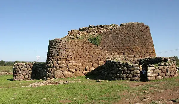
Echoes in Stone: Unearthing Sardinia's Lost Cyclopean Mysteries in the Wild Heart of Barbagia
The world teems with whispers of forgotten civilizations, of monumental achievements carved from stone, often attributed to mythical giants or unknown forces. We've all seen the awe-inspiring pyramids, the colosseums, the acropolises. But what if I told you that in the rugged, untamed heart of an island beloved for its turquoise waters and celebrity beaches, lies a different kind of #ancient wonder – a network of colossal, enigmatic stone fortifications so vast and mysterious they defy easy explanation? Forget the glittering coastlines and tourist traps; we are venturing into the Barbagia, Sardinia's ancient soul, to chase the shadow of its lost builders and the secrets held within its formidable Cyclopean Walls. This isn't a story of sun-drenched ruins easily accessed. This is a tale of resilience, isolation, and a civilization that built with a scale and precision that still baffles modern engineers. These are the Mura Ciclopiche, the Cyclopean Walls, named by the ancient Greeks who believed only the one-eyed giants, the Cyclopes, could have moved such immense stones. They are not merely walls, but a testament to an advanced Bronze Age #culture, the Nuragic people, whose ingenuity shaped a landscape for millennia before #Rome ever rose. And to truly understand them, we must embrace the wildness of Barbagia, a region where time often seems to have forgotten to move on. Barbagia: Sardinia's Unyielding Core Before we delve into the stones, let's establish our setting. Barbagia is not just a geographical region; it's a state of mind, a historical fortress against invaders and modern incursions alike. Nestled within the mountainous spine of Sardinia, particularly the Gennargentu massif, Barbagia remains stubbornly authentic. Its name, derived from "Barbaria" by the Romans, reflects its perceived wildness and the fierce independence of its inhabitants, who resisted Romanization more fiercely than any other Sardinian population. This isolation, while historically challenging, inadvertently preserved not only unique cultural traditions but also an astounding concentration of archaeological treasures. Driving through Barbagia is an experience in itself. Winding roads snake through oak forests, past granite outcrops, and into valleys where the only sounds are the rustle of leaves and the distant bleating of sheep. Villages here cling to hillsides, their stone houses seemingly extensions of the mountains themselves. This is a land of shepherds, of ancient traditions like the Canto a Tenore (polyphonic singing), and of a deeply rooted respect for #history and the land. It’s here, amidst this rugged beauty, that the true scale and mystery of the Cyclopean Walls begin to reveal themselves. The Nuragic Legacy: Master Builders of Stone The architects of these monumental structures were the Nuragic people, a civilization unique to Sardinia, flourishing from roughly 1800 BC to 250 BC. Their most iconic creations are the nuraghi themselves – conical stone towers, often reaching several stories high, built without mortar. Over 7,000 nuraghi dot the Sardinian landscape, from the coast to the highest peaks, some standing alone, others forming parts of vast, complex village structures. But the Cyclopean Walls represent an even grander ambition, an often overlooked aspect of their engineering prowess. These walls were not just defensive perimeters; they were expressions of power, territorial markers, and perhaps even astronomical observatories. The sheer size of the stones used—some weighing many tons—and their precise fitting without any binding material speaks volumes about the Nuragic people's understanding of physics, geometry, and communal effort. How they quarried, transported, and lifted these megaliths remains a subject of ongoing debate and fascination, adding layers to the mystery that surrounds them.Tracing the Megalithic Footprints: Sites Worth the Trek While nuraghi are ubiquitous, dedicated Cyclopean wall systems are more concentrated and often harder to reach, demanding a sense of adventure and respect for the terrain. They are frequently found surrounding extensive Nuragic complexes, serving as their primary defense and definition. One of the most impressive examples, though still relatively underexplored by mainstream tourism, is the archaeological complex of Serra Orrios, near Dorgali. This site features a well-preserved Nuragic village with over a hundred huts and two nuraghi, all enclosed by a formidable Cyclopean wall. The wall here isn't just a simple barrier; it's a testament to urban planning, defining space and offering a clear demarcation between the settlement and the wild. Further into the heart of Barbagia, near the village of Fonni, one can find remnants of even grander scale. The area around Monte Tiscali (though Tiscali itself is a cave village, the surrounding region holds immense archaeological interest) and the Gennargentu foothills often reveal isolated sections of these walls, sometimes merely a few courses high, but with blocks so colossal they evoke immediate awe. These are not always easily signposted, requiring local knowledge or detailed topographical maps and a willingness to hike. The Nuraghe Arvu complex, also near Dorgali, offers another compelling experience. While the nuraghe itself is impressive, the surrounding defensive walls, built from massive, roughly hewn stones, illustrate the protective measures taken by these ancient communities. What strikes visitors most is the seamless integration of these structures into the natural landscape, often using natural rock formations as foundations, amplifying their formidable presence. Exploring these sites is more than just a walk through ruins; it’s a #journey into a different time, a confrontation with engineering marvels that predate classical antiquity by millennia. Each colossal stone whispers tales of a vibrant, complex society that mastered its environment in ways we are only just beginning to comprehend. The Journey Inward: Practicalities and Preparation Venturing into Barbagia to seek out these ancient wonders is not for the faint of heart or the unprepared. This is authentic, rugged #travel.Vehicle: A sturdy car, preferably with good ground clearance, is highly recommended. Many of the most interesting sites are accessed via unpaved or poorly maintained roads. Navigation: While GPS is helpful, physical maps and a compass can be invaluable, especially in areas with patchy mobile signal. Local advice is golden; the people of Barbagia are famously hospitable once trust is established. Hiking Gear: Comfortable hiking boots, plenty of water, sun protection, and appropriate clothing for varying weather conditions are essential. Some treks can be strenuous, involving steep climbs and uneven terrain. Respect the Land: These sites are often unfenced and lie on private land or within natural parks. Always respect private property, leave no trace, and do not disturb any archaeological remains. Accommodation: Stay in charming agriturismos (farm stays) or family-run guesthouses in towns like Oliena, Orgosolo, or Fonni. This not only supports local communities but also provides an authentic cultural immersion. Patience: Discovering these hidden gems requires patience. Some sites might be harder to find than anticipated, but the reward of standing before a wall built 3,500 years ago is immeasurable.Beyond the Stones: Culture and Myth The enduring legacy of the Nuragic civilization extends beyond its formidable architecture. The spirit of independence and connection to the land that characterizes Barbagia today is arguably a direct inheritance from these ancient people. Local myths and legends often intertwine with the presence of these colossal structures. Tales of giants, fairies (Janas), and benevolent spirits are often associated with the nuraghi and megalithic sites, reflecting a deep cultural memory of powerful, mysterious builders. The traditional Sardinian diet, centered around lamb, wild boar, pecorino cheese, and the flatbread pane carasau, sustained by shepherds and farmers, echoes ancient ways of life. Even the renowned bandits of Orgosolo, a historical phenomenon, can be seen as a modern manifestation of Barbagia's long-standing resistance to external authority, a trait perhaps etched into the very stones of their ancestral fortifications. Visiting Barbagia is not just an archaeological expedition; it’s a journey into a living culture that remains fiercely proud of its past. Engage with the locals, try their food, listen to their stories. You’ll find that the "barbarians" are some of the kindest and most welcoming people you’ll ever meet, eager to share the secrets of their ancient land, if approached with genuine interest and respect. Conservation and the Future of Sardinia's Megaliths Despite their grandeur, many of Sardinia's Nuragic sites, particularly the less accessible Cyclopean walls, face threats from natural erosion, neglect, and occasional illicit digging. While some major complexes are protected and maintained, countless smaller, equally significant sites remain vulnerable. There is a growing movement within Sardinia to further protect and promote these incredible testaments to their ancient heritage, balancing preservation with sustainable tourism. For the intrepid traveler, this offers a unique opportunity to witness these wonders in a raw, uncommercialized state. But it also places a responsibility on us, as visitors, to tread lightly, to respect the fragility of these sites, and to advocate for their continued preservation. By visiting responsibly, we contribute to their recognition and ensure that the echoes in stone continue to whisper their tales for generations to come. Conclusion: A Call to the Untamed Sardinia's Cyclopean Walls in the heart of Barbagia represent one of Europe's most overlooked archaeological treasures. They are a powerful reminder that history is not just found in textbooks or on well-trodden paths, but often in the most rugged, forgotten corners of our world. To stand before these immense, dry-stone structures, built by a people whose secrets are still being unravelled, is to feel a profound connection to the ancient human spirit – a spirit of ingenuity, resilience, and an unyielding will to build and to defend. This journey is an invitation to step beyond the picturesque postcard and plunge into the wild, untamed beauty of Sardinia's interior. It’s an adventure for those who seek not just sights, but stories; not just ruins, but echoes. Come, listen to the stones whisper their ancient lore, and discover a Sardinia you never knew existed.#SardiniaTravel #NuragicCivilization #BarbagiaAdventures #MegalithicStructures #HiddenHistory Related InsightsLe Dôme de Milan (Il Duomo) : L'Élégance de Marbre Blanc From Cliffside Villages to Fjord Horizons: Europe’s Most Breathtaking Coastal Drives Svalbard: Arctic Adventures Beyond the Northern Lights – A Remote Paradise for Explorers and Digital Nomads{ "@context": "https://schema.org", "@type": "FAQPage", "mainEntity": [ { "@type": "Question", "name": "What is the main focus of Echoes in Stone: Unearthing Sardinia's Lost Cyclopean Mysteries in the Wild Heart of Barbagia?", "acceptedAnswer": { "@type": "Answer", "text": "Journey deep into Sardinia's untamed Barbagia region to uncover the colossal, enigmatic Cyclopean Walls—a testament to a forgotten Bronze Age civilization and a breathtaking adventure for the intrepid explorer." } }, { "@type": "Question", "name": "Who authored the comprehensive guide on Echoes in Stone: Unearthing Sardinia's Lost Cyclopean Mysteries in the Wild Heart of Barbagia?", "acceptedAnswer": { "@type": "Answer", "text": "This detailed article and its insights were carefully researched and authored by John Explorer." } }, { "@type": "Question", "name": "Where can I find more related content about Travel?", "acceptedAnswer": { "@type": "Answer", "text": "You can explore more articles, detailed reviews, and similar insights by browsing the Related Insights section at the bottom of this article or visiting our dedicated Travel category page." } } ] }
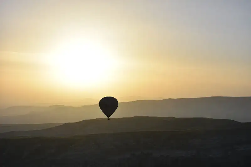
- Marco Rossi
- 27 Jun, 2026 10:01
Un'Avventura Italiana in Cappadocia: La Terra dei Camini delle Fate e delle Mongolfiere
Cappadocia per Nomadi Digitali: La Guida Definitiva a Nevşehir, Turchia Se il tuo ufficio è dove si trova il tuo laptop e il tuo spirito brama avventura, cultura millenaria e paesaggi da sogno, allora la Cappadocia, e in particolare la città di Nevşehir, potrebbe essere la tua prossima destinazione. Dimentica le solite capitali frenetiche; immagina di lavorare tra formazioni rocciose ultraterrene, respirando storia ad ogni passo e ammirando albe mozzafiato punteggiate da centinaia di mongolfiere. Questo non è un sogno, ma la realtà che attende i nomadi digitali in Turchia, un paese che ha recentemente aperto le braccia a questa crescente comunità globale. In questa guida completa, ti condurrò attraverso tutto ciò che devi sapere per trasformare la Cappadocia nella tua base operativa, concentrandoci su Nevşehir come il tuo portale verso questa regione incantata. Dalle formalità del visto al costo della vita, dalla connettività alle esperienze culturali, preparati a scoprire perché la Cappadocia è molto più di una meta turistica: è un ecosistema ideale per il nomade digitale moderno. Il Fascino Ineguagliabile della Cappadocia per il Nomade DigitaleLa Cappadocia è una terra di leggende, dove la natura e la storia si fondono in un paesaggio che sembra uscito da una fiaba. Le sue iconiche "camini delle fate" (peribacaları), formazioni rocciose coniche modellate da milioni di anni di erosione, creano un panorama surreale e fotogenico. Ma non è solo la sua bellezza a renderla attraente. Per un nomade digitale, la Cappadocia offre un ambiente di lavoro stimolante e una qualità della vita elevata a costi sorprendentemente accessibili. Qui, puoi trovare l'equilibrio perfetto tra produttività e scoperta. Immagina di iniziare la giornata con una sessione di lavoro in un caffè accogliente, per poi esplorare antiche città sotterranee, fare escursioni tra valli nascoste o assistere allo spettacolo senza tempo delle mongolfiere che si librano all'alba. Questo mix di avventura e tranquillità nutre la mente e l'anima, elementi cruciali per mantenere la motivazione e la creatività nel lavoro remoto. La cultura turca, con la sua rinomata ospitalità, la sua cucina deliziosa e la sua profonda storia, aggiunge uno strato di ricchezza all'esperienza quotidiana che è difficile da trovare altrove.Nevşehir: Il Tuo Campo Base IdealeMentre località come Göreme, Uçhisar e Avanos sono famose per il loro fascino turistico, Nevşehir emerge come la scelta strategica e pratica per i nomadi digitali che cercano un vero equilibrio tra vita locale e accesso alle meraviglie della Cappadocia. Nevşehir è il capoluogo di provincia, il che significa infrastrutture più robuste, una vita quotidiana più autentica e costi generalmente inferiori rispetto ai villaggi più turistici. Qui troverai:Connettività: Accesso a internet affidabile (fibra ottica in molte aree), uffici postali, banche e tutti i servizi essenziali. Trasporti: Un aeroporto locale (Cappadocia Airport, NEV) con voli per Istanbul, facilitando gli spostamenti. Una rete di autobus e "dolmuş" (minibus condivisi) ben sviluppata per spostarsi in città e verso i centri turistici vicini. Servizi: Ospedali moderni, grandi supermercati (Migros, CarrefourSA, Şok, Bim), mercati locali per prodotti freschi, centri commerciali, palestre e una varietà di ristoranti e caffè che servono sia cucina turca tradizionale che opzioni internazionali. Autenticità: Vivere a Nevşehir ti immerge nella vita turca quotidiana, lontano dalla bolla turistica, offrendoti un'opportunità unica di integrazione culturale e di scoprire gemme nascoste. Potrai interagire con la gente del posto, imparare qualche frase in turco e apprezzare la genuina ospitalità anatolica.Da Nevşehir, le principali attrazioni della Cappadocia come Göreme, le città sotterranee di Derinkuyu e Kaymaklı, la Valle di Ihlara e le formazioni di Pasabag, sono tutte facilmente raggiungibili con brevi tragitti in auto o con i mezzi pubblici. Visto per Nomadi Digitali in Turchia: La Tua Chiave d'AccessoLa Turchia ha compiuto un passo significativo per attrarre talenti globali introducendo il suo Visto per Nomadi Digitali. Questo è un game-changer per chiunque sogni di stabilirsi in questo paese affascinante per un periodo prolungato, lavorando da remoto. Per qualificarsi, i requisiti generali includono:Essere cittadini di determinati paesi (controllare l'elenco aggiornato sul portale ufficiale). Avere un'età compresa tra 21 e 55 anni. Essere titolari di un passaporto valido. Dimostrare di lavorare da remoto per un'azienda al di fuori della Turchia o di possedere un'attività propria che generi un reddito online. Requisito di Reddito: È necessario dimostrare un reddito mensile di almeno $3,000 USD. Questo può essere comprovato tramite estratti conto bancari, lettere di impiego o contratti di lavoro. Costi di Applicazione: La tassa di richiesta è di 964 TL, a cui si aggiungono tariffe giornaliere basate sulla cittadinanza.Il processo di richiesta inizia generalmente attraverso il portale ufficiale di GoTürkiye, specificamente designato per i nomadi digitali. Ti verrà richiesto di caricare i documenti necessari, inclusi prove di reddito, dettagli del passaporto e talvolta una lettera di intenti. È sempre consigliabile consultare la fonte ufficiale per le informazioni più aggiornate e i dettagli specifici sul processo: GoTürkiye Nomadi Digitali. Una volta ottenuta l'approvazione preliminare, ti verrà rilasciato un "Documento di Identificazione per Nomadi Digitali", che potrai poi utilizzare per richiedere un visto attraverso l'ambasciata o il consolato turco nel tuo paese, o direttamente in Turchia, a seconda delle normative vigenti al momento della tua richiesta. Questo visto ti permetterà di vivere e lavorare legalmente in Turchia, godendo di tutte le opportunità che il paese offre. Costo della Vita in Cappadocia/Nevşehir: Un Paradiso per il Portafoglio Uno dei maggiori vantaggi di scegliere la Cappadocia come base per nomadi digitali è il costo della vita. Rispetto a molte destinazioni europee o americane, la Turchia è notevolmente più accessibile, e la Cappadocia/Nevşehir è generalmente ancora più conveniente rispetto a metropoli come Istanbul. Secondo i dati di Numbeo (previsioni per il 2026), il costo della vita medio in Turchia per una persona singola è di circa ₺31,135 (~$666) al mese, escluso l'affitto. Questo dato rende l'idea di quanto la vita quotidiana possa essere economica. È fondamentale notare che la Cappadocia/Nevşehir è solitamente più economica di Istanbul, il che significa che potresti aspettarti di spendere anche meno per molte voci di spesa. Puoi consultare i dettagli specifici del costo della vita in Turchia su Numbeo. Analizziamo le principali voci di spesa:Affitto (Rent): Questa è spesso la spesa più significativa per qualsiasi nomade digitale. A Nevşehir, puoi trovare appartamenti moderni e confortevoli a prezzi molto ragionevoli. Un monolocale o un appartamento con una camera da letto nel centro di Nevşehir può costare tra le ₺7.000 e le ₺15.000 al mese (circa $230-$500), a seconda della posizione e dei comfort. Se sogni un'esperienza più unica, potresti considerare l'affitto di una "cave house" (casa grotta) nei villaggi turistici vicini, ma queste tendono ad essere più costose. Un bilocale in un quartiere ben servito di Nevşehir offre un ottimo rapporto qualità-prezzo. Cibo (Food): Mangiare fuori è incredibilmente conveniente. Un pasto in un ristorante locale può costare tra le ₺100 e le ₺300 ($3-$10). Fare la spesa al mercato locale (pazar) è ancora più economico e ti permetterà di gustare prodotti freschi, frutta, verdura e formaggi a prezzi irrisori. La cucina turca è varia e deliziosa, con opzioni salutari e ricche di sapore. Trasporti (Transportation): Il trasporto pubblico a Nevşehir è economico. Un biglietto singolo per l'autobus costa pochi lire. I "dolmuş" sono un'opzione pratica ed economica per brevi spostamenti. Se desideri esplorare la regione più a fondo, il noleggio auto è un'opzione, con prezzi variabili ma generalmente accessibili. Molti hotel e agenzie offrono anche tour organizzati a prezzi competitivi. Internet e Utenze (Internet & Utilities): L'internet ad alta velocità è generalmente disponibile e affidabile, con costi che variano tra le ₺200 e le ₺400 al mese per un piano domestico. Le bollette (elettricità, acqua, gas) dipendono molto dall'uso, ma in generale sono gestibili. Per un appartamento di dimensioni medie, si possono stimare tra le ₺500 e le ₺1000 al mese. Svago e Attività (Leisure & Activities): Molte delle meraviglie naturali della Cappadocia possono essere esplorate gratuitamente, come le escursioni nelle valli. L'iconica gita in mongolfiera è un'esperienza da non perdere, ma è un'attività "una tantum" piuttosto costosa (può variare da $150 a $300+ a persona). Le entrate ai musei e alle città sotterranee sono anch'esse a pagamento, ma generalmente economiche. La vita sociale, come prendere un tè o un caffè, è molto accessibile.Connettività e Infrastruttura per il Lavoro Remoto Per un nomade digitale, la connettività è re. Nevşehir e i centri più turistici della Cappadocia sono ben attrezzati per soddisfare queste esigenze.Internet Domestico: Come accennato, la fibra ottica è sempre più diffusa a Nevşehir. È possibile ottenere pacchetti internet ad alta velocità da fornitori come Turkcell, Vodafone e Türk Telekom. La stabilità della connessione è generalmente buona, anche se può variare leggermente a seconda del quartiere. Internet Mobile: Le reti 4G/LTE sono ampiamente disponibili e offrono ottima copertura anche nelle aree rurali della Cappadocia. Acquistare una SIM locale è semplice e conveniente, con pacchetti dati generosi a prezzi competitivi. Questo ti garantisce di rimanere sempre connesso, anche quando sei in movimento. Spazi di Coworking e Caffè: Mentre Nevşehir potrebbe non avere una pletora di spazi di coworking dedicati come Istanbul, troverai numerosi caffè con Wi-Fi affidabile e un'atmosfera accogliente dove poter lavorare tranquillamente. Molti hotel di fascia media e alta offrono anche spazi comuni o lobby con buona connettività, ideali per sessioni di lavoro occasionali. Alimentazione Elettrica: La Turchia utilizza la corrente a 220V con prese di tipo F (come in Europa continentale). Le interruzioni di corrente sono rare nelle aree urbane, ma è sempre consigliabile avere un adattatore universale e, per maggiore sicurezza, un power bank.Cultura e Comunità in Cappadocia Vivere in Cappadocia significa immergersi in una cultura ricca e millenaria. L'ospitalità turca è leggendaria, e la gente del posto è generalmente molto accogliente e curiosa nei confronti degli stranieri.Lingua: Sebbene l'inglese sia parlato nelle zone turistiche, imparare alcune frasi di base in turco farà una grande differenza nella tua esperienza quotidiana. Ti aprirà le porte a interazioni più profonde e ti permetterà di navigare meglio nella vita locale. Tradizioni: La Cappadocia è un crocevia di civiltà, e le sue tradizioni riflettono questa ricchezza. Potrai assistere a cerimonie dei Dervisci Rotanti, esplorare laboratori di ceramica ad Avanos, o semplicemente gustare un çay (tè turco) con la gente del posto. Comunità: Sebbene la comunità di nomadi digitali in Cappadocia sia ancora in fase di crescita rispetto ad altre destinazioni più consolidate, sta rapidamente espandendosi. Gruppi sui social media e incontri informali possono aiutarti a connetterti con altri expat e lavoratori remoti. L'atmosfera più piccola e coesa di Nevşehir può favorire la creazione di legami più stretti. Sicurezza: La Cappadocia, e la Turchia in generale, è un paese sicuro per i turisti e i residenti. Come in ogni luogo, è sempre saggio esercitare il buon senso e prendere precauzioni di base, ma la criminalità è bassa e la sensazione di sicurezza è elevata.Cosa Fare e Vedere nei Dintorni di Nevşehir Vivere in Cappadocia significa avere un tesoro di esplorazione a portata di mano. Quando non lavori, le tue giornate saranno piene di scoperte:Göreme: Il cuore turistico della Cappadocia, famoso per il suo Museo all'Aperto (Patrimonio UNESCO), le sue chiese rupestri affrescate e l'iconico spettacolo delle mongolfiere. Uçhisar: Domina la valle con il suo imponente castello roccioso, offrendo viste panoramiche mozzafiato, specialmente al tramonto. Avanos: Conosciuta per le sue ceramiche rosse prodotte con l'argilla del fiume Kızılırmak. Potrai visitare i laboratori e persino provare a modellare l'argilla. Città Sotterranee: Esplora i labirinti affascinanti di Derinkuyu e Kaymaklı, costruite migliaia di anni fa per proteggere gli abitanti dagli invasori. Valli Incantevoli: Fai trekking nelle valli di Rose Valley, Love Valley o Pigeon Valley, ammirando le formazioni rocciose e le chiese rupestri nascoste. Passeggiate a Cavallo e Quad: Per un'esperienza più avventurosa, esplora le valli a cavallo o in quad, specialmente all'alba o al tramonto. Gastronomia: Deliziati con specialità locali come il Testi Kebab (cucinato in un vaso di terracotta), i Manti (tortellini turchi) e l'Ayran (bevanda a base di yogurt).Consigli Pratici per il Tuo TrasferimentoBanche: Aprire un conto bancario locale può semplificare le transazioni quotidiane e il pagamento delle bollette. Le principali banche turche (Ziraat Bankası, Garanti BBVA, Akbank, İş Bankası) offrono servizi completi. SIM Card: Acquista una SIM card locale non appena arrivi. I fornitori principali sono Turkcell, Vodafone e Türk Telekom. Avrai bisogno del passaporto per registrarla. Assistenza Sanitaria: È consigliabile avere un'assicurazione sanitaria internazionale che copra la Turchia. Ci sono ospedali pubblici e privati a Nevşehir che offrono servizi di buona qualità. Periodo Migliore: La primavera (aprile-maggio) e l'autunno (settembre-ottobre) offrono il clima più piacevole per esplorare e lavorare, con temperature miti e cieli sereni. L'estate può essere calda, e l'inverno freddo e talvolta nevoso, ma offre un paesaggio magico.Conclusione La Cappadocia, con Nevşehir come suo fulcro pratico e affascinante, rappresenta una destinazione eccezionale per i nomadi digitali. Offre un costo della vita incredibilmente accessibile, una cultura ricca e ospitale, paesaggi mozzafiato che ispirano la creatività e, grazie al nuovo Visto per Nomadi Digitali, una chiara via legale per un soggiorno prolungato. Se stai cercando un luogo che combini storia, avventura e tranquillità, dove ogni giorno offre nuove scoperte senza prosciugare il tuo portafoglio, allora prepara il tuo laptop e le tue valigie. La Cappadocia ti aspetta per ridefinire la tua esperienza di lavoro remoto. #DigitalNomad #CostOfLiving #Numbeo #RemoteWork #Travel Related InsightsÓbidos: A Vila Medieval Rodeada de Muralhas Bhutan’s Tiger’s Nest Monastery: A Pilgrimage to the Clouds Floating Above the Clouds: A Definitive Pilgrimage to Bhutan’s Tiger’s Nest{ "@context": "https://schema.org", "@type": "FAQPage", "mainEntity": [ { "@type": "Question", "name": "What is the main focus of Un'Avventura Italiana in Cappadocia: La Terra dei Camini delle Fate e delle Mongolfiere?", "acceptedAnswer": { "@type": "Answer", "text": "Il viaggiatore italiano Marco Rossi si immerge nella magica atmosfera della Cappadocia. Non perdetevi questa esperienza unica ricca di camini delle fate, tour in mongolfiera e città sotterranee!" } }, { "@type": "Question", "name": "Who authored the comprehensive guide on Un'Avventura Italiana in Cappadocia: La Terra dei Camini delle Fate e delle Mongolfiere?", "acceptedAnswer": { "@type": "Answer", "text": "This detailed article and its insights were carefully researched and authored by Marco Rossi." } }, { "@type": "Question", "name": "Where can I find more related content about Travel?", "acceptedAnswer": { "@type": "Answer", "text": "You can explore more articles, detailed reviews, and similar insights by browsing the Related Insights section at the bottom of this article or visiting our dedicated Travel category page." } } ] }
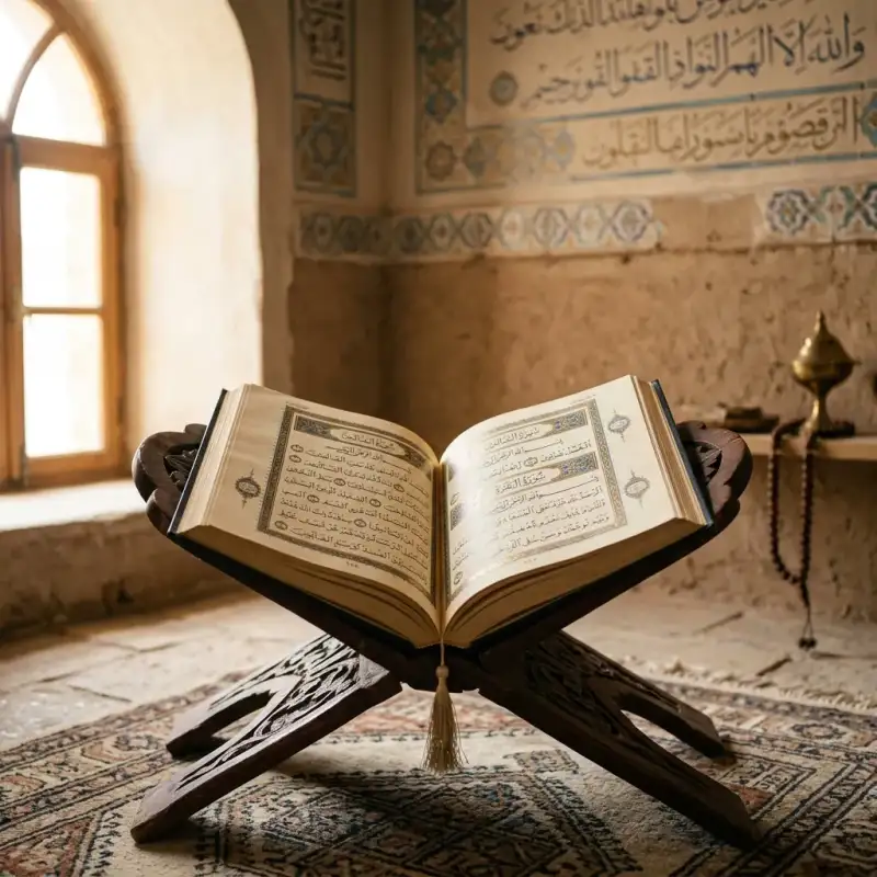

#Mahoma (en árabe: مُحَمَّد, ; La #Meca, c. 570-Medina, 8 de junio de 632 d. C.) fue un líder religioso, social y político árabe, así como el fundador del #Islam. #Mahoma era miembro del clan de Háshim, de la tribu de los coraichitas. De acuerdo con la tradición musulmana, Alá (Dios) reveló a #Mahoma los pasajes del Corán para guiar a la naciente comunidad musulmana (umma) en sus predicamentos. La religión que predicó #Mahoma es llamada #Islam, que significa «sumisión a Dios», y su principio de fe fundamental es que existe un solo Dios y que #Mahoma es el Mensajero de Dios. #Mahoma era hijo de Abdullah ibn Abd al-Muttalib y Amina bint Wahb. Su padre, Abdullah, hijo del líder tribal coraichita Abd al-Muttálib ibn Hashim, murió alrededor de la fecha del nacimiento de #Mahoma, y su madre Amina murió cuando #Mahoma tenía seis años, quedando así huérfano a una temprana edad. Fue criado bajo el cuidado de su abuelo Abd al-Muttálib, y de su tío paterno, Abu Tálib. De acuerdo con la tradición, en años posteriores, #Mahoma adoptó la costumbre de retirarse periódicamente a orar a una caverna en la montañas llamada la cueva de Hira. A la edad de cuarenta años, alrededor del 610 d. C., #Mahoma reportó haber sido visitado por el arcángel Gabriel en la cueva y recibir su primera revelación de Dios. En 613, #Mahoma empezó a predicar estas revelaciones públicamente, proclamando que «Dios es Uno», que la «sumisión» completa (islām) a Dios (Alá) es la forma correcta de vivir (dīn), y que él era un profeta y mensajero de Dios, similar a los otros profetas en el islam. Los seguidores de #Mahoma fueron inicialmente poco numerosos y sufrieron hostilidades de parte de politeístas de La #Meca durante 13 años. Para escapar la continua persecución, #Mahoma envió a algunos de sus seguidores a Abisinia en 615, antes de que él mismo y sus seguidores migraran de La #Meca a Medina (conocida en esos tiempos como Yazrib) en 622. Este evento, la Hégira, marca el comienzo del calendario musulmán. En Medina, #Mahoma unió a las tribus bajo la constitución de Medina. En diciembre de 629, tras ocho años de combates intermitentes con las tribus mecanas, #Mahoma reunió un ejército de diez mil #musulmanes conversos y marchó sobre la ciudad de La #Meca. Encontraron poca oposición en esta toma y la ciudad fue capturada con poco derramamiento de sangre. En 632, unos meses después de retornar de la Peregrinación del adiós, enfermó y murió. Para el momento de su muerte, la mayor parte de la Península arábiga se había convertido al islam. Las revelaciones (ayat) que #Mahoma reportó recibir hasta su muerte forman los versos del Corán, considerado por los #musulmanes como la «Palabra de Dios» textualmente, en la que se basa la religión. Además del Corán, las enseñanzas y prácticas de #Mahoma (sunna), que aparecen en reportes transmitidos (hadiz) y en su biografía (sīrah), también se usan como fuentes de ley islámica. La inmensa mayoría de #musulmanes, incluyendo las principales corrientes del islam como el sunismo y el chiismo, considera a #Mahoma como «el último de los profetas» o «sello de los profetas» (en árabe: خاتم النبيين, romanizado: jātim an-nabīyīn; o en árabe: خاتم الأنبياء, romanizado: jātim al-anbiyā), quien es la culminación de una larga cadena de mensajeros enviados por Dios para actualizar su mensaje, entre cuyos predecesores se cuentan Abraham, Moisés y Jesús de Nazaret. Sin embargo, para los ahmadíes, #Mahoma es el último en entregar una ley religiosa a la humanidad, mas no el último profeta. Es reconocido por los drusos como uno de sus profetas. El bahaísmo lo venera como uno de los profetas o «Manifestación de Dios», cuyas enseñanzas habrían sido actualizadas por las de Bahá'u'lláh, fundador de esta religión. Etimología #Mahoma provienen del árabe clásico محمد (vocalizado: مُحَمَّد, Muḥammad), participio pasivo del verbo حَمَّدَ (alabar, ḥammada), derivado de la raíz triconsonántica ح-م-د (Ḥ-M-D) que significa alabar o loar, por lo tanto el nombre significa «el alabado», pasó al español a través del árabe andalusí Mahammad a Mahommad y después al castellano como #Mahoma. En lenguas como el francés evolucionó a Mahomet, en italiano a Maometto y en portugués a Maomé. Su nombre completo en árabe es أَبُو الْقَاسِمِ مُحَمَّدُ بْنُ عَبْدِ اللَّهِ بْنِ عَبْدِ الْمُطَّلِبِ الْهَاشِمِيُّ الْقُرَشِيُّ, Abū l-Qāsim Muḥammad ibn ‘Abd Allāh ibn ‘Abd al-Muṭṭalib al-Hāšim al-Qurayšī, que se hispaniza como «#Mahoma» o bien como «Mohamed». Vida de #Mahoma El Corán ofrece escasa información biográfica concreta sobre #Mahoma, y la mayor parte de la información biográfica que la tradición islámica conserva sobre él se encuentra fuera del Corán, en la llamada literatura de la sīrah (en árabe: السيرة النبوية, lit. 'biografía'). Fuentes importantes sobre la vida de #Mahoma pueden hallarse en obras históricas escritas por autores de los siglos II y III de la era de la Hégira (alrededor de los siglos VIII y IX d. C. respectivamente). Estas fuentes incluyen biografías musulmanas tradicionales de #Mahoma (sīrah), que brindan detalles adicionales de su vida. La más temprana de estas biografías es la Vida del Mensajero de Dios de Ibn Ishaq, escrita c. 767 d. C. (150 d. H). Si bien la obra original se perdió, esta sira sobrevive en la forma de fragmentos extensos en obras de Ibn Hisham y en un grado menor en obras de Al-Tabari. Sin embargo, Ibn Hisham escribió en el prefacio de su biografía de #Mahoma que había omitido asuntos de la biografía de Ibn Ishaq que «afligirían a ciertas personas». Otra fuente histórica temprana es la #historia de las campañas de #Mahoma escrita por al-Waqidi (m. 130 d. H), y la obra del secretario de al-Waqidim Ibn Sa'd al-Baghdadi (m. 168 d. H). Gracias a estos esfuerzos biográficos tempranos, se sabe más de #Mahoma que de casi cualquier otro fundador de una de las grandes religiones. Muchos académicos y académicas aceptan estas biografías tempranas como auténticas. Sin embargo, la biografía de al'Waqidi ha sido ampliamente criticada por académicos islámicos por sus métodos, en particular su decisión de omitir sus fuentes. Estudios recientes han llevado a académicos a distinguir entre tradiciones relacionadas con asuntos legales y acontecimientos puramente históricos. En el grupo legal, las tradiciones podrían haber sido sujetas a inventos mientras que los acontecimientos históricos, aparte de casos excepcionales, pueden haber sido sujetos solamente a un «moldeo tendencioso». Otros académicos han criticado la confiabilidad de este método, sugiriendo que no se puede dividir claramente tradiciones entre categorías puramente legales e históricas. HIstoriadores occidentales describen que el propósito de estas biografías tempranas fue el de transmitir un mensaje, más que el de registrar de manera estricta y adecuada la #historia. Vida anterior a la predicación =### Nacimiento e infancia= Árabe de la tribu de Quraysh (o coraichitas), nació en La #Meca (مكة) alrededor del 570. La #Meca se encuentra en la región de Hiyaz en la actual Arabia Saudí. Fue hijo póstumo de Abd Allah ibn Abd al-Muttalib, miembro del del clan de Hāshim. El padre de #Mahoma falleció antes de su nacimiento, dejándolo al cuidado de su abuelo paterno, ʿAbd al-Muṭṭalib. A la edad de seis años, #Mahoma pierde también a su madre, Āminah, y a los ocho pierde a su abuelo. A partir de entonces, la responsabilidad de #Mahoma es asumida por el nuevo jefe del clan de Hāshim: su tío Abū Ṭālib. La costumbre de los más honorables de la tribu coraichita era enviar a sus hijos con niñeras beduinas con el propósito de que crecieran libres y saludables en el desierto, para poder también robustecerse y aprender de los beduinos, que eran reconocidos por su honradez y la carencia de numerosos vicios, y #Mahoma fue confiado a Bani S’ad. =### Milagros= El primer milagro que se narra sobre #Mahoma en la compilación de los hadices es que el arcángel Gabriel descendió y abrió su pecho para sacar su corazón. Extrajo un coágulo negro de este y dijo «Esta era la parte por donde Satán podría seducirte». Después lo lavó con agua del pozo de Zamzam en un recipiente de oro y devolvió el corazón a su sitio. Los niños y compañeros de juego con los que se encontraba corrieron hacia su nodriza y dijeron: «#Mahoma ha sido asesinado»; todos se dirigieron a él pero descubrieron que estaba vivo. Los #musulmanes ven este acontecimiento como una protección para que él se apartara desde su infancia de la adoración de los ídolos y probablemente la razón por la que fue devuelto a su madre. Quedó huérfano a temprana edad y, debido a una costumbre árabe que dice que los hijos menores no pueden recibir la herencia de sus progenitores, no recibió ni la de su padre ni la de su madre.[cita requerida] Se dice que ella murió cuando él tenía seis años, por lo que fue acogido y educado primero por su abuelo Abd al-Muttálib y luego por su tío paterno Abu Tálib, un líder de la tribu Quraysh o coraichita, la más poderosa de La #Meca, y padre de su primo y futuro califa Alí. =### Encuentro con el monje Bahira= En aquella época La #Meca era un centro comercial próspero, principalmente porque existían varios templos que contenían diferentes ídolos, lo cual atraía a un gran número de peregrinos. Mercaderes de diferentes tribus visitaban La #Meca en la época del peregrinaje, cuando las guerras tribales estaban prohibidas y podían contar con un viaje seguro. En su adolescencia, #Mahoma acompañó a su tío por sus viajes a Siria y otros lugares. Por tanto, pronto llegó a ser una persona con amplia experiencia en las costumbres de otras regiones. A los doce años se dirigió a Bosra con su tío Abu Tálib y tuvieron un encuentro con un monje llamado Bahira. Algunos orientalistas dicen que esto demuestra que #Mahoma aprendió de él los libros sagrados, pero los estudiosos #musulmanes refutan esta opinión alegando que no pudo haber aprendido en la hora de la comida ese conocimiento y que además no se registra un segundo encuentro con este monje. En los hadices se narra que Bahira reconoció algunas señales de la profecía de #Mahoma y le advirtió a su tío sobre llevarlo a Siria por temor de los judíos y romanos (en aquel entonces los bizantinos). =### Matrimonio con Jadiya= #Mahoma no tuvo un trabajo específico en su juventud, pero se ha reportado que trabajó como pastor para Bani Sad y en La #Meca como asalariado. A la edad de veinticinco años, #Mahoma trabajó como mercader en la ruta caravanera entre Damasco y La #Meca a las órdenes de Jadiya, hija de Juwáylid (خديجة بنت خويلد), una rica comerciante viuda, a quien impresionó y le propuso matrimonio en el año 595. Ibn Ishaq presenta que la edad de Jadiya era de veintiocho años, y Al-Waqidi presenta cuarenta. Algunos dicen que al engendrar Jadiya dos varones y cuatro mujeres de #Mahoma, hace que la opinión más fuerte sea la de Ibn Ishaq, pues es sabido que la mujer llega a la edad de la menopausia antes de los cincuenta años, a pesar de que estas informaciones no están establecidas en un hadiz sino que circularon entre los historiadores. Todos sus descendientes nacieron antes de que #Mahoma recibiera la primera revelación. Sus hijos Al-Qásim y Abdullah murieron durante su infancia en La #Meca. Sus cuatro hijas se llamaban Záinab, Ruqayyah, Umm Kulthum bint Muhammad y Fátima (la única en sobrevivir después de la muerte de #Mahoma). Las primeras revelaciones #Mahoma era de carácter reflexivo y, cada vez más preocupado por las condiciones sociales de los mecanos, rutinariamente empezó a pasar noches orando y meditando en la cueva de Hira, cerca de La #Meca. Los #musulmanes creen que en 610 a los cuarenta años de edad, mientras meditaba, #Mahoma tuvo una visión del arcángel Gabriel (Yibril, جبريل), quien le enseña los versículos iniciales de la sura 96 del Corán: «¡Recita en el nombre de tu Señor, que crea; / que crea al hombre de un coágulo! / Recita, pues tu Señor es el más generoso…». Estas primeras revelaciones hicieron que #Mahoma tuviese miedo. Cuando #Mahoma despertó de su visión, de acuerdo con la tradición, las palabras parecían talladas en su corazón y temió estar poseído, llegando incluso a considerar brevemente el suicidio, pero escuchó una voz de los cielos que le llamaba apóstol de Dios. Al regresar a su casa, #Mahoma le contó a Jadiya lo que había pasado. Con la ayuda del primo cristiano de Jadiya, Waraka ibn Nawfal, quien interpretó la visión de #Mahoma como una experiencia espiritual, Jadiya lo persuadió de tener fe en sí mismo y escuchar las revelaciones.#Mahoma describió luego esta visita como un mandato para memorizar y recitar los versos enviados por Dios. Inicialmente, #Mahoma solo le comunicó su mensaje a personas muy cercanas a él: Jadiya, su joven primo Ali ibn Abi Tálib, su hijo adoptivo Zayd ibn Harithah, y su amigo, el mercader Abu Bakr ibn Abi Quhafa. Unos años después, #Mahoma llevó su mensaje a la gente de La #Meca. Umar ibn al-Jattab y Uthmán ibn Affán fueron dos mecanos importantes en aceptar sus enseñanzas en esta época, si bien se dice que fueron los jóvenes menos pudientes quienes más escucharon su mensaje. Durante su vida, #Mahoma confió la conservación de la palabra de Dios (Allah الله), trasmitida por Gabriel, a la retentiva de los memoriones, quienes la memorizaban recitándola incansablemente que después de su muerte serían recopilados por escrito en el Corán debido a la primordial importancia de conservar el mensaje original en toda su pureza, sin el menor cambio ni de fondo ni de forma. Para ello emplearon materiales como las escápulas de camello, sobre las que grababan los versículos del Corán. El arcángel Gabriel le indicó que había sido elegido como el último de los profetas y como tal predicó la palabra de Dios sobre la base de un estricto monoteísmo, prediciendo el Día del Juicio Final. De acuerdo con el Corán y las narraciones, #Mahoma era analfabeto (ummi), hecho que la tradición musulmana considera una prueba que autentifica al Corán (Al-Qur'ān, القران), libro sagrado de los #musulmanes, como portador de la verdad revelada. Sin embargo, hay al menos dos hadices que muestran que #Mahoma no era analfabeto. ‘Abdullah bin ‘Abbâs dijo: «La enfermedad del Profeta empeoró un jueves». Entonces el Profeta dijo: «Traedme algo para escribir que os redactaré un escrito y no os perderéis después de ello». Al-Bara' dijo: «Así el Mensajero de Alá, tomó el documento, y aunque no podía escribir bien escribió: “Esto es lo que Muhammad ibn 'Abdullah concluye...”» (Esto sucedió durante las negociaciones del tratado de Hudaybiyyah). Rechazo A medida que los seguidores de #Mahoma comenzaban a aumentar en número, su acción crítica contra el politeísmo mecano lo convirtió en una amenaza para los jefes de las tribus locales. La riqueza de estas tribus se basaba en la Kaaba, el recinto sagrado de los ídolos de los árabes y el punto principal religioso de La #Meca, lugar de peregrinaciones. Si rechazaban a dichos ídolos, tal como #Mahoma predicaba, no habría peregrinos hacia La #Meca, ni comercio, ni riqueza. El repudio al politeísmo que denunciaba #Mahoma era particularmente ofensivo a su propia tribu, la qurayshí, por cuanto ellos eran los guardianes de la Kaaba. Es por esto que #Mahoma y sus seguidores se vieron perseguidos.[cita requerida] Según la tradición islámica, los mecanos hicieron planes para matarlo. #Mahoma supo que tendría que abandonar La #Meca cuando, aproximadamente en el año 619 fallecieron Jadiya, la esposa de #Mahoma, y su tío Abu Tálib, no quedando pues nadie que pudiera ofrecerle la protección y el apoyo moral que necesitaba. Este año se conoce como el «año de la tristeza». El clan al que pertenecía #Mahoma lo repudió y sus seguidores sufrieron hambre y persecución. Isra y Mirach En el año 620 d. C, según relata el hadiz, #Mahoma hizo un viaje en una noche que es conocido como Isra y Miraŷ. Isra es la palabra en árabe que se refiere a un viaje milagroso desde La #Meca a Jerusalén, específicamente al lugar conocido como Masyid al-Aqsa. Isra fue seguida por el Mi'rāŷ, su ascensión al Cielo, donde según el hadiz recorrió los siete cielos y se comunicó con profetas que le precedieron, como Abraham, Moisés o Jesús. La Hégira La vida de la pequeña comunidad musulmana en La #Meca no solo era difícil, sino también peligrosa. Las tradiciones árabes afirman que hubo varios atentados contra la vida de #Mahoma.[cita requerida] Entretanto, la gente de la ciudad de Yazrib (la actual Medina), un gran oasis agrícola donde había seguidores suyos, decidió invitarlo como juez y árbitro, y #Mahoma inmediatamente aprovechó la oportunidad para abandonar La #Meca. Finalmente decidió trasladarse en el 622, enviando a sus seguidores adelante y siguiéndolos en secreto junto con Abu Bakr como su acompañante. Rompiendo sus vínculos con las lealtades tribales y familiares, #Mahoma demostraba que estos vínculos eran insignificantes comparados con su compromiso con el islam, una idea revolucionaria en la sociedad tribal de Arabia. Esta migración a Medina marca el principio del año en el calendario islámico. El calendario islámico cuenta las fechas a partir de la Hégira (هجرة), razón por la cual las fechas islámicas llevan el prefijo AH (año de la Hégira). Para los #musulmanes, marca el alba de la «era del islam», en comparación con los tiempos preislámicos, que llaman «era de la ignorancia» (yahilíyyah). #Mahoma llegó a Medina como un mediador, invitado a resolver querellas entre los bandos árabes de Aws y Khazraj. Logró este fin absorbiendo a ambas facciones en la comunidad musulmana y prohibiendo el derramamiento de sangre entre los #musulmanes. #Mahoma ejercía ahora el liderazgo de una comunidad basada no en lazos tribales sino en una fe compartida en Un Solo Dios. Pronto Yazrib empezó a ser conocida como Medinat al-nabi (la ciudad del Profeta) o simplemente Medina. Los mecanos que emigraron junto con #Mahoma fueron conocidos como Al-Muhaŷirun, y los medineses que los acogieron y ayudaron fueron conocidos como los Ansar. Sin embargo, Medina era también el lugar donde vivían varias tribus judías. #Mahoma esperaba que, como monoteístas, estas tribus lo reconocieran como profeta, e incluso antes de su llegada a Medina afirmaba que también adoraba al Dios de Moisés y de Jesús, y se giraba a orar en dirección a Jerusalén, a donde había sido llevado en su viaje espiritual nocturno. Sin embargo, los judíos de Medina rechazaron sus enseñanzas. Algunos académicos afirman que #Mahoma abandonó la esperanza de ser reconocido como profeta por todas las tribus judías, y decidió distinguir su comunidad de la de ellos, y la alquibla, es decir, la dirección en la que rezan los #musulmanes, fue cambiada del antiguo templo de Jerusalén a la Kaaba en el año 624 . #Mahoma emitió un documento que se conoce como La Constitución de Medina (en 622-623), en la cual se especifican los términos en que otras facciones, particularmente los judíos, podían vivir dentro del nuevo estado islámico. De acuerdo con este sistema, a los judíos y cristianos les era permitido mantener su religión mediante el pago de un tributo: Ŷizya o ŷizyah (no así a los practicantes de religiones consideradas paganas). Este sistema vendría a tipificar la relación entre los #musulmanes y los dhimmis, y esta tradición es la razón de la relativa estabilidad que normalmente existía en los califatos árabes. La principal tribu judía de Medina (Banu Qurayza o Banu Nadir) no fue citada por La Constitución de Medina debido a su traición, posterior desintegración y retirada de La Carta de Medina. Luego, #Mahoma libró una serie de batallas contra los mecanos así como contra los judíos de Medina, hasta que finalmente el islam se afianzó firmemente en la ciudad, donde #Mahoma estableció su hogar. La guerra Las relaciones entre La #Meca y Medina se deterioraron rápidamente. Todas las propiedades de los #musulmanes en La #Meca fueron confiscadas,[cita requerida] mientras que en Medina #Mahoma lograba alianzas con las tribus vecinas. Los seguidores de #Mahoma comenzaron a asaltar las caravanas que se dirigían a La #Meca. En marzo de 624, #Mahoma condujo a trescientos guerreros en un asalto a una caravana de mercaderes que se dirigía a La #Meca. Los integrantes de la caravana lograron esquivar el ataque cambiando la ruta habitual por otra más cercana a la costa, gracias a cierta información que le llegó a Abu Sufyan ibn Harb, el jefe de la caravana. Posteriormente los jefes de #Meca decidieron dirigir una represalia contra los #musulmanes,[cita requerida] enviando un pequeño ejército a invadir Medina. El 15 de marzo de 624 , en un lugar llamado Badr, ambos bandos chocaron. Si bien los seguidores de #Mahoma eran numéricamente tres veces inferiores a sus enemigos (trescientos contra mil), los #musulmanes ganaron la batalla. Este fue el primero de una serie de logros militares por parte de los #musulmanes. El dominio de #Mahoma se consolida Para los #musulmanes, la victoria de Badr resultaba una ratificación divina de que #Mahoma era un legítimo profeta. Después de la victoria, y una vez que el clan judío de Banu Qainuqa fue expulsado de Medina, la mayoría de los ciudadanos de este lugar adoptaron la fe musulmana[cita requerida] mientras que algunos conservaron su antigua fe monoteísta anterior al islam y #Mahoma se estableció como el regente de la ciudad. Después de la muerte de su esposa, #Mahoma contrajo matrimonio con Aisha, la hija de su amigo Abu Bakr (quien posteriormente se convertiría en el líder de los #musulmanes tras la muerte de #Mahoma). En Medina también se casó con Hafsah, hija de Úmar (quien luego sería el sucesor de Abu Bakr). Estos casamientos sellarían las alianzas entre #Mahoma y sus principales seguidores. La hija de #Mahoma, Fátima, se casó con Ali, primo de #Mahoma. Otra hija, Ruqayyah, contrajo matrimonio con Uthmán pero ella falleció y después Uthmán se casó con su hermana Umm Kulthum. Estos hombres surgirán en los años subsiguientes como los sucesores de #Mahoma (califas) y líderes políticos de los #musulmanes. Por tanto, los cuatro primeros califas estaban vinculados a #Mahoma por los diferentes matrimonios. Los #musulmanes consideran a estos califas como los rāshidūn (الخلفاء الراشدون), que significa «guiados». Continúa la guerra En 625 un jefe de La #Meca, Abu Sufyan, marchó contra Medina con tres mil hombres. En la batalla de Uhud que se libró el 23 de marzo, no salió victorioso ninguno de los dos bandos. El ejército de La #Meca afirmó haber ganado la batalla, pero quedó demasiado diezmado como para perseguir a los #musulmanes de Medina y ocupar la ciudad. En abril de 627, Abu Sufyán emprendió otro ataque contra Medina, pero #Mahoma había cavado trincheras alrededor de la ciudad y pudo defenderla exitosamente en lo que se conoce como la batalla de la Trinchera. En esta batalla, la tribu judía de Banu Qurayza se había aliado con el ejército de La #Meca, por lo que los #musulmanes emprendieron guerra contra ellos, derrotándolos. Tras la victoria de la batalla de las Trincheras, los #musulmanes expandieron su influencia a través de conversiones o conquistas de varias ciudades y tribus, aplicando el mismo concepto bélico de Yihad. La conquista de La #Meca En el año 628, la posición de #Mahoma era lo suficientemente fuerte para decidir su retorno a La #Meca, esta vez como un peregrino. En marzo de ese año, se dirigió a La #Meca seguido de mil seiscientos hombres. Después de diversas negociaciones, se firmó un tratado en un pueblo cercano a La #Meca llamado al-Hudaybiyyah. Si bien a #Mahoma no se le permitió ese año entrar en La #Meca, las hostilidades cesaron y a los #musulmanes se les autorizó el acceso a la ciudad en el año siguiente. El tratado duró solo dos años, ya que en 630 #Mahoma lo rompió. #Mahoma marchó hacia esa ciudad con un ejército de más de diez mil hombres y la conquistó sin encontrar resistencia #Mahoma amnistió a los habitantes de la ciudad salvo a quienes lo habían injuriado y a los #musulmanes apóstatas. Mandó matar a éstos «incluso si eran hallados bajo las cortinas de la Kaaba».[cita requerida] Muchos habitantes se convirtieron al islam. #Mahoma destruyó los trescientos sesenta ídolos colocados alrededor de la Kaaba e hizo borrar las pinturas paganas de sus muros interiores, aunque preservó las de Jesús y la Virgen María. Asimismo, prohibió a los no #musulmanes peregrinar a La #Meca, convirtiéndola así en el lugar sagrado del islam y principal sitio de peregrinaje de la nueva religión. A pesar de que #Mahoma no estuvo presente en el asalto a la ciudad, administró la quinta parte del botín para repartirlo entre los más necesitados. Los cuatro quintos restantes pertenecían siempre a los combatientes. Cobró un rescate cuarenta y cinco onzas de plata por cada prisionero, rescate que fue repartido entre los necesitados. #Mahoma no llegó nunca a saciarse de comida alguna, en su casa no había sino lo necesario para pasar el día y para los invitados que a ella acudían. La capitulación de La #Meca y la derrota de las tribus enemigas en Hunayn permitió a #Mahoma imponer su dominio sobre toda Arabia. Sin embargo, #Mahoma no formó ningún gobierno, sino que prefirió gobernar a través de las relaciones personales y los tratados con las diferentes tribus. La vida familiar de #Mahoma La vida conyugal de #Mahoma puede dividirse en dos periodos: el pre-Hégira en La #Meca (570-622) y el post-Hégira en Medina (622-632). En 595, a la edad de veinticinco años, #Mahoma se casó con Jadiya, una acaudalada mujer de La #Meca que contaba con veintisiete años de edad (cuarenta según otras fuentes) cuando se casó. El matrimonio duró veinticinco años y fue feliz. Tras la muerte de Jadiya, en 619, Jawla bint Hakim, una de sus sahaba, sugirió a #Mahoma que contrajera matrimonio con Sawda bint Zam'a, una viuda musulmana, o con Aisha,[cita requerida] hija de Umm Ruman y Abu Bakr de La #Meca—quien posteriormente sucedería a #Mahoma—. Se dice que #Mahoma solicitó que se hicieran los arreglos para casarse con ambas. Según algunos hadices, Aisha tenía seis años de edad cuando fue prometida al profeta, que tenía cincuenta y cuatro, aunque el matrimonio se consumó cuando ella tenía nueve años. Hay, sin embargo, ulemas #musulmanes del siglo XX que creen que dichos datos son erróneos y que Aisha era considerablemente mayor. Pese a estas reinterpretaciones modernas de los hadices que adjudicarían a Aisha una edad más madura, una gran parte de los #musulmanes siguen aceptando actualmente las interpretaciones tradicionales. Esto último ha sido utilizado por críticos del islam, como Ibn Warraq, para sostener que los matrimonios infantiles que se siguen practicando en la actualidad en los países islámicos encuentran un argumento favorable en estos posibles relatos del hadiz. #Mahoma realizaba tareas domésticas, tales como preparar la comida, coser ropa o reparar calzado. También se dice que acostumbró a sus esposas al diálogo; escuchaba sus consejos, y ellas debatían e incluso discutían con él. Se dice que Jadiya tuvo cuatro hijas con #Mahoma (Ruqayya bint Muhammad, Umm Kulthum bint Muhammad, Zainab bint Muhammad y Fátima az-Zahra) y dos hijos (Qasim ibn Muhammad y Abd Allah ibn Muhammad, quienes fallecieron durante la infancia). Todas sus hijas, a excepción de una —Fátima—, murieron antes que él. Algunos eruditos chiitas sostienen que Fátima fue la única hija de #Mahoma. Más tarde se casó con Hafsa, con Záynab bint Yahsh (quien fue esposa menos de un año de su hijo adoptivo Zayd, del cual se divorció), Ramlah, hija de un líder que combatió a #Mahoma, y con Umm Salama, viuda de un combatiente musulmán. También se casó[cita requerida] con una cristiana de nombre Maríyah al-Qibtíyah (Maríyah, la copta), tuvo otro hijo con ella después de mudarse a Medina. Ese séptimo y último hijo se llamaba Ibrahim ibn Muhammad. Al igual que sus hermanos varones, Ibrahim falleció en su niñez; se dice que murió a los diecisiete o dieciocho meses de edad. Una de las sunas o hadices, narra que el sol se eclipsó el día en el que Ibrahim murió aunque #Mahoma recuerda que un eclipse de Sol no es señal de la muerte (ni del nacimiento) de alguien. Ibrahim es el mismo nombre que el del patriarca de judíos y cristianos (y #musulmanes), Abraham, del cual una de las sunas o hadices, la 314 del Libro 1 Musulmán de Fe, narra que fue encontrado por #Mahoma en el séptimo cielo durante su viaje por los cielos, e Ibrahim es el nombre del séptimo hijo de #Mahoma. Se casó con una judía de nombre Safiyya bint Huyayy. Tuvo varias otras esposas, de número impreciso entre estas nueve reseñadas, que afirman casi todos los expertos como seguras, y las más de veinte que algunos le estiman. Algunas de estas mujeres eran esposas de seguidores de #Mahoma muertos en batalla, mientras que otras eran hijas de sus aliados. Nueve de las esposas de #Mahoma le sobrevivieron. Aisha —quien, según la tradición suní, llegó a ser considerada la esposa favorita de #Mahoma— le sobrevivió durante varias décadas y desempeñó un papel fundamental en la recopilación de los dichos dispersos de #Mahoma que conforman la literatura del hadiz para la rama suní del islam. #Mahoma prescribió un máximo de cuatro esposas por musulmán, por lo que su casamiento con al menos nueve mujeres constituye la única excepción dentro de la fe que se estaba desarrollando, hasta la venida de la azora An-Nisa en el año 628 d. C. que sentaría las bases legales del matrimonio, divorcio, herencia y orfandad. =### Lista de esposas= La muerte de #Mahoma Alrededor del año 632 d. C., #Mahoma, habiendo establecido su autoridad sobre la Península arábiga, hizo la peregrinación del hach hasta La #Meca, circunvalando la Kaaba, y estableciendo así el ritual del hach que los #musulmanes practican hasta la actualidad. Esta peregrinación es recordada como la Peregrinación del adiós. Pocos días después de regresar de su peregrinación, y después de una corta enfermedad, #Mahoma falleció el 8 de junio de 632 en la casa de Aisha, en la ciudad de Medina, a la edad de sesenta y tres años, siendo enterrado allí mismo. La dolencia es tradicionalmente atribuida a la ingestión de una pieza de carne envenenada. Esto se produjo tres años antes de su muerte, tras la caída y represión de los líderes de Jáibar frente a las tropas islámicas. Dado que #Mahoma no dejó ningún arreglo para su sucesión, su muerte provocó una importante disputa sobre el futuro liderazgo de la comunidad que fundó. Abu Bakr, el padre de Aisha, la tercera esposa de #Mahoma, fue elegido por los líderes de la comunidad musulmana como el sucesor de #Mahoma, pues este era su favorito. Cualesquiera que hayan sido los hechos, lo cierto es que Abu Bakr se convirtió en el nuevo líder del islam. La mayor parte de su corto reinado la pasó combatiendo tribus rebeldes en lo que se conoce como las Guerras Ridda. A la fecha de la muerte de #Mahoma, había unificado toda la península arábiga y expandido la religión islámica en esta región, así como en parte de Siria y Palestina. Posteriormente los sucesores de #Mahoma extendieron el dominio del imperio árabe a Palestina, Siria, Mesopotamia, Persia, Egipto, el norte de África y #Al-Ándalus. Descendientes de #Mahoma A #Mahoma le sobrevivieron su hija Fátima y los hijos de esta (Hasan y Husáin) y también su última esposa, Aisha. Los chiíes afirman que el esposo de Fátima, Alí y sus descendientes, son los verdaderos líderes del islam. Los suníes no aceptan esta afirmación, si bien respetan a los descendientes de #Mahoma. Los descendientes de #Mahoma son conocidos por diferentes nombres, tales como sayyid y sharif. Muchos líderes y nobles de los países #musulmanes, actuales y pasados, afirman ser descendientes de #Mahoma con variables grados de credibilidad, tales como la dinastía fatimí del norte de África, los idrisíes, la actual familia real de Marruecos y Jordania y los imanes ismaelitas que usan el título de Aga Jan. Significado histórico de #Mahoma Antes de su muerte en 632, #Mahoma había establecido al islam como una fuerza social, militar y religiosa y había unificado Arabia. Algunas décadas después de su muerte, sus sucesores conquistaron Persia, Egipto, Palestina, Siria, Armenia y gran parte del norte de África, y cercaron dos veces Constantinopla, aunque no pudieron hacerse con ella, lo que les impidió avanzar hacia el este de #Europa. Entre 711 y 716 comienza la lucha por la conquista árabe, de casi ocho siglos, de la península ibérica, y en 732, cien años después de la muerte de #Mahoma, el avance árabe en la conquista de #Europa Occidental es detenido en el corazón de Francia en la batalla de Poitiers. Bajo los gaznavíes, el islam se extendió en el siglo X a los principales Estados hindúes al este del río Indo, en lo que es actualmente el norte de la India. La expansión del islam continuó sin invasiones militares por diversas regiones de África y del sudeste de Asia. El islam cuenta actualmente con más de mil seiscientos millones de seguidores, siendo la segunda mayor religión del mundo, después del cristianismo. No obstante, el número de fieles es difícil de determinar, ya que según la ley islámica la apostasía debe ser castigada con la muerte. Este hecho puede inhibir a aquellos que manifiestan su identidad religiosa en zonas de mayoría musulmana. Veneración por #Mahoma Los #musulmanes profesan amor y veneración por #Mahoma: Al hablar de #Mahoma, la alusión se acompaña de títulos como el de Profeta y su nombre es seguido de bendiciones hacia él y, en el caso de los chiíes, a su familia con la fórmula "bendígale Dios y le dé su paz" (sal-la allahu 'alaihi (wa alihi) wa sal-lam صلّى الله عليه (و آله) وسلّم) o "la paz y la oración estén con él" (alaihi as-salatu wa-s-salam عليه الصلاة والسلام). Existe mucha música musulmana en veneración a #Mahoma, especialmente la música devota de los sufíes. Algunos #musulmanes celebran el nacimiento de #Mahoma con grandes festividades, aunque no es una tradición extendida y muchos consideran que se trata de una innovación contraria al espíritu del islam y a los preceptos coránicos. Aparte de las historias canónicas del Hadiz, compilación de dichos sobre la vida de #Mahoma y sus compañeros, escritas aproximadamente dos siglos tras su muerte Al Muwatta y Sahih al-Bujari, existen innumerables relatos acerca de su nacimiento y vida. Imágenes de #Mahoma El Corán no prohíbe explícitamente las imágenes de #Mahoma pero hay unos pocos hadices (tradiciones complementarias) que han prohibido directamente a los #musulmanes crear representaciones visuales de figuras humanas en cualquier circunstancia. La mayoría de los #musulmanes sunníes contemporáneos creen que las imágenes visuales de los profetas en general deberían prohibirse, y muy especialmente las imágenes de #Mahoma. El concepto clave es que el islam considera que el uso de imágenes fomenta la idolatría, porque la imagen tiende a volverse más importante que el concepto que representa. En el arte islámico #Mahoma suele aparecer con el rostro cubierto por un velo, o simbólicamente representado como una llama, sin embargo otras imágenes, especialmente de Persia o realizadas durante el gobierno del Imperio otomano, entre otros ejemplos, lo muestran por completo. La perspectiva islámica es diversa y algunos #musulmanes mantienen una visión más flexible. Algunos, especialmente los chiíes de Irán, aceptan las imágenes respetuosas, y utilizan ilustraciones de #Mahoma en libros y decoración arquitectónica, como los suníes en varios momentos y lugares del pasado, aunque estos últimos actualmente tienden hacia posturas iconoclastas y al rechazo de cualquier imagen de #Mahoma, incluyendo las creadas y publicadas por no #musulmanes. Desde el siglo VII, el nombre del profeta del islam ha conocido varios estereotipos. Muchas fuentes mencionan estereotipos exagerados y a veces equivocados. Estos estereotipos nacen en Oriente, pero serán adoptados o desarrollados en las culturas occidentales. En estas referencias, se desempeñan un papel principal en la introducción de #Mahoma y su religión en Occidente como el falso profeta, príncipe sarraceno, deidad de sarracenos, la bestia bíblica, cismático del cristianismo, una criatura satánica, el autor del Corán y el Anticristo. Objetos atribuidos a #Mahoma En el Pabellón del Santo Manto y las Reliquias Sagradas, del Palacio de Topkapi, en Estambul, se exhiben objetos que habrían pertenecido a #Mahoma, como el Santo Manto, el arco y la espada del profeta, tierra de la tumba de #Mahoma y una huella de su pie enmarcada en bronce, así como un pelo de su barba y el relicario donde se conserva uno de sus dientes. Cronología Fechas y lugares importantes en la vida de #Mahoma Perspectiva Histórica y Legado (Parte 2) #Mahoma (en árabe: مُحَمَّد, ; La #Meca, c. 570-Medina, 8 de junio de 632 d. C.) fue un líder religioso, social y político árabe, así como el fundador del islam. #Mahoma era miembro del clan de Háshim, de la tribu de los coraichitas. De acuerdo con la tradición musulmana, Alá (Dios) reveló a #Mahoma los pasajes del Corán para guiar a la naciente comunidad musulmana (umma) en sus predicamentos. La religión que predicó #Mahoma es llamada islam, que significa «sumisión a Dios», y su principio de fe fundamental es que existe un solo Dios y que #Mahoma es el Mensajero de Dios. #Mahoma era hijo de Abdullah ibn Abd al-Muttalib y Amina bint Wahb. Su padre, Abdullah, hijo del líder tribal coraichita Abd al-Muttálib ibn Hashim, murió alrededor de la fecha del nacimiento de #Mahoma, y su madre Amina murió cuando #Mahoma tenía seis años, quedando así huérfano a una temprana edad. Fue criado bajo el cuidado de su abuelo Abd al-Muttálib, y de su tío paterno, Abu Tálib. De acuerdo con la tradición, en años posteriores, #Mahoma adoptó la costumbre de retirarse periódicamente a orar a una caverna en la montañas llamada la cueva de Hira. A la edad de cuarenta años, alrededor del 610 d. C., #Mahoma reportó haber sido visitado por el arcángel Gabriel en la cueva y recibir su primera revelación de Dios. En 613, #Mahoma empezó a predicar estas revelaciones públicamente, proclamando que «Dios es Uno», que la «sumisión» completa (islām) a Dios (Alá) es la forma correcta de vivir (dīn), y que él era un profeta y mensajero de Dios, similar a los otros profetas en el islam. Los seguidores de #Mahoma fueron inicialmente poco numerosos y sufrieron hostilidades de parte de politeístas de La #Meca durante 13 años. Para escapar la continua persecución, #Mahoma envió a algunos de sus seguidores a Abisinia en 615, antes de que él mismo y sus seguidores migraran de La #Meca a Medina (conocida en esos tiempos como Yazrib) en 622. Este evento, la Hégira, marca el comienzo del calendario musulmán. En Medina, #Mahoma unió a las tribus bajo la constitución de Medina. En diciembre de 629, tras ocho años de combates intermitentes con las tribus mecanas, #Mahoma reunió un ejército de diez mil #musulmanes conversos y marchó sobre la ciudad de La #Meca. Encontraron poca oposición en esta toma y la ciudad fue capturada con poco derramamiento de sangre. En 632, unos meses después de retornar de la Peregrinación del adiós, enfermó y murió. Para el momento de su muerte, la mayor parte de la Península arábiga se había convertido al islam. Las revelaciones (ayat) que #Mahoma reportó recibir hasta su muerte forman los versos del Corán, considerado por los #musulmanes como la «Palabra de Dios» textualmente, en la que se basa la religión. Además del Corán, las enseñanzas y prácticas de #Mahoma (sunna), que aparecen en reportes transmitidos (hadiz) y en su biografía (sīrah), también se usan como fuentes de ley islámica. La inmensa mayoría de #musulmanes, incluyendo las principales corrientes del islam como el sunismo y el chiismo, considera a #Mahoma como «el último de los profetas» o «sello de los profetas» (en árabe: خاتم النبيين, romanizado: jātim an-nabīyīn; o en árabe: خاتم الأنبياء, romanizado: jātim al-anbiyā), quien es la culminación de una larga cadena de mensajeros enviados por Dios para actualizar su mensaje, entre cuyos predecesores se cuentan Abraham, Moisés y Jesús de Nazaret. Sin embargo, para los ahmadíes, #Mahoma es el último en entregar una ley religiosa a la humanidad, mas no el último profeta. Es reconocido por los drusos como uno de sus profetas. El bahaísmo lo venera como uno de los profetas o «Manifestación de Dios», cuyas enseñanzas habrían sido actualizadas por las de Bahá'u'lláh, fundador de esta religión. Etimología #Mahoma provienen del árabe clásico محمد (vocalizado: مُحَمَّد, Muḥammad), participio pasivo del verbo حَمَّدَ (alabar, ḥammada), derivado de la raíz triconsonántica ح-م-د (Ḥ-M-D) que significa alabar o loar, por lo tanto el nombre significa «el alabado», pasó al español a través del árabe andalusí Mahammad a Mahommad y después al castellano como #Mahoma. En lenguas como el francés evolucionó a Mahomet, en italiano a Maometto y en portugués a Maomé. Su nombre completo en árabe es أَبُو الْقَاسِمِ مُحَمَّدُ بْنُ عَبْدِ اللَّهِ بْنِ عَبْدِ الْمُطَّلِبِ الْهَاشِمِيُّ الْقُرَشِيُّ, Abū l-Qāsim Muḥammad ibn ‘Abd Allāh ibn ‘Abd al-Muṭṭalib al-Hāšim al-Qurayšī, que se hispaniza como «#Mahoma» o bien como «Mohamed». Vida de #Mahoma El Corán ofrece escasa información biográfica concreta sobre #Mahoma, y la mayor parte de la información biográfica que la tradición islámica conserva sobre él se encuentra fuera del Corán, en la llamada literatura de la sīrah (en árabe: السيرة النبوية, lit. 'biografía'). Fuentes importantes sobre la vida de #Mahoma pueden hallarse en obras históricas escritas por autores de los siglos II y III de la era de la Hégira (alrededor de los siglos VIII y IX d. C. respectivamente). Estas fuentes incluyen biografías musulmanas tradicionales de #Mahoma (sīrah), que brindan detalles adicionales de su vida. La más temprana de estas biografías es la Vida del Mensajero de Dios de Ibn Ishaq, escrita c. 767 d. C. (150 d. H). Si bien la obra original se perdió, esta sira sobrevive en la forma de fragmentos extensos en obras de Ibn Hisham y en un grado menor en obras de Al-Tabari. Sin embargo, Ibn Hisham escribió en el prefacio de su biografía de #Mahoma que había omitido asuntos de la biografía de Ibn Ishaq que «afligirían a ciertas personas». Otra fuente histórica temprana es la #historia de las campañas de #Mahoma escrita por al-Waqidi (m. 130 d. H), y la obra del secretario de al-Waqidim Ibn Sa'd al-Baghdadi (m. 168 d. H). Gracias a estos esfuerzos biográficos tempranos, se sabe más de #Mahoma que de casi cualquier otro fundador de una de las grandes religiones. Muchos académicos y académicas aceptan estas biografías tempranas como auténticas. Sin embargo, la biografía de al'Waqidi ha sido ampliamente criticada por académicos islámicos por sus métodos, en particular su decisión de omitir sus fuentes. Estudios recientes han llevado a académicos a distinguir entre tradiciones relacionadas con asuntos legales y acontecimientos puramente históricos. En el grupo legal, las tradiciones podrían haber sido sujetas a inventos mientras que los acontecimientos históricos, aparte de casos excepcionales, pueden haber sido sujetos solamente a un «moldeo tendencioso». Otros académicos han criticado la confiabilidad de este método, sugiriendo que no se puede dividir claramente tradiciones entre categorías puramente legales e históricas. HIstoriadores occidentales describen que el propósito de estas biografías tempranas fue el de transmitir un mensaje, más que el de registrar de manera estricta y adecuada la #historia. Vida anterior a la predicación =### Nacimiento e infancia= Árabe de la tribu de Quraysh (o coraichitas), nació en La #Meca (مكة) alrededor del 570. La #Meca se encuentra en la región de Hiyaz en la actual Arabia Saudí. Fue hijo póstumo de Abd Allah ibn Abd al-Muttalib, miembro del del clan de Hāshim. El padre de #Mahoma falleció antes de su nacimiento, dejándolo al cuidado de su abuelo paterno, ʿAbd al-Muṭṭalib. A la edad de seis años, #Mahoma pierde también a su madre, Āminah, y a los ocho pierde a su abuelo. A partir de entonces, la responsabilidad de #Mahoma es asumida por el nuevo jefe del clan de Hāshim: su tío Abū Ṭālib. La costumbre de los más honorables de la tribu coraichita era enviar a sus hijos con niñeras beduinas con el propósito de que crecieran libres y saludables en el desierto, para poder también robustecerse y aprender de los beduinos, que eran reconocidos por su honradez y la carencia de numerosos vicios, y #Mahoma fue confiado a Bani S’ad. =### Milagros= El primer milagro que se narra sobre #Mahoma en la compilación de los hadices es que el arcángel Gabriel descendió y abrió su pecho para sacar su corazón. Extrajo un coágulo negro de este y dijo «Esta era la parte por donde Satán podría seducirte». Después lo lavó con agua del pozo de Zamzam en un recipiente de oro y devolvió el corazón a su sitio. Los niños y compañeros de juego con los que se encontraba corrieron hacia su nodriza y dijeron: «#Mahoma ha sido asesinado»; todos se dirigieron a él pero descubrieron que estaba vivo. Los #musulmanes ven este acontecimiento como una protección para que él se apartara desde su infancia de la adoración de los ídolos y probablemente la razón por la que fue devuelto a su madre. Quedó huérfano a temprana edad y, debido a una costumbre árabe que dice que los hijos menores no pueden recibir la herencia de sus progenitores, no recibió ni la de su padre ni la de su madre.[cita requerida] Se dice que ella murió cuando él tenía seis años, por lo que fue acogido y educado primero por su abuelo Abd al-Muttálib y luego por su tío paterno Abu Tálib, un líder de la tribu Quraysh o coraichita, la más poderosa de La #Meca, y padre de su primo y futuro califa Alí. =### Encuentro con el monje Bahira= En aquella época La #Meca era un centro comercial próspero, principalmente porque existían varios templos que contenían diferentes ídolos, lo cual atraía a un gran número de peregrinos. Mercaderes de diferentes tribus visitaban La #Meca en la época del peregrinaje, cuando las guerras tribales estaban prohibidas y podían contar con un viaje seguro. En su adolescencia, #Mahoma acompañó a su tío por sus viajes a Siria y otros lugares. Por tanto, pronto llegó a ser una persona con amplia experiencia en las costumbres de otras regiones. A los doce años se dirigió a Bosra con su tío Abu Tálib y tuvieron un encuentro con un monje llamado Bahira. Algunos orientalistas dicen que esto demuestra que #Mahoma aprendió de él los libros sagrados, pero los estudiosos #musulmanes refutan esta opinión alegando que no pudo haber aprendido en la hora de la comida ese conocimiento y que además no se registra un segundo encuentro con este monje. En los hadices se narra que Bahira reconoció algunas señales de la profecía de #Mahoma y le advirtió a su tío sobre llevarlo a Siria por temor de los judíos y romanos (en aquel entonces los bizantinos). =### Matrimonio con Jadiya= #Mahoma no tuvo un trabajo específico en su juventud, pero se ha reportado que trabajó como pastor para Bani Sad y en La #Meca como asalariado. A la edad de veinticinco años, #Mahoma trabajó como mercader en la ruta caravanera entre Damasco y La #Meca a las órdenes de Jadiya, hija de Juwáylid (خديجة بنت خويلد), una rica comerciante viuda, a quien impresionó y le propuso matrimonio en el año 595. Ibn Ishaq presenta que la edad de Jadiya era de veintiocho años, y Al-Waqidi presenta cuarenta. Algunos dicen que al engendrar Jadiya dos varones y cuatro mujeres de #Mahoma, hace que la opinión más fuerte sea la de Ibn Ishaq, pues es sabido que la mujer llega a la edad de la menopausia antes de los cincuenta años, a pesar de que estas informaciones no están establecidas en un hadiz sino que circularon entre los historiadores. Todos sus descendientes nacieron antes de que #Mahoma recibiera la primera revelación. Sus hijos Al-Qásim y Abdullah murieron durante su infancia en La #Meca. Sus cuatro hijas se llamaban Záinab, Ruqayyah, Umm Kulthum bint Muhammad y Fátima (la única en sobrevivir después de la muerte de #Mahoma). Las primeras revelaciones #Mahoma era de carácter reflexivo y, cada vez más preocupado por las condiciones sociales de los mecanos, rutinariamente empezó a pasar noches orando y meditando en la cueva de Hira, cerca de La #Meca. Los #musulmanes creen que en 610 a los cuarenta años de edad, mientras meditaba, #Mahoma tuvo una visión del arcángel Gabriel (Yibril, جبريل), quien le enseña los versículos iniciales de la sura 96 del Corán: «¡Recita en el nombre de tu Señor, que crea; / que crea al hombre de un coágulo! / Recita, pues tu Señor es el más generoso…». Estas primeras revelaciones hicieron que #Mahoma tuviese miedo. Cuando #Mahoma despertó de su visión, de acuerdo con la tradición, las palabras parecían talladas en su corazón y temió estar poseído, llegando incluso a considerar brevemente el suicidio, pero escuchó una voz de los cielos que le llamaba apóstol de Dios. Al regresar a su casa, #Mahoma le contó a Jadiya lo que había pasado. Con la ayuda del primo cristiano de Jadiya, Waraka ibn Nawfal, quien interpretó la visión de #Mahoma como una experiencia espiritual, Jadiya lo persuadió de tener fe en sí mismo y escuchar las revelaciones.#Mahoma describió luego esta visita como un mandato para memorizar y recitar los versos enviados por Dios. Inicialmente, #Mahoma solo le comunicó su mensaje a personas muy cercanas a él: Jadiya, su joven primo Ali ibn Abi Tálib, su hijo adoptivo Zayd ibn Harithah, y su amigo, el mercader Abu Bakr ibn Abi Quhafa. Unos años después, #Mahoma llevó su mensaje a la gente de La #Meca. Umar ibn al-Jattab y Uthmán ibn Affán fueron dos mecanos importantes en aceptar sus enseñanzas en esta época, si bien se dice que fueron los jóvenes menos pudientes quienes más escucharon su mensaje. Durante su vida, #Mahoma confió la conservación de la palabra de Dios (Allah الله), trasmitida por Gabriel, a la retentiva de los memoriones, quienes la memorizaban recitándola incansablemente que después de su muerte serían recopilados por escrito en el Corán debido a la primordial importancia de conservar el mensaje original en toda su pureza, sin el menor cambio ni de fondo ni de forma. Para ello emplearon materiales como las escápulas de camello, sobre las que grababan los versículos del Corán. El arcángel Gabriel le indicó que había sido elegido como el último de los profetas y como tal predicó la palabra de Dios sobre la base de un estricto monoteísmo, prediciendo el Día del Juicio Final. De acuerdo con el Corán y las narraciones, #Mahoma era analfabeto (ummi), hecho que la tradición musulmana considera una prueba que autentifica al Corán (Al-Qur'ān, القران), libro sagrado de los #musulmanes, como portador de la verdad revelada. Sin embargo, hay al menos dos hadices que muestran que #Mahoma no era analfabeto. ‘Abdullah bin ‘Abbâs dijo: «La enfermedad del Profeta empeoró un jueves». Entonces el Profeta dijo: «Traedme algo para escribir que os redactaré un escrito y no os perderéis después de ello». Al-Bara' dijo: «Así el Mensajero de Alá, tomó el documento, y aunque no podía escribir bien escribió: “Esto es lo que Muhammad ibn 'Abdullah concluye...”» (Esto sucedió durante las negociaciones del tratado de Hudaybiyyah). Rechazo A medida que los seguidores de #Mahoma comenzaban a aumentar en número, su acción crítica contra el politeísmo mecano lo convirtió en una amenaza para los jefes de las tribus locales. La riqueza de estas tribus se basaba en la Kaaba, el recinto sagrado de los ídolos de los árabes y el punto principal religioso de La #Meca, lugar de peregrinaciones. Si rechazaban a dichos ídolos, tal como #Mahoma predicaba, no habría peregrinos hacia La #Meca, ni comercio, ni riqueza. El repudio al politeísmo que denunciaba #Mahoma era particularmente ofensivo a su propia tribu, la qurayshí, por cuanto ellos eran los guardianes de la Kaaba. Es por esto que #Mahoma y sus seguidores se vieron perseguidos.[cita requerida] Según la tradición islámica, los mecanos hicieron planes para matarlo. #Mahoma supo que tendría que abandonar La #Meca cuando, aproximadamente en el año 619 fallecieron Jadiya, la esposa de #Mahoma, y su tío Abu Tálib, no quedando pues nadie que pudiera ofrecerle la protección y el apoyo moral que necesitaba. Este año se conoce como el «año de la tristeza». El clan al que pertenecía #Mahoma lo repudió y sus seguidores sufrieron hambre y persecución. Isra y Mirach En el año 620 d. C, según relata el hadiz, #Mahoma hizo un viaje en una noche que es conocido como Isra y Miraŷ. Isra es la palabra en árabe que se refiere a un viaje milagroso desde La #Meca a Jerusalén, específicamente al lugar conocido como Masyid al-Aqsa. Isra fue seguida por el Mi'rāŷ, su ascensión al Cielo, donde según el hadiz recorrió los siete cielos y se comunicó con profetas que le precedieron, como Abraham, Moisés o Jesús. La Hégira La vida de la pequeña comunidad musulmana en La #Meca no solo era difícil, sino también peligrosa. Las tradiciones árabes afirman que hubo varios atentados contra la vida de #Mahoma.[cita requerida] Entretanto, la gente de la ciudad de Yazrib (la actual Medina), un gran oasis agrícola donde había seguidores suyos, decidió invitarlo como juez y árbitro, y #Mahoma inmediatamente aprovechó la oportunidad para abandonar La #Meca. Finalmente decidió trasladarse en el 622, enviando a sus seguidores adelante y siguiéndolos en secreto junto con Abu Bakr como su acompañante. Rompiendo sus vínculos con las lealtades tribales y familiares, #Mahoma demostraba que estos vínculos eran insignificantes comparados con su compromiso con el islam, una idea revolucionaria en la sociedad tribal de Arabia. Esta migración a Medina marca el principio del año en el calendario islámico. El calendario islámico cuenta las fechas a partir de la Hégira (هجرة), razón por la cual las fechas islámicas llevan el prefijo AH (año de la Hégira). Para los #musulmanes, marca el alba de la «era del islam», en comparación con los tiempos preislámicos, que llaman «era de la ignorancia» (yahilíyyah). #Mahoma llegó a Medina como un mediador, invitado a resolver querellas entre los bandos árabes de Aws y Khazraj. Logró este fin absorbiendo a ambas facciones en la comunidad musulmana y prohibiendo el derramamiento de sangre entre los #musulmanes. #Mahoma ejercía ahora el liderazgo de una comunidad basada no en lazos tribales sino en una fe compartida en Un Solo Dios. Pronto Yazrib empezó a ser conocida como Medinat al-nabi (la ciudad del Profeta) o simplemente Medina. Los mecanos que emigraron junto con #Mahoma fueron conocidos como Al-Muhaŷirun, y los medineses que los acogieron y ayudaron fueron conocidos como los Ansar. Sin embargo, Medina era también el lugar donde vivían varias tribus judías. #Mahoma esperaba que, como monoteístas, estas tribus lo reconocieran como profeta, e incluso antes de su llegada a Medina afirmaba que también adoraba al Dios de Moisés y de Jesús, y se giraba a orar en dirección a Jerusalén, a donde había sido llevado en su viaje espiritual nocturno. Sin embargo, los judíos de Medina rechazaron sus enseñanzas. Algunos académicos afirman que #Mahoma abandonó la esperanza de ser reconocido como profeta por todas las tribus judías, y decidió distinguir su comunidad de la de ellos, y la alquibla, es decir, la dirección en la que rezan los #musulmanes, fue cambiada del antiguo templo de Jerusalén a la Kaaba en el año 624 . #Mahoma emitió un documento que se conoce como La Constitución de Medina (en 622-623), en la cual se especifican los términos en que otras facciones, particularmente los judíos, podían vivir dentro del nuevo estado islámico. De acuerdo con este sistema, a los judíos y cristianos les era permitido mantener su religión mediante el pago de un tributo: Ŷizya o ŷizyah (no así a los practicantes de religiones consideradas paganas). Este sistema vendría a tipificar la relación entre los #musulmanes y los dhimmis, y esta tradición es la razón de la relativa estabilidad que normalmente existía en los califatos árabes. La principal tribu judía de Medina (Banu Qurayza o Banu Nadir) no fue citada por La Constitución de Medina debido a su traición, posterior desintegración y retirada de La Carta de Medina. Luego, #Mahoma libró una serie de batallas contra los mecanos así como contra los judíos de Medina, hasta que finalmente el islam se afianzó firmemente en la ciudad, donde #Mahoma estableció su hogar. La guerra Las relaciones entre La #Meca y Medina se deterioraron rápidamente. Todas las propiedades de los #musulmanes en La #Meca fueron confiscadas,[cita requerida] mientras que en Medina #Mahoma lograba alianzas con las tribus vecinas. Los seguidores de #Mahoma comenzaron a asaltar las caravanas que se dirigían a La #Meca. En marzo de 624, #Mahoma condujo a trescientos guerreros en un asalto a una caravana de mercaderes que se dirigía a La #Meca. Los integrantes de la caravana lograron esquivar el ataque cambiando la ruta habitual por otra más cercana a la costa, gracias a cierta información que le llegó a Abu Sufyan ibn Harb, el jefe de la caravana. Posteriormente los jefes de #Meca decidieron dirigir una represalia contra los #musulmanes,[cita requerida] enviando un pequeño ejército a invadir Medina. El 15 de marzo de 624 , en un lugar llamado Badr, ambos bandos chocaron. Si bien los seguidores de #Mahoma eran numéricamente tres veces inferiores a sus enemigos (trescientos contra mil), los #musulmanes ganaron la batalla. Este fue el primero de una serie de logros militares por parte de los #musulmanes. El dominio de #Mahoma se consolida Para los #musulmanes, la victoria de Badr resultaba una ratificación divina de que #Mahoma era un legítimo profeta. Después de la victoria, y una vez que el clan judío de Banu Qainuqa fue expulsado de Medina, la mayoría de los ciudadanos de este lugar adoptaron la fe musulmana[cita requerida] mientras que algunos conservaron su antigua fe monoteísta anterior al islam y #Mahoma se estableció como el regente de la ciudad. Después de la muerte de su esposa, #Mahoma contrajo matrimonio con Aisha, la hija de su amigo Abu Bakr (quien posteriormente se convertiría en el líder de los #musulmanes tras la muerte de #Mahoma). En Medina también se casó con Hafsah, hija de Úmar (quien luego sería el sucesor de Abu Bakr). Estos casamientos sellarían las alianzas entre #Mahoma y sus principales seguidores. La hija de #Mahoma, Fátima, se casó con Ali, primo de #Mahoma. Otra hija, Ruqayyah, contrajo matrimonio con Uthmán pero ella falleció y después Uthmán se casó con su hermana Umm Kulthum. Estos hombres surgirán en los años subsiguientes como los sucesores de #Mahoma (califas) y líderes políticos de los #musulmanes. Por tanto, los cuatro primeros califas estaban vinculados a #Mahoma por los diferentes matrimonios. Los #musulmanes consideran a estos califas como los rāshidūn (الخلفاء الراشدون), que significa «guiados». Continúa la guerra En 625 un jefe de La #Meca, Abu Sufyan, marchó contra Medina con tres mil hombres. En la batalla de Uhud que se libró el 23 de marzo, no salió victorioso ninguno de los dos bandos. El ejército de La #Meca afirmó haber ganado la batalla, pero quedó demasiado diezmado como para perseguir a los #musulmanes de Medina y ocupar la ciudad. En abril de 627, Abu Sufyán emprendió otro ataque contra Medina, pero #Mahoma había cavado trincheras alrededor de la ciudad y pudo defenderla exitosamente en lo que se conoce como la batalla de la Trinchera. En esta batalla, la tribu judía de Banu Qurayza se había aliado con el ejército de La #Meca, por lo que los #musulmanes emprendieron guerra contra ellos, derrotándolos. Tras la victoria de la batalla de las Trincheras, los #musulmanes expandieron su influencia a través de conversiones o conquistas de varias ciudades y tribus, aplicando el mismo concepto bélico de Yihad. La conquista de La #Meca En el año 628, la posición de #Mahoma era lo suficientemente fuerte para decidir su retorno a La #Meca, esta vez como un peregrino. En marzo de ese año, se dirigió a La #Meca seguido de mil seiscientos hombres. Después de diversas negociaciones, se firmó un tratado en un pueblo cercano a La #Meca llamado al-Hudaybiyyah. Si bien a #Mahoma no se le permitió ese año entrar en La #Meca, las hostilidades cesaron y a los #musulmanes se les autorizó el acceso a la ciudad en el año siguiente. El tratado duró solo dos años, ya que en 630 #Mahoma lo rompió. #Mahoma marchó hacia esa ciudad con un ejército de más de diez mil hombres y la conquistó sin encontrar resistencia #Mahoma amnistió a los habitantes de la ciudad salvo a quienes lo habían injuriado y a los #musulmanes apóstatas. Mandó matar a éstos «incluso si eran hallados bajo las cortinas de la Kaaba».[cita requerida] Muchos habitantes se convirtieron al islam. #Mahoma destruyó los trescientos sesenta ídolos colocados alrededor de la Kaaba e hizo borrar las pinturas paganas de sus muros interiores, aunque preservó las de Jesús y la Virgen María. Asimismo, prohibió a los no #musulmanes peregrinar a La #Meca, convirtiéndola así en el lugar sagrado del islam y principal sitio de peregrinaje de la nueva religión. A pesar de que #Mahoma no estuvo presente en el asalto a la ciudad, administró la quinta parte del botín para repartirlo entre los más necesitados. Los cuatro quintos restantes pertenecían siempre a los combatientes. Cobró un rescate cuarenta y cinco onzas de plata por cada prisionero, rescate que fue repartido entre los necesitados. #Mahoma no llegó nunca a saciarse de comida alguna, en su casa no había sino lo necesario para pasar el día y para los invitados que a ella acudían. La capitulación de La #Meca y la derrota de las tribus enemigas en Hunayn permitió a #Mahoma imponer su dominio sobre toda Arabia. Sin embargo, #Mahoma no formó ningún gobierno, sino que prefirió gobernar a través de las relaciones personales y los tratados con las diferentes tribus. La vida familiar de #Mahoma La vida conyugal de #Mahoma puede dividirse en dos periodos: el pre-Hégira en La #Meca (570-622) y el post-Hégira en Medina (622-632). En 595, a la edad de veinticinco años, #Mahoma se casó con Jadiya, una acaudalada mujer de La #Meca que contaba con veintisiete años de edad (cuarenta según otras fuentes) cuando se casó. El matrimonio duró veinticinco años y fue feliz. Tras la muerte de Jadiya, en 619, Jawla bint Hakim, una de sus sahaba, sugirió a #Mahoma que contrajera matrimonio con Sawda bint Zam'a, una viuda musulmana, o con Aisha,[cita requerida] hija de Umm Ruman y Abu Bakr de La #Meca—quien posteriormente sucedería a #Mahoma—. Se dice que #Mahoma solicitó que se hicieran los arreglos para casarse con ambas. Según algunos hadices, Aisha tenía seis años de edad cuando fue prometida al profeta, que tenía cincuenta y cuatro, aunque el matrimonio se consumó cuando ella tenía nueve años. Hay, sin embargo, ulemas #musulmanes del siglo XX que creen que dichos datos son erróneos y que Aisha era considerablemente mayor. Pese a estas reinterpretaciones modernas de los hadices que adjudicarían a Aisha una edad más madura, una gran parte de los #musulmanes siguen aceptando actualmente las interpretaciones tradicionales. Esto último ha sido utilizado por críticos del islam, como Ibn Warraq, para sostener que los matrimonios infantiles que se siguen practicando en la actualidad en los países islámicos encuentran un argumento favorable en estos posibles relatos del hadiz. #Mahoma realizaba tareas domésticas, tales como preparar la comida, coser ropa o reparar calzado. También se dice que acostumbró a sus esposas al diálogo; escuchaba sus consejos, y ellas debatían e incluso discutían con él. Se dice que Jadiya tuvo cuatro hijas con #Mahoma (Ruqayya bint Muhammad, Umm Kulthum bint Muhammad, Zainab bint Muhammad y Fátima az-Zahra) y dos hijos (Qasim ibn Muhammad y Abd Allah ibn Muhammad, quienes fallecieron durante la infancia). Todas sus hijas, a excepción de una —Fátima—, murieron antes que él. Algunos eruditos chiitas sostienen que Fátima fue la única hija de #Mahoma. Más tarde se casó con Hafsa, con Záynab bint Yahsh (quien fue esposa menos de un año de su hijo adoptivo Zayd, del cual se divorció), Ramlah, hija de un líder que combatió a #Mahoma, y con Umm Salama, viuda de un combatiente musulmán. También se casó[cita requerida] con una cristiana de nombre Maríyah al-Qibtíyah (Maríyah, la copta), tuvo otro hijo con ella después de mudarse a Medina. Ese séptimo y último hijo se llamaba Ibrahim ibn Muhammad. Al igual que sus hermanos varones, Ibrahim falleció en su niñez; se dice que murió a los diecisiete o dieciocho meses de edad. Una de las sunas o hadices, narra que el sol se eclipsó el día en el que Ibrahim murió aunque #Mahoma recuerda que un eclipse de Sol no es señal de la muerte (ni del nacimiento) de alguien. Ibrahim es el mismo nombre que el del patriarca de judíos y cristianos (y #musulmanes), Abraham, del cual una de las sunas o hadices, la 314 del Libro 1 Musulmán de Fe, narra que fue encontrado por #Mahoma en el séptimo cielo durante su viaje por los cielos, e Ibrahim es el nombre del séptimo hijo de #Mahoma. Se casó con una judía de nombre Safiyya bint Huyayy. Tuvo varias otras esposas, de número impreciso entre estas nueve reseñadas, que afirman casi todos los expertos como seguras, y las más de veinte que algunos le estiman. Algunas de estas mujeres eran esposas de seguidores de #Mahoma muertos en batalla, mientras que otras eran hijas de sus aliados. Nueve de las esposas de #Mahoma le sobrevivieron. Aisha —quien, según la tradición suní, llegó a ser considerada la esposa favorita de #Mahoma— le sobrevivió durante varias décadas y desempeñó un papel fundamental en la recopilación de los dichos dispersos de #Mahoma que conforman la literatura del hadiz para la rama suní del islam. #Mahoma prescribió un máximo de cuatro esposas por musulmán, por lo que su casamiento con al menos nueve mujeres constituye la única excepción dentro de la fe que se estaba desarrollando, hasta la venida de la azora An-Nisa en el año 628 d. C. que sentaría las bases legales del matrimonio, divorcio, herencia y orfandad. =### Lista de esposas= La muerte de #Mahoma Alrededor del año 632 d. C., #Mahoma, habiendo establecido su autoridad sobre la Península arábiga, hizo la peregrinación del hach hasta La #Meca, circunvalando la Kaaba, y estableciendo así el ritual del hach que los #musulmanes practican hasta la actualidad. Esta peregrinación es recordada como la Peregrinación del adiós. Pocos días después de regresar de su peregrinación, y después de una corta enfermedad, #Mahoma falleció el 8 de junio de 632 en la casa de Aisha, en la ciudad de Medina, a la edad de sesenta y tres años, siendo enterrado allí mismo. La dolencia es tradicionalmente atribuida a la ingestión de una pieza de carne envenenada. Esto se produjo tres años antes de su muerte, tras la caída y represión de los líderes de Jáibar frente a las tropas islámicas. Dado que #Mahoma no dejó ningún arreglo para su sucesión, su muerte provocó una importante disputa sobre el futuro liderazgo de la comunidad que fundó. Abu Bakr, el padre de Aisha, la tercera esposa de #Mahoma, fue elegido por los líderes de la comunidad musulmana como el sucesor de #Mahoma, pues este era su favorito. Cualesquiera que hayan sido los hechos, lo cierto es que Abu Bakr se convirtió en el nuevo líder del islam. La mayor parte de su corto reinado la pasó combatiendo tribus rebeldes en lo que se conoce como las Guerras Ridda. A la fecha de la muerte de #Mahoma, había unificado toda la península arábiga y expandido la religión islámica en esta región, así como en parte de Siria y Palestina. Posteriormente los sucesores de #Mahoma extendieron el dominio del imperio árabe a Palestina, Siria, Mesopotamia, Persia, Egipto, el norte de África y #Al-Ándalus. Descendientes de #Mahoma A #Mahoma le sobrevivieron su hija Fátima y los hijos de esta (Hasan y Husáin) y también su última esposa, Aisha. Los chiíes afirman que el esposo de Fátima, Alí y sus descendientes, son los verdaderos líderes del islam. Los suníes no aceptan esta afirmación, si bien respetan a los descendientes de #Mahoma. Los descendientes de #Mahoma son conocidos por diferentes nombres, tales como sayyid y sharif. Muchos líderes y nobles de los países #musulmanes, actuales y pasados, afirman ser descendientes de #Mahoma con variables grados de credibilidad, tales como la dinastía fatimí del norte de África, los idrisíes, la actual familia real de Marruecos y Jordania y los imanes ismaelitas que usan el título de Aga Jan. Significado histórico de #Mahoma Antes de su muerte en 632, #Mahoma había establecido al islam como una fuerza social, militar y religiosa y había unificado Arabia. Algunas décadas después de su muerte, sus sucesores conquistaron Persia, Egipto, Palestina, Siria, Armenia y gran parte del norte de África, y cercaron dos veces Constantinopla, aunque no pudieron hacerse con ella, lo que les impidió avanzar hacia el este de #Europa. Entre 711 y 716 comienza la lucha por la conquista árabe, de casi ocho siglos, de la península ibérica, y en 732, cien años después de la muerte de #Mahoma, el avance árabe en la conquista de #Europa Occidental es detenido en el corazón de Francia en la batalla de Poitiers. Bajo los gaznavíes, el islam se extendió en el siglo X a los principales Estados hindúes al este del río Indo, en lo que es actualmente el norte de la India. La expansión del islam continuó sin invasiones militares por diversas regiones de África y del sudeste de Asia. El islam cuenta actualmente con más de mil seiscientos millones de seguidores, siendo la segunda mayor religión del mundo, después del cristianismo. No obstante, el número de fieles es difícil de determinar, ya que según la ley islámica la apostasía debe ser castigada con la muerte. Este hecho puede inhibir a aquellos que manifiestan su identidad religiosa en zonas de mayoría musulmana. Veneración por #Mahoma Los #musulmanes profesan amor y veneración por #Mahoma: Al hablar de #Mahoma, la alusión se acompaña de títulos como el de Profeta y su nombre es seguido de bendiciones hacia él y, en el caso de los chiíes, a su familia con la fórmula "bendígale Dios y le dé su paz" (sal-la allahu 'alaihi (wa alihi) wa sal-lam صلّى الله عليه (و آله) وسلّم) o "la paz y la oración estén con él" (alaihi as-salatu wa-s-salam عليه الصلاة والسلام). Existe mucha música musulmana en veneración a #Mahoma, especialmente la música devota de los sufíes. Algunos #musulmanes celebran el nacimiento de #Mahoma con grandes festividades, aunque no es una tradición extendida y muchos consideran que se trata de una innovación contraria al espíritu del islam y a los preceptos coránicos. Aparte de las historias canónicas del Hadiz, compilación de dichos sobre la vida de #Mahoma y sus compañeros, escritas aproximadamente dos siglos tras su muerte Al Muwatta y Sahih al-Bujari, existen innumerables relatos acerca de su nacimiento y vida. Imágenes de #Mahoma El Corán no prohíbe explícitamente las imágenes de #Mahoma pero hay unos pocos hadices (tradiciones complementarias) que han prohibido directamente a los #musulmanes crear representaciones visuales de figuras humanas en cualquier circunstancia. La mayoría de los #musulmanes sunníes contemporáneos creen que las imágenes visuales de los profetas en general deberían prohibirse, y muy especialmente las imágenes de #Mahoma. El concepto clave es que el islam considera que el uso de imágenes fomenta la idolatría, porque la imagen tiende a volverse más importante que el concepto que representa. En el arte islámico #Mahoma suele aparecer con el rostro cubierto por un velo, o simbólicamente representado como una llama, sin embargo otras imágenes, especialmente de Persia o realizadas durante el gobierno del Imperio otomano, entre otros ejemplos, lo muestran por completo. La perspectiva islámica es diversa y algunos #musulmanes mantienen una visión más flexible. Algunos, especialmente los chiíes de Irán, aceptan las imágenes respetuosas, y utilizan ilustraciones de #Mahoma en libros y decoración arquitectónica, como los suníes en varios momentos y lugares del pasado, aunque estos últimos actualmente tienden hacia posturas iconoclastas y al rechazo de cualquier imagen de #Mahoma, incluyendo las creadas y publicadas por no #musulmanes. Desde el siglo VII, el nombre del profeta del islam ha conocido varios estereotipos. Muchas fuentes mencionan estereotipos exagerados y a veces equivocados. Estos estereotipos nacen en Oriente, pero serán adoptados o desarrollados en las culturas occidentales. En estas referencias, se desempeñan un papel principal en la introducción de #Mahoma y su religión en Occidente como el falso profeta, príncipe sarraceno, deidad de sarracenos, la bestia bíblica, cismático del cristianismo, una criatura satánica, el autor del Corán y el Anticristo. Objetos atribuidos a #Mahoma En el Pabellón del Santo Manto y las Reliquias Sagradas, del Palacio de Topkapi, en Estambul, se exhiben objetos que habrían pertenecido a #Mahoma, como el Santo Manto, el arco y la espada del profeta, tierra de la tumba de #Mahoma y una huella de su pie enmarcada en bronce, así como un pelo de su barba y el relicario donde se conserva uno de sus dientes. Cronología Fechas y lugares importantes en la vida de #Mahoma #islam #historia #mahoma Related InsightsIl Palatino: Il Colle degli Imperatori Vertical Dreams: Navigating the Dolomitic Majesty of Northern Italy Sochi Riviera{ "@context": "https://schema.org", "@type": "FAQPage", "mainEntity": [ { "@type": "Question", "name": "What is the main focus of Mahoma: El Profeta del Islam?", "acceptedAnswer": { "@type": "Answer", "text": "Descubre la historia profunda de Mahoma." } }, { "@type": "Question", "name": "Who authored the comprehensive guide on Mahoma: El Profeta del Islam?", "acceptedAnswer": { "@type": "Answer", "text": "This detailed article and its insights were carefully researched and authored by Mateo García." } }, { "@type": "Question", "name": "Where can I find more related content about Travel?", "acceptedAnswer": { "@type": "Answer", "text": "You can explore more articles, detailed reviews, and similar insights by browsing the Related Insights section at the bottom of this article or visiting our dedicated Travel category page." } } ] }
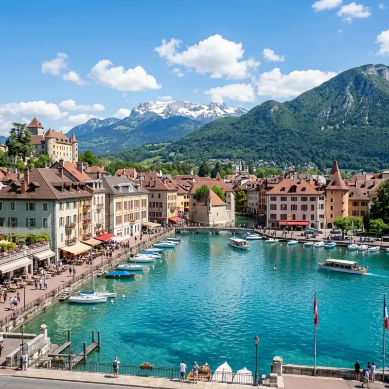
Bem-vindo! Prepare-se para uma #viagem inesquecível pelo coração de #Portugal. Coimbra: Onde a História Canta e a Tradição Vive Eterna Olá, meus caros aventureiros e amantes de viagens! Aqui é o Tiago Silva, e hoje levo-vos numa jornada inesquecível a um dos corações pulsantes de #Portugal, uma cidade que respira séculos de história e onde cada pedra parece sussurrar contos de reis, estudantes e poetas. Estou a falar, claro, de Coimbra, a joia do centro do nosso país, uma cidade que é muito mais do que um ponto no mapa – é uma experiência, um sentimento, uma parte indelével da alma portuguesa. Aninhada na Região Centro, mais especificamente na sub-região de Coimbra (NUT III), esta capital de distrito é um universo em si. O seu município, com os seus 319,40 km², é um mosaico de paisagens e comunidades, lar de cerca de 140.796 almas (dados de 2021), que vivem e respiram a sua essência. Coimbra é uma cidade que se estende e se abraça com os seus vizinhos, limitada a norte pela Mealhada, a leste por Penacova, Vila Nova de Poiares e Miranda do Corvo, a sul por Condeixa-a-Nova, a oeste por Montemor-o-Velho e a noroeste por Cantanhede. Esta localização privilegiada, quase a meio caminho entre as efervescentes cidades de Lisboa e do Porto, confere-lhe uma importância estratégica inegável, funcionando como um nó vital no tecido do nosso país. Mas Coimbra é, acima de tudo, sinónimo de uma identidade que transcende a geografia: é a cidade universitária por excelência. Uma das mais antigas urbes portuguesas, a sua reputação está intrinsecamente ligada ao ensino e à #cultura, um legado que se manifesta em cada esquina, em cada voz de estudante que ecoa pelas suas ruelas. Preparados para desvendar os seus segredos? Então, venham comigo! O Coração Académico: Onde o Saber Ganha Asas Não podemos falar de Coimbra sem nos rendermos à majestade e à gravitas da sua Universidade. A Universidade de Coimbra não é apenas uma instituição de ensino; é um monumento vivo, um guardião do conhecimento e da liberdade. Fundada em 1290, pela visão iluminada de D. Dinis, como o "Estudo Geral Português", a sua história é tão fascinante quanto a própria cidade. Inicialmente, a sua casa foi Lisboa, mas, num vaivém histórico entre as duas cidades, foi em 1537 que Coimbra a acolheu definitivamente, nas pitorescas margens do lendário rio Mondego. E que bom que assim foi! Desde então, a Universidade de Coimbra tem sido um farol, não só para #Portugal, mas para toda a #Europa. É uma das mais antigas universidades do continente e, sem dúvida, uma das maiores e mais influentes do nosso país. A sua população estudantil, que ronda os 37.000 jovens, entre o ensino superior público não politécnico, o politécnico e o privado, injeta uma energia vibrante e uma juventude contagiante na cidade. Coimbra é, por isso, um caldeirão de ideias, de sonhos e de futuro. Mas a influência da Universidade vai muito além das salas de aula. Na história contemporânea, os seus estudantes foram uma força motriz na defesa dos ideais de liberdade e democracia, erguendo a voz e a coragem contra a ditadura do Estado Novo. Esta é uma faceta de Coimbra que me enche de orgulho: uma cidade onde o saber não é apenas acumulado, mas também usado para moldar um futuro mais justo e livre. E o reconhecimento não tardou a chegar. No dia 22 de junho de 2013, a Universidade de Coimbra, juntamente com a sua Alta e a Sofia, foi merecidamente declarada Património Mundial pela UNESCO. Caminhar por estes espaços é sentir a história, é ser parte de um legado que é celebrado em todo o mundo. É uma experiência que recomendo a todos os que procuram uma #viagem com significado e profundidade. Coimbra, Capital do Reino: Berço de Reis e de uma Nação Antes de Lisboa assumir o papel principal, Coimbra deteve a honra de ser a capital do Reino de Portugal, até 1255. Esta é uma cidade que viu nascer reis, que abrigou os alicerces da nossa nação. É nas suas terras que repousa D. Afonso Henriques, o nosso primeiro rei, no sagrado Mosteiro de Santa Cruz – o que foi o primeiro Panteão Nacional do país. Visitar este local é sentir um arrepio na espinha, é estar face a face com o início de tudo, com a bravura e a determinação que forjaram a nossa identidade. As ruas estreitas, os pátios escondidos, as escadinhas sinuosas e os arcos medievais de Coimbra são testemunhas silenciosas de uma história grandiosa. Seis reis da Primeira Dinastia nasceram aqui, entre estas muralhas que contam histórias de glória e de desafios. É uma das cidades mais antigas da Europa, e cada passo que damos é um mergulho num passado que se recusa a ser esquecido. Das Raízes Romanas ao Esplendor Árabe A história de Coimbra é uma tapeçaria rica e complexa, tecida ao longo de milénios. Os Romanos, mestres na arte de edificar cidades, chamaram-na Emínio (Aeminium), erguendo-a majestosamente sobre a colina que domina o rio Mondego. Com o tempo, a sua importância cresceu, e Coimbra tornou-se sede de Diocese, substituindo a vizinha cidade romana de Conímbriga – e é desta última que deriva o seu nome atual, um testemunho da continuidade e da evolução. Depois, em 711, os mouros chegaram à Península Ibérica, e Coimbra transformou-se em Kulūmriyya. Sob o domínio islâmico, floresceu como um vital entreposto comercial, uma ponte entre o norte cristão e o sul árabe, abrigando uma próspera comunidade moçárabe. Imaginar os mercados vibrantes, os sons de diferentes línguas, os aromas exóticos – é viajar no tempo, é sentir a riqueza de uma época de intercâmbio cultural. A Reconquista foi um período de intensas lutas. Coimbra foi tomada por Hermenegildo Guterres em 878, tornando-se capital do Condado de Coimbra, apenas para ser atacada por Almançor em 986 e recuperada para o domínio muçulmano em 987. A cidade só seria definitivamente reconquistada em 1064, durante a campanha das Beiras, por Fernando Magno de Leão, após um longo e extenuante cerco de seis meses, entre 20 de janeiro e 9 de julho. Que resiliência, que espírito de luta estas muralhas testemunharam! Com a reconquista, Coimbra renasceu das cinzas, emergindo como a cidade mais importante a sul do rio Douro, capital de um vasto condado governado pelo moçárabe Sesnando. Em 1094, foi integrada no Condado Portucalense, e o conde D. Henrique e a rainha D. Teresa escolheram-na como sua residência, solidificando o seu estatuto. Apesar de ter sido atacada em 1116 e sitiada em 1117, foi na segurança das suas muralhas que viria a nascer o segundo rei de Portugal, Sancho I, que, em 1131, a elevou a capital do condado, substituindo Guimarães. No século XII, Coimbra já apresentava uma estrutura urbana clara e fascinante: a cidade alta, designada por Alta ou Almedina, era o domínio dos aristocratas, dos clérigos e, mais tarde, dos estudantes; enquanto a Baixa, junto ao rio, fervilhava com o comércio, o artesanato e os bairros populares ribeirinhos. Uma divisão que ainda hoje se sente na atmosfera das suas diferentes zonas. Não posso deixar de mencionar a lendária lealdade do alcaide-mor Martim de Freitas. Nas lutas entre D. Sancho II e o seu irmão, D. Afonso III, Martim de Freitas recusou-se a entregar as chaves do castelo de Coimbra sem antes confirmar a morte de D. Sancho II em Toledo, a quem prestara vassalagem. Só após essa confirmação o castelo foi entregue a Afonso III. Não foi tomado, foi entregue. Uma história de honra e fidelidade que nos fala de um tempo de valores inabaláveis. Desde meados do século XVI, a história da cidade e da Universidade tornaram-se quase indissociáveis, um entrelaçar de destinos que só no século XIX viu Coimbra começar a expandir-se para além dos seus limites históricos, abraçando o futuro sem esquecer o passado. O Abraço do Mondego e a Alma da Cidade Coimbra é acarinhada pelo rio Mondego, um rio que nasce na majestosa Serra da Estrela e a atravessa no sentido Este-Oeste, oferecendo-lhe não só uma beleza cénica inigualável, mas também uma ligação vital à natureza circundante. Passear pelas margens do Mondego, sentir a brisa suave, observar as águas espelhadas que refletem a cidade, é uma experiência de pura serenidade e um lembrete constante da beleza natural que nos rodeia. É um convite à contemplação e ao relaxamento, um refúgio da agitação #portugal #travel #history #europe #cultura Related InsightsPorto: O Berço do Vinho e da Cultura Invicta The Nomad’s Guide to the Golden Circle: Living and Thriving in Iceland’s Volcanic Heart Unveiling the Hidden Gem of Palawan: A Journey Through Time{ "@context": "https://schema.org", "@type": "FAQPage", "mainEntity": [ { "@type": "Question", "name": "What is the main focus of Coimbra: Tradição Académica e História Medieval?", "acceptedAnswer": { "@type": "Answer", "text": "Junte-se a Tiago Silva numa exploração profunda por Coimbra." } }, { "@type": "Question", "name": "Who authored the comprehensive guide on Coimbra: Tradição Académica e História Medieval?", "acceptedAnswer": { "@type": "Answer", "text": "This detailed article and its insights were carefully researched and authored by Tiago Silva." } }, { "@type": "Question", "name": "Where can I find more related content about Travel?", "acceptedAnswer": { "@type": "Answer", "text": "You can explore more articles, detailed reviews, and similar insights by browsing the Related Insights section at the bottom of this article or visiting our dedicated Travel category page." } } ] }


Introduction to the Silent Sentinels As a heritage traveler and documentary filmmaker from Denver, Colorado, I have had the immense privilege of visiting some of the most breathtaking landscapes on our planet. Yet, nothing quite prepares you for the profound sense of isolation and mystery that envelops Rapa Nui, commonly known as Easter Island. Located in the southeastern Pacific Ocean, thousands of miles from the nearest continent, it is a place where ancient stone giants watch over a windswept, volcanic landscape. #WorldHeritage sites like this are not just beautiful places to visit; they are vital cultural sanctuaries that require our utmost respect and protection. When I first set foot on this remote island, the sheer scale and presence of the moai—the monolithic human figures carved by the Rapa Nui people centuries ago—overwhelmed my senses. There are nearly 1,000 of these statues scattered across the island, many clustered on massive stone platforms called ahu. Documenting these iconic figures was a primary goal for my trip, but as always, my lens quickly turned toward the underlying stories: the delicate balance of the island's ecosystem, the looming threat of #ClimateChange, and the ongoing efforts by the indigenous community for #HeritagePreservation. The Art of Documentary Making at the Edge of the World Filming in a location as remote and exposed as Rapa Nui presents a unique set of challenges and opportunities. The constant Pacific winds, the harsh volcanic light, and the immense cultural sensitivity required to work here demand a flexible and deeply respectful approach. My documentary making process always begins with observation. Before setting up a single camera, I spent days walking the ancient trails, listening to the crash of the ocean, and observing how the light interacted with the basalt and tuff stone of the moai. #DocumentaryFilmmaking is as much about cultural immersion as it is about capturing visuals. I rely heavily on natural light to capture the authentic essence of a place. On Rapa Nui, this meant waiting for the golden hours of dawn and dusk when the harsh shadows soften, revealing the intricate carvings on the statues' backs and the solemn expressions on their faces. To capture the true scale of the ahu and the sweeping coastline, I utilized wide-angle lenses. The island has strict regulations regarding filming, requiring indigenous guides and absolute adherence to paths to protect the fragile archaeological context. The soundscape of Rapa Nui is just as important as the visuals. The relentless wind, the pounding surf against the cliffs, the calls of the native seabirds—all these elements build a rich audio tapestry. Using a specialized array of highly directional microphones with heavy wind protection, I spent hours isolating these sounds. #FieldRecording here is a battle against the elements, but the result is a truly immersive experience for the audience. Climate Change and Coastal Heritage One of the most pressing issues I explore in my documentaries is the impact of #ClimateChange on #UNESCOWorldHeritage sites. Rapa Nui is a stark, visual indicator of the threat rising sea levels pose to coastal heritage. Many of the most significant ahu, such as Ahu Tongariki and Ahu Akivi, are located perilously close to the ocean. The island's volcanic rock is porous and highly susceptible to erosion. During my interviews with local archaeologists and conservationists, the concern was palpable. Increased storm intensity and rising sea levels are accelerating the erosion of the cliffs upon which many statues sit. It's a race against time to document and, where possible, stabilize these ancient structures before they are lost to the sea. The threat to Rapa Nui is not just a loss of stone; it is a potential erasure of human history. It's a vivid demonstration that global #ClimateAction must be prioritized to protect vulnerable island communities. The changing climate also threatens the island's already fragile freshwater resources and agricultural viability. My documentary aims to highlight these profound changes. Through dramatic footage of crashing waves near the ahu and interviews with indigenous leaders fighting to protect their ancestral lands, I want to show my audience that #ClimateChange is not a distant threat; it is happening right here, threatening the very foundations of the moai. Heritage Preservation: Balancing Tourism and Conservation Rapa Nui is highly dependent on tourism, attracting thousands of visitors who journey to see the enigmatic statues. While tourism brings vital economic benefits, it also places immense pressure on the island's limited infrastructure and fragile archaeological sites. #HeritagePreservation in the modern era is often a delicate balancing act between allowing people to experience these wonders and protecting them from being loved to death. Navigating the delicate balance between access and conservation is evident across the island. The local Ma'u Henua community, who recently regained administrative control of the national park, has implemented strict rules. Visitors must be accompanied by local guides, and touching or walking on the ahu is strictly forbidden. Yet, issues like waste management and water scarcity on a remote island remain significant challenges. In my film, I feature the dedicated individuals who patrol the sites and educate visitors. Their #Conservation efforts are heroic, ensuring that the legacy of their ancestors remains intact. Education is a cornerstone of effective preservation. By fostering a deeper understanding of the profound cultural significance of the moai, we can encourage visitors to treat the island as an open-air temple rather than an amusement park. My hope is that through visual storytelling, I can inspire a sense of stewardship among my viewers. Indigenous Cultures and Local Connections While Rapa Nui is famous for its statues, the living culture of the indigenous Rapa Nui people is equally compelling. In my #Documentary travels, I always seek to connect with the local communities, as their histories are intricately woven into the landscape. The story of Rapa Nui is often told as an ecological cautionary tale of collapse, but spending time with the community reveals a different narrative: one of incredible resilience and survival. The Rapa Nui possess a deep, generational connection to the land and sea. Their language, traditional music, and the annual Tapati festival are vibrant expressions of a culture that survived near-decimation from disease and slave raids in the 19th century. During my time there, I had the privilege of interviewing elders and young activists. They shared their ongoing struggles for self-determination and their efforts to reclaim their narrative from Western historians. These oral histories are invaluable. They provide context that archaeological data alone cannot. The locals spoke of the moai not as mere statues, but as the living embodiment of their ancestors' mana (spiritual power). By incorporating these voices into my documentary, I aim to provide a holistic view of Rapa Nui. It is not just an archaeological site; it is a living, breathing community whose #CulturalHeritage is the beating heart of the island. The Technical Challenges of Filmmaking on a Remote Island From a technical standpoint, filming on Rapa Nui is a logistical puzzle. The remote location means you must bring everything you need; there are no camera rental houses here. The fine, abrasive volcanic dust gets into every crevice of your gear, and the intense UV radiation can quickly overheat electronics. My equipment kit is heavily optimized for durability. I use custom dust covers for the cameras and meticulously clean lenses every night. The relentless wind is the greatest challenge, both for capturing clean audio and keeping heavy tripods stable on uneven volcanic ground. I relied heavily on heavy-duty sandbags and blimps for my microphones. Additionally, the unpredictable weather patterns mean you must be ready to shoot at a moment's notice. Yet, these challenges force you to be adaptable and often lead to raw, authentic footage that perfectly captures the untamed spirit of the island. Reflecting on the Journey As I boarded the plane to leave Rapa Nui, I felt a profound sense of reverence. As a #DocumentaryMaker, I am tasked with translating the majesty, the fragility, and the complex realities of this place to an audience thousands of miles away. Rapa Nui is a testament to human ingenuity and resilience in the face of extreme isolation. My journey here has reinforced my belief in the power of visual storytelling. Through my lens, I hope to capture not just the silent sentinels of stone, but the vibrant living culture that surrounds them. I want to highlight the dedication of the Ma'u Henua, the wisdom of the elders, and the urgent need for global #ClimateAction to protect this remote outpost of humanity. Rapa Nui is a treasure that belongs to the world, and we must heed its silent warnings. Extended Thoughts on Global Heritage Preservation (A Deep Dive) The following section is part of my ongoing journal series exploring the broader implications of heritage preservation in the 21st century. The concept of #WorldHeritage is relatively modern, formalized by the 1972 UNESCO Convention. The underlying premise is noble: that certain places on Earth are of outstanding universal value to humanity and should be protected for future generations. However, the practical application of this ideal is fraught with complexities. As I travel from site to site, I observe recurring themes and challenges that transcend geographical boundaries. The Paradox of Popularity One of the most significant challenges is the 'paradox of popularity.' When a site receives UNESCO designation, it often experiences a surge in tourism. While this brings economic prosperity to local communities, it also places immense strain on the site itself. In places like Plitvice Lakes, Venice, or Machu Picchu, overtourism threatens the very qualities that made these sites worthy of protection in the first place. The sheer volume of visitors can cause physical degradation, alter local economies, and turn vibrant communities into mere backdrops for tourists. #SustainableTourism is not just a buzzword; it is an urgent necessity. We must rethink how we interact with these spaces, moving away from extractive tourism toward a model of stewardship and respect. Climate Change: The Great Multiplier If overtourism is an acute symptom, #ClimateChange is the chronic underlying disease threatening global heritage. The impacts are diverse and profound. Rising sea levels threaten coastal sites; increasing temperatures exacerbate the decay of ancient structures; shifting weather patterns disrupt fragile ecosystems. As a documentary filmmaker, I see it as my duty to visualize these impacts. Data and statistics can be easily ignored, but the sight of a crumbling monument or a dying coral reef evokes an emotional response. We need to bridge the gap between scientific understanding and public awareness. #ClimateAction is heritage preservation. The two are inextricably linked. If we fail to address the climate crisis, we stand to lose irreplaceable pieces of our shared human history and the natural wonders that define our planet. Amplifying Indigenous Voices Another critical aspect of my work is centering indigenous and local voices in the narrative of heritage preservation. Historically, conservation efforts have often been top-down, driven by Western ideologies that separate 'nature' from 'culture.' This approach frequently marginalizes the very people who have lived in and stewarded these landscapes for millennia. In my documentaries, I strive to challenge this paradigm. True #HeritagePreservation must be inclusive. It must recognize and respect the traditional ecological knowledge of indigenous communities. Their practices, honed over centuries, offer vital lessons in sustainability and resilience. By amplifying their voices, we enrich our understanding of these sites and foster more effective, equitable conservation strategies. The Role of Technology in Preservation While technology has undoubtedly contributed to some of the challenges we face, it also offers powerful tools for preservation. 3D scanning, photogrammetry, and virtual reality allow us to document and reconstruct heritage sites with unprecedented accuracy. This digital archiving is invaluable, providing a record that can survive physical degradation. Furthermore, these technologies offer alternative ways for people to experience these sites, potentially alleviating the pressure of physical tourism. However, we must be cautious. A digital replica can never fully replace the visceral experience of standing in awe before a natural wonder or an ancient ruin. Technology must serve as a tool for preservation, not a substitute for the real thing. The Ethical Filmmaker's Dilemma Finally, I grapple continuously with the ethical implications of my own work. As a #DocumentaryFilmmaker, my very presence alters the dynamic of a place. I am extracting images and stories, shaping them into a narrative for public consumption. Do my films inadvertently contribute to the problem of overtourism? Am I truly capturing the essence of a place, or merely presenting a curated, idealized version? These are difficult questions with no easy answers. I mitigate these concerns through rigorous research, extensive consultation with local stakeholders, and a commitment to authenticity over sensationalism. My goal is not merely to showcase beauty, but to provoke thought, inspire empathy, and catalyze action. A Call to Action The preservation of our world's natural and cultural heritage is not a task for governments and large organizations alone. It requires a collective shift in consciousness. Each of us has a role to play. Whether it's choosing to travel responsibly, supporting conservation organizations, advocating for #ClimateAction, or simply educating ourselves about the diverse cultures and landscapes that make our planet so extraordinary. As I look back on my time at Rapa Nui, the memory of the stone faces staring out to sea remains vivid. It is a memory I carry with me, a constant reminder of the fragile, wondrous world we inhabit. Through my lens, I hope to share a piece of that wonder with you, and in doing so, invite you to join me in the vital work of protecting our shared heritage. Sarah Mitchell is a documentary filmmaker and heritage traveler based in Denver, Colorado. Her work focuses on the intersection of culture, nature, and climate change. Follow her journeys as she explores the world's most extraordinary places, one frame at a time. Technical Gear List for Rapa Nui Shoot:Primary Camera: Canon C300 Mark III for its robust build and internal ND filters, crucial for shifting island light. Lenses: A set of rugged cine primes, specifically utilizing wide focal lengths (14mm, 24mm) to capture the landscape's vastness. Audio: Sound Devices recorder paired with shotgun mics encased in maximum wind protection (Rycote Cyclone). Support: Heavy, sturdy aluminum tripods that won't blow over in the Pacific gales. Protection: Abundant lens cleaning kits, compressed air for dust, and specialized polarized filters to cut through oceanic glare.Travel Logistics and Recommendations: Visiting Rapa Nui is a commitment. Flights are limited and long. Respect the local regulations: you absolutely must hire a local guide to visit the national park sites. This not only protects the archaeology but supports the local economy. Do not touch the moai; the oils from your hands degrade the stone. Try to visit during the Tapati festival in February to witness the incredible living culture, but book well in advance. Remember, you are a guest on someone else's ancestral land. #RapaNui #EasterIsland #Chile #TravelPhotography #ConservationMatters #ProtectOurPlanet #Moai #NatureDocumentary #Storytelling #EcoTourism #SustainableTravel #unesco #documentary #chile #rapanui #archaeology #conservation Related InsightsJapan’s Secret Onsen: 10 Underrated Retreats Where Tradition Meets Serenity The Silk Road's Nomadic Hospitality: Yurt Stays in Kyrgyzstan Roadtrip durch den Schwarzwald{ "@context": "https://schema.org", "@type": "FAQPage", "mainEntity": [ { "@type": "Question", "name": "What is the main focus of The Silent Sentinels: Documenting Rapa Nui?", "acceptedAnswer": { "@type": "Answer", "text": "Exploring the enigmatic moai of Rapa Nui, examining climate change impacts on coastal heritage, indigenous resilience, and the art of documentary filmmaking." } }, { "@type": "Question", "name": "Who authored the comprehensive guide on The Silent Sentinels: Documenting Rapa Nui?", "acceptedAnswer": { "@type": "Answer", "text": "This detailed article and its insights were carefully researched and authored by Sarah Mitchell." } }, { "@type": "Question", "name": "Where can I find more related content about Travel?", "acceptedAnswer": { "@type": "Answer", "text": "You can explore more articles, detailed reviews, and similar insights by browsing the Related Insights section at the bottom of this article or visiting our dedicated Travel category page." } } ] }
Bienvenue! Let us embark on an unforgettable #journey to the heart of #France. The French Riviera, known in French as the Côte d'Azur (French: [kot dazyʁ] ; Provençal: Còsta d'Azur, pronounced [ˈkwɔstɔ daˈzyʀ]; lit. 'Azure Coast'), is the Mediterranean coastline of the southeast corner of #France. There is no official boundary, but it is considered to be the coastal area of the Alpes-Maritimes department, extending from the rock formation Massif de l'Esterel to Menton, at the France–Italy border, although some other sources place the western boundary further west around Saint-Tropez or Toulon. The coast is entirely within the Provence-Alpes-Côte d'Azur region of France. The Principality of Monaco is a semi-enclave within the region, surrounded on three sides by France and fronting the Mediterranean. The French Riviera contains the seaside resorts of Cap-d'Ail, Beaulieu-sur-Mer, Saint-Jean-Cap-Ferrat, Villefranche-sur-Mer, Antibes, Juan-les-Pins, Cannes, and Théoule-sur-Mer. Riviera is an Italian word that originates from the #ancient Ligurian territory of Italy, wedged between the Var and Magra rivers. Côte d'Azur is originally a nickname given by France to the County of Nice after its annexation in 1860, because the climate was similar to that of the north of Italy, even in winter, with "a sky as blue as its sea". When the Mistral (Northwest) and the Tramontane (North) winds are blowing in the Languedoc and Provence areas, the temperature of the Mediterranean can be very cool in summer. This phenomenon is observed very little or not at all on the coast between the French Riviera and the Italian Riviera. This coastline was one of the first modern resort areas. It began as a winter health resort for the British upper class at the end of the 18th century. With the arrival of the railway in the mid-19th century, it became the playground and vacation spot of British, Russian, and other aristocrats, such as Queen Victoria, Tsar Alexander II and King Edward VII, when he was Prince of Wales. In the summer, it also played home to many members of the Rothschild family. In the first half of the 20th century, it was frequented by artists and writers, including Pablo Picasso, Henri Matisse, Francis Bacon, Edith Wharton, Somerset Maugham and Aldous Huxley, as well as wealthy Americans and Europeans. After World War II, it became a popular tourist destination and convention site. Many celebrities, such as Elton John and Brigitte Bardot, have homes in the region. Officially, the French Riviera is home to 163 nationalities with 83,962 foreign residents, although estimates of the number of non-French nationals living in the area are often much higher. Its largest city is Nice, which has a population of 340,017 as of 2017. The city is the centre of a métropole—Nice-Côte d'Azur—bringing together 49 communes and more than 540,000 inhabitants and 943,000 in the urban area. Nice is home to Nice Côte d'Azur Airport, France's third-busiest airport (after Charles de Gaulle Airport and Orly Airport), which is on an area of partially reclaimed coastal land at the western end of the Promenade des Anglais. A second airport at Mandelieu was once the region's commercial airport, but is now mainly used by private and business aircraft. The A8 autoroute runs through the region, as does the old main road generally known as the Route nationale 7 (officially now DN7 in Var and D6007 in Alpes-Maritimes). High-speed trains serve the coastal region and inland to Grasse, with the TGV Sud-Est service reaching Nice-Ville station in five and a half hours from #Paris. The French Riviera has a total population of more than two million. It is home to a high tech and science park (French: technopole) at Sophia-Antipolis (north of Antibes) and a research and technology centre at the University of Nice Sophia Antipolis. The region has 35,000 students, of whom 25 percent are working toward a doctorate. The French Riviera is a major yachting and cruising area with several marinas along its coast. According to the Côte d'Azur Economic Development Agency, each year the Riviera hosts 50 percent of the world's superyacht fleet, with 90 percent of all superyachts visiting the region's coast at least once in their lifetime. As a tourist centre, the French Riviera benefits from 310 to 330 days of sunshine per year, 115 kilometres (71 miles) of coastline and beaches, 18 golf courses, 14 ski resorts and 3,000 restaurants. Etymology Origin of term The term French Riviera comes by analogy with the term Italian Riviera, which extends east of the French Riviera (from Ventimiglia to La Spezia). As early as the 19th century, the British referred to the region as the Riviera or the French Riviera, usually referring to the eastern part of the coast, between Monaco and the Italian border. Riviera is an Italian noun which means "coastline". The name Côte d'Azur was given to the coast by the writer Stéphen Liégeard in his book, La Côte d’azur, published in December 1887. Liégeard was born in Dijon, in the French department of Côte-d'Or, and adapted that name by substituting the azure colour of the Mediterranean for the gold of Côte-d'Or. In Occitan (Niçard and Provençal) and French, the only usual names are Còsta d'Azur in Occitan and Côte d'Azur in French. A term like "French Riviera" (Ribiera Francesa in Occitan, Riviera Française in French) would only be used in literal translation, or adaptations of it. For instance, in French, "Riviera Française" is found in the online Larousse encyclopedia to refer to the holidays of a group of English workers (moreover, in Occitan, the word ribiera "coastline" mostly works as a common name, whereas in French, the old-fashioned term Rivière de Gênes was used to refer to the Italian Riviera whose center is Genoa). Disputes over the extent of the Riviera and the Côte d'Azur Côte d'Azur and the French Riviera have no official boundaries. Some sources put the western boundary at Saint-Tropez. Others include Saint Tropez, Hyères or Toulon in the Var (departement), or as far as Cassis in the Bouches-du-Rhône departement. In her 1955 novel, The Talented Mr. Ripley, Patricia Highsmith describes the Riviera as including all of the coast between Toulon and the Italian border. #history From prehistory to the Bronze Age The region of the French Riviera has been inhabited since prehistoric times. Primitive tools dating to between 1,000,000 and 1,050,000 years ago were discovered in the Grotte du Vallonnet, near Roquebrune-Cap-Martin, with stones and bones of animals, including bovines, rhinoceros, and bison. At Terra Amata (380,000 to 230,000 years ago), near the Nice Port, a fireplace was discovered that is one of the oldest found in Europe. Stone dolmens, monuments from the Bronze Age, can be found near Draguignan, while the Valley of Marvels (Vallée des Merveilles) near Mount Bégo, at 2,000 m (6,600 ft) elevation, is presumed to have been an outdoor religious sanctuary, having over 40,000 drawings of people and animals, dated to about 2000 BC. Greek influence Beginning in the 7th century BC, Greek sailors from Phocaea in Asia Minor began to visit and then build emporia along the Côte d'Azur. Emporia were started at Olbia (Hyères); Antipolis (Antibes) and Nikaia (Nice). These settlements, which traded with the inhabitants of the interior, became rivals of the Etruscans and Phoenicians, who also visited the Côte d'Azur. Roman colonization In 8 BC, the Emperor Augustus built an imposing trophy monument at La Turbie (the Trophy of the Alps or Trophy of Augustus) to mark the pacification of the region. Roman towns, monuments and amphitheatres were built along the Côte d'Azur and many still survive, such as the amphitheatre and baths at Cimiez, above Nice, and the amphitheatre, Roman walls and other remains at Fréjus. Barbarians and Christians Roman Provence reached the height of its power and prosperity during the 2nd and 3rd centuries AD. In the mid-3rd century, Germanic peoples began to invade the region, and Roman power weakened. In the same period, Christianity started to become a powerful force in the region. The first cathedrals were built in the 4th century, and bishoprics were established: in Fréjus at the end of the 4th century, Cimiez and Vence in 439, and Antibes in 442. The oldest Christian structure still in existence on the Côte d'Azur is the baptistery of Fréjus #cathedral, built at the end of the 5th century, which also saw the founding of the first monastery in the region, Lerins Monastery on an island off the coast at Cannes. The fall of the Western Roman #empire in the first half of the 5th century was followed by invasions of Provence by the Visigoths, the Burgundians and the Ostrogoths. There was then a long period of wars and dynastic quarrels, which in turn led to further invasions by the Saracens and the Normans in the 9th century. The Counts of Provence and the House of Grimaldi Some peace was restored to the coast by the establishment in 879 of a new kingdom of Provence, ruled first by the Bosonids dynasty (879–1112), then by the Catalans (1112–1246), and finally by the Angevins (1246–1382, elder branch, 1382–1483 (younger branch). In the 13th century, another powerful political force appeared, the House of Grimaldi. Descended from a Genoese nobleman expelled from Genoa by his rivals in 1271, members of the different branches of the Grimaldis took power in Monaco, Antibes and Nice, and built castles at Grimaud, Cagnes-sur-Mer and Antibes. Albert II, the current Prince of Monaco, is a descendant of the Grimaldis. In 1388, the city of Nice and its surrounding territory, from the mouth of the Var to the Italian border, were separated from Provence and came under the protection of the House of Savoy. The territory was called the Comté de Nice after 1526, and thereafter its language, history and #culture were separate from those of Provence until 1860, when it was re-attached to France under Napoleon III. Provence retained its formal independence until 1480, when the last Comte de Provence, René I of Naples, died and left the Comté to his nephew, Charles du Maine, who in turn left it to Louis XI of France. In 1486, Provence formally became part of France. Popularity with the British upper class in 18th and 19th centuries Until the end of the 18th century, the area later known as the Côte d'Azur was a remote and impoverished region, known mostly for fishing, olive groves and the production of flowers for perfume (manufactured in Grasse). A new phase began when the coast became a fashionable health resort for the British upper class in the late 18th century. The first British traveller to describe its benefits was the novelist Tobias Smollett, who visited Nice in 1763 when it was still an Italian city within the Kingdom of Sardinia. Smollett brought Nice and its warm winter climate to the attention of the British aristocracy with Travels through France and Italy, written in 1765. At about the same time, a Scottish doctor, John Brown, became famous for prescribing what he called climato-therapy, a change in climate, to cure a variety of diseases including tuberculosis, known then as consumption. The French historian Paul Gonnet wrote that, as a result, Nice was filled with "a colony of pale and listless English women and listless sons of nobility near death". In 1834, a British nobleman and politician named Henry Peter Brougham, First Baron Brougham and Vaux, who had played an important part in the abolition of the slave trade, travelled with his unwell daughter to the south of France, intending to go to Italy. A cholera epidemic in Italy forced him to stop at Cannes, where he enjoyed the climate and scenery so much that he bought land and built a villa. He began to spend his winters there and, owing to his fame, others followed: Cannes soon had a small British enclave. Robert Louis Stevenson was a later British visitor who came for his health. In 1882 he rented a villa called La Solitude at Hyères, where he wrote much of A Child's Garden of Verses. Railway, gambling and royalty In 1864, six years after Nice became part of France following the Second Italian War of Independence the first railway was completed, making Nice and the Riviera accessible to visitors from all over Europe. One hundred thousand visitors arrived in 1865. By 1874, residents of foreign enclaves in Nice, most of whom were British, numbered 25,000. In the mid-19th century, British and French entrepreneurs began to see the potential of promoting tourism along the Côte d'Azur. At the time, gambling was illegal in France and Italy. In 1856, the Prince of Monaco, Charles III, began constructing a casino in Monaco, which was called a health spa to avoid criticism by the church. The casino was a failure, but in 1863 the Prince signed an agreement with François Blanc, a French businessman already operating a successful casino at Baden-Baden (southwestern Germany), to build a resort and new casino. Blanc arranged for steamships and carriages to take visitors from Nice to Monaco, and built hotels, gardens and a casino in a place called Spélugues. At the suggestion of his mother, Princess Caroline, Charles III renamed the place Monte Carlo after himself. When the railway reached Monte Carlo in 1870, many thousands of visitors began to arrive and the population of the principality of Monaco doubled. The French Riviera soon became a popular destination for European royalty. Just days after the railway reached Nice in 1864, Tsar Alexander II of Russia visited on a private train, followed soon afterwards by Napoleon III and then Leopold II, the King of the Belgians. Queen Victoria was a frequent visitor. In 1882 she stayed in Menton, and in 1891 spent several weeks at the Grand Hotel at Grasse. In 1892 she stayed at the Hotel Cost-belle in Hyères. In successive years from 1895 to 1899 she stayed in Cimiez in the hills above Nice. First, in 1895 and 1896, she patronised the Grand Hôtel, while in later years she and her staff took over the entire west wing of the Excelsior Hôtel Régina, which had been designed with her needs specifically in mind (part of which later became the home and studio of the renowned artist Henri Matisse). She travelled with an entourage of between sixty and a hundred, including chef, ladies in waiting, dentist, Indian servants, her own bed and her own food. The Prince of Wales was a regular visitor to Cannes, starting in 1872. He frequented the Club Nautique, a private club on the Croisette, the fashionable seafront boulevard of Cannes. He visited there each spring for a two-month period, observing yacht races from shore while the royal yacht, Britannia, was sailed by professional crewmen. After he became King in 1901, he never again visited the French Riviera. By the end of the 19th century the Côte d'Azur began to attract artistic painters, who appreciated the climate, the bright colors and clear light. Among them were Auguste Renoir, who settled in Cagnes-sur-Mer and in Mougins, Henri Matisse and Pablo Picasso. Inter-war period, American visitors and decline of the aristocracy The First World War brought down many of the royal houses of Europe and altered the #nature and the calendar of the French Riviera. Following the war, greater numbers of Americans began arriving, with business moguls and celebrities eventually outnumbering aristocrats. The 'High Society' scene moved from a winter season to a summer season. Americans began coming to the south of France in the 19th century. Henry James set part of his novel The Ambassadors on the Riviera. James Gordon Bennett Jr., the son and heir of the founder of the New York Herald, had a villa in Beaulieu. Industrialist John Pierpont Morgan gambled at Monte Carlo and bought 18th-century paintings by Fragonard in Grasse – shipping them to the Metropolitan Museum in New York. A feature of the French Riviera in the inter-war years was the Train Bleu, an all first-class sleeper train which brought wealthy passengers down from Calais. It made its first trip in 1922, and carried Winston Churchill, Somerset Maugham, and the future King Edward VIII over the years. While Europe was still recovering from the war and the American dollar was strong, American writers and artists started arriving on the Côte d'Azur. Edith Wharton wrote The Age of Innocence (1920) at a villa near Hyères, winning the Pulitzer Prize for the novel (the first woman to do so). Dancer Isadora Duncan frequented Cannes and Nice, but died in 1927 when her scarf caught in a wheel of the Amilcar motor car in which she was a passenger and strangled her. The writer F. Scott Fitzgerald first visited with his wife Zelda in 1924, stopping at Hyères, Cannes and Monte Carlo – eventually staying at Saint-Raphaël, where he wrote much of The Great Gatsby and began Tender Is the Night. While Americans were largely responsible for making summer the high season, a French fashion designer, Coco Chanel, made sunbathing fashionable. She acquired a striking tan during the summer of 1923, and tans then became the fashion in Paris. During the abdication crisis of the British Monarchy in 1936, Wallis Simpson, the intended bride of King Edward VIII, was staying at the Villa Lou Viei in Cannes, talking with the King by telephone each day. After his abdication, the Duke of Windsor (as he became) and his new wife stayed at the Villa La Croë on the Cap d'Antibes. The English playwright and novelist Somerset Maugham also became a resident in 1926, buying the Villa La Mauresque toward the tip of Cap Ferrat, near Nice. Second World War When Germany invaded France in June 1940, the remaining British colony was evacuated to Gibraltar and eventually to Britain. American Jewish groups helped some of the Jewish artists living in the south of France, such as Marc Chagall, to escape to the United States. In August 1942, 600 Jews from Nice were rounded up by French police and sent to Drancy, and eventually to death camps. In all about 5,000 French Jews from Nice perished during the war. Following D-Day in Normandy, Operation Dragoon (initially Operation Anvil), the code name for the Allied invasion of Southern France, commenced on 15 August 1944, when American parachute troops landed near Fréjus, and a fleet landed 60,000 troops of the American Seventh Army and French First Army between Cavalaire and Agay, east of Saint-Raphaël. German resistance was not as fanatical as Hitler and the High Command had ordered, and crumbled in days. Saint-Tropez was badly damaged by German mines at the time of the liberation. The novelist Colette organized an effort to assure the town was rebuilt in its original style. When the war ended, artists Marc Chagall and Pablo Picasso returned to live and work. Post-war period and late 20th century The Cannes Film Festival was launched in September 1946, marking the return of French cinema to world screens. The Festival Palace was built in 1949 on the site of the old Cercle Nautique, where the Prince of Wales had met his mistresses in the late 19th century. The release of the French film Et Dieu… créa la femme (And God Created Woman) in November 1956 was a major event for the Riviera, making an international star of Brigitte Bardot, and making an international tourist destination of Saint-Tropez, particularly for the new class of wealthy international travellers called the jet set. The marriage of American film actress Grace Kelly to Prince Rainier of Monaco on 18 April 1956, attracted world attention once again. It was viewed on television by 30 million people. During the 1960s, the Mayor of Nice, Jacques Médecin, decided to reduce the dependence of the Riviera on ordinary tourism, and to make it a destination for international congresses and conventions. He built the Palais des Congrès at the Acropolis in Nice, and founded a Chagall Museum and a Matisse Museum at Cimiez. At the end of August 1997, Princess Diana and Dodi Fayed spent their last days together on his father's yacht off Pampelonne Beach near Saint-Tropez, shortly before they died in the Alma Tunnel in Paris. Geography Coastal municipalities Places Places on the Côte d'Azur (following the broadest definition), following the coast from south-west to north-east, include: Tourism Some data related to tourism on the Riviera in 2006: More than 14 million tourists 52% of customers from abroad 65 million nights stayed Tourists spending €5 billion 75,000 jobs; tourism is 18% of total employment in the Alpes-Maritimes. 500,000 tourists in the High Country 500,000 delegates 3 million admissions to museums and monuments More than 45% of tourists come by air Climate The French Riviera is mostly subtropical, featuring a Mediterranean climate, with sunny, hot, dry summers and mild winters. Winter temperatures are moderated by the Mediterranean; days of frost are rare. The average daily low temperature in Nice in January is 5.4 °C (41.7 °F); the January average daily low temperature in Toulon is 6.2 °C (43.2 °F). The average high temperature in August in Nice is 28.6 °C (83.5 °F); in Toulon the average daily high temperature is 29.7 °C (85.5 °F) The Côte d'Azur receives more rainfall annually than Paris (803.3 mm (31.63 in) annually in Nice and 684.8 mm (26.96 in) in Toulon compared with 649.8 mm (25.58 in) in Paris), but the rainy days are much less frequent and the Riviera is considerably sunnier; 111 rainy days a year in Paris compared with 61 days in Toulon and 63 in Nice. Rain is generally more common in the Autumn and Winter months while the summers are drier. Toulon has 2,793 hours of sunshine a year, Nice has 2,668 hours. Micro-climates exist in these coastal regions, and there can be great differences in the weather between various locations. Strong winds such as the mistral, a cold dry wind from the northwest or from the east, are another characteristic, particularly in the winter. Nice, in particular is surrounded by mountains to the North, protecting it from the Mistral winds making it feel milder on sunny days. The Sirocco is a southerly wind, coming from the African continent and often felt on the Mediterranean coast of Europe. It is a hot and humid wind, occasionally carrying sand from the Sahara which is then deposited in coastal areas across Southern Europe. The French Riviera is one of the mildest locations in the world for its latitude, owing to the Gulf Stream which moderates the temperatures in Western Europe, particularly in winter and the warming effect of the Mediterranean Sea. Because of this, the region boasts a long growing season and supports the growth of exotic flora such as Citrus Fruits and Palm Trees. Snow is very uncommon in the winters and the long, hot and sunny summers have long been a draw for tourists since the days of British Aristocracy. =### Nice and Alpes-Maritimes= Nice and the Alpes-Maritimes département are sheltered by the Alps. The winds are usually gentle, from the sea to the land, though sometimes the mistral blows strongly from the northwest, or, turned by the mountains, from the east. In 1956 a mistral from the northwest reached 180 kilometres per hour (110 mph) at Nice Airport. Sometimes, in summer, the sirocco brings high temperatures and reddish desert sand from the Sahara (see Winds of Provence). Rain can be torrential, particularly in the autumn, when storms and rain are caused by the difference between the colder air inland and the warm Mediterranean water temperature (20–24 °C [68–75 °F]). The rainiest months are September (75.6 millimetres [2.98 in] average rainfall); October (143.9 millimetres [5.67 in]); November (94.3 millimetres [3.71 in]) and December (87.8 millimetres [3.46 in]). Snow on the coast is rare, falling on average once every ten years. 1956 was exceptional, when 20 cm (7.9 in) blanketed the coast. In January 1985 the coast between Cannes and Menton received 30 to 40 cm (12 to 16 in). In the mountains, snow is present from November to May. =### Var= The département of Var (which includes Saint-Tropez and Hyères) has a climate slightly warmer, drier and sunnier than Nice and Alpes-Maritimes, but is less sheltered from the wind. The mistral, which brings cold and dry air down from the upper Alpine regions via the Rhône valley and extends with diminishing intensity along the Côte d'Azur, blows frequently during the winter. Strong winds blow for about 75 days a year in Fréjus. Events and festivals Several major events take place: Monaco and southeast France: Rallye Automobile Monte-Carlo, January Monaco: International Circus Festival of Monte-Carlo, January / February Mandelieu-la-Napoule: La Fête du Mimosa, February Nice: Carnival, February Menton: Lemon Festival, February Tourrettes-sur-Loup: Violet Festival, March Monaco: Monte-Carlo Masters, April–May Monaco: Formula One Grand Prix race, May Grasse; Rose Festival, May Cannes: Cannes Film Festival and Cannes Film Market, May Nice: Jazz Festival, July Juan-les-Pins: Jazz à Juan, late July. Grasse: Jasmine Festival, August Toulon: Toulon Tournament, Tall Ships' Race IRONMAN 70.3 Races, May Painters The climate and vivid colors of the Mediterranean attracted many famous artists during the 19th and 20th centuries. They included: Pierre Bonnard (1867–1947); retired to and died at Le Cannet. Roger Broders (1883–1953); Parisian #travel poster illustrator. Marc Chagall (1887–1985); lived in Saint-Paul-de-Vence between 1948 and 1985. Henri-Edmond Cross (1856–1910); discovered the Côte d'Azur in 1883, and painted at Monaco and Hyères. Maurice Denis (1870–1943); painted at St. Tropez and Bandol. Raoul Dufy (1877–1953); whose wife was from Nice, painted in the region, including in Nice. Albert Marquet (1873–1947); painted at St. Tropez. Henri Matisse (1869–1954); first visited St. Tropez in 1904. In 1917 he settled in Nice, first at the Hôtel Beau Rivage, then at the Hôtel de la Méditerranée, then at la Villa des Alliés in Cimiez. In 1921 he lived in an apartment in Nice, next to the flower market and overlooking the sea, where he lived until 1938. He then moved to the Hôtel Régina in the hills of Cimiez, above Nice. During World War II he lived in Vence, then returned to Cimiez, where he died and is buried. Claude Monet (1840–1927); visited Menton, Bordighera, Juan-les-Pins, Monte Carlo, Nice, Cannes, Beaulieu and Villefranche, and painted a number of seascapes of Cap Martin, near Menton, and at Cap d'Antibes. Edvard Munch (1863–1944); visited and painted in Nice and Monte Carlo (where he developed a passion for gambling), and rented a villa at Saint-Jean-Cap-Ferrat in 1891. Pablo Picasso (1881–1973); spent each summer from 1919 to 1939 on the Côte d'Azur, and moved there permanently in 1946, first at Vallauris, then at Mougins, where he spent his last years. Auguste Renoir (1841–1919); visited Beaulieu, Grasse, Saint-Raphaël and Cannes, before finally settling in Cagnes-sur-Mer in 1907, where he bought a farm in the hills and built a new house and workshop on the grounds. He continued to paint there until his death in 1919. His house is now a museum. Paul Signac (1863–1935); visited St. Tropez in 1892, and bought a villa, La Hune, at the foot of citadel in 1897. It was at his villa that his friend, Henri Matisse, painted his famous Luxe, Calme et Volupté in 1904. Signac made numerous paintings along the coast. Yves Klein (1928–1962); a native of Nice, considered an important figure in post-war European art. Sacha Sosno (1937–2013); French painter and sculptor who lived and worked in Nice. Writers Many writers have also been inspired by the area, including Death on the Riviera by John Bude, The Garden of Eden by Ernest Hemingway, Imogen by Jilly Cooper, and Swimming Home by Deborah Levy. Bibliography History Henry de Lumley, La Grand Histoire des premiers hommes européens, Odile Jacob, Paris, 2010 (ISBN 978 2 7381 2386 2). Aldo Bastié, Histoire de la Provence, Éditions Ouest-France, 2001. Mary Blume, Côte d'Azur: Inventing the French Riviera, Thames and Hudson, London, 1992. Patrick Howarth, When the Riviera was Ours, Routledge & Kegan Paul, London, 1977. Jim Ring, Riviera, the Rise and Fall of the Côte d'Azur, John Murray Publishers, London, 1988. Edouard Baratier (editor), Histoire de la Provence, Editions Privat, Toulouse, 1969 (ISBN 2 7089 1649 1). Painters La Méditerranée de Courbet à Matisse, catalog of the exhibit at the Grand Palais, Paris from September 2000 to January 2001. Published by the Réunion des musées nationaux, 2000. #france #travel #history #europe #culture Related Insights乌镇:梦回明清的水乡 伏見稲荷大社: 千本鳥居が導く神秘の山 Mud‑Brick Horizons: Documenting the Architectural Soul of Djenné and Timbuktu{ "@context": "https://schema.org", "@type": "FAQPage", "mainEntity": [ { "@type": "Question", "name": "What is the main focus of The Glamour and Secrets of the French Riviera?", "acceptedAnswer": { "@type": "Answer", "text": "Join Camille Dubois on a journey exploring The Glamour and Secrets of the French Riviera and its incredible history." } }, { "@type": "Question", "name": "Who authored the comprehensive guide on The Glamour and Secrets of the French Riviera?", "acceptedAnswer": { "@type": "Answer", "text": "This detailed article and its insights were carefully researched and authored by Camille Dubois." } }, { "@type": "Question", "name": "Where can I find more related content about Travel?", "acceptedAnswer": { "@type": "Answer", "text": "You can explore more articles, detailed reviews, and similar insights by browsing the Related Insights section at the bottom of this article or visiting our dedicated Travel category page." } } ] }
The Great Barrier Reef: A Fragile Underwater Wonder As I descended beneath the crystalline surface of the Coral Sea, the world transformed. The muted sounds of the boat engine above were replaced by the rhythmic crackle of marine life—a symphony of the ocean. This is the Great Barrier Reef, a living structure so massive it can be seen from space, yet so fragile it is currently fighting for its very existence. #WorldHeritage #OceanConservation Stretching over 2,300 kilometers along the northeastern coast of Australia, the Great Barrier Reef is not a single entity but a vast, intricate network of nearly 3,000 individual reefs and 900 islands. It is a masterpiece of biodiversity, a sanctuary for countless species of marine life, and a vital barometer for the health of our planet's oceans. #Nature #GreatBarrierReef A Kaleidoscope of Life My first dive took me to the Agincourt Reef, a ribbon reef situated on the very edge of Australia's continental shelf. Here, the water is extraordinarily clear, offering visibility that can exceed 30 meters. As I floated in the weightless embrace of the ocean, a kaleidoscope of colors unfolded before my eyes. Vibrant corals—staghorn, brain, and plate corals—formed an underwater cityscape. Darting among these living structures were schools of tropical fish in every conceivable hue. I spotted a pair of clownfish defending their anemone home, their bright orange bodies standing out against the swaying, neon-tipped tentacles. #MarineLife #ScubaDiving But the Great Barrier Reef is more than just colorful fish. It is home to six of the world's seven species of marine turtles. During my time here, I had the profound privilege of swimming alongside a massive green sea turtle, its ancient, wise eyes seeming to hold the secrets of the ocean depths. #SeaTurtles #WildlifePhotography The Threat of Climate Change However, the beauty of the Great Barrier Reef is increasingly overshadowed by a looming crisis. As a documentary maker, my lens is trained not just on the splendor, but on the fragility of these UNESCO World Heritage sites. And nowhere is that fragility more apparent than here. Climate change is the single greatest threat to the reef. As global temperatures rise, so do ocean temperatures. When the water gets too warm, corals become stressed and expel the symbiotic algae (zooxanthellae) living in their tissues. These algae provide the corals with their vibrant colors and, more importantly, their primary source of food through photosynthesis. Without them, the corals turn stark white—a phenomenon known as coral bleaching. #ClimateChange #CoralBleaching During my dives, I witnessed the devastating impact of this firsthand. Alongside the vibrant, healthy reefs were patches of skeletal, bleached coral, resembling underwater graveyards. It is a heartbreaking sight, a stark reminder of the urgent need for global action to reduce greenhouse gas emissions. #SaveOurOceans #EnvironmentalAwareness Indigenous Connections The story of the Great Barrier Reef is inextricably linked to the Indigenous peoples of Australia. For over 60,000 years, Aboriginal and Torres Strait Islander communities have been the traditional custodians of this vast seascape. Their connection to the reef is profound, woven into their culture, spirituality, and daily lives. I spent time with traditional owners from the Yirrganydji and Kuku Yalanji language groups, learning about their deep understanding of the marine environment. They shared ancient stories of creation, explaining how the reef and its inhabitants came to be. Their traditional ecological knowledge is increasingly recognized as vital to the ongoing management and conservation of the reef. #IndigenousCulture #TraditionalKnowledge They are also at the forefront of efforts to monitor and protect the reef. Many traditional owners are now working as sea rangers, combining their ancestral wisdom with modern scientific techniques to manage marine resources sustainably. It is a powerful example of how Indigenous leadership can guide us towards a more harmonious relationship with the natural world. #ConservationLeadership #CommunityAction A Call to Action Leaving the Great Barrier Reef, I carried with me a profound sense of both awe and urgency. This extraordinary ecosystem is a testament to the resilience and beauty of the natural world, but it is also a fragile treasure that is teetering on the brink. As a traveler and a storyteller, I believe we have a responsibility to not just witness these wonders, but to actively protect them. The fate of the Great Barrier Reef is not sealed. By supporting sustainable tourism, advocating for strong climate action, and elevating the voices of Indigenous custodians, we can help ensure that this underwater wonderland continues to thrive for generations to come. #SustainableTravel #ActionForClimate The Great Barrier Reef is not just an Australian treasure; it is a global heritage. Its survival depends on the choices we make today. Let us choose to protect the fragile beauty of our blue planet. #ProtectOurOceans #DocumentaryFilmmaking (Note: As a dedicated documentary filmmaker, I continue to document these locations to preserve their memory, but nothing compares to saving them in reality.) #unesco #documentary #ocean #australia Related Insights姫路城: 白鷺が舞い降りた名城 The Shimmering Waters: Documenting Plitvice Lakes National Park Jalid ibn al-Walid: La Espada de Dios{ "@context": "https://schema.org", "@type": "FAQPage", "mainEntity": [ { "@type": "Question", "name": "What is the main focus of The Great Barrier Reef: A Fragile Underwater Wonder?", "acceptedAnswer": { "@type": "Answer", "text": "Exploring the fragile beauty and climate challenges facing Australia's Great Barrier Reef." } }, { "@type": "Question", "name": "Who authored the comprehensive guide on The Great Barrier Reef: A Fragile Underwater Wonder?", "acceptedAnswer": { "@type": "Answer", "text": "This detailed article and its insights were carefully researched and authored by Sarah Mitchell." } }, { "@type": "Question", "name": "Where can I find more related content about Travel?", "acceptedAnswer": { "@type": "Answer", "text": "You can explore more articles, detailed reviews, and similar insights by browsing the Related Insights section at the bottom of this article or visiting our dedicated Travel category page." } } ] }
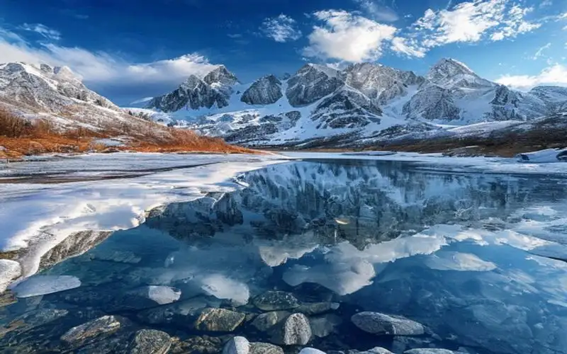

Алтай — это горный край на стыке Сибири и Центральной Азии, место, где Россия граничит с Монголией, Китаем и Казахстаном. Алтайские горы, которые часто называют «Русским Тибетом» или «Золотыми горами», представляют собой край нетронутой природы, кристально чистых рек, бурных водопадов и мистических мест силы. В 1998 году этот регион был включен в список Всемирного наследия ЮНЕСКО. Природные сокровища и Чуйский тракт Высшей точкой Алтая является величественная гора Белуха (4506 метров), состоящая из двух пиков. Для многих местных жителей и последователей эзотерических учений она считается священной, вратами в легендарную Шамбалу. С ледников Белухи берет свое начало Катунь — главная артерия Горного Алтая, река потрясающего бирюзового цвета, которая особенно ярко выглядит осенью. Путешествие по Алтаю неразрывно связано с Чуйским трактом — одной из самых красивых автомобильных дорог в мире по версии National Geographic. Трасса, исторически служившая торговым путем в Монголию, пролегает через живописные перевалы (Семинский и Чике-Таман), вдоль скалистых ущелий и горных степей. Вдоль тракта можно найти древние петроглифы урочища Калбак-Таш и знаменитые Пазырыкские курганы — захоронения скифских вождей, в вечной мерзлоте которых сохранились уникальные артефакты, включая мумию знаменитой «Алтайской принцессы». Шаманизм и дары алтайской природы Алтай — это земля сильных традиций шаманизма и уникального горлового пения (кай). Местные жители глубоко чтят духов гор, рек и перевалов, привязывая белые ленточки (дьялама) на ветви деревьев у святых источников на удачу. Алтай славится своими экологически чистыми продуктами. Главный гастрономический бренд региона — знаменитый алтайский мед, собранный с альпийских лугов. Очень ценятся кедровые орехи, собранные в густой тайге, и травяные чаи из эндемичных растений. В меню местных кафе стоит поискать блюда из мяса марала (благородного оленя), а также традиционный алтайский сыр курут — твердый и солоноватый, который идеально подходит для долгих походов. Поездка на Алтай — это перезагрузка для души и тела, возможность прикоснуться к первозданной мощи природы и почувствовать дыхание древности. #алтай #горныйалтай #чуйскийтракт #белуха #природароссии #алтайскиймед #путешествия #горы #travel #russia #altai #nature #mountains #russiatravel Related InsightsThe Stone Dreams of Kings: Unveiling the Loire Valley’s Living Tapestry Hidden Gems of Eastern Anatolia Fantasmi sulla Via della Seta: Il richiamo silenzioso delle oasi perdute del Turkmenistan{ "@context": "https://schema.org", "@type": "FAQPage", "mainEntity": [ { "@type": "Question", "name": "What is the main focus of Altai Mountains?", "acceptedAnswer": { "@type": "Answer", "text": "A travel guide to Altai Mountains" } }, { "@type": "Question", "name": "Who authored the comprehensive guide on Altai Mountains?", "acceptedAnswer": { "@type": "Answer", "text": "This detailed article and its insights were carefully researched and authored by Ivan Sokolov." } }, { "@type": "Question", "name": "Where can I find more related content about Travel?", "acceptedAnswer": { "@type": "Answer", "text": "You can explore more articles, detailed reviews, and similar insights by browsing the Related Insights section at the bottom of this article or visiting our dedicated Travel category page." } } ] }
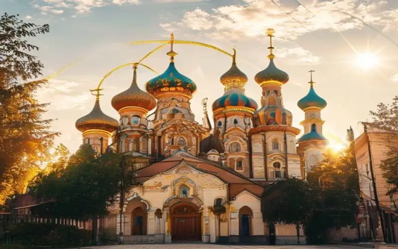
Золотое кольцо России — это знаменитый туристический маршрут, проходящий по древним русским городам, где сохранились уникальные памятники истории и культуры. Эти города, расположенные к северо-востоку от Москвы, являются настоящими сокровищницами древнерусского зодчества, центрами народных ремесел и хранителями вековых традиций. Сам термин «Золотое кольцо» был придуман в 1967 году журналистом Юрием Бычковым. Белокаменное зодчество и духовные центры Классический маршрут включает в себя восемь основных городов: Сергиев Посад, Переславль-Залесский, Ростов Великий, Ярославль, Кострома, Иваново, Суздаль и Владимир. Каждый из них обладает своим неповторимым лицом. Во Владимире восхищают белокаменные шедевры XII века: Успенский собор с фресками Андрея Рублева и Золотые ворота. Суздаль же — это настоящий город-музей под открытым небом, где на небольшой площади расположилось огромное количество церквей, монастырей и старинных деревянных изб, создавая атмосферу ожившей русской сказки. Сергиев Посад знаменит Троице-Сергиевой лаврой — духовным центром русского православия, основанным Сергием Радонежским в XIV веке. В Ростове Великом находится потрясающий кремль, чьи звонницы славятся на весь мир своим мелодичным колокольным звоном. А Ярославль, исторический центр которого внесен в список Всемирного наследия ЮНЕСКО, поражает богатством изразцового декора храмов. Традиции и русская кухня Города Золотого кольца — идеальное место для знакомства с исконной русской кухней. В Суздале обязательно нужно попробовать знаменитую медовуху — древний славянский слабоалкогольный напиток на основе меда, который готовят здесь по десяткам различных рецептов. В местных трактирах подают наваристые щи в хлебном горшочке, пожарские котлеты, блины с икрой и рассыпчатые каши, томленные в настоящей русской печи. Здесь же процветают традиционные ремесла: в Сергиевом Посаде можно купить настоящую матрешку, в Костроме — изделия из льна, а в Ростове — украшения, выполненные в уникальной технике финифти (росписи по эмали). Золотое кольцо позволяет совершить путешествие во времени, прикоснуться к истокам российской государственности и насладиться неспешной красотой русской провинции. #золотоекольцо #суздаль #владимир #ярославль #русскаяархитектура #православие #медовуха #путешествияпороссии #travel #russia #goldenring #history #architecture #russiatravel Related InsightsThe Enigmatic Ruins of Angkor Wat: Beyond the Crowds and Into the Jungle Moscow Red Square Il Faro di Ercole e i Giganti Luminosi Dimenticati dell'Oceano: Un Viaggio Tra i Guardiani Romani dell'Infinito Atlantico{ "@context": "https://schema.org", "@type": "FAQPage", "mainEntity": [ { "@type": "Question", "name": "What is the main focus of Golden Ring Cities?", "acceptedAnswer": { "@type": "Answer", "text": "A travel guide to Golden Ring Cities" } }, { "@type": "Question", "name": "Who authored the comprehensive guide on Golden Ring Cities?", "acceptedAnswer": { "@type": "Answer", "text": "This detailed article and its insights were carefully researched and authored by Ivan Sokolov." } }, { "@type": "Question", "name": "Where can I find more related content about Travel?", "acceptedAnswer": { "@type": "Answer", "text": "You can explore more articles, detailed reviews, and similar insights by browsing the Related Insights section at the bottom of this article or visiting our dedicated Travel category page." } } ] }
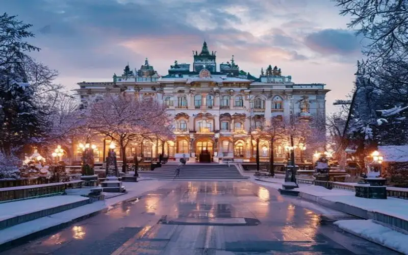
Государственный Эрмитаж в Санкт-Петербурге — один из крупнейших и наиболее значимых художественных и культурно-исторических музеев мира. Его масштабы поражают воображение: чтобы просто обойти все залы и уделить каждому экспонату хотя бы минуту, потребуется несколько лет беспрерывных прогулок. История создания и величие Зимнего дворца История Эрмитажа берет свое начало в 1764 году, когда императрица Екатерина Великая приобрела коллекцию из 225 картин у берлинского купца Иоганна Эрнста Гоцковского. Изначально это было закрытое собрание, размещенное в специальных апартаментах дворца — «эрмитаже» (от французского ermitage — место уединения). Однако со временем коллекция разрослась до невероятных размеров. В 1852 году музей был открыт для широкой публики. Главное здание музейного комплекса — Зимний дворец, бывшая парадная резиденция российских императоров. Роскошь интерьеров, созданных гением Бартоломео Растрелли и других выдающихся архитекторов, завораживает. Иорданская лестница, сверкающая позолотой и белоснежным мрамором, Малахитовая гостиная и невероятной красоты Павильонный зал с легендарными часами «Павлин» — каждый зал сам по себе является шедевром. Сокровища мирового искусства В коллекциях Эрмитажа хранится более трех миллионов экспонатов. Здесь представлены памятники первобытной культуры, античности, искусства Востока и Западной Европы. Гордостью музея являются полотна таких мастеров, как Леонардо да Винчи, Рафаэль, Тициан, Рембрандт, Рубенс. Особое место занимает собрание французских импрессионистов и постимпрессионистов, выставленное в здании Главного штаба — работы Моне, Ренуара, Сезанна, Ван Гога и Матисса привлекают ценителей искусства со всего мира. Кулинарные традиции Петербурга Посещение Эрмитажа — это не только погружение в искусство, но и отличный повод насладиться атмосферой исторического центра Петербурга. После долгих часов, проведенных среди шедевров живописи, обязательно стоит прогуляться по Невскому проспекту и заглянуть в одну из традиционных пышечных. Знаменитые петербургские пышки, обильно посыпанные сахарной пудрой, в сочетании с горячим бочковым кофе станут идеальным перекусом. А для полноценного обеда стоит выбрать классический бефстроганов — блюдо, изобретенное в Петербурге графом Строгановым, подающееся с нежным картофельным пюре и солеными огурчиками. Эрмитаж — это не просто музей, это настоящая сокровищница человеческого гения, место, где оживает история. #эрмитаж #санктпетербург #музеимира #искусство #живопись #путешествияпороссии #культурнаястолица #travel #russia #stpetersburg #hermitage #museum #russiatravel Related InsightsYellowstone: The Fiery Heart of the American West The Faroe Islands: Where Nordic Wilderness Meets Photographic Magic L'Abbaye de Westminster : Le Cœur Royal de Londres{ "@context": "https://schema.org", "@type": "FAQPage", "mainEntity": [ { "@type": "Question", "name": "What is the main focus of St. Petersburg Hermitage?", "acceptedAnswer": { "@type": "Answer", "text": "A travel guide to St. Petersburg Hermitage" } }, { "@type": "Question", "name": "Who authored the comprehensive guide on St. Petersburg Hermitage?", "acceptedAnswer": { "@type": "Answer", "text": "This detailed article and its insights were carefully researched and authored by Ivan Sokolov." } }, { "@type": "Question", "name": "Where can I find more related content about Travel?", "acceptedAnswer": { "@type": "Answer", "text": "You can explore more articles, detailed reviews, and similar insights by browsing the Related Insights section at the bottom of this article or visiting our dedicated Travel category page." } } ] }
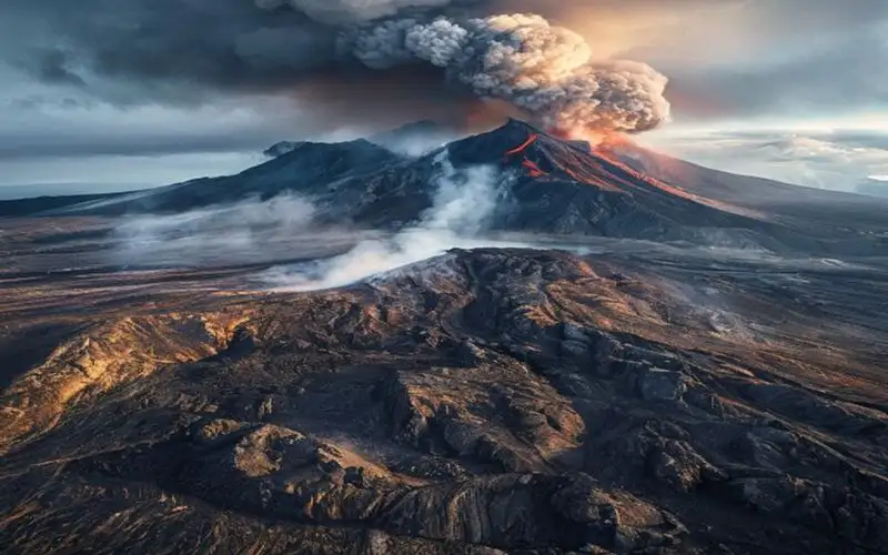
Камчатка — это далекий край на самом востоке России, где природа предстает в своем первозданном, диком и необузданном великолепии. Этот полуостров часто называют «Землей огня и льда», ведь здесь ледники соседствуют с раскаленной лавой, а из недр земли вырываются столбы пара и кипящей воды. Камчатка — это рай для искателей приключений и любителей дикой природы. Царство вулканов и Долина гейзеров Визитной карточкой Камчатки, безусловно, являются вулканы. На полуострове насчитывается более 300 вулканов, из которых около 30 считаются активными. Ключевская Сопка — самый высокий действующий вулкан Евразии, его идеальный конус поднимается на высоту более 4700 метров. Восхождение на вулканы, такие как Авачинский или Мутновский, позволяет заглянуть прямо в кратер, где дымят фумаролы и бурлят кислотные озера. Не менее знаменита Долина гейзеров — одно из крупнейших гейзерных полей в мире и единственное в Евразии. Это уникальное природное явление скрыто в глубоком каньоне, где бьют фонтаны кипятка, пульсируют грязевые котлы и стелются клубы пара. Доступ сюда строго ограничен, и попасть в Долину можно только на вертолете, что делает это приключение еще более эксклюзивным. Хозяева полуострова и богатство океана Камчатка — это медвежий угол в прямом смысле этого слова. Здесь обитает одна из крупнейших популяций бурых медведей в мире. Летом на берегах Курильского озера можно наблюдать уникальное зрелище: десятки медведей собираются на мелководье, чтобы ловить идущего на нерест лосося. Кстати, о рыбе. Камчатская кухня — это настоящий праздник для любителей морепродуктов. Главным деликатесом региона является знаменитый камчатский краб, мясо которого отличается невероятной нежностью и сладковатым вкусом. Также регион славится красной рыбой — неркой, кетой, чавычей — и, конечно же, свежайшей красной икрой-пятиминуткой. Из дикоросов здесь популярна жимолость и папоротник, который местные жители искусно маринуют. Коренные народы полуострова — коряки, ительмены и эвены — бережно хранят свои традиции. На стойбищах можно познакомиться с их бытом, послушать гортанное пение и прокатиться на собачьих упряжках. Камчатка оставляет неизгладимый след в сердце каждого, кто осмелится бросить вызов ее суровой красоте. #камчатка #вулканыкамчатки #долинагейзеров #путешествияпороссии #дикаяприрода #медведи #камчатскийкраб #экотуризм #travel #russia #kamchatka #volcano #nature #russiatravel Related InsightsHidden Gems of Southeast Asia: Where Adventure Meets Unspoiled Beauty in 2026 La Signora di Ferro che Sfidò il Cielo: Storie, Segreti e le Ombre Nascoste della Torre Eiffel La Cathédrale de Séville : Gothique et Héritage Andalou{ "@context": "https://schema.org", "@type": "FAQPage", "mainEntity": [ { "@type": "Question", "name": "What is the main focus of Kamchatka Volcanoes?", "acceptedAnswer": { "@type": "Answer", "text": "A travel guide to Kamchatka Volcanoes" } }, { "@type": "Question", "name": "Who authored the comprehensive guide on Kamchatka Volcanoes?", "acceptedAnswer": { "@type": "Answer", "text": "This detailed article and its insights were carefully researched and authored by Ivan Sokolov." } }, { "@type": "Question", "name": "Where can I find more related content about Travel?", "acceptedAnswer": { "@type": "Answer", "text": "You can explore more articles, detailed reviews, and similar insights by browsing the Related Insights section at the bottom of this article or visiting our dedicated Travel category page." } } ] }
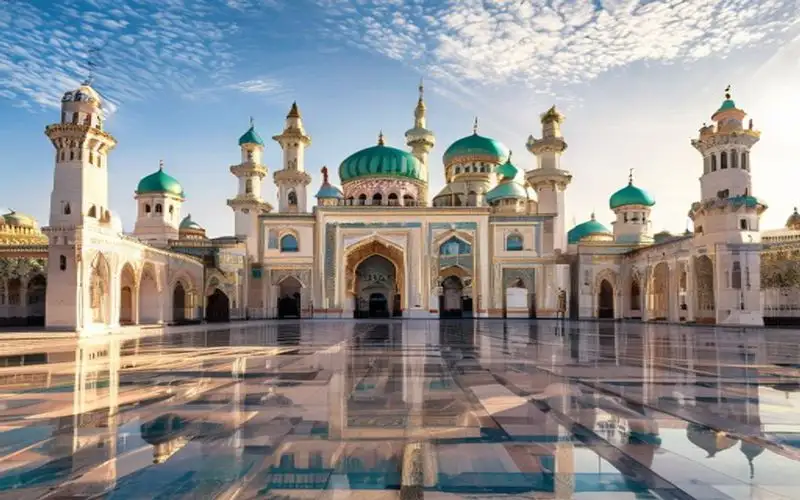
Казань — «Третья столица России» и главный город Республики Татарстан. Это удивительное место, где на протяжении веков мирно сосуществуют и переплетаются русская православная и татарская мусульманская культуры. Казань завораживает своей архитектурой, богатой историей, которая насчитывает более тысячелетия, и невероятным гостеприимством. Жемчужина Татарстана: Казанский Кремль Сердцем города и его главным символом является Казанский Кремль — белокаменная крепость, внесенная в список объектов Всемирного наследия ЮНЕСКО. Это выдающийся архитектурный ансамбль, где в полной мере отражено единение двух культур. Главная мечеть республики — Кул Шариф — поражает своим величием и изяществом. Построенная уже в наше время, она воссоздает образ легендарной мечети, разрушенной во время взятия Казани войсками Ивана Грозного в 1552 году. Буквально в нескольких десятках метров от нее возвышается древний Благовещенский собор — старейший православный храм в комплексе. Еще одна загадка Кремля — падающая башня Сююмбике, овеянная множеством романтических легенд о татарской царице, которая якобы бросилась с нее, чтобы не достаться московскому царю. Прогулки по городу и татарская кухня После изучения Кремля стоит прогуляться по пешеходной улице Баумана — «Казанскому Арбату», где можно послушать уличных музыкантов, увидеть памятник Коту Казанскому и подняться на колокольню Богоявленского собора для лучшего вида на город. Обязательна к посещению и Старо-Татарская слобода с ее яркими деревянными домами и старинными мечетями, сохранившими дух дореволюционной Казани. Особая гордость региона — татарская национальная кухня, которая никого не оставит равнодушным. Обязательно попробуйте эчпочмак — сытный треугольный пирожок с начинкой из мяса, картофеля и лука. Традиционным мясным блюдом является кызылык (сыровяленая колбаса из конины) и наваристый суп токмач с домашней лапшой. На десерт вас ждет знаменитый чак-чак — кусочки обжаренного теста, щедро залитые горячим медом, которые буквально тают во рту. Запивать сладости принято крепким черным чаем с травами. Казань — это яркий пример межкультурного диалога, город, в который хочется возвращаться снова и снова. #казань #казанскийкремль #татарстан #кулшариф #чакчак #эчпочмак #путешествияпороссии #архитектура #travel #russia #kazan #kremlin #architecture #russiatravel Related InsightsAustralia Unveiled: Where Sun-Kissed Shores Meet Ancient Souls and Modern Marvels Whispers of the Tatra: Unveiling the Soul of Poland's Winter Capital, Zakopane Australien: Wo die Ewigkeit des Outbacks auf den Puls der Moderne trifft{ "@context": "https://schema.org", "@type": "FAQPage", "mainEntity": [ { "@type": "Question", "name": "What is the main focus of Kazan Kremlin?", "acceptedAnswer": { "@type": "Answer", "text": "A travel guide to Kazan Kremlin" } }, { "@type": "Question", "name": "Who authored the comprehensive guide on Kazan Kremlin?", "acceptedAnswer": { "@type": "Answer", "text": "This detailed article and its insights were carefully researched and authored by Ivan Sokolov." } }, { "@type": "Question", "name": "Where can I find more related content about Travel?", "acceptedAnswer": { "@type": "Answer", "text": "You can explore more articles, detailed reviews, and similar insights by browsing the Related Insights section at the bottom of this article or visiting our dedicated Travel category page." } } ] }
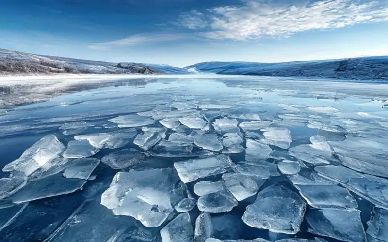
Озеро Байкал — это величайшее чудо природы, расположенное в самом сердце Сибири. Его часто называют «Славным морем» или «Голубым оком Сибири», и эти эпитеты в полной мере отражают величие и красоту этого уникального водоема. Байкал не просто озеро, это рекордсмен во многих отношениях и священное место для местных народов. Природные рекорды и уникальная флора и фауна Байкал является самым глубоким озером на планете — его максимальная глубина достигает 1642 метров. Кроме того, это самое древнее озеро, возраст которого оценивается в 25-35 миллионов лет. В его котловине сосредоточено около 20% всех мировых запасов пресной озерной воды. Вода в Байкале настолько чистая и прозрачная, что в некоторых местах дно можно разглядеть на глубине до 40 метров. Озеро славится своей уникальной экосистемой. Большинство видов растений и животных, обитающих здесь, являются эндемиками, то есть не встречаются больше нигде в мире. Самым известным обитателем Байкала является байкальская нерпа — единственный в мире вид пресноводного тюленя. Эти милые и грациозные животные часто греются на камнях Ушканьих островов. Остров Ольхон и шаманские традиции Сердцем Байкала по праву считается остров Ольхон — самый крупный из островов озера. Ольхон пропитан мистикой и древними легендами. Главная достопримечательность острова — Скала Шаманка (мыс Бурхан), которая является одной из девяти святынь Азии. Издавна это место было центром шаманских обрядов бурятского народа, и сегодня сюда съезжаются паломники и шаманы для проведения ритуалов и общения с духами предков. Гастрономические открытия Прибайкалья Путешествие на Байкал невозможно представить без знакомства с местной кухней, основу которой составляют дары озера и традиционные бурятские блюда. Королем байкальского стола является омуль. Его едят в соленом, вяленом виде, но особенно хорош омуль горячего копчения, который продается прямо на берегу. Не менее популярны и бурятские буузы (или позы) — блюдо, напоминающее крупные манты или хинкали, приготовленное на пару, внутри которого находится рубленное мясо с невероятно вкусным бульоном. Байкал прекрасен в любое время года. Летом он манит прозрачными водами и пляжами, а зимой превращается в царство сверкающего, прозрачного льда, покрытого причудливыми трещинами и метановыми пузырями. #байкал #сибирь #природароссии #ольхон #омуль #путешествияпороссии #глубочайшееозеро #буузы #шаманизм #travel #russia #baikal #lakebaikal #winter #russiatravel Related InsightsThe Twenty Million Dollar View: A History of Humanity's Most Exclusive Destination 喀什:丝绸之路上的明珠与时光交错的古城 La Corse : Éclats de granit et murmures de Méditerranée{ "@context": "https://schema.org", "@type": "FAQPage", "mainEntity": [ { "@type": "Question", "name": "What is the main focus of Lake Baikal?", "acceptedAnswer": { "@type": "Answer", "text": "A travel guide to Lake Baikal" } }, { "@type": "Question", "name": "Who authored the comprehensive guide on Lake Baikal?", "acceptedAnswer": { "@type": "Answer", "text": "This detailed article and its insights were carefully researched and authored by Ivan Sokolov." } }, { "@type": "Question", "name": "Where can I find more related content about Travel?", "acceptedAnswer": { "@type": "Answer", "text": "You can explore more articles, detailed reviews, and similar insights by browsing the Related Insights section at the bottom of this article or visiting our dedicated Travel category page." } } ] }
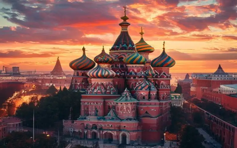
Красная площадь в Москве — это не просто сердце столицы России, это настоящий символ страны, где каждый камень дышит вековой историей. Название «Красная» происходит от древнерусского слова, означающего «красивая», и площадь полностью оправдывает это имя. Расположенная у восточной стены Кремля, она является свидетелем важнейших событий в истории государства на протяжении более чем пяти веков. Архитектурные шедевры Главным украшением площади, несомненно, является Собор Василия Блаженного (Покровский собор), возведенный в XVI веке по приказу Ивана Грозного в честь взятия Казани. Его причудливые, разноцветные купола, напоминающие языки пламени, стали визитной карточкой Москвы. Напротив собора расположен Исторический музей — величественное здание из красного кирпича, хранящее миллионы экспонатов, рассказывающих о богатом прошлом страны. Вдоль кремлевской стены находится Мавзолей В.И. Ленина, усыпальница основателя Советского государства, а за ним — некрополь, где покоятся многие видные государственные деятели. Неотъемлемой частью архитектурного ансамбля является также Спасская башня с ее знаменитыми курантами, бой которых каждый Новый год слушает вся страна. Культурное наследие и гастрономия С восточной стороны Красную площадь замыкает здание Главного универсального магазина (ГУМ). Построенный в конце XIX века в псевдорусском стиле, сегодня ГУМ — это не только элитный торговый центр, но и великолепное место для прогулок под стеклянными сводами. Оказавшись здесь, обязательно стоит попробовать знаменитое советское мороженое в вафельном стаканчике, рецепт которого, кажется, не меняется десятилетиями. После длительной прогулки по брусчатке площади, стоит заглянуть в один из близлежащих ресторанов, чтобы насладиться классической русской кухней. Традиционные блины с красной икрой, горячий борщ со сметаной и расстегаи позволят вам ощутить истинный вкус России. Центр притяжения Красная площадь включена в список Всемирного наследия ЮНЕСКО. Это место, где проходят главные военные парады страны, концерты мировых звезд и грандиозные фестивали. Зимой здесь заливают знаменитый ГУМ-каток и устраивают рождественские ярмарки, превращая площадь в волшебную сказку. Каждый гость столицы, ступая на брусчатку Красной площади, невольно ощущает масштаб и грандиозность российской истории, которая здесь словно застыла в архитектурном великолепии. Это место обязательно к посещению для всех, кто хочет понять русскую душу. #москва #краснаяплощадь #россия #путешествия #историяроссии #архитектура #гум #соборвасилияблаженного #travel #russia #moscow #redsquare #saintbasils #russiatravel Related InsightsL'Odyssée Australienne : Entre Terre Rouge et Récifs d'Azur Unveiling the Land Down Under: A Journey Through Australia's Thriving Tourism Scene Southeast Asia’s Best-Kept Secrets: Uncharted Adventures and Untouched Wonders in 2026{ "@context": "https://schema.org", "@type": "FAQPage", "mainEntity": [ { "@type": "Question", "name": "What is the main focus of Moscow Red Square?", "acceptedAnswer": { "@type": "Answer", "text": "A travel guide to Moscow Red Square" } }, { "@type": "Question", "name": "Who authored the comprehensive guide on Moscow Red Square?", "acceptedAnswer": { "@type": "Answer", "text": "This detailed article and its insights were carefully researched and authored by Ivan Sokolov." } }, { "@type": "Question", "name": "Where can I find more related content about Travel?", "acceptedAnswer": { "@type": "Answer", "text": "You can explore more articles, detailed reviews, and similar insights by browsing the Related Insights section at the bottom of this article or visiting our dedicated Travel category page." } } ] }