Showing Posts From
Adventure travel
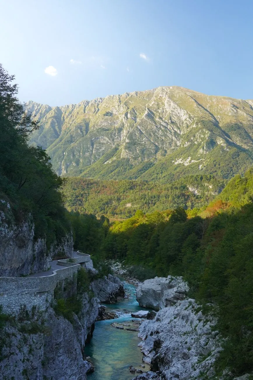
Emerald Waters and Alpine Peaks: The Geography That Fuels Adventure The Soča River, known locally as the “Emerald Beauty,” carves a 138‑kilometre corridor through the Julian Alps before spilling into the Adriatic. Its source lies in the Trenta Valley, where glacial meltwater gathers beneath the towering peaks of Triglav, Slovenia’s highest summit at 2 864 metres. This dramatic elevation drop creates a gradient that fuels world‑class white‑water conditions while simultaneously offering sheer limestone walls perfect for climbing and canyoning. The valley floor sits at roughly 200 metres above sea level, yet within a 30‑kilometre radius you gain more than 2 500 metres of vertical relief — a topographical cocktail that few European destinations can match. Geologically, the river follows a fault line that exposes layers of Triassic limestone and dolomite. These strata produce the river’s signature turquoise hue, a result of suspended rock flour refracting sunlight. The same limestone forms natural arches, caves, and overhangs that have become iconic backdrops for photographers and film crews alike. The valley’s microclimate is equally distinctive: Mediterranean warmth pushes northward along the river, while alpine breezes descend from the peaks, delivering mild summers (average 22 °C) and crisp, snow‑kissed winters that keep the river runnable well into October. Infrastructure has kept pace with nature’s generosity. The main artery, the Goriška cesta (Road 203), threads through Bovec, Kobarid, and Tolmin, linking the valley to Ljubljana in under two hours by car. Regular bus services run year‑round, and the newly upgraded railway stop at Most na Soči offers a low‑carbon alternative for travelers arriving from Italy or Austria. For the adventure‑focused visitor, a network of marked trails — ranging from the gentle Alpe‑Adria Trail to the technical Via Dinarica — connects every major put‑in point, allowing seamless transitions between paddling, hiking, and cycling without ever leaving the valley’s embrace.White‑Water Mastery: Kayaking, Rafting, and Canyoning on the Soča The Soča’s reputation as a paddling mecca rests on a spectrum of rapids graded from Class II to Class V, all within a single day’s reach. The upper reaches near Trenta serve up gentle, meandering currents ideal for beginners and family rafting trips. Guided half‑day tours typically start at the “Kluže” put‑in, where the river widens into a series of playful wave trains that teach fundamental boat control without overwhelming novices. Certified instructors from the Slovenian Rafting Association (SRA) maintain a 1:6 guide‑to‑guest ratio, ensuring safety standards that meet International Rafting Federation (IRF) guidelines. Mid‑valley, the “Bovec‑Kobarid” stretch escalates to solid Class III‑IV rapids such as “Koritnica” and “Soca Gorge.” Here, experienced kayakers test their eddy‑turn precision against limestone slots that demand millisecond timing. The annual Soča Extreme Kayak Race, held each July, draws elite paddlers from across the continent to negotiate a 5‑kilometre course that includes the notorious “Mala Koritnica” — a 4‑metre drop into a churning cauldron. Spectators line the riverbanks, and live‑streamed footage showcases the valley’s raw power to a global audience. Canyoning adds a vertical dimension to the aquatic playground. The “Šunik” and “Kozjak” canyons, both accessible from the village of Šunik, feature cascading waterfalls up to 30 metres, natural slides, and deep pools that invite controlled jumps. Local outfitters provide full‑gear packages (wetsuit, helmet, harness) and conduct mandatory safety briefings that cover rope‑work, swift‑water rescue, and environmental stewardship. The Slovenian Alpine Club (PZS) monitors canyon conditions daily, publishing real‑time flow rates on their website so adventurers can match their skill level to the day’s hydraulics.Sky‑High Perspectives: Paragliding and Mountain Biking Trails When the river’s roar fades, the valley’s ridgelines beckon. Paragliding launch sites at “Mangart” (2 300 m) and “Krn” (2 200 m) exploit reliable thermals that rise from the sun‑warmed valley floor. The Slovenian Paragliding Association (SPA) certifies over 30 tandem pilots who operate under EASA‑compliant regulations, offering 20‑minute flights that trace the river’s serpentine path from a bird’s‑eye view. On clear days, pilots can spot the Adriatic coastline 70 kilometres away, a visual reminder of the valley’s geographic reach. Mountain biking has exploded in popularity since the 2022 “Soča Trail” project, which stitched together 120 kilometres of singletrack, forest roads, and alpine meadows into a graded network. The “Red Loop” (difficult) climbs 1 200 metres over 35 kilometres, rewarding riders with technical rock gardens and panoramic vistas of the Triglav National Park. The “Blue Loop” (moderate) follows the river’s left bank, linking historic World War I sites such as the Kobarid Museum with quiet hamlets where locals serve homemade štruklji. Bike‑rental hubs in Bovec and Kobarid stock full‑suspension e‑MTBs, allowing riders of varying fitness to tackle the same terrain. Trail maintenance is a community effort. The “Friends of the Soča Trails” volunteer group conducts monthly clean‑ups, erosion control, and signage updates, funded partly by a €2 per‑day trail pass that contributes directly to the Triglav National Park’s conservation budget. This model ensures that the surge in two‑wheel traffic does not degrade the fragile alpine flora — edelweiss, alpine rose, and the endemic Soča trout’s spawning grounds.Cultural Roots and Culinary Fuel: From Trenta to Bovec Adventure in the Soča Valley is inseparable from its human story. The valley witnessed the brutal Isonzo Front of World War I, where over a million soldiers clashed among the same limestone cliffs that now host via ferrata routes. The Kobarid Museum, a UNESCO‑recognized site, presents a balanced narrative through artifacts, personal letters, and interactive maps, reminding visitors that the river’s turquoise flow once ran red. Guided “History Hikes” combine moderate trekking with storytelling, linking former trench lines to present‑day climbing crags. Gastronomy here is a direct reflection of the terrain. Alpine dairy farms produce “Tolminc” cheese, a protected designation of origin (PDO) product aged in mountain huts for at least 60 days. The cheese’s nutty, slightly piquant profile pairs perfectly with “žganci” — buckwheat porridge — served alongside locally foraged mushrooms and smoked pork “kranjska klobasa.” River‑front restaurants in Bovec specialize in “Soča trout” (Salmo trutta marmoratus), grilled over beech wood and drizzled with pumpkin seed oil, a regional specialty pressed from Styrian pumpkins. Wine lovers find a surprising ally in the “Goriška Brda” hills, just 30 kilometres south, where the microclimate nurtures Rebula (Ribolla Gialla) and Pinot Noir. Many valley guesthouses offer cellar tours, allowing guests to taste vintages that echo the same limestone soils that color the river. The annual “Soča Gourmet Festival” in late September showcases farm‑to‑table menus, cooking workshops, and a “Cheese & Wine Pairing” competition judged by Slovenian Master Sommeliers. Living the Nomad Dream: Visas, Costs, and Connectivity in the Valley Slovenia’s digital‑nomad permit, introduced in 2023, has turned the Soča Valley into a viable long‑term base for remote professionals. The permit requires proof of a monthly net income of at least €3 200 — roughly twice the national average net salary — and a clean criminal record. Once granted, the visa allows a stay of up to 12 months, renewable if the income threshold remains met. Application fees total €120, and processing typically concludes within 30 days through the Administrative Unit (Upravna enota) in Nova Gorica. Connectivity is robust: fiber‑optic broadband reaches Bovec, Kobarid, and Tolmin with symmetrical 1 Gbps plans priced around €45 per month. Mobile coverage (4G/5G) blankets the valley, and several coworking spaces — “Basecamp Bovec” and “River Hub Kobarid” — offer day passes (€15) and monthly memberships (€180) that include meeting rooms, high‑speed Wi‑Fi, and community events. Cost‑of‑living data from Numbeo (2024) shows that a single person can expect the following average monthly outlays in the valley:Category Average Monthly Cost (€)Rent (1‑bedroom, centre) 650‑850Utilities (electricity, water, heating) 120‑150Internet (1 Gbps fiber) 45Groceries (local markets) 250‑300Dining out (mid‑range, 2×/week) 180‑220Transport (Related InsightsOne Hundred Years of Solitude Book Review and Summary Jurassic Park Book Review and Summary Beloved Book Review and Summary
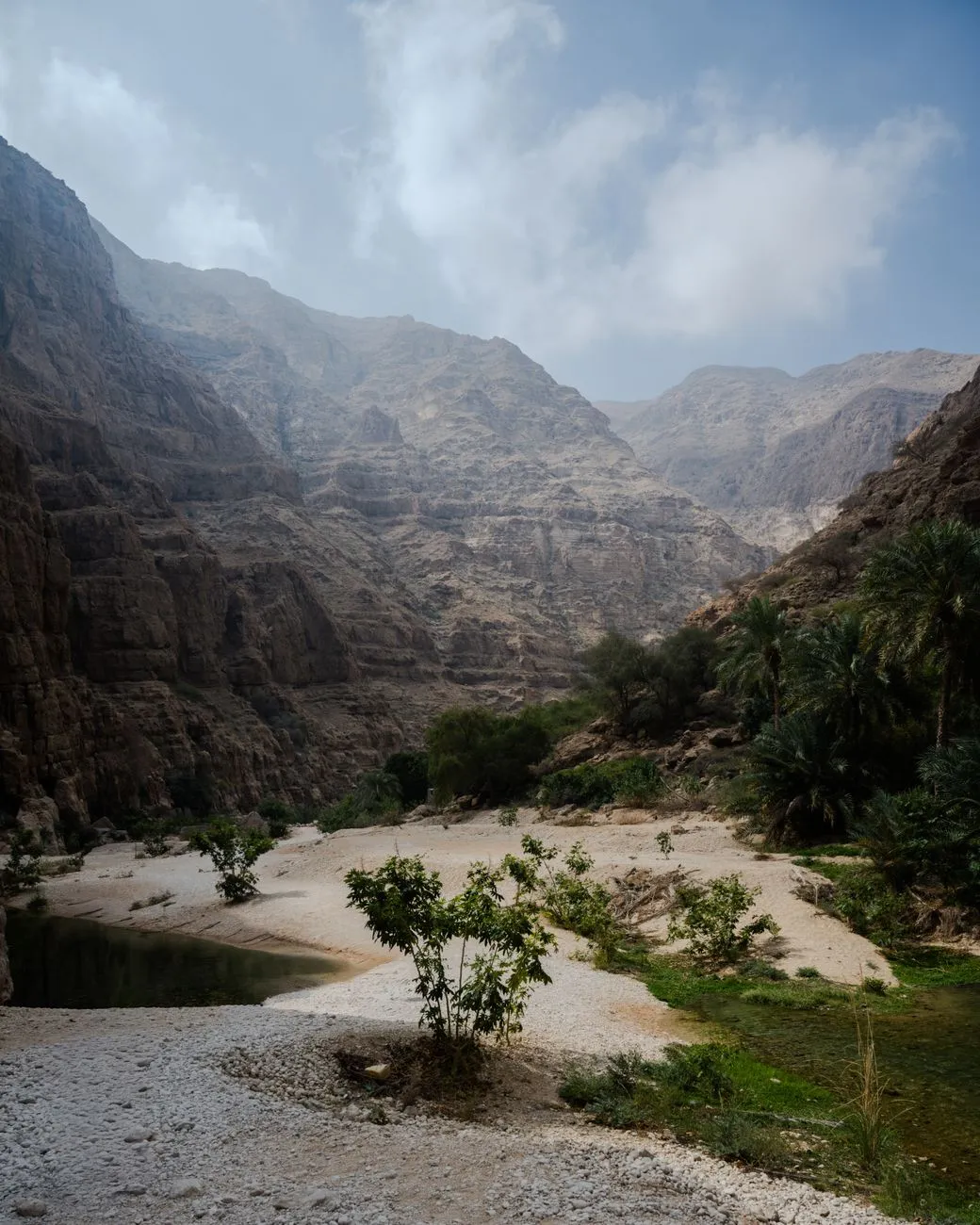
Emerald Veins of the Hajar: The Genesis of Oman’s Wadis The Hajar Mountains rise like a jagged spine across northern Oman, their limestone ribs folded by millennia of tectonic pressure. When winter rains sweep in from the Arabian Sea, they do not simply run off the slopes; they infiltrate fissures, dissolve carbonate rock, and emerge as perennial springs that stitch together a network of wadis — Arabic for “valley” — each a living artery of fresh water. Unlike the seasonal torrents that scar desert basins elsewhere, many Omani wadis retain water year‑round, forming natural pools that shimmer in shades of turquoise, jade, and deep sapphire. Geologically, the process is a textbook example of karst hydrology. Rainwater, slightly acidic from dissolved CO₂, widens fractures into conduits. Over thousands of years these conduits become caves and underground rivers. When the roof of a conduit collapses, a surface pool appears, often framed by sheer cliffs and draped with date palms. The result is a landscape where geology, climate, and biology converge: endemic fish such as Garra barreimiae dart among submerged roots, while the rare Arabian tahr grazes on the upper slopes. Human history has been written in these corridors. Ancient copper traders followed the wadi floors, leaving petroglyphs that still whisper of caravans laden with frankincense. In the 20th century, the British explorer Wilfred Thesiger documented the Bedouin’s intimate knowledge of each pool, noting how they timed migrations to the rhythm of water availability. Today, the wadis remain a cultural touchstone; families picnic under the shade of Ziziphus trees, and children learn to swim in the same basins that sustained their ancestors. For the modern traveller, the wadis offer a rare blend of adventure and accessibility. A 4×4 can reach the mouth of most major wadis, but the most rewarding pools often require a short hike — sometimes a scramble over boulders, sometimes a gentle walk through date‑palm groves. The reward is a plunge into water that stays a constant 24‑26 °C, a natural air‑conditioner in a region where summer highs regularly exceed 45 °C. Understanding the hydrology and heritage of these corridors transforms a simple swim into a dialogue with deep time. As you step into the cool embrace of a wadi pool, you are literally immersing yourself in a system that has filtered rain through limestone for eons, a living museum of Earth’s patient sculpting. Wadi Shab: Where Canyons Meet Crystal Waters If Oman’s wadis were a symphony, Wadi Shab would be its soaring crescendo. Located roughly 150 km southeast of Muscat, the wadi opens onto a narrow coastal plain before funneling into a dramatic gorge. The approach is an experience in itself: a short boat ride across a turquoise inlet deposits you at the trailhead, where the path weaves between towering cliffs and lush vegetation. The first pool greets you within ten minutes — a shallow, sun‑dappled basin perfect for acclimatizing. Continue upstream and the canyon tightens; sheer walls rise 50 m, their faces stained by mineral deposits that paint the rock in ochre and rust. After a 30‑minute trek, the trail opens into a cavernous chamber where a waterfall cascades into a deep, circular pool. Light filters through a natural skylight, turning the water into liquid emerald. This is the “Hidden Pool,” a name earned because the entrance is concealed behind a curtain of vines. Swimming here feels like entering a cathedral. The acoustics amplify the splash of each stroke, and the water’s clarity reveals a sandy bottom dotted with smooth pebbles. Adventurous souls can dive through a submerged tunnel that leads to a second, smaller chamber — a secret grotto where the only sound is the drip of stal Related InsightsObsidian Book Review and Summary „Die Architektur des Geschmacks: Wie Gastronomie zur Wissenschaft der Zivilisation wurde“ Breakfast in Istanbul
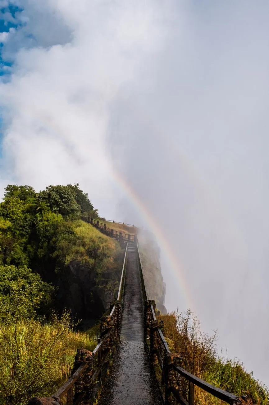

Navigating the Gorge: Mapping the Zambezi’s Hidden Canyons The Zambezi River carves a spectacular series of basalt gorges downstream of Victoria Falls, offering a playground for advanced canyoning that few rivers can match. The Batoka Gorge, stretching roughly 120 kilometres, presents a sequence of narrow slots, towering waterfalls, and deep plunge pools that demand precise navigation and a thorough understanding of the river’s morphology. Before committing to a descent, study the most recent topographic surveys and satellite imagery to identify constriction points where water velocity spikes and where natural anchors — such as exposed basalt columns — can be used for rappels. The guide to Livingstone for digital nomads describes the area as an “adrenaline‑fueled frontier outpost” with a wild river and weak Wi‑Fi, underscoring the remoteness that makes self‑reliance essential. Plot each rappel, swim, and scramble on a waterproof map, marking escape routes to the riverbanks where vehicle access exists. Seasonal flow data, available through the Zambezi River Authority, should dictate whether you target the high‑water window (February–May) for dramatic hydraulics or the low‑water window (June–October) for more technical rock‑work. A detailed itinerary, shared with a trusted contact and logged with the local tourism office, transforms a high‑risk expedition into a managed adventure.Gear Up for the Rapids: Advanced Equipment and Safety Protocols Equipment selection for Zambezi canyoning goes far beyond a standard wetsuit and helmet. The river’s powerful hydraulics and sharp basalt demand a full‑face helmet with a secure chin strap, a 5 mm neoprene drysuit with integrated hood, and a pair of high‑traction canyoning boots featuring sticky rubber soles and reinforced toe caps. A dynamic rope system — 10.5 mm static kernmantle rated for 30 kN — paired with a figure‑8 descender and a backup prusik loop provides redundancy on long rappels that can exceed 30 metres. Carry a compact, waterproof first‑aid kit stocked with trauma shears, a tourniquet, and a SAM splint; the remote nature of the gorge means evacuation can take hours. Communication devices are critical: a satellite messenger (e.g., Garmin inReach) and a VHF marine radio allow contact with the Livingstone rescue coordination centre, which the digital‑nomad guide notes operates with limited but functional infrastructure. Conduct a pre‑trip gear inspection using a checklist that includes rope integrity, carabiner gate function, and battery levels on all electronics. Practice swift‑water rescue drills in a controlled environment before departure; the ability to execute a throw‑bag rescue or a tethered swim can be the difference between a close call and a fatality.Basecamp Livingstone: Digital Nomad Logistics on the Edge Livingstone serves as the logistical hub for any Zambezi canyoning expedition, and the complete guide to Livingstone for digital nomads highlights its dual identity as a tourist gateway and a nascent remote‑work outpost. Accommodation ranges from budget hostels near the railway station to riverside lodges offering reliable power backup — essential for charging satellite devices and laptops. Coworking spaces such as “The Hub” provide high‑speed fibre (when the grid holds) and a community of fellow adventurers who can share real‑time river conditions. The guide warns of “weak Wi‑Fi” in many neighbourhoods, so a local SIM with a data bundle from MTN or Airtel is advisable for backup connectivity. Food costs are modest; a typical meal at a local market stall costs under US $3, while a mid‑range restaurant dinner averages US $12. Transport to the gorge entry points is usually arranged via 4×4 hire (≈US $150 per day) or through a reputable adventure operator who includes shuttle logistics in their package. Safety indices from Numbeo rank Livingstone’s crime level as moderate, with petty theft the primary concern; securing valuables in a lockable locker at your lodge mitigates risk. Establish a daily check‑in routine with your basecamp contact, sharing GPS waypoints and expected return times, to maintain a safety net while you explore the gorge.Reading the River: Hydrology, Seasonal Flows, and Route Selection Understanding Zambezi hydrology is the cornerstone of route selection. The river’s discharge varies dramatically: peak flows can exceed 6,000 m³/s during the rainy season, creating massive standing waves and hydraulic jumps that render many canyon sections impassable. Conversely, the dry season reduces flow to below 500 m³/s, exposing technical rock corridors and allowing longer rappels but also increasing the risk of pin‑point entrapment in narrow slots. The Zambezi River Authority publishes weekly flow bulletins; integrate these into your decision matrix. For advanced teams, the “Devil’s Staircase” — a series of five consecutive waterfalls ranging from 12 to 25 metres — is best tackled at moderate flow (1,500–2,500 m³/s) when the plunge pools are deep enough for safe landings but the water volume still provides a manageable current. Use a handheld flow meter or a calibrated drift‑log to verify on‑site conditions before committing. Map each rapid’s classification (Class III–V) and note the presence of undercut rocks, sieves, and strainers. A flexible itinerary that allows you to bypass or re‑sequence sections based on real‑time observations preserves both safety and the quality of the experience. Cultural Currents: Engaging Local Guides and Conservation Ethics The Zambezi’s gorges are not merely geological features; they are cultural landscapes stewarded by the Tonga and Lozi communities for generations. Engaging a certified local guide from the Livingstone Guides Association adds invaluable knowledge of traditional river lore, hidden anchor points, and seasonal wildlife movements — such as the migration of Nile crocodiles into the gorge during low water. The guide also ensures compliance with the Zambia Wildlife Authority’s permit system, which mandates a conservation fee that funds anti‑poaching patrols and habitat restoration. Practice Leave‑No‑Trace principles rigorously: pack out all waste, avoid disturbing nesting sites of the African fish eagle, and refrain from using soap or detergents in the river. The digital‑nomad guide emphasizes the “wild river, weak Wi‑Fi” ethos, reminding visitors that the environment’s fragility demands a low‑impact footprint. Support community‑based tourism by purchasing handcrafted gear (e.g., woven rope handles) directly from local artisans, thereby injecting economic benefit into the villages that border the gorge. A respectful partnership transforms a technical descent into a shared stewardship experience, preserving the Zambezi’s wild character for future explorers.Category Relative Cost (Numbeo 2024) NotesAccommodation (1‑bed) Low‑Moderate Hostels $10‑$25/night; lodges $60‑$120Meals (local) Low Market meals $2‑$4; restaurants $8‑$15Transport (4×4 hire) Moderate $130‑$170 per day including fuelCoworking Space Low‑Moderate Day pass $10‑$20; monthly $150‑$250Internet (mobile data) Low 10 GB bundle $12‑$18Safety Index Moderate Petty theft common; violent crime rareBeyond the Rapids: Reflections on the Zambezi Journey Emerging from the Batoka Gorge, the roar of the river fades behind you, replaced by the quiet hum of Livingstone’s evening Related InsightsIceland's Golden Circle: Unveiling the Land of Fire and Ice Beyond the Clouds: Unveiling the Eternal Spirit of Georgia’s Caucasus Echoes in Stone: Unearthing Sardinia's Lost Cyclopean Mysteries in the Wild Heart of Barbagia{ "@context": "https://schema.org", "@type": "FAQPage", "mainEntity": [ { "@type": "Question", "name": "What is the main focus of Canyoning the Zambezi: Advanced Adventure Tactics for Remote River Explorations?", "acceptedAnswer": { "@type": "Answer", "text": "Master the technical and logistical demands of canyoning the Zambezi, from gear selection to basecamp strategy in Livingstone." } }, { "@type": "Question", "name": "Who authored the comprehensive guide on Canyoning the Zambezi: Advanced Adventure Tactics for Remote River Explorations?", "acceptedAnswer": { "@type": "Answer", "text": "This detailed article and its insights were carefully researched and authored by Mark Dinn." } }, { "@type": "Question", "name": "Where can I find more related content about Travel?", "acceptedAnswer": { "@type": "Answer", "text": "You can explore more articles, detailed reviews, and similar insights by browsing the Related Insights section at the bottom of this article or visiting our dedicated Travel category page." } } ] }
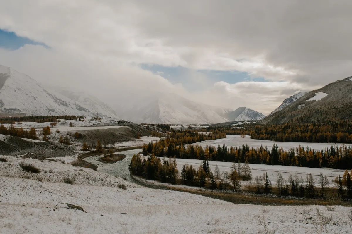
Crossing the Eternal Sky: The Altai Gateway The Altai range rises like a jagged spine between Mongolia, Russia, China, and Kazakhstan, guarding some of the planet’s most pristine pastoral corridors. For centuries, Kazakh eagle hunters and Mongolian herders have moved their flocks along these high valleys, following seasonal water sources that appear only after the summer melt. The gateway to this world is the dusty town of Ölgii, capital of Bayan‑Ölgii Province, where the paved road ends and the real journey begins. From Ölgii, a 4×4 track climbs toward the Tsambagarav massif, crossing the Khovd River at a narrow ford that can swell to a torrent in July. Travelers should time their departure for early June, when the passes are clear of snow but the grass is already tall enough to sustain livestock. Permits are mandatory. The Mongolian Ministry of Environment issues a “Special Protected Area” permit for the Altai Tavan Bogd National Park, while the local soum (district) office requires a “Herders’ Passage” letter signed by the host family. Both documents can be arranged in Ölgii within a day if you present a copy of your passport, a travel itinerary, and a letter of invitation from a registered ger camp. Fuel is scarce beyond the town; carry at least 120 liters of diesel in jerry cans, and verify that your vehicle’s ground clearance exceeds 220 mm to negotiate the rocky riverbeds. Satellite phones are advisable because mobile coverage disappears after the first 30 kilometers. The first night is usually spent at a family‑run ger camp near the Khar‑Us Lake. Here, the host will demonstrate the traditional “khadag” greeting — a blue silk scarf offered with both hands — and serve a bowl of salty milk tea (suutei tsai) alongside boiled mutton. This ritual is more than hospitality; it signals that you are accepted onto the migratory route and may travel with the herd for the next leg. Understanding these customs early prevents cultural missteps that can jeopardize later access to grazing lands. Reading the Wind: Traditional Navigation Techniques Long before GPS, Altai nomads read the landscape like a map written in wind, stone, and animal behavior. The prevailing westerly wind shapes the orientation of yurts, the direction of herd movement, and even the placement of fire pits. A seasoned herder can tell the time of day by the length of the shadow cast by a lone larch on the ridge, and can predict a storm by the sudden silence of marmots. For the modern traveler, learning a handful of these cues adds a safety layer that no satellite can replace. First, identify the “wind corridors” — narrow valleys where the breeze funnels consistently. Herders position their camps at the
-
 Aisha Sharma
 - 20 Sep, 2026 11:46
Whispers of the Taiga: Journey Among Mongolia's Last Reindeer Nomads
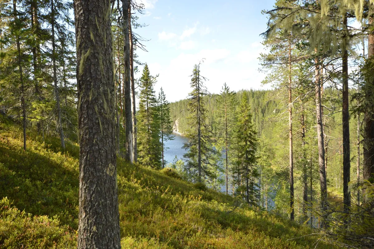
Crossing the Siberian Border into the Taiga The journey begins long before the first hoof prints appear on the mossy floor of the taiga. From Ulaanbaatar, a 12‑hour flight to Mörön followed by a bone‑rattling 4×4 ride across the steppe delivers you to the edge of the Darkhad Valley, where the Siberian frontier looms like a silent guardian. The road dissolves into a narrow track that winds through larch forests, past crystal‑clear rivers that reflect the sky in shades of jade. At the border checkpoint, Mongolian border guards stamp passports with a quiet efficiency that belies the remoteness ahead. Once the checkpoint fades, the landscape shifts dramatically. The steppe’s golden grasses give way to dense coniferous stands, their needles muffling every footfall. The air grows colder, scented with pine resin and damp earth. Reindeer herders — known locally as the Tsaatan or Dukha — have navigated these corridors for centuries, following seasonal pastures that stretch across the Russian‑Mongolian border. Their migration is not a simple north‑south line; it is a lattice of micro‑routes dictated by snow depth, lichen abundance, and the health of the herd. Understanding this geography is essential for any traveler who wishes to move with the herders rather than merely observe them from a distance. Local guides, often former herders themselves, speak a dialect of Tuvan peppered with Mongolian loanwords. They teach you to read the subtle signs: a broken branch indicates a recent passage; a cluster of reindeer droppings marks a favored grazing spot. The first night in a traditional ortz (a conical felt tent) is a lesson in minimalism. A single wood stove provides heat, while reindeer hides serve as both bedding and insulation. The silence is broken only by the soft click of hooves on frozen ground and the distant howl of a wolf pack — reminders that the taiga remains a wild, untamed realm. Morning Milk and Midnight Fires with the Tsaatan Dawn arrives with a pale glow filtering through the larch canopy. The herders rise before the sun, their movements practiced and unhurried. The first task is milking the reindeer — a delicate operation that requires a calm hand and a soft voice. Each animal yields a modest cup of rich, slightly sweet milk, which is immediately transformed into suutei tsai (salted milk tea) or fermented into airag, a mildly alcoholic beverage that fuels long days on the trail. Breakfast is a communal affair. Flatbreads baked on the stove’s hot stones accompany bowls of boiled reindeer meat, seasoned only with salt and wild onions foraged from the forest floor. Conversations flow in a mixture of Tuvan, Mongolian, and Russian, punctuated by laughter and the occasional story of a bear encounter or a sudden blizzard that once forced the herd to shelter in a hidden ravine. The herders’ knowledge of the land is encyclopedic; they can name every lichen species, predict the onset of a snowstorm by the behavior of the birds, and locate the safest river crossings without a map. As the day progresses, the herd moves in a loose formation, guided by the lead bull’s low, resonant calls. Travelers are invited to walk alongside, learning to match the reindeer’s pace — a steady, energy‑conserving gait that can cover 30 kilometres in a day. The terrain is unforgiving: frozen bogs that swallow boots, steep ridges that demand careful footing, and sudden thaw patches that turn solid ground into slush. Yet the herders navigate with an innate GPS built from generations of oral maps. Evening brings the ritual of the fire. A circle of stones encloses a blaze fed by dry larch branches. The herders share stories of the “Eternal Sky” — a spiritual concept that binds the people, the reindeer, and the forest into a single living entity. Songs rise in a haunting pentatonic scale, accompanied by the morin khuur (horsehead fiddle) whose strings vibrate with the same resonance as the taiga wind. For a visitor, these moments are not tourist performances; they are invitations into a worldview where time is measured by seasons, not clocks. Mapping the Ancient Migration Corridors The Tsaatan’s migration routes are not static lines on a map; they are living arteries that shift with climate, policy, and the health of the reindeer. Historical records from Russian explorers in the 19th century describe a network of summer pastures near the Shishged River and winter camps deep in the Sayan foothills. Modern GPS tracking, conducted in collaboration with the Mongolian Academy of Sciences, reveals that the herders now travel roughly 1,200 kilometres annually, a distance that has increased by 15 % over the past two decades due to shrinking lichen beds. Key waypoints include the “White Lake” (Tsagaan Nuur) where the herd grazes on nutrient‑rich sedges in July, and the “Black Rock Pass” (Khar Uul) that offers shelter from the biting January winds. Each waypoint carries cultural significance: White Lake hosts the annual “Reindeer Festival,” a gathering where families exchange news, arrange marriages, and perform shamanic rites to honor the spirit of the herd. Black Rock Pass is the site of a sacred cairn, built stone by stone by ancestors who believed it guided lost souls back to the tribe. The corridors intersect with protected areas such as the Khövsgöl Lake National Park and the Uvs Nuur Basin, a UNESCO World Heritage site. While conservation laws safeguard biodiversity, they also restrict traditional grazing zones, forcing herders to negotiate permits that can take months to secure. Satellite imagery shows a 12 % reduction in viable lichen cover since 2000, a trend linked to rising temperatures and increased frequency of summer droughts. The herders adapt by extending their stay in higher elevations, where cooler microclimates preserve lichen longer, but this adds physical strain and lengthens the migration. For travelers, understanding these corridors means more than following a trail; it means respecting the temporal rhythm of the land. Guided treks typically allocate 10‑14 days to traverse a single seasonal loop, allowing time for acclimatization, cultural exchange, and the inevitable weather delays. Maps provided by local NGOs highlight water sources, emergency shelters, and zones where photography is prohibited to protect sacred sites. Carrying a lightweight GPS device pre‑loaded with these waypoints is advisable, yet the most reliable navigation remains the herder’s whispered direction: “Follow the ridge where the wind sings.” Practical Logistics: Budgeting Your Taiga Expedition A realistic budget transforms a dream into a feasible plan. The following table summarizes average 2026 costs derived from Numbeo’s Mongolia dataset (crowdsourced from over 1,200 contributors) and on‑ground quotes from licensed tour operators in Mörön. Prices are in USD and reflect a solo traveler joining a small group (4‑6 people) for a 12‑day guided migration experience.Expense Category Low Estimate High Estimate NotesInternational flight (round‑trip to Ulaanbaatar) $850 $1,400 Varies by departure city and seasonDomestic flight Ulaanbaatar → Mörön $180 $250 Operated by Aero Mongolia / Hunnu Air4×4 transfer Mörön → Taiga entry point $120 $180 Shared vehicle, includes driverGuide & herder family fee (12 days) $1,200 $1,600 Covers accommodation, meals, cultural liaisonPermit & park entry fees $70 $110 National park & border zone permitsGear rental (sleeping bag, insulated boots) $90 $130 Optional if you bring own equipmentFood & incidentals (extra snacks, souvenirs) $150 $250 Local markets in MörönTravel insurance (adventure coverage) $120 $200 Must cover high‑altitude, remote evacuationTotal Approximate $2,780 $4,120Prices fluctuate with exchange rates (MNT/USD ≈ 3,450) and fuel surcharges. Early booking (3‑4 months ahead) typically secures the lower band. Beyond the table, hidden costs deserve attention. Satellite phone rental ($15/day) is advisable for emergency communication, as mobile coverage ends at the valley’s edge. A modest tip for the herder family (≈ $50) is customary and directly supports their livelihood. Currency exchange is best done in Ulaanbaatar; ATMs in Mörön dispense MNT but may run dry during peak season. Logistically, the optimal window is late June through early September, when the taiga is snow‑free, rivers are fordable, and the reindeer are in peak condition. Winter expeditions exist but require specialized cold‑weather gear and a higher risk tolerance. Visa‑free entry for up to 30 days applies to citizens of the United States, EU, Canada, Australia, and several Asian nations; others must secure a tourist visa (≈ $50) from a Mongolian consulate. Packing light is a discipline. Essentials include a four‑season sleeping bag rated to –20 °C, merino base layers, a wind‑proof shell, gaiters, and a headlamp with extra batteries. A compact first‑aid kit, water‑purification tablets, and a multi‑tool round out the kit. Remember that every kilogram adds to the vehicle’s fuel consumption on the rough track, so the herders appreciate travelers who respect the weight limit (typically 15 kg per person for personal gear). Preserving a Fragile Heritage in a Changing Climate The Tsaatan’s way of life sits at the intersection of cultural resilience and ecological vulnerability. Climate models for the Sayan‑Altai region project a mean temperature rise of 2.3 °C by 2050,
-
 John Explorer
 - 17 Sep, 2026 20:45
The White Silence Beckons: A Century of Chasing the Antarctic Dream
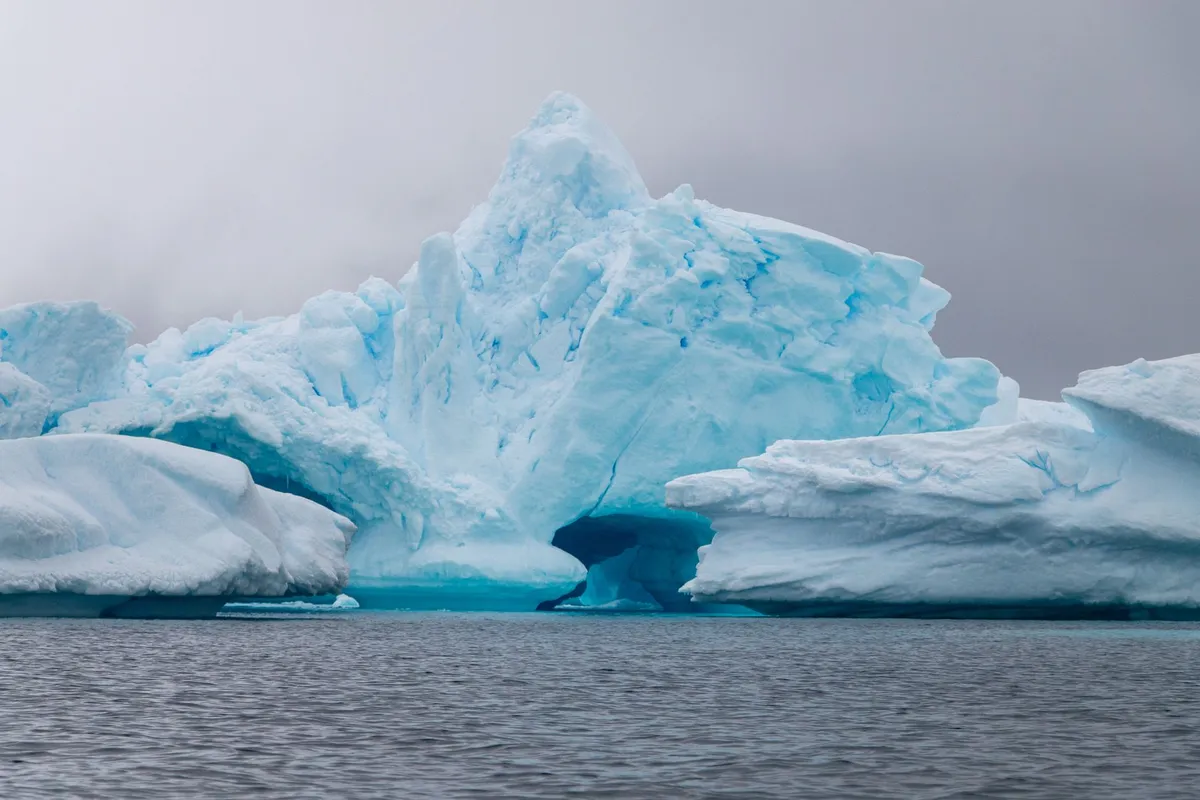
The wind off the Drake Passage doesn’t howl; it screams. It strips the heat from your face and reminds you, with every gust, that you are a guest in a domain that does not negotiate. There is no indigenous population here to welcome you, no ancient cities to explore, no souvenir stalls hawking trinkets. There is only ice—compressed, ancient, blindingly white—and the profound, terrifying silence of a continent that has kept its secrets for millennia. Yet, humanity has been chasing this silence for over a century, evolving from whalers and mail-runners into the modern pilgrims who now number over a hundred thousand a year. This is the story of how we turned the last frontier into a destination, and the fragile price of that access. The Mail Ship and the Pioneer: Birth of an Industry Long before the sleek, ice-strengthened hulls of today’s expedition fleet carved paths through the Bransfield Strait, there was the SS Fleurus. In the 1920s, this Falkland Islands mail ship plied a lonely route to the South Shetland and South Orkney Islands, servicing the grim, oil-stained whaling and sealing stations that dotted the rocky shores. It wasn't built for leisure. But somewhere in the ledgers, a few entries read "tourist tickets"—round-trip passages sold to the curious and the wealthy. These were the very first commercial tourists to Antarctica, accidental pioneers watching the rendering plants boil blubber on Deception Island, unaware they were writing the opening lines of a massive industry. The real shift came decades later, fueled by diplomacy. The 1959 Antarctic Treaty froze territorial claims and dedicated the continent to peace and science. It inadvertently opened the door. By the 1960s, sea tourism began tentatively. Then, in 1969, a visionary named Lars-Eric Lindblad changed everything. He launched the MS Lindblad Explorer, the world’s first purpose-built expedition liner. It wasn't a cruise ship; it was a tool for discovery. Lindblad didn't just sell a ticket; he sold the landing. He introduced the Zodiac (RIB) to polar travel, allowing passengers to step from a rolling sea onto a pebble beach surrounded by penguins. That moment—boots on the ground—defined the modern Antarctic experience.The Modern Armada: Ushuaia, the Polar Code, and the 124,000 Today, the gateway is Ushuaia, Argentina—the "End of the World." From this windswept port, the modern armada departs. The journey across the Drake Passage remains the rite of passage; the "Drake Shake" or "Drake Lake" separates the committed from the curious. Voyages span 10 days to three weeks, with price tags starting around US$6,000 for shared cabins, climbing steeply for suites on luxury ice-breakers. The fleet has ballooned. By 2025, annual cruise visitors hit 124,000, a staggering leap from the 14,762 recorded in the 1999–2000 season and the 37,000 of 2009–2010. Most cluster along the Antarctic Peninsula—the "Banana Belt" where summer temperatures occasionally kiss freezing. But the rules of the road have hardened alongside the growth.The Permit Maze: No country owns Antarctica, so no visas exist. Instead, signatories to the Antarctic Treaty issue permits. An Australian traveler, for example, needs an Environmental Impact Assessment (EIA) approved by the Australian Antarctic Division under the Antarctic Treaty (Environment Protection) Act 1980. The Landing Limits: Ships carrying over 500 passengers cannot land anyone. Those that do land are restricted to 100 people ashore at a time. The Heavy Fuel Ban: In 2009, regulations halted large cruise vessels (some carrying 950+ souls) from operating in Antarctic waters due to their heavy fuel oils—a watershed moment for environmental protection. The Polar Code: The IMO’s International Code for Ships Operating in Polar Waters now mandates a Polar Ship Certificate, ensuring hull strength and survival gear match the latitude.Overseeing this self-regulation is IAATO (International Association of Antarctic Tour Operators). Their members carry the vast majority of visitors, releasing yearly statistics and championing the "leave no trace" ethos. Yet, as of May 2026, their primary concern has shifted from fuel to biology: the spread of avian influenza (H5N1), a microscopic threat hitching a ride on boots and gear, threatening the dense penguin colonies that define the peninsula.Wings Over the White: Triumph, Tragedy, and the Dreamliner While ships crawl, wings once flew. The history of scenic flights is a saga of soaring ambition clipped by catastrophe. It began in February 1977. Air New Zealand launched DC-10s from Auckland, flying 12-hour round trips over Ross Island and McMurdo Sound, often with legends like Sir Edmund Hillary narrating the geography. Qantas followed days later from Sydney, Melbourne, and Perth, flying 747-200Bs over George V Land, Adélie Land, the South Magnetic Pole, and Oates Land. By 1979, Qantas had flown 27 flights, carrying over 7,000 passengers. They didn't land; they just witnessed the scale—a continent larger than the US and Mexico combined, unfolding wingtip to wingtip. Then came November 28, 1979. Air New Zealand Flight TE901. A route planning error, a whiteout, and Mount Erebus. 257 lives lost. The world’s most beautiful flight path became a graveyard. Air New Zealand never returned. Qantas paused for 15 years. But the pull of the ice is persistent. Qantas resumed in 1994 and flies today. The metal has changed—747-400s and now Boeing 787 Dreamliners from Brisbane (a 14.5-hour odyssey). The prices range from $1,000 to $8,000 for a window seat to nowhere and everywhere. There were even earlier Chilean overflights in 1958, ghost flights largely forgotten. Today, Qantas and Antarctica Flights offer the only way to see the Transantarctic Mountains and the Polar Plateau without seasickness, a high-altitude perspective that ships can never provide.The Banana Belt Yachts: Intimacy on the Edge For those who find even 200-passenger ships too crowded, there is the yachting fringe. Since the late 1960s, private vessels have slipped south. David Henry Lewis famously circumnavigated the continent in 1972, a feat of seamanship that reads like fiction. Today, roughly 30 yachts a year nose into the Peninsula’s hidden coves. They leave from Tierra del Fuego, Ushuaia, or Stanley (Falklands) for four-to-six-week voyages. These are not floating hotels; they are walnut shells in a storm. But the reward is solitude. Only smaller vessels are permitted to land their crew. Imagine anchoring in a silent bay, the only sounds the creak of rigging and the blows of humpbacks, skiing a pristine slope where no ship’s wake has ever reached. It is the rawest, most authentic thread of Antarctic tourism, unchanged in spirit since Lewis.Boots on the Ground: Camping, Skiing, and the Pole The ship or the yacht is merely the vehicle. The destination is the landing. Modern itineraries read like adventure menus: camping on the ice under the midnight sun (or the aurora), cross-country skiing across glaciers, mountaineering unclimbed peaks, or the ultimate bucket-list item—a flight to the Geographic South Pole. These land activities have exploded in popularity, driving the recent surge in numbers. But every footfall requires paperwork. The Antarctic Treaty demands permits. Operators must prove they can manage waste, prevent non-native species introduction (boot washing is ritualistic), and conduct emergency evacuations in a place where the nearest hospital is days away. You don't just visit Antarctica; you negotiate entry with the environment itself.The Ross Sea and the Far Side: The Other Antarctica Most tourists never see the other half of the continent. The Ross Sea and East Antarctica (Commonwealth Bay)—the realm of Scott, Shackleton, and Mawson—are a different world. Accessible only from New Zealand (specifically Heritage Expeditions on the ice-strengthened Heritage Adventurer), these voyages are longer, colder, and vastly more expensive. Here lie the historic huts, frozen in time, where penguins nest under the bunks of the Terra Nova expedition. It is tourism as pilgrimage, a journey to the shrines of the Heroic Age, far from the Peninsula's relative bustle. The Carbon Shadow and the Viral Risk The data tells a clear story: growth is exponential. From the SS Fleurus’ handful of passengers to 124,000 souls a year. Recent academic research flags decarbonisation as the urgent governance priority. Every ship burns fuel; every Dreamliner burns Jet A-1. The carbon footprint of a single Antarctic trip dwarfs the annual emissions of many global citizens. Simultaneously, researchers warn of a new, strange danger: social media emulation. Tourists filming risky stunts—approaching wildlife too closely, sliding down unstable cornices, ignoring guide boundaries—for likes and views. In a place where a sprained ankle becomes a life-threatening evacuation, viral trends are a lethal export. The Fragile Contract Standing on a beach at Neko Harbour, watching a Gentoo penguin steal a pebble from its neighbor, the silence returns. It is broken only by the crack-thunder of a calving glacier—a sound that vibrates in your chest. We are here because the Treaty allowed it, because Lindblad invented the way, because Qantas and Air New Zealand dared the skies, and because 30 yachts a year still brave the Roaring Forties. But the contract is fraying. Avian flu creeps south on the wind and our boots. The ice shelves thin. The carbon we burn to witness the melting accelerates the melt. The "Banana Belt" is warming faster than almost anywhere on Earth. Antarctic tourism is no longer an experiment; it is a massive, regulated, high-stakes industry. It brings witnesses—ambassadors for the ice, arguably. But every ambassador leaves a footprint. The challenge for the next decade isn't just managing numbers or cleaning fuel. It is deciding if we can love this place enough to change how we reach it, before the silence is broken for good.#Ant
Where the Crowds Never Go: The Real Southeast Asia Awaits Southeast Asia has long been a magnet for travelers, but the well-trodden paths of Bali, Bangkok, and Hanoi are only the beginning. In 2026, a new wave of adventurers is uncovering the region’s hidden gems—places where pristine beaches, lush jungles, and vibrant cultures thrive without the tourist hordes. From the misty highlands of northern Laos to the ancient temples of Cambodia’s Siem Reap, these destinations offer something far more authentic than the typical backpacker route. Whether you're a digital nomad chasing reliable Wi-Fi or a thrill-seeker hunting for untouched landscapes, Southeast Asia’s best-kept secrets promise an experience that’s as enriching as it is exhilarating.Siem Reap: Beyond Angkor Wat – A Digital Nomad’s Paradise Emerges For decades, Siem Reap was known solely as the gateway to Angkor Wat, a place where travelers rushed in, snapped photos, and fled. But in 2026, this Cambodian gem has transformed into a digital nomad haven, offering a perfect blend of affordability, culture, and modern convenience. The city’s internet infrastructure has seen a dramatic upgrade, with speeds now ranging from 50 to 80 Mbps in the city center—a far cry from the dial-up days of the past. Coworking spaces like AngkorHub and The Factory provide high-speed connections, ergonomic setups, and networking opportunities, all for a fraction of what you’d pay in Bangkok or Bali. The cost of living is another draw. A digital nomad can comfortably live on $700–$1,100 per month, including rent, food, and coworking fees. A studio apartment in the city center costs around $300–$500, while a meal at a local amok (Cambodian curry) restaurant runs just $3–$5. Even gym memberships and social events are budget-friendly, with most activities costing under $10. The visa situation has also improved, with Cambodia’s Digital Nomad Visa (introduced in 2024) now fully operational. For $290, you get a 12-month visa with the option to extend, making it one of the most straightforward and affordable options in Southeast Asia. But Siem Reap isn’t just about saving money—it’s about immersion. The city’s growth has brought a wave of new cafes, art galleries, and coworking hubs, all while preserving its rich heritage. The Phare Circus, a social enterprise employing at-risk youth, offers evening performances that blend acrobatics with Cambodian folklore. Meanwhile, the Siem Reap Pub Street has evolved beyond its backpacker reputation, now featuring rooftop bars with live music and craft cocktails. For those seeking adventure, day trips to the Tonlé Sap Lake or the Kulen Promtep Wildlife Sanctuary offer kayaking, hiking, and encounters with rare wildlife.Da Nang: Vietnam’s Coastal Secret Where Urban Sophistication Meets Beachside Bliss While Ho Chi Minh City and Hanoi dominate Vietnam’s travel narrative, Da Nang has quietly emerged as the country’s most dynamic coastal destination. In 2026, this city of 1.2 million is a digital nomad hotspot, offering a rare combination of urban amenities, stunning beaches, and affordability. The cost of living for a digital nomad hovers between $700–$1,100 per month, making it one of the most budget-friendly cities in Southeast Asia for those who want a high quality of life. A modern one-bedroom apartment in the An Thuong district costs $400–$600, while a meal at a local seafood restaurant is just $5–$8. Coworking spaces like DNC Coworking Space and The Hive Da Nang provide high-speed internet (up to 100 Mbps), meeting rooms, and networking events for $80–$150 per month. What sets Da Nang apart is its diverse landscape. The city is nestled between the Marble Mountains (a series of limestone hills with caves and pagodas) and My Khe Beach, one of Vietnam’s most pristine stretches of sand. Adventure seekers can surf the consistent waves, paraglide over the coastline, or hike through the Son Tra Peninsula, home to the rare red-shanked douc langur. For culture lovers, the Dragon Bridge—a 656-foot-long steel structure that breathes fire and water on weekends—is a must-see. Meanwhile, the Hoi An Ancient Town (a UNESCO World Heritage Site) is just a 30-minute drive away, offering lantern-lit streets, tailor-made clothing, and riverside dining. The city’s digital nomad community is thriving, with monthly meetups, tech conferences, and beachside coworking sessions. The Da Nang Digital Nomad Visa (introduced in 2025) allows stays of up to 6 months, with an easy extension process. Health insurance is affordable, with plans starting at $30 per month, and the city’s international hospital (Vinmec) provides top-tier medical care. Currency risk is minimal, as Vietnam’s dong remains stable against the dollar, making budgeting straightforward.Chiang Mai: The Northern Thai Enclave Where Tradition and Innovation Collide Chiang Mai has long been a digital nomad favorite, but in 2026, it’s evolved into something even more special—a place where ancient temples, lush mountains, and a burgeoning tech scene coexist. According to Numbeo’s May 2026 data, Chiang Mai is 11.7% pricier than Ho Chi Minh City, but the trade-off is worth it. A digital nomad budget here ranges from $1,000–$1,500 per month, covering rent, food, coworking, and leisure. A modern studio apartment in the Nimmanhaemin Road area costs $500–$800, while a meal at a trendy café runs $4–$7. Coworking spaces like Punspace and CAMP (Creative and Meeting Place) offer high-speed internet (up to 120 Mbps), yoga sessions, and networking events for $100–$200 per month. The city’s digital nomad visa (the Thailand LTR Visa) is one of the most attractive in Southeast Asia. For $1,500–$2,000 per year, you get a 5-year visa, tax benefits, and the ability to work remotely. Health insurance is mandatory but affordable, with plans starting at $50 per month, and Thailand’s Bumrungrad Hospital is one of the best in the region. The currency risk is low, as the Thai baht remains relatively stable against the dollar. But Chiang Mai isn’t just about work—it’s about culture and adventure. The city is surrounded by mountains, waterfalls, and hill tribes, offering endless opportunities for trekking, elephant sanctuaries, and meditation retreats. The Doi Suthep Temple, perched on a mountain overlooking the city, provides breathtaking views and a glimpse into Northern Thai Buddhism. Meanwhile, the Sunday Night Market is a sensory overload of street food, handicrafts, and live music. For those who crave nightlife, the Nimman area is packed with rooftop bars, live music venues, and craft beer pubs.Bali’s Hidden Highlands: Where the Island’s Soul Resides Beyond the Beaten Path Bali is synonymous with beaches and resorts, but in 2026, the island’s hidden highlands are stealing the spotlight. Places like Sidemen, Munduk, and Amed offer a quieter, more authentic experience, where rice terraces, volcanoes, and traditional villages take center stage. The cost of living in these areas is $1,170+ per month for a digital nomad, but the trade-off is unparalleled beauty and tranquility. A villa with a private pool in Sidemen costs $600–$1,000, while a meal at a local warung is just $2–$5. Coworking spaces are sparse, but cafes like Zest Ubud and Seniman Coffee offer reliable Wi-Fi (up to 50 Mbps) for $5–$10 per day. The B211 Digital Nomad Visa (introduced in 2025) allows stays of up to 6 months, with an easy extension process. Health insurance is mandatory but affordable, with plans starting at $40 per month, and Bali’s international hospitals (like BIMC Hospital) provide excellent care. The currency risk is minimal, as the Indonesian rupiah remains stable against the dollar. What makes Bali’s highlands so special is their untouched beauty. The Sidemen Valley is a UNESCO Biosphere Reserve, home to ancient irrigation systems (subak) and volcanic lakes. The Munduk Waterfalls are a series of seven cascading falls, each more stunning than the last. Meanwhile, Amed is a fishing village turned diver’s paradise, with coral reefs, WWII shipwrecks, and black sand beaches. For adventure seekers, Mount Batur offers sunrise hikes, while traditional weaving villages like Tenganan provide a glimpse into Bali’s pre-colonial culture.Bangkok’s Secret Side: The City’s Underrated Neighborhoods and Hidden Adventures Bangkok is often dismissed as a chaotic metropolis, but in 2026, savvy travelers are discovering its hidden neighborhoods—places where local culture, street food, and modern luxury collide. Areas like Ari, Thonglor, and On Nut offer a more authentic experience than the tourist-heavy Khao San Road or Sukhumvit. The cost of living for a digital nomad is $1,000–$1,500 per month, with studio apartments costing $500–$900 and meals at local eateries ranging from $2–$7. Coworking spaces like The Hive Bangkok and WeWork Phrom Phong provide high-speed internet (up to 150 Mbps) and networking events for $120–$200 per month. The Thailand LTR Visa (same as Chiang Mai) is the best option for long-term stays, offering 5 years with tax benefits. Health insurance is mandatory but affordable ($50–$80 per month), and Bangkok’s Bumrungrad Hospital is one of the best in Asia. The currency risk is low, as the Thai baht remains stable. Bangkok’s hidden gems are endless. The Chatuchak Weekend Market (the world’s largest) is a shopper’s paradise, with over 15,000 stalls selling everything from antiques to street food. The Bang Krachao area, known as the "Green Lung of Bangkok," is a car-free zone with cycling paths, mangrove forests, and floating markets. Meanwhile, the Rooftop Cinema Club offers movie screenings with panoramic city views, and the Talad Neon Night Market is a vibrant hub for live music and craft beer.The Ultimate 2026 Southeast Asia Digital Nomad Cost BreakdownCity Monthly Budget (USD) Rent (1BR Apartment) Coworking (Monthly) Meal (Local Restaurant) Visa Cost (Annual) Internet Speed (Mbps)Siem Reap $700–$1,100 $300–$500 $80–$120 $3–$5 $290 50–80Da Nang $700–$1,100 $400–$600 $80–$150 $5–$8 N/A (6-month visa) 80–100Chiang Mai $1,000–$1,500 $500–$800 $100–$200 $4–$7 $1,500–$2,000 100–120Bali (Highlands) $1,170+ $600–$1,000 $5–$10 (daily) $2–$5 $35–$50 (monthly) 30–50Bangkok $1,000–$1,500 $500–$900 $120–$200 $2–$7 $1,500–$2,000 120–150Costs are approximate and based on 2026 data. Visa costs are for digital nomad-specific visas.Why 2026 is the Year to Explore Southeast Asia’s Hidden Gems Southeast Asia in 2026 is not the same as it was in 2016. The region has evolved, with better infrastructure, more digital nomad-friendly policies, and a growing appreciation for sustainable tourism. Places like Siem Reap, Da Nang, and Bali’s highlands offer something that the overcrowded hotspots can’t—authenticity, affordability, and adventure. For digital nomads, the cost of living is still a fraction of what you’d pay in Europe or North America, while the quality of life is often higher. The internet speeds are improving, the visa options are expanding, and the communities are thriving. Whether you’re hiking through Cambodia’s jungles, surfing Vietnam’s coastlines, or meditating in Thailand’s mountains, Southeast Asia’s hidden gems promise an experience that’s as rewarding as it is unforgettable. The question isn’t why you should visit these places—it’s when you’ll book your ticket.#DigitalNomadLife #HiddenGems #SoutheastAsia2026 #AdventureAwaits #TravelSmart Related InsightsMétéora : L'Ascension Mystique entre Ciel et Pierre Crossing the Roof of the World: Karakoram Highway Road Trip – Part 02: The Khunjerab Border Ethiopia’s Danakil Depression: A Journey to Earth’s Hottest and Most Alien Landscape{ "@context": "https://schema.org", "@type": "FAQPage", "mainEntity": [ { "@type": "Question", "name": "What is the main focus of Southeast Asia’s Best-Kept Secrets: Uncharted Adventures and Untouched Wonders in 2026?", "acceptedAnswer": { "@type": "Answer", "text": "Discover the most breathtaking and underrated destinations in Southeast Asia for 2026, where adventure meets untouched beauty and digital nomads thrive without breaking the bank." } }, { "@type": "Question", "name": "Who authored the comprehensive guide on Southeast Asia’s Best-Kept Secrets: Uncharted Adventures and Untouched Wonders in 2026?", "acceptedAnswer": { "@type": "Answer", "text": "This detailed article and its insights were carefully researched and authored by Mark Dinn." } }, { "@type": "Question", "name": "Where can I find more related content about Travel?", "acceptedAnswer": { "@type": "Answer", "text": "You can explore more articles, detailed reviews, and similar insights by browsing the Related Insights section at the bottom of this article or visiting our dedicated Travel category page." } } ] }

- Aisha Sharma
- 15 Aug, 2026 19:00
Whispers on Wheels: The World’s Most Enchanting Train Journeys for Love and Adventure
Where the Tracks Weave Magic: The Allure of Romantic Train Travel There’s something inherently poetic about train journeys—an unhurried rhythm that syncs with the heartbeat of the landscape passing by. Unlike the fleeting rush of air travel, trains invite you to savor the moment, to watch the world unfurl like a living painting. For couples, these journeys become more than just travel; they transform into shared memories etched in time. Whether it’s the golden hues of the Swiss Alps, the emerald valleys of India, or the rugged coastlines of Canada, the world’s most romantic train routes offer more than just transportation—they offer a passage into a dream. From the opulent carriages of the Orient Express to the rustic charm of the Canadian Rockies’ Rocky Mountaineer, each journey tells a story. These trains are not just about reaching a destination; they’re about the journey itself—the clatter of wheels on tracks, the hum of conversation, the panoramic windows framing nature’s masterpieces. In this guide, we’ll explore the most enchanting train journeys across continents, each chosen for its ability to ignite romance, adventure, and a sense of wonder.The Golden Arrow to the Alps: Switzerland’s Glacier Express Switzerland is a country that seems tailor-made for romance, and the Glacier Express is its crown jewel. This 8-hour journey from Zermatt to St. Moritz is not just a train ride; it’s a symphony of alpine beauty. The route winds through 91 tunnels, across 291 bridges, and over the Landwasser Viaduct—a UNESCO-listed marvel that arches like a dragon’s spine over a deep gorge. For couples, the Glacier Express is a masterclass in slow travel, where every twist and turn reveals a new postcard-perfect vista. The train itself is a marvel of Swiss engineering. Its panoramic windows offer 270-degree views, ensuring no moment of the landscape is missed. The carriages are designed with plush seating, large tables for intimate conversations, and even a restaurant car where you can indulge in Swiss fondue or raclette while watching the Matterhorn loom in the distance. The journey peaks at the Oberalp Pass, where the train slows to a crawl, allowing passengers to soak in the vastness of the Alps. For those seeking a shorter but equally romantic experience, the Bernina Express from Chur to Tirano in Italy offers a UNESCO-listed route through the Rhaetian Railway. This 4-hour journey takes you over the Bernina Pass, where glaciers glisten and wildflowers dot the meadows in summer. The train’s open-air observation car is a favorite among couples, offering unobstructed views of the valley below. Pro Tip: Book a first-class seat for the best views and the quietest ride. If you’re traveling in winter, wrap up in a cozy blanket and sip on a glass of Swiss Merlot as the snow-capped peaks pass by.From the Heart of India: The Palace on Wheels India is a land of contrasts, where ancient traditions meet modern aspirations. The Palace on Wheels, a luxury train that has been ferrying royalty and travelers since 1982, is a testament to this grandeur. This 7-night journey begins and ends in Delhi, taking passengers through Rajasthan’s golden deserts, emerald forests, and royal palaces. For couples, it’s a journey into the heart of India’s regal past, where every stop feels like stepping into a Bollywood movie set. The train itself is a relic of India’s colonial era, with carriages named after former maharajas and decorated in opulent styles. The interiors feature handcrafted furniture, stained-glass windows, and plush velvet upholstery. The restaurant car serves gourmet Indian cuisine, from butter chicken to saffron-infused biryani, paired with fine wines. The journey includes stops at Jaipur’s Amber Fort, Udaipur’s Lake Pichola, and Jaisalmer’s golden dunes, where you can take camel rides under the stars. One of the most romantic moments on the Palace on Wheels is the sunset dinner on the deck of the train, where the desert breeze carries the scent of spices and the sky turns a fiery orange. The train’s staff, dressed in traditional attire, ensure every need is met, from champagne toasts to private guided tours of historical sites. Pro Tip: Opt for the "Royal Suite" for the ultimate indulgence. It features a private lounge, a four-poster bed, and a personal butler to cater to your every whim.Where the Wild Meets the Wilderness: Canada’s Rocky Mountaineer For couples who crave adventure without sacrificing comfort, the Rocky Mountaineer is a dream come true. This Canadian train journey takes you through the heart of the Rockies, where jagged peaks pierce the sky and turquoise lakes mirror the surrounding wilderness. The most popular route, the "First Passage to the West," runs from Vancouver to Banff, offering 18 hours of breathtaking scenery over two days. The Rocky Mountaineer is not just a train; it’s an experience. The carriages feature floor-to-ceiling windows, allowing passengers to marvel at the Canadian Rockies’ raw beauty. The journey includes stops in Kamloops and Lake Louise, where you can take helicopter tours over glaciers or soak in the mineral-rich waters of the Banff Upper Hot Springs. The train’s gourmet dining car serves locally sourced ingredients, from Alberta beef to wild Pacific salmon, paired with Canadian wines. One of the most romantic aspects of the Rocky Mountaineer is the "GoldLeaf Service," where couples can dine in a glass-domed carriage, watching the landscape unfold around them. The train’s staff are known for their warmth and attentiveness, ensuring every moment feels intimate and special. Pro Tip: Travel in September for the best weather and fewer crowds. The fall foliage adds a splash of color to the already stunning scenery.A Journey Through Time: The Orient Express’ Grand Legacy No list of romantic train journeys would be complete without the Orient Express. Made famous by Agatha Christie’s Murder on the Orient Express, this legendary train has been a symbol of luxury and intrigue since 1883. Today, the Venice Simplon-Orient-Express offers a journey that harks back to the golden age of travel, where opulence meets adventure. The journey from Paris to Venice takes 12 hours, but it feels like stepping into a bygone era. The train’s carriages are restored to their 1920s and 1930s glory, with mahogany paneling, silk drapes, and crystal chandeliers. The restaurant car serves a multi-course dinner, complete with silver service and fine china, while the bar car offers cocktails and live piano music. The route takes you through the French countryside, the Swiss Alps, and into the heart of Italy, where Venice’s canals and palaces await. For couples, the Orient Express is a chance to indulge in old-world romance. The train’s private cabins feature twin or double beds, a writing desk, and a private washroom. The journey includes a stop in Verona, where you can visit Juliet’s balcony or take a romantic stroll through the city’s medieval streets. Pro Tip: Book the "Grand Suite" for the ultimate luxury. It features a private bathroom, a sitting area, and a connecting door to another cabin, perfect for couples traveling together.The Silk Road Reimagined: China’s Shangri-La Express For those seeking a journey that blends history, culture, and natural beauty, the Shangri-La Express in China is a must. This 3-day journey from Xining to Lhasa takes you through the Tibetan Plateau, where the air is thin, the skies are endless, and the monasteries cling to the mountainsides. The train itself is a marvel of modern engineering, with oxygenated carriages to help passengers acclimate to the high altitude. The Shangri-La Express is more than just a train ride; it’s a spiritual journey. The route passes through the Kunlun Mountains, the source of the Yellow River, and into the heart of Tibet. The train’s dining car serves Tibetan and Chinese cuisine, from momo dumplings to yak meat stews, while the observation car offers panoramic views of the plateau. The journey includes stops in monasteries and villages, where you can interact with locals and learn about Tibetan culture. For couples, the Shangri-La Express is a chance to disconnect from the world and reconnect with each other. The train’s cabins are cozy and comfortable, with large windows to take in the ever-changing landscapes. The journey culminates in Lhasa, where the Potala Palace and Jokhang Temple await, offering a glimpse into Tibet’s rich spiritual heritage. Pro Tip: Spend a few extra days in Lhasa to explore the city’s temples and markets. The Barkhor Street is a must-visit for its vibrant atmosphere and traditional Tibetan crafts.Comparing the World’s Most Romantic Train Journeys To help you choose the perfect journey, here’s a comparison of the top romantic train routes:Train Journey Duration Best Time to Travel Starting Point Highlights Price Range (Per Person)Glacier Express 8 hours May-October Zermatt Matterhorn, Landwasser Viaduct $200-$400Palace on Wheels 7 nights October-March Delhi Rajasthan’s palaces, desert safaris $3,000-$6,000Rocky Mountaineer 2 days June-September Vancouver Canadian Rockies, Lake Louise $1,500-$3,000Orient Express 12 hours Year-round Paris French countryside, Venice $2,000-$5,000Shangri-La Express 3 days April-October Xining Tibetan Plateau, Potala Palace $800-$1,500Choosing Your Perfect Romantic Train Journey With so many options, how do you choose the right journey for you and your partner? Here are a few tips to help you decide:Consider Your Travel Style: Are you looking for a short, scenic ride or a multi-day adventure? The Glacier Express and Rocky Mountaineer are perfect for those who want a taste of romance, while the Palace on Wheels and Orient Express offer immersive, luxurious experiences.Budget Wisely: Train journeys can range from a few hundred dollars to several thousand. The Palace on Wheels and Orient Express are at the higher end, while the Glacier Express and Shangri-La Express offer more affordable options.Season Matters: Some journeys are best enjoyed in specific seasons. The Rocky Mountaineer is stunning in the fall, while the Palace on Wheels is magical in winter when the deserts are cool and the palaces are lit up at night.Cultural Immersion: If you’re interested in history and culture, the Palace on Wheels and Shangri-La Express offer deep dives into local traditions. For those who prefer natural beauty, the Glacier Express and Rocky Mountaineer are unbeatable.Dining and Comfort: Think about the kind of dining experience you want. The Orient Express and Palace on Wheels offer gourmet meals, while the Rocky Mountaineer focuses on locally sourced ingredients.Beyond the Tracks: Making the Most of Your Journey A romantic train journey is more than just the ride itself; it’s about the memories you create along the way. Here are a few ways to enhance your experience:Pack Light: Train cabins can be cozy, so pack only what you need. A small suitcase or duffel bag is ideal. Dress the Part: Bring a few elegant outfits for dinners and special moments. The Orient Express and Palace on Wheels are perfect for dressing up. Capture the Moments: Bring a good camera or smartphone to capture the stunning landscapes and candid moments with your partner. Engage with the Staff: The staff on these trains are often locals who love sharing stories and recommendations. Ask them for tips on the best stops and hidden gems. Disconnect to Reconnect: Train journeys are the perfect opportunity to unplug and focus on each other. Leave your devices aside and enjoy the moment.A Final Whisper on the Rails There’s a certain magic to train travel—a rhythm that syncs with the soul and a pace that invites reflection. Whether you’re watching the sunrise over the Alps, toasting to a new adventure in the Orient Express, or sharing a quiet moment with your partner on the Rocky Mountaineer, these journeys are more than just trips; they’re experiences that linger in the heart forever. As the wheels click-clack against the tracks and the world outside blurs into a kaleidoscope of colors, you’ll realize that the most romantic train journeys are not just about the destinations they take you to, but the moments they gift you along the way. So, pack your bags, book your cabin, and let the rails carry you into a story worth telling.#RomanticTrainJourneys #LuxuryTravel #CoupleAdventures #SlowTravel #Wanderlust
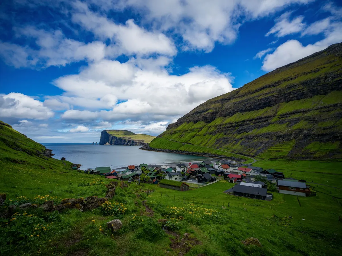

Where the North Atlantic Roars and the Sky Touches the Sea Nestled between Iceland and Norway, the Faroe Islands are a cluster of 18 volcanic islands where jagged cliffs plunge into the churning ocean, waterfalls cascade over green hillsides, and sheep outnumber people. This remote Nordic archipelago is a paradise for hikers seeking untouched trails and photographers chasing the perfect shot of raw, unfiltered nature. With an average of 280 cloudy days a year, the Faroe Islands offer a dynamic canvas of light and shadow, where every turn on a trail reveals a new masterpiece. But this is not just a place for the intrepid—it’s a destination where adventure meets comfort. The islands boast cozy guesthouses, world-class seafood, and a culture deeply rooted in Viking heritage. Whether you're trekking along the cliffs of Mykines or capturing the midnight sun over Tórshavn’s harbor, the Faroe Islands promise an experience that lingers long after you’ve left.A Landscape Carved by Fire and Ice The Faroe Islands are a geological wonder, formed by ancient volcanic activity and sculpted by glaciers over millennia. The islands’ dramatic topography includes towering sea stacks, deep fjords, and rolling hills blanketed in emerald grass. The highest point, Slættaratindur, stands at 880 meters (2,887 feet) and offers panoramic views of the archipelago. For hikers, this means trails that range from gentle coastal walks to challenging ridge hikes with vertigo-inducing drops. One of the most iconic hikes is the Gásadalur to Sørvágsvatn Lake Trail, a 5.5-kilometer (3.4-mile) route that takes you from the village of Gásadalur to the surreal lake perched above the ocean. The trail features a wooden boardwalk, a steep descent into a lush valley, and a final stretch along the cliffs of Trælanípan, where the lake appears to float above the sea. This optical illusion, caused by the cliff’s gradient, is one of the Faroes’ most photographed phenomena. For those seeking a more strenuous challenge, the Kalsoy Ridge Hike offers a 12-kilometer (7.5-mile) trek across the island of Kalsoy. The trail winds along sheer cliffs, past abandoned villages, and through tunnels carved into the rock. The reward? Views of the dramatic Kalsoy coastline and the chance to spot puffins nesting in the cliffs during summer.The islands’ weather is as unpredictable as it is dramatic. Wind speeds can exceed 100 km/h (62 mph), and rain showers can roll in within minutes. Hikers should be prepared for all conditions, with waterproof layers, sturdy boots, and a reliable map essential. The Faroese Meteorological Institute provides real-time weather updates, but even locals advise checking conditions before setting out.Photography in Paradise: Capturing the Faroes’ Ever-Changing Light The Faroe Islands are a photographer’s dream, where the interplay of light, water, and rock creates scenes that feel almost otherworldly. The islands’ high latitude means long summer days with the midnight sun casting a golden glow over the landscape, while winter offers dramatic storms and the chance to capture the northern lights (though sightings are rare due to frequent cloud cover). One of the best spots for photography is Múlafossur Waterfall, near the village of Gásadalur. The waterfall plunges 63 meters (207 feet) directly into the ocean, creating a mesmerizing spectacle, especially during storms when the spray is whipped into the air. The nearby cliffs provide vantage points for capturing the waterfall’s full force. For a more abstract shot, head to Saksun, a remote village accessible via a narrow isthmus. The black sand beach and the surrounding hills create a stark contrast, while the nearby lake, surrounded by steep cliffs, offers reflections that are perfect for mirror-like compositions. The village’s abandoned church, Dúvugarður, adds a touch of history to the scene.The Faroes’ lack of light pollution makes them an ideal location for astrophotography. During the winter months, the aurora borealis can occasionally be seen, though it’s best to head to the northernmost islands, such as Viðareiði, for the clearest skies. For daytime photography, the islands’ ever-changing weather means that no two shots are ever the same. A sunny morning can quickly turn into a misty afternoon, with the light shifting from golden to ethereal blue in minutes.A Nordic Lifestyle: Where Adventure Meets Comfort The Faroe Islands may be remote, but they offer a lifestyle that balances rugged adventure with Nordic comfort. The islands have a population of just 54,000, and the pace of life is slow and deliberate. Villages are small and tightly knit, with colorful houses clustered around harbors filled with fishing boats. The Faroese people are known for their hospitality, and visitors are often greeted with open arms. Accommodation ranges from cozy guesthouses to luxury hotels, with prices reflecting the islands’ status as one of Europe’s more expensive destinations. According to Numbeo, the average cost of a meal at a mid-range restaurant is around 150 DKK ($22 USD), while a pint of beer can cost up to 80 DKK ($12 USD). Groceries are also pricey, with a liter of milk costing around 12 DKK ($1.80 USD) and a loaf of bread around 25 DKK ($3.70 USD).Item Price (DKK) Price (USD)Meal at mid-range restaurant 150 $22Pint of beer 80 $12Liter of milk 12 $1.80Loaf of bread 25 $3.70Taxi (1 km) 20 $3Public transport (bus ticket) 30 $4.50Despite the high costs, the Faroes offer a unique quality of life. The islands have excellent healthcare, free education, and a strong sense of community. The capital, Tórshavn, is a charming town with a vibrant cultural scene, including the annual Faroese Music Awards and the Ólavsøka festival, which celebrates the islands’ Viking heritage. For foodies, the Faroes are a seafood lover’s paradise. Dishes like fermented puffin (a local delicacy), fresh langoustines, and grilled salmon are staples. The islands’ restaurants range from casual eateries serving fish and chips to high-end establishments like KOKS, which holds two Michelin stars and offers a tasting menu featuring locally sourced ingredients.From Viking Ships to Modern Trails: The Faroes’ Rich History The Faroe Islands have a history as dramatic as their landscapes. Settled by Vikings in the 9th century, the islands were later Christianized and became a key stop on the medieval Norse trade routes. The Faroese language, Faroese, is a North Germanic language closely related to Icelandic and Norwegian, and it remains the primary language spoken on the islands. One of the best places to explore the Faroes’ Viking past is the Viking Museum in Hoyvík, which showcases artifacts from the islands’ early settlements. The museum’s exhibits include tools, jewelry, and even a replica Viking longhouse, offering a glimpse into the daily lives of the islands’ first inhabitants. For a more immersive experience, visit the National Museum of the Faroe Islands in Tórshavn. The museum’s exhibits cover everything from the islands’ geological formation to their role in World War II, when they were occupied by British forces to prevent a German invasion. The museum also features a replica of a traditional Faroese turf house, which provides insight into the islands’ architectural heritage.The Faroes’ Viking heritage is also celebrated in the islands’ folklore. Local legends tell of hidden people (huldufólk), elves who live in the rocks and hills, and who must be respected to avoid bad luck. These stories are still a part of Faroese culture, and visitors may hear them shared over a cup of coffee in a local café.The Faroes’ Hidden Gems: Off-the-Beaten-Path Adventures While the Faroes’ main islands offer plenty of attractions, the archipelago’s smaller islands are where the real magic lies. These remote outposts are accessible by ferry or helicopter, and they offer a chance to experience the Faroes’ untouched wilderness. One such island is Mykines, the westernmost of the Faroes and a haven for birdwatchers. Mykines is home to one of the largest puffin colonies in the world, with thousands of birds nesting in the cliffs during the summer months. The island’s hiking trails lead to the Mykinesholmur, a small island connected to Mykines by a narrow isthmus, where visitors can get up close to the puffins and other seabirds. Another hidden gem is Fugloy, the easternmost island in the Faroes. Fugloy is known for its dramatic cliffs and the Risin og Kellingin sea stacks, which rise out of the ocean like sentinels. The island’s remote location means it’s rarely visited by tourists, making it a perfect spot for those seeking solitude.For a truly unique experience, consider visiting Skúvoy, an island with a population of just 30 people. Skúvoy is home to the Skúvoy Church, one of the oldest wooden churches in the Faroes, and the Skúvoy Bird Reserve, where visitors can see thousands of seabirds nesting in the cliffs.A Nordic Paradise Awaits The Faroe Islands are more than just a destination—they’re an experience. Whether you’re hiking along cliffs that plunge into the ocean, capturing the ever-changing light on a camera sensor, or simply enjoying the warmth of a Faroese guesthouse, the islands offer a sense of adventure and tranquility that’s hard to find elsewhere. The Faroes may be expensive, but they’re worth every krone. The islands’ dramatic landscapes, rich history, and unique culture create a destination that lingers in the memory long after you’ve returned home. So pack your hiking boots, charge your camera, and prepare to be captivated by the Nordic paradise that is the Faroe Islands.#NordicAdventure #RemoteTravel #PhotographyDestinations #HikingParadise #FaroeIslandsMagic Related InsightsEthiopia's Danakil Depression: The Hottest Place on Earth's Alien Landscapes (Part 3) Il Faro di Ercole e i Giganti Luminosi Dimenticati dell'Oceano: Un Viaggio Tra i Guardiani Romani dell'Infinito Atlantico St. Petersburg Hermitage{ "@context": "https://schema.org", "@type": "FAQPage", "mainEntity": [ { "@type": "Question", "name": "What is the main focus of The Faroe Islands: Where Nordic Wilderness Meets Photographic Magic?", "acceptedAnswer": { "@type": "Answer", "text": "Discover why the Faroe Islands are Europe’s best-kept secret for hikers and photographers, with dramatic landscapes, untouched trails, and a lifestyle that balances adventure with Nordic charm." } }, { "@type": "Question", "name": "Who authored the comprehensive guide on The Faroe Islands: Where Nordic Wilderness Meets Photographic Magic?", "acceptedAnswer": { "@type": "Answer", "text": "This detailed article and its insights were carefully researched and authored by Wei Chen." } }, { "@type": "Question", "name": "Where can I find more related content about Travel?", "acceptedAnswer": { "@type": "Answer", "text": "You can explore more articles, detailed reviews, and similar insights by browsing the Related Insights section at the bottom of this article or visiting our dedicated Travel category page." } } ] }
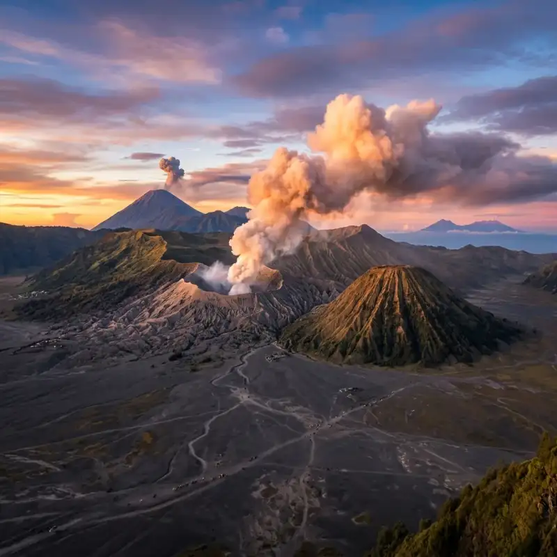
-
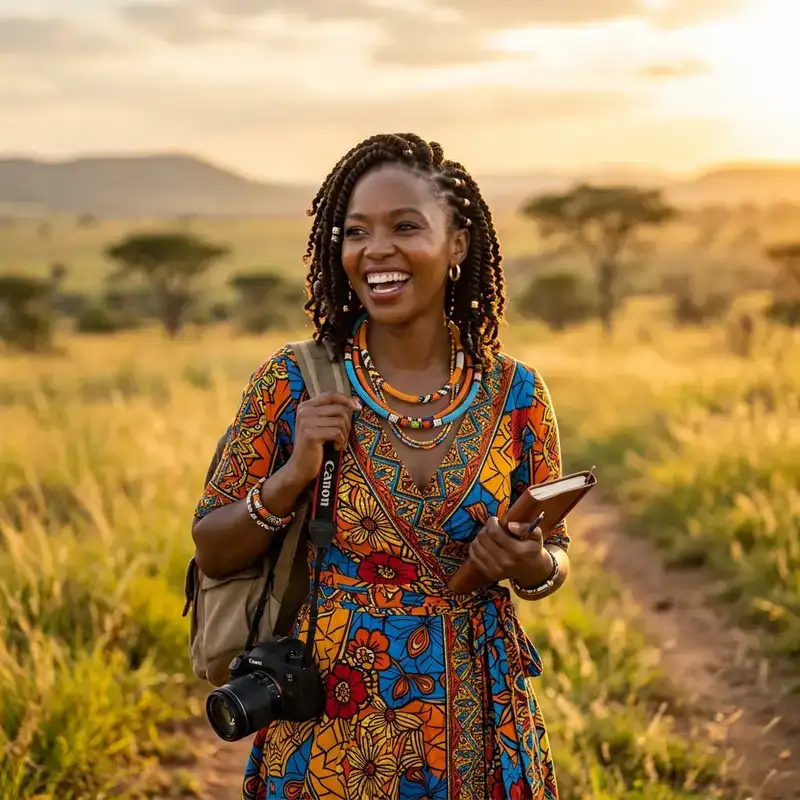 Zola Ndlovu
 - 12 Jul, 2026 17:32
Unleash Your Inner Explorer: Conquering Java's Fiery Peaks From Bali's Shores – A Definitive Guide
Indonesia, an archipelago born of fire, offers some of the planet’s most breathtaking and accessible volcanic landscapes. While Bali captivates with its serene beaches and vibrant culture, just a short journey west lies the rugged, otherworldly beauty of East Java – home to two of the world's most iconic and active volcanoes: Mount Bromo and Kawah Ijen. For the intrepid traveler, the transition from Bali’s tranquil rice paddies to Java’s smoking craters isn't merely a change in scenery; it’s an immersive expedition into the raw, pulsating heart of the Earth. As Zola Ndlovu, an expert in transformative travel experiences, I can attest that the challenge of ascending these peaks is profoundly rewarding, revealing vistas that defy imagination and stories etched in sulfur and ash. This isn't just a travelogue; it's a meticulously researched, highly factual blueprint for navigating an adventure that combines logistical precision with unparalleled natural spectacle. Forget the hazy travel anecdotes; we're diving deep into the actionable intelligence you'll need – from visa particulars and transport costs to the specific geological phenomena of Ijen's blue flames and Bromo's sunrise majesty. We’ll dissect itineraries, equip you with crucial packing lists, and prepare you for the physical and environmental realities of trekking active stratovolcanoes. Whether you're a seasoned mountaineer or a curious wanderer seeking an extraordinary chapter in your travel saga, this comprehensive guide will empower you to not just witness, but truly conquer, Java's fiery peaks, making your journey from Bali’s shores to the volcanic heart of Indonesia an unforgettable triumph. Get ready to embark on an adventure that will redefine your understanding of natural grandeur.The Gateway to Java's Giants: From Bali to Banyuwangi Embarking on the trans-island volcanic adventure begins in Bali, specifically from its westernmost tip, to cross the narrow Bali Strait into Java. The primary objective is reaching Banyuwangi, East Java, a strategic hub and the closest major city to Kawah Ijen. The journey is multi-modal and offers a blend of local immersion and logistical efficiency, which can be tailored to various budgets and preferences. The initial leg from popular tourist centres in South Bali (e.g., Seminyak, Kuta, Ubud) to Gilimanuk Ferry Terminal typically takes between 3 to 4.5 hours, depending heavily on traffic and your chosen mode of transport. Options range from private taxis or rented cars (expect to pay IDR 500,000 – 700,000 for a car with driver one-way, a comfortable but pricier option) to shared shuttle buses (around IDR 150,000 – 250,000 per person, offering a balance of cost and convenience) or even public buses from Denpasar's Ubung Terminal (significantly cheaper, IDR 60,000 – 80,000, but often slower and less direct). For independent adventurers, renting a scooter or motorcycle (IDR 70,000 – 100,000 per day) is an option, though the long journey and heavy traffic towards Gilimanuk can be challenging for inexperienced riders. Upon arrival at Gilimanuk, the transition to the Ketapang Ferry Terminal in Banyuwangi, Java, is seamless. Ferries operate 24 hours a day, departing every 20-30 minutes, ensuring minimal waiting time. The crossing itself is remarkably short, typically 30 to 45 minutes across the strait. Foot passenger tickets are incredibly affordable, usually costing around IDR 8,500 (approximately USD 0.55). If you're bringing a scooter, the cost is around IDR 29,000. These figures are consistent with local government tariffs and are highly reliable. The ferry ride provides scenic views, often accompanied by local vendors selling snacks and drinks. Once disembarking at Ketapang, you're officially in Banyuwangi. The ferry terminal is conveniently located near Banyuwangi Kota (formerly Karangasem) train station and the city centre. From Ketapang, a short taxi ride, Go-Jek (motorcycle taxi), or Grab car can take you to your accommodation in Banyuwangi city. Expect to pay IDR 20,000 – 50,000 for a local ride depending on distance and negotiation. Banyuwangi offers a range of accommodations, from budget guesthouses starting at IDR 100,000 per night to mid-range hotels like Hotel Santika or Aston Hotel Banyuwangi around IDR 400,000 – 700,000 per night, providing comfortable bases for your Ijen ascent. Securing a comfortable stay allows for crucial rest before the challenging pre-dawn hike to Kawah Ijen.Kawah Ijen's Ethereal Blue Flames and Turquoise Lake Kawah Ijen, perched at an elevation of 2,799 metres (9,183 feet) above sea level, is a stratovolcano that offers one of Earth's most unique nocturnal spectacles: the ethereal blue flames, an incredible natural phenomenon that occurs when sulfuric gases, emerging from cracks at temperatures up to 360°C (680°F), ignite upon contact with the oxygen-rich air. This visible combustion produces the iconic blue light, often described as lava-like, though it's purely burning gas. To witness this requires a midnight start, typically between 12:00 AM and 1:00 AM, ensuring you're at the crater rim before dawn. The trek to the crater rim from the Paltuding ranger post is approximately 3 kilometres (1.8 miles) with an elevation gain of around 500 metres (1,640 feet). The path is steep and challenging in sections, particularly in the dark, and takes approximately 1.5 to 2 hours for a reasonably fit individual. Once at the rim, a further perilous descent into the crater (approximately 800 metres) is required to get closer to the blue flames. This descent is unofficial and hazardous, involving navigating loose rocks and steep, narrow paths. While many tourists undertake it, it is not without risk, especially given the low light and the highly acidic environment. The main draw beyond the blue flames is the spectacular turquoise acid lake, the largest highly acidic crater lake in the world, with a pH of approximately 0.5. The vibrant colour comes from its high concentration of sulfuric and hydrochloric acids. This lake is also the site of a traditional sulfur mining operation, where local miners endure arduous conditions, carrying loads of up to 80-100 kg of solidified sulfur up and down the crater walls. Engaging with these miners, with respect and understanding, offers a humbling glimpse into their incredibly challenging livelihood. Essential gear for Ijen includes a high-quality gas mask (critical for protection against sulfuric fumes, which can cause respiratory irritation and eye discomfort; rentals are available at the base for IDR 30,000 – 50,000, but bringing your own is advisable for hygiene and fit), a powerful headlamp, sturdy hiking boots, warm layers (temperatures can drop significantly at altitude), and plenty of water. The foreign tourist entrance fee for Kawah Ijen is IDR 100,000 on weekdays and IDR 150,000 on weekends/public holidays. These fees contribute to park maintenance and local community initiatives. Safety is paramount; follow ranger instructions, consider hiring a local guide (approx. IDR 100,000-200,000), and be aware of your surroundings, especially when descending into the crater. The fumes can be overwhelming, and visibility can be poor. Mount Bromo's Volcanic Majesty and Sunrise Spectacle From the raw, elemental beauty of Kawah Ijen, the journey continues to the iconic Mount Bromo, part of the Bromo Tengger Semeru National Park. Located in East Java, Bromo's peak stands at 2,329 metres (7,641 feet) and is famous for its breathtaking sunrise views, its perpetually smoking crater, and the vast, ethereal "Sea of Sand" (Lautan Pasir) caldera surrounding it. The typical approach after visiting Ijen is to travel from Banyuwangi to Probolinggo (the main gateway town), and then onward to Cemoro Lawang, the village perched on the rim of the caldera, offering direct access to Bromo. Getting from Banyuwangi to Cemoro Lawang usually involves a train ride from Banyuwangi Kota (Karangasem) station to Probolinggo station. Popular train services include the Sri Tanjung or Tawang Alun, with tickets ranging from IDR 60,000 (economy) to IDR 150,000 (executive) for the approximately 4-5 hour journey. From Probolinggo, public minivans (colt) or shared jeeps (approx. IDR 50,000 – 75,000 per person) shuttle travellers up to Cemoro Lawang, taking about 1.5 to 2 hours on a winding, often congested road. Organized tours frequently bundle this transport. The quintessential Bromo experience begins with a pre-dawn ascent to one of the designated viewpoints. Penanjakan 1 (2,770m/9,088ft) is the most popular, offering panoramic views of Bromo, Mount Batok, and the active Mount Semeru in the distance, bathed in the hues of dawn. Other excellent viewpoints include King Kong Hill and Seruni Point, which are often less crowded. Most visitors hire a 4x4 jeep (IDR 500,000 – 700,000 per jeep, accommodating 4-6 people) to reach these viewpoints, departing from Cemoro Lawang around 3:00-3:30 AM. After sunrise, the jeeps descend into the Sea of Sand, driving across the volcanic ash desert to the base of Mount Bromo. From the jeep drop-off point, it's approximately a 20-30 minute walk across the sandy plain to the base of Bromo's cone. Here, a set of 250 concrete steps leads directly to the crater rim. The ascent is moderate, but the loose sand and the altitude can make it tiring. At the top, you're greeted by the mesmerizing sight and sound of the active crater, continuously spewing white sulfuric smoke. The foreign tourist entrance fee for Bromo Tengger Semeru National Park is IDR 220,000 on weekdays and IDR 320,000 on weekends/public holidays. The best time to visit is during the dry season (May to October) for clear skies, though it remains a popular destination year-round.Strategic Planning & Essential Preparations for the Volcanic Traverse Successfully navigating the Bali-Java volcanic expedition requires meticulous planning and preparation. Combining Kawah Ijen and Mount Bromo into a seamless itinerary typically spans 2 to 3 days from the moment you leave Bali. A common itinerary involves traveling from Bali to Banyuwangi, hiking Ijen on the first night/early morning, then proceeding to Cemoro Lawang for the Bromo sunrise the following morning. This intense schedule is rewarding but demands good physical fitness and efficient logistics. For the budget-conscious and adventurous, independent travel offers maximum flexibility. You manage your own transport bookings (ferry, trains, local minivans), accommodation reservations, and park entrance fees. While potentially cheaper overall, it requires more time, research, and comfort with local navigation, including potential language barriers (Bahasa Indonesia is essential for non-touristy areas). For example, booking train tickets via the KAI Access app (Indonesian Railways) can simplify this, but requires an Indonesian SIM card and payment methods. Alternatively, numerous tour operators in Bali (e.g., Kuta, Ubud, Seminyak) and Banyuwangi offer all-inclusive packages. These typically cover transfers from Bali, ferry tickets, private transport in Java, accommodation, park entrance fees, and sometimes even local guides. A 2-day/1-night Ijen-Bromo tour from Bali can range from IDR 1,500,000 to IDR 3,000,000 (approximately USD 100-200), depending on the group size, quality of accommodation, and inclusions. While more expensive, these tours provide convenience, especially for those with limited time or who prefer a hassle-free experience. Essential Packing List:Clothing: Layering is key. Lightweight wicking base layers, a fleece or insulated jacket, and a wind/waterproof outer shell are crucial for cold pre-dawn temperatures (can drop to 5-10°C / 40-50°F at altitude) and potential rain. A change of clothes for after the hikes. Footwear: Sturdy, broken-in hiking boots with good ankle support are indispensable for the uneven terrain of both Ijen and Bromo. Headlamp/Flashlight: Absolutely critical for midnight treks. Ensure it has fresh batteries. Gas Mask: As mentioned, vital for Ijen. Either rent at base or bring your own. Sun Protection: Hat, sunglasses, and high-SPF sunscreen for daylight hours, especially at Bromo, where the sun can be intense. Hydration: At least 2-3 litres of water per person for each hike. Dehydration can exacerbate altitude effects. Snacks: Energy bars, fruit, nuts to keep energy levels up. Personal First Aid: Basic kit with pain relievers, blister plasters, antiseptic wipes. Camera Gear: Protection from dust and sulfur is advisable. Small Backpack: For essentials during the hike. Cash (IDR): For small purchases, local food, and tips. ATMs are available in Banyuwangi and Probolinggo but rare near the parks.Physical Fitness and Altitude: While neither Bromo nor Ijen are extremely high-altitude treks, their elevations can still cause mild altitude sickness symptoms (headache, nausea) in some individuals. Ensure you are well-rested, hydrated, and listen to your body. Regular moderate exercise leading up to the trip will greatly enhance your enjoyment. Indonesia offers a visa-free entry for up to 30 days for citizens of over 80 countries, including most of Europe, North America, Australia, and parts of Asia. For other nationalities, a Visa on Arrival (VOA) is available at major airports for IDR 500,000 (approx. USD 35), valid for 30 days and extendable once. Always check the latest visa regulations for your specific nationality before travel.Beyond the Peaks: Embracing East Java's Cultural & Culinary Delights While the primary draw is the volcanic grandeur, East Java offers a rich tapestry of cultural and culinary experiences that enrich the adventure. Venturing beyond the peaks provides a deeper understanding of the region's unique identity, distinct from Bali's Hindu-centric culture. East Java is predominantly Muslim, with influences from Javanese, Madurese, and Tenggerese ethnic groups. Local Cuisine: East Javanese cuisine is flavourful and hearty.Nasi Pecel: A staple, featuring mixed vegetables with peanut sauce, served with rice, often accompanied by peyek (peanut brittle crackers) or rempeyek (rice flour crackers). A local, nutritious and affordable meal, typically costing IDR 15,000 – 25,000. Rawon: A distinctive black beef soup, gaining its colour from the keluak (black nut), offering a unique umami flavour. A must-try, available for IDR 25,000 – 40,000. Soto Ayam: A comforting chicken soup with turmeric broth, vermicelli, and various toppings. Ubiquitous and delicious, priced around IDR 20,000 – 35,000. Bakso: Indonesian meatball soup, a popular street food snack. Prices start from IDR 10,000. Local Coffee: East Java is a coffee-growing region. Enjoy robust local blends, often served strong and sweet. Cafes in Banyuwangi and Probolinggo offer a range of options, with a cup typically costing IDR 15,000 – 30,000.Other Attractions in East Java: Consider extending your trip to include:Madakaripura Waterfall: Often combined with Bromo tours, this majestic waterfall is about 1 hour from Cemoro Lawang. It's shrouded in mist and legend, requiring a trek through a canyon to reach its main basin. Entrance fee: IDR 20,000 – 30,000, plus optional local guide. Baluran National Park: Known as "Africa van Java," this park, located near Banyuwangi, boasts savannah landscapes, acacia forests, and a diverse range of wildlife including Javan banteng, deer, and various bird species. A striking contrast to the volcanic scenery. Entrance fee for foreigners: IDR 160,000 (weekdays) / IDR 240,000 (weekends). Tumpak Sewu Waterfall: While a bit further south and requiring more travel time, this multi-tiered waterfall near Lumajang is considered by many to be the most beautiful in Java, a truly spectacular natural wonder.Connectivity and Currency: Stay connected with a local SIM card. Providers like Telkomsel (best coverage, especially in remote areas) and XL Axiata offer affordable data packages. A 10GB data package costs approximately IDR 50,000 – 70,000. Indonesian Rupiah (IDR) is the local currency. ATMs are widely available in major towns like Banyuwangi, Probolinggo, and Surabaya, but carrying smaller denominations of cash is crucial for rural areas and street vendors. The exchange rate fluctuates, but roughly 1 USD is equivalent to IDR 15,500. Engaging with local communities, particularly the Tenggerese people around Bromo, provides a unique cultural insight. They are a Hindu minority in a predominantly Muslim region, with distinct traditions and a deep reverence for the mountain spirits. Practising respectful tourism, such as supporting local vendors, disposing of waste responsibly, and being mindful of local customs, ensures a positive impact and a richer travel experience for everyone. Estimated 3-Day Independent Volcano Trek Costs (Bali to Java) This table provides a realistic cost breakdown for a solo independent traveler undertaking the Bali-Java volcano trek over approximately 3 days, excluding international flights and personal shopping. Prices are approximate and subject to change based on seasonality, negotiation skills, and personal choices.Category Item Estimated Cost (IDR) Estimated Cost (USD) NotesDay 1: Bali to BanyuwangiTransport (Bali) Shuttle Bus (South Bali to Gilimanuk) 200,000 13 Varies by starting point and operatorFerry Gilimanuk to Ketapang (foot passenger) 8,500 0.55 Fixed tariffTransport (Banyuwangi) Taxi/Go-Jek (Ketapang to Hotel) 30,000 2 Negotiable, depends on distanceAccommodation Budget Guesthouse (Banyuwangi, 1 night) 150,000 10 Basic, clean roomFood 2 Meals (Banyuwangi) 70,000 4.5 Local warung food (IDR 25k-45k/meal)Day 2: Kawah Ijen Trek & Travel to Cemoro LawangIjen Transport Shared Car/Motorbike to Paltuding 150,000 10 Return trip from Banyuwangi, often shared with other hikersIjen Entrance Fee Foreigner Weekend Ticket 150,000 10 Weekday: IDR 100k. Budget for peak price.Gas Mask Rental40,000 2.5 Essential for safetyTrain Banyuwangi to Probolinggo (Economy) 60,000 4 Sri Tanjung or Tawang Alun train. Executive option is ~IDR 150k.Transport (Probolinggo) Shared Minivan to Cemoro Lawang 75,000 5 Often packed, can negotiate for better space.Accommodation Budget Homestay (Cemoro Lawang, 1 night) 200,000 13 Very basic, sometimes no hot water. Higher-end options available.Food 3 Meals (packed lunch, dinner Cemoro Lawang) 120,000 8 Food options limited/pricier in Cemoro Lawang.Day 3: Mount Bromo Sunrise & DepartureBromo Jeep Tour Shared Jeep (to Viewpoint & Crater) 150,000 10 Based on 4-6 people per jeep (total IDR 600k-900k).Bromo Entrance Fee Foreigner Weekend Ticket 320,000 20.5 Weekday: IDR 220k. Budget for peak price.Food 1 Meal (Breakfast) 30,000 2 Simple breakfast.Miscellaneous Snacks, Water, Tips, SIM card 100,000 6.5 Buffer for unexpected costs. SIM card costs around IDR 50k-70k for data.TOTAL ESTIMATED COSTS (approx.)1,963,500 126.05 Excludes return transport from Java and major splurges.Note: 1 USD ≈ IDR 15,500 for calculation purposes.The journey from Bali's tropical allure to the stark, powerful landscapes of Java's volcanoes is more than just a trip; it's a profound odyssey that carves itself into the memory. Witnessing the incandescent blue flames of Kawah Ijen, a phenomenon rare on Earth, followed by the majestic sunrise over Mount Bromo's smoking crater, surrounded by the lunar expanse of its caldera, offers a singular experience of nature's raw, untamed power. This adventure demands preparation, physical endurance, and a spirit of resilience, but the rewards—the awe-inspiring vistas, the humbling encounters with the local communities, and the sheer triumph of conquering these formidable peaks—are immeasurable. As Zola Ndlovu, I advocate for travel that challenges, inspires, and educates. The volcanic heart of Indonesia does precisely that, offering a deep dive into geological wonders, cultural nuances, and personal limits. With this detailed guide, you are now equipped with the factual data and strategic insights to plan your own epic traverse. Embrace the challenge, respect the environment, and prepare to be utterly captivated. Indonesia's fiery peaks await your footprints, ready to etch another unforgettable chapter into your global adventures.#IndonesiaTravel #VolcanoHiking #MountBromo #KawahIjen #AdventureTravel #EastJava