Showing Posts From
Travel
-
 Chloe Tremblay
 - 14 Jul, 2026 20:45
Unveiling the Breathtaking Landscape of Namibia's Sossusvlei: A Journey Through Time and Nature
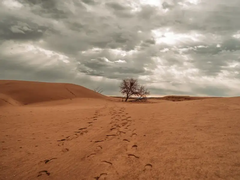
Introduction Namibia's Sossusvlei is a destination that embodies the essence of natural wonder, where the forces of time and erosion have crafted an breathtaking landscape of sculpted dunes and ancient trees. Located in the southern part of the Namib Desert, Sossusvlei is a must-visit destination for any traveler seeking to experience the raw beauty of Africa. As a traveler and explorer, I have had the privilege of witnessing the majesty of Sossusvlei firsthand, and I can attest to its awe-inspiring beauty. From the towering dunes that stretch towards the sky to the eerie silence of the Deadvlei, Sossusvlei is a place that will leave you speechless and yearning for more. The Geology of Sossusvlei Sossusvlei is nestled within the Namib-Naukluft National Park, which is the largest game reserve in Africa. The park is home to a diverse range of flora and fauna, including several endangered species. The geology of Sossusvlei is characterized by its unique dune landscape, which is shaped by the constant winds that sweep across the desert. The dunes are made up of sand that has been eroded from the rocks and soil of the surrounding landscape, and they can reach heights of up to 300 meters. The dunes are also home to a variety of unique fauna, including the Namib desert beetle, which is capable of collecting fog droplets on its back and channeling them into its mouth. The History of Sossusvlei The history of Sossusvlei is shrouded in mystery, but it is believed that the area has been inhabited by humans for thousands of years. The earliest known inhabitants of the region were the San people, who were skilled hunters and gatherers. The San people left behind a rich cultural heritage, including rock art and other artifacts that can still be seen today. In the 19th century, Sossusvlei was visited by European explorers, who were drawn to the area's unique landscape and natural resources. Today, Sossusvlei is a popular tourist destination, attracting visitors from all over the world.Exploring Deadvlei Deadvlei is a surreal landscape that is nestled within the heart of Sossusvlei. The area is characterized by its eerie silence and its stark beauty, with dead trees standing like skeletons against the backdrop of the dunes. Deadvlei is a place of great beauty and great sadness, where the forces of nature have crafted a landscape that is both haunting and awe-inspiring. The area is also home to a variety of unique flora and fauna, including the majestic oryx, which is capable of surviving in the harsh conditions of the desert. Planning Your Trip to Sossusvlei Planning a trip to Sossusvlei requires careful consideration and preparation. The best time to visit Sossusvlei is during the winter months, when the weather is cooler and the skies are clearer. Visitors can reach Sossusvlei by flying into Windhoek, the capital city of Namibia, and then taking a charter flight or driving to the park. Accommodation options range from luxury lodges to budget-friendly camping sites, and visitors can choose from a variety of activities, including hiking, birdwatching, and scenic flights.Cost and Logistics The cost of visiting Sossusvlei can vary greatly, depending on the time of year and the type of accommodation and activities chosen. Here is a breakdown of the estimated costs:Activity Cost (USD)Accommodation (per night) 100-500Charter flight (return) 200-500Guided tour (per person) 50-100Scenic flight (per person) 100-200Visitors should also be aware of the logistics of traveling to Sossusvlei, including the need for a 4x4 vehicle and the importance of bringing plenty of water and sunscreen.Conclusion In conclusion, Sossusvlei is a destination that is not to be missed. With its unique landscape, rich history, and diverse flora and fauna, Sossusvlei is a place that will leave you in awe of the natural beauty of Africa. Whether you are a seasoned traveler or just starting to plan your next adventure, Sossusvlei is a must-visit destination that is sure to leave you with memories that will last a lifetime. As a traveler and explorer, I highly recommend adding Sossusvlei to your bucket list and experiencing the magic of this incredible destination for yourself. #NamibiaTourism #Sossusvlei #AfricanAdventures #DesertLandscapes #TravelGuide #WildlifeConservation

-
 Zola Ndlovu
 - 14 Jul, 2026 18:49
Unveiling the Hidden Gems of the Arctic Circle: A Journey Through Sami Traditions and Tundra Life
Introduction The Arctic Circle, a region of breathtaking beauty and harsh climate, is home to several indigenous cultures, each with their unique traditions and ways of life. Among these cultures, the Sami people stand out for their rich heritage and resilience in the face of adversity. The Sami, also known as the Lapps or Laplanders, are an indigenous people living in the northern parts of Scandinavia, Russia, and Finland. Their history, culture, and traditions are deeply intertwined with the land and the natural resources it provides. In this article, we will delve into the world of the Sami people, exploring their history, traditions, and daily life in the Arctic tundra. From their expertise in reindeer herding to their vibrant cultural festivals, we will discover what makes the Sami people so fascinating and unique. History and Cultural Heritage of the Sami People The Sami people have a long and complex history, with evidence of their presence in the Arctic region dating back over 4,000 years. Their culture is based on a deep understanding of the natural environment and a strong spiritual connection to the land. The Sami people have developed a unique traditional clothing, known as the "kolt," which is made from reindeer skin and wool. The kolt is not only a symbol of Sami identity but also a practical means of surviving the harsh Arctic climate. The Sami people have also developed a rich cultural heritage, with a strong emphasis on storytelling, music, and dance. Their traditional music, known as "joiking," is a unique form of chanting that is used to tell stories and convey emotions. The Sami people have also developed a strong tradition of handicrafts, including weaving, knitting, and woodcarving. Traditional Sami Livelihoods and Economy The traditional livelihood of the Sami people is based on reindeer herding, which has been their main source of income for centuries. Reindeer are used for their meat, milk, and hides, and are also an important means of transportation in the Arctic region. The Sami people have developed a unique system of reindeer herding, which is based on a deep understanding of the animals' behavior and the natural environment. In addition to reindeer herding, the Sami people have also developed other traditional livelihoods, including fishing, hunting, and gathering. These activities are not only important for their economic survival but also play a crucial role in their cultural and spiritual practices. The Sami people have a strong tradition of sharing and cooperation, which is reflected in their system of collective reindeer herding and their emphasis on community-based decision-making. Sami Traditions and Cultural Festivals The Sami people have a rich cultural calendar, with several festivals and celebrations throughout the year. One of the most important festivals is the "Easter Festival," which is celebrated in the spring and marks the beginning of the new year. The festival is characterized by traditional music, dance, and handicrafts, and is an important occasion for socializing and strengthening community bonds. Another important festival is the "Midsummer Festival," which is celebrated in June and marks the summer solstice. The festival is characterized by traditional foods, music, and dance, and is an important occasion for celebrating the arrival of summer and the longest day of the year. Challenges Facing the Sami People Despite their rich cultural heritage and traditional livelihoods, the Sami people face several challenges in the modern world. One of the main challenges is the impact of climate change, which is affecting their traditional reindeer herding practices and threatening their way of life. The Sami people are also facing challenges related to land rights and self-determination, as their traditional lands are being threatened by mining, logging, and other forms of development. In addition to these challenges, the Sami people are also facing challenges related to language and cultural preservation. The Sami language is considered an endangered language, and efforts are being made to preserve and promote its use among young people. Conclusion and Future Prospects In conclusion, the Sami people are a unique and fascinating indigenous culture, with a rich cultural heritage and traditional livelihoods. Despite the challenges they face, the Sami people remain committed to their way of life and are working to preserve their language, culture, and traditional practices. Category Description PriceAccommodation Hotel $100Food Traditional Sami meal $20Transportation Reindeer sleigh ride $50As we look to the future, it is essential that we recognize the importance of preserving indigenous cultures and traditional livelihoods. By supporting the Sami people and their way of life, we can help to ensure the long-term sustainability of the Arctic region and the preservation of its unique cultural heritage.Zola Ndlovu #IndigenousCultures #ArcticCircle #SamiTraditions #TundraLife #CulturalPreservation #Sustainability #ClimateChange #LanguagePreservation
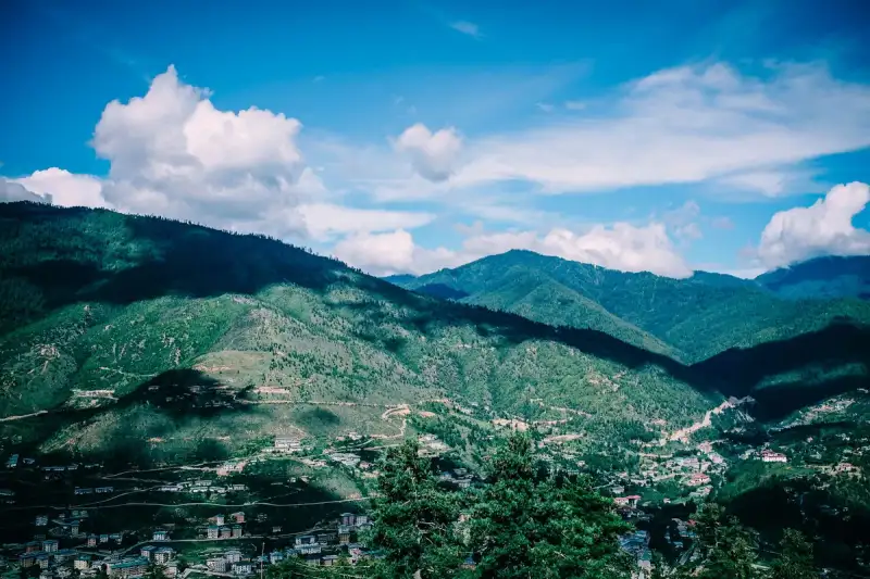
"Bhutan: The Last Shangri-La and Its Gross National Happiness Philosophy" Introduction to the mystical kingdom of Bhutan, nestled in the Himalayas, is a journey into a world where time stands still. This tiny country, with a population of just over 771,608 people (as per the 2020 census), has managed to preserve its unique culture, traditions, and environment, making it an enchanting destination for travelers. Bhutan is often referred to as the "Last Shangri-La" due to its unspoiled natural beauty, pristine forests, and majestic mountains. But what sets Bhutan apart from other travel destinations is its guiding principle of Gross National Happiness (GNH), a philosophy that prioritizes the well-being of its citizens and the environment over economic growth. History and Culture of Bhutan The history of Bhutan dates back to the 8th century when Guru Rinpoche, a Buddhist master, introduced Buddhism to the region. Over the centuries, Bhutan has developed a distinct culture, shaped by its Buddhist heritage and geographical isolation. The country is home to numerous ancient temples, monasteries, and festivals that showcase its rich cultural heritage. One of the most notable festivals is the Paro Tshechu, a five-day celebration that features masked dances, music, and traditional food. The Bhutanese culture is deeply rooted in Buddhism, and the country's unique philosophy of GNH is reflected in its everyday life. The government's emphasis on GNH has led to the development of a sustainable and equitable society, where economic growth is balanced with social and environmental well-being. Gross National Happiness Philosophy The concept of Gross National Happiness (GNH) was first introduced by the Fourth King of Bhutan, Jigme Singye Wangchuck, in 1972. GNH is based on the idea that the ultimate goal of development should be the happiness and well-being of the citizens, rather than just economic growth. The philosophy is guided by four pillars: sustainable and equitable socio-economic development, preservation and promotion of culture, conservation of the environment, and good governance. The GNH philosophy has been implemented through a series of policies and initiatives, including the establishment of the Gross National Happiness Commission, which is responsible for promoting and implementing the GNH philosophy. The commission has developed a set of indicators to measure GNH, including psychological well-being, physical health, education, and living standards. Traveling to Bhutan Traveling to Bhutan can be a challenging but rewarding experience. The country has a limited number of entry points, and visitors must obtain a visa in advance. The visa application process typically takes around 10-15 working days, and the cost of a visa is around $250 per person, plus a daily tariff of $250 per person. The daily tariff includes accommodation, food, transportation, and guide services. Visitors can choose from a range of accommodation options, including luxury hotels, budget hotels, and homestays. The best time to visit Bhutan is during the spring (March to May) and autumn (September to November) seasons, when the weather is mild and pleasant. Places to Visit in Bhutan Bhutan is home to numerous tourist attractions, including the Paro Taktsang (Tiger's Nest) monastery, the Punakha Dzong, and the Thimphu Valley. The Paro Taktsang monastery is one of the most iconic landmarks in Bhutan, perched on a cliff overlooking the valley below. The Punakha Dzong is a stunning example of Bhutanese architecture, with its intricate carvings and beautiful gardens. The Thimphu Valley is the capital city of Bhutan, with a range of attractions, including the National Library, the Institute of Zorig Chusum, and the Weekend Market. Visitors can also explore the surrounding countryside, with its picturesque villages, rice fields, and temples. Sustainable Tourism in Bhutan Bhutan has a unique approach to tourism, with a focus on sustainable and responsible travel. The government has implemented a range of initiatives to minimize the impact of tourism on the environment and local communities. Visitors are required to pay a daily tariff, which includes a royalty fee that is used to fund sustainable development projects. The tariff also includes a component for the promotion of culture and heritage, which is used to support local festivals, cultural events, and traditional crafts. Visitors can also participate in community-based tourism initiatives, such as homestays and village tours, which provide an opportunity to experience the local culture and way of life.Category Price (USD)Visa Application 40Daily Tariff 250Accommodation (per night) 100-500Transportation (per day) 50-100Food (per meal) 10-30Conclusion Bhutan is a unique and enchanting destination that offers a range of experiences for travelers. From its stunning natural beauty to its rich cultural heritage, Bhutan is a country that will leave you with lasting memories. The philosophy of Gross National Happiness is a guiding principle that shapes every aspect of life in Bhutan, from education and healthcare to environment and governance. As a responsible traveler, you can contribute to the sustainable development of Bhutan by respecting its culture, environment, and local communities. By visiting Bhutan, you will not only experience a unique and unforgettable journey but also contribute to the country's sustainable development and the well-being of its people. #BhutanTourism #GrossNationalHappiness #SustainableTravel #TravelBhutan #HimalayanAdventures #BuddhistCulture #EcoTourism #ResponsibleTravel Related InsightsThe Silent Chronicles of the Steppe: Unearthing the Enigma of Mongolia's Deer Stone Sentinels at Uushgiin Ovor Hattusa: The Hittite Capital Kamchatka Volcanoes{ "@context": "https://schema.org", "@type": "FAQPage", "mainEntity": [ { "@type": "Question", "name": "What is the main focus of Bhutan: Unveiling the Hidden Gem of Gross National Happiness?", "acceptedAnswer": { "@type": "Answer", "text": "Discover the enchanting kingdom of Bhutan, where Gross National Happiness is the guiding principle, and experience a unique travel destination like no other." } }, { "@type": "Question", "name": "Who authored the comprehensive guide on Bhutan: Unveiling the Hidden Gem of Gross National Happiness?", "acceptedAnswer": { "@type": "Answer", "text": "This detailed article and its insights were carefully researched and authored by Aisha Sharma." } }, { "@type": "Question", "name": "Where can I find more related content about Travel?", "acceptedAnswer": { "@type": "Answer", "text": "You can explore more articles, detailed reviews, and similar insights by browsing the Related Insights section at the bottom of this article or visiting our dedicated Travel category page." } } ] }
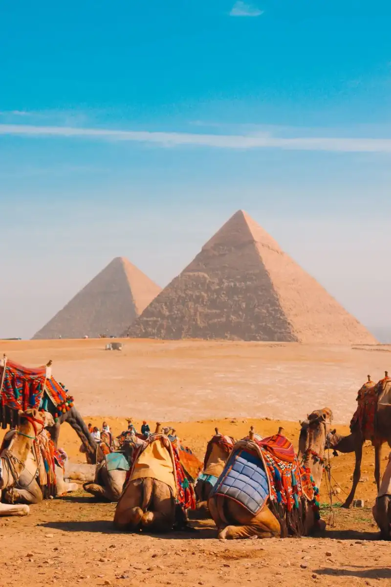

In the vast tapestry of ancient trade routes, names like the Silk Road often command immediate recognition, evoking images of bustling caravans and exotic goods. Yet, stretching thousands of kilometers through some of the world's most breathtaking and treacherous terrain, another artery of commerce pulsed with life for over a millennium: the Ancient Tea Horse Road, or Cha Ma Gu Dao (茶马古道). It is a forgotten epic, a saga of human endurance, cultural exchange, and the relentless pursuit of sustenance and fortune through the roof of the world. As a professional blogger and expert who has dedicated countless hours to tracing the forgotten pathways of human history, I find the Tea Horse Road particularly compelling. It represents not just a conduit for goods, but a testament to the symbiotic relationship between diverse cultures – the Han Chinese, the Tibetans, and myriad ethnic groups dwelling in the unforgiving peaks and valleys of Yunnan and Sichuan. This isn't just a historical curiosity; it's an invitation to an adventure unlike any other. Imagine hardy porters shouldering hundreds of pounds of compressed tea bricks, navigating narrow precipices where a single misstep meant oblivion, driven by the insatiable Tibetan demand for tea – a vital dietary supplement in their meat and dairy-rich diet. In return, the formidable Tibetan horses, crucial for Chinese military might, flowed eastward. This intricate exchange fostered a unique blend of cultures, leaving behind a legacy of stone-paved paths, ancient inns, and vibrant communities. Join me as we delve into the heart of this majestic route, exploring its profound history, the practicalities of journeying its surviving segments today, and the indelible mark it has left on the Himalayan frontier. Prepare to uncover a truly epic adventure, far removed from the tourist throngs, into China's forgotten Himalayan trade route. The Genesis of Giants: Unearthing the Historical Tapestry of the Cha Ma Gu Dao The origins of the Ancient Tea Horse Road are shrouded in the mists of antiquity, with historical records pointing to its formal establishment during the Tang Dynasty (618-907 AD). However, informal bartering of tea for horses between Han Chinese and Tibetan tribes likely predates this by centuries. The fundamental driver for this exchange was a fascinating dietary and geopolitical synergy. Tibetans, inhabiting a high-altitude plateau with limited agriculture, relied heavily on tsampa (roasted barley flour), yak meat, and dairy products. Tea, particularly the fermented Pu'er tea from Yunnan, was not merely a beverage but a critical source of vitamins, aiding digestion and mitigating the high-fat diet. This made tea an indispensable commodity, almost a medicinal necessity. Conversely, the various Han Chinese dynasties, constantly battling nomadic invaders from the north, had an insatiable need for strong, agile warhorses. The Tibetan plateau, with its harsh environment, bred some of the finest mountain horses – sturdy, resilient, and perfectly adapted to difficult terrain. This mutual dependency created the impetus for one of history's most arduous trade routes. The earliest documented large-scale exchange, known as the "Tea-Horse Market" (茶马互市), solidified this relationship. By the Song Dynasty (960-1279 AD), the trade was heavily regulated by the imperial court, often monopolized to ensure a steady supply of horses for the army. The government established "Tea-Horse Superintendencies" in strategic locations like Ya'an in Sichuan and Dali in Yunnan, controlling prices and quantities. The volume of trade was staggering. Historical records indicate that during the Song Dynasty, up to 10,000 horses were traded annually for millions of kilograms of tea. This wasn't merely a commercial transaction; it was a geopolitical strategy that shaped empires. The perilous journey, traversing altitudes exceeding 5,000 meters and navigating perilous river gorges, was undertaken by caravans of mules, yaks, and incredibly resilient human porters, often carrying loads of over 60 kg for months. These early pioneers carved out paths that would become the backbone of an economic and cultural highway, laying the groundwork for a rich intermingling of traditions, languages, and beliefs across the Tibetan plateau and southwestern China. Their courage and perseverance forged a legacy that echoes through the remote villages and mountain passes to this day.A Trek Through Time: Navigating the Southern and Northern Routes The Ancient Tea Horse Road wasn't a single path but a complex network of arteries, primarily branching into two main conduits: the Southern Route (originating in Yunnan) and the Northern Route (originating in Sichuan). Each route possessed distinct characteristics, challenges, and cultural landscapes, yet both converged on Lhasa, the spiritual heart of Tibet. Understanding these routes is key to appreciating the sheer scale of the historical trade and the incredible diversity of the regions they traversed. The Southern Route, often considered the older and more treacherous, commenced in the tea-producing regions of Pu'er (普洱) and Xishuangbanna (西双版纳) in southern Yunnan province. From there, it wound its way north through the historic towns of Dali (大理) and Lijiang (丽江) – now UNESCO World Heritage sites famous for their ancient architecture and Naxi culture. The path continued through Shangri-La (香格里拉, also known as Gyalthang or Zhongdian), ascending into the high-altitude landscapes of Deqin (德钦) and across the formidable Meili Snow Mountain range. This segment was characterized by its deep river gorges – particularly the Mekong (澜沧江), Salween (怒江), and Jinsha (金沙江) – and notoriously steep mountain passes. Merchants on this route interacted with a myriad of ethnic groups, including the Bai, Naxi, Yi, and Lisu, before finally reaching Tibetan regions. The journey from Pu'er to Lhasa could take six months or more, covering an astonishing 4,000 kilometers. The elevation changes were extreme, from tropical lowlands to glacial peaks, demanding incredible adaptability from both humans and animals. The Northern Route, while still formidable, was generally considered slightly less arduous and became more prominent during later dynasties. It originated in Ya'an (雅安) in Sichuan province, a city famously dubbed the "Rain City" and a major hub for tea processing. From Ya'an, the route moved west through Kangding (康定), a historically significant border town, and further into the Ganzi Tibetan Autonomous Prefecture. This route traversed rolling grasslands, high mountain plateaus, and deep river valleys, eventually joining the Southern Route in eastern Tibet or proceeding directly to Lhasa via Chamdo (昌都). The Northern Route facilitated trade not just with Tibet but also with various Qiang and Yi communities in Sichuan. Both routes served as conduits for more than just tea and horses; they facilitated the exchange of salt, medicinal herbs, furs, gold, silver, and cultural practices, profoundly shaping the demographics and economies of the regions through which they snaked. Modern expeditions often attempt segments of these ancient paths, experiencing firsthand the enduring majesty and challenge of this monumental trade network. The Commerce of Courage: Understanding the Economics of Tea and Horses The Tea Horse Road was a testament to supply, demand, and sheer human will, embodying a unique economic ecosystem that sustained millions for centuries. The core commodities were Pu'er tea (from Yunnan) and Ya'an tea (from Sichuan) and Tibetan horses. The value proposition was immense, driven by scarcity and necessity on both sides. For the Tibetans, tea was not just a luxury; it was a fundamental component of their diet and culture. Its stimulant properties, ability to aid digestion of high-fat foods, and medicinal qualities made it invaluable. A single brick of high-quality tea could be a unit of currency, traded for sheep, yak butter, or even a small horse. The cost of transporting tea was exorbitant due to the extreme conditions. Porters, known as ma bang (马帮) or "horse caravans" despite many being foot porters, often carried loads weighing 60-100 kilograms, sometimes even more. Their daily wages were meager compared to the risks, but the alternative was often harsher poverty. The profit margins for merchants were substantial, reflecting the high risk and extended journey times. A caravan leader (often with significant capital and influence) would organize the logistics, from purchasing tea at the source to arranging safe passage and negotiating prices at various markets along the way. These entrepreneurial spirits understood commodity pricing, risk assessment, and cross-cultural negotiation perhaps better than anyone of their era. The Tibetan horses, particularly the Baima (white horse) and Heizhu (black horse) breeds, were prized for their strength, agility, and stamina in mountainous terrain. For the Chinese imperial armies, these were not merely animals but strategic assets, critical for cavalry units and defense. The imperial government often instituted a strict "tea-horse exchange" system where specific grades of tea were mandated for specific numbers or qualities of horses. For example, in the Song Dynasty, 60-80 catties (approximately 30-40 kg) of high-grade tea might fetch one superior horse, while inferior tea required substantially more. This quasi-barter system, often overseen by government officials, ensured that both sides received goods of acceptable quality. The economic impact extended beyond the immediate traders. Entire communities thrived along the route, offering services like lodging, food, animal fodder, blacksmithing, and guiding. Towns like Lijiang and Kangding grew into prosperous trading centers, their wealth directly tied to the flow of goods and people. The Tea Horse Road wasn't just a physical path; it was a dynamic economic artery, demonstrating the resilience and ingenuity of human commerce in the face of daunting natural obstacles.Modern Expeditions: Planning Your Journey on the Ancient Trails For the modern adventurer, exploring segments of the Ancient Tea Horse Road offers an unparalleled opportunity to connect with history, experience breathtaking landscapes, and immerse oneself in rich minority cultures. However, planning such a journey requires careful consideration, as many parts remain remote and challenging. This is not a well-trodden tourist circuit, but rather an authentic expedition into some of China's least-explored territories. Permits and Access: The most critical aspect, especially if venturing into Tibetan areas. Foreigners require a Tibet Travel Permit to enter the Tibet Autonomous Region (TAR), and this must be arranged through a registered travel agency in mainland China. Independent travel in the TAR is generally not permitted for foreigners. For areas in Yunnan and Sichuan (e.g., Shangri-La, Lijiang, Kangding), standard tourist visas for China suffice, and independent travel is usually allowed, though guides are recommended for remote trekking. Always check current regulations as they can change. Best Time to Visit: Spring (April-May) and Autumn (September-October) are generally the most favorable. These periods offer stable weather, clear skies, and comfortable temperatures, avoiding the heavy monsoon rains of summer (June-August) and the extreme cold and heavy snows of winter (November-March), which can render many high passes impassable. Route Selection:Yunnan Segment (Southern Route): Popular starting points include Pu'er, Dali, and Lijiang. From Lijiang, trekkers can follow segments towards Tiger Leaping Gorge and then north to Shangri-La. These areas are relatively accessible with developed infrastructure and offer stunning scenery and rich Naxi/Tibetan culture. Guided treks are readily available. Sichuan Segment (Northern Route): Ya'an, Kangding, and Litang are key towns. This route often involves higher altitudes sooner. Kangding serves as an excellent base for exploring the surrounding Kham Tibetan areas. Roads are generally well-maintained, but some ancient paths require significant hiking or local transport like jeeps. Into Tibet (TAR): This requires a fully organized tour with a local guide, driver, and pre-arranged itinerary. Popular routes include connecting from Yunnan/Sichuan to Lhasa, or flying directly into Lhasa and then exploring. The highest passes and most remote sections are typically within the TAR.Logistics & Accommodation:Transportation: For accessible segments, public buses connect major towns. For more remote areas, hiring a private driver or joining a small tour group is advisable. For trekking specific ancient paths, mules or horses can sometimes be hired from local villages. Accommodation: Ranges from modern hotels in major cities (Lijiang, Shangri-La, Kangding) to charming guesthouses in smaller towns, and basic guesthouses or homestays in remote villages. Expect varying levels of comfort. Altitude Sickness: A serious concern, especially on the Sichuan and Tibetan routes. Acclimatize slowly, ascend gradually, stay hydrated, and carry necessary medication. Consider a few days in Lijiang (2,400m) or Shangri-La (3,200m) before pushing higher.Planning your journey on the Tea Horse Road is about balancing adventure with practicality and respect for local cultures. It's a journey that demands patience and preparation, but the rewards are immeasurable. Cultural Immersion & Conservation: Sustaining the Legacy for Future Generations The Ancient Tea Horse Road is more than just an old trading path; it is a vibrant cultural corridor, a living museum of diverse ethnic traditions, and a delicate ecosystem requiring thoughtful preservation. As you trace these ancient trails, you're not just witnessing history; you're interacting with communities whose identities have been shaped by centuries of cross-cultural exchange. Ethnic Diversity: The route weaves through the homelands of numerous minority groups, each with distinct languages, customs, and artistic expressions. In Yunnan, you encounter the graceful Naxi people, with their unique Dongba script and matriarchal traditions in Lijiang; the artistic Bai people around Dali; and the fiercely independent Yi people. As you ascend into Sichuan and Tibet, the vibrant Kham and Amdo Tibetan cultures dominate, characterized by their deep Buddhist faith, intricate monasteries, colorful festivals, and nomadic lifestyles. Engaging respectfully with these communities – visiting local markets, trying regional cuisine, observing traditional ceremonies – enriches the travel experience profoundly. Always seek permission before photographing people, especially monks or during religious rituals. Supporting local economies through purchasing handicrafts or staying in locally-run guesthouses directly contributes to their livelihoods. Architectural and Spiritual Heritage: Along the Tea Horse Road, ancient towns and villages stand as enduring monuments. Lijiang's Dayan Old Town, with its labyrinthine canals and timber-framed houses, and Kangding's strategic position as a gateway to Tibet, are prime examples. Numerous Buddhist monasteries, some dating back centuries, dot the landscape, offering spiritual solace to travelers and serving as centers of learning and culture. Visiting these sites requires respectful behavior, such as removing hats, dressing modestly, and adhering to local customs like circumambulating clockwise. Conservation Challenges and Efforts: The very remoteness and historical significance of the Tea Horse Road, while alluring, also present conservation challenges. Modern development, while bringing much-needed infrastructure, also risks eroding the authenticity of ancient paths and traditional ways of life. Increased tourism, if not managed sustainably, can strain local resources and alter cultural practices. Conservation efforts are underway by both government agencies and local communities to protect the tangible and intangible heritage of the route. This includes:Preservation of Ancient Paths: Identifying and maintaining original stone-paved sections, often through community-led initiatives. Restoration of Historic Structures: Rehabilitating old inns, caravan stops, and watchtowers. Documentation of Oral Histories: Recording the stories and traditions of elderly villagers who remember the days of the caravans. Promoting Sustainable Tourism: Encouraging low-impact travel, supporting local businesses, and educating visitors on responsible tourism practices.By traveling consciously and respectfully, visitors become part of the conservation effort, helping to ensure that the epic legacy of the Ancient Tea Horse Road continues to inspire and inform future generations, preserving a truly invaluable piece of global heritage.Estimated Expedition Costs: 14-Day Tea Horse Road Segment (Yunnan & Sichuan) Embarking on a 14-day journey along accessible segments of the Ancient Tea Horse Road requires careful budgeting. This table provides estimated costs for a solo traveler, assuming mid-range comfort, excluding international airfare. Prices are subject to fluctuation based on season, negotiation skills, and specific choices. Data is simulated based on average costs observed in regions like Yunnan and Western Sichuan (similar to Numbeo indices for regional Chinese cities, adjusted for more remote areas and specialized travel services). | Category | Estimated Daily Cost (USD) | Total Cost (14 Days, USD) | Notes A deep dive into the historical origins, cultural significance, and enduring legacy of the Ancient Tea Horse Road. From its inception in the Tang Dynasty, driven by the unique interplay of Han Chinese military demands and Tibetan dietary needs, to its arduous routes winding through breathtaking and perilous Himalayan terrain. This article provides critical details for understanding this forgotten trade artery and considers modern expeditions into its remaining vestiges, blending history, logistics, and cultural immersion. Conclusion: An Enduring Legacy on the Roof of the World The Ancient Tea Horse Road, a testament to human ingenuity and resilience, stands as one of history's most extraordinary trade routes. Far from being a mere footnote to the more celebrated Silk Road, the Cha Ma Gu Dao carved its own epic saga through the formidable Himalayas, connecting disparate cultures and shaping the destiny of empires. From the fragrant tea mountains of Yunnan and Sichuan to the sacred heart of Lhasa, this serpentine network facilitated not only the exchange of tea for horses but also ideas, religions, and artistic expressions, fostering a unique cultural tapestry that continues to thrive in its remote communities. Today, while the thundering hooves of mule caravans have largely faded into legend, replaced by modern roads and logistics, the spirit of the Tea Horse Road endures. Its ancient paths, still visible in stretches, beckon intrepid travelers to embark on a journey of discovery. To walk these trails is to step back in time, to breathe the same rarefied air as the hardy porters and courageous merchants, and to witness firsthand the breathtaking landscapes that both challenged and sustained them. It's an opportunity for profound cultural immersion, to engage with the Naxi, Yi, and Tibetan peoples whose ancestors were integral to this trade, and to appreciate their living traditions. As we look to the future, the ongoing efforts to conserve this priceless heritage are crucial. The Ancient Tea Horse Road reminds us of the enduring power of human connection, the raw beauty of our planet, and the stories etched into every stone and mountain pass. It is a journey I wholeheartedly recommend for anyone seeking an adventure that transcends mere tourism – an expedition into the heart of a forgotten epic.#TeaHorseRoad #HimalayanAdventures #ChinaTravel #AncientTradeRoutes #CulturalHeritage Related InsightsExploring the Aegean Coast The Pantanal Chronicles: Into the Heart of Earth’s Greatest Wetland Sanctuary Fairy Tale Châteaux: A Journey Through the Loire Valley{ "@context": "https://schema.org", "@type": "FAQPage", "mainEntity": [ { "@type": "Question", "name": "What is the main focus of Beyond the Silk Road: Unveiling China's Epic Tea Horse Road – Your Definitive Guide to a Lost World?", "acceptedAnswer": { "@type": "Answer", "text": "Journey deep into the Himalayas to uncover the legendary Ancient Tea Horse Road, a forgotten trade route. Explore its history, culture, and plan your own expedition with expert insights from Wei Chen." } }, { "@type": "Question", "name": "Who authored the comprehensive guide on Beyond the Silk Road: Unveiling China's Epic Tea Horse Road – Your Definitive Guide to a Lost World?", "acceptedAnswer": { "@type": "Answer", "text": "This detailed article and its insights were carefully researched and authored by Wei Chen." } }, { "@type": "Question", "name": "Where can I find more related content about Travel?", "acceptedAnswer": { "@type": "Answer", "text": "You can explore more articles, detailed reviews, and similar insights by browsing the Related Insights section at the bottom of this article or visiting our dedicated Travel category page." } } ] }

In the crucible of profound sorrow, where an emperor's love defied the finality of death, a vision of ethereal beauty was conceived. Rising from the banks of the sacred Yamuna River, carved in luminous ivory-white marble, stands the Taj Mahal – not merely a structure, but a monumental poem, an elegy etched in stone, forever whispering the tale of a timeless devotion. This magnificent mausoleum, arguably India’s most iconic landmark, transcends its architectural brilliance to embody the very essence of human emotion, an enduring testament to love, loss, and the unyielding pursuit of beauty. A Love Etched in Marble: The Genesis of an Immortal Promise The genesis of the Taj Mahal is rooted in the poignant narrative of Emperor Shah Jahan, the fifth Mughal ruler, whose reign (1628–1658) would forever be associated with this unparalleled creation. The year 1631 marked a turning point in his life, and indeed, in the annals of architectural history. It was then that his beloved wife, Mumtaz Mahal, departed from this world during the birth of their fourteenth child, a daughter named Gauhara Begum. Her sudden passing plunged the emperor into a grief so profound that contemporary historians, including Muhammad Amin Qazvini, Abdul Hamid Lahori, and Muhammad Saleh Kamboh, meticulously documented its severity. They recounted how Shah Jahan, a man known for his lavish lifestyle and affection, showed no comparable devotion to any other during Mumtaz Mahal's lifetime, and his sorrow after her death was equally singular. For a week, he retreated entirely from royal affairs, overwhelmed by his loss. His grief manifested in a stark transformation of his personal habits, eschewing music and luxurious attire for two years, a stark contrast to the opulence characteristic of the Mughal court. It was from this chasm of despair that the emperor’s resolve to build an incomparable resting place for his queen emerged. He sought a site that would be worthy of her memory, a place reflecting her radiance. His gaze fell upon a picturesque plot of land on the southern side of Agra, overlooking the Yamuna River, which at the time housed a mansion belonging to Raja Jai Singh I. Enchanted by its beauty and strategic location, Shah Jahan chose this spot for Mumtaz’s tomb. Raja Jai Singh I, understanding the emperor’s profound desire and the significance of the project, agreed to exchange his valuable property for a grand palace situated in the very heart of Agra, thus paving the way for the Taj Mahal's construction, which commenced in 1632. The Grand Canvas: Architectural Inspirations and Master Plan The Taj Mahal is not merely a solitary edifice but the centerpiece of an expansive 17-hectare (42-acre) complex, a meticulously planned ensemble that incorporates and significantly expands upon the rich design traditions of Indo-Islamic and Mughal architecture. Its conceptual framework draws deeply from revered Timurid and Mughal precedents, notably the Gur-e Amir in Samarkand—the tomb of Timur, the progenitor of the Mughal dynasty—and Humayun's Tomb in Delhi. These earlier masterpieces provided the inspiration for key elements such as the symmetrical Charbagh (four-part) gardens and the hasht-behesht (eight-paradise) plan, which structures the layout of the site. The entire complex is a symphony of symmetrical constructions, employing a diverse array of geometric shapes and profound symbolic motifs. While the mausoleum itself is famously rendered in resplendent white marble, intricately inlaid with semi-precious stones, the surrounding structures within the complex—including a magnificent mosque and a complementary guest house—are constructed from vibrant red sandstone. This choice of material for the auxiliary buildings was consistent with contemporary Mughal-era architectural practices, creating a striking visual contrast with the ethereal white of the main tomb. The entire monumental ensemble rests upon a colossal platform, measuring 300 meters (980 ft) in length and rising 8.7 meters (28.5 ft) in height, majestically overlooking the Yamuna River. This foundation is built with varying patterns of dark and light-colored sandstone, adding another layer of textural and visual interest to the grand design. The complex is further defined and protected by a crenellated wall, enclosing the formal gardens on three sides, creating a sanctuary of unparalleled beauty and tranquility.Crafting Eternity: The Multinational Assembly of Genius The creation of the Taj Mahal was an undertaking of epic proportions, demanding an extraordinary convergence of talent, skill, and sheer human endeavor. More than 20,000 workers and artisans were mobilized for this colossal project, their hands and minds guided by a dedicated board of architects. At the helm of this visionary team was Ustad Ahmad Lahori, the emperor's esteemed court architect, who served as the principal guiding force. However, the true brilliance of the Taj Mahal lies not just in its singular vision, but in the multinational collaboration that brought it to life. This monumental effort drew upon the finest minds and most skilled hands from across the vast Mughal Empire and beyond. The design and execution were overseen by a diverse assembly of artisans and supervisors, each a master in their respective crafts. Ismail Afandi, an Ottoman dome designer, brought his expertise to the mausoleum's iconic crown. Persian architects Ustad Isa, Isa Muhammad Effendi, and Puru contributed their profound understanding of form and proportion, shaping the structure's elegant lines. The intricate calligraphy that adorns the marble was the exquisite work of Amanat Khan Shirazi, the chief calligrapher. The majestic gilded finial atop the main dome was cast by Qazim Khan, showcasing advanced metalwork. The meticulous masonry was supervised by skilled overseers such as Muhammad Hanif, Mir Abdul Karim, and Mukkarimat. This rich tapestry of international talent, pooling diverse skills and artistic traditions, ensured that the Taj Mahal would be a synthesis of the finest architectural and artistic elements of its age, a truly global masterpiece born from a singular Mughal dream. A Timeline of Triumph: From Commission to Completion The journey from Shah Jahan's profound commission in 1631 to the final realization of the Taj Mahal complex was a testament to Mughal perseverance and engineering prowess. Construction on the mausoleum, the central and most sacred component, was completed in 1648, a remarkable feat given its scale and intricacy. Yet, the broader vision for the encompassing complex, with its accompanying structures, elaborate gardens, and meticulous detailing, continued to unfold for another five years. The entire Taj Mahal complex is believed to have reached its completion in its entirety by 1653, fulfilling Shah Jahan's grand design. A poignant marker in this lengthy construction period was the first ceremony held at the mausoleum. On February 6, 1643, Shah Jahan personally observed the 12th anniversary of Mumtaz Mahal's death within the newly completed tomb, a powerful testament to the emotional heart of the entire project. The financial investment in this unparalleled monument was equally staggering. At the time of its completion, the cost was estimated to be around ₹32 million. To comprehend the magnitude of this expenditure in contemporary terms, this amount would be approximately ₹52.8 billion (equivalent to US$827 million) in 2015, underscoring the immense resources dedicated to this labor of love. The Heart of the Crown: The Mausoleum's Exquisite Exterior The mausoleum building stands as the indisputable focal point of the entire Taj Mahal complex, a vision of sublime beauty crafted from the purest ivory-white marble. It rests gracefully upon a substantial square plinth, a foundation measuring 6 meters (20 ft) in height and with sides extending 95.5 meters (313 ft) in length. The fundamental structure of the mausoleum is a grand multi-chambered cube, its corners artfully chamfered to create an elegant eight-sided form. Each of the four long sides of this octagonal structure stretches approximately 57.3 meters (188 ft), contributing to its impressive scale. The architectural genius of the mausoleum is further showcased by its four identical facades, each a mirror image of the other, ensuring perfect symmetry from every vantage point. These sides are punctuated by magnificent iwans, or arch-shaped doorways, that invite the eye inward. Each iwan is dramatically framed by a colossal pishtaq, a vaulted archway soaring to a height of 33 meters (108 ft), with two similarly shaped arched balconies stacked gracefully on either side. This intricate motif of archways is ingeniously replicated on a smaller, more delicate scale within the chamfered corner areas, reinforcing the design's absolute symmetry and harmony. Access to this elevated sanctuary from ground level is provided by two flights of stairs located on the southern side of the platform, facing the verdant gardens, partially covered to maintain their elegant lines.The Celestial Canopy: Dome, Chattris, and Finial Dominating the mausoleum's skyline, and indeed the entire Agra landscape, is the colossal marble dome, the paramount feature that crowns the tomb. Soaring to an impressive height of 23 meters (75 ft), this iconic dome possesses a distinctive onion shape, a hallmark of Mughal architecture that imbues the structure with a sense of graceful ascension. It rests majestically upon a substantial cylindrical drum, which itself measures 12 meters (39 ft) in height and boasts an inner diameter of 18.4 meters (60 ft). A subtle, almost imperceptible asymmetry lends a unique character to this grand dome, which is exquisitely topped by a 9.6-meter (31 ft) high gilded finial, catching the sunlight and drawing the eye heavenward. The intermediate zone between the drum and the base of the dome is further embellished by an ornamental moulding, featuring an intricate twisted rope design that adds a layer of delicate detail to the colossal form. Complementing the grandeur of the main dome are four smaller domes, known as chattris, strategically placed at each of the mausoleum's corners. These smaller domes elegantly replicate the distinctive onion shape of their larger counterpart, creating a harmonious visual rhythm. Each chattri is supported by slender columns that rise from the main structure, serving not only as decorative elements but also playing a crucial role in allowing natural light to filter into the interior of the building, illuminating the sacred space within. Adding to the exterior's decorative richness, tall spires known as guldastas extend gracefully from the edges of the walls, serving as vertical accents that enhance the overall sense of elevation and intricate design. Both the main dome and its smaller accompanying chattris are further adorned with a delicate design resembling a lotus flower, a symbol of purity and beauty, tying the architectural forms to natural motifs and profound spiritual meaning. The Language of Materials: Marble, Sandstone, and Inlay The choice and application of materials in the Taj Mahal are fundamental to its aesthetic and structural integrity. The mausoleum, the very heart of the complex, is constructed entirely of pristine white marble, a material chosen for its luminous quality and its ability to capture and reflect light, giving the structure an almost ethereal glow. This white marble is not merely a surface but a canvas, meticulously inlaid with thousands of semi-precious stones. This technique, known as pietra dura, transforms the solid stone into a tapestry of intricate floral and geometric patterns, each delicate detail contributing to the mausoleum's unparalleled richness. In deliberate contrast, the other significant buildings within the complex, including the mosque and the guest house, are fashioned from a robust red sandstone. This choice was not arbitrary but reflects a consistent architectural practice prevalent during the Mughal era, where red sandstone was a favored material for grand secular and religious structures. The juxtaposition of the vibrant red sandstone against the brilliant white marble creates a striking visual dialogue across the complex, highlighting the mausoleum's unique prominence. Furthermore, the immense platform upon which the entire complex rests is built with varying patterns of dark and light colored sandstone, adding textural depth and subtle visual interest to the foundation of this magnificent monument, demonstrating a holistic approach to material selection and aesthetic harmony.Unveiling the Name: Etymology and Historical Reference The name "Taj Mahal" itself, resonant with historical and romantic connotations, is of Urdu origin, believed to be derived from a fusion of Arabic and Persian words. The term tāj translates to "crown," while mahall signifies "palace," thus giving us "Crown of the Palace" – a fitting descriptor for a structure of such regal grandeur. An intriguing alternative derivation posits that "Taj" might be a corruption of the second syllable of "Mumtaz," directly linking the monument's name to the beloved empress it commemorates. Adding another layer to its historical identity, Abdul Hamid Lahori, a contemporary chronicler and author of the 1636 book Padshahnama, referred to the Taj Mahal by a different, equally evocative name: rauza-i munawwara. This Perso-Arabic phrase (روضه منواره) translates to "the illumined or illustrious tomb," beautifully capturing the mausoleum's radiant beauty and its profound significance even during its construction phase. These different appellations underscore the multifaceted interpretations and deep cultural resonance the Taj Mahal held from its very inception, reflecting its status as both a royal palace-like monument and a sacred, luminous resting place. An Enduring Global Icon: Legacy and Recognition More than just a historical monument, the Taj Mahal has firmly cemented its place as an enduring global icon, a testament to its universal appeal and profound cultural significance. In 1983, recognizing its unparalleled beauty and historical importance, UNESCO designated the Taj Mahal as a World Heritage Site. This prestigious acknowledgment came with the declaration that it is "the jewel of Islamic art in India and one of the universally admired masterpieces of the world's heritage." This pronouncement underscored its status not just as a national treasure but as a global legacy, celebrated for its unique blend of architectural innovation and profound artistic expression. The Taj Mahal is widely regarded as one of the finest examples of Mughal architecture, representing the zenith of this distinctive style that harmoniously blends Persian, Islamic, and Indian elements. Beyond its architectural brilliance, it stands as a potent symbol of Indian history, embodying an era of imperial grandeur, artistic patronage, and profound human emotion. Its allure is undeniable, making it a major tourist attraction that draws an astonishing number of visitors – more than five million annually – from every corner of the globe. Its international acclaim was further solidified in 2007 when it was declared a winner of the prestigious New 7 Wonders of the World initiative, voted by millions worldwide. Today, the Taj Mahal and its meticulously preserved setting, encompassing grounds, and surrounding structures, are recognized as a Monument of National Importance, vigilantly administered by the Archaeological Survey of India, ensuring its protection and preservation for generations to come.The Taj Mahal stands not merely as a white marble edifice on the Yamuna’s banks, but as a frozen tear, a whispered promise, and an eternal embrace. It is the palpable embodiment of an emperor’s grief transmuted into an architectural marvel, a symphony of stone and light composed from profound loss. From its meticulously planned gardens to its soaring, onion-shaped dome, every element speaks of precision, artistry, and an unwavering commitment to eternal memory. To stand before it is to witness not just a building, but a timeless narrative, continually unfolding the story of a love that built paradise on Earth. It is, unequivocally, a crown jewel of human endeavor, forever reminding us that even from the deepest sorrow, unparalleled beauty can emerge.#TajMahal #MughalHistory #IndiaTravel #WorldHeritageSite #ArchitecturalWonder Related InsightsMyanmar’s Inle Lake: Where Leg-Rowing Fishermen Dance on Water and Floating Gardens Feed a Nation (Part 2) Il Palatino: Il Colle degli Imperatori Echoes of the North Atlantic: Navigating the Untamed Faroe Islands{ "@context": "https://schema.org", "@type": "FAQPage", "mainEntity": [ { "@type": "Question", "name": "What is the main focus of The Ivory Dream: Unveiling the Enduring Majesty of the Taj Mahal?", "acceptedAnswer": { "@type": "Answer", "text": "Journey into the heart of India's most iconic monument, the Taj Mahal, a breathtaking testament to eternal love and unparalleled Mughal artistry, born from an emperor's profound grief." } }, { "@type": "Question", "name": "Who authored the comprehensive guide on The Ivory Dream: Unveiling the Enduring Majesty of the Taj Mahal?", "acceptedAnswer": { "@type": "Answer", "text": "This detailed article and its insights were carefully researched and authored by Cemre Seyyah." } }, { "@type": "Question", "name": "Where can I find more related content about Travel?", "acceptedAnswer": { "@type": "Answer", "text": "You can explore more articles, detailed reviews, and similar insights by browsing the Related Insights section at the bottom of this article or visiting our dedicated Travel category page." } } ] }
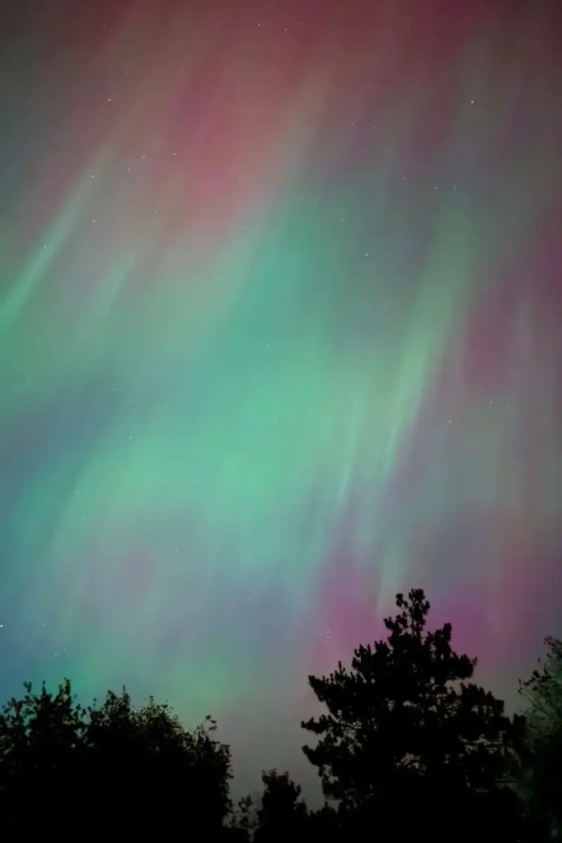
In den stillen, weiten Arenen der hohen Breiten, wo die Nacht oft endlos scheint und die Kälte beißt, entfaltet sich ein Spektakel von so transzendenter Schönheit, dass es seit Anbeginn der Menschheit Ehrfurcht und Staunen hervorruft. Der Himmel selbst wird zur Leinwand, auf der unsichtbare Kräfte ein Gemälde aus Licht und Schatten weben, das sich in Farben ergießt, die jeder Beschreibung spottend, doch das Herz im Sturm erobernd. Es ist der kosmische Tanz, die stille, doch mächtige Offenbarung der Aurora – eine Himmelserscheinung, die nicht nur unsere Sinne fesselt, sondern auch tiefe Einblicke in die komplexen Wechselwirkungen zwischen unserer Erde und der mächtigen Sonne gewährt. Weit entfernt von der Stille der irdischen Landschaften, in den unermesslichen Weiten des Sonnensystems, entspringt dieses Wunderwerk. Es beginnt mit der Sonne, jenem gewaltigen Kern unserer Existenz, der nicht nur Licht und Wärme spendet, sondern auch einen stetigen Strom geladener Partikel ins All schleudert – den Sonnenwind. Dieser Wind, der mit unglaublicher Geschwindigkeit durch den interplanetaren Raum rauscht, trägt in sich die Saat der Aurora. Seine Energie und seine elektrisch geladenen Teilchen, vornehmlich Elektronen und Protonen, sind die eigentlichen Architekten dieses himmlischen Feuerwerks. Doch die Erde ist nicht schutzlos. Ein unsichtbares Kraftfeld, unser Magnetfeld, umhüllt unseren Planeten wie ein schützender Kokon, die Magnetosphäre. Wenn der Sonnenwind, dessen Geschwindigkeit durch koronale Löcher und koronale Massenauswürfe aus der Sonne verstärkt wird, auf diese schützende Hülle trifft, entstehen Störungen. Diese Turbulenzen in der Magnetosphäre verändern die Flugbahnen der geladenen Partikel im Magnetosphärenplasma. Sie werden abgelenkt, beschleunigt und schließlich, wie von einer unsichtbaren Hand gezogen, in die oberen Schichten unserer Atmosphäre – die Thermosphäre und Exosphäre – gelenkt. Dort, in Höhen von vielen Kilometern über dem Erdboden, ereignet sich die wahre Magie. Die energiereichen Partikel des Sonnenwinds kollidieren mit den Gasatomen und -molekülen unserer Atmosphäre, hauptsächlich Sauerstoff und Stickstoff. Diese Kollisionen versetzen die atmosphärischen Bestandteile in einen angeregten Zustand. Es ist wie bei einem Blitzschlag, der eine Glühbirne zum Leuchten bringt, nur auf atomarer Ebene. Wenn diese angeregten Atome und Moleküle wieder in ihren ursprünglichen Energiezustand zurückfallen, geben sie die zuvor aufgenommene Energie in Form von Licht ab. Und genau dieses Licht ist es, das wir als Aurora bestaunen. Die Farbvielfalt der Aurora ist ebenso faszinierend wie ihre Entstehung und direkt abhängig von der Art der kollidierenden Atome und der Höhe, in der diese Kollisionen stattfinden. Sauerstoffatome sind beispielsweise für das charakteristische Grün verantwortlich, das in den meisten Auroras zu sehen ist – ein Leuchten, das typischerweise in Höhen um 100 Kilometer auftritt. Höher gelegene Sauerstoffkollisionen können ein seltenes, aber atemberaubendes Rot erzeugen. Stickstoffmoleküle wiederum tragen zu den blauen und violetten Farbtönen bei, die oft an den unteren Rändern der Aurora zu erkennen sind. Die Intensität und die Beschleunigung, die den eintretenden Partikeln verliehen wird, beeinflussen nicht nur die Helligkeit, sondern auch die Form der Aurora, die sich in Bändern um die Polregionen erstreckt. Die Etymologie der Lichter: Eine göttliche NamensgebungDie Bezeichnungen für dieses Naturwunder tragen eine tiefe historische und mythologische Resonanz. Der Begriff „Aurora Borealis“, weithin bekannt als die Nordlichter, wurde 1649 in einer Beschreibung von Pierre Gassendi verwendet, der ein beeindruckendes Polarlichtphänomen über ganz Frankreich im Jahr 1621 dokumentierte. Gassendi bezog sich dabei auf die umfangreichen Schriften Galileo Galileis, der den Begriff bereits 1619 in seinen Werken über die Aurora nutzte. Im Englischen fand der Begriff 1828 Einzug. Das Wort „Aurora“ selbst ist dem Namen der römischen Göttin der Morgenröte entlehnt, Aurora, die von Osten nach Westen reiste, um die Ankunft der Sonne zu verkünden. Schon im 14. Jahrhundert wurde „Aurora“ im Englischen verwendet. Die spezifischen Bezeichnungen „Borealis“ und „Australis“ stammen aus der griechisch-römischen Mythologie. „Borealis“ leitet sich von Boreas ab, dem antiken Gott des Nordwinds, während „Australis“ von Auster, dem Gott des Südwinds, abstammt. Es ist eine poetische Verbindung, die die Himmelslichter mit den Winden der jeweiligen Pole verknüpft – ein Zeugnis der frühen Menschheit, die in diesen Erscheinungen göttliche oder mythische Zeichen sah. Heutige Stilrichtlinien empfehlen jedoch, meteorologische Phänomene wie die Aurora borealis nicht großzuschreiben. Der Plural „Auroras“ ist im amerikanischen Englisch mittlerweile gebräuchlicher, während „aurorae“ der ursprüngliche lateinische Plural ist und oft von Wissenschaftlern verwendet wird. In einigen Kontexten wird „Aurora“ auch als unzählbare Nomen verwendet, wobei mehrere Sichtungen einfach als „die Aurora“ bezeichnet werden. Charakteristik und geographische Ausbreitung Das Auftreten der Aurora ist nicht zufällig, sondern folgt präzisen geomagnetischen Mustern. Am häufigsten werden Auroras in der sogenannten „Auroralzone“ beobachtet, einem Band von etwa 6 Grad Breite, das auf 67 Grad nördlicher und südlicher Breite zentriert ist – das entspricht einer Breite von rund 660 Kilometern. Die Region, in der eine Aurora aktuell sichtbar ist, wird als „Auroraloval“ bezeichnet. Dieses Oval ist durch den Sonnenwind verschoben und weicht in Richtung Mittag etwa 15 Grad und in Richtung Mitternacht 23 Grad vom geomagnetischen Pol (nicht dem geografischen Pol) ab. Frühe wissenschaftliche Arbeiten, insbesondere die von Elias Loomis (1860) und später detaillierter von Hermann Fritz (1881) und Sophus Tromholt (1881), lieferten entscheidende Beweise für diese geomagnetische Verbindung, indem sie statistisch belegten, dass die Aurora hauptsächlich in dieser Auroralzone erschien. In den nördlichen Breiten ist das Phänomen als Aurora Borealis oder Nordlichter bekannt. Das südliche Pendant, die Aurora Australis oder Südlichter, weist fast identische Merkmale auf und ändert sich gleichzeitig mit Veränderungen in der nördlichen Auroralzone. Die Aurora Australis ist von hohen südlichen Breiten wie der Antarktis, Patagonien, dem südöstlichen Australien, Neuseeland und den Falklandinseln aus sichtbar. Die Aurora Borealis hingegen lässt sich in arktischen Regionen wie Alaska, Kanada, Island, Grönland, den Färöer-Inseln, Skandinavien, Finnland, Schottland und Russland bestaunen. Wenn das Oval sich ausdehnt: Außergewöhnliche SichtungenEine geomagnetische Störung hat die bemerkenswerte Fähigkeit, die Auroralovale – sowohl im Norden als auch im Süden – zu erweitern. Dies führt dazu, dass die Aurora auch in niedrigeren Breiten oder weiter südlich in höheren Lagen sichtbar wird. Solche großen geomagnetischen Stürme treten am häufigsten während des Höhepunkts des 11-jährigen Sonnenfleckenzyklus oder in den drei Jahren danach auf. Bei seltenen Gelegenheiten konnte die Aurora Borealis so weit südlich wie das Mittelmeer, Ostasien und die südlichen Bundesstaaten der USA beobachtet werden, während die Aurora Australis bis nach Neukaledonien, Südafrika, der Pilbara-Region in Westaustralien und Uruguay zu sehen war. Während des Carrington-Ereignisses im Jahr 1859, dem größten jemals beobachteten geomagnetischen Sturm, wurden Auroras sogar in den Tropen gesichtet – ein eindrucksvolles Zeugnis der potenziellen Reichweite dieses Naturphänomens. Für Beobachter innerhalb des Auroralovals kann die Aurora direkt über ihnen erscheinen, ein Himmelszelt aus Licht. Aus größerer Entfernung erleuchten sie den polwärts gelegenen Horizont als ein grünliches Leuchten oder manchmal ein schwaches Rot, als ob die Sonne aus einer ungewöhnlichen Richtung aufginge. Auroras treten auch polwärts der Auroralzone als diffuse Flecken oder Bögen auf, die unter Umständen kaum sichtbar sind. Das Verhalten der geladenen Teilchen, insbesondere der Elektronen, ist komplex. Ein Elektron spiraliert (gyriert) um eine Feldlinie in einem Winkel, der durch seine Geschwindigkeitsvektoren – parallel und senkrecht zum lokalen geomagnetischen Feldvektor B – bestimmt wird. Dieser Winkel wird als „Pitchwinkel“ des Partikels bezeichnet. Der Abstand oder Radius des Elektrons von der Feldlinie wird als sein Larmor-Radius bezeichnet. Der Pitchwinkel nimmt zu, wenn sich das Elektron in eine Region größerer Feldstärke näher an der Atmosphäre bewegt. Es ist daher möglich, dass einige Partikel zurückkehren oder „spiegeln“, wenn der Winkel 90° erreicht, bevor sie in die Atmosphäre eindringen und mit den dichteren Molekülen kollidieren. Andere Partikel, die nicht spiegeln, dringen in die Atmosphäre ein und tragen zur Auroralanzeige über verschiedene Höhenbereiche bei. Formen und Höhen: Die Struktur des Himmlischen TanzesAb 1911 nutzten Carl Størmer und seine Kollegen Kameras, um mehr als 12.000 Auroras zu triangulieren. Ihre bahnbrechenden Forschungen ergaben, dass keine Auroras unter 70 Kilometern Höhe auftraten und nur 6,5 % über 150 Kilometern. Die maximale Häufigkeitsverteilung der Höhe lag bei etwa 100 Kilometern – ein entscheidender Befund, der unser Verständnis der Atmosphärenphysik und der Interaktion mit dem Sonnenwind vertiefte. Clark (2007) unterscheidet fünf Hauptformen, die vom Boden aus sichtbar sind, geordnet von der am wenigsten bis zur am meisten sichtbaren:Ein mildes Glühen, nahe am Horizont. Diese können nahe an der Sichtbarkeitsgrenze liegen, sind aber von mondbeschienenen Wolken zu unterscheiden. Sie sind die subtilsten Formen der Aurora und erfordern oft einen dunklen Himmel und eine gewisse Gewöhnung des Auges, um sie wahrzunehmen. Bögen: Ein weicher, bandförmiger Bogen, der sich über den Himmel erstreckt. Strahlen: Schmale, vertikale Lichtstrahlen, die oft aus Bögen aufsteigen. Vorhänge: Die ikonischsten Formen, die wie schimmernde Vorhänge oder Draperien aussehen, die sich dynamisch am Himmel bewegen und tanzen. Koronas: Wenn die Aurora direkt über dem Beobachter liegt und die Strahlen sich wie eine Krone oder ein Fächer in alle Richtungen ausbreiten.Neben diesen häufigeren Formen wurden auch andere Arten von Auroras aus dem Weltraum beobachtet, die vergleichsweise selten und noch nicht vollständig verstanden sind. Dazu gehören „polwärts gerichtete Bögen“, die sich sonnenwärts über die Polarkappe erstrecken, die damit verbundene „Theta-Aurora“ und „tagseitige Bögen“ nahe der Mittagszeit. Weitere interessante Effekte sind pulsierende Auroras, die „schwarze Aurora“ und ihr seltener Begleiter, die „Anti-Schwarz-Aurora“, sowie schwer sichtbare rote Bögen. Ergänzend zu all dem wird ein schwaches Leuchten (oft tiefrot) um die beiden polaren Spitzen beobachtet, jene Feldlinien, die die sich durch die Erde schließenden von denen trennen, die in den Schweif gerissen werden und sich entfernt schließen. Die Fähigkeit der Erde, diese strahlenden Manifestationen kosmischer Energie zu beherbergen, ist nicht einzigartig im Sonnensystem. Auch andere Planeten wie Jupiter und Saturn, Braune Zwerge, Kometen und sogar einige natürliche Satelliten wie Jupiters Mond Ganymed, zeigen ihre eigenen, einzigartigen Auroras – ein Beweis dafür, dass die Wechselwirkung zwischen Sternenwinden und planetaren Magnetfeldern ein universelles Phänomen ist, das über die Grenzen unserer eigenen Welt hinausgeht. Die Aurora ist weit mehr als nur ein visuell beeindruckendes Naturphänomen. Sie ist ein lebendiges, atmendes Zeugnis der komplexen physikalischen Prozesse, die unser Sonnensystem formen. Jedes Flackern, jeder Vorhang, jede Farbe erzählt eine Geschichte von der unermüdlichen Aktivität unserer Sonne und dem schützenden Schild unserer Erde. Sie erinnert uns daran, dass wir, selbst in den stillsten Nächten, mit dem unermesslichen, dynamischen Kosmos verbunden sind. Für jeden Reisenden und Beobachter bleibt die Begegnung mit der Aurora ein unvergessliches Erlebnis, das die Seele berührt und den Blick auf die Majestät des Universums weitet. Es ist ein himmlisches Spektakel, das uns immer wieder an die Wunder erinnert, die jenseits unseres täglichen Horizonts liegen. #Gezi #AuroraBorealis #AuroraAustralis #Naturwunder #Polarlichter
-
 John Explorer
 - 13 Jul, 2026 09:17
Where Earth Breathes Ages: A Deep Dive into Grand Canyon National Park
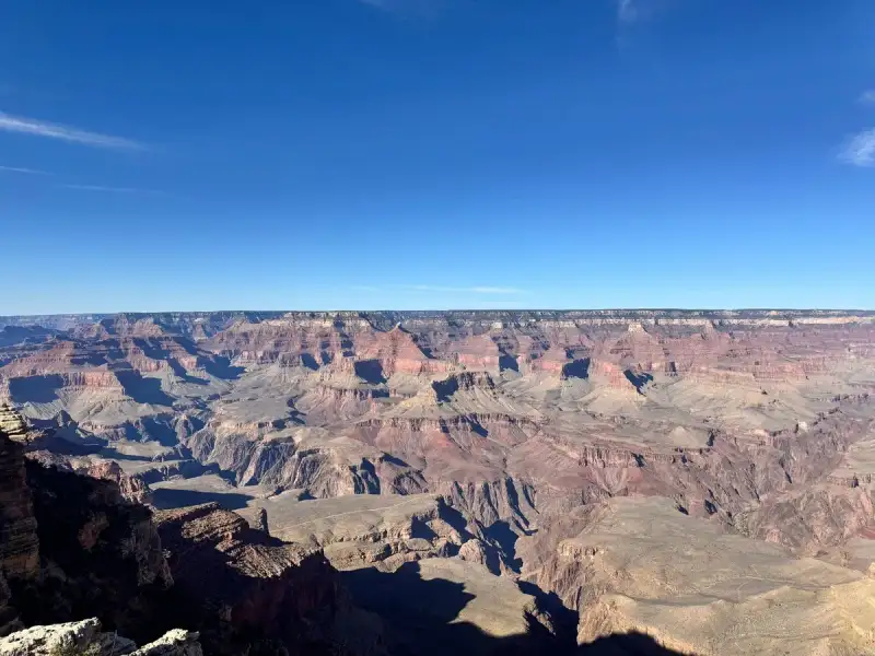
In the vast silence of northwestern Arizona, where the earth has been meticulously carved by the relentless hand of time, lies a chasm that defies easy description: the Grand Canyon. It is not merely a geological formation but a profound statement, an open book of epochs, often hailed as one of the natural Wonders of the World. Sprawling across 1,217,262 acres of unincorporated land within Coconino and Mohave counties, this majestic gorge, sculpted by the mighty Colorado River, forms the heart of Grand Canyon National Park. As the 15th site to earn the prestigious national park designation, it has captivated millions, drawing over 4.9 million recreational visitors in 2024 alone, a testament to its enduring, almost primordial, allure. Its significance extends beyond national borders, having been recognized globally as a UNESCO World Heritage Site in 1979, a fitting tribute to a landscape that celebrated its centenary on February 26, 2019. A Tapestry Woven by Time: Geological Genesis The true marvel of the Grand Canyon lies not just in its breathtaking scale but in the story told by its exposed layers of colorful rocks. This colossal cut through the Colorado Plateau reveals a stratigraphic record stretching back to Precambrian times, offering geologists and casual observers alike an unparalleled glimpse into Earth's ancient past. The canyon's formation is a dramatic saga of uplift and erosion. Millennia ago, the Colorado Plateau began its slow, inexorable rise. As it ascended, the nascent Colorado River system, already charting its course, began to incise itself deeper and deeper into the bedrock, relentlessly carving the intricate network of canyons we see today. It is this combination of sheer size, profound depth, and the brilliantly exposed, multi-hued strata that elevates the Grand Canyon from a mere valley to a geological masterpiece, a living laboratory where the forces of nature have painted history in stone. The river, a sculptor of unimaginable patience and power, continues its work, a constant reminder of the dynamic forces that shaped and continue to shape our planet.The Long Road to Preservation: A Century of Stewardship The story of the Grand Canyon's official protection is as vast and complex as its geological history. While indigenous peoples had revered this land for millennia, it only began to capture the widespread American imagination in the 1880s, spurred by the expansion of railroads and the nascent development of tourism infrastructure. Yet, the path to national park status was anything but direct. One of its most influential champions was President Theodore Roosevelt, whose 1903 visit left him profoundly moved. "The Grand Canyon fills me with awe," he declared, his words echoing through the annals of conservation. "It is beyond comparison—beyond description; absolutely unparalleled throughout the wide world… Let this great wonder of nature remain as it now is. Do nothing to mar its grandeur, sublimity and loveliness. You cannot improve on it. But you can keep it for your children, your children's children, and all who come after you, as the one great sight which every American should see." These impassioned words underscored a deep conviction for preservation, yet even Roosevelt’s formidable influence could not immediately confer national park status upon the Grand Canyon. The legislative struggle began much earlier, in 1882, when then-Senator Benjamin Harrison introduced the first bill to establish Grand Canyon as the United States' third national park, following Yellowstone and Mackinac. His efforts in 1883 and 1886 proved unsuccessful. However, upon his election to the presidency, Harrison managed to establish the Grand Canyon Forest Reserve in 1893, marking an important preliminary step in its formal protection. Roosevelt, picking up the mantle, further solidified its protected status, first creating the Grand Canyon Game Preserve by proclamation on November 28, 1906, and then designating it as the Grand Canyon National Monument on January 11, 1908. Despite these significant actions and Roosevelt's fervent advocacy, subsequent Senate bills aimed at establishing it as a national park faced defeat in 1910 and 1911. It wasn't until February 26, 1919, that President Woodrow Wilson finally signed the Grand Canyon National Park Act (Pub. L. 65–277) into law, securing its permanent protection as a national park. The administration of this newly designated park fell to the National Park Service, which itself had been established just three years prior, in 1916. This triumph was a landmark achievement for the burgeoning conservation movement, embodying a collective will to safeguard natural wonders for future generations. Crucially, its national park status proved instrumental in repelling proposals to dam the Colorado River within its pristine boundaries, though the Glen Canyon Dam would later be constructed upriver, illustrating the continuous vigilance required in environmental stewardship.The park's boundaries and protective measures continued to evolve. In 1932, a second Grand Canyon National Monument was proclaimed to the west, expanding the scope of its preservation. A pivotal moment came in 1975 with the Grand Canyon National Park Enlargement Act, an act of Congress signed on January 3 (Pub. L. 93–620). This legislation integrated the 1932 monument and the Marble Canyon National Monument—established in 1969 and encompassing the Colorado River northeast from the Grand Canyon to Lees Ferry—into the expansive Grand Canyon National Park. Four years later, on October 26, 1979, the international community formally recognized its global significance when UNESCO declared the park a World Heritage Site, solidifying its place among the planet's most treasured natural landscapes. However, the designation did not end the challenges. By 1987, the National Parks Overflights Act highlighted emerging threats, stating that "Noise associated with aircraft overflights at the Grand Canyon National Park is causing a significant adverse effect on the natural quiet and experience of the park and current aircraft operations at the Grand Canyon National Park have raised serious concerns regarding public safety, including concerns regarding the safety of park users." This underscores the ongoing delicate balance between access and preservation. In a modern nod to its iconic status, Grand Canyon National Park was honored with its own coin in 2010 as part of the America the Beautiful Quarters program. On February 26, 2019, the park proudly commemorated a century since its initial designation, reflecting on a hundred years of dedicated protection. Administratively, the park transitioned from the National Park Service's Intermountain Region until 2018, now falling under Region 8, also known as the Lower Colorado Basin, ensuring its continued oversight. The park also faces contemporary threats, as evidenced by the Dragon Bravo Fire on July 9, 2025, which tragically led to the destruction of multiple structures on the North Rim, including the historic Grand Canyon Lodge, burning for over a week concurrently with the White Sage Fire. Such events serve as stark reminders of the ongoing vulnerability of even the most protected natural treasures. Stewards of the Sublime: The Administrators Behind the grandeur of the Grand Canyon lies a legacy of dedicated individuals who have overseen its protection and management. From its initial acting administrators like William Harrison Peters in 1919 and John Roberts White in 1921, to longer-serving superintendents such as Miner Raymond Tillotson (1927–1938) and Harold Child Bryant (1941–1954), each has played a crucial role in safeguarding this immense wilderness. The continuous chain of leadership, from Dewitt L. Raeburn to Ed Keable, who took the helm in April 2020, reflects an unwavering commitment from the National Park Service to maintain the canyon's integrity, manage its complex ecosystems, and provide an unparalleled experience for its millions of visitors, navigating the challenges of both natural forces and human impact over more than a century. Navigating the Immensity: A Geographic Overview The Grand Canyon's geography is defined by its sheer scale and rugged character. Beyond the well-trodden paths of its primary public areas, the vast majority of the park remains incredibly remote and challenging to access, a testament to its wild heart. While some intrepid explorers venture into these backcountry realms via pack trails and rugged roads, the park's primary public face is presented by its two distinct rims: the South Rim and the North Rim. The Accessible South Rim For the overwhelming majority of visitors, the journey to the Grand Canyon leads to the South Rim. Its superior accessibility, primarily via Arizona State Route 64, which enters the park near Tusayan, is a key factor, accounting for a staggering 90% of the park's total visitation. This ease of access ensures that countless individuals can experience the canyon's grandeur firsthand. The park headquarters are strategically located at Grand Canyon Village, a hub of activity and services situated conveniently near the South Entrance and offering proximity to some of the most popular and iconic viewpoints. From these vantage points, visitors are treated to expansive, sweeping vistas of the canyon's immense scale and its intricate geological features, a truly humbling experience that etches itself into memory.While the provided data emphasizes the South Rim's prominence, the existence of the North Rim, though less visited, implies a distinct character—likely more remote, higher in elevation, and offering different perspectives on the canyon's vastness. The contrast between these two primary public areas further highlights the diverse experiences the Grand Canyon offers, from readily accessible panoramas to more secluded, wilderness encounters for those willing to venture deeper. The sheer magnitude of the canyon, and its complex network of tributary canyons, means that even after decades of exploration and preservation, it retains an air of mystery and an endless capacity to inspire awe. The Grand Canyon National Park stands as a monumental achievement, both of nature's raw power and humanity's collective will to protect it. From its ancient Precambrian foundations to its hard-won national park status, and through the continuous efforts of its many stewards, this site remains a beacon for conservation. It is a place where one can truly feel the pulse of the earth, witness the artistry of geological time, and understand the profound importance of safeguarding such unparalleled natural heritage for every generation yet to come. It is more than a destination; it is an enduring journey into the heart of our planet's magnificence.#GrandCanyon #NationalPark #ArizonaTravel #UNESCOHeritage #GeologicalWonder
-
 Aisha Sharma
 - 12 Jul, 2026 19:38
The Arctic's Whispering Skies: Your Ultimate Guide to Unlocking Scandinavia's Northern Lights Mystique
Greetings, fellow adventurers and dreamers! It's Aisha Sharma, and today, we're diving headfirst into one of the most breathtaking spectacles our planet has to offer: the Aurora Borealis. Imagine standing under a canvas of infinite stars, as ethereal ribbons of green, pink, and purple dance across the night sky, whispering ancient tales. This isn't a scene from a fantasy novel; it's a very real, very accessible phenomenon that awaits you in the pristine wilderness of Scandinavia. For decades, I’ve traversed the globe, seeking out wonders that ignite the soul, and few experiences compare to the profound awe inspired by the Northern Lights. Scandinavia, comprising Norway, Sweden, and Finland, is not just a region; it's a pilgrimage site for aurora chasers. Its unique geographical position within the "auroral oval" – a ring around the magnetic North Pole – combined with vast, unpolluted dark skies, makes it a prime viewing destination. From the dramatic fjords of Norway to the serene forests of Finnish Lapland and the icy wilderness of Swedish Lapland, each country offers a distinct backdrop to this celestial ballet. But simply showing up isn't enough. Chasing the aurora requires strategic planning, a keen understanding of the science, and a readiness to embrace the Arctic environment. This comprehensive guide, born from countless nights under the Arctic sky, will equip you with everything you need to transform your dream of seeing the Northern Lights into an unforgettable reality, backed by factual insights and actionable advice. Prepare to unlock the secrets to a truly magical experience. Understanding the Aurora Borealis: The Science Behind the Spectacle To truly appreciate the Northern Lights, it helps to understand the incredible cosmic mechanics that orchestrate their appearance. The aurora is, at its heart, a magnificent solar-terrestrial interaction. It begins over 150 million kilometers away, on the surface of our sun. Solar flares and coronal mass ejections (CMEs) release a torrent of charged particles – primarily electrons and protons – into space. This phenomenon, known as solar wind, travels at speeds ranging from 400 to 800 kilometers per second, taking between two and five days to reach Earth. Upon arrival, these energized particles encounter Earth's magnetic field. Most are deflected, but some manage to penetrate the magnetic shield near the poles, where the field lines converge. As these solar particles collide with atoms and molecules in Earth's upper atmosphere, typically at altitudes between 80 and 500 kilometers, they excite these atmospheric gases. When these excited atoms and molecules return to their original, lower energy state, they emit photons of light – creating the vibrant glow we know as the aurora. The specific color depends on the type of gas molecule and the altitude at which the collision occurs. Oxygen atoms, for instance, are responsible for the most common green-yellow hues (at lower altitudes, ~100-200 km) and the rarer red auroras (at higher altitudes, ~200-400 km). Nitrogen molecules produce blue or purple light. The intensity of the aurora is often quantified by the Kp-index, a global geomagnetic activity index that ranges from 0 to 9. A Kp-index of 0-1 indicates very weak activity, while a Kp of 5 or higher signifies a geomagnetic storm, leading to highly visible and widespread auroras. While a Kp of 2-3 can yield beautiful displays, higher values drastically increase your chances and the aurora's vibrancy. Forecasting is crucial, with organizations like NOAA's Space Weather Prediction Center providing short-term (30-minute) and long-term (3-day) forecasts. Understanding these scientific underpinnings allows for more strategic planning, ensuring you're in the right place at the right time to witness this celestial masterpiece. The magnetic poles, specifically within the auroral oval, are where these field lines are weakest, acting like a funnel for the charged particles, which is precisely why Scandinavia, particularly its northern regions, offers such consistent and spectacular shows.Prime Locations in Scandinavia for Aurora Chasing Scandinavia offers an unparalleled array of destinations for aurora hunters, each with its unique charm and viewing advantages. The key to successful aurora chasing lies in venturing above the Arctic Circle, minimizing light pollution, and choosing locations known for their clear skies and auroral activity. Norway: Often considered the jewel of aurora tourism, Norway's long coastline stretches deep into the auroral oval, offering dramatic backdrops of fjords and mountains.Tromsø: Dubbed the "Gateway to the Arctic," Tromsø (69.6°N) is arguably Norway's most popular aurora destination. It's a bustling city with excellent infrastructure, including an international airport, numerous tour operators, and a variety of accommodation options. While the city itself has some light pollution, most tours take you just outside to darker areas. Data from local weather stations indicates that Tromsø experiences an average of 200 aurora nights per year between September and March. Lofoten Islands: Further south (around 68°N), the Lofoten Islands offer arguably the most scenic aurora backdrop, with rugged mountains rising directly from the sea. Less crowded than Tromsø, but requiring more self-sufficiency. Viewings are frequent, though weather can be more variable due to coastal proximity. North Cape (Nordkapp): At 71°N, this is continental Europe's northernmost point. It's remote, wild, and incredibly dark, offering unimpeded views of the northern sky. Best accessed from Honningsvåg.Sweden: Swedish Lapland is characterized by vast, unspoiled wilderness and consistent cold, dry weather, often leading to clearer skies than coastal Norway.Abisko National Park: Widely hailed as one of the very best places on Earth to see the Northern Lights. Abisko (68.3°N) benefits from a unique microclimate created by the surrounding mountains that keep the skies clear. The "Blue Hole of Abisko" is a local phenomenon where the sky over Lake Torneträsk often remains clear even when surrounding areas are cloudy. The Aurora Sky Station, accessible by chairlift, offers an elevated, light-pollution-free viewing platform. Statistical data from the Swedish Institute of Space Physics (IRF) confirms a significantly higher number of clear nights in Abisko compared to other Arctic locations. Kiruna: Sweden's northernmost city, Kiruna (67.8°N), serves as a major hub for Swedish Lapland and is close to the iconic ICEHOTEL in Jukkasjärvi. It offers a good balance of accessibility and proximity to dark skies.Finland: Finnish Lapland provides a magical, snowy wonderland experience, synonymous with Santa Claus and winter activities, alongside incredible aurora displays.Rovaniemi: While known as the official hometown of Santa Claus (66.5°N, just on the Arctic Circle), Rovaniemi is also a solid base for aurora hunting, especially in its surrounding dark areas. It offers excellent air connections and a wide range of activities. Levi, Saariselkä, and Inari: These fell villages (all around 68-69°N) are further north than Rovaniemi and offer exceptionally dark skies. Saariselkä is famous for its "Kaamos" or polar night period, ensuring prolonged darkness. Inari, located by Lake Inari, Finland's third-largest lake, provides vast, open views over the frozen expanse, minimizing light obstruction. These areas are particularly popular for glass igloo accommodations, offering a unique viewing experience directly from your bed. Choosing your prime location depends on your travel style, budget, and desired activities beyond aurora chasing.Optimal Timing & Weather Considerations Successfully chasing the Northern Lights is as much about timing and understanding weather patterns as it is about choosing the right location. Patience and flexibility are paramount. Best Season: The aurora season generally spans from late August/early September to early April. Within this window, the prime months are typically September through October and February through March.September-October: The autumn months offer slightly milder temperatures, making outdoor waiting more comfortable. The landscapes are often vibrant with autumn colors, and frozen lakes haven't yet locked down, allowing for different transportation options like boat tours. However, rain or snow can be more frequent, potentially obscuring views. November-January: These are the darkest months, including the polar night period (Kaamos) above the Arctic Circle, where the sun doesn't rise for weeks. This means maximum darkness, increasing viewing opportunities in terms of hours. However, temperatures plummet, often reaching -20°C to -30°C or even colder, and heavy snowfall can lead to increased cloud cover. February-March: As spring approaches, daylight hours gradually lengthen, but there's still ample darkness for aurora viewing. Temperatures remain cold but often less extreme than deep winter. This period frequently offers a good balance of cold, clear nights and manageable temperatures, making it a very popular time for visitors.Daily Timing: The best time to see the aurora is typically between 9:00 PM and 2:00 AM local time, though it can appear anytime from sunset to sunrise. Most tour operators schedule their chases during these hours. It's crucial to stay vigilant throughout the night, as displays can intensify or fade rapidly. Moon Phases: While the aurora is bright enough to be seen even under a full moon, a new moon phase or a crescent moon provides the darkest skies, allowing fainter auroras to be more visible and stars to shine more brightly, enhancing the overall experience. Check moon phase calendars when planning your trip. Cloud Cover: This is the single biggest factor beyond solar activity that can make or break your aurora hunt. Even with a strong Kp-index, if the sky is overcast, you won't see anything.Local Weather Forecasts: Constantly monitor local weather forecasts for cloud cover. Websites like Yr.no (for Norway and globally), AccuWeather, or local meteorological services are invaluable. Aurora Apps: Use dedicated aurora forecasting apps (e.g., My Aurora Forecast, Aurora Alerts) that combine Kp-index data with cloud cover maps, often showing satellite imagery of clear patches. Mobility: Being mobile is a significant advantage. Aurora chase tours specialize in driving to areas known for clear skies, sometimes crossing borders into different weather zones. If you rent a car, be prepared to do the same, but always prioritize safety on icy roads.Remember, the aurora is a natural phenomenon, and guarantees are impossible. However, by selecting the optimal time window and remaining flexible with your viewing locations based on real-time weather, you significantly increase your chances of witnessing this celestial marvel.👉 Continue Reading: The Arctic's Whispering Skies: Your Ultimate Guide to Unlocking Scandinavia's Northern Lights Mystique (Part 2)#AuroraBorealis #NorthernLights #ScandinaviaTravel #ArcticAdventures #TravelGuide #SustainableTourism Related InsightsExploring Ani, City of 1001 Churches The Twenty Million Dollar View: A History of Humanity's Most Exclusive Destination Azure Horizons and Fragile Ecosystems: The Maldives Reality Check{ "@context": "https://schema.org", "@type": "FAQPage", "mainEntity": [ { "@type": "Question", "name": "What is the main focus of The Arctic's Whispering Skies: Your Ultimate Guide to Unlocking Scandinavia's Northern Lights Mystique?", "acceptedAnswer": { "@type": "Answer", "text": "Embark on an epic journey to witness the Aurora Borealis in Scandinavia with this expert guide covering science, locations, timing, budgeting, and photography." } }, { "@type": "Question", "name": "Who authored the comprehensive guide on The Arctic's Whispering Skies: Your Ultimate Guide to Unlocking Scandinavia's Northern Lights Mystique?", "acceptedAnswer": { "@type": "Answer", "text": "This detailed article and its insights were carefully researched and authored by Aisha Sharma." } }, { "@type": "Question", "name": "Where can I find more related content about Travel?", "acceptedAnswer": { "@type": "Answer", "text": "You can explore more articles, detailed reviews, and similar insights by browsing the Related Insights section at the bottom of this article or visiting our dedicated Travel category page." } } ] }
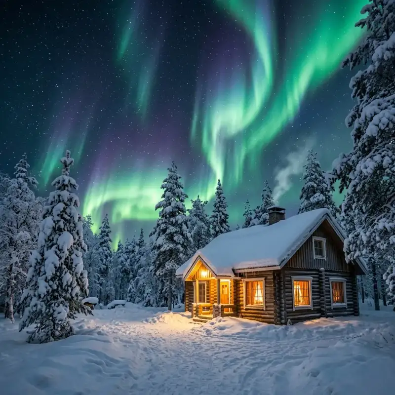
- Aisha Sharma
- 12 Jul, 2026 19:38
The Arctic's Whispering Skies: Your Ultimate Guide to Unlocking Scandinavia's Northern Lights Mystique (Part 2)
This is Part 2 of the series. Read Part 1 here.Planning Your Expedition: Logistics and Budgeting Embarking on an Arctic adventure to chase the Northern Lights requires meticulous planning, especially concerning logistics and managing the higher cost of living in Scandinavia. A well-thought-out itinerary and budget can make all the difference. Visa Requirements: For most international travelers, Scandinavia falls under the Schengen Area. Citizens of many countries, including the US, Canada, UK, Australia, and New Zealand, can enter visa-free for up to 90 days within any 180-day period for tourism. However, starting in mid-2025 (latest information as of 2024), travelers from visa-exempt countries will need to apply for an ETIAS (European Travel Information and Authorization System) authorization prior to their trip. This is not a visa but a pre-travel screening, costing around €7. Always check the latest visa and entry requirements from official government sources well in advance of your departure. Flights & Transportation:International Flights: Major international airports like Oslo Gardermoen (OSL), Stockholm Arlanda (ARN), and Helsinki-Vantaa (HEL) are primary gateways. From these hubs, you'll typically take domestic flights to Arctic destinations (e.g., Tromsø (TOS), Kiruna (KRN), Rovaniemi (RVN)). Expect round-trip economy fares from North America to Scandinavia to range from €500-€900 ($550-$1000 USD), depending on booking time and season. Inter-Scandinavia flights can range from €100-€300. Local Transportation: In most aurora destinations, public transport can be limited. Renting a car offers flexibility for self-guided aurora chases, but be prepared for challenging winter driving conditions (studded tires are mandatory in winter). Many choose organized tours, which include transport. Trains are an excellent option for scenic travel between certain cities, for example, the Arctic Circle Express from Narvik (Norway) to Kiruna (Sweden).Accommodation: Options range from budget hostels to luxurious ice hotels and glass igloos.Standard Hotels/Guesthouses: Expect to pay €80-€150 per night for a basic room, €150-€300 for mid-range. Ice Hotels (e.g., ICEHOTEL in Jukkasjärvi, Sweden): A unique experience, but pricey, starting from €250-€500 per night for an 'ice room', warmer rooms are also available. Glass Igloos/Cabins (e.g., Kakslauttanen Arctic Resort in Finland): Iconic for aurora viewing from bed, these can cost upwards of €400-€800+ per night. Airbnb/Self-Catering: Often a more budget-friendly option, especially for groups, allowing for cooking and cost savings on meals.Tours & Activities:Aurora Chase Tours: Highly recommended for first-timers, these typically cost €100-€200 per person per night and include transportation, expert guides, thermal suits, and sometimes hot drinks/snacks. Guides monitor conditions and drive to clear spots. Dog Sledding/Snowmobiling: Popular daytime activities, ranging from €150-€300 per person. Reindeer Sledding, Sami Cultural Experiences: Around €80-€150.Food & Drink: Scandinavia is renowned for its high cost of living.Groceries: Budget €20-€40 per day if cooking for yourself. Restaurant Meals: A casual lunch can be €15-€25, while dinner in a mid-range restaurant can easily be €30-€60+ per person. Alcohol is particularly expensive.Clothing & Gear: This is non-negotiable. Arctic temperatures demand proper attire.Base Layers: Merino wool or synthetic thermal underwear (top and bottom). Mid-Layers: Fleece or down jacket/vest. Outer Layers: Waterproof and windproof heavy winter jacket and trousers. Many aurora tours provide thermal overalls. Extremities: Warm hat covering ears, thick wool/fleece neck gaiter, waterproof insulated gloves/mittens (two pairs: thin inner, thick outer), insulated, waterproof winter boots (Sorel, Baffin recommended). Camera Gear: Tripod, remote shutter release, extra batteries (cold drains them quickly), wide-angle lens.Sample 7-Day Budget for Aurora Trip (Mid-Range, per person, excluding international flights):Category Estimated Cost (EUR) NotesDomestic Flights 250 - 450 Round trip from major hub (e.g., Oslo to Tromsø)Accommodation (6 nights) 900 - 1500 Mid-range hotels/guesthouses (€150-€250/night). Could be lower with hostels or higher for luxury igloos.Aurora Chase Tours 300 - 600 2-3 guided tours (€150-€200 each) to maximize chances.Daytime Activities 300 - 500 E.g., 1 dog sledding tour, museum entry, local transport.Food & Drink 350 - 500 Mix of self-catering (breakfast, some lunches) and eating out for dinner (€50-€70/day average).Warm Clothing/Gear 0 - 200 If renting or buying specific items. Tours often provide overalls.Miscellaneous 100 - 200 Souvenirs, unforeseen expenses, etc.Total Estimated Cost 2200 - 3950 Excludes international flights. Budget travelers might aim for €1500-€2000.This table illustrates that a realistic mid-range budget for a 7-day aurora trip in Scandinavia, excluding your main international flight, can range from €2,200 to €3,950 per person. Being prepared for these costs is key to an enjoyable, stress-free adventure. Mastering Aurora Photography: Capturing the Elusive Dance Witnessing the Northern Lights is an experience that transcends description, but capturing its ephemeral beauty through photography allows you to relive those moments and share them with others. Aurora photography requires specific techniques and gear due to the low-light conditions and dynamic nature of the phenomenon. Essential Gear:DSLR or Mirrorless Camera: A camera that allows full manual control over aperture, shutter speed, and ISO is essential. Modern cameras with good low-light performance (higher ISO capabilities with less noise) are advantageous. Wide-Angle Lens: A lens with a focal length between 14mm and 24mm (on a full-frame sensor) or equivalent on APS-C is ideal. This allows you to capture more of the sky and landscape. A fast aperture (f/2.8 or wider, e.g., f/1.4 or f/1.8) is critical for gathering maximum light. Sturdy Tripod: Non-negotiable. Long exposure times mean even the slightest camera movement will result in blurry images. A robust tripod will keep your camera steady in potentially windy conditions. Remote Shutter Release (or Intervalometer): This prevents camera shake when pressing the shutter button. Alternatively, use your camera's self-timer (2-second delay). Extra Batteries: Cold temperatures drain batteries rapidly. Carry at least 2-3 spare batteries, keeping them warm in an inside pocket until needed. Headlamp with Red Light Mode: A headlamp is crucial for seeing in the dark, but use a red light setting to preserve your night vision and avoid disturbing others or interfering with their photos.Camera Settings (Starting Points):Manual Mode (M): You need full control. Aperture (f-stop): Set your lens to its widest aperture (smallest f-number), e.g., f/2.8, f/4. This lets in the most light. ISO: Start with ISO 800-1600. Adjust based on the aurora's brightness. For fainter auroras, you might go up to ISO 3200 or even 6400, but be mindful of increased digital noise. Shutter Speed: This depends on the aurora's movement. Fast, dancing aurora: 5-15 seconds. Longer exposures will blur the distinct curtain-like shapes. Slow, faint aurora: 15-30 seconds. This allows more light to be captured. Experiment to find the sweet spot.Focus: Set your lens to manual focus (MF) and focus to infinity. A good trick is to focus on a distant star or the moon (if visible) using live view and then zoom in to ensure sharpness before locking focus. Alternatively, some lenses have an infinity mark, but verify its accuracy. White Balance: Auto White Balance (AWB) often works well, but you can experiment with Kelvin temperatures (e.g., 3500K-4500K) for a cooler, more natural look. Image Format: Shoot in RAW. This captures the most data, giving you maximum flexibility for post-processing adjustments (exposure, white balance, noise reduction) without degrading image quality.Practical Tips:Composition: Include a foreground element (trees, mountains, cabins, or even yourself) to add scale and interest to your photos. Stay Warm: Your comfort directly impacts your concentration. Wear multiple layers, insulated boots, and thick gloves. Consider hand warmers for yourself and your camera batteries. Protect Your Gear: Condensation can be an issue when moving from cold outdoors to warm indoors. Place your camera in a sealed plastic bag before coming inside and let it warm up slowly to room temperature to prevent condensation from forming on or inside the lens and camera body. Practice: Familiarize yourself with your camera settings in the dark before the aurora appears. Practice focusing and adjusting settings in low light.Mastering aurora photography is a rewarding challenge. With the right gear, settings, and patience, you'll be able to capture the magic of the Northern Lights and cherish those incredible memories forever.Responsible Aurora Chasing: Sustainable Tourism in the Arctic As aurora tourism continues to grow, it's increasingly important to practice responsible travel and minimize our impact on the fragile Arctic environment and local communities. Sustainable aurora chasing ensures that this wonder remains accessible for future generations and respects the unique culture of the region. Environmental Impact:Minimize Light Pollution: Light pollution is the enemy of aurora viewing. When out chasing, avoid using bright flashlights or phone screens unnecessarily. If a headlamp is needed, use a red light setting. Support local businesses that also prioritize dark sky preservation. Leave No Trace: The Arctic wilderness is pristine. Carry out everything you carry in, including all trash, food wrappers, and cigarette butts. Stick to designated paths and avoid disturbing flora and fauna. Even seemingly minor disturbances can have long-lasting effects in cold, slow-growing ecosystems. Energy Consumption: Be mindful of your energy usage in accommodations. Heating large spaces in sub-zero temperatures consumes significant energy. Turn off lights and lower thermostats when leaving your room. Choose eco-certified accommodations where possible. Transportation Choices: While flying is often necessary to reach the Arctic, consider combining train travel for scenic routes or choosing operators that use more fuel-efficient vehicles for tours. Carpool when possible.Respecting Local Communities and Culture:Sámi Culture: Scandinavia's Arctic regions are the traditional homelands of the Sámi people, the indigenous population. Their culture is deeply intertwined with the land and reindeer herding. When participating in Sámi-themed activities (e.g., reindeer sledding, cultural camps), choose ethical operators who genuinely respect and promote Sámi traditions and livelihoods, ensuring fair compensation and authentic experiences. Avoid exploitative or superficial portrayals. Support Local Businesses: Patronize local restaurants, shops, and tour operators. This directly contributes to the local economy and helps communities thrive, reducing the impact of mass tourism on smaller, more vulnerable businesses. Cultural Sensitivity: Be aware of local customs and traditions. Politeness, punctuality, and an open mind are always appreciated. Ask permission before taking photos of people, especially in cultural settings. Noise Levels: The Arctic wilderness is often profoundly silent. Be mindful of noise levels, especially at night when out aurora chasing, to avoid disturbing wildlife or other aurora viewers.Wildlife Encounters:Observe from a Distance: If you encounter Arctic wildlife (reindeer, moose, foxes), observe them from a safe and respectful distance. Never feed wild animals. Driving Safely: Be extremely cautious when driving, especially at dusk and dawn. Reindeer and moose often wander onto roads, and collisions can be dangerous for both animals and humans. Guided Tours: For activities like dog sledding or snowmobiling, choose reputable operators who prioritize animal welfare and operate sustainably. Ensure the animals are well-cared for and not overworked.By incorporating these principles into your travel plans, you not only ensure a more enriching experience for yourself but also contribute to the preservation of the Arctic's natural beauty and cultural heritage. Responsible aurora chasing is about being a mindful guest in a truly spectacular, yet vulnerable, part of the world. Conclusion Chasing the Northern Lights in Scandinavia is more than just a trip; it's an expedition into the heart of nature's most dazzling artistry. From the scientific dance of solar particles and atmospheric gases to the logistical ballet of planning and budgeting, every step of this journey is an adventure in itself. We've explored the optimal viewing locations from the dramatic fjords of Norway to the serene forests of Finnish Lapland, delved into the critical timing and weather considerations, meticulously budgeted for a realistic Arctic experience, and equipped you with the technical prowess to capture these elusive light shows. Remember that patience and flexibility are your greatest allies. The aurora is a natural phenomenon, and while we can maximize our chances, there are no guarantees. Embrace the unexpected, revel in the stunning Arctic landscapes, and soak in the unique culture of the North. Whether you find yourself enveloped in the profound silence of a snowy forest as green ribbons unfurl above, or hear the excited murmurs of fellow travelers as a sudden burst of pink ignites the sky, the memory of the Aurora Borealis will be etched into your soul forever. This isn't just about seeing lights; it's about connecting with the raw power and immense beauty of our universe. Pack your warmest clothes, calibrate your camera, and prepare for an odyssey into the whispering skies of Scandinavia. May your skies be clear and your auroras be bright! Safe travels and happy chasing! Warmly, Aisha Sharma#AuroraBorealis #NorthernLights #ScandinaviaTravel #ArcticAdventures #TravelGuide #SustainableTourism Related InsightsBeyond the Sands: Unveiling Oman’s Thriving Tourism Tapestry 宏村:画中的明清古村落 Fantasmi sulla Via della Seta: Il richiamo silenzioso delle oasi perdute del Turkmenistan{ "@context": "https://schema.org", "@type": "FAQPage", "mainEntity": [ { "@type": "Question", "name": "What is the main focus of The Arctic's Whispering Skies: Your Ultimate Guide to Unlocking Scandinavia's Northern Lights Mystique (Part 2)?", "acceptedAnswer": { "@type": "Answer", "text": "Embark on an epic journey to witness the Aurora Borealis in Scandinavia with this expert guide covering science, locations, timing, budgeting, and photography." } }, { "@type": "Question", "name": "Who authored the comprehensive guide on The Arctic's Whispering Skies: Your Ultimate Guide to Unlocking Scandinavia's Northern Lights Mystique (Part 2)?", "acceptedAnswer": { "@type": "Answer", "text": "This detailed article and its insights were carefully researched and authored by Aisha Sharma." } }, { "@type": "Question", "name": "Where can I find more related content about Travel?", "acceptedAnswer": { "@type": "Answer", "text": "You can explore more articles, detailed reviews, and similar insights by browsing the Related Insights section at the bottom of this article or visiting our dedicated Travel category page." } } ] }
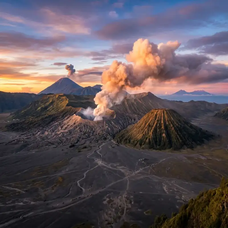
- Zola Ndlovu
- 12 Jul, 2026 17:32
Unleash Your Inner Explorer: Conquering Java's Fiery Peaks From Bali's Shores – A Definitive Guide
Indonesia, an archipelago born of fire, offers some of the planet’s most breathtaking and accessible volcanic landscapes. While Bali captivates with its serene beaches and vibrant culture, just a short journey west lies the rugged, otherworldly beauty of East Java – home to two of the world's most iconic and active volcanoes: Mount Bromo and Kawah Ijen. For the intrepid traveler, the transition from Bali’s tranquil rice paddies to Java’s smoking craters isn't merely a change in scenery; it’s an immersive expedition into the raw, pulsating heart of the Earth. As Zola Ndlovu, an expert in transformative travel experiences, I can attest that the challenge of ascending these peaks is profoundly rewarding, revealing vistas that defy imagination and stories etched in sulfur and ash. This isn't just a travelogue; it's a meticulously researched, highly factual blueprint for navigating an adventure that combines logistical precision with unparalleled natural spectacle. Forget the hazy travel anecdotes; we're diving deep into the actionable intelligence you'll need – from visa particulars and transport costs to the specific geological phenomena of Ijen's blue flames and Bromo's sunrise majesty. We’ll dissect itineraries, equip you with crucial packing lists, and prepare you for the physical and environmental realities of trekking active stratovolcanoes. Whether you're a seasoned mountaineer or a curious wanderer seeking an extraordinary chapter in your travel saga, this comprehensive guide will empower you to not just witness, but truly conquer, Java's fiery peaks, making your journey from Bali’s shores to the volcanic heart of Indonesia an unforgettable triumph. Get ready to embark on an adventure that will redefine your understanding of natural grandeur.The Gateway to Java's Giants: From Bali to Banyuwangi Embarking on the trans-island volcanic adventure begins in Bali, specifically from its westernmost tip, to cross the narrow Bali Strait into Java. The primary objective is reaching Banyuwangi, East Java, a strategic hub and the closest major city to Kawah Ijen. The journey is multi-modal and offers a blend of local immersion and logistical efficiency, which can be tailored to various budgets and preferences. The initial leg from popular tourist centres in South Bali (e.g., Seminyak, Kuta, Ubud) to Gilimanuk Ferry Terminal typically takes between 3 to 4.5 hours, depending heavily on traffic and your chosen mode of transport. Options range from private taxis or rented cars (expect to pay IDR 500,000 – 700,000 for a car with driver one-way, a comfortable but pricier option) to shared shuttle buses (around IDR 150,000 – 250,000 per person, offering a balance of cost and convenience) or even public buses from Denpasar's Ubung Terminal (significantly cheaper, IDR 60,000 – 80,000, but often slower and less direct). For independent adventurers, renting a scooter or motorcycle (IDR 70,000 – 100,000 per day) is an option, though the long journey and heavy traffic towards Gilimanuk can be challenging for inexperienced riders. Upon arrival at Gilimanuk, the transition to the Ketapang Ferry Terminal in Banyuwangi, Java, is seamless. Ferries operate 24 hours a day, departing every 20-30 minutes, ensuring minimal waiting time. The crossing itself is remarkably short, typically 30 to 45 minutes across the strait. Foot passenger tickets are incredibly affordable, usually costing around IDR 8,500 (approximately USD 0.55). If you're bringing a scooter, the cost is around IDR 29,000. These figures are consistent with local government tariffs and are highly reliable. The ferry ride provides scenic views, often accompanied by local vendors selling snacks and drinks. Once disembarking at Ketapang, you're officially in Banyuwangi. The ferry terminal is conveniently located near Banyuwangi Kota (formerly Karangasem) train station and the city centre. From Ketapang, a short taxi ride, Go-Jek (motorcycle taxi), or Grab car can take you to your accommodation in Banyuwangi city. Expect to pay IDR 20,000 – 50,000 for a local ride depending on distance and negotiation. Banyuwangi offers a range of accommodations, from budget guesthouses starting at IDR 100,000 per night to mid-range hotels like Hotel Santika or Aston Hotel Banyuwangi around IDR 400,000 – 700,000 per night, providing comfortable bases for your Ijen ascent. Securing a comfortable stay allows for crucial rest before the challenging pre-dawn hike to Kawah Ijen.Kawah Ijen's Ethereal Blue Flames and Turquoise Lake Kawah Ijen, perched at an elevation of 2,799 metres (9,183 feet) above sea level, is a stratovolcano that offers one of Earth's most unique nocturnal spectacles: the ethereal blue flames, an incredible natural phenomenon that occurs when sulfuric gases, emerging from cracks at temperatures up to 360°C (680°F), ignite upon contact with the oxygen-rich air. This visible combustion produces the iconic blue light, often described as lava-like, though it's purely burning gas. To witness this requires a midnight start, typically between 12:00 AM and 1:00 AM, ensuring you're at the crater rim before dawn. The trek to the crater rim from the Paltuding ranger post is approximately 3 kilometres (1.8 miles) with an elevation gain of around 500 metres (1,640 feet). The path is steep and challenging in sections, particularly in the dark, and takes approximately 1.5 to 2 hours for a reasonably fit individual. Once at the rim, a further perilous descent into the crater (approximately 800 metres) is required to get closer to the blue flames. This descent is unofficial and hazardous, involving navigating loose rocks and steep, narrow paths. While many tourists undertake it, it is not without risk, especially given the low light and the highly acidic environment. The main draw beyond the blue flames is the spectacular turquoise acid lake, the largest highly acidic crater lake in the world, with a pH of approximately 0.5. The vibrant colour comes from its high concentration of sulfuric and hydrochloric acids. This lake is also the site of a traditional sulfur mining operation, where local miners endure arduous conditions, carrying loads of up to 80-100 kg of solidified sulfur up and down the crater walls. Engaging with these miners, with respect and understanding, offers a humbling glimpse into their incredibly challenging livelihood. Essential gear for Ijen includes a high-quality gas mask (critical for protection against sulfuric fumes, which can cause respiratory irritation and eye discomfort; rentals are available at the base for IDR 30,000 – 50,000, but bringing your own is advisable for hygiene and fit), a powerful headlamp, sturdy hiking boots, warm layers (temperatures can drop significantly at altitude), and plenty of water. The foreign tourist entrance fee for Kawah Ijen is IDR 100,000 on weekdays and IDR 150,000 on weekends/public holidays. These fees contribute to park maintenance and local community initiatives. Safety is paramount; follow ranger instructions, consider hiring a local guide (approx. IDR 100,000-200,000), and be aware of your surroundings, especially when descending into the crater. The fumes can be overwhelming, and visibility can be poor. Mount Bromo's Volcanic Majesty and Sunrise Spectacle From the raw, elemental beauty of Kawah Ijen, the journey continues to the iconic Mount Bromo, part of the Bromo Tengger Semeru National Park. Located in East Java, Bromo's peak stands at 2,329 metres (7,641 feet) and is famous for its breathtaking sunrise views, its perpetually smoking crater, and the vast, ethereal "Sea of Sand" (Lautan Pasir) caldera surrounding it. The typical approach after visiting Ijen is to travel from Banyuwangi to Probolinggo (the main gateway town), and then onward to Cemoro Lawang, the village perched on the rim of the caldera, offering direct access to Bromo. Getting from Banyuwangi to Cemoro Lawang usually involves a train ride from Banyuwangi Kota (Karangasem) station to Probolinggo station. Popular train services include the Sri Tanjung or Tawang Alun, with tickets ranging from IDR 60,000 (economy) to IDR 150,000 (executive) for the approximately 4-5 hour journey. From Probolinggo, public minivans (colt) or shared jeeps (approx. IDR 50,000 – 75,000 per person) shuttle travellers up to Cemoro Lawang, taking about 1.5 to 2 hours on a winding, often congested road. Organized tours frequently bundle this transport. The quintessential Bromo experience begins with a pre-dawn ascent to one of the designated viewpoints. Penanjakan 1 (2,770m/9,088ft) is the most popular, offering panoramic views of Bromo, Mount Batok, and the active Mount Semeru in the distance, bathed in the hues of dawn. Other excellent viewpoints include King Kong Hill and Seruni Point, which are often less crowded. Most visitors hire a 4x4 jeep (IDR 500,000 – 700,000 per jeep, accommodating 4-6 people) to reach these viewpoints, departing from Cemoro Lawang around 3:00-3:30 AM. After sunrise, the jeeps descend into the Sea of Sand, driving across the volcanic ash desert to the base of Mount Bromo. From the jeep drop-off point, it's approximately a 20-30 minute walk across the sandy plain to the base of Bromo's cone. Here, a set of 250 concrete steps leads directly to the crater rim. The ascent is moderate, but the loose sand and the altitude can make it tiring. At the top, you're greeted by the mesmerizing sight and sound of the active crater, continuously spewing white sulfuric smoke. The foreign tourist entrance fee for Bromo Tengger Semeru National Park is IDR 220,000 on weekdays and IDR 320,000 on weekends/public holidays. The best time to visit is during the dry season (May to October) for clear skies, though it remains a popular destination year-round.Strategic Planning & Essential Preparations for the Volcanic Traverse Successfully navigating the Bali-Java volcanic expedition requires meticulous planning and preparation. Combining Kawah Ijen and Mount Bromo into a seamless itinerary typically spans 2 to 3 days from the moment you leave Bali. A common itinerary involves traveling from Bali to Banyuwangi, hiking Ijen on the first night/early morning, then proceeding to Cemoro Lawang for the Bromo sunrise the following morning. This intense schedule is rewarding but demands good physical fitness and efficient logistics. For the budget-conscious and adventurous, independent travel offers maximum flexibility. You manage your own transport bookings (ferry, trains, local minivans), accommodation reservations, and park entrance fees. While potentially cheaper overall, it requires more time, research, and comfort with local navigation, including potential language barriers (Bahasa Indonesia is essential for non-touristy areas). For example, booking train tickets via the KAI Access app (Indonesian Railways) can simplify this, but requires an Indonesian SIM card and payment methods. Alternatively, numerous tour operators in Bali (e.g., Kuta, Ubud, Seminyak) and Banyuwangi offer all-inclusive packages. These typically cover transfers from Bali, ferry tickets, private transport in Java, accommodation, park entrance fees, and sometimes even local guides. A 2-day/1-night Ijen-Bromo tour from Bali can range from IDR 1,500,000 to IDR 3,000,000 (approximately USD 100-200), depending on the group size, quality of accommodation, and inclusions. While more expensive, these tours provide convenience, especially for those with limited time or who prefer a hassle-free experience. Essential Packing List:Clothing: Layering is key. Lightweight wicking base layers, a fleece or insulated jacket, and a wind/waterproof outer shell are crucial for cold pre-dawn temperatures (can drop to 5-10°C / 40-50°F at altitude) and potential rain. A change of clothes for after the hikes. Footwear: Sturdy, broken-in hiking boots with good ankle support are indispensable for the uneven terrain of both Ijen and Bromo. Headlamp/Flashlight: Absolutely critical for midnight treks. Ensure it has fresh batteries. Gas Mask: As mentioned, vital for Ijen. Either rent at base or bring your own. Sun Protection: Hat, sunglasses, and high-SPF sunscreen for daylight hours, especially at Bromo, where the sun can be intense. Hydration: At least 2-3 litres of water per person for each hike. Dehydration can exacerbate altitude effects. Snacks: Energy bars, fruit, nuts to keep energy levels up. Personal First Aid: Basic kit with pain relievers, blister plasters, antiseptic wipes. Camera Gear: Protection from dust and sulfur is advisable. Small Backpack: For essentials during the hike. Cash (IDR): For small purchases, local food, and tips. ATMs are available in Banyuwangi and Probolinggo but rare near the parks.Physical Fitness and Altitude: While neither Bromo nor Ijen are extremely high-altitude treks, their elevations can still cause mild altitude sickness symptoms (headache, nausea) in some individuals. Ensure you are well-rested, hydrated, and listen to your body. Regular moderate exercise leading up to the trip will greatly enhance your enjoyment. Indonesia offers a visa-free entry for up to 30 days for citizens of over 80 countries, including most of Europe, North America, Australia, and parts of Asia. For other nationalities, a Visa on Arrival (VOA) is available at major airports for IDR 500,000 (approx. USD 35), valid for 30 days and extendable once. Always check the latest visa regulations for your specific nationality before travel.Beyond the Peaks: Embracing East Java's Cultural & Culinary Delights While the primary draw is the volcanic grandeur, East Java offers a rich tapestry of cultural and culinary experiences that enrich the adventure. Venturing beyond the peaks provides a deeper understanding of the region's unique identity, distinct from Bali's Hindu-centric culture. East Java is predominantly Muslim, with influences from Javanese, Madurese, and Tenggerese ethnic groups. Local Cuisine: East Javanese cuisine is flavourful and hearty.Nasi Pecel: A staple, featuring mixed vegetables with peanut sauce, served with rice, often accompanied by peyek (peanut brittle crackers) or rempeyek (rice flour crackers). A local, nutritious and affordable meal, typically costing IDR 15,000 – 25,000. Rawon: A distinctive black beef soup, gaining its colour from the keluak (black nut), offering a unique umami flavour. A must-try, available for IDR 25,000 – 40,000. Soto Ayam: A comforting chicken soup with turmeric broth, vermicelli, and various toppings. Ubiquitous and delicious, priced around IDR 20,000 – 35,000. Bakso: Indonesian meatball soup, a popular street food snack. Prices start from IDR 10,000. Local Coffee: East Java is a coffee-growing region. Enjoy robust local blends, often served strong and sweet. Cafes in Banyuwangi and Probolinggo offer a range of options, with a cup typically costing IDR 15,000 – 30,000.Other Attractions in East Java: Consider extending your trip to include:Madakaripura Waterfall: Often combined with Bromo tours, this majestic waterfall is about 1 hour from Cemoro Lawang. It's shrouded in mist and legend, requiring a trek through a canyon to reach its main basin. Entrance fee: IDR 20,000 – 30,000, plus optional local guide. Baluran National Park: Known as "Africa van Java," this park, located near Banyuwangi, boasts savannah landscapes, acacia forests, and a diverse range of wildlife including Javan banteng, deer, and various bird species. A striking contrast to the volcanic scenery. Entrance fee for foreigners: IDR 160,000 (weekdays) / IDR 240,000 (weekends). Tumpak Sewu Waterfall: While a bit further south and requiring more travel time, this multi-tiered waterfall near Lumajang is considered by many to be the most beautiful in Java, a truly spectacular natural wonder.Connectivity and Currency: Stay connected with a local SIM card. Providers like Telkomsel (best coverage, especially in remote areas) and XL Axiata offer affordable data packages. A 10GB data package costs approximately IDR 50,000 – 70,000. Indonesian Rupiah (IDR) is the local currency. ATMs are widely available in major towns like Banyuwangi, Probolinggo, and Surabaya, but carrying smaller denominations of cash is crucial for rural areas and street vendors. The exchange rate fluctuates, but roughly 1 USD is equivalent to IDR 15,500. Engaging with local communities, particularly the Tenggerese people around Bromo, provides a unique cultural insight. They are a Hindu minority in a predominantly Muslim region, with distinct traditions and a deep reverence for the mountain spirits. Practising respectful tourism, such as supporting local vendors, disposing of waste responsibly, and being mindful of local customs, ensures a positive impact and a richer travel experience for everyone. Estimated 3-Day Independent Volcano Trek Costs (Bali to Java) This table provides a realistic cost breakdown for a solo independent traveler undertaking the Bali-Java volcano trek over approximately 3 days, excluding international flights and personal shopping. Prices are approximate and subject to change based on seasonality, negotiation skills, and personal choices.Category Item Estimated Cost (IDR) Estimated Cost (USD) NotesDay 1: Bali to BanyuwangiTransport (Bali) Shuttle Bus (South Bali to Gilimanuk) 200,000 13 Varies by starting point and operatorFerry Gilimanuk to Ketapang (foot passenger) 8,500 0.55 Fixed tariffTransport (Banyuwangi) Taxi/Go-Jek (Ketapang to Hotel) 30,000 2 Negotiable, depends on distanceAccommodation Budget Guesthouse (Banyuwangi, 1 night) 150,000 10 Basic, clean roomFood 2 Meals (Banyuwangi) 70,000 4.5 Local warung food (IDR 25k-45k/meal)Day 2: Kawah Ijen Trek & Travel to Cemoro LawangIjen Transport Shared Car/Motorbike to Paltuding 150,000 10 Return trip from Banyuwangi, often shared with other hikersIjen Entrance Fee Foreigner Weekend Ticket 150,000 10 Weekday: IDR 100k. Budget for peak price.Gas Mask Rental40,000 2.5 Essential for safetyTrain Banyuwangi to Probolinggo (Economy) 60,000 4 Sri Tanjung or Tawang Alun train. Executive option is ~IDR 150k.Transport (Probolinggo) Shared Minivan to Cemoro Lawang 75,000 5 Often packed, can negotiate for better space.Accommodation Budget Homestay (Cemoro Lawang, 1 night) 200,000 13 Very basic, sometimes no hot water. Higher-end options available.Food 3 Meals (packed lunch, dinner Cemoro Lawang) 120,000 8 Food options limited/pricier in Cemoro Lawang.Day 3: Mount Bromo Sunrise & DepartureBromo Jeep Tour Shared Jeep (to Viewpoint & Crater) 150,000 10 Based on 4-6 people per jeep (total IDR 600k-900k).Bromo Entrance Fee Foreigner Weekend Ticket 320,000 20.5 Weekday: IDR 220k. Budget for peak price.Food 1 Meal (Breakfast) 30,000 2 Simple breakfast.Miscellaneous Snacks, Water, Tips, SIM card 100,000 6.5 Buffer for unexpected costs. SIM card costs around IDR 50k-70k for data.TOTAL ESTIMATED COSTS (approx.)1,963,500 126.05 Excludes return transport from Java and major splurges.Note: 1 USD ≈ IDR 15,500 for calculation purposes.The journey from Bali's tropical allure to the stark, powerful landscapes of Java's volcanoes is more than just a trip; it's a profound odyssey that carves itself into the memory. Witnessing the incandescent blue flames of Kawah Ijen, a phenomenon rare on Earth, followed by the majestic sunrise over Mount Bromo's smoking crater, surrounded by the lunar expanse of its caldera, offers a singular experience of nature's raw, untamed power. This adventure demands preparation, physical endurance, and a spirit of resilience, but the rewards—the awe-inspiring vistas, the humbling encounters with the local communities, and the sheer triumph of conquering these formidable peaks—are immeasurable. As Zola Ndlovu, I advocate for travel that challenges, inspires, and educates. The volcanic heart of Indonesia does precisely that, offering a deep dive into geological wonders, cultural nuances, and personal limits. With this detailed guide, you are now equipped with the factual data and strategic insights to plan your own epic traverse. Embrace the challenge, respect the environment, and prepare to be utterly captivated. Indonesia's fiery peaks await your footprints, ready to etch another unforgettable chapter into your global adventures.#IndonesiaTravel #VolcanoHiking #MountBromo #KawahIjen #AdventureTravel #EastJava

- Chloe Tremblay
- 12 Jul, 2026 15:22
Beyond the Horizon: Unveiling Naoshima and Teshima – Japan's Transformative Art Island Odyssey (Part 2)
This is Part 2 of the series. Read Part 1 here.Navigating the Setouchi Triennale: Peak Immersion and Practicalities The Setouchi Triennale is a world-renowned contemporary art festival that transforms the Seto Inland Sea islands, including Naoshima and Teshima, into a vibrant, expansive art canvas every three years. Far more than just an exhibition, the Triennale is a comprehensive initiative aimed at revitalizing the region through art, fostering interaction between local communities and international artists. Its multi-island format means that during the festival periods (typically spring, summer, and autumn), new installations emerge, existing sites may host special exhibitions, and the entire archipelago hums with an unparalleled creative energy. Planning a visit during the Triennale requires a different logistical approach compared to off-Triennale periods. During the 2022 Setouchi Triennale, total visitor numbers across all participating islands exceeded 1.1 million, a 15% increase from the 2019 edition, with Naoshima and Teshima accounting for over 60% of these visits. This surge often leads to accommodation occupancy rates nearing 95% on peak weekends, according to data from the Kagawa Tourism Association. Therefore, booking accommodations, especially on the islands themselves or in nearby Takamatsu, months in advance is absolutely crucial. Ferry services also increase in frequency and capacity to manage the influx of visitors, but queues can still be substantial, particularly for popular routes like Takamatsu to Naoshima. A key practical consideration is ticketing. While individual museum entries remain available, the Setouchi Triennale Passport becomes an invaluable asset. This passport, typically costing around ¥4,800 to ¥5,500 (2022 pricing), grants access to nearly all art sites across all participating islands for the entire duration of the festival, offering significant savings for multi-island exploration. Without the passport, visiting multiple sites individually can quickly become expensive, making the passport a highly cost-effective option for serious art enthusiasts. Cultural etiquette during the Triennale is paramount. While the atmosphere is festive, respect for local customs, private property (especially around the Art House Project), and the art itself is expected. Photography rules vary by site; always check for explicit signage. Walking quietly through residential areas and disposing of waste properly are small but important gestures. The Triennale not only showcases new art but also often features pop-up cafes, workshops, and performances, providing unique opportunities to engage with local culture and artists directly. For instance, the Shima Kitchen on Teshima often hosts special events during the festival. While the crowds are larger, the sheer scale and variety of art on display, combined with the vibrant, international atmosphere, make visiting during the Triennale an exceptionally rich and immersive experience for those prepared for the logistical considerations. Those seeking a more contemplative, unhurried visit might prefer to travel during off-Triennale years, when the permanent collections are still fully accessible, and the islands revert to a quieter charm. Essential Planning & Logistical Blueprint: From Ferries to Accommodation A successful journey to Japan's Art Islands hinges on meticulous planning, especially concerning transportation and accommodation. The main gateways to the Setouchi Sea region are Okayama City (Honshu island) and Takamatsu City (Shikoku island). Accessing the Islands:From Okayama: Take the JR Uno Line (approximately 1 hour, ¥590) to Uno Port. From Uno Port, regular ferries operated by Shikoku Kisen depart for Naoshima (Miyanoura Port and Honmura Port). The ferry to Miyanoura takes about 20-25 minutes and costs ¥290 for adults (one-way). Some slower car ferries also go to Honmura. From Takamatsu: Takamatsu Port offers more frequent and direct ferry services. High-speed ferries to Naoshima (Miyanoura Port) take approximately 25 minutes and cost ¥1,230 (one-way). Standard ferries take around 50 minutes and cost ¥520 (one-way). Takamatsu also offers direct ferries to Teshima (Ieura Port) which take approximately 30 minutes and cost ¥770. These fares are standard for 2024 operations.Getting Around the Islands:Naoshima: The island is relatively flat in the Miyanoura and Honmura areas. An island bus service connects Miyanoura Port, Honmura, and Tsutsuji-so (near Benesse House). A 1-day bus pass costs ¥500. Rental bicycles (standard and electric) are readily available at Miyanoura Port, costing ¥500-¥1,500 for a full day. Walking between some sites in Honmura is also feasible. Teshima: Teshima is significantly hillier, making electric bicycles highly recommended. These can be rented at Ieura Port and Karato Port for ¥1,000-¥1,500 for a half-day. A local bus service operates, but its frequency is lower than Naoshima's. Planning around the bus schedule is crucial if not cycling.Accommodation:On Naoshima: Options range from high-end (Benesse House Museum hotel, from ¥35,000/night) to charming guesthouses and minshuku (from ¥7,000/night). Booking well in advance is essential, especially for Benesse House. On Teshima: Accommodation is very limited, primarily consisting of a few guesthouses. It is often fully booked months ahead. Many visitors opt for a day trip to Teshima from Naoshima or Takamatsu. Takamatsu as a Base: For those seeking more choices and convenience, staying in Takamatsu is an excellent option. It offers a wide range of hotels, restaurants, and easy access to both Naoshima and Teshima via frequent ferry services. Numbeo data suggests a daily budget for a mid-range traveler to Kagawa Prefecture, inclusive of accommodation and food, ranges from ¥12,000 to ¥18,000, making Takamatsu a practical hub.Best Time to Visit: Spring (March-May) and Autumn (October-November) offer the most pleasant weather for exploring, with mild temperatures and clear skies. These seasons coincide with the Setouchi Triennale, which, while vibrant, attracts significant crowds. If you prefer a quieter experience, consider visiting during off-Triennale years. Summer (July-August) can be hot and humid, while winter (December-February) is cooler, with some outdoor installations occasionally closed due to weather, but offers the fewest crowds. Cost Considerations (Estimated Daily Averages per Person, excluding accommodation):Ferry Tickets: ¥1,000 - ¥2,500 (depending on routes and frequency) Museum Entry Fees: ¥3,000 - ¥5,000 (if visiting 2-3 major sites) Island Transport: ¥500 - ¥1,500 (bus pass or bike rental) Food & Drink: ¥3,000 - ¥6,000 (ranging from casual to mid-range dining) A sensible daily budget, excluding major accommodation costs, would range from ¥7,500 to ¥15,000 for a fulfilling art island experience.Art Islands Comparison: Naoshima vs. Teshima To aid in your planning, here's a comparative overview of Naoshima and Teshima, highlighting their unique characteristics and offerings.Feature Naoshima TeshimaKey Attractions Chichu Art Museum, Benesse House Museum, Art House Project, Lee Ufan Museum, Yayoi Kusama's Yellow Pumpkin Teshima Art Museum, Teshima Yokoo House, Les Archives du Coeur, Shima KitchenAtmosphere Concentrated art experience, modern architecture, active tourism hub, more commercialized Serene, rural, integrated with nature, contemplative, authentic island life, quieterTerrain Relatively flatter, easier for standard bicycles in main areas Hilly, significant elevation changes, electric bicycles highly recommended for explorationRecommended Stay 1-2 full days to thoroughly explore all major sites and enjoy the atmosphere 1 full day for the primary art sites, often visited as a day trip from Naoshima or TakamatsuPrimary Transport Island bus, standard bicycle, walking Island bus (less frequent), electric bicycle (highly recommended)Daily Visitor Cost ¥8,000 - ¥15,000 (museums, transport, food) ¥7,000 - ¥13,000 (museums, transport, food)Ferry Access From Uno Port (direct), Takamatsu (direct) Uno Port (via Shodoshima or direct), Takamatsu (direct, or via Naoshima)Accommodation Options More varied, from luxury hotels to guesthouses, but book well in advance Very limited guesthouses, often requiring booking months aheadConclusion The Art Islands of Naoshima and Teshima are more than just destinations; they are a pilgrimage for the culturally curious, a profound immersion into a world where human creativity converges seamlessly with the raw beauty of nature. From the architectural genius of Tadao Ando to the contemplative brilliance of Rei Naito and the vibrant, community-driven spirit of the Art House Project, these islands offer an unparalleled journey of discovery and reflection. The meticulous planning by the Benesse Art Site Naoshima project, backed by significant investment and a clear philosophical vision, has transformed these previously struggling islands into globally significant cultural epicenters. Whether you choose to navigate the bustling energy of the Setouchi Triennale or seek the quiet contemplation offered during off-peak seasons, the insights and practical guidance provided here will empower you to craft an enriching and seamless travel experience. Remember to book accommodations and ferries well in advance, especially during popular periods, and embrace the unique island rhythms. Your journey to Naoshima and Teshima will be one that not only captivates your senses but also deepens your understanding of art's transformative power and its ability to revitalize communities and inspire the soul. Prepare to be moved, challenged, and utterly captivated by Japan's extraordinary Art Islands. Chloe Tremblay Professional Blogger & Expert in Global Travel#JapanTravel #ArtIslands #Naoshima #Teshima #ContemporaryArt #CulturalImmersion #SetouchiTriennale#JapanTravel #ArtIslands #Naoshima #Teshima #ContemporaryArt #IslandHopping #CulturalImmersion Related InsightsLa Cathédrale de Reims : Le Sanctuaire des Rois de France L'Abbaye de Westminster : Le Cœur Royal de Londres Die steinerne Ewigkeit von Stonehenge: Ein Echo aus prähistorischen Nebeln, das bis heute verweilt{ "@context": "https://schema.org", "@type": "FAQPage", "mainEntity": [ { "@type": "Question", "name": "What is the main focus of Beyond the Horizon: Unveiling Naoshima and Teshima – Japan's Transformative Art Island Odyssey (Part 2)?", "acceptedAnswer": { "@type": "Answer", "text": "Embark on an unparalleled journey to Naoshima and Teshima, Japan's revered art islands. This comprehensive guide reveals how these cultural havens offer a profound immersion into contemporary art, architecture, and breathtaking island landscapes." } }, { "@type": "Question", "name": "Who authored the comprehensive guide on Beyond the Horizon: Unveiling Naoshima and Teshima – Japan's Transformative Art Island Odyssey (Part 2)?", "acceptedAnswer": { "@type": "Answer", "text": "This detailed article and its insights were carefully researched and authored by Chloe Tremblay." } }, { "@type": "Question", "name": "Where can I find more related content about Travel?", "acceptedAnswer": { "@type": "Answer", "text": "You can explore more articles, detailed reviews, and similar insights by browsing the Related Insights section at the bottom of this article or visiting our dedicated Travel category page." } } ] }
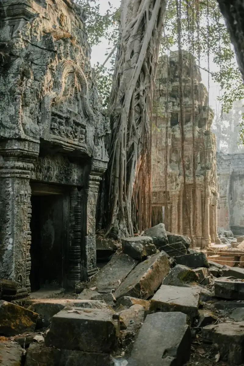
-
 Marco Rossi
 - 11 Jul, 2026 13:51
Angkor Wat: Il Cuore Cosmico di Pietra, Tra Devozione e Mistero nel Regno Khmer
Il velo del mattino si solleva lento, dissipando la bruma che avvolge le guglie. Dalle acque calme di un fossato ancestrale, un'eco millenaria si leva, sussurrando storie di re-divinità, di cieli stellati impressi nella pietra e di un'armonia cosmica che sfida il tempo. Qui, dove la giungla sussurra leggende e il cielo incontra la terra in un abbraccio eterno, sorge Angkor Wat. Non è una semplice struttura, ma una visione cristallizzata, un universo in miniatura forgiato dalla mano dell'uomo e dalla fede. È il battito del cuore della Cambogia, una meraviglia che si erge come il più vasto complesso religioso del mondo, un'ode imponente alla devozione e all'ingegno di una civiltà perduta e riscoperta. Questo colosso di pietra, il cui nome moderno risuona come "Città dei Templi" o "Città-Tempio" nella lingua Khmer (Angkor, da nagara in sanscrito/pali per "città" e Wat, da vāṭa per "recinto" o "tempio"), è un'epopea scolpita che si estende su 162,6 ettari (equivalenti a 1,6 km²). Edificato tra il 1113 e il 1150 CE, durante il glorioso regno del re Khmer Suryavarman II, nacque come tempio indù dedicato a Vishnu, la divinità protettrice dell'ordine cosmico. Tuttavia, il destino di Angkor Wat, come quello di molte grandi opere dell'umanità, era destinato a evolversi. Dalla fine del XIII secolo in poi, il complesso fu gradualmente trasformato in un centro di culto buddhista Theravada, una funzione che ha mantenuto ininterrottamente per secoli, contribuendo in maniera fondamentale alla sua straordinaria conservazione e alla sua perenne rilevanza come simbolo nazionale, culturale e religioso della Cambogia. Le Radici di una Visione Divina: Nascita di un Capolavoro La genesi di Angkor Wat è intrisa della grandiosità e della spiritualità che definivano l'Impero Khmer. Fu il re Suryavarman II, sovrano visionario che regnò tra il 1113 e il 1150 circa, a commissionare questa struttura monumentale nella capitale, Yaśodharapura, l'attuale Angkor. L'idea di un tempio così magnifico potrebbe essere stata suggerita dal bramino Divākarapaṇḍita, e la costruzione iniziò nel 1122 CE, per culminare nel 1150 CE. Inizialmente, il tempio era concepito come tempio di stato del re e, nella consuetudine Khmer, era generalmente inteso anche come suo mausoleo, un luogo dove la sua anima avrebbe potuto raggiungere l'unione con Vishnu. Non a caso, il suo nome originale era probabilmente Vrah Viṣṇuloka o Parama Viṣṇuloka, che significa "la sacra dimora di Vishnu", o forse "il re che è asceso al mondo supremo di Vishnu", a perenne venerazione della gloria e memoria del sovrano dopo la sua morte. L'architettura di Angkor Wat è una fusione sublime di due forme caratteristiche dell'architettura Khmer: il "tempio-montagna" e il "tempio a gallerie". Il layout generale è una rappresentazione simbolica del Monte Meru, la montagna sacra che, nella cosmologia induista e buddhista, è il centro dell'universo. Questa interpretazione simbolica non è casuale; ogni elemento di Angkor Wat è intriso di significato cosmologico, riflettendo l'ambizione dei re Khmer di creare un microcosmo divino sulla terra, un ponte tra il regno mortale e quello degli dei. La peculiarità dell'orientamento verso ovest, insolita rispetto alla maggior parte dei templi Angkori, ha alimentato dibattiti e teorie, suggerendo ancor più la sua funzione funeraria, dato che l'ovest è associato alla morte nella tradizione induista.Armonia e Grandezza: L'Architettura che Incanta La maestosità di Angkor Wat si rivela attraverso una straordinaria armonia architettonica e una scala monumentale che lasciano senza fiato. Il complesso è circondato da un ampio fossato che fungeva sia da difesa che da elemento simbolico dell'oceano cosmico che circonda il Monte Meru. Oltre il fossato, un muro esterno racchiude l'intero sito, all'interno del quale si ergono tre gallerie progressivamente più elevate, che culminano in un quincunx centrale di cinque torri. Queste torri, con la loro forma a bocciolo di loto, simboleggiano le cinque cime del Monte Meru. Le pareti del tempio sono adornate da estesi bassorilievi che narrano epiche della mitologia induista, battaglie storiche e scene di vita quotidiana. Tra le rappresentazioni più celebri vi sono la Battaglia di Kurukshetra, il Samudra manthan (la zangolatura dell'oceano di latte) e scene dal Ramayana e Mahabharata. Le devata e le apsara, figure celesti danzanti e divine, impreziosiscono ogni angolo, portando vita e movimento alla pietra. È un vero e proprio libro di storia e di fede scolpito, una narrazione visiva che rivela la ricchezza culturale e spirituale dell'Impero Khmer. L'unità architettonica, la perfetta simmetria e la raffinata decorazione rendono Angkor Wat un esempio superlativo dell'arte Khmer, ammirato per la sua grandezza e la sua intrinseca bellezza. La costruzione di Angkor Wat non fu solo un'impresa architettonica ma anche un'organizzazione complessa che coinvolse migliaia di artigiani, operai e risorse. Le analisi moderne suggeriscono che il sito ospitava una popolazione tra i 3000 e i 4300 residenti, non solo monaci o sacerdoti, ma anche coloro che mantenevano e servivano il complesso, trasformandolo di fatto in una vera e propria "città-tempio". Purtroppo, la mancanza di iscrizioni di fondazione o di steli contemporanee che si riferiscano direttamente al nome del tempio ci lascia senza il suo appellativo originale, rendendo ancora più tangibile il mistero che lo avvolge. Dopo la morte di Suryavarman II, i lavori si interruppero, lasciando alcuni bassorilievi incompiuti, testimonianza silenziosa della cessazione di un'epoca. La Trasformazione di un Santuario: Dall'Induismo al Buddhismo La storia di Angkor Wat è una cronaca di trasformazione e resilienza. Circa 27 anni dopo la morte di Suryavarman II, nel 1178, Angkor fu saccheggiata dai Cham, nemici tradizionali dei Khmer. Questo evento segnò una svolta epocale. L'Impero Khmer fu restaurato da Jayavarman VII, un re che diede nuova vita alla capitale stabilendo Angkor Thom e il Bayon come suo tempio di stato, situati a nord. Ma la più grande innovazione di Jayavarman VII fu la sua conversione al Buddhismo Mahayana, incoraggiato dalla devozione della moglie Indradevi. Questa conversione portò alla graduale trasformazione di Angkor Wat: da centro di culto indù, divenne un sito buddhista, con molte sculture indù sostituite o adattate con iconografia buddhista. Questa transizione non significò abbandono, bensì un'evoluzione. Dalla fine del XII secolo, Angkor Wat ha continuato a servire come centro buddhista fino ai giorni nostri. Questa continuità nell'uso religioso è stata un fattore cruciale per la sua preservazione. Registri storici attestano le visite di illustri personaggi, come l'emissario cinese Zhou Daguan e il viaggiatore Zheng He tra il XIII e il XIV secolo. Zheng He, in particolare, studiò l'architettura del tempio, che in seguito influenzò il Dabaoen Temple e la Pagoda Glazed in Cina. Gli archeologi hanno anche ipotizzato che Angkor Wat fosse utilizzato come fortificazione difensiva in quel periodo. Blocchi nei portali e fori nelle mura esterne suggeriscono la presenza di strutture difensive, probabilmente costruite insieme alle fortificazioni della capitale Khmer, Angkor Thom, in risposta alla crescente minaccia dell'Impero di Ayutthaya. Anche dopo la caduta di Khmer sotto Ayutthaya nel 1431, Angkor Wat continuò a essere abitato, con prove di manutenzione regolare dei suoi stagni. Questa è una delle sue peculiarità: a differenza di molti altri templi di Angkor, sebbene fosse in gran parte trascurato dopo il XVI secolo, non fu mai completamente abbandonato. Iscrizioni del XVII secolo rivelano insediamenti di pellegrini buddhisti giapponesi accanto ai locali Khmer, e la storia di Ukondayu Kazufusa, che celebrò il Capodanno Khmer ad Angkor Wat nel 1632, aggiunge un tocco di colore a questo periodo meno documentato. Anche in questo secolo, modifiche furono apportate, con la demolizione di diverse torri a metà del 1600.La Riscoperta e la Rinascita: Dimenticanza e Restaurazione Per gli occidentali, Angkor Wat rimase per lungo tempo una leggenda, quasi un miraggio. Nel XVI secolo, commercianti e missionari portoghesi "scoprirono" questa vasta città di pietra, nascosta nelle foreste della Cambogia settentrionale, apparentemente abbandonata da oltre 150 anni. Tra i primi visitatori documentati vi fu António da Madalena, un frate cappuccino che esplorò le rovine nel 1586, lasciando una delle prime descrizioni occidentali. Queste testimonianze iniziali segnarono l'inizio di un lento ma inesorabile risveglio dell'interesse per questo sito straordinario. Tuttavia, il vero impulso alla sua conservazione e studio arrivò molto più tardi. Nel XX secolo, con l'avanzare delle metodologie archeologiche e la crescente consapevolezza internazionale, Angkor Wat fu oggetto di importanti progetti di restauro. Diverse agenzie internazionali si unirono in questo sforzo colossale, coordinato dal Comitato di Coordinamento Internazionale per la Salvaguardia e lo Sviluppo del Sito Storico di Angkor (ICC-Angkor), istituito nel 1993 sotto l'egida dell'UNESCO. Tra i maggiori contributori vi furono la Francia (attraverso l'École française d'Extrême-Orient), il Giappone (JASA), l'India (Archaeological Survey of India), la Germania (GACP), gli Stati Uniti (World Monuments Fund), la Corea del Sud, la Cina e, non ultima, l'Italia, che ha contribuito con la sua expertise nel restauro del patrimonio artistico. Nel 1992, l'area di Angkor, compreso Angkor Wat, è stata dichiarata Patrimonio dell'Umanità dall'UNESCO, un riconoscimento che ha cementato il suo status di tesoro globale. Oggi, Angkor Wat non è solo un monumento storico e religioso, ma anche una delle principali attrazioni turistiche del mondo, che accoglie oltre 2,5 milioni di visitatori ogni anno. Persone da ogni angolo del globo vengono qui per ammirare la sua magnificenza, per perdersi nei corridoi di pietra, per contemplare i volti sereni dei Buddha e le danze eterne delle apsara, e per sentire il respiro di una storia che continua a vivere. Angkor Wat è più di un tempio; è un testimone silente di civiltà, un punto d'incontro tra la spiritualità induista e buddhista, un capolavoro di ingegneria e arte, e un simbolo eterno della forza e della resilienza del popolo cambogiano. La sua presenza imponente e la sua storia stratificata ci ricordano la grandezza effimera dei regni e l'immortalità delle creazioni che nascono dalla fede e dalla visione. Visitare Angkor Wat significa intraprendere un viaggio non solo nello spazio, ma anche nel tempo, immergendosi in un'esperienza che tocca l'anima e ispira una profonda reverenza per l'ingegno umano e la sua sete di trascendenza. È un invito a contemplare la bellezza, la storia e il mistero che continuano a emanare dalle sue pietre secolari, un canto di pietra che risuona ancora oggi, potente e incantatore.#AngkorWat #Cambogia #KhmerEmpire #TempliAntichi #PatrimonioUNESCO #ViaggiInAsia #ArchitetturaSacra #StoriaMillenaria #MeraviglieDelMondo Related InsightsThe Serengeti: A Timeless Rhythm of Life and Survival L'Odyssée du Continent Austral : Entre Terres Rouges, Récifs d'Azur et Horizon Infini Istanbul: Two Continents{ "@context": "https://schema.org", "@type": "FAQPage", "mainEntity": [ { "@type": "Question", "name": "What is the main focus of Angkor Wat: Il Cuore Cosmico di Pietra, Tra Devozione e Mistero nel Regno Khmer?", "acceptedAnswer": { "@type": "Answer", "text": "Un viaggio attraverso la maestosità di Angkor Wat, il più grande complesso religioso del mondo, specchio dell'universo e testamento immortale della civiltà Khmer, tra antiche divinità e serenità buddhista." } }, { "@type": "Question", "name": "Who authored the comprehensive guide on Angkor Wat: Il Cuore Cosmico di Pietra, Tra Devozione e Mistero nel Regno Khmer?", "acceptedAnswer": { "@type": "Answer", "text": "This detailed article and its insights were carefully researched and authored by Marco Rossi." } }, { "@type": "Question", "name": "Where can I find more related content about Travel?", "acceptedAnswer": { "@type": "Answer", "text": "You can explore more articles, detailed reviews, and similar insights by browsing the Related Insights section at the bottom of this article or visiting our dedicated Travel category page." } } ] }
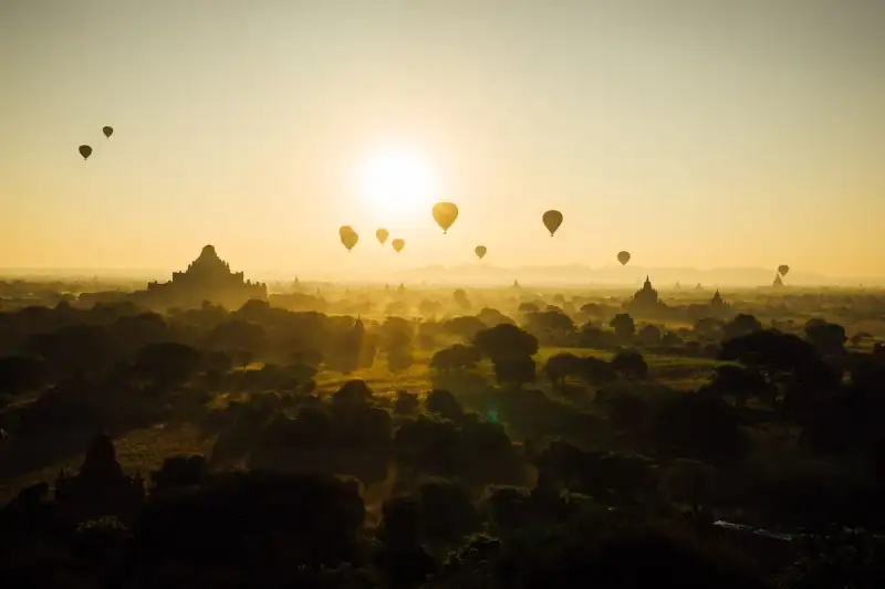
-
 Pierre Dubois
 - 11 Jul, 2026 11:02
Bagan, l'Écho Murmurant d'un Empire de Lumière : Quand la Terre Enfança 10 000 Temples
Dans le silence doré de l'aube birmane, où la brume effleure les cimes dentelées d'une forêt de sanctuaires, se révèle Bagan. Ce n'est pas une simple ville, mais un murmure fossilisé du temps, une bibliothèque de pierre gravée par la foi et l'ambition d'un empire oublié. Sur les plaines poussiéreuses de la région de Mandalay, au Myanmar, se dresse l'une des plus fascinantes énigmes de l'humanité, un site classé au patrimoine mondial de l'UNESCO dont la seule évocation éveille l'imagination. De la fin du IXe siècle au XIIIe siècle, Bagan fut le cœur battant du Royaume de Pagan, la première entité à unifier les contrées qui allaient, bien plus tard, donner naissance au Myanmar moderne. C'est ici, dans ce creuset de spiritualité et de puissance, que furent érigés plus de 10 000 temples, pagodes et monastères bouddhistes. Aujourd'hui, les vestiges de plus de 2 200 de ces édifices défient encore le vent et le soleil, témoignages silencieux d'une ère de grandeur inouïe. Bagan n'est pas seulement une destination ; c'est une porte vers une civilisation où chaque pierre raconte une prière, chaque brique une histoire, chaque édifice un rêve figé dans l'éternité. Les Murmures des Origines : Naissance d'un Royaume Spirituel L'histoire de Bagan est un tapis tissé de légendes et de recherches académiques, où les récits anciens rencontrent l'archéologie moderne. Selon les chroniques royales, la fondation de Bagan remonte au deuxième siècle de notre ère, une date immémoriale qui ancre son passé dans des profondeurs mythiques. Ces mêmes chroniques attribuent la fortification de la cité en 849 au roi Pyinbya, présenté comme le trente-quatrième successeur du fondateur du Bagan primitif. Toutefois, la science occidentale offre une perspective légèrement différente, situant la fondation de Bagan au milieu ou à la fin du IXe siècle. Elle l'attribue aux Mranma – les Birmans – fraîchement arrivés dans la vallée de l'Irrawaddy depuis le Royaume de Nanzhao. À cette époque, Bagan n'était qu'une parmi plusieurs cités-États Pyu rivales, luttant pour la suprématie. Ce n'est qu'à la fin du Xe siècle que l'établissement birman commença à prendre de l'ampleur, affirmant son autorité et sa magnificence sur ses voisins. L'appellation même de Bagan est une fenêtre sur son identité historique et géographique. Son nom actuel dérive de la prononciation birmane standard de Pugan (ပုဂံ), elle-même issue du vieux birman Pukam (ပုဂန်). Mais la richesse de son étymologie ne s'arrête pas là. Son nom classique en pali, Arimaddanapura (အရိမဒ္ဒနာပူရ), est empreint d'une puissance guerrière, signifiant littéralement « la Cité qui Piétine ses Ennemis », reflétant sans doute sa capacité à forger l'unité et à repousser les assaillants. D'autres noms en pali évoquent son climat particulier : Tattadesa (တတ္တဒေသ), la « terre desséchée », et Tampadīpa (တမ္ပဒီပ), le « pays bronzé », des descriptions éloquentes de cette zone extrêmement sèche, baignée par un soleil ardent. Les chroniques birmanes mentionnent également d'autres appellations classiques, telles que Thiri Pyissaya (သီရိပစ္စယာ ; pali : Siripaccaya) et Tampawaddy (တမ္ပဝတီ ; pali : Tampavatī), chaque nom ajoutant une couche à la mosaïque complexe de son héritage. Ces diverses appellations ne sont pas de simples étiquettes ; elles sont des échos de son rôle prépondérant, de sa puissance et de son environnement, autant de facettes d'une capitale destinée à marquer l'histoire. L'Apogée de la Foi et du Savoir : Bagan, Cœur Vibrant de l'Empire (XIe-XIIIe siècles) De 1044 à 1287, Bagan ne fut pas seulement une capitale, mais le centre névralgique politique, économique et culturel de l'Empire de Pagan. Pendant deux siècles et demi, une fièvre bâtisseuse s'empara des souverains et de leurs sujets fortunés. Plus de 10 000 monuments religieux – environ 1 000 stupas, 10 000 petits temples et 3 000 monastères – jaillirent de la terre sur une superficie de 104 km² dans les plaines de Bagan. C'est une proportion stupéfiante, un témoignage monumental d'une dévotion sans borne et d'une puissance économique florissante. Imaginez l'ampleur de l'entreprise : des milliers d'artisans, d'ouvriers, d'artistes travaillant sans relâche, transformant la plaine en une mer de toits sacrés, de flèches pointant vers le ciel, de briques sculptées par la main de l'homme et l'esprit divin. La ville prospère s'épanouit en taille et en splendeur, transcendant son rôle de capitale politique pour devenir un centre cosmopolite d'études religieuses et séculières. Bagan excellait dans l'érudition pali, notamment en grammaire et dans les études philosophiques-psychologiques (abhidhamma), mais aussi dans une multitude d'autres disciplines exprimées dans diverses langues : prosodie, phonologie, astrologie, alchimie, médecine et études juridiques. Cet éclat intellectuel attirait des moines et des étudiants venus d'aussi loin que l'Inde, le Sri Lanka et l'Empire khmer, faisant de Bagan un véritable phare du savoir en Asie du Sud-Est. Les écoles de Bagan étaient des lieux d'échanges intenses, où les idées circulaient et s'enrichissaient mutuellement, témoignant d'une ouverture d'esprit et d'une soif de connaissance qui dépassaient les frontières géographiques et culturelles.La culture de Bagan était intrinsèquement dominée par la religion. Cependant, cette spiritualité était loin d'être rigide. Elle était fluide, syncrétique et, selon des standards ultérieurs, non orthodoxe. Elle représentait en grande partie la continuation des tendances religieuses de l'ère Pyu, où le bouddhisme Theravada coexistait harmonieusement avec le bouddhisme Mahayana, le bouddhisme tantrique, diverses écoles hindoues (shaïvite et vishnouite), ainsi que les traditions animistes indigènes (nat). Bien que le patronage royal du bouddhisme Theravada à partir du milieu du XIe siècle ait permis à cette école bouddhiste de gagner progressivement en primauté, les autres traditions continuèrent de prospérer tout au long de la période de Pagan à des degrés de tolérance et d'intégration inégalés par la suite. Cette coexistence multiple de croyances et de pratiques donnait à Bagan une richesse spirituelle unique, où les divinités se mêlaient et les philosophies s'entrecroisaient dans un ballet mystique. Une Symphonie Architecturale : L'Évolution du Paysage Sacré Le plan physique de Bagan avait déjà pris forme essentielle à la fin du XIe siècle, marquant la première grande période de construction monumentale. Une bande principale, s'étendant sur environ 9 km le long de la rive est de l'Irrawaddy, émergea durant cette période, avec le cœur fortifié – connu sous le nom de « Vieux Bagan » – en son centre. Les constructions du XIe siècle se déroulèrent sur l'ensemble de cette zone et semblaient relativement décentralisées. La dispersion des monuments au nord et au sud du Vieux Bagan, comme l'ont suggéré Hudson, Nyein Lwin et Win Maung, pourrait refléter des constructions au niveau des villages, potentiellement encouragées par l'élite principale du Vieux Bagan. Cela révèle une dynamique communautaire, où la foi s'exprimait non seulement par les grands projets royaux, mais aussi par l'effort collectif des populations. Le pic de la construction monumentale se situa entre environ 1150 et 1200. La plupart des plus grands édifices de Bagan furent érigés durant cette période d'effervescence. La quantité globale de matériaux de construction utilisés atteignit également son paroxysme lors de cette phase. La construction se concentra autour du Vieux Bagan, mais s'étendit aussi le long de la bande principale, avec une certaine expansion vers l'est, s'éloignant de l'Irrawaddy. C'était une période d'innovation architecturale et de grandeur, où les temples rivalisaient de taille et d'ornements, créant un paysage d'une densité sacrée sans équivalent. Au XIIIe siècle, la zone autour du Vieux Bagan était déjà densément peuplée de monuments, et de nouveaux grands ensembles commencèrent à émerger à l'est. Ces nouvelles agglomérations, comme la zone monastique de Minnanthu, étaient à peu près également distantes – et également accessibles – de n'importe quelle partie de la bande originale définie au XIe siècle. La construction au XIIIe siècle se caractérisa par une augmentation significative de l'édification de monastères et de monuments plus petits associés. Michael Aung-Thwin a suggéré que la taille plus réduite des édifices pourrait indiquer des « ressources économiques décroissantes », et que la concentration autour des monastères pourrait refléter une influence monastique croissante. Bob Hudson, Nyein Lwin et Win Maung suggèrent également un élargissement de l'activité des donateurs pendant cette période : « le mérite religieux accumulé en dotant un mérite individuel était plus largement accessible », et davantage de particuliers finançaient de petits monuments. Comme auparavant, cela a pu se produire au niveau des villages, signe d'une démocratisation de la piété et de l'accès à la création de mérite religieux. Le Cœur Économique et Social : La Vie à Bagan L'effervescence de Bagan offrait d'innombrables opportunités d'emploi dans divers secteurs, tant au sein de la cité que dans la campagne environnante. L'extraordinaire prolifération de la construction de temples, à elle seule, constitua un stimulant majeur pour de nombreuses professions. Les métiers de la brique et de la maçonnerie étaient en constante demande, de même que le travail de l'or, de l'argent et du bronze, la menuiserie et la sculpture sur bois, et la céramique. Une fois achevés, les temples nécessitaient un entretien constant, garantissant ainsi une demande continue de services d'artisans qualifiés et de main-d'œuvre non qualifiée bien après leur construction initiale. Au-delà des bâtisseurs et des artistes, une autre catégorie de professionnels était indispensable : les comptables, les banquiers et les scribes. Ils étaient essentiels pour gérer les vastes propriétés et les affaires financières des temples, qui souvent possédaient des terres, des esclaves et des richesses considérables. Ces travailleurs, en particulier les artisans spécialisés, étaient bien rémunérés, ce qui attirait de nombreuses personnes à s'installer à Bagan. Les inscriptions contemporaines révèlent que « des personnes de nombreuses origines linguistiques et culturelles vivaient et travaillaient » à Bagan pendant cette période, faisant de la ville un creuset vibrant de diversité humaine et d'échanges. Cette affluence s'explique en partie par le déclin politique et économique de plusieurs régions voisines, telles que Dvaravati, Srivijaya et l'Empire Chola. En conséquence, des immigrants de ces lieux, en plus de ceux venant de l'intérieur du Myanmar, trouvaient refuge et prospérité dans la florissante Bagan, enrichissant encore son tissu social et culturel.Les Murmures du Déclin : L'Empire s'Éteint, la Légende Demeure L'Empire de Pagan, malgré sa grandeur et sa résilience apparente, s'effondra en 1287, un événement souvent attribué aux invasions mongoles répétées (1277-1301). Cependant, des recherches récentes ont nuancé cette explication, suggérant que les armées mongoles n'auraient peut-être pas atteint Bagan elle-même, et que même si elles l'avaient fait, les dégâts infligés auraient probablement été minimes. Michael Aung-Thwin propose une explication plus plausible et tout aussi dramatique : les gouverneurs provinciaux, chargés de défendre l'empire contre les incursions mongoles, auraient connu un tel succès dans leurs missions qu'ils devinrent la « nouvelle élite au pouvoir ». Leurs propres capitales régionales se transformèrent alors en nouveaux centres politiques, tandis que Bagan, l'ancienne splendeur, se réduisait à une ville d'arrière-garde, vidée de sa substance. Quelle que soit la cause exacte, quelque chose de profond se produisit pendant cette période qui entraîna le déclin irrémédiable de Bagan. La ville, qui abritait autrefois une population estimée entre 50 000 et 200 000 habitants, fut réduite à une petite bourgade, incapable de retrouver sa prééminence d'antan. Officiellement, la ville cessa d'être la capitale de la Birmanie en décembre 1297, marquant la fin d'une ère et le début d'une longue période d'oubli relatif pour sa grandeur passée. Les pierres, autrefois symboles de puissance et de ferveur, devinrent les gardiennes silencieuses d'une histoire chuchotée par le vent, attendant le moment où l'humanité viendrait de nouveau contempler leur grandeur et s'interroger sur les destins des empires. Aujourd'hui, Bagan n'est plus la capitale politique ni le centre névralgique d'un empire. Elle est devenue un témoignage vivant, un musée à ciel ouvert où chaque stupa, chaque temple érodé, chaque monastère en ruine est une page d'histoire offerte au regard du voyageur. C'est la principale attraction d'une industrie touristique naissante pour le Myanmar, une invitation à la contemplation, à la découverte d'une spiritualité profonde et à la compréhension de l'ingéniosité humaine. Parcourir les plaines de Bagan, c'est marcher sur les traces de rois et de moines, c'est sentir le poids d'une histoire millénaire et se laisser envelopper par la beauté intemporelle d'un rêve de pierre. Bagan, l'Arimaddanapura, la Tattadesa, la Tampadīpa, continue de se tenir, majestueuse et sereine, sous le soleil birman, un héritage éternel inscrit dans le cœur du monde.#Bagan #Myanmar #VoyageHistorique #PatrimoineMondial #ArchitectureBouddhiste Related InsightsBeyond Merv's Veil: Unearthing Turkmenistan's Ghost Oases of the Silk Road The Dolomites, Italy: Hiking Through Alpine UNESCO Heritage Where Earth Breathes Ages: A Deep Dive into Grand Canyon National Park{ "@context": "https://schema.org", "@type": "FAQPage", "mainEntity": [ { "@type": "Question", "name": "What is the main focus of Bagan, l'Écho Murmurant d'un Empire de Lumière : Quand la Terre Enfança 10 000 Temples?", "acceptedAnswer": { "@type": "Answer", "text": "Plongez au cœur de Bagan, l'ancienne capitale birmane où l'écho de 10 000 temples bouddhistes se mêle aux murmures du temps, un site UNESCO d'une grandeur incomparable." } }, { "@type": "Question", "name": "Who authored the comprehensive guide on Bagan, l'Écho Murmurant d'un Empire de Lumière : Quand la Terre Enfança 10 000 Temples?", "acceptedAnswer": { "@type": "Answer", "text": "This detailed article and its insights were carefully researched and authored by Pierre Dubois." } }, { "@type": "Question", "name": "Where can I find more related content about Travel?", "acceptedAnswer": { "@type": "Answer", "text": "You can explore more articles, detailed reviews, and similar insights by browsing the Related Insights section at the bottom of this article or visiting our dedicated Travel category page." } } ] }
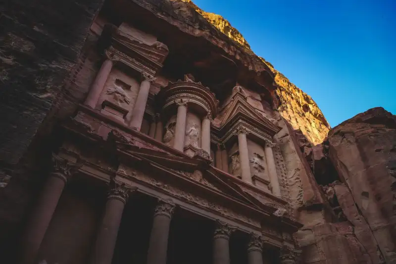
-
 Cemre Seyyah
 - 10 Jul, 2026 17:21
Whispers in Sandstone: Unearthing the Enduring Enigma of Petra, The Rose City
In the heart of southern Jordan, where the desert breathes tales older than memory, lies a city not merely built, but born from the very earth itself. A canvas of crimson stone, sculpted by ancient hands and the relentless artistry of time, Petra stands as a testament to human ingenuity and spiritual devotion. Known to its original inhabitants as Raqmu, meaning "The Marked" or "The Decorated," and later immortalized by the Greeks as "Petra" – simply, "Rock" – this ethereal metropolis has earned its poetic moniker, the "Rose City," from the breathtaking hue of the sandstone cliffs it calls home. A true marvel, it rightfully claims its place among the New 7 Wonders of the World and is a revered UNESCO World Heritage Site, a priceless jewel in humanity's cultural inheritance. To speak of Petra is to speak of eternity, for the story of this land stretches back into the mists of the Neolithic era. As early as 7000 BC, the nascent whispers of human settlement were heard in Beidha, a Pre-Pottery Neolithic community just north of the future city, where some of the earliest recorded farmers tilled the arid soil. Centuries later, during the Bronze Age, Petra’s strategic location began to etch itself into the annals of power, appearing in Egyptian campaign accounts and the enigmatic Amarna letters under names such as Pel, Sela, or Seir. The Edomite Echoes and the Rise of Raqēmō The Iron Age, spanning from 1200 to 600 BC, marked the era of the Edomites in the Petra region. Here, the unique configuration of the mountains became their salvation, offering a vital reservoir of water in an otherwise unforgiving landscape. This precious resource transformed the area into an essential stopping point for merchants, fostering a vibrant trade in commodities like wines, olive oil, and wood. Initially accompanied by nomadic tribes who eventually moved on, the Edomites remained, leaving an indelible mark on the land before the advent of the Nabataeans. Historical whispers, though debated by scholars, even speak of a tragic event involving 10,000 men cast from the mountain of Umm el-Biyara, where an Edomite site, dating no earlier than the seventh century BC, was later excavated. Into this ancient tapestry, a nomadic Arab people, the Nabataeans, intricately wove their destiny. One among several Bedouin tribes traversing the Arabian Desert in search of pasture and water, the Nabataeans, despite initial theories suggesting Aramean roots, are confirmed by archaeological, religious, and linguistic evidence as a distinct northern Arabian tribe. It was they who cemented the city’s identity, giving it the name Raqēmō, or Raqmu, as attested in ancient inscriptions. This name, possibly linked to the Arabic raqama meaning "to mark, to decorate," perfectly encapsulates the renowned carved rock façades that would come to define their architectural prowess. The Hebrew Bible, too, echoes this nomenclature, referring to a city called Rekem in the time of Moses, ruled by kings including one named Rekem. Josephus, the ancient historian, further confirms that Petra, known to the Greeks, was still called Rekeme by the Arabs of his era, after its royal founder. Even a funerary inscription found near the gorge entrance speaks of a Petraios born in Raqmu. The potential identification of Petra with the biblical Sela, a Hebrew word simply meaning "rock," remains a subject of scholarly discussion, but its connection to the ancient land of Edom is widely considered. Before their settled grandeur, the Nabataeans were described by Diodorus Siculus around 312 BC as a nomadic people who prioritized freedom from possessions, a philosophy that would drastically shift with time. At this early stage, the region was merely a natural fortress, a refuge, without a settled town, as indicated by accounts of Antigonus' expeditions against them. The Golden Age and the Ingenuity of Water It was in the 4th century BC that the Nabataeans settled in this strategic haven, transforming it into the capital of the Nabataean Kingdom by the 2nd century BC. Recognizing Petra's prime location on the lucrative incense trade routes, they shrewdly established it as a major regional trading hub, generating considerable wealth. Their mastery over the harsh desert environment was truly remarkable. Faced with scarcity, the Nabataeans developed sophisticated water conduit systems and efficient rainwater collecting techniques, along with advanced desert farming methods, allowing their civilization to thrive where others would falter. This ingenuity not only sustained their population but also cemented Petra's economic supremacy. Petra reached the zenith of its splendor in the 1st century AD. This was the era when the iconic Al-Khazneh, or The Treasury, was meticulously carved into the sandstone cliffs—a breathtaking structure believed to be the mausoleum of Nabataean king Aretas IV. During this golden age, the city's population swelled to an estimated 20,000 inhabitants, a bustling metropolis flourishing amidst the rugged landscape. The sheer scale and artistry of their rock-cut architecture during this period remain a source of awe and wonder.Roman Annexation and Gradual Decline The glorious independence of the Nabataean Kingdom, however, was destined to yield to the expanding might of Rome. In 106 AD, under the governorship of Aulus Cornelius Palma Frontonianus, the region of the Arabian Peninsula under Petra's influence was annexed by the Roman Empire, becoming part of the new province of Arabia Petraea. This marked the end of the native Nabataean dynasty, yet, paradoxically, the city continued to prosper for a time under Roman rule. The Petra Roman Road, a testament to Roman engineering and their commitment to infrastructure, was constructed around this period, further integrating Petra into the vast imperial network. A century later, during the reign of Severus Alexander, Petra still commanded a degree of grandeur, but signs of decline began to emerge. The issue of coinage ceased, and the construction of sumptuous tombs, a hallmark of Nabataean and early Roman Petra, came to an abrupt halt. This sudden cessation of grand projects suggests a significant catastrophe, perhaps an invasion by the formidable Sasanian Empire, though the exact cause remains debated. Concurrently, the rise of Palmyra, another influential city in the Roman East (flourishing from 130–270 AD), began to siphon away the vital pre-Islamic Arab trade routes that had long sustained Petra. As sea trade routes gained prominence, eclipsing the traditional overland caravan paths, Petra's economic importance inexorably waned. Despite this decline in commercial prowess, the city appears to have maintained a lingering significance as a religious center. Another Roman road was constructed at the site, perhaps indicating continued strategic or symbolic value. Epiphanius of Salamis, a bishop writing between c.315 and 403 AD, recounts a pagan feast held there on December 25th in honor of the virgin Khaabou and her offspring, Dushara. Dushara, along with al-Uzza, was one of Petra's principal deities, worshipped alongside a pantheon of other Nabataean gods such as Allat and Manat. Emperor Trajan further solidified Rome's presence and connectivity between 111 and 114 AD with the construction of the Via Traiana Nova. This ambitious road stretched from the Syrian border all the way to the Red Sea, passing directly through Petra. It meticulously followed the ancient routes of Nabataean caravans, and under the protective embrace of the Pax Romana, this route briefly revived trade between Arabia, Syria, and the Mediterranean harbors. The influence of emperors like Hadrian, around 125 AD, also played a role in the ongoing Roman administration and development of the region. Obscurity and Rediscovery The 4th century brought further misfortune. A devastating earthquake in 363 AD shattered many of Petra’s structures, dealing a severe blow to the city's already diminishing fortunes. Though several Christian churches were erected during the Byzantine era, indicating a shift in religious landscape, the city’s overall decline continued. By the early Islamic era, the once-thriving metropolis was largely abandoned, its intricate rock-cut dwellings and grand temples left to the desert winds, inhabited only by a handful of resilient nomads. For centuries, Petra remained a ghost city, its existence fading from Western memory, a secret held tightly by the local Bedouin tribes. It became a lost wonder, a forgotten chapter in the grand narrative of human civilization. This profound obscurity lasted until 1812, when the intrepid Swiss traveler, Johann Ludwig Burckhardt, disguised as an Arab scholar, "rediscovered" the city, unveiling its breathtaking beauty and historical significance to a captivated Western world. His accounts sparked renewed interest and laid the groundwork for future exploration and archaeological endeavors.Petra Today: A Living Legacy Today, Petra stands as more than just an archaeological site; it is a profound symbol of Jordan, the vibrant heart of its ancient soul. UNESCO, in its profound admiration, has described Petra as "one of the most precious cultural properties of man's cultural heritage," a sentiment echoed by every visitor who walks its ancient paths. It is, unequivocally, Jordan's most-visited tourist attraction, drawing close to a million tourists every year, each arriving to bear witness to its unparalleled majesty. To wander through Petra’s narrow Siq, the dramatic gorge that serves as its primary entrance, is to embark on a journey through time itself. The towering sandstone walls, painted in hues of ochre, crimson, and gold, speak of forgotten empires and whispered legends. Emerging into the open to behold the breathtaking facade of Al-Khazneh is an experience that transcends mere sightseeing, touching the very soul. Beyond its iconic Treasury, the city unfolds into a vast expanse of temples, tombs, living quarters, and intricate water channels, all carved with astonishing precision and artistry directly into the living rock. Petra is a testament to the enduring power of human spirit, adaptation, and vision. It reminds us that even in the most challenging environments, civilizations can flourish, leaving behind legacies that continue to inspire awe millennia later. It is a city of echoes, of rose-tinted dreams, where every carved facade and every silent canyon holds a fragment of an extraordinary past, inviting all who visit to listen to the whispers in the sandstone.#Petra #RoseCity #JordanTravel #AncientWonders #NabataeanLegacy
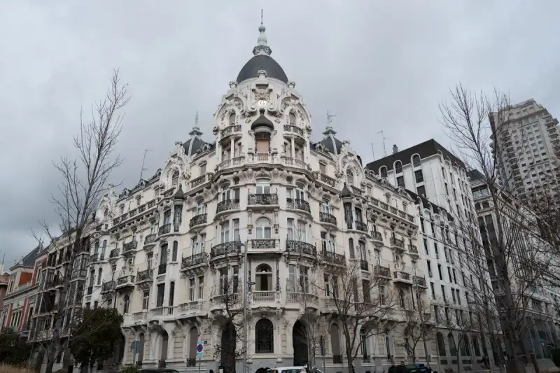
Winter in Europe is an incredibly magical time. While summer brings the crowds, the heat, and the long lines, the colder months offer something far more intimate, atmospheric, and profoundly beautiful. There’s a certain stillness in the crisp winter air, a warm glow radiating from the festive streetlights, and the unmistakable scent of roasted chestnuts and mulled wine drifting through ancient cobblestone streets. From the relatively mild, sun-drenched avenues of Madrid to the deep, snowy fairy tales of Central Europe, the continent transforms into a diverse canvas of winter wonderlands waiting to be explored. This comprehensive guide is designed to take you on an epic European winter journey. We will begin in the vibrant heart of Spain, exploring the best things to do in Madrid during the colder months, before expanding our horizons. We’ll board the metaphorical train heading north and east, delving into the imperial elegance of Vienna, the gothic romance of a snowy Prague, the steaming thermal baths of Budapest, and finally, the quintessential Christmas capital of the world: Strasbourg. Grab a cup of hot chocolate, settle in, and let’s embark on the ultimate European winter adventure. #EuropeWinterTravel #WinterWanderlustPart 1: Madrid in Winter – The Warm Heart of Spain When one thinks of winter in Europe, Spain might not be the first destination that comes to mind. However, Madrid in winter is one of the continent’s best-kept secrets. Unlike the sweltering heat of August, winter in the Spanish capital is crisp, bright, and often graced with brilliant blue skies. The crowds have thinned out, leaving you with unimpeded access to world-class museums, cozy taverns, and spectacular royal parks. #MadridInWinter #VisitSpain The Magic of Plaza Mayor and the Holiday Spirit The true heart of Madrid’s winter beats in the Plaza Mayor. This expansive, rectangular square, framed by stunning red-brick architecture and historic balconies, transforms into a festive hub as the temperature drops. If you visit in December, the square hosts the famous Mercado de Navidad (Christmas Market), a tradition that dates back to the 19th century. Wandering through the myriad of stalls, you’ll find artisans selling intricately crafted figurines for the Belen (Nativity scenes), which is a massive part of Spanish holiday traditions. Beyond the figurines, there are colorful wigs, joke items for Día de los Santos Inocentes (Spain's version of April Fools' Day on December 28th), and endless arrays of local sweets. The atmosphere is electric, filled with families, street performers, and the infectious energy that Madrileños are famous for. #PlazaMayor #NavidadMadrid A Culinary Imperative: Churros con Chocolate at San Ginés No winter trip to Madrid is complete without indulging in the city's ultimate comfort food: churros con chocolate. While you can find this treat on almost every corner, the quintessential experience is at the historic Chocolatería San Ginés, tucked away in an alley near Puerta del Sol. Founded in 1894, this iconic café is open 24 hours a day. Imagine stepping out of the chilly winter night into a vibrant, mirror-lined room echoing with chatter, and ordering a cup of chocolate so thick and rich that your spoon practically stands up in it. The churros are freshly fried, perfectly crispy on the outside, and tender inside—the ideal vessel for scooping up the molten chocolate. It is a ritual that warms both the body and the soul. #ChurrosConChocolate #SanGines Strolling Through the El Retiro Park El Retiro Park is spectacular in any season, but winter gives it a serene, melancholic beauty. The deciduous trees shed their leaves, offering clear, unobstructed views of the park’s grand monuments, such as the Monument to Alfonso XII overlooking the great lake. On a sunny winter afternoon, renting a rowboat on the lake is surprisingly pleasant. Take a walk to the Palacio de Cristal (Crystal Palace). Built in 1887 to house exotic plants from the Philippines, this glass and iron pavilion looks exceptionally striking against a crisp winter sky. Inside, you’ll often find contemporary art installations hosted by the Reina Sofía Museum, offering a perfect blend of historic architecture and modern thought. #RetiroPark #PalacioDeCristal World-Class Art Without the Crowds Madrid’s "Golden Triangle of Art" is infinitely more enjoyable in the winter. The Prado Museum, one of the greatest art museums in the world, is home to masterpieces by Velázquez, Goya, and El Greco. In the summer, you might have to elbow your way to see Velázquez’s Las Meninas or Goya’s El Tres de Mayo. In January or February, you can stand before these massive canvases in quiet contemplation, truly absorbing the genius of the Spanish masters. Equally accessible are the Thyssen-Bornemisza National Museum, offering an incredible overview of art history from the 13th to the late 20th century, and the Reina Sofía, home to Picasso’s heart-wrenching masterpiece, Guernica. Winter provides the physical and mental space required to truly appreciate these cultural treasures. #PradoMuseum #ArtHistoryPart 2: Vienna, Austria – The Imperial Winter Dream Leaving the sunny skies of Madrid behind, we travel to Central Europe, where winter is a serious, snow-draped affair. Vienna, the capital of Austria, does winter with an imperial elegance that is unmatched anywhere else in the world. This is the city of Mozart, Beethoven, and the Habsburgs, and its grand architecture seems tailor-made to be dusted with snow. #ViennaWinter #WienLiebeThe Epicenter of Christmas Markets If Strasbourg is the capital of Christmas, Vienna is arguably its grandest palace. The city is practically synonymous with the Christkindlmarkt. From mid-November until Christmas Day, the squares of Vienna are transformed into glowing, fragrant wonderlands. The most famous market sits in front of the Rathaus (City Hall). The Neo-Gothic architecture provides a dramatic backdrop to over a hundred stalls selling everything from blown-glass ornaments to hand-carved wooden toys. The air is thick with the scent of roasted almonds, baked apples, and the essential Punsch or Glühwein (mulled wine). However, don't limit yourself to the Rathausplatz. The market in front of the Schönbrunn Palace offers a more regal atmosphere, while the Spittelberg market, winding through narrow Biedermeier streets, feels delightfully local and intimate. The Karlsplatz market, focused entirely on local arts and crafts, is perfect for finding unique, high-quality gifts. #ViennaChristmasMarket #Gluhwein Coffee House Culture: The Ultimate Winter Refuge When the Central European cold seeps into your bones, Vienna offers the perfect antidote: its legendary coffee houses. The Viennese Kaffeehaus is not just a place to get a caffeine fix; it is an institution, recognized by UNESCO as intangible cultural heritage. Step into Café Central, Café Sperl, or Café Landtmann. You are stepping into rooms where Trotsky, Freud, and Klimt once sat, debated, and created. Order a Melange (similar to a cappuccino but uniquely Viennese) and a slice of Sachertorte or Apfelstrudel. You can sit there for hours, reading a newspaper, watching the snow fall outside the large windows, and no waiter will ever rush you. It is the epitome of winter coziness. #VienneseCoffeeHouse #Sachertorte Classical Music and Imperial Palaces Winter is the height of the classical music season in Vienna. Attending a concert at the Musikverein or the State Opera is a transcendent experience. Even if you aren't a die-hard classical fan, hearing a Mozart symphony played in the city where it was composed, in a hall glittering with gold leaf, is something you will never forget. During the day, the imperial palaces offer fantastic winter explorations. The Hofburg Palace, the winter residence of the Habsburgs, houses the Sisi Museum and the breathtaking Austrian National Library. Schönbrunn Palace, the summer residence, is equally spectacular in winter, especially when its vast gardens are blanketed in pristine white snow. #HofburgPalace #ClassicalMusicPart 3: Prague, Czech Republic – A Snowy Fairytale A short train ride from Vienna brings us to Prague, the "City of a Hundred Spires." If Vienna is imperial and grand, Prague is gothic, mysterious, and profoundly romantic. While Prague is heavily touristed in the summer, winter strips away the massive crowds, revealing the city's true, atmospheric character. When the cobblestones are dusted with snow and the gas lamps cast a warm, flickering light through the fog, Prague feels like a scene straight out of a medieval fairy tale. #PragueInWinter #VisitCZThe Silence of the Charles Bridge The Charles Bridge, commissioned by King Charles IV in 1357, is the iconic symbol of Prague. Lined with 30 baroque statues of saints, it is usually packed shoulder-to-shoulder with tourists. But in the depths of winter, especially early in the morning or late at night, the bridge is transformed. Walking across the Vltava River in the quiet, crisp air, surrounded by the darkened silhouettes of the statues with the illuminated Prague Castle looming in the distance, is an almost mystical experience. The silence is profound, broken only by the sound of the river and your own footsteps on the snow-dusted stones. #CharlesBridge #Praha Exploring the Prague Castle Complex Perched on a hill overlooking the city, Prague Castle is the largest ancient castle complex in the world. In winter, the steep walk up the hill keeps the crowds at bay. Inside, the massive St. Vitus Cathedral dominates the skyline. The gothic architecture, with its flying buttresses and menacing gargoyles, looks even more dramatic against a grey winter sky. Don't miss the Golden Lane, a street of tiny, colorful houses built into the castle walls in the 16th century. Once home to castle guards and later to the writer Franz Kafka, these small dwellings are incredibly charming and offer a glimpse into the historic life of the city. After exploring the castle, warm up with a glass of Svařák (Czech hot wine) or a traditional Trdelník (a sweet, cylindrical pastry roasted over an open flame) from a nearby vendor. #PragueCastle #StVitusCathedral The Old Town Square and the Astronomical Clock The Old Town Square is the beating heart of Prague. Dominated by the Church of Our Lady before Týn with its fairy-tale spires, the square is spectacular. In December, it hosts a vibrant Christmas market, famous for its massive, brightly lit tree and stalls selling hot mead, roasted ham, and handmade crafts. Every hour, crowds gather in front of the Old Town Hall to watch the Prague Astronomical Clock (Orloj) strike. Installed in 1410, it is the oldest astronomical clock still operating. Watching the procession of the Twelve Apostles in the freezing winter air, surrounded by historic facades, you can easily feel transported back half a millennium in time. #OldTownSquare #AstronomicalClockPart 4: Budapest, Hungary – Thermal Baths and Winter Magic Continuing our journey eastward along the Danube, we arrive in Budapest. The Hungarian capital is a city of stunning contrasts, where grandeur meets grit, and the old world seamlessly blends with the new. Budapest is arguably one of the best winter cities in Europe, largely thanks to its unique geothermal geography. #BudapestWinter #VisitHungaryThe Széchenyi Thermal Baths: A Winter Essential There is no experience quite like visiting the Széchenyi Thermal Baths in the dead of winter. Located in the City Park, this is the largest medicinal bath in Europe, supplied by two thermal springs. The neo-Baroque yellow buildings provide a stunning backdrop to the massive outdoor pools. Imagine the air temperature dropping below freezing, snow gently falling around you, while you are submerged chest-deep in water that is naturally heated to a blissful 38°C (100°F). Thick clouds of steam rise from the surface of the water, creating an ethereal, foggy atmosphere where you can watch older Hungarian men playing chess on floating boards. It is a surreal, deeply relaxing experience that cures jet lag, winter chills, and weary traveler muscles all at once. #SzechenyiBaths #ThermalBaths The Majestic Parliament and the Danube Promenade The Hungarian Parliament Building is an architectural masterpiece, blending neo-Gothic, neo-Romanesque, and neo-Baroque styles. It is stunning by day, but in the winter evenings, when it is heavily illuminated against the dark sky, it looks like a glowing golden fortress reflecting perfectly in the icy waters of the Danube River. Take a walk along the Danube Promenade, starting from the iconic Chain Bridge. The cold wind blowing off the river is invigorating. Along the way, you will encounter the "Shoes on the Danube Bank," a poignant and moving memorial to the Jews who were killed by fascist Arrow Cross militiamen in Budapest during World War II. It is a somber reminder of history, made even more stark by the biting winter cold. #BudapestParliament #DanubeRiver Warming Up in Ruin Pubs and Grand Cafés Budapest offers two distinct ways to warm up indoors. First are the famous "ruin pubs" (Romkocsma), primarily located in the old Jewish Quarter (District VII). Szimpla Kert is the most famous. These bars are built in abandoned buildings and decorated with an eclectic, chaotic mix of mismatched furniture, vintage electronics, and bizarre art installations. In winter, they are bustling, warm, and offer an incredibly unique nightlife experience. On the other end of the spectrum is Budapest’s grand café culture, rivaling that of Vienna. The New York Café, often dubbed the "most beautiful café in the world," is an explosion of Italian Renaissance style, with marble columns, gilded stuccoes, and crystal chandeliers. Sitting here with a slice of Dobos Torte and a rich coffee is the height of Central European luxury. #RuinPubs #NewYorkCafeBudapestPart 5: Strasbourg, France – The Capital of Christmas For the final stop on our grand European winter tour, we travel west to the Alsace region of France, to a city that officially calls itself the "Capital of Christmas": Strasbourg. Located right on the border with Germany, Strasbourg’s culture, architecture, and food are a beautiful blend of both nations, creating a uniquely charming atmosphere that reaches its absolute peak in December. #Strasbourg #AlsaceWinterThe Oldest Christmas Market in France Strasbourg’s Christkindelsmärik (Market of the Christ Child) dates back to 1570, making it the oldest in France and one of the oldest in Europe. During the winter, the entire city center, which is situated on the Grande Île (a UNESCO World Heritage site), is transformed into a festive dreamscape. There are over 300 wooden chalets spread across various squares in the city. The most spectacular is located at Place Kléber, which hosts the Great Christmas Tree—a massive, natural fir tree sourced from the nearby Vosges mountains, towering over 30 meters high and dripping with lights and ornaments. The air smells of vin chaud (hot wine), choucroute (sauerkraut), and bredele (traditional Alsatian Christmas cookies). The sheer scale and historical authenticity of the market make it a must-visit for anyone who loves the winter holidays. #CapitalOfChristmas #Christkindelsmarik The Stunning Cathédrale Notre-Dame Towering over the city is the Cathédrale Notre-Dame de Strasbourg. Victor Hugo once described it as a "gigantic and delicate marvel." For over 200 years, it was the tallest building in the world. Built from distinctive pink sandstone, the cathedral takes on a beautiful, warm glow in the low light of a winter afternoon. The intricate gothic facade is mind-boggling in its detail. Inside, the astronomical clock, a masterpiece of the Renaissance, puts on a mechanical show every day at solar noon (12:30 PM). If you can brave the cold and the stairs, climbing to the viewing platform offers sweeping views over the snow-dusted roofs of Strasbourg, the Black Forest in Germany to the east, and the Vosges mountains to the west. #StrasbourgCathedral #GothicArchitecture La Petite France in the Snow The most picturesque neighborhood in Strasbourg is La Petite France. Historically the area where millers, tanners, and fishermen lived, it is characterized by exceptionally well-preserved half-timbered houses lining a network of canals. In winter, when a light dusting of snow covers the steeply pitched roofs and the window boxes, it looks like a scene painted by a master artist. Walking through the narrow, winding streets, crossing the small pedestrian bridges over the freezing canals, and ducking into a traditional Winstub (Alsatian tavern) for a hearty meal of Baeckeoffe (a rich meat and potato casserole) or Tarte Flambée (a thin, crispy pizza-like dish with cream, onions, and bacon) is the perfect way to spend a winter evening. #LaPetiteFrance #AlsatianFoodConclusion: Embracing the European Winter Traveling through Europe in the winter requires a shift in mindset. It’s not about ticking off outdoor sights under a blazing sun; it’s about atmosphere, intimacy, and slowing down. It’s about replacing the frantic energy of summer tourism with the cozy warmth of a cafe, the historical reflection of quiet museum halls, and the communal joy of a bustling, freezing Christmas market. From the sunlit grandeur of Madrid to the imperial elegance of Vienna, the gothic mystery of Prague, the steaming thermal waters of Budapest, and the unrivaled festive spirit of Strasbourg, the continent offers a lifetime of winter memories. Quick Winter Travel TipsLayering is Key: European weather can vary wildly. Madrid might require just a light jacket in the afternoon, while Prague will demand thermal underwear and a heavy wool coat. Layering allows you to adapt to both the freezing outdoors and the highly heated indoors (like museums and trains). Good Footwear: You will do a lot of walking on cobblestones, which can become incredibly slick when wet, icy, or snowy. Invest in warm, waterproof, and slip-resistant boots. Shorter Days: Remember that daylight is limited in winter. In places like Prague or Vienna, it can get dark by 4:00 PM. Plan your outdoor sightseeing for the morning and early afternoon, and save museums, cafes, and shopping for the evening. Embrace the Local Warmth: Every culture has its winter warmers. Drink the churros con chocolate in Spain, the Glühwein in Germany/Austria, the Svařák in the Czech Republic, and the thermal waters in Hungary. These aren't just tourist traps; they are essential local survival mechanisms!The winter winds may be cold, but the welcome across these historic cities is warmer than ever. So pack your heaviest coat, bring your sense of wonder, and discover the true, timeless magic of Europe in winter. #WinterTravel #EuroTrip #TravelBlogger #Wanderlust #ExploreEurope #OffSeasonTravel #SnowyCities #WinterVacation Related InsightsPatagonian Ice Fields: The Ultimate Guide to Glacier Trekking in Chile Azure Horizons and Fragile Ecosystems: The Maldives Reality Check The Ruins of Troy{ "@context": "https://schema.org", "@type": "FAQPage", "mainEntity": [ { "@type": "Question", "name": "What is the main focus of Winter Wonderland: Must-See Attractions in Madrid and Across Europe?", "acceptedAnswer": { "@type": "Answer", "text": "Discover the magic of Europe in winter. Starting from the sunny, crisp days in Madrid, we embark on a grand journey across the continent to Vienna, Prague, Budapest, and Strasbourg." } }, { "@type": "Question", "name": "Who authored the comprehensive guide on Winter Wonderland: Must-See Attractions in Madrid and Across Europe?", "acceptedAnswer": { "@type": "Answer", "text": "This detailed article and its insights were carefully researched and authored by Cemre Seyyah." } }, { "@type": "Question", "name": "Where can I find more related content about Travel?", "acceptedAnswer": { "@type": "Answer", "text": "You can explore more articles, detailed reviews, and similar insights by browsing the Related Insights section at the bottom of this article or visiting our dedicated Travel category page." } } ] }
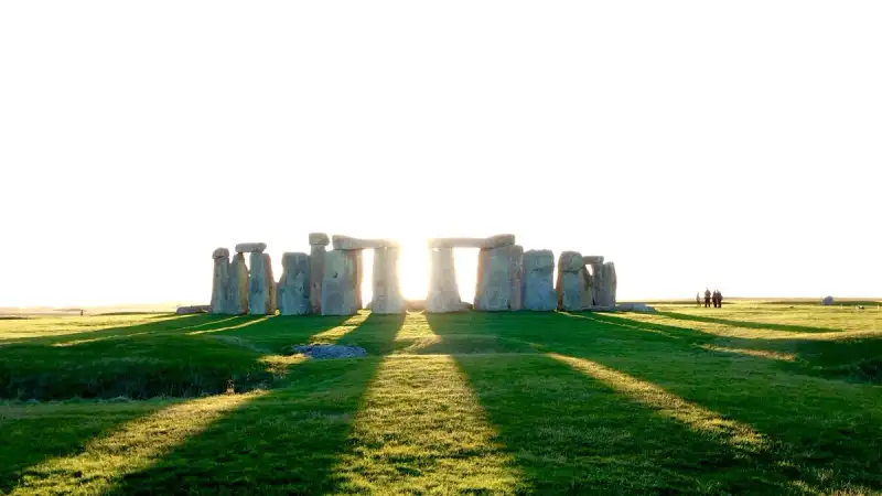
-
 Hans Müller
 - 09 Jul, 2026 20:59
Die steinerne Ewigkeit von Stonehenge: Ein Echo aus prähistorischen Nebeln, das bis heute verweilt
In den weiten Ebenen von Wiltshire, England, wo der Wind über die Salisbury Plain streicht und die Jahrtausende nur flüchtige Spuren hinterlassen zu haben scheinen, erhebt sich ein Bauwerk, das die menschliche Vorstellungskraft seit undenklichen Zeiten fesselt: Stonehenge. Es ist nicht nur eine Ansammlung von Steinen, sondern ein monumental in Stein gemeißeltes Rätsel, eine spirituelle Landkarte und ein Kalender, dessen Schatten die Geheimnisse einer längst vergangenen Welt bergen. Wer sich diesem Ort nähert, spürt unweigerlich die schwere Aura der Geschichte, das Gewicht der Zeit und die unausgesprochenen Geschichten jener Menschen, die mit schier unglaublicher Mühe und Präzision diese gigantische Struktur errichteten. Es ist ein Zeugnis menschlichen Strebens nach Ewigkeit, eine Verbindung zwischen Erde und Kosmos, die in den Morgenröten der Sommersonnenwende und den Dämmerungen der Wintersonnenwende ihren Höhepunkt findet. Das steinerne Herz einer alten Landschaft Drei Kilometer westlich von Amesbury, umgeben von einem der dichtesten Komplexe neolithischer und bronzezeitlicher Monumente in England, darunter Hunderte von Grabhügeln, liegt Stonehenge. Seine majestätische Präsenz dominiert die Landschaft und offenbart auf den ersten Blick seine architektonische Einzigartigkeit. Die äußerste Struktur bilden imposante Sarsensteine, die als aufrechte Pfeiler dienen. Jeder dieser Kolosse misst etwa 4 Meter in der Höhe und 2,1 Meter in der Breite und bringt ein Gewicht von rund 25 Tonnen auf die Waage. Was Stonehenge jedoch von vielen anderen zeitgenössischen Monumenten abhebt und seine ingenieurtechnische Brillanz unterstreicht, sind die horizontalen Sturzsteine, die diese aufrechten Pfeiler miteinander verbinden. Sie sind mit einer raffinierten Zapfenverbindung (Mortise-and-Tenon-Joint) befestigt – eine Bauweise, die in jener Epoche nahezu ohne Parallele ist und das Wissen und die Geschicklichkeit der Erbauer auf beeindruckende Weise demonstriert. Innerhalb dieses gewaltigen Sarsenkreises befindet sich ein weiterer Ring, der aus kleineren Blausteinen besteht. Noch weiter im Inneren erheben sich freistehende Trilithons, die aus zwei massiveren, vertikalen Sarsensteinen bestehen, die jeweils von einem einzigen Sturzstein überspannt werden. Obwohl das gesamte Monument heute in Ruinen liegt, ist seine ursprüngliche Ausrichtung unverkennbar: Es ist präzise auf den Sonnenaufgang der Sommersonnenwende und den Sonnenuntergang der Wintersonnenwende ausgerichtet. Diese astronomische Präzision lässt auf eine tief verwurzelte spirituelle oder kalendarische Bedeutung schließen, die weit über das bloße Bauen hinausging. Eine Chronologie in Stein: Die Phasen der Errichtung Die Geschichte von Stonehenge ist eine Geschichte vieler Phasen, die sich über einen Zeitraum von mindestens 1500 Jahren erstrecken, von etwa 3100 v. Chr. bis etwa 1600 v. Chr. Diese lange und komplexe Baugeschichte macht die Erforschung der Stätte zu einer faszinierenden archäologischen Detektivarbeit. Die erste Phase, die mit dem umgebenden kreisförmigen Erdwall und Graben datiert wird, reicht bis etwa 3100 v. Chr. zurück. Diese frühen Erdarbeiten markierten den Beginn einer Entwicklung, die Jahrhunderte später in der Errichtung der berühmten Steinkreise münden sollte. Die ikonischen großen Sarsensteine, die heute das Bild von Stonehenge prägen, wurden zwischen 2600 v. Chr. und 2400 v. Chr. in ihre Position gebracht. Die Blausteine, von denen angenommen wird, dass sie bereits um 3000 v. Chr. an diesem Ort gewesen sein könnten, erhielten ihre heutige Anordnung laut Radiokarbondatierung zwischen 2400 und 2200 v. Chr. Diese zeitliche Abfolge deutet auf eine kontinuierliche Weiterentwicklung und Anpassung des Monuments hin, möglicherweise im Einklang mit sich wandelnden religiösen Vorstellungen oder gesellschaftlichen Bedürfnissen. Es war kein einmaliger Akt, sondern ein über Generationen andauerndes Projekt, das die kollektive Anstrengung und Vision ganzer Gemeinschaften erforderte.Kulturelle Ikone und geschütztes Erbe Stonehenge ist weit mehr als nur ein archäologisches Relikt; es ist eine nationale Ikone und ein tief verwurzelter Teil der britischen Identität. Als eines der bekanntesten Wahrzeichen des Vereinigten Königreichs genießt es seit dem Ancient Monuments Protection Act von 1882 rechtlichen Schutz. Seine universelle Bedeutung wurde 1986 anerkannt, als die Stätte und ihre Umgebung in die Liste des UNESCO-Weltkulturerbes aufgenommen wurden. Das Eigentum an Stonehenge liegt bei der Crown Estate, während die Verwaltung und Pflege von English Heritage übernommen wird. Die umliegenden Ländereien, die für das Verständnis des gesamten Landschaftskomplexes von entscheidender Bedeutung sind, gehören dem National Trust. Diese vielschichtige Eigentums- und Verwaltungsstruktur unterstreicht die Wertschätzung und das Engagement, das dieser einzigartigen prähistorischen Stätte entgegengebracht wird. Es ist eine Verpflichtung, dieses Erbe für zukünftige Generationen zu bewahren und die Geheimnisse, die es noch immer birgt, weiter zu erforschen. Ein Ort der Toten: Das ursprüngliche Heiligtum Die Forschung der letzten Jahrzehnte hat immer stärker die Rolle von Stonehenge als Bestattungsplatz hervorgehoben. Schon von seinen frühesten Anfängen an könnte es als Grabstätte gedient haben. Ablagerungen, die menschliche Knochen enthielten, stammen aus der Zeit um 3000 v. Chr., als der Graben und der Erdwall erstmals ausgehoben wurden. Diese Praxis setzte sich für mindestens weitere 500 Jahre fort. Mike Parker Pearson, Leiter des Stonehenge Riverside Project, betonte, dass Stonehenge von seinem Beginn bis zu seiner Blütezeit im mittleren dritten Jahrtausend v. Chr. ein Ort der Bestattung war. Er argumentiert, dass die Brandbestattungen, die der Phase der Sarsensteine von Stonehenge zuzuordnen sind, wahrscheinlich nur eine von vielen aus dieser späteren Nutzungsperiode des Monuments sind und zeigen, dass es weiterhin sehr stark ein Reich der Toten war. Diese Erkenntnis verleiht Stonehenge eine noch tiefere, existenzielle Bedeutung und rückt es in den Kontext menschlicher Rituale um Leben, Tod und das Jenseits. Der Name und seine Echos: Etymologie von "Henge" Der Name „Stonehenge“ selbst birgt eine eigene Geschichte und hat die archäologische Nomenklatur maßgeblich geprägt. Das Oxford English Dictionary verweist auf Ælfrics Glossar aus dem 10. Jahrhundert, in dem „henge-cliff“ die Bedeutung „Abgrund“ oder „Stein“ zugeschrieben wird. Elfhundertjährige Schriftsteller verzeichneten die „stanenges“ oder „Stanheng“ „nicht weit von Salisbury“ als „in der Luft gestützte Steine“. Im Jahr 1740 bemerkte William Stukeley: „Pendelnde Felsen werden heute in Yorkshire Henges genannt… Ich zweifle nicht, dass Stonehenge im Sächsischen die hängenden Steine bedeutet.“ Christopher Chippindales „Stonehenge Complete“ leitet den Namen Stonehenge von den altenglischen Wörtern „stān“ (Stein) und entweder „hencg“ (Scharnier, weil die steinernen Sturzsteine an den aufrechten Steinen scharnierartig sitzen) oder „hen(c)en“ (hängen, Galgen oder Folterinstrument) ab. An anderer Stelle in seinem Buch zitiert Chippindale jedoch die Etymologie der „hängenden Steine“. Interessanterweise hat der Begriff „henge“ als Namensbestandteil einer ganzen Klasse von Denkmälern seinen Namen gegeben. Archäologen definieren „Henges“ als Erdarbeiten, die aus einer kreisförmigen, umwallten Anlage mit einem inneren Graben bestehen – eine Definition, die ein Überbleibsel aus der antiquarischen Nutzung ist und die historische Verknüpfung des Namens mit der tatsächlichen Form der Stätte widerspiegelt.Die Urzeit vor den Giganten: Eine Landschaft im Wandel Bevor die ersten großen Steine auf der Salisbury Plain aufgestellt wurden, war die Landschaft bereits von menschlicher Aktivität geprägt, deren Spuren weit in die Mesolithikum zurückreichen. Unter dem Bereich des bis 2013 genutzten Touristenparkplatzes haben Archäologen vier, möglicherweise sogar fünf, große mesolithische Pfostenlöcher entdeckt, die auf etwa 8000 v. Chr. datiert werden. Diese hielten Kiefernpfosten mit einem Durchmesser von etwa 0,75 Metern, die aufgerichtet wurden und schließlich an Ort und Stelle verrotteten. Drei oder sogar vier dieser Pfosten waren ost-westlich ausgerichtet, was auf eine frühe rituelle Bedeutung hindeuten könnte. Ähnliche, aber spätere Stätten wurden in Skandinavien gefunden, während im schottischen Aberdeenshire ein weiteres mesolithisches astronomisches Gelände, Warren Field, als der älteste lunisolare Kalender der Welt gilt, der jährlich durch Beobachtung der Wintersonnenwende korrigiert wurde. Ein möglicherweise gleichzeitiges Siedlungsgebiet zu den Pfosten wurde bei Blick Mead entdeckt, einer zuverlässigen, ganzjährigen Quelle, die nur 1,6 Kilometer von Stonehenge entfernt liegt. Zu dieser Zeit war die Salisbury Plain noch bewaldet. Vier Jahrtausende später, während des frühen Neolithikums, begannen die Menschen, eine sogenannte Causewayed Enclosure (ein ringförmiges Erdwerk mit Unterbrechungen) bei Robin Hood’s Ball zu errichten und Langhügelgräber in der umgebenden Landschaft anzulegen. Um etwa 3500 v. Chr. wurde der Stonehenge Cursus, ein riesiges lineares Erdwerk, 700 Meter nördlich der späteren Steinkreise erbaut, als die ersten Bauern begannen, die Wälder zu roden und das Gebiet zu entwickeln. Weitere bisher übersehene Stein- oder Holzstrukturen und Grabhügel könnten bis auf 4000 v. Chr. zurückdatieren; Holzkohle aus dem Lager von Blick Mead wurde auf diese Zeit datiert. Das Humanities Research Institute der University of Buckingham vertritt die Ansicht, dass die Gemeinschaft, die Stonehenge erbaute, dort über mehrere Jahrtausende lebte, was es potenziell zu einem der „Angelpunkte in der Geschichte der Stonehenge-Landschaft“ macht. Diese frühe, kontinuierliche menschliche Präsenz unterstreicht, dass Stonehenge nicht aus dem Nichts entstand, sondern das Ergebnis einer langen kulturellen Entwicklung in einer bereits bedeutsamen Landschaft war. Stonehenge 1: Der erste Kreis der Erde Die erste monumentale Phase von Stonehenge, datiert auf etwa 3100 v. Chr., manifestierte sich als ein kreisförmiger Erdwall- und Grabenkomplex. Diese Anlage, die aus Seaford-Kreide des späten Santonium-Zeitalters (Oberkreide) bestand, maß etwa 110 Meter im Durchmesser. Sie war in offenem Grasland auf einer leicht geneigten Fläche angelegt. Zwei Eingänge unterbrachen den Kreis: ein großer im Nordosten und ein kleinerer im Süden. Die Erbauer dieser ersten Phase legten die Knochen von Hirschen und Ochsen auf den Boden des Grabens, zusammen mit einigen bearbeiteten Feuersteinwerkzeugen. Auffallend ist, dass die Knochen deutlich älter waren als die Geweihspitzen, die zum Graben des Grabens verwendet wurden. Dies deutet darauf hin, dass die Menschen, die sie dort vergruben, diese Knochen eine Zeit lang vor der Bestattung aufbewahrt und gepflegt hatten – ein Hinweis auf rituelle Praktiken oder eine tiefe Ehrfurcht vor diesen Überresten. Der Graben selbst war kontinuierlich, wurde aber in Abschnitten ausgehoben, ähnlich den Gräben der früheren Causewayed Enclosures in der Gegend. Die aus dem Graben ausgehobene Kreide wurde zu einem Wall aufgeschüttet. Diese erste Stufe, die um 3100 v. Chr. datiert wird, markiert den Beginn des Stonehenge-Komplexes, bevor der Graben auf natürliche Weise zu verschlammen begann. Innerhalb des äußeren Bereichs dieser eingefassten Fläche befindet sich ein Kreis von 56 Gruben, jede etwa 1 Meter im Durchmesser. Diese sind als Aubrey-Löcher bekannt, benannt nach John Aubrey, dem Antiquar des 17. Jahrhunderts, dem zugeschrieben wird, sie als Erster identifiziert zu haben. Ihre Funktion bleibt bis heute Gegenstand intensiver Debatten – waren sie Pfostenlöcher, rituelle Depots oder Teil eines astronomischen Beobachtungssystems? Die bleibende Faszination Stonehenge bleibt ein tiefgründiges Mysterium, dessen Steine in stummer Pracht von den Ingenieurleistungen, dem astronomischen Wissen und den spirituellen Überzeugungen einer untergegangenen Zivilisation zeugen. Jeder Stein, jede Ausrichtung und jede archäologische Schicht erzählt eine Geschichte von Tausenden von Jahren menschlicher Interaktion mit dieser besonderen Landschaft. Von den mesolithischen Pfostenlöchern, die auf eine noch ältere rituelle Nutzung hindeuten, über die frühen Erdarbeiten von Stonehenge 1 bis hin zu den monumentalen Steinkreisen, die Generationen von Menschen erbauten – Stonehenge ist ein Spiegel der Zeit, der uns zwingt, über unsere eigene Geschichte und unseren Platz im Kosmos nachzudenken. Die Forschung geht weiter, und mit jeder neuen Entdeckung wird das Bild dieses prähistorischen Heiligtums nuancierter und komplexer. Doch die Essenz bleibt: Stonehenge ist ein Ort, der über die Jahrhunderte hinweg seine Kraft und Anziehung behalten hat. Es ist ein Ort, der uns daran erinnert, wie tief der menschliche Drang ist, Spuren zu hinterlassen, den Himmel zu vermessen und die Geheimnisse des Lebens und des Todes zu ergründen. Wenn die Sonne an der Sommersonnenwende ihre Strahlen durch die Steine sendet oder an der Wintersonnenwende hinter ihnen versinkt, spürt man, dass diese alten Steine nicht nur auf der Erde stehen, sondern auch eine Brücke zu den Sternen schlagen, ein ewiges Echo einer verlorenen Welt.#Stonehenge #PrähistorischesMonument #UNESCOWelterbe #EnglandReise #Archäologie #Megalithanlage Related InsightsZanzibar’s Hidden Shores: Unveiling the Most Secluded Beaches Where Crowds Dare Not Wander (Part 2) La Cathédrale Saint-Guy de Prague : Joyau de Bohême Machu Picchu : Quand les Pierres Éternelles des Incas Murmurent l'Histoire Oubliée au Sommet des Andes{ "@context": "https://schema.org", "@type": "FAQPage", "mainEntity": [ { "@type": "Question", "name": "What is the main focus of Die steinerne Ewigkeit von Stonehenge: Ein Echo aus prähistorischen Nebeln, das bis heute verweilt?", "acceptedAnswer": { "@type": "Answer", "text": "Tauchen Sie ein in die fesselnde Geschichte von Stonehenge, dem monumentalen Zeugnis menschlicher Genialität und spiritueller Tiefe, das seit Jahrtausenden die englische Landschaft prägt und die Forschung bis heute in Atem hält." } }, { "@type": "Question", "name": "Who authored the comprehensive guide on Die steinerne Ewigkeit von Stonehenge: Ein Echo aus prähistorischen Nebeln, das bis heute verweilt?", "acceptedAnswer": { "@type": "Answer", "text": "This detailed article and its insights were carefully researched and authored by Hans Müller." } }, { "@type": "Question", "name": "Where can I find more related content about Travel?", "acceptedAnswer": { "@type": "Answer", "text": "You can explore more articles, detailed reviews, and similar insights by browsing the Related Insights section at the bottom of this article or visiting our dedicated Travel category page." } } ] }
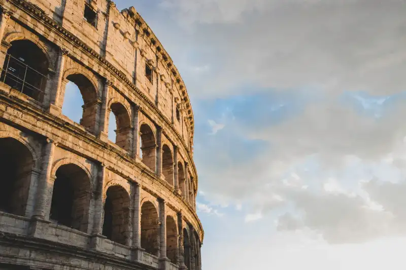
The very air in Rome hums with an ancient resonance, a symphony of forgotten glories and triumphs that still echo from every cobblestone and crumbling archway. Yet, amidst this chorus of antiquity, one monument rises, not merely as a structure of stone and mortar, but as a thrumming heart of imperial power, public spectacle, and enduring human drama: the Colosseum. It is more than a ruin; it is a sentinel of civilization, a silent narrator of an empire's zenith and the multifaceted lives it encompassed. To stand before it is to feel the weight of two millennia, to hear the roar of phantom crowds, and to understand that some stories, etched in travertine and tuff, are truly immortal. Nestled gracefully in the sprawling embrace of Italy's eternal capital, just to the east of the venerable Roman Forum, the Colosseum stands as an elliptical titan. It is not merely a testament to Roman ingenuity but an unparalleled marvel of engineering scale, holding the distinction as the largest ancient amphitheatre ever constructed and remaining the grandest standing amphitheatre in the world. Its very form, a colossal oval, speaks of inclusivity, designed to embrace tens of thousands within its imposing walls, a masterclass in communal experience, however brutal or magnificent. The Flavian Legacy: A Monument Born of Renewal The genesis of this architectural titan is deeply intertwined with the powerful Flavian dynasty, a lineage that sought to restore Rome's morale and grandeur after the tumultuous reign of Nero. Construction commenced under the formidable Emperor Vespasian in 72 AD. A pragmatist and a military man, Vespasian understood the importance of public works, of giving back to the people, and of cementing his dynasty's legitimacy. He initiated a project that would define an era, transforming a symbol of private imperial excess into a monumental arena for public entertainment. Vespasian, however, would not live to see its completion. The colossal undertaking was brought to fruition by his son and successor, Titus, who reigned from 79 to 81 AD, with the grand inauguration taking place in 80 AD. Further embellishments and modifications were carried out during the subsequent reign of Domitian (81–96 AD), completing what became the most sophisticated entertainment complex of the ancient world. It is this familial patronage – Vespasian, Titus, and Domitian – that led later classicists and archaeologists to bestow upon it the more formal, if less popularly known, appellation: the Flavian Amphitheatre, a name that honors the gens Flavia, their distinguished family name. Constructed from a formidable array of materials, the Colosseum is a testament to the Romans' mastery of construction. Its imposing skeleton of travertine limestone, sourced from nearby quarries, provided structural integrity and a dazzling white finish in its prime. Volcanic rock, known as tuff, lent its strength, while brick-faced Roman concrete – a revolutionary material for its time – allowed for complex shapes and incredible durability. This combination of natural resources and advanced engineering allowed for a structure that could accommodate an estimated 50,000 to 80,000 spectators at various junctures in its history, with an average audience capacity often cited around 65,000. Imagine the logistical feat of seating and managing such a throng, a testament to Roman organizational prowess. The Canvas of Spectacle: Life and Death in the Arena For centuries, the Colosseum served as the beating heart of Roman public life, a stage for spectacles that ranged from the awe-inspiring to the utterly barbaric. Gladiatorial contests, the most iconic and perhaps most misunderstood of its events, pitted highly trained fighters against each other in contests of skill, courage, and often, brutal fatality. These were not mere blood sports; they were complex social rituals, opportunities for emperors to display generosity, for citizens to vent frustrations, and for individuals to achieve fleeting fame or face ignominious death. Beyond the gladiators, the arena hosted a bewildering array of public shows. Animal hunts, known as venationes, saw exotic beasts from across the empire – lions, tigers, bears, rhinoceroses, and more – battling each other or specially trained hunters, a dazzling and terrifying display of imperial might and geographical reach. Executions, often theatrical and gruesome, served as stark warnings and expressions of state power. Re-enactments of famous battles brought historical and mythological narratives to life, while dramas based on Roman mythology provided a form of entertainment more akin to modern theatre, albeit with far grander staging. Perhaps most astonishingly, for a brief period, the arena was even flooded for naumachiae, or mock sea battles, transforming the Colosseum into an inland sea for naval engagements. The sheer engineering required to achieve this is almost unfathomable.The Name: A Colossus of Meaning The name "Colosseum" itself carries a fascinating etymology, a linguistic journey through time that often leads to misconception. Originally, the building's Latin name was simply amphitheatrum, signifying its function. While "Flavian Amphitheatre" is commonly used today, there is no definitive evidence that this name was widely used during classical antiquity. Some Romans may have unofficially referred to it as Amphitheatrum Caesareum, an adjective pertaining to the title Caesar, but this was likely a poetic flourish and not exclusive to Rome's great amphitheatre, as Vespasian and Titus themselves constructed another Flavian Amphitheatre in Puteoli (modern Pozzuoli). The popular name "Colosseum" is widely believed to derive from a colossal statue of Nero, a bronze giant modeled on the Colossus of Rhodes. This immense sculpture depicted Nero as a solar deity, and it was moved to a position beside the amphitheatre by Emperor Hadrian (r. 117–138 AD). The Latin adjective colosseus, meaning "gigantic" or "colossean," aptly described this statue. By the year 1000, the Latin name "Colosseum" had been coined specifically to refer to the amphitheatre, drawing its inspiration from the nearby "Colossus Solis" (Colossus of the Sun), as Nero's statue was then known. It's here that a famous historical nuance, often misconstrued, comes into play. In the 8th century, an epigram attributed to the Venerable Bede contained a prophetic verse: "Quamdiu stat Colisæus, stat et Roma; quando cadet colisæus, cadet et Roma; quando cadet Roma, cadet et mundus" – "as long as the Colossus stands, so shall Rome; when the Colossus falls, Rome shall fall; when Rome falls, so falls the world." This powerful declaration is frequently, and erroneously, translated to refer to the amphitheatre itself. However, at the time Pseudo-Bede wrote, the masculine noun coliseus specifically applied to the colossal statue of Nero, not the Flavian Amphitheatre. Even Lord Byron's poem "Childe Harold's Pilgrimage" perpetuates this common mistranslation, inadvertently cementing the error in popular imagination. The name continued its evolution through the Middle Ages. Medieval Latin saw variations like coloseum (attested from the 12th century) and coliseum (from the 14th century). In the 12th century, the structure was specifically recorded as amphitheatrum colisei, the "Amphitheatre of the Colossus." By the High Middle Ages, it was recognized in Old French as colosé in the late 13th century, and Middle French saw colisée by the early 16th century, a term that had by then broadened to apply to any amphitheatre. This lineage passed into Middle English as colisee, used by John Capgrave in his Solace of Pilgrims, where he remarked: "collise eke is a meruelous place … þe moost part of it stant at þis day." Similarly, John Bourchier, 2nd Baron Berners, in his 1533 translation of Antonio de Guevara's biography of Marcus Aurelius, referred to "this Emperour, beynge with the Senate at Collisee ...." Italian colosseo or coliseo first referred to the Roman amphitheatre before also becoming a generic term, as did Catalan coliseu, Spanish coliseo, and Portuguese coliseu. The earliest citation for the name "Colosseum" in Early Modern English comes from Philemon Holland's 1600 translation of Bartolomeo Marliani's Urbis Romae topographia, which explicitly states: "This Amphitheatre was commonly called Colosseum, of Neroes Colossus, which was set up in the porch of Neroes house." John Evelyn, in his translation of Roland Fréart de Chambray, similarly noted, "And 'tis indeed a kind of miracle to see that the Colosseum … and innumerable other Structures which seemed to have been built for Eternity, should be at present so ruinous and dilapidated." This rich linguistic history underscores how deeply the structure, and its naming, have been woven into the fabric of European culture and language. From Opulence to Public Forum: The Site's Transformation The very ground upon which the Colosseum proudly stands tells a compelling story of Roman history and transformation. The chosen site was a naturally flat area, nestled in the floor of a low valley, strategically positioned between the Caelian, Esquiline, and Palatine Hills. A canalized stream once traversed this area, alongside an artificial lake and marshland. By the 2nd century BC, this valley was a densely inhabited part of Rome, a vibrant urban landscape. This landscape was drastically altered by the Great Fire of Rome in 64 AD, a catastrophic event that devastated large portions of the city. Capitalizing on the destruction, the controversial Emperor Nero seized much of the area, annexing it to his personal imperial domain. On this prime piece of land, he embarked on the construction of the opulent Domus Aurea, his "Golden House," a sprawling palace complex designed for unparalleled luxury. In front of this grandiose residence, Nero created an artificial lake, complete with pavilions, meticulously designed gardens, and elegant porticoes, transforming a bustling urban district into his private pleasure grounds. The existing Aqua Claudia aqueduct was even extended to supply this extravagant new area with water, and, of course, the gigantic bronze Colossus of Nero was erected nearby, standing proudly at the entrance to the Domus Aurea. Vespasian's decision to construct the Colosseum on the very site of Nero's lake was a masterstroke of political symbolism. It was a powerfully populist gesture, a clear declaration of his intent to return land and resources from the emperor's private extravagance to the public good. Much of the Domus Aurea was systematically torn down, a deliberate act of dismantling a controversial predecessor's legacy. The artificial lake was filled in, and its land was meticulously prepared and reused as the foundation for the new Flavian Amphitheatre. To support the monumental operations of the arena, gladiatorial schools and various other auxiliary buildings were constructed nearby, within the former grounds of the Domus Aurea, creating an integrated complex dedicated to entertainment and spectacle. This transformation from a symbol of imperial self-indulgence to a grand public space speaks volumes about the political savvy of the Flavian emperors.Enduring Legacy: From Ruins to Global Icon The glory days of the Colosseum as an entertainment venue, however, were not eternal. With the decline of the Western Roman Empire and the rise of Christianity, the spectacles, often deemed pagan and excessively violent, gradually ceased. By the early medieval era, the building was no longer used for entertainment. Yet, its sheer structural integrity and vastness ensured its continued relevance, albeit in radically different capacities. It was creatively repurposed for various functions: as housing for citizens, workshops for artisans, quarters for a religious order, and even as a formidable fortress during periods of civil unrest. Tragically, it also served as a convenient quarry, its precious stones and materials (spolia) plundered for other building projects across Rome. Eventually, it gained sanctity as a Christian shrine, commemorating the martyrs believed to have died within its walls. Despite being substantially ruined over centuries by devastating earthquakes and the relentless depredations of stone robbers, the Colosseum has steadfastly remained an internationally renowned symbol of Imperial Rome. Its very silhouette against the Roman sky evokes an empire's might and artistic ambition. Its profound historical and cultural significance led to its inclusion as one of the New 7 Wonders of the World, a testament to its enduring power to captivate and inspire. Today, the Colosseum stands as one of Rome's most popular tourist attractions, drawing millions annually who come to walk in the footsteps of emperors and gladiators, to marvel at its scale, and to contemplate the stories etched into its ancient stones. Its symbolic weight extends even to contemporary religious practices; each Good Friday, the Pope leads a poignant, torchlit Catholic "Way of the Cross" procession that begins in the sacred area surrounding the Colosseum, connecting ancient suffering with Christian remembrance. Its image is even immortalized on the Italian version of the 5 euro cent coin, a constant reminder of its pervasive influence on Italian identity and heritage. The Colosseum, in its present state, is a powerful paradox: a magnificent ruin, a testament to both human grandeur and the relentless march of time. It embodies the ebb and flow of history, from a bustling valley to Nero's private lake, to a public amphitheater, then a quarry, and finally, a revered global monument. Its stones, scarred by earthquakes and human hands, continue to whisper tales of power, passion, and the indomitable spirit of an empire that, through this very structure, still commands our awe. To truly understand Rome, one must not merely see the Colosseum, but feel its pulse, listen to its echoes, and recognize its immutable grandeur as a permanent fixture in the human story.#Travel #AncientRome #Colosseum #ItalianHistory #ArchitecturalWonders Related InsightsDive Into a Hidden World: The Most Breathtaking Underwater Museums and Sculpture Parks Im Bann der Gezeiten: Wenn Stein und Meer den Mont Saint-Michel umarmen Beyond the Supermarket Aisle: A Gastronomic Odyssey Through Earth’s Most Exotic Fruits{ "@context": "https://schema.org", "@type": "FAQPage", "mainEntity": [ { "@type": "Question", "name": "What is the main focus of Echoes of Eternity: Unearthing the Colosseum's Immutable Grandeur?", "acceptedAnswer": { "@type": "Answer", "text": "Journey into the heart of ancient Rome with John Explorer as we unveil the Colosseum, an architectural marvel steeped in tales of emperors, gladiators, and an enduring legacy that shapes our world." } }, { "@type": "Question", "name": "Who authored the comprehensive guide on Echoes of Eternity: Unearthing the Colosseum's Immutable Grandeur?", "acceptedAnswer": { "@type": "Answer", "text": "This detailed article and its insights were carefully researched and authored by John Explorer." } }, { "@type": "Question", "name": "Where can I find more related content about Travel?", "acceptedAnswer": { "@type": "Answer", "text": "You can explore more articles, detailed reviews, and similar insights by browsing the Related Insights section at the bottom of this article or visiting our dedicated Travel category page." } } ] }
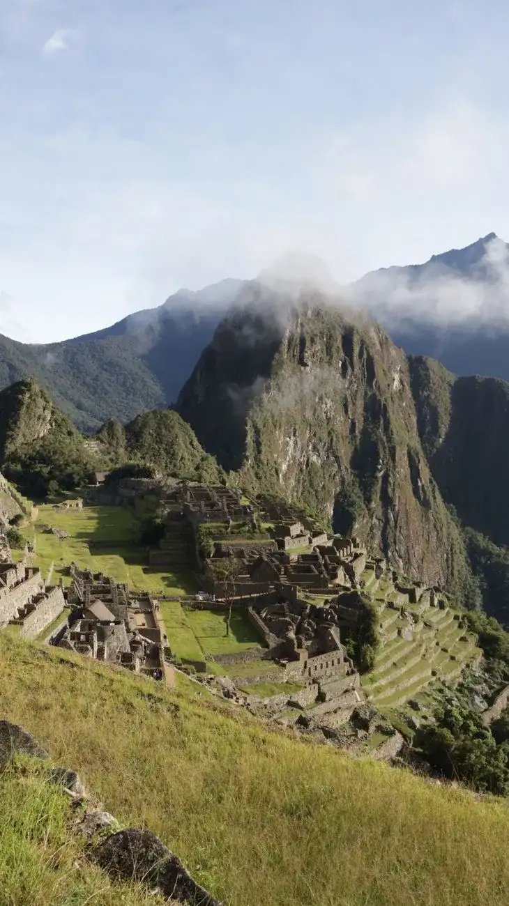
- Pierre Dubois
- 08 Jul, 2026 20:46
Machu Picchu : Quand les Pierres Éternelles des Incas Murmurent l'Histoire Oubliée au Sommet des Andes
Au cœur de la Cordillère Orientale du Pérou, là où les Andes déchirent le ciel en sommets vertigineux, s'accroche un rêve de pierre et de légende : Machu Picchu. Plus qu'une simple ruine, c'est une sentinelle silencieuse du temps, une citadelle oubliée que les brumes matinales enveloppent encore des mystères de l'Empire Inca. Perchée à une altitude défiant l'imagination, à 2430 mètres précisément, elle n'est pas un monument que l'on visite, mais un sanctuaire que l'on ressent, dont chaque pierre taillée murmure l'ingéniosité d'une civilisation disparue et la grandeur d'un empereur bâtisseur. Cet édifice intemporel, suspendu entre ciel et terre, continue de défier notre compréhension et d'éveiller notre âme d'explorateur, bien au-delà des sentiers battus de la modernité. L'Écho Millénaire d'une Cité Perdue Imaginez une forteresse inexpugnable, érigée au XVe siècle par la puissance Inca, non pas au fond d'une vallée accessible, mais sur une crête de montagne escarpée, à quelque 80 kilomètres au nord-ouest de Cusco. C'est là que Machu Picchu se dresse, surplombant la Vallée Sacrée et longeant le puissant fleuve Urubamba, qui creuse un canyon profond, baigné par un climat subtropical montagnard. Cette position stratégique, presque irréelle, a valu à la citadelle le surnom poétique et énigmatique de « Cité Perdue des Incas », bien qu'elle n'ait jamais réellement été perdue pour les populations locales. Elle incarne l'un des symboles les plus iconiques de cette civilisation fascinante et demeure, sans conteste, l'un des sites archéologiques majeurs de toutes les Amériques. La majesté de Machu Picchu réside autant dans son emplacement spectaculaire que dans l'extraordinaire ingéniosité de sa conception. Elle est le témoin silencieux d'une époque où l'homme et la nature s'unissaient dans une harmonie architecturale défiant le temps. Chaque année, plus de 1,5 million de pèlerins et de curieux du monde entier convergent vers ce sanctuaire, faisant de Machu Picchu la destination touristique internationale la plus visitée du Pérou. Son aura dépasse les frontières, son histoire captive, et son paysage à couper le souffle laisse une empreinte indélébile dans l'esprit de ceux qui foulent ses sentiers ancestraux. Les Pierres Murmurantes des Incas La construction de Machu Picchu, estimée aux alentours de 1450, fut un tour de force architectural, emblématique du style classique Inca. Chaque bloc de pierre, souvent d'une taille monumentale, fut taillé et ajusté avec une précision si parfaite qu'il est impossible d'y glisser la lame d'un couteau entre eux, sans l'usage de mortier. Une technique de maçonnerie à sec, d'une sophistication ahurissante, qui a permis à ces structures de résister aux séismes et aux intempéries pendant des siècles. On dit que cette cité fut édifiée pour servir de domaine à l'empereur Inca Pachacútec, bien qu'aucune chronique écrite contemporaine ne puisse l'attester avec une certitude absolue. Ce souverain légendaire, dont le règne marqua l'apogée de l'Empire, aurait vu en ce lieu une résidence d'exception, un havre de paix et de pouvoir. Parmi les édifices les plus remarquables, le Temple du Soleil se distingue par sa tour semi-circulaire et ses murs courbés, un chef-d'œuvre de stéréotomie, dont les fenêtres étaient alignées avec les solstices, témoignant de la profonde connaissance astronomique des Incas. Le Temple des Trois Fenêtres, avec ses ouvertures trapézoïdales offrant des vues imprenables sur les sommets environnants, et la pierre rituelle de l'Intihuatana, une sorte de cadran solaire sacré, sont d'autres exemples frappants de l'ingénierie et de la spiritualité inca. Chacune de ces structures n'est pas seulement un bâtiment, mais un lien tangible avec le cosmos, une expression de la cosmogonie d'un peuple. La citadelle fut abandonnée environ un siècle plus tard, vraisemblablement lors de la conquête espagnole. Les analyses modernes par datation au radiocarbone placent son occupation entre 1420 et 1530 environ, offrant une fenêtre temporelle plus précise sur son usage. Cette soudaine désertion, sans destruction majeure par les conquistadors, contribua grandement à préserver son mystère et son intégrité, la laissant ainsi sommeiller sous la végétation luxuriante des Andes jusqu'à sa "redécouverte" plus tardive.Chroniques Révisées : Quand l'Histoire se Révèle L'histoire et la chronologie précise de Machu Picchu ont longtemps fait l'objet de débats érudits. Les modèles chronologiques initiaux, principalement basés sur les reconstructions historiques du règne de Pachacútec Inca Yupanqui par John H. Rowe, situaient le début de la construction vers 1450, une décennie après son accession au pouvoir. Cependant, les avancées scientifiques récentes ont permis de jeter un éclairage nouveau et plus précis sur cette période. Une étude marquante de 2021, menée par Richard L. Burger, professeur d'anthropologie à l'Université de Yale, a rapporté 26 mesures par radiocarbone AMS (spectrométrie de masse par accélérateur) effectuées sur des restes humains. Ces analyses ont conclu que Machu Picchu fut occupé entre 1420 et 1530 environ, déplaçant ainsi son origine d'au moins vingt ans plus tôt. Des conclusions similaires, confortant une chronologie plus ancienne au début du XVe siècle, ont été rapportées par d'autres études isotopiques. Il apparaît donc que la construction de la citadelle s'est déroulée sous le règne de deux Sapa Incas successifs : Pachacútec Inca Yupanqui (de 1438 à 1471) et Túpac Inca Yupanqui (de 1472 à 1493). Le consensus parmi les archéologues penche vers l'idée que Pachacútec ordonna l'édification de ce domaine royal après sa conquête des régions moyenne et basse de l'Urubamba. Cette initiative s'inscrivait probablement dans un programme plus vaste visant à établir des domaines royaux le long du fleuve Urubamba, soulignant la volonté de l'empereur d'affirmer son pouvoir et d'organiser son empire. Le complexe palatial de Machu Picchu aurait ainsi fonctionné comme une retraite royale saisonnière, un lieu de villégiature et de représentation pour le souverain et sa cour. Bien que considéré comme un domaine royal, il ne semble pas avoir été transmis par lignée de succession directe. Il fut utilisé pendant environ 80 ans avant d'être brusquement abandonné, probablement en raison des conquêtes espagnoles qui ravageaient d'autres parties de l'Empire Inca. Il est même envisageable qu'une grande partie de ses habitants ait succombé à la variole, maladie introduite par les voyageurs européens, avant même l'arrivée des conquistadors espagnols dans la région isolée de Machu Picchu. Le Mystère du Nom : Entre Ancien Sommet et Jeune Pic Le nom même de cette merveille andine est empreint de poésie et d'histoire linguistique. Le site est niché sur une selle étroite entre deux sommets montagneux emblématiques : Machu Picchu et Huayna Picchu. Dans la langue quechua, "machu" signifie 'vieux' ou 'personne âgée', tandis que "wayna" (orthographié "huayna" en orthographe espagnole standard) signifie 'jeune'. Le terme "pikchu", quant à lui, désigne un 'sommet', un 'pic', ou une 'pyramide'. Ainsi, le nom de la citadelle est souvent traduit par 'vieille montagne' ou 'vieux pic'. Pourtant, le nom originel donné à cette colonie par ses bâtisseurs n'est pas connu avec certitude. Une étude publiée en 2021 dans "Ñawpa Pacha: Journal of the Institute of Andean Studies" suggère que le site était probablement désigné sous le nom de "Huayna Picchu", en référence au pic plus petit et plus proche, ou simplement "Picchu". Selon cette recherche, l'association du nom "Machu Picchu" avec les ruines aurait débuté avec les publications de l'explorateur américain Hiram Bingham en 1911. Cette conclusion est corroborée par les notes de terrain de Bingham, les premières cartes qu'il a utilisées, et divers documents historiques. C'est donc la "redécouverte" moderne qui aurait figé le nom que nous connaissons aujourd'hui, bien que les Incas eux-mêmes aient pu l'appeler différemment. La Vie Animée au Cœur de la Citadelle Royale Au-delà de sa magnificence architecturale, Machu Picchu était un lieu de vie, une micro-société complexe et dynamique. Durant sa période d'utilisation comme domaine royal, on estime qu'environ 750 personnes y résidaient. La majorité d'entre elles étaient des "yanaconas", du personnel de soutien qui vivait là de manière permanente, dédiant leur existence au service de l'empereur et de sa cour. Bien que le domaine appartînt à Pachacútec, des spécialistes religieux et des travailleurs temporaires spécialisés, les "mayocs", y vivaient également, probablement pour assurer le bien-être et le divertissement du souverain. Pendant l'hiver, saison généralement plus rude dans les Andes, les effectifs étaient réduits à quelques centaines de serviteurs et à quelques spécialistes religieux, dont la tâche principale était la maintenance des lieux. Un Mosaïque Humaine au Fil des Andins Les études menées sur les restes squelettiques retrouvés à Machu Picchu ont révélé une réalité fascinante : la plupart des personnes qui y vécurent étaient des immigrants, issus d'horizons divers. Des analyses génomiques ont montré que la communauté des domestiques (yanaconas et anciennes acllas) était génétiquement très variée, incluant des ascendances andines, côtières, équatoriennes et amazoniennes. Fait remarquable, des individus d'origines différentes vivaient, se reproduisaient et étaient inhumés ensemble, témoignant d'une intégration culturelle et sociale au sein de la citadelle. Ces individus ne possédaient pas les marqueurs chimiques et ostéologiques que l'on retrouverait chez des personnes ayant vécu toute leur vie à Machu Picchu. Au contraire, les recherches sur les restes squelettiques ont mis en évidence des lésions osseuses dues à diverses espèces de parasites aquatiques indigènes à différentes régions du Pérou. Des indicateurs ostéologiques de stress variés et des densités chimiques différentes suggéraient également des régimes alimentaires à long terme distincts, caractéristiques de régions éloignées les unes des autres. Ces régimes comprenaient des niveaux variables de maïs, de pommes de terre, de céréales, de légumineuses et de poisson. Cependant, le régime alimentaire à court terme le plus récent pour ces personnes se composait globalement de moins de poisson et de plus de maïs. Cela suggère que plusieurs immigrants provenaient de régions côtières et se sont déplacés vers Machu Picchu, où le maïs constituait une part plus importante de l'alimentation. Une autre observation notable est que la plupart des restes squelettiques découverts sur le site présentaient des niveaux inférieurs d'arthrite et de fractures osseuses par rapport à ceux trouvés dans la plupart des sites de l'Empire Inca. Les individus incas souffrant d'arthrite et de fractures osseuses étaient généralement ceux qui effectuaient un travail physique lourd (tel que la corvée de la "Mit'a") ou servaient dans l'armée inca, ce qui laisse entrevoir une vie relativement moins éprouvante physiquement pour les habitants de Machu Picchu. Des Compagnons et des Offrandes : La Faune de Machu Picchu La présence animale à Machu Picchu était également significative, comme en témoignent les nombreux ossements découverts, dont certains n'étaient pas natifs de la région. La plupart des os d'animaux appartenaient à des lamas et des alpagas. Ces camélidés vivent naturellement à des altitudes d'environ 4 000 mètres, bien plus élevées que les 2 400 mètres de Machu Picchu. Il est fort probable que ces animaux aient été amenés de la région de la Puna, principalement pour leur viande et leurs peaux, essentiels à la subsistance et à l'artisanat. Des cobayes, ou cuy, ont également été retrouvés sur le site, notamment dans des grottes funéraires spéciales. Leur présence dans ces tombes suggère qu'ils étaient au moins utilisés lors de rituels funéraires, pratique courante dans tout l'Empire Inca où ils servaient de sacrifices et de source de viande. Enfin, six chiens ont été découverts sur le site. En raison de leur positionnement parmi les restes humains, il est plausible qu'ils aient servi de compagnons aux défunts, partageant peut-être leur dernier voyage vers l'au-delà.L'Héritage d'un Empire : Redécouverte et Préservation Si Machu Picchu est aujourd'hui une icône mondiale, son histoire moderne est celle d'une révélation progressive. Bien que le site fut connu des populations locales depuis des siècles et atteint au début du XXe siècle par l'explorateur péruvien Agustín Lizárraga, c'est l'historien américain Hiram Bingham III qui, en 1911, attira l'attention internationale sur cette merveille. Ses expéditions et publications permirent au monde entier de découvrir la splendeur et le mystère de cette citadelle inca. Depuis lors, la reconnaissance et la protection de Machu Picchu n'ont cessé de croître. En 1981, le Pérou l'a désigné comme Sanctuaire Historique National, une mesure cruciale pour la conservation de son patrimoine naturel et culturel. Deux ans plus tard, en 1983, l'UNESCO l'a inscrit sur la liste du Patrimoine Mondial, reconnaissant son « importance universelle exceptionnelle ». Plus récemment, en 2007, Machu Picchu a été élu l'une des Nouvelle Sept Merveilles du Monde, cimentant sa place dans la conscience collective de l'humanité. Aujourd'hui, alors que les Andes continuent de veiller sur ce joyau, Machu Picchu demeure une source inépuisable de savoir, d'émerveillement et d'inspiration. C'est un appel à l'exploration, à la compréhension d'un passé glorieux, et à la méditation sur la persévérance et l'ingéniosité de l'esprit humain. Chaque pas sur ses pierres ancestrales est un écho d'une histoire millénaire qui refuse de se taire, une invitation à se connecter avec la grandeur d'un empire dont l'héritage continue de rayonner, suspendu entre les nuages et l'éternité.#MachuPicchu #Incas #Pérou #VoyageCulturel #Andes #CitéPerdue #Archéologie Related InsightsSardegna Profonda: Sulle Tracce Misteriose dei Nuraghi nella Barbagia Nascosta The Stone Dreams of Kings: Unveiling the Loire Valley’s Living Tapestry 清水寺: 断崖に立つ祈りの舞台{ "@context": "https://schema.org", "@type": "FAQPage", "mainEntity": [ { "@type": "Question", "name": "What is the main focus of Machu Picchu : Quand les Pierres Éternelles des Incas Murmurent l'Histoire Oubliée au Sommet des Andes?", "acceptedAnswer": { "@type": "Answer", "text": "Perchée à 2430 mètres, Machu Picchu n'est pas qu'une ruine; c'est un testament éternel à la grandeur inca, un joyau archéologique dont les secrets continuent de fasciner." } }, { "@type": "Question", "name": "Who authored the comprehensive guide on Machu Picchu : Quand les Pierres Éternelles des Incas Murmurent l'Histoire Oubliée au Sommet des Andes?", "acceptedAnswer": { "@type": "Answer", "text": "This detailed article and its insights were carefully researched and authored by Pierre Dubois." } }, { "@type": "Question", "name": "Where can I find more related content about Travel?", "acceptedAnswer": { "@type": "Answer", "text": "You can explore more articles, detailed reviews, and similar insights by browsing the Related Insights section at the bottom of this article or visiting our dedicated Travel category page." } } ] }
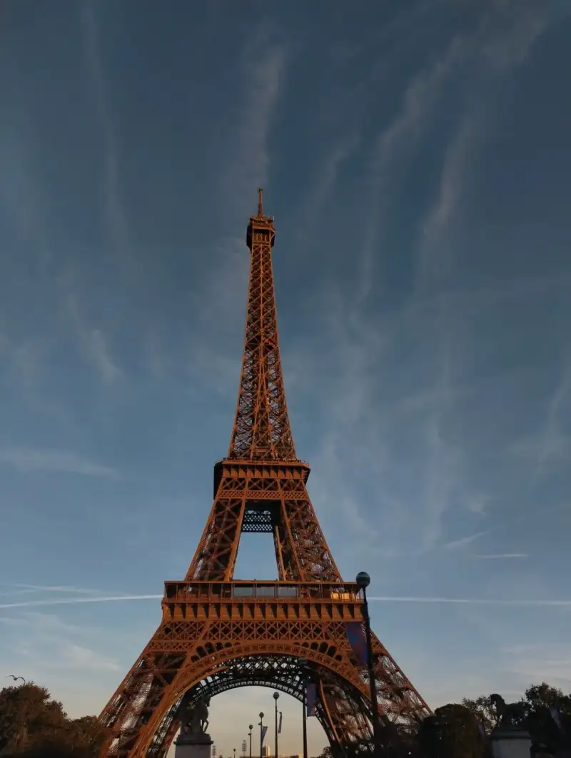
- Marco Rossi
- 08 Jul, 2026 16:00
La Signora di Ferro che Sfidò il Cielo: Storie, Segreti e le Ombre Nascoste della Torre Eiffel
C'è un luogo a Parigi dove il cielo e la terra si incontrano in un abbraccio di ferro, dove l'ambizione umana si è fusa con la poesia dell'acciaio forgiato, creando un simbolo che trascende il tempo e le frontiere. Non è semplicemente una struttura, ma un'anima vibrante, un battito cardiaco metallico che pulsa al ritmo della Ville Lumière. La chiamano "La dame de fer", la Signora di Ferro, un appellativo che evoca non solo la sua composizione, ma anche la sua resilienza, la sua grazia severa e la sua innegabile regalità. La Torre Eiffel non è nata senza controversie, non è sorta senza sogni e non ha conquistato il suo posto nel pantheon delle meraviglie senza una storia intrisa di ingegno, dibattito e, come spesso accade con le grandi opere, di segreti meno luminosi. L'Alba di un Gigante: Visione, Ingegno e la Nascita di un Simbolo Era la fine dell'Ottocento, un'epoca di fervore industriale e di celebrazioni nazionali. La Francia si preparava a ospitare l'Esposizione Universale del 1889, un evento grandioso destinato a coronare il centenario della Rivoluzione Francese. Per un'occasione così significativa, serviva un fulcro, un monumento che potesse incarnare lo spirito di un'epoca e la gratitudine di una nazione. Ed è qui che entra in scena l'ingegnere Gustave Eiffel, la cui azienda avrebbe progettato e costruito quella che sarebbe diventata la Torre Eiffel tra il 1887 e il 1889. L'idea originaria non fu esclusiva di Eiffel. Furono Maurice Koechlin ed Émile Nouguier, ingegneri senior della Compagnie des Établissements Eiffel, a concepire la prima bozza. Nel maggio del 1884, lavorando da casa, Koechlin abbozzò la loro visione: "un grande pilone, composto da quattro travi reticolari che si separano alla base e si uniscono in cima, congiunte da capriate metalliche a intervalli regolari". Eiffel, inizialmente, mostrò scarso entusiasmo per il progetto, ma diede il via libera per ulteriori studi. Fu allora che entrarono in gioco Stephen Sauvestre, capo del dipartimento di architettura dell'azienda. Sauvestre, con la sua sensibilità estetica, aggiunse archi decorativi alla base della torre, un padiglione di vetro al primo livello e altri abbellimenti che trasformarono la bozza iniziale in qualcosa di più affascinante e strutturalmente audace. Questa nuova versione conquistò il sostegno di Eiffel, che acquistò i diritti del brevetto registrato da Koechlin, Nouguier e Sauvestre. Il progetto fu poi esposto all'Esposizione delle Arti Decorative nell'autunno del 1884, presentandosi sotto il nome dell'azienda. Il 30 marzo 1885, Eiffel espose i suoi piani alla Société des Ingénieurs Civils. Nel suo discorso, dopo aver discusso i problemi tecnici e sottolineato gli usi pratici della torre, concluse con una dichiarazione che rivelava la profonda ambizione dietro il progetto. La torre, disse, avrebbe simboleggiato non solo l'arte dell'ingegnere moderno, ma anche il secolo dell'Industria e della Scienza in cui vivevamo, e per il quale la strada era stata preparata dal grande movimento scientifico del XVIII secolo e dalla Rivoluzione del 1789, a cui questo monumento sarebbe stato costruito come espressione della gratitudine della Francia. Il progresso fu lento fino al 1886, quando Jules Grévy fu rieletto presidente della Francia e Édouard Lockroy fu nominato ministro del Commercio. Fu approvato un budget per l'Esposizione, e il 1° maggio, Lockroy annunciò una modifica ai termini del concorso aperto per un fulcro dell'Esposizione. Questa modifica rese di fatto la selezione del progetto di Eiffel una conclusione scontata, poiché le proposte dovevano ora includere uno studio per una torre metallica a quattro lati di 300 metri sul Champ de Mars – un'impresa ingegneristica considerata allora erculea. Il 12 maggio, fu istituita una commissione per esaminare il progetto di Eiffel e quelli dei suoi rivali. Un mese dopo, la commissione decise che tutte le proposte, eccetto quella di Eiffel, erano o impraticabili o prive di dettagli sufficienti. Dopo qualche dibattito sull'esatta posizione della torre, un contratto fu firmato l'8 gennaio 1887. Eiffel lo firmò in proprio, piuttosto che come rappresentante della sua azienda, ottenendo 1,5 milioni di franchi per i costi di costruzione: meno di un quarto dei 6,5 milioni di franchi stimati. A Eiffel sarebbe spettato tutto il reddito derivante dallo sfruttamento commerciale della torre durante l'Esposizione e per i successivi 20 anni. In seguito, fondò una società separata per gestire la torre, mettendo personalmente la metà del capitale necessario. L'Anatomia di una Meraviglia: Dimensioni, Record e la Conquista del Cielo La Torre Eiffel, un'imponente struttura reticolare che si erge con grazia e audacia sul Campo di Marte, è molto più di un semplice assemblaggio di ferro. È un capolavoro di ingegneria, una scultura che dialoga con il vento e le nuvole, un punto di riferimento che ha ridefinito gli orizzonti urbani e le capacità umane. Con i suoi 330 metri di altezza, la torre è paragonabile a un edificio di 81 piani e rimane la struttura più alta di Parigi. La sua base, un quadrato perfetto, misura 125 metri per lato, conferendole una stabilità che sfida la sua apparente leggerezza. Durante la sua costruzione, la Torre Eiffel superò il Monumento a Washington, diventando di gran lunga la struttura artificiale più alta del mondo. Mantenuto questo titolo per ben 41 anni, la sua supremazia fu eclissata solo nel 1930, con il completamento del Chrysler Building a New York City. Fu la prima struttura al mondo a superare la soglia dei 200 e dei 300 metri di altezza, un traguardo che attestò l'audacia e l'ingegno dei suoi creatori. L'aggiunta di un'antenna di trasmissione sulla sua sommità nel 1957 ha ulteriormente innalzato il suo profilo, rendendola ora più alta del Chrysler Building di 11 metri. Escludendo i trasmettitori, la Torre Eiffel è la seconda struttura autoportante più alta della Francia, subito dopo il Viadotto di Millau, testimoniando la sua duratura rilevanza nel panorama ingegneristico mondiale. Ascendere la Signora di Ferro: L'Esperienza del Visitatore e i Segreti del Vertice La Torre Eiffel non è solo un monumento da ammirare da lontano; è un'esperienza da vivere, un viaggio che si snoda attraverso tre distinti livelli aperti ai visitatori, ognuno dei quali offre prospettive uniche sulla città e sulla struttura stessa. Ai primi due livelli, l'atmosfera si arricchisce della presenza di ristoranti, dove si può gustare la cucina francese con una vista mozzafiato, trasformando un pasto in un ricordo indimenticabile. La piattaforma superiore del terzo livello, situata a ben 276 metri dal suolo, detiene il primato del ponte di osservazione pubblico più alto dell'Unione Europea. Da qui, Parigi si dispiega sotto gli occhi del visitatore come una mappa vivente, un tappeto intricato di tetti, viali e monumenti storici. L'emozione di contemplare la metropoli da una tale altezza è indescrivibile, un momento di pura meraviglia che cattura l'essenza stessa del viaggio. Per raggiungere questi livelli, si può scegliere tra l'ascensione tramite scale o ascensore. Sebbene l'ascensore offra un comodo viaggio verso l'alto, per i più intrepidi o per chi desidera assaporare ogni passo della salita, la scalinata è un'opzione affascinante. La salita dal livello del suolo al primo livello conta oltre 300 gradini, così come quella dal primo al secondo, portando l'intera ascensione a piedi a un totale di circa 600 gradini. È un'impresa che ricompensa con panorami che si svelano gradualmente e con una maggiore consapevolezza dell'intricata struttura metallica. Per quanto riguarda il terzo livello, sebbene esista una scala, di solito è accessibile solo tramite ascensore, garantendo un'esperienza più esclusiva e gestita.Ma è al vertice, su questo terzo livello, che si cela un segreto intimo e affascinante: un appartamento privato costruito per Gustave Eiffel stesso. Un santuario personale, arredato con mobili realizzati da Jean Lachaise, dove Eiffel accoglieva amici e ospiti illustri. Tra questi, spiccava la figura di Thomas Edison, un incontro di menti brillanti in un luogo che sfidava i limiti dell'ingegno umano. Questo appartamento offre uno scorcio sulla vita e sulle relazioni del suo creatore, un promemoria che dietro ogni grande monumento c'è una storia umana, ricca di visioni e connessioni. Echi di Dissenso: La Protesta degli Artisti e l'Eredità Duratura Nonostante la sua attuale fama incontrastata, la proposta della Torre Eiffel fu oggetto di vivaci polemiche, attirando critiche sia da coloro che dubitavano della sua fattibilità sia da coloro che si opposero per motivi artistici. Prima della sua costruzione, nessuna struttura era mai stata eretta a un'altezza di 300 metri, né tantomeno di 200 metri, e molti credevano fosse un'impresa impossibile. Queste obiezioni non erano solo espressione di scetticismo tecnico, ma anche di un profondo disaccordo estetico. Un gruppo di importanti artisti e intellettuali francesi, tra cui nomi illustri, firmò una petizione contro quello che definirono un "mostro di ferro". Essi vedevano la torre come una cicatrice sfigurante nel paesaggio urbano di Parigi, un'imponente massa metallica che avrebbe deturpato la bellezza classica della città. Questa "Protesta degli Artisti" rimane un capitolo significativo nella storia della torre, a testimonianza di come l'innovazione audace possa spesso scontrarsi con le sensibilità consolidate. La visione di Eiffel di un simbolo dell'ingegneria moderna e della scienza del suo secolo si contrapponeva a quella di un'elite culturale che temeva la profanazione di un'estetica tradizionale. Tuttavia, nonostante le critiche iniziali, la Torre Eiffel ha superato le controversie, trasformandosi da oggetto di dibattito in un'icona culturale globale della Francia e una delle strutture più riconoscibili al mondo. Questa transizione da "mostro" a "meraviglia" è una testimonianza del suo potere intrinseco e della sua capacità di catturare l'immaginazione collettiva. Nel 2022, ha accolto ben 5.889.000 visitatori, e nel 2015, 6,91 milioni di persone l'hanno scalata, rendendola il monumento a pagamento più visitato al mondo. Il suo status è stato ulteriormente consolidato nel 1964, quando fu designata come "monumento historique", e nel 1991, quando fu inserita nel sito del patrimonio mondiale dell'UNESCO, come parte di "Parigi, Rive della Senna". Questi riconoscimenti ufficiali non sono altro che la consacrazione di un'eredità che si è affermata con forza, superando ogni scetticismo iniziale. Ombre e Luci: Il Lato Complesso del Finanziamento Ogni grande opera ha la sua storia, e quella della Torre Eiffel, un monumento alla libertà e all'ingegno francese, nasconde anche un capitolo meno celebrato, che si tinge di un'ombra profonda legata a dinamiche storiche ed economiche complesse. Mentre Gustave Eiffel si assicurava i finanziamenti per la sua opera grandiosa, un'istituzione bancaria francese, il Crédit Industriel et Commercial (CIC), giocava un ruolo chiave nell'erogazione di parte del capitale necessario. Tuttavia, la fonte di questi fondi rivela una connessione inquietante. Il CIC, durante il periodo di costruzione della torre, stava acquisendo fondi attraverso prestiti predatori alla Banca Nazionale di Haiti. Alcuni di questi fondi, indirettamente, confluirono nel finanziamento della Torre Eiffel. Questi prestiti erano intrinsecamente legati a una controversia di indennizzo che vide la Francia costringere il governo di Haiti a risarcire finanziariamente gli ex proprietari di schiavi francesi per le perdite subite a causa della Rivoluzione Haitiana. Questa situazione impose ad Haiti di pagare al CIC e al suo partner quasi la metà di tutte le tasse riscosse sulle esportazioni, "soffocando di fatto la principale fonte di reddito della nazione". Come evidenziato dal New York Times, in un'analisi che getta una luce critica su questo periodo storico: "In un'epoca in cui [il CIC] contribuiva a finanziare uno dei monumenti più noti al mondo, la Torre Eiffel, come monumento alla libertà francese, stava soffocando l'economia di Haiti, portando gran parte del reddito della giovane nazione a Parigi e compromettendo la sua capacità di avviare scuole, ospedali e gli altri elementi costitutivi di un paese indipendente". Questa rivelazione aggiunge uno strato di complessità alla narrazione della Torre Eiffel, ricordandoci che la storia dei grandi progetti è spesso intrecciata con le vicende, talvolta scomode, del contesto globale e delle relazioni internazionali. È un paradosso stridente: un monumento alla libertà francese finanziato, in parte, attraverso la privazione economica di un'altra nazione nata dalla lotta per la propria libertà.Il Cuore di Ferro di Parigi: Un Simbolo Senza Tempo La Torre Eiffel, in definitiva, è molto più di un'impressionante struttura in ferro battuto. È un'incarnazione vivente della storia, un monumento all'audacia umana e un simbolo multifaccettato di Parigi e della Francia stessa. Dalla sua genesi come audace proposta ingegneristica per l'Esposizione Universale del 1889, attraverso le critiche feroci degli artisti, fino alla sua consacrazione come icona culturale riconosciuta in tutto il mondo e Patrimonio dell'Umanità UNESCO, la sua traiettoria è stata tutt'altro che lineare. La sua storia racconta di record di altezza infranti, di innovazione architettonica che ha sfidato i limiti del possibile, e di milioni di visitatori che ogni anno ascendono i suoi livelli per ammirare Parigi da una prospettiva senza eguali. L'appartamento segreto di Gustave Eiffel al suo vertice, un tempo rifugio per menti brillanti come Thomas Edison, aggiunge un tocco di mistero e intimità a questa gigantesca opera. Ma la Torre Eiffel è anche un promemoria della complessità della storia, delle ombre che possono celarsi dietro le luci più brillanti. La sua connessione indiretta con il finanziamento predatorio che ha gravato su Haiti ci ricorda che anche i simboli più puri possono essere intrecciati con narrazioni meno gloriose, spingendoci a una riflessione più profonda sul significato di progresso e libertà. Oggi, la Signora di Ferro continua a dominare il cielo di Parigi, non solo come meraviglia architettonica, ma come un libro aperto sulla storia, l'ingegneria, l'arte e la società. È un punto fermo in un mondo in continuo mutamento, un faro che guida gli sguardi e i cuori, invitando ogni osservatore a contemplare non solo la sua grandezza fisica, ma anche le innumerevoli storie che le sue travi hanno visto e che continuano a raccontare, sussurrate dal vento sopra il Champ de Mars. È un viaggio che continua, un'eredità che si rinnova ad ogni alba, un simbolo che rimane, eterno e imponente, il cuore pulsante di una città che non smette mai di incantare.#TorreEiffel #Parigi #Gezi #StoriaFrancese #CapolavoroIngegneristico Related InsightsOmbre di Storia: Viaggio nel Turismo Oscuro tra Memoria e Mistero Sailing the Turquoise Coast Carcassonne: Stepping Back into the Medieval World{ "@context": "https://schema.org", "@type": "FAQPage", "mainEntity": [ { "@type": "Question", "name": "What is the main focus of La Signora di Ferro che Sfidò il Cielo: Storie, Segreti e le Ombre Nascoste della Torre Eiffel?", "acceptedAnswer": { "@type": "Answer", "text": "Dall'audacia ingegneristica alla polemica artistica, fino alle ombre finanziarie che ne hanno sostenuto la nascita: un viaggio profondo nel cuore di ferro di Parigi, la Torre Eiffel, simbolo di un'epoca e di un'identità complessa." } }, { "@type": "Question", "name": "Who authored the comprehensive guide on La Signora di Ferro che Sfidò il Cielo: Storie, Segreti e le Ombre Nascoste della Torre Eiffel?", "acceptedAnswer": { "@type": "Answer", "text": "This detailed article and its insights were carefully researched and authored by Marco Rossi." } }, { "@type": "Question", "name": "Where can I find more related content about Travel?", "acceptedAnswer": { "@type": "Answer", "text": "You can explore more articles, detailed reviews, and similar insights by browsing the Related Insights section at the bottom of this article or visiting our dedicated Travel category page." } } ] }
大家好!我是陈伟(Wei Chen)。今天我要带大家探索周庄,感受那深厚的历史底蕴。历史不仅在书本里,更在脚下的泥土中。 周庄,是中华人民共和国江苏省苏州市昆山市下辖的一个行政建制镇。 周围湖荡环列,镇内河港纵横,是典型的江南水乡,被誉为“中国第一水乡”。目前已经成为著名风景旅游区。2019年被评为中国文化百强镇。 地理 周庄位于中华人民共和国江苏省昆山市西南隅,东经120°53′,北纬31°14′处。东南与上海市青浦县的商塌为邻,西南与吴江市的莘塔接壤,东北与锦溪镇相衔,西北与吴县的淞南相望。为昆山、吴江、上海三市交界处。 周庄地处府县边隅,四周群湖环抱,河港纵横。“咫尺往来,皆须舟楫”[來源請求]。镇区北依白蚬湖、急水港,为吴淞江漕粮北运要道;南衔张矢鱼湖(今南湖),古为文人志士隐逸之地。元代居户聚集于市河东岸,今北市街一带,镇西仍荒僻。明代中期,镇址向镇西后港及港西方面延伸,而后太平桥、世德桥、福洪桥相继建成,道路沟通,遂由城隍埭继向普庆桥(今中市街)一带发展。至清初,规模日盛,整个市镇以富安桥为中心,有南北市街和中市街两条丁字型大街,形成闹市。清至民初,因地处三县之中,商业繁盛。 据史书记载,北宋元佑年间(1086年),周迪功郎信奉佛教,将庄田 200亩(13公顷多)捐赠给全福寺作为庙产,百姓感其恩德,将这片田地命名为“周庄”。1127年,金二十相公跟随宋高宗南渡迁居于此,人烟逐渐稠密。 周庄在元代中期时属苏州府长洲县。明清中期属松江府华亭县,清初复归长洲县。清雍正三年(公元1725年),周庄镇因元和县一分为二,约五分之四属元和县(今吴县市),五分之一属吴江县(今吴江市)。乾隆二十六年(公元1761年),江苏巡抚陈文恭将原驻吴县甪直镇的巡检司署移驻周庄,管辖澄湖、黄天荡、独墅湖、尹山湖和白蚬湖地区,几乎有半个县的范围。 清末至民国年间,战乱频仍。周庄以其独特的地理条件,成为南社发起人陈去病、柳亚子等人聚会酬唱之地。20年代,流品渐杂,成为方圆附近吴江、青浦乡里间的一大集镇。 1949年5月8日,周庄淪陷,归属吴江甪直区。1950年把镇西原属吴县部分划归吴江,结束了两县分治的状况。1952年以后,周庄镇归昆山县(现为昆山市)管辖。 中共建政后,商业渠道随政区而变化,趋向单一的农业经济。改革开放后,乡镇工业发展,对外交往增多。1986年昆(山)陈(墓)周(庄)公路建成通车,镇内以其保存完好的明清古建筑群,以及古朴的石拱桥、石河埠等吸引了大批游客。1988年周庄成立周庄旅游服务公司,旅游设施不断完善。来此考察和观光的各地游客、中外官员、学者、专家日益增多,并且成为写生作画、摄制影视片的热门场所。 行政区划 2010年末,周庄镇总面积39.05平方公里,镇辖10个行委会、2个居民委员会。1981年9月,撤销周庄公社革命委员会,成立周庄公社管理委员会。1983年4月,政社分设,恢复周庄乡人民政府建制,辖20个村民委员会,201个生产队。1988年6月,撤乡建镇。2001年8月,行政村合并。由原来的20个行政村合并成10个行政村,延续至今。户籍人口8681户、22144人;外籍人口32952人(其中经商打工9773人)。 36.05平方千米(2017年),31730人(2017年)。 历史 远古时期,已有人类在镇北太史淀一带耕牧繁衍。 春秋至汉代时期,吴王少子摇和汉越摇君在周庄地域册封,称“摇城”。 南宋元祐元年(1086年),周迪功郎在周庄镇收获设庄,把自己的宅子改造为全福寺,周庄就是这么来的。 南宋建炎四年(1127年),韩世忠在周庄境内加强防守。 元朝至顺元年(1330年),沈万三的父亲沈祐由湖南南浔沈家漾搬至周庄东垞,垦殖经营。人渐渐多了起来,便成了市镇。 明洪武六年(1373年),明太祖朱元璋建筑南京城垣,沈万三助建三分之一,并请犒军,为皇帝猜忌,被发配到云南。 洪武七年(1374年),沈万三案株连的事情很多,有把周庄屠城之说。镇人徐民望到京城告御状,才没有做。 清顺治五年(1648年),总戎杨承祖迎海涌峰(今虎丘)世尊大佛于全福寺。乾隆七年(1742年),沈本仁建敬业堂,为沈厅前身。乾隆十八年(1753年),章腾龙《贞丰拟乘》脱稿,嘉庆十三年(1808年)陈勰增辑付梓,为周庄第一部方志。道光二十三年(1843年),建永安桥和世德桥(即双桥),两桥纵横相连,俗称钥匙桥。光绪八年(1882年),里人陶煦编《周庄镇志》六册,刊印成书。 希望你们喜欢这次的Zhouzhuang之旅!欢迎持续关注我,一起探寻更多被遗忘的明清古迹。 #历史 #中国文化 #旅行 #明代 #清代 #Zhouzhuang #China #History #MingDynasty #Travel
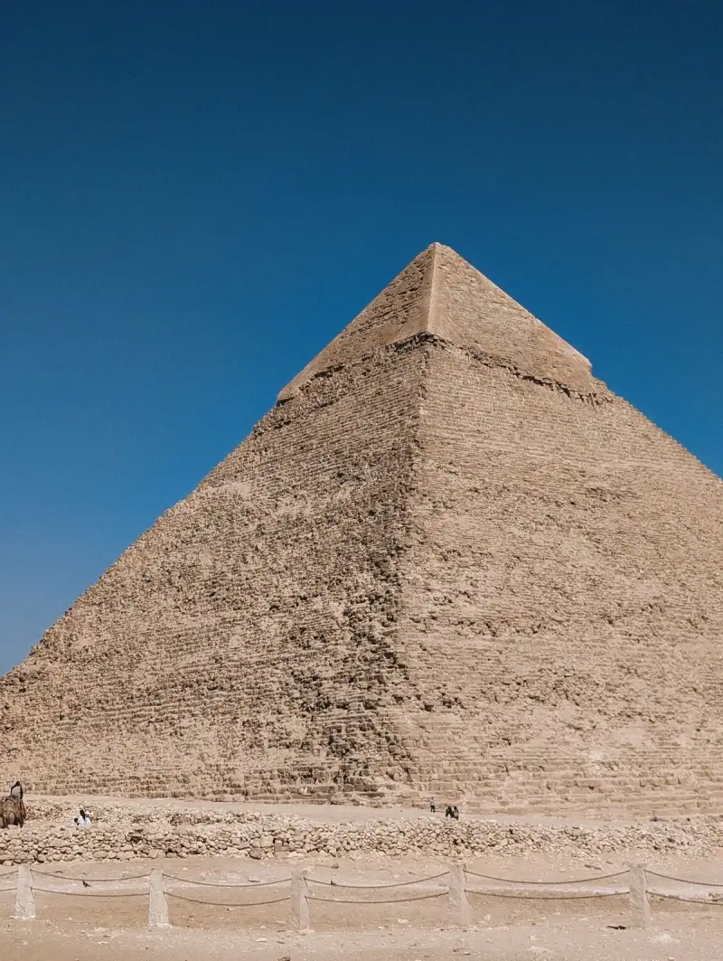
- Cemre Seyyah
- 07 Jul, 2026 17:53
The Immutable Sentinel: Unveiling the Enduring Majesty of Khufu's Great Pyramid
Upon the sun-scorched plains of Giza, where the relentless sands whisper tales of forgotten millennia, stands a monument unlike any other—a stark, immutable sentinel etched against the boundless canvas of the sky. It is a structure born of a will so absolute, an ambition so profound, that it defied the very limits of human endeavor, becoming a beacon of an age shrouded in mystery and unparalleled ingenuity. The Great Pyramid of Giza, a colossal enigma sculpted from the earth itself, does not merely occupy space; it commands time, anchoring our present gaze to the distant horizon of 2600 BC, a silent testament to a civilization that understood eternity not as an abstract concept, but as a tangible architectural imperative. This monolithic edifice, the largest of all Egyptian pyramids and undeniably the most celebrated landmark of the Giza complex, carries the distinction of being the sole survivor among the Seven Wonders of the Ancient World to remain largely intact. It is a singular achievement, a testament to the meticulous planning and unwavering dedication of those who labored under the aegis of Pharaoh Khufu, known to the Greeks as Cheops. For over 3,700 years, this structure held the uncontested title of the world's tallest human-made creation, its apex piercing the heavens as a symbol of divine kingship and an unyielding belief in an afterlife meticulously prepared. Its very existence, a narrative in stone, compels us to ponder the depths of human aspiration and the ephemeral nature of all else. Architectural Grandeur: A Testament in Stone The Great Pyramid, a monumental undertaking spanning approximately 26 years, was constructed around 2600 BC during the Fourth Dynasty of Egypt’s Old Kingdom. Initially, it towered at an astonishing 146.6 meters (481 feet), a height that dwarfed every subsequent human construction for millennia. Today, bereft of its exquisite smooth white limestone casing, which was gradually removed over centuries to be repurposed for other building projects, its height stands at 138.5 meters (454.4 ft). What we behold now is the raw, rugged beauty of its underlying core structure, still capable of instilling awe. The sheer scale of its foundation is equally staggering: each side of its base measures approximately 230.3 meters (755.6 ft) in length. This colossal footprint, combined with its impressive height, yields an estimated volume of roughly 2.6 million cubic meters (92 million cubic feet), a figure that includes a significant internal hillock integrated into its design. The ancient Egyptian architects, working with the royal cubit as their primary unit, crafted a structure with a precise height of 280 royal cubits (146.7 m; 481.4 ft) and a base length of 440 cubits (230.6 m; 756.4 ft). Its slope, a critical element of its iconic silhouette, was meticulously maintained with a seked of 5+1/2 palms, translating to an angle of 51°50'40". Such precision, achieved without the aid of modern surveying tools, speaks volumes about the sophisticated understanding of geometry and engineering possessed by its builders. The construction itself involved the quarrying and placement of an estimated 2.3 million large blocks, collectively weighing an astounding 6 million tonnes. The majority of these stones, primarily local limestone sourced directly from the Giza Plateau, are far from uniform in size or shape, and were only roughly dressed before being set into place. The outer layers, however, were meticulously bound together with a robust mortar, ensuring the stability and longevity of the colossal structure. Beyond the local limestone, specialized materials were imported: shimmering white limestone from the Tura quarries, transported by boat along the Nile, formed the smooth, brilliant casing that once rendered the pyramid a gleaming beacon under the desert sun. For the critical structural elements of the King's Chamber, immense blocks of granite, some weighing up to 80 tonnes, were painstakingly quarried from Aswan, hundreds of kilometers to the south, and floated upstream.While various scientific and alternative hypotheses strive to unravel the exact construction techniques employed—ranging from elaborate ramp systems to internal spiral passages—no definitive consensus has yet been reached. This enduring mystery only deepens the allure of the Great Pyramid, cementing its status as a marvel not just of ancient engineering, but of human problem-solving itself. Khufu's vizier, Hemiunu, is often credited by some scholars as the master architect behind this monumental achievement, a mind capable of orchestrating an endeavor of such unprecedented scale and complexity. A Labyrinth Within: Chambers of the Pharaoh Within the immense stone mass of the Great Pyramid lie three known chambers, each offering a glimpse into the evolving design and profound symbolic significance of the structure. The lowest of these, a chamber cut deep into the bedrock upon which the pyramid was founded, remains unfinished, its rough-hewn surfaces hinting at an altered plan during the construction process. Above ground, nestled within the heart of the pyramid's vast internal structure, are the two principal chambers: the so-called Queen's Chamber and, higher still, the King's Chamber. The King's Chamber, the ultimate destination within this ancient monument, houses a simple yet imposing granite sarcophagus. This austere vessel, carved from the same formidable Aswan granite that characterizes the chamber itself, was designed to contain the earthly remains of Pharaoh Khufu. Intriguingly, unlike the later tombs adorned with elaborate hieroglyphs and vibrant wall paintings, the internal chambers of the Great Pyramid, consistent with the architectural norms for Egyptian tombs of the fourth to late fifth dynasty, are remarkably devoid of inscriptions or decorations. The only exceptions are the occasional work-gang graffiti, simple marks left by the builders, which crucially include the names of Khufu—a silent, yet powerful, attribution. This absence of textual embellishment is particularly notable, given that the pyramid's construction predates the custom of inscribing pyramids with funerary texts by more than two centuries, placing it firmly in an earlier, more reserved artistic and theological tradition. The serene emptiness of these chambers, therefore, is not a sign of incompleteness but rather a reflection of the prevailing mortuary beliefs and artistic conventions of Khufu's time. Beyond the Apex: The Funerary Complex Unveiled The Great Pyramid was never a solitary monument; it was the focal point of an expansive and intricately planned funerary complex, a sacred landscape meticulously designed to serve the pharaoh's journey into the afterlife and sustain his eternal cult. This complex comprised two mortuary temples: one, the pyramid temple, situated immediately adjacent to the eastern face of the pyramid, and another, the valley temple, positioned closer to the life-giving waters of the Nile. These two temples were interconnected by a long, processional causeway, an elevated pathway that likely witnessed countless rituals and ceremonies. Surrounding the central pyramid were smaller, yet significant, structures dedicated to Khufu's immediate family and court. Three smaller pyramids, arrayed to the east of the Great Pyramid, served as the tombs for Khufu's wives, reflecting their elevated status within the royal family. An even smaller "satellite pyramid" was also part of this sacred ensemble, its purpose still pondered by Egyptologists. The landscape was further dotted with extensive cemeteries, containing tombs (mastabas) for the high officials, nobles, and family members who served Khufu during his reign, ensuring their proximity to their divine king in the afterlife. One of the most remarkable discoveries within the complex involves five deeply buried pits, each containing the disassembled components of immense solar barques—ceremonial boats intended to transport the pharaoh's spirit across the heavens with the sun god Ra. These vessels were not merely symbolic; the best-preserved, Khufu's Ship, recovered from its pit, is a masterpiece of ancient shipbuilding, revealing a level of craftsmanship astonishing for its age. This entire sprawling complex, a testament to Khufu's enduring power and the elaborate nature of Old Kingdom funerary beliefs, is a crucial component of the UNESCO World Heritage Site "Memphis and its Necropolis," recognized globally for its outstanding universal value to humanity. The Sacred Purpose: Life Beyond Death The construction of the Great Pyramid, far from being merely an ostentatious display of wealth, was deeply rooted in the core tenets of ancient Egyptian religious belief, serving as the eternal tomb of Pharaoh Khufu. Like other elaborate tombs of the Egyptian elite, it fulfilled four paramount purposes, each intricately linked to the pharaoh's journey into and maintenance of his status in the afterlife. Firstly, it was designed to house the sacred body of the deceased pharaoh and, perhaps more critically, to keep it eternally safe from desecration and the ravages of time. The immense bulk and intricate internal passages were, in essence, an ultimate fortress, safeguarding the vessel through which the pharaoh's ka (life force) and ba (personality) could continue to exist. Secondly, the sheer monumental scale and unparalleled grandeur of the pyramid served as an unequivocal demonstration of the deceased pharaoh's exalted status and that of his royal family. It was an immutable declaration of divine kingship, an architectural assertion of unparalleled power and privilege that resonated across the land. Thirdly, the pyramid ensured the deceased's perpetual place in society, an enduring symbol that reinforced the societal hierarchy even after death. In ancient Egypt, high social status was not merely desirable but was considered an absolutely positive and divinely ordained state. The monumental social inequalities of the era were strikingly symbolized by the gigantic pyramids of kings and queens, towering over the comparatively modest mastaba tombs of officials. Finally, and perhaps most poignantly, the tomb served as a sacred space where offerings could be brought to the deceased, sustaining their spirit in the afterlife. These offerings, ranging from food and drink to precious artifacts, were vital for the pharaoh's continued existence and prosperity in the Field of Reeds. The ancient Egyptian understanding of death was not an end, but a transformation, as eloquently captured in the profound decree: "Make your grave well furnished and prepare thy place in the west. Look, death counts little for us. Look, life is valued highly by us. The house of the dead (the tomb) is for life." This powerful sentiment underscores the pyramid's fundamental role: it was not a monument to death, but a vibrant conduit to eternal life.The precise regulation of funerary architecture, including the allowed dimensions of tombs, was enshrined in royal decrees, reflecting the king's ultimate authority. In the Old Kingdom, the privilege of a pyramid tomb was reserved exclusively for kings and queens, a clear demarcation of their unparalleled divine status. Architectural layout and funeral equipment were also strictly sanctioned and, like access to vital materials and skilled workers, remained entirely at the discretion of the pharaoh, further emphasizing the centralized power structure of the age. Echoes of Khufu: Proving the Builder For centuries, the attribution of the Great Pyramid to Pharaoh Khufu rested largely upon the narratives of classical antiquity's great authors, most notably Herodotus and Diodorus Siculus, whose accounts, though centuries removed from the pyramid's construction, linked the edifice directly to Cheops. However, during the medieval period, as historical memory blurred and new legends arose, other figures were credited with its construction, including biblical characters like Joseph from the Book of Genesis, the mythical king Nimrod, or the legendary Saurid ibn Salhouk, reflecting a fascination with its origins that transcended historical fact. It was not until the intrepid explorations of the 19th century that irrefutable internal evidence began to surface, solidifying the attribution to Khufu. In 1837, the discovery of four previously inaccessible relieving chambers situated above the King's Chamber, accessed through painstaking tunneling, provided a critical breakthrough. The walls of these hidden chambers were adorned with hieroglyphs painted in red ochre—not formal inscriptions, but rather the casual, yet deeply significant, marks left by the work gangs themselves. These "graffiti" included the names of the gangs, often incorporating the pharaoh's name, such as "The gang, The white crown of Khnum-Khufu is powerful." The name of Khufu, spelled out with distinct cartouches, appeared over a dozen times within these chambers, serving as an unambiguous signature of the pyramid's intended owner. Further supporting this, Goyon later discovered similar graffiti on an exterior block from the 4th layer of the pyramid, reinforcing the internal evidence. These inscriptions bear striking resemblance to those found at other sites unequivocally associated with Khufu, such as the alabaster quarry at Hatnub or the harbor at Wadi al-Jarf, and are also present in the pyramids of other pharaohs, establishing a consistent pattern of royal attribution. The twentieth century further cemented Khufu's claim through extensive archaeological excavations of the cemeteries surrounding the pyramid. These burial grounds revealed the tombs of Khufu's closest kin and high-ranking officials, strategically positioned within the complex. The East Field, located south of the causeway, housed members of the immediate family and court, while the West Field contained the tombs of Khufu's wives, children, and grandchildren, as well as significant figures like Hemiunu (the likely architect) and Ankhaf, and even the funerary cache of Hetepheres I, Khufu's revered mother. As the eminent Egyptologist Selim Hassan aptly observed, "From the early dynastic times, it was always the custom for the relatives, friends and courtiers to be buried in the vicinity of the king they had served during life. This was quite in accordance with the Egyptian idea of the Hereafter." The continuous expansion of these cemeteries until the 6th dynasty further underscores the enduring connection between Khufu and his monumental resting place, providing a compelling archaeological argument for his unequivocal ownership. A Cult of Eternity: The Enduring Spirit While the internal chambers of the Great Pyramid remained stark and undecorated, the pyramid complex itself was a vibrant hub of ritual and commemoration. Khufu's two temples, integral to the funerary complex, were lavishly adorned and inscribed, offering a striking contrast to the pyramid's interior. The pyramid temple, situated directly beside the colossal tomb, was specifically dedicated to the Sed festival, an ancient jubilee celebrating a pharaoh's 30th year of rule, intended to rejuvenate his kingship. Surviving scenes within this temple portray Khufu himself, along with officials, priests, and other significant characters, engaged in various vital rituals, reinforcing his divine authority and continuous reign, even in the afterlife. The valley temple, though largely unexcavated to this day, has yielded tantalizing fragments of its original grandeur. Blocks reused by the later pharaoh Amenemhat I depict captivating scenes, including nautical imagery and intriguing personifications of Khufu's royal estates, such as the evocative "Khufu is beautiful." The sustained operation of a dedicated mortuary cult for Khufu, maintained within these very temples for hundreds of years after his passing, serves as powerful historical evidence that he was indeed successfully interred within the Great Pyramid, and that his cult was diligently observed. Further reinforcing this narrative is the presence of the cartouches of Khufu's son and successor, Djedefre, on the blocks that meticulously sealed the boat pits adjacent to the pyramid, indicating his filial responsibility in overseeing his father's funeral rites. Despite these elaborate preparations for eternal peace, the Great Pyramid, like many ancient tombs, was not immune to the passage of time and the covetousness of later generations. It was likely looted as early as the First Intermediate Period, a tumultuous era marked by political instability, and may even have been reused for various purposes thereafter. Arab accounts from the medieval period speak of legendary discoveries within the pyramid, painting vivid pictures of forgotten treasures and ancient mysteries. For instance, the historian Al-Maqrizi (1364–1442) recounts the astounding discovery of three shrouded bodies, a sarcophagus brimming with gold, and even a corpse clad in golden armor, wielding a sword of inestimable value, and bearing a ruby "as large as an egg." While these accounts may be embellished by legend, they underscore the enduring fascination and allure of the Great Pyramid, a structure that has continually sparked the human imagination for millennia. The Great Pyramid of Giza, therefore, is more than just a colossal stone structure. It is a profound architectural statement, an engineering marvel, and a silent narrator of ancient beliefs. It stands as an enduring testament to the human capacity for grand vision and persistent execution, a monument that transcends its original purpose as a tomb to become a symbol of eternity itself. As we gaze upon its weathered form, we are not merely observing an ancient relic, but connecting with a spirit of ambition and faith that shaped one of humanity's most extraordinary achievements, forever binding the sands of Giza to the annals of global wonder.#AncientWonders #EgyptianPyramids #GizaComplex #PharaohKhufu #HistoricalTravel #KhufuPyramid #AncientEgypt #Giza #History #Travel Related Insights'Hallstatt: Where Time Carved Its Name into the Alps and Salt Whispered Eternity' Real Alcázar de Sevilla: Belleza Mudéjar L'Eterna Seduzione della Costa Azzurra: Tra Scogliere di Porfido e Misteri Belle Époque{ "@context": "https://schema.org", "@type": "FAQPage", "mainEntity": [ { "@type": "Question", "name": "What is the main focus of The Immutable Sentinel: Unveiling the Enduring Majesty of Khufu's Great Pyramid?", "acceptedAnswer": { "@type": "Answer", "text": "Journey into the heart of ancient Egypt's most magnificent creation, the Great Pyramid of Giza, a monumental testament to pharaonic power, engineering brilliance, and an enduring mystery that continues to captivate the human spirit." } }, { "@type": "Question", "name": "Who authored the comprehensive guide on The Immutable Sentinel: Unveiling the Enduring Majesty of Khufu's Great Pyramid?", "acceptedAnswer": { "@type": "Answer", "text": "This detailed article and its insights were carefully researched and authored by Cemre Seyyah." } }, { "@type": "Question", "name": "Where can I find more related content about Travel?", "acceptedAnswer": { "@type": "Answer", "text": "You can explore more articles, detailed reviews, and similar insights by browsing the Related Insights section at the bottom of this article or visiting our dedicated Travel category page." } } ] }