Showing Posts From
Travel
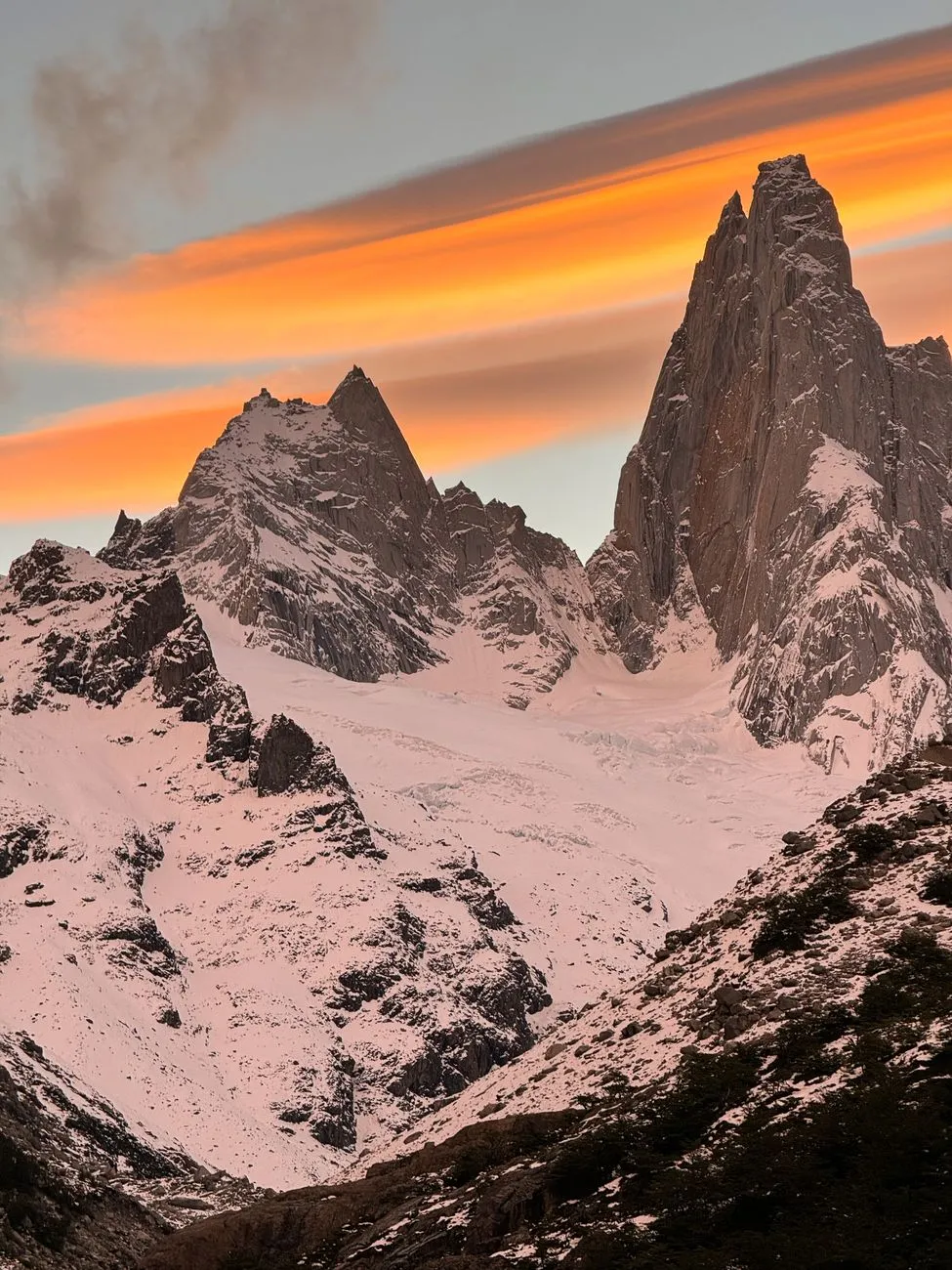

When the Air Thins: Understanding Altitude Physiology The moment you step above 2,500 meters the partial pressure of oxygen drops enough to trigger a cascade of physiological responses. Hemoglobin saturation can fall from 98 % at sea level to below 85 % at 4,000 meters, and the body compensates by increasing ventilation, heart rate, and red‑blood‑cell production. Acute Mountain Sickness (AMS) typically appears within 6–12 hours of rapid ascent and presents as headache, nausea, dizziness, and disturbed sleep. The Lake Louise Scoring System remains the gold standard for field diagnosis; a score ≥3 with a headache warrants descent or pharmacologic intervention. Acclimatization is not a passive waiting game. The “climb high, sleep low” principle—gaining 300–500 meters during the day and descending to sleep—stimulates erythropoietin without overstressing the cardiovascular system. A practical schedule for a 10‑day trek from Cusco (3,400 m) to the Ausangate circuit (5,200 m) includes two rest days at 3,800 m and 4,300 m, each paired with short hikes to 4,600 m. Monitoring SpO₂ with a fingertip pulse oximeter (target ≥90 % at rest) provides objective data; a drop below 85 % at rest signals the need for immediate descent or supplemental oxygen. Pharmacologic prophylaxis—acetazolamide 125 mg twice daily starting 24 hours before ascent—has been shown in randomized trials to reduce AMS incidence by 40–50 %. Dexamethasone 4 mg every 6 hours is reserved for treatment of High‑Altitude Cerebral Edema (HACE) and should never replace descent. Carry a portable hyperbaric bag (e.g., Gamow) for emergencies when evacuation is delayed; a 30‑minute session can simulate a 1,500‑meter descent. Gear That Breathes: Selecting Lightweight, Insulating Systems Every gram matters when you’re hauling a 12‑kilogram pack at 5,000 meters, yet the Andes demand protection against sub‑zero night temperatures, fierce UV, and sudden storms. A three‑layer system—base, mid, shell—remains the most adaptable. Merino wool base layers (150‑200 g/m²) wick moisture while resisting odor for multi‑day use. For the mid‑layer, a 800‑fill‑power down jacket (≈350 g) offers a warmth‑to‑weight ratio unmatched by synthetic alternatives, provided you keep it dry; a water‑repellent down treatment adds a safety margin. The outer shell must be fully waterproof, breathable (≥20,000 g/m²/24 h MVTR), and feature a helmet‑compatible hood. Gore‑Tex Pro or equivalent 3‑layer laminates weigh 400–500 g and survive abrasion from volcanic scree. Pair the shell with insulated, waterproof trekking boots (e.g., 1,200 g per pair) that accommodate crampon compatibility for glacier crossings. Gaiters, insulated gloves (liner + shell), and a balaclava complete the thermal envelope. Sleep systems are equally critical. A 0 °C rated down sleeping bag (≈900 g) combined with a closed‑cell foam pad (R‑value ≥ 4) and an inflatable pad (R‑value ≥ 3) yields a combined R‑value > 7, sufficient for −15 °C nights. A four‑season tent with a double‑wall design, snow‑shedding vestibule, and a footprint adds ~2 kg but prevents condensation and wind loading. Navigation gear: a GPS unit with pre‑loaded topographic maps (scale 1:25,000), a magnetic compass with declination adjustment for the South American magnetic anomaly (~−12°), and a paper map as backup. Power management: a 20,000 mAh solar‑compatible power bank (≈350 g) keeps headlamp, phone, and satellite messenger alive for the entire expedition. Fuel for the Summit: Nutrition, Hydration, and Electrolyte Strategy At altitude the basal metabolic rate rises 10–25 % due to increased ventilation and thermogenesis, while appetite often suppresses. Aim for 4,500–5,500 kcal/day, split 55 % carbohydrate, 25 % fat, 20 % protein. Carbohydrate oxidation requires less oxygen per ATP molecule than fat, making it the preferred fuel above 4,000 m. Portable sources: dehydrated quinoa (120 kcal/30 g), instant mashed potatoes (90 kcal/30 g), and energy gels (25 g carbs each). Protein intake of 1.6 g/kg body weight preserves muscle mass during prolonged catabolism. Lightweight options include vacuum‑sealed tuna (25 g protein/85 g), jerky (15 g/30 g), and plant‑based protein powder (20 g/30 g). Fat provides caloric density; nuts, cheese, and olive‑oil packets (9 kcal/g) add 800–1,000 kcal without bulk. Hydration is a moving target. Cold, dry air increases respiratory water loss to 1–1.5 L/day; sweat adds another 0.5–1 L during exertion. Target 4–5 L total fluid intake, using insulated bottles to prevent freezing. Electrolyte replacement—sodium 500–700 mg/L, potassium 200 mg/L, magnesium 50 mg/L—prevents hyponatremia and muscle cramps. Commercial tablets (e.g., Nuun) or a homemade mix of sea salt, potassium chloride, and magnesium citrate achieve the same profile at lower cost. Micronutrients matter: iron (18 mg/day) supports erythropoiesis; vitamin C (200 mg) enhances iron absorption; vitamin D (2,000 IU) compensates for limited sun exposure on covered skin. A daily multivitamin tailored for endurance athletes covers gaps. Meal timing: a carbohydrate‑rich breakfast (oats + dried fruit + nuts) fuels the morning ascent; a mid‑day “snack‑every‑hour” approach maintains blood glucose; a protein‑fat dinner (tuna + cheese + olive oil) supports overnight recovery. Avoid alcohol and excessive caffeine (>300 mg) as they exacerbate dehydration and impair sleep architecture. Navigating the Invisible: Weather Reading, Route Finding, and Emergency Protocols Andean weather shifts from clear blue to whiteout in minutes. The “Altiplano” high plateau creates a diurnal temperature swing of 20–30 °C. Morning radiation can melt surface snow, creating a fragile crust that collapses under weight by midday. Learn to read cloud formations: lenticular clouds over peaks indicate strong upper‑level winds and potential turbulence; a rapid buildup of cumulonimbus on the leeward side signals thunderstorms and hail. Carry a compact weather‑radio (NOAA/SAME compatible) and a satellite messenger (e.g., Garmin inReach) for real‑time forecasts and SOS capability. Pre‑load the route into the GPS with waypoints every 500 m, marking water sources, emergency shelters, and known avalanche terrain. In the Cordillera Blanca, the “Huayhuash” circuit traverses multiple glacier passes where crevasse risk spikes after warm spells; a 30‑meter rope, crevasse rescue kit, and proficiency in self‑arrest are non‑negotiable. Emergency protocols must be rehearsed before departure. Assign roles: leader (navigation, decision‑making), medic (first‑aid, AMS monitoring), communications (satellite messenger, radio), and gear manager (rope, shelter). Conduct a daily “situation brief” at camp: altitude gained, SpO₂ trends, weather outlook, water status, and any injuries. If a team member scores ≥5 on the Lake Louise scale, initiate immediate descent of at least 500 m, administer oxygen (2 L/min), and give dexamethasone 8 mg stat then 4 mg q6h. Evacuation planning: identify the nearest airstrip (e.g., Juliaca for southern Peru, El Alto for Bolivia) and confirm helicopter availability with local operators. Carry a lightweight litter (≈2 kg) and a portable stretcher for non‑ambulatory patients. Insurance that covers high‑altitude rescue up to 6,000 m is mandatory; verify policy wording for “adventure sports” exclusions. Budgeting the Ascent: Real Cost Data from Cusco, La Paz, and Quito Understanding the financial footprint of an Andean expedition prevents mid‑trip surprises. Numbeo’s crowdsourced database provides city‑level cost‑of‑living indices that translate directly into trek budgeting. The table below aggregates average daily expenses for a solo trekker (mid‑range comfort) in three major gateway cities, converted to USD at 2026‑09‑19 rates.Expense Category Cusco, Peru La Paz, Bolivia Quito, EcuadorHostel (dorm, 1 night) $12 $9 $14Private room (budget hotel) $35 $28 $40Meals (local market, 3×) $8 $6 $10Guide (certified, per day) $45 $38 $50Porter (15 kg load, per day) $20 $18 $22Park entry / permit $30 (Salkantay) $25 (Sajama) $28 (Cotopaxi)Local transport (bus/taxi) $5 $4 $6Estimated Daily Total $155 $128 $170These figures assume a 10‑day itinerary with two acclimatization days in the city. A 10‑day trek from Cusco therefore costs roughly $1,550 excluding international flights, gear rental, and insurance. La Paz offers the lowest baseline, but permit fees for Sajama National Park and limited English‑speaking guides can add hidden costs. Quito’s higher price point reflects stronger tourism infrastructure and easier access to medical facilities. Cost‑saving tactics: book guides and porters through reputable local cooperatives (e.g., Asociación de Guías de Montaña Cusco) to avoid middle‑man mark‑ups; purchase food at municipal markets (San Pedro in Cusco, Mercado Rodríguez in La Paz) where a kilogram of quinoa costs $2.50 versus $5 in tourist shops; share a private room Related Insights喀什:丝绸之路上的明珠与时光交错的古城 The Pantanal, Brazil: Unlocking the World’s Largest Wetland and Its Untamed Wildlife The Faroe Islands: Where Nordic Wilderness Meets Photographic Magic{ "@context": "https://schema.org", "@type": "FAQPage", "mainEntity": [ { "@type": "Question", "name": "What is the main focus of Breathing the Andes: Mastering Survival on the High-Altitude Trail?", "acceptedAnswer": { "@type": "Answer", "text": "Essential high-altitude survival tactics, gear, nutrition, and budget insights for trekking the Andean spine." } }, { "@type": "Question", "name": "Who authored the comprehensive guide on Breathing the Andes: Mastering Survival on the High-Altitude Trail?", "acceptedAnswer": { "@type": "Answer", "text": "This detailed article and its insights were carefully researched and authored by Wei Chen." } }, { "@type": "Question", "name": "Where can I find more related content about Travel?", "acceptedAnswer": { "@type": "Answer", "text": "You can explore more articles, detailed reviews, and similar insights by browsing the Related Insights section at the bottom of this article or visiting our dedicated Travel category page." } } ] }
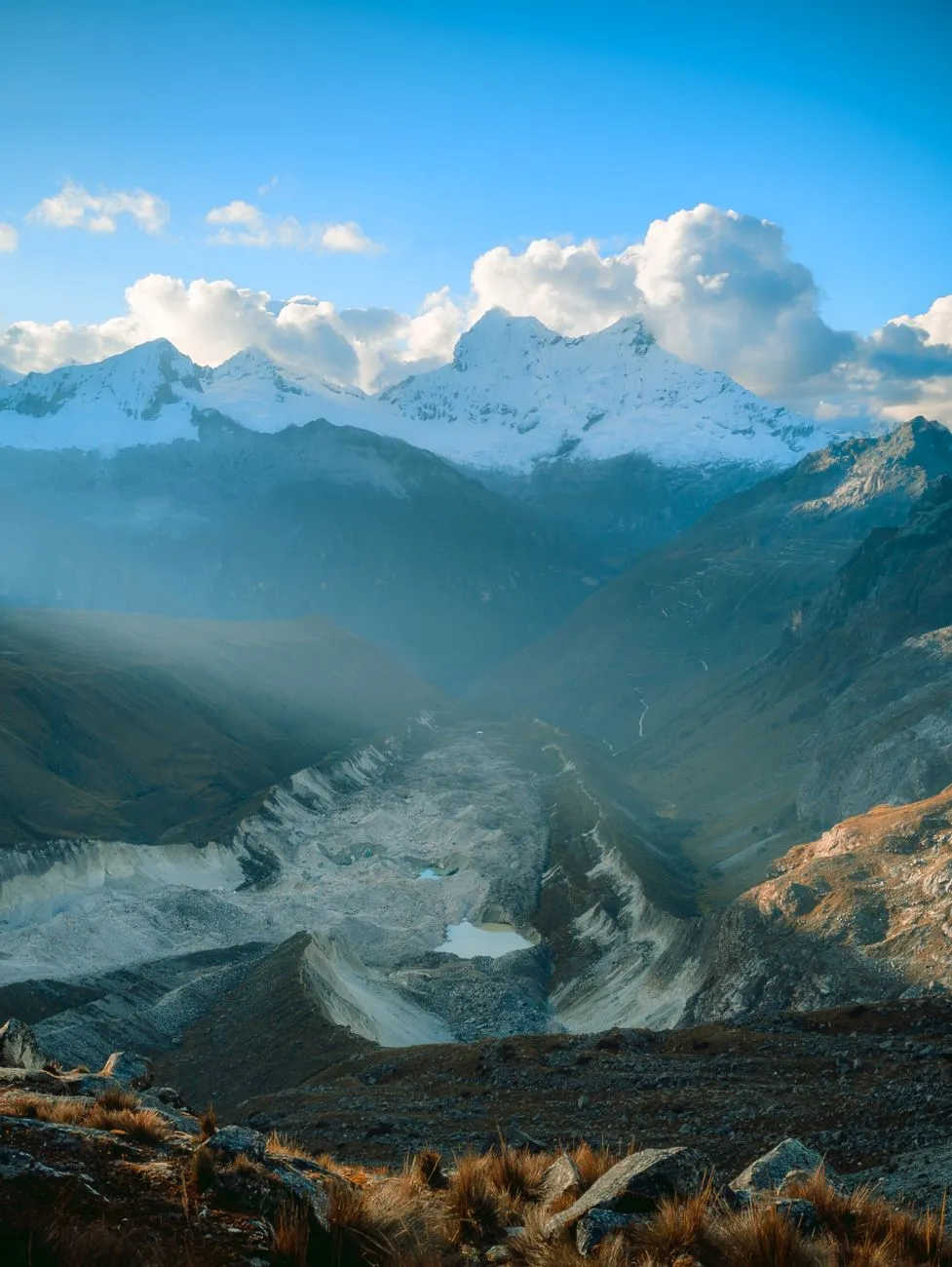
Whispers of the Apurímac: Entering the Uncharted Corridor The Apurímac River carves a canyon deeper than the Grand Canyon, its walls rising 3,000 meters above the turquoise water. Trekkers who venture here step onto a corridor that has no official signage, no ranger stations, and only the faint footprints of local Quechua herders. The approach usually begins in the town of Curahuasi (2,800 m), where a dirt track leads to the trailhead at 3,200 m. From there the path follows the river’s left bank, crossing suspension bridges woven from ichu grass and traversing scree slopes that shift with each seasonal melt. Historical records from the 16th‑century chronicler Pedro Cieza de León describe the Apurímac as “the river that swallows the sun,” a reference to the steep shadows that dominate the gorge at midday. Modern GPS surveys (IGN 1:50,000 sheets 27‑S and 28‑S) confirm that the trail gains 1,200 m over 18 km before reaching the high‑altitude plateau of Pampas de Chilca (4,400 m). Because the route is unmarked, navigation relies on a combination of topographic maps, a handheld GPS loaded with offline OpenStreetMap tiles, and the oral guidance of a local arrieros (muleteer) who knows the seasonal river crossings. Weather in the canyon is notoriously volatile. Morning mist often lifts by 10 am, revealing intense UV radiation (UV index 11+ at 4,000 m). Afternoon thunderstorms can raise the river level by 2 m in minutes, turning fordable sections into dangerous torrents. Trekkers should carry a lightweight four‑season tarp, a 3‑layer waterproof shell, and a compact emergency bivvy. Altitude sickness risk spikes above 3,500 m; a gradual ascent of no more than 300 m per day, combined with a 2‑day acclimatization in Cusco (3,399 m) and a night in the Sacred Valley (2,800 m), reduces acute mountain sickness incidence to under 10 % according to the 2022 High Altitude Medicine & Biology cohort study. Cultural immersion is unavoidable. The corridor passes through the comunidad campesina of Huancarani, where families still practice ayni (reciprocal labor) to maintain irrigation canals that date to the Inca mit’a system. Offering a few coca leaves and a brief pago a la tierra (earth offering) before crossing a sacred apacheta (stone cairn) is both respectful and a practical way to secure safe passage through lands that are technically communal property, not national park. Altitude Alchemy: Acclimatization Strategies for the High Andes Acclimatization is the single most decisive factor for a successful trek in the Andean highlands. The physiological cascade begins the moment you ascend above 2,500 m: ventilation increases, renal bicarbonate excretion rises, and hemoglobin concentration climbs over weeks. In practice, a three‑stage protocol works for most fit adults. Stage 1 – Cusco Base (3,399 m): Spend 48 hours in Cusco, sleeping at 3,400 m, hydrating 3–4 L daily, and avoiding alcohol. Light walks to Sacsayhuamán (3,700 m) and the nearby Q’enqo archaeological site provide incremental exposure without overexertion. A 2021 study by the Universidad Nacional de San Antonio Abad del Cusco showed that trekkers who completed this stage reduced their Lake Louise Score (LLS) by an average of 1.8 points compared with those who flew directly to 4,000 m. Stage 2 – Sacred Valley Descent (2,800 m): Drop to the Urubamba Valley for a night in Ollantaytambo or Pisac. The lower altitude allows the body to consolidate ventilatory gains while still sleeping above 2,500 m. Use this window to test gear, adjust pack weight, and practice breathing techniques such as pressure breathing (inhale 3 seconds, exhale 6 seconds) which improves arterial oxygen saturation by 2–3 % at 4,000 m. Stage 3 – Progressive Ascent (3,500 m → 4,500 m): Begin the trek proper, limiting daily elevation gain to 300 Related Insights明孝陵:大明王朝的开国之陵 Sustainable Archipelagos: Crafting an Eco‑Conscious Island‑Hopping Blueprint for the Azores The Arctic's Whispering Skies: Your Ultimate Guide to Unlocking Scandinavia's Northern Lights Mystique{ "@context": "https://schema.org", "@type": "FAQPage", "mainEntity": [ { "@type": "Question", "name": "What is the main focus of Shadow Trails of the Andes: Unveiling Peru's Hidden Sacred Valleys?", "acceptedAnswer": { "@type": "Answer", "text": "Journey beyond the beaten path into Peru's unmarked sacred valleys, where ancient stone arteries whisper Inca legends and high‑altitude silence tests every trekker." } }, { "@type": "Question", "name": "Who authored the comprehensive guide on Shadow Trails of the Andes: Unveiling Peru's Hidden Sacred Valleys?", "acceptedAnswer": { "@type": "Answer", "text": "This detailed article and its insights were carefully researched and authored by Zola Ndlovu." } }, { "@type": "Question", "name": "Where can I find more related content about Travel?", "acceptedAnswer": { "@type": "Answer", "text": "You can explore more articles, detailed reviews, and similar insights by browsing the Related Insights section at the bottom of this article or visiting our dedicated Travel category page." } } ] }
-
 John Explorer
 - 17 Sep, 2026 20:45
The White Silence Beckons: A Century of Chasing the Antarctic Dream
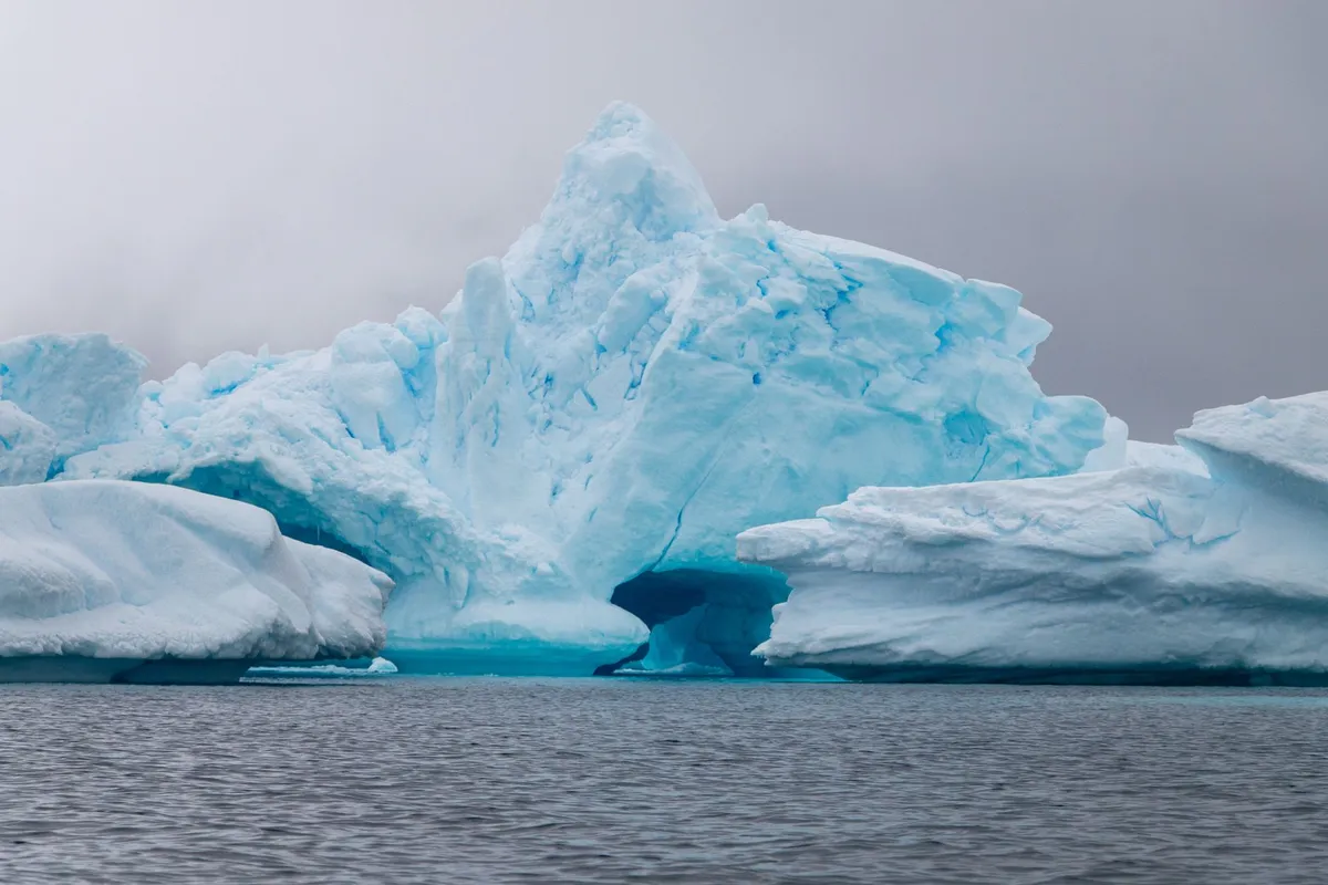
The wind off the Drake Passage doesn’t howl; it screams. It strips the heat from your face and reminds you, with every gust, that you are a guest in a domain that does not negotiate. There is no indigenous population here to welcome you, no ancient cities to explore, no souvenir stalls hawking trinkets. There is only ice—compressed, ancient, blindingly white—and the profound, terrifying silence of a continent that has kept its secrets for millennia. Yet, humanity has been chasing this silence for over a century, evolving from whalers and mail-runners into the modern pilgrims who now number over a hundred thousand a year. This is the story of how we turned the last frontier into a destination, and the fragile price of that access. The Mail Ship and the Pioneer: Birth of an Industry Long before the sleek, ice-strengthened hulls of today’s expedition fleet carved paths through the Bransfield Strait, there was the SS Fleurus. In the 1920s, this Falkland Islands mail ship plied a lonely route to the South Shetland and South Orkney Islands, servicing the grim, oil-stained whaling and sealing stations that dotted the rocky shores. It wasn't built for leisure. But somewhere in the ledgers, a few entries read "tourist tickets"—round-trip passages sold to the curious and the wealthy. These were the very first commercial tourists to Antarctica, accidental pioneers watching the rendering plants boil blubber on Deception Island, unaware they were writing the opening lines of a massive industry. The real shift came decades later, fueled by diplomacy. The 1959 Antarctic Treaty froze territorial claims and dedicated the continent to peace and science. It inadvertently opened the door. By the 1960s, sea tourism began tentatively. Then, in 1969, a visionary named Lars-Eric Lindblad changed everything. He launched the MS Lindblad Explorer, the world’s first purpose-built expedition liner. It wasn't a cruise ship; it was a tool for discovery. Lindblad didn't just sell a ticket; he sold the landing. He introduced the Zodiac (RIB) to polar travel, allowing passengers to step from a rolling sea onto a pebble beach surrounded by penguins. That moment—boots on the ground—defined the modern Antarctic experience.The Modern Armada: Ushuaia, the Polar Code, and the 124,000 Today, the gateway is Ushuaia, Argentina—the "End of the World." From this windswept port, the modern armada departs. The journey across the Drake Passage remains the rite of passage; the "Drake Shake" or "Drake Lake" separates the committed from the curious. Voyages span 10 days to three weeks, with price tags starting around US$6,000 for shared cabins, climbing steeply for suites on luxury ice-breakers. The fleet has ballooned. By 2025, annual cruise visitors hit 124,000, a staggering leap from the 14,762 recorded in the 1999–2000 season and the 37,000 of 2009–2010. Most cluster along the Antarctic Peninsula—the "Banana Belt" where summer temperatures occasionally kiss freezing. But the rules of the road have hardened alongside the growth.The Permit Maze: No country owns Antarctica, so no visas exist. Instead, signatories to the Antarctic Treaty issue permits. An Australian traveler, for example, needs an Environmental Impact Assessment (EIA) approved by the Australian Antarctic Division under the Antarctic Treaty (Environment Protection) Act 1980. The Landing Limits: Ships carrying over 500 passengers cannot land anyone. Those that do land are restricted to 100 people ashore at a time. The Heavy Fuel Ban: In 2009, regulations halted large cruise vessels (some carrying 950+ souls) from operating in Antarctic waters due to their heavy fuel oils—a watershed moment for environmental protection. The Polar Code: The IMO’s International Code for Ships Operating in Polar Waters now mandates a Polar Ship Certificate, ensuring hull strength and survival gear match the latitude.Overseeing this self-regulation is IAATO (International Association of Antarctic Tour Operators). Their members carry the vast majority of visitors, releasing yearly statistics and championing the "leave no trace" ethos. Yet, as of May 2026, their primary concern has shifted from fuel to biology: the spread of avian influenza (H5N1), a microscopic threat hitching a ride on boots and gear, threatening the dense penguin colonies that define the peninsula.Wings Over the White: Triumph, Tragedy, and the Dreamliner While ships crawl, wings once flew. The history of scenic flights is a saga of soaring ambition clipped by catastrophe. It began in February 1977. Air New Zealand launched DC-10s from Auckland, flying 12-hour round trips over Ross Island and McMurdo Sound, often with legends like Sir Edmund Hillary narrating the geography. Qantas followed days later from Sydney, Melbourne, and Perth, flying 747-200Bs over George V Land, Adélie Land, the South Magnetic Pole, and Oates Land. By 1979, Qantas had flown 27 flights, carrying over 7,000 passengers. They didn't land; they just witnessed the scale—a continent larger than the US and Mexico combined, unfolding wingtip to wingtip. Then came November 28, 1979. Air New Zealand Flight TE901. A route planning error, a whiteout, and Mount Erebus. 257 lives lost. The world’s most beautiful flight path became a graveyard. Air New Zealand never returned. Qantas paused for 15 years. But the pull of the ice is persistent. Qantas resumed in 1994 and flies today. The metal has changed—747-400s and now Boeing 787 Dreamliners from Brisbane (a 14.5-hour odyssey). The prices range from $1,000 to $8,000 for a window seat to nowhere and everywhere. There were even earlier Chilean overflights in 1958, ghost flights largely forgotten. Today, Qantas and Antarctica Flights offer the only way to see the Transantarctic Mountains and the Polar Plateau without seasickness, a high-altitude perspective that ships can never provide.The Banana Belt Yachts: Intimacy on the Edge For those who find even 200-passenger ships too crowded, there is the yachting fringe. Since the late 1960s, private vessels have slipped south. David Henry Lewis famously circumnavigated the continent in 1972, a feat of seamanship that reads like fiction. Today, roughly 30 yachts a year nose into the Peninsula’s hidden coves. They leave from Tierra del Fuego, Ushuaia, or Stanley (Falklands) for four-to-six-week voyages. These are not floating hotels; they are walnut shells in a storm. But the reward is solitude. Only smaller vessels are permitted to land their crew. Imagine anchoring in a silent bay, the only sounds the creak of rigging and the blows of humpbacks, skiing a pristine slope where no ship’s wake has ever reached. It is the rawest, most authentic thread of Antarctic tourism, unchanged in spirit since Lewis.Boots on the Ground: Camping, Skiing, and the Pole The ship or the yacht is merely the vehicle. The destination is the landing. Modern itineraries read like adventure menus: camping on the ice under the midnight sun (or the aurora), cross-country skiing across glaciers, mountaineering unclimbed peaks, or the ultimate bucket-list item—a flight to the Geographic South Pole. These land activities have exploded in popularity, driving the recent surge in numbers. But every footfall requires paperwork. The Antarctic Treaty demands permits. Operators must prove they can manage waste, prevent non-native species introduction (boot washing is ritualistic), and conduct emergency evacuations in a place where the nearest hospital is days away. You don't just visit Antarctica; you negotiate entry with the environment itself.The Ross Sea and the Far Side: The Other Antarctica Most tourists never see the other half of the continent. The Ross Sea and East Antarctica (Commonwealth Bay)—the realm of Scott, Shackleton, and Mawson—are a different world. Accessible only from New Zealand (specifically Heritage Expeditions on the ice-strengthened Heritage Adventurer), these voyages are longer, colder, and vastly more expensive. Here lie the historic huts, frozen in time, where penguins nest under the bunks of the Terra Nova expedition. It is tourism as pilgrimage, a journey to the shrines of the Heroic Age, far from the Peninsula's relative bustle. The Carbon Shadow and the Viral Risk The data tells a clear story: growth is exponential. From the SS Fleurus’ handful of passengers to 124,000 souls a year. Recent academic research flags decarbonisation as the urgent governance priority. Every ship burns fuel; every Dreamliner burns Jet A-1. The carbon footprint of a single Antarctic trip dwarfs the annual emissions of many global citizens. Simultaneously, researchers warn of a new, strange danger: social media emulation. Tourists filming risky stunts—approaching wildlife too closely, sliding down unstable cornices, ignoring guide boundaries—for likes and views. In a place where a sprained ankle becomes a life-threatening evacuation, viral trends are a lethal export. The Fragile Contract Standing on a beach at Neko Harbour, watching a Gentoo penguin steal a pebble from its neighbor, the silence returns. It is broken only by the crack-thunder of a calving glacier—a sound that vibrates in your chest. We are here because the Treaty allowed it, because Lindblad invented the way, because Qantas and Air New Zealand dared the skies, and because 30 yachts a year still brave the Roaring Forties. But the contract is fraying. Avian flu creeps south on the wind and our boots. The ice shelves thin. The carbon we burn to witness the melting accelerates the melt. The "Banana Belt" is warming faster than almost anywhere on Earth. Antarctic tourism is no longer an experiment; it is a massive, regulated, high-stakes industry. It brings witnesses—ambassadors for the ice, arguably. But every ambassador leaves a footprint. The challenge for the next decade isn't just managing numbers or cleaning fuel. It is deciding if we can love this place enough to change how we reach it, before the silence is broken for good.#Ant
-
 Chloe Tremblay
 - 17 Sep, 2026 07:18
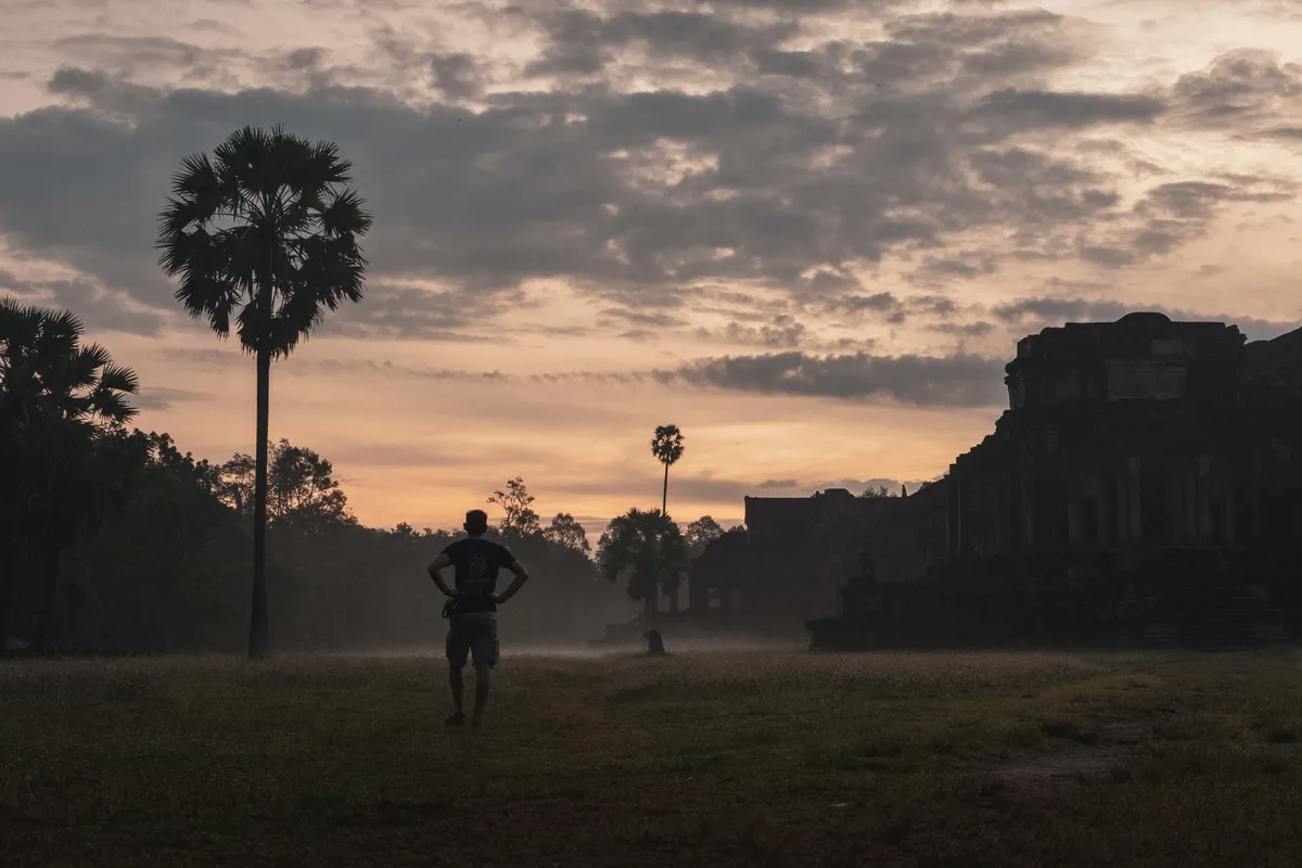
Shadows of Angkor: Unveiling the Jungle‑Cloaked Temples Beyond the Tourist Trail
Dawn Over the Lotus Moat The first light that slips over the lotus‑filled moat of Angkor Wat does more than illuminate sandstone; it rewrites the narrative of a site that has been photographed a million times yet still hides secrets in its shadowed galleries. Arriving before the tour buses rumble in, you hear the soft rustle of palm fronds and the distant call of a white‑rumped shama, a soundtrack that has accompanied pilgrims for centuries. The UNESCO World Heritage designation, granted in 1992, protects over 400 square kilometres of temple complexes, reservoirs, and jungle, but the real magic lives in the details that escape the standard itinerary. The central sanctuary, oriented precisely to the west, aligns with the equinox sun, a celestial engineering feat that still baffles archaeologists. As you step onto the causeway, the sandstone blocks — quarried from the Kulen Mountains some 30 kilometres away — feel cool underfoot, each one bearing the faint chisel marks of Khmer artisans who moved an estimated five million tonnes of stone without the wheel. The bas‑reliefs that line the outer galleries narrate the Churning of the Ocean of Milk, a mythic tug‑of‑war between devas and asuras, yet the deeper panels, often missed by hurried visitors, depict everyday life: rice harvesting, market bargaining, and even early forms of Khmer chess. Spending the morning here, you can trace the evolution of Khmer architecture from the early brick towers of Bakong to the soaring lotus bud towers of Angkor Wat itself, a progression that mirrors the empire’s rise from a regional chiefdom to a continental power. For the modern traveller, the early hours also mean a practical advantage: the temperature hovers around 24 °C, humidity is manageable, and the light is perfect for photography without the harsh midday glare. A modest entry fee of US 37 for a one‑day pass (US 62 for three days) grants access to the entire archaeological park, and the ticket booth opens at 5 am, allowing you to claim a quiet corner before the crowds arrive. Navigating the Jungle Corridors Beyond the iconic silhouette of Angkor Wat lies a labyrinth of lesser‑known temples where the jungle has reclaimed its territory, creating an atmosphere that feels more like an explorer’s journal than a tourist brochure. Ta Prohm, famously entwined with massive silk‑cotton roots, is the poster child for this symbiosis, yet the surrounding satellites — Banteay Kdei, Preah Khan, and the remote Beng Mealea — offer equally haunting corridors where stone and strangler fig engage in a slow, silent wrestle. The park’s 400 km² expanse includes over 1,000 identified structures, but only a fraction receive regular foot traffic. A bicycle or tuk‑tuk hired from Siem Reap (approximately US 15 per day for a bike, US 25 for a tuk‑tuk with driver) lets you chart a personal route that bypasses the main circuit. The “Grand Circuit” — a 26‑kilometre loop — connects the major outlying temples and can be completed in a leisurely day, while the “Small Circuit” covers the core sites in half the distance. For those who crave solitude, the early‑morning trek to Beng Mealea, 40 km east of the main park, rewards you with a temple still largely unrestored, its galleries choked by vines and its central tower collapsed into a pile of sandstone blocks that you can climb for a panoramic view of the surrounding forest canopy. The park’s management, overseen by the APSARA Authority, has implemented a zoning system that limits visitor numbers at fragile sites; permits for sunrise at Angkor Wat are capped at 2,000 per day, and a new digital booking platform launched in 2023 reduces queue times dramatically. Practical tip: carry a reusable water bottle (refill stations exist at the main entrance and at the Angkor Conservation Office), wear breathable long‑sleeve shirts to protect against both sun and insect bites, and download the offline map “Angkor Park Explorer” which marks lesser‑known trails, restroom locations, and the positions of the 12‑meter‑high laterite walls that once demarcated the royal city of Angkor Thom. Digital Nomad Life Among the Stones Siem Reap has quietly morphed from a backpacker stopover into a legitimate digital nomad hub, a transformation fueled by Cambodia’s “visa‑everything” approach — most nationalities receive a 30‑day e‑visa on arrival for US 36, extendable for another 30 days — and a cost of living that remains among Southeast Asia’s lowest. A comfortable one‑bedroom apartment in the Riverside district rents for US 350‑450 per month, while a high‑speed fibre connection (30‑50 Mbps) costs roughly US 30. Co‑working spaces such as “The Hive” and “Angkor Hub” offer day passes at US 10 and monthly memberships at US 120, complete with air‑conditioning, meeting rooms, and a community of freelancers, developers, and content creators who swap code reviews over Khmer iced coffee. The city’s population of roughly 245,000 swells during the high season (November‑March) but retains a laid‑back rhythm; Pub Street and the Night Market provide vibrant social scenes without the frenetic energy of Bangkok or Bali. Weekend excursions to the temples become a routine “office break” — many nomads schedule sunrise shoots at Angkor Wat, then return to a riverside café for a bowl of kuy teav (rice noodle soup) before diving into afternoon sprints. The local government has recognized this demographic, launching a “Digital Nomad Visa” pilot in 2024 that allows stays of up to one year with minimal paperwork, provided applicants show proof of remote income exceeding US 1,500 per month. Health care is accessible: the Royal Angkor International Hospital offers English‑speaking staff and international‑standard facilities, and a routine consultation costs US 25. For those who crave nature, the nearby Phnom Kulen National Park — a 45‑minute drive — provides waterfalls, sacred river carvings, and a chance to disconnect completely. The blend of ancient wonder and modern connectivity creates a unique productivity loop: the stones remind you of impermanence, while the Wi‑Fi keeps your deadlines alive. Feasting on Khmer Flavors at Sunset No exploration of Angkor is complete without surrendering to the culinary rhythm that pulses through Siem Reap’s streets as the sun dips behind the western gopura. The city’s food scene balances tradition with innovation, offering everything from humble street‑side amok — a fragrant fish curry steamed in banana leaves — to upscale tasting menus that reinterpret ancient recipes with modern technique. At “Malis Restaurant,” a Michelin‑commended venue, the signature “Fish Amok” uses locally sourced snakehead fish, kroeung paste (lemongrass, galangal, turmeric, kaffir lime), and coconut cream, served in a carved coconut shell; a portion costs US 12 and arrives with a side of jasmine rice and pickled vegetables. For a more casual experience, the “Old Market” (Phsar Chas) teems with vendors selling num banh chok — thin rice noodles topped with a green fish gravy, fresh herbs, and bean sprouts — at US 1.50 a bowl. Night markets along the riverfront transform into open‑air grills where skewers of marinated beef (sach ko ang) and pork belly (sach chrouk) sizzle over charcoal, releasing aromas that mingle with the incense from nearby pagodas. Vegetarian travellers will find “Vibe Café” offering a Khmer‑style “Lok Lak” made with seitan, served with a pepper‑lime dipping sauce and a side of fresh papaya salad. Pair any meal with a glass of “Angkor Beer” (5 % ABV, US 1.20 per can) or a freshly pressed sugarcane juice (US 0.50) for a refreshing counterpoint to the tropical heat. Dining al fresco at a riverside table as the sky blushes orange, you can watch the silhouette of Angkor Wat darken against the horizon, a daily reminder that the empire’s legacy is not only etched in stone but also simmered in the pots of its people. Preserving the Past for Future Wanderers Conservation at Angkor is a living dialogue between archaeology, community, and tourism economics. The APSARA Authority, established in 1995, coordinates restoration projects funded by international partners — Japan, France, Germany, and the United States — each contributing expertise in stone consolidation, laser scanning, and hydrological management. The “Angkor Hydraulic City” research initiative, launched in 2018, uses LiDAR to map the ancient water network that once sustained a population estimated at 750,000, revealing canals, reservoirs (barays), and moats that functioned as both irrigation and spiritual symbols. Recent work at the West Mebon, a temple situated on an artificial island in the West Baray, has stabilized its laterite foundation using a breathable lime‑based mortar that respects the original chemistry of the stone. Community‑based tourism programs employ local villagers as site guardians, guides, and artisans, ensuring that revenue circulates within the 40 surrounding communes. The “Adopt a Temple” scheme allows donors to sponsor specific conservation tasks — such as the removal of invasive vegetation at Preah Palilay — with transparent reporting on progress. Visitors can contribute directly by purchasing the “Angkor Pass Plus” (US 72 for three days) which allocates a portion to the Conservation Fund. Educational outreach includes school visits where children learn traditional stone‑carving techniques, fostering a sense of ownership that transcends generations. The challenge remains balancing access with preservation: foot traffic erodes delicate bas‑reliefs, while climate change intensifies seasonal flooding that threatens the structural integrity of the barays. Ongoing monitoring, coupled with visitor education — signage in Khmer, English, Chinese, and French — aims to cultivate a culture of respect that protects the site for the next millennium. Item Cost (USD) Cost (KHR)3‑day Angkor Pass 62 254,000Bicycle rental (per day) 15 61,500Tuk‑tuk with driver (per day) 25 102,500Co‑working day pass 10 41,000One‑bedroom apartment (monthly) 400 1,640,000Meal at mid‑range restaurant 12 49,200Street‑food bowl (num banh chok) 1.5 6,150Angkor Beer (can) 1.2 4,920Visa on arrival (30 days) 36 147,600Digital Nomad Visa (annual) 150 615,000Echoes That Linger Beyond the Temples Leaving Angkor feels less like a departure and more like a shift in perspective. The stone corridors you walked, the roots you brushed aside, the flavors you tasted — they all become reference points for a deeper understanding of resilience. The empire that built these monuments thrived on an intricate water management system, a lesson that resonates with today’s climate‑conscious planners. The digital nomads who now call Siem Reap home illustrate how ancient infrastructure can support modern livelihoods when connectivity and community align. As the last tuk‑tuk rolls away and the night market lights flicker, the silhouette of Angkor Wat remains etched against a star‑spangled sky, a silent promise that the stories carved in sandstone will continue to inspire wanderers, coders, Related InsightsLa Alcazaba de Málaga: Fortaleza Inexpugnable Istanbul: Two Continents Angkor Wat: Il Cuore Cosmico di Pietra, Tra Devozione e Mistero nel Regno Khmer{ "@context": "https://schema.org", "@type": "FAQPage", "mainEntity": [ { "@type": "Question", "name": "What is the main focus of Shadows of Angkor: Unveiling the Jungle‑Cloaked Temples Beyond the Tourist Trail?", "acceptedAnswer": { "@type": "Answer", "text": "Journey past the crowds into the mist‑shrouded corridors of Angkor, where ancient stone meets modern nomad life." } }, { "@type": "Question", "name": "Who authored the comprehensive guide on Shadows of Angkor: Unveiling the Jungle‑Cloaked Temples Beyond the Tourist Trail?", "acceptedAnswer": { "@type": "Answer", "text": "This detailed article and its insights were carefully researched and authored by Chloe Tremblay." } }, { "@type": "Question", "name": "Where can I find more related content about Travel?", "acceptedAnswer": { "@type": "Answer", "text": "You can explore more articles, detailed reviews, and similar insights by browsing the Related Insights section at the bottom of this article or visiting our dedicated Travel category page." } } ] }
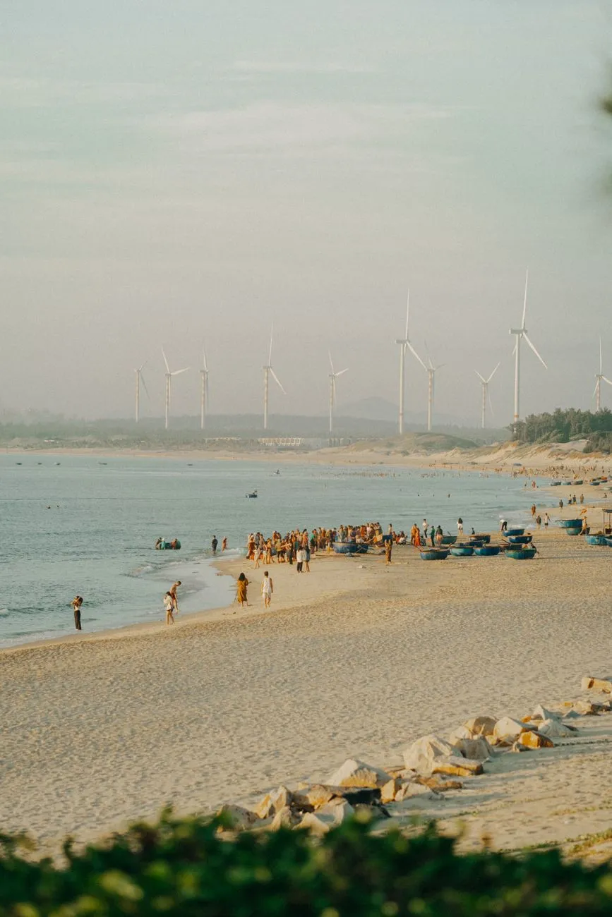
Wenn der Reisende zum Hüter wird Ein Flugzeug über den azurblauen Ozean, ein Zug, der durch unberührte Täler schnauft – doch hinter jedem Bild verbirgt sich die Frage, welchen Fußabdruck wir hinterlassen. Nachhaltiger Tourismus ist mehr als ein Modewort; er ist ein umfassendes Konzept, das Wirtschaft, Gesellschaft und Umwelt gleichermaßen berücksichtigt. Er strebt danach, das Reiseerlebnis zu verbessern, während er die Bedürfnisse der Gastgemeinschaften schützt und fördert.Wirtschaftliche Kraft hinter dem grünen Wandel Der World Travel & Tourism Council (WTTC) belegte 2019, dass der Tourismussektor 10,3 % des globalen BIP ausmachte, 1,5 Mrd. internationale Ankünfte verzeichnete und Exporterlöse von 1,7 Billionen US‑Dollar erwirtschaftete. Diese Zahlen zeigen das enorme Potenzial, das in einer nachhaltigen Ausrichtung liegt. Wenn Tourismusstrategien umweltfreundliche Praktiken integrieren, können diese wirtschaftlichen Gewinne langfristig stabilisiert werden – ein Gewinn für Unternehmen und lokale Gemeinschaften gleichermaßen. Kernpunkte der wirtschaftlichen NachhaltigkeitLangfristige Wertschöpfung: Investitionen in erneuerbare Energien und lokale Lieferketten stärken die Resilienz des Sektors. Arbeitsplatzschaffung: Ziel 8.9 der SDGs fordert bis 2030 politische Maßnahmen, die „nachhaltigen Tourismus schaffen, der Arbeitsplätze schafft und lokale Kultur fördert“. Faire Verteilung: Durch verantwortungsvolle Beschaffung wird ein Teil der Einnahmen direkt in die Gemeinden zurückgeführt.Soziale Gerechtigkeit und kulturelle Vielfalt Nachhaltiger Tourismus legt einen klaren Fokus auf soziale Gerechtigkeit und die Bewahrung kultureller Identität. Indem Besucher die Einzigartigkeit indigener Lebensweisen respektieren, entsteht ein Dialog, der das Selbstverständnis der Einheimischen stärkt. Die UN‑WTO betont, dass die Pflege von Kultur und Traditionen nicht nur ethisch, sondern auch ökonomisch sinnvoll ist: Lokale Produkte und Handwerk erhalten neue Märkte, während Reisende authentische Erlebnisse genießen. Praktische Maßnahmen für soziale NachhaltigkeitEinbindung der Gemeinschaft: Beteiligung der Einheimischen an Entscheidungsprozessen zu Infrastrukturprojekten. Förderung lokaler Produkte: Märkte, die regionales Handwerk und Gastronomie präsentieren. Bildungsprogramme: Workshops für Reisende, die über kulturelle Sensibilität informieren.Umwelt: Schutz des Lebensunterstützungssystems Der ökologische Aspekt ist das Rückgrat des Konzepts. Ziel 12. a der SDGs verlangt die Entwicklung von Werkzeugen, um die Auswirkungen des Tourismus auf die Umwelt zu messen. Darüber hinaus fordert Ziel 14.7 die Steigerung wirtschaftlicher Vorteile für kleine Inselstaaten und die am wenigsten entwickelten Länder durch nachhaltige Nutzung mariner Ressourcen. Das bedeutet, dass sowohl Küstenschutz als auch nachhaltige Fischereipraktiken in Tourismuspläne integriert werden müssen. Umweltstrategien, die funktionierenEnergieeffizienz: Nutzung von Solar- und Windkraft in Hotels und Resorts. Abfallmanagement: Einführung von Zero‑Waste‑Konzepte in touristischen Betrieben. Schutz von Biodiversität: Begrenzung von Besucherzahlen in sensiblen Naturschutzgebieten, um Habitatzerstörung zu vermeiden.Von der Theorie zur Praxis: Der Internationale Jahr für nachhaltigen Tourismus 2017 Im Jahr 2017 erklärte die UN‑WTO das „International Year for Sustainable Tourism for Development“. Diese Initiative brachte globale Aufmerksamkeit auf die Notwendigkeit, Tourismus als Motor für die Erreichung der 17 Sustainable Development Goals zu nutzen. Sie zeigte, dass jede Form von Tourismus – ob Massentourismus oder abgelegene Abenteuerreisen – das Potenzial hat, nachhaltig zu sein, sofern sie geplant, entwickelt und gemanagt wird. Gegenüberstellung: Klassischer Massentourismus vs. Nachhaltiger AnsatzMerkmal Massentourismus Nachhaltiger TourismusInfrastruktur Großflächige Bauprojekte, häufig neue Flughäfen, Hotels Nutzung vorhandener Ressourcen, umweltfreundliche BauweisenBesucherzahlen Hohe Dichte, standardisierte Pakete Begrenzte Kapazitäten, individuelle ErlebnisseUmweltbelastung Oft hohe Emissionen, Abfallproblematik Fokus auf CO₂‑Reduktion, Recycling, Schutz von ÖkosystemenSoziale Auswirkungen Risiko der Entfremdung lokaler Kulturen Förderung von Kultur, Partizipation der EinheimischenDer Unterschied liegt nicht nur im Umfang, sondern in der Haltung: Nachhaltiger Tourismus betrachtet den Reisenden als Partner, nicht als bloßen Konsumenten. Verantwortung jedes Einzelnen – Der Weg zum „Responsible Tourism“ Während „nachhaltiger Tourismus“ das übergeordnete Konzept beschreibt, steht „responsible tourism“ für das konkrete Handeln aller Akteure. Backpacker, die lokale Unterkünfte wählen, oder Kreuzfahrtgesellschaften, die Emissionsausgleich betreiben, tragen aktiv zur Nachhaltigkeit bei. Die UN‑WTO sieht alle Stakeholder – Regierungen, Unternehmen, Gemeinschaften und Reisende – in der Pflicht, gemeinsam Lösungen zu entwickeln. Tipps für verantwortungsbewusste ReisendeWähle zertifizierte Unterkünfte: Labels wie „Green Key“ oder „EarthCheck“. Nutze öffentliche Verkehrsmittel: Reduziere den CO₂‑Fußabdruck. Kaufe lokal: Unterstütze Produzenten vor Ort und vermeide importierte Produkte. Respektiere lokale Regeln: Beachte Naturschutzbestimmungen und kulturelle Etikette.Blick nach vorn: Nachhaltiger Tourismus als Teil der globalen Entwicklungsagenda Die Verknüpfung von Tourismus mit den SDGs schafft ein mächtiges Instrument für nachhaltiges Wirtschaftswachstum, soziale Gerechtigkeit und Umweltschutz. Durch die konsequente Umsetzung von Ziel 8.9, 12.a und 14.7 können Reisende nicht nur ihre Neugier stillen, sondern zugleich zu einer lebenswerteren Zukunft beitragen. Die Herausforderung liegt darin, Wissen, Finanzmittel und politische Rahmenbedingungen so zu koordinieren, dass alle Interessengruppen profitieren.#nachhaltigertourismus #responsibletourism #SDGs #greentravel #futureoftravel Related InsightsHidden Gems of Eastern Anatolia Il Pantheon: L'Occhio degli Dei Albania’s Riviera vs Montenegro’s Bay of Kotor: Europe’s Best-Kept Secret Coastlines Revealed{ "@context": "https://schema.org", "@type": "FAQPage", "mainEntity": [ { "@type": "Question", "name": "What is the main focus of Grüne Pfade: Wie nachhaltiger Tourismus das Herz der Erde bewahrt?", "acceptedAnswer": { "@type": "Answer", "text": "Entdecken Sie, wie verantwortungsbewusstes Reisen Wirtschaft, Kultur und Umwelt im Gleichgewicht hält und dabei neue Wege für globale Entwicklung eröffnet." } }, { "@type": "Question", "name": "Who authored the comprehensive guide on Grüne Pfade: Wie nachhaltiger Tourismus das Herz der Erde bewahrt?", "acceptedAnswer": { "@type": "Answer", "text": "This detailed article and its insights were carefully researched and authored by Hans Müller." } }, { "@type": "Question", "name": "Where can I find more related content about Travel?", "acceptedAnswer": { "@type": "Answer", "text": "You can explore more articles, detailed reviews, and similar insights by browsing the Related Insights section at the bottom of this article or visiting our dedicated Travel category page." } } ] }
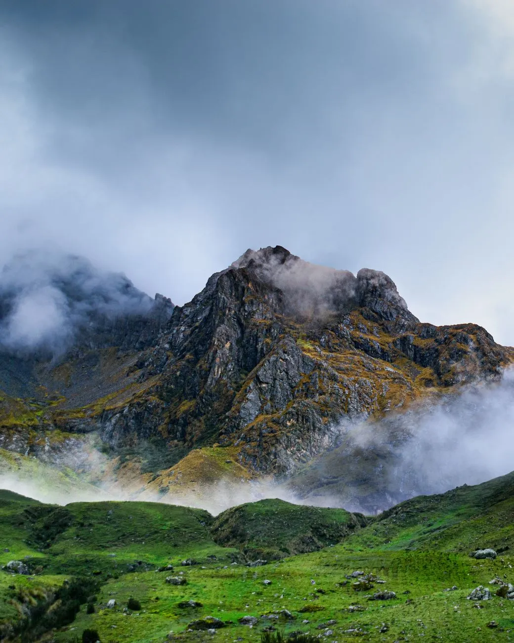

High in the mist-shrouded peaks of the Andes, where the air thins and the silence of the mountains rings with the gravity of centuries, a forgotten chemistry pulses beneath the soil. I am Mark Dinn, and my travels have taken me across six continents, but few places command the spirit like the rugged heart of Peru and Bolivia. Here, the history of civilization is not written merely in stone temples or golden artifacts, but in the slow, bubbling transformation of grains. This is the story of the lost alchemy—the ancestral practice of fermenting Andean staples, a process that once sustained empires and defined the cultural rhythm of the Inca and their predecessors. As a traveler navigating these high-altitude terrains, one does not just eat; one participates in an ancient conversation with the earth. The process of fermentation, often misunderstood in our modern, sterilized world, was the primary technology of survival in the Andes. It turned humble maize and quinoa into the lifeblood of ritual, medicinal, and nutritional necessity. To understand this, we must look past the tourist traps and into the communal kitchens where the "cora" (sprouted grain) is still prepared by hand.The practice of "chicha de jora," the most famous of these fermented maize drinks, begins with the germination of the grain. This is not a hobbyist’s endeavor; it is a labor-intensive ritual involving the soaking of corn in water until it begins to sprout. As the grain sprouts, enzymes are activated, breaking down complex starches into fermentable sugars. In the local Quechua tongue, the process is one of rebirth. For the modern traveler, finding an authentic chicha house—often marked by a simple red plastic bag tied to a pole outside a home—is a rite of passage. It is here, amidst the low hum of conversation and the pungent, earthy aroma of fermenting mash, that you realize the sophistication of the Andean diet. While travelers often focus on the cost of living or the safety of transit, referencing tools like Numbeo to manage their budget, the real currency here is tradition. Understanding the effort required to produce these artisanal ferments shifts the way we perceive value. We aren't just paying for a drink; we are subsidizing the survival of a lineage. The Chemistry of the High Altitude Harvest The survival of the Andean people is an architectural marvel of bio-chemistry. At altitudes exceeding 3,000 meters, the human body undergoes extreme stress, and the nutritional profile of the local grains—specifically quinoa, amaranth, and kañiwa—provides the necessary fortification. Fermentation acts as a catalyst here, increasing the bioavailability of micronutrients. When I trek through the Sacred Valley, I am constantly reminded that the fermentation process is essentially a form of pre-digestion. By introducing lactic acid bacteria and indigenous yeasts to the grain, these ancient practitioners effectively unlocked minerals that would otherwise be sequestered by phytic acid. This is why the Quechua people possess such endurance; their diet is engineered for the oxygen-deprived environment. For the digital nomad looking to settle in Cusco or La Paz, the reliance on these fermented grains can offer a transformative nutritional baseline. However, one must approach this with the rigor of a researcher. While Numbeo provides excellent data on the rising cost of imported goods, the savvy traveler learns that the local markets—where fermented products are sold in earthen vessels—offer the most nutrient-dense options for a fraction of the cost. The local market is not just a place to buy produce; it is a laboratory of health. The "chicha" you find there is rarely the filtered, pasteurized version exported to tourist restaurants. It is raw, alive, and teeming with beneficial microbes. I have spent countless hours speaking with local market vendors who hold the knowledge of how to stabilize these ferments using native herbs like "muña," which not only flavors the drink but adds potent antimicrobial properties. This is the intersection of botany and history, a tangible alchemy that defines the Andean traveler's journey.Nutrient Type Traditional Fermented Grain (per 100g) Modern Processed EquivalentBioavailable Protein 14g 9gDigestive Enzymes High (Active) Minimal (Inactive)Glycemic Index Low (Stable) High (Spiking)Microbiome Impact Beneficial Bacteria Neutral/NegligibleMineral Density High (Bioavailable) Low (Sequestered)The Rhythms of the Sacred Grain Fermentation Process To observe the fermentation process in a rural Andean village is to witness time slowing down. The craft is rarely documented in textbooks; it is passed through the hands of elders to the next generation. The grains—specifically the "jora" maize—are dried and ground, then boiled in massive clay vats over wood fires. This heat treatment is critical, yet it is the cooling and the subsequent inoculation that determines the quality of the final product. Many travelers make the mistake of assuming all chicha is alcoholic, but the spectrum of fermentation here ranges from the non-alcoholic "api" (a warm, sweet corn porridge) to the highly potent, long-aged chicha. Each stage of the fermentation creates a different chemical composition and a different cultural context.When you sit with a family in the highlands, observing the bubbling vats, you aren't just a guest; you are a witness to the preservation of Andean identity. The temperature fluctuations of the mountain nights play a vital role. The cool, crisp air slows the fermentation, allowing complex flavor profiles to develop over days rather than hours. As someone who evaluates cities for work-life balance using the metrics provided by databases like Numbeo, I find a fascinating parallel here. The "cost of living" in a city is often measured in currency, but in the Andes, the "cost of living" is measured in the patience required for food to mature. In our hurried world, we have forgotten that the most profound things—whether it is a career path or a jar of fermented quinoa—require the stability of time and the right environment to flourish. This realization is what keeps me returning to these mountains; it is the ultimate grounding mechanism for any traveler. Navigating the Modern Andes with Ancient Wisdom Traveling through the Andes requires a balance of modern logistics and respect for ancient protocols. If you are planning a trip to the region, utilize every available digital resource—check Numbeo for the relative cost of living, transport, and healthcare in cities like Lima, Arequipa, or Sucre. These data points are essential for long-term travelers. However, do not let the digital convenience blind you to the reality on the ground. When you arrive in these hubs, your first goal should be to bridge the gap between the modern city and the ancient mountain life. This means seeking out the "picanterías," the traditional kitchens that act as the gatekeepers of regional fermentation traditions. When visiting these establishments, the protocol is simple: humility and curiosity. Ask about the grains. Ask about the source of the "cora." You will find that when you move past the transactional nature of tourism, you unlock a depth of hospitality that is rare in the modern age. The Andes are not just a backdrop for trekking; they are a living system. If you take the time to understand the local fermentation practices, you will find that your travel budget goes much further, as you are accessing locally produced, nutrient-rich foods that sustain the population. Your health—often challenged by altitude and the rigors of constant travel—will benefit immensely from the probiotic density of these ancestral staples. Furthermore, by supporting these small-scale producers, you ensure that the ancient alchemy does not vanish into the tide of industrial, pre-packaged commodities that are slowly encroaching on urban Andean markets.The Philosophical Legacy of the Andean Vat The "Lost Alchemy" of the Andes is not truly lost; it is waiting in the silent corners of the highlands for those who have the patience to seek it out. It is a reminder that human ingenuity is not always about forward-facing progress; sometimes, the most sophisticated answers to our modern problems of health, nutrition, and environmental sustainability were perfected thousands of years ago in clay pots heated by open fires. As we move forward into a future where sustainability is no longer an option but a requirement, we would do well to look back at the Andean methods of grain utilization. The fermentation of native seeds and grains is a low-energy, high-output, and deeply ecological practice. As an expert blogger and a seasoned traveler, my mission is to bridge these worlds. Whether I am analyzing the cost of transport in a bustling South American metropolis or tasting the tart, effervescent notes of a fresh chicha in a remote village, the underlying theme is the same: value. Value is found in the connections we make, the knowledge we preserve, and the way we nourish ourselves. The Andes have taught me that the best journey is one that changes your internal chemistry as much as your geographic coordinates. So, pack your bags with the necessary technical tools to survive the modern world, but keep a small space in your heart and your schedule for the ancient, the slow, and the fermented. The echoes of the Andes are calling, and they speak in the language of bubbling grains, mountain air, and a tradition that refuses to be forgotten. In this final assessment, I urge you to look beyond the superficial travel guides and seek the heartbeat of the land, for it is there that you will find the most authentic travel experience of your life. Keep searching, keep learning, and above all, keep honoring the alchemy of the world around you, for it is the secret ingredient to a life well-traveled. The mountain paths are waiting to reveal their secrets, but only to those who are willing to drink from the cup of history. #CulinaryTravel #AndeanCulture #SustainableTravel #Fermentation #AncientGrains Related InsightsArctic Circle Digital Nomadism: Building Connectivity in Greenland's Remote Towns Le Cattedrali Sotterranee di Puglia: Un Viaggio Intimo nelle Città Rupestri delle Gravine Corsica: The Island of Beauty in the Mediterranean{ "@context": "https://schema.org", "@type": "FAQPage", "mainEntity": [ { "@type": "Question", "name": "What is the main focus of The Lost Alchemy of Ancient Fermented Grains: Echoes from the Andes?", "acceptedAnswer": { "@type": "Answer", "text": "Journey through the high-altitude landscapes of the Andes to rediscover the ancestral secrets of chicha and fermented grains, blending history with modern travel insights." } }, { "@type": "Question", "name": "Who authored the comprehensive guide on The Lost Alchemy of Ancient Fermented Grains: Echoes from the Andes?", "acceptedAnswer": { "@type": "Answer", "text": "This detailed article and its insights were carefully researched and authored by Mark Dinn." } }, { "@type": "Question", "name": "Where can I find more related content about Travel?", "acceptedAnswer": { "@type": "Answer", "text": "You can explore more articles, detailed reviews, and similar insights by browsing the Related Insights section at the bottom of this article or visiting our dedicated Travel category page." } } ] }
-
 Aisha Sharma
 - 15 Sep, 2026 21:41
Beyond the Supermarket Aisle: A Gastronomic Odyssey Through Earth’s Most Exotic Fruits
The Crimson Wonder of the Cactus: Decoding the Pitaya The dragon fruit, or pitaya, is perhaps the most visually arresting specimen in the fruit kingdom. Its bright pink skin, often adorned with leafy green scales that resemble a mythical beast, hides a interior that feels like a deliberate design choice by nature. As a traveler frequently traversing the bustling markets of Southeast Asia and Central America, I have learned that the visual spectacle is only the beginning. Hailing primarily from the Hylocereus cactus genus, this fruit thrives in arid, rocky soils, making it a resilient staple in regions where other crops might wither. When you crack open a pitaya, the experience is transformative. The white-fleshed variety, often found in Vietnam, provides a mild, refreshing crunch, while the deep magenta-fleshed cultivar—my personal favorite—bursts with antioxidants known as betalains. These pigments are not merely for aesthetics; they are potent compounds that combat oxidative stress. When sourcing pitaya for your breakfast bowl while living as a digital nomad, prioritize fruits that have a slight "give" when pressed, similar to a ripe avocado. If the scales are brown or wilted, the fruit is likely past its prime. Furthermore, the tiny black seeds scattered throughout are not just for texture; they are rich in polyunsaturated fatty acids, specifically omega-3s, which are essential for cardiovascular health. For those utilizing a nomad visa in places like Bali or Costa Rica, the price of pitaya is incredibly budget-friendly compared to Western import prices. On average, a kilogram of dragon fruit at a local wet market costs a fraction of what you would pay at a boutique grocer in London or New York, where it is often treated as a luxury "superfood." To properly enjoy it, slice it longitudinally and use a spoon to scoop out the flesh, ensuring you scrape right up to the peel, as that is where the highest concentration of fiber resides. It is the quintessential travel fuel: hydrating, low in calories, and undeniably photogenic for your next social update.The King of Fruits: Navigating the Complexities of Durian No discussion of exotic fruit is complete without addressing the olfactory elephant in the room: the durian. Known as the "King of Fruits" across Malaysia, Thailand, and Singapore, its reputation is as divisive as its scent is potent. To the uninitiated, the aroma is often described as a collision of rotting onions and turpentine. However, to the seasoned traveler, it is a perfume of creamy custard and almond-like decadence. The durian is, in essence, a lesson in cultural immersion. If you can move past the scent—which is caused by a complex cocktail of volatile sulfur compounds—you will discover a nutritional profile that is arguably unrivaled in the fruit world. Durian is incredibly energy-dense. It is one of the few fruits that is significantly high in healthy fats, making it a powerhouse for hikers and explorers. Beyond the calories, it is packed with vitamin C, potassium, and tryptophan. When shopping for durian, the locals will tell you to "listen" to the fruit. A gentle shake should reveal a slight movement of the seeds inside; if it is completely silent, the fruit may be unripe or overly dense with water. Many public transport systems, luxury hotels, and even airplanes throughout Southeast Asia strictly ban durian due to its lingering odor, so be mindful of your surroundings when indulging. To eat like a local, you must dine with your hands. The texture is akin to a mousse or cheesecake, and the flavor profile is wildly complex, ranging from savory and caramel-like to mildly fermented. While your cost of living calculations—often cross-referenced via platforms like Numbeo—might account for your basic grocery staples, set aside a separate budget for "premium durian" experiences. Seasonal varieties like the Musang King or Black Thorn command high prices, but the sensory reward is worth every cent. This is not just a snack; it is a rite of passage for every traveler seeking to understand the deep, ancient connection between Southeast Asian landscapes and their native botanical wonders.Exotic Fruit Primary Region Texture Profile Key Nutritional Benefit Price Index (Relative)Dragon Fruit SE Asia / Central America Crunchy / Watery Betalains (Antioxidants) LowDurian SE Asia Creamy / Custard-like Healthy Fats / Potassium HighMangosteen SE Asia Juicy / Soft Xanthones (Anti-inflammatory) MediumRambutan SE Asia Gelatinous / Sweet Vitamin C / Fiber LowCherimoya South America Creamy / Granular Vitamin B6 / Magnesium MediumThe Purple Empress: Unlocking the Secrets of the Mangosteen If durian is the King, the mangosteen is undisputedly the Queen. Wrapped in a thick, leathery, deep purple rind, the mangosteen yields a cluster of snow-white, citrusy, and sweet arils that practically dissolve on the tongue. My first encounter with a mangosteen was in a quiet market in Penang. The vendor, an elderly woman with eyes that sparkled like the fruit itself, taught me the trick to selecting the perfect one: count the "petals" on the bottom of the fruit. This star-shaped pattern corresponds exactly to the number of segments inside. The more petals, the more fruit segments, and generally, the fewer seeds you will encounter. The secret power of the mangosteen lies in its rind. While the flesh is the culinary prize, the pericarp (the thick skin) is loaded with xanthones—a class of plant compounds that have been studied for their potent anti-inflammatory and antioxidant properties. In many traditional medicinal practices across the tropical belt, the rind is dried and ground into a powder to treat various skin conditions and digestive ailments. For the traveler, this makes the mangosteen more than a dessert; it is a wellness tool. When planning your nomadic journey, keep in mind that the mangosteen season is relatively short. Because it is highly perishable and sensitive to temperature fluctuations, it rarely survives international export in its prime state. This is why traveling to the fruit, rather than waiting for the fruit to come to you, is essential. When you are visiting countries like Thailand or Indonesia, check the current local season. During the peak harvest, you will find bags of mangosteen sold at every street corner. It is a humble, affordable luxury that perfectly captures the essence of tropical travel: ephemeral, vibrant, and deeply satisfying. Remember to handle them gently; the purple pigment in the rind is a notorious stainer of fabrics, so exercise caution when opening them in your accommodation.The Andes' Best Kept Secret: The Custard Apple Chronicles Deep in the high-altitude valleys of the Andes, there grows a fruit so paradoxically delicious it was dubbed by Mark Twain as "the most delicious fruit known to men." The cherimoya, or custard apple, is a heart-shaped, green-scaled fruit that feels like a heavy secret held by the mountains. Unlike the flashy, bright colors of the tropical jungle, the cherimoya is muted, earthy, and unassuming. However, the moment you slice through its skin, you are greeted with a fragrance reminiscent of pineapple, banana, and strawberry all harmonizing in a creamy, luscious pulp. When living in Ecuador or Peru under a digital nomad visa, the cherimoya is a daily companion. It is dense with vitamin B6, which is crucial for serotonin regulation, making it, quite literally, a fruit that makes you happy. The texture is reminiscent of a firm custard or a thick yogurt. Eating a cherimoya requires patience; it is a fruit that demands to be enjoyed slowly. The black seeds are toxic if crushed, so you must carefully eat around them, turning the experience into a mindful exercise in slowing down—a practice that is sorely needed in our fast-paced modern lives. One of the most authoritative ways to prepare it is simply chilled. Cut it in half and scoop the flesh with a small spoon. If you want to elevate it, a small squeeze of lime juice cuts through the richness of the pulp, creating a bright, zesty counterpoint. For travelers residing in South American hubs like Cuenca or Medellín, sourcing these from local highland farmers ensures you are getting the freshest harvest. The market price is significantly lower than in European supermarkets, where they are often imported at a massive premium. As a traveler, sourcing these at origin is not just about cost-effectiveness; it is about supporting local biodiversity and the small-scale farmers who have cultivated these unique cultivars for centuries. The Spiky Velvet: Exploring the World of Rambutan In the vast ecosystem of Southeast Asia’s orchards, the rambutan acts as a playful contrast to the heavy, serious durian. Its name, derived from the Malay word "rambut" meaning "hair," refers to the soft, flexible spines that cover its skin. To look at it, one might mistake it for a sea urchin dropped in a forest, but beneath the wild exterior lies a fruit so sweet and succulent that it is impossible to stop at just one. The flesh is translucent, firm, and strikingly similar to a grape, but with a complex floral sweetness that is distinctly tropical. Rambutan is a fantastic source of vitamin C and copper, the latter being essential for the development and maintenance of healthy skin and energy levels. When traveling, I often keep a bag of rambutans in my day pack. They are nature’s own individually wrapped snacks—the skin is easily peeled by hand, making them the most convenient fruit to consume while moving between transport hubs. When selecting them at a market, look for the brightest, most vibrant green or red spikes. If the spikes have turned black or brittle, the fruit is likely dehydrated and the flavor will be compromised. As an expert, I must emphasize the importance of seasonal timing. Because rambutans are harvested in bulk during the rainy season, you will find prices plummeting, allowing you to indulge in massive quantities for a nominal cost. This is a great opportunity to lean into the local diet. Integrating these seasonal shifts into your travel calendar helps maintain a lower cost of living, as suggested by data from cost-of-living trackers, while simultaneously aligning your health with the natural cycles of the region. Whether you are adding them to a chilled salad or simply devouring them by the handful, the rambutan is a testament to the fact that the most exotic delights are often the most accessible if you are willing to embrace the local harvest.Embracing the Botanical Wonders of Our Shared Planet The world’s fruits are more than just sustenance; they are the living, breathing artifacts of the regions they occupy. By moving beyond the sterile, monoculture-dominated produce sections of global supermarkets and immersing ourselves in the vibrant, chaotic beauty of local markets, we gain a deeper, more visceral understanding of our destination. From the antioxidant-rich dragon fruit of the coastal tropics to the custard-like embrace of the Andean cherimoya, every bite tells a story of climate, geography, and human tradition. As travelers, we are privileged to witness these cycles firsthand. We have the rare opportunity to align our nutrition with the Earth’s seasonal clock, finding joy in the limited-time abundance of the mangosteen or the complex, acquired taste of the durian. These experiences don't just fill our stomachs; they broaden our palates and humble our perceptions of what "food" can be. When planning your next journey, I encourage you to look beyond the iconic landmarks and the crowded tourist traps. Make your way to the local market at dawn. Engage with the farmers who have spent lifetimes perfecting the soil and the harvest. Ask them how to identify the best fruit, how to prepare it traditionally, and what it means to their community. You will find that these small, edible treasures often provide the most profound insights into the places we choose to call home for a season. Travel is not just about the distance covered; it is about the flavors experienced along the way. So, keep your passport ready, your curiosity sharp, and your appetite open. There is an entire world of flavor waiting to be peeled, cracked, and savored. The next time you find yourself in a distant land, bypass the familiar, reach for the spiky, the hairy, or the neon-colored mystery on the stall, and let your senses lead the way. Happy travels, and even happier tasting. #CulinaryTravel #ExoticFruits #SustainableTourism #GlobalEats #FoodExploration Related InsightsThe Pantanal Chronicles: Into the Heart of Earth’s Greatest Wetland Sanctuary Sustainable Travel in 2024: How to Explore the World Without Leaving a Trace La Cathédrale de Reims : Le Sanctuaire des Rois de France{ "@context": "https://schema.org", "@type": "FAQPage", "mainEntity": [ { "@type": "Question", "name": "What is the main focus of Beyond the Supermarket Aisle: A Gastronomic Odyssey Through Earth’s Most Exotic Fruits?", "acceptedAnswer": { "@type": "Answer", "text": "Embark on a sensory journey across the globe as we decode the rarest, most peculiar, and delicious fruits that define the world’s most vibrant culinary cultures." } }, { "@type": "Question", "name": "Who authored the comprehensive guide on Beyond the Supermarket Aisle: A Gastronomic Odyssey Through Earth’s Most Exotic Fruits?", "acceptedAnswer": { "@type": "Answer", "text": "This detailed article and its insights were carefully researched and authored by Aisha Sharma." } }, { "@type": "Question", "name": "Where can I find more related content about Travel?", "acceptedAnswer": { "@type": "Answer", "text": "You can explore more articles, detailed reviews, and similar insights by browsing the Related Insights section at the bottom of this article or visiting our dedicated Travel category page." } } ] }

The Celestial Ballet: Decoding the Science of the Arctic Glow When the long, dark nights of the Arctic winter settle over the rugged landscapes of Scandinavia, the heavens awaken. As a travel expert who has spent years chasing the elusive Aurora Borealis, I can tell you that nothing prepares you for the moment the sky begins to pulse. The Northern Lights are not merely a visual spectacle; they are the result of a violent, beautiful collision between charged particles from the sun and our planet’s protective magnetic field. When these particles reach the thermosphere, they collide with oxygen and nitrogen atoms, releasing photons that create the signature green, violet, and sometimes deep red curtains that shimmer above the horizon. To witness this, one must move beyond the casual tourist mindset and embrace the role of an expeditioner. You are not just visiting a location; you are entering a high-latitude zone where weather, solar activity, and geography intersect. The best viewing windows are strictly dictated by the solar cycle and the proximity to the auroral oval, a ring-shaped zone centered on the geomagnetic north pole. Scandinavia—specifically Northern Norway, Swedish Lapland, and Finnish Lapland—sits perfectly beneath this ring. Understanding the "Kp index" is your first step toward success. This scale, ranging from 0 to 9, measures geomagnetic activity. While a high Kp-index is often cited as the magic number, experienced observers know that local weather conditions and light pollution are significantly more critical. A clear sky with a Kp-index of 2 is infinitely better than a cloudy sky with a Kp-index of 6. Therefore, the "whispering skies" require patience, movement, and a commitment to traveling away from the glow of civilization.Chasing Shadows: Navigating the Scandinavian Winter Logistics Planning a trip to see the lights requires the precision of a field researcher. If you are looking for the absolute best odds, I recommend focusing on the "Auroral Belt" cities: Tromsø in Norway, Abisko in Sweden, or Rovaniemi in Finland. These locations are not just gateways; they are epicenters of scientific observation. However, the travel logistics are vastly different from a summer holiday in Rome or Paris. First, consider the transport. Northern Scandinavia is vast and sparsely populated. Utilizing regional airlines like Widerøe in Norway or taking the night train from Stockholm to Abisko provides a unique logistical advantage. Once you arrive, renting a vehicle is often the most authoritative way to chase the clearings. You are essentially looking for "holes" in the cloud layer. Following the coastal weather reports versus the inland mountain forecasts is essential. In Tromsø, for instance, you might find that the clouds are thick over the fjords, but a short drive inland toward the Finnish border reveals a crystal-clear expanse. Safety is paramount when operating in these latitudes. You must familiarize yourself with winter driving conditions. The roads are often covered in packed ice and snow, and the temperature can plummet to -25°C (-13°F). Ensure your rental is equipped with high-quality studded tires—non-negotiable in this region. Furthermore, digital nomads or luxury travelers should prioritize accommodation that offers "Aurora alerts." Many high-end glass igloos or remote lodges in Finnish Lapland provide a wake-up service when the lights appear, saving you from spending every hour of the night shivering on a frozen lake. Budgeting for the Arctic: The Financial Reality of High-Latitude Travel One cannot discuss Scandinavian travel without addressing the cost of living. As an expert, I lean heavily on data-backed platforms like Numbeo to manage expectations for my readers. Scandinavia is undoubtedly one of the most expensive regions globally, and the Arctic territories are no exception. Costs for food, local transport, and specialized gear are premium. When you utilize crowdsourced data from Numbeo, you gain an objective view of how much a dinner for two might cost in a remote Norwegian hub compared to your home city. The cost of living index in cities like Tromsø or Kiruna is exceptionally high, particularly regarding imported goods and services. A single meal at a mid-range restaurant can cost significantly more than the global average, and the price of a pint of local beer or a coffee is often a surprise to first-timers. However, the quality of infrastructure—the reliability of healthcare, the efficiency of public transport, and the overall safety—is unparalleled. When planning your budget, I suggest allocating at least 40% of your total trip cost to "flexibility." This includes the ability to change accommodation on the fly, hire local guides for specialized snowmobile chases, or secure high-quality thermal rental gear. Do not attempt to "budget" your way through the Arctic at the expense of your warmth; substandard clothing or unreliable transport in these conditions is not just uncomfortable—it is a safety hazard. Use tools to compare prices between major hubs; for instance, you will often find that Finland offers a slightly more accessible price point for activities like dog sledding or reindeer farm visits compared to the more commercialized Norwegian ports.Expense Category Estimated Weekly Cost (USD) Comfort LevelMid-range Accommodation $1,200 - $1,800 HighSpecialized Winter Gear Rental $300 - $500 NecessaryLocal Transport / Car Rental $600 - $900 OptimalDining and Groceries $700 - $1,100 ModerateGuided Aurora Expeditions $400 - $800 High-valueThe Art of the Arctic Snapshot: Capturing the Uncapturable Capturing the Northern Lights is a pursuit of both artistic vision and technical mastery. Many travelers arrive with high-end cameras only to find themselves frustrated by frozen batteries and blurry, dark frames. To truly capture the movement of the skies, you must master the "Exposure Triangle." First, set your camera to manual mode. You need a fast, wide-angle lens—ideally f/2.8 or lower—to capture as much light as possible. The most common mistake is over-exposure. Because the sky is so dark, sensors tend to try to brighten everything, which makes the stars look like streaks and the aurora look like a flat, washed-out green smear. Keep your shutter speed between 5 and 15 seconds, depending on how fast the aurora is dancing. If the lights are active and moving quickly, you want a faster shutter speed to capture the distinct "curtain" shapes rather than a blurred mass. Furthermore, use a sturdy tripod. The wind in the Arctic is relentless, and even the slightest vibration will ruin a long-exposure shot. Pro-tip: focus your lens manually on infinity, or use the "Live View" to focus on the brightest star in the sky before you begin shooting. Never rely on autofocus in the dark; it will hunt endlessly and fail. Lastly, bring extra batteries. Cold weather drains lithium-ion batteries at an alarming rate. Keep your spares in an inside pocket, close to your body heat, and swap them out frequently. The goal is to capture the essence of the dance, not just a green light.Cultivating the Arctic Mindset: Beyond the Celestial Glow The true mystique of the Arctic lies not just in the lights, but in the lifestyle that thrives under such extreme conditions. To spend time in Scandinavia during the winter is to learn the meaning of "Friluftsliv," the Nordic philosophy of living in harmony with nature. Even when the sun does not rise for weeks—a period known as the Polar Night—the culture remains vibrant. The locals embrace the darkness with hygge-inspired gatherings, indoor saunas, and a deep appreciation for the quietude of the snow-covered landscape. As you await the Aurora, immerse yourself in the culture of the indigenous Sámi people. Their relationship with the land and the reindeer is the heartbeat of the North. Engaging in a traditional Lavvu experience, where you sit by an open fire listening to joik music, provides a profound context for the lights above. To them, the Aurora is often regarded with deep respect, a spiritual force that demands silence and observation. When you leave the Arctic, you will find that the experience changes you. It strips away the noise of urban existence. You become accustomed to the silence of the tundra, the blue light of the mid-afternoon, and the immense scale of the cosmos. This is the ultimate goal of the travel expert: not just to cross a destination off a list, but to be altered by the environment you inhabit. Whether you see the lights on your first night or wait six days in the freezing cold for a flicker of green, the pursuit itself is the reward. You are learning to read the sky, understand the cold, and appreciate the immense, quiet power of the world’s most elusive natural wonder. #ArcticTravel #NorthernLights #Scandinavia #AdventureTravel #DigitalNomad Related InsightsHamburgs Speicherstadt Fantasmi sulla Via della Seta: Il richiamo silenzioso delle oasi perdute del Turkmenistan Insel Rügen im Sommer{ "@context": "https://schema.org", "@type": "FAQPage", "mainEntity": [ { "@type": "Question", "name": "What is the main focus of Dancing With The Aurora: Unveiling The Arctic’s Celestial Symphony?", "acceptedAnswer": { "@type": "Answer", "text": "Master the art of chasing the Aurora Borealis in Scandinavia with this authoritative guide on logistics, budget, and celestial timing." } }, { "@type": "Question", "name": "Who authored the comprehensive guide on Dancing With The Aurora: Unveiling The Arctic’s Celestial Symphony?", "acceptedAnswer": { "@type": "Answer", "text": "This detailed article and its insights were carefully researched and authored by Wei Chen." } }, { "@type": "Question", "name": "Where can I find more related content about Travel?", "acceptedAnswer": { "@type": "Answer", "text": "You can explore more articles, detailed reviews, and similar insights by browsing the Related Insights section at the bottom of this article or visiting our dedicated Travel category page." } } ] }
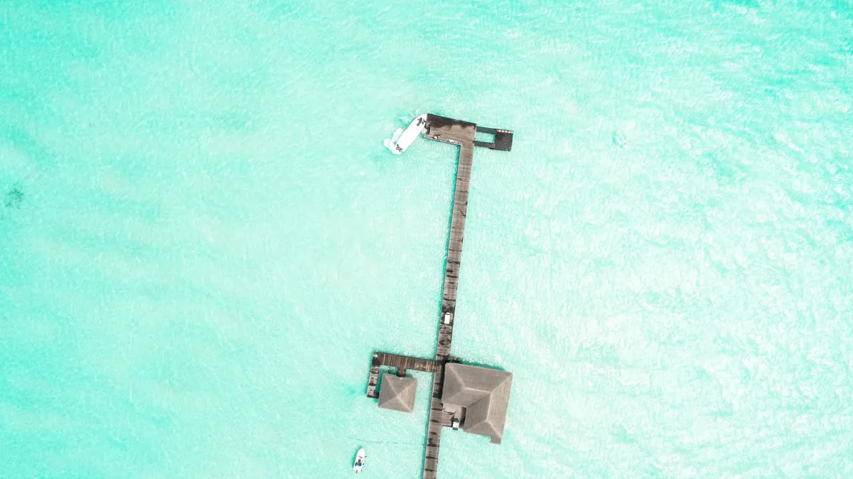
The Siren Call of the Indian Ocean The Maldives is not merely a destination; it is an archipelago of 1,192 coral islands that define the pinnacle of tropical indulgence. As an expert observer of global travel trends, I have witnessed the evolution of this nation from a secluded diving retreat to the global epicenter of "barefoot luxury." Yet, beneath the veneer of champagne sunsets and private infinity pools lies a geography fighting for its very existence. The iconic overwater bungalows, which have become the visual shorthand for paradise, occupy a unique space in the tension between high-end tourism and environmental stewardship. When you step onto the wooden jetty of a private island resort, you are entering a micro-economy that operates on a razor-thin margin between environmental extraction and preservation. The sustainability of this model relies on the ability of the tourism industry to pivot from passive enjoyment to active conservation. The Maldivian government, alongside private hospitality conglomerates, is increasingly mandating that resorts invest in their immediate marine surroundings. This is no longer just about planting a few coral fragments; it is about complex bio-rock infrastructure, large-scale seagrass protection, and the mitigation of carbon footprints in one of the most remote regions on Earth. For the discerning traveler in 2026, the question is no longer just "Is the water clear?" but "How does my stay contribute to keeping it that way?" The modern voyager understands that their footprint is indelible, and they choose to make it as light as possible. As we delve into the mechanics of living, vacationing, and protecting this aquatic heaven, remember that your choice of accommodation dictates the survival of the reefs that protect these islands from the rising tide.Luxury Living at the Edge of the Reef Staying in an overwater villa offers an unparalleled sensory experience, but it also places the guest directly atop a fragile nursery. Coral reefs are the beating heart of the Maldives, acting as natural breakwaters against the volatile Indian Ocean. Without these structures, many of the islands would struggle to maintain their physical integrity. In the past, the construction of villas involved dredging and land reclamation, which often suffocated the very reefs being advertised. Today, the narrative has shifted. Leading resorts are adopting "no-net-loss" policies, where the footprint of a villa is offset by the creation of new, protected nursery zones. Guests are now invited to participate in the "adopt-a-coral" programs, which are becoming standard fare in luxury travel packages. When you book your stay, look for properties that utilize non-invasive pillar construction, allowing water to flow naturally beneath your villa, maintaining the connectivity of the reef ecosystem. The cost of this luxury is significant, yet it is a necessary investment to ensure that the Maldivian dream remains a physical reality rather than a digital archive. In terms of your personal expenditure, planning for 2026 requires understanding that sustainability is often bundled into the premium rates. However, the premium is worth the cost when you realize that your presence is funding the marine biologists who patrol these reefs. The intersection of architectural marvels and environmental responsibility is where the true prestige of Maldivian travel now resides. You are not just paying for a room; you are paying for the continued guardianship of an underwater cathedral. Navigating the 2026 Economic Landscape For those considering the Maldives as more than a short-term destination—perhaps as a digital nomad hub or an expat home—the economic landscape of 2026 is complex. The cost of living is heavily influenced by the import-dependent nature of the archipelago. While local markets offer fresh, vibrant produce, anything beyond the basics, such as imported spirits, international culinary staples, or high-speed hardware, carries a significant markup due to the logistics of island-to-island transport. Understanding the price structure is vital for anyone planning an extended stay. In the capital, Malé, the cost of living is distinct from that of the private resort islands. As an expat, you will find that rent constitutes the bulk of your expenditure. Finding a long-term lease requires navigating a market that is increasingly geared toward luxury tourism, which can inflate prices for non-nationals. When budgeting for 2026, account for the fluctuating cost of utilities, specifically electricity and desalination. Water management is a critical issue; while you are surrounded by the sea, fresh water is a precious commodity. You must factor in the cost of high-quality internet connectivity, which, while improved, can be expensive compared to mainland hubs. Furthermore, visa pathways have become more streamlined, yet they necessitate proof of financial stability that exceeds the requirements of many other Southeast Asian or South Asian nations. The Maldives is not a low-cost getaway; it is a high-value investment in an exclusive lifestyle that demands fiscal foresight and respect for the local economic challenges.Economic Data and Local Price Trends The table below provides a representative snapshot of costs in the Maldives for the year 2026. Note that these are estimated averages based on prevailing trends; actual costs will fluctuate significantly depending on whether you are situated on a local island or an isolated luxury resort.Expense Category Estimated Monthly Cost (USD) Notes for 2026Apartment Rent (1 BR in Malé) $1,200 - $2,200 Prices rise sharply near the waterfront.Basic Utilities (Elect/Water) $150 - $250 Highly dependent on AC usage and conservation.Local Market Groceries $400 - $600 Focus on local fish/fruits to keep costs low.Imported Goods/Alcohol $300 - $500 High taxes on non-local items remain in effect.High-Speed Internet Plan $60 - $120 Vital for remote work, varies by ISP.Transport (Ferry/Speedboat) $100 - $300 Varies by distance from island-to-island.This data illustrates the premium placed on resource accessibility. Whether you are stocking up for a week or planning a month of remote work, prioritize local supply chains to support the national economy and manage your budget effectively. Conservation as the New Standard of Luxury The true luxury in the Maldives for 2026 is no longer about gold-plated taps or marble floors; it is about biodiversity. The most prestigious resorts are those that have successfully integrated "coral regeneration" into their branding. I have seen firsthand how resorts now mandate that their guests receive a briefing on reef etiquette. This includes the use of reef-safe sunscreens, strict "no-touch" policies, and the prohibition of single-use plastics. The transition from luxury-as-consumption to luxury-as-stewardship is the most vital development in the industry. Marine biologists are now as essential to a resort’s operation as a head chef. These experts lead night-snorkeling tours that educate visitors on the bioluminescence and nocturnal feeding habits of reef inhabitants. They manage coral propagation frames, which are essentially underwater nurseries that grow resilient coral species that can withstand rising sea temperatures. As a guest, engaging with these conservation efforts adds a layer of depth to your experience that a standard resort stay simply cannot provide. You are witnessing the frontline of climate adaptation. The reefs are the first line of defense against the rising sea levels that threaten the very existence of these low-lying islands. Therefore, supporting these programs is not just a virtuous act; it is a way to ensure that the archipelago remains a place you can return to in the coming decades. When you book, look for the 'Green Globe' or 'EarthCheck' certifications, which signal a verified commitment to these practices. Your participation in these initiatives turns your vacation into a partnership with nature.The Future of the Archipelago: Beyond the Horizon Looking toward the future, the Maldives stands at a crossroads. The economic viability of the nation remains inextricably linked to the health of its natural wonders. As we move further into the decade, we will see an increased reliance on smart-island technology—solar-powered desalination, automated waste management systems, and AI-driven monitoring of reef health. This technological adoption is not just for efficiency; it is an existential necessity. For the traveler, this means that the Maldives is becoming a living laboratory for sustainable tourism. If you are planning to visit or settle in the Maldives, bring with you a sense of responsibility. Engage with the local culture, which is deeply rooted in the Islamic tradition and seafaring history. Support local businesses on the inhabited islands, where you can find authentic Maldivian cuisine—try the mas huni, a traditional breakfast of tuna and coconut, which is not only delicious but also utilizes the bounty of the ocean in a sustainable manner. The Maldives of 2026 is a place of profound beauty, but it is also a place that demands humility from its visitors. By choosing to travel consciously, you are acknowledging that the privilege of witnessing this paradise comes with the duty to preserve it. The water is calling, and it is clearer than ever that the path forward must be paved with respect, research, and a deep, enduring commitment to the conservation of the world’s most precious coral kingdom. We must ensure that the legacy of the Maldives is not one of lost islands, but of a global success story in environmental adaptation and resilient human joy. The lasting impression of the Maldives is one of absolute clarity—a clarity of water, of light, and of purpose. Whether you are an expat working from a bustling local cafe in Hulhumalé or a traveler relaxing in an overwater villa in the Baa Atoll, you are part of a narrative that is far larger than your individual stay. The choices we make today regarding our consumption, our waste, and our interaction with the reef will echo in the depths for generations. May your journey to this island nation be one of discovery, not just of the landscapes, but of your own capacity to contribute to the preservation of the extraordinary. #SustainableTravel #MaldivesConservation #IslandLife #EcoLuxury #GlobalNomad Related InsightsGrüne Pfade: Wie nachhaltiger Tourismus das Herz der Erde bewahrt Australien: Wo die Ewigkeit des Outbacks auf den Puls der Moderne trifft Echoes in Stone: Unearthing Sardinia's Lost Cyclopean Mysteries in the Wild Heart of Barbagia{ "@context": "https://schema.org", "@type": "FAQPage", "mainEntity": [ { "@type": "Question", "name": "What is the main focus of Azure Horizons and Fragile Ecosystems: The Maldives Reality Check?", "acceptedAnswer": { "@type": "Answer", "text": "Explore the delicate balance between Maldives luxury overwater living and urgent coral reef conservation, complete with essential 2026 economic insights." } }, { "@type": "Question", "name": "Who authored the comprehensive guide on Azure Horizons and Fragile Ecosystems: The Maldives Reality Check?", "acceptedAnswer": { "@type": "Answer", "text": "This detailed article and its insights were carefully researched and authored by Aisha Sharma." } }, { "@type": "Question", "name": "Where can I find more related content about Travel?", "acceptedAnswer": { "@type": "Answer", "text": "You can explore more articles, detailed reviews, and similar insights by browsing the Related Insights section at the bottom of this article or visiting our dedicated Travel category page." } } ] }
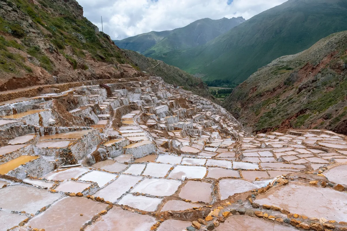
-
 Zola Ndlovu
 - 12 Sep, 2026 11:11
The Whispering Paths: Tracing Europe's Forgotten Salt Roads, From Alpine Mines to Adriatic Shores
Where the White Gold Carved the Earth To traverse the salt roads of Europe is to walk the veins of a continent that was once powered by the scarcity of sodium. Long before the modern conveniences of supermarkets and global logistics chains, salt was the world’s most precious currency—the "White Gold" that preserved life through harsh winters and fueled the rise of great empires. My journey begins not in a bustling capital, but in the damp, cool silence of the Salzkammergut region of Austria. This is where the story of European wealth truly starts, in the deep subterranean tunnels of Hallstatt, where salt has been extracted for over 7,000 years. Tracing these routes is not merely a historical exercise; it is a lesson in geography and logistics. The paths were narrow, designed for mule trains carrying sacks of salt from the high-altitude mines down toward the rivers and eventually the Adriatic Sea. Today, many of these trails have been reclaimed by nature or paved over by modern highways, but the whispering paths remain for those willing to look closer. When I think of these routes, I think of the sheer grit required to move tons of salt across treacherous Alpine passes. The logistics were brutal, the toll on animal and human life was immense, and the reward was the solidification of regional economies. For the modern traveler, this route offers a rare opportunity to peel back the layers of European identity. As we look toward 2026, traveling these roads requires a keen understanding of local economics, particularly for those of us living a nomadic lifestyle. Navigating the cost of living while uncovering history is the new challenge, and using tools like Numbeo, we can see that while these historic regions offer immense beauty, they also demand strategic financial planning to ensure that the journey remains sustainable for the long haul.Secrets of the Subterranean Labyrinths The mines of Hallstatt and Berchtesgaden are not just tourist attractions; they are the architectural bedrock of the region. As I descended into the tunnels, the temperature dropped significantly, a stark reminder of the environment in which miners spent their entire lives. The engineering feat of these mines, dating back to the Bronze Age, remains a testament to human ingenuity. Salt was mined here using fire-setting techniques and later, more sophisticated hydraulic methods that kept the industry alive through the Middle Ages. When planning your visit, it is vital to reconcile the romanticism of the past with the economic reality of the present. As a digital nomad, you are constantly balancing the desire for discovery with the limitations of your monthly budget. Analyzing the cost of living in countries like Austria or Slovenia, where many of these routes converge, reveals a significant variance in expenditure. Numbeo data provides a clear picture of the fiscal landscape in these regions. For instance, the cost of transit and basic sustenance in the Alpine regions of Austria is higher than in the coastal villages of Croatia, yet the quality of life index in these regions remains among the highest globally. It is this trade-off that we must navigate. If you are planning to spend a month documenting these routes, you need to account for high accommodation costs in the peak season, especially near popular heritage sites. My strategy has always been to balance the "premium" days—those spent in high-cost, high-reward locations like Hallstatt—with extended stays in smaller, less commercialized villages along the salt routes, where the local price of food and public transport drops significantly. Mapping the Logistics of the Ancient Trade Moving salt from the mountains to the Adriatic was a logistical nightmare that forced the creation of sophisticated trade networks. The "Salt Road" was not a single highway but a spiderweb of tracks that bypassed treacherous terrain and managed to find the most stable mountain passes. As salt moved from the Salzkammergut toward the salt pans of Piran and the markets of Venice, it passed through a series of checkpoints and customs houses that eventually evolved into the cities we know today. The transition from the Alpine interior to the Mediterranean coast is a study in contrasts. You move from the cold, damp shadows of the Alps to the sun-drenched salt pans of the Adriatic. In Piran, Slovenia, you can still witness the traditional harvesting of salt using methods that have remained unchanged for centuries. This is the culmination of the journey. Standing in the salt pans, you can almost hear the echoes of the mule trains arriving from the north. However, for the modern nomad, this journey brings its own set of logistical hurdles. In 2026, traveling across borders—even within the Schengen Area—requires more than just a passport. It requires a digital footprint. As you traverse these paths, ensure you have reliable connectivity. Numbeo’s global benchmarks on internet quality indicate that while city hubs offer stellar speeds, the remote mountain passes still face significant "dead zones." Plan your work-sync days carefully; do not assume that a picturesque village will provide the fiber-optic speed necessary for a professional blogger or consultant.Location Avg. Monthly Cost of Living (USD) Transport Rating Digital ConnectivityHallstatt, Austria $2,850 High ModerateSalzburg, Austria $2,600 Very High ExcellentLjubljana, Slovenia $1,900 High HighPiran, Slovenia $2,100 Moderate ModerateVenice, Italy $3,200 Very High HighThis table, compiled using data benchmarks for 2026, highlights the cost-of-living fluctuations for a nomadic traveler. The data illustrates that while the "classic" salt route destinations like Venice and Hallstatt command a premium due to tourism demand, the peripheral towns like Ljubljana offer a more balanced fiscal environment. High transit ratings are consistent throughout the route due to Europe’s extensive rail network, which essentially follows the path of the original salt-mule tracks.The Economic Pulse of Modern Nomadic Travel Living on the road in 2026 demands a level of financial literacy that early salt merchants would have found bewildering. When I began my journey through the salt roads, I realized that the cost of living index was not just a number on a website; it was a reflection of the infrastructure that had been built upon these very routes. A high cost of living in these historic towns often correlates with superior healthcare, efficient public transport, and reliable municipal services—the modern "infrastructure" that replaced the salt trade. Digital nomads often overlook the hidden costs: tax implications, local VAT on short-term rentals, and the varying costs of healthcare across different European nations. If you are staying in the EU, you need to be aware of the "nomad tax" implications that vary significantly from country to country. In 2026, many European nations have refined their visa and tax structures, making it easier for remote workers to stay long-term, but this comes with mandatory registration and tax contributions. Before you settle in a town along the Salt Road to finish your writing, cross-reference your specific location with current data on Numbeo. Look beyond the rent prices. Examine the cost of a fitness club, the price of a cinema ticket, and the local market costs. If you find yourself in a place where the cost of a basic lunch is disproportionately high, it is usually a sign of a tourist-heavy economy, which can be draining on a long-term budget. To maintain the "salt trail" lifestyle, choose base camps that are historical yet functional—cities that retain their character but provide the amenities necessary to sustain a 21st-century professional life.The Silent Echoes and Future Horizons As the sun sets over the Adriatic, reflecting the same salt-crusted horizon that guided the merchants of the 14th century, I am struck by the continuity of human ambition. The paths have changed, the technology of transport has evolved from wooden wagons to high-speed trains, and the currency has shifted from sacks of salt to digital packets of data, yet the impulse to travel, to trade, and to connect remains unchanged. We are all, in our own way, searching for the "White Gold" of our time—whether that is stability, experience, or the pursuit of professional freedom. My final piece of advice for those looking to retrace these whispering paths is to go slowly. The history of the Salt Road is not meant to be consumed in a weekend. It is meant to be felt in the slow climb of a mountain pass, the cool air of a mine, and the sharp, salty breeze of the coast. Use the data available to you to secure your logistics, but do not let the metrics dictate your experience. The true value of this journey lies in the intersection of the past’s endurance and the present’s potential. We live in a golden age of mobility, provided we possess the discipline to manage our resources and the curiosity to look beyond the paved highway. The salt roads are waiting for you, whispering stories of an age when every grain mattered. If you approach them with respect, preparedness, and a keen eye on your professional needs, you will find that these routes offer much more than just a destination; they offer a profound understanding of how we built the modern world, one path at a time. The road is open, the data is clear, and the history is yours to claim. Proceed with purpose, and let the whispers guide you home. #SaltRoads #DigitalNomad #EuropeanHistory #SlowTravel #NomadLife
-
 Cemre Seyyah
 - 12 Sep, 2026 09:47
Sun-Drenched Serenity vs. The Fjord’s Embrace: Choosing Between the Albanian Riviera and the Bay of Kotor
Where the limestone giants of the Dinaric Alps plunge abruptly into the salt-kissed depths of the Adriatic, Europe hides its most compelling secrets. For the weary traveler exhausted by the polished, predictable circuits of the West, the Balkan coast offers a rugged alternative—a theater of ancient stone, sapphire waters, and stories carved into the bedrock by centuries of Venetian and Ottoman rivalry. I am Cemre Seyyah, and today we are navigating the choice between two distinct souls of the Mediterranean: the sun-drenched, wild spontaneity of the Albanian Riviera and the dark, operatic majesty of Montenegro’s Bay of Kotor. A Dance With the Dinaric Giants in Kotor Imagine a landscape that defies the Mediterranean stereotype. The Bay of Kotor is not a gentle, sandy slope; it is a tectonic scar filled with seawater, a place where the mountains do not merely frame the horizon—they threaten it. Often mislabeled as Europe’s southernmost fjord, the bay is actually a submerged river canyon, a geological masterpiece that has served as a sanctuary for sailors since the time of the Illyrians. When you stand in the fortified town of Kotor, you are standing inside a limestone cocoon. The walls, which seem to grow out of the very cliffs that tower over the town, are the result of centuries of fortification. You cannot visit this place without feeling the weight of the Venetian Republic, which controlled these shores for four centuries. The lion of St. Mark still keeps watch over the gates, and the narrow, winding streets of the Stari Grad (Old Town) feel like a labyrinth designed to confuse invaders and captivate wanderers. The beauty of the bay lies in its intimacy. Unlike the vast, open horizons of the southern Adriatic, the Bay of Kotor is a series of interconnected basins—Boka Kotorska. As you move from Kotor toward Perast, the scenery shifts from dark, vertical cliffs to the ethereal sight of Our Lady of the Rocks, a man-made islet born from the devotion of local sailors who sank old ships and cast stones into the water for two hundred years to create a sanctuary. It is a place of profound history, best experienced in the quiet of a morning before the cruise ships release their temporary residents into the narrow alleys. The Untamed Wilds of the Albanian Riviera If Kotor is an operatic drama, the Albanian Riviera is a sun-drenched, untamed poem. Stretching from the Llogara Pass down to the borderlands of Saranda, this coastline remains one of the last frontiers of the European Mediterranean. For decades, Albania remained shrouded behind an iron curtain, leaving this stretch of the Ionian Sea to develop in almost complete isolation. Descending the Llogara Pass is a rite of passage for any traveler. One moment you are in the clouds at 1,000 meters above sea level, and within twenty minutes of hairpin turns, your tires are singing against the pristine pebbles of the Ionian shore. The water here is different—it possesses a luminescent, almost electric blue quality that makes even the most famous beaches in Greece appear muted by comparison. The appeal of the Riviera is its sheer, unfiltered variety. You have the vibrant, bohemian pulse of Himarë, where the scent of wild oregano clings to the air, and the hidden coves of Gjipe, accessible only by a strenuous hike or a local boat. These are not the manicured resorts of the West. Here, you will find bunkers—the concrete mushrooms of Enver Hoxha’s regime—slowly surrendering to the salt spray and the encroaching Mediterranean brush. It is a haunting juxtaposition: the brutal legacy of 20th-century isolation set against the eternal, indifferent beauty of a turquoise sea.Culinary Maps of the Adriatic and Ionian No journey through this region is complete without engaging in the local gastronomy, which tells the story of the geography itself. In the Bay of Kotor, the influence is undeniably maritime Venetian. Expect black risotto flavored with cuttlefish ink, grilled sea bream caught mere hours before it hits the plate, and a heavy reliance on the salty, cured delicacies of the mountain hinterlands, such as Njegusi prosciutto. The wine here is dark and brooding, often produced from the Vranac grape, which thrives in the thin, rocky soil of the Montenegrin karst. Conversely, the culinary landscape of the Albanian Riviera is a marriage of the sea and the orchard. Albania’s proximity to the Ionian means that the seafood is fresh, but the true stars are the products of the land. Because the coast is backed by massive mountains, the produce is staggeringly fresh. You will dine on byrek stuffed with wild greens, local olives that have been pressed in family-run mills for generations, and honey produced by bees foraging on the aromatic herbs of the Ceraunian Mountains. In the evenings, the village tavernas hum with a hospitality that feels less like a business transaction and more like an invitation into a local home. The Strategic Choice: Which Coastline Calls Your Name? Deciding between these two regions requires an honest assessment of what you seek from your travels. The Bay of Kotor is for the historian and the romantic. It is for those who wish to walk through centuries of stone, admire the craftsmanship of medieval stonemasons, and sip espresso while watching the fog roll down from the Lovćen massif. It is contained, intense, and deeply atmospheric. You do not come to the Bay of Kotor to sprawl on a beach; you come to witness the intersection of man and mountain. The Albanian Riviera, however, is for the explorer and the dreamer. It is for those who do not mind a bit of grit, who are willing to navigate winding mountain roads, and who crave the sensation of finding a beach where they are the only soul for a mile in either direction. It is a destination that is still finding its rhythm, a place where the architecture is messy, the infrastructure is evolving, and the promise of discovery is around every bend.Essential Wisdom for the Balkan Traveler If you choose the path of the fjord, prioritize a trip to the town of Perast. Once a naval power that rivaled the best, it is now a whisper of its former self, with crumbling palazzos that speak of lost wealth and Venetian glory. Spend an evening in the town of Kotor, but ensure you hike the ladder of Kotor—a series of switchbacks that offer a perspective of the bay that few tourists ever bother to earn. If you choose the path of the Riviera, base yourself in the village of Dhërmi. It serves as a perfect jumping-off point to explore the southern reaches, including the blue eye of Butrint and the ancient Roman ruins of the Butrint National Park nearby. Note that in Albania, time is a fluid concept. The local rhythm—avash-avash (slowly, slowly)—is not just a suggestion; it is a way of life that you must adopt if you wish to truly understand the coastline. Ultimately, both of these regions offer something the modern world has largely forgotten: the ability to exist in a space that feels untouched by the relentless pace of global consumption. Whether you prefer the dramatic, limestone-heavy embrace of Montenegro or the wild, sun-bleached freedom of the Albanian shore, you are choosing to witness a Europe that is still raw, still authentic, and still waiting to be understood. Pack your bags, leave the itinerary open, and let the Dinaric coast carve its own story into your memory. #Albania #Montenegro #BalkanTravel #HiddenEurope #TravelPhotography Related InsightsThe Silent Chronicles of the Steppe: Unearthing the Enigma of Mongolia's Deer Stone Sentinels at Uushgiin Ovor Ethiopia’s Danakil Depression: A Journey to Earth’s Hottest and Most Alien Landscape The Glamour and Secrets of the French Riviera{ "@context": "https://schema.org", "@type": "FAQPage", "mainEntity": [ { "@type": "Question", "name": "What is the main focus of Sun-Drenched Serenity vs. The Fjord’s Embrace: Choosing Between the Albanian Riviera and the Bay of Kotor?", "acceptedAnswer": { "@type": "Answer", "text": "From the turquoise allure of the Ionian Sea to the dramatic limestone peaks of Montenegro, discover which hidden Balkan gem belongs on your travel itinerary." } }, { "@type": "Question", "name": "Who authored the comprehensive guide on Sun-Drenched Serenity vs. The Fjord’s Embrace: Choosing Between the Albanian Riviera and the Bay of Kotor?", "acceptedAnswer": { "@type": "Answer", "text": "This detailed article and its insights were carefully researched and authored by Cemre Seyyah." } }, { "@type": "Question", "name": "Where can I find more related content about Travel?", "acceptedAnswer": { "@type": "Answer", "text": "You can explore more articles, detailed reviews, and similar insights by browsing the Related Insights section at the bottom of this article or visiting our dedicated Travel category page." } } ] }
- Chloe Tremblay
- 11 Sep, 2026 21:12
The Inle Lake Odyssey: Where Humanity Choreographs a Symphony on Still Water
A Symphony of Balance: The Ethereal Art of Leg-Rowing The first time you witness a fisherman on Inle Lake, your perception of human equilibrium shifts entirely. As the morning mist clings to the surface of the water, creating a mirror effect that blurs the horizon, these men emerge like ghosts of a bygone era. Standing at the very stern of their narrow, wooden skiffs, they wrap one leg around the oar while balancing with impossible grace. This is not merely a method of navigation; it is a cultural signature of the Intha people, an ethnic group whose name literally translates to "sons of the lake." In the cool dawn air, you will see them casting their iconic conical nets. The technique requires a rhythmic, almost hypnotic motion, a dance that has been refined over centuries. The leg-rowing style was developed out of necessity; the lake is choked with dense reeds and floating vegetation, making traditional rowing obscured and difficult. By standing, the fisherman gains a panoramic view of the water, allowing him to spot schools of fish hiding beneath the surface mats and avoid the treacherous weeds that might tangle a submerged paddle. Beyond the aesthetics, there is a profound scientific harmony here. The Intha fishermen have mastered the art of sustainable harvesting. They do not overfish; they treat the lake as a living, breathing pantry. As you glide past them in a longtail boat, you notice the silence. The motor of your boat is an intruder, but the fisherman’s world remains quiet, punctuated only by the soft splash of the oar and the call of migrating birds. Understanding this balance is the key to appreciating Inle. It is a place where industrial ambition has no place, and human survival is deeply tethered to the health of the aquatic ecosystem. If you visit, I implore you to hire a local boatman rather than a commercial tour agency. The revenue stays within the village, supporting families who have protected these waters for generations, and you get an authentic, unscripted lesson in the hydro-geography of this high-altitude wetland.Horticultural Miracles: Feeding a Nation from Floating Soil If the fishermen represent the heart of Inle, the floating gardens—or in-ye—represent its industrious spirit. These are not just clusters of plants; they are marvels of human ingenuity that seem to defy the laws of gravity. Intha farmers harvest the thick, buoyant mats of water hyacinth and decaying organic matter from the lake, anchoring them to the bottom with sturdy bamboo poles. Over years, these mats become so thick and nutrient-dense that they can support the weight of a person. The result is a fertile, self-irrigating soil that yields the most vibrant tomatoes, chilies, and beans in all of Myanmar. Walking (or rather, boating) through these garden rows, you are essentially traversing a landscape that is constantly shifting. The water level fluctuates with the monsoon seasons, but the gardens move with it, rising and falling in a rhythmic, symbiotic cycle. It is a masterclass in permaculture that predates the modern sustainable movement by hundreds of years. The produce grown here supplies markets as far away as Yangon. You will notice that the vegetables have a distinct flavor, often attributed to the mineral-rich silt and the unique aquatic microclimate. For the traveler, this offers a unique gastronomic journey. In the floating villages, you can enjoy a meal where the ingredients were harvested less than a hundred yards from your table. Whether it is a spicy tomato salad dressed in local lime or a hearty bean soup, the freshness is unparalleled. However, as an expert, I must advise you to look beyond the tourist traps. Visit the Maing Thauk village or the smaller, less commercialized garden zones near the southern shores. There, you can witness the irrigation process where farmers pump water from the lake directly into the raised beds. It is a fragile balance, though. Rising temperatures and fluctuating rainfall are putting pressure on these gardens, and as a visitor, your role is to observe with profound respect, ensuring your presence does not contribute to the erosion of the delicate bamboo anchors that keep these floating plots from drifting into the open lake. A Budgetary Compass: Navigating the Real Cost of the Lake Planning a journey to Inle requires a granular understanding of the local economy. While Myanmar has seen fluctuations in its cost-of-living indices, the region surrounding Nyaung Shwe and Inle Lake remains an accessible destination for the mindful traveler, provided you navigate the currency and market realities with foresight. Drawing from extensive data collected by global cost-of-living databases, we can establish a clear baseline for what to expect in 2026. Prices in the lake region are influenced by logistics; while the produce is local, imported goods—such as high-quality toiletries, specialized electronics, or international-grade coffee—must be transported into the Shan State mountains, which adds a premium. However, the cost of a traditional meal, a stay in a locally-run guesthouse, and boat transport remains highly competitive compared to global tourist hubs. Below, I have synthesized current pricing trends to help you prepare your travel budget effectively.Category Typical Cost (USD Equivalent) NotesBoat Rental (Full Day) $15.00 – $25.00 Includes boatman and fuel for multiple stopsTraditional Intha Meal $3.00 – $7.00 Local restaurants, seasonal vegetablesMid-range Guesthouse (Night) $25.00 – $45.00 Includes breakfast and water amenitiesMarket Entrance/Village Fee $2.00 – $5.00 Often part of regional tourism taxesBottled Water (Large) $0.50 – $1.00 Always choose purified/sealed bottlesLocal Bicycle Rental $2.00 – $4.00 Best way to explore Nyaung Shwe inlandThis table serves as a realistic benchmark. Remember that bargaining is a part of the market culture, but do so with kindness and dignity. When you are paying for a boat, remember that the price covers not just the fuel, but the skill required to navigate the labyrinthine canals and the maintenance of the boat itself. While the exchange rates and inflation can shift, the local currency (Kyat) often fluctuates, so keeping a supply of smaller denominations is essential for market purchases. Always check for the most current localized data on the morning of your departure to avoid being blindsided by sudden spikes in fuel costs, which often dictate the price of boat tours.Spiritual Sanctuaries and the Architecture of Devotion The cultural topography of Inle Lake is anchored by its monasteries and pagodas, which serve as the spiritual bedrock of the Shan people. The most famous, the Phaung Daw U Pagoda, houses five small, gilded Buddha statues that have been so heavily covered in gold leaf by devoted pilgrims over the decades that they have lost their original shapes, appearing now as mere golden blobs. During the annual pagoda festival, these statues are paraded around the lake on a magnificent, swan-shaped royal barge, a spectacle that draws thousands of devotees. Traveling deeper into the water-borne landscape, you will find the Nga Phe Kyaung Monastery, once famous for its "jumping cats." While the monks no longer train the cats to leap through hoops, the monastery itself is a breathtaking example of Shan wood-carving architecture. Built on stilts over the water, it feels as though the entire structure is floating in meditation. As you move through the creaky, dark-wood corridors, you hear the low, rhythmic chanting of novices, a sound that seems to harmonize with the lap of water against the floorboards. These sites are not merely tourist attractions; they are active, living spaces of devotion. When entering a monastery, remember the etiquette: cover your shoulders and knees, remove your footwear, and always ask permission before taking photographs of the monks. The Intha people are deeply hospitable, but their faith is private. To truly understand this place, you must witness the sunset from the terrace of a nearby pagoda. As the golden hour hits the water, the light reflects off the distant Shan mountains, and the entire lake turns into a sheet of hammered copper. It is in these moments of transition—between the busy marketplace and the quiet prayer hall—that the essence of Inle reveals itself. It is a place that demands patience. If you rush, you see only the surface; if you linger, you begin to see the centuries of history held within the silt and the prayer beads.Preserving the Pulse of a Liquid Ecosystem The sustainability of Inle Lake is perhaps the most critical narrative for any visitor to consider in 2026 and beyond. This is an ecosystem under stress. Runoff from agricultural fertilizers, the accumulation of plastic waste from increasing tourism, and the encroaching development along the banks are all visible signs of a system that is struggling to maintain its integrity. As a traveler, your footprint is significant. The choice to stay in an eco-lodge rather than a large hotel, the decision to avoid plastic water bottles in favor of a filtered bottle, and the refusal to buy crafts made from endangered wood or protected wildlife are all acts of advocacy. Local communities are increasingly aware of these threats. Various environmental initiatives have been launched to manage the water hyacinth population and control the siltation levels. By visiting responsibly, you provide the local economy with the incentives necessary to continue these protection efforts. When you hire a boat, ask the operator about the health of the lake. They are the frontline observers of these changes, and their anecdotal evidence is more reliable than any brochure. Beyond the environmental aspects, there is the socio-economic reality. The lake is a region of high resilience. Despite the challenges, the Intha and Shan people continue to educate their children, maintain their traditions, and invite the world to see their beauty. Your visit is a contribution to their resilience. Ensure your travel dollars support local cooperatives rather than external conglomerates. When you buy a scarf from a Kayan weaving workshop, ensure it is the work of a local artisan. When you eat, choose the family-owned café where the grandmother is still in the kitchen. As your time on the lake draws to a close, and the longtail boat makes its final journey back to the jetty at Nyaung Shwe, take one last look at the leg-rowers. They are the guardians of this liquid world. They have seen the world change, seen the climate shift, and seen the tourists arrive, yet they remain tethered to the water. The Inle Lake experience is not about ticking a box on a map; it is about recognizing the delicate, beautiful, and sometimes precarious dance between humanity and nature. It is a reminder that in some corners of the world, we still live by the rhythm of the tides and the cycle of the sun. Carry the stillness of the lake with you long after the water has dried from your shoes. Inle is not just a destination; it is a lesson in how to float, how to balance, and how to survive with grace. #InleLake #MyanmarTravel #SustainableTourism #CulturalHeritage #OffTheBeatenPath Related InsightsThe Sunken City of Kekova Yellowstone: The Fiery Heart of the American West Beyond the Supermarket Aisle: A Gastronomic Odyssey Through Earth’s Most Exotic Fruits{ "@context": "https://schema.org", "@type": "FAQPage", "mainEntity": [ { "@type": "Question", "name": "What is the main focus of The Inle Lake Odyssey: Where Humanity Choreographs a Symphony on Still Water?", "acceptedAnswer": { "@type": "Answer", "text": "Discover the ethereal beauty of Myanmar’s Inle Lake, where unique leg-rowing fishermen and miraculous floating gardens define a timeless way of life." } }, { "@type": "Question", "name": "Who authored the comprehensive guide on The Inle Lake Odyssey: Where Humanity Choreographs a Symphony on Still Water?", "acceptedAnswer": { "@type": "Answer", "text": "This detailed article and its insights were carefully researched and authored by Chloe Tremblay." } }, { "@type": "Question", "name": "Where can I find more related content about Travel?", "acceptedAnswer": { "@type": "Answer", "text": "You can explore more articles, detailed reviews, and similar insights by browsing the Related Insights section at the bottom of this article or visiting our dedicated Travel category page." } } ] }
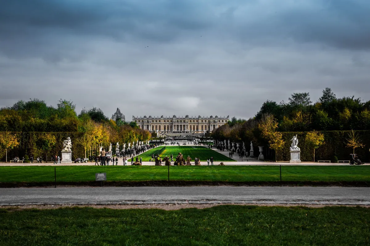

Non è semplicemente pietra o marmo, né una mera successione di stanze decorate con oro zecchino. Versailles è un’idea, una trasposizione fisica di un concetto politico audace quanto effimero: l'assolutismo elevato a forma d'arte divina. Quando si varca la soglia della cancellata dorata, non si sta solo entrando in un palazzo; si sta penetrando nella mente di Luigi XIV, il Re Sole, colui che scelse di trasformare un umile padiglione di caccia, eretto da suo padre Luigi XIII, nel palcoscenico mondiale del potere europeo. Il Battito di una Reggia che Eclissò l'Europa La metamorfosi di Versailles da un modesto ritiro in mattoni rossi a un complesso titanico è la testimonianza di un'ambizione smisurata. Luigi XIV non voleva solo una dimora; voleva una prigione dorata per l'aristocrazia francese. Sottraendo i nobili dalle trame di potere di Parigi e confinandoli in rituali di corte rigidamente gerarchizzati, il sovrano consolidò il suo controllo assoluto. L’architettura stessa, curata dai maestri dell’epoca come Louis Le Vau e successivamente rielaborata con la grandiosità di Jules Hardouin-Mansart, funge da prolungamento del corpo del monarca. Ogni decorazione, ogni affresco che celebra le vittorie militari o la mitologia classica è un tassello di un mosaico che recita una sola verità: il Re è il centro dell'universo, proprio come il sole è il centro del sistema cosmico.Un Labirinto di Specchi e Potere Il culmine di questa ostentazione architettonica è, senza dubbio, la Galerie des Glaces. Percorrere questa galleria non è solo un esercizio estetico; è un’esperienza psicologica. Diciassette arcate di specchi, che riflettono altrettante finestre affacciate sui giardini, servivano a moltiplicare la luce, ma soprattutto a riflettere l'immagine del Re in ogni angolo. Gli specchi, all'epoca una tecnologia costosissima e gelosamente protetta dalla maestranza veneziana, furono prodotti in Francia con uno sforzo industriale senza precedenti per ordine di Jean-Baptiste Colbert. Ogni frammento di vetro cattura l'essenza di una corte che non dormiva mai, dove la politica si decideva nei sussurri dietro i ventagli e le sorti di intere nazioni venivano sigillate tra un inchino e una danza. Il Trionfo dell'Arte sulla Natura nei Giardini Se il palazzo è l'intelletto di Versailles, i giardini sono la sua anima verde. Progettati da André Le Nôtre, questi spazi non sono semplici parchi; sono dimostrazioni di dominio umano sulla natura. La geometria perfetta, le simmetrie assiomatiche e la gestione sapiente dei canali d'acqua — un'impresa ingegneristica ciclopica per il XVII secolo — riflettono l'ordine che il Re imponeva al suo regno. Le fontane, dedicate ai miti di Apollo e ai cicli solari, non erano solo ornamenti, ma simboli di un re che controllava le acque, la terra e, simbolicamente, il tempo stesso. Camminare lungo il Grand Canal è una lezione di prospettiva: l'occhio viene guidato verso un orizzonte infinito, suggerendo che il potere del sovrano non ha confini.La Vita tra Cerimoniale e Rigore La giornata a Versailles era un orologio svizzero, scandito dal "Lever" e dal "Coucher" del Re. Essere ammessi alla vestizione del monarca non era un atto di umiltà, ma il privilegio supremo che definiva il rango di un cortigiano. Ogni gesto, dal porgere la camicia al reggere la candela, era regolato da un galateo che eliminava la spontaneità per lasciare spazio al puro rituale. Questa rigidità nascondeva, tuttavia, una vita estremamente complessa. Dietro la facciata, le stanze private del Re offrivano un raro scorcio sulla sua umanità, sebbene essa fosse costantemente celata sotto una parrucca incipriata e vesti di broccato. Versailles fu il luogo dove il lusso estremo conviveva con una scarsa igiene (data l'epoca) e dove il freddo dell'inverno filtrava dalle grandi finestre, rendendo i caminetti monumentali una necessità tanto quanto uno status symbol. L'eredità di una Pietra Miliare della Storia Cosa resta oggi, dopo che la Rivoluzione Francese ha infranto l'incantesimo del Re Sole, svuotando le stanze dai mobili d'oro e portando il Re e la Regina verso il loro destino tragico? Resta il mito. Versailles rimane il simbolo definitivo di ciò che l'uomo può costruire quando la sua ambizione sfida il cielo. Ogni turista che oggi si perde tra i corridoi affollati, guardando verso i soffitti affrescati di Charles Le Brun, sta in realtà compiendo lo stesso gesto dei cortigiani di allora: ammirare il trionfo della forma sul contenuto, l'eterna danza tra l'effimero della gloria terrena e la solidità del marmo.Consigli per una Visita Consapevole Per chiunque decida di immergersi in questo capitolo di storia, il consiglio di Marco Rossi è di non fermarsi alla sola galleria principale. Il segreto di Versailles è custodito nelle pieghe dei suoi spazi secondari:Il Petit Trianon: Un'oasi di relativa intimità, lontana dal clamore della corte principale, che ci ricorda come anche i re cercassero, a volte, una via di fuga dalla loro stessa grandezza. Il Hameau de la Reine: Il villaggio bucolico costruito per Maria Antonietta, un paradosso architettonico che mescola estetica rustica e lusso estremo. Le ore di luce: Visitate i giardini durante la "golden hour", quando la luce radente del sole (vero protagonista di Versailles) colpisce le facciate, facendole brillare proprio come tre secoli fa.Versailles non è un museo. È una macchina del tempo che continua a ticchettare, ricordandoci che, sebbene i re passino e le rivoluzioni cambino le carte in tavola, il desiderio umano di lasciare un segno indelebile sulla terra rimane una costante universale. È, in ultima analisi, il ritratto di un uomo che provò a trasformare il proprio nome in un sinonimo di "eternità". E, guardando le pareti dorate di questo palazzo, dobbiamo ammettere che, in qualche modo, ci è riuscito. #Versailles #ReSole #StoriaFrancese #ViaggiCulturali #ArchitetturaBarocca Related InsightsArctic Circle Digital Nomadism: Building Connectivity in Greenland's Remote Towns Yellowstone: The Fiery Heart of the American West Hidden Gems of Eastern Anatolia{ "@context": "https://schema.org", "@type": "FAQPage", "mainEntity": [ { "@type": "Question", "name": "What is the main focus of L'Eclissi del Re Sole: Tra gli Specchi e l'Oro di Versailles?", "acceptedAnswer": { "@type": "Answer", "text": "Un viaggio nel cuore pulsante dell'assolutismo francese, esplorando l'architettura, i giardini e il mito eterno della Reggia di Versailles." } }, { "@type": "Question", "name": "Who authored the comprehensive guide on L'Eclissi del Re Sole: Tra gli Specchi e l'Oro di Versailles?", "acceptedAnswer": { "@type": "Answer", "text": "This detailed article and its insights were carefully researched and authored by Marco Rossi." } }, { "@type": "Question", "name": "Where can I find more related content about Travel?", "acceptedAnswer": { "@type": "Answer", "text": "You can explore more articles, detailed reviews, and similar insights by browsing the Related Insights section at the bottom of this article or visiting our dedicated Travel category page." } } ] }
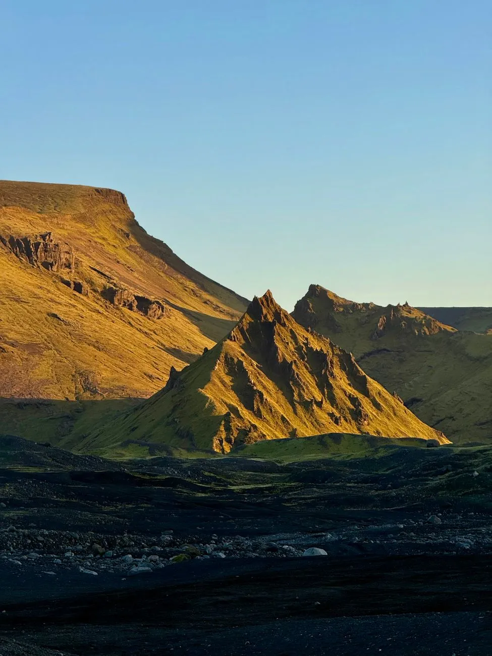
The siren song of the North is louder than ever, and for the modern remote worker, Iceland’s Golden Circle has transformed from a mere tourist checklist into a potential long-term base. As we step into 2026, the intersection of rugged wilderness and high-speed fiber-optic connectivity has created a paradox: how does one balance the raw, unforgiving elements of the Arctic with the professional demands of a global digital career? I am Mark Dinn, and having spent years navigating the nomadic lifestyle across various continents, I find that Iceland demands more preparation, more capital, and more reverence than perhaps any other destination on the planet. This region, defined by the interplay of tectonic shifts, geothermal heat, and glacial water, is not a place for the impulsive traveler. It is a place for the disciplined professional. To thrive here, you must understand the logistical scaffolding that supports life in a country where the sun dictates your mood and the wind dictates your schedule. We are looking at a landscape where the infrastructure is top-tier, but the price of admission—both literally and figuratively—is high. If you are planning to relocate your office to the shadow of the Great Geysir, you need a blueprint that goes beyond Instagram filters. You need the cold, hard data of 2026. Navigating the Legal Landscape of Icelandic Remote Residency The Icelandic long-term visa for remote work remains one of the most coveted yet misunderstood documents in the digital nomad ecosystem. By 2026, the process has matured into a stable, albeit stringent, administrative procedure. To be eligible, you must prove that you are not seeking to settle permanently in the traditional sense, but rather that you are an international professional providing services to companies based outside of Iceland. The core requirement remains: a consistent monthly income threshold that reflects the country’s high cost of living. As of current assessments, the income requirement is significant—aimed at ensuring you can sustain yourself without tapping into the local labor market. When you cross the 183-day threshold, you become a tax resident. This is where many nomads get caught off guard. Iceland’s tax system is robust and integrated; once you hit that six-month mark, the Revenue Directorate will expect a declaration of your global income. It is imperative that you consult with a local tax advisor before you even land in Keflavík. Many nomads choose to rotate their stays to avoid the automatic tax residency trap, but for those committed to the full experience, it is a matter of integrating into the local financial infrastructure. Banking in Iceland is remarkably digitized, yet it is notoriously difficult to open a local kennitala (national ID) account without a specific residence permit. For most nomads on the remote work visa, you will be relying on international digital banking solutions. However, you will need that Icelandic ID number for everything from gym memberships to booking local logistics or utilities in the Golden Circle area. This bureaucratic hurdle is the first test of your patience. If you can navigate the UTL (Directorate of Immigration) requirements, you have already cleared the hardest part of the relocation. The transition from tourist to resident is not a physical move; it is a mental shift into the methodical, organized, and often expensive reality of Icelandic law.The Financial Reality of the Fire and Ice Economy Living in the Golden Circle is an indulgence that comes with a steep price tag. When we look at the numbers for 2026, it is clear that Iceland is not for the budget-conscious traveler. The cost of living is approximately 47.4% higher than in the United States, a figure that becomes tangible the moment you walk into a grocery store in Selfoss or Hveragerði. For a single person, excluding rent, you are looking at a monthly commitment of roughly $1,594.60 (191,609.7 ISK). If you are bringing a family, that figure balloons to over $6,000, and that is before you sign a lease on a property that is likely heated by geothermal energy but priced by local scarcity. The primary expenses that will erode your savings are food, imported goods, and transport. Because the Golden Circle is a relatively remote, sparsely populated area, you will be reliant on a vehicle. Car ownership in Iceland is expensive due to taxes, fuel costs, and the high maintenance required to handle the volcanic terrain and harsh winters. You aren't just paying for the car; you are paying for the safety features and the insurance that covers damage from everything from volcanic ash to stray sheep. Despite these costs, the value proposition is found in the intangible. High-speed, reliable internet is ubiquitous, even in the smallest hamlets. You will rarely find yourself offline. Utilities, specifically electricity and heating, are surprisingly affordable compared to the rest of Europe because they are sourced directly from geothermal vents. This is a massive boon for the remote worker. Your heating bill in the dead of winter will be a fraction of what you would pay in a modern apartment in London or New York. The trade-off is clear: you pay a premium for imported food and transport, but you save significantly on your climate-controlled office environment. Smart nomads learn to live like locals—buying seasonal produce, utilizing the local community pools (the heart of Icelandic social life), and minimizing trips to the capital for non-essentials.Expense Category Monthly Cost (Single - USD) Monthly Cost (Family of 4 - USD)Basic Utilities (Heating/Water) $185.00 $310.00Grocery/Food Supplies $650.00 $2,400.00High-Speed Internet/Comms $95.00 $130.00Transportation/Fuel/Maintenance $480.00 $1,250.00Leisure/Community Pools $184.60 $1,937.20Total (Excluding Rent) $1,594.60 $6,027.20Climate Adaptation and the Nomad’s Daily Schedule The climate in the Golden Circle is not something you "deal with"—it is something you integrate into your daily pulse. By 2026, the weather patterns have remained as volatile as ever. In the summer, the Midnight Sun provides an almost unnatural energy; you might find yourself working until midnight, simply because your internal clock forgets that darkness is a requirement for sleep. Conversely, the winter brings the short, dark days where the sun barely crests the horizon. This is the most challenging period for the nomadic professional. If you lack structure, the seasonal affective shift can plummet your productivity and mood. Successful nomads in the Golden Circle don't fight the weather; they equip for it. My advice is to invest in high-quality technical gear immediately. Do not buy your outdoor clothing locally unless you are prepared to pay the premium; bring your base layers, high-end waterproof shells, and durable footwear from home. You will be spending your mornings either working or hitting the local geothermal pools to wake your muscles. The pool culture—sundlaugar—is essential for mental health. Sitting in a 40-degree Celsius hot tub while the air temperature hovers near freezing is the most effective way to clear a brain drained by Zoom calls and data analysis. Your workday in the Golden Circle will likely be fragmented. You might choose to block your time during the early morning hours, catch the peak daylight for outdoor exploration during lunch, and finish your tasks in the evening. This flexibility is the nomad’s greatest asset. However, you must remain vigilant about safety. If you decide to go for a hike near the Gullfoss waterfall or the Kerid crater, check the local weather apps religiously. The wind speeds in Iceland can be lethal, and the weather changes in minutes. When you are a remote worker, your laptop is your livelihood; don't risk getting caught in a storm that makes it impossible to return to your workspace. The Golden Circle teaches you that efficiency is not about doing things fast; it is about doing things at the right time when the elements allow.Infrastructure, Connectivity, and the Remote Office The myth of the isolated nomad in Iceland is just that—a myth. In 2026, the Golden Circle is arguably one of the most technologically advanced regions in the world. Iceland has invested heavily in fiber-optic infrastructure, and most guest houses, farms, and modern residential hubs in areas like Laugarvatn or Flúðir are equipped with high-speed internet that rivals any major city. However, you must verify this before you sign a lease. A "remote" house might be picturesque, but if it relies on a satellite connection that struggles during high-wind events, your professional life will suffer. When choosing a base, look for "Work-Ready" certifications. Many properties in the Golden Circle are now catering specifically to the nomad market, offering ergonomic chairs, dedicated desk spaces, and backup power generators. This is a critical investment. Iceland’s electrical grid is stable, but in the middle of a winter blizzard, any rural property is vulnerable. Having a secondary source of power or a reliable mobile hotspot is non-negotiable. I recommend securing a local SIM card with a high-data plan immediately upon arrival; the local carriers (Nova, Síminn, Vodafone) offer coverage that is startlingly good, even in the middle of a lava field. Setting up your "city playbook" for the Golden Circle involves knowing your service hubs. You won't find a sprawling metropolis here, but you will find reliable grocery stores like Bónus and Krónan, which are the lifelines of the local economy. Plan your shopping trips. If you are working on a high-stakes project, do not count on a grocery delivery service to be available at the drop of a hat. You must manage your supplies like a local resident. Stock up on pantry staples, respect the cold chain, and understand that you are living in a supply-chain-sensitive environment. The beauty of living here is the forced simplification. Without the distractions of a city, the noise of traffic, or the constant temptation of urban consumption, you will find your output increasing. The Golden Circle is not a distraction; it is a canvas for deep, focused work. The Cultural Integration and Long-Term Lifestyle Strategy Living in the Golden Circle as a nomad is not merely about surviving the climate; it is about engaging with a culture that values autonomy, resilience, and a deep connection to the land. The local population is sparse but welcoming to those who demonstrate respect for their environment. The most common pitfall for temporary residents is a lack of engagement. If you hide behind your screen for months, you miss the essence of the Icelandic experience. Attend the local community events, support the local farmers' markets, and respect the "Leave No Trace" ethos that defines Icelandic environmental policy. If you choose to stay for an extended period, you will start to notice the rhythms of the year. The transition from the frantic tourist season in summer to the contemplative quiet of winter is profound. As a nomad, you are in the unique position of being able to observe this transformation. You aren't just visiting the Golden Circle; you are bearing witness to the geological and social changes that define this region. It is a humbling experience that shifts your perspective on what "home" really means. Ultimately, your strategy for success is rooted in the balance between professional output and personal presence. You must master the logistics—the visas, the taxes, the specialized winter gear—but you must also leave room for the wonder. Hike the trails behind the waterfalls, sit in silence at the edge of a tectonic plate, and let the sheer scale of the landscape reset your professional focus. In 2026, the Golden Circle offers more than just a place to plug in your computer; it offers a place to rediscover the clarity of purpose that often gets lost in the noise of the digital world. You are not just working in Iceland; you are living in a place that has survived eruptions, ice ages, and the relentless passage of time. If you can mirror that resilience in your work and your lifestyle, you won't just succeed here—you will thrive in a way that few professionals ever get the chance to experience. Embracing the North: Your Next Professional Frontier The Golden Circle is more than a destination; it is an environment that tests your readiness for the modern nomadic life. It requires a level of fiscal maturity and logistical discipline that is rare in the wanderlust-driven world of remote work. By navigating the complexities of the 2026 visa regulations and embracing the high costs as a trade-off for unparalleled quality of life, you position yourself at the forefront of a new wave of global professionals. Iceland does not offer an easy path, but for those willing to brave the winds and the cold, it offers the ultimate reward: a life lived with intention, surrounded by the raw, untamed majesty of the Earth. Whether you are here for the six-month permit or planning to rotate your residency to make this your long-term base, remember that the environment you cultivate is just as important as the one you are inhabiting. Keep your finances in order, respect the local infrastructure, and never stop exploring. The Land of Fire and Ice will change the way you work, the way you think, and the way you view the world. Pack your layers, secure your connectivity, and prepare for a chapter of your career that will define your professional growth for years to come. Your office is waiting, and the view is unlike anything else on the planet.#DigitalNomad #IcelandTravel #RemoteWorkLife #GoldenCircle #LocationIndependence Related Insights西递:中国古代木雕的巅峰 Dive Into a Hidden World: The Most Breathtaking Underwater Museums and Sculpture Parks L'Écho des Pierres : Voyage au Cœur du Patrimoine Vivant{ "@context": "https://schema.org", "@type": "FAQPage", "mainEntity": [ { "@type": "Question", "name": "What is the main focus of The Nomad’s Guide to the Golden Circle: Living and Thriving in Iceland’s Volcanic Heart?", "acceptedAnswer": { "@type": "Answer", "text": "Discover the realities of remote work in Iceland's Golden Circle, from navigating the digital nomad visa to managing the high cost of living in the Land of Fire and Ice." } }, { "@type": "Question", "name": "Who authored the comprehensive guide on The Nomad’s Guide to the Golden Circle: Living and Thriving in Iceland’s Volcanic Heart?", "acceptedAnswer": { "@type": "Answer", "text": "This detailed article and its insights were carefully researched and authored by Mark Dinn." } }, { "@type": "Question", "name": "Where can I find more related content about Travel?", "acceptedAnswer": { "@type": "Answer", "text": "You can explore more articles, detailed reviews, and similar insights by browsing the Related Insights section at the bottom of this article or visiting our dedicated Travel category page." } } ] }
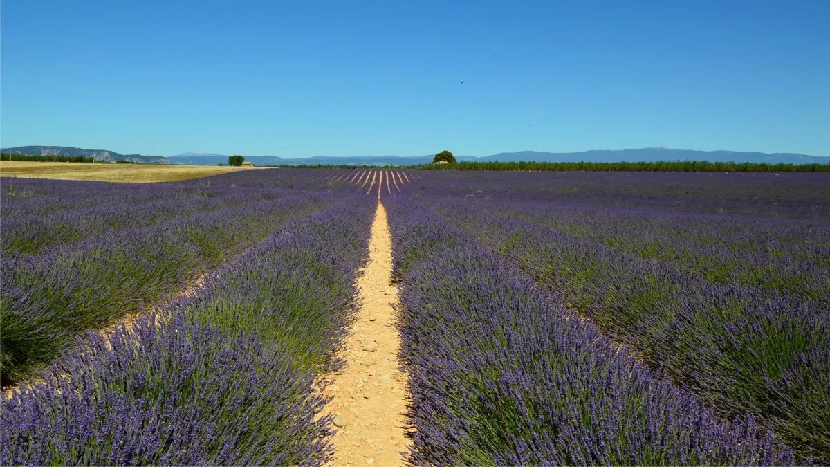

Sous le zénith implacable de l'été méridional, la terre provençale ne se contente pas de briller : elle palpite. Lorsque le mois de juin s'installe et que la canicule commence à dorer les calcaires du Luberon et du plateau de Valensole, un miracle chromatique s'opère. Les collines arides et les vastes vallées se drapent soudain d'un manteau d'un bleu profond, vibrant, presque hypnotique. C'est le réveil de l'or pourpre de la Provence, une ressource végétale qui a façonné non seulement les paysages, mais aussi l'âme, l'économie et l'identité olfactive de toute une région. En tant que voyageur et observateur amoureux de ces terres, chaque retour au milieu de ces rangées rectilignes est une promesse d'émerveillement et de reconnexion avec l'essentiel. La lavande fine, scientifiquement connue sous le nom de Lavandula angustifolia, n'est pas simplement une plante aromatique ; elle est la fille de la rigueur et du soleil. Établie principalement sur les hautes terres, entre 600 et 1 500 mètres d'altitude, elle pousse sur des sols pauvres, calcaires et bien drainés, là où d'autres cultures capitulent face à la sécheresse estivale. C'est cette rusticité qui lui confère sa noblesse. Contrairement au lavandin, son cousin hybride plus exubérant et plus bas en altitude, la lavande fine offre une essence d'une finesse incomparable, recherchée par les plus grands nez de la parfumerie mondiale. Les Chemins Secrets du Plateau de Valensole et du Luberon Pour appréhender la démesure de ce spectacle, il faut s'élancer sur les routes sinueuses du plateau de Valensole. Ici, l'horizon semble aspiré par une mer violette. Les vagues végétales ondulent au rythme du mistral, créant une chorégraphie naturelle que rien ne vient perturber, si ce n'est le bourdonnement incessant des abeilles. C'est un territoire où l'immensité le dispute à la poésie. Les photographes du monde entier s'y pressent, mais pour qui sait s'écarter des sentiers battus, la Provence offre des havres de paix insoupçonnés.En poussant vers le nord, dans la Drôme Provençale, ou en s'enfonçant dans les gorges sauvages de la Méouge, le paysage change de visage. Les champs deviennent plus intimes, lovés au creux de vallons secrets, encadrés par des chênes pubescents et des murets de pierres sèches. C'est dans ces décors plus confidentiels que l'on mesure le labeur des agriculteurs locaux. Car derrière la carte postale se cache une agriculture exigeante, soumise aux aléas climatiques, à la concurrence internationale et aux maladies du bois qui touchent épisodiquement les plants. Voici les principales variétés que l'on rencontre lors de la traversée des zones de production :La Lavande Fine (vraie lavande) : Cultivée en altitude, elle produit une huile essentielle AOP d'une pureté exceptionnelle, aux notes florales douces et camphrées. Le Lavandin : Un hybride stérile issu du croisement entre la lavande fine et la lavande aspic. Plus vigoureux, il pousse plus bas et produit beaucoup plus d'huile, principalement destinée à la saponification et aux produits d'entretien. La Lavande Aspic : Plus sauvage, poussant à plus basse altitude, elle se distingue par des feuilles plus larges et un parfum plus camphré, traditionnellement utilisé pour ses vertus apaisantes sur les brûlures et les piqûres.L'Alchimie de l'Alambic et le Savoir-Faire Ancestral La récolte de la lavande, qui bat son plein de la mi-juillet à la fin août, est un moment de communion collective. Jadis, les hommes et les femmes s'activaient à la faucille, courbés sous le soleil cuisant, liant les brins en bottes serrées avant de les acheminer vers les distilleries familiales. Aujourd'hui, les machines ont en grande partie remplacé la faucille sur les grands plateaux, mais l'esprit de la récolte demeure intact. L'odeur lourde et enivrante de la fleur coupée flotte dans l'air chaud, signalant aux voyageurs que l'été est à son paroxysme.L'étape de la distillation est le point d'orgue de ce cycle agricole. Dans les distilleries traditionnelles, qu'elles soient en pierre de taille ou modernisées, les brins de lavande sont tassés dans de grandes cuves métalliques appelées "distillateurs". La vapeur d'eau est ensuite injectée sous pression. En traversant la matière végétale, elle éclate les pockets sécrétoires qui contiennent l'huile essentielle. Le mélange de vapeur et d'essence s'élève, traverse un serpentin réfrigéré où il se condense, pour finir par s'écouler dans l'essencier. C'est là que s'opère la magie de la physique : l'huile essentielle, plus légère que l'eau et insoluble, flotte naturellement à la surface. Le spectacle de cet or liquide s'écoulant goutte à goutte est l'aboutissement d'une année de soins prodigués à la terre. Ce nectar précieux servira de fondement à la parfumerie de Grasse, aux cosmétiques haut de gamme et à l'aromathérapie. Préserver un Héritage Vivant Face aux Défis Modernes Explorer les champs de lavande de Provence, ce n'est pas seulement consommer un paysage esthétique ; c'est aussi prendre conscience de la fragilité de cet écosystème. Le changement climatique, marqué par des sécheresses de plus en plus précoces et des vagues de chaleur extrêmes, met à rude épreuve les plants de lavande fine. De plus, le "dépérissement", une maladie complexe liée à un phytoplasme transmis par des insectes piqueurs, décime des parcelles entières depuis plusieurs années. Puisse le voyageur qui foule ces terres le faire avec respect. Suivre les chemins balisés, s'abstenir de piétiner les rangs pour un simple cliché, et privilégier l'achat direct auprès des producteurs locaux sont autant de gestes qui garantissent la pérennité de ce patrimoine vivant. La lavande n'est pas un simple décor de cinéma ; c'est le fruit d'une symbiose millénaire entre l'homme et la nature calcaire du Midi. Lorsque le crépuscule tombe sur les plateaux provençaux, que le ciel s'embrase de teintes cuivrées et que le violet des champs se fond dans l'obscurité, la Provence offre une paix rare. C'est à cet instant précis, alors que le parfum de la lavande nocturne se mêle à la fraîcheur montante du soir, que l'on comprend pourquoi ce territoire continue de hanter l'imaginaire des poètes et des voyageurs du monde entier.#Provence #Lavande #Voyage #France #TourismeDurable Related Insights周庄:中国第一水乡的明朝记忆 Les Villages Engloutis de France : Plongée au Cœur d'un Patrimoine Submergé et de ses Mémoires Évanouies L'Odyssée Australienne : Entre Terre Rouge et Récifs d'Azur{ "@context": "https://schema.org", "@type": "FAQPage", "mainEntity": [ { "@type": "Question", "name": "What is the main focus of L'Or Pourpre de la Provence : Voyage au Cœur des Océans de Lavande?", "acceptedAnswer": { "@type": "Answer", "text": "Plongez dans l'histoire, la culture et la géographie des champs de lavande en Provence à travers le regard de Pierre Dubois." } }, { "@type": "Question", "name": "Who authored the comprehensive guide on L'Or Pourpre de la Provence : Voyage au Cœur des Océans de Lavande?", "acceptedAnswer": { "@type": "Answer", "text": "This detailed article and its insights were carefully researched and authored by Pierre Dubois." } }, { "@type": "Question", "name": "Where can I find more related content about Travel?", "acceptedAnswer": { "@type": "Answer", "text": "You can explore more articles, detailed reviews, and similar insights by browsing the Related Insights section at the bottom of this article or visiting our dedicated Travel category page." } } ] }
A Symphony of Water and Wildfire: Understanding the Pantanal’s Geographic Majesty Stepping into the Pantanal is not merely a trip; it is an immersion into a biological masterclass. Spanning an estimated 150,000 to 195,000 square kilometers, this colossal alluvial plain sits primarily within the Brazilian states of Mato Grosso and Mato Grosso do Sul, while extending its reach into parts of Bolivia and Paraguay. Unlike the dense, canopy-choked rainforests of the Amazon, the Pantanal offers an open theater of life. Its geography is defined by a pulse—a rhythmic, seasonal flooding pattern where the Paraguay River and its tributaries spill over their banks, transforming this vast depression into a kaleidoscopic mosaic of aquatic forests, savanna grasslands, and semi-aquatic habitats. For the intrepid traveler, understanding the hydrological cycle is paramount. The "flood season" (December to March) sees the plains submerged, forcing terrestrial life to retreat to the "cordilheiras" or higher ground. Conversely, the dry season (June to October) acts as a crucible of concentration. As the waters recede, they leave behind isolated ponds and lagoons that act as magnets for wildlife. This is the golden era for visitors. When you venture into the Transpantaneira—a rugged, 147-kilometer unpaved road that serves as the primary artery of the northern Pantanal—you are not just watching from a distance; you are traversing a corridor where caimans bask by the roadside and jabiru storks stalk the drying banks. From an expert perspective, the Pantanal’s ecological value is disproportionate to its visibility on typical travel maps. While its sister ecosystem, the Amazon, captures the world’s imagination with its scale, the Pantanal offers superior wildlife viewing simply because the vegetation is less dense. Here, the challenge isn't finding the animals; it’s keeping up with the relentless pace of their activity. The ecosystem supports the world’s densest concentration of jaguars, a staggering variety of avian life exceeding 650 species, and the largest concentration of crocodilians on the planet.The Jaguar Kingdom: Tracking the Apex Predator of the Wetlands There is a singular thrill that permeates the air of Porto Jofre, the epicenter for jaguar sightings in the northern sector. The Pantanal jaguar is a physical marvel; evolution has favored size and boldness here, with individuals often exceeding the mass of their Amazonian counterparts. These cats have uniquely adapted to an amphibious lifestyle, frequently seen swimming across wide channels with purposeful, muscular grace, or patrolling the riverbanks for caiman or capybara. For the modern traveler, tracking these magnificent felines requires patience and the right local expertise. I always advise travelers to engage dedicated river guides who are fluent in the "language of the river"—understanding alarm calls from capuchin monkeys or the silent dispersal of waterfowl that signals a hunting cat. Unlike safaris in the African savanna, where tracking is conducted via land vehicles, the pursuit here is largely fluvial. You move through narrow tributaries in aluminum skiffs, the silence broken only by the hum of an outboard motor that cuts out when a spotter identifies a flash of gold in the brush. The data supports the efficacy of this eco-tourism model. In the last two decades, the shift from ranching-centric land use to wildlife-centric tourism has provided an economic incentive for local landowners to protect the jaguars rather than cull them as threats to cattle. This "Jaguar Economy" has turned the Pantanal into one of the world’s most successful examples of predatory conservation. To ensure a successful encounter, one must plan for at least three full days in the Porto Jofre area. Jaguar behavior is unpredictable, but their territorial nature means they are creatures of habit, patrolling specific stretches of the Cuiabá River and its tributaries. When you finally lock eyes with a male jaguar—undisturbed, massive, and master of his domain—the sheer scale of the Pantanal’s untamed nature becomes an indelible memory. Navigating the Logistical Labyrinth: Visas, Costs, and Infrastructure Brazil, for all its splendor, remains a nation of bureaucratic precision. If you are planning an extended stay to document the biodiversity, you must be cognizant of the visa landscape. Brazil utilizes a reciprocal visa policy. Many Western travelers benefit from visa-free entry for up to 90 days, but it is vital to check the latest consular updates via the Brazilian Ministry of Foreign Affairs. For digital nomads seeking to utilize the "Nomad Visa," Brazil offers a specialized permit that allows remote workers to stay for a year, provided they meet specific income thresholds—typically around $1,500 USD per month or significant savings. Regarding expenses, the Pantanal is not a budget destination. The remoteness of the lodges requires a premium for logistics—food transport, fuel, and specialized equipment like safari boats and 4x4 vehicles. Expect to budget between $300 and $600 USD per day for a high-end, all-inclusive eco-lodge experience. These lodges are the backbone of the region, providing guided excursions that are essential for safety and educational depth. While Numbeo data suggests that general living costs in Brazil are significantly lower than in the United States or Western Europe, the "Pantanal premium" is a separate entity entirely. Prices for groceries and simple supplies in local hubs like Cuiabá or Campo Grande are modest, but once you head into the deep bush, the economy of supply chains takes over. I highly recommend purchasing your essential gear, high-quality cameras, and specialized medical supplies in the urban centers before embarking. ATMs are non-existent in the wetlands, and credit card connectivity is intermittent at best; therefore, maintaining a reserve of Brazilian Real (BRL) is an essential, if old-fashioned, necessity. Connectivity-wise, if you are looking to work while there, be warned: while some lodges offer Starlink, you should consider this a trip of digital disconnection.Item Category Estimated Cost Range (USD) NotesSafari Lodge (Per Day) $300 - $650 Inclusive of meals/guidesPrivate Boat Rental $150 - $300 Daily rate for trackingRegional Transport $100 - $250 Transfers from Cuiabá/Campo GrandeDaily Sustenance (Outside Lodge) $20 - $40 Modest local diningNational Park Entrance $10 - $25 Per day/visitor feesThe Avian Heartland: A Birdwatcher’s Infinite Paradise If the jaguar is the king of the Pantanal, the jabiru stork is its undisputed sentry. Standing over a meter tall with a massive, black, slightly upturned bill and a distinctive red band around its neck, the jabiru is the symbol of the wetlands. But they are merely the tip of the iceberg. The Pantanal is arguably the finest birdwatching destination on Earth, a sanctuary where the sheer density of avian life can leave even the most seasoned ornithologist overwhelmed. The Hyacinth Macaw, the largest flying parrot species in the world, is perhaps the most iconic resident. Once pushed to the brink by the pet trade and habitat loss, these cobalt-blue beauties have made a spectacular comeback thanks to intense conservation efforts in the southern Pantanal. Watching a pair of macaws nesting in a hollowed-out manduvi tree is an experience that highlights the delicate balance of this ecosystem. They are noisy, social, and strikingly vibrant against the muted greens and browns of the landscape. To maximize your birding experience, the timing of your visit is non-negotiable. While wildlife is present year-round, the avian migration patterns align with the dry season, when the receding waters concentrate fish in shallow pools, turning them into buffets for egrets, spoonbills, and kingfishers. I recommend bringing at least a 400mm lens and a pair of high-definition binoculars with at least 10x magnification. The birdlife here is so accustomed to the presence of human-operated boats that you can often drift within a few meters of rare species, provided you remain quiet. This proximity is the hallmark of the Pantanal; it is a place where the wild does not flee, but simply tolerates your presence, allowing for an intimate look into the habits of creatures that, elsewhere, would remain distant silhouettes against the sky.The Human Element: Ranching, Conservation, and Future Horizons The Pantanal is not a wilderness devoid of human presence; it is a landscape shaped by three centuries of cattle ranching. The "Pantaneiro" culture is deeply embedded in the identity of this region. These cowboys are the stewards of the land, and their symbiotic relationship with the environment is a fascinating counter-narrative to standard conservation tropes. Many traditional ranches, or "fazendas," have opened their doors to eco-tourism, effectively turning their lands into private reserves. This transition is essential for the future. The Pantanal faces threats from climate change, specifically the increasing frequency of forest fires during prolonged dry periods, as well as upstream agricultural runoff. The integrity of the Pantanal depends on the health of the Paraguay River basin. When we visit, we are not just observers; we are participants in an economic system that values the standing tree and the roaming predator over the cleared pasture. As a professional, I urge all travelers to research their lodges’ commitment to sustainability. Look for certifications, support for local school programs, and transparent waste management practices. The human history of this region is defined by isolation. The vast distances and the impassable nature of the land during the flood season have kept the Pantanal relatively insulated from the rapid development seen in other parts of Brazil. However, this isolation is fading. Improved road infrastructure and the rise of "glamping" experiences are making the region more accessible, which brings both opportunity and risk. As visitors, we carry the responsibility of low-impact exploration. Avoid plastic waste, support local handicrafts, and ensure that your presence leaves the wildlife undisturbed. The Pantanal is one of the few places left on Earth where you can witness the natural order of things in near-perfect equilibrium. To lose this would be an irreparable blow to the planet’s biological heritage. Respect the silence, honor the pace of the wild, and recognize that in the Pantanal, we are merely guests in an ancient, breathing cathedral of water and light.A Call to the Wild: Preserving the Eternal Pulse The journey through the Pantanal leaves an indelible mark on the soul of any traveler. It is a place where the grandeur of nature is not hidden behind the thick foliage of a jungle, but laid bare under the expansive horizon of a vast, flooding plain. We have navigated the logistics of its wild rivers, tracked the apex predators that command its silence, and observed the vibrant avian life that paints its sky. Whether you are an avid photographer, a seasoned researcher, or a soul simply seeking the raw, untamed beauty of our planet, the Pantanal offers a profound, life-altering experience. However, as we conclude this exploration, remember that this wetland is not an immortal museum; it is a living, fragile system. Its preservation rests on the informed choices we make as travelers. Choose the operators that respect the land, engage with the local communities that protect these habitats, and always advocate for the conservation of this critical biosphere. The heartbeat of the Pantanal is the sound of the rainfall, the ripple of the jaguar’s swim, and the wind through the grasses. It is a rhythmic, constant pulse that has persisted for millennia. By traveling with intention and authority, we ensure that this pulse continues to beat long after our return home. Brazil’s greatest treasure remains the Pantanal, and it is waiting, ever-patient, to reveal its deepest secrets to those who possess the patience to look and the humility to listen. The wild is not somewhere we go; it is a part of us, and in the heart of this wetland, we find our way back to it. #PantanalWildlife #BrazilTravel #EcoTourism #JaguarTracking #NatureConservation Related Insights厳島神社: 海に浮かぶ神々の住処 Surviving the Overland: Mastering Tasmania's Wild Heart in Shifting Skies La Cathédrale Saint-Guy de Prague : Joyau de Bohême{ "@context": "https://schema.org", "@type": "FAQPage", "mainEntity": [ { "@type": "Question", "name": "What is the main focus of The Pantanal Chronicles: Into the Heart of Earth’s Greatest Wetland Sanctuary?", "acceptedAnswer": { "@type": "Answer", "text": "Discover the unparalleled biodiversity of the Pantanal, the world's largest tropical wetland, and master the logistics of exploring this wild Brazilian frontier." } }, { "@type": "Question", "name": "Who authored the comprehensive guide on The Pantanal Chronicles: Into the Heart of Earth’s Greatest Wetland Sanctuary?", "acceptedAnswer": { "@type": "Answer", "text": "This detailed article and its insights were carefully researched and authored by Wei Chen." } }, { "@type": "Question", "name": "Where can I find more related content about Travel?", "acceptedAnswer": { "@type": "Answer", "text": "You can explore more articles, detailed reviews, and similar insights by browsing the Related Insights section at the bottom of this article or visiting our dedicated Travel category page." } } ] }
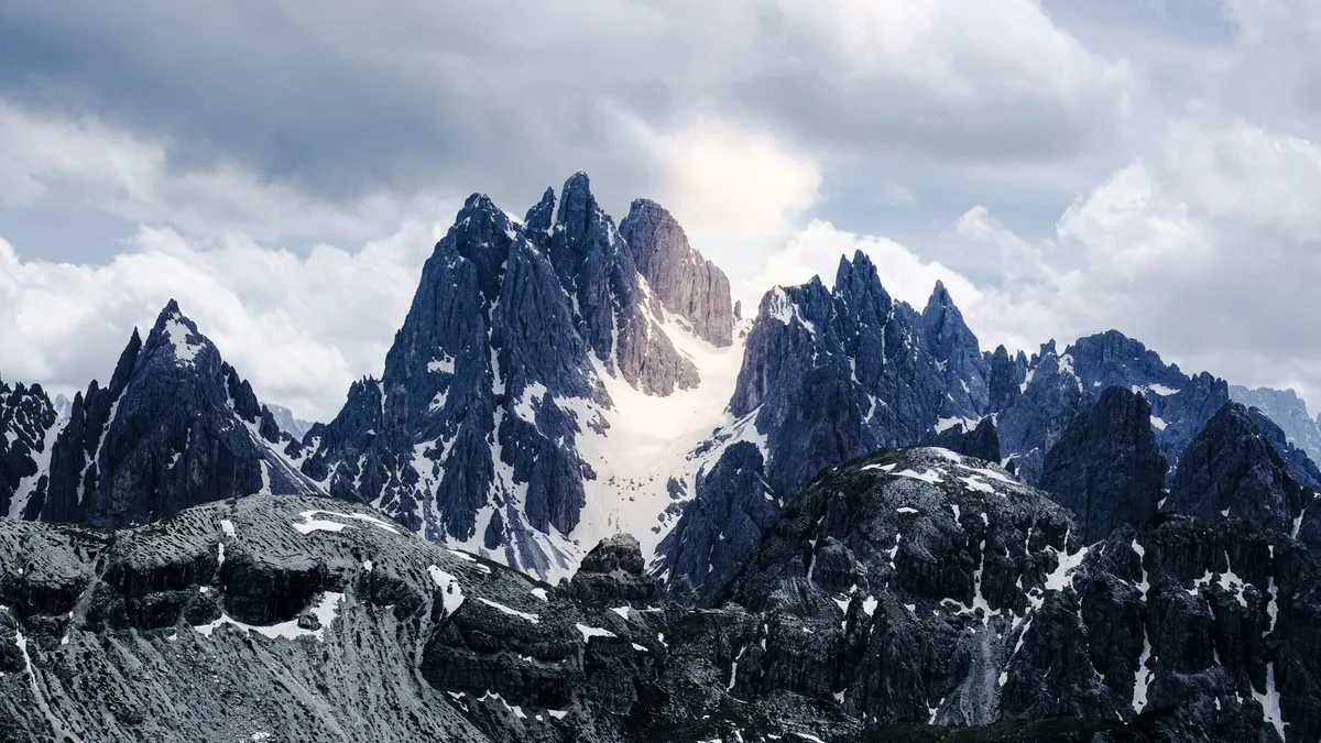
- Chloe Tremblay
- 09 Sep, 2026 11:46
Vertical Dreams: Navigating the Dolomitic Majesty of Northern Italy
Where the Earth Touches the Sky: Understanding the Pale Mountains The Dolomites, often referred to as the 'Pale Mountains' due to the unique chemical composition of dolomite rock that glows a soft, ethereal pink at sunset—a phenomenon known as enrosadira—represent one of the most geologically significant landscapes on the planet. As a UNESCO World Heritage site, this massive limestone range in northeastern Italy offers more than just aesthetic beauty; it provides a profound connection to geological time. For the hiker, the Dolomites are not merely a collection of trails but an intricate network of vie ferrate (iron paths) and high-altitude refugios that define the essence of Alpine exploration. Navigating this region requires an understanding of the sheer verticality of the terrain. Unlike the softer, rolling hills of Tuscany, the Dolomites demand respect. The peaks of the Sella Group, the iconic spires of the Tre Cime di Lavaredo, and the sheer face of the Marmolada glacier constitute a vertical playground that has challenged mountaineers for centuries. As someone who has spent years traversing these trails, I have found that the magic lies in the transition: one moment you are walking through dense coniferous forests, and within an hour, you are navigating scree slopes beneath towering monoliths that seem to scrape the very heavens. For those planning an extended stay, it is essential to consider the logistical reality of the Italian Alps. While the wilderness feels untouched, the infrastructure is world-class. You are never truly 'off the grid' in the way you might be in the remote Rockies or the Andes. Instead, you are traversing a landscape where ancient Ladin culture meets modern Italian hospitality. Whether you are aiming for a multi-day trek along the Alta Via 1 or seeking a quiet week in the Val Gardena, preparation is the difference between a grueling ordeal and a transformative journey. Understanding the rhythm of the mountain—when the mist rolls in, how the weather shifts in the afternoons, and the importance of timing your ascents—is the hallmark of a true mountain expert.The Logistics of the Alpine Nomadic Life In the modern era, the allure of the Dolomites is not restricted to those on a two-week sabbatical. With the rise of remote work, many are choosing to base themselves in alpine hubs like Cortina d’Ampezzo, Bolzano, or Ortisei. However, living in the shadow of giants comes with specific economic considerations. According to current data, the cost of living for a nomadic professional in Italy hovers around $1,629 per month, a figure that remains stable due to the country’s robust market-data collection. For those contemplating this transition, the Italian Digital Nomad Visa serves as a gateway, provided one meets the established monthly income requirement of $2,532. This financial threshold is designed to ensure sustainability for both the nomad and the local economy. When we analyze the cost-of-living metrics provided by global databases like Numbeo, we see that Italy offers a balanced lifestyle. While rental prices in tourist-heavy hubs during peak season can fluctuate, the access to high-quality healthcare, reliable public transport, and a superior standard of living—often characterized by the Mediterranean diet and a slower, more intentional pace of life—justifies the investment. Living here requires balancing the high cost of mountain-side accommodation with the reality of local supply chains. You will find that local markets are your best friends. Purchasing fresh speck, mountain cheese, and seasonal produce from village vendors is not only cheaper than dining out exclusively but is also a deeply integrated part of the Dolomitic experience. If you are planning to work remotely, prioritize areas with high-speed fiber connectivity, which is increasingly common in towns like Bolzano, yet can be elusive in the higher-altitude mountain huts. This duality—the need for high-tech stability and the desire for low-tech wilderness—is the central challenge of the modern Dolomite wanderer. By aligning your financial planning with these regional realities, you turn a dream into a viable, sustainable lifestyle. Gastronomy and the Art of the Refugio Refuel One cannot discuss the Dolomites without bowing to the culinary traditions that fuel the hike. After six hours on a vertical incline, nothing tastes quite as exquisite as Canederli—the hearty, local bread dumplings served in broth or smothered in browned butter and sage. The cuisine here is a hybrid of Italian refinement and Austrian robustness, a testament to the complex history of the South Tyrol region. A day on the trail typically starts with an espresso at the base and a hearty lunch at a refugio (mountain hut). These huts are the backbone of the Dolomite hiking experience. They are not merely rest stops; they are culinary sanctuaries. Places like the Rifugio Lagazuoi offer more than just a place to sleep; they offer a vantage point to watch the light change over the Tofane mountains while enjoying a glass of local Lagrein wine. The strategy for eating well in the mountains is simple: embrace the seasonal. In the autumn, mushroom dishes and game meats dominate the menus. In the spring and summer, fresh alpine herbs and mountain cheeses take center stage. For the budget-conscious traveler, eating at these huts is far more efficient than carrying heavy, non-perishable goods up the mountain. Furthermore, because the local economy relies heavily on the success of these refugios, your patronage helps maintain the trail networks and preserves the alpine heritage that makes this UNESCO site so precious. Always carry cash, as connectivity issues can occasionally render card terminals useless in the most remote reaches of the range.Mastering the Trails: A Guide to the Alta Via 1 and Beyond When we speak of the 'best' hiking, we are really speaking about the Alta Via 1—the most famous of the high-altitude routes. Spanning approximately 120 kilometers from Lago di Braies to Belluno, it is a trek that demands respect but rewards with unparalleled panoramic views. However, the expert hiker knows that the real secret to the Dolomites lies in the diversions. Do not be afraid to step off the primary trail markers. The Dolomites are crisscrossed by a secondary network of paths that often lead to hidden cirques and abandoned World War I fortifications. The history of this region is etched into the stone; you are literally hiking through a theater of the Great War. It is common to find remnants of tunnels and lookout points carved directly into the rock face. This adds a somber, reflective quality to the hiking experience that is rare in other alpine ranges. Safety is non-negotiable. Even in the height of August, the weather can turn within minutes. A clear, sunny morning can quickly devolve into a violent electrical storm, especially at higher altitudes. My authoritative advice: always check the Meteo Dolomiti forecasts, which are localized and significantly more accurate than generic weather apps. Pack for the 'four-season' reality of the mountains: technical base layers, a lightweight down jacket, a reliable shell, and sturdy, broken-in trekking boots. If you are planning to attempt any of the vie ferrate, professional gear—a helmet, harness, and ferrata-specific carabiner set—is mandatory. Do not overestimate your fitness level; the elevation gain here is often steeper than in the Alps of France or Switzerland, and the thin air at 2,500 meters will test your endurance.Expense Category Estimated Monthly Cost (USD) Notes for the Dolomite NomadRent (One-bedroom apartment) $850 - $1,100 Varies by proximity to tourist centersUtilities (Water, Electricity, Heating) $200 - $250 Higher during winter heating seasonsGroceries (Fresh Produce & Local Staples) $350 - $450 Utilizing local markets is keyTransportation (Public Bus/Train Pass) $80 - $120 Highly efficient and reliable in the regionDining & Leisure $250 - $350 Includes sporadic visits to refugiosTotal Estimated Monthly Expenditure $1,730 - $2,270 Depends on lifestyle and locationNote: Data derived from regional averages; individual spending may vary based on specific town selection. The Ethics of Stewardship in a UNESCO Frontier As hikers, we are guests in a fragile environment. The Dolomites are a UNESCO World Heritage site for a reason: their geological and ecological integrity is unique. Yet, the pressure of mass tourism is real. The paths are becoming eroded, and the noise pollution in once-quiet valleys is on the rise. To be an expert in this region is to be a guardian of it. Practicing 'Leave No Trace' is the absolute minimum requirement. This means carrying out every piece of waste, staying strictly on marked trails to prevent soil erosion, and respecting the wildlife. The flora of the Dolomites, including the elusive Edelweiss and the various mountain gentians, are protected species. Photograph them, admire them, but never disturb them. Moreover, consider your impact on the local communities. Opt for public transportation whenever possible; the regional bus network (Südtirol Alto Adige) is excellent and reduces the traffic congestion that plagues the mountain passes during the peak summer months. Engage with the Ladin culture—the indigenous people of the Dolomites—by learning a few phrases and supporting local artisan crafts rather than buying mass-produced souvenirs. This is not just about 'responsible tourism'; it is about enriching your own experience. When you treat the mountains as a sacred space rather than a backdrop for a digital profile, the mountains offer you much more in return. They grant you silence, perspective, and a sense of belonging that is difficult to find elsewhere.Finding Stillness in the High Alpine Silence As we look toward the future of travel in the Dolomites, the focus must shift from 'conquering' the peaks to 'coexisting' with them. Whether you are a digital nomad seeking a high-altitude office or a seasoned trekker tracing the steps of the pioneers, the Dolomites offer a unique synthesis of rigor and rejuvenation. The cost of living, while requiring careful financial navigation, is a small price for the quality of life afforded by the clean air, the dramatic landscape, and the deep, abiding quiet of the high mountains. Remember that the best time to experience this region is in the shoulder seasons—late June or early September—when the trails are less crowded and the weather is arguably at its most stable. You will find that the Dolomites do not just change your perspective on landscapes; they change your perspective on your own limitations. The exertion of the climb, the reward of the view, and the comfort of a warm meal at a high-altitude refuge combine to create a life-defining experience. Do not rush your time here. Allow the mountains to dictate your schedule. If a storm is predicted, stay in the valley and explore the local museums or the quiet charm of a village piazza. If the sun is out, reach for the heights, but always remain humble before the scale of the rock. The Pale Mountains are ancient, indifferent to our presence, and utterly magnificent. They invite us to witness their majesty, but they demand that we play our part in preserving their story for the generations of explorers who will follow in our boot prints. May your climbs be steady, your equipment reliable, and your appreciation for this UNESCO wonder never cease to grow. As you descend into the valleys, carrying the silence of the summits within you, you will realize that you have not just visited a destination—you have been shaped by a landscape. #Dolomites #HikingItaly #DigitalNomad #UNESCOHeritage #AlpineLife
- Zola Ndlovu
- 08 Sep, 2026 21:22
Oman Unveiled: Where Golden Dunes Meet Timeless Forts and Hidden Oases
Symphonies of Sand and Stone: A Gateway to the Arabian Soul Stepping into Oman is like turning the pages of an ancient manuscript written in gold and sandstone. As an explorer who has traversed the globe, I find few places that balance the raw, untamed magnetism of the desert with the refined elegance of modern infrastructure quite like the Sultanate. Oman does not shout for your attention; it whispers in the rustle of date palms and the rhythmic lapping of the Indian Ocean against the jagged cliffs of Musandam. Here, the hospitality is not a service—it is a sacred tradition. When you land in Muscat, the capital, you are greeted by the scent of frankincense, a fragrant reminder that you are standing at the historical crossroads of the ancient incense trade routes. This is a land where the government has meticulously preserved its heritage, ensuring that the skyscrapers of the 21st century do not overshadow the crenellated silhouettes of 17th-century forts. Whether you are a digital nomad scouting for a base with a high quality of life or a traveler seeking the silence of the Wahiba Sands, Oman offers an authenticity that is increasingly rare in our hyper-connected world. The air is clear, the pace is deliberate, and the horizon is always inviting. As we navigate the complexities of travel in 2026, it is essential to understand that Oman is not merely a destination; it is a profound immersion into a culture that deeply respects its roots while gracefully embracing the future. My goal is to guide you through this majestic tapestry, providing not just the aesthetic wonders, but the practical, hard-hitting data you need to navigate the Sultanate with the authority of a seasoned local expert. From the hidden wadis that pool with turquoise water to the vibrant souqs where silver and spice hold court, Oman is a revelation waiting for those who know where to look.Navigating the Cost of the Sultanate: A Practical Financial Blueprint To travel or reside in Oman effectively in 2026, one must move past the glossy brochures and confront the fiscal reality of the region. Oman offers a sophisticated financial environment, particularly for those coming from Western metropolitan hubs. According to recent data, the cost of living in Muscat provides a stark, favorable contrast to global financial centers like New York. If you are planning an extended stay, it is vital to anchor your budget around concrete figures. For a family of four, the estimated monthly expenditure—excluding housing—hovers around $3,034.40, which translates to approximately 1,166.7 Omani Rials. For the solo traveler or the digital nomad flying solo, that figure drops to a remarkably manageable $868.00 (333.8 Omani Rials). When we analyze these figures against the backdrop of a major city like New York, the economic advantage becomes undeniable. Muscat is roughly 51.9% less expensive than New York, excluding rent. Perhaps more compelling for those looking to set up a long-term base is the housing market; rent in Muscat is, on average, 85% lower than in its American counterparts. This financial breathing room is what allows the modern traveler to trade a cramped apartment for a sprawling villa with sea views or a centrally located flat near the bustling Mutrah Corniche. However, cost of living is only one piece of the puzzle. When calculating your financial pathway, you must factor in visa requirements, which have evolved to cater more specifically to remote workers and long-term expatriates. The purchasing power of the Omani Rial is robust, and when you combine lower daily expenses with the high quality of public infrastructure—such as the pristine roads and advanced telecommunications—the value proposition of choosing Oman for your next nomadic chapter becomes incredibly strong. As you build your itinerary, remember that while luxury is readily available, the true essence of Omani travel is found in the intersection of affordability and accessibility. Architectural Marvels and the Sentinels of Time The skyline of Oman is a dialogue between the earth and the heavens. Unlike the glass-and-steel competition seen in neighboring states, Omani architecture remains resolutely grounded in its environment. The forts—Nizwa, Bahla, and Nakhal—are not merely relics; they are the architectural anchors of the nation. Nizwa Fort, with its massive circular drum, stands as a testament to the Imamate period, providing a tactical view of the surrounding palm oases. To walk through these corridors is to touch the very foundation of Omani resilience. The Sultan Qaboos Grand Mosque in Muscat is perhaps the most striking example of modern Islamic architecture, housing one of the world's largest hand-woven carpets and a chandelier that mimics the starry night sky. The precision involved in these structures is staggering, often utilizing local limestone and traditional woodworking techniques that have been passed down through generations. These buildings are more than just tourist sites; they are functional symbols of the Sultanate’s dedication to preserving a cohesive national identity. When exploring these sites, one notices the deliberate lack of overwhelming modernization within the historic districts. The government has implemented strict zoning laws to ensure that the charm of the past remains undisturbed. Whether you are staring up at the intricate woodwork of a mosque ceiling or tracing the defensive masonry of a coastal watchtower, you are witnessing a commitment to longevity. For the discerning photographer, the interplay of light and shadow on these golden-hued structures during the 'golden hour' provides some of the most dramatic imagery in the Middle East. It is in these moments, surrounded by the silence of ancient stone, that you realize Oman is not interested in keeping pace with the world; it is interested in defining its own rhythm, one that is perfectly synced with the cycles of history.Wadis, Oasis, and the Turquoise Heart of the Desert If the forts are the bones of Oman, then the wadis are its lifeblood. A 'wadi' is a valley or a dry riverbed that, in Oman, often blossoms into a series of crystal-clear swimming holes fed by mountain springs. Wadi Shab is the crowning jewel of this geography. To reach it, you must take a small boat across a river, hike through rugged limestone cliffs, and navigate a series of submerged passages that lead you into a hidden cavern with a waterfall. It is a surreal, almost ethereal experience. This is the antithesis of the typical tourist beach experience. Here, the water is cool, the stone is smooth, and the only soundtrack is the gentle echo of water against rock. Beyond Wadi Shab, places like Wadi Bani Khalid offer a more accessible, but no less stunning, oasis experience. The contrast between the harsh, arid mountains and these lush, verdant pockets of water is what defines the Omani landscape. For the adventurous, these areas provide incredible hiking and canyoning opportunities. The water quality is exceptional, often mineral-rich and refreshing even in the peak of the Arabian summer. However, it is essential to respect the environment of these hidden oases. As a visitor, you are a guest in a fragile ecosystem. Local customs dictate modest dress even when swimming in these remote areas, and leave-no-trace principles are strictly expected. Engaging with the locals near these wadis—often farmers tending to date palms or grazing goats—offers a glimpse into a rural lifestyle that remains largely unchanged by the rapid digitization of the cities. Taking the time to share a coffee and dates with a local villager near a wadi provides a depth of cultural understanding that no guidebook can offer. It is here, far from the Wi-Fi signals and the noise of the city, that you will find the true, beating heart of Oman. A Comparative Analysis of Lifestyle ExpendituresExpense Category Muscat Average (USD) Comparative Index (vs NYC)Monthly Rent (1-Bed City Center) $450 - $650 85% LowerBasic Utilities (Monthly) $85 - $120 40% LowerRestaurant Meal (Mid-range) $15 - $25 60% LowerPublic Transport/Fuel $40 - $60 50% LowerGroceries (Monthly/Person) $200 - $300 45% LowerHigh-Speed Internet (Monthly) $40 - $55 ComparableThe table above illustrates the economic reality for those considering a transition to life in the Sultanate. While costs such as high-speed internet remain competitive with Western prices due to the reliance on imported infrastructure and advanced telecommunications networks, the fundamental costs of living—namely shelter and sustenance—provide significant savings. This economic delta is the primary driver for the growing influx of digital nomads who prioritize a high quality of life, safety, and cultural depth over the high-octane pace of major Western capitals. When analyzing these figures, consider the total package: the ability to live in a secure, stable, and culturally rich environment at a fraction of the cost found in global financial hubs. Furthermore, the lack of traditional income tax on personal earnings for many expatriates adds an additional layer of financial attractiveness. When you combine these economic benefits with the natural beauty and the historical depth of the region, the Sultanate emerges not just as a travel destination, but as a viable, long-term lifestyle choice. The data confirms what many who have visited already know: Oman is a hidden economic gem that rewards those who take the time to look beneath the surface. From the affordable fresh produce in the Muttrah Souq to the reasonably priced luxury of coastal housing, the Sultanate invites you to live well while experiencing a culture that places a premium on peace, progress, and historical integrity. It is an investment in your quality of life, offering a rare blend of modern convenience and ancient soul that is increasingly hard to find in a rapidly shifting global landscape.The Art of Living: Traditions, Flavors, and the Future of Travel As we look toward the future of travel in 2026, Oman remains a bastion of tradition in a world that often loses its way in the pursuit of the next trend. The hospitality here is anchored in 'Kahwa'—a bitter, cardamom-infused coffee served with sweet, chewy dates. It is a ritual performed in every home and every luxury hotel alike, a symbol of the Omani belief that a guest is a gift from God. This ethos extends to how the Sultanate manages its growth. The focus is on sustainable tourism—preserving the mountain trails, protecting the turtle nesting grounds at Ras Al Jinz, and ensuring the maritime history of Sur remains a living legacy rather than a dusty exhibit. For the traveler, this means that every dollar spent in Oman contributes to a larger mission of preservation. Whether you are bargaining for handmade silver in the souq or embarking on a desert safari, you are participating in a local economy that values quality and craftsmanship. The Omani people are exceptionally welcoming, and they are proud to share their land with those who show respect for their values. As you conclude your journey through the golden dunes and the timeworn forts, you will likely find that Oman has changed you. It reminds us that there is a profound power in simplicity, in the endurance of stone, and in the timelessness of a sunset over the desert. It is a place where you can find both the silence required for deep reflection and the vibrancy needed for genuine inspiration. As you prepare to leave, you will realize that you are not just taking photos or souvenirs with you; you are carrying a piece of a story that is as vast and beautiful as the Rub' al Khali itself. Oman is, and will always be, a beacon for the intentional traveler—one who looks for the gold not just in the dunes, but in the people, the history, and the quiet, enduring wisdom of the land. It is time to venture forth, with your camera ready and your heart open to the wonders of the Sultanate. #OmanTravel #DigitalNomad #MiddleEastDiscovery #LuxuryTravel #HiddenGems Related InsightsThe Pantanal Chronicles: Into the Heart of Earth’s Greatest Wetland Sanctuary L'Orizzonte Senza Fine: Viaggio nell'Anima e nel Motore del Turismo Australiano Le Isole che Respirano il Vento: Il Risveglio Silenzioso delle Fær Øer{ "@context": "https://schema.org", "@type": "FAQPage", "mainEntity": [ { "@type": "Question", "name": "What is the main focus of Oman Unveiled: Where Golden Dunes Meet Timeless Forts and Hidden Oases?", "acceptedAnswer": { "@type": "Answer", "text": "Discover the majestic beauty of Oman, from the vast Wahiba Sands to historic Muscat, with a comprehensive guide on culture, travel, and realistic living costs for the modern explorer." } }, { "@type": "Question", "name": "Who authored the comprehensive guide on Oman Unveiled: Where Golden Dunes Meet Timeless Forts and Hidden Oases?", "acceptedAnswer": { "@type": "Answer", "text": "This detailed article and its insights were carefully researched and authored by Zola Ndlovu." } }, { "@type": "Question", "name": "Where can I find more related content about Travel?", "acceptedAnswer": { "@type": "Answer", "text": "You can explore more articles, detailed reviews, and similar insights by browsing the Related Insights section at the bottom of this article or visiting our dedicated Travel category page." } } ] }
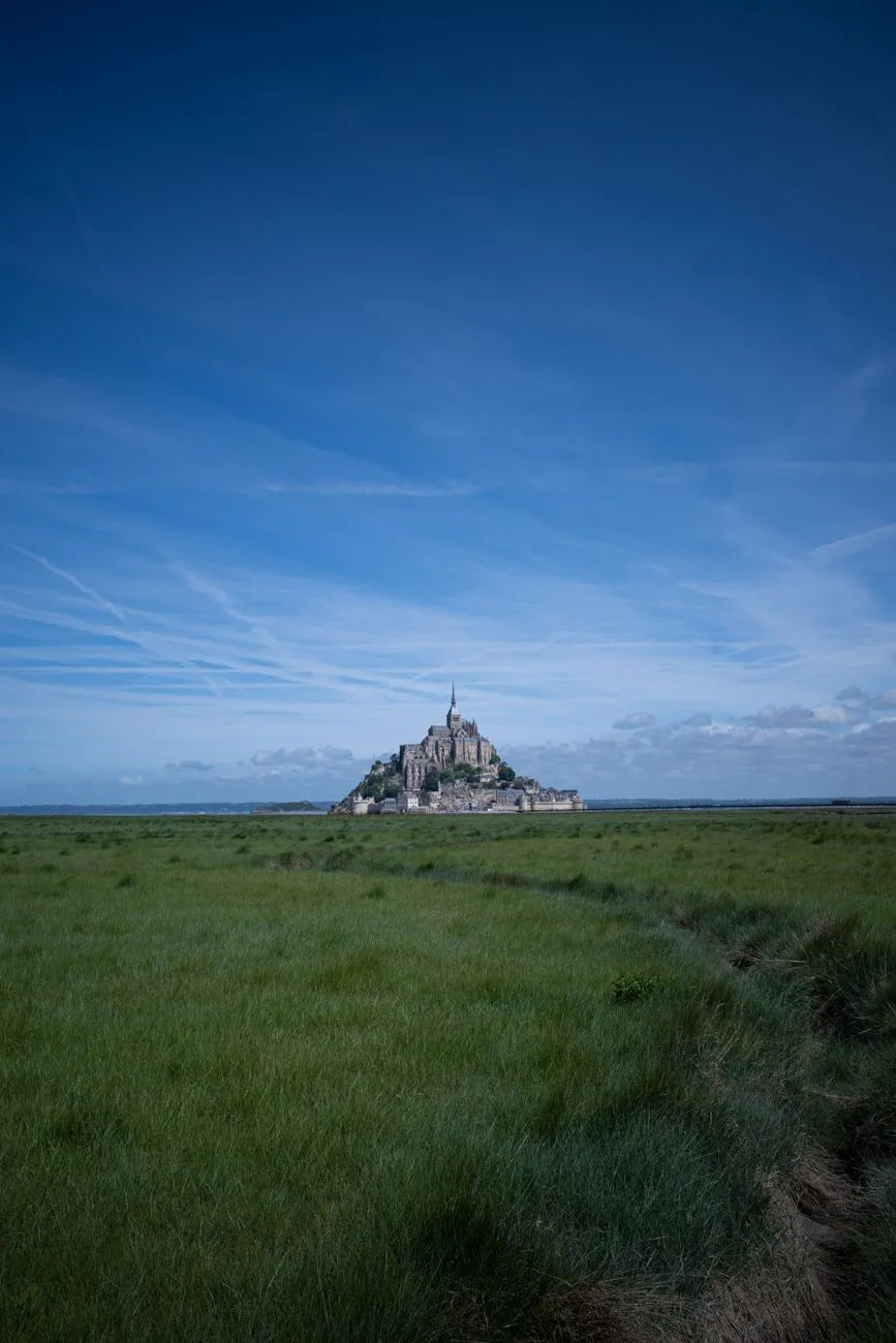
-
 Hans Müller
 - 07 Sep, 2026 20:55
Im Bann der Gezeiten: Wenn Stein und Meer den Mont Saint-Michel umarmen
Wo das Meer den Himmel küsst und die Zeit unter dem Rhythmus des Mondes zu atmen scheint, dort erhebt sich ein Meisterwerk aus Granit und Glaube: der Mont Saint-Michel. Wenn man am Ufer der Normandie steht und den Blick über das weitläufige Watt schweifen lässt, fühlt es sich an, als würde man in ein Kapitel eines mittelalterlichen Epos eintauchen. Es ist nicht bloß eine Insel; es ist eine Festung der Spiritualität, die seit Jahrhunderten den tobenden Elementen trotzt. Ein Juwel inmitten der tosenden Brandung Der Mont Saint-Michel ist weit mehr als nur ein touristisches Ziel; er ist ein architektonisches Paradoxon. Gelegen an der Grenze zwischen der Normandie und der Bretagne, ragt der Felsenkegel aus der flachen Bucht empor. Die Geschichte dieses Ortes beginnt im Jahr 708, als der Bischof Aubert von Avranches auf Anweisung des Erzengels Michael ein Heiligtum auf dem sogenannten "Mont Tombe" errichten ließ. Seitdem ist die Abtei ein Magnet für Pilger und Könige, ein Ort, an dem sich die Erde von der Welt abhebt. Das Besondere an dieser Bucht ist der gewaltige Tidenhub. Nirgendwo sonst in Europa spielt das Meer eine so dramatische Rolle wie hier. Bei Flut wird der Berg von den Wassermassen des Ärmelkanals isoliert und verwandelt sich in eine schwebende Insel, die scheinbar über dem Ozean schwebt. Bei Ebbe zieht sich das Wasser kilometerweit zurück und hinterlässt eine weite, silbrig glänzende Fläche aus feuchtem Sand.Architektur zwischen Himmel und Erde Die architektonische Struktur der Abtei ist ein faszinierendes Labyrinth. Die Anlage, die aufgrund ihrer vertikalen Bauweise oft als „La Merveille“ (das Wunder) bezeichnet wird, folgt einer strengen Hierarchie. Ganz oben thronen die Kirche und das Kloster, während sich darunter die Säle für die Mönche und die Aufenthaltsräume für die Pilger befinden. Ganz unten schließlich bildeten die Speicher und Stallungen das Fundament. Dieses vertikale Layout spiegelt perfekt die mittelalterliche Vorstellung der Weltordnung wider: von den materiellen Bedürfnissen an der Basis bis hin zur himmlischen Sphäre an der Spitze. Wenn Sie durch die engen, steilen Gassen der „Grande Rue“ schlendern, werden Sie spüren, wie das mittelalterliche Erbe in jedem Stein lebendig ist. Die hölzernen Fassaden, die kleinen Läden und die atemberaubenden Ausblicke auf die Festungsmauern entführen Sie direkt in eine Ära der Ritter und Geistlichen. Ein strategischer Bollwerk gegen die Zeit Neben der religiösen Bedeutung diente der Mont Saint-Michel während des Hundertjährigen Krieges als uneinnehmbare Festung. Die englischen Truppen versuchten mehrfach vergeblich, den Felsen zu stürmen. Die Kombination aus den massiven Verteidigungsmauern und dem unberechenbaren, tückischen Watt machte den Ort zu einem der sichersten Plätze Frankreichs. Während Ihres Besuchs sollten Sie unbedingt die gewaltigen „Merveille“-Gebäude besichtigen. Diese gotischen Bauten aus dem 13. Jahrhundert sind ein architektonisches Meisterwerk. Besonders der Kreuzgang mit seinem Blick auf das endlose Meer bietet eine Stille, die in der modernen Welt selten geworden ist. Hier, wo die Mönche einst ihre Gebete sprachen, spürt man heute noch die meditative Energie des Ortes.Die Gezeiten: Ein Naturspektakel ohnegleichen Wer den Mont Saint-Michel besucht, sollte den Rhythmus der Gezeiten respektieren. Es gibt keine Uhr, die hier wichtiger ist als der Mondkalender. Die Gezeiten in der Bucht erreichen Unterschiede von bis zu 15 Metern – ein Phänomen, das die Landschaft bei jeder Flut grundlegend verändert. Früher war der Weg über das Watt lebensgefährlich. Reisende wurden oft von der Geschwindigkeit der einlaufenden Flut überrascht, die, wie ein altes Sprichwort besagt, „so schnell wie ein galoppierendes Pferd“ ist. Heute ist der Zugang durch einen Damm geregelt, doch die Faszination für das Watt bleibt ungebrochen. Wanderungen durch die Bucht, am besten mit einem ortskundigen Führer, sind ein unvergessliches Erlebnis. Sie lernen nicht nur die Flora und Fauna der Bucht kennen, sondern verstehen auch, warum die Abtei für die Menschen des Mittelalters als ein Ort zwischen den Welten galt. Kulinarik und Tradition am Rande des Meeres Nachdem man die steilen Treppen zur Abtei erklommen hat, meldet sich meist der Hunger. Hier führt kein Weg an der berühmten „Omelette de la Mère Poulard“ vorbei. Seit dem späten 19. Jahrhundert ist dieses einfache, aber köstliche Gericht ein Markenzeichen des Berges. Mit einem Schneebesen in Kupferkesseln über dem offenen Feuer geschlagen, ist das Omelett ein Teil der kulinarischen Folklore geworden. In den kleinen Restaurants der Insel finden sich zudem viele Spezialitäten der Normandie, wie etwa der berühmte Apfelwein (Cidre) oder das Fleisch der „Prés-Salés“-Lämmer. Diese Lämmer grasen auf den salzigen Wiesen rund um den Berg, was ihrem Fleisch einen unvergleichlichen Geschmack verleiht. Es ist ein Genuss, bei Sonnenuntergang in einem der kleinen Lokale zu sitzen und dem Lichtspiel auf dem Wasser zuzusehen, während das Abendrot den Granit des Berges in sanfte Goldtöne taucht.Ein Rückzugsort der Stille Wenn die letzten Tagestouristen die Insel verlassen und die Lichter der Abtei in der Dunkelheit zu leuchten beginnen, kehrt der Mont Saint-Michel zu seinem wahren Wesen zurück. Es ist dann ein Ort der Stille und der Kontemplation. Die Geräusche des Meeres, das sanfte Rauschen des Windes und das ferne Läuten der Glocken lassen einen die hektische Welt vergessen. Es ist diese spirituelle Ruhe, die Reisende seit über tausend Jahren anzieht. Man begreift, dass der Mont Saint-Michel nicht nur ein Ziel auf der Landkarte ist, sondern ein Symbol für menschliche Beharrlichkeit, Glauben und die tiefe Verbundenheit mit der Natur. Egal, ob Sie Kunsthistoriker, Pilger oder einfach nur ein neugieriger Wanderer sind: Dieser Ort wird einen bleibenden Eindruck in Ihrem Gedächtnis hinterlassen. Wenn Sie das nächste Mal in der Normandie sind, planen Sie genügend Zeit ein. Lassen Sie sich nicht hetzen. Beobachten Sie, wie das Licht die Fassaden verändert, spüren Sie den Wind der Bucht auf Ihrer Haut und nehmen Sie sich einen Moment Zeit, um vor der gewaltigen Westfassade innezuhalten. Der Mont Saint-Michel ist ein lebendiges Denkmal – ein flüchtiges Wunder, das uns daran erinnert, dass wir nur Gäste auf dieser Welt sind, umgeben von der unendlichen Macht der Gezeiten.#MontSaintMichel #Normandie #FrankreichReisen #UNESCOWeltkulturerbe #ReiseInspiration Related Insights慕田峪长城:明代长城的精华 Ethiopia’s Danakil Depression: A Journey to Earth’s Hottest and Most Alien Landscape (Part 2) Lalibela : Le Chant de la Pierre Vivante – Plongée au Cœur des Églises Monolithiques d'Éthiopie{ "@context": "https://schema.org", "@type": "FAQPage", "mainEntity": [ { "@type": "Question", "name": "What is the main focus of Im Bann der Gezeiten: Wenn Stein und Meer den Mont Saint-Michel umarmen?", "acceptedAnswer": { "@type": "Answer", "text": "Erkunden Sie das Weltwunder in der Normandie, wo die stärksten Gezeiten Europas eine mystische Abtei zwischen Himmel und Erde erschaffen." } }, { "@type": "Question", "name": "Who authored the comprehensive guide on Im Bann der Gezeiten: Wenn Stein und Meer den Mont Saint-Michel umarmen?", "acceptedAnswer": { "@type": "Answer", "text": "This detailed article and its insights were carefully researched and authored by Hans Müller." } }, { "@type": "Question", "name": "Where can I find more related content about Travel?", "acceptedAnswer": { "@type": "Answer", "text": "You can explore more articles, detailed reviews, and similar insights by browsing the Related Insights section at the bottom of this article or visiting our dedicated Travel category page." } } ] }
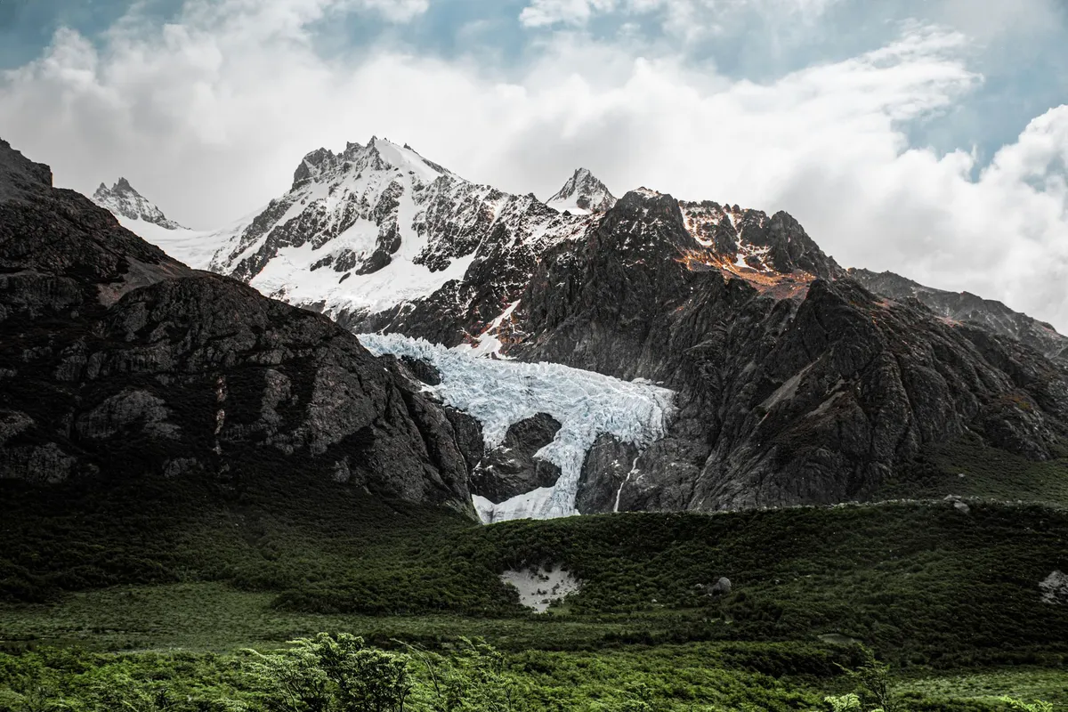
Where the map ends and the wind begins, Patagonia whispers secrets to those willing to listen. While Torres del Paine dominates the Instagram feeds of the world, those who venture deeper find a region not merely defined by peaks, but by the relentless rhythm of the Southern Hemisphere’s raw, untamed heart. I am Aisha Sharma, and today we move past the overcrowded viewpoints to uncover the true essence of this jagged wilderness. This is not just a travel guide; it is an economic and experiential blueprint for navigating the immense, expensive, and breathtaking duality of Argentine and Chilean Patagonia as we head into late 2026. The Alpine Soul of Bariloche and the Argentine Lake District If you seek the intersection of European charm and jagged Andean reality, San Carlos de Bariloche serves as the gateway. Situated in the heart of Nahuel Huapi National Park, Bariloche is where the myth of the "Swiss Alps of South America" meets the reality of high-altitude desert and temperate rainforest. As of late 2026, the cost of living here has stabilized following recent economic fluctuations in Argentina, yet it remains a destination of contrasts. For the slow traveler, a monthly budget of approximately $1,800 to $2,200 USD provides a comfortable standard of living, covering local apartment rentals, fresh market produce, and the occasional indulgent excursion. Navigating Bariloche requires an appreciation for the "Circuito Chico." Skip the tour buses; rent a mountain bike or utilize the reliable public transit system, the SUBE card, to reach the hidden bays of Lake Moreno. When you head into the mountains, specifically the Refugio Frey trek, you are not just hiking; you are walking through geological history. The granite spires here, while distinct from the Paine massif, offer technical climbing challenges that have drawn mountaineers for decades. Connectivity is surprisingly robust in the city center, making it a viable hub for digital nomads, though the further you retreat into the Llao Llao Peninsula, the more you are forced into a welcomed digital disconnection.Dining in Bariloche is a cultural ritual. The influence of Central European immigration means that smoked trout, wild boar, and, of course, the world’s most refined chocolate shops line Mitre Street. My authoritative advice: skip the tourist-trap storefronts near the clock tower and find the small, family-owned producers in the Colonia Suiza settlement. Here, the "Curanto"—a traditional method of cooking food in the earth—is an authentic experience that connects you to the indigenous Mapuche traditions that permeate the region’s soil. Budgeting for food is manageable if you cook at home using local artisanal ingredients; supermarkets are efficient, but the local "ferias" offer a significantly better price-to-quality ratio. El Chaltén: The Vertical Frontier of Human Endurance In the shadows of Fitz Roy and Cerro Torre lies El Chaltén, a village that feels more like a base camp for an expedition than a tourist town. It is the trekking capital of Argentina, and in 2026, it remains a place where the wind is the primary architect of the landscape. Unlike the structured luxury of Chilean resorts, El Chaltén retains a raw, rugged aesthetic. Expenses here are heavily influenced by the extreme seasonality of the location. Because almost every resource—from fresh produce to electricity—must be trucked in across vast distances, expect to pay a premium. A monthly slow-travel budget of $2,500 is a realistic baseline if you prioritize proximity to the trails. The magic of this region is that the most iconic views are accessible without a private guide, provided you respect the unpredictability of the weather. The hike to Laguna de los Tres is legendary, but the true secret is the Loma del Pliegue Tumbado. From this vantage point, you see the convergence of the Viedma Glacier and the granite giants in a panoramic sweep that most casual travelers overlook. As you plan your 2026 itinerary, remember that connectivity in El Chaltén is notoriously fragile. If your livelihood depends on a stable internet connection, opt for the dedicated co-working cafes rather than relying on hostel Wi-Fi, which often struggles during high-occupancy months.When packing for the wind, do not prioritize "fashionable" outdoor gear. Patagonia’s wind is legendary for its ability to test the integrity of technical fabrics. Ensure your gear is windproof rather than just water-resistant; in this region, the rain is secondary to the gusts that can reach speeds of over 100 kilometers per hour. Economically, El Chaltén is a cash-heavy environment. While card payments are increasingly accepted, having a reserve of Argentine pesos is a necessity for the smaller backcountry lodges and remote mountain huts (refugios). Managing these logistics is part of the "Patagonian tax," a small price for the privilege of existing on the edge of the Southern Patagonian Ice Field. The Chilean Duality: Puerto Natales and the Cost of Remoteness Crossing the border into Chile changes the economic landscape entirely. Chile operates on a more predictable, yet significantly higher, cost structure than Argentina. Puerto Natales, the primary staging ground for the southern fjords, has transformed into a sophisticated hub of sustainable tourism. Here, the currency is the Chilean Peso, and your daily expenses—particularly regarding transportation and park entry fees—will be notably higher than across the border. A slow-travel budget for Puerto Natales should hover around $3,000 USD per month if you intend to participate in the local culture while utilizing the town as a base for deep-wilderness exploration. The secret to Puerto Natales is not the town itself, but the access it provides to the Bernardo O’Higgins National Park and the fjords. While everyone heads north to Torres del Paine, the savvy traveler heads toward the Balmaceda and Serrano glaciers. These maritime routes provide an intimate look at the calving ice that few people see. By booking with smaller, local eco-operators, you are not only supporting the community but also avoiding the massive group tours that dominate the inland trails. Chile’s infrastructure is superior, with bus networks that make regional travel efficient and relatively comfortable, though the prices reflect this high level of service.Healthcare and safety standards in Chile are among the highest in South America. If you are planning an extended stay, ensure your travel insurance covers high-altitude mountain rescue, as this is a specific requirement for many of the more remote, non-maintained trails. The digital infrastructure in Puerto Natales is significantly more reliable than in the northern Argentine villages, making it the preferred choice for those who need to maintain a professional career while exploring the wild. The culinary scene is dominated by seafood—specifically the centolla (king crab)—and the local cordero (lamb). Budget tip: utilize the local markets in the center of town to source ingredients, as dining out for every meal in Puerto Natales will quickly inflate your monthly expenditure beyond the $3,000 threshold. Economic Benchmarks and Fiscal Realities for the 2026 Traveler To understand Patagonia, one must understand the fiscal divide. Argentina’s economy is defined by high volatility and the "blue" market exchange rates, whereas Chile offers stability with a high cost of entry. The table below outlines a comparison of approximate monthly costs for a single individual engaged in slow travel. These figures account for mid-range accommodation, market-sourced food, local transport, and occasional leisure activities. Note that park fees in Chile, particularly for high-traffic areas, can constitute a significant portion of your discretionary spending.Expense Category Bariloche, Argentina (USD) Puerto Natales, Chile (USD)Apartment Rent (Monthly) $700 - $900 $1,100 - $1,400Groceries (Monthly) $350 - $450 $500 - $650Local Transport/Transit $80 - $120 $150 - $200Connectivity (Internet) $30 - $50 $60 - $90Leisure & Park Fees $400 - $600 $800 - $1,000Total Estimated Monthly $1,560 - $2,120 $2,610 - $3,340Data synthesis based on 2026 market-data collection and regional cost-of-living benchmarks. This table serves as an authoritative guide for your financial planning. In Argentina, the strategy is to carry cash, understand the value of the parallel exchange rate, and remain flexible regarding price fluctuations. In Chile, the strategy is to budget for premium costs and take advantage of the ease of digital payments and credit card usage. Remember that in both countries, "slow travel" is inherently cheaper than "tourist travel." By renting long-term apartments rather than staying in short-term hotels and preparing your own meals, you significantly decrease the overhead costs associated with the remote logistics of this region. Mastering the Wind: Environmental Ethics and Cultural Preservation As we conclude this exploration, it is imperative to address the responsibility of the traveler. Patagonia is not merely a backdrop for our experiences; it is a fragile, hyper-sensitive ecosystem. The winds that carve the granite spires also spread wildfire, and the pristine waters are threatened by the influx of mass tourism. When you travel to these "secret gems," you are an ambassador for the region. The principle of 'Leave No Trace' is not a suggestion here; it is the fundamental law of the landscape. Carry your waste out of the wilderness, stay on designated trails, and respect the wildlife that calls this extreme environment home. Cultural preservation is equally vital. The Mapuche and Tehuelche people hold deep, ancestral connections to this land. When you purchase local handicrafts, ensure they are authentic. When you listen to stories about the region, recognize that they are part of a history that predates the arrival of global mountaineers. The true secret of Patagonia is not found in a map coordinate, but in the humility one feels when standing before a glacier that has existed for millennia. We are temporary visitors in a land that has been, and will continue to be, shaped by forces far greater than ourselves. As you finalize your plans for your 2026 journey, remember that Patagonia rewards those who are patient. If the wind prevents you from reaching a peak, spend the day in a local café reading, observing the rhythm of the town, and engaging with the locals. The beauty of this region is that it forces you to slow down. It strips away the pretense of modern life and leaves you with the fundamental elements of existence: stone, water, ice, and wind. Embrace the difficulty, budget wisely, respect the environment, and you will find that the legends you carve in your own memory are far more enduring than any digital image you could ever capture. The trail awaits, but remember, the most significant path is the one that respects the silence of the mountains. Patagonia is not a destination you conquer; it is a wild, living force that allows you to witness its grandeur, provided you treat it with the reverence it demands. Carry your gear, protect the fragile alpine tundra, and let the wind carry your footprints away until they are nothing but dust and memory. #Patagonia #SlowTravel #DigitalNomad #AdventureTravel #SustainableTourism Related InsightsThe Maldives: Where Overwater Bungalows Meet Coral Reef Conservation (Part 2) The Silent Cathedral of Sands: A Pilgrim’s Guide to Namibia’s Sossusvlei Palawan’s Hidden Lagoons: The Philippines’ Most Breathtaking Coastal Escapes You Can’t Miss{ "@context": "https://schema.org", "@type": "FAQPage", "mainEntity": [ { "@type": "Question", "name": "What is the main focus of Beyond the Granite Spires: Unveiling Patagonia’s Untamed Secrets?", "acceptedAnswer": { "@type": "Answer", "text": "Escape the crowds and discover the hidden soul of Patagonia, from the wind-whipped trails of El Chaltén to the alpine retreats of Bariloche." } }, { "@type": "Question", "name": "Who authored the comprehensive guide on Beyond the Granite Spires: Unveiling Patagonia’s Untamed Secrets?", "acceptedAnswer": { "@type": "Answer", "text": "This detailed article and its insights were carefully researched and authored by Aisha Sharma." } }, { "@type": "Question", "name": "Where can I find more related content about Travel?", "acceptedAnswer": { "@type": "Answer", "text": "You can explore more articles, detailed reviews, and similar insights by browsing the Related Insights section at the bottom of this article or visiting our dedicated Travel category page." } } ] }

Where the Skeleton Coast breathes its final sigh into the interior, the Namib Desert rises in a defiance of geology. Sossusvlei is not merely a destination; it is a profound sensory experience where the world’s oldest desert meets a sky so clear it feels like looking into the nascent vacuum of space. Standing at the base of Big Daddy, the tallest dune in the Sossusvlei area, one feels the crushing weight of geological time. The orange sands, oxidized by eons of solar exposure, stretch infinitely, creating a landscape that has remained largely unchanged for millions of years. This is the heart of the Namib-Naukluft National Park, a place where the stillness is so absolute it possesses a texture. For the traveler, the digital nomad, or the seeker of solitude, Sossusvlei serves as a reminder of our fleeting presence on a planet that measures time in the rise and fall of dunes rather than the ticking of a clock. As an expert observer, I find that the magnetism of Namibia lies not in what you see, but in the silence you eventually learn to hear when the wind dies down. Sculpting the Infinite: The Geologic Architecture of the Namib The Sossusvlei region is a paradox of life and void. At its core lies the Vlei—a salt-clay pan surrounded by towering dunes that reach heights of over 300 meters. These are not static mounds of sand; they are shifting, living gargoyles sculpted by the Atlantic winds that blow moisture inland, only for it to be stripped away by the harsh heat. The color palette of the sand—ranging from pale cream to a deep, visceral rust—is a direct result of iron oxide content. The older the dune, the deeper the hue. Geologically, these dunes are part of an erg that covers much of Western Namibia. When you climb Dune 45 or the iconic Big Daddy, you are effectively traversing layers of history. Each step forward is a literal interaction with antiquity. The clay pans, or vlei, form when the Tsauchab River floods, though such events are agonizingly rare. When the water does arrive, it creates a temporary, mirror-like oasis that reflects the intense blue sky, turning the desert into a surrealist painting. Between these events, the pans crack into intricate, mosaic-like polygons of white earth. This environment demands respect. It is a harsh, unforgiving ecosystem that dictates every move you make, from the timing of your hikes—always at dawn—to the necessity of hydration. For the photographer, the contrast between the desiccated acacia trees in Deadvlei, some of which have been standing dead for nearly a thousand years, and the vibrant orange walls of the dunes provides an aesthetic that cannot be replicated elsewhere on Earth.Financial Horizons: Decoding the Cost of Living in the Desert Frontier For those considering an extended stay in the Namibian interior, understanding the economic landscape is as critical as carrying extra water. Namibia offers a remarkably affordable lifestyle, especially when compared to the inflated markets of the United States. Recent 2026 data indicates that the cost of living in Namibia is, on average, 44.3% lower than in the United States, providing a substantial buffer for long-term travelers and expatriates. If you are planning to anchor yourself in the region, the estimated monthly costs for a single person hover around $695.20 (approximately N$11,107.0), excluding rent. For a family of four, these costs rise to $2,480.40 (N$39,628.0). These figures are essential for digital nomads who seek to integrate their professional lives with the tranquility of the desert. The Namibian government has become increasingly accommodating to the remote workforce, introducing a dedicated Digital Nomad Visa. This initiative is designed for those who want to call the Land of the Brave their office for a temporary duration. The program mandates an income requirement of $2,000 per month, a modest threshold for a high-value remote career. The estimated cost for processing and residency logistics is approximately $880 per month, a reasonable investment for tax-free status in a location that offers unparalleled mental clarity. While rent in remote regions like Sossusvlei fluctuates based on the proximity to luxury eco-lodges versus local town setups in nearby Sesriem, the overall fiscal environment remains highly favorable. Whether you are budget-conscious or seeking premium isolation, the economic architecture of Namibia allows for a diverse range of survival strategies. It is a place where your dollar retains its purchasing power, allowing you to focus on the terrain rather than the transaction.Category Cost (Monthly / USD) NoteSingle Person (No Rent) $695.20 Excluding housing and utilitiesFamily of Four (No Rent) $2,480.40 Excluding housing and utilitiesDigital Nomad Visa Fee ~$880.00 Monthly cost estimateIncome Threshold $2,000.00 Minimum monthly requirementNamibia vs USA 44.3% Lower Average cost reductionNavigating the Silence: A Tactical Guide to Desert Exploration To experience Sossusvlei correctly, one must embrace a nocturnal and matutinal rhythm. The desert heat is a predator by midday, effectively shutting down human activity between 11:00 AM and 4:00 PM. My advice to any explorer is to be at the gates of the Namib-Naukluft National Park before sunrise. The gate usually opens at dawn, and the race to the dunes is a rite of passage. Entering the park in the twilight, you will find the silhouettes of the dunes towering over the road like sleeping giants. The transition of the desert floor from cool, dark blue to the golden warmth of the rising sun is a transformation that warrants silence. Once you reach the parking area near the base of the dunes, ensure your vehicle is capable of handling deep sand if you intend to push beyond the main parking lot. For the average tourist, the 4x4 shuttle from the parking area to the start of the hike is standard, but if you have your own vehicle, deflate your tires to handle the loose substrate. Footwear is another critical component; the sand is soft and punishing, making lightweight, breathable trainers or specialized desert boots essential. Avoid thick leather boots that trap heat. When hiking, follow the ridges of the dunes. It is less strenuous than trudging through the soft slopes and offers better structural stability. Always carry more water than you think you need—at least 3 to 4 liters per person. Even if the air feels dry and comfortable in the morning, the lack of shade means the solar radiation will sap your energy before you realize it. The Nomad’s Sanctuary: Connectivity and Lifestyle in Namibia Many professionals are hesitant to venture into the Namib because they fear the loss of connectivity. However, the rise of the digital nomad culture has fostered a surprising level of infrastructure even in remote areas. While the depths of the Namib-Naukluft are designed to disconnect you, the nearby hubs are increasingly equipped with reliable internet access. When you are not in the heart of the park, locations near Sesriem and the wider Hardap region provide bases where the 2026 digital infrastructure allows for seamless communication. The tax-free nature of the Digital Nomad Visa is a significant incentive, allowing one to maximize their earnings while living a life dictated by the sun and the horizon rather than an office building. Imagine ending your workday with a sundowner overlooking the Elim Dune, where the iron in the sand glows deep red under the darkening sky. The psychological shift of moving from a high-stress urban environment to the vast openness of Namibia cannot be overstated. It is a reset button for the creative mind. The cost-of-living advantages allow for a higher quality of life—perhaps opting for a lodge that offers sustainable, off-grid power solutions—without breaking your monthly budget. In this environment, you do not just work; you exist in a state of flow. The challenge is not in the work itself, but in the distraction provided by the sheer magnificence of the surroundings. To thrive here, one must be disciplined, setting firm boundaries between the digital workspace and the vast, untamed playground just outside the window. Echoes of the Earth: Preserving the Delicate Equilibrium Sossusvlei is a fragile masterpiece. As travelers, our presence carries a weight that the ecosystem feels. The footprint you leave on the side of a dune will be erased by the wind within hours, but the impact of irresponsible tourism can last a lifetime. Conservation in Namibia is proactive and community-led. When visiting, adhere strictly to the marked trails. The cryptobiotic crusts of the desert—thin layers of cyanobacteria, lichens, and mosses that hold the soil together—are easily destroyed by trampling. Once broken, these surfaces take years, sometimes decades, to reform, leading to accelerated erosion and soil degradation. Wildlife, including oryx, springbok, and the occasional desert-adapted ostrich, rely on the sparse vegetation supported by these crusts. Watching an oryx navigate the dunes is a lesson in adaptation; they are perfectly evolved for this heat, and observing them from a respectful distance is one of the true privileges of a Namibian expedition. We are guests in a cathedral of time. The silence, the heat, and the vast, empty vistas are not merely scenery; they are the heritage of a planet that existed long before us and will persist long after we have packed our bags. As you prepare for your journey, pack light, respect the local laws, and, most importantly, leave nothing behind but the ghost of your footsteps. Whether you come for the photography, the scientific curiosity, or the simple need to find a space where the modern world feels distant, Sossusvlei delivers an experience that strips away the superficial and leaves you with the raw truth of the earth. The desert does not change for the visitor; the visitor must change for the desert.The journey through Sossusvlei is ultimately an inward one. You arrive with expectations of grandeur and leave with an understanding of insignificance. It is a grounding experience that shifts your perception of what is essential. In the quiet hours of the late afternoon, when the wind settles and the shadows lengthen, you find that the desert has a voice of its own—a low, humming vibration that speaks of the deep time it has witnessed. Namibia is not just a location on a map; it is a profound testament to the endurance of nature. For the digital nomad, the dreamer, and the traveler, it offers a rare opportunity to live, if only for a short time, in a world that operates on a scale far greater than our own. May your journey into the sands be as transformative as the shifting dunes themselves, and may you return to your corner of the world with the clarity that only the Namib can provide. #NamibiaTravel #Sossusvlei #DigitalNomadLife #DesertExploration #NaturePhotography Related InsightsMétéora : L'Ascension Mystique entre Ciel et Pierre 新疆火焰山:穿越神话、历史与烈焰的奇幻之旅 Golden Ring Cities{ "@context": "https://schema.org", "@type": "FAQPage", "mainEntity": [ { "@type": "Question", "name": "What is the main focus of The Silent Cathedral of Sands: A Pilgrim’s Guide to Namibia’s Sossusvlei?", "acceptedAnswer": { "@type": "Answer", "text": "Experience the timeless majesty of Sossusvlei. From cost-effective desert living to the architectural genius of nature, explore Namibia’s most iconic landscape." } }, { "@type": "Question", "name": "Who authored the comprehensive guide on The Silent Cathedral of Sands: A Pilgrim’s Guide to Namibia’s Sossusvlei?", "acceptedAnswer": { "@type": "Answer", "text": "This detailed article and its insights were carefully researched and authored by Mark Dinn." } }, { "@type": "Question", "name": "Where can I find more related content about Travel?", "acceptedAnswer": { "@type": "Answer", "text": "You can explore more articles, detailed reviews, and similar insights by browsing the Related Insights section at the bottom of this article or visiting our dedicated Travel category page." } } ] }