Showing Posts From
Travel
-
 John Explorer
 - 06 Sep, 2026 19:45
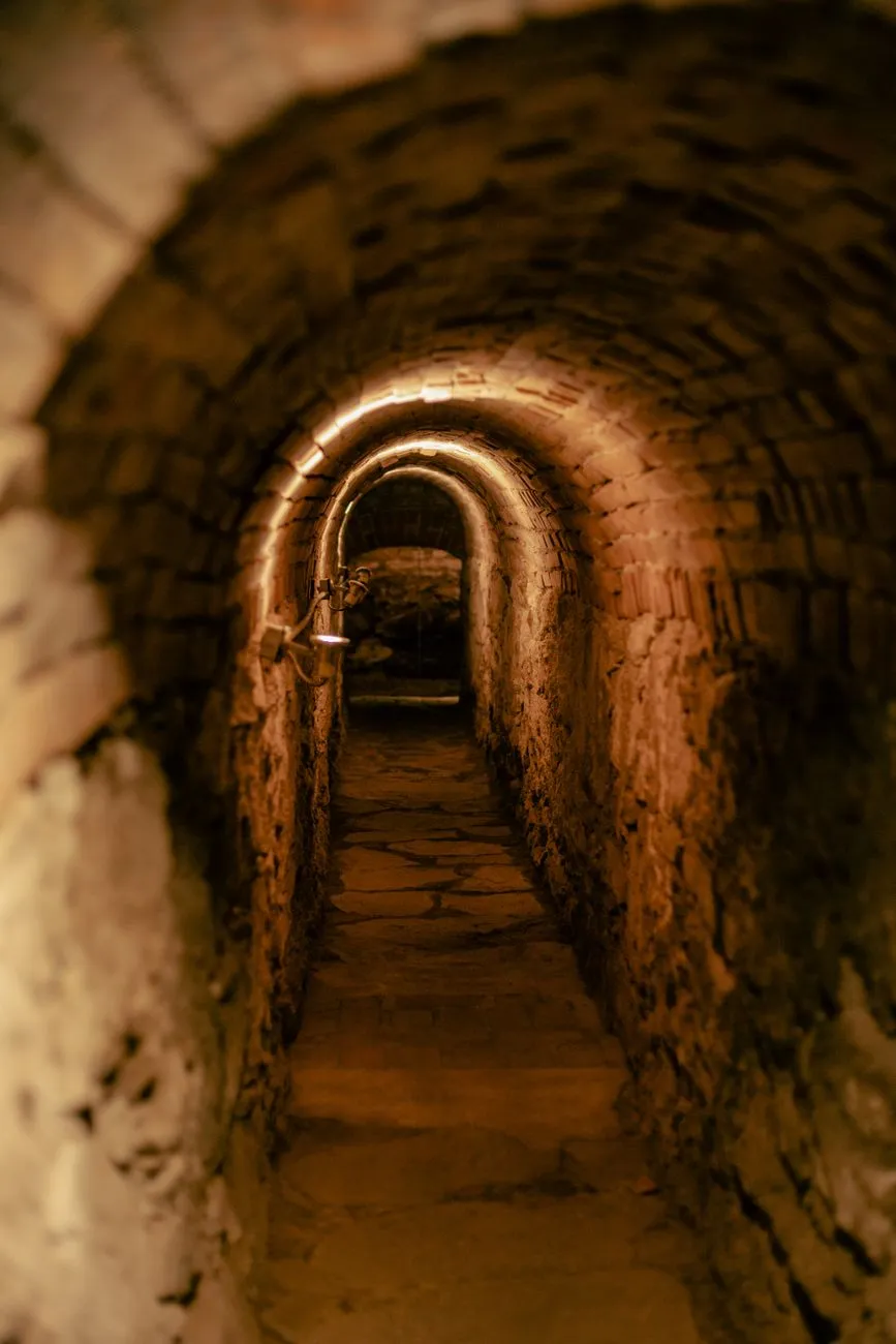
Beneath the City of Light: Descending into the Empire of the Dead in Paris
The Whispering Shadows Beneath the Boulevard Beneath the romantic veneer of Paris—far below the sun-drenched terraces of cafes, the fragrant bakeries, and the iconic iron lattice of the Eiffel Tower—lies another city entirely. It is a silent, subterranean metropolis carved from stone, where the echoes of the living rarely penetrate. As John Explorer, my boots have touched the soil of countless remote corners of the globe, yet few places possess the haunting gravity of the Parisian Catacombs. This is the dark heart of the City of Light, an ossuary holding the skeletal remains of over six million souls. To step down the spiral staircase at Place Denfert-Rochereau is to cross a distinct threshold between the vibrant world above and an eternal subterranean empire. The air changes instantly, growing cool, damp, and heavy with the scent of ancient earth. The walls, once rough-hewn quarries that provided the limestone to build the palaces and cathedrals of Paris, now cradle a terrifyingly vast mosaic of human history. This labyrinthine network of tunnels stretches for hundreds of kilometers beneath the streets, though only a fraction is open to the curious and the brave. From Roman Quarries to Overflowing Cemeteries The genesis of this subterranean necropolis is rooted in a severe public health crisis that gripped Paris during the late 18th century. For nearly a thousand years, the city’s primary burial ground was the Cemetery of the Innocents, located in the heart of the bustling Les Halles district. By the 1700s, this cemetery had become unimaginably overcrowded. Piles of earth rose several meters above the surrounding street level, saturated with centuries of decomposition. The situation reached a horrifying climax in 1780 when the basement walls of properties adjacent to the cemetery collapsed under the immense pressure of rotting corpses, spilling putrid matter directly into neighboring cellars. It was clear that the city could no longer bury its dead within its walls without risking catastrophic plagues. Faced with this desperate sanitation crisis, municipal authorities looked downward. The abandoned underground stone quarries that honeycomb southern Paris offered a brilliant, if macabre, solution. Transforming these empty caverns into a massive underground ossuary required an enormous engineering feat, but by 1786, the first nightly processions of bone-laden carts began rumbling through the dark streets. The Grand Relocation of the Lost Souls For many months, the transfer of bones was conducted with solemn reverence. Covered wagons draped in black cloth, accompanied by priests chanting hymns for the dead, transported skeletal remains from various parish cemeteries across Paris to the newly consecrated Tombe-Issoire quarries. Initially, the bones were simply dumped haphazardly into the deep cavities of the quarries. However, during the early 19th century, under the direction of Louis-Étienne Héricart de Thury, inspector of the quarries, the site underwent a dramatic aesthetic transformation. The engineers and workers stopped treating the bones merely as waste and began arranging them with macabre artistry. Today, walking through the official ossuary is akin to navigating a museum of mortality. Femurs and tibias are neatly stacked like cordwood, interspersed with rows of grinning skulls that stare blankly into the perpetual twilight. Cryptic stone tablets and classical plaques etched with philosophical warnings—such as "Think that every day is your last"—punctuate the walls, reminding every visitor of the ultimate equalizer: death. The Forbidden Underworld and Modern Explorers While the official tourist route covers roughly 1.5 kilometers of neatly curated tunnels, an entire subculture exists beyond the iron security gates. Known locally as cataphiles, urban explorers illegally infiltrate the subterranean network through hidden manholes, construction sites, and secret entrances scattered across the metropolis. These unauthorized explorers map forgotten tunnels, host secret gatherings in vast underground chambers, and preserve the raw, untamed history of the quarries. Navigating the dark, winding depths without a guide is fiercely dangerous; the maze is vast, signals do not penetrate the thick stone, and temperatures remain chilly year-round. Yet, the allure of the forbidden depths continues to draw those seeking a profound connection with the city's hidden past.As I emerged back onto the bustling Parisian streets, blinking against the sharp afternoon sunlight, the contrast was staggering. Above ground, life rushes forward with frantic energy, oblivious to the silent legions resting mere meters below. The Catacombs of Paris remain a breathtaking, humbling monument to human mortality—a place where history is not merely read in books, but felt in the very bones of the earth.#ParisCatacombs #DarkTourism #HiddenParis #UndergroundExploration #HistoryTravel Related Insights嵐山の美学: 竹林と自然の調和 The White Silence Beckons: A Century of Chasing the Antarctic Dream Quand l'Altruisme Devient Marchandise : Les Zones d'Ombre du Volontourisme{ "@context": "https://schema.org", "@type": "FAQPage", "mainEntity": [ { "@type": "Question", "name": "What is the main focus of Beneath the City of Light: Descending into the Empire of the Dead in Paris?", "acceptedAnswer": { "@type": "Answer", "text": "Journey deep beneath the streets of Paris into the chilling labyrinth of the Catacombs, where millions of bones whisper the forgotten history of the French capital." } }, { "@type": "Question", "name": "Who authored the comprehensive guide on Beneath the City of Light: Descending into the Empire of the Dead in Paris?", "acceptedAnswer": { "@type": "Answer", "text": "This detailed article and its insights were carefully researched and authored by John Explorer." } }, { "@type": "Question", "name": "Where can I find more related content about Travel?", "acceptedAnswer": { "@type": "Answer", "text": "You can explore more articles, detailed reviews, and similar insights by browsing the Related Insights section at the bottom of this article or visiting our dedicated Travel category page." } } ] }
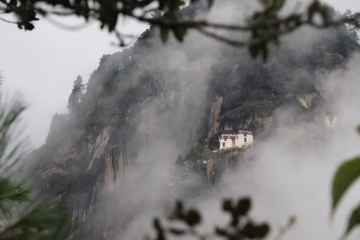

Ascending the Sacred Heights of Paro Taktsang Perched precariously at an altitude of 3,120 meters above sea level, the Tiger’s Nest Monastery, or Paro Taktsang, is not merely a destination; it is an endurance test for the spirit and a masterclass in architectural audacity. As a traveler who has spent years navigating the world’s most remote corners, I find that few places command the same reverence as this gravity-defying sanctuary in Bhutan. Legend dictates that Guru Rinpoche flew to this site on the back of a tigress in the 8th century, meditating here for three years, three months, three weeks, and three days to subdue local demons. Today, the monastery stands as the ultimate symbol of the Kingdom of Bhutan, a testament to the nation’s unwavering commitment to Vajrayana Buddhism. To visit Tiger’s Nest is to participate in a centuries-old tradition of pilgrimage. The air is thinner here, crisp and pine-scented, and the prayer flags that flutter across the gorge carry mantras to the heavens with every breeze. Reaching the monastery requires a demanding hike through rhododendron forests, where the path narrows and the world below seems to fall away. As you climb, you are not just traversing physical geography; you are moving through a landscape of myth. The sound of distant gongs and the chanting of monks create an acoustic tapestry that feels entirely removed from the clamor of modern life. It is a place that demands humility, patience, and a deep respect for the sanctity of the high-altitude environment. Before you even set foot on the trail, you must understand that Bhutan is a destination that favors the prepared. Unlike the chaotic spontaneity of other global hotspots, Bhutan requires a deliberate approach to logistics, primarily due to its unique policy of high-value, low-volume tourism. This isn't a place for the casual wanderer; it is a pilgrimage that begins long before you arrive in the Paro Valley.Navigating the Sustainable Development Fee and Entry Protocols The logistics of entering Bhutan are perhaps the most important hurdle for any aspiring traveler. The nation operates under the "Sustainable Development Fee" (SDF) policy, a strategy designed to preserve the country's pristine environment and deep-rooted cultural heritage. For international visitors, this fee is currently pegged at US$100 per person, per night. This is a mandatory contribution to the government’s efforts to maintain carbon-neutral status and fund critical infrastructure, including free healthcare and education for the Bhutanese people. This fee is distinct from your daily expenses, such as accommodation, food, and transport. It is essential to understand that this is not a traditional tourism tax but a foundational investment in Bhutan's future. Beyond the financial commitment, every visitor must secure a visa, which is processed online. Because of the requirement for a mandatory licensed Bhutanese guide, most travelers handle their visa and SDF through a certified tour operator. These guides are more than just escorts; they are cultural translators, navigators of the complex Bhutanese etiquette, and your primary point of contact for navigating the trail to the Tiger’s Nest. You cannot legally trek to the monastery without being accompanied by a government-licensed professional. This policy ensures that the sanctity of the site remains protected and that visitors are educated on the complex Buddhist iconography they encounter within the monastery walls. When you begin your journey toward the monastery, your guide will manage the entry permits, which are verified at the trailhead security checkpoint. The hours of operation are generally 8:00 AM to 5:00 PM, though it is highly recommended to start your ascent as early as possible—preferably by 7:30 AM—to avoid the midday sun and the influx of tour groups that typically arrive later in the morning. Being prepared with your visa documentation and having your SDF payment confirmed is mandatory before boarding your flight into Paro. Failure to produce these documents will result in entry denial at the border or airport. Decoding the Costs and Essential Preparations for Your Journey When planning your visit, it is vital to balance the costs of the SDF with the high quality of experience you receive in return. Numbeo provides an excellent framework for understanding global cost-of-living metrics, and while Bhutan’s economy differs from Western standards, the "value" of a visit here is measured in access and exclusivity. You are paying for a controlled, sustainable environment where over-tourism is actively managed. To help you structure your budget, I have compiled the following breakdown, which accounts for the current regulatory environment as of 2026. Note that these are estimations; costs can fluctuate based on the luxury level of your chosen accommodation and the season of your travel.Component Cost Estimation (USD) NotesSustainable Development Fee $100/night Mandatory daily paymentVisa Processing Fee $40 One-time entry feeLicensed Guide (Daily) $50 - $100 Varies by tour operatorAccommodation (Mid-range) $150 - $250/night Includes local taxesLocal Meals/Drinks $30 - $60/day Depending on dining choiceTotal Base Per Day (Estimated) $330 - $510 Excluding international flightsBeyond these fixed costs, consider the importance of personal preparation. The trail to the monastery is not a walk in the park; it is a sustained, steep incline that gains over 600 meters in elevation. Altitude sickness is a genuine concern for those coming from sea level. I highly recommend spending at least two to three days in Thimphu or Paro to acclimatize before attempting the hike. Thimphu, the capital, is an ideal place to spend your initial days. It offers a unique window into the life of remote workers and cultural enthusiasts alike. You will find that even in the capital, the pace of life remains slow, respectful, and deeply connected to traditional values. If you are planning to combine your trip with some remote work, ensure your hotel has high-speed connectivity, which is becoming increasingly reliable in major urban hubs like Thimphu, though it can still be sporadic in more rural, mountainous regions. When you move to pack for your journey, prioritize high-quality hiking boots with excellent ankle support. The path to the Tiger's Nest, while well-trodden, is composed of loose gravel, dirt, and stone steps that can become slippery during the monsoon season.The Art of the Ascent and Seasonal Wisdom Choosing the right time to visit is just as critical as the physical hike itself. Bhutan experiences distinct seasons, and each dictates the character of your trek to the monastery. The spring months of March, April, and May offer the spectacle of blooming rhododendrons, painting the lower reaches of the mountain in vibrant shades of pink and red. This is widely considered the peak season, offering clear, blue-sky views that make for spectacular photography. However, it is also when the trail is busiest. For those seeking solitude, the autumn months of late September through November are peerless. The skies are crisp, the air is sharp and invigorating, and the visibility across the valley is at its absolute maximum. Winter can be brutally cold at the 3,000-meter mark, but the snow-dusted monastery is a sight of unparalleled ethereal beauty, provided you are properly equipped with thermal gear. Regardless of the season, the ascent itself is a ritual. The trail is divided into two primary sections: the lower path and the viewpoint cafeteria. Many travelers stop at the viewpoint, which provides a magnificent, unobstructed view of the monastery clinging to the sheer cliff face. This is the classic vantage point for the "postcard" photograph. However, the pilgrimage continues. You must descend into the gorge, crossing a bridge adorned with prayer flags and misty waterfalls before ascending the final set of stairs to the monastery’s entrance. Within the monastery complex, there are several temples, each housing intricate thangka paintings, flickering butter lamps, and statues of various deities. You must strictly observe the on-site rules: no photography is allowed inside the temple chambers. This is a sacred space, not a museum, and you are expected to dress modestly—shoulders and knees must be covered. You will also be required to leave your bag, phone, and camera at the security desk before entering the inner sanctums. This forced disconnection is part of the experience; it strips away the desire to "capture" the moment and forces you to actually live it, witnessing the silent prayers of the monks and the pervasive scent of juniper incense filling the cool, dim chambers.Finding Balance in the Kingdom of Happiness Living and working in or around the vicinity of the Tiger's Nest requires a shift in mindset. As someone who has balanced demanding professional projects with long-term travel, I can attest that Bhutan demands that you abandon the "productivity at all costs" mentality. In Thimphu, you can find a growing number of digital nomads integrating into the community, but the core ethos remains one of contentment and "Gross National Happiness." If you are staying in the region for an extended period, treat the monastery not as a one-time excursion but as a recurring anchor. The local communities in Paro are deeply welcoming, and taking the time to learn about their agricultural practices—such as red rice cultivation or the intricate art of weaving—will enrich your experience far more than any singular hike. Food is another vital aspect of the Bhutanese experience. The cuisine is hearty and often features the staple, ema datshi, a spicy blend of chilies and local cheese. While it might be a shock to the palate at first, it is the perfect fuel for mountain trekking. Remember that the quality of life in Bhutan is not defined by Western markers like the volume of fast-food chains or the availability of high-speed gigabit fiber, but by the community and the landscape. When you are sitting in a local cafe in Paro, looking up toward the distant, hidden silhouette of the Tiger’s Nest, you will realize that the "cost" of the trip—both in dollars and in physical exertion—is negligible compared to the clarity you gain. You are effectively walking in the footsteps of legends, and that is a privilege that few places on earth still afford. As you conclude your journey, take the time to reflect not on the photos you took, but on the silence you felt. That silence is the true essence of Bhutan, a country that guards its soul as fiercely as the mountain guards the monastery. Whether you are a seeker of spiritual truth, a lover of extreme landscapes, or a weary traveler looking to disconnect from the digital churn, the Tiger’s Nest offers an experience that is both intensely local and profoundly universal. The Final Echoes of the Mountains As you descend back to the valley floor, your legs may ache, and your lungs may feel the strain, but your mind will be remarkably quiet. The journey to the Tiger's Nest is a cycle of exertion and stillness that mirrors the very rhythm of Himalayan life. It is a reminder that the most significant destinations in our lives are rarely the ones that are easily reached. By adhering to the local customs, respecting the sustainable tourism frameworks, and engaging deeply with the culture of the Bhutanese people, you do more than just visit a landmark; you become part of the ongoing story of this sacred cliffside retreat. Carry the peace of the clouds with you as you return to the world below, knowing that you have experienced one of the few places on earth that remains truly, beautifully, and authentically itself. #BhutanTravel #TigerNest #HimalayanAdventures #SustainableTourism #SpiritualJourney Related InsightsThe Pantanal, Brazil: Unlocking the World’s Largest Wetland and Its Untamed Wildlife Beyond the Clouds: Unveiling the Eternal Spirit of Georgia’s Caucasus Croatia Unveiled: Stepping Back into the Medieval World{ "@context": "https://schema.org", "@type": "FAQPage", "mainEntity": [ { "@type": "Question", "name": "What is the main focus of Floating Above the Clouds: A Definitive Pilgrimage to Bhutan’s Tiger’s Nest?", "acceptedAnswer": { "@type": "Answer", "text": "Journey to Paro Taktsang with expert Wei Chen. Discover the logistics, spiritual significance, and cultural protocols for visiting Bhutan's most iconic cliffside monastery." } }, { "@type": "Question", "name": "Who authored the comprehensive guide on Floating Above the Clouds: A Definitive Pilgrimage to Bhutan’s Tiger’s Nest?", "acceptedAnswer": { "@type": "Answer", "text": "This detailed article and its insights were carefully researched and authored by Wei Chen." } }, { "@type": "Question", "name": "Where can I find more related content about Travel?", "acceptedAnswer": { "@type": "Answer", "text": "You can explore more articles, detailed reviews, and similar insights by browsing the Related Insights section at the bottom of this article or visiting our dedicated Travel category page." } } ] }
-
 Marco Rossi
 - 05 Sep, 2026 09:39
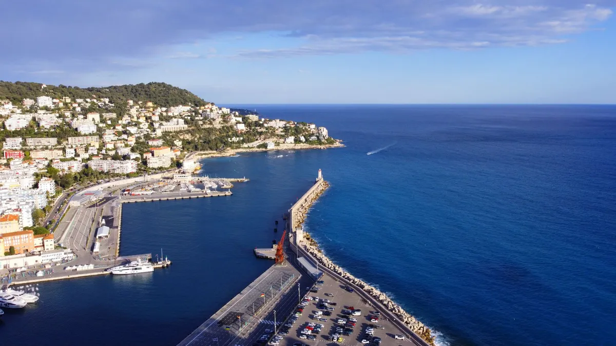
L'Eterna Seduzione della Costa Azzurra: Tra Scogliere di Porfido e Misteri Belle Époque
Il Mediterraneo non è solo un mare, è un palcoscenico. E in nessun luogo come lungo il litorale che si estende da Mentone fino a Théoule-sur-Mer, questo palcoscenico ha dato vita a una scenografia così perfetta da sembrare, talvolta, irreale. Qui, la roccia rossa dell'Esterel si tuffa in acque di un azzurro quasi violento, in un abbraccio cromatico che ha stregato pittori, scrittori e la nobiltà europea per oltre due secoli. Sono Marco Rossi, e oggi vi porto oltre la superficie patinata dei festival cinematografici per scoprire l'anima profonda della Costa Azzurra. Quando il Lusso Divenne lo Specchio dell'Anima Non si può comprendere la Costa Azzurra senza guardare alla trasformazione radicale avvenuta nel XIX secolo. Prima dell'arrivo dei treni e del benessere della "Belle Époque", questa striscia di terra era un insieme di villaggi di pescatori e agricoltori dediti alla coltivazione di agrumi e fiori. Fu l'arrivo dell'aristocrazia inglese, in cerca di un rifugio invernale contro il rigido clima del Nord, a mutare il volto di città come Nizza e Cannes. Lord Brougham, nel 1834, fu il pioniere involontario: bloccato a Cannes da un'epidemia di colera, si innamorò a tal punto della baia da costruirvi una villa. Questo atto segnò l'inizio di una metamorfosi. Nacquero i grandi boulevard, le passeggiate monumentali come la Promenade des Anglais, e le architetture eclettiche che oggi definiscono lo skyline di questa regione. Il lusso non era un accessorio, ma un linguaggio architettonico che fondeva il neoclassico con il liberty, creando una scenografia dove la vita sociale diventava spettacolo.Le Ombre Dorate dei Giardini di Mentone Spostandoci verso il confine italiano, Mentone ci accoglie con la sua tavolozza di colori pastello. Qui, il microclima è un segreto ben custodito: una barriera naturale di montagne protegge la città dai venti freddi, permettendo la crescita rigogliosa di limoni e piante tropicali. Durante il secolo scorso, Mentone non era solo una località climatica, ma un centro di studi botanici unico. Molti dei giardini che oggi visitiamo, come il Val Rahmeh o il giardino botanico di Les Colombières, sono testimonianze viventi dell'ossessione vittoriana per l'esotico. Esplorare questi luoghi significa camminare tra memorie di viaggiatori che riportavano specie vegetali dai quattro angoli dell'Impero Britannico, creando un ecosistema che ancora oggi sfida la logica geografica. La luce che filtra tra le fronde degli agrumeti di Mentone è diversa da ogni altra: è una luce che ha ispirato poeti e che, nonostante il passare degli anni, conserva intatta la sua capacità di sedurre. Il Mito di Nizza: Tra Vicoli Genovesi e Splendore Reale Nizza rappresenta la dicotomia perfetta della Costa Azzurra. Da un lato la "Vieille Ville", con i suoi vicoli stretti, le facciate color ocra e l'anima profondamente legata alla storia sabauda e genovese; dall'altro la Nizza ottocentesca, costruita per i visitatori stranieri, con le sue ampie piazze e i palazzi maestosi. La storia di Nizza è un intreccio complesso di domini: passata di mano tra conti di Provenza, la casata dei Savoia e infine la Francia nel 1860, conserva un'identità ibrida che la rende unica nel panorama francese. Passeggiare per il mercato di Cours Saleya significa immergersi in una tradizione che non ha ceduto alla modernità: il profumo dei fiori freschi, il sapore della socca (la tipica farinata di ceci) e il chiacchiericcio in lingua nizzarda sono ancora i veri custodi di questa città.Il Fascino Silenzioso delle Isole di Lerino Lontano dai riflettori di Cannes, a pochi minuti di battello dalla costa, si trovano le Isole di Lerino (Îles de Lérins). L'Isola di Santa Margherita e l'Isola di Sant'Onorato offrono un contrappunto perfetto al rumore glamour del litorale. Qui, la storia si fa solida e severa: il Forte Reale di Santa Margherita è famoso per aver ospitato il leggendario "Uomo con la maschera di ferro", il prigioniero più misterioso della storia di Francia. Al contrario, Sant'Onorato è il regno del silenzio: un monastero fortificato abitato dai monaci cistercensi, che coltivano i vigneti dell'isola da secoli. Questo contrasto tra la prigione di stato e il ritiro spirituale ci ricorda che la Costa Azzurra è anche una terra di solitudini e di introspezione, dove il lusso è dato dal tempo, non dall'oro. Architettura e Arte: Quando il Paesaggio diventa Museo Non si può parlare di questa regione senza menzionare l'impatto che ha avuto su giganti dell'arte come Matisse, Picasso e Chagall. La luce della Costa Azzurra ha una qualità rifrangente unica, dovuta alla vicinanza tra le montagne calcaree e il mare aperto. Questo ha spinto gli artisti a stabilirsi in borghi come Saint-Paul-de-Vence o Vence stessa. Le fondamenta stesse di questi villaggi, arroccati su promontori rocciosi per difendersi dalle invasioni corsare dei secoli passati, sono diventate gallerie a cielo aperto. Le mura medievali che un tempo proteggevano la popolazione, oggi ospitano botteghe d'arte e caffè che conservano l'atmosfera bohémienne degli anni '20 del secolo scorso.Consigli per Esplorare con Autenticità Per vivere davvero la Costa Azzurra, è necessario abbandonare i ritmi serrati del turismo di massa e abbracciare quello che i locali chiamano "l'art de vivre". Ecco come approcciarsi a questa terra:Spostatevi in treno: La linea ferroviaria che costeggia il mare tra Monaco e Cannes è uno dei percorsi più spettacolari d'Europa. Eviterete il traffico e godrete di una vista ininterrotta sulla baia. Visitate i mercati locali: Evitate i ristoranti troppo turistici lungo la spiaggia. Andate dove fanno la spesa i locali: il mercato di Nizza o quello di Antibes offrono prodotti di una qualità eccezionale. Cercate le tracce del passato: Ogni città conserva una targa o un piccolo museo dedicato ai personaggi che hanno contribuito a creare il mito della zona, da Cocteau ad Hemingway. Rispettate la natura: Le zone protette, come il massiccio dell'Esterel, sono fragili. Percorrete i sentieri segnati per proteggere la biodiversità locale.In definitiva, la Costa Azzurra non è una destinazione che si visita una sola volta. È un palinsesto di epoche, un luogo dove la storia degli uomini si è sovrapposta alla bellezza indifferente della natura. Che siate sedotti dall'eleganza di un hotel Belle Époque o dal silenzio di un monastero isolano, questa striscia di Francia avrà sempre qualcosa di nuovo da svelarvi, purché sappiate guardare oltre l'orizzonte. La Riviera francese rimane un promessa mantenuta: quella di un angolo di mondo dove, anche solo per un pomeriggio, il tempo sembra fermarsi sotto il riverbero costante del Mediterraneo. #CostaAzzurra #ViaggiDiLusso #RivieraFrancese #StoriaDiViaggio #FranciaSegreta Related InsightsThe Silk Road's Nomadic Hospitality: Yurt Stays in Kyrgyzstan (Part 2) The Silk Road Rediscovered: Navigating the Ancient Caravanserais of Central Asia Unveiling the Land Down Under: A Journey Through Australia's Thriving Tourism{ "@context": "https://schema.org", "@type": "FAQPage", "mainEntity": [ { "@type": "Question", "name": "What is the main focus of L'Eterna Seduzione della Costa Azzurra: Tra Scogliere di Porfido e Misteri Belle Époque?", "acceptedAnswer": { "@type": "Answer", "text": "Un viaggio esclusivo tra le memorie della Costa Azzurra, dove il lusso senza tempo incontra la storia millenaria della riviera più affascinante al mondo." } }, { "@type": "Question", "name": "Who authored the comprehensive guide on L'Eterna Seduzione della Costa Azzurra: Tra Scogliere di Porfido e Misteri Belle Époque?", "acceptedAnswer": { "@type": "Answer", "text": "This detailed article and its insights were carefully researched and authored by Marco Rossi." } }, { "@type": "Question", "name": "Where can I find more related content about Travel?", "acceptedAnswer": { "@type": "Answer", "text": "You can explore more articles, detailed reviews, and similar insights by browsing the Related Insights section at the bottom of this article or visiting our dedicated Travel category page." } } ] }
-
 Chloe Tremblay
 - 04 Sep, 2026 20:58
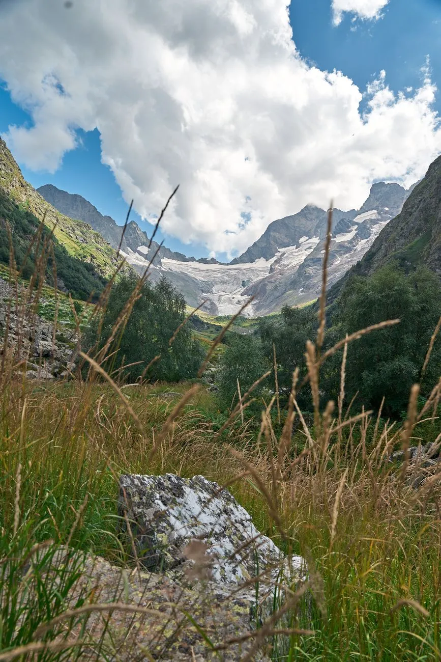
Beyond the Clouds: Unveiling the Eternal Spirit of Georgia’s Caucasus
Where the Gods Cast Their Shadows Across the Peaks The Caucasus Mountains are not merely a geographical barrier; they are a living, breathing testament to the resilience of human culture at the edge of the sky. As I stand on the precipice of a ridge overlooking the Svaneti region, the silence is so profound it feels prehistoric. This is the heart of Georgia, a nation that has spent millennia perfecting the art of existence between the peaks. For the modern traveler, Georgia offers something increasingly rare: an authentic encounter with history that hasn't been polished away by mass tourism. The jagged silhouettes of Mount Shkhara and Mount Kazbek dominate the horizon, creating a dramatic backdrop for the stone towers that have guarded these valleys for centuries. Visiting Georgia requires a shift in perspective. It is not a place to check off a list, but a place to inhabit. With the country’s liberal visa policies—offering a full year of visa-free access to citizens of dozens of countries—Georgia has transformed from a hidden gem into a sanctuary for digital nomads and long-term explorers. It is a country that understands the value of time, reflected in its 8,000-year-old tradition of qvevri winemaking. Here, the wine is not just a commodity; it is a sacred element of the dinner table, an ancient liquid timeline that connects the Neolithic era to your glass tonight. As you traverse the winding mountain passes, you will find that the hospitality of the high-altitude villages is as intense as the elevation itself. Whether you are trekking the Transcaucasian Trail or searching for the perfect Tbilisi café to log into your workday, the sheer gravity of Georgia’s spirit will pull you into its orbit, making a short trip feel like a lifetime.The Symphony of Stone and Sky in Svaneti Svaneti is the jewel in the crown of the High Caucasus, a region so isolated by its treacherous mountain terrain that it managed to preserve its unique language and customs even as empires rose and fell below it. The iconic Svan towers, or "koshki," rise from the earth like granite sentinels. Originally built during the Middle Ages as fortified dwellings to protect families from both invading armies and blood feuds, these towers now stand as iconic silhouettes against the massive glaciers. Trekking from Mestia to Ushguli is the quintessential Georgian experience. Ushguli, one of the highest permanently inhabited settlements in Europe, sits at the base of the Shkhara glacier. Here, the road ends, and the true wilderness begins. For the serious hiker, the trails here are unforgiving yet immensely rewarding. The path is marked by high mountain passes—often exceeding 2,500 meters—that test your lung capacity and spirit. But the effort is rewarded with scenes of wild, unmanicured beauty: meadows saturated with wildflowers, glacial rivers running turquoise with silt, and the constant, thundering presence of peaks that pierce the clouds. Living here, even for a few weeks, demands a change in your daily rhythm. There is no urgency in the mountains. The locals, the Svans, are known for their fierce independence and their legendary hospitality. You will find yourself invited into homes for a glass of homemade wine or chacha (a potent grape brandy) before you even realize you’ve been walking for six hours. This is the pulse of the Caucasus—a place where the physical challenge of the terrain is balanced by the warmth of the hearth. For a remote worker, the stability of mobile connectivity is improving, but the real benefit is the forced disconnection that allows you to rediscover your own creative clarity. A Toast to Eight Millennia of Viticulture To understand Georgia is to understand the Qvevri. These massive, egg-shaped clay vessels, buried deep underground, are the heart of a winemaking tradition that has survived virtually unchanged for eight thousand years. This is not the sterile, stainless-steel-tank wine production found in Bordeaux or Napa; this is raw, earthy, and profound. When you drink amber wine—produced by fermenting white grapes with their skins in the Qvevri—you are tasting history. The tannins, the color, and the depth of flavor are derived from the very earth of Georgia. In the mountain regions, the grapes grow in microclimates that are as dramatic as the peaks themselves, creating wines that are crisp, mineral-forward, and entirely distinct. Visiting a cellar in a remote valley is a masterclass in patience. The winemakers speak of their Qvevri as if they are living members of the family. Because of the natural temperature control of the earth, the wine matures at a steady, slow pace, resulting in a product that is complex and unfiltered. In Tbilisi, the capital, this tradition is being revitalized by a new generation of winemakers who are blending modern entrepreneurial spirit with ancient secrets. You can sit in a sleek, modern wine bar in the Sololaki district, sipping a 2024 vintage that was made exactly the same way as a 6000 BCE find discovered by archaeologists. This continuity is what makes Georgia so compelling. As a digital nomad, integrating into this culture means participating in the "supra," the traditional Georgian feast. It is a marathon of storytelling, polyphonic singing, and endless toasts led by a "tamada" (toastmaster). It is an experience that breaks down barriers faster than any business meeting ever could.Navigating the Nomad's Economic Frontier Georgia has quietly become the premier destination for remote workers who want to balance high-quality living with low overhead. Utilizing data aggregated from platforms like Numbeo, we can see why it attracts the global freelance community. While inflation has impacted global travel, Georgia remains a highly accessible "best-kept secret." The cost of living in Tbilisi, when compared to Western European capitals or major North American hubs, allows for a significantly higher quality of life on a modest budget. You aren't just surviving here; you are living in a historic city with a world-class culinary scene, an affordable network of coworking spaces, and a vibrant nightlife that rivals Berlin. Beyond the raw numbers, the lifestyle value is found in the ease of integration. The "Remotely from Georgia" visa program, combined with the general one-year visa-free stay, provides a level of legal certainty that is rare. For those looking to set up a base, the housing market in Tbilisi ranges from renovated Soviet-era apartments with soaring ceilings to ultra-modern lofts. However, the true savvy nomad spends their summer in the mountains and their shoulder season in the city. When you factor in the efficiency of the "Marshrutka" (the ubiquitous minibus transport system) and the plummeting costs of local food—characterized by fresh sulguni cheese, organic produce, and world-class bread—you realize that Georgia offers a masterclass in economic mobility. It is a place where you can afford to invest in your own health, your own wine collection, and your own professional development simultaneously.Expense Category Average Monthly Cost (USD) Comparison to Western EuropeStudio Apartment (City Center) $550 - $800 ~60% LowerCoworking Desk Space $120 - $200 ~50% LowerGrocery Budget (Fresh Market) $200 - $300 ~45% LowerHigh-Speed Internet/Utility Bill $40 - $60 ~30% LowerMonthly Restaurant Spend $300 - $450 ~55% LowerThe Art of the Slow Migration To live in Georgia is to practice the art of the slow migration. As the summer heat climbs in the Tbilisi streets, the pulse of the country moves upward. You follow it, winding your way through the Georgian Military Highway toward the mountain sanctuary of Kazbegi. The road itself is a historical marvel, cutting through the high passes that have defined trade and conflict for centuries. Once you arrive, the air changes. It is sharper, thinner, and clearer. This is where your workday shifts; you find yourself answering emails while staring at the Gergeti Trinity Church, perched precariously against the massive flank of Mt. Kazbek. The infrastructure for digital nomads in these remote regions is surprisingly robust. Small guesthouses in Stepantsminda have adapted to the influx of remote professionals, offering high-speed satellite internet alongside traditional mountain breakfasts. It is not uncommon to see a software developer, a trekking guide, and a local winemaker sharing a terrace. This intersection of cultures is where the true value of your stay lies. You learn to negotiate the pace of your professional life with the immutable pace of the mountains. You learn that a local storm might delay your commute, but it also provides the perfect excuse to spend the afternoon diving into the complexities of Georgian history. The isolation of the peaks acts as a catalyst for focus. When there are no distractions but the sound of the wind through the Caucasian pines, your output—whether it be code, prose, or strategic planning—takes on a new dimension of depth.Where Your Story Becomes Part of the Landscape The allure of Georgia is not that it caters to you, but that it invites you to join it. It is a land of paradoxes: fiercely traditional yet incredibly welcoming to the outsider, geographically isolated yet culturally central to the historic Silk Road. As you pack your gear to leave the mountain ridges or close your laptop after a month in a Tbilisi café, you realize that you aren't leaving a destination—you are leaving a community. The friendships formed over a shared bowl of Khinkali or a long, wine-soaked evening are deep and often lasting. You have become, for a fleeting moment, a part of the long, intricate tapestry of the Caucasus. If you are a traveler looking for the next frontier, look no further than these jagged, ancient heights. The mountains are waiting, and the wine is already poured. Georgia doesn't ask you to change it, but it will inevitably change you. You will return to your home country with a different standard for what constitutes a mountain, a different palate for what defines wine, and a different understanding of what it means to be truly free in a modern, connected world. The peaks of the Caucasus will remain, silent and immutable, long after your flight has departed, but the memory of the light hitting the glaciers at dusk will remain even longer. Do not wait for the perfect time to visit; in the land of 8,000 vintages, the perfect time is always now. Pack your boots, bring your curiosity, and prepare to be humbled by one of the most magnificent landscapes on this earth. The mountain path is open, and your story in Georgia is waiting to be written. #GeorgiaTravel #DigitalNomadLife #CaucasusMountains #TravelDeep #AncientTraditions Related InsightsExploring Ani, City of 1001 Churches Ethiopia's Danakil Depression: The Hottest Place on Earth's Alien Landscapes (Part 3) The Purple Gold of Provence: Exploring the Lavender Fields{ "@context": "https://schema.org", "@type": "FAQPage", "mainEntity": [ { "@type": "Question", "name": "What is the main focus of Beyond the Clouds: Unveiling the Eternal Spirit of Georgia’s Caucasus?", "acceptedAnswer": { "@type": "Answer", "text": "Discover why Georgia is the ultimate frontier for adventurers and digital nomads, blending 8,000-year-old wine traditions with the world’s most dramatic alpine scenery." } }, { "@type": "Question", "name": "Who authored the comprehensive guide on Beyond the Clouds: Unveiling the Eternal Spirit of Georgia’s Caucasus?", "acceptedAnswer": { "@type": "Answer", "text": "This detailed article and its insights were carefully researched and authored by Chloe Tremblay." } }, { "@type": "Question", "name": "Where can I find more related content about Travel?", "acceptedAnswer": { "@type": "Answer", "text": "You can explore more articles, detailed reviews, and similar insights by browsing the Related Insights section at the bottom of this article or visiting our dedicated Travel category page." } } ] }
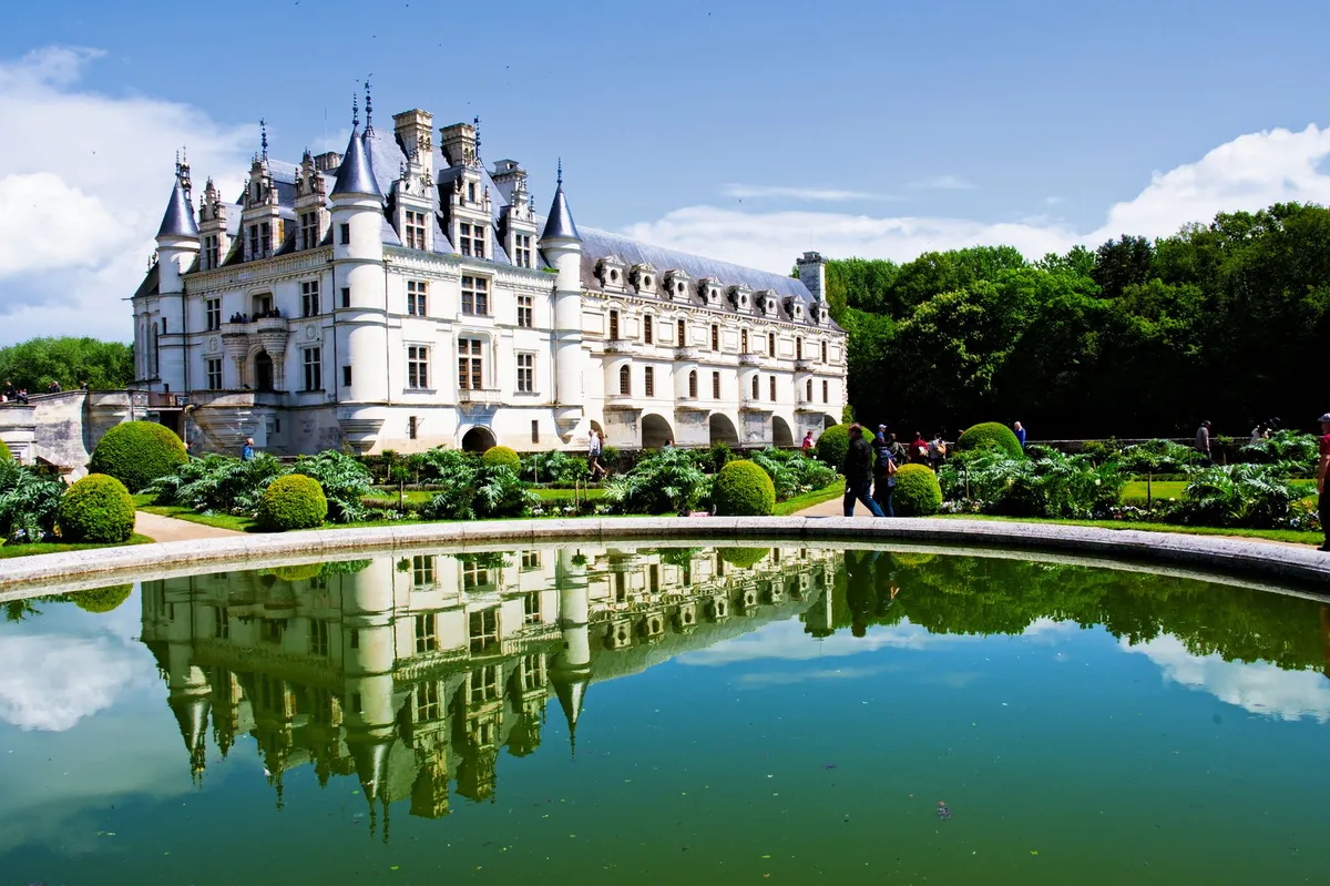
-
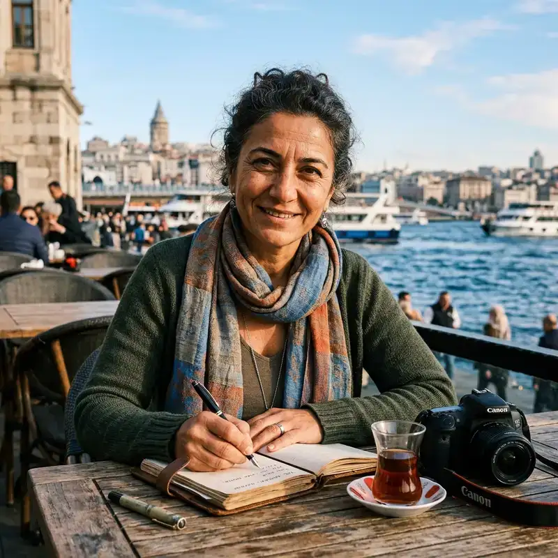 Cemre Seyyah
 - 04 Sep, 2026 20:02
The Stone Dreams of Kings: Unveiling the Loire Valley’s Living Tapestry
The morning mist clings to the silver ribbon of the Loire River like a half-remembered dream, obscuring the foundations of limestone giants that have stood watch over France for half a millennium. To travel here is not merely to sightsee; it is to perform a gentle excavation of time itself. Here, the landscape is defined by the heavy, sweet scent of ripening vineyards and the imposing silhouettes of châteaux that were birthed from the vanity, vision, and often the blood of kings. I am Cemre Seyyah, and I invite you to walk with me through the corridors of power, where the echoes of Valois and Bourbon footsteps still vibrate against the tapestries of history. Where the River Whispers Renaissance Secrets The Loire Valley, often heralded as the "Garden of France," serves as a physical manifestation of the transition from the fortified medieval fortress to the opulent pleasure palace. As the Hundred Years' War faded into the collective memory, the French nobility turned their gaze from defensive fortifications toward the pursuit of beauty, art, and intellectual inquiry. Château de Chambord stands as the absolute zenith of this transition. Commissioned by King Francis I, it is a dizzying display of French Renaissance architecture fused with traditional medieval forms. It was never intended to be a permanent residence, but rather a colossal hunting lodge, a stage upon which the king could project his immense power. Its most famous feature—the double-helix staircase—is a masterwork often attributed to the influence of Leonardo da Vinci. It functions on a principle where two people can ascend and descend without ever crossing paths, a perfect metaphor for the intricate, layered politics of the sixteenth-century French court.The Duality of Chenonceau: A Bridge Over Turbulent Waters If Chambord is the manifestation of masculine ego, Château de Chenonceau is the soul of feminine resilience. Known as the "Château des Dames," its history is inextricably linked to the influential women who shaped it: Diane de Poitiers, Catherine de' Medici, and Louise de Lorraine. Stretching gracefully across the River Cher, the bridge-gallery of Chenonceau creates a dreamlike illusion of floating architecture. Under the stewardship of Catherine de' Medici, the chateau became a center of political intrigue and grand festivals. However, the true beauty of Chenonceau lies in its endurance; it served as a hospital during the First World War and a secret passage during the Second, marking the boundary between occupied and free France. To stand in its gallery is to feel the weight of centuries pressing against the river stones. Architectural Alchemy at Blois and Amboise To understand the evolution of French royal taste, one must visit the Royal Château de Blois. It is a architectural palimpsest, where the layers of time are laid bare for the observant traveler. The chateau features four distinct wings built across different centuries, showcasing the shift from Gothic flamboyant styles to the refined, geometric grace of the Renaissance. The spiral staircase at Blois, built during the reign of Francis I, is an open-air spectacle of stone carving—a structural jewel box that defies the rigid austerity of the earlier medieval towers. Nearby, the Château d'Amboise offers a different perspective. It was here that Charles VIII met his sudden end, and here that Leonardo da Vinci spent his final years under the king’s protection. His tomb in the Saint-Hubert Chapel remains a pilgrimage site for those who worship at the altar of genius. The gardens of Amboise, cascading down toward the river, provide the perfect vantage point to appreciate the strategic importance of the Loire Valley as a riverine corridor of trade and defense.The Art of Living in the Valley of Kings The châteaux of the Loire were never intended to be stagnant museums. In their prime, they were the epicenters of a vibrant culture defined by the "art de vivre." The surrounding vineyards, which have been cultivated since the Roman era, provide the liquid narrative for the valley. The crisp, acidic whites of Sancerre and the robust reds of Chinon are not merely wine; they are the terroir of the Loire, distilled through centuries of tradition. When you walk through the Hall of Mirrors at smaller, perhaps less famous estates like Cheverny, you are witnessing the interior design sensibilities that would eventually inspire the grandeur of Versailles. The tapestries, the intricate woodworking, and the meticulously manicured topiary gardens are all remnants of a time when the king’s court was a migratory entity, moving from one castle to another to display authority and indulge in the excesses of the hunt and the feast. Hidden Echoes in the Limestone Grottoes The landscape of the Loire Valley is as much below the surface as it is above. Many of the châteaux were constructed from "tuffeau," a soft, white limestone that gives these buildings their luminous quality as the sun traverses the sky. For centuries, this stone was quarried directly from the hillsides, creating a vast network of subterranean caves. Today, these troglodyte dwellings have found new life as mushroom farms, wine cellars, and even eccentric boutique hotels. To enter these cool, damp spaces is to encounter the silent, working history of the region—the artisans and masons whose labor made the dreams of kings a reality. This duality—the towering, ornate spires above and the rugged, earthy grit of the limestone caves below—is what makes the Loire Valley so profoundly compelling.A Pilgrimage of Perpetual Wonder As you traverse the river, moving from the medieval defensive walls of Angers—with its legendary Apocalypse Tapestry—to the refined beauty of Azay-le-Rideau, you begin to understand the rhythm of the valley. It is a slow, measured pace that demands patience. The Loire does not rush; it winds. The châteaux serve as anchors in this landscape, grounding the ethereal beauty of the light and water. Each castle tells a story of survival—survival against the whims of shifting political alliances, the ravages of war, and the relentless creep of the centuries. Yet, they remain. They are stone prayers cast against the horizon, asking that we remember the men and women who, despite the brevity of their lives, sought to leave behind a legacy of absolute, uncompromising beauty. Traveler, when you arrive in the Loire Valley, do not simply check the items off your itinerary. Find a spot along the banks of the river near sunset, watch as the tuffeau stone turns a pale, ethereal pink, and let the silence of the valley speak to you. There is no better way to understand the heart of France than to listen to the whispers of its ancient stone guardians.#LoireValley #FrenchHistory #ChateauLife #RenaissanceArchitecture #TravelFrance Related InsightsThe Shimmering Waters: Documenting Plitvice Lakes National Park Beyond the Granite Spires: Unveiling Patagonia’s Untamed Secrets L'Eclissi del Re Sole: Tra gli Specchi e l'Oro di Versailles{ "@context": "https://schema.org", "@type": "FAQPage", "mainEntity": [ { "@type": "Question", "name": "What is the main focus of The Stone Dreams of Kings: Unveiling the Loire Valley’s Living Tapestry?", "acceptedAnswer": { "@type": "Answer", "text": "Step into a realm where Renaissance grandeur meets the tranquil waters of the Loire. Discover the architectural marvels that defined French history." } }, { "@type": "Question", "name": "Who authored the comprehensive guide on The Stone Dreams of Kings: Unveiling the Loire Valley’s Living Tapestry?", "acceptedAnswer": { "@type": "Answer", "text": "This detailed article and its insights were carefully researched and authored by Cemre Seyyah." } }, { "@type": "Question", "name": "Where can I find more related content about Travel?", "acceptedAnswer": { "@type": "Answer", "text": "You can explore more articles, detailed reviews, and similar insights by browsing the Related Insights section at the bottom of this article or visiting our dedicated Travel category page." } } ] }
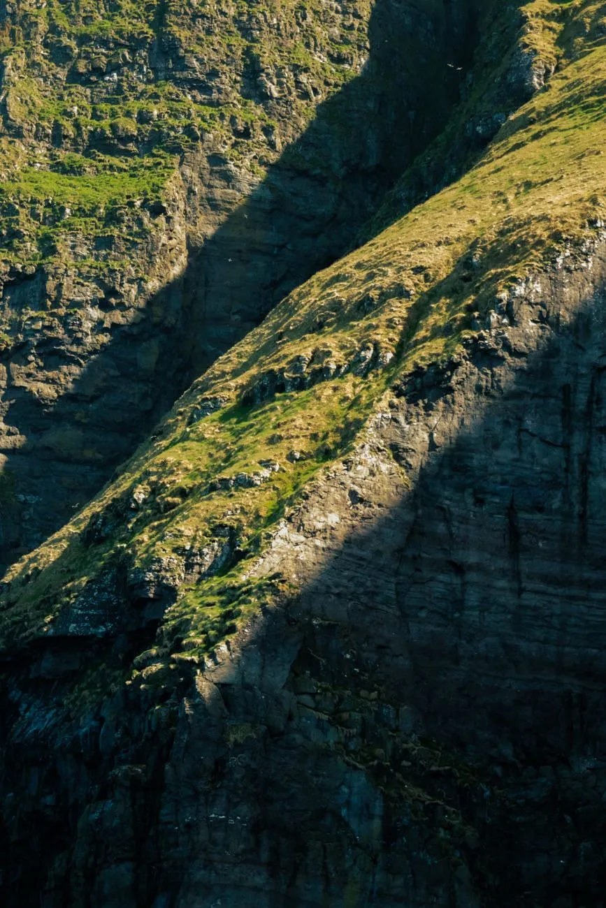
Where the North Atlantic crashes against basalt columns and the fog clings to verdant, grass-roofed villages, you will find the Faroe Islands. As a traveler who has traversed the globe, I find few places as hauntingly beautiful or as fiercely independent as this collection of eighteen volcanic islands. Situated roughly halfway between Norway and Iceland, the Faroes are more than just a cluster of rocks in the sea; they are a living, breathing testament to Viking resilience and a sanctuary for those seeking to escape the frantic pulse of the modern world. For the digital nomad or the intrepid explorer, these islands offer a unique blend of ancient Scandinavian tradition and surprisingly modern infrastructure, though this solitude comes with a price—both in currency and in the willingness to endure the whims of the North Atlantic weather. Stepping Into a Nordic Realm of Basalt and Legend The moment your plane touches down at Vágar Airport, you realize you have entered a domain where nature dictates the schedule. The islands, a self-governing territory of the Kingdom of Denmark, are rugged, precipitous, and utterly captivating. Historically, the islands served as a key stopover for Viking voyagers, and today, that seafaring spirit remains woven into the very fabric of the culture. The Faroese language, a direct descendant of Old Norse, is a rhythmic reminder of this heritage, still spoken daily by the resilient locals. Geographically, the islands are defined by steep cliffs that plummet into the churning ocean, dotted with sheep—which actually outnumber the human population—and waterfalls that defy gravity as they are blown upward by powerful gale-force winds. When you explore places like Gásadalur, where the Múlafossur waterfall plunges directly into the sea, the sense of being at the edge of the world is absolute. It is a landscape that demands respect; the weather shifts in seconds, transforming a bright, sun-drenched morning into a brooding, atmospheric grey afternoon. This is not a destination for the casual tourist seeking a resort-style retreat. It is a rugged frontier for those who wish to experience the raw power of the elements.Traveling here requires a shift in mindset. You must be prepared for the reality that your itinerary is merely a suggestion, easily overruled by a storm or a ferry cancellation. Yet, this uncertainty is precisely what makes the Faroe Islands so intoxicating. You aren’t just visiting a landscape; you are entering an agreement with it. You provide the patience, and the islands provide vistas that have remained largely unchanged since the first longships pulled onto these shores over a millennium ago. The Economic Realities of the North Atlantic Frontier For the digital nomad or the long-term visitor, one must confront the cold, hard numbers. Living in the Faroe Islands is an investment in exclusivity. My assessment of the current cost of living reveals that the islands function as a high-tier economic environment. For a single digital nomad, a budget of approximately $2,960 per month is the realistic median to maintain a comfortable standard of living. This figure covers a balanced mix of modest local housing, essential utilities, and a combination of cooking at home versus occasional dining out. Because the Faroe Islands are an autonomous territory, they occupy a unique legal space. They are not part of the European Union, nor are they part of the Schengen Area. This distinction is vital for long-term planning. Travelers generally follow Danish entry rules, which often means visa-free access for short-term stays for many nationalities. However, if you intend to plant roots as a remote worker for an extended period, you must navigate the process for a special long-term residency permit. Transportation is another significant line item. While the road infrastructure is world-class—featuring sub-sea tunnels that connect major islands like Streymoy and Eysturoy—car rentals and fuel are notably expensive. You are paying for the engineering marvels that make connectivity possible in such a hostile, disconnected environment. Utilities, particularly heating and electricity, also reflect the cost of importing resources and maintaining power grids in remote, wind-battered regions. Budgeting for the Faroes isn't just about saving money; it’s about understanding the premium placed on accessibility and comfort in a location that is, by its very nature, isolated. Navigating the Cost of Living in TórshavnCategory Typical Monthly Expense (USD) NotesApartment (1 Bedroom, Central) $1,200 - $1,600 High demand, limited supplyUtilities (Heating, Electricity) $250 - $400 Depends heavily on the seasonFood (Grocery staples + Coffee) $600 - $800 Prices elevated due to importTransportation (Car Rental/Fuel) $400 - $600 Essential for exploring remote areasConnectivity (High-speed Internet) $80 - $120 Surprisingly robust for the locationTotal Median Monthly Estimate $2,960 Baseline for a single digital nomadThis table provides a snapshot of what you can expect to pay. It is important to note that while Tórshavn, the capital, offers the most amenities, the real cost of living spikes when you venture into more remote villages where grocery options are limited to local, often pricier, goods. The Cultural Pulse of the Capital and Beyond Tórshavn is one of the smallest and most enchanting capitals in the world. It doesn't scream for your attention with glittering towers; instead, it whispers with the charm of grass-roofed houses in the historic Tinganes district, where the government has operated for centuries. As you walk the narrow, winding lanes of Tinganes, you are effectively stepping back into the 16th century, though the offices inside these preserved buildings are equipped with high-speed fiber optics. This juxtaposition of the ancient and the digital is the hallmark of the Faroe experience.Eating here is an exercise in local sustainability. The Faroese kitchen relies heavily on the sea and the rugged hillsides. You will find "ræst"—a process of fermenting lamb or fish in traditional drying sheds—which is a culinary cornerstone you must try to truly understand the local identity. It is an acquired taste, salty and intense, much like the climate itself. When you dine in Tórshavn, you are tasting the history of a people who survived for centuries on what could be caught, foraged, or grazed. Modern chefs have elevated these humble origins into world-class gastronomy, but the spirit of the food remains deeply rooted in the soil and the current. Beyond the capital, the islands of Eysturoy and Borðoy offer a deeper dive into the industrial and fishing history of the archipelago. Klaksvík, the second-largest town, sits nestled between towering mountains and serves as the epicenter for the islands' massive fishing industry. Watching the fleet return at sunset, the harbor glowing with life, provides a stark contrast to the quiet, ethereal silence of the mountain hiking trails. Every town, regardless of size, feels like a sanctuary protected by the mountains and the sea, offering a sense of community that is rare in today’s disconnected world. Masterclass in Nordic Adventure and Logistics To truly conquer the Faroe Islands, you must be a master of the elements. Hiking is the primary method of engagement with the geography, but it is not without risk. Trails are often unmarked and can be obscured by sudden shifts in visibility. Always consult local resources such as the "Hiking in the Faroe Islands" guides, and never underestimate the "mountain fog." It is a cliché for a reason: when the fog rolls in, it can make even the most familiar trail vanish in minutes.Preparation starts with gear. You need high-quality, windproof, and waterproof layers. Forget umbrellas; the wind will snap them in seconds. Instead, invest in technical shells and sturdy hiking boots that can handle boggy, uneven terrain. Before setting out, check the weather reports obsessively. The Faroese Meteorological Office provides reliable data, but even then, rely on your own observation. If the locals are staying put, you should likely do the same. For the remote professional, finding a "base camp" is essential. Tórshavn offers the most reliable infrastructure for digital nomads, including co-working spaces and high-speed satellite connectivity that ensures you remain tethered to your global responsibilities while you are physically situated at the edge of the map. Renting a small, traditional house with a grass roof in a slightly quieter village can provide the creative solitude many seek, but ensure your host guarantees stable internet. Remote island living sounds poetic, but when you are trying to push a large file during a storm, reliability becomes your most prized luxury. Embracing the Viking Spirit in a Modern World As I prepare to leave these rugged shores, I am struck by the permanence of the place. The Faroe Islands don’t change to accommodate you; you change to accommodate them. That is the true gift of this destination. In a world of over-tourism and curated Instagram moments, the Faroes remain fiercely authentic. They offer a rare opportunity to disconnect from the noise of the digital age and reconnect with the primal, elemental forces that have shaped human existence for millennia. The echoes of the Vikings are not just in the place names or the preservation of the language; they are in the way the locals look at a brewing storm—with respect, not fear. They are in the way the silence of the mountains rings in your ears after a long day of hiking. This is a place where you can find genuine solitude, where the scale of nature reminds you of your own place in the grand tapestry of the world. Whether you are a digital nomad searching for a new base of operations or a traveler seeking a landscape that challenges your senses, the Faroe Islands will leave an indelible mark on your psyche. It is an expensive journey, both in time and currency, but the dividends are measured in perspectives shifted and perspectives expanded. You arrive looking for scenery, but you leave with a deeper appreciation for the resilience of life in the most unlikely of places. So, pack your warmest gear, bring your sense of wonder, and prepare for the wind to change, because the Faroes are waiting to show you exactly what it means to live at the edge of the Atlantic. Your next great adventure is not just a trip; it is a pilgrimage to the core of the North. #FaroeIslands #DigitalNomad #AdventureTravel #VikingHeritage #TravelExpert Related InsightsMount Fuji: The Sacred Mountain of Japan Les Sentinelles Solitaires du Bout du Monde : Une Odyssée vers les Phares Oubliés de Patagonie Chilienne The Whispering Ice Temples: Tracing the Vanishing Footprints to Patagonia's Subterranean Sanctuaries{ "@context": "https://schema.org", "@type": "FAQPage", "mainEntity": [ { "@type": "Question", "name": "What is the main focus of Echoes of the North Atlantic: Navigating the Untamed Faroe Islands?", "acceptedAnswer": { "@type": "Answer", "text": "Discover the Faroe Islands, a hidden archipelago of Viking heritage and dramatic cliffs. Expert travel insights on costs, logistics, and wild landscapes." } }, { "@type": "Question", "name": "Who authored the comprehensive guide on Echoes of the North Atlantic: Navigating the Untamed Faroe Islands?", "acceptedAnswer": { "@type": "Answer", "text": "This detailed article and its insights were carefully researched and authored by Zola Ndlovu." } }, { "@type": "Question", "name": "Where can I find more related content about Travel?", "acceptedAnswer": { "@type": "Answer", "text": "You can explore more articles, detailed reviews, and similar insights by browsing the Related Insights section at the bottom of this article or visiting our dedicated Travel category page." } } ] }
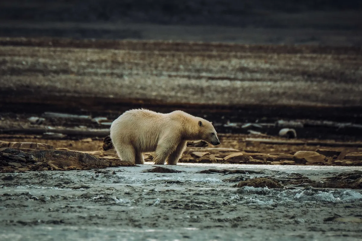
Welcome to the Frozen Frontier: Why Svalbard is the Ultimate Arctic Escape Few places on Earth evoke the same sense of isolation and raw wilderness as Svalbard. Nestled in the Arctic Ocean, midway between Norway and the North Pole, this archipelago is a land of extremes—where polar bears outnumber people, glaciers carve through fjords, and the midnight sun dances with the aurora borealis. For adventurers, remote workers, and those seeking a life untethered from the ordinary, Svalbard offers an unparalleled blend of natural spectacle and modern convenience. Unlike typical tourist destinations, Svalbard doesn’t just welcome visitors; it invites them to become part of its story. With no visa requirements for stays under 90 days (and a digital nomad pathway for longer stays), it’s a rare Arctic gem where bureaucracy doesn’t overshadow adventure. Here, you can work from a cozy cabin overlooking a glacier one day and embark on a snowmobile safari past walrus colonies the next. The archipelago’s unique status—governed by the Svalbard Treaty—means it’s a demilitarized zone where Norwegian law applies, but international access is unrestricted. This makes it a haven for those who crave both solitude and community in one of the planet’s most extreme environments. But Svalbard isn’t just about survival in the cold. It’s a place where human resilience meets Arctic wonder. The largest settlement, Longyearbyen, boasts a thriving cultural scene, including a world-class brewery, a seed vault preserving global biodiversity, and a university dedicated to Arctic studies. Yet, just beyond its streets, the wilderness begins—untamed, unpredictable, and breathtakingly beautiful. Whether you’re here for the Northern Lights, the midnight sun, or the chance to live in one of the world’s most remote communities, Svalbard promises an experience that lingers long after you’ve left.The Digital Nomad’s Arctic Oasis: Living and Working in Svalbard For remote workers, Svalbard is more than a seasonal escape—it’s a year-round destination. As of January 2025, the archipelago ranks 13th in the VisaGuide.World Digital Nomad Index, scoring 2.91 out of 5. This ranking considers factors like internet reliability, cost of living, and quality of life, placing Svalbard ahead of many traditional nomad hotspots. The best part? You can live here indefinitely as a digital nomad, provided you meet the financial requirements: a monthly income of $4,000 and proof of 27 years of age. Unlike Norway’s mainland, Svalbard has no visa fees, making it one of the most accessible Arctic destinations for long-term stays. The digital nomad lifestyle in Svalbard is a study in contrasts. By day, you might collaborate with colleagues across time zones in a café warmed by a wood-fired stove, your laptop screen glowing against the backdrop of snow-dusted mountains. By night, you could be stargazing under the aurora borealis or joining a local pub quiz in Longyearbyen’s only English-speaking bar. The archipelago’s infrastructure is surprisingly robust for its remote location. High-speed internet is available in most settlements, and coworking spaces like Svalbard Startup Village offer a hub for nomads to connect. Meanwhile, the absence of sales tax (0%) and low VAT (12%) on essentials like groceries make budgeting easier than in mainland Norway. However, living in Svalbard isn’t without its challenges. The polar night—when the sun doesn’t rise for months—can test even the hardiest souls. Mental health resources are limited, and the isolation can feel acute during the darkest months. Yet, many nomads thrive here by embracing the rhythm of Arctic life. They join local clubs (from photography to dog sledding), volunteer with conservation projects, or simply take advantage of the unique opportunity to work in a place where the natural world is your constant companion. The key to success? Preparation. Packing the right gear, securing a reliable income source, and building a support network within the community are essential. But for those who adapt, Svalbard offers a lifestyle that’s as rewarding as it is unforgettable.Beyond the Northern Lights: Adventures That Define Svalbard While the aurora borealis is Svalbard’s most famous draw, the archipelago’s true magic lies in its year-round adventures. Here, every season paints the landscape in a new light, offering experiences that range from the serene to the adrenaline-fueled. Winter Wonderland: Snowmobiles, Ice Caves, and Polar Bears Winter in Svalbard is a world of silence and stillness, where temperatures plunge to -30°C (-22°F) and the landscape is blanketed in snow. This is prime time for snowmobile safaris, which whisk you across frozen fjords and into the heart of the wilderness. Guided tours typically last 3–5 hours and cover distances of up to 100 km (62 miles), taking you to remote cabins where you can warm up with hot chocolate and stories of Arctic survival. For the truly adventurous, multi-day expeditions are available, complete with camping under the stars (or, more accurately, under the aurora). One of Svalbard’s most unique winter attractions is its ice caves. Formed by meltwater carving through glaciers, these caves are a surreal world of blue ice and intricate formations. The most accessible is the Pyramiden Ice Cave, a 3-hour snowmobile ride from Longyearbyen. Tours include crampons and helmets, and guides ensure safety in this ever-changing environment. Another highlight is dog sledding, where you’ll mush your own team of Alaskan huskies across the tundra, following in the footsteps of Arctic explorers like Roald Amundsen. But the most iconic—and dangerous—wildlife encounter in Svalbard is with the polar bear. With a population of around 3,000, these apex predators outnumber humans on the archipelago. While sightings are common, approaching them is strictly prohibited. Instead, guided bear-watching tours use rifles (for protection) and binoculars to observe these magnificent creatures from a safe distance. Remember: in Svalbard, carrying a firearm is mandatory when venturing outside settlements. This isn’t just for show—it’s a matter of survival. Summer Splendor: Hiking, Kayaking, and Midnight Sun Adventures When the sun returns in April, Svalbard transforms into a land of endless daylight. Summer is the season for hiking, with trails like the Adventdalen Valley offering easy routes through tundra dotted with Arctic flora like purple saxifrage and cotton grass. For a challenge, the Fuglefjellet hike rewards climbers with panoramic views of the Isfjorden fjord. Wildlife is abundant in summer, with reindeer, Arctic foxes, and seabird colonies thriving in the milder temperatures. Water lovers won’t be disappointed. Kayaking in Svalbard’s fjords is a surreal experience, with icebergs calving from glaciers and seals popping up alongside your boat. Guided tours often include camping on remote beaches, where you can fall asleep to the sound of waves and wake up to the sight of whales breaching in the distance. For those who prefer dry land, boat tours to the Alkefjellet cliffs offer a chance to see thousands of nesting seabirds, including puffins and guillemots. One of the most magical summer phenomena is the midnight sun, when the sun doesn’t set for weeks on end. In Longyearbyen, this means 24-hour daylight from late April to late August—a surreal experience for visitors used to darkness. Locals and tourists alike take advantage of the light to hike, fish, or simply enjoy the endless glow. It’s a time of celebration, with festivals like Svalbard’s Midnight Sun Marathon drawing runners from around the world. Year-Round Expeditions: From Glacier Trekking to Whale Watching Svalbard’s adventures aren’t limited to seasonal activities. Year-round expeditions include glacier trekking, where you don crampons and ice axes to explore the Nordenskiöldbreen or Paierlbreen glaciers. These treks are physically demanding but offer unparalleled views of crevasses and ice formations. For a more relaxed option, boat tours to the Barentsburg Russian mining town provide a glimpse into Svalbard’s Soviet-era history, complete with a visit to the world’s northernmost brewery. Whale watching is another year-round activity, with orcas and humpback whales frequenting the waters around Svalbard. The best time for sightings is between June and September, when these giants feed on capelin and herring. Guided tours use hydrophones to listen to whale songs and often include a visit to a local research station studying Arctic marine life.Survival in the Arctic: Safety, Gear, and Local Wisdom Svalbard is not a place for the unprepared. The Arctic doesn’t forgive mistakes, and its beauty is matched only by its danger. Whether you’re here for a week or a year, understanding the risks—and how to mitigate them—is crucial. The Polar Bear Threat: A Reality Check Polar bears are Svalbard’s most feared—and misunderstood—residents. Unlike grizzlies or black bears, polar bears are not afraid of humans. They are curious, opportunistic, and capable of incredible speed. In Svalbard, it’s illegal to leave settlements without a rifle (or a guide carrying one). Even with a firearm, encounters require extreme caution. The Svalbard Governor’s Office mandates that all visitors outside Longyearbyen or Barentsburg carry a rifle and know how to use it. This isn’t just bureaucracy—it’s survival. In 2023, there were 12 recorded polar bear encounters in Svalbard, with two resulting in human injuries. The lesson? Never hike alone, and always carry bear spray (though rifles are the gold standard). Dressing for the Arctic: Layering is Key Svalbard’s weather is unpredictable, even in summer. Temperatures can swing from -20°C (-4°F) in winter to 10°C (50°F) in summer, with wind chill making it feel colder. The key to staying warm is layering:Base Layer: Merino wool or synthetic fabrics to wick moisture. Mid Layer: Fleece or down for insulation. Outer Layer: A windproof and waterproof shell to block Arctic winds. Don’t forget accessories: insulated boots, gloves, a balaclava, and goggles for snowmobiling. Hypothermia is a real risk, even in summer, so always check the forecast before heading out.Health and Emergency Preparedness Medical facilities in Svalbard are limited. Longyearbyen has a small hospital, but serious cases require evacuation to mainland Norway—often delayed by weather. Travel insurance that covers Arctic expeditions is non-negotiable. The Svalbard Hospital can handle minor injuries and illnesses, but for anything serious, you’ll be flown to Tromsø, a 3-hour flight away. Always carry a first-aid kit, and know the symptoms of hypothermia and frostbite (numbness, white or grayish-yellow skin, and confusion are red flags). Local Knowledge: The Unsung Hero of Arctic Survival The people of Svalbard—whether locals or long-term residents—are your best resource. They know the land, the weather, and the wildlife in ways no guidebook can teach. Before embarking on an expedition, visit the Svalbard Museum or chat with staff at the Visit Svalbard office. They’ll share insights like:The best times to avoid avalanches (spring is risky). Where to find the freshest Arctic char (try the Hiorthhamn fishing spot). How to read the sky for sudden storms (a common hazard).Svalbard by the Numbers: Costs, Logistics, and Practicalities Planning a trip to Svalbard requires more than just packing a parka. Understanding the costs, logistics, and practicalities can make the difference between a dream adventure and a logistical nightmare. Below is a breakdown of essential expenses and tips to help you budget effectively.Expense Category Cost (USD) NotesFlights (round-trip) $1,200–$2,500 From Oslo or Tromsø; prices vary by season.Accommodation (per night) $150–$400 Hostels ($150), mid-range hotels ($250), luxury lodges ($400+).Food (per day) $50–$150 Groceries are cheaper than dining out; expect high prices for imported goods.Guided Tours $100–$500 Snowmobile safaris ($150), glacier hikes ($200), polar bear tours ($300).Gear Rental $50–$200 Snowmobiles ($100/day), crampons ($50), thermal suits ($150).Visa/Entry Requirements $0 No visa needed for stays under 90 days; digital nomad income requirement: $4,000/month.Local Transport $20–$100 Snowmobile rentals or taxis; public transport is limited.Budgeting Tips for Svalbard:Fly Mid-Week: Prices drop by 20–30% on Tuesdays and Wednesdays. Cook Your Own Meals: Imported food is expensive; stock up on basics like pasta, rice, and canned goods in Longyearbyen. Book Tours Early: Summer and winter peak seasons (June–August and December–February) sell out fast. Pack Smart: Bring reusable water bottles (tap water is safe to drink) and a power bank—outlets are scarce in remote areas. Insurance is Non-Negotiable: Ensure your policy covers Arctic activities, medical evacuation, and extreme weather delays.Getting There and Around:By Air: The only way to reach Svalbard is by flight from Oslo or Tromsø. Airlines like Norwegian Air and SAS operate daily routes, with flight times ranging from 3 to 4 hours. By Sea: Cruise ships visit Svalbard in summer, but these are expensive and time-consuming (7+ days from mainland Norway). Local Transport: Snowmobiles are the primary mode of transport outside Longyearbyen. Rentals cost $100–$150 per day, and fuel is included. Taxis are available but pricey.Best Time to Visit:Northern Lights (September–March): Dark skies and frequent aurora displays. Midnight Sun (April–August): Endless daylight for hiking and kayaking. Shoulder Seasons (April–May, September–October): Fewer crowds and milder temperatures.A Land of Contrasts: Culture, Cuisine, and Community in Svalbard Svalbard’s culture is as layered as its glaciers. A melting pot of Norwegian, Russian, and international influences, it’s a place where history, science, and survival intersect. The archipelago’s story begins with the whalers of the 17th century, who hunted bowhead whales in its icy waters. By the 20th century, coal mining—first by Norwegians, then by the Soviets—shaped its settlements. Today, those mines are closed, but their legacy lives on in the Russian town of Barentsburg and the abandoned Soviet mining village of Pyramiden. A Melting Pot of Cultures Longyearbyen, the capital, is a microcosm of Svalbard’s diversity. Home to around 2,400 people, it’s a mix of Norwegians, Russians, Filipinos, Thais, and digital nomads from around the world. The Svalbard Church, a wooden structure painted red, is the northernmost church in the world and a hub for community events. The Svalbard Museum offers a deep dive into the archipelago’s history, from polar expeditions to the seed vault that stores over a million crop varieties. Russian influence is strongest in Barentsburg, a Soviet-era mining town 50 km (31 miles) from Longyearbyen. Here, you’ll find the Barentsburg Pomor Museum, a brewery (Arctic Brewing Company), and a hotel where the walls are lined with Soviet propaganda posters. The town’s Russian Orthodox church, with its onion dome, is a striking contrast to the modern Norwegian settlements. Cuisine: From Reindeer to Reindeer-Free Svalbard’s food scene is a reflection of its isolation. Fresh produce is scarce, so locals rely on preserved foods, seafood, and game. Traditional dishes include:Smalahove: A sheep’s head boiled and dried, served with mashed potatoes. A polar plunge for the brave. Rakfisk: Fermented trout, often served with flatbread and sour cream. Arctic char: Freshly caught from local fjords, grilled or smoked. Whale meat: A controversial delicacy, served in some restaurants as a nod to Svalbard’s whaling past.For those craving international flavors, Longyearbyen has a surprising variety. The Huset restaurant offers Norwegian cuisine with a modern twist, while Fruene serves Thai food made with local ingredients. The Svalbard Butikk supermarket stocks everything from fresh bread to frozen pizzas, though prices are steep. A loaf of bread can cost $8, and a liter of milk $5. Community and Connection Despite its remoteness, Svalbard has a thriving social scene. The Svalbard Startup Village hosts workshops and networking events for remote workers, while the Nordpolhotellet bar is the go-to spot for live music and trivia nights. Volunteering is another way to integrate, with opportunities at the Svalbard Global Seed Vault or local conservation projects like SEATRACK, which tracks polar bear movements. The archipelago’s small population fosters a sense of camaraderie. Locals are quick to help visitors in need, whether it’s sharing a ride or offering advice on surviving the polar night. Yet, there’s also a quiet melancholy to life here. The isolation can be both a draw and a challenge, and many who come for a season end up staying for years.The Last Word: Why Svalbard Will Steal Your Heart Svalbard is not a destination for the faint of heart. It’s a place where the elements dictate your plans, where the silence is so profound it feels like the world has paused, and where the beauty of the Arctic is matched only by its indifference to human presence. Yet, for those who venture here, it becomes more than a trip—it becomes a part of who they are. What makes Svalbard so special isn’t just its landscapes or its adventures, but the way it changes you. It teaches resilience, patience, and a deep respect for nature. It shows you that life can thrive in the most extreme places, and that human connection can flourish even in the most isolated corners of the Earth. Whether you’re here for the Northern Lights, the midnight sun, or the chance to live in one of the world’s most unique communities, Svalbard will leave an indelible mark on your soul. So, are you ready to answer the call of the Arctic? To trade the ordinary for the extraordinary? To live where the wild things are? Svalbard is waiting—and it’s unlike anywhere else on Earth.#SvalbardAdventures #ArcticExploration #RemoteWorkLife #PolarBearCountry #MidnightSun Related InsightsExploring the Aegean Coast Where the Wild Things Roam: The World’s Most Unforgettable Wildlife Encounters L'Eterna Seduzione della Costa Azzurra: Tra Scogliere di Porfido e Misteri Belle Époque{ "@context": "https://schema.org", "@type": "FAQPage", "mainEntity": [ { "@type": "Question", "name": "What is the main focus of Svalbard: Arctic Adventures Beyond the Northern Lights – A Remote Paradise for Explorers?", "acceptedAnswer": { "@type": "Answer", "text": "Discover Svalbard’s raw Arctic beauty, from polar bears to glaciers, and why it’s a dream destination for remote workers and adventurers alike." } }, { "@type": "Question", "name": "Who authored the comprehensive guide on Svalbard: Arctic Adventures Beyond the Northern Lights – A Remote Paradise for Explorers?", "acceptedAnswer": { "@type": "Answer", "text": "This detailed article and its insights were carefully researched and authored by Wei Chen." } }, { "@type": "Question", "name": "Where can I find more related content about Travel?", "acceptedAnswer": { "@type": "Answer", "text": "You can explore more articles, detailed reviews, and similar insights by browsing the Related Insights section at the bottom of this article or visiting our dedicated Travel category page." } } ] }
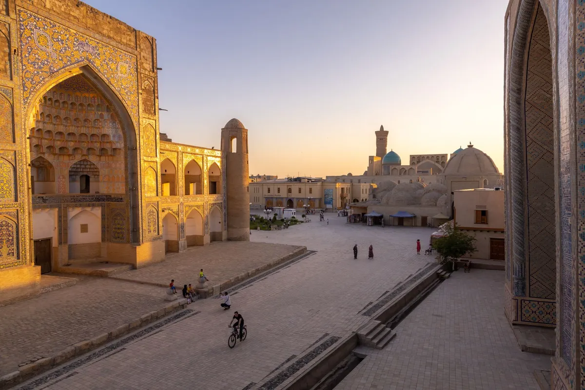

Where Time Stands Still: The Timeless Allure of Uzbekistan’s Silk Road The first light of dawn spills over the turquoise domes of Registan Square in Samarkand, casting golden reflections on the mosaic tiles that have witnessed centuries of caravans, scholars, and emperors. This is not a scene from a history book—it is the living heartbeat of Uzbekistan, a country where the past breathes through every brick of its ancient cities and the future hums in the air-conditioned cafes of Tashkent. Here, on the legendary Silk Road, time does not merely pass; it lingers, inviting travelers to step into a world where the echoes of Genghis Khan’s horsemen mix with the clatter of modern high-speed trains. Uzbekistan is more than a destination; it is an awakening. Once the crossroads of empires, it now stands as Central Asia’s most accessible and rapidly modernizing jewel, offering an unparalleled blend of heritage, affordability, and innovation. With a cost of living 65% lower than the United States—including rent—and a brand-new digital nomad visa launched in 2026, this is the moment to explore a land where the Silk Road’s legacy is being rewritten in real time.From Caravans to Code: How Uzbekistan is Rewriting Its Future For centuries, the Silk Road was the world’s greatest trade network, a labyrinth of routes connecting China to the Mediterranean, carrying silk, spices, and ideas. Today, Uzbekistan is reclaiming its role—not as a mere stop on the old route, but as a global hub for the new economy. The government’s ambitious reforms, launched in 2020, have transformed the country into a magnet for expats, digital nomads, and investors. Visa policies have been liberalized, with a 1-year digital nomad visa now available for remote workers earning as little as $1,500 per month. This is not just tourism; it’s a lifestyle revolution. The numbers tell the story. A single person can live comfortably in Tashkent for just $508.70 per month, while a family of four manages on $1,869.90—excluding rent. Compare that to the U.S., where the same expenses would cost nearly three times as much. But affordability is only part of the equation. Uzbekistan’s infrastructure is undergoing a renaissance. The Tashkent Metro, with its Soviet-era grandeur and modern efficiency, now connects to a high-speed rail network linking major cities. The new Tashkent International Airport, expanded in 2025, serves as a gateway to Central Asia, with direct flights to Istanbul, Dubai, and beyond. Yet, the true magic lies in the balance. While Tashkent’s skyline boasts glass towers and co-working spaces, the ancient cities of Bukhara, Khiva, and Samarkand remain frozen in time. Here, 15th-century madrasahs stand beside boutique hotels, and horse-drawn carriages share the streets with electric scooters. It’s a juxtaposition that defines modern Uzbekistan: a nation that honors its past while sprinting toward the future.The Three Crown Jewels: Samarkand, Bukhara, and Khiva No journey along the Silk Road is complete without wandering the labyrinthine streets of Uzbekistan’s three most iconic cities. Each is a UNESCO World Heritage Site, a living museum where history is not just preserved but celebrated. Samarkand: The Jewel of Timur’s Empire Samarkand is where the Silk Road’s grandeur is most vividly on display. Founded in the 6th century BCE, it became the capital of the Timurid Empire in the 14th century, under the rule of the legendary conqueror Amir Timur. His legacy is etched into every corner: the Registan Square, a trio of madrasahs (Ulugh Beg, Sher-Dor, and Tilya-Kori) whose turquoise domes and intricate tilework defy description; the Gur-e-Amir Mausoleum, the final resting place of Timur himself; and the Shah-i-Zinda necropolis, a street of mausoleums glowing in cobalt and azure. But Samarkand is not a relic. The city’s new Museum of Timurid History, opened in 2024, uses augmented reality to bring the past to life, while the Afrasiab Museum showcases 2,700-year-old frescoes uncovered from the ancient Sogdian settlement. For food lovers, the Siyob Bazaar offers a sensory overload of fresh fruits, spices, and the legendary non (Uzbek bread), baked in clay ovens. And when the sun sets, the city transforms into a hub of modern Uzbek cuisine, where traditional plov (rice pilaf) meets farm-to-table dining at restaurants like Plov Center. Bukhara: The Scholar’s Paradise If Samarkand is the empire’s crown, Bukhara is its soul. This 2,500-year-old city was a center of Islamic learning, home to over 200 madrasahs at its peak. The Ark of Bukhara, a fortress-palace dating back to the 5th century, was the residence of Bukhara’s emirs for nearly a millennium. Nearby, the Kalon Minaret, built in 1127, has survived earthquakes and invasions, standing as a testament to Bukhara’s resilience. The city’s charm lies in its intimacy. Unlike the grand squares of Samarkand, Bukhara’s streets are narrow and winding, lined with artisan workshops where potters, weavers, and jewelers practice age-old crafts. The Lyab-i Hauz plaza, with its 16th-century madrasahs and the ancient Hauz-i-Khan pond, is the perfect place to sip green tea and watch the world go by. For a taste of Bukhara’s culinary heritage, try samsa (meat pies) from a street vendor or dine at Chashmai Mirob, a restaurant serving dishes like manti (steamed dumplings) and shurpa (lamb soup). Khiva: The Open-Air Museum Khiva is a city straight out of a fairy tale. Enclosed within its 10-meter-high walls, the Itchan Kala (Inner City) is a UNESCO site where every building seems to whisper stories of the Silk Road. The Kuhna Ark fortress, once the residence of Khiva’s khans, offers panoramic views of the city, while the Islam Khodja Minaret, the tallest in Central Asia, provides a vantage point over the desert horizon. Khiva’s magic is in its authenticity. Unlike Samarkand and Bukhara, which have seen modern development, Khiva retains a timeless quality. The wooden caravanserais, the intricate tilework of the Juma Mosque, and the eerie silence of the Muhammad Amin Khan Madrasah at dusk create an atmosphere of suspended time. For a truly immersive experience, stay in a chaikhana (tea house) within the old city, where the walls are lined with centuries-old manuscripts and the scent of somsa fills the air.Beyond the Cities: The Hidden Gems of Uzbekistan’s Countryside While Samarkand, Bukhara, and Khiva are the stars, Uzbekistan’s true soul often lies in its lesser-known corners. Venture beyond the tourist trail, and you’ll discover a land of emerald valleys, snow-capped peaks, and nomadic traditions that have survived for millennia. The Nurata Mountains and Aydarkul Lake Nestled in the Kyzylkum Desert, the Nurata Mountains are a haven for hikers and history buffs. The ruins of the ancient fortress of Nur, built by Alexander the Great, overlook the vast Aydarkul Lake, a shimmering expanse of turquoise water where flamingos and pelicans nest. The nearby village of Nurata is a gateway to the yurt camps of the Kyrgyz nomads, where travelers can experience traditional beshbarmak (horse meat noodles) and kumis (fermented mare’s milk) under the stars. The Chimgan Mountains and Beldersay Ski Resort Just an hour from Tashkent, the Chimgan Mountains offer a surprising escape into alpine landscapes. In winter, Beldersay Ski Resort attracts skiers and snowboarders, while in summer, the meadows burst with wildflowers. The nearby Charvak Reservoir is a popular spot for kayaking and picnics, with the backdrop of the Ugam Range providing a dramatic setting. The Aral Sea: A Cautionary Tale and a Symbol of Hope The Aral Sea, once the world’s fourth-largest lake, is a stark reminder of environmental mismanagement. But Uzbekistan is fighting back. The Nukus Museum of Art, home to the avant-garde Savitsky Collection, and the nearby Aralkum Desert offer a poignant look at the region’s ecological challenges—and its resilience. Projects like the restoration of the Amu Darya Delta are slowly bringing life back to the area, making it a powerful destination for eco-tourists.A Taste of the Silk Road: Uzbekistan’s Culinary Odyssey To travel the Silk Road is to taste it. Uzbek cuisine is a fusion of Persian, Turkic, and Chinese influences, a reflection of the region’s history as a crossroads of cultures. At its heart is plov, the national dish, a fragrant rice pilaf cooked with lamb, carrots, and onions in a kazan (cauldron). But Uzbek food is so much more than plov. The Bread of Life: Non No meal in Uzbekistan begins without non, the round, crusty bread baked in clay ovens. The process of making non is an art form, with each baker having their own secret recipe. In Bukhara, the non from the Lyab-i Hauz bakery is legendary, while in Tashkent, the Chorsu Bazaar offers a dizzying array of varieties, from sesame-studded non to sweet non flavored with cardamom. Manti and Samsa: The Dumpling Delights Manti are steamed dumplings filled with minced lamb, onions, and pumpkin, served with a dollop of sour cream and garlic sauce. Samsa, on the other hand, are baked in a tandoor (clay oven), with a flaky crust and juicy filling. In Khiva, the samsa from the local market is a must-try, while in Samarkand, the manti at Plov Center are a revelation. Shorpa and Lagman: Hearty Stews and Noodles Shurpa is a lamb soup slow-cooked with vegetables and herbs, while lagman is a hand-pulled noodle dish with a rich beef broth and chunks of meat. Both are perfect for Uzbekistan’s chilly winters, and both are best enjoyed in a chaikhana (tea house) with a pot of green tea. Sweet Treats: Halva and Chak-chak No Uzbek meal is complete without dessert. Halva comes in two varieties: halva-yassi (a dense, nutty bar) and halva-kand (a crumbly, sweet confection). Chak-chak, a pyramid of fried dough balls drenched in honey, is a favorite at celebrations. In Tashkent, the Halva Museum offers a deep dive into the history of this beloved treat.Uzbek Dish Description Average Cost (USD)Plov Rice pilaf with lamb, carrots, onions $3.50 - $5.00Manti Steamed dumplings with lamb $2.00 - $3.50Samsa Baked meat pies $1.50 - $2.50Shurpa Lamb soup with vegetables $4.00 - $6.00Lagman Hand-pulled noodles with beef $5.00 - $7.00Non Traditional Uzbek bread $0.50 - $1.00Halva Nutty or crumbly sweet $2.00 - $4.00Living the Dream: The Digital Nomad’s Guide to Uzbekistan Uzbekistan is not just a place to visit—it’s a place to live. With the launch of its digital nomad visa in 2026, the country has positioned itself as a top destination for remote workers seeking adventure without sacrificing comfort. Here’s what you need to know to make the move. Visa Requirements and Costs The digital nomad visa is valid for 1 year and can be extended for another year. To qualify, you’ll need to show proof of remote income (minimum $1,500 per month) and health insurance. The visa fee is $200, and the application process is straightforward, with e-visa options available for many nationalities. Where to Live: Tashkent vs. The Ancient Cities Tashkent is the obvious choice for those who want a modern lifestyle. The city offers co-working spaces like Smart Point and Idea Space, high-speed internet, and a vibrant expat community. Rent for a 1-bedroom apartment in the city center averages $300-$500 per month, while a 3-bedroom apartment costs $600-$900. For those seeking a slower pace, the ancient cities offer a different kind of luxury. In Samarkand, a modern apartment with views of Registan Square can be rented for $400-$600 per month, while in Bukhara, you can find charming guesthouses for $25-$50 per night. The cost of living in these cities is even lower, with meals at local restaurants costing as little as $3-$5. Internet and Connectivity Uzbekistan’s internet infrastructure has improved dramatically in recent years. Tashkent and the major cities have 4G coverage, while fiber-optic internet is available in most urban areas. For remote workers, UzMobile and Beeline offer affordable data plans, and co-working spaces provide high-speed Wi-Fi. Healthcare and Safety Uzbekistan’s healthcare system is a mix of public and private facilities. Expats typically opt for private health insurance, which costs around $50-$100 per month. The country is generally safe, with low crime rates and a welcoming attitude toward foreigners. However, it’s always wise to take standard precautions, such as avoiding poorly lit areas at night. Cultural Etiquette and Language Uzbekistan is a Muslim-majority country, and while it is secular and tolerant, it’s important to respect local customs. Dress modestly in religious sites, and avoid public displays of affection. The official language is Uzbek, but Russian is widely spoken, and English is becoming more common, especially in tourist areas. Learning a few phrases in Uzbek, such as Salom (Hello) and Rahmat (Thank you), will go a long way in making connections.The Silk Road’s New Chapter: Why Now is the Time to Visit Uzbekistan is at a crossroads—not just geographically, but culturally and economically. The country’s efforts to modernize while preserving its heritage have created a unique opportunity for travelers and expats alike. The digital nomad visa, the ultra-low cost of living, and the country’s rich history make it a destination like no other. But beyond the practicalities, there’s something intangible about Uzbekistan that draws people in. It’s the feeling of walking through the Registan at dawn, the taste of plov cooked over an open fire, the warmth of a stranger’s smile in a chaikhana. It’s the realization that the Silk Road is not just a relic of the past—it’s a living, breathing entity, and Uzbekistan is its guardian. So, whether you’re a history buff, a foodie, a digital nomad, or simply someone in search of adventure, Uzbekistan awaits. The Silk Road is calling.#SilkRoadRevival #UzbekistanTravel #DigitalNomadParadise Related InsightsMud‑Brick Horizons: Documenting the Architectural Soul of Djenné and Timbuktu Azure Horizons and Fragile Ecosystems: The Maldives Reality Check L'Odyssée du Continent Austral : Entre Terres Rouges, Récifs d'Azur et Horizon Infini{ "@context": "https://schema.org", "@type": "FAQPage", "mainEntity": [ { "@type": "Question", "name": "What is the main focus of The Silk Road Revival: Uzbekistan’s Ancient Cities and Modern Wonders?", "acceptedAnswer": { "@type": "Answer", "text": "Discover Uzbekistan’s breathtaking Silk Road cities, ultra-low cost of living, and a brand-new digital nomad visa that’s transforming Central Asia into a traveler’s paradise." } }, { "@type": "Question", "name": "Who authored the comprehensive guide on The Silk Road Revival: Uzbekistan’s Ancient Cities and Modern Wonders?", "acceptedAnswer": { "@type": "Answer", "text": "This detailed article and its insights were carefully researched and authored by Mark Dinn." } }, { "@type": "Question", "name": "Where can I find more related content about Travel?", "acceptedAnswer": { "@type": "Answer", "text": "You can explore more articles, detailed reviews, and similar insights by browsing the Related Insights section at the bottom of this article or visiting our dedicated Travel category page." } } ] }
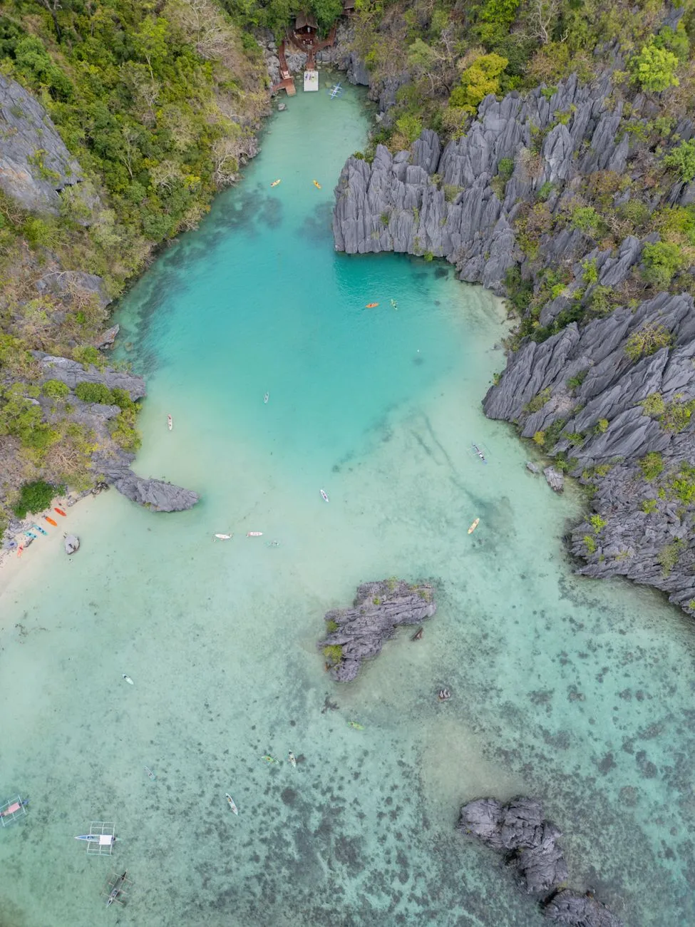
-
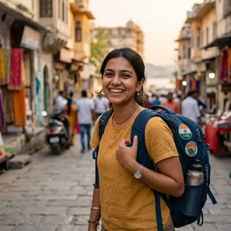 Aisha Sharma
 - 01 Sep, 2026 21:15
Palawan’s Hidden Lagoons: The Philippines’ Most Breathtaking Coastal Escapes You Can’t Miss
Where the Ocean Meets Myth: Palawan’s Lagoons Beckon the Adventurous Soul Nestled in the western Philippines, Palawan is a dream woven from emerald forests, powder-white beaches, and lagoons so pristine they feel plucked from a painter’s palette. While El Nido and Coron hog the spotlight, the true magic lies in the hidden lagoons—secluded pockets of water where limestone karsts rise like ancient sentinels, and the sea whispers secrets to those willing to listen. These are not just destinations; they are experiences that linger in the soul long after the tide has pulled you back to shore. For the intrepid traveler, Palawan’s lagoons offer more than Instagram-worthy backdrops. They are gateways to untouched ecosystems, where bioluminescent plankton dance under moonlight and mangroves cradle rare bird species. Whether you’re a digital nomad seeking inspiration, a honeymooner chasing romance, or a solo explorer mapping uncharted waters, these lagoons promise an escape that feels both timeless and exhilarating. But how do you uncover these hidden gems without falling into the tourist traps? What’s the real cost of living in this paradise, and how can you make the most of your visit? Let’s dive into the heart of Palawan’s lagoons, where every ripple tells a story.The Lagoons That Time Forgot: A Journey Through Palawan’s Secret Waterways Palawan’s lagoons are not just bodies of water; they are living museums of geological wonder. Formed over millions of years by the slow dissolution of limestone, these lagoons are part of a vast karst landscape that stretches from El Nido to Coron. The most famous among them—Big Lagoon, Small Lagoon, and Secret Lagoon in El Nido—are often crowded, but the real treasures lie beyond the beaten path. Take Taraw Cliff Lagoon, for instance. Accessible only by a steep hike through dense jungle, this lagoon rewards adventurers with a panoramic view of Bacuit Bay. The water here is so clear that you can spot fish darting between coral formations, and the limestone walls echo with the calls of swiftlets nesting in the caves. For those who prefer a quieter experience, Cadlao Lagoon in Coron offers a secluded escape with fewer boats and more wildlife sightings, including monitor lizards and kingfishers. But the crown jewel might just be Kayangan Lake, often hailed as the cleanest lake in Asia. Surrounded by towering cliffs, this lagoon is a snorkeler’s paradise, with vibrant coral reefs teeming with marine life. The water is so transparent that you can see the lakebed from the surface, making it a photographer’s dream. To reach it, you’ll need to climb a series of wooden steps, but the effort is worth every bead of sweat. For the truly off-the-beaten-path explorer, Dipuyai Lagoon in Taytay offers a raw, untouched beauty. Unlike the more touristy lagoons, Dipuyai is rarely visited, making it a perfect spot for solitude and reflection. The lagoon is nestled within a mangrove forest, and the water here is a mesmerizing shade of blue-green, reflecting the sky above.From Budget Backpacker to Luxury Seeker: The Real Cost of Living in Palawan Palawan is a paradise, but it’s not without its costs. Whether you’re planning a short visit or a long-term stay, understanding the financial landscape is crucial. According to recent data, the cost of living in Palawan for a digital nomad hovers around $1,280 per month for a mid-tier lifestyle. This includes rent, groceries, dining out, transportation, utilities, and coworking space access. Here’s a detailed breakdown of what you can expect:Expense Category Monthly Cost (USD) NotesRent (1-bedroom apartment) $550 Prices vary by location; El Nido and Coron are pricier than smaller towns.Groceries $240 Local markets offer fresh produce at lower prices than supermarkets.Dining Out $200 Street food and local eateries are affordable; Western restaurants cost more.Transportation $50 Tricycles and jeepneys are cheap; renting a scooter costs ~$10/day.Utilities (electricity, water, internet) $110 Internet speeds are decent but can be unreliable in remote areas.Coworking Space $130 Spaces like The Hub in Puerto Princesa or Do It El Nido offer modern amenities.Miscellaneous (tours, tips, etc.) $100 Includes entrance fees to lagoons, tips for guides, and unexpected expenses.For budget travelers, it’s possible to live on $800–$1,000 per month by opting for homestays, cooking your own meals, and using public transport. However, if you’re looking for comfort and convenience, budget closer to $1,500–$2,000 to enjoy Palawan’s finer offerings, such as private boat tours or luxury resorts.Visa Voyages: Navigating Palawan’s Entry Requirements Without the Headache Palawan’s allure is undeniable, but before you pack your bags, you’ll need to navigate the visa landscape. The good news? The Philippines offers visa-free entry for up to 30 days for citizens of over 150 countries, including the US, UK, Canada, Australia, and most EU nations. This visa-on-arrival is extendable for up to 36 months, making Palawan an ideal long-term destination for digital nomads and remote workers. Here’s what you need to know:Visa-Free Entry: If you’re from a visa-exempt country, you’ll receive a 30-day stamp upon arrival. No prior application is needed. Extensions: To extend your stay, visit the Bureau of Immigration office in Puerto Princesa or El Nido. Extensions are typically granted in 30-day increments, with a maximum stay of 36 months. Special Visa Programs: For digital nomads, the Philippines offers the Special Working Visa, which allows remote workers to stay for up to 6 months. Requirements include proof of employment or business ownership and a minimum monthly income of $800. Overstaying Penalties: Overstaying can result in fines of ₱500 per day, so it’s best to plan your extensions in advance.Pro tip: If you’re planning to stay long-term, consider applying for a Tourist Visa Extension (TVE) before your initial 30 days expire. The process is straightforward, but it’s wise to hire a local agent to handle the paperwork, as the bureaucracy can be daunting.Beyond the Postcard: Sustainable Ways to Explore Palawan’s Lagoons Palawan’s lagoons are fragile ecosystems, and their beauty is under threat from overtourism and environmental degradation. As a responsible traveler, you can minimize your impact—and even contribute to conservation efforts—by adopting sustainable practices.Choose Eco-Friendly Tour Operators: Opt for operators that prioritize sustainability, such as those using solar-powered boats or offering plastic-free tours. In El Nido, El Nido Resorts and Lagen Island Resort are leaders in eco-tourism, with initiatives like coral restoration and waste management programs. Leave No Trace: Pack out all your trash, including biodegradable items like fruit peels, which can harm wildlife. Avoid using chemical sunscreens, as they can bleach coral reefs. Support Local Communities: Buy souvenirs directly from local artisans in Palawan’s markets, such as the Puerto Princesa Public Market or El Nido’s Art in Paradise. This ensures your money goes to the people who call Palawan home. Respect Wildlife: Keep a safe distance from marine life, including dolphins and sea turtles. Never touch or feed wild animals, as this can disrupt their natural behaviors. Offset Your Carbon Footprint: Consider donating to local conservation projects, such as the Palawan Council for Sustainable Development, which works to protect the province’s biodiversity.By traveling responsibly, you’re not just preserving Palawan’s lagoons for future generations—you’re ensuring that your own memories of this paradise remain untarnished.The Unwritten Rules of Palawan’s Lagoons: Etiquette for the Conscious Traveler Palawan’s lagoons are not just attractions; they are sacred spaces for the communities that call them home. To ensure your visit is respectful—and unforgettable—here are some unwritten rules to follow:Ask Before You Enter: Some lagoons, like Nacpan Beach’s hidden coves, are on private land. Always ask locals or your guide for permission before exploring. Dress Modestly: While swimwear is acceptable at the lagoons, cover up when walking through villages or religious sites. Shoulders and knees should be covered in churches and local communities. Hire Local Guides: Not only do local guides provide invaluable insights into the lagoons’ history and ecology, but they also support the local economy. In Coron, guides often share stories about the lagoons’ formation or point out hidden caves. Avoid Peak Hours: The lagoons are at their most magical in the early morning or late afternoon. Avoid visiting between 10 AM and 3 PM to reduce crowds and give the ecosystem a chance to breathe. Learn a Few Local Phrases: A simple "Salamat" (thank you) in Tagalog goes a long way in showing respect to the locals. Many Palawan locals speak Cuyonon, a distinct dialect, so learning a few phrases can enhance your interactions.By following these guidelines, you’ll not only enrich your own experience but also foster a deeper connection with the people and places that make Palawan so special.When the Tide Calls: The Best Time to Visit Palawan’s Lagoons Palawan’s lagoons are a year-round destination, but the best time to visit depends on your priorities. Here’s a seasonal breakdown to help you plan:November to February (Dry Season): This is the peak tourist season, with sunny skies and calm waters. Expect higher prices and crowded lagoons, but also the best snorkeling conditions. If you’re planning a visit during this time, book accommodations and tours well in advance. March to May (Hot Season): Temperatures soar, but the lagoons are less crowded. This is a great time for budget travelers, as prices drop significantly. However, be prepared for occasional heatwaves and water shortages in some areas. June to October (Rainy Season): The rains bring lush greenery and fewer tourists, but the seas can be rough, making boat tours less reliable. If you’re seeking solitude and don’t mind the occasional downpour, this is the perfect time to visit. Just pack a waterproof bag for your gear!For the ultimate lagoon experience, aim for late January or early February, when the weather is ideal, and the crowds haven’t yet peaked. If you’re a photographer, the golden hours of sunrise and sunset cast a magical glow over the lagoons, making them even more photogenic.The Lagoons’ Legacy: How Palawan’s Hidden Gems Are Shaping the Future of Travel Palawan’s lagoons are more than just Instagram backdrops—they are a testament to the power of sustainable tourism. As travelers increasingly seek authentic, off-the-beaten-path experiences, Palawan has emerged as a model for responsible exploration. From community-led eco-tours to conservation initiatives, the province is proving that tourism can be both profitable and protective. One shining example is the El Nido-Taytay Managed Resource Protected Area (ENTMRPA), which oversees the conservation of Palawan’s marine ecosystems. Through partnerships with local NGOs and government agencies, the ENTMRPA has implemented measures like no-anchoring zones to protect coral reefs and fishing quotas to preserve marine biodiversity. Meanwhile, initiatives like The Palawan Sustainable Tourism Project are training local guides in eco-friendly practices and promoting homestays to distribute tourism revenue more evenly. These efforts not only safeguard Palawan’s natural beauty but also empower local communities to take ownership of their heritage. For travelers, this means that visiting Palawan’s lagoons is not just a vacation—it’s an opportunity to be part of a larger movement. By choosing sustainable options, supporting local businesses, and respecting the environment, you’re helping to ensure that these hidden gems remain unspoiled for generations to come.Where the Journey Never Ends: Palawan’s Lagoons Await Your Footsteps Palawan’s lagoons are not just destinations; they are invitations. Invitations to explore, to reflect, to connect with nature, and to rediscover the joy of unhurried travel. Whether you’re paddling through the emerald waters of Kayangan Lake, snorkeling in the vibrant reefs of Cadlao Lagoon, or simply sitting on the shore of a secluded cove, these lagoons have a way of slowing time and awakening the senses. But remember, the magic of Palawan lies not just in its beauty, but in the stories you’ll carry home. The fisherman who shared his lunch with you, the guide who pointed out a rare bird, the sunset that painted the sky in hues you never thought possible. These are the moments that transform a trip into a journey. So pack your bags, leave your worries behind, and let Palawan’s lagoons weave their spell on you. The tide is calling—will you answer?#PalawanParadise #HiddenGemsPhilippines #SustainableTravel #LagoonLover #OffTheBeatenPath Related InsightsSun-Drenched Serenity vs. The Fjord’s Embrace: Choosing Between the Albanian Riviera and the Bay of Kotor La Signora di Ferro che Sfidò il Cielo: Storie, Segreti e le Ombre Nascoste della Torre Eiffel 清水寺: 断崖に立つ祈りの舞台{ "@context": "https://schema.org", "@type": "FAQPage", "mainEntity": [ { "@type": "Question", "name": "What is the main focus of Palawan’s Hidden Lagoons: The Philippines’ Most Breathtaking Coastal Escapes You Can’t Miss?", "acceptedAnswer": { "@type": "Answer", "text": "Discover Palawan’s secret lagoons, where turquoise waters and limestone cliffs create paradise. Dive into the Philippines’ most stunning coastal escapes with this insider’s guide." } }, { "@type": "Question", "name": "Who authored the comprehensive guide on Palawan’s Hidden Lagoons: The Philippines’ Most Breathtaking Coastal Escapes You Can’t Miss?", "acceptedAnswer": { "@type": "Answer", "text": "This detailed article and its insights were carefully researched and authored by Aisha Sharma." } }, { "@type": "Question", "name": "Where can I find more related content about Travel?", "acceptedAnswer": { "@type": "Answer", "text": "You can explore more articles, detailed reviews, and similar insights by browsing the Related Insights section at the bottom of this article or visiting our dedicated Travel category page." } } ] }
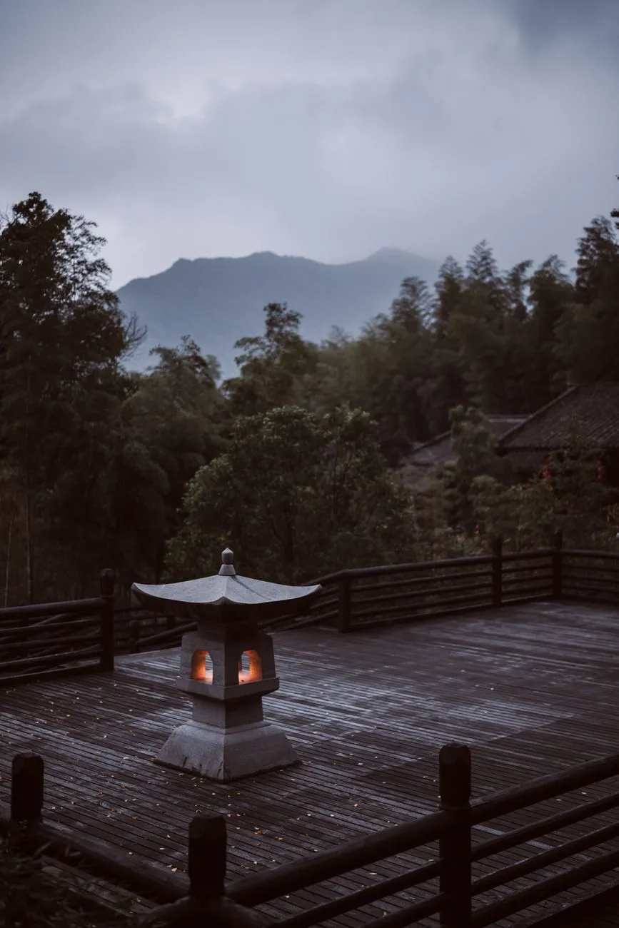
-
 Zola Ndlovu
 - 31 Aug, 2026 23:00
Japan’s Secret Onsen: 10 Underrated Retreats Where Tradition Meets Serenity
Where the Crowds Never Go: Japan’s Best-Kept Onsen Secrets Japan’s onsen culture is legendary, but the most transformative experiences often lie in the quiet corners of the archipelago. While Hakone and Beppu bask in global fame, their lesser-known counterparts offer something far more precious: solitude, authenticity, and a deeper connection to Japan’s timeless traditions. These are the onsen towns where the air smells of cedar, the waters whisper ancient secrets, and the rhythm of life slows to match the pace of a steaming ryokan bath. From the volcanic cliffs of Ibusuki to the alpine serenity of Nyuto Onsen, these retreats are where tradition isn’t just preserved—it’s lived. Here, you won’t find Instagram influencers or overpriced ryokan chains. Instead, you’ll find family-run sento (public baths) where locals soak alongside travelers, and ryokan where the tatami mats still creak with history. These are the places where the onsen isn’t just a tourist attraction—it’s a way of life. Let’s journey to where Japan’s soul still bubbles beneath the surface.The Forgotten Valleys: Nyuto Onsen’s Alpine Serenity Nestled in the remote mountains of Akita Prefecture, Nyuto Onsen is a cluster of seven onsen villages where time seems to stand still. The name Nyuto (乳頭温泉) translates to "nipple hot spring," a playful nod to the shape of the nearby Mount Nyuto, which resembles a woman’s breast. But don’t let the quirky name fool you—this is a place of profound tranquility, where the waters are milky white with minerals and the air is crisp with pine. The most famous of the Nyuto villages is Tsurunoyu Onsen, accessible only by a winding mountain road that feels like a journey to another world. The ryokan here, like Tsurunoyu Onsen, are modest but deeply authentic, with wooden bathtubs fed by natural hot springs. The water here is alkaline and rich in sodium bicarbonate, known for its skin-softening properties. Locals swear by its healing effects for arthritis and fatigue. For those willing to venture deeper, Nyuto Onsen Village offers a more developed (but still understated) experience. The village’s public bathhouse, Nishiki-no-Yu, is a communal space where travelers and locals mix freely. The water here is sulfuric, with a faint eggy scent that dissipates once you’re submerged. The surrounding landscape is a symphony of autumn colors in October or a snowy wonderland in winter, when the ryokan become cozy cocoons of warmth.How to Get There: Nyuto Onsen is best reached by train to Tazawako Station (via the Akita Shinkansen from Tokyo), followed by a 30-minute bus ride. A rental car is ideal for exploring the villages at your own pace. What to Expect:Price Range: ¥15,000–¥30,000 per night (including two meals) Best Time to Visit: October for autumn foliage or January–February for snow-covered serenity Must-Try: The onsen hopping pass (¥2,000) grants access to all seven villagesThe Volcanic Playground: Ibusuki’s Sand Baths and Sea Springs On the southern tip of Kyushu, where the East China Sea crashes against volcanic cliffs, lies Ibusuki Onsen. Unlike traditional onsen towns, Ibusuki is famous for its suna-mushi (sand baths), where visitors are buried up to their necks in naturally heated sand—a practice believed to detoxify the body and improve circulation. The sand here is rich in minerals like sulfur and magnesium, and the experience is as much about the heat as it is about the surreal sensation of being "cooked" by the earth itself. The town’s other claim to fame is its seawater onsen, where the mineral-rich waters are pumped directly from the ocean. The most iconic of these is Sengan-en Garden’s onsen, a historic site where samurai once bathed. Today, it’s a serene spot surrounded by Japanese gardens, where the contrast of hot spring water against the cool sea breeze is nothing short of magical. Ibusuki’s cuisine is another highlight. The town is known for kurobuta (black pork), grilled over charcoal and served with a side of imo jochu (sweet potato liquor). Pair your meal with a dip in the onsen, and you’ll understand why this place feels like a hidden paradise.How to Get There: Ibusuki is a 2.5-hour train ride from Kagoshima (via the Kyushu Shinkansen), followed by a short bus or taxi ride to the town center. What to Expect:Price Range: ¥10,000–¥25,000 per night (ryokan with sand bath access) Best Time to Visit: April–May for cherry blossoms or September–October for mild weather Must-Try: The suna-mushi experience at Ibusuki Sand Bathing Center (¥1,500 for 15 minutes)The Coastal Hideaways: Shirahama’s Hidden Gems Along the rugged Kii Peninsula in Wakayama Prefecture, Shirahama Onsen is a coastal retreat where the Pacific Ocean meets steaming hot springs. Unlike the more commercialized onsen towns, Shirahama’s charm lies in its understated elegance. The town is built around Saki-no-Yu, a striking red torii gate that marks the entrance to the public baths, where the water is said to cure everything from skin ailments to fatigue. One of the town’s best-kept secrets is Adventure World’s onsen, a luxury resort where you can soak in open-air baths while overlooking the ocean. The water here is rich in chloride and sodium, making it ideal for relaxation. For a more rustic experience, Shirahama Onsen-yu offers a traditional ashiyu (foot bath) right on the beach, where you can dip your toes in the sand while the waves lap at your ankles. Shirahama is also a gateway to Nachi Falls, Japan’s tallest waterfall, where you can combine a spiritual hike with a soothing soak. The contrast of the icy waterfall and the warm onsen is a sensory experience unlike any other.How to Get There: Shirahama is a 2-hour train ride from Osaka (via the Nanki Shirahama Express), followed by a short bus ride to the onsen district. What to Expect:Price Range: ¥12,000–¥28,000 per night (ocean-view ryokan) Best Time to Visit: June for hydrangeas or November for autumn colors Must-Try: The ashiyu foot bath at Shirahama Onsen-yu (¥300)The Snow Country Enclave: Ginzan Onsen’s Fairy-Tale Charm In the heart of Yamagata Prefecture, where the snow falls like powdered sugar in winter, lies Ginzan Onsen, a village straight out of a Studio Ghibli film. The town’s wooden ryokan line a riverbank, their facades illuminated by lanterns at night, creating a scene so picturesque it feels staged. The onsen here are fed by the Ginzan River, which runs through the village, and the water is rich in sodium bicarbonate, known for its gentle, skin-friendly properties. The most famous ryokan in Ginzan is Ginzan Onsen Fujiya, a historic inn where the baths are carved into the rock face, offering a view of the river below. The water is piped directly from the source, ensuring its mineral content remains potent. In winter, the village becomes a snowy wonderland, with the steam from the onsen creating an ethereal mist that clings to the wooden buildings. Ginzan is also a hub for traditional crafts. The town is known for its Zao-style daruma dolls, and you can visit workshops to try your hand at painting one. Pair your craft session with a soak in the onsen, and you’ll leave feeling like you’ve stepped into a different era.How to Get There: Ginzan Onsen is a 3-hour train ride from Tokyo (via Yamagata Shinkansen to Oishida Station), followed by a 30-minute bus ride. What to Expect:Price Range: ¥20,000–¥40,000 per night (luxury ryokan with private baths) Best Time to Visit: December–February for snowscapes or October for autumn foliage Must-Try: The kaiseki dinner at Ginzan Onsen Fujiya (multi-course meal with local ingredients)The Hidden Coastal Retreat: Kurokawa Onsen’s Riverfront Baths Tucked away in the mountains of Kumamoto Prefecture, Kurokawa Onsen is a village where the onsen are as much a part of the landscape as the river that winds through it. Unlike other onsen towns, Kurokawa’s baths are scattered along the Kurokawa River, and many are open-air, allowing you to soak while listening to the sound of water rushing over rocks. The village is divided into two districts: Naka-no-Yu (upper hot springs) and Shimo-no-Yu (lower hot springs). Each has its own character—Naka-no-Yu is more rustic, with family-run ryokan and public baths like Yunohana-no-Yu, while Shimo-no-Yu is slightly more developed, with larger ryokan and a communal foot bath. One of the town’s best-kept secrets is Kurokawa Onsen’s onsen-hopping pass, which grants access to 20+ baths for ¥2,000. This is the best way to experience the village’s diversity, from sulfuric pools to alkaline ones. The water here is rich in hydrogen sulfide, giving it a distinctive smell (which dissipates once you’re in the water) and reputed benefits for respiratory health.How to Get There: Kurokawa Onsen is a 2.5-hour bus ride from Kumamoto City, winding through scenic mountain roads. What to Expect:Price Range: ¥8,000–¥20,000 per night (budget to mid-range ryokan) Best Time to Visit: April–May for cherry blossoms or September–October for autumn colors Must-Try: The onsen-hopping pass (¥2,000) for 20+ bathsA Snapshot of Value: Comparing Japan’s Secret Onsen RetreatsOnsen Town Average Nightly Cost (¥) Best Season Unique Feature AccessibilityNyuto Onsen 15,000–30,000 October, January Alpine serenity, milk-white water Train + bus (Akita)Ibusuki Onsen 10,000–25,000 April–May, September Sand baths, seawater onsen Train (Kagoshima)Shirahama Onsen 12,000–28,000 June, November Coastal views, red torii gate Train (Osaka)Ginzan Onsen 20,000–40,000 December–February Snowy fairy-tale village Train (Tokyo)Kurokawa Onsen 8,000–20,000 April–May, September Riverfront baths, onsen-hopping Bus (Kumamoto)Where Tradition Still Breathes: The Unspoken Rules of Japan’s Secret Onsen To fully embrace the magic of Japan’s hidden onsen towns, you must first understand the unspoken etiquette that governs these sacred spaces. The onsen is not just a bath—it’s a ritual, a moment of connection between body, mind, and nature. Here’s how to honor that tradition:Wash Thoroughly Before Entering The first rule is non-negotiable: you must shower and scrub before entering the onsen. Use the provided stools, soap, and shampoo to cleanse thoroughly. The onsen is for soaking, not washing—never bring soap or shampoo into the bath.No Swimsuits or Towels Onsen are enjoyed nude, as clothing and swimsuits can contaminate the water. Most ryokan provide small towels to cover yourself while walking between the shower area and the bath, but you’ll remove it once in the water.Tattoos Are a Delicate Issue While tattoo culture is becoming more accepted in Japan, many traditional onsen still ban tattoos due to their historical association with the yakuza. Some towns, like Kurokawa Onsen, are more lenient, but always check ahead. If you have tattoos, consider covering them with waterproof patches or seeking out tattoo-friendly onsen.Silence Is Golden Onsen are places of quiet reflection. Avoid loud conversations, splashing, or disruptive behavior. The goal is to let the warmth of the water and the stillness of the surroundings wash over you.Respect the Seasons Each season offers a different onsen experience. In winter, the contrast of hot water against cold air is invigorating. In summer, the steam can be intense, but the cooler evenings make for a refreshing soak. Plan your visit around the seasonal beauty of the town—whether it’s autumn leaves in Nyuto or snowscapes in Ginzan.Support Local Businesses These hidden gems thrive because of the people who call them home. Stay in family-run ryokan, eat at local restaurants, and buy handmade crafts. Your presence is a gift to these communities, and your support ensures their traditions endure.The Last Soak: Why These Hidden Onsen Are Worth the Journey Japan’s secret onsen towns are more than just destinations—they are portals to a slower, more intentional way of life. In a world that moves at breakneck speed, these places offer a rare gift: the chance to unplug, unwind, and reconnect with something deeper than ourselves. Whether you’re buried in volcanic sand in Ibusuki, soaking in a riverfront bath in Kurokawa, or wandering through a snowy village in Ginzan, you’re not just visiting a place. You’re stepping into a story that’s been unfolding for centuries. The ryokan owners, the local artisans, the farmers who tend the rice fields—all of them are custodians of a tradition that refuses to fade. So the next time you plan a trip to Japan, skip the crowds of Hakone and Beppu. Seek out the quiet corners, the forgotten valleys, the coastal hideaways where the onsen waters still whisper the old stories. Because the best journeys aren’t the ones that fill your Instagram feed—they’re the ones that fill your soul.#JapanOnsen #HiddenGems #SlowTravel #CulturalImmersion #OffTheBeatenPath Related InsightsBeyond the Horizon: Unveiling Naoshima and Teshima - Japan's Transformative Art Island Odyssey Les Sentinelles Solitaires du Bout du Monde : Une Odyssée vers les Phares Oubliés de Patagonie Chilienne Romantische Straße fahren{ "@context": "https://schema.org", "@type": "FAQPage", "mainEntity": [ { "@type": "Question", "name": "What is the main focus of Japan’s Secret Onsen: 10 Underrated Retreats Where Tradition Meets Serenity?", "acceptedAnswer": { "@type": "Answer", "text": "Discover Japan’s most underrated onsen towns, where ancient traditions blend with breathtaking nature—far from the crowds of Hakone and Beppu." } }, { "@type": "Question", "name": "Who authored the comprehensive guide on Japan’s Secret Onsen: 10 Underrated Retreats Where Tradition Meets Serenity?", "acceptedAnswer": { "@type": "Answer", "text": "This detailed article and its insights were carefully researched and authored by Zola Ndlovu." } }, { "@type": "Question", "name": "Where can I find more related content about Travel?", "acceptedAnswer": { "@type": "Answer", "text": "You can explore more articles, detailed reviews, and similar insights by browsing the Related Insights section at the bottom of this article or visiting our dedicated Travel category page." } } ] }
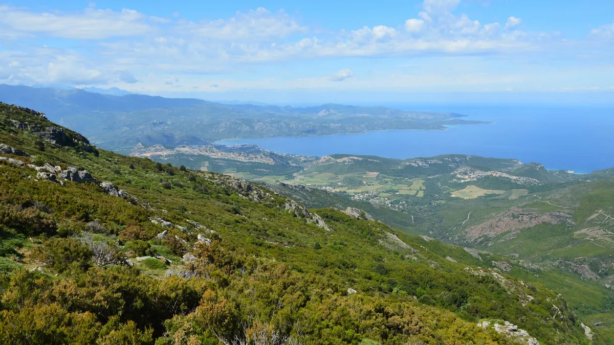

Le granit ne dort jamais en Corse ; il veille sur des millénaires d'histoires, de conquêtes et de silences. Lorsque l'on approche des côtes corses depuis le large, ce n'est pas une simple île qui se dessine, mais une forteresse minérale surgissant des abysses bleus, une proue de pierre braquant le vent et les siècles. Pour le voyageur en quête d'absolu, la Corse n'est pas une destination, c'est une confrontation avec la beauté pure, là où la rudesse des cimes tutoie la douceur des plages de sable blanc. Le bastion de Bonifacio : Entre ciel et abîme Perchée sur ses falaises de calcaire blanc, Bonifacio défie la pesanteur. Cette ville, véritable sentinelle de l'extrême sud, semble flotter au-dessus d'une mer si limpide qu'elle en devient irréelle. La cité est une architecture de vertige, où les maisons séculaires paraissent vouloir s'élancer dans le vide, offrant un spectacle dont la puissance dramatique ne laisse aucun visiteur indemne. L’histoire de Bonifacio est intimement liée à son port naturel, une entaille profonde dans la roche qui servit de refuge aux navigateurs depuis l'Antiquité. En arpentant les ruelles étroites de la Haute Ville, on sent le poids des siècles : les influences génoises sont partout, dans les blasons de pierre gravés au-dessus des portes et dans cette langue locale, le bonifacien, qui chante encore le passé médiéval de la cité. Chaque pavé est une archive, chaque escalier taillé dans la roche est un vestige de l'obstination humaine à vouloir s'ancrer dans l'impossible. Les sommets du granit : L'âme sauvage de l'Alta Rocca Il serait une erreur magistrale de limiter la Corse à ses rivages. Dès que l'on quitte le littoral pour s'enfoncer dans l'intérieur des terres, le paysage bascule dans une dimension alpine. Les Aiguilles de Bavella ne sont pas seulement des pics rocheux ; elles sont les cathédrales naturelles de l'Alta Rocca. Ce massif de granit rose, sculpté par l'érosion, offre un terrain de jeu sublime pour les randonneurs qui parcourent le célèbre sentier GR20, l'un des plus exigeants d'Europe. Ici, l'air change. Il se charge du parfum du maquis — ce tapis dense de cistes, de myrtes, d'arbousiers et de romarins qui recouvre l'île et lui donne son identité olfactive si particulière. C'est dans ces hauteurs que l'on comprend la fierté corse : une terre qui ne s'est jamais laissée dompter, où les villages de pierre se nichent dans des replis de montagnes inaccessibles, gardant farouchement leurs traditions agropastorales. Les citadelles de la mémoire : Bastia et Calvi Sur la côte nord, le contraste est frappant. Bastia, ville d'art et d'histoire, déploie ses façades baroques autour du Vieux-Port, où les barques de pêcheurs dansent doucement sous le regard bienveillant de la citadelle. À l'opposé, Calvi se dresse sur la Balagne, une région souvent surnommée le « jardin de la Corse » en raison de sa fertilité et de la douceur de son climat. Calvi, avec sa citadelle génoise, semble veiller éternellement sur son golfe. La légende raconte que la ville serait le lieu de naissance de Christophe Colomb, une théorie qui alimente encore aujourd'hui les discussions passionnées dans les cafés du port. Que ce soit vrai ou non, il règne ici une aura d'aventure, un écho lointain de grandes expéditions maritimes qui a façonné l'esprit insulaire. Un écosystème de contrastes : La nature à l'état brut La Corse est une terre de biodiversité exceptionnelle. Le parc naturel régional de Corse, qui couvre une grande partie de l'intérieur de l'île, protège des écosystèmes fragiles. Des forêts de pins laricio, ces géants qui peuvent atteindre 50 mètres de haut, aux lacs glaciaires comme celui de Nino, bordé par ses célèbres pozzines (pelouses humides), la nature corse est un sanctuaire. Le climat méditerranéen, chaud et sec, se heurte ici aux influences montagnardes, créant des micro-climats qui favorisent une flore endémique riche. Observer un gypaète barbu survolant les cimes ou croiser un mouflon sauvage dans les vallées reculées est le signe que l'homme, ici, est l'invité d'une terre qui lui survit. Gastronomie de caractère : Le goût du terroir La cuisine corse est à l'image du paysage : brute, généreuse et authentique. Elle ne triche pas. Le « prisutu » (jambon), la « coppa » et le « lonzu » sont les fleurons d'une charcuterie issue de cochons élevés en liberté, nourris aux châtaignes et aux glands du maquis. Ces saveurs puissantes sont le résultat d'un savoir-faire ancestral, celui des bergers qui, pendant des générations, ont transformé les produits de la terre en un art de vivre. Le fromage, comme le célèbre « brocciu », est le cœur battant de la table corse. Qu'il soit consommé frais en saison ou affiné, il accompagne les repas avec une onctuosité qui n'a pas d'égale. Accompagné d'un vin de Patrimonio, dont le terroir calcaire donne des cuvées d'une élégance rare, le repas corse devient une cérémonie où le temps s'arrête.Pourquoi la Corse reste une évasion sans pareille Il existe dans l'île une forme de résistance au temps. Malgré la pression touristique, la Corse conserve ses zones d'ombre, ses vallées mystérieuses et ses traditions immuables. Voyager en Corse, c'est accepter de se perdre sur des routes en lacets, de privilégier le silence d'une crique isolée à l'effervescence des plages aménagées, et de respecter cette dignité farouche que les insulaires ont su préserver. Pour quiconque cherche à s'échapper du tumulte du monde moderne, cette île est un refuge. On y vient pour la beauté des paysages, mais on y revient pour cette sensation unique d'être arrivé sur une terre où l'humanité a su, malgré tout, garder un lien profond avec les éléments. Conseils pour une immersion réussiePrivilégiez le printemps ou l'automne : La lumière y est plus douce, les sentiers moins fréquentés et le maquis offre ses plus belles floraisons. Prenez le temps de la rencontre : La Corse est une terre de parole. Les Corses sont fiers de leur histoire et aiment partager leurs récits, à condition que le voyageur aborde l'île avec humilité et curiosité. Respectez le territoire : Le maquis est inflammable, les chemins sont fragiles. La Corse se parcourt avec le souci constant de ne laisser que des traces de pas.La Corse n'est pas seulement un lieu sur une carte. C'est une émotion, un état d'esprit qui vous accompagne longtemps après votre retour. Elle est, comme l'écrivait Guy de Maupassant, une montagne dans la mer. Et cette montagne ne demande qu'à être comprise par ceux qui savent regarder au-delà des apparences.#Corse #VoyageCorse #IleDeBeauté #TourismeFrance #Méditerranée Related InsightsWhere Faith Clings to Cliffs: An Expedition to Tigray's Unseen Sky Sanctuaries The Galapagos Islands: A Living Laboratory Under Siege 平遥古城:穿越明清的金融中心{ "@context": "https://schema.org", "@type": "FAQPage", "mainEntity": [ { "@type": "Question", "name": "What is the main focus of La Corse : Éclats de granit et murmures de Méditerranée?", "acceptedAnswer": { "@type": "Answer", "text": "Plongez au cœur de la Corse, une terre de contrastes sauvages où les sommets escarpés rencontrent les eaux turquoise de la Méditerranée." } }, { "@type": "Question", "name": "Who authored the comprehensive guide on La Corse : Éclats de granit et murmures de Méditerranée?", "acceptedAnswer": { "@type": "Answer", "text": "This detailed article and its insights were carefully researched and authored by Pierre Dubois." } }, { "@type": "Question", "name": "Where can I find more related content about Travel?", "acceptedAnswer": { "@type": "Answer", "text": "You can explore more articles, detailed reviews, and similar insights by browsing the Related Insights section at the bottom of this article or visiting our dedicated Travel category page." } } ] }
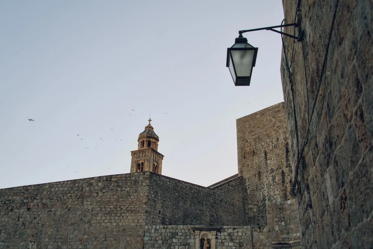
The sun does not merely shine upon the Adriatic; it illuminates a living tapestry of stone, salt, and centuries of defiance. To walk the streets of a Croatian coastal town is to step through a veil of time, where the modern traveler finds themselves brushing shoulders with the ghosts of Venetians, Ragusans, and ancient Illyrian tribes. Croatia is not just a destination; it is a monumental archive of human resilience carved into the very karst of the Balkan Peninsula. The Bastions of Ragusa and the Adriatic Horizon Dubrovnik, the legendary "Pearl of the Adriatic," remains the most profound testament to the medieval obsession with security and aesthetic grandeur. As you stand atop the Minceta Tower, the highest point of the city’s massive defensive system, the world narrows down to the rhythm of the waves crashing against the base of limestone ramparts. These walls, constructed predominantly between the 12th and 17th centuries, represent a masterclass in fortification. Unlike many European cities that lost their medieval character to fire or modernization, Dubrovnik preserved its core. Walking the Stradun, the main thoroughfare, one notices the uncanny uniformity of the buildings—a result of the Great Earthquake of 1667, which forced a rapid and structured reconstruction. The city was once the Republic of Ragusa, a maritime powerhouse that dared to rival the Venetian Republic. Its independence was bought not just with gold, but with the genius of diplomacy, navigating the complex power dynamics between the Ottoman Empire and the burgeoning kingdoms of the West.Diocletian’s Palatial Ghost in Split If Dubrovnik is a fortress preserved, Split is a city living inside a palace. The Diocletian’s Palace is arguably one of the most significant archaeological wonders in Europe. Built for the Roman Emperor Diocletian at the turn of the 4th century, it was never merely a temporary residence; it was a retirement fortress designed to be an entire city within itself. To navigate the Peristyle today is to participate in a strange, beautiful historical synthesis. Locals sip coffee where Roman soldiers once stood watch. The substructures, or the "cellars" of the palace, provided the blueprint for the living quarters above. As the Roman Empire receded, the citizens of Salona fled into these massive walls, building their homes within the very corridors designed for imperial guards. You are not visiting a ruin; you are visiting a layer cake of human habitation that spans 1,700 years. The Venetian Influence on the Istrian Peninsula Heading north to the Istrian Peninsula, the architectural dialect shifts. The town of Rovinj stands as a beacon of Venetian Gothic influence. Here, the landscape is defined by tight, winding alleys that climb toward the Basilica of St. Euphemia. The Venetian influence is unmistakable in the ornate balconies, the lion motifs carved into the stone lintels, and the vibrant, pastel-colored facades that reflect off the emerald waters of the Adriatic. The history of Istria is a complex narrative of shifting allegiances. It was a frontline of culture, where the Mediterranean influence of Italy met the rugged, Slavic soul of the hinterlands. While the coastal towns became hubs of maritime commerce and trade, the inland villages—often perched on hilltop plateaus like Motovun—functioned as defensive bastions against inland invaders. These towns, constructed from the local gray stone, offer a stark contrast to the opulence of the coast, revealing the tougher, more stoic side of the medieval Croatian experience.The Sacred Geometry of Zadar and Sibenik The medieval spirit of Croatia is deeply rooted in its religious heritage. In Zadar, the Church of St. Donatus, a pre-Romanesque structure from the 9th century, stands as an architectural anomaly. Its circular shape and massive, thick walls evoke the spirit of early Byzantine influence that permeated the Dalmatian coast long before the Gothic cathedrals began to dominate the skyline. Sibenik, however, takes this stone-carving mastery to an apex with the Cathedral of St. James. This structure is unique in the world, having been constructed entirely from stone without the use of wood or mortar for its structural joints. It is a masterpiece of the Renaissance, yet its spirit is purely medieval—an ambitious project that required the ingenuity of multiple generations of architects, including the legendary Juraj Dalmatinac. When you stand inside, looking at the stone barrel vaulting, you are witnessing the pinnacle of stone-crafting in the medieval period. The Living Heritage of the Adriatic Beyond the grand cathedrals and the intimidating ramparts, the true medieval world of Croatia survives in its traditions. It is found in the "klapa" singing, a form of a cappella music that echoes through the stone alleys of Dalmatia—a tradition recognized by UNESCO for its intangible cultural value. It is found in the local trade of salt, olive oil, and wine, industries that have defined the coastal lifestyle since the arrival of the Ancient Greeks. To travel through Croatia is to learn the language of stone. Every block in a wall, every archway in a cellar, and every crest above a doorway has a story of a merchant, a king, or a commoner fighting to maintain their autonomy against the tides of larger, more aggressive empires.Preserving the Past for Future Explorations The challenge for the modern visitor is to look past the glitz of the tourism industry and see the endurance beneath. Croatia has survived seismic shifts in borders, regimes, and ideologies. What remains is a testament to the fact that beauty, when crafted with the permanence of stone, can outlast even the most volatile historical eras. When you walk the ancient walls of Ston, or the narrow, labyrinthine alleys of Korcula—the purported birthplace of Marco Polo—you are connecting with a tangible, physical manifestation of medieval life. These towns were designed for a time when survival meant being able to seal the gates at sunset. Today, the gates are open, but the atmosphere remains thick with the scent of pine, sea salt, and the enduring weight of history. As the sun sets over the Adriatic, painting the limestone in hues of gold and violet, one cannot help but feel a deep sense of gratitude for those who labored to preserve these spaces. Croatia remains one of the few places in Europe where the medieval world hasn't just been preserved behind glass, but remains the backdrop for the daily lives of the people who call it home. It is a place where you don't just learn history; you inhabit it.#CroatiaTravel #MedievalHistory #Dubrovnik #Dalmatia #EuropeanHeritage Related InsightsIm Bann der Gezeiten: Wenn Stein und Meer den Mont Saint-Michel umarmen Sardinian Nuraghe Trails: Mapping the Bronze Age Megalithic Landscapes Lalibela : Le Chant de la Pierre Vivante – Plongée au Cœur des Églises Monolithiques d'Éthiopie{ "@context": "https://schema.org", "@type": "FAQPage", "mainEntity": [ { "@type": "Question", "name": "What is the main focus of Croatia Unveiled: Stepping Back into the Medieval World?", "acceptedAnswer": { "@type": "Answer", "text": "Journey through the ancient limestone corridors and fortress walls of Croatia, where the whispers of the Adriatic sea tell tales of empires past." } }, { "@type": "Question", "name": "Who authored the comprehensive guide on Croatia Unveiled: Stepping Back into the Medieval World?", "acceptedAnswer": { "@type": "Answer", "text": "This detailed article and its insights were carefully researched and authored by John Explorer." } }, { "@type": "Question", "name": "Where can I find more related content about Travel?", "acceptedAnswer": { "@type": "Answer", "text": "You can explore more articles, detailed reviews, and similar insights by browsing the Related Insights section at the bottom of this article or visiting our dedicated Travel category page." } } ] }
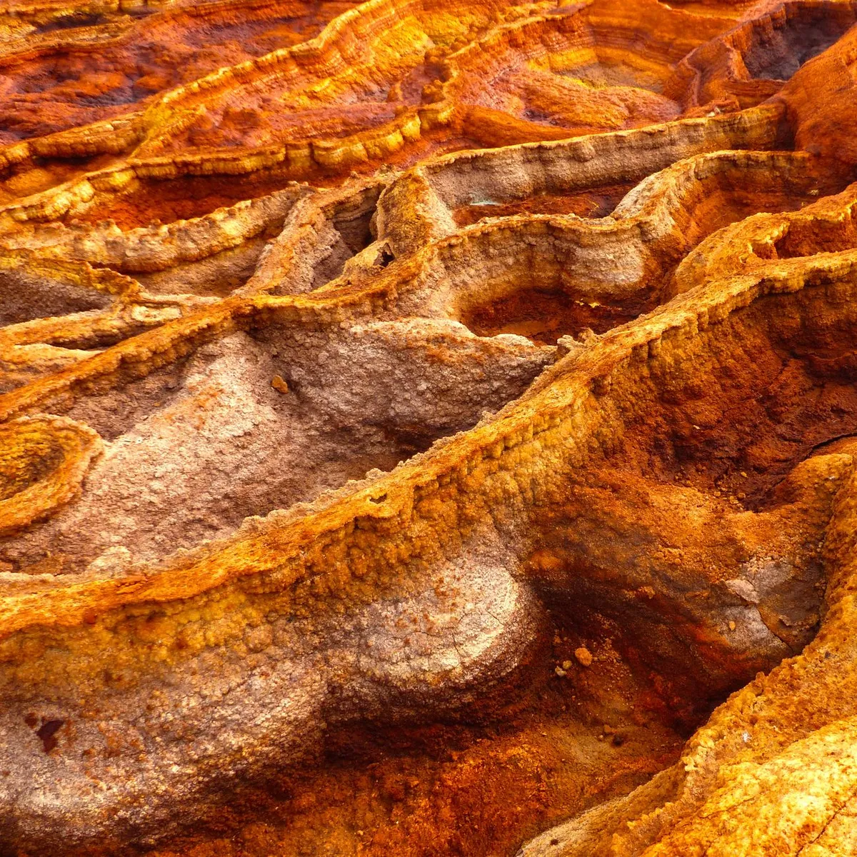
- Aisha Sharma
- 30 Aug, 2026 12:10
Ethiopia’s Danakil Depression: A Journey to Earth’s Hottest and Most Alien Landscape
Where the Earth Boils Beneath Your Feet Nestled in the northeastern corner of Ethiopia, the Danakil Depression is not just a place—it’s an experience that defies comprehension. Known as one of the hottest and lowest points on Earth, this geological wonder stretches over 100,000 square kilometers, dipping as low as 125 meters below sea level. Here, the air shimmers with heat, the ground crackles with volcanic fury, and the landscape shifts between salt-encrusted plains and bubbling lava lakes. It’s a realm where human survival is a testament to endurance, and where the planet’s raw power is laid bare. For adventurers, scientists, and travelers seeking the extraordinary, the Danakil Depression offers an unparalleled journey into the heart of Earth’s most extreme environments. But this is no ordinary destination. It’s a place where temperatures routinely exceed 50°C (122°F), where toxic gases linger in the air, and where the very ground beneath your feet is alive with geological activity. To visit is to step into another world—one that feels more like Mars than our own.The Geological Marvels That Define the Danakil Depression The Danakil Depression is a geological anomaly, a rift valley formed by the divergence of three tectonic plates: the Nubian, Somali, and Arabian plates. This relentless tectonic activity has created a landscape that is both breathtaking and terrifying. At its heart lies the Erta Ale volcano, one of the few continuously active lava lakes in the world. For over a century, this fiery cauldron has churned, its molten surface a mesmerizing yet deadly spectacle. Nearby, the Dallol hydrothermal field is a surreal tableau of acid pools, salt formations, and sulfur deposits. The water here is so acidic that it can dissolve flesh on contact, and the temperatures are so high that the air itself seems to vibrate. Scientists believe Dallol may resemble the conditions that existed on Earth billions of years ago, making it a living laboratory for astrobiologists studying the origins of life. But the Danakil Depression’s most iconic feature is its salt flats. For centuries, the Afar people have mined salt here, carving out blocks from the vast, white expanse that stretches endlessly into the horizon. The salt is transported by camel caravans, a tradition that dates back to ancient times. Today, these caravans still traverse the Danakil, a testament to the resilience of the people who call this harsh landscape home.The region’s extreme conditions have also made it a hotspot for scientific research. NASA has studied the Danakil Depression as an analog for Mars, while geologists flock here to study the unique volcanic and hydrothermal processes at work. The combination of extreme heat, toxic gases, and acidic waters creates an environment that is as challenging as it is fascinating. For travelers, the Danakil Depression is a bucket-list destination, but it’s not for the faint of heart. The journey here requires careful planning, specialized guides, and a tolerance for discomfort. Yet, for those who make the trek, the rewards are immeasurable—a glimpse into a world that feels like another planet.Navigating the Danakul: Logistics, Costs, and Essential Preparations Visiting the Danakil Depression is not a spontaneous trip. It requires meticulous planning, from securing permits to arranging transportation and accommodations. The journey typically begins in the Ethiopian city of Mekele, the gateway to the Danakil. From there, travelers embark on a multi-day expedition, often by 4x4 vehicle, through some of the most remote and rugged terrain on Earth. The cost of visiting the Danakil Depression can vary widely depending on the level of comfort and the duration of the trip. A basic guided tour can cost anywhere from $500 to $1,500 per person, while more luxurious options with private guides and better accommodations can exceed $2,000. These costs typically include transportation, guides, meals, and camping equipment. However, travelers should budget extra for tips, permits, and any additional expenses that may arise.One of the biggest challenges of visiting the Danakil Depression is the extreme heat. Temperatures during the day can exceed 50°C (122°F), making it essential to travel during the cooler hours of early morning or late evening. Hydration is critical, and travelers should carry at least 3-4 liters of water per person per day. Sun protection is also a must, with wide-brimmed hats, sunglasses, and high-SPF sunscreen being non-negotiable. Accommodations in the Danakil Depression are basic at best. Most tours involve camping in tents, with limited access to modern amenities. Some tours may include stays in basic lodges or guesthouses in nearby towns like Dallol or Berhale, but these are often rudimentary and lack electricity or running water. For those seeking a more comfortable experience, it’s possible to arrange private accommodations in Mekele before or after the expedition. Permits are another critical consideration. The Ethiopian government requires all visitors to the Danakil Depression to obtain a special permit, which can be arranged through a licensed tour operator. These permits are typically valid for a set period, and travelers must adhere to strict guidelines to ensure their safety and the preservation of the fragile ecosystem. For digital nomads and expats considering a longer stay in Ethiopia, the cost of living is relatively low compared to Western standards. According to Numbeo, the world’s largest cost-of-living database, rent for a one-bedroom apartment in Addis Ababa averages around $200-$400 per month, while a meal at a mid-range restaurant costs about $5-$10. However, the Danakil Depression is a different story. Supplies here are scarce and expensive, with basic items like bottled water and snacks costing significantly more than in major cities.Safety is a paramount concern in the Danakil Depression. The region is home to the Afar people, a semi-nomadic ethnic group with a strong presence in the area. While the Afar are generally welcoming to tourists, tensions can arise, particularly in disputed territories. Travelers should always be accompanied by a licensed guide and avoid venturing off alone. Additionally, the presence of landmines in some areas means that sticking to established routes is essential. Despite the challenges, the Danakil Depression is an unforgettable destination for those willing to brave its extremes. The combination of its otherworldly landscapes, geological wonders, and cultural richness makes it a must-visit for adventurers and explorers.Expense Category Estimated Cost (USD) NotesGuided Tour $500 - $2,000+ Includes transport, guide, mealsPermits $50 - $100 Required for entryAccommodations (Mekele) $20 - $50 per night Basic guesthouses or hotelsWater $1 - $3 per liter Prices increase in remote areasLocal Guide (per day) $50 - $100 Essential for safetyCamping Gear Rental $20 - $50 If not provided by tourThe Afar People: Guardians of the Danakil’s Secrets The Danakil Depression is not just a geological wonder—it’s also home to the Afar people, a resilient ethnic group with a rich cultural heritage. The Afar have inhabited this harsh landscape for centuries, adapting to its extreme conditions with remarkable ingenuity. Their way of life revolves around the salt trade, livestock herding, and trade with neighboring communities. The Afar are semi-nomadic, moving seasonally in search of water and grazing land for their camels, goats, and cattle. Their traditional dwellings, known as ari, are made from woven mats and sticks, designed to be easily dismantled and transported. Despite the challenges of their environment, the Afar are known for their hospitality, often welcoming visitors into their camps with tea and stories.The salt trade is central to Afar culture and economy. For generations, the Afar have mined salt from the Danakil’s vast salt flats, carving out blocks and transporting them by camel caravan to markets in Ethiopia and beyond. This trade has earned the Afar a reputation as skilled traders and negotiators, with salt serving as a form of currency in the region. However, the Afar’s way of life is under threat. Climate change, political instability, and economic pressures are forcing many Afar to abandon their traditional livelihoods in search of alternative income. The Danakil Depression’s extreme conditions also pose significant health risks, with diseases like malaria and tuberculosis prevalent in the region. Despite these challenges, the Afar remain deeply connected to their land. Their oral traditions, music, and rituals are a testament to their resilience and cultural richness. Visitors to the Danakil Depression have the opportunity to engage with the Afar, learning about their history, customs, and the challenges they face in preserving their way of life. For those interested in cultural immersion, a visit to an Afar village or salt-mining camp can be a highlight of the trip. The Afar are proud of their heritage and often eager to share their knowledge with visitors. Whether it’s participating in a traditional tea ceremony, learning about salt-mining techniques, or simply listening to stories around a campfire, the Afar offer a glimpse into a world that is both ancient and enduring.Surviving the Danakil: Safety, Health, and Essential Tips The Danakil Depression is not a place for the unprepared. Its extreme heat, toxic gases, and rugged terrain demand respect and caution. For travelers, the key to a safe and enjoyable visit lies in thorough preparation and adherence to safety guidelines. First and foremost, hiring a licensed guide is non-negotiable. The Danakil Depression is a maze of volcanic craters, salt flats, and shifting sands, and navigating it without expert guidance is a recipe for disaster. A good guide will not only ensure your safety but also enrich your experience with insights into the region’s geology, history, and culture.Health precautions are equally critical. The extreme heat can lead to dehydration, heatstroke, and sunburn, so it’s essential to stay hydrated and protected from the sun. Travelers should carry rehydration salts, electrolytes, and a first-aid kit. Insect repellent is also a must, as mosquitoes and other pests are common in the region. The air in the Danakil Depression can be laced with toxic gases, particularly around the Dallol hydrothermal field. These gases, including sulfur dioxide and hydrogen chloride, can cause respiratory distress and other health issues. Travelers with asthma or other respiratory conditions should avoid areas with high gas concentrations and carry a mask for protection. Food and water safety is another concern. Tap water in the Danakil Depression is not safe to drink, and travelers should rely on bottled water or purified water. Local food can be a gamble, as hygiene standards vary widely. Stick to freshly cooked meals and avoid raw vegetables or unpeeled fruits. For those prone to altitude sickness, the Danakil Depression’s low elevation may not be an issue, but the extreme heat can exacerbate symptoms. Travelers should take it slow, avoid strenuous activity during the hottest hours, and listen to their bodies. Finally, respect for the local culture and environment is essential. The Afar people are proud of their heritage, and visitors should approach interactions with humility and curiosity. Avoid taking photos without permission, and be mindful of the fragile ecosystem. Leave no trace, and support local businesses whenever possible.A Land That Defies Imagination The Danakil Depression is more than a destination—it’s a testament to the raw power and beauty of our planet. Here, in a landscape that feels plucked from another world, travelers can witness the Earth in its most primal form. From the bubbling lava lakes of Erta Ale to the shimmering salt flats of Dallol, every corner of the Danakil Depression tells a story of geological fury and human resilience. But the Danakil Depression is also a place of contrasts. It’s a land of extremes, where beauty and danger coexist in equal measure. It’s a place where the Afar people have carved out a life against all odds, where scientists uncover the secrets of Earth’s origins, and where adventurers push the limits of human endurance. For those who venture here, the Danakil Depression leaves an indelible mark. It’s a journey that challenges the body, tests the mind, and ignites the soul. It’s a reminder that our planet is still full of mysteries, waiting to be explored. So, if you’re ready to step into the unknown, pack your bags, hire a guide, and prepare for the adventure of a lifetime. The Danakil Depression is calling.#DanakilDepression #ExtremeTravel #EthiopiaAdventure #VolcanicLandscapes #SaltFlats Related InsightsYellowstone: The Fiery Heart of the American West The Great Southern Odyssey: Unveiling the Spirit of Australian Tourism Météora : L'Ascension Mystique entre Ciel et Pierre{ "@context": "https://schema.org", "@type": "FAQPage", "mainEntity": [ { "@type": "Question", "name": "What is the main focus of Ethiopia’s Danakil Depression: A Journey to Earth’s Hottest and Most Alien Landscape?", "acceptedAnswer": { "@type": "Answer", "text": "Explore Ethiopia’s Danakil Depression, a surreal, otherworldly expanse where lava lakes bubble, salt flats shimmer, and temperatures soar beyond human endurance." } }, { "@type": "Question", "name": "Who authored the comprehensive guide on Ethiopia’s Danakil Depression: A Journey to Earth’s Hottest and Most Alien Landscape?", "acceptedAnswer": { "@type": "Answer", "text": "This detailed article and its insights were carefully researched and authored by Aisha Sharma." } }, { "@type": "Question", "name": "Where can I find more related content about Travel?", "acceptedAnswer": { "@type": "Answer", "text": "You can explore more articles, detailed reviews, and similar insights by browsing the Related Insights section at the bottom of this article or visiting our dedicated Travel category page." } } ] }

-
 Hans Müller
 - 30 Aug, 2026 10:54
Australien: Wo die Ewigkeit des Outbacks auf den Puls der Moderne trifft
Dort, wo der Horizont in ein unendliches Ocker übergeht und die Stille der Wüste eine Sprache spricht, die älter ist als die geschriebene Geschichte der Menschheit, beginnt das wahre Abenteuer. Australien ist kein gewöhnliches Reiseziel; es ist ein lebendiges, pulsierendes Archiv der Erdgeschichte, verpackt in die atemberaubende Kulisse eines Kontinents, der sich nach der Trennung vom Superkontinent Gondwana in einer eigenen zeitlichen Dimension entwickelt hat. Die roten Pfade der Zeitlosen Wenn man in das rote Herz Australiens reist, betritt man das Territorium der Anangu, der traditionellen Hüter des Uluru-Kata Tjuta Nationalparks. Dieser gewaltige Inselberg aus Sandstein, der wie ein schlafender Riese aus der flachen Ebene ragt, ist nicht bloß eine geologische Formation. Für die Aborigines ist er ein heiliger Ort, dessen Geschichte in den "Dreaming"-Erzählungen verwurzelt ist – Mythen, die den Ursprung der Welt, der Tiere und der menschlichen Gesetze beschreiben. Die Geologie des Uluru ist so faszinierend wie seine spirituelle Bedeutung. Der Sandstein wurde vor etwa 550 Millionen Jahren abgelagert, als sich das Areal noch unter einem flachen Meer befand. Heute ist die Oberfläche durch Oxidation eisenhaltiger Mineralien rostrot gefärbt. Wer hier wandert, spürt den Atem der Äonen. Es ist eine Demut, die man nur an Orten findet, an denen die Natur die menschliche Existenz in ihre bescheidene Relation rückt.Architektonische Symphonien am Pazifik Verlässt man die staubigen Weiten des Outbacks und wendet sich den Küsten zu, trifft man auf eine völlig andere Facette des Kontinents. Sydney ist das Paradebeispiel dafür, wie Australien die Moderne in die Natur integriert hat. Das Sydney Opera House, entworfen von Jørn Utzon, gilt als eines der bedeutendsten Gebäude des 20. Jahrhunderts. Seine segelförmigen Schalen, die sich harmonisch in die Szenerie des Hafens einfügen, sind Ausdruck eines innovativen Geistes, der keine Angst vor technischer Komplexität hatte. Doch Sydney ist mehr als nur ein Postkartenmotiv. Es ist eine Stadt der Kontraste, in der koloniale Geschichte auf multikulturelle Gegenwart trifft. Die Nähe zum Pazifik bestimmt den Rhythmus der Bewohner. Das Leben spielt sich im Freien ab, an den Klippen von Bondi oder in den geschäftigen Häfen, die seit Jahrhunderten als Tor zur Welt fungieren. Die Verbindung zwischen dem tiefblauen Ozean und den urbanen Strukturen ist ein Symbol für die australische Lebensweise: eine ständige Bewegung zwischen urbaner Effizienz und dem Drang nach unberührter Natur. Unter der Oberfläche des Großen Barriere-Riffs Nördlich von Sydney, entlang der Küste von Queensland, entfaltet sich das größte Lebewesen der Erde: das Great Barrier Reef. Es erstreckt sich über 2.300 Kilometer und besteht aus tausenden einzelnen Riffen und Inseln. Was aus dem Weltraum als leuchtendes Band im Ozean sichtbar ist, ist unter Wasser ein komplexes Labyrinth der Artenvielfalt. Als Reisender taucht man hier in eine Welt ein, die von Kalkalgen und Korallenpolypen in mühevoller Kleinarbeit über Jahrtausende erschaffen wurde. Es ist ein fragiles Ökosystem, das uns daran erinnert, wie eng unsere Zukunft mit der Gesundheit der Weltmeere verknüpft ist. Die wissenschaftliche Bedeutung des Riffs liegt nicht nur in seiner Biologie, sondern auch in seinem Status als Klimaindikator. Der Besuch dieser Unterwasserwelt ist eine Lektion in Demut und Verantwortungsbewusstsein.Zwischen Eukalyptus und den Geheimnissen des Waldes Abseits der großen Touristenpfade offenbart Australien eine Flora, die weltweit einzigartig ist. Über 90 Prozent der einheimischen Pflanzenarten sind endemisch. Die Eukalyptuswälder, die den Kontinent wie ein silbriger Schleier überziehen, haben eine faszinierende Überlebensstrategie entwickelt: Ihre ätherischen Öle dienen nicht nur als Schutz vor Fressfeinden, sondern machen die Wälder auch brandanfällig – ein natürlicher Kreislauf der Regeneration, der seit Millionen Jahren besteht. Wenn man durch die Blue Mountains wandert, riecht man den typischen Duft des Eukalyptus, der wie ein blauer Nebel über den Tälern hängt – ein Phänomen, das den Bergen ihren Namen gab. Diese Wälder sind das Zuhause für Tiere, die sonst nirgendwo existieren: Kängurus, Koalas und Schnabeltiere. Diese Tiere sind evolutionäre Zeugen einer Zeit, in der Australien noch eng mit der Antarktis verbunden war, bevor es als "Arche Noah" auf seine isolierte Reise driftete.Das Erbe der Pioniere und die Suche nach dem Morgen Die Geschichte der menschlichen Besiedlung ist ebenfalls eine Erzählung von Anpassung. Während die Ureinwohner über 60.000 Jahre hinweg eine nachhaltige Lebensweise pflegten, brachten europäische Siedler ab Ende des 18. Jahrhunderts völlig neue kulturelle Paradigmen mit. Heute ist Australien ein Mosaik aus diesen Einflüssen. Städte wie Melbourne verkörpern dies durch ihre kulinarische Vielfalt und ihre Kunstszene, die so lebendig und divers ist wie die Bevölkerung selbst. Australien ist ein Land, das niemals stillsteht. Ob es die Erforschung der erneuerbaren Energien in der weiten Wüste ist oder die Bemühungen, das kulturelle Erbe der Aborigines in den modernen Bildungsalltag zu integrieren – der Kontinent ist ein Laboratorium für die Herausforderungen unserer Zeit. Ein Aufruf zur respektvollen Entdeckung Wenn man Australien bereist, trägt man eine Verantwortung. Es ist ein Land, das seine Spuren in der Seele hinterlässt. Vom Knirschen des Sandes unter den Wanderstiefeln im Northern Territory bis zum sanften Rauschen der Wellen in der Whitsunday Islands Region – alles hier ist von einer intensiven, fast physischen Präsenz. Um Australien wirklich zu verstehen, muss man bereit sein, zuzuhören: den Geschichten der Elders in den abgelegenen Gemeinden, dem Wind in den Eukalyptuswipfeln und dem Rhythmus der Städte. Es ist ein Ort, an dem Vergangenheit und Zukunft in einem ständigen Dialog stehen, bewacht von der unendlichen Weite des Himmels.Reisen Sie langsam, respektieren Sie die Stille und lassen Sie sich von der rohen Kraft des fünften Kontinents verändern. Australien wartet nicht darauf, erobert zu werden; es wartet darauf, dass wir unsere Perspektive ändern und erkennen, dass wir nur kleine Gäste in einer unermesslich alten und wunderbaren Welt sind.#Australien #Reisen #Outback #Naturwunder #Entdeckergeist Related InsightsThe Dark Heart of Paris: Exploring the Catacombs Whispers of the Tatra: Unveiling the Soul of Poland's Winter Capital, Zakopane The Arctic's Whispering Skies: Your Ultimate Guide to Unlocking Scandinavia's Northern Lights Mystique (Part 2){ "@context": "https://schema.org", "@type": "FAQPage", "mainEntity": [ { "@type": "Question", "name": "What is the main focus of Australien: Wo die Ewigkeit des Outbacks auf den Puls der Moderne trifft?", "acceptedAnswer": { "@type": "Answer", "text": "Begleiten Sie Hans Müller auf eine Reise durch den fünften Kontinent, von den heiligen Stätten der Ureinwohner bis zu den architektonischen Wundern der Küstenmetropolen." } }, { "@type": "Question", "name": "Who authored the comprehensive guide on Australien: Wo die Ewigkeit des Outbacks auf den Puls der Moderne trifft?", "acceptedAnswer": { "@type": "Answer", "text": "This detailed article and its insights were carefully researched and authored by Hans Müller." } }, { "@type": "Question", "name": "Where can I find more related content about Travel?", "acceptedAnswer": { "@type": "Answer", "text": "You can explore more articles, detailed reviews, and similar insights by browsing the Related Insights section at the bottom of this article or visiting our dedicated Travel category page." } } ] }
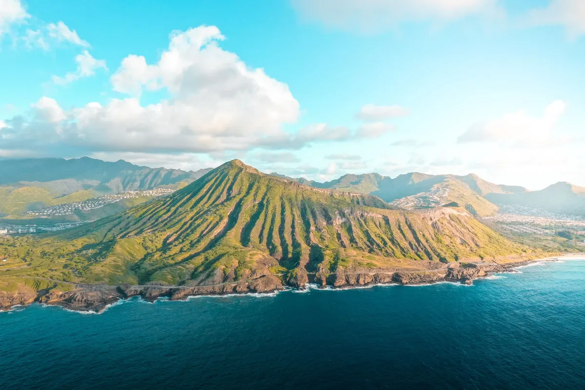
- Chloe Tremblay
- 29 Aug, 2026 12:49
The Azores: Europe’s Hidden Paradise Where Wild Volcanoes Meet Turquoise Oceans
Where Europe’s Dramatic Past Meets Nature’s Wildest Masterpiece The Azores, a remote archipelago in the North Atlantic, are a place where the earth still breathes fire and the ocean whispers ancient secrets. This Portuguese territory, scattered across nine volcanic islands, is a land of contrasts—lush green pastures meet jagged cliffs, thermal hot springs bubble beside black sand beaches, and whales breach in waters so clear they look like liquid sapphire. Unlike the crowded tourist trails of mainland Europe, the Azores remain a well-kept secret, where time moves slower, hospitality is genuine, and every horizon hides a new adventure. Here, you won’t find overpriced resorts or theme parks. Instead, you’ll find hiking trails that lead to crater lakes, whale-watching excursions where pilots guide you to within meters of humpback whales, and local festivals where the entire village dances to the rhythm of traditional fado music. The Azores are for those who crave authenticity, for travelers who want to immerse themselves in a world where nature dictates the pace. But what makes the Azores truly special? It’s the perfect blend of raw, untamed beauty and the warmth of Portuguese culture. Whether you’re sipping bolo lêvedo (a sweet muffin) in a café overlooking the ocean or hiking through the primordial landscapes of Pico Island, every moment feels like stepping into a postcard—one that’s alive, breathing, and waiting to be explored.The Azores Unveiled: A Land Forged by Fire and Water The Azores are not just another set of islands—they are a geological wonder, born from the depths of the Atlantic Ocean over millions of years. This archipelago sits atop the Mid-Atlantic Ridge, where tectonic plates pull apart, allowing magma to rise and create new land. The result? A dramatic landscape of towering volcanoes, steaming fumaroles, and deep blue crater lakes that shimmer like gemstones. The islands are divided into three groups: the Eastern Group (São Miguel and Santa Maria), the Central Group (Terceira, Graciosa, São Jorge, Pico, and Faial), and the Western Group (Flores and Corvo). Each island has its own personality, shaped by its volcanic history and the ocean’s influence. Take Pico Island, for example, home to Portugal’s highest peak, Mount Pico, a dormant volcano that last erupted in 1718. The island’s landscape is a stark contrast of black lava fields and lush vineyards, where the UNESCO-listed Landscape of the Pico Island Vineyard Culture tells the story of human resilience in a harsh environment. Meanwhile, São Miguel, the largest island, is a paradise of thermal springs, waterfalls, and the iconic Sete Cidades twin lakes, where legend says a princess’s tears filled the craters. The Azores are also a hotspot for geothermal activity. The Furnas Valley on São Miguel is a surreal world of boiling mud pots, steaming vents, and the famous Cozido das Furnas, a traditional stew slow-cooked underground by volcanic heat. On Terceira, the Algar do Carvão cave offers a glimpse into the island’s volcanic past, while Faial’s Caldeira is a massive volcanic crater that feels like stepping onto another planet. But the Azores aren’t just about fire—they’re equally defined by water. The islands are surrounded by some of the richest marine ecosystems in the world, where sperm whales, dolphins, and even blue whales migrate seasonally. The Azores Whale Watching industry is one of the most sustainable in the world, with operators like Picos de Aventura and Terra Azul offering ethical encounters that prioritize the well-being of marine life. For those who love the ocean, the Azores offer everything from coasteering (cliff jumping and swimming in hidden coves) to stand-up paddleboarding in the calm waters of Lagoa das Sete Cidades. The Island of Flores, the westernmost point of Europe, is a UNESCO Biosphere Reserve where waterfalls cascade directly into the sea, and the Ilhéu de Vila Franca, a small islet off São Miguel, is a natural pool of turquoise water so clear you can see fish darting beneath your feet. The Azores are a place where the earth is alive, where every step feels like a journey through time. Whether you’re standing on the rim of a volcano, swimming in a crater lake, or watching whales breach in the distance, you’re reminded that this is a land shaped by forces far greater than humanity.From Whale Songs to Traditional Festivals: The Soul of the Azores Beyond its breathtaking landscapes, the Azores are a cultural treasure trove, where traditions run deep and festivals are a way of life. The islands’ isolation has preserved a unique blend of Portuguese, Azorean, and even Azorean-American influences, creating a culture that is both familiar and distinctly its own. One of the most iconic traditions is the Festas Sanjoaninas, held every June in Ponta Delgada on São Miguel. This week-long celebration honors São João, the patron saint of the city, with parades, fireworks, and the playful tradition of hitting people on the head with plastic hammers—a custom said to bring good luck. The streets fill with music, dancing, and the scent of grilled chouriço (sausage) and bolo lêvedo, a sweet muffin that’s a staple of Azorean cuisine. On Terceira, the Festas da Praia da Vitória is a spectacle of color and sound, featuring bullfights (a traditional Azorean sport where bulls are not harmed), horse parades, and the famous touradas à corda, where bulls are led through the streets on a rope. Meanwhile, Pico’s Festas da Santa Cruz is a religious and cultural extravaganza, with processions, folk music, and the island’s famous vinho verde (green wine) flowing freely. Food is at the heart of Azorean culture, and the islands’ cuisine reflects their volcanic soil and maritime heritage. Cozido das Furnas, a hearty stew of meats, vegetables, and beans, is slow-cooked underground in the geothermal heat of Furnas Valley—a dish that’s as much a cultural experience as it is a meal. Lapas (grilled limpets) are a delicacy, often served with garlic butter, while alcatra, a beef stew with pineapple, is a nod to the islands’ historical ties with the Azores’ Portuguese and Brazilian influences. Seafood is, of course, a staple. Lapas grelhadas (grilled limpets), ** polvo à lagareiro** (octopus with olive oil and potatoes), and bife à regional (steak with a rich sauce) are must-tries. For dessert, queijadas da Vila Franca (cheese tarts) and donas amélia (coconut and egg yolk sweets) are local favorites. The Azores are also a place where music and dance are woven into daily life. Fado, the melancholic Portuguese musical genre, is alive and well here, with intimate performances in local taverns. Ranchos folclóricos (folk groups) perform traditional dances in colorful costumes, telling stories of the islands’ history through movement. But perhaps the most magical cultural experience is the whale festivals. In Lajes do Pico, the Festa dos Baleeiros celebrates the islands’ whaling history with parades, concerts, and educational exhibits. While whaling is now banned, the festivals honor the brave men who once risked their lives to hunt whales, a tradition that shaped the islands’ identity. The Azores are a place where culture is not just observed but lived. Whether you’re joining a local festival, sipping wine in a vineyard, or listening to a fado singer in a dimly lit café, you’re immersing yourself in a way of life that’s as rich and vibrant as the islands themselves.The Azorean Way of Life: Slow Travel in a Fast World In a world where travel often means rushing from one attraction to the next, the Azores offer something rare: the chance to slow down and truly live in the moment. This is a place where time moves to the rhythm of the tides, where the pace of life is dictated by the sunrise and the sunset, and where the concept of saudade—a Portuguese term for a bittersweet longing—feels palpable. The Azores are a haven for slow travelers, those who seek to immerse themselves in the local way of life rather than just tick off a checklist of sights. Here, you can wake up to the sound of waves crashing against the shore, spend your morning hiking through a volcanic crater, and spend your afternoon chatting with a local fisherman over a glass of wine. There’s no need to rush—because in the Azores, the journey is the destination. One of the best ways to experience the Azorean way of life is by staying in a local guesthouse or quinta (farmhouse). Unlike generic hotels, these accommodations offer a glimpse into the daily rhythms of island life. Many are family-run, with hosts who are eager to share their knowledge of the islands’ hidden gems. Whether it’s a casa de campo (country house) on Flores or a guesthouse in Furnas with a view of the steaming valley, these stays are where the magic happens. For those who want to dive deeper, volunteering is a fantastic way to connect with the community. Organizations like Azores Volunteering offer opportunities to work on organic farms, help with conservation projects, or assist in local schools. It’s a chance to give back while gaining a unique perspective on island life. The Azores are also a paradise for digital nomads and remote workers. With a growing number of coworking spaces (like Selina Ponta Delgada and Cowork Azores in Horta), reliable internet, and a welcoming expat community, the islands are becoming an increasingly popular destination for those who want to work with a view of the ocean. The cost of living is reasonable—Numbeo reports that a single person’s monthly expenses (excluding rent) average around €800-€1,200, making it an affordable alternative to mainland Europe. But perhaps the most rewarding aspect of slow travel in the Azores is the people. Azoreans are known for their warmth and hospitality, a trait that stems from their island mentality—where community is everything. Whether you’re invited into a local’s home for a home-cooked meal or struck up a conversation with a fisherman at the docks, you’ll find that the Azores are a place where strangers become friends in the blink of an eye. The Azorean way of life is a reminder that travel isn’t just about seeing new places—it’s about experiencing them in a way that nourishes the soul. And in the Azores, that’s exactly what you’ll do.A Practical Guide to the Azores: Costs, Seasons, and Must-Do Adventures Planning a trip to the Azores doesn’t have to be complicated, but a little preparation goes a long way. From the best time to visit to budgeting for your adventure, here’s everything you need to know to make the most of your time in this paradise. When to Go: Seasons and Weather The Azores enjoy a temperate maritime climate, meaning mild temperatures year-round with plenty of rain (especially in winter). The best time to visit is May to October, when the weather is warmest and driest, with average temperatures ranging from 18°C to 25°C (64°F to 77°F). This is also peak whale-watching season, as humpback and sperm whales migrate through the waters.Spring (April-May): Fewer crowds, wildflowers in bloom, and lower prices. Ideal for hiking and exploring. Summer (June-August): Warmest weather, lively festivals, and perfect beach conditions. Expect higher prices and more tourists. Autumn (September-October): Still warm, with fewer crowds. Great for whale watching and hiking. Winter (November-March): Cooler (14°C to 18°C / 57°F to 64°F) and rainier, but still beautiful for those who love dramatic landscapes and storm-watching. Whale watching is still possible, though less reliable.Getting There and Around The Azores are served by three international airports:Ponta Delgada (PDL) on São Miguel (the main gateway) Horta (HOR) on Faial (a key stop for transatlantic sailors) Pico (PIX) on Pico Island (smaller, with flights from Lisbon and Porto)From Europe, direct flights are available from Lisbon, Porto, and Madrid, with seasonal routes from other cities. From North America, Azores Airlines (SATA) offers direct flights from Boston, Providence, and Oakland. Once on the islands, the best way to get around is by rental car, which gives you the freedom to explore at your own pace. Ferries connect the islands, but schedules can be limited, and flights between islands are often more convenient. Public buses are available on larger islands like São Miguel and Terceira, but they’re not as reliable for tourists. Budgeting for Your Trip The Azores are more affordable than mainland Portugal but still a European destination, so budgeting wisely is key. Here’s a rough breakdown of costs (based on Numbeo 2026 data):Expense Cost (EUR) NotesAccommodation €50-€150/night Budget guesthouses start at €50, mid-range hotels €100-€150, luxury resorts €200+Food €15-€30/meal Local restaurants €10-€20, mid-range €20-€30, fine dining €40+Groceries €30-€50/week Basic staples are affordable; imported goods cost moreTransportation €20-€50/day Rental car €30-€50/day, fuel €1.50-€1.80/literActivities €20-€100 Whale watching €50-€80, guided hikes €20-€50, thermal baths €10-€20Total (per day) €80-€200 Varies based on travel styleMoney-Saving Tips:Eat local: Skip touristy restaurants and opt for tascas (local eateries) where meals cost €10-€15. Stay in guesthouses: Family-run accommodations offer better value than hotels. Use public transport: Buses are cheap (€2-€5 per ride) and a great way to meet locals. Travel in shoulder season: May and October offer good weather at lower prices.Must-Do Adventures No trip to the Azores is complete without experiencing these iconic adventures:Whale Watching in Pico or Faial – Join a responsible operator like Terra Azul or Picos de Aventura for a chance to see sperm whales, humpbacks, and dolphins in their natural habitat. Hiking Mount Pico – Summit Portugal’s highest peak (2,351m) for breathtaking views of the islands. Swimming in a Crater Lake – Take a dip in Lagoa do Fogo (São Miguel) or Lagoa das Sete Cidades, two of the most stunning volcanic lakes in the world. Exploring the Furnas Valley – Witness the power of geothermal activity with a visit to Furnas’ hot springs, Cozido das Furnas, and Terra Nostra Park. Surfing in São Jorge or Santa Maria – These islands offer world-class waves for surfers of all levels. Visiting Ilhéu de Vila Franca – A natural pool formed by a volcanic crater, perfect for snorkeling and swimming. Attending a Local Festival – Time your visit to coincide with Festas Sanjoaninas (June) or Festas da Praia (August) for an unforgettable cultural experience.Health and Safety The Azores are a safe and low-risk destination, but it’s always wise to take precautions:Healthcare: Portugal has excellent healthcare, but travel insurance is recommended. Pharmacies (farmácias) are well-stocked. Water: Tap water is safe to drink everywhere. Safety: Petty crime is rare, but keep an eye on belongings in tourist areas. Nature: Respect wildlife (especially whales and dolphins) and follow hiking trail guidelines to avoid accidents.Why the Azores Are the Ultimate Escape for the Modern Wanderer In a world where travel often feels like a race against time, the Azores offer something revolutionary: the chance to breathe. This is a place where the ocean’s rhythm dictates the day, where the scent of pine and salt fills the air, and where every sunset feels like a personal gift from the universe. The Azores are more than just a destination—they’re a state of mind. A place where you can disconnect from the noise of the modern world and reconnect with nature, with culture, and with yourself. Whether you’re standing on the edge of a volcano, watching a whale breach in the distance, or simply sipping wine with newfound friends, the Azores remind you that the best adventures aren’t found in guidebooks—they’re found in the moments that take your breath away. And perhaps that’s why the Azores remain Europe’s best-kept secret. Because in a world that’s increasingly connected, sometimes the most magical places are the ones that ask you to slow down, to look closer, and to truly see. So pack your bags, leave your itinerary at home, and let the Azores guide you. Your perfect escape is waiting.#AzoresAdventure #VolcanicParadise #SlowTravel #WhaleWatching #HiddenGemsEurope Related InsightsBeyond the Horizon: Unveiling Naoshima and Teshima – Japan's Transformative Art Island Odyssey (Part 2) Echoes of the Cosmos: Unveiling the Mysteries of Angkor Wat Beyond the Granite Spires: Unveiling Patagonia’s Untamed Secrets{ "@context": "https://schema.org", "@type": "FAQPage", "mainEntity": [ { "@type": "Question", "name": "What is the main focus of The Azores: Europe’s Hidden Paradise Where Wild Volcanoes Meet Turquoise Oceans?", "acceptedAnswer": { "@type": "Answer", "text": "Escape to the Azores, where volcanic landscapes, crystal-clear waters, and warm hospitality create a paradise untouched by mass tourism. Discover why this Portuguese archipelago is a dream destination for nature lovers and wanderers alike." } }, { "@type": "Question", "name": "Who authored the comprehensive guide on The Azores: Europe’s Hidden Paradise Where Wild Volcanoes Meet Turquoise Oceans?", "acceptedAnswer": { "@type": "Answer", "text": "This detailed article and its insights were carefully researched and authored by Chloe Tremblay." } }, { "@type": "Question", "name": "Where can I find more related content about Travel?", "acceptedAnswer": { "@type": "Answer", "text": "You can explore more articles, detailed reviews, and similar insights by browsing the Related Insights section at the bottom of this article or visiting our dedicated Travel category page." } } ] }
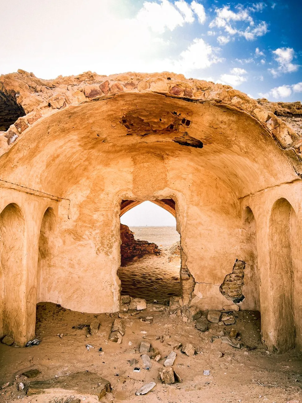
- Marco Rossi
- 29 Aug, 2026 01:18
Fantasmi sulla Via della Seta: Il richiamo silenzioso delle oasi perdute del Turkmenistan
Il vento del Karakum non soffia, sussurra. Porta con sé il riverbero di carovane che, secoli fa, solcavano le distese infinite dell'Asia centrale, cariche di seta, spezie e sogni di gloria imperiale. Quando ci si addentra nell'entroterra del Turkmenistan, la sensazione di trovarsi fuori dal tempo non è una suggestione, ma un dato di fatto geologico e storico. Qui, dove le oasi un tempo scintillavano come smeraldi nel cuore di un mare di sabbia, oggi restano solo le ossa di civiltà che hanno sfidato l'aridità del deserto e, alla fine, hanno dovuto arrendersi al suo implacabile abbraccio. L'architettura dell'oblio tra le dune del Karakum Camminare tra le rovine di Merv non è come visitare una città antica convenzionale. Non si tratta di passeggiare tra monumenti restaurati o musei all'aperto, ma di abitare lo spazio dell'assenza. Merv, un tempo centro nevralgico della Via della Seta, era definita la "Madre del Mondo". Oggi, ciò che resta è un vasto mosaico di fortificazioni in mattoni di fango, le cui mura sembrano sciogliersi lentamente sotto il sole incandescente, tornando a essere terra, polvere, infinito. L'immensità di questo sito archeologico è disarmante. I resti delle città sovrapposte – Erk Kala, Gyaur Kala, Sultan Kala – raccontano una storia di ascesa e caduta segnata dall'incessante lotta per l'acqua. Ogni mattone cotto al sole conserva la memoria di architetti che cercavano di contenere il caos del deserto attraverso la geometria sacra della cupola e dell'arco. La logica delle acque sotterranee e la morte delle civiltà Il mistero di queste oasi fantasma risiede nella loro dipendenza dal sistema dei qanat o kariz. Queste ingegnose gallerie sotterranee, progettate per trasportare l'acqua dalle montagne fino alle valli aride, rappresentano il battito cardiaco che teneva in vita le antiche città della Via della Seta. Quando il sistema idrico falliva — a causa di guerre, cambi di dinastia o mutamenti climatici — la città moriva in poche stagioni. Guardando i profili spezzati del mausoleo di Sultan Sanjar, si percepisce l'ambizione di un potere che pensava di poter controllare il deserto. La maestosità di questa struttura, ancora incredibilmente solida rispetto al vuoto circostante, è un monito silenzioso. Il Turkmenistan è un archivio di tentativi umani di domare l'incontrollabile. Le oasi non sono mai state luoghi stabili, ma patti temporanei con una terra che, per sua natura, non accetta padroni. Oltre la sabbia: l'eredità di Konye-Urgench Spostandosi verso nord, verso le sponde dell'antico corso dell'Amu Darya, ci si imbatte in Konye-Urgench. Qui, il paesaggio diventa ancora più spettrale. Il minareto di Kutlug-Timur si erge come un dito puntato verso il cielo, un'anomalia verticale in un orizzonte dominato dall'orizzontalità assoluta della steppa. Le rovine qui trasudano la storia del Khanato di Corasmia. È un luogo dove il tempo ha rallentato fino a fermarsi. Le decorazioni in mattoni, che formano motivi geometrici incredibilmente complessi, testimoniano un livello di raffinatezza artistica che contrasta violentemente con l'isolamento del luogo. Perché gli uomini hanno scelto di costruire tesori architettonici in una terra così ostile? La risposta risiede nel prestigio: lungo la Via della Seta, l'architettura era la moneta della diplomazia e della fede.L'archeologia del silenzio come stile di vita Il viaggiatore che cerca le oasi fantasma del Turkmenistan deve essere pronto a perdere le certezze. Non c'è rumore di folle, non ci sono souvenir dozzinali. C'è solo il silenzio che preme sulle tempie, interrotto raramente dal richiamo di un predatore del deserto o dal fruscio della sabbia che scivola sui resti delle mura. Questa è l'archeologia allo stato puro: una disciplina che richiede pazienza, rispetto e la capacità di saper leggere i segni lasciati dai secoli sulla materia organica delle costruzioni in adobe. Ogni crepa in un arco, ogni frammento di ceramica azzurra che brilla tra la polvere, è un capitolo di un libro scritto in una lingua che solo il vento può ancora leggere. Il fascino del nulla: perché tornare nel Karakum? Molti si chiedono perché intraprendere un viaggio verso siti così remoti e, a tratti, desolati. La risposta è semplice: per riconnettersi con la vulnerabilità umana. In un mondo iper-connesso e cementificato, le oasi fantasma del Turkmenistan ci ricordano che tutto ciò che costruiamo è, in ultima istanza, un prestito dalla terra. Visitare questi luoghi significa accettare di essere piccoli. Significa guardare negli occhi la storia e accorgersi che essa non è fatta di eroi o grandi battaglie, ma di comunità che hanno lottato per sopravvivere, che hanno creato bellezza in condizioni estreme e che, alla fine, hanno lasciato che la terra riprendesse ciò che era suo.Consigli per l'esploratore del tempo Chi intende avventurarsi in questi territori deve prepararsi con rigore. Non è una meta per il turismo di massa, ma per chi cerca una verità diversa. Il rispetto dei tempi: Il deserto detta le regole. Le ore più calde vanno evitate, lasciando che le rovine parlino solo quando la luce del tramonto allunga le ombre, rendendo visibili dettagli architettonici invisibili a mezzogiorno. L'osservazione: Non cercate l'oro o i tesori. Cercate i sistemi di canalizzazione, le fondamenta delle case comuni, il modo in cui le città venivano orientate rispetto ai venti dominanti. Il silenzio: Spegnete le tecnologie. Lasciate che il vuoto del deserto riempia i vostri sensi. La vera esperienza del Turkmenistan è l'assenza di distrazioni.Il Turkmenistan non vi regalerà una vacanza classica, ma una trasmutazione interiore. Lascerete il paese con meno certezze, ma con una consapevolezza molto più profonda della precarietà del cammino umano. Le oasi fantasma non sono morte: continuano a vivere nel racconto che ogni viaggiatore porta con sé, come un'eco che non smette di riverberare tra le dune. Il viaggio continua, non attraverso chilometri di asfalto, ma attraverso strati di storia che attendono solo di essere riscoperti da chi ha la pazienza di guardare oltre la sabbia. Perché, in fondo, siamo tutti carovanieri su una Via della Seta che non ha mai smesso di scorrere, anche quando i suoi sentieri sono stati inghiottiti dal silenzio.#Turkmenistan #SilkRoad #DesertGhosts #ArchaeologyTravel #HiddenGems Related InsightsSous les Vignobles de la Loire : Le Mystère Énigmatique des Cités Troglodytiques Oubliées Калининград и Куршская коса 平遥古城:穿越明清的金融中心{ "@context": "https://schema.org", "@type": "FAQPage", "mainEntity": [ { "@type": "Question", "name": "What is the main focus of Fantasmi sulla Via della Seta: Il richiamo silenzioso delle oasi perdute del Turkmenistan?", "acceptedAnswer": { "@type": "Answer", "text": "Un viaggio nel tempo tra le rovine desertiche del Turkmenistan, dove le antiche oasi della Via della Seta raccontano segreti dimenticati tra sabbia e storia." } }, { "@type": "Question", "name": "Who authored the comprehensive guide on Fantasmi sulla Via della Seta: Il richiamo silenzioso delle oasi perdute del Turkmenistan?", "acceptedAnswer": { "@type": "Answer", "text": "This detailed article and its insights were carefully researched and authored by Marco Rossi." } }, { "@type": "Question", "name": "Where can I find more related content about Travel?", "acceptedAnswer": { "@type": "Answer", "text": "You can explore more articles, detailed reviews, and similar insights by browsing the Related Insights section at the bottom of this article or visiting our dedicated Travel category page." } } ] }
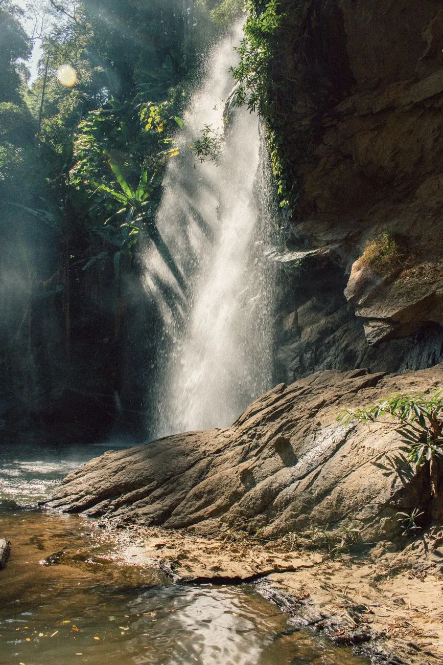
Where the Crowds Never Go: The Real Southeast Asia Awaits Southeast Asia has long been a magnet for travelers, but the well-trodden paths of Bali, Bangkok, and Hanoi are only the beginning. In 2026, a new wave of adventurers is uncovering the region’s hidden gems—places where pristine beaches, lush jungles, and vibrant cultures thrive without the tourist hordes. From the misty highlands of northern Laos to the ancient temples of Cambodia’s Siem Reap, these destinations offer something far more authentic than the typical backpacker route. Whether you're a digital nomad chasing reliable Wi-Fi or a thrill-seeker hunting for untouched landscapes, Southeast Asia’s best-kept secrets promise an experience that’s as enriching as it is exhilarating.Siem Reap: Beyond Angkor Wat – A Digital Nomad’s Paradise Emerges For decades, Siem Reap was known solely as the gateway to Angkor Wat, a place where travelers rushed in, snapped photos, and fled. But in 2026, this Cambodian gem has transformed into a digital nomad haven, offering a perfect blend of affordability, culture, and modern convenience. The city’s internet infrastructure has seen a dramatic upgrade, with speeds now ranging from 50 to 80 Mbps in the city center—a far cry from the dial-up days of the past. Coworking spaces like AngkorHub and The Factory provide high-speed connections, ergonomic setups, and networking opportunities, all for a fraction of what you’d pay in Bangkok or Bali. The cost of living is another draw. A digital nomad can comfortably live on $700–$1,100 per month, including rent, food, and coworking fees. A studio apartment in the city center costs around $300–$500, while a meal at a local amok (Cambodian curry) restaurant runs just $3–$5. Even gym memberships and social events are budget-friendly, with most activities costing under $10. The visa situation has also improved, with Cambodia’s Digital Nomad Visa (introduced in 2024) now fully operational. For $290, you get a 12-month visa with the option to extend, making it one of the most straightforward and affordable options in Southeast Asia. But Siem Reap isn’t just about saving money—it’s about immersion. The city’s growth has brought a wave of new cafes, art galleries, and coworking hubs, all while preserving its rich heritage. The Phare Circus, a social enterprise employing at-risk youth, offers evening performances that blend acrobatics with Cambodian folklore. Meanwhile, the Siem Reap Pub Street has evolved beyond its backpacker reputation, now featuring rooftop bars with live music and craft cocktails. For those seeking adventure, day trips to the Tonlé Sap Lake or the Kulen Promtep Wildlife Sanctuary offer kayaking, hiking, and encounters with rare wildlife.Da Nang: Vietnam’s Coastal Secret Where Urban Sophistication Meets Beachside Bliss While Ho Chi Minh City and Hanoi dominate Vietnam’s travel narrative, Da Nang has quietly emerged as the country’s most dynamic coastal destination. In 2026, this city of 1.2 million is a digital nomad hotspot, offering a rare combination of urban amenities, stunning beaches, and affordability. The cost of living for a digital nomad hovers between $700–$1,100 per month, making it one of the most budget-friendly cities in Southeast Asia for those who want a high quality of life. A modern one-bedroom apartment in the An Thuong district costs $400–$600, while a meal at a local seafood restaurant is just $5–$8. Coworking spaces like DNC Coworking Space and The Hive Da Nang provide high-speed internet (up to 100 Mbps), meeting rooms, and networking events for $80–$150 per month. What sets Da Nang apart is its diverse landscape. The city is nestled between the Marble Mountains (a series of limestone hills with caves and pagodas) and My Khe Beach, one of Vietnam’s most pristine stretches of sand. Adventure seekers can surf the consistent waves, paraglide over the coastline, or hike through the Son Tra Peninsula, home to the rare red-shanked douc langur. For culture lovers, the Dragon Bridge—a 656-foot-long steel structure that breathes fire and water on weekends—is a must-see. Meanwhile, the Hoi An Ancient Town (a UNESCO World Heritage Site) is just a 30-minute drive away, offering lantern-lit streets, tailor-made clothing, and riverside dining. The city’s digital nomad community is thriving, with monthly meetups, tech conferences, and beachside coworking sessions. The Da Nang Digital Nomad Visa (introduced in 2025) allows stays of up to 6 months, with an easy extension process. Health insurance is affordable, with plans starting at $30 per month, and the city’s international hospital (Vinmec) provides top-tier medical care. Currency risk is minimal, as Vietnam’s dong remains stable against the dollar, making budgeting straightforward.Chiang Mai: The Northern Thai Enclave Where Tradition and Innovation Collide Chiang Mai has long been a digital nomad favorite, but in 2026, it’s evolved into something even more special—a place where ancient temples, lush mountains, and a burgeoning tech scene coexist. According to Numbeo’s May 2026 data, Chiang Mai is 11.7% pricier than Ho Chi Minh City, but the trade-off is worth it. A digital nomad budget here ranges from $1,000–$1,500 per month, covering rent, food, coworking, and leisure. A modern studio apartment in the Nimmanhaemin Road area costs $500–$800, while a meal at a trendy café runs $4–$7. Coworking spaces like Punspace and CAMP (Creative and Meeting Place) offer high-speed internet (up to 120 Mbps), yoga sessions, and networking events for $100–$200 per month. The city’s digital nomad visa (the Thailand LTR Visa) is one of the most attractive in Southeast Asia. For $1,500–$2,000 per year, you get a 5-year visa, tax benefits, and the ability to work remotely. Health insurance is mandatory but affordable, with plans starting at $50 per month, and Thailand’s Bumrungrad Hospital is one of the best in the region. The currency risk is low, as the Thai baht remains relatively stable against the dollar. But Chiang Mai isn’t just about work—it’s about culture and adventure. The city is surrounded by mountains, waterfalls, and hill tribes, offering endless opportunities for trekking, elephant sanctuaries, and meditation retreats. The Doi Suthep Temple, perched on a mountain overlooking the city, provides breathtaking views and a glimpse into Northern Thai Buddhism. Meanwhile, the Sunday Night Market is a sensory overload of street food, handicrafts, and live music. For those who crave nightlife, the Nimman area is packed with rooftop bars, live music venues, and craft beer pubs.Bali’s Hidden Highlands: Where the Island’s Soul Resides Beyond the Beaten Path Bali is synonymous with beaches and resorts, but in 2026, the island’s hidden highlands are stealing the spotlight. Places like Sidemen, Munduk, and Amed offer a quieter, more authentic experience, where rice terraces, volcanoes, and traditional villages take center stage. The cost of living in these areas is $1,170+ per month for a digital nomad, but the trade-off is unparalleled beauty and tranquility. A villa with a private pool in Sidemen costs $600–$1,000, while a meal at a local warung is just $2–$5. Coworking spaces are sparse, but cafes like Zest Ubud and Seniman Coffee offer reliable Wi-Fi (up to 50 Mbps) for $5–$10 per day. The B211 Digital Nomad Visa (introduced in 2025) allows stays of up to 6 months, with an easy extension process. Health insurance is mandatory but affordable, with plans starting at $40 per month, and Bali’s international hospitals (like BIMC Hospital) provide excellent care. The currency risk is minimal, as the Indonesian rupiah remains stable against the dollar. What makes Bali’s highlands so special is their untouched beauty. The Sidemen Valley is a UNESCO Biosphere Reserve, home to ancient irrigation systems (subak) and volcanic lakes. The Munduk Waterfalls are a series of seven cascading falls, each more stunning than the last. Meanwhile, Amed is a fishing village turned diver’s paradise, with coral reefs, WWII shipwrecks, and black sand beaches. For adventure seekers, Mount Batur offers sunrise hikes, while traditional weaving villages like Tenganan provide a glimpse into Bali’s pre-colonial culture.Bangkok’s Secret Side: The City’s Underrated Neighborhoods and Hidden Adventures Bangkok is often dismissed as a chaotic metropolis, but in 2026, savvy travelers are discovering its hidden neighborhoods—places where local culture, street food, and modern luxury collide. Areas like Ari, Thonglor, and On Nut offer a more authentic experience than the tourist-heavy Khao San Road or Sukhumvit. The cost of living for a digital nomad is $1,000–$1,500 per month, with studio apartments costing $500–$900 and meals at local eateries ranging from $2–$7. Coworking spaces like The Hive Bangkok and WeWork Phrom Phong provide high-speed internet (up to 150 Mbps) and networking events for $120–$200 per month. The Thailand LTR Visa (same as Chiang Mai) is the best option for long-term stays, offering 5 years with tax benefits. Health insurance is mandatory but affordable ($50–$80 per month), and Bangkok’s Bumrungrad Hospital is one of the best in Asia. The currency risk is low, as the Thai baht remains stable. Bangkok’s hidden gems are endless. The Chatuchak Weekend Market (the world’s largest) is a shopper’s paradise, with over 15,000 stalls selling everything from antiques to street food. The Bang Krachao area, known as the "Green Lung of Bangkok," is a car-free zone with cycling paths, mangrove forests, and floating markets. Meanwhile, the Rooftop Cinema Club offers movie screenings with panoramic city views, and the Talad Neon Night Market is a vibrant hub for live music and craft beer.The Ultimate 2026 Southeast Asia Digital Nomad Cost BreakdownCity Monthly Budget (USD) Rent (1BR Apartment) Coworking (Monthly) Meal (Local Restaurant) Visa Cost (Annual) Internet Speed (Mbps)Siem Reap $700–$1,100 $300–$500 $80–$120 $3–$5 $290 50–80Da Nang $700–$1,100 $400–$600 $80–$150 $5–$8 N/A (6-month visa) 80–100Chiang Mai $1,000–$1,500 $500–$800 $100–$200 $4–$7 $1,500–$2,000 100–120Bali (Highlands) $1,170+ $600–$1,000 $5–$10 (daily) $2–$5 $35–$50 (monthly) 30–50Bangkok $1,000–$1,500 $500–$900 $120–$200 $2–$7 $1,500–$2,000 120–150Costs are approximate and based on 2026 data. Visa costs are for digital nomad-specific visas.Why 2026 is the Year to Explore Southeast Asia’s Hidden Gems Southeast Asia in 2026 is not the same as it was in 2016. The region has evolved, with better infrastructure, more digital nomad-friendly policies, and a growing appreciation for sustainable tourism. Places like Siem Reap, Da Nang, and Bali’s highlands offer something that the overcrowded hotspots can’t—authenticity, affordability, and adventure. For digital nomads, the cost of living is still a fraction of what you’d pay in Europe or North America, while the quality of life is often higher. The internet speeds are improving, the visa options are expanding, and the communities are thriving. Whether you’re hiking through Cambodia’s jungles, surfing Vietnam’s coastlines, or meditating in Thailand’s mountains, Southeast Asia’s hidden gems promise an experience that’s as rewarding as it is unforgettable. The question isn’t why you should visit these places—it’s when you’ll book your ticket.#DigitalNomadLife #HiddenGems #SoutheastAsia2026 #AdventureAwaits #TravelSmart Related InsightsMétéora : L'Ascension Mystique entre Ciel et Pierre Crossing the Roof of the World: Karakoram Highway Road Trip – Part 02: The Khunjerab Border Ethiopia’s Danakil Depression: A Journey to Earth’s Hottest and Most Alien Landscape{ "@context": "https://schema.org", "@type": "FAQPage", "mainEntity": [ { "@type": "Question", "name": "What is the main focus of Southeast Asia’s Best-Kept Secrets: Uncharted Adventures and Untouched Wonders in 2026?", "acceptedAnswer": { "@type": "Answer", "text": "Discover the most breathtaking and underrated destinations in Southeast Asia for 2026, where adventure meets untouched beauty and digital nomads thrive without breaking the bank." } }, { "@type": "Question", "name": "Who authored the comprehensive guide on Southeast Asia’s Best-Kept Secrets: Uncharted Adventures and Untouched Wonders in 2026?", "acceptedAnswer": { "@type": "Answer", "text": "This detailed article and its insights were carefully researched and authored by Mark Dinn." } }, { "@type": "Question", "name": "Where can I find more related content about Travel?", "acceptedAnswer": { "@type": "Answer", "text": "You can explore more articles, detailed reviews, and similar insights by browsing the Related Insights section at the bottom of this article or visiting our dedicated Travel category page." } } ] }
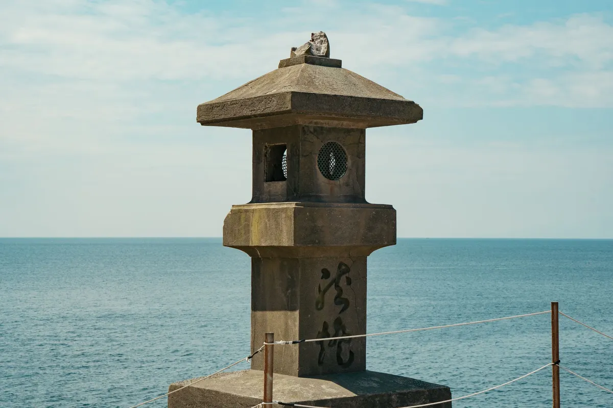
- Cemre Seyyah
- 28 Aug, 2026 01:54
Beyond the Horizon: Unveiling Naoshima and Teshima - Japan's Transformative Art Island Odyssey
The morning mist clings to the Seto Inland Sea like a whispered secret, a translucent veil separating the mundane world from the ethereal reality of Naoshima and Teshima. As the ferry cuts through the calm, obsidian waters of the Okayama prefecture, the modern frantic pace of Tokyo or Osaka feels like a lifetime away. Here, art does not merely sit within frames or behind velvet ropes; it breathes, it grows, and it merges with the rugged granite coastlines and the salt-sprayed air of rural Japan. This is Cemre Seyyah, and today, we are embarking on an odyssey where the horizon is not an end, but a canvas. Where Architecture Meets the Soul of the Sea Naoshima is the epicenter of this metamorphosis. Once a quiet island community struggling with the industrial fallout of smelting, it has been painstakingly repurposed into a global pilgrimage site for art lovers. At the heart of this transformation lies the vision of the Benesse Corporation and the stark, meditative concrete geometry of Pritzker Prize-winning architect Tadao Ando. When you step foot on Naoshima, you aren't just visiting a museum; you are entering a dialogue between nature and structural minimalism. The Benesse House, designed by Ando, is a masterclass in subtlety. Built partially underground to minimize its footprint, it ensures that the majesty of the Seto Inland Sea remains the focal point. Standing in the gallery, watching the light shift against a Monet water lily print while the real sea waves crash just meters away, is a sensory experience that defines the Naoshima spirit.The Art of the Abandoned and the Reborn Walking through the Honmura district, you will encounter the Art House Project. This is not a collection of galleries built from scratch, but rather a profound repurposing of time itself. Artists and architects were commissioned to take vacant, traditional Japanese houses and turn them into immersive installations. Take, for instance, Hiroshi Sugimoto’s treatment of the Go'o Shrine. By combining traditional Shinto aesthetics with modern optical glass, the shrine bridges the gap between the Edo period and the digital age. Or consider the Kadoya house, where digital LED counters flicker in the darkness, a heartbeat within a structure that has seen generations of life pass by. It is a reminder that on these islands, history is not preserved in formaldehyde; it is woven into the present. A Drop of Water in a Concrete Shell If Naoshima is the masterclass in deliberate design, Teshima is its introspective, poetic sibling. A short ferry ride brings you to an island that feels far more pastoral, draped in rice terraces that roll down to the water. The crown jewel here is the Teshima Art Museum. Architect Ryue Nishizawa and artist Rei Naito collaborated to create a space that defies all traditional definitions of a museum. There are no paintings on the wall. There are no sculptures on pedestals. Instead, the building itself—a massive, shell-like concrete structure with two large apertures open to the elements—serves as the medium. Water beads up from tiny holes in the concrete floor, slowly migrating across the space to form small, transient puddles that eventually coalesce into larger pools before disappearing into drains. It is a meditation on the cycle of life, the ephemerality of existence, and the quiet beauty of a single droplet. You find yourself sitting on the floor, in silence, watching nature perform its slow, silent dance. It is, perhaps, the most transformative experience in contemporary art.The Culinary Rhythm of the Inland Sea An odyssey of this magnitude requires sustenance that honors the terrain. Island life on Naoshima and Teshima is inextricably linked to the bounty of the Seto Inland Sea. Here, the seafood is not a luxury; it is the heartbeat of the local diet. In the small cafes dotting the coast, you will find shirasu-don—a simple, elegant bowl of tiny whitebait served over steaming rice with a drizzle of soy sauce and a garnish of green onions. It tastes of the ocean, briny and fresh, a perfect reflection of the morning commute. The influence of citrus is also omnipresent. Because the islands are known for their lemon and mandarin groves, you will find lemon-infused everything, from local artisan salt to refreshing summer spritzes that cut through the humidity. Eating here is an exercise in localism; the food is grown on the hillsides you walk, or caught in the nets you see drying on the docks as the sun sets. Navigating the Islands: A Practical Guide for the Wanderer To truly understand Naoshima and Teshima, one must embrace the pace of the bicycle. While shuttle buses exist, the soul of the island is discovered in the climb up a steep hill leading to a hidden overlook, or the sudden discovery of a stray cat napping in a patch of sunlight outside a gallery.Rent an Electric Bicycle: The topography of Naoshima is deceptively hilly. An e-bike is not a luxury; it is the key to unlocking the entire island without exhaustion. Book Museums in Advance: Specifically for the Teshima Art Museum and the Chichu Art Museum, tickets are often limited and must be reserved weeks, if not months, in advance. Respect the Living Community: These are not theme parks. Real people live, work, and farm on these islands. Keep your noise levels down, stay on marked paths, and always ask before photographing someone’s private home. Follow the Seasons: Spring brings mild temperatures and the vibrancy of the Seto Triennale, but autumn offers a melancholic beauty as the leaves change and the crowds dissipate, leaving the galleries to the silence they were designed for.Beyond the Horizon of Art As the sun begins to dip below the horizon, painting the Seto Inland Sea in shades of violent violet and liquid gold, one cannot help but reflect on what we seek when we travel. We often look for the "big" sights—the Eiffel Towers, the Great Walls, the crowded metropolises. But there is a different kind of travel, one that asks us to slow down, to look at a puddle of water, to listen to the creak of an old floorboard, and to find the humanity in the architecture. Naoshima and Teshima teach us that beauty is not about scale. It is about the intent behind the object. By taking spaces that were abandoned and giving them new purpose, by honoring the geography of the land, and by inviting the wind and the rain into our galleries, the people of these islands have created something far more valuable than a tourist destination. They have created a sanctuary for the mind. Whether you are an architect, an artist, or simply a wanderer looking for a place to breathe, these islands offer a rare commodity: clarity. In the reflection of a water droplet at the Teshima Art Museum or the shadow cast by a concrete pillar at the Chichu Art Museum, you find not just the art, but yourself. And perhaps, that is the true horizon we are all chasing—a place where the chaos of the world falls away, leaving only the quiet, beautiful truth of the present moment. Pack light, bring an open mind, and prepare to be changed. The Seto Inland Sea is waiting, and its secrets are best discovered one pedal stroke, one silence, and one horizon at a time. #Naoshima #Teshima #ArtIsland #JapanTravel #SetoInlandSea #ContemporaryArt #SlowTravel Related InsightsL’Australie, terre de contrastes : quand l’économie du rêve façonne un continent L'Eterna Seduzione della Costa Azzurra: Tra Scogliere di Porfido e Misteri Belle Époque Svalbard: Arctic Adventures Beyond the Northern Lights – A Remote Paradise for Explorers{ "@context": "https://schema.org", "@type": "FAQPage", "mainEntity": [ { "@type": "Question", "name": "What is the main focus of Beyond the Horizon: Unveiling Naoshima and Teshima - Japan's Transformative Art Island Odyssey?", "acceptedAnswer": { "@type": "Answer", "text": "Journey through the Seto Inland Sea to discover the serene intersection of contemporary architecture, avant-garde art, and the tranquil Japanese archipelago." } }, { "@type": "Question", "name": "Who authored the comprehensive guide on Beyond the Horizon: Unveiling Naoshima and Teshima - Japan's Transformative Art Island Odyssey?", "acceptedAnswer": { "@type": "Answer", "text": "This detailed article and its insights were carefully researched and authored by Cemre Seyyah." } }, { "@type": "Question", "name": "Where can I find more related content about Travel?", "acceptedAnswer": { "@type": "Answer", "text": "You can explore more articles, detailed reviews, and similar insights by browsing the Related Insights section at the bottom of this article or visiting our dedicated Travel category page." } } ] }
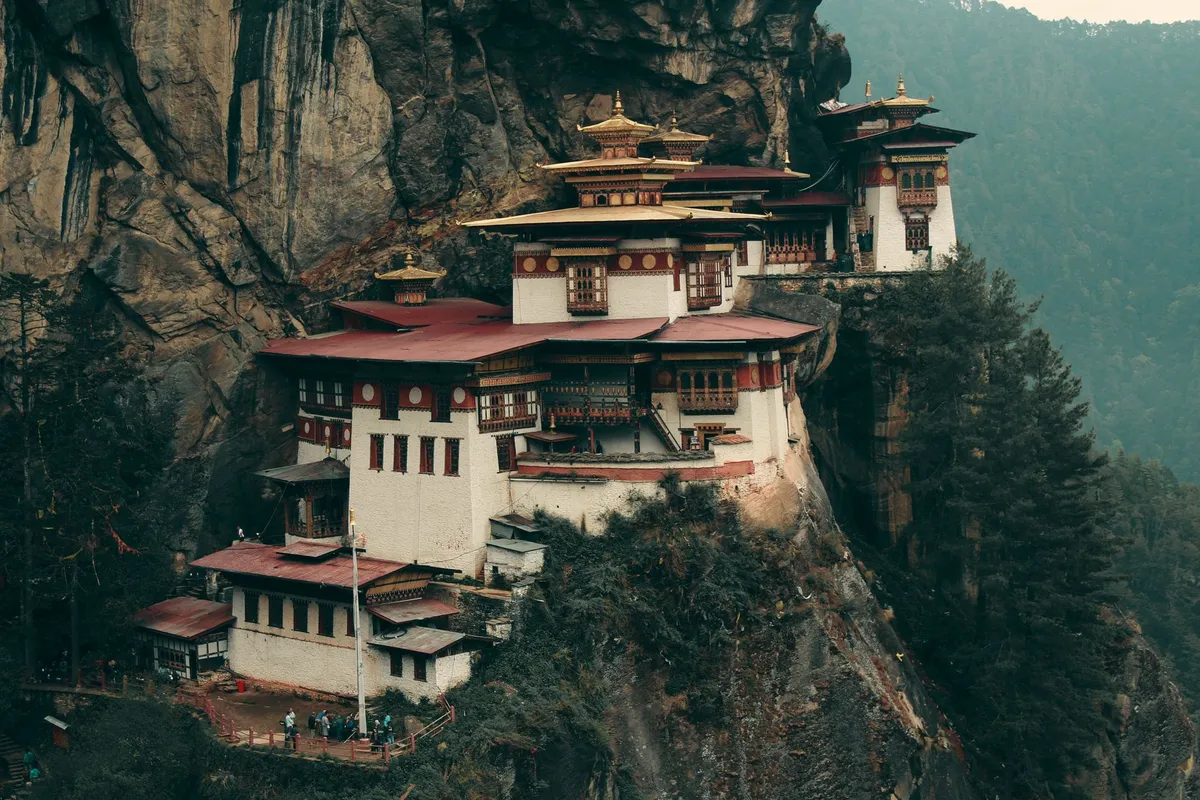
À 3 000 mètres d'altitude, là où l'air se fait rare et où les prières semblent toucher directement le divin, une structure défie les lois de la physique et de la gravité. Le monastère de Paro Taktsang, plus communément connu sous le nom de "Nid du Tigre", n'est pas seulement un monument architectural ; c'est une cicatrice sacrée sur le flanc d'une falaise granitique du Bhoutan. Ici, le monde moderne s'efface au profit d'un silence millénaire, brisé uniquement par le bruissement des drapeaux à prières et le martèlement sourd d'un cœur battant au rythme de la marche. La Légende de la Tigresse de Lumière L'histoire de ce lieu est intrinsèquement liée à Guru Rinpoche, figure centrale du bouddhisme himalayen, également appelé Padmasambhava. Selon la tradition, ce maître spirituel aurait atteint ce lieu perché sur le dos d'une tigresse volante — une manifestation de son épouse, Yeshe Tsogyal. Il se serait retiré dans une grotte pour y méditer intensément durant trois ans, trois mois, trois semaines, trois jours et trois heures afin de soumettre les démons locaux et de propager les enseignements du Dharma. C’est cette essence mystique qui imprègne chaque pierre du site. Lorsque l'on gravit le sentier escarpé, on ne parcourt pas simplement une distance physique ; on traverse des strates de conscience. Le monastère, construit en 1692 par Gyalse Tenzin Rabgye, semble avoir poussé de la roche elle-même, tel un champignon sacré ou une excroissance de la foi.Une Odyssée Verticale vers la Sérénité Le voyage vers le Nid du Tigre commence bien avant la falaise. C'est une immersion totale dans les forêts de pins drapées de lichens, où l'odeur de la résine se mêle à celle de l'encens. Le sentier est exigeant, serpentant à travers des passages étroits qui surplombent le vide. Chaque étape est ponctuée par la présence de moulins à prières actionnés par l'eau des torrents, une mécanique ancestrale qui, selon la croyance, envoie des mantras bénéfiques à travers l'univers à chaque rotation. Le visiteur est frappé par la précarité apparente de l'édifice. Comment les bâtisseurs du XVIIe siècle ont-ils pu ancrer ces structures en bois et en pierre au-dessus d'un précipice de 900 mètres ? La réponse réside sans doute dans la dévotion totale. Le monastère se divise en plusieurs temples, chacun dédié à des divinités ou à des aspects spécifiques de l'enseignement bouddhiste. En pénétrant dans ces espaces obscurs, éclairés uniquement par la lueur vacillante des lampes à beurre, on ressent une intensité presque palpable. Le calme qui règne à l'intérieur est total, contrastant avec le tumulte du vent à l'extérieur. L'Harmonie entre la Pierre et le Sacré L'architecture elle-même est un témoignage du génie bhoutanais. Les murs blanchis à la chaux, les toits en bardeaux de bois et les fenêtres finement sculptées s'intègrent parfaitement à la paroi rocheuse. Il n'y a pas de superflu ; tout est utilitaire, tout est spirituel. L'équilibre visuel est saisissant : le contraste entre la rudesse de la montagne et la délicatesse des peintures religieuses ornant les intérieurs crée une tension esthétique unique.En observant la structure de près, on remarque que les bâtiments ne se contentent pas de reposer sur des corniches naturelles ; ils utilisent des ancrages ingénieux qui défient l'érosion. Cette persistance face aux éléments naturels (neiges hivernales, vents violents, pluies de mousson) est perçue comme un signe de la protection des divinités protectrices, les Dharmapalas. Une Immersion dans la Spiritualité Vivante Le Nid du Tigre n'est pas un musée. C'est un monastère en activité, où des moines vivent, étudient et pratiquent quotidiennement. Cette dimension vivante est essentielle. Contrairement à bien des sites touristiques mondiaux, le silence ici est imposé non par des règles, mais par la solennité de l'activité monastique. La grotte originelle, le Pel Phuk, est le cœur battant du sanctuaire. Y pénétrer demande une humilité profonde. Les parois rocheuses, polies par des siècles de dévotion, semblent vibrer d'une énergie particulière. Les offrandes de fleurs, d'eau et de lampes à beurre créent une atmosphère feutrée, presque irréelle, où le temps semble s'être arrêté. Les aspects essentiels de l'expérience incluent :La contemplation des fresques murales représentant les différentes formes de Guru Rinpoche. L'écoute du chant des mantras, qui résonne contre les parois de roche, amplifié par l'acoustique naturelle du canyon. L'observation des drapeaux à prières, les Lungta, qui s'agitent dans le vent, libérant leurs bénédictions dans la vallée de Paro.La Préservation d'un Héritage Fragile Malgré un incendie tragique survenu en 1998, qui a détruit une grande partie des structures principales, le monastère a été méticuleusement restauré. Ce processus de reconstruction n'a pas été une simple remise en état, mais une réaffirmation de l'identité culturelle du Bhoutan. Le pays, qui mesure son succès national par le "Bonheur National Brut" plutôt que par le seul PIB, voit en Taktsang le symbole ultime de son harmonie avec la nature. Chaque visiteur doit comprendre que cet accès est un privilège. La gestion du tourisme au Bhoutan, bien que structurée, vise avant tout à protéger ce sanctuaire de la dégradation. Monter jusqu'au Nid du Tigre, c'est accepter de devenir, l'espace d'une journée, un pèlerin parmi les pèlerins. C'est laisser derrière soi les préoccupations matérielles pour se concentrer sur l'essentiel : le souffle, l'ascension, et la découverte d'un horizon qui, pour beaucoup, change la perception de la vie elle-même. À la descente, alors que les jambes tremblent encore sous l'effet de l'effort, le monastère semble s'éloigner pour retourner dans son royaume de nuages. On emporte avec soi non pas des souvenirs matériels, mais une résonance, une note grave et sacrée qui continue de vibrer longtemps après que les sommets himalayens ont disparu dans le lointain. Le Nid du Tigre n'est pas une destination que l'on visite ; c'est un état d'esprit que l'on atteint, un point de bascule où le monde physique rencontre enfin l'infini. #Bhoutan #VoyageSpirituel #Himalaya #NidDuTigre #ParoTaktsang Related InsightsSvalbard: Arctic Adventures Beyond the Northern Lights – A Remote Paradise for Explorers and Digital Nomads Ostia Antica: Il Porto dell'Impero Romano Istanbul: Two Continents{ "@context": "https://schema.org", "@type": "FAQPage", "mainEntity": [ { "@type": "Question", "name": "What is the main focus of L'Eveil des Cimes : Suspendu dans le Souffle du Tigre?", "acceptedAnswer": { "@type": "Answer", "text": "Plongez au cœur de l'Himalaya et découvrez Paro Taktsang, le monastère le plus sacré du Bhoutan, perché à 900 mètres au-dessus de la vallée." } }, { "@type": "Question", "name": "Who authored the comprehensive guide on L'Eveil des Cimes : Suspendu dans le Souffle du Tigre?", "acceptedAnswer": { "@type": "Answer", "text": "This detailed article and its insights were carefully researched and authored by Pierre Dubois." } }, { "@type": "Question", "name": "Where can I find more related content about Travel?", "acceptedAnswer": { "@type": "Answer", "text": "You can explore more articles, detailed reviews, and similar insights by browsing the Related Insights section at the bottom of this article or visiting our dedicated Travel category page." } } ] }
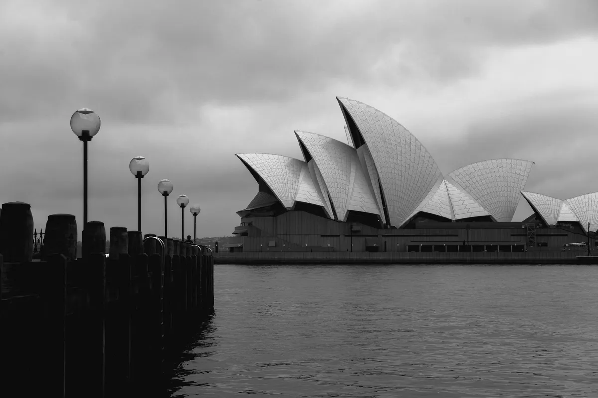
- John Explorer
- 22 Aug, 2026 06:22
Australia Unveiled: Where Sun-Kissed Shores Meet Ancient Souls and Modern Marvels
The land Down Under whispers secrets to those who dare to listen. Beneath its golden sun, where the Pacific Ocean crashes against ancient cliffs and the outback stretches into infinity, lies a continent that has lured explorers, dreamers, and wanderers for centuries. Australia isn’t just a destination—it’s a living museum of natural wonders, a playground for adventure, and a sanctuary for wildlife found nowhere else on Earth. From the neon-lit streets of Sydney to the silent majesty of Uluru, this is a country where every journey feels like stepping into a myth. Yet, beyond the postcard-perfect images and viral travel reels, Australia’s tourism story is one of resilience, reinvention, and raw, unfiltered beauty. It’s a tale of how a nation built on rugged individualism transformed into a global tourism powerhouse, where the echoes of colonial pasts mingle with the footsteps of modern-day explorers. Here, the Great Barrier Reef pulses with life, the Tasmanian wilderness hums with untamed energy, and the outback’s red sands tell stories older than humanity itself. This is not just another travel guide. This is a deep dive into the heart of Australia’s tourism—where history, economy, and adventure collide to create an experience unlike any other.The Economic Pulse: How Tourism Powers Australia’s Future Few countries understand the alchemy of turning natural splendor into economic gold quite like Australia. In the financial year 2018/19, tourism wasn’t just a sector—it was a lifeline. Contributing A$60.8 billion to the national economy, it ranked as Australia’s fourth-largest export, outpacing even some of its most lucrative industries. But what makes this figure staggering isn’t just the numbers; it’s the speed at which tourism grew. Over the past decade, the industry expanded faster than the national GDP, proving that Australia’s allure isn’t a fleeting trend but a permanent fixture in the global travel landscape. By December 2019, the country welcomed 8.7 million international visitors, each one a testament to Australia’s magnetic pull. These travelers didn’t just fill hotel rooms—they fueled 666,000 jobs, with 1 in 21 Australian workers relying on tourism for their livelihood. Women made up 54% of the tourism workforce, and nearly half held full-time positions, painting a picture of an industry that’s as diverse as the landscapes it celebrates. Even more striking, tourism accounted for 8.2% of Australia’s total export earnings in 2018–19, a figure that underscores its role as a silent economic giant. Yet, the story of Australia’s tourism economy isn’t just about dollars and cents. It’s about sustainability, innovation, and adaptability. The Tourism 2020 strategy, launched in 2003 and refined over the years, was a bold blueprint to future-proof the industry. It aimed to diversify Australia’s appeal, reduce seasonality, and ensure that tourism growth didn’t come at the cost of its natural and cultural heritage. The pandemic, of course, threw a wrench into these plans. Borders slammed shut, international travel plummeted, and domestic tourism became the unsung hero. But even in the darkest hours, Australians rediscovered their own backyard—exploring intrastate and interstate destinations with renewed vigor. Today, as the world reopens, Australia stands at a crossroads. Will it revert to its pre-pandemic reliance on international visitors, or will it double down on domestic tourism, ensuring that every corner of the country—from the Kimberley’s rugged gorges to the Whitsunday Islands’ turquoise waters—benefits from the tourism dollar?A Journey Through Time: How Australia’s Tourism Story Began To understand Australia’s tourism today, you must first step into its past—a past where travel was less about leisure and more about survival. In the colonial era, Australians were a restless people. Unlike their European counterparts, who were often rooted in ancestral lands, Australians were nomads by necessity. The vast distances between settlements, the harshness of the outback, and the lure of new opportunities made mobility a way of life. Travel wasn’t a luxury; it was a means to trade, to find work, or to reunite with family across the sea. The earliest tourists weren’t leisure-seekers but adventurers and fortune-hunters. They braved long sea voyages, treacherous coach rides, and the unforgiving outback to chase wealth or escape hardship. The opening of new lands, the discovery of gold, and the establishment of rail networks gradually transformed travel from a necessity into an aspiration. By the late 19th century, the idea of a "holiday" began to take root. Australians flocked to resorts near major cities, like the Blue Mountains in New South Wales or the coastal retreats near Melbourne, where the railway made escape from the urban grind possible. The real turning point, however, came with the advent of rail travel. State Government railway tourist bureaux became the unsung architects of Australia’s tourism boom, selling intrastate and even interstate travel to a public hungry for new experiences. These early promoters didn’t just sell train tickets—they sold dreams of adventure. Posters plastered across Britain and America depicted Australia as a land of golden beaches, towering gum trees, and endless horizons, while Walkabout magazine (launched in 1934) became the country’s first global travelogue, blending adventure with a touch of mystique. The post-World War II era marked another seismic shift. Rising incomes, the rise of the automobile, and the Jet Age shrank the world, making international travel accessible to the masses. Australians, who had once traveled to Britain by ocean liner for as little as $78 in tourist class, now found themselves jet-setting to New Zealand or cruising the South Pacific. The Australian National Travel Association (ANTA) and later the Australian Tourist Commission spearheaded these efforts, using bold marketing campaigns to position Australia as the ultimate escape. Yet, the most profound change was the democratization of domestic travel. The introduction of three weeks of paid annual holidays in New South Wales in 1958, followed by long-service leave, gave Australians the freedom to explore their own country. Suddenly, the outback wasn’t just a place for miners and explorers—it was a destination. National parks opened their gates, highways stretched into the wilderness, and resorts sprouted in once-isolated corners of the continent.The Icons That Define Australia: From Sydney’s Skyline to the Reef’s Depths Ask someone halfway across the world what they associate with Australia, and you’ll likely hear the same words: Sydney, the Great Barrier Reef, and kangaroos. These aren’t just landmarks; they’re cultural shorthand for a country that’s as diverse as it is vast. But beyond the clichés lies a deeper truth—Australia’s most famous attractions are more than just Instagram backdrops. They’re living ecosystems, historical tapestries, and economic engines that shape the nation’s identity. Sydney: Where Urban Sophistication Meets Natural Drama Few cities command a skyline quite like Sydney. The Sydney Opera House, with its sail-like curves, isn’t just an architectural marvel—it’s a symbol of Australia’s ambition. Designed by Jørn Utzon and completed in 1973 after a decade of controversy, it’s now a UNESCO World Heritage Site and the most photographed building in the country. But Sydney’s allure extends far beyond its opera house. The Harbour Bridge, affectionately dubbed the "Coathanger," offers panoramic views of the city and the ocean beyond, while Bondi Beach pulses with a surf culture that’s as much about community as it is about sport. Yet, Sydney’s real magic lies in its contrasts. A 30-minute drive from the CBD, the Royal National Park beckons with rugged cliffs and secluded beaches, while the Blue Mountains—just an hour’s train ride away—unfold in a labyrinth of eucalyptus forests and waterfalls. Here, the past and present collide: colonial-era railway stations stand alongside modern eco-lodges, and the echoes of Indigenous stories blend with the hum of a cosmopolitan city. The Great Barrier Reef: A Living Wonder Under Siege Stretching 2,300 kilometers along Queensland’s coast, the Great Barrier Reef is the world’s largest coral reef system—and one of its most fragile. Comprising over 2,900 individual reefs and 900 islands, it’s a biodiversity hotspot, home to 1,500 species of fish, 400 types of coral, and endangered creatures like the dugong and green sea turtle. For tourists, it’s a playground of snorkeling, diving, and glass-bottom boat tours, where the underwater world feels like another planet. But the reef is also a battleground. Climate change, pollution, and coral bleaching have taken a devastating toll, with scientists warning that up to 50% of the reef’s coral has died in recent decades. Yet, amid the gloom, there’s hope. Conservation efforts, sustainable tourism initiatives, and scientific research are fighting to preserve this natural wonder. Visitors today can choose eco-certified tour operators, support reef restoration projects, or even participate in citizen science programs—turning their holiday into a force for good. Uluru: The Heartbeat of the Outback Few places on Earth command silence quite like Uluru. This sacred sandstone monolith, rising 348 meters from the desert floor, is more than a geological marvel—it’s a spiritual epicenter for the Anangu people, the traditional owners of the land. For visitors, the experience is as much about cultural immersion as it is about adventure. The sunset viewing area offers a spectacle of shifting colors, while guided walks reveal the rock’s ancient stories, etched into its surface over 60,000 years. Uluru isn’t just a destination; it’s a pilgrimage. In 2019, the Australian government banned climbing the rock, a decision that honored Indigenous beliefs and marked a shift toward ethical tourism. Today, visitors are encouraged to explore the Kata Tjuta (The Olgas) nearby, a series of domed rock formations that feel like the ruins of a lost civilization.👉 Continue Reading: Australia Unveiled: Where Sun-Kissed Shores Meet Ancient Souls and Modern Marvels (Part 2)#AustraliaTravel #GreatBarrierReef #UluruAdventure #TasmanianWilderness #HiddenGemsAustralia Related InsightsMud‑Brick Horizons: Documenting the Architectural Soul of Djenné and Timbuktu Where Faith Clings to Cliffs: An Expedition to Tigray's Unseen Sky Sanctuaries Southeast Asia’s Best-Kept Secrets: Uncharted Adventures and Untouched Wonders in 2026{ "@context": "https://schema.org", "@type": "FAQPage", "mainEntity": [ { "@type": "Question", "name": "What is the main focus of Australia Unveiled: Where Sun-Kissed Shores Meet Ancient Souls and Modern Marvels?", "acceptedAnswer": { "@type": "Answer", "text": "Dive into Australia’s breathtaking landscapes, vibrant cities, and rich history—where every horizon hides a story worth discovering." } }, { "@type": "Question", "name": "Who authored the comprehensive guide on Australia Unveiled: Where Sun-Kissed Shores Meet Ancient Souls and Modern Marvels?", "acceptedAnswer": { "@type": "Answer", "text": "This detailed article and its insights were carefully researched and authored by John Explorer." } }, { "@type": "Question", "name": "Where can I find more related content about Travel?", "acceptedAnswer": { "@type": "Answer", "text": "You can explore more articles, detailed reviews, and similar insights by browsing the Related Insights section at the bottom of this article or visiting our dedicated Travel category page." } } ] }
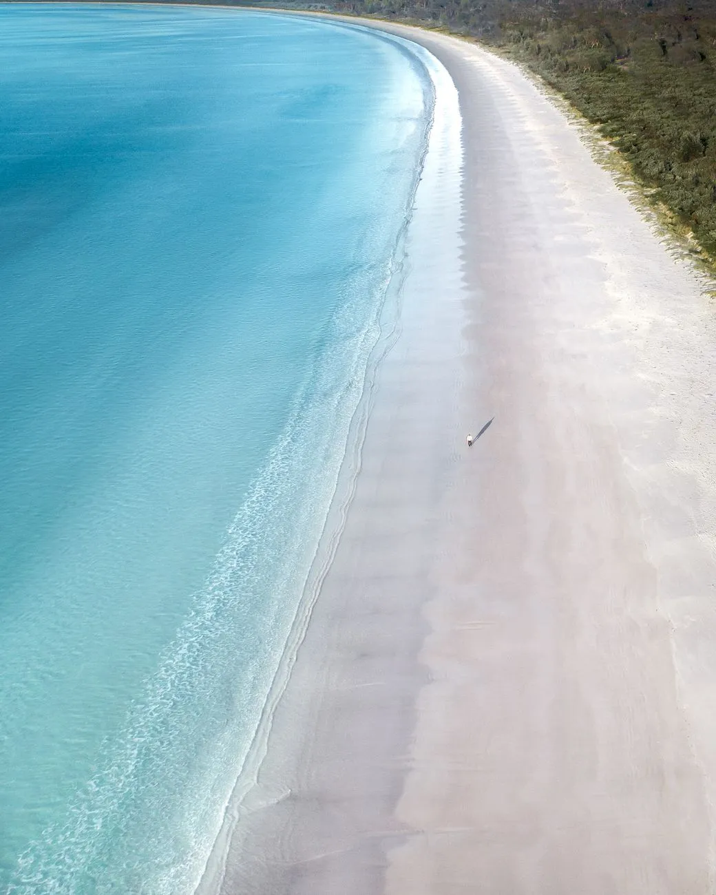
- John Explorer
- 22 Aug, 2026 06:22
Australia Unveiled: Where Sun-Kissed Shores Meet Ancient Souls and Modern Marvels (Part 2)
This is Part 2 of the series. Read Part 1 here.Beyond the Postcard: Australia’s Hidden Gems While Sydney’s skyline and the Great Barrier Reef steal the spotlight, Australia’s true magic lies in its secrets—the places where crowds thin, and the soul of the country reveals itself. These are the destinations that don’t make it onto postcards but linger in travelers’ memories forever. The Kimberley: Australia’s Last Frontier Few places on Earth feel as untamed and remote as the Kimberley region in Western Australia. Stretching over 423,000 square kilometers, it’s a land of ancient gorges, cascading waterfalls, and Indigenous rock art dating back 20,000 years. The Bungle Bungle Range, with its striped sandstone domes, is a surreal landscape that feels like another planet, while the Horizontal Falls—a natural phenomenon where tidal forces create a waterfall that flows sideways—defy logic. For adventurers, the Kimberley offers 4WD expeditions, helicopter tours, and multi-day cruises along the Mitchell Falls or through the King George River. But its real treasure is its cultural heritage. The Wunan people have lived here for millennia, and their stories are woven into the land. Visitors can learn about bush tucker (traditional foods), traditional hunting methods, and the deep connection between the people and the earth. Tasmania’s Wilderness: Where Time Stands Still If the mainland is Australia’s bustling heart, Tasmania is its quiet soul. This island state, separated from the mainland by the Bass Strait, is a wilderness lover’s paradise. Over 40% of Tasmania is protected as national park or World Heritage Area, home to ancient rainforests, glacial lakes, and wildlife found nowhere else. The Cradle Mountain-Lake St Clair National Park is a hiker’s dream, with trails like the Overland Track offering multi-day treks through alpine meadows and glacial valleys. The Freycinet Peninsula, with its pink granite mountains and white-sand beaches, is a photographer’s paradise, while the Tasmanian devil—a carnivorous marsupial—can be spotted in the wild, a rare sight in a world where many species are endangered. But Tasmania’s true magic lies in its isolation. The South West Wilderness is one of the last true wilderness areas on Earth, where the only sounds are the wind in the trees and the calls of native birds. It’s a place where you can disappear for days, and when you emerge, the world feels different. The Whitsunday Islands: Paradise Found If you’ve ever dreamed of sailing through turquoise waters, surrounded by sugar-white beaches and lush rainforests, the Whitsunday Islands are your answer. This 74-island archipelago in the heart of the Great Barrier Reef is a sailor’s paradise, where the Whitehaven Beach—with its 98% pure silica sand—is often ranked among the world’s best beaches. But the Whitsundays offer more than just relaxation. Heart Reef, a heart-shaped coral formation, is a snorkeler’s delight, while the Prosail Trail offers multi-day sailing adventures. The islands are also a hotspot for eco-tourism, with luxury resorts like Qualia on Hamilton Island leading the charge in sustainable luxury.The Wildlife Enigma: Where Nature Puts on a Show No discussion of Australia’s tourism would be complete without mentioning its wildlife—a cast of characters so bizarre, so otherworldly, that they feel like they’ve stepped out of a sci-fi movie. Australia is home to more than 378 mammal species, 828 bird species, and 4,000 species of fish, many of which exist nowhere else on Earth. For visitors, encountering these creatures isn’t just a novelty—it’s a privilege. The Kangaroo and Wallaby: Icons of the Outback No animal is more synonymous with Australia than the kangaroo. These marsupials, with their powerful hind legs and pouches, are a symbol of the country’s resilience. Spotting a kangaroo in the wild—whether in the Flinders Ranges or the Grampians National Park—is a moment that feels like stepping into a wildlife documentary. But kangaroos aren’t the only marsupials worth meeting. The wallaby, a smaller cousin, is equally charismatic, often seen hopping through forests or grazing in open plains. For a truly immersive experience, visit Kangaroo Island in South Australia, where wildlife encounters are part of everyday life. Here, you might share a beach with sea lions, spot koalas in eucalyptus trees, or even see echidnas—spiky, egg-laying mammals that are one of only two monotremes in the world. The Platypus: Nature’s Greatest Oddity Few animals capture the imagination quite like the platypus. With its duck-like bill, beaver-like tail, and venomous spur on the male’s hind leg, it’s a creature that defies logic. Discovered by European scientists in 1798, the platypus was so bizarre that they initially thought it was a hoax. Today, spotting a platypus in the wild is a rare and thrilling experience. The Barrington Tops National Park in New South Wales and the Platypus Creek in Victoria are two of the best places to see them, especially at dawn or dusk when they’re most active. Watching one surface from the water, its sleek body glistening, is a reminder of how wild and wonderful nature can be. The Tasmanian Devil: A Fierce Survivor The Tasmanian devil, with its black fur, pink ears, and bone-crushing bite, is one of Australia’s most feared and fascinating creatures. Once widespread across the mainland, it’s now found only in Tasmania, where it’s a symbol of the island’s wild spirit. Sadly, the devil is also a species under threat, thanks to a contagious cancer called devil facial tumor disease (DFTD). Conservation efforts are underway to save it, and visitors can support these initiatives by visiting sanctuaries like the Tasmanian Devil Unzoo or the Bonorong Wildlife Sanctuary. Seeing a devil up close—its eyes gleaming with intelligence and its growls echoing through the night—is a humbling experience.The Future of Australian Tourism: Challenges and Opportunities Australia’s tourism industry stands at a crossroads. The pandemic forced a reckoning—one that exposed vulnerabilities but also revealed opportunities. As the world reopens, the question isn’t just how to attract more visitors but how to ensure tourism benefits everyone. Sustainability: The New Frontier Climate change isn’t a distant threat—it’s a present reality for Australia. The Great Barrier Reef’s bleaching events, the bushfires of 2019–2020, and the droughts that parch the outback are stark reminders that tourism must evolve. The good news? Australia is leading the charge in sustainable tourism.Eco-certifications like EcoTourism Australia help travelers identify businesses committed to sustainability. Carbon offset programs allow visitors to neutralize their travel emissions. Indigenous-led tourism is gaining traction, with experiences like cultural walks, bush tucker tours, and storytelling sessions offering authentic, low-impact ways to explore the country.Domestic Tourism: The Unsung Hero While international travel dominates headlines, domestic tourism is the backbone of Australia’s tourism economy. In 2021, as borders closed, Australians rediscovered their own backyard, leading to a surge in regional travel. This shift isn’t just a temporary fix—it’s a long-term opportunity. Regional destinations like Margaret River in Western Australia, Byron Bay in New South Wales, and Port Douglas in Queensland are seeing record numbers of visitors, boosting local economies and reducing pressure on over-touristed hotspots. The challenge now is to keep this momentum going, ensuring that regional communities benefit from tourism dollars while preserving their unique character. Technology and Innovation: The Next Wave From virtual reality tours of Uluru to AI-powered travel planners, technology is reshaping how Australians and international visitors explore the country. The Australian Tourism Data Warehouse (ATDW) provides real-time data on attractions, while augmented reality apps enhance museum visits and guided tours. But perhaps the most exciting innovation is personalized travel. Gone are the days of one-size-fits-all itineraries. Today, travelers can curate their own adventures, whether it’s a luxury glamping trip in the Flinders Ranges, a multi-day hike along the Larapinta Trail, or a foodie tour of Melbourne’s laneways.Final Thoughts: Why Australia Will Always Call You Back Australia isn’t just a place you visit—it’s a place that changes you. It’s the sunset over Uluru, painting the desert in hues of fire. It’s the crash of waves on the Twelve Apostles, a reminder of nature’s raw power. It’s the smell of eucalyptus in the Blue Mountains, the taste of fresh seafood in Sydney’s Circular Quay, and the sound of laughter echoing across Bondi Beach. But more than anything, Australia is a feeling. It’s the freedom of the open road, the awe of standing beneath a sky so vast it feels infinite, and the humility of encountering creatures that have thrived here for millions of years. It’s a country that demands you slow down, to listen to the stories of the land and its people. As the world becomes smaller and travel more accessible, Australia’s challenge—and its gift—is to remain a place of wonder. A place where the old and new coexist, where adventure and tranquility balance, and where every journey feels like a pilgrimage. So, whether you’re planning your first trip or your tenth, remember this: Australia isn’t just a destination. It’s an invitation. An invitation to explore, to wonder, and to fall in love with a land that has been calling explorers for centuries. And once it calls you, it never lets go.#AustraliaTravel #GreatBarrierReef #UluruAdventure #TasmanianWilderness #HiddenGemsAustralia Related InsightsLalibela : Le Chant de la Pierre Vivante – Plongée au Cœur des Églises Monolithiques d'Éthiopie The Stone Dreams of Kings: Unveiling the Loire Valley’s Living Tapestry Les Sentinelles Solitaires du Bout du Monde : Une Odyssée vers les Phares Oubliés de Patagonie Chilienne{ "@context": "https://schema.org", "@type": "FAQPage", "mainEntity": [ { "@type": "Question", "name": "What is the main focus of Australia Unveiled: Where Sun-Kissed Shores Meet Ancient Souls and Modern Marvels (Part 2)?", "acceptedAnswer": { "@type": "Answer", "text": "Dive into Australia’s breathtaking landscapes, vibrant cities, and rich history—where every horizon hides a story worth discovering." } }, { "@type": "Question", "name": "Who authored the comprehensive guide on Australia Unveiled: Where Sun-Kissed Shores Meet Ancient Souls and Modern Marvels (Part 2)?", "acceptedAnswer": { "@type": "Answer", "text": "This detailed article and its insights were carefully researched and authored by John Explorer." } }, { "@type": "Question", "name": "Where can I find more related content about Travel?", "acceptedAnswer": { "@type": "Answer", "text": "You can explore more articles, detailed reviews, and similar insights by browsing the Related Insights section at the bottom of this article or visiting our dedicated Travel category page." } } ] }