Showing Posts From
Travel
-
 Chloe Tremblay
 - 04 Oct, 2026 12:47
Surviving the Overland: Mastering Tasmania's Wild Heart in Shifting Skies
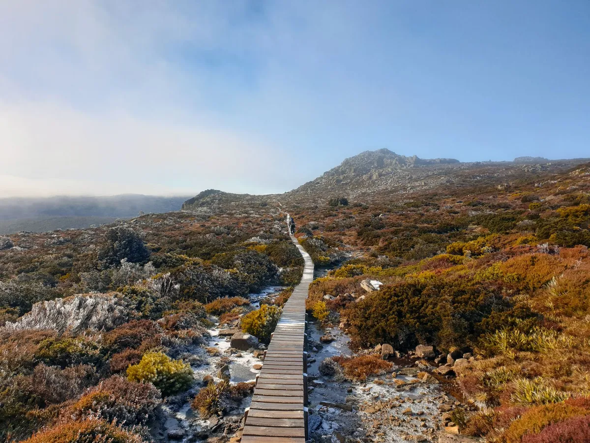
Dawn Over Cradle Mountain: Setting the Stage for the Overland The first light that kisses the jagged silhouette of Cradle Mountain is more than a postcard moment; it is the literal and psychological launchpad for every trekker who commits to the 65‑kilometre Overland Track. The track threads through the Tasmanian Wilderness World Heritage Area, a landscape where alpine heath, ancient rainforest, and glacial lakes coexist in a fragile balance. Before a single boot hits the boardwalk, the hiker must internalise the reality that the weather here does not follow a forecast—it writes its own script. The budget guide published by the Tasmanian Parks and Wildlife Service, cross‑referenced with Numbeo’s cost‑of‑living index for Tasmania, shows that a basic permit for the 2024‑25 season costs roughly AUD 240 per adult, while a return shuttle from Hobart to the Cradle Mountain visitor centre averages AUD 150. Those numbers are the financial bedrock; the physical bedrock is the ever‑present possibility of sudden snow, driving rain, or a wind chill that can drop the felt temperature well below zero even in midsummer. Understanding the terrain is the first survival skill. The track ascends from 700 metres at Ronny Creek to the 1,300‑metre summit of Mount Ossa, Tasmania’s highest peak, before descending to the shores of Lake St Clair. Each elevation band brings its own microclimate: the lower valleys can be humid and mosquito‑laden, while the exposed plateaus are prone to katabatic winds that scour the alpine vegetation. The Parks Service recommends a minimum of six days for the full traverse, yet many experienced walkers stretch it to eight to allow for weather‑forced rest days. Building a realistic itinerary that includes buffer days is not a luxury—it is a safety margin that can mean the difference between a memorable adventure and a rescue operation. The psychological preparation mirrors the logistical one. Hikers who have completed the track often speak of a “mental weather map” they carry: a habit of checking the sky every hour, noting cloud movement, wind direction, and temperature trends. This habit is cultivated long before the first step, during the weeks of training hikes where pack weight, boot break‑in, and layer systems are tested under simulated Tasmanian conditions. The budget guide also highlights hidden expenses—emergency satellite messenger rental (≈ AUD 30 per day), extra food for unplanned layovers, and potential gear replacement if a storm shreds a tarp. Factoring these into the pre‑trip spreadsheet prevents the nasty surprise of a dwindling cash reserve halfway through the wilderness. In short, the Overland Track is not a simple point‑to‑point hike; it is a dynamic negotiation with an environment that respects no schedule. The first sunrise over Cradle Mountain is a promise, but the promise is kept only by those who respect the data, the terrain, and the capricious sky. Reading the Sky: Weather Patterns That Shape the Track Tasmania’s maritime climate is famously fickle, and the Overland Track sits at the convergence of three major weather drivers: the Southern Ocean’s cold fronts, the subtropical high‑pressure ridge, and the island’s own topographic funneling. Numbeo’s climate aggregates for Hobart show an average of 150 rainy days per year, but the highlands experience a compressed version of that statistic—intense precipitation events can dump 100 mm in a few hours, turning boardwalks into slick ribbons and river crossings into torrents. The Parks Service issues a daily “Track Condition Report” that grades each section from “Open” to “Closed – Hazardous,” and savvy hikers treat that report as gospel. A practical rule of thumb is the “Three‑Hour Window”: if a cold front is forecast to arrive within three hours, assume the worst—visibility will drop, temperatures will plunge, and wind gusts can exceed 80 km/h on exposed ridges. The budget guide warns that many hikers underestimate the cost of a forced night in a hut (AUD 30 per night) versus a planned night in a campsite (AUD 15). When a front stalls, the track can become a corridor of wind‑driven sleet; the only reliable shelter is the network of six huts spaced roughly 12‑15 kilometres apart. Each hut has a wood‑stove, but firewood is limited and must be collected responsibly. Carrying a lightweight, four‑season tent as a backup is not optional—it is a lifeline when huts are full or when a sudden whiteout forces an early camp. Micro‑climates along the track demand granular awareness. The section between Kitchen Hut and Waterfall Valley, for example, sits in a natural wind tunnel; a modest breeze at the valley floor becomes a howling gale at the ridge. Conversely, the forested stretch near Pine Valley can trap moisture, creating a muggy micro‑environment that accelerates hypothermia risk if a hiker is wet and stationary. The Numbeo cost‑of‑living data for Tasmania indicates that a typical daily food budget for a self‑sufficient hiker is about AUD 45, but that figure assumes stable weather. In a storm, caloric needs rise 15‑20 % because the body burns extra fuel to maintain core temperature, pushing the daily food cost toward AUD 55. Seasoned walkers develop a personal “weather ledger”—a small notebook where they log temperature, wind, precipitation, and cloud type at each major waypoint. Over a multi‑day trek this ledger becomes a predictive tool: a pattern of thickening cirrus followed by a rapid pressure drop almost always precedes a front. The Parks Service also provides a free SMS alert service for registered hikers; signing up before departure adds a layer of real‑time intelligence that can shave hours off a decision to seek shelter. In the end, reading the sky is less about meteorology and more about humility—recognising that the mountain writes the forecast, and the hiker merely interprets it. Packing Light, Packing Right: Gear Essentials for Unpredictable Conditions The art of packing for the Overland Track is a balancing act between weight and redundancy. The budget guide’s “budget vs. luxury” comparison shows that a minimalist kit (tarp, down quilt, ultralight stove) can be assembled for roughly AUD 1,200, while a fully featured luxury setup (four‑season tent, synthetic sleeping bag, integrated cook system) pushes toward AUD 2,500. Numbeo’s Tasmania cost‑of‑living index places average retail prices for outdoor gear about 10 % higher than mainland Australia, so buying locally in Hobart or Launceston can add a modest premium. The sweet spot for most independent walkers lies in a hybrid approach: a three‑season tent rated for 30 km/h winds, a 800‑fill‑power down sleeping bag rated to –5 °C, and a modular layering system that can be augmented with a synthetic insulated jacket if Related InsightsHistorical Mardin Streets Castillo de Gibralfaro: El Guardián de Málaga Mercati di Traiano: Il Primo Centro Commerciale del Mondo{ "@context": "https://schema.org", "@type": "FAQPage", "mainEntity": [ { "@type": "Question", "name": "What is the main focus of Surviving the Overland: Mastering Tasmania's Wild Heart in Shifting Skies?", "acceptedAnswer": { "@type": "Answer", "text": "An authoritative deep‑dive into navigating Tasmania's Overland Track through volatile weather, with real‑world cost data, gear tactics, and shelter strategies." } }, { "@type": "Question", "name": "Who authored the comprehensive guide on Surviving the Overland: Mastering Tasmania's Wild Heart in Shifting Skies?", "acceptedAnswer": { "@type": "Answer", "text": "This detailed article and its insights were carefully researched and authored by Chloe Tremblay." } }, { "@type": "Question", "name": "Where can I find more related content about Travel?", "acceptedAnswer": { "@type": "Answer", "text": "You can explore more articles, detailed reviews, and similar insights by browsing the Related Insights section at the bottom of this article or visiting our dedicated Travel category page." } } ] }


Stone Sentinels of the High Caucasus The silhouette of a Svan tower against a bruised‑purple sky is the region’s calling card. Built between the 9th and 13th centuries, these defensive dwellings cluster in villages like Mestia, Ushguli, and Latali, forming a UNESCO World Heritage ensemble that feels less like a museum and more like a living citadel. Each tower rises 20‑25 metres, its narrow windows designed for archers, its thick schist walls insulated against both invaders and the biting alpine wind. Walking the cobblestone lanes of Ushguli — often cited as Europe’s highest continuously inhabited settlement at 2,100 metres — you can still hear the echo of centuries‑old polyphonic chants drifting from the nearby Lamaria Church. The towers were not merely military; they stored grain, housed extended families, and served as status symbols for the clans that ruled these valleys. Today, many have been restored as guesthouses, offering travelers a night inside history with modern comforts like Wi‑Fi and hot showers. The preservation effort is a delicate balance: local families maintain the structures using traditional lime mortar, while the Georgian Ministry of Culture oversees UNESCO compliance. For the curious, the Svaneti Museum of History and Ethnography in Mestia displays ancient manuscripts, weaponry, and the famed “Svaneti cross” — a symbol of the region’s distinct Christian heritage. A guided hike to the abandoned tower complex at Chazhashi reveals how the landscape dictated architecture: towers perch on rocky outcrops, their foundations anchored directly into bedrock. This interplay of geology and human ingenuity makes every step feel like a dialogue with the past.Navigating the Ribbon of Asphalt to Mestia Reaching Svaneti is an adventure in itself. The main artery, the Zugdidi‑Mestia highway (E60), stretches 150 kilometres of hairpin bends, sheer cliffs, and occasional rockfall zones. In summer, the drive takes roughly three hours from Zugdidi; in winter, snow and ice can double that time, and the road may close for days. The Georgian government has invested heavily in widening the most treacherous sections, installing guardrails and real‑time weather sensors, yet the route retains a raw, untamed character that rewards patient drivers with panoramic vistas of the Enguri River gorge. For those preferring air travel, the newly renovated Queen Tamar Airport in Mestia offers seasonal flights from Tbilisi (about 45 minutes) and Kutaisi, operated by small turboprop aircraft that land on a runway perched at 1,500 metres. Flights are weather‑dependent; fog can ground planes for hours, so flexible itineraries are essential. Shared minibuses (marshrutkas) run daily from Zugdidi’s central station, costing roughly ₾30‑₾40 ($11‑$15) and providing a sociable, if cramped, introduction to local life. Renting a 4×4 in Tbilisi or Kutaisi gives the most freedom — expect $70‑$100 per day for a sturdy SUV with high clearance. Fuel prices hover around ₾3.2 ($1.20) per litre, and the total fuel cost for a round‑trip from Tbilisi is under $80. Travel insurance that covers mountain driving is strongly advised; the safety index for Georgia sits at 73.7, reflecting low crime but notable road hazards. Whether you arrive by air or asphalt, the journey sets the tone: you are entering a realm where the road itself is a protagonist.Feasting on Fire‑Kissed Kubdari in Ushguli Svan cuisine is a revelation for anyone who thinks Georgian food begins and ends with khachapuri. The region’s signature dish, kubdari, is a hand‑rolled bread stuffed with spiced minced beef or lamb, onions, garlic, and a generous pinch of Svanetian salt — a blend of coriander, blue fenugreek, and dried chili. Baked in a wood‑fired tone oven, the crust turns charred and crisp while the filling stays juicy, releasing aromas that cling to the alpine air. In Ushguli, family‑run guesthouses serve kubdari alongside chvishtari (cornbread with melted sulguni cheese) and a bowl of hearty kharcho soup thickened with walnuts. The local honey, harvested from wild thyme and rhododendron blossoms, drizzles over fresh cheese plates, while the famed Svanetian vodka (arakhi) warms the belly after a day on the trails. Dining is communal: long wooden tables, shared platters, and the ever‑present toastmaster (tamada) guiding supra rituals that can last well into the night. The region’s natural wine movement thrives here; amber‑colored qvevri wines from the nearby Kakheti valley are transported up the mountain passes, their tannic structure complementing the rich meat dishes. Vegetarians will find solace in lobio (bean stew) seasoned with smoked ham hock alternatives and the ubiquitous pickled vegetables — jonjoli, cucumber, and garlic shoots. Prices are modest: a full supper with wine costs ₾30‑₾45 ($11‑$17) per person. For the culinary explorer, a cooking workshop in Mestia’s “Svaneti Kitchen” lets you knead dough, grind spices, and pull your own kubdari from the oven — an edible souvenir that travels far better than any magnet. Related Insights'Udaipur: Wo die Zeit in goldenen Palästen und smaragdgrünen Seen erstarrt' Azure Horizons and Fragile Ecosystems: The Maldives Reality Check Australia Unveiled: Where Sun-Kissed Shores Meet Ancient Souls and Modern Marvels (Part 2){ "@context": "https://schema.org", "@type": "FAQPage", "mainEntity": [ { "@type": "Question", "name": "What is the main focus of High Roads of Svaneti: Where Medieval Towers Meet Modern Nomads?", "acceptedAnswer": { "@type": "Answer", "text": "Explore Georgia's Svaneti region, its ancient stone towers, rugged mountain passes, and the practical realities for digital nomads seeking altitude." } }, { "@type": "Question", "name": "Who authored the comprehensive guide on High Roads of Svaneti: Where Medieval Towers Meet Modern Nomads?", "acceptedAnswer": { "@type": "Answer", "text": "This detailed article and its insights were carefully researched and authored by Mark Dinn." } }, { "@type": "Question", "name": "Where can I find more related content about Travel?", "acceptedAnswer": { "@type": "Answer", "text": "You can explore more articles, detailed reviews, and similar insights by browsing the Related Insights section at the bottom of this article or visiting our dedicated Travel category page." } } ] }
-
 Cemre Seyyah
 - 03 Oct, 2026 20:21
Where Sunflowers Guard the Gate: A Journey Into the World's Most Authentic Farm Stays
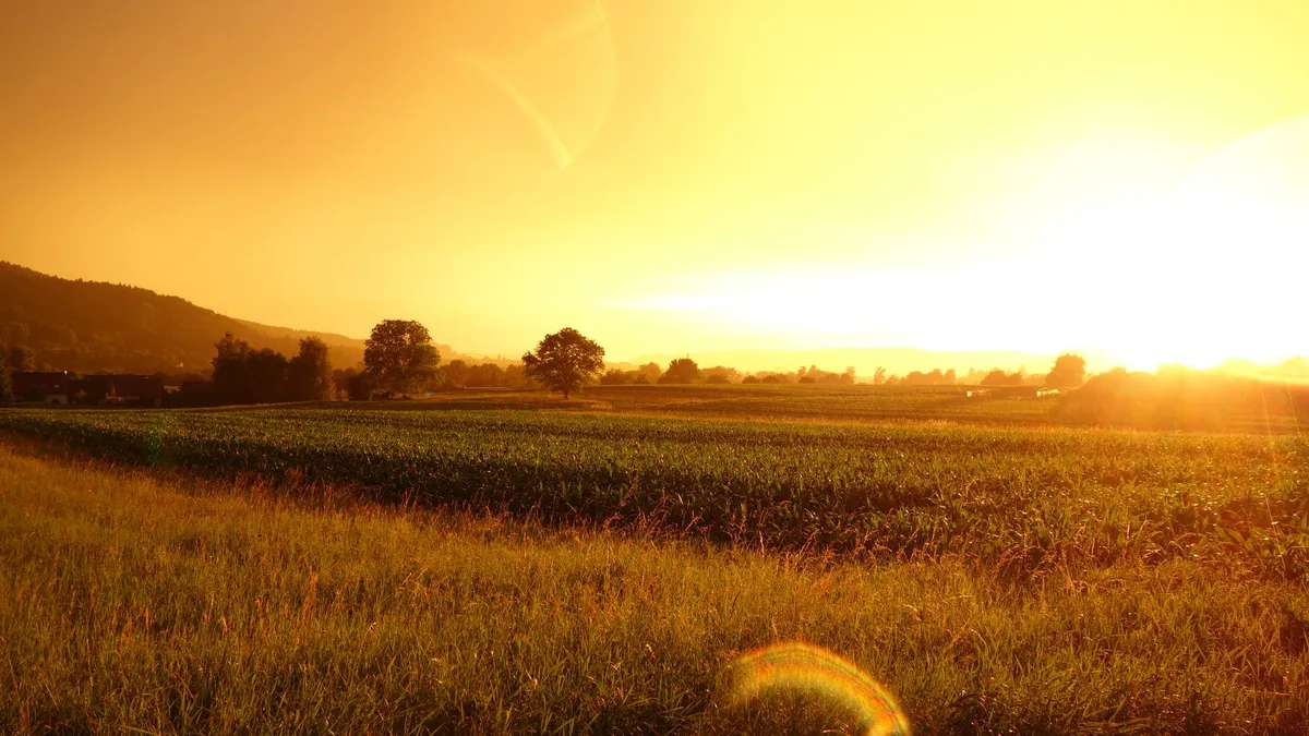
The dust motes dance in the slant of the late afternoon sun, caught in the amber glow of a barn converted into a bedroom. Somewhere beyond the stone wall, a rooster announces the impending dusk, not the dawn. There is no Wi-Fi password scrawled on a chalkboard here—only the password of the land: patience, seasons, and the quiet dignity of dirt under fingernails. This is not a vacation from life; it is a vacation into life, raw and unfiltered. We have spent decades chasing horizons, but the most radical journey right now might be the one that brings us back to the source. The Architecture of Belonging: Why We Trade Hotels for Haylofts The numbers tell a story of survival. For the small family farm, the calculus of modern agriculture is often brutal: commodity prices fluctuate, climate patterns shift, and the margins vanish. But a quiet revolution has been brewing in the furrows. By opening the gate to strangers—inviting them to sleep in the hayloft, to pick the fruit, to stir the pot—farmers have engineered a lifeline. It is diversification in its purest form. When the crops are sleeping under snow, the kitchen is still warm, serving harvest dinners to travelers hungry for provenance. This separate stream of income doesn't just save the farm; it revitalizes the entire rural ecosystem, drawing traffic—and revenue—to the gas station, the bakery, and the corner store in villages that the interstate highways forgot. Italy’s Golden Seal: Where the Sunflower Sets the Standard If there is a gold standard for this movement, it blooms in Italy. Since 1985, the concept of Agriturismo hasn't just been a vibe; it has been the law. The state formalized it, amended it in 2006, and in 2013, they planted a flag in the soil: the "Agriturismo Italia" trademark. Look for the sunflower enclosing a farm. It is a promise. This isn't a loose certification. It is a classification system graded one to five marks—girasoli, sunflowers—rating the level of comfort, the variety of services, and the quality of the natural environment. Managed by the Ministry of Agriculture in cooperation with regional associations, it offers a national guarantee that still respects the fierce specificity of a Tuscan vineyard versus a Sicilian olive grove. When you book a stay under that sunflower, you aren't just getting a room; you are entering a legally protected covenant between the traveler and the land.Armenia: Where the Loom Meets the Vine Travel east to the Caucasus, and the definition of agritourism expands beyond the plate. In Armenia, the revitalization of rural life was a matter of cultural survival. Here, the agricultural activity is inseparable from the artistic heritage. You don't just visit a vineyard; you participate in winemaking traditions that stretch back millennia. You sit beside a weaver, fingers learning the ancient knots of carpet weaving, the patterns telling stories older than the border lines on a map. The calendar is punctuated by festivals that taste of identity. The "Dolma" festival celebrates the stuffed grape leaf. The "Khorovats" festival turns barbecue into a communal ritual. The "Gata" festival honors the sweet, layered pastry. These aren't tourist traps; they are the village square opening its doors, saying: This is who we are. Come eat with us. India’s Green Gold: From Maharashtra’s Corporations to Kerala’s Backwaters In a nation where 85% of the population breathes with the rhythm of agriculture and the sector anchors 26% of the GDP, agritourism isn't a niche—it is a national narrative. Maharashtra leads the charge with the Agri Tourism Development Corporation, structuring the chaos into opportunity. But drift south to Kerala, and the landscape shifts to the watery veins of Kuttanad, the spice-scented hills of Wayanad, the palms of Palakkad, and the mist of Idukki. The "Green Farm" project, launched by the Government of Kerala, isn't just about hosting guests; it is about promoting a philosophy of agro-tourism rooted in the backwaters. Further east, the hills of Nagaland and Sikkim write their own success stories, proving that the model scales from the corporate framework to the community collective.Israel: Walking the Wine Route Through History In Israel, the soil is a palimpsest. At Ein Yael, Neot Kedumim, and Kfar Kedem, you don't just see history; you work it. Terraced farming and ancient irrigation systems aren't museum exhibits—they are activities. You stomp grapes in vats carved from bedrock. You press olives under stones that have felt the weight of a thousand harvests. The crops themselves are characters in the story: grapes, olives, dates, wheat. The Wine Route and Olive Route in the Mate Yehuda and Yoav regions thread together boutique wineries and presses both ancient and modern. In Haifa, the Dagon Museum traces the lineage of grain from the Fertile Crescent to the modern silo. Binyamina’s citrus groves perfume the air, while Kibbutz Ein Gedi, clinging to the shore of the Dead Sea, proves that desert farming is an act of defiance and ingenuity. For the modern chapter, the Dubrovin Farm museum and the Museum of Pioneer Settlement at Kibbutz Yifat document the sweat that built the agricultural infrastructure of the late 19th and early 20th centuries. The Desert Blooms: UAE’s 2023 Pivot The United Arab Emirates writes the newest chapter. In 2023, they unveiled a pioneering plan to revamp the agricultural industry, launching the 'UAE Agritourism Program.' It is a bold synthesis of the conventional and the hyper-modern: animal farms and crop farms sitting beside vertical farming tech. The goal is explicit—diversify farmer income, spike demand for local produce, and build a hub expected to generate thousands of jobs. It is agritourism as national strategy, turning the sandbox into a breadbasket. Pakistan’s Fertile Canvas Pakistan offers a canvas of raw potential. With 65% of its people rooted in rural life and agriculture contributing 21% to the GDP, the infrastructure is already written in the landscape: fertile land, four distinct seasons, and a vascular system of canals flowing north to south—dams, barrages, headworks, and distribution channels. It is a geography waiting for the narrative of hospitality to be overlaid upon the existing reality of production. The American Laboratory: California’s Database of Dreams In the United States, the University of California’s Small Farm Center framed the thesis early: "Agricultural tourism or agritourism, is one alternative for improving the incomes and potential economic viability of small farms and rural communities." California became the laboratory. Fairs and festivals matured into reliable engines. But the real tool for the wanderer is the California Agritourism Database—a digital map connecting the curious directly to the source, stripping away the middlemen. England’s Northern Pivot Across the Atlantic, a 2011 study in Tourism Planning and Development confirmed what the farmers of North West England already knew: diversification isn't optional; it's existential. As commodity pressures mount, the farm gate opens wider. The tea room in the converted barn, the pumpkin patch in October, the lambing live-streams in spring—these are the new hedgerows protecting the family business.Thailand’s Wellness Harvest: The Post-2021 Awakening Thailand’s agritourism curve bent sharply upward after 2021. The global pause rewired the traveler’s brain. We emerged craving healthy food, wellness, and community sustainable living. Thailand answered with a menu of connection: Farm Stays where the mosquito net is the only barrier between you and the jungle chorus; Farm Tours that trace the vanilla bean from vine to cured pod; Farm Product Festivals that turn the harvest into a street party; Workshops where you learn to ferment, to compost, to heal the soil. It is agritourism as therapy, promoting sustainable practice not as a slogan, but as a survival skill. The Taxonomy of the Experience: Five Ways to Get Your Hands Dirty A 2018 classification in the Journal of Agriculture, Food Systems, and Community Development mapped the terrain into five distinct territories. Most of us wander through several in a single trip. 1. Direct-to-Consumer Sales (The Market Moment) The farm stand at the end of the driveway. The "U-Pick" field where you judge a strawberry by its scent, not its shelf life. This is the shortest supply chain on earth. You are the logistics. 2. Agricultural Education (The Classroom Without Walls) School buses rumbling down dirt lanes. But increasingly, it’s adults relearning what a tomato plant looks like before the fruit appears. It’s the "aha!" moment when you realize a peanut flowers above ground but fruits below. 3. Hospitality (The Overnight Immersion) The farm stay. This is where the magic deepens. Waking to the lowing of cows. Assisting with chores—mucking stalls, gathering eggs, moving irrigation pipe. You earn your breakfast. The boundary between guest and family blurs over a shared labor. 4. Recreation (The Playground) Horseback riding along fence lines. Hunting leases managing wildlife populations. Corn mazes carved into standing stalks, GPS-designed but felt by flashlight and instinct. 5. Entertainment (The Celebration) Hayrides rattling over ruts. Harvest dinners under string lights where every course was born within a mile of the table. The wedding barn. The music festival in the pasture.The Indirect Thread: When the Farmer Stays Home Not every farmer wants to be an innkeeper. The indirect model respects that. The farmer grows; the tourist facility cooks and serves. The farmers' market becomes the bridge. Local products sold directly to tourists keep the money in the valley. It’s a quieter symbiosis, but no less vital. The chef gets the story; the farmer gets the fair price; the traveler gets the taste. The Philosophy of the Open Gate We travel to see difference. But in the quiet of a farm stay—whether under a Tuscan sunflower rating, beside an Armenian loom, on a Kerala backwater, or in an Israeli olive grove—we find a mirror. The work is different, the climate is different, the history is different. But the rhythm is the same. Plant. Tend. Harvest. Rest. Repeat. Agritourism reminds us that food is not a product; it is a process. And that process is the oldest story we have. When we pay to sleep in the barn, we aren't just buying a bed. We are buying a moment of alignment. We are saying: I remember. I belong to this, too. The gate is open. The sunflower is watching. What are you waiting for?#Agritourism #SlowTravel #FarmStays #SustainableTourism #RuralRevival
-
 Aisha Sharma
 - 02 Oct, 2026 13:04
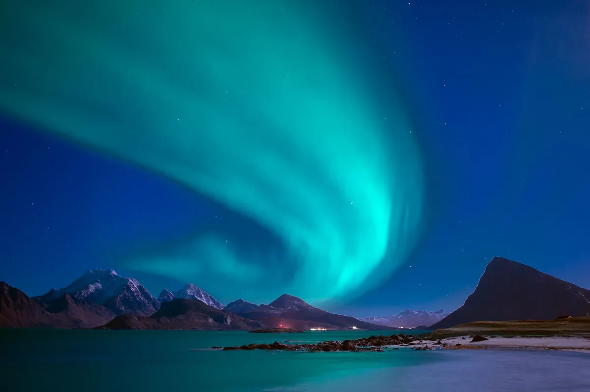
Arctic Circle Digital Nomadism: Building Connectivity in Greenland's Remote Towns
Midnight Sun Workstations: Setting Up in Ilulissat Ilulissat, the gateway to the UNESCO‑listed Icefjord, has quietly transformed from a seasonal tourism hotspot into a year‑round base for location‑independent professionals. The town’s modest population of roughly 4,700 belies a surprisingly robust infrastructure: a handful of cafés now offer dedicated power strips, high‑speed Wi‑Fi (up to 150 Mbps on the municipal fiber loop), and ergonomic seating that rivals any Scandinavian coworking hub. The local municipality, in partnership with the Arctic Digital Nomads initiative, has earmarked a former fish‑processing warehouse for conversion into a 24‑hour coworking space slated to open in Q2 2025. Early‑access members report latency under 30 ms to European cloud nodes, a figure that makes video‑conferencing and large‑file transfers practical even during the polar night. The climate, while harsh, offers a unique productivity rhythm. From late May to late July the sun never sets, granting an endless “golden hour” for deep‑focus work sessions; conversely, the winter darkness encourages a disciplined schedule anchored by artificial lighting and community events. Nomads who have wintered here describe a heightened sense of presence — fewer distractions, stronger bonds with fellow residents, and a daily ritual of watching icebergs drift past the harbor while debugging code. The town’s compact size means everything — grocery, gym, post office — sits within a ten‑minute walk, eliminating commute friction entirely. Housing remains the primary bottleneck. Short‑term rentals are scarce; most nomads negotiate month‑to‑month leases with private homeowners or secure rooms through the Arctic Digital Nomads accommodation portal, which vets properties for heating reliability and internet redundancy. Average monthly rent for a furnished one‑bedroom hovers around 9,500 DKK (≈ 1,270 USD), a figure that aligns with Numbeo’s cost‑of‑living index for “mid‑range” Arctic settlements. Utilities (electricity, water, heating) add another 1,200 DKK, but the municipality subsidizes renewable‑energy heating for residents who sign a two‑year lease, shaving up to 15 % off the bill.Fiber Under Ice: The Quest for Broadband in Nuuk Nuuk, Greenland’s capital with a population nearing 19,000, sits at the forefront of the nation’s digital ambition. In 2023 the government‑owned telecom Tusass completed the “Arctic Connect” submarine cable, linking Nuuk to the Canadian mainland and onward to the global internet backbone. The result: residential plans now advertise symmetrical 500 Mbps fiber for 1,200 DKK/month, while business‑class lines push 1 Gbps with dedicated SLAs. Real‑world speed tests conducted by nomads in Q1 2024 consistently show 420‑460 Mbps downstream and 380‑410 Mbps upstream — sufficient for high‑definition streaming, large‑scale CI/CD pipelines, and real‑time collaboration tools. Latency to major European data centers averages 55 ms, a dramatic improvement over the previous satellite‑only era where 600‑800 ms was the norm. This leap has attracted a wave of SaaS startups and freelance developers who previously avoided the region due to connectivity risk. The municipal IT department publishes a quarterly “Network Health Dashboard” that tracks uptime, packet loss, and scheduled maintenance windows, giving remote workers transparency rarely seen in larger metros. Beyond raw speed, Nuuk’s ecosystem nurtures community. The “Nuuk Tech Meetup” convenes monthly at the Katuaq cultural centre, blending talks on Arctic data sovereignty with informal networking over locally roasted coffee. The Arctic Digital Nomads chapter here runs a mentorship program pairing newcomers with seasoned residents who navigate the nuances of Danish‑Greenlandic bureaucracy, tax residency, and the seasonal ebb of tourism‑driven demand for short‑term rentals.Community Roots: Arctic Digital Nomads and Local Life The Arctic Digital Nomads network, described in its own literature as “more than coworking—it’s community, connection, and a place to live,” operates on a model that intertwines professional infrastructure with cultural immersion. In towns like Sisimiut and Qaqortoq, the organization has signed memoranda of understanding with municipal councils to co‑manage community halls as pop‑up workspaces during the off‑season. These agreements guarantee nomads access to reliable power, heated spaces, and a local liaison who can translate municipal notices and facilitate introductions to artisans, hunters, and researchers. Participation in local life is encouraged, not optional. Nomads are invited to join “Kaffemik” gatherings — traditional Greenlandic coffee mornings where stories, music, and food circulate freely. Such events foster trust, a currency far more valuable than bandwidth in a region where social capital determines access to hidden resources: a spare generator, a boat ride to a remote fjord, or an invitation to a dog‑sled expedition. The network’s “Skill‑Swap” evenings let a UX designer teach wireframing to a local teacher while learning Inuktitut phrases, creating a reciprocal knowledge economy that sustains both parties. Data from the network’s 2024 impact survey (n = 112 respondents) shows that 78 % of participants reported a “strong sense of belonging” after three months, and 64 % extended their stay beyond the initial visa window. The survey also highlighted a measurable economic contribution: average monthly spend per nomad on local goods and services reached 12,300 DKK, injecting an estimated 1.4 million DKK annually into towns with fewer than 5,000 residents. This inflow supports micro‑enterprises — bakeries, craft shops, guiding outfits — that otherwise struggle during the long winter.Cost of Living on the Edge: A Numbeo Snapshot Understanding the financial reality is essential before packing a laptop for the Arctic. Numbeo’s crowdsourced database, which aggregates millions of user submissions and validates them against market data, provides a reliable benchmark for Greenlandic towns. The following table compares key expense categories for a single digital nomad in Nuuk versus Ilulissat, expressed in Danish Krone (DKK) and USD (1 USD ≈ 7.45 DKK, 2024 average).Expense Category Nuuk (DKK) Nuuk (USD) Ilulissat (DKK) Ilulissat (USD)Rent (1‑bed, furnished) 11,500 1,545 9,500 1,275Utilities (electricity, water, heating) 1,500 200 1,200 160Fiber Internet (500 Mbps) 1,200 160 1,000 135Groceries (monthly) 3,800 510 3,500 470Transport (local buses, occasional taxi) 800 107 600 80Coworking / Community Membership 1,500 200 1,200 160Total Monthly 20,300 2,722 17,000 2,280Numbeo’s cost‑of‑living index ranks Nuuk at 84.3 (New York = 100) and Ilulissat at 71.5, reflecting the premium of capital‑city amenities versus the smaller settlement’s lower housing pressure. Notably, both towns score high on safety (crime index < 15) and healthcare quality (public system free at point of use for residents), factors that heavily influence nomad retention. Navigating Visas and Seasons: Practical Playbook Greenland remains an autonomous territory within the Kingdom of Denmark, so visa policy mirrors the Schengen framework with a few Arctic‑specific twists. Citizens of EU/EEA states, the United States, Canada, Australia, and Japan may enter visa‑free for up to 90 days within any 180‑day period. For stays beyond 90 days, a Danish “D‑type” residence permit is required; the application can be filed at the Danish embassy in the applicant’s home country or, since 2022, via the online “New to Denmark” portal. Processing typically takes 6‑8 weeks, and the permit grants the right to work remotely for a foreign employer — no local labor market test needed. Seasonality dictates logistics. Summer (June‑August) brings 24‑hour daylight, open‑water shipping, and a surge of tourists, which inflates short‑term rental prices by 30‑40 %. Winter (November‑March) offers cheaper accommodation, but limited daylight (2‑4 hours in Nuuk, none above the Arctic Circle) and occasional flight cancellations due to storms. Savvy nomads schedule “deep‑work sprints” during the dark months, leveraging the quiet, and reserve the bright season for field research, content creation, or client visits. Health insurance is mandatory for the residence permit. The Danish public system covers emergency care, but many nomads supplement with a private international plan that includes medical evacuation — critical given the limited specialist facilities outside Nuuk. The Arctic Digital Nomads community maintains a shared spreadsheet of vetted insurers, local clinics, and English‑speaking doctors, updated quarterly. Final Coordinates: Your Arctic Chapter Begins Standing on the edge of the world, where the aurora paints the sky in electric greens and the internet hums beneath a sheet of sea ice, you realize that connectivity here is more than bandwidth — it’s a lifeline woven from fiber, community, and sheer human curiosity. The towns of Greenland have turned isolation into an asset, offering a rare blend of pristine nature, reliable infrastructure, and a welcoming network that treats every newcomer as a future collaborator. Whether you chase the midnight sun for inspiration or the polar night for focus, the Arctic Circle now writes a new chapter for digital nomadism: one where the office window frames icebergs, the coffee comes with a story, and the next big idea might just be a dogsled ride away. Pack your laptop, secure that residence permit, and let the north rewrite your workflow.#DigitalNomad #Greenland #RemoteWork #ArcticConnectivity #CostOfLiving Related InsightsMoscow Red Square The Pantanal, Brazil: Unlocking the World’s Largest Wetland and Its Untamed Wildlife Beyond the Horizon: Unveiling Naoshima and Teshima – Japan's Transformative Art Island Odyssey (Part 2){ "@context": "https://schema.org", "@type": "FAQPage", "mainEntity": [ { "@type": "Question", "name": "What is the main focus of Arctic Circle Digital Nomadism: Building Connectivity in Greenland's Remote Towns?", "acceptedAnswer": { "@type": "Answer", "text": "Explore how remote Greenlandic towns are becoming viable hubs for digital nomads, from fiber rollouts to community-driven coworking." } }, { "@type": "Question", "name": "Who authored the comprehensive guide on Arctic Circle Digital Nomadism: Building Connectivity in Greenland's Remote Towns?", "acceptedAnswer": { "@type": "Answer", "text": "This detailed article and its insights were carefully researched and authored by Aisha Sharma." } }, { "@type": "Question", "name": "Where can I find more related content about Travel?", "acceptedAnswer": { "@type": "Answer", "text": "You can explore more articles, detailed reviews, and similar insights by browsing the Related Insights section at the bottom of this article or visiting our dedicated Travel category page." } } ] }
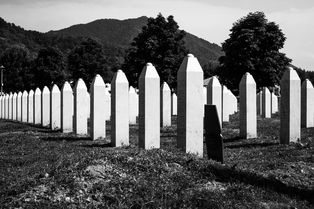

Le Radici del Turismo Oscuro Il fenomeno che oggi chiamiamo turismo oscuro affonda le sue radici in pratiche antiche: dai giochi gladiatori nel Colosseo romano alle esecuzioni pubbliche per decapitazione, fino alle visite alle catacombe. Già nel XIX secolo scrittori di viaggio come P. J. O'Rourke descrivevano i loro spostamenti a Varsavia, Managua e Belfast come “vacanze all’inferno”, mentre Chris Rojek nel 1993 parlava di “turismo dei punti neri” e di “sfruttamento del macabro”. La svolta accademica arrivò a Glasgow, in Scozia, dove nel 1996 Lennon e Foley coniarono il termine dark tourism e A. V. Seaton introdusse thanatourism. Da allora la letteratura si è moltiplicata, ma la ricerca empirica sul punto di vista del turista rimane scarsa.Quando la Storia Diventa Attrazione La forza attrattiva di questi luoghi non risiede solo nella loro associazione con la morte, ma nel valore storico che custodiscono. Il turismo dell'Olocausto, ad esempio, combina aspetti del turismo oscuro e del turismo patrimoniale: i visitatori cercano di comprendere, non solo di contemplare la sofferenza. Destinazioni come il castello di Culloden in Scozia, i castelli di Bran e Poienari in Romania, o le prigioni di Beaumaris in Galles e l’esposizione di Jack the Ripper al London Dungeon illustrano come campi di battaglia, fortezze e carceri diventino palcoscenici di memoria.Luoghi Simbolo: Dai Campi di Concentrazione ai Siti Nucleari La lista dei siti emblematici è lunga e variegata. Il Parco della Pace di Hiroshima in Giappone, la zona di Chernobyl in Ucraina e Ground Zero a New York rappresentano disastri naturali e provocati dall’uomo. I campi di concentramento come Auschwitz in Polonia, il Museo del Massacro di Nanchino in Cina, il Museo del Genocidio di Tuol Sleng in Cambogia, i siti dell’insurrezione di Jeju in Corea del Sud e il Centro di Internamento di Spirit Lake in Québec testimoniano atrocità, genocidi e politiche di internamento. Anche luoghi legati a figure controverse – i palazzi di Saddam Hussein in Iraq, la “spiderhole” dove si nascose, o le proprietà di Pablo Escobar in Colombia – attirano flussi di visitatori curiosi, spesso alimentati da narrazioni mediatiche.Il Dilemma Etico: Educazione o Sfruttamento? La tensione tra valore educativo e sfruttamento commerciale è al centro del dibattito. Lennon e Foley, nel loro primo libro, denunciarono che “tatto e gusto non prevalgono sulle considerazioni economiche” e che la responsabilità non ricade solo sui gestori, ma anche sui turisti che creano domanda. Un operatore mosso dall’avidità può “mungere il macabro” oppure trasformare la tragedia in esperienza di apprendimento. I visitatori, a loro volta, possono profanare i siti, sebbene pochi studi abbiano misurato l’impatto di tali azioni. Chris Hedges ha criticato la narrazione di Alcatraz presentata dal National Park Service definendola “imbiancatura”, perché ometterebbe la ferocia e l’ingiustizia del sistema carcerario statunitense, producendo una “disneyfication” della storia.Oltre i Confini: Nuove Frontiere del Thanatourism Oggi il concetto si espande. A Bali, i riti funebri vengono commercializzati: non appena si apprende di una morte, agenzie organizzano pullman e vendono biglietti. Negli Stati Uniti, il Museo della Memoria dell'Olocausto a Washington offre ai visitatori una carta d’identità che abbina età e genere a una vittima reale, mentre schermi mostrano squadre di esecuzione all’opera. In Colombia, i tour tematici su Pablo Escobar portano i turisti alla casa dove fu ucciso, alla prigione La Catedral e all’Hacienda Nápoles. Anche la serie televisiva Dark Tourist e il fenomeno del Sarajevo Safari mostrano come la cultura pop alimenti l’interesse per questi itinerari. Riflessioni Finali sul Viaggio nella Memoria Viaggiare verso luoghi di dolore non è solo un atto di curiosità morbosa; può diventare un pellegrinaggio laico, un modo per onorare le vittime e interrogarsi sul presente. La chiave sta nell’approccio: ascoltare le storie, rispettare il silenzio, sostenere progetti di conservazione e formazione. Solo così il turismo oscuro smette di essere spettacolo e si trasforma in strumento di consapevolezza collettiva.#DarkTourism #Thanatourism #HistoricalTravel #MemorySites #EthicalTravel Related InsightsThe Aetherial Threads: Unearthing Ladakh's Forgotten Sky Roads of the Monastics Albania’s Riviera vs Montenegro’s Bay of Kotor: Europe’s Best-Kept Secret Coastlines Revealed 云上佛国,人间仙山:峨眉山的历史、自然与信仰之旅{ "@context": "https://schema.org", "@type": "FAQPage", "mainEntity": [ { "@type": "Question", "name": "What is the main focus of Ombre di Storia: Viaggio nel Turismo Oscuro tra Memoria e Mistero?", "acceptedAnswer": { "@type": "Answer", "text": "Un'esplorazione profonda del turismo oscuro, dove la storia si intreccia con la memoria collettiva e le destinazioni diventano testimoni silenziose di dolore e resilienza." } }, { "@type": "Question", "name": "Who authored the comprehensive guide on Ombre di Storia: Viaggio nel Turismo Oscuro tra Memoria e Mistero?", "acceptedAnswer": { "@type": "Answer", "text": "This detailed article and its insights were carefully researched and authored by Marco Rossi." } }, { "@type": "Question", "name": "Where can I find more related content about Travel?", "acceptedAnswer": { "@type": "Answer", "text": "You can explore more articles, detailed reviews, and similar insights by browsing the Related Insights section at the bottom of this article or visiting our dedicated Travel category page." } } ] }
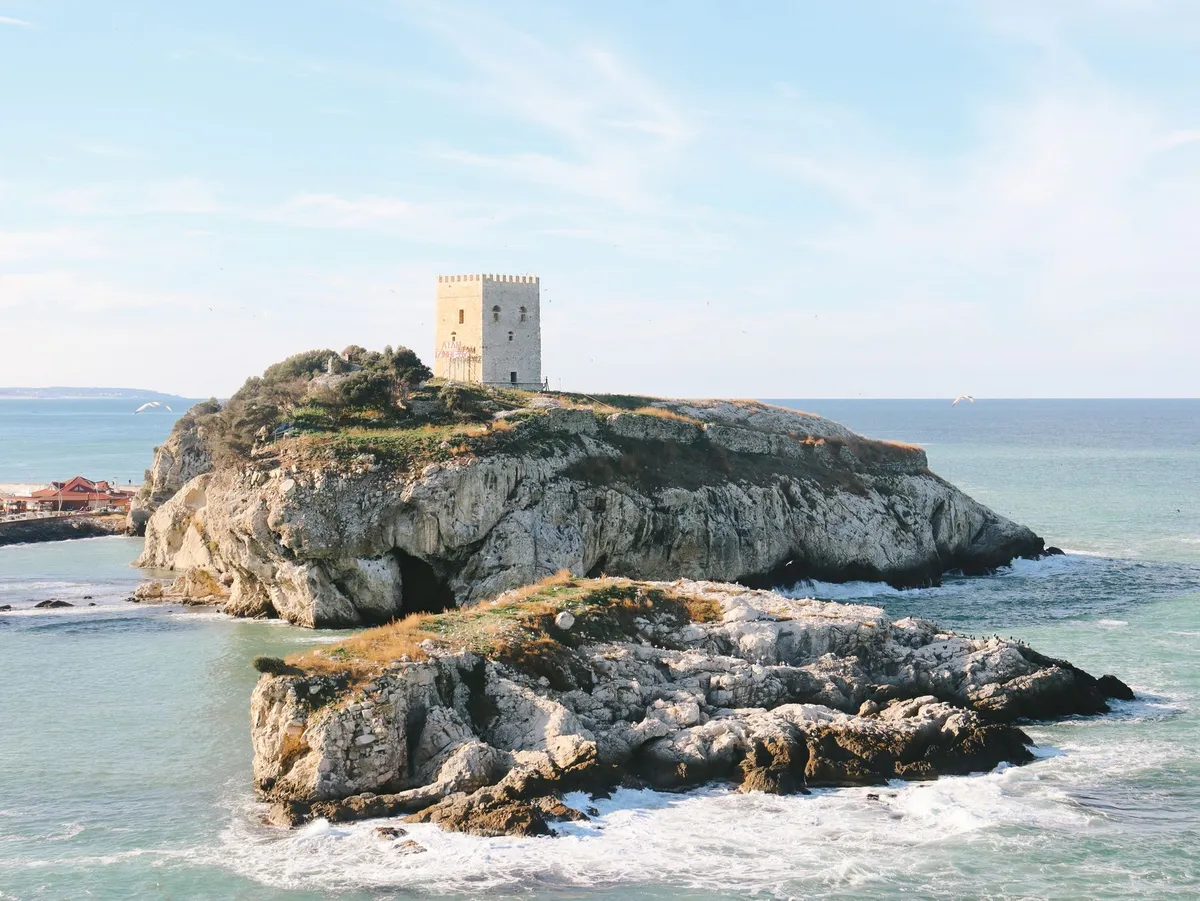

Stone Giants of the Mediterranean The island of Sardinia rises from the Tyrrhenian Sea like a time‑capsule, its interior studded with more than seven thousand nuraghi — conical stone towers that have guarded the landscape since the Middle Bronze Age, roughly 1800–1100 BCE. These megalithic monuments are not isolated curiosities; they form a dense, interconnected network that once regulated trade, defense, and ritual across the island’s rugged interior. The most celebrated example, Su Nuraxi di Barumini, earned UNESCO World Heritage status in 1997 for its remarkably preserved central tower, surrounding bastions, and a labyrinth of circular huts that illustrate the social hierarchy of the Nuragic people. Yet beyond Barumini, the countryside hides lesser‑known giants such as Nuraghe Losa near Abbasanta, the double‑towered complex of Santu Antine in Torralba, and the hilltop sentinel of Nuraghe Arrubiu in Orroli, each offering a distinct architectural vocabulary that reflects local geology and evolving construction techniques. Archaeologists have long debated the purpose of these structures. Early theories posited purely defensive roles, but recent excavations reveal domestic spaces, storage silos, and even metallurgical workshops within the walls, suggesting a multifunctional society that blended military vigilance with everyday life. The towers’ thick dry‑stone masonry, built without mortar, demonstrates an advanced understanding of load distribution — stones are laid in diminishing concentric circles, creating a self‑supporting dome that has withstood millennia of earthquakes and erosion. This engineering prowess is mirrored in the surrounding “giants’ graves” (tombe di giganti) and sacred wells, which together compose a ritual landscape aligned with celestial events. Solar orientations at several sites indicate that the Nuragic builders tracked solstices, embedding astronomical knowledge into the very stones that now guide modern hikers. For the contemporary traveler, the nuraghi are more than museum pieces; they are waypoints on a living trail system that stitches together archaeology, ecology, and local culture. The “Sentiero dei Nuraghi” — a network of marked paths maintained by the regional park authority — links over thirty major sites across the central and northern provinces, allowing multi‑day treks that traverse cork oak forests, limestone plateaus, and hidden valleys scented with myrtle and wild rosemary. Each stage reveals a new silhouette against the horizon, inviting walkers to read the landscape as the ancients did: as a map of power, water, and sky.Charting the Ancient Pathways Mapping the Nuragic trails demands both scholarly precision and on‑the‑ground intuition. The official cartography, published by the Ente Foreste della Sardegna, provides topographic sheets at 1:25,000 scale that mark every registered nuraghe, tomb, and sacred well, together with trail difficulty ratings (CAI grading from T/E for easy to EE for expert). However, many secondary paths — shepherd tracks, ancient transhumance routes, and forgotten pilgrimage ways — remain uncharted on paper but are known to local guides and the island’s vibrant hiking community. A reliable approach combines the official GPS waypoints (downloadable from the Sardegna Geoportale) with crowd‑sourced tracks on platforms like Wikiloc and Komoot, cross‑referenced against recent field reports from the Associazione Nazionale Guide Ambientali Escursionistiche (ANGAE). A practical itinerary for a five‑day immersion might begin in the historic town of Oristano, where the archaeological museum offers a concise overview of Nuragic chronology before you set foot on the trail. Day one follows the “Via dei Nuraghi” northward to the coastal plain of Sinis, crossing the low‑lying Nuraghe di Monte Prama — famed for its colossal limestone statues of warriors — before reaching the wetlands of Cabras, a birdwatcher’s paradise. Day two ascends into the basaltic heart of the Montiferru massif, where the double‑towered Nuraghe Santu Antine dominates a panoramic ridge; the ascent gains 600 m over 12 km, rated EE, and rewards hikers with views stretching to the Gulf of Oristano. Day three descends into the limestone karst of the Supramonte, threading through the “Gola di Gorropu” canyon to the remote Nuraghe Mereu, a site only accessible on foot and still under active excavation. Day four loops back via the high plateau of the Gennargentu National Park, touching the sacred well of Su Tempiesu — a subterranean chamber aligned with the winter solstice sunrise — before concluding at the UNESCO complex of Barumini, where guided tours illuminate the stratigraphy of the central tower and its surrounding village. Navigation on these routes requires a blend of digital and analog tools. A rugged GPS device pre‑loaded with offline maps ensures redundancy when mobile signal vanishes in deep valleys. Yet a paper topographic map, a compass, and the ability to read cairn markers (ometti) remain indispensable, especially on sections where trail maintenance is sporadic. Seasonal considerations are critical: spring (April–June) offers wildflower carpets and moderate temperatures (15–22 °C), while autumn (September–October) provides stable weather and fewer tourists. Summer heat can exceed 35 °C on exposed ridges, demanding early starts and ample water — at least three liters per person per day. Winter brings snow on the highest peaks, rendering many high‑altitude sections impassable without alpine equipment. Where History Meets the Horizon Walking among the nuraghi is an exercise in temporal layering. Each stone you touch has been shaped by human hands, weathered by wind, and reinterpreted by successive cultures — Phoenicians, Romans, Byzantines, and later Sardinian pastoralists who reused the towers as shepherds’ shelters. This palimpsest is visible in the architecture: at Nuraghe Losa, a Roman-era cistern was carved into the base of the central tower, while at Nuraghe Arrubiu, medieval graffiti coexist with Bronze Age cup marks. The landscape itself tells stories; the “nuragic alphabet” of standing stones (menhirs) and alignment corridors suggests a sophisticated territorial organization that prefigured later Roman centuriation. Ecologically, the trails traverse a mosaic of habitats that have changed little since the Nuragic era. Cork oak (Quercus suber) savannas dominate the lower slopes, their bark harvested sustainably for centuries — a practice that still supports local economies. Higher up, holm oak (Quercus ilex) and Mediterranean maquis give way to endemic species such as the Sardinian peony (Paeonia corsica) and the rare Gennargentu violet (Viola gennargentua). Wildlife encounters are frequent: mouflon (Ovis orientalis musimon) graze on alpine meadows, golden eagles (Aquila chrysaetos) patrol the cliffs, and the elusive Sardinian wildcat (Felis lybica sarda) slips through the underbrush at dusk. Birdsong provides a constant soundtrack, especially in the wetlands near Cabras where flamingos (Phoenicopterus roseus) stage seasonal migrations. Cultural immersion deepens when you pause in the villages that dot the trail network. In Barumini, the “Festa di San Giovanni” in late June revives ancient fire rituals that echo Nuragic solstice celebrations. In Orroli, the “Sagra del Pane Carasau” showcases the island’s iconic thin, crisp bread — baked in wood‑fired ovens using durum wheat varieties unchanged since antiquity. Local artisans still practice “filigrana” jewelry, weaving gold and silver into motifs inspired by Nuragic spiral patterns. Engaging with these living traditions transforms a hike into a dialogue across millennia, reminding you that the nuraghi are not dead monuments but anchors of a continuous cultural current.Practical Logistics for the Modern Explorer Turning an archaeological pilgrimage into a seamless adventure hinges on realistic budgeting, transport, and accommodation planning. According to the latest cost‑of‑living data for Sardinia (2026), a moderate lifestyle for a solo traveler averages $1,800 per month, broken down into housing $669, groceries $365, utilities $150, transportation $120, and discretionary spending $496. For a two‑week trek, you can expect to spend roughly $900–$1,100 depending on lodging choices. Budget‑friendly options include “agriturismi” (farm stays) that charge €35–€55 per night for a private room with breakfast, often located within walking distance of trailheads. Mid‑range hotels in Oristano or Cagliari range €80–€120 per night, while boutique guesthouses in Barumini hover around €70. Transport to the island is straightforward: Cagliari Elmas Airport (CAG) and Olbia Costa Smeralda Airport (OLB) receive daily flights from major European hubs. Once on the ground, renting a compact car (≈ €35/day) provides the flexibility to reach remote trailheads such as Nuraghe Mereu, which lacks public transport. Alternatively, the regional bus network (ARST) connects major towns, but schedules are sparse on weekends and may require overnight stays to align with trail start points. For the eco‑conscious, a combination of train (Trenitalia’s “Sardinia Line” from Cagliari to Oristano) and local shuttle services operated by the park authority can reduce carbon footprint, though it adds travel time. Health and safety considerations are modest but non‑negotiable. The Italian National Health Service (SSN) covers EU citizens Related InsightsShirakawa-go: The Enchanting Village of Snow and Traditions Insel Rügen im Sommer Historical Mardin Streets{ "@context": "https://schema.org", "@type": "FAQPage", "mainEntity": [ { "@type": "Question", "name": "What is the main focus of Sardinian Nuraghe Trails: Mapping the Bronze Age Megalithic Landscapes?", "acceptedAnswer": { "@type": "Answer", "text": "Explore the ancient stone towers of Sardinia on curated trails that reveal a lost civilization, with practical costs and insider tips." } }, { "@type": "Question", "name": "Who authored the comprehensive guide on Sardinian Nuraghe Trails: Mapping the Bronze Age Megalithic Landscapes?", "acceptedAnswer": { "@type": "Answer", "text": "This detailed article and its insights were carefully researched and authored by Wei Chen." } }, { "@type": "Question", "name": "Where can I find more related content about Travel?", "acceptedAnswer": { "@type": "Answer", "text": "You can explore more articles, detailed reviews, and similar insights by browsing the Related Insights section at the bottom of this article or visiting our dedicated Travel category page." } } ] }
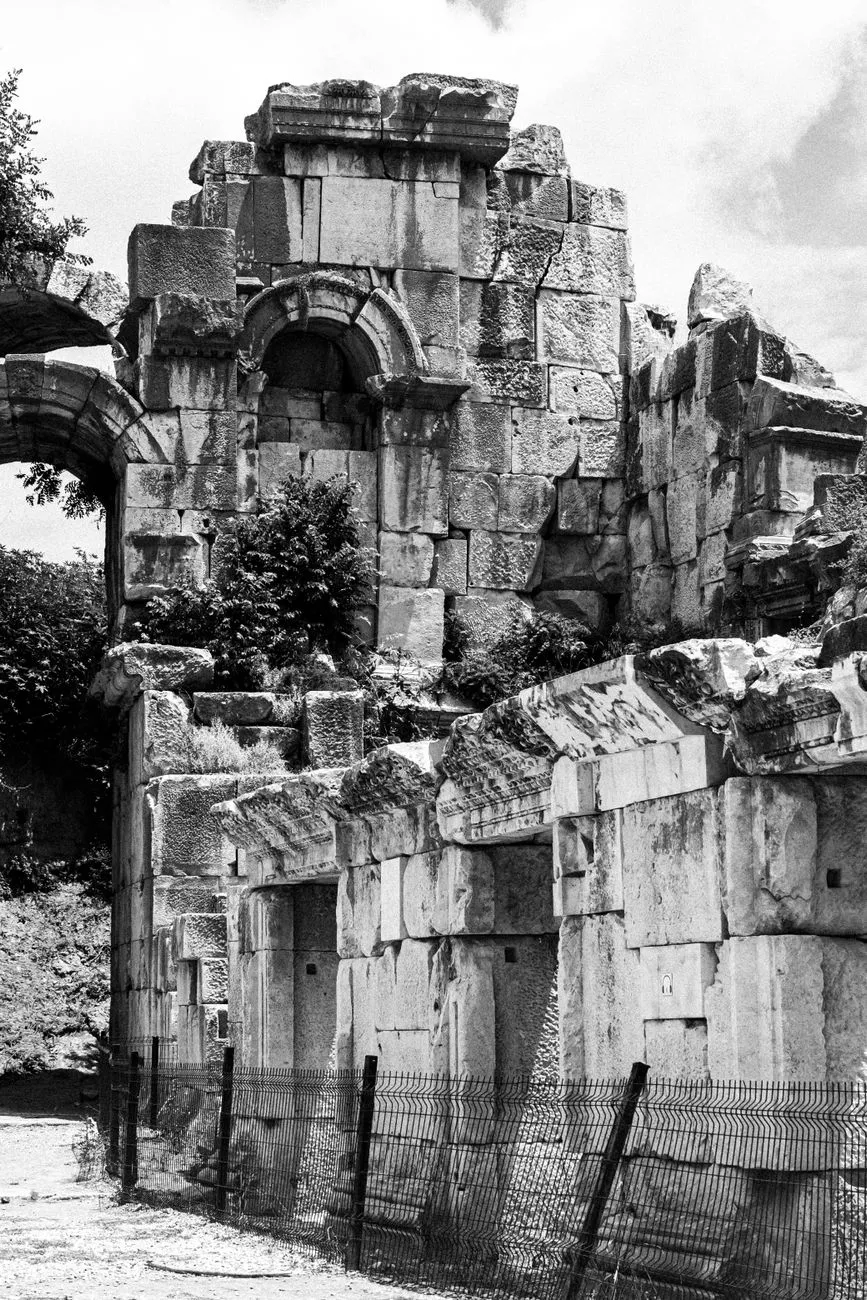

Les Racines du Pèlerinage et la Quête du Sens Depuis l'Antiquité, le déplacement vers des lieux sacrés a façonné les premières formes de tourisme patrimonial. Dans les traditions chrétiennes et islamiques, le pèlerinage visait à honorer le sanctuaire d'un prophète ou d'un saint, comme la Mecque pour le Hajj et la Omra, ou encore Lourdes en France et Canterbury en Angleterre. Ces flux de fidèles ont, bien avant l'ère moderne, généré des économies locales significatives, posant les bases d'une relation symbiotique entre spiritualité et développement territorial.La Naissance d'une Convention Mondiale Le tournant décisif survient au milieu du XXe siècle. La décision de construire le barrage d'Assouan en Égypte menaçait d'engloutir les temples d'Abou Simbel sous les eaux du Nil. Face à l'urgence, l'UNESCO lance en 1959 une campagne internationale de sauvegarde, mobilisant une cinquantaine de pays et réunissant près de 80 millions de dollars. Les monuments sont démontés, transportés et réassemblés sur un terrain sec, prouvant que la coopération mondiale peut préserver l'héritage commun. D'autres opérations — la lagune de Venise, les ruines de Mohenjo-daro au Pakistan, le temple de Borobudur en Indonésie — ont consolidé ce mouvement, aboutissant à la rédaction de la Convention du patrimoine mondial, pilotée avec l'ICOMOS.Saveurs et Savoirs : Le Patrimoine Gastronomique Le patrimoine ne se limite pas aux pierres ; il se goûte. En Bretagne, la galette de sarrasin incarne un savoir-faire transmis de génération en génération. En Normandie, le Calvados, eau-de-vie de pomme, raconte l'histoire des vergers et des alambics. Aux États-Unis, la région du Old Bourbon perpétue la distillation du bourbon, boisson emblématique d'un terroir précis. Ces produits, protégés par des appellations, deviennent des aimants pour les voyageurs en quête d'authenticité culinaire, transformant chaque dégustation en leçon d'histoire vivante.L'Illusion de l'Authenticité La recherche d'authenticité est le fil conducteur du visiteur contemporain. Les travaux sociologiques ont mis en lumière le concept d'« authenticité mise en scène » : les sites sont parfois aménagés pour donner l'illusion d'un « arrière-pays » préservé, alors que la réalité a été remodelée pour le regard touristique. Du côté des gestionnaires, l'objet patrimonial est analysé sous trois angles — sa forme physique, ses liens culturels et historiques, et sa vitalité à transmettre du sens. L'authenticité perçue repose alors sur des indices iconiques et indexiques que le site fournit, créant un dialogue constant entre présentation et réception.Retombées Économiques et Défis Éthiques L'impact financier peut être spectaculaire. En 2017, le tourisme patrimonial a injecté 50 millions de livres dans l'économie des Orcades, archipel écossais riche en sites néolithiques. Pourtant, la médaille a son revers. Au Mexique, l'engouement autour de la fin supposée du calendrier maya a attiré des foules, sans que les communautés mayas ne perçoivent les retombées promises. De même, les pratiques coloniales ont souvent utilisé les notes de terrain pour objectiver les peuples autochtones, transformant leur culture en spectacle. La vigilance s'impose : le tourisme doit devenir un levier de reconnaissance et de partage équitable, non une nouvelle forme d'extraction.Vers un Tourisme Responsable et Durable Face aux risques de surtourisme et d'appropriation culturelle, des initiatives comme le festival IT.A.CÀ en Italie promeuvent un tourisme responsable, intégrant les principes de durabilité, d'interprétation patrimoniale et de respect des communautés hôtes. La genéalogie touristique, le « dark tourism » ou les chemins de fer patrimoniaux illustrent la diversité des approches, chacune pouvant contribuer à la préservation si elle s'inscrit dans une gouvernance participative. L'avenir du patrimoine réside dans l'équilibre fragile entre valorisation économique et transmission fidèle aux générations futures.#Patrimoine #TourismeCulturel #UNESCO #Authenticité #DéveloppementDurable Related Insights喀什:丝绸之路上的明珠与时光交错的古城 The White Silence Beckons: A Century of Chasing the Antarctic Dream Zanzibar’s Hidden Shores: Unveiling the Most Secluded Beaches Where Crowds Dare Not Wander{ "@context": "https://schema.org", "@type": "FAQPage", "mainEntity": [ { "@type": "Question", "name": "What is the main focus of L'Écho des Pierres : Voyage au Cœur du Patrimoine Vivant?", "acceptedAnswer": { "@type": "Answer", "text": "Plongez dans l'univers du tourisme patrimonial, entre sites millénaires, traditions intangibles et défis contemporains de préservation." } }, { "@type": "Question", "name": "Who authored the comprehensive guide on L'Écho des Pierres : Voyage au Cœur du Patrimoine Vivant?", "acceptedAnswer": { "@type": "Answer", "text": "This detailed article and its insights were carefully researched and authored by Pierre Dubois." } }, { "@type": "Question", "name": "Where can I find more related content about Travel?", "acceptedAnswer": { "@type": "Answer", "text": "You can explore more articles, detailed reviews, and similar insights by browsing the Related Insights section at the bottom of this article or visiting our dedicated Travel category page." } } ] }
- Chloe Tremblay
- 26 Sep, 2026 21:26
Chasing the Endless Day: A Photographer’s Manual for Lofoten’s Midnight Sun
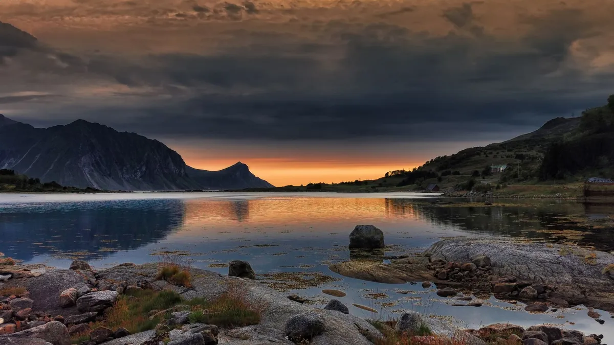
Awakening to the Arctic Glow The Lofoten archipelago, perched above the Arctic Circle at roughly 68° N, offers a rare window from late May through mid‑July when the sun never fully sets. During this period the horizon glows with a soft, golden‑blue light that can last for 24 hours, turning every fjord, village, and mountain ridge into a natural studio. Planning an expedition begins with locking in the exact dates of the midnight sun for your target year; the Norwegian Meteorological Institute publishes precise sunrise‑sunset tables that show the sun’s lowest elevation barely dipping below 0° around 21 June. Travel logistics are straightforward but require early booking. Most photographers fly into Bodø (BOO) and catch the 3‑hour ferry to Moskenes, or they opt for the faster 30‑minute flight to Leknes (LKN) followed by a rental car. A compact 4×4 is advisable because many prime locations—such as the dramatic cliffs of Uttakleiv Beach or the remote hamlet of Å—are reached via narrow, winding roads that can become slick with sea spray. Accommodation ranges from traditional rorbuer (fishermen’s cabins) in Reine to modern boutique hotels in Svolvær; prices in July hover around 1,200 NOK per night for a double room, so budgeting 10,000–12,000 NOK for a five‑night stay is realistic. Permits are another critical piece. Drone flights over the islands fall under the Norwegian Civil Aviation Authority (Luftfartstilsynet) regulations: any UAV over 250 g must be registered, and pilots need an A1/A3 certificate plus a specific “flight zone” approval for protected bird cliffs like those at Røst. The application can be submitted online and typically processes within five business days. Failure to secure permission can result in fines up to 15,000 NOK and confiscation of equipment. Weather in the high north is notoriously fickle. Even in midsummer, temperatures swing between 8 °C and 15 °C, and sudden fog banks can roll in from the Vestfjorden, reducing visibility to a few metres. Checking the Norwegian Weather Service (yr.no) hourly forecasts and the “Mountain Weather” app for localized alerts becomes a daily ritual. A flexible itinerary that allows you to chase clear skies—perhaps moving from the western coast to the inner fjords—maximises shooting opportunities. Finally, respect the fragile ecosystem. The Lofoten Islands host breeding colonies of puffins, sea eagles, and Arctic terns. Stick to marked paths, keep a minimum 50 m distance from nesting sites, and carry out all waste. The “Leave No Trace” principle is not just etiquette; it is enforced by local rangers who can issue on‑the‑spot penalties. Gear That Survives the Polar Night Choosing equipment that endures cold, damp, and wind is as important as mastering composition. A weather‑sealed full‑frame body—such as the Nikon Z9, Sony A1, or Canon EOS R3—offers high‑resolution files and reliable autofocus in low‑contrast light. Pair it with a versatile wide‑angle zoom (14‑24 mm f/2.8) for expansive fjord vistas and a fast prime (24 mm f/1.4) for intimate village scenes. A sturdy carbon‑fiber tripod (e.g., Gitzo GT3543LS) with a ball head that locks solidly prevents micro‑vibrations during long exposures of the never‑setting sun. Battery performance drops roughly 30 % at 5 °C, so carry at least four spare LP‑E6NH or NP‑FZ100 cells, stored in an insulated pouch close to your body. A portable solar charger (30 W) can top up power banks during the endless daylight, but remember that the sun’s low angle reduces panel efficiency; a 20,000 mAh power bank is a safer backup. Filters are indispensable. A 6‑stop circular ND (e.g., B+W 110) lets you stretch exposures to 30 seconds even at midday, smoothing the sea and rendering the sky with silky gradients. A graduated ND (GND) helps balance the bright horizon against darker foregrounds, especially when shooting from elevated viewpoints like the Reinebringen trail. Protection against moisture is non‑negotiable. A rain‑cover for the camera (Think Tank Photo Hydrophobia) and a dry‑bag for lenses keep condensation at bay when moving between the chilly outdoors and heated interiors. Silica gel packets in each bag absorb residual humidity. Below is a concise cost‑weight breakdown for a core kit tailored to a two‑week midnight‑sun expedition.Item Weight (g) Approx. Cost (USD) NotesNikon Z9 body 1,340 5,500 45 MP, 20 fps, weather‑sealedNIKKOR Z 14‑24 mm f/2.8 S 650 2,300 Edge‑to‑edge sharpnessNIKKOR Z 24 mm f/1.4 S 420 1,800 Low‑light village workGitzo GT3543LS tripod 1,850 950 Carbon‑fiber, 3‑sectionB+W 110 6‑stop ND 85 180 77 mm threadLee GND 0.9 (100 mm) 120 210 Slide‑in holder4× LP‑E6NH batteries 280 240 Keep warm in inner pocket20,000 mAh power bank 350 70 USB‑C PD 30 WThink Tank Hydrophobia cover 210 130 Full‑body rain protectionTotal 5,305 11,380Investing in redundancy—duplicate batteries, a second tripod leg, and a spare ND—pays off when a sudden gust sends a leg into a tide pool. Composition Secrets Under the Midnight Sun The perpetual daylight reshapes every compositional rule. With the sun circling the horizon, shadows stretch long and soft, offering a natural “golden hour” that never ends. Use this to your advantage by positioning foreground elements—weathered wooden racks, rusted fish‑drying frames, or the iconic red rorbuer—against the luminous sky. The rule of thirds still applies, but the horizon often sits higher (around the upper third) to showcase the expansive water and the subtle colour gradient from amber to teal. Leading lines become more pronounced when the light is low. The wooden pier at Henningsvær, the serpentine road hugging the coastline, or the jagged ridge of the Lofoten Wall guide the eye toward the glowing horizon. A low tripod height (≈30 cm) exaggerates these lines and adds a sense of immersion. Reflections are a hallmark of Lofoten’s glassy fjords. Early morning (around 02:00 local time) often yields the calmest water, turning mountains into perfect mirrors. To capture this, set the camera to a 2‑second timer, use a 10‑stop ND, and expose for 15‑20 seconds at f/11, ISO 64. The resulting image balances the bright sky with the dark foreground, preserving detail in both. Human elements add scale and narrative. A lone kayaker paddling beneath the midnight sun, a fisherman hauling nets, or a hiker silhouetted on Reinebringen provide a story anchor. When including people, obtain verbal consent and respect privacy; many locals are accustomed to photographers but appreciate a friendly greeting in Norwegian (“Hei, kan jeg ta et bilde?”). Panoramas stitch together the vastness that a single frame cannot contain. Shoot a 7‑frame horizontal panorama at 24 mm, overlapping 30 % each frame, then merge in Lightroom’s “Panorama” module with “Boundary Warp” set to 30 % to correct edge distortion. The final file can exceed 150 MP, ideal for large‑format prints. Finally, experiment with intentional camera movement (ICM). A slow vertical pan (1/4 s) while the shutter remains open paints the sky into abstract streaks, turning the midnight sun into a brushstroke of colour. This technique works best on a sturdy tripod with a fluid head, and the resulting images convey the surreal, timeless quality of the Arctic summer. Navigating Light and Weather on the Edge Understanding the quality of light at each “hour” of the midnight sun is essential for scheduling shoots. The sun’s azimuth shifts roughly 15° per hour, meaning the direction of illumination rotates continuously. Use a smartphone app like PhotoPills to plot the sun’s path for your exact coordinates; it shows the elevation angle (often 5‑10° above the horizon) and the exact bearing for any given minute. This allows you to pre‑visualise which side of a mountain will be lit at 03:00 versus 15:00. Cloud cover is the photographer’s wildcard. The Norwegian Climate Service reports that July averages 12 days of measurable precipitation in Lofoten, but cloud layers can be thin enough to act as a giant diffuser, softening Related InsightsSustainable Archipelagos: Crafting an Eco‑Conscious Island‑Hopping Blueprint for the Azores 喀什:丝绸之路上的明珠与时光交错的古城 The Grandeur of Versailles: Palace of the Sun King{ "@context": "https://schema.org", "@type": "FAQPage", "mainEntity": [ { "@type": "Question", "name": "What is the main focus of Chasing the Endless Day: A Photographer’s Manual for Lofoten’s Midnight Sun?", "acceptedAnswer": { "@type": "Answer", "text": "Master the art of shooting under the Arctic’s perpetual daylight with gear tips, composition strategies, and post‑processing workflows tailored for the Lofoten Islands." } }, { "@type": "Question", "name": "Who authored the comprehensive guide on Chasing the Endless Day: A Photographer’s Manual for Lofoten’s Midnight Sun?", "acceptedAnswer": { "@type": "Answer", "text": "This detailed article and its insights were carefully researched and authored by Chloe Tremblay." } }, { "@type": "Question", "name": "Where can I find more related content about Travel?", "acceptedAnswer": { "@type": "Answer", "text": "You can explore more articles, detailed reviews, and similar insights by browsing the Related Insights section at the bottom of this article or visiting our dedicated Travel category page." } } ] }
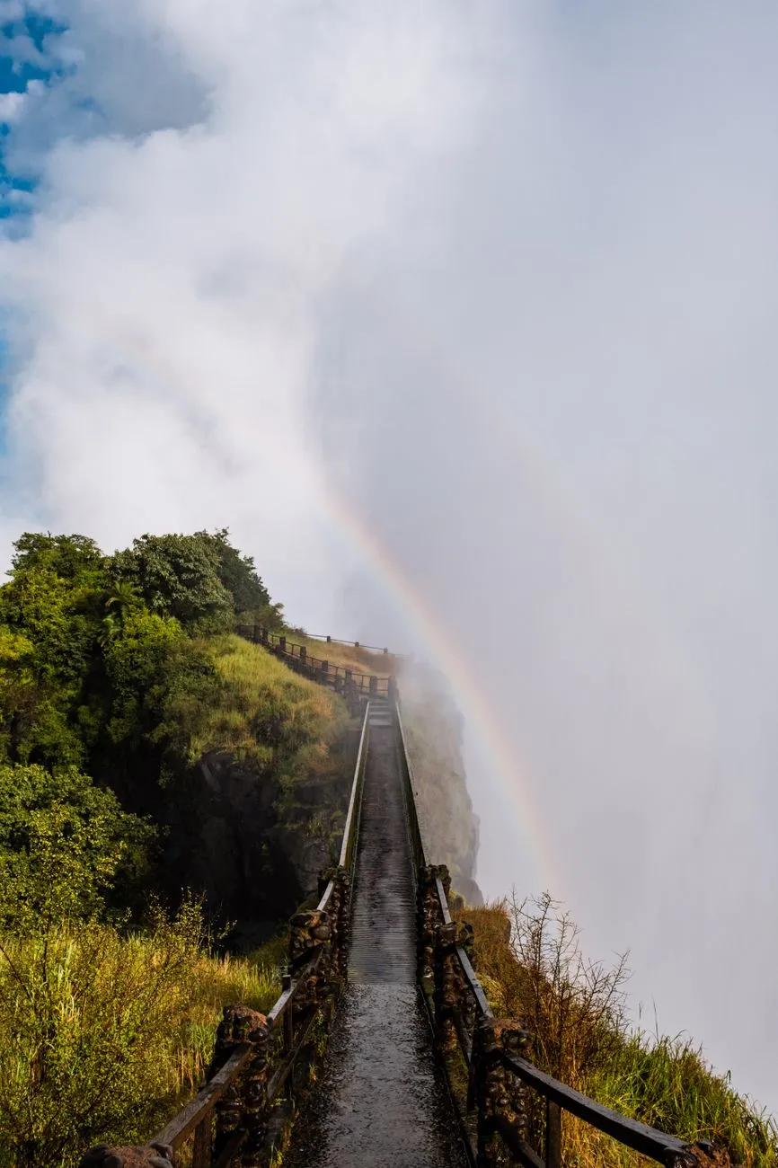
Navigating the Gorge: Mapping the Zambezi’s Hidden Canyons The Zambezi River carves a spectacular series of basalt gorges downstream of Victoria Falls, offering a playground for advanced canyoning that few rivers can match. The Batoka Gorge, stretching roughly 120 kilometres, presents a sequence of narrow slots, towering waterfalls, and deep plunge pools that demand precise navigation and a thorough understanding of the river’s morphology. Before committing to a descent, study the most recent topographic surveys and satellite imagery to identify constriction points where water velocity spikes and where natural anchors — such as exposed basalt columns — can be used for rappels. The guide to Livingstone for digital nomads describes the area as an “adrenaline‑fueled frontier outpost” with a wild river and weak Wi‑Fi, underscoring the remoteness that makes self‑reliance essential. Plot each rappel, swim, and scramble on a waterproof map, marking escape routes to the riverbanks where vehicle access exists. Seasonal flow data, available through the Zambezi River Authority, should dictate whether you target the high‑water window (February–May) for dramatic hydraulics or the low‑water window (June–October) for more technical rock‑work. A detailed itinerary, shared with a trusted contact and logged with the local tourism office, transforms a high‑risk expedition into a managed adventure.Gear Up for the Rapids: Advanced Equipment and Safety Protocols Equipment selection for Zambezi canyoning goes far beyond a standard wetsuit and helmet. The river’s powerful hydraulics and sharp basalt demand a full‑face helmet with a secure chin strap, a 5 mm neoprene drysuit with integrated hood, and a pair of high‑traction canyoning boots featuring sticky rubber soles and reinforced toe caps. A dynamic rope system — 10.5 mm static kernmantle rated for 30 kN — paired with a figure‑8 descender and a backup prusik loop provides redundancy on long rappels that can exceed 30 metres. Carry a compact, waterproof first‑aid kit stocked with trauma shears, a tourniquet, and a SAM splint; the remote nature of the gorge means evacuation can take hours. Communication devices are critical: a satellite messenger (e.g., Garmin inReach) and a VHF marine radio allow contact with the Livingstone rescue coordination centre, which the digital‑nomad guide notes operates with limited but functional infrastructure. Conduct a pre‑trip gear inspection using a checklist that includes rope integrity, carabiner gate function, and battery levels on all electronics. Practice swift‑water rescue drills in a controlled environment before departure; the ability to execute a throw‑bag rescue or a tethered swim can be the difference between a close call and a fatality.Basecamp Livingstone: Digital Nomad Logistics on the Edge Livingstone serves as the logistical hub for any Zambezi canyoning expedition, and the complete guide to Livingstone for digital nomads highlights its dual identity as a tourist gateway and a nascent remote‑work outpost. Accommodation ranges from budget hostels near the railway station to riverside lodges offering reliable power backup — essential for charging satellite devices and laptops. Coworking spaces such as “The Hub” provide high‑speed fibre (when the grid holds) and a community of fellow adventurers who can share real‑time river conditions. The guide warns of “weak Wi‑Fi” in many neighbourhoods, so a local SIM with a data bundle from MTN or Airtel is advisable for backup connectivity. Food costs are modest; a typical meal at a local market stall costs under US $3, while a mid‑range restaurant dinner averages US $12. Transport to the gorge entry points is usually arranged via 4×4 hire (≈US $150 per day) or through a reputable adventure operator who includes shuttle logistics in their package. Safety indices from Numbeo rank Livingstone’s crime level as moderate, with petty theft the primary concern; securing valuables in a lockable locker at your lodge mitigates risk. Establish a daily check‑in routine with your basecamp contact, sharing GPS waypoints and expected return times, to maintain a safety net while you explore the gorge.Reading the River: Hydrology, Seasonal Flows, and Route Selection Understanding Zambezi hydrology is the cornerstone of route selection. The river’s discharge varies dramatically: peak flows can exceed 6,000 m³/s during the rainy season, creating massive standing waves and hydraulic jumps that render many canyon sections impassable. Conversely, the dry season reduces flow to below 500 m³/s, exposing technical rock corridors and allowing longer rappels but also increasing the risk of pin‑point entrapment in narrow slots. The Zambezi River Authority publishes weekly flow bulletins; integrate these into your decision matrix. For advanced teams, the “Devil’s Staircase” — a series of five consecutive waterfalls ranging from 12 to 25 metres — is best tackled at moderate flow (1,500–2,500 m³/s) when the plunge pools are deep enough for safe landings but the water volume still provides a manageable current. Use a handheld flow meter or a calibrated drift‑log to verify on‑site conditions before committing. Map each rapid’s classification (Class III–V) and note the presence of undercut rocks, sieves, and strainers. A flexible itinerary that allows you to bypass or re‑sequence sections based on real‑time observations preserves both safety and the quality of the experience. Cultural Currents: Engaging Local Guides and Conservation Ethics The Zambezi’s gorges are not merely geological features; they are cultural landscapes stewarded by the Tonga and Lozi communities for generations. Engaging a certified local guide from the Livingstone Guides Association adds invaluable knowledge of traditional river lore, hidden anchor points, and seasonal wildlife movements — such as the migration of Nile crocodiles into the gorge during low water. The guide also ensures compliance with the Zambia Wildlife Authority’s permit system, which mandates a conservation fee that funds anti‑poaching patrols and habitat restoration. Practice Leave‑No‑Trace principles rigorously: pack out all waste, avoid disturbing nesting sites of the African fish eagle, and refrain from using soap or detergents in the river. The digital‑nomad guide emphasizes the “wild river, weak Wi‑Fi” ethos, reminding visitors that the environment’s fragility demands a low‑impact footprint. Support community‑based tourism by purchasing handcrafted gear (e.g., woven rope handles) directly from local artisans, thereby injecting economic benefit into the villages that border the gorge. A respectful partnership transforms a technical descent into a shared stewardship experience, preserving the Zambezi’s wild character for future explorers.Category Relative Cost (Numbeo 2024) NotesAccommodation (1‑bed) Low‑Moderate Hostels $10‑$25/night; lodges $60‑$120Meals (local) Low Market meals $2‑$4; restaurants $8‑$15Transport (4×4 hire) Moderate $130‑$170 per day including fuelCoworking Space Low‑Moderate Day pass $10‑$20; monthly $150‑$250Internet (mobile data) Low 10 GB bundle $12‑$18Safety Index Moderate Petty theft common; violent crime rareBeyond the Rapids: Reflections on the Zambezi Journey Emerging from the Batoka Gorge, the roar of the river fades behind you, replaced by the quiet hum of Livingstone’s evening Related InsightsIceland's Golden Circle: Unveiling the Land of Fire and Ice Beyond the Clouds: Unveiling the Eternal Spirit of Georgia’s Caucasus Echoes in Stone: Unearthing Sardinia's Lost Cyclopean Mysteries in the Wild Heart of Barbagia{ "@context": "https://schema.org", "@type": "FAQPage", "mainEntity": [ { "@type": "Question", "name": "What is the main focus of Canyoning the Zambezi: Advanced Adventure Tactics for Remote River Explorations?", "acceptedAnswer": { "@type": "Answer", "text": "Master the technical and logistical demands of canyoning the Zambezi, from gear selection to basecamp strategy in Livingstone." } }, { "@type": "Question", "name": "Who authored the comprehensive guide on Canyoning the Zambezi: Advanced Adventure Tactics for Remote River Explorations?", "acceptedAnswer": { "@type": "Answer", "text": "This detailed article and its insights were carefully researched and authored by Mark Dinn." } }, { "@type": "Question", "name": "Where can I find more related content about Travel?", "acceptedAnswer": { "@type": "Answer", "text": "You can explore more articles, detailed reviews, and similar insights by browsing the Related Insights section at the bottom of this article or visiting our dedicated Travel category page." } } ] }
-
 Zola Ndlovu
 - 25 Sep, 2026 21:47
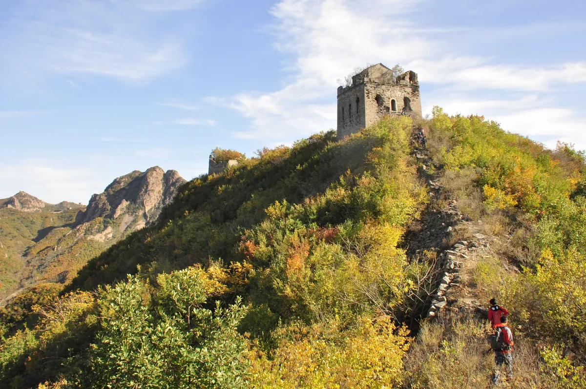
Beyond the Great Wall: Uncovering the Ming Dynasty Watchtowers in Hebei
Stone Sentinels of the Northern Frontier The Ming Dynasty (1368‑1644) erected a sprawling network of watchtowers along the northern frontier to guard the empire against Mongol incursions and to relay military signals across vast distances. In Hebei province, this defensive spine reaches its most dramatic expression: a chain of stone and brick towers that cling to ridgelines, peer over river valleys, and punctuate the skyline like silent guardians. Each tower was engineered with a two‑story layout — lower chambers for garrison troops and storage, an upper platform crowned with a beacon brazier that could be lit within minutes. The walls themselves combine kiln‑fired bricks, locally quarried limestone, and tamped‑earth cores, a composite that has resisted centuries of freeze‑thaw cycles and seismic tremors. Strategically, the towers functioned as a visual telegraph. By day, smoke signals rose from the beacon platforms; by night, firelight pierced the darkness, allowing commanders in Beijing to receive intelligence from the frontier within hours rather than days. The spacing — roughly 10 to 15 kilometres apart — was calculated to maintain line‑of‑sight across the undulating topography of the Yanshan and Taihang ranges. This geometry turned the landscape itself into a communication grid, a precursor to modern optical‑fiber networks. Today, many of these sentinels survive in varying states of preservation. The most intact examples — such as the twin towers at Jinshanling and the solitary beacon at Huangyaguan — showcase original crenellations, arrow‑slit windows, and internal staircases that still bear the wear of centuries of boots. Others exist only as foundations, their stones repurposed for village homes during the Qing and Republican eras. Preservation efforts led by the Hebei Cultural Heritage Bureau, in partnership with UNESCO’s “Great Wall Conservation Programme”, have stabilized several at‑risk structures using reversible mortar and discreet steel reinforcements, ensuring that the towers remain both authentic and safe for visitors.Walking among these towers feels like stepping into a living manuscript. The wind whistles through arrow slits, carrying the scent of pine and loess, while the distant hum of modern highways reminds you that the past and present share the same ridge. For the traveler willing to stray from the heavily restored Badaling sector, Hebei’s watchtowers offer an unfiltered encounter with Ming military genius and the raw beauty of northern China’s mountains. Mapping the Hidden Watchtower Trails Beyond the well‑trodden tourist loops, a lattice of footpaths links dozens of lesser‑known towers, creating a multi‑day hiking corridor that rewards the intrepid with solitude and panoramic vistas. The principal arteries run through four clusters: Jinshanling‑Simatai in the northeast, Gubeikou‑Xifengkou in the central corridor, Huangyaguan‑Taipingzhai in the west, and the coastal terminus at Shanhaiguan where the wall meets the Bohai Sea. Each cluster presents distinct terrain — Jinshanling’s steep, brick‑capped ridges; Simatai’s dramatic cliff‑side staircases; Gubeikou’s rolling grasslands dotted with watchtower ruins; Huangyaguan’s restored fortress‑like gatehouse. Navigating these trails demands preparation. Official topographic maps (scale 1:50 000) published by the Chinese State Bureau of Surveying and Mapping mark every numbered tower (e.g., Tower 7‑3, Tower 9‑1) and indicate gradient, water sources, and restricted military zones. GPS tracks downloaded from the “Great Wall Hiking” community forum (verified by local rangers) supplement paper maps, especially where vegetation obscures the path. A permit is required for overnight stays in the “core protection zones” — typically obtained online via the Hebei Tourism Administration portal at least 48 hours before departure. Day‑hikers can enter most sections freely, but the Simatai night‑tour segment mandates a guided group and a separate ticket. A recommended five‑day itinerary begins in Chengde (accessible by high‑speed rail from Beijing in 55 minutes). Day 1: transfer to Jinshanling, hike 12 km to Simatai, overnight in a family‑run guesthouse. Day 2: descend to Gubeikou, explore the twin towers and the ancient “Mongol‑Pass” trail. Day 3: bus to Huangyaguan, climb the restored gatehouse and walk the “Heavenly Ladder” stairway. Day 4: continue west to Taipingzhai, a quieter stretch with wild apricot blossoms in spring. Day 5: travel to Shanhaiguan, visit the “First Pass Under Heaven” museum, then return to Beijing via high‑speed train from Qinhuangdao. This route balances iconic scenery with off‑the‑beaten‑path discovery, allowing you to trace the Ming signal line from mountain to sea.Trail conditions vary seasonally. Spring (April‑May) brings mild temperatures (12‑20 °C) and blooming wildflowers, but occasional rain can make stone steps slick. Summer (June‑August) sees higher heat (25‑30 °C) and thunderstorms; early‑morning starts are advisable. Autumn (September‑October) offers crisp air (10‑18 °C) and spectacular foliage — ideal for photography. Winter (November‑March) transforms the wall into a snow‑clad sculpture; temperatures plunge below ‑10 °C, and some high passes close due to Related InsightsL'Eclissi del Re Sole: Tra gli Specchi e l'Oro di Versailles L'Eterna Seduzione della Costa Azzurra: Tra Scogliere di Porfido e Misteri Belle Époque 新疆火焰山:穿越神话、历史与烈焰的奇幻之旅{ "@context": "https://schema.org", "@type": "FAQPage", "mainEntity": [ { "@type": "Question", "name": "What is the main focus of Beyond the Great Wall: Uncovering the Ming Dynasty Watchtowers in Hebei?", "acceptedAnswer": { "@type": "Answer", "text": "Explore the hidden Ming-era watchtowers of Hebei, their history, hiking routes, and practical travel costs." } }, { "@type": "Question", "name": "Who authored the comprehensive guide on Beyond the Great Wall: Uncovering the Ming Dynasty Watchtowers in Hebei?", "acceptedAnswer": { "@type": "Answer", "text": "This detailed article and its insights were carefully researched and authored by Zola Ndlovu." } }, { "@type": "Question", "name": "Where can I find more related content about Travel?", "acceptedAnswer": { "@type": "Answer", "text": "You can explore more articles, detailed reviews, and similar insights by browsing the Related Insights section at the bottom of this article or visiting our dedicated Travel category page." } } ] }
-
 Hans Müller
 - 25 Sep, 2026 10:48
Wenn Heilung Reisen Lernt: Die Alte Und Neue Welt Des Medizintourismus
Der Wind über dem Saronischen Golf trägt noch heute den Duft von Pinien und altem Stein. Vor tausenden Jahren war es nicht der Ruf nach billigeren Preisen oder kürzeren Wartezeiten, der Pilger an diese Küste trieb – es war die nackte Hoffnung. Sie kamen nach Epidauria, zum Heiligtum des Asklepios, dem Gott der Heilkunst. Hier, in den Schatten der Tempel, schliefen die Kranken in der Enkoimesis, dem heiligen Traumschlaf, in der Erwartung, dass der Gott selbst im Traum die Therapie offenbare. Es war der Ursprung einer Bewegung, die die Menschheit bis heute nicht loslässt: die Suche nach Heilung jenseits der eigenen Haustür. Was einst ein Akt tiefer Spiritualität war, hat sich zu einem globalen Wirtschaftszweig von atemberaubender Dimension gewandelt. Der Medizintourismus – oder präziser: der Health Tourism – ist längst keine Randerscheinung mehr. Er ist ein Spiegelbild globaler Ungleichgewichte, ein Seismograf für die Versäumnisse nationaler Gesundheitssysteme und gleichzeitig ein Treiber medizinischer Innovation. Die Datenlage ist eindeutig: Patienten strömen über Grenzen, getrieben von einer Mischung aus Notwendigkeit, Kalkül und dem ur menschlichen Wunsch nach Unversehrtheit. Die Wiege Der Heilkunst: Von Epidauria Zu Den Kurorten Europas Die Geschichte kennt keine harten Schnitte, nur fließende Übergänge. Nachdem der Kult um Asklepios verblasste, übernahmen im 18. Jahrhundert die europäischen Spa-Towns die Rolle der Hoffnungsträger. Orte wie Bath, Baden-Baden oder Karlsbad wurden zu Magneten für das adelige und bürgerliche Europa. Man trank und badete in mineralhaltigen Quellen, um Gicht, Leberleiden und Bronchitis zu lindern. Es war "Medical Tourism" avant la lettre – exklusiv, sozial codiert, aber strukturell identisch mit dem heutigen Phänomen: Reisen zum Zwecke der Gesundheitswiederherstellung, weil die lokale Versorgung als unzureichend oder schlicht nicht existent galt. Doch die Pole haben sich verschoben. Historisch gesehen war die Route klar definiert: Vom globalen Süden in den Norden, von den weniger entwickelten Regionen in die High-Tech-Zentren der westlichen Welt. Man reiste hin zur Expertise. Heute? Heute ist die Landkarte der Patientenströme ein wildes Durcheinander aus Nord-Süd, Süd-Nord, Ost-West und allen Richtungen dazwischen.Die Ökonomie Der Wartezeit: Warum Der Westen In Den Osten Schaut Die Treiber dieser Umkehr sind so profan wie mächtig: Kosten und Zeit. In den Vereinigten Staaten, dem teuersten Gesundheitssystem der Welt, ist der Preisunterschied der wohl stärkste Magnet. Ein Beispiel, das wie ein Donnerschlag wirkt: Eine Lebertransplantation, die in den USA rund 300.000 US-Dollar verschlingt, kostet in Taiwan lediglich etwa 91.000 US-Dollar. Ein Bruchteil. Kein Wunder also, dass Prognosen – wie jene von Deloitte Consulting aus dem Jahr 2008 – bereits vor über einem Jahrzehnt eine Verzehnfachung des aus den USA ausgehenden Medizintourismus vorhersagten. 750.000 Amerikaner suchten 2007 im Ausland Behandlung; für 2008 wurden bereits 1,5 Millionen erwartet. Das Potenzial, dem US-Gesundheitssystem Milliarden an Einnahmen zu entziehen, war und ist real. In Europa, insbesondere im Vereinigten Königreich, tickt die Uhr anders. Hier ist es nicht primär der Preis – der NHS ist für den Patienten am Point of Service kostenlos –, es ist die Wartezeit. Die Vermeidung von Wartelisten ist der führende Faktor für britischen Medizintourismus. Man zahlt mit Geld, um Zeit zu kaufen. Zeit, die in öffentlichen Systemen oft Mangelware ist. Kanada liefert dazu das paradigmatische Beispiel: 2005 warteten schätzungsweise 782.936 Patienten durchschnittlich 9,4 Wochen. Für eine Hüftprothese standen 26 Wochen Wartezeit an, für eine Katarakt-OP 16 Wochen. In einem System, das Wartezeit-Benchmarks für nicht-dringende Eingriffe festlegt, wird die Flucht ins Ausland zur rationalen Überlebensstrategie. Die Globale Landkarte Der Heilung: Wo Die Welt Operieren Lässt Die Liste der Zielländer liest sich wie ein "Who is Who" der aufstrebenden und etablierten Medizinmächte. Kanada, Kuba, Costa Rica, Indien, Israel, Jordanien, Malaysia, Mexiko, Singapur, Südkorea, Taiwan, Thailand, Türkei, Vereinigte Staaten – sie alle buhlen um den internationalen Patienten. Doch die Spezialisierung ist feingliedriger. Für ästhetische Chirurgie – ein gewaltiger Marktsegment – verschiebt sich der Fokus: Brasilien, Kolumbien, Costa Rica, Tschechien, Dominikanische Republik, Ägypten, Griechenland, Iran, Indien, Italien, Libanon, Malaysia, Mexiko, Polen, Südkorea, Türkei, Thailand. Hier mischen sich medizinische Exzellenz mit touristischen Annehmlichkeiten. Der "Recovery-Urlaub" am Strand von Phuket oder in den Anden wird Teil des Therapieplans.Indien nimmt dabei eine Sonderstellung ein. Manish Chandra, Mitbegründer von Vaidam Health, beschreibt den Subkontinent als "rasant expandierenden Sektor". Die Projektion, dass die indische Gesundheitsindustrie bis 2020 die Marke von 280 Milliarden Dollar erreichen würde, unterstreicht den Anspruch: Kosteneffizienz, Geschwindigkeit, spezialisierte Fachkräfte und fortschrittliche Behandlungsoptionen, die anderswo fehlen oder unerschwinglich sind. Auch die Harvard Business School konstatierte bereits, dass Medizintourismus im Vereinigten Königreich weit aggressiver beworben werde als in den USA – ein Zeichen dafür, wie sehr öffentliche Systeme unter Druck geraten, Alternativen zu legitimieren. Jenseits Des Skalpells: Fruchtbarkeit, Seltene Leiden & Die Letzte Reise Doch Medizintourismus ist kein reines Domäne der Chirurgen. Dental Tourism und Fertility Tourism sind gewaltige Säulen. Paare reisen für In-vitro-Fertilisation (IVF), Leihmutterschaft oder das Einfrieren von Embryonen ("retro-production") über halbe Kontinente. Rechtliche Rahmenbedingungen sind hier oft der eigentliche Kompass. Wenn die Heimat die Eizellspende verbietet oder Leihmutterschaft kriminalisiert, wird die Grenze zur Brücke. Menschen mit seltenen Erkrankungen (Orphan Diseases) werden zu unfreiwilligen Globetrottern. Sie pilgern dorthin, wo die Fallzahlen hoch genug sind, damit Ärzte Routine entwickeln – wo die "Behandlung besser verstanden wird". Und das Spektrum reicht bis zum Lebensende: Psychiatrie, Alternativmedizin, Rehabilitationspflege und sogar Bestattungsdienstleistungen fallen unter den weiten Begriff des Health Tourism. Wellness-Tourismus als präventiver Bruder rundet das Bild ab: Von der Kur zur Prävention, von der OP zur Reha, von der Geburt bis zur Beerdigung – der Gesundheitsmarkt kennt keine nationalen Grenzen mehr. Das Graue Gebiet: Circumvention Tourism & Rechtliche Schatten Hier betreten wir minenreiches Terrain. Circumvention Tourism – Umgehungstourismus – bezeichnet das Reisen, um medizinische Leistungen in Anspruch zu nehmen, die im Heimatland illegal sind, am Zielort aber legal. Das ist der Punkt, an dem Medizin zu Politik wird.Fruchtbarkeitsbehandlungen, die im Heimatland (noch) nicht zugelassen sind. Schwangerschaftsabbrüche. Besonders in Europa, wo offene Grenzen kurze Wege ermöglichen, ist "Abortion Tourism" Realität. Polen, mit seinen extrem restriktiven Abtreibungsgesetzen, weist eine der höchsten Raten an Circumvention Tourism auf. Frauen reisen nach Deutschland, Tschechien oder die Niederlande. Es ist ein stiller Exodus, getrieben von Gesetzen, nicht von medizinischer Notwendigkeit allein. Arztbeistellter Suizid. Ein Tabuthema, das Destinationen wie die Schweiz (mit Organisationen wie Dignitas) zu Zielen für einen endgültigen "medizinischen" Trip macht.Diese Form des Tourismus legt die Widersprüche globaler Rechtsordnungen schonungslos offen. Der Körper wird zum Schlachtfeld nationaler Souveränität.Vertrauen Als Währung: Intermediäre, US-Chirurgen In Mexiko & Nachsorge Wer sich in ein fremdes Gesundheitssystem begibt, braucht einen Lotse. Medical Tourism Provider haben sich als Intermediäre etabliert. Sie vernetzen Patienten mit Chirurgen, Kliniken und Organisationen. Ein faszinierendes Modell: US-Chirurgen, die sich bei diesen Providern registrieren, um in Mexiko amerikanische Patienten zu operieren. Die Logik ist bestechend: Die Kostenstruktur Mexikos nutzen, aber das Vertrauen in die US-amerikanische Ausbildung und Zertifizierung (Board Certification) als Verkaufsargument nutzen. Ziel: Selbstversicherte US-Arbeitgeber (Self-insured Employers) davon zu überzeugen, diese Option ihren Mitarbeitern anzubieten – Kostensenkung bei angeblich gleichbleibender Qualität. Professionelle Anbieter stellen Nurse Case Manager zur Seite, die prä- und postoperativ betreuen. Die Nachsorge nach der Rückkehr ("Follow-up care") ist der kritische Punkt, an dem viele Modelle scheitern oder glänzen. Wer operiert in Bangkok, muss in Boston nachkontrollieren lassen – ein logistischer und haftungsrechtlicher Drahtseilakt. Regulatorische Hürden: FDA, EMA & Der Zugang Zur Innovation Ein oft übersehener Treiber ist die Regulatorik. Die Food and Drug Administration (FDA) in den USA oder die European Medicines Agency (EMA) entscheiden über Leben und Tod neuer Medikamente und Therapien – aber nur für ihre Jurisdiktion. Wenn ein lebensverlängerndes Medikament in Japan oder der EU zugelassen ist, in den USA aber noch in Phase 3 steckt, wird der Flug nach Tokio oder Frankfurt zur Überlebensstrategie. Patienten werden zu "Regulatory Refugees". Sie reisen nicht, weil es billiger ist, sondern weil es möglich ist. Der Zugang zu nicht-lizenzierten oder nicht-verfügbaren Therapien ist ein mächtiger, oft lebenswichtiger Motor. Risikowahrnehmung & Politische Stürme Die Wahrnehmung ist gespalten. In den USA, wo Qualitätsstandards (Joint Commission, CMS) als Goldstandard gelten, wird Medizintourismus oft als riskant betrachtet. Infektionsraten, Nachsorgelücken, rechtliche Durchsetzbarkeit bei Kunstfehlern – die Skepsis sitzt tief. Hinzu kommen geopolitische Faktoren. Politische Instabilität, Sanktionen, Reisebeschränkungen oder diplomatische Krisen können Patientenströme über Nacht umlenken. Ein Land, das gestern Top-Destination für Schönheits-OPs war, ist morgen wegen Reisehinweisen tabu. Die Gesundheit des Patienten wird zur Geisel der Außenpolitik. Die Zwei Gesichter Der Qualität: Akkreditierung Als Anker Wie navigiert man als Patient durch diesen Dschungel? Internationale Akkreditierung (z. B. Joint Commission International - JCI) ist zum Qualitätssiegel geworden. Kliniken in Bangkok, Neu-Delhi, Istanbul oder Mexiko-Stadt investieren Millionen, um westliche Standards zertifizieren zu lassen. Sie bauen "Hospitals within Hospitals" – luxuriöse Flügel für internationale Patienten, getrennt von der oft überlasteten Regelversorgung der Einheimischen. Das wirft ethische Fragen auf: Two-Tier Medicine im eigenen Land, finanziert durch ausländische Devisen. Doch für den einzelnen Patienten ist das Zertifikat oft der einzige Anker in der Unsicherheit.Quo Vadis, Medicus Viator? Die Daten zeigen eine ungebrochene Dynamik. Die Alterung der westlichen Gesellschaften, die Kostenexplosion bei neuen Therapien (Gen-, Zelltherapien), der globale Fachkräftemangel und die Digitalisierung (Telemedizin als Vor- und Nachbereitung) werden den Medizintourismus weiter befeuern. Wir stehen erst am Anfang einer Ära, in der der Patientenfluss so selbstverständlich wird wie der Warenfluss. Die Reise nach Epidauria dauerte Wochen, der Traumschlaf Nächte. Heute bucht man den Flug per App, die Videokonsultation mit dem Chirurgen in Seoul findet am Laptop statt, und die OP ist für nächsten Dienstag terminiert. Die Technologie hat sich radikal gewandelt, der Kern aber nicht: Ein Mensch in Not sucht einen Ort, an dem Heilung versprochen wird. Ob dieser Ort ein Marmortempel in Griechenland, ein Kurhaus im Schwarzwald oder eine High-Tech-Klinik in Bangkok ist – die Sehnsucht nach Unversehrtheit kennt keine Grenzen. Wir sollten aufhören, Medizintourismus als "Ausweichmanöver" zu betrachten. Er ist ein Korrektiv. Er zwingt nationale Systeme zur Effizienz, treibt Transparenz bei Preisen und Qualitäten voran und democratisiert den Zugang zu Spitzenmedizin – wenn auch unvollkommen und ungleich verteilt. Die Aufgabe der Zukunft ist nicht, ihn zu stoppen, sondern ihn sicher, ethisch und fair zu gestalten. Damit der Traum von der Heilung nicht zum Albtraum wird.#MedicalTourism #HealthTravel #GlobalHealthcare #PatientJourney #MedicalTravel
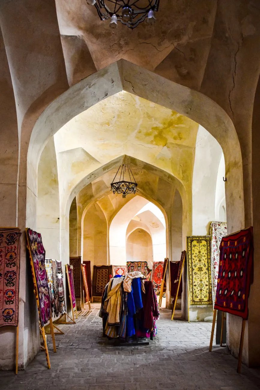
- Aisha Sharma
- 24 Sep, 2026 21:44
The Silk Road Rediscovered: Navigating the Ancient Caravanserais of Central Asia
The Silk Road was never a single highway; it was a living network of oases, mountain passes, and bustling markets stitched together by the humble caravanserai. These fortified inns offered shelter, fresh water, and a place to trade news as readily as silk, spices, or ideas. Today, the stone arches of those waystations still stand across Uzbekistan, Kyrgyzstan, Kazakhstan, Turkmenistan, and Tajikistan, inviting modern travelers to step into a narrative that spans millennia. Whether you are a history‑obsessed backpacker, a digital nomad chasing reliable Wi‑Fi in a courtyard of turquoise tiles, or a photographer hunting the perfect light on a domed roof, the surviving caravanserais deliver an authentic pulse of the past that no museum replica can replicate. Whispers of the Dunes: Khiva’s Living MuseumKhiva, a UNESCO World Heritage site, feels less like a city and more like a time capsule from the Silk Road era. The inner fortress, Ichan Kala, houses a cluster of restored caravanserais that once accommodated camel caravans laden with Chinese porcelain and Persian carpets. The most iconic, the Kalta Minor Minaret complex, includes a vaulted courtyard where merchants tethered their beasts beneath a canopy of blue‑glazed bricks. Walking the narrow lanes, you can still see the original “suv” (water) channels that fed both humans and animals, a hydraulic ingenuity that predates modern plumbing by centuries. For the digital nomad, Khiva offers a rare blend of atmosphere and connectivity. According to Numbeo’s crowdsourced data, a modest one‑bedroom apartment in the historic centre rents for roughly $250‑$300 per month, while a high‑speed internet package averages $15‑$20. Cafés tucked into former caravanserai cells serve strong Uzbek coffee and reliable Wi‑Fi, making deep‑work sessions feel like a scholarly retreat. Safety scores on Numbeo place Khiva well above the regional average, with a crime index below 20, so evening strolls through the moonlit arches are both inspiring and secure. Beyond the main tourist circuit, the Kunya‑Ark Citadel houses a lesser‑known caravanserai that now functions as a craft workshop. Artisans demonstrate silk‑weaving techniques unchanged since the 14th century, and visitors can purchase hand‑loomed fabrics directly from the loom. The site’s preservation plan, funded jointly by the Uzbek government and UNESCO, emphasizes adaptive reuse—keeping the stones alive with contemporary purpose rather than fossilizing them behind glass. Practical tip: Arrive early (before 9 am) to avoid tour groups and capture the courtyard’s geometric shadows at their sharpest. A local guide can unlock the “hidden hammam” beneath the main hall, a subterranean bathhouse once reserved for high‑ranking merchants. Bring a reusable water bottle; the ancient “suv” channels still run, and the water is potable after a quick filter. Stone Sentinels of the Steppe: Tash Rabat and the Kyrgyz HighlandsPerched at 3,200 meters on the ancient “Great Silk Road” branch that linked Kashgar to Lake Issyk‑Kul, Tash Rabat is a stone‑built caravanserai that feels more like a fortress than an inn. Its massive basalt walls, each over a meter thick, enclose a central courtyard flanked by 31 vaulted chambers—each designed to house a merchant, his goods, and a pair of camels. The structure’s orientation follows the cardinal points, a deliberate design that maximized solar gain in winter and shade in summer. Reaching Tash Rabat requires a 4‑hour drive from Naryn on a partially paved mountain road that climbs through the “Kyzyl‑Art” pass. The journey itself is a pilgrimage: yurts dot the valleys, herders wave from horseback, and the air carries the scent of juniper and fermented mare’s milk (kumis). Numbeo lists Naryn’s cost of living at roughly $350‑$400 per month for a modest lifestyle, with internet packages around $25—slightly higher than Khiva due to the remote terrain. The caravanserai’s interior remains remarkably intact. Archaeologists have uncovered “tandoor” ovens, grain silos, and a sophisticated “qanat” drainage system that channeled meltwater away from the sleeping quarters. Recent restoration, financed by the World Monuments Fund, replaced collapsed roof sections with locally quarried stone, preserving the original “corbelled” vaulting technique. Visitors can now spend a night in a restored chamber, sleeping on felt mats while the wind whistles through the stone lintels—a rare chance to experience the Silk Road as a traveler, not a spectator. For those planning a multi‑day trek, the nearby “Kara‑Kul” lake offers a high‑altitude campsite with basic facilities. Local tour operators provide “horse‑back” packages that follow the historic caravan trail to “Kashgar” (now in China), though border permits are required. Digital nomads should note that mobile coverage is spotty; a satellite hotspot is advisable if uninterrupted connectivity is essential. Blueprint of Hospitality: Bukhara’s Timeless InnsBukhara, the “City of a Thousand Minarets,” boasts a concentration of caravanserais unmatched anywhere on the route. The “Caravanserai of Sayfuddin” (also known as “Tim‑Abdullah”) sits directly opposite the “Kalyan Minaret”, its massive wooden gates still swinging on iron hinges forged in the 16th century. Inside, a double‑height arcade runs the length of the courtyard, each bay once rented to a different guild—spice merchants, textile traders, metalworkers—creating a micro‑economy that mirrored the macro‑trade of the Silk Road. Modern Bukhara has leveraged this heritage for tourism without sacrificing authenticity. The “Bukhara Silk Road Festival” each May transforms the caravanserai courtyards into open‑air galleries, where calligraphers, miniature painters, and “dutar” musicians perform. Numbeo data shows a comfortable one‑bedroom in the old town averages $300‑$350, while coworking spaces like “Silk Hub” charge $80‑$100 per month for a dedicated desk and high‑speed fiber. A hidden gem lies beneath the “Mir-i-Arab Madrasa”: a subterranean “sardoba” (water reservoir) that once supplied the entire caravanserai complex. Guided tours reveal the “karez” engineering—vertical shafts linked by gently sloping tunnels—that transported groundwater from the “Zarafshan” mountains over 30 kilometers. The system’s resilience is a testament to the hydraulic mastery that sustained desert commerce for centuries. Food lovers should not miss the “Plov” prepared in a “kazan” (cast‑iron cauldron) within the caravanserai’s communal kitchen. The recipe, passed down through generations of “oshpaz” (master chefs), includes “devzira” rice, “quince”, and a secret blend of “cumin, coriander, and barberries”. Sharing a plate with local artisans offers a direct line to the oral histories that no guidebook can capture. Crossroads of Empires: Samarkand’s Merchant HallsSamarkand’s “Registan” square is framed by three madrasas, but tucked behind the “Sher‑Dor” façade lies the “Caravanserai of the Silk Merchants”, a sprawling complex that once housed up to 500 camels. Its layout follows a “four‑iwan” plan—four vaulted halls opening onto a central courtyard—allowing separate zones for “wholesale”, “retail”, “storage”, and “rest”. The “iwan” arches are adorned with “muqarnas” (stalactite vaulting) that diffuse sunlight into a soft, golden glow, a design later echoed in Mughal architecture across the subcontinent. Today, the complex hosts the “International Craft Center”, where master ceramists fire “blue‑white” tiles using the same “cobalt” pigments that colored the “Bibi‑Khanym Mosque” dome. Numbeo lists Samarkand’s average rent for a centrally located apartment at $350‑$420, with internet at $18‑$22. The city’s “Silk Road Co‑Working” space, housed in a restored caravanserai wing, offers $90 monthly memberships and a community of freelance developers, translators, and travel writers. A practical itinerary for a two‑day deep dive: Day 1 – morning tour of the “Ulugbek Observatory”, then lunch at the caravanserai’s “chaikhana” (tea house) sampling “shashlik” grilled over apricot Related InsightsExploring the Aegean Coast Svalbard: Arctic Adventures Beyond the Northern Lights – A Remote Paradise for Explorers and Digital Nomads (Part 2) Rusting Rails of the Sahara: The Forgotten Iron Spine of a Colonial Dream{ "@context": "https://schema.org", "@type": "FAQPage", "mainEntity": [ { "@type": "Question", "name": "What is the main focus of The Silk Road Rediscovered: Navigating the Ancient Caravanserais of Central Asia?", "acceptedAnswer": { "@type": "Answer", "text": "Journey through the restored caravanserais that once powered the world’s greatest trade route, with practical tips, cost insights, and hidden gems." } }, { "@type": "Question", "name": "Who authored the comprehensive guide on The Silk Road Rediscovered: Navigating the Ancient Caravanserais of Central Asia?", "acceptedAnswer": { "@type": "Answer", "text": "This detailed article and its insights were carefully researched and authored by Aisha Sharma." } }, { "@type": "Question", "name": "Where can I find more related content about Travel?", "acceptedAnswer": { "@type": "Answer", "text": "You can explore more articles, detailed reviews, and similar insights by browsing the Related Insights section at the bottom of this article or visiting our dedicated Travel category page." } } ] }
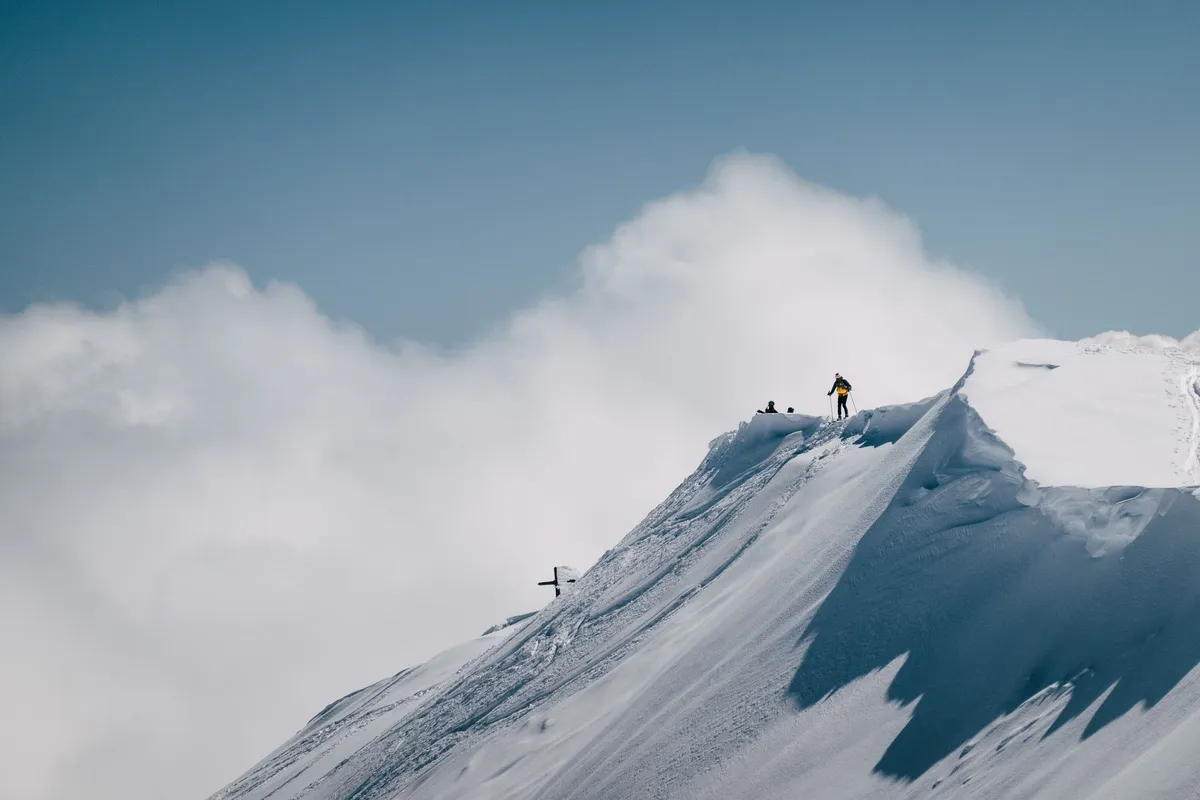
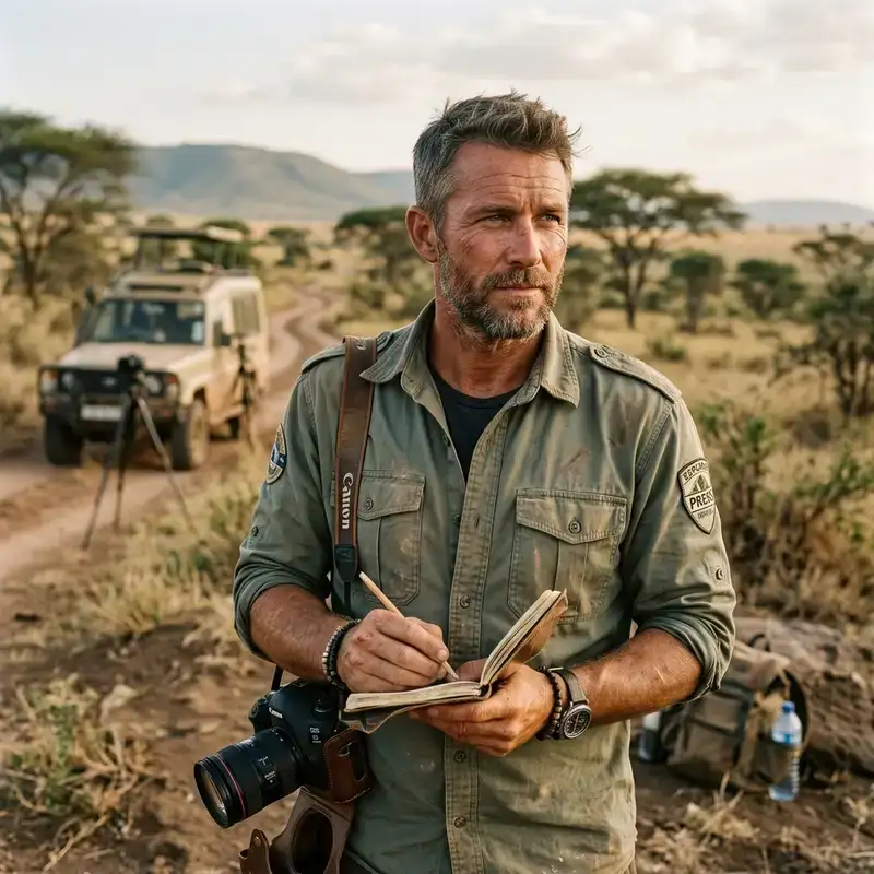
The wind doesn't care about your resume. It doesn't check your bank balance before it howls across the North Face of the Eiger, and the current of the Colorado River has zero interest in your comfort zone. It simply is. And for a specific, growing tribe of travelers, that indifference is exactly the point. We don't travel to escape life; we travel so life doesn't escape us. We chase the razor's edge where fear metabolizes into focus, where the map ends and the territory begins. This is the anatomy of adventure travel—a sector born not from brochures, but from the primordial human need to see what lies beyond the horizon, even if the price of admission is a pounding heart and scraped knuckles. The Primal Architecture of Risk Why do we do it? The data suggests it’s not a death wish. It’s a life wish. Adventure tourism is structurally defined by three pillars: physical activity, cultural exchange, and a connection with nature. But the engine driving the machine is psychological. Participants chase "rush" and "flow"—those elusive mental states where the noise of modernity silences, replaced by the immediate, high-stakes demand of the now. Stepping outside the comfort zone isn't a side effect; it's the product. Whether it’s the culture shock of a remote village in the Pamirs or the perceived danger of a bungee cord snapping taut over a canyon, the mechanism is the same: significant effort, real or perceived risk, and the subsequent recalibration of the self. The Adventure Travel Trade Association codifies this, but the feeling predates the acronym. It is the biology of the explorer. We are wired to seek the "roads less traveled," a market trend that exploded in the late 20th and early 21st century in the United States, yet remains notoriously difficult to measure because the definition refuses to sit still. Is it mountaineering? Trekking? Geocaching? Canyoneering? Sandboarding? River trekking? The answer is a resounding yes. It is a kaleidoscope of motion: mountain biking, cycling, canoeing, scuba diving, rafting, kayaking, zip-lining, paragliding, hiking, exploring, caving, rock climbing. The list grows faster than the guidebooks can print.Ghosts on the Matterhorn: The Birth of Modern Adventure To understand where we are, we must touch the ice axe marks on history. Long before "adventure tourism" was a market segment, humans moved for survival—food, skills, survival. But the leisure of danger? That has a timestamp. The modern era kicked open the door in 1865 with the mountaineering of the Matterhorn. That ascent wasn't just a climb; it was a declaration that vertical terrain was a playground, not just a barrier. Four years later, 1869 saw the first river rafting descent of the Colorado River. John Wesley Powell didn't have a dry bag or a self-bailing raft; he had wooden boats and iron will. These weren't vacations. They were expeditions. They birthed institutions that still hold the keys to the kingdom: the National Geographic Society and The Explorers Club. These organizations didn't just document the world; they legitimized the pursuit of the unknown. Then came the watershed moment of the mid-20th century. The 1950 French Annapurna Expedition—the first 8,000-meter peak summited—proved the death zone was survivable. The 1953 British Mount Everest Expedition planted the flag on the roof of the world. Post-WWII, the surplus of nylon, pitons, and hardened veterans turned exploration into a reproducible, albeit niche, commercial sector. Today, it remains a fast-changing beast, mutating new variants of experience every season. The Great Equalizer: Wheels, Wings, and Water The taxonomy of adventure is vast, but certain modalities define the culture. The Vertical Dance: Climbing and Mountaineering This is the aristocracy of risk. From the craggy limestone of Kalymnos to the ice smears of the Canadian Rockies, rock climbing and mountaineering demand a synthesis of chess-match intellect and balletic power. It is the direct descendant of that 1865 Matterhorn moment. The gear has evolved—cams replace chocks, dynema replaces hemp—but the physics of gravity and the psychology of the lead remain unchanged. The Liquid Arteries: Paddling and Rafting Water doesn't negotiate. Whether it’s the silent stroke of a kayak in a fjord or the violent choreography of a Class V rafting run on the Futaleufú, river travel strips away pretense. Canoeing connects us to the voyageur heritage; kayaking connects us to the Inuit lineage. Rafting adds the tribe dynamic—synchronized paddling as a survival language. The Silent World: Scuba Diving Jacques Cousteau gave us the Aqua-Lung, and suddenly the 70% of the planet covered in water became accessible. Scuba diving is unique in adventure travel: it removes gravity and sound. You are a visitor in a hostile envelope, breathing compressed air, weightless. The destinations read like a bucket list written by Poseidon:Belize's Great Blue Hole: A giant marine sinkhole, a dark eye staring up at the sky, demanding technical precision. Tahiti: Warm water, big animals, drama. Sipadan Island's Barracuda Point: A tornado of silver fish, a vortex of life off the coast of Borneo.The Long Walk: Trekking and Hiking The most democratic adventure. No engine, no rope (usually), just boots and biomechanics. It ranges from the teahouse trails of the Annapurna Circuit to the trailless wilderness of Patagonia. It is the slowest way to see the world, and therefore the deepest. The Niche and the Novel The fringe is where innovation lives. Canyoneering (slot canyon descent) blends climbing, swimming, and problem-solving. Geocaching gamifies exploration with GPS. Sandboarding brings the surf to the dunes. Caving (spelunking) is the anti-Everest—going down, into the dark, where the map is drawn by the beam of your headlamp. And on the controversial fringe: Disaster tourism and Ghetto tourism, forms that walk a razor-thin ethical line between witness and voyeurism. Overlanding: The Original Slow Travel Before flights, there was the wheel. Overlanding traces its DNA to Marco Polo’s 13th-century expedition from Venice to the court of Kublai Khan. It is the antithesis of the weekend warrior trip. It is a commitment measured in weeks or months. You don't visit a country; you transit a continent. The modern format crystalized in the 1960s. A converted truck or bus, a tour leader, a group of strangers becoming a tribe. The routes are legendary arteries: the trans-Africa routes, the Silk Road corridors across Asia, the Pan-American Highway. The "Hippie Trail" of the 60s and 70s saw a river of youth flow from Europe through the Middle East to India and Nepal, chasing enlightenment (or just cheap hash). Many of those traditional routes persist, paved over by time but still dusty at the edges. New veins have opened: Iceland to South Africa overland, and the Central Asian post-Soviet states—the Stans—where the steppe stretches infinite and the hospitality is aggressive. Overlanding teaches self-sufficiency. When the differential locks up in the Mongolian steppe, 500km from a mechanic, you don't call AAA. You fix it. You wait. You drink airag with nomads. That is the curriculum. The Green Heart: Jungle Tourism If the desert is minimalism, the jungle is maximalism. Jungle tourism is defined by "active multifaceted physical means of travel in the jungle regions of the earth." It is a major component of green tourism in tropical destinations—a relatively recent phenomenon in Western international tourism. Here, the biomass is the attraction and the obstacle. You don't just walk; you machete. You don't just look; you listen for the jaguar, the howler, the silent slide of a fer-de-lance. It demands a humidity tolerance that separates the tourists from the travelers. It is biology in 4K resolution, unfiltered, biting, screaming, rotting, and blooming simultaneously. The Frontier of Access: Adaptive Adventure One of the most profound shifts in the last decade is the rise of Accessible Tourism. Adventure travel for disabled people is a US$13 billion a year industry in North America alone. This isn't "wheelchair accessible" ramps at a visitor center. This is sit-skiing in Whistler, adaptive scuba in Cozumel, hand-cycling the Great Trail, paraplegic climbers on El Capitan. Destinations are building diverse programs and job opportunities specifically for the disabled community. It shatters the ableist assumption that adventure requires a standard-issue body. It proves the spirit of exploration is not housed in the legs, but in the will. The Extremes: When the Map Ends Extreme Tourism This overlaps with extreme sport. It is travel to dangerous (extreme) locations or participation in dangerous events. Volcano boarding in Nicaragua. Skiing the Chernobyl Exclusion Zone. Base jumping from the Burj Khalifa. The risk here is not perceived; it is statistical. The margin for error is zero. Remote Travel This is the introvert’s extreme. Travelling to locations far away from human settlements and/or infrastructure. It might be a straight-line stone's throw from a major city, but reaching it requires a "long period of time and/or a large amount of effort." Self-sufficiency is non-negotiable. Rescue is not a phone call away; it is a prayer. This is where the "flashpacking" tech—GPS, satellite messengers (Garmin inReach, Zoleo), solar charging—becomes survival gear, not gadgets. The interest in independent adventure travel has surged as specialist websites unlock previously niche locations and sports, allowing solo operators to plan logistics that once required an expedition committee.The Gender Gap on the Sharp End The data reveals a persistent, uncomfortable truth: Adventure sports tourism has traditionally been dominated by men. Women's participation has grown, yet the gender gap is still pronounced in terms of quantitative engagement. Fewer women sign up, show up, and stay in the pipeline for hard adventure. But here is the paradox that should make the industry sit up: In competitive adventure sport tourism, the success rate of women is currently higher than that of men. Read that again. When the stopwatch starts, or the summit bid goes down, or the race gun fires—women win more often. They manage risk better. They pace better. They suffer better. The barrier isn't capacity; it's culture. It's marketing. It's the "boys' club" narrative that still permeates gear shops and guide services. The next frontier of adventure travel isn't a new mountain or a deeper cave; it's closing that participation gap. The market is leaving money—and talent—on the table. The Digital Sherpa: Technology as Enabler We love to romanticize the "unplugged" adventure, but let's be honest: Access to inexpensive consumer technology turbocharged the industry. Global Positioning Systems (GPS) turned navigation from a black art into a screen glance. Flashpacking—backpacking with high-end tech (lightweight laptops, DSLRs, drones)—blurred the line between suffering and content creation. Social networking and photography created the feedback loop: the 'gram makes the dream, the dream books the trip, the trip feeds the 'gram. This connectivity is a double-edged sword. It enables independent adventure travel—you can download the .gpx file for a traverse in Kyrgyzstan, book a homestay via WhatsApp, and hire a local guide through a niche platform. But it also exports the crowd. The "secret spot" lasts about as long as a viral Reel. The challenge for the modern explorer is using the tools without becoming a tool of the algorithm. The Philosophy of the Uncomfortable Adventure travel is not a checkbox on a bucket list. It is a practice. It is the deliberate cultivation of discomfort as a teacher. When you are cold, wet, tired, and lost (temporarily) in the Cairngorms or the Cascades, the trivialities of modern anxiety—email, status, comparison—burn off like morning fog. You are reduced to the essentials: shelter, water, calories, direction, companionship. The Wikipedia definition mentions "real or perceived risk." That distinction is everything. Perceived risk (zip-lining, guided rafting) opens the door for the novice. Real risk (solo alpinism, unsupported polar travel) lives at the far end of the spectrum. A healthy adventure ecosystem needs both. The novice on the zip line today might be the alpinist on the North Face in a decade. The gateway drug is the gateway. Writing Your Own Chapter The map is never finished. The 1865 Matterhorn climbers didn't know they were inventing an industry. Powell didn't know he was founding a sport. Marco Polo didn't know he was drafting the first overlanding itinerary. They just moved. They engaged with the world on its terms, not a resort's terms. Today, the sector is a fast-changing niche with "new variants of activities for a travel experience" appearing constantly. E-foiling. Volcano diving. Ice climbing on man-made structures. Fat biking across frozen lakes. The labels will change. The gear will get lighter, stronger, smarter. The demographics will shift—hopefully toward parity. The technology will get more invisible, more integrated. But the core? The core is immutable. It is the human animal, upright and curious, looking at a horizon and wondering: What if I go there? What will I find? What will I become? Pack the bag. Check the forecast. Tell someone where you're going. And then—go. The wind is waiting.#AdventureTravel #Overlanding #ExtremeSports #TravelPsychology #ExploreMore Related InsightsShadows of Angkor: Unveiling the Jungle‑Cloaked Temples Beyond the Tourist Trail L'Orizzonte Senza Fine: Viaggio nell'Anima e nel Motore del Turismo Australiano Ein Tag in München{ "@context": "https://schema.org", "@type": "FAQPage", "mainEntity": [ { "@type": "Question", "name": "What is the main focus of Chasing the Rush: Why We Risk It All for the Road Less Traveled?", "acceptedAnswer": { "@type": "Answer", "text": "From the slopes of Matterhorn to the depths of the Blue Hole, we dissect the primal pull of adventure tourism and the modern tribes rewriting the map." } }, { "@type": "Question", "name": "Who authored the comprehensive guide on Chasing the Rush: Why We Risk It All for the Road Less Traveled?", "acceptedAnswer": { "@type": "Answer", "text": "This detailed article and its insights were carefully researched and authored by John Explorer." } }, { "@type": "Question", "name": "Where can I find more related content about Travel?", "acceptedAnswer": { "@type": "Answer", "text": "You can explore more articles, detailed reviews, and similar insights by browsing the Related Insights section at the bottom of this article or visiting our dedicated Travel category page." } } ] }
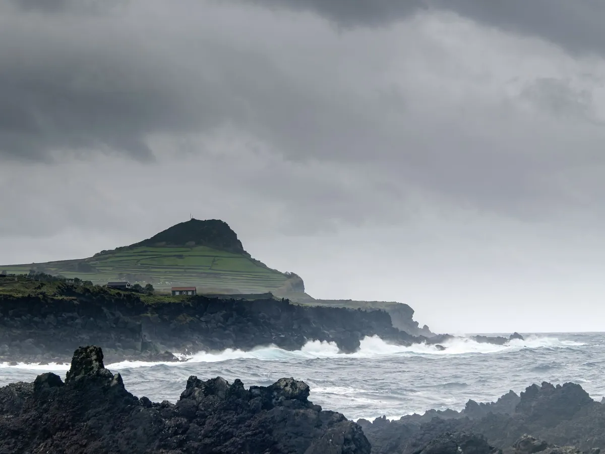
- Chloe Tremblay
- 23 Sep, 2026 12:01
Sustainable Archipelagos: Crafting an Eco‑Conscious Island‑Hopping Blueprint for the Azores
Island‑Hopping with Purpose: Why the Azores Lead Sustainable Travel The Azores, a nine‑island Portuguese archipelago perched in the middle of the North Atlantic, have quietly become a laboratory for low‑impact tourism. Their UNESCO‑designated marine reserves, volcanic soils that support organic farming, and a government committed to carbon‑neutral goals make them a perfect testing ground for the eco‑conscious traveler. Unlike the crowded streets of mainland tourist hotspots, the Azores still retain a modest visitor density—averaging fewer than 1.5 million arrivals per year, well below the 30 million threshold that strains infrastructure in many Mediterranean destinations. This lower footfall translates into cleaner beaches, less congested roads, and a genuine sense of community involvement in preservation projects. Sustainability here is not an afterthought; it is woven into policy. The Regional Government launched the “Blue Economy” strategy in 2022, pledging to increase renewable energy to 80 % by 2030. Wind turbines dot the coastal ridges of São Miguel and Terceira, while geothermal plants on São Miguel already supply roughly 30 % of the island’s electricity. For travelers, the result is a network of eco‑certified lodgings that run on clean power, and public transport that runs on biodiesel or electric buses. Beyond the macro policies, the islands’ micro‑ecosystems reward mindful exploration. The volcanic caldera of Sete Cidades on São Miguel, with its twin lakes of contrasting colors, is a fragile landscape where foot traffic is carefully managed through boardwalks and limited visitor numbers. In the Azores, “Leave No Trace” is not a slogan but a regulatory requirement; many trailheads require hikers to sign a digital pledge to carry out all waste. Sustainable island‑hopping therefore becomes a narrative of balance—leveraging the archipelago’s natural bounty while actively contributing to its preservation. The following sections break down how you can align your remote‑work lifestyle with the Azores’ green ambitions, from visa logistics to daily budgeting, without sacrificing the thrill of hopping from one volcanic gem to the next. Plugging In: Navigating Connectivity and the D8 Digital Nomad Visa For digital nomads, reliable internet is as essential as clean water. The Azores boast a 99.5 % fiber‑to‑the‑home coverage rate, with average download speeds hovering around 250 Mbps in the two main urban hubs—Ponta Delgada (São Miguel) and Angra do Heroísmo (Terceira). Real‑world case studies from 2024‑2025 report that co‑working spaces such as “Co‑Work Azores” in Ponta Delgada consistently deliver sub‑30‑ms latency, sufficient for video conferencing, cloud‑based design, and even 4K streaming. The D8 Digital Nomad visa, introduced by Portugal in 2022 and updated for 2026, is the gateway for long‑term remote work. Applicants must demonstrate a minimum monthly income of €1,000, proof of health insurance, and a clean criminal record. The application fee ranges from €90 to €110, and processing time averages 30 days. Once approved, the visa grants a stay of up to one year, renewable for an additional year, provided the income threshold is maintained. While Ponta Delgada offers the most robust connectivity, smaller islands like Faial or Graciosa present a trade‑off: breathtaking isolation paired with slightly higher latency (averaging 70–90 ms) due to limited fiber back‑haul. For remote workers who value solitude over split‑second response times, these islands become attractive, provided you plan for occasional “offline days” when the satellite backup is engaged. The D8 visa also simplifies tax residency. Nomads can elect to retain their home‑country tax status if they spend fewer than 183 days in Portugal, a crucial consideration for freelancers whose fiscal obligations span multiple jurisdictions. Moreover, the Regional Government offers a “Green Nomad” incentive—subsidized co‑working memberships for those who commit to using public transport or electric scooters for daily commuting. Balancing connectivity and ecological footprint is at the heart of the Azores’ digital‑nomad ecosystem. By selecting a base—whether the bustling port city of Ponta Delgada or the quieter harbor of Horta on Faial—you can calibrate your workflow, budget, and carbon impact. Budget‑Friendly Green Living: Cost of Life on Each Island Financial sustainability is as vital as environmental stewardship. Recent Numbeo data (2026) shows the average monthly cost of living for a single expatriate in the Azores ranges from €950 in the less‑touristy island of São Jorge to €1,350 in the more developed Ponta Delgada. These figures include rent for a modest one‑bedroom apartment, utilities, groceries, and transportation, but exclude discretionary spending on tours or fine dining. Island Avg. Monthly Rent (1‑BR) Utilities (incl. 99.5 % fiber) Groceries Index* Public Transport Pass Typical D8‑Compliant BudgetSão Miguel (Ponta Delgada) €720 €65 68 €38 €1,300‑€1,500Terceira (Angra do Heroísmo) €650 €60 66 €35 €1,200‑€1,400Faial (Horta) €560 €55 64 €30 €1,050‑€1,250São Jorge €480 €50 62 €28 €950‑€1,150Pico €500 €52 63 €29 €970‑€1,180Santa Maria €470 €48 60 €27 €940‑€1,120Graciosa €460 €47 59 €26 €930‑€1,100Flores €440 €45 58 €25 €910‑€1,080Corvo €420 €44 57 €24 €890‑€1,050*Groceries Index is a relative measure against Lisbon (100 = same price). Rent prices reflect a mix of traditional stone houses renovated for modern comforts and newer eco‑buildings that incorporate solar panels and rainwater harvesting. Utilities are notably lower than mainland Portugal thanks to the high share of renewable energy. Grocery costs benefit from the islands’ emphasis on locally produced dairy, fish, and vegetables—items that are often 10‑15 % cheaper than on the mainland. A typical D8‑compliant budget of €1,000‑€1,500 per month comfortably covers a modest lifestyle on any island, with the upper range allowing for occasional guided eco‑tours, organic meals at farm‑to‑table cafés, and a reliable co‑working membership. The lower‑cost islands also present an opportunity for “green entrepreneurship,” where travelers can rent a small studio, set up a solar‑powered home office, and contribute to the local economy by offering workshops or remote consulting services. Transportation costs remain modest: a monthly pass for buses and ferries across the archipelago costs €45‑€60, and many islands have introduced electric bike‑share schemes that charge €0.10 per minute—an attractive alternative to rental cars that emit higher CO₂. By aligning your spending with the Azores’ cost structure, you can maintain a comfortable remote‑work lifestyle while directly supporting the region’s sustainable development goals. Eco‑Conscious Activities: Low‑Impact Adventures Across the Archipelago Adventure in the Azores does not require a carbon‑heavy footprint. The islands’ volcanic geology, crystal‑clear lagoons, and endemic flora create a playground for activities that leave almost no trace. Here are the top low‑impact experiences, organized by island, and how to execute them responsibly. São Miguel – Whale Watching with Certified Eco‑OperatorsThe island’s surrounding waters host resident sperm whales and migrating blue whales. Certified operators follow strict guidelines: limiting vessel numbers to three per day, maintaining a 300‑meter distance, and using low‑noise engines. Prices average €70 per person for a two‑hour excursion, with a portion of proceeds funding marine‑research initiatives at the University of the Azores. Terceira – Hiking the Angra do Heroísmo UNESCO TrailThis trail circles the historic city, passing volcanic basalt formations and ancient fortifications. Hikers are required to stay on marked pathways to protect native lichen species. Portable water filters are encouraged to reduce plastic bottle waste. Faial – Kayaking the Caldeira da RibeiraPaddlers can explore the rim of the island’s massive volcanic crater, where calm waters reflect the surrounding cliffs. Local NGOs provide free kayak rentals in exchange for participants joining a post‑trip shoreline cleanup. São Jorge – Sustainable Cheese Farm VisitsThe island’s famed “Queijo São Jorge” is produced using traditional methods that rely on pasture‑grazed cows. Tours are limited to groups of ten, and visitors are invited to sample cheese while learning about the farm’s circular waste system—manure is composted for crops, and excess water is reclaimed for irrigation. Pico – Climbing Mount Pico with Minimal GearAt 2,351 m, Mount Pico is Portugal’s highest peak. Guided climbs emphasize “leave‑no‑trace” ethics: climbers carry reusable water bottles, use biodegradable soap, and pack out all waste. The ascent typically takes 6–8 hours, and the summit offers panoramic views of all nine islands—a reminder of the archipelago’s interconnected ecosystems. Across all islands, the Azores’ “Eco‑Pass” program provides a single digital ticket that grants access to public transport, bike‑share, and selected tours at a discounted rate, encouraging visitors to reduce reliance on rental cars. By prioritizing these activities, you not only enjoy the archipelago’s natural wonders but also reinforce the local commitment to low‑impact tourism. Building a Zero‑Waste Itinerary: Tools, Resources, and Community Hubs Transitioning from a conventional travel plan to a zero‑waste itinerary is achievable with a few strategic tools and local partnerships. The Azores’ burgeoning eco‑network offers digital and physical resources that streamline sustainable choices. Digital Toolkit Eco‑Map App – Developed by the Regional Government, this offline‑capable map highlights refill stations, compost bins, and certified zero‑waste cafés in each municipality. Green‑Visa Tracker – A spreadsheet template aligned with D8 visa requirements, allowing you to log income, health insurance, and monthly expenses while flagging any excess carbon‑intensive purchases. Carbon Offset Calculator – Integrated into the “Azores Travel” portal, it estimates emissions from flights, ferries, and local transport, offering direct links to regional reforestation projects.Physical Hubs Ponta Delgada Eco‑Hub – A co‑working space that also functions as a community kitchen, providing bulk pantry staples (beans, rice, local honey) in reusable containers. Membership includes a weekly “Zero‑Waste Workshop” where locals teach upcycling techniques for plastic nets and fishing gear. Angra do Heroísmo Green Library – Offers free bike rentals and a “Borrow‑A‑Tool” program for camping gear, reducing the need to purchase single‑use equipment. Faial Sustainable Market – Operates every Saturday, allowing travelers to purchase fresh produce directly from farmers who practice regenerative agriculture.Practical Steps Pack Reusables – Bring a stainless‑steel water bottle, collapsible coffee cup, and a set of silicone food bags. The first refill station you encounter will be in Ponta Delgada’s main square, where tap water is filtered and safe to drink. Adopt a “One‑Bag” Rule – Limit your daily waste to a single reusable bag; any non‑recyclable items must be taken back home. Choose Accommodations with Waste Segregation – Most eco‑lodges label bins for organics, plastics, glass, and metal. Participate actively by separating your trash. Support Local Circular Economies – Pay for meals at restaurants that compost food scraps and source fish from certified sustainable fisheries.By weaving these tools into your daily routine, you transform the Azores from a destination into a partner in your sustainability journey. The synergy between the D8 visa framework, robust digital infrastructure, and community‑driven zero‑waste initiatives creates a replicable model for other archipelagos worldwide. Your Sustainable Blueprint Awaits Imagine waking each morning to the gentle roar of Atlantic waves, logging into a high‑speed fiber connection, and stepping out onto a volcanic trail that feels untouched by mass tourism. The Azores make this vision possible—not just as a backdrop for remote work, but as an active collaborator in your eco‑conscious lifestyle. By securing the D8 Digital Nomad visa, choosing an island that aligns with your connectivity needs, budgeting wisely within the €1,000‑€1,500 monthly range, and engaging in low‑impact activities, you become part of a living laboratory for sustainable travel. The archipelago’s blend of renewable energy, zero‑waste community hubs, and transparent cost structures empowers you to leave a positive footprint while exploring one of the world’s most geologically spectacular regions. Pack your reusable gear, download the Eco‑Map, and set your compass for the Azores. The islands are waiting—not just for tourists, but for responsible explorers ready to co‑create a greener future. #SustainableTravel #DigitalNomad #AzoresAdventure Related InsightsThe Silent Sentinels: Documenting Rapa Nui The Arctic's Whispering Skies: Your Ultimate Guide to Unlocking Scandinavia's Northern Lights Mystique (Part 2) The Shimmering Waters: Documenting Plitvice Lakes National Park{ "@context": "https://schema.org", "@type": "FAQPage", "mainEntity": [ { "@type": "Question", "name": "What is the main focus of Sustainable Archipelagos: Crafting an Eco‑Conscious Island‑Hopping Blueprint for the Azores?", "acceptedAnswer": { "@type": "Answer", "text": "Explore the Azores through a sustainable lens—discover green accommodations, reliable fiber internet, D8 visa pathways, and low‑impact adventures that let you travel responsibly." } }, { "@type": "Question", "name": "Who authored the comprehensive guide on Sustainable Archipelagos: Crafting an Eco‑Conscious Island‑Hopping Blueprint for the Azores?", "acceptedAnswer": { "@type": "Answer", "text": "This detailed article and its insights were carefully researched and authored by Chloe Tremblay." } }, { "@type": "Question", "name": "Where can I find more related content about Travel?", "acceptedAnswer": { "@type": "Answer", "text": "You can explore more articles, detailed reviews, and similar insights by browsing the Related Insights section at the bottom of this article or visiting our dedicated Travel category page." } } ] }
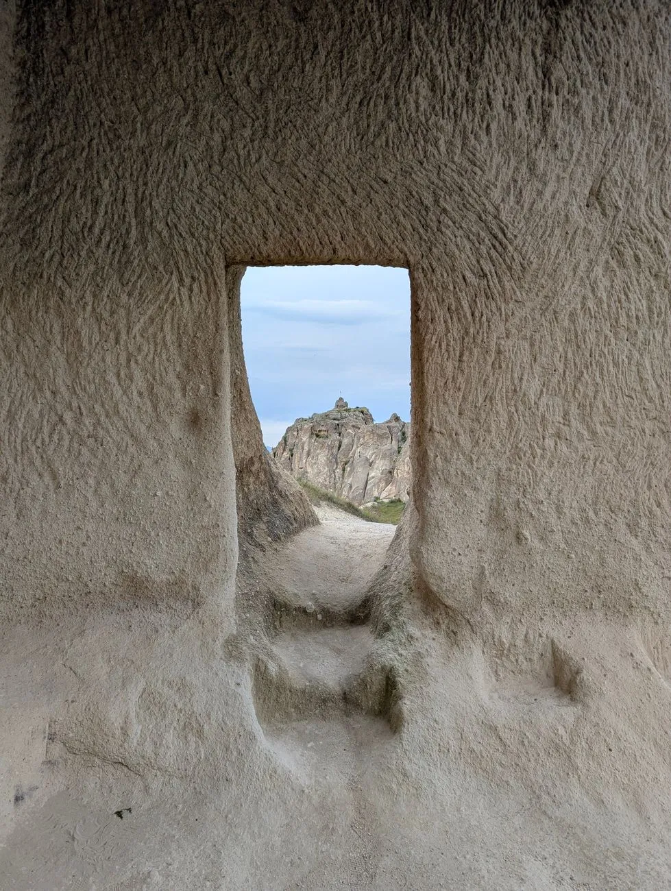
Whispers of the Earth: Entering Derinkuyu's Labyrinth Stepping through the narrow stone portal of Derinkuyu feels like crossing a threshold into a forgotten epoch. The air cools instantly, scented with mineral dust and the faint perfume of ancient hearths. This UNESCO‑listed complex plunges to a staggering 85 metres (≈279 ft) and unfolds across 18 discernible levels, though only the upper eight are open to visitors. Archaeologists estimate the city could shelter up to 20,000 souls, complete with ventilation shafts that still draw fresh air from the surface, a sophisticated water‑well system, and communal spaces — stables, wine presses, chapels, and even a missionary school. The engineering genius lies in the rolling stone doors, each weighing several hundred kilograms, which could be sealed from the inside to thwart invaders. As you descend the steep, uneven stairways, the walls reveal chisel marks that speak of centuries of patient labor. Guides often point out the “communication shafts” — narrow vertical channels that allowed messages to travel between levels without a messenger ever seeing daylight. Practicalities matter as much as wonder. The site opens at 08:00 am and closes at 19:00 pm in summer (17:00 pm in winter). The entrance fee sits at roughly 100 Turkish Lira (≈ €3.20) for adults, with a modest discount for students and children. A dolmuş (shared minibus) from Göreme’s central square reaches the entrance in about 30 minutes for 30 TL; a private taxi costs 150‑200 TL and offers flexibility for a combined Derinkuyu‑Kaymaklı day trip. Wear sturdy, closed‑toe shoes — stone steps are slick with condensation — and carry a small water bottle; there are no vendors inside. Photography is permitted, but flash is discouraged in the deeper chambers to protect fragile pigments on the walls. Kaymaklı's Layered Secrets: A Deeper Descent If Derinkuyu impresses with sheer depth, Kaymaklı captivates with its intricate horizontal sprawl. The city extends roughly 40 metres (≈130 ft) below ground across eight levels, of which four are accessible. Its layout resembles a honeycomb: narrow corridors branch into living quarters, storage rooms, and a remarkable communal kitchen equipped with a massive tandoor oven. The ventilation system here is equally ingenious — 52 shafts, some still functional, channel air through a network of carved ducts that maintain a constant 13 °C (55 °F) year‑round. Historical records suggest Kaymaklı served as a refuge during the Arab‑Byzantine wars, housing up to 3,500 people at its peak. The city’s name, meaning “with cream” in Turkish, hints at the dairy stores once kept cool in its subterranean larders. Visiting Kaymaklı follows a similar schedule: 08:00‑19:00 (summer) and 08:00‑17:00 (winter). The ticket costs about 80 TL (≈ €2.55). The site lies 20 km south of Göreme, reachable by the same dolmuş line that stops at Derinkuyu; simply stay aboard for the next stop. Many travelers combine both cities in a single morning, allocating roughly 90 minutes per site. A local guide (≈ 150 TL for a two‑hour private tour) can illuminate the subtle differences — Kaymaklı’s more domestic feel versus Derinkuyu’s militaristic design — and point out the hidden “escape tunnel” that leads toward the nearby Ihlara Valley. Engineering Marvels Beneath the Fairy Chimneys The fairy chimneys that punctuate Cappadocia’s skyline are the surface expression of the same volcanic tuff that made underground excavation feasible. Soft yet cohesive, the rock could be carved with bronze and later iron tools, allowing entire communities to sculpt habitable volumes without mortar. The ventilation shafts are a masterclass in passive climate control: each shaft tapers upward, creating a Venturi effect that draws stale air out while pulling fresh breezes in. Water management is equally sophisticated; Derinkuyu’s main well descends 55 metres, lined with stone to prevent collapse, and feeds a network of cisterns that could sustain the population for months. Modern engineers study these ancient systems for sustainable design inspiration. The rolling stone doors, for instance, operate on a simple pivot‑and‑groove mechanism that requires minimal force yet provides an airtight seal — a principle now explored in low‑energy building envelopes. The communal kitchens, with their centralized hearths and smoke‑extraction channels, anticipate modern district‑heating concepts. Even the waste‑disposal chutes, which directed refuse to sealed pits, demonstrate an early understanding of sanitation engineering. Visitors often marvel at the acoustic properties: a whisper at one end of a corridor can be heard clearly at the other, a feature likely used for covert communication during sieges. Practical Pathways: Getting There, Tickets, and Timing Planning a subterranean day trip hinges on logistics as much as curiosity. Göreme remains the most convenient base, offering a spectrum of accommodation from cave‑style boutique hotels (≈ €60‑120 per night) to budget hostels (≈ €15‑25). The town’s central bus station hosts regular dolmuş departures to both Derinkuyu and Kaymaklı every 30 minutes during peak season (April‑October). A round‑trip dolmuş ticket costs 60 TL; a private driver for the full circuit (Göreme → Derinkuyu → Kaymaklı → Göreme) averages 350‑450 TL, a worthwhile splurge if you value flexibility and air‑conditioned comfort. Ticket purchases are cash‑only at the entrance kiosks; credit cards are rarely accepted. Arrive early (by 08:30 am) to beat the tour‑bus crowds that swell around 10:00 am. Allocate a minimum of two hours per site to absorb the atmosphere without rushing. For those with limited mobility, note that both sites involve steep, uneven steps and low ceilings; Derinkuyu offers a partial wheelchair‑accessible route on the first level only. Restrooms are available at the entrance plazas, but none exist underground. A small café near Derinkuyu’s parking area serves Turkish tea, gözleme, and fresh fruit — ideal for a post‑descent recharge. Savoring the Surface: Food, Stay, and Local Lore Emerging from the cool darkness into Cappadocia’s sun‑baked valleys feels like a rebirth. The region’s culinary identity mirrors its geology — hearty, earth‑rooted, and deeply traditional. Breakfast in Göreme often features menemen (scrambled eggs with tomatoes, peppers, and spices) served with warm pide bread, while lunch might be a pottery kebab (testi kebabı) slow‑cooked in a sealed clay pot, cracked open tableside for dramatic aroma. Dinner options range from family‑run lokantas offering mantı (tiny dumplings with yogurt‑garlic sauce) to upscale restaurants pairing local wines — especially the crisp Narince white and robust Öküzgözü red — with tasting menus that celebrate Anatolian produce. Accommodation choices amplify the experience. Cave hotels, carved directly into the tuff, maintain a constant 18‑20 °C temperature, offering natural insulation that modern HVAC struggles to replicate. Many feature terraces with panoramic views of the fairy chimneys, perfect for sunrise hot‑air‑balloon watching — a quintessential Cappadocia ritual. For budget travelers, hostels in Ürgüz and Avanos provide clean dormitories and communal kitchens, often organizing group tours to the underground cities at discounted rates. Local lore enriches every stone. Legends speak of early Christians hiding from Roman persecution, carving secret chapels adorned with frescoes that still glow in candlelight. Oral histories recount the “Night of the Thousand Lanterns,” when refugees lit oil lamps throughout Derinkuyu’s corridors, turning the labyrinth into a constellation. Engaging with a village elder over a glass of çay can reveal stories not found in guidebooks — tales of hidden treasure chambers, forgotten escape routes, and the enduring spirit of a people who turned volcanic ash into sanctuary. Comparative Snapshot: Derinkuyu vs. KaymaklıFeature Derinkuyu KaymaklıMaximum depth 85 m (279 ft) 40 m (130 ft)Levels total / open 18 / 8 8 / 4Estimated capacity 20,000 people 3,500 peopleEntrance fee (2026) 100 TL (≈ €3.20) 80 TL (≈ €2.55)Opening hours (summer) 08:00‑19:00 08:00‑19:00Opening hours (winter) 08:00‑17:00 08:00‑17:00Dolmuş from Göreme 30 min, 30 TL 45 min, 30 TL (same line)Notable feature Rolling stone doors, deep well 52 ventilation shafts, communal kitchenAccessibility First level only for wheelchairs First level only for wheelchairsEchoes in the Stone: Reflections on a Subterranean Journey Leaving the underground cities behind, the mind lingers on the echo of footsteps on ancient tufa, the cool breath of ventilation shafts, and the quiet resilience of communities that chose darkness over surrender. Cappadocia’s hidden realms are more than tourist attractions; they are living textbooks of human ingenuity, testaments to a civilization that transformed a hostile landscape into a haven. Whether you trace the spiral staircase of Derinkuyu’s deepest chapel or trace your fingers along Kaymaklı’s soot‑blackened kitchen walls, you participate in a dialogue spanning millennia. The practical details — tickets, transport, timing — fade into background noise when the weight of history presses against your palm. As the sun sets behind the fairy chimneys, casting long shadows across the valley, the subterranean world remains, patient and eternal, waiting for the next curious soul to descend and listen. #Cappadocia #UndergroundCities #Derinkuyu #Kaymaklı #TurkeyTravel Related InsightsEl Generalife: Los Jardines del Paraíso La Cathédrale de Séville : Gothique et Héritage Andalou 'Lake Tekapo: Ein Juwel in Neuseelands Südinsel'{ "@context": "https://schema.org", "@type": "FAQPage", "mainEntity": [ { "@type": "Question", "name": "What is the main focus of Subterranean Europe: Unveiling Cappadocia's Hidden Cave Cities?", "acceptedAnswer": { "@type": "Answer", "text": "Journey beneath the fairy chimneys to explore Derinkuyu and Kaymaklı, the ancient subterranean marvels of Cappadocia." } }, { "@type": "Question", "name": "Who authored the comprehensive guide on Subterranean Europe: Unveiling Cappadocia's Hidden Cave Cities?", "acceptedAnswer": { "@type": "Answer", "text": "This detailed article and its insights were carefully researched and authored by Zola Ndlovu." } }, { "@type": "Question", "name": "Where can I find more related content about Travel?", "acceptedAnswer": { "@type": "Answer", "text": "You can explore more articles, detailed reviews, and similar insights by browsing the Related Insights section at the bottom of this article or visiting our dedicated Travel category page." } } ] }
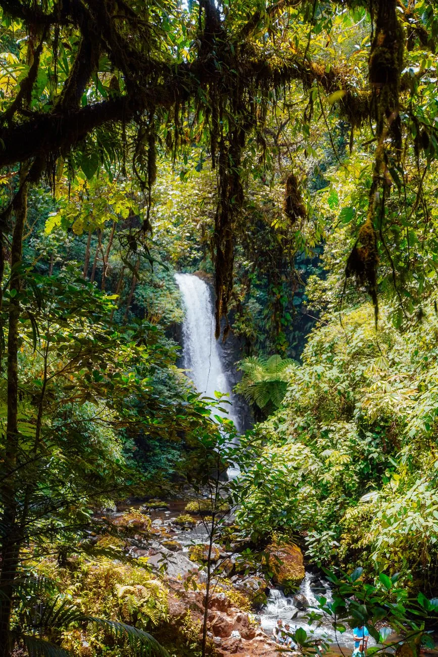
C'è un momento preciso, appena prima dell'alba, in cui la foresta pluviale trattiene il respiro. Non è silenzio vuoto: è un'architettura acustica fatta di gocce che cadono da foglie grandi come ombrelli, del richiamo lontano di un uccello che non ha nome nelle nostre guide, del fruscio di un mammifero che attraversa il sottobosco. In quel momento, il viaggiatore non è un ospite, ma un testimone. Eppure, la storia ci insegna che la linea tra testimone e invasore è sottile come un filo di seta. L'ecoturismo, quella parola che oggi riempie brochure e pagine web, nasce proprio dall'urgenza di non spezzare quel filo. Le Radici di una Parola: 1965, Yucatán e la Nascita di un Concetto Non è nato in una sala conferenze, il termine. Secondo le cronache, fu Claus-Dieter (Nick) Hetzer, accademico e avventuriero legato al Forum International di Berkeley, a coniare "ecotourism" nel 1965. Lo racconta il Contra Costa Times: Hetzer non si limitò alla teoria. Nei primi anni '70, guidò i primi "ecotour" nella penisola dello Yucatán, portando piccoli gruppi in aree di interesse ecologico con un intento educativo e, si sperava, a basso impatto. L'Oxford English Dictionary fissa la prima apparizione scritta di "ecotour" al 1973, mentre "ecotourism" compare nel 1982, "probabilmente derivato da ecotour". Una neologia tarda, figlia di un secolo che stava iniziando a contare le ferite inflitte al pianeta. Ma la definizione non è mai stata un monolite. Ancora nel 2009, il dibattito sulla "corretta definizione" era accesissimo. C'è chi la vede come turismo naturalistico finalizzato alla conservazione, minimamente impattante, che include educazione ambientale e benefici finanziari per le comunità ospitanti. C'è chi, più cinicamente, nota che il termine viene usato largamente da organizzazioni che offrono semplicemente turismo naturalistico, senza quel focus sulla beneficenza ambientale che dovrebbe essere il marchio di fabbrica. La differenza sta tutta nel verbo: contribuire vs sfruttare.Oltre la Definizione: Cosa Significa Davvero Viaggiare Leggeri Dal 1980 in poi, gli ambientalisti hanno considerato l'ecoturismo un'impresa cruciale per la conservazione. Le organizzazioni serie fanno contributi diretti o indiretti, adottano pratiche o tecnologie che riducono l'impronta. Tuttavia, come evidenziato da Buckley, pochissime organizzazioni riescono a ottenere un impatto netto positivo sull'ambiente nel complesso. È una verità scomoda: spesso l'ecoturismo utilizza la stessa infrastruttura e le stesse pratiche del turismo convenzionale, mascherate sotto un'etichetta verde. La distinzione fondamentale sta nell'oggetto dell'interazione. L'ecoturismo tratta con le parti vive degli ambienti naturali – flora, fauna, ecosistemi – mentre il geoturismo si lega alla geologia. Rispetto al turismo naturalistico tout court e al turismo sostenibile in generale, l'ecoturismo ha un'ambizione pedagogica esplicita: forgiare nei visitatori una più profonda stima per gli habitat naturali e le minacce che affrontano, nonché per la cultura locale. Un programma di ecoturismo responsabile deve includere la promozione del riciclo, l'efficienza energetica, la conservazione dell'acqua e la creazione di opportunità economiche per le comunità locali. Non è una lista della spesa opzionale: è il telaio su cui si regge l'intera impalcatura. Il Paradosso del Volo: Quando la Conservazione Brucia Carburante Qui entra in gioco l'elefante nella stanza, o meglio, l'aereo nel cielo. Come la maggior parte dei viaggi a lunga distanza, l'ecoturismo dipende spesso dal trasporto aereo, che contribuisce al cambiamento climatico. È il paradosso irrisolto: voliamo per salvare la foresta, ma il volo stesso erode il clima che la foresta regola. Non esiste una scappatoia facile. La mitigazione passa attraverso la compensazione delle emissioni, certo, ma anche attraverso una riconsiderazione radicale delle distanze. Forse l'ecoturismo più autentico è quello che si pratica a poche ore da casa, riscoprendo la biodiversità del "proprio" cortile, invece di inseguire l'esotico a tutti i costi.Comunità in Bilico: Tra Benefici Economici e Gentrificazione Verde L'ecoturismo è una sottocomponente del turismo sostenibile e deve massimizzare i benefici ecologici contribuendo al benessere economico, sociale e culturale delle comunità vicine ai siti. Sulla carta, i benefici potenziali sono enormi. Diretti: generazione di entrate (spese dei visitatori) e creazione di occupazione direttamente legata al settore; opportunità economiche per regioni periferiche, spesso escluse dai circuiti mainstream.Indiretti: alto effetto moltiplicatore e occupazione indiretta; supporto al turismo culturale e del patrimonio, settori altamente compatibili. Ma i rischi per le comunità locali sono reali e documentati. L'ecoturismo può generare frizioni tra turisti e residenti, e aumentare il costo degli affitti, delle tasse e dei valori immobiliari, emarginando i membri stessi della comunità. È la "gentrificazione verde": chi ha custodito quella terra per generazioni si ritrova estraneo nel proprio villaggio, spinto fuori dai prezzi gonfiati dalla domanda esterna. La stabilità e il benessere comunitario, che dovrebbero essere il fine, diventano vittime collaterali se mancano regolamenti stringenti e partecipazione decisionale locale. Il Patto Silenzioso: Educazione, Custodia e il Ruolo del Viaggiatore I benefici ecologici potenziali si articolano in diretti e indiretti. Tra i diretti: l'incentivo a proteggere ambienti naturali e a riabilitare terreni modificati; fondi per gestire ed espandere aree protette; gli stessi ecoturisti che assistono alla manutenzione degli habitat con le loro azioni, fungendo da "guardiani" che intervengono personalmente quando percepiscono minacce all'ambiente; lo scambio di competenze tra locali e visitatori. Quelli indiretti sono forse più profondi: l'esposizione all'ecoturismo favorisce un senso più ampio di ambientalismo; le comunità sperimentano cambiamenti nell'atteggiamento e nel comportamento ambientale; le aree protette per l'ecoturismo forniscono benefici ecosistemici diffusi; si affina il futuro benessere dei locali. Sul fronte socioculturale, un approccio olistico deve promuovere pratiche socio-culturali accanto a quelle economiche ed ecologiche. I benefici includono la stabilità comunitaria attraverso vantaggi economici e partecipazione locale; benefici estetici e spirituali per locali e turisti; accessibilità a un ampio spettro della popolazione. Ma la lettera piccola recita: "Quando si valutano i potenziali impatti positivi, è necessario menzionare che l'ecoturismo può avere effetti negativi non intenzionali. Gli impatti negativi possono essere mitigati attraverso regolamenti e codici di condotta che impartiscano efficacemente e persuasivamente messaggi sul comportamento appropriato dei visitatori." Non è burocrazia: è sopravvivenza.Rischi Invisibili: Patogeni, Salute e Fragilità degli Ecosistemi C'è un rischio che raramente finisce nei dépliant: la salute. L'ecoturismo comporta rischi noti per turisti, comunità locali, fauna ed ecosistemi. I viaggiatori possono portare patogeni in aree ecologicamente sensibili, mettendo a rischio la fauna selvatica e le comunità locali. Le attività stesse possono esporre i viaggiatori a problemi di salute o infortuni. La storia è piena di epidemie scatenate dal contatto tra mondi separati. La cautela non è allarmismo: è rispetto per la fragilità degli equilibri biologici. Anche il rischio ecologico diretto è tangibile: la semplice presenza di viaggiatori in una regione può intaccare l'integrità ecologica delle aree protette. Sentieri erosi, disturbo della fauna nidificante, introduzione di specie aliene attaccate agli scarponi: l'impronta non è solo carbonio, è fisica, biologica, chimica. Verso un Futuro Rigenerativo: Codici di Condotta e Speranza Allora, l'ecoturismo è una chimera? No. È uno strumento imperfetto, potente se maneggiato con rigore. La chiave sta nel passaggio da "sostenibile" (mantenere lo status quo) a "rigenerativo" (lasciare le cose migliori di come le abbiamo trovate). Signora richiede:Trasparenza radicale: le organizzazioni devono rendicontare non solo i soldi dati alla conservazione, ma l'impronta carbonio totale, l'impatto idrico, la gestione dei rifiuti. Governance locale: le comunità non devono essere "beneficiarie" passive, ma azioniste decisionali. Veto power sui progetti, controllo sui flussi, proprietà delle infrastrutture. Educazione pre-viaggio: il turista arriva già formato, consapevole dei codici di condotta, dei rischi sanitari, delle norme culturali. Non si impara sul posto a non toccare i coralli. Decrescita delle distanze: privilegiare il turismo di prossimità, treno, bici, cammino. L'esotico non deve essere l'unico orizzonte.L'ecoturismo, nella sua forma più alta, non è una vacanza. È un atto di cittadinanza planetaria. È la scelta di pagare il prezzo vero del viaggio – non solo in denaro, ma in tempo, fatica, rinuncia – per stare al mondo senza consumarlo.#Ecoturismo #TurismoSostenibile #ConservazioneNatura #ViaggiResponsabili #ComunitàLocali Related InsightsGolden Ring Cities Yellowstone: The Fiery Heart of the American West Die Moorgeister des Hohen Venns: Eine Reise in die vergessenen Welten der Torfstecher{ "@context": "https://schema.org", "@type": "FAQPage", "mainEntity": [ { "@type": "Question", "name": "What is the main focus of L'Eco del Silenzio: Quando il Viaggio Diventa Custodia della Terra?", "acceptedAnswer": { "@type": "Answer", "text": "Esploriamo le radici, i rischi e le promesse dell'ecoturismo, tra storia, dati reali e la necessità di un turismo che lasci un'impronta positiva." } }, { "@type": "Question", "name": "Who authored the comprehensive guide on L'Eco del Silenzio: Quando il Viaggio Diventa Custodia della Terra?", "acceptedAnswer": { "@type": "Answer", "text": "This detailed article and its insights were carefully researched and authored by Marco Rossi." } }, { "@type": "Question", "name": "Where can I find more related content about Travel?", "acceptedAnswer": { "@type": "Answer", "text": "You can explore more articles, detailed reviews, and similar insights by browsing the Related Insights section at the bottom of this article or visiting our dedicated Travel category page." } } ] }

- Cemre Seyyah
- 22 Sep, 2026 10:34
The Twenty Million Dollar View: A History of Humanity's Most Exclusive Destination
The silence hits you before the view does. It is not the absence of sound, but the presence of a pressure so vast it flattens the noise inside your own skull. For the seven individuals who slipped the surly bonds of Earth aboard a Russian Soyuz between 2001 and 2009, that silence cost between twenty and twenty-five million U.S. dollars. They were not pilots, nor scientists, nor military personnel. They were, by the strict definition that history has settled on, space tourists—human beings traveling to orbit for recreational purposes, motivated by the possibility of viewing Earth from space, feeling weightlessness, and experiencing speeds that render geography meaningless. The story of space tourism is not a smooth arc of progress. It is a jagged timeline of geopolitical necessity, engineering hubris, tragedy, and the relentless gravity of economics. It began not with a roar, but with a quiet docking in April 2001. The First Citizen of the Cosmos When Dennis Tito, an American businessman and engineer, climbed into the Soyuz-TM32 spacecraft, he carried the weight of a paradigm shift. For decades, the Soviet and American space programs had been the exclusive domains of the state. The Soviet Intercosmos program had broadened the pool slightly, flying cosmonauts from Warsaw Pact nations—Czechoslovakia, Poland, East Germany, Bulgaria, Hungary, Romania—and later allies like Cuba, Mongolia, Vietnam, and non-aligned states like India, Syria, and Afghanistan. The U.S. Space Shuttle had its "Payload Specialists," representatives of companies managing specific cargo, like Ulf Merbold of the ESA and Byron Lichtenberg of MIT on STS-9. In 1984, Charles D. Walker became the first non-government astronaut, his employer McDonnell Douglas footing a $40,000 bill (equivalent to roughly $124,000 today). But Tito was different. He wasn't managing a payload. He wasn't representing a nation. He was representing himself. Brokered by the American company Space Adventures in conjunction with Roscosmos and RSC Energia, his flight cracked the door open. Over the next eight years, seven space tourists made eight flights to the International Space Station. Iranian-American businesswoman Anousheh Ansari wrote her name into the history books in September 2006 as the first female space tourist. Some, far from mere sightseers, signed contracts with third parties to conduct research activities while in orbit, blurring the line between passenger and participant.The Crucible of Preparation The popular imagination often pictures the space tourist as a passive cargo, a very expensive suitcase. The reality, as dictated by the laws of physics and the demands of Roscosmos, was brutally physical. Space tourists needed to be in good physical form before going to space. They trained for fast acceleration and crushing g-forces in a centrifuge, their bodies learning to breathe under weights they never evolved to withstand. They flew in high-altitude jet planes tracing parabolic arcs, stealing twenty-second kisses with weightlessness to prepare their vestibular systems for the real thing. They sat in simulators, learning not just how to operate the spaceship, but how to fix parts of it. When you are 400 kilometers up, there is no roadside assistance. By 2007, analysts considered space tourism one of the earliest markets to emerge for commercial spaceflight. The momentum felt inevitable. Then, the seat belts snapped shut. The Russian Hiatus: Geopolitics of the Airlock In 2010, Russia halted orbital space tourism. The official reason was the increase in the International Space Station crew size. The seats that had been sold to paying spaceflight participants were now required for expedition crews. It was a pragmatic decision born of the post-Perestroika economy; the Russian space industry had relied on tourist revenue to keep the lights on, but the station's operational tempo had accelerated. Orbital tourist flights were set to resume in 2015. That planned flight was postponed indefinitely. For six years, the window to orbit was shuttered. The silence returned. It wasn't until the launch of Soyuz MS-20 in 2021 that Russian orbital tourism finally resumed, proving the demand had never vanished, only hibernated.The American Pivot: NASA Opens the Hatch While Soyuz provided the only taxi service to orbit, NASA’s stance on paying guests was initially hostile. Senior figures at the agency strongly opposed space tourism on principle. From the beginning of ISS expeditions, NASA stated it was not interested in accommodating paying guests. But the Subcommittee on Space and Aeronautics Committee on Science of the House of Representatives saw the shifting winds. In June 2001, they held a hearing to "Review the issues and opportunities for flying nonprofessional astronauts in space, the appropriate government role for supporting the nascent space tourism industry, use of the Shuttle and Space Station for Tourism, safety and training criteria for space tourists, and the potential commercial market for space tourism." They were particularly interested in evaluating Dennis Tito's extensive training and his experience as a nonprofessional astronaut. The institutional resistance crumbled slowly. On June 7, 2019, NASA announced a new era: starting in 2020, the organization would allow private astronauts to go to the International Space Station. The vehicles? The SpaceX Crew Dragon and the Boeing Starliner. The price tag? A cool $35,000 USD per day for one astronaut for life support and provisions, plus an estimated $50 million for the ride there and back. The government was no longer the gatekeeper; it was the landlord. The Suborbital Promise: A Taste of the Void While orbital tourism remained the domain of sovereign spacecraft and nine-figure bank accounts, a parallel track was being carved closer to home. Aerospace companies like Blue Origin and Virgin Galactic pushed toward suborbital space tourism vehicles. The proposition was different: a few minutes of weightlessness, a view of the curvature against the black, a suborbital hop rather than an orbital marathon. It was the "gateway drug" of spaceflight, designed for a lower price point and a drastically reduced training burden. This sector represents the democratization of the overview effect, bringing the sight of Earth without borders to a slightly wider, though still exceedingly wealthy, circle. The Moon That Wasn't: The DearMoon Cancellation The ultimate horizon has always been the Moon. In 2018, SpaceX announced a plan that sounded like science fiction made real: sending space tourists, including Japanese billionaire Yusaku Maezawa, on a free-return trajectory around the Moon aboard the Starship. It was the "DearMoon" project, a mission designed to carry artists and creators to lunar proximity. It captured the world's imagination. It was the logical endpoint of the trajectory started by Tito—the final frontier conquered not by a flag, but by a patron of the arts. On June 1, 2024, the project was cancelled. The cancellation of the lunar flyby serves as a stark reminder that in the new space age, hardware reality bites harder than vision. Starship development remains consumed by the iterative, explosive grind of orbital testing. The tourism timeline is held hostage by the engineering timeline. The Moon remains, for now, the exclusive domain of robots and government programs.Ghosts of the Shuttle: The Civilians Who Never Flew To understand the fragility of space tourism, one must look at the precursors that died on the launchpad. As the Shuttle program expanded in the early 1980s, NASA began a Space Flight Participant program to allow citizens without scientific or governmental roles to fly. Christa McAuliffe was chosen as the first Teacher in Space in July 1985 from 11,400 applicants. 1,700 applied for the Journalist in Space program. An Artist in Space program was considered. NASA expected that after McAuliffe's flight, two to three civilians a year would fly on the shuttle. Then came January 28, 1986. The Challenger disaster didn't just kill seven astronauts; it killed the dream of routine civilian access for a generation. McAuliffe's backup, Barbara Morgan, eventually flew in 1998 as a professional astronaut. A second journalist-in-space program, green-lighting Miles O'Brien, was scheduled for 2003. It was cancelled in the wake of the Columbia disaster on STS-107. The Shuttle also carried the ghosts of grander designs. In the 1970s, Rockwell International studied a $200–300 million removable cabin for the cargo bay, carrying up to 74 passengers for three days. Space Habitation Design Associates proposed a 72-passenger cabin in 1983, with six sections, windows, loading ramps, and seats that reconfigured for launch and landing. Another concept used Spacelab modules for 32 seats. A 1985 presentation to the National Space Society forecast 30,000 people a year paying $25,000 each (about $75,000 today) within 15 years, with lunar orbit flights within 30 years and surface visits within 50. We are past the 30-year mark. The passengers are still counted in single digits. The $25,000 ticket is a fantasy; the orbital ticket is $50 million. The Overview Effect as a Commodity What are these tourists actually buying? They are buying the Overview Effect—that cognitive shift reported by astronauts when viewing Earth from space, where national boundaries vanish, the atmosphere appears as a paper-thin shield, and the petty conflicts of the surface feel absurdly small. Dennis Tito bought it. Anousheh Ansari bought it. The clients of Space Adventures, SpaceX, and eventually Blue Origin and Virgin Galactic are purchasing a perspective shift that no amount of money can simulate on the ground. Yet, the industry remains trapped in a paradox. The cost is high because the flight rate is low. The flight rate is low because the cost is high. The Rockwell studies of the 80s assumed reusability and scale that took forty years to materialize. SpaceX’s Falcon 9 and Starship, Blue Origin’s New Shepard and New Glenn—these are the vehicles finally attempting to break that cycle. The Training Never Ends Even as the vehicles change, the human requirement remains constant. The tourists flying on Crew Dragon or Starliner under NASA’s private astronaut missions will still face rigorous preparation. They will still feel the centrifuge crush their chests. They will still float in parabolas. They will still study the schematics of the ship, learning which valve to turn if the air gets thin. Space does not care about your net worth. It cares only about your competence. The data from the 2001–2009 era is the only hard proof we have of what "space tourism" looks like in practice. It looks like a Soyuz capsule. It looks like a $25 million wire transfer. It looks like months in Star City, Russia, learning Russian and systems operations. It looks like Anousheh Ansari blogging from orbit. It looks like the hatch opening, and the smell of the station—ozone, metal, human sweat—hitting you like a wave.The Future is a Waiting List Today, the ledger is open. NASA has its price list for the ISS. Space Adventures is booking seats on future Soyuz and potentially Crew Dragon flights. Virgin Galactic and Blue Origin are flying suborbital trajectories with increasing cadence. The Starship stack sits on the pad in Boca Chica, the most powerful rocket ever built, waiting to turn the cancelled DearMoon mission into a future "DearMars" or "DearOrbit" reality. The history of space tourism is a history of delays, disasters, and dogged persistence. It is the story of Dennis Tito writing a check that changed the rules. It is the story of Christa McAuliffe, the teacher who never got to teach from orbit. It is the story of a Rockwell cabin that never flew, and a Starship that hasn't flown tourists yet. We are still in the "Precursors" phase. The 30,000 passengers a year are still a PowerPoint slide from 1985. But the hatch is open. The view is waiting. And for the first time in human history, the price of admission, while steep, is no longer "impossible." It is merely "expensive."#SpaceTourism #OrbitalTravel #SpaceHistory #CommercialSpaceflight #OverviewEffect Related InsightsBeyond the Great Wall: Uncovering the Ming Dynasty Watchtowers in Hebei Where Faith Clings to Cliffs: An Expedition to Tigray's Unseen Sky Sanctuaries Echoes from the Cradle: My Quest for the Waxed Reed Boats of Iraq's Ancient Marshes{ "@context": "https://schema.org", "@type": "FAQPage", "mainEntity": [ { "@type": "Question", "name": "What is the main focus of The Twenty Million Dollar View: A History of Humanity's Most Exclusive Destination?", "acceptedAnswer": { "@type": "Answer", "text": "From the first self-funded citizen on a Soyuz capsule to the cancelled lunar flyby, this is the definitive chronicle of how space became a playground for the ultra-wealthy." } }, { "@type": "Question", "name": "Who authored the comprehensive guide on The Twenty Million Dollar View: A History of Humanity's Most Exclusive Destination?", "acceptedAnswer": { "@type": "Answer", "text": "This detailed article and its insights were carefully researched and authored by Cemre Seyyah." } }, { "@type": "Question", "name": "Where can I find more related content about Travel?", "acceptedAnswer": { "@type": "Answer", "text": "You can explore more articles, detailed reviews, and similar insights by browsing the Related Insights section at the bottom of this article or visiting our dedicated Travel category page." } } ] }
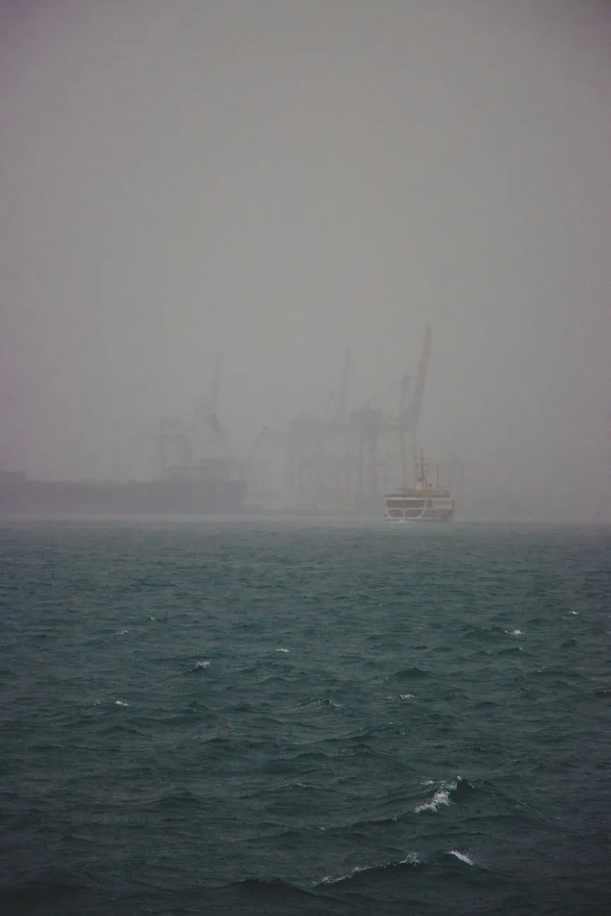
Silent Docks of Klaipėda Klaipėda, Lithuania’s only major seaport, wears its modern cargo cranes like a badge of commerce, yet a short walk north of the bustling container terminal reveals a world frozen in time. The old timber wharves that once received Hanseatic cog ships now lie half‑submerged, their pilings gnawed by brackish water and the relentless wind that sweeps across the Curonian Lagoon. Archaeological surveys conducted by the Lithuanian Institute of History have identified at least three distinct construction phases, the earliest dating to the 13th century when the Teutonic Order established Memel as a strategic foothold. Each phase corresponds to a shift in regional power — Danish, Swedish, Prussian, and finally Russian — leaving a palimpsest of architectural styles that can still be read in the weathered brick foundations and the rusted iron rings that once moored tall‑masted vessels. Walking the promenade at dawn, the only sounds are the cry of gulls and the low groan of timber settling under the tide. Local historians point to the “Old Port” district, where a series of warehouses built in the 1820s survived the 1919 fire that devastated much of the city center. Those warehouses, now roofless, once stored amber, flax, and timber destined for markets in Riga and Stockholm. The Lithuanian Maritime Museum, housed in a restored 19th‑century customs house, curates a collection of ship logs that document the port’s role in the 1905 Russian Revolution, when workers seized the harbor to block imperial troop movements. For the contemporary traveler, the area offers more than melancholy ruins. A network of cycling paths threads through the former shipyard, linking the ghostly docks to the vibrant art installations of the “Sea Festival” that animates the waterfront each summer. Accommodation options range from boutique hotels in restored merchant houses to budget hostels that cater to digital nomads taking advantage of Lithuania’s 183‑day tax residency rule. The cost‑of‑living data for 2025‑2026 shows that a mid‑range restaurant meal averages €12‑€15, while a night in a central guesthouse falls between €45‑€70, making an extended stay both affordable and immersive. Echoes of the Curonian Lagoon Beyond Klaipėda’s municipal limits, the Curonian Lagoon stretches like a silver mirror, its shores dotted with the skeletal remains of fishing stations that once fed the entire region. The lagoon’s unique hydrology — a brackish blend of Baltic seawater and the Nemunas River’s fresh outflow — created a natural harbor that required no artificial breakwaters. In the 16th century, the Grand Duchy of Lithuania granted exclusive fishing rights to the Curonian Spit communities, and the resulting “kurėnai” settlements built wooden jetties that extended far into the shallow waters. Today, those jetties are reduced to weathered pilings, their outlines visible only at low tide. The most haunting site is the abandoned village of Nida’s “Old Fishermen’s Quarter.” After World War II, the Soviet administration relocated the population to newly built concrete blocks, leaving the original thatched cottages to decay. The Lithuanian Cultural Heritage Department has documented over 120 structures in various states of collapse, each bearing the marks of traditional “kurenkai” construction — interlocking logs sealed with moss and tar. Oral histories collected by the University of Vilnius reveal that the lagoon’s ice roads, used for winter transport of amber and smoked fish, were critical lifelines during the harsh Baltic winters of the 19th century. Modern visitors can explore the lagoon’s ghostly perimeter by kayak, gliding past the rusted hulls of Soviet-era patrol boats that were deliberately scuttled in the 1990s to create artificial reefs. Guided tours, often led by former fishermen, explain how the lagoon’s salinity gradients shaped a unique ecosystem that still supports the endangered Baltic sturgeon. The 2025‑2026 cost breakdown indicates that a guided kayak excursion costs roughly €30‑€40 per person, while a simple lunch of smoked eel and rye bread at a local “kavinė” runs about €8‑€10. These modest expenses allow travelers to linger in a landscape where every tide whispers stories of trade routes that once linked Vilnius to the Hanseatic League. Forgotten Wharves of Šventoji North of the lagoon, the small coastal town of Šventoji hides a series of wharves that once served as the primary gateway for the Samogitian hinterland. In the 17th century, the Polish‑Lithuanian Commonwealth granted Šventoji a staple right, obliging all grain, timber, and flax from the interior to pass through its customs house before reaching the sea. The original stone quay, built with locally quarried limestone, stretched 300 meters and featured a series of crane foundations powered by horse‑drawn capstans. Today, only the foundations remain, their iron brackets corroded into abstract sculptures. The town’s decline began with the construction of the railway to Klaipėda in 1875, which diverted cargo traffic away from the shallow harbor. By the early 20th century, Šventoji’s wharves were repurposed for a modest herring fishery, but the Soviet collectivization of the 1940s nationalized the fleet and the port fell into complete disuse. Recent LiDAR surveys commissioned by the Lithuanian Ministry of Culture have revealed a network of submerged wooden pilings extending far beyond the visible shoreline, suggesting the harbor once accommodated vessels of up to 150 tons — far larger than previously assumed. For the intrepid explorer, Šventoji offers a rare blend of maritime archaeology and living culture. The annual “Šventoji Sea Festival” revives traditional boat‑building techniques, allowing visitors to watch craftsmen shape oak planks using hand tools unchanged since the 1600s. Accommodation in the town’s restored fisherman cottages averages €35‑€55 per night, and a hearty bowl of “šaltibarščiai” (cold beet soup) with dark rye bread costs under €7. The affordability, confirmed by the 2025‑2026 Numbeo dataset, makes Šventoji an ideal base for a multi‑day deep dive into Lithuania’s forgotten maritime corridors. Maritime Relics of the Nemunas Delta The Nemunas River, Lithuania’s longest waterway, fans into a sprawling delta before surrendering to the Baltic. This delta once hosted a constellation of minor ports — Ventė, Rusnė, and Uostadvaris — each serving a specific niche in the regional economy. Ventė Cape, the westernmost point, housed a lighthouse built in 1852 that guided vessels through the treacherous sandbanks. The lighthouse still operates, but the adjacent customs house and warehouses have been abandoned since the 1970s, when the Soviet regime centralized all river‑sea traffic at Klaipėda. Rusnė Island, accessible only by a narrow causeway, preserves a 19th‑century shipyard where flat‑bottomed “barges” were constructed for navigating the shallow delta channels. The shipyard’s slipways, now overgrown with reeds, reveal the ingenuity of local shipwrights who adapted Dutch designs to the delta’s unique hydrology. Uostadvaris, once a bustling grain transshipment point, retains a massive brick granary whose roof collapsed under the weight of winter snow in 1998. The granary’s interior still bears the faded stamps of the Russian Empire’s grain monopoly. Ecologically, the delta is a UNESCO Biosphere Reserve, and the abandoned ports have become inadvertent sanctuaries for migratory birds. Birdwatchers can observe the rare aquatic warbler nesting among the ruined pilings, while the Lithuanian Ornithological Society conducts annual counts from the old lighthouse tower. Travel logistics are straightforward: a regional bus from Klaipėda reaches Ventė in under two hours for €5, and bicycle rentals in Rusnė cost €10 per day. The 2025‑2026 cost data confirms that daily Related InsightsThe Azores: Europe’s Hidden Paradise Where Wild Volcanoes Meet Turquoise Oceans (Part 2) Gobeklitepe: The First Temple La Cathédrale Saint-Guy de Prague : Joyau de Bohême{ "@context": "https://schema.org", "@type": "FAQPage", "mainEntity": [ { "@type": "Question", "name": "What is the main focus of Ghost Ports of the Baltic: Uncovering Forgotten Maritime History in Lithuania?", "acceptedAnswer": { "@type": "Answer", "text": "Journey through Lithuania's abandoned harbors and discover the layered stories of trade, war, and nature that shaped the Baltic coast." } }, { "@type": "Question", "name": "Who authored the comprehensive guide on Ghost Ports of the Baltic: Uncovering Forgotten Maritime History in Lithuania?", "acceptedAnswer": { "@type": "Answer", "text": "This detailed article and its insights were carefully researched and authored by Wei Chen." } }, { "@type": "Question", "name": "Where can I find more related content about Travel?", "acceptedAnswer": { "@type": "Answer", "text": "You can explore more articles, detailed reviews, and similar insights by browsing the Related Insights section at the bottom of this article or visiting our dedicated Travel category page." } } ] }
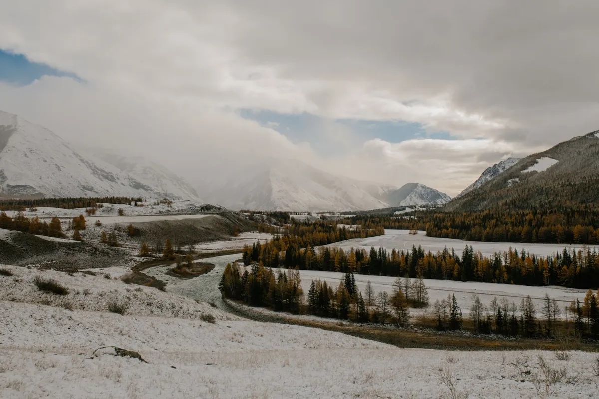
Crossing the Eternal Sky: The Altai Gateway The Altai range rises like a jagged spine between Mongolia, Russia, China, and Kazakhstan, guarding some of the planet’s most pristine pastoral corridors. For centuries, Kazakh eagle hunters and Mongolian herders have moved their flocks along these high valleys, following seasonal water sources that appear only after the summer melt. The gateway to this world is the dusty town of Ölgii, capital of Bayan‑Ölgii Province, where the paved road ends and the real journey begins. From Ölgii, a 4×4 track climbs toward the Tsambagarav massif, crossing the Khovd River at a narrow ford that can swell to a torrent in July. Travelers should time their departure for early June, when the passes are clear of snow but the grass is already tall enough to sustain livestock. Permits are mandatory. The Mongolian Ministry of Environment issues a “Special Protected Area” permit for the Altai Tavan Bogd National Park, while the local soum (district) office requires a “Herders’ Passage” letter signed by the host family. Both documents can be arranged in Ölgii within a day if you present a copy of your passport, a travel itinerary, and a letter of invitation from a registered ger camp. Fuel is scarce beyond the town; carry at least 120 liters of diesel in jerry cans, and verify that your vehicle’s ground clearance exceeds 220 mm to negotiate the rocky riverbeds. Satellite phones are advisable because mobile coverage disappears after the first 30 kilometers. The first night is usually spent at a family‑run ger camp near the Khar‑Us Lake. Here, the host will demonstrate the traditional “khadag” greeting — a blue silk scarf offered with both hands — and serve a bowl of salty milk tea (suutei tsai) alongside boiled mutton. This ritual is more than hospitality; it signals that you are accepted onto the migratory route and may travel with the herd for the next leg. Understanding these customs early prevents cultural missteps that can jeopardize later access to grazing lands. Reading the Wind: Traditional Navigation Techniques Long before GPS, Altai nomads read the landscape like a map written in wind, stone, and animal behavior. The prevailing westerly wind shapes the orientation of yurts, the direction of herd movement, and even the placement of fire pits. A seasoned herder can tell the time of day by the length of the shadow cast by a lone larch on the ridge, and can predict a storm by the sudden silence of marmots. For the modern traveler, learning a handful of these cues adds a safety layer that no satellite can replace. First, identify the “wind corridors” — narrow valleys where the breeze funnels consistently. Herders position their camps at the

Le vent chaud de Chiang Mai caresse l'écran rétroéclairé d'un MacBook Pro. À quelques mètres, le rugissement sourd d'un scooter se mêle au parfum citronné d'un pad thai cuisiné sur le trottoir. Ici, le bureau n'a pas de murs, le patron n'a pas de visage, et le salaire tombe sur un compte bancaire domicilié à des milliers de kilomètres. Bienvenue dans le quotidien d'un digital nomad, cette espèce hybride, née de la rencontre improbable entre la fibre optique et l'instinct migrateur. Ils sont programmeurs, designers, rédacteurs, développeurs. Ils portent leur vie dans un sac à dos de 40 litres et leur entreprise dans le nuage. Mais derrière la carte postale Instagram se cache une mutation anthropologique majeure, une réécriture radicale du contrat social entre l'homme, le travail et l'espace. L'Origine du Mythe : Quand le Vélo Devint Bureau Avant le terme, il y eut l'homme. Steven K. Roberts. Entre 1983 et 1991, cet illuminé précurseur a avalé plus de 16 000 kilomètres à travers l'Amérique du Nord sur un vélo couché truffé d'électronique. Indicatif radio N4RVE, système de messagerie par satellite, radio amateur : sa machine roulante était un nœud réseau mobile avant l'heure. Le magazine Popular Computing le baptisa « high-tech nomad ». L'image est saisissante : un cycliste solitaire, campant sous les étoiles, traitant des emails là où d'autres plantent des piquets de tente. C'était 1983. Le web n'existait pas encore, mais l'esprit, lui, était déjà libre.Le vocabulaire a suivi la prouesse. Au début des années 90, l'explosion des réseaux informatiques et la démocratisation des ordinateurs portables, tablettes et assistants personnels (PDA) ont rendu le rêve accessible. En 1992, Carl Malamud, dans Exploring the Internet, décrit ce « digital nomad » qui « voyage à travers le monde avec un laptop, installant des nœuds FidoNet ». L'année suivante, la maison d'édition Random House lance la série Digital Nomad's Guide signée Mitch Ratcliffe et Andrew Gore — PowerBook, AT&T EO Personal Communicator, Newton's Law — manuels sacrés d'une mobilité naissante. Craig McCaw, visionnaire des télécoms, prédit alors la fusion de la télécommunication et de l'informatique, promesse d'un « retour à un mode de vie nomade » où l'on emporte son environnement avec soi. La prophétie est en marche. L'Essor d'une Tribu : Chiffres et Réalités Post-Covid Longtemps confins aux marges — freelances aventuriers, geeks voyageurs —, les nomades numériques ont vu leur population exploser sous l'effet d'un catalyseur planétaire : la pandémie de COVID-19. En 2019, on comptait 10,9 millions de travailleurs américains s'identifiant comme tels. En 2020, le chiffre bondit de 49 % pour atteindre ce même seuil de 10,9 millions (correction : le texte source indique 10.9M en 2020, +49% vs 2019). Mais c'est l'après-crise qui révèle l'ampleur du basculement structurel. 2023 : 17,3 millions. 2024 : 18,1 millions. Une croissance de 131 % en cinq ans. La fermeture des bureaux et la normalisation du travail à distance ont brisé le tabou de la présence physique. Ce n'est plus uneMarginalité, c'est une démographie.Cette tribu est diverse. Majoritairement programmeurs, créateurs de contenu, designers ou développeurs, ils ne forment pas un bloc monolithique. Certains sont des « perpetual travelers », éternels migrants fiscaux changeant de pays au rythme des visas touristiques. D'autres ancrent leur van — le van-dwelling — dans une vallée des Alpes ou sur une côte portugaise pour six mois. D'autres encore ne font qu'un passage éclair, une parenthèse de deux ans avant de retrouver un bail et une adresse fixe. Mais tous partagent ce socle technologique : le Wi-Fi, le hotspot mobile, le cloud computing, cette infrastructure invisible qui rend la géographie optionnelle. La Quête du Coût de Vie : Pourquoi Ils Partent Pourquoi quitter Brooklyn, Paris ou Londres pour Medellín, Lisbonne ou Da Nang ? La donnée brute est sans appel : le coût de vie est le critère numéro un. Viennent ensuite le climat, la diversité culturelle et l'offre de loisirs. L'arbitrage géographique est la moteur économique de ce mouvement. Un développeur senior gagnant un salaire new-yorkais tout en louant une villa à Bali avec piscine pour une fraction du prix d'un studio à Manhattan : l'équation est vertigineuse. Mais l'argent ne coule pas à sens unique. Une étude révèle que les nomades injectent plus de 35 % de leurs revenus directement dans l'économie locale de leur lieu de séjour. Restaurants, logements, transports, services : ils sont des injecteurs de capital pur, dopant principalement le secteur des services et la vente de biens de consommation. Pour l'employeur, le calcul est aussi favorable. Une recherche de 2021 établit un lien de causalité entre l'option « work from anywhere » et la productivité : + 4,4 % de rendement moyen pour les travailleurs libérés de la contrainte géographique, toutes choses égales par ailleurs. La liberté rend performant, ou du moins, elle libère une énergie captive. L'Ombre au Tableau : Solitude, Burnout et Précarité Pourtant, la carte postale a son verso, fait d'ombres portées. Si l'on écoute les concernés, le premier combat n'est pas technique, il est existentiel : la solitude. Le nomadisme impose souvent une liberté radicale vis-à-vis des attaches personnelles — mariage, famille, amis d'enfance. La route use les liens. Développer des relations « face-à-face » de qualité devient une urgence sanitaire mentale, non plus un luxe.Vient ensuite le burnout. L'absence de délimitation entre travail et loisir est un piège structurel. Lorsque votre bureau est la plage, la plage devient du travail. Inversement, la recherche d'un logement, la gestion des visas, la logistique du déplacement — traditionnellement du domaine du loisir ou de la vie privée — deviennent des tâches professionnelles non rémunérées, chronophages, anxiogènes. La frontière s'effondre. Certains travaux passion sont vus comme du repos ; certaines tâches de voyage sont vues comme du labeur. Le cerveau ne sait plus où poser sa valise. La précarité structurelle est le troisième pilier de l'inquiétude. Rarement accès aux régimes de retraite, à l'assurance chômage, aux congés payés. Beaucoup basculent dans le gig work, la pige, l'instabilité des revenus. L'assurance santé internationale, le maquis fiscal (double imposition, visas de travail, résidence fiscale), les fuseaux horaires qui transforment la visioconférence en insomnie, la chasse au Wi-Fi fiable dans un café bruyant de Mexico : ce sont les frais cachés de la liberté. Et souvent, le minimalisme n'est pas un choix esthétique, mais une contrainte logistique : il faut tout porter sur son dos. Pas de home base, pas d'accumulation possible. Le Fantôme de la Gentrification Transnationale Il est un dernier point, peut-être le plus politiquement sensible, qui ne concerne pas le nomade lui-même, mais l'hôte. C'est la question de la « gentrification transnationale ». La plupart des nomades viennent du « Nord global » (Amérique du Nord, Europe occidentale) et posent leurs valises dans le « Sud global ». Leur pouvoir d'achat relatif, massif, entre en collision avec les marchés locatifs locaux. Les loyers flambent, les commerces traditionnels cèdent la place aux cafés à avocado toast et aux espaces de co-working climatisés. La tension monte entre natifs et voyageurs. Les interactions personnelles peuvent teinter de néocolonialisme involontaire. Le risque de dépendance touristique excessive guette des économies fragiles. La recherche n'a pas encore tranché sur l'ampleur réelle du phénomène, mais le signal d'alerte est pris au sérieux par les municipalités de Mexico à Lisbonne, en passant par Canggu. Vers un Nouvel Équilibre : Le Visa Nomade comme Passeport ? Face à ce chaos créateur, les États réagissent. Depuis l'analyse de Tsugio Makimoto et David Manners en 1997 (Digital Nomad), qui théorisait ce « retour des sociétés à un mode de vie nomade » libéré des « contraintes de géographie et de distance », le droit tente de rattraper la technologie. Des dizaines de pays ont lancé des visas « digital nomad » : Estonie, Barbade, Dubaï, Croatie, Costa Rica, Portugal, Espagne... Une tentative de légaliser, taxer, encadrer ce flux humain. Transformer l'illégalité douce (travailler sur un visa touristique) en cadre juridique clair. C'est la reconnaissance institutionnelle d'une main-d'œuvre devenue fluide. Mais le cœur du sujet reste humain. Le nomade numérique est le canari dans la mine de l'avenir du travail. Il incarne l'extrême de la flexibilité : autonomie totale, responsabilité totale, risque total. Il préfigure ce que deviendront peut-être, demain, des pans entiers de la classe moyenne intellectuelle : des entités économiques mobiles, déterritorialisées, gérant leur carrière comme un portefeuille d'options, leur vie comme une suite de projets.L'histoire de Steven Roberts sur son vélo solaire n'était pas une anecdote curieuse. C'était la première page d'un manuscrit que nous sommes en train d'écrire collectivement. Le nomade numérique n'est pas une mode passagère, ni une sous-catégorie de touriste. C'est un nouvel archétype social. Il pose, à vif, les questions que tous devront bientôt se poser : comment travailler sans lieu ? Comment appartenir sans racine ? Comment se soigner sans système ? Comment payer l'impôt sans frontière ? La réponse ne tient pas dans un passeport, ni dans un abonnement WeWork, ni même dans la 5G. Elle tient dans la capacité à construire du commun dans l'éphémère, à tisser du lien dans le transit, à faire du « chez-soi » un verbe et non un nom. Les 18 millions d'Américains de 2024 — et les millions d'autres à travers la planète — sont les pionniers d'une géographie réinventée. Ils portent le fardeau et la grâce d'être les premiers à devoir répondre, chaque matin, à la question : « Où est mon bureau aujourd'hui ? » Et la réponse, invariablement, est : « Là où je pose mon attention. »#DigitalNomad #RemoteWork #TravelLifestyle #FutureOfWork #NomadLife Related InsightsL'Or Pourpre de la Provence : Voyage au Cœur des Océans de Lavande Cape Town: Dove il Tempo si Incontra con l’Oceano e la Storia si Svela tra Montagne Sacre Ethiopia’s Danakil Depression: Where Earth’s Hellish Beauty Meets Alien Landscapes{ "@context": "https://schema.org", "@type": "FAQPage", "mainEntity": [ { "@type": "Question", "name": "What is the main focus of Les Enfants du Wi-Fi : Chroniques d'une Tribu Sans Frontières?", "acceptedAnswer": { "@type": "Answer", "text": "De la bicyclette connectée de Steven Roberts aux 18 millions d'Américains en 2024, plongée dans l'épopée moderne des nomades numériques entre liberté absolue et précarité invisible." } }, { "@type": "Question", "name": "Who authored the comprehensive guide on Les Enfants du Wi-Fi : Chroniques d'une Tribu Sans Frontières?", "acceptedAnswer": { "@type": "Answer", "text": "This detailed article and its insights were carefully researched and authored by Pierre Dubois." } }, { "@type": "Question", "name": "Where can I find more related content about Travel?", "acceptedAnswer": { "@type": "Answer", "text": "You can explore more articles, detailed reviews, and similar insights by browsing the Related Insights section at the bottom of this article or visiting our dedicated Travel category page." } } ] }
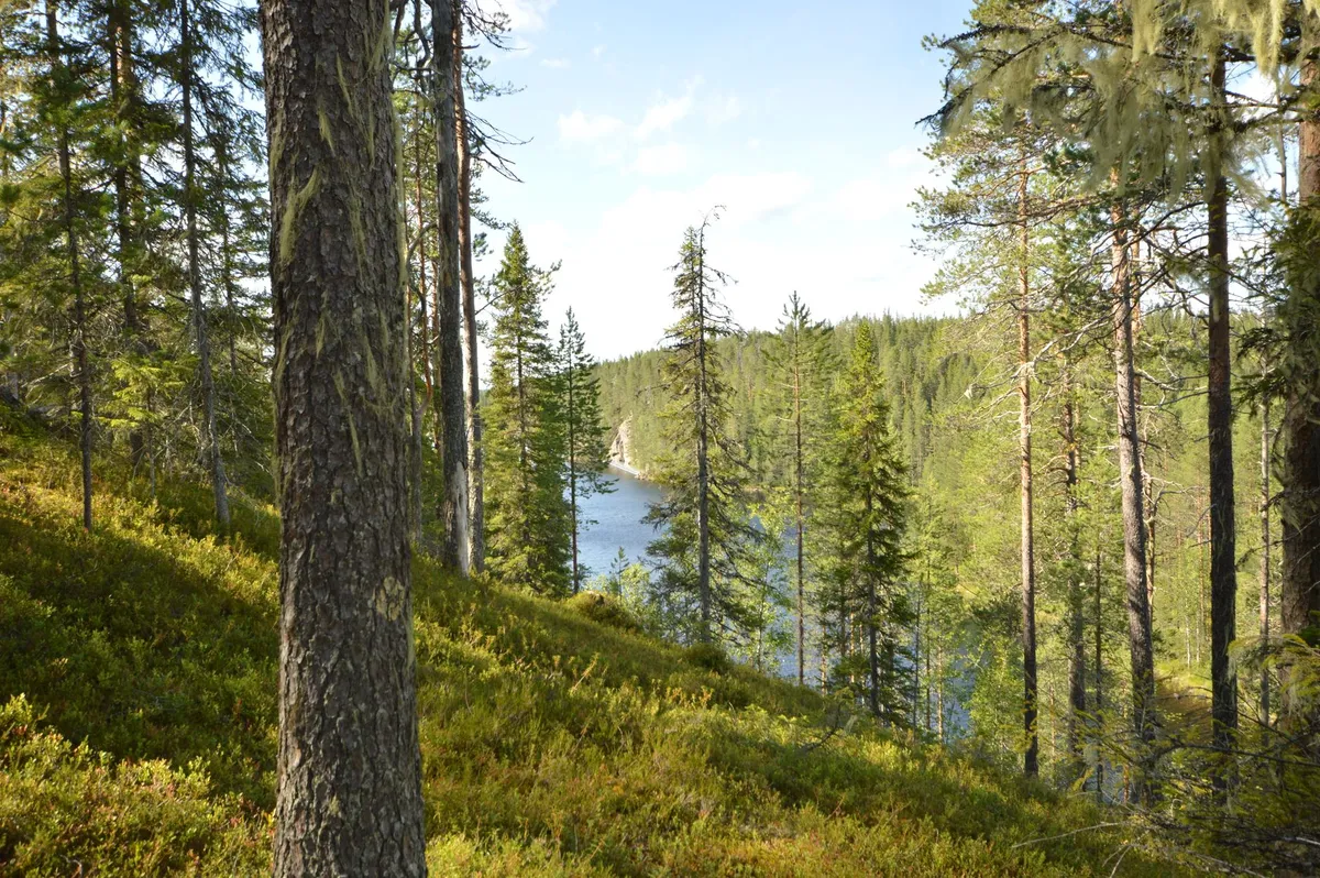
- Aisha Sharma
- 20 Sep, 2026 11:46
Whispers of the Taiga: Journey Among Mongolia's Last Reindeer Nomads
Crossing the Siberian Border into the Taiga The journey begins long before the first hoof prints appear on the mossy floor of the taiga. From Ulaanbaatar, a 12‑hour flight to Mörön followed by a bone‑rattling 4×4 ride across the steppe delivers you to the edge of the Darkhad Valley, where the Siberian frontier looms like a silent guardian. The road dissolves into a narrow track that winds through larch forests, past crystal‑clear rivers that reflect the sky in shades of jade. At the border checkpoint, Mongolian border guards stamp passports with a quiet efficiency that belies the remoteness ahead. Once the checkpoint fades, the landscape shifts dramatically. The steppe’s golden grasses give way to dense coniferous stands, their needles muffling every footfall. The air grows colder, scented with pine resin and damp earth. Reindeer herders — known locally as the Tsaatan or Dukha — have navigated these corridors for centuries, following seasonal pastures that stretch across the Russian‑Mongolian border. Their migration is not a simple north‑south line; it is a lattice of micro‑routes dictated by snow depth, lichen abundance, and the health of the herd. Understanding this geography is essential for any traveler who wishes to move with the herders rather than merely observe them from a distance. Local guides, often former herders themselves, speak a dialect of Tuvan peppered with Mongolian loanwords. They teach you to read the subtle signs: a broken branch indicates a recent passage; a cluster of reindeer droppings marks a favored grazing spot. The first night in a traditional ortz (a conical felt tent) is a lesson in minimalism. A single wood stove provides heat, while reindeer hides serve as both bedding and insulation. The silence is broken only by the soft click of hooves on frozen ground and the distant howl of a wolf pack — reminders that the taiga remains a wild, untamed realm. Morning Milk and Midnight Fires with the Tsaatan Dawn arrives with a pale glow filtering through the larch canopy. The herders rise before the sun, their movements practiced and unhurried. The first task is milking the reindeer — a delicate operation that requires a calm hand and a soft voice. Each animal yields a modest cup of rich, slightly sweet milk, which is immediately transformed into suutei tsai (salted milk tea) or fermented into airag, a mildly alcoholic beverage that fuels long days on the trail. Breakfast is a communal affair. Flatbreads baked on the stove’s hot stones accompany bowls of boiled reindeer meat, seasoned only with salt and wild onions foraged from the forest floor. Conversations flow in a mixture of Tuvan, Mongolian, and Russian, punctuated by laughter and the occasional story of a bear encounter or a sudden blizzard that once forced the herd to shelter in a hidden ravine. The herders’ knowledge of the land is encyclopedic; they can name every lichen species, predict the onset of a snowstorm by the behavior of the birds, and locate the safest river crossings without a map. As the day progresses, the herd moves in a loose formation, guided by the lead bull’s low, resonant calls. Travelers are invited to walk alongside, learning to match the reindeer’s pace — a steady, energy‑conserving gait that can cover 30 kilometres in a day. The terrain is unforgiving: frozen bogs that swallow boots, steep ridges that demand careful footing, and sudden thaw patches that turn solid ground into slush. Yet the herders navigate with an innate GPS built from generations of oral maps. Evening brings the ritual of the fire. A circle of stones encloses a blaze fed by dry larch branches. The herders share stories of the “Eternal Sky” — a spiritual concept that binds the people, the reindeer, and the forest into a single living entity. Songs rise in a haunting pentatonic scale, accompanied by the morin khuur (horsehead fiddle) whose strings vibrate with the same resonance as the taiga wind. For a visitor, these moments are not tourist performances; they are invitations into a worldview where time is measured by seasons, not clocks. Mapping the Ancient Migration Corridors The Tsaatan’s migration routes are not static lines on a map; they are living arteries that shift with climate, policy, and the health of the reindeer. Historical records from Russian explorers in the 19th century describe a network of summer pastures near the Shishged River and winter camps deep in the Sayan foothills. Modern GPS tracking, conducted in collaboration with the Mongolian Academy of Sciences, reveals that the herders now travel roughly 1,200 kilometres annually, a distance that has increased by 15 % over the past two decades due to shrinking lichen beds. Key waypoints include the “White Lake” (Tsagaan Nuur) where the herd grazes on nutrient‑rich sedges in July, and the “Black Rock Pass” (Khar Uul) that offers shelter from the biting January winds. Each waypoint carries cultural significance: White Lake hosts the annual “Reindeer Festival,” a gathering where families exchange news, arrange marriages, and perform shamanic rites to honor the spirit of the herd. Black Rock Pass is the site of a sacred cairn, built stone by stone by ancestors who believed it guided lost souls back to the tribe. The corridors intersect with protected areas such as the Khövsgöl Lake National Park and the Uvs Nuur Basin, a UNESCO World Heritage site. While conservation laws safeguard biodiversity, they also restrict traditional grazing zones, forcing herders to negotiate permits that can take months to secure. Satellite imagery shows a 12 % reduction in viable lichen cover since 2000, a trend linked to rising temperatures and increased frequency of summer droughts. The herders adapt by extending their stay in higher elevations, where cooler microclimates preserve lichen longer, but this adds physical strain and lengthens the migration. For travelers, understanding these corridors means more than following a trail; it means respecting the temporal rhythm of the land. Guided treks typically allocate 10‑14 days to traverse a single seasonal loop, allowing time for acclimatization, cultural exchange, and the inevitable weather delays. Maps provided by local NGOs highlight water sources, emergency shelters, and zones where photography is prohibited to protect sacred sites. Carrying a lightweight GPS device pre‑loaded with these waypoints is advisable, yet the most reliable navigation remains the herder’s whispered direction: “Follow the ridge where the wind sings.” Practical Logistics: Budgeting Your Taiga Expedition A realistic budget transforms a dream into a feasible plan. The following table summarizes average 2026 costs derived from Numbeo’s Mongolia dataset (crowdsourced from over 1,200 contributors) and on‑ground quotes from licensed tour operators in Mörön. Prices are in USD and reflect a solo traveler joining a small group (4‑6 people) for a 12‑day guided migration experience.Expense Category Low Estimate High Estimate NotesInternational flight (round‑trip to Ulaanbaatar) $850 $1,400 Varies by departure city and seasonDomestic flight Ulaanbaatar → Mörön $180 $250 Operated by Aero Mongolia / Hunnu Air4×4 transfer Mörön → Taiga entry point $120 $180 Shared vehicle, includes driverGuide & herder family fee (12 days) $1,200 $1,600 Covers accommodation, meals, cultural liaisonPermit & park entry fees $70 $110 National park & border zone permitsGear rental (sleeping bag, insulated boots) $90 $130 Optional if you bring own equipmentFood & incidentals (extra snacks, souvenirs) $150 $250 Local markets in MörönTravel insurance (adventure coverage) $120 $200 Must cover high‑altitude, remote evacuationTotal Approximate $2,780 $4,120Prices fluctuate with exchange rates (MNT/USD ≈ 3,450) and fuel surcharges. Early booking (3‑4 months ahead) typically secures the lower band. Beyond the table, hidden costs deserve attention. Satellite phone rental ($15/day) is advisable for emergency communication, as mobile coverage ends at the valley’s edge. A modest tip for the herder family (≈ $50) is customary and directly supports their livelihood. Currency exchange is best done in Ulaanbaatar; ATMs in Mörön dispense MNT but may run dry during peak season. Logistically, the optimal window is late June through early September, when the taiga is snow‑free, rivers are fordable, and the reindeer are in peak condition. Winter expeditions exist but require specialized cold‑weather gear and a higher risk tolerance. Visa‑free entry for up to 30 days applies to citizens of the United States, EU, Canada, Australia, and several Asian nations; others must secure a tourist visa (≈ $50) from a Mongolian consulate. Packing light is a discipline. Essentials include a four‑season sleeping bag rated to –20 °C, merino base layers, a wind‑proof shell, gaiters, and a headlamp with extra batteries. A compact first‑aid kit, water‑purification tablets, and a multi‑tool round out the kit. Remember that every kilogram adds to the vehicle’s fuel consumption on the rough track, so the herders appreciate travelers who respect the weight limit (typically 15 kg per person for personal gear). Preserving a Fragile Heritage in a Changing Climate The Tsaatan’s way of life sits at the intersection of cultural resilience and ecological vulnerability. Climate models for the Sayan‑Altai region project a mean temperature rise of 2.3 °C by 2050,