Showing Posts From
Travel
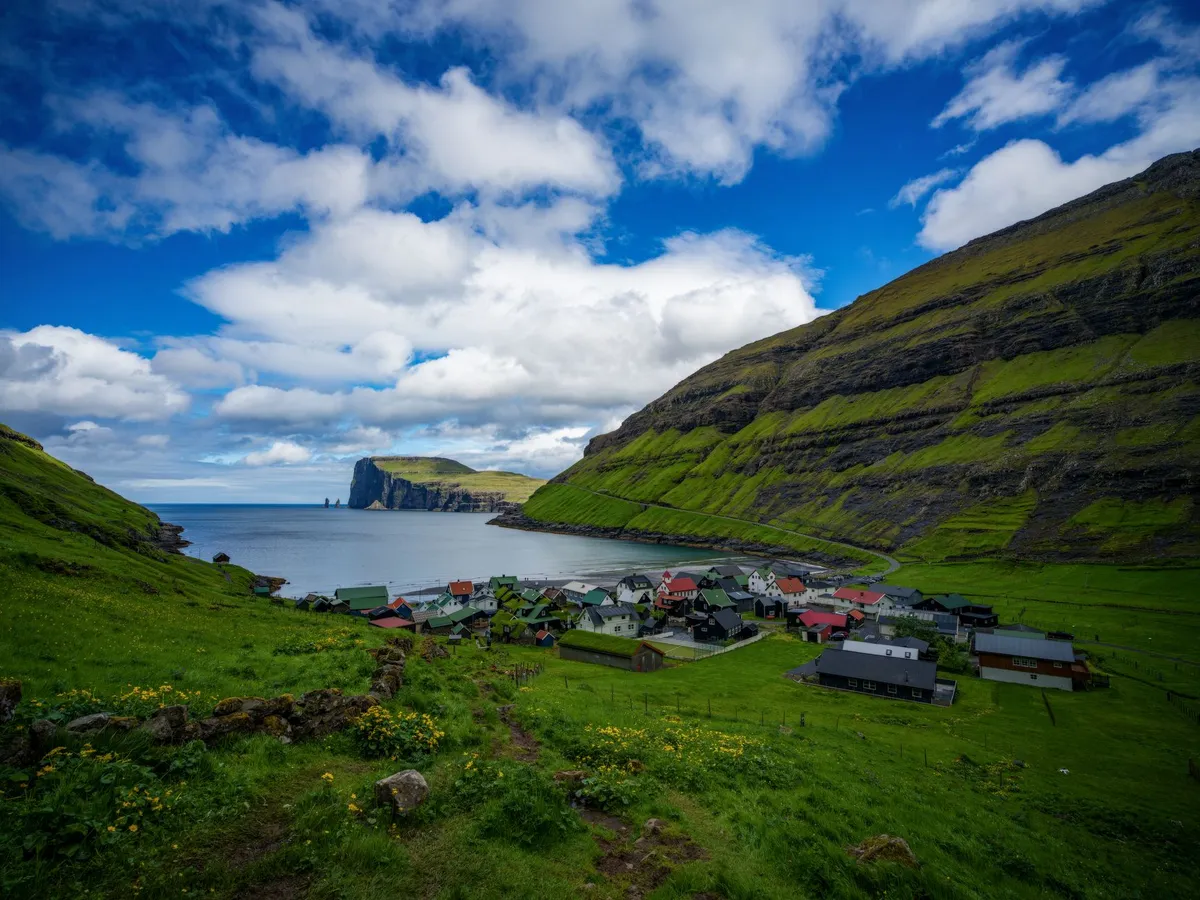

Where the North Atlantic Roars and the Sky Touches the Sea Nestled between Iceland and Norway, the Faroe Islands are a cluster of 18 volcanic islands where jagged cliffs plunge into the churning ocean, waterfalls cascade over green hillsides, and sheep outnumber people. This remote Nordic archipelago is a paradise for hikers seeking untouched trails and photographers chasing the perfect shot of raw, unfiltered nature. With an average of 280 cloudy days a year, the Faroe Islands offer a dynamic canvas of light and shadow, where every turn on a trail reveals a new masterpiece. But this is not just a place for the intrepid—it’s a destination where adventure meets comfort. The islands boast cozy guesthouses, world-class seafood, and a culture deeply rooted in Viking heritage. Whether you're trekking along the cliffs of Mykines or capturing the midnight sun over Tórshavn’s harbor, the Faroe Islands promise an experience that lingers long after you’ve left.A Landscape Carved by Fire and Ice The Faroe Islands are a geological wonder, formed by ancient volcanic activity and sculpted by glaciers over millennia. The islands’ dramatic topography includes towering sea stacks, deep fjords, and rolling hills blanketed in emerald grass. The highest point, Slættaratindur, stands at 880 meters (2,887 feet) and offers panoramic views of the archipelago. For hikers, this means trails that range from gentle coastal walks to challenging ridge hikes with vertigo-inducing drops. One of the most iconic hikes is the Gásadalur to Sørvágsvatn Lake Trail, a 5.5-kilometer (3.4-mile) route that takes you from the village of Gásadalur to the surreal lake perched above the ocean. The trail features a wooden boardwalk, a steep descent into a lush valley, and a final stretch along the cliffs of Trælanípan, where the lake appears to float above the sea. This optical illusion, caused by the cliff’s gradient, is one of the Faroes’ most photographed phenomena. For those seeking a more strenuous challenge, the Kalsoy Ridge Hike offers a 12-kilometer (7.5-mile) trek across the island of Kalsoy. The trail winds along sheer cliffs, past abandoned villages, and through tunnels carved into the rock. The reward? Views of the dramatic Kalsoy coastline and the chance to spot puffins nesting in the cliffs during summer.The islands’ weather is as unpredictable as it is dramatic. Wind speeds can exceed 100 km/h (62 mph), and rain showers can roll in within minutes. Hikers should be prepared for all conditions, with waterproof layers, sturdy boots, and a reliable map essential. The Faroese Meteorological Institute provides real-time weather updates, but even locals advise checking conditions before setting out.Photography in Paradise: Capturing the Faroes’ Ever-Changing Light The Faroe Islands are a photographer’s dream, where the interplay of light, water, and rock creates scenes that feel almost otherworldly. The islands’ high latitude means long summer days with the midnight sun casting a golden glow over the landscape, while winter offers dramatic storms and the chance to capture the northern lights (though sightings are rare due to frequent cloud cover). One of the best spots for photography is Múlafossur Waterfall, near the village of Gásadalur. The waterfall plunges 63 meters (207 feet) directly into the ocean, creating a mesmerizing spectacle, especially during storms when the spray is whipped into the air. The nearby cliffs provide vantage points for capturing the waterfall’s full force. For a more abstract shot, head to Saksun, a remote village accessible via a narrow isthmus. The black sand beach and the surrounding hills create a stark contrast, while the nearby lake, surrounded by steep cliffs, offers reflections that are perfect for mirror-like compositions. The village’s abandoned church, Dúvugarður, adds a touch of history to the scene.The Faroes’ lack of light pollution makes them an ideal location for astrophotography. During the winter months, the aurora borealis can occasionally be seen, though it’s best to head to the northernmost islands, such as Viðareiði, for the clearest skies. For daytime photography, the islands’ ever-changing weather means that no two shots are ever the same. A sunny morning can quickly turn into a misty afternoon, with the light shifting from golden to ethereal blue in minutes.A Nordic Lifestyle: Where Adventure Meets Comfort The Faroe Islands may be remote, but they offer a lifestyle that balances rugged adventure with Nordic comfort. The islands have a population of just 54,000, and the pace of life is slow and deliberate. Villages are small and tightly knit, with colorful houses clustered around harbors filled with fishing boats. The Faroese people are known for their hospitality, and visitors are often greeted with open arms. Accommodation ranges from cozy guesthouses to luxury hotels, with prices reflecting the islands’ status as one of Europe’s more expensive destinations. According to Numbeo, the average cost of a meal at a mid-range restaurant is around 150 DKK ($22 USD), while a pint of beer can cost up to 80 DKK ($12 USD). Groceries are also pricey, with a liter of milk costing around 12 DKK ($1.80 USD) and a loaf of bread around 25 DKK ($3.70 USD).Item Price (DKK) Price (USD)Meal at mid-range restaurant 150 $22Pint of beer 80 $12Liter of milk 12 $1.80Loaf of bread 25 $3.70Taxi (1 km) 20 $3Public transport (bus ticket) 30 $4.50Despite the high costs, the Faroes offer a unique quality of life. The islands have excellent healthcare, free education, and a strong sense of community. The capital, Tórshavn, is a charming town with a vibrant cultural scene, including the annual Faroese Music Awards and the Ólavsøka festival, which celebrates the islands’ Viking heritage. For foodies, the Faroes are a seafood lover’s paradise. Dishes like fermented puffin (a local delicacy), fresh langoustines, and grilled salmon are staples. The islands’ restaurants range from casual eateries serving fish and chips to high-end establishments like KOKS, which holds two Michelin stars and offers a tasting menu featuring locally sourced ingredients.From Viking Ships to Modern Trails: The Faroes’ Rich History The Faroe Islands have a history as dramatic as their landscapes. Settled by Vikings in the 9th century, the islands were later Christianized and became a key stop on the medieval Norse trade routes. The Faroese language, Faroese, is a North Germanic language closely related to Icelandic and Norwegian, and it remains the primary language spoken on the islands. One of the best places to explore the Faroes’ Viking past is the Viking Museum in Hoyvík, which showcases artifacts from the islands’ early settlements. The museum’s exhibits include tools, jewelry, and even a replica Viking longhouse, offering a glimpse into the daily lives of the islands’ first inhabitants. For a more immersive experience, visit the National Museum of the Faroe Islands in Tórshavn. The museum’s exhibits cover everything from the islands’ geological formation to their role in World War II, when they were occupied by British forces to prevent a German invasion. The museum also features a replica of a traditional Faroese turf house, which provides insight into the islands’ architectural heritage.The Faroes’ Viking heritage is also celebrated in the islands’ folklore. Local legends tell of hidden people (huldufólk), elves who live in the rocks and hills, and who must be respected to avoid bad luck. These stories are still a part of Faroese culture, and visitors may hear them shared over a cup of coffee in a local café.The Faroes’ Hidden Gems: Off-the-Beaten-Path Adventures While the Faroes’ main islands offer plenty of attractions, the archipelago’s smaller islands are where the real magic lies. These remote outposts are accessible by ferry or helicopter, and they offer a chance to experience the Faroes’ untouched wilderness. One such island is Mykines, the westernmost of the Faroes and a haven for birdwatchers. Mykines is home to one of the largest puffin colonies in the world, with thousands of birds nesting in the cliffs during the summer months. The island’s hiking trails lead to the Mykinesholmur, a small island connected to Mykines by a narrow isthmus, where visitors can get up close to the puffins and other seabirds. Another hidden gem is Fugloy, the easternmost island in the Faroes. Fugloy is known for its dramatic cliffs and the Risin og Kellingin sea stacks, which rise out of the ocean like sentinels. The island’s remote location means it’s rarely visited by tourists, making it a perfect spot for those seeking solitude.For a truly unique experience, consider visiting Skúvoy, an island with a population of just 30 people. Skúvoy is home to the Skúvoy Church, one of the oldest wooden churches in the Faroes, and the Skúvoy Bird Reserve, where visitors can see thousands of seabirds nesting in the cliffs.A Nordic Paradise Awaits The Faroe Islands are more than just a destination—they’re an experience. Whether you’re hiking along cliffs that plunge into the ocean, capturing the ever-changing light on a camera sensor, or simply enjoying the warmth of a Faroese guesthouse, the islands offer a sense of adventure and tranquility that’s hard to find elsewhere. The Faroes may be expensive, but they’re worth every krone. The islands’ dramatic landscapes, rich history, and unique culture create a destination that lingers in the memory long after you’ve returned home. So pack your hiking boots, charge your camera, and prepare to be captivated by the Nordic paradise that is the Faroe Islands.#NordicAdventure #RemoteTravel #PhotographyDestinations #HikingParadise #FaroeIslandsMagic Related InsightsEthiopia's Danakil Depression: The Hottest Place on Earth's Alien Landscapes (Part 3) Il Faro di Ercole e i Giganti Luminosi Dimenticati dell'Oceano: Un Viaggio Tra i Guardiani Romani dell'Infinito Atlantico St. Petersburg Hermitage{ "@context": "https://schema.org", "@type": "FAQPage", "mainEntity": [ { "@type": "Question", "name": "What is the main focus of The Faroe Islands: Where Nordic Wilderness Meets Photographic Magic?", "acceptedAnswer": { "@type": "Answer", "text": "Discover why the Faroe Islands are Europe’s best-kept secret for hikers and photographers, with dramatic landscapes, untouched trails, and a lifestyle that balances adventure with Nordic charm." } }, { "@type": "Question", "name": "Who authored the comprehensive guide on The Faroe Islands: Where Nordic Wilderness Meets Photographic Magic?", "acceptedAnswer": { "@type": "Answer", "text": "This detailed article and its insights were carefully researched and authored by Wei Chen." } }, { "@type": "Question", "name": "Where can I find more related content about Travel?", "acceptedAnswer": { "@type": "Answer", "text": "You can explore more articles, detailed reviews, and similar insights by browsing the Related Insights section at the bottom of this article or visiting our dedicated Travel category page." } } ] }
-
 John Explorer
 - 05 Aug, 2026 08:16
Unveiling the Land Down Under: A Journey Through Australia's Thriving Tourism
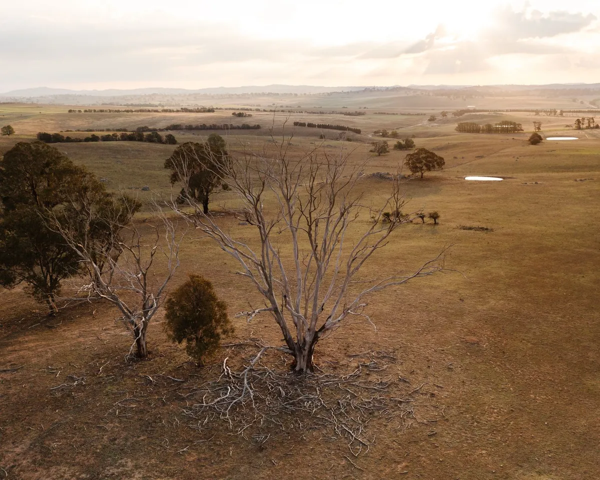
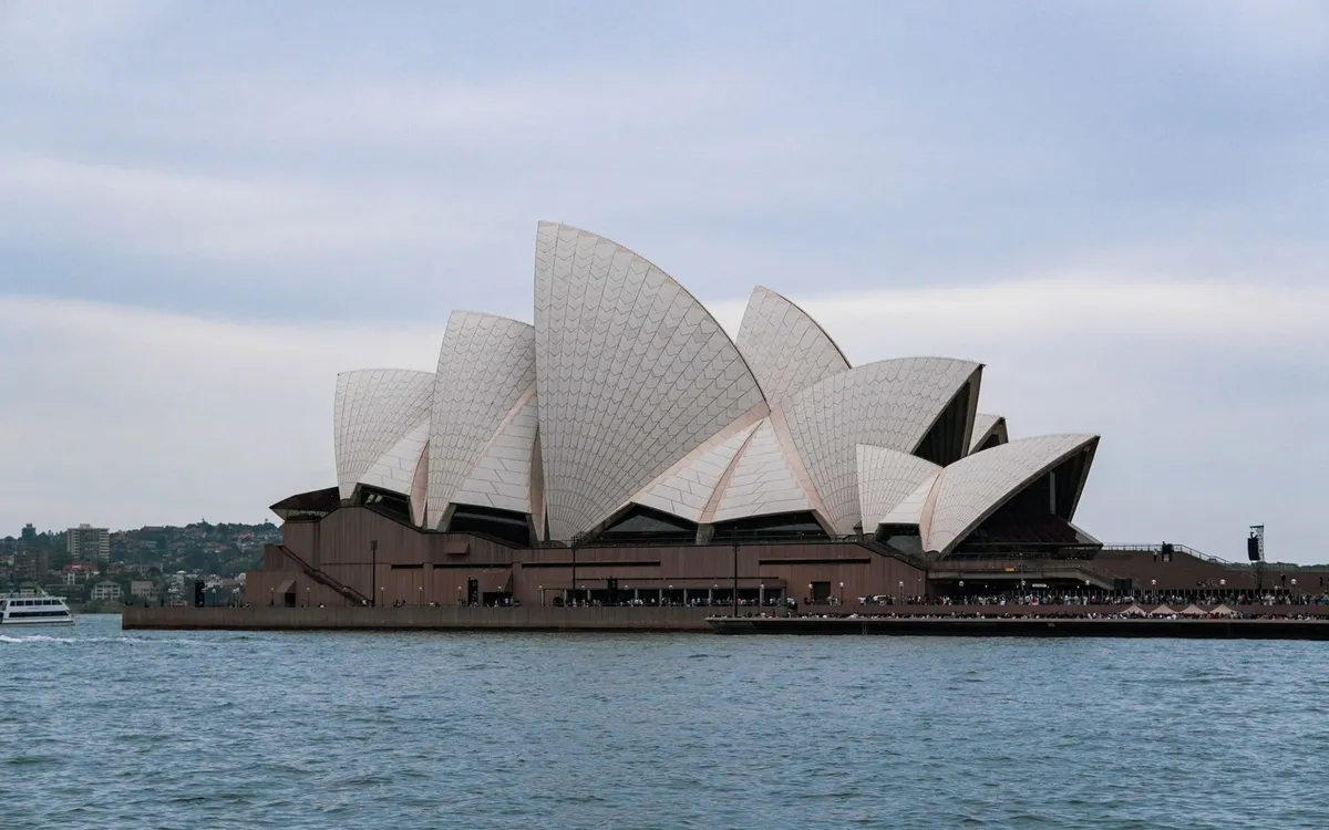
As the sun rises over the horizon, casting a golden glow over the vast expanse of the Australian landscape, the country comes alive with the sound of laughter and excitement. From the bustling streets of Sydney to the rugged beauty of the outback, Australia is a land of contrasts, where the old meets the new and the familiar blends with the unknown. With its unique wildlife, stunning landscapes, and vibrant cities, Australia has become a top destination for travelers from around the world, attracting over 8.7 million international visitors in the calendar year up to December 2019. A Brief History of Australian Tourism The concept of travel has been an integral part of Australian culture since the colonial days, with many Australians embarking on journeys to explore the vast and unforgiving landscape of their country. The opening of new lands, the establishment of industries and towns, and the consequent dispersal of people over Australia created a habit of mobility and enterprise, encouraging Australians to face the hardships of early travel by coach, on horseback, or by ship. As the years passed, the advent of rail travel and later, air travel, made it easier for people to explore the country, and the tourism industry began to take shape.The Australian outback, with its red sands and spinifex grass, is a unique and fascinating region that attracts visitors from around the world. The outback is home to a diverse range of wildlife, including kangaroos, wallabies, and emus, and offers a glimpse into the country's rich and varied history. Popular Destinations in Australia Australia is home to a wide range of popular destinations, each with its own unique character and attractions. From the iconic Sydney Opera House to the stunning natural beauty of the Great Barrier Reef, there is no shortage of exciting places to visit and explore. Some of the most popular destinations in Australia include:Sydney: The largest city in Australia, Sydney is a vibrant and cosmopolitan metropolis with a wide range of cultural attractions, including the Sydney Opera House and the Australian Museum. Melbourne: The cultural capital of Australia, Melbourne is a city of arts, literature, and music, with a wide range of galleries, museums, and performance venues. The Gold Coast: A popular destination for families and thrill-seekers, the Gold Coast is home to a wide range of theme parks, including Dreamworld and Sea World. The Great Barrier Reef: One of the most biologically diverse ecosystems on the planet, the Great Barrier Reef is a snorkeler's and scuba diver's paradise, with a wide range of coral and marine life.The Sydney Opera House is one of the most iconic buildings in the world, with its distinctive sail-like design and stunning harbor views. The Opera House is home to a wide range of cultural events and performances, including ballet, opera, and theater productions. The Economic Impact of Tourism in Australia Tourism is a significant contributor to the Australian economy, with the industry generating over A$60.8 billion in revenue in the financial year 2018/19. The tourism industry also employs a large number of people, with over 666,000 people working in the industry in 2018-19, making it one of the largest employers in the country. The economic impact of tourism in Australia is not limited to the revenue generated by the industry, but also includes the flow-on effects of tourism, such as the creation of new businesses and jobs, and the stimulation of local economies.The beaches of Australia are some of the most beautiful and iconic in the world, with their white sand and crystal-clear water. From the bustling beaches of the Gold Coast to the secluded coves of the Great Ocean Road, there is no shortage of stunning beaches to explore and enjoy. The Future of Tourism in Australia As the world becomes increasingly interconnected, the tourism industry in Australia is likely to continue to grow and evolve. With the rise of social media and online booking platforms, it has never been easier for people to plan and book their trips to Australia. The Australian government has also recognized the importance of the tourism industry, with the development of a range of initiatives and strategies to support the growth of the industry, including the Tourism 2020 strategy and the Tourism 2030 strategy.The cities of Australia are a testament to the country's vibrant and cosmopolitan culture, with their stunning architecture, world-class restaurants, and vibrant arts and cultural scenes. From the iconic skyscrapers of Sydney and Melbourne to the historic buildings of Hobart and Adelaide, there is no shortage of exciting and interesting cities to explore and discover. #Travel #AustralianTourism #TourismIndustry
-
 Chloe Tremblay
 - 04 Aug, 2026 09:23
Georgia’s Caucasus Mountains: Where Medieval Villages, Ancient Wine, and Epic Hikes Collide
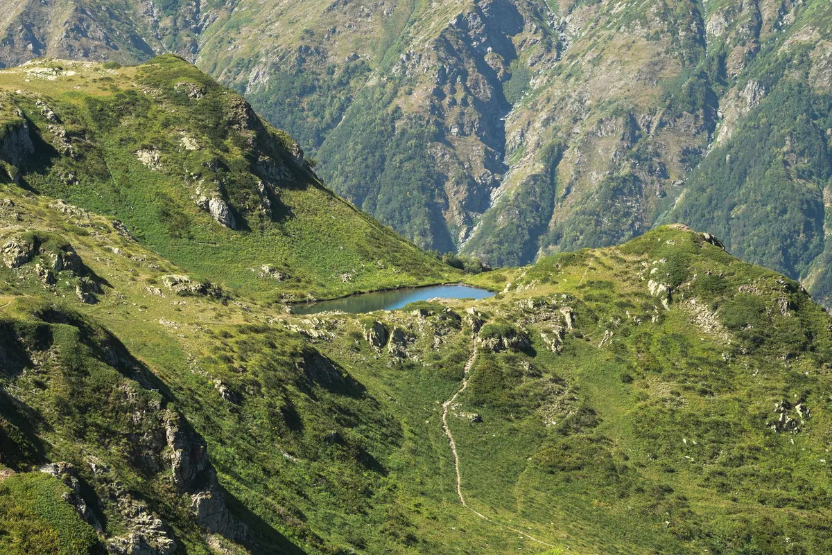
Where Europe Meets Asia in a Landscape of Fire and Stone The Caucasus Mountains rise like a jagged spine between Europe and Asia, a natural fortress where Georgia’s ancient soul still breathes. Here, the air smells of wild thyme and fermenting grapes, while the peaks—some towering over 5,000 meters—cast shadows over villages that have stood since the time of knights and crusaders. This is a land where the past isn’t just remembered; it’s tasted in amber-hued wines, walked upon in centuries-old cobblestone paths, and felt in the crisp alpine air that sharpens every breath.For travelers, the Caucasus offers more than just postcard scenery. It’s a place where you can wake up in a 1,000-year-old stone house, sip wine from amphorae buried underground for years, and end the day with a feast under the stars where toasts last longer than the wine itself. The region’s allure lies in its contradictions: rugged wilderness meets warm hospitality, ancient traditions clash with modern adventure, and every turn in the trail reveals another layer of Georgia’s story. But this isn’t just a destination for history buffs or wine connoisseurs. The Caucasus is a playground for hikers, with trails that range from gentle valley strolls to multi-day treks that test even the most seasoned adventurers. Whether you’re here for the wine, the culture, or the sheer thrill of the mountains, Georgia’s Caucasus promises an experience that lingers long after you’ve left.The Ancient Wine Roads: Georgia’s 8,000-Year-Old Secret Long before Bordeaux or Napa Valley became synonymous with wine, Georgia was fermenting its grapes in clay vessels called qvevri. Buried underground for months or even years, these amphorae transform juice into liquid gold, yielding wines with a depth and complexity that modern techniques often struggle to replicate. The Kakheti region, Georgia’s wine heartland, is where this tradition thrives, with vineyards sprawling across rolling hills and medieval monasteries standing sentinel over the vines.To truly understand Georgia’s wine culture, start in Sighnaghi, a charming hilltop town with cobblestone streets and pastel-colored houses. Known as the "City of Love," Sighnaghi is also the gateway to Kakheti’s vineyards. Here, you can tour family-run wineries like Pheasant’s Tears, where the owner, a former musician, crafts natural wines using grapes grown in the Alazani Valley. The tasting room, housed in a 19th-century building, feels like stepping into a scene from a Tolstoy novel—except the wine is poured from hand-blown glass, and the stories are as rich as the flavors. For a deeper dive, head to Tsinandali Estate, a historic winery owned by the noble Chavchavadze family. The estate’s museum showcases the family’s role in preserving Georgia’s wine heritage, while the vineyards stretch out like a patchwork quilt of green. The estate’s white wines, particularly the Rkatsiteli, are crisp and mineral-driven, a perfect foil to the bold reds like Saperavi, which packs flavors of blackberry and spice. But the real magic happens in the villages. In Khashmi, a tiny hamlet near Telavi, you can stay in a guesthouse run by a winemaker’s family. Here, dinner is a supra—a traditional Georgian feast—where platters of khachapuri (cheese-filled bread), grilled meats, and fresh herbs are accompanied by endless glasses of wine. The rule is simple: you drink, you eat, you toast. Refusing is considered rude, but the hospitality is so genuine that even the most reluctant drinker will find themselves raising a glass to the mountains. Georgia’s wine roads aren’t just about tasting; they’re about connection. Whether you’re sipping amber wine in a 1,000-year-old cellar or sharing stories with a winemaker whose family has tended the same vines for generations, you’re part of a tradition that’s older than most countries.Hiking the Caucasus: Trails That Carve Through Time The Caucasus Mountains are a hiker’s paradise, offering trails that cater to every level of experience. From gentle day hikes through alpine meadows to multi-day treks that traverse glaciers and high passes, the region’s diversity is staggering. One of the most iconic routes is the Truso Valley, a high-altitude wonderland where turquoise rivers carve through volcanic rock, and hot springs bubble up from the earth.The Truso Valley hike begins in the village of Abano, where the air is thin and the scent of sulfur from the hot springs fills your lungs. The trail winds through a lunar landscape of red and orange cliffs, past abandoned Soviet-era buildings, and into a valley where yurts dot the grassy plains. Along the way, you’ll encounter shepherds tending flocks of sheep, their dogs barking in warning as you pass. The highlight? The Keli Plateau, a vast expanse of wildflowers and crystal-clear streams where you can camp under a sky so clear it feels like you’re floating in space. For those seeking a challenge, the Kazbegi to Gergeti Trinity Church trek is a must. This 12-kilometer round-trip hike takes you through alpine meadows and past waterfalls before culminating at the iconic Gergeti Trinity Church, a 14th-century monastery perched on a hilltop with views of Mount Kazbek, a dormant volcano. The trail is steep in sections, but the reward—a panoramic vista of snow-capped peaks and the church’s golden domes—is worth every step. If you’re up for a multi-day adventure, the Greater Caucasus Traverse is one of the most epic hikes in the world. This 200-kilometer route takes you from the Georgian-Russian border to the Georgian-Azerbaijani border, crossing high passes and glaciers along the way. It’s a test of endurance, but the solitude and raw beauty of the mountains make it unforgettable. Most hikers complete the trek in 10-14 days, camping under the stars or staying in remote guesthouses. But you don’t need to be an expert to enjoy Georgia’s trails. The Borjomi-Kharagauli National Park offers well-marked paths through dense forests and along rivers, with options for both day hikes and overnight stays in cozy lodges. The Turtle Lake Trail in Tbilisi is a favorite among locals, a gentle loop that offers stunning views of the capital city below. No matter which trail you choose, hiking in the Caucasus is about more than just exercise. It’s a journey through time, where every step echoes the footsteps of ancient traders, shepherds, and pilgrims. The mountains here don’t just challenge your body—they awaken your soul.Medieval Villages: Stone Houses, Secret Passages, and Stories That Won’t Quit Georgia’s medieval villages are like something out of a fairy tale. Built from honey-colored stone, their narrow streets wind past crumbling churches, hidden courtyards, and houses with wooden balconies draped in ivy. These villages aren’t just relics of the past; they’re living, breathing communities where traditions are preserved with pride.One of the most enchanting is Ushguli, a cluster of four villages in the Svaneti region, often called the "roof of Europe." Ushguli is Europe’s highest permanently inhabited settlement, perched at 2,200 meters above sea level. The village’s stone towers, built in the 9th century as both homes and defensive structures, rise like sentinels against the backdrop of the Caucasus. The most famous is the Tower of Queen Tamar, named after the legendary Georgian queen who ruled in the 12th century. Inside, the walls are covered in faded frescoes, and the air is thick with the scent of woodsmoke and fresh bread. Staying in Ushguli is an experience in itself. Guesthouses like Hotel Tetnuld offer simple but cozy rooms with views of the Enguri River Valley. The hosts, often descendants of the tower’s original builders, will feed you khinkali (Georgian dumplings) until you can’t eat another bite and ply you with homemade chacha (a grape pomace brandy) until the stars blur together. Nearby, the village of Mestia serves as the gateway to Svaneti. Here, the Svaneti Museum of History and Ethnography houses a collection of medieval artifacts, including crosses, icons, and manuscripts. The museum’s most prized possession? A 12th-century silver reliquary said to contain the remains of Saint George, the patron saint of Georgia. But the real magic of Georgia’s medieval villages lies in their people. In Shatili, a fortress village in the Pankisi Gorge, you’ll meet families who have lived in the same stone houses for centuries. The village is a maze of narrow alleys and hidden staircases, with houses stacked on top of each other like a giant’s Lego set. The locals are warm and welcoming, often inviting travelers into their homes for tea and stories. Ask about the village’s history, and you’ll hear tales of bandits, wars, and secret love affairs that played out in these very streets. For a taste of Georgia’s medieval past, visit Vardzia, a cave city carved into the cliffs of the Erusheti Mountains. Built in the 12th century by Queen Tamar, Vardzia was designed as a fortress and a monastery, with over 600 rooms connected by tunnels and staircases. Today, it’s a hauntingly beautiful ruin, where the echoes of monks’ chants still seem to linger in the air. The highlight? The Church of the Dormition, with its stunning frescoes and a balcony that offers a breathtaking view of the Mtkvari River Valley. These villages aren’t just stops on a map; they’re gateways to another time. Walking their streets, you can almost hear the clatter of hooves on cobblestones and the murmur of prayers in ancient churches. Georgia’s medieval villages are where history isn’t just remembered—it’s lived.The Practical Side of Paradise: Costs, Visas, and How to Make the Most of Your Trip Georgia is a dream for travelers, but like any destination, it pays to be prepared. The country’s visa policies are famously liberal—US citizens can stay for up to 365 days visa-free, while citizens of the EU, UK, and many other countries can enter visa-free for 90 days. Tax residency kicks in after 183 days, so if you’re planning a long stay, keep track of your days. Banking is straightforward, with ATMs widely available and cards accepted in most places, though it’s wise to carry some cash for rural areas.Living costs in Georgia are a fraction of what you’d pay in Western Europe or North America. In Tbilisi, you can rent a modern apartment for as little as $400 per month, while a meal at a mid-range restaurant will set you back around $10. In smaller towns like Sighnaghi or Mestia, costs are even lower, with guesthouses charging $20-$30 per night and local meals costing just a few dollars. A budget of $800-$1,800 per month is enough to live comfortably, whether you’re a digital nomad working from a café or a traveler exploring the countryside. Healthcare in Georgia is affordable and accessible. The country has a mix of public and private hospitals, with private clinics offering high-quality care at reasonable prices. It’s recommended to have travel insurance that covers medical evacuation, especially if you’re planning to hike in remote areas. Pharmacies are well-stocked, and many medications can be purchased over the counter. Getting around Georgia is easy, thanks to a network of marshrutkas (minibuses) that connect cities and towns. For longer distances, trains are a comfortable option, with sleeper trains running between Tbilisi and Batumi. Renting a car is also a great way to explore, though be prepared for narrow mountain roads and aggressive driving habits. Here’s a breakdown of what you can expect to spend on a typical trip:Expense Cost (USD)Budget guesthouse per night $20-$40Mid-range restaurant meal $8-$15Local beer $1-$2Wine tasting tour $15-$30Marshrutka (minibus) ticket $2-$10SIM card with data $5-$10Taxi (short ride) $3-$8For digital nomads, Georgia is a rising star. The country has a thriving tech scene, with Tbilisi’s Impact Hub and Terminal offering co-working spaces and networking events. Cafés like Entree and Café Linville are popular spots to work, with fast Wi-Fi and excellent coffee. The time zone (GMT+4) is convenient for those working with Europe or the Middle East. One of the biggest draws for expats and travelers is Georgia’s supra, a traditional feast that’s as much about community as it is about food. A supra can last for hours, with toasts led by a tamada (toastmaster) who keeps the conversation flowing. The food is hearty and flavorful—think grilled meats, fresh herbs, and endless rounds of khachapuri (cheese-filled bread) and khinkali (dumplings). The rule is simple: you eat, you drink, you toast. Refusing is considered rude, but the hospitality is so genuine that even the most reluctant participant will find themselves raising a glass to the mountains.When to Go and What to Pack: Your Caucasus Survival Guide Georgia’s Caucasus Mountains are a year-round destination, but the best time to visit depends on what you want to do. For hiking, June to September is ideal, when the trails are clear of snow and the weather is warm. Wildflowers carpet the alpine meadows in July, and the vineyards of Kakheti are lush and green. If you’re here for wine, October is harvest season, a magical time when the air is thick with the scent of fermenting grapes and the villages buzz with activity. Winter (December to February) transforms the Caucasus into a snowy wonderland, with ski resorts like Gudauri offering world-class slopes. The village of Kazbegi is a popular base for winter hikes, with views of Mount Kazbek dusted in snow. Spring (March to May) is a quieter time, with wildflowers blooming and fewer tourists. It’s a great season for photography, with the landscapes coming alive in shades of green and gold.Packing for the Caucasus depends on the season, but there are a few essentials you’ll need year-round. Sturdy hiking boots are a must, especially if you’re planning to tackle trails like Truso Valley or Kazbegi. Layers are key—temperatures can vary wildly, from hot days in the valleys to freezing nights in the mountains. A good-quality down jacket, thermal base layers, and a waterproof shell are essential. Don’t forget a hat, gloves, and a scarf for the colder months. For wine lovers, bring a reusable bottle—many wineries offer discounts if you bring your own container. A phrasebook or translation app is helpful, as English isn’t widely spoken outside of Tbilisi and Batumi. Georgians are incredibly hospitable, so a small gift from your home country (like chocolates or postcards) is a thoughtful gesture if you’re invited into someone’s home. If you’re planning to hike, consider joining a guided tour, especially for multi-day treks. Local guides know the terrain, the best campsites, and the safest routes. They can also introduce you to communities along the way, offering a deeper connection to the land and its people.The Last Toast: Why Georgia’s Caucasus Will Steal Your Heart Georgia’s Caucasus Mountains are more than just a destination—they’re a feeling. It’s the warmth of a supra feast shared with strangers who become friends in a single evening. It’s the awe of standing atop a mountain pass, looking down at a valley where medieval villages cling to the cliffs. It’s the taste of wine that’s been fermented in clay for years, rich and complex and alive with history. This is a land where adventure and tradition walk hand in hand. Where every hike tells a story, every village hides a secret, and every glass of wine is a toast to a culture that has endured for millennia. Georgia doesn’t just welcome travelers—it embraces them, feeds them, and sends them home with memories that linger like the scent of wild thyme on a mountain breeze. So pack your bags, lace up your boots, and prepare to fall in love. The Caucasus is waiting.#GeorgiaTravel #CaucasusAdventure #WineAndWanderlust Related InsightsWhere the Wild Things Roam: The World’s Most Unforgettable Wildlife Encounters Kazan Kremlin Zeugma Mosaic Museum{ "@context": "https://schema.org", "@type": "FAQPage", "mainEntity": [ { "@type": "Question", "name": "What is the main focus of Georgia’s Caucasus Mountains: Where Medieval Villages, Ancient Wine, and Epic Hikes Collide?", "acceptedAnswer": { "@type": "Answer", "text": "Discover Georgia’s Caucasus Mountains—where medieval stone villages, 8,000-year-old wine traditions, and breathtaking hikes await. Your ultimate guide to adventure and culture." } }, { "@type": "Question", "name": "Who authored the comprehensive guide on Georgia’s Caucasus Mountains: Where Medieval Villages, Ancient Wine, and Epic Hikes Collide?", "acceptedAnswer": { "@type": "Answer", "text": "This detailed article and its insights were carefully researched and authored by Chloe Tremblay." } }, { "@type": "Question", "name": "Where can I find more related content about Travel?", "acceptedAnswer": { "@type": "Answer", "text": "You can explore more articles, detailed reviews, and similar insights by browsing the Related Insights section at the bottom of this article or visiting our dedicated Travel category page." } } ] }
-
 Zola Ndlovu
 - 03 Aug, 2026 20:18
Svalbard: Arctic Adventures Beyond the Northern Lights – A Remote Paradise for Explorers and Digital Nomads
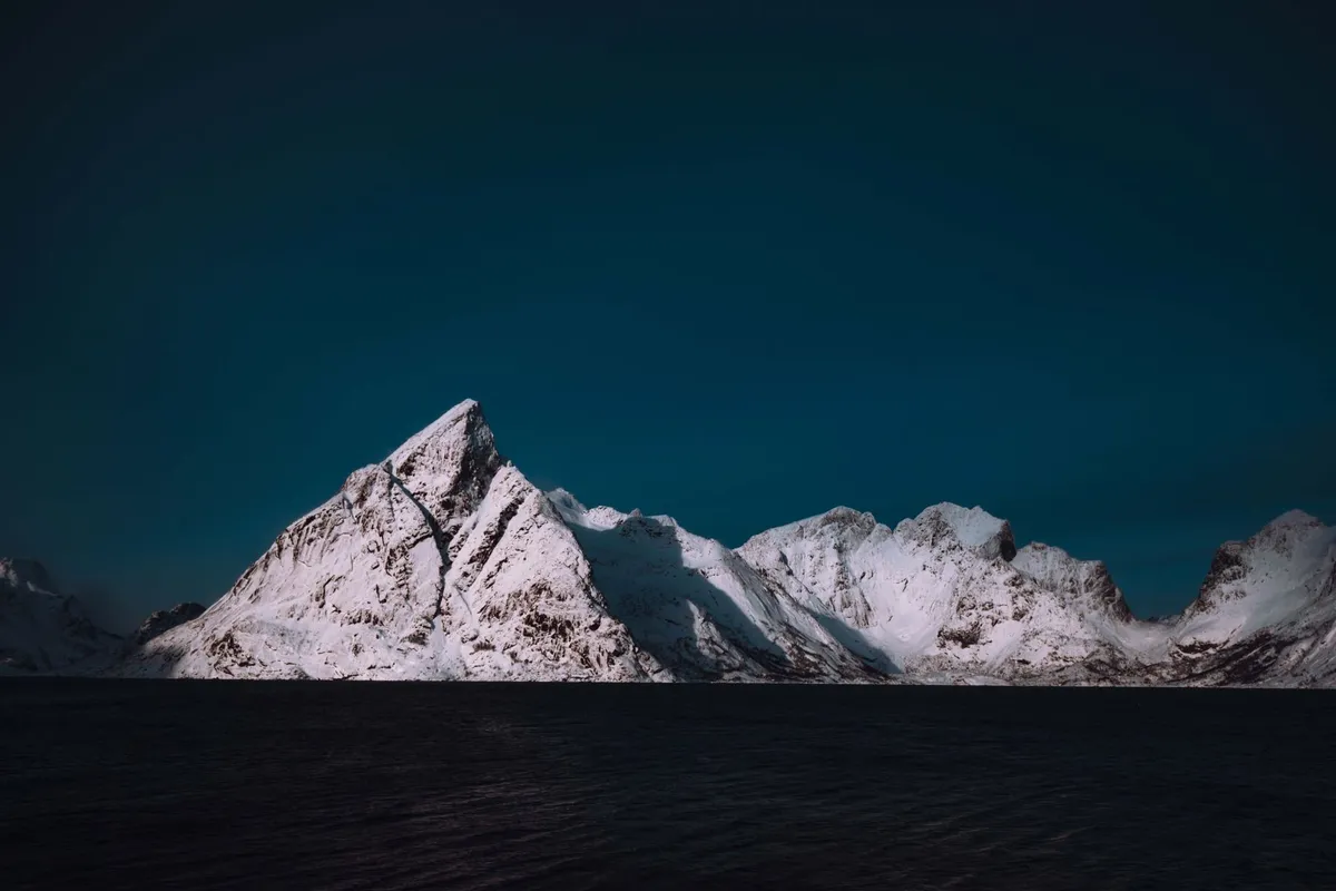
Few places on Earth evoke the raw, untamed spirit of adventure like Svalbard—a remote archipelago in the Arctic Ocean, halfway between Norway and the North Pole. Governed by the Svalbard Treaty, this Norwegian territory is a land of extremes: polar bears outnumber people, the sun never sets in summer, and the aurora borealis paints the winter skies in emerald and violet. Yet beyond its reputation as a bucket-list destination for chasing the Northern Lights, Svalbard offers something far deeper: a chance to live on the edge of the known world, where every day feels like an expedition. For digital nomads, Svalbard is a paradox—a place where cutting-edge remote work meets Stone Age isolation. In 2025, it ranked 13th in VisaGuide.World’s Digital Nomad Index, scoring 2.91 for its unique blend of infrastructure, safety, and unparalleled natural beauty. Unlike other Arctic destinations, Svalbard has no visa restrictions for remote workers, allowing indefinite stays. But this freedom comes with a price: life here is expensive, the climate is brutal, and the nearest mainland is a 3-hour flight to Oslo. Yet for those willing to embrace the challenge, Svalbard is more than a destination—it’s a way of life. In this guide, we’ll dive into the realities of living and traveling in Svalbard, from navigating its polar wilderness to thriving as a digital nomad in one of the world’s most isolated communities. Whether you’re drawn by the allure of polar bears, the silence of untouched tundra, or the thrill of working from the edge of the Arctic, Svalbard promises an adventure unlike any other.Why Svalbard? The Ultimate Arctic EscapeSvalbard isn’t just another Arctic destination—it’s a world apart. Located at 74–81°N latitude, this archipelago is one of the northernmost permanently inhabited places on Earth. Its isolation is both its greatest allure and its defining challenge. Unlike tourist-heavy destinations like Iceland or Norway’s mainland, Svalbard remains a frontier, where the rules of modern life bend to the whims of nature. The Land of Contrasts Svalbard’s geography is a study in extremes. Towering glaciers, such as the 30-kilometer-long Austfonna, carve through the landscape, while deep fjords like Isfjorden cut into the coastline. The terrain is a mix of barren rock, permafrost, and unexpected pockets of greenery—mosses, lichens, and Arctic flowers that bloom briefly in the summer. Despite its harsh climate, Svalbard supports a surprising diversity of wildlife, including reindeer, Arctic foxes, walruses, and over 30 species of birds. The real star, however, is the polar bear. With a population of around 3,000, these apex predators roam freely, making Svalbard one of the few places where humans are not at the top of the food chain. A Unique Legal and Cultural Landscape Svalbard’s governance is as unusual as its geography. The Svalbard Treaty of 1920 granted Norway sovereignty over the archipelago, but it also allowed citizens of signatory countries (including the U.S., UK, and Russia) to live and work here under Norwegian law. This means no visa is required for stays up to 90 days, and digital nomads can stay indefinitely as long as they meet local registration requirements. The population of around 2,900 is a melting pot of Norwegians, Russians, Poles, and Thais, with Longyearbyen—the largest settlement—serving as the cultural and administrative heart. The Digital Nomad Paradox Svalbard’s inclusion in the Digital Nomad Index is a testament to its growing appeal among remote workers. The archipelago offers high-speed internet (thanks to a fiber-optic cable from mainland Norway), co-working spaces like the Svalbard Science Centre, and a surprisingly vibrant café culture. Yet, the cost of living is astronomical. According to 2026 data, a monthly rent for a one-bedroom apartment in Longyearbyen averages 15,000 NOK ($1,400 USD), while a meal at a mid-range restaurant costs around 250 NOK ($24 USD). Groceries are 50–100% more expensive than in Oslo, and imported goods can double in price due to shipping costs. Despite this, Svalbard’s digital nomad scene is thriving. The Svalbard Digital Nomad Association organizes meetups, and the UNIS (University Centre in Svalbard) offers courses in Arctic studies, attracting academics and remote workers alike. The key to thriving here? Budgeting meticulously and embracing the local lifestyle—shopping at the Sysselbutikken (the state-run supermarket) for staples like milk and bread, and taking advantage of the Svalbard Samfunnsdrift (community services) for shared resources. For those seeking a challenge, Svalbard offers unparalleled rewards: the chance to live in a place where the Northern Lights dance above your doorstep, where you can ski to work in the dark of winter, and where every day feels like an expedition. It’s not for the faint-hearted, but for the adventurous, it’s a dream come true.Planning Your Arctic Expedition: Logistics and EssentialsSvalbard is not a spontaneous destination. Planning a trip—or a move—here requires meticulous preparation, from securing flights to packing the right gear. The archipelago’s remoteness means that once you arrive, you’re committed. Here’s everything you need to know to make your Arctic adventure a success. Getting There: Flights and Entry Requirements The only way to reach Svalbard is by air, with flights operated by Norwegian Air Shuttle and Arctic Aviation. All flights connect via Oslo, with the journey taking approximately 3 hours to Longyearbyen. As of 2026, there are no direct flights from outside Norway, and flights are often fully booked months in advance, especially during peak seasons (June–August for summer activities, December–February for the Northern Lights). Entry Requirements:Visa: No visa is required for stays up to 90 days for citizens of Schengen countries, the U.S., UK, Canada, Australia, and many others. For longer stays, you’ll need to register with the Sysselmesteren (Governor of Svalbard) and may require a work permit if employed locally. Passport: A valid passport is mandatory, with at least 6 months’ validity remaining. Insurance: Travel insurance covering medical evacuation is strongly recommended. Healthcare in Svalbard is excellent but limited—serious cases are evacuated to Oslo.Best Time to Visit: Seasons of Light and Dark Svalbard’s seasons are extreme, each offering a unique experience:Polar Night (Late October–Mid-February):The sun doesn’t rise above the horizon, and the archipelago is shrouded in 24-hour darkness. This is prime time for Northern Lights viewing, with displays visible on clear nights. Temperatures plummet to -20°C (-4°F), but the lack of daylight makes for easier polar bear tracking (a necessity when venturing outside settlements). Pro Tip: Book a Northern Lights tour with Green Trail or Svalbard Wildlife Expeditions for guided excursions with expert guides.Spring (March–May):Daylight returns gradually, and temperatures rise to a balmy -10°C (14°F). This is ideal for snowmobile safaris, dog sledding, and skiing. The ice on the fjords begins to break up, making boat tours possible. Must-Do: A snowmobile trip to Pyramiden, the abandoned Soviet mining town, is a surreal experience.Midnight Sun (Late April–August):The sun never sets, casting a golden glow over the landscape 24/7. This is the best time for hiking, wildlife spotting (puffin colonies, walruses), and exploring glaciers. Temperatures range from 0°C to 10°C (32°F to 50°F), but the weather is unpredictable—pack layers. Essential Activity: A boat tour to Hornøya, one of the largest seabird colonies in the Arctic.Autumn (September–October):The landscape transforms with fiery hues as the tundra prepares for winter. This is a quieter season, perfect for photographers and those seeking solitude. Temperatures drop rapidly, and the first snowfalls begin. Hidden Gem: The Svalbard Museum in Longyearbyen offers insights into the archipelago’s history, from whaling to polar exploration.Packing for the Arctic: Gear That Could Save Your Life Svalbard’s weather is unpredictable, and conditions can change from sunny to blizzard in hours. Your packing list should prioritize warmth, functionality, and safety:Clothing: Base Layers: Merino wool or synthetic thermal underwear (top and bottom). Mid Layers: Fleece or down jackets for insulation. Outer Layer: A high-quality, windproof, and waterproof shell (Gore-Tex recommended). Accessories: Thermal gloves, balaclava, neck gaiter, and wool socks. A pair of insulated, waterproof boots (like Sorel or Baffin) is non-negotiable.Gear: Headlamp: Essential during the polar night. Bring extra batteries. Sunglasses: With UV protection for the midnight sun. Trekking Poles: For glacier hikes and uneven terrain. Power Bank: Cold drains batteries quickly. A solar charger can be a lifesaver.Safety: Polar Bear Deterrent: A rifle is mandatory when venturing outside settlements (rentals available). Alternatively, hire a guide with a firearm. First Aid Kit: Include blister plasters, painkillers, and any personal medication. Emergency Communication: A satellite phone or GPS device (local SIM cards don’t work outside Longyearbyen).Accommodation: From Hostels to Luxury Lodges Longyearbyen is the only town with a range of accommodation options, from budget hostels to high-end lodges. Here’s a breakdown of what to expect:Type Price Range (NOK) Pros ConsHostels (e.g., Basecamp Hostel) 500–800/night Affordable, social atmosphere Basic amenities, shared bathroomsGuesthouses (e.g., Guesthouse 102) 1,200–1,800/night Cozy, homey feel Limited space, no kitchen accessHotels (e.g., Radisson Blu Polar Hotel) 2,000–3,500/night Comfortable, central location Expensive, can book up quicklyRentals (e.g., Airbnb) 1,500–2,500/night Privacy, kitchen access Limited availability, high demandResearch Stations (e.g., UNIS Guesthouse) 1,000–1,500/night Unique experience, near nature Strict rules, shared spacesFor longer stays, consider renting an apartment through the Svalbard Housing Office, though options are scarce. Many digital nomads opt for a mix of short-term rentals and house-sitting (check TrustedHousesitters for opportunities).👉 Continue Reading: Svalbard: Arctic Adventures Beyond the Northern Lights – A Remote Paradise for Explorers and Digital Nomads (Part 2)#ArcticAdventure #DigitalNomadLife #PolarExploration #RemoteLiving #SvalbardTravel Related InsightsSustainable Archipelagos: Crafting an Eco‑Conscious Island‑Hopping Blueprint for the Azores La Cathédrale de Reims : Le Sanctuaire des Rois de France Where Earth Breathes Ages: A Deep Dive into Grand Canyon National Park{ "@context": "https://schema.org", "@type": "FAQPage", "mainEntity": [ { "@type": "Question", "name": "What is the main focus of Svalbard: Arctic Adventures Beyond the Northern Lights – A Remote Paradise for Explorers and Digital Nomads?", "acceptedAnswer": { "@type": "Answer", "text": "Discover Svalbard’s rugged Arctic beauty, from glaciers and polar bears to digital nomad life in one of the world’s most remote yet welcoming destinations." } }, { "@type": "Question", "name": "Who authored the comprehensive guide on Svalbard: Arctic Adventures Beyond the Northern Lights – A Remote Paradise for Explorers and Digital Nomads?", "acceptedAnswer": { "@type": "Answer", "text": "This detailed article and its insights were carefully researched and authored by Zola Ndlovu." } }, { "@type": "Question", "name": "Where can I find more related content about Travel?", "acceptedAnswer": { "@type": "Answer", "text": "You can explore more articles, detailed reviews, and similar insights by browsing the Related Insights section at the bottom of this article or visiting our dedicated Travel category page." } } ] }

- Zola Ndlovu
- 03 Aug, 2026 20:18
Svalbard: Arctic Adventures Beyond the Northern Lights – A Remote Paradise for Explorers and Digital Nomads (Part 2)
This is Part 2 of the series. Read Part 1 here.Living in Svalbard: A Digital Nomad’s Guide to the Arctic Frontier Svalbard is one of the few places in the world where you can work remotely from the edge of the Arctic Circle. But living here as a digital nomad is not for the unprepared. The cost of living is high, the internet is reliable but expensive, and the isolation can be both exhilarating and overwhelming. Here’s how to make it work. The Cost of Living: A Breakdown of Arctic Expenses As of 2026, Svalbard’s cost of living is among the highest in the world. Below is a snapshot of average prices for essentials:Item/Service Price (NOK) Price (USD) NotesRent (1-bedroom) 15,000/month $1,400 Longyearbyen onlyUtilities 2,000/month $190 Includes heating, electricityInternet 800/month $75 High-speed fiber from TelenorGroceries (monthly) 8,000 $750 Sysselbutikken for basicsDining Out 250/meal $24 Mid-range restaurantPublic Transport 500/month $47 Bus passes availableCoworking Space 2,500/month $235 Svalbard Science CentreGym Membership 600/month $56 SvalbardhallenAlcohol 100/beer $9.50 State-run VinmonopoletBudgeting Tips:Shop Smart: The Sysselbutikken (state-run supermarket) is the cheapest for staples. Imported goods (like cheese or coffee) are pricey—stock up in Oslo before flying. Cook at Home: Eating out is a luxury. A home-cooked meal costs 50–100 NOK ($5–10 USD). Use Community Resources: The Svalbard Samfunnsdrift offers shared tools, bikes, and even free sauna sessions. Transport: Walking is the primary mode of transport in Longyearbyen, but a secondhand bike or electric scooter can save money.Internet and Workspaces: Staying Connected in the Wilderness Svalbard’s internet is surprisingly robust, thanks to a fiber-optic cable from mainland Norway. Speeds average 100–300 Mbps, with reliable connections even in remote areas. However, data caps and latency can be issues for video calls. Best Workspaces:Svalbard Science Centre: The hub for remote workers, with desks, meeting rooms, and a café. Membership costs 2,500 NOK/month. Radisson Blu Polar Hotel: Offers day passes for 300 NOK, including coffee and Wi-Fi. Home Offices: Many digital nomads work from their apartments, but power outages can occur during storms.Pro Tip: Invest in a local SIM card (Telenor or Ice) for backup connectivity, though coverage is limited outside Longyearbyen. Social Life and Community: Finding Your Tribe in the Arctic Svalbard’s small population means everyone knows each other—or at least knows of each other. The social scene revolves around shared experiences: polar bear guards, Northern Lights chases, and impromptu gatherings at Huset (the cultural hub). Where to Meet People:Huset: Hosts events like film screenings, concerts, and language exchanges. UNIS: The University Centre attracts students and researchers from around the world. Their café is a great place to network. Adventure Groups: Join a dog sledding or snowmobiling tour to meet fellow explorers. Volunteer: The Svalbard Museum and Sysselmesteren’s office often need help with events.Challenges of Isolation:Seasonal Affective Disorder (SAD): The polar night can be tough. Invest in a light therapy lamp and prioritize outdoor activities. Limited Healthcare: The Longyearbyen Hospital handles minor issues, but serious cases require evacuation. Ensure your insurance covers this. Boredom: With no cinemas or shopping malls, entertainment is DIY. Learn to ski, take a photography course, or join a book club.Safety and Survival: Rules for Living in Polar Bear Country Svalbard is one of the few places where polar bears outnumber humans. Safety is paramount, and ignorance of the rules can be deadly. Golden Rules:Carry a Rifle: When venturing outside settlements, you must have a firearm (or hire a guide with one). Rentals are available at Svalbard Sports. Stay in Groups: Never go alone. Polar bears are unpredictable and can cover ground quickly. Make Noise: Sing, talk, or clap while hiking to avoid surprising a bear. Know the Signs: Fresh tracks, scat, or a bear’s presence means you should leave the area immediately. Emergency Numbers: Dial 112 for police, fire, or medical emergencies.Wildlife Encounters:Reindeer: Harmless but curious. Don’t feed them. Arctic Foxes: Cute but may carry rabies. Avoid contact. Walruses: Found on beaches—keep a safe distance.Adventures Await: Top Activities in SvalbardSvalbard is an adventure playground, where the landscape dictates the activities. From glacier hikes to ice cave explorations, there’s no shortage of ways to immerse yourself in the Arctic wilderness. 1. Northern Lights and Polar Night Expeditions The Northern Lights are Svalbard’s most famous attraction, visible from late September to early April. The best viewing spots are outside Longyearbyen, where light pollution is minimal. How to Chase the Aurora:Guided Tours: Companies like Green Trail and Svalbard Wildlife Expeditions offer overnight trips with hot drinks and photography tips. DIY: Head to Platåberget or Mine 7 for unguided viewing. Use apps like Aurora Forecast to track activity. Photography Tips: Bring a tripod, wide-angle lens, and extra batteries (cold drains them fast).2. Dog Sledding: Racing Across the Tundra Dog sledding is a rite of passage in Svalbard. The tradition dates back to the early 20th century, when explorers like Roald Amundsen used sled dogs to traverse the Arctic. Where to Go:Basecamp Explorer: Offers multi-day expeditions to Pyramiden or Barentsburg. Local Guides: Many operators use Greenland huskies, known for their endurance. Beginner-Friendly: Short trips (2–3 hours) are available for first-timers.What to Wear: Dress in layers, with windproof outerwear. Your guide will provide insulated boots and gloves. 3. Snowmobiling: Exploring the Arctic Wilderness With over 500 kilometers of marked trails, snowmobiling is one of the best ways to explore Svalbard’s vast landscapes. Rentals start at 1,200 NOK/day, but guided tours (including safety briefings) are recommended. Top Routes:Longyearbyen to Pyramiden: A 100-kilometer trip through stunning valleys and abandoned Soviet towns. Adventdalen Valley: A scenic route with views of glaciers and reindeer herds. Barentsburg: A longer trip to the Russian mining town, with stops at Gruve 3 (a historic coal mine).Safety Tips:Always carry a GPS and spare fuel. Check the weather forecast—blizzards can disorient even experienced riders. Never ride alone.4. Glacier Hikes and Ice Cave Explorations Svalbard is home to some of the most accessible glaciers in the Arctic. Guided hikes take you across icy rivers, through crevasses, and into surreal blue ice caves. Popular Glaciers:Nordenskiöldbreen: A 20-kilometer-long glacier accessible from Longyearbyen. Paierlbreen: Known for its striking blue ice caves. Austre Lovénbreen: A shorter hike with stunning views of Isfjorden.What to Expect:Gear: Crampons, helmets, and ice axes are provided by guides. Difficulty: Ranges from easy (2–3 hours) to challenging (full-day expeditions). Best Time: June–September, when the ice is stable.5. Wildlife Safaris: Spotting Arctic Giants Svalbard’s wildlife is as diverse as it is elusive. The best way to see it? Join a guided safari. Top Wildlife Encounters:Puffins: Visit Hornøya in summer for colonies of these colorful birds. Walruses: Boat tours to Sørkapp Land offer close-up views. Polar Bears: While sightings aren’t guaranteed, guided expeditions increase your chances. Whales: Orcas and belugas are spotted in the fjords during summer.Ethical Considerations: Always choose operators that prioritize animal welfare and follow distance guidelines.Conclusion & Sign-off Svalbard is not a destination for the casual traveler. It’s a place where the elements dictate the rhythm of life, where the silence of the Arctic can be deafening, and where the Northern Lights shimmer like a promise. For those who venture here, Svalbard becomes more than a trip—it becomes a story to tell for a lifetime. Whether you’re drawn by the allure of polar bears, the thrill of dog sledding, or the challenge of living in one of the world’s most remote communities, Svalbard delivers. It’s a place where you can work from a café with a view of glaciers, ski to the grocery store in the dark of winter, and fall asleep to the sound of the wind howling across the tundra. But it’s also a place that demands respect—for its wildlife, its weather, and its isolation. If you’re considering Svalbard as your next home or adventure, start planning now. Flights book up months in advance, gear needs to be sourced carefully, and budgets must be meticulously planned. But if you’re willing to put in the effort, Svalbard will reward you with an experience that few places on Earth can match. So pack your thermal layers, book your flight, and prepare to step into a world where the rules of the Arctic reign supreme. Svalbard is waiting—and it’s unlike anywhere else. Safe travels, and may your Northern Lights be bright.#ArcticAdventure #DigitalNomadLife #PolarExploration #RemoteLiving #SvalbardTravel Related InsightsDive Into a Hidden World: The Most Breathtaking Underwater Museums and Sculpture Parks (Part 2) The Whispers of the White Gold: Tracing the Carpathian Salt Scribes of Maramureș Arctic Circle Digital Nomadism: Building Connectivity in Greenland's Remote Towns{ "@context": "https://schema.org", "@type": "FAQPage", "mainEntity": [ { "@type": "Question", "name": "What is the main focus of Svalbard: Arctic Adventures Beyond the Northern Lights – A Remote Paradise for Explorers and Digital Nomads (Part 2)?", "acceptedAnswer": { "@type": "Answer", "text": "Discover Svalbard’s rugged Arctic beauty, from glaciers and polar bears to digital nomad life in one of the world’s most remote yet welcoming destinations." } }, { "@type": "Question", "name": "Who authored the comprehensive guide on Svalbard: Arctic Adventures Beyond the Northern Lights – A Remote Paradise for Explorers and Digital Nomads (Part 2)?", "acceptedAnswer": { "@type": "Answer", "text": "This detailed article and its insights were carefully researched and authored by Zola Ndlovu." } }, { "@type": "Question", "name": "Where can I find more related content about Travel?", "acceptedAnswer": { "@type": "Answer", "text": "You can explore more articles, detailed reviews, and similar insights by browsing the Related Insights section at the bottom of this article or visiting our dedicated Travel category page." } } ] }
-
 Pierre Dubois
 - 03 Aug, 2026 19:19
L’Australie, terre de contrastes : quand l’économie du rêve façonne un continent
L’Australie n’est pas qu’un pays : c’est un continent où chaque horizon raconte une histoire, où chaque grain de sable sous les pieds porte l’écho des rêves des voyageurs. Entre les récifs coralliens qui s’étendent à perte de vue, les déserts rouges où le temps semble suspendu, et les villes côtières où l’énergie urbaine danse avec l’océan, ce territoire de contrastes attire chaque année des millions de visiteurs. Mais derrière les cartes postales se cache une machine économique puissante, un secteur qui pulse au rythme des saisons et des tendances mondiales. Le tourisme en Australie n’est pas un simple divertissement : c’est un pilier, une industrie qui façonne des paysages, crée des emplois, et transforme des rêves en réalité.L’Australie, quatrième exportateur touristique mondial : une économie qui respire par les voyages En 2018-2019, le tourisme représentait 3,1 % du PIB australien, soit 60,8 milliards de dollars australiens injectés dans l’économie nationale. Un chiffre qui place ce secteur au quatrième rang des exportations du pays, derrière seulement les mines, l’agriculture et les services financiers. Mais ce qui frappe, c’est sa croissance : sur la dernière décennie, le tourisme a progressé plus vite que le PIB national, prouvant que les voyageurs du monde entier sont prêts à traverser des océans pour découvrir ce pays-continent. En 2019, 8,7 millions de visiteurs internationaux ont foulé le sol australien, chacun contribuant à une économie qui emploie 666 000 personnes – soit 1 emploi sur 21 dans le pays. Parmi ces travailleurs, 54 % sont des femmes, et 48 % occupent des postes à temps plein, révélant une industrie inclusive et dynamique. Les recettes touristiques ont également représenté 8,2 % des exportations totales en 2018-2019, un témoignage de l’attractivité mondiale de l’Australie.Pourtant, derrière ces chiffres se cache une réalité plus nuancée. Le tourisme australien est ultra-dépendant des marchés asiatiques, avec la Chine, l’Inde et la Nouvelle-Zélande en tête des visiteurs. Mais la pandémie de COVID-19 a révélé une vulnérabilité : en 2021, alors que les frontières se fermaient, les Australiens se sont tournés vers le tourisme domestique, représentant 73 % du PIB touristique direct. Une résilience qui a permis au secteur de survivre, mais aussi de se réinventer.Des origines coloniales aux croisières modernes : une histoire du voyage en Australie L’histoire du tourisme australien est aussi riche que ses paysages. Dès l’époque coloniale, les Australiens étaient des nomades par nécessité. Les vastes distances, les conditions difficiles et l’absence de routes goudronnées obligeaient les colons à parcourir des milliers de kilomètres à cheval ou en diligence pour commercer, s’installer ou simplement rendre visite à leur famille. Le voyage n’était pas un luxe, mais une question de survie. Tout a changé avec l’arrivée du chemin de fer. Dans les années 1800, les lignes ferroviaires se sont étendues depuis les grandes villes comme Sydney et Melbourne, reliant les stations balnéaires et les montagnes aux centres urbains. Les Blue Mountains, près de Sydney, sont devenues une destination prisée, tout comme les stations côtières du Victoria. Les bureaux de tourisme des chemins de fer d’État ont joué un rôle clé, vendant des voyages intrastate et même interstate, transformant le rail en artère vitale du tourisme australien. Mais c’est après la Seconde Guerre mondiale que tout bascule. Avec l’essor des croisières transocéaniques, des voitures familiales et, surtout, de l’aviation commerciale, l’Australie s’ouvre au monde. En 1960, l’ère du Jet Age commence : des avions capables de transporter plus de 100 passagers à 600 miles par heure réduisent les distances. Un vol Sydney-Londres, qui prenait autrefois des semaines, devient accessible en 24 heures. Les standards de vie montent, les congés payés se généralisent (trois semaines en Nouvelle-Galles du Sud dès 1958), et les Australiens partent à l’assaut de leur propre continent.L’État a joué un rôle majeur dans cette expansion. En 1929, l’Australian National Travel Association (ANTA) est créée, avec des bureaux à Londres et New York. Son arme secrète ? Une campagne d’affichage percutante et le magazine Walkabout, lancé en 1934. Ce dernier, d’abord journal de la Australian Geographical Society, devient rapidement un outil de promotion touristique, vantant les plages de la Gold Coast, les récifs de la Grande Barrière, et l’aventure du bush australien. Plus tard, soutenu par l’Australian Tourist Commission, Walkabout se transforme en un magazine lifestyle, célébrant "la façon de vivre australienne".Les joyaux touristiques : quand la nature et la culture s’entrelacent L’Australie est un pays où chaque destination est une expérience sensorielle. Voici les incontournables, ceux qui font battre le cœur des voyageurs du monde entier. 1. La Grande Barrière de Corail : un écosystème en sursis Classée au patrimoine mondial de l’UNESCO, la Grande Barrière de Corail est le plus grand récif corallien du monde, s’étendant sur 2 300 kilomètres. Ce joyau abrite 1 500 espèces de poissons, 400 types de coraux et des créatures marines uniques comme la tortue verte ou le requin-baleine. Pourtant, ce paradis est menacé : le réchauffement climatique, la pollution et le blanchiment des coraux ont réduit sa couverture de 50 % depuis 1995. Les visiteurs peuvent explorer ce monde sous-marin en plongée, en snorkeling ou même en hélicoptère. Les îles Whitsunday, avec leur sable blanc et leurs eaux turquoise, sont un spot prisé, tout comme les îles de la Mer de Corail. Mais l’Australie mise aussi sur l’écotourisme : des programmes de restauration des coraux et des sanctuaires marins sont mis en place pour préserver ce trésor.2. Uluru : le rocher sacré qui murmure l’histoire du temps Au cœur du désert rouge de l’Outback, Uluru (anciennement Ayers Rock) se dresse comme un monolithe de 348 mètres de haut. Ce site sacré pour les Aborigènes Anangu est bien plus qu’un simple rocher : c’est un livre de pierre racontant 60 000 ans d’histoire. Les peintures rupestres, les légendes du Tjukurpa (le Temps du Rêve), et les formations géologiques uniques en font un lieu de pèlerinage spirituel. Depuis 2019, l’escalade d’Uluru est interdite pour respecter les traditions aborigènes. Les visiteurs peuvent désormais explorer les circuits guidés, découvrir les chants traditionnels et admirer les lever et coucher de soleil qui transforment la roche en un feu ardent. 3. Sydney et Melbourne : où l’urbain rencontre l’océanSydney : Avec son Opéra, son Harbour Bridge et ses plages comme Bondi, la ville incarne l’énergie australienne. Le quartier de The Rocks, avec ses ruelles pavées et ses pubs historiques, offre un voyage dans le temps. Les ferries qui traversent la baie permettent d’admirer la skyline sous un angle unique. Melbourne : Capitale culturelle du pays, elle séduit par son architecture victorienne, ses rues animées (comme Hosier Lane, célèbre pour ses graffitis) et sa scène gastronomique. Le marché Queen Victoria et les cafés de Fitzroy en font une destination gourmande.4. La Tasmanie : l’île sauvage où la nature règne en maître Séparée du continent par le détroit de Bass, la Tasmanie est un paradis pour les amoureux de la nature. Avec ses parcs nationaux (comme le Cradle Mountain-Lake St Clair), ses forêts primaires et ses plages désertes, l’île offre une escapade loin de l’agitation. Les wallabies, les diables de Tasmanie et les pins de Huon (certains vieux de 10 000 ans) en font un écosystème unique. Les visiteurs peuvent randonner sur le Overland Track, explorer les grottes de Mole Creek ou déguster des fruits de mer frais dans les ports de Hobart. 5. La Gold Coast : le paradis des surfeurs et des fêtes Avec ses plages de 70 kilomètres, ses parcs à thème (comme Dreamworld ou Warner Bros. Movie World) et sa vie nocturne animée, la Gold Coast est la destination préférée des familles et des fêtards. Surfers Paradise, avec ses gratte-ciel et ses vagues parfaites, est un symbole de l’Australie festive.Le tourisme post-pandémie : une renaissance entre résilience et innovation La crise du COVID-19 a frappé l’Australie de plein fouet. En 2020, les frontières se sont fermées, les croisières ont été annulées, et les villes se sont vidées. Pourtant, le secteur a fait preuve d’une résilience remarquable. Dès novembre 2021, alors que le variant Deltacron faisait rage, l’Australie a rouvert ses portes aux Australiens vaccinés, puis aux touristes internationaux. Les voyages intrastate (à l’intérieur d’un même État) ont explosé, tout comme les réservations dans les parcs nationaux. Des campagnes comme "Holiday Here This Year" ont encouragé les locaux à redécouvrir leur propre pays. Mais le tourisme australien ne se contente pas de survivre : il se réinvente. Voici les tendances qui façonnent son avenir : 1. L’écotourisme et le tourisme durable L’Australie mise sur des destinations responsables :Réduction des déchets dans les parcs nationaux. Énergies renouvelables dans les hôtels (comme l’hôtel QT Gold Coast, alimenté à 100 % par des panneaux solaires). Tourisme aborigène : des expériences comme les circuits culturels avec les Anangu à Uluru ou les camps traditionnels dans le Kimberley permettent de soutenir les communautés locales.2. Le tourisme médical et bien-être Avec des cliniques de pointe (comme celles de Sydney ou Melbourne) et des retraites de wellness dans le bush, l’Australie attire les voyageurs en quête de soins holistiques. Les spas des Blue Mountains ou les retraites de méditation à Byron Bay en sont des exemples. 3. Le tourisme gastronomique L’Australie est une terre de saveurs, mêlant influences aborigènes, asiatiques et européennes. Les visiteurs peuvent :Déguster des fruits de mer frais à Cairns. Explorer les vignobles de la Barossa Valley (Australie-Méridionale). Goûter aux spécialités aborigènes comme le kangourou grillé ou le damper (pain traditionnel).4. Le tourisme spatial (oui, vous avez bien lu !) Avec des projets comme SpaceX et Blue Origin, l’Australie se positionne comme une porte d’entrée vers l’espace. La société Southern Launch teste des fusées dans l’Outback, et des voyages suborbitaux pourraient bientôt décoller depuis le Whitsunday Coast Airport.Les défis de demain : entre croissance et préservation Malgré son succès, le tourisme australien fait face à des défis majeurs : 1. La surfréquentation des sites emblématiques Des lieux comme Uluru ou la Grande Barrière de Corail subissent une pression touristique insoutenable. Des solutions émergent :Réservations obligatoires (comme à Uluru). Limitation des croisières dans les récifs. Zones de protection renforcées.2. Le changement climatique Les feux de brousse, les sécheresses et le blanchiment des coraux menacent des destinations clés. L’Australie investit dans :La restauration des écosystèmes. Les énergies vertes pour les hôtels. Les campagnes de sensibilisation auprès des touristes.3. La dépendance aux marchés asiatiques Avant la pandémie, 40 % des touristes internationaux venaient d’Asie. La reprise dépendra de la réouverture des frontières chinoises et de la stabilité économique en Inde.Pourquoi l’Australie reste une destination intemporelle ? Au-delà des chiffres et des tendances, l’Australie est un pays qui marque les voyageurs à vie. Voici pourquoi : ✅ Une biodiversité unique : Des kangourous aux koalas, en passant par les ornithorynques, c’est un continent où la faune et la flore défient l’imagination. ✅ Des paysages à couper le souffle : Des déserts rouges aux plages de sable blanc, en passant par les forêts tropicales, chaque région offre une expérience visuelle inoubliable. ✅ Une culture vibrante : Entre art aborigène, festival de Sydney, opéra de Melbourne et cuisine fusion, l’Australie est un melting-pot culturel. ✅ Une hospitalité légendaire : Les Australiens sont connus pour leur sourire, leur générosité et leur amour du barbecue.Conseils pratiques pour un voyage en Australie Si vous prévoyez de découvrir ce continent-continent, voici quelques conseils essentiels : 🔹 Meilleure période pour visiter :Nord (Grande Barrière de Corail, Darwin) : Mai à octobre (saison sèche). Sud (Sydney, Melbourne, Tasmanie) : Décembre à février (été austral). Outback (Uluru, Alice Springs) : Avril à septembre (hivers doux).🔹 Transport :Location de voiture : Indispensable pour explorer l’Outback ou la Tasmanie. Train : Le Ghan (Adélaïde à Darwin) ou l’Indian Pacific (Sydney à Perth) sont des expériences uniques. Avion : Les low-cost comme Jetstar ou Virgin Australia relient les grandes villes.🔹 Budget :Repas : 15-30 AUD dans un café, 50-100 AUD dans un restaurant. Hébergement : 80-200 AUD/nuit pour un hôtel 3-4 étoiles. Activités : Plongée à la Grande Barrière (~200 AUD), visite d’Uluru (~38 AUD).🔹 Sécurité :Attention aux animaux : Ne nourrissez pas les kangourous ou les wombats (risque de morsures). Soleil : Utilisez une crème solaire indice 50+ et un chapeau (les UV sont intenses). Eau : Buvez beaucoup, surtout dans le désert.L’Australie, une terre qui vous transformera L’Australie n’est pas une destination comme les autres. C’est un voyage initiatique, une aventure humaine et sensorielle qui vous laisse des souvenirs gravés à jamais. Que vous soyez attiré par les gratte-ciels de Sydney, les récifs coralliens, les déserts mystiques ou les plages désertes, ce pays-continent a quelque chose à offrir à chacun. Et si vous hésitiez encore, rappelez-vous ces mots : "L’Australie n’est pas un lieu que vous visitez. C’est une expérience qui vous visite."#TourismeAustralie #VoyageExotique #DécouverteNature #Écotourisme #AventureOcéanie Related InsightsThe Enigmatic Ruins of Angkor Wat: Beyond the Crowds and Into the Jungle La Alhambra: El Sueño Nazarí de Granada Yellowstone: The Fiery Heart of the American West{ "@context": "https://schema.org", "@type": "FAQPage", "mainEntity": [ { "@type": "Question", "name": "What is the main focus of L’Australie, terre de contrastes : quand l’économie du rêve façonne un continent?", "acceptedAnswer": { "@type": "Answer", "text": "Plongez dans l’univers fascinant du tourisme australien, où économie florissante, paysages époustouflants et histoire riche se mêlent pour créer une expérience inoubliable." } }, { "@type": "Question", "name": "Who authored the comprehensive guide on L’Australie, terre de contrastes : quand l’économie du rêve façonne un continent?", "acceptedAnswer": { "@type": "Answer", "text": "This detailed article and its insights were carefully researched and authored by Pierre Dubois." } }, { "@type": "Question", "name": "Where can I find more related content about Travel?", "acceptedAnswer": { "@type": "Answer", "text": "You can explore more articles, detailed reviews, and similar insights by browsing the Related Insights section at the bottom of this article or visiting our dedicated Travel category page." } } ] }
-
 Aisha Sharma
 - 03 Aug, 2026 10:26
The Enigmatic Ruins of Angkor Wat: Beyond the Crowds and Into the Jungle
The Enigmatic Ruins of Angkor Wat: Beyond the Crowds and Into the JungleFor centuries, the jungles of Cambodia have whispered secrets to those brave enough to listen. Among the tangled vines and crumbling stone, the temples of Angkor Wat stand as silent sentinels of a forgotten empire, their spires piercing the emerald canopy like the fingers of giants. This is not just a destination; it’s a pilgrimage into the heart of history, where every moss-covered wall tells a story of kings, gods, and the relentless march of time. But Angkor Wat is more than a postcard-perfect ruin—it’s a living, breathing entity, where the past and present collide in a symphony of adventure and tranquility. Siem Reap, the gateway to this archaeological wonder, has evolved from a humble backpacker stopover into a thriving digital nomad hub. Here, the ancient and the modern coexist: monks in saffron robes glide past co-working spaces, while the hum of tuk-tuks blends with the clatter of laptop keyboards. The Angkor Archaeological Park, a UNESCO World Heritage Site, spans over 400 square kilometers and houses nearly 1,000 temples, each with its own legend. Yet, beyond the iconic faces of Angkor Wat and Bayon, lies a world of hidden gems—crumbling libraries, overgrown moats, and jungle-shrouded sanctuaries where the crowds rarely venture. This guide is your passport to exploring Angkor Wat beyond the beaten path. We’ll delve into the logistics of visiting, uncover the best-kept secrets of the jungle, and reveal how Siem Reap has become a sanctuary for remote workers seeking adventure without sacrificing comfort. Whether you’re a history buff, a digital nomad, or an intrepid traveler, Angkor Wat promises an experience that transcends the ordinary. So, lace up your hiking boots, charge your camera, and prepare to step into a world where the past is alive—and the jungle is waiting.1. The History and Mythology of Angkor Wat: A Civilization’s LegacyAngkor Wat is not merely a temple; it is a testament to the ingenuity, ambition, and spiritual devotion of the Khmer Empire. Built in the early 12th century by King Suryavarman II, this sprawling complex was originally dedicated to the Hindu god Vishnu before later becoming a Buddhist site. Its name, Angkor Wat, translates to "City of Temples," a fitting description for a complex that once served as the empire’s capital. The temple’s design is a masterclass in Khmer architecture, with its iconic five lotus-shaped towers symbolizing the peaks of Mount Meru, the mythical home of the gods in Hindu cosmology. The intricate bas-reliefs that adorn its walls depict scenes from Hindu epics like the Ramayana and Mahabharata, as well as historical battles and royal processions. These carvings are not just decorative—they are a visual chronicle of a civilization that flourished between the 9th and 15th centuries. But Angkor Wat’s history is shrouded in mystery. By the 15th century, the Khmer Empire began to decline, and the temples were gradually reclaimed by the jungle. It wasn’t until the 19th century that French explorers, led by Henri Mouhot, "rediscovered" Angkor Wat, sparking global fascination. Today, the site is a UNESCO World Heritage Site and a source of immense national pride for Cambodia. The Legends Behind the Stones Angkor Wat is steeped in mythology. One popular legend claims that the temple was built in a single night by the god Indra, who carried the stones from the heavens. Another tale speaks of a naga—a serpent deity—guarding the temple’s secrets. These stories add a layer of mystique to the ruins, making them feel less like relics and more like living entities. Preservation and Restoration Preserving Angkor Wat is an ongoing challenge. The temples face threats from erosion, vegetation overgrowth, and the sheer weight of centuries. The Authority for the Protection and Management of Angkor and the Region of Siem Reap (APSARA) oversees conservation efforts, using a combination of traditional techniques and modern technology. Visitors can support these efforts by purchasing official tickets, which fund preservation projects.2. Navigating Angkor Wat: Practical Tips for the Modern ExplorerVisiting Angkor Wat is an exercise in patience, planning, and curiosity. The site is vast, and the crowds can be overwhelming if you don’t know where to look. Here’s how to make the most of your visit without getting lost in the chaos. Choosing Your Ticket: The Key to Unlocking Angkor Angkor Archaeological Park operates on a tiered ticket system, with passes valid for 1, 3, or 7 days. Prices (as of 2026) are as follows:1-day pass: $37 3-day pass: $62 (valid for 10 days from first use) 7-day pass: $72 (valid for 30 days from first use)Pro Tip: The 3-day pass is the best value for most travelers, allowing you to explore at a leisurely pace without rushing. Purchase tickets at the official Angkor Enterprise ticket center in Siem Reap—avoid third-party sellers to ensure authenticity. The Best Time to Visit: When the Crowds Thin Angkor Wat is open from 5:00 AM to 5:30 PM, but the magic happens at sunrise. Arrive by 4:30 AM to secure a spot near the main temple for the iconic sunrise over the lotus towers. If you prefer fewer crowds, visit during the shoulder seasons (April–May or September–October), when temperatures are milder, and the tourist hordes are thinner. Getting Around: Tuk-Tuks, Bikes, and Elephants The most common way to explore Angkor Wat is by tuk-tuk, a motorized rickshaw that can navigate the park’s rough terrain. A full-day tuk-tuk tour (6–8 hours) typically costs between $15–$25, depending on the driver and route. For the adventurous, renting a bicycle is a cost-effective option (around $2–$5 per day), but be prepared for long distances and steep climbs. Alternative Transport:Private car: Ideal for groups or those with mobility issues ($40–$60 per day). E-bike: A quieter, eco-friendly option ($10–$15 per day). Elephant ride: A controversial but historically accurate way to enter the park (check ethical tour operators).The Essential Angkor Wat Route To avoid the crowds, skip the main temple at midday and explore the lesser-known sites first. A well-planned route might include:Preah Khan: A sprawling temple complex with a maze-like layout and jungle-shrouded corridors. Neak Pean: A serene, isolated temple surrounded by a circular island. Ta Prohm: Famous for its "Tomb Raider" roots, where tree roots engulf the ruins. Banteay Srei: Known as the "Citadel of Women," this pink sandstone temple is a masterpiece of Khmer art. Phnom Bakheng: A hilltop temple offering panoramic views of the surrounding jungle.Avoid: The main temple (Angkor Wat) between 8:00 AM and 11:00 AM, when tour groups descend en masse.3. Siem Reap: The Digital Nomad’s Paradise in the JungleSiem Reap has undergone a remarkable transformation in the past decade. Once a sleepy backpacker town, it’s now a thriving hub for remote workers, digital nomads, and entrepreneurs. The city’s low cost of living, reliable internet, and vibrant social scene make it an ideal base for exploring Angkor Wat while maintaining a productive lifestyle. The Cost of Living: Affordability Meets Adventure Siem Reap is one of Southeast Asia’s most budget-friendly cities, with a monthly cost of living ranging from $800 to $1,200, depending on your lifestyle. Here’s a breakdown of typical expenses:Expense Cost (USD)Rent (1-bedroom apartment) $300–$600Coworking space $5–$10/dayMeal (local restaurant) $2–$5Beer (Angkor Beer) $1–$2Tuk-tuk ride (10 km) $3–$5SIM card (1-month data) $5–$10Pro Tip: Many cafes and restaurants offer discounts for digital nomads who work on-site. Popular spots include The Pub Street area, Riverside, and The Haven. Internet and Infrastructure Siem Reap’s internet infrastructure has improved dramatically, with average speeds of 51 Mbps—more than sufficient for remote work. Major providers like Cellcard and Smart offer affordable SIM cards with generous data plans. Coworking spaces like AngkorHub and The Factory provide high-speed Wi-Fi, printing services, and networking opportunities. The Social Scene: Where Work Meets Play Siem Reap’s social life revolves around Pub Street, a bustling thoroughfare lined with bars, restaurants, and live music venues. Here, you’ll find everything from rooftop cocktail bars to backpacker hostels with communal kitchens. For a more laid-back vibe, head to the Riverside area, where expats and locals mingle over sunset drinks. Must-Visit Spots:The Temple Balcony: A rooftop bar with views of the city. Miss Wong Cocktail Bar: A speakeasy-style lounge with creative drinks. Angkor What? The Pub: A favorite among digital nomads for its lively atmosphere.Visa Rules and Tax Residency Cambodia offers a flexible visa policy, making it easy for digital nomads to stay long-term. The most popular options are:Tourist Visa (T-class): 30 days, extendable for another 30 days ($30). Ordinary Visa (E-class): 30 days, extendable indefinitely ($35). Business Visa (EB-class): For those working remotely (requires a local sponsor).Tax Residency: Cambodia taxes residents on worldwide income after 182 days of stay. Digital nomads should keep track of their days to avoid double taxation.4. Beyond the Temples: Jungle Adventures and Local ExperiencesAngkor Wat is just the beginning. The surrounding region is a playground for adventure seekers, offering everything from jungle treks to cultural immersion. Here’s how to experience the wild side of Siem Reap. Jungle Trekking and Wildlife Encounters The jungles around Angkor Wat are teeming with life. Guided treks lead to hidden waterfalls, ancient cave temples, and remote villages untouched by tourism. Popular routes include:Kulen Mountain: A sacred site with a 55-meter waterfall and a giant reclining Buddha. Beng Mealea: A "lost temple" enveloped by jungle, requiring a short hike to reach. Phnom Kulen National Park: Home to rare wildlife like the Indochinese silvered langur.Wildlife Watching: Keep an eye out for macaques, monitor lizards, and exotic birds. The best time for wildlife spotting is early morning or late afternoon. Cultural Immersion: Villages and Crafts Cambodia’s rural communities offer a glimpse into traditional Khmer life. Visit the floating villages on Tonlé Sap Lake, where stilt houses and floating markets thrive. Alternatively, explore the Artisans Angkor workshop, where locals craft silk textiles and stone carvings using age-old techniques. Homestays: For a deeper experience, stay with a local family in a village like Kampong Phluk, where you can participate in fishing, rice farming, and traditional cooking. Adrenaline Activities For thrill-seekers, Siem Reap offers:Zip-lining: Soar over the treetops at Angkor Zipline. ATV Tours: Ride through rice fields and rural villages. Kayaking: Paddle through the mangroves of Tonlé Sap Lake.5. Sustainable Travel: Preserving Angkor Wat for Future GenerationsAngkor Wat is a fragile treasure, and its preservation depends on responsible tourism. Here’s how you can minimize your impact while exploring this ancient wonder. Leave No Trace PrinciplesStay on marked paths to avoid damaging delicate structures. Carry reusable water bottles to reduce plastic waste. Respect sacred sites by dressing modestly and refraining from touching carvings.Supporting Local ConservationDonate to APSARA or organizations like Global Heritage Fund. Choose ethical tour operators that prioritize sustainability. Buy local crafts to support Cambodian artisans.Eco-Friendly Accommodation Opt for eco-lodges like The Green House or Tara Angkor Hotel, which use solar power and sustainable practices.Conclusion: Angkor Wat Awaits Your Discovery The ruins of Angkor Wat are more than just a tourist attraction—they are a gateway to a world where history, nature, and modernity intertwine. Whether you’re marveling at the sunrise over the lotus towers, sipping coffee in a Siem Reap coworking space, or trekking through the jungle to a hidden temple, this place will leave an indelible mark on your soul. Siem Reap’s transformation into a digital nomad haven means you can explore Angkor Wat without sacrificing the comforts of home. With its affordable cost of living, vibrant social scene, and easy visa policies, it’s the perfect base for adventure and productivity. So, pack your bags, book your ticket, and prepare to step into a story older than time itself. Angkor Wat is waiting—and it’s calling your name.#AngkorWat #SiemReap #DigitalNomad #JungleExploration #AncientRuins Related InsightsL'Eveil des Cimes : Suspendu dans le Souffle du Tigre Floating Above the Clouds: A Definitive Pilgrimage to Bhutan’s Tiger’s Nest Ethiopia’s Danakil Depression: Where Earth’s Hellish Beauty Meets Alien Landscapes{ "@context": "https://schema.org", "@type": "FAQPage", "mainEntity": [ { "@type": "Question", "name": "What is the main focus of The Enigmatic Ruins of Angkor Wat: Beyond the Crowds and Into the Jungle?", "acceptedAnswer": { "@type": "Answer", "text": "Uncover the mystical ruins of Angkor Wat beyond the tourist trails—where ancient temples meet untamed jungle, and digital nomads thrive in Siem Reap’s vibrant heart." } }, { "@type": "Question", "name": "Who authored the comprehensive guide on The Enigmatic Ruins of Angkor Wat: Beyond the Crowds and Into the Jungle?", "acceptedAnswer": { "@type": "Answer", "text": "This detailed article and its insights were carefully researched and authored by Aisha Sharma." } }, { "@type": "Question", "name": "Where can I find more related content about Travel?", "acceptedAnswer": { "@type": "Answer", "text": "You can explore more articles, detailed reviews, and similar insights by browsing the Related Insights section at the bottom of this article or visiting our dedicated Travel category page." } } ] }
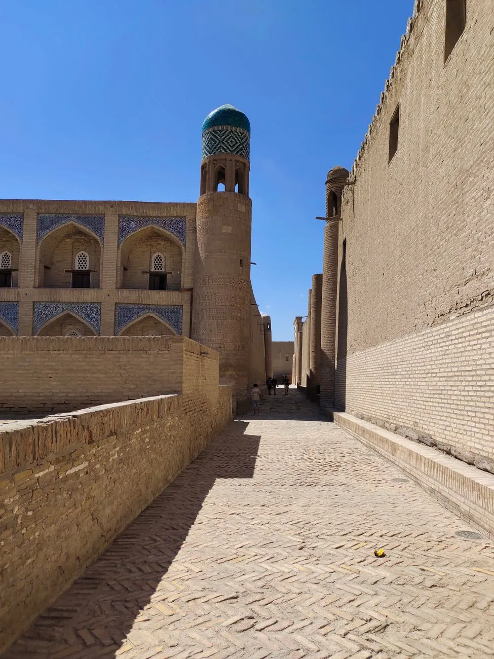
This is Part 2 of the series. Read Part 1 here.The Desert Caravanserai: A Rest Stop for Travelers Khiva’s caravanserais, like the Kutlug Murad Inak Madrasa, were once bustling rest stops for Silk Road travelers and their camels. Today, they house artisan workshops and guesthouses, where visitors can experience traditional Uzbek hospitality. The Khan’s Bathhouse, a 19th-century hammam, offers a chance to relax in a setting that has remained unchanged for centuries. Khiva’s Modern Face: A Hub for Art and Culture While Khiva’s ancient sites are its main attraction, the city is also embracing modernity. The Khiva Silk Carpet Museum showcases the artistry of Uzbek weavers, while the Khiva Art Gallery features contemporary works inspired by the city’s history. For digital nomads, guesthouses like Orient Star Khiva offer reliable Wi-Fi and a quiet workspace, making it easy to explore the city’s wonders while staying connected. Khiva is a place where time seems to have stopped. It’s a city where the desert wind whispers stories of caravans and kings, where every brick holds a secret, and where the spirit of the Silk Road lives on in the most unexpected ways.4. Tashkent: Uzbekistan’s Cosmopolitan Capital While Samarkand, Bukhara, and Khiva dazzle with their ancient charm, Tashkent is Uzbekistan’s modern face—a bustling metropolis where Soviet-era grandeur meets Central Asian tradition. With a population of over 3 million, Tashkent is the country’s cultural, economic, and political heart. It’s a city of wide boulevards, green parks, and futuristic architecture, where the past and future coexist in harmony. Chorsu Bazaar: The Soul of Tashkent Chorsu Bazaar is one of the largest and oldest markets in Central Asia, a labyrinth of stalls selling everything from fresh produce to handmade ceramics. The bazaar’s iconic blue dome, supported by 12 massive columns, is a landmark of Tashkent. Here, you can sample non (Uzbek flatbread), samsa (meat pies), and choy (tea) while bargaining with friendly vendors. The market is a sensory overload—colors, smells, and sounds collide in a symphony of Uzbek life. Khast Imam Complex: A Treasure Trove of Islamic Art The Khast Imam Complex is a spiritual and cultural hub, home to the Uthman Quran, one of the oldest and most revered copies of the Quran in the world. The complex includes the Barak-Khan Madrasa, the Tilla Sheikh Mosque, and the Muyi Muborak Library, which houses rare manuscripts and artifacts. The intricate tilework and calligraphy of the complex are a testament to Uzbekistan’s deep Islamic heritage. Amir Timur Square: A Monument to a Conqueror Amir Timur Square is the heart of Tashkent, a vast plaza dominated by a towering statue of the legendary conqueror. The square is surrounded by government buildings, museums, and the Navruz Palace, a modern structure that hosts cultural events. The Amir Timur Museum offers a deep dive into the life and legacy of Timur, while the Fine Arts Museum of Uzbekistan showcases the country’s rich artistic traditions. Tashkent’s Modern Wonders Tashkent is also a city of innovation. The Tashkent Metro, with its marble stations and Soviet-era mosaics, is a marvel of engineering and design. The Tashkent Tower, one of the tallest structures in Central Asia, offers panoramic views of the city. For digital nomads, co-working spaces like Smart Point provide high-speed internet and a community of like-minded professionals. Cafés like Café Loft serve up artisanal coffee and Uzbek fusion dishes, while the Tashkent City business district is a hub of modern commerce. Green Spaces and Urban Oases Despite its urban sprawl, Tashkent is a green city, with parks like Bog’i Erkinlik and Alisher Navoi Park offering a respite from the hustle and bustle. The Tashkent Botanical Garden is a haven for nature lovers, with over 3,000 species of plants from around the world. The city’s wide boulevards, lined with trees and fountains, make it easy to explore on foot or by bike. Tashkent is a city of contrasts—where Soviet-era buildings stand alongside modern skyscrapers, where ancient traditions meet cutting-edge innovation. It’s a place where the past and future collide, and where the spirit of Uzbekistan’s resilience and creativity shines through.5. Practical Travel Guide: Budget, Visa, and Digital Nomad Life in Uzbekistan Uzbekistan is not just a destination for history lovers—it’s also a paradise for budget travelers and digital nomads. With its ultra-affordable cost of living, fast-growing visa program, and modern infrastructure, the country is quickly becoming a hotspot for remote workers and explorers alike. Here’s everything you need to know to plan your trip, from visas to budgets, healthcare, and beyond. Visa Requirements: Easy Entry for Most Travelers Uzbekistan has made significant strides in simplifying its visa process. As of 2026, citizens of over 80 countries, including the US, UK, EU, Canada, Australia, and Japan, can enter Uzbekistan visa-free for up to 30 days. For longer stays, a tourist visa (valid for up to 30 days) can be obtained online via the e-Visa portal, with processing taking just 3 business days. For digital nomads, a 1-year multiple-entry visa is available for those who can prove remote work or business ties in Uzbekistan. Cost of Living: Affordable Luxury Uzbekistan is one of the most affordable destinations in the world, with a cost of living significantly lower than in Western Europe or North America. According to Numbeo, a single person can live comfortably in Tashkent or Samarkand on $800–$1,200 per month, while a couple can manage on $1,200–$1,800. Here’s a breakdown of typical expenses:Expense Category Cost (USD)Rent (1-bed apartment) $200–$400/monthUtilities (electricity, water, gas) $50–$100/monthGroceries $100–$200/monthDining out (mid-range restaurant) $5–$15/mealPublic transport (monthly pass) $10–$20SIM card (1 month, unlimited data) $5–$10Coworking space (monthly membership) $50–$150Accommodation: From Guesthouses to Boutique Hotels Uzbekistan offers a range of accommodation options to suit every budget:Guesthouses (1–2 stars): $15–$30/night – A great way to experience Uzbek hospitality, often run by local families. Boutique hotels (3–4 stars): $50–$100/night – Stylish, centrally located, and often housed in historic buildings. Modern apartments (Airbnb): $30–$80/night – Ideal for digital nomads seeking privacy and comfort. Luxury hotels (5 stars): $150–$300/night – For those seeking high-end amenities, like the Hyatt Regency Tashkent or Lotte City Hotel Samarkand.Healthcare: Reliable and Affordable Uzbekistan’s healthcare system has improved significantly in recent years, with modern hospitals and clinics in major cities. For digital nomads, international health insurance is highly recommended. The cost of a doctor’s visit ranges from $10–$30, while a night in a private hospital is around $50–$100. Pharmacies are widely available, and medications are generally affordable. Transportation: Getting Around Easily Uzbekistan’s transportation network is efficient and affordable:Domestic flights: Tashkent to Samarkand or Bukhara costs $50–$100 one-way. High-speed train (Afrosiyob): Tashkent to Samarkand in 2 hours for $25–$40. Marshrutkas (shared minivans): $2–$5 for short trips between cities. Taxis (Yandex.Taxi): $5–$15 for city rides. Bicycle rentals: $5–$10/day – A great way to explore cities like Bukhara and Khiva.Digital Nomad Life: Work, Wi-Fi, and Community Uzbekistan is rapidly becoming a digital nomad hotspot, thanks to its digital nomad visa, affordable cost of living, and growing community of remote workers. Here’s what to expect:Internet: Uzbekistan has 4G coverage across the country, with speeds averaging 20–50 Mbps. Major cities like Tashkent, Samarkand, and Bukhara have fiber-optic internet in most cafes and co-working spaces. Co-working spaces: Impact Hub Samarkand – $10/day or $100/month. Smart Point Tashkent – $8/day or $80/month. Coworking.uz Bukhara – $5/day or $50/month.Community: Facebook groups like Digital Nomads Uzbekistan and Expat Tashkent are great for networking and tips.Safety and Cultural TipsSafety: Uzbekistan is generally safe, with low crime rates. Petty theft can occur in tourist areas, so keep an eye on your belongings. Dress code: Uzbekistan is a Muslim-majority country, but it’s relatively liberal. Dress modestly in religious sites (cover shoulders and knees), but Western clothing is fine in cities. Language: Uzbek and Russian are the main languages, but English is spoken in tourist areas and by younger generations. Currency: The Uzbek som (UZS) is the local currency. $1 USD ≈ 12,500 UZS (as of 2026). Credit cards are accepted in major hotels and restaurants, but cash is king in markets and small shops.Uzbekistan is a destination that rewards curiosity, patience, and an open mind. Whether you’re exploring ancient cities, working remotely in a cozy café, or bargaining in a bustling bazaar, the country offers an experience that is as enriching as it is affordable.The Silk Road is not just a relic of the past—it’s a living, breathing thread that connects Uzbekistan’s ancient cities to a vibrant present. From the turquoise domes of Samarkand to the labyrinthine alleys of Bukhara, the desert jewel of Khiva, and the cosmopolitan energy of Tashkent, this country is a testament to the enduring power of history, culture, and human connection. Uzbekistan is more than a destination; it’s an invitation to step into a world where the past and future coexist, where every brick tells a story, and where the spirit of the Silk Road lives on in the most unexpected ways. Whether you’re a history buff, a digital nomad, a foodie, or simply someone seeking beauty in the unexpected, Uzbekistan offers a journey that will leave you inspired, enriched, and longing to return. So pack your bags, grab your passport, and set out on the adventure of a lifetime. The Silk Road is waiting.#SilkRoadRevival #UzbekistanTravel #CentralAsiaAdventure #CulturalJourney #DigitalNomadLife Related InsightsIceland's Golden Circle: Unveiling the Land of Fire and Ice Arctic Circle Digital Nomadism: Building Connectivity in Greenland's Remote Towns Fairy Tale Châteaux: A Journey Through the Loire Valley{ "@context": "https://schema.org", "@type": "FAQPage", "mainEntity": [ { "@type": "Question", "name": "What is the main focus of The Silk Road Revival: Uzbekistan’s Ancient Cities and Modern Wonders (Part 2)?", "acceptedAnswer": { "@type": "Answer", "text": "Step into the heart of Central Asia and rediscover the Silk Road through Uzbekistan’s breathtaking cities, where 3,000 years of history meet vibrant modernity and ultra-affordable living." } }, { "@type": "Question", "name": "Who authored the comprehensive guide on The Silk Road Revival: Uzbekistan’s Ancient Cities and Modern Wonders (Part 2)?", "acceptedAnswer": { "@type": "Answer", "text": "This detailed article and its insights were carefully researched and authored by Wei Chen." } }, { "@type": "Question", "name": "Where can I find more related content about Travel?", "acceptedAnswer": { "@type": "Answer", "text": "You can explore more articles, detailed reviews, and similar insights by browsing the Related Insights section at the bottom of this article or visiting our dedicated Travel category page." } } ] }
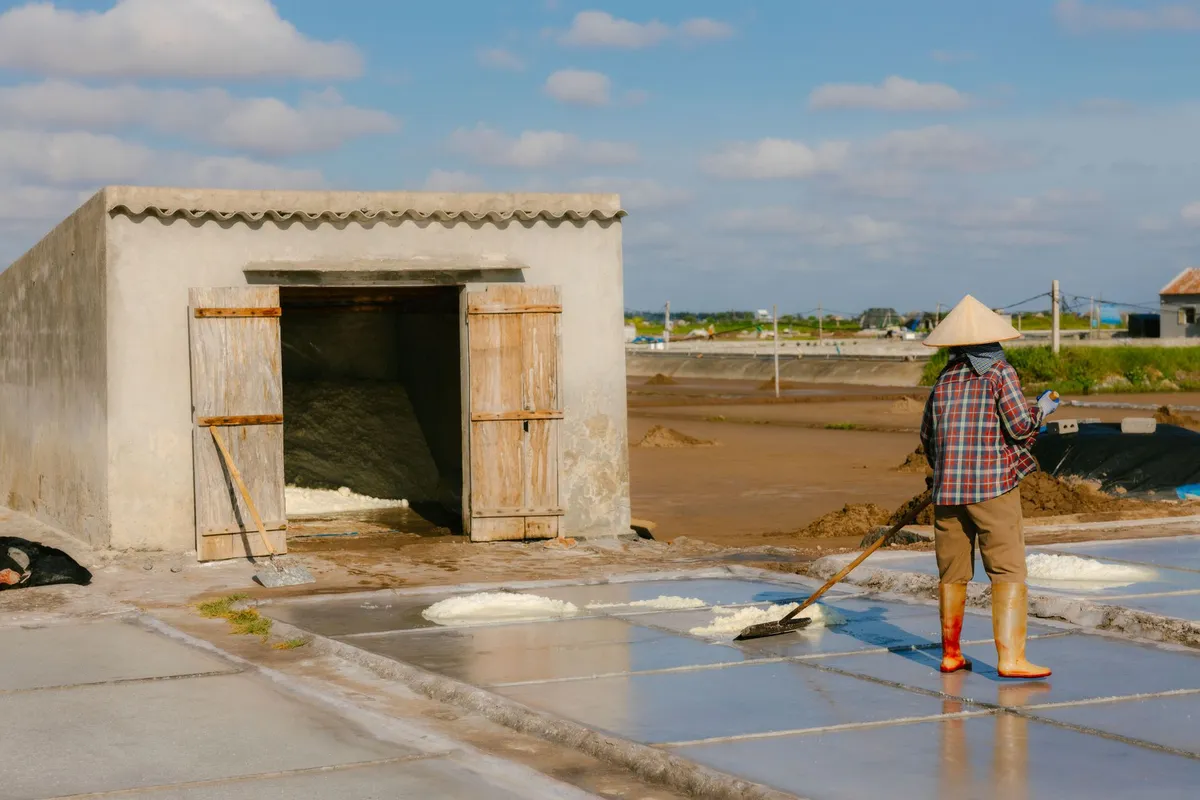
- Chloe Tremblay
- 22 Jul, 2026 17:50
Ethiopia’s Danakil Depression: A Journey to Earth’s Hottest and Most Alien Landscape (Part 2)
This is Part 2 of the series. Read Part 1 here.The Salt Caravans: A Journey Through Time The salt caravans of the Danakil Depression are a spectacle of human endurance and tradition. Each caravan consists of hundreds of camels, each laden with salt blocks weighing up to 30 kilograms (66 pounds). The journey is grueling, with temperatures often exceeding 50°C (122°F) and the terrain being treacherous. Yet, the caravans continue to operate, a testament to the resilience of the Afar people. For travelers, encountering a salt caravan is a rare and unforgettable experience. The sight of hundreds of camels trudging across the salt flats, their bells jingling in the distance, is like stepping back in time. Some tour operators include a visit to a salt mine or a caravan stop as part of their itinerary, giving visitors a glimpse into this ancient way of life. The Cultural Significance of Salt In Afar culture, salt is more than just a commodity—it’s a symbol of wealth, status, and even spirituality. The Afar people believe that the salt flats are sacred, and they perform rituals to honor the spirits that dwell there. Salt is also used in traditional medicine, with Afar healers prescribing it for everything from digestive issues to skin ailments. For visitors, the salt caravans offer a unique opportunity to engage with Afar culture. Many tour operators arrange meetings with local miners and traders, allowing travelers to learn about their traditions and way of life. Purchasing salt directly from the miners is also a way to support the local economy and bring home a piece of this extraordinary place.Surviving the Danakil Depression: Health Risks, Safety Tips, and Practical Advice The Danakil Depression is not a destination for the faint of heart. With temperatures that can melt asphalt, air thick with toxic fumes, and a landscape that seems designed to test human limits, survival here requires preparation, caution, and respect for the environment. In this section, we’ll cover the key health risks, safety tips, and practical advice to ensure your expedition is as safe as it is unforgettable. Health Risks: What to Watch Out For The Danakil Depression poses several health risks, the most immediate of which is heatstroke. With temperatures often exceeding 50°C (122°F), the risk of dehydration and heat exhaustion is extremely high. Symptoms of heatstroke include dizziness, nausea, confusion, and a rapid pulse. If left untreated, heatstroke can be fatal. To prevent it:Drink water constantly, even if you’re not thirsty. Avoid alcohol and caffeine, as they dehydrate you. Take frequent breaks in shaded areas. Wear lightweight, breathable clothing to help regulate body temperature.Another major health concern is respiratory issues caused by the sulfur fumes from the hydrothermal vents. Inhaling sulfur dioxide can irritate the lungs and throat, leading to coughing, wheezing, and shortness of breath. People with asthma or other respiratory conditions should consult a doctor before visiting. If you experience difficulty breathing, move to an area with fresher air and seek medical attention immediately. Safety Tips: Navigating the Extreme Landscape The Danakil Depression is a hazardous environment, and safety should be your top priority. Here are some essential tips to keep in mind:Never wander off alone: Always stay with your guide and group. The terrain is treacherous, and getting lost is a real risk. Avoid touching hot surfaces: The ground in the hydrothermal areas can reach temperatures of over 100°C (212°F). Even a brief touch can cause severe burns. Wear sturdy footwear: The salt flats and volcanic terrain are sharp and uneven. Proper hiking boots are a must. Carry a first-aid kit: Include bandages, antiseptic wipes, rehydration salts, and any personal medication. Stay hydrated: Dehydration can set in quickly, so drink water regularly, even if you’re not thirsty.Practical Advice: What to Expect on the Ground Your expedition will likely begin in Mekelle, the capital of the Tigray region, which serves as the gateway to the Danakil Depression. From there, you’ll travel by 4x4 vehicle to Semera, the regional capital of the Afar region. The journey takes about 6-8 hours, depending on road conditions. Along the way, you’ll pass through arid landscapes, small villages, and the occasional camel caravan. Once in the Danakil Depression, your itinerary will typically include visits to:Erta Ale volcano: A night hike to the crater’s edge to witness the lava lake. Dallol hydrothermal field: A surreal landscape of acidic hot springs and mineral deposits. Salt flats and caravans: An opportunity to see the salt mining process and interact with local traders.Accommodation during your expedition will be basic but comfortable. Most tours include stays in campsites with tents or simple lodges. Expect basic amenities like shared bathrooms and limited electricity. Meals are usually prepared by the tour crew and consist of local dishes like injera (a sourdough flatbread) and wat (a spicy stew). Money-Saving Tips for Budget-Conscious Travelers While the Danakil Depression is not a budget destination, there are ways to reduce costs without compromising safety or experience. Here are some tips:Travel during the off-season: The best time to visit is between October and March, when temperatures are slightly cooler. Avoid the peak summer months (June-August), when the heat is unbearable. Book a group tour: Sharing a tour with other travelers can significantly lower the per-person cost. Bring your own snacks and water: While meals are usually included, bringing extra snacks and a reusable water bottle can save money. Negotiate extras: Some tour operators may include additional stops or activities for a small fee, so ask about package deals.The Danakil Depression Through the Lens: Photography and Cultural Immersion The Danakil Depression is a photographer’s paradise—a landscape so alien and vibrant that it feels like another world. From the neon-yellow sulfur fields of Dallol to the glowing lava lake of Erta Ale, every corner of this extreme environment offers a unique visual experience. But capturing its beauty requires more than just a good camera—it demands patience, respect for the environment, and an understanding of the cultural significance of the land. Photography Tips for the Danakil Depression The Danakil Depression presents several challenges for photographers, the most obvious being the extreme heat and harsh light. Here are some tips to help you capture the best shots:Shoot during golden hour: The light is softest and most flattering during sunrise and sunset, making it the ideal time for landscape photography. Use a polarizing filter: This helps reduce glare and enhance the colors of the mineral deposits. Bring extra batteries: The heat drains batteries quickly, so pack spares and keep them in a cool place. Protect your gear: Dust and sand are constant companions in the Danakil Depression. Use a lens cloth to clean your equipment regularly and store your camera in a dust-proof bag when not in use.Cultural Immersion: Engaging with the Afar People The Danakil Depression is not just a geological wonder—it’s also home to the Afar people, one of Ethiopia’s most resilient ethnic groups. Engaging with the local community is a highlight of any visit, offering insights into their traditions, way of life, and deep connection to the land. Many tour operators arrange meetings with Afar miners, traders, and guides, allowing visitors to learn about their culture firsthand. Some tours even include homestays in Afar villages, where you can experience traditional food, music, and hospitality. The Afar people are warm and welcoming, but it’s important to approach interactions with respect and humility. Ask for permission before taking photos of people or their homes, and consider purchasing salt or other local crafts as a way to support their economy. Ethical Considerations: Responsible Tourism in the Danakil Depression The Danakil Depression is a fragile ecosystem, and tourism can have a significant impact on the environment and local communities. To minimize your footprint, follow these guidelines:Stay on marked paths: The terrain is fragile, and straying from designated routes can damage the landscape. Avoid littering: Pack out all your trash, including food wrappers and water bottles. Respect local customs: Dress modestly, ask before taking photos, and follow your guide’s instructions. Support local businesses: Purchase salt, crafts, or other goods directly from Afar traders to ensure your money goes back into the community.Cost Breakdown: What to Expect When Visiting the Danakil DepressionExpense Cost (USD) NotesEthiopian e-Visa $52 Single-entry, 30-day validity.Danakil Depression Permit $50-$100 Usually included in tour packages.3-Day Tour Package $450-$700 Includes transport, accommodation, meals, and guide.Flights to Ethiopia $800-$1,500 Varies by departure city and season.Travel Insurance $100-$200 Essential for medical evacuation coverage.Vaccinations $50-$150 Includes yellow fever, hepatitis A, and typhoid.Gear and Supplies $100-$200 Includes hiking boots, sunscreen, and a reusable water bottle.Total Estimated Cost $1,552-$2,852 Excludes souvenirs and extra activities.Conclusion: Is the Danakil Depression Worth the Journey? The Danakil Depression is not a destination for the casual traveler. It is a place of extremes—where the heat can melt the soles of your shoes, the air can burn your lungs, and the landscape looks like it belongs on another planet. Yet, for those who make the journey, the rewards are unparalleled. To stand on the edge of Erta Ale’s lava lake, to walk through the neon sulfur fields of Dallol, to witness the ancient salt caravans of the Afar people—these are experiences that transcend the ordinary. But the Danakil Depression is more than just an adventure—it’s a lesson in resilience, both human and geological. It’s a reminder of the raw power of nature and the fragility of human existence. It’s a place where the Earth’s crust is thin enough to glimpse the molten heart beneath, where the air is thick with the scent of sulfur and the echoes of ancient trade routes. If you’re willing to brave the heat, the bureaucracy, and the physical demands, the Danakil Depression will reward you with memories that last a lifetime. Just remember: this is not a trip to be taken lightly. It requires preparation, respect for the environment, and a willingness to embrace the unknown. But for those who do, the Danakil Depression offers an adventure unlike any other—a journey to the edge of the world and back. So, are you ready to step into the fire?#EthiopiaAdventure #ExtremeTravel #VolcanoTrekking #SaltFlats #DanakilDepression Related InsightsMachu Picchu : Quand les Pierres Éternelles des Incas Murmurent l'Histoire Oubliée au Sommet des Andes 'Australiens verborgene Schätze: Wie der Tourismus das Land neu erfindet' The Arctic's Whispering Skies: Your Ultimate Guide to Unlocking Scandinavia's Northern Lights Mystique (Part 2){ "@context": "https://schema.org", "@type": "FAQPage", "mainEntity": [ { "@type": "Question", "name": "What is the main focus of Ethiopia’s Danakil Depression: A Journey to Earth’s Hottest and Most Alien Landscape (Part 2)?", "acceptedAnswer": { "@type": "Answer", "text": "Explore Ethiopia’s Danakil Depression, a surreal, otherworldly landscape where temperatures soar, volcanoes erupt, and salt caravans traverse ancient trade routes." } }, { "@type": "Question", "name": "Who authored the comprehensive guide on Ethiopia’s Danakil Depression: A Journey to Earth’s Hottest and Most Alien Landscape (Part 2)?", "acceptedAnswer": { "@type": "Answer", "text": "This detailed article and its insights were carefully researched and authored by Chloe Tremblay." } }, { "@type": "Question", "name": "Where can I find more related content about Travel?", "acceptedAnswer": { "@type": "Answer", "text": "You can explore more articles, detailed reviews, and similar insights by browsing the Related Insights section at the bottom of this article or visiting our dedicated Travel category page." } } ] }
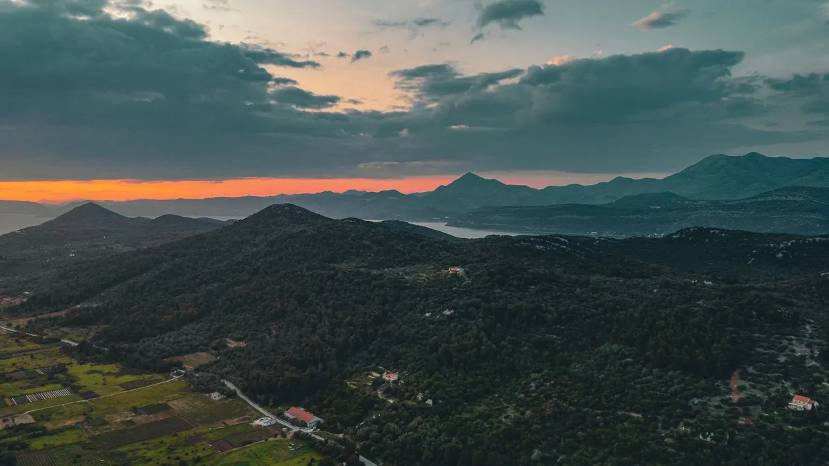
- Zola Ndlovu
- 22 Jul, 2026 07:13
Albania’s Riviera vs Montenegro’s Bay of Kotor: Europe’s Best-Kept Secret Coastlines Revealed
Albania’s Riviera and Montenegro’s Bay of Kotor are Europe’s most underrated coastal destinations—where rugged cliffs meet turquoise waters, medieval villages cling to mountainsides, and the cost of living is a fraction of Western Europe’s. While Croatia’s Dalmatian Coast hogs the spotlight, these two Balkan neighbors offer an intoxicating blend of affordability, authenticity, and natural splendor. Albania’s Riviera stretches 447 kilometers along the Adriatic and Ionian Seas, boasting some of the continent’s last truly wild beaches, while Montenegro’s Bay of Kotor—a UNESCO-listed fjord-like inlet—delivers dramatic scenery and a mix of Venetian, Ottoman, and Slavic heritage. For adventurous travelers, expats, and digital nomads, these regions represent a rare opportunity to experience Mediterranean beauty without the crowds or exorbitant prices. But which destination suits your travel style? Is Albania’s rock-bottom pricing and fast-growing infrastructure the better choice, or does Montenegro’s compact beauty and EU candidacy edge it out? Let’s dive into the hidden gems, practical tips, and hard data to help you decide.1. Albania’s Riviera: Europe’s Last Wild Coastline Albania’s Riviera is a 447-kilometer stretch of coastline along the Adriatic and Ionian Seas, often compared to the French Riviera but without the crowds or pretension. This region, stretching from Vlorë in the north to Sarandë in the south, is a paradise for travelers seeking untouched beaches, crystal-clear waters, and a slow-paced, authentic lifestyle. Unlike Croatia’s overdeveloped Dalmatian Coast, Albania’s Riviera remains largely undiscovered, with only 10% of its potential developed for tourism. This makes it a haven for those who crave solitude, adventure, and a taste of the "real" Mediterranean. The Best Beaches and Hidden Coves Albania’s Riviera is home to some of Europe’s most pristine beaches, many of which are accessible only by boat or a short hike. Ksamil Beach, often called the "Caribbean of Europe," is a postcard-perfect destination with four small islands just offshore, accessible by kayak or paddleboard. The water here is so clear that you can see fish swimming beneath your feet. For a more secluded experience, Gjipe Beach—a hidden cove near Vlorë—requires a 30-minute hike through a lush canyon, rewarding visitors with a nearly empty stretch of golden sand and dramatic cliffs.Jale Beach, near Dhermi, is another gem, known for its bohemian vibe and cliffside hostels where backpackers and digital nomads gather. The beach itself is a crescent of white pebbles and sand, backed by pine forests and towering limestone cliffs. For those willing to venture off the beaten path, Llogara Pass offers breathtaking views of the Ionian Sea from 1,000 meters above sea level, with hiking trails leading to secluded beaches like Drymades Beach, where the water is so calm it resembles a lake. Cultural and Historical Gems Albania’s Riviera isn’t just about beaches—it’s also rich in history and culture. Butrint National Park, a UNESCO World Heritage Site, is a must-visit. This ancient Greek and Roman city, nestled in a marshy lagoon, feels like a lost civilization. The ruins include a 2,500-year-old theater, a Byzantine basilica, and a Venetian castle, all surrounded by lush vegetation and wildlife. Nearby, the Blue Eye Spring (Syri i Kaltër) is a natural phenomenon where a deep blue pool of water bubbles up from the earth, creating a surreal, almost mystical atmosphere. For a taste of Albania’s Ottoman past, head to Gjirokastër, a UNESCO-listed "Stone City" with cobblestone streets, Ottoman-era houses, and a fortress that offers panoramic views of the surrounding mountains. The city is also famous for its traditional qoftë (meatballs) and byrek (savory pastry), which you can enjoy at local teahouses tucked away in the old town. Practical Tips for Visiting Albania’s RivieraBest Time to Visit: May to September is ideal, with temperatures ranging from 25°C to 35°C (77°F to 95°F). July and August are peak months, so book accommodations early. Getting Around: Buses and furgons (shared minivans) are the most common forms of transport. Renting a car gives you the freedom to explore hidden beaches and villages. Where to Stay: For budget travelers, Dhermi and Himarë offer affordable hostels and guesthouses. For luxury, Ksamil has boutique hotels with private beach access. Food and Drink: Albanian cuisine is a blend of Mediterranean and Balkan flavors. Don’t miss tavë kosi (baked lamb with yogurt), qifqi (rice balls), and fresh seafood grilled by the shore. Local wine from the Berat region is a must-try. Safety: Albania is generally safe, but petty theft can occur in tourist areas. Avoid leaving valuables unattended on beaches.2. Montenegro’s Bay of Kotor: Europe’s Southernmost Fjord Montenegro’s Bay of Kotor is often called Europe’s southernmost fjord, a dramatic inlet surrounded by towering mountains and medieval towns. This UNESCO-listed bay is a geological wonder, formed by tectonic shifts millions of years ago, and it’s one of the most stunning coastal landscapes in the world. Unlike Albania’s Riviera, which is spread out along a long coastline, the Bay of Kotor is compact, with most attractions concentrated in a small area. This makes it perfect for travelers who want to explore a lot in a short amount of time. The Highlights of the Bay of Kotor The bay is divided into four main sections: the inner bay (Boka Kotorska), the outer bay, the channel of Verige, and the Gulf of Tivat. The inner bay is the most picturesque, with Kotor Old Town as its crown jewel. This medieval walled city, with its narrow alleys, Byzantine churches, and Venetian palaces, feels like stepping into a fairy tale. The Cathedral of Saint Tryphon, built in 1166, and the Church of Our Lady of Remedy are must-see landmarks.For breathtaking views, hike up to the San Giovanni Fortress, which offers a panoramic view of the bay. The hike is steep and challenging, but the reward is worth it. Alternatively, take a boat tour from Perast to the Our Lady of the Rocks island, home to a 17th-century church and a museum showcasing local maritime history. Hidden Villages and Natural Wonders Beyond Kotor, the bay is dotted with charming villages that seem frozen in time. Perast, a UNESCO-listed town, is famous for its Baroque architecture and two iconic islets: Our Lady of the Rocks and Saint George Island. The town’s palaces and churches are a testament to its wealthy maritime past. For nature lovers, Lovćen National Park is a must-visit. The park is home to Mount Lovćen, which offers stunning views of the bay, and the Njegoš Mausoleum, a striking white structure at the summit. The drive up the mountain is an adventure in itself, with hairpin turns and breathtaking vistas. Another hidden gem is Tivat, a port town known for its luxury marina and the Porto Montenegro development, a playground for the rich and famous. While Tivat itself is more modern, it serves as a great base for exploring the bay. Practical Tips for Visiting the Bay of KotorBest Time to Visit: May to October is ideal, with temperatures ranging from 20°C to 30°C (68°F to 86°F). July and August are peak months, so expect crowds in Kotor. Getting Around: Buses and taxis are the most common forms of transport. Renting a car is useful for exploring the surrounding areas, but parking can be difficult in Kotor. Where to Stay: For luxury, Porto Montenegro offers high-end hotels and yacht charters. For budget travelers, Perast and Tivat have affordable guesthouses. Food and Drink: Montenegrin cuisine is a blend of Mediterranean and Balkan flavors. Don’t miss njeguški pršut (smoked ham), kačamak (cornmeal porridge), and fresh seafood. Local wine from the Crmnica region is a must-try. Safety: Montenegro is generally safe, but be cautious of pickpockets in crowded areas like Kotor Old Town.3. Cost of Living: Albania vs. Montenegro When it comes to affordability, Albania has a clear edge over Montenegro. According to Numbeo, the Cost of Living Index for Albania is significantly lower than that of Montenegro, making it an ideal destination for budget travelers, digital nomads, and expats. Below is a breakdown of key expenses in both countries, based on Numbeo’s latest data:Expense Category Albania (USD) Montenegro (USD) ComparisonMeal at an Inexpensive Restaurant $5 - $10 $8 - $15 Albania is ~30% cheaperMid-range Restaurant Meal (for two) $20 - $40 $30 - $60 Albania is ~40% cheaperLocal Beer (0.5L) $1 - $2 $1.50 - $3 Albania is ~25% cheaperCappuccino $1 - $2 $1.50 - $2.50 Albania is ~20% cheaperMonthly Rent (1-bedroom apartment in city center) $200 - $400 $300 - $600 Albania is ~40% cheaperMonthly Rent (1-bedroom apartment outside city center) $150 - $300 $200 - $400 Albania is ~30% cheaperPublic Transport (Monthly Pass) $15 - $25 $20 - $35 Albania is ~30% cheaperTaxi (1km) $0.50 - $1 $0.70 - $1.50 Albania is ~30% cheaperAs the table shows, Albania is consistently cheaper than Montenegro across all categories. This makes it an attractive option for travelers on a budget or those looking to stretch their euros further. However, Montenegro’s prices are still reasonable compared to Western Europe, and the country offers a higher standard of living in some areas, particularly in cities like Podgorica and Tivat. For digital nomads, Albania’s Dhermi and Himarë are popular hubs with coworking spaces and fast internet. Montenegro’s Kotor and Tivat also have coworking spaces, but the cost of living is higher. Ultimately, your choice will depend on your budget and priorities—whether you prioritize affordability or a slightly higher standard of living.4. Adventure and Activities: What to Do in Albania and Montenegro Both Albania and Montenegro offer a wealth of adventure activities, from hiking and kayaking to diving and cultural explorations. Here’s a breakdown of the best things to do in each destination: Albania’s Riviera: Adventure AwaitsHiking in the Accursed Mountains (Bjeshkët e Namuna): This rugged mountain range in northern Albania offers some of the most challenging and rewarding hikes in Europe. The Valbona Pass and Theth to Valbona trek are must-do routes for experienced hikers. Kayaking in Ksamil: Paddle through the crystal-clear waters of Ksamil’s four islands, where you can snorkel and explore underwater caves. Paragliding in Dhermi: Soar above the Ionian Sea with a tandem paragliding flight, offering breathtaking views of the coastline. Canyoning in Llogara Pass: Descend into hidden canyons and waterfalls near the Llogara Pass, a thrilling adventure for adrenaline junkies. Wine Tasting in Berat: Visit local wineries in the Berat region, known for its indigenous grape varieties like Kallmet and Shesh.Montenegro’s Bay of Kotor: A Mix of Culture and NatureHiking to San Giovanni Fortress: This challenging hike rewards you with panoramic views of the Bay of Kotor, one of the most stunning vistas in Europe. Boat Tour to Our Lady of the Rocks: Explore the historic islet and its museum, then enjoy a seafood lunch in Perast. Kayaking in the Bay of Kotor: Paddle through the calm waters of the bay, passing by medieval towns and hidden coves. Cycling the Bay of Kotor: Rent a bike and cycle along the scenic coastal roads, stopping at villages like Prčanj and Muo. Diving in the Blue Cave: Explore the underwater caves and shipwrecks near Herceg Novi, a popular diving spot.Both destinations offer a mix of adventure and relaxation, but Albania’s Riviera is better suited for those who love hiking, water sports, and off-the-beaten-path experiences. Montenegro’s Bay of Kotor, on the other hand, is ideal for culture lovers, history buffs, and those who enjoy a mix of city and nature.5. Digital Nomad and Expat Life: Which Destination is Right for You? For digital nomads and expats, both Albania and Montenegro offer unique advantages, but the best choice depends on your lifestyle, budget, and priorities. Albania: The Affordable Paradise Albania is quickly becoming a hotspot for digital nomads, thanks to its low cost of living, fast-growing infrastructure, and welcoming locals. Tirana, the capital, has a thriving coworking scene with spaces like The Roof and Impact Hub Tirana. The city is also home to a growing number of cafes and restaurants catering to remote workers. In the coastal towns of Dhermi and Himarë, you’ll find a mix of expats and locals, with affordable guesthouses and a laid-back vibe. The internet is reliable in most areas, and the time zone (CET) is convenient for European and American remote workers. Pros of Living in Albania:Extremely affordable cost of living. Fast-growing infrastructure and digital nomad community. Stunning beaches and natural beauty. Friendly locals and a relaxed pace of life.Cons of Living in Albania:Limited healthcare options outside major cities. Bureaucracy can be slow and frustrating. Public transport is unreliable in rural areas.Montenegro: The Compact European Gem Montenegro is a small but diverse country, offering a mix of coastal living, mountain adventures, and city life. Podgorica, the capital, is a modern city with a growing coworking scene, while Kotor and Tivat offer a more relaxed, coastal lifestyle. For expats, Montenegro’s EU candidacy is a major draw, as it offers the potential for easier travel and business opportunities within the EU. The country also has a higher standard of living than Albania, with better healthcare and infrastructure. Pros of Living in Montenegro:Higher standard of living and better infrastructure. EU candidacy offers future opportunities. Stunning natural beauty and diverse landscapes. More developed healthcare system.Cons of Living in Montenegro:Higher cost of living than Albania. Bureaucracy can be slow and inefficient. Limited digital nomad community outside major cities.Ultimately, your choice will depend on your budget and priorities. If you’re looking for an affordable, laid-back lifestyle with stunning beaches, Albania is the better choice. If you prefer a higher standard of living and don’t mind paying a bit more, Montenegro’s Bay of Kotor is an excellent option.Albania’s Riviera and Montenegro’s Bay of Kotor are two of Europe’s most underrated coastal destinations, each offering a unique blend of natural beauty, culture, and affordability. Albania’s Riviera is perfect for travelers seeking wild beaches, adventure, and a slow-paced lifestyle, while Montenegro’s Bay of Kotor is ideal for those who love history, medieval towns, and a mix of city and nature. Both destinations are affordable compared to Western Europe, but Albania has a clear edge in terms of cost of living. Whether you’re a digital nomad, an expat, or a traveler looking for your next adventure, these two Balkan gems are sure to captivate you. So pack your bags, grab your passport, and get ready to explore Europe’s best-kept secret coastlines.#BalkanTravel #HiddenGems #CoastalAdventures #BudgetTravel #EuropeanRiviera Related InsightsL'Or Pourpre de la Provence : Voyage au Cœur des Océans de Lavande Svalbard: Arctic Adventures Beyond the Northern Lights – A Remote Paradise for Explorers Hidden Gems of Eastern Anatolia{ "@context": "https://schema.org", "@type": "FAQPage", "mainEntity": [ { "@type": "Question", "name": "What is the main focus of Albania’s Riviera vs Montenegro’s Bay of Kotor: Europe’s Best-Kept Secret Coastlines Revealed?", "acceptedAnswer": { "@type": "Answer", "text": "Discover Albania’s untouched Riviera and Montenegro’s dramatic Bay of Kotor—two Balkan coastal jewels offering affordability, adventure, and breathtaking beauty." } }, { "@type": "Question", "name": "Who authored the comprehensive guide on Albania’s Riviera vs Montenegro’s Bay of Kotor: Europe’s Best-Kept Secret Coastlines Revealed?", "acceptedAnswer": { "@type": "Answer", "text": "This detailed article and its insights were carefully researched and authored by Zola Ndlovu." } }, { "@type": "Question", "name": "Where can I find more related content about Travel?", "acceptedAnswer": { "@type": "Answer", "text": "You can explore more articles, detailed reviews, and similar insights by browsing the Related Insights section at the bottom of this article or visiting our dedicated Travel category page." } } ] }
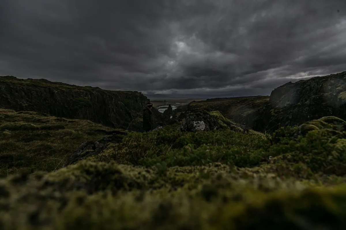

Introduction to Reykjavík Reykjavík, the capital and largest city of Iceland, is a treasure trove of history, culture, and natural beauty. Located on the southern shore of the Faxaflói bay in southwest Iceland, Reykjavík boasts a unique blend of traditional and modern charm. With a population of around 140,000 as of 2026, the city is home to approximately 64% of Iceland's population, making it the country's economic, cultural, and governmental hub.A Brief History of Reykjavík According to the Landnámabók, the settlement of Iceland began in Reykjavík when Ingólfur Arnarson arrived from Norway in the year 874. For over 900 years following this, there was no urban development; the city was officially founded in 1786 as a trading town and grew steadily as it transformed into its current state as the centre of Iceland's cultural, economic, and governmental activity. The city's name, Reykjavík, is derived from the Old Norse words "reykr" (smoke) and "vík" (bay), inspired by the steam rising from hot springs in the region.Urban Development and Growth The site of the modern city centre was farmland until the 18th century. In 1752, King Frederik V of Denmark donated the estate of Reykjavík to the Innréttingar corporation, marking the beginning of the city's urban development. The leader of this movement, Skúli Magnússon, played a significant role in shaping the city's early growth. The Danish Crown abolished monopoly trading in 1786, granting six communities around the country an exclusive trading charter, with Reykjavík being one of them. This charter enabled the city to establish itself as a major trading hub, attracting merchants and traders from across the region.Rise of Nationalism and Independence Icelandic nationalist sentiment gained influence in the 19th century, with the idea of Icelandic independence becoming widespread. Reykjavík, as Iceland's only city, was central to these ideas. Advocates of an independent Iceland realized that a strong Reykjavík was fundamental to achieving this objective. The city played a crucial role in the country's struggle for independence, with the Alþingi, the general assembly, being re-established in Reykjavík in 1845. In 1874, Iceland was given a constitution, and the Alþingi gained some limited legislative powers. The next step was to move most of the executive power to Iceland, with Home Rule being granted in 1904 and the office of Minister for Iceland being established in Reykjavík.World War II and Its Impact on Reykjavík On the morning of 10 May 1940, following the German occupation of Denmark and Norway, four British warships approached Reykjavík and anchored in the harbour. The Allied occupation of Reykjavík was complete, with no armed resistance from the Icelandic government. The economic effects of the occupation were positive for Reykjavík, with unemployment disappearing and construction work beginning. The British built Reykjavík Airport, which remains in service today, while the Americans built Keflavík Airport, situated 50 km west of Reykjavík, which became Iceland's primary international airport.Post-War Development and Modern Reykjavík In the post-war years, the growth of Reykjavík accelerated. An exodus from the rural countryside began, largely due to improved technology in agriculture reducing the need for manpower. The city was rapidly transformed into a modern metropolis, with private cars becoming common and modern apartment complexes rising in the expanding suburbs. Today, Reykjavík is a thriving city, known for its vibrant cultural scene, stunning natural beauty, and friendly inhabitants.#Travel #Iceland #Reykjavík Related InsightsEchoes from the Deep: Unveiling the Drowned Villages Beneath Italy's Lake Reschen L'Eterna Seduzione della Costa Azzurra: Tra Scogliere di Porfido e Misteri Belle Époque Ethiopia's Danakil Depression: The Hottest Place on Earth's Alien Landscapes (Part 3){ "@context": "https://schema.org", "@type": "FAQPage", "mainEntity": [ { "@type": "Question", "name": "What is the main focus of Reykjavík: The Smoke Bay Capital of Iceland?", "acceptedAnswer": { "@type": "Answer", "text": "Explore the world's northernmost capital, Reykjavík, and uncover its rich history, cultural significance, and breathtaking landscapes." } }, { "@type": "Question", "name": "Who authored the comprehensive guide on Reykjavík: The Smoke Bay Capital of Iceland?", "acceptedAnswer": { "@type": "Answer", "text": "This detailed article and its insights were carefully researched and authored by Cemre Seyyah." } }, { "@type": "Question", "name": "Where can I find more related content about Travel?", "acceptedAnswer": { "@type": "Answer", "text": "You can explore more articles, detailed reviews, and similar insights by browsing the Related Insights section at the bottom of this article or visiting our dedicated Travel category page." } } ] }
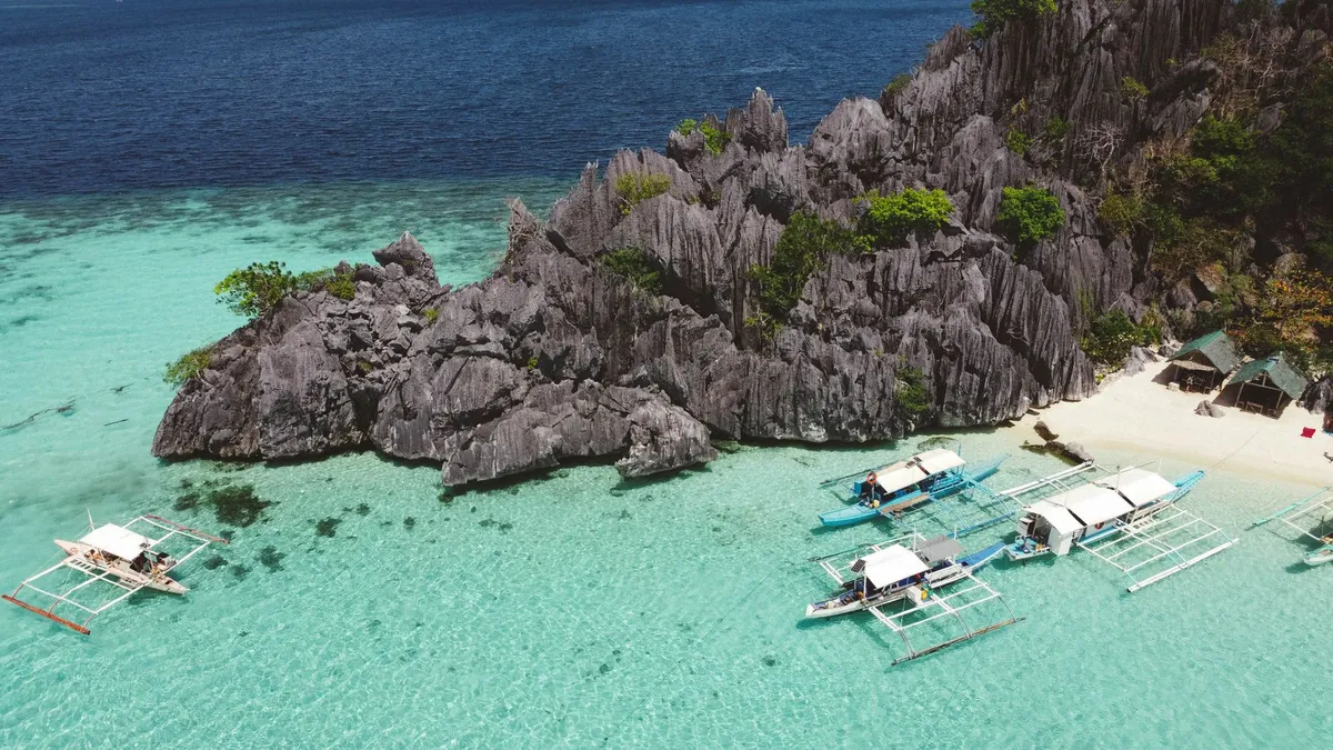
The Enchanting Province of Palawan Located in the region of Mimaropa, Palawan is the largest province in the Philippines, boasting a total area of 14,649.73 km2. This archipelagic province is a treasure trove of natural wonders, from its stunning beaches to its lush forests and majestic mountains. The capital and largest city, Puerto Princesa, is a must-visit destination, with its vibrant culture and rich history.The islands of Palawan stretch between Mindoro island in the northeast and Borneo in the southwest, lying between the South China Sea and the Sulu Sea. The province is named after its largest island, Palawan Island, which measures 450 kilometers long and 50 kilometers wide. A Glimpse into Pre-History The early history of Palawan was determined by a team of researchers led by Robert Bradford Fox, who found evidence in the Tabon Caves that humans have lived in Palawan for more than 50,000 years. The discovery of human bone fragments, known as Tabon Man, in the municipality of Quezon, as well as tools and other artifacts, provides a fascinating insight into the lives of the island's earliest inhabitants.The discovery of two articulated phalanx bones of a tiger, alongside other animal fossils, in Ille Cave near the village of New Ibajay, is a significant find. The condition of the tiger subfossils, dated to approximately 12,000 to 9,000 years ago, suggests that they may have been imported from elsewhere, possibly from Borneo. The Maritime Jade Road Palawan was a major site for the Maritime Jade Road, one of the most extensive sea-based trade networks of a single geological material in the prehistoric world. Operating for 3,000 years from 2000 BCE to 1000 CE, this network played a significant role in the island's early history.The Maritime Jade Road connected Palawan to other parts of Southeast Asia, facilitating the exchange of goods, ideas, and cultures. This ancient trade network has left a lasting legacy on the island, with many of its traditions and customs still evident today. Early History and Indigenous Groups Palawan is home to several Indigenous groups, including the Palaw'an, Batak, Tagbanwa, and Tau't Bato. These groups have traditionally practiced animist anito religions and have a deep connection to the island's natural environment.The coastlines of Palawan were also settled by later groups, collectively known as "Palaweños." Prior to Islamization, the islands of Palawan, Calamian, and parts of Luzon were under the jurisdiction of the nation Sandao, a vassal-state to the more powerful Ma-i nation in Mindoro. Spanish Colonial Era The arrival of the Spanish in the late 15th century marked a significant turning point in Palawan's history. The northern Calamianes Islands were the first to come under Spanish authority, and were later declared a province separate from the Palawan mainland.The Spanish colonial period saw the establishment of churches, garrisons, and other infrastructure, which had a lasting impact on the island's architecture and culture. The 1818 Spanish census recorded Palawan island as having 4,486 native families and 29 Spanish-Filipino families. Conclusion Palawan is a treasure trove of natural wonders, rich history, and vibrant culture. From its stunning beaches to its lush forests and majestic mountains, this Philippine archipelago is a must-visit destination for any traveler. With its unique blend of indigenous and colonial influences, Palawan is a true gem of the Philippines, waiting to be explored and discovered. #Travel #Palawan #Philippines #HiddenGems #IslandLife #CulturalHeritage
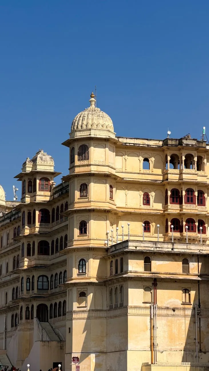
-
 Hans Müller
 - 21 Jul, 2026 17:18
'Udaipur: Wo die Zeit in goldenen Palästen und smaragdgrünen Seen erstarrt'
Die Stadt, die Akbar trotzte und die Herzen der Moguln verzauberte Zwischen den schroffen Gipfeln der Aravalli-Berge, dort wo die Sonne ihre letzten Strahlen über smaragdgrüne Wasserflächen wirft, erhebt sich eine Stadt, die wie aus einem Märchen des alten Rajasthan geschnitten scheint. Udaipur – die „Stadt der Seen“ – ist kein Ort, den man einfach besucht. Sie ist ein Gefühl, das sich in die Seele brennt, ein Ort, an dem die Zeit in den vergoldeten Mauern der Paläste erstarrt und die Legenden der Rajputen noch immer durch die Gassen flüstern. Hier, wo Maharana Udai Singh II im Jahr 1559 seine neue Hauptstadt errichtete, nachdem Chittorgarh von den Moguln belagert worden war, entstand nicht nur eine Festung, sondern ein ganzes Universum aus Wasser, Stein und ungebrochener Würde. Die Stadt, die einst als uneinnehmbar galt, weil ihre Berge zu steil für die schweren Mogul-Pferde waren, wurde zum Symbol des Widerstands – und zur Wiege einer Kultur, die bis heute atemberaubend strahlt. Doch Udaipur ist mehr als nur Geschichte. Es ist ein Ort, an dem die Moderne mit der Tradition tanzt: Wo Luxushotels in historischen Palästen residieren, während Fischerboote über die kristallklaren Seen gleiten. Wo die Luft nach Gewürzen, Jasmin und dem Staub der Wüste duftet, und wo jeder Sonnenuntergang über dem Lake Pichola so golden ist, dass selbst die härtesten Herzen für einen Moment innehalten.Die Geburt einer Legende: Wie ein verfluchter Ort zur strahlenden Hauptstadt wurde Die Geschichte Udaipurs beginnt nicht mit einem triumphalen Einzug, sondern mit einer Flucht. Als Akbar, der mächtigste Mogulkaiser Indiens, 1567 Chittorgarh eroberte, stand das Königreich Mewar am Abgrund. Doch statt sich zu ergeben, wählte Udai Singh II einen Ort, der seit Jahrhunderten als heilig galt: das Tal von Girwa, eingebettet zwischen den Aravalli-Bergen und dem Ufer des Lake Pichola. Der Fluch des Ayad und die Prophezeiung des Einsiedlers Laut Legende war das Gebiet um Udaipur einst von einer Überschwemmung heimgesucht worden, die die alte Hauptstadt Ayad – eine blühende Handelsstadt des 10. bis 12. Jahrhunderts – unter sich begrub. Die Bewohner sahen darin einen Fluch, doch Udai Singh II sah eine Chance. Während einer Jagd in den Hügeln traf er auf einen heiligen Mann, der ihm prophezeite: „Bau hier deine Stadt, denn diese Berge werden dich beschützen wie ein Schild.“ Ob Mythos oder Wahrheit – die Wahl des Ortes war genial. Die Aravalli-Berge boten natürlichen Schutz, die Seen sicherten die Wasserversorgung, und die fruchtbaren Täler ermöglichten Landwirtschaft. Innerhalb weniger Jahrzehnte entstand eine Stadt, die nicht nur sicher, sondern auch strahlend schön war. Die sieben Tore der Unbesiegbarkeit Um seine neue Hauptstadt zu schützen, ließ Udai Singh II eine massive Stadtmauer mit sieben Toren errichten: Surajpole, Chandpole, Udiapole, Hathipole, Ambapole, Brahmpole und Delhi Gate. Jedes Tor hatte eine eigene Bedeutung – das Surajpole (Sonnentor) symbolisierte den Sieg des Lichts über die Dunkelheit, während das Delhi Gate die Verbindung zum Norden und zur Hauptstadt der Moguln darstellte. Doch die Mauern sollten nicht nur Feinde abwehren. Sie wurden zum Rahmen für eine Stadt, die sich wie ein Juwel in die Landschaft schmiegte. Selbst als Akbar 1576 persönlich nach Udaipur kam und versuchte, die Stadt zu erobern, scheiterte er – nicht an Waffen, sondern an der Unzugänglichkeit der Berge und der Entschlossenheit der Rajputen.Die sieben Seen: Udaipurs flüssiges Herz, das seit 500 Jahren schlägt Wenn man Udaipur die „Stadt der Seen“ nennt, ist das keine poetische Übertreibung. Die sieben künstlichen Seen, die die Stadt umgeben, sind kein Zufall, sondern das Ergebnis jahrhundertelanger Ingenieurskunst. Sie speichern nicht nur Wasser, sondern sind das Lebenselixier der Region – und ein Grund, warum Udaipur bis heute grün und lebendig ist. Lake Pichola: Der See, der eine ganze Dynastie widerspiegelt Kein anderer See in Udaipur ist so ikonisch wie der Lake Pichola. Benannt nach einem Inselpavillon (Pichola), der einst einem Guru gehörte, ist dieser See das Herzstück der Stadt. Seine smaragdgrünen Wasser spiegeln nicht nur die Paläste, sondern auch die Geschichte Mewars wider.Jag Mandir: Die „Insel der Könige“ war einst ein Rückzugsort für Maharana Karan Singh II, der hier während einer Pestepidemie Schutz suchte. Heute ist sie ein Ort der Ruhe, umgeben von Gärten und Springbrunnen. Jag Niwas: Die berühmte Lake Palace-Insel, die heute als Luxushotel dient, war einst ein Sommerpalast der Mewar-Dynastie. Ihr weißer Marmor leuchtet bei Sonnenuntergang so intensiv, dass sie wie ein Schiff aus Licht wirkt. City Palace & Jagdish Temple: Vom Ufer aus sieht man, wie der City Palace sich wie eine Krone über den See neigt. Sein Spiegelbild im Wasser ist so perfekt, dass man meint, zwei Paläste zu sehen.Fateh Sagar Lake: Der See der Siege Benannt nach Maharana Fateh Singh, der ihn erweitern ließ, ist dieser See ein Meisterwerk der Wassermanagement-Kunst. Mit drei Inseln – Nehru Park, Fateh Sagar Island und Aravali Hills – ist er ein beliebter Ort für Picknicks und Bootstouren. Swaroop Sagar & Rangsagar: Die unsichtbaren Wächter Diese beiden Seen, oft übersehen, spielen eine entscheidende Rolle im Ökosystem Udaipurs. Swaroop Sagar (auch „Arsi Vilas“ genannt) ist ein kleiner, aber tiefer See, der als natürlicher Filter für das Wasser des Fateh Sagar dient. Rangsagar hingegen ist ein ruhiger See, umgeben von üppiger Vegetation, der vor allem von Einheimischen zum Angeln genutzt wird. Doodh Talai Lake: Wo die Legenden flüstern Der kleinste der sieben Seen, Doodh Talai, ist von Mythen umwoben. Eine Legende besagt, dass hier einst eine Kuh mit goldener Milch getrunken haben soll – ein Zeichen für Reichtum und Segen. Heute ist er ein beliebter Ort für Spaziergänge, mit Blick auf den Sajjangarh-Palast (auch „Monsoon Palace“ genannt), der auf einem Hügel thront.Die Paläste Udaipurs: Wo Stein zu Poesie wird Udaipur ist nicht nur die Stadt der Seen, sondern auch die Stadt der Paläste. Jeder Bau erzählt eine Geschichte – von Macht, Liebe, Verrat und unsterblicher Hingabe. Hier sind die wichtigsten: City Palace: Das Herz der Mewar-Dynastie Der City Palace ist kein einzelner Palast, sondern ein Labyrinth aus Höfen, Gärten, Tempeln und Residenzen, das über 400 Jahre hinweg gewachsen ist. Seine Architektur ist eine Mischung aus Rajput- und Mogul-Stil – ein Beweis für die kulturellen Einflüsse, die Udaipur geprägt haben.Badi Mahal: Der „Große Palast“ mit seinen schwebenden Gärten und dem berühmten Krishna-Violin-Fresko. Manak Mahal: Hier wurden einst die Edelsteine der Mewar-Dynastie aufbewahrt – heute beherbergt er eine exquisite Sammlung von Miniaturmalereien. Mor Chowk: Der „Pfauenhof“ mit seinen 5000 Glasfliesen, die ein Pfauenmuster bilden – ein Meisterwerk der Handwerkskunst.Jag Mandir: Die Insel der Träume Auf der Jag Mandir-Insel im Lake Pichola erhebt sich ein Palast, der wie aus einem Traum der Moguln geschnitten scheint. Mit seinen Marmorbögen, Mosaiken und Gärten war er ein Ort der Entspannung für die Herrscher Mewars. Heute kann man hier in einem der exklusivsten Hotels der Welt übernachten – und sich fühlen, als wäre man Teil der königlichen Familie. Fateh Prakash Palace: Wo die Moderne auf das Erbe trifft Dieser Palast, heute ein Luxushotel, war einst die Residenz von Maharana Fateh Singh. Seine gotische Architektur und die prunkvollen Innenräume zeigen, wie die Rajputen europäische Einflüsse in ihre Paläste integrierten. Sajjangarh (Monsoon Palace): Der Wächter der Wolken Auf dem Bansdara-Hügel thront der Sajjangarh-Palast, auch „Monsoon Palace“ genannt. Erbaut von Maharana Sajjan Singh im 19. Jahrhundert, diente er als Observatorium für die Monsunwolken – und als romantischer Rückzugsort. Von hier aus hat man den besten Blick über Udaipur und die Aravalli-Berge.Kultur & Tradition: Wo Feste die Seele Rajasthans zum Klingen bringen Udaipur ist nicht nur ein Ort für Geschichtsliebhaber – es ist ein Fest für alle Sinne. Die Stadt lebt von ihren Festen, die die reiche Kultur Rajasthans feiern. Mewar Festival: Wenn die Stadt in Farben explodiert Jedes Jahr im März/April verwandelt sich Udaipur in ein Meer aus Farben, Musik und Tanz. Das Mewar Festival feiert das Frühlingserwachen und die Kultur der Rajputen. Highlights:Gair-Tanz: Ein traditioneller Tanz, bei dem Männer in bunten Kostümen im Kreis tanzen. Elefantenparade: Geschmückte Elefanten ziehen durch die Straßen, begleitet von Trommeln und Jubel. Lichtershow am Lake Pichola: Ein spektakuläres Schauspiel, bei dem die Paläste und Boote illuminiert werden.Gangaur Festival: Die Hochzeit der Göttin Gauri Eines der wichtigsten Feste für die Frauen Rajasthans, bei dem die Göttin Gauri (eine Form der Göttin Parvati) gefeiert wird. Frauen tragen traditionelle Ghagra-Cholis (Röcke und Blusen) und singen Lieder, während sie Tonfiguren der Göttin durch die Stadt tragen. Shilpgram Utsav: Das Fest der Handwerker Ein 10-tägiges Festival, das die Kunsthandwerker Rajasthans ehrt. Hier kann man sehen, wie Miniaturmalereien, Blockdrucke, Marmorskulpturen und Textilien entstehen – und natürlich kaufen.Kulinarische Schätze: Wo Gewürze Geschichten erzählen Die Küche Udaipurs ist eine Symphonie aus Rajasthani-Aromen und Mogul-Einflüssen. Hier sind die Gerichte, die man unbedingt probieren sollte: Dal Baati Churma: Das Nationalgericht Rajasthans Ein herzhaftes Gericht aus knusprigen Baati (Weizenbällchen), serviert mit einer würzigen Dal (Linseneintopf) und süßem Churma (zerbröselte Weizenbällchen mit Ghee und Zucker). Am besten in Ambrai Restaurant oder Upre By The Lake genießen. Laal Maas: Das feurige Lammcurry Ein Gericht, das so scharf ist, dass es Legenden gibt, wonach es einst als Waffe gegen feindliche Armeen eingesetzt wurde. Heute ist es ein Muss für Abenteuerlustige. Ghewar: Das süße Symbol der Monsoon-Saison Ein knuspriger, honiggetränkter Kuchen, der vor allem während des Teej-Festes gegessen wird. Die beste Adresse: Jaihind Sweets. Masala Chai mit Blick auf den Lake Pichola Kein Besuch in Udaipur ist komplett ohne eine Tasse Masala Chai – am besten in einem der Cafés am Ufer des Lake Pichola, wo man den Sonnenuntergang über den Palästen genießen kann.Udaipur heute: Zwischen Luxus und Nachhaltigkeit Udaipur hat sich in den letzten Jahrzehnten von einer historischen Stadt zu einem globalen Reiseziel entwickelt. Doch anders als viele Touristenorte hat die Stadt ihren Charme bewahrt. Nachhaltiger Tourismus: Die Seen retten Dank des National Lake Conservation Plan (NLCP) werden die Seen Udaipurs seit 2006 restauriert. Projekte wie die Sewage Treatment Plants und die Aufforstung der Uferbereiche sorgen dafür, dass die Wasserqualität sich verbessert. Udaipur als Bildungs- und Wirtschaftszentrum Mit 5 Universitäten, 14 Colleges und über 160 Schulen ist Udaipur heute auch ein wichtiger Bildungsstandort. Zudem ist die Stadt ein Zentrum für:Marmorverarbeitung (berühmt für den „Udaipur White Marble“) Handwerk (Textilien, Schmuck, Holzarbeiten) Elektronikindustrie (Hindustan Zinc Limited)Luxusresorts: Wo Geschichte auf Moderne trifft Udaipur ist heute ein Paradies für Luxusreisende. Einige der besten Hotels der Welt haben hier ihre Residenzen:Taj Lake Palace (ehemals Jag Niwas) Oberoi Udaivilas (mit Privatstränden am Lake Pichola) Leela Palace (mit einem der besten Spas Indiens)Doch auch für Budget-Reisende gibt es charmante Heritage-Hotels wie das Bhanwar Niwas oder Mansingh Haveli, die den alten Charme der Stadt bewahren.Geheimtipps: Udaipur abseits der Touristenpfade Wer Udaipur wirklich erleben will, sollte abseits der ausgetretenen Pfade gehen: Bagore Ki Haveli: Ein verstecktes Juwel Dieser Palast am Gangaur Ghat ist weniger überlaufen als der City Palace, aber genauso beeindruckend. Besonders sehenswert: Die Ganga-Aarti-Zeremonie am Abend, bei der Priester mit Öllampen die Göttin Ganga ehren. Saheliyon Ki Bari: Der Garten der Kurtisanen Ein wunderschöner Garten, der einst von Maharana Sangram Singh für seine königlichen Damen angelegt wurde. Mit seinen Wasserkanälen, Springbrunnen und Marmorpavillons ist er ein Ort der Stille. Eklingji-Tempel: Wo Shiva in Stein thront Etwa 22 km von Udaipur entfernt liegt dieser 11. Jahrhundert-Tempel, der dem Gott Shiva gewidmet ist. Die Architektur ist eine Mischung aus Rajput- und Solanki-Stil – ein Muss für Architekturbegeisterte. Fateh Sagar bei Nacht: Wenn die Lichter tanzen Während die meisten Touristen den Fateh Sagar am Tag besuchen, lohnt sich ein Spaziergang am Ufer bei Nacht. Die beleuchteten Paläste spiegeln sich im Wasser, und die kühle Abendluft trägt den Duft von Jasmin und Gewürzen herüber.Praktische Tipps: So plant man die perfekte Udaipur-Reise Beste ReisezeitOktober bis März: Ideal für Sightseeing (angenehme Temperaturen zwischen 15°C und 28°C). April bis Juni: Sehr heiß (bis 45°C), aber gut für Budget-Reisende. Monsun (Juli–September): Die Stadt ist grün und weniger überlaufen, aber einige Sehenswürdigkeiten können geschlossen sein.AnreiseFlugzeug: Der Maharana Pratap Airport (UDR) ist gut angebunden (Direktflüge von Delhi, Mumbai, Jaipur). Zug: Udaipur ist mit dem Shatabdi Express und anderen Zügen von Delhi, Jaipur und Ahmedabad erreichbar. Bus: Gute Verbindungen von Rajasthan und Gujarat aus.Fortbewegung vor OrtTuk-Tuks & Rikschas: Günstig, aber verhandeln ist Pflicht! Auto mit Fahrer: Ideal für Tagesausflüge (z. B. nach Kumbhalgarh Fort oder Jaisalmer). Bootstouren: Unbedingt eine Sunset-Bootsfahrt auf dem Lake Pichola machen!Währung & BudgetIndische Rupien (INR) sind die einzige akzeptierte Währung. Budget: 1.500–3.000 INR/Tag (Hostels, Street Food, öffentliche Verkehrsmittel). Luxus: 10.000+ INR/Tag (5-Sterne-Hotels, private Touren).Sicherheit & GesundheitUdaipur ist relativ sicher, aber wie überall in Indien gilt: Wertsachen im Hotel lassen und nachts nicht allein unterwegs sein. Impfungen: Hepatitis A, Typhus und Tollwut werden empfohlen. Wasser: Nur abgefülltes Wasser trinken!Fazit: Warum Udaipur mehr ist als nur ein Reiseziel Udaipur ist kein Ort, den man besucht und dann vergisst. Es ist ein Ort, der sich in die Seele gräbt und dort bleibt. Vielleicht liegt es an den goldenen Sonnenuntergängen über dem Lake Pichola, vielleicht an den Geschichten der Rajputenkrieger, die noch immer in den Palastmauern widerhallen. Oder vielleicht daran, dass Udaipur eine der wenigen Städte der Welt ist, in der Wasser, Stein und Geschichte so perfekt harmonieren. Hier, wo die Aravalli-Berge wie Wächter über der Stadt thronen und die Seen wie flüssige Spiegel die Paläste in sich tragen, spürt man, was es bedeutet, lebendige Geschichte zu erleben. Udaipur ist nicht nur ein Reiseziel – es ist eine Zeitreise, eine Liebeserklärung an Rajasthan und ein Beweis dafür, dass Schönheit und Widerstandsfähigkeit Hand in Hand gehen können. Wer einmal durch die Gassen der Altstadt geschlendert ist, in einem Boot über den Lake Pichola geglitten und in den Hallen des City Palace gestanden hat, der wird verstehen, warum James Tod, der britische Administrator, Udaipur einst als „den romantischsten Ort des indischen Subkontinents“ bezeichnete. Und vielleicht, nur vielleicht, wird man beim Verlassen der Stadt ein kleines Stück von ihr mitnehmen – in den Erinnerungen, im Herzen und in der Gewissheit, dass es Orte gibt, die nicht nur besucht, sondern erlebt werden müssen.#UdaipurReiseführer #RajasthanGeheimtipps #IndienPaläste #StadtDerSeen #ReiseNachRajasthan
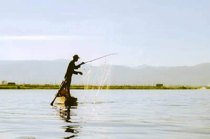
Few places on Earth evoke the kind of serene, almost surreal beauty as Inle Lake in Myanmar. Nestled in the Shan Hills of eastern Myanmar, this vast, shallow freshwater lake is not just a body of water—it is a living, breathing ecosystem where human ingenuity and nature coexist in perfect harmony. Here, leg-rowing fishermen balance precariously on their narrow wooden boats, using a single leg to propel themselves forward while casting nets with practiced ease. Around them, floating gardens drift lazily on the water’s surface, their lush greens and vibrant flowers nourished by nutrient-rich silt. This is a world where time moves differently, where tradition is not just preserved but performed daily, and where every ripple on the lake’s surface tells a story. Inle Lake is more than a destination; it is an experience that transcends the ordinary. Whether you're gliding through the mist at dawn, watching fishermen weave through the reeds, or wandering through the vibrant floating markets, the lake offers a rare glimpse into a way of life that has remained unchanged for centuries. But beyond its cultural allure, Inle Lake is also a testament to human resilience and innovation. The floating gardens, for instance, are not just a tourist spectacle—they are a vital agricultural system that sustains entire communities. Meanwhile, the leg-rowing technique, a UNESCO-recognized cultural heritage, is a skill passed down through generations, a dance of balance and precision that defines the identity of the Intha people, the lake’s indigenous inhabitants. As Myanmar reopens to the world, Inle Lake stands as a must-visit destination for travelers seeking authenticity, adventure, and a connection to a culture that thrives in harmony with its environment. But visiting this enchanting lake requires more than just a camera and a sense of wonder. To truly appreciate its magic, you need to understand its rhythms, its challenges, and its secrets. From the best time to visit and how to navigate the lake’s intricate waterways to the ethical considerations of supporting local communities, this guide will equip you with everything you need to experience Inle Lake like a seasoned traveler. So, let’s embark on a journey to one of Southeast Asia’s most captivating wonders—a place where the water reflects not just the sky, but the soul of a people who have made the impossible possible.The Leg-Rowing Fishermen: Masters of the Water At the heart of Inle Lake’s cultural identity are the leg-rowing fishermen, known locally as Intha fishermen. This unique tradition is not just a spectacle for tourists—it is a way of life that has been practiced for over 1,300 years. The Intha people, who migrated to the lake from the surrounding hills, adapted to their aquatic environment by developing a distinctive rowing technique that allows them to navigate the lake’s shallow waters with unparalleled skill. The technique itself is a marvel of efficiency and balance. Unlike traditional rowing, where oars are used, Intha fishermen use one leg to wrap around an oar and propel the boat forward. This method leaves their hands free to cast nets, steer, or even hold a cigarette—yes, it’s not uncommon to see a fisherman puffing away while effortlessly gliding across the water. The leg used for rowing is often wrapped in a piece of cloth or a net to prevent blisters, a testament to the physical demands of this craft. The boats themselves are narrow and long, designed to skim across the water’s surface with minimal resistance, allowing the fishermen to move swiftly and silently through the reeds. But why leg-rowing? The answer lies in the lake’s unique geography. Inle Lake is shallow, with an average depth of just 2 to 3 meters (6.5 to 10 feet), and its waters are often obscured by dense vegetation. Traditional rowing would be cumbersome in such conditions, but leg-rowing allows fishermen to navigate tight spaces, avoid obstacles, and even row while standing up—giving them a vantage point to spot fish beneath the surface. This technique also enables them to fish in pairs or small groups, working in sync to herd fish into their nets. The best time to witness this tradition is at dawn, when the lake is shrouded in a soft, ethereal mist and the fishermen set out in their boats, their silhouettes blending into the early light. As the sun rises, the mist lifts, revealing a bustling scene of boats weaving through the water, their rhythmic leg movements creating a hypnotic pattern. It’s a scene that feels frozen in time, a snapshot of a culture that has thrived in isolation for centuries. However, the leg-rowing tradition is not without its challenges. Modernization, climate change, and overfishing have put pressure on the lake’s ecosystem, leading to dwindling fish stocks and a decline in the number of young fishermen adopting the craft. Recognizing its cultural significance, UNESCO inscribed the leg-rowing technique on its Representative List of the Intangible Cultural Heritage of Humanity in 2015. This recognition has helped raise awareness and support for the preservation of this tradition, but it also underscores the need for sustainable tourism practices. For travelers, encountering the leg-rowing fishermen is a privilege. It’s an opportunity to witness a living heritage in action, to engage with a community that has shaped its identity around the lake, and to support their livelihoods through responsible tourism. When visiting Inle Lake, consider hiring a local guide who can introduce you to the fishermen, share their stories, and explain the nuances of their craft. And remember, while it’s tempting to take photos, always ask for permission first—these are not performers, but people going about their daily lives.Floating Gardens: Nature’s Ingenious Agricultural Marvel One of the most extraordinary sights on Inle Lake is the floating gardens, a testament to human ingenuity and the lake’s fertile ecosystem. These gardens are not just a tourist attraction; they are a vital agricultural system that has sustained the local population for generations. Unlike traditional land-based farming, the floating gardens are built entirely on the lake’s surface, using a technique that combines organic matter, silt, and water to create a nutrient-rich growing medium. The process begins with the collection of lake-bottom silt, which is rich in organic material and minerals. Fishermen and farmers use long bamboo poles to scoop up the silt and pile it onto a floating base made of water hyacinth roots and other aquatic plants. Over time, the silt decomposes, creating a thick, fertile layer that can support a variety of crops. The most common plants grown in these gardens are tomatoes, cucumbers, beans, and flowers, though some farmers also cultivate leafy greens and herbs. The gardens are anchored in place using bamboo poles, and their buoyancy allows them to rise and fall with the water level, ensuring that crops are never waterlogged. What makes the floating gardens so remarkable is their sustainability. Unlike conventional farming, which depletes the soil of nutrients, the floating gardens rely on the natural fertility of the lake’s silt. This closed-loop system minimizes the need for chemical fertilizers, making it an eco-friendly alternative to land-based agriculture. Additionally, the gardens provide a habitat for fish and other aquatic life, further enhancing the lake’s biodiversity. Visiting the floating gardens is a sensory experience. As you glide through the waterways in a small boat, you’ll be surrounded by a patchwork of vibrant greens and yellows, the scent of earth and vegetation filling the air. Farmers can often be seen tending to their crops, their boats laden with freshly harvested produce. Some gardens double as nurseries, where young plants are nurtured before being transplanted to larger plots. The most famous of these nurseries is the Ywama Floating Gardens, where you can see the entire process in action, from silt collection to harvest. But the floating gardens are not just about agriculture—they are also a cultural symbol. The Intha people have developed a deep understanding of the lake’s ecosystem, and their farming techniques reflect a harmonious relationship with nature. This philosophy is embodied in the concept of thanaka, a traditional Burmese beauty practice that also has agricultural applications. Thanaka, a paste made from the bark of the thanaka tree, is used to protect crops from pests and sun damage, showcasing the Intha people’s holistic approach to farming. For travelers, the floating gardens offer a glimpse into a sustainable way of life that is increasingly rare in the modern world. Supporting local farmers by purchasing their produce is a great way to contribute to the community’s economy. Many guesthouses and restaurants on the lake source their ingredients from the floating gardens, so you can enjoy fresh, locally grown food while knowing you’re supporting a tradition that has thrived for centuries.Exploring Inle Lake: A Step-by-Step Guide to the Ultimate Experience Inle Lake is a destination that rewards exploration, but navigating its waterways requires a bit of planning. The lake spans approximately 116 square kilometers (45 square miles) and is dotted with over 200 villages, each with its own unique character. To make the most of your visit, it’s essential to understand the best ways to explore the lake, the key attractions, and the logistics of getting around. Getting to Inle Lake The most common way to reach Inle Lake is by flying into Heho Airport, the nearest airport located about 30 kilometers (19 miles) from the lake. Heho Airport is serviced by domestic flights from Yangon, Mandalay, and Bagan, making it a convenient entry point for travelers coming from other parts of Myanmar. From the airport, you can take a taxi or a shared minibus to Nyaungshwe, the main gateway to Inle Lake. The journey takes about 45 minutes to an hour, depending on traffic and road conditions. Alternatively, you can take a bus or train from Yangon or Mandalay to Taunggyi, the capital of Shan State, and then continue to Nyaungshwe by road. This option is more budget-friendly but takes significantly longer, with bus journeys lasting up to 12 hours. If you’re coming from Bagan, you can also take a scenic overnight bus or train to Nyaungshwe, combining travel with an adventure. Where to Stay Nyaungshwe is the most popular base for exploring Inle Lake, offering a range of accommodations from budget guesthouses to luxury resorts. For a truly immersive experience, consider staying in a lakeside lodge or a floating hotel. These properties often provide easy access to boat tours and cultural sites, and some even offer cooking classes or workshops on traditional crafts. One of the most iconic places to stay is the Inle Heritage House, a boutique hotel that blends modern comfort with traditional Shan architecture. The hotel is surrounded by lush gardens and offers stunning views of the lake. Another excellent option is the Sanctuary Inle Lake, a luxury resort that combines eco-friendly design with world-class hospitality. For budget travelers, guesthouses like Little Bird Guesthouse and Ostello Bello Inle offer affordable accommodations with a social atmosphere, making them great places to meet fellow travelers. Boat Tours: The Best Way to Explore The best way to experience Inle Lake is by boat, and there are several tour options to suit different interests and budgets. The most popular is the half-day boat tour, which typically includes visits to the floating gardens, the leg-rowing fishermen, and the Inle Lake Floating Market. For a more in-depth experience, consider a full-day tour that takes you to lesser-known villages like Indein, where you can explore ancient pagodas and witness the unique architecture of the Intha people. Another must-visit is Shwe Indein Pagoda, a cluster of 1,000-year-old stupas that glow golden in the afternoon light. If you’re interested in photography, a sunrise or sunset tour is highly recommended. The soft light of dawn or dusk casts a magical glow over the lake, creating perfect conditions for capturing the fishermen at work or the floating gardens in full bloom. Cultural and Ethical Considerations While Inle Lake is a magical destination, it’s important to approach your visit with respect and mindfulness. The Intha people have a deep connection to the lake, and their way of life is not a tourist attraction but a living tradition. When visiting villages or interacting with locals, always ask for permission before taking photos, and avoid intrusive behavior. Supporting local businesses is another way to ensure your visit benefits the community. Purchase souvenirs from local artisans, dine at family-run restaurants, and consider hiring local guides who can share their knowledge and stories. Many tour operators in Nyaungshwe are owned and operated by locals, so choosing them over international companies can make a big difference. Best Time to Visit The ideal time to visit Inle Lake is during the cool, dry season, which runs from November to February. During this period, the weather is pleasant, with temperatures ranging from 15°C to 25°C (59°F to 77°F), and the lake is at its most vibrant. The Inle Lake Festival, held in October or November, is a highlight of the year, featuring boat races, traditional performances, and a lively atmosphere. The rainy season, from June to October, brings lush greenery and fewer tourists, but heavy rains can make boat tours challenging. The hot season, from March to May, is less ideal due to high temperatures and occasional haze from agricultural burning.👉 Continue Reading: Myanmar’s Inle Lake: Where Leg-Rowing Fishermen Dance on Water and Floating Gardens Feed a Nation (Part 2)#MyanmarTravel #InleLakeMagic #SustainableTourism #LegRowingFishermen #FloatingGardens Related InsightsEchoes in Stone: Unearthing Sardinia's Lost Cyclopean Mysteries in the Wild Heart of Barbagia Oman Unveiled: Where Golden Dunes Meet Timeless Forts and Hidden Oases The Serengeti: A Timeless Rhythm of Life and Survival{ "@context": "https://schema.org", "@type": "FAQPage", "mainEntity": [ { "@type": "Question", "name": "What is the main focus of Myanmar’s Inle Lake: Where Leg-Rowing Fishermen Dance on Water and Floating Gardens Feed a Nation?", "acceptedAnswer": { "@type": "Answer", "text": "Discover the timeless magic of Inle Lake in Myanmar, where leg-rowing fishermen glide across shimmering waters and floating gardens bloom with life—an unforgettable journey into culture, tradition, and nature." } }, { "@type": "Question", "name": "Who authored the comprehensive guide on Myanmar’s Inle Lake: Where Leg-Rowing Fishermen Dance on Water and Floating Gardens Feed a Nation?", "acceptedAnswer": { "@type": "Answer", "text": "This detailed article and its insights were carefully researched and authored by Wei Chen." } }, { "@type": "Question", "name": "Where can I find more related content about Travel?", "acceptedAnswer": { "@type": "Answer", "text": "You can explore more articles, detailed reviews, and similar insights by browsing the Related Insights section at the bottom of this article or visiting our dedicated Travel category page." } } ] }
This is Part 2 of the series. Read Part 1 here.Inle Lake’s Hidden Gems: Villages, Crafts, and Conservation Beyond the leg-rowing fishermen and floating gardens, Inle Lake is home to a wealth of cultural and natural treasures. Venturing beyond the main tourist spots reveals a side of the lake that is equally captivating, from traditional crafts to conservation efforts that are preserving the lake’s fragile ecosystem. The Villages of Inle Lake Inle Lake is dotted with over 200 villages, each with its own unique character and traditions. One of the most fascinating is Ywama, a village built entirely on stilts over the water. Here, you can see how the Intha people live in close-knit communities, with houses, schools, and even temples constructed on wooden platforms. The village is also known for its silk weaving, a craft that has been passed down through generations. The women of Ywama are renowned for their skill in weaving intricate patterns using traditional looms, and you can visit their workshops to see the process firsthand. Another village worth exploring is Kyaing Khan, home to the Inle Lake Bird Sanctuary. This protected area is a haven for migratory birds, including the rare spot-billed pelican and lesser adjutant stork. The sanctuary is a great place for birdwatching, with guided tours available to help you spot and identify the various species that call the lake home. For a glimpse into the past, visit Shwe Yan Pyay Monastery, a stunning wooden structure built on stilts in the middle of the lake. The monastery is a masterpiece of Shan architecture, with intricate carvings and a serene atmosphere. It’s also a place of spiritual significance, where monks and locals gather for prayers and ceremonies. Traditional Crafts and Workshops Inle Lake is a hub for traditional crafts, many of which are practiced by local artisans in their homes or small workshops. One of the most famous is silver smithing, a craft that has been practiced in the region for centuries. The village of Kyauk Ka village is known for its silver workshops, where artisans create intricate jewelry, utensils, and decorative items using traditional techniques. Visitors can watch the smiths at work and even purchase handmade souvenirs. Another craft to explore is lotus weaving, a unique art form that uses fibers from the lotus plant to create delicate textiles. The lotus plant grows abundantly in the lake’s waters, and its fibers are harvested, processed, and woven into scarves, shawls, and other garments. The lotus weaving workshop in Nyaungshwe offers hands-on experiences where you can try your hand at this labor-intensive craft. For those interested in lacquerware, the village of Kyaing Khan is home to skilled artisans who create beautiful bowls, boxes, and decorative items using traditional lacquer techniques. The process involves layering natural resins onto a bamboo or wood base, creating a durable and glossy finish. Many workshops offer demonstrations and the opportunity to purchase one-of-a-kind pieces. Conservation Efforts and Sustainable Tourism Inle Lake faces significant environmental challenges, including pollution, overfishing, and the impacts of climate change. Recognizing the need for conservation, local organizations and international groups have launched initiatives to protect the lake’s ecosystem and support sustainable tourism. One such initiative is the Inle Lake Conservation Project, which works with local communities to promote eco-friendly farming practices, reduce plastic waste, and restore degraded areas of the lake. The project also offers educational programs to raise awareness about the importance of preserving the lake’s biodiversity. Another organization making a difference is the Inle Heritage Foundation, which focuses on cultural preservation and sustainable development. The foundation runs workshops on traditional crafts, supports local artisans, and advocates for policies that protect the lake’s environment. As a traveler, you can support these efforts by choosing eco-friendly tour operators, minimizing your plastic use, and respecting the lake’s natural and cultural heritage. Simple actions like carrying a reusable water bottle, avoiding single-use plastics, and supporting local businesses can make a big difference.Practical Tips: Costs, Logistics, and Local Etiquette Planning a trip to Inle Lake requires careful consideration of practical details, from budgeting to cultural norms. While Myanmar remains one of Southeast Asia’s most affordable destinations, prices can vary depending on the season and your travel style. Here’s a breakdown of what to expect in terms of costs, logistics, and local etiquette. Cost of Living and Travel Expenses Myanmar is known for its affordability, and Inle Lake is no exception. Here’s a rough estimate of costs for a mid-range traveler:Expense Cost (USD) NotesBudget guesthouse $10–$25/night Basic but clean, often with shared bathroomsMid-range hotel $30–$80/night Private rooms, en-suite bathrooms, often lakesideLuxury resort $100–$250/night High-end amenities, often with spa and fine diningLocal meal $2–$5 Simple dishes like mohinga (noodle soup) or shan tofuRestaurant meal $5–$15 Western-style dishes or local specialties in tourist areasBoat tour (half-day) $15–$30 Group tours are cheaper; private tours cost moreBoat tour (full-day) $30–$60 Includes visits to multiple villages and attractionsLocal transport (taxi) $5–$15 Short trips within Nyaungshwe or to Heho AirportEntrance fees $5–$10 Some temples and attractions charge small feesCurrency: The local currency is the Myanmar Kyat (MMK). As of 2026, the exchange rate is approximately 1 USD = 2,100 MMK, though rates can fluctuate. It’s advisable to carry small denominations of kyats for markets and local vendors, as many places do not accept credit cards or foreign currency. ATMs: ATMs are available in Nyaungshwe, but they can be unreliable or out of cash, especially during peak tourist seasons. Withdraw larger amounts when you have the chance, and carry backup cash. Visa Requirements Most travelers to Myanmar require a visa, which can be obtained online through the e-Visa system or at a Myanmar embassy. The e-Visa is valid for 90 days from the date of issue and allows a stay of up to 30 days. The application process is straightforward, but it’s best to apply at least a few weeks before your trip to avoid delays. Visa on Arrival (VOA): Some nationalities may be eligible for a visa on arrival, but this is less reliable than the e-Visa. Check the latest requirements on the official Myanmar e-Visa website before traveling. Health and Safety Inle Lake is generally safe for travelers, but it’s important to take precautions to ensure a healthy and enjoyable trip.Vaccinations: Recommended vaccines include hepatitis A and B, typhoid, and Japanese encephalitis. Consult your doctor or a travel clinic at least 4–6 weeks before your trip. Malaria and Dengue: The lake’s tropical climate means mosquito-borne illnesses are a risk. Use insect repellent, wear long sleeves and pants, and consider taking antimalarial medication if recommended by your doctor. Water and Food: Drink only bottled or purified water, and avoid ice in drinks unless you’re sure it’s made from purified water. Street food can be delicious but opt for busy stalls where food is freshly prepared. Altitude Sickness: Inle Lake sits at an elevation of 880 meters (2,890 feet), which can cause mild altitude sickness in some travelers. Stay hydrated and take it easy for the first day or two.Local Etiquette and Cultural Norms Myanmar is a deeply Buddhist country, and respecting local customs is essential for a positive experience.Dress Modestly: When visiting temples or religious sites, wear clothing that covers your shoulders and knees. This is especially important for women. Remove Shoes: Always remove your shoes before entering a temple, monastery, or someone’s home. Respect the Monks: Monks are highly revered in Myanmar. If you encounter a monk, avoid physical contact, especially with women, as it is considered inappropriate. Ask Before Taking Photos: Always ask for permission before photographing locals, especially in villages or during religious ceremonies. Bargaining: Haggling is common in markets, but do so politely and with a smile. Start at about 50% of the asking price and negotiate from there.Connectivity and Communication Internet access in Inle Lake is limited, especially in rural areas. Most guesthouses and hotels offer Wi-Fi, but the connection can be slow and unreliable. Consider purchasing a local SIM card for better connectivity. MPT (Myanmar Posts and Telecommunications) and Telenor are the main providers, with coverage in Nyaungshwe and some lakeside areas.Conclusion & Sign-off Inle Lake is more than just a destination—it is a journey into the heart of Myanmar’s cultural and natural heritage. From the leg-rowing fishermen who glide effortlessly across the water to the floating gardens that nourish entire communities, every aspect of the lake tells a story of resilience, innovation, and harmony with nature. It’s a place where time slows down, where traditions are preserved with pride, and where every visit leaves a lasting impression. But Inle Lake is also a reminder of the fragility of such ecosystems. Climate change, overfishing, and pollution threaten the lake’s delicate balance, making sustainable tourism more important than ever. As travelers, we have a responsibility to explore mindfully, to support local communities, and to leave no trace behind. By doing so, we can help ensure that the magic of Inle Lake endures for generations to come. Whether you’re drawn by the allure of the leg-rowing fishermen, the vibrant floating gardens, or the rich cultural tapestry of the Intha people, Inle Lake promises an experience that is both unforgettable and transformative. It’s a place where the water reflects not just the sky, but the soul of a people who have made the impossible possible. So pack your bags, leave your preconceptions behind, and prepare to be enchanted. Inle Lake awaits, and it’s ready to share its secrets with those who seek them. Safe travels, and may your journey be as serene and inspiring as the waters of Inle Lake itself.#MyanmarTravel #InleLakeMagic #SustainableTourism #LegRowingFishermen #FloatingGardens Related InsightsL'Eclissi del Re Sole: Tra gli Specchi e l'Oro di Versailles La Sagrada Familia : Le Gothique Réinventé par Gaudí Beneath the City of Light: Descending into the Empire of the Dead in Paris{ "@context": "https://schema.org", "@type": "FAQPage", "mainEntity": [ { "@type": "Question", "name": "What is the main focus of Myanmar’s Inle Lake: Where Leg-Rowing Fishermen Dance on Water and Floating Gardens Feed a Nation (Part 2)?", "acceptedAnswer": { "@type": "Answer", "text": "Discover the timeless magic of Inle Lake in Myanmar, where leg-rowing fishermen glide across shimmering waters and floating gardens bloom with life—an unforgettable journey into culture, tradition, and nature." } }, { "@type": "Question", "name": "Who authored the comprehensive guide on Myanmar’s Inle Lake: Where Leg-Rowing Fishermen Dance on Water and Floating Gardens Feed a Nation (Part 2)?", "acceptedAnswer": { "@type": "Answer", "text": "This detailed article and its insights were carefully researched and authored by Wei Chen." } }, { "@type": "Question", "name": "Where can I find more related content about Travel?", "acceptedAnswer": { "@type": "Answer", "text": "You can explore more articles, detailed reviews, and similar insights by browsing the Related Insights section at the bottom of this article or visiting our dedicated Travel category page." } } ] }
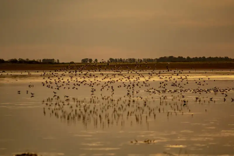
- Chloe Tremblay
- 20 Jul, 2026 21:44
The Pantanal, Brazil: Unlocking the World’s Largest Wetland and Its Untamed Wildlife
The Pantanal, Brazil: Unlocking the World’s Largest Wetland and Its Untamed Wildlife The Pantanal pulses with life. At dawn, the golden light dances across mirror-like lagoons where capybaras graze beside caimans. By midday, the air hums with the cries of hyacinth macaws and the distant roar of a jaguar patrolling the riverbanks. This is not the Serengeti. This is the Pantanal—the world’s largest tropical wetland—where wildlife thrives in densities unmatched anywhere on Earth. Spanning over 150,000 square kilometers across Brazil, Bolivia, and Paraguay, the Pantanal is a UNESCO World Heritage Site and a biodiversity hotspot. Unlike the African savannas, where sightings are seasonal, the Pantanal offers year-round wildlife encounters. Jaguars, giant otters, giant anteaters, and hundreds of bird species coexist in a landscape that shifts between flood and drought with the rhythm of the seasons. For travelers, it’s a living laboratory of nature—one where every boat ride, hike, and sunset reveals a new chapter in the wild. Yet, visiting the Pantanal is not just about ticking off species on a checklist. It’s about immersing yourself in a place where water dictates life, where the pulse of the wetland beats in sync with the seasons, and where the thrill of a jaguar sighting is matched only by the serenity of a sunset over the Cuiabá River. Whether you're a seasoned wildlife photographer, a first-time safari-goer, or a budget-conscious traveler, the Pantanal delivers an experience that is as raw as it is refined. In this guide, we’ll navigate the practicalities of planning your Pantanal adventure—from the best time to visit and where to stay, to how to budget for a safari that balances luxury with authenticity. We’ll also uncover insider tips to maximize wildlife sightings while minimizing costs, ensuring your journey into the world’s largest wetland is as unforgettable as it is responsible.Why the Pantanal Stands Apart: A Wildlife Wonderland Unlike Any Other The Pantanal is often overshadowed by its African counterparts, but those who venture here quickly realize it offers something truly unique: unparalleled wildlife density and accessibility. While the Serengeti may boast the Great Migration, the Pantanal delivers intimate, close-up encounters with predators and prey alike. Jaguars, for instance, are frequently spotted here—more reliably than in the Amazon—thanks to the open floodplains and riverine forests that make hunting easier. In fact, the Pantanal is one of the best places in the world to see jaguars in the wild, with sighting rates as high as 80% during the dry season. The wetland’s biodiversity is staggering. Over 4,700 plant species, 650 bird species, 260 fish species, and 100 mammal species call the Pantanal home. This includes iconic species like the giant otter, the hyacinth macaw (the world’s largest parrot), and the capybara, the world’s largest rodent. The Pantanal is also a haven for birdwatchers, with species like the jabiru stork, the toco toucan, and the sunbittern adding splashes of color to the landscape. What sets the Pantanal apart is its seasonal rhythm. During the wet season (November to March), the wetland floods, transforming into a vast, shallow lake. Wildlife disperses, and sightings become more challenging. But as the waters recede in the dry season (April to October), the landscape contracts, concentrating animals around shrinking water sources. This is when the Pantanal truly comes alive. Rivers shrink to ribbons, lagoons become isolated pools, and predators like jaguars and caimans are forced into close proximity with their prey. It’s a natural spectacle that draws wildlife enthusiasts from around the globe. The Pantanal is also a model of sustainable tourism. Unlike many other wildlife destinations, the wetland’s eco-lodges and tour operators prioritize conservation. Many are built with locally sourced materials, employ local guides, and contribute to community-based conservation projects. This ensures that your visit not only supports the local economy but also helps protect the Pantanal’s fragile ecosystem. For travelers, the Pantanal offers a safari experience that is both immersive and respectful. Whether you’re tracking jaguars by boat, spotting giant otters in the rivers, or simply watching the sunset over the wetlands, every moment is a reminder of nature’s grandeur.Planning Your Pantanal Safari: Best Time to Visit and Essential Preparations Timing is everything when planning a Pantanal safari. The wetland’s two distinct seasons—wet and dry—each offer unique experiences, but the dry season (April to October) is widely regarded as the best time to visit. During this period, the water levels drop, concentrating wildlife around rivers and lagoons, making sightings more predictable and accessible. The dry season also coincides with cooler temperatures, with average highs ranging from 25°C to 30°C (77°F to 86°F), making it more comfortable for long days in the field. The wet season (November to March) is a different beast entirely. While it’s less crowded and offers lush, green landscapes, the flooded terrain can make wildlife sightings more challenging. However, this season is ideal for birdwatching, as migratory species flock to the Pantanal, and for photographers seeking dramatic skies and reflections. It’s also a time of renewal, with the wetland bursting to life after the rains. When to visit ultimately depends on your priorities. If your goal is to maximize wildlife sightings, particularly of jaguars and other predators, aim for the dry season. If you’re a birdwatcher or photographer, consider the wet season for its vibrant landscapes and unique lighting. Essential Preparations for Your Pantanal SafariVisa and Entry RequirementsBrazil requires a visa for most travelers, including citizens of the United States, Canada, and many European countries. Check the latest requirements on the Brazilian consulate website for your country. Ensure your passport is valid for at least six months beyond your planned departure date. If you’re traveling from a country with a yellow fever risk, you’ll need a yellow fever vaccination certificate to enter Brazil. This is not required for the Pantanal itself but may be necessary if you’re transiting through high-risk areas.Health and SafetyThe Pantanal is a low-risk area for malaria, but it’s still wise to take precautions. Consult your healthcare provider about antimalarial medication and use insect repellent, especially during the wet season. Drink bottled or filtered water to avoid stomach issues. The Pantanal is home to venomous snakes like the bushmaster and fer-de-lance, so always wear sturdy boots and avoid walking in tall grass without guidance.Packing EssentialsClothing: Lightweight, breathable clothing in neutral colors (khaki, olive, or beige) is ideal for blending into the landscape. A wide-brimmed hat, sunglasses, and a lightweight rain jacket are also essential. Footwear: Sturdy, waterproof hiking boots or trail shoes are a must for boat rides and hikes. Gear: Binoculars (8x42 or 10x42 magnification are ideal), a DSLR or mirrorless camera with a telephoto lens (for wildlife photography), and a waterproof dry bag for protecting your equipment. Miscellaneous: A reusable water bottle, sunscreen, insect repellent, and a small first-aid kit are all must-haves.Choosing a BaseThe Pantanal is vast, so choosing the right base for your safari is crucial. The southern Pantanal, near the town of Miranda and the Transpantaneira Highway, is one of the most popular areas for wildlife viewing. It’s accessible from Campo Grande and offers a mix of luxury lodges and budget-friendly options. The northern Pantanal, near the town of Poconé and the Cuiabá River, is another excellent choice, particularly for jaguar sightings. This area is more remote but offers a wilder, more immersive experience. For a truly off-the-beaten-path adventure, consider the eastern Pantanal, near the town of Barão de Melgaço. This region is less touristy and offers a more authentic glimpse into local life.TransportationThe Pantanal is remote, so most travelers fly into major hubs like Campo Grande (CGR) or Cuiabá (CGB) and then arrange ground transportation to their chosen base. From Campo Grande or Cuiabá, you can drive to the Pantanal (approximately 4-6 hours), take a bus, or arrange a private transfer. Many lodges offer shuttle services from the airport. Once in the Pantanal, transportation is primarily by boat, 4x4 vehicle, or on foot. Some lodges provide guided excursions, while others allow you to explore independently.Budgeting for a Pantanal Safari: How to Experience Wildlife Without Breaking the Bank The Pantanal is often perceived as an expensive destination, but with careful planning, it’s possible to experience world-class wildlife safaris on a budget. Costs vary widely depending on the level of comfort, the duration of your stay, and the type of accommodations and tours you choose. Below, we break down the key expenses and offer tips for maximizing your experience without overspending. Cost Breakdown: What to ExpectExpense Category Budget Range (USD) Mid-Range (USD) Luxury (USD)Flights (Round-trip) $800 - $1,500 $1,200 - $2,000 $2,000+Accommodation (Per Night) $30 - $80 $100 - $250 $300+Guided Tours (Per Day) $50 - $100 $150 - $300 $400+Food (Per Day) $15 - $30 $30 - $60 $80+Transportation (Local) $50 - $150 $150 - $300 $400+Visa & Vaccinations $50 - $150 $50 - $150 $50 - $150Total (7 Days) $1,200 - $2,500 $2,500 - $4,500 $5,000+👉 Continue Reading: The Pantanal, Brazil: Unlocking the World’s Largest Wetland and Its Untamed Wildlife (Part 2)#PantanalWildlife #BrazilSafari #EcoTourism #JaguarCountry #SouthAmericaTravel Related InsightsTōdai-ji: The Great Buddha Temple of Nara 'Lake Tekapo: Ein Juwel in Neuseelands Südinsel' 新疆火焰山:穿越神话、历史与烈焰的奇幻之旅{ "@context": "https://schema.org", "@type": "FAQPage", "mainEntity": [ { "@type": "Question", "name": "What is the main focus of The Pantanal, Brazil: Unlocking the World’s Largest Wetland and Its Untamed Wildlife?", "acceptedAnswer": { "@type": "Answer", "text": "Discover the Pantanal, Brazil’s breathtaking wetland ecosystem, where jaguar sightings, caiman-filled rivers, and rare birds await. Learn how to plan a budget-friendly wildlife safari in the world’s largest tropical wetland." } }, { "@type": "Question", "name": "Who authored the comprehensive guide on The Pantanal, Brazil: Unlocking the World’s Largest Wetland and Its Untamed Wildlife?", "acceptedAnswer": { "@type": "Answer", "text": "This detailed article and its insights were carefully researched and authored by Chloe Tremblay." } }, { "@type": "Question", "name": "Where can I find more related content about Travel?", "acceptedAnswer": { "@type": "Answer", "text": "You can explore more articles, detailed reviews, and similar insights by browsing the Related Insights section at the bottom of this article or visiting our dedicated Travel category page." } } ] }

- Chloe Tremblay
- 20 Jul, 2026 21:44
The Pantanal, Brazil: Unlocking the World’s Largest Wetland and Its Untamed Wildlife (Part 2)
This is Part 2 of the series. Read Part 1 here.Tips for Budgeting Your Pantanal SafariTravel During Shoulder SeasonThe shoulder seasons (April-May and September-October) offer a balance between good weather and lower prices. Avoid peak season (July-August) when prices for accommodations and tours are highest.Stay in Budget-Friendly Lodges or GuesthousesBudget lodges and guesthouses in the Pantanal can cost as little as $30-$50 per night. These options often include meals and guided excursions, reducing additional costs. Look for eco-lodges or family-run guesthouses, which are often more affordable than large resorts.Join Group ToursGroup tours are a cost-effective way to experience the Pantanal. Prices for group tours typically range from $50-$100 per day, which is significantly cheaper than private tours. Many lodges offer shared excursions, allowing you to split costs with other travelers.Self-Guided ExplorationIf you’re comfortable navigating independently, consider renting a 4x4 vehicle and exploring the Transpantaneira Highway on your own. This route is well-marked and offers opportunities to spot wildlife from the road. Bring your own binoculars and camera gear to save on rental costs.Eat Like a LocalPantanal cuisine is hearty and locally sourced. Opt for regional dishes like moqueca (a fish stew), pacu (a local fish), and farofa (toasted cassava flour) at local restaurants. Avoid touristy restaurants near major attractions, as they tend to be overpriced. Instead, eat at local eateries or lodges that include meals in their packages.Travel Light and Pack SmartAvoid checked baggage fees by packing light. The Pantanal’s climate is warm year-round, so lightweight, breathable clothing is ideal. Bring a reusable water bottle to avoid buying bottled water, which can add up over time.Book in AdvanceThe Pantanal is a popular destination, especially during the dry season. Booking accommodations and tours in advance ensures you get the best prices and availability.Top Wildlife Encounters in the Pantanal: What to See and Where to Find It The Pantanal is a treasure trove of wildlife, but knowing where to look and what to expect can make the difference between a good safari and an unforgettable one. Below, we highlight the top wildlife encounters in the Pantanal, along with tips for maximizing your chances of seeing them. 1. Jaguars: The Crown Jewel of the Pantanal The jaguar is the Pantanal’s most iconic resident, and sightings here are among the most reliable in the world. The best time to see jaguars is during the dry season (April-October), when they congregate along the rivers and lagoons to hunt. The southern Pantanal, particularly around the Cuiabá River and the Transpantaneira Highway, is one of the best places to spot them. Tips for Jaguar Sightings:Take early morning or late afternoon boat excursions, as jaguars are most active during these times. Listen for the calls of capybaras and caimans, as these are often indicators of jaguar activity. Hire a local guide with experience tracking jaguars. Their knowledge of the terrain and animal behavior can significantly increase your chances of a sighting.2. Giant Otters: The Playful River Dwellers The giant otter is one of the Pantanal’s most charismatic residents. These social, vocal creatures are often seen playing in the rivers and lagoons, particularly in the northern Pantanal near the Cuiabá River. The best time to see them is during the dry season, when they are concentrated around shrinking water sources. Tips for Giant Otter Encounters:Visit oxbow lakes and lagoons, where giant otters are known to hunt and play. Listen for their distinctive whistles and chirps, which can help you locate them. Be patient and quiet. Giant otters are curious but can be shy around humans.3. Hyacinth Macaws: The Rainbow Kings of the Pantanal The hyacinth macaw is the world’s largest parrot and a symbol of the Pantanal’s vibrant birdlife. These striking blue birds are often seen in pairs or small flocks, feeding on palm nuts or perched on trees. The best places to see them are in the southern Pantanal, particularly around the Miranda River and the Transpantaneira Highway. Tips for Hyacinth Macaw Sightings:Visit clay licks, where macaws gather to eat mineral-rich clay, which aids digestion. Look for their distinctive calls, which are loud and unmistakable. Bring a good pair of binoculars, as these birds can be high in the trees.4. Caimans: The Pantanal’s Apex Reptiles The Pantanal is home to six species of caimans, including the black caiman, the largest species in the Americas. These reptiles are often seen basking on riverbanks or lurking in the water, waiting for prey. The best time to see caimans is during the dry season, when they are concentrated in shrinking water sources. Tips for Caiman Encounters:Take a nighttime boat excursion, as caimans are most active after dark. Listen for their distinctive calls, which resemble a deep, guttural growl. Be cautious when approaching the water’s edge, as caimans can be aggressive.5. Giant Anteaters: The Shy Giants of the Grasslands The giant anteater is one of the Pantanal’s most elusive residents. These solitary, nocturnal creatures are often seen foraging for ants and termites in the grasslands. The best time to see them is during the dry season, when they are more active during the day. Tips for Giant Anteater Encounters:Look for their distinctive tracks and signs, such as disturbed termite mounds. Visit open grasslands and savannas, where giant anteaters are most likely to be found. Be patient and quiet. Giant anteaters are shy and will avoid humans if they sense danger.6. Birdlife: A Birder’s Paradise The Pantanal is a paradise for birdwatchers, with over 650 species to spot. Some of the most iconic species include the jabiru stork, the toco toucan, the sunbittern, and the hyacinth macaw. The best time for birdwatching is during the wet season (November-March), when migratory species flock to the Pantanal. Tips for Birdwatching:Visit oxbow lakes and lagoons, where waterbirds congregate. Bring a good field guide or use a birdwatching app to help identify species. Visit clay licks, where macaws and other parrots gather to eat mineral-rich clay.Sustainable and Responsible Tourism in the Pantanal: How to Visit Without Harming the Ecosystem The Pantanal is a fragile ecosystem, and responsible tourism is essential to its preservation. By choosing eco-friendly lodges, supporting local communities, and minimizing your environmental impact, you can help ensure that the Pantanal remains a thriving wilderness for generations to come. Choosing Eco-Friendly Lodges Many lodges in the Pantanal are committed to sustainability, using renewable energy, conserving water, and supporting local conservation projects. Look for lodges that are certified by organizations like Rainforest Alliance or Green Key. Some top eco-friendly options include:Refúgio Ecológico Caiman: This luxury eco-lodge is powered by solar energy, uses organic farming practices, and supports jaguar conservation projects. Pousada Piuval: A family-run lodge that offers sustainable tourism experiences, including birdwatching and wildlife tracking. Jaguar Eco Lodge: A mid-range lodge that focuses on conservation and community-based tourism.Supporting Local Communities Many lodges and tour operators in the Pantanal are owned and operated by local communities. By choosing these businesses, you’re supporting the local economy and helping to preserve traditional ways of life. Look for lodges that employ local guides, use locally sourced materials, and contribute to community projects. Minimizing Your Environmental ImpactReduce Waste: Bring a reusable water bottle and avoid single-use plastics. Respect Wildlife: Keep a safe distance from animals and never feed them. Stay on Designated Trails: Avoid trampling vegetation or disturbing wildlife habitats. Support Conservation Projects: Many lodges and tour operators contribute to conservation efforts. Ask about their initiatives and consider donating to support their work.Ethical Wildlife ViewingAvoid Animal Encroachment: Never approach wildlife too closely or use bait to attract animals. Choose Responsible Tour Operators: Look for operators that prioritize animal welfare and follow ethical guidelines. Educate Yourself: Learn about the Pantanal’s wildlife and ecosystems to better appreciate and protect them.By following these guidelines, you can help ensure that your visit to the Pantanal is not only unforgettable but also sustainable.The Pantanal is more than just a destination—it’s an immersion into one of the world’s most extraordinary ecosystems. Here, the rhythm of life is dictated by the seasons, the rivers pulse with unseen energy, and every moment is a reminder of nature’s raw power and beauty. Whether you’re tracking jaguars along the Cuiabá River, marveling at the vibrant plumage of hyacinth macaws, or simply watching the sunset over the wetlands, the Pantanal offers an experience that is as humbling as it is exhilarating. Planning a trip to the Pantanal requires thoughtfulness—about timing, budget, and responsible travel—but the rewards are immeasurable. This is a place where wildlife thrives in densities unmatched anywhere else, where the air hums with the calls of birds, and where the spirit of adventure is matched only by the serenity of the landscape. For those willing to venture off the beaten path, the Pantanal delivers a safari experience that is intimate, authentic, and unforgettable. As you prepare for your journey, remember that the Pantanal is not just a place to see wildlife—it’s a place to connect with it. Whether you’re a seasoned traveler or a first-time explorer, the Pantanal will leave you with memories that linger long after you’ve returned home. So pack your binoculars, lace up your hiking boots, and get ready to unlock the secrets of the world’s largest wetland. Safe travels, and may your Pantanal adventure be filled with wonder, discovery, and respect for the wild.#PantanalWildlife #BrazilSafari #EcoTourism #JaguarCountry #SouthAmericaTravel Related InsightsBeyond the Horizon: Unveiling Naoshima and Teshima - Japan's Transformative Art Island Odyssey Medina Azahara: La Ciudad Brillante Australia Unveiled: Where Sun-Kissed Shores Meet Ancient Souls and Modern Marvels{ "@context": "https://schema.org", "@type": "FAQPage", "mainEntity": [ { "@type": "Question", "name": "What is the main focus of The Pantanal, Brazil: Unlocking the World’s Largest Wetland and Its Untamed Wildlife (Part 2)?", "acceptedAnswer": { "@type": "Answer", "text": "Discover the Pantanal, Brazil’s breathtaking wetland ecosystem, where jaguar sightings, caiman-filled rivers, and rare birds await. Learn how to plan a budget-friendly wildlife safari in the world’s largest tropical wetland." } }, { "@type": "Question", "name": "Who authored the comprehensive guide on The Pantanal, Brazil: Unlocking the World’s Largest Wetland and Its Untamed Wildlife (Part 2)?", "acceptedAnswer": { "@type": "Answer", "text": "This detailed article and its insights were carefully researched and authored by Chloe Tremblay." } }, { "@type": "Question", "name": "Where can I find more related content about Travel?", "acceptedAnswer": { "@type": "Answer", "text": "You can explore more articles, detailed reviews, and similar insights by browsing the Related Insights section at the bottom of this article or visiting our dedicated Travel category page." } } ] }
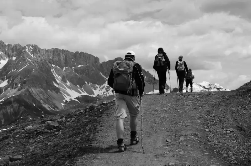
The Dolomites are not just a mountain range; they are a symphony of nature’s grandeur, where limestone spires pierce the sky, alpine meadows blush with wildflowers, and the air hums with the whispers of ancient glaciers. This UNESCO World Heritage Site, nestled in northeastern Italy, is a paradise for hikers, photographers, and soul-searchers alike. With over 1,200 kilometers of marked trails, the Dolomites offer an unparalleled blend of challenge and serenity, where every step reveals a new vista that feels plucked from a dream. Imagine waking up to the crisp mountain air, the scent of pine and wild herbs filling your lungs as you lace up your boots for a day on the trails. The Dolomites are a testament to the raw beauty of the Alps, but with a unique geological identity—composed of dolomite rock, which gives the mountains their signature pale, almost luminous appearance at sunrise and sunset. This geological wonder, combined with the rich cultural tapestry of Ladin villages and Italian alpine traditions, makes the Dolomites a destination unlike any other. Whether you're a seasoned trekker or a casual walker, the Dolomites promise an experience that will leave you breathless—not just from the altitude, but from the sheer majesty of the landscape. For those seeking more than just a hike, the Dolomites are a gateway to a slower, more intentional way of traveling. Here, time seems to stand still in the shadow of the peaks, and every village, every rifugio (mountain hut), and every winding trail tells a story. From the iconic Tre Cime di Lavaredo to the lesser-known Alpe di Siusi, the Dolomites are a mosaic of natural wonders waiting to be explored. So, lace up your boots, pack your camera, and prepare to be enchanted by one of Europe’s most spectacular alpine playgrounds.Why the Dolomites Are a UNESCO World Heritage Site The Dolomites earned their UNESCO World Heritage status in 2009, not just for their stunning beauty, but for their geological significance and ecological importance. This mountain range is a living laboratory of Earth’s history, where the remnants of ancient coral reefs and marine fossils tell the story of a time when the Dolomites were submerged beneath a tropical sea. The unique composition of dolomite rock, named after the French geologist Déodat Gratet de Dolomieu, gives the mountains their distinctive pale color and dramatic verticality. UNESCO recognized the Dolomites for their "outstanding universal value," citing their exceptional natural beauty, geological diversity, and the harmonious coexistence of human culture with the alpine environment. The range spans nine systems, including the Sella Group, the Marmolada, and the Pale di San Martino, each with its own character and charm. The Dolomites are also a biodiversity hotspot, home to rare flora like the Dolomites edelweiss and fauna such as the Alpine ibex and golden eagle. Beyond their natural splendor, the Dolomites are steeped in cultural heritage. The Ladin people, an indigenous group with roots dating back to the Roman era, have preserved their language, traditions, and way of life in the valleys of the Dolomites. Their influence is evident in the architecture of the villages, the cuisine, and the festivals that celebrate the alpine calendar. UNESCO’s designation highlights the importance of preserving this cultural landscape, where nature and human tradition intertwine seamlessly. For hikers, the UNESCO status means that every trail is part of a larger narrative—one that connects you to the earth’s ancient past and the enduring spirit of the people who call these mountains home. Whether you’re traversing the Via Ferrata routes or strolling through the flower-filled meadows of Alpe di Siusi, you’re walking in the footsteps of history.Best Hiking Trails in the Dolomites: From Beginner to Expert The Dolomites offer trails for every level of hiker, from gentle valley walks to grueling multi-day treks. Here’s a breakdown of the best routes, categorized by difficulty and experience. Beginner-Friendly Trails For those new to hiking or looking for a leisurely day on the trails, the Alpe di Siusi is a must-visit. This vast alpine meadow is Europe’s largest high-altitude pasture, stretching over 56 square kilometers. The Panorama Trail (No. 1) is a gentle 5.5-kilometer loop that offers sweeping views of the Sciliar and Sassolungo peaks. With minimal elevation gain and well-marked paths, it’s perfect for families and casual hikers. The trailhead is accessible via the Alpe di Siusi cable car from Compatsch, making it easy to reach. Another excellent beginner option is the Lago di Carezza trail, a short 2.5-kilometer loop around the stunning turquoise lake. The trail is flat and shaded, with interpretive signs explaining the lake’s geological formation and folklore. The lake itself is a photographer’s dream, its colors shifting from emerald to sapphire depending on the light. Intermediate Trails For those ready to tackle more elevation, the Tre Cime di Lavaredo Circuit is an iconic 10-kilometer loop that circles the famous Three Peaks. This trail offers a moderate challenge with an elevation gain of about 700 meters, but the rewards are unparalleled. The jagged limestone spires of the Tre Cime rise dramatically against the sky, and the route passes through alpine meadows dotted with wildflowers and grazing cows. The trail can be started from Rifugio Auronzo, which is accessible by car (though parking fees apply). Another intermediate favorite is the Seceda Ridgeline Trail, which connects the Seceda cable car station to Rifugio Firenze. This 8-kilometer out-and-back trail offers some of the most dramatic views in the Dolomites, with sheer cliffs plunging into the Val Gardena below. The trail is well-marked but exposed in sections, so hikers should be comfortable with heights. The Seceda cable car provides a convenient way to access the trailhead, saving you a steep climb. Advanced Trails For experienced hikers seeking a challenge, the Via Ferrata delle Tridentine is a thrilling option. This via ferrata (iron path) route requires a harness, helmet, and via ferrata set, as it involves sections of exposed climbing and fixed cables. The route starts from Rifugio Lagazuoi and ascends to the summit of Monte Lagazuoi, offering panoramic views of the surrounding peaks. The Via Ferrata is not for the faint-hearted, but the sense of accomplishment at the top is unmatched. For a multi-day adventure, the Alta Via 1 is the Dolomites’ most famous long-distance trail. Stretching 120 kilometers from Lago di Braies to Belluno, this high-altitude route takes hikers through some of the most remote and beautiful parts of the Dolomites. The trail is divided into 14 stages, each ranging from 4 to 16 kilometers, with rifugios providing accommodation along the way. The Alta Via 1 is best tackled in summer or early autumn, when the weather is stable and the rifugios are open. Hidden Gems For those looking to escape the crowds, the Croda da Lago Circuit in the Ampezzo Valley is a hidden gem. This 12-kilometer loop offers stunning views of the Croda da Lago and the Cinque Torri peaks, with far fewer hikers than the more popular routes. The trail starts from Passo Giau and winds through alpine meadows and rocky outcrops, culminating in a breathtaking viewpoint over the Boite Valley.Essential Gear and Packing List for Dolomites Hiking Hiking in the Dolomites is a rewarding but demanding experience, and having the right gear can make the difference between a pleasant adventure and a grueling ordeal. The key to packing for the Dolomites is to prepare for rapidly changing weather conditions, steep elevation gains, and long days on the trails. Here’s a detailed packing list to ensure you’re ready for anything the mountains throw at you. Footwear Your hiking boots are your most important investment. The Dolomites’ trails range from well-maintained paths to rocky, uneven terrain, so you’ll need a pair of boots with good ankle support and a sturdy sole. Brands like Meindl, Hanwag, and Salomon offer excellent options for alpine hiking. Make sure your boots are broken in before your trip to avoid blisters. For via ferrata routes, you’ll need a pair of approach shoes or lightweight hiking shoes with a stiff sole for climbing sections. Clothing The Dolomites’ weather can shift from sunny and warm to cold and rainy in a matter of hours, so layering is essential. Start with a moisture-wicking base layer, such as merino wool or synthetic fabric, to keep sweat away from your skin. Add an insulating mid-layer, like a fleece or down jacket, for warmth, and top it off with a waterproof and windproof shell jacket. Don’t forget a warm hat and gloves, even in summer, as temperatures can drop quickly at higher elevations. Quick-dry hiking pants are ideal, and consider packing a pair of leggings for colder days. Backpack and Hydration A 20-30 liter backpack is ideal for day hikes, with enough space for your water, snacks, and layers. Hydration is critical, so bring at least 2 liters of water or a hydration bladder. A collapsible water bottle is also useful for refilling at mountain streams (though always filter or treat water before drinking). Consider packing a lightweight water filter or purification tablets for longer hikes. Navigation and Safety While the Dolomites’ trails are well-marked with red-and-white stripes (the "CAI" markings), it’s still essential to carry a map and compass—or at least a GPS device or smartphone with offline maps. The Komoot and AllTrails apps are excellent for downloading trail maps, and the Dolomites Hiking Map by Tabacco is a must-have for serious hikers. A headlamp is also crucial, even for day hikes, in case you get caught out after dark. Don’t forget a first-aid kit, including blister treatment, pain relievers, and any personal medications. Miscellaneous Essentials A trekking pole or two can be a game-changer, especially on steep descents or via ferrata routes. They help reduce strain on your knees and provide stability on uneven terrain. Sunglasses with UV protection are a must, as the sun’s glare off the limestone can be intense. A buff or neck gaiter is useful for protecting your face from wind and sun, and a lightweight sit pad can provide comfort during breaks. Finally, pack a trash bag to carry out all your waste—leave no trace is a mantra in the Dolomites.👉 Continue Reading: The Dolomites, Italy: Hiking Through Alpine UNESCO Heritage (Part 2)#DolomitesAdventure #UNESCOHiking #AlpineEscape #ItalyTravel #MountainMagic Related InsightsThe White Silence Beckons: A Century of Chasing the Antarctic Dream Baños Árabes de Jaén: El Legado del Agua L'Eveil des Cimes : Suspendu dans le Souffle du Tigre{ "@context": "https://schema.org", "@type": "FAQPage", "mainEntity": [ { "@type": "Question", "name": "What is the main focus of The Dolomites, Italy: Hiking Through Alpine UNESCO Heritage?", "acceptedAnswer": { "@type": "Answer", "text": "Discover the breathtaking UNESCO-listed Dolomites in Italy, where alpine meadows, jagged peaks, and ancient trails await your next adventure." } }, { "@type": "Question", "name": "Who authored the comprehensive guide on The Dolomites, Italy: Hiking Through Alpine UNESCO Heritage?", "acceptedAnswer": { "@type": "Answer", "text": "This detailed article and its insights were carefully researched and authored by Aisha Sharma." } }, { "@type": "Question", "name": "Where can I find more related content about Travel?", "acceptedAnswer": { "@type": "Answer", "text": "You can explore more articles, detailed reviews, and similar insights by browsing the Related Insights section at the bottom of this article or visiting our dedicated Travel category page." } } ] }
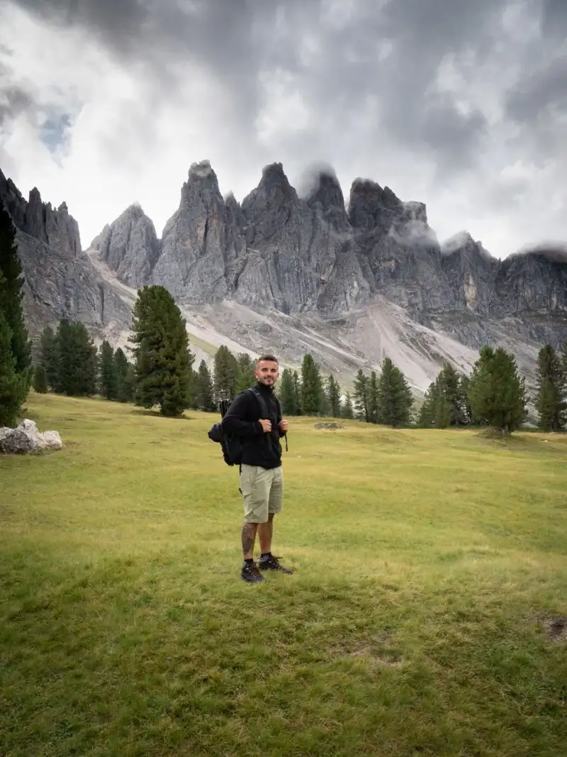
- Aisha Sharma
- 20 Jul, 2026 18:29
The Dolomites, Italy: Hiking Through Alpine UNESCO Heritage (Part 2)
This is Part 2 of the series. Read Part 1 here.Rifugio Etiquette If you’re staying in a rifugio (mountain hut), pack a lightweight sleeping bag liner, as most rifugios provide blankets but not sheets. Bring earplugs, as dormitory-style accommodations can be noisy. A small towel and toiletries are also useful, though many rifugios have basic amenities. Tipping is not expected, but rounding up your bill or leaving a small tip is appreciated for exceptional service.Gear Item Recommended Brand/Model PurposeHiking Boots Meindl Bhutan, Hanwag Tatra Ankle support, durabilityBase Layer Smartwool Merino 250, Icebreaker Moisture-wicking, temperature controlInsulating Layer Patagonia Nano Puff, Arc’teryx Warmth without bulkShell Jacket Gore-Tex Paclite, The North Face Waterproof, windproof protectionBackpack Osprey Talon 22, Deuter Speed Lite Comfortable, lightweight carryTrekking Poles Black Diamond Trail, Leki Makalu Stability, knee supportHeadlamp Petzl Actik Core, Black Diamond Hands-free lightingWater Filter Sawyer Squeeze, Katadyn BeFree Safe drinking waterCultural and Culinary Highlights: What to Eat and Experience in the Dolomites The Dolomites are not just a feast for the eyes; they’re a feast for the senses, especially when it comes to food and culture. The alpine cuisine here is hearty, flavorful, and deeply rooted in tradition, with dishes that reflect the region’s history and environment. From hearty stews to delicate pastries, the food of the Dolomites is a celebration of local ingredients and time-honored recipes. Must-Try Dishes One of the most iconic dishes of the Dolomites is canederli, or bread dumplings. Made from stale bread, milk, eggs, and cheese (often speck or Parmesan), these dumplings are typically served in a rich broth or with a creamy sauce. Another staple is speck, a smoky, cured ham that’s a specialty of the Alto Adige region. It’s often served thinly sliced as an antipasto or melted into dishes like speckknödel (speck dumplings). For meat lovers, casunziei is a must-try. These are beetroot-filled pasta dumplings, typically served with a butter and poppy seed sauce or a meat ragù. Another hearty dish is schlutzkrapfen, half-moon-shaped pasta filled with spinach, ricotta, and herbs, often served with a light tomato sauce. Vegetarians will delight in spinaci ripieni, spinach and cheese-stuffed pasta, or pizzoccheri, a buckwheat pasta dish from the Valtellina region, served with potatoes, greens, and Casera cheese. For dessert, try strudel di mele, a flaky apple strudel, or kaiserschmarrn, a caramelized pancake served with powdered sugar and fruit compote. Rifugio Dining: What to Expect Dining in a rifugio is an experience in itself. Most rifugios offer a set menu (often called a menù di montagna) that includes a starter, main course, and dessert. Prices typically range from €15 to €30 per person, depending on the rifugio’s location and amenities. Aperitivo is a beloved tradition in the Dolomites, where hikers gather before dinner to enjoy a drink (often a local wine or spritz) and small bites like olives, nuts, or cured meats. Popular rifugios like Rifugio Lagazuoi, Rifugio Locatelli, and Rifugio Nuvolau are known for their stunning views and delicious food. Be sure to reserve ahead during peak season (June to September), as rifugios can fill up quickly. Many rifugios also offer half-board options, which include dinner and breakfast, making them a convenient choice for multi-day hikers. Local Beverages The Dolomites are home to some excellent local wines and spirits. Try a glass of Lagrein, a bold red wine from the Alto Adige region, or Pinot Grigio, a crisp white wine that pairs perfectly with seafood dishes. For beer lovers, Forst and Peroni are popular Italian lagers, while Alpina offers craft beers brewed in the Dolomites. For a unique experience, sample genepì, a herbal liqueur made from alpine plants, or amaro, a bittersweet digestif. If you’re hiking in winter, try vin brulé, or mulled wine, which is sold at Christmas markets and rifugios alike. Cultural Experiences Beyond food, the Dolomites offer a wealth of cultural experiences. Visit the Ladin Museum in San Martino in Badia to learn about the Ladin people and their traditions. Attend a folk festival, such as the Sasslong Cup ski race or the Alta Badia Wine Festival, to immerse yourself in local culture. For a unique perspective, take a guided hike with a local expert who can share insights into the region’s geology, flora, and history. Many rifugios also offer cheese-making demonstrations, where you can learn how to make Casera or Puzzone di Moena, two iconic alpine cheeses.Practical Tips: Transportation, Accommodation, and Budgeting Planning a trip to the Dolomites requires careful consideration of transportation, accommodation, and budget. While the region is remote, it’s well-connected by public transport and offers a range of lodging options to suit every traveler’s needs and budget. Getting There The Dolomites are best accessed from major Italian cities like Venice, Milan, or Verona. The closest airports are Venice Marco Polo Airport (VCE) and Verona Villafranca Airport (VRN), both of which offer car rentals and train connections to the Dolomites. From Venice, you can take a train to Calalzo di Cadore or Cortina d’Ampezzo, two key gateway towns. The Dolomiti Bus network connects many of the region’s towns and trailheads, making it easy to reach popular hiking areas without a car. For example, the bus from Cortina to Rifugio Lagazuoi is a scenic and convenient way to access the trails. If you prefer to drive, renting a car gives you the flexibility to explore at your own pace. Be aware that parking in popular areas like Tre Cime or Alpe di Siusi can be expensive (€10-€20 per day), so arrive early or consider using public transport. Accommodation Options The Dolomites offer a range of accommodation options, from luxury hotels to rustic rifugios. Here’s a breakdown of the best choices:Rifugios: These mountain huts are the heart of alpine culture, offering dormitory-style or private rooms, hearty meals, and a chance to meet fellow hikers. Prices range from €30 to €80 per night, depending on the rifugio’s amenities. Some popular rifugios include Rifugio Lagazuoi, Rifugio Locatelli, and Rifugio Nuvolau. Hotels and Guesthouses: For those seeking more comfort, towns like Cortina d’Ampezzo, Ortisei, and San Martino in Badia offer a range of hotels, from boutique properties to family-run guesthouses. Prices vary widely, from €80 to €200 per night. Airbnb and Apartments: Renting an apartment is a great option for groups or families, offering more space and the chance to cook your own meals. Prices range from €60 to €150 per night, depending on the location and size. Camping: For budget travelers, camping is an option in some areas, though facilities are limited. Campgrounds like Camping Catinaccio in Vigo di Fassa offer basic amenities and easy access to trails.Budgeting for the Dolomites The Dolomites can be as affordable or as luxurious as you make it. Here’s a rough breakdown of costs for a 7-day trip:Expense Category Budget Range (Per Day) NotesAccommodation €30-€200 Rifugios are cheapest; hotels are pricierFood €20-€50 Rifugio meals €15-€30; groceries €10-€20Transportation €10-€30 Public transport €5-€15/day; car rental €40-€80/dayActivities €0-€50 Cable cars €15-€30; guided hikes €20-€50Miscellaneous €10-€20 Souvenirs, tips, unexpected costsFor a mid-range traveler, budget around €80-€120 per day, including accommodation, food, and activities. If you’re staying in rifugios and cooking some meals, you can reduce costs to €50-€80 per day. For a more luxurious experience, budget €150-€250 per day for high-end hotels, fine dining, and private tours. Digital Nomad Considerations If you’re a digital nomad, the Dolomites offer a stunning backdrop for remote work. While the region isn’t as well-equipped for digital nomads as cities like Lisbon or Chiang Mai, there are some options. Coworking spaces like Impact Hub Bozen in Bolzano offer reliable internet and a professional environment. Many rifugios and hotels also provide Wi-Fi, though speeds can be slow in remote areas. For a digital nomad visa, Italy offers a Digital Nomad Visa with an income requirement of $2,870 per month. The estimated cost of living in Italy is around $1,629 per month, making it a feasible option for remote workers. However, the Dolomites may not be the most practical base for a digital nomad due to limited coworking spaces and slower internet speeds. Best Time to Visit The Dolomites are a year-round destination, but the best time for hiking is from June to September, when the trails are free of snow and the rifugios are open. July and August are peak season, with higher prices and more crowds, while June and September offer pleasant weather and fewer tourists. For winter sports enthusiasts, the Dolomites are a paradise for skiing, snowboarding, and snowshoeing. The ski season runs from December to April, with popular resorts like Val Gardena, Cortina d’Ampezzo, and Alta Badia offering world-class slopes.The Dolomites are more than just a mountain range; they are a living testament to the power of nature and the resilience of human culture. Whether you’re traversing the iconic Tre Cime di Lavaredo, savoring a hearty meal in a rifugio, or simply soaking in the views from a high alpine meadow, the Dolomites have a way of leaving an indelible mark on your soul. This UNESCO-listed paradise offers something for everyone—adventure, tranquility, and a deep connection to the natural world. As you lace up your boots and set out on the trails, remember that the Dolomites are not just a destination; they are an experience to be savored, one step at a time. So, pack your bags, plan your route, and prepare to be enchanted by the magic of the Dolomites. The mountains are calling, and it’s time to answer.#DolomitesAdventure #UNESCOHiking #AlpineEscape #ItalyTravel #MountainMagic Related InsightsScavi di Pompei: La Città Congelata nel Tempo Mercati di Traiano: Il Primo Centro Commerciale del Mondo Hidden Gems of Eastern Anatolia{ "@context": "https://schema.org", "@type": "FAQPage", "mainEntity": [ { "@type": "Question", "name": "What is the main focus of The Dolomites, Italy: Hiking Through Alpine UNESCO Heritage (Part 2)?", "acceptedAnswer": { "@type": "Answer", "text": "Discover the breathtaking UNESCO-listed Dolomites in Italy, where alpine meadows, jagged peaks, and ancient trails await your next adventure." } }, { "@type": "Question", "name": "Who authored the comprehensive guide on The Dolomites, Italy: Hiking Through Alpine UNESCO Heritage (Part 2)?", "acceptedAnswer": { "@type": "Answer", "text": "This detailed article and its insights were carefully researched and authored by Aisha Sharma." } }, { "@type": "Question", "name": "Where can I find more related content about Travel?", "acceptedAnswer": { "@type": "Answer", "text": "You can explore more articles, detailed reviews, and similar insights by browsing the Related Insights section at the bottom of this article or visiting our dedicated Travel category page." } } ] }

-
 Marco Rossi
 - 20 Jul, 2026 18:02
Cape Town: Dove il Tempo si Incontra con l’Oceano e la Storia si Svela tra Montagne Sacre
Il Cuore Battente dell’Africa: Cape Town tra Mito e Modernità Cape Town non è semplicemente una città: è un poema scritto tra le onde dell’Atlantico e le vette maestose di una montagna che sembra sfidare il cielo. Qui, dove il vento salato accarezza le rocce antiche e la storia si respira ad ogni angolo, il tempo sembra fermarsi per poi ripartire con rinnovata energia. È la città dove l’Europa incontrò l’Africa, dove le leggende dei Khoikhoi si intrecciano con le gesta dei navigatori portoghesi, e dove oggi la modernità danza con una natura che toglie il fiato. Ma cosa rende Cape Town così straordinaria? È forse la sua posizione geografica, incastonata tra due oceani e una montagna iconica? O forse la sua anima multiculturale, plasmata da secoli di scambi, conflitti e rinascite? In questo viaggio tra le sue strade, le sue spiagge e i suoi tesori nascosti, scopriremo perché questa città è stata eletta più volte come la migliore al mondo per i viaggiatori.Dalle Origini Antiche alla Fondazione di una Metropoli: Un Viaggio nel Tempo I Primi Abitanti e l’Arrivo degli Europei Prima che le navi europee solcassero queste acque, la regione era già abitata da millenni. Le tracce più antiche di presenza umana risalgono a oltre 7.000 anni fa, quando i primi cacciatori-raccoglitori, antenati dei Khoikhoi, lasciarono testimonianze della loro vita nelle grotte di Peers Cave a Fish Hoek. Questi popoli, nomadi e profondamente legati alla terra, vivevano in armonia con un ambiente che oggi definiamo come parte della Cape Floristic Region, una delle aree più ricche di biodiversità al mondo. Tutto cambiò nel 1488, quando il navigatore portoghese Bartolomeu Dias doppiò per la prima volta il temibile Capo delle Tempeste (poi ribattezzato Capo di Buona Speranza da re Giovanni II del Portogallo). Dias non sapeva che stava aprendo una porta verso un nuovo mondo, ma sapeva che quella rotta avrebbe rivoluzionato il commercio globale. Pochi anni dopo, nel 1497, Vasco da Gama avrebbe completato il percorso, aprendo la via marittima verso le Indie. Tuttavia, l’incontro tra europei e abitanti locali non fu sempre pacifico. Nel 1510, nella Battaglia del Fiume Salato, il comandante portoghese Francisco de Almeida e i suoi uomini furono sconfitti dai Khoikhoi, che utilizzarono strategie innovative, come mandrie di buoi addestrati a rispondere a fischi e grida. Questa vittoria dimostrò la resilienza di un popolo che avrebbe resistito per secoli all’avanzata coloniale.L’Era Olandese: La Nascita di una Colonia Nel 1652, la Compagnia Olandese delle Indie Orientali (VOC) inviò Jan van Riebeeck a stabilire un insediamento a Table Bay. L’obiettivo era semplice: creare una stazione di rifornimento per le navi dirette verso le Indie Orientali. Quello che iniziò come un avamposto militare si trasformò rapidamente in una colonia agricola. Ma la crescita fu lenta. Gli olandesi faticavano a trovare manodopera, e così, a partire dal 1658, iniziarono a importare schiavi dall’Indonesia, dal Madagascar e dall’Africa orientale. Questi uomini e donne, costretti a lasciare la loro terra, divennero gli antenati delle comunità Cape Coloured e Cape Malay, che ancora oggi rappresentano una parte fondamentale dell’identità culturale della città. Van Riebeeck e i suoi successori introdussero anche nuove colture, come vite, cereali, patate e agrumi, che avrebbero trasformato per sempre l’agricoltura della regione. Tuttavia, la vita nella colonia non era facile: gli scontri con i Khoikhoi e i San (Boscimani) erano frequenti, e la sopravvivenza dipendeva dalla capacità di adattarsi a un ambiente ostile.L’Impero Britannico e la Trasformazione di Cape Town Dalla VOC alla Corona: Il Cambio di Guardia Nel 1795, durante le guerre napoleoniche, la Gran Bretagna occupò Cape Town per impedire che cadesse nelle mani dei francesi. Dopo un breve periodo di restituzione agli olandesi (1803), gli inglesi tornarono nel 1806 e, nel 1814, il controllo della colonia fu definitivamente ceduto al Regno Unito. Sotto il dominio britannico, Cape Town divenne la capitale della Colonia del Capo, un territorio in rapida espansione grazie alle guerre contro gli amaXhosa a est. Tuttavia, la crescita portò anche a profonde tensioni sociali. Nel 1833, la schiavitù fu abolita, liberando oltre 5.500 schiavi nella città, che all’epoca rappresentavano quasi un terzo della popolazione. Questo evento scatenò proteste e richieste di maggiore autonomia, culminate nella Crisi dei Convitti del 1849, un periodo di disordini civili che accelerò il processo di autogoverno. L’Età dell’Oro: Ferrovie, Diamanti e una Città che Cresceva Gli anni successivi furono segnati da una trasformazione senza precedenti. Nel 1859 fu inaugurata la prima linea ferroviaria, che collegava Cape Town al resto del paese. Poco dopo, la scoperta dei diamanti a Griqualand West (1867) e dell’oro nel Witwatersrand (1886) attirò migliaia di immigrati, facendo esplodere la popolazione cittadina da 67.000 a 171.000 abitanti in appena un decennio. La città si modernizzò rapidamente: nel 1895 entrò in funzione la prima centrale elettrica pubblica, e le infrastrutture si espansero per accogliere i nuovi abitanti. Tuttavia, non tutto fu armonia. I conflitti tra i boeri (afrikaner) e gli inglesi portarono alla Seconda Guerra Anglo-Boera (1899-1902), che si concluse con la vittoria britannica e la nascita dell’Unione Sudafricana nel 1910.Cape Town nel XX e XXI Secolo: Da Capitale Legislativa a Icona Globale L’Unione Sudafricana e l’Apartheid Con la formazione dell’Unione Sudafricana, Cape Town divenne la capitale legislativa del paese, un ruolo che mantiene ancora oggi. Tuttavia, il XX secolo fu segnato dall’orrore dell’apartheid, un sistema di segregazione razziale che colpì duramente la città. Nonostante ciò, Cape Town rimase un centro di resistenza e cultura, con comunità che lottavano per i loro diritti. Nel 1994, con la fine dell’apartheid, il Sudafrica entrò in una nuova era. Cape Town, con la sua storia multiculturale e la sua posizione strategica, divenne un simbolo di rinascita. Oggi, è una delle città più economicamente stabili del paese, con i redditi familiari più alti, il tasso di disoccupazione più basso e il mercato immobiliare più dinamico di tutta l’Africa meridionale. Un Destinazione da Sogno: Premi e Riconoscimenti Non sorprende che Cape Town sia stata più volte eletta come migliore città al mondo per i viaggiatori. Nel 2014, il New York Times la definì "la città più bella del pianeta". Nel 2025, Time Out l’ha nuovamente premiata, e per otto anni consecutivi (dal 2017 al 2025), The Telegraph l’ha classificata come la città più affascinante per i turisti. Ma cosa rende Cape Town così speciale? È forse la Table Mountain, che domina la città come un gigante addormentato? O forse la Cape Floristic Region, un patrimonio UNESCO che ospita il 70% delle specie vegetali del Sudafrica? O ancora, la sua vita notturna vibrante, la sua cucina fusion e la sua storia avvincente?I Tesori Nascosti di Cape Town: Oltre i Luoghi Comuni Table Mountain: Il Gigante di Pietra Nessun viaggio a Cape Town è completo senza una visita alla Table Mountain. Questa formazione rocciosa, alta 1.086 metri, è uno dei siti naturali più fotografati al mondo. Ma non è solo la sua maestosità a colpire: è anche la sua biodiversità. Il Parco Nazionale della Table Mountain ospita oltre 1.500 specie di piante, molte delle quali endemiche. Salire in cima può essere un’avventura: si può prendere la funivia, che offre viste mozzafiato, o intraprendere un’escursione a piedi, seguendo sentieri che attraversano fynbos (una vegetazione unica della regione) e incontrando animali come il dassie (un piccolo mammifero simile al coniglio) o il babbuino del Capo.Kirstenbosch: Il Giardino Botanico dei Sogni Se la Table Mountain rappresenta la forza della natura, il Kirstenbosch National Botanical Garden ne incarna la bellezza più delicata. Fondato nel 1913, questo giardino ospita cinque dei sei biomi del Sudafrica, con oltre 7.000 specie di piante. Camminare tra le sue aiuole è come fare un viaggio attraverso i diversi ecosistemi del paese: dalle foreste umide del Knysna alle aride distese del Karoo. Ma Kirstenbosch non è solo un luogo per botanici. È anche un centro culturale, con concerti all’aperto, mostre d’arte e persino un ristorante che offre piatti preparati con ingredienti locali. Non perdetevi il Boomslang Canopy Walkway, un ponte sospeso che vi porterà tra le cime degli alberi, offrendo una prospettiva unica sulla flora sudafricana. Robben Island: Il Luogo della Memoria A pochi chilometri dalla costa di Cape Town si trova Robben Island, un’isola che per secoli è stata un luogo di prigionia e sofferenza. Qui, nel 1964, Nelson Mandela fu rinchiuso per 18 dei suoi 27 anni di detenzione. Oggi, l’isola è un sito patrimonio dell’UNESCO e un museo a cielo aperto, dove le guide (spesso ex prigionieri politici) raccontano la loro storia con una forza che lascia senza parole. Visitare Robben Island non è solo un atto di memoria, ma anche un promemoria della resilienza umana. È un luogo che insegna che, anche nelle tenebre più profonde, la speranza può sopravvivere. Cape Point e la Fine del Mondo Se avete sempre sognato di stare al "confine del mondo", Cape Point è il posto giusto. Questa penisola, situata all’estremità meridionale della Table Mountain, è un luogo di straordinaria bellezza, dove l’Atlantico incontra l’Oceano Indiano. Qui, potrete camminare lungo sentieri che si affacciano su scogliere a picco sul mare, osservare balene (in stagione) e persino avvistare delfini e pinguini africani. Non perdetevi il Cape of Good Hope, dove, secondo la leggenda, gli antichi navigatori portoghesi avvistarono per la prima volta la via verso l’Asia. Oggi, è un luogo magico, dove il vento salato e il cielo infinito creano un’atmosfera quasi surreale.Una Cucina che Racconta Storie: Dalle Spezie al Vino Cape Town non è solo natura e storia: è anche un paradiso per i buongustai. La sua cucina è un mosaico di influenze, che riflette la sua storia multiculturale. Il Cape Malay Cuisine: Spezie e Tradizione Gli antenati degli attuali Cape Malay arrivarono come schiavi dall’Indonesia e dalla Malesia, portando con sé spezie, tecniche di cottura e ricette che ancora oggi definiscono la gastronomia locale. Piatti come il bobotie (un pasticcio speziato con carne macinata e uvetta), il breyani (un curry speziato) e il koeksisters (una ciambella dolce intrecciata) sono vere e proprie delizie. Per assaporare queste prelibatezze, non perdetevi ristoranti come Bo-Kaap Kombuis o The Moghul, dove la tradizione incontra la modernità. Il Vino del Capo: Un’Eredità Olandese Grazie agli olandesi, che introdussero le prime viti nel XVII secolo, il Capo Occidentale è oggi una delle regioni vinicole più prestigiose al mondo. Le cantine di Stellenbosch, Franschhoek e Paarl producono vini di classe mondiale, dai Chenin Blanc ai Pinotage (un vitigno autoctono). Non perdetevi una degustazione nelle vigneti storici di Klein Constantia, dove si produce uno dei vini più antichi del Sudafrica, o una visita alla Fairview Wine Farm, famosa per i suoi formaggi e i suoi vini biologici. Mercati e Street Food: L’Anima Popolare di Cape Town Per un’esperienza più informale, visitate i mercati locali, come il Neighbourgoods Market a Woodstock, dove potrete gustare samoosas (frittelle speziate), biltong (carne essiccata) e chakalaka (un contorno piccante a base di verdure). Un altro must è il Hout Bay Market, dove potrete acquistare prodotti freschi, artigianato locale e, ovviamente, pesce appena pescato.Avventure Estreme e Esperienze Uniche Cape Town non è solo per chi ama la cultura e la buona cucina: è anche un paradiso per gli amanti dell’avventura. Surf a Muizenberg e Big Wave a Dungeons Se siete appassionati di surf, Muizenberg Beach è il posto giusto. Le sue onde lunghe e dolci sono perfette per i principianti, ma anche per i surfisti esperti che vogliono cimentarsi in sessioni più impegnative. Per i più temerari, Dungeons, vicino a Hout Bay, offre onde giganti che attirano surfisti da tutto il mondo. Attenzione, però: queste onde sono tra le più pericolose del pianeta! Parapendio sulla Baia di False Immaginate di librarsi nel cielo sopra la False Bay, con la Table Mountain alle vostre spalle e l’oceano sotto di voi. Il parapendio a Signal Hill o a Langebaan è un’esperienza che vi lascerà senza fiato (letteralmente). Safari Urbano: Pinguini a Boulders Beach Sì, avete letto bene: a pochi chilometri da Cape Town, a Simon’s Town, potrete nuotare tra i pinguini africani a Boulders Beach. Questi simpatici animali, con il loro caratteristico piumaggio nero e bianco, sono una delle attrazioni più fotografate della città.La Cape Town di Oggi: Una Città in Evoluzione Oggi, Cape Town è una città vibrante e in continua trasformazione. Nonostante le sfide sociali ed economiche, sta diventando un modello di sostenibilità e innovazione. Economia e Innovazione Con i suoi redditi familiari più alti del Sudafrica, Cape Town attrae investimenti in settori come la tecnologia, il turismo e le energie rinnovabili. La città sta diventando un hub per startup e imprese innovative, grazie a un ecosistema che favorisce la creatività e l’imprenditorialità. Sostenibilità e Conservazione Cape Town è in prima linea nella lotta al cambiamento climatico. Il Cape Town Green Map è un progetto che promuove la mobilità sostenibile, mentre iniziative come il Two Oceans Aquarium lavorano per proteggere la biodiversità marina. Vita Notturna e Cultura La vita notturna di Cape Town è legendaria. Da Long Street, con i suoi bar e locali alla moda, a Green Point, dove si trovano ristoranti gourmet e club esclusivi, la città offre qualcosa per tutti i gusti. Non perdetevi anche gli eventi culturali, come il Cape Town Jazz Festival o il Cape Town International Film Market & Festival, che attirano artisti e visitatori da tutto il mondo.Consigli Pratici per un Viaggio Indimenticabile Quando Andare Il periodo migliore per visitare Cape Town è tra novembre e marzo, quando le temperature sono miti e le giornate lunghe. Tuttavia, anche l’inverno (giugno-agosto) ha il suo fascino, soprattutto per gli amanti della natura, grazie alla fioritura delle piante del fynbos. Come MuoversiNoleggio auto: È il modo più comodo per esplorare la città e i dintorni. Uber: Un’alternativa sicura e conveniente ai taxi tradizionali. Autobus e minibus: Economici, ma meno comodi per i turisti. Bicicletta: Per gli amanti delle due ruote, ci sono piste ciclabili lungo la costa.Cosa PortareAbbigliamento a strati: Le temperature possono variare notevolmente tra giorno e notte. Scarpe da trekking: Per le escursioni sulla Table Mountain o a Cape Point. Costume da bagno: Per le spiagge e le piscine. Protezione solare: Il sole sudafricano è intenso!Sicurezza Cape Town è una città sicura per i turisti, ma è sempre bene prendere alcune precauzioni:Evitate di camminare da soli di notte in zone poco frequentate. Non mostrate oggetti di valore in pubblico. Usate i parcheggi custoditi.Conclusione: Cape Town, una Storia che Continua Cape Town non è solo una destinazione: è un emozione. È il profumo del fynbos al mattino, il rumore delle onde che si infrangono sugli scogli, il sapore del vino del Capo in una sera stellata. È la storia di un popolo che ha resistito, si è adattato e ha creato qualcosa di unico. Che siate alla ricerca di avventura, cultura, relax o semplicemente di una fuga dalla routine, questa città saprà conquistarvi. Perché Cape Town non si visita: si sperimenta. E voi, siete pronti a partire?#CapeTown #ViaggioInSudafrica #PatrimonioMondiale #AvventuraECultura #MiglioriCittàDelMondo Related InsightsThe Silk Road Revival: Uzbekistan’s Ancient Cities and Modern Wonders The Faroe Islands: Rugged Landscapes and Viking Echoes The Dolomites, Italy: Hiking Through Alpine UNESCO Heritage{ "@context": "https://schema.org", "@type": "FAQPage", "mainEntity": [ { "@type": "Question", "name": "What is the main focus of Cape Town: Dove il Tempo si Incontra con l’Oceano e la Storia si Svela tra Montagne Sacre?", "acceptedAnswer": { "@type": "Answer", "text": "Scopri i segreti di Cape Town, città dove la natura selvaggia, la storia millenaria e una cultura vibrante si fondono in un’esperienza indimenticabile." } }, { "@type": "Question", "name": "Who authored the comprehensive guide on Cape Town: Dove il Tempo si Incontra con l’Oceano e la Storia si Svela tra Montagne Sacre?", "acceptedAnswer": { "@type": "Answer", "text": "This detailed article and its insights were carefully researched and authored by Marco Rossi." } }, { "@type": "Question", "name": "Where can I find more related content about Travel?", "acceptedAnswer": { "@type": "Answer", "text": "You can explore more articles, detailed reviews, and similar insights by browsing the Related Insights section at the bottom of this article or visiting our dedicated Travel category page." } } ] }
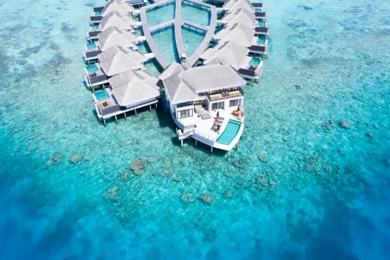
The Maldives is not just a destination; it is a dream woven from turquoise waters, powdery white sand, and the whisper of palm fronds against the breeze. Imagine waking up in a glass-walled overwater bungalow, the Indian Ocean stretching endlessly before you, its surface shimmering like liquid sapphire. This is the Maldives—a place where time slows, and every moment feels like a postcard come to life. But beyond the postcard-perfect scenery lies a deeper story: one of fragile ecosystems, conservation battles, and the delicate balance between luxury and sustainability. The Maldives is a paradox—a nation built on tourism yet fiercely protective of its coral reefs, a paradise where overwater bungalows offer unparalleled comfort while marine biologists work tirelessly to preserve the underwater world that makes this archipelago so extraordinary. For travelers, the Maldives represents the pinnacle of luxury travel. Overwater bungalows, once a novelty, have become synonymous with the Maldives itself. These iconic structures, perched on stilts above the lagoon, offer direct access to the ocean, private decks for sunset cocktails, and interiors that blend modern elegance with traditional Maldivian craftsmanship. But the allure of the Maldives extends beyond its accommodations. The country’s coral reefs, some of the most biodiverse on the planet, are the lifeblood of its tourism industry. They protect the islands from erosion, support fisheries that feed the nation, and attract divers and snorkelers from around the world. Yet, these reefs face existential threats from climate change, ocean acidification, and unsustainable tourism practices. The Maldives’ response? A bold commitment to conservation, innovation, and sustainable luxury. This article will guide you through the enchanting world of Maldivian overwater bungalows, from their history and design to the practicalities of booking and what to expect during your stay. We’ll also delve into the critical work being done to protect the coral reefs that make the Maldives a global treasure. Whether you’re planning a honeymoon, a digital nomad seeking inspiration, or an eco-conscious traveler eager to support sustainable tourism, this guide will equip you with everything you need to know. So, let’s dive in—literally and figuratively—into the Maldives, where every stay is an investment in paradise.The Evolution of Overwater Bungalows: From Tahiti to the Maldives The concept of overwater bungalows traces its roots to the 1960s in Tahiti, where the first such structures were built as simple, rustic huts on stilts. These early designs were born out of necessity—fishermen and locals needed affordable housing close to the water, and the elevated structures provided protection from tides and storms. It wasn’t until the 1970s that the idea was commercialized, thanks to the vision of hoteliers who recognized the potential of these unique dwellings as tourist accommodations. The first true overwater bungalow resort, the Club Med Papeete in Tahiti, opened in 1973, offering guests a novel way to experience the ocean without getting their feet wet. The Maldives adopted this concept in the late 1980s, but with a twist. Unlike Tahiti’s wooden huts, Maldivian overwater bungalows were designed to blend seamlessly with the environment, using local materials like coconut wood, thatch, and coral stone. The first resort to introduce overwater bungalows to the Maldives was Banyan Tree Maldives in 1994, which set a new standard for luxury and sustainability. Since then, the design and amenities of overwater bungalows in the Maldives have evolved dramatically. Today, they are architectural marvels, featuring floor-to-ceiling glass walls, private plunge pools, outdoor showers, and even glass floors that reveal the ocean beneath your feet. The Maldives now boasts over 100 resorts, many of which feature overwater villas as their flagship accommodations. These structures are not just places to sleep; they are immersive experiences. For example, Conrad Maldives Rangali Island offers a two-story overwater villa with a glass-bottom living room, while Soneva Jani in the Baa Atoll features retractable roofs and private slides into the lagoon. The engineering behind these bungalows is a feat in itself—built to withstand monsoon winds and rising sea levels, they are anchored to the ocean floor with reinforced concrete pilings and designed to minimize environmental impact. But the evolution of overwater bungalows in the Maldives is not just about luxury; it’s also about sustainability. Modern resorts are increasingly incorporating eco-friendly materials, solar power, and water conservation systems. For instance, Six Senses Laamu uses locally sourced materials and has a zero-plastic policy, while Gili Lankanfushi in North Malé Atoll is powered entirely by solar energy. These innovations reflect a growing awareness that true luxury must coexist with environmental responsibility.Choosing Your Maldivian Paradise: A Step-by-Step Guide to Overwater Bungalows Selecting the perfect overwater bungalow in the Maldives can feel overwhelming, given the sheer variety of options. From budget-friendly to ultra-luxury, each resort offers a unique experience. Here’s a step-by-step guide to help you navigate the process and find the bungalow that aligns with your travel goals, budget, and values. Step 1: Define Your Priorities Before diving into research, ask yourself what matters most to you. Is it location, price, amenities, or sustainability? The Maldives is divided into 26 atolls, each with its own character. For example:North Malé Atoll: Home to the capital, Malé, and the most accessible resorts. Ideal for first-time visitors who want convenience and a mix of luxury and mid-range options. South Malé Atoll: Less crowded, with some of the most secluded and high-end resorts like Soneva Jani and Cheval Blanc Randheli. Baa Atoll: A UNESCO Biosphere Reserve, perfect for eco-conscious travelers and those interested in marine conservation. Ari Atoll: Known for its vibrant marine life, including manta rays and whale sharks, making it a top choice for divers.Your budget will also play a significant role. Overwater bungalows in the Maldives range from $300 to over $10,000 per night. Mid-range options like Cinnamon Hakuraa Huraa Maldives offer solid amenities at around $500–$800 per night, while ultra-luxury resorts like The St. Regis Maldives Vommuli Resort can exceed $2,000 per night. Step 2: Research Resorts and Their Unique Offerings Once you’ve narrowed down your atoll, dive into the specifics of each resort. Here are some key factors to consider:Size and Layout: Some bungalows are standalone, while others are part of a larger complex. Lux South Ari Atoll, for example, offers interconnected bungalows ideal for families or groups. Amenities: Do you want a private pool, a butler service, or a spa? Siyam World in Noonu Atoll features overwater villas with private pools and direct access to a lagoon pool. Dining Options: Resorts like Ozen Reserve Bolifushi offer multiple restaurants, including underwater dining at Subsix, the world’s first underwater restaurant. Activities: If you’re a diver, look for resorts near house reefs or with PADI 5-star dive centers, such as Maafushi Island Resort in South Malé Atoll.Step 3: Understand the Logistics Staying in an overwater bungalow in the Maldives requires some planning. Here’s what you need to know:Transportation: Most resorts are accessible only by seaplane or speedboat. Seaplanes (operated by companies like Trans Maldivian Airways or Manta Air) are the most scenic but also the most expensive, costing around $500–$700 round-trip from Malé. Speedboats are cheaper (around $100–$200) but limited to resorts in North and South Malé Atolls. Visa Requirements: The Maldives offers a 30-day free visa on arrival for tourists from most countries. Ensure your passport is valid for at least six months. Best Time to Visit: The dry season (November to April) offers the best weather, with calm seas and minimal rainfall. However, this is also peak season, so prices are higher. The wet season (May to October) is cheaper and less crowded, but expect occasional rain and rougher seas.Step 4: Book Directly or Through a Travel Agent While online travel agencies (OTAs) like Booking.com or Expedia offer convenience, booking directly with the resort often comes with perks such as:Free upgrades (e.g., a larger villa or better view). Resort credits (e.g., $200–$500 to spend on spa or dining). Flexible cancellation policies.For example, Four Seasons Resort Maldives at Voavah offers a "Stay Longer, Save More" package, while W Maldives provides a "WOW" program with exclusive experiences like private sandbank picnics. Step 5: Prepare for Your Stay Once your booking is confirmed, start planning the details:Packing: Bring reef-safe sunscreen (regular sunscreen is banned in many resorts to protect coral reefs), lightweight clothing, waterproof phone cases, and a good book—Wi-Fi in the Maldives is surprisingly reliable, but don’t expect blazing-fast speeds. Excursions: Many resorts offer snorkeling trips to nearby reefs, sunset dolphin cruises, or visits to local islands. Coco Plum Island Resort in South Malé Atoll arranges cultural tours to nearby fishing villages. Budgeting: While all-inclusive resorts like Kudadoo Maldives Private Island cover meals and activities, others operate on a "pay-as-you-go" basis. Expect to spend $50–$100 per day on food and drinks if not all-inclusive.Coral Reef Conservation in the Maldives: Protecting Paradise The Maldives’ coral reefs are the unsung heroes of this tropical paradise. Covering less than 1% of the ocean floor, they support 25% of all marine life and provide critical ecosystem services, including coastal protection, carbon sequestration, and food security. Yet, these reefs are under siege from multiple threats:Climate Change: Rising sea temperatures cause coral bleaching, a phenomenon where corals expel the algae that give them color and nutrients, turning them white and leaving them vulnerable to disease. The 2016 and 2019 global bleaching events devastated up to 60% of the Maldives’ coral reefs. Ocean Acidification: Increased CO2 levels make seawater more acidic, weakening coral skeletons and making it harder for them to recover from bleaching. Overfishing and Destructive Fishing Practices: Unsustainable fishing, such as dynamite fishing, damages coral structures and depletes fish populations. Pollution: Runoff from resorts, plastic waste, and chemical sunscreens (which contain oxybenzone and octinoxate) contribute to coral degradation.Recognizing these threats, the Maldivian government and local organizations have launched ambitious conservation initiatives. Here’s a deep dive into the efforts shaping the future of the Maldives’ reefs. 1. Coral Restoration and Reef Gardening One of the most effective conservation strategies in the Maldives is coral restoration, often referred to as "reef gardening." This process involves growing coral fragments in underwater nurseries and then transplanting them onto damaged reefs. Organizations like Reefscapers and Coralive have pioneered this technique, working with resorts to restore reefs around their properties. For example, Kandolhu Island Resort in Ari Atoll has partnered with Reefscapers to establish a coral nursery where guests can participate in "coral planting" activities. Similarly, Soneva Fushi in Baa Atoll runs a "Coral Nursery Project," where guests can adopt a coral frame and track its growth online. These initiatives not only restore reefs but also raise awareness among tourists about the importance of marine conservation. 2. Marine Protected Areas (MPAs) The Maldives has designated 35 marine protected areas (MPAs) to safeguard critical habitats. These zones restrict fishing, diving, and other activities that could harm the reefs. The Baa Atoll UNESCO Biosphere Reserve, for instance, is a prime example of an MPA where sustainable tourism and conservation go hand in hand. Resorts like Four Seasons Private Island at Voavah and Soneva Jani adhere to strict environmental guidelines within these protected areas.👉 Continue Reading: The Maldives: Where Overwater Bungalows Meet Coral Reef Conservation (Part 2)#MaldivesTravel #SustainableLuxury #CoralReefConservation #OverwaterBungalows #DigitalNomadParadise Related InsightsAustralia Unveiled: Where Sun-Kissed Shores Meet Ancient Souls and Modern Marvels (Part 2) Albania’s Riviera vs Montenegro’s Bay of Kotor: Europe’s Best-Kept Secret Coastlines Revealed Cappadocia Unveiled: Soaring Above Fairy Chimneys and Sleeping in Stone Dreams{ "@context": "https://schema.org", "@type": "FAQPage", "mainEntity": [ { "@type": "Question", "name": "What is the main focus of The Maldives: Where Overwater Bungalows Meet Coral Reef Conservation?", "acceptedAnswer": { "@type": "Answer", "text": "Discover the ultimate luxury of Maldivian overwater bungalows while diving into coral reef conservation efforts in this tropical paradise." } }, { "@type": "Question", "name": "Who authored the comprehensive guide on The Maldives: Where Overwater Bungalows Meet Coral Reef Conservation?", "acceptedAnswer": { "@type": "Answer", "text": "This detailed article and its insights were carefully researched and authored by Zola Ndlovu." } }, { "@type": "Question", "name": "Where can I find more related content about Travel?", "acceptedAnswer": { "@type": "Answer", "text": "You can explore more articles, detailed reviews, and similar insights by browsing the Related Insights section at the bottom of this article or visiting our dedicated Travel category page." } } ] }