Showing Posts From
Travel
-
 Zola Ndlovu
 - 20 Jul, 2026 11:23
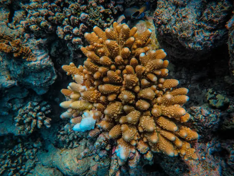
The Maldives: Where Overwater Bungalows Meet Coral Reef Conservation (Part 2)
This is Part 2 of the series. Read Part 1 here.3. Banning Harmful Practices In 2020, the Maldives took a bold step by banning single-use plastics, including straws, cutlery, and bags, to reduce ocean pollution. Additionally, many resorts have adopted reef-safe sunscreen policies, replacing chemical sunscreens with mineral-based alternatives. Gili Lankanfushi was one of the first resorts to ban all sunscreens containing oxybenzone and octinoxate, setting a precedent for the industry. 4. Community-Led Conservation Local communities play a vital role in reef conservation. Organizations like Blue Marine Foundation and Manta Trust work with Maldivian fishermen and resorts to promote sustainable fishing practices and protect endangered species like manta rays and whale sharks. For example, Manta Trust runs the Maldivian Manta Ray Project, which tracks and protects manta populations through citizen science and education programs. 5. Innovative Solutions The Maldives is also at the forefront of innovative conservation technologies. For instance:3D-Printed Coral Reefs: Projects like The Ocean Agency’s "50 Reefs" initiative use 3D printing to create artificial reef structures that mimic natural coral formations, providing habitats for marine life while the natural reefs recover. Coral IVF: Scientists in the Maldives are experimenting with "coral IVF," a technique that involves collecting coral spawn (eggs and sperm) during mass spawning events and fertilizing them in a lab before transplanting the larvae onto damaged reefs. AI and Drones: Organizations like The Nature Conservancy use drones and AI to monitor coral health and detect bleaching events in real time, allowing for rapid response and intervention.How Travelers Can Support Conservation As a visitor to the Maldives, you can contribute to reef conservation in several ways:Choose Eco-Certified Resorts: Look for resorts with certifications like Green Globe, EarthCheck, or LEED. Six Senses Laamu is Green Globe-certified, while Soneva Jani has achieved LEED Platinum status. Participate in Citizen Science: Many resorts offer programs where guests can help with coral monitoring, beach cleanups, or data collection for marine research. Support Local Conservation Organizations: Donate to or volunteer with groups like Reefscapers, Manta Trust, or Blue Marine Foundation. Reduce Your Environmental Footprint: Opt for reef-safe sunscreen, minimize plastic use, and choose resorts that prioritize sustainability.The Maldives on a Budget: Can You Afford Paradise? The Maldives is often stereotyped as an exclusive playground for the ultra-wealthy, but the reality is more nuanced. While overwater bungalows at top-tier resorts can cost upwards of $1,000 per night, there are ways to experience the Maldives on a budget—without sacrificing the magic. Here’s a detailed breakdown of costs, strategies for saving money, and alternative accommodations that offer a taste of paradise without the sticker shock. The Cost of Living in the Maldives According to Numbeo’s 2026 cost of living data, the Maldives is moderately expensive compared to other tropical destinations, but prices vary widely depending on where you stay and how you travel. Here’s a snapshot of average costs for travelers:Expense Category Average Cost (USD) NotesMid-range resort per night $300–$600 Includes meals, activities, and seaplane transfers.Budget guesthouse per night $80–$150 Often on local islands, no overwater bungalows.Seaplane transfer (round trip) $500–$700 Required for most resorts; speedboats are cheaper but limited.Speedboat transfer (round trip) $100–$200 Only available for resorts in North/South Malé Atolls.Meal at a local café $5–$10 Try Hulhule Island Café for authentic Maldivian dishes.Meal at a resort restaurant $20–$50 Buffets are often the best value.Local transportation (ferry) $1–$5 Public ferries connect local islands.Bottle of water $1–$2 Resorts charge premium prices; buy in Malé.SIM card with data $10–$20 Dhiraagu or Ooredoo offers tourist SIMs.Budget-Friendly Alternatives to Overwater Bungalows If overwater bungalows are out of your budget, consider these alternatives: 1. Local Island Guesthouses Staying on a local island is the most affordable way to experience the Maldives. Guesthouses like Maafushi Inn (Maafushi Island) or Thulusdhoo Beach Hotel (Thulusdhoo Island) offer basic but comfortable rooms for $50–$100 per night. While you won’t have an overwater bungalow, you’ll get a more authentic taste of Maldivian culture and cuisine. Plus, many local islands have stunning beaches and house reefs perfect for snorkeling. 2. Liveaboard Cruises For adventure seekers, liveaboard cruises offer a unique way to explore the Maldives’ atolls. Companies like Soneva Journeys or Maldives Liveaboard offer multi-day trips with diving, snorkeling, and visits to remote islands. Prices start at around $200 per day, including meals and activities. 3. Mid-Range Resorts Resorts like Cinnamon Hakuraa Huraa Maldives or OBLU Select at Sangeli offer overwater villas at a fraction of the cost of ultra-luxury resorts. These properties provide excellent amenities, including pools, spas, and dive centers, without the premium price tag. 4. All-Inclusive Resorts All-inclusive resorts like Kudadoo Maldives Private Island or Velaa Private Island bundle meals, drinks, and activities into one upfront cost. While the nightly rate may seem high ($800–$1,500), it can work out cheaper than paying à la carte at a luxury resort. Saving on Transfers Transportation to and from resorts is often the biggest expense. Here’s how to cut costs:Book a Speedboat Instead of a Seaplane: If your resort is in North or South Malé Atoll, a speedboat transfer can save you hundreds of dollars. Companies like MTCC Speedboats or Velaa Transport offer reliable services. Stay Longer: Many resorts offer discounts for extended stays. For example, Cinnamon Hakuraa Huraa offers a "Stay 7, Pay 6" deal. Travel During Shoulder Season: The period between May and October (wet season) is cheaper and less crowded, with rates dropping by 30–50%.Eating on a Budget Food in the Maldives can be expensive, especially at resorts. Here’s how to save:Eat at Local Cafés: Try Hulhumalé’s food markets or Maafushi’s local eateries for fresh seafood and Maldivian dishes like mas huni (tuna salad) and garudhiya (fish soup) for under $10. Opt for Half-Board or Full-Board: Many mid-range resorts offer meal plans that are cheaper than paying for à la carte dining. Bring Snacks: Buy snacks and drinks in Malé before heading to your resort to avoid inflated prices.Free and Low-Cost Activities The Maldives isn’t just about luxury; it’s also about adventure and culture. Here are some budget-friendly activities:Snorkeling: Many local islands and resorts have house reefs teeming with marine life. Maafushi Island has a vibrant reef just a short swim from shore. Island Hopping: Use public ferries to visit nearby islands like Gulhi or Thulusdhoo, which have beautiful beaches and local markets. Cultural Experiences: Visit the National Museum in Malé or attend a traditional Bodu Beru (drumming) performance on local islands.The Digital Nomad’s Guide to the Maldives: Work, Wi-Fi, and Paradise The Maldives is increasingly becoming a hotspot for digital nomads, thanks to its stunning landscapes, reliable internet, and unique work-from-paradise opportunities. However, working remotely in the Maldives comes with its own set of challenges and opportunities. Here’s everything you need to know to make the most of your stay as a digital nomad, from visa options to coworking spaces and the best resorts for remote work. Visa Options for Digital Nomads The Maldives offers several visa pathways for remote workers:Tourist Visa (30 Days): Free on arrival for most nationalities. Extendable for up to 90 days. Maldives Employment Act Visa: For those working for a Maldivian company (not applicable for most digital nomads). Digital Nomad Visa (Proposed): As of 2026, the Maldives is considering a dedicated digital nomad visa, which would allow remote workers to stay for up to 12 months. Keep an eye on updates from the Maldives Immigration Department.Internet and Connectivity Reliable internet is crucial for digital nomads, and the Maldives delivers—with some caveats. Here’s what to expect:Resort Wi-Fi: Most luxury resorts offer high-speed internet, often included in the room rate. Soneva Jani and Conrad Maldives Rangali Island are known for their excellent connectivity. Local SIM Cards: Purchase a SIM from Dhiraagu or Ooredoo for mobile data. Prices start at $10 for 10GB of data. Coverage is good on local islands but can be spotty on remote resorts. Coworking Spaces: While the Maldives doesn’t have dedicated coworking spaces, some resorts offer business centers with desks and meeting rooms. Cinnamon Hakuraa Huraa and OBLU Select at Sangeli are good options.Best Resorts for Digital Nomads If you’re planning to work while staying in an overwater bungalow, choose a resort with:Strong Wi-Fi: Ask the resort about internet speeds before booking. Kudadoo Maldives and Velaa Private Island are top choices. Quiet Workspaces: Look for resorts with private decks or libraries where you can set up your laptop. All-Inclusive Options: Resorts like Kudadoo and Ozen Reserve Bolifushi offer all-inclusive packages, so you don’t have to worry about meal costs while working.Tips for Working in ParadiseTime Zone Management: The Maldives is UTC+5, which can be challenging for those working with clients in the Americas or Europe. Plan your work hours accordingly to avoid burnout. Power Outages: While rare, power outages can occur. Bring a portable charger and consider a UPS (uninterruptible power supply) for critical work. Noise Levels: Overwater bungalows can be noisy due to waves and wind. Pack earplugs if you’re a light sleeper. Backup Plans: Always have a backup internet source, such as a mobile hotspot, in case of resort Wi-Fi issues.Balancing Work and Play The Maldives is all about relaxation, so don’t forget to take breaks! Here are some ways to unwind after a day of work:Sunset Cruises: Many resorts offer sunset dolphin cruises—perfect for decompressing. Spa Treatments: Indulge in a traditional Maldivian massage at Spa at Soneva Jani or Six Senses Spa. Snorkeling: Explore the house reef during your lunch break or after work.Conclusion: Your Maldives Journey Awaits The Maldives is more than a destination; it’s an experience that lingers in your memory long after you’ve left its shores. Whether you’re lounging in an overwater bungalow with the ocean at your feet, snorkeling over vibrant coral gardens, or contributing to conservation efforts, the Maldives offers something for every traveler. It’s a place where luxury and sustainability coexist, where every stay supports the preservation of one of the world’s most fragile ecosystems. As you plan your trip, remember that the Maldives is not a one-size-fits-all destination. Budget travelers can find affordable guesthouses and local experiences, while those seeking opulence can indulge in world-class resorts. Digital nomads can work from paradise, and conservationists can play a role in protecting the reefs that make this archipelago so special. The key to a memorable Maldives experience is preparation. Research your resort carefully, understand the logistics of transfers, and consider the environmental impact of your stay. By choosing eco-certified resorts, participating in conservation activities, and supporting local communities, you’re not just a tourist—you’re a steward of this incredible destination. So, pack your bags, book your seaplane, and get ready to fall in love with the Maldives. Whether you’re sipping a cocktail on your private deck, diving into a kaleidoscope of marine life, or simply watching the sunset paint the sky in hues of orange and pink, the Maldives will captivate your heart and soul. Paradise isn’t just a place you visit; it’s a feeling you carry with you forever.#MaldivesTravel #SustainableLuxury #CoralReefConservation #OverwaterBungalows #DigitalNomadParadise Related Insights乌镇:梦回明清的水乡 Der Seidene Atem Eurasiens: Eine Reise durch die vielschichtigen Routen, die Welten verbanden und bis heute faszinieren Beyond the Horizon: Unveiling Naoshima and Teshima - Japan's Transformative Art Island Odyssey{ "@context": "https://schema.org", "@type": "FAQPage", "mainEntity": [ { "@type": "Question", "name": "What is the main focus of The Maldives: Where Overwater Bungalows Meet Coral Reef Conservation (Part 2)?", "acceptedAnswer": { "@type": "Answer", "text": "Discover the ultimate luxury of Maldivian overwater bungalows while diving into coral reef conservation efforts in this tropical paradise." } }, { "@type": "Question", "name": "Who authored the comprehensive guide on The Maldives: Where Overwater Bungalows Meet Coral Reef Conservation (Part 2)?", "acceptedAnswer": { "@type": "Answer", "text": "This detailed article and its insights were carefully researched and authored by Zola Ndlovu." } }, { "@type": "Question", "name": "Where can I find more related content about Travel?", "acceptedAnswer": { "@type": "Answer", "text": "You can explore more articles, detailed reviews, and similar insights by browsing the Related Insights section at the bottom of this article or visiting our dedicated Travel category page." } } ] }
-
 Cemre Seyyah
 - 19 Jul, 2026 22:48
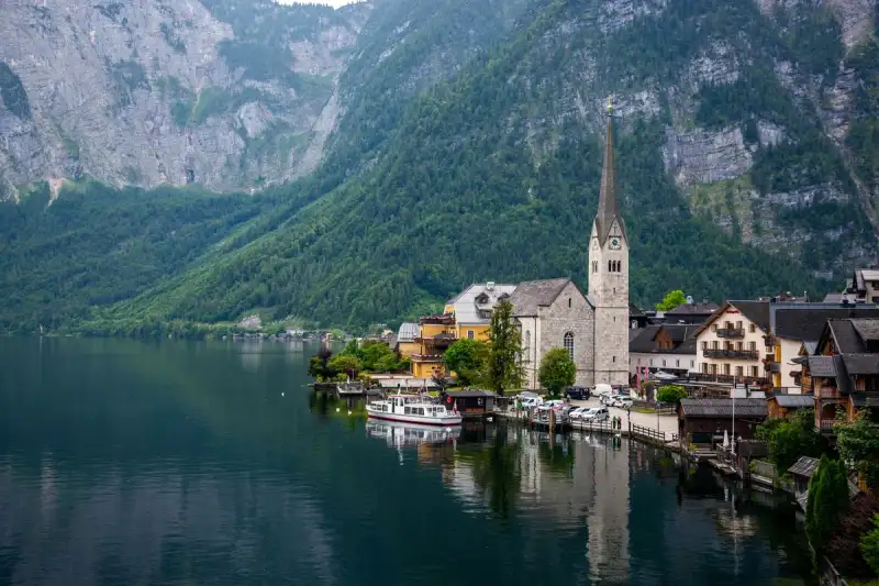
'Hallstatt: Where Time Carved Its Name into the Alps and Salt Whispered Eternity'
Nestled like a forgotten verse in the grand epic of the Alps, Hallstatt clings to the southwestern shore of its namesake lake, a jewel of Upper Austria where the Dachstein massif rises like the spine of a slumbering giant. Here, where the earth’s crust bled salt for millennia, humanity etched its earliest ambitions into the rock—literally. The air hums with the echoes of miners who carved not just tunnels, but the very identity of a continent. This is no ordinary village; it is a living museum where time itself was mined, traded, and immortalized. To stand in Hallstatt is to walk through the layers of history as one might peel the pages of a thousand-year-old manuscript. Beneath your feet lie the silent galleries of the world’s oldest salt mine, while above, the sky reflects the shimmer of a lake so still it feels like a mirror held to the heavens. The village is a paradox: a place of overtourism yet untouched by modernity’s rush, a UNESCO-listed dream that feels both timeless and transient. How did a settlement carved into a cliffside become the poster child for global wanderlust? And why does its story begin—and perhaps end—with salt?The Alchemy of Salt: How Hallstatt Became Europe’s First Industrial Powerhouse Long before the Romans named provinces or the Celts forged their legendary swords, Hallstatt was already a power center—not of armies, but of necessity. Salt, the "white gold" of antiquity, was here in abundance, crystallized in the veins of the Dachstein massif. By the Bronze Age (circa 2000–800 BC), Hallstatt’s miners were extracting salt in quantities that defied the era’s technological limits. They didn’t just dig; they engineered. Using antler picks and wooden tools, they carved hearts into the salt deposits—a symbol of life and trade, perhaps, or a nod to the sacred nature of their labor. The wealth generated from this trade was staggering. Archaeologists uncovered a prehistoric cemetery near the Salzberg mines, revealing 1,045 burials spanning centuries. These were not mere graves; they were archives of status, profession, and artistry. Grave goods included iron swords, bronze brooches, and pottery adorned with motifs that would later define the Hallstatt culture (800–450 BC). The salt’s preservative magic extended beyond food—it mummified textiles, leather shoes, and even wooden tools, offering a snapshot of daily life frozen in time. Yet for all its prosperity, Hallstatt’s golden age was fleeting. By 500 BC, the mines ran deep, the work perilous, and the culture’s dominance waned. The reasons remain shrouded in mystery: Was it exhaustion? Invasion? A shift in trade routes? What we know is that the village’s heart—its salt—continued to beat, even as the world moved on.The Hallstatt Culture: Europe’s Iron Age Renaissance The name "Hallstatt" is synonymous with an archaeological revolution. The Hallstatt culture (800–450 BC) was not just a period; it was a cultural earthquake that reshaped Central Europe. Defined by its distinctive burial practices, art, and proto-Celtic identity, it bridged the Bronze Age and the Iron Age, leaving behind a legacy that archaeologists still dissect today. The Burials: Windows into a Lost World The cemetery at Salzberg mines is a time capsule. Of the 1,300+ burials uncovered, only a fraction contained infants—a clue that Hallstatt’s society was selective, perhaps even stratified. Women and children were interred with grave goods, suggesting roles beyond the domestic sphere. The most striking finds? Elaborately decorated skulls in the local ossuary, their painted faces bearing names, professions, and dates of death. This macabre artistry was born of necessity: Hallstatt’s burial space was as scarce as its living quarters, forcing villagers to exhume bones every decade to make room for the newly dead. The Artifacts: Stories in Iron and Clay Hallstatt’s miners didn’t just extract salt—they extracted culture. Iron swords (Hallstatt C) and daggers (Hallstatt D) emerged as symbols of status, while pottery and brooches reflected regional influences. The village sat at the crossroads of the Hallstatt culture’s western and eastern zones, meaning its artifacts are a melting pot of styles. Some graves held Villanovan cremation urns, hinting at early Mediterranean connections, while others showcased the first iron tools—a technological leap that would define Europe’s future. The Decline: Why Did Hallstatt Fade? By 500 BC, the mines were exhausted, the graves looted, and the culture’s influence waned. Some scholars point to the rise of the La Tène culture (the "true" Celts) as a factor. Others argue that the salt’s depletion forced a shift in economic power. Whatever the cause, Hallstatt’s first act as a cultural titan had ended. But its second act was just beginning.From Obscurity to Obsession: Hallstatt’s Modern Metamorphosis For centuries, Hallstatt was a secret known only to locals and intrepid travelers. The village’s isolation was its charm—and its curse. Access was limited to boats or narrow trails, and the land between lake and mountain was so scarce that houses were stacked like books on a shelf. The first road, blasted into the rock in 1890, was a revolution. Yet even then, Hallstatt remained a backwater, its salt mines operating quietly beneath the radar. The 19th Century: The Birth of a Legend It was the 19th century that turned Hallstatt into a scholarly obsession. In 1846, Johann Georg Ramsauer began excavating the Salzberg cemetery, uncovering a trove of artifacts that would rewrite European prehistory. The finds were so significant that they gave their name to an entire culture. Meanwhile, the village itself became a curiosity—a place where bones were exhumed to make room for the living, and where skulls were painted with the stories of the dead. The 20th Century: From Salt to Stardom Hallstatt’s modern fame, however, was not born of archaeology alone. In 1997, UNESCO declared the Hallstatt-Dachstein/Salzkammergut Cultural Landscape a World Heritage Site, recognizing its "outstanding universal value." But the real explosion came in 2006, when a South Korean TV show featured Hallstatt as a picturesque escape. Social media did the rest. By 2013, the village was trending in Asia as "the most Instagrammable town in the world," its pastel houses and mirror-like lake inspiring millions of posts. Rumors swirled that Disney’s Frozen had copied its aesthetic from Hallstatt (the filmmakers denied it, citing Norway and Canada as inspirations), but the myth only fueled the pilgrimage. Today, Hallstatt is a victim of its own success. Overtourism has led to restrictions on visitor numbers, and locals grapple with balancing preservation and profit. Yet in the quiet hours before dawn, when the tour buses are still docked and the lake’s surface is glass, Hallstatt reveals its true self: a place where the past is not just remembered, but lived.The Hallstatt Salt Mine: A Journey into the Earth’s Belly To understand Hallstatt, you must descend into its mines. The Hallstatt salt mine is not just the world’s oldest working salt mine—it is a cathedral of human ingenuity, where every tunnel tells a story. The Levels: A Vertical Timeline The mine spans 21 levels, from the Erbstollen at 514 meters above sea level to the Erzherzog Matthias Schurf at 1,267 meters. Each level is a chapter in Hallstatt’s history:Level 1 (Erbstollen): The oldest, dating back to prehistoric times. Level 5: Home to the "world’s oldest pipeline," a 400-year-old system of 13,000 hollowed-out trees that transported brine to evaporation pans. Upper Levels: Used for modern mining, though the salt’s purity is now secondary to tourism.The Experience: More Than a Tour Visitors don’t just walk through the mine—they become part of its legacy. You’ll:Slide down wooden chutes (a tradition since the Bronze Age). See preserved artifacts, including miner’s backpacks and tools, still intact after centuries. Touch the "eternal salt"—a chamber where salt crystals grow like stalactites, untouched by time.The mine’s most haunting feature? The silence. Beneath the mountain, the world’s noise fades, leaving only the whisper of salt and the weight of history.Hallstatt’s Treasures: A Guide to the Village’s Soul Hallstatt is small—just 780 residents—but its cultural density is unmatched. Here’s how to experience its essence: 1. Hallstatt Skywalk: The View That Stole a Thousand Hearts Perched 360 meters above the village, the Skywalk (or "World Heritage View") offers a panorama that feels like standing on the edge of the world. The Dachstein Alps rise in jagged splendor, their peaks dusted with snow even in summer. Below, the Hallstätter See mirrors the village’s pastel facades, creating a scene so perfect it’s almost surreal. Come at sunset for the most magical light. 2. Hallstatt Ossuary: Where the Dead Keep Watch St. Michael’s Chapel houses one of Europe’s most unusual attractions: an ossuary with over 1,200 skulls, 600 of which are painted with names, dates, and symbols. The tradition began in the 16th century when space ran out, but the result is a macabre art installation. Some skulls bear poignant inscriptions like "Here lies Anna, wife of the baker, 1749–1800." It’s a reminder that Hallstatt’s history is not just ancient—it’s deeply personal. 3. Hallstatt Museum: A Time Machine to the Iron Age The museum’s exhibits are a deep dive into the village’s dual identity: salt miner and cultural crucible. Highlights include:Bronze Age tools used to extract salt. Iron Age jewelry and weapons from the Hallstatt culture. A replica of the 2nd-century Medusa cameo, discovered in 2025 during funicular construction—a rare Roman artifact in Upper Austria.4. The Village Itself: Where Every Corner Holds a StoryThe Market Square: Lined with Baroque houses, it’s the heart of Hallstatt’s charm. The Church of St. Mary: A Gothic masterpiece with a towering spire. The Lake Promenade: Where locals and visitors alike gather to watch the sunset over the water.The Dark Side of Hallstatt’s Fame: Overtourism and Its Toll Hallstatt’s transformation from sleepy mining village to global phenomenon has come at a cost. The village now welcomes over a million visitors annually, leading to:Overcrowded streets and long waits for attractions. Rising property prices, pushing locals out. Environmental strain on the delicate alpine ecosystem.In response, authorities have implemented measures like:Visitor quotas for the Skywalk. Bans on drone flights to protect the landscape. Promotion of shoulder seasons to distribute tourism more evenly.Yet for all its challenges, Hallstatt’s magic endures. Perhaps it’s because the village refuses to be reduced to a postcard. Beneath the Instagram filters, it remains a place where history is not just displayed—it’s lived.Hallstatt Beyond the Postcard: Hidden Gems and Local Secrets If you venture beyond the main attractions, Hallstatt reveals its quieter side: 1. The Dachstein Ice Caves A short cable car ride away, these caves are a frozen wonderland of stalactites and underground lakes. The "World Ice Arena" is a highlight—a cathedral of ice where you can walk through tunnels lit by eerie blue light. 2. The Five Fingers Viewing Platform Part of the Dachstein Skywalk, this cantilevered platform juts out over a 400-meter drop, offering vertigo-inducing views of the Alps. 3. The Salt World Theme Park A family-friendly attraction where kids (and adults) can learn about salt mining through interactive exhibits and a simulated mine train ride. 4. The Local Gasthäuser Skip the touristy restaurants and head to family-run Gasthäuser (inns) like Gasthof Zauner for authentic Austrian dishes like Kasnocken (cheese dumplings) or Wiener Schnitzel.When to Visit Hallstatt: Seasons of Light and Shadow Hallstatt’s mood shifts with the seasons, each offering a unique experience:Season Pros ConsSpring (May–June) Fewer crowds, blooming wildflowers. Unpredictable weather.Summer (July–Aug) Long daylight hours, lively atmosphere. Peak tourist season, hot and crowded.Autumn (Sept–Oct) Golden foliage, crisp air, fewer tourists. Some attractions may have reduced hours.Winter (Nov–Mar) Snow-covered village, Christmas markets. Short daylight hours, some closures.Best time to visit: Late September to early October, when the crowds thin and the lake reflects the fiery hues of autumn.How to Get to Hallstatt: The Journey is Part of the Adventure Hallstatt’s remoteness is part of its allure. Here’s how to reach it: By AirNearest airports: Salzburg (1.5 hours), Graz (2 hours), or Vienna (3 hours). From Salzburg: Take a train to Attnang-Puchheim, then a regional train to Hallstatt (3.5 hours total).By TrainThe Salzkammergutbahn line connects Hallstatt to Salzburg, Graz, and Vienna. The journey along the lake is breathtaking.By CarDrive via the A1 highway (Salzburg–Vienna), then take Route 145 to Hallstatt. Parking is limited; use the P5 parking garage (€12/day).By BoatFrom Obertraun (opposite shore), take a ferry (€10 round-trip) for a scenic crossing.Pro tip: Arrive early or stay overnight to avoid the day-trippers. The village is at its most enchanting at dawn and dusk.Final Thoughts: Why Hallstatt Matters Hallstatt is more than a destination; it’s a lesson in how humanity and nature can intertwine to create something extraordinary. It’s a place where salt—once a commodity—became a catalyst for culture, where a village carved into a cliffside became a symbol of global fascination, and where the past is not just remembered, but revered. To visit Hallstatt is to touch the pulse of Europe’s earliest chapters. It’s to stand in a mine where miners once carved hearts into salt, to walk streets where Iron Age Celts traded their swords, and to gaze upon a lake that has reflected the same mountains for millennia. In a world obsessed with the new, Hallstatt reminds us that some places are timeless. So come. But come slowly. Stay awhile. Let the village’s whispers sink in. And when you leave, take a piece of Hallstatt with you—not in your camera roll, but in your understanding of what it means to be human.#HallstattTravel #UNESCOHiddenGem #AlpineMagic #SaltAndHistory #AustrianWonders Related InsightsThe Magic of Pamukkale Whispers of the Wind: Chasing the Phantom Melodies of Mongolia's Barking Sands Ethiopia’s Danakil Depression: Where Earth’s Hellish Beauty Meets Alien Landscapes{ "@context": "https://schema.org", "@type": "FAQPage", "mainEntity": [ { "@type": "Question", "name": "What is the main focus of 'Hallstatt: Where Time Carved Its Name into the Alps and Salt Whispered Eternity'?", "acceptedAnswer": { "@type": "Answer", "text": "Discover Hallstatt, the Alpine village where prehistoric salt mines birthed a culture, and modern fame collided with ancient whispers—all cradled by the Dachstein’s embrace." } }, { "@type": "Question", "name": "Who authored the comprehensive guide on 'Hallstatt: Where Time Carved Its Name into the Alps and Salt Whispered Eternity'?", "acceptedAnswer": { "@type": "Answer", "text": "This detailed article and its insights were carefully researched and authored by Cemre Seyyah." } }, { "@type": "Question", "name": "Where can I find more related content about Travel?", "acceptedAnswer": { "@type": "Answer", "text": "You can explore more articles, detailed reviews, and similar insights by browsing the Related Insights section at the bottom of this article or visiting our dedicated Travel category page." } } ] }
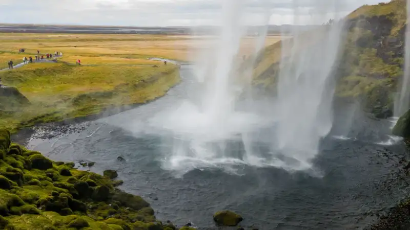

Introduction Iceland, a country known for its rugged landscapes, hot springs, and the Northern Lights, has become a popular destination for travelers and adventure-seekers. One of the most famous attractions in Iceland is the Golden Circle, a route that covers approximately 300 kilometers and takes you to some of the most breathtaking and unique wonders of the country. As a traveler, you'll have the opportunity to explore geysers, waterfalls, and volcanic landscapes that are sure to leave you in awe. In this article, we'll delve into the details of the Golden Circle, providing you with a comprehensive guide on what to expect, how to plan your trip, and what to budget for. Understanding the Golden Circle The Golden Circle is a popular tourist route in Iceland that covers three main attractions: Þingvellir National Park, Geysir geothermal area, and Gullfoss waterfall. Þingvellir National Park is a UNESCO World Heritage Site and the site of the world's first parliament, the Althing, which was established in 930 AD. The park is also home to a unique geological feature, where the North American and Eurasian tectonic plates meet. Geysir geothermal area is famous for its hot springs and geysers, including the Great Geysir, which erupts every few minutes. Gullfoss waterfall is a breathtaking sight, with water cascading down a 32-meter drop. Planning Your Trip to the Golden Circle Planning a trip to the Golden Circle requires some research and preparation. The best time to visit Iceland is during the summer months, from June to August, when the weather is mild and the days are long. However, this is also the peak tourist season, and prices for accommodations and tours may be higher. If you're on a budget, consider visiting during the shoulder season, from April to May or September to October. The Golden Circle is approximately a 300-kilometer drive from Reykjavik, and the journey can take around 4-5 hours, depending on the number of stops you make along the way. Budgeting for Your Trip to the Golden Circle When planning your trip to the Golden Circle, it's essential to budget for the costs of transportation, accommodation, food, and activities. According to the latest cost of living data for Iceland, the average price of a meal in a mid-range restaurant is around 2,500-3,500 ISK (Icelandic krona) per person. The cost of accommodation varies depending on the type and location, but on average, a hostel dorm costs around 4,000-6,000 ISK per night, while a hotel room costs around 20,000-30,000 ISK per night. Gasoline is around 230-250 ISK per liter, and a guided tour of the Golden Circle can cost around 10,000-15,000 ISK per person. Exploring the Golden Circle The Golden Circle is a self-drive route, and the journey is just as scenic as the destinations. The route takes you through picturesque landscapes, including rolling hills, glaciers, and black sand beaches. The first stop on the Golden Circle is Þingvellir National Park, where you can explore the historic site of the Althing and see the unique geological feature of the tectonic plates. The next stop is Geysir geothermal area, where you can see the famous Great Geysir and other hot springs and geysers. The final stop is Gullfoss waterfall, where you can take in the breathtaking views of the waterfall and surrounding landscape. Tips and Essentials for Visiting the Golden Circle When visiting the Golden Circle, there are a few tips and essentials to keep in mind. Firstly, make sure to check the weather forecast before you leave, as the weather in Iceland can be unpredictable. Secondly, bring warm clothing and layers, as the temperature can drop significantly, especially in the evenings. Thirdly, bring a camera and charger, as you'll want to capture the stunning landscapes and scenery. Finally, consider purchasing a guided tour or renting a 4x4 vehicle, as some of the roads on the Golden Circle can be rough and require a sturdy vehicle.Product/Service Average Price (ISK)Meal in a mid-range restaurant 2,500-3,500Hostel dorm 4,000-6,000Hotel room 20,000-30,000Gasoline (per liter) 230-250Guided tour of the Golden Circle 10,000-15,000Conclusion The Golden Circle is a must-visit destination in Iceland, offering a unique and breathtaking experience that combines history, geology, and natural beauty. With its stunning landscapes, hot springs, and waterfalls, the Golden Circle is sure to leave you in awe. Whether you're a traveler, adventure-seeker, or nature lover, the Golden Circle has something for everyone. As you plan your trip to the Golden Circle, remember to budget for the costs of transportation, accommodation, food, and activities, and don't forget to bring warm clothing and layers, a camera, and a sense of adventure. #Travel #Iceland #GoldenCircle #DigitalNomad Related Insights松本城: 漆黒の天守が語る戦国浪漫 Australia Unveiled: Where Sun-Kissed Shores Meet Ancient Souls and Modern Marvels Castel Sant'Angelo: Dal Mausoleo Imperiale alla Fortezza Papale{ "@context": "https://schema.org", "@type": "FAQPage", "mainEntity": [ { "@type": "Question", "name": "What is the main focus of Iceland's Golden Circle: Unveiling the Land of Fire and Ice?", "acceptedAnswer": { "@type": "Answer", "text": "Discover the breathtaking beauty of Iceland's Golden Circle, where geysers, waterfalls, and volcanic landscapes await. Get ready for an adventure of a lifetime in this land of fire and ice." } }, { "@type": "Question", "name": "Who authored the comprehensive guide on Iceland's Golden Circle: Unveiling the Land of Fire and Ice?", "acceptedAnswer": { "@type": "Answer", "text": "This detailed article and its insights were carefully researched and authored by Wei Chen." } }, { "@type": "Question", "name": "Where can I find more related content about Travel?", "acceptedAnswer": { "@type": "Answer", "text": "You can explore more articles, detailed reviews, and similar insights by browsing the Related Insights section at the bottom of this article or visiting our dedicated Travel category page." } } ] }
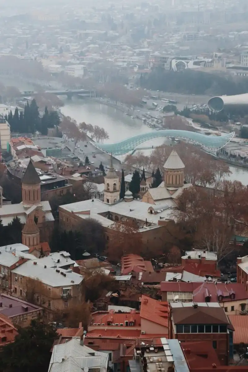

Dort, wo der Kura-Fluss sich wie ein silbernes Band durch die schroffen Täler windet und der Atem der Erde in Form von dampfenden Schwefelquellen aus dem Boden bricht, liegt eine Stadt, die mehr ist als nur eine Metropole. Sie ist ein Palimpsest der Weltgeschichte. In Tbilisi verschmelzen die Echos persischer Poesie, die Strenge russischer Imperialarchitektur und die unbeugsame Spiritualität des orthodoxen Christentums zu einem urbanen Teppich, dessen Farben so intensiv sind wie der georgische Wein. Es ist ein Ort, an dem die Zeit nicht linear verläuft, sondern in Schichten übereinander liegt. Die Etymologie des Feuers: Warum „Ort der Wärme“? Um Tbilisi zu verstehen, muss man bei seinem Namen beginnen. Die Sprache Georgiens ist eine Welt für sich, und die Bezeichnung der Hauptstadt ist ein direktes Versprechen an den Besucher. Das Wort „Tbilisi“ leitet sich vom altgeorgischen tpili (heute tbili) ab, was schlichtweg „warm“ bedeutet. Dieser Name ist kein Zufall, sondern eine Hommage an die natürlichen sulfuric hot springs, die das Fundament der Stadt bilden. Interessanterweise spiegelt die Namensgeschichte die politischen Turbulenzen der Region wider. Bis zum Jahr 1936 war die Stadt im Englischen und in vielen anderen Sprachen unter dem Namen Tiflis bekannt – eine Form, die auf der persischen Aussprache basierte. Erst unter der sowjetischen Führung wurde am 17. August 1936 angeordnet, die Namen vieler Städte anzupassen, um sie näher an die lokalen Sprachen zu bringen. Während die georgische Form Ṭpilisi modernisiert wurde, um dem neueren Wort für Wärme (tbili) zu entsprechen, hielten einige Sprachen wie das Deutsche, Spanische oder Türkische lange an der Variante Tiflis fest. Doch egal, ob man sie Tiflis oder Tbilisi nennt: Die Stadt bleibt der „Ort der Wärme“, sowohl in geologischer als auch in menschlicher Hinsicht.Eine Gründung zwischen Mythe und Mythos Die archäologischen Belege sprechen eine deutliche Sprache: In Vororten wie Dighomi gibt es Hinweise auf eine kontinuierliche Besiedlung seit der frühen Bronzezeit, und Steinartefakte führen uns sogar zurück in das Paläolithikum. Doch die Seele einer Stadt speist sich nicht aus Daten, sondern aus Legenden. Die Gründungsgeschichte von Tbilisi ist eine der poetischsten Anekdoten des Kaukasus. Man erzählt sich, dass König Vakhtang I. von Iberien gegen Ende des 5. Jahrhunderts in dieser damals dicht bewaldeten Region auf der Jagd war. Sein Falke (in einigen Versionen ein Habicht) erbeutete ein Fasanhuhn, wobei beide Vögel in eine heiße Quelle stürzten und dort an den Verbrennungen starben. Der König, fasziniert von der Wärme des Wassers und der strategischen Lage, beschloss, den Wald zu roden und an genau dieser Stelle eine Stadt zu errichten. Vakhtang I. legte den Grundstein, doch es war sein Nachfolger, König Dachi (Regierungszeit 522–534), der die Hauptstadt von Mzcheta nach Tbilisi verlegte und den Bau der Festungsmauern einleitete, die die Grenzen der neuen Stadt definierten. Von diesem Moment an wurde Tbilisi zu einem Magneten für Händler, Gelehrte und Eroberer. Das Schicksal am Kreuzweg: Ein Spiel der Weltmächte Tbilisi liegt an der Schnittstelle zwischen Europa und Asien, in unmittelbarer Nähe zur lukrativen Seidenstraße. Diese geografische Privilegierung war jedoch ein zweischneidiges Schwert. Wer die Kontrolle über Tbilisi hatte, kontrollierte einen der wichtigsten Transitwege der Welt. Dies machte die Stadt über Jahrhunderte hinweg zum Zankapfel globaler Mächte. Die Liste der Regenten liest sich wie ein Who-is-Who der Weltgeschichte:Perser und Byzantiner: Zwischen 570 und 627 Jahre beherrschten die Perser die Stadt, bevor byzantinische und chasarische Armeen sie plünderten. Das Arabische Emirat: Ab 736–738 errichteten arabische Truppen unter Marwan II. ein Emirat in Tbilisi. Diese Ära hinterließ bleibende Spuren; es wurde eine Münzprägeanstalt gegründet, die Dirhams mit Inschriften in sowohl arabischer als auch georgischer Sprache produzierte. Die Seldschuken: Im Jahr 1065 unterwarf der Sultan Alp Arslan die Stadt und errichtete eine Moschee, was die islamische Prägung der Stadt in dieser Zeit zementierte.Trotz dieser ständigen wechselnden Herrschaften bewahrte Tbilisi einen bemerkenswerten Kosmopolitismus. Die Stadt war ein Schmelztiegel der Kulturen, Ethnien und Religionen, auch wenn die ostorthodoxe christliche Identität stets der dominierende Kern blieb. Das Goldene Zeitalter: Wenn Kunst und Macht verschmelzen Der Wendepunkt in der Geschichte der Stadt kam im Jahr 1121. Nach der entscheidenden Schlacht von Didgori gegen die Seldschuken belagerte König David IV. Tbilisi und nahm sie 1122 ein. Er verlegte seine Residenz von Kutaissi nach Tbilisi und machte die Stadt zur Hauptstadt eines vereinten georgischen Staates. Dies markierte den Beginn des „Goldenen Zeitalters“ Georgiens. Im 12. und 13. Jahrhundert blühte die Wirtschaft, und die kulturelle Produktion erreichte Dimensionen, die heute noch bewundernswert sind. Die Bevölkerung wuchs auf etwa 100.000 Einwohner an, und Tbilisi entwickelte sich zu einem Zentrum der Literatur, nicht nur für Georgien, sondern für die gesamte orthodoxe Welt. Ein Höhepunkt dieser Ära war die Regierungszeit von Königin Tamar. Unter ihrer Schirmherrschaft schuf Shota Rustaveli sein legendäres Epos Der Ritter im Pantherfell, ein Werk, das bis heute als Nationalstolz Georgiens gilt. Diese Zeit der georgischen Renaissance schuf ein intellektuelles Fundament, das die Stadt durch spätere Krisen tragen sollte.Ein architektonisches Archiv der Epochen Wenn man heute durch die Straßen von Tbilisi spaziert, wandelt man durch ein offenes Geschichtsbuch. Die Architektur der Stadt ist nicht einheitlich; sie ist eine eklektische Mischung, die jede Phase der Fremdherrschaft und der nationalen Erneuerung widerspiegelt.Das Mittelalter: In der Narikala-Festung und den engen Gassen der Altstadt spürt man den Geist der frühen Festungsstadt und der byzantinischen Einflüsse. Neoklassizismus und Beaux Arts: Aus der Zeit des Russischen Reiches, als Tbilisi zwischen 1801 und 1917 Sitz des Kaukasus-Vizekönigreichs war, stammen prächtige Gebäude, die den imperialen Anspruch widerspiegelten. Jugendstil (Art Nouveau): In den Wohnvierteln finden sich filigrane Fassaden, die den europäischen Geist der Jahrhundertwende einfingen. Stalinistischer Klassizismus: Die monumentalen Bauten der sowjetischen Ära prägen viele der zentralen Plätze und Regierungsgebäude. Moderne: Zeitgenössische Strukturen setzen heute mutige Akzente in der Skyline der Stadt.Besonders hervorzuheben ist das Operntheater im pseudo-maurischen Stil, das die tiefe Verbindung der Stadt zu den orientalischen Einflüssen unterstreicht. Die pulsierenden Zentren: Von Rustaveli bis zur Freiheit Tbilisi ist eine Stadt der Kontraste, was sich besonders in ihren zentralen Achsen zeigt. Die Rustaveli Avenue ist das schlagende Herz der Stadt. Hier finden sich das Georgische Nationalmuseum und zahlreiche Regierungsgebäude, flankiert von einer Architektur, die von klassischem Prunk bis hin zu sowjetischem Beton reicht. Nicht weit entfernt liegt der Freedom Square (Platz der Freiheit), ein zentraler Treffpunkt und Schauplatz politischer Umbrüche. Wer Tiefe sucht, besucht die Kathedralen: Die Sioni-Kathedrale im Herzen der Altstadt und die monumentale Sameba-Kathedrale, die als eine der größten orthodoxen Kirchen der Welt über der Stadt thront. Die Aghmashenebeli Avenue hingegen bietet ein anderes Erlebnis. Hier mischen sich renovierte historische Gebäude mit modernen Cafés, was den Aufstieg Tbilisis zu einem modernen Trendzentrum zwischen Ost und West verdeutlicht.Klima und Lebensgefühl: Ein Guide für den Besucher Für Reisende ist das Klima in Tbilisi ein wichtiger Faktor. Die Sommer sind heiß und lebhaft, mit Temperaturen, die meist zwischen 20 und 32 °C liegen – die perfekte Zeit, um die schattigen Höfe der Altstadt zu erkunden. Die Winter hingegen sind frisch und können mit Temperaturen zwischen -1 und 7 °C recht kühl werden, was die Stadt in ein melancholisches, aber wunderschönes Licht taucht. Tbilisi ist heute mehr als nur ein touristisches Ziel; es ist ein wichtiger Transitknoten für Energie- und Handelsprojekte. Doch trotz der Modernisierung hat die Stadt ihre Seele bewahrt. Die Mischung aus der Ruhe in den orthodoxen Kirchen, dem Lärm der Märkte und dem Schwefelgeruch der heißen Quellen schafft eine Atmosphäre, die man nirgendwo sonst auf der Welt findet. Zusammenfassung der Highlights für Ihre Reise Wenn Sie Tbilisi besuchen, sollten diese Orte auf Ihrer Liste stehen:Narikala-Festung: Für den besten Panoramablick über die gesamte Stadt. Die Schwefelbäder: Ein Bad in den heißen Quellen, die der Stadt ihren Namen gaben. Sameba-Kathedrale: Ein Symbol des modernen georgischen Glaubens. Altstadt-Gassen: Ein Labyrinth aus Holzbalkonen und versteckten Cafés. Georgisches Nationalmuseum: Um die tiefe Geschichte vom Paläolithikum bis heute zu verstehen.Tbilisi ist eine Stadt, die nicht einfach besichtigt wird – sie muss gefühlt werden. Sie ist die Wärme der Quellen, die Stärke der Mauern und die Leidenschaft einer Bevölkerung, die trotz zahlreicher Invasionen und Umstürze ihre Identität bewahrt hat. #Travel #Tbilisi #Georgia #Kaukasus #Kulturreise

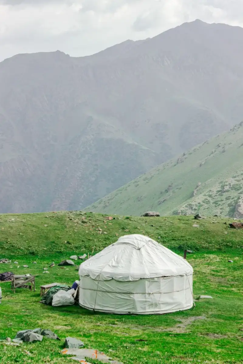
The Silk Road's Nomadic Hospitality: Yurt Stays in Kyrgyzstan Introduction Few experiences transport travelers back to the ancient Silk Road as vividly as spending a night in a traditional Kyrgyz yurt. Perched on the undulating steppes of Central Asia, these circular felt dwellings—known as boz üy in Kyrgyz—have sheltered nomadic herders for millennia. Today, they offer intrepid explorers a chance to step into a living tradition where hospitality is sacred, and the landscape is a masterpiece of untamed beauty. Kyrgyzstan, a landlocked jewel in Central Asia, has quietly emerged as one of the world’s most compelling destinations for cultural immersion and adventure. With its soaring peaks of the Tian Shan and Pamir-Alay ranges, crystalline alpine lakes like Issyk-Kul, and a cost of living that’s a fraction of Western standards, it’s no wonder remote workers and travelers are flocking here. According to Numbeo, the average monthly cost for a single person in Kyrgyzstan is just $446.40—60.8% lower than in the United States—making long-term stays not only possible but deeply rewarding. But beyond the affordability lies a deeper allure: the unparalleled hospitality of the Kyrgyz people. In a culture where guests are considered a blessing, travelers are welcomed into yurt camps with open arms, shared meals of beshbarmak (a hearty noodle and meat dish), and stories under the vast, star-studded sky. This is the Silk Road’s nomadic spirit, alive and breathing in the highlands of Kyrgyzstan.Whether you're a digital nomad seeking a change of scenery, a family craving adventure, or a solo traveler chasing authenticity, a yurt stay in Kyrgyzstan promises an experience that transcends the ordinary. From the practicalities of booking to the cultural nuances of nomadic life, this guide will equip you with everything you need to embark on your own Silk Road journey.Why Choose a Yurt Stay in Kyrgyzstan? The Allure of Nomadic Life The decision to trade a hotel room for a yurt isn’t just about novelty—it’s about reconnecting with a way of life that has sustained Central Asian nomads for centuries. Yurts, or ger in Mongolian (a term often used interchangeably in Kyrgyzstan), are marvels of portable architecture. Constructed from a collapsible wooden frame, layered with thick felt insulation, and topped with a crown (tündük) that allows smoke to escape and starlight to filter in, these dwellings are perfectly adapted to the region’s harsh climate. In summer, they offer cool refuge from the sun; in winter, they retain warmth against sub-zero temperatures. For travelers, a yurt stay is a gateway to understanding Kyrgyzstan’s soul. The country’s identity is deeply intertwined with its nomadic heritage, a legacy that dates back to the 2nd millennium BCE when the Scythians roamed these lands. Even today, nearly a third of Kyrgyzstan’s population identifies as nomadic or semi-nomadic, with many herding sheep, horses, and yaks across the high pastures during the warmer months. Beyond the cultural significance, yurt camps offer an unparalleled connection to nature. Imagine waking up to the sound of horses whinnying in the distance, the scent of juniper smoke curling from a nearby fire, and the sight of the sun rising over the Alay or Issyk-Kul valleys. Many camps are situated in UNESCO-listed landscapes, such as the Sary-Chelek Biosphere Reserve or the Song Kol Lake area, where the absence of light pollution makes the night sky a dazzling spectacle. From a practical standpoint, yurt stays are surprisingly comfortable. Modern yurt camps are equipped with amenities like electricity (often solar-powered), Wi-Fi (a boon for digital nomads), and even en-suite bathrooms with hot showers. The beds are typically simple but cozy, with thick mattresses and wool blankets to ward off the chill. Meals, often included in the cost, are a highlight—think freshly baked lepyoshka bread, manty (steamed dumplings), and plov (pilaf), all prepared with ingredients sourced from the camp’s own livestock or local farms. For those concerned about accessibility, yurt camps are generally easy to reach. Major hubs like Bishkek, the capital, serve as gateways to the countryside, with well-maintained roads leading to popular destinations such as the Ala-Archa National Park, the Boom Gorge, or the remote valleys of the Tian Shan. Many camps also offer transfer services from airports or bus stations, making the journey seamless.But perhaps the most compelling reason to choose a yurt stay is the people. Kyrgyz hospitality (kyrgyz konokchulugu) is legendary, rooted in the ancient code of manas, an epic poem that celebrates generosity and bravery. Guests are treated with reverence, often invited to join in traditional games like kok-boru (a Central Asian version of polo) or to participate in the preparation of a beshbarmak feast. In a world where authentic connections are increasingly rare, a yurt stay offers something truly priceless: a sense of belonging.Planning Your Yurt Stay: Logistics, Costs, and Best Seasons Embarking on a yurt stay in Kyrgyzstan requires a bit of planning, but the rewards far outweigh the effort. The first step is choosing the right time to visit. Kyrgyzstan’s climate is continental, with hot summers, cold winters, and dramatic temperature swings in between. The ideal seasons for a yurt stay are late spring (May to early June) and early autumn (September to October), when the weather is mild, the landscapes are lush, and the crowds are minimal. Summer (June to August) is the peak season, with temperatures in the valleys reaching up to 30°C (86°F). This is prime time for hiking, horseback riding, and exploring alpine lakes like Song Kol or Ala-Kul. However, it’s also the busiest period, so book yurt camps well in advance. Winter (November to March) transforms the landscape into a snowy wonderland, offering a quieter, more introspective experience. Some yurt camps operate year-round, but winter stays require warmer clothing and a tolerance for sub-zero temperatures. Booking Your Yurt Stay Yurt camps can be booked through a variety of platforms, including local tour operators, international booking sites like Booking.com or Airbnb, or directly via the camps’ websites or social media pages. Prices vary depending on the location, amenities, and season, but you can expect to pay between $20 and $50 per night for a standard yurt stay. Luxury yurts with private bathrooms or hot tubs may cost upwards of $80 per night. Here’s a breakdown of what to consider when booking:Location: Do you want to be near a major city like Bishkek, or are you seeking remote wilderness? Popular yurt camp destinations include:Song Kol Lake: A high-altitude lake surrounded by rolling pastures, perfect for horseback riding and stargazing. Issyk-Kul Region: Close to the lake’s northern shore, offering a mix of cultural and natural attractions. Jyrgalan Valley: A hidden gem in the Tian Shan, known for its hot springs and hiking trails. Ala-Archa National Park: Just a short drive from Bishkek, ideal for day trips and short stays.Amenities: Basic yurt camps offer shared bathroom facilities and simple meals, while upscale camps provide private bathrooms, Wi-Fi, and gourmet dining. Some even offer activities like eagle hunting demonstrations or traditional music performances.Transportation: Most yurt camps are located in rural areas, so you’ll need to arrange transportation. Many camps offer shuttle services from Bishkek or nearby towns, or you can rent a car (4x4 recommended for remote areas). Public buses (marshrutkas) are an option but may not drop you directly at the camp.Cultural Sensitivity: Yurt camps are often family-run businesses, and the Kyrgyz people are deeply proud of their traditions. Respect local customs by dressing modestly, asking before taking photos of people, and participating in communal activities when invited.Visa Requirements and Entry Kyrgyzstan has made it easier than ever for travelers to visit, with a 60-day visa-free entry for citizens of over 40 countries, including the US, UK, EU, Canada, and Australia. For longer stays, a digital nomad visa is available, allowing remote workers to live in Kyrgyzstan for up to six months. The visa costs $75 and requires proof of remote employment or freelance income. Upon arrival, you’ll need to register with the State Migration Service if staying longer than 60 days. Many yurt camps assist with this process, so be sure to ask when booking. Budgeting for Your Stay Kyrgyzstan’s low cost of living extends to yurt stays, making it an affordable destination for travelers of all budgets. Here’s a rough estimate of expenses for a 7-day yurt stay:Expense Category Estimated Cost (USD)Yurt stay (per night) $20 - $50Meals (per day) $5 - $15Transportation $10 - $30Activities (horseback riding, hiking) $15 - $50Visa (if applicable) $0 - $75Total (7 days) $150 - $400This budget assumes a mid-range experience, with some splurges on activities or upgrades. For digital nomads, the affordability of Kyrgyzstan means you can stretch your income further while enjoying a high quality of life.Top Yurt Camps in Kyrgyzstan: Where to Stay for an Unforgettable Experience Kyrgyzstan boasts hundreds of yurt camps, each offering a unique blend of comfort, culture, and natural beauty. Below are some of the most highly recommended camps, categorized by region and experience. 1. Song Kol Lake: The Heart of Nomadic Life Song Kol Lake, located at an altitude of 3,016 meters (9,900 feet), is one of Kyrgyzstan’s most iconic destinations. The lake is surrounded by rolling pastures where herders graze their livestock, and the yurt camps here offer an immersive nomadic experience. Top Camps:Song Kol Lake Yurt Camp: A family-run camp with basic but cozy yurts, home-cooked meals, and horseback riding. The camp organizes traditional games like ulak tartysh (a Central Asian tug-of-war game) and evening gatherings around the fire. Kyzyl-Tuu Yurt Camp: Situated on the lake’s eastern shore, this camp offers stunning views and activities like fishing and eagle hunting demonstrations. The yurts are equipped with solar-powered electricity and shared bathrooms. Djeti-Oguz Yurt Camp: Located near the famous red rock formations of Jeti-Oguz, this camp is ideal for those who want to combine a yurt stay with hiking in the nearby mountains.Best For: Families, photographers, and travelers seeking a deep dive into nomadic culture. 2. Issyk-Kul Region: Lakeside Serenity The Issyk-Kul Lake, the world’s second-largest alpine lake, is a year-round destination with a mix of Soviet-era resorts and traditional yurt camps. The northern shore, in particular, is dotted with camps offering easy access to the lake and nearby attractions like the Boom Gorge. Top Camps:Issyk-Kul Yurt Camp: A well-established camp with private yurts, a restaurant serving fresh lake fish, and boat tours on Issyk-Kul. The camp also offers cooking classes where you can learn to make manty and plov. Bokonbaev Yurt Camp: Famous for its eagle hunting demonstrations, this camp is a must-visit for wildlife enthusiasts. Guests can watch trainers work with golden eagles and even hold the birds if they’re comfortable. Cholpon-Ata Yurt Camp: Located near the petroglyphs of Cholpon-Ata, this camp offers a mix of cultural and outdoor activities, including visits to ancient rock carvings and horseback riding along the lake’s shores.Best For: Couples, solo travelers, and those who enjoy a mix of relaxation and adventure.👉 Continue Reading: The Silk Road's Nomadic Hospitality: Yurt Stays in Kyrgyzstan (Part 2)Conclusion A yurt stay in Kyrgyzstan is more than a travel experience—it’s a journey into the heart of Central Asia’s nomadic soul. From the moment you step into a boz üy, you’re enveloped in a world where time moves to the rhythm of the seasons, where hospitality is a sacred duty, and where the land itself tells stories of resilience and beauty. Whether you’re sipping kumis with a herder, galloping across the steppes on horseback, or gazing at the Milky Way from a remote yurt camp, you’ll leave with memories that linger long after you’ve returned home. Kyrgyzstan’s affordability makes it an accessible dream for travelers of all backgrounds. With a cost of living that’s a fraction of Western standards, you can extend your stay, splurge on a luxury yurt, or indulge in local delicacies without breaking the bank. The digital nomad visa further cements Kyrgyzstan’s appeal, offering remote workers the chance to live and work in a land of unparalleled beauty and culture. But beyond the practicalities, what makes Kyrgyzstan truly special is its people. The Kyrgyz are warm, proud, and deeply connected to their heritage. In a world where authenticity is increasingly commodified, a yurt stay offers something rare: a genuine connection to a culture that has thrived for millennia. It’s a reminder that travel isn’t just about seeing new places—it’s about being seen, welcomed, and transformed by the people and landscapes you encounter. As you plan your journey, remember that the Silk Road’s spirit lives on in the highlands of Kyrgyzstan. It’s in the smoke curling from a yurt’s tündük, in the laughter of children playing near a campfire, and in the vast, untamed beauty of the Tian Shan and Pamir-Alay. So pack your bags, leave your preconceptions behind, and let the nomadic hospitality of Kyrgyzstan welcome you home. Safe travels, and may your yurt stay be filled with wonder, warmth, and the kind of stories that stay with you forever.#DigitalNomadLife #SilkRoadAdventures #KyrgyzstanTravel #YurtLiving #OffTheBeatenPath Related InsightsThe Faroe Islands: Rugged Landscapes and Viking Echoes Il Foro Romano: Dove Pulsava la Vita di Roma Die Berliner Mauer heute{ "@context": "https://schema.org", "@type": "FAQPage", "mainEntity": [ { "@type": "Question", "name": "What is the main focus of The Silk Road's Nomadic Hospitality: Yurt Stays in Kyrgyzstan?", "acceptedAnswer": { "@type": "Answer", "text": "The Silk Road's Nomadic Hospitality: Yurt Stays in Kyrgyzstan hakkinda bilmeniz gereken her sey." } }, { "@type": "Question", "name": "Who authored the comprehensive guide on The Silk Road's Nomadic Hospitality: Yurt Stays in Kyrgyzstan?", "acceptedAnswer": { "@type": "Answer", "text": "This detailed article and its insights were carefully researched and authored by Chloe Tremblay." } }, { "@type": "Question", "name": "Where can I find more related content about Travel?", "acceptedAnswer": { "@type": "Answer", "text": "You can explore more articles, detailed reviews, and similar insights by browsing the Related Insights section at the bottom of this article or visiting our dedicated Travel category page." } } ] }
-
 Chloe Tremblay
 - 18 Jul, 2026 18:40
The Silk Road's Nomadic Hospitality: Yurt Stays in Kyrgyzstan (Part 2)
This is Part 2 of the series. Read Part 1 here.3. Jyrgalan Valley: Adventure and Hot Springs Tucked away in the Tian Shan mountains, the Jyrgalan Valley is a hidden gem known for its hot springs, hiking trails, and stunning alpine scenery. Yurt camps here are perfect for active travelers who want to explore off-the-beaten-path destinations. Top Camps:Jyrgalan Yurt Camp: A rustic but charming camp with yurts nestled among wildflowers. The camp offers guided hikes to waterfalls and hot springs, as well as traditional Kyrgyz meals cooked over an open fire. Altyn Arashan Yurt Camp: Located near the Altyn Arashan hot springs, this camp is a base for multi-day treks into the mountains. The yurts are basic but comfortable, and the hot springs are a perfect way to unwind after a day of hiking. Karakol Yurt Camp: Situated near the town of Karakol, this camp is a gateway to the nearby Karakol Valley and the stunning Ala-Kul Lake. It’s ideal for travelers who want to combine a yurt stay with trekking in the Tian Shan.Best For: Hikers, adventure seekers, and those seeking thermal relaxation. 4. Ala-Archa National Park: Gateway to the Tian Shan Just a 45-minute drive from Bishkek, Ala-Archa National Park is a paradise for nature lovers. The park’s yurt camps offer easy access to hiking trails, waterfalls, and the majestic peaks of the Tian Shan. Top Camps:Ala-Archa Yurt Camp: A family-run camp with yurts scattered among pine trees. The camp offers horseback riding, hiking, and traditional Kyrgyz meals. It’s a great option for those who want to experience the mountains without venturing too far from the capital. Ak-Sai Yurt Camp: Located at the entrance to the park, this camp is a base for treks to the Ak-Sai Glacier and the nearby waterfalls. The yurts are simple but cozy, and the camp’s restaurant serves hearty meals to fuel your adventures. Tien Shan Yurt Camp: A more upscale option with private yurts, a sauna, and a restaurant serving organic meals. The camp organizes guided treks and cultural tours, making it ideal for travelers who want a mix of comfort and adventure.Best For: Day trippers from Bishkek, hikers, and those seeking a quick escape into nature. 5. The Pamir-Alay Mountains: Remote and Rugged For travelers seeking a truly off-the-beaten-path experience, the Pamir-Alay Mountains in southern Kyrgyzstan offer some of the country’s most dramatic landscapes. Yurt camps here are sparse but rewarding, with opportunities to explore ancient Silk Road caravanserais and remote villages. Top Camps:Osh Yurt Camp: Located near the city of Osh, this camp is a gateway to the Pamir-Alay. It offers basic yurts and guided tours to nearby attractions like the Sulaiman-Too Sacred Mountain and the ruins of the ancient city of Uzgen. Kazarman Yurt Camp: Situated in the Chatkal Valley, this camp is a base for treks into the Chatkal Nature Reserve, home to ibex, snow leopards, and golden eagles. The yurts are simple but comfortable, and the camp’s guides can arrange multi-day treks. Arslanbob Yurt Camp: Near the world’s largest walnut forest, this camp offers a unique blend of nature and culture. Guests can explore the forest, visit local walnut-processing workshops, and enjoy traditional Kyrgyz meals.Best For: Adventurers, cultural explorers, and those willing to venture off the tourist trail.Cultural Etiquette and Practical Tips for Yurt Stays Staying in a yurt is more than just a place to sleep—it’s an invitation into a way of life that values community, respect, and harmony with nature. To ensure your stay is as enriching as possible, it’s important to understand and honor the cultural norms of Kyrgyz hospitality. Dos and Don’ts in a Kyrgyz Yurt Do:Remove your shoes before entering a yurt. This is a sign of respect and cleanliness. Accept food and drink when offered, even if it’s just a small portion. Refusing can be seen as impolite, especially if the host has gone to great effort to prepare the meal. Sit on the floor or on provided cushions. Avoid pointing your feet at others or the tündük (the yurt’s crown), as this is considered rude. Ask before taking photos of people, especially elders or during private moments. Participate in communal activities like games, music, or storytelling. This is how bonds are formed in nomadic culture.Don’t:Waste food. In Kyrgyz culture, wasting food is a serious offense, as it’s seen as disrespectful to the earth and the host’s efforts. Touch or move objects without permission. Many items in a yurt have sentimental or practical value. Raise your voice or argue. Kyrgyz people value harmony (tynchtyk), and loud or aggressive behavior is frowned upon. Assume you can stay indefinitely. While hospitality is generous, it’s polite to ask about the host’s expectations regarding your length of stay.Communicating with Your Hosts While many yurt camp owners and staff speak basic English or Russian, learning a few phrases in Kyrgyz can go a long way in building rapport. Here are some essential phrases:Salamatsyzby? (Hello, how are you?) Rahmat (Thank you) Men suuda jurot (I am happy to be here) Kanday jashaysyz? (How are you living?) Beshbarmak jasyngyz! (Enjoy your beshbarmak!)Body language is also important. A warm smile, a handshake (with the right hand, as the left is considered unclean), and direct eye contact are signs of respect. Health and Safety Kyrgyzstan is generally a safe destination, but it’s always wise to take precautions:Water: Stick to bottled or boiled water to avoid stomach issues. Many yurt camps provide filtered water for drinking. Food: While meals are typically safe, avoid raw or undercooked foods if you have a sensitive stomach. Opt for freshly cooked, hot meals. Altitude: Many yurt camps are located at high altitudes (over 2,500 meters/8,200 feet). Take it easy for the first day or two to acclimate, and stay hydrated. Wildlife: In remote areas, be mindful of bears, wolves, and snakes. Follow your host’s advice on safe hiking practices. Emergency contacts: Save the number for the local police (102) and ambulance (103) in your phone. Many yurt camps also have first aid kits and basic medical supplies.Packing Essentials Packing for a yurt stay requires a balance between comfort and practicality. Here’s a checklist to ensure you’re prepared:Clothing: Layered clothing for temperature swings (wool or thermal base layers, fleece mid-layers, and a waterproof jacket). Sturdy hiking boots and warm socks. A hat, gloves, and scarf for colder months. Swimwear if your camp has hot springs or a lake nearby.Gear: A sleeping bag (some yurts provide blankets, but a sleeping bag adds extra warmth). A headlamp or flashlight (power outages can happen). A power bank for your devices (solar charging is common but not always reliable). A reusable water bottle and water purification tablets.Extras: A lightweight towel and toiletries (some camps provide basics, but it’s good to have your own). A small gift for your host (e.g., tea, chocolate, or a local souvenir from your home country). A phrasebook or translation app for Kyrgyz or Russian.Beyond the Yurt: Activities and Experiences to Enhance Your Stay A yurt stay in Kyrgyzstan is just the beginning of your adventure. The country’s vast landscapes and rich cultural heritage offer endless opportunities for exploration. Here are some must-do activities to make the most of your trip. Horseback Riding: The Nomadic Way to Travel Horses are the lifeblood of Kyrgyzstan’s nomadic culture, and riding one is the best way to experience the landscape as the locals do. Many yurt camps offer horseback riding tours, ranging from short rides around the camp to multi-day treks across the steppes.Song Kol Lake: Ride through flower-filled meadows with the lake as your backdrop. Jyrgalan Valley: Trek to remote hot springs and waterfalls on horseback. Ala-Archa National Park: Navigate alpine trails with views of the Tian Shan peaks.For a truly immersive experience, consider a multi-day horseback trek along the ancient Silk Road routes. Companies like Kyrgyz Horse Trek and Eagle Trekking Company offer guided tours that include yurt stays, meals, and cultural exchanges with local herders. Hiking and Trekking: Trails for Every Level Kyrgyzstan is a hiker’s paradise, with trails ranging from easy day hikes to challenging multi-day treks. Some of the best hiking destinations include:Ala-Kul Lake: A 2-day trek from the village of Karakol, leading to a stunning alpine lake. Song Kol Lake: A gentle 3-4 hour hike around the lake’s perimeter, with opportunities to meet herders and their families. Jeti-Oguz: A challenging but rewarding hike through the "Seven Bulls" rock formations to the scenic Barskoon Valley. Tian Shan Mountains: For experienced hikers, the Kyrgyzstan-Tajikistan Transboundary Trek offers a 10-day journey through some of Central Asia’s most breathtaking landscapes.Many yurt camps can arrange guides and pack animals for treks, making it easy to explore without heavy gear. Cultural Immersion: Festivals and Traditions Kyrgyzstan’s calendar is filled with vibrant festivals that offer a glimpse into its nomadic heritage. If your visit aligns with one of these events, it’s an unforgettable experience.Nowruz (March 21): The Persian New Year is celebrated with music, dancing, and the preparation of sumalak (a sweet wheat pudding). Many yurt camps host Nowruz events with traditional games and feasts. Kyrgyz Yurt Festival (July): Held in Cholpon-Ata, this festival celebrates Kyrgyz culture with yurt-building competitions, eagle hunting displays, and folk music performances. World Nomad Games (September): A biennial event in Cholpon-Ata that brings together nomadic cultures from around the world. Competitions include kok-boru, archery, and traditional wrestling.Even outside of festivals, you can participate in daily nomadic activities like milking mares, making kumis (fermented mare’s milk), or learning to play the komuz (a traditional Kyrgyz string instrument). Hot Springs and Relaxation After days of hiking and exploring, soaking in a natural hot spring is a divine way to unwind. Kyrgyzstan is home to thousands of thermal springs, many of which are located near yurt camps.Jyrgalan Valley: The Jyrgalan Hot Springs are a series of pools with temperatures ranging from warm to scalding. The nearby yurt camps offer shuttle services. Altyn Arashan: A 3-hour hike from the yurt camp of the same name, these hot springs are nestled in a secluded valley. Chon-Kyzyl-Suu: A lesser-known hot spring near Issyk-Kul, perfect for a quiet soak.Many hot springs are clothing-optional, so be sure to pack a swimsuit or quick-dry towel. Wildlife and Birdwatching Kyrgyzstan’s diverse ecosystems are home to a wealth of wildlife, including snow leopards, ibex, golden eagles, and Marco Polo sheep. For birdwatchers, the country is a paradise, with over 400 species recorded.Sary-Chelek Biosphere Reserve: A UNESCO-listed reserve with dense forests, alpine meadows, and a lake teeming with fish. Look for bears, lynx, and the elusive snow leopard. Chatkal Nature Reserve: One of the best places to spot golden eagles and lammergeiers (bearded vultures). Issyk-Kul Lake: A haven for migratory birds, including pelicans, cormorants, and seagulls.Many yurt camps can arrange guided wildlife tours or birdwatching excursions with local experts.Conclusion A yurt stay in Kyrgyzstan is more than a travel experience—it’s a journey into the heart of Central Asia’s nomadic soul. From the moment you step into a boz üy, you’re enveloped in a world where time moves to the rhythm of the seasons, where hospitality is a sacred duty, and where the land itself tells stories of resilience and beauty. Whether you’re sipping kumis with a herder, galloping across the steppes on horseback, or gazing at the Milky Way from a remote yurt camp, you’ll leave with memories that linger long after you’ve returned home. Kyrgyzstan’s affordability makes it an accessible dream for travelers of all backgrounds. With a cost of living that’s a fraction of Western standards, you can extend your stay, splurge on a luxury yurt, or indulge in local delicacies without breaking the bank. The digital nomad visa further cements Kyrgyzstan’s appeal, offering remote workers the chance to live and work in a land of unparalleled beauty and culture. But beyond the practicalities, what makes Kyrgyzstan truly special is its people. The Kyrgyz are warm, proud, and deeply connected to their heritage. In a world where authenticity is increasingly commodified, a yurt stay offers something rare: a genuine connection to a culture that has thrived for millennia. It’s a reminder that travel isn’t just about seeing new places—it’s about being seen, welcomed, and transformed by the people and landscapes you encounter. As you plan your journey, remember that the Silk Road’s spirit lives on in the highlands of Kyrgyzstan. It’s in the smoke curling from a yurt’s tündük, in the laughter of children playing near a campfire, and in the vast, untamed beauty of the Tian Shan and Pamir-Alay. So pack your bags, leave your preconceptions behind, and let the nomadic hospitality of Kyrgyzstan welcome you home. Safe travels, and may your yurt stay be filled with wonder, warmth, and the kind of stories that stay with you forever.#DigitalNomadLife #SilkRoadAdventures #KyrgyzstanTravel #YurtLiving #OffTheBeatenPath Related InsightsL'Écho des Pierres : Voyage au Cœur du Patrimoine Vivant Dive Into a Hidden World: The Most Breathtaking Underwater Museums and Sculpture Parks (Part 2) The Enigmatic Ruins of Angkor Wat: Beyond the Crowds and Into the Jungle{ "@context": "https://schema.org", "@type": "FAQPage", "mainEntity": [ { "@type": "Question", "name": "What is the main focus of The Silk Road's Nomadic Hospitality: Yurt Stays in Kyrgyzstan (Part 2)?", "acceptedAnswer": { "@type": "Answer", "text": "The Silk Road's Nomadic Hospitality: Yurt Stays in Kyrgyzstan hakkinda bilmeniz gereken her sey." } }, { "@type": "Question", "name": "Who authored the comprehensive guide on The Silk Road's Nomadic Hospitality: Yurt Stays in Kyrgyzstan (Part 2)?", "acceptedAnswer": { "@type": "Answer", "text": "This detailed article and its insights were carefully researched and authored by Chloe Tremblay." } }, { "@type": "Question", "name": "Where can I find more related content about Travel?", "acceptedAnswer": { "@type": "Answer", "text": "You can explore more articles, detailed reviews, and similar insights by browsing the Related Insights section at the bottom of this article or visiting our dedicated Travel category page." } } ] }
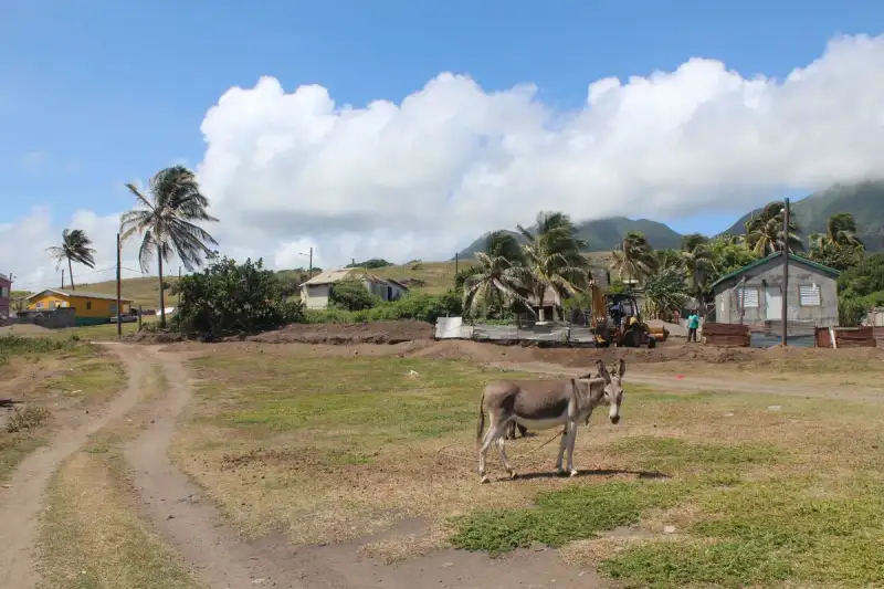
Esiste un luogo dove il tempo sembra essersi fermato, non per una scelta poetica, ma per un comando brutale della terra. Montserrat non è semplicemente un frammento di terra sospeso tra l'azzurro infinito dei Caraibi e il verde vibrante di una giungla indomita; è un monumento vivente alla resilienza umana e alla fragilità delle nostre ambizioni di fronte alla potenza geologica. Definita "L'Isola di Smeraldo dei Caraibi", Montserrat possiede una dualità struggente: da un lato, la bellezza eterea di paesaggi che ricordano le coste d'Irlanda, dall'altro, il silenzio spettrale di una capitale sepolta dalla cenere. L'Origine di un Nome e l'Eredità di Colombo Il viaggio per comprendere Montserrat inizia nel 1493, quando Cristoforo Colombo, durante il suo secondo viaggio, avvistò queste coste. Fu lui a battezzare l'isola Santa María de Montserrate, rendendo omaggio alla Vergine di Montserrat del monastero omonimo situato vicino a Barcellona, in Catalogna. Il termine "Montserrat", nella lingua catalana, significa letteralmente "montagna seghettata", un riferimento morfologico che ancora oggi risuona nel profilo frastagliato dell'isola. Ma prima dell'arrivo degli europei, Montserrat era già un mondo pulsante di vita e spiritualità. Le ricerche archeologiche condotte nel 2012 nei Centre Hills hanno rivelato un'occupazione arcaica, pre-Arawak, risalente a un periodo compreso tra il 2000 e il 500 a.C. Successivamente, i siti costieri hanno testimoniato la presenza della cultura Saladoid fino al 550 d.C. Gli indigeni Caribi, i veri custodi originari di queste terre, chiamavano l'isola Alliouagana, che si traduce come "Terra dei Cespugli Spinosi". Un dettaglio che affascina ogni viaggiatore e studioso è la scoperta, avvenuta tra il 2016 e il 2018, di preziosi petroglifi nei pressi di Soldier Ghaut. Queste incisioni, vecchie di circa 1.000-1.500 anni, sono testimonianze silenziose di popolazioni che giunsero dai pressi del Venezuela, risalendo la catena delle Piccole Antille, portando con sé sogni e culture che l'isola ha custodito per millenni.#travel #hiddenhistory #CaribbeanSecrets L'Impronta Irlandese e i "Redlegs" Ciò che rende Montserrat unica tra i Territori d'Oltremare britannici è l'intensità della sua eredità irlandese. Nel 1632, un gruppo di coloni irlandesi si stabilì sull'isola, molti dei quali provenienti da Saint Kitts per volere di Sir Thomas Warner, e successivamente integrati da immigrati della Virginia. Questi primi coloni non erano conquistatori in armi, ma coltivatori che lavoravano piccole fattorie, cercando una nuova vita lontano dalle oppressioni della madrepatria. Questa predominanza di anglo-irlandesi protestanti creò un tessuto sociale quasi unico. I cosiddetti "redlegs", discendenti di questi coloni, svilupparono una società neo-feudale. In un periodo di cupe contraddizioni, l'isola divenne un centro di piantagioni dove convivevano schiavi subsahariani e servi a contratto irlandesi cattolici, entrambi destinati al duro lavoro forzato. Le tensioni geopolitiche dell'epoca non risparmiarono Montserrat. Gli irlandesi, storicamente alleati dei francesi e legati da un comune disprezzo per l'egemonia inglese, arrivarono a invitare la Francia a rivendicare l'isola nel 1666. Sebbene i francesi l'abbiano occupata brevemente verso la fine di quel decennio, il Trattato di Breda confermò il controllo inglese. Un altro episodio significativo avvenne nel 1782, durante la Guerra d'Indipendenza Americana; la Francia, primo alleato dell'America, catturò Montserrat per poi restituirla alla Gran Bretagna nel 1783 tramite il Trattato di Parigi. Sangue, Libertà e l'Oro Verde La storia di Montserrat è segnata da una lotta incessante per la dignità. Il 17 marzo 1768 vide un tentativo di ribellione degli schiavi che, sebbene fallito militarmente, rimase impresso nella memoria collettiva come un simbolo di resistenza. Quando la schiavitù fu finalmente abolita nel 1834, l'isola dovette reinventarsi. Il XIX secolo fu un periodo di transizione dolorosa. Il crollo dei prezzi dello zucchero, causato dalla competizione di nazioni come il Brasile, mise in crisi l'economia locale. Fu in questo contesto di instabilità che nacquero le prime sperimentazioni agricole innovative. Nel 1852, un proprietario terriero di nome Mr. Burke piantò i primi agrumi. Successivamente, il filantropo britannico Joseph Sturge acquistò una tenuta saccarifera per dimostrare che il lavoro salariato fosse economicamente più sostenibile della schiavitù. La famiglia Sturge non si fermò qui: fondarono la Montserrat Company Limited e lanciarono la produzione commerciale di succo di lime (Key lime). Entro il 1895, l'isola produceva oltre 100.000 galloni di succo all'anno, che veniva trasportato in botti verso l'Inghilterra, chiarificato e imbottigliato a Liverpool dalla ditta Evans, Sons & Co. Questo "oro verde" permise a molti piccoli coltivatori di possedere le proprie terre, democratizzando l'accesso al suolo e cambiando per sempre il volto sociale di Montserrat.#culture #heritage #agriculture L'Apocalisse di Fuoco: Il Soufrière Hills Per secoli, il vulcano Soufrière Hills era rimasto dormiente, una presenza imponente ma silenziosa nel sud dell'isola. Tutto cambiò il 18 luglio 1995. In un istante, il gigante si risvegliò, scatenando una serie di eruzioni che avrebbero riscritto la geografia e la demografia di Montserrat. L'impatto fu devastante. Plymouth, la capitale di epoca georgiana situata sulla costa occidentale, venne letteralmente cancellata dalla mappa, sepolta sotto colate di cenere e detriti piroclastici. Tra il 1995 e il 2000, due terzi della popolazione dell'isola furono costretti all'esodo, molti dei quali trovarono rifugio nel Regno Unito. Nel 1997, l'isola contava meno di 1.200 residenti; una lenta ma costante rinascita ha portato la popolazione a quasi 5.000 persone nel 2016. L'attività vulcanica non si è mai arrestata completamente. Le aree intorno a Plymouth, i suoi moli e l'ex aeroporto W. H. Bramble sono stati sistematicamente inghiottiti. L'evento dell'11 febbraio 2010 ha segnato un ulteriore punto di rottura, sebbene da allora il vulcano sia rimasto relativamente tranquillo, monitorato costantemente dal Montserrat Volcano Observatory. Oggi, una vasta "zona di esclusione" copre la parte meridionale dell'isola, arrivando fino a parti della Belham Valley. L'accesso a quest'area è generalmente vietato per il rischio di attività piroclastiche legate al duomo vulcanico. Tuttavia, per chi desidera percepire l'eco di ciò che è stato, l'cima di Garibaldi Hill a Isles Bay offre una vista agghiacciante e affascinante sulla città distrutta di Plymouth, trasformandola in una sorta di "Pompei dei Caraibi".#nature #volcano #adventuretravel Una Rinascita tra Cenere e Speranza Nonostante le ferite profonde, Montserrat non ha smesso di lottare. La resilienza dei suoi abitanti è quasi tangibile nell'aria. Con il centro del governo e delle attività commerciali spostato temporaneamente a Brades, l'isola ha iniziato a guardare al futuro. Nel 2015, è stato annunciato un ambizioso piano di sviluppo: la creazione di una nuova città e di un nuovo porto a Little Bay, sulla costa nord-occidentale. Il progetto, denominato Little Bay Port Development Project, ha un valore di 28 milioni di sterline, finanziato dal Regno Unito e dalla Caribbean Development Bank. Nonostante i ritardi causati dagli uragani Irma e Maria nel 2017 e dalla pandemia di COVID-19, i lavori sono ufficialmente iniziati a giugno 2022. Montserrat oggi rimane l'unico membro non pienamente sovrano della Comunità Caraibica (CARICOM) e dell'Organizzazione degli Stati dell'Oriente Caraibico (OECS), una posizione politica particolare che riflette la sua natura di Territorio d'Oltremare. Ma oltre i trattati e le statistiche, c'è il cuore pulsante di un popolo che celebra ogni anno il giorno di San Patrizio con dieci giorni di festeggiamenti. Canti, danze, cibo tradizionale e costumi colorati trasformano il ricordo della ribellione del 1768 in un inno alla libertà e all'identità culturale. Considerazioni Finali per il Viaggiatore Visitare Montserrat significa accettare l'invito a un dialogo tra la vita e la distruzione. È un'isola che non offre il lusso standardizzato dei resort caraibici, ma un'esperienza spirituale e storica senza eguali. Camminare lungo le coste di 40 km, osservare il contrasto tra il verde smeraldo delle colline e il grigio lunare delle zone vulcaniche, significa comprendere che la terra non ci appartiene, ma che noi siamo ospiti temporanei della sua volontà. Montserrat ci insegna che, anche quando una capitale viene sepolta e una popolazione dispersa, l'identità di un luogo risiede nelle persone, nelle loro radici irlandesi e africane, e nella loro capacità di sognare una nuova città dove una volta regnava solo la cenere. #Montserrat #CaribbeanTravel #EmeraldIsle #VolcanicAdventure #HistoryTravel Related InsightsRoadtrip durch den Schwarzwald Ethiopia's Danakil Depression: The Hottest Place on Earth's Alien Landscapes (Part 2) L’Australie, terre de contrastes : quand l’économie du rêve façonne un continent{ "@context": "https://schema.org", "@type": "FAQPage", "mainEntity": [ { "@type": "Question", "name": "What is the main focus of Montserrat: Il Respiro del Fuoco e l'Anima di Smeraldo dei Caraibi?", "acceptedAnswer": { "@type": "Answer", "text": "Un viaggio profondo tra le ceneri di Plymouth e il verde lussureggiante di Montserrat, l'isola dove la storia coloniale incontra la furia della natura." } }, { "@type": "Question", "name": "Who authored the comprehensive guide on Montserrat: Il Respiro del Fuoco e l'Anima di Smeraldo dei Caraibi?", "acceptedAnswer": { "@type": "Answer", "text": "This detailed article and its insights were carefully researched and authored by Marco Rossi." } }, { "@type": "Question", "name": "Where can I find more related content about Travel?", "acceptedAnswer": { "@type": "Answer", "text": "You can explore more articles, detailed reviews, and similar insights by browsing the Related Insights section at the bottom of this article or visiting our dedicated Travel category page." } } ] }
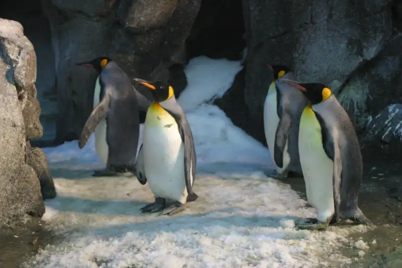
Introduction As a seasoned traveler, I, Wei Chen, have had the privilege of exploring some of the most breathtaking destinations on our planet. However, none have left me as awestruck as the pristine wilderness of Antarctica. This frozen continent, untouched and unspoiled, is a true marvel of nature. The sheer vastness of its ice sheets, the majesty of its glaciers, and the resilience of its wildlife all combine to create an experience that is truly once-in-a-lifetime. In this article, we will delve into the world of Antarctica expeditions, navigating the challenges and wonders of this unforgiving yet enchanting landscape. Planning and Preparation Embarking on an Antarctica expedition requires meticulous planning and preparation. The first step is to choose a reputable tour operator that specializes in polar expeditions. These operators will provide expert guidance, state-of-the-art equipment, and a deep understanding of the continent's unique environment. It is essential to research and select an operator that adheres to strict safety protocols and sustainable tourism practices. Additionally, travelers must be physically and mentally prepared for the challenges of Antarctica, including extreme cold, rough seas, and isolation. A thorough medical checkup and comprehensive travel insurance are also crucial components of pre-expedition planning. Choosing the Right Vessel The type of vessel chosen for an Antarctica expedition can greatly impact the overall experience. Most tour operators offer a range of options, from small, agile ships to larger, more luxurious cruisers. Each vessel has its advantages and disadvantages, and the right choice will depend on personal preferences, budget, and the specific itinerary. For example, smaller ships can navigate narrower channels and provide a more intimate, immersive experience, while larger vessels often offer more amenities and comfort. It is essential to consider factors such as cabin size, dining options, and onboard activities when selecting a vessel. Itinerary and Activities A typical Antarctica expedition itinerary will include a range of activities and excursions, from hiking and camping to kayaking and wildlife watching. The most popular destinations include the Antarctic Peninsula, the South Shetland Islands, and the Weddell Sea. Each of these regions offers unique landscapes, wildlife, and scientific interests, and a well-planned itinerary will ensure that travelers experience the full diversity of Antarctica's natural wonders. Many tour operators also offer specialized activities, such as scuba diving, mountaineering, and photography workshops, which can add an extra layer of excitement and engagement to the expedition. Environmental Considerations Antarctica is a fragile and protected environment, and all travelers have a responsibility to minimize their impact on the continent. This includes adhering to strict regulations regarding waste disposal, wildlife observation, and habitat preservation. Many tour operators are committed to sustainable tourism practices and work closely with environmental organizations to promote conservation and protection of Antarctica's unique ecosystems. Travelers can also play a role by choosing operators that adhere to these principles, respecting protected areas, and participating in citizen science projects. Safety and Emergency Procedures Safety is a top priority on any Antarctica expedition, and travelers must be aware of the potential risks and hazards associated with polar travel. These include extreme weather conditions, crevasses, and wildlife encounters. Tour operators will provide comprehensive safety briefings, emergency training, and state-of-the-art equipment to mitigate these risks. However, travelers must also take personal responsibility for their safety, adhering to guidelines and instructions, and being mindful of their physical and mental limitations. In the event of an emergency, it is essential to have a clear understanding of evacuation procedures and emergency communication protocols. Category Price Range DescriptionBudget $5,000 - $10,000 Basic accommodation, shared facilitiesMid-range $10,000 - $20,000 Comfortable cabin, onboard amenitiesLuxury $20,000 - $50,000 Suites, fine dining, personalized serviceConclusion In conclusion, an Antarctica expedition is a journey of a lifetime, offering a unique and unforgettable experience in one of the world's most pristine and awe-inspiring environments. By carefully planning and preparing, choosing the right vessel and itinerary, respecting environmental considerations, and prioritizing safety, travelers can embark on a journey that will leave them with lifelong memories and a deep appreciation for the natural world. As a seasoned traveler and blogger, I, Wei Chen, highly recommend adding Antarctica to your bucket list and experiencing the majesty of this frozen continent for yourself. #AntarcticaExpeditions #PolarTravel #SustainableTourism #WildlifeConservation #TravelTheWorld Related InsightsOmbre di Storia: Viaggio nel Turismo Oscuro tra Memoria e Mistero The Echoes of Thirst: Unearthing the Ancient Hymns of Kenya's Singing Wells 喀什:丝绸之路上的明珠与时光交错的古城{ "@context": "https://schema.org", "@type": "FAQPage", "mainEntity": [ { "@type": "Question", "name": "What is the main focus of Exploring the Frozen Wilderness: The Magnificent Antarctica Expeditions?", "acceptedAnswer": { "@type": "Answer", "text": "Embark on a life-changing journey through the pristine wilderness of the White Continent, discovering its unique wildlife and untouched beauty." } }, { "@type": "Question", "name": "Who authored the comprehensive guide on Exploring the Frozen Wilderness: The Magnificent Antarctica Expeditions?", "acceptedAnswer": { "@type": "Answer", "text": "This detailed article and its insights were carefully researched and authored by Wei Chen." } }, { "@type": "Question", "name": "Where can I find more related content about Travel?", "acceptedAnswer": { "@type": "Answer", "text": "You can explore more articles, detailed reviews, and similar insights by browsing the Related Insights section at the bottom of this article or visiting our dedicated Travel category page." } } ] }
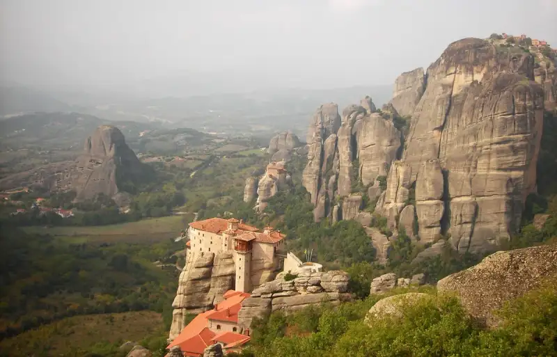
L'œil s'égare, le souffle se suspend, et l'esprit s'incline. Au nord-ouest de la Grèce, là où la plaine de Thessalie rencontre les contreforts du Pinde, s'élève un paysage qui semble avoir été sculpté par la main d'un géant ou par le rêve d'un poète. Météora. Ce nom, qui évoque l'éther, le suspendu et le céleste, ne ment pas. Ici, la roche ne se contente pas de soutenir la terre ; elle s'élance vers le firmament, portant sur ses sommets vertigineux des sanctuaires de pierre où le silence est l'unique langage et la prière l'unique respiration. S'aventurer à Météora, c'est accepter de quitter le monde profane pour entrer dans un royaume de verticalité. Ces colonnes de grès, massives et austères, se dressent comme des sentinelles immuables, gardiennes de secrets millénaires et de foi inébranlable. #travel #greece Une Genèse Géologique : Le Miracle du Grès et du Temps Pour comprendre la magie de Météora, il faut plonger dans les profondeurs du temps, bien avant que le premier moine ne pose le pied sur ces cimes. Ce que nous voyons aujourd'hui n'est pas le résultat d'une activité volcanique, contrairement à une idée reçue. Nous ne sommes pas en présence de bouchons ignés, mais d'un mélange complexe de grès et de conglomérats. Il y a environ 60 millions d'années, durant la période du Paléogène, cette région était le théâtre de dépôts sédimentaires massifs. Des cours d'eau transportaient pierres, sable et boue vers le delta d'un lac ancestral. Au fil des millions d'années, ces sédiments se sont compactés. Puis, des mouvements tectoniques puissants ont soulevé le fond marin, créant un haut plateau et fracturant la couche épaisse de grès selon des lignes de faille verticales. L'érosion, cet artisan patient, a ensuite pris le relais. L'eau, le vent et les variations extrêmes de température ont sculpté ces failles, transformant le plateau en piliers isolés. Ce qui rend Météora unique au monde, c'est l'uniformité remarquable de ces roches sédimentaires, laissant peu de traces de stratification horizontale, ce qui accentue l'aspect abrupt et vertical des parois. Scientifiquement, on parle d'un vestige continental exhumé d'association pangéenne.L'environnement actuel est tout aussi fascinant. Une végétation dense s'est installée dans les fissures et les crevasses, là où l'eau s'accumule, transformantบาง parties des parois en jungles impénétrables. Cependant, cette beauté naturelle cache une fragilité. La nature reste imprévisible : des chutes de pierres menacent régulièrement les pèlerins. En 1954, un séisme de magnitude 7 a secoué la région, mais miraculeusement, les piliers sont restés debout. Plus récemment, en 2005, un éboulement massif a bloqué les voies d'accès pendant plusieurs jours, rappelant que l'homme n'est ici qu'un invité. #geology #nature L'Ombre des Anciens : De la Grotte de Theopetra aux Premiers Ermites Bien avant l'érection des monastères, Météora était déjà un refuge. À seulement quatre kilomètres de Kalambaka se trouve la grotte de Theopetra, un site archéologique d'une importance capitale. Ce lieu est l'un des rares endroits au monde à conserver les traces de deux transitions culturelles majeures : le remplacement des Néandertaliens par l'homme moderne, puis la transition du mode de vie chasseur-cueilleur vers l'agriculture après la dernière ère glaciaire. Les recherches, notamment l'étude des diatomées pétrifiées, ont permis de reconstituer le paléoclimat de la région. Les datations au carbone 14 révèlent une présence humaine remontant à 50 000 ans. L'un des éléments les plus saisissants de Theopetra est un mur de pierre construit il y a 23 000 ans pour bloquer les deux tiers de l'entrée de la grotte, probablement pour protéger les habitants des vents glaciaux de l'époque. La proximité du fleuve Lithaios, affluent du Pineios, garantissait un accès permanent à l'eau potable, rendant ce site idéal pour la survie. Cependant, Météora, en tant que site spirituel, n'apparaît pas dans les mythes ou la littérature grecque classique. Son histoire sacrée commence véritablement vers l'an 800 de notre ère, lorsque des moines ascètes, en quête de solitude absolue, ont commencé à investir les anfractuosités des rochers. Ils vivaient dans des cavités naturelles, parfois à 550 mètres au-dessus de la plaine. #history #archaeologyL'Architecture du Sacré : Les Monastères Suspendus Si les ermites occupaient déjà les grottes dès le XIe siècle, la construction de véritables monastères ne commence qu'au XIVe siècle. Le moteur de cette ascension fut la nécessité : face à l'augmentation des attaques turques sur le sol grec, les moines cherchèrent un refuge inaccessible. Sous le règne local de Siméon Uroš, vingt-quatre monastères furent établis au sommet de ces piliers naturels. L'accès à ces citadelles de foi était, à l'origine, un exploit physique et spirituel. On y montait via des échelles amovibles ou des systèmes de cordes et de treuils. Imaginez le courage requis pour s'élever dans un panier de corde, suspendu au-dessus du vide, pour atteindre la porte du ciel. Ce n'est que dans les années 1920 que des escaliers ont été taillés à même la roche pour faciliter l'accès. Parmi les vingt-quatre structures initiales, seules six subsistent aujourd'hui, et quatre sont toujours actives, gérées par des communautés de moines et de nonnes :Le Grand Météore (fondé en 1356) : Le plus imposant et le premier des complexes. Le Monastère de Varlaam : Un chef-d'œuvre d'architecture et de spiritualité. Le Monastère de la Sainte-Trinité : Perché sur l'un des pics les plus escarpés. Le Monastère de Saint-Étienne : Devenu un couvent géré par des nonnes en 1961.Deux autres structures, Saint-Nicolas Anapausas et Rousanou, demeurent debout mais ne sont plus utilisées comme monastères actifs. Chaque site est un sanctuaire où le temps semble s'être arrêté, abritant moins de dix résidents par communauté. #spirituality #architectureUn Patrimoine Mondial : Beauté et Signification En 1988, l'UNESCO a inscrit le complexe de Météora sur la liste du Patrimoine Mondial. Cette reconnaissance ne repose pas seulement sur l'esthétique saisissante des lieux, mais sur la fusion parfaite entre l'architecture humaine et la géologie naturelle. Météora est l'incarnation physique de l'aspiration humaine vers le divin. L'organisation spatiale, située entre la ville de Kalambaka et le village de Kastraki, crée un contraste saisissant entre la vie quotidienne de la plaine et l'ascèse des sommets. La visite de ces lieux impose un respect profond, non seulement pour la foi des orthodoxes, mais pour la détermination de ceux qui ont bâti ces édifices pierre par pierre, transportant les matériaux à bout de bras ou par des cordes. Aujourd'hui, le visiteur qui parcourt les sentiers de Météora peut ressentir ce paradoxe : l'impression d'être minuscule face à la grandeur de la nature, tout en se sentant élevé par la grandeur de l'esprit humain. Que l'on soit croyant ou simple voyageur, l'expérience d'un coucher de soleil sur les piliers de Thessalie est une leçon d'humilité et de beauté. #unesco #worldheritage Conseils pour le Voyageur Contemporain Pour appréhender Météora dans toute sa splendeur, il est essentiel de s'imprégner de la lenteur. Je recommande de commencer par la grotte de Theopetra pour comprendre l'ancrage ancestral de l'homme dans cette terre, avant de s'attaquer à l'ascension des monastères. Il est important de noter que l'accès aux monastères actifs est régi par des règles de tenue vestimentaire strictes, respectant la tradition orthodoxe. Le silence et la contemplation sont les clés d'une immersion réussie. En observant les murs de grès, on peut encore deviner les traces des anciennes échelles et les points d'ancrage des cordes, témoins d'un temps où la foi était la seule force capable de vaincre la gravité. En conclusion, Météora n'est pas simplement une destination touristique ; c'est un pont entre la terre et le ciel, entre la préhistoire et la spiritualité byzantine. C'est un lieu où la pierre parle et où le vent murmure les prières d'il y a six cents ans. #Greece #Meteora #HiddenGems #TravelPhotography #OrthodoxHeritage Related InsightsEmerald Veins of the Hajar: A Journey Through Oman’s Living Wadis 厳島神社: 海に浮かぶ神々の住処 Altai Mountains{ "@context": "https://schema.org", "@type": "FAQPage", "mainEntity": [ { "@type": "Question", "name": "What is the main focus of Météora : L'Ascension Mystique entre Ciel et Pierre?", "acceptedAnswer": { "@type": "Answer", "text": "Explorez les mystères de Météora, où des monastères orthodoxes défient la gravité sur d'immenses piliers de grès en Grèce." } }, { "@type": "Question", "name": "Who authored the comprehensive guide on Météora : L'Ascension Mystique entre Ciel et Pierre?", "acceptedAnswer": { "@type": "Answer", "text": "This detailed article and its insights were carefully researched and authored by Pierre Dubois." } }, { "@type": "Question", "name": "Where can I find more related content about Travel?", "acceptedAnswer": { "@type": "Answer", "text": "You can explore more articles, detailed reviews, and similar insights by browsing the Related Insights section at the bottom of this article or visiting our dedicated Travel category page." } } ] }

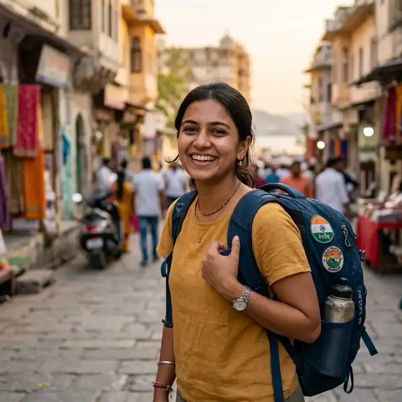
The Faroe Islands: Rugged Landscapes and Viking Echoes Nestled in the North Atlantic Ocean between Iceland and Norway, the Faroe Islands are a remote Nordic archipelago where dramatic cliffs plunge into the sea, waterfalls cascade into misty fjords, and Viking history whispers through every village. This self-governing territory of Denmark offers travelers an unparalleled blend of untamed nature and rich cultural heritage. With a population of just over 50,000, the islands remain one of the least-visited destinations in Europe, ensuring an authentic and immersive experience for those who venture here. Whether you're drawn by the allure of puffins, the thrill of hiking sheer basalt cliffs, or the chance to walk in the footsteps of Norse settlers, the Faroe Islands promise a journey unlike any other. Beyond their breathtaking scenery, the Faroes are steeped in Viking lore. The islands were first settled by Norse explorers in the 9th century, and their legacy endures in place names, sagas, and the annual Ólavsøka festival, which celebrates Faroese culture with traditional music, dance, and rowing races. Today, the islands balance modernity with tradition, offering cozy turf-roofed houses alongside state-of-the-art infrastructure. Whether you're exploring the capital of Tórshavn, hiking to the iconic Mulafossur waterfall, or savoring fermented sheep’s head (a local delicacy), the Faroe Islands deliver a travel experience that is both rugged and refined.Geography and Climate: A Land of Extremes The Faroe Islands consist of 18 rocky, volcanic islands connected by tunnels, ferries, and bridges. The terrain is defined by its stark contrasts: towering sea cliffs like the 600-meter-high Enniberg, lush valleys dotted with sheep, and deep fjords carved by ancient glaciers. The islands’ location in the Gulf Stream means a maritime climate—cool summers averaging 12°C (54°F) and mild winters around 4°C (39°F)—with frequent rain and wind. This unpredictable weather is part of the Faroes’ charm, rewarding intrepid travelers with ever-changing skies and dramatic light.Topographical Wonders The Faroes’ most iconic landscapes are its cliffs, which are among the tallest in Europe. The Kallur Lighthouse on Kalsoy Island offers a vertigo-inducing view of the Atlantic crashing against the cliffs below. Meanwhile, Mykines, the westernmost island, is a haven for puffins and features the Mykineshólmur sea stack, accessible via a suspension bridge. The Gásadalur village on Mykines is also home to the Múlafossur waterfall, which cascades directly into the ocean—a sight best viewed during the midnight sun in June or the northern lights in winter. For hikers, the Faroese Trail (a network of marked paths) connects villages across the islands. One of the most challenging routes is the Slættaratindur hike, which summits the highest peak in the Faroes at 880 meters (2,887 feet). The trail rewards climbers with panoramic views of the surrounding islands, including the dramatic Sørvágsvatn lake, which appears to float above the ocean when viewed from certain angles. Climate Considerations Travelers should prepare for rapid weather shifts. A sunny morning can quickly give way to fog or rain, so waterproof layers are essential. The best time to visit depends on your interests:Summer (June-August): Mild temperatures, puffins, and the midnight sun. Spring/Fall (May or September): Fewer tourists and dramatic autumn colors. Winter (November-March): Northern lights, stormy seas, and cozy village life.Cultural Heritage: From Viking Sagas to Modern Faroese Life The Faroe Islands’ history is deeply intertwined with Norse mythology and seafaring traditions. The islands were first settled by Vikings fleeing Norway in the 9th century, and their legacy is preserved in the Faroese Saga, a collection of medieval tales. The National Museum of the Faroe Islands in Tórshavn showcases artifacts from this era, including runestones and Viking-era boats.Traditional Faroese Culture Faroese culture revolves around sheep farming, fishing, and folk music. The islands are famous for their chain dance, a traditional form of group dancing accompanied by ballads sung in Faroese. The Ólavsøka festival (July 28-29) is the highlight of the year, featuring rowing competitions, music, and parades in Tórshavn. Food is another cornerstone of Faroese identity. While modern cuisine has embraced international influences, traditional dishes remain a must-try:Ræst kjøt (fermented mutton) Skerpikjøt (dried lamb) Fiskakøka (fish cake) Brennivín (a caraway-flavored schnapps)Language and Literature Faroese, a North Germanic language closely related to Icelandic, is the official language. Danish is also widely spoken, and English is commonly understood in tourist areas. Faroese literature, particularly the works of William Heinesen and Jørgen-Frantz Jacobsen, reflects the islands’ rugged beauty and isolation.Top 5 Must-See Attractions 1. Tórshavn: The Charming Capital Tórshavn, meaning "Thor’s Harbor," is the political and cultural heart of the Faroe Islands. Its colorful wooden houses, cobblestone streets, and harbor make it a delight to explore. Key sights include:Reyni (the old town) Tinganes (the historic parliament district) National Museum of the Faroe Islands Faroese Art Museum2. Mykines: Puffin Paradise Mykines is a birdwatcher’s dream, home to over 1 million puffins during breeding season (April-August). The island is accessible via ferry from Sørvágur, followed by a hike to the puffin colonies. The Mykineshólmur sea stack is another highlight, offering breathtaking views. 3. Sørvágsvatn: The Floating Lake This optical illusion lake appears to float above the ocean when viewed from certain angles. The best vantage point is from the Trælanípan hike, which takes you to the edge of the cliffs overlooking the lake. 4. Klaksvík: The Cultural Hub Klaksvík, the second-largest town, is known for its vibrant music scene and the Norðoyastevna festival. Nearby, the Klakkur church and the Viðareiði village offer stunning coastal views. 5. Gásadalur and Múlafossur Gásadalur is a picturesque village on Mykines, home to the Múlafossur waterfall, which cascades directly into the ocean. The hike to the waterfall is short but steep, rewarding visitors with one of the Faroes’ most iconic sights.Practical Travel Guide: Costs, Transport, and Tips The Faroe Islands are not a budget destination, but careful planning can help manage costs. Below is a breakdown of key expenses based on live data:Item Average Price (USD) NotesMeal at a mid-range restaurant $25-$40 Includes local dishes like fish or lamb.Pint of beer $8-$12 Local brews like Faroe Beer are popular.Taxi (1 km) $3-$5 Public transport is limited.Groceries (monthly) $400-$600 Includes staples like lamb, fish, and dairy.Hostel (per night) $50-$80 Budget option; private rooms cost more.Ferry ticket (Sørvágur to Mykines) $20-$30 Book in advance during peak season.Getting AroundFerries: Operated by Smyril Line, connecting the main islands. Buses: Limited service; best for short hops between villages. Rental Cars: The most flexible option; book in advance. Hitchhiking: Common and safe due to the islands’ small population.Best Time to VisitJune-August: Best for puffins and hiking. September-October: Fewer tourists and autumn colors. November-March: Northern lights and stormy seas.Local EtiquetteAlways greet locals with a friendly "Sæl" (hello). Respect private property, especially farmland. Try local dishes—even the fermented ones!Conclusion: Why the Faroe Islands Should Be on Your Bucket List The Faroe Islands are a destination for those who crave adventure, solitude, and raw natural beauty. Whether you’re hiking to a waterfall that meets the ocean, exploring Viking history in Tórshavn, or simply gazing at the endless Atlantic horizon, the islands offer an escape from the ordinary. Their rugged landscapes and deep cultural roots create an experience that lingers long after you’ve left. For travelers willing to venture off the beaten path, the Faroes deliver unforgettable moments—whether it’s the thrill of spotting a puffin on Mykines, the awe of standing atop a cliff in the wind, or the warmth of a Faroese village’s hospitality. This is a place where nature and history collide, leaving you with stories to tell for years to come. So pack your waterproof gear, embrace the unpredictability of the weather, and let the Faroe Islands weave their magic on you. #FaroeIslands #NordicAdventure #VikingHeritage #PuffinParadise #OffTheBeatenPath Related InsightsExploring the Frozen Wilderness: The Magnificent Antarctica Expeditions The Twenty Million Dollar View: A History of Humanity's Most Exclusive Destination Il Palatino: Il Colle degli Imperatori{ "@context": "https://schema.org", "@type": "FAQPage", "mainEntity": [ { "@type": "Question", "name": "What is the main focus of The Faroe Islands: Rugged Landscapes and Viking Echoes?", "acceptedAnswer": { "@type": "Answer", "text": "The Faroe Islands: Rugged Landscapes and Viking Echoes hakkinda bilmeniz gereken her sey." } }, { "@type": "Question", "name": "Who authored the comprehensive guide on The Faroe Islands: Rugged Landscapes and Viking Echoes?", "acceptedAnswer": { "@type": "Answer", "text": "This detailed article and its insights were carefully researched and authored by Aisha Sharma." } }, { "@type": "Question", "name": "Where can I find more related content about Travel?", "acceptedAnswer": { "@type": "Answer", "text": "You can explore more articles, detailed reviews, and similar insights by browsing the Related Insights section at the bottom of this article or visiting our dedicated Travel category page." } } ] }
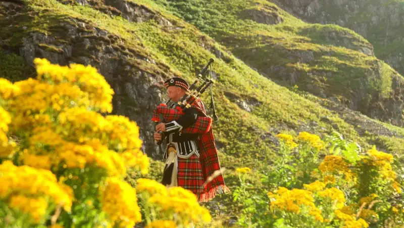
- Zola Ndlovu
- 16 Jul, 2026 18:49
Unraveling the Mystical Scottish Highlands: Where Ancient Legends Meet Breathtaking Landscapes
The Scottish Highlands: Myths, Lochs, and Ancient Clans Introduction The Scottish Highlands are a land where mist clings to the peaks of ancient mountains, where the wind carries whispers of clans long forgotten, and where the waters of lochs shimmer under a sky so vast it feels like the edge of the world. This is a place where history is not just remembered—it is felt in the very stones beneath your feet and the legends that echo through the glens. For centuries, the Highlands have been a magnet for adventurers, historians, and dreamers alike, offering a raw, untamed beauty that modern life often lacks. Whether you're drawn by the call of the wild, the allure of ancient mysteries, or the promise of a slower, more meaningful way of life, the Highlands deliver an experience unlike any other. But beyond the romance of tartan and bagpipes lies a region that is also embracing the future. With the introduction of Scotland’s Digital Nomad Visa, the Highlands are becoming a sanctuary for remote workers seeking inspiration in its rugged landscapes. Imagine trading the hum of a city office for the quiet rustle of pine trees, or swapping a coffee shop for a lochside coworking space with WiFi as reliable as the Highland breeze. Affordable living, breathtaking scenery, and a thriving remote work community are making the Highlands a hidden gem for digital nomads. In this article, we’ll explore the myths that shape the Highlands’ identity, the lochs that cradle its secrets, and the clans whose legacy still lingers in the air. We’ll also uncover how you can live and work in this magical region without breaking the bank.The Enigmatic Myths of the Scottish Highlands The Scottish Highlands are steeped in folklore that has been passed down through generations, each tale adding a layer of mystery to the landscape. These myths are not mere stories—they are the heartbeat of the region, shaping its culture and identity. One of the most enduring legends is that of the Selkies, mythical creatures said to be seals that shed their skins to become human on land. In coastal villages like Plockton, locals still speak of selkies emerging from the sea at dusk, their melancholic songs echoing across the water. The tale of the Blue Men of the Minch is another chilling story, where these aquatic beings are said to challenge sailors to rhyming contests, drowning those who fail to match their wit. These myths are more than entertainment; they are a reflection of the Highlands’ deep connection to the sea and the unpredictable forces of nature. Then there’s the legend of the Each-Uisge, a deadly water horse that lures unsuspecting travelers onto its back before dragging them into the depths. This myth serves as a cautionary tale, warning of the dangers lurking in the Highlands’ deceptively calm lochs and rivers. Even the standing stones of places like Callanish on the Isle of Lewis are said to hum with ancient power, their alignment with celestial events hinting at a lost understanding of astronomy. These myths are not confined to the past; they are alive in the present, with festivals like the Up Helly Aa in Shetland celebrating Viking heritage through fire and folklore. For those who visit, these stories offer a gateway into the Highlands’ soul, where every glen and peak has a tale to tell.For modern-day explorers, engaging with these myths is as simple as visiting the sites where they originated. The Clava Cairns near Inverness, for example, are Bronze Age burial chambers that feel eerily connected to the otherworldly tales of the Highlands. Guided folklore tours, such as those offered in the Cairngorms National Park, provide deeper insights into these legends, often led by locals who grew up hearing the stories. Whether you’re a skeptic or a believer, the myths of the Highlands add a layer of magic to any visit, making the region feel like a living storybook.Lochs: The Jewels of the Highlands and Their Hidden Secrets The Highlands are home to over 31,000 freshwater lochs, each one a mirror to the sky and a keeper of secrets. These lochs are not just bodies of water; they are the lifeblood of the region, shaping its geography, ecology, and even its mythology. The most famous of these is Loch Ness, a deep, dark expanse of water that has captivated the world with tales of the elusive Nessie, the Loch Ness Monster. While scientific evidence for Nessie remains elusive, the loch itself is a marvel, plunging to depths of 230 meters and holding more water than all the lakes in England and Wales combined. Sonar scans have revealed underwater caves and geological formations that add to the loch’s mystique, making it a must-visit for anyone exploring the Highlands. Beyond Loch Ness, other lochs hold their own allure. Loch Lomond, the largest freshwater loch in Great Britain by surface area, is a playground for outdoor enthusiasts, offering kayaking, hiking, and even island-hopping adventures. Its southern shores are dotted with charming villages like Luss, where cottages with slate roofs and flower-filled gardens create a postcard-perfect scene. Meanwhile, Loch Maree in Wester Ross is renowned for its crystal-clear waters and the Isle Maree, an island that was once a sacred site for ancient Celts. According to legend, the loch’s waters have healing properties, and its trees are said to be home to fairies. The loch’s isolation and untouched beauty make it a sanctuary for wildlife, including rare birds like the black-throated diver.For those seeking a deeper connection to the Highlands’ natural wonders, loch-hopping is an unforgettable experience. The North Coast 500 road trip, often called Scotland’s answer to Route 66, winds past some of the most stunning lochs in the country, including Loch Eriboll and Loch Laxford. Each loch has its own character—some are calm and reflective, while others are wild and windswept, their surfaces whipped into froth by the Atlantic winds. Kayaking on these lochs offers a unique perspective, allowing you to glide silently across the water and witness the Highlands’ wildlife up close, from otters to golden eagles. Whether you’re paddling at dawn or watching the sunset paint the loch in hues of gold and pink, these experiences are a reminder of why the Highlands are so revered.The Ancient Clans: Legacy of the Highlands’ Warrior Spirit The Scottish Highlands were once the domain of powerful clans, each with its own tartan, crest, and fierce loyalty to its chief. These clans shaped the region’s history, from the battles of the Jacobite risings to the everyday lives of Highlanders who lived off the land. The Clan MacLeod, for example, has its roots on the Isle of Skye, where the ruins of Dunvegan Castle still stand as a testament to their power. The castle’s Fairy Flag, a mysterious silk banner said to possess magical properties, is one of its most prized possessions, embodying the clan’s deep connection to folklore and superstition. Meanwhile, the Clan Campbell, one of the most influential clans in Scottish history, played a pivotal role in the suppression of the Jacobites and the forging of modern Scotland. Their stronghold, Inveraray Castle, is a grand estate that offers a glimpse into the opulence and politics of clan life. The legacy of the clans is not confined to history books; it lives on in the Highlands’ culture and traditions. The Gathering of the Clans at Culloden Battlefield is a poignant reminder of the Jacobite defeat in 1746, where the clans’ hopes for a Stuart restoration were crushed. Today, the battlefield is a place of reflection, with memorials to the fallen and exhibits that tell the story of the clans’ struggle. Tartan, the fabric woven into the identity of each clan, is still worn with pride at Highland games and festivals. Events like the Braemar Gathering bring together pipers, dancers, and athletes in a celebration of Highland culture, where the past feels alive in every note of the bagpipes and every step of the Highland dance.For those eager to trace their own clan heritage, the Highlands offer numerous resources. The Highland Clan Center in Newtonmore provides genealogy workshops and access to clan records, while local historians in places like Fort William and Inverness can help piece together family histories. Many clans also hold regular gatherings, known as ceilidhs, where descendants come together to share stories, music, and food. These events are a chance to connect with the past while enjoying the warmth of Highland hospitality. Whether you have Highland blood or simply admire the clans’ legacy, exploring their history is a journey into the heart of what makes the Highlands so special.Living and Working in the Highlands: A Digital Nomad’s Paradise The Scottish Highlands are no longer just a destination for hikers and history buffs—they’re also becoming a haven for digital nomads. With the introduction of Scotland’s Digital Nomad Visa, remote workers can now live and work in the Highlands while immersing themselves in its breathtaking landscapes. This visa, designed for freelancers and employees of overseas companies, allows stays of up to six months, giving nomads ample time to explore the region’s hidden gems. The Highlands offer a unique blend of affordability, natural beauty, and a growing remote work community, making it an ideal base for those seeking a slower pace of life without sacrificing connectivity. One of the biggest draws for digital nomads is the cost of living. Compared to major cities like Edinburgh or Glasgow, towns in the Highlands offer significantly lower rents. For example, a one-bedroom apartment in Inverness, the Highlands’ largest city, averages around £600 per month, while smaller towns like Fort William or Ullapool can be even more affordable, with options as low as £400 per month. Coworking spaces are also on the rise, with venues like The Hub in Inverness and The Lighthouse in Fort William providing high-speed internet and a collaborative environment. These spaces often overlook lochs or mountains, turning the daily grind into an inspiring experience. For those who prefer a more nomadic lifestyle, glamping sites like EcoVilla in the Cairngorms offer fully equipped cabins with WiFi, allowing you to wake up to panoramic views of the Highlands.The Highlands’ remote work scene is still in its early stages, but it’s growing rapidly. Facebook groups like Digital Nomads Scotland and Remote Workers Highlands are great places to connect with like-minded individuals, share tips, and even find roommates. Local cafes, such as The Black Isle Bar in Inverness or The Mountain Café in Aviemore, are popular spots for freelancers, offering strong coffee and a welcoming atmosphere. For those who crave a change of scenery, coffee shops with a view like The Bothy in Plockton provide a serene setting to tackle your to-do list. The Highlands also host regular meetups and workshops, from coding retreats to photography tours, ensuring that nomads can balance work with exploration.Practical Guide: How to Embrace the Highlands as a Digital Nomad 1. Choosing Your Base: Towns vs. Villages The Highlands offer a range of living options, from vibrant towns to remote villages. Inverness is the largest city in the region, with all the amenities of urban life, including supermarkets, hospitals, and a thriving arts scene. It’s ideal for nomads who want a balance of convenience and nature. Fort William, known as the "Outdoor Capital of the UK," is perfect for adventure seekers, with easy access to hiking, skiing, and mountain biking. For those seeking solitude, villages like Applecross or Shieldaig offer a slower pace of life, with stunning coastal views and a tight-knit community. Each location has its own charm, so consider your priorities—whether it’s proximity to nature, social opportunities, or cost of living—when choosing your base. 2. Transportation: Getting Around the Highlands The Highlands are vast, and public transportation can be limited, so having your own vehicle is highly recommended. Renting a car gives you the freedom to explore at your own pace, whether it’s driving the North Coast 500 or taking a detour to a secluded loch. For those who prefer not to drive, buses and trains connect major towns, with services like the Jacobite Steam Train (famous for its Hogwarts Express route) offering a scenic way to travel. Biking is also an option, with routes like the Caledonian Canal providing a flat and picturesque path for cyclists. If you’re staying in a village, consider carpooling with locals or using community transport schemes, which are becoming more common in rural areas. 3. Work-Life Balance: Making the Most of Your Time The Highlands are a playground for outdoor activities, so it’s easy to fall into the trap of overworking and missing out on the region’s beauty. To maintain a healthy work-life balance, set a schedule that includes time for exploration. Many nomads find that working in the mornings and spending afternoons hiking or kayaking keeps them energized and inspired. Joining local clubs or classes, such as pottery workshops in Plockton or Gaelic language courses in Stornoway, can also help you integrate into the community and make the most of your time. Additionally, take advantage of the Highlands’ dark sky parks, where you can stargaze without light pollution—an experience that’s both humbling and rejuvenating. 4. Budgeting: Cost of Living Breakdown To give you a realistic idea of what to expect, here’s a breakdown of monthly expenses for a digital nomad living in the Highlands:Expense Category Inverness (£) Fort William (£) Small Village (£)Rent (1-bed apartment) 600 550 400Groceries 200 200 180Coworking Space 100 80 N/AEating Out 150 120 100Transportation 100 120 80Utilities 100 90 80Miscellaneous 150 140 100Total 1,400 1,300 1,040Notes: Prices are approximate and can vary based on season and personal lifestyle. Rent in smaller villages may include utilities.5. Legal and Visa Considerations To live and work in the Highlands as a digital nomad, you’ll need to apply for Scotland’s Digital Nomad Visa. This visa allows you to stay for up to six months and is open to freelancers, remote employees, and business owners. Requirements include proof of income (typically around £2,500 per month), travel insurance, and a clean criminal record. Once approved, you’ll need to register with the local council if staying longer than three months. It’s also wise to familiarize yourself with UK tax laws, especially if you plan to stay beyond the visa’s duration. Consulting with an immigration lawyer or using resources like the UK Government’s official website can help ensure a smooth process.Conclusion The Scottish Highlands are more than just a destination—they are an experience that lingers long after you’ve left. Whether you’re drawn by the allure of ancient myths, the tranquility of its lochs, the legacy of its clans, or the promise of a slower, more connected way of life, the Highlands have a way of capturing your heart. For digital nomads, this rugged paradise offers the perfect blend of affordability, natural beauty, and a growing remote work community, making it an ideal place to live and work. The region’s ability to balance tradition with modernity is what sets it apart, allowing you to walk in the footsteps of clans while still enjoying the comforts of the 21st century. As you plan your journey, remember that the Highlands reward those who take their time. Whether it’s lingering by a loch at sunrise, striking up a conversation with a local in a village pub, or simply letting the silence of the glens wash over you, these moments are what make the Highlands unforgettable. The region’s magic isn’t something you can rush—it’s something you feel, deep in your bones. So pack your bags, bring your laptop, and prepare to be enchanted. For those ready to take the leap, the Highlands are waiting. And who knows? You might just find that the myths, the lochs, and the clans were waiting for you all along.#DigitalNomadLife #ScottishHighlands #RemoteWorkAdventure #LiveAbroadUK #HighlandExplorer
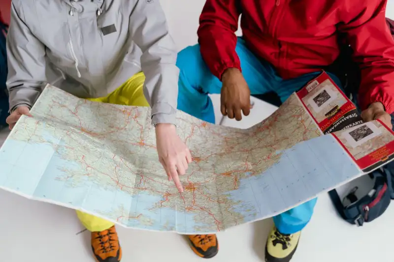
- Chloe Tremblay
- 16 Jul, 2026 14:48
Ethiopia’s Danakil Depression: Where Earth’s Hellish Beauty Meets Alien Landscapes
Ethiopia’s Danakil Depression: Where Earth’s Hellish Beauty Meets Alien Landscapes The Danakil Depression is not just a place—it’s a testament to nature’s raw, unfiltered power. Nestled in Ethiopia’s Afar region, this geological marvel sits 125 meters below sea level, making it one of the lowest and hottest inhabited places on Earth. With temperatures routinely soaring past 40°C (104°F) and volcanic activity shaping its surreal terrain, the Danakil Depression feels like stepping onto another planet. Here, sulfuric acid pools bubble ominously, salt flats stretch endlessly under a merciless sun, and the Erta Ale volcano’s lava lake glows like a furnace in the night. For adventurers willing to brave extreme heat, limited oxygen, and isolation, this is the ultimate frontier—a place where Earth’s inner fury is laid bare. This is not a destination for the faint-hearted. It’s a realm of extremes, where the air shimmers with heat, the ground trembles underfoot, and the landscape shifts between desolate salt pans and steaming hydrothermal vents. Yet, for those who venture here, the Danakil Depression offers an unparalleled spectacle: a living, breathing testament to the planet’s most violent forces. Whether you’re a geologist, a photographer, or a thrill-seeker chasing the world’s most extreme destinations, this is a journey that will redefine your understanding of what Earth can endure—and what humans can endure in pursuit of the extraordinary.The Geological Marvels of the Danakil Depression: A Journey to the Center of the Earth The Danakil Depression is a tectonic rift zone, where three of Earth’s major plates—the Nubian, Somali, and Arabian plates—are pulling apart at a rate of 1-2 centimeters per year. This relentless geological activity has created a landscape that looks like it belongs on Mars. The depression is part of the Afar Triple Junction, a hotspot of volcanic and seismic activity that has given rise to some of the planet’s most extreme environments. At the heart of this geological wonderland lies the Erta Ale volcano, one of only six continuously active lava lakes in the world. Standing at 613 meters (2,011 feet), this shield volcano has been erupting almost nonstop since 1967, its molten lake a mesmerizing, ever-changing spectacle. The lava lake’s surface is a dynamic display of convection currents, where molten rock rises, cools, and sinks in a perpetual cycle. Visitors who brave the grueling trek to its summit are rewarded with a view that feels like gazing into the bowels of the Earth itself. Beyond Erta Ale, the depression is a patchwork of hydrothermal vents, salt flats, and mineral-rich hot springs. The Dallol hydrothermal field, located in the northern part of the depression, is one of the most acidic places on Earth, with pH levels as low as -1.6—strong enough to dissolve metal. Here, yellow sulfur deposits, green acid pools, and white salt terraces create a psychedelic landscape that seems plucked from a science fiction novel. The Danakil Salt Plain, formed by the evaporation of an ancient inland sea, stretches for hundreds of kilometers, its crust of salt glistening under the relentless sun. The depression’s extreme conditions are not just a product of its geology but also its climate. With an average annual temperature of 34°C (93°F) and peaks exceeding 50°C (122°F) during the dry season, the Danakil Depression is one of the hottest places on Earth. The combination of low elevation, high solar radiation, and minimal cloud cover creates a furnace-like environment where survival is a challenge even for the hardiest organisms. Yet, despite these inhospitable conditions, the Afar people have inhabited this region for centuries, mining salt and enduring the harsh realities of life in one of Earth’s most extreme environments.For geologists, the Danakil Depression is a living laboratory, offering insights into the processes that shape our planet. The hydrothermal systems here are believed to be similar to those that may have existed on early Earth, or even on Mars, making this a critical site for astrobiological research. The salt deposits, rich in minerals like potassium, magnesium, and gypsum, are a reminder of the region’s ancient past as a shallow sea. And the volcanic gases, including sulfur dioxide and hydrogen chloride, paint a picture of the relentless forces at work beneath the surface. But the Danakil Depression is more than just a geological curiosity—it’s a testament to human resilience. The Afar people, who have lived in this region for generations, have adapted to its extreme conditions, using the salt flats as a resource and navigating the treacherous terrain with remarkable skill. Their knowledge of the land, passed down through centuries, is a vital part of understanding how life can thrive in even the most inhospitable environments.How to Visit the Danakil Depression: A Step-by-Step Guide to the World’s Most Extreme Adventure Visiting the Danakil Depression is not a journey for the unprepared. This is a multi-day expedition that requires careful planning, physical stamina, and a tolerance for extreme heat and isolation. The journey begins in Mekelle, the capital of the Tigray region, which serves as the primary gateway to the depression. From there, adventurers must travel north by 4x4 vehicle along rough, unpaved roads that cut through some of the most desolate landscapes on Earth. The first leg of the journey takes you through the Afar Triangle, a region known for its nomadic herders, camel caravans, and stark beauty. The drive is long—12-14 hours to reach the base of Erta Ale—but the scenery is unforgettable. As you descend into the depression, the landscape shifts from arid plains to volcanic rock fields and salt-encrusted valleys. The air grows thicker with sulfur fumes, and the temperature climbs steadily, a reminder of the extreme environment you’re entering. Once you reach the Erta Ale base camp, the real challenge begins. The hike to the volcano’s summit is arduous, with temperatures often exceeding 45°C (113°F). The trail is steep and rocky, and the thin air at this elevation can make breathing difficult. Most visitors opt to begin the ascent at dusk, when temperatures are slightly cooler, and the lava lake’s glow becomes visible against the darkening sky. The final push to the crater rim is a test of endurance, but the reward is a view unlike any other: a glowing, bubbling cauldron of molten rock, casting an eerie light over the surrounding landscape. For those who want to spend the night near the volcano, basic campsites are available, though conditions are spartan. Sleeping bags and warm clothing are essential, as temperatures can drop sharply at night. The next morning, adventurers can explore the hydrothermal vents and mineral deposits near the base camp before beginning the long journey back to Mekelle. But the Danakil Depression is more than just Erta Ale. The Dallol hydrothermal field, located further north, is another must-see destination. Reaching Dallol requires a two-day 4x4 journey from the Erta Ale base camp, crossing some of the most remote and rugged terrain in Ethiopia. The landscape here is otherworldly, with acid pools, salt formations, and mineral-rich hot springs creating a surreal, almost alien environment. The black sand dunes and steaming fumaroles add to the sense of being on another planet.For those who prefer a more structured experience, guided tours are available from Addis Ababa, Ethiopia’s capital. These tours typically include transportation, accommodation, meals, and a local guide who is familiar with the terrain and the Afar people. Prices vary depending on the length of the trip and the level of comfort, but expect to pay $1,000 to $2,500 USD per person for a 5-7 day expedition. While this may seem expensive, the cost reflects the logistical challenges of operating in such a remote and extreme environment. Safety is paramount when visiting the Danakil Depression. The region is politically sensitive, with occasional tensions between the Ethiopian government and local Afar groups. Travelers are advised to check travel advisories before planning their trip and to register with their embassy if possible. Additionally, the extreme heat, lack of water, and rugged terrain pose significant risks, so it’s essential to pack plenty of water, electrolytes, and sun protection. A local guide is not just recommended—it’s mandatory for navigating the region safely. For the truly intrepid, the Danakil Depression offers an opportunity to push the limits of human endurance. Whether you’re trekking to the summit of Erta Ale, exploring the acid pools of Dallol, or simply enduring the heat of the salt flats, this is an adventure that will test your body and mind. But for those who make it, the rewards are unparalleled—a glimpse into the raw, unfiltered power of our planet, and a memory that will last a lifetime.👉 Continue Reading: Ethiopia's Danakil Depression: The Hottest Place on Earth's Alien Landscapes (Part 2)#EthiopiaTravel #ExtremeAdventure #VolcanicExploration #DanakilDepression #AfarRegion Related InsightsThe Magic of Pamukkale Sydney Opera House: The Architectural Icon that Redefined Art and Innovation Floating Above the Clouds: A Definitive Pilgrimage to Bhutan’s Tiger’s Nest{ "@context": "https://schema.org", "@type": "FAQPage", "mainEntity": [ { "@type": "Question", "name": "What is the main focus of Ethiopia’s Danakil Depression: Where Earth’s Hellish Beauty Meets Alien Landscapes?", "acceptedAnswer": { "@type": "Answer", "text": "Explore the Danakil Depression, Ethiopia’s otherworldly geothermal wonderland where temperatures exceed 40°C and volcanic forces shape a surreal, uninhabitable landscape." } }, { "@type": "Question", "name": "Who authored the comprehensive guide on Ethiopia’s Danakil Depression: Where Earth’s Hellish Beauty Meets Alien Landscapes?", "acceptedAnswer": { "@type": "Answer", "text": "This detailed article and its insights were carefully researched and authored by Chloe Tremblay." } }, { "@type": "Question", "name": "Where can I find more related content about Travel?", "acceptedAnswer": { "@type": "Answer", "text": "You can explore more articles, detailed reviews, and similar insights by browsing the Related Insights section at the bottom of this article or visiting our dedicated Travel category page." } } ] }

- Chloe Tremblay
- 16 Jul, 2026 14:48
Ethiopia's Danakil Depression: The Hottest Place on Earth's Alien Landscapes (Part 2)
This is Part 2 of the series. Read Part 1 here.The Afar People: Surviving in Earth’s Most Harsh Environment The Afar people are the true survivors of the Danakil Depression. For centuries, they have called this hellish landscape home, adapting to its extreme conditions with remarkable ingenuity and resilience. The Afar, also known as the Danakil, are a nomadic pastoralist people who have traditionally relied on camel herding, salt mining, and trade to sustain their communities. Their way of life is a testament to human adaptability, offering a glimpse into how life can thrive even in the most inhospitable environments. The Afar people live in small, scattered settlements across the Danakil Depression, often in temporary huts made of palm fronds and animal hides. Their diet consists primarily of milk, meat, and flatbread, supplemented by dates and wild plants when available. Water is a precious resource, and the Afar have developed ingenious methods for collecting and storing it. They dig shallow wells in dry riverbeds, relying on the seasonal rains to replenish their supplies. In times of drought, they may travel hundreds of kilometers in search of water, following ancient trade routes that have been used for generations. Salt is the lifeblood of the Afar economy. The Danakil Salt Plain is one of the richest sources of salt in the world, and the Afar have mined it for centuries. The process is labor-intensive and dangerous, with workers cutting blocks of salt from the crust of the plain and loading them onto camel caravans for transport. These caravans, known as azibo, can stretch for miles, with hundreds of camels carrying salt to markets in Mekelle and other Ethiopian cities. The salt is not just a commodity—it’s a currency, used in trade and barter across the region. Despite the harsh conditions, the Afar people have a rich cultural heritage. Their society is matrilineal, with women playing a central role in decision-making and trade. Music and dance are integral parts of their culture, with traditional instruments like the tanbura (a lyre-like instrument) and the krar (a five-stringed lyre) accompanying celebrations and rituals. The Afar are also known for their elaborate body adornments, including beaded necklaces, brass arm rings, and intricate hairstyles, which serve as markers of identity and status. Yet, life in the Danakil Depression is not without its challenges. The region is chronically underdeveloped, with limited access to healthcare, education, and clean water. Droughts, famine, and conflict are constant threats, and many Afar people live in poverty, relying on subsistence farming and seasonal labor. The extreme heat and lack of infrastructure make it difficult to attract investment or development, leaving the Afar people to fend for themselves in one of the most extreme environments on Earth. For travelers who visit the Danakil Depression, interacting with the Afar people is a humbling experience. Their warmth, hospitality, and resilience are unforgettable, and their knowledge of the land is invaluable for navigating the region. Many guided tours include cultural exchanges, allowing visitors to learn about the Afar way of life, sample traditional foods, and even participate in salt mining or camel caravans. These interactions are not just educational—they’re a reminder of the universal human spirit that thrives even in the most challenging circumstances. The Afar people are guardians of a disappearing way of life. As climate change and modernization encroach on their traditional lands, their culture and livelihoods are under threat. For those who visit the Danakil Depression, supporting the Afar people—whether through fair trade, responsible tourism, or donations to local organizations—is a way to ensure that their story continues to be told.The Science Behind the Danakil Depression: A Window into Earth’s Violent Past The Danakil Depression is more than just a tourist destination—it’s a scientific goldmine. Geologists, volcanologists, and astrobiologists flock to this region to study its unique geological features, which offer insights into the early Earth, the origins of life, and even the potential for life on other planets. The depression is a natural laboratory, where the forces that shape our planet are on full display. At the heart of the Danakil Depression’s scientific significance is its tectonic activity. The region sits at the Afar Triple Junction, where three tectonic plates are pulling apart. This rifting process is creating a new ocean basin, a phenomenon that has occurred only a handful of times in Earth’s history. By studying the Danakil Depression, scientists can gain a better understanding of continental drift, seafloor spreading, and the formation of new crust. The Erta Ale volcano, with its continuous lava lake, is a prime example of this process in action, offering a glimpse into the mechanisms of volcanic activity that shape our planet. The hydrothermal systems of the Danakil Depression are another area of intense scientific interest. These acidic, mineral-rich pools are home to extremophiles—microorganisms that thrive in conditions that would be lethal to most life forms. The Dallol hydrothermal field, in particular, is one of the most acidic and saline environments on Earth, with pH levels as low as -1.6 and temperatures exceeding 100°C (212°F). These conditions are similar to those that may have existed on early Earth, or even on Mars, making the Danakil Depression a key site for astrobiological research.Scientists believe that the extremophiles found in the Danakil Depression could provide clues about the origins of life on Earth. These microorganisms, which survive in extreme heat, acidity, and salinity, may represent some of the earliest forms of life on our planet. By studying their metabolic processes and genetic makeup, researchers hope to gain insights into how life could have emerged in the hostile conditions of the early Earth—or even on other planets. The Danakil Depression is also a window into the future. As climate change accelerates, the region’s extreme conditions are becoming more pronounced. The rising temperatures, prolonged droughts, and increased volcanic activity are all signs of a changing planet. By studying the Danakil Depression, scientists can better understand how Earth’s systems respond to stress, and what the future may hold for other extreme environments around the world. For volcanologists, the Danakil Depression is a living textbook. The Erta Ale lava lake is one of the few places on Earth where a continuous lava lake can be observed, providing a rare opportunity to study magma dynamics, gas emissions, and volcanic hazards. The frequent earthquakes in the region are another area of focus, as they offer insights into the tectonic forces that shape the Earth’s crust. The scientific community is not the only group interested in the Danakil Depression. Space agencies, including NASA and ESA, have taken note of the region’s Mars-like landscapes, using it as a testing ground for equipment and experiments intended for future missions to the Red Planet. The acidic, mineral-rich terrain of Dallol, in particular, has been compared to Martian landscapes, making it an ideal site for rover testing and astrobiological research. The Danakil Depression is a reminder of Earth’s violent past—a place where the planet’s inner forces are laid bare. It’s a testament to the power of geology, and a window into the origins of life. For scientists, it’s a dream destination. For the rest of us, it’s a humbling reminder of the forces that shape our world—and the resilience of life in even the most extreme environments.The Danakil Depression on a Budget: How to Experience the Extreme Without Breaking the Bank The Danakil Depression is often dismissed as a luxury adventure, reserved for those with deep pockets and a taste for the extreme. But with the right planning, it’s possible to experience this otherworldly landscape without spending a fortune. While guided tours from Addis Ababa can cost $1,000 to $2,500 USD, there are budget-friendly alternatives for those willing to put in the effort. Here’s how to explore the Danakil Depression on a shoestring budget. 1. Travel Independently (But Safely) The most cost-effective way to visit the Danakil Depression is to organize your own trip, rather than booking a guided tour. This requires more planning and risk tolerance, but it can save you hundreds, if not thousands, of dollars. The key is to hire a local guide and driver in Mekelle, who can navigate the region’s treacherous roads and political sensitivities.Transportation: Rent a 4x4 vehicle with a driver in Mekelle. Prices vary, but you can expect to pay $100 to $150 USD per day for the vehicle and driver. Splitting costs with other travelers can reduce the price significantly. Accommodation: Camping is the cheapest option, with basic campsites available near Erta Ale and Dallol. Bring your own tent, sleeping bag, and cooking supplies to save money. Alternatively, some local guides offer homestays with Afar families, which can cost as little as $10 to $20 USD per night. Food: Pack non-perishable meals (e.g., rice, pasta, canned goods) and a portable stove to cook your own food. Local guides can also arrange meals, but they may charge extra.2. Join a Group Tour (But Choose Wisely) If you prefer the safety and convenience of a guided tour but want to save money, consider joining a group tour rather than booking a private one. Group tours are cheaper per person and often include shared transportation, accommodation, and meals.Cost: Group tours typically cost $500 to $1,500 USD per person, depending on the length of the trip and the level of comfort. Where to Book: Look for local tour operators in Addis Ababa or Mekelle, rather than international companies. Websites like Ethiopia Travel, Tour Ethiopia, or local Facebook groups can help you find reputable guides. What’s Included: Most group tours cover transportation, accommodation, meals, and a local guide. Some may also include park fees and camping equipment.👉 Continue Reading: Ethiopia's Danakil Depression: The Hottest Place on Earth's Alien Landscapes (Part 3)#EthiopiaTravel #ExtremeAdventure #VolcanicExploration #DanakilDepression #AfarRegion Related InsightsAustralia Unveiled: Where Sun-Kissed Shores Meet Ancient Souls and Modern Marvels (Part 2) Whispers in Sandstone: Unearthing the Enduring Enigma of Petra, The Rose City Il Faro di Ercole e i Giganti Luminosi Dimenticati dell'Oceano: Un Viaggio Tra i Guardiani Romani dell'Infinito Atlantico{ "@context": "https://schema.org", "@type": "FAQPage", "mainEntity": [ { "@type": "Question", "name": "What is the main focus of Ethiopia's Danakil Depression: The Hottest Place on Earth's Alien Landscapes (Part 2)?", "acceptedAnswer": { "@type": "Answer", "text": "Ethiopia's Danakil Depression: The Hottest Place on Earth's Alien Landscapes hakkinda bilmeniz gereken her sey." } }, { "@type": "Question", "name": "Who authored the comprehensive guide on Ethiopia's Danakil Depression: The Hottest Place on Earth's Alien Landscapes (Part 2)?", "acceptedAnswer": { "@type": "Answer", "text": "This detailed article and its insights were carefully researched and authored by Chloe Tremblay." } }, { "@type": "Question", "name": "Where can I find more related content about Travel?", "acceptedAnswer": { "@type": "Answer", "text": "You can explore more articles, detailed reviews, and similar insights by browsing the Related Insights section at the bottom of this article or visiting our dedicated Travel category page." } } ] }

- Chloe Tremblay
- 16 Jul, 2026 14:48
Ethiopia's Danakil Depression: The Hottest Place on Earth's Alien Landscapes (Part 3)
This is Part 3 of the series. Read Part 2 here.3. Travel During the Off-Season The best time to visit the Danakil Depression is during the dry season (October to March), when temperatures are slightly cooler and the roads are more passable. However, this is also peak tourist season, meaning prices are higher. If you’re on a budget, consider traveling during the shoulder seasons (April to May or September to October), when crowds are smaller and prices are lower.Temperatures: Even during the off-season, temperatures in the Danakil Depression can exceed 40°C (104°F). Pack lightweight, breathable clothing, a wide-brimmed hat, and plenty of sunscreen. Road Conditions: The rainy season (June to September) makes the roads impassable, so avoid traveling during this time unless you’re prepared for extreme conditions.4. Pack Smart to Save Money One of the biggest expenses of traveling to the Danakil Depression is gear and supplies. To save money, rent or borrow equipment rather than buying it new.Camping Gear: If you don’t own a tent, sleeping bag, or camping stove, consider renting from a local outdoor shop in Addis Ababa or Mekelle. Prices are typically $10 to $30 USD per item. Water: Bring a reusable water bottle and a water purification system (e.g., a LifeStraw or SteriPen) to avoid buying expensive bottled water. Food: Pack high-calorie, non-perishable snacks (e.g., nuts, dried fruit, energy bars) to keep costs down.5. Work with Local Guides Hiring a local guide is essential for navigating the Danakil Depression safely, but it doesn’t have to break the bank. Local guides are cheaper than international tour operators and often have deep knowledge of the region.Cost: A local guide typically costs $50 to $100 USD per day, depending on their experience and the length of the trip. Where to Find Them: Ask at hostels, guesthouses, or travel agencies in Addis Ababa or Mekelle. Alternatively, post in Facebook groups like Ethiopia Travel or Backpacking Ethiopia to find a guide. Negotiate: Don’t be afraid to bargain—many guides are willing to lower their prices for longer trips or group bookings.6. Budget Breakdown: How Much Will It Really Cost? Here’s a rough estimate of what it costs to visit the Danakil Depression on a budget:Expense Budget Option Mid-Range Option NotesTransportation (4x4 + Driver) $500 - $800 USD $1,000 - $1,500 USD Includes fuel, driver, and vehicle rentalAccommodation $50 - $100 USD $200 - $500 USD Camping vs. homestays or basic guesthousesFood $50 - $100 USD $150 - $300 USD Self-cooked vs. meals provided by guideGuide $150 - $300 USD $400 - $600 USD Local guide vs. international tour operatorGear Rental $20 - $50 USD $100 - $200 USD Tent, sleeping bag, stove, etc.Miscellaneous $50 - $100 USD $100 - $200 USD Permits, tips, unexpected expensesTotal $820 - $1,450 USD $1,950 - $3,300 USD Varies based on group size and trip lengthWhile the Danakil Depression is not a cheap destination, it’s possible to experience its otherworldly beauty without spending a fortune. The key is to plan ahead, travel with a group, and embrace the simplicity of life in one of Earth’s most extreme environments.The Danakil Depression: A Reality Check—Is It Worth the Risk? The Danakil Depression is not for everyone. It’s a place of extreme heat, isolation, and danger, where the line between adventure and peril is thin. Before you book your ticket, it’s important to ask: Is this trip really worth the risk? The Allure of the Extreme For adrenaline junkies, geology enthusiasts, and intrepid travelers, the Danakil Depression is a bucket-list destination. The chance to stand on the edge of a lava lake, walk across acidic hydrothermal vents, and explore a landscape that looks like another planet is an experience that few places on Earth can match. The sheer otherworldliness of the region is its biggest draw—it’s a place where you can feel the raw power of nature in a way that few other destinations allow. But the Danakil Depression is more than just a photographic opportunity. It’s a test of human endurance, a chance to push your limits and see what you’re truly capable of. For those who make the journey, the memories are unforgettable—the glow of the lava lake at night, the crunch of salt underfoot, the smell of sulfur in the air. It’s a place that changes you, leaving you with a newfound appreciation for the power and beauty of our planet. The Risks: What You Need to Know Of course, the Danakil Depression is not without its dangers. The extreme heat, lack of water, and rugged terrain pose significant risks, and the region’s political instability adds another layer of complexity.Heatstroke and Dehydration: Temperatures in the Danakil Depression can exceed 50°C (122°F), making heatstroke a real and life-threatening risk. Without proper hydration and sun protection, the consequences can be fatal. Volcanic Activity: The Erta Ale volcano is continuously active, and the risk of lava flows, gas emissions, and sudden eruptions is always present. The hydrothermal vents in Dallol are also highly acidic, posing a risk of chemical burns if you get too close. Political Instability: The Afar region has a history of conflict and unrest, and travelers are advised to check travel advisories before planning their trip. The Ethiopian government has a strong presence in the area, but local tensions can flare up unexpectedly. Limited Medical Care: There are no hospitals or clinics in the Danakil Depression. In the event of an emergency, evacuation to Mekelle or Addis Ababa could take days, and medical care is rudimentary at best.Who Should (and Shouldn’t) Visit? The Danakil Depression is not a destination for casual travelers. It’s a place for those who are physically fit, mentally prepared, and willing to take risks. Here’s a quick breakdown of who should—and shouldn’t—consider this trip:Who Should Go? Who Should Avoid It?Adventure seekers who crave extreme experiences Those with health conditions (e.g., heart problems, respiratory issues)Geology and volcanology enthusiasts Pregnant women or young childrenPhotographers and filmmakers looking for unique landscapes Travelers uncomfortable with extreme heat and isolationCultural explorers interested in the Afar people’s way of life Those unwilling to hire a local guideExtreme sports athletes (e.g., ultramarathon runners, mountaineers) Budget travelers unwilling to rough itAlternatives to the Danakil Depression If the Danakil Depression sounds too extreme, there are safer (but still incredible) alternatives in Ethiopia that offer a taste of its geological wonders without the same level of risk:Erta Ale (from a distance): If you’re not ready to hike to the summit, you can view the lava lake from a distance with a guided tour that stops at viewpoints along the way. Dallol (day trip): Some tours offer shorter trips to Dallol that don’t require an overnight stay, reducing the risk of heat exhaustion. Simien Mountains: For a less extreme but equally stunning adventure, consider trekking in the Simien Mountains, a UNESCO World Heritage Site known for its breathtaking landscapes and wildlife. Danakil Salt Plain (from Afdera): If you want to see the salt flats without venturing too deep into the depression, you can visit the town of Afdera, where salt mining is still a major industry.Final Verdict: Is It Worth It? For those who make the journey, the Danakil Depression is more than worth the risk. It’s a place that challenges you, humbles you, and leaves you in awe of the natural world. The otherworldly landscapes, the raw power of the volcanoes, and the resilience of the Afar people create an experience that is unlike anything else on Earth. But it’s also a trip that demands respect. The Danakil Depression is not a place to be taken lightly. It requires preparation, caution, and a willingness to push your limits. If you go in with the right mindset—respecting the environment, listening to your guide, and prioritizing safety—you’ll return with a story that few can match. For the rest, the Danakil Depression will remain a distant dream, a place of myth and legend that they’ll never dare to visit. But for those who do, it’s a once-in-a-lifetime adventure that will change the way you see the world.Ethiopia’s Danakil Depression: A Journey to the Edge of the Earth The Danakil Depression is Earth’s hellscape made real—a place where fire and salt collide, where the ground trembles with volcanic fury, and where the air shimmers with heat. It’s a destination that defies logic, a realm of extremes that pushes the boundaries of human endurance. For those who venture here, it’s more than a trip—it’s a pilgrimage to the heart of our planet’s most violent forces. From the glowing lava lake of Erta Ale to the acidic pools of Dallol, the Danakil Depression is a living testament to Earth’s raw power. It’s a place where geology, climate, and human resilience intersect in the most dramatic way possible. For geologists, it’s a dream come true. For adventurers, it’s the ultimate challenge. For the Afar people, it’s home. But the Danakil Depression is also a reminder of our place in the universe. It’s a place where life thrives in the most inhospitable conditions, where extremophiles hint at the origins of life, and where Earth’s inner fury is laid bare. It’s a destination that demands respect, that tests your limits, and that leaves you forever changed. If you’re ready to face the heat, to walk where few dare, and to see a landscape that looks like another planet, then the Danakil Depression awaits. But be warned: this is not a journey for the faint of heart. It’s a trip that will push you to your limits, that will test your endurance, and that will leave you with memories that will last a lifetime. So pack your bags, brace yourself for the heat, and get ready to explore the hottest place on Earth. The Danakil Depression is calling—and it’s not for the weak.#EthiopiaTravel #ExtremeAdventure #VolcanicExploration #DanakilDepression #AfarRegion Related InsightsHidden Gems of Eastern Anatolia Southeast Asia’s Best-Kept Secrets: Uncharted Adventures and Untouched Wonders in 2026 The Azores: Europe’s Hidden Paradise Where Wild Volcanoes Meet Turquoise Oceans{ "@context": "https://schema.org", "@type": "FAQPage", "mainEntity": [ { "@type": "Question", "name": "What is the main focus of Ethiopia's Danakil Depression: The Hottest Place on Earth's Alien Landscapes (Part 3)?", "acceptedAnswer": { "@type": "Answer", "text": "Ethiopia's Danakil Depression: The Hottest Place on Earth's Alien Landscapes hakkinda bilmeniz gereken her sey." } }, { "@type": "Question", "name": "Who authored the comprehensive guide on Ethiopia's Danakil Depression: The Hottest Place on Earth's Alien Landscapes (Part 3)?", "acceptedAnswer": { "@type": "Answer", "text": "This detailed article and its insights were carefully researched and authored by Chloe Tremblay." } }, { "@type": "Question", "name": "Where can I find more related content about Travel?", "acceptedAnswer": { "@type": "Answer", "text": "You can explore more articles, detailed reviews, and similar insights by browsing the Related Insights section at the bottom of this article or visiting our dedicated Travel category page." } } ] }
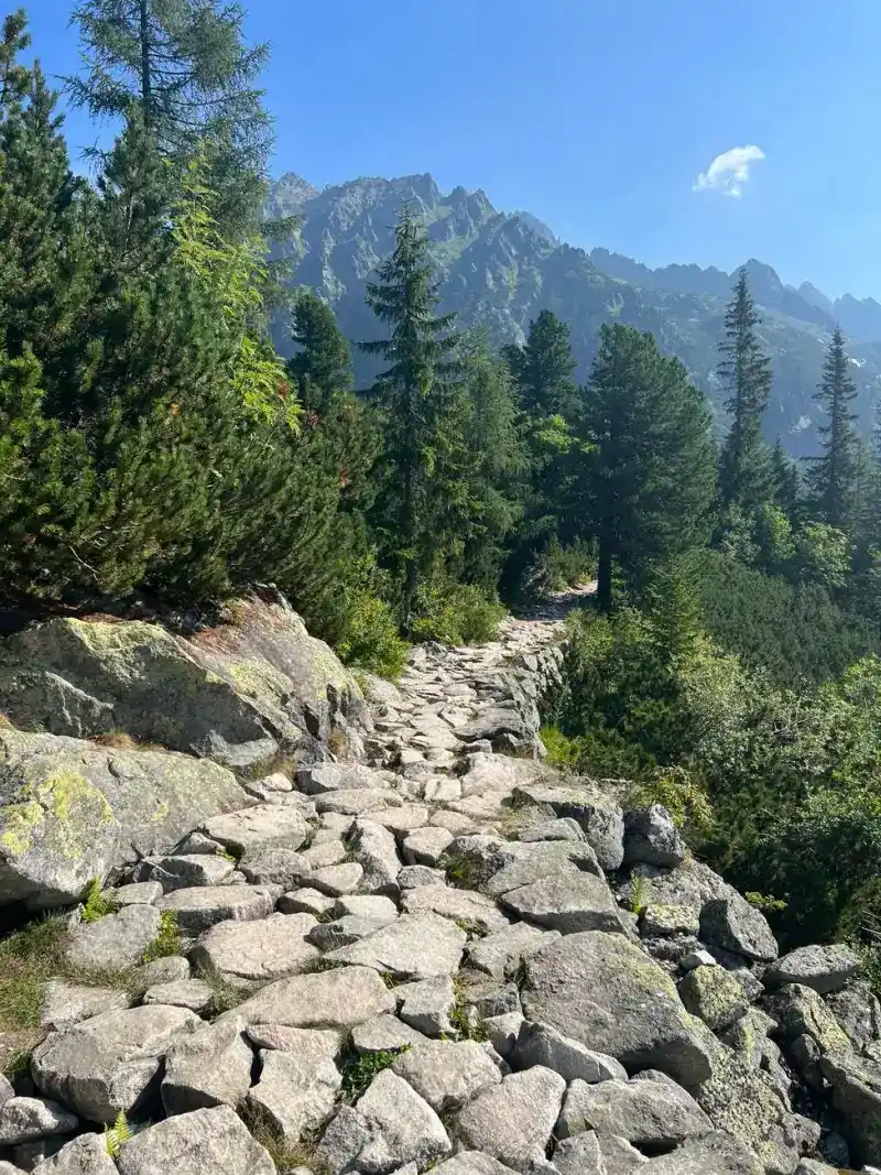
- Cemre Seyyah
- 16 Jul, 2026 05:38
Whispers of the Tatra: Unveiling the Soul of Poland's Winter Capital, Zakopane
The wind that sweeps across the northern slopes of the Tatra Mountains carries more than just the biting chill of a humid continental climate; it carries the echoes of centuries. To stand in Zakopane is to stand at the intersection of rugged wilderness and the refined spirit of the Podhale region. Known by the locals as Zokopane, this town is not merely a destination—it is the beating heart of Goral culture, a place where the altitude dictates the rhythm of life and the craggy silhouettes of the Tatras serve as constant, silent guardians. #travel #nature A Genesis in the Glades: From Humble Origins to Peak Popularity The chronicles of Zakopane begin in the 17th century, a time when the region was defined by a quiet glade known as Zakopisko. Records from 1676 paint a picture of a minuscule settlement of merely 43 souls, a stark contrast to the bustling hub it would eventually become. By 1818, the town began its slow transformation, housing 1,805 people within 340 homes. It was a frontier life, rooted in the earth and the mining and metallurgy industries that fueled the region of Galicia during the 19th century.As the 19th century waned, the transformation accelerated. The introduction of rail services on October 1, 1899, connecting Zakopane to Chabówka and eventually the provincial capital of Kraków, changed the town’s trajectory forever. What was once a narrow beaten path for miners traveling to Kuźnice—now the iconic Krupówki Street—became the spine of a burgeoning health resort. By the dawn of the 20th century, the town had successfully branded itself as a sanctuary for those seeking the healing properties of the mountain air. #history #mountainlife The Architecture of Identity: The Witkiewicz Legacy One cannot walk the streets of Zakopane without noticing the distinct, rhythmic patterns of its architecture. The Zakopane Style, pioneered by the visionary Stanisław Witkiewicz, is more than a design preference; it is a profound declaration of regional identity. Drawing inspiration from the folk motifs of the Carpathian Mountains, Witkiewicz created a visual language that defined the aesthetic of the Goral people. From the Villa Koliba (1892–93) to the intricate Chapel in Jaszczurówka (1904–07), these structures stand as wooden testaments to a bygone era. They are not merely buildings; they are artifacts of cultural resistance and pride. The Tatra Museum, itself a masterpiece of this style, houses the spirit of the region, while the Old Cemetery in Pęksowy Brzyzek offers a somber, beautiful final resting place for the artists, writers, and mountaineers who shaped the town’s soul. Walking through these sites, one feels the weight of history under their boots, a legacy preserved in timber and stone. The Crucible of War: Resilience in the High Peaks The story of Zakopane is not exclusively one of beauty and sport. During the dark chapter of World War II, the town became a focal point of strategic struggle. Following the German invasion in 1939, Zakopane was transformed into a site of immense suffering and coordinated resistance. The Villa Tadeusz, once a quiet retreat, became the setting for a grim meeting between the Soviet NKVD and the Nazi Gestapo to coordinate the pacification of Polish resistance. The human cost was staggering. Local leaders like mayor Zdzisław Adamczyk perished in the Katyn massacre, and thousands were displaced, including the tragic influx of Varsovians deported during the Warsaw Uprising. Yet, even in the shadow of the Kraków-Płaszów concentration camp’s labor efforts in the local stone quarries, the town retained its role as an underground staging point. In the immediate aftermath of 1945, the town’s humanity shone through the establishment of a home for Holocaust survivors—a poignant reminder of the necessity of healing in a post-war world. #history #resilience The Vertical Playground: Sports and High Altitudes For the modern traveler, Zakopane is synonymous with verticality. The town sits between 800 and 1,100 meters above sea level, but its ambition reaches much higher. The opening of the Wielka Krokiew ski jump in 1925 marked the town’s emergence as a premier sporting destination. This was followed by the engineering marvels of the Kasprowy Wierch cable car in 1936 and the Gubałówka funicular in 1938.The climate, characterized by the tundra-like conditions atop Kasprowy Wierch (1,987 meters), ensures that winter in Zakopane is a long, snowy affair. While the lowland areas of Poland shiver in grey, the "winter capital" often basks in sunlight, making it a haven for those drawn to the allure of the slopes. Yet, the mountain is a fickle host; the halny—a warm foehn wind—can arrive without warning, sending temperatures climbing beyond 10 °C in the depth of winter. It is this volatility, this sudden shift from biting frost to unexpected warmth, that keeps the mountaineer humble. #skiing #wintercapital Cultural Vibrancy and the Modern Nomad Zakopane’s culture is not static; it is a living, breathing entity. Since the late 19th century, it has attracted the luminaries of the Young Poland movement, artists who sought the raw, unfiltered inspiration of the Tatra landscape. Today, the town continues to draw those who appreciate the intersection of high-altitude trekking and deep-rooted tradition. Whether you are navigating the bustling intersection of Krupówki and Kościuszko Streets or finding solitude in the trails that lead away from the town center, the spirit of the Goral people is always present. They are the mountaineers who know every hidden crevice of the limestone peaks and the protectors of a heritage that survives in dance, music, and the very wooden beams of their homes. As you leave Zakopane, heading back toward the plains of Lesser Poland, you carry with you the scent of pine, the memory of the sharp mountain air, and the realization that some places are not just visited—they are experienced in the marrow of your bones. From the extreme records of its past—the bone-chilling -34.1 °C of 1956 to the peak summer warmth of 2013—Zakopane remains a town of extremes, a town of stories, and a town of peaks. #mountainculture #polandtravel#Zakopane #TatraMountains #PolandTravel #GoralCulture #WinterWonderland #MountainEscape
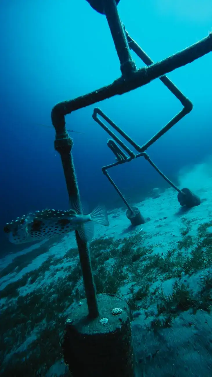
Dive Into a Hidden World: The Most Breathtaking Underwater Museums and Sculpture Parks The ocean has always been a canvas of mystery, but beneath its shimmering surface lies an even more extraordinary spectacle—underwater museums and sculpture parks. These submerged galleries are not just artistic marvels; they are sanctuaries for marine life, tools for conservation, and destinations that redefine travel. Imagine gliding through crystal-clear waters, surrounded by larger-than-life sculptures that tell stories of humanity, nature, and resilience. From the vibrant coral reefs of the Caribbean to the serene depths of the Mediterranean, these underwater museums offer an unparalleled fusion of art and ecology. Whether you're a seasoned diver, a snorkeling enthusiast, or an armchair traveler, this guide will take you on a journey to the most breathtaking submerged art installations in the world. In this article, we’ll explore the history, significance, and practicalities of visiting these underwater wonders. You’ll learn how these projects are transforming tourism, supporting marine ecosystems, and even combating climate change. We’ll also provide step-by-step guides on how to visit, including the best times to go, required certifications, and budget considerations. By the end, you’ll be inspired to dive into this hidden world and witness the magic for yourself.The Rise of Underwater Museums: A Fusion of Art and Conservation Underwater museums are a relatively recent phenomenon, born from the marriage of art, science, and environmental activism. The concept gained global attention in 2009 with the creation of MUSA (Museo Subacuático de Arte) in Cancún, Mexico, by British sculptor Jason deCaires Taylor. MUSA was the first large-scale underwater museum, featuring over 500 permanent life-sized sculptures designed to promote coral life and reduce pressure on natural reefs. Since then, the trend has exploded, with projects popping up in every corner of the globe, from the turquoise waters of the Maldives to the chilly depths of Norway’s fjords. The primary goal of these museums is conservation. Traditional coral reefs are under immense threat from climate change, overfishing, and pollution. By creating artificial reefs from pH-neutral materials like marine-grade concrete or recycled steel, underwater museums provide a substrate for coral polyps to attach and grow. Over time, these sculptures become encrusted with marine life, transforming into vibrant ecosystems. For example, MUSA’s sculptures are now home to over 500 species of fish and coral, making them one of the most biodiverse spots in the Mexican Caribbean. But these projects are more than just conservation tools—they are powerful statements about humanity’s relationship with nature. Many sculptures depict human figures in poses that evoke themes of climate change, migration, or cultural identity. Taylor’s The Silent Evolution in MUSA, for instance, features 400 life-sized human figures arranged in a spiral, symbolizing the collective impact of humanity on the planet. Similarly, Vicissitudes, another of Taylor’s works, shows a group of children holding hands, representing hope for future generations. These installations challenge viewers to reflect on their role in protecting the environment while offering a unique aesthetic experience. Underwater museums also play a crucial role in eco-tourism. By diverting tourists away from fragile natural reefs, they help reduce physical damage caused by divers and snorkelers. In places like Grenada’s Molinière-Beauséjour Marine Protected Area, where the Grenada Underwater Sculpture Park is located, the project has become a cornerstone of sustainable tourism. The park attracts thousands of visitors annually, generating revenue that funds local conservation efforts and education programs. This model has been replicated in other destinations, proving that art and ecology can coexist—and even thrive—together. As the movement grows, so does the diversity of projects. Some museums focus on education, like The Underwater Museum of Art (UMA) in Florida, which features sculptures designed to teach visitors about marine biology. Others, like Ocean Atlas in the Bahamas, are monumental in scale, with a 60-ton sculpture of a young girl holding up the ocean, symbolizing the fragility of marine ecosystems. Whether you’re drawn to the artistic, ecological, or educational aspects, there’s an underwater museum out there for you.Top 5 Must-Visit Underwater Museums and Sculpture Parks Around the World With so many incredible projects to choose from, it can be overwhelming to decide where to start. Below, we’ve curated a list of the top five underwater museums and sculpture parks, each offering a unique blend of art, adventure, and conservation. Whether you’re planning a bucket-list dive trip or simply dreaming of the experience, these destinations should be at the top of your list. 1. Museo Subacuático de Arte (MUSA), Cancún, Mexico Why Visit? MUSA is the granddaddy of underwater museums and remains one of the most impressive. Located in the Mesoamerican Barrier Reef System, the museum spans two galleries: Salvador Dalí Park and The Silent Evolution. The former features 12 surrealist sculptures inspired by Dalí’s work, while the latter houses Taylor’s iconic 400-figure installation. Together, they attract over 750,000 visitors annually, making it one of the most visited underwater museums in the world. What to Expect: The museum is accessible to both divers and snorkelers. The average depth is 8–12 meters (26–39 feet), making it suitable for beginners with an Open Water certification. The sculptures are arranged in a way that guides you through a narrative, from the surreal to the thought-provoking. The marine life here is spectacular, with schools of tropical fish, sea turtles, and even the occasional reef shark adding to the drama. Practical Tips:Best Time to Visit: November to April for calm seas and optimal visibility (up to 30 meters/100 feet). Certification Required: Open Water for snorkelers; Advanced Open Water recommended for divers. Cost: Snorkeling tours start at $80 USD; full-day dive packages with two dives cost around $150 USD. Local Operators: Phantom Divers and Dive Mike are highly rated for MUSA tours.2. Grenada Underwater Sculpture Park, Grenada Why Visit? This was the world’s first underwater sculpture park, established in 2006 by artist Jason deCaires Taylor and local marine biologists. Located in the Molinière-Beauséjour Marine Protected Area, the park features 65 sculptures spread across 800 square meters (8,600 square feet) of seabed. The sculptures are designed to attract marine life, and many have become completely encrusted with coral, creating a surreal blend of art and nature. What to Expect: The park is divided into two sections: The Gallery and The Garden. The Gallery is closer to shore and features human figures in various poses, while The Garden is a more naturalistic area with abstract forms. The depth ranges from 5 to 12 meters (16 to 39 feet), making it accessible to snorkelers and divers alike. The water is warm year-round, and visibility often exceeds 20 meters (65 feet). Practical Tips:Best Time to Visit: December to April for the best weather and visibility. Certification Required: None for snorkelers; Open Water for divers. Cost: Snorkeling tours start at $70 USD; dive packages with two dives cost around $130 USD. Local Operators: True Blue Bay Resort and Dive Grenada offer excellent tours.3. The Underwater Museum of Art (UMA), Florida, USA Why Visit? Located off the coast of Sarasota, UMA is the first underwater museum in the United States and a pioneer in marine education. The museum features 10 sculptures by artists like Kim Anderson and Rachel Binske, each designed to tell a story about Florida’s marine ecosystem. The project is part of a larger effort to restore the local reef, which has been severely damaged by hurricanes and coral bleaching. What to Expect: UMA is divided into three sections: The Garden, The Gallery, and The Sanctuary. The Garden is the shallowest area, perfect for snorkelers, while The Gallery and Sanctuary are deeper and require a scuba certification. The sculptures are made from marine-grade concrete and are designed to be colonized by coral, which has already begun to transform them into living art. Practical Tips:Best Time to Visit: April to October for warm water and calm conditions. Certification Required: None for snorkelers; Open Water for divers. Cost: Snorkeling tours start at $60 USD; dive packages cost around $120 USD. Local Operators: Sarasota Dive Company and Dive Sarasota are top choices.4. Ocean Atlas, Nassau, Bahamas Why Visit? Ocean Atlas is one of the most ambitious underwater sculptures ever created. Standing at 5 meters (16 feet) tall and weighing 60 tons, this colossal statue depicts a young girl holding up the ocean—a powerful metaphor for the fragility of marine ecosystems. Created by artist Jason deCaires Taylor, the sculpture is part of the UNEXSO’s Underwater Sculpture Park and is located near the famous Stuart Cove’s Dive Bahamas site. What to Expect: The sculpture is situated at a depth of 5 meters (16 feet), making it accessible to snorkelers and freedivers. The surrounding area is teeming with marine life, including reef sharks, eagle rays, and colorful tropical fish. The clarity of the water in the Bahamas is legendary, often exceeding 30 meters (100 feet), which makes for an unforgettable visual experience. Practical Tips:Best Time to Visit: November to May for the best weather and visibility. Certification Required: None for snorkelers; Open Water for divers. Cost: Snorkeling tours start at $90 USD; dive packages cost around $160 USD. Local Operators: Stuart Cove’s Dive Bahamas and UNEXSO are the go-to choices.5. The Underwater Museum of Cannes, France Why Visit? Nestled off the coast of Cannes, this underwater museum is a hidden gem in the Mediterranean. The museum features 34 sculptures by artist Marc Andre 2 Figueres, each designed to blend seamlessly with the natural environment. The project was created to promote marine conservation and has become a popular spot for divers and snorkelers alike. What to Expect: The sculptures are arranged in a circular formation at a depth of 8 to 12 meters (26 to 39 feet). The Mediterranean’s clear waters provide excellent visibility, and the sculptures are often surrounded by schools of fish and occasional sea turtles. The museum is also home to a variety of marine plants, adding to the natural beauty of the site. Practical Tips:Best Time to Visit: June to September for warm water and calm seas. Certification Required: None for snorkelers; Open Water for divers. Cost: Snorkeling tours start at €70; dive packages cost around €140. Local Operators: Cannes Dive Center and Plongee Azur offer excellent tours.👉 Continue Reading: Dive Into a Hidden World: The Most Breathtaking Underwater Museums and Sculpture Parks (Part 2)#UnderwaterArt #MarineConservation #EcoTourism #ScubaDiving #TravelWithPurpose Related InsightsVertical Dreams: Navigating the Dolomitic Majesty of Northern Italy Jalid ibn al-Walid: La Espada de Dios Mahoma: El Profeta del Islam{ "@context": "https://schema.org", "@type": "FAQPage", "mainEntity": [ { "@type": "Question", "name": "What is the main focus of Dive Into a Hidden World: The Most Breathtaking Underwater Museums and Sculpture Parks?", "acceptedAnswer": { "@type": "Answer", "text": "Discover the world’s most stunning underwater museums and sculpture parks where art meets marine life. From Mexico to the Maldives, explore how these submerged galleries are revolutionizing eco-tourism and conservation." } }, { "@type": "Question", "name": "Who authored the comprehensive guide on Dive Into a Hidden World: The Most Breathtaking Underwater Museums and Sculpture Parks?", "acceptedAnswer": { "@type": "Answer", "text": "This detailed article and its insights were carefully researched and authored by Wei Chen." } }, { "@type": "Question", "name": "Where can I find more related content about Travel?", "acceptedAnswer": { "@type": "Answer", "text": "You can explore more articles, detailed reviews, and similar insights by browsing the Related Insights section at the bottom of this article or visiting our dedicated Travel category page." } } ] }
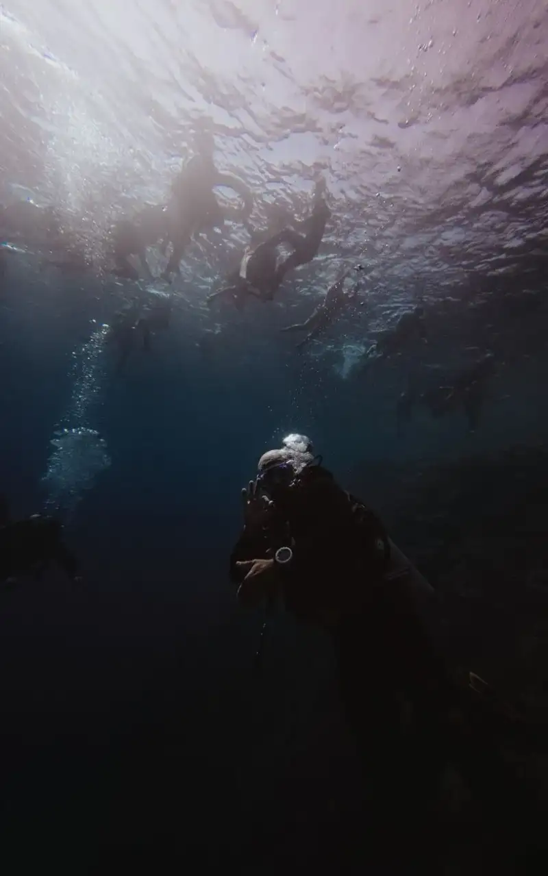
This is Part 2 of the series. Read Part 1 here.How to Plan Your Underwater Museum Adventure: A Step-by-Step Guide Visiting an underwater museum is an unforgettable experience, but it requires careful planning to ensure safety, comfort, and enjoyment. Whether you’re a seasoned diver or a first-time snorkeler, this step-by-step guide will help you prepare for your underwater adventure. From choosing the right destination to packing the essentials, we’ve got you covered. Step 1: Choose Your Destination and Timing The first step is selecting the right underwater museum for your interests and skill level. Consider factors like:Accessibility: Some museums, like Grenada’s, are perfect for beginners, while others, like MUSA’s deeper sections, require advanced certifications. Water Conditions: Research the best time of year for calm seas and optimal visibility. For example, the Caribbean is best from November to April, while the Mediterranean is ideal in summer. Marine Life: If you’re keen on seeing specific species, check which museums are known for attracting certain marine life. MUSA, for instance, is famous for its sea turtles and reef sharks.Step 2: Get Certified (If Necessary) If you plan to dive, you’ll need a scuba certification. Here’s a quick breakdown of the requirements:Open Water Certification: Required for most underwater museums. This certification allows you to dive to depths of 18 meters (60 feet). Advanced Open Water Certification: Recommended for museums with deeper sections or more challenging conditions. Specialty Courses: Some museums, like UMA, offer specialty courses in underwater photography or marine conservation, which can enhance your experience.If you’re not certified, many destinations offer discovery dives or resort courses that allow you to try scuba diving in a controlled environment. These are perfect for beginners who want to experience an underwater museum without committing to a full certification. Step 3: Book a Tour with a Reputable Operator Underwater museums are typically accessed through guided tours, which provide equipment, safety briefings, and local insights. When choosing a tour operator, look for:Safety Record: Check reviews and ratings on platforms like TripAdvisor or ScubaBoard. Group Size: Smaller groups often mean a more personalized experience. Equipment Quality: Ensure the operator provides well-maintained gear, including wetsuits, masks, and BCDs (buoyancy control devices). Environmental Practices: Choose operators that follow eco-friendly guidelines, such as avoiding touching coral or disturbing marine life.Step 4: Pack the Essentials Packing for an underwater museum adventure is similar to preparing for any dive or snorkeling trip, but there are a few key items to prioritize:Dive Certification Card: Bring your certification card if you’re diving. Dive Logbook: Some operators may ask to see your logbook, especially if you’re visiting deeper sections. Reef-Safe Sunscreen: Regular sunscreen can harm marine life, so opt for a mineral-based, reef-safe alternative. Wetsuit: Even in warm waters, a wetsuit can provide protection from the sun, jellyfish, and abrasions. Waterproof Camera: Capture the magic of your experience with a waterproof camera or GoPro. Dive Insurance: Consider purchasing dive insurance, especially if you’re traveling to remote locations.Step 5: Follow Safety and Eco-Friendly Guidelines Safety and environmental responsibility are paramount when visiting underwater museums. Here are some key guidelines to follow:Buoyancy Control: Master your buoyancy to avoid damaging coral or disturbing the sculptures. Many operators offer buoyancy workshops for beginners. No Touching: Resist the urge to touch the sculptures or marine life. Even gentle contact can damage delicate ecosystems. Stay with Your Group: Never wander off alone. Always follow your guide’s instructions. Respect Depth Limits: Adhere to the depth limits of your certification and the tour operator’s guidelines. Leave No Trace: Take all your trash with you, including food wrappers and plastic bottles.Step 6: Capture the Experience Underwater photography is a fantastic way to document your adventure and share it with others. Here are some tips for capturing stunning images:Use a Waterproof Camera: Invest in a good-quality waterproof camera or a GoPro with an underwater housing. Get Close: The closer you are to the subject, the clearer your photos will be. Use your camera’s macro mode for small details. Use Natural Light: Avoid using the camera’s flash, as it can create backscatter (floating particles in the water). Instead, rely on natural light or a video light. Practice Patience: Underwater photography takes time. Don’t rush; take your time to frame the perfect shot.Step 7: Reflect and Share After your dive or snorkeling adventure, take some time to reflect on the experience. Consider the following questions:How did the underwater museum change your perspective on art or conservation? What did you learn about marine ecosystems and the threats they face? How can you support conservation efforts in your own community?Sharing your experience can inspire others to visit these incredible sites and support sustainable tourism. Post your photos on social media with relevant hashtags, write a blog post, or even volunteer with a local marine conservation organization.The Environmental and Economic Impact of Underwater Museums Underwater museums are more than just tourist attractions—they are powerful tools for environmental conservation and economic development. By analyzing their impact, we can see how these projects are transforming coastal communities and marine ecosystems. Below, we break down the key benefits and challenges of underwater museums, supported by real-world data and case studies. Environmental BenefitsCoral Reef RestorationUnderwater museums provide a substrate for coral polyps to attach and grow, helping to restore damaged reefs. For example, MUSA’s sculptures are now 50% covered in coral, providing habitat for over 500 species of fish and invertebrates. A study by the University of Exeter found that artificial reefs can increase fish biomass by up to 200% compared to natural reefs in the same area.Reduction of Overfishing and PollutionBy attracting tourists to underwater museums, these projects divert pressure away from natural reefs, reducing physical damage from fishing gear and pollution. In Grenada, the Underwater Sculpture Park has become a focal point for marine education, with local schools incorporating the park into their curriculum.Climate Change MitigationCoral reefs are vital carbon sinks, absorbing CO2 from the atmosphere. By restoring reefs, underwater museums contribute to climate change mitigation. The Global Coral Reef Monitoring Network estimates that healthy coral reefs can sequester up to 1 kg of carbon per square meter per year.Economic BenefitsBoosting Eco-TourismUnderwater museums generate significant revenue for local communities. In Cancún, MUSA contributes an estimated $5 million USD annually to the local economy through tourism. A report by The Nature Conservancy found that eco-tourism can generate up to 10 times more revenue per hectare than traditional tourism.Job CreationThese projects create jobs in tourism, conservation, and education. In the Bahamas, the Ocean Atlas sculpture has led to the creation of dive guide positions and marine conservation roles. A study by the World Travel & Tourism Council estimates that the travel and tourism sector employs 1 in 10 people globally.Funding for ConservationRevenue from underwater museums often funds local conservation efforts. For example, Grenada’s sculpture park generates funds for the Molinière-Beauséjour Marine Protected Area, which supports research and habitat restoration.Challenges and CriticismsHigh Initial CostsCreating an underwater museum is expensive, with costs ranging from $100,000 to over $1 million USD, depending on the scale and materials used. Funding often comes from a mix of public and private sources, including grants, donations, and tourism revenue.Maintenance and MonitoringUnderwater museums require ongoing maintenance to ensure the sculptures remain structurally sound and continue to support marine life. Regular monitoring is needed to assess the health of the reef and the impact of tourism. In some cases, this requires partnerships with universities or research institutions.Potential for Over-TourismWhile underwater museums can reduce pressure on natural reefs, they can also become victims of their own success. Over-tourism can lead to damage from careless divers or snorkelers. To mitigate this, many museums implement visitor limits, guided tours, and educational programs to promote responsible tourism.Case Study: MUSA’s Success Story MUSA is a prime example of how underwater museums can drive conservation and economic growth. Since its inception in 2009, the museum has:Attracted over 750,000 visitors. Generated over $5 million USD in annual tourism revenue. Supported the growth of over 500 species of fish and coral. Inspired similar projects around the world, including Grenada’s sculpture park and the Bahamas’ Ocean Atlas.The success of MUSA has led to increased investment in underwater museums, with new projects planned in Indonesia, the Philippines, and the United Arab Emirates.Underwater Museum Location Year Established Number of Sculptures Estimated Annual Visitors Estimated Annual Revenue (USD)MUSA Cancún, Mexico 2009 500+ 750,000 $5,000,000Grenada Underwater Sculpture Park Grenada 2006 65 20,000 $1,500,000UMA Florida, USA 2018 10 15,000 $800,000Ocean Atlas Nassau, Bahamas 2014 1 50,000 $2,000,000Underwater Museum of Cannes Cannes, France 2015 34 10,000 $500,000Table: Key metrics for the world’s top underwater museums.Conclusion: Dive In and Make a Difference Underwater museums and sculpture parks are a testament to the power of art to inspire change. They offer a unique blend of adventure, education, and conservation, inviting us to explore the hidden beauty of the ocean while reminding us of our responsibility to protect it. Whether you’re drawn to the surreal sculptures of MUSA, the educational focus of UMA, or the monumental scale of Ocean Atlas, these destinations promise an experience that is as thought-provoking as it is breathtaking. As you plan your underwater adventure, remember that your visit supports conservation efforts and sustainable tourism. By choosing eco-friendly operators, respecting marine life, and sharing your experience, you become part of a global movement to preserve our oceans for future generations. So, take the plunge—literally—and discover the magic that lies beneath the waves. The ocean is not just a place to visit; it’s a world to protect. Underwater museums give us a glimpse of its wonders while offering a path forward for conservation. Whether you’re a diver, a snorkeler, or an armchair traveler, these submerged galleries are a call to action. So, grab your wetsuit, pack your camera, and get ready to dive into a world where art and nature collide in the most extraordinary way.#UnderwaterArt #MarineConservation #EcoTourism #ScubaDiving #TravelWithPurpose Related InsightsKamchatka Volcanoes The Twenty Million Dollar View: A History of Humanity's Most Exclusive Destination Beneath the City of Light: Descending into the Empire of the Dead in Paris{ "@context": "https://schema.org", "@type": "FAQPage", "mainEntity": [ { "@type": "Question", "name": "What is the main focus of Dive Into a Hidden World: The Most Breathtaking Underwater Museums and Sculpture Parks (Part 2)?", "acceptedAnswer": { "@type": "Answer", "text": "Discover the world’s most stunning underwater museums and sculpture parks where art meets marine life. From Mexico to the Maldives, explore how these submerged galleries are revolutionizing eco-tourism and conservation." } }, { "@type": "Question", "name": "Who authored the comprehensive guide on Dive Into a Hidden World: The Most Breathtaking Underwater Museums and Sculpture Parks (Part 2)?", "acceptedAnswer": { "@type": "Answer", "text": "This detailed article and its insights were carefully researched and authored by Wei Chen." } }, { "@type": "Question", "name": "Where can I find more related content about Travel?", "acceptedAnswer": { "@type": "Answer", "text": "You can explore more articles, detailed reviews, and similar insights by browsing the Related Insights section at the bottom of this article or visiting our dedicated Travel category page." } } ] }
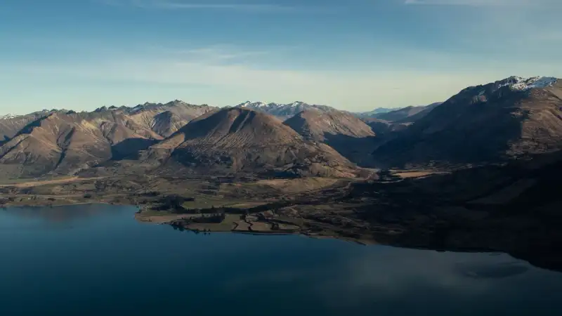
Lake Tekapo, ein atemberaubendes Gewässer in Neuseelands Südinsel, bietet eine einzigartige Kombination aus Natur, Kultur und Abenteuer. Der zweitgrößte von drei Seen, die parallel zur Nordkante des Mackenzie-Beckens verlaufen, deckt eine Fläche von 83 km² ab und liegt auf einer Höhe von 710 Metern über dem Meeresspiegel. In Māori-Kultur Der Name "Tekapo" ist eine Falschschreibung des Māori-Namens Takapō, was "in Eile über Nacht verlassen" bedeutet. Im Jahr 2021 kündigte der Mackenzie District Council an, dass er bei der Bezugnahme auf den Lake Tekapo künftig die doppelten Namen Tekapo und Takapō verwenden wird. Nach der Mythologie der Ngāi Tahu wurde der Lake Tekapo von dem Waitaha-Entdecker Rākaihautū mit seiner polynesischen Grabstange, die Tūwhakaroria genannt wurde, gegraben. Nach seiner Ankunft im Uruao-Waka in Nelson teilte Rākaihautū sein Volk in zwei Gruppen auf. Rākaihautū führte seine Gruppe durch die Mitte der Insel, wobei er die Südinsel-Seen grub. Sein Sohn, Rakihouia, führte die andere Gruppe entlang der Ostküste der Südinsel.Geografie Der See deckt eine Fläche von 83 km² ab und liegt auf einer Höhe von 710 Metern über dem Meeresspiegel. Er wird an seinem nördlichen Ende von den Flüssen Godley River und Macaulay River gespeist, die ihre Quellen in den Südalpen haben. Das Schmelzwasser aus den Südalpen wird durch den glazialen Schlamm in ein helles Türkis getaucht, was dem Lake Tekapo seine charakteristische Farbe gibt. Östlich des Lake Tekapo liegt der Two Thumb Range mit dem Mount Toby, dem Braun Elwert Peak, dem Dobson Peak und dem Mount Maude. Auf der westlichen Seite des Lake Tekapo liegt der Mount John, der dem Ort am nächsten ist, gefolgt von dem Lake Alexandrina weiter nördlich und dem Mistake Peak, der sich Richtung See befindet.Klima Lake Tekapo ist einer der sonnigsten Orte in Neuseeland, mit durchschnittlich mehr als 2.400 Sonnenstunden pro Jahr. Dark-Sky-Reservat Lake Tekapo und das umliegende Gebiet wurden 2012 als Aoraki Mackenzie International Dark Sky Reserve ausgewiesen. Das Reservat umfasst eine Fläche von 4.367 km² und ist damit das größte Dark-Sky-Reservat in der südlichen Hemisphäre. Die Anerkennung als Dark-Sky-Reservat bedeutet, dass die Nachthimmel in diesem Gebiet fast vollständig frei von Lichtverschmutzung sind und ideal für Sternenbeobachtung sind.#Hashtags: #Reisen #Neuseeland #LakeTekapo #SüdinselNeuseeland #MāoriKultur #DarkSkyReservat #Sternenbeobachtung #Natur #Abenteuer Related InsightsArctic Circle Digital Nomadism: Building Connectivity in Greenland's Remote Towns Mezquita-Catedral de Córdoba: El Corazón Omeya Le Cattedrali Sotterranee di Puglia: Un Viaggio Intimo nelle Città Rupestri delle Gravine{ "@context": "https://schema.org", "@type": "FAQPage", "mainEntity": [ { "@type": "Question", "name": "What is the main focus of 'Lake Tekapo: Ein Juwel in Neuseelands Südinsel'?", "acceptedAnswer": { "@type": "Answer", "text": "Lake Tekapo, ein atemberaubendes Gewässer in Neuseelands Südinsel, bietet eine einzigartige Kombination aus Natur, Kultur und Abenteuer." } }, { "@type": "Question", "name": "Who authored the comprehensive guide on 'Lake Tekapo: Ein Juwel in Neuseelands Südinsel'?", "acceptedAnswer": { "@type": "Answer", "text": "This detailed article and its insights were carefully researched and authored by Hans Müller." } }, { "@type": "Question", "name": "Where can I find more related content about Travel?", "acceptedAnswer": { "@type": "Answer", "text": "You can explore more articles, detailed reviews, and similar insights by browsing the Related Insights section at the bottom of this article or visiting our dedicated Travel category page." } } ] }
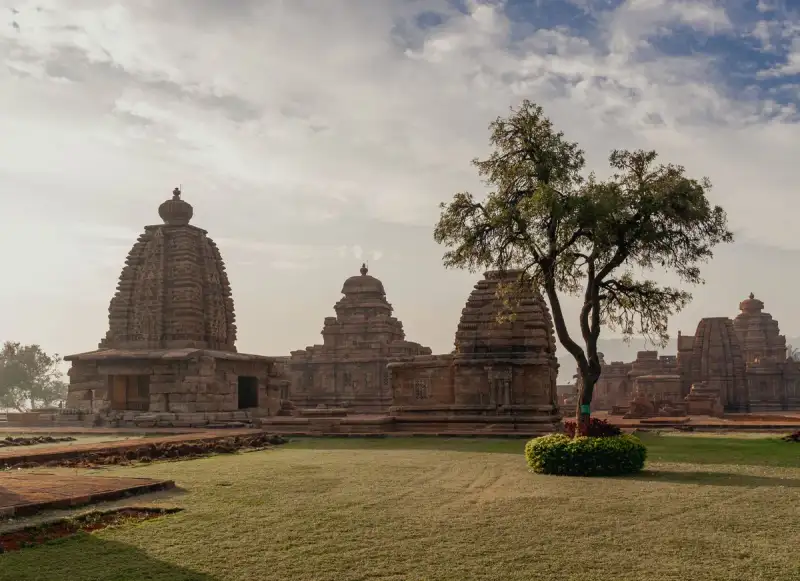

Luang Prabang, the capital of Luang Prabang Province in north-central Laos, is a city that embodies the essence of Lao culture, history, and natural beauty. The city's name, meaning "Royal Buddha Image," is derived from the Phra Bang, a statue symbolizing Lao sovereignty. Designated a UNESCO World Heritage Site in 1995, Luang Prabang is a treasure trove of Lao architecture, European colonial buildings, and over 30 Buddhist temples. History of Luang Prabang The city's history dates back to the 6th century, when the Mon peoples created the Dvaravati kingdoms. By the 8th century, the Mon had pushed north to create city states in Fa Daet, Sri Gotapura, Muang Sua, and Chantaburi. In the 8th century CE, Sri Gotapura controlled trade throughout the middle Mekong region. The city states introduced Theravada Buddhism from Sri Lankan missionaries throughout the region.In 1238, an internal uprising in the Khmer outpost of Sukhothai expelled the Khmer overlords. Xieng Dong Xieng Thong, the precursor to Luang Prabang, experienced a period of Khmer suzerainty under Jayavarman VII from 1185 to 1191. In 1353, Xieng Dong Xieng Thong became the capital of the Lan Xang kingdom. The city's name was changed to Luangphabang, named after the Buddha image, and it was used to spread Theravada Buddhism in the kingdom.Tourism in Luang Prabang Luang Prabang is a popular tourist destination, with numerous natural and cultural attractions. The Kuang Si Falls, Tat Sae Waterfalls, and Pak Ou Caves are some of the city's most popular natural tourism sites. Visitors can also explore the city's many Buddhist temples, including the Haw Kham Royal Palace Museum and the Wat Xieng Thong temple.The city's main street is lined with smaller wats, such as Wat Hosian Voravihane, and every morning at sunrise, monks walk in a procession through the streets accepting alms offered by local residents. Visitors can also participate in traditional Lao activities, such as elephant riding and making crafts.Gastronomy in Luang Prabang Luang Prabang is renowned for its delicious local cuisine, which includes dishes such as Or lam, Luang Prabang sausage, mokpa (steamed fish), and Kaipen made from Mekong River moss. Visitors can sample these dishes at local restaurants and markets, such as the night market, which offers a wide range of Lao street food.Transportation in Luang Prabang Luang Prabang is served by Route 13, which connects to Vang Vieng and Vientiane to the south, and to Boten in the north. The road is paved, and daily buses run from Vientiane to Luang Prabang, taking 11–13 hours. Since 2014, a road connects Kasi (near Vang Vieng) to Luang Prabang, allowing the trip to be made in about 3 hours.In December 2021, Luang Prabang was connected to the Vientiane–Boten railway, which parallels Route 13 and runs from Boten at the Chinese border in the north to Vientiane in the south. The complete journey takes less than 3 hours by train instead of 3 days by road.#Travel #LuangPrabang #LaosTourism #BuddhistTemples #UNESCOWorldHeritageSite #LaoCulture #NaturalBeauty #History #Gastronomy #Transportation Related InsightsWhispers in the Verdant Depths: Unearthing Japan's Secret 'Shizen no Koe' Moss Worlds Villa Adriana: Il Rifugio Imperiale a Tivoli Grüne Pfade: Wie nachhaltiger Tourismus das Herz der Erde bewahrt{ "@context": "https://schema.org", "@type": "FAQPage", "mainEntity": [ { "@type": "Question", "name": "What is the main focus of Discover Luang Prabang's Hidden Gems?", "acceptedAnswer": { "@type": "Answer", "text": "Delve into the enchanting world of Luang Prabang, a city steeped in history, culture, and natural beauty, and uncover its secrets." } }, { "@type": "Question", "name": "Who authored the comprehensive guide on Discover Luang Prabang's Hidden Gems?", "acceptedAnswer": { "@type": "Answer", "text": "This detailed article and its insights were carefully researched and authored by John Explorer." } }, { "@type": "Question", "name": "Where can I find more related content about Travel?", "acceptedAnswer": { "@type": "Answer", "text": "You can explore more articles, detailed reviews, and similar insights by browsing the Related Insights section at the bottom of this article or visiting our dedicated Travel category page." } } ] }

-
 Pierre Dubois
 - 15 Jul, 2026 02:04
Sydney Opera House: The Architectural Icon that Redefined Art and Innovation
A Silhouette Tearing the Horizon: The Call of Concrete Shells In the heart of Sydney, where the Pacific Ocean embraces the land with an almost violent passion, stands a structure that defies the laws of gravity and imagination. The Sydney Opera House is not just a building: it is an architectural statement, a cry of artistic freedom straight out of the dreams of one man, Jørn Utzon, and the hands of a team of Australian visionaries. Its white concrete shells, like sails filled by an invisible wind or the petals of an exotic flower ready to bloom, captivate the eye long before one steps through its doors. Every curve, every angle, every play of light on its surfaces seems to tell a story – that of boundless ambition, a quest for excellence, and a battle against the limits of the possible. But how could a simple architectural competition, launched in 1955, give birth to one of the most photographed monuments in the world? Why did this place, now a UNESCO World Heritage site, almost never see the light of day? And above all, what lies behind these "shells" that have caused so much ink and tears to flow?The Roots of a Dream: When Music Needs a Stage To understand the emergence of the Sydney Opera House, we must go back to the 1940s, in a Sydney still marked by post-war austerity. At the time, the city had no venue dedicated to large lyrical or symphonic productions. Orchestras and operas had to make do with the Sydney Town Hall, a historic building but unsuited to the nation's growing cultural ambitions. Enter Eugene Goossens, a visionary conductor and director of the New South Wales State Conservatorium of Music. In 1948, he sounded the alarm: "Sydney needs an opera house!" A seemingly harmless phrase that would trigger a revolution. Goossens didn't just advocate for a new building. He imagined a place capable of hosting monumental works, symphonic concerts, ballets, and even conferences. In 1954, he finally convinced the Premier of New South Wales, Joseph Cahill, to launch an international competition to build an opera house. The chosen site? Bennelong Point, a rocky peninsula between Sydney Harbour and the Royal Botanic Garden. A bold choice, as at the time, the location was merely a promontory with no major infrastructure. Yet Goossens was right: this spot, bathed by the turquoise waters of the harbor, offered breathtaking views of the Sydney Harbour Bridge and exceptional natural acoustics.The Competition That Changed Everything: When a Dane Stole the Show On September 13, 1955, the Australian government officially launched the competition. The criteria were clear: a large 3,000-seat auditorium, a small 1,200-seat auditorium, and the flexibility to host operas, concerts, conferences, and ballets. The prize? A modest sum of 5,000 Australian pounds – a godsend for architects worldwide. However, what was supposed to be a simple competition would become one of the most fascinating episodes in the history of architecture. Out of 233 projects received from 32 countries, only one would make history: that of Jørn Utzon, a 38-year-old Danish architect unknown to the general public. His design? A series of white concrete shells, evoking boat sails, clouds, or even flower petals. An organic, almost biological shape, completely breaking with the rigid straight lines of modern architecture of the time. For the jury, composed of eminent experts including Finnish-American architect Eero Saarinen, it was obvious: Utzon had captured the very essence of what an opera house should be – both monumental and poetic.On January 29, 1957, the announcement was made: Utzon was the winner. Yet, behind this victory lay the seeds of a future nightmare. For while the design was revolutionary, its execution would prove far more complex than anticipated.The Battle of the Shells: When Concrete Resists Started in 1958 under Utzon's direction, the construction of the Sydney Opera House quickly became a logistical nightmare. The technical challenges were immense:Concrete shells: Utzon wanted shell-like structures, but no one knew how to build them. Australian engineers, accustomed to straight lines, had to invent new methods to pour concrete into perfect curves. An exploding budget: The initial cost, estimated at 7 million Australian dollars, would ultimately reach 102 million – a colossal sum at the time. Unrealistic deadlines: Utzon planned for a 4-year construction. It took 14. Political conflicts: The New South Wales government, under pressure, eventually fired Utzon in 1966, leaving him to depart Australia without even attending the inauguration.Yet, despite these obstacles, Australian workers and engineers accomplished the impossible. The shells, made up of 2,194 precast concrete panels weighing up to 15 tons each, were assembled with surgical precision. The 1,056,006 tiles covering the shells – a mix of glossy white and matte cream – were manufactured in Sweden by Höganäs AB, a company specializing in tiles for the paper industry. Even the materials used for the facades, such as pink Tarana granite, were chosen with meticulous care.Architecture That Defies the Laws of Physics Today, the Sydney Opera House spans 1.8 hectares, with a length of 183 meters and a width of 120 meters at its widest point. Its shells, peaking at 67 meters above sea level, house six main performance venues, each with unique acoustics and varying capacity. The Venues: A Sensory Journey Through the ArtsThe Concert Hall: With 2,679 seats, it is the beating heart of the Sydney Opera House. Here, the Sydney Symphony Orchestra resonates, along with classical music concerts, jazz, and even popular events. The crown jewel of this hall? The Grand Organ, the largest mechanical tracker-action organ in the world, with over 10,000 pipes. Imagine the smell of aged wood, the thrill of the first notes of a Tchaikovsky concerto, and the echo reverberating beneath the sculpted concrete vaults.The Joan Sutherland Theatre: Formerly the Opera Theatre, it is the temple of opera and ballet. Seating 1,507, it hosts Opera Australia and The Australian Ballet. The name pays tribute to Australian soprano Joan Sutherland, one of the greatest voices of the 20th century.The Drama Theatre: More intimate with 544 seats, it is dedicated to contemporary theater and productions by the Sydney Theatre Company.The Playhouse and the Studio: Flexible spaces designed for experimental performances, readings, or dance shows.The Utzon Room: A versatile room, named in honor of the architect, ideal for receptions, conferences, or small chamber music concerts.The Yallamundi Rooms: Modular spaces for private events, such as weddings or corporate conferences.A Place to Live: More Than an Opera House, An Experience The Sydney Opera House is not just a building: it's a living space. Every year, over 1.4 million people attend one of the 1,800 performances offered. But the audience isn't limited to music lovers. With over 10 million visitors annually, the Opera House is one of Australia's most popular tourist attractions. Guided tours, attracting around 350,000 people each year, allow visitors to discover the secrets behind the scenes of this monument. Behind the Scenes of a MasterpieceThe revolving stage of the Joan Sutherland Theatre: A technical feat allowing sets to be changed in record time. Perfect acoustics: Thanks to materials like Australian white birch plywood and brush box wood, sounds resonate with exceptional clarity. Outdoor spaces: The panoramic terrace and monumental stairs are often used for outdoor events, such as film screenings or free concerts.Visiting the Sydney Opera House: Practical Tips for an Unforgettable Experience If you are planning a trip to Sydney, a visit to the Sydney Opera House is a must. Here are some tips to make the most of your experience: 1. Attend a Performance Nothing beats the thrill of experiencing a concert or opera in this legendary venue. Book your tickets in advance, especially for major productions like La Traviata or Sydney Symphony Orchestra concerts. 2. Take a Guided Tour Guided tours last about an hour and allow you to discover the backstage areas, the history of the building, and its most secret anecdotes. Don't miss the Utzon Room, where the architect left his mark. 3. Enjoy a Meal with a View The Sydney Opera House is home to several restaurants, including the Opera Bar, located right in front with breathtaking views of the harbor. Perfect for a romantic lunch or dinner. 4. Explore the Outdoor Spaces The monumental stairs and panoramic terrace offer spectacular views of the harbor and the Sydney Harbour Bridge. It's also a great spot for picnics or photo sessions. 5. Attend a Free Event During the summer months, the Sydney Opera House often hosts free outdoor concerts. An excellent way to discover the acoustics of the venue without spending a dime.Sydney Opera House: A Work of Art that Speaks to the World The Sydney Opera House is much more than a building: it is a total work of art, a perfect fusion of architecture, music, and history. It embodies Australia's spirit of innovation, a country that managed to turn its dreams into reality despite the challenges. Whether you are an architecture enthusiast, a music lover, or simply a traveler in search of beauty, the Sydney Opera House will amaze you. Its white concrete shells, its resonant halls, and its tumultuous history make it a unique place in the world. So, the next time you hear about Sydney, remember: behind this dynamic and modern city lies an architectural pearl, a masterpiece that forever changed the face of art and culture.#SydneyOperaHouse #IconicArchitecture #UNESCOWorldHeritage #PerformingArts #TravelAustralia #ExploreSydney #AustralianCulture Related InsightsEin Tag in München Whispers of the Tatra: Unveiling the Soul of Poland's Winter Capital, Zakopane Karakoram Highway Road Trip – Part 01: Navigating Pakistan’s Northern Passes{ "@context": "https://schema.org", "@type": "FAQPage", "mainEntity": [ { "@type": "Question", "name": "What is the main focus of Sydney Opera House: The Architectural Icon that Redefined Art and Innovation?", "acceptedAnswer": { "@type": "Answer", "text": "Dive into the history, revolutionary architecture, and living legacy of the Sydney Opera House, the jewel of Sydney and a 20th-century masterpiece." } }, { "@type": "Question", "name": "Who authored the comprehensive guide on Sydney Opera House: The Architectural Icon that Redefined Art and Innovation?", "acceptedAnswer": { "@type": "Answer", "text": "This detailed article and its insights were carefully researched and authored by Pierre Dubois." } }, { "@type": "Question", "name": "Where can I find more related content about Travel?", "acceptedAnswer": { "@type": "Answer", "text": "You can explore more articles, detailed reviews, and similar insights by browsing the Related Insights section at the bottom of this article or visiting our dedicated Travel category page." } } ] }
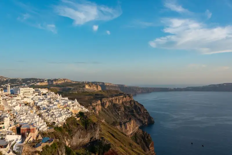
-
 Marco Rossi
 - 14 Jul, 2026 22:24
Santorini: L'Isola Nata dal Fuoco, Custode di Segreti Millenari e Bellezza Ineffabile
Quando il sole scende sull'Egeo, tingendo il cielo di sfumature incandescenti che si riflettono sulle cupole azzurre e sulle candide pareti dei villaggi aggrappati alla roccia, Santorini non è semplicemente un'isola; è un'epifania. Non è soltanto una destinazione da cartolina, ma un palcoscenico millenario dove la forza primordiale della terra e l'ingegno umano hanno tessuto una storia di distruzione e rinascita, di splendore e mistero. Sorge come un gioiello spezzato dal mare, l'ultimo anello di una catena vulcanica che respira ancora, la sua bellezza quasi dolorosa, scolpita da un passato tumultuoso che sussurra leggende di civiltà perdute e di cataclismi titanici. Questa terra, ufficialmente conosciuta come Thira o Thera, è molto più di una singola isola. È il cuore pulsante di un piccolo arcipelago circolare, il frutto drammatico e magnifico della caldera di Santorini, situato a circa 200 km a sud-est della terraferma greca, nel cuore dell'Egeo meridionale. La sua superficie, di circa 73 km², ne fa la più grande delle isole abitate che compongono la municipalità di Santorini, che include anche Therasia, le isole disabitate di Nea Kameni, Palaia Kameni, Aspronisi, Anydros e Christiana, per un'area totale di 90 km². Membro più meridionale dell'incantevole gruppo delle Cicladi, con una popolazione censita di 15.480 anime nel 2021, Santorini è parte integrante dell'unità regionale di Thira, un nome che risuona con la sua storia più antica. Un Cuore Ardente Sotto la Superficie: La Genesi Vulcanica di Santorini Santorini non è solo bella; è viva, geologicamente pulsante. Rappresenta il centro vulcanico più attivo dell'Arco Vulcanico del Sud Egeo, una cicatrice terrestre lunga circa 500 km e larga tra i 20 e i 40 km. L'attività vulcanica in questa regione ha radici profonde, risalenti a circa 3-4 milioni di anni fa. Tuttavia, è su Thera che il vulcanismo ha iniziato a manifestarsi in modo più distintivo circa 2 milioni di anni fa, con l'estrusione di lave dacitiche da bocche vulcaniche nei pressi dell'attuale Akrotiri. Questa storia geologica culminò in uno degli eventi più catastrofici e formativi della storia registrata: l'eruzione minoica, avvenuta circa 3.600 anni fa. Questo cataclisma, di proporzioni inaudite, ha ridefinito non solo la geografia dell'isola, ma anche il corso della storia umana e la genesi di miti senza tempo. L'esplosione lasciò un'enorme caldera sommersa dalle acque, circondata da depositi di cenere vulcanica profondi centinaia di metri, una testimonianza silente della sua furia. È questa eruzione colossale che, secondo alcuni studiosi, potrebbe essere la vera fonte della leggenda della civiltà perduta di Atlantide, un'eco di una memoria ancestrale di una terra inghiottita dal mare. Per settimane, l'isola fu scossa da un'eruzione che generò anche massicce onde di tsunami, il cui impatto si propagò per tutto l'Egeo, lasciando un'eredità indelebile. La caldera stessa è un monumento naturale a questo evento, un anfiteatro sbalorditivo dove le pareti scoscese rivelano strati su strati di storia geologica, dal nero basalto alla pomice biancastra, un promemoria costante della potenza creatrice e distruttiva del pianeta.L'Identità Poliedrica: Un Mosaico di Nomi Attraverso i Secoli L'anima di Santorini è tanto complessa quanto la sua geologia e la sua storia, e questa complessità si riflette nella moltitudine di nomi che ha portato nel corso dei millenni. Oggi è conosciuta popolarmente come Santorini, un nome che è una contrazione di "Saint Irene" (Santa Irene), derivato da un'antica chiesa nel villaggio di Perissa. Questa denominazione di influenza veneziana si affermò almeno dalla metà del XII secolo, con la prima menzione da parte del geografo Muhammad al-Idrisi intorno al 1154. Ma prima di "Santorini", prima ancora di "Thira", gli antichi le attribuivano epiteti che ne celebravano l'essenza. Era nota come "Kallístē" (Καλλίστη), che significa "la più bella", un nome che descriveva perfettamente la sua estetica mozzafiato anche migliaia di anni fa. E, secondo una tradizione moderna, era chiamata anche "Strongýlē" (Στρογγύλη), "la circolare", in riferimento alla sua forma originaria prima dell'eruzione minoica che la plasmò nella mezzaluna che vediamo oggi. L'antico nome "Thera", in onore di Theras, il leader spartano che la colonizzò e le diede il proprio nome, fu ufficialmente ripristinato nel XIX secolo per l'isola e la sua città principale, ma il nome colloquiale Santorini ha continuato a prosperare nella lingua popolare, radicandosi nell'immaginario collettivo come il suo appellativo più iconico. Questi nomi non sono semplici etichette; sono strati di storia, culture e percezioni che si sono sovrapposti, ognuno rivelando una sfaccettatura diversa di questa terra straordinaria. Akrotiri: La Pompei Minoica Sepolta Sotto la Cenere La storia di Santorini non è solo geologica, ma profondamente umana. L'isola fu teatro di una delle più grandi fioriture culturali dell'età del Bronzo, la civiltà minoica, la cui esistenza fu drammaticamente interrotta dall'eruzione di Thera. È proprio qui, nel sito di Akrotiri, che si trova la testimonianza più vivida e commovente di questa civiltà. A partire dal 1967, gli scavi diretti da Spyridon Marinatos hanno portato alla luce una città minoica straordinariamente conservata, rendendo Thera (sebbene non fosse conosciuta con questo nome all'epoca) il sito minoico più famoso al di fuori di Creta, la patria di questa cultura enigmatica. Ciò che è emerso è molto più di un semplice insediamento. Solo la punta meridionale di una vasta città è stata scoperta, eppure ha rivelato complessi di edifici a più livelli, strade lastricate e piazze, con resti di muri che si ergono fino a otto metri di altezza. Tutto questo è stato preservato, sigillato nella cenere solidificata della famosa eruzione, in un modo che evoca un'antica Pompei dell'Egeo. Akrotiri non era un complesso palaziale come quelli di Creta, né un semplice agglomerato di magazzini commerciali. La sua eccellente muratura e i suoi raffinati affreschi rivelano una comunità complessa e sofisticata. La scoperta di un laboratorio di telai suggerisce una tessitura organizzata per l'esportazione, indicando una rete commerciale ampia e prospera. Questa civiltà dell'età del Bronzo fiorì tra il 3000 e il 2000 a.C., raggiungendo il suo apice nel periodo tra il 2000 e il 1630 a.C. Molte delle case di Akrotiri erano strutture imponenti, alcune alte fino a tre piani. Le sue strade, piazze e mura, talvolta alte otto metri, indicavano che si trattava di una città di grande importanza. Gran parte è stata preservata negli strati di materiale eruttivo. Le case contengono enormi giare di ceramica per la conservazione (pithoi), macine e vasellame, e molte scale di pietra sono ancora intatte, testimoni silenziose della vita quotidiana di un popolo avanzato.L'Arte Vibrante di Akrotiri e l'Ingegno Minoico Ciò che colpisce maggiormente ad Akrotiri sono i suoi affreschi o pitture murali, che hanno mantenuto egregiamente il loro colore originale grazie alla conservazione sotto metri di cenere vulcanica. A giudicare dalla finezza artistica, i suoi abitanti erano sofisticati e relativamente ricchi. Tra gli affreschi più completi trovati in una casa ci sono due antilopi dipinte con una linea calligrafica sicura, un uomo che tiene pesci infilzati per le branchie, una flottiglia di barche da diporto accompagnate da delfini che saltano, e una scena di donne sedute all'ombra di leggere tettoie. Frammenti di pitture murali trovati in un altro sito mostrano affreschi minoici che raffigurano "raccoglitrici di zafferano" che offrono stimmi di croco a una donna seduta, forse una dea importante per la cultura di Akrotiri. I temi degli affreschi di Akrotiri non mostrano alcuna relazione con il contenuto tipico del decoro greco classico (510-323 a.C.) che raffigura le divinità del pantheon greco, sottolineando la loro unicità culturale. Ma l'ingegno degli Akrotiriani non si limitava all'arte. La città vantava anche un sistema di drenaggio altamente sviluppato. Tubature con acqua corrente e latrine scoperte ad Akrotiri sono le più antiche di tali utilità mai rinvenute. Le tubature correvano in sistemi gemelli, indicando che i Therani usavano sia forniture di acqua calda che fredda. L'origine dell'acqua calda circolante in città era probabilmente geotermica, data la vicinanza del vulcano, un'ingegneria sorprendente per l'epoca. Queste rovine ben conservate sono spesso paragonate agli spettacolari resti di Pompei in Italia, anche se purtroppo la copertura che proteggeva le rovine crollò nel settembre 2005, causando la morte di un turista e il ferimento di sette; il sito rimase chiuso fino all'aprile 2012, mentre veniva costruita una nuova copertura.I più antichi segni di insediamento umano risalgono al Tardo Neolitico (IV millennio a.C. o anche prima), ma intorno al 2000-1650 a.C. Akrotiri si sviluppò in uno dei principali porti dell'Egeo nell'età del Bronzo. Oggetti recuperati nel sito provengono non solo da Creta, ma anche dall'Anatolia, Cipro, Siria ed Egitto, così come dal Dodecaneso e dalla terraferma greca. Questo testimonia una vasta rete di scambi e una posizione strategica che faceva di Akrotiri un crocevia di culture e commerci, un faro di civiltà in un mare di acque. L'Eruzione Minoica: Un Punto Fissato nella Cronologia e nelle Leggende L'eruzione minoica non fu solo un evento catastrofico; divenne un punto di riferimento fondamentale per la cronologia del secondo millennio a.C. nell'Egeo, poiché le prove dell'eruzione si trovano in tutta la regione e il sito stesso contiene manufatti di culture esterne. L'eruzione si verificò durante il periodo "Tardo Minoico IA" della cronologia minoica a Creta e il periodo "Tardo Cicladico I" nelle isole circostanti. La datazione di questo evento epocale è stata oggetto di intenso dibattito scientifico. Le prove archeologiche, basate su una cronologia consolidata delle culture mediterranee dell'età del Bronzo, datano l'eruzione intorno al 1500 a.C. Tuttavia, queste date sono in conflitto con la datazione al radiocarbonio, che indica che l'eruzione avvenne tra il 1645 e il 1600 a.C., e con i dati degli anelli degli alberi, che hanno fornito una data precisa del 1628 a.C. Per queste e altre ragioni, la precedente cronologia basata sulla cultura è stata generalmente messa in discussione, evidenziando le sfide nel sincronizzare diverse metodologie di datazione. Il geologo Barbara J. Sivertsen, nel suo libro "The Parting of the Sea: How Volcanoes, Earthquakes, and Plagues Shaped the Exodus Story", ha persino teorizzato un legame causale tra questa eruzione e le piaghe dell'Esodo, aggiungendo un'altra dimensione di mistero e grandiosità all'impatto di questo evento.L'Era Antica: Silenzio, Rinascita e la Nascita di Thera Dopo l'eruzione, Santorini rimase disabitata per il resto dell'età del Bronzo, un periodo di silenzio e riposo mentre il paesaggio si rigenerava e nuove civiltà emergevano altrove, come i Greci che presero il controllo di Creta, come testimoniato dal contesto LMIIIA (XIV secolo a.C.) a Cnosso. Questa interruzione di abitazione durò per secoli, trasformando l'isola in un santuario naturale, dove la vita lentamente ricominciava a farsi strada tra le ceneri. Fu solo in un'epoca successiva che l'isola vide una nuova ondata di colonizzazione e rinascita. Il nome "Thera" non è solo un riferimento geografico attuale, ma un tributo a Theras, il leggendario leader spartano che, secondo la tradizione antica, guidò una spedizione e diede il suo nome all'isola. Questa ricolonizzazione segnò un nuovo capitolo nella storia dell'isola, che da quel momento si integrò nel mondo greco antico, pur portando sempre con sé le cicatrici e la memoria del suo passato vulcanico. La bellezza di Santorini, pur essendo stata in passato un'attrazione e una condanna, divenne nuovamente un magnete per coloro che cercavano nuove terre, nuove opportunità, forse inconsapevoli della grandezza e della tragedia che quella terra aveva già ospitato. L'Eterno Richiamo di Santorini: Oltre il Mito, la Realtà Incantata Santorini, dunque, è un'isola di contrasti mozzafiato: la distruzione vulcanica ha dato vita a una bellezza senza pari, il passato tumultuoso di Akrotiri si fonde con il presente vibrante dei suoi villaggi, e i nomi antichi si intrecciano con quelli moderni, creando una narrazione ricca e stratificata. È un luogo dove la storia non è solo scolpita nelle rovine, ma è palpabile nell'aria salmastra, nelle rocce vulcaniche e nel blu profondo dell'Egeo che circonda la sua caldera. Ogni angolo di quest'isola racconta una storia, ogni tramonto è un eco della sua grandiosa genesi, e ogni visita è un viaggio non solo attraverso lo spazio, ma anche attraverso il tempo, verso un passato di mistero, potenza e ineffabile bellezza. Santorini non è solo un'isola da visitare; è un'esperienza da vivere, un enigma da esplorare, un capolavoro naturale e storico che continua a incantare e a sfidare la nostra immaginazione. È il fuoco e l'acqua, la vita e la distruzione, un simbolo eterno della resilienza della natura e dell'umanità.#Santorini #Thira #Cicladi #GreciaAntica #Vulcanismo #AkrotiriMinoica #ViaggiEgeo #StoriaMediterranea Related InsightsShadows of Angkor: Unveiling the Jungle‑Cloaked Temples Beyond the Tourist Trail Hidden Gems of Southeast Asia: Where Adventure Meets Unspoiled Beauty in 2026 Crossing the Roof of the World: Karakoram Highway Road Trip – Part 02: The Khunjerab Border{ "@context": "https://schema.org", "@type": "FAQPage", "mainEntity": [ { "@type": "Question", "name": "What is the main focus of Santorini: L'Isola Nata dal Fuoco, Custode di Segreti Millenari e Bellezza Ineffabile?", "acceptedAnswer": { "@type": "Answer", "text": "Un viaggio profondo a Santorini, Thira, l'isola cicladica forgiata da un cataclisma vulcanico, esplorando la sua geologia, i suoi nomi antichi e i misteri dell'antica Akrotiri, la Pompei dell'Egeo." } }, { "@type": "Question", "name": "Who authored the comprehensive guide on Santorini: L'Isola Nata dal Fuoco, Custode di Segreti Millenari e Bellezza Ineffabile?", "acceptedAnswer": { "@type": "Answer", "text": "This detailed article and its insights were carefully researched and authored by Marco Rossi." } }, { "@type": "Question", "name": "Where can I find more related content about Travel?", "acceptedAnswer": { "@type": "Answer", "text": "You can explore more articles, detailed reviews, and similar insights by browsing the Related Insights section at the bottom of this article or visiting our dedicated Travel category page." } } ] }